|
|
|
- Merry Taylor
- 6 years ago
- Views:
Transcription

1

2


3

4
5
6
7 Attachment A Figures
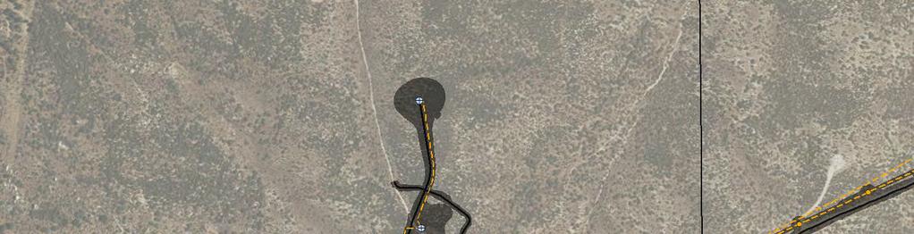
8 Sheet 1 Sheet 2 Sheet 3 Sheet 4 Sheet 5 K:\San Diego\projects\Iberdrola\00567_15_TuleWind\analyses\ _Variance_20ftIFC_Buffer\Fig01_Tule_VAR006_Rocks_OV.mxd; User: 35528; Date: 3/24/2017 Laydown Yard ac Sheet 9 Sheet 6 Sheet 8 Sheet 7 BLM Land Rocks Mile Figure 1 BLM VAR-006 R-1 Rocks
9 Road G Road B A-3 Road A A-2 1 A-1 McCain Valley Road K:\San Diego\projects\Iberdrola\00567_15_TuleWind\analyses\ _Variance_20ftIFC_Buffer\Fig02_Tule_VAR006_RocksDetail.mxd; User: 35528; Date: 3/24/ BLM Parcels Study Area Rocks Feet Access Roads!> Turbines Staging Area Project Collector System!( Collection Structure Overhead Transmission Alignment Transmission Structure C-4 Figure 2 Sheet 1 BLM VAR-006 R-1 Rocks
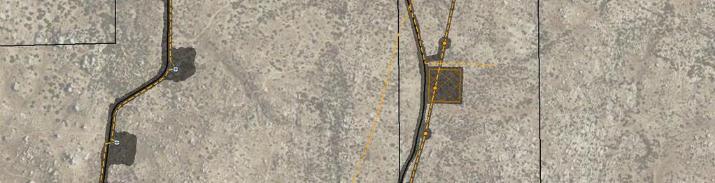
10 Road G C-4 C McCain Valley Road C-1 Road H C-2 Road F Road E C-3 B-1 3 Road C 2 1 Road D B B-3 Trail Re-Route 4 5 K:\San Diego\projects\Iberdrola\00567_15_TuleWind\analyses\ _Variance_20ftIFC_Buffer\Fig02_Tule_VAR006_RocksDetail.mxd; User: 35528; Date: 3/24/2017 BLM Parcels Study Area Rocks Feet B-4 Access Roads!> Turbines Staging Area Project Collector System!( Collection Structure Overhead Transmission Alignment Transmission Structure Figure 2 Sheet 2 BLM VAR-006 R-1 Rocks
11 C Road H Road I C-8 C D-1 7 McCain Valley Road 8 Road J Road K E E Road O K:\San Diego\projects\Iberdrola\00567_15_TuleWind\analyses\ _Variance_20ftIFC_Buffer\Fig02_Tule_VAR006_RocksDetail.mxd; User: 35528; Date: 3/24/2017 BLM Parcels Study Area Rocks Feet Access Roads!> Turbines Staging Area Project Collector System!( Collection Structure Overhead Transmission Alignment Transmission Structure E-3 Figure 2 Sheet 3 BLM VAR-006 R-1 Rocks
12 Road L D-3 D-4 Road O E E McCain Valley Road Road T E-6 E Road NRoad S Road R E-8 27 E E F-1 Road M K:\San Diego\projects\Iberdrola\00567_15_TuleWind\analyses\ _Variance_20ftIFC_Buffer\Fig02_Tule_VAR006_RocksDetail.mxd; User: 35528; Date: 3/24/2017 F Road Q F-3 F-4 BLM Parcels Study Area Rocks Feet Access Roads!> Turbines Staging Area Project Collector System!( Collection Structure Overhead Transmission Alignment Transmission Structure Figure 2 Sheet 4 BLM VAR-006 R-1 Rocks
13 30 31 Road W E Road V E McCain Valley Road K:\San Diego\projects\Iberdrola\00567_15_TuleWind\analyses\ _Variance_20ftIFC_Buffer\Fig02_Tule_VAR006_RocksDetail.mxd; User: 35528; Date: 3/24/2017 G-1 G-2 G-3 Road X 10 G G-5 Road Y BLM Parcels Study Area Rocks Feet Access Roads!> Turbines Staging Area Project Collector System!( Collection Structure Overhead Transmission Alignment Transmission Structure Figure 2 Sheet 5 BLM VAR-006 R-1 Rocks
14 G-6 53 H-1 54 G H-2 Road AA McCain Valley Road 56 G G G-10 Road Y Road Z G G K:\San Diego\projects\Iberdrola\00567_15_TuleWind\analyses\ _Variance_20ftIFC_Buffer\Fig02_Tule_VAR006_RocksDetail.mxd; User: 35528; Date: 3/24/ G-13 G-14 G-15 Road AD Substation O&M Building Construction Office Batch Plant BLM Parcels Study Area Rocks Feet Access Roads!> Turbines Staging Area Project Collector System!( Collection Structure Overhead Transmission Alignment Transmission Structure Figure 2 Sheet 6 BLM VAR-006 R-1 Rocks
15 13 J-2 Road AC J-3 Road AB Substation Sub Bay O&M Building Construction Office Batch Plant Wash Area 2 Parking McCain Valley Road 5 K:\San Diego\projects\Iberdrola\00567_15_TuleWind\analyses\ _Variance_20ftIFC_Buffer\Fig02_Tule_VAR006_RocksDetail.mxd; User: 35528; Date: 3/24/ BLM Parcels Study Area Rocks Feet Access Roads!> Turbines Staging Area Project Collector System!( Collection Structure Overhead Transmission Alignment Transmission Structure Figure 2 Sheet 7 BLM VAR-006 R-1 Rocks
16 McCain Valley Road K:\San Diego\projects\Iberdrola\00567_15_TuleWind\analyses\ _Variance_20ftIFC_Buffer\Fig02_Tule_VAR006_RocksDetail.mxd; User: 35528; Date: 3/24/ BLM Parcels Study Area Rocks Feet Access Roads!> Turbines Staging Area Project Collector System!( Collection Structure Overhead Transmission Alignment Transmission Structure Figure 2 Sheet 8 BLM VAR-006 R-1 Rocks
17 Laydown Yard acres K:\San Diego\projects\Iberdrola\00567_15_TuleWind\analyses\ _Variance_20ftIFC_Buffer\Fig02_Tule_VAR006_RocksDetail.mxd; User: 35528; Date: 3/24/2017 BLM Parcels Study Area Rocks Feet Access Roads!> Turbines Staging Area Project Collector System!( Collection Structure Overhead Transmission Alignment Transmission Structure Figure 2 Sheet 9 BLM VAR-006 R-1 Rocks

18 K:\San Diego\projects\Iberdrola\00567_15_TuleWind\mapdoc\Variances\A_VAR_001\Fig03_Tule_VAR006_Rocks_Diagram.mxd; User: 35528; Date: 3/24/ Mile Figure 3 BLM VAR-006 R-1 Rocks
19 Sheet 1 Sheet 2 Sheet 3 Sheet 4 Sheet 5 K:\San Diego\projects\Iberdrola\00567_15_TuleWind\mapdoc\Variances\A_VAR_001\Fig04_Tule_VAR006_SteepSlopes_OV.mxd; User: 35528; Date: 3/24/2017 Laydown Yard ac Sheet 9 Sheet 6 Sheet 8 Sheet 7 BLM Land Steep Slopes Mile Figure 4 BLM VAR-006 R-1 Steep Slopes


20 Road G Road B A-3 Road A A-2 1 A-1 McCain Valley Road K:\San Diego\projects\Iberdrola\00567_15_TuleWind\mapdoc\Variances\A_VAR_001\Fig05_Tule_VAR006_SteepSlopesDetail.mxd; User: 35528; Date: 3/24/ BLM Parcels Study Area Steep Slopes Feet Access Roads!> Turbines Staging Area Project Collector System!( Collection Structure Overhead Transmission Alignment Transmission Structure C-4 Figure 5 Sheet 1 BLM VAR-006 R-1 Steep Slopes
21 Road G C-4 C McCain Valley Road C-1 Road H C-2 Road F Road E C-3 B-1 3 Road C 2 1 Road D B B-3 Trail Re-Route 4 5 K:\San Diego\projects\Iberdrola\00567_15_TuleWind\mapdoc\Variances\A_VAR_001\Fig05_Tule_VAR006_SteepSlopesDetail.mxd; User: 35528; Date: 3/24/2017 BLM Parcels Study Area Steep Slopes Feet B-4 Access Roads!> Turbines Staging Area Project Collector System!( Collection Structure Overhead Transmission Alignment Transmission Structure Figure 5 Sheet 2 BLM VAR-006 R-1 Steep Slopes
22 C Road H Road I C-8 C D-1 7 McCain Valley Road 8 Road J Road K E E Road O E-3 K:\San Diego\projects\Iberdrola\00567_15_TuleWind\mapdoc\Variances\A_VAR_001\Fig05_Tule_VAR006_SteepSlopesDetail.mxd; User: 35528; Date: 3/24/2017 BLM Parcels Study Area Steep Slopes Feet Access Roads!> Turbines Staging Area Project Collector System!( Collection Structure Overhead Transmission Alignment Transmission Structure Figure 5 Sheet 3 BLM VAR-006 R-1 Steep Slopes
23 Road L D-3 D-4 Road O E E McCain Valley Road Road T E-6 E Road NRoad S Road R E-8 27 E E F-1 Road M K:\San Diego\projects\Iberdrola\00567_15_TuleWind\mapdoc\Variances\A_VAR_001\Fig05_Tule_VAR006_SteepSlopesDetail.mxd; User: 35528; Date: 3/24/2017 F Road Q F-3 F-4 BLM Parcels Study Area Steep Slopes Feet Access Roads!> Turbines Staging Area Project Collector System!( Collection Structure Overhead Transmission Alignment Transmission Structure Figure 5 Sheet 4 BLM VAR-006 R-1 Steep Slopes
24 30 31 Road W E Road V E McCain Valley Road K:\San Diego\projects\Iberdrola\00567_15_TuleWind\mapdoc\Variances\A_VAR_001\Fig05_Tule_VAR006_SteepSlopesDetail.mxd; User: 35528; Date: 3/24/2017 G-1 G-2 G-3 Road X 10 G G-5 Road Y BLM Parcels Study Area Steep Slopes Feet Access Roads!> Turbines Staging Area Project Collector System!( Collection Structure Overhead Transmission Alignment Transmission Structure Figure 5 Sheet 5 BLM VAR-006 R-1 Steep Slopes
25 G-6 53 H-1 54 G H-2 Road AA McCain Valley Road 56 G G G-10 Road Y Road Z G G K:\San Diego\projects\Iberdrola\00567_15_TuleWind\mapdoc\Variances\A_VAR_001\Fig05_Tule_VAR006_SteepSlopesDetail.mxd; User: 35528; Date: 3/24/ G-13 G-14 G-15 Road AD Substation O&M Building Construction Office Batch Plant BLM Parcels Study Area Steep Slopes Feet Access Roads!> Turbines Staging Area Project Collector System!( Collection Structure Overhead Transmission Alignment Transmission Structure Figure 5 Sheet 6 BLM VAR-006 R-1 Steep Slopes
26 13 J-2 Road AC J-3 Road AB Substation Sub Bay O&M Building Construction Office Batch Plant Wash Area 2 Parking McCain Valley Road 5 K:\San Diego\projects\Iberdrola\00567_15_TuleWind\mapdoc\Variances\A_VAR_001\Fig05_Tule_VAR006_SteepSlopesDetail.mxd; User: 35528; Date: 3/24/ BLM Parcels Study Area Steep Slopes Feet Access Roads!> Turbines Staging Area Project Collector System!( Collection Structure Overhead Transmission Alignment Transmission Structure Figure 5 Sheet 7 BLM VAR-006 R-1 Steep Slopes
27 McCain Valley Road K:\San Diego\projects\Iberdrola\00567_15_TuleWind\mapdoc\Variances\A_VAR_001\Fig05_Tule_VAR006_SteepSlopesDetail.mxd; User: 35528; Date: 3/24/ BLM Parcels Study Area Steep Slopes Feet Access Roads!> Turbines Staging Area Project Collector System!( Collection Structure Overhead Transmission Alignment Transmission Structure Figure 5 Sheet 8 BLM VAR-006 R-1 Steep Slopes


28 Laydown Yard acres K:\San Diego\projects\Iberdrola\00567_15_TuleWind\mapdoc\Variances\A_VAR_001\Fig05_Tule_VAR006_SteepSlopesDetail.mxd; User: 35528; Date: 3/24/2017 BLM Parcels Study Area Steep Slopes Feet Access Roads!> Turbines Staging Area Project Collector System!( Collection Structure Overhead Transmission Alignment Transmission Structure Figure 5 Sheet 9 BLM VAR-006 R-1 Steep Slopes
29 Sheet 1 K:\San Diego\projects\Iberdrola\00567_15_TuleWind\mapdoc\Variances\A_VAR_001\Fig06_Tule_VAR006_Stockpiles_OV.mxd; User: 35528; Date: 3/24/2017 Laydown Yard ac Sheet 2 Sheet 4 Sheet 3 BLM Land Stockpiles Mile Figure 6 BLM VAR-006 R-1 Stockpiles
30 30 31 Road W E Road V E McCain Valley Road K:\San Diego\projects\Iberdrola\00567_15_TuleWind\mapdoc\Variances\A_VAR_001\Fig07_Tule_VAR006_StockpilesDetail.mxd; User: 35528; Date: 3/24/2017 G-1 G-2 G-3 Road X 10 G G-5 Road Y BLM Parcels Study Area Stockpiles Access Roads!> Turbines Staging Area Project Collector System!( Collection Structure Overhead Transmission Alignment Transmission Structure Feet Figure 7 Sheet 1 BLM VAR-006 R-1 Stockpiles 4
31 G-6 53 H-1 54 G H-2 Road AA McCain Valley Road 56 G G G-10 Road Y Road Z G G K:\San Diego\projects\Iberdrola\00567_15_TuleWind\mapdoc\Variances\A_VAR_001\Fig07_Tule_VAR006_StockpilesDetail.mxd; User: 35528; Date: 3/24/ G-13 G-14 G-15 Road AD Substation O&M Building Construction Office Batch Plant BLM Parcels Study Area Stockpiles Access Roads!> Turbines Staging Area Project Collector System!( Collection Structure Overhead Transmission Alignment Transmission Structure Feet Figure 7 Sheet 2 BLM VAR-006 R-1 Stockpiles 4
32 13 J-2 Road AC J-3 Road AB Substation Sub Bay O&M Building Construction Office Batch Plant Wash Area 2 Parking McCain Valley Road 5 K:\San Diego\projects\Iberdrola\00567_15_TuleWind\mapdoc\Variances\A_VAR_001\Fig07_Tule_VAR006_StockpilesDetail.mxd; User: 35528; Date: 3/24/ BLM Parcels Study Area Stockpiles Feet Access Roads!> Turbines Staging Area Project Collector System!( Collection Structure Overhead Transmission Alignment Transmission Structure Figure 7 Sheet 3 BLM VAR-006 R-1 Stockpiles


33 McCain Valley Road K:\San Diego\projects\Iberdrola\00567_15_TuleWind\mapdoc\Variances\A_VAR_001\Fig07_Tule_VAR006_StockpilesDetail.mxd; User: 35528; Date: 3/24/ BLM Parcels Study Area Stockpiles Access Roads!> Turbines Staging Area Project Collector System!( Collection Structure Overhead Transmission Alignment Transmission Structure Feet Figure 7 Sheet 4 BLM VAR-006 R-1 Stockpiles 4
34 Sheet 1 Sheet 2 Sheet 3 Sheet 4 K:\San Diego\projects\Iberdrola\00567_15_TuleWind\mapdoc\Variances\A_VAR_001\Fig08_Tule_VAR006_RiprapOutfalls_OV.mxd; User: 35528; Date: 3/24/2017 BLM Land Riprap Outfalls Laydown Yard ac Sheet Mile Figure 8 BLM VAR-006 R-1 Riprap Outfalls
35 Road G C-4 C McCain Valley Road C-1 Road H C-2 Road F Road E C-3 B-1 3 Road C 2 1 Road D B B-3 Trail Re-Route 4 5 K:\San Diego\projects\Iberdrola\00567_15_TuleWind\mapdoc\Variances\A_VAR_001\Fig09_Tule_VAR006_RiprapOutfallsDetail.mxd; User: 35528; Date: 3/24/ B BLM Parcels Study Area Riprap Outfalls Access Roads!> Turbines Staging Area Project Collector System!( Collection Structure Overhead Transmission Alignment Transmission Structure Feet Figure 9 BLM VAR-006 R-1 Riprap Outfalls
36 C Road H Road I C-8 C D-1 7 McCain Valley Road 8 Road J Road K E E Road O E-3 K:\San Diego\projects\Iberdrola\00567_15_TuleWind\mapdoc\Variances\A_VAR_001\Fig09_Tule_VAR006_RiprapOutfallsDetail.mxd; User: 35528; Date: 3/24/ BLM Parcels Study Area Riprap Outfalls Access Roads!> Turbines Staging Area Project Collector System!( Collection Structure Overhead Transmission Alignment Transmission Structure Feet Figure 9 BLM VAR-006 R-1 Riprap Outfalls
37 Road L D-3 D-4 Road O E E McCain Valley Road Road T E-6 E Road NRoad S Road R E-8 27 E E F-1 Road M K:\San Diego\projects\Iberdrola\00567_15_TuleWind\mapdoc\Variances\A_VAR_001\Fig09_Tule_VAR006_RiprapOutfallsDetail.mxd; User: 35528; Date: 3/24/2017 F Road Q F-3 F BLM Parcels Study Area Riprap Outfalls Access Roads!> Turbines Staging Area Project Collector System!( Collection Structure Overhead Transmission Alignment Transmission Structure Feet Figure 9 BLM VAR-006 R-1 Riprap Outfalls
38 30 31 Road W E Road V E K:\San Diego\projects\Iberdrola\00567_15_TuleWind\mapdoc\Variances\A_VAR_001\Fig09_Tule_VAR006_RiprapOutfallsDetail.mxd; User: 35528; Date: 3/24/2017 G-1 G-2 G-3 Road X 10 G G-5 Road Y McCain Valley Road BLM Parcels Study Area Riprap Outfalls Access Roads!> Turbines Staging Area Project Collector System!( Collection Structure Overhead Transmission Alignment Transmission Structure Feet Figure 9 Sheet 1 BLM VAR-006 R-1 Riprap Outfalls


39 13 J-2 Road AC J-3 Road AB Substation Sub Bay O&M Building Construction Office Batch Plant Wash Area 2 Parking McCain Valley Road 5 K:\San Diego\projects\Iberdrola\00567_15_TuleWind\mapdoc\Variances\A_VAR_001\Fig09_Tule_VAR006_RiprapOutfallsDetail.mxd; User: 35528; Date: 3/24/ BLM Parcels Study Area Riprap Outfalls Access Roads!> Turbines Staging Area Project Collector System!( Collection Structure Overhead Transmission Alignment Transmission Structure Feet Figure 9 Sheet 3 BLM VAR-006 R-1 Riprap Outfalls

40 Sheet 1 Sheet 2 Sheet 3 Sheet 4 K:\San Diego\projects\Iberdrola\00567_15_TuleWind\mapdoc\Variances\A_VAR_001\Fig10_Tule_VAR006_Gaps_OV.mxd; User: 35528; Date: 3/24/2017 BLM Land Gaps between Roads and Overhead Lines Laydown Yard ac Sheet Mile Figure 10 BLM VAR-006 R-1 Gaps between Roads and Overhead Lines


41 Road G C-4 C McCain Valley Road C-1 Road H C-2 Road F Road E C-3 B-1 3 Road C 2 1 Road D B B-3 Trail Re-Route 4 5 K:\San Diego\projects\Iberdrola\00567_15_TuleWind\mapdoc\Variances\A_VAR_001\Fig11_Tule_VAR006_GapsDetail.mxd; User: 35528; Date: 3/24/2017 BLM Parcels Study Area Gaps between Roads and Overhead Lines B-4 Access Roads!> Turbines Staging Area Project Collector System!( Collection Structure Overhead Transmission Alignment Transmission Structure Feet Figure 11 Sheet 1 BLM VAR-006 R-1 Gaps between Roads and Overhead Lines


42 C Road H Road I C-8 C D-1 7 McCain Valley Road 8 Road J Road K E E Road O E-3 K:\San Diego\projects\Iberdrola\00567_15_TuleWind\mapdoc\Variances\A_VAR_001\Fig11_Tule_VAR006_GapsDetail.mxd; User: 35528; Date: 3/24/2017 BLM Parcels Study Area Gaps between Roads and Overhead Lines Access Roads!> Turbines Staging Area Project Collector System!( Collection Structure Overhead Transmission Alignment Transmission Structure Feet Figure 11 Sheet 2 BLM VAR-006 R-1 Gaps between Roads and Overhead Lines


43 Road L D-3 D-4 Road O 17 E E McCain Valley Road Road T E-6 E Road NRoad S Road R E-8 27 E E F-1 Road M K:\San Diego\projects\Iberdrola\00567_15_TuleWind\mapdoc\Variances\A_VAR_001\Fig11_Tule_VAR006_GapsDetail.mxd; User: 35528; Date: 3/24/2017 F F-3 Road Q F-4 BLM Parcels Study Area Gaps between Roads and Overhead Lines Access Roads!> Turbines Staging Area Project Collector System!( Collection Structure Overhead Transmission Alignment Transmission Structure Feet Figure 11 Sheet 3 BLM VAR-006 R-1 Gaps between Roads and Overhead Lines


44 30 31 Road W E-12 8 Road V 32 E McCain Valley Road K:\San Diego\projects\Iberdrola\00567_15_TuleWind\mapdoc\Variances\A_VAR_001\Fig11_Tule_VAR006_GapsDetail.mxd; User: 35528; Date: 3/24/2017 G-1 G-2 G-3 Road X 10 G G-5 Road Y BLM Parcels Study Area Gaps between Roads and Overhead Lines Access Roads!> Turbines Staging Area Project Collector System!( Collection Structure Overhead Transmission Alignment Transmission Structure Feet Figure 11 Sheet 4 BLM VAR-006 R-1 Gaps between Roads and Overhead Lines


45 G H-1 G H-2 Road AA McCain Valley Road 56 G G G-10 Road Y Road Z G G K:\San Diego\projects\Iberdrola\00567_15_TuleWind\mapdoc\Variances\A_VAR_001\Fig11_Tule_VAR006_GapsDetail.mxd; User: 35528; Date: 3/24/ G-13 G-14 G-15 Road AD Substation O&M Building Construction Office Batch Plant BLM Parcels Study Area Gaps between Roads and Overhead Lines Access Roads!> Turbines Staging Area Project Collector System!( Collection Structure Overhead Transmission Alignment Transmission Structure Feet Figure 11 Sheet 5 BLM VAR-006 R-1 Gaps between Roads and Overhead Lines


46 McCain Valley Road K:\San Diego\projects\Iberdrola\00567_15_TuleWind\mapdoc\Variances\A_VAR_001\Fig12_Tule_VAR006_ESA_Avoidance.mxd; User: 35528; Date: 3/24/2017 BLM Parcels Study Area ESA Potential ESA Avoidance Impact Access Roads Overhead Transmission Alignment Transmission Structure Feet Figure 12 BLM VAR-006 R-1 ESA Avoidance
47 Attachment B Foreseen and Unforeseen Impacts Processes
48 Impacts Beyond Existing Disturbance Limits Foreseen Issue Foreman looks for high risk compliance areas. Yes Foreman or Superintendent identifies high risk compliance area (rocks, topsoil salvage, odd shaped limits of disturbance [LOD], etc.). Superintendent verifies the location in the field Considers if it can reasonably and safely done differently to remain within the LOD. Confirms there are no known ESAs in the area. No Construction proceeds within LOD. The proposed activity is unsafe, impacts an ESA, or can reasonably be done within the LOD. Form is not submitted. The proposed activity is safe, outside of known ESAs, and cannot reasonably be done within the LOD End of Variance Process Construction will stay within LOD. Superintendent signs the Foreseen Additional Impacts Signoff Form Dudek reviews the form with the Foreman and/or Superintendent in the field. Activity is approved Day of - Prior to the Start of Work: Area is swept by Environmental Monitors (Native American, cultural, and biological monitors). ESAs, if present, are confirmed and signage updated as needed. Additional Areas Impacts Signoff Form is signed by all 3 monitors and Dudek. If work extends beyond a single day, the areas will be reswept for biological resources prior to starting work. Day of - During Work: Full time cultural and biological monitoring is required, unless otherwise determined in coordination with Dudek/BLM. If the activity involves rock placement, a Restoration Specialist (RS) will be consulted if possible to provide guidance on rock placement. Post Impact: Contractor or Environmental Monitors map the area outside the LOD using a tape measure or GPS unit with submeter accuracy (as appropriate for the size of the additional impact). Impact is logged in the Additional Impacts Spreadsheet. Acreage is calculated and added to the additional impact acres spreadsheet log. The Additional Impacts Spreadsheet will be provided to Dudek/BLM every-other-week, and an update will be provided weekly during our call.
49 Impacts Beyond Existing Disturbance Limits Unforeseen Issue Additional impact occurs outside the LOD. On-site monitors (biological, cultural, and Native American) observe the impact. If biological monitor is not onsite, the Biological Lead is notified by the contractor. Area is surveyed by biological, cultural, and Native American monitors to determine if resources were impacted. Resources were impacted. Dudek is notified. No damage to resources occurred. Biology Cultural Impact is evaluated and the appropriate Agency (CDFW, FWS, etc. is notified within 24 hours). Documentation is completed as required by the appropriate Agency. Impact is documented and ESA fencing is fixed and/or established. County and/or BLM are notified immediately and a report is prepared documented the impact. If further analysis is required a testing plan will be prepared and implemented in consultation with the appropriate Agencies. If impact is to a significant resource additional mitigation may be required. Post Impact: Contractor identifies the issue that caused the exceedance of the LOD. Contractor or Environmental Monitors map the area outside the LOD using a tape measure or GPS unit with submeter accuracy (as appropriate for the size of the additional impact). Dudek and the BLM determine if the incident is a Problem Area, Noncompliance or Serious Violation If the impact is determined to be a Problem Area, it is logged in the additional impacts spreadsheet noting the cause and any corrective actions taken. Acreage is calculated and added to the additional impact acres spreadsheet log. The Additional Impact Acres spreadsheet will be provided to Dudek/BLM every-other-week, and an update will be provided weekly during our call.
50 Attachment C Additional Foreseen Impacts Sign-off Form
51 ADDITIONAL FORESEEN IMPACT AREAS SIGN-OFF FORM Date: Foreman: Location Superintendent: Superintendent Signature: Phone #: Description of Foreseeable Additional Impacts Construction Activity Print Monitor Name Monitor Signature Type Time Monitoring Requirement Dudek Approval [Ex: Rock needs to be relocated from the LOD boundary. Relocation would cause impacts beyond the LOD, including rock placement outside the LOD.] [Ex: Rock relocation using D-8 dozer.] Arch Tribal Sweep Conducted Full Time Monitor Spot Check Monitor No Monitor Required Sweep Conducted Full Time Monitor Spot Check Monitor No Monitor Required Dudek Compliance Monitor Name: Dudek Compliance Monitor Signature: Bio/Env Sweep Conducted Full Time Monitor Spot Check Monitor No Monitor Required Date: Arch Sweep Conducted Full Time Monitor Spot Check Monitor No Monitor Required Dudek Compliance Monitor Name: Tribal Sweep Conducted Full Time Monitor Spot Check Monitor No Monitor Required Dudek Compliance Monitor Signature: Bio/Env Sweep Conducted Full Time Monitor Spot Check Monitor No Monitor Required Date:
52 Attachment D Additional Impacts Spreadsheet
53 Date Spreadsheet sent Total Acres Impacted at to Dudek time of Submittal 3/20/ Total Impacts Remaining Impact Per VAR
54 Unforeseen Impact Tracker Total Square Feet Impacted : Total Acres Impacted: Date Location Monitors Present Description of Incident Contractor Notified by Dudek Personnel Notified 3/13/2017 North of turbine G8 Archaeological and Native American. Area had been swept by a biological monitor. A blade hit a rock below the ground surface during grading activities along the access road north of turbine pad G 8. When the blade hit the rock, it lost balance and travelled outside of the approved limits of disturbance while trying to regain balance. An approximately 40 foot by 10 foot area was disturbed outside of the approved limits of disturbance. Per conversations with the equipment operator, if he had not travelled outside of the approved limits of disturbance to regain balance the blade could have tipped over. Blattner Blattner Foreman, Joseph "Sparky" Rossetti Compliance Monitor PK Sharp Garcia Total area of disturbance (square feet) Resources Impacted Resolved (Y/N) Follow Up Actions 400 No Y Operator was reminded to identify hazard areas prior to commecing work for the day and discuss those areas with the foreman Non Compliance Category Date Report Received from Dudek Problem Area 3/15/2017 3/13/2017 East side of G6 Archaeological and Native American. Area had been swept by a biological monitor. A D8 bulldozer slipped down the east side of the slope at turbine pad G6. The bulldozer did not cross the limits of disturbance, but dirt extending out in two areas (measuring approximately 2 ft x 20 ft and 3 ft x 22 ft) was pushed outside of the limits of disturbance. The dirt that was pushed outside of the limits of disturbance was inspected for sensitive resources and none were identified. The dirt was left in place. Blattner ASM Lead Archeological Monitor, Michelle Dalope Compliance Monitor PK Sharp Garcia 106 No Y Operator was reminded to identify hazard areas prior to commecing work for the day and discuss those areas with the foreman Problem Area 3/15/2017
55 Foreseen Impact Tracker Total Square Feet Impacted : Total Acres Impacted: Date Requested 0 0 Date Approved Location Description of Work Description of Impacts Contractor Person Requesting Additional Area List Surveys Completed Prior to Impact Monitor Signoff Sheet Completed Prior to Work (Y/N) Authorizing Dudek Personnel Total Area of Disturbance (square feet) Resources Impacted Notes
 DOI-BLM- CA-")

56 U.S. Department of the Interior Bureau of Land Management Determination of NEPA Adequacy (DNA) DOI-BLM- CA- D DNA - Variance Request 006 PREPARING OFFICE U.S. Department of the Interior Bureau of Land Management El Centro Field Office, California
57 Determination of NEPA Adequacy (DNA) DOI-BLM- CA-D xx-DNA - Variance Request 006
58 Table of Contents 1. Determination of NEPA Adequacy (DNA)... 1 Worksheet...1 Description of Proposed Action and any applicable mitigation measures...1 Identify applicable National Environmental Policy Act (NEPA) documents and other related documents that cover the proposed action....4 NEPA Adequacy Criteria...7 Persons/Agencies/BLM Staff Consulted...8 Conclusion...9
59 1 1. Determination of NEPA Adequacy (DNA) Worksheet U.S. Department of the Interior Bureau of Land Management OFFICE: El Centro Field Office, 1661 S. 4 th Street, El Centro, California TRACKING NUMBER: DOI-BLM- CA- D DNA CASE FILE/PROJECT NUMBER: CACA PROPOSED ACTION TITLE/TYPE: Changes to the Variance Request and Approval Process under the Project s Environmental Compliance and Mitigation Plan (ECMP) LOCATION/LEGAL DESCRIPTION: The Tule Wind project is located on 12,360 acres of land administered by the BLM near the town of Boulevard in San Diego County, California. The proposed project-related activities are located within the Tule Wind project right-of-way (ROW) grant boundary, but outside of the limits of disturbance identified in the approved Plan of Development (POD). APPLICANT: Tule Wind LLC Description of Proposed Action and any applicable mitigation measures Tule Wind LLC submitted Variance Request R1 (herein referred to as VR-006) to the BLM on March 24, 2017 in accordance with the protocols set forth in the s Environmental Compliance and Mitigation Plan (ECMP). In summary, VR-006 requests to further refine the Variance Request and Approval process in the ECMP. In accordance with the POD approved for the Tule Wind project, construction activities will be conducted within the approved engineering limits of disturbance and within areas covered by previous focused surveys for biological and cultural resources. As part of the project s final engineering for constructability and overall safety, Tule Wind LLC has identified several known project-related activities that have the potential to exceed limits of disturbance identified in the POD (see VR-006 and itemized list below for further explanation). In foresight of this, Tule Wind LLC has conducted supplemental focused biological, hydrological, and cultural resources surveys, extending 20 feet beyond the project s entire limits of disturbance identified in the POD (see VR-006). Tule Wind LLC is requesting an amendment to the ECMP to allow the Tule Wind LLC and BLM field team leadership (i.e. the Tule Wind LLC construction foreman and on-site compliance leads, Tule Wind LLC lead biologist and archaeologist, and BLM Environmental Compliance Lead) to approve, on a caseby-case basis, specific project-related activities (described below and in VR-006) via a Level 1 Variance Request process within a 20-foot-buffer outside the limits of disturbance in the POD. In the event that
60 2 one of the known project-related activities described below needs to deviate outside the limits of disturbance, a process for approval (identified in VR-006) would be implemented. In summary, the field team leadership would 1) identify the proposed activity needing to occur outside the limits of disturbance, but within the 20-foot survey limit, 2) review the area for biological, cultural, and other natural resources per existing survey data, 3) determine whether or not the activity was within or exceeded disturbance thresholds under VR-006 (see next paragraph below); 4) prepare the Additional Foreseen Impacts Signoff Form (identified in VR-006, Attachment C), and 5) determine based on the aforementioned factors whether or not to approve the disturbance. Prior to work occurring under an approved Variance Request, all necessary pre-construction sweeps for biological and cultural resources would occur in accordance with mitigation measures and all fencing and flagging delineating Environmentally Sensitive Areas (ESA) would be installed to ensure full avoidance of resources. Tule Wind LLC field teams would delineate areas approved for work under, and would monitor activities in accordance with, the ECMP and mitigation measures. Additionally, Tule Wind LLC would track disturbances approved under this specific Variance Request process and submit to the BLM throughout project construction, per documentation methods identified in VR-006 (see Attachment D). Tule Wind LLC anticipates up to 10 acres would be allowed to be permanently disturbed as part of this Variance Request process. In areas where temporary impacts occur, those impacts will be restored consistent with the Habitat Restoration Plan (HRP). The following known project-related activities would be covered (allowed for consideration) under the proposed Variance Request process: 1. Rocks: An inventory has been completed and over 3,000 rocks over five feet in diameter have been identified within the approved disturbance limits. The rocks that were completely within the limits of disturbance and were small enough to haul away have been removed. Many of the remaining rocks rest at the edge of the disturbance limits with part of the rock inside the limits of disturbance and part outside the limits of disturbance. The intent is to use the foreseen impacts process to allow rocks to be placed either permanently or temporarily beyond the limits of disturbance to allow for the grading / construction to occur. Figures showing the Project Alignment and the diagram showing how rocks will be moved during rock placement are included in VR-006, Attachment A, Figures 1-3. This activity is the only activity included in the variance that could result in permanent impacts. Within the 10 acres included in the variance, up to seven acres would be permanent for rock placement. 2. Steep Slopes: The project is located on terrain that generally rises from south to north. While the northern third of the site has a fairly steady gentle slope, the southern and central portions contain many undulating and abrupt hills and drops. When grading through these steeper sections, it can be difficult to tie the proposed slopes to the existing ground. In order to blend the proposed grade to the existing terrain, it may be advantageous to track beyond the limits of disturbance. In addition, tracking beyond the limits may be the only way to safely navigate the boundary between existing and proposed slopes in order to effectively tie them together. The areas of 20% slope and greater have been identified as areas where this construction method may be required (see VR-006, Attachment A, Figures 4 and 5). 3. Stockpiles: Topsoil stockpiles have been created throughout the site in accordance with the project HRP. According to the HRP, stockpile (e.g., backfill and topsoil stockpile) areas will be located within
61 3 disturbance limits. Topsoil stockpiles will be located along or near the perimeter of the disturbance limits. With this in mind, stockpiled topsoil will be situated in a manner where construction equipment can easily access the material and effectively distribute it once the project design feature installation phase is complete. The windrows have been placed at the perimeter of the disturbance limits to protect the topsoil from contamination with the underling DG soils during grading. When mass grading is complete, these piles will be reclaimed and spread over the adjacent soils. In order to maximize the work area, these piles were often placed at the edge of clearance limits, in accordance with the HRP (see VR-006, Attachment A, Figures 6 and 7). The work to reclaim these piles poses a higher risk of encroachment beyond the current limits of disturbance due to the proximity of the pile to the boundary and the equipment needed to pull the soils back. 4. Riprap Outfalls: This refers to the locations where proposed ditches are designed to discharge along McCain Valley Road or the private turbine access roads (see VR-006, Attachment A, Figures 8 and 9). The design outfall is a section of riprap intended to slow the runoff and remove energy and sediment before discharge off site. These areas are a natural risk as sediment or blowouts will naturally migrate downstream directly toward the project limits of disturbance. Many of these areas are in the steep slopes noted above and the foreseen impacts process will allow the contractor space to better construct / fit the outfall with the natural terrain to minimize the risk of blowouts or sediment runoff. 5. Gaps between Roads and Overhead Lines: Portions of the overhead collection or overhead transmission line parallels McCain Valley Road. The designs for the road and the electrical system were completed independently and then merged into the overall project disturbance resulting in a number of locations where a sliver or wedge of undisturbed area is left between two limits of disturbance boundaries (creating a donut hole). This has been a source of confusion; stakes are often close together and visually confusing in the field, thus making it difficult to discern the donut hole sliver which is outside the limits of disturbance (see VR-006, Attachment A, Figures 10 and 11). 6. Limits of Disturbance on the Opposite Side of the Road from an ESA: Where ESAs are immediately adjacent to a temporary road, there is potential for vehicles to accidentally travel outside of the limits of disturbance on the opposite side of the road while trying to avoid impacts to the ESA. The foreseen impacts process will allow the contractor to continue to remain cautious around ESAs and remain in compliance while maintaining site access (see VR-006, Attachment A, Figure 12). VR-006 is predominantly within previously surveyed areas for biological and archaeological resources as part of the EIR/EIS process and as part of developing the final project footprint delineated in the 2016 POD for construction. Approximately one acre of the proposed 20-foot buffer extends beyond the areas previously surveyed for biological and archaeological resources. Supplemental biological and archaeological memoranda have been prepared and submitted as part of this variance to survey portions of the 20-foot buffer outward of the approved limits of disturbance. The activities associated with each proposed action component would be performed at the same time as the construction and conducted in accordance with the same impact avoidance, minimization, monitoring, and mitigation measures that apply to the project impact areas. Such measures
62 4 include those specified in the Project s ECMP, BLM s ROD, the Project s ROW grant, and approved plans and permits for specific activities related to the construction of the Project. Consequently, the potential impacts associated with the modified disturbance footprint have been addressed and analyzed in the Final EIS/EIR and have been mitigated through measures identified in the Final EIS/EIR and adopted by the ROD. Land Use Plan (LUP) Conformance LUP Name Date Approved: Record of Decision, Implementation of a Wind Energy Development December 15, 2005 Program and Associated Land Use Plan Amendments Eastern San Diego County Resource Management Plan April 13, 2008 and Record of Decision The proposed action is in conformance with the LUP because it is clearly consistent with the following LUP decisions (objectives, terms, and conditions) and, if applicable, implementation plan decisions: The 2008 Eastern San Diego County Regional Management Plan (RMP) designated select lands within the planning area as available for geothermal leasing and wind energy development. Public lands within the 1 McCain Valley area were made available for both geothermal leasing and wind energy development. The was determined to be consistent with land use plans in the 2011 ROD (Section 3.3, Land Use Plan Conformance) for the project. Development of the Proposed Action is consistent with BLM s land use designation for wind energy development, because the Proposed Action (changes to Variance Request processes in the ECMP) includes components that part of the overall wind project, and the wind project ROW remains within the area designated as available for wind energy development (McCain Valley East) 2. Also, consistent with management actions identified in Section , Renewable Energy, of the 2008 RMP, the Proposed Action would provide for the production and distribution of renewable energy (Renewable Energy (RNE)-08), would not be sited within a special designation (wilderness area, wilderness study area) 3 (RNE-03 and RNE-11), and has been sited to avoid sensitive resources (RNE-09), consistent with mitigation measures for the project. 1 As shown in the Final EIR/EIS, Figure D.4-3B, BLM Lands Available for Renewable Energy Development, lands on which the has been sited have made available for wind energy development through BLM planning; Map 2-28: Lands Available For Wind Energy Development and Geothermal Leasing Alternative D (BLM 2007) as approved in the Eastern San Diego County Resource Management Plan and Record of Decision (BLM 2008) 2 Ibid 3 As shown in in the Final EIR/EIS, Figures D4-8A through D4-8cB, Existing Land Uses
63 5 Applicable National Environmental Policy Act (NEPA) documents and other related documents that cover the proposed action ASM Affiliates Re: Confidential Cultural Resources Analysis for the : Variance Request #6. Letter Report from Brian Williams, M.M.A, RPA Senior Archaeologist, Carlsbad Office and Jennifer Roland, M.A., RPA Associate Archaeologist, to Donna Beddow, County of Sand Diego, and Sheila Brierley, Archaeologist, El Centro Field Office, March 3, BLM (Bureau of Land Management) Record of Decision: Implementation of a Wind Energy Development Program and Associated Land Use Plan Amendments. December 15, BLM Resource Management Plan and Record of Decision. El Centro, California: BLM, El Centro Field Office. October /fesdrmp.Par File.dat/ESDC_RMP26ROD.pdf. BLM Record of Decision for the. DOI Control No. FES11-20, Case File Number: CACA El Centro, California: BLM, El Centro Field Office. December 19, BLM Right-of-Way Grant. Serial No. CACA El Centro, California: BLM, El Centro Field Office. Issued April 12, BLM Documentation of National Environmental Policy Act (NEPA) Adequacy. Tule Wind Modified 138 kv Transmission Gen-Tie. DOI-BLM-CA-D DNA. March 7, BLM Amended Record of Decision. DOI Control No. FES 11-06, Case File Number: CACA El Centro, California. BLM, El Centro Field Office. March 7, BLM Decision. Proposed Amendments to Right-of-Way Grant CACA and Response to Request for Extension of Notice to Proceed. El Centro, California. BLM, El Centro Field Office. Issued November 5, BLM Right-of-Way Grant. Serial No. CACA El Centro, California. El Centro Field Office. Issued June 30, Bureau of Land Management-California, Department of Energy, Bureau of Indian Affairs, U.S. Army Corps of Engineers, Ewiiaapaayp Band of Kumeyaay Indians, Tule Wind LLC, the California State Historic Preservation Officer, and the Advisory Council on Historic Preservation Memorandum of Agreement Among the Bureau of Land Management-California, Department of Energy, Bureau of Indian Affairs, U.S. Army Corps of Engineers, Ewiiaapaayp Band of Kumeyaay Indians, Tule Wind LLC, the California State Historic Preservation Officer, and the Advisory Council on Historic Preservation Regarding the Tule Wind Energy Project, San Diego County, California. November 16, CPUC and BLM (California Public Utilities Commission and Bureau of Land Management) Joint Final Environmental Impact Report/ Environmental Impact Statement (EIR/EIS) East County Substation/Tule Wind/Energia Sierra Juarez Gen-Tie Projects. DOI Control No. DOI-BLM-CA- D EIS. October ICF Biological Resources Variance 006. Memorandum from James Hickman, Designated Biologist, to Tom Zale [BLM]. March 3, 2017
64 6 Tule Wind LLC Plan of Development. February 2013, Revised May Submitted by Tule Wind LLC to Bureau of Land Management California Desert District. May 6, U.S. Fish and Wildlife Service Formal Section 7 Opinion for the Proposed, San Diego County, California (FWS-SD-1 OBO F0229). Memorandum from the Field Supervisor, Carlsbad Fish and Wildlife Office, transmitting the Biological Opinion to the District Manager, Bureau of Land Management, California Desert District Office. September 2011.
65 7 NEPA Adequacy Criteria 1. Is the new proposed action a feature of, or essentially similar to, an alternative analyzed in the existing NEPA document(s)? Is the project within the same analysis area, or if the project location is different, are the geographic and resource conditions sufficiently similar to those analyzed in the existing NEPA document(s)? If there are differences, can you explain why they are not substantial? Yes. The proposed action consists of a revised variance request and approval process that would allow for field-level approval of known project-related activities anticipated to exceed the delineated limits of disturbance identified in the approved POD. All project-related activities would be features of the approved project. The project-related activities would be within the same analysis area as the proposed action alternative ( Proposed Project ) in the Joint Final Environmental Impact Report/ Environmental Impact Statement (EIR/EIS) East County Substation/Tule Wind/Energia Sierra Juarez Gen-Tie Projects (BLM 2011) and wholly within the approved ROW area for the project. Moreover, the proposed action would review variances for project-related activities within the extent of existing biological, hydrological, and cultural resources surveys and within the supplemental survey areas conducted for the 20-foot buffer extending beyond the approved limits of disturbance. 2. Is the range of alternatives analyzed in the existing NEPA document(s) appropriate with respect to the new proposed action, given current environmental concerns, interests, and resource value? Yes. The proposed action would only entail a modified variance request and approval process, and would not approve project-related activities that were not previously contemplated as part of the project. 3. Is the existing analysis valid in light of any new information or circumstances (such as, rangeland health standard assessments, recent endangered species listings, and updated lists of BLM sensitive species)? Can you reasonably conclude that new information and new circumstances would not substantially change the analysis of the new proposed action? Yes. The variance areas are within the Project s ROW grant boundary and predominately within areas previously surveyed for biological and archaeological resources. Approximately one acre of the proposed 20-foot buffer extends beyond the areas previously surveyed for biological and archaeological resources. Supplemental biological, hydrological, and archaeological memoranda have been prepared for projectrelated activities with the possibility of going outside the limits of disturbance. The subsequent biological and cultural evaluations conclude that with recommended avoidance measures, activities that may (or may not) be approved under this specific variance request and approval process would not result in new significant impacts. Thus the analyses and conclusions in the Final EIS/EIR are valid as of October 2011 and apply to all project related activities, including the proposed action. There is no new information and no new guidance associated with the proposed action that would trigger the need of additional analyses beyond the analysis presented in the Final EIS/EIR. 4. Are the direct, indirect, and cumulative effects that would result from implementation of the new proposed action similar (both quantitatively and qualitatively) to those analyzed in the existing NEPA document?
66 8 Yes. The direct, indirect, and cumulative effects of the project-related activities that could be approved by the proposed action (modified variance request and approval process) are substantially the same to those analyzed in the Final EIS/EIR for the approved project. Should the project need to perform the abovementioned project-related activities outside the limits of disturbance identified in the POD, and those activities approved as part of the variance request and approval process, the project-related activities could increase the overall permanent disturbance acreage identified in the POD up to 10 acres. Any project activities approved as part of this variance request and approval process above would be conducted in accordance with the same impact avoidance, minimization, monitoring, and mitigation measures that apply to all other Project impact areas. Such measures include those specified in the Project s ECMP, BLM s ROD, and approved plans and permits. Consequently, the direct, indirect, and cumulative effects of installation of riprap beyond the previously approved limits of disturbance would be within the scope of those analyzed and mitigated for in the Final EIS/EIR for the approved Tule Wind project. 5. Are there public involvement and interagency reviews associated with existing NEPA document(s) adequate for the current proposed action? Yes. Public involvement and comment on the Proposed Project was extensive. The California Public Utilities Commission and BLM distributed the Joint Draft Environmental Impact Report/Environmental Impact Statement (EIR/EIS) East County (ECO) Substation, Tule Wind, and ESJ Gen-Tie Projects for public review on December 24, Recognizing that the public review period began during the holidays, the public review period was extended past the typical 45-day review period to 54 days. In response to public comments received on the Draft EIR/EIS, the close of the public review and comment period was further extended past the original February 16, 2011, deadline to March 4, 2011; in total, the duration of public review period was 70 days. The Final EIR/EIS was published October 14, The ROD was signed by the Secretary of the Interior on December 19, Additionally, the 2013 Amended ROD for the, which allowed the overhead alignment of the 138 kv Transmission Line, was signed by BLM on March 7, 2013, and underwent a 30-day public appeal period as described in Section 7 of the ROD. Because the Proposed Action is within the study area of the original Proposed Project in the Final EIR/EIS, the BLM believes the review of the Final EIR/EIS and affiliated decisions is adequate for the current Proposed Action. Persons/Agencies/BLM Staff Consulted List of Preparers Name Role Discipline Carrie Sahagun Assistant Field Manager, BLM General Miriam Liberatore Planning and Environmental General Coordinator, BLM Camden Bruner Wildlife Biologist, BLM Biology Sheila Brierley Archaeologist, BLM Archaeology Derek Eysenbach NEPA Coordinator, BLM General Micah Hale Archeologist, Dudek Archaeology Keith Carwana Environmental Compliance General Manager, Dudek David Hochart Environmental Compliance Manager, Dudek General
Alignment Sheet/Sta. No.: Tract No.: N/A Landowner: BLM In or Within 50ft of a Wetland: Current Land Use/Vegetative Cover:
 Request Prepared by: Variance Request Form Company: Avangrid Renewables Variance: VAR-006 Address: 25 NW Couch Street, Suite 700 Request No.: Rev City, State, Zip : Portland, OR, 720 Date Submit: 03/24/7
BLM Authorized Officer Weekly Report
 BLM Authorized Officer Weekly Report Project: Tule Wind Energy Project Weekly Project Update El Centro Field Office 1661 S. 4th Street El Centro, California 92243 Website: www.tulewindeccmp.com Prepared
Karen, Best regards, *National Environmental Policy Act
 From: Pell, Jerry To: 'karen_goebel@fws.gov' Cc: 'Tim Murphy' ; 'Richard Williams' ; Como, Anthony ;
The compliance monitors are responsible for reviewing NEXUS s construction and documenting compliance with the FERC Certificate.
 FEDERAL ENERGY REGULATORY COMMISSION ENVIRONMENTAL COMPLIANCE MONITORING PROGRAM WEEKLY SUMMARY REPORT NEXUS GAS TRANSMISSION PROJECT DOCKET NO.: CP16-22-000 FOR THE PERIOD: MARCH 19 THROUGH MARCH 25,
Environmental Information Worksheet
 Environmental Information Worksheet Water System Owner (Attach additional sheets if necessary) Needs and Alternatives Provide a brief narrative that describes: Current drinking water system needs. Project
Worksheet Documentation of Land Use Plan Conformance and NEPA Adequacy (DNA) U.S. Department of the Interior Bureau of Land Management (BLM)
 U.S. Department of the Interior Bureau of Land Management (BLM)") Worksheet Documentation of Land Use Plan Conformance and NEPA Adequacy (DNA) U.S. Department of the Interior Bureau of Land Management (BLM) Note: This worksheet is to be completed consistent with the
Worksheet Documentation of Land Use Plan Conformance and NEPA Adequacy (DNA) U.S. Department of the Interior Bureau of Land Management (BLM) Note: This worksheet is to be completed consistent with the
Northwest State Route 138 Corridor Improvement Project
 Northwest State Route 138 Corridor Improvement Project Los Angeles County, CA DISTRICT 7- LA- 138 (PM 0.0/36.8); DISTRICT 7- LA- 05 (PM 79.5/83.1); DISTRICT 7- LA- 14 (PM 73.4/74.4) 265100/ 0700001816
The compliance monitors are responsible for reviewing NEXUS s construction and documenting compliance with the FERC Certificate.
 FEDERAL ENERGY REGULATORY COMMISSION ENVIRONMENTAL COMPLIANCE MONITORING PROGRAM WEEKLY SUMMARY REPORT NEXUS GAS TRANSMISSION PROJECT DOCKET NO.: CP16-22-000 FOR THE PERIOD: OCTOBER 23 THROUGH OCTOBER
[FWS R8 ES 2017 N107; FXES FF08ECAR00] Endangered and Threatened Wildlife and Plants; Incidental Take Permit
![[FWS R8 ES 2017 N107; FXES FF08ECAR00] Endangered and Threatened Wildlife and Plants; Incidental Take Permit](/thumbs/76/74284537.jpg "[FWS R8 ES 2017 N107; FXES FF08ECAR00] Endangered and Threatened Wildlife and Plants; Incidental Take Permit") This document is scheduled to be published in the Federal Register on 12/01/2017 and available online at https://federalregister.gov/d/2017-25889, and on FDsys.gov Billing Code 4333 15 DEPARTMENT OF THE
This document is scheduled to be published in the Federal Register on 12/01/2017 and available online at https://federalregister.gov/d/2017-25889, and on FDsys.gov Billing Code 4333 15 DEPARTMENT OF THE
DEPARTMENT OF ENVIRONMENTAL PROTECTION BUREAU OF MINING AND RECLAMATION. Coal Refuse Disposal - Site Selection
 DEPARTMENT OF ENVIRONMENTAL PROTECTION BUREAU OF MINING AND RECLAMATION DOCUMENT NUMBER: 563-2113-660 TITLE: Coal Refuse Disposal - Site Selection EFFECTIVE DATE: February 8, 1999 AUTHORITY: The Coal Refuse
Department of the Army Permit Application
 Department of the Army Permit Application DA File Number U.S. Army Corps of Engineers Honolulu District Date Received by CEPOH-RO Send Completed Application to: Honolulu District, U.S. Army Corps of Engineers
Executive Summary for the Record of Decision
 for the Record of Decision for the Record of Decision for the Land Use Plan Amendment to the California Desert Conservation Plan, Bishop Resource Management Plan, and Bakersfield Resource Management Plan
SOUTH FLORIDA WATER MANAGEMENT DISTRICT. Question 13: Wetlands
 SOUTH FLORIDA WATER MANAGEMENT DISTRICT Question 13: Wetlands 1. The wetland responses and topographical data provided in the ADA for the 520- acre project site are conceptual in nature. The referenced
INVASIVE SPECIES CONTROL PLAN FOR CONSTRUCTION ACTIVITIES AND POST CONSTRUCTION MONITORING
 INVASIVE SPECIES CONTROL PLAN FOR CONSTRUCTION ACTIVITIES AND POST CONSTRUCTION MONITORING INTRODUCTION Black Oak Wind Farm, LLC is proposing to develop a wind-powered electric generating facility (the
Mine Operation Plan (MOP) For New Mexico State Land Office Construction Materials Lease Lease Number: HA-
 For New Mexico State Land Office Construction Materials Lease Lease Number: HA-") Mine Operation Plan (MOP) For New Mexico State Land Office Construction Materials Lease Lease Number: HA- Date: Company Name: Address: Legal Land Description: New Mexico State Highway and Transportation
Mine Operation Plan (MOP) For New Mexico State Land Office Construction Materials Lease Lease Number: HA- Date: Company Name: Address: Legal Land Description: New Mexico State Highway and Transportation
Notice of Availability of the Final Environmental Impact Statement for the Monument
 This document is scheduled to be published in the Federal Register on 06/24/2016 and available online at http://federalregister.gov/a/2016-15023, and on FDsys.gov 4310-DQ-P DEPARTMENT OF THE INTERIOR Bureau
DECISION MEMO. Steve Simpson and Associates, Inc. Simpson #114 & #116 Gas Well Project Compartment 106
 DECISION MEMO Steve Simpson and Associates, Inc. Simpson #114 & #116 Gas Well Project Compartment 106 USDA FOREST SERVICE REGION 8 NATIONAL FORESTS AND GRASSLANDS IN TEXAS SABINE NATIONAL FOREST ANGELINA/SABINE
Instructions for the South Pacific Division Nationwide Permit Pre- Construction Notification (PCN):
:") This PCN integrates the requirements of the U.S. Army Corps of Engineers (Corps) Nationwide Permit Program within the South Pacific Division (SPD), including the Albuquerque, Los Angeles, San Francisco,
This PCN integrates the requirements of the U.S. Army Corps of Engineers (Corps) Nationwide Permit Program within the South Pacific Division (SPD), including the Albuquerque, Los Angeles, San Francisco,
Long-term Management Plan For The Mitigation Bank
 Note: The California multi-agency Project Delivery Team developed this general outline to assist in the development of the Long-term Management Plan for mitigation banks. Objectives and tasks are provided
DRECP DESERT RENEWABLE ENERGY CONSERVATION PLAN
 DRECP DESERT RENEWABLE ENERGY CONSERVATION PLAN PROPOSED LAND USE PLAN AMENDMENT AND FINAL ENVIRONMENTAL IMPACT STATEMENT Executive Summary October 2015 2 DRECP PROPOSED LUPA AND FINAL EIS TABLE OF CONTENTS
NOTICE OF PREPARATION OF AN ENVIRONMENTAL IMPACT REPORT
 Date: September 19, 2017 NOTICE OF PREPARATION OF AN ENVIRONMENTAL IMPACT REPORT To: Agencies and Interested Parties Lead Agency: Sacramento Municipal Utility District 6201 S Street, MS B203 Sacramento,
CHAPTER 8 EROSION AND SEDIMENT CONTROL PLAN REQUIREMENTS
 CHAPTER 8 EROSION AND SEDIMENT CONTROL PLAN REQUIREMENTS 8.1 INTRODUCTION To minimize the detrimental effects of erosion and sedimentation, Henrico County requires that those individuals responsible for
Office of Surface Mining Reclamation and Enforcement
 This document is scheduled to be published in the Federal Register on 01/03/2018 and available online at https://federalregister.gov/d/2017-28407, and on FDsys.gov 4310-05-P DEPARTMENT OF THE INTERIOR
PUBLIC NOTICE US Army Corps of Engineers, Honolulu District
 PUBLIC NOTICE US Army Corps of Engineers, Honolulu District Regulatory Office (CEPOH-RO) Public Notice Date: March 16, 218 Building 23 Expiration Date: March 3, 218 Fort Shafter, Hawaii 9688-44 Permit
Preliminary Decision Memo 2015 Recreation Residence Projects Odell Lake
 2015 Recreation Residence Projects Odell Lake USDA Forest Service Crescent Ranger District, Deschutes National Forest Klamath County, Oregon Background The Crescent Ranger District maintains 66 recreation
Concrete Waste Management
 Categories EC SE TC WE NS WM Erosion Control Sediment Control Tracking Control Wind Erosion Control Non-Stormwater Management Control Waste Management and Materials Pollution Control Legend: Primary Category
Notice of Intent to Prepare a Draft Environmental Impact Statement for the Intake. Diversion Dam Fish Passage Project, Dawson County, Montana
 This document is scheduled to be published in the Federal Register on 01/04/2016 and available online at http://federalregister.gov/a/2015-33066, and on FDsys.gov BILLING CODE: 3720-58 DEPARTMENT OF DEFENSE
EXECUTIVE SUMMARY. EXECUTIVE SUMMARY Volume 1 vii
 EXECUTIVE SUMMARY Introduction In accordance with the National Environmental Policy Act of 1969 (NEPA, 42 USC 4321 et seq.), the Forest and Rangeland Renewable Resources Planning Act of 1974 (RPA), as
EIGHT POINT WIND ENERGY CENTER
 EIGHT POINT WIND ENERGY CENTER Case No. 16 F 0062 1001.11 Exhibit 11 Preliminary Design Drawings Contents Exhibit 11: Preliminary Design Drawings... 1 11(a) Site Plan... 1 11(b) Construction Operations
PROJECT INFORMATION AMEREN POWERLINE RECONSTRUCTION PROJECT April 2014
 PROJECT INFORMATION AMEREN POWERLINE RECONSTRUCTION PROJECT April 2014 The United States Forest Service (USFS), Shawnee National Forest (SNF), is analyzing a request from Ameren Services (Ameren), a group
DECISION MEMO. USDA Forest Service. Butte District Silver Bow County T4N, R8W, Section 36
 Page 1 of 5 Background DECISION MEMO USDA Forest Service Butte District Silver Bow County T4N, R8W, Section 36 Northwestern Energy operates utility systems and facilities on federal lands under a Master
Ponds. Pond A water impoundment made by excavating a pit, or constructing a dam or an embankment.
 POND SITE SELECTION AND CONSTRUCTION Uses, Planning, & Design David Krietemeyer Area Engineer USDA-NRCS June 20, 2008 Uses Considerations for Location of Commonly Used Terms Pond A water impoundment made
FINDING OF NO SIGNIFICANT IMPACT OWL CREEK GRAVEL PIT EXPANSION U.S. FOREST SERVICE
 FINDING OF NO SIGNIFICANT IMPACT OWL CREEK GRAVEL PIT EXPANSION U.S. FOREST SERVICE OURAY RANGER DISTRICT OURAY COUNTY, COLORADO BACKGROUND The Owl Creek Gravel Pit, also known as the Spruce Ridge Pit,
Project Name: Gerber Stew Stewardship Contract CX Log #: OR-014 CX Chase Mtn./ Upper Bear Valley Plantation Thinnings
 Decision Memorandum on Action and for Application of: Categorical Exclusion 516 DM2, Appendix 1, 1.12 Hazardous Fuel Reduction (PLAN CONFORMANCE AND CATEGORICAL EXCLUSION DETERMINATION) Project Name: Gerber
Rocky Mountain Regional Office
 Forest Service File Code: 1570 Route To: Rocky Mountain Regional Office 740 Simms Street Golden, CO 80401-4702 Voice: 303-275-5350 TDD: 303-275-5367 Date: June 13, 2013 Subject: To: Recommendation Memorandum
TABLE OF CONTENTS. LIST OF FIGURES Figure 4-1: Alternative 1 System Overview Figure 4-2: Alternative 3 System Overview...
 TABLE OF CONTENTS 4 DESCRIPTION AND EVALUATION OF ALTERNATIVES... 4-1 4.1 INTRODUCTION... 4-1 4.2 METHODOLOGY... 4-1 4.3 DESCRIPTION OF ALTERNATIVES... 4-2 4.3.1 No Project Alternative... 4-2 4.3.2 Alternative
DECISION MEMO. West Fork Blacktail Deer Creek Hardened Crossing
 Page 1 of 6 Background DECISION MEMO USDA Forest Service Madison Ranger District Madison County T12S, R4W, Section 30 The project is in the Gravelly Landscape, Snowcrest Recommended Wilderness Management
ESTIMATE OF QUANTITIES
 Sheet 1 of 9 INDEX OF SHEETS Sheet 1 Sheet 2 Sheets 3 & 4 Sheets 5-7 Sheets 8 & 9 Layout Map Index of Sheets Estimate of Quantities Environmental Commitments & Plan Notes Tables of Spot Asphalt Concrete
MITIGATED NEGATIVE DECLARATION & MITIGATION MONITORING PROGRAM CITY OF CHICO PLANNING DIVISION
 MITIGATED NEGATIVE DECLARATION & MITIGATION MONITORING PROGRAM CITY OF CHICO PLANNING DIVISION Based upon the analysis and findings contained within the attached initial study, a mitigated negative declaration
Draft Decision Notice Maroon Bells - Snowmass Wilderness Overnight Visitor Use Management Plan
 Draft Decision Notice Maroon Bells - Snowmass Wilderness Overnight Visitor Use Management Plan USDA Forest Service Aspen-Sopris Ranger District, White River National Forest Gunnison Ranger District, Grand
In Reply Refer To: 5400/1792 (OR-120) OR Mister Slate CT Timber Sale EA OR Slater Rocks Environmental Assessment.
 OR Mister Slate CT Timber Sale EA OR Slater Rocks Environmental Assessment.") In Reply Refer To: United States Department of the Interior BUREAU OF LAND MANAGEMENT COOS BAY DISTRICT OFFICE 1300 AIRPORT LANE, NORTH BEND, OR 97459 Web Address: http://www.blm.gov/or/districts/coosbay
In Reply Refer To: United States Department of the Interior BUREAU OF LAND MANAGEMENT COOS BAY DISTRICT OFFICE 1300 AIRPORT LANE, NORTH BEND, OR 97459 Web Address: http://www.blm.gov/or/districts/coosbay
DEPARTMENT OF ENVIRONMENTAL PROTECTION Bureau of Water Quality Protection. Design Criteria - Wetlands Replacement/Monitoring
 DEPARTMENT OF ENVIRONMENTAL PROTECTION Bureau of Water Quality Protection DOCUMENT NUMBER: 363-0300-001 TITLE: Design Criteria - Wetlands Replacement/Monitoring EFFECTIVE DATE: February 11, 1997 AUTHORITY:
Water Pollution Control for Work in Sensitive Areas
 Water Pollution Control for Work in Sensitive Areas 10-1. WATER POLLUTION CONTROL The Contractor is advised that failure to fully comply with the provisions of this Section, and all requirements listed
TES Industrial Development SW ¼ SEC Lacombe County Outline Plan
 TES Industrial Development Lacombe County Outline Plan 112849297 June 2012 am v:\1128\active\112849297\07_reports_studies\rpt_tes_20120508.doc i Table of Contents 1.0 INTRODUCTION... 1 1.1 PURPOSE... 1
JOSHUA TREE SURVEY REPORT FOR THE BURRTEC WASTE AND RECYCLING SERVICES YUCCA VALLEY FACILITY YUCCA VALLEY, SAN BERNARDINO COUNTY, CALIFORNIA
 JOSHUA TREE SURVEY REPORT FOR THE BURRTEC WASTE AND RECYCLING SERVICES YUCCA VALLEY FACILITY YUCCA VALLEY, SAN BERNARDINO COUNTY, CALIFORNIA Prepared By: Lake Elsinore, California 92530 (909) 772-9009
PRELIMINARY DRAINAGE REPORT NEWCASTLE FIRE STATION OLD STATE HIGHWAY
 PRELIMINARY DRAINAGE REPORT FOR THE NEWCASTLE FIRE STATION OLD STATE HIGHWAY PREPARED FOR THE NEWCASTLE FIRE PROTECTION DISTRICT JULY 2014 BY ROSEVILLE DESIGN GROUP, INC. ROSEVILLE DESIGN GROUP, Inc Established
MEMORANDUM OF UNDERSTANDING Between UNITED STATES ARMY CORPS OF ENGINEERS And BNSF RAILWAY COMPANY
 MEMORANDUM OF UNDERSTANDING Between UNITED STATES ARMY CORPS OF ENGINEERS And BNSF RAILWAY COMPANY I. Purpose The purpose of this Memorandum of Understanding (MOU) is to establish communication protocols
Public Notice ISSUED: March 14, 2018 EXPIRES: April 13, 2018
 APPLICANT: REFER TO: Wellington Management, Inc. 2004-04510-BBY Public Notice ISSUED: March 14, 2018 EXPIRES: April 13, 2018 SECTION:404 - Clean Water Act 1. APPLICATION FOR PERMIT TO discharge fill material
Bureau of Indian Affairs NEPA Compliance Tribal Solar Working Group. March 24, 2015
 Bureau of Indian Affairs NEPA Compliance Tribal Solar Working Group March 24, 2015 Department of the Interior (DOI) Bureau of Indian Affairs Central Office Assistant Secretary-Indian Affairs & BIA Director
SITE DESIGN ENGINEER'S STATEMENT:
 SITE DESIGN ENGINEER'S STATEMENT: THESE DETAILED PLANS AND SPECIFICATIONS WERE PREPARED UNDER MY DIRECTION AND SUPERVISION. SAID PLANS AND SPECIFICATIONS HAVE BEEN PREPARED ACCORDING TO THE CRITERIA ESTABLISHED
Bureau of Land Management National Sage-Grouse Habitat Conservation Strategy
 Bureau of Land Management National Sage-Grouse Habitat Conservation Strategy 1.3.1 Guidance for Addressing Sagebrush Habitat Conservation in BLM Land Use Plans U.S. Department of the Interior November
Construction Best Management Practices Handbook BEST MANAGEMENT PRACTICES
 Construction Best Management Practices Handbook www.montereysea.org BEST MANAGEMENT PRACTICES 26 www.montereysea.org Construction Best Management Practices Handbook VEHICLE TRACKING AND DUST CONTROL IN
CHAPTER 7. San Dieguito River Flooding Adaptation
 CHAPTER 7 San Dieguito River Flooding Adaptation This chapter includes a range of adaptation measures to address vulnerabilities from flooding along the San Dieguito River, including the river valley,
4.4 Agricultural Resources
 4.4 This section evaluates the potential impacts of the Moosa 100K Alternative on agricultural resources. This evaluation includes an assessment of the direct, indirect, short-term, long-term, and cumulative
STATE OF MINNESOTA MINNESOTA POLLUTION CONTROL AGENCY FINDINGS OF FACT
 STATE OF MINNESOTA MINNESOTA POLLUTION CONTROL AGENCY IN THE MATTER OF THE DECISION ON THE NEED FOR AN ENVIRONMENTAL IMPACT STATEMENT FOR THE PROPOSED LESTER PRAIRIE WASTEWATER TREATMENT FACILITY EXPANSION
3-13 Other Required Findings and Regulatory Compliance
 Affected Environment and Environmental Consequences 3-13 Other Required Findings and Regulatory Compliance 3-13.1 Short-term Uses and Long-term Productivity NEPA requires consideration of the relationship
DRAFT TECHNICAL SPECIFICATIONS FOR
 DRAFT TECHNICAL SPECIFICATIONS FOR DETROIT RIVER AOC STONY ISLAND HABITAT RESTORATION PROJECT THE DETROIT RIVER, WAYNE COUNTY, MICHIGAN FOR INFORMATION JANUARY, 2016 Prepared for: FRIENDS OF THE DETROIT
Blanche Park Reservoir Decision Notice and Finding of No Significant Impact
 Blanche Park Reservoir Decision Notice and Finding of No Significant Impact U.S. Forest Service Grand Mesa, Uncompahgre, and Gunnison National Forests Delta County, Colorado INTRODUCTION The Grand Mesa
Conservation and Reclamation INFORMATION LETTER. Environmental Protection Guidelines for Oil Production Sites - Revised January 2002
 March 2002 Conservation and Reclamation INFORMATION LETTER C&R/IL/02-1 Environmental Protection Guidelines for Oil Production Sites - Revised January 2002 CHANGES TO THE INFORMATION LETTER This Information
Black Hills Corp. Overview 8/14/2015 POWER PLANT STORMWATER STABILIZATION THROUGH REVEGETATION, A CASE STUDY. Topics
 POWER PLANT STORMWATER STABILIZATION THROUGH REVEGETATION, A CASE STUDY AHMP National Conference 2015 Joe Jenkins, PG, CHMM, CPESC Topics Black Hills Corporation Overview Post Construction BMPs and Controls
DECISION MEMO Divide Creek Barrier Enhancement
 Page 1 of 7 Background DECISION MEMO USDA Forest Service Butte Ranger District Silver Bow County, Montana T. 2 N., R. 9 W., Section 32 The North Fork of Divide Creek is approximately 4 miles west of the
Appendix J Greater Sage-grouse Habitat Equivalency Analysis
 TransWest Express EIS Appendix J Greater Sage-grouse Habitat Equivalency Analysis TransWest Express EIS Appendix J J-1 Compliance with Applicable Greater Sage-grouse Polices and Applicant Proposed Mitigation
Nevada Department of Transportation (NDOT)
") Nevada Department of Transportation (NDOT) Stormwater Pollution Prevention Plan (SWPPP) Template for Construction Activities NDOT STORMWATER COMPLIANCE & ENFORCEMENT Table of Contents Page # STORM WATER
Nevada Department of Transportation (NDOT) Stormwater Pollution Prevention Plan (SWPPP) Template for Construction Activities NDOT STORMWATER COMPLIANCE & ENFORCEMENT Table of Contents Page # STORM WATER
NOTICE OF PREPARATION
 NOTICE OF PREPARATION Date: June 12, 2014 To: From: Subject: Governor s Office of Planning and Research/State Clearinghouse Unit, Responsible Agencies, Trustee Agencies, and Interested Parties Announcement
SAN LUIS VALLEY PUBLIC LANDS CENTER
 Decision Notice And Finding of No Significant Impact Watershed and Fisheries Conservation Treatments SAN LUIS VALLEY PUBLIC LANDS CENTER USDA Forest Service Rocky Mountain Region Public Lands Center Rio
Erosion & Sedimentation Control Policy
 Issue Date 10/22/2010 Page 1 of 8 Erosion & Sedimentation Control Policy Introduction: Soil erosion is the removal of soil by water, wind, ice or gravity and sediment deposition occurs when the rate of
Response to Comments of Don and Tricia Nevis (Letter I25) See the master response to Public Outreach Process.
 See the master response to Public Outreach Process.") Freeport Regional Water Authority and the U.S. Department of the Interior, Bureau of Reclamation Chapter 8. Responses to Comments from Individuals Don and Tricia Nevis (I25) Response to Comments of Don
Freeport Regional Water Authority and the U.S. Department of the Interior, Bureau of Reclamation Chapter 8. Responses to Comments from Individuals Don and Tricia Nevis (I25) Response to Comments of Don
FOREST SERVICE MANUAL NATIONAL HEADQUARTERS (WO) WASHINGTON, DC
 WASHINGTON, DC") Page 1 of 20 FOREST SERVICE MANUAL NATIONAL HEADQUARTERS (WO) WASHINGTON, DC Amendment No.: 2500-2010-1 Effective Date: November 23, 2010 Duration: This amendment is effective until superseded or removed.
Page 1 of 20 FOREST SERVICE MANUAL NATIONAL HEADQUARTERS (WO) WASHINGTON, DC Amendment No.: 2500-2010-1 Effective Date: November 23, 2010 Duration: This amendment is effective until superseded or removed.
Public Notice. Applicant: City of Dallas Project No.: SWF Date: April 18, Name: Chandler Peter Phone Number:
 Public Notice Applicant: City of Dallas Project No.: SWF- 2014-00151 Date: April 18, 2014 The purpose of this public notice is to inform you of a proposal for work in which you might be interested. It
NOTICE OF PREPARATION AND SCOPING MEETING
 April 9, 2013 NOTICE OF PREPARATION AND SCOPING MEETING SUBJECT: Notice of preparation of a Draft Environmental Impact Report (DEIR) for the California Flats Solar Project. The County of Monterey will
TECHNICAL MEMORANDUM
 California High-Speed Train Project TECHNICAL MEMORANDUM 15% Design Scope Guidelines TM 0.1 Signed document on file Prepared by: 12 May 08_ Ken Jong, PE Checked by: Signed document on file 12 May 08_ John
Chapter 3 Dispersion BMPs
 Chapter 3 Dispersion BMPs 3.1 BMP L611 Concentrated Flow Dispersion 3.1.1 Purpose and Definition Dispersion of concentrated flows from driveways or other pavement through a vegetated pervious area attenuates
Decision Notice and Finding of No Significant Impact
 Decision Notice and Finding of No Significant Impact Gold Lake Bog Research Natural Area Boundary Adjustment and Nonsignificant Forest Plan Amendment #53 USDA Forest Service Middle Fork Ranger District,
1.0 Introduction. The USACE Fort Worth District s goals for the REIS are to:
 Lignite Mining in Texas Chapter 1.0 Introduction 1-1 1.0 Introduction Surface coal and lignite mining operations typically conduct work that results in impacts to waters of the U.S. Such work requires
TABLE OF CONTENTS 4.17 UTILITIES AND SERVICE SYSTEMS...
 TABLE OF CONTENTS 4.17 UTILITIES AND SERVICE SYSTEMS... 4.17-1 4.17.0 Introduction... 4.17-1 4.17.1 Methodology... 4.17-2 4.17.2 Existing Conditions... 4.17-2 4.17.3 Impacts... 4.17-4 4.17.4 Applicant-Proposed
Appendix D - Evaluation of Interim Solutions
 Appendix D - Evaluation of Interim Solutions D.1 Introduction The implementation of long-term improvements is projected to take 5 to 8 years. To reduce the number of years of flooding impacts, the partner
APPENDIX A. NEPA Assessment Checklist
 APPENDI A NEPA Assessment Checklist NEPA CHECKLIST DATE: January 12, 2009 PREPARER: Frederick Wells, RLA PIN and Project Title: Surplus Property Request Wilder Balter Partners Marketplace Town of Newburgh,
Erosion and Sediment Pollution Control Guidelines for Residential Lots with soil disturbance of less than 1 acre (see exceptions)
") Adams Co. Conservation District 670 Old Harrisburg Road, Suite 201 Gettysburg, PA 17325 Telephone: 334-0636 Fax: 337-0730 www.adamscounty.us Erosion and Sediment Pollution Control Guidelines for Residential
Adams Co. Conservation District 670 Old Harrisburg Road, Suite 201 Gettysburg, PA 17325 Telephone: 334-0636 Fax: 337-0730 www.adamscounty.us Erosion and Sediment Pollution Control Guidelines for Residential
ENVIRONMENTAL SCREENING REPORT
 ENVIRONMENTAL SCREENING REPORT Pursuant to the Canadian Environmental Assessment Act (CEA Act) SCREENING SUMMARY TransCanada PipeLines Limited (TransCanada) is proposing to conduct a contaminant sampling
Public Notice of Application for Permit
 US Army Corps of Engineers Alaska District Regulatory Division (1145) CEPOA-RD Post Office Box 6898 JBER, Alaska 99506-0898 Public Notice of Application for Permit PUBLIC NOTICE DATE: July 5, 2017 EXPIRATION
PUBLIC NOTICE. REPLY TO: Denver Regulatory Office 9307 South Wadsworth Blvd 30 DAY NOTICE Littleton, CO FAX (303)
") PUBLIC NOTICE US Army Corps of Engineers Omaha District Application No: NWO-2017-01366-DEN Project: Douglas Lane Tributary Stabilization Project Applicant: Town of Castle Rock Waterway: Douglas Lane Tributary
PUBLIC NOTICE US Army Corps of Engineers Omaha District Application No: NWO-2017-01366-DEN Project: Douglas Lane Tributary Stabilization Project Applicant: Town of Castle Rock Waterway: Douglas Lane Tributary
CORPS REGULATORY PROGRAM
 CORPS REGULATORY PROGRAM Emily Hughes Special Projects Manager/Outreach Specialist Wilmington Regulatory Field Office USACE, Wilmington District US Army Corps of Engineers BUILDING STRONG Corps Regulatory
When the land division tree preservation requirements apply
 INFORMATION GUIDE Tree Preservation on Your Land Division Site The land division process provides the flexibility and opportunity to promote creative site design that considers multiple objectives, including
PROPOSED ACTION Cooperative Horse Removal with Fort McDermitt Paiute-Shoshone Tribe
 PROPOSED ACTION Cooperative Horse Removal with Fort McDermitt Paiute-Shoshone Tribe Proposed Action The Santa Rosa Ranger District of the Humboldt-Toiyabe National Forest is proposing to remove all unauthorized
S.O.P. No. HMD
 Page: 1 of 9 PURPOSE: To establish (SOP) for submission requirements, review process and approval of applications for Non-vehicular Access Permits for the purpose of connection or discharge to any MassDOT
PROJECT INFORMATION Manchester Ranger District Apple Tree Release and Maintenance Project
 PROJECT INFORMATION Manchester Ranger District Apple Tree Release and Maintenance Project The USDA Forest Service is proposing to release and prune living apple trees in the Manchester Ranger District,
PRESENTERS. Contact Information: RW Armstrong Union Station, 300 S. Meridian St. Indianapolis, IN
 1 PRESENTERS David Bourff, Director of Environmental Planning Simon Davies, LEED AP, Environmental Scientist Summer O Brien, PWS, Senior Environmental Scientist Contact Information: RW Armstrong Union
United States Department of the Interior
 United States Department of the Interior I:'( RE P! Y RE ~ER TO BUREAU OF INDIAN AFFAIRS Pacific Regional Office 2800 Cottage Way Sacramento, California 95825 Honorable Leonard Masten Chairman. Hoopa Valley
Public Notice. Applicant: Lennar Homes Project No.: SWF Date: October 29, Name: Mr. Darvin Messer Phone Number:
 Public Notice Applicant: Lennar Homes Project No.: SWF-2013-00265 Date: October 29, 2013 The purpose of this public notice is to inform you of a proposal for work in which you might be interested. It is
SECTION F UPDATED PERMIT REQUIREMENTS
 SECTION F UPDATED PERMIT REQUIREMENTS F. UPDATED PERMIT REQUIREMENTS This section of the Final EIR, Volume I updates the permit requirements for the Twin Oaks Valley Water Treatment Plant project, based
PLANNED UNIT DEVELOPMENT & SUBDIVISION STAFF REPORT Date: July 11, 2013
 PLANNED UNIT DEVELOPMENT & SUBDIVISION STAFF REPORT Date: July 11, 2013 SUBDIVISION NAME DEVELOPMENT NAME LOCATION Northside LTD/Joint Venture Subdivision, Resubdivision of and Addition to Lot 3A Northside
901 STORMWATER POLLUTION MANAGEMENT SECTION 901 STORMWATER POLLUTION MANAGEMENT
 SECTION 901 STORMWATER POLLUTION MANAGEMENT 901.1 DESCRIPTION Design, implement, inspect and maintain appropriate best management practices to minimize or eliminate erosion, sediment and other pollutants
APPENDIX F. SECTION 404(B)(1) EVALUATION SHORT VERSION. Herbert Hoover Dike Dam Safety Modification Study
(1) EVALUATION SHORT VERSION. Herbert Hoover Dike Dam Safety Modification Study") Appendix F Section 404(b)(1) APPENDI F. SECTION 404(B)(1) EVALUATION SHORT VERSION Herbert Hoover Dike Dam Safety Modification Study HHD Dam Safety Modification Study EIS June 2016 E i Appendix F Section
Appendix F Section 404(b)(1) APPENDI F. SECTION 404(B)(1) EVALUATION SHORT VERSION Herbert Hoover Dike Dam Safety Modification Study HHD Dam Safety Modification Study EIS June 2016 E i Appendix F Section
DECISION MEMO. Bull Bear 1H-18 Oil and Gas Pipeline
 DECISION MEMO Bull Bear 1H-18 Oil and Gas Pipeline USDA, Forest Service Cibola National Forest, Black Kettle National Grasslands Roger Mills County, Oklahoma BACKGROUND: Laredo Petroleum, Inc., in order
Florida Department of Environmental Protection. Bureau of Mining and Minerals Regulation. Regulation of Mines. Howard J. Hayes, Program Administrator
 Florida Department of Environmental Protection Bureau of Mining and Minerals Regulation Regulation of Mines Howard J. Hayes, Program Administrator April 2011 What is a mine? Nonphosphate mine: Subsections
SOUTHWEST CONNECTICUT RELIABILITY PROJECT
 SOUTHWEST CONNECTICUT RELIABILITY PROJECT BY THE CONNECTICUT LIGHT AND POWER COMPANY DOING BUSINESS AS EVERSOURCE ENERGY VOLUME 1: DESCRIPTION OF THE PROPOSED PROJECT AND ALTERNATIVES ANALYSIS APRIL 2016
CATEGORICAL EXCLUSION WORKSHEET: RESOURCE CONSIDERATIONS
 CATEGORICAL EXCLUSION WORKSHEET: RESOURCE CONSIDERATIONS Developed Recreation/Trails, Wilderness & Roadless Jasper Mountain Priest Lake Ranger District Idaho Panhandle National Forest Description of the
BRIEL FARM SOLAR PERMIT-BY-RULE APPLICATION DOCUMENTS
 BRIEL FARM SOLAR PERMIT-BY-RULE APPLICATION DOCUMENTS Small Renewable Energy Projects (Solar) Permit By Rule Henrico County, Virginia DRAFT IN PROGRESS 10/26/17 PREPARED FOR: Urban Grid Solar 337 Log Canoe
Chapter 10 Natural Environment
 Chapter 10 Natural Environment Existing Conditions The Natural Environment Element addresses the protection, conservation, preservation, and restoration of the natural resources the Bayview Ridge Subarea,
C&B Alberta Solar Development ULC
 Decision 22296-D01-2017 Hays Solar Power Plant June 7, 2017 Alberta Utilities Commission Decision 22296-D01-2017 Hays Solar Power Plant Proceeding 22296 Application 22296-A001 June 7, 2017 Published by