LITTLE SHADES CREEK RESTORATION PROJECT CWA Section 319(h) Nonpoint Source Implementation Grant Project Workplan #17 ADEM Contract #C
|
|
|
- Rafe Atkinson
- 6 years ago
- Views:
Transcription
 Nonpoint")

1 LITTLE SHADES CREEK RESTORATION PROJECT CWA Section 319(h) Nonpoint Source Implementation Grant Project Workplan #17 ADEM Contract #C
2
3 PARTNERS Alabama Department of Environmental Management Cawaco Resource Conservation & Development Council, Inc. Cahaba Clean Water Partnership Goodwyn Mills & Cawood, Inc. Jennings Environmental North State Environmental Alabama Cooperative Extension System North Carolina State Cooperative Extension System Alabama Department of Transportation City of Vestavia The Nature Conservancy Ashley Woods Homeowners Association Morgan Properties
4
5 LITTLE SHADES CREEK RESTORATION PROJECT CWA Section 319(h) Nonpoint Source Implementation Grant Project Workplan #17 ADEM Contract #C Beginning Date: September 2, 2009 Ending Date: September 2, 2010 Discussion of Problem and Background: Little Shades Creek is a sub-watershed of the Shades Creek Watershed (HUC ) within the Cahaba River Basin. This project is located within the City of Vestavia, Jefferson County, Alabama. The Little Shades Creek Watershed has an area of almost eight square miles and is over 35% developed. Increased development and impervious surfaces has increased the volume and velocity of stormwater entering Little Shades Creek. This stormwater has created severe erosion near the Ashley Woods Subdivision. This increased erosion makes a significant stormwater contribution to the Cahaba River which is identified on the States 303(d) list as being impaired due to sediment. The Final Total Maximum Daily Load (TMDL) for the Cahaba River Watershed (ADEM, 2005) states that, major streambank instabilities were observed at... sites on Little Shades Creek... All of the unstable sites are in the vicinity of highly urbanized areas with high percentages of impervious land cover in the form of roads, parking lots, and roofs. Magnified peak runoff from these urban areas has caused irreversible changes in stream channel structure that will continue to evolve and discharge sediment. Goal: Implement components of the Final Total Maximum Daily Loads (TMDLs) for the Cahaba River Watershed (ADEM, 2005) by reducing contributions of sediment from Little Shades Creek to the Cahaba River. Objectives: 1. Control acceleration of erosion and reduce sedimentation by utilizing natural channel design techniques. 2. Install appropriate BMPs to remediate runoff from urban sources. 3. Provide education regarding nonpoint source pollution and effective stormwater management techniques. Methods: Natural stream channel design techniques will be implemented to improve stream and floodplain functions. Restoration efforts are expected to: Provide a stable stream channel that efficiently transports water and sediment delivered by the watershed while maintaining its dimension, pattern, and profile - neither degrading nor aggrading. Improve the water quality and aquatic habitat of the stream. Improve the floodplain functions of water storage and habitat. Reduce stormwater quality and quantity impacts to the stream by installing innovative stormwater best management practices. Help educate citizens about water quality protection, nonpoint source pollution, and natural stream channel design and restoration, using workshops and signage along the steam corridor. Deliverables and Outputs: 1. Restore approximately 1,900+/- feet of stream channel using natural channel design. 2. Enhancement of an existing constructed wetland. 3. A workshop to promote the use of natural channel design techniques as a management tool for improving water quality and aquatic habitat. 4. A workshop to promote the use of innovative stormwater runoff water quality and quantity best management practices. 5. Development of a watershed-based management plan for Little Shades Creek that incorporates applicable EPAs a-i Section 319 grant guideline components for an effective watershed management plan.

 within the Cahaba River Basin.")
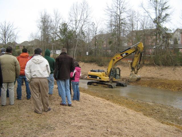
6 1. Restore approximately 1,900+/- feet of stream channel using natural channel design The Little Shades Creek Enhancement project in Vestavia Hills, Alabama, is funded by a Clean Water Act Section 319 grant administered by USEPA, ADEM, and the Cawaco RC&D Council. The goals are to improve water quality, habitat, and stream stability in 1,500 linear feet of Little Shades Creek and provide a demonstration of urban natural channel design stream enhancement and stormwater management. Little Shades Creek is a sub-watershed of the Shades Creek Watershed (HUC ) within the Cahaba River Basin. The project is located in the in the Ashley Woods subdivision in the City of Vestavia Hills in Jefferson County, Alabama. The watershed at the project site has a drainage area of almost eight square miles and is over 35% developed. The existing conditions of the stream reach were found to be impaired due to severe streambank erosion, mid-channel sediment bars in areas of overwide channel bottom, lack of deep-rooted native riparian vegetation on some streambanks, non-native invasive plants, lack of in-stream habitats, and stormwater discharges from adjacent parking lots and streets. The stream bed material consists of gravel/cobble overlaying bedrock. Project constraints include sewer lines crossing under the streambed, a greenway trail along the left bank, bridges upstream and downstream, and several stormwater outflow pipes and channels. Figure 1 shows typical existing conditions. Figure 1 Photos of existing conditions before enhancement (September 2009) The enhancement project initiated in January, 2010, includes the following elements: Channel realignment to provide a naturally stable meander pattern reducing stress on tight bends; Channel re-shaping to create a stable bankfull channel, floodplain benches on both sides, and stable terrace slopes on both sides; Installation of 11 in-stream boulder and log vane structures to direct flow away from streambanks, improve bedload sediment transport, provide grade control, and improve fish habitat; Streambank stabilization with native grass seeding, straw, temporary matting, and a brush mattress to reduce streambank erosion while permanent vegetation becomes established; Re-grading and stabilization of 10 stormwater outfall channels to minimize impacts of stormwater runoff from both sides of the stream project; Planting of native riparian trees, shrubs, and wetland plants to provide permanent streambank stability, shade and food for aquatic habitat improvements, and improved aesthetics.


7 Implementation began January 26, 2010, with mobilization and establishment of the staging area. Construction was completed March 5, with planting completed March 12, Project construction proceeded in 200-ft segments from downstream to upstream. After each segment was completed, exposed streambanks were stabilized with straw and coir erosion control matting to prevent potential erosion during rainfall events. Each project element is described below. Channel realignment consisted of excavating a new channel thalweg and low-flow channel following a sinuous path of repeating meanders down through the valley. Meander bends were created with low radius of curvature (approximately 70 to 90 ft) to minimize near-bank stress on the outside meanders during high flows. Channel re-shaping consisted of creating stable channel cross-sections for riffles, runs, pools, and glides with bankfull benches at 2.0 ft above low-flow water surface. This configuration provides for effective sediment transport and reduced shear stress during abovebankfull flows. Figure 2 shows the realigned and re-shaped channel during low flow and bankfull flow conditions (March 10, 2010). Figure 2 Realigned and re-shaped channel during low flow and bankfull flow conditions This project includes 7 boulder vanes and 4 log vanes structures to direct flow away from streambanks, improve bedload sediment transport, provide grade control, and improve fish habitat. The vanes are located on the outside banks of meander bends and are keyed into the bankfull benches to prevent scouring around the ends. Each constructed meander bend has two vanes in series to maximize bank protection. All but one of the boulder vanes include j-hooks to provide grade control, promote scour pools for habitat, and enhance sediment transport through the middle of the channel. The most downstream boulder vane is a short vane without a j-hook positioned to protect the left bank bench created from fill material. The most upstream log vane includes a boulder j-hook similar to the boulder vanes. The other log vanes do not include j-hooks and are positioned to protect bank stability during high flows.


8 Typical boulder vane lengths are ft with 4-5% arm slopes and offset angles of approximately 25 degrees from the streambank. The log vanes are shorter (30-40 ft) with lower slopes (2-4%). The vane arm boulders are sealed by chinking small rocks into gaps and placing a woven filter cloth upstream of the boulders. The upstream area between the boulders and stream bank is backfilled with cobbles and gravels to prevent flow from passing under or between the boulders. The vane arms are anchored into the streambank with sill boulders buried 5-10 feet into the bank to prevent cutting around the structure during high flows. For log vanes, there are 2-3 logs buried behind and below the header log for stability. The log vane arms are sealed by nailing a woven filter cloth to the upstream side of the vane arm log and draping it over the backer log. The upstream area between the logs and stream bank is backfilled with cobbles and gravels to prevent flow from passing under or between the logs. The vane arms are anchored into the streambank with 10-ft long root wads placed perpendicular to the stream bank just downstream of the log vane root wad to prevent cutting around the structure during high flows. Under the top log is a ledge on the downstream side to provide fish cover. Figures 3 and 4 show boulder and log vanes, respectively. Figure 3 Photos of boulder j-hook vanes under construction and during high flow directing flow away from streambank Figure 4 Photos of log vanes showing typical slope and angle and submersion in low flow to prevent rapid decomposition


9 Streambank stabilization consisted of seeding with a riparian grass mix, applying straw for temporary erosion control, applying temporary biodegradeable coir matting, and installing a brush mattress in an area of high stress for added bank protection. Figure 5 shows the brush mattress installation. Figure 5 Photos of brush mattress installation using live cuttings of dormant silky willow and silky dogwood anchored in soil and covered with straw and chicken wire to proect the cuttings until root establishment in spring and summer The 10 stormwater outfalls on both sides of the stream ranged from short, steep channels to long, flat conveyances. The steep channels were lined with boulder steps to prevent erosion. The flat channels were converted to bio-swales by lining the bottom with sandy soil and coir matting. These were planted with wetland plants to promote retention, infiltration, and filtering of stormwater runoff. Some of the bio-swales have step-pools at the ends to drop water down into the stream. Figure 6 shows typical stormwater outfalls. Figure 6 Photos of stormwater outfalls including a flat bio-swale with a step-pool drop structure at the end and a steep cascading boulder lined channel


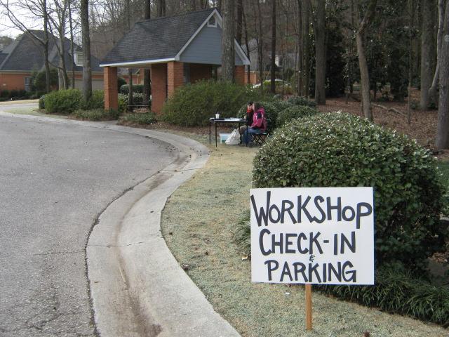
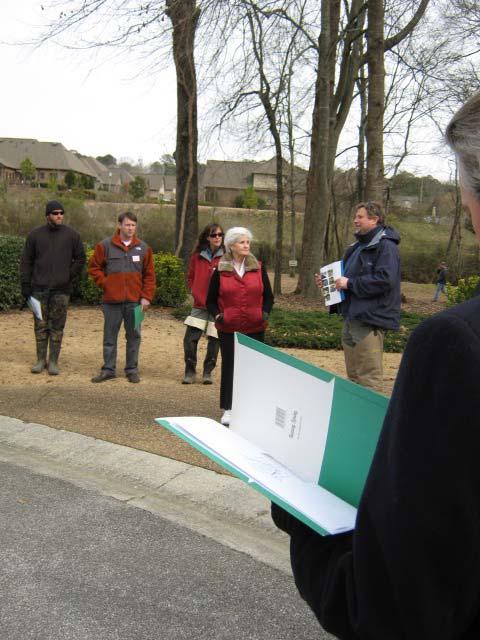
10 Riparian planting included native trees, shrubs, and wetland plants to provide permanent streambank stability, shade and food for aquatic habitat improvements, and improved aesthetics. Plants were installed in zones depending on wetness as shown in Figure 7. Figure 7 Photos of vegetation including wetland plugs, bare-root seedlings, and container shrubs and trees 2. Enhancement of an existing constructed wetland The City of Vestavia is currently working with Goodwyn Mills and Cawood, Inc. to design, repair and expand existing wetland. 3. A workshop to promote the use of natural channel design techniques as a management tool for improving water quality and aquatic habitat 4. A workshop to promote the use of innovative stormwater runoff water quality and quantity best management practices Two workshops were held in conjunction with the Little Shade Creek Stream Restoration project, Stream Restoration Construction on February11, 2010 and Vegetation for Stream and Floodplain Restoration on March9, These hands-on workshops offered natural resource professionals and local stakeholders an opportunity to learn more about stream enhancement and restoration on an urban stream. Continuing Education Units from Auburn University were offered for each training. The field activities for the Restoration Construction workshop included channel and floodplain grading; in-stream boulder and log structure placement for flow direction, grade control, and habitat enhancement; Stream bank stabilization using root wads, erosion control matting, and vegetation; Stormwater treatment and conveyance using bio-swales and bio-retention. 25 participants met at the field site for lectures and demonstrations by stream restoration design and construction professionals (Alabama Cooperative Extension System, North Carolina State Cooperative Extension System and North State Environmental.) The workshop participants included representatives from local and state government, non-profit organizations, local business, and private industry.


11 Figure 8 Photos from the Construction Workshop


12 30 participants were part of the Vegetation for Stream and Floodplain Restoration workshop. The field activities for this workshop included:,riparian tree and shrub selection and planting; Bioengineering for stream bank stabilization; and Invasive plant management for Streamside Forests. The workshop participants included representatives from localand state government, nonprofit organizations, local business, and private industry. Evaluations from workshop participants were positive. Figure 9 Photos from the Vegetation Workshop

13 5. Development of a watershed-based management plan for Little Shades Creek that incorporates applicable EPAs a-i Section 319 grant guideline components for an effective watershed management plan. A draft of the watershed management plan was submitted to the Alabama Department of Environmental Management October, A final draft is currently being completed. 6. Other March 8-15, 2009 Immediately after construction, a large rain event tested the site. The area received an average rainfall between 6-8 inches. No major erosion or maintenance issues were discovered. Figure 10 National Weather Service Rainfall Totals March 8-15, 2010
STREAM RESTORATION PURPOSE, PRACTICE, AND METHODS. By Marcus Rubenstein, CPESC
 STREAM RESTORATION PURPOSE, PRACTICE, AND METHODS By Marcus Rubenstein, CPESC WHAT IS STREAM RESTORATION? The return of a stream s lost natural functions, usually resulting from watershed alterations,
Old Mill School Stream Restoration
 Project Overview This conceptual plan restores and stabilizes two consecutive reaches of a highly incised and unstable stream and reconnects them with the floodplain. The restoration reaches are part of
POLICY FOR NATURAL RESOURCE MANAGEMENT AREAS
 POLICY FOR NATURAL RESOURCE MANAGEMENT AREAS I. POLICY STATEMENT Auburn University's (the University's) "Policy for Natural Resource Management Areas" implements the Campus Master Plan Land Use Element
RIPARIAN CORRIDOR STUDY FINAL PARLEYS CREEK MANAGEMENT PLAN TABLE OF CONTENTS
 TABLE OF CONTENTS 1.0 INTRODUCTION... 1-1 Riparian Corridor Study and Management Plan Goals... 1-1 Study Area... 1-2 Importance and Functions of Riparian Corridors... 1-2 Habitat for Mammals, Birds, and
Maintaining Riparian Areas and Wetlands
 Maintaining Riparian Areas and Wetlands Riparian areas are the lands along the banks of our rivers, lakes, and tidal waters. Many riparian areas not only border surface waters, but they are often adjacent
RIPARIAN CORRIDOR STUDY FINAL CITY CREEK MANAGEMENT PLAN TABLE OF CONTENTS
 TABLE OF CONTENTS 1.0 INTRODUCTION... 1-1 Riparian Corridor Study and Management Plan Goals... 1-1 Study Area... 1-2 Importance and Functions of Riparian Corridors... 1-2 Habitat for Mammals, Birds, and
INTERMEDIATE BMI ASSESSMENT TIER 2 FIELD SHEET
 INTERMEDIATE BMI ASSESSMENT TIER 2 FIELD SHEET PHYSICAL PARAMETERS ASSESSMENT FIELD SHEET ALL TIERS NAME: DATE: TIME: STREAM OR RIVER NAME: WATERSHED NAME: TOWN: WEATHER PRESENT PAST 48 HOURS SITE DESCRIPTION
Oatka Creek Stream Stabilization and Habitat Restoration Project Narrative
 Oatka Creek Stream Stabilization and Habitat Restoration Project Narrative This project was started from a previous Great Lakes Grant to identify concerns in the Oatka and Black Creek watersheds. Through
Temporary Watercourse Crossing: Culverts
 Temporary Watercourse Crossing: Culverts DRAINAGE CONTROL TECHNIQUE Low Gradient Velocity Control Short Term Steep Gradient Channel Lining Medium-Long Term Outlet Control Soil Treatment Permanent Symbol
Maitland Valley WATERSHED
 Maitland Valley WATERSHED Report Card 2018 Maitland Conservation has prepared this report card as a summary of the state of your forests, wetlands, and water resources. WHERE ARE WE? We are one of 36 Conservation
D Olive Watershed. Path Toward Restoration
 D Olive Watershed Path Toward Restoration Water is the most critical resource issues of our lifetime and our children s lifetime. The health of our waters is the principal measure of how we live on the
Stream Corridor Protection and Adaptive Management Manual. Prepared for the City of Independence, Missouri
 Stream Corridor Protection and Adaptive Management Manual Prepared for the City of Independence, Missouri Rock Creek Independence, Missouri By Patti Banks Associates and Applied Ecological Services, Inc.
COON CREEK WATERSHED DISTRICT PERMIT REVIEW. Spring Lake Park Schools Westwood Middle School st Avenue NE, Spring Lake Park, MN 55432
 PAN 16-112, Westwood Middle School, Page 1 of 6 COON CREEK WATERSHED DISTRICT PERMIT REVIEW MEETING DATE: August 22, 2016 AGENDA NUMBER: 10 FILE NUMBER: 16-112 ITEM: Westwood Middle School RECOMMENDATION:
A GUIDE TO STREAM RESTORATION
 A GUIDE TO STREAM RESTORATION Restoration of stream resources occurs for many reasons. You might be interested in goals of: Reducing and preventing further bank erosion, Increasing your property value,
South St. Vrain / Hall Meadows Restoration Planning August 20, 2015
 South St. Vrain / Hall Meadows Restoration Planning August 20, 2015 Agenda Introductions Purpose & Goals of Meeting Planning Area Master Plan Restoration Planning: Cost Estimates, Grants, Scope, Timeline
BMP 6.4.4: Infiltration Trench
 BMP 6.4.4: Infiltration Trench An Infiltration Trench is a leaky pipe in a stone filled trench with a level bottom. An Infiltration Trench may be used as part of a larger storm sewer system, such as a
Stream Simulation in Very Low Gradient Channels
 University of Massachusetts - Amherst ScholarWorks@UMass Amherst International Conference on Engineering and Ecohydrology for Fish Passage International Conference on Engineering and Ecohydrology for Fish
INTRODUCTION AND PURPOSE OF THE DESIGN GUIDE
 B A N K P R OT E C T I O N/E R O S I O N R E PA I R D E S I G N G U I D E INTRODUCTION AND PURPOSE OF THE DESIGN GUIDE This Design Guide is intended to clarify the Chapter 1 of the Water Resources Infrastructure
STREAMBANK RESTORATION DESIGN
 STREAMBANK RESTORATION DESIGN WITH VINYL SHEET PILE GRADE CONTROL STRUCTURES BRUCE M. PHILLIPS, M.S., P.E. ABSTRACT Grade control structures are an effective channel stabilization measure which can eliminate
Stormwater Management at. Park View Estates. Zach Bradley Riley Jones Grant Moore Derek West. November 18, 2016
 Stormwater Management at Park View Estates Zach Bradley Riley Jones Grant Moore Derek West November 18, 2016 Mission Statement The mission of the Cowboy Stormwater Management team is to design and implement
APPENDIX H Guidance for Preparing/Reviewing CEQA Initial Studies and Environmental Impact Reports
 APPENDIX H H.1 Guidance for Preparing and Reviewing CEQA Initial Studies Step 1: Consider the Project Characteristics as Provided by the Project Applicant Review the project application and draft plan
SW-74 SERENOVA PRESERVE SITES 2, 3, 4, 8 MITIGATION PLAN
 SW-74 SERENOVA PRESERVE SITES 2, 3, 4, 8 MITIGATION PLAN BACKGROUND INFORMATION Project SWIM? Aquatic Control? Exotic Control? Mitigation Bank? Type No No No No Mitigation Restoration and enhancement Type
Stream Watch Visual Survey Instructions
 Stream Watch Visual Survey Instructions The Stream Watch Visual Survey is based on assessment parameters from the EPA's Rapid Bioassessment Protocol Habitat Assessment, Georgia Adopt a Stream Visual Survey,
CITY OF SPRING HILL Water Quality Buffer Zone Policy (Adopted April 22, 2008)
") Section I - Description CITY OF SPRING HILL Water Quality Buffer Zone Policy (Adopted April 22, 2008) A water quality buffer zone (a.k.a. a riparian zone) is a strip of undisturbed native (indigenous)
Section I - Description CITY OF SPRING HILL Water Quality Buffer Zone Policy (Adopted April 22, 2008) A water quality buffer zone (a.k.a. a riparian zone) is a strip of undisturbed native (indigenous)
NEW CASTLE CONSERVATION DISTRICT. through. (Name of Municipality) PLAN REVIEW APPLICATION DRAINAGE, STORMWATER MANAGEMENT, EROSION & SEDIMENT CONTROL
 PLAN REVIEW APPLICATION DRAINAGE, STORMWATER MANAGEMENT, EROSION & SEDIMENT CONTROL") NEW CASTLE CONSERVATION DISTRICT through (Name of Municipality) PLAN REVIEW APPLICATION DRAINAGE, STORMWATER MANAGEMENT, EROSION & SEDIMENT CONTROL Office use only: Received by Municipality: Received by
NEW CASTLE CONSERVATION DISTRICT through (Name of Municipality) PLAN REVIEW APPLICATION DRAINAGE, STORMWATER MANAGEMENT, EROSION & SEDIMENT CONTROL Office use only: Received by Municipality: Received by
Rainfall, runoff and sediment transport in the Napa River watershed: now and a possible future
 Rainfall, runoff and sediment transport in the Napa River watershed: now and a possible future Lester McKee San Francisco Estuary Institute 5/24/2017 1 The importance of the natural water cycle of infiltration
PRENTISS CREEK (SUB-E) KENSINGTON PLACE CONCEPT PLAN VILLAGE OF DOWNERS GROVE, ILLINOIS AUGUST, 2011
 KENSINGTON PLACE CONCEPT PLAN VILLAGE OF DOWNERS GROVE, ILLINOIS AUGUST, 2011") PRENTISS CREEK (SUB-E) KENSINGTON PLACE CONCEPT PLAN VILLAGE OF DOWNERS GROVE, ILLINOIS AUGUST, 2011 Submitted to: NATHANIEL HAWK, STAFF ENGINEER VILLAGE OF DOWNERS GROVE 5101 WALNUT AVENUE DOWNERS GROVE,
PRENTISS CREEK (SUB-E) KENSINGTON PLACE CONCEPT PLAN VILLAGE OF DOWNERS GROVE, ILLINOIS AUGUST, 2011 Submitted to: NATHANIEL HAWK, STAFF ENGINEER VILLAGE OF DOWNERS GROVE 5101 WALNUT AVENUE DOWNERS GROVE,
The total population of the township is 9,942 (2015 Five-Year American Community Survey [ACS]). The median household income is over $109,000.
![The total population of the township is 9,942 (2015 Five-Year American Community Survey [ACS]). The median household income is over $109,000.](/thumbs/72/67990406.jpg "The total population of the township is 9,942 (2015 Five-Year American Community Survey [ACS]). The median household income is over $109,000.") East Bradford Township, Pennsylvania Motivated by watershed impairment caused by suburban development over the past 30 years, a township with a full slate of water quality improvement programs looks outside
East Bradford Township, Pennsylvania Motivated by watershed impairment caused by suburban development over the past 30 years, a township with a full slate of water quality improvement programs looks outside
APPENDIX H. Stabilization Measure Fact Sheets
 APPENDIX H Stabilization Measure Fact Sheets Prepared for The Boeing Company 5800 Woolsey Canyon Road, MC: 033-T436 Canoga Park, CA 91304-1148 Appendix H Stabilization Measure Fact Sheets Prepared by 6701
Riparian Buffers and Stream Restoration
 Riparian Buffers and Stream Restoration Why focus on riparian areas? Link land and water on any given site and link landscapes together in a watershed Riparian corridors protect the circulatory system
Prepared for: Whippany River Watershed Action Committee c/o Arthur Vespignani, Facilitator P.O. Box 223 Morristown, NJ
 Stream Bank Stabilization Design for the Whippany River at the Whippany Burying Grounds Southeast of the Intersection of Troy Hills Road and State Route 10 Block 5901, Lot 15 Hanover Township, Morris County,
FieldDoc.org User Guide For 2017 NFWF Chesapeake Bay Stewardship Fund Applicants. Background 2. Step 1: Register for a FieldDoc account 3
 FieldDoc.org User Guide For 2017 NFWF Chesapeake Bay Stewardship Fund Applicants Table of Contents (click to go to page) Background 2 Step 1: Register for a FieldDoc account 3 Step 2: Create the Project
Interstate-Callahan Upper and Lower Rock Dumps RA Construction Project. East Fork Ninemile Creek, Idaho May 3, 2016
 Interstate-Callahan Upper and Lower Rock Dumps RA Construction Project East Fork Ninemile Creek, Idaho May 3, 2016 Tony Wesche, P.E. Pioneer Technical Services, Inc. and North Wind Group Presentation Topics
719 Griswold, Suite 820 Detroit, MI DANVERS POND DAM REMOVAL AND STREAM RESTORATION PROJECT
 Great Lakes Restoration Initiative Grant Final Report US EPA Grant GL 00E006 43 October, 2013 Valley Woods Wetland Southfield Lola Valley Grow Zone Wayne County Parks Venoy Park Grow Zone Wayne County
LEGAL AUTHORITY AND JURISDICTIONS
 CALIFORNIA DEPARTMENT OF FISH AND GAME RIPARIAN RESOURCES AND REGULATORS: The DFG Lake and Streambed Alteration 1600 Process LEGAL AUTHORITY AND JURISDICTIONS Serge Glushkoff CENTRAL COAST REGION YOUNTVILLE
SECTION V CHAPTER 12 STORMWATER POLLUTION PREVENTION POLICY
 1. PURPOSE: SECTION V CHAPTER 12 STORMWATER POLLUTION PREVENTION POLICY The purpose of this policy is to establish procedures to facilitate compliance with federal, state and local stormwater regulations
Understanding Stormwater Pollution Prevention Plans (SWPPPs) (SWPPPS)
 (SWPPPS)") Understanding Stormwater Pollution Prevention Plans (SWPPPs) (SWPPPS) Definitions SWPPP: Storm Water Pollution Prevention Plan BMP: Best Management Practice(s) to control pollution IDNR: Iowa Department
Understanding Stormwater Pollution Prevention Plans (SWPPPs) (SWPPPS) Definitions SWPPP: Storm Water Pollution Prevention Plan BMP: Best Management Practice(s) to control pollution IDNR: Iowa Department
APPENDIX D: COST ESTIMATES FOR STUDY REACHES
 D-1 APPENDIX D: COST ESTIMATES FOR STUDY REACHES This appendix provides approximate quantity and cost information for the higher-priority improvement measures identified in the reach tables in Appendix
Functional Uplift Based Stream Assessment & Restoration Design
 Functional Uplift Based Stream Assessment & Restoration Design Darcy K.L. Turner Senior Environmental Scientist, Biohabitats, Inc. (dturner@biohabitats.com) Christopher A. Streb, PE Ecological Engineer,
ALABAMA S BEST MANAGEMENT PRACTICES. Protection of Water Quality During Timber Harvesting
 ALABAMA S BEST MANAGEMENT PRACTICES Protection of Water Quality During Timber Harvesting Water Quality Responsibility Landowners and/or involved professional forestry practitioners such as: Forest resource
PA Municipal Separate Storm Sewer System (MS4) TMDL Plan
 TMDL Plan") PA Municipal Separate Storm Sewer System (MS4) TMDL Plan Instructor: Bryan Seipp, Watershed Manager- CWP Lee Epstein, Director, Lands Program- CBF 1 To Adjust How the Slides Appear on Your Screen To make
PA Municipal Separate Storm Sewer System (MS4) TMDL Plan Instructor: Bryan Seipp, Watershed Manager- CWP Lee Epstein, Director, Lands Program- CBF 1 To Adjust How the Slides Appear on Your Screen To make
Monitoring Stormwater Best Management Practices: Why Is It Important and What To Monitor
 Monitoring Stormwater Best Management Practices: Why Is It Important and What To Monitor Scott D. Struck, Ph.D. US EPA, Urban Watershed Management Branch New Jersey Water Monitoring Workshop 4/20/2006
BCWMC Capital Improvement Program (approved April 19, 2018; pending minor Plan amendment)
") BCWMC Capital Improvement Program 2020 2024 (approved April 19, 2018; pending minor Plan amendment) Project Name City Number 2019 2020 2021 2022 2023 2024 2025 Totals Medicine Lake Rd and Winnetka Ave
BCWMC Capital Improvement Program 2020 2024 (approved April 19, 2018; pending minor Plan amendment) Project Name City Number 2019 2020 2021 2022 2023 2024 2025 Totals Medicine Lake Rd and Winnetka Ave
Estimated Construction Cost: $30,000-$110,000
 SITE 11 BMP retrofits at Smith Middle School Index Sheet No.: 16 Raw Data Name: IJ 34 Estimated Construction Cost: $30,000-$110,000 Page 73 CAMDEN LN CLAYMORE RD BURNS PL WHITMORE CIR S HAWICK CT ROGERS
PRESENTERS. Contact Information: RW Armstrong Union Station, 300 S. Meridian St. Indianapolis, IN
 1 PRESENTERS David Bourff, Director of Environmental Planning Simon Davies, LEED AP, Environmental Scientist Summer O Brien, PWS, Senior Environmental Scientist Contact Information: RW Armstrong Union
What Does It All Mean? CWA? Sara Esposito, P.E. DNREC Division of Watershed Stewardship
 What Does It All Mean? CWA? Sara Esposito, P.E. DNREC Division of Watershed Stewardship sara.esposito@state.de.us Why are we here? Just like pavement has helped move cars faster; it has also helped water
Mike Jastremski, CFM Watershed Conservation Director
 Planning for Flood Resilient and Fish Friendly Road-Stream Crossings in CT s Northwest Hills Mike Jastremski, CFM Watershed Conservation Director Presentation Outline Project area Climate threats Field
Case Study 7. Woodrock Guard Station Geoweb Ford
 Appendix A Case Study Case Study. Woodrock Guard Station Geoweb Ford Location Central Wyoming. Bighorn National Forest. West Fork of the South Tongue River. 20 miles southwest of Sheridan, off Forest Highway
C O M P R E H E N S I V E P R O T E C T I O N & R E S T O R AT I O N P L A N. f or th e
 C O M P R E H E N S I V E P R O T E C T I O N & R E S T O R AT I O N P L A N f or th e R O S S B A R NE T T R E SERV O I R WATERS HED, MI S S I S S I P P I E X E C U T I V E S U M M A R Y O C T O B E R
Natural and Engineered Wetlands for Stormwater Management
 Natural and Engineered Wetlands for Stormwater Management Dan Hitchcock, Ph.D., P. E. Baruch Institute of Coastal Ecology and Forest Science Clemson University Georgetown, SC Prominence and Diversity of
TORCH LAKE TOWNSHIP WATER QUALITY ACTION PLAN
 TORCH LAKE TOWNSHIP WATER QUALITY ACTION PLAN Elk-River-Chain-of-Lakes Gaps Analysis Project The Watershed Center Grand Traverse Bay Tip of the Mitt Watershed Council Michigan Department of Natural Resources
Alabama s Best Management Practices
 Alabama s Best Management Practices Protection of Water Quality During Timber Harvesting Water Quality Responsibility Landowners and/or involved professional forestry practitioners such as: Forest resource
Provide flood damage reduction projects that t work, with appropriate regard for community and natural values.
 The mission of the Harris County Flood Control District is to: Provide flood damage reduction projects that t work, with appropriate regard for community and natural values. Harris County Flood Control
NJDEP Regulations that impact or soon will impact agricultural operations. April 1, 2007 Horses 2007
 NJDEP Regulations that impact or soon will impact agricultural operations. April 1, 2007 Horses 2007 Peter L. Kallin, Ph.D., P.W.S. Phone: 732-499-3600 Ext. 237 E-mail: pkallin@aesop.rutgers.edu www.water.rutgers.edu
Duwamish Waterway Self Guided Tour: Turning Basin Number Three and Terminal 105 Aquatic Habitat Restoration Sites
 Duwamish Waterway Self Guided Tour: Turning Basin Number Three and Terminal 105 Aquatic Habitat Restoration Sites Text and illustrations in the following pages include: (1) summary information describing
7/16/2012. Post Construction Best Management Practices (PCBMPs) Article VIII: Post Construction Best Management Practices
 Article VIII: Post Construction Best Management Practices") Post Construction Best Management Practices (PCBMPs) Article VIII: Post Construction Best Management Practices Presented by Jennifer Boyer DuPage County DEC Includes BMPs intended to provide volume control
Post Construction Best Management Practices (PCBMPs) Article VIII: Post Construction Best Management Practices Presented by Jennifer Boyer DuPage County DEC Includes BMPs intended to provide volume control
STORMWATER RUNOFF AND WATER QUALITY IMPACT REVIEW
 SUBCHAPTER 8 STORMWATER RUNOFF AND WATER QUALITY IMPACT REVIEW 7:45-8.1 Purpose and scope of review Except for those projects expressly exempted by this chapter or waived by the Commission, the Commission
Best Management Practice Fact Sheet 10: Dry Swale
 Publication 426-129 Best Management Practice Fact Sheet 10: Dry Swale David J. Sample, Assistant Professor and Extension Specialist, Biological Systems Engineering, Virginia Tech Lia Doumar, Undergraduate
Chapter 1. Introduction
 Chapter 1 Introduction James P. Heaney, Robert Pitt, and Richard Field Introduction Stormwater has traditionally been considered a nuisance, requiring rapid and complete drainage from areas of habitation.
Constructed Wetland Pond T-8
 Constructed Wetland Pond T-8 Description A constructed wetlands pond is a shallow retention pond designed to permit the growth of wetland plants such as rushes, willows, and cattails. Constructed wetlands
Pennsylvania Stormwater Best Management Practices Manual. Chapter 3. Stormwater Management Principles and Recommended Control Guidelines
 Pennsylvania Stormwater Best Management Practices Manual Chapter 3 Stormwater Management Principles and Recommended Control Guidelines 363-0300-002 / December 30, 2006 Chapter 3 Stormwater Management Principles
W. Goodrich Jones State Forest. Best Management Practices Virtual Demonstration Tour
 W. Goodrich Jones State Forest Best Management Practices Demonstrations of commonly implemented Texas Forestry BMPs for Water Quality Protection Texas Forest Service Water Resources P.O. Box 310 Lufkin,
Municipal Stormwater Ordinances Summary Table
 APPENDIX F Municipal Ordinances Summary Table Municipality Abington Bryn Athyn Borough Hatboro Borough Ordinance, SALDO Runoff equals pre post Erosion Sediment Control Water Quality Requirements Any which
Lyon Creek Cedar Way Stormwater Detention Dam Operation and Maintenance Manual
 Lyon Creek Cedar Way Stormwater Detention Dam Operation and Maintenance Manual Prepared by: Mike Shaw Stormwater Program Manager City of Mountlake Terrace January 2010 Section I General Information This
UMD Storm Water Program Construction Requirements. Greg Archer, MBA Environmental Compliance Specialist
 UMD Storm Water Program Construction Requirements Greg Archer, MBA Environmental Compliance Specialist Phase 2 Regulatory Overview Dec. 1999 EPA issues Phase 2 Federal Register Municipalities (MS4) from
Habitat Grant Projects Clinton River Watershed
 Habitat Grant Projects Clinton River Watershed L Y N N E S E Y M O U R E N V I R O N M E N T A L E N G I N E E R O F F I C E O F T H E M A C O M B C O U N T Y P U B L I C W O R K S C O M M I S S I O N
16.0 Water Quality Management Criteria for Developed Land
 October 2003, Revised February 2005 Criteria for Developed Land Page 1 16.1 Introduction 16.0 Water Quality Management Criteria for Developed Land Stormwater quality control is an integral part of any
DIVISION VII SOIL EROSION AND SEDIMENTATION CONTROL
 DIVISION VII SOIL EROSION AND SEDIMENTATION CONTROL 1. General la. Purpose VII-1 1B. Necessity of Grading Permit... VII-1 1C. Additional Requirements... VII-2 1D. Responsibility of Permittee... VII-2 2.
Chapter 3 Dispersion BMPs
 Chapter 3 Dispersion BMPs 3.1 BMP L611 Concentrated Flow Dispersion 3.1.1 Purpose and Definition Dispersion of concentrated flows from driveways or other pavement through a vegetated pervious area attenuates
Missouri Streams. Fact Sheet. What factors affect stream habitat? Stream Habitat Affects Aquatic Communities
 Missouri Streams Fact Sheet Written by Del Lobb & Suzanne Femmer Edited by Sarah Wolken When most people think of habitat, they usually picture places where fish or wildlife live, like a hollow log or
Virginia Department of Forestry Water Resources Program. Chesapeake Bay Forestry Workgroup Meeting April 8, 2014
 Virginia Department of Forestry Water Resources Program Chesapeake Bay Forestry Workgroup Meeting April 8, 2014 VDOF Mission for Forestry in Virginia We protect and develop healthy, sustainable forest
Regional Watershed Planning. Calumet Summit 2010: A Call to Connect Calumet Conference Center April 27, 2010
 Regional Watershed Planning Calumet Summit 2010: A Call to Connect Calumet Conference Center April 27, 2010 Basins The Calumet Region Watershed Communities Land Cover- 2006 Impervious Cover 303d Listed
Georgia's Nonpoint Source Management Program. Linda MacGregor Watershed Protection Branch Georgia Environmental Protection Division
 Georgia's Nonpoint Source Linda MacGregor Watershed Protection Branch Georgia Environmental Protection Division Overview of Georgia s Nonpoint Source Georgia s s Nonpoint Source is a comprehensive framework
DAKOTA COUNTY SOIL AND WATER CONSERVATION DISTRICT COMPREHENSIVE PLAN
 DAKOTA COUNTY SOIL AND WATER CONSERVATION DISTRICT COMPREHENSIVE PLAN 2011-2015 4100 220 th Street West, Suite 102 Farmington, MN 55024 651-480-7777 www.dakotacountyswcd.org I. INTRODUCTION A. Purpose
Low Head Stone Weirs By: Jon Fripp 1, Dr. Craig Fischenich 2, and Dr. David Biedenharn 2
 Low Head Stone Weirs By: Jon Fripp 1, Dr. Craig Fischenich 2, and Dr. David Biedenharn 2 Complexity Low Moderate High Environmental Value Low Moderate High Cost Low Moderate High OVERVIEW Establishing
THE EVOLUTION OF EROSION CONTROL TECHNOLOGY. Welcome! Pete Hanrahan, CPESC E. J. Prescott, Inc. Gardiner, Maine
 THE EVOLUTION OF EROSION CONTROL TECHNOLOGY Welcome! Pete Hanrahan, CPESC E. J. Prescott, Inc. Gardiner, Maine pete.hanrahan@ejprescott.com EROSION CONTROL HAS BEEN PRACTICED FOR THOUSANDS OF YEARS CLEAN
CITY UTILITIES DESIGN STANDARDS MANUAL
 CITY UTILITIES DESIGN STANDARDS MANUAL () September 2017 Page Chapter 1 Acronyms and Definitions 1.01 Purpose 1 1.02 Acronyms 1 1.03 Definitions 3 Chapter 2 Introduction 2.01 Purpose 1 2.02 Applicability
Review of State and Federal Stormwater Regulations November 2007
 Review of State and Federal Stormwater Regulations November 2007 By: James T. Spaulding, PE, CPESC Joseph M. Ducharme, Jr., PE TTG ENVIRONMENTAL CONSULTANTS, LLC 27 LOCKE ROAD, CONCORD, NH 03301-5301 TELEPHONE:
STREAM AND BUFFER AREA PROTECTION/RESTORATION
 STREAM AND BUFFER AREA PROTECTION/RESTORATION AMENDMENT OPTIONS TO STRENGTHEN POLICY IN HEADWATERS AREAS DRAFT SUBSEQUENT TO THE JANUARY 25, 2007 MEETING OF THE PLANNING COMMISSION ENVIRONMENT COMMITTEE
CITY OF GRIFFIN STREAM BANK RESTORATION PROGRAM
 CITY OF GRIFFIN STREAM BANK RESTORATION PROGRAM Lee Phillips 1, J. Erik Alford2 and M. Brad McLeod 3 AUTHORS: 'Project Engineer, Integrated Science & Engineering, 118 North Expressway, Griffin, GA 30223;
VIDEO: Riparian Forest Buffers: The Link Between Land & Water
 VIDEO: Riparian Forest Buffers: The Link Between Land & Water Introduction to Riparian Buffers Adapted from: Riparian Forest Buffers: The Link Between Land & Water. Maryland Cooperative Extension. Wye
Municipal Stormwater Management Planning
 Municipal Stormwater Management Planning Christopher C. Obropta, Ph.D., P.E. Water Resources Extension Specialist with Rutgers Cooperative Extension Assistant Professor with Department of Environmental
Funding Guidelines State Fiscal Year 2016
 State Fiscal Year 2016 Water Quality Financial Assistance Centennial Clean Water Program Clean Water Act Section 319 Program Stormwater Financial Assistance Program Washington State Water Pollution Control
Riparian Buffer Requirements. Department of Environmental Protection Bureau of Watershed Management
 102.14 - Riparian Buffer Requirements Department of Environmental Protection Bureau of Watershed Management 102.2 Scope and Purpose BMPs to protect, maintain, and restore water quality and existing designated
Standards for Soil Erosion and Sediment Control in New Jersey May 2012 STANDARD FOR GRASSED WATERWAYS. Definition. Purpose
 STANDARD FOR GRASSED WATERWAYS Definition A natural or constructed watercourse shaped or graded in earth materials and stabilized with suitable vegetation for the safe conveyance of runoff water. Purpose
Erosion and Sediment Pollution Control Guidelines for Residential Lots with soil disturbance of less than 1 acre (see exceptions)
") Adams Co. Conservation District 670 Old Harrisburg Road, Suite 201 Gettysburg, PA 17325 Telephone: 334-0636 Fax: 337-0730 www.adamscounty.us Erosion and Sediment Pollution Control Guidelines for Residential
Adams Co. Conservation District 670 Old Harrisburg Road, Suite 201 Gettysburg, PA 17325 Telephone: 334-0636 Fax: 337-0730 www.adamscounty.us Erosion and Sediment Pollution Control Guidelines for Residential
Municipal Separate Storm Sewer Systems (MS4) Implementation. Craig Carson Montgomery County Department of Environmental Protection
 Implementation. Craig Carson Montgomery County Department of Environmental Protection") Montgomery County Maryland Municipal Separate Storm Sewer Systems (MS4) Implementation Craig Carson Montgomery County Department of Environmental Protection Montgomery County, Maryland 500 sq. miles 970,000
Montgomery County Maryland Municipal Separate Storm Sewer Systems (MS4) Implementation Craig Carson Montgomery County Department of Environmental Protection Montgomery County, Maryland 500 sq. miles 970,000
E. STORMWATER MANAGEMENT
 E. STORMWATER MANAGEMENT 1. Existing Conditions The Project Site is located within the Lower Hudson Watershed. According to the New York State Department of Environmental Conservation (NYSDEC), Lower Hudson
Watershed master planning, City of Griffin, Georgia, USA
 Water Resources Management VII 3 Watershed master planning, City of Griffin, Georgia, USA J. K. Kaplan & B. J. Watson Tetra Tech, Water Resources Group, Atlanta, Georgia, USA Abstract Tetra Tech has assisted
Chapter 6. Hydrology. 6.0 Introduction. 6.1 Design Rainfall
 6.0 Introduction This chapter summarizes methodology for determining rainfall and runoff information for the design of stormwater management facilities in the City. The methodology is based on the procedures
Outcomes. Kelly Karll-SEMCOG Margaret Barondess - MDOT
 Eco-Logical: I-75 Corridor I-75 Conservation Transportation Action Planning in to Monroe Achieve County: Multiple Stormwater Environmental Considerations Outcomes Kelly Karll-SEMCOG Karll@semcog.org Margaret
ODFW AQUATIC INVENTORY PROJECT RESTORATION MONITORING STREAM HABITAT REPORT
 ODFW AQUATIC INVENTORY PROJECT RESTORATION MONITORING STREAM HABITAT REPORT STREAM: GCG: 5-SC SITE ID: 466 BASIN: ROGUE TREATMENT DATE: 2 SURVEY DATE: 7/29/23 SURVEY CREW: USGS MAPS: ECOREGION: REPORT
West Fork White River Watershed Conservation Map Summaries. Prepared for the Beaver Watershed Alliance. By the Watershed Conservation Resource Center
 West Fork White River Watershed Conservation Map Summaries Prepared for the Beaver Watershed Alliance By the Watershed Conservation Resource Center November 2014 The Watershed Conservation Resource Center
iswm TM Criteria Manual City of Azle Section 14 City of Azle Subdivision Ordinance DRAFT-June Chapter 1
 City of Azle Section 14 City of Azle Subdivision Ordinance DRAFT-June 2010... Chapter 1 i CITY OF AZLE iswm CRITERIA MANUAL FOR SITE DEVELOPMENT AND CONSTRUCTION Incorporating the Regional NCTCOG Integrated
New Castle County, DE. Floodplain Regulations
 New Castle County, DE Floodplain Regulations John J. Gysling, PE CFM Department of Land Use New Castle County, DE February 26, 2009 Today s Presentation Floodplain Protection and Uses Terms and Definitions
Andrea Ludwig, PhD, EIT Assistant Professor Biosystems Engineering and Soil Science University of Tennessee
 Andrea Ludwig, PhD, EIT Assistant Professor Biosystems Engineering and Soil Science University of Tennessee 2 Circa 1891 3 Circa 1900 4 5 Urban Development Stormwater NPDES Permits Phase I (n=4); pop>100,000
CHAPTER 3 Environmental Guidelines for WATERCOURSE CROSSINGS GOVERNMENT OF NEWFOUNDLAND AND LABRADOR DEPARTMENT OF ENVIRONMENT AND LABOUR
 GOVERNMENT OF NEWFOUNDLAND AND LABRADOR DEPARTMENT OF ENVIRONMENT AND LABOUR CHAPTER 3 Environmental Guidelines for WATERCOURSE CROSSINGS WATER RESOURCES MANAGEMENT DIVISION Water Investigations Section
Design of the Next Generation of Constructed Wetlands
 Design of the Next Generation of Constructed Wetlands AGENDA The Curious Evolution of Stormwater Wetlands The Improved Stormwater Wetland Design Key Design Choices for Stormwater Wetlands The Regenerative
Appendix J. Existing Efforts for Identifying Multi-Benefit Projects
 Appendix J Existing Efforts for Identifying Multi-Benefit Projects Water Purveyor Projects Existing Efforts for Identifying Multi Benefits Projects In-lieu groundwater recharge under RWA planning efforts