Mitigation Options For Shoreland Property Owners. Mike Wenholz Shoreland Specialist Wisconsin Department of Natural Resources, Eau Claire
|
|
|
- Neil Ward
- 6 years ago
- Views:
Transcription

1 Mitigation Options For Shoreland Property Owners Mike Wenholz Shoreland Specialist Wisconsin Department of Natural Resources, Eau Claire Wisconsin Lakes Partnership Convention, April 11, 2013
2 Outline for this session 1. Shoreland zoning overview 2. What is shoreland mitigation? 3. When is shoreland mitigation required? 4. What are some shoreland mitigation options? 5. Shoreland mitigation implementation approaches 6. Real world shoreland mitigation examples
3 Shoreland Zoning Overview Grounded in the Public Trust Doctrine Article IX, Section 1 of the Wisconsin Constitution Came from the governing of the Northwest Territory well before Statehood Establishes navigable waters defined in Chapter 30, Wisconsin Statute Shoreland zoning established under S , s , , , Wisconsin Statute Shoreland zoning applies to areas adjacent to and along navigable waters
4 Shoreland Zoning Overview Goal of shoreland zoning is to limit direct and cumulative impacts of shoreland development on: Water quality Near shore aquatic, wetland, and upland wildlife habitat Natural scenic beauty
 Applies statewide to all unincorporated areas Applies to areas annexed after May 7, 1982 or")
5 Shoreland Zone What is it? Where is It? The areas that shoreland zoning applies to Established June 1966, Water Resources Act (now NR 115) Applies statewide to all unincorporated areas Applies to areas annexed after May 7, 1982 or incorporated after April 30, 1994 Different rules pertain to shoreland zoning in cities and villages (NR 117) AND the Lower St. Croix Riverway (NR 118)


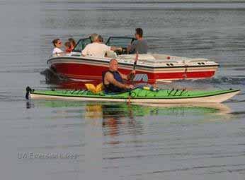

6 Why Care About Shoreland Zoning? Enjoying healthy lakes & rivers: Part of who we are in WI


7 Why Care About Shoreland Zoning? VS

8 Why Care About Shoreland Zoning?
9 Shoreland Mitigation What is it? One portion of shoreland zoning Definition General balancing measures that are designed, implemented and function to restore natural functions and values that are otherwise lost through development and human activities Natural Functions = Water quality, near shore aquatic habitat, upland wildlife habitat, and natural scenic beauty
10 Shoreland Mitigation What is it? Definition Legal in Code (NR (1)(e) and (g)) enforceable obligations of the property owner to establish or maintain measures that are determined to adequately offset the impacts of the permitted action on water quality, near shore aquatic habitat, upland wildlife habitat, and natural scenic beauty shall be proportional to the amount and impacts of the permitted action
11 Shoreland Mitigation When is it Required? Under current NR 115 mitigation is triggered by: Increasing impervious surfaces over 15% Vertical expansion of nonconforming structures Replacement or Relocation of nonconforming structures Mitigation may also be triggered by: BOA variance approval condition Other miscellaneous regulations
12
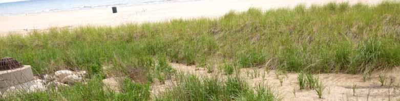
13 Shoreland Mitigation Options Vegetative Shoreland Buffers Shoreland Stabilization and Revegetation Rain Gardens and Bioretention Systems Infiltration Systems Structure Removal Nonconforming Structures Sea Walls / Rip Rap Outhouse / Privy Use of Natural Colors Softer Shoreland Lighting Narrower Access Corridors Pervious Pavers / Permeable Concrete
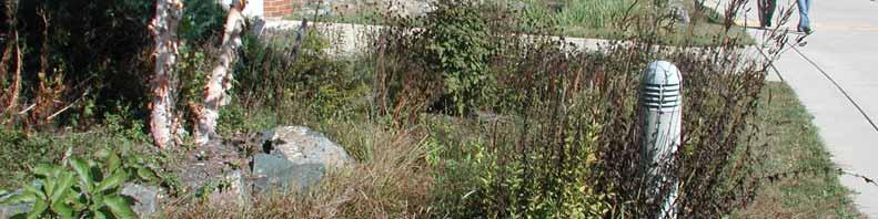
14 Shoreland Mitigation Options Vegetative Buffer

15 Shoreland Mitigation Options Vegetative Buffer Install New Vegetative Buffer Full Buffer 35 foot width up from the OHWM Partial Buffer adjacent to shore or to side lot lines Widen / Increase Existing Vegetative Buffer
16 Shoreland Mitigation Options Vegetative Buffer


 Phosphorus")
17 Shoreland Vegetative Buffers Use Native Species Nutrient y ie ld ( lb /a c /y r ) Total nutrients delivered to lakes Nitrogen (TKN) Phosphorus (TP) Lawn Forest


18 Runoff Volume Phosphorus Inputs Sediment Inputs 4x 5x 6x Adapted From: Wisconsin DNR 18x
19 Largemouth bass & black crappie nests Jeffrey Reed, MN DNR, 2001 Crooked Lake Bergen Lake Cowdry Lake Highly Developed Shoreline Developed Shoreline with Dwelling Developed Shoreline w/out Dwelling Undeveloped Shoreline Represents 5 Black Crappie Nests Represents 1 Largemouth Bass Nest


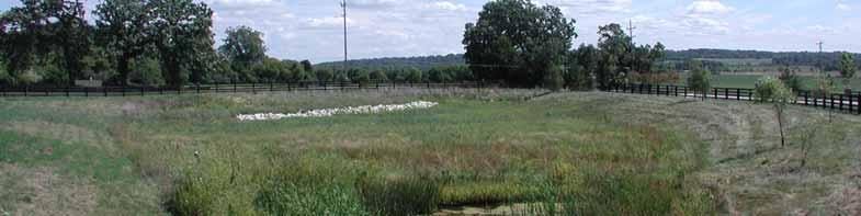
20 Shoreland Mitigation Options Vegetative Buffer
21 Shoreland Vegetative Buffer Research Recommended Shoreline Buffer Widths A Research Summary Nutrient control Stormw ater runoff control Fecal bacteria Sediment control Wildlife habitat ft NR115 Range of recommended buffer w idths in feet based on (x) studies buffer Review of 52 U.S. studies by Aquatic Resource Consultants, Seattle WA
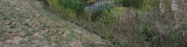
22 Shoreland Mitigation Options Shoreland Stabilization and Revegetation

23 Shoreland Mitigation Options Shoreland Stabilization and Revegetation From a Fiber Log brochure

24 Shoreland Mitigation Options Rain Garden

25 Shoreland Mitigation Options Rain Garden From: Minnesota Urban Small Sites BMP Manual, Infiltration Systems On-Lot Infiltration, page 3-151

26 Shoreland Mitigation Options Rain Garden

27 Shoreland Mitigation Options Infiltration System

28 Shoreland Mitigation Options Infiltration System From: Minnesota Urban Small Sites BMP Manual, Infiltration Systems On-Lot Infiltration, page 3-145


29 Shoreland Mitigation Options Infiltration System
30 Shoreland Mitigation Options Structure Removal Nonconforming Accessory Structure: Boathouse Shed Patio Deck Unnecessary Retaining Wall Guest cabin Seawall Rip Rap Outhouse / Privy

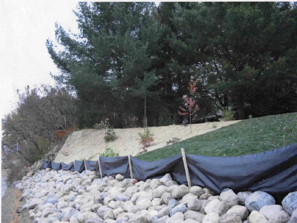
31 Shoreland Mitigation Options Bio or Fiber Logs Replace Rip Rap From Anoka Natural Resources website, Ham Lake, MN


32 Shoreland Mitigation Options Structure Removal


33 Shoreland Mitigation Options Natural Colors

34 Shoreland Mitigation Options Natural Colors


35 Shoreland Mitigation Options Softer Lighting

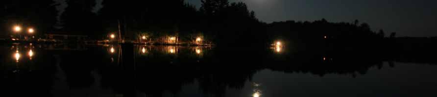

36 Shoreland Mitigation Options Softer Lighting

37 Shoreland Mitigation Options Softer Lighting From: Sensible Shoreland Lighting: Preserving the Beauty of the Night, UW-Extension, Liebl and Korth, 2000


38 Shoreland Mitigation Options Narrower Access

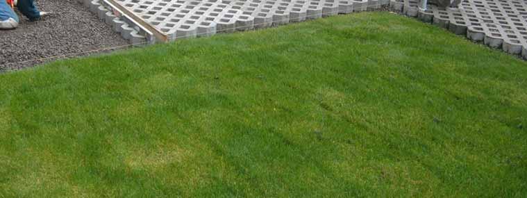
39 Shoreland Mitigation Options Pervious Pavers taken from

40 Shoreland Mitigation Options Permeable Concrete From the National Ready Mixed Concrete Association Pervious Pavement website
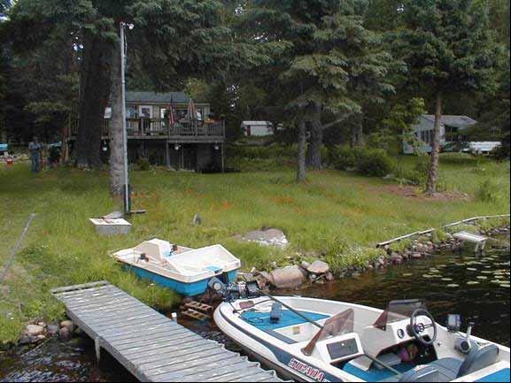
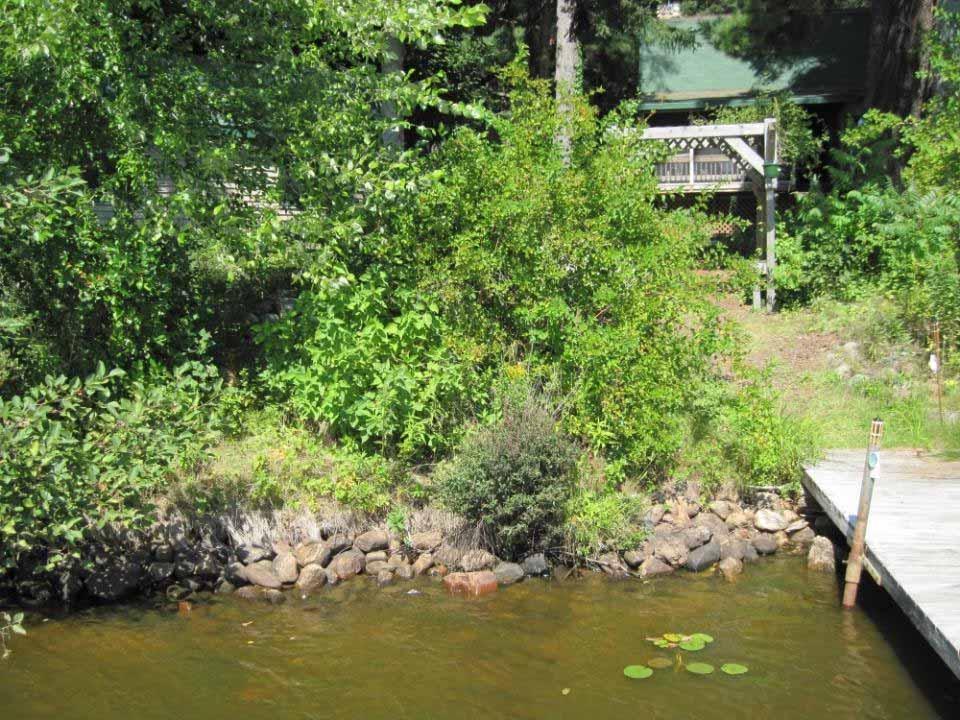
41
42 Shoreland Mitigation Implementation Approaches Case By Case Determinations Full Vegetative Buffer Installation List of Required Actions Shoreland Buffer Maintenance or Restoration Stormwater Management Compliant Septic System, Composting Toilets, etc. Removal of Pre existing Accessory Structures Menu and Point System Good Examples: Green Lake, Lincoln, Marquette, Monroe, etc. Other Approaches Land Use Runoff Rating (Polk County) BOA Decision Conditions
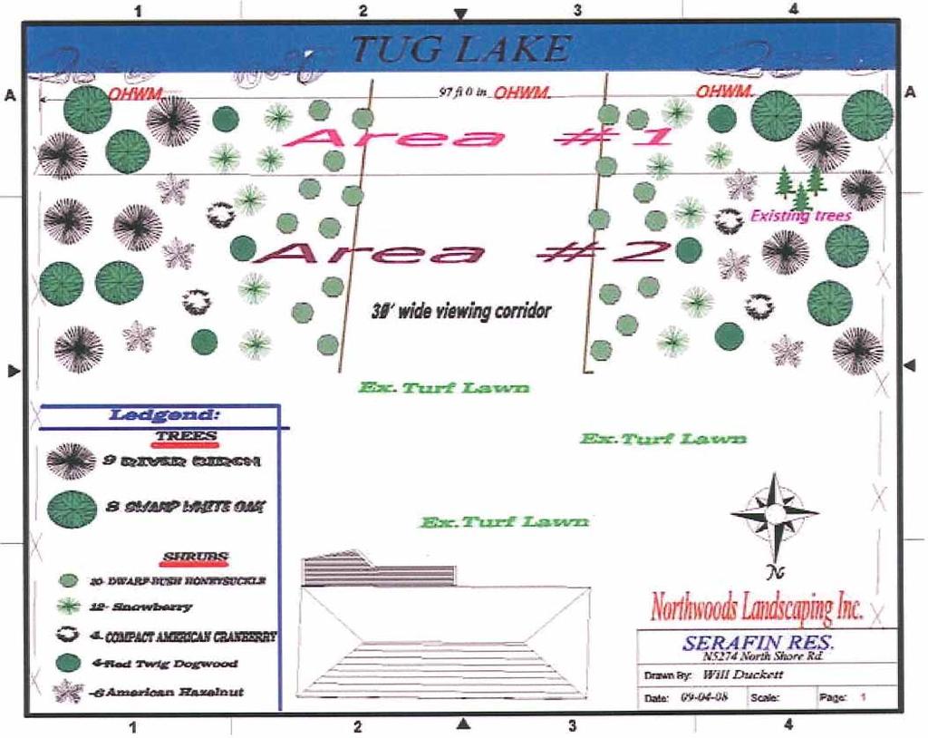
43 Shoreland Mitigation Implementation Approaches Menu and Point System Approach Example Part 1 Mitigation Practice Buffer restoration 35 feet from OHWM Each additional 10 feet of buffer restoration Rain garden to capture runoff Removing accessory structures less than 75 from OHWM Narrowing viewing corridor Reducing shoreland lighting Engineered system to capture all runoff Other practices agreed to by zoning administrator Points 3 points 1 point 2 points 1 3 points 1 point 1 point 3 points Up to 2 points
44 Shoreland Mitigation Implementation Approaches Menu and Point System Approach Example Part 2 Development Requiring Mitigation Additional Impervious Surface (15 25%) Additional Impervious Surface (25 30%) Vertical expansion of NC principal structure Replacement of NC principal structure Relocation of NC principal structure (same setback) Relocation of NC principal structure (further from OHWM) Points 4 points 5 points 2 points 3 points 4 points 3 points
45
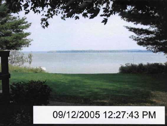
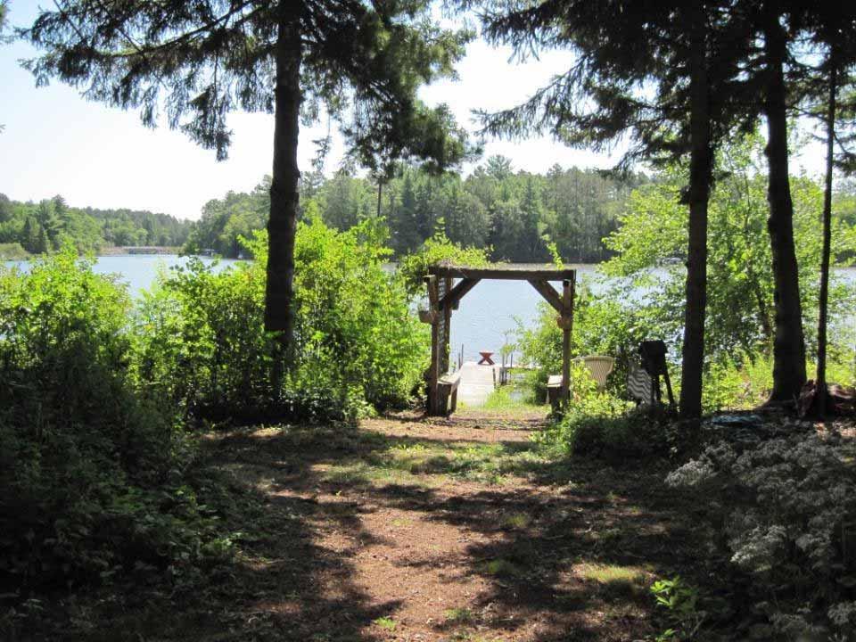
46 Real World Shoreland Mitigation Example 1
47
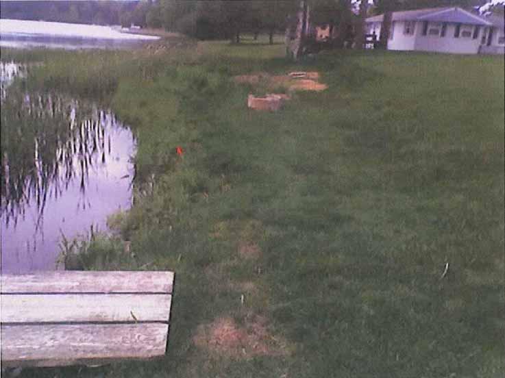

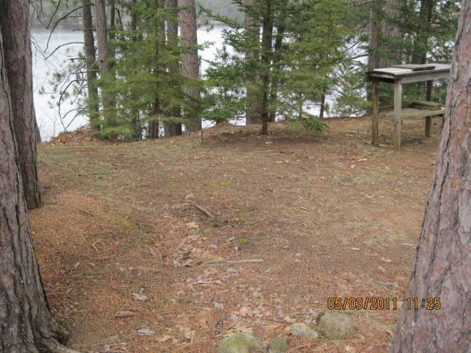
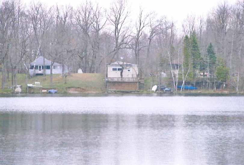
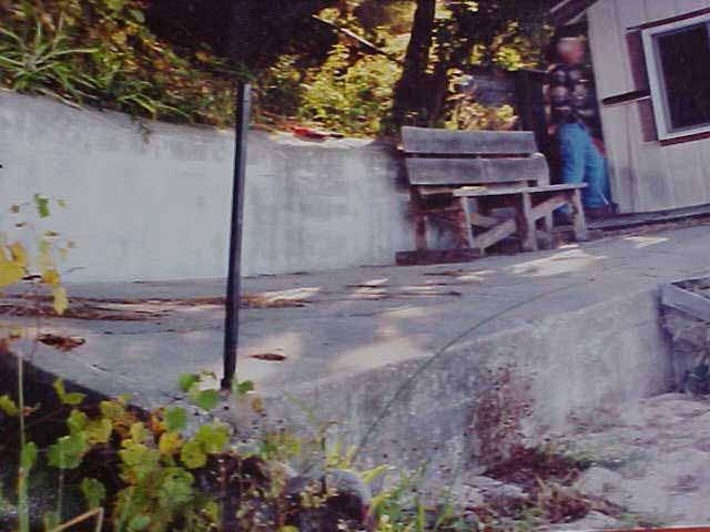
48 Before
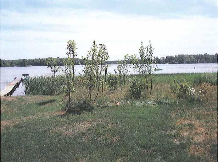

49 After
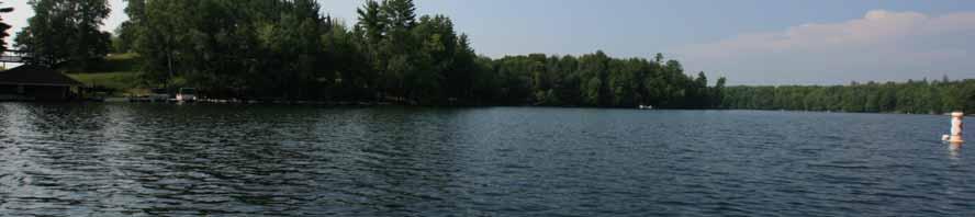
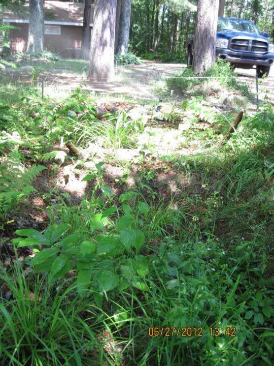
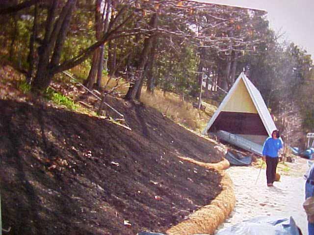
50 Real World Shoreland Mitigation Example 2 Not technically mitigation, the project was voluntary and cost shared. But this could be a mitigation option. Lower Post Lake in Langlade County A geotextile bag wall was used to stop erosion on the steep slope. Watering has taken place ever since installation in The pictures are from April 2010, April 2011, June The cabin was remodeled and remained a neutral brown color.
51 2010
52 2011
53 2012
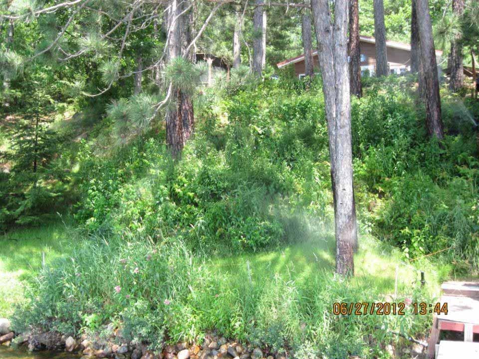
54 Real World Shoreland Mitigation Example 3 Step down/bi level rain garden installation at top of slope. Lower Post Lake in Langlade County Stormwater was washing from the cabin and driveway, creating a "gully". There is a watering system. All of the plantings on the site have compost soil mixed in to assist growing. The pictures are from May 2011 (before) and June 2012 (after).
55
56
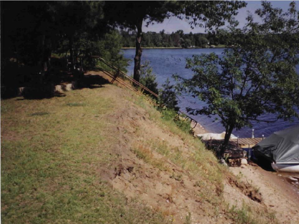
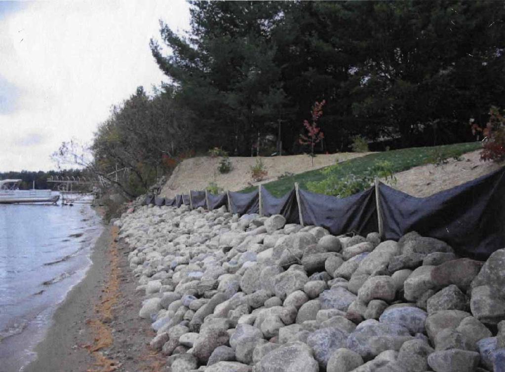
57 Real World Shoreland Mitigation Example 4 Mitigation required as part of home remodeling. Lake Dubay in Marathon County Overall goals: Stop erosion at the shoreline Home remodeling The pictures are from prior to work, 2004, and 2005.
58
59 2004
60 2004

61

62
63
64 Real World Shoreland Mitigation Example 5 Not technically mitigation, the project was voluntary. But this could be a mitigation option. Lower Post Lake in Langlade County Reduced access corridor. The pictures are from 2005 (before) and 2012 (after).
65 2005
66 2012
67 2012
68 Real World Shoreland Mitigation Example 6
69
70
71
72
73 Real World Shoreland Mitigation Example 7 Variance request granted. Waushara County Conditions: Remove old cottage near the OHWM Remove retaining wall near the OHWM Shoreland restoration

74
75
76
77
78 Summary Impacts from each shoreland property is often considered insignificant, but over time the sum of all riparian land uses and pollution sources is the main cause of today s water quality problems and lack of habitat. The rapid increase in riparian development has led to numerous negative shoreland impacts. Shoreland zoning is grounded in the long standing Public Trust Doctrine, and has the goal of limiting direct and cumulative impacts of shoreland development on water quality, habitat, and natural scenic beauty.
79 Summary Shoreland mitigation is enforceable actions designed to proportionally balance and offset the impacts of a permitted action on water quality, habitat, and natural scenic beauty. There are many different mitigation options. Counties can implement shoreland mitigation under one of several different approaches. Learn from the many existing examples of shoreland mitigation and more to come.
80 Comments, Questions?? Mike Wenholz DNR Shoreland Specialist
81
82
83 Why Care About Shoreland Zoning? Lake Quality & Economics: Is there a connection? More polluted lakes have less valuable property than do cleaner lakes. E.L. David, Water Resources Research, 1968 A study of over 1200 waterfront properties in Minnesota found when water clarity changed by 3 feet changes in property prices for these lakes are in the magnitude of tens of thousands to millions of dollars. Krysel et al, 2003
84 Higher Property Values = Human Amenities Diversity of Bugs, Fish, Wildlife Diversity & Variety of Habitat Water Quality NR 115 Shoreland Zoning Standards


85 Why were Shoreland Zoning Rules Revised?

86

87 Shoreland Zoning Counties going beyond 1968 law Counties recognized inadequacies Adopted higher standards New ideas 16 counties have impervious surface stnds 27 counties have shoreland mitigation Map by Wisconsin Lakes

88 Shoreland Zoning Changes What standards have stayed the same? Lot sizes Shoreland setbacks, including averaged setbacks Shoreland buffer sizes Standards for land disturbing activities Shoreland Wetland standards Structure exemptions

89 Shoreland Zoning Changes Shoreline Buffers More clarity and specification than previously First 35 feet, no vegetation removal except Access and viewing corridors Shoreline restoration activities & invasive species control Dead, dying or diseased when replaced with native vegetation Sound forestry practices on larger tracts of land Where mowing currently occurs counties may allow keep what you have Other types of removal allowed with a permit. Vegetation removed with a permit must be replaced.
90 Shoreland Zoning Changes Shoreline Buffers There has been general support for the value of buffer strips and the flexibility of their applications Current draft ordinance places greater emphasis on buffer strips in all areas of shoreland activity from agricultural practices to resorts and residential development Many farmers have voluntarily initiated effective conservation practices on their shoreland agricultural lands Many residential lot owners have already installed buffer areas of native vegetation and creative landscaping The challenge lies in making this the norm and not the exception
91 Shoreland Zoning Changes Impervious Surface Standards What is an impervious surface? An area that releases all or a majority of the precipitation that falls on it. Includes rooftops, sidewalks, driveways, parking lots, etc. What are the Water Quality Impacts of Impervious Surfaces? Erosion More pollutants entering the water Increased algae growth Fewer fish, insect, and other aquatic species
92 Shoreland Zoning Changes Impervious Surface Standards Impervious surfaces that existed prior to revision of the county shoreland zoning ordinance, may be: Maintained and repaired Replaced with a similar impervious surface within the existing building envelope Relocated or modified with a similar or different impervious surface if: No overall increase in % of impervious on the property Impervious surfaces meets the setbacks in NR 115.
93 Impervious Surface Example 15% of 20,000 sq. ft. lot 1500 sq. ft. house footprint 740 sq. ft. garage 660 sq. ft. driveway 100 sq. ft. sidewalk 3000 sq. ft. total
94 Less than 8% 8-12% Greater than 12% Increasing impervious surface in the watershed Decreasing number of fish & fish species Fish found in streams when impervious surface in the watershed was: Less than 8% 8-12% Greater than 12% Iowa darter Black crappie Channel catfish Yellow perch Rock bass Hornyhead chub Sand shiner Southern redbelly dace Golden shiner Northern pike Largemouth bass Bluntnose minnow Johnny darter Common shiner Golden shiner Northern pike Largemouth bass Bluntnose minnow Johnny darter Common shiner 2008 study of 164 WI lakes found the same trend Creek chub Fathead minnow Green sunfish White sucker Brook stickleback Creek chub Fathead minnow Green sunfish White sucker Brook stickleback Creek chub Fathead minnow Green sunfish White sucker Brook stickleback Wang et al. 2000
95 Shoreland Zoning Changes Nonconforming Principal Structures Nonconforming Structure = pre existing structure that does not meet current standards NR 115 now provides options other than a 50% increase in valuation (i.e. 50% Rule)
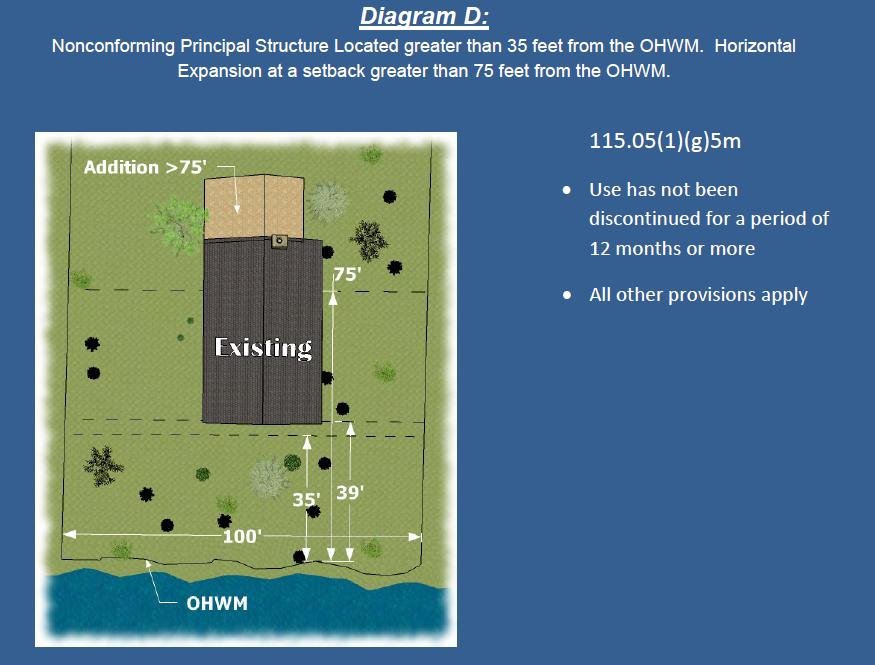
96 Shoreland Zoning Changes Nonconforming Principal Structures Maintenance unlimited within existing building envelope Expansion 0 35 feet from OHWM prohibited feet from OHWM vertical expansion only 75 feet + from OHWM vertical or horizontal Replacement/Relocation 0 35 feet from OHWM prohibited Only if no other compliant location available All other non conforming structures on lot removed
97


98 Shoreland Mitigation Options Vegetative Buffer
BIG ROCHE A CRI LAKE CHARACTERISTICS
 BIG ROCHE A CRI LAKE CHARACTERISTICS Lake Description Big Roche Cri Lake is located in north central Adams County and has a surface area of 205 acres, a shoreline length of 6.1 mile, a volume of 6,993
VILLAGE OF BELLAIRE WATER QUALITY ACTION PLAN
 VILLAGE OF BELLAIRE WATER QUALITY ACTION PLAN Elk-River-Chain-of-Lakes Gaps Analysis Project The Watershed Center Grand Traverse Bay Tip of the Mitt Watershed Council Michigan Department of Natural Resources
TORCH LAKE TOWNSHIP WATER QUALITY ACTION PLAN
 TORCH LAKE TOWNSHIP WATER QUALITY ACTION PLAN Elk-River-Chain-of-Lakes Gaps Analysis Project The Watershed Center Grand Traverse Bay Tip of the Mitt Watershed Council Michigan Department of Natural Resources
Staff Report. Application: A Application #: A Parcel number:
 Staff Report Application: 2016 20A Application #: 2016 20A Parcel number: 87-029-1110 Applicants: Bob and Carol Faye Muller on property described as: All that part of Government Lot 1, Section 29 Township
Section 1 Non-Conforming Structures and Uses Allowed to Continue. 12
 CHAPTER 3 NONCONFORMITIES Section 1 Non-Conforming Structures and Uses Allowed to Continue. 12 Section 2 Discontinuance 12 Section 3 Change of Use... 12 Section 4 Residential Alterations 12 Section 5 Restoration..
Maintaining Riparian Areas and Wetlands
 Maintaining Riparian Areas and Wetlands Riparian areas are the lands along the banks of our rivers, lakes, and tidal waters. Many riparian areas not only border surface waters, but they are often adjacent
Shoreland Development Density and Impervious Surfaces How do they affect water resources? How much is too much for our lakes and streams?
 Shoreland Development Density and Impervious Surfaces How do they affect water resources? How much is too much for our lakes and streams? Center for Land Use Education Introduction When a landowner develops
Cat Island Chain Restoration, Green Bay
 Cat Island Chain Restoration, Green Bay Victoria Harris, UW Sea Grant January 27, 2005 Southern Green Bay historically provided diverse coastal wetland habitats for fish and wildlife Expansive emergent
Red Rock Lake: A Path Forward
 University of Minnesota Morris Digital Well University of Minnesota Morris Digital Well Center for Small Towns 6-2016 Red Rock Lake: A Path Forward Colette Millard Student - University of Minnesota, Morris
dpd Seattle Permits CAM Environmentally Critical Areas: Wetlands and Fish & Wildlife Habitat Conservation Areas
 dpd Department of Planning and Seattle Permits CAM Client Assistance Memo 326 part of a multi-departmental City of Seattle series on getting a permit Environmentally Critical Areas: Wetlands and Fish &
LAKE BELLAIRE SHORELINE SURVEY SUMMARY REPORT
 1 LAKE BELLAIRE SHORELINE SURVEY SUMMARY REPORT Three Lakes Association PO Box 689 Bellaire, MI 49615 by William Bohannon, Braden Ackerman, Wilhelmina Witt and TLA Volunteers August 30, 2008 3 Developed
FieldDoc.org User Guide For 2017 NFWF Chesapeake Bay Stewardship Fund Applicants. Background 2. Step 1: Register for a FieldDoc account 3
 FieldDoc.org User Guide For 2017 NFWF Chesapeake Bay Stewardship Fund Applicants Table of Contents (click to go to page) Background 2 Step 1: Register for a FieldDoc account 3 Step 2: Create the Project
Portage County Lake Planning Process
 Portage County Lake Planning Process Lake Leaders Kemp Field Station September 2010 Jen McNelly and Nancy Turyk Center for Watershed Science and Education UW-Stevens Point Types of Planning Emotional Crisis
Agricultural/Rural Riparian Buffer Analysis
 Agricultural/Rural Riparian Buffer Analysis December 2014 Executive Summary The Agricultural/Rural Riparian Buffer Analysis was developed from a 2014 analysis of current requirements for the riparian areas
STREAM AND BUFFER AREA PROTECTION/RESTORATION
 STREAM AND BUFFER AREA PROTECTION/RESTORATION AMENDMENT OPTIONS TO STRENGTHEN POLICY IN HEADWATERS AREAS DRAFT SUBSEQUENT TO THE JANUARY 25, 2007 MEETING OF THE PLANNING COMMISSION ENVIRONMENT COMMITTEE
Chapter 3 Dispersion BMPs
 Chapter 3 Dispersion BMPs 3.1 BMP L611 Concentrated Flow Dispersion 3.1.1 Purpose and Definition Dispersion of concentrated flows from driveways or other pavement through a vegetated pervious area attenuates
STREAM RESTORATION PURPOSE, PRACTICE, AND METHODS. By Marcus Rubenstein, CPESC
 STREAM RESTORATION PURPOSE, PRACTICE, AND METHODS By Marcus Rubenstein, CPESC WHAT IS STREAM RESTORATION? The return of a stream s lost natural functions, usually resulting from watershed alterations,
Green Real Estate. NSCC - RES 130 Online. Module 3 Sustainable Sites & Water Cate O dahl, Instructor. Learning Objectives
 Green Real Estate NSCC - RES 130 Online Module 3 Sustainable Sites & Water Cate O dahl, Instructor Sustainable Sites & Water Conservation Learning Objectives Relationship of the Building to Water Issues
Nutrient Management in. A presentation to the West Metro Water Alliance
 Nutrient Management in Developing and Agricultural Areas A presentation to the West Metro Water Alliance Chris Meehan, P.E. May 25, 2011 Agenda Physical Improvements Planning Improvements How to get it
Oswego Lake: Beneath the Surface. an investigation into your lake s health
 Oswego Lake: Beneath the Surface an investigation into your lake s health LAKE SIZE... 83 acres WATERSHED SIZE... 71,660 acres MAX DEPTH... 36 feet INLETS... Flow from Lake Tippecanoe Oswego Lake OUTLETS...
Portage Lake Hubbard County
 Prepared in cooperation with the Minnesota Department of Natural Resources Minnesota Lake ID: 9- Area: acres Watershed Area: 6,7 acres Ecoregion: Northern Lakes and Forests (NLF) Portage Lake Hubbard County
(For individual lake and stream classifications in Cook County, refer to Appendix II)
") Article 7 Sec. 7.01 Shoreland Management Regulations Policy The uncontrolled use of shorelands of Cook County, Minnesota affects the public health, safety and general welfare not only by contributing to
Article 7 Sec. 7.01 Shoreland Management Regulations Policy The uncontrolled use of shorelands of Cook County, Minnesota affects the public health, safety and general welfare not only by contributing to
Municipal Stormwater Management Planning
 Municipal Stormwater Management Planning Christopher C. Obropta, Ph.D., P.E. Water Resources Extension Specialist with Rutgers Cooperative Extension Assistant Professor with Department of Environmental
You re the Solution to Water Pollution!
 You re the Solution to Water Pollution! Storm Drains Did you know that stormdrains deliver surface water run-off directly to the nearest pond or creek, and eventually to the Bay? Major Pollutants: Soil
Polluted Runoff and Land Conservation: What s the Connection?
 Polluted Runoff and Land Conservation: What s the Connection? Caroly Shumway, Ph.D. Executive Director, Merrimack River Watershed Council In partnership with NMCOG Overview Purpose Of This Talk Is To Convey
MURPHY DRAIN CATCHMENT
 The RVCA produces individual reports for 16 catchments in the Lower Rideau subwatershed. Using data collected and analysed by the RVCA through its watershed monitoring and land cover classification programs,
Riparian Buffer Requirements. Department of Environmental Protection Bureau of Watershed Management
 102.14 - Riparian Buffer Requirements Department of Environmental Protection Bureau of Watershed Management 102.2 Scope and Purpose BMPs to protect, maintain, and restore water quality and existing designated
Linking Land Use to Water Quality
 Title Slide Title Slide Linking Land Use to Water Quality NEMO Intro/Credit Slide This educational slide show has been created by the NEMO Project at the University of Connecticut Cooperative Extension
POLICY FOR NATURAL RESOURCE MANAGEMENT AREAS
 POLICY FOR NATURAL RESOURCE MANAGEMENT AREAS I. POLICY STATEMENT Auburn University's (the University's) "Policy for Natural Resource Management Areas" implements the Campus Master Plan Land Use Element
C O M P R E H E N S I V E P R O T E C T I O N & R E S T O R AT I O N P L A N. f or th e
 C O M P R E H E N S I V E P R O T E C T I O N & R E S T O R AT I O N P L A N f or th e R O S S B A R NE T T R E SERV O I R WATERS HED, MI S S I S S I P P I E X E C U T I V E S U M M A R Y O C T O B E R
Arlington s New Stormwater Management Ordinance. Informational Meeting May 28, 2014
 Arlington s New Stormwater Management Ordinance Informational Meeting May 28, 2014 Outline Overview Plan submission and review P2 plan/implementation Construction inspection SWMF construction Landscape
Wisconsin Wastewater Operators Association. Protecting Our Water Resources: The Future Bill Hafs - NEW Water 10/2014
 Wisconsin Wastewater Operators Association Protecting Our Water Resources: The Future Bill Hafs - NEW Water 10/2014 The Fox River Contributes 1/3 of All Nutrients to Lake Michigan APRIL 15, 2011 Photo
15A NCAC 07H.0209 COASTAL SHORELINES (a) Description. The Coastal Shorelines category includes estuarine shorelines and public trust shorelines.
 Description. The Coastal Shorelines category includes estuarine shorelines and public trust shorelines.") 15A NCAC 07H.0209 COASTAL SHORELINES (a) Description. The Coastal Shorelines category includes estuarine shorelines and public trust shorelines. Estuarine shorelines AEC are those non-ocean shorelines
15A NCAC 07H.0209 COASTAL SHORELINES (a) Description. The Coastal Shorelines category includes estuarine shorelines and public trust shorelines. Estuarine shorelines AEC are those non-ocean shorelines
CHAPTER 6 ADDITIONAL STANDARDS APPLYING TO SHORELAND AREAS AND PUBLIC WATERS
 CHAPTER 6 ADDITIONAL STANDARDS APPLYING TO SHORELAND AREAS AND PUBLIC WATERS Section 1 Intent. 49 Section 2 Floodplain Requirements 49 Section 3 Water-Oriented Accessory Structures 50 Section 4 Stairways,
City of Salem Stormwater Utility Answers to Frequently Asked Questions
 Answers to Frequently Asked Questions Questions about Urban Stormwater Runoff... 3 1. What is urban stormwater runoff?...3 2. What is impervious surface?...3 3. Why is there a concern about stormwater
This assessment examines
 Managing to Protect Water Quality This assessment examines the special role shoreline property owners have in preventing contamination of their lake or stream. Use this publication as a supplement to the
Chapter 10 Natural Environment
 Chapter 10 Natural Environment Existing Conditions The Natural Environment Element addresses the protection, conservation, preservation, and restoration of the natural resources the Bayview Ridge Subarea,
Recent Developments in Water Withdrawal Management
 Recent Developments in Water Withdrawal Management Frank Ruswick David A. Hamilton Michigan Department of Environmental Quality Overview What Water Withdrawals are regulated? Water Withdrawal Assessment
Chapter 516 Shoreland Districts
 Chapter 516 Shoreland Districts 516.01 Statutory Authorization The State of Minnesota in Minnesota Statutes, Chapter 103F, has defined shoreland areas and described limitations on uses and locations of
D Olive Watershed. Path Toward Restoration
 D Olive Watershed Path Toward Restoration Water is the most critical resource issues of our lifetime and our children s lifetime. The health of our waters is the principal measure of how we live on the
SECTION 3 NATURAL RESOURCES
 SECTION 3 NATURAL RESOURCES The natural environment plays a large role in planning for future development. Environmental conditions, such as topography, wetlands, floodplains, and water bodies, can often
Sustainable Natural Environment Fish Habitat
 Town of Huntsville Official Plan Review - POLICY BACKGROUND PAPER Sustainable Natural Environment Fish Habitat BACKGROUND: Lakes, rivers, streams, ponds and many wetlands provide fish habitat. Intermittent
Why we re against the SHELLEY S FIELDS development plan
 Why we re against the SHELLEY S FIELDS development plan BACKGROUND In late 2004, developer Randy Shelley and a representative of the Hereford Zone Recreation Council unveiled a development plan known as
Welcome. Thank you for joining us! Lower Mississippi River Watershed Management Organization
 Welcome. Thank you for joining us! Lower Mississippi River Watershed Management Organization Lower Mississippi River Watershed Management Organization Watershed Restoration and Protection (WRAP) Study
Pennsylvania Stormwater Best Management Practices Manual. Chapter 3. Stormwater Management Principles and Recommended Control Guidelines
 Pennsylvania Stormwater Best Management Practices Manual Chapter 3 Stormwater Management Principles and Recommended Control Guidelines 363-0300-002 / December 30, 2006 Chapter 3 Stormwater Management Principles
WATERSHED. Maitland Valley. Report Card 201
 Maitland Valley WATERSHED Report Card 201 The Maitland Valley Conservation Authority has prepared this report card as a summary on the state of our forests, wetlands, surface water, and ground water resources.
Regional Watershed Planning. Calumet Summit 2010: A Call to Connect Calumet Conference Center April 27, 2010
 Regional Watershed Planning Calumet Summit 2010: A Call to Connect Calumet Conference Center April 27, 2010 Basins The Calumet Region Watershed Communities Land Cover- 2006 Impervious Cover 303d Listed
What Does It All Mean? CWA? Sara Esposito, P.E. DNREC Division of Watershed Stewardship
 What Does It All Mean? CWA? Sara Esposito, P.E. DNREC Division of Watershed Stewardship sara.esposito@state.de.us Why are we here? Just like pavement has helped move cars faster; it has also helped water
Healthy lakes add value to our communities. They provide a place to relax and recreate,
 Pike Lake Eastern Marathon County Lake Study Final Study Results 2013 University of Wisconsin-Stevens Point and Marathon County Staff and Citizens Healthy lakes add value to our communities. They provide
2016 Adams County LWCD Plan of Operations
 2016 Adams County LWCD Plan of Operations I. County Owned Dams a. Goal: Inspect, Operate and Maintain dams as specified in the I.O.M. Plan to meet State laws/standards. Action: Update I.O.M. Plan and Emergency
Environment & Conservation Introduction
 Environment & Conservation Introduction Anacortes is blessed with an abundance of natural beauty. Residents identify marine shorelines, streams, lakes, forested areas, and other natural features as defining
Chapter 4 Watershed Goals and Objectives
 Chapter 4 Watershed Goals and Objectives Eight (8) long-term watershed goals have been developed by the NEW Watershed Advisory Group (WAG) after consideration of discussions held during monthly watershed
Glamor Lake Shoreline Assessment Summary Report
 R Glamor Lake Shoreline Assessment Summary Report Submitted by Watersheds Canada and the Canadian Wildlife Federation. Love Your Lake is a program of Watersheds Canada and the Canadian Wildlife Federation.
Clam Lakes (Lower & Upper), Burnett County Four-Phased Lake Management Planning Project Description
, Burnett County Four-Phased Lake Management Planning Project Description") 1 Clam Lakes (Lower & Upper), Burnett County Four-Phased Lake Management Planning Project Description Lake and Watershed Characteristics The Clam Lakes are a combined 1544 acres with Upper Clam Lake essentially
1 Clam Lakes (Lower & Upper), Burnett County Four-Phased Lake Management Planning Project Description Lake and Watershed Characteristics The Clam Lakes are a combined 1544 acres with Upper Clam Lake essentially
Hydrology 101. Impacts of the Urban Environment. Nokomis Knolls Pond Summer June 2008
 Hydrology 101 Nokomis Knolls Pond Summer 2002 Impacts of the Urban Environment Hydrologic Cycle; What is it? Geography, Topography, Geology, Land Cover and Climate determine the Amount and Behavior of
Hickory Creek 319 grant project City of Denton
 Hickory Creek 319 grant project City of Denton Kenneth Banks, Division of Environmental Quality, City of Denton PREPARED IN COOPERATION WITH THE TEXAS COMMISSION ON ENVIRONMENTAL QUALITY AND U.S. ENVIRONMENTAL
The effects of pollution. What is stormwater runoff? Why is stormwater runoff a problem?
 What is stormwater runoff? Stormwater runoff occurs when precipitation from rain or snowmelt flows over the ground. Impervious surfaces like driveways, sidewalks, and streets prevent stormwater from naturally
Implementation of Priority CRP Conservation Practices and Estimated Nutrient Load Reductions
 1 Minnesota Nutrient Reduction Strategy Agricultural Sector/FSA CRP Program Measures Implementation of Priority CRP Conservation Practices and Estimated Nutrient Load Reductions Measure Background Visual
Maitland Valley WATERSHED
 Maitland Valley WATERSHED Report Card 2018 Maitland Conservation has prepared this report card as a summary of the state of your forests, wetlands, and water resources. WHERE ARE WE? We are one of 36 Conservation
SHORELINE & STREAMBANK EROSION CONTROL. Wendy Henniges DNR Water Management Specialist
 SHORELINE & STREAMBANK EROSION CONTROL Wendy Henniges DNR Water Management Specialist Lakeshore vs. Streambank Different Standards & Eligibility Criteria - NR 328 Subch. I Inland Lakes & Impoundments -
PROTECTING OUR WATERWAYS: STORMWATER POLLUTION REDUCTION EFFORTS
 PROTECTING OUR WATERWAYS: STORMWATER POLLUTION REDUCTION EFFORTS Public Information Meeting ~ May 2, 2018 Public Works Stormwater Management Division OVERVIEW Surface Water Quality Protection Municipal
Paraprofessional Training Session 1
 Paraprofessional Training Session 1 Part 2: Stormwater Basics November 26, 2012 Rutgers University, Cook Campus Christopher C. Obropta, Ph.D., P.E. Extension Specialist in Water Resources Associate Professor
Bee Meadow Pond Shoreline Restoration Project
 Bee Meadow Pond Shoreline Restoration Project Executive Summary Bee Meadow Pond is one of three ponds located in Bee Meadow Park. The ponds are stocked for fishing, but boating and swimming are not allowed.
A Summary Guide to the. Rifle River WATERSHED MANAGEMENT PLAN. Know Your Watershed Protect Its Resources
 A Summary Guide to the Rifle River WATERSHED MANAGEMENT PLAN Know Your Watershed Protect Its Resources Table of Contents The Watershed... 3 The Management Plan... 4 Designated and Desired Uses... 5 Sources
Zoning Ordinance Chapter 7
 CHAPTER 7 - HILLSIDE SECTION 7.0 GENERAL A. Purpose: To allow for the reasonable use and development of hillside areas while promoting the public health, safety, and general welfare of the citizens of
Carter Lake Restoration Project
 Carter Lake Restoration Project Location in Iowa EPA 303d Impaired Waters list for; phosphorus, nitrogen, algae, toxic algae, chlorophyll, PCBs, ph, ammonia, and low dissolved oxygen. High concentrations
A Lake Classification and Conservation Portfolio for Wisconsin
 A Lake Classification and Conservation Portfolio for Wisconsin Kristen Blann Freshwater ecologist The Nature Conservancy Based on development of the lake classification and conservation portfolio for MN,
MODEL LAND USE REGULATIONS
 A REVIEW OF " MODEL LAND USE REGULATIONS prepared for ~ississippi HeadwaterS Board prepared by National Park Service Midwest Region Rivers and Trails Conservation Assistance Program !,- A REVIEW OF MODEL
Community Benefits of Land Restoration
 Community Benefits of Land Restoration Introducing Green Infrastructure for Coastal Resilience Matt Fulda, Acting Director Monroe May 23 rd, 2017 Avery Point Campus, University of Connecticut Easton Trumbull
Goose Lake: Beneath the Surface. an investigation into your lake s health
 Goose Lake: Beneath the Surface an investigation into your lake s health LAKE SIZE... 72 acres WATERSHED SIZE... 921 acres MAX DEPTH... 53 feet Goose Lake AVG DEPTH... 25 feet INLETS... Spring-fed OUTLETS...
RIPARIAN PROTECTION Questions & Answers
 RIPARIAN PROTECTION Questions & Answers 1. What is a riparian corridor and why is it important? Answer: A riparian corridor is a space on both sides of a stream or around a lake or wetland. The corridor
The Colley Bay Story: Successful Implementation of a Living Shoreline
 The Colley Bay Story: Successful Implementation of a Living Shoreline Definition Living Shoreline Treatments address erosion in lower energy situations by providing long-term protection, restoration or
Streamlines V2, n2 (May 1997) A Newsletter for North Carolina Water Supply Watershed Administrators
 A Newsletter for North Carolina Water Supply Watershed Administrators") Page 1 of 5 STREAMLINES A Newsletter for North Carolina Water Supply Watershed Administrators Volume 2, Number 2 May 1997 Non-Point Source (NPS) Pollution This issue of Streamlines provides basic information
Page 1 of 5 STREAMLINES A Newsletter for North Carolina Water Supply Watershed Administrators Volume 2, Number 2 May 1997 Non-Point Source (NPS) Pollution This issue of Streamlines provides basic information
Habitat Grant Projects Clinton River Watershed
 Habitat Grant Projects Clinton River Watershed L Y N N E S E Y M O U R E N V I R O N M E N T A L E N G I N E E R O F F I C E O F T H E M A C O M B C O U N T Y P U B L I C W O R K S C O M M I S S I O N
EFFECT OF UPSTREAM DEVELOPMENT ON THE CLEAR CREEK AREA
 EFFECT OF UPSTREAM DEVELOPMENT ON THE CLEAR CREEK AREA Technical Memorandum Farming in the Floodplain Project Prepared for May 2017 PCC Farmland Trust Photo credit: Google Earth TABLE OF CONTENTS Page
Shoreland Rules Revision Project Using GIS in North-Central Minnesota
 Shoreland Rules Revision Project Using GIS in North-Central Minnesota Andrew J. Williquett Department of Resource Analysis, Saint Mary s University of Minnesota, Minneapolis, MN 55404 Keywords: GIS, docks,
ENVIRONMENTAL RESOURCE PERMIT APPLICATION
 ENVIRONMENTAL RESOURCE PERMIT APPLICATION SOUTHWEST FLORIDA WATER MANAGEMENT DISTRICT 2379 BROAD STREET, BROOKSVILLE, FL 34604-6899 (352) 796-7211 OR FLORIDA WATS 1 (800) 423-1476 SECTION E INFORMATION
RIPARIAN CORRIDOR STUDY FINAL PARLEYS CREEK MANAGEMENT PLAN TABLE OF CONTENTS
 TABLE OF CONTENTS 1.0 INTRODUCTION... 1-1 Riparian Corridor Study and Management Plan Goals... 1-1 Study Area... 1-2 Importance and Functions of Riparian Corridors... 1-2 Habitat for Mammals, Birds, and
CITY OF SPRING HILL Water Quality Buffer Zone Policy (Adopted April 22, 2008)
") Section I - Description CITY OF SPRING HILL Water Quality Buffer Zone Policy (Adopted April 22, 2008) A water quality buffer zone (a.k.a. a riparian zone) is a strip of undisturbed native (indigenous)
Section I - Description CITY OF SPRING HILL Water Quality Buffer Zone Policy (Adopted April 22, 2008) A water quality buffer zone (a.k.a. a riparian zone) is a strip of undisturbed native (indigenous)
Pollution Reduction Plan For Municipal Separate Storm Sewer System
 Pollution Reduction Plan For Municipal Separate Storm Sewer System West Chester University of Pennsylvania September 2017 Table of Contents Purpose and Scope Permit Requirements Pollution Reduction Conclusion
Natural and Engineered Wetlands for Stormwater Management
 Natural and Engineered Wetlands for Stormwater Management Dan Hitchcock, Ph.D., P. E. Baruch Institute of Coastal Ecology and Forest Science Clemson University Georgetown, SC Prominence and Diversity of
CITY OF ASTORIA PUBLIC WORKS ENGINEERING DIVISION ENGINEERING DESIGN STANDARDS FOR IN-FILL DEVELOPMENT
 CITY OF ASTORIA PUBLIC WORKS ENGINEERING DIVISION ENGINEERING DESIGN STANDARDS FOR IN-FILL DEVELOPMENT Adopted by City Council: May 21, 2007 X:\General Eng\DESIGN STANDARDS\Engineering Design Standards
Riparian Buffers and Stream Restoration
 Riparian Buffers and Stream Restoration Why focus on riparian areas? Link land and water on any given site and link landscapes together in a watershed Riparian corridors protect the circulatory system
Monitoring Project. Status of the UNRBA Monitoring and Credits Projects 3/28/2016. WRRI Annual Conference March 17 & 18, 2016
 Status of the UNRBA Monitoring and Credits Projects WRRI Annual Conference March 17 & 18, 2016 Alix Matos, PE alix.matos@cardno.com Monitoring Project 1 Objectives of the UNRBA Monitoring Program Revise
State of Florida Department of Community Affairs Areas of Critical State Concern Implementation Status Report Apalachicola Bay Area
 State of Florida Department of Community Affairs Areas of Critical State Concern Implementation Status Report Apalachicola Bay Area Thaddeus L. Cohen, AIA Secretary November 2006 CONTENTS Part 1 - Summary
DAKOTA COUNTY SOIL AND WATER CONSERVATION DISTRICT COMPREHENSIVE PLAN
 DAKOTA COUNTY SOIL AND WATER CONSERVATION DISTRICT COMPREHENSIVE PLAN 2011-2015 4100 220 th Street West, Suite 102 Farmington, MN 55024 651-480-7777 www.dakotacountyswcd.org I. INTRODUCTION A. Purpose
Understanding Stormwater Pollution Prevention Plans (SWPPPs) (SWPPPS)
 (SWPPPS)") Understanding Stormwater Pollution Prevention Plans (SWPPPs) (SWPPPS) Definitions SWPPP: Storm Water Pollution Prevention Plan BMP: Best Management Practice(s) to control pollution IDNR: Iowa Department
Understanding Stormwater Pollution Prevention Plans (SWPPPs) (SWPPPS) Definitions SWPPP: Storm Water Pollution Prevention Plan BMP: Best Management Practice(s) to control pollution IDNR: Iowa Department
Dakota County Soil and Water Conservation District. Strategic Plan
 Dakota County Soil and Water Conservation District Strategic Plan Adopted September 6, 2012 Goals and Objectives In March of 2012 the Dakota County Soil and Water Conservation District (District) Board
Permit Requirements for Landslide-Prone Areas in the City of Seattle. Slope Stability and Vegetative Soil Stabilization in the Puget Sound Region
 Permit Requirements for Landslide-Prone Areas in the City of Seattle AGENDA Landslide-Prone Areas Rob McIntosh, P.E., Senior Geotechnical Engineer Department of Planning and Development (DPD) Trees and
Erosion Control for Home Builders
 Erosion Control for Home Builders By controlling erosion, home builders help keep our lakes and streams clean. Eroding construction sites are a leading cause of water quality problems in Wisconsin. For
Standard Erosion Control Plan
 Standard Erosion Control Plan for - & 2-Family Dwelling Construction Sites According to Chapters Comm 20 & 2 of the Wisconsin Uniform Dwelling Code, soil erosion control information needs to be included
L-THIA Online and LID in a watershed investigation
 L-THIA Online and LID in a watershed investigation Larry Theller Agricultural and Biological Engineering, Purdue University Great Lakes Sedimentation Workshop Ann Arbor Mi. L-THIA On-line watershed delineation
Best Management Practice Fact Sheet 14: Wet Ponds
 Publication 426-133 Best Management Practice Fact Sheet 14: Wet Ponds David J. Sample, Assistant Professor and Extension Specialist, Biological Systems Engineering, Virginia Tech Stefani Barlow, Undergraduate
Non-point source pollution now accounts for over 75% of Pennsylvania s total water pollution
 2. Non-point Source Pollution Living on the Landscape and How We Affect Our Shared Water Resources by John Jose, Watershed Specialist, Pike County Conservation District Water is the most critical resource
Municipal Separate Storm Sewer Systems (MS4) Implementation. Craig Carson Montgomery County Department of Environmental Protection
 Implementation. Craig Carson Montgomery County Department of Environmental Protection") Montgomery County Maryland Municipal Separate Storm Sewer Systems (MS4) Implementation Craig Carson Montgomery County Department of Environmental Protection Montgomery County, Maryland 500 sq. miles 970,000
Montgomery County Maryland Municipal Separate Storm Sewer Systems (MS4) Implementation Craig Carson Montgomery County Department of Environmental Protection Montgomery County, Maryland 500 sq. miles 970,000
Cedar Lake Aquatic Ecosystem Restoration Feasibility Study, Cedar Lake, Indiana. Frequently Asked Questions November 2016
 Cedar Lake Aquatic Ecosystem Restoration Feasibility Study, Cedar Lake, Indiana Frequently Asked Questions 1. Why is dredging only occurring in specific locations? The locations and the quantity of material
RIPARIAN CORRIDOR STUDY FINAL CITY CREEK MANAGEMENT PLAN TABLE OF CONTENTS
 TABLE OF CONTENTS 1.0 INTRODUCTION... 1-1 Riparian Corridor Study and Management Plan Goals... 1-1 Study Area... 1-2 Importance and Functions of Riparian Corridors... 1-2 Habitat for Mammals, Birds, and