Carter Lake Restoration Project
|
|
|
- Rosaline James
- 6 years ago
- Views:
Transcription

1 Carter Lake Restoration Project

2 Location in Iowa


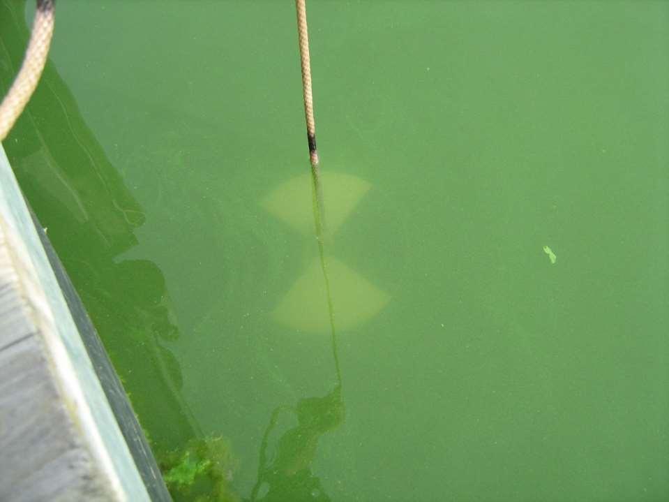
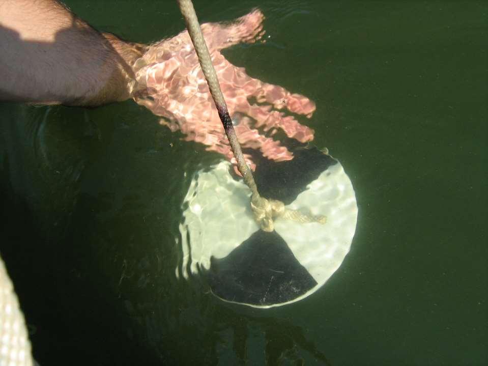
3 EPA 303d Impaired Waters list for; phosphorus, nitrogen, algae, toxic algae, chlorophyll, PCBs, ph, ammonia, and low dissolved oxygen.

4 High concentrations of toxins released by blue green algae resulted in beach postings for 18 weeks through the recreation season. In 2007, there were beach postings for 6 weeks through the recreation season.
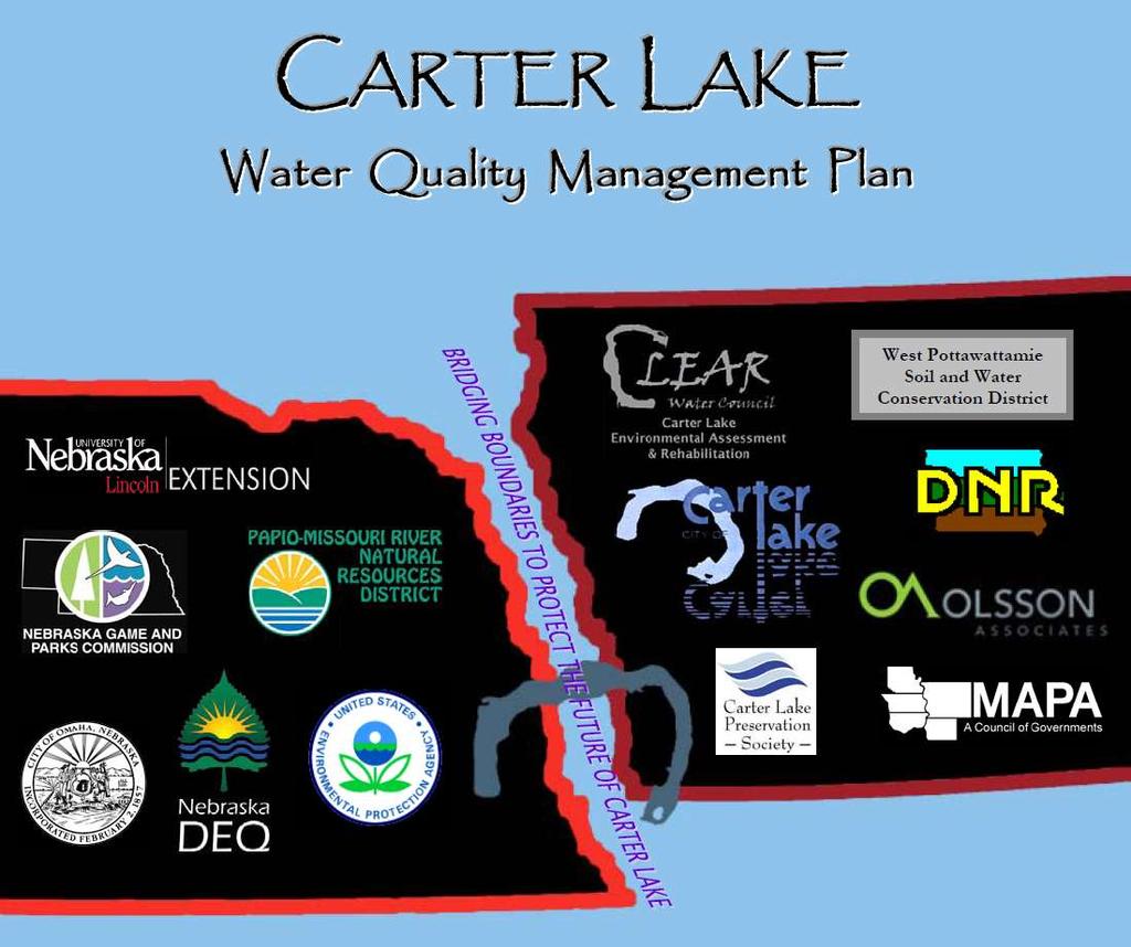
5 THE LAKE IS SICK Diagnosis: Runoff pollution from homes, yards, businesses, streets, sidewalks, parking lots and driveways is making Carter Lake sick. Remedy: Develop a watershed management plan to prevent runoff pollution and improve the water quality in Carter Lake. Prescription: Watershed residents, business owners, lake users, interested citizens are invited to attend Community Based Watershed Management Planning Public Meetings to develop a Carter Lake Watershed Management Plan: Thursday, October 5, p.m. 9 p.m. Tuesday, October 24, p.m. 9 p.m. Carter Lake Elementary School 1105 Redick Blvd, Carter Lake Doors open at 6 p.m. ; Meeting starts at 7 p.m. Sponsored by City of Carter Lake and City of Omaha Cooperating Agencies- Iowa Natural Resources Conservation Service, Iowa Dept. of Natural Resources, Papio-Missouri River Natural Resources District, West Pottawattamie County Iowa Extension, University of Nebraska Lincoln Extension in Douglas/Sarpy Counties, Nebraska Dept. of Environmental Quality, Nebraska Game and Parks Commission, Nebraska Dept. of Natural Resources, MAPA, West Pottawattamie County Soil and Water Conservation District, Omaha Public Works Dept., Omaha Parks, Recreation and Public Property Dept., and Carter Lake Preservation Society.


6 Community Based Watershed Planning (CBP) is a voluntary, locally led planning process that involves social, economic, and environmental concerns over a defined geographic area (such as a watershed).

7 CBP Forms partnerships between stakeholder groups and technical resource specialists. Minimizes conflict! Emphasizes desired future conditions. Improves natural resource Management.


8 CMP The desired outcome is a Comprehensive Watershed Management Plan that is Fully Implemented

9 CBP Key Components 1. A Common Vision of Desired Conditions 2. Identification and Prioritization of Concerns 3. Development and Implementation of Appropriate Steps to Adequately Address Concerns

10 CBP 3 KEY BENEFITS: Community and stakeholders are much more informed about what is happening! Stakeholders are actively involved in the decisions made and implementation of the plan will happen at a much higher rate! Projects completed are more successful!
11 A Community-Based Water Quality Management Plan for Carter Lake Watershed Project Sponsors: City of Carter Lake, Iowa City of Omaha Parks, Recreation & Public Property Technical Advisory Team: City of Carter Lake, Iowa City of Omaha Parks, Recreation & Public Property Department Nebraska Department of Natural Resources University of Nebraska-Lincoln Extension in Douglas/Sarpy Counties Iowa State University in West Pottawattamie County Iowa Department of Natural Resources USDA Natural Resources Conservation Service Nebraska Department of Environmental Quality Carter Lake Preservation Society Nebraska Game and Parks Commission West Pottawattamie County Soil & Water Conservation District Metropolitan Area Planning Agency Iowa Division of Soil Conservation Papio-Missouri River Natural Resources District City of Omaha Public Works Department CLEAR Water Council: Peter Parkert Doug Wallingford Julie McKillip Pam Christiansen Pam Parkert Stephanie Kelley Merl Harder Mike Dailey Les Lundberg Bill Van Trump Doug Dodson Bob Hegwood Steve Wilbur Hani Haider Wayne Houston Project Consultant: Olsson Associates Tetra Tech

12 Carter Lake will be the crown jewel of the metropolitan area by being a stable, healthy ecosystem that provides for multi use recreational activities and economic opportunities.

 4.")
13 Goals 1. Achieve a full support status for the aquatic life uses 2. Reduce Contamination levels in fish to safe levels 3. Achieve and maintain a full support status for the recreation use (to achieve this goal, several growing season nutrient concentration and water quality parameters reductions were set, which included a more aggressive phosphorus concentration reduction to 75 mg/l than the goal set in the TMDL of 96 mg/l) 4. Maintain a full support status for the aesthetic use
14
15 Please attend a Public Meeting to learn about and comment on the proposed Water Quality Management Plan Learn about the plan to HEAL THE LAKE! March 11, :00 p.m. 8:30 p.m. Shoreline Golf Course Clubhouse 210 East Locust Street in Carter Lake, Iowa Doors open at 6:30 p.m. Meeting will begin at 7 p.m.
16 Implementation Funding Iowa DNR Lake Restoration Program Iowa DNR Watershed Improvement section 319 Iowa DNR Fisheries Bureau Iowa Dept. of Ag & Land Stewardship Nebraska Game & Parks Commission Nebraska Aquatic Habitat Fund Nebraska Dept. of Environmental Quality section 319 Nebraska Environmental Trust Cities of Carter Lake and Omaha ~ $6.0 million

17 Water Quality Improvement Plan lawn care, rain gardens/barrels, pet waste, pervious surfaces, stormwater inlet stenciling & veg. management


18 Alum Fish Renovation Rain gardens 2011 MO River Flood Stormwater detention basins

")


19 Targeted dredging (88k cu yrds) Other BMPs Shoreline armoring Wetland enhancement
20 Before renovation
21 After renovation
22 Total P (ppb) Reduce growing season in-lake total phosphorus from 153 ug/l to 75 ug/l. 300 Phosphorus Alum treatment & Fish renovation
23 μg/l Decrease growing season median chlorophyll a concentrations from 59 μ/l to 21 μ/l. 350 Chlorophyll a Alum treatment & Fish renovation
 15 10 5")
24 Microcystin Toxin (ppb) Microcystin (blue-green algae) Toxin Levels in Carter Lake Pre-Implementation Post-Implementation Beach Posting Criterion (20ppb)
25 Clarity in feet Increase growing season median water clarity from 16 inches to 54 inches to meet the Iowa Lake Restoration Program Goal but not to fall below 30 inches to meet the TMDL Goal. Water clarity Project goal = Alum treatment & Fish renovation
26 4 years of good water quality!

27 Clear water grows rooted aquatic plants!

28

29 All in all a very successful project Community Based Planning played a vital role!

30 Chris Larson Iowa DNR (712)
Lake restoration can be a dirty job.
 What Works Carter Lake: Restoring the Crown Jewel John Holz, Ph.D.; Sara Mechtenberg, PE; Mark Porath; and Chris Larson Introduction Lake restoration can be a dirty job. The restoration of Carter Lake
Factsheet: Town of Deep River Water Quality and Stormwater Summary
 79 Elm Street Hartford, CT 06106-5127 www.ct.gov/deep Affirmative Action/Equal Opportunity Employer Factsheet: Town of Deep River Water Quality and Stormwater Summary This document was created for each
Portage County Lake Planning Process
 Portage County Lake Planning Process Lake Leaders Kemp Field Station September 2010 Jen McNelly and Nancy Turyk Center for Watershed Science and Education UW-Stevens Point Types of Planning Emotional Crisis
Contents. PUBLIC REVIEW DRAFT June 28, 2016
 Contents CHAPTER 1 - Introduction/Background... 1 1.1. Location... 1 1.2. Plan Purpose... 3 1.2.1. History and Function of NRDs... 4 1.3. Planning Process Summary... 5 1.3.1. Nebraska Nonpoint Source Management
BIG ROCHE A CRI LAKE CHARACTERISTICS
 BIG ROCHE A CRI LAKE CHARACTERISTICS Lake Description Big Roche Cri Lake is located in north central Adams County and has a surface area of 205 acres, a shoreline length of 6.1 mile, a volume of 6,993
Chapter 4 Watershed Goals and Objectives
 Chapter 4 Watershed Goals and Objectives Eight (8) long-term watershed goals have been developed by the NEW Watershed Advisory Group (WAG) after consideration of discussions held during monthly watershed
North Dakota s Nutrient Reduction Strategy. Presented to the 2016 ND Water Quality Monitoring Conference March 4, 2016
 North Dakota s Nutrient Reduction Strategy Presented to the 2016 ND Water Quality Monitoring Conference March 4, 2016 Nutrients Nutrients, in appropriate amounts, are essential to the growth and health
A Successful Lake Management Program for Lake Mitchell PROFESSIONAL ENGINEERS AND SCIENTISTS SPECIALIZING IN WATER RESOURCES
 A Successful Lake Management Program for Lake Mitchell PROFESSIONAL ENGINEERS AND SCIENTISTS SPECIALIZING IN WATER RESOURCES Tonight s Agenda 1. General Review of FYRA Engineering and Qualifications 2.
Boy Lake CASS COUNTY
 Boy Lake 11-143- CASS COUNTY Summary Boy Lake is located near Remer, MN in Cass County. It covers 3,452 acres, which places it in the upper 1% of lakes in Minnesota in terms of size. Boy Lake has two main
Tackling Non-point Source Water Pollution in British Columbia
 Water Quality Clean Water Tackling Non-point Source Water Pollution in British Columbia Our well-being depends on sustainable supplies of clean water for our physical health and for a healthy environment
Hamilton Harbour. Area of Concern Status of Beneficial Use Impairments September 2010
 Hamilton Harbour Area of Concern Status of Beneficial Use Impairments September 2010 Hamilton Harbour is a 2150-ha bay located at the western tip of Lake Ontario. The Area of Concern covers about 500 km
Welcome. Thank you for joining us!
 Welcome. Thank you for joining us! Watershed Restoration and Protection Strategy (WRAPS) Study Implementation Workshop June 24, 2014 Lower Mississippi River Watershed Management Organization Tonight s
Wisconsin Wastewater Operators Association. Protecting Our Water Resources: The Future Bill Hafs - NEW Water 10/2014
 Wisconsin Wastewater Operators Association Protecting Our Water Resources: The Future Bill Hafs - NEW Water 10/2014 The Fox River Contributes 1/3 of All Nutrients to Lake Michigan APRIL 15, 2011 Photo
STATE OF THE LAKE Environment Report 2012 JOES LAKE
 STATE OF THE LAKE Environment Report 2012 JOES LAKE JOES LAKE WHY WATERSHED WATCH? A lake monitoring program of the Mississippi Valley Conservation Authority Mississippi Valley Conservation Authority (MVCA)
A result of the University of Missouri s Outreach and Extension (UOE) Plan of Work Statewide
 Plan of Work Statewide") USING INTERNET RESOURCES TO PROTECT WATER QUALITY IN MISSOURI T. Madzura Water Quality Program, Agricultural Engineering Building, University of Missouri Columbia Outreach & Extension 232, Columbia, MO
USING INTERNET RESOURCES TO PROTECT WATER QUALITY IN MISSOURI T. Madzura Water Quality Program, Agricultural Engineering Building, University of Missouri Columbia Outreach & Extension 232, Columbia, MO
Restoration and Protection of the Water Resources of the Greenwood Lake Watershed in New Jersey
 Restoration and Protection of the Water Resources of the Greenwood Lake Watershed in New Jersey Greenwood Lake Commission Bi-state commission that was formed in 2001 for the express purpose of improving
The Chesapeake Bay Blueprint:
 PHASE II The Chesapeake Bay Blueprint: THE BEST HOPE FOR RESTORING CLEAN WATER THIS NATION HAS EVER SEEN Peter McGowan/U.S. Fish and Wildlife Service Strategic Plan 2016-2020 The Chesapeake Bay Foundation
Gull Lake CASS & CROW WING COUNTIES
 Gull Lake 11-0305-00 CASS & CROW WING COUNTIES Summary Gull Lake is located just northwest of Brainerd, Minnesota, on the border of Cass and Crow Wing Counties. It covers 9,947 acres, which places it in
Regional Watershed Planning. Calumet Summit 2010: A Call to Connect Calumet Conference Center April 27, 2010
 Regional Watershed Planning Calumet Summit 2010: A Call to Connect Calumet Conference Center April 27, 2010 Basins The Calumet Region Watershed Communities Land Cover- 2006 Impervious Cover 303d Listed
(including Slides from Dick Schwer & Michelle Thompson)
") Updated: 17 April 2013 Print version Lecture #38 TMDLs (including Slides from Dick Schwer & Michelle Thompson) David Reckhow CEE 577 #38 1 David Reckhow CEE 577 #38 2 What is a TMDL? Total Maximum Daily
Updated: 17 April 2013 Print version Lecture #38 TMDLs (including Slides from Dick Schwer & Michelle Thompson) David Reckhow CEE 577 #38 1 David Reckhow CEE 577 #38 2 What is a TMDL? Total Maximum Daily
Finding Data Gaps: Compiling and Interpreting Existing Data
 Finding Data Gaps: Compiling and Interpreting Existing Data Christopher C. Obropta Extension Specialist in Water Resources 732-932 932-4917 www.water.rutgers.edu Defining Scope of Planning Effort Ensures
Comfort Lake-Forest Lake Watershed District Six Lakes Total Maximum Daily Load Implementation Plan
 Prepared by: for the Comfort Lake-Forest Lake Watershed District and the Minnesota Pollution Control Agency Comfort Lake-Forest Lake Watershed District Six Lakes Total Maximum Daily Load February 16, 2010
OUR MISSION: To preserve, protect, and restore Delaware s Inland Bays the water that flows into them and the watershed around them.
 OUR MISSION: To preserve, protect, and restore Delaware s Inland Bays the water that flows into them and the watershed around them. OUR In 1988, the Delaware Inland Bays were declared an estuary of national
Nutrient Management in. A presentation to the West Metro Water Alliance
 Nutrient Management in Developing and Agricultural Areas A presentation to the West Metro Water Alliance Chris Meehan, P.E. May 25, 2011 Agenda Physical Improvements Planning Improvements How to get it
Walnut Creek Watershed Management Authority. Project Kick Off March 18, 2015
 Walnut Creek Watershed Management Authority Project Kick Off March 18, 2015 Agenda Schedule & Meeting Purpose Meeting Purpose TMDL Raccoon River TMDL Impaired by Nitrate and E.coli Includes Walnut Creek
(1)(A)Inventory of the following existing natural resources on the USFSP Campus or within the context area adjacent to the University.
(A)Inventory of the following existing natural resources on the USFSP Campus or within the context area adjacent to the University.") 13. 6C-21.208 CONSERVATION ELEMENT Information Sources George F. Young, Interview notes, June 2002 Sasaki Associates, Inc., interview notes, April, 2000 Interviews between DRMP Staff and USF Staff, May,
13. 6C-21.208 CONSERVATION ELEMENT Information Sources George F. Young, Interview notes, June 2002 Sasaki Associates, Inc., interview notes, April, 2000 Interviews between DRMP Staff and USF Staff, May,
STATE OF THE LAKE Environment Report 2012 CLAYTON LAKE
 STATE OF THE LAKE Environment Report 2012 CLAYTON LAKE CLAYTON LAKE WHY WATERSHED WATCH? A lake monitoring program of the Mississippi Valley Conservation Authority Mississippi Valley Conservation Authority
Oswego Lake: Beneath the Surface. an investigation into your lake s health
 Oswego Lake: Beneath the Surface an investigation into your lake s health LAKE SIZE... 83 acres WATERSHED SIZE... 71,660 acres MAX DEPTH... 36 feet INLETS... Flow from Lake Tippecanoe Oswego Lake OUTLETS...
The total population of the township is 9,942 (2015 Five-Year American Community Survey [ACS]). The median household income is over $109,000.
![The total population of the township is 9,942 (2015 Five-Year American Community Survey [ACS]). The median household income is over $109,000.](/thumbs/72/67990406.jpg "The total population of the township is 9,942 (2015 Five-Year American Community Survey [ACS]). The median household income is over $109,000.") East Bradford Township, Pennsylvania Motivated by watershed impairment caused by suburban development over the past 30 years, a township with a full slate of water quality improvement programs looks outside
East Bradford Township, Pennsylvania Motivated by watershed impairment caused by suburban development over the past 30 years, a township with a full slate of water quality improvement programs looks outside
Portage Lake Hubbard County
 Prepared in cooperation with the Minnesota Department of Natural Resources Minnesota Lake ID: 9- Area: acres Watershed Area: 6,7 acres Ecoregion: Northern Lakes and Forests (NLF) Portage Lake Hubbard County
MARYLAND DEPARTMENT OF THE ENVIRONMENT 1800 Washington Boulevard Baltimore MD
 MARYLAND DEPARTMENT OF THE ENVIRONMENT 1800 Washington Boulevard Baltimore MD 21230 410-537-3000 1-800-633-6101 Martin O Malley Governor Anthony G. Brown Lieutenant Governor November 6, 2009 Shari T. Wilson
Lake Pepin Watershed TMDL: Looking Ahead. August 2008 Sector Meetings. Lake Pepin Photo by Guy Schmickle
 Lake Pepin Watershed TMDL: Looking Ahead August 2008 Sector Meetings Lake Pepin Photo by Guy Schmickle Three Questions What are the critical issues to face moving forward? How can we as a sector address
DAKOTA COUNTY SOIL AND WATER CONSERVATION DISTRICT COMPREHENSIVE PLAN
 DAKOTA COUNTY SOIL AND WATER CONSERVATION DISTRICT COMPREHENSIVE PLAN 2011-2015 4100 220 th Street West, Suite 102 Farmington, MN 55024 651-480-7777 www.dakotacountyswcd.org I. INTRODUCTION A. Purpose
Monitoring Project. Status of the UNRBA Monitoring and Credits Projects 3/28/2016. WRRI Annual Conference March 17 & 18, 2016
 Status of the UNRBA Monitoring and Credits Projects WRRI Annual Conference March 17 & 18, 2016 Alix Matos, PE alix.matos@cardno.com Monitoring Project 1 Objectives of the UNRBA Monitoring Program Revise
VILLAGE OF BELLAIRE WATER QUALITY ACTION PLAN
 VILLAGE OF BELLAIRE WATER QUALITY ACTION PLAN Elk-River-Chain-of-Lakes Gaps Analysis Project The Watershed Center Grand Traverse Bay Tip of the Mitt Watershed Council Michigan Department of Natural Resources
Lake Pepin. TMDL Basics
 NORTH DAKOTA SOUTH DAKOTA Lake Pepin Basins BASIN Cannon River Basin Minnesota River Basin Minnesota River Basin St. Croix River Basin Upper Mississippi River Basin HUC 07040001 Major Rivers Metro Area
Development of a Stormwater Management Plan for Phase II Small MS4s Insight and Innovation
 Development of a Stormwater Management Plan for Phase II Small MS4s Insight and Innovation Ohio Water Environment Association 2016 Technical Conference & Expo June 29, 2016 Objective To create a Stormwater
The Hypoxic Zone in the Gulf of Mexico
 The Hypoxic Zone in the Gulf of Mexico References Council Committee on Environmental and Natural Resources. 2003. An Assessment of Coastal Hypoxia and Eutrophication in U.S. Water. National Science and
Minnesota River Basin Interagency Study
 650 Minnesota River Basin Interagency Study Agencies collaborate for basin water quality and ecosystem restoration in Minnesota, Iowa, North Dakota, and South Dakota A multi-state effort is underway to
Habitat Grant Projects Clinton River Watershed
 Habitat Grant Projects Clinton River Watershed L Y N N E S E Y M O U R E N V I R O N M E N T A L E N G I N E E R O F F I C E O F T H E M A C O M B C O U N T Y P U B L I C W O R K S C O M M I S S I O N
Stormwater Pollution: A City Problem with Backyard Solutions
 Stormwater Pollution: A City Problem with Backyard Solutions RI Residential Rain Garden Training Program March 31 and April 1, 2011 Roger Williams Park Botanical Center Providence RI Lorraine Joubert URI
Cedar Island, Pike, and Eagle Lakes Nutrient TMDL Implementation Plan
 Cedar Island, Pike, and Eagle Lakes Nutrient TMDL Implementation Plan Wenck File #1240-76 Prepared for: SHINGLE CREEK WATERSHED MANAGEMENT COMMISSION MINNESOTA POLLUTION CONTROL AGENCY Prepared by: May
Andrea Ludwig, PhD, EIT Assistant Professor Biosystems Engineering and Soil Science University of Tennessee
 Andrea Ludwig, PhD, EIT Assistant Professor Biosystems Engineering and Soil Science University of Tennessee 2 Circa 1891 3 Circa 1900 4 5 Urban Development Stormwater NPDES Permits Phase I (n=4); pop>100,000
2016 Adams County LWCD Plan of Operations
 2016 Adams County LWCD Plan of Operations I. County Owned Dams a. Goal: Inspect, Operate and Maintain dams as specified in the I.O.M. Plan to meet State laws/standards. Action: Update I.O.M. Plan and Emergency
A Summary Guide to the. Rifle River WATERSHED MANAGEMENT PLAN. Know Your Watershed Protect Its Resources
 A Summary Guide to the Rifle River WATERSHED MANAGEMENT PLAN Know Your Watershed Protect Its Resources Table of Contents The Watershed... 3 The Management Plan... 4 Designated and Desired Uses... 5 Sources
South Carolina Water Quality Standards. Heather Preston DHEC Bureau of Water October 14, 2008
 South Carolina Water Quality Standards Heather Preston DHEC Bureau of Water October 14, 2008 The Water Quality Standards 303 (c) of the Clean Water Act requires all states to have water quality standards
Hello my name is Joy Loughry and I am with the groundwater technical unit of the Minnesota department of natural resources. Today I am going to talk
 Hello my name is Joy Loughry and I am with the groundwater technical unit of the Minnesota department of natural resources. Today I am going to talk about how the state of Minnesota manages its Water resources
Chapter 1. Introduction
 Chapter 1 Introduction James P. Heaney, Robert Pitt, and Richard Field Introduction Stormwater has traditionally been considered a nuisance, requiring rapid and complete drainage from areas of habitation.
TMDL Implementation Plan
 South Fork Crow River Lakes (Eagle, Oak, and Swede) TMDL Implementation Plan Carver County Water Management Organization 600 East 4th Street Chaska, MN 55318 952-361-1800 October 2010 wq-iw8-23c Table
Numeric Nutrient Criteria Development
 Florida Department of Environmental Protection Numeric Nutrient Criteria Development Bureau of Assessment and Restoration Support Daryll Joyner, Bureau Chief Summary of Presentation Background info on
Municipal Stormwater Management Planning
 Municipal Stormwater Management Planning Christopher C. Obropta, Ph.D., P.E. Water Resources Extension Specialist with Rutgers Cooperative Extension Assistant Professor with Department of Environmental
Lake Emily CROW WING COUNTY
 Lake Emily 18-0203-00 CROW WING COUNTY Lake Water Quality Summary Lake Emily is located on the eastern edge of the City of Emily, MN in Crow Wing County. It is a shallow lake that covers 720 acres and
Decision Rationale. Total Maximum Daily Load for Phosphorus for the Sassafras River, Cecil and Kent Counties, Maryland 4/1/2002
 Decision Rationale I. Introduction Total Maximum Daily Load for Phosphorus for the Sassafras River, Cecil and Kent Counties, Maryland 4/1/2002 The Clean Water Act (CWA) requires a Total Maximum Daily Load
GULF OF MEXICO - SEGMENT 2501
 GULF OF MEXICO - SEGMENT 2501 GULF OF MEXICO - SEGMENT 2501 LAND COVER BACTERIA CHLOROPHYLL A Impairment Concern No Impairments or Concerns GULF OF MEXICO - SEGMENT 2501 OTHER IMPAIRMENTS Bays & Estuaries
STREAM AND BUFFER AREA PROTECTION/RESTORATION
 STREAM AND BUFFER AREA PROTECTION/RESTORATION AMENDMENT OPTIONS TO STRENGTHEN POLICY IN HEADWATERS AREAS DRAFT SUBSEQUENT TO THE JANUARY 25, 2007 MEETING OF THE PLANNING COMMISSION ENVIRONMENT COMMITTEE
Cedar Lake Aquatic Ecosystem Restoration Feasibility Study, Cedar Lake, Indiana. Frequently Asked Questions November 2016
 Cedar Lake Aquatic Ecosystem Restoration Feasibility Study, Cedar Lake, Indiana Frequently Asked Questions 1. Why is dredging only occurring in specific locations? The locations and the quantity of material
Orange County Fertilizer Application Education Course for Citizens
 Orange County Fertilizer Application Education Course for Citizens Thanks for taking the time to learn how to keep Central Florida beautiful while protecting our water quality! Why is Orange County Requiring
GI BMP Training Program Review Worksheets
 GI BMP Training Program Review Worksheets 2/7/2013 Version 1 ANSWER KEY Instructions: Use the worksheets as a guide to review key learning points and information provided during the training program. Depending
State College March 6, 2017
 State College March 6, 2017 Paul Racette Pennsylvania Environmental Council Mike Hickman Center for Watershed Protection Alice R. Baker PennFuture 1 Pennsylvania Environmental Council Photos: Rutgers Cooperative
Water in New Orleans. Jennifer Roberts. Sewerage & Water Board of New Orleans
 Water in New Orleans Jennifer Roberts Sewerage & Water Board of New Orleans Restoring and Protecting Water Quality, whose job is it? Water Quality What is Water Quality (WQ) What is lawful? How is WQ regulated?
Hydrologic and Ecologic Impacts from the CERP Indian River Lagoon South Project
 Hydrologic and Ecologic Impacts from the CERP Indian River Lagoon South Project Dr. Gretchen Ehlinger Senior Biologist US Army Corps of Engineers Jacksonville District November 15, 2016 AWRA Conference
APPENDIX H Guidance for Preparing/Reviewing CEQA Initial Studies and Environmental Impact Reports
 APPENDIX H H.1 Guidance for Preparing and Reviewing CEQA Initial Studies Step 1: Consider the Project Characteristics as Provided by the Project Applicant Review the project application and draft plan
Hydrology and Water Quality. Water. Water 9/13/2016. Molecular Water a great solvent. Molecular Water
 Hydrology and Water Quality Water Molecular Water Exists as an equilibrium But equilibrium altered by what is dissolved in it Water Molecular Water a great solvent In reality, water in the environment
Water Quality Monitoring Report. Tom Ash Assistant Director Water Management Division October 16, 2014
 Water Quality Monitoring Report Tom Ash Assistant Director Water Management Division October 16, 2014 basic to any approach toward protections of the aquatic environment in the Tampa Bay area would be
Upper Mississippi River Conference 2016 Action Agenda: Raise the Grade
 Upper Mississippi River Conference 2016 Action Agenda: Raise the Grade December 16, 2016 On Oct. 13 14, 2016, a partnership of river stakeholders hosted the ninth annual Upper Mississippi River Conference,
Prairie Lake OTTER TAIL COUNTY
 Prairie Lake 56-0915-00 OTTER TAIL COUNTY Lake Water Quality Summary Prairie Lake is located less than one mile north of Pelican Rapids, MN in northwestern Otter Tail County. It covers 1,004 acres and
Results of Water Quality Measurements in Messer Pond Bob Crane, Messer Pond Protective Association (MPPA) Board
 Board") Results of Water Quality Measurements in Messer Pond Bob Crane, Messer Pond Protective Association (MPPA) Board The collection of water samples for the assessment of water quality in Messer Pond, New London,
Results of Water Quality Measurements in Messer Pond Bob Crane, Messer Pond Protective Association (MPPA) Board The collection of water samples for the assessment of water quality in Messer Pond, New London,
West Leaf Lake DNR ID:
 East Otter Tail County Water Quality Factsheet West Leaf Lake DNR ID: 56-0114-00 Vitals Physical Characteristics MN Lake ID: 56-0114-00 Surface area (acres): 700 Zoning Authority: Ottertail Littoral area
Goose Management through Habitat Restoration
 Goose Management through Habitat Restoration presented at the Goose Management Workshop Bergen County Community College Paramus, New Jersey March 3, 2009 Christopher C. Obropta, Ph.D., P.E. Extension Specialist
James River Alternatives Analysis June 23, 2005
 James River Alternatives Analysis June 23, 2005 Prepared by: Virginia Department of Environmental Quality in cooperation with the U.S. EPA Chesapeake Bay Program Office [ THIS PAGE INTENTIONALLY LEFT BLANK
State Water Resources Monitoring Priorities and Role of Citizen Based Monitoring Tim Asplund, WDNR April 5, 2013
 State Water Resources Monitoring Priorities and Role of Citizen Based Monitoring Tim Asplund, WDNR April 5, 2013 From Ken Johnson, WDNR Water Division Administrator: Please extend my gratitude to all those
THE BENEFITS OF MECHANICAL DEWATERING: CASE STUDY OF MACHADO LAKE ECOSYSTEM REHABILTATION PROJECT IN LOS ANGELES, CALIFORNIA
 THE BENEFITS OF MECHANICAL DEWATERING: CASE STUDY OF MACHADO LAKE ECOSYSTEM REHABILTATION PROJECT IN LOS ANGELES, CALIFORNIA Presented by: Thomas B. Amaro, VP/GM, Tim Azevedo, Chief Estimator Machado Lake
Parts Per Million. Vocabulary: MCL, MCLG, ppm (parts per million), dilution
, dilution") Parts Per Million Adapted from: Reaching Your Limits in Project WET: Curriculum & Activity Guide. Bozeman: The Watercourse and the Council for Environmental Education, 1995. Parts per million Grade Level:
Parts Per Million Adapted from: Reaching Your Limits in Project WET: Curriculum & Activity Guide. Bozeman: The Watercourse and the Council for Environmental Education, 1995. Parts per million Grade Level:
Illinois Environmental Protection Agency Annual Facility Inspection Report for General Permit for Discharges from Small MS4s
 Illinois Environmental Protection Agency Annual Facility Inspection Report for General Permit for Discharges from Small MS4s Permit Year 12: March 2014 to February 2015 Contents Part A. Changes to Best
BMPTRAINS MODEL: A TRAINING WORKSHOP B Y : M AR T Y W AN I E L I S T A, H AR V E Y H AR P E R AN D M I K E H AR D I N.
 BMPTRAINS MODEL: A TRAINING WORKSHOP B Y : M AR T Y W AN I E L I S T A, H AR V E Y H AR P E R AN D M I K E H AR D I N. PURPOSE OF TRAINING IS TO: Understand the theory essential for estimating annual nutrient
Lake Monitoring Results for Gorman, Rice, Sabre, Shields, Lower Sakatah, Upper Sakatah, and Tetonka Lakes, Cannon River Watershed Partnership, 2007
 Georges-Pierre Seurat: Sunday Afternoon at the Island of La Grande Jatte, 1884-18860 Lake Monitoring Results for Gorman, Rice, Sabre, Shields, Lower Sakatah, Upper Sakatah, and Tetonka Lakes, Cannon River
The Next Generation of Stormwater Management and Site Design. Melanie R. Grigsby, P.E. Stormwater Resource Manager, City of Fort Myers
 The Next Generation of Stormwater Management and Site Design Melanie R. Grigsby, P.E. Stormwater Resource Manager, City of Fort Myers History of WMD Stormwater Rule Florida passed the first rule requiring
POLICY FOR NATURAL RESOURCE MANAGEMENT AREAS
 POLICY FOR NATURAL RESOURCE MANAGEMENT AREAS I. POLICY STATEMENT Auburn University's (the University's) "Policy for Natural Resource Management Areas" implements the Campus Master Plan Land Use Element
TORCH LAKE TOWNSHIP WATER QUALITY ACTION PLAN
 TORCH LAKE TOWNSHIP WATER QUALITY ACTION PLAN Elk-River-Chain-of-Lakes Gaps Analysis Project The Watershed Center Grand Traverse Bay Tip of the Mitt Watershed Council Michigan Department of Natural Resources
The Clean Water Act: Phase I
 Nearly 40 percent of all surveyed bodies of water in the U.S. do not meet the Environmental Protection Agency s (EPA s) water quality standards because of untreated polluted runoff that is often discharged
CHESAPEAKE BAY COMPREHENSIVE WATER RESOURCES AND RESTORATION PLAN. Habitat GIT Meeting 9 May 2017
 CHESAPEAKE BAY COMPREHENSIVE WATER RESOURCES AND 255 255 255 237 237 237 0 0 0 217 217 217 163 163 163 200 200 200 131 132 122 239 65 53 80 119 27 RESTORATION PLAN 110 135 120 252 174.59 112 92 56 62 102
IMPROVING WATER QUALITY: A REVIEW OF THE MISSISSIPPI RIVER BASIN HEALTHY WATERSHEDS INITIATIVE (MRBI) TO TARGET U.S. FARM CONSERVATION FUNDS
 TO TARGET U.S. FARM CONSERVATION FUNDS") Working Paper IMPROVING WATER QUALITY: A REVIEW OF THE MISSISSIPPI RIVER BASIN HEALTHY WATERSHEDS INITIATIVE (MRBI) TO TARGET U.S. FARM CONSERVATION FUNDS MICHELLE PEREZ AND SARA WALKER SUMMARY Historically,
Working Paper IMPROVING WATER QUALITY: A REVIEW OF THE MISSISSIPPI RIVER BASIN HEALTHY WATERSHEDS INITIATIVE (MRBI) TO TARGET U.S. FARM CONSERVATION FUNDS MICHELLE PEREZ AND SARA WALKER SUMMARY Historically,
Go Green, Save Money: Lowering Flood Insurance Rates in Virginia with Stormwater Management. Kristen Clark VCPC Alumna, Spring 2014
 Go Green, Save Money: Lowering Flood Insurance Rates in Virginia with Stormwater Management Kristen Clark VCPC Alumna, Spring 2014 Rising Waters, Rising Rates Coastal Communities in Virginia are confronted
Nutrients & Algal Blooms Developing water quality standards for the James River.
 Nutrients & Algal Blooms Developing water quality standards for the James River. Dr. Paul A. Bukaveckas and Dr. Joseph Wood Department of Biology Center for Environmental Studies http://wp.vcu.edu/jamesriver/
Bijou Area Erosion Control Project
 Join the City of South Lake Tahoe for a Ribbon Cutting Ceremony for the Bijou Area Erosion Control Project Thursday, October 30th at 3:30pm Ceremony will be held at the cul-de-sac at the end of Bal Bijou
DRAFT THE ROUGE RIVER AREA OF CONCERN BENEFICIAL USE IMPAIRMENTS DELISTING STRATEGY
 DRAFT THE ROUGE RIVER AREA OF CONCERN BENEFICIAL USE IMPAIRMENTS DELISTING STRATEGY April 27, 2011 ACKNOWLEDGMENTS The Project Team (comprised of the individuals listed below) would like to acknowledge
South Atlantic Regional Plan
 South Atlantic Regional Plan Merryl Alber Christine Laporte Georgia Coastal Research Council Dept. of Marine Sciences Univ. of Georgia National Estuarine Eutrophication Assessment (1999) Numeric Change
INTRODUCTION TO HOBBY FARMING AND WATER QUALITY
 SECTION ONE INTRODUCTION TO HOBBY FARMING AND WATER QUALITY This is a handbook for owners of Hobby Farms - small scale farms operated primarily as a residential lifestyle - to provide their owners with
Nutrients and Water Quality in the East Souris River Watershed
 Nutrients and Water Quality in the East Souris River Watershed Phosphorus and nitrogen occur naturally and are important plant nutrient sources in water bodies. However, several human factors have created
Lake Ossawinnamakee CROW WING COUNTY
 Lake Ossawinnamakee 18-0352-00 CROW WING COUNTY Lake Water Quality Summary Lake Ossawinnamakee is located by Breezy Point, MN in Crow Wing County. It is an elongated L shape basin that covers 689 acres
Protecting Our Water Keeping Our Water Healthy
 Protecting Our Water Keeping Our Water Healthy Draw a bubble map about "Why Water is Important in Our Daily Lives". Include at least 5 reasons. Compare answers with your neighbors, noting similarities
City of Bellevue Stormwater Management Guide
 City of Bellevue Stormwater Management Guide January 2012 2012 City of Bellevue City of Bellevue Stormwater Management Guide Message from the Utilities Director Dear Reader: It is with great excitement
Harmful Algal Blooms: An Overview
 1 Harmful Algal Blooms: An Overview Anthony Prestigiacomo, Research Scientist Finger Lakes Watershed Hub Division of Water, Bureau of Water Assessment & Management NYSAC 2017 September 14, 2017 2 Presentation
Pelican Lake CROW WING COUNTY
 Pelican Lake 18-0308-00 CROW WING COUNTY Lake Water Quality Summary Pelican Lake is located six miles east of Pequot Lakes, Minnesota, in Crow Wing County. It covers 8,367 acres, which places it in the
Module 2: Basic Stormwater Principles
 Module 2: Basic Stormwater Principles 2a. Overview... 2 Inspectors and stormwater management...2 Definition of stormwater runoff...3 VSMP technical criteria...3 Environmental Site Design...4 Best management
ULTRAVIOLET DISINFECTION FOR STORMWATER TREATMENT IN COASTAL CAROLINAS
 ULTRAVIOLET DISINFECTION FOR STORMWATER TREATMENT IN COASTAL CAROLINAS Ronald A. Geiger HDR Engineering, Charlotte, NC Tom Garigen, Horry County Storm Water, Conway, SC BACKGROUND South Carolina's beaches
Riparian Buffers and Stream Restoration
 Riparian Buffers and Stream Restoration Why focus on riparian areas? Link land and water on any given site and link landscapes together in a watershed Riparian corridors protect the circulatory system
Welcome to Round 3 of the Zumbro River WRAPS Meetings Held in Theilman, Oronoco, and Rochester on November 15 and 16, 2016
 Welcome to Round 3 of the Zumbro River WRAPS Meetings Held in Theilman, Oronoco, and Rochester on November 15 and 16, 2016 Round 3 Lobe Meeting Overview Protection component of the WRAPS: Fully supporting
MiCorps 101. Presented by Paul Steen. & MiCorps Staff
 MiCorps 101 Presented by Paul Steen & MiCorps Staff MiCorps Team Bill Dimond Laura Kaminski Anne Sturm Dina Klemens Paul Steen, Ph.D. Jason Frenzel Scott Brown Jean Roth Jo Latimore, Ph.D. Together, we