3.6 GROUNDWATER RESOURCES AND HYDROGEOLOGY
|
|
|
- Hilary Simmons
- 5 years ago
- Views:
Transcription
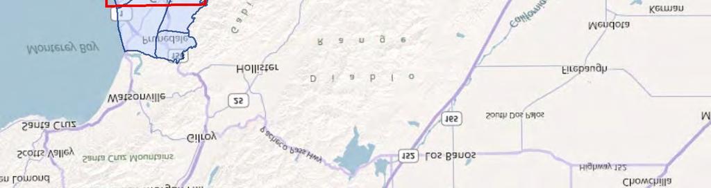
1 This section assesses impacts related to water supply and availability of water to the proposed project. The analysis of groundwater resources and hydrogeology presented in this section is based on consultation with Monterey County Water Resources Agency staff, the Preliminary Geologic, Geotechnical, Hydrogeologic, Erosion, Drainage and Environmental Phase I Assessment and Hydrogeologic Update Memorandum prepared by Kleinfelder in July 28 and June 212, respectively, and the Preliminary Drainage Report for prepared by Whitson Engineering in February 21. The report and memorandum by Kleinfelder summarizes previous hydrogeologic studies and assesses the groundwater source and aquifer stratigraphy, well data and groundwater trends, area rainfall, wastewater discharge, project water demand, and groundwater quality. The report by Whitson provides estimated runoff to be detained on-site, which relates to groundwater recharge. Both of these reports are included in Appendix E. Surface water and water quality are addressed in Section 3.7, Surface Water Hydrology and Water Quality, of this Draft EIR ENVIRONMENTAL SETTING Water is vital to support agriculture and the population of Monterey County, and to maintain a thriving economy. The importance of water makes hydrogeology and groundwater resources primary issues in the county. The topography and geology of the area create a complex, interrelated system of groundwater resources that are heavily dependent on the climate, the health of local watersheds, and water management. There are three existing wells onsite that currently procure water from groundwater resources, which are described below. GROUNDWATER BASIN According to the Department of Water Resources (DWR), the project site lies within the Salinas Valley Groundwater Basin (hereinafter referred to as the basin ) as shown in Figure The basin is one of the largest coastal groundwater basins in California and lies within the southern Coast Ranges between the San Joaquin Valley and the Pacific Ocean. The basin consists of sand, gravel, and clay that have been deposited over millions of years. The basin is drained by the Salinas River, which extends approximately 15 miles from the headwaters near San Luis Obispo County to the mouth of the river at Monterey Bay near Moss Landing. The total drainage area of the basin is about 5, square miles within the Salinas Valley. The Salinas Valley ranges from 1 miles wide in the north to 3 miles wide in the south and is about 12 miles long. Over the years, the Salinas Valley Groundwater Basin has experienced overdraft, a condition where more water is pumped out of an aquifer than is recharged on an average yearly basis. This overdraft condition causes a decline in the water level, which allows seawater intrusion to occur or streams and rivers to go dry. When this occurs, the wells in the affected aquifers must either be deepened or abandoned, or water must be treated to dilute the salt concentration. Sufficient water resources exist in the county s reservoirs, aquifers, and watersheds, but the economic problems of storage and distribution prevent these resources from being fully available. August Draft Environmental Impact Report
2 Groundwater Subbasin The Salinas Valley Groundwater Basin (Basin Identification #3-4) is divisible into eight area subbasins: 18/4-Foot Aquifer (3-4.1); Eastside Aquifer (3-4.2); Forebay Aquifer (3-4.4); Upper Valley Aquifer (3-4.5); Paso Robles Area (3-4.6); Seaside Area (3-4.8); Langley Area (3-4.9); and Corral de Tierra Area (3-4.1), as shown in Figure (DWR 24). According to DWR basin maps, the project site is located in the northeast portion of the Corral de Tierra Area Subbasin (DWR 21) of the Salinas Valley Groundwater Basin. However, potable water for the proposed project would be provided by wells in California Water Service Company s Salinas District, which procures water from the 18/4-Foot Aquifer Subbasin of the basin. Both of these subbasins are described below. Corral de Tierra Area Subbasin As defined in Salinas Valley Groundwater Basin, 18/4-Foot Aquifer Subbasin Bulletin 118 (Bulletin 118), the Corral de Tierra Area Subbasin includes outcrops of Plio-Pleistocene nonmarine units, including the Aromas Sands, the Paso Robles Formation, the Santa Margarita Formation, and the Monterey Formation (DWR 24). The subbasin is bounded by the Seaside Area Subbasin to the northwest and the 18/4-Foot Aquifer Subbasin to the northeast. The primary water-bearing units of the subbasin are the Miocene/Pliocene Santa Margarita Formation, the Pliocene Paso Robles Formation, and the Pleistocene Aromas Sands. The Santa Margarita Formation is poorly consolidated marine sandstone with a maximum thickness of 225 feet and is an important water-bearing formation. It underlies the Paso Robles Formation, which consists of sand (approximately 2 feet thick), gravel, and clay interbedded with some minor calcareous beds and is the major water-bearing unit (DWR 24). Geosyntec Report Under contract with the Monterey County Water Resources Agency (MCWRA), Geosyntec Consultants prepared the El Toro Groundwater Study in July 27, which was supplemented in June 21. The primary objective of the study was to evaluate groundwater resource capacity in a portion of the Salinas Valley Groundwater Basin and to make recommendations regarding the extent of the B-8 zoning overlay, which restricts further subdivision of property. This report used a topography/watershed-based methodology to define its limits of study and did not take into account MCWRA s Zone 2C boundaries, which are discussed in more detail under Groundwater Quality later in this section. The study area was not consistent with the Corral de Tierra Subbasin boundary, but contained a portion of this subbasin. In order to prevent confusion between the Geosyntec study and physical subbasin boundaries recognized by the MCWRA, this Draft EIR refers to the area studied as the Geosyntec Study Area, which is shown in relationship to the project in Figure 3.6-2a. The Geosyntec Study Area is subdivided into five subareas as shown in Figure 3.6-2b. The westernmost portion of the project site is located in the El Toro Creek and San Benancio Gulch subareas of the Geosyntec Study Area. Draft Environmental Impact Report August


3 T:\_GIS\MONTEREY_COUNTY\MXDS\SALINAS VALLEY GROUNDWATER.MXD - 1:4:5 AM LANGLEY AREA SEASIDE AREA EASTSIDE AQUIFER CORRAL DE TIERRA AREA See Inset 18/4 FOOT AQUIFER FOREBAY AQUIFER UPPER VALLEY AQUIFER Seaside Area 18/4 Foot Aquifer Corral de Tierra PASO ROBLES AREA Legend Project Site Subbasin Boundary Source: CASIL, 21; Bing Maps, MILES FIGURE GROUNDWATER BASIN MAP
4 This page intentionally left blank. Draft Environmental Impact Report August


5 T:\_CS\Work\Monterey, County of\ferrini Ranch\Figures\Section 3-6\Figure 3.6-2a Historic Seawater Intrusion - 18ft.ai, April 27 Source: MCWRA 211 2,5 5, FIGURE 3.6-2A SCALE IN FEET N GEOSYNTEC STUDY AREA IN RELATIONSHIP TO THE PROJECT SITE
6 This page intentionally left blank. Draft Environmental Impact Report August
7 Harper Creek Legend Intermittent Stream El Toro Creek El T Creek Subarea Boundary Parcel Boundary Project Site Boundary 8 6 Laguna Seca Area Corral De Tierra San Benancio Gulch Watson Creek Watso n Creek T:\_CS\Work\Monterey, County of\ferrini Ranch 26-11\Figures\Section 3-6 Source: Geosyntec 27 Calera Creek 2, 4, FIGURE 3.6-2B FEET SUBAREAS OF THE GEOSYNTEC STUDY AREA
8 This page intentionally left blank. Draft Environmental Impact Report August
9 According to the Geosyntec study, water-bearing formations in the northeastern portion of the subbasin dip in a northeasterly direction toward the Salinas Valley as shown in Figure According to the supplemental geologic map and cross sections (MCWRA 21), the Plio-Pleistocene Continental Deposits (QTc) (Paso Robles Formation) of the study area show that the hydraulic gradient under the El Toro Creek Valley/State Route 68 corridor is generally northeastward and contiguous with the Salinas Valley Groundwater Basin as shown in Figure (Also refer to Figure for the project site relationship to the cross sections). In addition, the northern portion of the Geosyntec Study Area was identified to have a deep saturated thickness, which was determined to have a large volume of groundwater storage and could sustain current and increased rates of pumping for decades (MCWRA 27, 21). The Geosyntec study is relevant as it provides continuing information and research about local groundwater dynamics. The study area overlaps with a portion of the project site and demonstrates hydraulic connectivity between the larger Salinas Valley Groundwater Basin and the Corral de Tierra Area Subbasin. 18/4-Foot Aquifer Subbasin The 18/4-Foot Aquifer Subbasin includes the lower reaches and mouth of the Salinas River. The subbasin is bounded by the Sierra de Salinas to the southwest; the Corral de Tierra Area Subbasin to the west; the Seaside Area Subbasin and Monterey Bay to the northwest; the Pajaro Valley Groundwater Basin and Eastside Aquifer and Langley Area Subbasins to the northeast; and the Lower Forebay Subbasin, near the City of Gonzalez, to the southeast. The 18/4-Foot Aquifer Subbasin has an estimated total storage capacity of approximately 7,24, acre-feet of groundwater, with the two main water-bearing units being the 18-Foot Aquifer and the 4-Foot Aquifer (named for the average depth at which they occur) (DWR 24). A near-surface water-bearing zone also exists, but it is a relatively minor source of water due to poor water quality. The 18-Foot Aquifer consists of a complex zone of interconnected sands, gravels, and clay lenses with thicknesses that vary from 5 to 15 feet, averaging 1 feet (DWR 24). The 18-Foot Aquifer is separated from the 4-Foot Aquifer by a zone of discontinuous aquifers and aquitards ranging in thickness from 1 to 7 feet. The 4-Foot Aquifer consists of sands, gravels, and clay lenses with an average thickness of 2 feet (DWR 24). An additional, deeper aquifer (also referred to as the 9-Foot Aquifer or the Deep Aquifer) is present in the lower Salinas Valley. A blue marine clay aquitard also separates this aquifer from the overlying 4-Foot Aquifer. This deeper aquifer consists of alternating layers of sand-gravel mixtures and clays (up to 9 feet thick), rather than a distinct aquifer and aquitard (DWR 24). The Deep Aquifer has experienced little development except near the coast where it is used to replace groundwater from the 18-Foot and 4-Foot Aquifers rendered unusable by seawater intrusion. August Draft Environmental Impact Report
10 GROUNDWATER QUANTITY The proposed project would be provided water service by California Water Service Company (CWSC). According to the tentative map and discussions with the CWSC, water for the project would be procured from a variety of wells located in the Spreckels area, along River Road in CWSC s Salinas Hills System, which pump groundwater from the 18/4-Foot Aquifer Subbasin of the Salinas Valley Groundwater Basin, not the Corral de Tierra Area Subbasin. Water procured from these wells is conveyed to users via large transmission lines. The proposed project would likely tap into existing water transmission lines located within Torero Drive north of State Route 68 and along River Road. According to the CWSC, the Salinas Hills System currently has 2,216 service connections, and the existing demand is approximately 1, acre-feet per year (AFY) (or gallons per minute (GPM) (He 27). The MCWRA monitors wells in this area, and since the construction of the Salinas Valley Water Project, there has been a noticeable change in well levels. According to the MCWRA s fourth quarter report for water year 29 21, the average depth to groundwater in the 18/4-Foot Aquifer has been reduced, which indicates higher well levels. According to monitoring data, the depth to groundwater for the 18-Foot Aquifer was 52 feet, which was up 1 foot from the previous month, up 7 feet from the previous year, and down 1 foot from 1985 levels. Monitoring data for the 4- Foot Aquifer showed the depth to groundwater was 46 feet, which was up 1 foot from the previous month, up 6 feet from previous year, and up 1 feet from 1985 levels. Groundwater Recharge Water enters coastal basin aquifers in several ways. Precipitation runoff from the surrounding mountains during the winter months infiltrates the permeable sediments of the valley floor. Precipitation that falls on the valley floor and irrigation of crops provide some direct recharge, but in the coastal basins, most of this precipitation and irrigation evaporate or are directly transpired by plants. Water can also enter an aquifer system as lateral subsurface flow from an adjacent basin if hydraulically connected. Of these methods of recharge, runoff from the mountains and percolation through streambeds provide the largest quantities of recharge to the basin s aquifer system. Groundwater discharge in the coastal basins is primarily through withdrawal by wells. The rate of recharge from irrigation and rainfall can be estimated using a soil moisture budget (SMB). SMB zones are determined based on the existing land use (vegetation), soil characteristics, and average annual rainfall. According to the Laguna Seca Subarea Phase III Hydrogeologic Update prepared by Yates, Feeney, and Rosenberg in November 22 for the Monterey Peninsula Water Management District (MPWMD), each SMB zone equates to an average rate of recharge. Areas that are covered in native grasses, trees, and shrubs may have a slightly higher recharge rate, whereas those areas with urban development may have a slightly lower recharge rate due to the presence of impermeable surfaces. Understanding the rate of recharge is useful in determining a project s overall water balance, particularly if groundwater is the primary water source. Draft Environmental Impact Report August
11 2 3 SID133 WL=624 Legend! Station ID and Water Level Elevation Inferred Groundwater Flow Direction Water Level Elevation Contour (ft msl) SID126 WL=26.2 SID158 SID157 WL=25.91! WL=194.44! SID159 SID125! WL= WL=248.2!! SID155 WL= Laguna Seca Area 25 SID156 WL= SID145 WL=238.4!!! 2 SID116 WL=195 SID114 WL=245 SID135 WL=181 SID143 WL=178! SID121 WL=323.3 SID122! WL= Subarea Boundary Parcel Boundary Project Site Boundary NOTES: Ambler Park wells (SID 116, 135, and 143) water levels were measured in June 22; January 21 data not available. WL = water level ft msl = feet mean sea level This figure was originally produced in color. Reproduction in black and white may result in loss of information. 25! SID154 WL= ! SID133 WL= T:\_CS\Work\Monterey, County of\ferrini Ranch 26-11\Figures\Section 3-6 Source: Geosyntec ! SID124 WL= ! 85 SID128 WL= ! SID127 WL= ,5 3, FIGURE FEET GEOSYNTEC STUDY AREA GROUNDWATER FLOW
12 This page intentionally left blank. Draft Environmental Impact Report August

")


, MCWRA database, and Yates et. al (25).")
13 X1 X2 Y X Tsm Qal/Qof Qal/Qof Highway 68 El Toro Creek 2 2 Salinas River Qal/Qof QTc 4 Reliz - Las Palmas Fault Qal/Qof Tmd -2 QTc -4-2 Tsm -6-4 QTc -6 Tmd Tuss -8-8 Approximate location of Ferrini Ranch Project Site X1 X2 Z X Harper Fault Tsm Qal/Qof Qal/Qof Qal/Qof 2 Qal/Qof Qal/Qof QTc 2 Salinas River Qt 4 Reliz - Las Palmas Fault QTc Qal/Qof Tmd -2 Tsm Tuss -2 QTc QTc - Coarse -4 Kqm -6 QTc Tuss Tmd -8 LEGEND Well from MCWRA database (see Table 1 for well ID) Well from Yates et al 25 5 Well IDs for Supplemental Wells 1 X2 Well B Well C r Creek Harpe nci oc reek ena Z 1 1 Proposed Harper Canyon Project 6) 15S/3E-18F1 7) 15S/3E-18C2 8) 15S/3E-18B1 9) 15S/3E-8T5 1) 15S/3E-17M1 Cross-Sections Have 2X Vertical Exaggeration 2,5 2,5 Feet Geologic Map and Cross-Sections from El Toro to Salinas Valley El Toro Groundwater Study Monterey County, CA ³ 5 San B 5 16S/2E-3A1 16S/2E-2D5 16S/2E-2D1 15S/2E-25C1 15S/3E-18M2 NOTES: Geology adapted from Clark et al. 2, Rosenberg, L.I. 21, Yates et al. 25, Kennedy Jenks, 24 Well locations are approximate. ay 68 SW El Toro Planning Area 9 Highw 4 X3 6 Well A 7 8 y ith log n w eo tio d G era an op ines co M in of red on pa isi Pre Div a rni lifo Ca 5 3 T:\_CS\Work\Monterey, County of\ferrini Ranch 26-11\Figures\Section ee k Watson Cr 5 El Toro Creek ) 2) 3) 4) 5) 5 N 1 X1 Y 5 2 Salin as R iver 25 Estimated Groundwater Elevation Contour Based on Jan 21 data and contour map (Geosyntec, 27), MCWRA database, and Yates et. al (25). Inset Scale 1 1 Mile June 21 Source: Geosyntec Consultants, June 21 FIGURE GEOSYNTEC STUDY AREA GEOLOGIC CROSS SECTIONS
14 This page intentionally left blank. Draft Environmental Impact Report August
15 GROUNDWATER QUALITY Groundwater in Monterey County is generally considered to be excellent to good. The two principal aquifers serving the project are the 18-Foot Aquifer and the 4-Foot Aquifer of the Salinas Valley Groundwater Basin. According to the DWR, groundwater procured from these aquifers is characterized by calcium sulfate to calcium sodium bicarbonate sulfate; however, where seawater intrusion has occurred, the groundwater is typically characterized by sodium chloride to calcium chloride (DWR 24). In addition to seawater intrusion closer to the ocean, a primary impairment to water quality in the basin is nitrates from historic and ongoing agricultural practices. Of 194 wells sampled during 1995 for nitrates in both the 18-Foot and 4-Foot Aquifers, 21 exceeded the drinking water standard. Seawater Intrusion Over the years, many wells have gone out of production or have had to be redrilled deeper due to seawater intrusion. Seawater intrusion is the migration of ocean water inland into the freshwater aquifers. This condition is induced by pumping groundwater from the basin faster than the aquifers can be recharged. Seawater intrusion has been accelerated in the Salinas Valley Groundwater Basin due to decreased groundwater recharge and increased groundwater pumping. Seawater intrusion can have effects related to loss of agricultural jobs, curtailment of growth, reduction in land values, and an increase in the cost of water. Heavy pumping of the 18-Foot and 4-Foot Aquifers has caused significant seawater intrusion into both aquifers, which was first documented in 193s (DWR 24). In the northernmost portion of the subbasin, typical groundwater flow to the ocean has been reversed and seawater has intruded inland. By 1995, seawater had intruded over 5 miles inland through the 18-Foot Aquifer, including the area beneath the towns of Castroville and Marina as shown in Figure 3.6-5a. Seawater had also intruded over 2 miles into the 4-Foot Aquifer by 1995 as shown in Figure 3.6-5b. The Salinas Valley Water Project was developed to help stop seawater intrusion. Virtually all water used in the Salinas Valley Groundwater Basin is pumped from groundwater aquifers. These water supplies are dependent on recharge from surface drainages, primarily from the watersheds in the region. Intensified land use activities over the years have gradually increased the amount of groundwater pumped from the aquifers, while the ability of watersheds to recharge underlying aquifers has decreased. Seawater has contaminated both the 18-Foot and 4-Foot Aquifers of the 18/4-Foot Aquifer Subbasin. Figures 3.6-5a and 3.6-5b provide historical seawater intrusion maps for the 18- Foot and 4-Foot Aquifers of the subbasin. It is estimated that seawater has intruded an average of 1, AFY since By 1999, an estimated 24,19 acres of land were underlain by seawater intrusion in the 18-Foot Aquifer and 1,54 acres were underlain by seawater intrusion in the 4-Foot Aquifer (MCWRA 21). Seawater intrusion is not just an agricultural problem since the seawater is close to threatening the domestic water supply for the City of Salinas. Aquifers intruded with seawater are largely unusable for August Draft Environmental Impact Report
16 agricultural or municipal purposes. In an attempt to address the seriousness of the effect seawater intrusion has on the community, three goals have been established for the region: (1) reduce the amount of groundwater consumed; (2) increase the amount of water replenished into the aquifer; and (3) find other sources of water besides groundwater. To help manage and protect groundwater resources, the MCWRA developed and constructed the Salinas Valley Water Project. Salinas Valley Water Project/Zone 2C The Salinas Valley Water Project (SVWP) provides for the long-term management and protection of groundwater resources in the basin by meeting the following objectives: stopping seawater intrusion and providing adequate water supplies and flexibility to meet current and future (year 23) needs. Through the construction of a variety of improvement projects at the San Antonio and Nacimiento Reservoirs and along the Salinas River, the SVWP provides the surface water supply necessary to attain a hydrologically balanced groundwater basin in the Salinas Valley. These improvements allow diversion of surface water from the Salinas River during the irrigation season to reduce the groundwater pumping demand for agricultural use. The Monterey County Water Recycling Project (MCWRP), created by MCWRA and the Monterey Regional Water Pollution Control Agency (MRWPCA), reclaims and recycles wastewater to supplement irrigation demand, making more groundwater resources available for urban/domestic uses. The SVWP was designed to provide adequate water supplies to meet current and future water demands. The Salinas Valley Integrated Ground and Surface Water Model (SVIGSM), a planning tool, was used to evaluate hydrologic effects of operations under Alternatives A and B of the SVWP (MCWRA 22). The analysis relied on assumptions about future population growth and water demand in the Salinas Valley, hydrology (patterns of wet and dry years), and regional economic trends, which were based on historical records and predictive tools used by the Association of Monterey Bay Area Governments (AMBAG) and local planning departments. The SVWP was designed to enhance recharge, provide direct deliveries of surface water, reduce pumping in areas prone to seawater intrusion, and provide for projected agricultural water needs now and through the planning horizon (year 23). The ability to reduce seawater advancement is visually demonstrated in the graphs below. The graphs demonstrate that the cumulative rate of seawater advancement is slowing and stabilizing, while the annual advance is beginning to decrease. Draft Environmental Impact Report August
17 In order to fund the improvements provided by the SVWP, the MCWRA established a special assessment zone, Zone 2C (formerly Zones 2a and 2b) as shown in Figure Zone 2C benefits are deemed special benefits received by only those parcels that fund the SVWP. Zone 2C was defined based on geologic conditions and hydrological factors that define and limit the area of benefits derived from operation of the Nacimiento and San Antonio Reservoirs and construction of the SVWP. The proposed Ferrini Ranch project is located in Monterey County Water Resources Agency Zone 2C as shown in Figure August Draft Environmental Impact Report
18 Recycled Water Projects Recycled water is being used for irrigation to conserve the limited groundwater supply throughout California. The MRWPCA operates one of the largest recycled water treatment plants in the nation just north of the City of Marina. This water treatment plant produces 19,5 acre-feet a year of recycled water for irrigation in the Castroville area to aid in the fight against seawater intrusion as part of the Castroville Seawater Intrusion Program (CSIP). Agricultural operations in this area are able to use recycled water to irrigate their crops, thus reducing the amount of water pumped directly from the aquifer in order to try to reverse the groundwater levels and reverse the directional flow of seawater REGULATORY SETTING FEDERAL AND STATE AGENCIES AND REGULATIONS Safe Drinking Water Act The Safe Drinking Water Act (SDWA), originally passed by Congress in 1974 (amended 1986 and 1996), protects public health by regulating the nation s public drinking water supply. The law requires many actions to protect drinking water and its sources: rivers, lakes, reservoirs, springs, and groundwater wells. (The SDWA does not regulate private wells that serve fewer than 25 individuals.) The U.S. Environmental Protection Agency (EPA) is the governing authority that sets national health-based standards for drinking water in order to protect against both naturally occurring and man-made contaminants. Individual states and water systems work in conjunction with the EPA to ensure these standards are met. Originally, SDWA focused on treatment as the primary means of providing safe drinking water at the tap. The 1996 amendments recognized source water protection, operator training, funding for water system improvements, and public information as important components of safe drinking water. This approach helps ensure the quality of drinking water by protecting it from source to tap. California Department of Health Services In response to the 1996 federal Safe Drinking Water Act requirements, Section of the California Health and Safety Code was enacted. This section states: No public water system that was not in existence on January 1, 1998, shall be granted a permit unless the system demonstrates to the department that the water supplier possesses adequate financial, managerial, and technical capability (TMF) to assure the delivery of pure, wholesome and potable drinking water. This section shall also apply to any change of ownership of a public water system that occurs after January 1, Compliance is required at the time of permit application. Draft Environmental Impact Report August
19 Monterey Bay 1975 Legend Seawater Intruded Areas By Year Est ÿ 156 Cities Historic Seawater Intrusion Map Pressure - 18 Foot Aquifer 5 mg/l Chloride Areas CASTROVILLE ÿ 156 T:\_CS\Work\Monterey, County of\ferrini Ranch\Figures\Section 3-6\Figure 3.6-2a Historic Seawater Intrusion - 18ft.ai, April SEASIDE Source: MCWRA 21 ÿ 1 MARINA NASHUA RD RESERVATION RD 27 Map Date: November 16, BLANCO RD ÿ 183 DAVIS RD ESPINOSA RD ÿ SALINAS Note: The scale and configuration of all information shown hereon are approximate and are not intended as a guide for survey or design work Miles N FIGURE 3.6-5A HISTORIC SEAWATER INTRUSION MAP - 18-FOOT AQUIFER
20 This page intentionally left blank. Draft Environmental Impact Report August


21 Legend Seawater Intruded Areas By Year Cities Historic Seawater Intrusion Map Monterey Bay }ÿ 156 Pressure - 4 Foot Aquifer 5 mg/l Chloride Areas 1959 T:\_CS\Work\Monterey, County of\ferrini Ranch\Figures\Section 3-6\Figure 3.6-2a Historic Seawater Intrusion - 18ft.ai, April }ÿ MARINA Source: MCWRA RESERVATION RD CASTROVILLE NASHUA RD 25 Map Date: November 16, 21 BLANCO RD }ÿ 183 ESPINOSA RD DAVIS RD 11 1 SALINAS Note: The scale and configuration of all information shown hereon are approximate and are not intended as a guide for survey or design work Miles N FIGURE 3.6-5B HISTORIC SEAWATER INTRUSION MAP - 4-FOOT AQUIFER
22 This page intentionally left blank. Draft Environmental Impact Report August

23 Zone 2C Boundary T:\_CS\Work\Monterey, County of\ferrini Ranch\Figures\Section 3-6\Figure Water Project Zone2c Boundary.ai, April 27 Source: MCWRA 23 FIGURE SALINAS VALLEY WATER PROJECT ZONE 2C
24 This page intentionally left blank. Draft Environmental Impact Report August
25 Under California Water Code Section 35, the California Department of Health Services can direct that a water supplier (both public and private) declare a water supply emergency, either on a short-term basis, during an extended drought, or on a long-term basis, where there is evidence that the available water supply may not be able to meet existing public needs. Department of Water Resources The California Department of Water Resources (DWR) is the state agency responsible for managing California s water resources other than water quality, including conducting technical studies of surface water and groundwater in cooperation with local agencies, overseeing certain flood prevention and floodplain management programs, and developing and implementing water conservation and efficient water use strategies and programs in cooperation with local agencies. The DWR is also responsible for building, operating, and maintaining the State Water Project, which supplies drinking water and agricultural irrigation water to various parts of the state, but not to Monterey County. The DWR has also been given the responsibility for overseeing the preparation of Groundwater Management Plans. State Water Resource Control Board/Central Coast Regional Water Quality Control Board The passage of the Porter-Cologne Water Quality Control Act by the State of California in 1969 established the State Water Resources Control Board (SWRCB), and the nine Regional Water Quality Control Boards (Regional Boards) became the principal state agencies with responsibility for the coordination and control of water quality. The SWRCB was created by merging the State Water Quality Control Board and the State Water Rights Board. The SWRCB is generally responsible for setting statewide water quality policy and is solely responsible for the allocation or determination of surface water rights. The Regional Boards are responsible for water quality planning and regulatory decisions for their respective regions. The Central Coast Regional Water Quality Control Board (Region 3) (CCRWQCB) has the authority to implement water quality protection standards through the issuance of permits for discharges to waters in Monterey County. Their jurisdiction also extends to discharge of wastes and wastewater to land, and to land disturbance, if the activities could affect the beneficial uses of surface water or groundwater. The CCRWQCB has a Water Quality Control Plan for basins within its jurisdiction (Central Coast Basin Plan) that identifies beneficial uses of surface waters, establishes numeric and narrative objectives for protection of beneficial uses, and sets forth policies to guide the implementation of programs to attain certain objectives. Water pollution, including control of waste discharges to lands that might impact surface water and groundwater, as well as direct point source and diffuse or non-point source discharges, are primarily administered by the CCRWQCB. The primary CCRWQCB programs include the National Pollutant Discharge Elimination System (NPDES) program, August Draft Environmental Impact Report
26 the Total Maximum Daily Load (TMDL) program, the Conditional Waiver Program for Agriculture, and the Watershed Management Initiative. In addition, the Regional Board often investigates and oversees the cleanup of contaminated surface water and groundwater bodies, is involved in the review and issuance of water quality certifications for Section 44 wetlands fill permit requests, and works closely with the County on a variety of wastewater treatment, pollution control, development, and mineral resource extraction projects. Watershed Management Initiative The Watershed Management Initiative (WMI) guides the water resource protection efforts of the SWRCB and the Regional Boards. The WMI is designed to integrate various surface water and groundwater regulatory programs while promoting cooperative, collaborative efforts by various agencies and interest groups within a watershed. Local governments that provide or maintain underground drinking water supplies within their boundaries are responsible for developing wellhead protection programs. Wellhead protection programs (including local ordinances and land use control programs for lands immediately surrounding public water supply wells) focus on preventing groundwater drinking water supplies from being contaminated. Salinas River Watershed Management Action Plan The Salinas River Watershed Management Action Plan, completed in 1999, outlines the watershed characteristics and management actions recommended to control point source and non-point source pollution in the Salinas River watershed. The upper watershed is primarily in San Luis Obispo County and overlies the Paso Robles Groundwater Basin, while the lower watershed extends from Bradley to Monterey Bay and overlies the Salinas Valley Groundwater Basin. AB 33 Groundwater Management Plans In 1992, the State passed Assembly Bill (AB) 33 (and later amended it in Senate Bill 1938), which provides authority for local water agencies to adopt groundwater management plans if certain procedures are followed (California Water Code Section 1753). These plans involve collaboration among numerous agencies and thus offer opportunities for local governments to participate in groundwater management planning in cooperation with water providers. No new level of government is formed under AB 33, and action is voluntary rather than mandatory. The Water Code also provides the local water supplier with the powers of a Water Replenishment District in order to raise revenue to pay for facilities used for basin management (including extraction, recharge, conveyance, and water quality). Jurisdictions have typically included aspects of groundwater management in their watershed management or stormwater management plans, or refer to the CCRWQCB Basin Plan, as well as plans devoted to a particular resource, such as the Carmel or Salinas Rivers. The MCWRA has completed and adopted Draft Environmental Impact Report August
27 detailed Basin Management Plans that describe the management actions and capital improvement projects they will undertake to bring the basin into water supply/consumptive use balance over the long term. LOCAL AGENCIES AND REGULATIONS Monterey County Water Resources Agency The MCWRA was formerly called the Monterey County Flood Control and Water Conservation District. This agency oversees the development and implementation of water quality, water supply, and flood control projects in Monterey County. Primary responsibilities are management of water supply resources in the reservoir system, including San Antonio and Nacimiento Reservoirs, and permitting and development of the Salinas Valley Water Project. Maintaining high water quality standards for both supply and environmental habitat are major goals of the agency. Goals are achieved through the development and implementation of water quality programs such as those designed to evaluate and develop strategies for reducing contamination of waterways from chemicals used in agriculture and agricultural waste products or for overall watershed protection in reservoir areas. The MCWRA and its cooperators, including the Monterey Regional Water Pollution Control Agency, have two major capital projects that are currently moving forward to better manage groundwater quality and reverse the long-term trend of seawater intrusion and groundwater declines in the Salinas Valley Groundwater Basin. They include the Castroville Seawater Intrusion Project (CSIP) and the Salinas Valley Water Project (SVWP). Monterey County Health Department, Environmental Health Bureau The mission of the Environmental Health Bureau (EHB) is to prevent environmental hazards from occurring and to protect the public and resources from environmental hazards when they occur. The EHB is the agency responsible for water well permits for construction, destruction, and modification as well as inspection of placement of sanitary seals. They also conduct inspections, issue permits, and monitor chemical and bacteriological water quality for small public water systems with less than 2 connections. Monterey County Code Except for water quality issues, most of the regulations affecting water resources (both surface water and groundwater) are contained in the Monterey County Code and related ordinances, with code enforcement primarily by the MCWRA and EHB. In many cases however, development and implementation of a local program or ordinance has been mandated by the State of California or the federal government. August Draft Environmental Impact Report
28 Water Data from Water Distribution Systems Ordinance 3438 (1989) requires water distribution systems to implement record management procedures and provide water use information to the District. The purpose of the ordinance is to facilitate and encourage water conservation in Monterey County by monitoring water use patterns and practices, through the collection and analysis of water use records and data. The MCWRA has prepared an amendment to this ordinance, which is currently under consideration by the Board of Directors. Proposed changes include a clarification that the ordinance also applies to governmental water users, requirements for metering of supply wells and service connections for all distribution systems, and modifications of the data reporting procedure. Hydrology and Hydrogeology Chapters 19.3, 19.5, and 19.7 of the Monterey County Code regulate subdivisions, land divisions, and other development. The code requires submission of verification of legal rights to water supply, evaluation of site hydrology, hydrogeology, surface and groundwater resources, water balance, and long-term safe yield of the aquifer if development occurs, and analysis of potential changes in water usage due to subdivision development. Verification of water resources is subject to review by the Director of Environmental Health. Groundwater Resources Groundwater resources are required to be identified as part of Chapter The ordinance requires the following submittals: Hydrogeologic environment shall include aquifer identification and characterization, groundwater basin delineation, well yields, and a characterization of soils. Groundwater levels and flow shall include a discussion of groundwater levels, a groundwater contour map, and a discussion of any seasonal and/or long-term fluctuations. This Section shall also include a discussion of the recharge areas and the amount of recharge shall be quantified using monthly time-step methodology. It shall also evaluate the impact of pumping on neighboring wells. Groundwater in storage shall be quantified by discussing the amount of groundwater in storage and the amount that can be recovered. Groundwater quality shall be discussed and any impacts on the groundwater by the proposed project shall be discussed and mitigation measures listed. Draft Environmental Impact Report August
29 Wells and Domestic Water Title 15 of the Monterey County Code regulates public services, including Chapters 15.4 Domestic Water Systems and Chapter 15.8 Water Wells. Domestic water supply is regulated to ensure that the citizens of Monterey County receive safe and pure drinking water. Regulatory requirements include compliance with state laws, as well as ensure that development does not occur where there is a lack of sustainable water resources. Water Resources and Conservation Water conservation is regulated in Chapter 18.5 of the Monterey County Code, which is intended to reduce the excessive use of water within the following planning areas: Greater Salinas, Toro, Greater Monterey Peninsula, and a portion of North County including the Coastal Zone. These regulations require the installation of low-water-use plumbing fixtures and water-efficient landscape materials as part of new construction, as well as prohibiting certain excessive use of water. Monterey County General Plan Policies Land use and development shall be accomplished in a manner to minimize runoff and maintain groundwater recharge in vital water resource areas Increased uses of groundwater shall be carefully managed, especially in areas known to have groundwater over drafting Water conservation measures for all types of land uses shall be encouraged The County shall not allow water consuming development in areas which do not have proven adequate water supplies Proliferation of wells, serving residential, commercial, and industrial uses, into common water tables shall be discouraged. Toro Area Plan Policies Developments shall be designed to maintain groundwater recharge capabilities on the property New water supply wells for subdivisions shall require seventy-two hour pump tests. August Draft Environmental Impact Report
30 3.6.3 IMPACTS AND MITIGATION MEASURES STANDARDS OF SIGNIFICANCE The following thresholds for measuring a project s environmental impacts are based on CEQA Guidelines and standards used by the County of Monterey. For the purposes of this Draft EIR, impacts are considered significant if the following could result from implementation of the proposed project: 1) Violate any water quality standards. 2) Substantially deplete groundwater supplies or interfere substantially with groundwater recharge such that there would be a net deficit in aquifer volume or a lowering of the local groundwater table level (e.g., the production rate of preexisting nearby wells would drop to a level which would not support existing land uses or planned uses for which permits have been granted). 3) Otherwise substantially degrade water quality. 4) Lack availability of sufficient water supplies to serve the project from existing entitlements and resources, or require new or expanded entitlements. METHODOLOGY Kleinfelder prepared a hydrogeologic assessment in July 28. This assessment included a review of published reports, maps, and other technical documents. Whitson Engineering prepared the Preliminary Drainage Report for in February 21 that provides estimated recharge and detention volumes used in the water balance. Both of these reports are included in Appendix E. In addition, the EIR preparers coordinated closely with Monterey County Planning Department and MCWRA staff to remain up to date on the findings of recent groundwater studies and analysis documents used by the County. PROJECT IMPACTS AND MITIGATION MEASURES Drinking Water Quality Standards Impact Implementation of the proposed project would result in the extraction of groundwater from the 18/4-Foot Aquifer Subbasin of the Salinas Valley Groundwater Basin, within which arsenic, total dissolved solids (TDS), and nitrates are of particular concern. However, according to the California Water Service Company, water quality from the two source wells is in compliance with the primary and secondary drinking standards in accordance with the Safe Drinking Water Act. Water procured for the proposed project would be required to adhere to state and federal mandated standards of water quality, and the project will not directly or Draft Environmental Impact Report August
31 indirectly affect water availability at the source wells. Therefore, this would be considered a less than significant impact. The proposed project s water demands would be met by water procured from wells that pump water from the 18/4-Foot Aquifer Subbasin of the Salinas Valley Groundwater Basin. The wells are operated and managed by the California Water Service Company (CWSC) and are located along River Road in an area referred to as the Spreckels area of the Salinas District. According to CWSC s 25 water quality report for the Spreckels area (part of the Salinas District), water procured from the wells is in compliance with primary and secondary drinking standards in accordance with the Safe Drinking Water Act. In the Salinas River watersheds, arsenic, total dissolved solids (TDS), and nitrates are of particular concern. The average concentrations of arsenic, TDS, and nitrate for the wells are summarized in Table TABLE WATER QUALITY DATA FOR THE WELLS PRIMARY CONSTITUENTS CURRENT MCL SOURCE WELL CONCENTRATION Arsenic 1 ppb 1.34 ppb Nitrate 45 ppm 1.9 ppm SECONDARY CONSTITUENTS CURRENT MCL CONSTITUENT CONCENTRATION Total Dissolved Solids 1 ppm 493 ppm Notes: MCL = Maximum Contaminant Level; ppm = parts per million; ppb = parts per billion; Umhos/cm = micromhos per centimeter Source: Kleinfelder 28 Water procured for the proposed project would be required to adhere to state and federal mandated standards of water quality. Therefore, the primary and secondary drinking standards would be met, and this would be considered a less than significant impact. No mitigation measures are necessary. Long-Term Impact to Groundwater Resources Impact Implementation of the proposed project would result in a gross increase in groundwater pumping of approximately 113 acre-feet per year (AFY), which would result in an increased long-term water demand on the Salinas Valley Groundwater Basin. However, the project site is located within MCWRA s Zone 2C and will obtain potable water from the 18/4-Foot Aquifer Subbasin. The quantity and source of water would result in a less than significant impact on groundwater resources. Residential Water Demand Rates Water demand rates vary dependent upon the area, proposed use, number of fixtures, implementation of water-efficient plumbing fixtures, and amount and type of landscaping at a residence. Over the years, a number of residential water demand rates have been used in various reports prepared for projects in the vicinity of the Ferrini Ranch project site. August Draft Environmental Impact Report
32 According to CWSC s Urban Water Management Plan Salinas District (27), water use in 23 was 11 gallons per capita per day (.12 AFY) for residential uses and 156 gallons per capita per day (.17 AFY) for all uses. However, according to the CWSC, the average interior/exterior water demand for the neighboring Las Palmas development was.4 AFY in 26 and.6 in 24, both of which are lower than the state average and other residential developments in the area. According to MCWRA s North Monterey County Area Hydrogeologic Study prepared by Fugro in October 1995 used water demand rates of.7 AFY for residential lots less than 1 acre,.8 AFY for residential lots 1 to 1 acres, 1.7 AFY for residential lots greater than 1 acres, and 1 AFY for commercial lots (MCWRA 1995). The County of Monterey has analyzed water demand rates from several sources. Rates can vary depending on the type of development proposed. The Final Revised Water Demand Analysis for the September Ranch Subdivision Project was prepared by the County of Monterey in August 21. This analysis identified water demand rates for market-rate lots, inclusionary housing lots, and workforce housing lots based on various assumptions. According to this analysis, the water demand for a market-rate lot was determined to be approximately.54 AFY (.28 AFY indoor and.26 AFY outdoor) based on the following assumptions: 4.4-acre lots with an allowable building envelope size of.59 acres; 3 to 4 full baths and 2 half baths using EPA WaterSense Tank-Type High-Efficiency Toilet Specifications (allowing no more than 1.25 gallons per flush) and ultra low flow washing machines for a total fixture count of 24.5 to 29.8; and Maximum of 4,275 square feet per lot dedicated to landscaping and exterior water features; compliance with the new Model Water Efficient Landscape Ordinance (Model Ordinance) promulgated by the California Department of Water Resources or the MPWMD rules; and the use of low-water-use plants. This analysis also determined water demand rates for inclusionary housing lots would be approximately.24 AFY (.14 AFY indoor and.99 AFY outdoor) based on the following: lot sizes of.15 acres (6,5 square feet); 1,5-square-foot homes with 2-car garage; decking and patios for a total area of 4,9 square feet; 2 bathrooms with a total fixture count of 13.6; maximum area for landscaping and water feature area of 1,6 square feet; and medium consumption rated based on the Maximum Applied Water Allowance (MAWA) formula. This analysis also determined water demand rates for workforce housing lots would be approximately.29 AFY (.17 AFY indoor and.1233 AFY outdoor) based on the following: lot size of.2 acres (8,5 square feet); 2, square-foot homes with 2-car garage, decking and patios for a total area of 6,5 square feet; maximum area for landscaping and water feature area of 1,6 square feet; 2 full baths and 1 half bath with a total fixture county of 16.9; and medium consumption rated based on the MAWA formula. Use of drought-tolerant landscaping and application of the model ordinance would reduce the water demand rates for inclusionary and workforce housing lots. In addition, California Water Services Urban Water Management Plan Salinas District projects district system Draft Environmental Impact Report August
33 losses ranging from 9.6 to 1.3 percent of total water use between 21 and 23. The district s system loss would likely recharge the groundwater basin as opposed to be consumed. Therefore, the system losses would not play a significant factor in the proposed project s effect on the groundwater basin. A comparison of various consumption rates in the area is summarized in Table TABLE SUMMARY OF VARIOUS WATER RESIDENTIAL CONSUMPTION RATES Agency/Development Kleinfelder Cluster and Inclusionary Residential Residential Lots <1 acre Residential Lots 1 1 acres Residential Lots >1 acres Commercial Lots Residential Consumption Rates (AFY) Indoor Outdoor Lot EPA/East Bay MUD (Family of 4) 1.2 Monterey County 1 Aromas Water District.41 California Water Service-Salinas District.38 North County 4 Lots <1 acre Lots 1 1 acres Lots >1 acres Cal-Am: Bishop.65 Cal-Am: Ambler.49 Cal Am Service Area (MPWMD) 1 Incorporated Areas Unincorporated Areas Development Projects Santa Lucia Preserve 1 (1 5A blvd. env.).66 Monterra Ranch 1 (1.33A bldg. env.).41 Tehema 1 (1.3A bldg. env. + caretaker) September Ranch 1 Inclusionary (.15A bldg. env.) Workforce (.2A bldg. env.) Market Rate (.59A building env) Oaks Harper Canyon (Encina Hills) 3.75 Pasadera Structured Housing Standard Lots Lots >1 acre Hidden Hills/Las Palmas 1.41 Notes: 1. Final Revised Water Demand Analysis for the September Ranch Subdivision Project (Monterey County 21) 2. Oaks Residential Subdivision Certified EIR (Monterey County 21) 3. Harper Canyon (Encina Hills) DEIR (Monterey County 21e) 4. Preliminary Geologic, Geotechnical, Hydrogeologic, Erosion, Drainage and Environmental Phase I Assessment (Kleinfelder 28), and North Monterey County Area Hydrogeologic Study (MCWRA 1995) August Draft Environmental Impact Report
3.6 GROUNDWATER RESOURCES AND HYDROGEOLOGY
 This section assesses impacts related to water supply and availability for the proposed project. The analysis of groundwater resources and hydrogeology presented in this section is based on a Project Specific
SALINAS VALLEY GROUNDWATER BASIN SETTING INITIAL REVIEW FOR DEVELOPMENT OF GROUNDWATER SUSTAINABILITY PLAN
 1 SALINAS VALLEY GROUNDWATER BASIN SETTING INITIAL REVIEW FOR DEVELOPMENT OF GROUNDWATER SUSTAINABILITY PLAN May 10, 2018 Prepared for Salinas Valley Basin Groundwater Sustainability Agency Outline Purpose
REVISED: 3.6 GROUNDWATER RESOURCES AND HYDROGEOLOGY
 REVISED: 3.6 GROUNDWATER RESOURCES AND HYDROGEOLOGY This section assesses impacts related to water supply and availability for the proposed project. The analysis of groundwater resources and hydrogeology
Annual Monitoring Report for Calendar Year 2009
 Annual Monitoring Report for Calendar Year 2009 City of Paso Robles Submitted to: Paso Robles Groundwater Basin Groundwater Advisory Committee Date: February 9, 2011 Table of Contents 1 Introduction 2
IV. ENVIRONMENTAL IMPACT ANALYSIS G. HYDROLOGY/WATER QUALITY
 IV. ENVIRONMENTAL IMPACT ANALYSIS G. HYDROLOGY/WATER QUALITY ENVIRONMENTAL SETTING The project site is located in the Wilshire community of the City of Los Angeles and is bound by S. Wetherly Drive to
Post Office Box 1876, Salinas, CA Website: Telephone: FAX:
 June 4, 2012 Post Office Box 1876, Salinas, CA 93902 Email: LandWatch@mclw.org Website: www.landwatch.org Telephone: 831-759-2824 FAX: 831-759-2825 Michael Houlemard Jr. Executive Officer Fort Ord Reuse
Staff contact: Mr. Bob Holden, Principal Engineer Phone: (831) Fax: (831)
 Fax: (831)") SUPPLEMENT TO THE MAY 2013 NOTICE OF PREPARATION FOR THE MONTEREY PENINSULA GROUNDWATER REPLENISHMENT (PURE WATER MONTEREY) PROJECT ENVIRONMENTAL IMPACT REPORT TO: Agencies, Interested Parties, and Members
SUPPLEMENT TO THE MAY 2013 NOTICE OF PREPARATION FOR THE MONTEREY PENINSULA GROUNDWATER REPLENISHMENT (PURE WATER MONTEREY) PROJECT ENVIRONMENTAL IMPACT REPORT TO: Agencies, Interested Parties, and Members
WATER QUALITY STATUTORY AND REGULATORY COMPLIANCE OVERVIEW
 CHAPTER 3 WATER QUALITY STATUTORY AND REGULATORY COMPLIANCE OVERVIEW Table 3-1 Proposed Project Treatment Barriers As described in Chapter 2, Project Description, the Pure Water Monterey Groundwater Replenishment
3.7 SURFACE WATER HYDROLOGY AND WATER QUALITY
 This section of the Draft EIR evaluates individual resource and cumulative impacts to surface water hydrology and water quality resulting from the proposed project. The analysis of surface water hydrology
Bob Jaques, Seaside Basin Watermaster Technical Program Manager. Gus Yates, Senior Hydrologist, Todd Groundwater
 6 April 2015 MEMORANDUM To: From: Re: Bob Jaques, Seaside Basin Watermaster Technical Program Manager Gus Yates, Senior Hydrologist, Todd Groundwater Groundwater Management Options and Recommendations
Paso Robles Basin Groundwater Management Plan
 March 2011 Paso Robles Basin Groundwater Management Plan Submitted to Paso Robles Groundwater Basin Groundwater Advisory Committee Date: V2.0 Project No: 083720 Table of Contents Table of Contents i 1
CEQA provides the following guidelines for discussing project alternatives:
 4.1 GENERAL CEQA REQUIREMENTS CEQA requires that a reasonable range of alternatives to the proposed project be described and considered within an EIR. The alternatives considered should represent scenarios
DRAFT UPDATED BMAP. Seaside Groundwater Basin 2018 Basin Management Action Plan SEASIDE GROUNDWATER BASIN WATERMASTER MONTEREY COUNTY, CALIFORNIA
 November 28, 2018 Seaside Groundwater Basin 2018 Basin Management Action Plan SEASIDE GROUNDWATER BASIN WATERMASTER MONTEREY COUNTY, CALIFORNIA DRAFT UPDATED BMAP PAGE 1 Contents 1 Executive Summary...
Salinas Valley. Integrated Regional Water Management Functionally Equivalent Plan Update. Proposition 50 Chapter 8 Implementation Grant Application
 Submitted for: Proposition 50 Chapter 8 Implementation Grant Application Salinas Valley Integrated Regional Water Management Functionally Equivalent Plan Update May 2006 Marina Coast Water District Castroville
Groundwater in the Santa Rosa Plain
 . Groundwater in the Santa Rosa Plain Marcus Trotta, PG, CHg Principal Hydrogeologist Sonoma County Water Agency Santa Rosa Plain Groundwater Sustainability Agency October 12, 2017 www.sonomacountywater.org
4.3 GROUNDWATER Impact Issues and Evaluation Criteria
 4.3 GROUNDWATER 4. Environmental Consequences and Mitigation Measures This section describes changes to groundwater conditions associated with the project alternatives, as compared to the No Action alternative.
GROUNDWATER & SGMA 101
 GROUNDWATER & SGMA 101 Santa Cruz Mid-County GSA Public Orientation Workshop #1 Presenter: Derrik Williams, HydroMetrics Water Resources Inc. Thursday, October 5, 2017 Session Objectives 1. Understanding
MENDOCINO WATER RESOURCES AND WATER CONSERVATION
 MENDOCINO WATER RESOURCES AND WATER CONSERVATION MENDOCINO S LIMITED GROUNDWATER SUPPLY The Town of Mendocino is located on the Mendocino Headlands along the Pacific Coast in Mendocino County, California
Water and Environment. Monterey Peninsula, Carmel Bay and South Monterey Bay Integrated Regional Water Management Draft Plan
 Water and Environment Monterey Peninsula, Carmel Bay and South Monterey Bay Integrated Regional Water Management Draft Plan December 11, 2006 Presentation Outline Purpose of IRWM Planning Status of Plan
Water Supply Water Quality Water Reuse and Conservation Watershed Management Interagency Coordination
 WATER ELEMENT INTRODUCTION Water is one of the most critical resources for the Merced County economy and for the quality of life of its residents. Both surface water and groundwater supplies are an important
AMENDED Memorandum of Understanding for Integrated Regional Water Management in the Monterey Peninsula, Carmel Bay, and South Monterey Bay Region
 AMENDED Memorandum of Understanding for Integrated Regional Water Management in the Monterey Peninsula, Carmel Bay, and South Monterey Bay Region 1. PURPOSE The purpose of this Memorandum of Understanding
The Sustainable Groundwater Management Act (SGMA) June 8, 2017
 June 8, 2017") The Sustainable Groundwater Management Act (SGMA) June 8, 2017 Troubled California Groundwater There are 515 groundwater basins and sub-basins ( basins ) defined by the California Department of Water Resources
The Sustainable Groundwater Management Act (SGMA) June 8, 2017 Troubled California Groundwater There are 515 groundwater basins and sub-basins ( basins ) defined by the California Department of Water Resources
Overview of Conjunctive Management in California Let s Have a Frank Discussion
 Overview of Conjunctive Management in California Let s Have a Frank Discussion Mark S. Nordberg, P.G. Division of Integrated Regional Water Management North Central Region Office Geology and Groundwater
3F. Hydrology and Water Quality
 This section provides an analysis of potential hydrological and water quality impacts associated with implementation of the proposed project. The section also evaluates and describes the potential impacts
Planning for Our Water Future: City of Santa Cruz & Soquel Creek Water District. September
 Planning for Our Water Future: City of Santa Cruz & Soquel Creek Water District September 2011 www.scwd2desal.org 1 Overview Background information on City of Santa Cruz and Soquel Creek Water District
INFRASTRUCTURE ELEMENT Goal, Objectives and Policies
 INFRASTRUCTURE ELEMENT Goal, Objectives and Policies City of Bartow Comprehensive Plan Adopted August 5, 1991 Amended August 2, 1993, Amended 1996 & 1999 Adopted Changes January 16, 2001, Amended April
Water Resources on PEI: an overview and brief discussion of challenges
 Water Resources on PEI: an overview and brief discussion of challenges Components: Components and links Atmospheric water Surface water (including glacial water) Groundwater Links: Precipitation (atm(
Assessment. Appendix I: Water Supply Assessment
 I Appendix I: Water Supply Assessment Please see the next page. CITY OF SAN LUIS OBISPO ASSESSMENT OF WATER SUPPLY Water Code 10910 et seq. To: City of San Luis Obispo 990 Palm Street San Luis Obispo,
1006 UTILITIES, STREET LIGHTS, WATER SUPPLY, SEWAGE DISPOSAL, SURFACE WATER MANAGEMENT, AND EROSION CONTROL
 1006 UTILITIES, STREET LIGHTS, WATER SUPPLY, SEWAGE DISPOSAL, SURFACE WATER MANAGEMENT, AND EROSION CONTROL 1006.01 GENERAL STANDARDS A. The location, design, installation, and maintenance of all utility
Chapter 21 Stormwater Management Bylaw
 Chapter 21 Stormwater Management Bylaw SECTION 1. PURPOSE The purpose of this Bylaw is to: implement the requirements of the National Pollutant Discharge Elimination System (NPDES) General Permit for Storm
year within the area of Kings County (California Department of Water Resources, 1979).
.") 4.3 WATER RESOURCES 4.3 WATER RESOURCES This section describes the existing hydrological setting for the County, including a discussion of water quality, based on published and unpublished reports and
4.3 WATER RESOURCES 4.3 WATER RESOURCES This section describes the existing hydrological setting for the County, including a discussion of water quality, based on published and unpublished reports and
REQUEST FOR PROPOSALS for A Groundwater Management Plan. CITY OF EAST PALO ALTO Project No. WS /14
 REQUEST FOR PROPOSALS for A Groundwater Management Plan CITY OF EAST PALO ALTO Project No. WS-05-2013/14 Release Date: April 28, 2014 Proposals due Date: Wednesday, May 28, 2014 at 2:00 PM Community Development
Coachella Valley Regional Water Management Group (CVRWMG)
") April 13, 2015 SNMP Overview Introduction Regulatory Framework Water Quality Objectives Basin Characterization Ambient Water Quality and Assimilative Capacity Estimate of Future Water Quality Salt and
April 13, 2015 SNMP Overview Introduction Regulatory Framework Water Quality Objectives Basin Characterization Ambient Water Quality and Assimilative Capacity Estimate of Future Water Quality Salt and
MEMORANDUM. FROM: Jordan Kear, P.G., C.Hg. KG
 MEMORANDUM TO: Mr. Robert Elliott Little Baldy Water Company PO Box 313 Llano, California 93544 FROM: Jordan Kear, P.G., C.Hg. KG12-0100 DATE: July 20, 2012 SUBJECT: Reconnaissance Level Hydrogeologic
Post-Development Stormwater Runoff Performance Standards
 Post-Development Stormwater Runoff Performance Standards December 9, 2014 Topics Why performance standards? What practices/requirements are in effect in other States? The Workgroup s preliminary and final
APPENDIX H Guidance for Preparing/Reviewing CEQA Initial Studies and Environmental Impact Reports
 APPENDIX H H.1 Guidance for Preparing and Reviewing CEQA Initial Studies Step 1: Consider the Project Characteristics as Provided by the Project Applicant Review the project application and draft plan
M E E T I N G N O T I C E AND A G E N D A TECHNICAL ADVISORY COMMITTEE OF THE SEASIDE BASIN WATER MASTER
 M E E T I N G N O T I C E AND A G E N D A TECHNICAL ADVISORY COMMITTEE OF THE SEASIDE BASIN WATER MASTER DATE: Wednesday, January 9, 2019 MEETING TIME: 1:30 p.m. Monterey One Water Offices 5 Harris Court,
CHAPTER 13 OUTLINE The Hydrologic Cycle and Groundwater. Hydrologic cycle. Hydrologic cycle cont.
 CHAPTER 13 OUTLINE The Hydrologic Cycle and Groundwater Does not contain complete lecture notes. To be used to help organize lecture notes and home/test studies. Hydrologic cycle The hydrologic cycle is
Livingston County Department of Public Health Environmental Health Division. Hydrogeologic Investigation Requirements for Land Division Developments
 Livingston County Department of Public Health Environmental Health Division Hydrogeologic Investigation Requirements for Land Division Developments Reviewed March 1, 2013 Table of Contents Scope/Authority..1
2015 Water Resources Status Report
 CITY OF SAN LUIS OBISPO 2015 Water Resources Status Report This Report Covers the Time Period of October 1, 2014 through September 30, 2015 Salinas Reservoir Dam, February 2015. Photo credit: County of
APPENDIX N Guidance for Preparing/Reviewing CEQA Initial Studies and Environmental Impact Reports
 APPENDIX N N.1 Guidance for Preparing and Reviewing CEQA Initial Studies Step 1: Consider the Project Characteristics as Provided by the Project Applicant Review the project application and draft plan
Effluent Disposal Feasibility Alternatives Study of Morro Valley
 Final Report Effluent Disposal Feasibility Alternatives Study of Morro Valley Morro Bay, California Prepared for Michael K. Nunley & Associates and the City of Morro Bay August 2016 Prepared by Table of
PIMA COUNTY COMPREHENSIVE PLAN CO PIMA COUNTY REGIONAL COMPREHENSIVE PLAN POLICY MAJOR PLAN AMENDMENT
 PIMA COUNTY COMPREHENSIVE PLAN CO7-07-04 PIMA COUNTY REGIONAL COMPREHENSIVE PLAN POLICY MAJOR PLAN AMENDMENT Arizona law [A.R.S. 11-821(C)(3)] requires: Planning for water resources that addresses: a)
ORDINANCE # 854. Stormwater Management / Operation and Maintenance Requirements
 ORDINANCE # 854 Stormwater Management / Operation and Maintenance Requirements Section 1. Purpose and Authority In accordance with the provisions of Chapters 98, 124, 126, 440, 444, and 446h of the General
PASO ROBLES GROUNDWATER BASIN: WATER SUPPLY FRAMEWORK, HISTORY, AND CURRENT CONDITIONS. CCVT Sustainable Ag Expo.
 PASO ROBLES GROUNDWATER BASIN: WATER SUPPLY FRAMEWORK, HISTORY, AND CURRENT CONDITIONS CCVT Sustainable Ag Expo November 18, 2013 Paul A. Sorensen, PG, CHg Principal Hydrogeologist Fugro Consultants, Inc.
CHAPTER 3 Water Supply
 CHAPTER 3 3.1 WATER SUPPLY OVERVIEW This chapter describes the sources of water available to the City and MID. The chapter includes a description of each water source, including limitations, water quality
Section M: Technical Analysis
 Section M: The purpose of the standard as stated in the Proposition 84/1E Integrated Regional Water Management (IRWM) Program Guidelines is to explain the technical information, methods, and analyses used
4.2 HYDROLOGY AND WATER QUALITY
 4.2 HYDROLOGY AND WATER QUALITY 4.2.1 INTRODUCTION This section provides information regarding hydrology and water quality in the vicinity of the proposed reclaimed water use areas. Following an overview
A. POTABLE WATER SUB-ELEMENT GOAL I-1: STRIVE TO PROVIDE HIGH QUALITY POTABLE WATER TO CURRENT AND FUTURE RESIDENTS AND VISITORS.
 A. POTABLE WATER SUB-ELEMENT GOAL I-1: STRIVE TO PROVIDE HIGH QUALITY POTABLE WATER TO CURRENT AND FUTURE RESIDENTS AND VISITORS. Objective I-1.1 Water Supply Planning Walton County shall develop and maintain
3G. Hydrology and Water Quality
 INTRODUCTION This chapter assesses the potential impacts to surface water hydrology, surface water quality, groundwater hydrology, and groundwater quality resulting from the development of the proposed
Water for All, Now and Into the Future: Water Quantity in Wisconsin. A report by the Sierra Club-John Muir Chapter
 Water for All, Now and Into the Future: Water Quantity in Wisconsin A report by the Sierra Club-John Muir Chapter Table of Contents Background The Importance of Water Quantity Water Use in Wisconsin Excessive
Climate Change and Groundwater Sustainability in a Mixed Agriculture/Urban Basin
 Amec Foster Wheeler 2017 Climate Change and Groundwater Sustainability in a Mixed Agriculture/Urban Basin Isabella Polenghi-Gross, PhD; Matt Baillie, CHg, and Les Chau, BCES Amec Foster Wheeler Environment
General Groundwater Concepts
 General Groundwater Concepts Hydrologic Cycle All water on the surface of the earth and underground are part of the hydrologic cycle (Figure 1), driven by natural processes that constantly transform water
North Monterey County Drought Contingency Plan
 North Monterey County Water Total Water Management Evaluating Options for a Reliable Water Future North Monterey County Drought Contingency Plan May 31, 2018 Meeting Topics Overview of Drought Contingency
5. Basin Evaluation Salt and Nitrate Balance
 SNMP Attachment B, Section B.2.1.3 (originally Section 5 in CV-SALTS Phase 2 Conceptual Model Task 5 deliverables) 5. As part of the evaluation of water quality the SNMP requires loading estimates and
Supplemental Water Supply Program and Fee Study. City of Coachella
 Supplemental Water Supply Program and Fee Study City of Coachella Prepared By: TKE Engineering, Inc. 2305 Chicago Avenue Riverside, CA 92507 (951) 680-0440 TABLE OF CONTENTS Section 1 Coachella Water Authority...
Chapter 7 Shallow Ground Water Study Team
 Chapter 7 Shallow Ground Water Study Team Objective What are the shallow ground water issues of concern and what needs to be done? Introduction The Shallow Ground Water Study Team (Team) was formed to
PUTNAM COUNTY COMPREHENSIVE PLAN EXHIBIT DD INFRASTRUCTURE ELEMENT
 COMPREHENSIVE PLAN EXHIBIT DD D. Infrastructure Element (Sanitary Sewer, Potable Water, Solid Waste, Drainage and Natural Groundwater Aquifer Recharge) Goals, Objectives and Policies GOAL D.1: Putnam County
20. UTILITIES AND SERVICE SYSTEMS
 June 28, 2018 Page 20-1 20. UTILITIES AND SERVICE SYSTEMS This EIR chapter describes existing conditions for and distribution, collection and, and solid waste disposal and recycling in the planning area.
Wastewater ENVIRONMENTAL SETTING. Wastewater Collection
 4.15.3.1 ENVIRONMENTAL SETTING Wastewater Collection The City owns, operates, and maintains the local sewer lines that collect wastewater generated within the City. The existing sewer lines include a gravity
DRAINAGE AND NATURAL AQUIFER GROUNDWATER RECHARGE ELEMENT
 Goal 7.0. To optimize integrated stormwater management in order to reduce damage and impacts from sea level rise and flooding, promotes recharge to the Surficial Aquifer System (SAS), improve and protect
WATER RESOURCES ELEMENT
 WATER RESOURCES ELEMENT PURPOSE The addresses water quality, availability and conservation for the City s current and future needs. The Element also discusses the importance of on-going coordination and
SECTION SIX. Water Quality. Water Quality. Section 6
 SECTION SIX Water Quality Section 6 Water Quality SECTION 6 Water Quality Providing a safe drinking water supply to consumers is a task of paramount importance to West Basin. All prudent actions are taken
Workshop 1 Our Groundwater and Surfacewaters are Connected and We are What We Drink Hosted by: Lackawanna County Conservation District
 Workshop 1 Our Groundwater and Surfacewaters are Connected and We are What We Drink Hosted by: Lackawanna County Conservation District Sponsored by: Pocono Northeast RC&D Council Through the C-SAW C Program
APPENDIX C 2012 RECYCLED WATER FEASIBILITY STUDY PUBLIC COMMENT RESPONSES
 APPENDIX C 2012 RECYCLED WATER FEASIBILITY STUDY PUBLIC COMMENT RESPONSES Prepared by: Dennis Delzeit, P.E., Project Manager Reviewed by: Tom Falk, P.E., Dudek Date: April 26, 2012 1. Can the treated effluent
Groundwater in Madera/Mariposa County & Sustainable Groundwater Management
 Mariposa, April 2016 Groundwater in Madera/Mariposa County & Sustainable Groundwater Management Thomas Harter University of California Davis ThHarter@ucdavis.edu http://groundwater.ucdavis.edu Photo: Justin
TOWN OF BERKLEY ARTICLE 32 STORM WATER BYLAW
 TOWN OF BERKLEY ARTICLE 32 STORM WATER BYLAW Land development projects and other land use conversions, and their associated changes to land cover, permanently alter the hydrologic response of local watersheds
Monterey County Agricultural Groundwater Sustainability: Local Issues Solved Locally
 Monterey County Agricultural Groundwater Sustainability: Local Issues Solved Locally Robert Johnson Monterey County Water Resources Agency Sustainable Agriculture Exposition November 14, 2011 Today s s
City of Valdosta Land Development Regulations
 Chapter 324 Section 324-1 Environmental Planning Criteria Protection of Groundwater Recharge Areas (A) Purpose and Intent. Pursuant to O.C.G.A. 12-2-8 and the Georgia Department of Natural Resources (DNR),
4.3 Water Resources Abstract
 4.3 This section of the EIR discusses water and its importance as a fundamental component of the environment, beginning with an overview of the current physical characteristics of Monterey County s surface-
Whereas, the Board finds that groundwater has been and will continue to be an important source of water for the County; and
 Draft Groundwater Export Ordinance (Regulation) Chapter X.XX Sections: X.xx.010 Findings and declaration of intent X.xx.020 Definitions X.xx.030 County authorization required for extraction of groundwater
UWMP Standardized Tables. Salinas District Urban Water Management Plan Appendix H
 UWMP Standardized Tables Salinas District 2015 Urban Water Management Plan Appendix H Table 2-1 Retail Only: Public Water Systems Public Water System Number Public Water System Name Number of Municipal
San Mateo Plain Groundwater Basin Assessment Stakeholder Workshop #8 17 APRIL 2018
 San Mateo Plain Groundwater Basin Assessment Stakeholder Workshop #8 17 APRIL 2018 PRESENTATION OVERVIEW Introductions Project Overview Summary of Analysis Supporting Model Development Model Development
WATER SUPPLY POLICIES
 WATER SUPPLY POLICIES The County will: GOALS AND OBJECTIVES 10.1 Coordinate Planning Coordinate water supply planning with land use and wastewater management planning to assure that the supply and quality
Pajaro River Watershed Integrated Regional Water Management Plan Update Project Solicitation Form
 Pajaro River Watershed Integrated Regional Water Management Plan Update PROJECT OVERVIEW General Project Information Project Title: South County Recycled Water Pipeline - Short-Term CIP Implementation
4.6 - Hydrology and Water Quality
 City of Wasco - Wasco Center Walmart Hydrology and Water Quality 4.6 - Hydrology and Water Quality 4.6.1 - Introduction This section provides an evaluation of hydrology and water quality. The analysis
INFRASTRUCTURE ELEMENT
 Goals, Objectives and Policies INFRASTRUCTURE ELEMENT SANITARY SEWER GOAL 4.A.1.: PROVIDE ADEQUATE CENTRAL SANITARY SEWAGE FACILITIES FOR RESIDENTIAL AND NON-RESIDENTIAL DEVELOPMENT AND REDEVELOPMENT IN
THIS PAGE INTENTIONALLY LEFT BLANK
 APPENDI N Technical Memorandum: Monterey Regional Water Supply Evaluation: Evaluation Summary, RMC Water and Environment, prepared for Monterey Regional Plan Work Group, January 25, 2008 CalAm Coastal
Headwaters Underground Water Conservation. District Hill Country Priority Groundwater Management Area
 GW Special Designations Comparison of Water Availability Rules, Hill Country Counties Southeast Trinity Groundwater Conservation Hill Country Priority Groundwater Management Area Hill Country Underground
AN ORDINANCE OF THE COUNTY OF SAN BERNARDINO, STATE OF CALIFORNIA, ADDING ARTICLE 5 TO CHAPTER 6 OF DIVISION
 ORDINANCE NO. AN ORDINANCE OF THE COUNTY OF SAN BERNARDINO, STATE OF CALIFORNIA, ADDING ARTICLE TO CHAPTER OF DIVISION OF TITLE OF THE SAN BERNARDINO COUNTY CODE RELATING TO GROUNDWATER MANAGEMENT IN THE
Carpinteria Valley Water District Carpinteria Advanced Purification Project
 NOTICE OF PREPARATION AND SCOPING MEETING Carpinteria Valley Water District Carpinteria Advanced Purification Project TO: Agencies, Organizations, and Interested Parties DATE: January 7, 2019 SUBJECT:
DRAFT ANNOTATED OUTLINE 12/4/2006
 DRAFT ANNOTATED OUTLINE 12/4/2006 INTEGRATED WATER MANAGEMENT PLAN SAN DIEGO REGION A. INTRODUCTION AND REGIONAL WATER MANAGEMENT GROUP Summary This Integrated Regional Water Management Plan (IRWM Plan)
Fillmore One to seven million acre-feet in storage depending on calculation assumption; surface area is 20,100 acres.
 Where does the City of Santa Paula obtain its water? Currently, the City of Santa Paula obtains its water supply from the court-adjudicated Santa Paula Groundwater Basin (Basin) and in lieu surface water
Potable Water Supply, Wastewater & Reuse Element
 Potable Water Supply, Wastewater & Reuse Element GOAL ONE: HIGH QUALITY AND AFFORDABLE POTABLE WATER WILL BE AVAILABLE TO MEET THE EXISTING AND PROJECTED DEMANDS OF PINELLAS COUNTY UTILITY CUSTOMERS. 1.1.
Mid-County Basin Groundwater Hydrology and Management
 Mid-County Basin Groundwater Hydrology and Management Presented on July 8, 2014 to Mid-County Groundwater Stakeholder Advisory Group Santa Cruz County HydroMetrics WRI Introduction Consulting groundwater
Electrical Conductivity/Salinity Fact Sheet
 Electrical Conductivity/Salinity Fact Sheet What is Electrical Conductivity/Salinity/TDS? Solids can be found in nature in a dissolved form. Salts that dissolve in water break into positively and negatively
Corrective Action Cost Estimate for Known or Reasonably Foreseeable Release to Water For Lopez Canyon Landfill By The City of Los Angeles Bureau of
 Corrective Action Cost Estimate for Known or Reasonably Foreseeable Release to Water For Lopez Canyon Landfill By The City of Los Angeles Bureau of Sanitation Solid Resource Processing and Construction
12/11/2014. Provided by Thomas Harter, UC Davis RAIN. How much groundwater is in an aquifer?
 12/11/2014 Drought Effects on Groundwater Management: Understanding Groundwater, Drought, and Streams Overview 1. Differences in aquifer characteristics across California ag areas (capacity, material,
MARINA COAST WATER DISTRICT WATER SHORTAGE CONTINGENCY PLAN
 MCWD Contingency Plan Revised Draft 9/8/2014 MARINA COAST WATER DISTRICT WATER SHORTAGE CONTINGENCY PLAN 1.0 INTRODUCTION AND BACKGROUND This Contingency Plan is developed in compliance with California
CHAPTER 11 Climate Change Considerations
 CHAPTER 11 CHAPTER 11 CLIMATE CHANGE CONSIDERATIONS 11.1 INTRODUCTION Human activities, such as energy production and land development also result in both direct and indirect emissions that contribute
City of Rio Vista Urban Water Management Plan 2010
 1. Plan Preparation: City of Rio Vista Urban Water Management Plan 2010 The City of Rio Vista (City), as defined in the California Waster Code section 10617, qualifies as an "Urban Water Supplier". The
Conn. Agencies Regs d-2 Preparation of plans and schedule for submission
 As of February 1, 2012 Conn. Agencies Regs. 25-32d-2 Preparation of plans and schedule for submission (a) Each water company supplying water to 1,000 or more persons or 250 or more consumers, and any other
APPENDIX A. Significant Policies, Rules, and Regulations
 Introduction APPENDIX A Significant Policies, Rules, and Regulations The development of recycled water is strongly influenced by political, regulatory, and economic factors. Recycled water policies shape
INDIAN HILLS SOURCE WATER PROTECTION PLAN MEETING JANUARY 11, 2017
 INDIAN HILLS SOURCE WATER PROTECTION PLAN MEETING JANUARY 11, 2017 Jefferson County Public Health Environmental Health Services Division Our Mission: Promoting and protecting health across the lifespan
EASTERN GOLETA VALLEY COMMUNITY PLAN D. WATER, WASTEWATER, AND SOLID WASTE MANAGEMENT. Land Use and Development Policies and Implementation Strategies
 D. WATER, WASTEWATER, AND SOLID WASTE MANAGEMENT A significant consideration for sustainable land use and development is the rate of use and disposal of resources. Demand for potable water and consumable
6.6 WATER RESOURCES AND WATER QUALITY
 6.6 WATER RESOURCES AND WATER QUALITY 6.6.1 Introduction How water resources are planned and used in Shasta County are key to both regional as well as statewide water issues. For this reason, water resource
MITIGATION PLAN SEAWATER INTRUSION
 MITIGATION PLAN SEAWATER INTRUSION A. OVERVIEW The Island County Health Department has identified the western area of Sections 8 and 17, Township 31 North, Range 2 East, W. M. (east of Race Road) as being
Developing Local Resources for Groundwater Replenishment
 Developing Local Resources for Groundwater Replenishment Local Groundwater Supply Central and West Coast Basins Santa Monica Mtns Over 10% 4 Area of Million California s 43 = Cities 420 People mi 2 population
CHAPTER 10 NATURAL GROUNDWATER AND AQUIFER RECHARGE ELEMENT
 CHAPTER 10 NATURAL GROUNDWATER AND AQUIFER RECHARGE ELEMENT Page 1 of 7 G:\Comp\Adopted Comprehensive Plans\15. Cylce 16-2 and 16-3\Elements not changed\ Groundwater & Aquifer A. OVERVIEW CHAPTER 10 NATURAL
..Title Receive Report on Salinas Valley Water Conditions for the Third Quarter of Water Year
 ..Title Receive Report on Salinas Valley Water Conditions for the Third Quarter of Water Year 2016-2017..Report RECOMMENDATION: It is recommended that the Monterey County Water Resources Agency Board of