The 2013 Bow River Basin Flood
|
|
|
- Josephine Ray
- 5 years ago
- Views:
Transcription


1 The 2013 Bow River Basin Flood Understanding the Big Picture A Presentation to the Priddis Millarville Residents Association 1

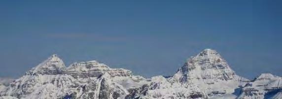
2 Looking West and Wondering If. 2


3 The Flood 3

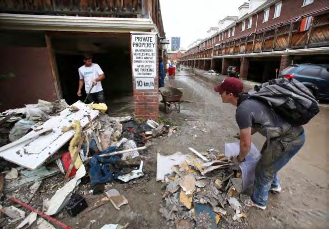
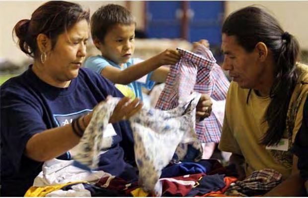
4 The Response 4


5 The Causes 5


6 The Human Component (Natural Floods versus Economic Floods) 6


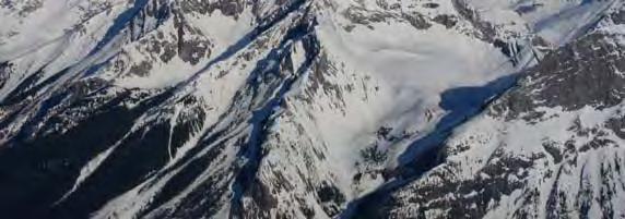
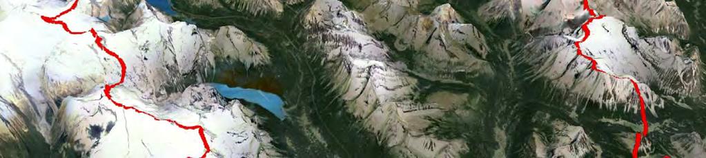
7 Setting the Stage N ~15,500 km 2 W E S 7

8 This is a relatively New Landscape Most recent glacial event occurred between 20,000 and 9,000 years Relatively young landscape for soils and vegetation Action of glaciers ground up rock and increased availability of minerals; enhanced plant growth and soil formation 8


9 Remnants of Glacial Headwaters 9

10 The Small Scale Picture 10


11 The Upper Bow River Basin Source: ALCES Online 11


12 The Anatomy of the Bow River Basin Source: ALCES Online 12
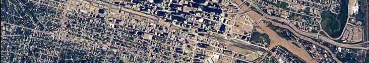
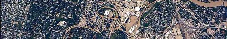
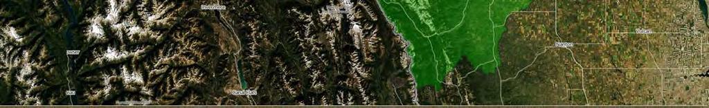
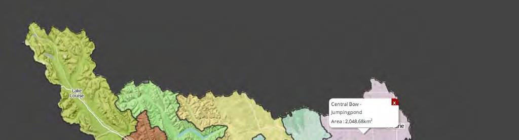
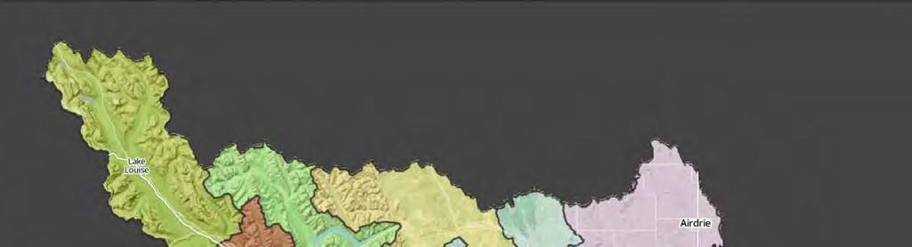
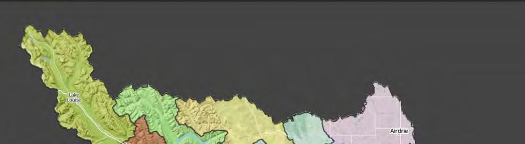
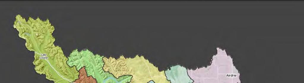
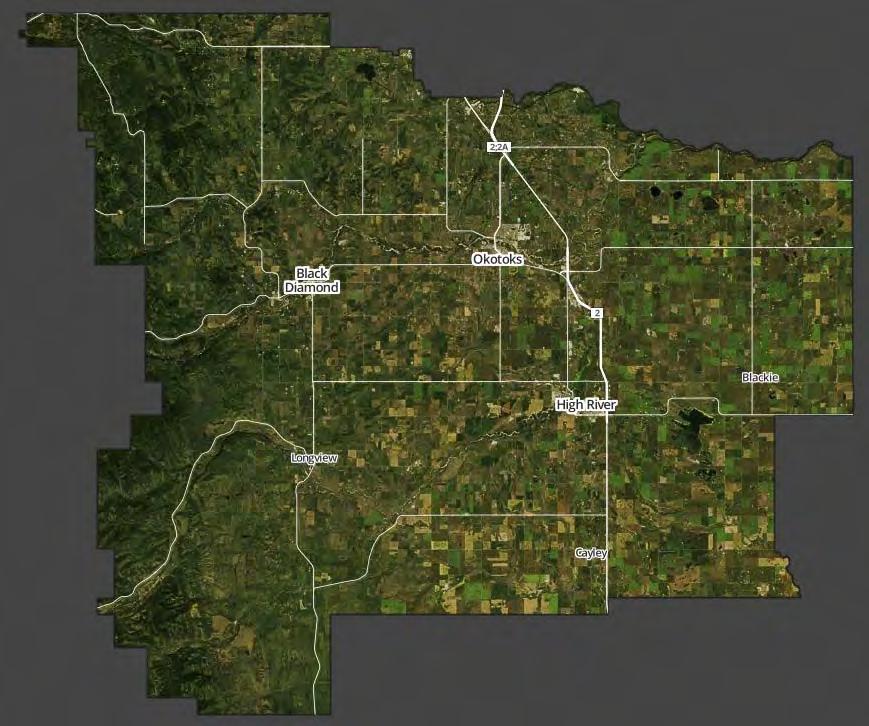
13 The Basin and Selected Communities W Banff Canmore Lake Louise S Turner Valley Longview Black Diamond High River Millarville Okotoks Bragg Creek Redwood Meadows Priddis Calgary Chestermere Cochrane Airdrie Crossfield N E 13


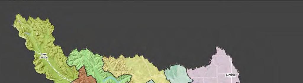
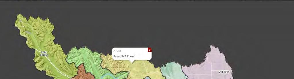
14 The Major Plumbing Pipes of the Bow River Basin (including alluvial aquifers) Examples of Alluvial Bow Ghost Jumping Nose Elbow Fish Sheep Highwood Creek Hill River Aquifer Pound Mainstem River Drainage Channels Drainage W S N E 14
15 Inter Annual Variation in Precipitation and Flow AVERAGE YEAR W S N E 15
16 Inter Annual Variation in Precipitation and Flow DRY YEAR W S N E 16
17 Inter Annual Variation in Precipitation and Flow WET YEAR W S N E 17 Redwood Meadows

18 Mean Elevation (m.a.s.l( m.a.s.l) Source: ALCES Online 18

19 Mean Slope Source: ALCES Online 19
20 Mean Annual Temperature Source: ALCES Online 20
21 Mean Annual Precipitation (mm) Source: ALCES Online 21
")

22 Mean Annual Runoff (mm) Source: ALCES Online 22
23 The Basic Math of Water in the Upper Bow Annual Annual Precipitation with Average Rainfall Events Precipitation (~780 mm) Evapotranspiration (~450 mm) Runoff of Surface Water (~250 mm) Decades 23
24 The Basic Math of Water in the Upper Bow Annual Annual Precipitation but Rain falls in Intense Storms Precipitation (~780 mm) Runoff Evapotranspiration of Surface Water (~450 (~450 mm) mm) Runoff Evapotranspiration of Surface Water (~250 (~250 mm) mm) Year to Year 24
25 Monthly Precipitation and Temperature at Calgary Source: Environment Canada 25

26 Much of the Winter Precipitation Accumulates as Snowpack 26

27 Average Pattern of Snowpack Accumulation and Loss Source: Environment Canada Under Climate Change High Scenarios, Rainfall High Rainfall Events Events Possible Can Occur Earlier in the Spring 27
28 How s s the Snowpack this year? Source: Alberta Environment, AESRD 2013 Snowpack 2014 Snowpack 28
29 Flow Rates of the 2013 Bow River at Calgary Source: Alberta Environment, AESRD Average Peak of ~200 cms In 2013, peaked at ~1740 cms 29


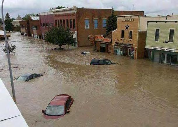
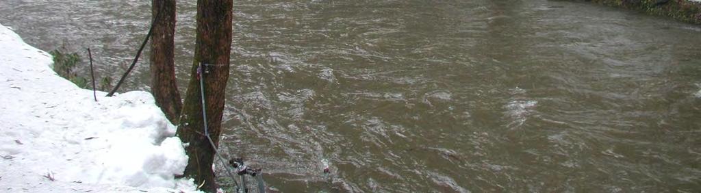
30 We have been there many times in the past We will be there many times more Source. Various Historical Archives in Alberta 30

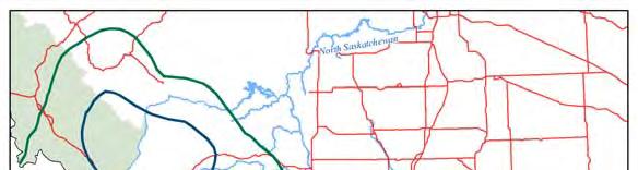
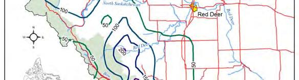

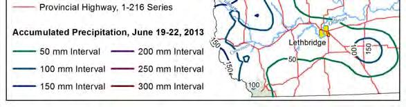
31 June 2013 A Very Large and Concentrated Precipitation Event 31

32 Rainfall Intensity and River Volume A Short and Intensive Rainfall Event of a 2 Day Period River Discharge Rate Extended Bout of Rainfall Over a 1 Week Period Time 32

33 A Lot of Rain over a Short Period of Time 33

34 Rain on Snow 34


35 The Steep Elevation Loss of the Elbow River Headwaters. Source: Elbow River Basin ALCES Simulator North South West East 35
36 The Steep Elevation Loss of the Bow Basin Headwaters. Source: Elbow River Basin ALCES Simulator mass x slope (velocity) = energy Calgary Bragg Creek North West South East 36


37 The Steep Elevation Loss of the Elbow River Headwaters. Source: ALCES Online 37

38 The Erosional Power of Floods Source: Calgary Herald 38


39 Some Math behind the Bow River Flood Event Variable Amount Units 39


40 Under the pull of Gravity, much of this precipitation will get to the Mainstem Rivers, and very quickly 40


41 But the mainstem river systems of the Bow River basin only amount to about ¾ of 1% of the landscape. 41

42 The Elbow Dissipating Energy Source: Rick Bodan, Workabove.com 42


43 The Elbow River and Dissipating Energy Source: Rick Bodan, Workabove.com 43


44 Bow River Basin Reservoir Infrastructure Considerable water can be retained but primary historical purpose e has been electricity generation, not flood mitigation Minnewanka 157 M m 3 Spray 199 M m 3 Barrier, 21 M m 3 Ghost 50 M m 3 Name of Reservoir Working Volume of Water m 3 Bearspaw, 6 M m 3 Most topographically suitable sites for reservoirs have already been used Water storage capacity is continually reduced by sedimentation Glenmore 25 M m 3 L. Kananaskis 58 M m 3 U. Kananaskis 93 M m 3 44
45 Contributing Factors to Floods High Precipitation + Concentrated Precipitation + High Snowpack + Low Landscape Resiliency = High Water (Flood) 45
46 Contributing Factors to Flood Disasters High Precipitation + Concentrated Precipitation + High Snowpack + Low Landscape Resiliency + Floodplain and Floodway Infrastructure = High Water (Flood) and Economic Hardship 46
47 Night Time Light Emission Source: Bow River Basin Alces Online 47
48 Footprint Area of the Energy Sector Source: Bow River Basin Alces Online ~90 km 2 48
49 Footprint Area of the Forest Sector Source: Bow River Basin Alces Online ~40 km 2 49
50 Footprint Area of the Road Sector Source: Bow River Basin Alces Online ~250 km 2 50
51 Footprint Area of the Residential Sector Source: Bow River Basin Alces Online ~900 km 2 51
52 Footprint Area of the Agriculture Sector Source: Bow River Basin Alces Online ~2,500 km 2 52
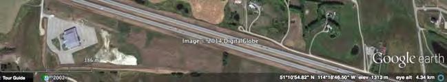
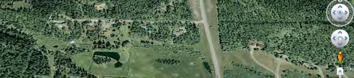
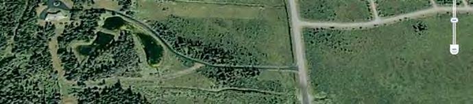
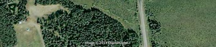
53 Footprint Area of All Land Uses Source: Bow River Basin Alces Online ~3,700 km 2 53


54 Land Use Footprint Intensity Source: Bow River Basin Alces Online Year Footprint km 2 Study Area km 2 = % ,700 km 2 = 24% 15,500 km ,200 km 2 = 34% 15,500 km 2 54


55 Holding Back the Water; Slowing its Speed 55
56 Holding Back the Water; Slowing its Speed Photo Credit: Jenny Earle 56
57 The Role of Wetlands in Flood Mitigation The Source: Mitsch and Gosselink) 57

58 Loss of Wetlands in the East Slopes Pre Industrial


59 We are Losing Natural Wetland Storage 59


60 Time Series of Natural Area in Upper Bow Source: East Slopes ALCES Simulator Pre Industrial
61 Proper Riparian Function Source: Google Earth 61


 at which")
62 Land Use and Flashy Runoff In comparison to natural ecosystems, roads, settlements, acreages, cutblocks, croplands, pasturelands, and industrial features generally increase the pace (rate) at which precipitation runs off landscapes. 62
63 In Harms Way 63

64 The Rivers of the Bow Basin are trying to release their flood energy into the floodplain by scouring and depositing We are trying to concentrate its energy by containing it within narrow and constrained channels 64


65 Flooding in Canmore 65

66 Flooding in High River Source: 66


67 Holding Back Water Resilient Natural Systems Engineering Solutions Optimal and Cost Effective Flood Mitigation Strategies require both of these approaches to work in concert 67


 and landuses")
68 Moving beyond Silos We need an Integrated Resource Management Paradigm Forestry Energy In practice, the watershed is fully integrated Crops Livestock Residential Mining Reservoirs Unfortunately, our watershed management principles are still based on Silos The volume and flow of its water reflects the full suite of natural processes (climate) and landuses Transportation 68
69 Summary Thoughts Precipitation is, by nature, highly variable in time (seasons, years, decades) Floods are a natural, and required, process for all healthy watersheds Climate Change models suggest that variation in precipitation (floods, droughts) will increase in frequency and intensity The resiliency of the Bow River Watershed to absorb and hold meltwater has been impaired by land uses (forestry, agriculture, transportation, residential) Human infrastructure (crops, forestry, residential, transportation) has accelerated the rate of water movement to mainstem rivers We have intentionally constructed many billions of $ of infrastructure in the flood plain of the Bow River Basin mainstem rivers and its tributaries Although engineering solutions play a key role in flood mitigation, longterm and sustainable solutions to flood risk must incorporate a landscape (watershed) level We should be looking for silver buckshot, not a silver bullet. We are all part of both the problem and the solution. 69
70 What Can We Do Now to Mitigate Flood Risk? 1. Where possible, remove high risk infrastructure from the flood plain 2. Stop approving and building new infrastructure in the flood plain 3. Relocate (elevate) valuables and key utilities (furnaces, water heaters, electrical controls) from basements; 4. Restore natural river function and flow 5. Promote the reconstruction of wetlands and riparian function 6. Promote forestry practices (and other land uses) that encourage water retention in the headwater forest ecosystems 7. Require, and support, regional planning initiatives that promote resilient watersheds 70

71 Implications to MD Foothills 71
72 72
73 Cropland in MD Foothills Pre Agriculture 73

74 Cropland in MD Foothills

75 Cropland in MD Foothills
76 Cropland Trajectory in MD Foothills 76
77 Pasture in MD Foothills Pre Agriculture 77

78 Pasture Land in MD Foothills

79 Pasture Land in MD Foothills
80 Pasture Trajectory in MD Foothills 80
81 Human Popn in MD Foothills (pre) 81

82 Human Population in MD Foothills

83 Human Population in MD Foothills
84 Human Popn Trajectory in MD Foothills 84
85 Wetlands in MD Foothills (pre) 85
86 Wetlands in MD Foothills
87 Human Population in MD Foothills
88 Wetland Trajectory in MD Foothills 88


89 89
Collaborative Water Management in Southern Alberta March 2015
 Collaborative Water Management in Southern Alberta March 2015 SSRB: Four Unique, Dynamic Watersheds www.albertawatersmart.com 2 Climate is Water.Water is Climate Annual Precipitation Water yield is already
The Water Balance Model for Canada:
 Watershed & Stormwater Management Webconference The Water Balance Model for Canada: Improving the Urban Landscape through Inter-Provincial Partnerships Kim Stephens, PEng,, Project Coordinator, Inter-Governmental
Respecting Our Rivers Alberta s Approach to Flood Mitigation
 Respecting Our Rivers Alberta s Approach to Flood Mitigation The flooding that occurred throughout Alberta in June 2013 was unprecedented. More than 100,000 Albertans were impacted in over 30 communities,
Watershed Health and Water Management in the Porcupine Hills
 Watershed Health and Water Management in the Porcupine Hills In Alberta, our quality of life is tied to healthy and sustainable water supplies for the environment, for our communities, and for our economic
Pre-Event Activities. Blue River. Pre Field Trip Suggestions
 Blue River Have you heard we all live in a watershed? Well, it is true! This total body activity will allow students to demonstrate how water flows in a watershed while exploring how seasonal variations
WASA Quiz Review. Chapter 2
 WASA Quiz Review Chapter 2 Question#1 What is surface runoff? part of the water cycle that flows over land as surface water instead of being absorbed into groundwater or evaporating Question #2 What are
River Talk Patterns. Student Copy Page PART I (1 of 1) 3. Human nervous system. Waters and drainage patterns. Road system.
 3. Human nervous system. Waters and drainage patterns. Road system.") River Talk Patterns Student Copy Page PART I (1 of 1) 3 Human nervous system photo credit: Hemera Thinkstock Photos Waters and drainage patterns photo credit: Comstock Getty Images Road system photo credit:
River Talk Patterns Student Copy Page PART I (1 of 1) 3 Human nervous system photo credit: Hemera Thinkstock Photos Waters and drainage patterns photo credit: Comstock Getty Images Road system photo credit:
Black River Watershed Management Plan Plan
 Black River Watershed Management Plan Plan Final Report Part II: Appendices May 2010 This watershed management plan was prepared for the New York State Department of State Division of Coastal Resources
Protecting and Enhancing Ecosystem Services the Role of Wetlands and Watershed Management in Flood Attenuation Dr. Mark Gloutney Director Regional
 Protecting and Enhancing Ecosystem Services the Role of Wetlands and Watershed Management in Flood Attenuation Dr. Mark Gloutney Director Regional Operations Eastern Canada April 14 2016 Changes in Storm
How is Water Quality Affected by Land Use?
 Watershed Connections Lesson Les4 3 How is Water Quality Affected by Land Use? Overview What are the benefits of a healthy watershed? What are examples of land uses? What types of pollution can come from
Global Water Futures Programme and its Science Contributions to GEWEX
 Global Water Futures Programme and its Science Contributions to GEWEX John Pomeroy, Director, Global Water Futures Program Centre for Hydrology, University of Saskatchewan, Saskatoon & Canmore Our water
Planning Considerations for Stormwater Management in Alberta. R. D. (Rick) Carnduff, M. Eng., P. Eng. February 20, 2013.
 Carnduff, M. Eng., P. Eng. February 20, 2013.") Planning Considerations for Stormwater Management in Alberta R. D. (Rick) Carnduff, M. Eng., P. Eng. February 20, 2013 Photo Optional Purpose The purpose of urban stormwater management is to provide solutions
Planning Considerations for Stormwater Management in Alberta R. D. (Rick) Carnduff, M. Eng., P. Eng. February 20, 2013 Photo Optional Purpose The purpose of urban stormwater management is to provide solutions
Southern Sierra Headwaters Tour
 Southern Sierra Headwaters Tour Introduction The headwaters of the Sierra Nevada support the needs of California s diverse downstream communities, economies, and environments. On this tour and in our research,
Ensuring Sufficient Water Supply for the Emerging Bioeconomy
 Ensuring Sufficient Water Supply for the Emerging Bioeconomy John Pomeroy & Michael Solohub Canada Research Chair in Water Resources & Climate Change & Centre for Hydrology, University of Saskatchewan
Community Resilience and Mitigation Assessment
 As part of the application process for the Alberta (ACRP), applicants are required to submit a. Only one Community Resilience & Mitigation Assessment is required for each municipality Disasters occur at
New Approaches to Watershed Modelling Using STELLA. WeSMART Conference, December 11, 2014 Heather Cray & Michael McTavish
 New Approaches to Watershed Modelling Using STELLA WeSMART Conference, December 11, 2014 Heather Cray & Michael McTavish Ecosystem Modelling What are models and ecosystem models? Broadly, a model is a
Tracking Sources of Fecal Pollution in the Bow and Elbow Rivers: Implications for Drinking Water Risk Assessments in Calgary
 Tracking Sources of Fecal Pollution in the Bow and Elbow Rivers: Implications for Drinking Water Risk Assessments in Calgary *Norman F. Neumann, Norma J. Ruecker, Graham Banting, Joanne Matsune, Shannon
HAZARD MITIGATION ASSISTANCE
 FEDERAL INSURANCE ANDMITIGATION ADMINISTRATION HAZARD MITIGATION ASSISTANCE New Partners for Smart Growth Conference - February 3, 2018 Jennie Orenstein, FEMA HQ 1 Objectives By the end of this session
calgary watershed report,
 calgary watershed report, 2007-2009 city of calgary water resources water quality services Calgary Watershed Report, 2007-2009 A Summary of Surface Water Quality in the Bow and Elbow River Watersheds,
Water Budget III: Stream Flow P = Q + ET + G + ΔS
 Water Budget III: Stream Flow P = Q + ET + G + ΔS Why Measure Streamflow? Water supply planning How much water can we take out (without harming ecosystems we want to protect) Flood protection How much
Water Budget III: Stream Flow P = Q + ET + G + ΔS
 Water Budget III: Stream Flow P = Q + ET + G + ΔS Why Measure Streamflow? Water supply planning How much water can we take out (without harming ecosystems we want to protect) Flood protection How much
CHAPTER ONE : INTRODUCTION
 CHAPTER ONE : INTRODUCTION WHAT IS THE HYDROLOGY? The Hydrology means the science of water. It is the science that deals with the occurrence, circulation and distribution of water of the earth and earth
White House Council on Environment Quality, Interagency Water Resources and Climate Change Adaptation Workshop Response Comments.
 White House Council on Environment Quality, Interagency Water Resources and Climate Change Adaptation Workshop Response Comments from American Society of Agronomy Crop Science Society of America Soil Science
Water Budget III: Stream Flow P = Q + ET + G + ΔS
 Water Budget III: Stream Flow P = Q + ET + G + ΔS Why Measure Streamflow? Water supply planning How much water can we take out (without harming ecosystems we want to protect) Flood protection How much
Rethinking operations of river infrastructure from experience in Alberta: people, tools, and process
 Rethinking operations of river infrastructure from experience in Alberta: people, tools, and process Mike Nemeth Environmental Specialist, Alberta WaterSMART PNWER 25 th Annual Summit, Big Sky Montana
Water Budget III: Stream Flow P = Q + ET + G + ΔS
 Water Budget III: Stream Flow P = Q + ET + G + ΔS Why Measure Streamflow? Water supply planning How much water can we take out (without harming ecosystems we want to protect) Flood protection How much
Town of Canmore. Climate Change Adaptation Background Report and Resilience Plan
 Town of Canmore Climate Change Adaptation Background Report and Resilience Plan PRAC Webinar Tools for Municipal Adaptation Action May 4 th, 2018 Lori Rissling Wynn Sustainability Coordinator/Development
FACTSHEET INTRODUCTION. help rebalance the water cycle, mitigate the effects of climate change and improve human health and livelihoods.
 1 FACTSHEET INTRODUCTION World Water Day, on 22 March every year, is about focusing attention on the importance of water. This year s theme, Nature for Water, explores nature-based solutions (NBS) to the
Welcome to a WATERSHED Event!
 Welcome to a WATERSHED Event! Long-Term Flood Resiliency for Communities: A Watershed Management Approach April 16, 2015 Kim Sherwood Watershed Consultant from Chautauqua County, NY WATERSHEDS THE FUNNEL,
SHEEP RIVER AT 128 TH STREET FLOOD HAZARD RISKS AND REVIEW OF MITIGATION OPTIONS
 SHEEP RIVER AT 128 TH STREET FLOOD HAZARD RISKS AND REVIEW OF MITIGATION OPTIONS Submitted to: Municipal District of Foothills No. 31 Calgary, Alberta Submitted by: Calgary, Alberta CW2167.SHEEP is committed
Inputs. Outputs. Component/store. Section of a system where material or energy is held. Something that enters the system (material or energy)
") .. Inputs Something that enters the system (material or energy) Outputs Something that leaves the system (material or energy) Component/store Section of a system where material or energy is held Transfer/flow
.. Inputs Something that enters the system (material or energy) Outputs Something that leaves the system (material or energy) Component/store Section of a system where material or energy is held Transfer/flow
Science 8 Chapter 1 Section 1
 Science 8 Chapter 1 Section 1 Distribution of Water (pp. 8-13) How much fresh water do we have? The vast majority of water on Earth, about 97 percent, is salt water Two thirds of that fresh water supply
Alberta WaterSMART and the Sustainable Water Management in the Athabasca River Basin Initiative (ARB Initiative) June 1, 2016
 June 1, 2016") Alberta WaterSMART and the Sustainable Water Management in the Athabasca River Basin Initiative (ARB Initiative) June 1, 2016 Topics for today WaterSMART and the collaborative approach Overview of the
Alberta WaterSMART and the Sustainable Water Management in the Athabasca River Basin Initiative (ARB Initiative) June 1, 2016 Topics for today WaterSMART and the collaborative approach Overview of the
Sacramento and San Joaquin Basins Study & Climate Adaptation Options
 Sacramento and San Joaquin Basins Study & Climate Adaptation Options Presentation to MCWRA and ACWA Region 3 March 11, 2014 v2 WaterSMART Basin Study Program Overview Basin Studies Authorized in SECURE
IT S BEAUTIFUL. IRREPLACEABLE. AND SHOULD LAST FOREVER. LET S CONSERVE THIS TOGETHER THE BOW & BEYOND CAMPAIGN
 IT S BEAUTIFUL. IRREPLACEABLE. AND SHOULD LAST FOREVER. LET S CONSERVE THIS TOGETHER The Bow & Beyond Campaign CONSERVING OUR IRREPLACEABLE RIVER VALLEYS This treasured land connects us. But it is disappearing
Chehalis Basin Strategy Programmatic SEPA Draft EIS
 Chehalis Basin Strategy Programmatic SEPA Draft EIS History of Flooding I-5 closed in 1990, 1996, 2007, 2009 Five largest flood events occurred since 1986 2 History of Habitat Degradation Harvest has been
DEPARTMENT OF GEOGRAPHY POST GRADUATE GOVT. COLLEGE FOR GIRLS.SECTOR-11 CHANDIGARH CLASS-B.A.II PAPER-A RESOURCES AND ENVIRONMENT: WORLD PATTERNS
 DEPARTMENT OF GEOGRAPHY POST GRADUATE GOVT. COLLEGE FOR GIRLS.SECTOR-11 CHANDIGARH CLASS-B.A.II PAPER-A RESOURCES AND ENVIRONMENT: WORLD PATTERNS Hydrological cycle The sun, which drives the water cycle,
2
 1 2 3 4 5 Context Our basin has diverse landscapes from the forested Cascade Mountains, the agricultural Willamette Valley, to the densely populated cities of Eugene, Salem, and Portland. Water flows through
Rangeland Hydrology and Management
 Rangeland Hydrology and Management This watershed rehabilitation and restoration training was prepared by the U.S. Department of Agriculture (USDA) team of Melvin Westbrook, Director USDA-NRCS/IPD, Otto
4. Present Activities and Roles
 4. Present Activities and Roles The present missions, authorities, activities and roles of the various agencies involved with flood protection, floodplain management and flood-damage reduction are identified
Community Services and Utilities & Environmental Protection Report to UE The SPC on Utilities and Environment Page 1 of April 25
 Community Services and Utilities & Environmental Protection Report to UE2007-15 The SPC on Utilities and Environment Page 1 of 2 2007 April 25 ENVIRONMENTAL RESERVE SETBACKS SUMMARY/ISSUE This report recommends
WATERSHED. Maitland Valley. Report Card 201
 Maitland Valley WATERSHED Report Card 201 The Maitland Valley Conservation Authority has prepared this report card as a summary on the state of our forests, wetlands, surface water, and ground water resources.
COTTONWOOD CREEK RECLAMATION PHASE I & II
 COTTONWOOD CREEK RECLAMATION PHASE I & II COTTONWOOD CREEK RECLAMATION Stream Stabilization Approach to Urban Runoff Quality Cherry Creek Basin Water Quality Authority The Problem The Cherry Creek Reservoir
Water, forests and climate
 Water, forests and climate Roger Bales, UC Merced 1. Water & fire 2. Water & forest management 3. Securing the future 1. Water & fire issues to consider Forest structure Wildfire Water yield Snowpack storage
Climate Change in the Columbia Basin. Stephanie Smith Manager of Hydrology, BC Hydro
 Climate Change in the Columbia Basin Stephanie Smith Manager of Hydrology, BC Hydro June 20, 2017 Outline Climate change in the Columbia River basin What has happened? What could happen? What can we do
New Castle County, DE. Floodplain Regulations
 New Castle County, DE Floodplain Regulations John J. Gysling, PE CFM Department of Land Use New Castle County, DE February 26, 2009 Today s Presentation Floodplain Protection and Uses Terms and Definitions
Role of Soils in Water Quality. Mike Marshall Extension Associate Texas A&M-Institute of Renewable Natural Resources
 Role of Soils in Water Quality Mike Marshall Extension Associate Texas A&M-Institute of Renewable Natural Resources Water Quality in Texas Water is a finite resource that can be impaired by pollution from
beneficial management practices
 beneficial management practices introduction Phosphorus is an essential nutrient for crop growth. Alberta soils are generally deficient or low in phosphorus for optimum crop production (
Protection of wetlands as an element of water management in rural areas
 Protection of wetlands as an element of water management in rural areas Waldemar Mioduszewski, Monika Hardej Institute for Land Reclamation and Grassland Farming, IMUZ Falenty, Poland Actions associated
Nonpoint Source Pollution A Challenge to Control
 Nonpoint Source Pollution A Challenge to Control Connecticut Envirothon Aquatics Workshop January 14, 2017 Presented by Denise Savageau Conservation Director, Town of Greenwich Point Source Pollution is
Jason R. Vogel, Ph.D., P.E. Biosystems and Agricultural Engineering Oklahoma State University
 Stormwater 101 OKLAHOMA STATE UNIVERSITY Biosystems and Agricultural Engineering Department Jason R. Vogel, Ph.D., P.E. Biosystems and Agricultural Engineering Oklahoma State University Stormwater is excess
1 THE USGS MODULAR MODELING SYSTEM MODEL OF THE UPPER COSUMNES RIVER
 1 THE USGS MODULAR MODELING SYSTEM MODEL OF THE UPPER COSUMNES RIVER 1.1 Introduction The Hydrologic Model of the Upper Cosumnes River Basin (HMCRB) under the USGS Modular Modeling System (MMS) uses a
Draft Fact Sheet Butte County Stable Isotope Recharge Study
 Agenda Item #4 Draft Fact Sheet Butte County Stable Isotope Recharge Study Purpose of the Study: To develop a better understanding of how various water sources contribute to recharge of Butte County groundwater.
Wisconsin s Buried Treasure: Groundwater Basics. Kevin Masarik Center for Watershed Science and Education
 Wisconsin s Buried Treasure: Groundwater Basics Kevin Masarik Center for Watershed Science and Education Groundwater is Valuable to Wisconsin 95% of Wisconsin Communities 75% of Wisconsin Citizens rely
Bow River Project. The Bow River Research Consortium. Bow River Basin Council March 9, 2011
 Bow River Project Bow River Basin Council March 9, 2011 The Bow River Project BRP: A collaborative project of water stakeholders to assess possible changes to water storage and flows in the Bow System
IPCC WG II Chapter 3 Freshwater Resources and Their Management
 IPCC WG II Chapter 3 Freshwater Resources and Their Management Impacts increasingly harmful & more costly to adapt as global temperature increases May imperil sustainable development goals Semi-arid /
FEMA s Mitigation Support for Resiliency: Innovative Drought and Flood Mitigation Projects
 FEMA s Mitigation Support for Resiliency: Innovative Drought and Flood Mitigation Projects Jordan Williams, CFM Eric Kenney, PE, CFM May 4, 2017 2 Hazard Mitigation Purpose: Research climate resilient
Advice to Government on Water Management in the Bow River Basin
 Bow River Water Management Project Advice to Government on Water Management in the Bow River Basin Submitted to: Hon. Shannon Phillips Minister Environment and Parks Government of Alberta Submitted on:
City of Toronto s Climate Change Adaptation Strategy to Mitigate Urban Flooding
 City of Toronto s Climate Change Adaptation Strategy to Mitigate Urban Flooding Michael D Andrea, M.E.Sc., P.Eng. Chief Engineer and Executive Director, Engineering & Construction Services City of Toronto
Wetland Ecology Basic Principles. November 14, Kendra Moseley, Regional ESS, Soil Science Division
 Wetland Ecology Basic Principles November 14, 2018 - Kendra Moseley, Regional ESS, Soil Science Division Wetland Ecology Primary & Secondary Succession Disturbance Ecological Thresholds Ecological Dynamics
The Water Cycle and Water Insecurity
 The Water Cycle and Water Insecurity EQ1: What are the processes operating within the hydrological cycle from global to local scale? 6 & 8 markers = AO1. 12 & 20 markers = AO1 and AO2 larger weighting
Water exists everywhere on Earth, and covers 70% of its surface. 97% of this water is found in the oceans.
 10.1 Distribution of Water Water exists everywhere on Earth, and covers 70% of its surface. 97% of this water is found in the oceans. w Another 2% is ice and snow, leaving only 1% as fresh water found
Managing Erosion in Vineyard Blocks and Avenues
 Managing Erosion in Vineyard Blocks and Avenues Preventing Erosion and Flow Concentration Managing Concentrated Storm Runoff and Sediment Delivery from Vineyards Evaluating drainage and erosion to comply
Review of Chapter 1. Taken from: Check Your Understanding sections p. 13, 21 and 33
 Review of Chapter 1 Taken from: Check Your Understanding sections p. 13, 21 and 33 In case you were curious: Henry Hudson The Last Voyage of Henry Hudson, 1611 Painted in 1880 by: John Collier Today Hudson
HYDROLOGY - BASIC CONCEPTS
 HYDROLOGY - BASIC CONCEPTS Hydrology Hydrology is the science of the waters of the earth and its atmosphere. It deals with occurrence, circulation, distribution and movements of these waters over the globe
GCI Survey---Lake Winnipeg Watershed
 IISD-GWSP Conference. Winnipeg May 1-4, 2012 Water-Energy-Food Nexus GCI Survey---Lake Winnipeg Watershed A. A. WARKENTIN Hydrometeorologist GCI Survey Lake Winnipeg Watershed PRESENTATION OUTLINE WATERSHED
D Olive Watershed. Path Toward Restoration
 D Olive Watershed Path Toward Restoration Water is the most critical resource issues of our lifetime and our children s lifetime. The health of our waters is the principal measure of how we live on the
Stormwater Management in Your Backyard: Stormwater 101
 Stormwater Management in Your Backyard: Stormwater 101 Gregory Rusciano Program Associate, Water Resources Rutgers Cooperative Extension New Jersey Sea Grant Extension Program How much water do we have?
Hydrologic Characteristics of the Owens River Basin below the Upper Owens River
 Appendix T. Hydrologic Characteristics of the Owens River Basin below the Upper Owens River The hydrology of Mono Basin is described in detail in Chapter 3A. This appendix describes the Owens River basin
CHAPTER 7 PHYSICAL INVENTORY OF THE CITY
 CHAPTER 7 PHYSICAL INVENTORY OF THE CITY Chapter 7: Physical Inventory of the City 39 This page intentionally left blank. Chapter 7: Physical Inventory of the City 40 SECTION 1 PHYSICAL SETTING While communities
Shower Curtain Watershed
 Shower Curtain Watershed Overview: What is a watershed and how do humans affect its health? What is a watershed? How do our actions affect the health of a watershed? Students explore these questions by
Sustainable Water Resource Practices
 Sustainable Water Resource Practices This section is related to and shoudl be read in conjunction with the Land Use Element, and Conservation Element. Implementing sustainable water resource practices
Maitland Valley WATERSHED
 Maitland Valley WATERSHED Report Card 2018 Maitland Conservation has prepared this report card as a summary of the state of your forests, wetlands, and water resources. WHERE ARE WE? We are one of 36 Conservation
Read p.4 Activity. Class Discussion (The many ways people use water) P. 5. Read p.6 Read pp. 8-9
 P. 5. Read p.6 Read pp. 8-9") Grade 8 Science Read p.4 Activity Class Discussion (The many ways people use water) P. 5 Read p.6 Read pp. 8-9 Water exists everywhere on Earth, and covers 70% of its surface. 97% of this water is found
Grade 8 Science Read p.4 Activity Class Discussion (The many ways people use water) P. 5 Read p.6 Read pp. 8-9 Water exists everywhere on Earth, and covers 70% of its surface. 97% of this water is found
Water and Climate Change in British Columbia, Canada
 Water and Climate Change in British Columbia, Canada Presentation to RegionsAdapt Water Resources and Management Working Group Jenny Fraser British Columbia Ministry of Environment 8 June 2016 Background
The Land & Infrastructure Resiliency Assessment (LIRA) Project Economic Flood Hazard Assessment
 Project Economic Flood Hazard Assessment") The Land & Infrastructure Resiliency Assessment (LIRA) Project Economic Flood Hazard Assessment Robert Armstrong / Cameron Kayter Agri-Environment Services Branch LIRA Background Subcomponent of Climate
The Land & Infrastructure Resiliency Assessment (LIRA) Project Economic Flood Hazard Assessment Robert Armstrong / Cameron Kayter Agri-Environment Services Branch LIRA Background Subcomponent of Climate
An overview. Wildland Fire Canada, Halifax, By Marie-Pierre Rogeau, PhD candidate University of Alberta Wildland Disturbance Consulting
 An overview Wildland Fire Canada, Halifax, 2014 By Marie-Pierre Rogeau, PhD candidate University of Alberta Wildland Disturbance Consulting Determine spatial variation of prob. of ignitions or prob. of
Post Flood Sediment Sampling in High River
 Post Flood Sediment Sampling in High River Jan Quinlan, M.Sc., P.Ag. Alberta Environment and Sustainable Resource Development WaterTech April 2014 Presentation at a Glance 1. The Back Story The Flood area,
ORDINANCE # 854. Stormwater Management / Operation and Maintenance Requirements
 ORDINANCE # 854 Stormwater Management / Operation and Maintenance Requirements Section 1. Purpose and Authority In accordance with the provisions of Chapters 98, 124, 126, 440, 444, and 446h of the General
Ward s Stormwater - Floodplain Model Train the Trainer Workshop INAFSM Workshop, South Bend, IN September 7, 2017
 Ward s Stormwater - Floodplain Model Train the Trainer Workshop INAFSM Workshop, South Bend, IN September 7, 2017 Presenter Training for the Stormwater Floodplain Model: A Hands-on Workshop for Education
Bylaw , being "Official Community Plan Bylaw, 2016" Schedule "A" 5Improve. Natural + Built Systems
 Bylaw 2600-2016, being "Official Community Plan Bylaw, 2016" Schedule "A" 5Improve Natural + Built Systems Vision Abbotsford will become both more city and more country, where the city becomes more urban
The Lower Watershed Ecosystem Services in Coastal Areas with a focus on the Courtenay River Floodplain
 The Lower Watershed Ecosystem Services in Coastal Areas with a focus on the Courtenay River Floodplain Jennifer Sutherst Estuary Coordinator and Staff Biologist Comox Valley Project Watershed Society Lower
Water Resources. The Water Cycle. Section 1. Key Terms surface water river system watershed groundwater aquifer porosity permeability recharge zone
 Water Resources The next time you drink a glass of water, think about where the water came from. Did you know that some of the water in your glass may have been part of a rainstorm that pounded Earth long
Home to about 56 million people, the Southwest includes Nevada, Arizona, New Mexico, Utah, Colorado and most of California.
 Climate change in the U.S. Southwest U.S. Environmental Protection Agency Overview The Southwest is the hottest and driest region in the nation. Extending from the Pacific Ocean east to the Rocky Mountains
2.4.0 CLIMATE CHANGE, EXPOSURE & RISK. Contents of Set : Guide 2.4.1: Activity : Activity : Activity 3 IN THIS SET YOU WILL:
 2.4.0 SERIES 2 Understanding Vulnerability & Risk CLIMATE CHANGE, EXPOSURE & RISK Contents of Set 2.4.0: Guide 2.4.1: Activity 1 2.4.2: Activity 2 2.4.3: Activity 3 One component of vulnerability to climate
General Groundwater Concepts
 General Groundwater Concepts Hydrologic Cycle All water on the surface of the earth and underground are part of the hydrologic cycle (Figure 1), driven by natural processes that constantly transform water
Earth s Water. 97% Salt 3% Fresh
 Earth s Water 97% Salt 3% Fresh Of the 3% Freshwater 77% is in icecaps and glaciers (frozen) 22% is under the surface (groundwater) 1% is other: lakes, streams, rivers, etc. Surface water Supports cities
Figure 1: Changes in the movement of water when land use changes. (
 Evidence #1: Land use changes have generated large pressures on fresh water resources. These changes are affecting both water quality and availability. Farming, mining, and forestry require large amounts
Our reference BGS-0003-c. Direct line +31(0)
") Deltares Enabling Delta Life,J Alberta Environment and Parks Resilience and Mitigation Attn. Mr. A. Wilson 4th Floor, 9920-108 Street EDMONTON, AB T5K 2M4 Canada 7 October 2015 From Hans van Duijne Our
Deltares Enabling Delta Life,J Alberta Environment and Parks Resilience and Mitigation Attn. Mr. A. Wilson 4th Floor, 9920-108 Street EDMONTON, AB T5K 2M4 Canada 7 October 2015 From Hans van Duijne Our
Climate Change in Calgary What will it look like?
 Climate Change in Calgary What will it look like? Alberta Council for Environmental Education, ACEE Climate Chance Education and Outreach Workshop December 7, 2017 2017-12-10 Climate Change in Calgary
Analyzing the Changes to the Hydrologic Cycle. with the Implementation of LID Techniques in Korea
 Analyzing the Changes to the Hydrologic Cycle with the Implementation of LID Techniques in Korea Jung Min Lee Contents 1 Introduction 2 Change of New City Paradigm on Korea 3 Case Study 4 The Effects of
CLIMATE RESILIENCE FOR ALBERTA MUNICIPALITIES
 CLIMATE RESILIENCE FOR ALBERTA MUNICIPALITIES INTRODUCTION On March 11 in Edmonton and March 14 in Calgary the Municipal Climate Change Action Centre (MCCAC) and C-3 hosted Climate Resilience for Alberta
Sturgeon River Watershed Alliance
 Sturgeon River Watershed Alliance State of the Watershed Overview and Intermunicipal Partnership October 19, 2017 Presented by: Melissa Logan, P.Biol. Environmental Coordinator, Sturgeon River and Natural
OFFICE OF THE COUNTY MANAGER
 Page 1 of 16 OFFICE OF THE COUNTY MANAGER TO: Council DATE: December 11, 2018 DIVISION: All FILE: N/A APPLICATION: N/A SUBJECT: Springbank Off-Stream Reservoir Report 1 EXECUTIVE SUMMARY: The 2013 flood
Natural Water Retention Measures
 Natural Water Retention Measures DG Environment Water Unit Lucia Bernal Saukkonen GIIR WORKING GROUP 19.11.2014 Current activities on NWRM Within the CIS: EU Policy document on NWRM Pilot project: Integration
FISHER RIVER INTEGRATED WATERSHED MANAGEMENT PLAN STATE OF THE WATERSHED REPORT CONTRIBUTION SURFACE WATER HYDROLOGY REPORT
 FISHER RIVER INTEGRATED WATERSHED MANAGEMENT PLAN STATE OF THE WATERSHED REPORT CONTRIBUTION SURFACE WATER HYDROLOGY REPORT Disclaimer: The hydrologic conditions presented in this report are estimates
Chapter 1. Introduction
 Chapter 1 Introduction James P. Heaney, Robert Pitt, and Richard Field Introduction Stormwater has traditionally been considered a nuisance, requiring rapid and complete drainage from areas of habitation.
Calgary Region Economic Partnership. Productivity Assessment Survey 2010
 Calgary Region Economic Partnership Productivity Assessment Survey 2010 Introduction From early September through mid December 2009, Calgary and Region oil and gas, construction, manufacturing, value-added
Unit E: Basic Principles of Soil Science. Lesson 7: Understanding Soil Erosion and Management Practices
 Unit E: Basic Principles of Soil Science Lesson 7: Understanding Soil Erosion and Management Practices 1 Important Terms Accelerated erosion Conservation tillage Cover crops Diversion ditches Geologic
Background to the Saskatchewan River Basin
 Background to the Saskatchewan River Basin Professor John Pomeroy Canada Research Chair in Water Resources & Climate Change, Centre for Hydrology, University of Saskatchewan, Saskatoon Canada www.usask.ca/hydrology