Water Budget III: Stream Flow P = Q + ET + G + ΔS
|
|
|
- Gerald Potter
- 6 years ago
- Views:
Transcription

1 Water Budget III: Stream Flow P = Q + ET + G + ΔS
2 Why Measure Streamflow? Water supply planning How much water can we take out (without harming ecosystems we want to protect) Flood protection How much water will come down the channel if X storm happens? Who ll be flooded? Water quality What are the fluxes (flow x concentration) of contaminants to a lake or estuary? What are the effects of land use change on water delivery to downstream systems?
3 Stream Flow Network (

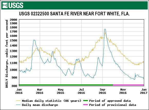
4 The Santa Fe River

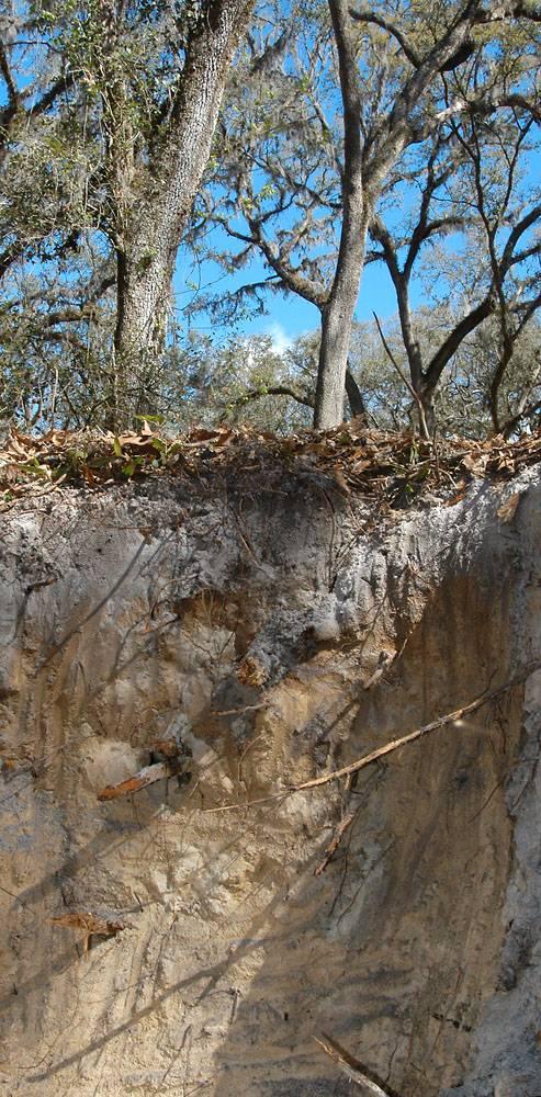
5 Extreme Low Flows Rainfall between Oct and January 21, 2011 is 2.68 inches
6 Hydrograph- graph of flow over time

7 Flow Over Time Santa Fe River
8 Seasonality of Flow
9 Watersheds as Filters Rain falls Storages buffer the rainfall signal, letting water out slowly More storage = more buffering The result is that the rainfall signal looks stochastic, the flow looks more organized Watershed properties AND size affect the filtering effect
10 Rainfall Filtering Santa Fe River
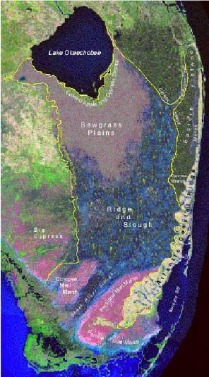
11 Rainfall Filtering Finer View
12 Consider the Filter Effects of: Watersheds with steep vs. shallow slopes Watersheds with deep vs. shallow soils Watersheds with intense vs. extended rainfall Watersheds with forests vs. parking lots Watersheds with dams vs. not Big vs. little watersheds Watersheds with big shallow aquifers
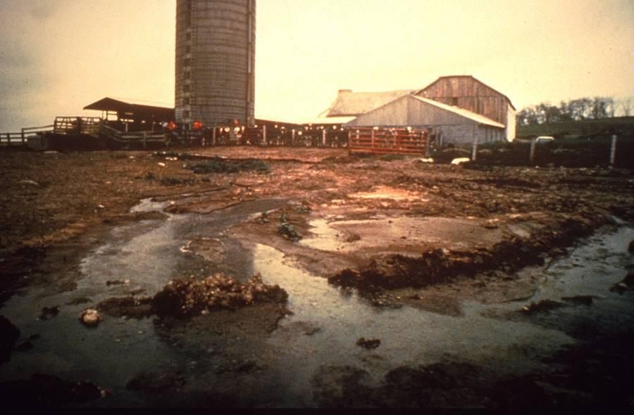
13 Basin Filtering Creates Lags Hatchet Creek
14 Where is Stream Flow From? At any time, flow is a composite of water with different sources and residence times Some water is stored in the watershed for a very long time, some very short During low flow conditions, water is mostly old During storms, the contribution of new water increases How does an aquifer affect this?
15 2% 8% 23%
16 Streamflow - A Convolution of Storms

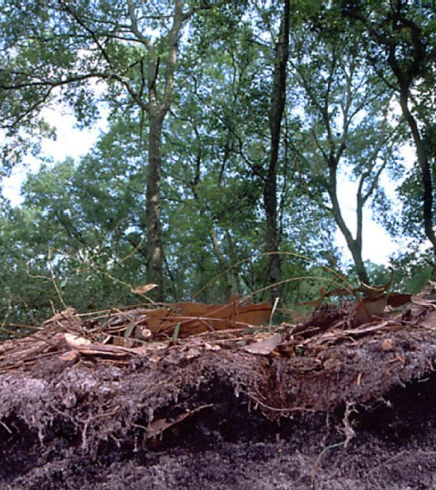
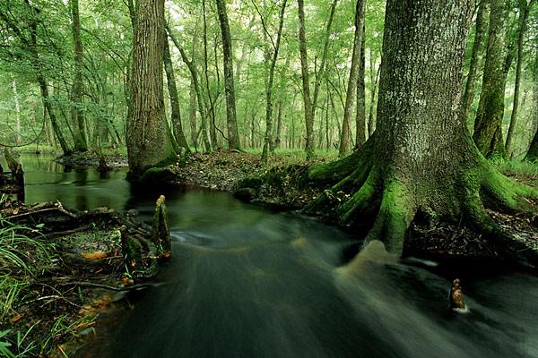
17 Flow and Rainfall Intensity If Rainfall Intensity > Infiltration Capacity then surface runoff occurs Stream flows are composites of Surface runoff Subsurface flows
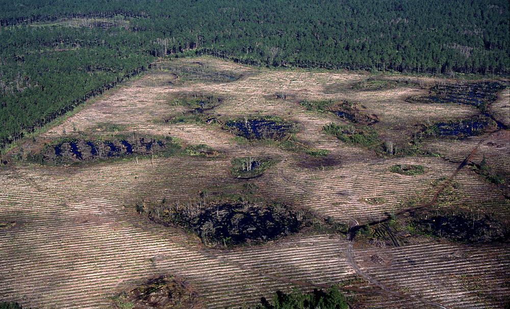
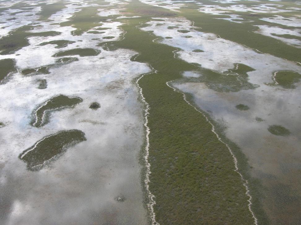
18 Variable Source Area (Stormflow Generation in Florida)
19 Variable Source Area Makes Antecedent Rainfall IMPORTANT
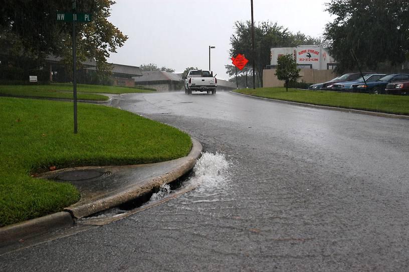
20 Land Use (Cover) Affects Runoff Generation Impervious surfaces preclude infiltration Less infiltration means more runoff Runoff also MOVES faster Less filtering Compare land uses
21
22 More stormflow, higher peak flow, sooner.
23 The importance of storage the basis of filtering Same total flow (area under the curve), lower peak flow.


24 Water Storage in the Forest
25
 slow runoff.")

26 Wetland Hydrological Services Depressions and vegetation (swamps) slow runoff. Upper watershed wetland storage delays runoff and reduces peak flows. Wetland flood plain has a dominant influence on downstream peak flow and solute transport.
27 Why Does Storage Matter? 200,000 m 3 of Stormwater Runoff; Channel Peak Flow capacity of 1m 3 /s All in one day Peak Flow =2.3 m 3 /s Spread over 3 days Peak Flow = 0.8m 3 /s
28 How Big a Flood Can We Expect? The size of the flood is inversely proportional to it s frequency Big event happen rarely Big events shape the landscape Medium events maintain the landscape Small events control the biology How would we predict the size of a flood that happens roughly once in 25 years? Think back to the rainfall lab
29 Rainfall Recurrence Series

30 Flow (Santa Fe River Station 3)

31 Daily Flow Recurrence Series

32 The 100-yr Floodzone Map
33 How Do We Measure Streamflow? Funny you should ask basis of Lab #4. Basis is to estimate: Cross-sectional area (A; through which water flows) Water flow velocity (V) Q = A * V

34 Measuring Surface Flow

35 Typical stream velocity profile

36 Where to measure mean velocity? Float Velocity * 0.8 for natural channels Float Velocity * 0.9 for concrete channels

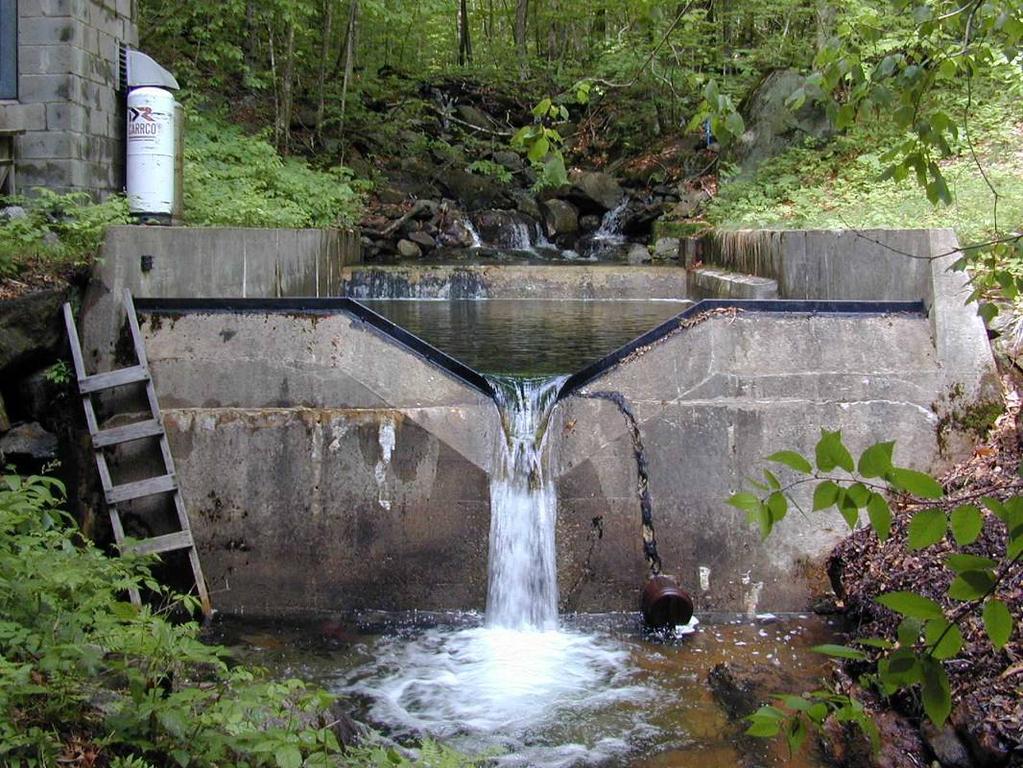
37 Velocity Instruments $2k Turn-cup ft/s $4k Electromagnetic ft/s $7k Sonic Doppler ft/s
38 Sect Width (m) Depth (m) m/s Flow (m 3 /s) Total 0.84m 3 /s
39 Discharge is HARD to Measure We want: Daily (or sub-daily) measurements Multiple stations per river Real time updating (detect changes in flow as they are happening)
 allow continuous flow")
40 Rating equations (stage vs. discharge) allow continuous flow monitoring
41 Stage-Discharge Relation Water stage (elevation) is EASY to measure Stage is related to dischage via a mathematical relationship Applying that relationship to measured stage gives estimates of discharge H H Q t Q t Stage Hydrograph Stage-Discharge Curve or Rating Curve Discharge Hydrograph
42 Stage-Discharge Relation Typical relationship: Q = a(h +b) c The relationship between H & Q has to be calibrated locally for different stations
43 Stage Discharge Relationship for the Ichetucknee River At low stage, positive relationship between stage and discharge At high stage, negative relationship Why? Discahrge Stage


44 Stage Measurements Float-pulley Staff gage Pressure Ultrasonic
45 Weirs
46 Flumes
47 Weir vs Flume Type The Good The Bad Weir Low cost Easy installation Won t work on low gradient streams Upstream flooding Clogs Changes WQ Wildlife barrier Flume Works ok in low gradient streams Better for WQ and wildlife Self cleaning High cost Difficult to install

48 What if there s no rating curve? New watershed, new conditions Areas where it s hard to develop rating curves For example, the Everglades
49 Manning s Equation - Flow Estimation without a rating equation Q= 1/n * A * r 2/3 * s 1/2 Q = estimated flow m 3 /s n = Manning s roughness number (0.02 smooth to 0.15 rough or weedy, 0.5 dense vegetation) A = cross sectional area (m 2 ) r = Hydraulic Radius (wetted perimeter = WD/(W + 2D) W > 10D, R D) s = Hydraulic Gradient ΔH/L
50
51 Predicting Flow in the Everglades Dense vegetation channel (n = 0.4) Shallow slope (s = 3 cm per km = ) Wide channel (100 m wide, 0.3 m deep, A = 30 m 2, r = 30 m 2 / m = 0.3 m) What is Q? What is flow velocity (u)? Q = (1/n) * A * r 0.67 * s 0.5 V = Q / A Q = (1/0.4) * 30 m 2 * 0.3 m 0.67 * = m 3 /s V = m 3 /s / 30 m 2 = m/s = 0.6 cm/s
52 Groundwater Next Time
Methods of Streamflow Analysis
 4 Methods of Streamflow Analysis CHAPTER 4 Streamflow Measurements Danielle M. Andrews Department of Crop and Soil Sciences, The Pennsylvania State University I. INTRODUCTION Perennial carries water all
Hydrology for Drainage Design. Design Considerations Use appropriate design tools for the job at hand:
 Hydrology for Drainage Design Robert Pitt Department of Civil and Environmental Engineering University of Alabama Tuscaloosa, AL Objectives for Urban Drainage Systems are Varied Ensure personal safety
Definitions 3/16/2010. GG22A: GEOSPHERE & HYDROSPHERE Hydrology
 GG22A: GEOSPHERE & HYDROSPHERE Hydrology Definitions Streamflow volume of water in a river passing a defined point over a specific time period = VxA discharge m 3 s -1 Runoff excess precipitation - precipitation
The Texas A&M University and U.S. Bureau of Reclamation Hydrologic Modeling Inventory (HMI) Questionnaire
 Questionnaire") The Texas A&M University and U.S. Bureau of Reclamation Hydrologic Modeling Inventory (HMI) Questionnaire May 4, 2010 Name of Model, Date, Version Number Dynamic Watershed Simulation Model (DWSM) 2002
The Texas A&M University and U.S. Bureau of Reclamation Hydrologic Modeling Inventory (HMI) Questionnaire May 4, 2010 Name of Model, Date, Version Number Dynamic Watershed Simulation Model (DWSM) 2002
Watersheds and the Hydrologic Cycle
 Watersheds and the Hydrologic Cycle The Global Hydrologic Cycle Water Cycle in Florida Florida Water Facts Surface Area = 170,452 km 2 Average Rainfall = 140 cm (55 ) Total Annual Rain = 238 billion m
EART 204. Water. Dr. Slawek Tulaczyk. Earth Sciences, UCSC
 EART 204 Water Dr. Slawek Tulaczyk Earth Sciences, UCSC 1 Water is an amazing liquid, (high heat capacity - particularly in phase transitions, maximum density at ca. 4 deg. C) 2 3 4 5 6 7 8 9 Basin Hydrologic
HYDROLOGIC CONSIDERATIONS. 22 nd Annual Nonpoint Source Pollution Conference Saratoga Springs, NY
 LOW IMPACT DEVELOPMENT HYDROLOGIC CONSIDERATIONS 22 nd Annual Nonpoint Source Pollution Conference Saratoga Springs, NY May 18, 2011 PRESENTATION AGENDA Introduction Definitions Discuss Impacts to Hydrologic
MODULE 1 RUNOFF HYDROGRAPHS WORKSHEET 1. Precipitation
 Watershed MODULE 1 RUNOFF HYDROGRAPHS WORKSHEET 1 A watershed is an area of land thaaptures rainfall and other precipitation and funnels it to a lake or stream or wetland. The area within the watershed
DRAINAGE & DESIGN OF DRAINAGE SYSTEM
 Drainage on Highways DRAINAGE & DESIGN OF DRAINAGE SYSTEM P. R.D. Fernando Chartered Engineer B.Sc.(Hons), M.Eng. C.Eng., MIE(SL) Drainage Requirement of Highway Drainage System Introduction Drainage means
Hydrology 101. Impacts of the Urban Environment. Nokomis Knolls Pond Summer June 2008
 Hydrology 101 Nokomis Knolls Pond Summer 2002 Impacts of the Urban Environment Hydrologic Cycle; What is it? Geography, Topography, Geology, Land Cover and Climate determine the Amount and Behavior of
What is runoff? Runoff. Runoff is often defined as the portion of rainfall, that runs over and under the soil surface toward the stream
 What is runoff? Runoff Runoff is often defined as the portion of rainfall, that runs over and under the soil surface toward the stream 1 COMPONENTS OF Runoff or STREAM FLOW 2 Cont. The types of runoff
Hydrologic Calibration:
 Hydrologic Calibration: UPDATE OF EFFECTIVE HYDROLOGY FOR MARYS CREEK October 2010 Agenda Background Hydrologic model Calibrated rainfall Hydrologic calibration 100 year discharges, Existing Conditions
Grass Channel STORMWATER MANAGEMENT SUITABILITY KEY CONSIDERATIONS
 4.0 Structural Stormwater Control Description: Vegetated open channels designed to filter stormwater runoff and meet velocity targets for the water quality design storm and the Streambank Protection storm
Runoff Hydrographs. The Unit Hydrograph Approach
 Runoff Hydrographs The Unit Hydrograph Approach Announcements HW#6 assigned Storm Water Hydrographs Graphically represent runoff rates vs. time Peak runoff rates Volume of runoff Measured hydrographs are
Runoff Processes. Daene C. McKinney
 CE 374 K Hydrology Runoff Processes Daene C. McKinney Watershed Watershed Area draining to a stream Streamflow generated by water entering surface channels Affected by Physical, vegetative, and climatic
iswm TM Technical Manual Hydrology:
 : 1.0 2.0 Downstream Assessment 3.0 Streambank Protection 4.0 Water Balance 5.0 Rainfall Tables 6.0 Hydrologic Soils Data Table of Contents 1.0... HO-1 1.1 Estimating Runoff... HO-1 1.1.1 Introduction
Hydrology and Water Management. Dr. Mujahid Khan, UET Peshawar
 Hydrology and Water Management Dr. Mujahid Khan, UET Peshawar Course Outline Hydrologic Cycle and its Processes Water Balance Approach Estimation and Analysis of Precipitation Data Infiltration and Runoff
Runoff Volume: The Importance of Land Cover
 Runoff Volume: The Importance of Land Cover Grade Level: 9-12 Time: 1-2 class periods Learning Objectives: - Quantify the volume of water that runs off different land uses in a watershed. - Analyze the
1. Stream Network. The most common approach to quantitatively describing stream networks was postulated by Strahler (1952).
.") 1. Stream Network The most common approach to quantitatively describing stream networks was postulated by Strahler (1952). First Order Streams streams with no tributaries. Second Order Streams begin at
1. Stream Network The most common approach to quantitatively describing stream networks was postulated by Strahler (1952). First Order Streams streams with no tributaries. Second Order Streams begin at
CONSISTENCY BETWEEN CUHP AND RATIONAL METHODS James C.Y. Guo, PhD, P.E., and Ben Urbonas, P.E., D.WRD 08/04/2008
 CONSISTENCY BETWEEN CUHP AND RATIONAL METHODS James C.Y. Guo, PhD, P.E., and Ben Urbonas, P.E., D.WRD 08/04/2008 When estimating runoff for a storm event it is assumed that the storm runoff occurs from
Module 10b: Gutter and Inlet Designs and Multiple Design Objectives
 Module 10b: Gutter and Inlet Designs and Multiple Design Objectives Bob Pitt University of Alabama and Shirley Clark Penn State Harrisburg Evening traffic plows through high water at the intersection of
HYDROLOGIC & HYDRAULIC ASPECTS of the Walnut Street Bridge over the Schuylkill River Philadelphia, PA
 HYDROLOGIC & HYDRAULIC ASPECTS of the Walnut Street Bridge over the Schuylkill River Philadelphia, PA J. Richard Weggel CAEE201 Lectures 30 April & 2 May 2007 HYDROLOGY (Natural Science) Study of the waters
Continuous Simulation Modeling of Stormwater Ponds, Lakes, & Wetlands: A BUILT-IN APPLICATION OF PONDS 3.2
 Continuous Simulation Modeling of Stormwater Ponds, Lakes, & Wetlands: A BUILT-IN APPLICATION OF PONDS 3.2 PRESENTED AT THE SFWMD WORKSHOP PRE-DEVELOPMENT VERSUS POST DEVELOPMENT RUNOFF VOLUME ANALYSIS
COON CREEK WATERSHED DISTRICT PERMIT REVIEW. Spring Lake Park Schools Westwood Middle School st Avenue NE, Spring Lake Park, MN 55432
 PAN 16-112, Westwood Middle School, Page 1 of 6 COON CREEK WATERSHED DISTRICT PERMIT REVIEW MEETING DATE: August 22, 2016 AGENDA NUMBER: 10 FILE NUMBER: 16-112 ITEM: Westwood Middle School RECOMMENDATION:
Norman Maclean Snowmelt Flow rate Storm flows fs (c flow m a tre S
 Eventually, all things merge into one, and a river runs through it. Norman Maclean Understanding Streamflow ADEQ SW Short Course June 13, 213 Phoenix, AZ Hydrographs Discharge (Q) USGS flow data & plots
Review for Chapter 1 Introduction. 1. Sketch the hydrologic cycle and label the location and movement of water.
 Review for Chapter 1 Introduction 1. Sketch the hydrologic cycle and label the location and movement of water. 2. Describe the hydrologic cycle (use a graph to support your description) 3. Define the science
Measuring discharge. Climatological and hydrological field work
 Measuring discharge Climatological and hydrological field work 1. Background Discharge (or surface runoff Q s) refers to the horizontal water flow occurring at the surface in rivers and streams. It does
Analysis of Runoff Reduction and Hydrologic Cycle Utilizing LID Concepts
 Maine Stormwater Conference (Portland, ME, 2015) Analysis of Runoff Reduction and Hydrologic Cycle Utilizing LID Concepts Park Jongpyo, Lee Kyoungdo: HECOREA. INC Shin Hyunsuk: Busan National University
BAEN 673 / February 18, 2016 Hydrologic Processes
 BAEN 673 / February 18, 2016 Hydrologic Processes Assignment: HW#7 Next class lecture in AEPM 104 Today s topics SWAT exercise #2 The SWAT model review paper Hydrologic processes The Hydrologic Processes
Western Washington Hydrology Model (WWHM) Software Introduction. Doug Beyerlein, P.E., P.H., D.WRE Clear Creek Solutions, Inc. Mill Creek, Washington
 Software Introduction. Doug Beyerlein, P.E., P.H., D.WRE Clear Creek Solutions, Inc. Mill Creek, Washington") Western Washington Hydrology Model (WWHM) Software Introduction Doug Beyerlein, P.E., P.H., D.WRE Clear Creek Solutions, Inc. Mill Creek, Washington Clear Creek Solutions Hydrology Expertise Clear Creek
Western Washington Hydrology Model (WWHM) Software Introduction Doug Beyerlein, P.E., P.H., D.WRE Clear Creek Solutions, Inc. Mill Creek, Washington Clear Creek Solutions Hydrology Expertise Clear Creek
the 2001 season. Allison brought high winds and street flooding to Houston, after
 Module 10b: Gutter and Inlet Designs and Multiple Design Objectives Bob Pitt University of Alabama and Shirley Clark Penn State Harrisburg Evening traffic plows through high water at the intersection of
STORMWATER HYDROLOGY
 ..CHAPTER.. STORMWATER HYDROLOGY 3.1 Introduction to Hydrologic Methods Hydrology is the science dealing with the characteristics, distribution, and movement of water on and below the earth's surface and
INFLOW DESIGN FLOOD CONTROL SYSTEM PLAN PLANT GREENE COUNTY ASH POND ALABMA POWER COMPANY
 INFLOW DESIGN FLOOD CONTROL SYSTEM PLAN PLANT GREENE COUNTY ASH POND ALABMA POWER COMPANY Section 257.82 of EPA s regulations requires the owner or operator of an existing or new CCR surface impoundment
CEE6400 Physical Hydrology
 CEE6400 Physical Hydrology Midterm Review Learning Objectives (what you should be able to do) Hydrologic data, the hydrologic cycle and water balance (HW 1) Work with hydrologic data, quantify uncertainty
Stream Reaches and Hydrologic Units
 Chapter United States 6 Department of Agriculture Natural Resources Conservation Service Chapter 6 Stream Reaches and Hydrologic Units Rain clouds Cloud formation Precipitation Surface runoff Evaporation
Implementing Stormwater Management through Split-Flow Drainage Design
 Implementing Stormwater Management through Split-Flow Drainage Design Stuart Patton Echols PhD, ASLA, RLA Assistant Professor - Department of Landscape Architecture 210 Engineering Unit D Center for Watershed
Estimating Field-Scale Runoff and Sediment Delivery. Seth M. Dabney, USDA-ARS Dalmo A. N. Vieira, USDA-ARS Daniel C. Yoder, Univ.
 Estimating Field-Scale Runoff and Sediment Delivery Seth M. Dabney, USDA-ARS Dalmo A. N. Vieira, USDA-ARS Daniel C. Yoder, Univ. of Tennessee Organization Buffers for concentrated flow control Distributed
Index. Page numbers followed by f indicate figures.
 Index Aerodynamic method, 103, 110 111 Algae, 131, 173, 175 Alternate depth, 88 Alternating block method, 132, 140 141 Attenuation, 106, 107f, 118, 120 Page numbers followed by f indicate figures. Baseflow
Hydrologic cycle, runoff process
 Hydrologic cycle, runoff process Motivation of hydrological modelling What happens at the catchment and in the stream when it rains? How does the increased/decreased runoff affect (not only) the landowners
1 n. Flow direction Raster DEM. Spatial analyst slope DEM (%) slope DEM / 100 (actual slope) Flow accumulation
 slope DEM / 100 (actual slope) Flow accumulation") 1 v= R S n 2/3 1/2 DEM Flow direction Raster Spatial analyst slope DEM (%) Flow accumulation slope DEM / 100 (actual slope) 0 = no cell contributing 215 = 215 cell contributing towards that cell sqrt (actual
1 v= R S n 2/3 1/2 DEM Flow direction Raster Spatial analyst slope DEM (%) Flow accumulation slope DEM / 100 (actual slope) 0 = no cell contributing 215 = 215 cell contributing towards that cell sqrt (actual
Introduction to Storm Sewer Design
 A SunCam online continuing education course Introduction to Storm Sewer Design by David F. Carter Introduction Storm sewer systems are vital in collection and conveyance of stormwater from the upstream
Natural and Engineered Wetlands for Stormwater Management
 Natural and Engineered Wetlands for Stormwater Management Dan Hitchcock, Ph.D., P. E. Baruch Institute of Coastal Ecology and Forest Science Clemson University Georgetown, SC Prominence and Diversity of
Rainfall, Runoff and Peak Flows: Calibration of Hydrologic Design Methods for the Kansas City Area
 Rainfall, Runoff and Peak Flows: Calibration of Hydrologic Design Methods for the Kansas City Area Bruce McEnroe, Bryan Young, Ricardo Gamarra and Ryan Pohl Department of Civil, Environmental, and Architectural
Chapter 3 Dispersion BMPs
 Chapter 3 Dispersion BMPs 3.1 BMP L611 Concentrated Flow Dispersion 3.1.1 Purpose and Definition Dispersion of concentrated flows from driveways or other pavement through a vegetated pervious area attenuates
Hydrologic Pathways: Precipitation, ET, Storage, Runoff & Recharge. Joe Magner, MPCA
 Hydrologic Pathways: Precipitation, ET, Storage, Runoff & Recharge Joe Magner, MPCA Concrete! Sluice gates Channels What was the consequence Loss of 60,000 fishing jobs Initial 20 % loss of lake volume,
STORMWATER RUNOFF AND WATER QUALITY IMPACT REVIEW
 SUBCHAPTER 8 STORMWATER RUNOFF AND WATER QUALITY IMPACT REVIEW 7:45-8.1 Purpose and scope of review Except for those projects expressly exempted by this chapter or waived by the Commission, the Commission
Effect of Land Surface on Runoff Generation
 Effect of Land Surface on Runoff Generation Context: Hydrologic Cycle Runoff vs Infiltration Infiltration: Process by which water on the ground surface enters the soil Runoff: Water (from rain, snowmelt,
Grass Channel KEY CONSIDERATIONS STORMWATER MANAGEMENT SUITABILITY FEASIBILITY CONSIDERATIONS OTHER CONSIDERATIONS POLLUTANT REMOVAL
 4.3.10 Grass Channel General Application Stormwater BMP Description: Grass channels are vegetated open channels that are designed to filter stormwater runoff, as well as slow water for treatment by another
SPATIAL-TEMPORAL ADJUSTMENTS OF TIME OF CONCENTRATION
 JOURNAL O LOOD ENGINEERING J E 1(1) January June 2009; pp. 21 28 SPATIAL-TEMPORAL ADJUSTMENTS OF TIME OF CONCENTRATION Kristin L. Gilroy & Richard H. McCuen Dept. of Civil and Environmental Engineering,
5/11/2007. WinTR-55 for Plan Reviews Small Watershed Hydrology Overview
 WinTR-55 for Plan Reviews Small Watershed Hydrology Overview 1 Overview Course Outline Historical Background Program Description Model Capabilities and Limitations This is the Overview portion of the training.
Stormwater Local Design Manual For Houston County, Georgia
 Stormwater Local Design Manual For Houston County, Georgia Adopted November 15, 2005 TABLE OF CONTENTS 1. FORWARD... 1 2. GENERAL LEVEL OF SERVICE STANDARDS... 2 2.1. DETENTION REQUIREMENTS... 2 2.1.1.
Vegetation Management and Water Yield: Silver Bullet or a Pipe Dream?
 Vegetation Management and Water Yield: Silver Bullet or a Pipe Dream? Lee H. MacDonald rofessor Emeritus and Senior Research Scientist Watershed Science/NREL Colorado State University, Fort Collins, CO
Ch 18. Hydrologic Cycle and streams. Tom Bean
 Ch 18. Hydrologic Cycle and streams Tom Bean Wednesday s outline 1. the hydrologic cycle reservoirs cycling between them Evaporation and the atmosphere 2. Surface hydrology infiltration and soil moisture
Runoff and soil loss. (Quantification and modeling of watershed discharge and sediment yield) Kassa Tadele (Dr.Ing) Arba Minch University
 Kassa Tadele (Dr.Ing) Arba Minch University") Runoff and soil loss (Quantification and modeling of watershed discharge and sediment yield) Kassa Tadele (Dr.Ing) Arba Minch University Part I. Runoff Contents 1. Fundamental Concepts 2. Generation of
Runoff and soil loss (Quantification and modeling of watershed discharge and sediment yield) Kassa Tadele (Dr.Ing) Arba Minch University Part I. Runoff Contents 1. Fundamental Concepts 2. Generation of
MODEL Stormwater Local Design Manual. City of Centerville
 MODEL Stormwater Local Design Manual City of Centerville Adopted December 6, 2005 TABLE OF CONTENTS 1. FORWARD... 1 2. GENERAL LEVEL OF SERVICE STANDARDS... 1 2.1. DETENTION REQUIREMENTS... 1 2.1.1. Discharge
CHAPTER 3 STORMWATER HYDROLOGY. Table of Contents SECTION 3.1 METHODS FOR ESTIMATING STORMWATER RUNOFF
 CHAPTER 3 STORMWATER HYDROLOGY Table of Contents SECTION 3.1 METHODS FOR ESTIMATING STORMWATER RUNOFF 3.1.1 Introduction to Hydrologic Methods...3.1-1 3.1.2 Symbols and Definitions...3.1-3 3.1.3 Rainfall
INFLOW DESIGN FLOOD CONTROL SYSTEM PLAN PLANT BARRY ASH POND ALABAMA POWER COMPANY
 INFLOW DESIGN FLOOD CONTROL SYSTEM PLAN PLANT BARRY ASH POND ALABAMA POWER COMPANY Section 257.82 of EPA s regulations requires the owner or operator of an existing or new CCR surface impoundment or any
Pennsylvania Stormwater Best Management Practices Manual. Chapter 3. Stormwater Management Principles and Recommended Control Guidelines
 Pennsylvania Stormwater Best Management Practices Manual Chapter 3 Stormwater Management Principles and Recommended Control Guidelines 363-0300-002 / December 30, 2006 Chapter 3 Stormwater Management Principles
NREM 407/507 WATERSHED MANAGEMENT Day 2
 NREM 407/507 WATERSHED MANAGEMENT 1-15-09 - Day 2 1. Review Hydrologic Cycle Terminology/Model 2. Summarize Differences Cropfield vs Perennial Watershed 3. Tues Lab Develop International River PPT bring
Hydrologic Engineering Center Hydrologic Modeling System (HEC-HMS) Sunil KUMAR Director, National Water Academy
 Sunil KUMAR Director, National Water Academy") Hydrologic Engineering Center Hydrologic Modeling System (HEC-HMS) Sunil KUMAR Director, National Water Academy 22 April 2015 NWA, Pune Exercise Objective: To determine hydrological Response of the given
Hydrologic Engineering Center Hydrologic Modeling System (HEC-HMS) Sunil KUMAR Director, National Water Academy 22 April 2015 NWA, Pune Exercise Objective: To determine hydrological Response of the given
UNIT HYDROGRAPH AND EFFECTIVE RAINFALL S INFLUENCE OVER THE STORM RUNOFF HYDROGRAPH
 UNIT HYDROGRAPH AND EFFECTIVE RAINFALL S INFLUENCE OVER THE STORM RUNOFF HYDROGRAPH INTRODUCTION Water is a common chemical substance essential for the existence of life and exhibits many notable and unique
6.0 Runoff. 6.1 Introduction. 6.2 Flood Control Design Runoff
 October 2003, Revised February 2005 Chapter 6.0, Runoff Page 1 6.1 Introduction 6.0 Runoff The timing, peak rates of discharge, and volume of stormwater runoff are the primary considerations in the design
Chapter H. Introduction to Surface Water Hydrology and Drainage for Engineering Purposes
 Chapter H. Introduction to Surface Water Hydrology and Drainage for Engineering Purposes As seen in Figure H.1, hydrology is a complex science that deals with the movement of water between various stages
EFFECT OF UPSTREAM DEVELOPMENT ON THE CLEAR CREEK AREA
 EFFECT OF UPSTREAM DEVELOPMENT ON THE CLEAR CREEK AREA Technical Memorandum Farming in the Floodplain Project Prepared for May 2017 PCC Farmland Trust Photo credit: Google Earth TABLE OF CONTENTS Page
Chapter 3 Physical Factors Affecting Runoff
 Chapter 3 Physical Factors Affecting Runoff Copyright 2003 David G Tarboton, Utah State University CHAPTER 3: PHYSICAL FACTORS AFFECTING RUNOFF The general climatic regime controls the total volume of
Understanding Stormwater Pollution Prevention Plans (SWPPPs) (SWPPPS)
 (SWPPPS)") Understanding Stormwater Pollution Prevention Plans (SWPPPs) (SWPPPS) Definitions SWPPP: Storm Water Pollution Prevention Plan BMP: Best Management Practice(s) to control pollution IDNR: Iowa Department
Understanding Stormwater Pollution Prevention Plans (SWPPPs) (SWPPPS) Definitions SWPPP: Storm Water Pollution Prevention Plan BMP: Best Management Practice(s) to control pollution IDNR: Iowa Department
2
 1 2 3 4 5 6 The program is designed for surface water hydrology simulation. It includes components for representing precipitation, evaporation, and snowmelt; the atmospheric conditions over a watershed.
M.L. Kavvas, Z. Q. Chen, M. Anderson, L. Liang, N. Ohara Hydrologic Research Laboratory, Civil and Environmental Engineering, UC Davis
 Assessment of the Restoration Activities on Water Balance and Water Quality at Last Chance Creek Watershed Using Watershed Environmental Hydrology (WEHY) Model M.L. Kavvas, Z. Q. Chen, M. Anderson, L.
1.6 Influence of Human Activities and Land use Changes on Hydrologic Cycle
 1.6 Influence of Human Activities and Land use Changes on Hydrologic Cycle Watersheds are subjected to many types of changes, major or minor, for various reasons. Some of these are natural changes and
WASTEWATER & STORM WATER COLLECTION AND REMOVAL
 CVE 471 WATER RESOURCES ENGINEERING WASTEWATER & STORM WATER COLLECTION AND REMOVAL Assist. Prof. Dr. Bertuğ Akıntuğ Civil Engineering Program Middle East Technical University Northern Cyprus Campus CVE
Sunset Circle Vegetated Swale and Infiltration Basin System Monitoring Report: Rainy Seasons and
 Sunset Circle Vegetated Swale and Infiltration asin System Monitoring Report: Rainy Seasons 2012-13 and 2013-14 bstract Site Summary Project Features Sunset Circle Vegetated swales and infiltration basins
Chapter 6. Hydrology. 6.0 Introduction. 6.1 Design Rainfall
 6.0 Introduction This chapter summarizes methodology for determining rainfall and runoff information for the design of stormwater management facilities in the City. The methodology is based on the procedures
Re-plumbing Roadside Ditch Networks
 Re-plumbing Roadside Ditch Networks Ditches Improving management to reduce flooding, water pollution, and in-stream erosion and habitat degradation Rebecca Schneider Dept. Natural Resources Cornell University,
Municipal Stadium Wetland
 W A T E R S H E D F A C T S Total watershed area 140 mi 2 Average annual rainfall 38 in Average annual temperature 58 F Elevation Max 1321 ft Min 899 ft C. J. Brown Reservoir controls flow from 83 mi 2
4.1 General Methodology and Data Base Development
 Chapter 4 METHODOLOGY 4.1 General and Data Base Development This report project utilized several computer software models and analysis techniques to create the numeric data on which decisions for this
Hydrology and Flooding
 Hydrology and Flooding Background The 1996 flood Between February 4, 1996 and February 9, 1996 the Nehalem reporting station received 28.9 inches of rain. Approximately 14 inches fell in one 48 hour period.
INFLOW DESIGN FLOOD CONTROL SYSTEM PLAN 40 C.F.R. PART PLANT YATES ASH POND 3 (AP-3) GEORGIA POWER COMPANY
 GEORGIA POWER COMPANY") INFLOW DESIGN FLOOD CONTROL SYSTEM PLAN 40 C.F.R. PART 257.82 PLANT YATES ASH POND 3 (AP-3) GEORGIA POWER COMPANY EPA s Disposal of Coal Combustion Residuals from Electric Utilities Final Rule (40 C.F.R.
INFLOW DESIGN FLOOD CONTROL SYSTEM PLAN 40 C.F.R. PART 257.82 PLANT YATES ASH POND 3 (AP-3) GEORGIA POWER COMPANY EPA s Disposal of Coal Combustion Residuals from Electric Utilities Final Rule (40 C.F.R.
DIVISION 5 STORM DRAINAGE CRITERIA
 DIVISION 5 STORM DRAINAGE CRITERIA Section 5.01 GENERAL The following storm drainage design criteria shall apply to all storm drainage designs in the City. Additional design criteria are specified in the
E. STORMWATER MANAGEMENT
 E. STORMWATER MANAGEMENT 1. Existing Conditions The Project Site is located within the Lower Hudson Watershed. According to the New York State Department of Environmental Conservation (NYSDEC), Lower Hudson
The Islamic University of Gaza- Civil Engineering Department Sanitary Engineering- ECIV 4325 L5. Storm water Management
 The Islamic University of Gaza- Civil Engineering Department Sanitary Engineering- ECIV 4325 L5. Storm water Management Husam Al-Najar Storm water management : Collection System Design principles The Objectives
URBAN FLOODING: HEC-HMS
 1.0 Introduction URBAN FLOODING: HEC-HMS -Sunil Kumar, Director, NWA All major ancient civilisations were developed in the river valleys because river served as source of water, food, transportation and
Hydrologic evaluation of flood flows from a burned watershed
 Flood Recovery, Innovation and Response II 257 Hydrologic evaluation of flood flows from a burned watershed A. W. Miller & E. J. Nelson Department of Civil & Environmental Engineering, Brigham Young University,
Green Infrastructure BMPs. Hydrologic Performance Small Storms
 Green Infrastructure BMPs Hydrologic Performance Small Storms Clay Emerson, Ph.D. Princeton Hydro Robert G. Traver, Ph.D., PE Department of Civil and Environmental Engineering Villanova University Director,
Uncertainty in Hydrologic Modelling for PMF Estimation
 Uncertainty in Hydrologic Modelling for PMF Estimation Introduction Estimation of the Probable Maximum Flood (PMF) has become a core component of the hydrotechnical design of dam structures 1. There is
Module 3. Lecture 4: Introduction to unit hydrograph
 Lecture 4: Introduction to unit hydrograph (UH) The unit hydrograph is the unit pulse response function of a linear hydrologic system. First proposed by Sherman (1932), the unit hydrograph (originally
Alternative Futures for the City of La Paz, Mexico
 O N T H E G R O U N D Alternative Futures for the City of La Paz, Mexico Caroline Dragoo University of Arizona and Robert Faris Harvard University La Paz, Mexico is working hard not to turn into Cabo San
Green Infrastructure Flood Reduction Computations
 Green Infrastructure Flood Reduction Computations Stephen Sands, PE, CFM ssands@hazenandsawyer.com March 24, 2016 Water JAM 2010 Discussion Topics Siting success Watershed-wide computations Individual
Introduction. Welcome to the Belgium Study Abroad Program. Courses:
 Introduction Welcome to the Belgium Study Abroad Program Courses: AGSM 335: Soil and Water Management BAEN 460: Principals of Environmental Hydrology BAEN 460 / AGSM 335 Combined lecture and HW sessions
Rhode Island Stormwater Design and Installations Standards Manual
 Rhode Island Stormwater Design and Installations Standards Manual Public Workshop Required Management Volume Calculations and Redevelopment Considerations March 22, 2011 Presentation Outline Recap of How
Best Management Practices (BMPs) Regulatory Program. Ximena Pernett, P.E. Bureau of Everglades Regulation September 25, 2014
 Regulatory Program. Ximena Pernett, P.E. Bureau of Everglades Regulation September 25, 2014") Best Management Practices (BMPs) Regulatory Program Ximena Pernett, P.E. Bureau of Everglades Regulation September 25, 2014 Agenda What are best management practices (BMPs)? Why is there BMP regulatory
Best Management Practices (BMPs) Regulatory Program Ximena Pernett, P.E. Bureau of Everglades Regulation September 25, 2014 Agenda What are best management practices (BMPs)? Why is there BMP regulatory
4.2 Discharge measurement by Velocity Area Method (Chitale, 1974)
") 4.2 Discharge measurement by Velocity Area Method (Chitale, 1974) This method comprises measuring the mean velocity V and the flow area 'A' and computing the discharge Q from the continuity equation. The
4.2 Discharge measurement by Velocity Area Method (Chitale, 1974) This method comprises measuring the mean velocity V and the flow area 'A' and computing the discharge Q from the continuity equation. The
Issue paper: Aquifer Water Balance
 Issue paper: Aquifer Water Balance 1. Introduction And Background 1.1. Purpose and Scope The population in Kitsap County has grown rapidly in recent years and is expected to increase substantially in the
Paraprofessional Training Session 1
 Paraprofessional Training Session 1 Part 2: Stormwater Basics November 26, 2012 Rutgers University, Cook Campus Christopher C. Obropta, Ph.D., P.E. Extension Specialist in Water Resources Associate Professor
Background Information on the. Peace River Basin
 Background Information on the Peace River Basin Resource Conservation & Development Department August 24 Background Physiography The Peace River drainage basin occupies large parts of Polk, Hardee, DeSoto,
LID PLANTER BOX MODELING
 LID PLANTER BOX MODELING Clear Creek Solutions, Inc., 2010 Low Impact Development (LID) planter boxes are small, urban stormwater mitigation facilities. They are rain gardens in a box. WWHM4 provides the
M.L. Kavvas, Z. Q. Chen, M. Anderson, L. Liang, N. Ohara Hydrologic Research Laboratory, Civil and Environmental Engineering, UC Davis
 Assessment of the Restoration Activities on Water Balance and Water Quality at Last Chance Creek Watershed Using Watershed Environmental Hydrology (WEHY) Model M.L. Kavvas, Z. Q. Chen, M. Anderson, L.
CHAPTER 4 DISCUSSION. Total Flow. For the study watershed, the water budget equation is defined as inflow equals
 CHAPTER 4 DISCUSSION Total Flow For the study watershed, the water budget equation is defined as inflow equals outflow minus any losses. Inflow consists of precipitation. Outflow consists of stream flow
Lecture 11: Water Flow; Soils and the Hydrologic Cycle
 Lecture 11: Water Flow; Soils and the Hydrologic Cycle Water Flow in Soils Types of Water Flow in Soil Saturated flow: Soil pores completely filled with water; controlled by the hydrostatic potential After
Functional Uplift Based Stream Assessment & Restoration Design
 Functional Uplift Based Stream Assessment & Restoration Design Darcy K.L. Turner Senior Environmental Scientist, Biohabitats, Inc. (dturner@biohabitats.com) Christopher A. Streb, PE Ecological Engineer,
CIVE22 BASIC HYDROLOGY Jorge A. Ramírez Homework No 7
 Hydrologic Science and Engineering Civil and Environmental Engineering Department Fort Collins, CO 80523-1372 (970) 491-7621 CIVE22 BASIC HYDROLOGY Jorge A. Ramírez Homework No 7 1. Obtain a Unit Hydrograph