Water property monitoring and assessment for China s inland Lake Taihu from
|
|
|
- Moses Griffin
- 5 years ago
- Views:
Transcription
1 Water property monitoring and assessment for China s inland Lake Taihu from MODIS-Aqua measurements By Wang M, W Shi and J Tan, Remote Sensing of Environment 115 (2011) Wei Wang 9 December 2011
2 Outline Background Methods Results Discussion
3 1. Background Fig. 1 Geo-location of Lake Taihu Wang, 2011
4 1.1 Why do we focus on water property in Taihu? Taihu locates in one of the world s most heavily populated regions with the rapidest economic growth. It helps irrigate millions of ha. of farmlands, also provides drinking water for more than 2 million people, and sustains one of China s most important fisheries (Guo, 2007). Since 1980s, Taihu has became more and more eutrophic. In early June 2007, massive blue-green algae bloomed over Taihu, contaminating tap water for millions of Wuxi residents (Ding, et al., 2007; Hu et al., 2010).
5
6 Table 1 Comparison between Remote Sensing g( (RS) and In situ measurement Remote Sensing In situ measurement Temporal coverage Spatial coverage Characteristics High rate, long-term Broad field of view Rapid, synoptic, repeated, stable Spectral Resolution Spatial Resolution Temporal Resolution Ma et al., 2009, 2010 Low rate, short-term Fixed locations Labor-intensive, confined to short period, restricted by external conditions MODIS measurements
7 1.2 Basic knowledge for Lake Color RS L sw r L sky L w L g L f Fig. 1 Above water signal composition (Kirk, 2011)
8 L r L L L r L L L sw w sky f g Radiance received by sensors sw F nlw ( ) L Ed (0 ) 0 Lw Ma et al., 2010 Reflectivity of water-atmosphere interface L w Water-leaving radiance L sky Radiance contributions of white cap Sunglint specular f g nl Normalized water-leaving radiance w E d (0 ) Incident radiance above surface F Top of atmosphere radiance at mean Earth-Sun distance 0 L Skylight radiance
9 Sun n Plane of observation Sensor v v Plane of solar incidence Fig. 2 Viewing geometry of above-water measurement (Tang et al., 2004)
10 Table 2 Optical properties es of Lake water (Case ⅡWaters) e s)( (Ma et al., 2010) Water leaving radiance Apparent optical properties Reflectance (AOPs) g Inherent optical properties (IOPs) Normalized water-leaving radiance Remote sensing reflectance Diffuse attenuation coefficient of water Diffuse attenuation coefficient of irradiance Absorption coefficient Scattering coefficient Scattering phase function Volume scattering coefficient Beam attenuation coefficient


 CDOM")

 Fig.")
11 Absorption spectra of Chlorophyll Chemical of the week: Chlorophyll Suspended matter reflectance spectra (NASA) Absorption spectra of CDOM (Zhang, 2006) Reflectance spectra over Taihu (Duan, 2010) Fig.3 Typical spectral
12 Table 3 Atmospheric correction algorithm suitable for Water Color RS (Ma et al., 2010) Ocean Color RS Characteristic, inf 0 Algorithm Lake Color RS L L, inf 0 w, near rared wnear, Gordon algorithm for CZCS (Gordon, 1993) Gordon algorithm for SeaWiFs (Gordon and Wang, 1994) Gordon algorithm for MODIS (Gordon and Voss, 1999) rared Principal component analysis (Neumann,1995) Arnone iteration (Arone, 1998) Artificial neural network method (Doerffer and Schiller, 1998) Absorption coefficient iteration in near infrared (Aiken and Moore, 2000) Hu algorithm (Hu, 2000) Ruddick algorithm (Ruddick, 2000, 2001) Fixed remote sensing reflectance algorithm (He and Pan, 2003) Shortwave infrared (SWIR) algorithm Shortwave infrared (SWIR) algorithm (Wang and Shi, 2005)
13 2. Methods Table 4 Data set In situ data Water-leaving radiance spectral (10-18 June 2007) a (31.43 N, E), b (31.27 N, E) c (31.95 N, E), d (31.06 N, E) MODIS-Aqua images 29 March, 19 April, 7 May, 14 May, 8 June 2007 Validation data (From CERN) In situ Chl-a concentration 17 March (13), 15 April (13), May (31), 15 June (13) 2007
14 Fig. 4 Flow chart of SWIR-based atmospheric correction algorithm MODIS L1B data, geo-location data and ancillary data Aerosol scattering of 1240nm and 2130nm bands Negligible g water-leaving radiance for SWIR bands Appropriate aerosol Ångström exponent values Selecting clean pixels Aerosol scattering Rayleigh L f L of other bands Scattering g L w nl w
15 Deriving Chl-a concentration and diffuse attenuation coefficient K d (490) from nl w spectra O Reilly et al., 2000 Wang et al., 2009
16 3. Results 10 1 Lake Taihu in China, June 10, 2007 (a) 10 1 Lake Taihu in China, June 12, 2007 (b) nlw( ) (mw cm -2 m -1 sr -1 ) 10 0 Location: ( o E, o N) In Situ Data MODIS-Aqua nlw( ) (mw cm -2 m -1 sr -1 ) 10 0 Location: ( o E, o N) In Situ Data MODIS-Aqua Wavelength (nm) Wavelength (nm) 10 1 Lake Taihu in China, June 17, 2007 (c) 10 1 Lake Taihu in China, June 18, 2007 (d) r -1 ) ( ) (mw cm -2 m -1 sr nlw( 10 0 Location: ( o E, o N) In Situ Data MODIS-Aqua r -1 ) ( ) (mw cm -2 m -1 sr nlw( 10 0 Location: ( o E, o N) In Situ Data MODIS-Aqua Wavelength (nm) Wavelength (nm) Fig.5 Comparison of normalized water-leaving radiance spectra
17 Importance of nl w (λ) for typical bands nl w (443): representing characteristic of algae absorption, low value corresponds to high algae concentration; nl w (555), nl w (645), nl w (859): representing variation of total suspended sediment (TTS), high value corresponds to high TTS concentration ; K d (490): water diffuse attenuation coefficient at 490nm, low value corresponds to high-clarity waters.
18
19 Fig.6 MODIS-Aqua monitoring for 2007 algae bloom in Taihu


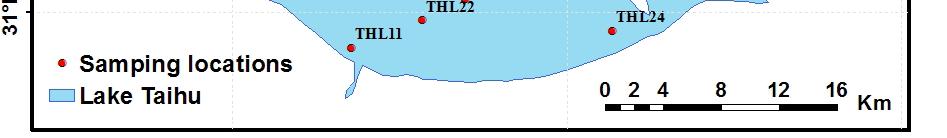
20 Fig.7 Sampling locations distribution in Taihu
21 Fig.8 Chl-a concentration comparison between MODSI retrieval and in situ observation (monthly)
22
23 Fig.9 Chl-a concentration comparison between MODSI retrieval and in situ observation (every location)
24
25
26
27 Fig. 10 (a) MODIS derived time series (29 March to 8 June 2007) for Chl-a and nl w (443), (b) nl w (λ) spectral on 7 May 2007 for algae contaminated and non- contaminated waters.
28 Fig. 11 MODSI-derived ( ) monthly climatology nl w (443)
29 Fig. 12 MODSI-derived ( ) monthly climatology nl w (555)
30 Fig. 13 MODSI-derived ( ) monthly climatology nl w (645)
31 Fig. 14 MODSI-derived ( ) monthly climatology nl w (859)
32 Fig. 15 MODSI-derived ( ) monthly climatology K d (490)
33 Fig. 16 MODSI-derived K d (490) for central lake, Gonghu Bay and Meiliangwan Bay
34 Fig 17 Seasonal variability of MODSI derived K (490) for the central lake Fig. 17 Seasonal variability of MODSI-derived K d (490) for the central lake, Gonghu Bay and Meiliangwan Bay
35 Fig. 18 MODSI-derived d climatology l water property
36 Main conclusions Modified SWIR-based atmospheric correction algorithm is suitable for highly turbid inland Lake Taihu; Algae usually appears in the bay regions (Meiliangwan Bay, Gonghu Bay and Zhushan Bay), and high Chl-a concentration were often observed during late spring to early summer; Waters in Taihu are consistently highly turbid all year around, TTS concentration, driven by wind is high in winter-spring seasons and low in summer-fall seasons; Inland freshwater optical and biological properties, as well as water quality can be monitored and evaluated quantitatively by RS measurements (MODIS).
 >")

37 4. Discussion Hypothesis for daily mean water surface albedo analysis WS DPK >WS MLW Difference Similarity Similar atmospheric conditions TTS DPK >TTS MLW Reflected short-wave irradiance (DPK) > Reflected short-wave irradiance (MLW) Similar il incident id tirradiance Albedo (DPK)> Albedo (MLW) The spatial pattern of daily mean albedo may be similar to TTS distribution pattern p p y y p on local scale.
38 Difficulties for validation of lake color RS Reflection of bottom sediment in optical shallow regions; Asynchronism between RS measurement and in situ observation; Aerosol changing and fast variation of water color driven by wind; Spatial non-uniformity of water property in Lake Taihu.
39 Wang, 2011
40 Look forward to your suggestions. Thank you!
Zu-Tao Ou-Yang Center for Global Change and Earth Observation Michigan State University
 Zu-Tao Ou-Yang Center for Global Change and Earth Observation Michigan State University Ocean Color: Spectral Visible Radiometry Color of the ocean contains latent information on the water qualitycdom,
OCEAN COLOR PRODUCTS RETRIEVAL AND VALIDATION AROUND CHINA COAST WITH MODIS
 OCEAN COLOR PRODUCTS RETRIEVAL AND VALIDATION AROUND CHINA COAST WITH MODIS L. Sun a, M. Guo b, X. Wang b a National Satellite Meteorological Center, China Meteorological Administration, No.46 South Avenue
Ocean Diurnal Variations Measured by the Korean Geostationary Ocean Color Imager
 Ocean Diurnal Variations Measured by the Korean Geostationary Ocean Color Imager Menghua Wang 1, Lide Jiang 1,2, Seunghyun Son 1,2, & Wei Shi 1,2 1 NOAA/NESDIS Center for Satellite Applications & Research
Characterization of global ocean turbidity from Moderate Resolution Imaging Spectroradiometer ocean color observations
 JOURNAL OF GEOPHYSICAL RESEARCH, VOL. 115,, doi:10.1029/2010jc006160, 2010 Characterization of global ocean turbidity from Moderate Resolution Imaging Spectroradiometer ocean color observations Wei Shi
7. Requirements for future ocean color satellite sensors. Menghua Wang, IOCCG Lecture Series Atmospheric Correction
 7. Requirements for future ocean color satellite sensors Significant efforts are needed for improvements of water color products in the inland & coastal regions: Turbid Waters (violation of the NIR black
Appendix A. Proposal Format. HICO Data User s Proposal
 Appendix A. Proposal Format HICO Data User s Proposal Title of Proposal: A hyperspectral atmospheric correction algorithm to retrieve water-leaving radiance signal from HICO data Principal Investigator
Estimation of chlorophyll-a concentration in estuarine waters:
 Estimation of chlorophyll-a concentration in estuarine waters: case study of the Pearl River estuary Yuanzhi Zhang *, Chuqun Chen #, Hongsheng Zhang *, Xiaofei*, Chen Guiying Chen# *Institute of Space
Diffuse Attenuation Coefficient of the Photosynthetically Available Radiation (PAR), K d (PAR), for Global Open Ocean and Coastal Waters
, K d (PAR), for Global Open Ocean and Coastal Waters") Diffuse Attenuation Coefficient of the Photosynthetically Available Radiation (PAR), K d (PAR), for Global Open Ocean and Coastal Waters SeungHyun Son 1,2 and Menghua Wang 1 1 NOAA/NESDIS/STAR, E/RA3,
Diffuse Attenuation Coefficient of the Photosynthetically Available Radiation (PAR), K d (PAR), for Global Open Ocean and Coastal Waters SeungHyun Son 1,2 and Menghua Wang 1 1 NOAA/NESDIS/STAR, E/RA3,
USE OF THE NEW OLCI AND SLSTR BANDS FOR ATMOSPHERIC CORRECTION OVER TURBID COASTAL AND INLAND WATERS
 USE OF THE NEW AND SLSTR BANDS FOR ATMOSPHERIC CORRECTION OVER TURBID COASTAL AND INLAND WATERS Kevin Ruddick and Quinten Vanhellemont Royal Belgian Institute for Natural Sciences (RBINS), Operational
ANALYZING THE SPATIAL AND TEMPORAL VARIABILITY OF WATER TURBIDITY IN THE COASTAL AREAS OF THE UAE USING MODIS SATELLITE DATA
 ANALYZING THE SPATIAL AND TEMPORAL VARIABILITY OF WATER TURBIDITY IN THE COASTAL AREAS OF THE UAE USING MODIS SATELLITE DATA Muna R. Al Kaabi, Jacinto Estima and Hosni Ghedira Ocean Color Group - Earth
NASA Satellite Ocean Color Timeseries
 NASA Satellite Ocean Color Timeseries Bryan Franz and the NASA Ocean Biology Processing Group International Ocean Color Science Meeting 6-8 May 2013 Ocean Biology Processing Group Multi-mission Ocean Color
Future remote sensors for chlorophyll a. Dimitry Van der Zande, Quinten Vanhellemont & Kevin Ruddick
 Future remote sensors for chlorophyll a Dimitry Van der Zande, Quinten Vanhellemont & Kevin Ruddick Workshop Scheldt Commission: eutrophication 20 th October 2016 Ocean colour from space ESA MERIS 7 May
USING MERIS DATA FOR THE RETRIEVAL OF CHL A, CDOM AND TSS VALUES IN THE GULF OF FINLAND AND LAKE LOHJANJÄRVI
 USING MERIS DATA FOR THE RETRIEVA OF CH A, CDOM AND TSS VAUES IN THE GUF OF FINAND AND AKE OHJANJÄRVI Sampsa Koponen 1, Jenni Vepsäläinen 2, Jouni Pulliainen 1, Kari Kallio 2, Timo Pyhälahti 2, Antti indfors
Great Lakes Remote Sensing Algorithms
 Great Lakes Remote Sensing Algorithms Status, Comparisons, and Future Directions Robert Shuchman MTRI Mike Sayers MTRI George Leshkevich NOAA/GLERL Barry Lesht JGLR/Assoc. Editor Caren Binding Environment
Carbon dynamics in inland and coastal ecosystems. Dragon 3 ID 10561
 Carbon dynamics in inland and coastal ecosystems Dragon 3 ID 10561 Project Team Ronghua Ma Hongtao Duan Yuchao Zhang Juhua Luo Lin Chen Steven Loiselle Alessandro Donati Claudio Rossi Project Young Scientists
Monitoring water quality of the Southeastern Mediterranean sea using remote sensing
 Monitoring water quality of the Southeastern Mediterranean sea using remote sensing Tamir Caras The Remote Sensing Laboratory Jacob Blaustein Institutes for Desert Research Ben-Gurion University of the
Moderate Resolution Imaging Spectroradiometer (MODIS) Observations of Cyanobacteria Blooms in Taihu Lake, China
 Observations of Cyanobacteria Blooms in Taihu Lake, China") University of South Florida Scholar Commons Marine Science Faculty Publications College of Marine Science 4-1-2010 Moderate Resolution Imaging Spectroradiometer (MODIS) Observations of Cyanobacteria Blooms
University of South Florida Scholar Commons Marine Science Faculty Publications College of Marine Science 4-1-2010 Moderate Resolution Imaging Spectroradiometer (MODIS) Observations of Cyanobacteria Blooms
NASA Workshop for Remote Sensing of Coastal & Inland Waters
 NASA Workshop for Remote Sensing of Coastal & Inland Waters Madison, Wisconsin June 20-22, 2012 Dr. Robert Shuchman, MTRI George Leshkevich, NOAA GLERL Contributors: Michael Sayers, MTRI Colin Brooks,
IEEE GEOSCIENCE AND REMOTE SENSING LETTERS, VOL. 6, NO. 4, OCTOBER X/$ IEEE
 IEEE GEOSCIENCE AND REMOTE SENSING LETTERS, VOL. 6, NO. 4, OCTOBER 2009 845 Satellite Estimation of Chlorophyll-a Concentration Using the Red and NIR Bands of MERIS The Azov Sea Case Study Wesley J. Moses,
Ocean Color - Simultaneous Marine and Aerosol Retrieval Tool (OC-SMART)
") Ocean Color - Simultaneous Marine and Aerosol Retrieval Tool (OC-SMART) Yongzhen Fan, Nan Chen, Wei Li, and Knut Stamnes Light and Life Laboratory, Stevens Institute of Technology, Hoboken, NJ, USA OC-SMART
Ocean Color - Simultaneous Marine and Aerosol Retrieval Tool (OC-SMART) Yongzhen Fan, Nan Chen, Wei Li, and Knut Stamnes Light and Life Laboratory, Stevens Institute of Technology, Hoboken, NJ, USA OC-SMART
NASA ocean color processing and data analysis support for SGLI
 NASA ocean color processing and data analysis support for SGLI Bryan Franz Ocean Biology Processing Group NASA Goddard Space Flight Center JAXA GCOM-C PI Workshop. January 2014 Collaborators Ziauddin Ahmad
MERIS PERFORMANCE IN THE EAST CHINA SEAS: EVALUATION OF ATMOSPHERIC CORRECTION AND OPTICAL INVERSION ALGORITHMS
 MERIS PERFORMANCE IN THE EAST CHINA SEAS: EVALUATION OF ATMOSPHERIC CORRECTION AND OPTICAL INVERSION ALGORITHMS Ming-Xia HE 1, Shuangyan He 1, Lianbo Hu 1, Yunfei Wang 1, Qian Yang 1, Tinglu Zhang 1 Wenzhong
Measuring Ocean Color: The Basics
 Measuring Ocean Color: The Basics Radiation of energy from the Sun and the Earth s surface. Recall from previous lectures that the Sun (6000 K), radiates energy in three portions of the energy spectrum:
EVALUATION OF TWO SITES FOR OCEAN COLOR VALIDATION IN THE TURBID WATERS OF THE RÍO DE LA PLATA (ARGENTINA)
") EVALUATION OF TWO SITES FOR OCEAN COLOR VALIDATION IN THE TURBID WATERS OF THE RÍO DE LA PLATA (ARGENTINA) Dogliotti, A. I. (1), Gossn, J. I. (1), Vanhellemont, Q. (2), Ruddick, K.G. (2) (1) (2) Instituto
EVALUATION OF TWO SITES FOR OCEAN COLOR VALIDATION IN THE TURBID WATERS OF THE RÍO DE LA PLATA (ARGENTINA) Dogliotti, A. I. (1), Gossn, J. I. (1), Vanhellemont, Q. (2), Ruddick, K.G. (2) (1) (2) Instituto
Inland and coastal water quality retrieval Some challenges and new opportunities
 Inland and coastal water quality retrieval Some challenges and new opportunities Els Knaeps, Dries Raymaekers, Sindy Sterckx (VITO, Belgium) Kevin Ruddick, Bouchra Nechad (MUMM, Belgium) Ana Dogliotti
Remote Sensing of Water Quality in Wisconsin
 Remote Sensing of Water Quality in Wisconsin 1 Steve Greb, UW-Madison Daniela Gurlin, WDNR ----------------------------------- Wisconsin Lakes Convention April 19 th, 218 MODIS Today website are acquired
Detection of redtides/habs: A Remote Sensing Perspective
 Detection of redtides/habs: A Remote Sensing Perspective P. Shanmugam 1 and Yu-Hwan Ahn 2 1 Indian Institute of Technology, Madras, India 2 Korea Ocean Research and Development Institute, Korea This presentation
Remote sensing of total suspended sediment within lakes Onoke and Wairarapa
 Remote sensing of total suspended sediment within lakes Onoke and Wairarapa Introduction Remote sensing can provide synoptic monitoring of water quality and temperature (e.g., Kloiber et al. 2002, Dekker
 Fernando Gilbes 1, William Hernández, Natlee Hernández, José Martínez, and Vilmaliz Rodriguez Geological and Environmental Remote Sensing Lab Department of Geology University of Puerto Rico at Mayagüez
Satellite ocean color algorithms: a review of applications to the Great Lakes
 Satellite ocean color algorithms: a review of applications to the Great Lakes Barry M. Lesht a,, Richard P. Barbiero b, Glenn J. Warren c a CSC and Department of Earth and Environmental Sciences, University
Update on NOAA Ocean Color Activities: VIIRS et al.
 Update on NOAA Ocean Color Activities: VIIRS et al. Cara Wilson, NOAA-NMFS Menghua Wang & Paul DiGiacomo, NOAA-NESDIS International Ocean Color Science Meeting Darmstadt, Germany, 6 May 2013 NMFS: National
Trophic state assessment of global large inland waters using the MODIS-derived FUI
 August 2018 Stirling Trophic state assessment of global large inland waters using the MODIS-derived FUI Shenglei Wang Junsheng Li & Bing Zhang Evangelis Spyrakos & Andrew N. Tyler RADI, Chinese Academy
A Unified Approach to Remote Estimation of Chlorophyll a Concentration in Complex Inland, Estuarine, and Coastal waters
 A Unified Approach to Remote Estimation of Chlorophyll a Concentration in Complex Inland, Estuarine, and Coastal waters Wesley J. Moses 1, *, Anatoly A. Gitelson 1, Alexander A. Gilerson 2, and Daniela
Coastal Biological Data from Satellite
 Coastal Biological Data from Satellite Joji Ishizaka Nagoya University Institute for Space-Earth Environmental Research (ISEE) jishizaka@nagoya-u.jp GEOSS 2018.10.25 Kyoto Genki Terauchi UNEP/NOWPAP CEARAC,
Use of remote sensing in assessing the impacts of ocean acidification
 Use of remote sensing in assessing the impacts of ocean acidification William M. Balch Bigelow Laboratory for Ocean Sciences W. Boothbay Harbor, ME 04575 Thanks to so many D. Drapeau, B. Bowler, E. Booth
Application of Geostationary Satellite Images to the monitoring of dynamic variations
 The 1 st International Ocean Colour Science Meeting Darmstadt, Germany, 6-8 May 2013 Application of Geostationary Satellite Images to the monitoring of dynamic variations Jong-Kuk Choi, Young Je Park and
Satellite based inland and coastal water quality monitoring
 Satellite based inland and coastal water quality monitoring Harmonized transnational, long-term and near-real time space based solutions. Thomas Heege CEO EOMAP Germany Earth Observation & Mapping Inland
Distribution and Cycling of Dissolved Organic Carbon and Colored Dissolved Organic Carbon on the West Florida Shelf
 Distribution and Cycling of Dissolved Organic Carbon and Colored Dissolved Organic Carbon on the West Florida Shelf Dr. Paula Coble College of Marine Science University of South Florida 10 7 th Ave South
NASA DEVELOP National Program Focusing on Partnerships with project example
 National Aeronautics and Space Administration NASA Ames Research Center NASA DEVELOP National Program Focusing on Partnerships with project example Jenna Williams Center Lead Where DEVELOP Fits @ NASA
MAPPING OF PHOTOSYNTHETIC PIGMENTS IN SPANISH RESERVOIRS
 MAPPING OF PHOTOSYNTHETIC PIGMENTS IN SPANISH RESERVOIRS Ramón Peña-Martínez, José Antonio Domínguez-Gómez, Caridad de Hoyos, Antonio Ruiz-Verdú Centro de Estudios Hidrográficos del CEDEX, Pº Bajo de la
Mapping water constituents concentrations in estuaries using MERIS full resolution satellite data
 Mapping water constituents concentrations in estuaries using MERIS full resolution satellite data David Doxaran, Marcel Babin Laboratoire d Océanographie de Villefranche UMR 7093 CNRS - FRANCE In collaboration
MERIS PRODUCTS OVER LARGE EUROPEAN LAKES - COMPARISON WITH MEASURED DATA ABOUT AEROSOL AND WATER QUALITY
 MERIS PRODUCTS OVER LARGE EUROPEAN LAKES - COMPARISON WITH MEASURED DATA ABOUT AEROSOL AND WATER QUALITY A. Reinart (1), H. Ohvril (2), K. Alikas (1), P. Ibrus (1), H. Teral (2), K. Valdmets (1), O. Okulov
Journal of Physics: Conference Series PAPER OPEN ACCESS. To cite this article: H Wibisana et al 2018 J. Phys.: Conf. Ser.
 Journal of Physics: Conference Series PAPER OPEN ACCESS Optimalisation of remote sensing algorithm in mapping of chlorophyl-a concentration at Pasuruan coastal based on surface reflectance images of Aqua
An understanding biological variability in the open ocean (GlobCOLOUR project) Dr Samantha Lavender
 Dr Samantha Lavender") An understanding biological variability in the open ocean (GlobCOLOUR project) Dr Samantha Lavender SEOES & Marine Institute, University of Plymouth ARGANS Limited Tamar Science Park, Plymouth s.lavender@plymouth.ac.uk
An understanding biological variability in the open ocean (GlobCOLOUR project) Dr Samantha Lavender SEOES & Marine Institute, University of Plymouth ARGANS Limited Tamar Science Park, Plymouth s.lavender@plymouth.ac.uk
What is Hydrologic Optics? Optics Attentuation Inherent properties Scatter Absorption Apparent properties
 1 of 7 3/22/2006 1:29 PM Water quality research Water quality Hydrologic optics Components of water quality SERC water research projects CISNet program What is Hydrologic Optics? Optics Attentuation Inherent
How are these equations relevant to remotely sensed data? Source: earthsci.org/rockmin/rockmin.html
 Lecture 3 How does light give us information about environmental features Revision Select a different scoop from last week Post the key points as a reaction to http://www.scoop.it/t/env22-52-w2 (need to
Study of Water Quality using Satellite data
 2nd Workshop on Parameterization of Lakes in Numerical Weather Prediction and Climate Modelling Study of Water Quality using Satellite data M. Potes, M. J. Costa (Évora Geophysics Centre, PORTUGAL) This
Development of Carbon Data Products for the Coastal Ocean: Implications for Advanced Ocean Color Sensors
 Development of Carbon Data Products for the Coastal Ocean: Implications for Advanced Ocean Color Sensors Antonio Mannino NASA Goddard Space Flight Center Greenbelt, Maryland USA Field Activities & DOC
Application of Gliders for Near-Real Time METOC Data Collection Capability for Battlespace Characterization
 DISTRIBUTION STATEMENT A: Approved for public release; distribution is unlimited. Application of Gliders for Near-Real Time METOC Data Collection Capability for Battlespace Characterization Charles Trees
Land surface albedo and downwelling shortwave radiation from MSG: Retrieval, validation and impact assessment in NWP and LSM models
 Land surface albedo and downwelling shortwave radiation from MSG: Retrieval, validation and impact assessment in NWP and LSM models Jean-Louis ROUJEAN, Dominique CARRER, Xavier CEAMANOS, Olivier HAUTECOEUR,
Spectral relationships for atmospheric correction. II. Improving NASA s standard and MUMM near infra-red modeling schemes.
 Spectral relationships for atmospheric correction. II. Improving NASA s standard and MUMM near infra-red modeling schemes. C. Goyens, 1 C. Jamet, 1 and K. G. Ruddick 2 1 CNRS, UMR 8187, Université Lille
Remote sensing for aquatic habitat quality mapping and EU Water Framework Directive (EU-WFD) reporting
 reporting") Remote sensing for aquatic habitat quality mapping and EU Water Framework Directive (EU-WFD) reporting S. C. J. Palmer 1,2, A. Zlinszky 1, H. Balzter 2, V. R. Tóth 1 1 Balaton Limnological Institute, Hungarian
Remote sensing for aquatic habitat quality mapping and EU Water Framework Directive (EU-WFD) reporting S. C. J. Palmer 1,2, A. Zlinszky 1, H. Balzter 2, V. R. Tóth 1 1 Balaton Limnological Institute, Hungarian
Remote Sensing of Environment
 Remote Sensing of Environment 115 (2011) 1617 1631 Contents lists available at ScienceDirect Remote Sensing of Environment journal homepage: www.elsevier.com/locate/rse Spectral variations in the near-infrared
Recent Progress in Aircraft and Satellite Remote Sensing of Chesapeake Bay
 Recent Progress in Aircraft and Satellite Remote Sensing of Chesapeake Bay Horn Point Laboratory and Maryland Sea Grant University of Maryland Center for Environmental Science Integration and Application
Harmful Algal Blooms (HABs) 2 methods
 2 methods") Harmful Algal Blooms (HABs) 2 methods Richard P. Stumpf NOAA, National Ocean Service HAB occurrences worldwide Image from whoi.edu/redtide Remote Sensing for HAB Detection: Does the Bloom Change Water
Harmful Algal Blooms (HABs) 2 methods Richard P. Stumpf NOAA, National Ocean Service HAB occurrences worldwide Image from whoi.edu/redtide Remote Sensing for HAB Detection: Does the Bloom Change Water
PV-LAC: D-1-A3 Requirements Baseline Document Activity 3
 Delivery report PV-LAC: advances Land, Aerosol and Coastal products for Proba-V PV-LAC: D-1-A3 Requirements Baseline Document Activity 3 Sindy Sterckx, Nitin Bhatia, Els Knaeps May 2016 Distribution List
Pattern recognition of marine provinces
 International Journal of Remote Sensing Vol. 26, No. 7, 10 April 2005, 1499 1503 Pattern recognition of marine provinces K.-H. SZEKIELDA The Graduate School and University Center, Earth and Environmental
Study of attenuation depths for MODIS bands in the Bohai Sea in China
 Acta Oceanologica Sinica 2009, Vol.28, No.5, p.39-48 http://www.hyxb.org.cn E-mail: hyxbe@263.net Study of attenuation depths for MODIS bands in the Bohai Sea in China LIU Ying 1,2, LI Guosheng 1 1 Institute
doi: /j.isprsjprs
 doi: 10.1016/j.isprsjprs.2012.02.008 A simple method for distinguishing global Case-1 and Case-2 waters using SeaWiFS measurements Bunkei Matsushita, 1 Wei Yang,* 2,1 Peng Chang, 1 Fan Yang, 1 Takehiko
Remote Sensing of Water
 Remote Sensing of Water Carolina Distinguished Professor Department of of Geography University of of South Carolina Columbia, South Carolina 29208 jrjensen@sc.edu sc.edu Earth: The Water Planet 74% of
Global Processing and Products from MERIS Full Resolution Data for the Coastal Zone. User Consultation Meeting
 Global Processing and Products from MERIS Full Resolution Data for the Coastal Zone User Consultation Meeting 16-17.11.2010 Frascati CoastColour UCM1 * Frascati * 16.- 17.11.2010 CoastColour is ESAs initiative
Application of OCEANSAT-2 2 data to study the CASE- 2 waters in the North-Eastern Mediterranean sea (NEMO-C2W)
") Application of OCEANSAT-2 2 data to study the CASE- 2 waters in the North-Eastern Mediterranean sea (NEMO-C2W) IIA PI: Stefano Pignatti Italian National Research Council Atmospheric Pollution E-mail: rosa.cavalli@lara.rm.cnr.it
Application of OCEANSAT-2 2 data to study the CASE- 2 waters in the North-Eastern Mediterranean sea (NEMO-C2W) IIA PI: Stefano Pignatti Italian National Research Council Atmospheric Pollution E-mail: rosa.cavalli@lara.rm.cnr.it
Monitoring Harmful Algal Blooms in Lake Champlain with MODIS and Landsat 8 OLI Remote Sensing Data
 Monitoring Harmful Algal Blooms in Lake Champlain with MODIS and Landsat 8 OLI Remote Sensing Data Maya Midzik Advisor: Ron Smith Second Reader: Pincelli Hull May 4 th, 2016 A Senior Thesis presented to
Note that approval of a data user proposal does not imply Navy S&T financial support.
 HICO Data User Agreement Between the Naval Research Laboratory And The HICO Data User Principal Investigator Issued on: HICO-based water transparency Mapping in Pearl River Estuary (PRE) of South China
LSP: using AVHRR NDVI data and from 2003 using MODIS NBAR. Water Quality: using MSS and TM Landsat data and from 2001 using
 Land cover land use change effects on surface water quality: Integrated MODIS and SeaWiFS assessment of the Dnieper and Don River basins and their reservoirs Anatoly A. Gitelson, Wesley Moses & Daniela
Changes in Arctic Ocean Primary Production from Kevin R. Arrigo G. L. van Dijken
 Changes in Arctic Ocean Primary Production from 1998-2008 Kevin R. Arrigo G. L. van Dijken Department of Environmental Earth System Science Stanford University Background Circulation influenced by both
Key words: Turbidity, Total Suspended Solids, Nephelometric Tubidity Unit, Backscattering coefficient, Inherent Optical Properties, Bio-optical Model
 Investigating relationship of nephelometric turbidity unit and total suspended solids with the inherent optical properties paramete derived from spectra reflectance Kai Li KWOH [1], Sai Meng NG [1], Hong
CS229 Project: Identifying Regions of High Turbidity in San Francisco Bay
 CS229 Project: Identifying Regions of High Turbidity in San Francisco Bay Joe Adelson December 11, 2014 Introduction Suspended sediments in oceans, seas, and estuaries shape coastal geography, provide
Final Report of Activities carried out during the STM period at NIGLAS-CAS
 Programma STM - Short Term Mobility (Anno 215) -Paolo Villa [authorized with Prot. AMMCNT Num. 2422 of 9/4/215] Programma STM - Short Term Mobility (Anno 215), authorized with Prot. AMMCNT Num. 2422 of
Earth Observation & Mapping
 Coastal bathymetry from Wordview-2 satellite data 2012 Thomas Heege EOMAP Germany Magnus Wettle EOMAP Asia Pacific Dave Benson DigitalGlobe London David Chritchley Proteus Abu Dhabi Susanne Lehner German
Satellite observations of fire-induced albedo changes and the associated radiative forcing: A comparison of boreal forest and tropical savanna
 Satellite observations of fire-induced albedo changes and the associated radiative forcing: A comparison of boreal forest and tropical savanna 1 Yufang Jin, 1 James T. Randerson, 2 David P. Roy, 1 Evan
BOTH inherent and apparent optical properties (IOPs and
 1136 IEEE GEOSCIENCE AND REMOTE SENSING LETTERS, VOL. 12, NO. 5, MAY 2015 Influence of Particle Composition on Remote Sensing Reflectance and MERIS Maximum Chlorophyll Index Algorithm: Examples From Taihu
Eyes Over Puget Sound: Producing Validated Satellite Products to Support Rapid Water Quality Assessments in Puget Sound
 Western Washington University Western CEDAR Salish Sea Ecosystem Conference 2014 Salish Sea Ecosystem Conference (Seattle, Wash.) May 2nd, 10:30 AM - 12:00 PM Eyes Over Puget Sound: Producing Validated
SPECTRAL REFLECTANCE SIGNATURES OF CASE II WATERS: POTENTIAL FOR TROPICAL ALGAL BLOOM MONITORING USING SATELLITE OCEAN COLOUR SENSORS
 Paper presented at the th JSPS/VCC Joint Seminar on Marine and Fisheries Sciences, Melaka, Malaysia, 9 Nov - Dec 999 SPECTRAL REFLECTANCE SIGNATURES OF CASE II WATERS: POTENTIAL FOR TROPICAL ALGAL BLOOM
SURFACE REFLECTANCE AND UNDERWATER DOWNWELLING IRRADIANCE IN ALQUEVA RESERVOIR, SOUTHEAST PORTUGAL
 SURFACE REFLECTANCE AND UNDERWATER DOWNWELLING IRRADIANCE IN ALQUEVA RESERVOIR, SOUTHEAST PORTUGAL M. Potes, R. Salgado, M. J. Costa, M. Morais, D. Bortoli and I. Kostadinov Institute of Earth Sciences
DEVELOPMENT OF MERIS LAKE WATER ALGORITHMS: VALIDATION RESULTS FROM EUROPE
 DEVELOPMENT OF MERIS LAKE WATER ALGORITHMS: VALIDATION RESULTS FROM EUROPE Antonio Ruiz-Verdú (1,2), Sampsa Koponen (3), Thomas Heege (4), Roland Doerffer (5), Carsten Brockmann (6), Kari Kallio (7), Timo
Richard C. Zimmerman, Victoria J. Hill, John Klinck Michael Dinniman Department Ocean, Earth & Atmospheric Sciences and Center for Coastal Physical
 Richard C. Zimmerman, Victoria J. Hill, John Klinck Michael Dinniman Department Ocean, Earth & Atmospheric Sciences and Center for Coastal Physical Oceanography Old Dominion University Norfolk VA 23529
Ocean Color Remote Sensing -Selected Applications
 Ocean Color Remote Sensing -Selected Applications Young-Je Park, Ph.D Korea Ocean Satellite Center(KOSC) Korea Institute of Ocean Science and Technology (KIOST) For the NOWPAP-PICES Joint Tranning Course
Beyond the two cases of water
 44 th Intl. Liège Colloquium on Ocean Dynamics 11 May 2012 Beyond the two cases of water Water constituent retrieval algorithms and their validity ranges Odermatt, D. 1,2, Gitelson, A. 3, Brando, V.E.
From research to applications: monitoring optically complex waters with MERIS/ENVISAT data
 DISSERTATIONES GEOPHYSICALES UNIVERSITATIS TARTUENSIS 27 KRISTA ALIKAS From research to applications: monitoring optically complex waters with MERIS/ENVISAT data DISSERTATIONES GEOPHYSICALES UNIVERSITATIS
CONAE: Missions, Projects and Initiatives for coasts and oceans. Sandra Torrusio
 CONAE: Missions, Projects and Initiatives for coasts and oceans Sandra Torrusio From de Past to the Future... SAC-C SAOCOM SAC-D AQUARIUS SABIAMar SAC-C 2000-2013 80 Km SSS Rain Wind Water Vapor Sea Ice
EUMETSAT current activities on desert targets
 EUMETSAT current activities on desert targets Sébastien Wagner sebastien.wagner@eumetsat.int Summary of recent, current and planned activities 1. MSG-3 commissioning 2. Development of monitoring tools
A Study of Himreen Reservoir Water Quality Using in Situ Measurement and Remote Sensing Techniques
 A Study of Himreen Reservoir Water Quality Using in Situ Measurement and Remote Sensing Techniques Dr. Salah A. H. Saleh College of Science, Nahrain University, Baghdad - IRAQ Abstract The use of remote
The Spectral Reflectance Responses of Water with Different Levels
 Turkish J. Eng. Env. Sci. 29 (2005), 351 360. c TÜBİTAK The Spectral Reflectance Responses of Water with Different Levels of Suspended Sediment in The Presence of Algae Murat KARABULUT Kahramanmaraş Sütçü
Using A Satellite to Help Us Evaluate the Impacts of Oyster Restoration: A Perspective From Above
 Using A Satellite to Help Us Evaluate the Impacts of Oyster Restoration: A Perspective From Above A NESDIS/NMFS Collaboration & Contribution to the Choptank HFA Water Column Habitat Study Sept 27, 2018
INTERANNUAL VARIABILITY OF CHLOROPHYLL CONCENTRATION IN THE EASTERN ARABIAN SEA
 INTERANNUAL VARIABILITY OF CHLOROPHYLL CONCENTRATION IN THE EASTERN ARABIAN SEA A Summer Internship Report BY MS. Satlaj Karanje Under the guidance of Dr. S. Prasanna Kumar Scientist, NIO, Goa Department
Satellite Monitoring of Water Quality in Lake Manzalah, Egypt. Real-Time Water Quality Monitoring Workshop June St.
 Satellite Monitoring of Water Quality in Lake Manzalah, Egypt Real-Time Water Quality Monitoring Workshop June 16-17 2009 St. John s, Canada Motivation Lakes are vital component of Egypt s water resources
N 2 O concentration and flux in Lake Taihu
 耶鲁大学 - 南京信息工程大学大气环境中心 Yale-NUIST Center on Atmospheric Environment N 2 O concentration and flux in Lake Taihu Qitao Xiao 2016.11.18 1 Outline 2 1. Background 2. Objective 3. Material and Method 4. Results
Satellite Remote Sensing of Algal Blooms in the southcentral USA:
 Satellite Remote Sensing of Algal Blooms in the southcentral USA: Landsat 8 based algal and turbidity indices in the Grand Lake watershed Abu Mansaray, Doctoral Candidate Environmental Science Graduate
Future Retrievals of Water Column Bio-Optical Properties using the Hyperspectral Infrared Imager (HyspIRI)
") Remote Sens. 2013, 5, 6812-6837; doi:10.3390/rs5126812 Article OPEN ACCESS Remote Sensing ISSN 2072-4292 www.mdpi.com/journal/remotesensing Future Retrievals of Water Column Bio-Optical Properties using
Remote Sens. 2013, 5, 6812-6837; doi:10.3390/rs5126812 Article OPEN ACCESS Remote Sensing ISSN 2072-4292 www.mdpi.com/journal/remotesensing Future Retrievals of Water Column Bio-Optical Properties using
Remote Sensing Models of Algal Blooms and Cyanobacteria in Lake Champlain
 University of Massachusetts Amherst ScholarWorks@UMass Amherst Environmental & Water Resources Engineering Masters Projects Civil and Environmental Engineering 2-2012 Remote Sensing Models of Algal Blooms
Remote Sens. 2014, 6, ; doi: /rs Article. Lin Qi 1,2,3, Chuanmin Hu 2, Hongtao Duan 1, Brian B. Barnes 2 and Ronghua Ma 1, *
 Remote Sens. 2014, 6, 10694-10715; doi:10.3390/rs61110694 Article OPEN ACCESS remote sensing ISSN 2072-4292 www.mdpi.com/journal/remotesensing An EOF-Based Algorithm to Estimate Chlorophyll a Concentrations
SGLI/GCOM-C1. Algorithm Theoretical Basic Document. Ocean net primary productivity (ONPP)
") SGLI/GCOM-C1 Algorithm Theoretical Basic Document Ocean net primary productivity (ONPP) Version 3.3 31 March 2016 PI: Toru Hirawake 1* Co-I: Amane Fujiwara 2, Tomonori Isada 3 and Sei-ichi Saitoh 1, 4
SGLI/GCOM-C1 Algorithm Theoretical Basic Document Ocean net primary productivity (ONPP) Version 3.3 31 March 2016 PI: Toru Hirawake 1* Co-I: Amane Fujiwara 2, Tomonori Isada 3 and Sei-ichi Saitoh 1, 4
Overview of Bio-optical Algorithms for Open Ocean, Coastal and Inland Water Transitions
 IOCS 17 BO7: Multi-water Algorithms and Performance Assessment Overview of Bio-optical Algorithms for Open Ocean, Coastal and Inland Water Transitions Daniel Odermatt, Odermatt & Brockmann GmbH, Zurich
Remote sensing of water quality: The development and use of water processors available in BEAM
 Remote sensing of water quality: The development and use of water processors available in BEAM Sampsa Koponen, Helsinki University of Technology (TKK) sampsa.koponen@tkk.fi Acknowledgments Roland Doerffer
Global Greenhouse Gas Observation by Satellite
 Global Greenhouse Gas Observation by Satellite Greenhouse gases Observing SATellite Figure 1. Overview of GOSAT ( JAXA) The Greenhouse Gases Observing Satellite (GOSAT) will be the world s first satellite
A Discussion on the paper Surface Albedo in Cities: Case Study in Sapporo and Tokyo, Japan
 A Discussion on the paper Surface Albedo in Cities: Case Study in Sapporo and Tokyo, Japan By Hirofumi Sugawara Tamio Takamura Boundary-Layer Meteorology Zhang Xue 2014-10-10 Outline Introduction Materials
In situ Requirements for Ocean Color System Vicarious Calibration: A Review
 In situ Requirements for Ocean Color System Vicarious Calibration: A Review Background literature G. Zibordi, Ispra, Italy G.Zibordi, F. Mélin, K.J. Voss, B.C. Johnson, B.A. Franz, E. Kwiatkowska, J.P.
BIO-OPTICAL SENSORS FOR PROFILING FLOATS
 BIO-OPTICAL SENSORS FOR PROFILING FLOATS J. Ronald V. Zaneveld Western Environmental Technology Laboratories, Inc. P.O. Box 518, Philomath, OR 97370, U.S.A. FAX:1-541-929-5277 e-mail:ron@wetlabs.com Introduction
ASSESSING THE POTENTIAL OF REMOTELY SENSED DATA FOR WATER QUALITY MONITORING OF COASTAL AND INLAND WATERS
 ASSESSING THE POTENTIAL OF REMOTELY SENSED DATA FOR WATER QUALITY MONITORING OF COASTAL AND INLAND WATERS Asif Mumtaz Bhatti, Donald C. Rundquist, Seigo Nasu and Masataka Takagi Research Associate, COE,