Satellite based inland and coastal water quality monitoring
|
|
|
- Rosalyn Norman
- 5 years ago
- Views:
Transcription


1 Satellite based inland and coastal water quality monitoring Harmonized transnational, long-term and near-real time space based solutions. Thomas Heege CEO EOMAP Germany Earth Observation & Mapping


2 Inland and coastal water monitoring Monitoring services Applications Water quality monitoring Oil- and gas industry Dredging Turbidity monitoring Offshore construction impact monitoring Water depth mapping Water ways Pipeline routing Sea floor monitoring Biodiversity baseline
3 Outline Space based monitoring of water quality and bathymetry 1. Use cases 2. Technology background 3. Geo-spatial infrastructure 4. Benefits


4 1. Introduction Satellite based inland and coastal water quality monitoring Relevant questions where EO solutions contribute to clients issues Solving issues of economical and social impact Impact of industry, agriculture, and people on water quality Topics: Water way and offshore construction, dams, EO tools: Environmental baseline, change and impact monitoring


5 Dredge plume monitoring e.g. for Woodside Energy, Australia: Cost savings for Woodside Energy: AUD
6 Damns: Quantification of the impact Example Mekong: transnational river system Requirement on harmonized long-term monitoring of International river commissions governmental authorities, insurers
 Location of Xiaowan Dam Location of Manwan Dam Situation before after closure 2009-January-09 2009-Dec-27 2009-Nov-25 2009-Nov-11 2009-Feb-10")
7 Damns: Quantification of the impact Example Mekong: transnational river system Requirement on harmonized long-term monitoring of International river commissions governmental authorities, insurers Landsat 7 ETM+ (30m resolution) Location of Xiaowan Dam Location of Manwan Dam Situation before after closure 2009-January Dec Nov Nov Feb Jan-09

8 Damns: Quantification of the impact Xiaowan dam


9 River systems: water way construction Various user friendly formats for data visualization River Elbe, river ems: > 100 Mio /Y dredging costs BAW, BFG Germany River Elbe, Rapideye, 2. June 2011, 11:39 UTC Suspended matter [mg/l] Land Cloud

10 River systems: water way construction River Elbe, river ems: > 100 Mio /Y dredging costs BAW, BFG Germany River Ems, Rapideye Suspended matter [mg/l] Land Cloud


11 European Freshwater Monitoring: GMES FRESHMON EOMAP is the leading coordinator 18.April 2011
12 European Freshwater Monitoring: GMES FRESHMON Validation Lake Constance Total Suspended matter

13 European Freshwater Monitoring: GMES FRESHMON Validation Lake Constance Total Suspended matter
14 Turbidity [NTU] Multi-sensor water quality monitoring MODIS m, Landsat, Rapideye, THEOS,.. Turbidity monitoring - Can Tho In-situ data (GFZ) Satellite derived data MODIS monthly mean Slide 14
15 Multi-sensor water quality monitoring MODIS m, Landsat, Rapideye, THEOS,.. Slide 15
16 Client and user comments from authorities The EOMAP satellite turbidity products enable a harmonized and objective measure on various temporal and spatial scales of the federal river system beyond the in situ measurement systems capabilities Understanding the transport processes of suspended sediments in waterways is essential to reduce river engineering expenses such as dredging. As the federal authority BAW is responsible for the German waterways,

 P")
17 Core Technology: EOMAP MIP System Processing Water Quality and Water Depth Product generation workflow Input satellite radiance image L Atmosphere vertical profiles of optical properties Land-water-cloud detection Adjacency correction Sunglitter correction Radiative transfer database Global and regional land-water database Sensor sensor parameters Atmospheric correction coupled with retrieval of water constituents Optical models specific opt. properties of water, sea floor, land subsurface reflectance R Water column inversion coupled retrieval water constituents: Suspended matter S Phytoplankton (CHL-a) P Yellow Substances Y Output Water depth z Sea floor albedo


18 EOMAP Processing System EWS EOMAP Workflow System EWS Orchestration of fully operational processing chains on top of ground segments Off-the-shell production Near-real-time production Solutions to orchestrate national / trans-national monitoring solutions
19 Applicable sensors and resolutions Sensors applicable for EOMAP Bathymetry and EOMAP Water Quality Low resolution 0,25 1 km MERIS, MODIS, Sentinel 3, up to 3 times daily Medium resolution 15 30m Landsat 7/8, Sentinel 2, THEOS, 2-4 / month High resolution 2 5m WorldView-2, Rapideye, Tasking & Archive
20 EOMAP Water Quality products Charateristics of water quality products PRODUCTS: Turbidity [NTU] or [FTU] Total Suspended Matter [mg/l] Total Organic Absorption [1/m] Chlorophyll [µg/l] Dissolved organic components absorption [1/m] QUALITY CONTROL: Pixel wise quality indicators Quality summary in meta data DELIVERY FORMAT: GeoTIFF 32/8, ASCII, NETDCF Cartography, optional.kmz (Google),.shp (GIS) INSPIRE / OGC conform meta data

21 EOMAP service infrastructure Satellite sensors Ground stations EOMAP VA processors EOMAP Web Shop EOMAP Marketing Partner and Client Groups Asia Pacific

22 EOMAP Bathymetry Products and Services


23 EOMAP Seabed Classification Qatar, World-View 2


24 APPS4GMES: Access via mobile applications Near real time water quality services on mobile phones Solutions for many end users: Tourists, divers, aqua culture farmers, fishery, coast guard, offshore companies,.. Standard app s with cost effective adaptation to serve many user groups
25 Benefits Space based monitoring of water quality and bathymetry Near real time, long-term for decades back Multi-scale and area wide: transnational, intercontinental Harmonized, transferable, comparable and valid measure Independent and objective, repeatable measure Long-term reliability: Independent on single sensor systems Cost-effective Safety, accessibility, no risks at data take Integratable with in situ data and models to enable 4d-monitoring

26 Outlook Space based monitoring of water quality and bathymetry High resolution and multi-temporal water quality - worldwide Multi-temporal bathymetry worldwide


27 Outlook: Product aggregation Space based monitoring of water quality and bathymetry High resolution and multi-temporal water quality - worldwide Multi-temporal bathymetry worldwide

28 THANK YOU EOMAP

29 Product examples 05 October 2010, MODIS Aqua 500m, West Australia

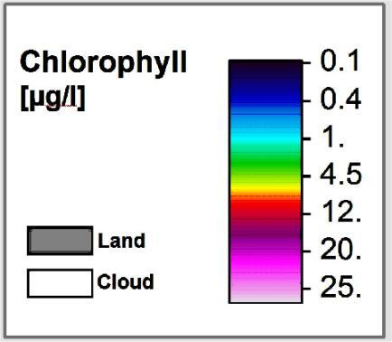
30 Phytoplankton and Chlorophyll a 05 October 2010, MODIS Aqua 500m, West Australia Chlorophyll [µg/l] Land Cloud
31 Turbidity and Suspended Matter 05 October 2010, MODIS Aqua 500m, West Australia Turbidity [NTU] Land Cloud

32 Aerosol optical depth 05 October 2010, MODIS Aqua 500m, West Australia Aerosol AOD 440nm Land Cloud

33 Requirements Atmospheric conditions WV-2 Rottnest Island, Australia

34 Requirements Atmospheric conditions WV-2 Rottnest Island, Australia > Subsurface reflectance RGB, channel 4,3,2


35 Requirements Atmospheric conditions WV-2 Rottnest Island, Australia

36 Turbidity Monitoring Long-Term change in the Mekong Delta Current situation 2013-Jan-20

37 Multi-sensor water quality monitoring MODIS m, Landsat, Rapideye, THEOS,..
![Comparison to NASA processor - PHY NASA 2011/08/19 MIP Chlorophyll [µg/l] - 0.1-0.3-1. - 3. - 10. - 30. - 100.](/docs-images/82/85671331/images/38-1.jpg "Land Cloud NASA concentrations are higher in shallow waters but lower in deep waters compared to MIP MIPs filter algorithms seem more flexible to MODIS sensor failures")
38 Comparison to NASA processor - PHY NASA 2011/08/19 MIP Chlorophyll [µg/l] Land Cloud NASA concentrations are higher in shallow waters but lower in deep waters compared to MIP MIPs filter algorithms seem more flexible to MODIS sensor failures Near-coastal areas are sometimes processed by MIP but not by NASA


39 Spatial and temporal analysis - FLH 2011/07/ /08/12 FLH seems suitable to indicate HAB occurrence. Limiting factors of this method: Weak spectral signal at the required MODIS wavelength Other environmental signals influence FLH increases Max. spatial resolution of 1000 m
40 TSM [mg/l] Temporal resolution of multiple satellite sensors MODIS Aqua, Terra, MERIS 3,5 3,0 2, Lake Constance Central station FU MERIS satellite MODIS Terra and Aqua satellite 2,0 1,5 1,0 0,5 0,0 Jan Feb Mrz Apr Mai Jun Jul Aug Sep Okt Nov Dez Month
41 Validation Lake Walchensee Bavaria
42 European Freshwater Monitoring: GMES FRESHMON Validation Lake Zurich Chlorophyll-a

![Satellite sensors: MODIS Terra, Aqua MERIS, RapidEye Suspended matter [mg/l] - 1-6 -](/docs-images/82/85671331/images/43-2.jpg "24-58 - 125-358 - 712 RapidEye 5m Land Cloud Reference coordinate system: Projection:")
43 Multi-sensor water quality monitoring Contracts by water authorities Germany 27. Juni 2010 River Elbe / Germany Suspended matter monitoring 09:55 11:30 11:40 13:20 UTC Satellite sensors: MODIS Terra, Aqua MERIS, RapidEye Suspended matter [mg/l] RapidEye 5m Land Cloud Reference coordinate system: Projection: UTM Zone 32 N


44 Satellite based inland and coastal water quality monitoring Harmonized transnational, long-term and near-real time space based solutions. Thomas Heege EOMAP / Germany Earth Observation & Mapping
Earth Observation & Mapping
 Coastal bathymetry from Wordview-2 satellite data 2012 Thomas Heege EOMAP Germany Magnus Wettle EOMAP Asia Pacific Dave Benson DigitalGlobe London David Chritchley Proteus Abu Dhabi Susanne Lehner German
Operationelles Monitoring von Binnengewässern mit Copernicus und multiplen Satellitensensoren: Regionale und globale Anwendungen
 Operationelles Monitoring von Binnengewässern mit Copernicus und multiplen Satellitensensoren: Regionale und globale Anwendungen Dr. Thomas Heege, EOMAP GmbH & Co.KG, Germany Questions 1) Acceptance of
Operational MODIS Satellite based water turbidity monitoring for dredging operations in Woodside
 DRAFT Operational MODIS Satellite based water turbidity monitoring for dredging operations in Woodside Peter Hausknecht, Woodside - GTO - Geomatics OGP Remote Sensing workshop held at European Space Agency
 Fernando Gilbes 1, William Hernández, Natlee Hernández, José Martínez, and Vilmaliz Rodriguez Geological and Environmental Remote Sensing Lab Department of Geology University of Puerto Rico at Mayagüez
Ocean Diurnal Variations Measured by the Korean Geostationary Ocean Color Imager
 Ocean Diurnal Variations Measured by the Korean Geostationary Ocean Color Imager Menghua Wang 1, Lide Jiang 1,2, Seunghyun Son 1,2, & Wei Shi 1,2 1 NOAA/NESDIS Center for Satellite Applications & Research
Zu-Tao Ou-Yang Center for Global Change and Earth Observation Michigan State University
 Zu-Tao Ou-Yang Center for Global Change and Earth Observation Michigan State University Ocean Color: Spectral Visible Radiometry Color of the ocean contains latent information on the water qualitycdom,
Expert Meeting on Crop Monitoring for Improved Food Security, 17 February 2014, Vientiane, Lao PDR. By: Scientific Context
 Satellite Based Crop Monitoring & Estimation System for Food Security Application in Bangladesh Expert Meeting on Crop Monitoring for Improved Food Security, 17 February 2014, Vientiane, Lao PDR By: Bangladesh
Application of Geostationary Satellite Images to the monitoring of dynamic variations
 The 1 st International Ocean Colour Science Meeting Darmstadt, Germany, 6-8 May 2013 Application of Geostationary Satellite Images to the monitoring of dynamic variations Jong-Kuk Choi, Young Je Park and
Estimation of chlorophyll-a concentration in estuarine waters:
 Estimation of chlorophyll-a concentration in estuarine waters: case study of the Pearl River estuary Yuanzhi Zhang *, Chuqun Chen #, Hongsheng Zhang *, Xiaofei*, Chen Guiying Chen# *Institute of Space
Satellite Monitoring of Water Quality in Lake Manzalah, Egypt. Real-Time Water Quality Monitoring Workshop June St.
 Satellite Monitoring of Water Quality in Lake Manzalah, Egypt Real-Time Water Quality Monitoring Workshop June 16-17 2009 St. John s, Canada Motivation Lakes are vital component of Egypt s water resources
The UNESCO-IHP IIWQ World Water Quality Portal - Whitepaper -
 The UNESCO-IHP IIWQ World Water Quality Portal - Whitepaper - International Initiative on Water Quality (IIWQ) This document is accessible through the UNESCO-IHP IIWQ World Water Quality Portal. This brochure
USING MERIS DATA FOR THE RETRIEVAL OF CHL A, CDOM AND TSS VALUES IN THE GULF OF FINLAND AND LAKE LOHJANJÄRVI
 USING MERIS DATA FOR THE RETRIEVA OF CH A, CDOM AND TSS VAUES IN THE GUF OF FINAND AND AKE OHJANJÄRVI Sampsa Koponen 1, Jenni Vepsäläinen 2, Jouni Pulliainen 1, Kari Kallio 2, Timo Pyhälahti 2, Antti indfors
Remote Sensing of Water Quality in Wisconsin
 Remote Sensing of Water Quality in Wisconsin 1 Steve Greb, UW-Madison Daniela Gurlin, WDNR ----------------------------------- Wisconsin Lakes Convention April 19 th, 218 MODIS Today website are acquired
Water property monitoring and assessment for China s inland Lake Taihu from
 Water property monitoring and assessment for China s inland Lake Taihu from MODIS-Aqua measurements By Wang M, W Shi and J Tan, Remote Sensing of Environment 115 (2011) 841-854 Wei Wang 9 December 2011
Monitoring water quality of the Southeastern Mediterranean sea using remote sensing
 Monitoring water quality of the Southeastern Mediterranean sea using remote sensing Tamir Caras The Remote Sensing Laboratory Jacob Blaustein Institutes for Desert Research Ben-Gurion University of the
Future remote sensors for chlorophyll a. Dimitry Van der Zande, Quinten Vanhellemont & Kevin Ruddick
 Future remote sensors for chlorophyll a Dimitry Van der Zande, Quinten Vanhellemont & Kevin Ruddick Workshop Scheldt Commission: eutrophication 20 th October 2016 Ocean colour from space ESA MERIS 7 May
Global Lakes Sentinel Services GLASS-S3VT
 www.glass-project.eu Global Lakes Sentinel Services GLASS-S3VT Water Insight (A. Hommersom, S. Peters, K. Poser), SYKE (S. Koponen, K. Kallio), EOMAP (T. Heege, K. Schenk, S. Ohlendorf), VU University
1. Regional Sea Progra r m and NOWP m and NOWP
 Satellite based monitoring of marine and coastal environment of the Northwest Pacific Genki Terauchi *1 and Joji Ishizaka 2 1.NOWPAP CEARAC 2.Nagoya University Outline 1. Regional Sea Program and NOWPAP
An understanding biological variability in the open ocean (GlobCOLOUR project) Dr Samantha Lavender
 Dr Samantha Lavender") An understanding biological variability in the open ocean (GlobCOLOUR project) Dr Samantha Lavender SEOES & Marine Institute, University of Plymouth ARGANS Limited Tamar Science Park, Plymouth s.lavender@plymouth.ac.uk
An understanding biological variability in the open ocean (GlobCOLOUR project) Dr Samantha Lavender SEOES & Marine Institute, University of Plymouth ARGANS Limited Tamar Science Park, Plymouth s.lavender@plymouth.ac.uk
Study of Water Quality using Satellite data
 2nd Workshop on Parameterization of Lakes in Numerical Weather Prediction and Climate Modelling Study of Water Quality using Satellite data M. Potes, M. J. Costa (Évora Geophysics Centre, PORTUGAL) This
The 2nd Yellow Sea Regional Science Conference in Xiamen, China, Feb 24-26, 2010
 The 2nd Yellow Sea Regional Science Conference in Xiamen, China, Feb 24-26, 2010 NOWPAP region The Common Procedures Holistic Secondary Assessment checkup for finding drivers Detailed Holistic assessment
Mapping water constituents concentrations in estuaries using MERIS full resolution satellite data
 Mapping water constituents concentrations in estuaries using MERIS full resolution satellite data David Doxaran, Marcel Babin Laboratoire d Océanographie de Villefranche UMR 7093 CNRS - FRANCE In collaboration
ANALYZING THE SPATIAL AND TEMPORAL VARIABILITY OF WATER TURBIDITY IN THE COASTAL AREAS OF THE UAE USING MODIS SATELLITE DATA
 ANALYZING THE SPATIAL AND TEMPORAL VARIABILITY OF WATER TURBIDITY IN THE COASTAL AREAS OF THE UAE USING MODIS SATELLITE DATA Muna R. Al Kaabi, Jacinto Estima and Hosni Ghedira Ocean Color Group - Earth
METODOLOGIE E APPROCCI PER OSSERVAZIONI IPERSPETTRALI IN ACQUE COSTIERE E INTERNE
 Data Exploitation della missione PRISMA, precursore delle missioni iperspettrali nazionali Roma, 1-3 marzo 2017 METODOLOGIE E APPROCCI PER OSSERVAZIONI IPERSPETTRALI IN ACQUE COSTIERE E INTERNE Federica
EU FP7-SPACE project INFORM
 Improvedmonitoring andforecastingof ecologicalstatus of European INland waters by combining Future earth ObseRvation data and Models Miguel Dionisio Pires Deltares miguel.dionisio@deltares.nl EU FP7-SPACE
Great Lakes Remote Sensing Algorithms
 Great Lakes Remote Sensing Algorithms Status, Comparisons, and Future Directions Robert Shuchman MTRI Mike Sayers MTRI George Leshkevich NOAA/GLERL Barry Lesht JGLR/Assoc. Editor Caren Binding Environment
NASA Workshop for Remote Sensing of Coastal & Inland Waters
 NASA Workshop for Remote Sensing of Coastal & Inland Waters Madison, Wisconsin June 20-22, 2012 Dr. Robert Shuchman, MTRI George Leshkevich, NOAA GLERL Contributors: Michael Sayers, MTRI Colin Brooks,
Developing the next generation of coastal water quality products and services - the FP7/HIGHROC project
 Developing the next generation of coastal water quality products and services - the FP7/HIGHROC project K. Ruddick, C. Brockmann, E. Capuzzo, K. Collingridge, S. Constantin, V. Créach, L. De Keukelaere,
Eyes Over Puget Sound: Producing Validated Satellite Products to Support Rapid Water Quality Assessments in Puget Sound
 Western Washington University Western CEDAR Salish Sea Ecosystem Conference 2014 Salish Sea Ecosystem Conference (Seattle, Wash.) May 2nd, 10:30 AM - 12:00 PM Eyes Over Puget Sound: Producing Validated
Development of Carbon Data Products for the Coastal Ocean: Implications for Advanced Ocean Color Sensors
 Development of Carbon Data Products for the Coastal Ocean: Implications for Advanced Ocean Color Sensors Antonio Mannino NASA Goddard Space Flight Center Greenbelt, Maryland USA Field Activities & DOC
Remote sensing of total suspended sediment within lakes Onoke and Wairarapa
 Remote sensing of total suspended sediment within lakes Onoke and Wairarapa Introduction Remote sensing can provide synoptic monitoring of water quality and temperature (e.g., Kloiber et al. 2002, Dekker
Inland and coastal water quality retrieval Some challenges and new opportunities
 Inland and coastal water quality retrieval Some challenges and new opportunities Els Knaeps, Dries Raymaekers, Sindy Sterckx (VITO, Belgium) Kevin Ruddick, Bouchra Nechad (MUMM, Belgium) Ana Dogliotti
Measuring Ocean Color: The Basics
 Measuring Ocean Color: The Basics Radiation of energy from the Sun and the Earth s surface. Recall from previous lectures that the Sun (6000 K), radiates energy in three portions of the energy spectrum:
OCEAN COLOR PRODUCTS RETRIEVAL AND VALIDATION AROUND CHINA COAST WITH MODIS
 OCEAN COLOR PRODUCTS RETRIEVAL AND VALIDATION AROUND CHINA COAST WITH MODIS L. Sun a, M. Guo b, X. Wang b a National Satellite Meteorological Center, China Meteorological Administration, No.46 South Avenue
Appendix A. Proposal Format. HICO Data User s Proposal
 Appendix A. Proposal Format HICO Data User s Proposal Title of Proposal: A hyperspectral atmospheric correction algorithm to retrieve water-leaving radiance signal from HICO data Principal Investigator
Harmful Algal Blooms (HABs) 2 methods
 2 methods") Harmful Algal Blooms (HABs) 2 methods Richard P. Stumpf NOAA, National Ocean Service HAB occurrences worldwide Image from whoi.edu/redtide Remote Sensing for HAB Detection: Does the Bloom Change Water
Harmful Algal Blooms (HABs) 2 methods Richard P. Stumpf NOAA, National Ocean Service HAB occurrences worldwide Image from whoi.edu/redtide Remote Sensing for HAB Detection: Does the Bloom Change Water
Towards implementation of Earth Observationbased water quality monitoring and assessment: case of Lithuanian surface waters
 Towards implementation of Earth Observationbased water quality monitoring and assessment: case of Lithuanian surface waters D i a n a Va i č i ū t ė K l a i p ė d a U n i v e r s i t y d i a n a.v a i
7. Requirements for future ocean color satellite sensors. Menghua Wang, IOCCG Lecture Series Atmospheric Correction
 7. Requirements for future ocean color satellite sensors Significant efforts are needed for improvements of water color products in the inland & coastal regions: Turbid Waters (violation of the NIR black
Richard C. Zimmerman, Victoria J. Hill, John Klinck Michael Dinniman Department Ocean, Earth & Atmospheric Sciences and Center for Coastal Physical
 Richard C. Zimmerman, Victoria J. Hill, John Klinck Michael Dinniman Department Ocean, Earth & Atmospheric Sciences and Center for Coastal Physical Oceanography Old Dominion University Norfolk VA 23529
Variational aerosol emission inversion in regional scale using MODIS observations
 Variational aerosol emission inversion in regional scale using MODIS observations M. Sofiev, J. Vira, E. Rodriguez, G. de Leeuw Workshop on parameter estimation and inverse modelling for atmospheric composition,
J. Vira, E. Rodriguez, G. de Leeuw, M. Sofiev International Workshop on Air Quality Forecasting Research December 2012 Geneve Switzerland
 Regional-scale particulate matter emission estimates using satellite observations and variational inversion J. Vira, E. Rodriguez, G. de Leeuw, M. Sofiev International Workshop on Air Quality Forecasting
Role of high frequency water quality analysis in confirming catchment hydrology interpretation
 Role of high frequency water quality analysis in confirming catchment hydrology interpretation Michael DONN, Olga BARRON, Tony BARR CSIRO Land and Water, Australia Introduction Nutrient export to the Swan
Satellite Remote Sensing of Algal Blooms in the southcentral USA:
 Satellite Remote Sensing of Algal Blooms in the southcentral USA: Landsat 8 based algal and turbidity indices in the Grand Lake watershed Abu Mansaray, Doctoral Candidate Environmental Science Graduate
How safe is Beijing s Air Quality for Human Health? Naresh Kumar Θ
 How safe is Beijing s Air Quality for Human Health? Naresh Kumar Θ Abstract: The success of the 2008 Olympics will be largely impacted by the level of air pollution in Beijing. The World Health Organization
Research and Applications using Realtime Direct Broadcast Imagery, Weather Radar, and LiDAR in Disaster Response and Preparedness
 Research and Applications using Realtime Direct Broadcast Imagery, Weather Radar, and LiDAR in Disaster Response and Preparedness Richard P. Watson, Ph.D. University of New Mexico Earth Data Analysis Center
Remote sensing for aquatic habitat quality mapping and EU Water Framework Directive (EU-WFD) reporting
 reporting") Remote sensing for aquatic habitat quality mapping and EU Water Framework Directive (EU-WFD) reporting S. C. J. Palmer 1,2, A. Zlinszky 1, H. Balzter 2, V. R. Tóth 1 1 Balaton Limnological Institute, Hungarian
Remote sensing for aquatic habitat quality mapping and EU Water Framework Directive (EU-WFD) reporting S. C. J. Palmer 1,2, A. Zlinszky 1, H. Balzter 2, V. R. Tóth 1 1 Balaton Limnological Institute, Hungarian
Coastal Biological Data from Satellite
 Coastal Biological Data from Satellite Joji Ishizaka Nagoya University Institute for Space-Earth Environmental Research (ISEE) jishizaka@nagoya-u.jp GEOSS 2018.10.25 Kyoto Genki Terauchi UNEP/NOWPAP CEARAC,
Fernerkundung für die behördliche Berichterstattung ein Beispiel aus den USA
 Fernerkundung für die behördliche Berichterstattung ein Beispiel aus den USA Kundenoptimierte EO-Dienste mit harmonisierten Satellitenmessungen Dr. Thomas Heege EOMAP GmbH & Co.KG www.eomap.com Satellite
Nutrient Response to Sewage Abatement in Hong Kong
 Nutrient Response to Sewage Abatement in Hong Kong Prof. Paul J. Harrison Atmospheric, Marine & Coastal Environment Program Institute for the Environment HK University of Science & Technology Outline Background
USE OF THE NEW OLCI AND SLSTR BANDS FOR ATMOSPHERIC CORRECTION OVER TURBID COASTAL AND INLAND WATERS
 USE OF THE NEW AND SLSTR BANDS FOR ATMOSPHERIC CORRECTION OVER TURBID COASTAL AND INLAND WATERS Kevin Ruddick and Quinten Vanhellemont Royal Belgian Institute for Natural Sciences (RBINS), Operational
Status of FerryBox Systems in Europe. Franciscus Colijn and Wilhelm Petersen HZG
 Status of FerryBox Systems in Europe Franciscus Colijn and Wilhelm Petersen HZG History of using Ships of Opportunity (SoOs) for Ocean Monitoring 1853 Brussels Conference: systemizing reporting of marine
EUMETSAT current activities on desert targets
 EUMETSAT current activities on desert targets Sébastien Wagner sebastien.wagner@eumetsat.int Summary of recent, current and planned activities 1. MSG-3 commissioning 2. Development of monitoring tools
Detection of redtides/habs: A Remote Sensing Perspective
 Detection of redtides/habs: A Remote Sensing Perspective P. Shanmugam 1 and Yu-Hwan Ahn 2 1 Indian Institute of Technology, Madras, India 2 Korea Ocean Research and Development Institute, Korea This presentation
Field Survey and Satellite Validation of Water Quality Parameters of Rivers in the Surroundings of Santo Domingo Metropolitan Area, Dominican Republic
 EMECS 9 (Baltimore, 27 31 August 2011) Field Survey and Satellite Validation of Water Quality Parameters of Rivers in the Surroundings of Santo Domingo Metropolitan Area, Dominican Republic Hiroshima University
LSP: using AVHRR NDVI data and from 2003 using MODIS NBAR. Water Quality: using MSS and TM Landsat data and from 2001 using
 Land cover land use change effects on surface water quality: Integrated MODIS and SeaWiFS assessment of the Dnieper and Don River basins and their reservoirs Anatoly A. Gitelson, Wesley Moses & Daniela
WP54 Calibration and validation
 Update for Report on data quality and Title: Subtitle: Related to: Prepared by: Doc: WP54 Calibration and validation Update for Report on data quality and data WP 5.4, Deliverable D54.3_2 WP4 Issue/Rev:
Using A Satellite to Help Us Evaluate the Impacts of Oyster Restoration: A Perspective From Above
 Using A Satellite to Help Us Evaluate the Impacts of Oyster Restoration: A Perspective From Above A NESDIS/NMFS Collaboration & Contribution to the Choptank HFA Water Column Habitat Study Sept 27, 2018
CONAE: Missions, Projects and Initiatives for coasts and oceans. Sandra Torrusio
 CONAE: Missions, Projects and Initiatives for coasts and oceans Sandra Torrusio From de Past to the Future... SAC-C SAOCOM SAC-D AQUARIUS SABIAMar SAC-C 2000-2013 80 Km SSS Rain Wind Water Vapor Sea Ice
Ocean Color - Simultaneous Marine and Aerosol Retrieval Tool (OC-SMART)
") Ocean Color - Simultaneous Marine and Aerosol Retrieval Tool (OC-SMART) Yongzhen Fan, Nan Chen, Wei Li, and Knut Stamnes Light and Life Laboratory, Stevens Institute of Technology, Hoboken, NJ, USA OC-SMART
Ocean Color - Simultaneous Marine and Aerosol Retrieval Tool (OC-SMART) Yongzhen Fan, Nan Chen, Wei Li, and Knut Stamnes Light and Life Laboratory, Stevens Institute of Technology, Hoboken, NJ, USA OC-SMART
Use of EO for integrated Coastal Zone Management [ICZM]
![Use of EO for integrated Coastal Zone Management [ICZM]](/thumbs/78/78380350.jpg "Use of EO for integrated Coastal Zone Management [ICZM]") Use of EO for integrated Coastal Zone Management [ICZM] Prof. George Zalidis Aristotle University of Thessaloniki, School of Agriculture Director of the Laboratory of Applied Soil Science Director of the
Use of EO for integrated Coastal Zone Management [ICZM] Prof. George Zalidis Aristotle University of Thessaloniki, School of Agriculture Director of the Laboratory of Applied Soil Science Director of the
Beyond the two cases of water
 44 th Intl. Liège Colloquium on Ocean Dynamics 11 May 2012 Beyond the two cases of water Water constituent retrieval algorithms and their validity ranges Odermatt, D. 1,2, Gitelson, A. 3, Brando, V.E.
Examples of the use of MERIS data in marine and land applications
 Examples of the use of MERIS data in marine and land applications Peter Regner Science, Applications & Future Technologies Department ESA/ESRIN, Frascati, Italy Examples of the use of MERIS data European
A Study of Himreen Reservoir Water Quality Using in Situ Measurement and Remote Sensing Techniques
 A Study of Himreen Reservoir Water Quality Using in Situ Measurement and Remote Sensing Techniques Dr. Salah A. H. Saleh College of Science, Nahrain University, Baghdad - IRAQ Abstract The use of remote
COLLEGE OF ARTS AND SOCIAL SCIENCE ADI- KEIH Department of Geography Program Geoinformatics Master of Science degree
 COLLEGE OF ARTS AND SOCIAL SCIENCE ADI- KEIH Department of Geography Program Geoinformatics Master of Science degree Spatial and seasonal variability of phytoplankton concentration in the territorial waters
Science of the Causes of Hypoxia Nancy Rabalais et al.
 Science of the Causes of Hypoxia Nancy Rabalais et al. In support of overview of diversions and hypoxia, and context for refining science needs; July 14, 2014 Scientific Curiosity Hypothesis Testing Management
NASA DEVELOP National Program Focusing on Partnerships with project example
 National Aeronautics and Space Administration NASA Ames Research Center NASA DEVELOP National Program Focusing on Partnerships with project example Jenna Williams Center Lead Where DEVELOP Fits @ NASA
EO opportunities and challenges for achieving SDG 6.6
 EO opportunities and challenges for achieving SDG 6.6 Marc Paganini, European Space Agency (ESA) Sharing experiences on indicator 6.6.1 on freshwater related ecosystems, and exploring opportunities for
EVALUATION OF TWO SITES FOR OCEAN COLOR VALIDATION IN THE TURBID WATERS OF THE RÍO DE LA PLATA (ARGENTINA)
") EVALUATION OF TWO SITES FOR OCEAN COLOR VALIDATION IN THE TURBID WATERS OF THE RÍO DE LA PLATA (ARGENTINA) Dogliotti, A. I. (1), Gossn, J. I. (1), Vanhellemont, Q. (2), Ruddick, K.G. (2) (1) (2) Instituto
EVALUATION OF TWO SITES FOR OCEAN COLOR VALIDATION IN THE TURBID WATERS OF THE RÍO DE LA PLATA (ARGENTINA) Dogliotti, A. I. (1), Gossn, J. I. (1), Vanhellemont, Q. (2), Ruddick, K.G. (2) (1) (2) Instituto
Characterization of global ocean turbidity from Moderate Resolution Imaging Spectroradiometer ocean color observations
 JOURNAL OF GEOPHYSICAL RESEARCH, VOL. 115,, doi:10.1029/2010jc006160, 2010 Characterization of global ocean turbidity from Moderate Resolution Imaging Spectroradiometer ocean color observations Wei Shi
Impacts of climate change on water hygiene and pathogens in German waterways
 Impacts of climate change on water hygiene and pathogens in German waterways - Non-Cholera Vibrio spp. Emerging pathogens in the German Bight? Simone Böer, Nicole Brennholt, Georg Reifferscheid German
NERC Knowledge Exchange Fellowship: Exploitation of satellite remote sensing for regulation and monitoring of inland water quality
 NERC Knowledge Exchange Fellowship: Exploitation of satellite remote sensing for regulation and monitoring of inland water quality Dr Claire Neil, Biological & Environmental Sciences, University of Stirling
A Study on Red Tide Detection Technique by Comparison of Spectral Similarity
 , pp.137-141 http://dx.doi.org/10.14257/astl.2017.145.27 A Study on Red Tide Detection Technique by Comparison of Spectral Similarity Su-Ho Bak 1, Do-Hyun Hwang 1, Heung-Min Kim 1, Don-Hyug Kang 1 and
Biodegradation Test of Chemical Substances
 Biodegradation Test of Chemical Substances I. Scope of application A standard method for the biodegradation test of chemical substances is described as follows. II. Terms The terms used in this test method
Geophysical Validation Needs of the Geostationary Air Quality (GeoAQ) Constellation GEMS + Sentinel-4 + TEMPO Linked together by LEO sensors
 Constellation GEMS + Sentinel-4 + TEMPO Linked together by LEO sensors") Geophysical Validation Needs of the Geostationary Air Quality (GeoAQ) Constellation GEMS + Sentinel-4 + TEMPO Linked together by LEO sensors Ben Veihelmann AC-VC co-chair Sentinel-4 and -5 Mission Scientist,
Geophysical Validation Needs of the Geostationary Air Quality (GeoAQ) Constellation GEMS + Sentinel-4 + TEMPO Linked together by LEO sensors Ben Veihelmann AC-VC co-chair Sentinel-4 and -5 Mission Scientist,
A decision support system for water quality in the Wadden Sea
 47th Liege Colloquium Luigi Ceccaroni, Meinte Blaas, Marcel R. Wernand, Filip Velickovski, Anouk Blauw and Laia Subirats Liège, May 8 th 2015 A decision support system for water quality in the Wadden Sea
Ecological effects & Hydropower dams & Transboundary river
 BNU Ecological effects & Hydropower dams & Transboundary river 11 th International River International Riversymposium and Environmental Flows Conference, Brisbane, Australia 3 rd, September, 2008 Hongjuan
MERIS validation activities at Lake Constance
 Peter Gege and Stefan Plattner MERIS validation activities at Lake Constance MERIS user workshop Session 3: MERIS water products validaton Frascati, 11.11.2003 Lake Constance (Bodensee) CHRIS-PROBA MERIS
2015 Fall Chesapeake Bay Water Clarity
 2015 Fall Chesapeake Bay Water Clarity Presentation for the Scientific, Technical Assessment & Reporting (STAR) Team, January 28, 2016 Mark Trice Program Chief, Water Quality Informatics Maryland Department
LAND AND WATER - EARTH OBSERVATION INFORMATICS FSP
 Earth Observation for Water Resources Management Arnold Dekker,Juan P Guerschman, Randall Donohue, Tom Van Niel, Luigi Renzullo,, Tim Malthus, Tim McVicar and Albert Van Dijk LAND AND WATER - EARTH OBSERVATION
BOTH inherent and apparent optical properties (IOPs and
 1136 IEEE GEOSCIENCE AND REMOTE SENSING LETTERS, VOL. 12, NO. 5, MAY 2015 Influence of Particle Composition on Remote Sensing Reflectance and MERIS Maximum Chlorophyll Index Algorithm: Examples From Taihu
MOBILE BAY. Darius Hixon (Project Lead) Austin Clark Tyler Lynn Manoela Rosa. Monitoring Marsh Conditions in Coastal Alabama. Conservation Initiatives
 Austin Clark Tyler Lynn Manoela Rosa. Monitoring Marsh Conditions in Coastal Alabama. Conservation Initiatives") National Aeronautics and Space Administration MOBILE BAY MOBILE ECOLOGICAL BAY ECOLOGICAL FORECASTING FORECASTING II II Monitoring Marsh Conditions in Coastal Alabama Monitoring Using NASA Marsh Earth
National Aeronautics and Space Administration MOBILE BAY MOBILE ECOLOGICAL BAY ECOLOGICAL FORECASTING FORECASTING II II Monitoring Marsh Conditions in Coastal Alabama Monitoring Using NASA Marsh Earth
DUE preparatory activities for Sentinel 2 exploitation: Agriculture, Land Cover Change, Costal Monitoring, Forest Mapping
 DUE preparatory activities for Sentinel 2 exploitation: Agriculture, Land Cover Change, Costal Monitoring, Forest Mapping Fostering the development and validation of EO applications with and for user communities
Coastal Services : Market Perspective to the Use of EO in Delta Ecosystems Ghada El Serafy, Deltares
 Coastal Services : Market Perspective to the Use of EO in Delta Ecosystems Ghada El Serafy, Deltares Ghada.elserafy@deltares.nl Introduction Coastal Services Deltares: an independent, not-for-profit, applied
Final Report of Activities carried out during the STM period at NIGLAS-CAS
 Programma STM - Short Term Mobility (Anno 215) -Paolo Villa [authorized with Prot. AMMCNT Num. 2422 of 9/4/215] Programma STM - Short Term Mobility (Anno 215), authorized with Prot. AMMCNT Num. 2422 of
Water targets and indicators of the the SDGs Peter Koefoed Bjornsen Director of UNEP-DHI Partnership Centre on Water and Environment
 UNEP-DHI Water Webinar series Approaching the SDGs through Innovation in Water Management Water targets and indicators of the the SDGs Peter Koefoed Bjornsen Director of UNEP-DHI Partnership Centre on
Coupling SWAT with land cover and hydropower models for sustainable development in the Mekong Basin
 Coupling SWAT with land cover and hydropower models for sustainable development in the Mekong Basin Mauricio E. Arias 1 Tom A. Cochrane 1, Thanapon Piman 1,2, Ornanorg Vonnarart 2, Thomas B. Wild 3, Daniel
Forest Biomass Change Detection Using Lidar in the Pacific Northwest. Sabrina B. Turner Master of GIS Capstone Proposal May 10, 2016
 Forest Biomass Change Detection Using Lidar in the Pacific Northwest Sabrina B. Turner Master of GIS Capstone Proposal May 10, 2016 Outline Relevance of accurate biomass measurements Previous Studies Project
DEVELOPMENT OF MERIS LAKE WATER ALGORITHMS: VALIDATION RESULTS FROM EUROPE
 DEVELOPMENT OF MERIS LAKE WATER ALGORITHMS: VALIDATION RESULTS FROM EUROPE Antonio Ruiz-Verdú (1,2), Sampsa Koponen (3), Thomas Heege (4), Roland Doerffer (5), Carsten Brockmann (6), Kari Kallio (7), Timo
Development of Microsatellite in Monitoring Initial Harmful Algal Bloom (HAB) Presenting by: TAN AIK KWAN Univesiti Sains Malaysia (USM)
 Presenting by: TAN AIK KWAN Univesiti Sains Malaysia (USM)") Development of Microsatellite in Monitoring Initial Harmful Algal Bloom (HAB) Presenting by: TAN AIK KWAN Univesiti Sains Malaysia (USM) Algal Bloom is not something NEW! Harmful algal blooms, or HABs,
Development of Microsatellite in Monitoring Initial Harmful Algal Bloom (HAB) Presenting by: TAN AIK KWAN Univesiti Sains Malaysia (USM) Algal Bloom is not something NEW! Harmful algal blooms, or HABs,
Update on NOAA Ocean Color Activities: VIIRS et al.
 Update on NOAA Ocean Color Activities: VIIRS et al. Cara Wilson, NOAA-NMFS Menghua Wang & Paul DiGiacomo, NOAA-NESDIS International Ocean Color Science Meeting Darmstadt, Germany, 6 May 2013 NMFS: National
MERIS VALIDATION WITH RESPECT TO OPERATIONAL MONITORING NEEDS IN THE NORTH AND BALTIC SEA
 MERIS VALIDATION WITH RESPECT TO OPERATIONAL MONITORING NEEDS IN THE NORTH AND BALTIC SEA Kerstin Stelzer (1), Jasmin Geißler (1), Carsten Brockmann (1), Holger Klein (2), Jeanette Göbel (3), Anu Reinart
CMS and Decision Support Discussion Forum: Current and Near-term Satellite Assets
 CMS and Decision Support Discussion Forum: Current and Near-term Satellite Assets February 6, 2013 Diane E. Wickland 1 and Marc L. Imhoff 2 1 - NASA HQ, Science Mission Directorate, Earth Science Division
Climate Change Impacts for the Central Coast and Hunter Regions
 Climate Change Impacts for the Central Coast and Hunter Regions http://www.ozcoasts.gov.au/climate/ima ges/f1_risks.jpg Peter Smith 1 Climate change will have increasing impacts on a wide range of natural
How global warming and climate change may be accelerating losses of Chesapeake Bay seagrasses.
 How global warming and climate change may be accelerating losses of Chesapeake Bay seagrasses. Dr. Ken Moore The Virginia Institute of Marine Science School of Marine Science College of William and Mary
Assessment Status and Trend of Short - lived Climate Pollutants (SLCPs) in Hanoi
 in Hanoi") International Workshop on Air Quality in Asia Inventory, Modeling and Climate Impacts of Greenhouse Gas emissions (GHG s) and Aerosols; Remote sensing applications and Integrated Technologies Assessment
International Workshop on Air Quality in Asia Inventory, Modeling and Climate Impacts of Greenhouse Gas emissions (GHG s) and Aerosols; Remote sensing applications and Integrated Technologies Assessment
Monitoring Inland Water Quality based on Earth Observation Data towards reporting of the SDG Indicator Ambient Water Quality
 Monitoring Inland Water Quality based on Earth Observation Data towards reporting of the SDG Indicator 6.3.2 Ambient Water Quality Prof. George Zalidis Aristotle University of Thessaloniki, School of Agriculture
Sentinels for Agriculture Global, Operational, Open, Reliable
 Sentinels for Agriculture Global, Operational, Open, Reliable Benjamin Koetz European Space Agency Earth Observation Directorate ESA UNCLASSIFIED - For Official Use Sentinel-2B Launch Tonight, 7 th of
Mapping major crops using Sentinel Images for Nepal
 Mapping major crops using Sentinel Images for Nepal (Strengthening Agriculture Advisory by Establishing Agriculture Information Dashboard) SARI workshop, Delhi, May 2-4, 2017 Nabin Kumar Yadav, Faisal
How are these equations relevant to remotely sensed data? Source: earthsci.org/rockmin/rockmin.html
 Lecture 3 How does light give us information about environmental features Revision Select a different scoop from last week Post the key points as a reaction to http://www.scoop.it/t/env22-52-w2 (need to
Drought Indicators for the SADC
 Drought Indicators for the SADC Bruce Eady DHI-SA Annual Conference Coping with Drought: Adaptions to Water Stress in the Face of Climate Change Agenda Introduction Satellite Data Drought and Flood Portal