Modeling Shallow Groundwater for Support of Riparian Areas in the Colorado River Delta
|
|
|
- Tiffany June Bryant
- 5 years ago
- Views:
Transcription


1 Modeling Shallow Groundwater for Support of Riparian Areas in the Colorado River Delta Matthew R. Grabau, PhD, Karen J. Schlatter, Eliana Rodríguez Burgueño, Jorge Ramírez Hernández, PhD, Jeff Milliken, Chad McKenna, Jason Keller, and Francisco Zamora-Arroyo, PhD


2 U.S. MEXICO Upper Gulf of California

3 On the map the Delta was bisected by the river, but in fact the river was nowhere and everywhere, for he could not decide which of a hundred lagoons offered the most pleasant and least speedy path to the Gulf For the last word in procrastination, go travel with a river reluctant to lose its freedom to the sea. Aldo Leopold, A Sand County Almanac


4 Photo source: IBWC Historic Delta


5 Historic Delta Photo source: IBWC
6 Colorado River Flow to Mexico during 19 th Century 30 Colorado River Flow at U.S. - Mexico Border Annual Discharge (Million Acre Feet) Hoover Dam Completion Colorado River Compact Signed Treaty With Mexico Signed Glen Canyon Dam Completion Annual Discharge (Billion Cubic Meters) Treaty obligation Year International Water and Boundary Commission, 2010


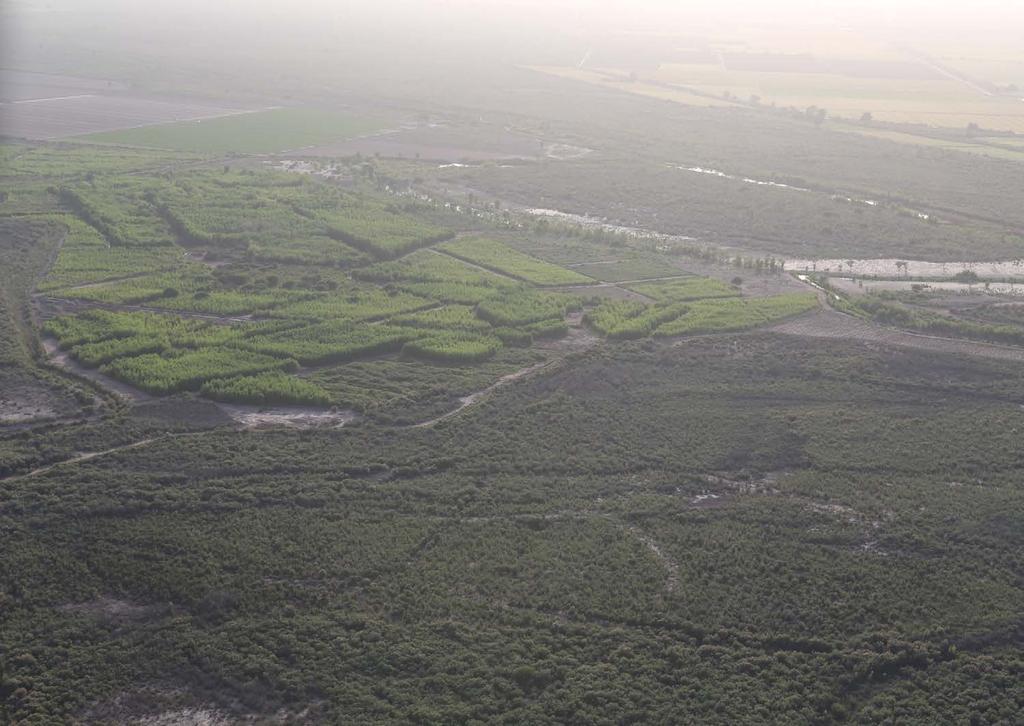
7 The Delta Today

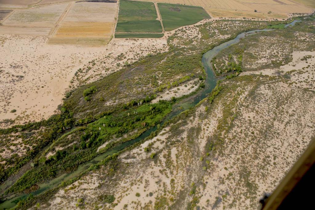
8 Colorado River Corridor in Mexico Laguna Grande Restoration Area
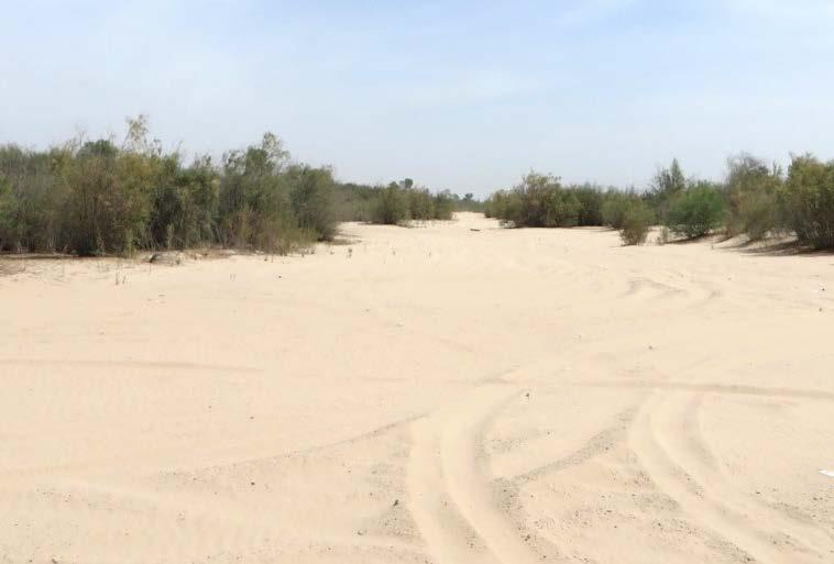
9 Reach 1
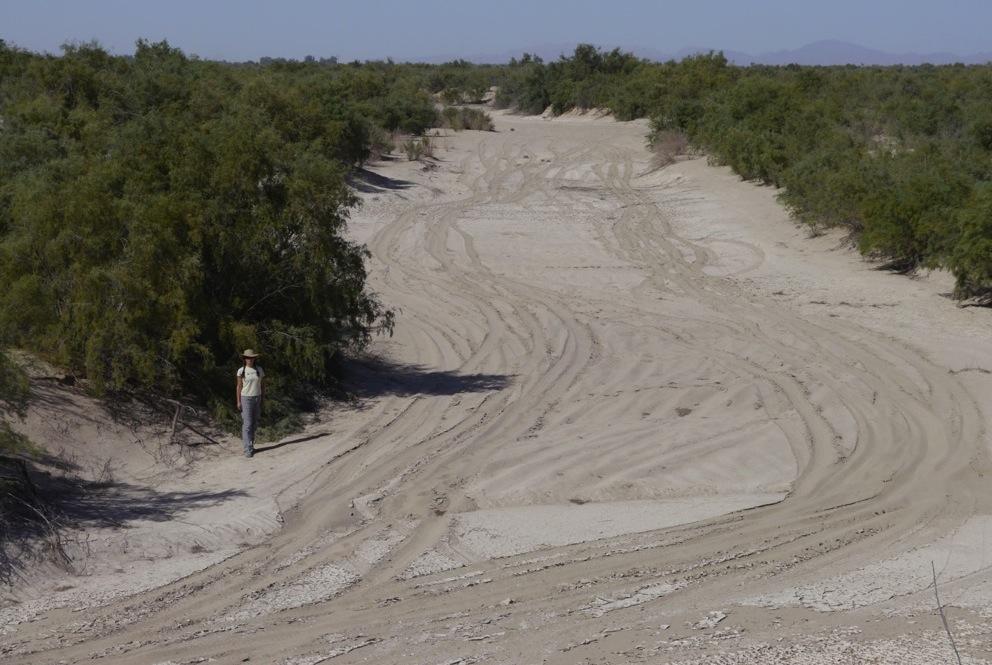
10 Reach 2
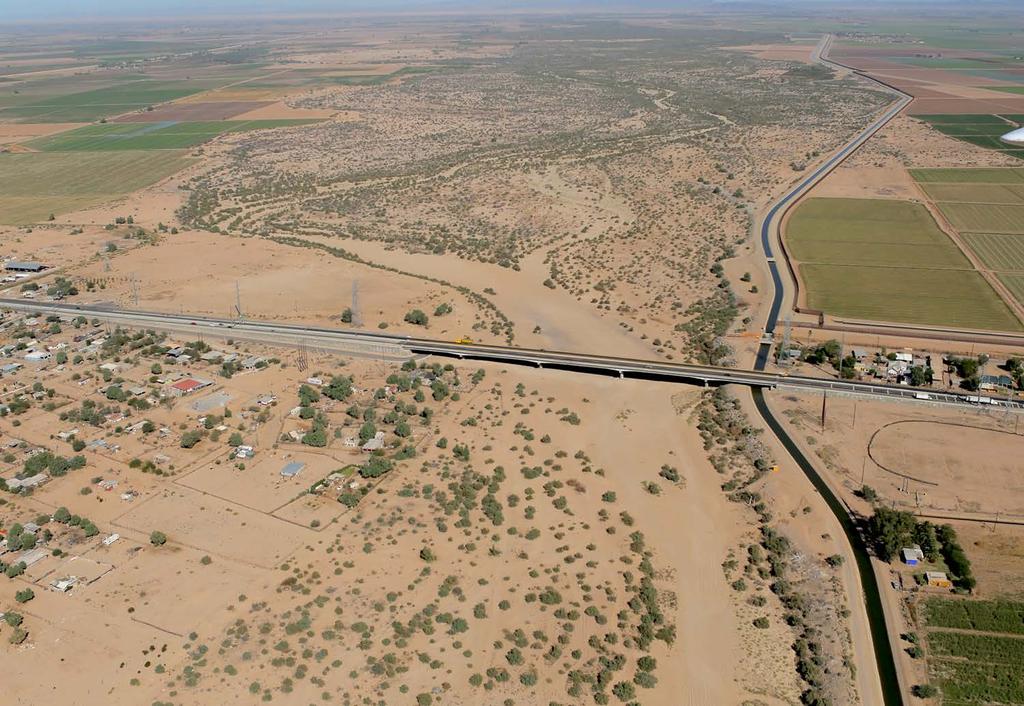
11 Reach 3

12 Reach 4: Laguna Grande Restoration Area
13
14 14

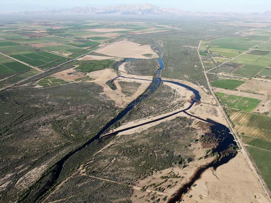
15 Reach 4: Laguna Grande Complex

16 ~15 Miles from the Gulf of California 16
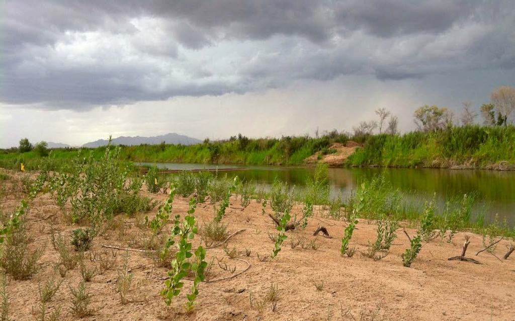
17 Groundwater Concerns Shallow, low-salinity groundwater required to support desired riparian habitat. Existing vegetation and hydrology Completed restoration projects Potential restoration sites Groundwater levels determined by a range of factors: Agricultural return flows Groundwater pumping Local evapotranspiration Basin-wide precipitation Environmental flows Shallow groundwater areas targeted for active restoration: Reach 1 Reach 4: Current research project.

18 Conceptual Reach 4 Water Balance Model Agricultural Return Flows Evaporation and Transpiration River Inflow/Outflow Environmental Flows and Rainfall
19 Groundwater Trend at Laguna Grande
20 Groundwater with Environmental Flows
21
22 Current Groundwater Analysis for Reach 4 Groundwater Monitoring UABC/Minute 319 piezometer transects Additional ~20 piezometers at Laguna Grande Restoration Area Groundwater depth and elevation Groundwater salinity Use results to: Monitor effects of irrigation and environmental flows Adaptively manage restoration sites Groundwater Modeling Determine depth to groundwater under different scenarios. What are the reasonable expectations for groundwater changes in Reach 4 in the future? Use results to inform: Restoration planning site selection, long-term irrigation needs. Future environmental flows what are the effects of different volumes, where can they be applied to maximize ecological benefits in Reach 4?
23 Groundwater Modeling Refine existing groundwater model to predict mean monthly groundwater depth under different input combinations (model scenarios). Use literature values, on-site observations, and remote sensing results to establish groundwater depth thresholds for riparian plants in the Delta. Determine the extent of groundwater support for existing and potential open water, marsh, and riparian areas under different modeled scenarios.
 Conductivity: Diaz,")

")
24 Existing Groundwater Model (UABC) Conductivity: Diaz, 2001; Rodriguez- Burgueño, 2011 Pumping: CONAGUA Recharge: % (Feirstein et al, 2008) Irrigation volume
25 Model Components Input Category Input Level Input Amount Drivers Baseline 20% of existing water rights Agricultural Return Flows Increased Reduced 30% of water rights 15% of water rights Canal lining, fallowing, crop changes Riparian Corridor ET Environmental Flow Deliveries Baseline Increased Decreased None Low High Current Conversion of saltcedar to native vegetation Saltcedar ET reduction based on leaf beetle (16% annually) 0 a-f/year 5,000 a-f/year 17,600 a-f/year Saltcedar removal, saltcedar defoliation, vegetation composition. International water agreements (Min 32X) Upstream Subsurface Inflow Reduced Increased Intermediate Minimum values in period of record ( ) Modified pulse flow Average of reduced and increased Groundwater pumping, reduced agricultural application, upstream environmental flows, extreme weather events. 3 X 3 X 3 X 3 = 81 Scenarios
26 Agricultural Return Flows
27 Riparian Corridor ET
28 Saltcedar ET and Beetle Effects Month Monthly ET, mm Reduction Pre- Post- Reduction Coefficient Beetle Beetle January February March April May June July August September October November December Annual Following Liebert et al. (2015)
29 Monthly ET Curves for Model Scenarios
30 Theoretical Reach 4 ET Balance
31 Upstream Subsurface Inflows/Boundary Conditions
32 For each model grid cell: Percolation rate. Evapotranspiration rate. Model Inputs Dependent on: Current land use (ag or not ag). Current vegetation (saltcedar or not saltcedar). Restoration plans (inside or outside restoration polygons). Application: Assigned values for each of 20,000 grid cells. Fractional calculations based on current cover.
33 Model Boundary Conditions Upstream boundary conditions. Assigned head boundary. Agricultural subsurface return flows. Parent model for Mexicali Valley.
34 Anticipated Analysis of Model Results Model outputs: Mean monthly groundwater elevation in each model cell (81 scenarios X 12 months = 972 elevation surfaces). Will have to focus on key months. Summarize groundwater depth conditions for Reach 4. Convert groundwater depth to habitat support. Open water Marsh Cottonwood-Willow Mesquite Transitional


35 Cori Concession Polygon: Water Year Groundwater Depth
36 Pending Work: Depth to Groundwater Threshold Analysis


37 Habitat Potential Open Water Marsh Wet Riparian Dense Riparian Open Riparian Mesquite Halophytes Open Mesquite/Upland
38 Current Project Status and Next Steps Completed Refinement of groundwater model for Reach 4. Compilation of historic groundwater data. Ongoing Refinement of depth to groundwater thresholds. Spatial analysis of model results. Existing vegetation mapping for Reach 4. ET and Percolation scenarios and intersections.
39 Recap of Modeling Objectives Determine how sensitive the groundwater and supported ecosystem in Reach 4 is to factors that are not managed by restoration practitioners. Determine if management actions can mitigate declines in groundwater levels. Understand the potential negative impacts of restoration on the water budget.

40 Acknowledgments Desert Landscape Conservation Cooperative The Lincoln Institute The Colorado River Delta Water Trust CONAGUA Universidad Autónoma de Baja California
41 Questions?
A Spatial and Temporal Analysis of Groundwater Elevation in the Colorado. River Delta in Response to the Minute 319 Pulse-Flow.
 A Spatial and Temporal Analysis of Groundwater Elevation in the Colorado River Delta in Response to the Minute 319 Pulse-Flow by Stephanie Arnold GIS term project Dr. David Maidment Energy and Earth Resources
Progress and Perspectives in Mexico - US Join Cooperative Actions on the Colorado River, with Drought and Climate Change
 Navigating the Future of the Colorado River Progress and Perspectives in Mexico - US Join Cooperative Actions on the Colorado River, with Drought and Climate Change Ing. Mario López Pérez Comisión Nacional
As Goes Grand County, So Goes the Colorado River
 As Goes Grand County, So Goes the Colorado River Grand County State of the River May 17, 2017 Anne J Castle Getches-Wilkinson Center, University of Colorado Source: US Bureau of Reclamation Colorado River
San Mateo Plain Groundwater Basin Assessment Stakeholder Workshop #8 17 APRIL 2018
 San Mateo Plain Groundwater Basin Assessment Stakeholder Workshop #8 17 APRIL 2018 PRESENTATION OVERVIEW Introductions Project Overview Summary of Analysis Supporting Model Development Model Development
Albuquerque District
 Albuquerque District Rio Grande Reservoir Symposium Federal Perspective Upper Rio Grande Operations Model and URWOPS Update April Sanders Project Manager 1 Why are we doing this? Upper Rio Grandè Basin
Colorado River Challenges Impacts to Southern Arizona
 Colorado River Challenges Impacts to Southern Arizona 2 3 4 5 Colorado River Basics 7 States, 2 Nations Annual Flow 15.0 MAF 40 Million People All of the Major Cities in Southwest 5.5m Irrigated Acres
deceased Received: 28 April 2018 Revised: 9 August 2018 Accepted: 4 September 2018 Published: 18 December Background
 https://doi.org/10.5194/piahs-380-45-2018 Author(s) 2018. This work is distributed under the Creative Commons Attribution 4.0 License. Remote sensing vegetation index methods to evaluate changes in greenness
Landscape Performance Benefits & Methods
 Landscape Performance Benefits & Methods Case Study prepared by: Research Fellow: G Mathias Kondolf, Professor and Chair of Landscape Architecture & Environmental Planning, UC Berkeley Research Assistants:
RESPONSE OF ESTABLISHED RIPARIAN VEGETATION TO MINUTE 319 ENVIRONMENTAL FLOW IN THE COLORADO RIVER DELTA, MEXICO: A CLOSE-UP VIEW.
 RESPONSE OF ESTABLISHED RIPARIAN VEGETATION TO MINUTE 319 ENVIRONMENTAL FLOW IN THE COLORADO RIVER DELTA, MEXICO: A CLOSE-UP VIEW. MARTHA GOMEZ-SAPIENS1, PAT SHAFROTH2, ERICK LUNDGREN3; CHRIS JARCHOW4,
Sustainability of Colorado River Delta Riparian Habitat Under Different Water Management and Climate Change Scenarios
 Sustainability of Colorado River Delta Riparian Habitat Under Different Water Management and Climate Change Scenarios Working Paper WP15KS1 Karen Schlatter Sonoran Institute Matthew Grabau GeoSystems Analysis
Imported Water Committee Special Meeting September 14, 2017
 Imported Water Committee Special Meeting September 14, 2017 Dan Denham, Colorado River Program Director Dan Denham: Assistant General Manager Kara Mathews: Senior Water Resources Specialist Background
Technical Memorandum
 Specialists in Agricultural Water Management Serving Stewards of Western Water since 1993 To: From: Technical Memorandum Butte County Department of Water and Resource Conservation Davids Engineering Date:
Ecosystem services and the value of water in the Colorado River Delta and Estuary, USA and Mexico: Guidelines for mitigation and restoration
 Ecosystem services and the value of water in the Colorado River Delta and Estuary, USA and Mexico: Guidelines for mitigation and restoration Karl W. FLESSA (Department of Geosciences, University of Arizona,
Groundwater in the Santa Rosa Plain
 . Groundwater in the Santa Rosa Plain Marcus Trotta, PG, CHg Principal Hydrogeologist Sonoma County Water Agency Santa Rosa Plain Groundwater Sustainability Agency October 12, 2017 www.sonomacountywater.org
March 26, Colorado River Basin States. Colorado River overview and management. Basin States response to drought
 Integrated Resource Planning Advisory Committee March 26, 2014 Colorado River Basin States 1 Meeting Topics Colorado River overview and management Basin States response to drought U.S. Mexico Colorado
5. Basin Evaluation Salt and Nitrate Balance
 SNMP Attachment B, Section B.2.1.3 (originally Section 5 in CV-SALTS Phase 2 Conceptual Model Task 5 deliverables) 5. As part of the evaluation of water quality the SNMP requires loading estimates and
62 nd Annual New Mexico Water Conference
 62 nd Annual New Mexico Water Conference Kenneth (KC) Carroll Plant & Environmental Science Department and Water Science & Management Program kccarr@nmsu.edu Brackish Groundwater Source for Desalination
Rio Grande Project Operating Agreement: Supplemental Environmental Assessment
 Rio Grande Project Operating Agreement: Supplemental Environmental Assessment Jim Wilber Albuquerque Area Office Bert Cortez El Paso Field Division August 2, 2013 Project Operations: 1916-1979 From Project
Numerical Groundwater Model for the Kaweah Delta Water Conservation District
 Numerical Groundwater Model for the Kaweah Delta Water Conservation District Nels Ruud and Peter Leffler Fugro West, Inc. Larry Dotson Kaweah Delta Water Conservation District Presentation Outline Background
APES- Water Diversions Name: Brandon Tran
 APES- Water Diversions Name: Brandon Tran Purpose: Conduct research to analyze the effects of water diversions on surrounding ecosystems and human communities. Compare and contrast the problems and successes
CENTRAL COAST POST-CONSTRUCTION REQUIREMENTS IMPLEMENTATION GUIDANCE SERIES 1
 CENTRAL COAST POST-CONSTRUCTION REQUIREMENTS IMPLEMENTATION GUIDANCE SERIES 1 SERIES ISSUE #2: DECENTRALIZED STORMWATER MANAGEMENT TO COMPLY WITH RUNOFF RETENTION POST-CONSTRUCTION STORMWATER CONTROL REQUIREMENTS
Alternative Futures for the City of La Paz, Mexico
 O N T H E G R O U N D Alternative Futures for the City of La Paz, Mexico Caroline Dragoo University of Arizona and Robert Faris Harvard University La Paz, Mexico is working hard not to turn into Cabo San
Chapter 13: Water Resources
 Aqueducts in California Grand Coolee Dam Desalinization Chapter 13: Water Resources Fresh Water on Earth Only a small fraction of Earth's water is fresh water & available for human use. Discuss with your
Groundwater Management in the Sonoran Desert of Arizona: The Importance of Surface Supplies and Recharge
 Groundwater Management in the Sonoran Desert of Arizona: The Importance of Surface Supplies and Recharge Engalec 04 March 2004 XII Encuentro National de Ganaderos Lecheros Torreón, Coahuila México Sharon
DRAFT KERN GROUNDWATER AUTHORITY COORDINATION AGREEMENT COMPONENTS WHITE PAPER SERIES. Item D Total Water Use
 KERN GROUNDWATER AUTHORITY COORDINATION AGREEMENT COMPONENTS WHITE PAPER SERIES Item D Total Water Use Introduction There are seven components to Groundwater Sustainability Plan (GSP) coordination agreements.
Roberto Sanchez University of California, Santa Cruz. The Colorado River and Bi-national Issues with Mexico
 Roberto Sanchez University of California, Santa Cruz The Colorado River and Bi-national Issues with Mexico Presented at The Aspen Global Change Institute June 5-10, 2003 Summer Science Session I Learning
Comparative analysis of SWAT model with Coupled SWAT-MODFLOW model for Gibbs Farm Watershed in Georgia
 2018 SWAT INTERNATIONAL CONFERENCE, JAN 10-12, CHENNAI 1 Comparative analysis of SWAT model with Coupled SWAT-MODFLOW model for Gibbs Farm Watershed in Georgia Presented By K.Sangeetha B.Narasimhan D.D.Bosch
Report. Environmental Water Demands. Butte County Department of Water and Resource Conservation Integrated Water Resources Plan.
 Report Butte County Department of Water and Resource Conservation Integrated Water Resources Plan s June 2004 s Section 1 - Introduction 1.1 Project Description This project is a preliminary investigation
Simulation of Groundwater Conditions in the Upper San Pedro Basin for the. Evaluation of Alternative Futures. Tomas Charles Goode. Thomas Maddock III
 Simulation of Groundwater Conditions in the Upper San Pedro Basin for the Evaluation of Alternative Futures by Tomas Charles Goode and Thomas Maddock III Alternative Futures 1 Alternative Futures Study
Section 8 Stevinson Water District Study Area
 Stevinson Water District Study Area Figure 8-1. Location of Stevinson Water District & the Merquin County Water District (SWD 2005). 8.1 Introduction and Overview The Stevinson Water District (SWD) is
Upper Rio Grande Water Operations Model (URGWOM) Runs for the Middle Rio Grande Endangered Species Act Collaborative Program
 Runs for the Middle Rio Grande Endangered Species Act Collaborative Program") Upper Rio Grande Water Operations Model (URGWOM) Runs for the Middle Rio Grande Endangered Species Act Collaborative Program Craig Boroughs, Ph.D., P.E. BH&H Engineering, Inc. URGWOM Technical Team 2008
Upper Rio Grande Water Operations Model (URGWOM) Runs for the Middle Rio Grande Endangered Species Act Collaborative Program Craig Boroughs, Ph.D., P.E. BH&H Engineering, Inc. URGWOM Technical Team 2008
Salton Sea Hydrology Development
 T E C H N I C A L R E P O R T Salton Sea Hydrology Development Prepared for Imperial Irrigation District October 2018 CH2M HILL 402 W. Broadway, Suite 1450 San Diego, CA 92101 Contents Section Page 1
Water Budgets. 1. Recap of Groundwater What is required for a water budget? 3. How will water budgets be used in GSPs? 4. Factors to consider
 Water Budgets 1 Water Budgets 1. Recap of Groundwater 1.0 2. What is required for a water budget? 3. How will water budgets be used in GSPs? 4. Factors to consider 5. Practice! 2 Conceptual Water Budget
Climate Sensitivity Runs (DRAFT)
") Climate Sensitivity Runs (DRAFT) South Florida Water Management Model SOUTH FLORIDA WATER MANAGEMENT DISTRICT February 13, 2013 Authored by: Hydrologic & Environmental Systems Modeling (HESM) Contributors:
Climate Sensitivity Runs (DRAFT) South Florida Water Management Model SOUTH FLORIDA WATER MANAGEMENT DISTRICT February 13, 2013 Authored by: Hydrologic & Environmental Systems Modeling (HESM) Contributors:
Climate Change and Its Potential Effect on Vernal Pool Ecosystems: Example of Oregon & California Hardpan Vernal Pools
 Climate Change and Its Potential Effect on Vernal Pool Ecosystems: Example of Oregon & California Hardpan Vernal Pools Presented by Niall McCarten Overview Vernal Pool Wetlands brief overview Climate atmospheric
Pajaro River Watershed Integrated Regional Water Management Plan Update Project Solicitation Form
 Pajaro River Watershed Integrated Regional Water Management Plan Update PROJECT OVERVIEW General Project Information Project Title: South County Recycled Water Pipeline - Short-Term CIP Implementation
High-Resolution Groundwater Models for the Assessment of Riparian Restoration Options and River Conveyance Efficiency
 High-Resolution Groundwater Models for the Assessment of Riparian Restoration Options and River Conveyance Efficiency Karen L. MacClune 1, Gilbert Barth 1, Nabil Shafike 2, Deborah Hathaway 1 1 S. S. Papadopulos
Natural Resources of the West: Water and Drought
 Prowers Co., Colorado, 1937. (Western History Collection, University of Oklahoma) Natural Resources of the West: Water and Drought What is Drought? Thirsty corn in Iowa Drought in India Gigi A. Richard
The DNR is charged with managing waters resources to assure an adequate and sustainable supply for multiple uses.
 The DNR is charged with managing waters resources to assure an adequate and sustainable supply for multiple uses. Minnesota Laws 2015, chapter 4, article 4, directed the Department of Natural Resources
C a l - S I M E T A W
 C a l - S I M E T A W Daily Soil Water Balance Program New Model to Estimate Agricultural Water Demand in California Morteza Orang 2015 Annual UC, ANR Water Program Team February 13, 2015 California Study
Appendix I. Groundwater Modeling
 Appendix I. Groundwater Modeling This appendix describes current and future groundwater modeling efforts associated with the. 0 I. Current Objectives of Groundwater Modeling Efforts The objectives of groundwater
GROUND WATER/SURFACE WATER INTERACTIONS AWRA SUMMER SPECIALTY CONFERENCE Judith Schenk'
 July 1-3 GROUND WATER/SURFACE WATER INTERACTIONS AWRA SUMMER SPECIALTY CONFERENCE 2002 326x6 pjf= INTEGRATION OF DATA USING GIS AND STATEPP TO ESTIMATE GROUNDWATER MODEL INPUT PARAMETERS Judith Schenk'
Dynamic Statewide Water Budget for Water Planning in New Mexico
 Dynamic Statewide Water Budget for Water Planning in New Mexico Sep 20 2016 Ongoing Drought in New Mexico and the West Jan 20 2015 April 8 2014 July 9 2013 Elephant Butte Storage (AF) Surface supplies
If you need this publication in alternate form, contact the Public Affairs Office at
 If you need this publication in alternate form, contact the Public Affairs Office at 1-800-272-8869. Table of Contents Volume 3 - Regional Reports Chapter 1: State Summary Chapter 2: North Coast Hydrologic
ADAPTATION TO CLIMATE CHANGE IN THE RIO GRANDE/RIO BRAVO AND COLORADO RIVERS
 INTERNATIONAL BOUNDARY AND WATER COMISSION COMMISSION COMISIÓN INTERNACIONAL DE LÍMITES Y AGUAS ADAPTATION TO CLIMATE CHANGE IN THE RIO GRANDE/RIO BRAVO AND COLORADO RIVERS Commissioners Edward Drusina
Walker Basin Restoration Program. Program Overview - June 7, 2016 Legislative Commission s Subcommittee to Study Water Dyer, Nevada
 Walker Basin Restoration Program Program Overview - June 7, 2016 Legislative Commission s Subcommittee to Study Water Dyer, Nevada National Fish and Wildlife Foundation The National Fish and Wildlife Foundation
Issue paper: Aquifer Water Balance
 Issue paper: Aquifer Water Balance 1. Introduction And Background 1.1. Purpose and Scope The population in Kitsap County has grown rapidly in recent years and is expected to increase substantially in the
A Case Study: Imperial Valley, California
 University of Colorado Law School Colorado Law Scholarly Commons Western Water: Expanding Uses/Finite Supplies (Summer Conference, June 2-4) Getches-Wilkinson Center Conferences, Workshops, and Hot Topics
Hydrologic Characteristics of the Owens River Basin below the Upper Owens River
 Appendix T. Hydrologic Characteristics of the Owens River Basin below the Upper Owens River The hydrology of Mono Basin is described in detail in Chapter 3A. This appendix describes the Owens River basin
Appendix J. Existing Efforts for Identifying Multi-Benefit Projects
 Appendix J Existing Efforts for Identifying Multi-Benefit Projects Water Purveyor Projects Existing Efforts for Identifying Multi Benefits Projects In-lieu groundwater recharge under RWA planning efforts
TRUCKEE BASIN STUDY. Reclamation Mid-Pacific Region. Truckee Meadows Water Authority. April 15, 2015 Reno, NV BOARD Agenda Item 6
 TRUCKEE BASIN STUDY Reclamation Mid-Pacific Region Truckee Meadows Water Authority April 15, 2015 Reno, NV x Page 1 of 22 Basin Studies - Mandated Elements P.L. 111-11 The SecureWater Act: Each Basin Study
BASIN-WIDE REMOTE SENSING OF ACTUAL EVAPOTRANSPIRATION AND ITS INFLUENCE ON REGIONAL WATER RESOURCES PLANNING
 BASIN-WIDE REMOTE SENSING OF ACTUAL EVAPOTRANSPIRATION AND ITS INFLUENCE ON REGIONAL WATER RESOURCES PLANNING Daniel J. Howes 1 Charles M. Burt 2 Kyle Feist 3 ABSTRACT The Irrigation Training & Research
Projected Impacts of Climate Change on Water Resources in the Upper Rio Grande Basin
 Projected Impacts of Climate Change on Water Resources in the Upper Rio Grande Basin Presentation to the New Mexico Academy of Science, New Mexicans for Science and Reason, and the NM Museum of Natural
Lecture 11: Water Flow; Soils and the Hydrologic Cycle
 Lecture 11: Water Flow; Soils and the Hydrologic Cycle Water Flow in Soils Types of Water Flow in Soil Saturated flow: Soil pores completely filled with water; controlled by the hydrostatic potential After
GROUND-WATER LEVELS AND RIVER-AQUIFER INTERACTIONS IN THE UPPER ARKANSAS RIVER CORRIDOR IN SOUTHWEST KANSAS
 GROUND-WATER LEVELS AND RIVER-AQUIFER INTERACTIONS IN THE UPPER ARKANSAS RIVER CORRIDOR IN SOUTHWEST KANSAS Presentation for Upper Arkansas CREP Educational Meetings Donald Whittemore University of Kansas
Technical Memorandum. Butte County Department of Water and Resource Conservation
 Butte County Department of Water and Resource Conservation Base Case and Water Management Scenario Simulations April 2008 Technical Memorandum Contents Section 1 Introduction Section 2 Base Case... 2-1
Overview of Nevada groundwater systems and evolution of groundwater investigations
 Overview of Nevada groundwater systems and evolution of groundwater investigations Kip K. Allander; Groundwater Specialist; NV Water Science Center David L. Berger; Associate Director; NV Water Science
Lower Rio Grande Salinity Monitoring
 Lower Rio Grande Salinity Monitoring Chad Johannesen, DBS&A Beiling Liu, NM Interstate Stream Commission James F. Hogan, NM Environment Department Amy Ewing, DBS&A Chris Wolf, DBS&A Rio Grande Surface
SAN MATEO PLAIN GROUNDWATER BASIN ASSESSMENT STAKEHOLDER WORKSHOP#2 SEPTEMBER 7, 2016
 SAN MATEO PLAIN GROUNDWATER BASIN ASSESSMENT STAKEHOLDER WORKSHOP#2 SEPTEMBER 7, 2016 PRESENTATION OVERVIEW Introductions Project Overview Summary of Stakeholder Meeting #1 Feedback Snapshot of Results
MONTEREY PENINSULA WATER MANAGEMENT DISTRICT PROJECT DESCRIPTION FOR SELECTIVE VEGETATION MANAGEMENT AND BANK RESTORATION (RANCHO SAN CARLOS AREA)
") MONTEREY PENINSULA WATER MANAGEMENT DISTRICT PROJECT DESCRIPTION FOR SELECTIVE VEGETATION MANAGEMENT AND BANK RESTORATION (RANCHO SAN CARLOS AREA) IN THE CARMEL RIVER CHANNEL, SUMMER AND FALL 2014 SELECTIVE
MONTEREY PENINSULA WATER MANAGEMENT DISTRICT PROJECT DESCRIPTION FOR SELECTIVE VEGETATION MANAGEMENT AND BANK RESTORATION (RANCHO SAN CARLOS AREA) IN THE CARMEL RIVER CHANNEL, SUMMER AND FALL 2014 SELECTIVE
Improving Economic Returns and Long-Run Sustainability in a Rapidly Growing, Peri- Urban, Multicultural, Small-Scale, Traditional Farming Community
 Improving Economic Returns and Long-Run Sustainability in a Rapidly Growing, Peri- Urban, Multicultural, Small-Scale, Traditional Farming Community Leeann DeMouche Water Resource Specialist New Mexico
Section V: Water Accounting and Water Supply Reliability
 Section V: Accounting and Supply Reliability A. Quantifying the Supplier s Supplies 1. Agricultural Supplier Quantities Table 38 shows typical water diversions from the CA Aqueduct during the representative
Hydrogeology 101 3/7/2011
 Hydrogeology 101 W. Richard Laton, Ph.D., PG, CPG Associate Professor of Hydrogeology California State University, Fullerton Department of Geological Sciences 1 Hydrogeology 101 The objective is to obtain
Home to about 56 million people, the Southwest includes Nevada, Arizona, New Mexico, Utah, Colorado and most of California.
 Climate change in the U.S. Southwest U.S. Environmental Protection Agency Overview The Southwest is the hottest and driest region in the nation. Extending from the Pacific Ocean east to the Rocky Mountains
Chapter 6 Water Resources
 Chapter 6 Water Resources Elemental Geosystems 5e Robert W. Christopherson Charles E. Thomsen 1 Water Resources The Hydrologic Cycle Groundwater Resources Our Water Supply The Hydrologic Cycle A Hydrologic
USGS Virginia Water Science Center: Scientific Support to the Virginia Department of Environmental Quality Groundwater Withdrawal Permitting Program
 USGS Virginia Water Science Center: Scientific Support to the Virginia Department of Environmental Quality Groundwater Withdrawal Permitting Program Reported and Estimated Withdrawals for Virginia Coastal
May 3, 2011 BUILDING STRONG BUILDING STRONG ALBUQUERQUE DISTRICT. US Army Corps of Engineers. US Army Corps of Engineers
 Upper Rio Grande Water Operations Model Present t& Future Work May 3, 2011 US Army Corps of Engineers US Army Corps of Engineers BUILDING STRONG ALBUQUERQUE DISTRICT URGWOM Website http://www.spa.usace.army.mil/urgwom/default.asp
New Investments in Water Portfolios
 California Water Plan Update 2010 New Investments in Water Portfolios California Water and Environmental Water Forum Annual Meeting February 27, 2007 Todd Hillaire hillaire@water.ca.gov California Department
Home. Colorado River Interactive Simulation - Colorado River Basin Unit. Introduction
 Colorado River Interactive Simulation - Colorado River Basin Unit Home NPS/Mike Quinn Introduction The Colorado River is considered one of the great rivers of North America. Although other rivers are longer
Water for Southern California: How Bay-Delta is Key to All of the Above Strategy
 Water for Southern California: How Bay-Delta is Key to All of the Above Strategy Stephen N. Arakawa Manager, Bay-Delta Initiatives The Metropolitan Water District of Southern California October 15, 2016
Integrated systems evaluation of climate change and future adaptation strategies for the Lower River Murray, Australia
 Bureau of Meteorology From the SelectedWorks of Amgad Elmahdi 2008 Integrated systems evaluation of climate change and future adaptation strategies for the Lower River Murray, Australia Amgad ELMAHDI Jeff
Napa Watershed Symposium. Factors affecting future water quantity and quality in Napa County, and strategies for adaptation
 Napa Watershed Symposium Factors affecting future water quantity and quality in Napa County, and strategies for adaptation Pierre Stephens California Department of Water Resources May 21, 2009 Source:
THE CALIFORNIA DROUGHT
 THE CALIFORNIA DROUGHT Helen Dahlke Assistant Professor in Integrated Hydrologic Sciences, LAWR, UC Davis DECEMBER 13, 2015 EMAIL: hdahlke@ucdavis.edu Signs of a 4-year drought NOAA drought index THE DILEMMA
2014 Executive Summary
 2014 Executive Summary 2 We forget that the water cycle and the life cycle are one. Jacques-Yves Cousteau Photo by Peter W. Cross Water makes headlines when there s too little or too much. Persistent droughts
Colorado River: Drought Contingency Planning Wyoming s Little Snake and Green River Basins October 15, 2018
 Colorado River: Drought Contingency Planning Wyoming s Little Snake and Green River Basins October 15, 2018 Cheyenne Meeting and Webinar Wyoming State Engineer s Office Glen Canyon Dam and Lake Powell
Assessing the Ecological Benefits of River and Floodplain Restoration
 Assessing the Ecological Benefits of River and Floodplain Restoration John Hunter, Ph.D. (HTH), Michael Yun (Anderson Krygier), Craig Williams (DWR), Mary Jo Kealy, Ph.D. (CH2M), Ron Melcer (DWR), and
The Future of Irrigated Agriculture: Where's the Water?
 The Future of Irrigated Agriculture: Where's the Water? California Colloquium on Water UC Berkley February 9 th 2010 David F. Zoldoske, Director Center for Irrigation Technology California State University,
Osvel Hinojosa Huerta paddles his
 Colorado River Delta JEFFREY P. COHN Members of the Ejido Luis Encinas Johnson, a local communal group, earn extra money by taking scientists, journalists, hunters, and ecotourists onto the Cienega de
UPDATE: SNWA Groundwater Development Project Activities. August 20, 2009
 UPDATE: SNWA Groundwater Development Project Activities August 20, 2009 History Southern Nevada s Population (1980s) 2,000,000 1,000,000 750,000 444,000 0 1900 1910 1920 1930 1940 1950 1960 1970 1980 1990
4C.11 Off-Channel Reservoir near Lake Corpus Christi (N-11)
") 4C.11 Off-Channel Reservoir near Lake Corpus Christi (N-11) 4C.11.1 Description of Strategy Choke Canyon Reservoir (CCR) has a storage capacity of approximately 695,000 acft and a contributing drainage
4C.11 Off-Channel Reservoir near Lake Corpus Christi (N-11) 4C.11.1 Description of Strategy Choke Canyon Reservoir (CCR) has a storage capacity of approximately 695,000 acft and a contributing drainage
U.S. Water Budget. Figure Source:Data from The Nation s Water Resources , Vol. 1, U.S. Water Resources Council.
 U.S. Water Budget Figure 10.18 10-9 Source:Data from The Nation s Water Resources 1975-2000, Vol. 1, U.S. Water Resources Council. Average U.S. Precipitation Figure 10.19 10-10 Source: U.S. Water Resources
ITRC METRIC and Net Groundwater Use/Recharge
 ITRC METRIC and Net Groundwater Use/Recharge Dan Howes, Ph.D., P.E. 9/5/2018 Irrigation Training and Research Center (ITRC) California Polytechnic State University (Cal Poly) San Luis Obispo, CA 93407
Section V: Water Accounting and Water Supply Reliability
 Section V: Accounting and Supply Reliability A. Quantifying the Supplier s Supplies 1. Agricultural Supplier Quantities Table 46 illustrate the District s water. The District routinely transfers and/or
Section 3 Current and Future Water Demand
 Understanding the magnitude and location of future water demands, and any potential changes from existing water demands, allows the County to develop recommendations that will meet or manage demands for
SALINAS VALLEY GROUNDWATER BASIN SETTING INITIAL REVIEW FOR DEVELOPMENT OF GROUNDWATER SUSTAINABILITY PLAN
 1 SALINAS VALLEY GROUNDWATER BASIN SETTING INITIAL REVIEW FOR DEVELOPMENT OF GROUNDWATER SUSTAINABILITY PLAN May 10, 2018 Prepared for Salinas Valley Basin Groundwater Sustainability Agency Outline Purpose
The State of the Colorado River
 April 2014 The State of the Colorado River Executive Summary The Colorado River Basin is now in its fifteenth year of drought. System runoff during this period has been comparable to or less than that
Public Private Partnership Reduces Harmful Discharges. Presented to the Florida Stormwater Association December 2017
 Public Private Partnership Reduces Harmful Discharges Presented to the Florida Stormwater Association December 2017 Dispersed Water Management (DWM) Definition: Shallow water distributed across parcel
STORMWATER RUNOFF AND WATER QUALITY IMPACT REVIEW
 SUBCHAPTER 8 STORMWATER RUNOFF AND WATER QUALITY IMPACT REVIEW 7:45-8.1 Purpose and scope of review Except for those projects expressly exempted by this chapter or waived by the Commission, the Commission
Legislative Committee on Public Lands
 Legislative Committee on Public Lands EXHIBIT D2 May 28, 2004 EXHIBIT D2 Committee Name Lands Document consists of 74 Slides Entire document provided. Due to size limitations, pages provided. A copy of
Effluent Disposal Feasibility Alternatives Study of Morro Valley
 Final Report Effluent Disposal Feasibility Alternatives Study of Morro Valley Morro Bay, California Prepared for Michael K. Nunley & Associates and the City of Morro Bay August 2016 Prepared by Table of
Water Management Under Severe Storm Conditions in Central and South Florida
 Water Management Under Severe Storm Conditions in Central and South Florida Chandra S. S. Pathak, Ph.D., P.E. Severe Storm Prediction and Global Climate Impact in the Gulf Coast Conference October 29 to
The Downstream Perspective
 The Downstream Perspective Chris C. Mahannah, PE, SWRS 12 February 2018 Lyon / Churchill County Water Workshop Mahannah & Associates, LLC chris@mah2o.com (775) 323-1804 Speakers Chris Mahannah, P.E. downstream
Understanding Flows Through the Remnant Colorado River Delta
 Research for People and the Planet Understanding Flows Through the Remnant Colorado River Delta Recommendations for Streamgage Sites and Data Collection November 4, 2005 for more information, contact:
WARM SPRINGS NATURAL AREA FACTS
 WARM SPRINGS NATURAL AREA FACTS 1,220 acres of Mojave Desert riparian ecosystem 28 Sensitive Species Annual Rainfall 5.4 in. Elevation: 1,689-1,923 feet above mean sea level Five major spring complexes
The Importance of the Pearl River to Mississippi s Estuarine Habitats Jennifer Buchanan Education Coordinator
 The Importance of the Pearl River to Mississippi s Estuarine Habitats Jennifer Buchanan Education Coordinator 2006 Pearl River Basin Symposium May 5-6, 2006 Topics for Discussion What s an estuary? Pearl
Sterling and Gilcrest/LaSalle High Groundwater Analysis
 FINAL REPORT Prepared for The State of Colorado, Department of Natural Resources Sterling and Gilcrest/LaSalle High Groundwater Analysis July 2015 Sterling and Gilcrest/LaSalle High Groundwater Analysis
California s s Water Supplies and Uses
 California s s Water Supplies and Uses Presented to Delta Stewardship Council Presented by Joe Grindstaff September 21 1 Place to Place: Most precipitation falls in the mountains in the north and east
Chapter 1 Introduction
 Engineering Hydrology Chapter 1 Introduction 2016-2017 Hydrologic Cycle Hydrologic Cycle Processes Processes Precipitation Atmospheric water Evaporation Infiltration Surface Runoff Land Surface Soil water
New River Desert Hills Community Association Ben Graff CAP Board October 13, 2017
 New River Desert Hills Community Association Ben Graff CAP Board October 13, 2017 Central Arizona Project 336-mile aqueduct stretches from Lake Havasu to Tucson 14 pumping plants lift water nearly 3,000
Conservation Priority Areas
 Calexico CALIFORNIA BAJA CALIFORNIA Yuma Mexicali 9 23 Sierra Cucapá Laguna Salada Mexicali Irrigation District Río Hardy 1 10 2 5 4 6 3 Colorado River 11 7c 12 7a 7b San Luis San Luis Río Colorado Desierto