May 3, 2011 BUILDING STRONG BUILDING STRONG ALBUQUERQUE DISTRICT. US Army Corps of Engineers. US Army Corps of Engineers
|
|
|
- Clare Louise Mosley
- 5 years ago
- Views:
Transcription


1 Upper Rio Grande Water Operations Model Present t& Future Work May 3, 2011 US Army Corps of Engineers US Army Corps of Engineers BUILDING STRONG ALBUQUERQUE DISTRICT


2 URGWOM Website
3 5 Year Plan Overview AWRA November 7 10, Upper Rio Grande NM Real Time Watershed Modeling Watershed Model Colorado Portion Middle Rio Grande Watershed Model Accounting Model Combined Forecast Water Ops Model Lower Rio Grande
4 5 Year Plan
5 5 Year Plan URGWOM Regular Activities Rules Development Database Management Monthly Model Maintenance URGWOM Technical Review (2012) Update Survey of Vegetated Areas (2012) URGWOM Enhancement & Development Rules Efficiency Watershed Model Colorado Portion Middle Valley Model Improvements Real Time Water Operations Model
6 5 Year Plan URGWOM Enhancement & Development Accounting Model lenhancements Accounting Controller Solution Research Lower Rio Grande Model Enhancements Monthly Timestep RiverWare Model Development Water Quality Simulation Capability to Groundwater Objects Planning Support MRGES Collaborative Program Modeling (BA/BO) Development of Monthly Powersim Scoping Model
7 Colorado Portion
8
9 Current URGWOM Methods Flows currently based on historical gage data at Lobatos (historical year in a synthetic sequence) Upcoming year inflows adjusted to match forecast volume Assumption operations match historical i operations
10 Admin of Colo. DWR District 20 ~ 200 ditches administered (Apr 1 Oct 31) Diversion from river to eight main canals Rio i Grande canal provides water to 32 ditches Various water user associations regulate head gates from main canals and laterals
11 Rio Grande Compact Conejos Delivery obligation forthe Conejos River is computed as function of Conejos Index Supply Conejos Index Supply = Mogote Gage + Los Pinos Gage near Ortiz + San Antonio River Gage at Ortiz April October Actual delivery to Rio Grande is gaged near Las Sauces, CO
12 Rio Grande Compact Rio Grande Delivery computed as a function of Rio Grande flow at Del Norte Delivery is based on gaged river flow at Lobatos minus the flow from Conejos River
13 Other Rio Grande Tributaries Culebra Creek basin is administered flows do not reach the Rio Grande La Jara River and Alamosa River do not affect Compact administration & operations have not changed over time Trincheras Creek flows are ~ 75 cfs
14 Groundwater Shallow aquifer and a deep confined aquifer Groundwater use has not impacted administration Groundwater use clearly impacts river flows Permitting for groundwater use began in 1965 with rights administered since 1969 A metering program underway for groundwater wells
15 Platoro Reservoir Project water is stored at Platoro Reservoir if Article VII is not in effect Direct flow storage may occur at Platoro Up to 10,000 ac ft may be stored for the Compact Allocations of water available to purchase are set based on the amount of land in the District
16 Rio Grande, Santa Maria, & Continental Reservoirs Storage is fairly low in priority Storage g may occur for a few days or a couple weeks Direct flow storage decree Diversion right is deferred & water is stored upstream Used by same water user in same year Storage for Compact to provide flexibility with meeting delivery requirement
17 DRAFT Design Plan New portion set up independently at first When models are merged, the new rules would be added to solve at a higher priority Verify existing rules since the mainstem above the confluence now solves without rules Impacts on Rio Chama deliveries downstream
18 DRAFT Design Plan Colorado portion would all merge into a primary native Rio Grande account at Lobatos PROPOSED to improve results for analyzing actual conditions in New Mexico NOT PROPOSED to analyze administrative actions in Colorado
19 Initial Layout
20 Initial Layout Detail
21 Initial Layout Detail
22 Initial Layout Detail
23 Initial Layout Detail
24 Middle Rio Grande


25 Upper Rio Grande Watershed URGWOM Modeled from Colorado state line to Texas state line Middle Rio Grande between Cochiti Dam and Elephant Butte Reservoir


26 System in Middle Valley River Channel Riparian Vegetation Riverside Drains Levees and Spoil Banks Irrigation System
27 Groundwater Surface Water Interaction Percolation from Irrigation Riparian Evapotranspiration Rio Grande Riverside Drain Percolation from Irrigation Canal Seepage pg GW West GW River 80 ft GW East Variable Head Boundaries Head Dependant Flow Heads Input from Regional MODFLOW Model


28 Physical System in Model Previous representation of the physical system in URGWOM Uses regression relations for river seepage Feedback loop used to calibrate flow in the river and drains Flow input needed for feedback loop


29 Physical System in Model New representation of the physical system in URGWOM Compute seepage from reach objects Compute groundwater flow between groundwater objects Compute head dependent flux from shallow aquifer and deep aquifer
30 Physical System in Model Detail
31 Seepage from Reach Objects Seepage computed based on head differential between river and shallow hll aquifer level lusing Darcy s equation Seepage = ΔH * Conductance Conductance = K * L * w / m K = hydraulic conductivity L = reach length w = reach width m = bed thickness River head based on a stage discharge relationship.
32 URGWOM Simulates operations/releases Target flows at locations in the Middle Valley Other conditions for other ecological considerations Deliveries to water users Accounting Flows to Elephant Butte Reservoir Daily time step Simulated river flows significantly ifi affected by groundwatersurface water interaction methods
33 Watershed Model


34 La Puente Test Case Headwaters Ungaged Unregulated Small reservoirs Small diversions Major input
35 Loss Method: SCS Curve Number Equation parameters P e = Excess Precipitation P = Accumulated rainfall S = Potential maximumretention S = (25, * CN) / CN I a = Initial abstraction = 0.2 * S CN = Curve Number CN composite = sum (A i * CN i ) / sum A i CN = 30 (very yp permeable) CN = 100 (impervious cover) CN is reasonable range
36 Loss Method: Impervious % Percentage t of impervious i area Increase in % of impervious area leads increase in runoff
37 usgs (cfs) rc0875, varying %imp. & CN 0 7/26/2009 0:007/31/2009 0:00 8/5/2009 0:00 8/10/2009 0:008/15/2009 0:008/20/2009 0:008/25/2009 0:008/30/2009 0:00 9/4/2009 0:00
38 La Puente August usgs (cfs) Rainfall (in) 10 7/26 7/31 8/5 8/10 8/15 8/20 8/25 8/30 9/
39 Baseflow Methods 100 usgs (cfs) 90 rc09 rc08 80 rc rc /26/2009 0:00 7/31/2009 0:00 8/5/2009 0:00 8/10/2009 0:00 8/15/2009 0:00 8/20/2009 0:00 8/25/2009 0:00 8/30/2009 0:00 9/4/2009 0:00 BUILDING STRONG


40 Future Work Snowmelt runoff SNODAS vs. SNOTEL Good Match Cumbres Trestle 10,040 Hopewell 10,000 Bateman 9,300 Poor Match Chamita 8,400
41 Accounting Model
42 Accounting Model Basis forotherother models within URGWOM Accounting of water use in the New Mexico portion of Rio Grande Basin


43 Accounting Model Data sent by COE to BOR Streams, reservoirs, etc. BOR Performs data QC Runs Accounting Model Electronic transfer of model COE COE, NMISC Performs monthly forecast Updated dwater Operations
44 Combined dmodel
45 Combined Forecast Water Ops Integrates forecast and water ops models Currently forecast is output to a temp DSS and overwrittenwith with each new forecast Each month, each sequence Not used due to software quirks Init Rules flag not differentiated with user input
46 Lower Rio Grande
47 Current Work LRG RiverWare Model for Rincon Valley and Mesilla Basin Surface water diversions linked to cropped area demand Interactive groundwater objects linked to drain return flows Expand the RiverWare model to represent the main canal system Simulate river flow and water operations planning scenarios Enhance coordinated water resources database RiverWare Model lfor Lower El Paso Valley Compile flow and crop data Develop the RiverWare model to simulate the river flow and water operations planning scenarios Incorporate data into the coordinated water resources database Evaluate USGS MODFLOW model for Hueco Bolson for SW/GW interaction


48 Model Layout for Rincon Valley
49 Model Layout for Rincon Valley


50 Model Layout for El Paso Valley
51 Model Layout for El Paso Valley
52 Future Plan Enhancement of RiverWare Model for Rincon Valley and Mesilla Basin Further development of RiverWare Model for El Paso Valley Integrate t the RiverWare models for both reaches Simulate flood planning for the Rio Grande Project area Assess alternative water operations planning scenarios under different weather/climate conditions Expansion to simulate the water quality for Rio Grande salinity control and management
53 Questions?
Upper Rio Grande Water Operations Model (URGWOM) Runs for the Middle Rio Grande Endangered Species Act Collaborative Program
 Runs for the Middle Rio Grande Endangered Species Act Collaborative Program") Upper Rio Grande Water Operations Model (URGWOM) Runs for the Middle Rio Grande Endangered Species Act Collaborative Program Craig Boroughs, Ph.D., P.E. BH&H Engineering, Inc. URGWOM Technical Team 2008
Upper Rio Grande Water Operations Model (URGWOM) Runs for the Middle Rio Grande Endangered Species Act Collaborative Program Craig Boroughs, Ph.D., P.E. BH&H Engineering, Inc. URGWOM Technical Team 2008
MEETING NOTES UPPER RIO GRANDE WATER OPERATIONS MODEL STEERING COMMITTEE MEETING
 MEETING NOTES UPPER RIO GRANDE WATER OPERATIONS MODEL STEERING COMMITTEE MEETING NM INTERSTATE STREAM COMMISSION 5550 SAN ANTONIO DR NE ALBUQUERQUE, NM May 12, 2011 Amy Louise called the meeting to order
mainstem Rio Grande (District 20) and focused on Rio Grande Compact administration, direct flow use, reservoir storage administration and groundwater
 and focused on Rio Grande Compact administration, direct flow use, reservoir storage administration and groundwater") MEETING NOTES UPPER RIO GRANDE WATER OPERATION MODEL STEERING COMMITTEE MEETING US FISH AND WILDLIFE SERVICE, NM ECOLOGICAL SERVICES FIELD OFFICE ALBUQUERQUE, NM August 12, 2010 Marc Sidlow called the
MEETING NOTES UPPER RIO GRANDE WATER OPERATION MODEL STEERING COMMITTEE MEETING US FISH AND WILDLIFE SERVICE, NM ECOLOGICAL SERVICES FIELD OFFICE ALBUQUERQUE, NM August 12, 2010 Marc Sidlow called the
Rio Grande Project Operating Agreement: Supplemental Environmental Assessment
 Rio Grande Project Operating Agreement: Supplemental Environmental Assessment Jim Wilber Albuquerque Area Office Bert Cortez El Paso Field Division August 2, 2013 Project Operations: 1916-1979 From Project
UPPER RIO GRANDE WATER OPERATIONS MODEL PHYSICAL MODEL DOCUMENTATION: THIRD TECHNICAL REVIEW COMMITTEE DRAFT
 UPPER RIO GRANDE WATER OPERATIONS MODEL PHYSICAL MODEL DOCUMENTATION: THIRD TECHNICAL REVIEW COMMITTEE DRAFT Contents INTRODUCTION... 1 UPPER RIVER... 3 SUMMARY OF REACH ANALYSIS METHODS ROUTING AND LOSSES...
Michael Roark, USGS Nabil Shafike, ISC Technical Review - October 14, 2010
 Michael Roark, USGS Nabil Shafike, ISC Technical Review - October 14, 2010 Area of Significant GW/SW Interaction Middle Valley System Several diversion structures divert river flows to a system of canals.
Upper Rio Grande Water Operations Model (URGWOM)
") Upper Rio Grande Water Operations Model (URGWOM) Brief History, 2010 AOP Model Results October 14, 2010 Marc Sidlow USACE Pre 1996 History of URGWOM: No comprehensive reservoir and river model of entire
Upper Rio Grande Water Operations Model (URGWOM) Brief History, 2010 AOP Model Results October 14, 2010 Marc Sidlow USACE Pre 1996 History of URGWOM: No comprehensive reservoir and river model of entire
Lower Rio Grande Salinity Monitoring
 Lower Rio Grande Salinity Monitoring Chad Johannesen, DBS&A Beiling Liu, NM Interstate Stream Commission James F. Hogan, NM Environment Department Amy Ewing, DBS&A Chris Wolf, DBS&A Rio Grande Surface
Lower Rio Grande RiverWare Model URGWOM Advisory Committee
 Lower Rio Grande RiverWare Model URGWOM Advisory Committee Steve Setzer Hydros Consulting Inc. September 9, 2014 Previous Contract/Project Previous contract between Hydros and USACE ending September 2013
URGWOM Updates Planning and Water Operations Model Updates
 URGWOM Updates Planning and Water Operations Model Updates URGWOM Technical Review October 14, 2010 Upper Rio Grande Basin System from Colorado state-line to Texas stateline modeled with URGWOM including
Albuquerque District
 Albuquerque District Rio Grande Reservoir Symposium Federal Perspective Upper Rio Grande Operations Model and URWOPS Update April Sanders Project Manager 1 Why are we doing this? Upper Rio Grandè Basin
High-Resolution Groundwater Models for the Assessment of Riparian Restoration Options and River Conveyance Efficiency
 High-Resolution Groundwater Models for the Assessment of Riparian Restoration Options and River Conveyance Efficiency Karen L. MacClune 1, Gilbert Barth 1, Nabil Shafike 2, Deborah Hathaway 1 1 S. S. Papadopulos
GROUND WATER/SURFACE WATER INTERACTIONS AWRA SUMMER SPECIALTY CONFERENCE Judith Schenk'
 July 1-3 GROUND WATER/SURFACE WATER INTERACTIONS AWRA SUMMER SPECIALTY CONFERENCE 2002 326x6 pjf= INTEGRATION OF DATA USING GIS AND STATEPP TO ESTIMATE GROUNDWATER MODEL INPUT PARAMETERS Judith Schenk'
D R A F T Middle Rio Grande Valley Cochiti Dam to Elephant Butte Reservoir Physical Model Upgrades
 D R A F T Middle Rio Grande Valley Cochiti Dam to Elephant Butte Reservoir Physical Model Upgrades CONTENTS Description of the Middle Valley Physical System... 1 River... 1 Groundwater System... 4 Irrigation
Technical Completion Report DEVELOPMENT OF RIVERWARE MODEL OF THE RIO GRANDE FOR WATER RESOURCES MANAGEMENT IN THE PASO DEL NORTE WATERSHED
 Technical Completion Report DEVELOPMENT OF RIVERWARE MODEL OF THE RIO GRANDE FOR WATER RESOURCES MANAGEMENT IN THE PASO DEL NORTE WATERSHED Sponsored by U.S. Army Corps of Engineers, Gulf Coast Cooperative
GROUNDWATER AND SURFACE WATER MODELING FOR WATER PLANNING
 Groundwater and Surface Water Modeling for Water Planning NEW MEXICO WATER PLANNING 2003 NOVEMBER NEW MEXICO WATER RESOURCES RESEARCH INSTITUTE 2003 J. Phillip King is an associate professor and associate
Improving Economic Returns and Long-Run Sustainability in a Rapidly Growing, Peri- Urban, Multicultural, Small-Scale, Traditional Farming Community
 Improving Economic Returns and Long-Run Sustainability in a Rapidly Growing, Peri- Urban, Multicultural, Small-Scale, Traditional Farming Community Leeann DeMouche Water Resource Specialist New Mexico
Projected Impacts of Climate Change on Water Resources in the Upper Rio Grande Basin
 Projected Impacts of Climate Change on Water Resources in the Upper Rio Grande Basin Presentation to the New Mexico Academy of Science, New Mexicans for Science and Reason, and the NM Museum of Natural
MEETING NOTES UPPER RIO GRANDE WATER OPERATIONS MODEL STEERING COMMITTEE MEETING
 MEETING NOTES UPPER RIO GRANDE WATER OPERATIONS MODEL STEERING COMMITTEE MEETING NM INTERSTATE STREAM COMMISSION 5550 SAN ANTONIO DR NE ALBUQUERQUE, NM August 11, 2011 Amy Louise called the meeting to
Reservoir Operation Constraints and Opportunities, from the perspective of the Bureau of Reclamation
 Reservoir Operation Constraints and Opportunities, from the perspective of the Bureau of Reclamation Presented at: Institutional Constraints to Water Management in New Mexico Albuquerque, New Mexico May
State Perspectives on Reservoir Management
 State Perspectives on Reservoir Management Pecos and Rio Grande Basins New Mexico Presented at Institutional Constraints to Water Management in New Mexico Presented By: Grace Haggerty Rio Grande Bureau
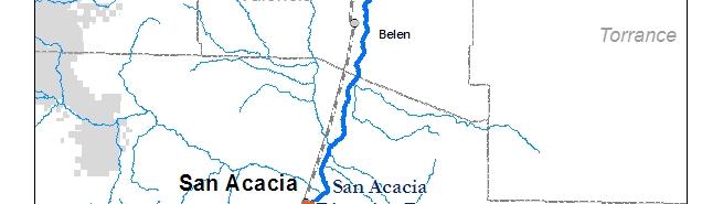
To address water supply issues in the San Acacia
 CURRENT ISSUES ON THE MIDDLE RIO GRANDE 89 How Science Can Provide Pathways to Solutions The Technical Toolbox Susan Kelly, Utton Transboundary Resources Center, University of New Mexico School of Law
URGWOM Technical Review October 14, 2010
 Rule Updates URGWOM Technical Review October 14, 2010 Rulebased Simulations Planning and Water Operations model runs are rulebased simulations completed using the single URGWOM ruleset. Ruleset represents
Scientific Investigations Report By Jeff B. Langman and Scott K. Anderholm. U.S. Department of the Interior U.S.
 Effects of Reservoir Installation, San Juan-Chama Project Water, and Reservoir Operations on Streamflow and Water Quality in the Rio Chama and Rio Grande, Northern and Central New Mexico, 1938-2 By Jeff
Using the RGDSS Groundwater Model to Compute Response Functions
 Using the RGDSS Model to Compute Response Functions The computation of response functions for Subdistrict No. 1 involves making a set of paired model simulations using the Rio Grande Decision Support Model
Camp Far West Hydroelectric Project Relicensing
 Camp Far West Hydroelectric Project Relicensing Water Operations Model FERC Project No. 2997 July 16, 2018 Overview Project and South Sutter Water District overview Operations model Overview Model Updates
Seepage Losses for the Rio Grande Project (Franklin Canal Case Study)
") Seepage Losses for the Rio Grande Project (Franklin Canal Case Study) Zhuping Sheng, Ph.D., P.E. Yaqi Wanyan, M.S., EIT Luis S. Aristizabal Kadambari Reddy, M.S., EIT TAMU, Agricultural Research and Extension
Seepage Losses for the Rio Grande Project (Franklin Canal Case Study) Zhuping Sheng, Ph.D., P.E. Yaqi Wanyan, M.S., EIT Luis S. Aristizabal Kadambari Reddy, M.S., EIT TAMU, Agricultural Research and Extension
Use and Management of Hydrologic Resources in New Mexico
 Use and Management of Hydrologic Resources in New Mexico Water Work Table Mesa de Trabajo Sobre Agua NEW MEXICO REPORT August, 2006 Utton Transboundary Resources Center University of New Mexico School
Center for Advanced Decision Support for Water and Environmental Systems (CADSWES)
") Center for Advanced Decision Support for Water and Environmental Systems (CADSWES) Modeling Rivers, Reservoirs, Hydropower, Regulation, Consumptive Use, Water Allocation, Water Accounting, Flood Management,
Center for Advanced Decision Support for Water and Environmental Systems (CADSWES) Modeling Rivers, Reservoirs, Hydropower, Regulation, Consumptive Use, Water Allocation, Water Accounting, Flood Management,
Climate Impacts and Water Sources in the Riparian Zone James Hogan
 Climate Impacts and Water Sources in the Riparian Zone James Hogan NSF STC for Sustainability of Semi-Arid Hydrology and Riparian Areas (SAHRA) Department of Hydrology and Water Resources College of Engineering
LEGAL AND PHYSICAL CONSTRAINTS ON THE CONJUNCTIVE USE WATER SUPPLY OF THE MIDDLE RIO GRANDE REGION
 LEGAL AND PHYSICAL CONSTRAINTS ON THE CONJUNCTIVE USE WATER SUPPLY OF THE MIDDLE RIO GRANDE REGION Deborah L. Hathaway 1, Kevin G. Flanigan 2, Karen J. Lewis 3 ABSTRACT: Conjunctive use of surface water
Natural Resources Journal
 Natural Resources Journal 14 Nat Resources J. 2 (Spring 1974) Spring 1974 Water Deliveries under the Rio Grande Compact S. E. Reynolds Philip B. Mutz Recommended Citation S. E. Reynolds & Philip B. Mutz,
Aamodt Hydrologic Modeling Using URGWOM to Evaluate Cochiti Recreation Pool Water Needs
 Aamodt Hydrologic Modeling Using URGWOM to Evaluate Cochiti Recreation Pool Water Needs Steve Setzer and Nick Mander Hydros Consulting Inc. December 13, 2013 Background Part of Aamodt Litigation Settlement
HYDROLOGY REPORT HEACOCK & CACTUS CHANNELS MORENO VALLEY, CALIFORNIA NOVEMBER 2005 REVISED APRIL 2006 REVISED AUGUST 2006
 HYDROLOGY REPORT HEACOCK & CACTUS CHANNELS MORENO VALLEY, CALIFORNIA NOVEMBER 2005 REVISED APRIL 2006 REVISED AUGUST 2006 RIVERSIDE COUNTY FLOOD CONTROL AND WATER CONSERVATION DISTRICT TABLE OF CONTENTS
Yuba River Development Project FERC Project No. 2246
 TECHNICAL MEMORANDUM 2-2 Water Balance/ Operations Model November 2012 2012, Yuba County Water Agency All Rights Reserved TECHNICAL MEMORANDUM 2-2 EXECUTIVE SUMMARY In 2011 and 2012, the Yuba County Water
SCOTT RIVER HYDROLOGY AND INTEGRATED SURFACE WATER / GROUNDWATER MODELING
 SCOTT RIVER HYDROLOGY AND INTEGRATED SURFACE WATER / GROUNDWATER MODELING 1.0 Study Goals and Objectives The overall goal of the Scott River hydrology and integrated surface water / groundwater modeling
Improvements to seasonal and longerterm forecasting for the Rio Grande Basin in Colorado and New Mexico
 Improvements to seasonal and longerterm forecasting for the Rio Grande Basin in Colorado and New Mexico Upper Colorado River Basin Forum, Colorado Mesa University, Grand Junction, Colorado November 7-8,
Third Consequence: Drought/Surface Water Shortages Fourth Consequence: Decline of Groundwater & Underground Flows
 Third Consequence: Drought/Surface Water Shortages Fourth Consequence: Decline of Groundwater & Underground Flows Water Assembly March 21, 2015 J. Phillip King, P.E., Ph.D. Professor and Associate Department
Appendix VI: Illustrative example
 Central Valley Hydrology Study (CVHS) Appendix VI: Illustrative example November 5, 2009 US Army Corps of Engineers, Sacramento District Prepared by: David Ford Consulting Engineers, Inc. Table of contents
5/25/2017. Overview. Flood Risk Study Components HYDROLOGIC MODEL (HEC-HMS) CALIBRATION FOR FLOOD RISK STUDIES. Hydraulics. Outcome or Impacts
 CALIBRATION FOR FLOOD RISK STUDIES. Hydraulics. Outcome or Impacts") HYDROLOGIC MODEL (HEC-HMS) CALIBRATION FOR FLOOD RISK STUDIES C. Landon Erickson, P.E.,CFM Water Resources Engineer USACE, Fort Worth District April 27 th, 2017 US Army Corps of Engineers Overview Flood
HYDROLOGIC MODEL (HEC-HMS) CALIBRATION FOR FLOOD RISK STUDIES C. Landon Erickson, P.E.,CFM Water Resources Engineer USACE, Fort Worth District April 27 th, 2017 US Army Corps of Engineers Overview Flood
Groundwater Use Rules Status
 Groundwater Use Rules Status RGDSS Model: Completed! Response Functions: Completed! Rules: Filed with the Water Court September 23, 2015 (Case No. 15CW3024) Rules Trial: Began on January 29, 2018. Anticipated
Unimpaired Flows vs. Natural Flows to the Sacramento San Joaquin Delta: What s the Difference?
 Unimpaired Flows vs. Natural Flows to the Sacramento San Joaquin Delta: What s the Difference? California Water and Environmental Modeling Forum Folsom, California March 9-11, 2015 Tariq Kadir and Guobiao
DEVELOPMENT OF A HYDRO-GEOMORPHIC MODEL FOR THE LAGUNA CREEK WATERSHED
 DEVELOPMENT OF A HYDRO-GEOMORPHIC MODEL FOR THE LAGUNA CREEK WATERSHED Agenda Background Hydro-Geomorphic Modeling Methodology HEC-HMS Modeling How is the Model Used Background Proposition 50 Grant Funding
Decision support systems for efficient irrigated agriculture
 Sustainable Irrigation Management, Technologies and Policies 247 Decision support systems for efficient irrigated agriculture R. Oad, L. Garcia, K.-D. Kinzli & D. Patterson Department of Civil Engineering,
DISTRICT COURT, WATER DIVISION 3, STATE OF COLORADO TO: ALL PERSONS INTERESTED IN WATER APPLICATIONS FILED IN WATER DIVISION 3.
 DISTRICT COURT, WATER DIVISION 3, STATE OF COLORADO TO: ALL PERSONS INTERESTED IN WATER APPLICATIONS FILED IN WATER DIVISION 3. Pursuant to C.R.S. 37-92-302(3), you are notified that the following is a
Technical Documentation Version 7.3 Accounting
 Technical Documentation Version 7.3 Accounting These documents are copyrighted by the Regents of the University of Colorado. No part of this document may be reproduced, stored in a retrieval system, or
Texas v. New Mexico Supreme Court
 Texas v. New Mexico Supreme Court Water Case: Issues, Process and Interpretation American Water Resources Association 50 th Anniversary - 2014 Annual Conference November 3-6, 2014 Vienna, Virginia Ari
6.0 USGS MODEL. 6.1 Background
 6.0 USGS MODEL 6.1 Background A groundwater flow model is a simplification of a real groundwater flow system. Real groundwater flow systems are complex, and they are often simplified with a model for the
1 THE USGS MODULAR MODELING SYSTEM MODEL OF THE UPPER COSUMNES RIVER
 1 THE USGS MODULAR MODELING SYSTEM MODEL OF THE UPPER COSUMNES RIVER 1.1 Introduction The Hydrologic Model of the Upper Cosumnes River Basin (HMCRB) under the USGS Modular Modeling System (MMS) uses a
PANAMA CANAL RESERVOIR WATER QUALITY EVALUATION STUDY
 PANAMA CANAL RESERVOIR WATER QUALITY EVALUATION STUDY Billy E. Johnson, PhD, PE Research Civil Engineer Engineer Research and Development Center U.S. Army Corps of Engineers Vicksburg, MS. USA Barry W.
GROUND WATER/STJRFACE WATER INTERACTIONS JULY 1-5 AWRA SUMMER SPECIALTY CONFERENCE
 1997) GROUND WATER/STJRFACE WATER INTERACTIONS JULY 1-5 AWRA SUMMER SPECIALTY CONFERENCE 2002 Surface Water - Groundwater Interaction Represented in the Rio Grande Water Resources Planning Model I 2 Edward
CALSIM II Sacramento River Basin Hydrology Enhancements
 CALSIM II Sacramento River Basin Hydrology Enhancements Andy Draper Walter Bourez - Montgomery Watson Harza - MBK Engineers February 26, 2004 Current representation Problems Solutions Work completed Possible
Reservoir on the Rio Boba
 Reservoir on the Rio Boba Michael J. Burns II Guillermo Bustamante J. James Peterson Executive Summary The National Institute of Water Resources in the Dominican Republic (INDRHI) plans to construct a
Collaboratively Modeling Water Resources in the Truckee-Carson River System
 Special Publication 17-04 Collaboratively Modeling Water Resources in the Truckee-Carson River System Kelley Sterle, Doctoral Candidate Graduate Program of Hydrologic Sciences University of Nevada, Reno
21st Century Climate Change In SW New Mexico: What s in Store for the Gila? David S. Gutzler University of New Mexico
 21st Century Climate Change In SW New Mexico: What s in Store for the Gila? David S. Gutzler University of New Mexico gutzler@unm.edu Silver City, NM June 5, 2008 Global Warming in the 20th/Early 21st
TNC Fisher Slough Final Design and Permitting Subject: Internal Memorandum for Levee Design Groundwater Mounding
 TNC Fisher Slough Final Design and Permitting Subject: Internal Memorandum for Levee Design Groundwater Mounding To: From: Internal Memo for Record David Cline (Tetra Tech) Date: Dec. 16, 2009 Introduction
MRG Bernalillo to Belen GRR
 MRG Bernalillo to Belen GRR Appendix H Hydrology and Hydraulics July 2017 Albuquerque District South Pacific Division Rio Grande Floodway Bernalillo to Belen, Mt. View - Isleta to Belen Unit Bernalillo
San Antonio Water System Mitchell Lake Constructed Wetlands Below the Dam Preliminary Hydrologic Analysis
 San Antonio Water System enhancement. This recommendation was based on limited water quality data provided by SAWS and using a free-water surface constructed wetland with approximately 112 acres of wetted
Acequia Hydrology: Surface Water- Groundwater Interactions in Northern New Mexico
 College of Agricultural, Consumer and Environmental Sciences All About Discovery! New Mexico State University aces.nmsu.edu Acequia Hydrology: Surface Water- Groundwater Interactions in Northern New Mexico
Comparative analysis of SWAT model with Coupled SWAT-MODFLOW model for Gibbs Farm Watershed in Georgia
 2018 SWAT INTERNATIONAL CONFERENCE, JAN 10-12, CHENNAI 1 Comparative analysis of SWAT model with Coupled SWAT-MODFLOW model for Gibbs Farm Watershed in Georgia Presented By K.Sangeetha B.Narasimhan D.D.Bosch
Dynamic Statewide Water Budget for Water Planning in New Mexico
 Dynamic Statewide Water Budget for Water Planning in New Mexico Sep 20 2016 Ongoing Drought in New Mexico and the West Jan 20 2015 April 8 2014 July 9 2013 Elephant Butte Storage (AF) Surface supplies
Rio Grande Salinity Management Program: Preliminary Economic Impact Assessment
 Rio Grande Salinity Management Program: Preliminary Economic Impact Assessment Ari M. Michelsen - Texas AgriLife Research Tom McGuckin New Mexico State University Zhuping Sheng - Texas AgriLife Research
Technical Memorandum
 Specialists in Agricultural Water Management Serving Stewards of Western Water since 1993 To: From: Technical Memorandum Butte County Department of Water and Resource Conservation Davids Engineering Date:
Project Summary: - Hydrologic Models. - LiDAR Based - 10 Synthetic Events - No Historic Events - 100yr Runoff is Largest - Assumes Even Rainfall
 Project Summary: - Hydrologic Models Phase 2 Underway Nearly Completed (Park/Pembina EOY) - LiDAR Based - 10 Synthetic Events - No Historic Events - 100yr Runoff is Largest - Assumes Even Rainfall Phase
AGENDA DATE: November 14, 2018
 ALAMEDA COUNTY FLOOD CONTROL AND WATER CONSERVATION DISTRICT, ZONE 7 100 NORTH CANYONS PARKWAY, LIVERMORE, CA 94551 PHONE (925) 454-5000 FAX (925) 454-5727 ORIGINATING SECTION: INTEGRATED PLANNING CONTACT:
South Platte Decision Support System Alluvial Groundwater Model Update Documentation
 EXECUTIVE SUMMARY Prepared for The Colorado Water Conservation Board and Division of Water Resources South Platte Decision Support System Alluvial Groundwater Model Update Documentation June 2017 All cover
SECTION IV WATERSHED TECHNICAL ANALYSIS
 A. Watershed Modeling SECTION IV WATERSHED TECHNICAL ANALYSIS An initial step in the preparation of this stormwater management plan was the selection of a stormwater simulation model to be utilized. It
List of Appendices APPENDIX A: WY 2000 LAKE MICHIGAN DIVERSION ACCOUNTING REPORT APPENDIX B: WY 2001 LAKE MICHIGAN DIVERSION ACCOUNTING REPORT
 EXECUTIVE SUMMARY This document is the Water Year (WY) 2000 Annual Report of the Chicago District, U. S. Army Corps of Engineers activities in the monitoring and review of the accounting of Lake Michigan
WATER LEVEL CHANGES IN THE UNCONFINED AQUIFER OF THE SAN LUIS VALLEY,
 WATER LEVEL CHANGES IN THE UNCONFINED AQUIFER OF THE SAN LUIS VALLEY, 1980-1995 By Isobel R. McGowan Shepherd Miller, Inc. 2460 W. 26th Ave., Suite 430-C Denver, CO 80211 and Dan Plazak Consulting Hydrogeologist
A Federal Family Comes Together Association of State Floodplain Managers Conference
 A Federal Family Comes Together 2016 Association of State Floodplain Managers Conference Region 6 by the Numbers 5 States 5 USGS Offices 6 USACE Districts 6 HUC2 Regions 40 HUC4 Subregions 403 HUC8 Watersheds
Role of the State Engineer s Office
 Role of the State Engineer s Office Water Administration Water Court Colorado Water Law: Water Court Practice Seminar March 1, 2018 Kevin Rein, P.E., State Engineer Division of Water Resources Tonight
Forecast Informed Reservoir Operations (FIRO) ERDC Hydrologic Investigations
 ERDC Hydrologic Investigations") Forecast Informed Reservoir Operations (FIRO) ERDC Hydrologic Investigations Briefing, May 31, 2017 Background The US Army Corps of Engineers (USACE) operates reservoirs primarily for flood control, with
Forecast Informed Reservoir Operations (FIRO) ERDC Hydrologic Investigations Briefing, May 31, 2017 Background The US Army Corps of Engineers (USACE) operates reservoirs primarily for flood control, with
By Kimberly D. Peterson. Rob Van Kirk, Brian Apple, Brad Finney
 An Analytical Model of Surface Water/Groundwater Interactions in a Western Watershed Experiencing Changes to Water and Land Use Upper Teton Watershed, Idaho By Kimberly D. Peterson Rob Van Kirk, Brian
PROPOSAL LEVEL 2 TUCANNON RIVER TEMPERATURE ASSESSMENT MIDDLE SNAKE WATERSHED (WRIA 35) INTRODUCTION
 INTRODUCTION") To: WRIA 35 Planning Committee Memo From: Jory Oppenheimer Project: WRIA 35 Level II Water Quality CC: Ben Floyd, HDR/EES Date: May 18, 2005 Job No: 22592 PROPOSAL LEVEL 2 TUCANNON RIVER TEMPERATURE ASSESSMENT
To: WRIA 35 Planning Committee Memo From: Jory Oppenheimer Project: WRIA 35 Level II Water Quality CC: Ben Floyd, HDR/EES Date: May 18, 2005 Job No: 22592 PROPOSAL LEVEL 2 TUCANNON RIVER TEMPERATURE ASSESSMENT
DRAINAGE OF IRRIGATED LANDS
 CVE 471 WATER RESOURCES ENGINEERING DRAINAGE OF IRRIGATED LANDS Assist. Prof. Dr. Bertuğ Akıntuğ Civil Engineering Program Middle East Technical University Northern Cyprus Campus CVE 471 Water Resources
Dynamic Simulation Modeling of Groundwater Basins in the Upper Rio Grande Basin, Colorado- New Mexico
 University of New Mexico UNM Digital Repository Water Resources Professional Project Reports Water Resources 4-29-2010 Dynamic Simulation Modeling of Groundwater Basins in the Upper Rio Grande Basin, Colorado-
MANAGING FRESHWATER INFLOWS TO ESTUARIES
 MANAGING FRESHWATER INFLOWS TO ESTUARIES The preparation of this document was made possible through support provided by the Office of Natural Resources Management, Bureau for Economic Growth, Agriculture
San Mateo Plain Groundwater Basin Assessment Stakeholder Workshop #8 17 APRIL 2018
 San Mateo Plain Groundwater Basin Assessment Stakeholder Workshop #8 17 APRIL 2018 PRESENTATION OVERVIEW Introductions Project Overview Summary of Analysis Supporting Model Development Model Development
Daily River Operations Model (DROM) River Operations Center (ROC) Lower Colorado River Authority (LCRA)
 River Operations Center (ROC) Lower Colorado River Authority (LCRA)") Daily River Operations Model (DROM) River Operations Center (ROC) Lower Colorado River Authority (LCRA) Steve Setzer, Kevin Wheeler, and John Carron February 10, 2010 Outline Colorado River Background
Daily River Operations Model (DROM) River Operations Center (ROC) Lower Colorado River Authority (LCRA) Steve Setzer, Kevin Wheeler, and John Carron February 10, 2010 Outline Colorado River Background
CONSTRAINTS ON NEW MEXICO WATER RESOURCE AVAILABILITY by W. Peter Balleau April 30, 1999
 CONSTRAINTS ON NEW MEXICO WATER RESOURCE AVAILABILITY by W. Peter Balleau April 30, 1999 The physical availability of water in New Mexico is over five million acre feet (MAF) per year from streams 1 and
RiverWare Model and Analysis Tools for River System Planning and Management
 RiverWare Model and Analysis Tools for River System Planning and Management Edith A. Zagona, Research Professor, Department of Civil, Environmental and Architectural Engineering, and Director, Center for
SECTION III: WATERSHED TECHNICAL ANALYSIS
 Trout Creek Watershed Stormwater Management Plan SECTION III: WATERSHED TECHNICAL ANALYSIS A. Watershed Modeling An initial step this study of the Trout Creek watershed was the selection of a stormwater
Integrated Water Management Modeling Framework in Nebraska
 Integrated Water Management Modeling Framework in Nebraska Association of Western State Engineers Spring Workshop Salt Lake City, Utah June 9, 2015 Mahesh Pun, EIT Integrated Water Management Analyst Nebraska
Groundwater in the Santa Rosa Plain
 . Groundwater in the Santa Rosa Plain Marcus Trotta, PG, CHg Principal Hydrogeologist Sonoma County Water Agency Santa Rosa Plain Groundwater Sustainability Agency October 12, 2017 www.sonomacountywater.org
MODELING GROUNDWATER-SURFACE WATER INTERACTIONS IN AN OPERATIONAL SETTING BY LINKING RIVERWARE WITH MODFLOW ALLISON MARIE VALERIO
 MODELING GROUNDWATER-SURFACE WATER INTERACTIONS IN AN OPERATIONAL SETTING BY LINKING RIVERWARE WITH MODFLOW by ALLISON MARIE VALERIO B.S., University of Michigan, 2000 A thesis submitted to the University
Hydrologic Calibration:
 Hydrologic Calibration: UPDATE OF EFFECTIVE HYDROLOGY FOR MARYS CREEK October 2010 Agenda Background Hydrologic model Calibrated rainfall Hydrologic calibration 100 year discharges, Existing Conditions
Norman Maclean Snowmelt Flow rate Storm flows fs (c flow m a tre S
 Eventually, all things merge into one, and a river runs through it. Norman Maclean Understanding Streamflow ADEQ SW Short Course June 13, 213 Phoenix, AZ Hydrographs Discharge (Q) USGS flow data & plots
7/20/2011 TECHNICAL FEEDBACK GROUP OBJECTIVES. Seepage and Conveyance Technical Feedback Group. April 29, H Street Los Banos, CA.
 Seepage and Conveyance Technical Feedback Group April 29, 2011 541 H Street Los Banos, CA Agenda Introductions and Technical Feedback Group (TFG) Purpose Action Item Review and Update 2011 Interim Flows
Modeling Irrigation Systems in Semi-Arid Regions: Current Status & Emerging Needs for SWAT
 Modeling Systems in Semi-Arid Regions: Current Status & Emerging Needs for SWAT Ryan T. Bailey Timothy K. Gates Miles Daly SWAT Conference, Oct. 15 Irrigated Stream-Aquifer Systems Salts, N, P Salts, N,
DRAFT KERN GROUNDWATER AUTHORITY COORDINATION AGREEMENT COMPONENTS WHITE PAPER SERIES. Item D Total Water Use
 KERN GROUNDWATER AUTHORITY COORDINATION AGREEMENT COMPONENTS WHITE PAPER SERIES Item D Total Water Use Introduction There are seven components to Groundwater Sustainability Plan (GSP) coordination agreements.
An Investigation into the 2012 drought on Apalachicola River. Steve Leitman, Bill Pine and Greg Kiker
 An Investigation into the 2012 drought on Apalachicola River Steve Leitman, Bill Pine and Greg Kiker Apalachicola-Chattahoochee-Flint (ACF) River basin 20,400 sq. mi. One of the most actively disputed
Water Budget III: Stream Flow P = Q + ET + G + ΔS
 Water Budget III: Stream Flow P = Q + ET + G + ΔS Why Measure Streamflow? Water supply planning How much water can we take out (without harming ecosystems we want to protect) Flood protection How much
Control and mitigation of floods along transbasin diversion channel of Mekong tributaries and Nan river, Thailand
 Control and mitigation of floods along transbasin diversion channel of Mekong tributaries and Nan river, Thailand Tawatchai Tingsanchali* School of Civil Engineering, Asian Institute of Technology, P.O.Box
Watershed Planning to Protect and Restore New Mexico Waters with 319(h) Grant Funding
 Grant Funding") Watershed Planning to Protect and Restore New Mexico Waters with 319(h) Grant Funding Lower Rio Grande Watershed Tour November 19, 2010 Chris Canavan, NM Environment Department Hilary Brinegar, NM Department
Watershed Planning to Protect and Restore New Mexico Waters with 319(h) Grant Funding Lower Rio Grande Watershed Tour November 19, 2010 Chris Canavan, NM Environment Department Hilary Brinegar, NM Department
Water Budget III: Stream Flow P = Q + ET + G + ΔS
 Water Budget III: Stream Flow P = Q + ET + G + ΔS Why Measure Streamflow? Water supply planning How much water can we take out (without harming ecosystems we want to protect) Flood protection How much
Chapter IV: SUMMARY OF MODEL DEVELOPMENT AND RESULTS. The quantity of runoff, precipitation, evaporation,
 Chapter IV: CONCLUSIONS SUMMARY OF MODEL DEVELOPMENT AND RESULTS The quantity of runoff, precipitation, evaporation, evapotranspiration, diversions, and storage changes in the Mono Basin and their annual
river modelling keeping low flows in mind
 Incorporating surfacegroundwater interactions into river modelling keeping low flows in mind David Rassam 11 February 2013 CSIRO LAND WATER; WATER FOR A HEALTHY COUNTRY FLAGSHIP Outline of presentation
EVALUATION OF METAL TRANSPORT INTO AND OUT OF TERRACE RESERVOIR, CONEJOS COUNTY, COLORADO, APRIL 1994 THROUGH MARCH 1995
 EVALUATION OF METAL TRANSPORT INTO AND OUT OF TERRACE RESERVOIR, CONEJOS COUNTY, COLORADO, APRIL 1994 THROUGH MARCH 1995 By Sheryl A. Ferguson U.S. Geological Survey, WRD 201 W. 8th Street, Suite 200 Pueblo,
Hydrology and Water Management. Dr. Mujahid Khan, UET Peshawar
 Hydrology and Water Management Dr. Mujahid Khan, UET Peshawar Course Outline Hydrologic Cycle and its Processes Water Balance Approach Estimation and Analysis of Precipitation Data Infiltration and Runoff
Distribution Restriction Statement Approved for public release; distribution is unlimited.
 CECW-EH-Y Regulation No. 1110-2-1464 Department of the Army U.S. Army Corps of Engineers Washington, DC 20314-1000 Engineering and Design HYDROLOGIC ANALYSIS OF WATERSHED RUNOFF Distribution Restriction