Variable-width buffers to reduce sediment pollution from potato production on steep slopes of Black Brook Watershed using AgBufferBuilder
|
|
|
- Nicholas Williams
- 6 years ago
- Views:
Transcription

1 Variable-width buffers to reduce sediment pollution from potato production on steep slopes of Black Brook Watershed using AgBufferBuilder Josée Owen and Sheldon Hann Agriculture and Agri-Food Canada Potato Research Centre, Fredericton, NB and Michael Dosskey United States Department of Agriculture National Agroforestry Centre, Lincoln, NE


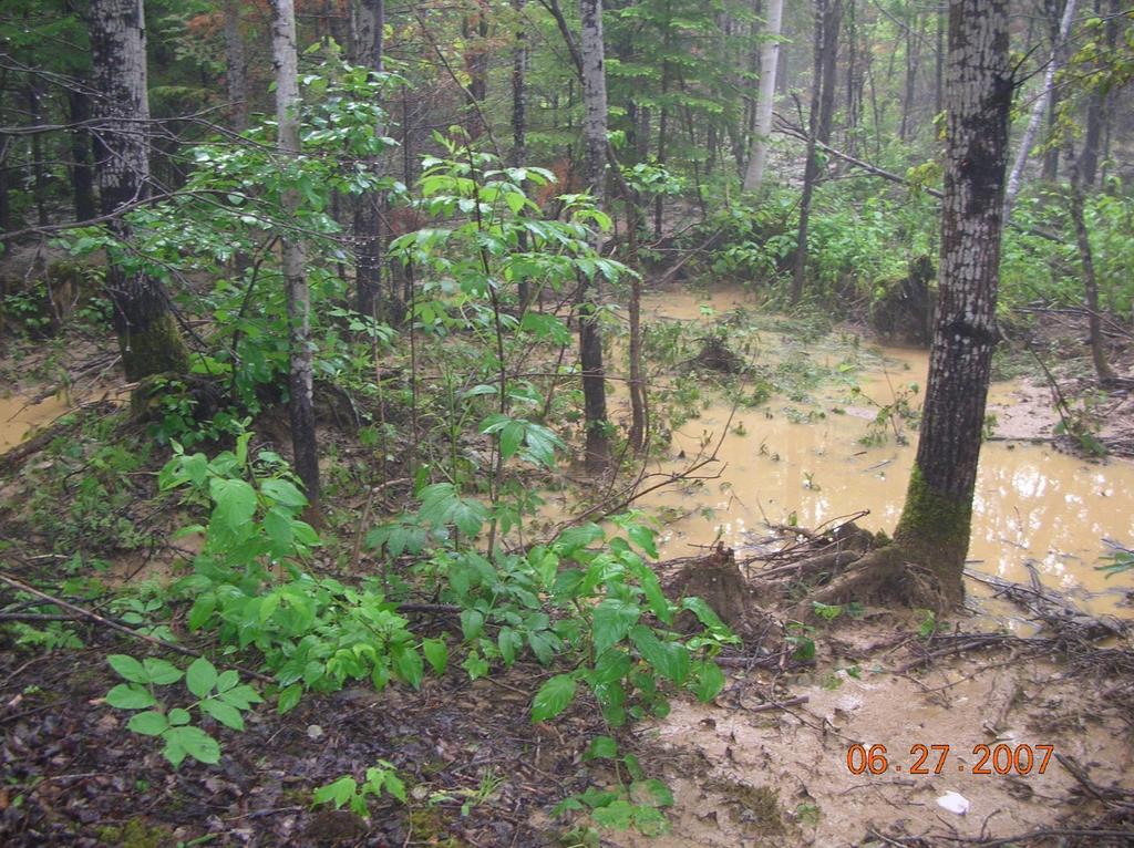
2 Once upon a time, in Canada Saint John River Farmland in the river valley

3

4

5

6

7
8 A few things we all know: Potato farming involves much soil disturbance Disturbed soil is easily eroded, especially during heavy rain or snow melt Riparian buffers can intercept sediment, nutrients and agrochemicals before they enter the water Regulations ask for fixed setbacks from watercourses rather than variable-width riparian buffer Planting buffers costs money Farmers don t have much money
9 A few things we d like to know: How effective are the existing buffers? Where should I plant buffers? If I only have a little money for buffers, where should I plant so that my $ investment has the greatest impact? Is it better for each farmer to plant buffers, or for a community to plan buffers at a landscape level?
10 Objectives To evaluate and modify the software AgBufferBuilder 1.0 to offer growers a decision-support tool for recommending where variable-width buffers can be planted to the greatest benefit Evaluate of the AgBufferBuilder 1.0 extension (through the ArcGIS 10.0 platform) on the Black Brook Watershed Evaluate trapping efficiency of existing vegetative buffers. Evaluate trapping efficiency of model-derived vegetative buffers
11 AgBufferBuilder 1.0: A Filter Strip Design Tool for GIS Developed by United States Department of Agriculture and University of Kentucky ArcGIS extension for designing and assessing vegetative filter strips around agricultural fields Combines digital imagery, elevation data, cropping system and soil information to assess the efficacy of existing buffers Develops raster datasets that identify the locations of potential buffers that result in a user-defined efficiency Primarily a research tool: has not been validated in a production context
 Water-related soil losses can exceed 20 tonnes/ha")
12 Study Area: Black Brook Watershed 1,450 ha, approx. 65% agricultural About 50% of ag land is in potatoes annually Slopes from 2-9%, some exceeding 15% Annual precipitation is 1130mm (25% as snow) Water-related soil losses can exceed 20 tonnes/ha annually associated with up-and-down slope potato cultivation without erosion protection > 50% of the farmland in the BBW have implemented some BMPs

13 Black Brook Watershed is a long term model watershed. Best Management Practices are represented here much more than in other Potato Belt areas. Diversion terraces with vegetative buffers, and grassed waterways
14


15 AgBufferBuilder 1.0: Input Data Digital Imagery: Orthophoto ( ) (MrSID 1m resolution) Elevation Data: Canadian Digital Elevation Data (1:50,000 or 8-23 m resolution)
16 AgBufferBuilder 1.0: Input Data Land Use Records: 2011 land use records were used to verify field boundaries. AAFC Weir Sub-basins: Weir sub-basins were used as natural breaks in the topography.
17 AgBufferBuilder 1.0: Data Analysis Input data was imported and re-projected in ArcGIS to maintain data compatibility AgBufferBuilder 1.0 extension was loaded Each weir sub-basin was delineated as the Field Margin dataset Existing buffers/bmps were delineated as the Buffer Assessment dataset The Buffer Assessment dataset is used by the AgBufferBuilder extension to assess existing buffers and provide a trapping efficiency value (%) The data analysis results consist of two raster datasets: the current buffers that were identified in the Area of Interest (AOI) with the trapping efficiency value the model-derived buffers that provide 75% trapping efficiency
")
18 AgBufferBuilder 1.0: Results The derived buffers were produced by using the following parameters Type of pollutant: Sediment Soil texture of the surface soil layer: Class I -Medium texture materials (SC, SiL, L, VFSL) Soils associated with BBW include Grand Falls, Holmesville, Interval, Muniac, Seigas and Undine (range from SL to SiL) USLE C-Factor: 0.50 Plow tillage after corn or chisel after soybeans Trapping efficiency: 75%
 Calculated efficiency")

19 BBW Weir Sub-basins: Weir 2 Analysis Buffer size (ha) Calculated efficiency Current buffers % Buffers calculated to provide 75% efficiency %
 Calculated efficiency")

20 BBW Weir Sub-basins: Weir 3 Analysis Buffer size (ha) Calculated efficiency Current buffers % Buffers calculated to provide 75% efficiency %
 Calculated")

21 BBW Weir Sub-basins: Weir 6 and Weir 7 Analysis Buffer size (ha) Calculated efficiency Current buffers 0.5 0% Buffers calculated to provide 75% efficiency %
")

22 BBW Weir Sub-basins: Weir 6 and Weir 7 Landscape scale considerations Analysis Buffer size (ha) Calculated efficiency Current buffers of Weir 6 and Weir % Analysed separately % Analysed together %


23 Analysis Buffer size (ha) Calculated efficiency Current buffers 6.0 9% Buffers to provide 75% efficiency % Scenario % Scenario %
24 The social side of environmental responsibility Potato growers in this region are very competitive with each other Potato industry is undergoing a contraction financial bottom line will determine who will be able to grow for shrinking processing prices Many landowners in the watershed Fields of one grower may drain into land of another grower Buffers necessary for one owner s fields may sometimes need to be placed in another owner s field Few incentives for growers to plant buffers
25 Effecting real change Majority of New Brunswick s population is downstream A thriving potato industry is important to the economy Clean water is a public benefit Tools such as AgBufferBuilder can be used to show where welldesigned variable-width buffers would work to best effect Projects such as this may provide tools and rationale for public programming Skilled land-use planner, able to design effective buffers Working with a community of growers In a participatory approach Supported by incentives
26 Conclusions Software was designed for field-by-field use, but could have greater use as a landscape-level planning tool Uses imagery, elevation data and land use records allowing for a better understanding of the interactions between topography and erosion potential Could eventually be a tool to support policy changes to support variable width buffers and programs to support landscape planning Is theoretical until we do the next steps of validating the model
27 Conclusions Recommends only size and placement of buffers Make-up of buffers affects efficiency Additional tools required to guide species selection, spacing, establishment AgBufferBuilder can be used to design buffers to prevent sediment and associated agrochemicals from reaching watercourses It does not address the important issue of how to keep sediment in the field where it belongs
28 AgBufferBuilder 1.0: Future Considerations The model needs validation We need to confirm that the suggested buffers, if planted, deliver the suggested results We intend to mount a project to validate the model Particular attention to snowmelt User interface may need adaptation Data choices available now reflect only US mid-west agriculture
29 Thank you for your attention! Acknowledgements Developer of AgBufferBuilder: Dr. Mike Dosskey of the USDA National Agroforestry Center GIS work: Sheldon Hann, AAFC, Agroforestry and Agronomy Research Team
HOW CHANGES IN NUTRIENT MANAGEMENT REGULATIONS WILL AFFECT FORAGE PRODUCTION
 HOW CHANGES IN NUTRIENT MANAGEMENT REGULATIONS WILL AFFECT FORAGE PRODUCTION Dick Wolkowski and Larry Bundy Department of Soil Science University of Wisconsin What are the issues Forage producers typically
IS FALL TILLAGE FOLLOWING SOYBEAN HARVEST NECESSARY? 1/
 IS FALL TILLAGE FOLLOWING SOYBEAN HARVEST NECESSARY? / Introduction As growers look for opportunities to enhance profit margins, the need for fall tillage following soybean harvest is questioned. Although
ATLANTIC SOIL AND WATER CONSERVATION CHALLENGES
 ATLANTIC SOIL AND WATER CONSERVATION CHALLENGES Gordon Fairchild, Ph.D., P.Ag., Soils Specialist, ECSWCC and Jean-Louis Daigle, P.Eng., P.Ag., Director, ECSWCC Environmental Farm Planning Worshop Crystal
Conservation Practices for Water Quality: Sediment & Nutrient Control. Trap Sediments/Trap Nutrients on the Field. Improve Soil Health.
 Conservation Practices for Water Quality: Sediment & Nutrient Control. Trap Sediments/Trap Nutrients on the Field. Improve Soil Health. Sediment Conservation Cover Cover Crop Critical Area Planting Field
Strategies for Phosphorus Management on Cropland. Renee Hancock, NE NRCS State Water Quality Specialist
 Strategies for Phosphorus Management on Cropland Renee Hancock, NE NRCS State Water Quality Specialist Phosphorus Essential nutrient for growth of crops. Often needs to be applied to land for optimal crop
Canada-Ontario Domestic Action Plan for Lake Erie Phosphorus Reduction. Agriculture Sector Working Group April 19, 2017
 Canada-Ontario Domestic Action Plan for Lake Erie Phosphorus Reduction Agriculture Sector Working Group April 19, 2017 Purpose Present an overview of the Canada-Ontario Draft Action Plan for Lake Erie
Watercourses and Wetlands and Agricultural Activities
 Watercourses and Wetlands and Agricultural Activities Watercourses and regulated wetlands can be found throughout New Brunswick, including on agricultural lands. The Clean Water Act defines a watercourse
GIS Analysis of Gully Head Erosion Rates on High Ridge Tree Farm in Winona County, Minnesota
 GIS Analysis of Gully Head Erosion Rates on High Ridge Tree Farm in Winona County, Minnesota Lisa M. Worrell Department of Resource Analysis, Saint Mary s University of Minnesota, Winona, MN 55987. Keywords:
Reducing Farm Field Runoff Application: A Systematic Tool for Analyzing Resources
 Reducing Farm Field Runoff Application: A Systematic Tool for Analyzing Resources David Healy and Michael Winchell 2016 Esri User Conference: Mapping the Future of Agriculture Session June 29, 2016 1 Overview
Development of a tool to estimate Best Management Practices (BMP) efficiency using SWAT
 efficiency using SWAT") 5 th International SWAT Conference Development of a tool to estimate Best Management Practices (BMP) efficiency using SWAT Maringanti C., I. Chaubey, B. Engel Purdue University, West Lafayette, IN M. Arabi
5 th International SWAT Conference Development of a tool to estimate Best Management Practices (BMP) efficiency using SWAT Maringanti C., I. Chaubey, B. Engel Purdue University, West Lafayette, IN M. Arabi
Watershed BMPs. Notes from NRCS online site on BMPs. Focus on key BMPs
 Notes from NRCS online site on BMPs http://www.nrcs.usda.gov/technical/standards/nhcp.html Focus on key BMPs Function, benefits, and drawbacks listed Definition Novotny & Olem: BMPs are methods and practices
SOIL P-INDEXES: MINIMIZING PHOSPHORUS LOSS. D. Beegle, J. Weld, P. Kleinman, A. Collick, T. Veith, Penn State & USDA-ARS
 SOIL P-INDEXES: MINIMIZING PHOSPHORUS LOSS D Beegle, J Weld, P Kleinman, A Collick, T Veith, Penn State & USDA-ARS Part of a larger national effort to improve the P Index and P Management Chesapeake Bay
WATERSHED. Maitland Valley. Report Card 201
 Maitland Valley WATERSHED Report Card 201 The Maitland Valley Conservation Authority has prepared this report card as a summary on the state of our forests, wetlands, surface water, and ground water resources.
Agriculture Action Packet DRAFT Attachment # FARM MAP EXAMPLE DRAFT
 Attachment # FARM MAP EXAMPLE Attachment # Conservation Systems to Meet the PA E&S Guidelines to be Used as an Interim Guideline when a Plan Meeting Soil Loss (T) Cannot be Obtained Guiding Principles
Estimating Field-Scale Runoff and Sediment Delivery. Seth M. Dabney, USDA-ARS Dalmo A. N. Vieira, USDA-ARS Daniel C. Yoder, Univ.
 Estimating Field-Scale Runoff and Sediment Delivery Seth M. Dabney, USDA-ARS Dalmo A. N. Vieira, USDA-ARS Daniel C. Yoder, Univ. of Tennessee Organization Buffers for concentrated flow control Distributed
Agricultural/Rural Riparian Buffer Analysis
 Agricultural/Rural Riparian Buffer Analysis December 2014 Executive Summary The Agricultural/Rural Riparian Buffer Analysis was developed from a 2014 analysis of current requirements for the riparian areas
West Fork White River Watershed Conservation Map Summaries. Prepared for the Beaver Watershed Alliance. By the Watershed Conservation Resource Center
 West Fork White River Watershed Conservation Map Summaries Prepared for the Beaver Watershed Alliance By the Watershed Conservation Resource Center November 2014 The Watershed Conservation Resource Center
Grassed Waterway Improvement and Gully Restoration
 Revised April 2007 Agdex 573-5 Grassed Waterway Improvement and Gully Restoration Each year, tonnes of topsoil are eroded from localized areas on some Alberta farms. This loss is serious for several reasons:
Planting and Harvesting Crops
 Planting and Harvesting Crops Chesapeake Bay Program Agricultural Workgroup s Building a Better Bay Model Workshop 05/22/2013 Gary Shenk Chesapeake Bay Program s Integrated Analysis Coordinator Photos
Conservation Practices. Conservation Choices. These five icons will show the benefits each practice offers... 6/4/2014
 Conservation Choices Your guide to conservation and environmental farming practices. Conservation Choices These five icons will show the benefits each practice offers... The practice reduces soil erosion
Revised Universal Soil Loss Equation
 Revised Universal Soil Loss Equation April 2003 Sustainable Agriculture Resource Section AGDEX # 572/751 In April 2002, the Agricultural Crop Rotation Act (ACRA) was adopted to protect water and soil quality
TORCH LAKE TOWNSHIP WATER QUALITY ACTION PLAN
 TORCH LAKE TOWNSHIP WATER QUALITY ACTION PLAN Elk-River-Chain-of-Lakes Gaps Analysis Project The Watershed Center Grand Traverse Bay Tip of the Mitt Watershed Council Michigan Department of Natural Resources
Rick L. Day Bob Neiderer. Assoc. Prof. Soil Science and Environmental Information Systems Department of Crop and Soil Sciences Penn State University
 Rick L. Day Bob Neiderer Assoc. Prof. Soil Science and Environmental Information Systems Department of Crop and Soil Sciences Penn State University Pa One Stop provides online tools to help farmers meet
Agronomy Guide. Purdue University Cooperative Extension Service SOILS (TILLAGE) AY-285. Vegetated Filter Strips for Improved Water Quality
 AY-285. Vegetated Filter Strips for Improved Water Quality") Agronomy Guide Purdue University Cooperative Extension Service SOILS (TILLAGE) AY-285 Vegetated Filter Strips for Improved Water Quality Kenneth J. Eck, Purdue T by 2000 Education Specialist Filter strips
Agronomy Guide Purdue University Cooperative Extension Service SOILS (TILLAGE) AY-285 Vegetated Filter Strips for Improved Water Quality Kenneth J. Eck, Purdue T by 2000 Education Specialist Filter strips
New Practices for Nutrient Reduction: STRIPs and Saturated Buffers. Matthew Helmers and Tom Isenhart Iowa State University
 New Practices for Nutrient Reduction: STRIPs and Saturated Buffers Matthew Helmers and Tom Isenhart Iowa State University Situation Increasing concern for local and regional waters Substantial demand for
DAKOTA COUNTY SOIL AND WATER CONSERVATION DISTRICT COMPREHENSIVE PLAN
 DAKOTA COUNTY SOIL AND WATER CONSERVATION DISTRICT COMPREHENSIVE PLAN 2011-2015 4100 220 th Street West, Suite 102 Farmington, MN 55024 651-480-7777 www.dakotacountyswcd.org I. INTRODUCTION A. Purpose
L-THIA Online and LID in a watershed investigation
 L-THIA Online and LID in a watershed investigation Larry Theller Agricultural and Biological Engineering, Purdue University Great Lakes Sedimentation Workshop Ann Arbor Mi. L-THIA On-line watershed delineation
Ohio River Water Quality Trading Program Overview
 Ohio River Water Quality Trading Program Overview December 2014 Brian Brandt Director Ag Conservation Innovations American Farmland Trust Sources of Nutrients Nitrogen in Power Plants 2 Full Scale Program
Phosphorus for the Ontario CCA 4R Nutrient Management Specialty
 Ontario CCA 4R Nutrient Management Workshop Wednesday, 18 January 2017 Woodstock, Ontario, Canada Phosphorus for the Ontario CCA 4R Nutrient Management Specialty Tom Bruulsema, Phosphorus Program Director
Modeling Nutrient and Sediment Losses from Cropland D. J. Mulla Dept. Soil, Water, & Climate University of Minnesota
 Modeling Nutrient and Sediment Losses from Cropland D. J. Mulla Dept. Soil, Water, & Climate University of Minnesota Watershed Management Framework Identify the problems and their extent Monitor water
Phosphorus for the Ontario CCA 4R Nutrient Management Specialty
 Ontario CCA 4R Nutrient Management Workshop Thursday, July 21, 2016 Holiday Inn, Guelph Phosphorus for the Ontario CCA 4R Nutrient Management Specialty Tom Bruulsema, Phosphorus Program Director Lake Erie
Government Conservation Programs
 Government Conservation Programs Policy Resolutions Webinar 2017 Illinois Farm Bureau Governmental Affairs & Commodities Division Lyndsey Ramsey Assoc. Director of Natural and Environmental Resources CURRENT
Erosion, Erosion, Everywhere
 Erosion, Erosion, Everywhere Main Objectives 1.Capable of describing the magnitude of accelerated soil erosion in the past and at the present. 2.Comprehend the mechanics and the factors influencing water
Mississippi River Basin Healthy Watersheds Initiative
 Helping People Help the Land www.nrcs.usda.gov Mississippi River Basin Healthy Watersheds Initiative Overview To improve the health of the Mississippi River Basin, including water quality and wildlife
Nutrient Management in. A presentation to the West Metro Water Alliance
 Nutrient Management in Developing and Agricultural Areas A presentation to the West Metro Water Alliance Chris Meehan, P.E. May 25, 2011 Agenda Physical Improvements Planning Improvements How to get it
To 4R or Not to 4R Is There an Option?
 To 4R or Not to 4R Is There an Option? August 3, 2014 Setting the Stage for 4R Nutrient Stewardship in Ontario Phosphorus in the Great Lakes with the focus on the western basin of Lake Erie. Multiple Point
Using precision agriculture technologies for phosphorus, potassium, and lime management with lower grain prices and to improve water quality
 214 Integrated Crop Management Conference - Iowa State niversity 137 sing precision agriculture technologies for phosphorus, potassium, and lime management with lower grain prices and to improve water
Nutrient Management in Kentucky
 IP-71 Nutrient Management in Kentucky Nutrient Management Focus Group, Environmental and Natural Resource Issues Task Force AGRICULTURE & NATURAL RESOURCES FAMILY & CONSUMER SCIENCES 4-H/YOUTH DEVELOPMENT
Soil Health Research Landscape Tool, v Data Dictionary Soil Health Institute 12/21/2016
 Soil Health Research Landscape Tool, v.12-21-16 Data Dictionary Soil Health Institute 12/21/2016 The Soil Health Research Landscape tool provides up-to-date information on soil health-related research
An Environmental Accounting System to Track Nonpoint Source Phosphorus Pollution in the Lake Champlain Basin. Year 2 Project Work Plan
 An Environmental Accounting System to Track Nonpoint Source Phosphorus Pollution in the Lake Champlain Basin Mary Watzin and Lula Ghebremichael University of Vermont, Rubenstein School of Environment and
East Baton Rouge Parish Micro-Watershed Characterization
 26 th Annual Louisiana Remote Sensing and GIS Workshop José E. Villalobos-Enciso Warren L. Kron, Jr. April 28, 2010 Presentation Outline Objectives Warren Kron Data Warren Kron Concept José Villalobos
Antonio Mallarino Professor, Department of Agronomy. Introduction
 2003 Integrated Crop Management Conference - Iowa State University 121 USING THE IOWA PHOSPHORUS INDEX FOR AGRONOMIC AND ENVIRONMENTAL MANAGEMENT OF FERTILIZER AND MANURE PHOSPHORUS Antonio Mallarino Professor,
Manure and Nutrient Management Report Huxley Farm
 Manure and Nutrient Management Report Huxley Farm Prepared by: Ruth McDougall, M.Sc., PAg., Consulting Agrologist 1. Introduction On May 12, 2016, Darlene R Huxley of 2148 Pyott Road, Armstrong BC was
Department of Agriculture, Aquaculture and Fisheries
 AGRICULTURAL LAND POLICY CONSULTATIONS WHAT WAS SAID June 2016 Department of Agriculture, Aquaculture and Fisheries Message from the Minister of Agriculture, Aquaculture and Fisheries Agriculture plays
Land Application and Nutrient Management
 MODULE D Land Application and Nutrient Management Figure 34-13. Relationship between the concentration of dissolved P in subsurface drainage from 30 cm deep lysimeters and the Mehlich-3 extractable soil
Cropping Management Using
 Cropping Management Using Color and Color Infrared Aerial Photographs KEN M. MORGAN DONALD R. MORRIS-JONES GERHARD B. LEE RALPH W. KIEFER University of Wisconsin Madison, WI 53706 Manual airphoto interpretation
ANALYSIS OF CCRP S RECORD BREAKING ENROLLMENT NSAC SPECIAL REPORTS
 ANALYSIS OF CCRP S RECORD BREAKING ENROLLMENT NSAC SPECIAL REPORTS FEBRUARY 217 KEYWORDS AND PROGRAMS: CONSERVATION RESERVE PROGRAM, CONTINUOUS CONSERVATION RESERVE PROGRAM, CONSERVATION RESERVE ENHANCEMENT
available detached transport availability detached carries
 Syngenta and Water Protecting Water Quality From the decision to develop a chemical molecule to the disposal of the product container, stewardship is essential to ensure the sustainability of the product,
Small-Scale Farmers and the Environment: How to be a Good Steward
 L P E S Small Farms Fact Sheet series Livestock and Poultry Environmental Stewardship < L P E S > Curriculum : How to be a Good Steward By Mark Rice, North Carolina State University Summary Good stewardship
TECHNICAL CONTENT PROPOSED STEEP SLOPE REGULATION
 1 TECHNICAL CONTENT PROPOSED STEEP SLOPE REGULATION Draft 2/08/10 (Revised 02-14-11,Revised 02-21-11, Revised 03-03-11, Revised 04-19-11, Revised 04-20-11, Revised 05-05-11, Revised 05-09-11). DEFINITIONS
Agricultural NPS Measures. Kevin Wagner Aaron Wendt
 Agricultural NPS Measures Kevin Wagner Aaron Wendt How are Ag BMPs Implemented? Texas Conservation Partnership Providing Conservation Assistance to Private Landowners for 70 Years LOCAL- 217 Soil and Water
Integrating Water Quality and Natural Filters into Maryland s Marine Spatial Planning Efforts
 Integrating Water Quality and Natural Filters into Maryland s Marine Spatial Planning Efforts Nicole Carlozo NOAA Coastal Management Fellow July 31, 2014 Watershed-scale restoration targeting helps direct
Attachment # 1. Commonwealth of Pennsylvania. Pennsylvania Code. Title 25. Environmental Protection. Department of Environmental Protection
 Attachment # 1 Commonwealth of Pennsylvania Pennsylvania Code Title 25. Environmental Protection Department of Environmental Protection Chapter 102.4 1 Attachment #1 Pennsylvania Code, 102.4 Erosion and
CROPPING, TILLAGE, AND LAND MANAGEMENT PRACTICES IN SOUTHWESTERN ONTARIO
 CROPPING, TILLAGE, AND LAND MANAGEMENT PRACTICES IN SOUTHWESTERN ONTARIO 1984 by Dr. Gregory J. Wall & Elizabeth E. Vaughan Agriculture Canada and Galen Driver Soil and Water Management Branch - OMAF November
M.L. Kavvas, Z. Q. Chen, M. Anderson, L. Liang, N. Ohara Hydrologic Research Laboratory, Civil and Environmental Engineering, UC Davis
 Assessment of the Restoration Activities on Water Balance and Water Quality at Last Chance Creek Watershed Using Watershed Environmental Hydrology (WEHY) Model M.L. Kavvas, Z. Q. Chen, M. Anderson, L.
Mission. Selected Accomplishments from Walnut Gulch. Facilities. To develop knowledge and technology to conserve water and soil in semi-arid lands
 USDA-ARS Southwest Watershed Research Center Mission Sound Science for Watershed Decisions To develop knowledge and technology to conserve water and soil in semi-arid lands ARS Watershed Locations Selected
LPES Small Farms Fact Sheets* Small-Scale Farmers and the Environment: How to be a Good Steward. By Mark Rice, North Carolina State University
 LPES Small Farms Fact Sheets* Small-Scale Farmers and the Environment: How to be a Good Steward By Mark Rice, North Carolina State University Summary Good stewardship is important for everyone, including
VILLAGE OF BELLAIRE WATER QUALITY ACTION PLAN
 VILLAGE OF BELLAIRE WATER QUALITY ACTION PLAN Elk-River-Chain-of-Lakes Gaps Analysis Project The Watershed Center Grand Traverse Bay Tip of the Mitt Watershed Council Michigan Department of Natural Resources
December 2002 Issue # PHOSPHORUS MANAGEMENT ON HIGH PHOSPHORUS SOILS. Angela Ebeling, Keith Kelling, and Larry Bundy 1/ Introduction
 December 2002 Issue #12 2002 PHOSPHORUS MANAGEMENT ON HIGH PHOSPHORUS SOILS Angela Ebeling, Keith Kelling, and Larry Bundy 1/ Introduction Soil phosphorus (P) is important for crop production. Phosphorus
Implementation of Priority CRP Conservation Practices and Estimated Nutrient Load Reductions
 1 Minnesota Nutrient Reduction Strategy Agricultural Sector/FSA CRP Program Measures Implementation of Priority CRP Conservation Practices and Estimated Nutrient Load Reductions Measure Background Visual
Maryland Nutrient Management Program
 Maryland Nutrient Management Program Nutrient management planning plays a key role in reducing nutrients from agricultural non-point sources Maryland Nutrient Management Program (MNMP) was established
Phosphorus Site Index (PSI) and the Phosphorus Management Tool (PMT)
 and the Phosphorus Management Tool (PMT)") Phosphorus Site Index (PSI) and the Phosphorus Management Tool (PMT) Patricia Steinhilber Department of Environmental Science & Technology Agricultural Nutrient Management Program University of Maryland
Phosphorus Site Index (PSI) and the Phosphorus Management Tool (PMT) Patricia Steinhilber Department of Environmental Science & Technology Agricultural Nutrient Management Program University of Maryland
Red River Valley Drainage Water Management Demonstration Project
 Red River Valley Drainage Water Management Demonstration Project Aaron Janz, Margaret Wagner, Jeppe Kjaersgaard Minnesota Department of Agriculture Drainage Research Forum November 23, 2015 Project Partners
Assessing Agricultural Biomass Using Geographic Information Systems. Brittany Crocker Biomass Research Intern West Central Research & Outreach Center
 Assessing Agricultural Biomass Using Geographic Information Systems Brittany Crocker Biomass Research Intern West Central Research & Outreach Center 15 August 2008 1 Table of Contents Abstract p. 3 Introduction
FEATURE. Figure 1. doi: /jswc a
 FEATURE doi:10.2489/jswc.66.4.104a Multifunctional Mississippi River leveed bottomlands and settling basins: Sny Island Levee Drainage District Kenneth R. Olson, Mike Reed, and Lois Wright Morton Kenneth
2010 Growing Season - Barton County, Kansas Land Cover Summary
 2010 Growing Season - Barton County, Kansas Land Cover Summary Number of Fields Percent of Total Fields Total Acres Percent of Acres ALFALFA 39 7.1% 3,075.5 6.4% CORN 45 8.1% 5,328.6 11.1% CRP 4 0.7% 408.5
Action Packet for Agriculture
 Pennsylvania Water Quality Action Packet for Agriculture A Self Assessment and Planning Tool for Water Quality Protection Under the PA Clean Streams Law Funded by Pennsylvania Department of Environmental
Agronomic and soil quality trends after five years of different tillage and crop rotations across Iowa
 21 Integrated Crop Management Conference - Iowa State University 185 Agronomic and soil quality trends after five years of different tillage and crop rotations across Iowa Mahdi Al-Kaisi, associate professor
Strip-tillage Successes, watch-outs based on soil type, soil drainage, and climate
 2014 Integrated Crop Management Conference - Iowa State University 157 Strip-tillage Successes, watch-outs based on soil type, soil drainage, and climate Mahdi Al-Kaisi, Professor and Extension Soil Management
Statewide Ranking of Ecological Value of CRP and other Critical Lands
 Statewide Ranking of Ecological Value of CRP and other Critical Lands Funded by ENRTF as recommended by LCCMR 2008 2009 D. J. Mulla, S. J. Taff, G. Host, J. Galzki, T. Brown, A. Lewandowski, and J. Nelson
History of Model Development at Temple, Texas. J. R. Williams and J. G. Arnold
 History of Model Development at Temple, Texas J. R. Williams and J. G. Arnold INTRODUCTION Then Model development at Temple A long history (1937-present) Many scientists participating in: Data collection
C O M P R E H E N S I V E P R O T E C T I O N & R E S T O R AT I O N P L A N. f or th e
 C O M P R E H E N S I V E P R O T E C T I O N & R E S T O R AT I O N P L A N f or th e R O S S B A R NE T T R E SERV O I R WATERS HED, MI S S I S S I P P I E X E C U T I V E S U M M A R Y O C T O B E R
Vertical Tillage: Does it Help the Transition to No-till?
 Vertical Tillage: Does it Help the Transition to No-till? Greg Stewart and Horst Bohner, Ontario Ministry of Agriculture, Food and Rural Affairs Tony Vyn, Purdue University and Ken Janovicek, University
HEALTH SOIL MEANS Healthy Farms and Cleaner Water!
 HEALTH SOIL MEANS Healthy Farms and Cleaner Water! National Hypoxia Taskforce Meeting May 10, 2012 Barry Fisher State Soil Health Specialist, Indiana NRCS - HELPING PEOPLE HELP THE LAND Improving Soil
TARGETING WATERSHEDS FOR RESTORATION ACTIVITIES IN THE CHESAPEAKE BAY WATERSHED. Technical Documentation October 4, 2002
 TARGETING WATERSHEDS FOR RESTORATION ACTIVITIES IN THE CHESAPEAKE BAY WATERSHED Technical Documentation October 4, 2002 Acknowledgements and Disclaimer This project was funded by the Chesapeake Bay Foundation,
M.L. Kavvas, Z. Q. Chen, M. Anderson, L. Liang, N. Ohara Hydrologic Research Laboratory, Civil and Environmental Engineering, UC Davis
 Assessment of the Restoration Activities on Water Balance and Water Quality at Last Chance Creek Watershed Using Watershed Environmental Hydrology (WEHY) Model M.L. Kavvas, Z. Q. Chen, M. Anderson, L.
Field-Scale Targeting of Cropland Sediment Yields Using ArcSWAT
 Field-Scale Targeting of Cropland Sediment Yields Using ArcSWAT Prasad Daggupati Biological and Agricultural Engineering, Kansas State University, 30A Seaton Hall, Manhattan, KS 66506, prasad9@ksu.edu
Appendix 12. Pollutant Load Estimates and Reductions
 Appendix 12. Pollutant Load Estimates and Reductions A pollutant loading is a quantifiable amount of pollution that is being delivered to a water body. Pollutant load reductions can be calculated based
The Value of Buffers
 Maintain Your Buffers Manage the land to maintain and encourage shallow sheet flow and water infiltration. New techniques have been developed to address concentrated flow, for example, strategically positioned
What is Urban Tree Canopy?
 The following report was prepared by University of Vermont for Cacapon Institute in support of the WV UTC A&E project. Understanding our tree canopy is an essential first step in setting urban tree canopy
A Landowner s Guide to C o n s e rvation Buffer Incentive Pro g r a m s in Pennsylvania
 A Landowner s Guide to C o n s e rvation Buffer Incentive Pro g r a m s in Pennsylvania Purpose of This Guide This guide is a compilation of the major federal, state and private voluntary conservation
Departments of Agronomy C709 Conservation Farming and Biological and Agricultural Engineering. Permanent grass cover
 Terrace Maintenance Photo 1. Measuring the ridge height above the channel is easily done with a straight board, carpenters level, and tape measure. Departments of Agronomy C709 Conservation Farming and
2010 Growing Season - Harvey County, Kansas Land Cover Summary
 2010 Growing Season - Harvey County, Kansas Land Cover Summary Number of Fields Percent of Total Fields Total Acres Percent of Acres ALFALFA 12 2.6% 683.4 2.0% CORN 77 16.5% 6,627.5 19.7% CRP 1 0.2% 13.9
MURPHY DRAIN CATCHMENT
 The RVCA produces individual reports for 16 catchments in the Lower Rideau subwatershed. Using data collected and analysed by the RVCA through its watershed monitoring and land cover classification programs,
Saturated Buffer. Subsurface Drainage PURPOSE N REDUCTION LOCATION COST BARRIERS
 Saturated Buffer To intercept tile drainage prior to discharging to surface waters and redistribute the water laterally in the soil profile of the streamside buffer. Subsurface drainage, also known as
7.10 BRA Sediment Reduction Program
 7.10 BRA Sediment Reduction Program 7.10.1 Description of Option The protection of already developed water supplies is a key element of water supply planning. Because Region G s inventory of suitable sites
Agricultural Policy. Relevance, Direction and Links to Environment
 Agricultural Policy Relevance, Direction and Links to Environment Jamshed Merchant Assistant Deputy Minister, PFRA & Environment Agriculture and Agri-Food Canada Why is agricultural policy important? Canada
Unit E: Basic Principles of Soil Science. Lesson 7: Understanding Soil Erosion and Management Practices
 Unit E: Basic Principles of Soil Science Lesson 7: Understanding Soil Erosion and Management Practices 1 Important Terms Accelerated erosion Conservation tillage Cover crops Diversion ditches Geologic
Streamlines V2, n2 (May 1997) A Newsletter for North Carolina Water Supply Watershed Administrators
 A Newsletter for North Carolina Water Supply Watershed Administrators") Page 1 of 5 STREAMLINES A Newsletter for North Carolina Water Supply Watershed Administrators Volume 2, Number 2 May 1997 Non-Point Source (NPS) Pollution This issue of Streamlines provides basic information
Page 1 of 5 STREAMLINES A Newsletter for North Carolina Water Supply Watershed Administrators Volume 2, Number 2 May 1997 Non-Point Source (NPS) Pollution This issue of Streamlines provides basic information
Best Management Practices (BMPs) are structural
 are structural") Agriculture and Natural Resources WATER QUALITY: Controlling Nonpoint Source (NPS) Pollution A L A B A M A A & M A N D A U B U R N U N I V E R S I T I E S ANR-790-4.2.3 The Rural Environment And NPS Pollution
Agriculture and Natural Resources WATER QUALITY: Controlling Nonpoint Source (NPS) Pollution A L A B A M A A & M A N D A U B U R N U N I V E R S I T I E S ANR-790-4.2.3 The Rural Environment And NPS Pollution
Planning & Building Department. Requirements for Erosion and Sediment Control
 Planning & Building Department 455 County Center, 2nd Floor Redwood City, California 94063 Tel: 540/863-4161/Fax: 650/363-4849 Mail Drop PLN122 plngbldg@smcgov.org http://planning.smcgov.org Requirements
Understanding Stormwater Pollution Prevention Plans (SWPPPs) (SWPPPS)
 (SWPPPS)") Understanding Stormwater Pollution Prevention Plans (SWPPPs) (SWPPPS) Definitions SWPPP: Storm Water Pollution Prevention Plan BMP: Best Management Practice(s) to control pollution IDNR: Iowa Department
Understanding Stormwater Pollution Prevention Plans (SWPPPs) (SWPPPS) Definitions SWPPP: Storm Water Pollution Prevention Plan BMP: Best Management Practice(s) to control pollution IDNR: Iowa Department
Chapter 15 Goodwater Creek Watershed, Missouri: National Institute of Food and Agriculture Conservation Effects Assessment Project
 265 Goodwater Creek Watershed, Missouri: National Institute of Food and Agriculture Conservation Effects Assessment Project M. Arabi, C. Baffaut, E.J. Sadler, S.H. Anderson, R.R. Broz, D.W. Meals, D.LK.
3.3.3 Landscape-Directed Soil Sampling
 12 3 Soil Sampling and Analysis 3.1 Principles of Soil Sampling Soil sampling and analysis is the only way to determine the available nutrient status of a field and to receive field-specific fertilizer
Preface. Riparian Wetland Restoration Site Selection Using GIS
 Riparian Wetland Restoration Site Selection Using GIS i Preface This bulletin is intended as a guide for managers, planners, and policy-makers involved in wetland restoration projects. This step-by-step
INTRODUCTION TO HOBBY FARMING AND WATER QUALITY
 SECTION ONE INTRODUCTION TO HOBBY FARMING AND WATER QUALITY This is a handbook for owners of Hobby Farms - small scale farms operated primarily as a residential lifestyle - to provide their owners with
Precision Ag. Back to Basics
 Precision Ag Back to Basics Nicole Rabe (Land Resource Specialist OMAFRA) Mike Wilson (CCA-ON, Advanced Agronomy Solutions Manager - Thompsons Limited) What is Precision Agriculture a management system
BMP Verification: What is it and How Will it Impact Pennsylvania?
 BMP Verification: What is it and How Will it Impact Pennsylvania? Chesapeake Bay Program Conservation District and Agency Staff Meeting March 13, 2017 + over 400 other unique practices approved by the
SWAT INPUT DATA:.OPS CHAPTER 33
 CHAPTER 33 SWAT INPUT DATA:.OPS The Scheduled Management Operations (.ops) file is an optional file which allows the simulation of non-reoccurring management related activities. The.ops file is particularly
Edge-of-Field Monitoring
 Edge-of-Field Monitoring Karma Anderson Water Quality Specialist National Water Quality and Quantity Team NRCS Edge-of-Field Monitoring NRCS WQ monitoring first introduced in 2010 as Interim CPS 799 in