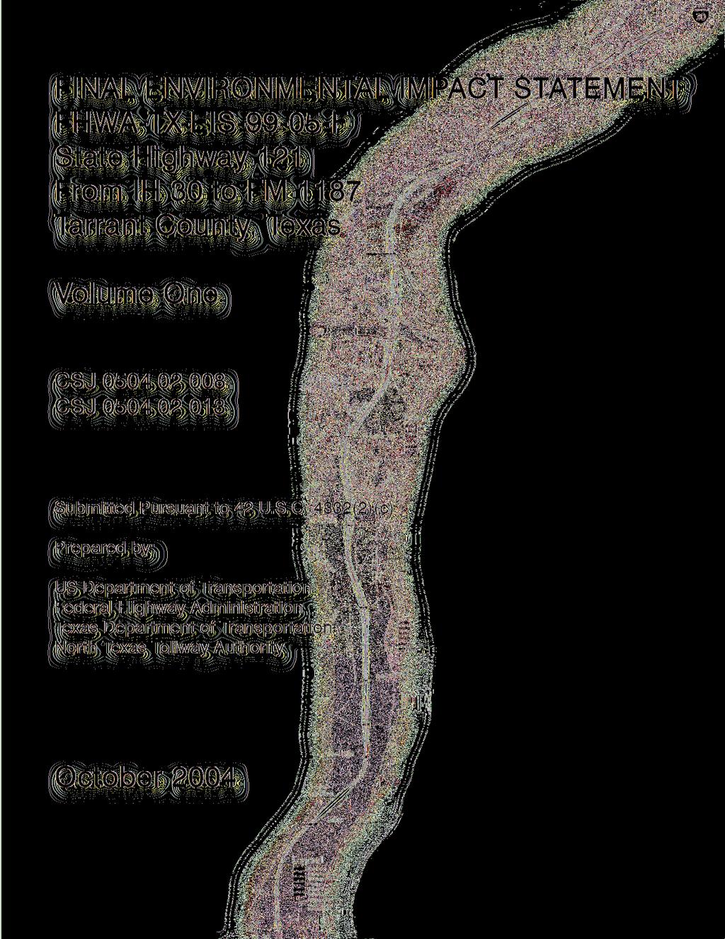
PREFACE SH 121 IH 30 to FM 1187 Final Environmental Impact Statement
|
|
|
- Andrew Lloyd
- 5 years ago
- Views:
Transcription
1
2
3 Preface PREFACE SH 121 IH 30 to FM 1187
4 SH 121 IH 30 to FM 1187 Preface PREFACE Throughout the history of this project, the roadway has been referred to by several different names. For the purposes of this document, the recommended project/tollroad is identified as State Highway 121. This for SH 121 from Interstate Highway 30 to Farmto-Market Road 1187 has been prepared in accordance with regulations developed by the Council on Environmental Quality for the National Environmental Policy Act, U.S. Department of Transportation and Federal Highway Administration. The structure of this document is as follows: Summary: Provides a summary of the document. Chapter 1 Project History: Presents the SH 121 project development history. Chapter 2 Purpose and Need: Presents the purpose and need for the project along with an overview of local and regional transportation goals. Specific transportation problems are presented along with a discussion of the purpose and need for transportation improvements in the southwest quadrant of the City of Fort Worth. Chapter 3 Alternatives: Provides a comparison and analysis of options considered including roadway options, various Build alternatives, the No-Build alternative, the recommended alternative and congestion management strategies in conjunction with the proposed alternatives. Chapter 4 Affected Environment: Describes the existing social, economic and natural environmental conditions in the study area without the influence of the recommended project. The discussion provides a description of the environment in which the project would take place and describes the relevant resources in the study area. Chapter 5 Environmental Consequences: Discusses potential impacts of the recommended project alternatives on the man-made and natural environments. i
5 SH 121 IH 30 to FM 1187 Preface Chapter 6 Public and Agency Involvement: This chapter summarizes the public and agency involvement efforts. Chapter 7 Recommended Alternative: Identifies the recommended Build alternative. Chapter 8 Summary of Mitigation Measures: Potential mitigation measures are described for regulated impacts due to the recommended alternative. Chapter 9 Agency Coordination and Comments This document also contains eight appendices: Appendix A provides a list of preparers. Appendix B provides a list of recipients. Appendix C provides the City of Fort Worth authorizations. Appendix D contains the Notice of Intent letters. Appendix E contains the Southwest Fort Worth Subarea Study. Appendix F contains agency coordination and communications. Appendix G provides the City of Fort Worth Project Development Team Recommendations Appendix H provides a list of acronyms, abbreviations and definitions used in the document and their definitions. ii
6 SH 121 IH 30 to FM 1187 Preface Volume Two of the document contains the April 22, 2003 Public Hearing documentation consisting of: Public Hearing summary and analysis Public Hearing comment and response report Public Hearing transcript Written comments from the Public Hearing process iii
7 SH 121 IH 30 to FM 1187 Preface This page is intentionally left blank. 4
8 TABLE OF CONTENTS Table of Comments SH 121 IH 30 to FM 1187
9 SH 121 IH 30 to FM 1187 Table of Contents TABLE OF CONTENTS VOLUME 1 Preface... i Summary... 1 S 1.0 Description of Proposed Action... 1 S 2.0 Major Actions Proposed by Other Government Agencies... 7 S 3.0 Reasonable Alternatives Considered... 8 S 4.0 Major Environmental Impacts... 9 S 5.0 Issues of Public Deliberation... 9 S 5.1 Governmental Agencies... 9 S 5.2 Public S 6.0 Major Unresolved Issues with Other Agencies S 7.0 Federal Actions Required for the Proposed Action Project History Purpose and Need Purpose and Need for the Project Supporting Documentation Purpose and Need Demographics and Population Demand Growth of Major Employers Growth and Traffic Demand Regional Transportation Plan Transportation Demand Congestion Management Systems Summary Safety/Roadway Deficiencies Funding and Legislation Alternatives Analysis Introduction Freeway and Tollroad Options Freeway Option Tollroad Option Description of the Build Alternatives Retained for Detailed Study The Combination Alternative, Alternative C/A Alternative A Alternative B Alternative C Alternative D Summary of Build Alternatives Description of the No-Build Alternative Comparative Analysis Build and No-Build Alternatives Length, Cost and Right-of-way Acreage Effect on Existing Network Travel Time-Distance Comparisons Congestion Management Strategies in Conjunction with Proposed Alternatives Rail/Transit-Oriented Strategies Transportation Systems Strategies i
10 SH 121 IH 30 to FM 1187 Table of Contents 4.0 Affected Environment Description of Project Area Social and Economic Environment Utilities Existing Land Use and Employment within the Project Study Corridor Transportation Facilities Publicly Oriented Facilities Environmental Setting Earth Resources Ecological Resources Ecological Setting Environmentally Sensitive Areas Cultural Resources Archeological Surveys Archeological Sites Historic Resources Historic Buildings and Structures Endangered/Threatened Species Publicly Owned Facilities and Community Services Environmental Consequences Land Use Impacts Alternatives A, B, C, C/A and D No-Build Alternative Prime and Unique Farmlands Alternatives A, B, C, C/A, D and No-Build Environmental Justice Impacts Overview Public Participation Impact Assessment Methodology Impact Assessment Alternatives A, B, C, C/A and D No-Build Alternative Social Impacts Community Cohesion Impacts Public Safety Impacts Alternatives A, B, C, C/A and D No-Build Alternative Relocation Impacts Alternative A Alternative B Alternative C and C/A Alternative D No-Build Alternative Economic Impacts Analysis Methodology ii
11 SH 121 IH 30 to FM 1187 Table of Contents Assumptions Results Pedestrian and Bicycle Impacts Alternatives A, B, C, C/A and D No-Build Alternative Section 4(f) Impacts Publicly Owned Parks, Recreation, Wildlife and Waterfowl Refuge Lands Cultural Impacts Air Quality Impacts Mesoscale Analysis Microscale Analysis No Build Alternative Noise Impacts Sound Measurement Units Methodology Results Noise Abatement No-Build Alternative Water Quality Impacts Surface Water Quality Groundwater Impacts Alternatives A, B, C, C/A and D No-Build Alternative Permits Jurisdictional Waters of the United States and Wetlands Impacts Alternative A Alternative B Alternative C and C/A Alternative D No-Build Alternative Practicable Measures to Minimize Harm Water Body Modifications and Wildlife Impacts Alternatives A, B, C, C/A and D No-Build Alternative Floodplain and Floodway Impacts Alternative A Alternative B Alternative C and C/A Alternative D No-Build Alternative Floodplain and Floodway Impacts Summary Floodplain and Floodway Impacts Conclusion Wild and Scenic Rivers Impacts Coastal Barriers and Coastal Zone Impacts Threatened or Endangered Species iii
12 SH 121 IH 30 to FM 1187 Table of Contents Alternatives A, B, C, C/A and D No-Build Alternative Trees, Vegetation and Wildlife Habitat Alternatives A, B, C, C/A and D No-Build Alternative Historic Resources Impacts Regulatory Compliance Archeological Surveys Historic Resources Build Alternative Impacts No-Build Alternative Recommendations Hazardous Waste Sites Alternative A Alternative B Alternative C and C/A Alternative D No-Build Alternative Visual Impacts Representative Assessment Sites Sunset Terrace Neighborhood Mistletoe Heights/Berkeley Place Neighborhood Botanic Garden Vickery Boulevard Business Area Trinity River Crossing (near Stonegate Boulevard) Overton Woods Fort Worth Country Day School Hulen Bend Estates Quail Ridge Neighborhood Park Palisades Visual Impact Mitigation Light Impacts Railroad Impacts Alternatives A, B, C, C/A and D No-Build Alternative Relationship Between Local Short Term Uses of Man s Environment and the Maintenance and Enhancement of Long-term Productivity Secondary and Cumulative Effects Analysis Methodology and Scoping Existing Secondary and Cumulative Effects Analysis Environment Anticipated Secondary and Cumulative Effects Conclusions of the Secondary and Cumulative Effects Analysis Irreversible and Irretrievable Commitments of Resources Which Would Be Involved in the Proposed Action Public Involvement iv
13 SH 121 IH 30 to FM 1187 Table of Contents 6.1. Summary and Analysis of Public Meetings Recommended Alternative Summary of Mitigation Measures Visual Impacts/Context-Sensitive Design Overview Contextual Parameters Public Involvement Corridor Image Bridges and Interchanges Walls Landscaping Lighting Land Use Impacts Prime and Unique Farmlands Environmental Justice and Social Impacts Relocation Impacts Economic Impact Pedestrian and Bicycle Impacts Section 4(f) Impacts Air Quality Impacts Traffic Noise Impacts Water Quality Impacts Surface Water Quality Groundwater Resources Permits Floodplain and Floodway Impacts Wild and Scenic Rivers Impacts Coastal Barriers and Coastal Zone Impacts Threatened or Endangered Species Trees, Vegetation and Wildlife Habitat Historic Resources Impacts Archeological Sites Historic Buildings and Structures Construction Impacts Construction Air Quality Construction Noise Secondary and Cumulative Project Impacts Hazardous Materials Conclusion Agency Coordination and Comments Agency Coordination Major Investment Study v
14 SH 121 IH 30 to FM 1187 Table of Contents LIST OF EXHIBITS Exhibit S.1 Project Alignment...S-2 Exhibit S.2 Project Study Corridor (1 of 4)...S-3 Exhibit S.3 Project Study Corridor (2 of 4)...S-4 Exhibit S.4 Project Study Corridor (3 of 4)...S-5 Exhibit S.5 Project Study Corridor (4 of 4)...S-6 Exhibit 1.1 Preferred Route in Exhibit 1.2 Alignment Alternatives in Exhibit 1.3 Southwest Subarea Study Alignment in Exhibit 1.4 Alignment Alternatives in 1986 Bellaire to FM Exhibit 1.5 Alignment Alternatives in 1988 IH 35W to Bellaire Exhibit 1.6 Alignment Alternatives in Exhibit 1.7 Recommended Alternative, Alternative C/A Exhibit 2.1 Existing Traffic Volumes for On-state Facilities Exhibit 2.2 Existing Traffic Volumes for Major Arterials Exhibit Congestion with Improvements Exhibit Regional Plan Map Freeway and Tollroad System Exhibit 2.5 Transportation Systems Management/Travel Demand Management Strategies.2-12 Exhibit Regional Plan High Occupancy Vehicle and Managed Facility System Exhibit 2.7 Future and Existing Rail System Exhibit Regional Plan Bicycle Pedestrian System Exhibit 3.1 Alternative Comparison Exhibit 3.2 Typical Sections Exhibit 3.3 Alternative C/A (1 of 4) Exhibit 3.4 Alternative C/A (2 of 4) Exhibit 3.5 Alternative C/A (3 of 4) Exhibit 3.6 Alternative C/A (4 of 4) Exhibit 3.7 Alternative A (1 of 4) Exhibit 3.8 Alternative A (2 of 4) Exhibit 3.9 Alternative A (3 of 4) Exhibit 3.10 Alternative A (4 of 4) Exhibit 3.11 Alternative B (1 of 4) Exhibit 3.12 Alternative B (2 of 4) Exhibit 3.13 Alternative B (3 of 4) Exhibit 3.14 Alternative B (4 of 4) Exhibit 3.15 Alternative C (1 of 4) Exhibit 3.16 Alternative C (2 of 4) Exhibit 3.17 Alternative C (3 of 4) Exhibit 3.18 Alternative C (4 of 4) Exhibit 3.19 Alternative D (1 of 4) Exhibit 3.20 Alternative D (2 of 4) Exhibit 3.21 Alternative D (3 of 4) Exhibit 3.22 Alternative D (4 of 4) Exhibit 4.1 Land Use (1 of 4) vi
15 SH 121 IH 30 to FM 1187 Table of Contents Exhibit 4.2 Land Use (2 of 4) Exhibit 4.3 Land Use (3 of 4) Exhibit 4.4 Land Use (4 of 4) Exhibit 4.5 City of Fort Worth Master Thoroughfare Plan Exhibit 4.6 Existing Park and Bike Trails Exhibit 4.7 Trinity Aquifer Exhibit 4.8 Woodbine Aquifer Exhibit 5.1 Relocation Impacts by Socio-Economic Classification Exhibit 5.2 Affected Wetlands, Air/Noise Modeling and Hazardous Material Sites (1 of 4) 5-45 Exhibit 5.3 Affected Wetlands, Air/Noise Modeling and Hazardous Material Sites (2 of 4) 5-46 Exhibit 5.4 Affected Wetlands, Air/Noise Modeling and Hazardous Material Sites (3 of 4) 5-47 Exhibit 5.5 Affected Wetlands, Air/Noise Modeling and Hazardous Material Sites (4 of 4) 5-48 Exhibit 5.6 Proposed Noise Wall Locations Exhibit 5.7 Representative Visual Impact Assessment Sites Exhibit 5.8 Neighborhood Organizations Exhibit 5.9 Texas Christian University/Westcliffe Planning Sector Future Land Use Exhibit 5.10 Planning Sectors Exhibit 5.11 Archeological Study Area Exhibit 5.12 Mixed Use Growth Centers vii
16 SH 121 IH 30 to FM 1187 Table of Contents LIST OF TABLES Table 2-1 Recommended Maximum Average Daily Traffic* and Level of Service Table 3-1 SH 121 Evaluation Matrix Table 3-2 SH Tollroad Performance Summary Table 3-3 Base Year and 2025 Demographic Summary Table 3-4 Time-Distance Comparisons During Peak-Period Table Daily Traffic Forecasts by Alternative Table 3-6 Fort Worth Transit Authority Ridership Report Table 4-1 Ethnic Composition by Census Tract Table 4-2 Median Household Income by Census Tract in Table 4-3 Tarrant County Listed Endangered/Threatened Species SH 121 Corridor Table 5-1 Evaluation of Census Tract in Project Corridor Table 5-2 Impacted Employees by Business Sector Table 5-3 Total Displacements for Alternative A Table 5-4 Total Displacements for Alternative B Table 5-5 Total Displacements for Alternative C and C/A Table 5-6 Total Displacements for Alternative D Table 5-7 Cumulative Employment Impact, Table 5-8 Cumulative Direct and Indirect Taxes, Table 5-9 Net Public Cost-Benefit Table 5-10 National Ambient Air Quality Standards Table 5-11 Yearly Maximum 1-Hour Carbon Monoxide Concentrations, Table 5-12 MOBILE6 CO Emission Factors Used (gm/mile) Table 5-13 Predicted 1-Hour Carbon Monoxide Concentrations in parts per million, Table 5-14 Predicted 1-Hour Carbon Monoxide Concentrations in parts per million, Table 5-15 Common Sound/Noise Levels Table 5-16 Federal Highway Administration Noise Abatement Criteria Table 5-17 Traffic Noise Levels L eq Table 5-18 Noise Barrier Proposal Table 5-19 Noise Impact Contours, Table 5-20 Estimated Impacts to Jurisdictional Waters Alternative A Table 5-21 Estimated Impacts to Jurisdictional Waters - Alternative B Table 5-22 Estimated Impacts to Jurisdictional Waters - Alternative C and C/A Table 5-23 Estimated Impacts to Jurisdictional Waters Alternative D Table 5-24 Stream and 100-Year Floodplain Crossings Table 5-25 Tarrant County Listed Endangered/Threatened Species SH121 Corridor Table 5-26 Predominant Tree Composition Along the Project Study Corridor Table 5-27 Representative Assessment Sites Along the Corridor Table 5-28 Cumulative Effects Evaluations Table 5-29 Geographic Boundaries and Time Periods Table 5-30 Proposed New Roads Table 5-31 Proposed Parks near the Project Study Corridor Table 5-32 Neighborhoods Adjacent to Proposed SH Table 5-33 Annual Average Daily Traffic viii
17 SH 121 IH 30 to FM 1187 Table of Contents Table 5-34 Common Sound/Noise Levels ix
18 SH 121 IH 30 to FM 1187 Table of Contents This page is intentionally left blank. x
19 SUMMARY Summary SH 121 IH 30 to FM 1187
20 SH 121 IH 30 to FM 1187 Summary SUMMARY S 1.0 Description of Proposed Action The proposed State Highway (SH) 121 project is a multi-lane controlled access tollroad from Interstate Highway (IH) 30 near downtown Fort Worth in Tarrant County to Farm-to-Market Road (FM) 1187, for a total project length of approximately 15 miles (mi). Exhibit S.1 represents the recommended alternative. Exhibit S.2 through Exhibit S.5 provides a geographical representation of the project study corridor (PSC). The entire facility is proposed on a new alignment. It would traverse a large portion of the City of Fort Worth (City) with major interchanges at IH 30 and IH 20/SH 183. IH 30 (the northern terminus) is a major IH that facilitates traffic moving east-west through the Dallas/Fort Worth (DFW) area. FM 1187 (the southern terminus) is a major arterial, included on the National Highway System that serves traffic moving through southern Tarrant County. The Federal Highway Administration (FHWA) approved the limits of the project as logical termini. The proposed action would provide a major link in the regional transportation network. Construction of the proposed SH 121 is part of the North Central Texas Council of Governments (NCTCOG) regional transportation plan and the City of Fort Worth's Master Thoroughfare and Comprehensive Plans. The proposed SH 121 would provide a needed alternate route to the already congested urban arterials serving southwest Tarrant County. The proposed action would be a divided tollroad. From the northern terminus at IH 30 to Altamesa Boulevard the proposed facility would ultimately be six lanes. From Altamesa Boulevard to the southern limit at FM 1187, the ultimate facility would be four lanes. However, until warranted due to future increases in traffic volume, only a part of the ultimate six/four-lane facility is being proposed at this time. As currently proposed, the facility would vary from six lanes between IH 30 and Altamesa Boulevard to four lanes from Altamesa Boulevard to FM Limited frontage road access would be provided where needed for local traffic circulation. The typical right-of-way (ROW) width for the project varies from 220 feet (ft) to 400 ft, with additional ROW width required S-1

21 S-2

22 S-3

23 S-4

24 S-5

25 S-6
26 SH 121 IH 30 to FM 1187 Summary at interchanges. The recommended alternative would require acquisition of approximately 635 acres (ac). Though proposed as a multi-phase constructed facility, the action described in this document is consistent with the 2004 Metropolitan Transportation Plan (MTP), Mobility Update, the Transportation Improvement Plan (TIP) and conforms to the Clean Air Act Amendments of 1990 (CAAA) per the U.S. Department of Transportation (DOT) on April 8, The Motor Vehicle Emissions Budget in the State Implementation Plan was found to be adequate for transportation conformity purposes effective November 6, 2000 by the US Environmental Protection Agency (see 65 Federal Register 63074). Since that time, modifications to the concept and scope of identified projects submitted by local governments and the Texas Department of Transportation (TxDOT) have required revisions to the air quality conformity determination. The most current conformity determination continues to meet the requirements of the SIP, the Clean Air Act (CAA) found in 42 United States Code (USC) 7504, 7506 (c) and (d) as amended on November 15, 1990 and the transportation conformity rule found in 40 Code of Federal Regulations (CFR) Parts 51 and 93. Additionally, the project comes from an operational Congestion Management System (CMS) that meets all requirements of 23 CFR-Highways, Parts 450 and 500. A previously proposed route was designated as a Texas SH in October 1973, following a Public Hearing and approval of a recommended alignment by the Texas Highway Commission. Following refinement of route location and study limits, a toll facility became the only viable option for funding. The project is now proposed to be a part of the North Texas Tollway Authority (NTTA) system (Please see discussion in Chapter 1.0, Project History and in Chapter 3.2, Freeway and Tollroad Options). S 2.0 Major Actions Proposed by Other Government Agencies The City is currently planning the extension of Bellaire Drive/Arborlawn Drive from its current terminus to Bryant Irvin Road. The proposed extension would be extremely effective in improving local traffic circulation. Future development of the proposed outer loop (Loop 9), which is planned S-7
27 SH 121 IH 30 to FM 1187 Summary to follow the current alignment of FM 1187 in the southern part of Tarrant County, is under consideration pending further study. No other major actions are currently proposed by other government agencies that would influence the proposed action. S 3.0 Reasonable Alternatives Considered This document includes a detailed account of the history of the project, including the consideration of various modal and alignment alternatives. Four Build alternatives and the No-Build were identified in the Draft Environmental Impact Statement (DEIS). During the Public Hearing, the City presented a resolution identifying an additional Build alternative. Therefore five Build alternatives identified as A, B, C, C/A and D, in addition to the No-Build, are presented in this document. The Build alternatives vary with respect to their interchanges and footprint. Due to the 40-year history of the project and subsequent land use patterns that have evolved, the proposed Build alternatives are essentially confined to the same horizontal alignment with the vertical profile varying among the alternatives. In addition to vertical profile modification, there are various locations where different plan concepts have been proposed depending on the alternative. The Build alternatives were proposed by different agencies, studies and continuing public involvement. The City s recommended alternative is primarily Alternative A with modifications. The following alignment description is applicable to all five build alternatives. The recommended project would begin west of Summit Avenue at IH 30 with a tie-in to Forest Park Boulevard. It would proceed west between Vickery Boulevard and the Union Pacific Railroad (UPRR), crossing over the UPRR before proceeding south and over the Clear Fork of the Trinity River to the SH 183/IH 20 interchange. From this point the alignment would proceed south to its terminus at the intersection of FM S-8
28 SH 121 IH 30 to FM 1187 Summary The Alternative C/A would incorporate much of the City s Resolution No in so far as is feasible and practicable. Based on public involvement and the assessment of the affected environment, the Alternative C/A is identified as the recommended alternative, which best meets the purpose and need of the project. S 4.0 Major Environmental Impacts The recommended alternative would offer improved access and a less congested alternative route to local businesses, residential and commercial properties. A negative aesthetic impact would occur during construction of the proposed facility. In the long-term, the paved arteries and overpasses would affect the current rural and scenic nature in the southern end of the project within the project corridor. Short-term impacts to existing pedestrian and bicycle facilities would be limited to the construction phase of the project. Other short-term impacts such as soil erosion and sediment-laden runoff from construction areas could temporarily impact rivers and streams along the project. However, both temporary and permanent erosion control structures could be employed to reduce or eliminate sediment discharges into receiving waters. Short-term air and noise impacts would also occur during the construction phase. However, with the use of proper abatement measures these impacts would be minimized. Acquisition of additional ROW for project construction would require the relocation of commercial, residential, City property and a place of worship. The relocation would take place along approximately 3 miles of the proposed SH 121. S 5.0 Issues of Public Deliberation S 5.1 Governmental Agencies The Fort Worth City Council endorsed the proposed SH 121 project with a seven votes to two votes, on December 8, The proposal received much debate and public input, ending in the authorization of Resolution No in support of the proposed SH 121 (Appendix C, Attachment 3). A Mayor and Council Communication (Ref. No. C-17178) was also signed on this date, S-9
29 SH 121 IH 30 to FM 1187 Summary authorizing the, Southwest Parkway Interlocal Agreement Between the City, TxDOT and the NTTA. The Fort Worth City Council opted to consider the appointment of an independent committee to re-evaluate the downtown section of the proposed facility, near IH 30 and Forest Park Boulevard. From January 1999 until December 2000, the City initiated three separate review committees: the Citizens Advisory Committee (CAC), the Peer Review Team (PRT) and the Project Development Team (PDT). After the PDT presented the review and recommendations of the three independent committees, the recommendations were presented to the City Council. These recommendations were subsequently approved by the City Council and submitted to NTTA and TxDOT for review. The PDT s recommended alternative, as well as an additional alternative derived from the recommendations, is included within this document (Please refer to Appendix C). NTTA and TxDOT have diligently analyzed the public s concerns expressed during the Public Hearing process. This resulted in revised studies based on updated data, an expanded discussion of secondary and cumulative impacts and an overall improvement in the readability of the document. It has been determined that there are no changes to the project that would result in substantial environmental impacts not previously considered in the DEIS nor is there new information relevant to environmental concerns that would result in substantial impacts not evaluated in the DEIS. As a result of this hard look NTTA and TxDOT recommended proceeding to this Final Environmental Impact Statement (FEIS). The FHWA has concurred with this approach. Due to public interest in this project, the City has requested additional public involvement as this project advances. While not traditionally provided at the FEIS stage, NTTA, TxDOT and FHWA have agreed to provide an additional Public Hearing after the FEIS would be made available to the public. Before the execution of the Record of Decision (ROD), a summary of this additional Public Hearing and analysis of comments would also be made available to the public. Comments not previously addressed in the FEIS would be noted in the ROD. S-10
30 SH 121 IH 30 to FM 1187 Summary S 5.2 Public To date, public sentiment regarding SH 121 has been mostly positive and supportive of the project. Persons raising objections to the project have been generally opposed to specific plan elements of the facility, but continued to support the overall project. The creation of the CAC, authorized in January, 1999, by City Council Resolution No (Appendix C, Attachment 4), has provided a means for citizens to voice many of these concerns and work together with the NTTA and TxDOT to incorporate desired aesthetic and urban design standards and in general, provide citizen input on matters of public interest. In addition to the CAC, the PDT developed alternatives during a sixmonth process between June 2000 and December The PDT process included monthly workshops and public meetings to solicit comments from the public. Following the 2003 Public Hearing, the City in Resolution 2982 (Please refer to Appendix C, Attachment 6) established the Citizens Advisory Group (CAG). The charge of the CAG is to provide input on the project s features and themes to the City Council in the succeeding phases of project development, following the ROD. Additional information on public involvement is described in Volume 2. S 6.0 Major Unresolved Issues with Other Agencies There are no unresolved issues with other agencies. Coordination efforts among TxDOT, NTTA, FHWA and the City are ongoing. S 7.0 Federal Actions Required for the Proposed Action Under Section 404 of the Clean Water Act (CWA) it is anticipated that construction of the project would require a United States Army Corps of Engineers (USACE) Individual Permit (IP) for the crossings over the Clear Fork of the Trinity River. It is also anticipated that a Section 404 Nationwide Permit (NWP) No. 14 would be required at several of the other minor tributary crossings. Because the affected streams and rivers are not classified as navigable, neither a United States Coast Guard (USCG) Section 9 permit nor a USACE Section 10 permit would be required. S-11
31 SH 121 IH 30 to FM 1187 Summary Coordination with the USACE concerning permits for this project would be conducted during the detailed design of the project. In addition, Texas Commission on Environmental Quality (TCEQ) Section 401 of the CWA Best Management Practices (BMP) for erosion control would be implemented in association with any Section 404 permits. Because this project would disturb more than one acre, the project would be required to obtain a TCEQ Phase II Texas Pollutant Discharge Elimination System (TPDES) Construction General Permit. This would be accomplished by filing a Notice of Intent (NOI) to comply with the TPDES stating that NTTA and TxDOT would have a Storm Water Pollution Prevention Plan (SW3P) in place during construction of the project. No long-term water quality impacts are expected as a result of the project. No other permit requirements have been identified. Land transfers from Federal agencies would not be required in order to construct the project. No other Federal actions required for the proposed action have been identified. S-12
32 CHAPTER 1 PROJECT HISTORY Chapter 1 SH 121 IH 30 to FM 1187
33 SH 121 IH 30 to FM 1187 Chapter 1 Project History 1.0 PROJECT HISTORY In 1962, a radial freeway through the southwest quadrant of Fort Worth was placed on the Fort Worth Metropolitan Area Thoroughfare Plan. The Texas Highway Commission, by Minute Order (MO) dated August 1, 1963, authorized the development of a comprehensive and continuing Urban Transportation Plan, which indicated the need for the development of a freeway in the City from IH 35W to the Tarrant-Johnson County Line. In 1964, this Northside-Southwest Freeway was included in the Dallas/Fort Worth Regional Transportation Study. The Texas Highway Commission, through MO dated July 9, 1970 (Please refer to Appendix C), directed that preliminary design and environmental studies be completed, followed by a Public Hearing, leading to the possible designation of a southwest radial freeway as a SH. In January 1972, representatives from the NCTCOG, Tarrant County, the City and TxDOT, in conjunction with members of a consultant team, completed the Route Study Report for the Northside-Southwest Freeway. The study resulted in the 1972 recommendation of a preferred route, shown as Exhibit 1.1 for the proposed freeway. A Draft Environmental/Section 4(f) Statement Administrative Action for the Northside-Southwest Freeway was prepared by the City Planning Department in conjunction with TxDOT in March of The report was later approved by the FHWA for circulation and comments in July of TxDOT issued an Administrative Route Approval on July 17, 1972, for the purpose of holding a route Public Hearing. On May 2, 1973, TxDOT, the City, Tarrant County and NCTCOG conducted a Public Hearing at the Round-Up Inn. The recommended 1973 route ran from the connection of IH 35W and SH 121 crossing IH 30 alongside Montgomery Street and then proceeding south along the UPRR, crossing the railroad at Hulen Street. At this meeting the attending residents, city planners, Garden Club officials, City Park and Recreation board members, TxDOT officials and the Chamber of Commerce, endorsed a recommended route (Route A on Exhibit 1.2). Route A was then added to the Texas highway system by the Texas Highway Commission in October of 1973, giving priority to the area 1-1

34 1-2

35 1-3
36 SH 121 IH 30 to FM 1187 Chapter 1 Project History from IH 35W to IH 20. In January 1974, SH 121 from IH 35W to IH 20 was included as part of the Federal Aid Highway System. On October 4, 1974, Route A was approved by the THC under MO (Please refer to Appendix C) and it was designated as SH 121. After advanced planning and before detailed design and ROW studies were completed for the 1974 approved route, the national economy had begun to decline with the onset of the fuel shortage crisis. Subsequent inflation of construction costs resulted in the establishment of the TxDOT statewide 20- year Project Development Plan (PDP). It was created to manage allocation of limited funding for roads and highways. Though part of the proposed SH 121 (from IH 35W to SH 199) was included in the 10 year Advance Planning Schedule, most of the route was deferred pending a later revision of the funding plan. With this indefinite deferment of construction, efforts to preserve ROW along the project corridor were abandoned and several new buildings have been constructed. In the late 1970 s and early 1980 s, the concept of a Cultural District that encompassed museums, the Will Rogers Complex, Casa Mañana, Farrington Field, the Botanic Garden, Trinity Park and Forest Park had begun to emerge in Fort Worth. What was once a widely supported alignment for the proposed SH 121 was now strongly opposed by many of its original proponents due to the splitting effect it would have on this newly identified Cultural District. The subarea planning study conducted by NCTCOG in cooperation with the City was completed in April of The study, Southwest Fort Worth Subarea Study: Evaluation of Transportation Alternatives examined 18 functional and location alternatives for SH 121 (Please see Appendix E). The alternatives studied included the existing plus committed improvements, a Transportation Systems Management (TSM) strategy, three parkway alternatives, an alternative with a tollroad segment (from IH 20 to IH 30), eleven freeway alternatives and one rail alternative. Based on a comparative analysis of the alternatives, with respect to engineering, traffic performance, cost and environmental impacts, the 11.7 mi "Freeway - East Alignment" was recommended as the preferred route. The report also recommended that the section between IH 30 and Sycamore School Road be constructed in the first phase while assuring that ROW between the IH 35W and SH 121 intersection 1-4
37 SH 121 IH 30 to FM 1187 Chapter 1 Project History and IH 30 would be protected for phase two construction. This route was then endorsed by the Fort Worth City Council. In December 1984, the City commissioned the development of schematic plans for a portion of the proposed alignment to resolve various preliminary design issues that had been identified. Studies concluded the route was feasible, but required a plan to relocate the Trinity River 150 to 200 ft into Trinity Park. This eastern route was embraced and endorsed by the City Council, the Tarrant County Commissioners Court, the Fort Worth Chamber of Commerce, the Cultural District Committee, the school district, the water district, the Streams and Valleys Committee, the Fort Worth Planning Commission and the Fort Worth Garden Club (Please see Exhibit 1.3). The USACE concurred with the alignment shift. This report was concluded in June In response to the community s concerns, the Texas Highway Commission canceled its previous route approval and authorized preliminary engineering and environmental studies to establish a new route alignment. These studies were authorized by MO and MO and approved by the TxDOT Commission on August 29, 1985 and January 30, 1986, respectively. MO authorized preliminary engineering for SH 121 from IH 35W to FM 1187 and MO authorized a feasibility study for SH 121 from FM 1187 to SH 174 in Johnson County. On February 4, 1986, the RTC adopted Mobility 2000: The Regional Transportation Plan for North Central Texas prepared by the NCTCOG. The proposed roadway was included as a designated freeway to FM 1187 and as a proposed freeway south of FM TxDOT included SH 121 from IH 35W north of downtown Fort Worth to SH 174 in their 20-year PDP. SH 121 was designated as a project that required local commitment in order to improve cost effectiveness. The City and Tarrant County, having reached consensus on the freeway's route from downtown to McPherson Road, commissioned a location study for the proposed SH 121 between McPherson Road and FM 1187 in order to secure ROW donations. The location study analyzed two routes: a westerly alignment, Alternative A, which crossed FM 1187 along the existing FM 1902 alignment then used major portions of FM 1902 and an existing county road before connecting to SH

38 1-6
39 SH 121 IH 30 to FM 1187 Chapter 1 Project History (about one mile north of Joshua); and an eastern alignment (Alternative B-3) that followed a southeastern direction from McPherson Road and connected to SH 174 about 1.5 mi north of Joshua. Exhibit 1.4 depicts the alignments studied. In February 1986, this study recommended the western alternative as being more cost effective and more conducive to phased construction. In March 1987, TxDOT engaged the services of a consulting firm to conduct environmental studies and recommend routes for the freeway. During project development, a decision was made to separate the proposed SH 121 into two projects for public involvement and environmental study purposes. The point of division was determined to be IH 20, creating a project from the junction of IH 35W and SH 121 in the north to IH 20 and a project from IH 20 to SH 174 or United States Highway (US) 67 in Johnson County. In May 1987, with the intent of accelerating the construction process for the proposed SH 121, the Tarrant County Commissioners proposed the creation of a county tollroad authority named the "Tarrant County Tollroad Authority." The bill proposing the creation of the agency was rejected. In June 1987, the Fort Worth City Council and the Tarrant County Commissioners Court requested that the TxDOT, Texas Turnpike Authority Division (TTA) conduct a feasibility study for converting all or portions of the proposed SH 121 into a toll facility. The Texas Highway Commission approved the feasibility study on July 29, Subsequently, in July 1987, TTA retained a consultant team to study the costs of the project, the location of the tollbooths and the financial viability of the proposed toll facility. The proposed 9.2 mi long study included a six-lane tollroad from IH 35W north of the Central Business District (CBD) to Montgomery Street and a four-lane turnpike to IH 20 near Hulen Street. However, plans to build this segment of SH 121 as a tollroad were stopped in November 1987 when the results of these studies revealed that the proposed SH 121 would pay for only 16 percent of its estimated $315 million dollar cost. As part of the environmental assessment (EA) process, TxDOT sponsored a public meeting to discuss suggested routes for the proposed SH 121 from IH 20 to SH 174 or US 67. The meeting was held on November 12, 1987, at the First Baptist Church in Crowley. At this meeting, the local 1-7

40 1-8
41 SH 121 IH 30 to FM 1187 Chapter 1 Project History governments showed unanimous support for the extension of SH 121. However, the cities adjacent to SH 174 (Burleson, Joshua and Crowley) supported the extension of SH 121 terminating at various points along SH 174. There was no agreement on the location of the southern terminus by these cities. At the November 12, 1987 meeting, the City of Burleson presented two reports entitled: Analysis of Proposed Extension of Southwest Freeway SH 121 and Alternative Evaluation for Southern Extension of Southwest Freeway SH 121. Both of these reports supported an alternative that connects the proposed SH 121 with SH 174 just north of Burleson s city limits between Joshua and Burleson, north of FM 917. On May 17, 1988, a public meeting was held at the Fort Worth Tarrant County Convention Center to discuss the alternative alignments being studied for the proposed SH 121 from IH 35W to IH 20. No opposition to the proposed facility was voiced at that time. Specific comments on the alternatives tended to support both the "Red" and Green alternatives (Please see Exhibit 1.5). Following the meeting, however, numerous written comments were received by TxDOT, many stating that they had not been adequately informed about the meeting. The majority of the comments received heavily supported the Green alternative due to the impacts of the Red alternative on the Cultural District. EAs were prepared by TxDOT in July 1988 and September 1988 for the two projects. A NOI to prepare an Environmental Impact Statement (EIS) for the proposed SH 121 from IH 20 to SH 174 or US 67 in Johnson County was published in the Federal Register on August 4, On October 12, 1989, a DEIS for the proposed SH 121 from IH 20 to SH 174 or US 67 in Johnson County was submitted and approved by the FHWA for further processing. The proposed action for this project would result in the construction of a four/six lane controlled access highway on new location, with frontage roads on each side of the highway, from IH 20 to US 67 in Johnson County. The proposed SH 121 from IH 35W to IH 20 was approved by the FHWA for further processing on March 28, An NOI to prepare an EIS was published in the Federal Register on April 5, The proposed action would result in the construction of an eight-lane controlled access highway on 1-9

42 1-10
43 SH 121 IH 30 to FM 1187 Chapter 1 Project History new location from IH 20 to IH 35W with frontage roads only in those areas where they would be essential to maintain local street circulation and continuity. A second public meeting for the proposed SH 121 from IH 35W to IH 20 was held on October 25, 1990, at the Baptist Community Center to discuss the alternative alignments being studied. Most comments supported the "North" alternative, which would extend SH 121 from IH 35W north across Cold Springs Road near Dumpground Road, then north between Poindexter and Pavilion Streets and across North Calhoun and North Main Streets just north of North 6th Street. The alternative would then cross the Trinity River and Henderson Street. The area residents expressed opposition to the "Greer Street" alternative (Please see Exhibit 1.6). This project was included in the NCTCOG 1990 TIP for the DFW Metropolitan Area. The availability of funds for transportation projects was restructured under the Intermodal Surface Transportation Efficiency Act (ISTEA), passed into legislation in December 1991, causing a major shift in the allocation of funding. Faced with reduced opportunities for funding and a large price tag on the proposed freeway facility from IH 35W to US 67 (estimated at over $750 million), a SH 121 Task Force was established to keep the project moving forward. The 1991 ISTEA legislation allowed for tollroad bond funds to be augmented with Federal transportation funds to build tollroads under certain conditions. In light of this new legislation, the concept of building all or part of the proposed SH 121 as a tollroad was revived. On September 29, 1992, a delegation from the City, Tarrant and Johnson Counties and the Fort Worth Chamber of Commerce appeared before the Texas Transportation Commission. The delegation proposed several local initiatives, including ROW donations and participation in frontage road construction, to reduce project costs. With a favorable response from the Commission, the project was authorized for further study. 1-11

44 1-12
45 SH 121 IH 30 to FM 1187 Chapter 1 Project History On January 21, 1993, a Public Hearing was held for the proposed SH 121 from IH 20 to SH 174 or US 67 in Johnson County at the First Baptist Church in Crowley. The project was received with minimal opposition. In July 1993, a DEIS for the proposed SH 121 from IH 35W to IH 20 was also submitted for FHWA review, however, final approval was not given and a Public Hearing was not held. TxDOT included this project in Phase I of the 1993 Transitional PDP to be financed out of Category 3A - National Highway Mobility System when funds became available. In 1994, the SH 121 Task Force retained a consulting firm to study alternatives and proposals for the project. The primary goals of this study were to: i) reduce project costs; ii) minimize the number of interchanges; iii) minimize frontage roads; and iv) explore alternative financing options for the facility. Due in large part to the fact that the previously proposed freeway project would have difficulty obtaining full funding due to financial constraints, the study resulted in a finding that a toll facility was likely to be the best remaining viable option. A detailed feasibility study for the development of SH 121 as a tollroad was commissioned by the Fort Worth City Council in October To date, the proposal has gained both political and community consensus from all affected local entities. The feasibility study segmented the route and identified four priority levels for the corridor: i) from SH 199 to Overton Ridge Boulevard; ii) from Overton Ridge Boulevard to FM 1187; iii) from IH 35W to SH 199, and iv) from FM 1187 to US 67 in Cleburne. The study also proposed reducing construction costs by minimizing frontage roads and grade-separated intersections while relocating portions of the facility in Johnson County and in the CBD of Fort Worth. A detailed tollroad traffic and revenue study was completed in December 1997, for the NTTA (created in 1997). This report investigated the feasibility of constructing a tollroad that would extend from an intersection of IH 30 southwest of the Fort Worth CBD to Altamesa Boulevard (8.5 mi). A shorter alternative that would extend from IH 30 to Overton Ridge Boulevard was also investigated. This study was developed in sufficient detail to be used in support of bond financing. 1-13
46 SH 121 IH 30 to FM 1187 Chapter 1 Project History Backed by a positive recommendation by the study, preliminary schematic and environmental work continued on the proposed toll facility. A NOI for the revised project limits (IH 30 to FM 1187) was filed in both the Texas and Federal Registers on May 20, 1998 and May 14, 1998, respectively (Appendix D). On June 4, 1998, a public meeting was held jointly by the NTTA and TxDOT to discuss the alignment and preliminary environmental issues with citizens. A majority of the comments received were in support of the project. The meeting was adjourned with an assurance from NTTA and TxDOT that there would be further opportunities for public input throughout the development of the project. Following the public meetings of 1998, development of the preliminary schematics and environmental studies continued. As the preliminary schematics were developed they were provided to various local agencies for review. During the inter-agency review, City public officials questioned the plan of the SH 121/IH 30 interchange. Local officials felt the plan was too intrusive to the nearby residential areas and requested the overall size of the interchange be reduced. As proposed, the SH 121/IH 30 interchange provided several directional connections between SH 121, IH 30 and Forest Park Boulevard. The Forest Park Boulevard direct connections were included to accommodate traffic bound to and from the CBD. Earlier traffic analyses indicated IH 30 would be unable to carry those volumes destined for the CBD from SH 121 and as such, Forest Park Boulevard was chosen as an additional route. Although the Forest Park connections appeared to be justified, public officials requested their elimination and proposed the re-evaluation of the interchange in an effort to reduce its size. In January 1999, the City formed the CAC to advise the City Council prior to the selection of their desired alternative. The first of a series of meetings was held in March In all, a total of seven committee meetings were held, culminating in the presentation of recommendations to the City Council in October Based on these recommendations, NTTA and TxDOT developed a new interchange plan known then as the "Modified Design" henceforth in this document referred to as Alternative B. This plan removed the direct connections between IH 30 and Forest Park Boulevard and replaced the access to Forest Park Boulevard by providing conventional ramps to frontage roads. 1-14
Public Hearing 2. Highway/Limits SH 121: From IH 30 to FM 1187 CSJ
 Public Hearing ( and Response to Comments Received at and Subsequent to the December 13, 2004 Public Hearing) District/County Fort Worth District/ Tarrant County Highway/Limits SH 121: From IH 30 to FM
Northwest State Route 138 Corridor Improvement Project
 Northwest State Route 138 Corridor Improvement Project Los Angeles County, CA DISTRICT 7- LA- 138 (PM 0.0/36.8); DISTRICT 7- LA- 05 (PM 79.5/83.1); DISTRICT 7- LA- 14 (PM 73.4/74.4) 265100/ 0700001816
Outer Loop/Rail Bypass Study
 Outer Loop/Rail Bypass Study Outer Loop Stakeholder Roundtable Southwest Segment Joshua City Hall April 16, 2008 North Central Texas Council of Governments Transportation Department Stakeholder Roundtable
DECEMBER P R O G R E S S R E P O R T
 DECEMBER 201 2 P R O G R E S S R E P O R T The My 35 Plan is a dynamic document and will continue to be re-evaluated and updated by the Committee as needed. The My 35 Plan contains the ideas and recommendations
Mobility 2025 Update: The Metropolitan Transportation Plan
 Mobility 2025 Update: The Metropolitan Transportation Plan May, 2001 North Central Texas Council of Governments Transportation Department MOBILITY 2025 UPDATE FINANCIAL SUMMARY Metropolitan Transportation
D R A F T. SECTION 4(f) EVALUATION. INTERSTATE 73 From I-95 to the Myrtle Beach Region
 EVALUATION. INTERSTATE 73 From I-95 to the Myrtle Beach Region") D R A F T SECTION 4(f) EVALUATION INTERSTATE 73 From I-95 to the Myrtle Beach Region INTRODUCTION Section 4(f) of the Department of Transportation Act of 1966, 49 USC 303 requires that prior to the use
D R A F T SECTION 4(f) EVALUATION INTERSTATE 73 From I-95 to the Myrtle Beach Region INTRODUCTION Section 4(f) of the Department of Transportation Act of 1966, 49 USC 303 requires that prior to the use
vi Figures viii Summary S.1
 Contents Contents iii Tables vi Figures viii Summary S.1 Chapter 1: Purpose and Need Project History A.1 Project Description A.2 Project Purpose A.5 Transportation Need A.6 Highway Capacity and Congestion
SH 34 Corridor Study & Environmental Assessment:
 SH & Environmental Page 1 SH & Environmental : from Kaufman (SH 243) to Terrell (north of IH 20) Third Series TxDOT 80 557 80 The SH Corridor 20 20 175 SH Study Area Boundary 243 175 SH & Environmental
CHAPTER 5 ENVIRONMENTAL CONSEQUENCES
 CHAPTER 5 ENVIRONMENTAL CONSEQUENCES Chapter 5 SH 121 IH 30 to FM 1187 Affected Environment 5.0 ENVIRONMENTAL CONSEQUENCES This section includes the potential beneficial and adverse social, economic and
Lubbock Outer Route Feasibility Study Report Executive Summary
 Lubbock Outer Route Feasibility Study Report Executive Summary Prepared for: Texas Department of Transportation Lubbock District Prepared by: MACTEC Engineering and Consulting, Inc. 6701 Aberdeen, Suite
Summary. Preliminary Alternative Development and Screening. DEIS July 23, 2018
 What is the Carolina Crossroads Project? The South Carolina Department of Transportation (SCDOT), in cooperation with the Federal Highway Administration (FHWA), is proposing to upgrade and redesign a key
Preparing a Reevaluation Using the Documented Reevaluation Checklist (DRC)
") Guidance Preparing a Reevaluation Using the Documented This guidance outlines the TxDOT process for preparing a documented reevaluation as required by 43 TAC 2.85 and 23 CFR 771.129. TxDOT Environmental
Guidance Preparing a Reevaluation Using the Documented This guidance outlines the TxDOT process for preparing a documented reevaluation as required by 43 TAC 2.85 and 23 CFR 771.129. TxDOT Environmental
APPENDIX H NEPA TRANSITION REPORT
 APPENDIX H NEPA TRANSITION REPORT BORDER HIGHWAY EAST STUDY CSJ: 0-0-00 EL PASO COUNTY, TEXAS TEXAS DEPARTMENT OF TRANSPORTATION The environmental review, consultation, and other actions required by applicable
SUMMARY S.1 PROJECT DESCRIPTION AND LOCATION S.2 PURPOSE AND NEED
 S SUMMARY S.1 PROJECT DESCRIPTION AND LOCATION The Virginia Department of Transportation (VDOT), in cooperation with the Federal Highway Administration (FHWA), is studying alternatives to meet transportation
Environmental Impact Statement; Lone Star Regional Rail Project Williamson, Travis, Bastrop, Hays, Caldwell, Comal, Guadalupe, and Bexar Counties, TX
 This document is scheduled to be published in the Federal Register on 10/06/2014 and available online at http://federalregister.gov/a/2014-23711, and on FDsys.gov [4910-22] DEPARTMENT OF TRANSPORTATION
Section 7 Environmental Constraints
 Section 7 Environmental Constraints i Yakima Valley Metropolitan and Regional Transportation Plan Public Comment DRAFT 1/27/2016 Environmental Constraints Analysis A programmatic-level review of potential
Texas State Highway 130 Proposed Routes
 Texas State Highway 130 Proposed Routes Submitted by: Mary Magnuson Tom Myatt April 12, 2000 Executive Decision Making Dr. Ernest Forman Table of Contents Executive Summary... 1 Background. 2 Alternatives.
Federal Highway Administration FINDING OF NO SIGNIFICANT IMPACT Interstate Highway 45 and Loop 197 Direct Connector Galveston County, Texas
 Federal Highway Administration FINDING OF NO SIGNIFICANT IMPACT Interstate Highway 45 and Loop 197 Direct Connector Galveston County, Texas Introduction The Federal Highway Administration (FHWA) has determined,
FEDERAL HIGHWAY ADMINISTRATION RECORD OF DECISION FOR THE LYNNWOOD LINK EXTENSION
 FEDERAL HIGHWAY ADMINISTRATION RECORD OF DECISION FOR THE LYNNWOOD LINK EXTENSION AUGUST 2015 Table of Contents 1 Decision... 1 1.1 Project Description... 2 1.2 Basis for the FHWA Decision... 7 1.2.1
PUBLIC HEARING LOOP 9
 PUBLIC HEARING LOOP 9 From Interstate (I)-35E to I-45 Dallas and Ellis Counties, Texas CSJ: Loop 2964-10-005 9: I-35E to I-45 Tuesday, June 20, 20, 2017 2017 Public Hearing Introductions ELECTED & PUBLIC
Welcome. Public Meeting. August 2, :00 to 7:00 p.m. Presentation 6:00 to 6:30 p.m.
 Welcome Public Meeting August 2, 2017 5:00 to 7:00 p.m. Presentation 6:00 to 6:30 p.m. www.glenwoodsouthbridge.net Welcome to the South Bridge Environmental Assessment Public Meeting Why Are We Here Tonight?
SUPPLEMENTAL DRAFT ENVIRONMENTAL IMPACT STATEMENT NORTH BELT FREEWAY SUMMARY INTRODUCTION
 SUMMARY INTRODUCTION The Arkansas State Highway and Transportation Department (AHTD), in cooperation with the Federal Highway Administration (FHWA), is proposing a highway project located in northern Pulaski
I-69 Angelina and Nacogdoches Counties Scoping Study Executive Summary
 I-69 Angelina and Nacogdoches Counties Scoping Study Executive Summary November 2013 The Texas Department of Transportation (TxDOT) is working to find the most appropriate means to develop the Interstate
Corpus Christi Metropolitan Transportation Plan Fiscal Year Introduction:
 Introduction: Traffic congestion in the Corpus Christi Metropolitan area is not as much a function of population growth as the function of the increase in single occupant trips. Using census data, the
CHAPTER 2 PURPOSE AND NEED
 CHAPTER 2 PURPOSE AND NEED Chapter 2 SH 121 IH 30 to FM 1187 2.0 PURPOSE AND NEED 2.1. for the Project Continued growth and urbanization in the DFW region has resulted in the need for more efficient transportation
Environmental Impact Statement for the Green Line to the Airport Project. ACTION: Notice of Intent to Prepare an Environmental Impact Statement (EIS).
.") This document is scheduled to be published in the Federal Register on 11/18/2015 and available online at http://federalregister.gov/a/2015-29418, and on FDsys.gov DEPARTMENT OF TRANSPORTATION Federal Transit
This document is scheduled to be published in the Federal Register on 11/18/2015 and available online at http://federalregister.gov/a/2015-29418, and on FDsys.gov DEPARTMENT OF TRANSPORTATION Federal Transit
5.0 PRELIMINARY ENVIRONMENTAL REVIEW
 5.0 PRELIMINARY ENVIRONMENTAL REVIEW 5.1 INTRODUCTION A preliminary environmental review was performed on the proposed freeway improvements that form Concept C, which encompasses the three freeway corridors
11 Joint Development Regulatory Context and Methodology
 11 Joint Development This chapter describes the long-term direct and potential indirect impacts, and short-term direct and potential indirect impacts, of the proposed METRO Blue Line Light Rail Transit
U.S. DEPARTMENT OF TRANSPORTATION Federal Highway Administration. RECORD OF DECISION June 2014
 U.S. DEPARTMENT OF TRANSPORTATION Federal Highway Administration RECORD OF DECISION June 2014 Grand Parkway (State Highway 99) Segments H and I-1 From United States Highway (US) 59 North/Interstate Highway
Public Notice. Applicant: City of Dallas Project No.: SWF Date: April 18, Name: Chandler Peter Phone Number:
 Public Notice Applicant: City of Dallas Project No.: SWF- 2014-00151 Date: April 18, 2014 The purpose of this public notice is to inform you of a proposal for work in which you might be interested. It
SECONDARY WETLAND IMPACTS ANALYSIS
 SECONDARY WETLAND IMPACTS ANALYSIS USACE File. SWG-2012-00153 During the development of the Grand Parkway (State Highway 99) Segments H and I-1 from United States Highway 59/Interstate Highway 69 N to
Interstate 73 FEIS: I-95 to the Myrtle Beach Region Chapter 4. Public Involvement and Agency Coordination
 4-65 Interstate 73 FEIS: I-95 to the Myrtle Beach Region 4-66 Comment noted. The use of existing roadways was considered during alternative development (refer to Chapter 2, Section 2.1, page 2-1 and the
12 Evaluation of Alternatives
 12 Evaluation of Alternatives This chapter evaluates the effectiveness of the No-Build Alternative and the proposed METRO Blue Line Light Rail Transit (BLRT) Extension project based on the information
HIGHWAY 412 EXECUTIVEXECUTIVE SUMMARYUMMARY FINAL ENVIRONMENTAL IMPACT STATEMENT. Benton and Washington Counties. October 2005
 EXECUTIVEXECUTIVE SUMMARYUMMARY FINAL ENVIRONMENTAL IMPACT STATEMENT SPRINGDALE NORTHERN BYPASS HIGHWAY 412 Benton and Washington Counties October 2005 Federal Highway Administration Arkansas State Highway
An Overview and Comparison of the Tennessee Department of Transportation s Environmental Evaluation Process
 Introduction This document provides a brief overview of the policy and procedures that govern the environmental evaluation process that the Tennessee Department of Transportation (TDOT) must follow for
River Valley. Intermodal Facilities. February Prepared by: Federal Highway Administration Draft Environmental Impact Statement
 Prepared by: River Valley Intermodal Facilities Federal Highway Administration Draft Environmental Impact Statement River Valley Regional Intermodal Facilities Authority February 2006 and Arkansas State
IH 820 Corridor Improvement Study Randol Mill Road To North SH 121 Interchange. Public Meeting. Thursday April 4, 2013
 IH 820 Corridor Improvement Study Randol Mill Road To North SH 121 Interchange Public Meeting Thursday April 4, 2013 1 Project Contacts: TxDOT-Fort Worth District John R. Tillinghast, P.E. IH 820 Project
Chapter 2: Alternatives
 Chapter 2: Alternatives Introduction An Environmental Impact Statement (EIS) is a procedural document. In other words, the environmental planning process follows a logical sequence of development. Subsequent
WELCOME IL 47. Community Advisory Group Meeting #5 Waubonsee Community College Wednesday, May 31, 2017
 WELCOME IL 47 Community Advisory Group Meeting #5 Waubonsee Community College Wednesday, May 31, 2017 MEETING PURPOSE MEETING AGENDA 1. Welcome/Introduction 2. Review Previous Public Involvement 3. Process/Schedule
National Environmental Policy Act ACECNJ/NJDOT/FHWA 2013 DESIGN SUMMIT
 National Environmental Policy Act ACECNJ/NJDOT/FHWA 2013 DESIGN SUMMIT Dana Hecht, NJDOT Jo Ann Asadpour, NJDOT Ileana Ivanciu, ACEC Bruce Riegel, ACEC Background of the legislation Parties and their roles
TIER 2 EIS SCOPING MEETING WELCOME TO THE FEDERAL AVIATION ADMINISTRATION SCOPING MEETING
 TIER 2 EIS SCOPING MEETING WELCOME TO THE FEDERAL AVIATION ADMINISTRATION SCOPING MEETING TIER 2 EIS OVERVIEW SOUTH SUBURBAN INAUGURAL AIRPORT ENVIRONMENTAL IMPACT STATEMENT The proposed, (SSA) will require
TABLE OF CONTENTS 3.0 AFFECTED ENVIRONMENT AND ENVIRONMENTAL CONSEQUENCES
 TABLE OF CONTENTS 1.0 PURPOSE AND NEED -------------------------------------------------------------------------------------------- 1-1 1.1 STUDY AREA -----------------------------------------------------------------------------------------------------
Once known as warehousing and distribution, the process
 Map III-2.3 Proposed Agile Port Industrial Area AGILE PORT INDUSTRIAL AREA PLAN Once known as warehousing and distribution, the process of moving goods to market has evolved dramatically. No longer is
Final Air Quality Report
 Florida Department of Transportation - District VII County Line Road (C.R. 578) Project Development and Environment Study From U.S. 19 (S.R. 55) to U.S. 41 (S.R. 45) Work Program Item Segment Number: 257298
2004 FEASIBILITY STUDY UPDATE
 Austin-San Antonio Intermunicipal Commuter Rail District 2004 FEASIBILITY STUDY UPDATE December 2004 EXECUTIVE SUMMARY INTRODUCTION Almost 3 million people in Central Texas, living and working between
ROUTE FEASIBILITY STUDY. PUBLIC MEETING January 26, 2010
 PHASE I - LUBBOCK OUTER ROUTE FEASIBILITY STUDY PUBLIC MEETING January 26, 2010 CONSTRUCTION SCHEMATIC DESIGN & ENVIRONMENTAL STUDY DETAILED DESIGN & RIGHT OF WAY ACQUISITION UTILITY ADJUSTMENTS ROUTE
I-20 East Transit Initiative
 I-20 East Transit Initiative Open Houses Monday, June 24 6 7 PM: Open House 7 8 PM: Presentation & Q/A City of Atlanta Old Council Chambers Atlanta City Hall 55 Trinity Avenue Atlanta, GA 30303 Tuesday,
North Central Texas Council of Governments. Workshop TxDOT Dallas
 Workshop TxDOT Dallas July 10, 2015 1 CMP Workshop Overview Overview of the CMP CMP and Documentation Project Implementation Form CMP Corridor Analysis Fact Sheet CMP Roadway Deficiency Form Project Examples
Chester Bridge Environmental Assessment (EA) CAG Meeting #2. October 12, 2017
 CAG Meeting #2. October 12, 2017") Chester Bridge Environmental Assessment (EA) CAG Meeting #2 October 12, 2017 Agenda Introductions Purpose & Need review and Merger Approval Review of the Conceptual Alternatives Recap of the Public Meeting
Chester Bridge Environmental Assessment (EA) CAG Meeting #2 October 12, 2017 Agenda Introductions Purpose & Need review and Merger Approval Review of the Conceptual Alternatives Recap of the Public Meeting
MOBILITY 2045: A FOCUS ON TRANSPORTATION CHOICE:
 Mobility 2045: The Metropolitan Transportation Plan for North Central Texas is the defining vision for the multimodal transportation system in the Dallas- Fort Worth Metropolitan Planning Area. The plan,
Work Breakdown Structure Element Dictionary Preliminary Engineering
 Element Name Initiation PE 3.1 Initiation includes the implementation of the project s funding and notification of the consultant or in-house design staff to commence work, the Kickoff Meeting with the
2.1.1 Traffic Noise Analysis
 2.1.1 Traffic Noise Analysis Number: 2.1.1 2.1.1 Name: Traffic Noise Analysis Traffic Noise Analysis Description: This category includes the performance of a traffic This category includes the performance
MEMORANDUM. Date: July 14, 2006 Project #: To: US 97 & US 20 Refinement Plan Steering Committee
 MEMORANDUM Date: July 14, 2006 Project #: 6389 To: US 97 & US 20 Refinement Plan Steering Committee From: Sonia Hennum, P.E., Andrew Cibor, E.I.T., & Julia Kuhn, P.E. Project: US 97 & US 20 Refinement
PUBLIC HEARING US 69 WIDENING. Phase 1 (IH-10 to LNVA Canal) Phase 2 (LNVA Canal to Tram Road) Jefferson County, Texas
 Phase 2 (LNVA Canal to Tram Road) Jefferson County, Texas") PUBLIC HEARING US 69 WIDENING Phase 1 (IH-10 to LNVA Canal) Phase 2 (LNVA Canal to Tram Road) Jefferson County, Texas CSJs: 0065-07-062 and 0200-11-095 Footer Text Thursday, April 26, 2018 Date ELECTED
PUBLIC HEARING US 69 WIDENING Phase 1 (IH-10 to LNVA Canal) Phase 2 (LNVA Canal to Tram Road) Jefferson County, Texas CSJs: 0065-07-062 and 0200-11-095 Footer Text Thursday, April 26, 2018 Date ELECTED
Abbreviated State Final Environmental Impact Statement
 Loop 375 Border Highway West Extension Project From Racetrack Drive to U.S. Highway 54 El Paso County, Texas CSJ: 2552-04-027 Abbreviated State Final Environmental Impact Statement Texas Department of
I-20 East Transit Initiative
 I-20 East Transit Initiative Technical Advisory Committee (TAC) Meeting June 11 th, 2013 Introductions Purpose of Today s Meeting Project Review Preliminary Environmental Findings Next Steps Project Status
University Corridor Draft Environmental Impact Statement (DEIS)
") University Corridor Draft Environmental Impact Statement (DEIS) Public Meetings/Open Houses August 13, 27 August 14, 27 5: pm to 7: pm 5: pm to 7: pm Holiday Inn Select- Greenway* Wheeler Avenue Baptist
University Corridor Draft Environmental Impact Statement (DEIS) Public Meetings/Open Houses August 13, 27 August 14, 27 5: pm to 7: pm 5: pm to 7: pm Holiday Inn Select- Greenway* Wheeler Avenue Baptist
Chapter 5 Transportation Draft
 Chapter 5 Transportation Draft Discussion Similar to the other elements in the Comprehensive Plan, the transportation element impacts the quality of life, economic development and public safety of the
SECTION III - REGIONAL ARTERIAL SYSTEM. The Regional Arterial System is a subcomponent of a broader regional thoroughfare system.
 SECTION III - REGIONAL ARTERIAL SYSTEM SYSTEM IDENTIFICATION The Regional Arterial System is a subcomponent of a broader regional thoroughfare system. The NCTCOG Regional Thoroughfare Plan (RTP) recognizes
Derry-Londonderry I-93 Exit 4A Public Officials/Information Meeting
 Derry-Londonderry 13065 - I-93 Exit 4A Public Officials/Information Meeting May 24, 2018 Purpose of Meeting To present the five build alternatives To present the evaluation matrix To answer questions and
1.0 Introduction. The USACE Fort Worth District s goals for the REIS are to:
 Lignite Mining in Texas Chapter 1.0 Introduction 1-1 1.0 Introduction Surface coal and lignite mining operations typically conduct work that results in impacts to waters of the U.S. Such work requires
EXECUTIVE SUMMARY. The IP developed the following purpose and need statement for the Part B I-71 Access Improvement Study.
 EXECUTIVE SUMMARY The Ohio-Kentucky-Indiana Regional Council of Governments (OKI) has conducted the with the following purpose: Develop a comprehensive transportation plan for the Uptown area that serves
SECTION II CONTROLLED ACCESS FACILITIES
 SECTION II CONTROLLED ACCESS FACILITIES SYSTEM IDENTIFICATION A critical component of the Dallas-Fort Worth (DFW) Metropolitan Transportation System is the regional freeway and tollway systems, which are
Grand Parkway State Highway 99 Segment E
 VOLUME II From IH 10 to US 290 Harris County, Texas Final Environmental Impact Statement Grand Parkway State Highway 99 Segment E FHWA-TX-EIS-02-01-F November 2007 Document Organization The Grand Parkway
Draft Environmental Assessment Terminal B/C Redevelopment, Secure National Hall, and Related Improvements
 JUNE 2016 RONALD REAGAN WASHINGTON NATIONAL AIRPORT Draft Environmental Assessment Terminal B/C Redevelopment, Secure National Hall, and Related Improvements PREPARED BY: Ricondo & Associates, Inc. IN
Washington Dulles International Airport EXECUTIVE SUMMARY
 EXECUTIVE SUMMARY The events of September 11, 2001 and the economic uncertainties facing commercial aviation have affected the timing of the Proposed Action. The Metropolitan Washington Airports Authority
State Route 8 Bridge Replacement Project
 OPEN HOUSE PUBLIC INVOLVEMENT MEETING Celebration Church 688 Dan Street, Akron, Ohio Tuesday, July 14, 2015 5:00 PM to 7:00 PM State Route 8 Bridge Replacement Project Existing Bridge Future Bridges: Steel
Supplemental Draft Environmental Impact Statement
 Supplemental Draft Environmental Impact Statement 40 67 Highway 67 - I-40 West Pulaski County, Arkansas January, 2007 Federal Highway Administration Arkansas State Highway and Transportation Department
Categorical Exclusion (CE)
") Categorical Exclusion (CE) Project Information Project Name: Federal Project#: Project Number: 0029-002-135, D624, P101 Project Type: Construction UPC: 77383 Charge Number: Route Number: 29 Route Type:
Categorical Exclusion (CE) Project Information Project Name: Federal Project#: Project Number: 0029-002-135, D624, P101 Project Type: Construction UPC: 77383 Charge Number: Route Number: 29 Route Type:
SECTION 6.0 Alternatives to the Proposed Project
 SECTION 6.0 Alternatives to the Proposed Project 6.0 ALTERNATIVES TO THE PROPOSED PROJECT CEQA requires that an EIR include an analysis of a range of project alternatives that could feasibly attain most
GULF COAST RAIL DISTRICT VISION FOR REGIONAL RAIL
 GULF COAST RAIL DISTRICT VISION FOR REGIONAL RAIL OCTOBER 2014 Cover photographs courtesy of Top left - Mike Bates TABLE OF CONTENTS MISSION... 1 INTRODUCTION... 1 VISION STATEMENT... 1 BACKGROUND... 2
Lynnwood Link Extension 2013 Draft EIS Comments and Responses. Page 945
 I-441-001 Thank you for your comments about the importance of the Latvian Center to the Latvian community. Following the Draft EIS, the Sound Transit Board directed Sound Transit to develop a Preferred
APPENDIX A. NEPA Assessment Checklist
 APPENDI A NEPA Assessment Checklist NEPA CHECKLIST DATE: January 12, 2009 PREPARER: Frederick Wells, RLA PIN and Project Title: Surplus Property Request Wilder Balter Partners Marketplace Town of Newburgh,
Agency Scoping. May 31, :00 a.m. 1:00 p.m. Environmental Impact Statement Port Columbus International Airport
 Agency Scoping Meeting 10:00 a.m. 1:00 p.m. Environmental Impact Statement Port Columbus International Airport Presented to: CMH EIS Agencies By: FAA Consultant, Landrum & Brown Date: Agenda I. History,
Welcome. Elk River to Zimmerman. Highway 169 Interchange & Frontage Road Study:
 Welcome Chamber of Commerce Meeting 3:30-4:30 p.m. Public Open House 4:30-7:30 p.m. Dorothea Study Background 136th Street Livonia Township 277th Ave Future High School 273rd Ave 269th Ave Huntington Proposed
Categorical Exclusion (CE)
") Categorical Exclusion (CE) Project Information Project Name: Rte 130 Bridge Replacement over Pedlar River Federal Project#: BR-005-3(116) Project Number: 0130-005-643, B650, C501, P101, R201 Project Type:
Categorical Exclusion (CE) Project Information Project Name: Rte 130 Bridge Replacement over Pedlar River Federal Project#: BR-005-3(116) Project Number: 0130-005-643, B650, C501, P101, R201 Project Type:
Table Table 7.2 Potential Environmental Impacts and Mitigation Measures
 7.2 Natural Environment/Environmental Planning Executive Summary/Key Points The Environmental Consultation and Mitigation Plan establishes: o A process for consultation with environmental resource agencies
Introduction to the Proposed Statewide Transportation Improvement Program (STIP) Transportation Planning and Programming
 Transportation Planning and Programming") Introduction to the Proposed 2015-2018 Statewide Transportation Improvement Program (STIP) Transportation Planning and Programming Public Hearing August 19 th, 2014 TABLE OF CONTENTS Introduction... 1
Introduction to the Proposed 2015-2018 Statewide Transportation Improvement Program (STIP) Transportation Planning and Programming Public Hearing August 19 th, 2014 TABLE OF CONTENTS Introduction... 1
ENVIRONMENTAL ASSESSMENT and SECTION 4(f) EVALUATIONS for HIGHLAND LAKES PARK and USACE PROPERTY
 EVALUATIONS for HIGHLAND LAKES PARK and USACE PROPERTY") ENVIRONMENTAL ASSESSMENT and SECTION 4(f) EVALUATIONS for HIGHLAND LAKES PARK and USACE PROPERTY IH 35E: FROM PRESIDENT GEORGE BUSH TURNPIKE TO FM 2181 CSJs: 0196-02-068, 0196-01-096, 0196-02-073, 0196-02-114,
ENVIRONMENTAL ASSESSMENT and SECTION 4(f) EVALUATIONS for HIGHLAND LAKES PARK and USACE PROPERTY IH 35E: FROM PRESIDENT GEORGE BUSH TURNPIKE TO FM 2181 CSJs: 0196-02-068, 0196-01-096, 0196-02-073, 0196-02-114,
: value pricing. application of the 10 criteria for the long-term consideration of 5.1 THE UNIVERSE OF FACILITIES IN THE DALLAS- FORT WORTH REGION
 Re g i o n a l Va l u e P r i c i n g C o r r i d o r E v a l u at i o n a n d Fe a s i b i l i t y S t u d y N o r t h C e n t r a l T e x a s C o u n c i l o f G o v e r n m e n t s 5 application of
Congestion Management Process 2013 Update
 OVERVIEW OF THE DALLAS-FORT WORTH CONGESTION MANAGEMENT PROCESS Traffic Congestion In The Dallas-Fort Worth Region With the Dallas-Fort Worth (DFW) urban area as its center, the North Central Texas region
US 377 CRESSON RELIEF ROUTE
 US 377 CRESSON RELIEF ROUTE Public Hearing Tuesday, February 25, 2014 CSJ: 0080-11-001 and 0080-12-001 US 377 Cresson Relief Route Project Location Proposed US 377 Existing US 377 Cresson 2 Public Hearing
MOBILITY AND ALTERNATIVES ANALYSIS
 6 MOBILITY AND ALTERNATIVES ANALYSIS BACK OF SECTION DIVIDER 6.0 Mobility and Alternatives Analysis Travel demand analysis provides a framework for the identification of transportation facilities and services
DRAFT PURPOSE AND NEED STATEMENT
 DRAFT PURPOSE AND NEED STATEMENT Cotton Belt Corridor Regional Rail Project July 2010 Version 1 TABLE OF CONTENTS 1.0 PURPOSE AND NEED... 2 1.1 Project Overview... 2 1.2 Goals and Objectives... 3 1.3 Relevant
9.0 I-26 & I-526 Interchange Improvements
 9.0 I-26 & I-526 Interchange Improvements The I-26 & I-526 System-to-System interchange currently consists of a combination of directional and loop ramps providing for all movements from one Interstate
On behalf of the Carolina Crossroads project team we thank you for taking the time to attend this meeting.
 On behalf of the Carolina Crossroads project team we thank you for taking the time to attend this meeting. Located in the heart of South Carolina, the I-20/26/126 Corridor is the crossroads of the state
Interstate 66 Tier 1 Environmental Impact Statement Public Hearing
 Interstate 66 Tier 1 Environmental Impact Statement Public Hearing 1 Project Corridor Study Process / Tiering Approach Tier 1 EIS focuses on broad issues - Purpose and need - Mode / Technology choice -
NORTHWEST CORRIDOR PROJECT. NOISE TECHNICAL REPORT 2015 Addendum Phase IV
 Noise Technical Report 2015 Addendum NOISE TECHNICAL REPORT 2015 Addendum PREPARED FOR: Federal Highway Administration and Georgia Department of Transportation PREPARED BY: Parsons Brinckerhoff Project
CSJ#: , , , , ,
 Table of Contents TABLE OF CONTENTS INTRODUCTION...1 I. NEED AND PURPOSE FOR PROPOSED PROJECT...5 II. DESCRIPTION OF EXISTING FACILITIES...7 A. Existing Facilities...7 B. Existing Land Use...13 III. DESCRIPTION
Preparation of an Environmental Impact Statement for High Capacity Transit
 This document is scheduled to be published in the Federal Register on 11/19/2013 and available online at http://federalregister.gov/a/2013-27583, and on FDsys.gov DEPARTMENT OF TRANSPORTATION Federal Transit
RESOLUTION NO:
 RESOLUTION NO: 11-031 A RESOLUTION OF THE CITY COUNCIL OF THE CITY OF PASO ROBLES CERTIFYING THE FINAL ENVIRONMENTAL IMPACT REPORT FOR THE 2011 CIRCULATION ELEMENT OF THE GENERAL PLAN AND ADOPTING FINDINGS,
Master Development Plan for the TxDOT North Tarrant Express Project, Segments 2-4. Chapter 9: Phasing and Sequencing Report.
 Table of Contents 9.1 Phasing, Sequencing and Prioritization of Facilities... 1 9.2 Schedule of Facility Development... 8 9.2.1 Basis of Schedule... 8 9.2.2 Interim and Ultimate Build-Outs Configurations
Categorical Exclusion Programmatic Agreement Between the Federal Highway Administration And the Indiana Department of Transportation
 Categorical Exclusion Programmatic Agreement Between the Federal Highway Administration And the Indiana Department of Transportation Introduction The Indiana Department of Transportation (INDOT) and the
ENVIRONMENTAL ASSESSMENT INTERSTATE HIGHWAY 35W FROM INTERSTATE HIGHWAY 820 TO INTERSTATE HIGHWAY 30 CITY OF FORT WORTH TARRANT COUNTY, TEXAS
 ENVIRONMENTAL ASSESSMENT INTERSTATE HIGHWAY 35W FROM INTERSTATE HIGHWAY 820 TO INTERSTATE HIGHWAY 30 CITY OF FORT WORTH TARRANT COUNTY, TEXAS CSJ Nos. 0014-16-179 0014-16-268 PREPARED BY: UNITED STATES
SECTION 5. Existing Conditions TRANSPORTATION NETWORK TRANSPORTATION
 SECTION 5 TRANSPORTATION Transportation systems are vital for moving people and goods and serving existing businesses. They also play a major role in guiding the location and type of development. The following
Williamsport Area Transportation Study Metropolitan Planning Organization
 Williamsport Area Transportation Study Metropolitan Planning Organization LONG RANGE TRANSPORTATION PLAN 2018-2038 CHAPTER 1 INTRODUCTION Purpose of a Long Range Transportation Plan Transportation infrastructure
Tri-County Regional Planning Commission 2045 Regional Metropolitan Transportation Plan Goals and Objectives Adopted March 22, 2017
 Tri-County Regional Planning Commission 2045 Regional Metropolitan Transportation Plan Goals and Objectives Adopted March 22, 2017 One of the initial steps in the development of the TCRPC 2045 Metropolitan
Objective A: Transportation facilities and services should be designed to conform with other policies contained herein.
 CHAPTER ONE GOALS & OBJECTIVES INTRODUCTION KRS 100.193 mandates that a Planning Commission adopt statements of goals and objectives that will act as guides to the preparation of the plan. The update has
TRANSPORTATION RELATIONSHIP TO OTHER ELEMENTS OF THE PLAN AND COUNTY REGULATIONS VISION FOR TRANSPORTATION PLANNING ROAD NETWORK SECTION 7
 TRANSPORTATION Like many growing western counties, Douglas County focuses on one of the most integral elements in land-use planning: transportation. The primary purpose of a transportation network is to
APPROVAL TO SUBMIT COMMENTS ON I-45 AND MORE DRAFT ENVIRONMENTAL IMPACT STATEMENT
 TAC Agenda Item 09 Mailout 7/12/17 APPROVAL TO SUBMIT COMMENTS ON I-45 AND MORE DRAFT ENVIRONMENTAL IMPACT STATEMENT Background The Texas Department of Transportation, in cooperation with the Federal Highway