Development of a Statewide Wetland Reference Network for Montana. Karen Newlon and Linda Vance Montana Natural Heritage Program Helena, MT
|
|
|
- Julian Nicholson
- 5 years ago
- Views:
Transcription


1 Development of a Statewide Wetland Reference Network for Montana Karen Newlon and Linda Vance Montana Natural Heritage Program Helena, MT


2 Montana s s source for information on native species and habitats, emphasizing those of conservation concern.
3 Answers Key Questions about Montana s Natural Heritage What species and ecosystems exist in Montana? Which are rare, declining, or otherwise significant? Where precisely are those found? What do they need to survive and thrive? Who manages those places? What is their condition?
4 Answers Key Questions about Montana s Natural Heritage What species and ecosystems exist in Montana? Which are rare, declining, or otherwise significant? Where precisely are those found? What do they need to survive and thrive? Who manages those places? What is their condition?
5 Under the Clean Water Act 305 (b) States are required to monitor and report on the quality of waters within their states, including wetlands Objective:restoreand maintainthe chemical, physical, and biological integrity of the Nation s waters (CWA 101(a)). Combination of chemical, physical, and biological integrity Ecological Integrity BIOLOGICAL INTEGRITY CHEMICAL INTEGRITY ECOLOGICAL INTEGRITY PHYSICAL INTEGRITY
6 Wetland Condition Reference standard Gradient of Ecological Condition Severely impacted Minimal (least) disturbance Gradient of human disturbance Severe disturbance


7 Reference Standard Wetland -an example from the Prairie Pothole Region


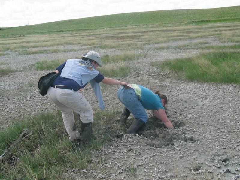
8 Impacted Wetland -an example from the Prairie Pothole Region

9 Purposes of Reference Wetland Networks Establish a basis for defining characteristic levels of integrity Establish range and variability of wetland attributes Represent a range of condition for monitoring and assessing trends

10 Montana s Reference Wetland Network Provides examples of least-disturbed condition for multiple wetland systems Identifies the variability in wetland attributes Identifies humaninduced disturbances impacting wetland condition

11 Study Area


12 Northwestern Glaciated Plains Ecoregion Great Plains Prairie Pothole Western Great Plains Saline Depression Western Great Plains Closed Depression Western Great Plains Open Freshwater Depression


13 Northwestern Great Plains Ecoregion Western North American Emergent Marsh Western Great Plains Closed Depression Western Great Plains Open Freshwater Depression


14 Middle Rockies, Northern Rockies, & Canadian Rockies Ecoregions Western North American Emergent Marsh Rocky Mountain Subalpine- Montane Fen Rocky Mountain Alpine-Montane Wet Meadow
15 Methods Selected sites based on wetland sites described in the literature and input from other ecologists Classified each wetland by: ecological system Cowardin system, class, and water regime hydrogeomorphic features
16 Methods Level 2 - Rapid assessment Attributes measured within a 0.5 hectare assessment area and its200 meter envelope: Landscape context connectivity, buffer size and condition Vegetation structure relative cover of native plant species; cover of invasive exotic species; patch interspersion Physicochemical soil surface integrity; water quality Hydrology water source; hydroperiod; hydrologic connectivity Stressor checklist list of anthropogenic stressors that correspond to field indicators
17 Methods Level 3 - Intensive assessment Measured within a 0.05 hectare plot: Plant species cover and composition Ground cover Use data to calculate multiple vegetation metrics to conduct a floristic quality assessment (FQA)
18 Results
19 Results Wetland Condition Score Categories at or near expected reference standard (scores = ) least impacted (scores = 80-89) moderately impacted (scores = 70-79) severely impacted (scores < 70)
20 Results Great Plains Wetlands Freshwater Depression Prairie Pothole Saline Depression 14 # of Wetlands < Overall Condition Score
21 Results MontaneWetlands Subalpine-Montane Fen Emergent Marsh Alpine-Montane Wet Meadow # of Wetlands < Overall Condition Score

22 Results Northwestern Glaciated Plains and Northwestern Great Plains Wetlands Most Common Stressors livestock grazing roads buffer condition landscape connectivity altered hydrology

23 Results Middle Rockies, Canadian Rockies, and Northern Rockies Wetlands Most Common Stressors livestock grazing altered hydrology roads
24 Wetland Reference Network Uses and Applications Allow for rapid comparison of wetland condition both within and across wetland systems Can diagnose potential causes of wetland degradation Provide examples of multiple wetland systems in varying levels of condition across Montana Highlights areas to focus and prioritize conservation, acquisition, and restoration efforts Characterize examples of least disturbed condition Validate and calibrate our wetland assessment methods

25 Wetland Reference Network: Future Work Continue adding to network Refine disturbance gradient Collect more Level 3 data Develop regional networks


26 Wetland Databases


27


28 Field Guide to Wetland Ecological Systems


29


30 Acknowledgments U.S. EPA MTNHP USFS, BLM, MTDNRC, MTFWP, NRCS, USFWS MTDEQ Field Crews


31 Questions?
REFERENCE WETLANDS. Karen Newlon and Cat McIntyre Montana Natural Heritage Program Helena, MT
 REFERENCE WETLANDS Karen Newlon and Cat McIntyre Montana Natural Heritage Program Helena, MT REFERENCE CONCEPT Indicators are evaluated against some expectation of condition Expectations act as a reference
David M. Stagliano
 Wetland Associations Of Dragonflies,Damselflies & Butterflies in Montana s Wetlands: Uses in Level II & III Assessments David M. Stagliano http://www.mtnhp.org/ Key Goals for Addressing Montana s Wetland
Colorado s Wetland Program Plan: Monitoring and Assessment
 Colorado s Wetland Program Plan: Monitoring and Assessment Association of State Wetland Managers Webinar September 18, 2012 Joanna Lemly, Wetland Ecologist Colorado Natural Heritage Program Colorado State
Day 1 Workshop Activities 1 & 2: Habitats and Species/Species Groups
 Day 1 Workshop Activities 1 & 2: Habitats and Species/Species Groups Instructions for Small Group Discussions Divide up into umbrella habitats groups A & B Upland Desert/Grassland Wetland Riparian/Riverine
How Much Habitat Is Enough? How Much Disturbance is Too Much?
 How Much Habitat Is Enough? How Much Disturbance is Too Much? Jocelyn Sherwood Canadian Wildlife Service - Ontario January 27 th, 2017 Page 2 April 19, 2017 Page 3 April 19, 2017 Grasslands Forest Wetlands
A program of the WSMD within the ANR. Determines the condition of Vermont s wetlands
 A program of the WSMD within the ANR A work in progress Links wetland impact(s) to: current condition and water quality the community structure of the flora water quality sampling Determines the condition
California Rapid Assessment Method for Wetlands and Riparian Areas (CRAM) Introduction
 Introduction") California Rapid Assessment Method for Wetlands and Riparian Areas (CRAM) Introduction What is CRAM? CRAM is a field-based walk and talk diagnostic tool that, when used as directed, provides rapid, repeatable,
California Rapid Assessment Method for Wetlands and Riparian Areas (CRAM) Introduction What is CRAM? CRAM is a field-based walk and talk diagnostic tool that, when used as directed, provides rapid, repeatable,
THE BLACKFEET RESERVATION: Ecological Significance, Biological Diversity and Conservation
 THE BLACKFEET RESERVATION: Ecological Significance, Biological Diversity and Conservation Document prepared by Tara A. Luna, East Glacier Park, Blackfeet Nation, Montana. November 30 th, 2012. PREFACE
FACT SHEET: BLM, USFS Greater Sage-Grouse Conservation Effort
 EMBARGOED UNTIL SEPTEMBER 22, 2015 @ 12:00PM ET FACT SHEET: BLM, USFS Greater Sage-Grouse Conservation Effort Overview Effective conservation of the greater sage-grouse and its habitat requires a collaborative,
How Much Habitat is Enough?
 How Much Habitat is Enough? Canadian Wildlife Service 2017 Third Edition Page 2 April 19, 2017 Grasslands Forest Wetlands Riparian & Watershed Page 3 April 19, 2017 Significant impairment in stream At
NORTH DAKOTA WETLANDS: CHANGES OVER FIVE YEARS IN PRAIRIE POTHOLE WETLANDS AND A DESCRIPTION OF VEGETATIVE AND SOIL PROPERTIES IN A NORTH DAKOTA FEN
 NORTH DAKOTA WETLANDS: CHANGES OVER FIVE YEARS IN PRAIRIE POTHOLE WETLANDS AND A DESCRIPTION OF VEGETATIVE AND SOIL PROPERTIES IN A NORTH DAKOTA FEN A Thesis Submitted to the Graduate Faculty of the North
Creating a Value-Added Wetlands Layer: Enhancing the Utility of Wetland Mapping in Montana Karen Newlon Montana Natural Heritage Program Helena, MT
 Creating a Value-Added Wetlands Layer: Enhancing the Utility of Wetland Mapping in Montana Karen Newlon Montana Natural Heritage Program Helena, MT Wetlands & Riparian Mapping Wetland and riparian digital
Ecological Integrity Assessment for Colorado Wetlands. Field Manual, Version 2.0
 Ecological Integrity Assessment for Colorado Wetlands Field Manual, Version 2.0 September 2015 Ecological Integrity Assesment (EIA) for Colorado Wetlands Field Manual, Version 2.0 Joanna Lemly and Laurie
California Rapid Assessment Method for Wetlands (CRAM) Introduction
 Introduction") California Rapid Assessment Method for Wetlands (CRAM) Introduction What is CRAM? CRAM is a field-based walk and talk diagnostic tool that, when used as directed, provides rapid, repeatable, numeric assessment
California Rapid Assessment Method for Wetlands (CRAM) Introduction What is CRAM? CRAM is a field-based walk and talk diagnostic tool that, when used as directed, provides rapid, repeatable, numeric assessment
Statewide Strategies to Improve Effectiveness in Protecting and Restoring Colorado s Wetland Resource
 Statewide Strategies to Improve Effectiveness in Protecting and Restoring Colorado s Wetland Resource Including the Rio Grande Headwaters Pilot Wetland Condition Assessment July 2011 Colorado Natural Heritage
Colorado Natural Heritage Program. Wetland Program Plan
 Colorado Natural Heritage Program Wetland Program Plan A Vision for Building Comprehensive Wetland Information for the State of Colorado Planning Years 2011 2015 Colorado Natural Heritage Program Wetland
A GUIDE TO THE WETLAND, DEEPWATER HABITATS, AND RIPARIAN CLASSIFICATIONS USED IN WETLAND AND RIPARIAN MAPPING IN MONTANA
 A GUIDE TO THE WETLAND, DEEPWATER HABITATS, AND RIPARIAN CLASSIFICATIONS USED IN WETLAND AND RIPARIAN MAPPING IN MONTANA Purpose: The Montana Natural Heritage Program s Wetland and Riparian Mapping Center
Above and Below Ground Nutrient Cycling in Northern Prairie Wetlands
 Above and Below Ground Nutrient Cycling in Northern Prairie Wetlands Lindsey M. Meyers, Edward S. DeKeyser, Jack E. Norland, Christina L.M. Hargiss, Thomas DeSutter North Dakota State University Introduction
You may use the information and images contained in this document for non-commercial, personal, or educational purposes only, provided that you (1)
") You may use the information and images contained in this document for non-commercial, personal, or educational purposes only, provided that you (1) do not modify such information and (2) include proper
You may use the information and images contained in this document for non-commercial, personal, or educational purposes only, provided that you (1) do not modify such information and (2) include proper
Modeling Cottonwood Habitat and Forecasting Landscape Changes along the Missouri River
 Modeling Cottonwood Habitat and Forecasting Landscape Changes along the Missouri River Lisa Rabbe USACE, Alaska District Kelly A. Burks-Copes US Army Engineer Research and Development Center (ERDC-EL)
New Hampshire s Wildlife Habitat Conditions
 CHAPTER THREE New Hampshire s Wildlife Habitat Conditions Abstract Wildlife habitat condition was assessed for all 27 habitat types. NHFG developed a methodology to assess the relative ecological condition
NatureServe. Camas NWR. Ecological Integrity Assessment, Watershed Analysis and Habitat Vulnerability Climate Change Index
 NatureServe Camas NWR Ecological Integrity Assessment, Watershed Analysis and Habitat Vulnerability Climate Change Index Gwen Kittel, Don Faber-Langendoen and Pat Comer 12/11/2012 Left to right: Sagebrush
Washington State Department of Ecology: Biological Assessment Model Development and Use in State Regulatory Programs
 Western Washington University Western CEDAR Salish Sea Ecosystem Conference 2014 Salish Sea Ecosystem Conference (Seattle, Wash.) May 1st, 10:30 AM - 12:00 PM Washington State Department of Ecology: Biological
Basic Information: Individual Vernal Pool
 Basic Information: Individual Vernal Pool Assessment Area Name: Project Name: Assessment Area ID #: Project ID #: Assessment Team Members for This AA Date: AA Location: Latitude: Longitude: Datum: Wetland
Restoration Mitigation Impacted Ambient Reference Training
 Basic Information Sheet: Perennial Estuarine Wetlands Assessment Area Name: Project Name: Assessment Area ID #: Project Site ID #: Date: Assessment Team Members for This AA Center of AA: Latitude: Wetland
Assessing Ecological Condition of Headwater Wetlands in the Southern Rocky Mountains Using a Vegetation Index of Biotic Integrity (Version 1.
 Assessing Ecological Condition of Headwater Wetlands in the Southern Rocky Mountains Using a Vegetation Index of Biotic Integrity (Version 1.0) May 22, 2007 Colorado Natural Heritage Program Colorado State
Weber River Watershed Wetland Condition Assessment
 Weber River Watershed Wetland Condition Assessment By Diane Menuz, Ryhan Sempler, and Jennifer Jones Utah Geological Survey Utah Department of Natural Resources Salt Lake City, UT January 2016 A contract
Fire Initiatives & Strategic Planning
 Fire Initiatives & Strategic Planning Intermountain West Rangelands & Mojave Desert Presentation Sky Islands Fire Goals Learning Network Explain the choice of priority landscapes Demonstrate effective
New Mexico Rapid Assessment Method (NMRAM) for Riverine Wetlands Introduction 2013
 for Riverine Wetlands Introduction 2013") New Mexico Rapid Assessment Method (NMRAM) for Riverine Wetlands Introduction 2013 New Mexico Environment Department Surface Water Quality Bureau Wetlands Program Natural Heritage New Mexico Museum of
New Mexico Rapid Assessment Method (NMRAM) for Riverine Wetlands Introduction 2013 New Mexico Environment Department Surface Water Quality Bureau Wetlands Program Natural Heritage New Mexico Museum of
Jennifer L. Chutz
 jchutz@mt.gov 406.444.3500 EXECUTIVE SUMMARY As a wetland ecologist and wildlife biologist, I have 13 years of experience in natural resource management, monitoring, and applied research. Prior to founding
Riparia - a Center where science informs policy and practice in wetlands ecology, landscape hydrology, and watershed management
 Mid Atlantic Freshwater Wetlands: Using Science to inform Policy and Practice MAWWG Mid-Atlantic Wetlands Work Group Regina Poeske, EPA Region 3, Co-Director www.mawwg.psu.edu Riparia - a Center where
# $% 01"&%*23"3#,--.%( ) 4 5 ')
 4 5 ')") !" # $% &'(&))*+)' ",--. /,--. 0 A field crew measures a forested plot at Acadia National Park. From Tierney et al. 2009. 01"&%*23"3#,--.%( ) 4 5 ') )154(14)5'467 451(&4')(&') 48)'6(&((16 4 &((% "(2"8(%9(%
!" # $% &'(&))*+)' ",--. /,--. 0 A field crew measures a forested plot at Acadia National Park. From Tierney et al. 2009. 01"&%*23"3#,--.%( ) 4 5 ') )154(14)5'467 451(&4')(&') 48)'6(&((16 4 &((% "(2"8(%9(%
ASSESSING FOREST ECOLOGICAL INTEGRITY USING LANDFIRE AND USFS FOREST INVENTORY AND ANALYSIS DATA
 ASSESSING FOREST ECOLOGICAL INTEGRITY USING LANDFIRE AND USFS FOREST INVENTORY AND ANALYSIS DATA i NatureServe is a non-profit organization dedicated to providing the scientific basis for effective conservation
California Rapid Assessment Method. Worksheets for the Episodic Riverine User s Manual and Field Book
 California Rapid Assessment Method Worksheets for the Episodic Riverine User s Manual and Field Book ver. 1.0 December 2015 1 Worksheet 3.1: Stream Corridor Continuity Metric for Riverine Systems Using
Reference Condition: Science and Regulatory Context
 Reference Condition: Science and Regulatory Context Stoddard et al. (2006) the primary focus of biological assessment is an evaluation of the effect of human activity Requires the estimation of biological
Pine Flatwood Habitat Management through Feral Hog Control To Benefit Species of Greatest Conservation Need
 2015 Arkansas State Wildlife Grant Pre-proposals Pine Flatwood Habitat Management through Feral Hog Control To Benefit Species of Greatest Conservation Need Project Summary Ecological damage to high priority
Ecological Integrity Assessment and Performance Measures for Wetland Mitigation
 Ecological Integrity Assessment and Performance Measures for Wetland Mitigation Ecological Integrity Assessment and Performance Measures for Wetland Mitigation Copyright 2006 NatureServe Photograph on
Wetland Profile and Condition Assessment of the Little Snake River, Wyoming
 Wetland Profile and Condition Assessment of the Little Snake River, Wyoming FINAL REPORT September 26th, 2018 Lindsey Washkoviak, Teresa M. Tibbets, and George Jones Wyoming Natural Diversity Database,
LINDA KATHERINE VANCE (406)
") LINDA KATHERINE VANCE (406)-444-3380 Email: livance@mt.gov EDUCATION: 2004: Doctor of Philosophy (Ph.D), University of California, Davis, Graduate Group in Ecology. Exam Areas: Ecological Principles, Conservation
LINDA KATHERINE VANCE (406)-444-3380 Email: livance@mt.gov EDUCATION: 2004: Doctor of Philosophy (Ph.D), University of California, Davis, Graduate Group in Ecology. Exam Areas: Ecological Principles, Conservation
2.e Aquatic resource type (Cowardin system): Palustrine emergent Riparian Palustrine emergent
: Palustrine emergent Riparian Palustrine emergent") Attachment 12512.3 Compensatory mitigation site evaluation checklist examples. Example 1: Lazy Day Ranch 1 Date: 2/6/2015 Corps file.: SPL-2015-111 Project name: Lazy Day Ranch Project Manager: Wyatt Earp
Attachment 12512.3 Compensatory mitigation site evaluation checklist examples. Example 1: Lazy Day Ranch 1 Date: 2/6/2015 Corps file.: SPL-2015-111 Project name: Lazy Day Ranch Project Manager: Wyatt Earp
Wetland Profile and Condition Assessment of the Laramie Plains Wetland Complex, Wyoming
 Wetland Profile and Condition Assessment of the Laramie Plains Wetland Complex, Wyoming FINAL REPORT January 22, 2016 Teresa M. Tibbets 1, Lindsey Washkoviak 1,2, Steve Tessmann 3, George Jones 2 and Holly
Ecosystem Sustainability and the Cheatgrass Fire Cycle
 Ecosystem Sustainability and the Cheatgrass Fire Cycle Jeanne C. Chambers Research Ecologist US Forest Service, RMRS Reno, Nevada jchambers@fs.fed.us http://www.fs.fed.us/rm/reno SUSTAINABLE ECOSYSTEMS
A PRACTICAL GUIDE FOR THE DEVELOPMENT OF A WETLAND ASSESSMENT METHOD: THE CALIFORNIA EXPERIENCE 1
 JOURNAL OF THE AMERICAN WATER RESOURCES ASSOCIATION FEBRUARY AMERICAN WATER RESOURCES ASSOCIATION 2006 A PRACTICAL GUIDE FOR THE DEVELOPMENT OF A WETLAND ASSESSMENT METHOD: THE CALIFORNIA EXPERIENCE 1
Chris S. Pease U.S. Fish and Wildlife Service Gulf Coast Ecosystem Restoration Task Force
 --to build upon Gulf coast geographies to link protected lands and waters, working landscapes, and other open spaces that conserve ecosystem processes and provide associated connections and services to
Great Basin Landscape Conservation Cooperative 2017 Online Public Forum Summary Report
 Photo: BLM Nevada Great Basin Landscape Conservation Cooperative 017 Online Public Forum Summary Report Online Public Forum Overview The Great Basin Landscape Conservation Cooperative (LCC) hosted an online
9/4/2013 CHAPTER 4 ECOLOGY AND GEOLOGY. Ecosystem. Ecology & Geology Linkage. Fundamental Ecology Terms. Natural Service Functions of Ecosystems
 CHAPTER 4 ECOLOGY AND GEOLOGY Ecology & Geology Linkage Ecology Study of relationships between living things and their environments; the study of control factors over the distribution, abundance, and health
Technical Report No: ND12-01 ECOSYSTEM SERVICES AND WETLAND CONDITION ASSESSMENT IN THE PRAIRIE POTHOLE REGION
 Technical Report No: ND12-01 ECOSYSTEM SERVICES AND WETLAND CONDITION ASSESSMENT IN THE PRAIRIE POTHOLE REGION Lindsey M. Meyers, Edward S. DeKeyser, and Jack E. Norland School of Natural Resource Sciences
AN EVALUATION OF RAPID METHODS FOR ASSESSING THE ECOLOGICAL CONDITION OF WETLANDS
 WETLANDS, Vol. 27, No. 3, September 2007, pp. 543 560 2007, The Society of Wetland Scientists AN EVALUATION OF RAPID METHODS FOR ASSESSING THE ECOLOGICAL CONDITION OF WETLANDS M. Siobhan Fennessy 1, Amy
Conservation Assessment & Prioritization System (CAPS)
") Conservation Assessment & Prioritization System (CAPS) Assessing ecological integrity and supporting decision-making for land conservation, habitat management, project review & permitting to protect biodiversity
Conservation Assessment & Prioritization System (CAPS) Assessing ecological integrity and supporting decision-making for land conservation, habitat management, project review & permitting to protect biodiversity
A Tool for Rating Wetland Values in DE. Alison Rogerson, Andy Howard, Matt Jennette January 27, 2015
 A Tool for Rating Wetland Values in DE Alison Rogerson, Andy Howard, Matt Jennette January 27, 2015 What s in place now? Delaware Rapid Assessment Procedure DERAP scores are based on multiple wetland functions
Applications of National Wetland Condition Assessment Data to Wetland Protection and Management
 United States Environmental Protection Agency Office of Research and Development Applications of National Wetland Condition Assessment Data to Wetland Protection and Management Mary E. Kentula USEPA, ORD,
Assessments for designing fish habitat programs and restoration. Peter B Moyle Center for Watershed Sciences University of California, Davis
 Assessments for designing fish habitat programs and restoration Peter B Moyle Center for Watershed Sciences University of California, Davis This talk Framing monitoring of aquatic systems in terms of reconciliation
2.4 Floodplain Restoration Principles
 Floodplain Restoration Principles 2.4 Floodplain Restoration Principles Anthropogenic alternation of river corridors and floodplains significantly modified the structure and function of landscapes and
Estuary Habitat Restoration STRATEGY 2012
 Estuary Habitat Restoration STRATEGY 2012 INTRODUCTION The Estuary Restoration Act of 2000 (ERA), as amended, (title I of Pub. L. 106 457) fosters a collaborative and comprehensive process among federal
Wetland name or number 2
 H. Does the wetland unit have the opportunity to provide habitat for many species? H.1 Buffers (see P. 80) Choose the description that best represents condition of buffer of wetland unit. The highest scoring
Maps to Help You Protect and Manage Lands: The Revised Wildlife Action Plan Maps. Emily Preston, Wildlife Biologist Katie Callahan, GIS specialist
 Maps to Help You Protect and Manage Lands: The Revised Wildlife Action Plan Maps Emily Preston, Wildlife Biologist Katie Callahan, GIS specialist What is the Wildlife Action Plan? Restore rare wildlife
Wetland Mitigation Crediting & Performance
 Wetland Mitigation Crediting & Performance Subhead for title slide BWSR Academy 2014 Overview Quick Review of Crediting Banking vs Impact Approvals & the Private Market Basic Requirements & Considerations
PFLCC Conservation Targets PROGRESS UPDATE JUNE 3-4, 2015
 PFLCC Conservation Targets PROGRESS UPDATE JUNE 3-4, 2015 Purpose of Conservation Targets To assist in biological planning and conservation design to attain a shared planning framework for PFLCC partners
Ecology and Conservation of California's Coastal Freshwater Wetlands An Introduciton to the diversity of coastal freshwater wetlands Lorraine Parsons
 California s Coastal Freshwater Wetlands Lorraine Parsons Point Reyes Station, Calif. Habitat Definition Holland - e.g., Coastal and Valley Freshwater Marsh Cowardin Classification Wetlands are lands transitional
MAPPING FIRE REGIME CONDITION CLASS: A METHOD FOR WATERSHED AND PROJECT SCALE ANALYSIS
 MAPPING FIRE REGIME CONDITION CLASS: A METHOD FOR WATERSHED AND PROJECT SCALE ANALYSIS Wendel J. Hann 3005 East Camino del Bosque, Silver City, NM 88061 ABSTRACT Fire regime and associated condition class
Integrating the Protection of Healthy Waters in Tribal Clean Water Act Section 319 and other Water Quality Programs
 Integrating the Protection of Healthy Waters in Tribal Clean Water Act Section 319 and other Water Quality Programs August 18, 2016 Steve Epting, US EPA Headquarters 1 Today s Talk Defining healthy watersheds
Beverly. Produced in This report and associated map provide information about important sites for biodiversity conservation in your area.
 CONSERVING THE BIODIVERSITY OF MASSACHUSETTS IN A CHANGING WORLD Beverly Produced in 2012 This report and associated map provide information about important sites for biodiversity conservation in your
The National Strategy to Promote the Health of Honey Bees and Other Pollinators
 The National Strategy to Promote the Health of Honey Bees and Other Pollinators Tyler D. Johnson Regional Botanist US Forest Service Rocky Mountain Region tdjohnson02@fs.fed.us Where We re Headed The Strategy
EXECUTIVE SUMMARY. Introduction
 Introduction In September 2003, Hillsborough County retained Ayres Associates Inc to update the Watershed Management Plan (WMP) for the Rocky/Brushy Creek watershed, which was originally prepared in 2001.
MONITORING CHANGES IN EXOTIC VEGETATION
 MONITORING CHANGES IN EXOTIC VEGETATION Robert D. Sutter Director of Biological Conservation Southeast Regional Office The Nature Conservancy Chapel Hill, NC 27515 Ecological monitoring provides critical
IBIs AND WETLAND QUALITY STANDARDS: Using Empirical Data to Define Tiered Aquatic Life Uses In Pennsylvania Wetlands
 IBIs AND WETLAND QUALITY STANDARDS: Using Empirical Data to Define Tiered Aquatic Life Uses In Pennsylvania Wetlands Sarah J. Miller and Denice H. Wardrop Penn State Cooperative Wetlands Center From Data
Assessment. Forest Plan Revision
 Assessment Forest Plan Revision Draft Climate Report Prepared by: Scott Barndt Ecosystem Staff Officer Forest Climate Change Coordinator for: Custer Gallatin National Forest November 29, 2016 Contents
Strong site and year specific needs, particularly driven by annual systems Well drained, <1200 m, over diverse soil types
 California s grasslands span over 10% of CA s land area (5,640,400 ha). The grasslands are also a key understory component of California s woodlands and coastal scrub, so grassland species cover at least
NATURAL RESOURCES. American River College Catalog
 NATURAL RESOURCES Area: Science and Engineering Dean: Dr. Rina Roy Phone: (916) 484-8107 Counseling: (916) 484-8572 DEGREES AND CERTIFICATES Environmental Conservation A.S. Degree (formerly Natural Resources)
Appendix 2. Summary of the U.S. Fish and Wildlife Service 2010 Warranted but Precluded Determination
 Appendix 2. Summary of the U.S. Fish and Wildlife Service 2010 Warranted but Precluded Determination This appendix contains a summary of the U.S. Fish and Wildlife Service (USFWS) 12-month findings for
Integrated Landscape Monitoring: Prairie Pilot
 Integrated Landscape Monitoring: Prairie Pilot Prairie Pilot Science Team U.S. Department of the Interior U.S. Geological Survey JUSTIFICATION & NEED USDA Agency influences 400 million acres of cropland
Southern California River and Stream Habitats
 Southern California River and Stream Habitats Climate Change Adaptation Actions Summary An Important Note About this Document: This document represents an initial effort to identify adaptation actions
Implementation of a Tiered Aquatic Life Use Framework for Minnesota Streams
 Implementation of a Tiered Aquatic Life Use Framework for Minnesota Streams June 13, 2012 New Text wq-ppt3-02 Minnesota Pollution Control Agency St. Paul, MN Stream Diversity in Minnesota Forest Mixed
Augmenting Wetland Level 2 Ecological Integrity Assessments with Updated FQA Metrics in New Jersey
 Augmenting Wetland Level 2 Ecological Integrity Assessments with Updated FQA Metrics in New Jersey Kathleen Strakosch Walz New Jersey Natural Heritage Program Office of Natural Lands Management New Jersey
Great Lakes Riparian Opportunity Assessment Methodology New York Natural Heritage Program September 25, 2015
 Great Lakes Riparian Opportunity Assessment Methodology New York Natural Heritage Program September 25, 2015 OBJECTIVES The goal of this analysis is to assemble a suite of riparian habitat quality indicators
Prairie Pothole Wetlands: Characteristics, Functions, and Values
 Prairie Pothole Wetlands: Characteristics, Functions, and Values Brian Tangen USGS, Northern Prairie Wildlife Research Center U.S. Department of the Interior U.S. Geological Survey Society for Range Management
Habitat Evaluation Scoring Method to Estimate Ecosystem Service Improvements from Restoration. Timothy Barber, Jennifer Lyndall, and Wendy Mahaney
 Habitat Evaluation Scoring Method to Estimate Ecosystem Service Improvements from Restoration Timothy Barber, Jennifer Lyndall, and Wendy Mahaney The Challenge Valuation of Ecosystem Services from Restoration
The VIBI-FQ: a Streamlined Approach to Vegetation Monitoring in Ohio. Brian Gara Wetland Ecology Group Division of Surface Water Ohio EPA
 The VIBI-FQ: a Streamlined Approach to Vegetation Monitoring in Ohio Brian Gara Wetland Ecology Group Division of Surface Water Ohio EPA Vegetation Index of Biotic Integrity (VIBI) Overview A level 3 tool
Identifying Priority Conservation Areas in Michigan
 Identifying Priority Conservation Areas in Patrick W. Brown, Amy Derosier, Joelle Gehring, Michael Kost, John Paskus, Michael Penskar, and Ed Schools (MNFI) Patrick Doran (TNC) Gary Roloff (MSU Fish and
Mapping the Cheatgrass-Caused Departure From Historical Natural Fire Regimes in the Great Basin, USA
 Mapping the Cheatgrass-Caused Departure From Historical Natural Fire Regimes in the Great Basin, USA James P. Menakis 1, Dianne Osborne 2, and Melanie Miller 3 Abstract Cheatgrass (Bromus tectorum) is
Manitoba s Submission Guidelines for Peatland Recovery Plans
 Manitoba s Submission Guidelines for Peatland Recovery Plans Peatland Management Guidebook Forestry and Peatlands Branch Manitoba Sustainable Development First Published: September 2017 Review by: 2022
Rogue Basin Ecological Integrity Assessment and Climate Change Management Interactions
 Rogue Basin Ecological Integrity Assessment and Climate Change Management Interactions Jimmy Kagan OSU PSU UO Ecological Integrity Measures (by area) Land management status Landscape features Habitat characteristics
Today s Schedule Wetland Monitoring and Restoration
 Today s Schedule Wetland Monitoring and Restoration AM Lectures on Wetland Restoration Introduction to Wetland Restoration Planning, Monitoring, and Evaluating Success Identifying Potential Wetland Restoration
THE FIRST IRAQI NATIONAL REPORT TO THE CONVENTION ON BIOLOGICAL DIVERSITY
 THE FIRST IRAQI NATIONAL REPORT TO THE CONVENTION ON BIOLOGICAL DIVERSITY CHAPTER I BIODIVERSITY VALUES MARSH Most Most important fresh fresh and and brackish water water system of of the the region Breeding
An Introduction to NatureServe s Ecological Integrity Assessment Method
 An Introduction to NatureServe s Ecological Integrity Assessment Method Don Faber-Langendoen, William Nichols, Joe Rocchio, Kathleen Walz, Joanna Lemly page left blank i An Introduction to NatureServe
Upper Des Plaines River Feasibility Study
 Upper Des Plaines River Feasibility Study Appendix M Monitoring & Adaptive Management Plan August 2013 Study Partnership Illinois Department of Natural Resources (IDNR) Southeastern Wisconsin Regional
Applying the Rhode Island Rapid Assessment Method to Identify Reference Conditions in Rhode Island Freshwater Wetlands
 Applying the Rhode Island Rapid Assessment Method to Identify Reference Conditions in Rhode Island Freshwater Wetlands Technical Report Prepared for Rhode Island Department of Environmental Management
U.S. Arid Land Springs A Biology, Environment, & Management Primer
 U.S. Arid Land Springs A Biology, Environment, & Management Primer Donald W. Sada Society for Range Management Conference, Billings, MT February 10, 2011 Funding Sources and Collaborators Funding Agencies
THE VALIDATION PHASE OF CRAM MODULE DEVELOPMENT
 EXECUTIVE SUMMARY Slope wetlands, one of the most numerous wetland types in California, are important regulators of downstream water supplies, and provide water storage functions, filtration and benefits
Assessment of Wetland Ecosystem Condition across Landscape Regions: A Multi-metric Approach
 Assessment of Wetland Ecosystem Condition across Landscape Regions: A Multi-metric Approach Part A. Ecological Integrity Assessment Overview and Field Study in Michigan and Indiana EPA/600/R-12/021a June
2015 Wildlife Action Plan Habitats Crosswalk
 2015 Wildlife Action Plan Habitats Crosswalk A crosswalk guide between Wildlife Action Plan Habitats and other habitat classification schemes. Ecosystem Comments NH WAP 2015 NHNHB System Open Water (NLCD-NHD
Anne Hairston-Strang MD DNR Forest Service September 7, 2017
 Anne Hairston-Strang MD DNR Forest Service September 7, 2017 Improving Forest-related BMPs Riparian Forest Buffers Consider drainage flow context and Farm Plan Address concentrated flows with companion
RESTORATION OF RARE PLANTS OF THE PALOUSE. Trish Heekin Conservation Planner Latah Soil and Water Conservation District
 RESTORATION OF RARE PLANTS OF THE PALOUSE Trish Heekin Conservation Planner Latah Soil and Water Conservation District Rare Plants of the Palouse We ve already covered What are they? Where do they occur?
Assessment of the Functional Capacity of Wetlands within the Coon Creek Watershed
 Assessment of the Functional Capacity of Wetlands within the Coon Creek Watershed Tim Kelly & Justin Hawley March Goals 1. To assess wetland functional capacity within the watershed 2. To use a tool based
Using Ecosystem Services Frameworks to Increase Forest Value and Enhance Forest Health
 Using Ecosystem Services Frameworks to Increase Forest Value and Enhance Forest Health Robert Deal, USDA Forest Service, Pacific Northwest Research Station, Portland, OR Outline of Presentation Working
Ecological Performance Standards for Wetland Mitigation
 N at u r eserv e Report No v e m b e r 2008 Ecological Performance Standards for Wetland Mitigation An Approach Based on Ecological Integrity Assessments A Report to the Environmental Protection Agency
Natural Communities of Clay Soils in the Lake Champlain Basin
 Natural Communities of Clay Soils in the Lake Champlain Basin Marc Lapin, Forest Ecologist Middlebury College Program in Environmental Studies & Champlain Valley Clayplain Forest Project What Makes Clayplain
Lake Fork of the Gunnison Watershed: Status and Stewardship. Camille Richard, Project Director
 Lake Fork of the Gunnison Watershed: Status and Stewardship Camille Richard, Project Director Upper Gunnison Basin Lake Fork Watershed 7,500 14,309 ft Sagebrush to alpine 432 square miles Population 900
2018 Arkansas State Wildlife Grant Pre-proposal
 2018 Arkansas State Wildlife Grant Pre-proposal EXPANDING PINE FLATWOODS HABITAT RESTORATION AT LONGVIEW SALINE NATURAL AREA TO BENEFIT SPECIES OF GREATEST CONSERVATION NEED Project Summary High priority
Appendix Q Conceptual Mitigation Plan for Impacts to Wetlands and Other Waters of the United States
 for Impacts to Wetlands and Other Waters of the United States Q.1 Introduction This Conceptual Mitigation Plan (Plan) is intended to provide a framework for identifying the potential mitigation areas and