WELCOME! Mill Creek Daylighting Technical Feasibility Study. Thank you! Open House December Please sign in and get a comment form.
|
|
|
- Gary Scott
- 6 years ago
- Views:
Transcription
1 WELCOME! Daylighting Technical Feasibility Study Open House December 2016 Please sign in and get a comment form. Thank you!


2 WHAT IS DAYLIGHTING? Daylighting refers to the process of re-establishing creeks and streams that have been altered to concrete channels or diverted to pipes. Many jurisdictions around the world have undertaken daylighting projects to restore their creek and ravine systems.


3 BACKGROUND is one of 12 ravines within Edmonton contributing flow to the North Saskatchewan River. is a prominent feature of Edmonton s river valley and ravine system, and provides key ecosystem services such as biodiversity, aquatic and upland wildlife habitat, and regional ecological connectivity. Prior to development activities dating back to the early 20th century, was a free-flowing stream connected to the North Saskatchewan River about 500m downriver of the Low Level Bridge Air Photo with approximate creek alignment shown 1967 Air Photo with approximate creek alignment shown


4 BACKGROUND CONTINUED In the 1960 s was permanently diverted through a tunnel to the North Saskatchewan River to facilitate development of a freeway system. In 1972, the James MacDonald Bridge and connecting ramps to Connors Road and 98 Avenue were completed, and the channel was filled in. Due to public opposition, the proposed freeway in Mill Creek Ravine was never completed. Early transportation plan showing the diversion of 1978 Air Photo with approximate creek alignment (blue) and diversion tunnel (red) shown

5 VISION Restoration of the connectivity between and the North Saskatchewan River is a key priority of the City of Edmonton for enhancing Edmonton s ecological network. It is also a priority for Alberta Environment and Parks due to the potential for re-establishing spawning habitat for native fish species. Restoration of the channel will: Re-establish the natural hydrologic and hydraulic regimes that connect to the North Saskatchewan River Improve water quality Support biodiversity Provide recreation and cultural opportunities


6 TECHNICAL FEASIBILITY STUDY As part of its 2016 budget, City Council authorized a Technical Feasibility Study to: Determine the technical feasibility for daylighting this reach of Identify constraints to daylighting, including existing transportation and utility infrastructure Determine possible routes for daylighting Explore options for aquatic and terrestrial wildlife passage Explore options for pedestrian and cycling along the restored creek Develop three conceptual design options for daylighting Prepare cost estimates Identify funding sources and options for staging.


7 EXISTING CONDITIONS Existing channel at 90 Avenue inlet to tunnel at 94 Avenue Ravine Park north of tunnel diversion


8 EXISTING CONDITIONS Ravine Park at Connors Road Connors Road bridge at approximate alignment of original Existing original channel north of 98 Avenue
9 STUDY AREA NORTH SASKATCHEWAN RIVER 98 AVENUE JAMES MACDONALD BRIDGE CONNORS ROAD 95 AVENUE 94 AVENUE SCONA ROAD 93 AVENUE Study Area Likely Daylighting Corridor


10 EXISTING TRAILS AND WALKWAYS NORTH SASKATCHEWAN RIVER 98 AVENUE JAMES MACDONALD BRIDGE CONNORS ROAD 95 AVENUE 94 AVENUE SCONA ROAD l l l l l l l l l l l l l l l l l l l l l l l l l l l l l l l l l l l l l l l l l l l l l l l l l l l l l l 93 AVENUE Study Area Likely Daylighting Corridor Stairs Gravel Trails Shared Use Paths Sidewalks Pedestrian Bridges B LRT Conflict Points Bus Stops Future LRT Station Access across LRT Tracks B LRT

11 TECHNICAL FEASIBILITY The study has determined that it is technically feasible to daylight the lower reach of. The key technical findings include: The roadways are the most significant and costly constraint The size of the roadway crossings will have the greatest ecologic and recreational impact Buried utility conflicts are manageable Several retaining walls will be required to create space for the creek The creek slope is moderately steep and erosion protection measures are required Very high creek flows need to be diverted to the existing tunnel Fish spawning habitat gains will be greatest near the creek mouth but fish passage and spawning further upstream will be possible To provide spawning habitat, it will be necessary to remove some trees from Henrietta Muir Edwards Park

12 THE WAY WE GREEN DEVELOPMENT OF DAYLIGHTING CONCEPTS Three daylighting concepts were developed based on engineering constraints and consideration of ecological and recreational opportunities. The three daylighting concepts proposed are: Concept 1: Ecological Focus Concept 2: Trail Connectivity Focus Concept 3: Destination Park Focus

13 DEVELOPMENT OF DAYLIGHTING CONCEPTS WHAT WE HEARD Feedback from the November 16 open house assisted in identifying guiding principles and design priorities for concept development. You told us that you valued the following: Accessibility, walking along creek Trail connectivity to the greater River Valley trail system Connection to nature or habitat that encourages wildlife use Recreational, dog walking and picnic opportunities Balance of naturalized areas and of man-made elements Access points from adjacent neighbourhoods No traffic noise Educational opportunities Urban park connected to the Muttart LRT station

14 WHAT WE HEARD WHAT WE DID What We Heard What We Did Create fish spawning habitat Fish spawning habitat provided in every concept Simplify and/or re-design road network Don t change the road network Create new habitat, restore ecosystem and improve biodiversity Provide a natural aesthetic, nonmanmade character Extend current uses of the creek and ravine Make the area a destination, provide education opportunities Create wetland habitat Road network re-design provided in every concept Concept 2 (Trails Focus) limits changes to shifting 98 Avenue Concept 1 (Ecology Focus) emphasizes new habitat, biodiversity and strong ecological connectivity Concepts 2 (Trails Focus) and 3 (Destination Park Focus) provide this to a lesser degree All concepts include naturalized vegetation Concept 1 (Ecology Focus) has fewest man-made elements, Concept 3 (Destination Park Focus) provides a balanced mix of natural and man-made elements All concepts extend current uses of the ravine to some extent Concept 3 (Destination Park Focus) focuses on destination elements, connection with the Muttart and includes a learning centre Wetlands are provided in all concepts
15 WHAT WE HEARD WHAT WE DID What We Heard What We Did Plan for the future, think longterm and don t rush Save mature trees / include many trees in final design Ensure high functioning trail system Historical recognition of past uses Consider winter usage Improve sense of safety around road network, ensure paths go under roads Make creek swimmable and allow for canoe access Consider alignment through Gallagher Park and Muttart Consider flooding All concepts account for known parks, transportation and utility infrastructure plans including the Valley Line LRT All concepts can be staged based on funding availability All concepts retain as many of the existing trees as possible All concepts include large areas with new treed areas All concepts have at least one trail that ties into existing system Where trails are lost, replacement paths will provide equivalent or improved connectivity All concepts include the potential to incorporate various interpretive values through signage and other educational material Each concept has a trail or space that could be used for cross-country skiing and snowshoeing All concepts include trails with road underpasses Vegetation will screen traffic from view, further increasing sense of security As an urban creek, the water quality cannot be made suitable for swimming Water depths are not expected to be conducive to canoeing or kayaking Significant technical constraints and conflicts exist with this option and thus it was not selected as one of the three concepts High flows will be diverted through the existing tunnel to river Creek to be well below existing infrastructure


16 FISH SPAWNING HABITAT AND WETLANDS A key project objective is to create new fish spawning habitat in the daylighted. The biggest habitat gains would be near the creek s confluence with the river. The targeted fish species would be Northern Pike. Northern pike spawning habitat could be created through the development of small in-stream and off-stream wetlands. All three of these concepts include wetlands within Henrietta Muir Edwards Park, and involve some tree removals. Other species, such as white sucker and walleye may spawn in creek reaches having gravelly substrate. Examples of fish spawning habitat.


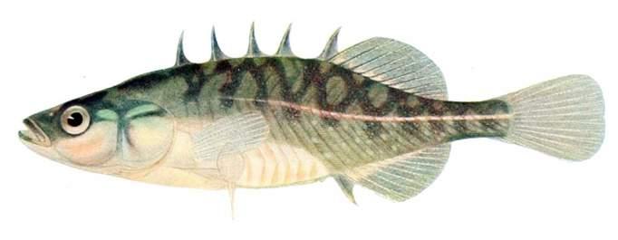
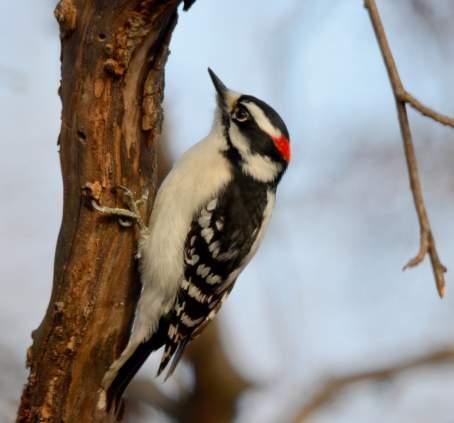
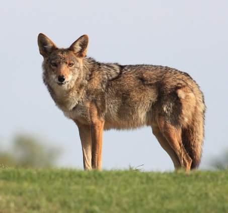
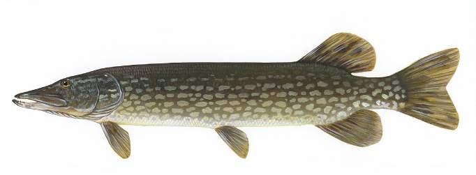
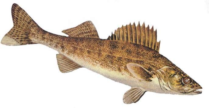
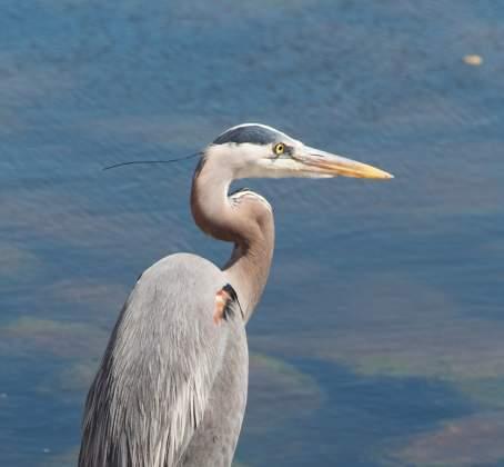


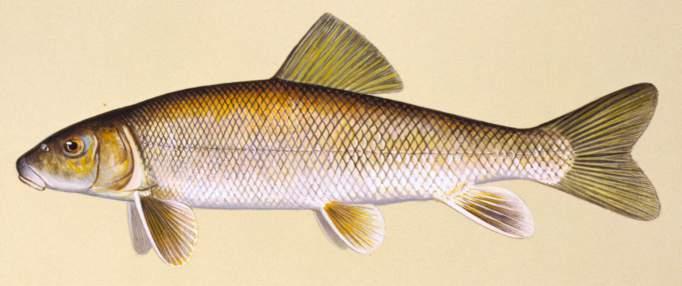
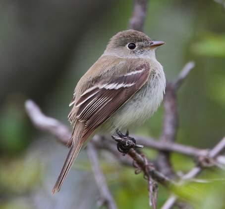
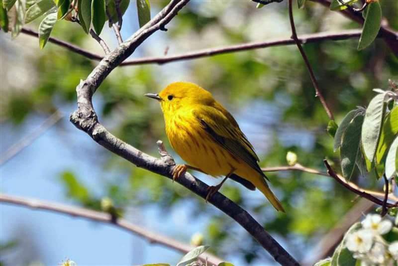


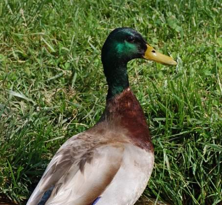

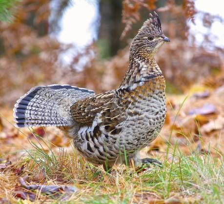
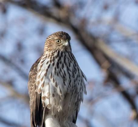
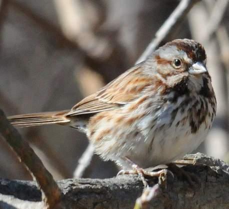
17 HINTERLAND WHO S WHO Species that can be expected within a daylighted Bird Species (left to right,top to bottom) Belted Kingfisher, Black-capped Chickadee, Downy Woodpecker, Great Blue Heron, Least Flycatcher, Yellow Warbler, Mallard, Northern Saw-whet Owl, Ruffled Grouse, Sharp-skinned Hawk, Song Sparrow Mammal Species (left to right) Mule Deer, Porcupine, Coyote, Least Chipmunk, Red Squirrel, Snowshoe Hare Fish Species (left to right, top to bottom) Long Nose Sucker, Brook Stickleback, Northern Pike, Spottail Shiner, Trout-perch, Flathead Minnow, Walleye, White Sucker


18 WHAT WOULD YOU LIKE TO SEE? Maps are available on adjacent tables. Please provide your comments on the following topics: Memorable Experiences / Favourite Places Key Issues and Concerns Idea Map
19 NEXT STEPS The three daylighting concepts will be refined based on input from tonight s open house. The final report will be presented to City Council in early Council will then provide guidance regarding next steps. If the daylighting initiative proceeds, the City of Edmonton will work with other levels of government to identify funding opportunities for the design and construction stages of the project.
Logan River at Rendezvous Park, Channel and Floodplain Restoration: Crack Willow (Salix fragilis) Issues and Management Strategies
 Issues and Management Strategies") Logan River at Rendezvous Park, Channel and Floodplain Restoration: Crack Willow (Salix fragilis) Issues and Management Strategies Prepared May 2, 2017 by Darren Olsen, BIO-WEST, Inc. Issues Crack willow
Logan River at Rendezvous Park, Channel and Floodplain Restoration: Crack Willow (Salix fragilis) Issues and Management Strategies Prepared May 2, 2017 by Darren Olsen, BIO-WEST, Inc. Issues Crack willow
Welcome to the Boulevard Lake Dam Class Environmental Assessment. Public Information Session #1. June 14, 2016
 Welcome to the Boulevard Lake Dam Class Environmental Assessment Public Information Session #1 June 14, 2016 Boulevard Dam - Overview Built approximately 100 years ago Owned and operated by the City of
Wildlife Habitat Management on State Land
 Aspen, Paper Birch Wildlife Habitat Management on State Land Aspen and paper birch are typically managed by using even-aged management (clear cutting) with retention of scattered older trees or patches
Urban Riparian & Stream Restoration Program: Management & Photo Monitoring. Texas Water Resource Institute
 Urban Riparian & Stream Restoration Program: Management & Photo Monitoring Texas Water Resource Institute Hindrances to Healthy / Functional Riparian Areas: Farming too close to the bank Mowing, spraying
Leaside to Main Infrastructure Refurbishment Project Strengthening the transmission system in your neighbourhood
 Leaside to Main Infrastructure Refurbishment Project Strengthening the transmission system in your neighbourhood Purpose of this Public Information Centre Provide you with an update on Hydro One s infrastructure
OBSERVED CLIMATE IMPACTS ON ECOLOGY AND WILDLIFE
 FROM THE GROUND UP OBSERVED CLIMATE IMPACTS ON ECOLOGY AND WILDLIFE (AND THINGS WE CAN DO ABOUT IT) Rick Van de Poll, Ph.D. Ecosystem Management Consultants Sandwich, NH THE PREMISE - Climate change shall
TABLE OF CONTENTS 5.0 FOREST MANAGEMENT PLANNING...
 TABLE OF CONTENTS 5.0 FOREST MANAGEMENT PLANNING... 1 5.1 Planning Framework... 1 5.1.1 Sustainable Forest Management Planning... 1 5.1.2 Five-Year Operating Plan... 1 5.1.3 Annual Operating Plans... 3
Table D1: WC-R1 to WC-R3 (Wilket Creek Park)
") APPENDIX D Table D1: WC-R1 to WC-R3 (Wilket Creek Park) Category of Consideration Criteria Alternative 1 Do Nothing Alternative 2 Local Improvements Alternative 3 Channel Realignment Natural Geomorphic
APPENDIX D Table D1: WC-R1 to WC-R3 (Wilket Creek Park) Category of Consideration Criteria Alternative 1 Do Nothing Alternative 2 Local Improvements Alternative 3 Channel Realignment Natural Geomorphic
Strength. Performance. Passion. Paris Pit CAP. September 25, 2012
 Strength. Performance. Passion. Paris Pit CAP September 25, 2012 2012 Holcim 2012 (Canada) Holcim (Canada) Inc. Inc. Agenda Introductions Minutes from Last Meeting Dufferin Paris Pit - General Update Holcim
CITY OF NEW WESTMINSTER. Bylaw No. 7033, 2005 RIPARIAN AREAS PROTECTION BYLAW
 CITY OF NEW WESTMINSTER Bylaw No. 7033, 2005 RIPARIAN AREAS PROTECTION BYLAW WHEREAS the City may preserve, protect, restore and enhance the natural environment near streams that support fish habitat from
Public Information Centre September 19 th, 2017
 Public Information Centre September 19 th, 2017 WELCOME! Public Information Centre for the Maple Hill Creek Rehabilitation Class Environmental Assessment Please take the time to sign our sign in sheet
Northeast 9/27/2011. Agenda for Tonight: Setting the Stage: Background Information. Alberta's Population Highlights. Edmonton s Highlights
 Agenda for Tonight: Visioning Session & Design Charrette September 7, 2011 Welcome : Tim Ford and Joe Geller Background information: Process Nancy MacDonald Dinner NE: Constraints and Opportunities, Transportation
Table of Contents. List of Tables. 11. Advantages and Disadvantages
 Table of Contents 11. Advantages and Disadvantages... 11-1 page List of Tables... 11-1 11. Advantages and Disadvantages The overall advantages and disadvantages of the DMNP are articulated, summarized
Transportation Association of Canada Environmental Achievement Award Nomination Submission:
 Transportation Association of Canada Environmental Achievement Award Nomination Submission: Highway 26 New Wildlife Passage and Enhancements Ontario Ministry of Transportation, Central Region Nominees:
Burns Paiute Tribe s s Wildlife Acquisitions
 Burns Paiute Tribe s s Wildlife Acquisitions Logan Valley 2000-009 009-00 Purchased: April 2000 Malheur River 2000-027 027-0000 Purchased: November 2000 Location of Properties Malheur Malheur River Subbasin
ANCR INDIVIDUAL RESPONSES SUMMARY: 2/11/04 WATER RESOURCES GOALS AND OBJECTIVES
 ANCR INDIVIDUAL RESPONSES SUMMARY: 2/11/04 WATER RESOURCES GOALS AND OBJECTIVES Goal 1: Protect the health and safety of the Dane County population. a. Prevent development that may have an adverse effect
Conceptual Design and Feasibility of a Natural Fishway at the Fremont BART Weir, Alameda Creek, California
 Conceptual Design and Feasibility of a Natural Fishway at the Fremont BART Weir, Alameda Creek, California Final Report September 2005 Prepared by Center for Ecosystem Management and Restoration, Oakland,
Los Angeles River Master Plan Update DRAFT Vision, Goals, and Actions
 Los Angeles River Master Plan Update DRAFT Vision, Goals, and Actions 1996: Los Angeles River Master Plan Mission Statement: The Los Angeles River Master Plan provides for the optimization and enhancement
LYNCH WOODS. Site Analysis & Design Concept. February 25, 2010 LYNCH WOODS Town of Brighton
 LYNCH WOODS Site Analysis & Design Concept Community Connectivity EXISTING CONDITIONS EXISTING CONDITIONS PHOTOS Scrub/shrub wetland Open field Upland ridge trail Successional woodlot EXISTING CONDITIONS
Magino Project Environmental Impact Statement. Technical Support Document Draft Fish Habitat Compensation Plan
 Magino Project Environmental Impact Statement Technical Support Document 20-14 Rev. No. Revision Date Approved 0 Document issued for EIS Table of Contents SECTION 1.0 INTRODUCTION... 1 SECTION 2.0 BACKGROUND...
MANZANITA LAKE PLANNING UNIT Willow Creek Watershed
 Existing Conditions & Uses Overview Area surrounding a small afterbay and creeks with ethnobotanical resources and valuable habitat 472 acres in Madera County; 337 acres outside the FERC boundary and 135
COUNTY COMPREHENSIVE PLAN
 86 : Policy Statement Lewis County has an abundance of natural resources, including water, wind, soils, and wildlife. Together with our citizens, they form a unique ecosystem that must be preserved and
Town of Aurora Stream Management Master Plan PUBLIC INFORMATION CENTRE May 1 st, 2018
 Town of Aurora Stream Management Master Plan PUBLIC INFORMATION CENTRE May 1 st, 2018 Your comments are encouraged and appreciated, as this will provide us an opportunity to address project issues and
Carp Creek 2013 Summary Report
 Monitoring Activity in the Carp River Watershed In 2012, Mississippi Valley Conservation Authority (MVCA) worked with Friends of the Carp River (FCR) on a preliminary assessment of the Carp River. This
Prioritizing Climate Change Impacts and Action Strategies
 Prioritizing Climate Change Impacts and Action Strategies Chesapeake Bay Program STAC December 8, 2015 2014 Chesapeake Bay Agreement CLIMATE RESILIENCY GOAL: Increase the resiliency of the Chesapeake Bay
Valley Line LRT. Project Update & Citizen Working Groups Overview Public At Large Recruitment Meeting Citizen Working Group B River Valley
 Valley Line LRT Project Update & Citizen Working Groups Overview Public At Large Recruitment Meeting Citizen Working Group B River Valley Agenda Welcome & meeting purpose Project overview & status update
San Bernardino County Flood Control District. Ecological Resource Specialist
 San Bernardino County Flood Control District Ecological Resource Specialist Cactus Basins Improvement Project Within the City of Rialto South of the 210 Freeway, north of Baseline Road, west of Cactus
RIVER ACCESS STRATEGY GUIDING PRINCIPLES & STRATEGIES
 RIVER ACCESS STRATEGY GUIDING PRINCIPLES & STRATEGIES SEPTEMBER 2015 RIVER ACCESS STRATEGY GUILDING PRINCIPLES & STRATEGIES TABLE OF CONTENTS Executive Summary... 3 The Need for a Strategy... 4 What the
Welcome. Public Information Event. Dufferin Sanitary Trunk Sewer (STS) System Improvements Municipal Class Environmental Assessment Study
 System Improvements Municipal Class Environmental Assessment Study") Welcome Public Information Event Dufferin Sanitary Trunk Sewer (STS) System Improvements Municipal Class Environmental Assessment Study Please sign in to be added to the study mailing list and receive
Welcome Public Information Event Dufferin Sanitary Trunk Sewer (STS) System Improvements Municipal Class Environmental Assessment Study Please sign in to be added to the study mailing list and receive
Project Goals and Scoping
 Prepared for: Boulder County, Colorado Flood Planning & Preliminary Design Services for South St. Vrain Creek Restoration at Hall Ranch and Scoping May 24, 2016 Meeting with General Public In association
Jan Moryk, Project Manager, Environmental Monitoring and Data Management Section, TRCA
 Distribution of Brook Trout in the TRCA Jurisdiction and what Legislation, Policies, and Guidelines do Conservation Authorities have at their disposal to Protect Brook Trout Habitat Jan Moryk, Project
COTTON CREEK CULVERT REPLACMENT
 COTTON CREEK CULVERT REPLACMENT Integrating Mobility with Environmental Innovation Located along a scenic section of Highway 3/95 in British Columbia, Moyie Bluffs, a 6.5 km stretch of inland highway had
PRINCE GEORGE NATURAL AREAS AND THE EFFECTS OF CLIMATE CHANGE: CASE STUDY
 PRINCE GEORGE NATURAL AREAS AND THE EFFECTS OF CLIMATE CHANGE: CASE STUDY Natural Areas in Prince George The City of Prince George is dominated by natural, undeveloped areas within city limits and in adjacent
RIPARIAN AREAS REGULATION
 Definitions and interpretation RIPARIAN AREAS REGULATION 1 (1) In this regulation: Act means the Fish Protection Act; active floodplain means an area of land that supports floodplain plant species and
South St. Vrain / Hall Meadows Restoration Planning August 20, 2015
 South St. Vrain / Hall Meadows Restoration Planning August 20, 2015 Agenda Introductions Purpose & Goals of Meeting Planning Area Master Plan Restoration Planning: Cost Estimates, Grants, Scope, Timeline
Theme General projections Trend Category Data confidence Climatology Air temperature
 PHYSICAL EFFECTS ENVIRONMENTAL CHEMISTRY & POLLUTANTS Theme General projections Trend Category Data confidence Climatology Air temperature Precipitation Drought Wind Ice storms Water temperature Water
Lynnwood Link Extension 2013 Draft EIS Comments and Responses. Page 275
 C-034-001 Thank you for your comments describing the cultural importance of the Latvian Evangelical Lutheran Church. See Section 2.5.1 for a description of the refined Segment A alternatives that avoid
SDC 2.0 Working Group: Goals, Actions and Targets Nature + Water
 1 SDC 2.0 Working Group: Goals, Actions and Targets Nature + Water *KEY: Yellow highlights are proposed new text. NATURE 1 Goal 1: Protect, restore, and expand aquatic ecosystems. Target 1: CURRENT: By
Jan Moryk, Project Manager, Environmental Monitoring and Data Management Section, TRCA
 Distribution of Brook Trout in the TRCA Jurisdiction and what Legislation, Policies, and Guidelines do Conservation Authorities have at their disposal to Protect Brook Trout Habitat Jan Moryk, Project
DIRECTIONS FOR STRATEGY DEVELOPMENT
 DIRECTIONS FOR STRATEGY DEVELOPMENT CHAPTER 9 This chapter is designed to identify issues which may be considered during the development of a watershed strategy. In the previous Don, Humber, and Rouge
Response of Wildlife to Riparian Habitat. David A. Manuwal College of Forest Resources UW
 Response of Wildlife to Riparian Habitat David A. Manuwal College of Forest Resources UW What Does Riparian Mean? Habitat adjacent to or along streams, rivers, (lakes, ponds, reservoirs and tidewater)
Sustainable Natural Environment Fish Habitat
 Town of Huntsville Official Plan Review - POLICY BACKGROUND PAPER Sustainable Natural Environment Fish Habitat BACKGROUND: Lakes, rivers, streams, ponds and many wetlands provide fish habitat. Intermittent
Temporary Watercourse Crossing: Culverts
 Temporary Watercourse Crossing: Culverts DRAINAGE CONTROL TECHNIQUE Low Gradient Velocity Control Short Term Steep Gradient Channel Lining Medium-Long Term Outlet Control Soil Treatment Permanent Symbol
CHAPTER 3 Environmental Guidelines for WATERCOURSE CROSSINGS GOVERNMENT OF NEWFOUNDLAND AND LABRADOR DEPARTMENT OF ENVIRONMENT AND LABOUR
 GOVERNMENT OF NEWFOUNDLAND AND LABRADOR DEPARTMENT OF ENVIRONMENT AND LABOUR CHAPTER 3 Environmental Guidelines for WATERCOURSE CROSSINGS WATER RESOURCES MANAGEMENT DIVISION Water Investigations Section
RIPARIAN CORRIDOR STUDY FINAL CITY CREEK MANAGEMENT PLAN TABLE OF CONTENTS
 TABLE OF CONTENTS 1.0 INTRODUCTION... 1-1 Riparian Corridor Study and Management Plan Goals... 1-1 Study Area... 1-2 Importance and Functions of Riparian Corridors... 1-2 Habitat for Mammals, Birds, and
7.0 CHAPTER. Wildlife Habitat
 BENEFICIAL MANAGEMENT PRACTICES 123 CHAPTER 7.0 Wildlife Habitat Natural ecosystems are a vital component in sustaining ecological functions. This chapter describes beneficial management practices for
OurFuture. Protecting. March Ontario Provincial Plans and Conservation Authorities
 Protecting OurFuture Ontario Provincial Plans and Conservation Authorities March 2015 Greenbelt Plan I Niagara Escarpment Plan I Growth Plan for the Greater Golden Horseshoe I Oak Ridges Moraine Conservation
S.R. 4007, Section 14B PADEP Environmental Assessment Form. Enclosure C Description of Aquatic Habitat
 S.R. 4007, Section 14B PADEP Environmental Assessment Form Description of Aquatic Habitat Cresheim Creek is the only water resource that exists within the project area. No jurisdictional wetlands were
Section 7 Environmental Constraints
 Section 7 Environmental Constraints i Yakima Valley Metropolitan and Regional Transportation Plan Public Comment DRAFT 1/27/2016 Environmental Constraints Analysis A programmatic-level review of potential
Habitat Grant Projects Clinton River Watershed
 Habitat Grant Projects Clinton River Watershed L Y N N E S E Y M O U R E N V I R O N M E N T A L E N G I N E E R O F F I C E O F T H E M A C O M B C O U N T Y P U B L I C W O R K S C O M M I S S I O N
Stream Health. Stream Bugs Our Stream Health Communicators. Upper Nottawasaga River Stream Health. NVCA Science & Stewardship
 NVCA Science & Stewardship Stream Health Upper Nottawasaga River, 2015 Stream Bugs Our Stream Health Communicators Stream bugs (benthic macroinvertebrates) are organisms that spend much or all of their
The Nature Conservancy Cosumnes River Preserve Franklin Boulevard Galt CA 95632
 Study Partners The Nature Conservancy Cosumnes River Preserve 13501 Franklin Boulevard Galt CA 95632 East Bay Municipal Utility District 1 Winemaker Way, Unit K Lodi CA 95240 Sacramento County Water Agency
LIST OF TECHNICAL APPENDICES
 Idaho Power Company List of Technical Appendices LIST OF TECHNICAL APPENDICES Sediment and Geomorphology E.1-1 Sediment Transport, Supply, and Stability in the Hells Canyon Reach of the Snake River This
2015 Monitoring Report Year 2 Harmon Property Stream Restoration Aurora, Ohio. Corps Permit Number Prepared by:
 2015 Monitoring Report Year 2 Harmon Property Stream Restoration Aurora, Ohio Prepared by: EnviroScience Excellence n Any Environment EnviroScience, nc. 5070 Stow Rd Stow OH 44224 (330) 688-0111 Year Ending:
Chapter 9 Wetlands Park Study Team
 Chapter 9 Wetlands Park Study Team Objective How can we help Clark County facilitate implementation of the Clark County Wetlands Park Master Plan, and provide for the management of various ecosystems within
7.0 WATER-BASED CONTROL MEASURES
 7.0 WATER-BASED CONTROL MEASURES 7.1 IDENTIFICATION AND DESCRIPTION OF CONTROL MEASURES Table 7-1 lists the water-based options being considered for implementation in the initial screening stage. Descriptions
3.6 Riparian Ecosystem Wildlife
 3.6 Riparian Ecosystem Wildlife 3.6.1 Introduction and Methodology Riparian areas and associated wetlands are widely recognized for the significant and diverse roles they play in the landscape. They clean
SHORELINE INVENTORY AND RESTORATION PLANNING
 CHAPTER 3 SHORELINE INVENTORY AND RESTORATION PLANNING A. PURPOSE OF THE SHORELINE INVENTORY AND CHARACTERIZATION A first step in the comprehensive Master Program update process is development of a shoreline
3.6 Construction Methods
 Exhibit 144: Birchmount Stop Layout West Don River Bridge - Girders are adequate to accommodate LRT right-of-way and required deck widening. Supplementary support or deck strengthening may be required
Attachment C Applicant s Proposed Mitigation Statement Alaska DOT&PF Northern Region Pilot Station Airport Relocation Project POA
 Attachment C Applicant s Proposed Mitigation Statement Alaska DOT&PF Northern Region Pilot Station Airport Relocation Project POA-2004-1223 Introduction This mitigation statement was prepared as an attachment
The Norwich Street Bridge
 The Norwich Street Bridge Class Environmental Assessment Open House May 17, 2017 6:30-8 p.m. Guelph City Hall Phase 1 Phase 2 Project File Our Study Process: This study is being undertaken as a Schedule
Gravel Pit Objections
 April 14 th, 2015 Clint MacDonald, BASc (Civil Engineering and Mgmt Science) Gravel Pit Objections Objections based on Hydrology, Hydraulics, Air Flow, and Traffic Patterns Overview Hydrology Water Table
Moonlight Aquatic Organism Passage Project
 Notice of Proposed Action Moonlight Aquatic Organism Passage Project Mt. Hough Ranger District Plumas National Forest Plumas County, California Figure 1. Hungry 1 aquatic organism passage outlet showing
Aquatic Mitigation Riverside Oxbow and Sycamore Creek Restoration
 Aquatic Mitigation Riverside Oxbow and Sycamore Creek Restoration Brian Murphy, P.E., D.WRE July 30, 2014 Overview Central City Project Marine Creek Sycamore Creek Design (Criteria & Approach) Summary
Chines Integrated Stormwater (Watershed) Managerrient Plan
 Managerrient Plan") Coouitlam Fof Counci June 13, 2016 Our File: 11-5225-01/000/2016-1 Doc#: 2296372.V1 To: From: Subject: For: City Manager General Manager, Engineering and Public Works Chines Integrated Stormwater (Watershed)
Coouitlam Fof Counci June 13, 2016 Our File: 11-5225-01/000/2016-1 Doc#: 2296372.V1 To: From: Subject: For: City Manager General Manager, Engineering and Public Works Chines Integrated Stormwater (Watershed)
TABLE OF CONTENTS. TOC-i
 TOC-i TABLE OF CONTENTS 1.0 INTRODUCTION... 1-1 Riparian Corridor Study and Management Plan Goals... 1-1 Study Area... 1-2 Importance and Functions of Riparian Corridors... 1-2 Habitat for Mammals, Birds,
CROSBY BROOK RESTORATION STUDY BRATTLEBORO, VT
 Key Stakeholders: CROSBY BROOK RESTORATION STUDY BRATTLEBORO, VT Funded By: VT Dept. of Environmental Conservation VT Agency of Transportation (VTrans) Town of Brattleboro NEWEA Spring Meeting Omni Mt.
Appendix M. Criteria, Measures and Indicators for Effects Assessment
 Appendix M Criteria, Measures and Indicators for Effects Assessment Appendix M. Criteria, Measures and Indicators for Effects Assessment Objective 1: Naturalization Changes to Aquatic Habitat Disruption,
The primary advantages of the Yandukin Drive Area Crossing concepts are: The primary disadvantages of the Yandukin Drive Area Crossing concepts are:
 9.6.4 Yandukin Drive is the easterly access to the Juneau International Airport and to the Fred Meyer shopping area. A newly proposed interchange at this location presents a logical terminus for the JSCC
DECISION MEMO FOR CATEGORICAL EXCLUSION HOLY JIM CREEK CROSSING REPLACEMENT
 DECISION MEMO FOR CATEGORICAL EXCLUSION HOLY JIM CREEK CROSSING REPLACEMENT U.S.D.A. Forest Service Cleveland National Forest Trabuco Ranger District Orange County, California Background The current configuration
U n i v e r s i t i e s & M e d i c a l D i s t r i c t. Off-campus Neighborhood Development
 U n i v e r s i t i e s & M e d i c a l D i s t r i c t Off-campus Neighborhood Development 7 Housing 8 Parking Lot The off-campus neighborhood includes an established residential community and commercial
Temporary Stream Crossing
 Categories EC Erosion Control SE Sediment Control TC Tracking Control WE Wind Erosion Control Non-Stormwater NS Management Control Waste Management and WM Materials Pollution Control Legend: Primary Objective
Temporary Stream Crossing
 Temporary Stream Crossing NS-4 Objectives EC Erosion Control SE Sediment Control TR Tracking Control WE Wind Erosion Control Non-Stormwater NS Management Control Waste Management and WM Materials Pollution
Frequently Asked Questions Connecting Palo Alto
 Frequently Asked Questions Connecting Palo Alto www.cityofpaloalto.org/connectingpaloalto General Project Questions Q1: What is Connecting Palo Alto? A1: Connecting Palo Alto (formerly the Palo Alto Rail
STAFF REPORT WASHINGTON STATE PARKS AND RECREATION COMMISSION COVERED SHELTERS AND BIKE RACKS
 STAFF REPORT WASHINGTON STATE PARKS AND RECREATION COMMISSION COVERED SHELTERS AND BIKE RACKS TO: Douglas County Hearing Examiner FROM: Douglas County Land Services Staff RE: SP-2019-02 DATE: April 8,
Wetland Resources Cultural, Historical and Environmental Significance
 Wetland Resources Cultural, Historical and Environmental Significance Maryann McGraw Wetlands Program Coordinator New Mexico Environment Department Wetlands Program What is a wetland? (What is a mountain?
Join the Conversation!
 Stage 2 ION: Light Rail Transit (LRT) from Kitchener to Cambridge Transit Project Assessment(TPA) Process Public Consultation Centre (PCC) No.1 November 18, 2015 November 19, 2015 Join the Conversation!
CATEGORY a protection of the natural environment, its ecosystems and biodiversity.
 29. ENVIRONMENTAL DEVELOPMENT PERMIT AREA CATEGORY a protection of the natural environment, its ecosystems and biodiversity. The requirement to obtain an environmental development permit is cited in Section
Great Lakes Coastal Wetland Monitoring: Support of Restoration Across the Basin
 : Support of Restoration Across the Basin Matthew J. Cooper University of Notre Dame, Notre Dame, IN Presentation Outline Quality control and assurance Importance of basin wide monitoring Examples of our
8. A. AQUATIC HABITATS
 ENCLOSURE C S.R. 1006 SECTION 80S DELAWARE CANAL BRIDGE REHABILITATION PROJECT, TINICUM TOWNSHIP, BUCKS COUNTY, PENNSYLVANIA DESCRIPTION OF AQUATIC HABITAT 8. A. AQUATIC HABITATS (1) Food Chain Production-
Kittitas County Voluntary Stewardship Plan
 Kittitas County Voluntary Stewardship Plan Presented by John Small and Nora Schlenker, Anchor QEA 1 Agenda Welcome and Follow-up from Last Meeting Follow-up on Comments Received Stewardship Practices Description
RIPARIAN CORRIDOR STUDY FINAL PARLEYS CREEK MANAGEMENT PLAN TABLE OF CONTENTS
 TABLE OF CONTENTS 1.0 INTRODUCTION... 1-1 Riparian Corridor Study and Management Plan Goals... 1-1 Study Area... 1-2 Importance and Functions of Riparian Corridors... 1-2 Habitat for Mammals, Birds, and
In July 2000, City Council adopted an. Environmental Protection Program for. the City of North Vancouver.
 In July 2000, City Council adopted an Environmental Protection Program for the City of North Vancouver. Chapter 8 Environment 8.1 RELATIONSHIP TO OUR VISION The Environment is core to our vision of a sustainable
4. What is Item A called? a. Eckman dredge b. Secchi disk c. Van Dorn sampler d. Ponar sampler
 Envirothon Questions for AQUATICS station April 24, 2013 1. Eutrophication often results in large fish kills. What is the major cause of these fish kills? a. Oxygen has been depleted due to the decay of
ROSS VALLEY FLOOD PROTECTION & WATERSHED PROGRAM U.S. ARMY CORPS OF ENGINEERS CORTE MADERA CREEK PROJECT. Community Meeting.
 ROSS VALLEY FLOOD PROTECTION & WATERSHED PROGRAM U.S. ARMY CORPS OF ENGINEERS CORTE MADERA CREEK PROJECT ROSS SCHOOL 9 LAGUNITAS ROAD, ROSS Community Meeting Photo: Flooding along College Ave. in Kentfield
Community Services and Utilities & Environmental Protection Report to UE The SPC on Utilities and Environment Page 1 of April 25
 Community Services and Utilities & Environmental Protection Report to UE2007-15 The SPC on Utilities and Environment Page 1 of 2 2007 April 25 ENVIRONMENTAL RESERVE SETBACKS SUMMARY/ISSUE This report recommends
S.R. 2027, Section 02B PADEP Environmental Assessment Form. Enclosure C Description of Aquatic Habitat
 S.R. 2027, Section 02B PADEP Environmental Assessment Form Description of Aquatic Habitat Water resources that exist within the project area include Hosensack Creek and two palustrine emergent (PEM) wetlands.
Lesson 2-2: Riparian Zones
 2-14 Lesson 2-2: Riparian Zones Time of Lesson: 1 hour Rationale: The purpose of this lesson is to define what a riparian zone is and link its importance for fish and other animals, and humans, and the
Understanding and Restoring Natural Floodplain Function. Gary James CTUIR Fisheries Program Manager
 Understanding and Restoring Natural Floodplain Function Gary James Fisheries Program Manager Future of Our Salmon Technical Workshop on Healthy Floodplains Spokane, WA - August 16-18, 2016 Presentation
Chapter 10 Natural Environment
 Chapter 10 Natural Environment Existing Conditions The Natural Environment Element addresses the protection, conservation, preservation, and restoration of the natural resources the Bayview Ridge Subarea,
16.1 Significant and Unavoidable Impacts
 Chapter 16 NEPA requires an EIS and CEQA requires an EIR to evaluate a number of other types of environmental impacts in addition to those already addressed in the resource chapters. The analysis required
Wetland and Watershed Management Planning FAQ
 Wetland and Watershed Management Planning FAQ Jon Kusler, Ph.D., Esq., Jennifer Brady-Connor, Nan Stolzenburg Association of State Wetland Managers 2001 This summary was prepared for the Institute for
BMP 5.4.2: Protect /Conserve/Enhance Riparian Areas
 BMP 5.4.2: Protect /Conserve/Enhance Riparian Areas The Executive Council of the Chesapeake Bay Program defines a Riparian Forest Buffer as "an area of trees, usually accompanied by shrubs and other vegetation,
DEPARTMENT OF THE ARMY U.S. ARMY CORPS OF ENGINEERS, SACRAMENTO DISTRICT 1325 J STREET SACRAMENTO CA PUBLIC NOTICE
 DEPARTMENT OF THE ARMY U.S. ARMY CORPS OF ENGINEERS, SACRAMENTO DISTRICT 1325 J STREET SACRAMENTO CA 95814-2922 Operations and Readiness Branch PUBLIC NOTICE REQUEST FOR PERMISSION TO MODIFY A U.S. ARMY
APPENDIX 8. NORTHERN GROUND ELECTRODE LINE WATERCOURSE CROSSING ASSESSMENT BOOKLETS
 APPENDIX 8. NORTHERN GROUND ELECTRODE LINE WATERCOURSE CROSSING ASSESSMENT BOOKLETS Aquatic Environment November 2011 Bipole III Transmission Project Construction Camp CC1 Location Datum: NAD 83 UTM: Zone:
CLAREMONT CONSERVATION COMMISSION CONSERVATION PLAN Adopted 7/21/2016
 CLAREMONT CONSERVATION COMMISSION CONSERVATION PLAN Adopted 7/21/2016 THE CLAREMONT CONSERVATION COMMISSION The Claremont Conservation Commission provides the following services to the City: Advises residents
COTTONWOOD CREEK RECLAMATION PHASE I & II
 COTTONWOOD CREEK RECLAMATION PHASE I & II COTTONWOOD CREEK RECLAMATION Stream Stabilization Approach to Urban Runoff Quality Cherry Creek Basin Water Quality Authority The Problem The Cherry Creek Reservoir
Appendix E : Guidelines for Riparian Buffer Areas
 Appendix E : Guidelines for Riparian Buffer Areas This document should be read in conjunction with the CRCA Planning Policy. 1.0 PURPOSE The purpose of this document is to summarize the recommendations
Silicon Valley Rapid Transit Corridor Final Supplemental EIR
 3-5 3-6 3-7 3-8 3-9 RESPONSE TO COMMENT LETTER S-1 California Regional Water Quality Control Board S-1.1 The clear span bridge for the existing UPRR freight and future BART tracks was a design developed
3. SHIRLEY S BROOK / WATTS CREEK SUBWATERSHED STUDY COMMITTEE RECOMMENDATION
 3. SHIRLEY S BROOK / WATTS CREEK SUBWATERSHED STUDY COMMITTEE RECOMMENDATION That Council endorse the Shirley s Brook/Watts Creek Subwatershed Study (September 1999) as the technical document to guide