Link Light Rail Operations and Maintenance Satellite Facility
|
|
|
- Barbara McCormick
- 6 years ago
- Views:
Transcription

1 Link Light Rail Operations and Maintenance Satellite Facility Final Environmental Impact Statement Central Puget Sound Regional Transit Authority
2 September 25, 2015 Dear Recipient: The U.S. Department of Transportation Federal Transit Administration (FTA) and Sound Transit (the Central Puget Sound Regional Transit Authority) have prepared this Final Environmental Impact Statement (Final EIS) on the proposed Link Light Rail Operations and Maintenance Satellite Facility. Sound Transit is the project proponent. The Final EIS has been prepared pursuant to the National Environmental Policy Act (42 U.S.C to 4370e) and the State Environmental Policy Act (Ch C RCW). It has been prepared to inform the public, agencies and decision makers about the environmental consequences of building and operating the Link Light Rail Operations and Maintenance Satellite Facility. The Final EIS examines the project alternatives in the cities of Bellevue and Lynnwood, including the preferred alternative identified by the Sound Transit Board. The major choices for the project involve the location of a light rail operations and maintenance satellite facility. The Sound Transit Board will consider the alternatives evaluated in the Final EIS, public and agency comments on the Draft EIS, and other information before selecting the project to build. After the Sound Transit Board selects the project to build, FTA will issue a Record of Decision, which will state FTA s decision on the project and list mitigation commitments to reduce or avoid impacts. The Final EIS includes appendices, technical reports, background materials, and responses to comments on the Draft EIS on the enclosed CD. Please see the Fact Sheet of this Final EIS regarding document availability and who to contact for further information about the Final EIS. Sincerely, Kent Hale Environmental Affairs and Sustainability CHAIR Dow Constantine King County Executive VICE CHAIRS Paul Roberts Everett Councilmember Marilyn Strickland Tacoma Mayor BOARD MEMBERS Claudia Balducci Bellevue Mayor Fred Butler Issaquah Mayor Dave Earling Edmonds Mayor Dave Enslow Sumner Mayor John Lovick Snohomish County Executive John Marchione Redmond Mayor Pat McCarthy Pierce County Executive Joe McDermott King County Council Vice Chair Mary Moss Lakewood Councilmember Ed Murray Seattle Mayor Mike O Brien Seattle Councilmember Lynn Peterson Washington State Secretary of Transportation Larry Phillips King County Council Chair Dave Upthegrove King County Councilmember Peter von Reichbauer King County Councilmember CHIEF EXECUTIVE OFFICER Joni Earl Central Puget Sound Regional Transit Authority Union Station 401 S. Jackson St., Seattle, WA Reception: (206) FAX: (206)


3
4 Fact Sheet Project Title (OMSF) Proposed Action The (OMSF) project (proposed project) proposes to construct and operate an OMSF to meet the needs of the expanded fleet of light rail vehicles (LRVs) identified in Sound Transit 2: A Mass Transit Guide, The Regional Transit System Plan for Central Puget Sound (ST2). The OMSF would be used to store, maintain, and dispatch LRVs for daily service by providing vehicle storage, preventative maintenance inspections, light maintenance, emergency maintenance, interior vehicle cleaning, and exterior vehicle washing. The facility would also be used to accommodate administrative and operational functions, such as serving as a report base for LRV operators. Additional facility elements would include employee parking, operations staff offices, maintenance staff offices, dispatcher work stations, an employee report room, and areas with lockers, showers, and restrooms for both operators and maintenance personnel. Four build alternative sites for the proposed project are evaluated: three in Bellevue and one in Lynnwood, Washington. Project Proponent and State Environmental Policy Act Lead Agency Sound Transit Union Station 401 South Jackson Street Seattle, Washington Dates of Construction and Opening Sound Transit would begin construction of the proposed project by 2018, and expects it to be ready for operations in National Environmental Policy Act Lead Agency Federal Transit Administration 915 Second Avenue, Suite 3142 Seattle, Washington Final Environmental Impact Statement FS 1
5 Fact Sheet Responsible National Environmental Policy Act Official Richard F. Krochalis, Administrator for Region 10 Federal Transit Administration 915 Second Avenue, Suite 3142 Seattle, Washington State Environmental Policy Act Responsible Official Perry Weinberg, Director, Office of Environmental Affairs and Sustainability Sound Transit Union Station 401 South Jackson Street Seattle, Washington Contacts Sound Transit Kent Hale, Senior Environmental Planner Union Station 401 South Jackson Street Seattle, Washington (206) Luke Lamon, Community Outreach Specialist Union Station 401 South Jackson Street Seattle, Washington (206) Federal Transit Administration J. Steve Saxton, Transportation Program Specialist, FTA Region Second Avenue, Suite 3142 Seattle, Washington (206) Final Environmental Impact Statement FS 2
6 Fact Sheet Potential Permits and Approvals The list below pertains to permits that may be required based on the range of alternatives in this Final Environmental Impact Statement (Final EIS). Permit or Approval Federal Section 106 Review Section 4(f) Review Clean Water Act, Section 404 Federal Endangered Species Act Review State Hydraulic Project Approval Public Utility Commission Permits Section 106 Review National Pollution Discharge Elimination System Stormwater Discharge Permit Temporary Modification of Water Quality Criteria Underground Storage Tank Notification Requirement Water Quality Certification: Section 401 Temporary Construction Easement (SR 520) Cities Street Use Permits Construction Permits Right of Way Permits or Franchise for Use of City Right of Way Environmental Critical Areas/Sensitive Areas Review Development Permits, including conditional use permit (CUP) or land use code amendment Noise Variance Street Vacations Certificates of Approval Various Approvals: Planning, Design Review, and Arts Commissions Other Notification of Intent to Perform Demolition or Asbestos Removal Pipeline and Utility Crossing Permits Utility Approvals: Easements and Use Agreements Issuing Agency Federal Transit Administration Federal Transit Administration U.S. Army Corps of Engineers U.S. Fish and Wildlife Service and National Oceanic and Atmospheric Administration Fisheries Service Washington Department of Fish and Wildlife Washington Public Utility Commission Washington State Department of Archaeology and Historic Preservation Washington State Department of Ecology Washington State Department of Ecology Washington State Department of Ecology Washington State Department of Ecology Washington State Department of Transportation Cities of Bellevue and Lynnwood Cities of Bellevue and Lynnwood Cities of Bellevue and Lynnwood Cities of Bellevue and Lynnwood Cities of Bellevue and Lynnwood Cities of Bellevue and Lynnwood Cities of Bellevue and Lynnwood Cities of Bellevue and Lynnwood Cities of Bellevue and Lynnwood Puget Sound Clean Air Agency Utility Providers Utility Providers Final Environmental Impact Statement FS 3
7 Fact Sheet Principal Contributors This Final EIS was prepared by consultants at the following firms: ICF International, Huitt Zollars, Heffron Transportation, Inc., Hart Crowser, and Michael Minor and Associates. See Appendix A, Document Support Information, Section A.2, for a detailed list of preparers and the nature of their contributions. Date of Issue of the Final Environmental Impact Statement under SEPA September 25, 2015 Date of Issue of the Final Environmental Impact Statement under NEPA October 2, 2015 Next Actions Following publication of the Final EIS, the Sound Transit Board of Directors will make a final decision on the OMSF alternative to be built. After publication of the Final EIS, FTA is expected to issue a Record of Decision (ROD) on the proposed project. Related Documents Environmental Documents Final Supplemental Environmental Impact Statement on the Regional Transit Long Range Plan (Sound Transit 2005) East Link Project Final Environmental Impact Statement (Sound Transit 2011) Regional Transit Long Range Plan Update Final Supplemental Environmental Impact Statement (Sound Transit 2014) Lynnwood Link Extension Final Environmental Impact Statement (Sound Transit 2015) Other Documents Sound Transit 2: A Mass Transit Guide, The Regional Transit System Plan for Central Puget Sound (Sound Transit 2008) Final Environmental Impact Statement FS 4
8 Fact Sheet Cost and Availability of the Final Environmental Impact Statement This Final EIS is available for public review in a variety of formats and locations. The Final EIS is available on the Sound Transit website ( the document is also available on CD at no cost from Sound Transit. Paper copies of the Final EIS are available for the cost listed below. Summary Free Final EIS $25.00 Technical Background Reports $11.00 $15.00 each Copies of the Final EIS and related documents listed above are available for review or purchase at the office of Sound Transit, Union Station, 401 South Jackson Street, Seattle, Washington To request any of the documents, please contact Erin Green at (206) To review these documents, please call the Sound Transit librarian at (206) during normal business hours (weekdays from 8:00 a.m. to 5:00 p.m.) to arrange an appointment. Paper copies of the Final EIS documents are also available for review at the following public locations. Bellevue Regional Library Lynnwood Library Washington State Library Appeals Washington State Environmental Policy Act (SEPA) challenges to this Final EIS are governed by Sound Transit Resolution R7 1 and the SEPA rules and regulations (Ch C RCW and WAC ). Sound Transit Resolution R7 1 is available online at Sound Transit/Board of Directors/Board archives/resolutions archive.xml. ( Resolutions). As provided in Resolution R7 1, appeals of SEPA determinations must be made in writing by filing a letter of appeal and paying the required fee within 14 days following the date the environmental document is issued. Letters of appeal should be addressed to Joni Earl, Chief Executive Officer, Sound Transit, Union Station, 401 South Jackson Street, Seattle, Washington For this Final EIS, appeals must be received by Sound Transit on or before 5:00 p.m. on October 9, Additional details about the appeals process and requirements are set out in Resolution R7 1 and in the SEPA rules and regulations. Final Environmental Impact Statement FS 5
9 Preface Sound Transit plans, builds, and operates the regional mass transit system for the central Puget Sound region. The system includes light rail, heavy rail commuter trains, and express buses. In 2005 and again in 2015, Sound Transit updated the Sound Transit Regional Transit Long Range Plan (Long Range Plan) using public input to refine the long term vision of mass transit for the region. The Long Range Plan informed the development of ST2, which provides the foundation for expanding the regional transit system. Since voter financing approval in 2008, Sound Transit has been integrating the ST2 program elements with the ongoing light rail, commuter rail, and regional express bus service operations. In addition to added commuter rail and bus service, implementation of ST2 will add approximately 36 miles to the light rail system and increase the existing LRV fleet to approximately 180 vehicles. Currently, the Link light rail system includes the Forest Street Operations and Maintenance Facility (Forest Street OMF), located at 3407 Airport Way South in the City of Seattle. The Forest Street OMF can serve a maximum of 104 LRVs. The new OMSF is proposed to accommodate the added vehicles required by the ST2 light rail expansion. Sound Transit, together with FTA, has prepared this Final EIS for the proposed project in compliance with the National Environmental Policy Act (NEPA) and the Washington State Environmental Policy Act (SEPA). This Final EIS achieves the following: Provides environmental information to assist decision makers in selecting the project alternative to be built. Describes the alternatives and their potential environmental impacts. Identifies measures to avoid and minimize impacts and, when necessary, mitigate for adverse impacts. Considers cumulative and indirect impacts. Provides information for other review processes, including: The Endangered Species Act. Section 106 of the National Historic Preservation Act of Section 4(f) of the Department of Transportation Act of Section 6(f) of the Land and Water Conservation Fund Act of Executive Order Federal Actions to Address Environmental Justice in Minority Populations and Low Income Populations. Final Environmental Impact Statement P 1
10 Preface The scope of environmental review and range of alternatives evaluated in this Final EIS respond to the following: Public and agency comments received during the public scoping process that began in September Public and agency comments received on the 2014 Draft EIS. Feedback received from the public and agencies through community workshops, briefings, stakeholder presentations, and agency coordination meetings held since the environmental review process began. To comply with NEPA and SEPA and to enhance readability, this Final EIS focuses on the most relevant information regarding project definition, potential adverse impacts, and trade offs among the alternatives. The study area for this Final EIS varies by resource and is described within each resource section of the document, as appropriate. The Final EIS is organized as follows. The Summary is a separately bound, condensed version of the overall document. It briefly describes the purpose and need for the proposed project, the proposed project s goals and objectives, and the preferred alternative and other alternatives being considered. It presents the impacts for each alternative and potential mitigation, and briefly evaluates and compares the different alternatives. The Summary concludes by identifying areas of uncertainty and the proposed project s next steps. Chapter 1. Purpose and Need for the Project, describes the proposed project s purpose and need, provides a brief background of the proposed project, and outlines the proposed project s goals and objectives. Chapter 2. Alternatives Considered, describes the alternatives evaluated and how they were identified and developed for study in this Final EIS. A No Build Alternative is also evaluated to serve as a baseline for comparing the potential effects of the build alternatives. This chapter also provides an overview of the construction approach and a comparison of cost estimates by alternative. It concludes by explaining the proposed project s planning and decision making context, including the major steps in the environmental evaluation and project development process. Chapter 3. Affected Environment and Environmental Consequences, describes the built and natural environment in the study areas, explains the impacts from construction and operation of the proposed project alternatives, and describes potential avoidance and minimization measures. In the case that adverse impacts cannot be avoided, compensatory mitigation is identified, as appropriate. This chapter includes the following environmental topics: 3.1 Transportation 3.2 Acquisitions, Displacements, and Relocations 3.3 Land Use 3.4 Economics Final Environmental Impact Statement P 2
11 Preface 3.5 Social Impacts, Community Facilities, and Neighborhoods 3.6 Visual and Aesthetic Resources 3.7 Air Quality and Greenhouse Gases 3.8 Noise and Vibration 3.9 Ecosystems 3.10 Water Resources 3.11 Energy 3.12 Geology and Soils 3.13 Hazardous Materials 3.14 Electromagnetic Fields 3.15 Public Services 3.16 Utilities 3.17 Historic and Archaeological Resources 3.18 Parklands and Open Space Chapter 4. Alternatives Analysis, compares the project alternatives in terms of affected environment and how effectively they meet the project s goals and objectives. Chapter 5. Public and Agency Comment Summary, summarizes the comments Sound Transit and FTA received from agencies, tribes, and the public during the comment period on the Draft EIS. It also describes the ways that Sound Transit and FTA advertised the Draft EIS release and publicized the public hearings/open houses and other events. Appendices A through I, provide additional details on the project and Final EIS process. Appendix A includes document support information (references, lists of preparers and recipients, and acronyms), Appendix B provides a summary of public involvement and agency coordination and a list of regulatory information used to prepare this Final EIS. Appendices C and D provide federally required reports on environmental justice and Section 4(f) and 6(f) resources (park and recreation areas, wildlife refuges, and any properties funded by the Land and Water Conservation Fund). Appendix E contains the detailed technical reports prepared for the Transportation, Noise and Vibration, Historic and Archaeological Resources, and Ecosystems sections of Chapter 3. Appendix F contains additional technical data that support the resource analysis sections of Chapter 3. Appendix G provides conceptual plans of the proposed project. Appendix H provides a list of mitigation commitments for the Preferred Alternative. Lastly, Appendix I provides all comments made on the Draft EIS and responses to these comments. Final Environmental Impact Statement P 3
12 Table of Contents List of Appendices... ix List of Tables... xi List of Figures... xv Fact Sheet... FS 1 Preface... P 1 Summary... S 1 Chapter 1 Purpose and Need for the Project Purpose of the Project ST2 Light Rail Operating Plan Need for Project Project Goals and Objectives Chapter 2 Alternatives Considered Introduction Background and Project Development Core Light Rail System Expansion Link OMSF Corridor Analysis Identifying Potential OMSF Sites OMSF Storage Requirements ULI Advisory Services Panel and Stakeholder Concepts No Build Alternative Build Alternatives Preferred Alternative BNSF Modified Alternative SR 520 Alternative Lynnwood Alternative Overview of Construction Approach Construction Sequence and Activities Staging Areas and Construction Easements Final Environmental Impact Statement i
13 Table of Contents 2.8 Consideration of Other Relevant Sound Transit Projects Lynnwood Link Extension East Link Federal Way Link Extension Environmental Commitments and Sustainability Funding and Estimated Project Costs Next Steps and Schedule Project Schedule Benefits and Disadvantages of Delaying Project Implementation Chapter 3 Affected Environment and Environmental Consequences Indirect Impact Assessment Potential for Future Development Cumulative Impact Assessment Transportation Light Rail Transit Operations Traffic and Other Transportation Elements Methods Affected Environment Environmental Impacts Indirect and Cumulative Impacts Potential Mitigation Measures Acquisitions, Displacements, and Relocations Introduction to Resources and Regulatory Requirements Methods Affected Environment Environmental Impacts Indirect and Cumulative Impacts Potential Mitigation Measures Land Use Introduction to Resources and Regulatory Requirements Methods Affected Environment Final Environmental Impact Statement ii
14 Table of Contents 2.8 Consideration of Other Relevant Sound Transit Projects Lynnwood Link Extension East Link Federal Way Link Extension Environmental Commitments and Sustainability Funding and Estimated Project Costs Next Steps and Schedule Project Schedule Benefits and Disadvantages of Delaying Project Implementation Chapter 3 Affected Environment and Environmental Consequences Indirect Impact Assessment Potential for Future Development Cumulative Impact Assessment Transportation Light Rail Transit Operations Traffic and Other Transportation Elements Methods Affected Environment Environmental Impacts Indirect and Cumulative Impacts Potential Mitigation Measures Acquisitions, Displacements, and Relocations Introduction to Resources and Regulatory Requirements Methods Affected Environment Environmental Impacts Indirect and Cumulative Impacts Potential Mitigation Measures Land Use Introduction to Resources and Regulatory Requirements Methods Affected Environment Final Environmental Impact Statement ii
15 Table of Contents Environmental Impacts Indirect and Cumulative Impacts Potential Mitigation Measures Economics Introduction to Resources and Regulatory Requirements Methods Affected Environment Environmental Impacts Indirect and Cumulative Impacts Potential Mitigation Measures Social Impacts, Community Facilities, and Neighborhoods Introduction to Resources and Regulatory Requirements Methods Affected Environment Environmental Impacts Indirect and Cumulative Effects Potential Mitigation Measures Environmental Justice Summary Visual and Aesthetic Resources Introduction to Resources and Regulatory Requirements Methods Affected Environment Environmental Impacts Indirect and Cumulative Impacts Potential Mitigation Measures Air Quality and Greenhouse Gases Introduction to Resources and Regulatory Requirements Methods Affected Environment Environmental Impacts Indirect and Cumulative Impacts Final Environmental Impact Statement iii
16 Table of Contents Potential Mitigation Measures Noise and Vibration Introduction to Resources and Regulatory Requirements Methods Affected Environment Environmental Impacts Indirect and Cumulative Impacts Potential Mitigation Measures Ecosystems Introduction to Resources and Regulatory Requirements Methods Affected Environment Environmental Impacts Indirect and Cumulative Impacts Potential Mitigation Measures Water Resources Introduction to Resources and Regulatory Requirements Methods Affected Environment Environmental Impacts Indirect and Cumulative Impacts Potential Mitigation Measures Energy Introduction to Resources and Regulatory Requirements Methods Affected Environment Environmental Impacts Indirect and Cumulative Impacts Potential Mitigation Measures Geology and Soils Introduction to Resources and Regulatory Requirements Final Environmental Impact Statement iv
17 Table of Contents Methods Affected Environment Environmental Impacts Indirect and Cumulative Impacts Potential Mitigation Measures Hazardous Materials Introduction to Resources and Regulatory Requirements Methods Affected Environment Environmental Impacts Indirect and Cumulative Impacts Potential Mitigation Measures Electromagnetic Fields Introduction to Resources and Regulatory Requirements Methods Affected Environment Environmental Impacts Indirect and Cumulative Impacts Potential Mitigation Measures Public Services Introduction to Resources and Regulatory Requirements Methods Affected Environment Environmental Impacts Indirect and Cumulative Impacts Potential Mitigation Measures Utilities Introduction to Resources and Regulatory Requirements Methods Affected Environment Environmental Impacts Final Environmental Impact Statement v
18 Table of Contents Indirect and Cumulative Impacts Potential Mitigation Measures Historic and Archaeological Resources Introduction to Resources and Regulatory Requirements Methods Affected Environment Environmental Impacts Indirect and Cumulative Impacts Potential Mitigation Measures Parklands and Open Space Introduction to Resources and Regulatory Requirements Methods Affected Environment Environmental Impacts Indirect and Cumulative Impacts Potential Mitigation Measures Chapter 4 Alternatives Evaluation Effectiveness at Meeting the Goals and Objectives Transportation Goal: Facilitate Operation of the Expanded Regional Link Light Rail System Environmental Goal: Preserve Environmental Quality Financial Goal: Achieve Financial Feasibility Commitment of Resources Areas of Controversy and Issues to Be Resolved Chapter 5 Public and Agency Comment Summary Introduction Overview of Comments Received Preferred Alternative BNSF Modified Alternative SR 520 Alternative Lynnwood Alternative Final Environmental Impact Statement vi
19 Table of Contents 5.3 Comments Received from Public Agencies and Tribes Federal Agencies State Agencies Regional and Local Agencies and Jurisdictions Tribes Comments Received from Businesses, Organizations, and Individuals Businesses Organizations Individuals Suggestions for Other Alternatives Responses to Common Comments Final Environmental Impact Statement vii
20 List of Appendices A. Document Support Information A.1. References A.2. List of Preparers A.3. List of Recipients A.4. Acronyms A.5 Glossary of Terms A.6 Index B. Public Involvement and Agency Coordination C. Environmental Justice D. Section 4(f) and 6(f) Evaluation E. Technical Reports* E.1. Transportation* E.2. Noise and Vibration* E.3. Ecosystems* E.4. Historic and Archaeological Resources* F. Technical Background Information F.1. Additional Detail on the Two Site OMSF Option* F.2. Land Acquisition Data* F.3. Visual Simulations and Key Observation Point Analysis F.4. Air Quality Analysis Details* F.5. Urban Land Institute Advisory Services Panel Report* G. Conceptual Plans H. Mitigation Plan I. Draft EIS Comments and Responses* *Technical reports and background information are provided on CD with the Final EIS and available on the project website at and Plans/Link Operations and Maintenance Satellite Facility. Printed versions are available on request for the cost of reproduction. Final Environmental Impact Statement ix
21 Table of Contents Tables 1 1 ST2 Link Operational Characteristics Potential and Suggested Alternatives during Public Scoping of the Draft EIS Potential and Suggested Alternatives during Public Review of the Draft EIS Urban Land Institute Concepts and Observations OMSF Stakeholder Committee Concepts for the Preferred Alternative East Link Stations Estimated Capital and Operating Costs of OMSF Build Alternatives Staffing Requirements of the Build Alternatives Project Schedule Future Development Potential at the Preferred Alternative Site (square feet) Reasonably Foreseeable Future Actions in the Study Areas Link Operational Characteristics Roadway Characteristics Preferred Alternative and BNSF Modified Alternative Sites Roadway Characteristics SR 520 Alternative Site Roadway Characteristics Lynnwood Alternative Site Affected Parcels and Displacements by Generalized Land Use Classification Land Occupied by OMSF within 0.25 Mile of a Light Rail Station Land Occupied by OMSF within 0.5 Mile of a Light Rail Station Development Potential of Surplus Land Population, Household, and Employment Forecasts by Forecast Analysis Zone Percent of Total Revenues for the City of Bellevue Percent of Total Revenues for the City of Lynnwood Direct Expenditures and Direct Employment from Construction Property Acquisition Impacts on Businesses and Employees Initial Property Tax Impacts for 2014 on Cities by Build Alternative Final Environmental Impact Statement xi
22 Table of Contents Fiscal Impact Comparisons No Build Alternative vs. Preferred Alternative Demographics within 0.5 Mile of the Build Alternative Sites Landscape Units, Existing Visual Quality Rating and Existing Viewer Groups Projected Maximum Daily Construction Emissions for Build Alternatives Comparison of Projected Maximum Daily Criteria Pollutant Emissions and Annual Greenhouse Gas Emissions from Net Operations by Build Alternative City of Bellevue EDNA Land Use Designations City of Bellevue Maximum Permissible Noise Limits City of Lynnwood EDNA Land Use Designations City of Lynnwood Maximum Permissible Noise Limits FTA Vibration Impact Criteria for Frequenta Events Typical Construction Activities and Maximum Noise Levels at 100 Feet Typical Maximum Construction Noise Levels at Seattle Children s Hospital: Bellevue Clinic and Surgery Center Noise Impact Analysis Results for Preferred Alternative Noise Impact Analysis Results for Lynnwood Alternative Noise Impacts and Mitigation for the Lynnwood Alternative per City of Lynnwood Code Impacts on Aquatic Resources Impacts on Vegetation and Wildlife Impacts on Jurisdictional Ditches, Wetlands, and Wetland Buffers Potentially Affected Surface Water Bodies in the Study Area Existing and Proposed Impervious Surface Areas by Build Alternative Proposed Pollutant Generating Impervious Surfaces by Build Alternative Utility Data for PSE and SnoPUD Aggregate Annual Operational Energy Consumption (Electricity and Natural Gas Consumption and Vehicle Miles Traveled) Annual Construction Related Energy Consumption Final Environmental Impact Statement xii
23 Table of Contents Potential Geological Hazards in the Study Area Comparative Estimate of Earthwork Quantities in Cubic Yards Number of Hazardous Material Sites within One Eighth Mile of the Build Alternative Sites Common EMF Sources and Median Corresponding Field Strengths Ranges of EMF Exposure to Electric Rail Workers ICNIRP Reference Levels for EMF Exposure at 60 Hertz Utility Providers in the Study Area Utility Conflict Summary with Approximate Length of Utility Lines to be Relocated or Protected Fleet Storage and Deployment by Build Alternative Differentiating Characteristics and Impacts of the Build Alternatives Estimated Capital and Operating Costs of the Build Alternatives Estimated Comments Received by Commenter Type Responses to Common Comments on the Draft EIS Final Environmental Impact Statement xiii
24 Table of Contents Figures 1 1 Regional Setting for the Build Alternatives Link ST2 System Peak Period Operating Plan Typical Link Light Rail Vehicle (LRV) Potential OMSF Sites Locations of the Build Alternatives a Preferred Alternative b Preferred Alternative Aerial View c Proposed Interim Trail in the Eastside Rail Corridor a BNSF Modified Alternative b BNSF Modified Alternative Aerial View a SR 520 Alternative b SR 520 Alternative Aerial View a Lynnwood Alternative with Lynnwood Link Extension Alignment b Lynnwood Alternative with Lynnwood Link Extension Alignment Aerial View c Lynnwood Alternative, BNSF Storage Tracks Preferred Alternative Phase 1 Development Scenario Preferred Alternative Phase 2 Development Scenario Link ST2 System Peak Period Operating Plan Link Light Rail Vehicle (LRV) Preferred Alternative Affected Parcels BNSF Modified Alternative Affected Parcels SR 520 Alternative Affected Parcels a Lynnwood Alternative Affected Parcels b Lynnwood Alternative, BNSF Storage Tracks Affected Parcels Preferred Alternative Zoning BNSF Modified Alternative Zoning Final Environmental Impact Statement xv
25 Table of Contents SR 520 Alternative Zoning a Lynnwood Alternative Zoning b Lynnwood Alternative, BNSF Storage Tracks Zoning Preferred Alternative Community Facilities BNSF Modified Alternative Community Facilities SR 520 Alternative Community Facilities a Lynnwood Alternative Community Facilities b Lynnwood Alternative, BNSF Storage Tracks Community Facilities Preferred Alternative, BNSF Modified Alternative, and BNSF Storage Tracks Viewshed and KOPs SR 520 Alternative Viewshed and KOPs Lynnwood Alternative Viewshed and KOPs Typical Day Night Sound Levels FTA Noise Impact Criteria Typical RMS Vibration Levels Preferred Alternative Land Use and Monitoring Locations BNSF Modified Alternative Land Use and Monitoring Locations SR 520 Alternative Land Use and Monitoring Locations Lynnwood Alternative Land Use and Monitoring Locations Preferred Alternative Noise Impacts Lynnwood Alternative Noise Impacts Preferred Alternative Noise Mitigation Lynnwood Alternative Noise Mitigation Preferred Alternative Impacts BNSF Modified Alternative Impacts SR 520 Alternative Impacts a Lynnwood Alternative Impacts (Lynnwood Component) Final Environmental Impact Statement xvi
26 Table of Contents 3.9 4b Lynnwood Alternative Impacts (BNSF Storage Tracks Component) Hazardous Material Sites (Ranked) Within One Eighth Mile Bellevue Hazardous Material Sites (Ranked) within One Eighth Mile Lynnwood Preferred Alternative, BNSF Modified Alternative, and BNSF Storage Tracks Parklands SR 520 Alternative Parklands Lynnwood Alternative Parklands Light Rail Operating Constraints Final Environmental Impact Statement xvii
27 Chapter 1 Purpose and Need for the Project 1.1 Purpose of the Project The purpose of the Sound Transit (OMSF) project (proposed project) is to enable Sound Transit to meet the maintenance and storage needs of the expanded fleet of light rail vehicles (LRVs) identified in Sound Transit 2: A Mass Transit Guide, The Regional Transit System Plan for Central Puget Sound (ST2). ST2, financing for which was approved by voters in November 2008, expands Sound Transit s Link light rail transit system and requires additional operations and maintenance facility capacity to support the added LRVs. The proposed project would do the following: Support the intended level of service for expansion of the Link light rail system to the Lynnwood Transit Center, Overlake Transit Center and Kent/Des Moines Transit Center. Minimize system annual operating costs and support efficient and reliable light rail service. Support regional long range plans, including the Puget Sound Regional Council s VISION 2040 and Transportation 2040 plans, and the Sound Transit Regional Transit Long Range Plan (Long Range Plan). The OMSF would provide service and inspections for approximately half of the ST2 fleet (about 90 vehicles), with sufficient capacity to allow expansion of the light rail system beyond ST2 in the corridor where it is located. The existing Forest Street Operations and Maintenance Facility (Forest Street OMF) would continue to provide inspection services as well as heavy repair and overhauls. The OMSF would also store, maintain, and dispatch vehicles for daily service ST2 Light Rail Operating Plan Link light rail extensions of ST2 are planned in King and Snohomish Counties in the metropolitan Puget Sound region. Currently, planned light rail extensions with ST2 funding include the Cities of Bellevue and Redmond in the east, the City of Lynnwood in the north, and the Cities of Kent and Des Moines in the south. The OMSF would be located near either the north or east line to serve the system. The project vicinity and regional setting is shown in Figure 1 1. Final Environmental Impact Statement 1 1
28 Lynnwood Alternative 145th Preferred Alternative BNSF Modified Alternative BNSF Storage Tracks (element of the Lynnwood Alternative) SR 520 Alternative Forest Street OMF Federal Way Link Extension Graphics ( ) Future extensions not currently funded for construction Figure 1-1: Regional Setting for the Build Alternatives Sound Transit Link Light Rail OMSF Final EIS
29 Chapter 1. Purpose and Need for the Project Beginning in 2023, Link will operate with two lines, as shown in Figure 1 2. One line will operate between Lynnwood and the Overlake Transit Center (Overlake TC), and the other line will operate between Lynnwood and Kent/Des Moines. The two lines will merge at the International District/Chinatown Station and share the same tracks between the merge point and Lynnwood. The shared tracks will include a tunnel stretching 8.7 miles between the International District/Chinatown Station and the tunnel portal just south of Northgate Transit Center. The two lines will be scheduled to alternate on the shared tracks in both directions. Due to the configuration of tracks, there is no direct operating line between Overlake TC and Kent/Des Moines; therefore, passengers traveling between stations east and south of downtown Seattle must transfer between lines at International District/Chinatown. Similarly, trains cannot be deployed from the Forest Street OMF directly to the tracks headed east toward Overlake TC. Figure 1 2. Link ST2 System Peak Period Operating Plan Lynnwood Northgate Tunnel 4 min. headway combined Int l Dist. / Chinatown Overlake TC Existing Forest Street OMF 8 min. headway Kent / Des Moines Final Environmental Impact Statement 1 3
30 Chapter 1. Purpose and Need for the Project Link uses a fleet of light rail vehicles (LRVs), or cars. Each LRV is 95 feet long and can be operated independently or with other LRVs in a multicar train. The Link system can accommodate trains with up to four LRVs. Table 1 1 shows key operational characteristics of ST2. The anticipated headways, hours of operation, and fleet requirements are developed for planning purposes based on the build out of ST2 and projected ridership demand. Actual operations when service opens on each Link extension (north, east, and south) could differ or be adjusted (e.g., shorter train lengths) from what is shown in Table 1 1. Table 1 1. ST2 Link Operational Characteristics Hours of Operation Headways LRV Fleet Weekdays and Saturdays Sundays and holidays Peak (6:00 8:30 a.m. & 3:00 6:30 p.m.) Off Peak (8:30 a.m. 3:00 p.m. & 6:30 10:00 p.m.) Early/Late (5:00 6:00 a.m. & 10:00 p.m. 1:00 a.m.) Lynnwood Kent/Des Moines # Trains Train Length Service LRVs 5:00 a.m. to 1:00 a.m. 6:00 a.m. to 12:00 a.m. 8 minutes (4 min. on combined section) 10 minutes (5 min. combined) 15 minutes (7.5 min. combined) 20 4 car 80 Lynnwood Overlake TC # Trains Train Length Service LRVs Total Service LRVs Spare LRVs (15%) Total Fleet Size 19 4 car Need for Project The Forest Street OMF is in an industrial area of south Seattle and can serve up to 104 LRVs. To implement the ST2 expansion, Sound Transit needs to increase its LRV fleet to approximately 180 vehicles by The need for the proposed project arises from the Forest Street OMF s inability to store, maintain, and deploy the vehicles needed for the ST2 expansion. The light rail system requires more storage area and greater capacity for necessary service, maintenance, and inspection functions to implement ST2. The proposed OMSF needs to be ready for operations in 2020 to accept delivery of new LRVs and/or store existing LRVs while the new LRVs are tested and prepared for service. Final Environmental Impact Statement 1 4
31 Chapter 1. Purpose and Need for the Project 1.3 Project Goals and Objectives Based on the project purpose, Sound Transit developed evaluation criteria consisting of the goals and objectives listed below. Sound Transit applied these goals and objectives to evaluate potential OMSF alternatives. These criteria address Sound Transit s responsibility to meet public transportation and mobility needs for high capacity transit infrastructure while also being a responsible steward of the environment, and planning a fiscally feasible project. Transportation Goal. Facilitate operation of the expanded regional Link light rail system. Locate a facility to provide efficient and reliable light rail service. Environment Goal. Preserve environmental quality. Minimize potential adverse impacts on the natural and built environment. Financial Goal. Achieve financial feasibility. Build, operate, and maintain a cost effective facility. Final Environmental Impact Statement 1 5
 project (proposed project), including the")
32 Chapter 2 Alternatives Considered 2.1 Introduction This chapter describes the build alternatives for the Sound Transit Link Light Rail Operations and Maintenance Satellite Facility (OMSF) project (proposed project), including the Preferred Alternative and a No Build Alternative. It also describes how the alternatives were identified and developed for study in this Final Environmental Impact Statement (Final EIS). Also presented are those alternatives that were reviewed but eliminated from further consideration and those that met the purpose and need for the proposed project. Four build alternatives are evaluated in this Final EIS: three alternatives in Bellevue and one alternative in Lynnwood, Washington. A No Build Alternative is evaluated and represents the transportation system and environment as they would exist without the proposed project. It also serves as a baseline for comparing the potential effects of the build alternatives. This Final EIS is consistent with guidelines of the National Environmental Policy Act (NEPA) and the Washington State Environmental Policy Act (SEPA). Sound Transit and the Federal Transit Administration (FTA) published a Draft EIS for the proposed project on May 9, 2014, with a 45 day comment period. The Sound Transit Board considered the build alternatives analyzed in the Draft EIS, and the public and agency comments received during the comment period. On July 24, 2014, the Sound Transit Board approved Motion M , identifying the BNSF Alternative as the preferred alternative for evaluation in the Final EIS along with other build alternatives. The motion also directed staff to further evaluate potential design modifications for the Preferred Alternative in the Final EIS. Chapter 5, Public and Agency Comment Summary, summarizes the public comments Sound Transit and FTA received, and Appendix I, Comments and Responses, provides the detailed responses and comments. Sound Transit s existing Forest Street Operations and Maintenance Facility (Forest Street OMF), located at 3407 Airport Way S in the City of Seattle, includes a four story, 162,000 square foot building that contains component repair shops, an electronics repair shop, a signals and communications lab, and a communications maintenance shop. It can store and maintain up to 104 light rail vehicles (LRVs), and houses the backup Link Control Center, training rooms, sheriff offices, and staff offices for maintenance and operations management and administrative personnel (Figure 2 1). Figure 2 1. Typical Link Light Rail Vehicle (LRV) Final Environmental Impact Statement 2 1
33 Chapter 2. Alternatives Considered The proposed project would provide service and inspection functions for approximately 90 additional LRVs with the assumption that the Forest Street OMF would continue to provide inspection, heavy repair, and overhaul services. The OMSF would be used to store, maintain, and dispatch vehicles for daily service. Activities at the OMSF would include preventative maintenance inspections, light maintenance, emergency maintenance, interior vehicle cleaning, and exterior vehicle washing. The facility would need to accommodate administrative and operations functions and would be used as a report base for LRV operators. Space would be needed for employee parking, operations staff offices, maintenance staff offices, dispatcher work stations, an employee report room, and areas with lockers, showers, and restrooms for both operators and maintenance personnel. 2.2 Background and Project Development In 2011, Sound Transit conducted a system wide operations analysis for the implementation of Sound Transit 2: A Mass Transit Guide, The Regional Transit System Plan for Central Puget Sound (ST2). The results of this analysis were the ST2 Operations Plan (June 2011) and the ST2 Link Light Rail Fleet Management Plan (June 2011). Both plans assumed a Sound Transit light rail system that extended north to Lynnwood, south to Kent/Des Moines and east to the Overlake Transit Center in Redmond. The operations plan assumed two lines for the extended light rail system: a north south line from Lynnwood to Kent/Des Moines and an east north line that extends from the Overlake Transit Center to Lynnwood. Both lines would travel on the same tracks through the Downtown Seattle Transit Tunnel (DSTT) to Lynnwood. To meet future demand (2035), the plan assumes each line would have four car trains operating every 8 minutes in the peak periods (10 minutes in the offpeak and evenings). This results in a combined frequency of 4 minutes in the segment through the DSTT to Lynnwood (5 minutes in the off peak periods). Beginning in 2012, Sound Transit conducted a three part study to identify potential alternatives for the proposed project. 1. Core Light Rail System Expansion Plan Review. The Core Light Rail System Expansion Plan Review looked beyond the operations and facilities needs for ST2 to future expansion of the light rail system to Everett, Tacoma, and downtown Redmond consistent with the Sound Transit Regional Transit Long Range Plan (Long Range Plan). 2. Link OMSF Corridor Analysis. The Link OMSF Corridor Analysis identified the constraints, benefits, and trade offs of locating the OMSF in the north, south, and east corridors. 3. Potential OMSF Site Identification. Potential OMSF sites were identified in each of the operable light rail expansion corridors and data were collected for each site illustrating land use and environmental and physical site characteristics Core Light Rail System Expansion The Sound Transit Core Light Rail System Expansion Plan Review analyzed extending light rail to Everett, Tacoma, and downtown Redmond. The Core Light Rail System Expansion is a component of the Long Range Plan, adopted by the Sound Transit Board in 2014, and it has also been adopted as Final Environmental Impact Statement 2 2
34 Chapter 2. Alternatives Considered part of the Puget Sound Regional Council (PSRC) VISION 2040 and Transportation 2040 regional plans. Review of the operations plan and the operations and maintenance (O&M) facility needs associated with the Core Light Rail System Expansion concluded that a total of three O&M facilities will eventually be needed. These include the Forest Street OMF, a second OMF, and one satellite O&M facility (i.e., an OMSF). A satellite OMSF would not provide the functions or equipment for heavy repairs such as LRV overhauls, frame straightening, or vehicle painting that a full OMF provides. In addition to the Forest Street OMF south of downtown Seattle, one OMF (or OMSF) will eventually be needed along the north operating line and one along the east operating line (Sound Transit 2012a). However, the third facility will not be required until the light rail system is expanded beyond the light rail extensions identified in ST Link OMSF Corridor Analysis This analysis identified constraints, benefits, and trade offs of locating an OMSF in the north, south, and east corridors to serve the ST2 expansion, primarily using the criteria below to determine which corridors would meet the operating needs of the system. Operating Cost. Located within a transit corridor that minimizes the system operating costs. Reliability. Able to transition of light rail vehicles between the OMSF and the revenue line without negatively affecting revenue operations or the available nightly maintenance window for the light rail guideway and systems (approximately 1:00 a.m. to 5:00 a.m.). Efficiency. Site characteristics and location that minimize vehicle maneuvering to position the trains for morning deployment. Sites located in the north and east corridors would meet these operational needs. Locating an OMSF south of the junction where the north south line and the north east line meet at the International District Station (including expansion of the Forest Street OMF) would not be operationally feasible for the following reasons (Sound Transit 2012b): The time allotted to deploy trains serving the 6:00 a.m. to 10:00 a.m. morning peak period would be exceeded. The nightly inspection and maintenance window (approximately 1:00 a.m. to 5:00 a.m.), when all revenue service trains must be off the system, could not be maintained. Expansion of the Forest Street OMF would not provide capacity (e.g., number of vehicle bays, operator report facility, parts storage and component repair) to meet the daily and weekly maintenance and inspection needs for the entire fleet of 180 vehicles. There is insufficient property to expand the Forest Street OMF to provide these needs without vacating or closing 6th Avenue S and/or Airport Way, which are essential for freight mobility in the SODO industrial area. If all 180 vehicles were stored on a single site, a system failure during the morning deployment could result in the entire fleet being trapped and unable to begin service. Final Environmental Impact Statement 2 3
35 Chapter 2. Alternatives Considered OMSF Features The proposed project would involve construction and operation of the following site features. An enclosed LRV maintenance building containing service bays for maintaining LRVs that would include the following activities and equipment: Exterior LRV washing area Interior LRV cleaning area General service, inspection, and repair bays Wheel truing Equipment and parts storage Shipping and receiving Electronics shop Welding and fabrication shop Brake and coupler shop Office space attached to the shop building containing the following areas: Individual offices and workspaces Conference rooms Training room Fitness room Lunch/break room Lockers Restrooms Track, switches, overhead catenary power lines, a traction power substation, and signals to support movement of LRVs to and from the mainline and around the facility through the LRV maintenance building and LRV storage area. Lead track to provide access between the OMSF and light rail system mainline. Maintenance of way shops to support maintenance of the infrastructure of the light rail system beyond the LRVs such as track, signals, and power system that would include an attached truck wash. Maintenance of way office space attached to the maintenance of way shops that would include office space, conference and training rooms, a lunch/break room, and restrooms. Outdoor covered and uncovered storage areas. Final Environmental Impact Statement 2 4
36 Chapter 2. Alternatives Considered Parking for automobiles and two points of road access to the facility with one to be used as a primary access point for most traffic, and the second to serve as an access point for emergency response vehicles and special deliveries or maintenance activities only. At approximately 32 feet tall, the LRV maintenance building would be the tallest building at the site. This building height is necessary to allow for overhead equipment necessary to perform work on all sides of an LRV, including the top. The LRV maintenance building would also be the largest building on the site. It would house the LRV maintenance shops but it would also be attached to office space that would be used by operators, dispatchers, and administrative staff. The OMSF would be fenced for security purposes and access to the facility would be controlled by keycard access at the main entrance gate and at all building entrances. The fencing used along portions of the perimeter would be highly visible outside the facility. It would be selected to aesthetically fit with the OMSF and its surrounding environment consistent with code requirements of each local jurisdiction and serve as a partial visual. Landscaping would also be incorporated into perimeter fence line areas and parking areas as appropriate to diversify the visual landscape of the OMSF. It would include small trees and shrubs as well as lower profile herbaceous vegetation. Overhead lighting would be provided across the OMSF for security purposes and allow for nighttime operations, since much of the LRV maintenance would occur at night. Lighting would be directed downward and onto the site. 2.3 Identifying Potential OMSF Sites The identification and evaluation of potential OMSF sites for consideration in the EIS included technical work conducted by Sound Transit, as well as suggestions from agencies and the public during the environmental scoping period. A site identification and evaluation study (described below) that built on the background studies described above. Twenty one locations were considered in total. Screening criteria were developed based on the OMSF physical and operational requirements, site and environmental constraints, consistency with regional transportation plans, and the proposed project s purpose and need (Chapter 1, Purpose and Need). Alternatives that performed poorly against the screening criteria were eliminated from further consideration. The screening criteria addressed both physical and operational needs. A build alternative would meet the physical needs of the proposed project by being: Near an existing or future light rail segment. Able to accommodate approximately 90 LRVs. 20 to 25 acres of usable land. Generally rectangular in shape. A build alternative that meets operational needs of the proposed project would be: Final Environmental Impact Statement 2 5
37 Chapter 2. Alternatives Considered Located in a transit corridor that minimizes overall system operating costs. Available for the nightly maintenance window (approximately 1:00 a.m. to 5:00 a.m.). Minimize vehicle maneuvering to position the trains for morning deployment. Consistent with adopted regional transportation plans, including Sound Transit s Long Range Plan, PSRC Vision 2040, and the key strategies of the PSRC Transportation 2040 plan. Additional details on potential alternatives identified and considered are included in the following documents, which are available on the Sound Transit project website ( and Plans/Link Operations and Maintenance Satellite Facility/OMSF document archive). Link OMSF Sites Memo (September 2012). This report identifies potential site alternatives and associated information related to the land use, environmental, and physical site characteristics. It also evaluates each potential site with respect to system and facility operations (e.g., operating costs, efficiency, and reliability). Link OMSF Environmental Scoping Information Report (September 2012). This report describes the environmental scoping process and the potential site alternatives presented during the environmental scoping period. Sound Transit Board Memo OMSF Site Evaluation and Environmental Scoping Summary Report (November 2012). This report summarizes the environmental scoping process and public and agency comments received, including suggestions for site alternatives. All sites identified as potential alternatives are shown in Figure 2 2. As illustrated in the figure, sites indicated with an N, C, or E are described in the Link OMSF Sites Memo (Sound Transit 2012c). Other sites were suggested during the environmental scoping period OMSF Storage Requirements ST2 light rail expansion to Lynnwood, Kent/Des Moines, and the Eastside will require a fleet of approximately 180 LRVs. Sound Transit s current fleet of 62 LRVs can serve the extensions to the University of Washington and S 200th Street planned to open in The Forest Street OMF in Seattle has a storage capacity of 104 LRVs. The OMSF would need to accommodate approximately 90 vehicles to efficiently operate the ST2 system (about half of the 180 vehicles needed). The OMSF would also need to provide sufficient fleet capacity for expanding the light rail system beyond ST2 in the corridor where it is located. Final Environmental Impact Statement 2 6


 Redmond Lake Hills E-5 Hines Site West Lake Sammamish L a k e Monohan Sammam ish")
38 Harbour Pointe Paine Field Murphys Corner Washington Project Vicinity P U G E T S O U N D Lynnwood Alternative Mill Creek Meadowdale UV UV 525 Alderwood Mall 99 UV 527 Lynnwood Kennard Corner UV 9 Clearview Cathcart Oregon Path: K:\Projects_3\Huitt_Zollars\00329_12_ST_LightRail\mapdoc\EIS_Figures\CH2\Fig_2_2_Potential.mxd; User: 34938; Date: 2/13/2015 P U G E T S O U N D Edmonds UV 104 Esperance Woodway Richmond Beach Richmond Highlands Shoreline Metro Bus Base Sites N-2 Nile Golf Course UV 99 C-1 Seattle Heights 5 UV 519 Link Light Rail Lynnwood Link Extension* Northgate Link Extension University Link Mountlake Terrace N-3 UV 104 Lake Forest Park North City Sheridan Beach Seattle Fircrest 90 UV 900 E-6 Alderwood Manor Brier UV 520 Kenmore Bothell Inglewood Hunts Point Juanita 405 Clyde Hill Kirkland UV 513 L a k e Wa s h i n g t o n UV 908 East Link Central Link Yarrow Point E-7 Auto Row Mercer Island Canyon Park UV 522 E-9 Beaux Arts Village Build Alternative Kingsgate Bellevue Eliminated Alternative Turner Corner Woodinville E-10 Eastgate Source: Link light rail and eliminated alternatives, SoundTransit, 2013 *A scoping comment received requested an additional location of an OMSF site in Pierce County; however, no specific location was provided E-8 SR 520 Alternative 90 Maltby Preferred Alternative BNSF Modified Alternative BNSF Storage Tracks (element of the Lynnwood Alternative) Redmond Lake Hills E-5 Hines Site West Lake Sammamish L a k e Monohan Sammam ish Pine Lake ± 0 5 Miles Kilometers 0 5 Figure 2-2: Potential OMSF Sites Sound Transit Link Light Rail OMSF Final EIS
39 Chapter 2. Alternatives Considered The storage tracks are configured so each row stores two four car trains (eight cars per row). To accommodate 90 cars, 12 rows are needed. As a result, all OMSF sites are designed with storage capacity for up to 96 LRVs. The dimensions and configuration of a typical light rail operations and maintenance facility is primarily driven by the space required for a runaround track. The runaround track allows vehicles to enter the site and either go directly to the storage area or continue to the maintenance and/or wash bays for service and then return to the storage area directly without the operator changing ends of the train. The size is also driven by the size of the maintenance building and the number of storage tracks needed to accommodate the fleet. (The Forest Street OMF has 13 rows with eight cars per row.) The following potential alternatives were evaluated against the screening criteria and eliminated from further consideration in the Draft EIS for the reasons stated. Additional detail on the potential alternatives described in Table 2 1 is included in the Link OMSF Sites Memo (Sound Transit 2012c). In addition, some comments received during the environmental scoping process suggested alternative sites that are also described in Table 2 1, but none of these alternatives meet the OMSF siting criteria. Table 2 1. Potential and Suggested Alternatives during Public Scoping of the Draft EIS Potential Alternative C 1: Forest Street OMF N 2: 220th St SW and I 5 N 3: 236th St SW and I 5 E 5: Redmond E 6: Dearborn St and Rainier Ave S Reason Not Advanced Expanding the Forest Street OMF by acres could accommodate the storage tracks required for 80 more LRVs, but it would not provide the necessary space for maintenance functions. The entire ST2 fleet of 180 LRVs cannot be reliably or efficiently deployed from an expanded Forest Street OMF because of the limited capacity of deploying service to the Eastside. Finally, by consolidating the fleet at a single site, a system failure during the morning deployment could trap the entire fleet. This potential site is 17.5 acres, which does not meet the minimum acreage needed for the OMSF, and adjacent land is limited because the site is constrained on three sides by public arterial roads and Interstate 5 (I 5) on the east. The site assumes vacating 64th Avenue W between 200th Street SW and 224th Street SW. The site would require extensive grading and retaining walls to achieve topography suitable for the development of an OMSF. This potential site is 17.8 acres, which does not meet the minimum acreage needed for the OMSF, adjacent land is limited because the site is constrained by I 5 on the west and a public street on the north (overpass to I 5). The site is also constrained by critical areas to the south (wetlands and stream) and its irregular shape. The E 5 site is located 4 miles from the main East Link terminus at Overlake Transit Center that will be built during ST2. Developing this site would require building 4 miles of additional guideway with substantial capital and operating costs. Site E 6 is approximately 9.95 acres, which does not meet the minimum acreage needed for developing an OMSF. Final Environmental Impact Statement 2 8
40 Chapter 2. Alternatives Considered Potential Alternative E 7: SR 520 & I 405 E 8: 148th Ave NE and 20th Ave NE E 9: Metro Bus Facility 120th Ave NE E 10: Northup Way and 130th Ave NE Auto Row: An approximately 22 acre site located along 116th Ave NE, south of NE 8th St in the City of Bellevue. The site is proximate to the East Link line. Near Alderwood Mall: This site is located north of I 5, south of 184th St SW, and east of 33rd Ave W in the City of Lynnwood. Reason Not Advanced The E 7 site contains critical areas associated with Yarrow Creek, and steep slopes require extensive grading and recontouring. Access would require a long lead track (approximately 6,900 linear feet, 3,450 feet of track for each direction) that would affect efficiency of operations and increase capital costs. In addition, this site would require relocating and reconfiguring Northup Way. Site E 8 contains areas of steep slopes and erosion hazard areas. The topography would require substantial earthwork. The site is composed of 11 land parcels in existing commercial retail and office uses, including a large anchor retail store (Fred Meyer) and several other restaurants and retail businesses. Development of this site would require substantial acquisition and relocation efforts. This site had the highest assessed value of all sites identified and evaluated. The site is approximately acres; however, a creek (west tributary of Kelsey Creek) meanders through the middle of the site and avoiding this area decreases the usable land by approximately 3.5 acres, which is below the minimum size required for it to be a viable alternative. Site E 10 contains some steep slopes, the southwest corner of the site is immediately adjacent to a wetland and stream (west tributary of Kelsey Creek), and substantial grading efforts would be required. The portion of the site adjacent to the East Link 130th Avenue Station is zoned for Residential Commercial Node 1, which represents the center of the Bel Red Subarea, and is zoned for the highest density of transit oriented mixed use development. Thus, this location has the greatest incompatibility with the Bel Red Subarea redevelopment goals and policies. This site is narrow at both ends, making it difficult to accommodate all required OMSF facilities and track work on the site. In addition, the City of Bellevue has secured funding and is advancing work on the NE 4th Street Extension Project, between 116th Avenue NE and 120th Avenue NE. This roadway extension project will bisect the suggested site into two separate, approximately 10 acre sites, making development of the OMSF at this location infeasible. This site is not proximate to the light rail line (the Alderwood Mall is approximately 1.5 miles or about 8,000 feet north of the Lynnwood Transit Center) and there is no funded light rail line extending north of Lynnwood Transit Center as part of ST2. Final Environmental Impact Statement 2 9
41 Chapter 2. Alternatives Considered Potential Alternative Near Paine Field: This site is located west of the Everett Mall in the City of Everett. Location of an OMSF Site in Pierce County: This site was suggested for somewhere in Pierce County, but specifics on location were not provided. Hines Site: This site is located northwest of SR 520 and east of 148th St in the City of Redmond. Fircrest Residential Habilitation Center for the Developmentally Disabled: This site is located along 15th Ave NE in the City of Shoreline. Shoreline Metro Bus Base: An approximately 17 acre site located on the west side of I 5 at N 163rd St in the City of Shoreline. Nile Golf Course: This site is located on the west side of I 5 at the Snohomish/King County boundary in the City of Mountlake. Sources: Sound Transit 2012c; 2012d. Reason Not Advanced This site is not proximate to the light rail line and there is no funded light rail line serving the Paine Field area or other areas of Everett (north of Lynnwood Transit Center) as part of ST2. There is no location in Pierce County that is proximate to the light rail line as part of ST2. There is no funded light rail line in ST2 serving Pierce County other than Tacoma Link, which will not be connected to the greater light rail system as part of ST2. The Hines Site is located northwest of State Route (SR) 520 on the Microsoft Campus, along East Link between the Overlake Village and Overlake Transit Center. The East Link alignment in this location runs in a retained cut on the southeast side of SR 520. The retained cut passes under the existing NE 31st/NE 36th Street bridge, which passes over SR 520 and provides access to this part of the Microsoft Campus. A connection to this site from the East Link line would necessitate substantial design revisions to the East Link main line guideway profile, such as spanning or tunneling under SR 520 to access this site. A connection to this site from East Link would have high capital costs and would create operational inefficiencies. This site is located along 15th Avenue NE in Shoreline, approximately 1.5 miles from the Lynnwood Link Extension. To access the site, a lead track would need to be constructed through single family neighborhoods to the east of the Lynnwood Link Extension located in the I 5 corridor. A connection to this site from the Lynnwood Link Extension would have high capital costs, create operational inefficiencies, and result in impacts on residential neighborhoods. This site is approximately 17 acres, which does not meet the minimum site size requirements. It is located on the west side of I 5 and the Lynnwood Link Extension in this vicinity on the east side of I 5. Access to the site would involve lead track spanning over or tunneling under I 5 travel lanes. This site is on the west side of I 5 and the Lynnwood Link Extension in this vicinity on the east side of I 5. Access to the site would involve lead track spanning over or tunneling under I 5 travel lanes, which would have high capital costs and create operational inefficiencies. Another alternative suggested during the environmental scoping period involved separating operations and maintenance functions on two smaller sites along each light rail extension north and east (i.e., a two site OMSF option). Specific locations for two smaller facilities were not suggested. Although this suggestion was not identified for detailed evaluation in the Draft EIS by the Sound Transit Board, Sound Transit analyzed this suggestion in response to inquiries from partner Final Environmental Impact Statement 2 10
42 Chapter 2. Alternatives Considered jurisdictions. The results of this analysis are included in Appendix F.1, Additional Detail on the Two Site OMSF Option, of this Final EIS. The analysis concludes that the two site option would require the following: More land in total than the individual site alternatives being studied in this Final EIS (approximately 34 acres total compared to 22 to 25 acres), associated with increases in property acquisition costs. $5 million more in annual operating costs due to the need for increased operations and maintenance staff to run the two facilities. Additional specialized equipment and facility features that become redundant and contribute to the increased annual operating and facilities maintenance costs. Higher capital costs (approximately $70 to $110 million). As a result, the two site option was not carried forward for review in the EIS. Some comments received during the Draft EIS comment period suggested additional alternatives. The alternatives suggested during the Draft EIS public review are described in Table 2 2. None meet the OMSF siting criteria and/or purpose and need for the project. Table 2 2. Potential and Suggested Alternatives during Public Review of the Draft EIS Potential Alternative Location of an OMSF to the north in Everett Location of an OMSF to the east in Redmond Location of an OMSF to the south in Tacoma Location of an OMSF in downtown Seattle Location of an OMSF at Interstate 5 (I 5)/Alderwood Mall Parkway/State Route (SR) 525 intersection Underground OMSF design Source: Sound Transit 2014a. Reason Not Advanced Locations near Everett were previously considered during site screening. There is no funded light rail line serving areas of Everett (north of Lynnwood Transit Center) as part of ST2. Site E 5 in Redmond was previously considered during site screening. Developing a site in Redmond would require building additional guideway with substantial capital and operating costs. Locations near Tacoma were previously considered during site screening. However, Tacoma Link will not be connected to the greater light rail system as part of ST2. The comment did not identify a particular location in downtown Seattle. Expanding the existing Forest Street OMF in Seattle was considered during site screening (Site C 1). An expanded or second facility in downtown Seattle would not allow the fleet of 180 vehicles to be reliably or efficiently deployed to serve the Eastside. A site near Alderwood Mall was previously considered during site screening. This specific location is not proximate to the light rail line and is approximately 1.5 miles north of the Lynnwood Transit Center. There is no funded light rail line extending north of the Lynnwood Transit Center as part of ST2. An underground OMSF would have prohibitive capital costs. Final Environmental Impact Statement 2 11
43 2.4 ULI Advisory Services Panel and Stakeholder Concepts Chapter 2. Alternatives Considered In March 2014, Sound Transit sponsored an Urban Land Institute (ULI) Advisory Services Panel in Seattle. The panel was asked to identify and document transit oriented development (TOD) and economic development opportunities and strategies around each build alternative site. The panel toured each site and surrounding area and interviewed staff from Sound Transit and the City of Bellevue, as well as other stakeholders. The City of Lynnwood staff declined to participate in the field tours and workshops held with the panel. Afterward, the panel made observations and recommendations, including opportunities for design modifications at each build alternative site (Appendix F.5, Advisory Services Panel Report). Suggested modifications were focused on creating more space along street frontages, which would allow for redevelopment and/or site screening of the OMSF through preserving existing vegetation or creating a landscaped area. The panel addressed the potential for joint development, through either public public or public private partnerships, which could include overbuilding and decking at the OMSF to create a podium to support future development over portions of the facility. It noted that overbuilding may not be financially feasible, although it should be considered where the zoning would allow for sufficient height and density to recoup the initial investment in additional costs. It noted common community concerns and misperceptions regarding light rail maintenance facilities, such as noise, light, traffic, and 24 hour activity. It also noted the key to addressing these concerns is through collaboration with the community and design strategies, such as site orientation and layout, setbacks and landscaping, and architectural materials for buildings. Table 2 3 summarizes the concepts and observations made by the ULI Advisory Services Panel for each OMSF build alternative. Table 2 3. Urban Land Institute Concepts and Observations OMSF Alternative ULI Advisory Services Panel Concepts and Observations Preferred "Slenderize" the build alternative site as practical, locate some OMSF track work in Alternative the Eastside Rail Corridor, and realign 120th Avenue NE to the east to create more buffer and/or developable space along 120th Avenue NE. Consider moving OMSF buildings to the north end of the site and concentrate parking on the south end to more readily accommodate potential overbuild on the south end of the site, closest to the East Link 120th Avenue Station node. BNSF Modified The panel decided to focus on the Preferred Alternative at this location and did not Alternative provide specific concepts or observations unique to the BNSF Modified Alternative. SR 520 Alternative Extend site footprint to the east to create space along 130th Avenue NE for daylighting Goff Creek and creating an open space "gateway" to Bel Red. Slenderize the build alternative site by cantilevering the administrative building over the storage tracks and moving the operations building to the west. Lynnwood Consider joint development with Edmonds School District to colocate LRV and Alternative school bus maintenance and storage functions. Relocate planned school district administrative facilities to the future Lynnwood Transit Center light rail station area to activate TOD in Lynnwood urban center. Include landscaping along 52nd Avenue to create a buffer. Source: Urban Land Institute 2014 (Appendix F.5). Final Environmental Impact Statement 2 12
44 Chapter 2. Alternatives Considered Following the panel s work and completion of the Draft EIS comment period, including review of public and agency comments, the Sound Transit Board in July 2014 identified the BNSF Alternative as the OMSF preferred alternative for evaluation, along with the other build alternatives in the Final EIS (Motion ). The Board's action directed Sound Transit staff to maximize TOD potential on and surrounding the OMSF site, design the project to maximize compatibility with the Bel Red Subarea Plan (City of Bellevue 2009), consider ULI recommendations, and work with the City of Bellevue and interested stakeholders with the goal of developing a preliminary design that integrates the OMSF with the surrounding land uses. Sound Transit and the City of Bellevue assembled a stakeholder group comprising agency personnel, former Bellevue Planning Department officials and Planning Commission members, neighboring property owners and neighborhood representatives, TOD advocacy representatives, and private developers advancing TOD in the vicinity of the 120th Avenue Station. The stakeholder group met three times in fall Table 2 4 summarizes four alternative concepts for the Preferred Alternative that were developed and discussed during the stakeholder meetings. At the conclusion of the stakeholder meetings, representatives of the group provided the Sound Transit Board with their collective recommendations. All of the ULI Advisory Services Panel and stakeholder group recommendations have been considered, and some have been advanced into project design for the Preferred Alternative as described in Section 2.6.1, Preferred Alternative. Designs of the other build alternatives have not been modified in the Final EIS. If any of the other build alternatives were selected to be built, the ULI Advisory Services Panel recommendations for those build alternatives would be explored further and potentially incorporated into the OMSF layout and design. Where those recommendations could increase impacts (such as acquisition of additional property), decrease impacts (such as avoiding stream impacts), or enhance TOD opportunities at each site, these issues are described in the EIS for each resource area as applicable. Table 2 4. OMSF Stakeholder Committee Concepts for the Preferred Alternative Concept Description Benefits and Challenges Scheme A 1 Scheme A 2 North south orientation, similar to the layout included in the Draft EIS Considered moving rail car storage tracks on east side of site, nearest to 120th Avenue NE North south orientation, similar to the layout included in the Draft EIS Considered realigning 120th Avenue NE to create developable space between the OMSF and 120th Avenue Considered moving rail car storage tracks on east side of site, nearest to 120th Avenue NE No impacts on Metro s East Base. Creates development opportunities on the south end of the site, but limited opportunities along 120th Avenue NE. Maintains OMSF schedule. Requires relocation of Metro s East Base. Creates development opportunities on south end of the site and along 120th Avenue NE. Maintains OMSF schedule. Additional cost to realign 120th Avenue NE. Final Environmental Impact Statement 2 13
45 Chapter 2. Alternatives Considered Concept Description Benefits and Challenges Scheme B Scheme C East west orientation, to move the majority of the OMSF footprint outside of the 0.25 mile TOD zone centered on the East Link 120th Avenue Station Split site concept, locating maintenance buildings adjacent to the Eastside Rail Corridor, and rail storage tracks east of 120th Avenue NE. Storage tracks would be decked over to allow development on top of this portion of the OMSF. Source: Sound Transit Stakeholder Meeting Summary Reports, 2014b TOD = transit oriented development 2.5 No Build Alternative Creates better frontage on the Eastside Rail Corridor. Requires relocation of Metro s East Base. Delays the OMSF schedule. Requires more property acquisition than schemes A 1 and A 2. Delays the OMSF schedule. Would hinder development of the northern portion of the Spring District. Requires two crossings of 120th Avenue NE. Most expensive scheme. This EIS evaluates a No Build Alternative, as required under NEPA and SEPA, to represent the transportation system and the environment as they would exist without the proposed project. The No Build Alternative provides a baseline against which the other alternatives can be compared. It includes projects and proposals that are expected to be built by For transportation improvements, this includes projects identified in regional and local transportation improvement programs with identified funding for implementation. Local land use or site development proposals are considered part of the No Build Alternative by virtue of completed project level environmental review and land use or building permit approvals. The No Build Alternative includes light rail transit improvements included in ST2, including light rail extensions to Lynnwood, Overlake Transit Center, and Kent/Des Moines, but an OMSF would not be built. The operations and maintenance support needs for the existing and currently planned and funded Link light rail system would be served exclusively by the Forest Street OMF south of downtown Seattle, which has the capacity to maintain up to 104 LRVs. Overnight storage of up to 16 LRVs would be built along the Eastside Rail Corridor as currently designed in East Link. The East Link facility would provide for overnight storage and vehicle operator parking, but it would not provide LRV maintenance functions. The No Build Alternative assumes a maximum light rail fleet size of 104 LRVs, because this is the design capacity for vehicle maintenance at the Forest Street OMF. The No Build Alternative LRV fleet is approximately 76 fewer vehicles than the minimum number of LRVs (approximately 180) needed to operate the system at planned service levels under ST2. The No Build Alternative assumes that all LRVs would be deployed from the Forest Street OMF at the beginning of service each day, except for the 16 LRVs deployed directly from the East Link storage track along the Eastside Rail Corridor. Final Environmental Impact Statement 2 14
46 Chapter 2. Alternatives Considered 2.6 Build Alternatives The Sound Transit Board of Directors considered the proposed project s purpose and need, the physical and operational requirements of the OMSF and associated site screening criteria, and EIS scoping comments and suggestions provided by agencies and the public. In December 2012, the Sound Transit Board adopted Motion M , which identified four build alternatives for detailed evaluation in the Draft EIS. The EIS discusses the potential environmental impacts that may result from construction and operation of the proposed project under each of these build alternatives. Chapter 4, Alternatives Analysis, also discusses how each alternative meets the goals and objectives developed for the proposed project. The locations of the four build alternative sites are shown in Figure 2 3 and features that would be included in the OMSF are described in Section , OMSF Features. Three of the four build alternatives would include high capacity transit improvements to the Eastside Rail Corridor south of SR 520 and north of NE 12th Street in the City of Bellevue. The Eastside Rail Corridor is railbanked, which permits interim trail use, utility infrastructure, and other compatible uses of the corridor, while keeping it available for reactivation of freight rail service in the future. Sound Transit now owns this portion of the Eastside Rail Corridor subject to King County s trail easement and reactivation rights. Potential high capacity transit uses in the corridor evaluated in this Final EIS are consistent with the shared uses allowed under the corridor s easement provisions and envisioned by the Eastside Rail Corridor Regional Advisory Council (2013) Preferred Alternative Under the Preferred Alternative, Sound Transit would construct the OMSF on property located between the Eastside Rail Corridor on the west and 120th Avenue NE on the east, south of SR 520 and north of NE 12th Street in the City of Bellevue. This site is approximately 28 acres, including 2 acres of the Eastside Rail Corridor now owned by Sound Transit, and is located along the adopted East Link revenue line northwest of the 120th Avenue Station. The OMSF development footprint is approximately 21 acres leaving approximately 6 acres for redevelopment at the southern end of the site. One additional acre at the northern end of the site is planned to be used for development of an interim trail. A conceptual layout is shown in Figure 2 4a and an aerial view is shown in Figure 2 4b. Sound Transit Board Motion M directed staff to prioritize and incorporate agency and community TOD potential consistent with the Sound Transit TOD Policy (Resolution R ). Final Environmental Impact Statement 2 15


47 Murphys Corner P U G E T S O U N D Lynnwood Alternative Meadowdale UV 99 UV 525 UV 527 Lynnwood Mill Creek Kennard Corner UV 9 Project Vicinity Cathcart Clearview Washington Oregon Edmonds UV 104 Esperance Woodway Seattle Heights Mountlake Terrace Alderwood Manor Brier Turner Corner Canyon Park UV 522 Maltby Richmond Beach Richmond Highlands Shoreline UV 99 5 UV 104 Lake Forest Park North City Sheridan Beach Kenmore Bothell Woodinville Inglewood Kingsgate Path: K:\Projects_3\Huitt_Zollars\00329_12_ST_LightRail\mapdoc\EIS_Figures\CH2\Fig_2_3_Locations.mxd; User: 34938; Date: 5/4/2015 P U G E T S O U N D UV 519 Link Light Rail Lynnwood Link Extension Northgate Link Extension University Link Source: Link light rail, Sound Transit, 2013 Seattle 90 UV 900 UV 167 UV 513 East Link Central Link L a k e Wa s h i n g t o n UV 520 Hunts Point Juanita Clyde Hill Kirkland Yarrow Point Mercer Island UV 908 Build Alternative 405 Beaux Arts Village Bellevue Hazelwood Preferred Alternative BNSF Modified Alternative BNSF Storage Tracks (element of the Lynnwood Alternative) Eastgate Redmond SR 520 Alternative Lake Hills West Lake Sammamish 90 L a k e S a m m a m i s h ± Sammamish Monohan Sahalee Pine Lake 0 5 Miles Kilometers 0 5 Figure 2-3: Locations of the Build Alternatives Sound Transit Link Light Rail OMSF Final EIS


48 COVERED STORAGE POWER SUBSTATION OFFICE SHOPS Path: K:\Projects_3\Huitt_Zollars\00329_12_ST_LightRail\mapdoc\EIS_Figures\CH2\Fig_2_4a_Preferred.mxd; User: 34938; Date: 7/20/ th Ave NE Affected Parcels Interim Trail in the Eastside Rail Corridor East Link Extension Sources: Site plans, Huitt Zollars, 2015; Aerial imagery, City of Bellevue, 2013 OFFICES / STORAGE Site Design Building Pavement Track MAINTENANCE SHOPS WASH SERVICE 120th Ave NE Interim Trail Connection to Improved 120 th Avenue NE ± Feet Meters Figure 2-4a: Preferred Alternative Sound Transit Link Light Rail OMSF Final EIS

49 Graphics /27/2015 Not to Scale Figure 2-4b: Preferred Alternative Aerial View Sound Transit Link Light Rail OMSF Final EIS
50 Chapter 2. Alternatives Considered Since the Draft EIS, the project team has refined the site design and layout to incorporate key concepts identified during the ULI and stakeholder work, as well as ongoing coordination with the City of Bellevue: It reduced the facility footprint by approximately 9% (from 23 to 21 acres). It moved the OMSF buildings to the north to allow more land for TOD at the southern portion of the site, nearest to the East Link 120th Avenue Station area. It set back the OMSF footprint an additional 25 feet from 120th Avenue NE to allow more opportunity for site screening and frontage improvements. It revised the maintenance building location and configuration to avoid building over an existing King County sanitary sewer trunk line. In addition, the Preferred Alternative includes project elements identified during the Stakeholder Process, which make the OMSF more compatible with the vision and policies of the Bel Red Subarea Plan (City of Bellevue 2009). The subarea plan calls for concentrating TOD in station areas (i.e., station nodes), creating pedestrian and bicycle connectivity between light rail station areas and the future regional trail in the Eastside Rail Corridor, and restoring streams and open space as properties in the Bel Red Subarea are redeveloped. The Preferred Alternative includes the following elements that address these objectives: Onsite infrastructure would be designed to facilitate potential future development on or adjacent to the OMSF, such as utility stub outs and a structural shear wall to support future building over part of the facility. Specific proposals for developing property on or adjacent to the OMSF would undergo their own separate, project level environmental review, land use approvals, and design review by the City of Bellevue. A setback from 120th Avenue NE to minimize the bulk and scale of the façade and allow visual screening from adjacent properties. The service and wash bays that front 120th Avenue NE would be set back approximately 80 feet or more from the roadway and would be approximately 22 feet high. The vehicle maintenance shops, LRV roof maintenance shop, and offices west of the service and wash bays have modulated increases in building height (from approximately 26 to 40 to 32 feet, respectively). The OMSF frontage along 120th Avenue NE would have a decorative fence set back approximately 60 feet from the roadway. The area between the roadway and the fence would be landscaped to screen the trackwork, OCS wires, and buildings and would also include a multipurpose pathway for pedestrians and bicyclists. Existing mature trees and landscaping along 120th Avenue NE would be preserved as practicable. Three interim trails: One in the Eastside Rail Corridor from the pedestrian connection between the Hospital Station and 116th Avenue N to SR 520 would be developed (in coordination with King County Metro) approximately 10 feet wide, made of crushed gravel, and located on the existing railbed; a second along the north side of the OMSF on an abandoned rail spur to Final Environmental Impact Statement 2 19
51 Chapter 2. Alternatives Considered connect the Eastside Rail Corridor and 120th Avenue NE; and a third in the landscaped frontage along 120th Avenue NE, to connect to the East Link 120th Avenue Station (Figure 2 4c). Improvements to allow the eventual daylighting of a portion of the West Tributary of Kelsey Creek. The stream is located in the wetland complex north of the Preferred Alternative site, and flows in a pipe under and parallel to 120th Avenue NE for approximately 340 feet, before discharging to an open channel on the east side of 120th Avenue NE. The Preferred Alternative design would include a northern access driveway and a north interim trail connection to accommodate an approximate 65 foot long fish passable culvert. The creek could then be realigned and daylighted by others for approximately 350 feet when the City of Bellevue implements planned realignment and improvements to 120th Avenue NE. The differences in direct impacts between the BNSF Alternative evaluated in the Draft EIS and the Preferred Alternative are minor. One additional vacant parcel would be acquired, but no additional business displacements would occur. Wetland impacts would be greater, but largely as a result of better information gathered during development of the Final EIS rather than changes to the Preferred Alternative design. The maintenance offices and shops building would be two stories rather than one, similar to the BNSF Modified Alternative. The reduction in size overall would reduce the amount of impervious area; and the greater roadway setback and landscaping would reduce potential for visual impacts for the Preferred Alternative. The inclusion of an interim trail in the Eastside Rail Corridor would result in different, beneficial impacts on recreational resources. There would not be differences in direct impacts for traffic, light rail operations, land use, economics, social/community facilities, air quality, noise and vibration, energy, geology and soils, hazardous materials, electromagnetic fields, public services, utilities, or historic and archaeological resources BNSF Modified Alternative Under the BNSF Modified Alternative, Sound Transit would construct the OMSF on both sides of the Eastside Rail Corridor west of 120th Avenue NE on the east, south of SR 520 and north of NE 12th Street in the City of Bellevue. This site is located along the adopted East Link revenue line and is approximately 34 acres, including 2 acres of Eastside Rail Corridor now under Sound Transit ownership. The OMSF development footprint on the site is approximately 24 acres leaving approximately 8 acres for future redevelopment. The storage tracks would be located on the western portion of the site, west of the rail corridor. Other OMSF facilities would be located adjacent to the east side of the rail corridor, leaving the frontage area along 120th Avenue NE available for other development. The design acknowledges the railbanked status of the Eastside Rail Corridor by allowing sufficient width and vertical clearances to accommodate a future trail or freight rail use of the corridor, as well as existing utilities in the corridor. A conceptual layout of this site is shown in Figure 2 5a and an aerial view is shown in Figure 2 5b. Final Environmental Impact Statement 2 20

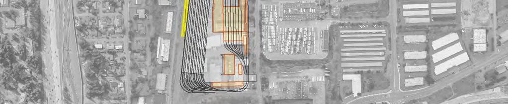
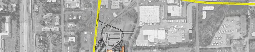


52 520 Northup Way Path: K:\Projects_3\Huitt_Zollars\00329_12_ST_LightRail\mapdoc\EIS_Figures\CH2\Fig_2_4c _Interim_Trail.mxd; User: 30481; Date: 8/6/ th Ave NE Interim Trail Connection to East Link Hospital StationTrail Interim Trail Affected Parcels East Link Extension Station NE 8th St Site Design Building Sources: Site plans, Huitt Zollars, 2015; Aerial imagery, City of Bellevue, 2013 Eastside Rail Corridor Pavement Track NE 12th St Lake Bellevue Interim Trail Connection to Improved 120 th Avenue NE 124th Ave NE 120 th Avenue Station Bel-Red Rd ± 0 1,000 Feet Meters Figure 2-4c: Proposed Interim Trail in the Eastside Rail Corridor Sound Transit Link Light Rail OMSF Final EIS


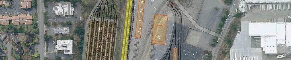
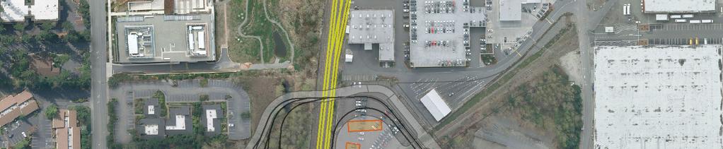
53 OUTDOOR STORAGE PEDESTRIAN BRIDGE OFFICES / STORAGE MAINTENANCE SHOPS Path: K:\Projects_3\Huitt_Zollars\00329_12_ST_LightRail\mapdoc\EIS_Figures\CH2\Fig_2_5a_BNSF_Mod_10_3.mxd; User: rdstest; Date: 4/8/ th Ave NE Affected Parcels Site Design East Link Extension Building Pavement Sources: Site plans, Huitt Zollars, 2013; Aerial imagery, City of Bellevue, 2013 E a s t s i d e R a i l C o r r i d o r Track COVERED STORAGE Elevated Track SHOPS OFFICE POWER SUBSTATION 120th Ave NE ± Feet Meters Figure 2-5a: BNSF Modified Alternative Sound Transit Link Light Rail OMSF Final EIS

54 Graphics /27/2015 Not to Scale Figure 2-5b: BNSF Modified Alternative Aerial View Sound Transit Link Light Rail OMSF Final EIS
55 Chapter 2. Alternatives Considered As described in Table 2.3, the ULI Advisory Services Panel did not make specific recommendations for the BNSF Modified Alternative because the layout of the build alternative was specifically designed to maximize TOD potential at the south end of the site and along the frontage of 120th Avenue NE SR 520 Alternative Under the SR 520 Alternative, Sound Transit would construct the OMSF south of SR 520 and north of Northup Way/NE 20th Street, east of 130th Avenue NE and west of 140th Avenue NE in the City of Bellevue. This site is located along the adopted East Link revenue line and is approximately 25 acres. The OMSF development footprint encompasses the entire site, leaving no substantial area for redevelopment. A conceptual layout of this site is shown in Figure 2 6a. Primary access to the site would be directly off of NE 20th Street west of 136th Place NE. The configuration of buildings under this alternative would vary from the other alternatives in that the operations offices would be in a separate building to the west of the LRV maintenance shops, and the LRV covered wash and service bay would be in a separate building east of the LRV maintenance shops as shown in Figure 2 6a. An aerial view is shown in Figure 2 6b. Based on the concepts identified during the ULI Advisory Services Panel work and subsequent coordination with the City of Bellevue, the SR 520 Alternative site layout could be revised by shifting the OMSF to the east and making it narrower. This would allow for the potential daylighting of Goff Creek and create a greater buffer along the frontage of Northup Way. However, it would also displace additional businesses and the TOD potential at the alternative site would remain limited Lynnwood Alternative The Lynnwood Alternative would be north of I 5 and east of 52nd Avenue/ W Cedar Valley Road in the City of Lynnwood. The OMSF footprint for the Lynnwood Alternative would require approximately 24 acres of land. Approximately 41 acres would need to be acquired, given existing parcel boundaries, and approximately 4 acres are designated as wetlands and wetland buffers, leaving approximately 13 acres for redevelopment. The Lynnwood Link Extension would be located along the Lynnwood Alternative site for the OMSF. The Lynnwood Alternative for the OMSF also includes LRV storage, operator report facilities, and interior cleaning functions for up to 32 LRVs at a separate location (referred to as the BNSF Storage Tracks, a component of the Lynnwood Alternative). The BNSF Storage Tracks would be located north of NE 12th Street and south of SR 520 in the City of Bellevue, within the Sound Transit owned portion of the Eastside Rail Corridor and on an adjacent property located immediately east of the Eastside Rail Corridor to provide morning service to the Eastside. The design acknowledges the railbanked status of the Eastside Rail Corridor by allowing sufficient width to accommodate a future trail or freight rail use of the corridor, as well as existing utilities in the corridor. Conceptual layouts of the Lynnwood Alternative for the OMSF with the Lynnwood Link Extension alignment, an aerial view of the Lynnwood Alternative site, and the BNSF Storage Tracks are shown in Figures 2 7a through 2 7c, respectively. Final Environmental Impact Statement 2 24
56 NE 24th St Path: K:\Projects_3\Huitt_Zollars\00329_12_ST_LightRail\mapdoc\EIS_Figures\CH2\Fig_2_6a_SR520.mxd; User: 30481; Date: 4/8/ th Ave NE Affected Parcels East Link Extension 52 0 OPERATIONS Site Design Building OFFICES / SHOPS Pavement Track Sources: Site plans, Huitt Zollars, 2013; Aerial imagery, City of Bellevue, 2013 MAINTENANCE SHOPS NE 20th St POWER SUBSTATION SHOPS / OFFICE WASH / SERVICE COVERED STORAGE 136th Pl NE 52 0 ± Feet Meters th Ave N E Figure 2-6a: SR 520 Alternative Sound Transit Link Light Rail OMSF Final EIS

57 Graphics /27/2015 Not to Scale Figure 2-6b: SR 520 Alternative Aerial View Sound Transit Link Light Rail OMSF Final EIS
58 200th St SW Cedar Valley Rd 46th Ave W 202nd St SW COVERED STORAGE SHOPS OFFICE 204th St SW Path: K:\Projects_3\Huitt_Zollars\00329_12_ST_LightRail\mapdoc\EIS_Figures\CH2\Fig_2_7a_Lynn.mxd; User: 34938; Date: 4/20/ th St SW 208th St SW 52nd Ave W Affected Parcels MAINTENANCE SHOPS Lynnwood Link Extension OFFICES POWER SUBSTATION Interurban Trail Site Design 50th Ave W Building Concrete Pavement Sources: Site plans, Huitt Zollars, 2015; Aerial imagery, Sound Transit, 2010 Track Elevated Track 48th Ave W Interurban Trail 5 ± Feet Meters Figure 2-7a: Lynnwood Alternative with Lynnwood Link Extension Alignment Sound Transit Link Light Rail OMSF Final EIS

59 Graphics /27/2015 Not to Scale Figure 2-7b: Lynnwood Alternative with Lynnwood Link Extension Alignment Aerial View Sound Transit Link Light Rail OMSF Final EIS


60 CANOPY OFFICES ACCESS GATE LOADING DOCK YARD STORAGE Path: K:\Projects_3\Huitt_Zollars\00329_12_ST_LightRail\mapdoc\EIS_Figures\CH2\Fig_2_7c_Storage_Tracks.mxd; User: rdstest; Date: 4/8/2015 E a s t s i d e R a i l C o r r i d o r Affected Parcels Site Design East Link Extension Building Pavement Sources: Site plans, Huitt Zollars, 2013; Aerial imagery, City of Bellevue, th Ave NE ± Feet Meters Figure 2-7c: Lynnwood Alternative, BNSF Storage Tracks* Sound Transit Link Light Rail OMSF Final EIS *The BNSF Storage Tracks are located in Bellevue
REPORT TO THE CITY COUNCIL rd Avenue NE, Woodinville, WA
 To: From: Subject: CJTYOFWOODINVILLE, WA REPORT TO THE CITY COUNCIL 17301 133rd Avenue NE, Woodinville, WA 98072 WWW.CI.WOODINVILLE.WA.US Q Honorable City Council Richard A. Leahy, City Manager f"-v Sound
1.1 Purpose of the Project
 Chapter 1 Purpose and Need for East Link Project 1.1 Purpose of the Project The purpose of the East Link Project is to expand the Sound Transit Link light rail system from Seattle to Mercer Island, Bellevue
Notice of Preparation For Link Union Station (Link US) Project. Joint Environmental Impact Statement and Environmental Impact Report
 Project. Joint Environmental Impact Statement and Environmental Impact Report") Notice of Preparation For Link Union Station (Link US) Project Joint Environmental Impact Statement and Environmental Impact Report Date: May 27, 2016 To: Subject: Project Title: From: All Interested Agencies,
Notice of Preparation For Link Union Station (Link US) Project Joint Environmental Impact Statement and Environmental Impact Report Date: May 27, 2016 To: Subject: Project Title: From: All Interested Agencies,
S-09: Auburn Station Access Improvements
 Project Number S-09 Subarea South King Primary Mode Commuter Rail Facility Type Infrastructure Improvements Length Version Number ST Board Workshop Date Last Modified 11-25-2015 PROJECT AREA AND REPRESENTATIVE
Draft Environmental Assessment Terminal B/C Redevelopment, Secure National Hall, and Related Improvements
 JUNE 2016 RONALD REAGAN WASHINGTON NATIONAL AIRPORT Draft Environmental Assessment Terminal B/C Redevelopment, Secure National Hall, and Related Improvements PREPARED BY: Ricondo & Associates, Inc. IN
Bus Rapid Transit Project Update
 Bus Rapid Transit Project Update Woodinville City Council September 12, 2017 Sound Transit BRT Project Team Kamuron Gurol and Bernard van de Kamp: HCT Corridor Development Directors - kamuron.gurol@soundtransit.org,
South Sounder Capital Improvements Program
 South Sounder Capital Improvements Program Subarea South King/Pierce Primary Mode Commuter Rail Facility Type Infrastructure Improvement Length Version Draft ST3 Plan Date Last Modified March 28, 2016
Significant Unavoidable Adverse Impacts
 6 Significant Unavoidable Adverse Impacts CHAPTER 6. SIGNIFICANT UNAVOIDABLE ADVERSE IMPACTS 6.1 LAND USE AND HOUSING Construction of the project would not require significant excavation, inhibit access
MOTION NO. M Design-Build Contract for Link Maintenance of Way Facility for University Link Extension
 MOTION NO. M2014-27 Design-Build Contract for Link Maintenance of Way Facility for University Link Extension MEETING: DATE: TYPE OF ACTION: STAFF CONTACT: Capital Committee 04/10/2014 04/24/2014 Recommendation
CENTRAL PUGET SOUND REGIONAL TRANSIT AUTHORITY GREEN BONDS
 CENTRAL PUGET SOUND REGIONAL TRANSIT AUTHORITY GREEN BONDS SECOND-PARTY REVIEW BY SUSTAINALYTICS July 27 th, 2015 www.sustainalytics.com Vikram Puppala (Toronto) Manager, Advisory Services vikram.puppala@sustainalytics.com
LONE HILL TO WHITE DOUBLE TRACK STUDY Community Open Houses May 16 & 17
 LONE HILL TO WHITE DOUBLE TRACK STUDY Community Open Houses May 16 & 17 1 PROJECT TEAM & COLLABORATORS 2 OPEN HOUSE SERIES Tuesday, May 16, 2017 6-8:00 pm La Verne City Council Chambers 3660 D Street La
THE MLK DISTRICT. Help Us Plan the Future of. The MLK District
 t DIVISION AVE Wright Park S 6TH ST S 9TH ST MLK District S 15TH ST MARTIN LUTHER KING JR WAY S 17TH ST S YAKIMA AVE SCOPING Meeting: Help Us Plan the Future of THE MLK DISTRICT The City of Tacoma is working
Metro Blue Line Improvements & Project Update
 Metro Blue Line Improvements & Project Update February 9, 2018 MBL Operational Improvements - External Metro & LADOT coordination to identify traffic signal and intersection treatments aimed at increasing
TRANSPORTATION 101 Today and Tomorrow. Moving People and Goods
 TRANSPORTATION 101 Today and Tomorrow Moving People and Goods What is the Transportation Commission? An independent, seven-member body of citizens appointed by the Governor for six-year terms and representing
Public Notice. Applicant: City of Dallas Project No.: SWF Date: April 18, Name: Chandler Peter Phone Number:
 Public Notice Applicant: City of Dallas Project No.: SWF- 2014-00151 Date: April 18, 2014 The purpose of this public notice is to inform you of a proposal for work in which you might be interested. It
TIER 1 DRAFT ENVIRONMENTAL IMPACT STATEMENT. 7. Affected Environment, Environmental Consequences, and Mitigation Strategies
 TIER 1 DRAFT ENVIRONMENTAL IMPACT STATEMENT 7. Affected Environment, Environmental Consequences, and Mitigation Strategies Table of Contents Chapter 7 7 Affected Environment, Environmental Consequences,
Project Overview. Northwest Innovation Works LLC and the Port of Kalama propose to develop and operate
 Project Overview Northwest Innovation Works LLC and the Port of Kalama propose to develop and operate a natural gas-tomethanol production plant and storage facilities, and a new marine terminal, in the
Sound Transit 3: The Regional Transit System Plan
 Sound Transit 3: The Regional Transit System Plan for Central Puget Sound Table of Contents Sound Transit 3: Introduction... 4 Sound Transit 3: Building on Success... 5 The Sound Transit 3 Plan... 6 Link
VISION 2040 Supplemental Draft Environmental Impact Statement. Puget Sound Regional Council
 VISION 2040 Supplemental Draft Environmental Impact Statement Puget Sound Regional Council July 16, 2007 Dear Member of the Puget Sound Regional Council and Interested Parties: The VISION 2040 Supplemental
Transit Oriented Development Study
 Federal Way Link Extension Transit Oriented Development Study Table of Contents Executive Summary ES 1 Chapter 1: Introduction.. 1-1 Chapter 2: Methodology. 2-1 Chapter 3: Project Overview 3-1 Chapter
NOTICE OF PREPARATION OF AN ENVIRONMENTAL IMPACT REPORT
 Date: September 19, 2017 NOTICE OF PREPARATION OF AN ENVIRONMENTAL IMPACT REPORT To: Agencies and Interested Parties Lead Agency: Sacramento Municipal Utility District 6201 S Street, MS B203 Sacramento,
City of White Plains Westchester County, NY. Draft Generic Environmental Impact Statement
 60 South Broadway Rezoning Project City of White Plains Westchester County, NY Draft Generic Environmental Impact Statement July 2, 2014 60 SOUTH BROADWAY CB-3 REZONING AND ZONING TEXT AMENDMENTS DRAFT
Project Purpose. Federal Railroad Administration
 Project Purpose To preserve the current functionality of Amtrak s Northeast Corridor service and NJ TRANSIT s commuter rail service between New Jersey and Penn Station New York by repairing the deteriorating
October 19, 2017 Community Engagement Panel Meeting #4 Overview of Environmental Effects
 Lake Elmo Airport Environmental Assessment (EA)/ Environmental Assessment (EAW) Worksheet October 19, 2017 Community Engagement Panel Meeting #4 Overview of Environmental Effects Agenda Public Event #2
Partnering for Success Sound Transit and City of Bellevue East Link - S Bellevue to Overlake Light Rail Extension
 Partnering for Success Sound Transit and City of Bellevue East Link - S Bellevue to Overlake Light Rail Extension DeWitt Jensen, P.E. Sound Transit, Corridor Design Manager Seattle, WA Kevin Collins, P.E.
Sounder Extension to DuPont
 Subarea Pierce Primary Mode Commuter Rail Facility Type Station Length 7.8 miles Version Draft ST3 Plan Date Last Modified March 28, 2016 PROJECT AREA AND REPRESENTATIVE ALIGNMENT SHORT PROJECT DESCRIPTION
US Army Corps of Engineers
 I I I ' A I US Army Corps of Engineers LA River Ecosystem Restoration, CA Preconstruction Engineering and Design Phase 104791 LOS ANGELES DISTRICT SOUTH PACIFIC DIVISION August 15, 2017 1 Table of Contents
AFFECTED ENVIRONMENT AND ENVIRONMENTAL IMPACTS
 Callou t box: Callout box en d. CHAPTER 3 AFFECTED ENVIRONMENT AND ENVIRONMENTAL IMPACTS 3.0 INTRODUCTION This introductory chapter and subchapters describe the existing conditions (affected environments)
Durham-Orange Light Rail Transit Project
 Durham-Orange Light Rail Transit Project Scoping Information Booklet WHAT S INSIDE What is Scoping? p. 3 How was the LPA determined? p. 3 Project development process p. 4 Project Purpose & Need p. 5 Alternatives
Transit, Intercity Bus, Taxi 8-1
 8-1 Introduction Public transit is a critical element of any transportation system. It both provides an alternative form of transportation to the traditional use of the automobile and provides mobility
Memorandum. FROM: Jim Ortbal Rosalynn Hughey Barry Ng TO: HONORABLE MAYOR, CITY COUNCIL. DATE: June 16, 2017
 CITY OF SANjOSE CAPITAL OF SILICON VALLEY TO: HONORABLE MAYOR, CITY COUNCIL SUBJECT: TRANSPORTATION POLICY UPDATE REQUIRED BY STATE LAW - LOS TO VMT Memorandum FROM: Jim Ortbal Rosalynn Hughey Barry Ng
SOLID WASTE DISPOSAL FACILITY CONSTRUCTION/DEMOLITION LANDFILL PERMIT APPLICATION PACKAGE. ADEM Form
 SOLID WASTE DISPOSAL FACILITY CONSTRUCTION/DEMOLITION LANDFILL PERMIT APPLICATION PACKAGE ADEM Form 305 8-02 1 July 10, 2002 M E M O R A N D U M TO: FROM: RE: Applicants Seeking a Permit for Solid Waste
REPORT TO PLANNING AND DESIGN COMMISSION City of Sacramento
 REPORT TO PLANNING AND DESIGN COMMISSION City of Sacramento 915 I Street, Sacramento, CA 95814-2671 4 To: Members of the Planning and Design Commission: PUBLIC HEARING May 11, 2017 Subject: Capital City
Letter No Impact Sciences, Inc Temporary use of the Rose Bowl by the NFL November 2012
 Letter No. 48 1 3.0-303 1 2 3 3.0-304 3 4 5 3.0-305 6 7 8 9 10 11 3.0-306 12 13 3.0-307 13 14 3.0-308 14 15 3.0-309 15 3.0-310 16 3.0-311 16 17 3.0-312 17 18 19 3.0-313 19 20 21 22 3.0-314 22 23 24 3.0-315
ISSUES & RISKS Potential timing and coordination with a future system planning process Coordination with jurisdictions and partner transit agencies
 Subarea Systemwide Primary Mode HCT Facility Type Study Length Date Last Modified July 1, 2016 PROJECT AREA AND REPRESENTATIVE ALIGNMENT SHORT PROJECT DESCRIPTION The planning studies will help to identify
EXHIBIT A. TRANSIT AND MULTIMODAL DEVELOPMENT SUPPORT CONTINUING SERVICES SCOPE OF SERVICES FM No
 EXHIBIT A TRANSIT AND MULTIMODAL DEVELOPMENT SUPPORT CONTINUING SERVICES SCOPE OF SERVICES FM No. 429768-4-12-01 This Exhibit forms an integral part of the Agreement between the DEPARTMENT and, the CONSULTANT,
2016 Transit Integration Report October Puget Sound Regional Council
 October 2016 Puget Sound Regional Council Puget Sound Regional Council 2016 TRAnsIT IntegRATIon RepoRT / October 2016 Funding for this document provided in part by member jurisdictions, grants from U.S.
CHAPTER 2B - PHASE I, INITIAL ROADWAY INVESTIGATION & PRELIMINARY FIELD INSPECTION
 CHAPTER 2B - PHASE I, INITIAL ROADWAY INVESTIGATION & PRELIMINARY FIELD INSPECTION SECTION 2B 1 - GROUND SURVEYS Survey Authorization... 2B-1 Interstate... 2B-1 Principal / Minor Arterial... 2B-1 Urban...
PRACTITIONER S HANDBOOK
 AASHTO PRACTITIONER S HANDBOOK 03 August 2016 MANAGING THE NEPA PROCESS FOR TOLL LANES AND TOLL ROADS This Handbook provides recommendations for conducting National Environmental Policy Act (NEPA) studies
STATE OF WASHINGTON DEPARTMENT OF ECOLOGY
 STATE OF WASHINGTON DEPARTMENT OF ECOLOGY PO Box 47775 Olympia, Washington 98504-7775 (360) 407-6300 711 for Washington Relay Service Persons with a speech disability can call 877-833-6341 October 13,
ARLINGTON COUNTY TRANSIT DEVELOPMENT PLAN
 p EXECUTIVE SUMMARY Report Prepared by: ARLINGTON COUNTY TRANSIT DEVELOPMENT PLAN The Arlington County Transit Development Plan (TDP) is an effort to evaluate and assess the performance, connectivity,
Executive Summary October 2017
 Executive Summary The King of Prussia Rail Draft Environmental Impact Statement/Draft Section 4(f) Evaluation (DEIS) describes and summarizes the transportation and environmental benefits and impacts of
U.S. Department of Transportation Federal Transit Administration and Metropolitan Atlanta Rapid Transit Authority
 ATLANTA BELTLINE CITY OF ATLANTA, FULTON COUNTY, GA TIER 1 DRAFT ENVIRONMENTAL IMPACT STATEMENT/ SECTION 4(F) EVALUATION U.S. Department of Transportation Federal Transit Administration and Metropolitan
APPENDIX H: TRAVEL DEMAND MODEL VALIDATION AND ANALYSIS
 APPENDIX H: TRAVEL DEMAND MODEL VALIDATION AND ANALYSIS Travel demand models (TDM) simulate current travel conditions and forecast future travel patterns and conditions based on planned system improvements
Sustainability. Sustainability Principles. 1. Framework. Spokane Transit s definition of Sustainability is:
 Sustainability Spokane Transit s definition of Sustainability is: Sustainability at Spokane Transit is about providing services in ways that optimize our ability to meet the needs of present and future
FINDINGS CALIFORNIA DEPARTMENT OF TRANSPORTATION FINDINGS FOR THE INTERSTATE 10 CORRIDOR PROJECT SAN BERNARDINO AND LOS ANGELES COUNTIES, CALIFORNIA
 FINDINGS CALIFORNIA DEPARTMENT OF TRANSPORTATION FINDINGS FOR THE INTERSTATE 10 CORRIDOR PROJECT SAN BERNARDINO AND LOS ANGELES COUNTIES, CALIFORNIA DISTRICT 7 LA 10 (PM 44.0/48.3) DISTRICT 8 SBD 10 (PM
SP Old Florida Investment Resources, LLC SMR Aggregates SR 64 Borrow Pit (DTS # )
") H.O. 03/24/14 SP-14-01 Old Florida Investment Resources, LLC SMR Aggregates SR 64 Borrow Pit (DTS #201400001) Request: Approval of a Special Permit for major earthmoving in the A (General Agriculture)
H.O. 03/24/14 SP-14-01 Old Florida Investment Resources, LLC SMR Aggregates SR 64 Borrow Pit (DTS #201400001) Request: Approval of a Special Permit for major earthmoving in the A (General Agriculture)
Surrey Newton - Guildford Light Rail Transit Environmental and Socio-Economic Review DRAFT Terms of Reference
 Surrey Newton - Guildford Light Rail Transit Environmental and Socio-Economic Review Terms of Reference October 16, 2017 City of Surrey Client ref: MT01701P Prepared by: Surrey Newton - Guildford Light
CHAPTER 21: COMMITMENT OF RESOURCES
 CHAPTER 21: COMMITMENT OF RESOURCES 21.1 INTRODUCTION In accordance with the National Environmental Policy Act (NEPA) and the Council on Environmental Quality s implementing procedures under Title 40,
METRA UP-W LINE. Locally Preferred Alternative Report
 METRA UP-W LINE Cook, Kane, and DuPage Counties Illinois Alternatives Analysis Study Document #9 Locally Preferred Alternative Report August 13, 2007 Prepared by Parsons Alternatives Analysis Documents
APPENDIX B. Public Works and Development Engineering Services Division Guidelines for Traffic Impact Studies
 APPENDIX B Public Works and Development Engineering Services Division Guidelines for Traffic Impact Studies Revised December 7, 2010 via Resolution # 100991 Reformatted March 18, 2011 TABLE OF CONTENTS
Greenhouse Gas Emission Reduction Strategies
 Greenhouse Gas Emission Reduction Strategies 2011 ITE Quad Conference April 18 19, 2011, Embassy Suites; Lynnwood, WA Victor L. Sl Salemann, PE Senior Associate David Evans and Associates Bellevue, WA
GENERAL ASSEMBLY OF NORTH CAROLINA SESSION 2011 SESSION LAW HOUSE BILL 609
 GENERAL ASSEMBLY OF NORTH CAROLINA SESSION 2011 SESSION LAW 2011-374 HOUSE BILL 609 AN ACT TO PROMOTE THE DEVELOPMENT OF WATER SUPPLY RESERVOIRS AND OTHER WATER SUPPLY RESOURCES, TO PROVIDE THAT FUNDS
Draft Decision Notice Maroon Bells - Snowmass Wilderness Overnight Visitor Use Management Plan
 Draft Decision Notice Maroon Bells - Snowmass Wilderness Overnight Visitor Use Management Plan USDA Forest Service Aspen-Sopris Ranger District, White River National Forest Gunnison Ranger District, Grand
INTERGOVERNMENTAL COORDINATION ELEMENT GOALS, OBJECTIVES, AND POLICIES
 INTERGOVERNMENTAL COORDINATION ELEMENT GOALS, OBJECTIVES, AND POLICIES Goal 8 To provide accessible, effective and frequent intergovernmental opportunities to achieve consistency among all government agencies
Identification and Evaluation of Alternatives Tier 1
 Vanasse Hangen Brustlin, Inc. DRAFT 4 Identification and Evaluation of Alternatives Tier This chapter describes the initial set of alternatives that were identified to address the Purpose and Need of the
CRTPA Regional Mobility Plan Attachment 1 Agenda Item 4E Page 1 of 11
 CRTPA Regional Mobility Plan Attachment 1 Page 1 of 11 INTRODUCTION Everyone wants to have the ability to move around the city, county, region, country and world in the way that they see fit, when they
Pacific Northwest High Speed Rail Corridor Amtrak Cascades Passenger Service Update
 Pacific Northwest High Speed Rail Corridor Amtrak Cascades Passenger Service Update John Sibold Cascade Rail Corridor Director State Rail and Marine Director, WSDOT International Mobility Trade Corridor
Scope of Work. Project Approach and Understanding. Task 1: Study Initiation and Administration
 Scope of Work Route 116/Hinesburg Growth Center Corridor Study Town of Hinesburg and CCRPC Project Approach and Understanding Route 116 through Hinesburg had seen substantial changes in the past 15 years,
Environment & Conservation Introduction
 Environment & Conservation Introduction Anacortes is blessed with an abundance of natural beauty. Residents identify marine shorelines, streams, lakes, forested areas, and other natural features as defining
California High-Speed Train Program FEIR/EIS
 Page 2-30 Page 2-31 Page 2-32 Page 2-33 Page 2-34 Page 2-35 Page 2-36 of Enrique Manzanilla, Director U.S. Environmental Protection Agency, August 31, 2004 (Letter AF008) AF008-1 Acknowledged. AF008-2
City of Palo Alto (ID # 7047) City Council Staff Report
 City Council Staff Report") City of Palo Alto (ID # 7047) City Council Staff Report Report Type: Consent Calendar Meeting Date: 6/13/2016 Summary Title: East Palo Alto Comment Letter Title: Approval and Authorization for the City
City of Palo Alto (ID # 7047) City Council Staff Report Report Type: Consent Calendar Meeting Date: 6/13/2016 Summary Title: East Palo Alto Comment Letter Title: Approval and Authorization for the City
IMPROVING THE LINK LIGHT RAIL. A proposal prepared by: TEAM NITRO. Leilani Battle. Dennis Zhang. Ryan McCarthy. Stephan Favilla. For: Kerrie Kephart
 IMPROVING THE LINK LIGHT RAIL A proposal prepared by: TEAM NITRO Leilani Battle Dennis Zhang Ryan McCarthy Stephan Favilla For: Kerrie Kephart HCDE 333 University of Washington February 10, 2011 TEAM NITRO
Joint Public Notice. LOCATION: In Salmon Bay, Lake Washington Ship Canal, at Seattle, Washington.
 US Army Corps of Engineers Seattle District Joint Public Notice Application for a Department of the Army Permit and a Washington Department of Ecology Water Quality Certification and/or Coastal Zone Management
Project Steering Committee April 14, 2015
 Project Steering Committee April 14, 2015 Agenda Project Background and Schedule Agency Coordination Project Need and Purpose Alternatives Under Consideration Resources Stakeholder and Public Involvement
CHAPTER 1 COMMUTE TRIP REDUCTION BASIC INFORMATION
 CHAPTER 1 COMMUTE TRIP REDUCTION BASIC INFORMATION COMMUTE TRIP REDUCTION (CTR) OVERVIEW In 1991, the Washington State Legislature passed the Commute Trip Reduction (CTR) Law requiring employers to work
Transit Service Guidelines
 G R E AT E R VA N CO U V E R T R A N S P O RTAT I O N A U T H O R I T Y Transit Service Guidelines PUBLIC SUMMARY REPORT JUNE 2004 Greater Vancouver Transportation Authority TRANSIT SERVICE GUIDELINES
Mainstreaming Context Sensitive Solutions in the Workforce Washington
 Mainstreaming Context Sensitive Solutions in the Workforce Washington Submitted By Kathleen Davis Director of Highways and Local Programs PO Box 47390 Olympia, WA 98504 Phone - 360-705-7871 Fax 360-705-6822
State Route 8 Bridge Replacement Project
 OPEN HOUSE PUBLIC INVOLVEMENT MEETING Celebration Church 688 Dan Street, Akron, Ohio Tuesday, July 14, 2015 5:00 PM to 7:00 PM State Route 8 Bridge Replacement Project Existing Bridge Future Bridges: Steel
Notice of Availability of the Final Environmental Impact Statement for the Monument
 This document is scheduled to be published in the Federal Register on 06/24/2016 and available online at http://federalregister.gov/a/2016-15023, and on FDsys.gov 4310-DQ-P DEPARTMENT OF THE INTERIOR Bureau
III. King County Guiding Principles
 III. King County Guiding Principles 2016 Comprehensive Plan December 5, 2016 The Comprehensive Plan is based on the principles of creating sustainable neighborhoods, preserving open space, farmland, and
Information on the focal point for the Convention. Information on the point of contact for the Convention
 Questionnaire for the REPORT OF MONTENEGRO ON THE IMPLEMENTATION OF THE CONVENTION ON ENVIRONMENTAL IMPACT ASSESSMENT IN A TRANSBOUNDARY CONTEXT in the period 2006 2009 Information on the focal point for
Decision Notice and Finding of No Significant Impact
 Decision Notice and Finding of No Significant Impact Gold Lake Bog Research Natural Area Boundary Adjustment and Nonsignificant Forest Plan Amendment #53 USDA Forest Service Middle Fork Ranger District,
Distribution Restriction Statement
 CECW-A Engineer Regulation 1165-2-501 Department of the Army U.S. Army Corps of Engineers Washington, DC 20314-1000 ER 1165-2-501 30 September 1999 Water Resources Policies and Authorities CIVIL WORKS
Transportation and Works Department The Regional Municipality of York Yonge Street Newmarket, Ontario L3Y 6Z1
 TRANSPORTATION IMPACT STUDY (TIS) GUIDELINES FOR DEVELOPMENT APPLICATIONS Transportation and Works Department The Regional Municipality of York 17250 Yonge Street Newmarket, Ontario L3Y 6Z1 August, 2007
BOSTON REGION METROPOLITAN PLANNING ORGANIZATION
 PLANNING ORGANIZATIO BOSTON REGION MPO NMETROPOLITAN BOSTON REGION METROPOLITAN PLANNING ORGANIZATION Stephanie Pollack, MassDOT Secretary and CEO and MPO Chair Karl H. Quackenbush, Executive Director,
PROJECT SCOPING PHASE ~ SCOPE OF SERVICES MAIN STREET BRIDGE OVER WINOOSKI RIVER CITIES OF BURLINGTON & WINOOSKI VERMONT
 PROJECT SCOPING PHASE ~ SCOPE OF SERVICES MAIN STREET BRIDGE OVER WINOOSKI RIVER CITIES OF BURLINGTON & WINOOSKI VERMONT PROJECT DESCRIPTION McFarland-Johnson, Inc. (MJ) has prepared this proposal to perform
Downtown Estes Loop Project Frequently Asked Questions
 May 15 th, 2015 Project Status 1) Has Alternative 1 already been selected? Is it a done deal? Response: The NEPA process will proceed with environmental analysis of both the No Action and Alternative 1.
5.D.1 HISTORIC, ARCHITECTURAL, ARCHEOLOGICAL, AND CULTURAL RESOURCES
 5.D.1 HISTORIC, ARCHITECTURAL, ARCHEOLOGICAL, AND CULTURAL RESOURCES Section 106 of the National Historic Preservation Act (NHPA) of 1966, as amended (16 U.S.C. Section 470(f)) protects properties that
STATE OF MINNESOTA MINNESOTA POLLUTION CONTROL AGENCY FINDINGS OF FACT
 p-ear2-44b STATE OF MINNESOTA MINNESOTA POLLUTION CONTROL AGENCY IN THE MATTER OF THE DECISION ON THE NEED FOR AN ENVIRONMENTAL IMPACT STATEMENT FOR THE PROPOSED RANDY S SANITATION TRANSFER FACILITY PROPOSED
City of La Palma Agenda Item No. 2
 City of La Palma Agenda Item No. 2 MEETING DATE: March 9, 2015 TO: FROM: SUBMITTED BY: AGENDA TITLE: DEVELOPMENT COMMITTEE DOUGLAS D. DUMHART COMMUNITY DEVELOPMENT DIRECTOR SCOTT HUTTER, ASSOCIATE PLANNER
Environmental Information Worksheet
 Environmental Information Worksheet Water System Owner (Attach additional sheets if necessary) Needs and Alternatives Provide a brief narrative that describes: Current drinking water system needs. Project
CITY OF MERCER ISLAND DEVELOPMENT SERVICES GROUP 9611 SE 36TH STREET MERCER ISLAND, WA PHONE:
 CITY OF MERCER ISLAND DEVELOPMENT SERVICES GROUP 9611 SE 36TH STREET MERCER ISLAND, WA 98040 PHONE: 206.275.7605 www.mercergov.org WEEKLY BULLETIN FREQUENTLY ASKED QUESTIONS 1. IF I OBJECT TO THE APPLICATION,
Office of Surface Mining Reclamation and Enforcement
 This document is scheduled to be published in the Federal Register on 01/03/2018 and available online at https://federalregister.gov/d/2017-28407, and on FDsys.gov 4310-05-P DEPARTMENT OF THE INTERIOR
PUBLIC HEARING April 24, 2017
 PUBLIC HEARING April 24, 2017 1 Agenda SDEIS Public Review Environmental Process Overview Project Highlights Comments to Stenographer 2 3 SDEIS Public Review Public Hearing Schedule Monday, April 24, 2017
POND SITING REPORT TABLE OF CONTENTS LIST OF TABLES LIST OF FIGURES EXECUTIVE SUMMARY SECTION 1.0 INTRODUCTION SECTION 2.0 PROJECT DESCRIPTION
 November, 2014 TABLE OF CONTENTS LIST OF TABLES LIST OF FIGURES EXECUTIVE SUMMARY POND SITING REPORT Summary of section 1.0 & 2.0. Specify datum used in the design calculations and the construction plans.
Chapter 10 Natural Environment
 Chapter 10 Natural Environment Existing Conditions The Natural Environment Element addresses the protection, conservation, preservation, and restoration of the natural resources the Bayview Ridge Subarea,
Railyard Enterprise Project (REP) Supplemental Scoping
 Supplemental Scoping") FINAL SCOPE OF WORK DATE: November 11, 2016 PROJECT: PROJECT DESCRIPTION Railyard Enterprise Project (REP) Supplemental Scoping The City of Burlington and VTrans would like to further evaluate the REP
FINAL SCOPE OF WORK DATE: November 11, 2016 PROJECT: PROJECT DESCRIPTION Railyard Enterprise Project (REP) Supplemental Scoping The City of Burlington and VTrans would like to further evaluate the REP
CHAPTER 2 WHAT ARE WE TRYING TO ACHIEVE?
 CHAPTER 2 WHAT ARE WE TRYING TO ACHIEVE? VISION After significant public outreach and coordination with numerous agencies, organizations, and individuals, Phase 1 established a vision for transportation
9 Before and After Study Plan
 9 Before and After Study Plan A Before and After Study Plan has been prepared, describing how the Massachusetts Bay Transportation Authority (MBTA), in cooperation with the Massachusetts Department of
I-70 East ROD 1: Phase 1 (Central 70 Project) Air Quality Conformity Technical Report
 Air Quality Conformity Technical Report") I-70 East ROD 1: Air Quality Conformity Technical Report January 2017 I-70 East ROD 1: Air Quality Conformity Technical Report TABLE OF CONTENTS Chapter Page 1 PURPOSE OF THIS REPORT... 1 2 PROJECT DESCRIPTION...
I-70 East ROD 1: Air Quality Conformity Technical Report January 2017 I-70 East ROD 1: Air Quality Conformity Technical Report TABLE OF CONTENTS Chapter Page 1 PURPOSE OF THIS REPORT... 1 2 PROJECT DESCRIPTION...
WELCOME IL 47. Community Advisory Group Meeting #5 Waubonsee Community College Wednesday, May 31, 2017
 WELCOME IL 47 Community Advisory Group Meeting #5 Waubonsee Community College Wednesday, May 31, 2017 MEETING PURPOSE MEETING AGENDA 1. Welcome/Introduction 2. Review Previous Public Involvement 3. Process/Schedule
NOTICE OF PREPARATION
 NOTICE OF PREPARATION Date: June 12, 2014 To: From: Subject: Governor s Office of Planning and Research/State Clearinghouse Unit, Responsible Agencies, Trustee Agencies, and Interested Parties Announcement
PUBLIC TRANSPORTATION PLAN
 PUBLIC TRANSPORTATION PLAN Introduction Public transportation is a vital element of the total transportation services provided within a metropolitan area. Not only does public transportation provide options
Task 1: Project Management Tasks
 CH2M HILL 1100 112 th Avenue NE Suite 500 Bellevue, WA 98004 Tel 425-453-5000 July 14, 2014 Tyler Schroeder, Whatcom County Planning Supervisor Whatcom County Planning and Development Services 5280 Northwest
RESOLUTION NO.15- The Planning Commission of the City of La Habra does hereby resolve as follows:
 RESOLUTION NO.15- A RESOLUTION OF THE PLANNING COMMISSION OF THE CITY OF LA HABRA CERTIFYING MITIGATED NEGATIVE DECLARATION OF ENVIRONMENTAL IMPACTS 14-02 FOR A 32 UNIT MULTI-FAMILY RESIDENTIAL DEVELOPMENT
FERRY COUNTY COUNTY-WIDE PLANNING POLICIES
 FERRY COUNTY COUNTY-WIDE PLANNING POLICIES This memorandum of understanding lays out the framework upon which the comprehensive planning process for Ferry County and the City of Republic will be built.
52 North Broadway DEIS Scoping Outline
 Introduction WP Development NB, LLC (the Applicant ) proposes to redevelop the former Good Counsel site, of which it is the owner, in White Plains, NY with residential uses in a campus-like setting (the
PUBLIC NOTICE. REPLY TO: Denver Regulatory Office 9307 South Wadsworth Blvd 30 DAY NOTICE Littleton, CO FAX (303)
") PUBLIC NOTICE US Army Corps of Engineers Omaha District Application No: NWO-2017-01366-DEN Project: Douglas Lane Tributary Stabilization Project Applicant: Town of Castle Rock Waterway: Douglas Lane Tributary
PUBLIC NOTICE US Army Corps of Engineers Omaha District Application No: NWO-2017-01366-DEN Project: Douglas Lane Tributary Stabilization Project Applicant: Town of Castle Rock Waterway: Douglas Lane Tributary
Response to Comments of Don and Tricia Nevis (Letter I25) See the master response to Public Outreach Process.
 See the master response to Public Outreach Process.") Freeport Regional Water Authority and the U.S. Department of the Interior, Bureau of Reclamation Chapter 8. Responses to Comments from Individuals Don and Tricia Nevis (I25) Response to Comments of Don
Freeport Regional Water Authority and the U.S. Department of the Interior, Bureau of Reclamation Chapter 8. Responses to Comments from Individuals Don and Tricia Nevis (I25) Response to Comments of Don