Follow this and additional works at:
|
|
|
- Randall Davidson
- 6 years ago
- Views:
Transcription
1 University of Massachusetts - Amherst ScholarWorks@UMass Amherst International Conference on Engineering and Ecohydrology for Fish Passage International Conference on Engineering and Ecohydrology for Fish Passage 2013 Jun 27th, 1:30 PM - 1:50 PM Concurrent Sessions C: A Comprehensive Approach to Fish Passage: What's Happening in Washington State - WDFW s Fish Passage Barrier and Surface Water Diversion Screening Assessment and Prioritization Protocols Susan Cierebiej Washington Department of Fish & Wildlife Follow this and additional works at: Cierebiej, Susan, "Concurrent Sessions C: A Comprehensive Approach to Fish Passage: What's Happening in Washington State - WDFW s Fish Passage Barrier and Surface Water Diversion Screening Assessment and Prioritization Protocols" (2013). International Conference on Engineering and Ecohydrology for Fish Passage This Event is brought to you for free and open access by the The Fish Passage Community at UMass Amherst at ScholarWorks@UMass Amherst. It has been accepted for inclusion in International Conference on Engineering and Ecohydrology for Fish Passage by an authorized administrator of ScholarWorks@UMass Amherst. For more information, please contact scholarworks@library.umass.edu.


 2013 International")

2 WDFW s Fish Passage Barrier and Surface Water Diversion Screening Assessment and Prioritization Protocols Susan Cierebiej, Biologist Washington Department of Fish & Wildlife (WDFW) 2013 International Conference on Engineering and Ecohydrology for Fish Passage Corvallis, Oregon June 27, 2013
3 WDFW s Fish Passage Program Comprehensive Fish Passage and Screening Inventories Fish Passage and Surface Water Diversion Inventory Database Fish Passage and Screening Inventories Habitat Assessments help prioritize barrier correction efforts Central data repository for instream feature, GIS, fish, and habitat information resulting from inventories Locate, prioritize, select, implement, and monitor fish passage projects Fish Passage and Screening Projects Design, Permit, Construct, Evaluate, Monitor
4 Fish Passage Regulations in Washington WAC Water Crossing Structures - free and unimpeded fish passage for adult and juvenile fishes Forest and Fish Agreement WAC & 050 structures must provide for fish passage at all life stages RCW Fish passage barrier is defined as any artificial instream structure that impedes the free passage of fish


5 WDFW Barrier Assessment Protocols Criteria can be found in WAC Minimum standard for water depth and velocity are based on passing 6 trout 90% of the time during adult migration; smaller salmonids and other species may be able to pass at some lower flows Swimming/jumping abilities of other species not developed
6 Surface Water Diversion Screening Regulations in Washington RCWs and Requires all surface water diversions be screened to prevent fish injury or mortality Woven wire mesh max opening 2.2 mm Perforated plate and profile bar max opening 1.75 mm Fish Bypass Approach and sweeping velocities Consistent with NOAA Fisheries fish protection screening guidelines

7 Developed in 1998; updated in 2000 and 2009 Fish Passage Features o Road Crossings o Dams o Fishways o Natural Barriers Surface Water Diversions Habitat Assessment Prioritization
8 Purpose of WDFW s Inventory Manual Provide guidance for conducting Fish Passage and Surface Water Diversion Screening Inventories Inventories are the foundation of Fish Passage Barrier Correction and/or Screening Programs Identify, Assess, and Prioritize Correction of Fish Passage Barriers Unscreened or Inadequately-screened Surface Water Diversions
9 WDFW s Inventory Manual Covers most, human-made, instream features encountered. Provides simple tools for assessing fish passage and screening in most cases, although sometimes a more detailed hydraulic analysis is required. Does not provide design guidelines.


10 Background WDFW has conducted dedicated fish passage assessments at road crossings since the 1980 s In 1998, WDFW developed standardized methodology for evaluating fish passage at road crossings
 Slope ( 1% without backwater = barrier) Level B Higher Level Analysis Depth (< 0.")
11 Fish Passage Inventory Protocol Development Professional Judgment (1980 s-1998) Assessment Manual (1998 to present) Bedload deposition Undersized culverts Multiple culverts High velocities Large outfall drop Large plunge pool Sheeting flow Level A Initial Assessment Water Surface Drop ( 0.24 m = barrier) Slope ( 1% without backwater = barrier) Level B Higher Level Analysis Depth (< 0.30 m = barrier) Velocity ( 1.2 mps = barrier)

12 Where are the Barriers? o 41,720 instream features evaluated o 18,511 humman-made features o 13,556 fish passage barriers
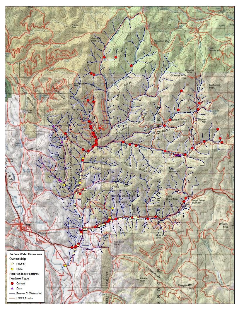
13 Fish Passage WDFW Inventories Washington State Department of Transportation WDFW Lands (Wildlife Areas & Hatcheries) Washington State Parks Kitsap, Thurston, Jefferson, and Grays Harbor Counties (prior to 1998) Puget Sound Cities and Counties (since 2012) Surface Water Diversion Inventories Entiat, Okanogan, Wenatchee, and Methow rivers Beaver Creek watershed

14 Why Use WDFW s Protocols? Science-based, Repeatable, and Consistent Broadly Accepted and Widely used by Federal, Local, State and Tribal Governments, Watershed Enhancement Groups, and Others


15 Inventory Planning Develop Scope and Project Goals Fish Passage Surface Water Diversion Screening Jurisdictional vs Watershed Habitat Assessment Prioritization Barrier Correction and Diversion Screening Review Existing Data Equipment Training Coordination Updating Inventory


16 Conducting Fish Passage Inventories Culvert Rider Barrier-sniffing Dog Stream Walker Spelunker
17 Conducting Fish Passage and Diversion Screening Inventories Possible Options Road-Based, Culvert Inventory Only Road-Based Inventory with Habitat Assessment Surface Water Diversion Inventory Stream-Based/ Watershed Inventory
18 Road-based inventory

19 Updated road-based inventory

20 Road-based inventory w/ Habitat Assessment
21 Watershed-based inventory
22 Comparison of different inventory efforts Inventory Effort* Scope of Work Diversions Inventoried Culverts Inventoried All Fish Passage Features Inventoried Natural Barriers Identified Project Prioritization Surface Water Diversion Inventory Culvert Inventory Ownership-based Road-based and/or jurisdictional/ ownership Culvert Inventory with Habitat Assessment & Prioritization Road-based and/or jurisdictional/ ownership ** ** Comprehensive Fish Passage & Surface Water Diversion Inventory & Prioritization Watershed-based *Inventory may be conducted in watersheds with anadromous access only, or for all species. ** Only on streams where a jurisdictional barrier was found and a habitat assessment was conducted.
 Dams Miscellaneous Obstructions & Natural Barriers Fishways Surface Water Diversions (gravity and pump) Photos Overview, close-up, upstream & downstream habitat Object for")
23 Typical Data Collection at each Site Site Information Location (Lat/Long, stream name, owner type, other info) Fish use and species Feature Information and Evaluation Road crossing (culverts, bridges, fords) Dams Miscellaneous Obstructions & Natural Barriers Fishways Surface Water Diversions (gravity and pump) Photos Overview, close-up, upstream & downstream habitat Object for scale

24 Barrier Assessment Locate the Culvert Record the Location and Ownership Information Overview for a Determine Fish Use Non-Fish Bearing Fill Out Culvert Form through Rise Culvert Feature Fish Bearing or Unknown Conduct Level A Barrier Assessment Not a Barrier Stop Unknown Barrier Conduct Level B Barrier Assessment Not a Barrier or Unknown Stop Barrier Conduct Habitat Assessment Prioritize the Barrier for Correction

25 Culvert Barrier Analysis Level A

26 Barrier Analysis - Level B Does the Calculated Depth and Velocity meet the Criteria for Trout in WAC ? Yes The Culvert is Passable No Do a Backwater Analysis Is the Culvert Backwatered to the Upstream End of the Culvert? No The Culvert is a Barrier Yes The Culvert is a Barrier No Does the Calculated Depth and Velocity at the Upstream End of the Culvert meet the Criteria for Trout in WAC ? Yes The Culvert is Passable

 model Species")
27 Habitat Assessment Quantify and Qualify Habitat Gain Spawning Rearing Linear Gain Habitat suitability and extent for each species End of fish use Project Prioritization Priority Index (PI) model Species production potential
28 Summary WDFW s protocols provide consistent evaluation standard between fish passage and screening inventories conducted by different groups Consistent minimum standards for barrier identification and for barrier correction Surface water diversion screening compliance and inspection Inventories can lead to prioritized list of fish passage and screening projects Watershed-based inventories recommended Identify other habitat restoration opportunities


29 Aquatic Habitat Guidelines Program guidance documents are online at:

30 Water Crossing Design Guidelines o No Slope properly sized culverts set at flat gradient o Stream Simulation mimics natural channel processes throughout the culvert o Bridges full channel spanning bridges facilitate habitat connection for fish and wildlife

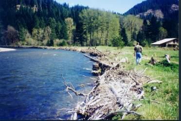
31 Stream Restoration Streambank Protection 30 30

32 Acknowledgements Photos, maps, etc. are courtesy of WDFW staff. Appreciation for past and present WDFW fish passage and screening staff. For more information:

33 Thank you! Susan Cierebiej, WDFW Fish Passage Section Biologist WDFW barrier assessment manual, design manuals, and other guidance documents are online at:
Stream Simulation in Very Low Gradient Channels
 University of Massachusetts - Amherst ScholarWorks@UMass Amherst International Conference on Engineering and Ecohydrology for Fish Passage International Conference on Engineering and Ecohydrology for Fish
Sustaining Hydrologic Connections WSDOT FISH PASSAGE PROGRAM. Connectivity Session
 Connectivity Session Sustaining Hydrologic Connections ABSTRACT WSDOT FISH PASSAGE PROGRAM Jon Peterson (360-705-7499, peterjn@wsdot.wa.gov), Fish Passage Coordinator, Environmental Services Office, Washington
Barrier Nets for Fish Guidance and Reduction of Entrainment at Water Intakes
 University of Massachusetts - Amherst ScholarWorks@UMass Amherst International Conference on Engineering and Ecohydrology for Fish Passage International Conference on Engineering and Ecohydrology for Fish
Amherst. University of Massachusetts - Amherst. Nathaniel Gillespie United State Department of Agriculture, Forest Service
 University of Massachusetts - Amherst ScholarWorks@UMass Amherst International Conference on Engineering and Ecohydrology for Fish Passage International Conference on Engineering and Ecohydrology for Fish
Session A6- Mannings "n" roughness characteristic occurring in semi-smooth turbulent flow of nature- Iike fishways
 University of Massachusetts - Amherst ScholarWorks@UMass Amherst International Conference on Engineering and Ecohydrology for Fish Passage International Conference on Engineering and Ecohydrology for Fish
Session B6: Hydraulic Design of an Innovative Baffle-Brush Type Fish Pass
 University of Massachusetts - Amherst ScholarWorks@UMass Amherst International Conference on Engineering and Ecohydrology for Fish Passage International Conference on Engineering and Ecohydrology for Fish
Session B2 - Assessing fish passage connectivity at the watershed scale: Truckee River case study
 University of Massachusetts - Amherst ScholarWorks@UMass Amherst International Conference on Engineering and Ecohydrology for Fish Passage International Conference on Engineering and Ecohydrology for Fish
Session A2: Like Shooting Fish in a Barrel: Migratory Behavior of Fish at Intertidal Fish Passes in Dutch Wadden Sea
 University of Massachusetts - Amherst ScholarWorks@UMass Amherst International Conference on Engineering and Ecohydrology for Fish Passage International Conference on Engineering and Ecohydrology for Fish
Overview of the Instream Flow/Fish Habitat Element of the WRIA 1 Watershed Management Project. By Jeremy Freimund, P.H.
 Overview of the Instream Flow/Fish Habitat Element of the WRIA 1 Watershed Management Project By Jeremy Freimund, P.H. January 31, 2006 1 Presentation Outline General Overview Instream Flow and Fish Habitat
Farmington Dam Repurpose Project
 Farmington Dam Repurpose Project 2017 $158,100,000 to re-purpose the Farmington Dam from flood protection only to a long-term water storage facility that increases water supply reliability to the region.
Temporary Watercourse Crossing: Culverts
 Temporary Watercourse Crossing: Culverts DRAINAGE CONTROL TECHNIQUE Low Gradient Velocity Control Short Term Steep Gradient Channel Lining Medium-Long Term Outlet Control Soil Treatment Permanent Symbol
Influence of the presence of sills on the behavior of brown trouts (Salmo trutta) in an experimental vertical slot fishway
 in an experimental vertical slot fishway") University of Massachusetts Amherst ScholarWorks@UMass Amherst International Conference on Engineering and Ecohydrology for Fish Passage International Conference on Engineering and Ecohydrology for Fish
University of Massachusetts Amherst ScholarWorks@UMass Amherst International Conference on Engineering and Ecohydrology for Fish Passage International Conference on Engineering and Ecohydrology for Fish
CHAPTER 3 Environmental Guidelines for WATERCOURSE CROSSINGS GOVERNMENT OF NEWFOUNDLAND AND LABRADOR DEPARTMENT OF ENVIRONMENT AND LABOUR
 GOVERNMENT OF NEWFOUNDLAND AND LABRADOR DEPARTMENT OF ENVIRONMENT AND LABOUR CHAPTER 3 Environmental Guidelines for WATERCOURSE CROSSINGS WATER RESOURCES MANAGEMENT DIVISION Water Investigations Section
RRS Project Review. BPA Grand Total $4,358,784 FY16 $ 496,743
 RRS Project Review Project ID: 2003-039-00 1 Title: Monitor and Evaluate (M&E) Reproductive Success and Survival in Wenatchee River Short Description: This project aims to quantitatively evaluate the relative
Session B6: The Baffle-Brush-Fishpass - A New Concept for Non-Selective Fishpasses
 University of Massachusetts - Amherst ScholarWorks@UMass Amherst International Conference on Engineering and Ecohydrology for Fish Passage International Conference on Engineering and Ecohydrology for Fish
Evaluation of the effectiveness of upstream fish passage facilities in the Rhine River assessed by a PIT-tagging study
 University of Massachusetts Amherst ScholarWorks@UMass Amherst International Conference on Engineering and Ecohydrology for Fish Passage International Conference on Engineering and Ecohydrology for Fish
A GIS Tool Prioritizing Dams for Removal within the State of North Carolina Kat Hoenke Southeast Aquatic Resources Partnership (SARP)
") A GIS Tool Prioritizing Dams for Removal within the State of North Carolina Kat Hoenke Southeast Aquatic Resources Partnership (SARP) Cape Fear River Partnership Meeting May 15-16, 2014 Project Background
A GIS Tool Prioritizing Dams for Removal within the State of North Carolina Kat Hoenke Southeast Aquatic Resources Partnership (SARP) Cape Fear River Partnership Meeting May 15-16, 2014 Project Background
Riverine obstacles to fish movement: a rapid assessment tool
 Riverine obstacles to fish movement: a rapid assessment tool Colin Bull Centre for River Ecosystem Science University of Stirling c.d.bull@stir.ac.uk The issue: What is a obstacle to fish migration? Anything
Prioritization Framework For Management Strategies in the Entiat Subbasin Plan
 Prioritization Framework For Management Strategies in the Entiat Subbasin Plan November, 2004 Co-Planners: Chelan County Yakama Nation Prepared by Introduction The purpose of this report is to provide
Culvert Prioritization Model: Aiding Communities in the Selection of Priority Restoration Projects
 Culvert Prioritization Model: Aiding Communities in the Selection of Priority Restoration Projects SNHPC Meeting January 24, 2017 1 Undersized Culverts! Culvert Sizes (~7,500 VT culverts) 6,000 5,000 69%
Wenatchee and Icicle Efforts. AWRA Seattle September 26, 2013
 Wenatchee and Icicle Efforts AWRA Seattle September 26, 2013 Watersheds in WA Yakima/Kittitas Wenatchee Skagit Walla Walla Dungeness Wenatchee Basin 1,370 square miles 85% USFS-managed ~30,000 residents
Informing Puget Sound steelhead recovery goals with a life cycle model
 Informing Puget Sound steelhead recovery goals with a life cycle model March 2016 Phil Sandstrom 1, Joseph Anderson 1, Ken Currens 2, Neala Kendall 1, Jeff Hard 3, and Puget Sound Steelhead Recovery Team
Planning and Combination (Planning and Acquisition) Project Proposal
 Project Proposal") Planning and Combination (Planning and Acquisition) Project Proposal Project Number 15-1308 Project Name Asotin County Geomorphic/Watershed Assessment Sponsor Asotin County Conservation District List all
Planning and Combination (Planning and Acquisition) Project Proposal Project Number 15-1308 Project Name Asotin County Geomorphic/Watershed Assessment Sponsor Asotin County Conservation District List all
LEGAL AUTHORITY AND JURISDICTIONS
 CALIFORNIA DEPARTMENT OF FISH AND GAME RIPARIAN RESOURCES AND REGULATORS: The DFG Lake and Streambed Alteration 1600 Process LEGAL AUTHORITY AND JURISDICTIONS Serge Glushkoff CENTRAL COAST REGION YOUNTVILLE
JHI Sweetheart Lake: Spawning Habitat Assessment & Maintenance
 Technical Memorandum JHI Sweetheart Lake: Spawning Habitat Assessment & Maintenance Date: April 4, 2014 To: Duff Mitchell Company: JHI From: Dan Miller, Lon Mikkelsen, Inter Fluve, Inc. Introduction Juneau
ANNUAL PROGRESS REPORT FOR 2014 ROGUE RIVER SPRING CHINOOK SALMON CONSERVATION PLAN ROGUE WATERSHED DISTRICT OREGON DEPARTMENT OF FISH AND WILDLIFE
 ANNUAL PROGRESS REPORT FOR 2014 ROGUE RIVER SPRING CHINOOK SALMON CONSERVATION PLAN ROGUE WATERSHED DISTRICT OREGON DEPARTMENT OF FISH AND WILDLIFE INTRODUCTION In September of 2007, the Oregon Fish and
The status of aquatic ecosystems in the Basin
 AQUATIC SPECIES AND HABITATS The status of aquatic ecosystems in the Basin is influenced by both natural and human processes. The geologic and geomorphic processes described earlier formed and continue
Lower Columbia River Pile Dike Assessment
 Lower Columbia River Pile Dike Assessment David Gorman, PE August 2, 2011 Credits Hans R. Moritz, US Army Corps of Engineers Portland District Carl Kassebaum, AECOM Project Manager AECOM Coastal and Rivers
FREQUENTLY ASKED QUESTIONS: URBAN STREAM RESTORATION BMP. David Wood Chesapeake Stormwater Network. Lisa Fraley-McNeal Center for Watershed Protection
 FREQUENTLY ASKED QUESTIONS: David Wood Chesapeake Stormwater Network URBAN STREAM RESTORATION BMP Lisa Fraley-McNeal Center for Watershed Protection Bill Stack Center for Watershed Protection FREQUENTLY
Building Resilient Communities - Low Impact Development and Green Infrastructure Strategies
 Building Resilient Communities - Low Impact Development and Green Infrastructure Strategies October 24, 2013 Bridgewater State University E. Heidi Ricci Senior Policy Analyst Mass Audubon Shaping the Future
7.0 SUMMARY AND CONCLUSIONS
 7.0 SUMMARY AND CONCLUSIONS 7.1 SUMMARY This report results from a Washington State Legislature grant to study the feasibility of storing additional water in Lake Wenatchee. The Legislature acted upon
February 4, Erik Merrill, ISAB Coordinator; Jim Ruff, ISAB Ex Officio; and Laura Robinson, Program Implementation and Liaison Specialist
 Bill Bradbury Chair Oregon Henry Lorenzen Oregon W. Bill Booth Idaho James A. Yost Idaho Jennifer Anders Vice Chair Montana Pat Smith Montana Tom Karier Washington Phil Rockefeller Washington February
United States Department of the Interior
 United States Department of the Interior FISH AND WILDLIFE SERVICE Red Bluff Fish & Wildlife Office 10950 Tyler Road, Red Bluff, California 96080 (530) 527-3043, FAX (530) 529-0292 July 20, 2015 To: Guy
Hydropower Plants in Iceland and Their Impact on Freshwater Fishes
 University of Massachusetts Amherst ScholarWorks@UMass Amherst International Conference on Engineering and Ecohydrology for Fish Passage International Conference on Engineering and Ecohydrology for Fish
Chehalis Basin Strategy Programmatic SEPA Draft EIS
 Chehalis Basin Strategy Programmatic SEPA Draft EIS History of Flooding I-5 closed in 1990, 1996, 2007, 2009 Five largest flood events occurred since 1986 2 History of Habitat Degradation Harvest has been
BEAVER MANAGEMENT GUIDELINES
 BEAVER MANAGEMENT GUIDELINES Prepared by the Ministry of Environment, Lands and Parks Vancouver Island Region DRAFT May 10, 2001 Version 1 TABLE OF CONTENTS 1.0 INTRODUCTION...1 2.0 REGULATORY FRAMEWORK...1
Are Juvenile Chinook Salmon Entrained at Unscreened Diversions in Direct Proportion to the Volume of Water Diverted?
 Are Juvenile Chinook Salmon Entrained at Unscreened Diversions in Direct Proportion to the Volume of Water Diverted? Charles H. Hanson Abstract Mark-recapture experiments were used to test the null hypothesis
Chelan County Natural Resource Program. Lake Wenatchee Water Storage Feasibility Study June Executive Summary Why is this study being done?
 Executive Summary The focus on reviewing all potential solutions to shortfalls in instream flow and water supply was sharpened in the drought year of 2001, when streamflows dropped to historic lows in
APPENDIX D WATER DRAFTING GUIDELINES. D-1 NMFS Water Drafting Specifications. D-2 DFG Guidelines for Temporary Water Drafting: Preliminary Draft
 APPENDIX D WATER DRAFTING GUIDELINES D-1 NMFS Water Drafting Specifications D-2 DFG Guidelines for Temporary Water Drafting: D-1 NMFS - WATER DRAFTING WATER-DRAFTING SPECIFICATIONS National Marine Fish
A Summary Guide to the. Rifle River WATERSHED MANAGEMENT PLAN. Know Your Watershed Protect Its Resources
 A Summary Guide to the Rifle River WATERSHED MANAGEMENT PLAN Know Your Watershed Protect Its Resources Table of Contents The Watershed... 3 The Management Plan... 4 Designated and Desired Uses... 5 Sources
7. HABITAT PROTECTION 7.1. INTRODUCTION
 7. HABITAT PROTECTION 7.1. INTRODUCTION Successful habitat protection depends on three important components. First is a public that recognizes the importance of salmon habitat protection, and that does
South St. Vrain / Hall Meadows Restoration Planning August 20, 2015
 South St. Vrain / Hall Meadows Restoration Planning August 20, 2015 Agenda Introductions Purpose & Goals of Meeting Planning Area Master Plan Restoration Planning: Cost Estimates, Grants, Scope, Timeline
These potential changes and their implications are outlined in Annex 1.
 Guidance Note Hydropower Guidance Note: This Guidance Note has been prepared by Natural Resources Wales (NRW) to provide applicants for abstraction and impoundment licences for hydropower schemes with
Prioritizing Mitigation of Road-Stream Crossings for Resident Aquatic Organisms by Accounting for Habitat Quantity, Quality, and Accessibility
 University of Massachusetts Amherst ScholarWorks@UMass Amherst Environmental & Water Resources Engineering Masters Projects Civil and Environmental Engineering 5-2015 Prioritizing Mitigation of Road-Stream
West Branch LeClerc Creek Watershed Restoration Project Environmental Assessment
 West Branch LeClerc Creek Watershed Restoration Project Environmental Assessment Decision Notice, Finding of No Significant Impact, and Response to Public Comments April 2015 USDA Forest Service Colville
iv) Alberta fish weirs
 Alberta fish weirs") Fish passage at culverts in New Zealand 36 iv) Alberta fish weirs The fish weirs used by Alberta Transportation are weir baffles with a partial slot (Figure 16). The best designs from Rajaratnam et al.
Fish passage at culverts in New Zealand 36 iv) Alberta fish weirs The fish weirs used by Alberta Transportation are weir baffles with a partial slot (Figure 16). The best designs from Rajaratnam et al.
Water and Watersheds. Data Maps Action
 Water and Watersheds Data Maps Action What is the Wildlife Action Plan? Restore rare wildlife and habitats. Keep common species common. 2015 Revision: Partners in Conservation Science 2015 Revision Data
NetMap Community Digital Watersheds & Shared Analysis Tools
 NetMap Community Digital Watersheds & Shared Analysis Tools Earth Systems Institute U. S. Forest Service, Pacific Northwest Experiment Station & Collaborating Agencies The NetMap Project Collaborators:
Mission Restoration Project
 Hydrologic/Aquatic Resources Report Prepared by: R. Lance George, Zone Hydrologist and Gene Shull, Zone Fisheries Biologist Methow Valley and Tonasket Ranger Districts Okanogan-Wenatchee National Forest
MASSACHUSETTS RIVER AND STREAM CROSSING STANDARDS RIVER AND STREAM CONTINUITY PARTNERSHIP. Developed by the
 MASSACHUSETTS RIVER AND STREAM CROSSING STANDARDS Developed by the RIVER AND STREAM CONTINUITY PARTNERSHIP Including: University of Massachusetts Amherst The Nature Conservancy Massachusetts Division of
LINKING FRESHWATER REARING HABITAT TO SKAGIT CHINOOK SALMON RECOVERY. Appendix C of the Skagit Chinook Recovery Plan
 LINKING FRESHWATER REARING HABITAT TO SKAGIT CHINOOK SALMON RECOVERY Appendix C of the Skagit Chinook Recovery Plan November 4, 2005 Eric M. Beamer Bob Hayman Devin Smith GIS work: Kate Ramsden and Karen
Climate Change: Impacts, Monitoring, and Solutions
 Climate Change: Impacts, Monitoring, and Solutions 1 Responding to Climate Change 1. Projections/Impacts 2. Adaptation and Resiliency 3. Monitoring 4. What about emissions? 2 Native trout and salmon are
River Basin Management of the Meuse
 River Basin Management of the Meuse The IMC Masterplan for Migratory Fish Willem L.M. Schreurs Secretary General EC IEA Hydropower Workshop, Brussels 29 30 May 2017 River Basin Management of the Meuse
The Status of Rainbow Trout (Oncorhynchus mykiss) in the Stanislaus River Summary report of 2015 snorkel surveys
 in the Stanislaus River Summary report of 2015 snorkel surveys") The Status of Rainbow Trout (Oncorhynchus mykiss) in the Stanislaus River Summary report of 2015 snorkel surveys Prepared By: Matt Peterson Jason Guignard Andrea Fuller Doug Demko FISHBIO 1617 S. Yosemite
The Status of Rainbow Trout (Oncorhynchus mykiss) in the Stanislaus River Summary report of 2015 snorkel surveys Prepared By: Matt Peterson Jason Guignard Andrea Fuller Doug Demko FISHBIO 1617 S. Yosemite
King County Flood Control District approves grants for flood prevention projects Regional projects to benefit from district funds
 News Release Contact: Al Sanders 206-477-1016 August 31, 2015 Flood Control District approves grants for flood prevention projects Regional projects to benefit from district funds The Flood Control District
f) Culverts in series shall be spaced at least 20 feet between each other. 2.7 C Culverts
 Culverts in series shall be spaced at least 20 feet between each other. 2.7 C Culverts") 2.7 C Culverts 1. General Culverts are intended to safely pass flow under road crossings. Criteria are designed to protect, maintain, and enhance public health, safety, and the environment. Where culverts
2.7 C Culverts 1. General Culverts are intended to safely pass flow under road crossings. Criteria are designed to protect, maintain, and enhance public health, safety, and the environment. Where culverts
SECTION 5.0 ACTION 4 - ENGLEBRIGHT DAM REMOVAL
 SECTION 5.0 ACTION 4 - ENGLEBRIGHT DAM REMOVAL This Section presents facilities design and cost information for Englebright Dam Removal Action (Action 4). Action 4 includes improvements to Daguerre Point
Programmatic Environmental Impact Statement (EIS) for Lower Green River Corridor Plan Request for Proposals:
 for Lower Green River Corridor Plan Request for Proposals:") Programmatic Environmental Impact Statement (EIS) for Lower Green River Corridor Plan Request for Proposals: The King County Flood District (District) is seeking proposals from firms to prepare a programmatic
Programmatic Environmental Impact Statement (EIS) for Lower Green River Corridor Plan Request for Proposals: The King County Flood District (District) is seeking proposals from firms to prepare a programmatic
In re: Town of Norwich Pool Dam Reconstruction, Stream Alteration Permit Application
 Agency of Natural Resources October 20, 2015 Neil R. Fulton Town Manager Town of Norwich P.O. Box 376 Norwich, VT 05055 In re: Town of Norwich Pool Dam Reconstruction, Stream Alteration Permit Application
Outcomes. Kelly Karll-SEMCOG Margaret Barondess - MDOT
 Eco-Logical: I-75 Corridor I-75 Conservation Transportation Action Planning in to Monroe Achieve County: Multiple Stormwater Environmental Considerations Outcomes Kelly Karll-SEMCOG Karll@semcog.org Margaret
WRIA 1 Long Term Monitoring Program Strategy for Implementation
 1 2 3 4 5 6 7 8 9 10 11 12 13 14 15 16 17 18 19 20 21 22 23 24 25 26 27 28 29 30 31 32 33 34 35 36 WRIA 1 Long Term Monitoring Program Strategy for Implementation Section 1- Introduction The June 2005
Developing and optimizing a coordinated Salish Sea zooplankton monitoring program
 Western Washington University Western CEDAR Salish Sea Ecosystem Conference 2014 Salish Sea Ecosystem Conference (Seattle) May 1st, 3:30 PM - 5:00 PM Developing and optimizing a coordinated Salish Sea
Conner Creek Migration Barrier Removal Project
 Conner Creek Migration Barrier Removal Project Conner Creek Road Conner Creek - November 2011 CA DEPARTMENT OF FISH AND GAME AGREEMENT P0710308 FINAL REPORT Partners Coastal Conservancy Grant Nos. 08-090,
Subject: October and November Fish Kill Incidents, Article 406
 FEDERAL ENERGY REGULATORY COMMISSION Washington, D. C. 20426 OFFICE OF ENERGY PROJECTS Kevin Bernier Senior Compliance Specialist Black Bear Hydro Partners, LLC 26 Katherine Drive Hallowell, ME 04347 Project
PACIFIC STATES MARINE FISHERIES COMMISSION POSITION DESCRIPTION Title: Fishery Biologist/Analyst 2 (17-902)
") Title: Fishery Biologist/Analyst 2 (17-902) Location: Portland, Oregon (97232) Position Type: Full Year (12 months or more), Salary/ Exempt Benefits Eligible: Yes www.psmfc.org/benefits Salary Target:
Title: Fishery Biologist/Analyst 2 (17-902) Location: Portland, Oregon (97232) Position Type: Full Year (12 months or more), Salary/ Exempt Benefits Eligible: Yes www.psmfc.org/benefits Salary Target:
STETSON ENGINEERS INC. HANSON ENVIRONMENTAL,INC. IBIS ENVIRONMENTAL SERVICES. February 2004 Revised
 FINAL DRAFT ARROYO GRANDE CREEK HABITAT CONSERVATION PLAN (HCP) AND ENVIRONMENTAL ASSESSMENT/INITIAL STUDY (EA/IS) FOR THE PROTECTION OF STEELHEAD AND CALIFORNIA RED-LEGGED FROGS February 2004 Revised
Session C5: Downstream Migration of the European Eel (A. anguilla): Movement Patterns and the Potential Impact of Environmental Factors
: Movement Patterns and the Potential Impact of Environmental Factors") University of Massachusetts - Amherst ScholarWorks@UMass Amherst International Conference on Engineering and Ecohydrology for Fish Passage International Conference on Engineering and Ecohydrology for Fish
University of Massachusetts - Amherst ScholarWorks@UMass Amherst International Conference on Engineering and Ecohydrology for Fish Passage International Conference on Engineering and Ecohydrology for Fish
Estimation of rearing habitat requirements of San Joaquin River Chinook salmon using the Emigrating Salmonid Habitat Estimation (ESHE) Model
 Model") Estimation of rearing habitat requirements of San Joaquin River Chinook salmon using the Emigrating Salmonid Habitat Estimation (ESHE) Model California Central Valley Cramer Fish Sciences *Draft conceptual
Estimation of rearing habitat requirements of San Joaquin River Chinook salmon using the Emigrating Salmonid Habitat Estimation (ESHE) Model California Central Valley Cramer Fish Sciences *Draft conceptual
SNOHOMISH COUNTY PUBLIC UTILITY DISTRICT NO.1. Your Northwest renewables utility
 SNOHOMISH COUNTY PUBLIC UTILITY DISTRICT NO.1 Your Northwest renewables utility November 1,2012 VIA ELECTRONIC FILING Kimberly D. Bose, Secretary Federal Energy Regulatory Commission (FERC) 888 First Street
The McKenzie River Watershed Conservation Strategy
 The McKenzie River Watershed Conservation Strategy January 2002 The McKenzie Watershed Council Fostering better stewardship of McKenzie Watershed resources through voluntary partnerships and collaboration.
Trails Permitting Process
 Appendix H: Trail Permitting Process A PPENDIX H: T RAIL P ERMITTING P ROCESS Trails Permitting Process The permitting process is a critical component in the successful development of a trail network.
We have great news. Danish National Institute of Aquatic Resources uses drones for survey
 We have great news From drone surveys to social attitudes towards dams, new projects in the Allier river and much more. You can read it all in this new AMBER newsletter. Danish National Institute of Aquatic
PUBLIC NOTICE. Section 404 of the Clean Water Act (33 U.S.C. 1344) Section 10 of the Rivers and Harbors Act of 1899 (33 U.S.C.
 Section 10 of the Rivers and Harbors Act of 1899 (33 U.S.C.") US Army Corps Of Engineers Wilmington District PUBLIC NOTICE Issue Date: June 17, 2014 Comment Deadline: July 17, 2014 Corps Action ID#: SAW-2009-00655 NC DOT TIP: R-4903 The Wilmington District, Corps
US Army Corps Of Engineers Wilmington District PUBLIC NOTICE Issue Date: June 17, 2014 Comment Deadline: July 17, 2014 Corps Action ID#: SAW-2009-00655 NC DOT TIP: R-4903 The Wilmington District, Corps
EFFECT OF UPSTREAM DEVELOPMENT ON THE CLEAR CREEK AREA
 EFFECT OF UPSTREAM DEVELOPMENT ON THE CLEAR CREEK AREA Technical Memorandum Farming in the Floodplain Project Prepared for May 2017 PCC Farmland Trust Photo credit: Google Earth TABLE OF CONTENTS Page
AP Environmental Science
 2017 AP Environmental Science Sample Student Responses and Scoring Commentary Inside: RR Free Response Question 4 RR Scoring Guideline RR Student Samples RR Scoring Commentary 2017 The College Board. College
Monitoring Program Terms of Reference REVELSTOKE FLOW MANAGEMENT PLAN
 Columbia River Project Water Use Plan Monitoring Program Terms of Reference REVELSTOKE FLOW MANAGEMENT PLAN CLBMON-17 Middle Columbia River Juvenile Fish Habitat Use Revisions May 12, 2010 Revised Terms
DECISION MEMO. West Fork Blacktail Deer Creek Hardened Crossing
 Page 1 of 6 Background DECISION MEMO USDA Forest Service Madison Ranger District Madison County T12S, R4W, Section 30 The project is in the Gravelly Landscape, Snowcrest Recommended Wilderness Management
Project sponsors provided a brief presentation on their project(s), followed by comments from the Committee.
, followed by comments from the Committee.") WRIA 14 Salmon Habitat Recovery Committee Meeting April 17, 2014 Summary notes Project sponsors provided a brief presentation on their project(s), followed by comments from the Committee. Allyn Shoreline
WRIA 14 Salmon Habitat Recovery Committee Meeting April 17, 2014 Summary notes Project sponsors provided a brief presentation on their project(s), followed by comments from the Committee. Allyn Shoreline
STONYBROOK CREEK SALMONID MIGRATION BARRIER REMOVAL PROJECT. October 2005
 04-1016-01.003 STONYBROOK CREEK SALMONID MIGRATION BARRIER REMOVAL PROJECT October 2005 Prepared for: Gordon Becker Center for Ecosystem Management and Restoration (CEMAR) 4179 Piedmont Ave. Ste 325 Oakland,
Stream Watch Visual Survey Instructions
 Stream Watch Visual Survey Instructions The Stream Watch Visual Survey is based on assessment parameters from the EPA's Rapid Bioassessment Protocol Habitat Assessment, Georgia Adopt a Stream Visual Survey,
FY16 RSM IPR Portland District, Optimizing Fall Creek Reservoir Flush TMDL s, Stanford Gibson, Chris Nygaard, Jim Crain, Jarod Norton
 Fall Creek Reservoir Fall Creek Dam is at river mile 7.2 on Fall Creek, a tributary of the Willamette River, about 20 miles southeast of Eugene, OR. Dam works in coordination with Lookout Point and Hills
Stakeholder Meeting; Project Status - Meeting Summary
 1 Wallowa Falls Project Relicensing November 4, 2014 Stakeholder Meeting; Project Status - Meeting Summary Start Time: 10:00 a.m. To review PacifiCorp s Additional Information Request-Response filed with
Cedar River Watershed Habitat Conservation Plan
 Cedar River Watershed Habitat Conservation Plan Briefing for the WRIA 8 Salmon Recovery Council November 21, 2013 Cyndy Holtz Seattle Public Utilities cyndy.holtz@seattle.gov What is an HCP? Habitat Conservation
Construction of Artificial Riffles and Pools For Freshwater Habitat Restoration
 Construction of Artificial Riffles and Pools For Freshwater Habitat Restoration Kate Howe Preserving biodiversity is one of the central goals of ecologists and conservation biologists today. As human population
Effectiveness Monitoring Gap Analysis and Prioritization. Jennifer O Neal - Project Manager Tetra Tech EC, Inc.
 Effectiveness Monitoring Gap Analysis and Prioritization Jennifer O Neal - Project Manager Tetra Tech EC, Inc. Overview Project Background Project Approach Methods Results Recommendations Summary Additional
Green River Diversion Rehabilitation
 USDA Natural Resources Conservation Service-Utah Wallace F. Bennett Federal Building 125 S. State Street Room 4010 Salt Lake City, UT 84138-1100 Green River Diversion Rehabilitation National Environmental
LOW WATER CROSSINGS, fords, or drifts, as they
 Chapter 9 For ords and Low-Water Crossings Keep the ford profile low, armor the driving surface, and protect against scour. LOW WATER CROSSINGS, fords, or drifts, as they are commonly called, can offer
Habitat Grant Projects Clinton River Watershed
 Habitat Grant Projects Clinton River Watershed L Y N N E S E Y M O U R E N V I R O N M E N T A L E N G I N E E R O F F I C E O F T H E M A C O M B C O U N T Y P U B L I C W O R K S C O M M I S S I O N
Summary of the 1997 Fish Habitat Risk Assessment Panel
 United States Department of Agriculture Forest Service Tongass National Forest Forest Plan Interdisciplinary Team 8465 Old Dairy Road Juneau, Alaska 99801 (907) 586-8700 Reply To: RS-G-b Date: May 7, 1997
REQUEST FOR PROPOSAL
 REQUEST FOR PROPOSAL Submittal Deadline: 5:00 pm July 7, 2017 The Vermont Chapter of The Nature Conservancy invites proposals from qualified consultants for two fish passage restoration projects on culverts
Conservation Assessment & Prioritization System (CAPS)
") Conservation Assessment & Prioritization System (CAPS) Assessing ecological integrity and supporting decision-making for land conservation, habitat management, project review & permitting to protect biodiversity
Conservation Assessment & Prioritization System (CAPS) Assessing ecological integrity and supporting decision-making for land conservation, habitat management, project review & permitting to protect biodiversity
Lisa Hauck Stream Restoration May
 The Effects of Stream Restoration on Habitat Quality Lisa Hauck Abstract Many stream restoration projects do not include a requirement for long-term monitoring after the project has been completed, resulting
Otter Creek Watershed TMDL Project. Stakeholder Meeting June 6, 2013
 Otter Creek Watershed TMDL Project Stakeholder Meeting June 6, 2013 1 Meeting Purpose Meet with watershed & technical advisory group members and watershed landowners to provide basic Otter Creek TMDL project
New Hampshire Stream Crossing Guidelines
 New Hampshire Stream Crossing Guidelines May 2009 1 This document was written to assist in the design, construction and permitting of stream crossings in New Hampshire. Many individuals from non-governmental
Using Climate Science in Hydropower Planning
 Using Climate Science in Hydropower Planning Susan Walker, NOAA- Fisheries Alaska Hydropower Coordinator Andrea J. Ray, Ph.D., NOAA Earth System Research Lab, Physical Sciences Division, Boulder, CO Joseph
Municipal Class Environmental Assessment for Pottersburg Creek Slope Stability Study South of Hamilton Road, Schedule B
 Municipal Class Environmental Assessment for Pottersburg Creek Slope Stability Study South of Hamilton Road, Schedule B February 13, 2013 Municipal Class EA Process We are here Purpose and Objective of
Tim Hayden, Yurok Tribe Natural Resources Division Mat Millenbach, Western Rivers Conservancy Sarah Beesley, Yurok Tribal Fisheries Program
 BLUE CREEK FOREST SANCTUARY: RESTORING OLD GROWTH FOREST ECOSYSTEM FUNCTION, PROTECTING SALMON, WILDLIFE, AND TRADITIONAL- LIFE WAYS AND CULTURE IN THE FACE OF CLIMATE CHANGE Tim Hayden, Yurok Tribe Natural
Project # Protect and Restore the Crooked and American River Watersheds. Response to December 9, 2010 ISRP Comments
 Nez Perce Tribe Department of Fisheries Resource Management Administration Enforcement Habitat/Watershed Harvest Production Research Resident Fish WATERSHED DIVISION P.O. Box 365 Lapwai, Idaho 83540 Phone:
SECTION 11: REGULATORY FLOODWAYS
 SECTION 11: REGULATORY FLOODWAYS Contents 11.1. The Floodway... 11-2 11.1.1. The floodway concept... 11-2 11.1.2. Floodway map... 11-2 11.1.3. Floodway permitting... 11-3 11.1.4. Changing the floodway...
Culvert Prioritization Model: Aiding Communities in the Selection of Priority Restoration Projects
 Culvert Prioritization Model: Aiding Communities in the Selection of Priority Restoration Projects Meeting #1 of the Technical Advisory Committee March 18, 2016 1 Press 2 Prepared February 2016 Undersized