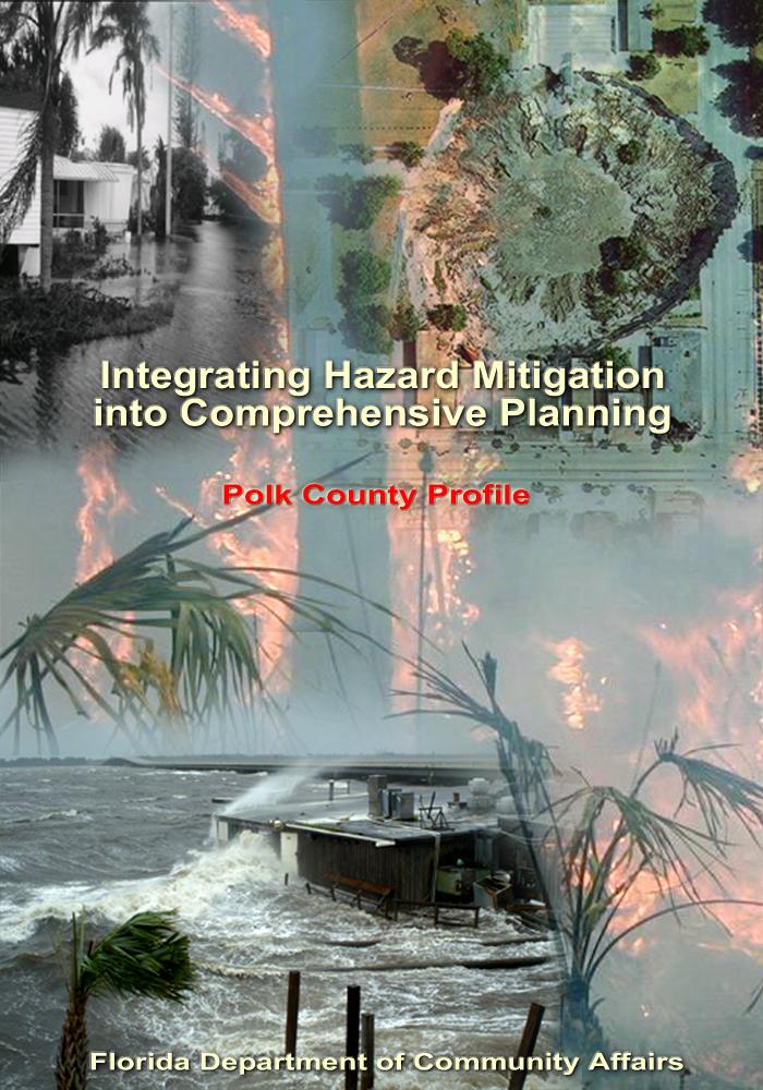
INTEGRATION OF THE LOCAL MITIGATION STRATEGY INTO THE LOCAL COMPREHENSIVE PLAN. ExecutiveSumary
|
|
|
- Beverley Jordan
- 5 years ago
- Views:
Transcription
1
2 ExecutiveSumary The experiences of the 2004 hurricane season epitomize the importance of better integrating hazard mitigation activities into local comprehensive planning. That fall, residents all over the state experienced significant damages from Hurricanes Charley, Frances, Jeanne, and Ivan as a result of winds, tornadoes, surge, and/or flooding. But this was not the only time we have experienced natural disasters, nor will it be the last. In 1992, Hurricane Andrew devastated South Florida. In 1998 and 1999, most counties in Florida experienced wildfires. In some cases, despite firefighters' best efforts, fires advanced through neighborhoods and homes were lost. Every year in Central Florida, new sinkholes emerge, swallowing homes and damaging infrastructure. The cost of recovery for these various disasters ranges from hundreds of thousands to billions of dollars, significantly taxing local, State, and federal financial sources. Losses covered through federal funding as a result of the 2004 hurricanes alone could reach as high as $7 billion. Worst of all, however, are the many lives that, directly or indirectly, are lost due to natural disasters. It is imperative that we reduce the human and financial costs of natural disasters. Through better integration of natural hazard considerations into local comprehensive planning, we can build safer communities. This Polk County Profile has been prepared as part of a statewide effort by the Florida Department of Community Affairs to guide local governments in integrating hazard mitigation principles into local Comprehensive Plans. Information provided in this profile will enable planners to (1) convey Polk County s existing and potential risk to identified hazards; (2) assess how well local hazard mitigation principles have been incorporated into the County s Comprehensive Plan; (3) provide recommendations on how hazard mitigation can be better integrated into the Comprehensive Plan; and (4) determine if any enhancements could be made to the Local Mitigation Strategy (LMS) to better support comprehensive planning. Best available statewide level data are provided to convey exposure and risk as well as illustrate the vulnerability assessment component of the integration process. In this profile, we present an argument for why hazard mitigation needs to be a part of comprehensive planning through an examination of population growth, the hazards that put the County at risk, the special needs population and structures that could be affected by these hazards, and the distribution of existing and future land uses in different hazard areas. We hope that this analysis will serve as an example of the issues each jurisdiction should consider as they update their plans to include hazard mitigation. The profile also contains a review of the LMS and the Comprehensive Plan. Based on the analysis and review, we were able to develop specific options for the County on how to incorporate more hazard mitigation into the Comprehensive Plan and how to enhance the LMS so that it is also a better tool for local planners. During our review, we found that Polk County had many strengths regarding hazard mitigation in both its LMS and Comprehensive Plan, and these are outlined in the profile. There are always ways to further strengthen such plans, however, and the following is a summary of some of the options that would enable the County to do so. GENERAL RECOMMENDATIONS The County can include a map of hazard locations overlaying land uses as a new map in the Future Land Use series. The LMS could also include existing and future land uses on hazard maps. By using consistent data and showing linkages between the different plans, each plan will be stronger. Maps, such as the ones in this profile, provide useful visual knowledge on the relationship between land uses and hazard zones that can be used for planning mitigation or changes in future land use. This would also support the County s development of future development flood scenarios (Comprehensive Plan Policy E2). Draft 3/14/2006 FLORIDA DEPARTMENT OF COMMUNITY AFFAIRS ii
3 The County can support a program in coordination with the LMS committee to educate homeowners of mitigation techniques for protecting their structures, including wind, flood, firewise, and sinkhole mitigation techniques. While regulation can prevent new vulnerabilities to hazards, one of the best ways to mitigate existing vulnerabilities is through education. Also, LMS initiatives can be drafted to implement goals and objectives pertaining to education. Polk County currently has a shelter capacity deficit of over 30,000 people according to the 2004 State Shelter Plan. The County through the Comprehensive Plan and LMS can encourage new residential developments to include a shelter in the development or build safe rooms into each home if not in a flood zone. They can also identify safe zones (large defensible space and non-flammable materials) throughout the county for wildfire emergency shelters. The LMS could add an objective that supports increasing the amount of shelter space in the county through hardening of public buildings or new shelter facilities. The Comprehensive Plan could add a policy for determining future shelter demand based on future land use scenarios and could even set of a level of service for shelter space related to new development. The County could adopt development regulations that employ cluster development to avoid natural features. The County could protect natural and cultural resources by locating cultural facilities away from hazard areas. The LMS could access the vulnerability and risk of historic sites and structures to natural hazards. Also, the County could prioritize drainage projects that will protect historical structures. The County can address redevelopment in the hazard area by only allowing redevelopment after a natural disaster to occur at the density/intensity of the land use designation currently in place. This is considered on of the best management practices from Protecting Florida's Communities. (FDCA, 2005b) Flood Hazards Polk County can use incentives or provide assistance in retrofit, relocation, or demolition of repetitive loss structures and/or acquire repetitive loss properties for parks or conservation. Table 2.3 shows that 121,402 structures are within the 100-year floodplain and there are 21 homes in the State s Repetitive Flood Loss database. To eliminate repetitive loss structures (i.e. from flood or sinkhole damages) residents may need assistance with relocation or costly retrofits. Wildfire Hazards The County can require management plans for conservation areas that address reduction of wildfire fuels. Forests that are maintained, through prescribed fire or other mechanical means, will not become a wildfire risk to the nearby community. The County can adopt LDRs that limit residential development in high-risk fire areas, such as those adjacent to conservation lands. Limiting development or requiring adequate defensible buffers near conservation areas will assuage some of the liability and practical issues of using prescribed fire as a management practice. The County can require firewise neighborhood design as a condition of approval for subdivisions or PUDs in high-risk areas. There are 97,777 residential structures in medium-high wildfire risk zones as shown in Table 2.3. In addition, 24.3% of the wildfire Draft 3/14/2006 FLORIDA DEPARTMENT OF COMMUNITY AFFAIRS iii
4 susceptible areas shown on the maps in Attachment B are designated for future residential use. Through design techniques and/or adoption of a firewise building code for these at risk areas, the County could reduce its vulnerability to wildfire and make many new homes much safer. Sinkhole Hazards The County can restrict development through overlay zones or preservation districts in high-risk, karst- sensitive areas. This is considered a best management practice from Protecting Florida's Communities. (FDCA, 2005b) The County already has several types of overlay districts to which this could be a new type or the Development- Limitation Areas overlay could have sinkholes added as another characteristic. The County can use buffers or setbacks to prevent development from building too close to an existing sinkhole. In karst-sensitive areas such as those shown on the maps in Attachment C, the County can require a geotechnical evaluation be made prior to development approval. They can then employ clustering or transfer of development rights to provide the property owner with other options. Draft 3/14/2006 FLORIDA DEPARTMENT OF COMMUNITY AFFAIRS iv
5 TableofContents Executive Summary...i 1. County Overview Hazard Vulnerability Existing Mitigation Measures Comprehensive Plan Review Recommendations Sources...15 Attachments... Attachment A: Maps of the Existing and Future Land Uses within the 100-year Floodplain... A-1 Attachment B: Maps of the Existing and Future Land Uses within Wildfire Susceptible Areas... B-1 Attachment C: Maps of the Existing and Future Land Uses within Potential Sinkhole Hazard Areas...C-1 Attachment D: Polk County Local Mitigation Strategy Goals and Objectives...D-1 Attachment E: Polk County Comprehensive Plan Excerpts Related to Hazard Mitigation... E-1 Draft 3/14/2006 FLORIDA DEPARTMENT OF COMMUNITY AFFAIRS v
. There are seventeen incorporated municipalities within the County, and these are listed in Table 1.")
6 1.CountyOverview Geography and Jurisdictions Polk County is located in Central Florida. It covers a total of 1,874 square miles with an average population density of people per square mile (U.S. Census, 2000). There are seventeen incorporated municipalities within the County, and these are listed in Table 1.1. Population and Demographics Official 2004 population estimates for all jurisdictions within Polk County as well as the percent change in population from the 2000 U.S. Census are presented in Table 1.1. The most current estimated countywide population of Polk County is 528,389 people (University of Florida, Bureau of Economic and Business Research, 2004). The most populated city in Polk County is Lakeland, but 62.1% of the countywide population lives in the unincorporated portion of the County. Between 1990 and 2000, Polk County as a whole had a growth rate of 19.4%, which was less than the statewide growth rate of 23.5% in those 10 years. (U.S. Census Bureau, 2000) Table 1.1 Population Estimates by Jurisdiction Jurisdiction Population, Census 2000 Population Estimate, 2004 % Change, % of Total Population (2004) UNINCORPORATED 302, , % 62.1% Auburndale 11,032 11, % 2.3% Bartow 15,340 15, % 3.0% Davenport 1,924 2, % 0.4% Dundee 2,912 2, % 0.6% Eagle Lake 2,496 2, % 0.5% Ft. Meade 5,691 5, % 1.1% Frostproof 2,975 2, % 0.6% Haines City 13,174 14, % 2.8% Highland Park % 0.0% Hillcrest Heights % 0.1% Lake Alfred 3,890 4, % 0.8% Lake Hamilton 1,304 1, % 0.3% Lake Wales 10,194 12, % 2.4% Lakeland 78,452 89, % 17.0% Mulberry 3,230 3, % 0.6% Polk City 1,516 1, % 0.3% Winter Haven 26,487 27, % 5.3% Countywide Total 483, , % 100.0% Source: University of Florida, Bureau of Economic and Business Research, Draft 3/14/2006 FLORIDA DEPARTMENT OF COMMUNITY AFFAIRS 1
7 According to the University of Florida, Bureau of Economic and Business Research (2004), Polk County s population is projected to grow steadily for the next 25 years, reaching 730,000 people by the year Figure 1.1 illustrates medium population projections for Polk County based on 2004 calculations. Figure 1.1 Medium Population Projections for Polk County, , , ,000 Population 500, , , , , Year Source: University of Florida, Bureau of Economic and Business Research, Of particular concern within Polk County s population are those persons with special needs and/or limited resources such as the elderly, disabled, low-income, or language-isolated residents. According to the 2000 U.S. Census, 18.3% of Polk County residents are listed as 65 years old or over, 22.6% are listed as having a disability, 12.9% are listed as below poverty, and 12.1% live in a home with a primary language other than English. (U.S. Census Bureau, 2000) 2.HazardVulnerability Hazards Identification The following are natural hazards that pose a high risk for the County as identified in the County s Local Mitigation Strategy (LMS): floods, hurricanes and coastal storms, severe storms/tornadoes, wildfires, and drought/heat wave. Polk County was directly affected by 2 hurricanes in 2004 and indirectly affected by 2 others. The County was impacted by inland flooding and high winds. In the past 50 years, Polk has had several minor flooding events totaling approximately $3 million in damages. The most impacted areas of the county were adjacent to rivers and streams that overflowed their banks. The county has also had several sinkholes but no detailed data exists on these events. In the past 10 years, 10 wildland fires have burned several acres throughout the county. The most recent was in 2001 when a large wildfire burned over 11,000 acres of mainly grass, scrub trees and shrubs along the north side of the Interstate 4 corridor over mainly rural portions of northern Polk County. A ten mile stretch of Interstate 4 was closed between Polk City and Lakeland due to the wildfire for nearly ten days. (Polk County, 2005). Hazards Analysis The following analysis looks at three major hazard types: flooding, sinkholes, and wildfire. All of the information in this section, except the evacuation and shelter estimates, was obtained through the online Mapping for Emergency Management, Parallel Hazard Information System (MEMPHIS). MEMPHIS was designed to provide a variety of hazard related data in support of the Draft 3/14/2006 FLORIDA DEPARTMENT OF COMMUNITY AFFAIRS 2
8 Florida Local Mitigation Strategy DMA2K revision project. It was created by Kinetic Analysis Corporation under contract with the Florida Department of Community Affairs (FDCA). Estimated exposure values were determined using the Federal Emergency Management Agency's (FEMA s) designated 100-year flood zones (A, AE, V, VE, AO, 100 IC, IN, AH), levels of concern 5 through 9 for wildfire, and high through adjacent risk zones for sinkholes. For more details on a particular hazard or an explanation of the MEMPHIS methodology, consult the MEMPHIS Web site ( or your countywide LMS. Existing Population at Risk Table 2.1 presents the estimated countywide population at risk from hazards, as well as a breakdown of the sensitive needs populations at risk. The first column in the table summarizes the residents of Polk County that live within FEMA Flood Insurance Rate Map zones that signify special flood hazard areas. According to these maps, 16% of the population, or 77,503 people, are within the 100-year flood zone. A majority of those at risk of flooding are either elderly and/or disabled. These special-needs citizens require extra planning by local governments to ensure their safety. In Polk County, sinkholes are a major risk, and 35% of the population is within a high to adjacent risk sinkhole zone. This is a widespread problem for the County with no easy solution; however, steps can be taken to further define potential sinkhole locations and to build in a way that lessens the risk. Wildfire is also a hazard of concern to the County, with 57.6% of the population living in medium- to high-risk wildfire zones. Forty-one percent of those at risk from wildfire are disabled, making a quick evacuation more difficult. Table 2.1 Estimated Number of Persons at Risk from Selected Hazards Population Flood Sinkhole (highadjacent risk) Wildfire (medium-high risk) Minority 13,709 38,838 61,752 Over 65 16,727 27,259 46,862 Disabled 33,362 69, ,989 Poverty 9,144 23,211 37,347 Language Isolated Single Parent 4,561 11,264 17,701 Countywide Total 77, , ,651 Source: Florida Department of Community Affairs, 2005a. Evacuation and Shelters As discussed in the previous sections, population growth in Polk County has been steady, and this trend is projected to continue. As the population increases in the future, the demand for shelter space and the length of time it takes to evacuate the County is only going to increase. Currently, evacuation clearance times for Polk County are estimated to be 13 hours for all category hurricanes, as shown in Table 2.2. These data were derived from 11 regional Hurricane Evacuation Studies that have been produced by FEMA, the U.S. Army Corps of Engineers, and Florida Regional Planning Councils. The study dates range from 1995 to 2004 and are updated on a rotating basis. According to Rule 9J-5, counties must maintain or reduce hurricane evacuation times. Some experts have suggested that counties should try to achieve 12 hours or less clearance time for a Category 3 hurricane. This is due to the limited amount of time between the National Hurricane Center issuing a hurricane warning and when the tropical storm-force winds make landfall. Polk County is just above this recommendation for now, but with continued growth and the limited road network of the region, it will be difficult to maintain this evacuation time. Additionally, storm events requiring evacuation typically impact larger areas, often forcing multiple counties to issue evacuation orders and placing a greater number of evacuees on the Draft 3/14/2006 FLORIDA DEPARTMENT OF COMMUNITY AFFAIRS 3
9 major roadways, further hindering evacuation progress. Thus, it is important to not only consider evacuation times for Polk County, but also for other counties in the region as shown in Table 2.2. Table 2.2 County Evacuation Clearance Times in Hours (High Tourist Occupancy, Medium Response) County Hurricane Category Desoto Glades Hardee Hendry Highlands Polk Note: Best available data as of 7/05 Source: State of Florida, 2005 (some counties may be in the process of determining new clearance times) Coupled with evacuation is the need to provide shelters. If adequate space can be provided in safe shelters for Polk County residents, then this could be a partial solution to the ever-increasing clearance times for evacuation. Currently, the State Shelter Plan reports that there is space for 11,172 people in the County s shelters, and there are 30,668 more people that will need sheltering in the case of a Category 5 hurricane. It is projected that by 2009 the deficit will increase to 34,063 people in need of space (FDCA, 2004). The County will need to address this deficiency but might also try to decrease the demand for public shelters by encouraging new homes to be built with safe rooms if they are outside of flood and surge zones. Residents who are further inland in the County and not in a flood zone could shelter in place if they had a safe room that could withstand hurricane-force winds. Safe rooms could at least be a last option for residents who cannot evacuate in time, especially in the case of a tornado. Existing Built Environment While the concern for human life is always of utmost importance in preparing for a natural disaster, there also are large economic impacts to local communities, regions, and even the State when property damages are incurred. To be truly sustainable in the face of natural hazards, we must work to protect the residents and also to limit, as much as possible, property losses that slow down a community s ability to recover from a disaster. Table 2.3 presents estimates of the number of buildings in Polk County by structure type that are at risk from each of the four hazards being analyzed. Flooding presents a large risk to property in the County, with 121,402 structures within a flood zone. A majority of those structures are single-family or mobile homes. According to the latest National Flood Insurance Program Repetitive Loss Properties list, there are 21 homes in unincorporated Polk County that have had flood damage multiple times and received insurance payments but have not remedied the recurring problem. Table 2.3 also shows 68,454 structures within high to adjacent risk sinkhole areas, with 67.4% of those structures being single-family homes. Residences are also at risk from wildfire, with 71.3% of the total 123,521 structures at risk being single-family or mobile homes. Draft 3/14/2006 FLORIDA DEPARTMENT OF COMMUNITY AFFAIRS 4
10 Table 2.3 Estimated Number of Structures at Risk from Selected Hazards Structure Type Flood Sinkhole (highadjacent risk) Wildfire (medium- high risk) Single-Family Homes 49,094 46,133 68,369 Mobile Homes 22,156 7,136 19,680 Multi-Family Homes 18,271 4,421 9,728 Commercial 14,136 5,448 9,665 Agriculture 13,816 2,809 9,100 Gov./Institutional 3,929 2,507 6,979 Total 121,402 68, ,521 Source: Florida Department of Community Affairs, 2005a. In addition to understanding exposure, risk assessment results must also be considered for prioritizing and implementing hazard mitigation measures. The risk assessment takes into account not only the people and property in a hazard area, but also the probability of occurrence that is necessary to understand the impacts to people and property. Although people and property are exposed to hazards, losses can be greatly reduced through building practices, land use, and structural hazard mitigation measures. The next section of this report examines the existing and future land use acreage in hazard areas. This information can be useful in considering where to implement risk reducing comprehensive planning measures. Analysis of Current and Future Vulnerability The previous hazards analysis section discussed population and existing structures at risk from flooding, sinkholes, and wildfire according to MEMPHIS estimates. This section demonstrates the County s vulnerabilities to these hazards spatially and in relation to existing and future land uses. The following maps and tabulations of existing land use within hazard areas are based on the 1999 and 1995 geographic information system (GIS) shapefiles from the Florida Department of Environmental Protection, the Southwest Florida Water Management District, and the South Florida Water Management District. Maps and tabulations of future land uses in hazard areas were developed using the Polk County future land use map obtained August In Attachment A, two maps present the existing and future land uses within a 100-year flood zone. There are large swaths of flood-prone areas scattered across the county, as there are wetlands, streams, and lakes found all throughout the county. The total amount of land in these special flood hazard areas is 383,904 acres for the unincorporated County. As shown in Table 2.4, only 7.9% of these acres are currently undeveloped, however, a majority of the flood prone land is listed as submerged land or is in parks and conservation or agricultural uses. Table 2.5 shows that 75.3% of the currently undeveloped flood-prone acres are designated for conservation phosphate mining. In Attachment B, maps present the land uses associated with high-risk wildfire zones. Wildfire susceptible areas are scattered across the county, however, a large concentration lies on the western side of the county. A total of 35% of the land within these wildfire zones is currently vacant, as shown in Table 2.4. Another 36.1% of the wildfire susceptible areas are either used for agriculture or parks and conservation and 25.9% is currently in residential use. A majority of the residential development in Polk is low to medium density. Large-lot residential development is the most at risk since these homes typically are surrounded by wooded lots and often do not have enough defensible space to stop a wildfire from spreading throughout the neighborhood. Of the 52,787 undeveloped acres, 65.9% are shown to be designated for phosphate mining in the Draft 3/14/2006 FLORIDA DEPARTMENT OF COMMUNITY AFFAIRS 5
11 future (Table 2.5). Another 17.3% of the undeveloped wildfire areas are designated for agricultural use which also allows rural residences that could be highly vulnerable to a wildfire. Attachment C includes maps of potential sinkhole areas in the County. A majority of the potential sinkhole areas are found in the central portion of the county, clustered around the many lakes which were created through sinkhole processes. Currently 30.3% of these sinkhole risk areas are used for agriculture, while another 23.8% is in single-family residential use, and 24.8% is vacant (Table 2.4). Of the undeveloped land at risk, 54.8%, or 8,472 acres, are designated for future use as lakes, preservation, recreation, or agriculture as seen in Table 2.5. These designations will limit new development in these hazardous areas, however, another 35.3% of the undeveloped land is set aside for residential development. To make sure that development is safe on these acres, geological testing could be used prior to building and appropriate design adjustments could be made. Draft 3/14/2006 FLORIDA DEPARTMENT OF COMMUNITY AFFAIRS 6
12 Table 2.4 Total Unincorporated Acres in Hazard Areas by Existing Land Use Category Existing Land Use Category Agriculture Attractions, lodging Attractions, Stadiums, Lodging Places of Worship Commercial Government, Institutional, Hospitals, Education Industrial Parks, Conservation Areas, Golf Courses Residential Group Quarters, Nursing Homes Residential High-Density Residential Low-Density Residential Medium-Density Residential Multi-Family Residential Mobile Home, or Commercial Parking Lot Residential Single-Family Submerged Land (Water Bodies) Submerged Land (Water Bodies) Transportation, Communication, Rights-of-Way Utility Plants and Lines, Solid Waste Disposal Vacant Total Acres Flood Zones Wildfire Susceptible Areas Sinkhole Susceptible Areas Acres 165, , ,868.1 % Acres % Acres % Acres % Acres % Acres 9, ,748.6 % Acres % Acres 88, , ,403.8 % Acres % Acres , % Acres 4, , % Acres 3, , % Acres % Acres ,853.0 % Acres ,802.3 % Acres 79, , % Acres % Acres % Acres % Acres 30, , ,443.0 % Acres 383, , ,290.1 % Draft 3/14/2006 FLORIDA DEPARTMENT OF COMMUNITY AFFAIRS 7
13 Table 2.5 Total and Undeveloped Acres in Hazard Areas by Future Land Use Category for the Unincorporated County Future Land Use Category Flood Zones Wildfire Susceptible Areas Potential Sinkhole Areas Total Undev. Total Undev. Total Undev. Agriculture/Resid.-Rural Business Park Center Business Park Center - Limited CARMP Core Commercial Enclave Community Activity Center Convenience Center Devel. of Regional Impact Employment Center High-Impact Commercial Center Industrial Institutional Lakes Leisure Recreation Linear Commercial Corridor Neighborhood Activity Center Office Center Phosphate Mining Preservation Professional/Institutional Recreation and Open Space Acres 152, , , , , ,410.1 % Acres , , % Acres 1, , % Acres 32, , % Acres % Acres % Acres % Acres 12, , , % Acres % Acres % Acres 1, , , % Acres 1, , , % Acres 81, , ,982.8 % Acres % Acres % Acres % Acres % Acres 33, , , , % Acres 14, , % Acres % Acres 23, , % Draft 3/14/2006 FLORIDA DEPARTMENT OF COMMUNITY AFFAIRS 8
14 Table 2.5 Total and Undeveloped Acres in Hazard Areas by Future Land Use Category for the Unincorporated County Future Land Use Category Flood Zones Wildfire Susceptible Areas Potential Sinkhole Areas Total Undev. Total Undev. Total Undev. Regional Activity Center Residential Low-2 Residential High Density Residential Low-1 Residential Low-3 Residential Low-4 Residential Medium Density Residential Suburban Rural-Cluster Center Tourism-Commercial Center Town Center Total Acres % Acres , , % Acres % Acres 11, , , , ,541.8 % Acres 1, , , % Acres , , % Acres 1, , , % Acres 9, , , ,368.4 % Acres % Acres % Acres % Acres 383, , , , , ,443.0 % Table 2.6 presents the total numbers of acres in a hazard zone in Polk County s incorporated areas and how many of those acres are currently undeveloped. All of the municipalities have land within the 100-year floodplain. Lakeland, Winter Haven, Lake Alfred, Auburndale, and Lake Wales all have over 2,000 acres at risk from flooding. These municipalities also have the least amount of undeveloped acres at risk, meaning that mitigation of existing flood problems is a priority for them. Lakeland, followed by Bartow and Winter Haven, have the most acres of any of the incorporated areas susceptible to wildfire, but all of the municipalities have some risk area. Again, most of the area at risk has already been developed with only 17.7% of the total incorporated areas still vacant. The municipalities will need to concentrate on homeowner education about techniques to protect their property from wildfire. Sinkholes are not an issue for all of the municipalities. Fort Meade, Frostproof, Highland Park, Hillcrest Heights, Lake Hamilton, and Polk City do not have any acres within a high to adjacent sinkhole risk zone. Lakeland, Winter Haven, Bartow, and Lake Wales all have substantial land within a potential sinkhole area, though, with only Bartow having very many undeveloped acres. Draft 3/14/2006 FLORIDA DEPARTMENT OF COMMUNITY AFFAIRS 9
15 Table 2.6 Total and Vacant Incorporated Acres in Hazard Areas Jurisdiction Flood Zones Wildfire Susceptible Areas Sinkhole Susceptible Areas Total Vacant Total Vacant Total Vacant Auburndale Bartow Davenport Dundee Eagle Lake Fort Meade Frostproof Haines City Highland Park Hillcrest Heights Lake Alfred Lake Hamilton Lake Wales Lakeland Mulberry Polk City Winter Haven Total Acres Acres 2, , % Acres 1, , , % Acres % Acres , % Acres % Acres % Acres % Acres 1, % Acres % Acres % Acres 2, , % Acres % Acres 2, , % Acres 7, , , , % Acres , % Acres % Acres 6, , , % Acres 28, , , , , ,713.0 % Draft 3/14/2006 FLORIDA DEPARTMENT OF COMMUNITY AFFAIRS 10
16 3.ExistingMitigationMeasures Local Mitigation Strategy The LMS is an ideal repository for all hazard mitigation analyses, policies, programs, and projects for the County and its municipalities due to its multi-jurisdictional and intergovernmental nature. The LMS identifies hazard mitigation needs in a community and structural or non-structural initiatives that can be employed to reduce community vulnerability. Communities can further reduce their vulnerability to natural hazards by integrating the LMS analyses and mitigation objectives into their Comprehensive Plans. An LMS prepared pursuant to the State s 1998 guidelines has three substantive components (FDCA, 2005b): Hazard Identification and Vulnerability Assessment (HIVA). This section identifies a community s vulnerability to natural hazards. Under Florida rules, the HIVA is required to include, at a minimum, an evaluation of the vulnerability of structures, infrastructure, special risk populations, environmental resources, and the economy to any hazard the community is susceptible to. According to FEMA, LMSs revised pursuant to the Disaster Mitigation Act of 2000 (DMA 2000) criteria must include maps and descriptions of the areas that would be affected by each hazard, information on previous events, and estimates of future probabilities. Vulnerability should be assessed for the types and numbers of exposed buildings, infrastructure, and critical facilities with estimates of potential monetary losses. Plan updates will be required to assess the vulnerability of future growth and development. Guiding Principles. This section lists and assesses the community s existing hazard mitigation policies and programs and their impacts on community vulnerability. The Guiding Principles typically contain a list of existing policies from the community s Comprehensive Plan and local ordinances that govern or are related to hazard mitigation. Coastal counties frequently include policies from their Post-Disaster Redevelopment Plans (PDRPs). Mitigation Initiatives. This component identifies and prioritizes structural and non-structural initiatives that can reduce hazards vulnerability. Proposals for amendments to Comprehensive Plans, land development regulations, and building codes are often included. Structural projects typically address public facilities and infrastructure, and buyouts of private structures that are repetitively damaged by flood. Many of these qualify as capital improvement projects based on the magnitude of their costs and may also be included in the capital improvements elements of the Counties and Cities Comprehensive Plans. The LMS Goals and Objectives will guide the priority of the mitigation initiatives. The Polk County LMS (adopted in 2005) was used as a source of information in developing this profile and was also reviewed for any enhancements that could be made to allow better integration with other plans, particularly the local Comprehensive Plans. Hazard Identification and Vulnerability Assessment This section of the LMS was briefly reviewed for its ability to provide hazard data that can support comprehensive planning. The LMS uses detailed data from MEMPHIS on populations and structures at risk for all of the major hazards discussed in this profile. It also describes the potential for damages from each hazard with dollar estimates. The maps in the LMS show only the hazard areas and do not attempt to correlate this with population centers or land uses. Incorporating land use and population data into the risk assessment of the LMS provides a better source of data for planners to use in policy making and policy evaluation of the local Comprehensive Plan. Draft 3/14/2006 FLORIDA DEPARTMENT OF COMMUNITY AFFAIRS 11
17 Guiding Principles There is not a section of the Polk LMS that directly fits the above-described Guiding Principles section. The Polk LMS does not list policies from other plans that relate to hazard mitigation. It does, however, have a section that lists the plans that the LMS should be incorporated into (Section 8 Incorporation into other Plans, pg.7). It lists the Polk Comprehensive Plan and Capital Improvements Plan, as well as the Comprehensive Emergency Management Plan (CEMP), as some of the plans that should reference and use the hazard assessment of the LMS. It would be very useful for integration purposes if a list of the hazard-related policies from each jurisdiction's Comprehensive Plan were included in the LMS for reference. This would allow all jurisdictions and County departments access to information that can be used to judge whether more integration is needed. LMS Goals and Objectives The LMS Goals and Objectives can be found in Attachment D. The following is a summary of how well the LMS has addressed mitigation issues that coincide with planning concerns. Polk County s LMS has only a few broad, multi-hazard goals. They focus largely on mitigation projects, stating that the LMS projects should benefit as many people as possible, be long-term solutions, and cost-effective. There are also goals to protect critical services and facilities and provide sufficient shelter space. Another goal encourages participation in flood programs and the only other goal promotes education of homeowners and businesses of mitigation measures. Comprehensive Emergency Management Plan The Mitigation Annex of the 2003 Polk County CEMP was reviewed for consistency with the other plans and evaluated in its effectiveness as a tool for planners. The Annex does a good job of summarizing the responsibilities of hazard mitigation among the different agencies and organizations within the County and summarizing the main priorities for hazard mitigation. The CEMP Mitigation Annex is a good place for planners who are not familiar with the County s mitigation practices to begin. It summarizes the most prevalent hazard risks for the County and the assumptions the Annex and the LMS are working from. It outlines the major factors for consideration in post-disaster redevelopment and the stakeholder groups who should be involved in redevelopment decisions. The Annex not only summarizes each department s responsibilities but also has an intergovernmental coordination matrix which visually shows which departments have what responsibilities. The Annex also outlines funding opportunities and describes the LMS review process. The risk assessment of the CEMP was not reviewed, however, it is suggested that this section be updated on a regular basis to be consistent with the risk assessment of the LMS. Post-Disaster Redevelopment Plan A PDRP for Polk County was not available for review at the time this profile was drafted. If Polk County has a current PDRP, this will be obtained and reviewed for the final version of this document. National Flood Insurance Program/Community Rating System Polk County and all of its municipalities, except Highland Park and Hilcrest Heights, are participating communities in the National Flood Insurance Program. In addition, Polk County and Lakeland participate in the Community Rating System and have current classes of 7 and 8, respectively. Draft 3/14/2006 FLORIDA DEPARTMENT OF COMMUNITY AFFAIRS 12
18 4.ComprehensivePlanReview Polk County s Comprehensive Plan (revised in 2003) was reviewed in order to see what the County has already done to integrate their LMS policies, and hazard mitigation in general, into their planning process. A list of the goals, objectives, and policies currently in the plan that contribute to hazard mitigation is found in Attachment E. The following is a summary of how well the plan addressed the four hazards of this analysis. Flooding Hazards Flooding was addressed in the Comprehensive Plan in multiple policies. There were many policies for protecting or limiting densities in floodplains and wetlands, including a Floodplain Protection Areas overlay. There also is a policy for determining and prioritizing floodways and for implementing regional watershed management plans. These policies are in addition to standard wetland and floodplain protection policies and those that require structure elevation. In fact there is even a policy to maintain existing roads to above a 10-year flood elevation and to build all new roads to above a 100-year flood elevation. The Plan has many policies specifically dealing with the Kissimmee River floodplain and has established a special overlay district for it in addition to the Floodplain Protection overlay and the Wetland Protection overlay. Another policy requires the County to update future development flood scenarios based on projected growth patterns and to identify potential problem areas. This is a very progressive way to combat flooding and if implemented through appropriate land use decisions can be very effective. Another effective set of flood protection policies in the plan include those that prioritize acquiring open space in the floodplain and those that provide incentives for property owners to not develop within the floodplain. Wildfire Hazards There were no policies in the Comprehensive Plan that directly related to wildfire hazards. There was, however, a policy for locating development which included criteria of fire protection with adequate response times, properly trained personnel, and proper firefighting equipment. There also are several policies to conserve water supplies which indirectly relates to having sufficient water to put out a wildfire. Sinkhole Hazards No policies were found during this review that explicitly aimed to mitigate sinkhole damage besides one policy that lists sinkholes as a natural topographic feature that should be preserved. There was a policy aimed at conserving land for groundwater recharge. This policy contributes to mitigating sinkholes by decreasing the probability of human-induced sinkholes, which can occur from changes in the water level of the aquifer in karst areas that are already susceptible to sinkhole activity. There also is a policy for funding the Polk Soil and Water Conservation District and for the district to provide technical assistance for development (including mining) and agriculture to use best management practices. Best management practices for mining would limit the amount of human-induced sinkholes as well. Other Hazard Mitigation Policies Polk s Comprehensive Plan included several general hazard mitigation policies that are key to integration with the LMS. Objective G is one of these. It states that future land uses will be coordinated with the goals, objectives, and recommendations of the LMS. The corresponding policy calls for purchasing property for preservation purposes if consistency with the LMS means that the property should not be developed. There also is a policy for using transfer of development rights to remove densities in the floodplain. The Intergovernmental Coordination Element includes policies for the County to coordinate with the municipalities in relation to emergency management and the LMS. Draft 3/14/2006 FLORIDA DEPARTMENT OF COMMUNITY AFFAIRS 13
19 5.Recomendations For the LMS to be effective in the decision-making process of growth management, its objectives and policies must be integrated into the Comprehensive Plan. The Plan is the legal basis for all local land use decisions made. If hazard mitigation is to be accomplished beyond the occasional drainage project, these hazards must be addressed in comprehensive planning, where development can be limited or regulated in high-risk hazard areas just as sensitive environments are routinely protected through growth management policies. Mitigation of hazards is considerably easier and less expensive if done when raw land is being converted into development. Retrofitting structure and public facilities after they have been built is significantly more expensive. However, if older neighborhoods or communities are scheduled to be revitalized or redeveloped, hazard mitigation needs to be an aspect considered and integrated into the project prior to the time of development approval. Polk County has begun this process of integrating hazard mitigation throughout its Plan s elements. The prior section summarized how the major hazards for the County have been for the most part well-addressed. There is, however, still some disconnection between the LMS objectives and initiatives, and the policies in the Comprehensive Plan. By tightening the connection between these documents, the County will find it easier to implement hazard mitigation, and there will be higher awareness of these issues within more departments of the County government. In the final version of this document, a table will present options for further integration as well as the basis for the recommendations described in the Executive Summary. NOTE: The recommendations set out in this section are only suggestions. Through the workshop process and contact with the local governments, the goal of this project is to result in specific recommendations tailored and acceptable to each county. While the profile addresses hurricanes, flooding, wildfire, and sinkholes, the County should consider other hazards, if appropriate, such as tornadoes and soil subsidence, during the update of the local Comprehensive Plan. Draft 3/14/2006 FLORIDA DEPARTMENT OF COMMUNITY AFFAIRS 14
20 6.Sources Florida Department of Community Affairs Statewide Emergency Shelter Plan. Tallahassee, FL. Florida Department of Community Affairs. 2005a. Mapping for Emergency Management, Parallel Hazard Information System. Tallahassee, FL. Florida Department of Community Affairs. 2005b. Protecting Florida s Communities: Land Use Planning Strategies and Best Development Practices for Minimizing Vulnerability to Flooding and Coastal Storms. Tallahassee, FL. Polk County Polk County Comprehensive Plan. Polk County Local Mitigation Strategy. Polk County Comprehensive Emergency Management Plan. State of Florida Hurricane Evacuation Study Database. Florida Department of Community Affairs, Division of Emergency Management. University of Florida, Bureau of Economic and Business Research Florida Statistical Abstract. Gainesville, FL. U.S. Census Bureau State & County Quickfacts. Retrieved in 2005 from Draft 3/14/2006 FLORIDA DEPARTMENT OF COMMUNITY AFFAIRS 15
21 AtachmentA MapsoftheExistingandFutureLandUses withinthe10-yearflodplain 3/14/2006 FLORIDA DEPARTMENT OF COMMUNITY AFFAIRS A-1
22 AtachmentB MapsoftheExistingandFutureLandUses withinwildfiresusceptibleareas 3/14/2006 FLORIDA DEPARTMENT OF COMMUNITY AFFAIRS B-1
23 AtachmentC MapsoftheExistingandFutureLandUses withinpotentialsinkholehazardareas 3/14/2006 FLORIDA DEPARTMENT OF COMMUNITY AFFAIRS C-1
24 Attachment D Polk County Local Mitigation Strategy Goals and Objectives Educate home and business owners on mitigation measures Encourage participation in the National Flood Insurance and Flood Mitigation Assistance Programs Complete projects that benefit as many residents as possible Insure that critical services and facilities are protected Insure that projects produce long-term, cost effective benefits Provide sufficient shelter space in public facilities by retrofitting those facilities 3/14/2006 FLORIDA DEPARTMENT OF COMMUNITY AFFAIRS D-1
25 Attachment E Polk County Comprehensive Plan Excerpts Related to Hazard Mitigation Future Land Use Element POLICY A6: TOPOGRAPHY CONSIDERATIONS Polk County shall evaluate all development within unincorporated Polk County with regard for, and for impacts on, existing topography. The County's Land Development Code shall specify necessary protection and/or mitigation requirements. Development standards shall include, but not be limited to, the following guidelines: a. Encourage the preservation the natural topographic features by preserving floodplains, streams, sinkholes and other water bodies in accordance with policies of this Plan. POLICY A7: SOILS Polk County shall evaluate all development within unincorporated Polk County with regard for, and for impacts on, soils. The County's Land Development Code shallspecify development/construction standards necessary to protect against soil erosion, provide for sound engineering construction techniques, and/or mitigate adverse impacts due to soil conditions. These development standards shall be guided by DEP's best management practices cited in Florida Development Manual, Chapter Six, and the Polk County Soil and Water Conservation District's Best Management Practices manual. Criteria for Polk County's inspection of development sites during construction activities shall include erosion-control standards. POLICY A9: LOCATION CRITERIA The following factors shall be taken into consideration when determining the appropriateness of establishing or expanding any land use or development area: 2. sanitary sewer and potable water service; 3. storm-water management; 5. fire protection with adequate response times, properly trained personal, and proper firefighting equipment; 6. emergency medical service (EMS) provisions; and f. environmental factors, including, but not limited to: 1. environmental sensitivity of the property and adjacent property; 2. surface water features, including drainage patterns, basin characteristics, and flood hazards; 3. wetlands and primary aquifer recharge areas; 4. soil characteristics; 5. location of potable water supplies, private wells, public well fields; and 6. climatic conditions, including prevailing winds, when applicable. POLICY A2: SPECIAL-AREA OVERLAY DISTRICTS/AREAS ESTABLISHED The following Overlay Districts and Areas are hereby established for the Polk County Comprehensive Plan: a. Special-Area Overlay Districts/Areas 1. Development-Limitation Areas (a) Floodplain- Protection Areas (b) Wetland-Protection Areas (c) Aquifer-Protection Areas (d) Kissimmee-River Flood-Protection Area (e) Green-Swamp Protection Area (f) Historic-Preservation Sites OBJECTIVE A: The Polk County Plan shall define those areas of the County that are subject to natural development limitations through the establishment and mapping of Development-Limitation Areas as part of the Future Land Use Map Series. POLICY A1: CHARACTERISTICS Development-Limitation Areas are areas which contain natural or environmentally based development constraints, including: a. areas subject to 100-year flooding; b. environmentally sensitive lands; c. areas with on-site sewage disposal system restrictions due to severe percolation limitations, and/or d. areas requiring protection for the public's health, safety, and welfare. 3/14/2006 FLORIDA DEPARTMENT OF COMMUNITY AFFAIRS E-1
INTEGRATION OF THE LOCAL MITIGATION STRATEGY INTO THE LOCAL COMPREHENSIVE PLAN. Executive Summary
 Executive Summary The experiences of the 2004 hurricane season epitomize the importance of better integrating hazard mitigation activities into local comprehensive planning. Last fall, residents all over
INTEGRATION OF THE LOCAL MITIGATION STRATEGY INTO THE LOCAL COMPREHENSIVE PLAN. Executive Summary
 Executive Summary The experiences of the 2004 hurricane season epitomize the importance of better integrating hazard mitigation activities into local comprehensive planning. That fall, residents all over
INTEGRATION OF THE LOCAL MITIGATION STRATEGY INTO THE LOCAL COMPREHENSIVE PLAN. ExecutiveSumary
 ExecutiveSumary The experiences of the 2004 and 2005 hurricane seasons epitomize the importance of better integrating hazard mitigation activities into local comprehensive planning. In the fall of 2004,
INTEGRATION OF THE LOCAL MITIGATION STRATEGY INTO THE LOCAL COMPREHENSIVE PLAN. ExecutiveSumary
 ExecutiveSumary The experiences of the 2004 hurricane season epitomize the importance of better integrating hazard mitigation activities into local comprehensive planning. Last fall, residents all over
INTEGRATION OF THE LOCAL MITIGATION STRATEGY INTO THE LOCAL COMPREHENSIVE PLAN. ExecutiveSumary
 ExecutiveSumary The experiences of the 2004 and 2005 hurricane seasons epitomize the importance of better integrating hazard mitigation activities into local comprehensive planning. In the fall of 2004,
INTEGRATION OF THE LOCAL MITIGATION STRATEGY INTO THE LOCAL COMPREHENSIVE PLAN. Executive Summary
 Executive Summary The experiences of the 2004 hurricane season epitomize the importance of better integrating hazard mitigation activities into local comprehensive planning. Last fall, residents all over
INTEGRATION OF THE LOCAL MITIGATION STRATEGY INTO THE LOCAL COMPREHENSIVE PLAN. Executive Summary
 Executive Summary The experiences of the 2004 Hurricane Season epitomize the importance of better integrating hazard mitigation activities into local comprehensive planning. Last fall, residents from all
INTEGRATION OF THE LOCAL MITIGATION STRATEGY INTO THE LOCAL COMPREHENSIVE PLAN SARASOTA COUNTY PROFILE. Executive Summary
 Executive Summary The experiences of the 2004 Hurricane Season epitomize the importance of better integrating hazard mitigation activities into local comprehensive planning. Last fall, residents from all
INTEGRATION OF THE LOCAL MITIGATION STRATEGY INTO THE LOCAL COMPREHENSIVE PLAN. Executive Summary
 Executive Summary The experiences of the 2005 hurricane season epitomize the importance of better integrating hazard mitigation activities into local comprehensive planning. In the fall of 2005, residents
INTEGRATION OF THE LOCAL MITIGATION STRATEGY INTO THE LOCAL COMPREHENSIVE PLAN COLLIER COUNTY PROFILE. Executive Summary
 Executive Summary The experiences of the 2004 Hurricane Season epitomize the importance of better integrating hazard mitigation activities into local comprehensive planning. Last fall, residents from all
INTEGRATION OF THE LOCAL MITIGATION STRATEGY INTO THE LOCAL COMPREHENSIVE PLAN
 SEMINOLE COUNTY The 2004 hurricane season underscores the importance of better integrating hazard mitigation activities and local comprehensive planning. This past fall, Floridians experienced significant
INTEGRATION OF THE LOCAL MITIGATION STRATEGY INTO THE LOCAL COMPREHENSIVE PLAN HERNANDO COUNTY PROFILE. Executive Summary
 Executive Summary The experiences of the 2004 Hurricane Season epitomize the importance of better integrating hazard mitigation activities into local comprehensive planning. Residents from all over the
SECTION VIII PLAN MAINTENANCE AND EVALUATION
 SECTION VIII PLAN MAINTENANCE AND EVALUATION 44 Code of Federal Regulations 44 CFR 201.6(c)(4)(i): A section describing the method and schedule of monitoring, evaluating, and updating the mitigation plan
INTEGRATION OF THE LOCAL MITIGATION STRATEGY INTO THE LOCAL COMPREHENSIVE PLAN
 ORANGE COUNTY The 2004 Hurricane Season underscores the importance of better integrating hazard mitigation activities and local comprehensive planning. This past fall, Floridians experienced significant
INTEGRATING HAZARD MITIGATION INTO COMPREHENSIVE PLANNING THE GLADES COMMUNITIES OF PALM BEACH COUNTY, FL
 INTEGRATING HAZARD MITIGATION INTO COMPREHENSIVE PLANNING THE GLADES COMMUNITIES OF PALM BEACH COUNTY, FL THE CITY OF BELLE GLADE January 15, 2007 Executive Summary The experiences of the 2004 and 2005
Climate Smart Resiliency Plans, Policies, and Projects Improvement Plan for: The Town of Caroline
 Climate Smart Resiliency Plans, Policies, and Projects Improvement Plan for: The Town of Caroline Overview This document should serve as a supplement to the Climate Smart Resiliency Planning Evaluation
Hazard Mitigation Strategies to Reduce Damages from Disasters. Jennifer Z. Carver, AICP May 2007 Florida Department of Community Affairs
 Hazard Mitigation Strategies to Reduce Damages from Disasters Jennifer Z. Carver, AICP May 2007 Florida Department of Community Affairs Florida s s Hazards Flooding Coastal Zone Karst/Sinkholes Wildfires
MECKLENBURG COUNTY HAZARD MITIGATION PLAN
 MECKLENBURG COUNTY HAZARD MITIGATION PLAN 2010 Plan Update Adopted By: Mecklenburg County City of Charlotte Town of Cornelius Town of Davidson Town of Huntersville Town of Matthews Town of Mint Hill Town
Work Group Discussion Guidance
 Infrastructure Work Group Discussion Guidance Lead Work Group Member: Agency or Department: Additional Departments/Organizations Identified Please list any contact information for the departments or organizations
Infrastructure Element
 Infrastructure Element 1 2 3 4 5 6 7 8 9 10 11 12 13 14 15 16 17 18 19 20 21 22 23 24 25 26 27 28 29 30 31 32 33 34 35 36 37 38 39 40 41 42 43 44 45 INFRASTRUCTURE ELEMENT GOAL 1: To provide for environmentally
2006 EVALUATION AND APPRAISAL REPORT
 EVALUATION OF MAJOR ISSUES 2.1 DISASTER MITIGATION AND RECOVERY 2006 EVALUATION AND APPRAISAL REPORT Disaster Mitigation: The County will assess whether provisions of the Comprehensive Plan have been successful
INFRASTRUCTURE ELEMENT Goal, Objectives and Policies
 INFRASTRUCTURE ELEMENT Goal, Objectives and Policies City of Bartow Comprehensive Plan Adopted August 5, 1991 Amended August 2, 1993, Amended 1996 & 1999 Adopted Changes January 16, 2001, Amended April
Natural Hazards Mitigation Plan Kankakee County, Illinois Executive Summary
 1. Introduction Natural Hazards Mitigation Plan Kankakee County, Illinois Executive Summary Kankakee County s first Natural Hazards Mitigation Plan was adopted by the Kankakee County Board on October 11,
Public Facilities Element (WAT) (SEW) (SOL) (STM)
 (SEW) (SOL) (STM)") Public Facilities Element (WAT) (SEW) (SOL) (STM) Potable Water Sub-Element (WAT) Goal Provide public potable water supply facilities in a manner, which ensures the health, welfare and safety of the residents
Public Facilities Element (WAT) (SEW) (SOL) (STM) Potable Water Sub-Element (WAT) Goal Provide public potable water supply facilities in a manner, which ensures the health, welfare and safety of the residents
EXHIBIT # ATTACHMENT #
 EXHIBIT # ATTACHMENT # Proposed Text Amendment to the Broward County Land Use Plan II. GOALS, OBJECTIVES AND POLICIES SMART GROWTH, AND GREEN/ENERGY EFFICIENT AND SUSTAINABLE LAND USE PATTERNS GOAL A.00.00
Kane County Natural Hazards Mitigation Committee
 Kane County Natural Hazards Mitigation Committee Annual Report For 2004 TO: Members of the Kane County Board FROM: Kane County Natural Hazards Mitigation Committee SUBJECT: Annual Report for 2004 Date:
OVERVIEW... 1 PUBLIC SURVEY RESULTS... 2
 A P P E N D I X B OVERVIEW... 1 PUBLIC SURVEY RESULTS... 2 OVERVIEW Otsego County prepared public surveys that asked a wide range of questions concerning the opinions of the public regarding natural and
City of Winter Haven Water Sustainability Program. Mike Britt, P.E., Natural Resources Division
 Florida Stormwater Association EXCELLENCE AWARD for STORMWATER PROGRAMS and PROJECTS NOMINATION FORM I. Nomination Information Nomination Category (please check only one box): Program (Department/Division)
EXHIBIT # ATTACHMENT #
 EXHIBIT # ATTACHMENT # Proposed Text Amendment to the Broward County Land Use Plan II. GOALS, OBJECTIVES AND POLICIES SMART GROWTH AND GREEN/ENERGY EFFICIENT AND SUSTAINABLE LAND USE PATTERNS GOAL A.00.00
TREASURE COAST REGIONAL PLANNING COUNCIL M E M O R A N D U M. To: Council Members AGENDA ITEM 3E
 TREASURE COAST REGIONAL PLANNING COUNCIL M E M O R A N D U M To: Council Members AGENDA ITEM 3E From: Date: Subject: Staff May 19, 2017 Council Meeting Local Government Comprehensive Plan Review Draft
CHAPTER 6 SANITARY SEWER SUB-ELEMENT
 CHAPTER 6 SANITARY SEWER SUB-ELEMENT Page 1 of 10 CHAPTER 6 SANITARY SEWER SUB-ELEMENT A. OVERVIEW The following Future Land Use categories are considered to be urban and require the provision of sanitary
COMMUNITY FACILITIES ELEMENT
 [COMPREHENSIVE PLAN] 2025 EXHIBIT C COMMUNITY FACILITIES ELEMENT INTRODUCTION Chapter 163 of the Florida Statutes (F.S.) and Rule 9J-5 of the Florida Administrative Code (F.A.C.) provide the statutory
Table G - 7. Mitigation Actions Identified for Implementation by the City of Eyota ( ) (From Olmsted County Master Mitigation Action Chart)
 (From Olmsted County Master Mitigation Action Chart)") Multi-Hazard Plan, 2017 Table G - 7. Actions Identified for by the City of () (From Master Action Chart) City of Action Comments on 1 All- Hazards Preparedness & Response Support Identify and map locations
Multi-Hazard Plan, 2017 Table G - 7. Actions Identified for by the City of () (From Master Action Chart) City of Action Comments on 1 All- Hazards Preparedness & Response Support Identify and map locations
Goals, Objectives, and Policies Infrastructure Element Introduction
 Goals, Objectives, and Policies Infrastructure Element Introduction Pursuant to Section 163.3177 (6) (c), FS and Sections 9J-5.011 (2)(b) and (c), FAC, the following represents the Potable Water, Sanitary
UTILITIES: SOLID WASTE GOALS, OBJECTIVES AND POLICIES. Goal 1: [SW] (EFF. 7/16/90; REV. EFF. 12/24/10)
![UTILITIES: SOLID WASTE GOALS, OBJECTIVES AND POLICIES. Goal 1: [SW] (EFF. 7/16/90; REV. EFF. 12/24/10)](/thumbs/93/113960126.jpg "UTILITIES: SOLID WASTE GOALS, OBJECTIVES AND POLICIES. Goal 1: [SW] (EFF. 7/16/90; REV. EFF. 12/24/10)") UTILITIES: SOLID WASTE GOALS, OBJECTIVES AND POLICIES Goal 1: [SW] (EFF. 7/16/90; REV. EFF. 12/24/10) Provide an environmentally sound, sustainable, and cost effective integrated solid waste materials
UTILITIES: SOLID WASTE GOALS, OBJECTIVES AND POLICIES Goal 1: [SW] (EFF. 7/16/90; REV. EFF. 12/24/10) Provide an environmentally sound, sustainable, and cost effective integrated solid waste materials
CHAPTER 8: INTERGOVERNMENTAL COOPERATION
 CHAPTER 8: INTERGOVERNMENTAL COOPERATION Photos above by Randy Uhl 8.1 Introduction Intergovernmental cooperation involves working with neighboring communities, school districts and agencies to understand
Wakulla County Comprehensive Plan July 2013 GOALS, OBJECTIVES AND POLICIES
 GOALS, OBJECTIVES AND POLICIES INFRASTRUCTURE ELEMENT Goal 1: To provide needed public facilities in a manner that protects investments in existing facilities and supports orderly, efficient growth while
Polk County Post Disaster Redevelopment Plan Case Study
 Polk County Post Disaster Redevelopment Plan Case Study Background Polk County has several features that distinguish it from other pilot communities that were selected for Phase II of the Post Disaster
CLINTON COUNTY HAZARD MITIGATION PLAN
 CLINTON COUNTY HAZARD MITIGATION PLAN PREPARED FOR CLINTON COUNTY DEPARTMENT OF EMERGENCY SERVICES 22 CREE DRIVE LOCK HAVEN, PA 17745 PREPARED BY THE CLINTON COUNTY HAZARD MITIGATION TEAM Executive Summary
Proactive Planning for Resilient Coasts Lessons for North Texas
 Proactive Planning for Resilient Coasts Lessons for North Texas Kimberly M. Miller, Senior Planner & Operations Manager, Allen Engineering and Science Overview of Today s Program 1. Planning for Coastal
HAZARD MITIGATION PLANNING
 HAZARD MITIGATION PLANNING October 5, 2016 Joseph Boxhorn, Ph.D., Senior Planner Southeastern Wisconsin Regional Planning Commission DOCS #232977 What is Mitigation? Mitigation is any sustained action
ANNEX M: HAMILTON CREEK METROPOLITAN DISTRICT
 ANNEX M: HAMILTON CREEK METROPOLITAN DISTRICT M.1 Community Profile (HCMD) is a special district in Summit County. The District operates under the direction of a five person, elected Board of Directors.
SECTION 6: MITIGATION STRATEGIES
 SECTION 6: MITIGATION STRATEGIES This section presents mitigation actions for Onondaga County to reduce potential exposure and losses identified as concerns in the Risk Assessment portion of this plan.
Comprehensive Plan Update - Stormwater Management Section Planning Commission Workshop: November 10, 2014
 Comprehensive Plan Update - Stormwater Management Section Planning Commission Workshop: November 10, 2014 Application type Agency Review Comments Applicable Plan Sections Staff Planner Staff Recommendation
Joseph E. Boxhorn, Ph.D., Senior Planner Southeastern Wisconsin Regional Planning Commission
 1976 Washington County Ice Storm # 237316 Joseph E. Boxhorn, Ph.D., Senior Planner Southeastern Wisconsin Regional Planning Commission 1940 Slinger Flooding Plan Documentation 1981 West Bend Tornado SEWRPC
Appendix IV Village of Bald Head Island Hazard Mitigation Plan. Mitigation Strategy
 Appendix IV Island Hazard Mitigation Plan Mitigation Strategy This section of the Plan summarizes study conclusions, outlines community goals and objectives, and describes the action plan to reduce vulnerability
Clay Macon. Kickoff Meeting. January 6, Peeks Creek Landslide, Macon County, NC Photo Source: Wikipedia
 Clay Macon Regional Hazard Mitigation Plan Kickoff Meeting January 6, 2015 Peeks Creek Landslide, Macon County, NC Photo Source: Wikipedia Handouts Agenda Presentation Slides Data Collection Tools Public
Tipton Flood Resilience Plan - Strategies for Smart Growth and Long-Term Flood Risk Reduction
 Tipton Flood Resilience Plan - Strategies for Smart Growth and Long-Term Flood Risk Reduction An Action Discovery Project as part of the Upper White River Watershed Discovery Report Presented by: Siavash
Welcome and Introductions Project Overview Draft Plan Review
 Public Review of Draft Plan September 20, 2016 Welcome and Introductions Project Overview Draft Plan Review Planning Process Risk Assessment Capability Assessment Mitigation Strategy Plan Maintenance Planning
SECTION 5 - VULNERABILITY ASSESSMENT. 5.1 Overview
 SECTION 5 - VULNERABILITY ASSESSMENT 5.1 Overview A Vulnerability Assessment is performed to determine the impact that hazards have on the built environment and how they can affect the safety of the residents.
Environmental Protection Update Stormwater and Floodplain. February 2, 2017
 Environmental Protection Update Stormwater and Floodplain Glen Behrend, P.E. 2017 GA Zoning Conference February 2, 2017 INTRODUCTION Today s discussion: Stormwater Overview Stormwater and Smart Growth
Environmental Resource Inventories. What are ERIs? Significance of information How to use them
 Environmental Resource Inventories What are ERIs? Significance of information How to use them Environmental Resource Inventory - ERI Compiled by the environmental commission Information about the natural
Flood Mitigation Plan
 City of Huntsville, Alabama Flood Mitigation Plan 2001 Prepared by Flood Mitigation Planning Committee June 1, 2001 City of Huntsville, Alabama Flood Mitigation Plan Executive Summary 1973 1999 Prepared
FUTURE LAND USE ELEMENT
 FUTURE LAND USE ELEMENT 0 GOALS, OBJECTIVES AND POLICIES GOAL 1: ENSURE THAT FUTURE DEVELOPMENT AND REDEVELOPMENT OF THE CITY ACCOMMODATES THE PROJECTED POPULATION PROMOTING DEVELOPMENT PATTERNS WHICH
11. Planning and Growth Management
 11. Planning and Growth Management Tony A. Arrant INTRODUCTION The State of Florida has one of the most comprehensive and progressive land use planning programs in the country. The authority and responsibility
No Adverse Impact Floodplain Management
 No Adverse Impact Floodplain Management June 6, 2013 Beth Lucas, Senior Planner Broome County Planning No Adverse Impact Developed by Association of State Floodplain Managers Purposes: Address the shortcomings
OVERVIEW ORDINANCE: ORD # APPLICATION: 2014C-002
 PROPOSED SMALL-SCALE FUTURE LAND USE MAP (FLUM) AMENDMENT OVERVIEW ORDINANCE: ORD # 2014-191 APPLICATION: 2014C-002 APPLICANT: PAUL M. HARDEN PROPERTY LOCATION: 8101 Southside Boulevard Acreage: 1.76 Acres
APPENDIX 5: PIONEER/VOLCANO PLAN- NING UNIT COMMUNITY FEATURES
 APPENDIX 5: PIONEER/VOLCANO PLAN- NING UNIT COMMUNITY FEATURES CONTENTS Pioneer/Volcano Community Features... 102 5.1. Social and Political Setting... 102 5.1.1. Cultural Resources... 102 5.1.2. Population
Collaboration: Sea Level Marin Adaptation Response Team Phase II
 Collaboration: Sea Level Marin Adaptation Response Team Phase II 2018-2020 Scope of Work Background Climate experts estimate that by 2100, sea level could rise by up to 70 inches, though recent projections
TWIN PLATTE NATURAL RESOURCES DISTRICT
 TWIN PLATTE NATURAL RESOURCES DISTRICT Twin Platte NRD Multi-Jurisdictional Hazard Mitigation Plan Update Twin Platte NRD Multi-Jurisdictional Hazard Mitigation Plan Update 2016 1 INTRODUCTION This HMP
Florida Emergency Hurricane State and Private Forestry Programs
 INTRODUCTION This request provides a summary of Hurricane Michael s impact on Florida s forest resources, an overview of damages and mitigation actions prescribed in response. SUMMARY Hurricane Michael
WHAT DO YOU NEED TO KNOW ABOUT HAZARDS IN YOUR COMMUNITY
 WHAT DO YOU NEED TO KNOW ABOUT HAZARDS IN YOUR COMMUNITY R. JOSH HUMAN, DIRECTOR UNIVERSITY OF LOUISVILLE CENTER FOR HAZARDS RESEARCH AND POLICY DEVELOPMENT Presentation Outline Introduction Hazards Overview
PUTNAM COUNTY COMPREHENSIVE PLAN EXHIBIT DD INFRASTRUCTURE ELEMENT
 COMPREHENSIVE PLAN EXHIBIT DD D. Infrastructure Element (Sanitary Sewer, Potable Water, Solid Waste, Drainage and Natural Groundwater Aquifer Recharge) Goals, Objectives and Policies GOAL D.1: Putnam County
Florida Emergency Hurricane State and Private Forestry Programs
 INTRODUCTION This request provides a summary of Hurricane Michael s impact on Florida s forest resources, an overview of damages and mitigation actions prescribed in response. SUMMARY Hurricane Michael
CHAPTER 3. PLANNING BASIC: LAND USE PLANNING AND ZONING
 CHAPTER 3. PLANNING Communities use planning to direct development and public projects and ensure their land use regulations (zoning) meet the community s needs. When done correctly, planning can prevent
Hardee County Comprehensive Plan
 Hardee County 2030 Comprehensive Plan Amended through November 2014 Hardee County 2030 Comprehensive Plan Amended through November 2014 Updated August 2014 HARDEE COUNTY 2030 COMPREHENSIVE PLAN TABLE OF
REGIONAL PUBLIC MEETING February 22, 2018, East Haven, CT. South Central Regional Multi-Jurisdiction Hazard Mitigation Plan Update
 REGIONAL PUBLIC MEETING February 22, 2018, East Haven, CT South Central Regional Multi-Jurisdiction Hazard Mitigation Plan Update 1 AGENDA Hazard Mitigation Planning Benefits of a FEMA Approved Mitigation
Support legislation that will protect the quantity of water in Lake Erie
 Specific Regional Priorities Each of Pennsylvania s major drainage basins has an array of individual characteristics that distinguish it from other regions of the state. These include diverse geographic
Section 11: Urban and Wildland Fires
 Section 11: Urban and Wildland Fires Contents Why Urban and Wildland Fires Are a Threat...11-1 Hazard Profile...11-4 History of Major Urban Fires...11-5 Location of Hazardous Areas...11-6 People and Property
HAZARD MITIGATION PLANNING
 HAZARD MITIGATION PLANNING April 22, 2015 Joseph Boxhorn, Ph.D., Senior Planner Southeastern Wisconsin Regional Planning Commission Katie Sommers, CFM, State Hazard Mitigation Officer Wisconsin Division
2.1 Summary of Existing and Future Population Estimates
 SECTION 2 Demographics This technical memorandum identifies the uncertainties and describes potential future demographics that might affect wastewater facilities in the City of McCall, Idaho (the City).
DRAINAGE AND NATURAL AQUIFER GROUNDWATER RECHARGE ELEMENT
 Goal 7.0. To optimize integrated stormwater management in order to reduce damage and impacts from sea level rise and flooding, promotes recharge to the Surficial Aquifer System (SAS), improve and protect
Appendix C Risk Assessment Methods
 Appendix C Risk Assessment Methods The following section outlines the specific methods, data, and values used to evaluate wildfire risk in Lane County. Identifying the Wildland Urban Interface Risk The
M E M O R A N D U M. Workshop Discussion: Review of Results Neutral Crosswalk Methodology for Reforming the Comprehensive Plan Utility Elements
 M E M O R A N D U M DATE: April 14, 2015 TO: FROM: RE: Planning and Zoning Board Alaina Ray, Director Planning, Zoning and Building Department Workshop Discussion: Review of Results Neutral Crosswalk Methodology
BUILDING BLOCKS DRAFT
 BUILDING BLOCKS DRAFT EFFECTIVE DATE: SUBJECT: TBD To establish compliance with the construction of buildings and structures governed by the Florida Building Code (FBC) 5 th Edition Building and ASCE 24-14
STAFF REPORT. Permit Number: Tallman. Kitsap County Board of Commissioners; Kitsap County Planning Commission
 STAFF REPORT Permit Number: 15 00742 Tallman DATE: November 9, 2015 TO: FROM: RE: Kitsap County Board of Commissioners; Kitsap County Planning Commission Katrina Knutson, AICP, Senior Planner, DCD and
DEKALB COUNTY STORMWATER MANAGEMENT PLAN PHASE 2
 DEKALB COUNTY STORMWATER MANAGEMENT PLAN PHASE 2 Introduction DeKalb County, Illinois, located approximately 50 miles west of Lake Michigan, is rectangular in shape, with a north/south dimension of 36
Municipal Stormwater Management Planning
 Municipal Stormwater Management Planning Christopher C. Obropta, Ph.D., P.E. Water Resources Extension Specialist with Rutgers Cooperative Extension Assistant Professor with Department of Environmental
CITRUS COUNTY COMPREHENSIVE PLAN INDEX
 A Access Management 10-177 Access Roads, Requirement 6-73 Affordable Housing Needs Assessment 1-39 Affordable Housing, Definition of 1-41 Affordable Housing, Infill Areas 1-55 Agricultural Land Use 10-56
Fires Urban and Rural (Wildfires)
") Fires and Rural () General A National Fire Protection Administration (NFPA) 2013 Report, U.S. Fire Experience by Region cites 2007-2011 Annual Averages. For the Northeast, which includes Pennsylvania,
Fires and Rural () General A National Fire Protection Administration (NFPA) 2013 Report, U.S. Fire Experience by Region cites 2007-2011 Annual Averages. For the Northeast, which includes Pennsylvania,
Sea Level Rise Impacts on Municipal Stormwater Systems in Hampton Roads
 VIRGINIA D.C. MARYLAND CHAPTER Sea Level Rise Impacts on Municipal Stormwater Systems in Hampton Roads Presentation at the APWA Mid-Atlantic Chapter May Regional Conference Virginia Beach, Virginia May
beachsamp Rhode Island Shoreline Change Special Area Management Plan
 beachsamp Rhode Island Shoreline Change Special Area Management Plan Nowhere else in the U.S. is there a management plan for tackling the complicated impacts associated with sea level rise, and Rhode Island
EXECUTIVE SUMMARY. The criteria are divided into three major parts:
 EXECUTIVE SUMMARY These planning criteria are arranged to provide guidance for the development, review and capability demonstration of Local Comprehensive Emergency Management Plans (CEMPs). It is designed
3.1 Problem Statements, Goals, Objectives and Action Items
 3.0 Mitigation Plan Hazard mitigation planning is the coordination of actions taken to reduce injuries, deaths, property damage, economic losses, and degradation of natural resources due to natural or
LAND LIMITATION ENVIRONMENTAL LIMITATIONS
 LAND LIMITATION ENVIRONMENTAL LIMITATIONS Floodplains An ideal municipal solid waste landfill will have little or no floodplain areas within its boundaries. A site located within the 100-year floodplain,
Executive Summary. San Marcos Pass - Eastern Goleta Valley Mountainous Communities Community Wildfire Protection Plan
 Executive Summary San Marcos Pass - Eastern Goleta Valley Mountainous Communities Community Wildfire Protection Plan The San Marcos Pass and Eastern Goleta Valley (SMP/EGV) Mountainous Communities Community
4. Present Activities and Roles
 4. Present Activities and Roles The present missions, authorities, activities and roles of the various agencies involved with flood protection, floodplain management and flood-damage reduction are identified
HAZARD MITIGATION PLAN ANNEX FOR VOLUNTOWN, CONNECTICUT. An Annex of the Southeastern Connecticut Regional Hazard Mitigation Plan
 HAZARD MITIGATION PLAN ANNEX FOR VOLUNTOWN, CONNECTICUT An Annex of the Southeastern Connecticut Regional Hazard Mitigation Plan PREPARED FOR: Southeastern Connecticut Council of Governments DATE: June
Chapter 7 Risk and Vulnerability Analysis
 Chapter 7 Risk and Vulnerability Analysis Hazard Ranking Methodology After a thorough review of the community profile, a county hazard ranking was completed using a three-step process. The first step was
- Intergovernmental Coordination Goal, Objectives and Policies.
 9.0 INTERGOVERNMENTAL COORDINATION 9.1 INTRODUCTION The INTERGOVERNMENTAL COORDINATION element is required to be included within the Comprehensive Plan per requirements of State planning law and criteria.
Climate Change, Conservation and Coastlines Critical Concerns in South Florida?
 Climate Change, Conservation and Coastlines Critical Concerns in South Florida? Contents Greenhouse gas emissions Climate Challenges Interrelated Impacts Concepts for the Comprehensive Plan Dr. Ana Puszkin-Chevlin
CHAPTER 10 NATURAL GROUNDWATER AND AQUIFER RECHARGE ELEMENT
 CHAPTER 10 NATURAL GROUNDWATER AND AQUIFER RECHARGE ELEMENT Page 1 of 7 G:\Comp\Adopted Comprehensive Plans\15. Cylce 16-2 and 16-3\Elements not changed\ Groundwater & Aquifer A. OVERVIEW CHAPTER 10 NATURAL
ANCR INDIVIDUAL RESPONSES SUMMARY: 2/11/04 WATER RESOURCES GOALS AND OBJECTIVES
 ANCR INDIVIDUAL RESPONSES SUMMARY: 2/11/04 WATER RESOURCES GOALS AND OBJECTIVES Goal 1: Protect the health and safety of the Dane County population. a. Prevent development that may have an adverse effect
Environmental Impact Statement Addendum A Revisions to the Okanogan County Comprehensive Plan February 11, 2011
 Okanogan County OFFICE OF PLANNING AND DEVELOPMENT 123-5 th Ave. N. Suite 130 - Okanogan, WA 98840 (509) 422-7160 FAX: (509) 422-7349 TTY/Voice Use 800-833-6388 email: planning@co.okanogan.wa.us INTRODUCTION:
Central Florida Water Initiative Minimum Flows and Levels and Reservations Team
 Processes Used by the South Florida, St. Johns River, and Southwest Florida Water Management Districts for Developing Priority Lists for Minimum Flows and Levels and Reservations Central Florida Water
INTERGOVERNMENTAL COORDINATION ELEMENT GOALS, OBJECTIVES, AND POLICIES
 INTERGOVERNMENTAL COORDINATION ELEMENT GOALS, OBJECTIVES, AND POLICIES Goal 8 To provide accessible, effective and frequent intergovernmental opportunities to achieve consistency among all government agencies
5. Environmental Stewardship
 5. Environmental Stewardship Introduction Environmental stewardship is a priority for Fort Wayne and Allen County. It is also an overlapping issue that must be dealt with on a variety of policy and planning
Hazard Mitigation: Integrating Best Practices into Planning
 University of New Orleans ScholarWorks@UNO Exec_BR 2011 Presentations - Disaster Resilient Communities: A State-Level Executive Program in Resilience and Risk Management Conferences and Workshops 6-24-2011
Why Plan? Sean Rausch Disaster Response and Recovery Planner Mitigation Ozaukee County Hazard Mitigation Kickoff Meeting February 13, 2018
 Why Plan? Sean Rausch Disaster Response and Recovery Planner Mitigation Ozaukee County Hazard Mitigation Kickoff Meeting February 13, 2018 According to the Federal Emergency Management Agency (FEMA): Mitigation