Sunset Lake. Final Results Portage County Lake Study. April 12, University of Wisconsin-Stevens Point, Portage County Staff and Citizens
|
|
|
- Katrina Gardner
- 5 years ago
- Views:
Transcription

1 Sunset Lake Final Results Portage County Lake Study April 12, 2005 University of Wisconsin-Stevens Point, Portage County Staff and Citizens What can you learn from this study? You can learn a wealth of valuable information about: Critical habitat that fish, wildlife, and plants depend on Water quality and quantity of your lake The current diagnosis of your lake good news and bad news What can you DO in your community? You can share this information with the other people who care about your lake and then plan together for the future. Develop consensus about the local goals and objectives for your lake. Identify available resources (people, expertise, time, funding). Explore and choose implementation tools to achieve your goals. Develop an action plan to achieve your lake goals. Implement your plan. Evaluate the results and then revise your goals and plans. 1
2 2


3 Sunset Lake ~ Location Sunset Lake East of the intersection of county roads MM and A; Northeast of the town of Nelsonville Surface Area: 63 acres Maximum Depth: 55 feet Lake Volume: 1908 acre-feet Water Flow Sunset Lake is a seepage lake Water enters the lake through groundwater, runoff and precipitation Water exits the lake to groundwater Water levels fluctuate with changes in the groundwater table 3

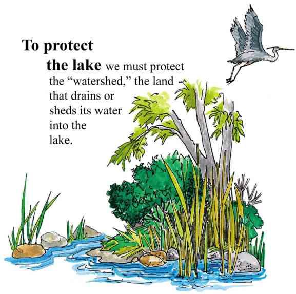
4 Sunset Lake ~ Land Use in the Surface Watershed Surface Watershed: The land area where water runs off the surface of the land and drains toward the lake. The watershed shown below also includes adjacent wetlands. Current Predominant Land Use Surface Watershed: 202 Acres Around the lake: forest, shrub cover, and residential land uses are present In the watershed: forest, shrub cover, residential, and non-irrigated cropland are present Taylor Rd. County MM Acres Sunset Lake Surface Watershed Land Use Surface Watershed Land Use Forested cover has dominated the land use since 1948 Non-irrigated agriculture has remained a relatively small but steady land use since Residential Transportation Non-irr. Cropland Forested Shrub W ater Residential land use has been steadily increasing. 4


5 Sunset Lake ~ Land Use in the Groundwater Shed Groundwater Shed: The land area where water soaks into the ground and travels underground to the lake. Current Predominant Land Use Major land uses in the groundwater shed are forest, non-irrigated agriculture, residential, and shrub cover Taylor Rd. Acres Groundwater Shed Land Use Residential Transportation Non-Irrigated Cropland Permanent Pasture Forested Shrub Cover Water Bodies Groundwater Shed Land Use Non-irrigated cropland and forest have dominated the land use since 1948 Shrub cover has decreased since 1948 Residential use has been slowly increasing 5
6 Sunset Lake ~ Taking a closer look (Within 1,000 feet of the lake) Points of Interest 1. The lack of water in the ponds that surround Sunset Lake is the most noticeable difference between the two pictures. The water surface area of the two ponds is approximately 45% greater in 2000 than it was in The 1938 air photo was taken after a period of drought. 2. The land cover that surrounds the lake has reverted from cropland to forest. This is most noticeable on the southeast side of the lake. In 1938 the forest did not come close to the road. In the 2000 photo, the forest comes right up to County Road MM. 3. The blue line shows an access road that was added after Air Photo ( ) 3 1 Noted Features 1000 Foot Buffer Road Network Orthophoto (5-2000) 6
7 Sunset Lake ~ Taking a closer look (Within 1,000 feet of the lake) Changes from 1938 to # of Docks Impervious Surface (acres) Residential (acres) Cropland (acres) Open area (acres) Forest (acres) Wetland / Open Water Percent Land Cover Within 1000 Foot Buffer 60% 50% 40% 30% 20% 10% 0% Cropland Other Lakes/Wetlands Open Land/ Pasture Residential Forest Impermeable Surfaces


8 Sunset Lake ~ Water Quality Total Phosphorus In more than 80% of Wisconsin s lakes phosphorus is the key nutrient affecting aquatic plant and algae growth. Once in a lake system phosphorus levels are difficult to reduce, so limiting phosphorus input is key. Phosphorus at levels above 30 parts per billion (ppb) can lead to nuisance aquatic plant growth and accelerate a lake s change from oligotrophic to eutrophic. Sources of phosphorus include septic systems, detergents, animal waste, farmland and storm sewer runoff, soil erosion, and fertilizers for lawns, gardens, and agriculture. Oligotrophic Lakes Common uses: Swimming Skiing Boating Vegetation of oligotrophic lakes: Very little vegetation Mesotrophic Lakes Common uses: Boating Fishing Vegetation of mesotrophic lakes: Increased vegetation Occasional algal blooms Eutrophic Lakes Common uses: Fishing Wildlife watching Vegetation of eutrophic lakes: Lots of aquatic plants Frequent algal blooms Winter fish kills can occur 8
9 Sunset Lake ~ Water Quality Average Total Phosphorus Levels 35 Concentration (ppb) Eutrophic Mesotrophic Oligotrophic Sunset Lake Historic Average Average Definitions for eutrophic, mesotrophic and oligotrophic are on the previous page. The graph to the left shows total phosphorus levels measured when the lake was well mixed (overturn). Phosphorus levels in Sunset Lake in were better than average historic levels. Current levels of phosphorus in Sunset Lake are lower than 25.5ppb, the average concentration for similar seepage lakes in the county. Overturn: uniform temperature from top to bottom in the lake. 0 Water Clarity Water clarity (Secchi disc depth) is an indicator of water quality. The two main components affecting water clarity are materials dissolved in the water and materials suspended in the water. Water clarity can indicate overall water quality, especially the amount of algae and suspended sediment present. 0 Sunset Lake Depth from surface (ft) May June July August Sept. The water clarity in Sunset Lake is considered good. The average Secchi depth reading for similar lakes in the county is 9 feet; Sunset Lake appears to have better clarity than this. The water clarity of Sunset Lake during growing seasons was better than the historic growing season average. The months of May and June show the best water clarity and the month of July the poorest. These fluctuations throughout the summer are normal as algae populations and sedimentation increase and decrease. Historic Average Historic Maximum 2002/2003 Average Historic Minimum 9


10 2002 Amphibian Distribution at Portage County Lakes This summary provides preliminary information on the amphibian species present and their distribution at the twenty-nine Portage County lakes. Surveys were conducted from April August 2002, the typical breeding period of the frogs and salamanders found in the county. Twelve frog species have been documented in Wisconsin, nine of which currently inhabit Portage County: American toad, chorus frog, spring peeper, eastern gray treefrog, Cope s gray treefrog, green frog, pickerel frog, northern leopard frog, and wood frog. Historically, Blanchard s cricket frog inhabited Portage County but is believed to now exist only in southeastern Wisconsin. Of all species believed to inhabit Portage County, only the pickerel frog was not found during the spring and summer of The pickerel frog has been listed as a species of special concern in Wisconsin. No new species to Portage County were recorded in Seven salamander species have been documented in Wisconsin, all of which currently inhabit Portage County: blue-spotted salamander, spotted salamander, tiger salamander, central newt, mudpuppy, northern redback salamander and four-toed salamander. The four-toed salamander is listed as a species of special concern in Wisconsin. Large sections of continuous natural shoreline on lakes are ideal habitats for frog and salamander populations. Natural areas with large amounts of submergent, emergent and floating-leaf vegetation provide protection for amphibians. Many species also use the vegetation for attachment of eggs during the breeding season. Green frogs, bullfrogs, pickerel frogs and leopard frogs depend on the shoreline area throughout the year. In contrast, American toads, spring peepers, tree frogs, wood frogs and chorus frogs depend on the shoreline area in the spring for breeding and then move to other areas for the rest of the year. Undisturbed areas of shoreline that are also connected to large natural upland areas provide ideal habitat for many amphibian species because they lessen frogs exposure to predators. Many frog and salamander species migrate to the lakes in the spring to breed and spend the summer months foraging in the uplands. Many amphibian species will also over winter in the uplands. Chorus Frog Spring Peeper Eastern Gray Treefrog Northern Leopard Frog Wood Frog American Toad Green Frog Cope s Gray Treefrog Blue-spotted Salamander Northern Redback Salamander 10

11 Sunset Lake ~ Frogs, Salamanders, Turtles Sunset Lake Frogs, Salamanders, and Turtles Number of frog species: 6 Frog species observed: wood frog, spring peeper, chorus frog, American toad, gray treefrog, Cope s gray treefrog Number of salamander species: 2 Salamander species observed: blue-spotted salamander, northern redback salamander Location of primary habitat: east and southeast sides of lake Key features of habitat: undisturbed natural shoreline with large amounts of submergent, emergent and floating-leaf vegetation Map Key Red outlined areas = primary frog habitat Yellow outlined areas = primary salamander habitat Good news Several species of frogs present; some large, undisturbed areas of natural shoreline present; small wetland near boat landing provides excellent frog habitat Bad news Sections of highly altered shoreline are present at the lake Number of turtle species: 1 Turtle species observed: painted turtle 11


12 Sunset Lake ~ Shoreline Vegetation Frogs and toads depend on shoreline and aquatic vegetation for: attachment of eggs during the breeding season, shelter for adults throughout the spring and summer, food for larvae, habitat for prey, and slowing evaporation and moderating temperature fluctuations. Sunset Lake Green Frog Habitat Frogs are commonly found in areas with large amounts of tree cover, aquatic plants, leaves, and downed branches, characteristics typical of natural areas. Frogs are not frequently found in sandy areas or open water, characteristics typical of altered areas. Though amphibians use drier prairies and woodlands near lakes and wetlands, this study focused on areas reaching from 16 feet into the lake to 33 feet inland. Poor 40% Excellent 0% Green frogs are used as an indicator for the health of aquatic life in Wisconsin lakes because they are abundant, live in many cover types, and remain along the edge of the lake throughout the spring and summer. While other amphibians may require more specific cover types, the green frog habitat is a useful indicator. Some cover types (as shown on map above) are better than others for green frogs. Specifically: Excellent green frog habitat = cover types 1 and 2 Adequate green frog habitat = cover types 3, 4 and 6 Poor green frog habitat = cover types 5, 7 and 8 Lakes with larger amounts of good green frog habitat will likely support more amphibians and more species of amphibians. Likewise, amphibians are more likely to be harmed or eliminated with increasing shoreland development. Adequate 60% Best Green Frog Habitat: Ebert Lake 33% excellent habitat + 67% adequate Worst Green Frog Habitat: Helen Lake 2% excellent habitat + 6% adequate + 92% poor 12
13 Sunset Lake ~ Aquatic Plants Aquatic plant surveys were conducted in each lake. More detailed information is available in the final report. Aquatic Plant Survey There are 69 species of aquatic and wetland macrophytes (68 species of vascular plants plus one or more species of macrophytic submersed mosses) that have been found in Sunset Lake or on the adjacent wetlands and shore. This is above average for Portage County lakes. Sunset Lake supports a relatively large flora of aquatic and wetland plants. Most of the species are native, and, except for relatively few patches of reed canary-grass, free of invasive species. The north shore is undeveloped and has a good representation of fen species. Invasive Exotic Aquatic Plants Invasive species displace native species, disrupt ecosystems, and affect citizen s livelihoods and quality of life. They hamper boating, swimming, fishing, and other water recreation, and take an economic toll on commercial, agricultural and aquatic resources. (Wisconsin DNR) Aquatic plants surveys revealed that some of the lakes in the study have invasive aquatic plants present. Eurasian milfoil (Myriophyllum spicatum) was present in Bear Lake Lake Emily Lake Joanis Jordan Pond McDill Pond Springville Pond Thomas Lake Curly leaf pondweed (Potomogetan crispis) was identified in Spring Lake Amherst Millpond Contact the Portage County Land Conservation Department for additional information. 13
14 Sunset Lake ~ What can you do to help? A lake is a magnificent water resource. The quality of its water is a reflection of what happens on the land that surrounds it. Lake Users: Run boat engines efficiently. Observe no/low wake zones. Refuel away from water. Dispose of trash properly Remove all aquatic plants from boats and trailers. Project support provided by: Wisconsin DNR Lake Protection grants UW-Stevens Point Portage County Portage County Citizens Study Contacts: Portage County: Steven Bradley at Land Owners: Control soil erosion. Keep livestock out of lakes and streams. Control manure runoff. Carefully manage nutrients and pesticides. Learn to identify and look for invasive species Home Owners: Leave natural vegetation buffers in place or replace them if they have been removed. Eliminate the use of fertilizer or use low/no phosphorus fertilizer. Eliminate or minimize use of pesticides. Control soil erosion. Clean up after pets. Learn to identify and look for invasive species UW- Stevens Point: Nancy Turyk at
 Planning Assistance Lynn Markham Mike Hansen Reptiles and Amphibians/Near Shore Habitat Dr.")
15 Sunset Lake ~ Primary Researchers Algae Dr. Bob Bell Aquatic Plants Dr. Robert Freckmann Birds Dr. Tim Ginnett Brad Bulin (Graduate Student) Fish Dr. Ron Crunkilton Land Use Coverages/Watersheds Steve Bradley (Portage County Conservationist) Planning Assistance Lynn Markham Mike Hansen Reptiles and Amphibians/Near Shore Habitat Dr. Erik Wild Rori Paloski (Graduate Student) Water Quality/Watersheds Becky Cook Dr. Paul McGinley Dr. Byron Shaw Dick Stephens Nancy Turyk Near Shore Summary Dr. Glenn Bowles Special thanks to UWSP undergraduate and graduate students and local citizens for their assistance! 15
Amherst Mill Pond. Final Results Portage County Lake Study. University of Wisconsin-Stevens Point, Portage County Staff and Citizens.
 Amherst Mill Pond Final Results Portage County Lake Study University of Wisconsin-Stevens Point, Portage County Staff and Citizens March 31, 2005 What can you learn from this study? You can learn a wealth
Springville Pond. Final Results Portage County Lake Study. April 12, University of Wisconsin-Stevens Point Portage County Staff and Citizens
 Springville Pond Final Results Portage County Lake Study April 12, 2005 University of Wisconsin-Stevens Point Portage County Staff and Citizens What can you learn from this study? You can learn a wealth
McDill Pond. Final Results Portage County Lake Study. University of Wisconsin-Stevens Point, Portage County Staff and Citizens.
 McDill Pond Final Results Portage County Lake Study University of Wisconsin-Stevens Point, Portage County Staff and Citizens April 5, 2005 What can you learn from this study? You can learn a wealth of
Helen Lake. Final Results Portage County Lake Study. April 5, University of Wisconsin-Stevens Point, Portage County Staff and Citizens
 Helen Lake Final Results Portage County Lake Study University of Wisconsin-Stevens Point, Portage County Staff and Citizens April 5, 2005 What can you learn from this study? You can learn a wealth of valuable
Tree Lake. Final Results Portage County Lake Study. University of Wisconsin-Stevens Point Portage County Staff and Citizens.
 Tree Lake Final Results Portage County Lake Study University of Wisconsin-Stevens Point Portage County Staff and Citizens April 12, 2005 What can you learn from this study? You can learn a wealth of valuable
Lime Lake. Final Results Portage County Lake Study. University of Wisconsin-Stevens Point, Portage County Staff and Citizens.
 Lime Lake Final Results Portage County Lake Study University of Wisconsin-Stevens Point, Portage County Staff and Citizens March 31, 2005 What can you learn from this study? You can learn a wealth of valuable
Wolf Lake. Final Results Portage County Lake Study. April 12, University of Wisconsin-Stevens Point, Portage County Staff and Citizens
 Wolf Lake Final Results Portage County Lake Study University of Wisconsin-Stevens Point, Portage County Staff and Citizens April 12, 25 What can you learn from this study? You can learn a wealth of valuable
Fountain Lake. Final Results Portage County Lake Study. April 5, University of Wisconsin-Stevens Point Portage County Staff and Citizens
 Fountain Lake Final Results Portage County Lake Study April 5, 2005 University of Wisconsin-Stevens Point Portage County Staff and Citizens What can you learn from this study? You can learn a wealth of
Spring Lake. Final Results Portage County Lake Study. University of Wisconsin-Stevens Point Portage County Staff and Citizens.
 Spring Lake Final Results Portage County Lake Study University of Wisconsin-Stevens Point Portage County Staff and Citizens April 7, 2005 What can you learn from this study? You can learn a wealth of valuable
Jacqueline Lake. Final Results Portage County Lake Study. University of Wisconsin-Stevens Point, Portage County Staff and Citizens.
 Jacqueline Lake Final Results Portage County Lake Study University of Wisconsin-Stevens Point, Portage County Staff and Citizens April 5, 2005 What can you learn from this study? You can learn a wealth
Healthy Lakes have value to a community for a number of reasons. They provide a
 Rice Lake Eastern Marathon County Lake Study Preliminary Results 2010-2012 University of Wisconsin-Stevens Point and Marathon County Staff and Citizens Healthy Lakes have value to a community for a number
Water Quality in Mayflower Lake. N. Turyk Water Resource Scientist UW-Stevens Point
 Water Quality in Mayflower Lake N. Turyk Water Resource Scientist UW-Stevens Point Tonight s discussion Water movement Water quality Zoning/Build-outs in the Watersheds Recommendations and Considerations
Summary Report University of Wisconsin-Stevens Point and Waushara County Staff and Citizens
 Summary Report 2013 University of Wisconsin-Stevens Point and Waushara County Staff and Citizens Round Lake Location WAUSHARA COUNTY LAKES STUDY 1 Pine (Springwater) 18 W. Branch Mill Pond 2 Twin 19 Porters
Healthy lakes add value to our communities. They provide a place to relax and recreate,
 Lilly Lake Eastern Marathon County Lake Study Final Study Results 2013 University of Wisconsin-Stevens Point and Marathon County Staff and Citizens Healthy lakes add value to our communities. They provide
Healthy lakes add value to our communities. They provide a place to relax and recreate,
 Lost Lake Eastern Marathon County Lake Study Final Study Results 2013 University of Wisconsin-Stevens Point and Marathon County Staff and Citizens Healthy lakes add value to our communities. They provide
DEVELOPING COMMUNITY WIDE SCIENCE-BASED LAKE STEWARDSHIP
 DEVELOPING COMMUNITY WIDE SCIENCE-BASED LAKE STEWARDSHIP 2010 Lake Leaders Kemp Field Station N. Turyk, Univ. Wisconsin-Stevens Point S. Bradley, Portage County B. Sorge, Wisconsin Dept. Natural Resources
Healthy lakes add value to our communities. They provide a place to relax and recreate,
 Pike Lake Eastern Marathon County Lake Study Final Study Results 2013 University of Wisconsin-Stevens Point and Marathon County Staff and Citizens Healthy lakes add value to our communities. They provide
2016 Data Report for Iron Lake, Iron County
 Michigan Lakes Ours to Protect Data Report for Iron Lake, Iron County.1397 N,.533 W The CLMP is brought to you by: 1 About this report: This report is a summary of the data that have been collected through
Healthy lakes add value to a community. They provide a place to relax and
 Mission Lake Eastern Marathon County Lake Study Final Study Results 2013 University of Wisconsin-Stevens Point and Marathon County Staff and Citizens Healthy lakes add value to a community. They provide
JORDAN LAKE MANAGEMENT6 PLAN PT 2--REVISED 8/16/14 Page 19 ITEM GOALS and ACTION ITEMS WHO WHEN
 JORDAN LAKE MANAGEMENT6 PLAN PT 2--REVISED 8/16/14 Page 19 EDUCATION Goal A: Educate community and public about lake management concerns. 1. Establish community events to encourage & educate the community
2018 Data Report for Pickerel Lake, Kalkaska County
 Michigan Lakes Ours to Protect 2018 Data Report for Pickerel Lake, Kalkaska County Site ID: 400035 44.800559 N, 84.97667 W The CLMP is brought to you by: 1 About this report: This report is a summary of
2016 Data Report for Magician Lake, Cass County
 Michigan Lakes Ours to Protect 216 Data Report for Magician Lake, Cass County Site ID: 1465 42.649 N, 86.179 W The CLMP is brought to you by: 1 About this report: This report is a summary of the data that
2016 Data Report for Bruin Lake, Washtenaw County
 Michigan Lakes Ours to Protect 1 Data Report for Bruin Lake, Washtenaw County Site ID: 8575.189788 N, 8.39387 W The CLMP is brought to you by: 1 About this report: This report is a summary of the data
2015 Data Report for South Torch Lake, Antrim County
 Michigan Lakes Ours to Protect 2015 Data Report for South Torch Lake, Antrim County Site ID: 050240 44.91590 N, 85.30280 W The CLMP is brought to you by: About this report: This report is a summary of
JORDAN LAKE MANAGEMENT6 PLAN PT 2--REVISED 8/10/13 Page 19 ITEM GOALS and ACTION ITEMS WHO WHEN
 JORDAN LAKE MANAGEMENT6 PLAN PT 2--REVISED 8/10/13 Page 19 EDUCATION Goal A: Educate community and public about lake management concerns. 1. Establish community events to encourage & educate the community
2016 Data Report for Barlow Lake, Barry County
 Michigan Lakes Ours to Protect 216 Data Report for Barlow Lake, Barry County Site ID: 8176 42.67559 N, 85.5242 W The CLMP is brought to you by: 1 About this report: This report is a summary of the data
Portage County Lake Planning Process
 Portage County Lake Planning Process Lake Leaders Kemp Field Station September 2010 Jen McNelly and Nancy Turyk Center for Watershed Science and Education UW-Stevens Point Types of Planning Emotional Crisis
2017 Data Report for Portage Lake, Washtenaw County
 Michigan Lakes Ours to Protect 2017 Data Report for Portage Lake, Washtenaw County Site ID: 810248 42.420559 N, 83.921392 W The CLMP is brought to you by: 1 About this report: This report is a summary
2018 Data Report for. Crystal Lake, Montcalm County
 Michigan Lakes Ours to Protect 218 Data Report for Crystal Lake, Montcalm County Site ID: 5915 43.25584 N, 84.93362 W The CLMP is brought to you by: 1 About this report: This report is a summary of the
Water Quality in Rice and Pike Lakes. Ryan Haney Water Resource Specialist Center for Watershed Science and Education UW Stevens Point
 Water Quality in Rice and Pike Lakes Ryan Haney Water Resource Specialist Center for Watershed Science and Education UW Stevens Point Tonight s discussion How do we measure water quality? How is the water
2017 Data Report for Shingle Lake, Clare County
 Michigan Lakes Ours to Protect 217 Data Report for Shingle Lake, Clare County Site ID: 1818 43.96359 N, 84.95282 W The CLMP is brought to you by: 1 About this report: This report is a summary of the data
2016 Data Report for Klinger Lake, St. Joseph County
 Michigan Lakes Ours to Protect 216 Data Report for Klinger Lake, St. Joseph County Site ID: 75136 41.82781 N, 85.543893 W The CLMP is brought to you by: 1 About this report: This report is a summary of
2014 Data Report for Higgins Lake, Roscommon County North Basin
 214 Data Report for Higgins Lake, Roscommon County North Basin Michigan Lakes Ours to Protect The CLMP is brought to you by: About this report: This report is a summary of the data that have been collected
2014 Data Report for Freska Lake, Kent County
 214 Data Report for Freska Lake, Kent County Michigan Lakes Ours to Protect The CLMP is brought to you by: About this report: This report is a summary of the data that have been collected through the Cooperative
2017 Data Report for Rogers Pond, Mecosta County
 Michigan Lakes Ours to Protect 2017 Data Report for 43.6175478 N, 85.4718313 W The CLMP is brought to you by: 1 About this report: This report is a summary of the data that have been collected through
2017 Data Report for Silver Lake, Van Buren County
 Michigan Lakes Ours to Protect 2017 Data Report for Silver Lake, Van Buren County Site ID: 800534 42.3891 N, 86.0599 W The CLMP is brought to you by: 1 About this report: This report is a summary of the
Lake Voorheis, Oakland County
 214 Data Report for Lake Voorheis, Oakland County Michigan Lakes Ours to Protect The CLMP is brought to you by: About this report: This report is a summary of the data that have been collected through
2017 Data Report for Loon Lake, Iosco County
 Michigan Lakes Ours to Protect 2017 Data Report for Loon Lake, Iosco County Site ID: 350078 The CLMP is brought to you by: 1 About this report: This report is a summary of the data that have been collected
2017 Data Report for Hoags Lake, Mason County
 Michigan Lakes Ours to Protect 17 Data Report for Hoags Lake, Mason County.171 N,.19575 W The CLMP is brought to you by: 1 About this report: This report is a summary of the data that have been collected
Big Chetac and the Red Cedar River Watershed. Dan Zerr University of Wisconsin-Extension Natural Resource Educator
 Big Chetac and the Red Cedar River Watershed Dan Zerr University of Wisconsin-Extension Natural Resource Educator The Water Cycle An area that all drains to a particular stream, river, lake, or ocean.
2017 Data Report for Big Maggie Lake, Iron County
 Michigan Lakes Ours to Protect 2017 Data Report for Big Maggie Lake, Iron County Site ID: 360173 46.01 N, 88.4626 W The CLMP is brought to you by: 1 About this report: This report is a summary of the data
2017 Data Report for Painter Lake, Cass County
 Michigan Lakes Ours to Protect 217 Data Report for Painter Lake, Cass County Site ID: 1418 41.81667 N, 85.99194 W The CLMP is brought to you by: 1 About this report: This report is a summary of the data
2017 Data Report for Earl Lake, Livingston County
 Michigan Lakes Ours to Protect 217 Data Report for Earl Lake, Livingston County Site ID: 755 2.191 N, 3.95 W The CLMP is brought to you by: 1 About this report: This report is a summary of the data that
2017 Data Report for Arbutus Lake, Grand Traverse County
 Michigan Lakes Ours to Protect 217 Data Report for Arbutus Lake, Grand Traverse County Site ID: 2819 44.65917 N, 85.519726 W The CLMP is brought to you by: 1 About this report: This report is a summary
2017 Data Report for Fern Lake, Grand Traverse County
 Michigan Lakes Ours to Protect 2017 Data Report for Site ID: 280438 44.73475 N, 85.73409 W The CLMP is brought to you by: 1 About this report: This report is a summary of the data that have been collected
2017 Data Report for Deer Lake, Alger County
 Michigan Lakes Ours to Protect 2017 Data Report for Deer Lake, Alger County Site ID: 020127 46.48016 N, 86.98277 W The CLMP is brought to you by: 1 About this report: This report is a summary of the data
2017 Data Report for Pleasant Lake, Wexford County
 Michigan Lakes Ours to Protect 2017 Data Report for Pleasant Lake, Wexford County Site ID: 830183 44.3 N, 85.4775 W The CLMP is brought to you by: 1 About this report: This report is a summary of the data
2017 Data Report for Oxbow Lake, Oakland County
 Michigan Lakes Ours to Protect 2017 Data Report for Oxbow Lake, Oakland County Site ID: 630666 42.64167 N, 83.477226 W The CLMP is brought to you by: 1 About this report: This report is a summary of the
2017 Data Report for Duck Lake, Muskegon County
 Michigan Lakes Ours to Protect 217 Data Report for Duck Lake, Muskegon County Site ID: 61778 43.33785 N, 86.39258 W The CLMP is brought to you by: 1 About this report: This report is a summary of the data
Mayflower Lake Management Planning Committee UWSP Center for Watershed Science and Education Marathon County Wisconsin Department of Natural
 Mayflower Lake Management Planning Committee UWSP Center for Watershed Science and Education Marathon County Wisconsin Department of Natural Resources Reduces conflicts Addresses problems Allows for proactive
2017 Data Report for Lake Tahoe, Oceana County
 Michigan Lakes Ours to Protect 17 Data Report for Lake Tahoe, Oceana County Site ID: 33 3.1 N,.3 W The CLMP is brought to you by: 1 About this report: This report is a summary of the data that have been
2017 Data Report for Little Paw Paw Lake, Berrien County
 Michigan Lakes Ours to Protect 2017 Data Report for Site ID: 110765 42.21899 N, 86.29072 W The CLMP is brought to you by: 1 About this report: This report is a summary of the data that have been collected
2017 Data Report for Lake Independence, Marquette County
 Michigan Lakes Ours to Protect 217 Data Report for Lake Independence, Marquette County Site ID: 2149 46.88337 N, 87.711393 W The CLMP is brought to you by: 1 About this report: This report is a summary
2017 Data Report for Klinger Lake, St. Joseph County
 Michigan Lakes Ours to Protect 217 Data Report for Klinger Lake, St. Joseph County Site ID: 75136 41.82781 N, 85.543893 W The CLMP is brought to you by: 1 About this report: This report is a summary of
Northern Chain of Lakes
 Northern Chain of Lakes Presented by Pat Conrad and Joe Pallardy on behalf of the Brown s Creek Watershed District Board of Managers w a t e r I e c o l o g y I c o m m u n i t y Lake by Lake Analysis
Choosing Management Strategies for Portage County Lakes
 Choosing Management Strategies for Portage County Lakes Once you ve set goals for the condition of your lake through the lake management planning process, you ll want to choose the strategies most likely
Choosing Management Strategies for Portage County Lakes
 Choosing Management Strategies for Portage County Lakes Once you ve set goals for the condition of your lake through the lake management planning process, you ll want to choose the strategies most likely
Torch Lake (South), Antrim County
, Antrim County") 2014 Data Report for Torch Lake (South), Antrim County Michigan Lakes Ours to Protect The CLMP is brought to you by: About this report: This report is a summary of the data that have been collected through
2014 Data Report for Torch Lake (South), Antrim County Michigan Lakes Ours to Protect The CLMP is brought to you by: About this report: This report is a summary of the data that have been collected through
2014 Data Report for Lake Chemung, Livingston County
 2014 Data Report for Lake Chemung, Livingston County Michigan Lakes Ours to Protect The CLMP is brought to you by: About this report: This report is a summary of the data that have been collected through
2014 Data Report for Clark Lake, Jackson County
 2014 Data Report for Clark Lake, Jackson County Michigan Lakes Ours to Protect The CLMP is brought to you by: About this report: This report is a summary of the data that have been collected through the
Modeling What s the Use? Paul McGinley Center for Watershed Science & Education UW Stevens Point
 Modeling What s the Use? Paul McGinley Center for Watershed Science & Education UW Stevens Point Lake Leaders 2014 What s a model One definition: A mathematical description to help visualize something
Natural Shoreline Landscapes on Michigan Inland Lakes
 Natural Shoreline Landscapes on Michigan Inland Lakes Excerpts from Chapters 2 and 3 Session topics Characteristics of natural and altered shorelines Lakes, shorelines, habitat and water quality Considerations
2018 Data Report for. Lotus Lake, Oakland County
 Michigan Lakes Ours to Protect 218 Data Report for Lotus Lake, Oakland County 42.6941 N, 83.4244 W The CLMP is brought to you by: 1 About this report: This report is a summary of the data that have been
2017 Data Report for Spider Lake, Grand Traverse County
 Michigan Lakes Ours to Protect 217 Data Report for Spider Lake, Grand Traverse County Site ID: 28395 44.675987 N, 85.49947 W The CLMP is brought to you by: 1 About this report: This report is a summary
2017 Data Report for Perch Lake, Iron County
 Michigan Lakes Ours to Protect 217 Data Report for Perch Lake, Iron County Site ID: 3646 46.361392 N, 88.658338 W The CLMP is brought to you by: 1 About this report: This report is a summary of the data
CLMP+ Report on Grass Lake (Anoka County) Lake ID# CLMP+ Data Summary
 Lake ID# CLMP+ Data Summary") CLMP+ Report on Grass Lake (Anoka County) Lake ID# 02-0113-00 2012-2013 CLMP+ Data Summary October 2014 Authors Shannon Martin, MPCA Editing and graphic design Public Information Office Staff The (MPCA)
CLMP+ Report on Grass Lake (Anoka County) Lake ID# 02-0113-00 2012-2013 CLMP+ Data Summary October 2014 Authors Shannon Martin, MPCA Editing and graphic design Public Information Office Staff The (MPCA)
2017 Data Report for Ottawa Lake, Iron County
 Michigan Lakes Ours to Protect 2017 Data Report for Site ID: 360033 46.08484 N, 88.76419 W The CLMP is brought to you by: 1 About this report: This report is a summary of the data that have been collected
Welcome. Thank you for joining us! Lower Mississippi River Watershed Management Organization
 Welcome. Thank you for joining us! Lower Mississippi River Watershed Management Organization Lower Mississippi River Watershed Management Organization Watershed Restoration and Protection (WRAP) Study
Resource Conservation Opportunities and Management Guidelines
 Resource Conservation Opportunities and Management Guidelines The general ecosystem integrity of lakes is dependent on preserving natural habitat components and the processes that sustain them. These include
Maitland Valley WATERSHED
 Maitland Valley WATERSHED Report Card 2018 Maitland Conservation has prepared this report card as a summary of the state of your forests, wetlands, and water resources. WHERE ARE WE? We are one of 36 Conservation
Big Chetac Lake Getting Rid of the Green Phase 3. Nutrient Budget and Management Data Analysis Report
 Big Chetac Lake Getting Rid of the Green Phase 3 Nutrient Budget and Management Data Analysis Report Prepared for: Big Chetac Chain Lake Association and Wisconsin Department of Natural Resources Prepared
2015 Update. Boelter Lake/Wetland Management Plan Portage County, Wisconsin
 2015 Update Boelter Lake/Wetland Management Plan Portage County, Wisconsin Boelter Lake/Wetland Management Planning Committee Created: May 13, 2011 Revised: November 2014 Prepared by UW-Stevens Point Center
CLMP+ Report on Fleming Lake (Aitkin County)
") CLMP+ Report on Fleming Lake (Aitkin County) Lake ID# -5-5-6 CLMP+ Data Summary July 7 Authors Shannon Martin Contributors/acknowledgements Terry Dahlberg Sandy Dahlberg Pam Anderson For questions regarding
CLMP+ Report on Fleming Lake (Aitkin County) Lake ID# -5-5-6 CLMP+ Data Summary July 7 Authors Shannon Martin Contributors/acknowledgements Terry Dahlberg Sandy Dahlberg Pam Anderson For questions regarding
Hubbard County Water Quality and You Celebrating 20 Years of Water Quality Testing in Hubbard County!
 Hubbard County Water Quality and You Celebrating 20 Years of Water Quality Testing in Hubbard County! A Collaborative Effort by: Citizen Volunteers Hubbard County Coalition of Lake Associations (HC COLA)
WATERSHED. Maitland Valley. Report Card 201
 Maitland Valley WATERSHED Report Card 201 The Maitland Valley Conservation Authority has prepared this report card as a summary on the state of our forests, wetlands, surface water, and ground water resources.
Otonabee Region WATERSHED
 Otonabee Region WATERSHED Report Card 2018 Otonabee Conservation has prepared this report card as a summary of the state of your forests, wetlands, and water resources using data from 2012 to 2016. WHERE
From My Backyard to Our Bay It s the 911 for the Chesapeake Bay
 From My Backyard to Our Bay Reporting Problems on Our Bay, Rivers, and Streams We can all be the eyes and ears of our local waterways. Maryland has established the Chesapeake Bay Safety and Environmental
Weeds are critical to our eco system...
 Lakes The lake shore (or littoral zone) is the shallow area along the shoreline of a lake or pond which supports diverse communities of rooted plants and serves as food, habitat and protective shelter
Potato Lake 2010 Project Results and APM Plan. Saturday May 28, 2011 Dave Blumer, Jake Macholl SEH Lake Scientists
 Potato Lake 2010 Project Results and APM Plan Saturday May 28, 2011 Dave Blumer, Jake Macholl SEH Lake Scientists Lake and Aquatic Plant Management Planning Goal: To maintain or improve the overall condition
2008 SUMMARY REPORT of North Loon Lake NICC Pond. Lake County, Illinois
 2008 SUMMARY REPORT of North Loon Lake NICC Pond Lake County, Illinois Prepared by the LAKE COUNTY HEALTH DEPARTMENT ENVIRONMENTAL HEALTH SERVICES LAKES MANAGEMENT UNIT 3010 Grand Avenue Waukegan, Illinois
B ig E ast R iver. Stewardship Works! S ubwatershed. Grades. Land Water Wetlands Biodiversity. Not Stressed Not Stressed Not Stressed Vulnerable
 s B ig E ast R iver Land Water Wetlands Biodiversity S ubwatershed T he Big East River Subwatershed is 64,699 hectares in area. Major lakes in the subwatershed include Bella Lake (3.45 km2) and Rebecca
Shoreland zoning history
 Shoreland zoning history The Wisconsin Constitution, adopted in 1848, says navigable waters are common highways and forever free This led to The waters of WI belong to the people of WI which is the basis
H ollow R iver. Stewardship Works! S ubwatershed. Grades. Land Water Wetlands Biodiversity. Not Stressed Not Stressed Not Stressed Vulnerable
 s H ollow R iver Land Water Wetlands Biodiversity S ubwatershed T he Hollow River Subwatershed is 40,863 hectares in size and lies predominantly in the Township of Algonquin Highlands in Haliburton County.
Amnicon & Dowling Lakes Aquatic Plant Management Planning Project
 Amnicon & Dowling Lakes Aquatic Plant Management Planning Project Project Background Aquatic Invasive Species Education, Prevention and Planning Grant Application Submitted to WDNR in August 2011 Awarded
Hadlock Pond, Washington Co., Lake Hadlock Association, Inc.
 Hadlock Pond, Washington Co., Lake Hadlock Association, Inc. Lake Characteristics Watershed Characteristics Surface Area (ac/ha) Max Depth (ft/m) Mean Depth (ft/m) Retention Time (years) Water Class Dam
BLACK OTTER LAKE DISTRICT
 BLACK OTTER LAKE DISTRICT Storm water Action Plan Action Plan submitted for UW-Madison Course 272630 JDD001 #41967 Great Lakes Water Stewardship Institute 2012 Hortonville Area School District Hortonville
Portage Lake CASS COUNTY
 Portage Lake 11-0204-00 CASS COUNTY Summary Portage Lake is located near Bena, MN in Cass County. It covers 1,539 acres, which places it in the upper 10% of lakes in Minnesota in terms of size. Portage
Red Rock Lake: A Path Forward
 University of Minnesota Morris Digital Well University of Minnesota Morris Digital Well Center for Small Towns 6-2016 Red Rock Lake: A Path Forward Colette Millard Student - University of Minnesota, Morris
Chapter 5: Water Quality Buffer Requirements
 Chapter 5: Water Quality Buffer Requirements 5.1 Introduction Water quality buffer requirements apply to all new land development or redevelopment containing streams or other water bodies such as ponds,
Norwalk Harbor Report Card
 Norwalk Harbor Report Card C+ Following the water s trail from your house, into the river, and to the Harbor The way land is used in a watershed has a significant effect on water quality. In areas where
Portage Lake Hubbard County
 Prepared in cooperation with the Minnesota Department of Natural Resources Minnesota Lake ID: 9- Area: acres Watershed Area: 6,7 acres Ecoregion: Northern Lakes and Forests (NLF) Portage Lake Hubbard County
2018 Data Report for. Park Lake, Clinton County
 Michigan Lakes Ours to Protect 218 Data Report for Park Lake, Clinton County Site ID: 1999 42.7897 N, 84.4311 W The CLMP is brought to you by: 1 About this report: This report is a summary of the data
3.6 Riparian Ecosystem Wildlife
 3.6 Riparian Ecosystem Wildlife 3.6.1 Introduction and Methodology Riparian areas and associated wetlands are widely recognized for the significant and diverse roles they play in the landscape. They clean
Long Prairie River Watershed Restoration and Protection Strategies (WRAPS) Report Summary
 Report Summary") Long Prairie River Watershed Restoration and Protection Strategies (WRAPS) Report Summary Minnesota has adopted a watershed approach to address the state s 80 major watersheds (denoted by 8-digit hydrologic
Long Prairie River Watershed Restoration and Protection Strategies (WRAPS) Report Summary Minnesota has adopted a watershed approach to address the state s 80 major watersheds (denoted by 8-digit hydrologic
Purpose of Shoreland Zoning:
 January, 2016 Purpose of Shoreland Zoning: 1. Further the maintenance of safe and healthful conditions 2. Prevent and control water pollution 3. Protect spawning grounds, fish, and aquatic life 4. Regulate
Volunteers Keeping A Watchful Eye on the Health of Maine Lakes and Ponds for 39 Years!
 Volunteers Keeping A Watchful Eye on the Health of Maine Lakes and Ponds for 39 Years! VLMP is the Largest Collector and Provider of Lake Data in the State of Maine 2009 608 volunteers collected water
Suspended Sediments. A lgae. Factors that Affect Water Clarity
 Factors that Affect Water Clarity Water clarity is a measure of the amount of particles in the water, or the extent to which light can travel through the water. There are many ways to express water clarity,
SECTION 10: WETLANDS PROTECTION
 SECTION 10: WETLANDS PROTECTION 10-1 INTENT AND PURPOSE A. Intent 1. The City finds that wetlands serve a variety of beneficial functions. Wetlands maintain water quality, reduce flooding and erosion,
Silver Lake Watershed Management Plan. F. X. Browne, Inc.
 Silver Lake Watershed Management Plan F. X. Browne, Inc. Eutrophication Trophic means food or energy level Oligotrophic ecologically young lake with low nutrients, low populations of algae and macrophytes
Background. AEM Tier 2 Worksheet Stream & Floodplain Management. Glossary
 AEM Tier 2 Worksheet Stream & Floodplain Management Glossary Bankfull Stage: The stage at which water starts to flow over the flood plain; the elevation of the water surface at bankfull discharge. (This