Presentation and Contents copyright QuestUAV Ltd 2013
|
|
|
- Beryl Underwood
- 6 years ago
- Views:
Transcription

1
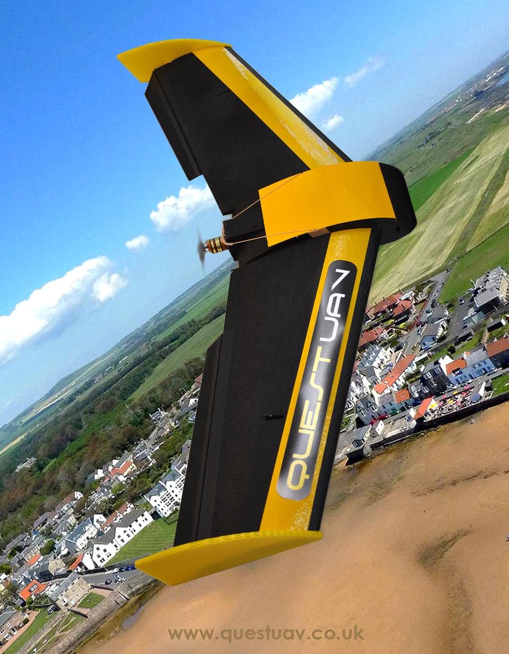
2 Where is the UAV industry taking us in remote sensing capability and what lies ahead? An industry leader s point of view. Nigel King FBIPP UAVSA CEO QuestUAV
3 Fixed Wing Orientated Talk UAV = RPA
4 About QuestUAV A UK manufacturer of fixed wing unmanned aircraft designed to carry remote sensing equipment We help provide the capability to analyse results that come back from a flight Our eight person team manufactures suav in our workshops in Northumberland, England Provides suav services Sells our UAV systems to a global community Provide training Work with many with Universities and Research Councils


5
6 Where is the UAV Industry taking us? Further, Higher, Faster Bigger, Bolder, Smaller Tougher, Stronger, Cheaper but hardly ever easier
7 Quick Figures 5m geospatial without ground control (just UAV GPS positioning) in a single 300ha flight Potentially 5cm geospatial with ground control AND UAV GPS positioning 1.5 cm pixel resolution over a single 100Ha flight
8 More?? Higher Winds Water Operations Mountains.. In typical winds Buildings Multiple UAV Swarms 24 Hour coverage More capable sensors GIS
9 The ROADMAP European RPAS Steering Group (ERSG) European aviation system: EASA, EUROCONTROL, EUROCAE, SESAR JU, JARUS, ECAC, EDA, ESA, ASD, UVSI, EREA and ECA Setup by the European Commission in July 2012 as an outcome of the consultation conducted by the Commission between 2009 and 2012 on the future of RPAS in Europe Aiming at an initial RPAS integration by 2016 Roadmap identifies all the issues to be addressed and establishes a step-by-step approach to address them Available online at
10 The ROADMAP Every significant RPA organisation in Europe has decided that we need to harmonize the way RPA/UAV work and are regulated The Regulatory Work Plan proposes the transfer of national competence for RPAS <150 kg to the EU around 2016 This will be achieved in a smooth and progressive way. Annex 1 provides a Regulatory Work Plan identifying the improvements to the existing regulatory framework considered necessary to allow RPAS operating outside segregated airspace Annex 2 presents a Strategic R&D Plan identifying the technology enablers and the research activities necessary to achieve a safe integration of RPAS Annex 3 analyses aspects of the societal impact of RPAS
11 The ROADMAP The outcome is that the current 500m / 400ft is unlikely to change. However the research clause may be lost, meaning that certification may be required for the purely academic RS work you do Grandfather rights will in some cases be respected

12 Reasonable Boundaries Reaonable Boundaries
13 Reasonable Boundaries The average car size hasn t changed drastically for over a century, nor will average-user RS suav VTOL or Close VTOL is very sensible as the undercarriage is a restriction for many RS operations VLOS capability is very sensible 7kg for a new UAV/RPA user is heavy! 1kg to 4kg is reasonable to pack, carry, and fly Payload 2kg now, increasing to 4kg (possibly 12kg in short flight multirotor) Minimum of two operators for non-professional RS operations

14 Reasonable Boundaries
15 Where are we now? (Capability) Industry moving at an incredibly fast pace


16 25, ,000
17 Where are we now? (Capability) Every few months manufacturers announce greater capability Airframe costs reduce while capability increases Recreation / Toy market is quickly emerging (Parot, DJI Phantom)
18 Where are we now? (Legal) Analogy cars, country roads, dual carriageways and motorways In UK UAVs are only allowed to drive in a big car park Restricted to VLOS (500m / 400ft) or ELOS


19 Why Training? greater successes better data, more data reduced risks more enjoyable operating scenarios it can actually be fun and rewarding prevent scares, crashes and down time avoid personal and corporate embarrassment avoid claims
20 Where are we now? (Legal) Analogy cars, country roads, dual carriageways and motorways In UK UAVs are only allowed to drive in a big car park Restricted to VLOS (500m / 400ft) or ELOS Scenario 1 How would you feel if a fleet of experimental unmanned cars were driving around your area? And what if this were a regular event with occasional accidents? Scenario 2 Would you want an aircraft you are flying in to run the risk of impacting with a stray UAV? aircraft during its flight?
21 You will not be able to fly large distances in UK until Failsafe technology matures Properly Qualified Operators Regular Practice Insurance
22 What can we look forward to? Stronger airframes and improved reliability Improved data volume and accuracy Flight range will open up dramatically when Sense and Avoid technology becomes available Faster production cycles through things like 3d printing for UAV airframes and components Input from the toy / recreational market
23 Choice and Range of Sensors RGB Cameras as good as the commercial industry gets NIR Cameras modified commercial cameras Multispectral Currently mediocre, heavy or expensive eg Tetracam, new multispectral coming within 12 months Hyperspectral Almost there LIDAR already possible on heavy lift multirotor. 2kg barrier for fixed wing almost there (YellowScan 2kg) Thermal definitely getting more user friendly Mutipayload is here already
 Batteries Four")

24 New Batteries, Greater Range, Larger Payload Li SO 2 (Sion) Batteries Four times capacity of Li- Polymer More Charges, More Stable More Environmentally Friendly When?
25 The Warning The attractiveness and availability of UAV technology is far outpacing the capacity of the industry to regulate itself. With more operators coming active, privacy fears and airspace sharing will become more of an issue With more inexperienced users in the airspace, flight safety will increasingly be at risk. Most of this is being addressed
26 The Challenges Are 1. To understand where appropriate regulation is required and to apply it with common sense (ERSG addressing that one). 2. To encourage manufacturers to place a great emphasis on responsible use (difficult). 3. To grow a network of accessible support, training and advice that will help new users become safe and skilled operators. 4. Place an increasing importance on training and currency. (through orgs like RSPSOC).
27 Newbie Questions 1. How big, how small, how fast, how long, how much payload, what accuracy, what resolution? This is what is important! 2. Success is about the pilot not crashing it. 3. Prep is about making up a good route and getting a fresh battery in. 4. With range and long endurance you can kick ass. 5. Cheap. We need cheap. 6. Autonomous means it will do all the hard stuff for you. Including the landing so strike number 2 above.
28 Real Questions How much does the provider assist me in getting from no-knowledge right through to getting useable data? How can I make up any shortfall? What team do I have surrounding me that will assist in making the project a sustainable one? What is the repeatability and reliability of the UAV/RPA system like? How easily repairable is it and can I repair it in my workshop? Will it provide the data that I want and if not what am I willing to compromise on? When it goes wrong (it will) what assets do we have that will help us get back on track? Taking the rose tinted glasses off, what is the true capability of the UAV/RPA and how much realistically will we be able to achieve with it?
29 Thank You Questions
30 Summary Bigger, Better, Faster, Higher, Wetter, More, More More Not necessarily easier (despite what the manufacturers will tell you). You will have to prove that you are competent and safe. Learn from how we design, regulate and use cars. The UAV industry has similar aspects, just compressed into a much smaller timescale Expect to stay within the 500g to 7kg weight band for very sensible reasons Airframe prices will come down. Better sensors will become available for a similar investment. You will still pay fully for the service, the training, the staffing, the insurance, the exams and the legislation. Organisation like ERSG are doing their job to bring coherent regulation together and make your life a little safer (if not easier).
 Needed to log all control movements and triggers.")


31 Fixed Wing UAV/RPA Functions Propulsion GPS Airframe Autopilot Capability to manage all flight input data to fly UAV without pilot input Capability to manage and operate payloads inc cameras Capability to intelligently manage critical situations Data Collection (Black Box) Needed to log all control movements and triggers. Logging of route and camera image locations. Logging of all pitch / roll / yaw for every camera image. Power Source High output LiPo. Capable of extended flight. Safe. Reliable. Capable of many charges. Efficient, Reliable, Electric, Powerful, Vibration free Autopilot needs to know exactly where it is in order to navigate. Lat/Long Height, Speed, Sats, PDOP etc. Performance, Legal and Environmental Capability Pass CAA restrictions and licensing Manage difficult or high winds, turbulence, thermals and still be able to navigate and take good imagery. Cover a large survey area in a single flight (up to 800Ha) and survive hostile landings. Designed for exceptional robustness Easily transportable Aerodynamic - Good glide angle Operate anywhere High Impact Absorption High visibility Easily repaired Payload Bay Manage different vis camera, IR camera Multipspectral, thermal, video or extra batteries etc. Camera & Gimbal Protection for camera during landings Must create vertical imagery Vibration free imagery Launch System Must accelerate UAV to safe flying Speed without damage Must be easily transportable Easily set up & removed
UNMANNED AERIAL VEHICLE SYSTEMS
 UNMANNED AERIAL VEHICLE SYSTEMS UNMANNED AERIAL VEHICLE SYSTEMS INTRODUCTION UAV SYSTEMS APPLICATIONS LEGISLATION SAFETY CONSIDERATIONS HOW TO SELECT A COMPETENT SUPPLIER OF UAV SERVICES Q&A One of Europe's
Unmanned Aerial Vehicle (UAV) Inspection, survey, mapping, modelling & analysis
 Inspection, survey, mapping, modelling & analysis") Unmanned Aerial Vehicle (UAV) Inspection, survey, mapping, modelling & analysis Opus have utilised our own UAV fleet since 2007. They are one of a range of technologies used to enhance our core services.
Unmanned Aerial Vehicle (UAV) Inspection, survey, mapping, modelling & analysis Opus have utilised our own UAV fleet since 2007. They are one of a range of technologies used to enhance our core services.
Responses to Questions Asked by BIS Ahead of Challenger Business Programme UAV Workshop, 23/11/15
 Responses to Questions Asked by BIS Ahead of Challenger Business Programme UAV Workshop, 23/11/15 Authors: Dr Darren Ansell, Dr Andrew Heaton, UCLan. i Introduction This document is the University of Central
Drones and Their Role in Agriculture. Mike Buschermohle Precision Ag Specialist UT Extension
 Drones and Their Role in Agriculture Mike Buschermohle Precision Ag Specialist UT Extension Current FAA Regulatory Environment Public UASs can fly under a Certificate of Authorization (COA). Government
Aarhus, Denmark September
 This is a response from the Danish National Model Flyer Association Modelflyvning Danmark to the Advance Notice of Proposed Amendment 201510 (ANPA 201510). Summary Main conclusion: The traditional noncommercial
Drones in the Solid Waste Industry
 1 Drones in the Solid Waste Industry Sam Marchant December 4, 2018 Presented By: Sam Marchant, E.I.T. Bachelor of Science in Civil Engineering from Cal Poly, San Luis Obispo Assists in improving efficiency
Automating Your Monitoring with the Latest suas Technology. Harry White, Forest Ecologist, Colebrook, CT
 Automating Your Monitoring with the Latest suas Technology Harry White, Forest Ecologist, Colebrook, CT Primary Uses: Annual Property Monitoring Easement and Fee Inspections Big-Block Challenges Stewardship
Prospect ATCOs Branch Position Paper On Unmanned Aerial Vehicles
 Prospect ATCOs Branch Position Paper On Unmanned Aerial Vehicles www.prospect.org.uk www.atcos.co.uk Introduction Prospect s Aviation Group is responsible for over 5,000 members working in civil aviation.
Drone Safety and Commercial Operations IOSH Staffordshire June 2017
 Drone Safety and Commercial Operations IOSH Staffordshire June 2017 Cloudbase Images Ltd Aims of this Presentation To offer an introduction as to the uses of drones across industry To give an indication
Potential for Using Unmanned Aerial Vehicles (UAV) in an On-Site Inspection
 in an On-Site Inspection") Potential for Using Unmanned Aerial Vehicles (UAV) in an On-Site Inspection Dr James Palmer AWE plc, UK CTBTO Science and Technology Conference 2015 T3.2-06 What is an Unmanned Aerial Vehicle? Different
Potential for Using Unmanned Aerial Vehicles (UAV) in an On-Site Inspection Dr James Palmer AWE plc, UK CTBTO Science and Technology Conference 2015 T3.2-06 What is an Unmanned Aerial Vehicle? Different
Drones In Logistics PRESENTATION TITLE. Alexander Stimpson, Ph.D. Your Logo Goes Here! 2017 MHI Copyright claimed for audiovisual works and
 Drones In Logistics Presented by: Alexander Stimpson, Ph.D. PRESENTATION TITLE Your Logo Goes Here! 2017 MHI Copyright claimed for audiovisual works and Outline Introduction The Nature of Drones Drone
Enabler for safe operations - UAV Health Condition Monitoring
 Enabler for safe operations - UAV Health Condition Monitoring SafeDrone by Lufthansa Technik - Whitepaper April 2018 www.safe-drone.com Summary This Whitepaper addresses the recent research results from
AW Drone (UAS) Program Summary
 Program Summary") 1 Geospatial technology (GIS) is what gives UAS the ability to be autonomous. The convenience of inspecting vast infrastructure without significant time and manpower invested is enough of a reason - www.gislounge.com
1 Geospatial technology (GIS) is what gives UAS the ability to be autonomous. The convenience of inspecting vast infrastructure without significant time and manpower invested is enough of a reason - www.gislounge.com
Photogrammetric Week '15 Dieter Fritsch (Ed.) Wichmann/VDE Verlag, Belin & Offenbach, Mayr 51. UAVs for Production. Werner Mayr, Welzheim
 Wichmann/VDE Verlag, Belin & Offenbach, Mayr 51. UAVs for Production. Werner Mayr, Welzheim") Photogrammetric Week '15 Dieter Fritsch (Ed.) Wichmann/VDE Verlag, Belin & Offenbach, 2015 Mayr 51 UAVs for Production Werner Mayr, Welzheim ABSTRACT Unmanned airborne vehicles (UAV) are becoming commodity,
Photogrammetric Week '15 Dieter Fritsch (Ed.) Wichmann/VDE Verlag, Belin & Offenbach, 2015 Mayr 51 UAVs for Production Werner Mayr, Welzheim ABSTRACT Unmanned airborne vehicles (UAV) are becoming commodity,
New Regulatory Framework for UAS CEPT Workshop on Spectrum for Drones/UAS Copenhagen, The EASA Team
 New Regulatory Framework for UAS CEPT Workshop on Spectrum for Drones/UAS Copenhagen, 29.05.18 The EASA Team TE.GEN.00409-001 Content of the Presentation Setting the Stage The Helsinki High Level Conference
PAL-V Starts Selling Its Commercial Models
 PAL-V Starts Selling Its Commercial Models 13 th of February 2017 This week, flying car manufacturer PAL-V has officially started the sales of its commercial models, the Liberty Pioneer and Liberty Sport.
Enhancing the Value of Precision Ag Data with Unmanned Aerial Systems (UASs) Mike Buschermohle Precision Ag Specialist UT Extension
 Mike Buschermohle Precision Ag Specialist UT Extension") Enhancing the Value of Precision Ag Data with Unmanned Aerial Systems (UASs) Mike Buschermohle Precision Ag Specialist UT Extension Unmanned Aerial Systems (UASs) Current FAA Regulations UASs UAV, cameras,
Enhancing the Value of Precision Ag Data with Unmanned Aerial Systems (UASs) Mike Buschermohle Precision Ag Specialist UT Extension Unmanned Aerial Systems (UASs) Current FAA Regulations UASs UAV, cameras,
Vision VTOL. The Future of Flight
 Vision VTOL The Future of Flight What if batteries had just 10 times their current power density? What would an aircraft look like? What could it do? Wings become obsolete. Motors become as reliable as
PAL-V Unveils The Production Model of its Limited Edition Flying Car
 PAL-V Unveils The Production Model of its Limited Edition Flying Car March 2019 At the Geneva International Motor Show 2019 (GIMS) PAL-V unveiled the distinctive features of the PAL-V Liberty Pioneer,
Growth Opportunities for Computer Vision in Commercial Unmanned Aircraft Systems (UAS) Dave Litwiller Aeryon Labs Inc.
 Dave Litwiller Aeryon Labs Inc.") Growth Opportunities for Computer Vision in Commercial Unmanned Aircraft Systems (UAS) Dave Litwiller Aeryon Labs Inc. Overview The rise of the suas industry Market size, growth, and main applications
Growth Opportunities for Computer Vision in Commercial Unmanned Aircraft Systems (UAS) Dave Litwiller Aeryon Labs Inc. Overview The rise of the suas industry Market size, growth, and main applications
Real-time surveillance just got lighter
 Real-time surveillance just got lighter The most important thing we build is trust AVIATOR UAV 200 Enhanced satcom connectivity for tactical UAVs Photo: Andrew Shiva The world s smallest, lightest Inmarsat
Year of Autonomy Remotely Piloted Aircraft Systems
 Year of Autonomy 2017 Remotely Piloted Aircraft Systems Who Am I? Bryan Stanislas Membership Director for ARPAS-UK My Background: Marine Media Specialist working in TV, Film, Onshore and Offshore sectors
Such a category, which is sometimes referred to as a "micro" or "open" category, presents several benefits, including:
 August 28, 2015 Via email: carrac@tc.gc.ca Canadian Aviation Regulations Advisory Council Transport Canada 330 Sparks Street Ottawa, ON K1A 0N5 Re: Notice of Proposed Amendment #2015-012 (Unmanned Air
Drones Use in Forestry: Regulations, Applications, Considerations
 Drones Use in Forestry: Regulations, Applications, Considerations Regulations What is a Drone? Small unmanned aircraft system aka UAV, UAS, suas. Weight is greater than 0.5 lbs. and less than 55 lbs. including
CIEEM Autumn Conference Workshop
 CIEEM Autumn Conference Workshop Getting to grips with the use of Small Unmanned Aerial Vehicles (SUAVs) in Ecological Practice Nottingham 2016 Cameron S Crook MCIEEM Cameron S Crook & Associates Introduction
Stephen Ween and Jane Knipe. Drones The flight path from toy shop to research tool
 Stephen Ween and Jane Knipe Drones The flight path from toy shop to research tool Outline We will outline: What a drone is Legislative requirements and responsibilities Summary of requirements and general
ESSENTIAL CONSIDERATIONS FOR DRONE OPERATION.
 GET TING A SAFER B IR DS - E Y E VIEW: ESSENTIAL CONSIDERATIONS FOR DRONE OPERATION. www.cna.com Table of Contents Introduction... 2 Know Who s Up In the Air... 3 Drones by the Numbers... 3 Understand
Development and Applications of Unmanned Aerial Vehicles: Challenges and Opportunities
 Development and Applications of Unmanned Aerial Vehicles: Challenges and Opportunities Yanbo Huang Research Ag Engineer, Lead Scientist, USDA-ARS Adjunct Professor, Texas A&M University, Mississippi State
Intro to Small Unmanned Aircraft Systems & Recreational Drones
 Intro to Small Unmanned Aircraft Systems & Recreational Drones Room Assignments Tuesday & Thursday Room 112 Neal Leeper nleeper@cfu.net www.nleeper.com/drone Class Introduction What is your Name? Do
Unmanned Aerial Systems (UAS) Desk and Derrick Club of Dallas May 3 rd, 2018
 Desk and Derrick Club of Dallas May 3 rd, 2018") Unmanned Aerial Systems (UAS) Desk and Derrick Club of Dallas May 3 rd, 2018 Table of Contents Introduction to UASs Current Market Projections Oil and Gas Adoption FAA & Regulations Oil and Gas Applications
Unmanned Aerial Systems (UAS) Desk and Derrick Club of Dallas May 3 rd, 2018 Table of Contents Introduction to UASs Current Market Projections Oil and Gas Adoption FAA & Regulations Oil and Gas Applications
kg l Without Fuel
 l Link to online registration l Cost (in Euro) Electronic Chip (with National Registration Number) Is Required: l Indicate additional information (if any) that should be included on electronic chip l Authority
Real-time surveillance just got lighter
 Real-time surveillance just got lighter The most important thing we build is trust AVIATOR UAV 200 Enhanced satcom connectivity for tactical UAVs Photo: Andrew Shiva. Intergrator is produced by Insitu
Use of UAVs for ecosystem monitoring. Genova, July 20 th 2016
 Use of UAVs for ecosystem monitoring Genova, July 20 th 2016 Roberto Colella colella@ba.issia.cnr.it Unmanned Aerial Vehicle An Unmanned Aerial Vehicle (UAV) is an aircraft without a human pilot onboard.
Artificial Intelligence applied for electrical grid inspection using drones
 Artificial Intelligence applied for electrical grid inspection using drones 11/08/2018-10.22 am Asset management Grid reliability & efficiency Network management Software Drones are being used for overhead
Community Directorate. Drone Guidance
 Community Directorate Drone Guidance Community Directorate Harrow Council Civic Centre Station Road Harrow HA1 2XA Tel: 020 8863 5611 Drone Guidance Page 2 Contents 1 Introduction... 4 2 Drones (Commercial
DRONES EN TOEPASSINGEN
 17/11/2017 DRONES EN TOEPASSINGEN PREBES 16TH NOV 2017, BOOM WWW.VITO.BE KOEN MEULEMAN 1 UAV/UAS, DRONES NO! RPAS (REMOTELY PILOTED AIRCRAFT SYSTEMS, EVEN AN AIRCRAFT ICAO, 28/08/2012 An aircraft (wing
Policy on the Use of Unmanned Aerial Vehicles University of Chichester
 Policy on the Use of Unmanned Aerial Vehicles University of Chichester May 2017 Version 2, SEMT 1 Introduction Unmanned Aerial Vehicles (UAVs) have become far more common in recent years and are beginning
Safe operation of drones in Europe Update on EASA s activities
 Safe operation of drones in Europe Update on EASA s activities EASA has recently published the first formal Opinion on safe operations for small drones in Europe. This first ever EU-wide rules for civil
P310 VTOL UAV CHC P310 VTOL UAV. Zhen Yann Zhen Yann - UAV Product Manager UAV Product Manager Shanghai, 15 February,2017 Shanghai - Feburary 15, 2017
 P310 VTOL UAV CHC P310 VTOL UAV Zhen Yann Zhen Yann - UAV Product Manager UAV Product Manager Shanghai, 15 February,2017 Shanghai - Feburary 15, 2017 1 CHC Profile 2 CHC VTOL UAV Introduction 3 4 CHC VTOL
aerial services EUROCONTROL CNS SYMPOSIUM 02 OCTOBER 2018 FUTURE CNS: A DRONE AIRSPACE USER VIEW Gilles Fartek Co-owner & Co-funder INAS 1 Sept-2017
 EUROCONTROL CNS SYMPOSIUM 02 OCTOBER 2018 FUTURE CNS: A DRONE AIRSPACE USER VIEW Gilles Fartek Co-owner & Co-funder INAS 1 The content of this document contains proprietary information and, except with
Attendees at CES Can Take a Virtual Flight in The World s First Commercial Flying Car, The PAL-V Liberty
 Attendees at CES Can Take a Virtual Flight in The World s First Commercial Flying Car, The PAL-V Liberty The team from the Netherlands and North America will be hosted in the Holland Pavilion at CES this
Unmanned Aircraft Transmission Line Maintenance Technology
 Unmanned Aircraft Transmission Line Maintenance Technology RMEL s Transmission Planning and Operations Conference March 14 th -15 th 2018 Dusty Birge UAV Recon Ft. Collins, CO - Solutions Provider www.uav-recon.com
IMAV 2014 Micro Air Vehicle Competion
 IMAV 2014 Micro Air Vehicle Competion Competition Rules Changelog: Version Changes 1.0 First published version 1.1 Updated Section 5. Dimensions, added dimensions for doors, windows, etc. 1.2 Reduced dimensions
Developing Sense and Avoid (SAA) Capability in Small Unmanned Aircraft
 Capability in Small Unmanned Aircraft") Developing Sense and Avoid (SAA) Capability in Small Unmanned Aircraft J. Perrett, S.D. Prior University of Southampton, Autonomous Systems Laboratory, Boldrewood Campus, Southampton, SO16 7QF, UK, jp13g11@soton.ac.uk
Developing Sense and Avoid (SAA) Capability in Small Unmanned Aircraft J. Perrett, S.D. Prior University of Southampton, Autonomous Systems Laboratory, Boldrewood Campus, Southampton, SO16 7QF, UK, jp13g11@soton.ac.uk
European Economic and Social Committee OPINION
 European Economic and Social Committee TEN/553 Remotely piloted aircraft systems Brussels, 15 October 2014 OPINION of the European Economic and Social Committee on the Communication from the Commission
The World s First Flying Car Production Model Comes to Life
 The World s First Flying Car Production Model Comes to Life 31 st of January 2018 On the 6th & 7th of March (press only) and between the 8th and 18th of March (public days) at the Geneva Motor Show at
The World s First Flying Car Production Model Makes its Aviation Debut at Farnborough Airshow
 The World s First Flying Car Production Model Makes its Aviation Debut at Farnborough Airshow J uly 2018 During the 16 th until the 22 nd of July the PAL-V Liberty will have its aviation debut at the Farnborough
UAV Data: Uses in Water Utilities. James Rennie - Chief UAV Operator and Director
 UAV Data: Uses in Water Utilities James Rennie - Chief UAV Operator and Director A Business Case for Drones 1. Safer 2. More economical 3. Faster 4. Provide better data If a drone service meets three or
Drones and Its Applications Manzul Kumar Hazarika, Ph.D.
 Drones and Its Applications Manzul Kumar Hazarika, Ph.D. Director (Project Operations), Geoinformatics Center Asian Institute of Technology (AIT) Thailand manzul@ait.asia This learning material was not
Tender Specifications. Invitation to Tender ref. SJU/LC/0101-CFT
 annexed to Invitation to Tender Ref. SJU/LC/0101-CFT Definition Phase related to civil Remotely Piloted Air Systems insertion into the European Aviation System in the context of the Single European Sky
RPAS Swarms in Disaster Management Missions
 DLR.de Chart 1 RPAS Swarms in Disaster Management Missions Efficient Deployment through Optimized Mission Planning Julia Zillies, Dagi Geister DLR.de Chart 2 Introduction RPAS Deployment in Disaster Management
From Boom to Bust to Destiny A Potential Flight Path for Commercial UAV Markets. Robin Higgons. Qi3 Ltd
 A Potential Flight Path for Commercial UAV Markets Robin Higgons Qi3 Ltd 1 Setting the Scene Range of UAV Types Category Sub Category Long Range HALE (High Altitude Long Endurance) MALE (Mid Altitude Long
Taking Off With Drones. December 4, :45 4:45 Workshop Block II Brian D Simmons, P.E., FAA 107 Principal Engineer Bolton & Menk Inc.
 Taking Off With Drones December 4, 2017 3:45 4:45 Workshop Block II Brian D Simmons, P.E., FAA 107 Principal Engineer Bolton & Menk Inc. Taking Off With Drones Regulations UAV/Drone Implementation & your
Introduction to Drones
 Introduction to Drones Introduction You can go backwards, you can hover, and you can go straight up or straight down. What is it? It s a bird, it s a plane, no it s a drone! If you are familiar with the
Use of Unmanned Aerial Vehicles (UAVs) in Impact Assessment. IAIA, Florence, Italy, April 2015
 in Impact Assessment. IAIA, Florence, Italy, April 2015") Use of Unmanned Aerial Vehicles (UAVs) in Impact Assessment IAIA, Florence, Italy, April 2015 EIA Context EIA is essentially a predictive process that informs decision making Institutionalisation: 191
Use of Unmanned Aerial Vehicles (UAVs) in Impact Assessment IAIA, Florence, Italy, April 2015 EIA Context EIA is essentially a predictive process that informs decision making Institutionalisation: 191
Drone Surveying: The Complete Story
 Drone Surveying: The Complete Story NYSAPLS Friday Webinar Series December 1, 2017 Aerotas enables surveyors to map by drone More than: 60 clients, 600 drone surveys, 450 hours of field testing & training,
Drone Basics 101 Technology, Regulations and Project Examples. Tom Gehrdes & Alton Whittle
 Drone Basics 101 Technology, Regulations and Project Examples Tom Gehrdes & Alton Whittle What are UAVs? Unmanned Aerial Vehicles (UAVs) are remotely operated aircraft that fly without the possibility
UAV USER NEEDS REPORT EXECUTIVE SUMMARY. We know where.
 UAV USER NEEDS REPORT EXECUTIVE SUMMARY We know where. FrontierSI profiled 56 UAV applications across 12 industries. We have included a few examples from the report in this summary. MINING: REHABILITATION
Mapping on a Budget. Using Drones & Digital Data. Jeff Campbell
 Mapping on a Budget Using Drones & Digital Data Jeff Campbell 1 Mapping with Minimal Investment UAS Mapping suited to Incremental Approach Large Up front investment not necessary. Determine if you have
Performing UAV Mission Planning, Design, & Optimization
 Performing UAV Mission Planning, Design, & Optimization Russ Magazzu UAV Product Manager Pg 1 of 30 Agenda Unmanned aerial systems application areas capabilities STK 8 Aircraft Mission Modeler Pg 2 of
Deliverable 1 Report. Summary. Project Status. UAV Challenge 2016 (Medical Express)
") Deliverable 1 Report UAV Challenge 2016 (Medical Express) Summary The CanberraUAV 1 design approach is to use up to two VTOL UAVs. The Retrieval UAV will fly along the designated corridor then take a high
Deliverable 1 Report UAV Challenge 2016 (Medical Express) Summary The CanberraUAV 1 design approach is to use up to two VTOL UAVs. The Retrieval UAV will fly along the designated corridor then take a high
ASTM International. Unmanned Systems Portfolio. Mary Mikolajewski Manager, Technical Committee Operations. 19 May 2017 ANSI UAS Collaborative
 ASTM International Unmanned Systems Portfolio Mary Mikolajewski Manager, Technical Committee Operations 19 May 2017 ANSI UAS Collaborative www.astm.org What is ASTM? A Proven and Practical System Established
Michigan Department of Transportation
 Evaluating the Use of Unmanned Aerial Systems (UAS) for Transportation Purposes Michigan Department of Transportation Steven J. Cook, P.E. Engineer of Operations & Maintenance UAS Benefits for Transportation
Components of a Quadcopter SYST 460
 Components of a Quadcopter SYST 460 https://www.dronezon.com/learn-about-drones-quadcopters/drone-components-parts-overview-with-tips/ A. Standard Prop While some drones like the DJI Phantom look more
Flying High. Typical methods
 1 Flying High MicroUAV (Unmanned Air Vehicles) Applications for Public Works APWA National Congress San Antonio, Texas September 2007 Mike Harrell, P.E. Senior Engineer mharrell@ara.com www.ara.com (p)
Fleet Management and Compliance. Improve driver safety and simplify regulatory compliance, while saving time and money
 Fleet Management and Compliance Improve driver safety and simplify regulatory compliance, while saving time and money When you increase compliance and reap great rewards in return, that s a win-win. Especially
The professional mapping tool
 The professional mapping tool The ebee is the easiest-to-use, fully autonomous mini-drone on the market. Our drone is a turn-key solution and includes all the accessories required for operation, as well
DRONE / SMALL UNMANNED AIRCRAFT FLYING - ON THE UCL ESTATE
 Mandatory Fire & Safety Instruction DRONE / SMALL UNMANNED AIRCRAFT FLYING - ON THE UCL ESTATE Drones commonly known as Remotely Piloted Aircraft Systems (RPAS) / Unmanned Aerial Vehicles (UAV) / Small
Precision Ag UAV Operations. Georgia Tech Research Institute Dave Price
 Precision Ag UAV Operations Georgia Tech Research Institute Dave Price Types of Precision Ag UAVs Rotary Wing Single rotor (Conventional helicopter) Multi Rotor (Quad, Hex, Octocopter) Fixed Wing (Conventional
Important issues: Inclusion of a minimum age requirement. Remote electronic identification
 DMAE comments on the draft Delegated Regulation on unmanned aircraft intended for use in the open category, and on third-country operators of unmanned systems and Implementing Regulation on the rules and
Unmanned Aerial Systems
 DHS SCIENCE AND TECHNOLOGY Unmanned Aerial Systems Considerations for First Responder Organizations February 28, 2017 Stephen Hancock Director of Special Projects First Responders Group Science and Technology
Small Unmanned Air Systems - Enforcement Tool or Security Threat? Professor Jim Scanlan
 Small Unmanned Air Systems - Enforcement Tool or Security Threat? Professor Interests: Manned / Unmanned Southampton and Big Aeroplanes! Largest UK Aerospace university Has eight University Technology
Blueprint. What is U-space?
 Blueprint The demand for drone services is steadily increasing, with the potential to generate significant economic growth and societal benefits 1, as recognised in the 2015 EU Aviation Strategy 2, and
Common FAA and UAS Terms
 Common FAA and UAS Terms FAA- Federal Aviation Administration From their website: Summary of Activities We're responsible for the safety of civil aviation. The Federal Aviation Act of 1958 created the
PES ESSENTIAL. A bird s eye view
 A bird s eye view The latest UAV (unmanned aerial vehicle) technology allows swift, thorough inspections to assess turbines. Drones can be used either as part of routine reporting or for detailed inspections
CURRICULUM SAMPLE. The Anatomy of a Drone DAY STEM CONNECTIONS DURATION MATERIALS
 32 The Anatomy of a Drone SCHEDULE STEM CONNECTIONS Technology: Empowered Learning DURATION 60 Minute Lesson MATERIALS Recap (5 min) All 5 drones All 5 radio controllers, charged All batteries, charged
Drones in Forestry: Regulations, Applications, and Considerations SESAF Conference Darian Yawn Paul Shepard
 Drones in Forestry: Regulations, Applications, and Considerations 2018 SESAF Conference Darian Yawn Paul Shepard About LMSS Forest Technology Solutions Provider Sales, Training, and Support Project Consulting,
Drones: Are they Risky Business?
 Drones: Are they Risky Business? Andrew Kay- Divisional Vice President Great American Property & Casualty Public Sector Division 10-23-2015 Cool `Footage Headlines Secret Service Arrests Man After Drone
16bn. 42bn 628,000 76,000. Poised for take-off. increase in UK gross domestic product (GDP) in net cost savings to the UK economy
 in net cost savings to the UK economy") Poised for take-off Drones are becoming an increasingly familiar aspect of life and work in the UK today, playing a growing role in areas ranging from emergency services to construction to oil and gas.
Poised for take-off Drones are becoming an increasingly familiar aspect of life and work in the UK today, playing a growing role in areas ranging from emergency services to construction to oil and gas.
Overview: Syllabus: Course Outline: Vale UAS Operator Certification
 Course Outline: Vale UAS Operator Certification Overview: This is a four-day course that covers the techniques and best practices required to safely and successfully utilize drones for inspection purposes.
Low Cost Aerial Mapping Alternatives for Natural Disasters in the Caribbean
 Low Cost Aerial Mapping Alternatives for Natural Disasters in the Caribbean Raid Al-Tahir, Marcus Arthur, and Dexter Davis The University of the West Indies, Trinidad and Tobago Presentation Outline: The
BCN Drone Center Datasheet
 BCN Drone Center Datasheet Segregated Airspace (TSA-31 CTC-Moià) Airfield Operation Area Area Maximum Altitude Minimum Altitude LOS Operation BVLOS Operation Area Main Runway Secondary Runway Helipad 25
Using Drones For Aerial Imagery Version v2
 www.skylark-aerialphotography.co.uk Using Drones For Aerial Imagery Version v2 Simon Handley Skylark Aerial Photography Skylark Aerial Photography Skylark Aerial Photography is run by:- Simon Handley My
Can a Ruggedized UAS be Used for Scientific Data Gathering in Harsh Environments Like Volcano Monitoring? NASA is Betting on It.
 Photo by Austin Post, USGS, May 18, 1980. Can a Ruggedized UAS be Used for Scientific Data Gathering in Harsh Environments Like Volcano Monitoring? NASA is Betting on It. info@ In April 2010, Icelandic
UNMANNED AERIAL VEHICLE SYSTEM
 UNMANNED AERIAL VEHICLE SYSTEM UNIQUE CAMCOPTER S-100 is a highly versatile, autonomous Unmanned Aerial Vehicle (UAV) system developed to provide a unique balance between advanced capabilities and operation
UAV's ability to make mapping and aerial photography increasing - cost cheaper, more accurate, RTK technology and improved payload.
 GEOSMART ASIA 2017 OVERVIEW UAV's ability to make mapping and aerial photography increasing - cost cheaper, more accurate, RTK technology and improved payload. 90 80 70 60 50 40 30 20 10 0 UAV MAPPING
AeroVironment, Inc. Unmanned Aircraft Systems Overview. Background
 AeroVironment, Inc. Unmanned Aircraft Systems Overview Background AeroVironment ( AV ) is a technology company with a 40-year history of practical innovation in the fields of unmanned aircraft systems
OCWR DRONE PROGRAM LEA Technical Training Series December 4, 2018
 OCWR DRONE PROGRAM 2018 LEA Technical Training Series December 4, 2018 2 ENTERING THE DANGER ZONE 3 OVERVIEW History of OCWR s Drone Operations Upgrades in Drone Technology FAA Operating Rules FAA Remote
Prioritising safety in unmanned aircraft system traffic management
 White paper: drones Prioritising safety in unmanned aircraft system traffic Drones are proliferating throughout the world s airspace, making them impossible to ignore. As their numbers rise, the importance
DARPA Bay Area Hackfest
 DARPA Bay Area Hackfest Chris Anderson, 3DR CEO NASA AMES Conference Center November 15, 2017 Distribution Statement A (Approved for Public Release, Distribution Unlimited) Neglected Dimension of Innovation
Unmanned Aerial Systems
 Unmanned Aerial Systems Products & Services Design, Development & Manufacture by: i-grandee Unmanned Systems Pvt. Ltd. No. 5, Kamaraj Colony, Chitlapakkam Chennai - 600064, Tamil Nadu, India www.igrandeeums.com
Drone inspection - high resolution images and video
 Non-destructive testing Drone inspection - high resolution images and video Our drone inspection solutions provide high resolution images and video of otherwise inaccessible areas of your facility. Drone
Advanced Tactics Announces the Release of the AT Panther Drone First Aerial Package Delivery Test with a Safe Drive-up-to-your-doorstep Video
 UPDATED 03APRIL2017 MEDIA CONTACT: press@advancedtacticsinc.com (310) 325-0742 Advanced Tactics Announces the Release of the AT Panther Drone First Aerial Package Delivery Test with a Safe Drive-up-to-your-doorstep
Superior. Drone. Solutions. CASE STUDY. Improving Infrastructure Damage Assessment using Drones.
 Superior. Drone. Solutions. CASE STUDY Improving Infrastructure Damage Assessment using Drones www.aerialapplications.com EXECUTIVE SUMMARY In the wake of Hurricane Matthew in October of 2016, Aerial Applications
Unmanned Aerial Vehicles in Municipality Level 3D Topographic Data Production in Urban Areas
 Unmanned Aerial Vehicles in Municipality Level 3D Topographic Data Production in Urban Areas Olli NEVALAINEN, Tomi ROSNELL, Teemu HAKALA, Eija HONKAVAARA, Roope NÄSI, Kimmo NURMINEN, Finland Key words:
Military and Commercial Drones: -- Markets Reach $16.1 Billion By 2021
 Military and Commercial Drones: -- Markets Reach $16.1 Billion By 2021 LEXINGTON, Massachusetts (July 30, 2015) WinterGreen Research announces that it has published a new study Drones: Trains, Planes,
Drones Interest Group Members
 About the GSMA Drones Interest Group Members GSMA Position on Drones GSMA have created a policy position, on behalf of the mobile industry, to explain to policy makers and regulators the benefits of using
Committing to Safe and Versatile UAV Inspections
 Committing to Safe and Versatile UAV Inspections Johnathan Morrison UAV Operations Manager Insight Environmental Houston, TX / Minneapolis, MN April 2018 Page 1 Objectives What s the difference between
HurleyIR Drone Kits HurleyIR is a DJI Authorized Dealer
 The HurleyIR UAS Aerial System is a fully customizable surveillance platform. Cutting edge fail safe technology and intelligent flight modes make flying easy and comfortable for any operator. The included
Cartographic Potential of New Technologies: Aerial Data Collection
 Old Dominion University ODU Digital Commons September 29, 2016: Adaptive Structures and Innovative Solutions Hampton Roads Sea Level Rise/Flooding Adaptation Forum 9-29-2016 Cartographic Potential of New