Public Works Department -
|
|
|
- Marjory Robbins
- 5 years ago
- Views:
Transcription

 on the")

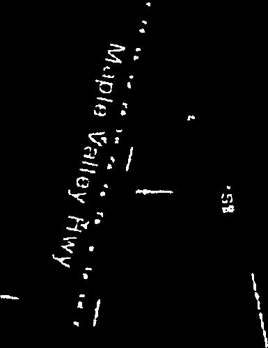
1 Gregg Denis Law Mayor Public Works Department - Zimmerman, P.E., Administrator June 4, 2018 Ms. Fereshteh Dehkordi King County Department of Permitting and Environmental Review SE Douglas Street, Suite 210 Snoqualmie, WA RE: Proposed Lakeside Maple Valley Asphalt Plant, GRDE ; PREA Dear Ms. Dehkordi: Thank you for providing the City of Renton the opportunity to review and comment on the proposed Lakeside Maple Valley Asphalt plant at SE Renton Maple Valley Road (SR 169) on the south side of SR 169 in unincorporated King County, as shown in the Figure 1 site vicinity map. The City of Renton has concerns about the impacts additional traffic trips associated with this project will have on SR 169, its intersections to the west of the project and also on 154 th Place SE which currently suffers severe congestion during the morning and afternoon peak travel hours. The proposed asphalt plant is located 1.4 miles east of the Renton city limits, and 2.3 miles east of the intersection of SR 169 and l54 Place SE. The June 19, 2017 Level 1 Traffic Impact Analysis prepared by TENW indicates that a total of 460 new weekday daily trips will be introduced by the project, with 45 trips occurring during the weekday morning peak hours and 32 trips occurring during the weekday afternoon peak hours. With credits for the existing use applied, the project is estimated to generate 295 weekday daily trips. The Analysis states there will be a total of 360 paving truck movements (190 in and 190 out) weekdays between 6:00 a.m. and 6:00 p.m. An estimated 60% of these trips (114 in and 114 out) will be to and from the west on SR 169. We are concerned that these truck trips will exacerbate the backups and gridlock that already occur at the intersection of 154 th Place SE with SR 169 during the peak hours (see attached aerial photo). Currently a significant amount of westbound traffic on SR 169 during the morning peak hours turns north on 154 th Place SE and heads up the hill. Frequently motorists in the queue of vehicles waiting to make the right-hand turn get impatient of the delay, and instead turn left onto l52 Avenue SE in Renton and make U-turns to head up the hill. This creates a dangerous situation that has required us to post No U-Turn signs along l52 Avenue SE, and to provide heavy police enforcement at this intersection. In addition, we receive frequent complaints of traffic congestion and backups and dangerous conditions for motorists trying to enter the street from their driveways from residents living along 154 th Place SE. We also receive complaints about traffic congestion and speeding along SE l42 Street andl44 Avenue SE in Maplewood Heights (unincorporated King County) and 156 th Avenue SE and Jericho Avenue NE in Renton South Grady Way, Renton, WA rentonwa.gov

. In the afternoon peak travel period, 30% of the traffic using 154 th Place SE is cut-through traffic.")
 E.")


2 Ms. Fereshteh Dehkordi Page 2 of 2 June 4, 2018 Renton performed an origin and destination traffic study to determine the impact of cut-through traffic in Renton. Cut-through traffic means traffic using streets in Renton to bypass the heavily congested state routes, in particular. The study showed that in the morning peak travel period, 68% of the traffic turning right from SR 169 onto 154 th Place SE is cut-through traffic with origins and destinations outside of Renton (see attached graphics). In the afternoon peak travel period, 30% of the traffic using 154 th Place SE is cut-through traffic. The TENW Traffic Impact Analysis shows that at the proposed new site access driveway on SR 169, the northbound (exiting site) movement during the afternoon peak hour is anticipated to operate at level of service (LOS) E. The City of Renton s Transportation Element of our Comprehensive Plan (page 28 attached) applies a standard of LOS D to arterials and collectors, which would apply to this portion of SR 169 if it were located within the city limits. The proposed Lakeside Maple Valley Asphalt Plant would be certain to exacerbate an already bad situation on SR 169, 154 th 152 Place SE, nd Avenue SE, SE l42 Street, 144 th Avenue SE and 156 th Avenue SE both in Renton and in unincorporated King County. The problems of backed up traffic along SR 169 and 154 th Place SE, and speeding, congestion, hazardous driveway conditions and illegal U-turns along these and the other streets mentioned, would be worsened by the addition of paving trucks using these arterials and collector streets to bypass backups on We doubt these impacts could be adequately mitigated, and therefore oppose the siting of an asphalt plant in the proposed location. With our shared interest in the Cedar River, we urge you to consider the impacts of the proposal on the four wetlands and three streams located on the subject property. Each of the three streams (A, B and C) flow into the Cedar River. Wetland A is the headwater of Stream B, and the right-of-way wetland (located within SR 169) connects to Stream C. Environmentally critical areas disturbed during site remediation should be restored and protected, and adequate buffers should be required of the proposed development in order to prevent adverse effects to the Cedar River. Thank you for the opportunity to review and comment on this project. Sincerely, GreggZim an,p.e. Public Works Administrator cc: Dave upthegrove, King county council Member Reagan Dunn, King county council Member Denis Law, Mayor Renton city council Robert Harrison, chief Administrative Officer Jim Seitz, Transportation Systems Division Director chris Barnes, Transportation Operations Manager Jennifer Henning, Planning Director 1055 South Grady Way, Renton, WA rentonwa.gov


3 Trcifiic Impact Anaysk LaIesde indushies SR 169 p. A1 Figure 1: Frojecl Sire Vicinity EQTTO SCALE TENW June 19, 2017 Page 3


4 City of Renton Print map Template ; t, I Notes None 0 j City and County Boundary Parcels c:eee:z:: 1_ l2Feet NGS g84 Web MercatorAuxiIiary_Sphete -Reiitili Finance & IT Division Information Tachnology - GIS RenIonMapSupport@RentorTwaov 611/2018 Thm n-ap p a user gmad stasc natpu from an nemet maptnn see and 5 far rererence cnfy Dara layers tsat appear an tips map may or may mat be accurate current or otherw,e r!table Ti-uS MAP IS NOT TO BE USED FOR NAVIGATION


5 Cut Through Traffic Routes o - f.-4i Pk NE 81Vd u-i z 0) > to D Co If hi Origin/Destination Node Simplified Travel Route! Direction NE 4th St I tti GO1 Couro 11%, e 7/ t. Renton 0 Public Works


6 AM Cut Through Traffic Per Route Origin/Destination Node Simplified Travel Route! Direction Renton 0 CITY OF Public Works


")
7 PM Cut Through Traffic Per Route Origin/Destination Node Simplified Travel Route! Direction Renton C) Cliv OF PubHc Works


8 approval or that an adopted strategy is in place to Action ordinances facilities are in place at the time of development vehicular trips per City-adopted Planned Policy T-44: Ensure adequate transportation POLICIES 5. Adopted planned action areas: Track Community Planning Areas use and growth strategy, establish a citywide The general mode categories include: motor vehicle trips, transit trips, and non-motorized mode with capital improvements and programs. level of person trips by mode, and support each A. Citywide Person Trips: 8ased on the City s land Policy T-48: Apply the following multimodal LOS modes in concurrency determinations. that maximizes mobility, is coordinated with level of transportation facilities, programs and services contributes its fair share of the cost of needed to mitigate growth related transportation meets concurrency requirements. standards at a citywide level, community planning area level, and development level: Policy T-45: Ensure that new development Policy T-46: Maintain a multimodal level of service Policy T-47; Incorporate multiple transportation 4. Kennydale/Highlands/East Plateau Planning Areas 3. Talbot/Benson/Fairwood Community by the following areas to monitor if growth is 2. Valley Community Planning Area Community Planning Areas different pattern than planned, consider the effect on operational LOS and determine if the Comprehensive Plan land use, LOS or capital investments should be amended. Plan investments. If growth is occurring in a concurrency review process, track person trips B. Community Planning Area Trips: Through the 1. West Hill/City Center/Cedar River provide adequate facilities within six years. impacts. service standards of adjacent jurisdictions, and trips. occurring in relation to the Land Use Element and planned Transportation and Capital Facility C. Operational LOS: Through the SEPA review 1. Arterials and Collectors: Except as listed in INVENTORY CITY OF RENTON COMPREHENSIVE PLAN PAGE 28 supported by transit and other non-single occupant 27th/Strander Corridor into Tukwila. than 10 million tons per year), T2 freight corridors principles. Avenue, Rainier Avenue, Grady Way, SR Mobility Plan, hereby incorporated by reference, 900 and SR 515. p.m. peak hour LOS falls below LOS E. Policy T-49: Encourage development that can be Truck and rail freight are important to the regional For the above Corridors and Centers, Center Village neighborhood context. Apply urban design businesses in the City of Rentori. Safe and efficient movement and distribution of FREIGHT Policy T-50: Design transportation facilities to fit the Policy T-51: Support continued development of the vehicle modes. Specific Corridors: Carr Road, Logan Centers: Renton Urban Center and Mitigated for the following: increasing transit or other modes) when Apply a standard of Level of Service E 2. Alternative Arterial and State Route LOS: C.2, apply a standard of LOS D. impacted by a proposed development: congestion should be mitigated (such as standard at intersections that could be process, apply the following operational LOS goods is important for attracting and retaining and local economy. The Washington State Freight identifies Ti freight corridors (those carrying more TRANSPORTATION ELEMENT
DIVISION I TRAFFIC IMPACT STUDY GUIDELINES ENGINEERING STANDARDS
 CITY OF ALBANY DEPARTMENT OF PUBLIC WORKS DIVISION I TRAFFIC IMPACT STUDY GUIDELINES ENGINEERING STANDARDS Prepared By PUBLIC WORKS DEPARTMENT ALBANY, OREGON 97321 Telephone: (541) 917-7676 TABLE OF CONTENTS
Transportation Concurrency
 2015 Frequently Asked Questions About. Transportation Concurrency Q. What is Transportation Concurrency? A. Transportation Concurrency is both a State law requirement and a City pre-application development
Transportation Concurrency
 2017 Frequently Asked Questions About. Transportation Concurrency Q. What is Transportation Concurrency? A. Transportation Concurrency is both a State law requirement and a City pre-application development
RE: A Traffic Impact Statement for a Proposed Mixed-use Development at 400 Windmill Road
 James J. Copeland, P.Eng. GRIFFIN transportation group inc. 30 Bonny View Drive Fall River, NS B2T 1R2 June 27, 2016 Stephanie Nowe-Morris, NSAA LEED AP SNMArchitect Limited 27 DeWolfe Court Bedford, NS
Future Build Alternative Traffic Forecasts and Level of Service Analysis
 4.2.10 Future Build Alternative Traffic Forecasts and Level of Service Analysis For the five Build Alternatives, study intersections within one mile of potential station locations were analyzed, as it
TENW MEMORANDUM. Project Description. Trip Generation
 TENW Transportation Engineering NorthWest MEMORANDUM DATE: January 31, 2017 TO: FROM: SUBJECT: Min Luo, P.E. City of Redmond Curtis Chin, P.E. TENW Phase 1 Traffic Study UPS Redmond Mezzanine Redmond,
Chapter 5 Transportation Draft
 Chapter 5 Transportation Draft Discussion Similar to the other elements in the Comprehensive Plan, the transportation element impacts the quality of life, economic development and public safety of the
Article 16 Traffic Impact Analysis
 Article 16 Traffic Impact Analysis Table of Contents... 16-1 Chapter 16.1 Purpose and Intent... 16-2 Chapter 16.2 Applicability... 16-2 Chapter 16.3 Exemptions... 16-2 Chapter 16.4 Trip Generation Data...
TRAFFIC & TRANSPORTATION COMMISSION AGENDA REPORT
 TRAFFIC & TRANSPORTATION COMMISSION AGENDA REPORT AGENDA ITEM #4 T/T MTG: 092616 DATE: SEPTEMBER 26, 2016 TO: TRAFFIC & TRANSPORTATION COMMISSION FROM: BENJAMIN CHAN, P.E, T.E., DEPUTY PUBLIC WORKS DIRECTOR
Chapter 4: Transportation and Circulation
 Chapter 4: Transportation and Circulation 4.1 Introduction Circulation improvements constructed for the West Valley Logistics Center will improve the functional efficiency of the circulation system in
10.0 Congestion Management Process
 Livability 2040 Regional Transportation Plan 10-1 10.0 Congestion Management Process 10.1 CMP Summary The identification and evaluation of projects for the Livability 2040 Regional Transportation Plan
Essex Junction Highway-Rail Grade Crossing Study
 Communities working together to meet Chittenden County s transportation needs CHITTENDEN COUNTY METROPOLITAN PLANNING ORGANIZATION Essex Junction Highway-Rail Grade Crossing Study October 18, 2000 CCMPO
TRAFFIC STUDY GUIDELINES
 TRAFFIC STUDY GUIDELINES December 2013 The scope of the traffic impact analysis (TIA) should follow these guidelines and the requirements of VMC 11.80.130 and VMC 11.70, transportation concurrency (attached
Traffic Impact Study Requirements
 [TYPE THE COMPANY NAME] Traffic Impact Study Requirements County of San Mateo Department of Public Works Roadway Services 9/1/2013 I. Introduction The County of San Mateo (County), Department of Public
ALBION FLATS DEVELOPMENT EXISTING TRAFFIC CONDITIONS AND POTENTIAL IMPACTS
 EXISTING TRAFFIC CONDITIONS AND POTENTIAL IMPACTS FINAL REPORT SEPTEMBER 2010 TABLE OF CONTENTS 1.0 INTRODUCTION 1 2.0 EXISTING TRAFFIC CONDITIONS 2 3.0 FUTURE TRAFFIC CONDITIONS 3 4.0 POTENTIAL IMPACTS
1.1 Purpose of the Project
 Chapter 1 Purpose and Need for East Link Project 1.1 Purpose of the Project The purpose of the East Link Project is to expand the Sound Transit Link light rail system from Seattle to Mercer Island, Bellevue
% U<p. Memorandum SAN JOSE CAPITAL OF SILICON VALLEY. FROM: Jim Ortbal Harry Freitas TO: HONORABLE MAYOR AND CITY COUNCIL
 COUNCIL AGENDA: 9/20/16 ITEM: 11.2(b) CITY OF CR 3 SAN JOSE CAPITAL OF SILICON VALLEY TO: HONORABLE MAYOR AND CITY COUNCIL SUBJECT: I-280/WINCHESTER TRANSPORTATION DEVELOPMENT POLICY Memorandum FROM: Jim
APPENDIX B. Public Works and Development Engineering Services Division Guidelines for Traffic Impact Studies
 APPENDIX B Public Works and Development Engineering Services Division Guidelines for Traffic Impact Studies Revised December 7, 2010 via Resolution # 100991 Reformatted March 18, 2011 TABLE OF CONTENTS
4.9 TRANSPORTATION AND CIRCULATION
 4.9 TRANSPORTATION AND CIRCULATION 4.9 TRANSPORTATION AND CIRCULATION This section describes the current transportation setting for and generally assesses the impacts of future dairy development on the
Appendix O Level of Service Standard and Measurements
 July 8, 2016 Appendix O. Appendix O Standard and Measurements Definition Level of service (LOS) is a mechanism used to determine how well a transportation facility is operating from a traveler s perspective.
January 17, Ron Waldthausen Platte Valley LLC 1378 Promontory Bluff View Colorado Springs, CO 80921
 LSC TRANSPORTATION CONSULTANTS, INC. 545 East Pikes Peak Avenue, Suite 210 Colorado Springs, CO 80903 (719) 633 2868 FAX (719) 633 5430 E mail: lsc@lsctrans.com Website: http://www.lsctrans.com January
CITY OF SAN MATEO GENERAL PLAN MITIGATION MONITORING AND REPORTING PROGRAM
 CITY OF SAN MATEO GENERAL PLAN MITIGATION MONITORING AND REPORTING PROGRAM INTRODUCTION This document is the (MMRP) for the Mateo General Plan. This MMRP has been prepared pursuant to Section 21081.6 of
Contents i Contents Page 1 A New Transportation Plan Community Involvement Goals and Objectives... 11
 Contents i Contents 1 A New Transportation Plan... 1 Why develop a new plan?... 1 What area does the LRTP focus on?... 2 Why is this LRTP important?... 3 Meeting Requirements for Transportation Planning...
Greenhouse Gas Emission Reduction Strategies
 Greenhouse Gas Emission Reduction Strategies 2011 ITE Quad Conference April 18 19, 2011, Embassy Suites; Lynnwood, WA Victor L. Sl Salemann, PE Senior Associate David Evans and Associates Bellevue, WA
Section 7 Environmental Constraints
 Section 7 Environmental Constraints i Yakima Valley Metropolitan and Regional Transportation Plan Public Comment DRAFT 1/27/2016 Environmental Constraints Analysis A programmatic-level review of potential
Evaluation of Alternatives
 Chapter 9.0 Evaluation of Alternatives Chapter 9.0 provides a summary evaluation of the No Build Alternative and the Preferred Alternative. The evaluation contained within this chapter is an assessment
12 Evaluation of Alternatives
 12 Evaluation of Alternatives This chapter evaluates the effectiveness of the No-Build Alternative and the proposed METRO Blue Line Light Rail Transit (BLRT) Extension project based on the information
VTrans2040 Multimodal Transportation Plan Corridors of Statewide Significance Needs Assessment Western Mountain Corridor (L)
") VTrans2040 Multimodal Transportation Plan Corridors of Statewide Significance Needs Assessment Western Mountain Corridor (L) 77 Table of Contents I. Corridor Overview Land Use and Demographics Corridor
VTrans2040 Multimodal Transportation Plan Corridors of Statewide Significance Needs Assessment Western Mountain Corridor (L) 77 Table of Contents I. Corridor Overview Land Use and Demographics Corridor
Chapter 5 - Transportation
 Chapter 5 - Transportation Discussion Similar to the other elements in the Comprehensive Plan, the transportation element impacts the quality of life, economic development and public safety of the residents
What is the Dakota County Principal Arterial Study?
 What is the Dakota County Principal Arterial Study? The Dakota County is underway and will address future designations of certain highways as Principal Arterials. What Are Principal Arterials? Principal
Chapter Five: Transportation
 Chapter Five: Transportation Purpose and Intent Transportation Goals and Policies Land Use Assumptions Airway Heights Transportation System Facilities and Services Pedestrian Transportation Public Transportation
Washington State Association of Counties. County Overview: WTP Advisory Committee County Transportation Overview
 County Overview: All citizens (6.7 million) receive county wide services (including cities) Counties are agent of State o Elections o Courts o Recording o Prosecution o Jail o Assessment/Collection of
Chapter 6 Freight Plan
 Chapter 6 Freight Plan Overview This chapter presents a review and assessment of needs, deficiencies, policies and improvement options affecting the freight transportation system within the Medford Urban
Technical Memorandum. 720 SW Washington Suite 500 Portland, OR dksassociates.com. DATE: July 12, 2017
 Technical Memorandum DATE: July 12, 2017 TO: Kay Bork City of Veneta Bill Johnston, AICP Oregon Department of Transportation Christina McDaniel-Wilson, PE Oregon Department of Transportation Keith Blair,
Chapter 8. Transportation Element
 Chapter 8. Transportation Element Introduction/Overview Element Requirements Transportation is a key issue and priority in Longview. State highways, local roads, transit, railroads, and the port are lifelines
Technical Briefing Report
 Technical Briefing Report March 2007 CONGESTION MANAGEMENT PROCESS (CMP) The Congestion Management Process (CMP) seeks a management solution to a growing traffic problem by targeting resources to operational
BCEO TRAFFIC IMPACT STUDY GUIDELINES
 BCEO TRAFFIC IMPACT STUDY GUIDELINES February 2006 TABLE OF CONTENTS INTRODUCTION..... i TRAFFIC IMPACT STUDY STRUCTURE... 1 WHEN IS A TRAFFIC IMPACT STUDY NEEDED?..... 1 STUDY AREA, SITE PLAN & HORIZON
Traffic Impact Analysis Guidelines. Town of Queen Creek
 Traffic Impact Analysis Guidelines Town of Queen Creek January 2016 1. INTRODUCTION The purpose of this document is to outline the procedures and requirements for preparing a Transportation Impact Analysis
City of Berkeley. Guidelines for Development of Traffic Impact Reports
 Office of Transportation (OOT) City of Berkeley Guidelines for Development of Traffic Impact Reports Office of Transportation, City of Berkeley 1 1. Overview These guidelines provide a framework to help
Livability 2050 Regional Transportation Plan Update. Transportation Policy Board (TPB) August 23, 2018
 August 23, 2018") Livability 2050 Regional Transportation Plan Update Transportation Policy Board (TPB) August 23, 2018 1 Oct. 2017 Plan Kick-Off Sept. 2019 Plan Adoption Timeline Livability 2050 Regional Transportation
Livability 2050 Regional Transportation Plan Update Transportation Policy Board (TPB) August 23, 2018 1 Oct. 2017 Plan Kick-Off Sept. 2019 Plan Adoption Timeline Livability 2050 Regional Transportation
CITY OF DRAPER TRAFFIC IMPACT STUDY DESIGN GUIDELINES
 CITY OF DRAPER TRAFFIC IMPACT STUDY DESIGN GUIDELINES June 1, 2012 Draper City Traffic Impact Study Guidelines Table of Contents Introduction... 1 Traffic Impact Classification Levels... 1 Analysis Approach
Mendocino Forest Products Grading For Industrial Land Improvements
 Mendocino Forest Products Grading For Industrial Land Improvements Technical Memorandum #10 CEQA Evaluation of Environmental Impacts Prepared for: Mendocino Forest Products Company, LLC Consulting Engineers
Chapter 2 Transportation Element Goals, Objectives and Policies
 Chapter 2 Transportation Element Goals, Objectives and Policies City of Belleview Comprehensive Plan Adopted by Ord 2016-10 on July 5, 2016 GOALS, OBJECTIVES AND POLICIES Goal 2 Transportation...1 Objective
6.0 CONGESTION HOT SPOT PROBLEM AND IMPROVEMENT TRAVEL DEMAND MODEL ANALYSIS
 6.0 CONGESTION HOT SPOT PROBLEM AND IMPROVEMENT TRAVEL DEMAND MODEL ANALYSIS 6.1 MODEL RUN SUMMARY NOTEBOOK The Model Run Summary Notebook (under separate cover) provides documentation of the multiple
PROJECT SUBMISSION FORM
 PROJECT SUBMISSION FORM Basic Project Information CEID 1182 1. Submitting Agency: MDOT/State Highway Administration 2. Secondary Agency: 3. Agency Project ID: 4. Project Type: Interstate Primary Secondary
CHAPTER 2: MODELING METHODOLOGY
 CHAPTER 2: MODELING METHODOLOGY 2.1 PROCESS OVERVIEW The methodology used to forecast future conditions consisted of traditional traffic engineering practices and tools with enhancements to more accurately
RE: A Traffic Impact Statement for the Proposed Fall River South Development
 James J. Copeland, P.Eng. GRIFFIN transportation group inc. 30 Bonny View Drive Fall River, NS B2T 1R2 June 20, 2016 Chris Boudreau, P.Eng. Manager Engineering Strum Consulting Railside, 1355 Bedford Highway
EXAMPLES OF COMPREHENSIVE PLAN POLICIES HOW TO ESTIMATE THE BENEFITS OF THE CTR PROGRAM
 TABLE OF CONTENTS INTRODUCTION... I BACKGROUND OF THE COMMUTE TRIP REDUCTION EFFICIENCY ACT... II MAKING THE CONNECTION BETWEEN COMMUTE TRIP REDUCTION AND THE GROWTH MANAGEMENT ACT... IV CTR PLANNING AND
Progress Report Regional Express & Bus Rapid Transit Program
 Progress Report Regional Express & Bus Rapid Transit Program ST Express Bus routes serve urban centers in Snohomish, King, and Pierce. March 2018 Prepared by Project Control & VE l Design, Engineering
Transportation and Utilities
 4 Section 4 Transportation and Utilities 4.0 Introduction Transportation and utility systems are essential to accommodate and support development proposed in the Future Land Use Map. The following pages
Nashville Regional Freight & Goods Movement Study Phase III
 Mayor Karl Dean, Chairman Nashville Regional Freight & Goods Movement Study Phase III Freight Advisory Committee Meeting #2 June 3 rd, 2015 Agenda Update on Freight Vision/Regional Truck Route Network
FEDERAL HIGHWAY ADMINISTRATION RECORD OF DECISION FOR THE LYNNWOOD LINK EXTENSION
 FEDERAL HIGHWAY ADMINISTRATION RECORD OF DECISION FOR THE LYNNWOOD LINK EXTENSION AUGUST 2015 Table of Contents 1 Decision... 1 1.1 Project Description... 2 1.2 Basis for the FHWA Decision... 7 1.2.1
GUIDE FOR THE PREPARATION OF TRAFFIC IMPACT STUDIES
 GUIDE FOR THE PREPARATION OF TRAFFIC IMPACT STUDIES Adopted by Town Council on November 25, 2008 Prepared By: HNTB Engineering Department Planning Department TABLE OF CONTENTS I. INTRODUCTION... 1 II.
Briefing for: MOA Freight Advisory Commission. January12,
 Briefing for: MOA Freight Advisory Commission January12, 2010 www.highway2highway.com Project Team Lead Agencies Federal Highway Administration Federal Transit Administration Alaska Department of Transportation
APPENDIX Methodology Letter of Understanding (MLOU) and Agency Correspondence
 and Agency Correspondence") APPENDIX 21 1 Methodology Letter of Understanding (MLOU) and Agency Correspondence Question 21 Transportation This document reflects the transportation study methodology to be utilized in preparing responses
APPENDIX 21 1 Methodology Letter of Understanding (MLOU) and Agency Correspondence Question 21 Transportation This document reflects the transportation study methodology to be utilized in preparing responses
2006 TRANSPORTATION IMPACT FEES REPORT
 City of Bellingham 2006 TRANSPORTATION IMPACT FEES REPORT Prepared for: City of Bellingham September 2006 Prepared by: David Evans and Associates, Inc. 415 118th Avenue SE Bellevue, WA 98005 Phone: 425-519-6500
MEMORANDUM #4. DATE: November 4, Warrenton TSP Project Management Team. Ray Delahanty, AICP, DKS Associates Kate Petak, EIT, DKS Associates
 MEMORANDUM #4 DATE: November 4, 2015 TO: FROM: SUBJECT: Warrenton TSP Project Management Team Ray Delahanty, AICP, DKS Associates Kate Petak, EIT, DKS Associates Warrenton Transportation System Plan Update
King County Intelligent Transportation Systems
 King County Intelligent Transportation Systems Signal Synchronization and Beyond Presentation to the Transportation Leadership Forum Department of Transportation February 24, 2005 System Control & Evaluation
Town of Lakeshore TRANSPORTATION IMPACT STUDY GUIDELINES
 FEBRUARY 2010 TABLE OF CONTENTS 1. INTRODUCTION... 1 1.1 Why is a Transportation Impact Study Required?... 1 1.2 Applicability... 1 1.3 Acknowledgement of Responsibility... 2 2. TIS REQUIREMENTS AND SCOPE...
CHAPTER 3.0 CIRCULATION ELEMENT
 CHAPTER 3.0 CIRCULATION ELEMENT The Circulation Element identifies the general location and extent of existing and proposed major transportation facilities for vehicle, rail, air, water, and bicycle transportation
CHAPTER 4. Existing Roadway Conditions. Highway Element. Kanawha County Putnam County
 CHAPTER 4 Highway Element Existing Roadway Conditions The challenges facing the future of the transportation network in the Kanawha Valley are a collective result of reliance on passenger vehicles for
City of Los Angeles 2010 Bicycle Plan First Year of the First Five-Year Implementation Strategy & Figueroa Streetscape Project Draft EIR
 5.0 ALTERNATIVES California Environmental Quality Act (CEQA) requires that an EIR describe a range of reasonable alternatives to the project or to the location of the project that could feasibly avoid
Memorandum. 921 SW Washington Street, Suite 468, Portland, OR tel fax
 Date: September 16, 2010 To: I-84/US 395 IAMP Project Team From: Shayna Rehberg, AICP Darci Rudzinski, AICP Re: I-84/US 395 Interchange Area Management Plan Proposed IAMP Policies and Code Amendments L
Traffic Impact Study Guidelines. City of Guelph
 Traffic Impact Study Guidelines City of Guelph April 2016 Engineering and Capital Infrastructure Services Infrastructure, Development & Enterprise 1 Carden Street Guelph, Ontario Canada N1H 3A1 Page 1
CHAPTER 8 TRANSPORTATION ELEMENT
 CHAPTER 8 TRANSPORTATION ELEMENT Section 8.01 Purpose: The purpose of this Chapter (element) is to establish the desired and projected transportation system within Niceville and to plan for future motorized
Executive Summary. Study Background
 Executive Summary ES 1.1 Introduction The Capitol Region Council of Governments (CRCOG) and the Connecticut Department of Transportation (CTDOT) initiated the (BTS) in 2006 to identify near and long-term
SOUTHWEST LRT (METRO GREEN LINE EXTENSION)
") 8 Evaluation of Alternatives This chapter evaluates the effectiveness of the No Build Alternative and the Southwest Light Rail Transit (LRT) Project (the Project) based on the information contained in
8 Evaluation of Alternatives This chapter evaluates the effectiveness of the No Build Alternative and the Southwest Light Rail Transit (LRT) Project (the Project) based on the information contained in
GUIDELINES FOR TRAFFIC IMPACT ANALYSIS (ZONING PETITIONS)
") GUIDELINES FOR TRAFFIC IMPACT ANALYSIS (ZONING PETITIONS) (A) INTENT This Section is intended to help ensure that new development does not adversely affect the capacity of streets and intersections to
GUIDELINES FOR TRAFFIC IMPACT ANALYSIS (ZONING PETITIONS) (A) INTENT This Section is intended to help ensure that new development does not adversely affect the capacity of streets and intersections to
The Hampton Roads Region
 Congestion Management System in Hampton Roads, Virginia Presented by: Keith Nichols Hampton Roads Planning District Commission CMS Peer Exchange Forum September 16, 2005 The Hampton Roads Region Located
TRANSPORTATION RELATIONSHIP TO OTHER ELEMENTS OF THE PLAN AND COUNTY REGULATIONS VISION FOR TRANSPORTATION PLANNING ROAD NETWORK SECTION 7
 TRANSPORTATION Like many growing western counties, Douglas County focuses on one of the most integral elements in land-use planning: transportation. The primary purpose of a transportation network is to
TRANSPORTATION MOBILITY PLAN GUIDELINES
 TRANSPORTATION MOBILITY PLAN GUIDELINES for Development Applications November 2016 Executive Summary The Regional Municipality of York (the Region) is located in the heart of the Greater Toronto Area (GTA)
TSM/TDM (Transit and Roadway Efficiency) Concept - Analysis and Results
 Concept - Analysis and Results") M E M O R A N D U M TSM/TDM (Transit and Roadway Efficiency) Concept - Analysis and Results TO: FROM: Task Force and Oversight Team Steve Perone/PTV America Tim Burkhardt/CH2M HILL DATE: Revised: August
M E M O R A N D U M TSM/TDM (Transit and Roadway Efficiency) Concept - Analysis and Results TO: FROM: Task Force and Oversight Team Steve Perone/PTV America Tim Burkhardt/CH2M HILL DATE: Revised: August
EXECUTIVE SUMMARY REGIONAL TRANSPORTATION PLAN 2050
 EXECUTIVE SUMMARY REGIONAL TRANSPORTATION PLAN 2050 Introduction Goals Policies, and Performance Measures Growth Forecast and Planned Land Use Development Key Recommendations i Executive Summary April
LAS VEGAS STREET RAILROAD CROSSING RR/PUC CONNECTION AND PRELIMINARY DESIGN
 LAS VEGAS STREET RAILROAD CROSSING RR/PUC CONNECTION AND PRELIMINARY DESIGN Prepared for: City of Colorado Springs Prepared by: Felsburg Holt & Ullevig 508 South Tejon Street Colorado Springs, CO 80903
EXECUTIVE SUMMARY. The cities of Bellevue, Kirkland, Issaquah, and Redmond, commenced a two-year cooperative study in fall 2001 to
 EXECUTIVE SUMMARY STUDY PURPOSE The cities of Bellevue, Kirkland, Issaquah, and Redmond, commenced a two-year cooperative study in fall 2001 to describe and assess the four cities existing approaches to
The TIS is to be signed and sealed by a Florida Registered Professional Engineer.
 CHAPTER 900. SECTION 901. DEVELOPMENT STANDARDS INFRASTRUCTURE STANDARDS 901.5. Transportation Impact Study A. Intent and Purpose The intent and purpose of the Traffic Impact Study (TIS) is to identify
TRANSPORTATION IMPACT STUDIES
 January 28, 2009 POLICIES AND PROCEDURES FOR TRANSPORTATION IMPACT STUDIES Related to Highway Occupancy Permits Pennsylvania Department of Transportation Bureau of Highway Safety and Traffic Engineering
VDOT Land Use Overview. Brad Shelton, AICP Transportation and Mobility Planning Division June 2015
 VDOT Land Use Overview Brad Shelton, AICP Transportation and Mobility Planning Division June 2015 VDOT Land Development Programs Local/State Plan and Program Consistency Review local comp plan transportation
Appendix O Congestion Management Program REGIONAL TRANSPORTATION PLAN/SUSTAINABLE COMMUNITIES STRATEGY
 Appendix O Congestion Management Program REGIONAL TRANSPORTATION PLAN/SUSTAINABLE COMMUNITIES STRATEGY 2014 REGIONAL CONGESTION MANAGEMENT PROGRAM 2014 RTP/SCS APPENDIX O SAN JOAQUIN COUNCIL OF GOVERNMENTS
PORT OF FERNANDINA TRUCK CIRCULATION STUDY
 OCTOBER 2015 PREPARED FOR: I. Introduction... 1 II. Study Area... 1 III. Field Data Collection... 3 IV. Existing Traffic... 5 V. Truck Circulation Analysis... 8 VI. Peak Hour Intersection Analysis... 10
PINELLAS COUNTY MOBILITY PLAN SUMMARY REPORT
 PINELLAS COUNTY MOBILITY PLAN SUMMARY REPORT In September, 2013, the Pinellas County Mobility Plan Report was approved by the Metropolitan Planning Organization (MPO). This action endorsed a countywide
CITY OF SARNIA TRANSPORTATION MASTER PLAN: TRANSPORTATION IMPACT STUDY GUIDELINES
 CITY OF SARNIA TRANSPORTATION MASTER PLAN: TRANSPORTATION IMPACT STUDY GUIDELINES REPORT JULY 2013 I B I G R O U P R E P O R T TABLE OF CONTENTS 1. INTRODUCTION... 1 1.1 Why is a Transportation Impact
M D 355 [FR E D E R IC K R O A D] OVER
![M D 355 [FR E D E R IC K R O A D] OVER](/thumbs/79/79553721.jpg "M D 355 [FR E D E R IC K R O A D] OVER") M D 355 [FR E D E R IC K R O A D] OVER LITTLE BENNETT CREEK MAINTENANCE OF TRAFFIC ALTERNATIVE ANA LYSIS Prepared by: INTRODUCTION The purpose of this report is to present the results of traffic analyses
M D 355 [FR E D E R IC K R O A D] OVER LITTLE BENNETT CREEK MAINTENANCE OF TRAFFIC ALTERNATIVE ANA LYSIS Prepared by: INTRODUCTION The purpose of this report is to present the results of traffic analyses
3.12 TRANSPORTATION AND TRAFFIC
 3.12 TRANSPORTATION AND TRAFFIC This section summarizes the potential transportation and traffic impacts related to construction and operation of the proposed project. The section includes a review of
Proposed Council Changes to Comprehensive Plan
 Chapter 6 Transportation Page and line numbers reflect Planning Commission Recommended Draft dated 1/14/16 (http://wawhatcomcounty.civicplus.com/documentcenter/view/15155 ). To improve clarity of Councilmember
Informational Brochure. Proposed Interchange. Interstate Route 295 (I-295) AT Greenville Avenue (State Route 5) Town of Johnston, Rhode Island
 AT Greenville Avenue (State Route 5) Town of Johnston, Rhode Island") Informational Brochure Proposed Interchange OF Interstate Route 295 (I-295) AT Greenville Avenue (State Route 5) Town of Johnston, Rhode Island October 5, 2016 Department of Transportation Two Capitol
Informational Brochure Proposed Interchange OF Interstate Route 295 (I-295) AT Greenville Avenue (State Route 5) Town of Johnston, Rhode Island October 5, 2016 Department of Transportation Two Capitol
PROPOSED AMENDMENT OF THE I 76 INTEGRATED CORRIDOR MANAGEMENT PROJECT TO THE CONNECTIONS 2040 PLAN FOR GREATER PHILADELPHIA
 PROPOSED AMENDMENT OF THE I 76 INTEGRATED CORRIDOR MANAGEMENT PROJECT TO THE CONNECTIONS 2040 PLAN FOR GREATER PHILADELPHIA Background and Project Description In July 2013, the Delaware Valley Regional
The Policies section will also provide guidance and short range policies in order to accomplish the goals and objectives.
 4 Goals & Objectives INTRODUCTION The 2015-2040 MTP preserves and promotes the quality of life and economic prosperity of the MAB by providing a transportation system consistent with the regional goals.
Chapter 4 Construction Effects and Mitigation
 Chapter 4 Construction Effects and Mitigation This chapter discusses the direct and indirect s of project related construction on the elements of the built and natural environments. Direct s are s caused
Performance Measures for Transportation Planning Part 1
 Performance Measures for Transportation Planning Part 1 Flint, MI July 12, 2011 Brian Betlyon FHWA Resource Center Overview Performance Measurement in Transportation Planning Module Outcomes Describe performance
A+ ACADEMY HIGH SCHOOL
 TRAFFIC MANAGEMENT PLAN FOR A+ ACADEMY HIGH SCHOOL IN DALLAS, TEXAS Prepared for: A+ Charter Schools, Inc. 8225 Bruton Road Dallas, Texas 75217 Prepared by: Texas Registered Engineering Firm F-3199 400
Date: May 4, Clare M. Look-Jaeger, P.E. Kevin C. Jaeger Linscott, Law & Greenspan, Engineers Weingart Projects Construction Traffic Analysis
 MEMORANDUM To: CAJA Environmental Services, LLC Date: From: Subject: Clare M. Look-Jaeger, P.E. Kevin C. Jaeger Linscott, Law & Greenspan, Engineers Weingart Projects Construction Traffic Analysis LLG
Final Initial Study/Mitigated Negative Declaration Indianola Subdivision Project City of Sanger, Fresno County, California
 Final Initial Study/Mitigated Negative Declaration Indianola Subdivision Project City of Sanger, Fresno County, California Prepared for: City of Sanger 1700 7 th Street Sanger, CA 93657 559.876.6300 Contact:
THE PROJECT. Executive Summary. City of Industry. City of Diamond Bar. 57/60 Confluence.
 THE PROJECT A freeway segment ranked 6th worst in the Nation, with levels of congestion, pollution and accidents that are simply unacceptable and which have Statewide and National implications. Executive
Database and Travel Demand Model
 Database and Travel Demand Model 7 The CMP legislation requires every CMA, in consultation with the regional transportation planning agency (the Metropolitan Transportation Commission (MTC) in the Bay
3.6 GROUND TRANSPORTATION
 3.6.1 Environmental Setting 3.6.1.1 Area of Influence The area of influence for ground transportation consists of the streets and intersections that could be affected by automobile or truck traffic to
Final Land Use and Development Opportunities Report 5.0 Environmental Impact/Environmental Consequences
 Figure 5-6. Century City 1/4-Mile Station Area August 16, 2010 Page 5-14 Figure 5-7. Wilshire/Westwood 1/4-Mile Station Area August 16, 2010 Page 5-15 Alternative 1 would be constructed underneath existing
Congestion Management Process 2013 Update
 OVERVIEW OF THE DALLAS-FORT WORTH CONGESTION MANAGEMENT PROCESS Traffic Congestion In The Dallas-Fort Worth Region With the Dallas-Fort Worth (DFW) urban area as its center, the North Central Texas region
on Access Management Howard Preston CH2M HILL 7 th Annual Conference
 I-394 Business 7 th Annual Conference on Access Management Howard Preston CH2M HILL hpreston@ch2m.com 651-688 688-87728772 ext. 14 Park City, Utah August, 2006 David Plazak Iowa State University CTRE dplazak@iastate.edu
2017 TIGER DISCRETIONARY GRANT APPLICATION
 2017 TIGER DISCRETIONARY GRANT APPLICATION Spokane International Airport Spokane, WA APPENDIX A Letters of Support 801 W. Riverside Suite 100 Spokane WA 99201 Phone: 509.624.1393 800.SPOKANE