Working in Arid and Semi-Arid Climates with Hydromodification Concerns
|
|
|
- Roger Booker
- 6 years ago
- Views:
Transcription


1 Design Techniques for Stream Restoration: Working in Arid and Semi-Arid Climates with Hydromodification Concerns Presented By: Tory R. Walker, PE, CFM, LEED GA September 30, 2014
2 Brief Overview Short History Lesson MS4 (Stormwater) Permit as a Catalyst Regional Factors & Influencers Case Studies
3 Short History Lesson 5 water quality 1 natural 4 Detention & MPDs 2 ditches 3 channels

4 What Are You Looking At? from Stormwater Magazine

5 MS4 Permits as a Catalyst Recent focus on problem of hydromodification Intention is commendable, science is lacking Science has been imported Approach is over simplified Conservative assumptions Result is a convoluted set of rules with little resemblance to reality You can t legislate how nature should behave!
6 Factors & Influencers Precipitation data and geologic data have influenced urban development Consider how MS4 permits should be written to properly address the impacts of hydromodification Present a more effective approach that is scientifically robust & practical MUST UNDERSTAND THESE FACTORS OR ELSE!
7 The Fatal Conceit (coined by Friedrich Hayek) To summarize - the belief that people can manipulate and control complex systems that they don t understand and have good outcomes. Invariably, when they do that, they not only do not have good outcomes, they get all kinds of unintended consequences. Complex systems, by definition, are systems that no one of us can fully understand. Each of us sees only a part of it, and yet when we manipulate it, we continue to be surprised by the results.


8 Climatic Influence The Mediterranean climate in Southern California entices people there to live, work, and play

9 BUT Devastation from occasional winter storms Flooding and mudslides Erosion of channels Sediment deposition downstream Damage to utilities, roads and bridges Loss of life and property Infrequency causes short term memory!
10 Climatic Influence- Seasonal 7.00 Seasonal Precipitation in Oceanside (cm) Jan Feb Mar Apr May Jun Jul Aug Sep Oct Nov Dec 60% 2%

11 Climatic Influence- Long Term Variation
12 Climatic Influence SoCal climatic patterns do not represent most of the U.S.

13 yet the majority of LID and hydromodification management tools have been developed & applied elsewhere, including: Computer Simulation Models & Studies Stream restoration tools & techniques

14 # of days of Rainfall per Year Rainfall Distribution Typical Distributions of Annual Precipitation in Days per Year S. Coastal Vancouver, BC 60 San Diego LIGHT HEAVY EXTREME

15 % of Runoff Rainfall Distribution Typical Distributions of Annual Precipitation as Percentages S. Coastal Vancouver, BC San Diego LIGHT HEAVY EXTREME

16 Climate Vast geographic differences demonstrates need for calibration of continuous simulation hydrologic models LID tools and onsite hydromodification management devices may function differently depending on climate Understand how precipitation infiltrated will behave in soils and underlying geology

17 Geological Influences

18 Urban Environment Established communities have grown around and adapted to environmental conditions and constraints Example: San Diego County currently imports over 80% of its water from outside the County Building and development standards established in recognition of environmental conditions and societal values in the area

19 Building Out an Urban Environment Southern California is largely built out Most desirable land has been developed More challenging (and costly) lands have yet to be developed Some developed land gets redeveloped New development is often adjacent to existing built environment Must carefully consider all potential impacts on both built environment and natural environment
 to reduce hydromodification impacts!")
20 Urban Environment & Water Water is still relatively inexpensive and reliable Typical residential water budget is 50% to 60% outside uses Typical landscaping requires 50 inches of irrigation Over-irrigation frequently leads to Slope instability Settlement Mold growth Seepage through foundations Undermining of roads & utilities Now EPA is pushing LID (i.e., infiltration) to reduce hydromodification impacts!
21 Hydromodification Simple Definition: Erosion of waterways and subsequent sediment deposition downstream, often due to modifications in the watershed Examples: Covering the land with impervious surfaces Deprives waterways of sediment Increased runoff volumes, durations, & peaks in those same waterways Flood Control Dams Traps sediment Reduces damaging peak flows & volumes
22 Effects of Urbanization on Hydrology (Peak, Volume, Duration) Disruption of natural water balance Increased flood peaks Increased stormwater runoff More frequent flooding Increased bankfull flows
23 Traditional Response to Hydromodification Impacts addressed by improving (channelizing and hardening) waterways Protecting adjacent lands from periodic flooding Protecting against erosion Often resulting in concrete lining or rock riprap lining Allowing for more adjacent lands to be developed Urban environment encroached upon previously flood-prone lands Habitat was assigned less value by society than potential uses of adjacent lands

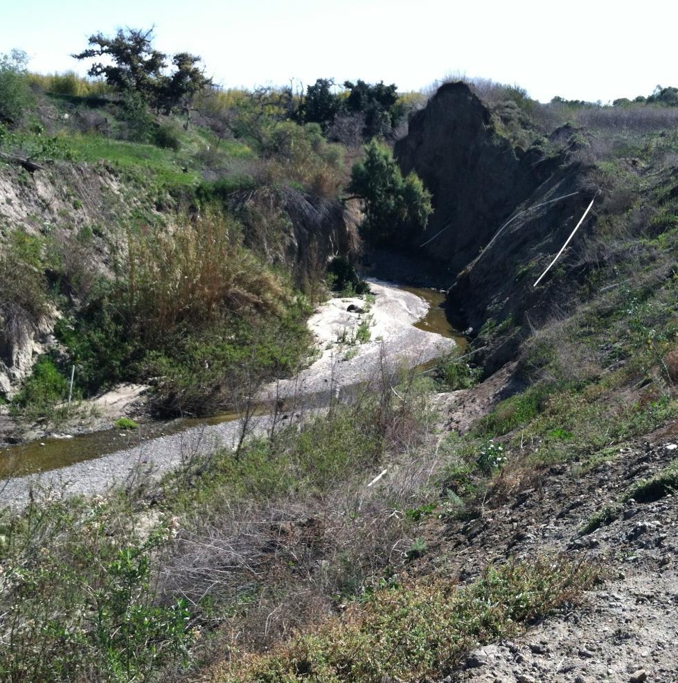
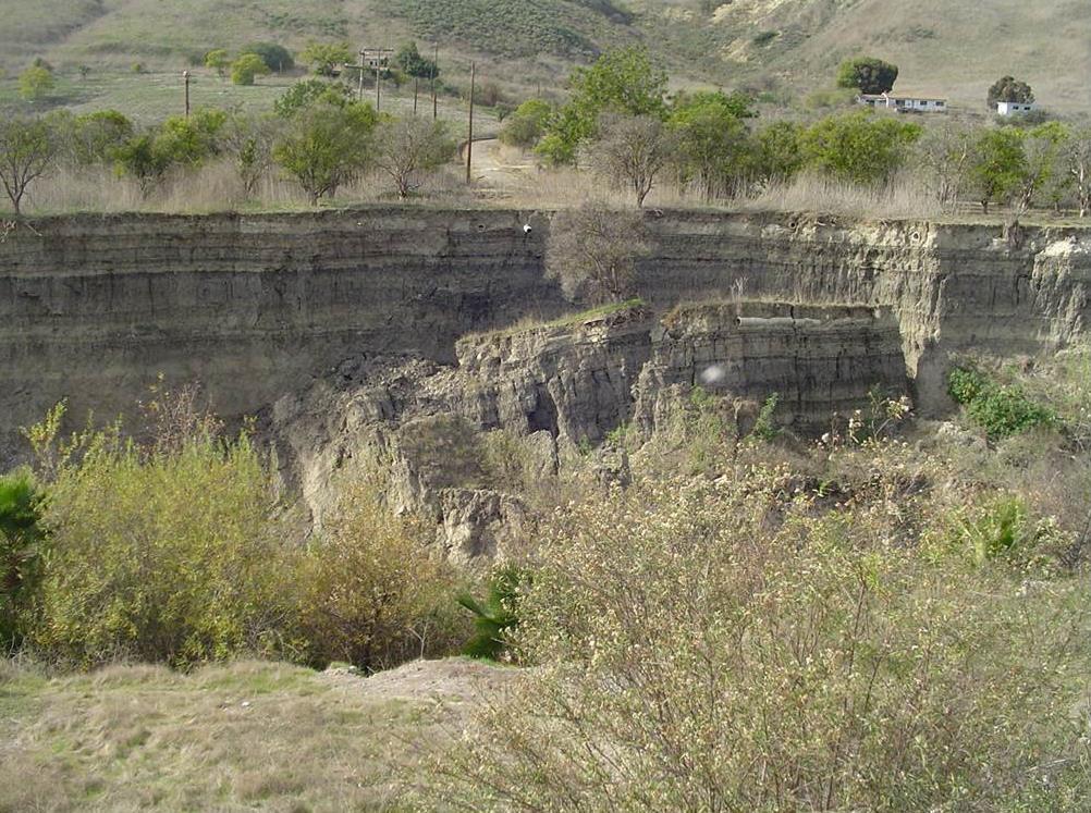
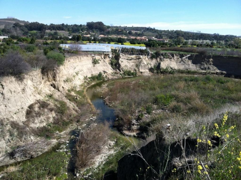
24 Hydromodification Degradation Many waterways in Southern California were not improved through the traditional approach Various degrees of degradation resulted Common factors affecting stream degradation include: Percentage and locations of impervious areas within watershed Soils and geology of watershed Sediment sizes within watershed Slope of waterway Time passed since development


25 Oso Creek in San Juan Capistrano

26 Escondido Creek in Escondido
27 Agua Hedionda Creek in Vista
28 Geology Consensus Based Science The Permit FOG Vegetation
29 Hydromodification Myths Common Myths (over-simplification): 1. Precise definition of critical low-flow threshold is fundamental to determine hydromodification impacts 2. A small change in imperviousness of an already heavily altered system will change the erosion response 3. Many heavily altered watersheds and creeks can be restored to natural (pre-columbian) conditions 4. Designing over-sized onsite hydromodification management facilities for new developments may significantly improve current problems
30 Hydromodification and the SoCal MS4 Permit Fails to consider mitigating factors that exist in nature Wetland and riparian vegetation Channel irregularities Ability of many creeks to self-armor Climatic Variation Fails to consider fluvial systems that are in a state of dynamic equilibrium Assumes that critical low-flow threshold is the point at which a natural channel becomes unstable FACT: in Southern California, infrequent episodic events are far more influential!

31 Sediment Transport - Southern California Most sediment is transported during medium to extreme events
 accomplishes very little of significance Greatly increases size of onsite hydromodification management facilities * 73 years of daily data")
32 Sediment Transport - Tijuana River 53% of sediment transported occurs for peak flows larger than Q10 * Typical range valid for non-mediterranean climates is not representative of the optimum range of analysis in Southern California Misguided efforts to tightly control extremely small flows (i.e., 10% of Q 2 ) accomplishes very little of significance Greatly increases size of onsite hydromodification management facilities * 73 years of daily data
33 Sensitivity of an Impacted System Previous studies of natural fluvial systems As little as 3% of impervious area can be sufficient to cause a natural system to begin to degrade or unravel Long term response of fluvial systems to impervious area is not well understood Predictions can be based on similar systems Some systems remain vulnerable (Oso Creek) Some in a state of new dynamic eq. (Escondido Creek) Some in between (needing some level of restoration)

34 Systematic Approach to Hydromodification Management Observe response of fluvial system to previous increase in impervious area over time Study aerial photography and topography GIS analysis HEC-RAS Other fluvial geomorphic tools Fluvial Geomorphic Studies Reasonable Assessments of Vulnerability
35 One Approach to Watershed Rehabilitation Deconstructing urban environment over time Restoration to pre-columbian natural systems All new development needs a zero net impact LID and onsite hydromodification management Existing development would follow suit Required retention of 85 th Percentile runoff Natural condition as a point for comparison If underlying soils unsuitable for infiltration, other LID practices implemented Green roofs; Cisterns and rain barrels REMEMBER FACTORS & INFLUENCERS!
 Not smart")
36 A Flawed Approach Society would bear cost of condemning all currently protected properties adjacent to waterways Alternatives will cause pressure to infiltrate against better judgment Displaced homes and businesses would need to relocate (new impacts) Not smart growth
 California Environmental Quality Act (CEQA) requires")


37 A Flawed Approach (cont.) California Environmental Quality Act (CEQA) requires consideration of potential impacts to surrounding land uses, both natural and built Potential impacts Flooding Environmental degradation Impacts to groundwater quality and quantity CEQA checklist addresses groundwater depletion Does not address Increases of infiltration Increases to groundwater levels

38 A Balanced Approach Start with multidiscipline team of experts! Use the best available data, models and tools Rigorous adherence to the scientific method Further develop modeling tools based on local data Application to realities that characterize the Region Climatic Geologic Urban Economic Calibrate parameters
39 MS4 Permit Alternative Compliance Focus on impaired receiving waters rather than onsite LID and hydromodification management Allowing water quality goals to be achieved sooner Establish Water Quality Equivalency (currency) In-lieu fee mechanism (like wetlands program) Numerous stream restoration and rehabilitation projects have been already identified Improves physical, chemical and biological characteristics of waterway


40 Oso Creek Watershed Watershed area is 20 sq. miles, creek is 13.5 miles long From Upper Oso Reservoir, through Mission Viejo, to North San Juan Capistrano Tributary to Trabuco Creek Watershed is highly urbanized, creek is mostly hardened
 Land use historically agriculture")
41 Impaired Area Reach End of hardened channel to Trabuco Creek Within City of San Juan Capistrano Both public and private property Vital infrastructure (roads, railroad, water, sewer) Land use historically agriculture
42 Area Issues Active erosion due to hydromodification (upstream development) Sedimentation downstream Trabuco Creek is critical habitat for Steelhead Trout Loss of natural creek functions Decreased flood capacity downstream Development of private land infeasible Threat to existing infrastructure
43 May 1994

44 June 2002

45 April 2005

46 November 2009

47 March 2011
48 Issues to Identify in Restoration Plan Stabilization of creek bed and banks Re-establishment of natural creek functions Potential groundwater replenishment Protection of adjacent and downstream properties Downstream flood capacity preserved Protection of existing infrastructure, such as railroad and sewer lines

49 Stabilize Creek Bed and Banks
50

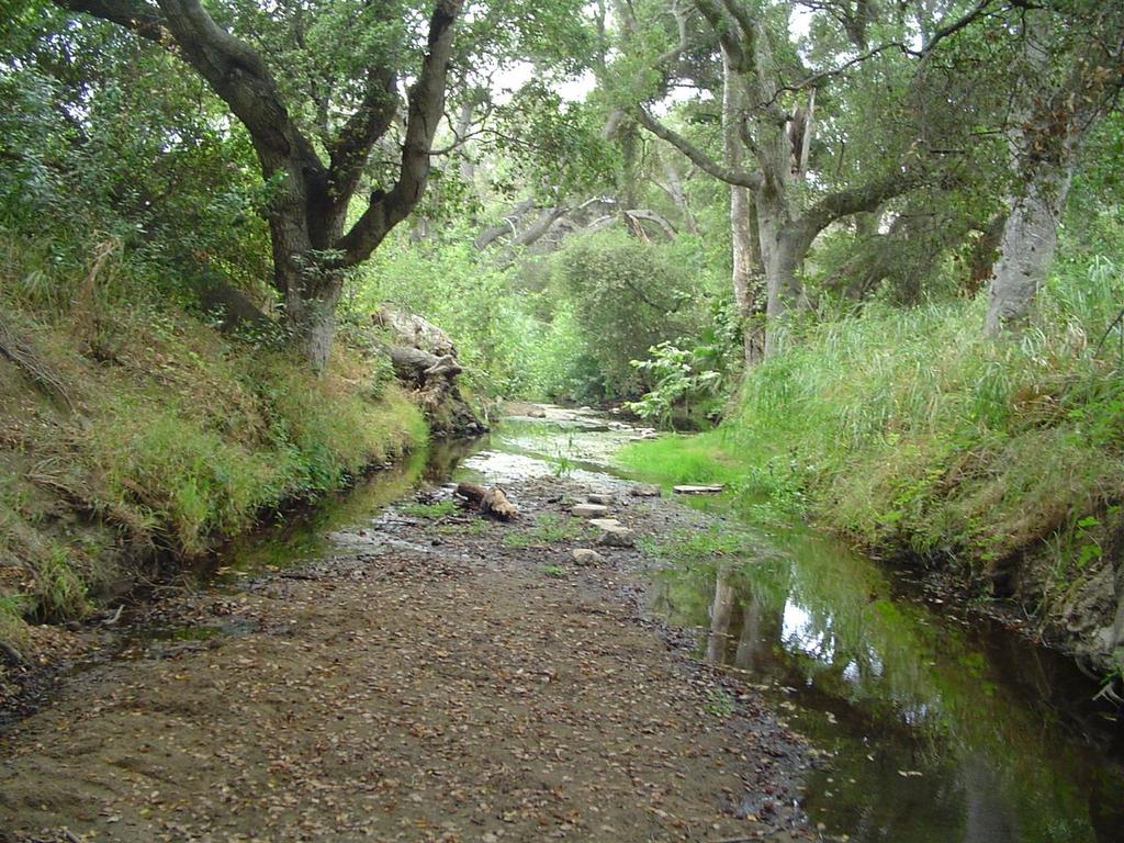
51 Re-Establish Natural Creek Functions

52 Groundwater Replenishment

53 Protection of Property


54 Preserve Downstream Flood Capacity Trabuco Creek at San Juan Creek
55
56
57 Conceptual Design Typical Plan View Re-establishment of natural creek profile Creek bed stabilization (grade control) Creek bank stabilization (rock groins)
58 Conceptual Design Typical Profile Re-establishment of Natural Creek Profile
59 Creek Bed Stabilization (Natural Rock Grade Control)

60 Benefits of Grade Control Reduces velocity Reduces bed and bank erosion Promotes sediment buildup Protects existing infrastructure Enhances aquatic biology with riffle pool stream profile Replenishes groundwater Restores bed and bank vegetation Natural attenuation of peak flows
61 Creek Bank Stabilization with Rock Groins Reduces velocity Reduces bank erosion Allows for habitat variation Preserves low flow channel Stabilizes channel bank Plan View Cross Section

62 Agua Hedionda Area Reach About 35 miles north of downtown San Diego Includes portions of Carlsbad, Vista, Oceanside, San Marcos Approximately 31 square miles & 37 linear miles of streams Terminates at the Agua Hedionda Lagoon
63 Agua Hedionda Creek Stable System (circa 1900) High Groundwater Recharge Equilibrium Sediment Transport High Floodplain Function Low Discharge Velocities Dynamic and Broad Riparian Zone Diverse Riparian Habitat Sustainable Vegetation Mosaic Cool Seasonal Aquatic System

64 Agua Hedionda Creek - Present Early Incised System (Present) Depressed Groundwater Table High Groundwater Export Low Groundwater Recharge High Channel Bank Erosion Confined Low Floodplain Function High Discharge Velocities Diminishing Riparian Zone Width Low Diversity Riparian Habitat Poor Riparian Plant Recruitment Cool Seasonal/Perennial Aquatic System

65 Agua Hedionda Creek - Present

66 Agua Hedionda Creek Restoration Project Floodplain Inundation Map Detailed HEC-RAS study Surveyed cross-sections 50 feet apart on average Incorporated hydraulic parameters specific to each cross section Useful for sediment transport analysis Evaluated 2-year, 10-year & 100-year
67 Preliminary Design Proposed Structures 9 grade control structures - 6 larger structures - 3 smaller (riffle) structures

68 Preliminary Design Proposed Structures
69 Preliminary Design Proposed Structures 5 areas of Bank Stabilization Natural stone toe with plantable gabions Natural stone toe to top of bank (2:1 slope) - Requires more room - Many mature trees limit its use

70 Agua Hedionda Creek Mature Incised System (circa 2040) Groundwater Conditions Same High Channel Bank Erosion Confined Low Floodplain Function High Discharge Velocities Diminishing Riparian Zone Width Low Diversity, Narrow Riparian Habitat High Scour Plant Loss Opportunistic Exotic Plant Recruitment Warm Seasonal/Perennial Aquatic System
71 Agua Hedionda Creek Restoration Project Preliminary Design Grade Control Structures
72 QUESTIONS? Tory Walker (760)
Stormwater and LEED. Vancouver LEED User s Group May 27, Craig Kipkie, M.Sc., P.Eng, LEED AP
 Stormwater and LEED Vancouver LEED User s Group May 27, 2005 Craig Kipkie, M.Sc., P.Eng, LEED AP Outline Sustainable Sites 2 Stormwater credits SSc6.1 SSc6.2 Synergies with other Credits Case Study How
South St. Vrain / Hall Meadows Restoration Planning August 20, 2015
 South St. Vrain / Hall Meadows Restoration Planning August 20, 2015 Agenda Introductions Purpose & Goals of Meeting Planning Area Master Plan Restoration Planning: Cost Estimates, Grants, Scope, Timeline
A Case for the Design and Modeling of BMP Infiltration and LID Techniques. By: Bob Murdock
 A Case for the Design and Modeling of BMP Infiltration and LID Techniques 2009 IAFSM Annual Conference 2009 IAFSM Annual Conference By: Bob Murdock Presentation Outline 1. Runoff Reduction (RR) and Low
APPENDIX H Guidance for Preparing/Reviewing CEQA Initial Studies and Environmental Impact Reports
 APPENDIX H H.1 Guidance for Preparing and Reviewing CEQA Initial Studies Step 1: Consider the Project Characteristics as Provided by the Project Applicant Review the project application and draft plan
Pennsylvania Stormwater Best Management Practices Manual. Chapter 3. Stormwater Management Principles and Recommended Control Guidelines
 Pennsylvania Stormwater Best Management Practices Manual Chapter 3 Stormwater Management Principles and Recommended Control Guidelines 363-0300-002 / December 30, 2006 Chapter 3 Stormwater Management Principles
CHAPTER 7. San Dieguito River Flooding Adaptation
 CHAPTER 7 San Dieguito River Flooding Adaptation This chapter includes a range of adaptation measures to address vulnerabilities from flooding along the San Dieguito River, including the river valley,
FEMA s Mitigation Support for Resiliency: Innovative Drought and Flood Mitigation Projects
 FEMA s Mitigation Support for Resiliency: Innovative Drought and Flood Mitigation Projects Jordan Williams, CFM Eric Kenney, PE, CFM May 4, 2017 2 Hazard Mitigation Purpose: Research climate resilient
STREAM RESTORATION PURPOSE, PRACTICE, AND METHODS. By Marcus Rubenstein, CPESC
 STREAM RESTORATION PURPOSE, PRACTICE, AND METHODS By Marcus Rubenstein, CPESC WHAT IS STREAM RESTORATION? The return of a stream s lost natural functions, usually resulting from watershed alterations,
Municipal Stormwater Management Planning
 Municipal Stormwater Management Planning Christopher C. Obropta, Ph.D., P.E. Water Resources Extension Specialist with Rutgers Cooperative Extension Assistant Professor with Department of Environmental
LID & Detention Pond Sizing Tool to Address Hydromodification and Water Quality in Clackamas County
 LID & Detention Pond Sizing Tool to Address Hydromodification and Water Quality in Clackamas County Leah Johanson, Water Environment Services February 12 th, 2015 Agenda» WES History/Stormwater Standards»
STREAMBANK RESTORATION DESIGN
 STREAMBANK RESTORATION DESIGN WITH VINYL SHEET PILE GRADE CONTROL STRUCTURES BRUCE M. PHILLIPS, M.S., P.E. ABSTRACT Grade control structures are an effective channel stabilization measure which can eliminate
Chapter 6. Hydrology. 6.0 Introduction. 6.1 Design Rainfall
 6.0 Introduction This chapter summarizes methodology for determining rainfall and runoff information for the design of stormwater management facilities in the City. The methodology is based on the procedures
Chapter 1. Introduction
 Chapter 1 Introduction James P. Heaney, Robert Pitt, and Richard Field Introduction Stormwater has traditionally been considered a nuisance, requiring rapid and complete drainage from areas of habitation.
Review of State and Federal Stormwater Regulations November 2007
 Review of State and Federal Stormwater Regulations November 2007 By: James T. Spaulding, PE, CPESC Joseph M. Ducharme, Jr., PE TTG ENVIRONMENTAL CONSULTANTS, LLC 27 LOCKE ROAD, CONCORD, NH 03301-5301 TELEPHONE:
Implementing Stormwater Management through Split-Flow Drainage Design
 Implementing Stormwater Management through Split-Flow Drainage Design Stuart Patton Echols PhD, ASLA, RLA Assistant Professor - Department of Landscape Architecture 210 Engineering Unit D Center for Watershed
Climate Change & Urbanization Have Changed River Flows in Ontario
 Climate Change & Urbanization Have Changed River Flows in Ontario by Trevor Dickinson & Ramesh Rudra Water Resources Engineering University of Guelph Acknowledgements Agencies NSERC, OMAF & Environment
COON CREEK WATERSHED DISTRICT PERMIT REVIEW. Spring Lake Park Schools Westwood Middle School st Avenue NE, Spring Lake Park, MN 55432
 PAN 16-112, Westwood Middle School, Page 1 of 6 COON CREEK WATERSHED DISTRICT PERMIT REVIEW MEETING DATE: August 22, 2016 AGENDA NUMBER: 10 FILE NUMBER: 16-112 ITEM: Westwood Middle School RECOMMENDATION:
Leila Talebi and Robert Pitt. Department of Civil, Construction, and Environmental Engineering, The University of Alabama, P.O. Box , Tuscaloosa
 Leila Talebi and Robert Pitt Department of Civil, Construction, and Environmental Engineering, The University of Alabama, P.O. Box 870205, Tuscaloosa May 2012 Global consumption of water increases every
Chapter Three: Discussion and Conclusion. 3.1 Introduction/Overview. 3.2 Countywide Stream Assessment
 3.1 Introduction/Overview The objective of this study was to develop a stream prioritization tool that evaluates stream reaches in terms of the potential water quality improvements that could be achieved
Paraprofessional Training Session 1
 Paraprofessional Training Session 1 Part 2: Stormwater Basics November 26, 2012 Rutgers University, Cook Campus Christopher C. Obropta, Ph.D., P.E. Extension Specialist in Water Resources Associate Professor
CHAPTER 3 Environmental Guidelines for WATERCOURSE CROSSINGS GOVERNMENT OF NEWFOUNDLAND AND LABRADOR DEPARTMENT OF ENVIRONMENT AND LABOUR
 GOVERNMENT OF NEWFOUNDLAND AND LABRADOR DEPARTMENT OF ENVIRONMENT AND LABOUR CHAPTER 3 Environmental Guidelines for WATERCOURSE CROSSINGS WATER RESOURCES MANAGEMENT DIVISION Water Investigations Section
New Draft Model BMP Design Manual for San Diego Region
 New Draft Model BMP Design Manual for San Diego Region Public Input 2013 Storm Water Permit June 10, 2014 & June 11, 2014 1 Welcome Sign-In Refreshments Sponsor Break Q&A and Input 2 Outline of Presentation
iswm TM Criteria Manual City of Azle Section 14 City of Azle Subdivision Ordinance DRAFT-June Chapter 1
 City of Azle Section 14 City of Azle Subdivision Ordinance DRAFT-June 2010... Chapter 1 i CITY OF AZLE iswm CRITERIA MANUAL FOR SITE DEVELOPMENT AND CONSTRUCTION Incorporating the Regional NCTCOG Integrated
Functional Uplift Based Stream Assessment & Restoration Design
 Functional Uplift Based Stream Assessment & Restoration Design Darcy K.L. Turner Senior Environmental Scientist, Biohabitats, Inc. (dturner@biohabitats.com) Christopher A. Streb, PE Ecological Engineer,
MS4 Programs: Quality, the Other Stormwater Q. Dan Bounds, PE, D.WRE IAFSM March 9, 2017
 MS4 Programs: Quality, the Other Stormwater Q Dan Bounds, PE, D.WRE IAFSM March 9, 2017 MS4 Rule and Regulations MS4 Municipal Separate Storm Sewer System A conveyance or system of conveyances (catch basins,
POLICY FOR NATURAL RESOURCE MANAGEMENT AREAS
 POLICY FOR NATURAL RESOURCE MANAGEMENT AREAS I. POLICY STATEMENT Auburn University's (the University's) "Policy for Natural Resource Management Areas" implements the Campus Master Plan Land Use Element
Chehalis Basin Strategy Programmatic SEPA Draft EIS
 Chehalis Basin Strategy Programmatic SEPA Draft EIS History of Flooding I-5 closed in 1990, 1996, 2007, 2009 Five largest flood events occurred since 1986 2 History of Habitat Degradation Harvest has been
UMD Storm Water Program Construction Requirements. Greg Archer, MBA Environmental Compliance Specialist
 UMD Storm Water Program Construction Requirements Greg Archer, MBA Environmental Compliance Specialist Phase 2 Regulatory Overview Dec. 1999 EPA issues Phase 2 Federal Register Municipalities (MS4) from
New Castle County, DE. Floodplain Regulations
 New Castle County, DE Floodplain Regulations John J. Gysling, PE CFM Department of Land Use New Castle County, DE February 26, 2009 Today s Presentation Floodplain Protection and Uses Terms and Definitions
San Antonio Water System Mitchell Lake Constructed Wetlands Below the Dam Preliminary Hydrologic Analysis
 San Antonio Water System enhancement. This recommendation was based on limited water quality data provided by SAWS and using a free-water surface constructed wetland with approximately 112 acres of wetted
Stream Corridor Protection and Adaptive Management Manual. Prepared for the City of Independence, Missouri
 Stream Corridor Protection and Adaptive Management Manual Prepared for the City of Independence, Missouri Rock Creek Independence, Missouri By Patti Banks Associates and Applied Ecological Services, Inc.
PRENTISS CREEK (SUB-E) KENSINGTON PLACE CONCEPT PLAN VILLAGE OF DOWNERS GROVE, ILLINOIS AUGUST, 2011
 KENSINGTON PLACE CONCEPT PLAN VILLAGE OF DOWNERS GROVE, ILLINOIS AUGUST, 2011") PRENTISS CREEK (SUB-E) KENSINGTON PLACE CONCEPT PLAN VILLAGE OF DOWNERS GROVE, ILLINOIS AUGUST, 2011 Submitted to: NATHANIEL HAWK, STAFF ENGINEER VILLAGE OF DOWNERS GROVE 5101 WALNUT AVENUE DOWNERS GROVE,
PRENTISS CREEK (SUB-E) KENSINGTON PLACE CONCEPT PLAN VILLAGE OF DOWNERS GROVE, ILLINOIS AUGUST, 2011 Submitted to: NATHANIEL HAWK, STAFF ENGINEER VILLAGE OF DOWNERS GROVE 5101 WALNUT AVENUE DOWNERS GROVE,
Development of a Stormwater Management Plan for Phase II Small MS4s Insight and Innovation
 Development of a Stormwater Management Plan for Phase II Small MS4s Insight and Innovation Ohio Water Environment Association 2016 Technical Conference & Expo June 29, 2016 Objective To create a Stormwater
Green Infrastructure BMPs. Hydrologic Performance Small Storms
 Green Infrastructure BMPs Hydrologic Performance Small Storms Clay Emerson, Ph.D. Princeton Hydro Robert G. Traver, Ph.D., PE Department of Civil and Environmental Engineering Villanova University Director,
Urban Hydrology Characteristics and their Influence on Urban Stream Restoration Technology. Presented by:
 Urban Hydrology Characteristics and their Influence on Urban Stream Restoration Technology Presented by: Michael Clar Ecosite, Inc. James Gracie Brightwater, Inc. BACKGROUND Many streams in urban areas
Lecture 9A: Drainage Basins
 GEOG415 Lecture 9A: Drainage Basins 9-1 Drainage basin (watershed, catchment) -Drains surfacewater to a common outlet Drainage divide - how is it defined? Scale effects? - Represents a hydrologic cycle
Water Balance Methodology
 Water Balance Methodology Integrating the Site with the Watershed and the Stream March 2012 An initiative under the umbrella of the Water Sustainability Action Plan for British Columbia Water Balance Methodology
Ponds. Pond A water impoundment made by excavating a pit, or constructing a dam or an embankment.
 POND SITE SELECTION AND CONSTRUCTION Uses, Planning, & Design David Krietemeyer Area Engineer USDA-NRCS June 20, 2008 Uses Considerations for Location of Commonly Used Terms Pond A water impoundment made
16.0 Water Quality Management Criteria for Developed Land
 October 2003, Revised February 2005 Criteria for Developed Land Page 1 16.1 Introduction 16.0 Water Quality Management Criteria for Developed Land Stormwater quality control is an integral part of any
Good morning, Chairman Yaw, Chairman Yudichak, Chairman Vulakovich, Chairman Costa,
 Testimony of Patrick McDonnell, Secretary Pennsylvania Department of Environmental Protection Joint Hearing on Flooding and Emergency Response Senate Environmental Resources & Energy and Veterans Affairs
Note that the Server provides ArcGIS9 applications with Spatial Analyst and 3D Analyst extensions and ArcHydro tools.
 Remote Software This document briefly presents the hydrological and hydraulic modeling software available on the University of Nice Server with Remote Desktop Connection. Note that the Server provides
December 7, Dr. Christine Pomeroy University of Utah Civil and Environmental Engineering MCE Salt Lake City, UT. Dear Dr.
 December 7, 2012 Dr. Christine Pomeroy University of Utah Civil and Environmental Engineering MCE 2042 Salt Lake City, UT 84112 Dear Dr. Pomeroy, The following document is the final report of the Red Butte
6.0 Runoff. 6.1 Introduction. 6.2 Flood Control Design Runoff
 October 2003, Revised February 2005 Chapter 6.0, Runoff Page 1 6.1 Introduction 6.0 Runoff The timing, peak rates of discharge, and volume of stormwater runoff are the primary considerations in the design
Pre-Treatment Bioretention Cells Bioswales IOWA STORMWATER MANAGEMENT MANUAL DECEMBER 16, 2015
 Pre-Treatment Bioretention Cells Bioswales IOWA STORMWATER MANAGEMENT MANUAL DECEMBER 16, 2015 Urban Runoff Background How we got here What Problem?? Provenance of the Problem Unified Sizing Criteria What
Urban Rainwater Harvesting Systems: Promises and Challenges
 TheWaterChannel Webinar #5 Urban Rainwater Harvesting Systems: Promises and Challenges By Vishwanath S Zenrainman@gmail.com www.ircsa.org www.rainwaterclub.org Thanks for coming. The webinar will begin
Lyon Creek Cedar Way Stormwater Detention Dam Operation and Maintenance Manual
 Lyon Creek Cedar Way Stormwater Detention Dam Operation and Maintenance Manual Prepared by: Mike Shaw Stormwater Program Manager City of Mountlake Terrace January 2010 Section I General Information This
Regulatory Requirements
 CHAPTER 1 Regulatory Requirements 1.0 Introduction The negative impacts of unmanaged stormwater runoff present a challenge to the City of Philadelphia, including increased runoff pollutant concentrations,
Stormwater Management Studies PDS Engineering Services Division ES Policy # 3-01
 Stormwater Management Studies PDS Engineering Services Division Revised Date: 2/28/08 INTRODUCTION The City of Overland Park requires submission of a stormwater management study as part of the development
Understanding Stormwater Pollution Prevention Plans (SWPPPs) (SWPPPS)
 (SWPPPS)") Understanding Stormwater Pollution Prevention Plans (SWPPPs) (SWPPPS) Definitions SWPPP: Storm Water Pollution Prevention Plan BMP: Best Management Practice(s) to control pollution IDNR: Iowa Department
Understanding Stormwater Pollution Prevention Plans (SWPPPs) (SWPPPS) Definitions SWPPP: Storm Water Pollution Prevention Plan BMP: Best Management Practice(s) to control pollution IDNR: Iowa Department
Science Supporting Policy: The Case For Flow Quantity
 MassDEP Water Management Program Science Supporting Policy: The Case For Flow Quantity Integrating Water Resources Management UMASS Conference April 8, 2008 Overview Human impact on streamflow and aquatic
Western Washington Hydrology Model (WWHM) Software Introduction. Doug Beyerlein, P.E., P.H., D.WRE Clear Creek Solutions, Inc. Mill Creek, Washington
 Software Introduction. Doug Beyerlein, P.E., P.H., D.WRE Clear Creek Solutions, Inc. Mill Creek, Washington") Western Washington Hydrology Model (WWHM) Software Introduction Doug Beyerlein, P.E., P.H., D.WRE Clear Creek Solutions, Inc. Mill Creek, Washington Clear Creek Solutions Hydrology Expertise Clear Creek
Western Washington Hydrology Model (WWHM) Software Introduction Doug Beyerlein, P.E., P.H., D.WRE Clear Creek Solutions, Inc. Mill Creek, Washington Clear Creek Solutions Hydrology Expertise Clear Creek
7/16/2012. Post Construction Best Management Practices (PCBMPs) Article VIII: Post Construction Best Management Practices
 Article VIII: Post Construction Best Management Practices") Post Construction Best Management Practices (PCBMPs) Article VIII: Post Construction Best Management Practices Presented by Jennifer Boyer DuPage County DEC Includes BMPs intended to provide volume control
Post Construction Best Management Practices (PCBMPs) Article VIII: Post Construction Best Management Practices Presented by Jennifer Boyer DuPage County DEC Includes BMPs intended to provide volume control
Existing Conditions
 3.1.4 Hydrology and Water Quality This section addresses the potential hydrology, water quality, and stormwater/flooding impacts associated with implementation of The Villages Escondido Country Club Project
Department of the Army Permit Application
 Department of the Army Permit Application DA File Number U.S. Army Corps of Engineers Honolulu District Date Received by CEPOH-RO Send Completed Application to: Honolulu District, U.S. Army Corps of Engineers
PIMA COUNTY COMPREHENSIVE PLAN CO PIMA COUNTY REGIONAL COMPREHENSIVE PLAN POLICY MAJOR PLAN AMENDMENT
 PIMA COUNTY COMPREHENSIVE PLAN CO7-07-04 PIMA COUNTY REGIONAL COMPREHENSIVE PLAN POLICY MAJOR PLAN AMENDMENT Arizona law [A.R.S. 11-821(C)(3)] requires: Planning for water resources that addresses: a)
Elements of the Storm Water Management Plan. Storm Water Pollution Prevention Plan (SWPPP)
") Elements of the Storm Water Management Plan Storm Water Pollution Prevention Plan (SWPPP) Small Construction Site Storm Water Management Rodney Hendrick Water Quality Specialist LSU Ag Center Plan Requirements
Elements of the Storm Water Management Plan Storm Water Pollution Prevention Plan (SWPPP) Small Construction Site Storm Water Management Rodney Hendrick Water Quality Specialist LSU Ag Center Plan Requirements
STREAM AND BUFFER AREA PROTECTION/RESTORATION
 STREAM AND BUFFER AREA PROTECTION/RESTORATION AMENDMENT OPTIONS TO STRENGTHEN POLICY IN HEADWATERS AREAS DRAFT SUBSEQUENT TO THE JANUARY 25, 2007 MEETING OF THE PLANNING COMMISSION ENVIRONMENT COMMITTEE
M.L. Kavvas, Z. Q. Chen, M. Anderson, L. Liang, N. Ohara Hydrologic Research Laboratory, Civil and Environmental Engineering, UC Davis
 Assessment of the Restoration Activities on Water Balance and Water Quality at Last Chance Creek Watershed Using Watershed Environmental Hydrology (WEHY) Model M.L. Kavvas, Z. Q. Chen, M. Anderson, L.
What is a stormwater utility fee?
 What is a stormwater utility fee? A stormwater utility fee is similar to a water or sewer utility fee. In essence, customers pay a fee to convey stormwater from their properties. The City of Goodlettsville
SECTION 4 SURFACE WATER MANAGEMENT DESIGN AND CONSTRUCTION REQUIREMENTS
 SECTION 4 SURFACE WATER MANAGEMENT DESIGN AND CONSTRUCTION REQUIREMENTS Page 4-1 INTRODUCTION 4-3 4-1.01 Applicability of VMCs 14.24, 14.25, 14.26 4-4 4-1.02 Minimum Requirements - Projects Below Threshold
SW-74 SERENOVA PRESERVE SITES 2, 3, 4, 8 MITIGATION PLAN
 SW-74 SERENOVA PRESERVE SITES 2, 3, 4, 8 MITIGATION PLAN BACKGROUND INFORMATION Project SWIM? Aquatic Control? Exotic Control? Mitigation Bank? Type No No No No Mitigation Restoration and enhancement Type
UNIVERSITY OF OREGON NORTH CAMPUS CONDITIONAL USE PERMIT PROJECT Draft Conditional Use Permit Stormwater, Sanitary Sewer, and Water Analysis Report
 UNIVERSITY OF OREGON NORTH CAMPUS CONDITIONAL USE PERMIT PROJECT Draft Conditional Use Permit Stormwater, Sanitary Sewer, and Water Analysis Report Prepared for: Cameron McCarthy Landscape Architects LLP
Adjusted Flood Prone Acres
 Adjusted Flood Prone Acres The flood prone area is defined as the area adjacent to the stream that is innundated or saturated when the elevation of the water is at twice the maximum depth at bankfull stage
TORCH LAKE TOWNSHIP WATER QUALITY ACTION PLAN
 TORCH LAKE TOWNSHIP WATER QUALITY ACTION PLAN Elk-River-Chain-of-Lakes Gaps Analysis Project The Watershed Center Grand Traverse Bay Tip of the Mitt Watershed Council Michigan Department of Natural Resources
APPENDIX IV. APPROVED METHODS FOR QUANTIFYING HYDROLOGIC CONDITIONS OF CONCERN (NORTH ORANGE COUNTY)
") APPENDIX IV. APPROVED METHODS FOR QUANTIFYING HYDROLOGIC CONDITIONS OF CONCERN (NORTH ORANGE COUNTY) Hydromodification design criteria for the North Orange County permit area are based on the 2- yr, 24-hr
APPENDIX IV. APPROVED METHODS FOR QUANTIFYING HYDROLOGIC CONDITIONS OF CONCERN (NORTH ORANGE COUNTY) Hydromodification design criteria for the North Orange County permit area are based on the 2- yr, 24-hr
Information for File # PRH
 Information for File # 2016-02602-PRH Applicant Corps Contact Tom Morley Paul Hauser Address 152 Baker Drive, Redwood Falls, MN 56283 E-Mail Paul.R.Hauser@usace.army.mil Phone 651-290-5357 Primary County
Background / Regulatory Requirements
 Chapter 2 Background / Regulatory Requirements This Chapter summarizes the impacts of development on stormwater quality and quantity and explains the postconstruction stormwater control requirements for
E. STORMWATER MANAGEMENT
 E. STORMWATER MANAGEMENT 1. Existing Conditions The Project Site is located within the Lower Hudson Watershed. According to the New York State Department of Environmental Conservation (NYSDEC), Lower Hudson
Issue paper: Aquifer Water Balance
 Issue paper: Aquifer Water Balance 1. Introduction And Background 1.1. Purpose and Scope The population in Kitsap County has grown rapidly in recent years and is expected to increase substantially in the
In re: Town of Norwich Pool Dam Reconstruction, Stream Alteration Permit Application
 Agency of Natural Resources October 20, 2015 Neil R. Fulton Town Manager Town of Norwich P.O. Box 376 Norwich, VT 05055 In re: Town of Norwich Pool Dam Reconstruction, Stream Alteration Permit Application
Pennsylvania Stormwater Best Management Practices Manual DRAFT - JANUARY Section 1 Introduction and Purpose of Stormwater BMP Manual
 Pennsylvania Stormwater Best Management Practices Manual DRAFT - JANUARY 2005 Section 1 Introduction and Purpose of Stormwater BMP Manual This page intentionally left blank. Section 1 Introduction and
Stormwater Volume and Treatment Methods Simplifying the Numbers. IAFSM March 10, Presented by: Tom Powers P.E., CFM, LEED AP, CPESC
 Stormwater Volume and Treatment Methods Simplifying the Numbers IAFSM March 10, 2011 Presented by: Tom Powers P.E., CFM, LEED AP, CPESC Introduction GOALS: Improve understanding of Rate and Volume (Quantity)
Fort Leonard Wood, Missouri. September 2013
 Fort Leonard Wood, Missouri September 2013 1 Presenters Shannon Kelly, Physical Scientist Clean Water Act Program Manager Directorate of Public Works Environmental Division Environmental Compliance Branch
Stormwater Local Design Manual For Houston County, Georgia
 Stormwater Local Design Manual For Houston County, Georgia Adopted November 15, 2005 TABLE OF CONTENTS 1. FORWARD... 1 2. GENERAL LEVEL OF SERVICE STANDARDS... 2 2.1. DETENTION REQUIREMENTS... 2 2.1.1.
VILLAGE OF BELLAIRE WATER QUALITY ACTION PLAN
 VILLAGE OF BELLAIRE WATER QUALITY ACTION PLAN Elk-River-Chain-of-Lakes Gaps Analysis Project The Watershed Center Grand Traverse Bay Tip of the Mitt Watershed Council Michigan Department of Natural Resources
The Impacts of Climate Change on Portland s Water Supply
 The Impacts of Climate Change on Portland s Water Supply Richard Palmer and Margaret Hahn University of Washington Department of Civil and Environmental Engineering Joe Dvorak, Dennis Kessler, Azad Mohammadi
REGIONAL STORMWATER CAPTURE & USE FEASIBILITY STUDY TAC MEETING #1 - JULY 18, 2017
 REGIONAL STORMWATER CAPTURE & USE FEASIBILITY STUDY TAC MEETING #1 - JULY 18, 2017 Agenda 1. Welcome & Introductions Project Team Technical Advisory Committee (TAC) 2. Study Overview 3. TAC Charter 4.
Characteristics of Land Resources
 Chapter Chapter 1 Characteristics of Land Resources The geology, soils and topography of Woodford County T he geology, soils and topography of an area are important to the community planning process for
SECTION 11: REGULATORY FLOODWAYS
 SECTION 11: REGULATORY FLOODWAYS Contents 11.1. The Floodway... 11-2 11.1.1. The floodway concept... 11-2 11.1.2. Floodway map... 11-2 11.1.3. Floodway permitting... 11-3 11.1.4. Changing the floodway...
Camp Creek: Tackling Erosion and Improving Water Quality in a Recreational Playground Mitchellville, Iowa
 Camp Creek: Tackling Erosion and Improving Water Quality in a Recreational Playground Mitchellville, Iowa Rachel Conrad, PE, CFM IAFSM March 10 th, 2016 Outline Project Background and Goals Modeling Results
Urban Hydrology and Storm Water Management. iwater_3rd International Event Juan Jose Galan Vivas (Aalto University)
") Urban Hydrology and Storm Water Management iwater_3rd International Event Juan Jose Galan Vivas (Aalto University) OBJECTIVES of the LECTURE Provide the basics to understand the hydraulic factors and variables
Urban Hydrology and Storm Water Management iwater_3rd International Event Juan Jose Galan Vivas (Aalto University) OBJECTIVES of the LECTURE Provide the basics to understand the hydraulic factors and variables
MODEL Stormwater Local Design Manual. City of Centerville
 MODEL Stormwater Local Design Manual City of Centerville Adopted December 6, 2005 TABLE OF CONTENTS 1. FORWARD... 1 2. GENERAL LEVEL OF SERVICE STANDARDS... 1 2.1. DETENTION REQUIREMENTS... 1 2.1.1. Discharge
SECTION 3 NATURAL RESOURCES
 SECTION 3 NATURAL RESOURCES The natural environment plays a large role in planning for future development. Environmental conditions, such as topography, wetlands, floodplains, and water bodies, can often
Plan Formulation Strategies for Ecosystem Restoration Projects
 Plan Formulation Strategies for Ecosystem Restoration Projects Leigh Skaggs Office of Water Project Review PCoP Webinar 1 September 2016 US Army Corps of Engineers A quick recap from our April PCoP webinar
Module 10b: Gutter and Inlet Designs and Multiple Design Objectives
 Module 10b: Gutter and Inlet Designs and Multiple Design Objectives Bob Pitt University of Alabama and Shirley Clark Penn State Harrisburg Evening traffic plows through high water at the intersection of
Project Goals and Scoping
 Prepared for: Boulder County, Colorado Flood Planning & Preliminary Design Services for South St. Vrain Creek Restoration at Hall Ranch and Scoping May 24, 2016 Meeting with General Public In association
San Diego Hydrology Model (SDHM 3.0) Reviewer Workshop. Doug Beyerlein, P.E., P.H., D.WRE Clear Creek Solutions, Inc. Mill Creek, Washington
 Reviewer Workshop. Doug Beyerlein, P.E., P.H., D.WRE Clear Creek Solutions, Inc. Mill Creek, Washington") San Diego Hydrology Model (SDHM 3.0) Reviewer Workshop Doug Beyerlein, P.E., P.H., D.WRE Clear Creek Solutions, Inc. Mill Creek, Washington Clear Creek Solutions Hydrology Expertise Clear Creek Solutions,
San Diego Hydrology Model (SDHM 3.0) Reviewer Workshop Doug Beyerlein, P.E., P.H., D.WRE Clear Creek Solutions, Inc. Mill Creek, Washington Clear Creek Solutions Hydrology Expertise Clear Creek Solutions,
City of Katy Flood Protection Study (Meeting 3 of 3) October 23, 2017
 October 23, 2017") City of Katy Flood Protection Study (Meeting 3 of 3) October 23, 2017 Phasing of Meetings April Meeting May Meeting October Review of Tax Day Storm Event and Immediate Actions Taken By City Review of Coordination
City of Katy Flood Protection Study (Meeting 3 of 3) October 23, 2017 Phasing of Meetings April Meeting May Meeting October Review of Tax Day Storm Event and Immediate Actions Taken By City Review of Coordination
Module 2: Basic Stormwater Principles
 Module 2: Basic Stormwater Principles 2a. Overview... 2 Inspectors and stormwater management...2 Definition of stormwater runoff...3 VSMP technical criteria...3 Environmental Site Design...4 Best management
Challenges in Seoul Metropolitan for restoring urban water cycle
 Challenges in Seoul Metropolitan for restoring urban water cycle Reeho Kim*, Seung Won Lee, Jung-hun Lee Daehee Lee, Muhammad Shafique Korea Institute of Civil Engineering and Building Technology 1 Table
the 2001 season. Allison brought high winds and street flooding to Houston, after
 Module 10b: Gutter and Inlet Designs and Multiple Design Objectives Bob Pitt University of Alabama and Shirley Clark Penn State Harrisburg Evening traffic plows through high water at the intersection of
L-THIA Online and LID in a watershed investigation
 L-THIA Online and LID in a watershed investigation Larry Theller Agricultural and Biological Engineering, Purdue University Great Lakes Sedimentation Workshop Ann Arbor Mi. L-THIA On-line watershed delineation
FREQUENTLY ASKED QUESTIONS: URBAN STREAM RESTORATION BMP. David Wood Chesapeake Stormwater Network. Lisa Fraley-McNeal Center for Watershed Protection
 FREQUENTLY ASKED QUESTIONS: David Wood Chesapeake Stormwater Network URBAN STREAM RESTORATION BMP Lisa Fraley-McNeal Center for Watershed Protection Bill Stack Center for Watershed Protection FREQUENTLY
Water sensitive urban design. Developing design objectives for urban development in South East Queensland
 Water sensitive urban design Developing design objectives for urban development in South East Queensland Version 2-8 November 2007 Contents Contents......... ii Executive Summary............1 1 Introduction.........1
Rainwater Management. Dr. Iftikhar Ahmad. College of Earth and. University of The Punjab Lahore
 Rainwater Management in Major Cities of Punjab Dr. Iftikhar Ahmad College of Earth and Environmental Sciences. University of The Punjab Lahore Need For Rainfall Harvesting in Urban Areas of Punjab Groundwater
Project Drainage Report
 Design Manual Chapter 2 - Stormwater 2A - General Information 2A-4 Project Drainage Report A. Purpose The purpose of the project drainage report is to identify and propose specific solutions to stormwater
Lower Columbia River Pile Dike Assessment
 Lower Columbia River Pile Dike Assessment David Gorman, PE August 2, 2011 Credits Hans R. Moritz, US Army Corps of Engineers Portland District Carl Kassebaum, AECOM Project Manager AECOM Coastal and Rivers
Santa Margarita Region Hydromodification Management Plan
 May 2014 Santa Margarita Region Hydromodification Management Plan In compliance with Order No. R9-2010-0016, this HMP has been developed by the Riverside County Copermittees Table of Contents Santa Margarita