Southern Africa perspective - Identification and Mapping National Freshwater Ecosystems Priority Areas in South Africa
|
|
|
- Randolf Arnold Eaton
- 6 years ago
- Views:
Transcription
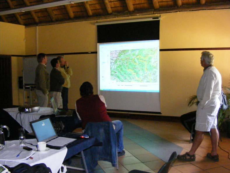
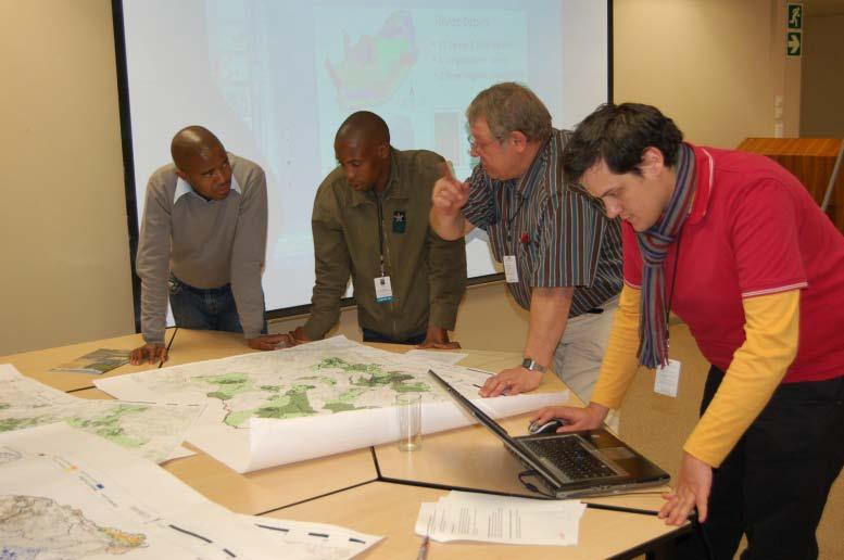
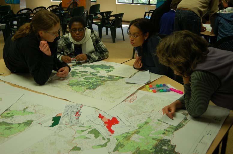
1 Southern Africa perspective - Identification and Mapping National Freshwater Ecosystems Priority Areas in South Africa SA National Wetland Inventory By N Mbona
2 Outline National Wetland Inventory SA Wetland Classification System ID Freshwater Ecosystem priorities Data Inputs Results
3 Objectives of NWI To get: extent, distribution + diversity 1: Identifying the location of wetlands and priority conservation sites 2: Identify functions and values of individual wetlands 3: Establishment of a baseline for measuring future change in wetland area, function and values

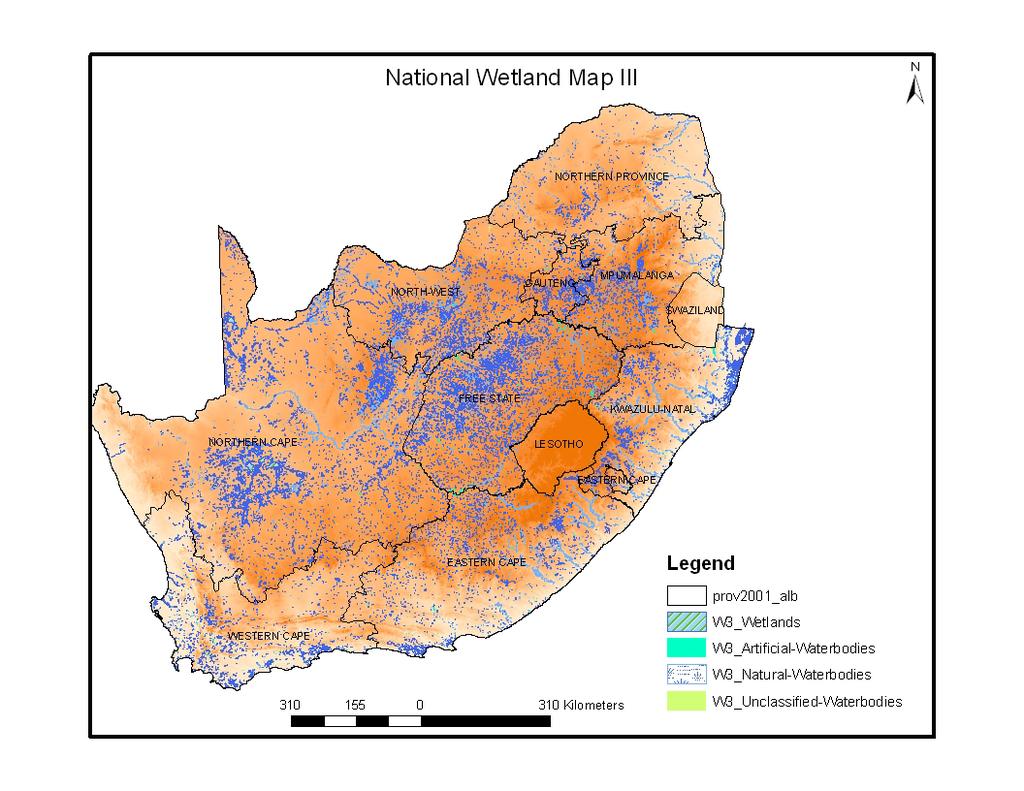
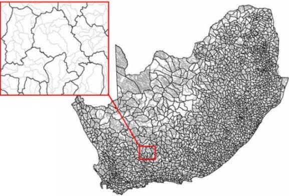
4 Wetland Map 3 Artificial = artificial and/or transformed Finer-scale sub-national data KZN CAPE fine-scale plans Kamieskroon Niewoudville Overberg
")

5 Challenges in Wetland Mapping small size and fragmented distribution in landscape (e.g. 1 2 ha) similar vegetative cover to surrounding non-wetland vegetation Accuracy Assessment: Very wide knowledge gap (location)
6
7 SA Wetland Classification System Definition of wetland RAMSAR CONVENTION (ADAPTED): Wetlands are areas of marsh, fen, peatland or water, whether natural or artificial, permanent or temporary, with water that is static or flowing, fresh, brackish or salt, including areas of marine water the depth of which at low tide does not exceed ten metres.
8 Connectivity to open ocean LEVEL 1: SYSTEM Marine / Estuarine / Inland PRIMARY DISCRIMINATORS (to distinguish between wetland types) Physiographic & biogeographic features - Periodicity of connection to ocean [Estuarine] - Landscape setting [Inland] LEVEL 2: REGIONAL SETTING (ECOREGION / BIOREGION / BIOGEOGRAPHIC ZONE) LEVEL 3: SUBSYSTEM / LANDSCAPE UNIT Landform & hydrology/hydrodynamics LEVEL 4: HGM UNIT SECONDARY DISCRIMINATORS - Tidal regime [Marine / Estuarine] - Perenniality [Inland: channels] LEVEL 5: TIDAL / HYDROLOGICAL REGIME FUNCTIONAL UNIT - Inundation & saturation periodicity (& inundation depth-class) [Inland: nonchannels] LEVEL 6: WETLAND CHARACTERISTICS GEOLOGY NATURAL vs. ARTIFICIAL VEGETATION COVER TYPE SUBSTRATUM SALINITY ACIDITY / ALKALINITY Geology Naturalness Vegetation cover, form & status Substratum type Salinity / conductivity ph DESCRIPTORS (to categorise wetland characteristics/features)
9 8 Primary HGM Units for Inland Systems (at Level 4A) occurring in different Landscape Settings: CHANNEL CHANNELLED VALLEY BOTTOM WETLAND UNCHANNELLED VALLEY BOTTOM WETLAND FLOODPLAIN WETLAND HILLSLOPE SEEP VALLEYHEAD SEEP DEPRESSION FLAT
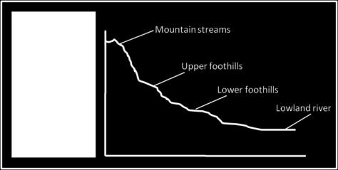
10 LEVEL 1: SYSTEM CONNECTIVITY TO OPEN OCEAN INLAND LEVEL 2: REGIONAL SETTING ECOREGION DWAF Level I Ecoregions LEVEL 3: LANDSCAPE UNIT SLOPE PLAIN LANDSCAPE SETTING VALLEY FLOOR BENCH (HILLTOP / SADDLE / SHELF) Channel (river) Channelled valleybottom wetland Unchannelled valleybottom wetland Floodplain wetland Depression A B C D Mountain headwater stream [not applicable] [not applicable] Mountain stream [not applicable] [not applicable] Transitional river [not applicable] [not applicable] Rejuvenated bedrock fall [not applicable] [not applicable] With channelled outflow [not applicable] Without channelled outflow [not applicable] With channelled inflow Exorheic [not applicable] Endorheic Dammed Without channelled inflow With channelled inflow Without channelled inflow With channelled inflow Without channelled inflow Mountain stream [not applicable] [not applicable] Transitional river [not applicable] [not applicable] Rejuvenated bedrock fall [not applicable] [not applicable] Upper foothill river [not applicable] [not applicable] Lower foothill river [not applicable] [not applicable] Lowland river [not applicable] [not applicable] Rejuvenated foothill river [not applicable] [not applicable] Upland floodplain river [not applicable] [not applicable] Valley-bottom depression [not applicable] [not applicable] Valley-bottom flat [not applicable] [not applicable] Valley-bottom depression [not applicable] [not applicable] Valley-bottom flat [not applicable] [not applicable] Floodplain depression [not applicable] [not applicable] Floodplain flat [not applicable] Exorheic [not applicable] With channelled inflow [not applicable] Endorheic Dammed Without channelled inflow With channelled inflow Without channelled inflow With channelled inflow Without channelled inflow Valleyhead seep [not applicable] [not applicable] [not applicable] Channel (river) Floodplain wetland Unchannelled valleybottom wetland Depression Lowland river [not applicable] [not applicable] Upland floodplain river [not applicable] [not applicable] Floodplain depression [not applicable] [not applicable] Floodplain flat [not applicable] [not applicable] Valley-bottom depression [not applicable] [not applicable] Valley-bottom flat [not applicable] [not applicable] With channelled inflow Without channelled inflow With channelled inflow Without channelled inflow Flat [not applicable] [not applicable] [not applicable] Depression HGM TYPE Channel (river) Hillslope seep Depression LEVEL 4: HYDROGEOMORPHIC (HGM) UNIT LONGITUDINAL ZONATION / LANDFORM [not applicable] [not applicable] [not applicable] DRAINAGE - OUTFLOW DRAINAGE - INFLOW Exorheic Endorheic Exorheic Endorheic With channelled inflow Without channelled inflow With channelled inflow Without channelled inflow Flat [not applicable] [not applicable] [not applicable]
11 NFEPA Aims 1. To identify National Freshwater Ecosystem Priority Areas 2. To develop an institutional basis to enable effective implementation of Freshwater Ecosystem Priority Areas National component - aligning conservation & water sector policy mechanisms Sub-national component - building capacity to use products at local levels

12 NFEPA Project deliverables 1. National criteria for identifying FEPAs 2. Maps of FEPAs 3. Guidelines linked to maps 4. Implementation manual with legal and institutional mechanisms for implementing FEPAs 5. NFEPA Atlas 6. Project report


13 Criteria Represent river, wetland and estuary ecosystem types Represent threatened fish Represent free-flowing rivers Represent NB migration routes Fish corridors Wetland clusters Maintain water supply areas High water yield areas High groundwater recharge areas Represent estuary species Identify connected systems

14 Input data Sub-quaternaries River types Wetland delineations Wetland types Wetland clusters Fish sanctuaries Free-flowing rivers River condition Groundwater recharge Water yield (MAR) Wetland condition

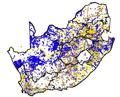
15 Wetland types
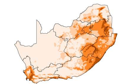
16 Ecosystem Threat Status How threatened are our ecosystems? A measure of the proportion of the total ecosystem type that is still in an AB or C condition Condition: AB = Natural/good C = Moderately modified D = Largely modified EF = Seriously modified Z = Modelled as not intact Ecosystem types: 223 river types 782 wetland types

17 River condition A or B C D E Z
18 Wetland condition Used to rank the relative importance of a wetland CONDITION OF NON-RIVERINE WETLANDS Based on the minimum % natural land cover in and around the wetland: Wetland 50 m area around a wetland 100 m area around wetland 500 m area around wetland CONDITION OF RIVERINE WETLANDS The condition of the river is also considered If river condition is D, E or F wetland condition is D, E or F If river condition is A, B, C or unknown wetland condition is based on minimum % natural landcover in and around the wetland


19 ECOSYSTEM THREAT STATUS: Wetlands 2010
20 Wetland ranks Ramsar Threatened frogs Threatened waterbirds Cranes Expert knowledge Peat wetlands unique and intact Threatened or endemic plants and animals Wetland condition
21 Wetland clusters Clusters of wetlands embedded in a relatively natural landscape matrix through which dispersal between wetlands can occur Clusters are a biodiversity feature IN ADDITION to representing wetland types More than 3 non-riverine wetlands within 1 km of each other where: > 50 % of the wetland systems are natural, the landscape matrix is 25% natural Preferential selection first from ones with 50 % Strive for representation across wetland vegetation groups


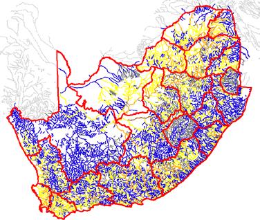
22 Map products WMA level 1. FEPA map National level 2. Summary map at WMA level 3. Summary map at sub-wma level 4. Free-flowing rivers (Top 10; others) 5. Fish sanctuary areas 6. Water supply areas
23 Free-flowing rivers STATS (in brackets is number 100 km) Total 66 (24) Per province : Western Cape 9 (1) Eastern Cape 29 (8) KZN 18 (9) Mpumalanga 6 (4) Limpopo 2 (1) Gauteng 0 (0) North West 1 (0) Free State (0) (0) Northern Cape 1 (1) Top 10 in SA Others


24 MAP 1: FEPA map Incorporating a conservation vision into Catchment Management Strategies Biodiversity sector input into scenario planning Planning by national & provincial conservation agencies

25 Biodiversity planning outputs underpinning map products
26

27 NFEPA TEAM
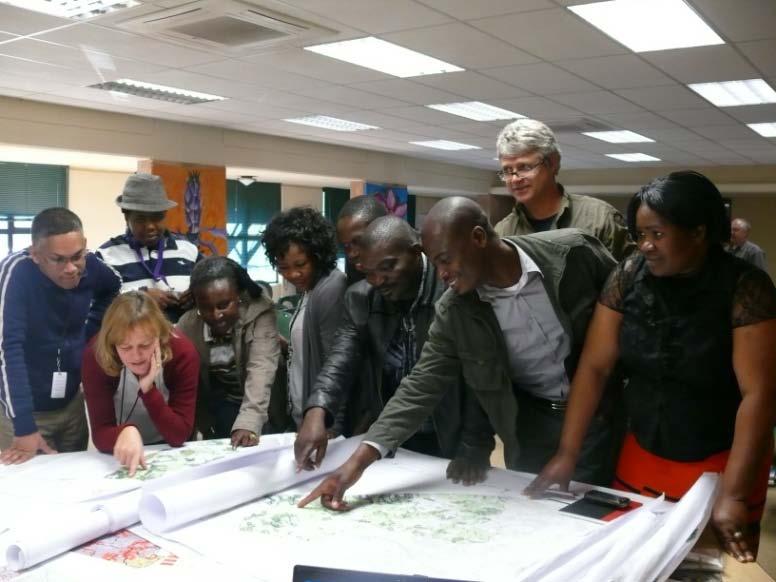

28 Co-production of knowledge Collective experience of almost 1000 years!
29 Pre-requisite Wetland inventory Classification system Species data associated with freshwater Multiple stakeholders On the ground implementation managers Conservation planning expertise
30 Lessons Learnt Data collection time consuming Too much Processing time and computer power GIS methods to be trialed Collaborative effort very useful Upstream management of shared basins

31 THANK YOU!
Dr Stephen Holness & Andrew Skowno - Ecosol Brent Corcoran, WWF-South Africa
 Dr Stephen Holness & Andrew Skowno - Ecosol Brent Corcoran, WWF-South Africa Mapping Ecological Infrastructure for the greater umngeni Catchment Project concept EI introduction Logic we used to define
Hydrogeomorphic Wetland Classification HGM classification for wetlands of the Mid-Atlantic Region, USA
 Hydrogeomorphic Wetland Classification HGM classification for wetlands of the Mid-Atlantic Region, USA Robert P. Brooks Riparia, Department of Geography PENNSYLVANIA STATE UNIVERSITY PLEASE READ BEFORE
NWI 2007 NEW TOOLS AND TECHNOLOGIES. Ralph Tiner Wetland Ecologist U.S. Fish & Wildlife Service National Wetlands Inventory Program
 NWI 2007 NEW TOOLS AND TECHNOLOGIES Ralph Tiner Wetland Ecologist U.S. Fish & Wildlife Service National Wetlands Inventory Program WHERE WE ARE GOING Improved mapping Expanded wetland classification Preliminary
Riparia - a Center where science informs policy and practice in wetlands ecology, landscape hydrology, and watershed management
 Mid Atlantic Freshwater Wetlands: Using Science to inform Policy and Practice MAWWG Mid-Atlantic Wetlands Work Group Regina Poeske, EPA Region 3, Co-Director www.mawwg.psu.edu Riparia - a Center where
Ecosystem Accounting in South Africa
 Ecosystem Accounting in South Africa Mandy Driver South African National Biodiversity Institute 20 th London Group Meeting New Delhi, 16 October 2014 South African National Biodiversity Institute Government
Ecology and Conservation of California's Coastal Freshwater Wetlands An Introduciton to the diversity of coastal freshwater wetlands Lorraine Parsons
 California s Coastal Freshwater Wetlands Lorraine Parsons Point Reyes Station, Calif. Habitat Definition Holland - e.g., Coastal and Valley Freshwater Marsh Cowardin Classification Wetlands are lands transitional
PROPOSED RESIDENTIAL DEVELOPMENT ON ERF 271 BAKKERSHOOGTE, SOMERSET WEST, WESTERN CAPE PROVINCE.
 PROPOSED RESIDENTIAL DEVELOPMENT ON ERF 271 BAKKERSHOOGTE, SOMERSET WEST, WESTERN CAPE PROVINCE. SPECIALIST FRESHWATER ASSESSMENT Prepared for: Headland Town Planning Prepared by: Natasha van de Haar SACNASP
Ecosystem Accounting in South Africa: Initial Work
 Ecosystem Accounting in South Africa: Initial Work Mandy Driver South African National Biodiversity Institute UNSD EGM on Experimental Ecosystem Accounting 18 November 2013 South African National Biodiversity
Beverly. Produced in This report and associated map provide information about important sites for biodiversity conservation in your area.
 CONSERVING THE BIODIVERSITY OF MASSACHUSETTS IN A CHANGING WORLD Beverly Produced in 2012 This report and associated map provide information about important sites for biodiversity conservation in your
A Method for Assessing Cumulative Impacts on Wetland Functions at the Catchment or Landscape Scale
 Wetland Health and Importance Research Programme 5 A Method for Assessing Cumulative Impacts on Wetland Functions at the Catchment or Landscape Scale Authors: W Ellery, S Grenfell, M Grenfell, C Jaganath,
Coordinated Waterbird Counts - CWAC
 Coordinated Waterbird Counts - CWAC Guidelines for the completion of the Site Data Collection Form Compiled by D.M Harebottle and J.A. Harrison November 1999 IMPORTANT: (1) PLEASE READ THROUGH THESE GUIDELINES
Resolution IX.1 Annex B. Revised Strategic Framework and guidelines for the future development of the List of Wetlands of International Importance
 9th Meeting of the Conference of the Parties to the Convention on Wetlands (Ramsar, Iran, 1971) Wetlands and water: supporting life, sustaining livelihoods Kampala, Uganda, 8-15 November 2005 Resolution
Concurrent Session 129 The hydroecology of a Florida river and the potential ecological effects of human water use (Part 2 of 2)
") Concurrent Session 129 The hydroecology of a Florida river and the potential ecological effects of human water use (Part 2 of 2) Photograph: Dean Campbell Moderator: Ed Lowe, Ph. D. Director, Bureau of
Concurrent Session 129 The hydroecology of a Florida river and the potential ecological effects of human water use (Part 2 of 2) Photograph: Dean Campbell Moderator: Ed Lowe, Ph. D. Director, Bureau of
Wetlands. Development of a Functional Matrix. Andrea Borkenhagen B.Sc., B.I.T Geetha Ramesh PhD., P.Biol
 Wetlands Development of a Functional Matrix ndrea Borkenhagen B.Sc., B.I.T Geetha Ramesh PhD., P.Biol genda Introduction Purpose Regulations Development Example wetland assessment pplication 2 Introduction
River Talk Patterns. Student Copy Page PART I (1 of 1) 3. Human nervous system. Waters and drainage patterns. Road system.
 3. Human nervous system. Waters and drainage patterns. Road system.") River Talk Patterns Student Copy Page PART I (1 of 1) 3 Human nervous system photo credit: Hemera Thinkstock Photos Waters and drainage patterns photo credit: Comstock Getty Images Road system photo credit:
River Talk Patterns Student Copy Page PART I (1 of 1) 3 Human nervous system photo credit: Hemera Thinkstock Photos Waters and drainage patterns photo credit: Comstock Getty Images Road system photo credit:
Mekong Wetland Assets
 1 Basin-wide Climate Change Impact and Vulnerability Assessment for Wetlands of the LMB for Adaptation Planning 2nd Regional Expert Advisory Workshop, Vientiane 11-12 July 2011 Mekong Wetland Assets Prepared
The Ramsar Convention on Wetlands. Ramsar Convention Secretariat Rue Mauverney Gland Switzerland
 The Ramsar Convention on Wetlands Ramsar Convention Secretariat Rue Mauverney 28 1196 Gland Switzerland e-mail: ramsar@ramsar.org What are wetlands? Wetlands are ecosystems that can be natural or artificial
SETLABOTSHA SETLABOTSHA IN RELATION TO THE MPUMALANGA BIODIVERSITY CONSERVATION PLAN
 0 Thuthukani Tutuka Power Station Legend ity / Town Tutuka Power Station East Shaft Preferred Shaft es Mining Right West Shaft Standerton MBSP Terrestrial Assessment Subcategory PA National Parks & Nature
National Landcare Programme Community Grants Guidelines
 National Landcare Programme Community Grants Guidelines 2016-2018 Lake Tyers estuary entrance, 2015 National Landcare Programme Community Grants Guidelines 2016-2018 Contents Contents... 1 Part 1 Introduction...
FRESHWATER ASSESSMENT FOR THE PROPOSED DEVELOPMENT OF THE MBABANE BRIDGE NEAR SCRUM, KWAZULU NATAL
 FRESHWATER ASSESSMENT FOR THE PROPOSED DEVELOPMENT OF THE MBABANE BRIDGE NEAR SCRUM, KWAZULU NATAL FINAL Prepared for: Afzelia Environmental Consultants Prepared by: Louise Zdanow SACNASP Reg. no. 114072
Ramsar Advisory Mission Pakistan 29 October 5 November, 2012
 Ramsar Advisory Mission Pakistan 29 October 5 November, 2012 What are wetlands? Wetlands are areas of marsh, fen, peatland or water, whether natural or artificial, permanent or temporary, with water that
Wetland Functions in the Watershed: Part 1 Watershed Elements. USDA NRCS Module Name 1
 Wetland Functions in the Watershed: Part 1 Watershed Elements USDA NRCS Module Name 1 Objectives Define Landscape Elements in the Watershed Describe Hydrologic Connections Between Elements Introduce Soil
The role of wetlands in the water cycle
 Ramsar COP7 DOC. 16.1 People and Wetlands: The Vital Link 7 th Meeting of the Conference of the Contracting Parties to the Convention on Wetlands (Ramsar, Iran, 1971), San José, Costa Rica, 10-18 May 1999
Guidelines for the delimitation of wetland ecosystems Version 1.1
 Guidelines for the delimitation of wetland ecosystems Version 1.1 March 3, 2016 Page: 1 Contributors: Dania Abdul Malak, European Topic Centre of University of Málaga Antonio Sanchez Espinosa, European
AMATHOLE DISTRICT MUNICIPALITY CASE STUDY 2018
 AMATHOLE DISTRICT MUNICIPALITY CASE STUDY 2018 LOCAL ACTION FOR BIODIVERSITY: WETLANDS SOUTH AFRICA Focused wetland prioritisation in Amathole District Municipality Planning for wetland rehabilitation
protecting water-related related ecosystems for sustainable development
 Danone Water & Environment Committee Evian 14 December 2010 a contribution by Tobias Salathé «Ramsar» Convention on Wetlands the life cycle of water and biodiversity European Parliament, Brussels. 9 February
Chapter - 4 WETLAND CLASSIFICATION
 Chapter - 4 WETLAND CLASSIFICATION 4.1. GENERAL CLASSIFICATION The primary goal of wetland classification, according to Cowardin et.al (1979) is to impose boundaries on natural ecosystems for the purpose
What is an ecosystem?
 What is an ecosystem? An ecosystem is generally defined as a community of organisms living in a particular environment and the physical elements in that environment with which they interact. (http://www.enviroliteracy.org/category.php/3.html)
VEGETATIVE, WATER, FISH AND WILDLIFE RESOURCES POLICIES
 VEGETATIVE, WATER, FISH AND WILDLIFE RESOURCES POLICIES The County will: GOALS AND OBJECTIVES 1.1 Conserve, Enhance, Protect, Maintain and Manage Vegetative, Water, Fish and Wildlife Resources Promote
What are Wetlands? Wetland Ecology Fall 2017
 What are Wetlands? Wetland Ecology Fall 2017 Ingredients to make a wetland Water Topography Soil Plants Animals Definitions Transition zone between upland and permanently flooded ecosystems Isolated basins
Wetlands in Alberta: Challenges and Opportunities. David Locky, PhD, PWS, PBiol Grant MacEwan University
 Wetlands in Alberta: Challenges and Opportunities David Locky, PhD, PWS, PBiol Grant MacEwan University Overview What & Where Function & Value Alberta s Keystone Ecosystem Losses & Impacts Restoration
Cooperation of the Water and Wetland Conventions
 Cooperation of the Water and Wetland Conventions protect nature to improve water sustainable solutions for waterrelated management problems valuing ecosystem services Second Assessment of Transboundary
REFERENCE WETLANDS. Karen Newlon and Cat McIntyre Montana Natural Heritage Program Helena, MT
 REFERENCE WETLANDS Karen Newlon and Cat McIntyre Montana Natural Heritage Program Helena, MT REFERENCE CONCEPT Indicators are evaluated against some expectation of condition Expectations act as a reference
Background. Literature Review
 Ms. Joanna Helms Economic Development Director Town of Apex 73 Hunter Street P.O. Box 250 Apex, North Carolina 27502 October 23, 2015 Reference: Report of Wetland Determination Cash Perkins Site ECS Project
CHAPTER ONE : INTRODUCTION
 CHAPTER ONE : INTRODUCTION WHAT IS THE HYDROLOGY? The Hydrology means the science of water. It is the science that deals with the occurrence, circulation and distribution of water of the earth and earth
PROVINCIAL SCP THE REAL WORLD
 PROVINCIAL SCP THE REAL WORLD Threatened specie Prior 2001 2004 2012 A 37 63 88 15 B 7 7 2 0 C 66 8 0 0 D 27 13 4 0 E 10 0 0 0 F 162 139 G 2700 1829 H 223 0 BIOLOGY - Life history PROTECTION - Regulation
A GUIDE TO THE WETLAND, DEEPWATER HABITATS, AND RIPARIAN CLASSIFICATIONS USED IN WETLAND AND RIPARIAN MAPPING IN MONTANA
 A GUIDE TO THE WETLAND, DEEPWATER HABITATS, AND RIPARIAN CLASSIFICATIONS USED IN WETLAND AND RIPARIAN MAPPING IN MONTANA Purpose: The Montana Natural Heritage Program s Wetland and Riparian Mapping Center
Aquatic & Wetland Impact Assessment Report for the Proposed Schurvekop Mine. Mpumalanga
 Aquatic & Wetland Impact Assessment Report for the Proposed Schurvekop Mine Mpumalanga March 2017 REFERENCE Schurvekop CLIENT Prepared for: Beyers Office Park, Bosbok Road, Randpark Ridge Office: +27 11
Kooragang Wetland Rehabilitation Project : 21 years of ecosystem repair and management in the Hunter River estuary Updated: 8/3/2016
 Kooragang Wetland Rehabilitation Project : 21 years of ecosystem repair and management in the Hunter River estuary Updated: 8/3/2016 Kooragang Wetland Rehabilitation Project (KWRP) was launched in 1993
Guidelines for reviewing laws and institutions to promote the conservation and wise use of wetlands
 People and Wetlands: The Vital Link 7 th Meeting of the Conference of the Contracting Parties to the Convention on Wetlands (Ramsar, Iran, 1971), San José, Costa Rica, 10-18 May 1999 Guidelines for reviewing
SECTION 3: Water, Wetlands and Waterways
 SECTION 3: Water, Wetlands and Waterways KEY PRIORITY To ensure protection of water quality and quantity for use by residents, the commercial sector and ecosystems, through integrated consultation, planning,
CITY OF NEW WESTMINSTER. Bylaw No. 7033, 2005 RIPARIAN AREAS PROTECTION BYLAW
 CITY OF NEW WESTMINSTER Bylaw No. 7033, 2005 RIPARIAN AREAS PROTECTION BYLAW WHEREAS the City may preserve, protect, restore and enhance the natural environment near streams that support fish habitat from
Water Asset Account in Physical Terms
 Water Asset Account in Physical Terms Regional Training Workshop on the System of Environmental-Economic Accounting with a Focus on Water Accounting September 26-30, 2016 Putrajaya, Malaysia François Soulard
Guidance for addressing the implications for wetlands of policies, plans and activities in the energy sector
 Guidance for addressing the implications for wetlands of policies, plans and activities in the energy sector A. Context and definitions (Resolution XI.10, 2012) 1. The energy sector is broad and diverse
Vermillion River Headwaters Groundwater Recharge Area Inventory and Protection Plan
 Vermillion River Headwaters Groundwater Recharge Area Inventory and Protection Plan A project funded through a Metro Environmental Partnership grant from the Metropolitan Council with technical analysis
Riparian Habitat and Wetland Delineation Impact Assessment for the Proposed Turffontein Sewer Pipeline Replacement GAUTENG
 Riparian Habitat and Wetland Delineation Impact Assessment for the Proposed GAUTENG May 2017 REFERENCE 10539 CLIENT Prepared for: Nemai Consulting 147 Bram Fischer Drive, Ferndale, Randburg Tel: +27 11
New Hampshire s Wildlife Habitat Conditions
 CHAPTER THREE New Hampshire s Wildlife Habitat Conditions Abstract Wildlife habitat condition was assessed for all 27 habitat types. NHFG developed a methodology to assess the relative ecological condition
THE BRISBANE DECLARATION (2007)
") THE BRISBANE DECLARATION (2007) Environmental Flows* are essential for freshwater ecosystem health and human well-being This declaration presents summary findings and a global action agenda that address
THE BRISBANE DECLARATION (2007) Environmental Flows* are essential for freshwater ecosystem health and human well-being This declaration presents summary findings and a global action agenda that address
COMPREHENSIVE ENVIRONMENTAL IMPACT STUDY & MANAGEMENT PLAN South Albion Bolton Community Plan Employment Needs & North Hill Commercial Lands Study
 COMPREHENSIVE ENVIRONMENTAL IMPACT STUDY & MANAGEMENT PLAN South Albion Bolton Community Plan Employment Needs & North Hill Commercial Lands Study Part A Study Components Background Information Review
Amazon conservation biology:
 Amazon conservation biology: the challenge of representing biodiversity in a changing environment JC Riveros, G. Powell, C. Scaramuzza, A. Soto, S. Rodrigues, C. Suarez WWF March 22th 2007 Outline Purpose
39. WETLANDS Introduction. Wetlands and Waterbodies Cook Inlet Drainages
 39. WETLANDS 39.1 Introduction This chapter summarizes the wetlands and waterbodies study for the Cook Inlet drainages study area (Figure 39-1). The objectives of the study were to determine and map the
CLIMATE CHANGE AND SEA LEVEL RISE: IMPACTS TO WETLANDS. Juliana BarreB ConnecDcut Sea Grant UConn Extension
 Call of the Wild CLIMATE CHANGE AND SEA LEVEL RISE: IMPACTS TO WETLANDS Juliana BarreB ConnecDcut Sea Grant UConn Extension Changes in climate are changing plant and animal ranges, migradons on land and
CCAI Demonstration Projects in Viet Nam. Dr. Nguyen Anh Duc National CCAI Coordinator, Viet Nam National Mekong Committee
 1 CCAI Demonstration Projects in Viet Nam Dr. Nguyen Anh Duc National CCAI Coordinator, Viet Nam National Mekong Committee Outline Project: Preliminary Study on Climate Change Adaptation Plan in Kien Giang
Wetland Hydrogeomorphic Classification for Scotland
 Final Report Project WFD66 Wetland Hydrogeomorphic Classification for Scotland November 2007 SNIFFER 2007 All rights reserved. No part of this document may be reproduced, stored in a retrieval system or
NAR Fact Sheet Proposed Changes to Clean Water Act Regulations
 On April 21, 2014, the Environmental Protection Agency and Army Corps of Engineers proposed these changes to their interpretation of which waters are automatically subject to Clean Water Act regulations
APPENDIX D. Specialists Reports
 APPENDIX D Specialists Reports APPENDIX D.1 Wetland Assessment Wetland Assessment:: Extension of East Central Arterial Road, Richards Bay May 2012 Extension of East Central Arterial Road to Richards Bay
Ganga Basin Socio-economic values. Dr. Ritesh Kumar, Wetlands International South Asia
 Ganga Basin Socio-economic values Dr. Ritesh Kumar, Wetlands International South Asia Ritesh.kumar@wi-sa.org Ganga Basin Socioeconomic dimensions Most densely populated part of country (26.3% of land area,
Issues in measuring and managing changes to the ecological character of the Western Port Ramsar Site as a result of climate change
 presenter: Shelley Heron Issues in measuring and managing changes to the ecological character of the Western Port Ramsar Site as a result of climate change Western Port Bay Where is it? Ecological character
Aquatic Assessment December 2013
 year unless drained. According to the Soil Survey Staff (1975) definition, in order for a soil to be classed as organic it must have >12% organic carbon by weight if it is sandy and >18% if it is clay-rich.
Creating a Value-Added Wetlands Layer: Enhancing the Utility of Wetland Mapping in Montana Karen Newlon Montana Natural Heritage Program Helena, MT
 Creating a Value-Added Wetlands Layer: Enhancing the Utility of Wetland Mapping in Montana Karen Newlon Montana Natural Heritage Program Helena, MT Wetlands & Riparian Mapping Wetland and riparian digital
The Lower Watershed Ecosystem Services in Coastal Areas with a focus on the Courtenay River Floodplain
 The Lower Watershed Ecosystem Services in Coastal Areas with a focus on the Courtenay River Floodplain Jennifer Sutherst Estuary Coordinator and Staff Biologist Comox Valley Project Watershed Society Lower
Agricultural Ditches, Waterways and Wetlands: Sorting It Out
 Agricultural Ditches, Waterways and Wetlands: Sorting It Out Eric Metz Planning & Policy Manager Aquatic Resource Management 503-986-5266 eric.metz@state.or.us Clatsop SWCD Waterways Seminar March 16,
Aquatic Science Unit 1. Introduction to Freshwater Ecology
 Aquatic Science Unit 1 Introduction to Freshwater Ecology Water is essential to life Water is essential to the survival of all living things No living organism can survive without water Humans cannot go
Maps to Help You Protect and Manage Lands: The Revised Wildlife Action Plan Maps. Emily Preston, Wildlife Biologist Katie Callahan, GIS specialist
 Maps to Help You Protect and Manage Lands: The Revised Wildlife Action Plan Maps Emily Preston, Wildlife Biologist Katie Callahan, GIS specialist What is the Wildlife Action Plan? Restore rare wildlife
Single most important determinant of the establishment and maintenance of specific types of wetlands & wetland processes
 Wetland Ecology Lectures 12 & 13 Wetland Hydrology Hydrology Single most important determinant of the establishment and maintenance of specific types of wetlands & wetland processes Starting point of hydrological
The Niger: a lifeline. Effective Water Management in the Upper Niger River
 The Niger: a lifeline Effective Water Management in the Upper Niger River Niger River Basin 212 dams Upper Niger with existing and planned infrastructures Statement: Take downstream effects into account
CHAPTER 1 INTRODUCTION. 1.1 Background and Preliminary Description of the Physical Setting for this Draft Guidebook
 Introduction 1-1 CHAPTER 1 INTRODUCTION 1.1 Background and Preliminary Description of the Physical Setting for this Draft Guidebook The term ecosystem function refers to processes that are necessary for
GLY 155 Introduction to Physical Geology, W. Altermann. Grotzinger Jordan. Understanding Earth. Sixth Edition
 Grotzinger Jordan Understanding Earth Sixth Edition Chapter 17: THE HYDROLOGIC CYCLE AND GROUNDWATER 2011 by W. H. Freeman and Company Chapter 17 The Hydrologic Cycle and Groundwater 1 About the Hydrologic
ENVIRONMENTAL ASPECTS OF INTEGRATED FLOOD MANAGEMENT
 ENVIRONMENTAL ASPECTS OF INTEGRATED FLOOD MANAGEMENT Photo by: Liang Changsheng WMO WMO/GWP ASSOCIATED PROGRAMME ON FLOOD MANAGEMENT (APFM) World Meteorological Organization 1 Flood Plains Positive aspects:
RIPARIAN AREAS REGULATION
 Definitions and interpretation RIPARIAN AREAS REGULATION 1 (1) In this regulation: Act means the Fish Protection Act; active floodplain means an area of land that supports floodplain plant species and
Australia s rivers. Variability a characteristic of Australia s rivers. Pressures on the rivers
 Australia s rivers This article was contributed by John Whittington and Peter Liston of the Cooperative Research Centre for Freshwater Ecology. By world standards Australia is a dry continent with few
Habitat Quality: Model Overview
 Habitat Quality: Model Overview Biodiversity is not treated as an ecosystem service Instead, it s used to assess overlaps and tradeoffs InVEST models habitat quality and rarity as indicators of the status
Physiographic zones. and water quality
 Southland Physiographic zones Peat Wetlands Technical information Physiographic zones are part of the Water and Land 2020 & Beyond project that aims to maintain and improve water quality in the Southland
Hydrology Attribute 1/15/2016. California Rapid Assessment Method for Wetlands. Hydrology. Precipitation Increases the Extent of Wetlands
 California Rapid Assessment Method for Wetlands Hydrology Attribute Hydrology Determines existence of wetlands, drives primary physical and ecological processes: Establishment of reducing conditions Nutrient
Think About It (not on notes)
") Aquatic Ecosystems Think About It (not on notes) We call our planet Earth, yet nearly three-fourths of Earth s surface is covered with water. Despite the vital roles aquatic ecosystems play in the biosphere,
Aquatic Ecosystems Think About It (not on notes) We call our planet Earth, yet nearly three-fourths of Earth s surface is covered with water. Despite the vital roles aquatic ecosystems play in the biosphere,
The hydrologic and hydraulic study of the behaviour of the Nyl River floodplain
 River Basin Management IV 149 The hydrologic and hydraulic study of the behaviour of the Nyl River floodplain C. F. B. Havenga 1, A. Jeleni 1, W. V. Pitman 2 & A. K. Bailey 2 1 Department of Water Affairs
Climate Resilient Flyway Network
 Climate Resilient Flyway Network to support the implementation of AEWA Resolutions 5.13 and 6.6 on climate change adaptation for waterbirds Mori Diallo Wetlands International Linkages amongst project outputs
Wetland Verification Study
 Biodiversity and Aquatic Specialists 638 Turf Street Wingate Park, 0181 Tel: 012-345 4891 Fax: 086 675 6136 Email: Vanessam@lantic.net VAT No: 4080227657 Wetland Verification Study Of Portion 11 of the
AP Environmental Science
 AP Environmental Science Types of aquatic life zones MARINE Estuaries coral reefs mangrove swamps neritic zone pelagic zone FRESHWATER lakes and ponds streams and rivers wetlands Distribution of aquatic
Inkomati Rivers Classification
 water affairs Department: Water Affairs REPUBLIC OF SOUTH AFRICA Inkomati Rivers Classification Determination of Water Resource Classes and Associated Resource Quality Objectives in the Inkomati Water
Estuarine Restoration in San Francisco Bay: Design and Adaptive Management. Environmental Management of Enclosed Coastal Seas
 Estuarine Restoration in San Francisco Bay: Design and Adaptive Management Environmental Management of Enclosed Coastal Seas August 31, 2011 Eric Jolliffe, Bill Brostoff, and Fari Tabatabai U. S. Army
Wetland Sensitivity to Potential Reductions in Surface Water Flow in the St. Johns River
 Wetland Sensitivity to Potential Reductions in Surface Water Flow in the St. Johns River Palmer Kinser Sandra Fox Environmental Assessment Section St. Johns River Water Management District Outline: Background
biology Slide 1 of 39 End Show Copyright Pearson Prentice Hall
 biology 1 of 39 2 of 39 4-4 Aquatic Ecosystems Nearly three-fourths of the Earth s surface is covered with water. Almost all bodies of water contain a wide variety of communities governed by biotic and
Resource Protection Areas: Nontidal Wetlands Guidance on the Chesapeake Bay Preservation Area Designation and Management Regulations June 18, 2007
 Resource Protection Areas: Nontidal Wetlands Guidance on the Chesapeake Bay Preservation Area Designation and Management Regulations June 18, 2007 Purpose: This document provides guidance on requirements
4-4 Aquatic Ecosystems
 biology 1 of 39 2 of 39 Nearly three-fourths of the Earth s surface is covered with water. Almost all bodies of water contain a wide variety of communities governed by biotic and abiotic factors including
Great Lakes Biodiversity Conservation Strategies
 A.D. Latornell Conservation Symposium Dan Kraus, Nature Conservancy of Canada 21 November 2013 Summary Two Minute History of Application and Next Steps 2 Two Minute History of the Part 1: Paradise Found
HABITATS INTRODUCTION
 386 HABITATS INTRODUCTION can be defined in the landscape as mappable units and include both biotic and abiotic characteristics. This section of the Natural History of Nova Scotia deals with the habitats
1. Background Provisioning Regulating: Cultural:
 IN PARTNERSHIP WITH EXECUTIVE SUMMARY The Myanmar hydropower sector, in the early stages of development, has the opportunity to develop sustainably by balancing electricity generation with environmental
FRESHWATER ASSESSMENT REPORT FOR THE ROAD UPGRADES ALONG THE R510
 FRESHWATER ASSESSMENT REPORT FOR THE ROAD UPGRADES ALONG THE R510 JULY 2017 Project number: P442-Apr17 Prepared By: Mr Dana Grobler, Ms Toni Belcher and Mr Stuart Barrow PO Box 455, Somerset Mall, 7137
8. ASSESSMENT OF THE BIOPHYSICAL ENVIRONMENT
 8. ASSESSMENT OF THE BIOPHYSICAL ENVIRONMENT 8.1. Hydrogeology 8.1.1. Introduction Bohlweki Environmental appointed SRK Consulting to undertake the necessary hydrogeological studies for the proposed CCGT
PRE - FINAL. Guidelines for Preparation of Brief Document to facilitate implementation of the Wetlands (Conservation and Management) Rules, 2010
 Rules, 2010") PRE - FINAL Guidelines for Preparation of Brief Document to facilitate implementation of the Wetlands (Conservation and Management) Rules, 2010 National River Conservation Directorate Ministry of Environment,
PRE - FINAL Guidelines for Preparation of Brief Document to facilitate implementation of the Wetlands (Conservation and Management) Rules, 2010 National River Conservation Directorate Ministry of Environment,
Application of SLAMM to Estimate N removal services in tidal wetlands
 Application of SLAMM to Estimate N removal services in tidal wetlands JENNIFER B RYA N L O R A H A R R IS* H A R R IS@UMCES.EDU 410-326-7391 Global Mean SLR Boesch et al. 2013 Maryland SLR Estimates Boesch
Designing Sustainable Landscapes: DSLland and Subsysland
 Designing Sustainable Landscapes: DSLland and Subsysland A project of the University of Massachusetts Landscape Ecology Lab Principals: Kevin McGarigal, Professor Brad Compton, Research Associate Ethan
2015 Wildlife Action Plan Habitats Crosswalk
 2015 Wildlife Action Plan Habitats Crosswalk A crosswalk guide between Wildlife Action Plan Habitats and other habitat classification schemes. Ecosystem Comments NH WAP 2015 NHNHB System Open Water (NLCD-NHD
Basic Information: Individual Vernal Pool
 Basic Information: Individual Vernal Pool Assessment Area Name: Project Name: Assessment Area ID #: Project ID #: Assessment Team Members for This AA Date: AA Location: Latitude: Longitude: Datum: Wetland
Lecture 1 Integrated water resources management and wetlands
 Wetlands and Poverty Reduction Project (WPRP) Training module on Wetlands and Water Resources Management Lecture 1 Integrated water resources management and wetlands 1 Water resources and use The hydrological
Estuary Habitat Restoration STRATEGY 2012
 Estuary Habitat Restoration STRATEGY 2012 INTRODUCTION The Estuary Restoration Act of 2000 (ERA), as amended, (title I of Pub. L. 106 457) fosters a collaborative and comprehensive process among federal
How Much Habitat is Enough?
 How Much Habitat is Enough? Canadian Wildlife Service 2017 Third Edition Page 2 April 19, 2017 Grasslands Forest Wetlands Riparian & Watershed Page 3 April 19, 2017 Significant impairment in stream At
Wetland name or number 2
 H. Does the wetland unit have the opportunity to provide habitat for many species? H.1 Buffers (see P. 80) Choose the description that best represents condition of buffer of wetland unit. The highest scoring
Progress on South Florida Estuaries Restoration: C-111 Western Spreader Canal and Biscayne Bay Coastal Wetland CERP Project
 Progress on South Florida Estuaries Restoration: C-111 Western Spreader Canal and Biscayne Bay Coastal Wetland CERP Project American Water Resources Association 2016 ANNUAL WATER RESOURCES CONFERECNCE