Report on public consultation activities for DRBM Plan Update 2015 & DFRM Plan
|
|
|
- Rachel Barbra Russell
- 6 years ago
- Views:
Transcription


1 Report on public consultation activities for DRBM Plan Update 2015 & DFRM Plan Public consultation on the Danube River Basin Management Plan Update 2015 and 1 st Danube Flood Risk Management Plan Document number: IC WD 645 Version: Draft 3 Date: 12 Nov 2015
2 Public Consultation Report 2 Imprint Published by: ICPDR International Commission for the Protection of the Danube River ICPDR 2015 Contact ICPDR Secretariat Vienna International Centre / D0412 P.O. Box 500 / 1400 Vienna / Austria T: +43 (1) / F: +43 (1) icpdr@unvienna.org /
3 Public Consultation Report 3 Table of Contents 1 Introduction Objectives and legal framework for Public Participation Observers to the ICPDR Public participation, communication and outreach Public consultation for the DRBM Plan Update Comments submitted in writing Consultation Workshop Online questionnaire Social media campaign Development & use of this Public Consultation Report Links to public consultation on the national level Public consultation links between DRBM Plan Update 2015 and DFRM Plan 7 2 Annex A: Overview table & responses Danube River Basin Management Plan Danube Flood Risk Management Plan 8 3 Annex B: Results Comments submitted in writing Aarhus Centers Network in Bosnia and Herzegovina Danubeparks Network of Protected Areas Danube Environment Forum (DEF) Danube Environment Forum (DEF) additional statement Drought Management Center for South East Europe European Barge Union (EBU) Global Water Partnership (GWP) International Association for Danube Research (IAD) Joint note by Danube Environmental Forum, WWF Danube-Carpathian Programme, IAD, DANUBEPARKS, European Anglers Association Österreichisches Kuratorium für Fischerei und Gewässerschutz / European Anglers Association Province of Lower Austria / Land Niederösterreich Umweltverbände Deutschland (BUND, Deepwave, DUH, DNR, Greenpeace, Grüne Liga, NABU, Schutzstation Wattenmeer, WDC, WWF) Waterways and Shipping Directorate-General WWF Danube-Carpathian Programme consultation workshop Voice of the Danube Online questionnaires Questionnaire 1: Danube River Basin Management Plan (95 submission) Questionnaire 2: Flood Risk Management Plan (90 submissions) Social media campaign 113
4 Public Consultation Report 4 1 Introduction 1.1 Objectives and legal framework for Public Participation The ICPDR is committed to active public participation in its decision making. The ICPDR believes that this facilitates broader support for policies and leads to increased efficiency in implementation efforts. The ICPDR consults stakeholders in the entire cycle of its activities: from conceptualising policies, to implementing measures, to evaluating impacts. A legal framework for this is provided by Article 14 of the EU Water Framework Directive and by Article 9 and Article 10 of the EU Floods Directive. In practice, the ICPDR pursues public participation primarily through two avenues: (1) through the involvement of observer organisations in its ongoing work; and (2) through specific activities that are dedicated to public participation and information. A third line of public participation activities are organised ad-hoc; these are stakeholder dialogues on specific integration issues. In particular, such activities were done for inland navigation, climate change adaptation, sustainable hydropower development and agriculture. 1.2 Observers to the ICPDR Observers of the ICPDR can actively participate in all meetings of ICPDR expert groups and task groups, as well as plenary meetings (Standing Working Group and Ordinary Meetings). Observers represent a broad spectrum of water stakeholders in the Danube River Basin, covering social, cultural, economic and environmental interest groups. Institutionally, observers include interest groups, non-government organisations (NGOs), and intergovernmental organisations (see below). They are accepted upon approval of the ICPDR and have to meet a defined set of criteria laid down in IC 185 Guidelines for Observers. As of 2015, there were 23 organisations approved as observers, all of which had the opportunity to contribute to the development of the DRBM Plan Update 2015 and the DFRM Plan through the relevant expert groups, task groups and plenary meetings. ICPDR Observers as of 2015 Black Sea Commission (BSC) Carpathian Convention Central Dredging Association (CEDA) Danube Competence Center (DCC) Danube Civil Society Forum (DCSF) Danube Commission (DC) Danube Environmental Forum (DEF) Danubeparks Danube Tourist Commission (DIE DONAU) European Anglers Alliance (EAA) European Barge Union (EBU) European Water Association (EWA) Friends of Nature International (NFI) Global Water Partnership (GWP/CEE) International Association for Danube Research (IAD) International Association of Water Supply Companies in the Danube River Catchment Area (IAWD) International Hydrological Programme of the UNESCO (IHP/Danube) International Sava River Basin Commission (ISRBC) RAMSAR Convention on Wetlands Regional Environmental Center for Central and Eastern Europe (REC) VGB PowerTech e.v. (VGB) Viadonau World Wide Fund for Nature Danube- Carpathian Programme (WWF-DCP)
5 Public Consultation Report 5 Active participation means that delegates of observers have both access to information including all technical meeting documents as well as the right to contribute to all technical discussions. Observers are only excluded from administrative and legal issues of the ICPDR. Observer delegates do not have a vote in meetings. However, especially at the level of expert groups and task groups, votes take place only rarely as the groups work towards consensus through discussions. 1.3 Public participation, communication and outreach Under the umbrella of public participation, the ICPDR pursues a range of activities. These can be grouped into (1) public information such as the development of technical public documents and general publications (e.g. the quarterly magazine Danube Watch); (2) environmental education, awareness raising and outreach (e.g. the annual river festival Danube Day or the teacher s kit Danube Box); and (3) public consultation activities directly linked to the development of management plans as elaborated in detail below. 1.4 Public consultation for the DRBM Plan Update 2015 To accompany the development of the DRBM Plan Update 2015 and the DFRM Plan, public consultation was done in three main stages, in which comments from the public were collected (1) on a timetable and work programme including public consultation measures; (2) on significant water management issues (SWMIs) in the river basin; and (3) the draft management plan. Public consultation for each of these steps spun a period of at least six months, in which the opportunity to provide comments was actively promoted. The timetable and work programme was published for comments from 22 December 2012 to 22 June 2013; the SWMI document and preliminary flood risk assessment were published 22 December 2013 to 22 June 2014; the draft DRBM Plan Update 2015 and the DFRM Plan entered the public consultation phase on 22 December 2014 and convened 22 July The opportunity to participate in each of these steps was promoted through the ICPDR network of contracting parties and observers; through news items on the ICPDR website icpdr.org; the magazine Danube Watch; targeted advertisements in specialist media such as Aquapress; and through a video clip that called stakeholders to get active in the consultation process. The video was used in national channels via the ICPDR network and can be found at: icpdr.org/main/get-active For the consultation on the draft DRBM Plan Update 2015 and the DFRM Plan, a comprehensive approach was chosen that aimed at stakeholder groups with differing degrees of involvement in water management issues. These can be divided into four groups and corresponding activities, which are described in more detail below. Raw data and reports on each of these activities are part of this report and were published online at: Comments submitted in writing The review and commenting on technical documents such as the DRBM Plan Update 2015 and the DFRM Plan requires a high level of river basin management understanding. The opportunity to comment on the draft plans in writing was therefore primarily advertised to organised stakeholders with sound technical capacity and expertise, such as ICPDR observers. Until 22 July 2015, a total of 14 written comments by a range of organisations or individuals representing an organisation were provided. Each of these comments, some of which are extensive documents relating to several different elements in the draft plan, were published online (see link above) and processed further for this report.
6 Public Consultation Report Consultation Workshop The stakeholder consultation workshop Voice of the Danube was held in Zagreb, 2/3 July It targeted specialists with expertise in water management. For its implementation, the ICPDR partnered with Global Water Partnership. In total, over 80 participants represented a broad range of backgrounds, from academia, to the national and international public sector, to non-government organisations and to corporate entities. The 1.5 day event covered both the DRBM Plan Update 2015 and the DFRM Plan. Keynote presentations gave a short introduction to the plans and participants had an opportunity to make short statements, but the heart of the workshop comprised of five topical sessions with moderated, interactive discussions. These topics were: (1) nutrient, organic and hazardous substance pollution in surface and groundwater; (2) hydromorphological alterations and integration issues (flood risk management, hydropower, navigation, agriculture); (3) objectives and measures of flood risk management plans; (4) measures to implement both plans and financing of the measures; and (5) communication & public participation. Each of these group sessions was started with a short introduction by an expert moderator who also guided the discussion; an expert rapporteur recorded the main items. Facilitators and rapporteurs rotated, so that all workshop participants eventually contributed to each session. This means that all participants worked on elements from both draft management plans regardless of their professional background. In addition, a statement from a youth organisation, an artist and additional questions that emerged at the event were given space Online questionnaire To expand the target groups of public consultation beyond expert stakeholders, simple and easily accessible online questionnaires were developed and published via ICPDR.org to target the interested, but not informed public. These questionnaires one for the DRBM Plan Update 2015 and one for the DFRM Plan - related to very general aspects of the plans. As such, they served also as information tools to draw attention to the plans and the other public consultation measures in particular, the stakeholder consultation workshop and opportunity to comment on the plans in writing. The questionnaires surveyed e.g. opinions about the achievements of the first DRBM Plan since 2009, general knowledge about the Danube River Basin, flood hazards and attitudes towards some measures from the management plans, such as the use of fertilisers or investments in wastewater treatment plants. Results showed that participants were generally supportive of measures proposed in the plans; however, the format of the questionnaires did not allow for substantial comments. The questionnaires could therefore be seen primarily as an awareness raising and information tool and only secondarily as a consultation channel. In total, 90 people filled in the questionnaire for the DRBM Plan Update 2015, and a further 95 people filled in the one for the DFRM Plan. Questions and data can be found in apter 3 of this report Social media campaign To include the general public that would not be targeted by the other consultation measures, a social media campaign was implemented in parallel to the preparation for the stakeholder consultation workshop. The campaign relied on small and interesting pieces of information ( factoids ) that should attract attention to water management issues and finally the draft management plans.
7 Public Consultation Report 7 Priority for this was given to Facebook, backed up with Twitter (hashtag #DanubeVoice) during the stakeholder workshop. The social media campaign helped to cross-link the different consultation tools. In the core period between 14 May and 12 July 2015, the campaign yielded 20 new Twitter followers; 186 new Facebook fans; 2,905 interactions (Twitter mentions, retweets and Facebook stories created for the profiles to this group) by 2,358 unique users; as well as 927,863 impressions (the combined number of potential users who saw content associated with the Twitter & Facebook profiles connected to the relevant Twitter and Facebook accounts). During the stakeholder workshop (1 to 3 July 2015), social media activities yielded 162 interactions by 96 unique users and a total of 109,444 impressions. A detailed report on the social media activities was published online (see link above) and is part of apter 3 of this report. 1.5 Development & use of this Public Consultation Report To ensure the highest possible transparency, all comments requesting changes or additions in the DRBM Plan Update 2015 and the DFRM Plan were collected and processed by the relevant ICPDR expert or task group. This report will be published alongside with the final management plan in December It will be sent to all organisations and individuals that participated in the public consultation activities and will be published on icpdr.org. 1.6 Links to public consultation on the national level The DRBM Plan Update 2015 and the DFRM Plan provide basin-wide umbrellas supported by national and partly sub-basin management plans. These management plans are developed with national endeavours in the field of public consultation. To support information exchange between the responsible authorities and interlink national public consultation activities with the basin-wide level, information on national SWMIs documents/preliminary flood risk assessments and draft management plan consultation measures was collected and centrally published on icpdr.org. Information on the analogous ICPDR documents was in turn published on national consultation websites. Meetings of the ICPDR and its expert group for public participation further supported a basin-wide exchange on the national consultation work. 1.7 Public consultation links between DRBM Plan Update 2015 and DFRM Plan All activities related to public consultation described here were done as much as possible to support the development of both DRBM Plan Update 2015 and the DFRM Plan. This applies in particular to the publication of the timetable and work programme including public consultation measures in 2013; and the public consultation measures for the draft management plans. For example, the stakeholder consultation workshop was a joint activity to highlight the interlinkages between both plans and also to enable an attendance back to back; the online questionnaires were developed jointly and referred to each other.
8 Public Consultation Report 8 2 Annex A: Overview table & responses The following tables break down the individual requests for changes to the draft DRBM Plan Update 2015 and the DFRM Plan together with information on the relevant chapter they relate to, which organisation raised it and how it was dealt with if it resulted in changes, information was given on which; if it was rejected, a reason was given why. The tables draw from all public consultation measures described in this report. 2.1 Danube River Basin Management Plan 2015 Nr Ref Organis. Comment Treatment of the comment DEF Fig Fig Protecting and improving the waters and environment of the Danube River Basin is substantial for achieving sustainable development and is vital for the long term health, well-being and prosperity for the population of the Danube region. Being aware of this issue and due to the fact that the sustainable management of water resources requires transboundary cooperation, the countries sharing the Danube River Basin agreed to jointly work towards the achievement of this objective. (page 1). This commitment is not only shared by the Danube countries and the EU but also by the Danube Environmental Forum. Industry is a major polluter in many water bodies, ICPDR should take a lead in prioritization of actions to be addressed at international level. ICPDR should consider to stress the importance of the small wastewater treatment facility applications when basin wide strategy of waste water sector development is harmonised with national priorities. More pressure should be put on national governments to tackle actions (legislation, financial support) on water sector (water supply, wastewater treatment).in the southern area of the Danube Basin more focus is needed on wastewater treatment. Appreciated. GWP "(Table 3 and Figure 9)" should be renumbered as (Table 3 and Figure 8) Corrected. GWP "Figure 8" should be renumbered as Figure 7. Corrected. DANUBEPARKS Considering the ecosystem services of intact floodplains and the loss of floodplain habitats in the past, the restoration of floodplains on agricultural land and to banish intensive agriculture from active floodplains Industrial pollution is assessed in several sub-chapters ( , , ). Measures have been listed in the JPM ( , , ). A paragraph on small treatment facilities was added in chapter Text on financial support and realistic planning was added in chapter , key conclusions were added on financial support (8.8) Text was added on floodplain restoration in chapter
9 Public Consultation Report GWP GWP Fig GWP should be stressed in the chapter Organic pollution from industry and agricultural point sources. It is stated in this chapter: "However, 34% of the agglomerations (representing 17% of the PE) have no collection systems which should be constructed together with appropriate treatment in the future." GWP CEE prepared a guidebook on natural waste water treatment technologies and recommends to consider the treatment methodologies for small settlements as alternatives with lower investment, maintenance and operation cost solutions. The guidebook could be found at: It is stated in this chapter: "Surface waters can receive significant nutrient emissions from agricultural fields due to the high nutrient surpluses of the cultivated soils and/or inappropriate agricultural practices." Nutrient surpluses of cultivated soils in most of the New EU MS and Non-EU countries are decreasing or constant and even in some regions the nutrient surpluses are negative. It would be good to show a graph on these trends by countries for the last 30 years. In the first table in Annex 11 the "Nutrient (N) surplus" column shows that only Slovenia reports slight increasing surplus, while for most of the countries the nutrient surplus stagnant or negative, and five countries did not provide information on this issue. It should be noted that nutrient surplus is not a measure of the amount of nutrient that could be subject of emission to water resources, rather it is a sort of measure to indicate the amount of nutrient in the root zone that the plant could utilize. More attention should be paid in the plan to the possibilities of the new Common Agricultural Policy and its potential influence on the agriculture in the basin. In the DRBMP Update 2015 the reduction of organic and nutrient pollution of surface and groundwater is a significant water management issue. The construction of sewerage network and waste water treatment plants for large number of settlements with PE between 2000 and as well as providing solutions for settlements smaller than 2000 PE (people equivalents) would require unrealistically high costs from countries in the south and eastern part of the Danube Basin. To consider application of sustainable sanitation methodology with emphasis on using natural treatment technologies wherever these are feasible, thus reducing the very high economic burden on countries in the south and eastern part of the Danube Basin where there are still large number of small settlements without proper sanitation facilities. GWP In the left part of the figure there is no dimension given to the numbers at the top of the columns. Dimension is written in the title. GWP Workshop GWP GWP WWF In the last paragraph it is stated: "However, the reported industrial direct emissions rose by about 46% (TN) and 10% (TP) which is probably caused by the improved reporting quality."the industrial emission increase might come from increased industrial production in the region as well. Pollution is more and more considered as a security problem in terms of accidental pollution. In the last paragraph it is written: "For the CS the M2 methodology has been applied for risk assessment." A reference paper would be needed here. It is not common to know M2 method. While there is a Summary of key findings chapter for three significant pressures (organic pollutions, nutrient pollutions and hazardous substances pollutions), such key findings chapter would be valuable and useful for hydromorphological alterations, as well. The significance of riverbed incision need to be emphasized properly in this chapter since it has broad consequences on the river ecosystem and a key factor to design future measures. A paragraph on small treatment facilities was added in chapter Annex on agricultural trends is provided, surplus data will be shown in the Annex on MONERIS. In MONERIS, nutrient surplus is the nutrient amount that is NOT utilized by crops therefore it is subject to mobilization. All assessments refer to this definition of surplus. Text was added on CAP and agri-environmental measures in chapter Relation between impacts on SW and GW is mentioned in the plan. A paragraph on small treatment facilities was added in chapter The text was rephrased. Confirmed. Reference was added. The key findings were transferred from the respective sub-chapters on organic, nutrient and hazardous substances pollution into a box. Added in chapter
10 Public Consultation Report Fig Map Fig 23 DANUBEPARKS Based on the results of the JDS 3, chapter describes very well the quality of the Danube River in terms of river morphology. Considering the intention of the DRBMP to strengthen the coordination between the WFD and the Birds and Habitat Directive and facing the key role of biodiversity conservation in this context, DANUBEPARKS would like to stress the results of the JDS 3 on riparian bird species as indicators for rivers morphology which show a significant relationship between absence and presence of indicator species and the hydro-morphological class as the predictor: only river sections which are slightly modified (class 2) or even in a better ecological status show to full biological potential in terms of indicator species. Stronger hydromorphological alterations reduce this ecological value, consequently, class 2 can be seen as a threshold for a good status in terms of biodiversity. This conclusion could be described in chapter respectively in chapter and should be considered in the vision and management objectives for hydromorphological alterations ( ). Proposal to raise awareness also on negative impacts of flood protection measures and river training works; Indicated in chapter 2.1.4, 6.1 and Information on linkage to indicator bird species added in chapter under JDS3 results. EEA The downstream-migration at power plants is not solved at all. This issues is already pointed out in chapter GWP DANUBEPARKS Wasser-und Schiffahrtsverw altung des Bundes DANUBEPARKS It is suggested to write:..., posing problems i.e. for long and medium distance migratory fish species as well as for sediment transport. Due to the high relevance of river continuity for morphological processes and, furthermore, for the conservation of characteristic species of river habitats, the definition of the vision in chapter Interruption of river continuity and morphological alterations should consider river dynamics as factor for biodiversity conservation. The strong impact of transversal structures on river morphology, downstream and upstream, should be highlighted. The crucial value of longitudinal and transversal river continuity should be highlighted, independently of fish and sturgeon migration which cover only one aspect of continuity. Map 9 cannot being read very well. In the federal waterway Danube are the following barrages, which are managed by V: Barrages Bad Abbach, Regensburg, Geisling, Straubing and Kachlet. In the boat alleys of the barrages Bad Abbach, Regensburg and Straubing are brush fishpass already been installed. The barrage Kchlet has a pool fish ladder. The effectiveness of the measures will be reviewed by monitoring. The barrage Geisling has no fish way. Facing the high relevance of better connectivity for flood prevention and biodiversity conservation in the Upper and in Middle Danube as well as in the Lower Danube we see figure 23 Area of DRBD wetlands which are reconnected or with reconnection potential as misleading and, partly, counterproductive.definitely, the graph is right to show the large areas with potential for reconnection at the Lower Danube. However, considering e.g. the growing importance of natural water retention measures as contribution to flood prevention, DANUBEPARKS experts identified also the potential and the need for largescale reconnection measures at the Upper and the Middle Danube (possible also on areas > 500 ha). Innovative techniques (e.g. opening or relocation of flood prevent dykes) have to be considered to realize this potential also at the Upper Danube and Middle Danube.In this content, we refer to studies elaborated by the Added in chapter Added in chapter The fish passes installed at the barrages/dams Bad Abbach, Regensburg, Straubing and Kachlet are not fully functional. Dams without passable fish passes are indicated with red dots in map 9. The barrage Straubing was marked green by mistake in the delivered data. This will be changed. Hence, all 5 dams are declared as not passable barriers. Figure 23 inter alia outlines areas which were already reconnected or which have the potential for re-connection as reported by the Danube countries. The reconnection potential depends on other uses like agriculture, urban development etc. and requires in many cases further assessments, which are under discussion to be performed in the frame of a potential future project.
11 Public Consultation Report Fig 25 Map Map 15 A5 GWP Wasser-und Schiffahrtsverw altung des Bundes WWF (Assessment of the restoration potential along the Danube and main tributaries (2010, Schwarz); Assessment of the Restoration Potential in the Transboundary UNESCO Biosphere Reserve Mura-Drava- Danube (2012, Schwarz) and offer the expertise of the Danube Protected Areas to identify the restoration capacity in each Protected Area along the Danube.In figure 23 some coherence in the interpretation of totally or partly reconnected. Better using synergies between Flood Risk Management and improving river hydromorphology (example Lonjsko polje), i.e. by reconnecting wetlands/floodplains; more areas with potential for re-connection are expected to be in place countries were asked to check and updated the data; clarification of no net-loss principle, not only to maintain status-quo but to expand reconnected wetland/floodplain areas; It is written in the text: "The pressure analysis concludes that in total 138 significant water abstractions are causing alterations in water flow in DRBD rivers (Figure 25 and Map 13). 87 water bodies are affected by these pressures. The Danube River itself is only impacted by alterations through water abstraction at Gabcikovo hydropower dam (bypass channel) and water abstractions in Germany as well as Hungary." In Map 13 the DE Danube section is marked with blue line, no indication of any significant water abstraction, though text and Figure 25 refer to 5 significant water abstractions. Clarification is needed in the text why the DE Danube section is marked with blue. Clarification is also needed for the light green marked Hungarian Danube section. Why restoration measures are not necessary if there are still 3 significant water abstractions in this section. The list of Future Infrastructure Projects (FIPs) is proposed to be updated by the countries since not all relevant FIPs are considered to be yet included; Midyear 2014 the Federal government of Germany and the Free State of Bavaria have finally agreed upon the development of the Danube section from Straubing to Vilshofen based on an EU funded study. That means upgrading the waterway solely with stream control measures according the Variant A (without lock/dam) and improving the flood protection measures with regard to a 100 year event. The section from Straubing to Vilshofen is again divided into two subsections namely Straubing-Deggendorf and Deggendorf-Vilshofen. The planning contains engineering and accompanying landscape management measures. The latter are based on ecological obligations to compensate unavoidable impacts by the plan. Hence, motivation are the responsibilities under environmental law and not a river basin developement in terms of WFD / Habitat and Bird Directive. EU funded study "Variant-independent investigation on the development of Danube waterway between Straubing and Vilshofen": The Danube river section from Straubing to Vilshofen is a major bottleneck in the TEN-T Network regarding loaded draught and nautical difficulties. After many years of interdisciplinary studies and political negotiations on the possibilities for improving shipping conditions including flood control and implementation of a regional planning procedure, there was no agreement about the variant to be used. Finally two remaining development variants with different benefit and impacts were pursued in the course of a EU fund and study as part of Priority Project 18. Based on this study both the Federal Government of Germany and the State of Bavaria decided variant A had to be chosen even though it does not guarantee equal conditions. Reconnection of wetlands/floodplains is a key issue under hydromorphology and synergies are pointed out under chapter 6.1. The "no net loss principle" is one of the management objectives. In addition the reconnection of formerly lost wetlands and floodplains is an additional measure as indicated in the DRBM Plan. Map 13 is updated on water abstractions in Germany according to the latest data provided. Restoration measures in Hungary were reported not to be necessary because the existing water abstractions are not considered as significant pressure type causing failure to achieve GES/GEP. The list of FIPs was updated according to latest data provided by the Danube countries. For the two river water bodies DEBY_1_F361 and DEBY_1_F477 located in the Danube section from Straubing to Vilshofen future infrastructure projects navigation and flood protection will be included.
12 Public Consultation Report Map 15 A Map 15 A5 WWF WWF EBU DANUBEPARKS DANUBEPARKS In the annex, there are future infrastructure projects listed where neither EIA, nor SEA were elaborated and at the same time no deterioration is expected. We would like to ask for an explanation how no deterioration is justified if no environmental analysis was done. Also a question for the future how to select FIPs for the DRBM. If any independent body or institution should check/verify the justifications for the statements in the annex (e.g. no deterioration). We would also like to repeat our call for making art 4.7 studies available on the ICPDR intranet in order share information and procedures. This chapter mainly includes projects that are under implementation and less future ones. We have information about some planned dams which pose a significant risk of deterioration and transboundary effect is expected (like in Bratislava, Slovakia, in Slovenia on the Mura, or 3 dams on the Drava upstream Osijek), but they are not listed in the annex. What is the reason? EBU welcomes that Hungary is elaborating a proposal to review its sediment management system in close cooperation with ICPDR, Austria and Romania. EBU offers all possible support for this improvement of the maintenance policy in the Hungarian stretch. Using the water for heating and cooling will be more problematic area in the future. Considering the key importance of sediment management and riverbed incision as significant problem, a clear statement is missing in the DRBMP to tackle this issue: Specific actions are needed to balance the sediment regime in a) the last free flowing sections in the Upper Danube (in particular east of Vienna), b) downstream Gabcikovo dam and c) downstream the Iron Gate dams. According to the different morphological situation and local frame conditions, detailed concepts have to be developed. However, the general perspective should be formulated in the management plan. Beside the focus on the crucial aspect of sediment quantity and transport in the main river channel, also the accumulation of fine sediments in the floodplains due to hydro-morphological alterations should be stressed in chapter Active measures are necessary to counteract this factor for the increasing disconnectivity between river and wetlands. Restoration of hydro-morphological alterations gain higher priority, to be underlined in Joint Programme of Measures (JPM) for Hydromorphological alterations (chapter 8.1.4) Page 38, box Integrated River Engineering Project: the official English wording is Donau-Auen National Park (instead of National Park Donau-Auen ) The list of FIPs was updated according to latest data provided by the Danube countries. The list of FIPs was updated according to latest data provided by the Danube countries. Appreciated. To be taken into account for the future discussions on the update of the Significant Water Management Issues Sediment management is considered as a key topic for the ICPDR and a project proposal on this issue is under elaboration. Based on the results of the project, sediment management is planned to be addressed more strongly in the next DRBM Plan. Hydromorphological alterations already have high priority in the DRBM Plan since being defined as a "Significant Water Management Issue" including respective measures in chapter 8. Text was updated accordingly. Pollutions originating from sediment should be considered in the plan. Sediment quality issues are already addressed in chapter Sediment behind dams should be managed. Sediment should be returned from the reservoirs back to the nature. There should be a solution how to return deposited sediment to the river system. Need for a sediment management tool Sediment management is considered as a key topic for the ICPDR and a project proposal on this issue is under elaboration. Based on the results of the project sediment management is planned to be addressed more strongly in the next DRBM Plan. Sediment management is considered as a key topic for the ICPDR and a project proposal on this issue is under elaboration. Based on the results of the project sediment management is planned to be addressed more strongly in the next DRBM Plan.
13 Public Consultation Report WWF WWF EAA Province Lower Austria DANUBEPARKS Joint Note NGOs (DEF, WWF, IAD, DANUBEPARKS, EAA) There are/were different industrial activities along the Danube and its tributaries, which deposited hazardous substances, sediments along the rivers, usually very close to the main course. The red sludge catastrophe on Torna creek and river Marcal in 2010 is an example that shows the volume of the risk of reservoirs, where polluted sediments are deposited. There are further red sludge deposits along the Danube, which can either cause accidental catastrophe or effect sediment and water quality. Reservoirs of metal mines on upper Tisza are also risks on the sub-basin. We suggest to refer to hazardous substances in this chapter as risk factors to the sediment quality. Concerning the sediment quantity the Danube is highlighted, but other rivers are not mentioned. We suggest at least to list other main rivers, where the lack of sediment is a significant problem and also the main root causes like dams, excavations, river regulation. By our conception the comment of a joint statement by navigation and environment is to less. Please accept, the damages by navigation are clear. Black-See-Gobies are brought by the ballast-water of modern vessels and the waves. Black-Sea-Gobies are spread already over entire Europe, feeding on Spawn and fry of our fish, the tiny predators are hiding in the rip-rap-banks of our rivers. In these stretches of the Danube there are already up to 80 pieces/m² of these small pests. The waves by navigation are destroying spawn and fry on the few remaining nature-near zones. In the upper reaches of the Danube there are only a few of such zones left, in Austria for example the Wachau and the Nationalpark Donauauen, all together about 24% of the Austrian Danube. So we think it s necessary to state clearly, in such sensitive zones any waves by navigation have to be prohibited. River-navigation has to take care no more aquatic lifeforms can be brought in by ballast-tank-water, especially no Black-Sea-Gobies. Waves are causing damages on fish-spawn and fish-fry, therefore waves have to be prohibited in the few remaining sensitive zones of the Danube in the upper reaches in Germany and Austria. SONDAR HU-AT: Key aspect of the project: Soil as a filter for pollutants, soil as a reservoir for carbon In the province of Western Hungary the topics soil as a filter and soil and groundwater are very important. Storing and filtering of nutrients and pollutants are closely linked with the production of save food as well with the protection of groundwater and drinking water and with the possibility of reducing soil erosion by areawide soil protection. Main aim of the project is the improvement of soil protection regarding quantitative and qualitative aspects by means of awareness raising and realization of paradigms on communal level. Another aim is to establish well trained soil ambassadors. The EU Strategy for the Danube Region has been launched as policy framework to ensure the equal representation and a balance of different sectors and Priority Areas in this macro-region. Anchor the approach of EUSDR PA 6 e.g. biodiversity conservation, initiatives towards a Danube Habitat Corridor with strong Protected Areas as core areas in the DRBMP update Cooperation of the ICPDR with EUSDR PA 4,5, and 6 presents a very welcome chance of strengthening the strategic approach to water related biodiversity conservation in the framework of water and flood risk management planning. We would welcome if ICPDR HoD used this opportunity more intensively for the development of a biodiversity conservation plan for the Danube corridor and relevant tributaries. Added. It is indicated in chapter that the sediment transport in most large rivers within the DRB can be characterised as disturbed or severely altered and that attention should be given to ensuring the sediment continuum (improving existing barriers and avoiding additional interruptions). The issue of IAS is addressed in chapter The importance of the Joint Statement process towards sustainable navigation infrastructure is highlighted in chapter 6.4 and yearly Joint Statement Meetings are organised where the issues are addressed and discussed in more detail. It is not necessary to insert a specific statement about the link between soil management and groundwater in the chapter on groundwater because the references made in chapters on surface water are sufficient for this purpose. The EU Habitats Directive 92/43/EEC, EU Birds Directive 79/409/EEC, EU Green Infrastructure Strategy and the EU 2020 Biodiversity Strategy are highlighted in chapter 6.3. Reference to the EUSDR is provided in chapter 6.6 and 8.5 Noted.
14 Public Consultation Report Map DANUBEPARKS DANUBEPARKS DEF DANUBEPARKS IAD Joint Note NGOs (DEF, Stress the proactive role of Protected Areas in the Danube River Basin:- Protected Areas are active on many integration issues, in particular at the interface of river basin management and nature protection. Therefore, a link to chapter 6.3 should be included.- The Danube is the most international river of the world. Consequently, the harmonization of the Protected Areas management and transnational cooperation is strongly needed, to ensure coherence among all Protected Areas. This requirement should be stressed. In this content, the Danube River Network of Protected Areas could be mentioned as unique instrument to build a platform for the Protected Areas along the most international river and as good practice for other river systems, as stressed by winning the Natura 2000 Award In point 4 of this statement, we propose to add (in chapter ) the development of the Danube as habitat corridor as objective of the DRBMP, to counteract the Interruption of river continuity and morphological alterations. In this bio-corridor, Danube Protected Areas act as core areas, a role which should be stressed in chapter 3 of the DRBMP. After a first look of Map 18, we would recommend a carful check whether all relevant Protected Areas are included (e.g. in Austria the Natura 2000 site Tullner Auen or the Wachau are not included). Improvement of monitoring network would be needed. Further improvement of devices and methods is also important. Scientific further investigations/research are needed to understand the potential combined effects of specific pollutants below limit (EQS) values, which might be present in the water environment and producing interactions or integrated effects, which are not known yet. The less developed countries in the basin need more effective support to revitalize their monitoring system to re-establish a baseline information system for better assessment and planning. The designation of HMWB needs to be reviewed for this plan. There are still water bodies not correctly designed as HMWB like in the Lower Danube or in the Save river. This should be changed in time because it is important to have the right environmental objectives. All Danube-wide monitoring schemes implemented by DANUBEPARKS underline the high ecological quality of the Lower Danube and its floodplains: The study on Riparian bird species as indicator for River Dynamics and Morphology implemented in the frame of the Joint Danube Survey 3 clearly shows the outstanding value of the Lower Danube. The definition of these sections and water bodies as heavily modified is in clear contradiction to scientific results. Additionally, these results also shows the extreme high ecological value of some sections at the Sava River, e.g. the highest abundance of Sand Martin - an indicator bird species for intact river morphology - of all rivers investigated in the Danube-river basin. Consequently, DANUBEPARKS sees a clear need to review the methodologies for water body designation: The categorization should not neglect scientific results of Danubewide monitoring schemes implemented in the frame of the JDS and EU-funded programs, but has to reflect the outstanding ecological value of sections of the Lower Danube and the Sava River. A revision of this classification is recommended. In case of several water bodies like for example the Drava upstream Barcs and the Lower Danube section (downstream Iron Gate and upstream the Danube Delta) the designation as HMWB would need some more explanation how this classification is justified and compares to the general classification approach. Existing assessments as from the JDS 3 (for the Lower Danube) suggest that these stretches are of high quality regarding hydromorphology. While in case of Drava hydro-peaking or flood protection dykes along the Lower Danube are existing, a further justification is needed to explain the current classification. In 2015, responsible countries will review the methodologies for water body designation, taking into consideration new data acquired as well as the EC standard methods. The role of the Danube Protected Areas was added in chapter The map was updated with latest data provided by the Danube countries. Comment added to chapter 4 There are many problems in coping with EQS, the suggested research is not relevant for this DRBMP Comment added to chapter 4 The designation of HMWB is based on national methodologies and compiled in the plan. HMWB designation is an issue for the national level and the respective countries. The designation of HMWB is based on national methodologies and compiled in the plan. HMWB designation is an issue for the national level and the respective countries. The designation of HMWB is based on national methodologies and compiled in the plan. HMWB designation is an issue for the national level and the respective countries. The designation of HMWB is based on national methodologies and compiled in the plan. HMWB designation is an issue for the national level and the respective
15 Public Consultation Report Map 19 Map Map 25 WWF, IAD, DANUBEPARKS, EAA) WWF WWF In case of several water bodies like Drava upstream Barcs, free-flowing Sava, Lower Danube the HMWB designation is questionable. The Joint Danube Survey 3 results give sufficient indications, for example, that the Lower Danube is not heavily modified. These sections are one of the best conditioned stretches in the region and comparing to other sections, we don t see the proper justification of this decision even if in case of Drava hydropeaking or flood protection dykes along the Lower Danube are considered. The revision of these designations are recommended. In Croatia HMWB are still not defined, only candidates exist, because of lack of data that disabled final valorisation of water bodies. In the status assessment we saw inconsistent approaches between countries e.g. in case of Mura and Drava. The level of modification significantly change at the border while the natural conditions don t underpin this. (AT-SI border it is significant: Mura is heavily modified in Austria, natural in Slovenia. The same situation exist on the Croatian-Hungarian border on river Drava, on the Romanian-Hungarian border on rivers Körös/Cricul and Berettyó/Barcau, and on the Hungarian Slovakian border on river Bodrog. Further harmonising approaches on hydromorphology between countries (strengthening of methodologies for hydromorphological assessments and HMWB designation); this would lead to a more comprehensive and consistent DRBM Plan; countries. The designation of HMWB is based on national methodologies and compiled in the plan. HMWB designation is an issue for the national level and the respective countries. The comment is not true for AT/SI, as there is a shared water body of AT-SI. Bodrog is natural in SK and HMWB in HU so the mentioned difference is OK in plan. HR/HU Drava is HMWB because of impact of hydropower, the water body between RO/HU is also HMWB. Added in chapter 8.8 DEF Map 25 is not really clearly showing the differences because colours are not so different for different issues. All maps were checked again for readability DEF Exemptions according to articles 4.5 and 4.7 have to be explained DEF Joint Note NGOs (DEF, WWF, IAD, DANUBEPARKS, EAA) Province Lower Austria The causes for less stringent environmental objectives (article 4.5) or for article 4.7 should be made visible and transparent. 40 waterbodies are concerned. Floodplains earmarked for restoration under the second Danube River Basin Management Plan should have been analysed and considered as first choice for flood risk management measures under the Flood Risk Management Plan while the new River Basin Management Plan should have added restoration sites of particular value for flood retention (and of particular biodiversity value). WFD and biodiversity experts should have been consulted on how structural flood risk mitigation measures where they are necessary can be optimized. Instead, both Plans refer to Natural Water Retention Measures in a rather vague manner so far. SONDAR SK-AT Key aspect of the project: Soil as an indicator of flood occurrences Soils have a long-term memory, and they store the history of their formation like an archive. This stored information can be used in order to deduce the occurrence of rare historical floodings. Therefore soils can be used in order to localize potential flooding areas. Important aims of this project were the preparation of soil maps as an instrument of forecasting and sensitization and for creation of awareness. The description of the role of exemptions was extended. However, the application of exemptions is based on national approaches and decisions. Reference to more detailed information at national level (level B) is included. Reference to more detailed information at national level (level B) is included. Coordination of concrete measures has to take place at national level (level B). However, the need for exchange between WFD and Flood Risk Management experts is pointed out, ongoing and will be furhter pursued in the frame of the ICPDR. Well noted.
16 Public Consultation Report WWF WWF Map 11 IAD In order to achieve the maximum synergies and reduce the potential conflicts, the following key conditions, activities are necessary: Developed measures under the WFD and FD processes have to be the result of a joint planning or at least iterative feedback loops between the planners of the RBMP and FRMP. Relevant water bodies have to be analysed in parallel from both directives point of view. Analysis should be done of different measure scenarios for the water bodies and the most effective ones chosen from the point of view of reaching environmental objectives, reducing flood risk and fulfilling cost-effectiveness. As a principle, apart from non-structural measures, in case of field interventions NWRM (which help to achieve WFD objectives) should be considered first as priority for flood risk mitigation. If these measures cannot fully reduce the flood risk to the required level, then traditional engineering measures could be considered as supplement, ensuring combined solutions. Keep purely structural, traditional engineering measures with deterioration potential to a minimum. Suggested checklist for main flood risk mitigation measures that contribute to WFD objectives:- restoration of former wetlands/floodplain areas, increasing their size, demolition of existing dykes (like summer-dykes) or dyke relocation- creation of new wetlands- restoration of meandering capacity of rivers- restoration of sidebranches- restoration of oxbows and lakes, use them for water storage- elimination of invasive species on the active floodplain- reforestation on catchment- retention of water, precipitation and sewage- controlled inundation of morphological floodplains, natural depressions outside the flood protection dykes- regulations in land use (e.g. no new buildings on floodplains, increase area of grasslands/wet meadows next to the main channel instead of low profitable arable lands)- change land use that is resistant to floods (e.g. to grasslands/wet meadows on the floodplain instead of sensitive crops)- modify agriculture subsidy systems in order to ensure incentives for nature friendly land use change (e.g. change to wet meadows, grazing areas like grasslands, reed management, bee keeping) As a principle to follow also EU wide recommendation, NWRM (which help to achieve WFD objectives) should be used as a key principle for a sustainable flood risk mitigation approach and improved implementation. If these measures cannot fully reduce the flood risk to the required level, then traditional engineering measures could be considered as supplementary measures, ensuring combined solutions with the aim to limit traditional engineering approaches to a minimum. It is suggested to overlay the already compiled maps describing Flood hazardous and risk maps with RBMP floodplain restoration maps in order to achieve the following from a water management perspective: Link those floodplain restoration sites that respond best to flood risk mitigation objectives to provide welldefined priorities for action. As a methodological approach we recommend to use cost-benefit analysis or multi-criteria decision aid approaches that give sufficient weight to flood retention benefits. Coordination of concrete measures has to take place at national level (level B). However, the need for exchange between WFD and Flood Risk Management experts is pointed out, ongoing and will be further pursued in the frame of the ICPDR. Provision of proposal for checklist is appreciated and will feed into discussions on coordination requirements between WFD and FD. Proposal is appreciated. However, overlaying the wetlands map with the flood hazard map is currently of limited value because of the significant differences in size of the areas. Instead a link to the Danube Flood Risk Management Plan and related map was included in chapter of the DRBM Plan. Furthermore, concrete measures planning is a key issue for the national level (level B). Floodplain restoration and the implications for the WFD and FD requires in many cases further assessments, which are under discussion to be performed in the frame of a potential future project.
17 Public Consultation Report Map etc WWF Umweltverbän de Germany More concretely, it is suggested to overlay of Flood hazardous and risk maps with RBMP floodplain restoration maps in order to do the following: - From a flood risk management perspective, analyse and consider floodplains earmarked for restoration under the DRBMP as first choice flood risk management measures. In places where floodplain restoration is not sufficient or not an option, other flood risk management solutions such as polders, reservoirs on the floodplain should be planned in a way that they support the WFD objectives e.g. by maintaining or increasing the area of wetlands within the polder and adapting the land use practises according to it (like grazing wet meadows, managing reed). Base these decisions on a cost-benefit analysis or multi-criteria analysis that give sufficient weight to WFD benefits (like nutrient reduction, fish production, biodiversity).- From a water management perspective, make those floodplain restoration sites a priority for action that respond best to flood risk mitigation objectives. Reconsider adding areas to the list of floodplain sites to be reconnected if they are urgently needed flood retention areas. Base these decisions on a costbenefit analysis or multi-criteria analysis that give sufficient weight to flood retention benefits. - Land use values at risk from flood damage should be scrutinised in order to analyse whether (harmful) subsidies favour a land use type that is not favourable to WFD implementation and whether a shift of subsidies to WFD compliant land use makes a NWRM profitable. For example, wheat production on a floodplain area not favourable for this type of production might only be profitable because the farmer receives CAP funds. This pushes up the value of land and thus might favour a polder solution when in fact a floodplain restoration measure would have more benefits from a WFD and FD perspective. Shifting CAP funds to measures that support farmers in changing their land use in response to restoration might provide a higher return both for the individual farmer and society.- Additionally land use change and the wide range of landownership requires special knowledge on proper stakeholder involvement for which trainings and capacity building for planners and responsible bodies are necessary.- The communication of flood related issues should be well balanced. Flood is not only a risk, but a positive, natural phenomenon, a service and resource for people and nature. From ecological point of view floods are vital. Floods supply floodplains, connected wetlands with water ensuring fish reproduction, nutrient reduction, groundwater recharge, etc. Specific suggestions on the inter-linkage between the WFD and Marine Strategy Framework Directive, including measures in the River Basin Management Plans for the benefit of the receiving sea. These are inter alia the following: Measures for the reduction of nutrient emissions like limitations for fertilizer application, periods of prohibition of application, economic instruments and subsidies, buffer strips along surface waters, storage capacities for manure, control mechanisms, application of fertilizers on slopes, organic farming, cultivation of energy crops, phosphor recycling, protection and maintenance of water-depend ecosystems, treatment of urban wastewater, monitoring, revision of limiting values for oily discharges, hydromorphological measures like the protection and restoration of river continuity and habitats, measures on hydropower or sediment management, beside others. Proposal is appreciated. However, overlaying the wetlands map with the flood hazard map is currently of limited value because of the significant differences in size of the areas. Instead a link to the Danube Flood Risk Management Plan and related map was included in chapter of the DRBM Plan. Furthermore, concrete measures planning is a key issue for the national level (level B). Floodplain restoration and the implications for the WFD and FD requires in many cases further assessments, which are under discussion to be performed in the frame of a potential future project. The link between WFD and MSFD is highlighted in chapter 6.2 which is dedicated to this issue.
18 Public Consultation Report DEF DANUBEPARKS IAD EBU In the public participation process on significant water management issues the Danube Environmental Forum (DEF) intended to add nature protection, biodiversity and green infrastructure to the significant water management issues. We keep on thinking that these issues are important in water management. Nevertheless we are pleased to see this issue now dealt with in the integration issues chapter as chapter 6.3 Interlinkage between river basin management and nature protection. Together with the prominent role of sturgeon protection in the management plan we are on a good way to integrate nature protection in the management plan. All these aspects can be developed in co-operation with the European Danube Regional Strategy EUSDR, especially Priority Area 6 Biodiversity) and with environmental NGOs, regional stakeholders including agriculture, who can contribute to develop the range of synergies of water and nature protection. Propose to add in chapter 6.3 (page 68) after the last but one paragraph: The Danube river is the most important element of green-blue infrastructure and habitat connection in Europe and the DRB offers a large variety of biodiversity. River basin management can help to improve nature protection in and along rivers by avoiding further deterioration, restoring river and wetland dynamics and fostering adapted uses, especially land use. Strategic sustainable development and landscape planning in river corridors and space along rivers including flooded and dry areas are instruments to create manifold synergies for biodiversity, habitat connectivity, flooding and water protection, erosion control and climate change adaptation. Together with EUSDR Priority Area 6, environmental NGOs and other stakeholders including agriculture, ICPDR can provide core elements and a significant share of information and cooperation on green infrastructure, biodiversity and habitat connectivity in the DRB. The draft document stresses the need for coordination of the WFD with other Directives like Birds Directive and Habitats Directive (page 66). The high relevance of biodiversity conservation is underlined in the Danube River Basin Management Plan (e.g. chapter 6.3). Both aspects are highly supported by DANUBEPARKS. In cooperation with EUSDR Priority Area 6, environmental NGOs and other stakeholders including the agricultural sector, ICPDR can deliver core elements and a significant share of information and collaboration on green infrastructures and other EU recommendations, biodiversity aims and improved habitat connectivity in the DRB. The integration of the Danube river basin and the core inland ports as multimodal nodes in the TEN corridors need to be taken into account both in the interaction of environmental protection with navigation and in the field of economic development and sustainability in the DRB waterbodies GWP Acronym IWT is not referenced in the List of Acronyms Added DEF DANUBEPARKS Regarding a situation when most of the problems with existing hydropower are not even mitigated and upstream fish migration is not improved in many cases, some financial and political interests of the energy and building sector and some people in favour of renewable energy (often without knowledge on ecological impacts) are fostering a new wave of new dam building in the DRB. An implementation of these plans would cause massive further deterioration of rivers and streams. This is not in line with WFD objectives and there are definitely significantly better environmental options and alternatives. The draft version illustrates very well the disturbed and altered situation of sediment quantity at most large rivers within the Danube River Basin and stresses the need for actions by an integrated approach with hydropower and other sectors. In chapter 6.5 Sustainable hydropower it should be highlighted that sedimentation and transport of sediments play a key role when it comes to the sustainability of hydropower. The linkage to Nature protection is considered as an important issue. Due to this reason, chapter 6.3 is specifically dedicated to this issue and e.g. the Green Infrastructure Strategy, ecosystem services, Biodiversity Strategy etc. are highlighted. The linkages to nature protection and related issues are furthermore highlighted in several chapters of the Plan. Appreciated. Well noted. These issues are particularly addressed in the frame of the Joint Statement process. In the Plan chapter 6.4 is dedicated to this issue. The need for mitigation measures and strategic planning on hydropower is pointed out in the DRBM Plan and further specified in the ICPDR "Guiding Principles on Sustainable Hydropower Development in the Danube Basin" which are referenced in the plan and highlighted in chapter 6.5. The role of hydropower regarding sediment quantity is already pointed out in chapter " Quality and quantity aspects of sediments". Specifically outlining sediments in chapter 6.5 would also require outlining all other pressures related to hydropower, what would be a duplication of information already provided in chapter 2. Therefore chapter 6.5 is more focusing on strategic aspects.
19 Public Consultation Report etc DEF IAD WWF WWF WWF GWP WWF Drought Management Center for SEE The danger of a massive deterioration of rivers in the DRB by a wave new hydropower projects has to be discussed clearly in this management plan basically aiming at river protection. Otherwise the objectives of the WFD are not met on this important issue. The chapter on hydropower and the guidelines should be revised from the perspective of river protection and the objectives of reaching good status and avoiding deterioration. In addition to the chapters 6 and 8. Also for chapters 5, 6 and 8, especially 5.1, 6.1, 6.4, 6.5 and 8.1 the issue of strategic planning for river restoration including the impacts of uses could be sharpened. In line with the issues as outlined in the strategic documents of the DSTF all aspects including support for a more effective enforcement and a reduction of poaching pressures during the bans by developing alternative income options for fishermen. In connection with navigation fairway improvement, emphasis on measures to protect Sturgeon habitats should be highlighted and discussed. Additionally to the already mentioned problems and measures, we recommend add the need for more effective enforcement of sturgeon conservation legislation and in order to reduce incentives for poaching, to involve relevant actors in developing alternative income for fishermen. In connection with navigation improvement, measures or requirements to protect Sturgeon habitats are also suggested. We recommend to properly highlight in the chapter the strong need for enhanced research and monitoring of Sturgeon status and distributions as well as key habitats as key prerequisites of any future measures for Sturgeon conservation. To consider water scarcity and drought impacts and adaptation measures as significant issues on basin wide level in the Danube River Basin Management Plan Update Water scarcity and water quality should be addressed in an integrated way as they are interconnected. The fact that water scarcity and drought is addressed was appreciated, however, the lack of sufficient policies and guidelines was raised, causing a challenge for practical measures implementation Proposal to work more on water scarcity and drought, i.e. towards practical implementation of measures; We suggest to include in the chapter the reference to river regulations in the 20th century, which cut many oxbows, side-arms and floodplains from the rivers. The water retention capacity of rivers and adjacent habitats significantly reduced, which can become a factor of water scarcity. DMCSEE would encourage to establish coherent framework for drought management in DRB. At the moment many activities in the frame of DMCSEE was devoted to agricultural drought management but hydrological drought is still not explored to the stage that countries would have drought proactive plans. For countries in DRB, especially in the south, would be pragmatic to have framework in place in advance to manage drought risks through an integrated approach when needed. Experiences, good practices and review of national action plans in central and eastern Europe from GWP/DMCSEE projects related to drought could be also used for filling knowledge gaps in adaptation to climate change/more frequent risk of hydrological drought in DMP. DMCSEE appeal is to encourage inception of follow-up project on existing knowledge which could help to make a shift from reactive to proactive drought measures, the integration of vertical planning and decision-making processes and capacity building It is pointed out in the DRBM Plan that the need to increase production of renewable energy represents a significant driver for the development of hydropower generation. Balanced approaches are needed, requiring further exchange between water and energy managers what is planned to further take place in the frame of the ICPDR. The sturgeon issue is addressed in the plan as well as by the DSTF. Sturgeons are also addressed in the frame of the Joint Statement process and relevant projects. The problem of poaching is mentioned in chapter 6.6 and addressed in the frame of the DSTF. Measures required for sturgeon protection are outlined in chapter 6.6 and further specified in Sturgeon apter 6.6 outlines urgent priority actions, including inter alia monitoring and the mapping of existing and historic sturgeon habitats in the DRB. Water scarcity and drought is considered as a Significant Water Management Issue in some countries but not yet on the basin-wide scale. However, the issue is addressed in chapter 6.7. Both issues are addressed in the integrated DRBM Plan. The need to maintaining an exchange on water scarcity and drought is mentioned in chapter 6.7. Furthermore, activities of GWP and DMCSEE are highlighted, next to the mission to coordinate and facilitate the development, assessment, and application of drought risk management tools and policies in South-Eastern Europe with the goal of improving drought preparedness and reducing drought impacts. Several factors are relevant for water scarcity and droughts. The issue of cut-off side arms and floodplains is addressed in the chapters on hydromorphology. The need to maintaining an exchange on water scarcity and drought is mentioned in chapter 6.7. Furthermore, activities of GWP and DMCSEE are highlighted, next to the mission to coordinate and facilitate the development, assessment, and application of drought risk management tools and policies in South-Eastern Europe with the goal of improving drought preparedness and reducing drought impacts.
20 Public Consultation Report DEF Tab GWP Province Lower Austria for all stakeholders in DRB. Working towards better planning is considered as an important issues, taking into account long-term perspectives and effects (e.g. climate change), transparency, a broader planning perspective on benefits and impacts, as well as public consultation and the involvement of stakeholders; The economic analysis is an important element of the management plan. Water is important as drinking water and for many uses. The polluter pays principle should be a basic principle for all water uses. This principle often has not been applied but it would help to solve problems and to avoid deterioration. Yet there are still a lot of differences on the definition of water services. Whatever the definitions it is important to have information on the environmental and resource costs of all uses. It is necessary to clear this problem soon. DEF advocates clearly the broader definition with the EU Commission. Otherwise the polluter pays principle would not work in many cases and water bodies are not improved because of restricted financial capacities. Concept of ecosystem services should be considered and should be integrated into the plan at basin level. The only country which reported that population connected to public sewerage system is less (74%) than population connected to wastewater treatment plant (99%). Clarification would be needed to explain how this could be. Pilot project Management of soil organic matter and regional production of biofertilizers This project aims at optimizing the management of soil organic matter and biogenic wastes in order to preserve soil fertility as a pivotal resource. The major focus is to establish humus balancing using the humus balancing software tool in agricultural practice and to optimize the production of regional biofertilizers. Specific goals are to create new products for the optimum use of biogenic wastes and biofertilizers and to develop a catalogue of measures for sustainably safeguarding soil humus and soil fertility. Designated land is needed for nature conservation restoration purposes in active flood plains for nutrient pollution reduction. Better methods of the organic and inorganic fertilizers usage/application on land are needed. A regional/basin wide level organic material balance and management system for reduction of nutrient pollution is proposed. To achieve higher pollution reduction the respective subsidies should be more properly used focusing on better adaptation of land use. Better financial instruments are also needed. When reducing nutrients in the rivers this might result in reduction of the biomass (fish population) as well. More understanding is needed on the balance of the both sides of the issue. It is proposed to pay attention to different investment projects, not only focusing on wastewater treatment on big cities, but on smaller settlements (with less than 2000 PE) as well. This would decrease pollution loads of the groundwater. Phosphorous in middle term perspective would be looked at as resource, therefore P losses should be minimized. The timing and dosage of nutrients (organic, inorganic) applications should be compliant with the existing legislation in the practice. Well noted. The ICPDR is working to reach this objective. An addition was included to highlight the importance of CR for the polluter pays principle in chapter 7.3 The concept of ecosystem services is interesting and potentially relevant for several WFD implementation steps; it is not, however, an explicit part of the Directive and its practical implementation faces significant difficulties, and hence it is not included at the basin level. The chapter was updated and more detailed information can be obtained from table 23 and 24. Well noted. Text was added on flood plains in terms of nutrient retention. Text was added on balanced fertilization. Text was added on maintenance of soil organic material content. Text was added on better financing agricultural measures. Not relevant for PM EG. Relation between impacts on SW and GW is mentioned in the plan. A paragraph on small treatment facilities was added in chapter Text was added on P loss minimization. Text was added on Nitrate Directive and restricted fertilization.
21 Public Consultation Report WWF Agricultural practice should be appropriately managed to minimize nutrient loads to the surface and groundwater resources, this should get priority in the measures. Water corridors are good practical means to reduce pollutants transfer from catchment areas. At least 5 m or 15 m buffer zones should be created to reduce pollution from agricultural fields to the surface waters. High technology (state of the art) farming practices which could reduce pollution load from agriculture should be supported. More detailed knowledge would be needed on over nutrition of agricultural plants. Allocation of more resources for the solution of this problem is advised. Introduction of Best Practices in the daily farming activity would be needed. Support of clean agriculture is recommended by increasing or better utilizing the subsides for clean agricultural production. Cost-effectiveness and farmers' willingness to implement agricultural measures are very relevant issues. Dialogue with agricultural sector is a must. Targeting the hot spots and proper subsidization of the measures are essential. Concentration of land ownership/production should not be further encouraged, however, it is recommended to get around 10% of the population to be involved in the agricultural production sector for effective implementation of measures. Farmers need money to implement the environmental oriented measures in connection with agricultural production. Trace back the sources" approach should be encouraged for the agricultural sector (and maybe linked that with polluter pay principle). Proposal to work closer with the agricultural sector - several issues considered as relevant (reduction of nutrient and hazardous substances pollution, use of agricultural land for water retention, soils role as linkage between agriculture and water, erosion and relevance for sediment transport, etc.); Improvement of intersectorial working relationship with the agriculture sector and better allocation of CAP funds (strengthen CAP pillar II.) are strongly recommended and supported. Shifting of CAP funds to more effectively finance WFD compatible measures to achieve good status are key prerequisites for either nutrient reduction or floodplain restoration. There are many inventories on hazardous substances, but these are separated. There is a need to develop a detailed integrated inventory, which could increase the information base about the real situation of hazardous substances in the production sector/economy. Higher level (fourth type) treatment would be needed to reduce impacts of hazardous substances. It is recommended to consider examples from Switzerland where 100 waste water treatment plants will be upgraded aiming the fourth technology (ozonation, UV treatment, activated carbon filters) Radioactive substances are considered as a serious issue in the Sava basin. There is no proper solution of dumping radioactive wastes in environmentally sound way in the basin. There is no information about radioactive wastes in the plan. Progress and best practices in hydromorphological measures implementation are proposed to be better communicated River continuity is proposed to be broader addressed, including next to fish migration also other aspects of connectivity, i.e. disconnection of semi-aquatic habitats, sediment transport, reduced river dynamics and impacts on related species, next to the issue of downstream fish migration; Text was added on agricultural measures to prevent nutrient losses. Text was added on buffer zones. Text was added on best management practices. Text was added on balanced fertilization and best management practices. Better allocation of funds for agri-environmental measures is discussed in the plan. Targeting, proper subsidization and dialogue with farmers is discussed in the plan. Well noted. Financial support is discussed in the plan. Well noted, it belongs to lower level planning. Future task, mentioned in the plan. Better allocation of funds for agri-environmental measures is discussed in the plan. Future task, work is on-going. A short paragraph was added on the basin-wide catalogue of risk spots Sentence was added on the fourth stage. Radioactive substances are not evaluated for the status assessment and are not considered explicitly by the Water Framework Directive. The DRBM Plan was revised for better communicating the progress which was achieved. Added in chapter 2.1.4; the issue of downstream migration is already pointed out in chapter
22 Public Consultation Report Map Map Map 11 (DEF) WWF Wasser-und Schiffahrtsverw altung des Bundes DANUBEPARKS DANUBEPARKS WWF WWF WWF Proposal for guidance on the application of exemptions for new projects according to WFD Art. 4.7, taking into account work already performed in the frame of the Joint Statement on Inland Navigation and the Environment, Guiding Principles Sustainable Hydropower and on Sustainable Flood Risk Management; Danube Environmental Forum is missing river corridor concept that could be upscale into an international pilot project. It proposed to have a close look on deterioration issue due to hydro-power construction. Integrated planning should integrate land-use not around rivers but in broader areas. We also have to keep in mind an overall goal of achieving a good water status. Improving monitoring of fish pass functioning and effectiveness is crucial. We recognized an inconsistent approach to restoring river continuity. While some countries like Romania assume that GES is already reached or apply art 4.5 for most dams, meantime other countries assume that much more restoration is possible / needs to be done. We suggest as potential measure for the next period to harmonise the approaches of the countries. According to current planning status is intended to restore the continuity of the barrages Geilsing, Kachlet and Straubing in management period by 2021 by further measures. The continuity of barrages Regensburg and Bad Abbach will be restored by Influence of barriers and interruption often cannot be compensated for the full quantity of fish, not for all species, and often downstream migration is still limited. These aspects should be mentioned in the DRBMP to avoid the misleading picture of full compensation of barriers by fish ladders. A careful evaluation and further studies on infrastructure to overcome alterations of river continuity for fish migration is needed. The vision and management objective of the updated DRBMP definitely should stress the high relevance of the Danube River as habitat corridor of European relevance, not only in aquatic habitats (fish, sturgeons), but also in semi-aquatic and terrestrial habitats and as flyway for water-related organisms. According to the priorities defined in the Action Plan for the EU Strategy for the Danube Region and the draft operational program of the upcoming Danube Transnational Cooperation Program, DANUBEPARKS propose to include in chapter the clear objective to develop the Danube as habitat corridor. We support the prioritization of the potential sites to be restored and also the approach to choose sites as first priority which have multiple benefits (like biodiversity improvement, flood mitigation, nutrient reduction, drought/water scarcity mitigation, climate change adaptation, etc.). Desired actions and results need to be integrated into other relevant plans (e.g. Flood Risk or Natura2000 management plans). Compared to the first plan, the wetland reconnection potential is drastically reduced in the 2nd draft DRBMP in the Lower Danube, Prut and Upper Tisza and would like to ask what is the reason for this lower level of ambition. WWF provided two restoration potential analyses and here would like to offer them again for further use. We would appreciate a lot if the DRBMP could mention them as potential recommended resource documents: 1.) Assessment of the Restoration Potential in the Transboundary UNESCO, Biosphere Reserve Mura-Drava- Danube ; Vienna, October 2012; Ulrich Schwarz, FLUVIUS (commissioned by WWF) 2.) Assessment of the restoration potential along the Danube and main tributaries; Vienna, July 2010; Ulrich Schwarz, FLUVIUS (commissioned by WWF) The importance of WFD Art. 4(7) is already pointed out in chapter and respective steps for ensuring the further exchange for ensuring the sustainability of future infrastructure projects. An international project addressing the river corridor concept was already performed with the SEE River Project. Integrating land use not only around rivers but in a broader sense (i.e. addressing diffuse pollution) is addressed in particular by river basin management planning, the subject of the DRBM Plan, including the objective of achieving "good status". Monitoring fish pass functioning was added in chapter Decisions on measures are subject for the national level. The data concerning the 5 dams/barrages will be corrected according to the comment of the V. It is mentioned in the DRBM Plan that "the restoration of downstream connectivity is still less advanced than it is for upstream fish passage." Further progress on the effectiveness of fish migration aids is expected to be made with the ongoing implementation of measures. The importance of the Danube as an important habitat corridor connecting Protected Areas was added in chapter Well noted. Updated information on the restoration potentials was provided by Danube countries. The potentials for floodplain restoration and the implications for the WFD and FD requires in many cases further assessments, which are under discussion to be performed in the frame of a potential future project. Already existing studies should be useful for this work. A reference was therefore included in chapter
23 Public Consultation Report Maps Tab Tab Figure 26 WWF DANUBEPARKS DANUBEPARKS GWP We would like to highlight again also under the wetland restoration chapter that improvement of intersectorial working relationship with agriculture sector and better allocation of CAP funds (strengthen CAP pillar II.) are strongly recommended and supported. Shifting of CAP funds to more effectively finance WFD compatible measures to achieve good status are key prerequisites for either floodplain restoration or nutrient reduction. Due to hydro-morphological alterations, nearly all (most valuable) natural sites and Protected Areas are facing damaged, insufficient and bad connectivity between river and floodplains (should be added in chapter ): - Improvement of connectivity between rivers and their wetlands/floodplains which are caused by alteration of river morphology (caused by bed and bank reinforcement for erosion control, the straightening and deepening of the river channel or by river substrate manipulation) - Specification of number, location and area of wetlands/floodplains that connection will be improved by 2021 by each country. - Ensuring exchange with relevant experts on the implications of the measures for sustainable flood risk management. DANUBEPARKS highly welcomes all steps to reach the vision to reconnect and restore Danube floodplains and wetlands (chapter ). Facing the loss of floodplains in the Danube River Basin in the past and considering the unfavourable condition of numerous wetlands, the no net-loss principle can be seen only as first step, but a pro-active approach towards restoration has to be stressed. In this context, DANUBEPARKS would see the need to have a stronger focus of ICPDR activities (e.g. within the next Joint Danube Survey JDS4) on the conditions of floodplains, not exclusively on the river itself. Dimension is missing. An identical table is presented in the Flood Risk Management Plan for the Danube River Basin District on page 55 (Table 1), but the numbers do not match. Harmonisation of the two tables and the corresponding texts is needed. GWP Numbers in the text and Table 36 (construction on-going and completed) do not match. Text was updated accordingly. WWF WWF DANUBEPARKS Hydropeaking: In case of several rivers downstream of the dams there is no or very limited information about the water discharge parameters to be released. Measures to improve the monitoring and real time data from the flows to downstream would considerably supplement measures targeting ecological status improvement and flood protection, and measures that should mitigate and buffer hydropeaking, like implementation of e- flow, based on holistic e-flow assessment. The chapter doesn t show the link with riverbed incision and sediment balance. Not only hydropeaking, but regular operations of hydropower plants cause water level fluctuations, which can cause considerable pressures on freshwater habitats. Dams are sediment traps and enhance riverbed incision downstream effecting biodiversity, agriculture, forestry, and water supply. We suggest to add this link to the text. To have a good starting point for the documentation of the current situation and expected improvements by 2021 (chapter JPM ) a careful description of the present situation is necessary: For Germany, graph 28 shows an unspecified magnitude, but data are available and should be included (e.g. five hydropower plants between Bertoldsheim to Vohburg operate with a magnitude of 1.5 m twice a day). Intensified exchange with the agricultural sector is planned as a future activity and outlined in chapter In chapter it is already pointed out that "compared with the 19th Century, less than 19% of the former floodplain area (...) remain in the entire DRB (...) caused in particular due to the expansion of agricultural uses and the disconnection from water bodies due to river engineering works concerning mainly flood control, navigation and hydropower generation. Furthermore, the protection, conservation and restoration of wetlands/floodplains is inter alia already included as a management objective in chapter A pro-active approach towards the restoration of wetlands is clearly expressed in the DRBM Plan, in addition to the no net-loss principles. The scope of JDS4 will be discussed during the preparation of JDS4. Dimension was added and figures with those presented in the Flood Risk Management Plan harmonised (updated in both Plans). The importance of monitoring in combination with measures implementation and further research is pointed out in chapter Text in chapter on pressures was updated. The data that is the basis for Fig. 26 contains hydropeaking at River Water Bodylevel, not at the level of individual continuity interruptions. Therefore, it is not possible to determine a single value for the magnitude unless all interruptions in one river water body fall into the same category. This would have to be proven.
24 Public Consultation Report WWF WWF WWF Proposal for discussion on the practical application of the Hydropower Guiding Principles, i.a. regarding obstacles and solutions; potential for multi-purpose uses and enabler for other forms of renewable energy by balancing supply and demand, the already utilised potential and the need for a balanced approach and environmental impacts should be taken into account. The Guiding Principles on Sustainable Hydropower Development in the Danube Basin was adopted in 2013 June. In the last two years little progress is detected in the implementation including especially defining, designating and mapping exclusion zones for new hydropower, according to scientifically sound ecological, cultural and social criteria. (See former NGO HP position paper as reference.) We recommend to agree on joint actions to define obstacles, difficulties of implementation (considering all relevant stakeholders and authorities) and define the proper tools how to target them. We strongly support stakeholder involvement during the pre-planning of projects. Additionally we suggest to add that also concrete planning phases should be observed by stakeholders, establishment of stakeholder fora to all infrastructure projects that fall under the ICPDR definition for FIP would be necessary. (This platform would have a kind of supervisory role with permanent members of different stakeholder groups. The costs of this forum should be covered by project budgets. This model worked well during the planning phase of e.g. the navigation route development project on the Serbian Danube.) There is unclarity about what an art. 4.7 analysis should entail. We recommend to develop a more detailed 4.7 guidance document for future infrastructure projects. Approaches for public consultation and stakeholder involvement should be strengthened towards better planning - proposal for support and exchange of experiences in the frame of the ICPDR; Suggestions to further work on improved cooperation with relevant sectors - WFD and Flood Risk Management, Joint Statement Inland Navigation and Environment, Guiding Principles Sustainable Hydropower; GWP In the last paragraph acronym ESIF is not referenced in the List of Acronyms. Added Support/help national actors with applying for available funds (listed in Annex 18 and others). Several difficulties were mentioned at the workshop: administrative complexity for applying and managing funds; cofinancing requirements; timing of financing and planning process were not in line, etc Better utilize local knowledge and experience and include local actors into prioritization process (usually they are excluded from the debate). Better understanding of financial flows: incentives for sustainable water use, economic instruments, and sustainability of investments that has worked in the past and can be improved in the future, cost-effectiveness of measures. More support from the Danube level for prioritization of the measures on a national level. Intention to further facilitate exchange on hydropower is clearly expressed in chapter Intention to further facilitate exchange on hydropower is clearly expressed in chapter The planning and implementation of infrastructure projects is within the responsibility of national authorities. However, ensuring exchange where needed and considered as useful is taking place in the frame of the ICPDR (e.g. on inland navigation), taking into account practical limitations due to resource constraints. The application of exemptions according to WFD Art. 4.7 is within the responsibility of national authorities. However, exchange of experiences is (e.g. Guiding Principles Sustainable Hydropower, Joint Statement Inland Navigation) and planned to be further pursued in the future. The ongoing public participation work of the ICPDR is described in apter 9 of the DRBM Plan Update Information sharing and capacity building is a key aspect of the expert group structure of the ICPDR. The comment does not require an integration into DRBM Plan Update Integration issues are understood to be a key aspect of both the technical and the public consultation work presented in the DRBM Plan Update In particular, this is reflected in apter 6 (Integration Issues) and the reference to stakeholder dialogues as outlined in apter 9 (Public Consultation). Cooperation with relevant sectors - as described in the plan - will remain high on the agenda of the ICPDR during the coming implementation cycle. The comment does not require an integration into DRBM Plan Update Shortcomings mentioned in the stakeholder workshops were added in chapter 8.5 as a footnote; recommendations for future improvements will be considered in the future work of the ICPDR.
25 Public Consultation Report WWF Make a connection with EU Strategy for the Danube Region (EUSDR) and Danube Transnational Programme. Recommendations for future years: There should be exchanges of experiences at the basin-wide level on following: o regarding interaction with different administrative levels for the measures implementation (better communication with higher level); o better understanding (based on the 1st RBMP experiences) of»financing that worked«; how were successful projects implemented, what were benefits, where did they get funding, etc. o case studies of using funding possibilities; o better understanding of cost-effectiveness of measures (examples based on the 1st RBMP experiences); o how to involve private sector financing; o examples of win-win situations (flood protection, energy, biodiversity, etc.). Transparency of the funding/spending should be improved. A better understanding is needed regarding what was the benefit/ profit of the money which was already invested in the measures in the past, how have investments in the past been done, what were the financial flows, etc. Various financing mechanisms exist; however, fundraising requires capacity, skills, resources for co-funding, etc. There should be bigger support/help from the basin-wide level to national-actors get access to funds. So called Funding Help Desk was proposed: o supporting search for funding possibilities (e.g. list of calls); o supporting funding applications (at various levels focus on local); o getting national co-financing; o communication with different levels (authorities) and sectors; interaction between different levels of authorities and different sectors is usually not working); o supporting public participation; o to create basin wide small fund for small projects that integrate public active players small NGOs, municipalities, SMEs, etc. Clearer guidance to prioritization of measures needed to improve chances of national actors to gain funding: o to break down big steps in the plans into smaller, concrete ones as recommendations on concrete actions for countries; o to identify priority areas for investments regarding problems which have transboundary effects. To identify hot spots, where finances should be channelled to (priorities connected for examples with country s natural hazards, etc.) Concrete pledges/commitments of countries for each SWMI could be added to the plan. Better utilization of the Common Agricultural Policy 2nd pillar for water management measures is crucial. To finance those measures which address sustainable land use. Creation of win-win solutions with broad stakeholder support. As a contribution to accelerate the floodplain restorations in the region, WWF prepared a summary about the main EU funds eligible for different elements of floodplain/wetland restoration processes. Please find attached the document for further use. The broshure is available under this link: A paragraph regarding the Danube Transnational Program was added in chapter 8.5. Recommendations for future exchanges of experience will be considered in the future work program of the ICPDR. Shortcomings mentioned in the stakeholder workshops were added into the chapter 8.5 as a footnote. Recommendations for future improvements will be considered in the future work program of the ICPDR. To indicate concrete commitments for funding on each SWMI for each country would be extremely difficult due to the complex and varying funding structure in each country. The 2nd pillar of the CAP is important and needs to be considered at the national level. Win-win solutions are a key driving force behind the work of the ICPDR. Information from the document was included in chapter 8.5 and Annex 15.
26 Public Consultation Report /EU-funding-opportunities-for-wetland-and-floodplain-restoration GWP DEF In the final version similar to Annex 2 of Flood Risk Management Plan for the Danube River Basin District (apter 7 List of transboundary projects supporting DFRMP) a list of planned projects / actions supporting implementation of JPMs or at least give indication what multi-country actions might assist the implementation of JPMs would be a value In the following implementation process it is necessary to improve public participation with information and understanding of the process. It is recommended for the countries to improve public participation processes. An important instrument can be local and regional projects or projects for sectors, municipalities, NGOs, for integrated projects. To make this participation and implementation process better possible it is important to develop small grants without too much bureaucratic demands. To develop such tools could improve the whole implementation process. There is a lack of designated communication people at international and local level, who can communicate the important messages to the public. The big question is who is really doing the communication work, which is very important. There was not enough time for promoting the questionnaires. The questionnaires in this form are for the public, but the plans are for the technical people and these are 2 very different groups. Reaching the broad public and engage them in public consultation. Create concerns and interest about the plan. Clear actions and clear messages are needed in terms of the Plans. Strategically important projects are mentioned in chapter 8.8. Provisions for ongoing public participation/consultation e.g. through the involvement of observer organisations or topical stakeholder dialogue processes on the basin-wide level are elaborated in detail in apter 9 of the DRBMP Update A further integration of this comment into the DRBM Plan is not applicable, as the comment relates to national management plans. The responsible actors for communication on the basin-wide level and their responsibilities are identified in apter 9 of the DRBMP. The comment is taken into account for the implementation of the DRBM Plan, e.g. cross-links between basin-wide communication activities and the local level will be improved. No further integration of the comment into the DRBM Plan is necessary. The criticism about the limited time was noted. The questionnaires were only one of several measures to consult the public; apter 9 of the DRBM Plan summarises all measures grouped into four categories. Over-all, there were 7 months of public consultation, one more month than legally required. The questionnaires targeted a general public and served as a tool to raise awareness for the plans; more technical audiences were targeted by other measures; see. 9 DRBMP Update 2015 for further details. apter 9 of the DRBMP Update 2015 outlines the comprehensive strategy that was applied to reach a broad public from different angles through appropriate consultation measures. These complemented the ongoing outreach and public information work of the ICPDR and the stakeholder consultation e.g. through the involvement of observers in drafting policies. No further integration of this comment into the DRBM Plan is necessary. This comment is understood to relate to the public information work that will follow the adoption of the plans. As of late 2015, the ICPDR is preparing a public brochure on the two management plans which will contribute to accommodating this comment. Furthermore, the ICPDR is engaged in a range of public information activities in support of "creating concerns and interest", these are also outlined in apter 9 of the DRBM Plan. No further integration of this comment into the DRBM Plan is necessary. Integrated through the development of an Executive Summary to make the DRBM Plan more accessible. To some extent, this comment is understood to generally relate to the public information work that will follow the adoption of the plans. As of late 2015, the ICPDR is preparing a public brochure on the two management plans which will contribute to accommodating this comment. The ICPDR is engaged in a range of public information activities outlined in apter 9 of the DRBM Plan.
27 Public Consultation Report Policy makers need short and precise information about the Plans. It is not explained who participated in the preparation of the Plans. It has to be written who is responsible for the data. It has to be clear who will be responsible for the facilitation of the public participation connected with the plans at local level. To train the planners and the decision makers and people who are responsible for the planning and the implementation of the plans how to involve the stakeholder groups and public and to make trainings for better wordings. More sectors should be engaged in the preparation and public consultation phase of the Plans. Prepare communication packages for different target audiences (teachers, farmers, etc.) Organise forums for territories and also thematic forums (fishery, agriculture, etc.) where to invite specific stakeholder groups. oose and translate certain messages to local level. If the aim is to reach the general public, it is necessary to have a short summary of the Plans, simple and clear, with infographics and photos within the timeframe of the consultation. Integrated through the development of an Executive Summary to make the DRBM Plan more accessible. This comment is understood to generally relate to the ICPDR's public information work that will follow the adoption of the plans. As of late 2015, the ICPDR is preparing a public brochure on the two management plans which will contribute to accommodating this comment. The ICPDR is engaged in a range of public information activities outlined in apter 9 of the DRBM Plan. Competent authorities are identified in Annex 1 of the DRBM Plan Update 2015; and Annex 3 of the FRMP. On the level of the ICPDR, Heads of Delegations are identified on icpdr.org and both management plans contain an imprint with contact information. Observers, too, are identified on icpdr.org and sources of comments for this report can be identified in column C of this table. Public participation on the local level is subject to the national management plans and relevant authorities, however, cross-links are identified in apter 9 of the DRBMP. Further integration of this comment into the DRBM Plan Update 2015 is therefore not necessary. Comment is taken into account for the implementation of the management plans, i.e. the ongoing public information work that the ICPDR pursues, but a further implementation into the management plan itself is not considered applicable. The public consultation activities for the development of the plans are elaborated in apter 9 of the DRBM Plan. They are based on a strategy that targeted different stakeholder groups with a comprehensive set of activities. The ICPDR is committed to a maximum of transparency and openness in the drafting of these plans; stakeholders and the general public are actively notified of the various opportunities to contribute to the public consultation. However, the decision to contribute or not is ultimately with these stakeholders / the public and not the responsibility of the ICPDR. Integration of this comment into the management plan is considered to be not applicable. The comment will be taken into consideration for the ongoing public information work of the ICPDR, which is described in apter 9 of the DRBM Plan. It comprises of a great many of communication activities, each of which is aligned with a specific target group. This policy will be continued in the future and stakeholders have an opportunity to contribute to it through ICPDR observer organisations or activities that are open to anyone. e.g. contributions to the magazine Danube Watch. Integration of this comment into the DRBM Plan is considered to be not applicable. Comment is taken into account for the implementation of the management plans, i.e. the ongoing public information work that the ICPDR pursues. Integration of this comment into the DRBM Plan is considered to be not applicable. An Executive Summary was developed for the DRBMP Update The DFRMP is a shorter document, a summary in the document itself was therefore not pursued. However, there will be a public brochure which will summarise both management plans in a non-technical language and which will be published alongside the management plans until January This is understood to fulfil the request of the comment raised here.
28 Public Consultation Report WWF 167 General 168 General 169 General Province Lower Austria Province Lower Austria It is important to have a face of the message. Celebrity with a simple message. Show the ICPDR faces also, make it more personal. Use more media, TV, organise interviews. eck which communication channel works in each country. It could be easier to bring simple messages to the general public we need the public to push the policy makers bottom up approach. In order to strengthen the WFD-FD linkage in the countries, we suggest a stronger highlight for the need to manage joint public consultation processes between RBMP and FRMP in the future. SONDAR CZ-AT Key aspect of the project: Improving quality of soil by raising soil awareness Soil is the starting point for all life on Earth, and it provides for more than 90% of our food. It is threatened in various ways: Building blocks and excessive exploitation in favourable conditions, neglect and give-up in unfavourable conditions. A general awareness of the population seems to get lost and does no longer correspond to reality, respectively. Soils are living systems, which can only perform their functions within the ecosystem and for man, if their qualities are largely intact. A sustainable cultivation of land in the Danube region can decisively contribute to soil fertility, preventive flood protection, and to the use of soils as carbon storage tanks and thus to climate protection. ELSA European Land and Soil Alliance The European Land and Soil Alliance (ELSA) e.v. is an association of cities, towns and rural districts together with comparable local authorities with the aim of making an active contribution to sustainable soil use. The members of ELSA are committed to a determined approach in terms of soil protection and spatial development, particularly on a local and regional level, and promote an awareness for soil issues in the local authorities. Cooperation among the local authorities in the European countries and over and beyond their national frontiers with all partners in the alliance opens up new chances and is at the same time a challenge for responsible use of soil in Europe. Currently almost 200 members in 11 European countries (UK, NL, D, CH, A, IT, CZ, SK, HU, RO, BG) manly cities and communities are engaged in ELSA. Due to its engagement in the Working Community of Danube Region Countries the province of Lower Austria is an important hub to our Eastern members, and there exist valuable cross-connections to the European Strategy of the Danube Region and to other conventions and organizations. The plans in this form are not attractive to the general public who are not technical experts. They should be translated in a way that the common people could understand. The best solution would be to draft the Plans themselves from the beginning in a better and more attractive way, meant for a broader audience. The comment will be taken into consideration for the ongoing public information work of the ICPDR, which is described in apter 9 of the DRBM Plan. Several communication activities could be more personalised and the comment will be brought up again when such opportunities arise. Much of the face-to-face (B2C) communication is done in national languages on the country level and therefore relate to the national management plans. Integration of this comment into the DRBM Plan is considered to be not applicable. This comment is understood to relate to the public information work that will follow the adoption of the plans. As of late 2015, the ICPDR is preparing a public brochure on the two management plans which will contribute to accommodating this comment. The ICPDR is engaged in a range of public information activities outlined in apter 9 of the DRBM Plan. Integration of this comment into the DRBM Plan is considered to be not applicable. This comment relates mostly to national management plans, no further integration in basin-wide plans is necessary. Cross-links between the basin-wide plans and national plans as well as cross-links between the two basin-wide plans are elaborated in apter 9 of the DRBM Plan Update 2015; as well as apter 6 (Integration Issues) of the DRBMP. Cross-links between WFD and FD public consultation work on the national level is the responsibility of individual countries. Well noted. Comment will be taken into consideration for ongoing public consultation work, in particular with regard to integration issues where soil / agriculture will be of importance. Integration of this comment into the DRBM Plan is considered to be not applicable. An Executive Summary was added next to the development of a brochure with the aim to communicated to contents to a broader audience.
29 Public Consultation Report General Addressing the issue of spatial planning - problems of deforestation, land use and soil compaction, leading to increased risks for flash floods; In particular and issue for Danube Flood Risk Management Plan. 171 General Include organic farmers and agriculture sector, harmonize planning documents such as land use plans, agriculture and forestry plans. Integration need, national level, agri guidance 172 General 173 General 174 General (GWP CEE) (InterSus) (Slovak Academy of Science) Look for synergies with landscape planning that is developed in some Danube countries and measures, such as territorial systems of ecological stability and eco-stabilization measures. Farmers should be involved in the national processes and commitments of the national levels should feed in the plans. Long term planning horizon until 2050 and communication with the Danube Strategy. Integration need, national level, agri guidance National level Formalised exchange with EUSDR is ongoing, an integration of the comment into DRBM Plan not applicable. 2.2 Danube Flood Risk Management Plan Nr. p Organisation Comment Implementation of the comment GWP DEF DEF In the Annex of Flood Directive determines the main elements of the flood risk management plan. In Part I. Components of the first flood risk management plans, par. 2. it is written that one of the elements is: " flood hazard maps and flood risk maps as prepared under apter III, or already in place in accordance with Article 13, and the conclusions that can be drawn from those maps;" apter 3 Flood hazard maps and flood risk maps of the FRM Plan does not contain a conclusions section. It would be valuable to compile basin wide conclusions from these maps. In the chapter of objectives resilience was defined only for society: To improve its resilience against flooding the society has to have an adequate emergency response during and immediately after flooding to limit adverse effects and it shall recover to regain a standard of living comparable to the pre-flooding status. The resilience issue comes from an ecological point of view. Concerning flooding it would mean that flooding in zones at rivers or in floodplains where it is not harmful for human health and properties ecosystems are as a whole in a more stable and less vulnerable state adjusted to river and flooding ecological terms. So we would like to propose the addition of a sentence concerning the resilience of ecosystems. The proposal is to add: The promotion of natural water retention improves the resilience of ecosystems adjusted to flooding and limits adverse effects for nature. Danube Flood Risk Management Plan, not only PA 5 Environmental Risks, but also PA 4 Water Quality and PA 6 Biodiversity, landscapes, quality of air and soils could help to enhance and refine measures. The common measures together with PA 6 could include the promotion of Green Infrastructure. We would like to suggest and to add (after the sentence with Priority Area 5): Cooperation with Priority Areas 4 Water Quality and 6 Biodiversity, Conclusions section added to the chapter 3 The proposed sentence has been added to the chapter 6 The proposed sentence has been added to the chapter as suggested
30 Public Consultation Report 30 landscapes, quality of air and soils can help to enhance and refine measures especially in the fields of water protection, biodiversity and Green Infrastructure DEF , BA 43 Aarhus Centers BA GWP) Natural water retention measures are measures that aim to safeguard and enhance the water storage potential of landscape, soil, and aquifers, by restoring ecosystems, natural features and characteristics of water courses and using natural processes. They support Green Infrastructure by contributing to integrated goals dealing with nature and biodiversity conservation and restoration, landscaping, etc. NWRM provide multiple benefits, including flood protection, water quality and habitat improvement. They are adaptation measures that use nature to regulate the flow and transport of water so as to smooth peaks and moderate extreme events (floods, droughts, desertification). They reduce vulnerability of water resources to climate change and other anthropogenic pressures. They are relevant both in rural and urban areas. The definition is good. To foster synergies of flood protection, biodiversity, water protection and Green Infrastructure we would propose to add after the sentence on Green Infrastructure: Promoting river corridors for flood protection, habitat connection and nutrients reduction for water quality supports many synergies. Establish natural retentions as flood control measures In order to seriously tackle floods as a growing threat, apart from short-term technical measures, we need to consider long-term systematic solutions including the establishment of natural retention zones. Existing floodplains and wetlands are part of the natural system for flood control and used to play key role in the traditional regulation of water fluctuations. Governments in Bosnia and Herzegovina need to take notice of the high potential of natural water retention measures (NWRM) in Danube River Basin, as there are still a lot of non-urbanized areas, which can be used as natural retentions. Giving more space to rivers and increasing the area of their floodplains (flood retention areas) can enlarge wetland habitats in the region, which can in turn bring additional benefits regarding nature conservation, tourism and local economic activities, and can also recover lost ecosystem processes. For example, Central Posavina region is an extremely important flood retention basin, which needs to be protected from further development (building of flood protection structures, levees etc.). Nature Park Lonjsko polje in Croatia is a good example of a natural retention. To change the article and to re-consider natural retentions as problem solution. Even smallest possibilities for the creation of natural retentions in Sava River Basin as a part of the flood risk management have to be included into this chapter as it is done for neighbouring countries. In this case, we will open the door for dialog and finding solutions for establishing the natural retentions as a part of the flood risk management structure and avoid blockade of those ideas and possibilities in future. This chapter provides concise information by countries about the cost-benefit analysis method they used. As the information in most cases is very general it is recommended that references or links to documents available on the internet be given for the methods mentioned. The proposed sentence has been added to the chapter as suggested The deadline for completing the Flood Risk Management Plan in BA has not been defined, and BA is generally at this point quite far from it. At present the Terms of Reference of the project to produce flood hazard maps and flood risk maps in BA are being drafted. This project will be realized with support of WBIF and will last 2 years. For the DFRMP BA submitted the measures which have been officially discussed earlier at the workshop of the Sava Commission. It is clear that once the flood risk management plan for BA is under development, it will contain much more measures both structural and non-structural, and the possibility of building natural retentions will be discussed in detail. In chapter of DFRMP general situation was described in terms of space and morphological conditions. Situation along the Sava River in the Federation of Bosnia and Herzegovina is not very appropriate for the application natural water retention because there are objects of flood protection systems (embankments, pumping site, canal network) in these areas. As regards other major watercourses in BiH on the Sava River Basin these are generally in narrow valleys and very populated and urbanized so there is hardly any possibility to create large natural retention basin. Nevertheless, the issue of natural water retention will be included in the regional plans which will be developed in future and also addressed in the Flood Risk Management Plan for BA. The available links were added to the chapter.
31 Public Consultation Report GWP 8-55 GWP GWP 10 A2 - Aarhus Centers BA Aarhus Centers BA The numbers referred in the text in this paragraph does not correspond with the numbers cited on page 109 in the top paragraph and in Table 35 in the DRBD MP discussing the same issues. Numbers in Table 1 do not match with the numbers in Table 35 of DRBD MP, which has the same content. Harmonisation of the two tables and the corresponding texts is needed. The information that countries provided has no similar structure. It is recommended to apply a kind of template with defined information elements (such as institutions involved in the implementation; legislation applied; harmonisation steps, etc) and amend the information wherever it is needed and restructure them according to the elements of the template. In a table 3. Measures reducing the existing risks for Bosnia and Herzegovina only structural measures were mentioned which clearly shows that water sector in both entities are under the big influence of the construction and hydropower lobby because they did not even consider non-structural measures such as natural retentions. To include the water retention and revivification of wetlands and flood pastures along the Sava flood plain as well as to introduce awareness rising activities regarding necessity of the settlements removal from flood risk areas. To examine the possibilities for the smaller retentions in upstream parts of the Sava River tributaries in order to use them as a first aid measures for downstream disaster reductions. Most of the data and inputs in the FRMP from Bosnia and Herzegovina side comes from Federation and not representing the stands of the experts and public opinion. The public participation and consultation process is not organized well and not considered, while on the other side it is obvious that stands and positions in this document clearly reflects the hydropower and construction lobby interests. The corresponding numbers will be taken from the final version of DRBMP The corresponding numbers will be taken from the final version of DRBMP There was no template agreed for collection of information for the chapter 8.4. The use of such template will be considered for the update of the flood risk management plan. The deadline for completing the Flood Risk Management Plan in BA has not been defined, and BA is generally at this point quite far from it. At present the Terms of Reference of the project to produce flood hazard maps and flood risk maps in BA are being drafted. This project will be realized with support of WBIF and will last 2 years. For the DFRMP BA submitted the measures which have been officially discussed earlier at the workshop of the Sava Commission. It is clear that once the flood risk management plan for BA is under development, it will contain much more measures both structural and non-structural, and the possibility of building natural retentions will be discussed in detail. In chapter of DFRMP general situation was described in terms of space and morphological conditions. Situation along the Sava River in the Federation of Bosnia and Herzegovina is not very appropriate for the application natural water retention because there are objects of flood protection systems (embankments, pumping site, canal network) in these areas. As regards other major watercourses in BiH on the Sava River Basin these are generally in narrow valleys and very populated and urbanized so there is hardly any possibility to create large natural retention basin. Nevertheless, the issue of natural water retention will be included in the regional plans which will be developed in future and also addressed in the Flood Risk Management Plan for BA. The inputs from BA to DFRMP come from the institutions officially responsible for the implementation of the EU Floods Directive and they respect the need of coordination with the WFD GWP A list of Acronyms, Tables, Figures, Maps and Annexes would be needed A list of Acronyms, Tables, Figures, Maps and Annexes was added. In the text several reports, documents, publications are mentioned, but there is no reference Relevant links will be provided in the footnote GWP cited for them. Consequently, there is no reference list in the plan, which would be needed. 14 A3 - GWP 15 A4 - GWP the information for Hungary needs updating. It is advised to check other countries as well AT and DE provided information only in German. Is should be translated to English as it is the case of other countries where information was primarily given in national language. All countries checked information provided in the Annex 3 and the necessary corrections were made. English version of the information from DE and AT was inserted into the Annex 4
32 Public Consultation Report NGOs Lower Austria Lower Austria Lower Austria Floodplains earmarked for restoration under the second Danube River Basin Management Plan should have been analysed and considered as first choice for flood risk management measures under the Flood Risk Management Plan while the new River Basin Management Plan should have added restoration sites of particular value for flood retention (and of particular biodiversity value). WFD and biodiversity experts should have been consulted on how structural flood risk mitigation measures where they are necessary can be optimized. Instead, both Plans refer to Natural Water Retention Measures in a rather vague manner so far. SONDAR SK-AT: Key aspect of the project: Soil as an indicator of flood occurrences Soils have a long-term memory, and they store the history of their formation like an archive. This stored information can be used in order to deduce the occurrence of rare historical floodings. Therefore soils can be used in order to localize potential flooding areas. Important aims of this project were the preparation of soil maps as an instrument of forecasting and sensitization and for creation of awareness. SONDAR CZ-AT: Key aspect of the project: Improving quality of soil by raising soil awareness. Soil is the starting point for all life on Earth, and it provides for more than 90% of our food. It is threatened in various ways: Building blocks and excessive exploitation in favourable conditions, neglect and give-up in unfavourable conditions. A general awareness of the population seems to get lost and does no longer correspond to reality, respectively. Soils are living systems, which can only perform their functions within the ecosystem and for man, if their qualities are largely intact. A sustainable cultivation of land in the Danube region can decisively contribute to soil fertility, preventive flood protection, and to the use of soils as carbon storage tanks and thus to climate protection. SONDAR HU-AT: Key aspect of the project: Soil as a filter for pollutants, soil as a reservoir for carbon. In the province of Western Hungary the topics soil as a filter and soil and groundwater are very important. Storing and filtering of nutrients and pollutants are closely linked with the production of save food as well with the protection of groundwater and drinking water and with the possibility of reducing soil erosion by area-wide soil protection. Main aim of the project is the improvement of soil protection regarding quantitative and qualitative aspects by means of awareness raising and realization of paradigms on communal level. Another aim is to establish well trained soil ambassadors. Next to the chapter on measures DFRMP contains a separate chapter on NWRM which is a clear demonstration of importance of this issue. In the next flood risk management planning period the floodplain restoration potential and its use for flood retention will be explored. A text box on SONDAR project has been added to the plan. A text box on SONDAR project has been added to the plan. A text box on SONDAR project has been added to the plan.
33 Public Consultation Report Lower Austria Lower Austria 22 A2 - Wasser-und Schiffahrtsverwaltun g des Bundes WWF WWF ELSA European Land and Soil Alliance: The European Land and Soil Alliance (ELSA) e.v. is an association of cities, towns and rural districts together with comparable local authorities with the aim of making an active contribution to sustainable soil use. The members of ELSA are committed to a determined approach in terms of soil protection and spatial development, particularly on a local and regional level, and promote an awareness for soil issues in the local authorities. Cooperation among the local authorities in the European countries and over and beyond their national frontiers with all partners in the alliance opens up new chances and is at the same time a challenge for responsible use of soil in Europe. Currently almost 200 members in 11 European countries (UK, NL, D, CH, A, IT, CZ, SK, HU, RO, BG) manly cities and communities are engaged in ELSA. Due to its engagement in the Working Community of Danube Region Countries the province of Lower Austria is an important hub to our Eastern members, and there exist valuable cross-connections to the European Strategy of the Danube Region and to other conventions and organizations. Pilot project Management of soil organic matter and regional production of biofertilizers This project aims at optimizing the management of soil organic matter and biogenic wastes in order to preserve soil fertility as a pivotal resource. The major focus is to establish humus balancing using the humus balancing software tool in agricultural practice and to optimize the production of regional biofertilizers. Specific goals are to create new products for the optimum use of biogenic wastes and biofertilizers and to develop a catalogue of measures for sustainably safeguarding soil humus and soil fertility. Measures in accordance with the FRM Directive on a federal waterway require the approval of the V, especially measures involving physical interventions to regulate flows, such as the construction modification or removal of water retaining structures and which have a significant impact on the hydrological regime. The main text of the plan includes new approaches for flood risk mitigation, especially highlighting natural water retention measures (NWRM) contributing to achieve good status of water bodies which we fully support and underline its importance. Also acknowledge some countries efforts toward this (e.g. Austrian and German examples). The annex listing the measures planned by the countries is not reflecting to the same degree this approach and acceptance of WFD compatible measures or NWRM which expressed in the main text. We assume this is not only a question of formulation of the text, but reflects the real status in the countries. Using NWRM where possible is considered in theory, but not yet translated into action. In the coming years during the implementation of the FRMPs this will be one of the challenges for the planners, relevant authorities and stakeholders. The shortage of financial resources and capacity call for a prioritization approach to define the most effective and urgent measures. Non-structural flood risk mitigation measures - in case of interventions on the field - we suggest to consider as a principle, that NWRM (which helps to achieve WFD objectives) should be assessed first as priority for flood risk mitigation. If these measures cannot fully reduce the flood risk to the required level, then traditional engineering measures could be considered as supplement, ensuring combined solutions. Information about the European Land and Soil Alliance was taken note of, but it was not found relevant for the DFRMP. Sufficient links to soil issues and their relation to flood risk management are provided in the DFRMP. Information about the project Management of soil organic matter and regional production of biofertilizers was taken note of, but it was not found relevant for the DFRMP. Sufficient links to soil issues and their relation to flood risk management are provided in the DFRMP. Information by Wasser-und Schifffahrtsverwaltung des Bundes/Generaldirektion von Wasserstrassen und Schifffahrt was taken note of, there is no formal need to include it into DFRMP Annex 2 reviews types of measures and not the detailed measures, which can be found in national plans. In line with the EU catalogue of measures the NWRM are listed under Natural flood management / runoff and catchment management type of measures (Measures to reduce the flow into natural or artificial drainage systems, such as overland flow interceptors and / or storage, enhancement of infiltration, etc and including inchannel, floodplain works and the reforestation of banks, that restore natural systems to help slow flow and store water.). The necessity to implement the WFD compliant measures is also demonstrated by the fact that the EU and national funding schemes require this as a prerequisite for providing the grant. DFRMP highlights the new approaches for flood risk mitigation, in particular the natural water retention measures (NWRM) contributing to achieve good status of water bodies giving a clear signal to flood managers in DRB. In chapter 6 it is stated that green infrastructure measures shall play a major role in sustainable flood risk management in the Danube River Basin District. Win-win solutions need to be the focus of flood risk management (integrated approach providing multiple benefits). Based on an earlier WWF comment and on the FP EG recommendation an extensive text on floodplain restoration prioritization describing the activities of the HYMO TG with a
34 Public Consultation Report WWF WWF WWF WWF WWF WWF WWF Keep purely structural, traditional engineering measures with deterioration potential to a minimum. Those measures which incorporate the integrated approach and have multiple benefits (like biodiversity improvement, flood mitigation, nutrient reduction, drought/water scarcity mitigation, climate change adaptation, etc.) should be analysed as priority. Such actions need to be included in other relevant plans as well (e.g. RBMPs or Natura2000 management plans). We would like to underline the importance of the well balanced communication of the flood issue toward the public. Flood waves are not only a risk, a negative phenomenon, but a positive service, natural resource for people. From the ecological point of view, floods are vital. Floods supply floodplains, connected wetlands with water ensuring fish reproduction, nutrient reduction, biomass, grazing areas, etc. which are crucial ecosystem services. Natural depressions on the floodplains should be considered first for flood retention with nature friendly land uses (fish production, grazing of meadows, reed or other biomass production, forestry, etc.). In most of the cases building of artificial emergency reservoirs for flood mitigation are not appropriate solutions for the problem. These new infrastructure (reservoirs) don t target to solve the root cause of the problem and have high investment and high maintenance costs. The root of the problem is the improper land use on the former floodplains (morphological floodplain), where land use doesn t adapt to the natural and geomorphological conditions, but an artificial and costly status is maintained. The EU agriculture subsidies (CAP pillar I) maintain intensive agricultural practices also on areas which are not profitable, but the subsidy works against changing toward more nature friendly land use. Natural depressions on the floodplains should be considered first for flood retention with nature friendly land uses (fish production, grazing of meadows, reed or other biomass production, forestry, etc.). Improvement of intersectorial working relationship with the agriculture sector and better allocation of CAP funds (strengthen CAP pillar II.) are strongly recommended and supported. Shifting of CAP funds to more effectively finance WFD compatible measures to achieve good status also ensures flood risk mitigation with natural water retention measures. Some measures are too general, or there is no clear connection of the concrete measure and the measure category. We suggest specifying or better describing those for avoiding misunderstandings, misinterpretations. (E.g. under Hungary: leading the floods into other river basin. We don t really understand this measure, in particular from catchment management point of view.) From the formulation of some measures it s not clear if restoration of former floodplains is also considered or only restoration of active floodplains. Also a question if land use change includes floodplain restoration or not. recommendation for flood managers to take these activities into account has already been inserted into DFRMP. The prioritization criteria were agreed two years ago and at present it is too late for any changes. The proposal will be discussed in the next flood risk management planning period. Based on an earlier WWF comment and on the FP EG recommendation a respective text has already been inserted into DFRMP // Comment was also discussed at the 18th PP EG Meeting. Understood to be general with no integration into the DFRMP necessary. Communication work of the ICPDR is elaborated in detail in apter 12 of the DFRM Plan. Ongoing communication work of the ICPDR is steered by the Public Participation EG, which includes public information on issues raised here. A public brochure on the two management plans in under preparation. Based on an earlier WWF comment and on the FP EG recommendation an extensive text on floodplain restoration prioritization describing the activities of the HYMO TG with a recommendation for flood managers to take these activities into account has already been inserted into DFRMP. The objective of the EU Floods Directive is to reduce flood risk, and constructing of flood retention reservoirs is one of the most appropriate measures to reduce the flood risk. Based on an earlier WWF comment the recommendation on land use and on the need of a good cooperation with the agricultural sector has already been inserted into the apter 8 on Coordination with WFD Based on an earlier WWF comment the recommendation on land use and on the need of a good cooperation with the agricultural sector has already been inserted into the apter 8 on Coordination with WFD Annex 2 reviews types of measures and not the detailed measures, which can be found in national plans. The measures which were found by WWF unclear were rephrased. The statements have been rephrased to address the former floodplains as well
35 Public Consultation Report WWF WWF 34 M1 - WWF 35 M5 - WWF WWF WWF WWF We found some controversial measures connected with Hungary (e.g. removal or relocation of dykes and heightening or reinforcement of dykes under the same cell). We suggest to set up criteria when the different measures are recommended to apply, or set up priority list among measures. Removing obstacles, clearing flood conveying channels can work against biodiversity and WFD objectives, thus careful planning with proper intersectorial negotiations are crucial. (E.g. cutting of natural floodplain forests are not supported, but clearing invasive species from the floodplain like Indigo bush Amorpha fruticosa are in line with environmental objectives. ) About flood hazard is very similar to the maps that show the river basin before river regulations. It means that the restoration and floodplain reconnection capacity is still very big on the river basin. The land use change and regulation (ban) of building new infrastructure on these areas are very good tools to reduce flood risk, and parallel restoration works have very big potential. We suggest indicating with a different colour or on a different map the areas, where protected areas/ N2000 sites are overlapping. This is not clear on this map thus the main information is lost. The designation of flood hazard areas should be better harmonized. The state borders are also borders for flood hazard areas on the Croatian-Slovenian, Croatian-Austrian border, although rivers don t change when crossing the state borders. Countries evaluated the level of the hazard differently on the same river. As a principle, apart from non-structural measures, in case of field interventions NWRM (which help to achieve WFD objectives) should be considered first as priority for flood risk mitigation. If these measures cannot fully reduce the flood risk to the required level, then traditional engineering measures could be considered as supplement, ensuring combined solutions. Keep purely structural, traditional engineering measures with deterioration potential to a minimum. More concretely, it is suggested to overlay of Flood hazardous and risk maps with RBMP floodplain restoration maps in order to do the following: - From a flood risk management perspective, analyse and consider floodplains earmarked for restoration under the DRBMP as first choice flood risk management measures. In places where floodplain restoration is not sufficient or not an option, other flood risk management solutions such as polders, reservoirs on the floodplain should be planned in a way that they support the WFD objectives e.g. by maintaining or increasing the area of wetlands within the polder and adapting the land use practises according to it (like grazing wet meadows, managing reed). Base these decisions on a cost-benefit analysis or multi-criteria analysis that give sufficient weight to WFD benefits (like nutrient reduction, fish production, biodiversity). - From a water management perspective, make those floodplain restoration sites a priority for action that respond best to flood risk mitigation objectives. Reconsider adding areas to the list of floodplain sites to be reconnected if they are urgently needed flood retention areas. Base these decisions on a cost-benefit analysis or multi-criteria analysis that give sufficient weight to flood retention benefits. All measures in Hungary indicated by WWF were rephrased. The criteria will be discussed in the next river basin management planning period. The FP EG discussed this earlier WWF comment and emphasized that this is not about clearing floodplains but about maintaining conveyance capacity. The comment was not accepted. Flood hazard map shows the areas, in which floods with medium and low probability can occur. Because in these areas there is often urban, industrial and other development they cannot be used for flood retention. In the next flood risk management planning period the floodplain restoration potential and its use for flood retention will be explored. The map 5a indicates by red colour the overlap of flood hazard areas with low probability with protected areas thus it shows exactly what is proposed by this comment. This problem is known to the ICPDR and it requires further cooperation between countries. It has been addressed by the CeFrame project and is planned to be addressed by the project "Development of elements of flood risk management plans for transboundary subunits of common interest" which is listed in the DFRMP Annex 2. In chapter 6 it is stated that green infrastructure measures shall play a major role in sustainable flood risk management in the Danube River Basin District. Win-win solutions need to be the focus of flood risk management (integrated approach providing multiple benefits). Based on an earlier WWF comment and on the FP EG recommendation an extensive text on floodplain restoration prioritization describing the activities of the HYMO TG with a recommendation for flood managers to take these activities into account has already been inserted into DFRMP. The FP EG discussed these earlier WWF comments and agreed as follows: Bullet points 1 and 2 are addressed in an earlier response by the ICPDR FP EG to the WWF comment which reads: "what is suggested by the WWF comment is the state of the art approach taken by the Danube countries. The countries are in the first cycle of flood risk management so it may not be obvious they are following these principles". Text was inserted into DFRMP on floodplain restoration prioritization describing the ICPDR activities in response to pressures from hydromorphological alterations with a recommendation for flood managers to take these activities into account. The recommendation on land use in the bullet points 3 and 4 has been inserted into the apter 8 on Coordination with WFD. The recommendation in the bullet point 5 has been accepted and the text of the DFRMP has been rephrased indicating positive effects of high probability floods.
36 Public Consultation Report WWF Land use values at risk from flood damage should be scrutinised in order to analyse whether (harmful) subsidies favour a land use type that is not favourable to WFD implementation and whether a shift of subsidies to WFD compliant land use makes a NWRM profitable. For example, wheat production on a floodplain area not favourable for this type of production might only be profitable because the farmer receives CAP funds. This pushes up the value of land and thus might favour a polder solution when in fact a floodplain restoration measure would have more benefits from a WFD and FD perspective. Shifting CAP funds to measures that support farmers in changing their land use in response to restoration might provide a higher return both for the individual farmer and society. - Additionally land use change and the wide range of landownership requires special knowledge on proper stakeholder involvement for which trainings and capacity building for planners and responsible bodies are necessary. - The communication of flood related issues should be well balanced. Flood is not only a risk, but a positive, natural phenomenon, a service and resource for people and nature. From ecological point of view floods are vital. Floods supply floodplains, connected wetlands with water ensuring fish reproduction, nutrient reduction, groundwater recharge, etc. Suggested checklist for main flood risk mitigation measures that contribute to WFD objectives: - restoration of former wetlands/floodplain areas, increasing their size, demolition of existing dykes (like summer-dykes) or dyke relocation - creation of new wetlands - restoration of meandering capacity of rivers - restoration of side-branches - restoration of oxbows and lakes, use them for water storage - elimination of invasive species on the active floodplain - reforestation on catchment - retention of water, precipitation and sewage - controlled inundation of morphological floodplains, natural depressions outside the flood protection dykes - regulations in land use (e.g. no new buildings on floodplains, increase area of grasslands/wet meadows next to the main channel instead of low profitable arable lands) - change land use that is resistant to floods (e.g. to grasslands/wet meadows on the floodplain instead of sensitive crops) - modify agriculture subsidy systems in order to ensure incentives for nature friendly land use change (e.g. change to wet meadows, grazing areas like grasslands, reed management, bee keeping) Natural water retention should be promoted in both international and national plans Improve communication with AGRI sector (incl. PP) The measures suggested by the checklist were inserted into the apter 8 on Coordination with WFD as examples of flood risk mitigation measures that contribute to WFD objectives. They are put for consideration to the flood managers. DFRMP contains a separate chapter on NWRM which is a clear demonstration of importance of this issue. In the next flood risk management planning period the floodplain restoration potential and its use for flood retention will be explored. In chapter 8 it is mentioned that a good cooperation with the agricultural sector is another important prerequisite for ensuring synergies between land use, flood risk management and river basin management Some issues shall be addressed stronger in national plans (deforestation increases flood risk, All these issues have been stressed in DFRMP.
37 Public Consultation Report A organic farming has retention potential, missing local land use plans pose gaps for flood retention): inserting these into DFRMP would be helpful to promote development at national level Sedimentation in HPP reservoirs spilling needed for retention capacity - non-compliance with WFD objectives Natural water retention measures shall be applied (e.g., in areas without settlements along Sava). Natural water retention is a better environmental option in flood risk management, which provides win-win solutions for the implementation of WFD and FD and it should be strongly promoted on both national and international level Priority be given to horizontal cross-sectoral measures (WFD, FD, water scarcity), more NWR measures shall be presented in the Annex 2 Measures addressing flash floods shall be more promoted Measures targeting floods in urban areas and the related urban planning methodology shall be upgraded to reflect current trends Information about influence of floods on soil from the AT/SK project shall be included either as a text box or as a subchapter on soil retention into the chapter on NWR Putting more stress to potential of afforestation, organic farming and availability of local land use plans (IAD to contribute) Better using synergies between Flood Risk Management and improving river hydromorphology (example Lonjsko polje), i.e. by reconnecting wetlands/floodplains; more areas with potential for re-connection are expected to be in place countries were asked to check and updated the data; clarification of no net-loss principle, not only to maintain status-quo but to expand reconnected wetland/floodplain areas Preparedness to communicate floods to the public and once they come, we should immediately communicate them, not wait for a week or more to do so Better communicate the meaning of low probability on hazard map to public Current description of natural water retention in BA should be revised to promote this issue There is a project planned for the next flood risk management planning period on this issue. DFRMP contains a separate chapter on NWRM which is a clear demonstration of importance of this issue. In the next flood risk management planning period the floodplain restoration potential and its use for flood retention will be explored. Prioritization criteria were agreed two years ago, it is not possible to change them at the end of the planning cycle. This issue will be addressed in the next planning cycle. DFRMP does not distinguish between fluvial, pluvial or flash floods. The flash floods are relevant for some countries only and DFRMP deals with basin-wide aspects. More analysis of sources of flooding will be carried out in the next flood risk management planning cycle. DFRMP does not distinguish between fluvial, pluvial or flash floods. The flash floods are relevant for some countries only and DFRMP deals with basin-wide aspects. More analysis of sources of flooding will be carried out in the next flood risk management planning cycle. A text box on SONDAR project has been added to the plan. All these issues have been stressed in DFRMP. In the next flood risk management planning period the floodplain restoration potential and its use for flood retention will be explored. Floods are communicated to public not only when they come but the flood forecasting systems provide warnings to the population before the floods occur. This is a standard procedure in all Danube countries. DFRMP uses the language of flood directive. Any changes on map can be confusing. An explanation was added into DFRMP that when 1000-year flood occurs it does not mean that another 1000-year flood could not happen next month. In chapter of DFRMP general situation was described in terms of space and morphological conditions. Situation along the Sava River in the Federation of Bosnia and Herzegovina is not very appropriate for the application natural water retention because there are objects of flood protection systems (embankments, pumping site, canal network) in these areas. As regards other major watercourses in BiH on the Sava River Basin these are generally in narrow valleys and very populated and urbanized so there is hardly any possibility to create large natural retention basin. Nevertheless, the issue of natural water retention will be included in the regional plans which will be developed in future and also addressed in the Flood Risk Management Plan for BA.
38 Public Consultation Report 38 3 Annex B: Results 3.1 Comments submitted in writing The draft management plans were published for comments from 22 December 2014 until 22 July They were updated after the Standing Working Group Meeting 2/3 June During this period, a total 14 written comments were provided. The following organisations (in alphabetical order) contributed these comments: Aarhus Centers Network in Bosnia and Herzegovina Danubeparks Network of Protected Areas Danube Environment Forum (DEF) Danube Environment Forum (DEF) additional statement Drought Management Center for South East Europe European Barge Union (EBU) Global Water Partnership (GWP) International Association for Danube Research (IAD) Joint note by Danube Environmental Forum, WWF Danube-Carpathian Programme, IAD, DANUBEPARKS, European Anglers Association Österreichisches Kuratorium für Fischerei und Gewässerschutz / European Anglers Association Province of Lower Austria / Land Niederösterreich Umweltverbände Deutschland (BUND, Deepwave, DUH, DNR, Greenpeace, Grüne Liga, NABU, Schutzstation Wattenmeer, WDC, WWF) Waterways and Shipping Directorate-General WWF Danube-Carpathian Programme All original comments as published as PDFs at Below you find a text version in the complete form without letter heads. The individual aspects of the comments were put into context with the relevant chapters of the commented management plan and discussed by responsible ICPDR expert or task group. These comments and the responses by the ICPDR are given in the tables in chapter 2 of this report Aarhus Centers Network in Bosnia and Herzegovina Comments and recommendations for the Flood Risk Management Plan of the Danube River Basin apter: Bosnia and Herzegovina
39 Public Consultation Report 39 Comment: Establish natural retentions as flood control measures In order to seriously tackle floods as a growing threat, apart from short-term technical measures, we need to consider long-term systematic solutions including the establishment of natural retention zones. Existing floodplains and wetlands are part of the natural system for flood control and used to play key role in the traditional regulation of water fluctuations. Governments in Bosnia and Herzegovina need to take notice of the high potential of natural water retention measures (NWRM) in Danube River Basin, as there are still a lot of nonurbanized areas, which can be used as natural retentions. Giving more space to rivers and increasing the area of their floodplains (flood retention areas) can enlarge wetland habitats in the region, which can in turn bring additional benefits regarding nature conservation, tourism and local economic activities, and can also recover lost ecosystem processes. For example, Central Posavina region is an extremely important flood retention basin, which needs to be protected from further development (building of flood protection structures, levees etc.). Nature Park Lonjsko polje in Croatia is a good example of a natural retention. Recommendation: To change the article and to re-consider natural retentions as problem solution. Even smallest possibilities for the creation of natural retentions in Sava River Basin as a part of the flood risk management have to be included into this chapter as it is done for neighboring countries. In this case, we will open the door for dialog and finding solutions for establishing the natural retentions as a part of the flood risk management structure and avoid blockade of those ideas and possibilities in future. Annex 2 FRMP Measures Comment: In a table 3. Measures reducing the existing risks for Bosnia and Herzegovina only structural measures were mentioned which clearly shows that water sector in both entities are under the big influence of the construction and hydropower lobby because they did not even consider nonstructural measures such as natural retentions. Recommendation: To include the water retention and revivification of wetlands and flood pastures along the Sava flood plain as well as to introduce awareness rising activities regarding necessity of the settlements removal from flood risk areas. To examine the possibilities for the smaller retentions in upstream parts of the Sava River tributaries in order to use them as a first aid measures for downstream disaster reductions. General observation and conclusion: Most of the data and inputs in the FRMP from Bosnia and Herzegovina side comes from Federation and not representing the stands of the experts and public opinion. The public participation and consultation process is not organized well and not considered, while on the other side it is obvious that stands and positions in this document clearly reflects the hydropower and construction lobby interests. On behalf of the ACN BiH: Viktor Bjelic, Coordinator Danubeparks Network of Protected Areas Danube River Basin Management Plan Update 2015 Contribution by DANUBEPARKS Danube River Network of Protected Areas within the Public Consultation Process Orth an der Donau, 13th July 2015 Introduction The Danube River forms the lifeline for our joint Danube natural heritage and is the blue bend connecting all Danube Protected Areas. The Danube River Basin Management Plan update 2015 prepares the framework for the next years work and defines priorities of activities in its basin. Consequently, it is of fundamental importance for the Danube region, for the work of the Danube Protected Areas and for the wise management of the Danube region and its 80 million inhabitants. Facing this relevance, DANUBEAPRKS highly welcomes the efforts of the ICPDR to elaborate a suitable tool and useful document and stresses the high quality of the draft version.
40 Public Consultation Report 40 Already in December 2014, in the frame of the ICPDR ordinary meeting, a first statement on the DRBMP was endorsed by DANUBEPARKS together with several NGOs, all active as Observer at the ICDPR. This first statement welcomes the stronger focus of the updated DRBMP on integration and its focus on biodiversity. DANUBEPARKS together with NGOs acknowledge that natural water retention measures are highlighted as sustainable option for managing flood risks. However, the position paper from December 2014 also underlines the missing progress on certain issues and hopes to address them when revising the draft plans during the public participation process (e.g. the missing priority ranking of river restoration and green infrastructure in the Programme of Measures, the need for correction of the designation of the Lower Danube and sections of the Sava as heavily modified, the missing investments to overcome Interruption of River and Habitat Continuity, the slow progress on sustainable hydropower and inland navigation, the need for cooperation with the EU Strategy for the Danube Region to develop a biodiversity conservation plan). DANUBEPARKS Contribution After careful study of the draft document by DANUBEPARKS experts from several Danubecountries, we would like to contribute the following comments to the DRBMP - update These contributions from the perspective of Danube Protected Areas should ensure to adequate anchoring of biodiversity, integration, river morphology and other aspects relevant for the efficient management of Danube natural assets in the frame of the DRBMP: 1) Disconnected adjacent wetlands/floodplains 1 a) Most Danube Protected Areas preserve floodplains and wetlands which are still fully or partly connected with river. Mostly, the existing connectivity is one the factors for their outstanding natural value and, consequently, the reason for high level of protection (National Parks, Nature Reserves etc.). However, due to hydro-morphological alterations, nearly all (most valuable) natural sites and Protected Areas are facing damaged, insufficient and bad connectivity between river and floodplains (should be added in chapter ). Limited morphological processes at the river (no new side branches and meanders, limited side erosion etc.) lead to sedimentation and succession in the floodplains and cause increasing dis-connectivity. Consequently, also in the Joint Progamme of Measures (JPM) wetlands/floodplains which are still connected with the river but loosing step by step their connectivity should be taken into consideration. Therefore, we propose to add in chapter : Improvement of connectivity between rivers and their wetlands/floodplains which are caused by alteration of river morphology (caused by bed and bank reinforcement for erosion control, the straightening and deepening of the river channel or by river substrate manipulation) - Specification of number, location and area of wetlands/floodplains that connection will be improved by 2021 by each country. - Ensuring exchange with relevant experts on the implications of the measures for sustainable flood risk management. 1 b) The connectivity between the river and the floodplains is a key factor for the long term functioning of aquatic and semi-aquatic ecosystems. Consequently, it is of crucial relevance for the efficient management of Danube Protected Areas. Facing the high relevance of better connectivity for flood prevention and biodiversity conservation in the Upper and in Middle Danube as well as in the Lower Danube we see figure 25 Area of DRBD wetlands which are reconnected or with reconnection potential as misleading and, partly, counterproductive. Definitely, the graph is right to show the large areas with potential for reconnection at the Lower Danube. However, considering e.g. the growing importance of natural water retention measures as contribution to flood prevention, DANUBEPARKS experts identified also the potential and the need
41 Public Consultation Report 41 for large-scale reconnection measures at the Upper and the Middle Danube (possible also on areas > 500 ha). Innovative techniques (e.g. opening or relocation of flood prevent dykes) have to be considered to realize this potential also at the Upper Danube and Middle Danube. In this content, we refer to studies elaborated by the WWF (Asstessment of the restoration potential along the Danube and main tributaries (2010, Schwarz); Assessment of the Restoration Potential in the Transboundary UNESCO Biosphere Reserve Mura-Drava-Danube (2012, Schwarz) and offer the expertise of the Danube Protected Areas to identify the restoration capacity in each Protected Area along the Danube. Furthermore, we see in graph 25 some coherence in the interpretation of totally or partly reconnected. 2) The role of Biodiversity conservation within the WFD and in the DRBMP The draft document stresses the need for coordination of the WFD with other Directives like Birds Directive and Habitats Directive (page 66). The high relevance of biodiversity conservation is underlined in the Danube River Basin Management Plan (e.g. chapter 6.3). Both aspects are highly supported by DANUBEPARKS. Consequently, we would see the need to stronger consider and integrate biodiversity aspects into several chapters: 2 a) The interruption of river continuity and morphological alterations are main drivers for the loss of characteristic species of river habitats and, consequently, for he loss of biodiversity on a larger scale. Due to the high relevance of river continuity for morphological processes and, furthermore, for the conservation of characteristic species of river habitats, the definition of the vision in chapter Interruption of river continuity and morphological alterations should consider river dynamics as factor for biodiversity conservation. The strong impact of transversal structures on river morphology, downstream and upstream, should be highlighted. DANUBEPARKS highly welcomes all efforts to make transversal structures passable for fish and sturgeons and support this vision for these group of species defined in the draft document of the DRBMP update However, the crucial value of longitudinal and transversal river continuity should be highlighted, independently of fish and sturgeon migration which cover only one aspect of continuity. 2 b) Based on the results of the JDS 3, chapter describes very well the quality of the Danube River in terms of river morphology. Considering the intention of the DRBMP to strengthen the coordination between the WFD and the Birds and Habitat Directive and facing the key role of biodiversity conservation in this context, DANUBEPARKS would like to stress the results of the JDS 3 on riparian bird species as indicators for rivers morphology which show a significant relationship between absence and presence of indicator species and the hydro-morphological class as the predictor: only river sections which are slightly modified (class 2) or even in a better ecological status show to full biological potential in terms of indicator species. Stronger hydro-morphological alterations reduce this ecological value, consequently, class 2 can be seen as a threshold for a good status in terms of biodiversity. This conclusion could be described in chapter respectively in chapter and should be considered in the vision and management objectives for hydromorphological alterations ( ). 3) Alteration of river continuity for fish migration The interruption of the longitudinal continuity for mish migration is evident and well stressed in the draft version of the DRBMP update DANUBEPARKS highly welcomes the progress on this issue and the permanent experience exchange of fish migration experts to make sure that measures on restoration of river continuity for fish migration are as efficient as possible, e.g. in the ICPDR technical paper Measures for ensuring fish migration at transversal structures.
42 Public Consultation Report 42 However, influence of barriers and interruption often cannot be compensated for the full quantity of fish, not for all species, and often downstream migration is still limited. These aspects should be mentioned in the DRBMP to avoid the mis-leading picture of full compensation of barriers by fish ladders. A careful evaluation and further studies on infrastructure to overcome alterations of river continuity for mish migration is needed. 4) From Interruption of river continuity and morphological alterations (chapter ) towards a Danube River Habitat Corridor The vision and management objective of the updated DRBMP definitely should stress the high relevance of the Danube River as habitat corridor of European relevance, not only in aquatic habitats (fish, sturgeons), but also in semi-aquatic and terrestrial habitats and as flyway for water-related organisms. According to the priorities defined in the Action Plan for the EU Strategy for the Danube Region and the draft operational program of the upcoming Danube Transnational Cooperation Program, DANUBEPARKS propose to include in chapter the clear objective to develop the Danube as habitat corridor. 5) Designation of Heavily Modified Water Bodies All Danube-wide monitoring schemes implemented by DANUBEPARKS underline the high ecological quality of the Lower Danube and its floodplains: The study on Riparian bird species as indicator for River Dynamics and Morphology implemented in the frame of the Joint Danube Survey 3 clearly shows the outstanding value of the Lower Danube. The definition of these sections and water bodies as heavily modified is in clear contradiction to scientific results. Additionally, these results also shows the extreme high ecological value of some sections at the Sava River, e.g. the highest abundance of Sand Martin - an indicator bird species for intact river morphology - of all rivers investigated in the Danube-river basin. Consequently, DANUBEPARKS sees a clear need to review the methodologies for water body designation: The categorization should not neglect scientific results of Danube-wide monitoring schemes implemented in the frame of the JDS and EU-funded programs, but has to reflect the outstanding ecological value of sections of the Lower Danube and the Sava River. 6) Sediment and sustainable Hydropower The draft version illustrates very well the disturbed and altered situation of sediment quantity at most large rivers within the Danube River Basin and stresses the need for actions by an integrated approach with hydropower and other sectors. Taking this fact into consideration, in chapter 6.5 Sustainable hydropower it should be highlighted that sedimentation and transport of sediments play a key role when it comes to the sustainability of hydropower. 7) Sediment and hydro-morphological alterations DANUBEPARKS welcomes the strong focus of the DRBMP on the sediment issue and fully supports the initiative for a Danube-wide project to improve sediment management stressed in the draft document. Considering the key importance of sediment management and riverbed incision as significant problem, a clear statement is missing in the DRBMP to tackle this issue: Specific actions are needed to balance the sediment regime in a) the last free flowing sections in the Upper Danube (in particular east of Vienna), b) downstream Gabciovo dam and c) downstream the Iron Gate dams. According to the different morphological situation and local frame conditions, detailed concepts have to be developed. However, the general perspective should be formulated in the management plan. Beside the focus on the crucial aspect of sediment quantity and transport in the main river channel, also the accumulation of fine sediments in the floodplains due to hydro-morphological alterations
43 Public Consultation Report 43 should be stressed in chapter Active measures are necessary to counteract this factor for the increasing dis-connectivity between river and wetlands. Taking this fact into consideration, restoration of hydro-morphological alterations gain higher priority, to be underlined in Joint Programme of Measures (JPM) for Hydromorphological alterations (chapter 8.1.4) 8) Protected Areas in the DRBD The draft document fulfills the requirement of the WFD to register protected areas. However, from our perspective, unsurprisingly, we see Protected Areas in an important role for many aspects listed in the DRBMP and, therefore, would welcome to have some additional points listed, to stress the proactive role of Protected Areas in the Danube River Basin: - The Danube is the most international river of the world. Consequently, the harmonization of the Protected Areas management and transnational cooperation is strongly needed, to ensure coherence among all Protected Areas. This requirement should be stressed. In this content, the Danube River Network of Protected Areas could be mentioned as unique instrument to build a platform for the Protected Areas along the most international river and as good practice for other river systems, as stressed by winning the Natura 2000 Award Protected Areas are active on many integration issues, in particular at the interface of river basin management and nature protection. Therefore, a link to chapter 6.3 should be included. - After a first look of MAP 15, we would recommend a carful check whether all relevant Protected Areas are included (e.g. in Austria the Natura 2000 site Tullner Auen or the Wachau are not included). - In point 4 of this statement, we propose to add (in chapter ) the development of the Danube as habitat corridor as objective of the DRBMP, to counteract the Interruption of river continuity and morphological alterations. In this bio-corridor, Danube Protected Areas act as core areas, a role which should be stressed in chapter 3 of the DRBMP. - 9) Cooperation with the EU Strategy for the Danube Region The DRBMP stresses the high relevance of integration of different sectors, an aspect which is welcomed by DANUBEPARKS. The EU Strategy for the Danube Region has been launched as policy framework to ensure the equal representation and a balance of different sectors and Priority Areas in this macro-region. Consequently, DANUBEPAKS would welcome to anchor the approach of EUSDR PA 6 e.g. biodiversity conservation, initiatives towards a Danube Habitat Corridor with strong Protected Areas as core areas in the DRBMP update ) Organic pollution & lateral connectivity Floodplains are multifunctional and deliver a wide range of ecosystem services, including natural retention and purification of organic loads Considering the ecosystem services of intact floodplains and the loss of floodplain habitats in the past, the restoration of floodplains on agricultural land and to banish intensive agriculture from active floodplains should be stressed in the chapter Organic pollution from industry and agricultural point sources. 11) Hydropeaking The pressure by hydropeaking is well illustrated in the DRBMP. The difficulty to overcome this impact in particular at the Upper Danube is stressed. To have a good starting point for the documentation of the current situation and expected improvements by 2021 (chapter JPM ) a careful description of the present situation is
44 Public Consultation Report 44 necessary: For Germany, graph 28 shows an unspecified magnitude, but data are available and should be included (e.g. five hydropower plants between Bertoldsheim to Vohburg operate with a magnitude of 1.5 m twice a day). 12) Focus on floodplains DANUBEPARKS highly welcomes all steps to reach the vision to reconnect and restore Danube floodplains and wetlands (chapter ). Facing the loss of floodplains in the Danube River Basin in the past and considering the unfavorable condition of numerous wetlands, the no net-loss principle can be seen only as first step, but a pro-active approach towards restoration has to be stressed. In this context, DANUBEPARKS would see the need to have a stronger focus of ICPDR activities (e.g. within the next Joint Danube Survey JDS4) on the conditions of floodplains, not exclusively on the river itself. 13) Minor technical comment page 38, box Integrated River Engineering Project: the official English wording is Donau-Auen National Park (instead of National Park Donau-Auen ) Contact Person: Georg Frank, DANUBEPARKS Secretary General g.frank@danubeparks.org Danube Environment Forum (DEF) Extended Comment of the Danube Environmental Forum (DEF) on the Danube River Basin District Management Plan (Draft) The Danube Environmental Forum (DEF) tries to contribute to the Danube River Basin District Management Plan (Draft) within working groups of the ICPDR, if possible. Due to capacity and time restrictions we have to confine our comment to some important issues. Additionally we hope to contribute to further issues and discussion of the DRBDM Plan until December to complete and refine the document. Protecting and improving the waters and environment of the Danube River Basin is substantial for achieving sustainable development and is vital for the long term health, well-being and prosperity for the population of the Danube region. Being aware of this issue and due to the fact that the sustainable management of water resources requires transboundary cooperation, the countries sharing the Danube River Basin agreed to jointly work towards the achievement of this objective. This commitment is not only shared by the Danube countries and the EU but also by the Danube Environmental Forum. Integration of nature protection, biodiversity and green-blue infrastructure in river corridors In the public participation process on significant water management issues the Danube Environmental Forum (DEF) intended to add nature protection, biodiversity and green infrastructure to the significant water management issues. We keep on thinking that these issues are important in water management. Nevertheless we are pleased to see this issue now dealt with in the integration issues chapter as chapter 6.3 Interlinkage between river basin management and nature protection. Together with the prominent role of sturgeon protection in the management plan we are on a good way to integrate nature protection in the management plan. Thanks to all who cared about this issue. We welcome the commitment expressed in chapter 6.6 to protect the Danube sturgeon species. With this commitment the ICPDR has a prominent and leading role in the conservation of important and endangered migrating fish species in Europe. Although aspects of nature protection a water and water-related ecosystems are dealt with in the chapters for water protection and hydromorphological alterations it should be stated that some elements are especially important and that we have some more synergies e.g. by implementing greenblue infrastructure in river corridors. Our colleagues from Danubeparks, WWF and IAD suggested some detailed measures also supported by DEF. What is especially important is to avoid further deterioration, to keep, improve and restore river, river bank and wetland dynamics together with adapted land use and landscape planning in the river corridors. Improvement of information and research on water related and river corridor habitats
45 Public Consultation Report 45 and species is necessary for strategic planning processes. To implement better nature protection and all the other synergies in and along rivers the availability of land resources is a most crucial issue. Already in December several environmental NGOs including DEF had stated that for the future development it would be necessary to strengthen the green or green-blue infrastructure along the rivers, to give more space for natural flooding and for river restoration. This would also mean to improve water self-purification and protection from hazardous substances and nutrients leading to a better quality of water, in many cases of drinking water, too. Additionally tourism can be a socioeconomic factor of importance for sustainable development. River corridors should include wetlands and former or existing floodplains but also river slopes, hills, mountainous and gorges regions along the river. To include the dry elements is important for erosion control and fine sediments, a major threat for river species causing colmation, but also for habitat and species protection and continuity. In these zones along rivers water protection, river restoration, flooding, biodiversity and habitat continuity should have some preferential role in management and development. All these aspects can be developed in co-operation with the European Danube Regional Strategy EUSDR, especially Priority Area 6 Biodiversity) and with environmental NGOs, regional stakeholders including agriculture, who can contribute to develop the range of synergies of water and nature protection. So we would like to propose to add in chapter 6.3 (page 68) after the last but one paragraph: The Danube river is the most important element of green-blue infrastructure and habitat connection in Europe and the DRB offers a large variety of biodiversity. River basin management can help to improve nature protection in and along rivers by avoiding further deterioration, restoring river and wetland dynamics and fostering adapted uses, especially land use. Strategic sustainable development and landscape planning in river corridors and space along rivers including flooded and dry areas are instruments to create manyfold synergies for biodiversity, habitat connectivity, flooding and water protection, erosion control and climate change adaptation. Together with EUSDR Priority Area 6, environmental NGOs and other stakeholders including agriculture, ICPDR can provide core elements and a significant share of information and cooperation on green infrastructure, biodiversity and habitat connectivity in the DRB. Dams, hydromorphological alterations and deterioration The Danube Environmental Forum cares about many new planned hydropower plants in the DRB. Many of them may be so-called smaller ones and even outside of the range of the international management plan but as a whole of importance for DRB river and stream ecological status. Many of these new dams will be destroying rivers completely by building chains of dams, many on important tributaries like Sava river and in the Sava river basin, on Velika Morava, on western Balkans, Carpathian mountains and in alpine regions. Impacts of dams cannot be compensated by fish migration aids. Streams and rivers need hydro power themselves for sustaining their ecological systems and dynamics. In most cases dams are destroying rivers in many aspects, in many basic ecological functions of rivers. Dams are damaging the breeding of many river species, dams are causing changes of water and groundwater levels and dynamics, dams are causing river incision and sediment regime changes downstream, dams are interrupting vertical, horizontal and longitudinal continuity of river ecosystems and habitats. Turbines are injuring and killing fish on downstream migration, especially often high percentages of juvenile fish. Hydropeaking additionally causes losses of fish and other species populations. These are well-known facts of fish biology and hydromorphology. How can any increase of these effects and impacts of hydropower be called sustainable? How does it fit to the objectives of river and water ecosystem protection, of avoidance of deterioration? The development of new hydropower is not sustainable, it destroys and deteriorates streams and rivers and therefore it should be stopped immediately.
46 Public Consultation Report 46 Regarding a situation when most of the problems with existing hydropower are not even mitigated and upstream fish migration is not improved in many cases, some financial and political interests of the energy and building sector and some people in favour of renewable energy (often without knowledge on ecological impacts) are fostering a new wave of new dam building in the DRB. An implementation of these plans would cause massive further deterioration of rivers and streams. This is not in line with WFD objectives and there are definitely significantly better environmental options and alternatives. The management plan tells us that the Danube guidance on hydropower could be a means to protects the rivers and streams. In reality this guidance has been produced under the domination of three leading countries with some strong interest to develop new hydropower in still free flowing river stretches. The side of river protection was not enough represented in the process of elaboration and in the end the objective has not been to protect rivers from new hydropower but to enable further hydropower infrastructure development including some mitigation for better acceptance. The guiding questions have been where and how new hydropower schemes should be built. Impacts of hydropower have been named but in a whole they have been played down suggesting that most impacts of hydropower development can be mitigated and accepted. The protection of free flowing river stretches is an exception in the guidance (exclusion zones) whereas the general approach is developing new hydropower due to an assessment matrix considering hydroelectric potential on one hand and environment and landscape on the other. The paper may include the wish of some actors to protect as much as possible in a dam building wave which cannot be stopped because of the big political influence of the hydropower lobby and it recommends to protect river stretches with high ecological value and low hydroelectric potential. But then, should other river stretches be sacrificed? In this case the ICPDR left its point of view of water and river protection under the lead of the three countries with major hydropower development interest opening the door for further accepted deterioration. This was not a balanced process because the objective of new hydropower development was set. The approach of general further deterioration by new hydropower development is not in line with the objectives of the Water Framework Directive (WFD). The WFD does not only aim at protecting the most natural rivers but to avoid deterioration of all water bodies and improvement of water bodies in bad or not favourable status. This point of view is now backed and strengthened by the judgement of the European Court of Justice on deepening of Weser river. It is not allowed to jeopardise the attainment of good water status by deterioration of one of the biological quality elements of annex V of the WFD text and if a waterbody is already in the lowest class, further deterioration is not acceptable. A derogation clause is possible, but derogation is or should not be the rule in water and river protection with the WFD. In this perspective a revision of the guidelines with a new approach on protecting rivers from new hydropower development and mitigating or removing existing dams is necessary. Instead of even opening protected areas in Natura 2000 sites (as an exceptional possibility in the guidelines and now in the consultation process in Brussels) the damming of free flowing stretches of rivers should be stopped from the perspective of river protection. Dam removal is an important solution to protect species and habitats, especially in protected areas like Natura 2000 or the Emerald network. In France and in the USA dams are removed under the perspective of nature and fish species protection. This is also an instrument of the WFD which should be used in the DRB. We recommend the recommendations of the German Federal Agency for Nature Protection on hydropower as a perspective for a new approach to protect free flowing river stretches. A new approach should also help to create alternatives for the development of energy and renewable energy solutions without deteriorating river ecosystems. A new approach should also improve information and knowledge on habitats and species threatened by existing and new hydropower. A strategic planning process from the perspective of river protection should include model projects for river restoration including mitigation of hydropower impacts. This can help the hydropower sector, too, to develop acceptable
47 Public Consultation Report 47 solutions to reach the good ecological potential. The precautionary principle should be applied for every new planned alteration of river hydromorphology. Some conclusions: The danger of a massive deterioration of rivers in the DRB by a wave new hydropower projects has to be discussed clearly in this management plan basically aiming at river protection. Otherwise the objectives of the WFD are not met on this important issue. The chapter on hydropower and the guidelines should be revised from the perspective of river protection and the objectives of reaching good status and avoiding deterioration. The precautionary principle is to be applied for all new planned alterations of hydromorphology. This is an addition to the chapters 6 and 8. Also for chapters 5, 6 and 8, especially 5.1, 6.1, 6.4, 6.5 and 8.1 the issue of strategic planning for river restoration including the impacts of uses could be sharpened. This DRB management plan and the national plans are indeed relevant instruments of strategic planning but the management plans could be implemented in river restoration plans and projects, best with a strategic approach including uses and stakeholders, but from the main perspective of river protection. Heavily Modified Water Bodies (HMWB) The designation of HMWB needs to be reviewed for this plan. There are still water bodies not correctly designed as HMWB like in the Lower Danube or in the Save river. This should be changed in time because it is important to have the right environmental objectives. Environmental objectives As a whole the exemptions of article 4.4 have been widely used. Exemptions according to articles 4.5 and 4.7 have to be explained. Map 25 is not really clearly showing the differences because colours are not so different for different issues. The causes for less stringent environmental objectives (article 4.5) or for article 4.7 should be made visible and transparent. 40 waterbodies are concerned. As these exemptions from the environmental objectives are substantial there is a need to discuss these exemptions on the international level. Public participation, information and transparency In the following implementation process it is necessary to improve public participation with information and understanding of the process. It is recommended for the countries to improve public participation processes. An important instrument can be local and regional projects or projects for sectors, municipalities, NGOs, for integrated projects. To make this participation and implementation process better possible it is important to develop small grants without too much bureaucratic demands. To develop such tools could improve the whole implementation process. Economic aspects of Danube river basin management The economic analysis is an important element of the management plan. Water is important as drinking water and for many uses. The polluter pays principle should be a basic principle for all water uses. This principle often has not been applied but it would help to solve problems and to avoid deterioration. Yet there are still a lot of differences on the definition of water services. Whatever the definitions it is important to have information on the environmental and resource costs of all uses. It is necessary to clear this problem soon. DEF advocates clearly the broader definition with the EU Commission. Otherwise the polluter pays principle would not work in many cases and water bodies are not improved because of restricted financial capacities. Gerhard Nagl, M.A., Danube Environmental Forum (DEF), Martin-Luther-Str. 14, Deggendorf, Germany, Phone , gerhard.nagl@donaufluss.de
48 Public Consultation Report Danube Environment Forum (DEF) additional statement Danube River Basin Lifelines ances and Threats to Sustainable Development No deterioration: Green Infrastructure instead of new dams! 2015 is the year of the second Danube District River Basin Management Plan 2016 to 2021 organized by the International Commission for the Protection of the Danube (ICPDR) is a year to care for sustainable development across the basin with EU s Danube Regional Strategy, too. Are we on a good way to sustainable development? Yes and no. Yes, because river basin management planning with the aims of the European Water Framework Directive (WFD) can lead us to better water quality and to a better status of water habitats. The Danube Strategy can help us to find common solutions and to improve basin wide communication on sustainable development, biodiversity, tourism, energy and other issues. No, because many developments are not really sustainable. Yet, nowadays nearly everybody claims to have sustainable solutions but often a closer look is necessary. The biggest threat to river ecosystems and aquatic biodiversity are structural measures in the rivers, energy policy and the intensification of agriculture. Also of importance are the issues of good drinking water, of sewage water treatment and flood protection. The implementation of the European Floods Directive is on the agenda for 2015, too. Floodriskmanagementplans should help to be better prepared for flooding. Implemented together with the river basin management plans they can help to improve flood protection as well as river and wetland habitats. The European Commission advocates to prioritise natural water retention measures and to use the Green Infrastructure for solutions in favour of wildlife and natural ecosystems. Yet in reality we often see polders and reservoirs as dominant measures, we see more dam building which often blocks natural water retention measures. Building dams is the most destructive measure for a river. At rivers with dams you can see a watercourse with water in it. But under the water surface in the mud of the impoundments there is no more spawning ground and habitat for most of the river species and downstream the river incises its own bed because the gravel transportation has been blocked. Above all, water velocity, important for river ecosystems and the dynamics of high and low water is destroyed, which is also a fundamental basis for floodplain ecosystems. The problem of fish migration is only the last element of this sad performance. Nevertheless the Danube river basin faces a wave of destruction, thousands of new dams, big and small, often cascades of dams to use or destroy a river completely. Why this in times of sustainability and the objectives of rivers in a good status? It is said this would be needed for climate protection because hydropower would be a clean kind of energy. Is it sustainable to destroy rivers to save the planet? And all the destroyed rivers cannot compensate increasing emissions of greenhouse gases and there are alternatives. Above all, dams and their impoundments are not only producing greenhouse gases, too, but also are reducing climate resilience of rivers and wetlands which is an important element of climate change adaptation. Some people with no idea of river ecology and alternatives but of economic interest try to play down these facts. Too often is tried to trivialize the effects of dams, suggesting that impacts could be mitigated by fish ladders or even that there would be win-win-situations by building new dams while the problems with existing dams are not solved. Building new dams is the ultimate attack on Danube river basin biodiversity. We are at the crossroads: Dams should be stopped because dams are destroying rivers. To keep up the objectives of the Water Framework Directive and the objectives of
49 Public Consultation Report 49 European biodiversity policy further deterioration by dam building should stopped. Climate protection is important but better environmental solutions are possible. New infrastructure for waterways has also deteriorating effects for rivers. It is not correct if the Lower Danube and the Lower Sava are designed be heavily modified to minimize environmental objectives. For flood protection reservoirs and polders, technical solutions are often implemented instead of integrated comprehensive concepts prioritizing natural water retention and Green Infrastructure. We need to care for the effects and results of hydro-morphological alterations: We must recognize the effects of past and planned degradation for river basins and regional stretches. The intensification of agriculture and biomass production increasing maize cultivation also puts massive threats for landscapes and biodiversity, especially for river, water and even marine ecosystems of the Black Sea, often endangering groundwater and drinking water from rivers by erosion of fine sediments, by nutrients and pesticides. The Water Framework Directive offers some chances to protect drinking water and to improve the purification of sewage from settlements and from industrial sources. To get cost recovery and to have money for improvement it is necessary to include environmental and resource costs of all water uses and services. The polluter pays principle can help to avoid harmful developments. This is not only true for classical water pollution but also for hydro-morphological changes and agriculture. This approach can ease the burdens of citizens, municipalities and taxpayers. The Danube river is the most important lifeline in Europe for biodiversity. This should be recognized in all planning for different purposes. Only recently an IUCN report showed the new age of mass extinction of species and habitats. River and wetland biodiversity is highly endangered in the Danube river basin, too. Therefore it is not only necessary to stop further deterioration but also to develop the implementation of the European Green Infrastructure on this most important part of European habitat connection. We need river corridors to protect habitats and biodiversity along the rivers, most important along the Danube. This is fostering not only nature protection but also flood protection, water cleaning, tourism and recreation, climate resilience and in the end sustainable development of economy. It should be accompanied by a biodiversity strategy analysing problems, chances and most urgent tasks. Public information and participation in biodiversity and water protection should be improved in the countries on a common way to sustainability. Gerhard Nagl, M.A., Danube Environmental Forum (DEF), Martin-Luther-Str. 14, Deggendorf Germany, gerhard.nagl@donaufluss.de Drought Management Center for South East Europe Written comments for ICPDR p Unfortunately water scarcity and drought are according to ICPDR questionnaire not considered as issues requring coordination and management on the basis-wide level at this stage. DMCSEE experiences in the region of SE Europe show that approach to develop co-ordination of efforts to strengthen drought monitoring, risk identification, drought prediction and early warning services and development of drought management knowledge is slow process, especially when tackled more countries like DRB. DMCSEE would encourage to establish coherent framework for drought management in DRB. At the moment many activites in the frame of DMCSEE was devoted to agricultural drought management but hydrological drought si still not explored to the stage that countries would have drought proactive plans. For countries in DRB, especially in the south, would be pragmatic to have framework in place in advance to manage drought risks through an integrated approach when needed.
50 Public Consultation Report 50 Experiences, good practices and review of national action plans in central and eastern Europe from GWP/DMCSEE projects related to drought could be also used for filling knowledge gaps in adaptation to climate change/more frequent risk of hydrological drought in DMP. DMCSEE apeal is to encourage inception of follow-up project on existing knowledge which could help to make a shift from reactive to proactive drought measures, the integration of vertical planning and decision-making processes and capacity building for all stakeholders in DRB. Comments prepared by: Dr. Andreja Sušnik, Slovenian Environment Agnecy European Barge Union (EBU) Many thanks for reminding us on the public consultation of the ICPDR Management Plans. We would like to take this opportunity to share some comments on it with you, which refer to the following paragraphs: EBU welcomes that Hungary is elaborating a proposal to review its sediment management system in close cooperation with ICPDR, Austria and Romania. EBU offers all possible support for this improvement of the maintenance policy in the Hungarian stretch Referring to the part of inland navigation and environment reference is made to the Manual on good maintenance in Waterway Planning, which currently is updated by PLATINA II. The sector welcomes this initiative that is of particular interest to the Danube area. Furthermore, the integration of the Danube river basin and the core inland ports as multimodal nodes in the TEN corridors need to be taken into account both in the interaction of environmental protection with navigation and in the field of economic development and sustainability in the DRB waterbodies. Finally we also want to emphasise the importance of inland waterway transport to contribute to the development of sustainable transport solutions in the Danube countries, which is recognised in your Management Plans. The current lack of fairway maintenance on the Danube is a pressing issue for the inland waterway sector and the industry using it. The failure to maintain the Danube and its navigable tributaries however threatens the safe and cost-efficient navigability of the river and the development of sustainable transport. To overcome this challenge the Ministers of the Danube Riparian States recently endorsed the Fairway Rehabilitation and Maintenance Master Plan for the Danube and its Navigable Tributaries, which was developed in the framework of the EU Strategy for the Danube Region (EUSDR). It identifies critical maintenance locations which currently limit the navigability of the Danube and analyses the underlying issues and the financial needs required to resolve them. We are convinced that these initiatives will contribute to the benefit of economic and ecological solutions to address the challenges in this field. With kind regards Mit freundlichen Grüßen Met vriendelijke groeten Theresia Hacksteiner, Secretary General Global Water Partnership (GWP) Comments from the Global Water Partership Central and Eastern Europe to the draft Danube River Basin District Management Plan Update 2015, and the draft 1st Flood Risk Management Plan for the Danube River Basin District Since its inception Global Water Partnership Central and Eastern Europe (GWP CEE) works in the context of European water polices, in particular the EU Neighbourhood Polices and the EU Water Framework Directive (WFD) through its Country Water Partnerships. There are 12 Country Water Partnerships - CWPs (in Bulgaria, Czech Republic, Estonia, Hungary, Latvia, Lithuania, Moldova,
51 Public Consultation Report 51 Poland, Romania, Slovakia, Slovenia and Ukraine) that form GWP Central and Eastern Europe. Out of the 12 CWPs 8 CWPs are connected to the Danube Basin. The GWP CEE is a long term collaborative partner of the International Commission for the Protection of the Danube River (ICPDR). Transboundary dialogues on water quality, hazardous substances and hydro-morphological impacts are facilitated by GWP CEE in cooperation with the ICPDR. GWP CEE has made a review of both draft plans - the Danube River Basin Management Plan Update 2015 and the 1st Flood Risk Management Plan for the DRB - issued by the ICPDR for public consultation using experts network in the CWPs and the Danube Strategy Task Force of the GWP CEE. The outcome of the review is summarized in the following two main parts of this document. Part I. Comments to the Danube River Basin District Management Plan Update 2015 I. 1. Background The review of the Danube River Basin District Management Plan - Update 2015 was carried out on the Draft 15 May 2015 version published by the International Commission for the Protection of the Danube Basin (ICPDR). The plan and its related maps and annexes were available only electronically and could be found at: The following three documents were reviewed, which were accessed and downloaded on 23 June 2015: DRBM Plan - Update 2015: Draft Report DRBM Plan - Update 2015: Draft Maps DRBM Plan - Update 2015: Draft Annex The Danube River Basin District Management Plan - Update 2015 document has 127 pages and structured into 9 main chapters, such as: 1 Introduction and background; 2 Significant pressures in the DRBD; 3 Protected areas in the DRBD; 4 Monitoring networks and status assessment; 5 Environmental objectives and exemptions; 6 Integration issues; 7 Economic analysis; 8 Joint Programme of Measures (JPM); 9 Public information and consultation. The Danube River Basin District Management Plan - Update 2015 plan is supplemented with 35 thematic maps and 15 Annexes. Taking into account of the available time for the review it was not possible to make checking on the numerical data reported in the documents. In this regard only internal disharmony of the text and cross-references of some common figures and tables with Flood Risk Management Plan for the Danube River Basin District version 4.5 were checked. I. 2. Comments to DRBM Plan The Danube River Basin District Management Plan - Update 2015 gives a comprehensive overview of: O the historical development of the DRBD MPs (1st and Update 2015) and their supporting reports (Roof Report, Analysis Reports: 2004, 2013, etc) O updates compared to the 1st DRBM Plan 2009 and puts a stronger emphasis on the topic of integration with other sectoral policies. O the integration with flood risk management, inland navigation, sustainable hydropower and climate adaptation receive particular attention, beside the inter-linkage with the marine environment and the issue of water scarcity and drought which are also addressed. General comments: Future climate scenarios in the region forecast increased frequency and severity of extreme weather events, which will result in the increase of water scarcity and droughts.
52 Public Consultation Report 52 GWP CEE recommends to consider water scarcity and drought impacts and adaptation measures as significant issues on basin wide level in the Danube River Basin Management Plan Update In the DRBMP Update 2015 the reduction of organic and nutrient pollution of surface and groundwater is a significant water management issue. The construction of sewerage network and waste water treatment plants for large number of settlements with PE between 2000 and as well as providing solutions for settlements smaller than 2000 PE (people equivalents) would require unrealistically high costs from countries in the south and eastern part of the Danube Basin. GWP CEE recommends to consider application of sustainable sanitation methodology with emphasis on using natural treatment technologies wherever these are feasible, thus reducing the very high economic burden on countries in the south and eastern part of the Danube Basin where there are still large number of small settlements without proper sanitation facilities. Comments to the text: (in order of page number Page 12: In the last paragraph: "Figure 8" should be renumbered as Figure 7. Page 13: "(Table 3 and Figure 9)" should be renumbered as (Table 3 and Figure 8). Page 16: In apter Summary and key findings It is stated in this chapter: "However, 34% of the agglomerations (representing 17% of the PE) have no collection systems which should be constructed together with appropriate treatment in the future." Comment: GWP CEE prepared a guidebook on natural waste water treatment technologies and recommends to consider the treatment methodologies for small settlements as alternatives with lower investment, maintenance and operation cost solutions. The guidebook could be found at: Page 16: In apter Nutrient pollution It is stated in this chapter: "Surface waters can receive significant nutrient emissions from agricultural fields due to the high nutrient surpluses of the cultivated soils and/or inappropriate agricultural practices." Comment: Nutrient surpluses of cultivated soils in most of the New EU MS and Non-EU countries are decreasing or constant and even in some regions the nutrient surpluses are negative. It would be good to show a graph on these trends by countries for the last 30 years. In the first table in Annex 11 the "Nutrient (N) surplus" column shows that only Slovenia reports slight increasing surplus, while for most of the countries the nutrient surplus stagnant or negative, and five countries did not provide information on this issue. The estimated nutrient emission to surface waters could come not only from leaching of soil nutrient surplus but from runoff, erosion and through base-flow when timing and application technology of organic or inorganic fertilizers are not environmentally sound. However, it should be noted that nutrient surplus is not a measure of the amout of nutrient that could be subject of emission to water resources, rather it is a sort of measure to indicate the amount of nurient in the rootzone that the plant could utilize. Page 22: Figure 17: In the left part of the figure there is no dimension given to the numbers at the top of the columns. Page 23: In apter Summary and key findings In the last paragraph it is stated: "However, the reported industrial direct emissions rose by about 46% (TN) and 10% (TP) which is probably caused by the improved reporting quality." Comment: The industrial emission increase might come from increased industrial production in the region as well.
53 Public Consultation Report 53 Page 25: In apter Hazardous substances pollution from accident risk spots and contaminated sites In the last paragraph it is written: "For the CS the M2 methodology has been applied for risk assessment." Comment: A reference paper would be needed here. It is not common to know M2 method. Page 31: under Figure 21 is written: migratory fish species." "..., posing problems i.e. for long and medium distance It is suggested to write:..., posing problems i.e. for long and medium distance migratory fish species as well as for sediment transport. Page 35 in Water abstraction paragraph It is written in the text: "The pressure analysis concludes that in total 138 significant water abstractions are causing alterations in water flow in DRBD rivers (Figure 25 and Map 13). 87 water bodies are affected by these pressures. The Danube River itself is only impacted by alterations through water abstraction at Gabcikovo hydropower dam (bypass channel) and water abstractions in Germany as well as Hungary." In Map 13 the DE Danube section is marked with blue line, no indication of any significant water abstraction, though text and Figure 25 refer to 5 significant water abstractions. Clarification is needed in the text why the DE Danube section is marked with blue. Clarification is also needed for the light green marked Hungarian Danube section. Why restoration measures are not necessary if there are still 3 significant water abstractions in this section. Page 37: before apter Other issues Comment: While there is a Summary of key findings chapter for three significant pressures (organic pollutions, nutrient pollutions and hazardous substances pollutions), such key findings chapter would be valuable and useful for hydromorphological alterations, as well. Page 65: apter 6.4 Inland navigation and the environment Acronym IWT is not referenced in the List of Acronyms. Page 79: in Table 22: The only country which reported that population connected to public sewerage system is less (74%) than population connected to wastewater treatment plant (99%). Comment: Clarification would be needed to explain how this could be. (The difference comes from the situation that significant portion of the households collects wastewater in septic tanks from which the collected wastewater is transported time to time to wastewater treatment plants.) Page 109: Table 35: Dimension is missing. Page 109: Table 35: An identical table is presented in the Flood Risk Management Plan for the Danube River Basin District on page 55 (Table 1), but the numbers do not match. Harmonisation of the two tables and the corresponding texts is needed. Page 110: In paragraph Impoundments. Numbers in the text and Table 36 (construction on-going and completed) do not match. In paragraph Water abstractions. Numbers in the text and Table 37 (construction on-going and completed) do not match. Page 122: In the last paragraph acronym ESIF is not referenced in the List of Acronyms. Page 125: apter 8.8 Key conclusions
54 Public Consultation Report 54 Comment: In the final version similar to Annex 2 of Flood Risk Management Plan for the Danube River Basin District (apter 7 List of transboundary projects supporting DFRMP) a list of planned projects / actions supporting implementation of JPMs or at least give indication what multi-country actions might assist the implementation of JPMs would be a value. II. Comments to the 1st Flood Risk Management Plan for the Danube River Basin District II. 1. Background The review of the Flood Risk Management Plan for the Danube River Basin District was carried out on the 4.5 version (date: 28 May 2015) published by the International Commission for the Protection of the Danube Basin (ICPDR). The plan and its annexes were available only electronically and could be found at: The following five documents were reviewed, which were accessed and downloaded on 23 June 2015: FRM Plan: Draft 1st Flood Risk Management Plan for the DRB FRM Plan: Draft Annex 1 (Hazard and Risk Maps Update) FRM Plan: Draft Annex 2 (Measures) FRM Plan: Draft Annex 3 (Competent Authorities) FRM Plan: Draft Annex 4 (Bilateral Agreements) The Flood Risk Management Plan for the Danube River Basin District document has 77 pages and structured into 13 main chapters, such as: 1 Introduction; 2 Conclusions of the preliminary flood risk assessment; 3 Flood hazard maps and flood risk maps; 4 Objectives; 5 Measures; 6 Water retention; 7 Cost-benefit analysis; 8 Coordination with WFD; 9 Impacts of climate change; 10 International coordination; 11 Solidarity principle; 12 Public information and consultation; 13 Conclusions and next steps. The Flood Risk Management Plan for the Danube River Basin District is supplemented with 4 Annex documents, such as: Annex 1: Flood hazard and risk maps; Annex 2: Overview of Measures; Annex 3: Competent authorities; Annex 4: Bilateral agreements on flood risk management in the DRBD. Taking into account of the available time for the review it was not possible to make checking on the numerical data reported in the documents. In this regard only internal disharmony and crossreferences of some common figures and tables with Danube River Basin District Management Plan - Update 2015 (Draft 15 May 2015) were checked. II. 2. Comments to FRM Plan The Flood Risk Management Plan for the Danube River Basin District gives a comprehensive overview of O the historical development of the FRM Plan O conclusions of the preliminary flood risk assessment O flood hazard maps and flood risk maps O the flood risk management plan itself. Comments to the text: Similar to Danube River Basin District Management Plan - Update 2015 a list of O Acronyms O Tables O Figures O Maps and
55 Public Consultation Report 55 O Annexes would be needed in the Flood Risk Management Plan for the Danube River Basin District, as well. In the text several reports, documents, publications are mentioned, but there is no reference cited for them. Consequently, there is no reference list in the plan, which would be needed. Page 12: apter 3 Flood hazard maps and flood risk maps: In the Annex of Flood Directive determines the main elements of the flood risk management plan. In Part I. Components of the first flood risk management plans, par. 2. it is written that one of the elements is: " flood hazard maps and flood risk maps as prepared under apter III, or already in place in accordance with Article 13, and the conclusions that can be drawn from those maps;" Comment: apter 3 Flood hazard maps and flood risk maps of the FRM Plan does not contain a conclusions section. It would be valuable to compile basin wide conclusions from these maps. Page 45: apter 7 Cost-benefit analysis This chapter provides concise information by countries about the cost-benefit analysis method they used. As the information in most cases is very general it is recommended that references or links to documents available on the internet be given for the methods mentioned. Page 53: second paragraph The numbers referred in the text in this paragraph does not correspond with the numbers cited on page 109 in the top paragraph and in Table 35 in the DRBD MP discussing the same issues. Page 55: In Table 1: Numbers in Table 1 do not match with the numbers in Table 35 of DRBD MP, which has the same content. Harmonisation of the two tables and the corresponding texts is needed. Page 56: apter 8.4 National activities towards coordinating FD & WFD implementation The information that countries provided has no similar structure. It is recommended to apply a kind of template with defined information elements (such as institutions involved in the implementation; legislation applied; harmonisation steps, etc) and amend the information wherever it is needed and restructure them according to the elements of the template. In Annex 3 Competent Authorities the information for Hungary needs updating. It is advised to check other countries as well. In Annex 4 Bilateral agreements AT and DE provided information only in German. Is should be translated to English as it is the case of other countries where information was primarily given in national language. Budapest, 19 July The report was prepared by Dr. János Fehér, Leader of the Danube Strategy Task Force of the GWP CEE International Association for Danube Research (IAD) Statement to the updated Danube River Basin management Plan 2015 The association IAD is an active network of scientists active in the Danube river Basin since Currently the IAD board has country representatives in 12 Danube countries and has active expert groups in 12 topics covering major ecological and management fields. IAD is an observer in the ICPDR expert groups and regular meetings, followed and contributed to the development of the DRBMP. We highly appreciate the progress made, the huge efforts and capacity invested in data, information collection, discussions among different experts and representatives of the countries and formulation of the current draft plan.
56 Public Consultation Report 56 In our statement paper we intent to point out several aspects for a further improvement. apter Designation of heavily modified and artificial water bodies In case of several water bodies like for example the Drava upstream Barcs and the Lower Danube section (downstream Iron Gate and upstream the Danube Delta) the designation as HMWB would need some more explanation how this classification is justified and compares to the general classification approach. Existing assessments as from the JDS 3 (for the Lower Danube) suggest that these stretches are of high quality regarding hydromorphology. While in case of Drava hydro-peaking or flood protection dykes along the Lower Danube are existing, a further justification is needed to explain the current classification. A revision of this classification is recommended. apter 6.1 Interlinkage between river basin management and flood risk management As a principle to follow also EU wide recommendation, NWRM (which help to achieve WFD objectives) should be used as a key principle for a sustainable flood risk mitigation approach and improved implementation. If these measures cannot fully reduce the flood risk to the required level, then traditional engineering measures could be considered as supplementary measures, ensuring combined solutions with the aim to limit traditional engineering approaches to a minimum. In more detail, it is suggested to overlay the already compiled maps describing Flood hazardous and risk maps with RBMP floodplain restoration maps in order to achieve the following from a water management perspective: Link those floodplain restoration sites that respond best to flood risk mitigation objectives to provide well-defined priorities for action. As a methodological approach we recommend to use cost-benefit analysis or multi-criteria decision aid approaches that give sufficient weight to flood retention benefits. apter 6.3 Interlinkage between river basin management and nature protection The Danube River is the most important element of green-blue infrastructures and migration corridor connecting key habitats in Europe providing a large variety of biodiversity (aquatic and terrestrial). Efficient river basin management can support achieving the aims of nature protection in riverine landscapes and adjacent landscape elements by avoiding further deterioration, restoring basic river and wetland functions and balancing land use patterns and development. Strategic sustainable development and landscape planning in river corridors and space along rivers considering the changing interlinked aquatic and terrestrial environments are instrumental to guarantee sustainable approaches for future uses to protect and conserve biodiversity, habitat connectivity, flooding and water protection, erosion control and by that enhance climate change adaptation potential. In cooperation with EUSDR Priority Area 6, environmental NGOs and other stakeholders including the agricultural sector, ICPDR can deliver core elements and a significant share of information and collaboration on green infrastructures and other EU recommendations, biodiversity aims and improved habitat connectivity in the DRB. apter 6.6 Sturgeons in the Danube River Basin District We acknowledge and highly appreciate the emphasis on the conservation of Sturgeon species in the DRB and well-structured text in the draft plan addressing mapping activities and conservation actions. In line with the issues as outlined in the strategic documents of the DSTF all aspects including support for a more effective enforcement and a reduction of poaching pressures during the bans by developing alternative income options for fishermen. In connection with navigation fairway improvement, emphasis on measures to protect Sturgeon habitats should be highlighted and discussed. Contact person: Thomas Hein, President of IAD, Thomas.hein@boku.ac.at
57 Public Consultation Report Joint note by Danube Environmental Forum, WWF Danube-Carpathian Programme, IAD, DANUBEPARKS, European Anglers Association NGO Statement at ICPDR Ordinary Meeting 2014: Five years have passed since the adoption of the first Danube River Basin Management Plan and the second Plan as well as the first Flood Risk Management Plan are taking shape time for the NGO observers to the ICPDR to take stock of interim achievements and trends from our perspective. On a positive note and with respect to RBM planning, we are very content with a stronger focus on integration, in particular of sturgeon conservation aspects into all relevant chapters of the Plan as well as a new section on other integration issues, and very much welcome a focus on biodiversity in this context. And we acknowledge that natural water retention measures are highlighted as sustainable option for managing flood risks. However, we miss progress on certain issues, some already raised five years ago, and do hope this can be addressed when revising the draft Plans during and after the public participation phase in Our concerns relate in particular to 1) Floodplain restoration and other Green Infrastructure aspects Over the past five years at the A level, authorities have not been very ambitious concerning implementing and preparing floodplain restoration measures as an approach serving flood risk mitigation, WFD and Green Infrastructure objectives. The priority ranking approach that should have been developed by now according to the current Programme of Measures is painfully missing. Floodplains earmarked for restoration under the second Danube River Basin Management Plan should have been analysed and considered as first choice for flood risk management measures under the Flood Risk Management Plan while the new River Basin Management Plan should have added restoration sites of particular value for flood retention (and of particular biodiversity value). WFD and biodiversity experts should have been consulted on how structural flood risk mitigation measures where they are necessary can be optimized. Instead, both Plans refer to Natural Water Retention Measures in a rather vague manner so far. 2) Designation of HMWB The Lower Danube River water bodies as well as large parts of the free flowing Sava are still designated as heavily modified. The Joint Danube Survey and studies undertaken by WWF and other NGOs have provided clear indications that hydromorphological characteristics of these water bodies have not been substantially changed. We thus hope that in 2015, responsible countries will review the methodologies for water body designation, taking into consideration new data acquired as well as the EC standard methods. 3) Interruption of River and Habitat Continuity While we welcome further work on the prioritization approach for re-establishing river continuity from a basin-wide perspective, we have seen little evidence that this approach has informed investment decisions. Also, we hope that monitoring the success of fish passage solutions will receive stronger emphasis in the 2nd River Basin Management Plan and that additional measures to improve fish habitat will be proposed. 4) Slow progress on Sustainable Hydropower and Inland Navigation There is little evidence that since the endorsement of the Guiding Principles for Sustainable Hydropower Development and the Joint Statement for Inland Navigation impacts on water ecosystems and Green Infrastructure have decreased. Without the pressure of civil society, actual progress towards minimizing impact of water infrastructure measures on freshwater ecosystems would have been even smaller. The specific impact of existing water infrastructure on water bodies has been insufficiently monitored and thus specific biological pressure indicators as a basis for sound decision making are still missing in most countries. 5) Cooperation with EUSDR
58 Public Consultation Report 58 Cooperation of the ICPDR with EUSDR PA 4,5, and 6 presents a very welcome chance of strengthening the strategic approach to water related biodiversity conservation in the framework of water and flood risk management planning. We would welcome if ICPDR HoD used this opportunity more intensively for the development of a biodiversity conservation plan for the Danube corridor and relevant tributaries. Endorsed in Vienna on 9 December 2014 by Danube Environmental Forum; WWF Danube- Carpathian Programme; IAD, DANUBEPARKS, European Anglers Association Österreichisches Kuratorium für Fischerei und Gewässerschutz / European Anglers Association We want to state, the stakeholdermeeting Voice of Danube in Zagreb has been a great success. Many thanks for the opportunity to exchange information and minds. But please add in the results our following comments concerning river navigation and hydropower: River navigation By our conception the comment of a joint statement by navigation and environment is to less. Please accept, the damages by navigation are clear. Black-See-Gobies are brought by the ballast-water of modern vessels and the waves. Black-Sea-Gobies are spread already over entire Europe, feeding on Spawn and fry of our fish, the tiny predators are hiding in the rip-rap-banks of our rivers. In these stretches of the Danube there are already up to 80 pieces/m² of these small pests. The waves by navigation are destroying spawn and fry on the few remaining nature-near zones. In the upper reaches of the Danube there are only a few of such zones left, in Austria for example the Wachau and the Nationalpark Donauauen, all together about 24% of the Austrian Danube. So we think it s necessary to state clearly, in such sensitive zones any waves by navigation have to be prohibited. So we ask to add to the point navigation: River-navigation has to take care no more aquatic lifeforms can be brought in by ballast-tank-water, especially no Black-Sea-Gobies. Waves are causing damages on fish-spawn and fish-fry, therefore waves have to be prohibited in the few remaining sensitive zones of the Danube in the upper reaches in Germany and Austria. Hydropower To the point hydropowerplants please add: The downstream-migration at powerplants is not solved at all. Helmut Belanyecz, Participant for the European Anglers Alliance (EAA)) and Österreichisches Kuratorium für Fischerei und Gewässerschutz Province of Lower Austria / Land Niederösterreich Some contributions by the administration of Lower Austria concerning the topics of soil (soil protection, soil awareness raising) and sustainable land use (agriculture) First example: concerning soil and cross border co-operation SONDAR (Soil Strategy Network in the Danube Region) Lower Austria and its neighbouring countries Czech Republic, Slovakia and Hungary cooperated in three bilateral European Territorial Cooperation projects from 2010 until the year The main aim of all three projects under the framework of SONDAR was to establish a network of increasing responsibility for soil: between science and practice, between administration and users of land, between education, arts and the entire population. The effect of the project examples shall become relevant to the entire Danube region, and after termination the projects shall lead to the development of strategies for a continuation of activities. SONDAR SK-AT
59 Public Consultation Report 59 Key aspect of the project: Soil as an indicator of flood occurences Soils have a long-term memory, and they store the history of their formation like an archive. This stored information can be used in order to deduce the occurrence of rare historical floodings. Therefore soils can be used in order to localize potential flooding areas. Important aims of this project were the preparation of soil maps as an instrument of forecasting and sensitization and for creation of awareness. SONDAR CZ-AT Key aspect of the project: Improving quality of soil by raising soil awareness Soil is the starting point for all life on Earth, and it provides for more than 90% of our food. It is threatened in various ways: Building blocks and excessive exploitation in favorable conditions, neglect and give-up in unfavorable conditions. A general awareness of the population seems to get lost and does no longer correspond to reality, respectively. Soils are living systems, which can only perform their functions within the ecosystem and for man, if their qualities are largely intact. A sustainable cultivation of land in the Danube region can decisively contribute to soil fertility, preventive flood protection, and to the use of soils as carbon storage tanks and thus to climate protection. SONDAR HU-AT Key aspect of the project: Soil as a filter for pollutants, soil as a reservoir for carbon In the province of Western Hungary the topics soil as a filter and soil and groundwater are very important. Storing and filtering of nutrients and pollutants are closely linked with the production of save food as well with the protection of groundwater and drinking water and with the possibility of reducing soil erosion by area-wide soil protection. Main aim of the project is the improvement of soil protection regarding quantitative and qualitative aspects by means of awareness raising and realization of paradigms on communal level. Another aim is to establish well trained soil ambassadors. Further information Second example: concerning soil and cross border co-operation ELSA European Land and Soil Alliance The European Land and Soil Alliance (ELSA) e.v. is an association of cities, towns and rural districts together with comparable local authorities with the aim of making an active contribution to sustainable soil use. The members of ELSA are committed to a determined approach in terms of soil protection and spatial development, particularly on a local and regional level, and promote an awareness for soil issues in the local authorities. Cooperation among the local authorities in the European countries and over and beyond their national frontiers with all partners in the alliance opens up new chances and is at the same time a challenge for responsible use of soil in Europe. Currently almost 200 members in 11 European countries (UK, NL, D, CH, A, IT, CZ, SK, HU, RO, BG) manly cities and communities are engaged in ELSA. Due to its engagement in the Working Community of Danube Region Countries the province of Lower Austria is an important hub to our Eastern members, and there exist valuable cross-connections to the European Strategy of the Danube Region and to other conventions and organizations. Further information Third example: concerning land use and organic matter Pilot project Management of soil organic matter and regional production of biofertilizers
60 Public Consultation Report 60 This project aims at optimizing the management of soil organic matter and biogenic wastes in order to preserve soil fertility as a pivotal resource. The major focus is to establish humus balancing using the humus balancing software tool in agricultural practice and to optimize the production of regional biofertilizers. Specific goals are to create new products for the optimum use of biogenic wastes and biofertilizers and to develop a catalogue of measures for sustainably safeguarding soil humus and soil fertility. Further information Forschungs-, Technologie- und Innovationsprogramm Niederösterreich Lower Austrian Program for Research, Technology and Innovation Umweltverbände Deutschland (BUND, Deepwave, DUH, DNR, Greenpeace, Grüne Liga, NABU, Schutzstation Wattenmeer, WDC, WWF) Verbandsübergreifende Stellungnahme zu den Entwürfen der Bewirtschaftungspläne sowie der Maßnahmenprogramme für den Zeitraum 2015 bis 2021 im Rahmen der Umsetzung der EUWasserrahmenrichtlinie (WRRL) für alle deutschen Flussgebiete - Schnittstellen mit der Meeresstrategierahmenrichtlinie (MSRL) Waterways and Shipping Directorate-General WWF Danube-Carpathian Programme Der Wasserrahmenrichtlinie (WRRL) kommt seit diesem Jahr eine noch größere Verantwortung zu, die sich in den Bewirtschaftungsplänen und Maßnahmenprogrammen noch nicht ausreichend wiederspiegelt. Im Jahr 2008 hat die EU mit der Meeresstrategie-Rahmenrichtlinie (MSRL) einen rechtsverbindlichen Rahmen geschaffen, um Schutz und Nutzung der europäischen Meere in Einklang zu bringen. Ziel der MSRL ist das Erreichen eines guten Umweltzustands der europäischen Meere bis spätestens 2020 und dessen Erhalt darüber hinaus. In dem Entwurf des Maßnahmenprogramms im Rahmen der MSRL vom wird für die Umweltziele 1: Meere ohne Beeinträchtigung durch anthropogene Eutrophierung und Umweltziel 2: Meere ohne Verschmutzung durch Schadstoffe auf die WRRL verwiesen. Laut MSRLMaßnahmenprogramm werden Nähr- und Schadstoffeinträge, die von Land über den Wasserpfad in die Meere gelangen, zukünftig allein über Maßnahmen unter der WRRL abgedeckt. Sowohl die Anfangsbewertung der deutschen Meeresgebiete von 2012 gemäß MSRL als auch die Ende 2014 gezogene Bilanz der Zielerreichung im Rahmen der WRRL bescheinigen unseren Gewässern insgesamt keinen guten Umweltzustand, wobei die Nährstoffeinträge aus der Landwirtschaft weiterhin zu den Hauptbelastungen zählen. Trotzdem sind über 65% der erforderlichen Maßnahmen gegen übermäßige Nährstoffeinträge aus der Landwirtschaft im Rahmen der WRRL bislang nicht oder nicht vollständig umgesetzt1. Um den Zielsetzungen gerecht zu werden, ist es daher essentiell, dass die neuen Maßnahmenprogramme und Bewirtschaftungspläne im Rahmen der WRRL den Blick auf die Meere ausweiten und zwar über die WRRL-Zielgebiete hinaus. Das bedeutet z.b., dass im Rahmen der WRRL Maßnahmen zur Reduktion der sogenannten Toten Zonen und anderer Folgen der massiven Nährstoffeinträge in die Nord- und Ostsee umgesetzt werden. Da die MSRL einen guten Umweltzustand der Meere bis zum Jahr 2020 zum Ziel hat, müssen im kommenden Bewirtschaftungszyklus der WRRL die Maßnahmen zur Reduzierung von stofflichen Einträgen in die Gewässer entsprechend konzipiert und umgesetzt werden. Die Einträge von Nährund Schadstoffen ins Meer über Flüsse und Grundwasser müssen in den nächsten fünfeinhalb Jahren unter die angesetzten Grenzwerte sinken. Schon jetzt im Rahmen der WRRL eine weitere Fristverlängerung bis 2027 anzuvisieren, widerspricht den Zielen beider Richtlinien und darf daher nicht als mögliche Strategie in Betracht gezogen werden. Bei mehreren relevanten Stoffen wie z.b. Nitrat, Schwermetallen oder Pestiziden hat sich das Belastungsniveau in den letzten Jahren im Wesentlichen nicht verbessert. In Einzelfällen kam es sogar
61 Public Consultation Report 61 zu einem Wiederanstieg der Konzentrationen und Frachten. Die ökologische Situation bleibt bei den meisten Binnen- und Küstengewässern kritisch, so dass die vorgegebenen Ziele im Rahmen der WRRL für 2015 deutlich verfehlt werden. Hier bedarf es eines deutlich verstärkten Engagements, um die formulierten Maßnahmen auch effektiv umzusetzen. Auch zur Zielerreichung für das Umweltziel 3 (Meere ohne Beeinträchtigung der marinen Arten und Lebensräume durch die Auswirkungen menschlicher Aktivitäten) müssen die Maßnahmen in der MSRL und WRRL koordiniert werden. Viele wandernde Fischarten, die eine freie Durchgängigkeit zwischen ihren Lebensräumen im Meer und in den Flüssen benötigen, sind inzwischen bedroht, einige in Deutschland bereits ausgestorben. Etwa 90% der für die Durchgängigkeit notwendigen Arbeiten sind nicht umgesetzt, so dass anadrome und katadrome Fisch- und Neunaugenarten wie z.b. Aal, Lachs und Meerneunaugen viele Gewässerstrecken nicht bzw. nicht sicher durchwandern können. Ebenfalls relevant sind neben der Durchgängigkeit auch intakte Habitate z.b. zum Ablaichen. Mit Blick auf den Verweis der Bundesregierung zur Verschneidung der Maßnahmen der WRRL mit denen der MSRL fordern die beteiligten Verbände, die WRRL-Bewirtschaftungspläne dringend um die zentralen Aufgaben und notwendigen Maßnahmen der MSRL zu ergänzen bzw. die Maßnahmen, die auch den Zielen der MSRL dienen, prioritär umzusetzen. Soweit diese Maßnahmen nicht im direkten Tätigkeitsbereich der für die WRRL zuständigen Behörden liegen, müssen aktiv ein intensiver fachübergreifender Dialog und eine Umsetzungsstrategie zu einer gemeinsamen Zielerreichung aufgebaut werden. Die Richtlinien müssen effektiv durch ressortübergreifendes Arbeiten und Integration aller beteiligten Akteure (z.b. Wasserwirtschaft, Umweltverbände und Landwirtschaft) umgesetzt werden. Die Einbindung von Umwelt- und Gewässerschutzzielen in Förderrichtlinien und die Umsetzung von attraktiven Förderstrukturen sind unerlässlich für eine zeitnahe Zielerreichung beider Richtlinien. Lücken im Ordnungsrecht müssen geschlossen sowie Regulierungs- und Vollzugsdefizite behoben werden. Übergeordnet müssen das Vorsorge- und Verursacherprinzip bei der Erarbeitung und Umsetzung der Maßnahmenprogramme immer klar im Vordergrund stehen. Das vorrangige Ziel muss sein, Verschmutzung zu vermeiden. Wer sie doch verursacht, muss auch für die Wiederherstellung des guten Zustands aufkommen. Der Schutz der Oberflächengewässer, des Grundwassers und der Meere durch die WRRL kann nur Erfolg haben, wenn die Ziele in die verschiedensten Politikbereiche integriert werden und nachhaltige Produktions- und Lebensweisen etabliert werden. Schnittstelle MSRL Umweltziel 1: Meere ohne Beeinträchtigung durch anthropogene Eutrophierung Eine direkte Konsequenz von Nährstoffeinträgen ins Meer ist das übermäßige Wachstum von Phytoplankton und schnell wachsenden Makroalgen. Algenblüten können natürliche Ereignisse sein und werden v.a. durch die Verfügbarkeit von Licht und Nährstoffen reguliert. Die übermäßige Zufuhr von Nährstoffen führt jedoch zu häufigeren und intensiveren Blüten einiger weniger opportunistischer Arten. Diese Massenvorkommen von Phytoplankton erzeugen eine starke Trübung des Wassers, so dass am Boden angesiedelte mehrjährige Pflanzenarten wie Seegras oder langsam wachsende Makroalgen absterben. Mit dem Verschwinden dieser Phytalbestände gehen hochproduktive Habitate verloren, die als Schutz, Nahrungsquelle sowie als Kinderstube für viele Meerestiere dienen. Ein zusätzliches Problem entsteht bei der Zersetzung des abgestorbenen Phytoplanktons, das am Meeresboden von sauerstoffzehrenden Bakterien abgebaut wird. Es entstehen sauerstoffarme oder sauerstofffreie Zonen (sogenannte Tote Zonen), in denen keine Lebewesen, die Sauerstoff benötigen, überleben können. Vor allem die Ostsee ist durch den eingeschränkten Wasseraustausch stark von Eutrophierungseffekten betroffen. Die Küstengewässer der Nordsee und die Ostsee sind so stark überdüngt, dass eine Erholung der Ökosysteme nur langsam vor sich geht. Daher ist es essentiell, dass die Maßnahmen zur Minimierung des Eintrags von weiteren Nährstoffen ambitioniert und schnellstmöglich umgesetzt werden. Es fehlt weiterhin eine Minimier ngsstrategie mit quantifizierten und überprüfbaren Reduktionszielen in allen relevanten Sektoren.
62 Public Consultation Report 62 Der Sachverständigenrat für Umweltfragen (SRU) geht in seinem aktuellen Sondergutachten Stickstoff: Lösungsstrategien für ein drängendes Umweltproblem davon aus, dass mindestens eine Halbierung der Stickstoffeinträge in Deutschland und der EU notwendig wäre, um nationale und internationale Umweltqualitätsziele zu erreichen. Der SRU verweist darauf, dass beim reaktiven Stickstoff global betrachtet die Grenzen der Tragfähigkeit bereits weit überschritten sind. Es besteht daher gerade im Hauptverursachersektor Landwirtschaft ein immenser Handlungsbedarf. Daher fordern wir für die Bewirtschaftungspläne der WRRL folgende Maßnahmen aufzunehmen und umzusetzen: Zur effektiven Reduktion der Nitratbelastung der Gewässer muss die Ausbringung von Düngemitteln besser reguliert werden. Dazu bedarf es dringend einer grundlegenden Novelle der Düngeverordnung und einer Verschärfung ihrer Bußgeldvorschriften. Denkbar wären zusätzlich auch ökonomische Instrumente, wie die Einführung einer Umweltsteuer auf überschüssige Nährstoffeinträge. Zurzeit besteht ein enormes Vollzugs- und Kontrolldefizit bei der Umsetzung gewässerschonender Maßnahmen in der Landwirtschaft. Die intensive Landwirtschaft stützt sich auf den massiven Einsatz von Mineral- und Wirtschaftsdünger. Ein erheblicher Anteil davon gelangt mit dem Niederschlag ins Grundwasser oder in die Oberflächengewässer und landet über die Fließgewässer letztendlich im Meer. Eine Bilanzierung der Nährstoffströme durch die Einführung einer Hoftorbilanz muss verpflichtend umgesetzt und kontrolliert werden. Sperrfristen der Ausbringung müssen so gestaltet werden, dass eine Auswaschung von Nährstoffen in Grund- und Oberflächengewässer effektiv verhindert wird. Gleichzeitig müssen Bund und Länder Bäuerinnen und Bauern ermutigen, auf umweltfreundliche Landbaumethoden wie den Ökolandbau umzusteigen. Wir verweisen hier auch auf Stellungnahme der Umweltverbände zur Novelle der Verordnung zur Neuordnung der guten fachlichen Praxis beim Düngen (Düngeverordnung - DüV) vom ,4 sowie auf die LAWA-Empfehlung zur Übertragung flussbürtiger, meeresökologischer Reduzierungsziele ins Binnenland. Im Zusammenhang mit einer Reduzierung der Nährstoffeinträge bedarf es einer Überarbeitung der EEG-Förderung für Biomasse. Regional führt das aktuell zu einer Explosion von Maisanbau, zur Überdüngung durch Gülleaufbringung und zur Entsorgung von Unmengen an Gärresten auf den Äckern, die in ansteigenden Nährstoffbelastungen im Boden, im Grundwasser und in Oberflächengewässern resultieren. Dieses Problem wird in der Düngeverordnung bislang nicht in die Nährstoff-Bilanz der Betriebe eingerechnet. In den betroffenen Anbaugebieten sind im Grundwasser wieder steigende Trends der Nährstoffbelastung zu beobachten, die auch bei Trinkwasserversorgern ernste Besorgnis hervorrufen. Eine verbindliche Ausweisung von beidseitigen Gewässerrandstreifen mit Düngungs-, Pestizidausbringungs- sowie einem Ackerbau- und Umbruchsverbot muss vorgeschrieben und die Einhaltung der Auflagen kontrolliert werden. Die Breite der Gewässerrandstreifen hängt von Art und Größe des Gewässertyps ab. Eine Mindestbreite von 10 m bei kleineren bis mittleren Gewässern (bis 2. Ordnung) sowie von mindestens 20 m bei größeren Gewässern (1. Ordnung) ist unerlässlich. Bei großen Strömen sollte keine Gülle-Düngung in den Vorländern erfolgen. Gewässerrandstreifen reduzieren Feinsediment- und Nährstoffeinträge, sie bieten Retentionsraum, verbessern die Uferstruktur und fördern bei entsprechender Bewirtschaftung eine typspezifische Entwicklung der Artenvielfalt (oder im WRRL-Terminus: der biologischen Qualitätskomponenten). Für die Lagerung von Gülle und ähnlichen Substraten müssen stringente bundeseinheitliche Regelungen gelten. Hier blockiert das Bundesministerium für Ernährung und Landwirtschaft derzeit weiterhin die Umsetzung der Verordnung zu wassergefährdenden Stoffen.
63 Public Consultation Report 63 Ein signifikanter Teil der Nährstoffeinträge wird in manchen Einzugsgebieten über Dränwasser eingetragen. Ein erheblicher Teil des Sickerwassers wird dabei ohne lange Bodenpassage direkt in die Oberflächengewässer eingeleitet. Im Nährstoffreduzierungskonzept zu Dahme, Spree und Havel beträgt der Eintrag durch Drainagen in manchen Teileinzugsgebieten bis zu 25 % der Phosphorfrachten. Hier besteht ein großes Reduzierungspotential, das stärker als bisher genutzt werden muss. Bei der Ökologisierungskomponente (Greening) der Gemeinsamen Agrarpolitik der EU (GAP) muss Deutschland bei der nächsten Überarbeitung die Spielräume so nutzen, dass eine große positive ökologische Wirksamkeit erreicht wird. Die Umsetzung der Greeningvorgaben muss verbindlich für alle Betriebe sein und im jeweiligen Betrieb erfolgen. Sie muss auf die für die Umsetzung der MSRL und WRRL erforderlichen Maßnahmen abgestimmt sein. Weitere Agrargelder müssen ebenfalls zugunsten des Gewässer- und Meeresschutzes umverteilt werden. Die Beratung zu sowie die Kontrolle von Maßnahmen der guten fachlichen Praxis, die Auswirkungen auf die Gewässergüte haben, wie Einsatz von Dünge- und Spritzmittel, Anbaudiversifizierung oder erosionsmindernde Bewirtschaftung in Hanglagen, muss flächendeckend ausgeweitet werden. Gewässer- und grundwasserschonende Bewirtschaftung und ökologische Wirkzusammenhänge müssen zudem einen größeren Stellenwert in der landwirtschaftlichen Ausbildung bekommen. Subventionen und Förderkriterien müssen auf die Integration von Umweltzielen ausgerichtet werden. Praktiken, die zu einer Umweltgefährdung in der Flächennutzung (wie Auswaschung von Nährstoffen) führen, dürfen nicht subventioniert werden. Der Ökolandbau muss verstärkt gefördert werden. Ziel ist die Ausweitung auf mindestens 20 % der landwirtschaftlichen Fläche in Deutschland gemäß der Nachhaltigkeitsstrategie der Bundesregierung. Der Anbau von Energiepflanzen, die starkes Düngen erfordern, muss reduziert werden und darf in der Aue nur mit sehr strikten Auflagen für den Gewässerschutz erfolgen. Die Erhaltung und die Renaturierung von grundwasserabhängigen Ökosystemen spielt für die Reduzierung von Nährstoffen in den Flüssen und letztendlich auch im Meer eine große Rolle und muss unbedingt weiter vorangetrieben werden. Die Anstrengungen zur Reduzierung von Nährstofffrachten aus Siedlungsbereichen müssen weiter intensiviert werden. Dazu stehen verschiedene dezentrale Maßnahmen der Siedlungswasserwirtschaft zur Verfügung, deren Einsatz noch ausgebaut werden muss. Phosphor ist eine endliche Ressource, deshalb müssen Strategien und Methoden des Phosphatrecyclings auch aus dem Klärschlamm künftig vermehrt gefördert werden. Schnittstelle MSRL Umweltziel 2: Meere ohne Verschmutzung durch Schadstoffe Aufgrund ihrer Langlebigkeit können sich biologisch schwer abbaubare Stoffe in den Meeresökosystemen verbreiten und anreichern. Die Effekte treten zudem nicht immer direkt an der Kontaminationsquelle auf. Deshalb wurde in den Meeresschutzkonventionen OSPAR11 und HELCOM12 der sogenannte Nulleintrag bis zum Jahr 2020 vereinbart. Im Sinne des Vorsorgeprinzips sollen besonders Stoffe mit unbekannten bzw. unzureichend bekannten Eigenschaften (z.b. Pestizide und Biozide sowie neu entwickelte Stoffe) grundsätzlich als gefährlich eingestuft werden, bis das Gegenteil bewiesen ist. Es gilt die kumulative und synergistische Wirkung von Schadstoffen zu berücksichtigen, da nicht nur die Auswirkung eines einzelnen Stoffes auf die Meeresumwelt in Betracht gezogen werden kann. Dies kann durch folgende Schritte und Maßnahmen realisiert werden:
64 Public Consultation Report 64 Verbindliche Einhaltung der Monitoring Programme und Abkommen wie der OSPAR Strategie für gefährliche Stoffe (OSPAR Hazardous Substance Strategy), des HELCOM Ostsee-Aktionsplans für gefährliche Stoffe (HELCOM Baltic Sea Action Plan for Hazardous Substances), des Qualitätsberichts des trilateralen Überwachungs- und Bewertungsprogramms (Quality Status Report des Trilateral Monitoring and Assessment Programme (TMAP)) sowie der Umweltqualitätsnormen für gefährliche prioritäre Stoffe nach WRRL (Phasing-Out- Verpflichtung für prioritär gefährliche Stoffe). Revision der Grenzwerte für ölhaltige Abwässer (Schifffahrt, Ölförderung, Raffinerien, metallverarbeitende Industrie etc.) auf unter 5 ppm in allen Gewässern. Vollständiges Verbot von biozidhaltigen Antifoulinganstrichen: Stichproben des Umweltbundesamtes in 50 deutschen Sportboothäfen ergaben eine Überschreitung der Umweltqualitätsnorm für prioritäre Stoffe nach WRRL, u.a. für Cybutryn in 35 Fällen (70 %). Das zweistufige Zulassungsverfahren der Biozid-Verordnung (Nr. 528/2012) wurde bisher von keinem Antifoulingmittel erfolgreich durchlaufen. Alle Antifoulings sind derzeit nur auf Grund von Übergangsregeln ungeprüft auf dem Markt. Entwicklung von Schadstoffeffekt-geleiteter Analytik (Forschung Gemischttoxizität) dies würde auch Information über die Transportwege und die Mengen der Substanzen hinsichtlich der Emissionen/Einleitungen in verschiedene ökologische Nischen geben. Förderung einer naturverträglichen Energiewende, da sämtliche Technologien zur Gewinnung von Energie aus fossilen Energieträgern (Kohle, Erdgas (insbes. Fracking), Erdöl) mit schädlichen Einträgen in Oberflächengewässer und in das Grundwasser verbunden sind. Einführung der 4. Reinigungsstufe für Kläranlagen der Größenklasse V wie vom Umweltbundesamt empfohlen: Nach dem Positionspapier des UBA ist der Eintrag über das kommunale Abwasser bei einer Reihe von prioritären Stoffen ein signifikanter Eintragspfad. Dies gilt z.b. bei den prioritären Schwermetallen (Nickel, Blei, Quecksilber und Cadmium), Diuron, Isoproturon, Nonylphenol, PAK und DEHP. Darüber hinaus ist das kommunale Abwassersystem für eine Vielzahl europaweit nicht geregelter Stoffe wie Arzneimittel, darunter auch hormonaktive Stoffe, der Haupteintragspfad. Die 4. Reinigungsstufe kann neben einer Vermeidung durch Anwendungsbeschränkungen und verbote über Stoffrecht, Produktrecht, Verminderung von Luftemissionen einen Beitrag zur Verunreinigung von Mikroschadstoffen leisten. Dies wäre auch ein zusätzlicher Grund, die Klärschlammausbringung auf landwirtschaftlichen Flächen (zurzeit noch ca. 30 %) zu beenden. Durch die erhöhte Reinigungsleistung einer 4. Reinigungsstufe würde sich die Konzentration von Mikroschadstoffen im Klärschlamm erhöhen und bei der Verwendung als Dünger wieder in den Kreislauf gelangen. Die 4. Reinigungsstufe befindet sich außerdem in der Diskussion bezüglich der Reduktion von Mikroplastik, einer mittlerweile stark an Bedeutung gewinnenden Bedrohung, die auf allen Ebenen der Nahrungskette wirkt und wie die anderen Schad- und Fremdstoffe auch ein Gesundheitsproblem für den Menschen darstellt. Die 4. Reinigungsstufe ist jedoch nur als Übergangslösung zu verstehen. Letztendlich müssen Maßnahmen an der Verunreinigungsquelle Vorrang haben. Reduzierung der Schadstoffeinträge durch Regenwasser aus Siedlungsgebieten durch eine verbesserte Regenwasserbehandlung (z.b. durch den Einsatz von Schrägklärern in Regenbecken). Bei der Behandlung von verunreinigtem Regenwasser ist die Entsiegelung und der natürliche Wasserrückhalt wo immer möglich technischen Lösungen vorzuziehen. Schnittstelle MSRL Umweltziel 3: Meere ohne Beeinträchtigung der marinen Arten und Lebensräume durch die Auswirkungen menschlicher Aktivitäten Zur Zielerreichung für das Umweltziel 3 müssen die Maßnahmen in der MSRL und WRRL koordiniert werden. Dabei stehen folgende Maßnahmen im Vordergrund:
65 Public Consultation Report 65 Gewässertypspezifische hydromorphologische Strukturen zum Schutz von anadromen und katadromen Fisch- und Neunaugenarten müssen weiter etabliert werden (z.b. Kiesbänke, Totholz, Flachwasserzonen, Revitalisierung Uferzonen und Auen). Die Durchgängigkeit zwischen limnischen und marinen Lebensräumen sowie innerhalb der limnischen Gewässersysteme (sowohl die laterale als auch die longitudinale Konnektivität) ist für die Reproduktion der katadromen und anadromen Arten essentiell und muss hergestellt werden. In diesem Zusammenhang muss die Subvention von kleinen Wasserkraftanlagen eingestellt werden. Die rund 7300 kleinen Wasserkraftanlagen mit einer Leistung von weniger als 1 MW von insgesamt ca Wasserkraftanlagen in Deutschland erzeugen nur maximal 10 % der Gesamtleistung durch Wasserkraft. Sie leisten keinen signifikanten Beitrag zu einer naturverträglichen Energiewende und haben enorme negative ökologische Folgen. Die Schädigungsrate an den Tieren könnte in einem ersten Schritt erheblich gesenkt werden, wenn Wasserkraftwerke zur Hauptwanderzeit nachts ausgeschaltet werden. Mittelfristig gilt es die Standorte und Anlagen kritisch zu überprüfen und ihre Zahl zu reduzieren (Rückbau). Die Durchgängigkeit muss generell sowohl flussauf- als auch abwärts gewährleistet werden. Die Auswirkungen von baulichen Maßnahmen in Fließgewässern auf den Sedimenthaushalt und transport an den und zu den Küstengewässern müssen bei der Bewertung solcher Eingriffe in Betracht gezogen werden Waterways and Shipping Directorate-General Related to the Danube River Basin Management Plan Update 2015

66 Public Consultation Report 66

67 Public Consultation Report 67

68 Public Consultation Report 68 Signed: Sabrina Betz Related to the Danube Flood Risk Management Plan


69 Public Consultation Report 69 Signed: Sabrina Betz WWF Danube-Carpathian Programme DANUBE RIVER BASIN DISTRICT MANAGEMENT PLAN 2015 UPDATE STATEMENT, COMMENTS OF WWF DCP AND WWF ADRIA WWF as observer to the ICPDR meetings, followed and contributed to the development of the DRBMP. We fully acknowledge and appreciate the huge efforts and capacity invested in data, information collection, discussions among different experts and representatives of the countries and formulation of the draft plan! In our statement paper we intent to point out some key issues for further improvement Hydromorphological alterations
70 Public Consultation Report 70 Deepening of the riverbed was significant in the 20th century. It was more than 1,5 meter in 100 year in some sections of the Hungarian Danube, and more than 1,0 meter/100 year on the Croatian- Hungarian Drava, also some parts of the Tisza suffers from riverbed incision (source: László Rákóczi and János Szekeres, VITUKI: Environmental effects of industrial dredging on alluvial riverbeds. ) The significance of riverbed incision need to be emphasized properly in this chapter since it has broad consequences on the river ecosystem and a key factor to design future measures Designation of heavily modified and artificial water bodies In case of several water bodies like Drava upstream Barcs, free-flowing Sava, Lower Danube the HMWB designation is questionable. The Joint Danube Survey 3 results give sufficient indications, for example, that the Lower Danube is not heavily modified. These sections are one of the best conditioned stretches in the region and comparing to other sections, we don t see the proper justification of this decision even if in case of Drava hydropeaking or flood protection dykes along the Lower Danube are considered. The revision of these designations are recommended. In Croatia HMWB are still not defined, only candidates exist, because of lack of data that disabled final valorisation of water bodies Future infrastructure measures + annex, map O In the annex, there are future infrastructure projects listed where neither EIA, nor SEA were elaborated and at the same time no deterioration is expected. We would like to ask for an explanation how no deterioration is justified if no environmental analysis was done. Also a question for the future how to select FIPs for the DRBM. If any independent body or institution should check/verify the justifications for the statements in the annex (e.g. no deterioration). We would also like to repeat our call for making art 4.7 studies available on the ICPDR intranet in order share information and procedures. O This chapter mainly includes projects that are under implementation and less future ones. We have information about some planned dams which pose a significant risk of deterioration and transboundary effect is expected (like in Bratislava, Slovakia, in Slovenia on the Mura, or 3 dams on the Drava upstream Osijek), but they are not listed in the annex. What is the reason? Quality and quantity aspects of sediments O There are/were different industrial activities along the Danube and its tributaries, which deposited hazardous substances, sediments along the rivers, usually very close to the main course. The red sludge catastrophe on Torna creek and river Marcal in 2010 is an example that shows the volume of the risk of reservoirs, where polluted sediments are deposited. There are further red sludge deposits along the Danube, which can either cause accidental catastrophe or effect sediment and water quality. Reservoirs of metal mines on upper Tisza are also risks on the sub-basin. At the beginning of the years 2000, the cyanid catastrophe at Baia Mare also underpin the importance of the subject.. We suggest to refer to hazardous substances in this chapter as risk factors to the sediment quality. O Concerning the sediment quantity the Danube is highlighted, but other rivers are not mentioned. We suggest at least to list other main rivers, where the lack of sediment is a significant problem and also the main root causes like dams, excavations, river regulation. 4. Monitoring networks and status assessment + maps In the status assessment we saw inconsistent approaches between countries e.g. in case of Mura and Drava. The level of modification significantly change at the border while the natural conditions don t underpin this. (At-Slo border it is significant: Mura is heavily modified in Austria, natural in Slovenia. The same situation exist on the Croatian-Hungarian border on river Drava, on the
71 Public Consultation Report 71 Romanian-Hungarian border on rivers Körös/Cricul and Berettyó/Barcau, and on the Hungarian Slovakian border on river Bodrog. 6.1 Interlinkage between river basin management and flood risk management In order to achieve the maximum synergies and reduce the potential conflicts, the following key conditions, activities are necessary: Developed measures under the WFD and FD processes have to be the result of a joint planning or at least iterative feedback loops between the planners of the RBMP and FRMP. Relevant water bodies have to be analysed in parallel from both directives point of view. Analysis should be done of different measure scenarios for the water bodies and the most effective ones chosen from the point of view of reaching environmental objectives, reducing flood risk and fulfilling cost-effectiveness. As a principle, apart from non-structural measures, in case of field interventions NWRM (which help to achieve WFD objectives) should be considered first as priority for flood risk mitigation. If these measures cannot fully reduce the flood risk to the required level, then traditional engineering measures could be considered as supplement, ensuring combined solutions. Keep purely structural, traditional engineering measures with deterioration potential to a minimum. More concretely, it is suggested to overlay Flood hazardous and risk maps with RBMP floodplain restoration maps in order to do the following: O From a flood risk management perspective, analyse and consider floodplains earmarked for restoration under the DRBMP as first choice flood risk management measures. In places where floodplain restoration is not sufficient or not an option, other flood risk management solutions such as polders, reservoirs on the floodplain should be planned in a way that they support the WFD objectives e.g. by maintaining or increasing the area of wetlands within the polder and adapting the land use practises according to it (like grazing wet meadows, managing reed). Base these decisions on a costbenefit analysis or multi-criteria analysis that give sufficient weight to WFD benefits (like nutrient reduction, fish production, biodiversity). O From a water management perspective, make those floodplain restoration sites a priority for action that respond best to flood risk mitigation objectives. Reconsider adding areas to the list of floodplain sites to be reconnected if they are urgently needed flood retention areas. Base these decisions on a cost-benefit analysis or multi-criteria analysis that give sufficient weight to flood, water retention benefits. O Land use values at risk from flood damage should be scrutinised in order to analyse whether (harmful) subsidies favour a land use type that is not favourable to WFD implementation and whether a shift of subsidies to WFD compliant land use makes a NWRM profitable. For example, wheat production on a floodplain area not favourable for this type of production might only be profitable because the farmer receives CAP funds. This pushes up the value of land and thus might favour a polder solution when in fact a floodplain restoration measure would have more benefits from a WFD and FD perspective. Shifting CAP funds to measures that support farmers in changing their land use in response to restoration might provide a higher return both for the individual farmer and society. O Additionally land use change and the wide range of landownership requires special knowledge on proper stakeholder involvement for which trainings and capacity building for planners and responsible bodies are necessary. O The communication of flood related issues should be well balanced. Flood is not only a risk, but a positive, natural phenomenon, a service and resource for people and nature. From ecological point of view floods are vital. Floods supply floodplains, connected wetlands with water ensuring fish reproduction, nutrient reduction, groundwater recharge, etc. Suggested checklist for main flood risk mitigation measures that contribute to WFD objectives:
72 Public Consultation Report 72 (like summer-dykes) or dyke relocation -branches tion of oxbows and lakes, use them for water storage protection dykes sions outside the flood meadows next to the main channel instead of low profitable arable lands) s (e.g. to grasslands/wet meadows on the floodplain instead of sensitive crops) (e.g. change to wet meadows, grazing areas like grasslands, reed management, bee keeping) Integration issues: 6.6 Sturgeons in the Danube River Basin District O We welcome the great acknowledgement of the importance of Sturgeon conservation. Additionally to the already mentioned problems and measures, we recommend to add the need for more effective enforcement of sturgeon conservation legislation and in order to reduce incentives for poaching, to involve relevant actors in developing alternative income for fishermen. O In connection with navigation improvement, measures or requirements to protect Sturgeon habitats are also suggested. O We recommend to properly highlight in the chapter the strong need for enhanced research and monitoring of Sturgeon status and distributions as well as key habitats as key prerequisites of any future measures for Sturgeon conservation. Integration issues: 6.7 Water scarcity and drought We suggest to include in the chapter the reference to river regulations in the 20th century, which cut many oxbows, side-arms and floodplains from the rivers. The water retention capacity of rivers and adjacent habitats significantly reduced, which can become a factor of water scarcity JPM: Nutrient pollution Improvement of intersectoral working relationship with the agriculture sector and better allocation of CAP funds (strengthen CAP pillar II.) are strongly recommended and supported. Shifting of CAP funds to more effectively finance WFD compatible measures to achieve good status are key prerequisites for either nutrient reduction or floodplain restoration JPM: Hydrological alterations O Hydropeaking: In case of several rivers downstream of the dams there is no or very limited information about the water discharge parameters to be released. Measures to improve the monitoring and real time data from the flows to downstream would considerably supplement measures targeting ecological status improvement and flood protection, and
73 Public Consultation Report 73 measures that should mitigate and buffer hydropeaking, like implementation of e-flow, based on holistic e-flow assessment. O The chapter doesn t show the link with riverbed incision and sediment balance. Not only hydropeaking, but regular operations of hydropower plants cause water level fluctuations, which can cause considerable pressures on freshwater habitats. Dams are sediment traps and enhance riverbed incision downstream effecting biodiversity, agriculture, forestry, and water supply. We suggest to add this link to the text JPM: Future infrastructure projects O The Guiding Principles on Sustainable Hydropower Development in the Danube Basin was adopted in 2013 June. In the last two years little progress is detected in the implementation including especially defining, designating and mapping exclusion zones for new hydropower, according to scientifically sound ecological, cultural and social criteria. (See former NGO HP position paper as reference.) We recommend to agree on joint actions to define obstacles, difficulties of implementation (considering all relevant stakeholders and authorities) and define the proper tools how to target them. O We strongly support stakeholder involvement during the pre-planning of projects. Additionally we suggest to add that also concrete planning phases should be observed by stakeholders, establishment of stakeholder fora to all infrastructure projects that fall under the ICPDR definition for FIP would be necessary. (This platform would have a kind of supervisory role with permanent members of different stakeholder groups. The costs of this forum should be covered by project budgets. This model worked well during the planning phase of e.g. the navigation route development project on the Serbian Danube.) o There is unclarity about what an art. 4.7 analysis should entail. We recommend to develop a more detailed 4.7 guidance document for future infrastructure projects JPM: Interruption of river continuity and morphological alterations O Improving monitoring of fish pass functioning and effectiveness is crucial. We recognized an inconsistent approach to restoring river continuity. While some countries like Romania assume that GES is already reached or apply art 4.5 for most dams, meantime other countries assume that much more restoration is possible / needs to be done. We suggest as potential measure for the next period to harmonise the approaches of the countries JPM: Disconnected adjacent wetlands/floodplains + maps O We support the prioritization of the potential sites to be restored and also the approach to choose sites as first priority which have multiple benefits (like biodiversity improvement, flood mitigation, nutrient reduction, drought/water scarcity mitigation, climate change adaptation, etc.). Desired actions and results need to be integrated into other relevant plans (e.g. Flood Risk or Natura2000 management plans). O Compared to the first plan, the wetland reconnection potential is drastically reduced in the 2nd draft DRBMP in the Lower Danube, Prut and Upper Tisza and would like to ask what is the reason for this lower level of ambition. O WWF provided two restoration potential analyses and here would like to offer them again for further use. We would appreciate a lot if the DRBMP could mention them as potential recommended resource documents: 1.) Assessment of the Restoration Potential in the Transboundary UNESCO Biosphere Reserve Mura-Drava-Danube ; Vienna, October 2012; Ulrich Schwarz, FLUVIUS (commissioned by WWF)
74 Public Consultation Report 74 2.) Assessment of the restoration potential along the Danube and main tributaries; Vienna, July 2010; Ulrich Schwarz, FLUVIUS (commissioned by WWF) O We would like to highlight again also under the wetland restoration chapter that improvement of intersectorial working relationship with agriculture sector and better allocation of CAP funds (strengthen CAP pillar II.) are strongly recommended and supported. Shifting of CAP funds to more effectively finance WFD compatible measures to achieve good status are key prerequisites for either floodplain restoration or nutrient reduction. 8.5 Financing the JPM As a contribution to accelerate the floodplain restorations in the region, WWF prepared a summary about the main EU funds eligible for different elements of floodplain/wetland restoration processes. Please find attached the document for further use. The broshure is available under this link: 9. JPM: Public information and consultation In order to strengthen the WFD-FD linkage in the countries, we suggest a stronger highlight for the need to manage joint public consultation processes between RBMP and FRMP in the future. Contact person: Laurice Ereifej, Head of WWF DCP Freshwater Programme, laurice.ereifej@wwf.hu FLOOD RISK MANAGEMENT PLAN FOR THE DANUBE RIVER BASIN DISTRICT 2015 STATEMENT, COMMENTS OF WWF DCP WWF DCP is an observer in the ICPDR meetings, followed and contributed to the development of the DFRMP. We experienced the efforts and capacity invested to develop the first draft plan (data, information collection, discussions among experts and representatives of the countries). We acknowledge and appreciate all these efforts and processes. In our statement paper we intent to point out some key issues for further improvement. General remarks: The main text of the plan includes new approaches for flood risk mitigation, especially highlighting natural water retention measures (NWRM) contributing to achieve good status of water bodies which we fully support and underline its importance. Also acknowledge some countries efforts toward this (e.g. Austrian and German examples). However the annex listing the measures planned by the countries is not reflecting to the same degree this approach and acceptance of WFD compatible measures or NWRM which expressed in the main text. We assume this is not only a question of formulation of the text, but reflects the real status in the countries. Using NWRM where possible is considered in theory, but not yet translated into action. In the coming years during the implementation of the FRMPs this will be one of the challenges for the planners, relevant authorities and stakeholders. The shortage of financial resources and capacity call for a prioritization approach to define the most effective and urgent measures. Additionally to the non-structural flood risk mitigation measures - in case of interventions on the field - we suggest to consider as a principle, that NWRM (which helps to achieve WFD objectives) should be assessed first as priority for flood risk mitigation. If these measures cannot fully reduce the flood risk to the required level, then traditional engineering measures could be considered as supplement, ensuring combined solutions. Keep purely structural, traditional engineering measures with deterioration potential to a minimum. Those measures which incorporate the integrated approach and have multiple benefits (like biodiversity improvement, flood mitigation, nutrient reduction, drought/water scarcity mitigation,
75 Public Consultation Report 75 climate change adaptation, etc.) should be analysed as priority. Such actions need to be included in other relevant plans as well (e.g. RBMPs or Natura2000 management plans). We would like to underline the importance of the well balanced communication of the flood issue toward the public. Flood waves are not only a risk, a negative phenomenon, but a positive service, natural resource for people. From the ecological point of view, floods are vital. Floods supply floodplains, connected wetlands with water ensuring fish reproduction, nutrient reduction, biomass, grazing areas, etc. which are crucial ecosystem services. In most of the cases building of artificial emergency reservoirs for flood mitigation are not appropriate solutions for the problem. These new infrastructure (reservoirs) don t target to solve the root cause of the problem and have high investment and high maintenance costs. The root of the problem is the improper land use on the former floodplains (morphological floodplain), where landuse doesn t adapt to the natural and geomorphological conditions, but an artificial and costly status is maintained. The EU agriculture subsidies (CAP pillar I) maintain intensive agricultural practices also on areas which are not profitable, but the subsidy works against changing toward more nature friendly landuse. Natural depressions on the floodplains should be considered first for flood retention with nature friendly land uses (fish production, grazing of meadows, reed or other biomass production, forestry, etc.). Improvement of intersectorial working relationship with the agriculture sector and better allocation of CAP funds (strengthen CAP pillar II.) are strongly recommended and supported. Shifting of CAP funds to more effectively finance WFD compatible measures to achieve good status also ensures flood risk mitigation with natural water retention measures. Annex - Measures: Some measures are too general, or there is no clear connection of the concrete measure and the measure category. We suggest specifying or better describing those for avoiding misunderstandings, misinterpretations. (E.g. under Hungary: leading the floods into other river basin. We don t really understand this measure, in particular from catchment management point of view.) From the formulation of some measures its not clear if restoration of former floodplains is also considered or only restoration of active floodplains. Also a question if land use change includes floodplain restoration or not. We found some controversial measures connected with Hungary (e.g. removal or relocation of dykes and heightening or reinforcement of dykes under the same cell). We suggest to set up criteria when the different measures are recommended to apply, or set up priority list among measures. Removing obstacles, clearing flood conveying channels can work against biodiversity and WFD objectives, thus careful planning with proper intersectorial negotiations are crucial. (E.g. cutting of natural floodplain forests are not supported, but clearing invasive species from the floodplain like Indigo bush Amorpha fruticosa are in line with environmental objectives. ) Annex - maps map 1 about flood hazard is very similar to the maps that show the river basin before river regulations. It means that the restoration and floodplain reconnection capacity is still very big on the river basin. The land use change and regulation (ban) of building new infrastructure on these areas are very good tools to reduce flood risk, and parallel restoration works have very big potential. map 5, a we suggest indicating with a different colour or on a different map the areas, where protected areas/ N2000 sites are overlapping. This is not clear on this map thus the main information is lost. The designation of flood hazard areas should be better harmonized. The state borders are also borders for flood hazard areas on the Croatian-Slovenian, Croatian-Austrian border, although rivers
76 Public Consultation Report 76 don t change when crossing the state borders. Countries evaluated the level of the hazard differently on the same river. Interlinkage between river basin management and flood risk management In order to achieve the maximum synergies and reduce the potential conflicts, the following key conditions, activities are necessary: Developed measures under the WFD and FD processes have to be the result of a joint planning or at least iterative feedback loops between the planners of the RBMP and FRMP. Relevant water bodies have to be analysed in parallel from both directives point of view. Analysis should be done of different measure scenarios for the water bodies and the most effective ones chosen from the point of view of reaching natural/environmental objectives, reducing flood risk and fulfil cost-effectiveness. As a principle, apart from non-structural measures, in case of field interventions NWRM (which help to achieve WFD objectives) should be considered first as priority for flood risk mitigation. If these measures cannot fully reduce the flood risk to the required level, then traditional engineering measures could be considered as supplement, ensuring combined solutions. Keep purely structural, traditional engineering measures with deterioration potential to a minimum. More concretely, it is suggested to overlay of Flood hazardous and risk maps with RBMP floodplain restoration maps in order to do the following: O From a flood risk management perspective, analyse and consider floodplains earmarked for restoration under the DRBMP as first choice flood risk management measures. In places where floodplain restoration is not sufficient or not an option, other flood risk management solutions such as polders, reservoirs on the floodplain should be planned in a way that they support the WFD objectives e.g. by maintaining or increasing the area of wetlands within the polder and adapting the land use practises according to it (like grazing wet meadows, managing reed). Base these decisions on a costbenefit analysis or multi-criteria analysis that give sufficient weight to WFD benefits (like nutrient reduction, fish production, biodiversity). O From a water management perspective, make those floodplain restoration sites a priority for action that respond best to flood risk mitigation objectives. Reconsider adding areas to the list of floodplain sites to be reconnected if they are urgently needed flood retention areas. Base these decisions on a cost-benefit analysis or multi-criteria analysis that give sufficient weight to flood retention benefits. O Land use values at risk from flood damage should be scrutinised in order to analyse whether (harmful) subsidies favour a land use type that is not favourable to WFD implementation and whether a shift of subsidies to WFD compliant land use makes a NWRM profitable. For example, wheat production on a floodplain area not favourable for this type of production might only be profitable because the farmer receives CAP funds. This pushes up the value of land and thus might favour a polder solution when in fact a floodplain restoration measure would have more benefits from a WFD and FD perspective. Shifting CAP funds to measures that support farmers in changing their land use in response to restoration might provide a higher return both for the individual farmer and society. O Additionally land use change and the wide range of landownership requires special knowledge on proper stakeholder involvement for which trainings and capacity building for planners and responsible bodies are necessary. O The communication of flood related issues should be well balanced. Flood is not only a risk, but a positive, natural phenomenon, a service and resource for people and nature. From ecological point of view floods are vital. Floods supply floodplains, connected wetlands with water ensuring fish reproduction, nutrient reduction, groundwater recharge, etc. Suggested checklist for main flood risk mitigation measures that contribute to WFD objectives: dykes (like summer-dykes) or dyke relocation
77 Public Consultation Report 77 -branches storation of oxbows and lakes, use them for water storage dykes ons outside the flood protection meadows next to the main channel instead of low profitable arable lands) (e.g. to grasslands/wet meadows on the floodplain instead of sensitive crops) (e.g. change to wet meadows, grazing areas like grasslands, reed management, bee keeping) Contact person: Laurice Ereifej, Head of WWF DCP Freshwater Programme,


; objectives and measures of flood risk management plans; measures to implement both plans and financing of the measures;")

78 Public Consultation Report consultation workshop Voice of the Danube The stakeholder consultation workshop Voice of the Danube was held in Zagreb, 2/3 July In total, over 80 participants represented a broad range of backgrounds. Keynote presentations gave a short introduction to the plans and participants were given different opportunities to make statements or ask questions. The heart of the workshop comprised of five topical sessions with moderated, interactive discussions. These topics were: nutrient, organic and hazardous substance pollution in surface and groundwater; hydromorphological alterations and integration issues (flood risk management, hydropower, navigation, agriculture); objectives and measures of flood risk management plans; measures to implement both plans and financing of the measures; communication & public participation. The findings from each of these session as well as statements made or questions raised on other occasions at the workshop were collected and recorded in the report of the workshop given below. The individual aspects of the findings were put into context with the relevant chapters of the commented management plan and discussed by responsible ICPDR expert or task group. These comments and the responses by the ICPDR are given in the tables in chapter 2 of this report. Visual impressions from Voice of the Danube


79 Public Consultation Report 79


80 Public Consultation Report 80


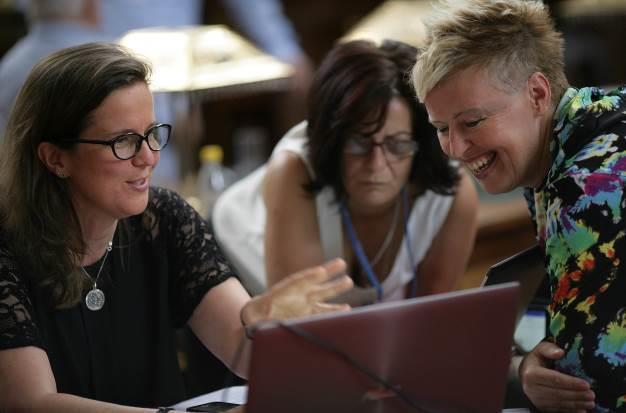
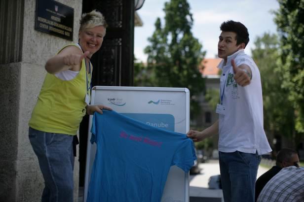
81 Public Consultation Report 81
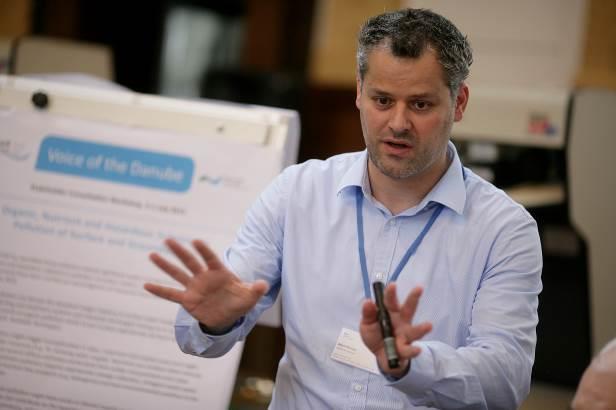


82 Public Consultation Report 82
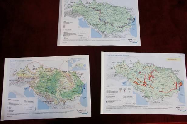


83 Public Consultation Report 83


84 Public Consultation Report 84 Introduction Voice of the Danube ICPDR Consultation Workshop 2015 Workshop Report 2-3 July 2015, Zagreb, Croatia The ICPDR is developing the Danube River Basin Management Plan Update 2015 and the first Flood Risk Management Plan for the Danube River Basin for the period between 2015 and As of December 2014, the ICPDR provided the draft management plans for comments. The public is invited to submit comments to the ICPDR Secretariat until the 22 nd of July To accompany the development of the Update 2015 DRBM Plan and the development of the first Flood Risk Management Plan, the public consultation workshop, entitled Voice of the Danube, was organized on July 2-3, 2015 in Zagreb, Croatia. The ICPDR invited GWP CEE to support the organization and the facilitation of the consultation. There were 85 registrants from different sectors representing governments, public sector, civil society organizations, professional associations, NGOs, businesses, research and academia. The stakeholders had an opportunity to discuss the two draft management plans and propose ways to adjust and improve them. Background information The EU Water Framework Directive establishes a legal framework to protect and restore clean water across Europe and to ensure its long-term, sustainable use. It requires an integrated approach (i.e. across all sectors including agriculture, industry, and spatial policy) to the sustainable management and protection of water resources. It impacts on, and is equally impacted by, a diverse range of environmental plans and regulations. Ensuring the integration of all the aims of these plans is a particular challenge in the Danube basin the most transboundary basin in the Europe. Both, the Danube River Basin Management Plan and Danube Flood Risk Management Plan indeed require a considerable amount of technical expertise. In addition to this, the planning process should benefit of the knowledge and perspectives of people who use water in their everyday lives, whether as a source of drinking water, agriculture production, for fishing or swimming or to support manufacturing or power generation or even just for its aesthetic appeal. The ICPDR is committed to active public participation in its decision making. The consultation of stakeholders in the entire cycle of ICPDR activities as stipulated in the Article 14 of the EU Water Framework Directive. In practice, the ICPDR pursues public participation primarily through two avenues: - through the involvement of observer organizations in its ongoing work
85 Public Consultation Report 85 - through specific activities that are dedicated to public participation and information. This report is a summary of the consultation. Setting the stage Prior to the workshop, the participants were invited to submit their statements, comments and suggestions to the DRBMP and FRMP. All participants have access to all online planning documents both at national and international levels. In addition, the public Surveys on DRBMP and FRMP were established. During the workshop, the participants were encouraged to post their questions to be addressed by the ICPDR. The agenda of the workshop is in Annex 1. The workshop was organised in the form of interactive discussion Danube Café; the participants were encouraged to discuss each element of the DRBMP and FRMP. Facilitators and reporters rotated and therefore, everybody had an opportunity to express opinions to each of the groups. Facilitators worked with organizers before the workshop to prepare short background information and a set of questions for the groups. Facilitators and rapporteurs were appointed from the ICPDR and GWP CEE experts. The consultation themes included: Nutrient, Organic and Hazardous Substance Pollution in Surface and Groundwater; Hydromorphological Alterations & Integration Issues (Flood risk management, Hydropower, Navigation, Agriculture) Objectives and measures of Flood Risk Management Plans Measures to implement both plans, Financing of the measures Communication & Public Participation The workshop The consultation workshop was opened by Mr. Drazen Kurecic, president of the ICPDR. ICPDR s film clip to encourage public participation Get active! Public participation for the Danube was shown. Key note presentation on Update 2015 DRBMP and DFRMP The key note presentation was provided by Ivan Zavadsky, ICPDR Executive Secretary. He explained that ICPDR s role is to coordinate and develop the international Danube River Basin Management (DRBMP) and Danube Flood Risk Management Plans (FRMP). The DRBMP Update 2015 has 140 pages, 35 maps and 15 annexes. It determines priorities for transboundary water management. The draft was submitted for public consultations in December Ivan Zavadsky gave examples of significant progress made in pressures with 900 urban waste water treatment plants completed by To solve hydromorphological alterations, 120-plus fish migration aids were completed or under completion by Regarding ecological and chemical status assessment, improved monitoring and data gaps are expected to be solved during finalisation of the plans. Water is a cross cutting issue and therefore, inter sectoral cooperation is mentioned in connection to floods, marine, nature protection, inland navigation, hydro power, sturgeons and adaptation to climate change. Economic analysis and financing of measures indicates trends in key economic indicators until Examples of Joint Programme of Measures were given as well.
86 Public Consultation Report 86 FRMP includes flood hazard and risk maps. Its Danube wide objectives are to avoid new risks, reduce existing risks, and strengthen resilience, and increase awareness and solidarity. FRMP deals with Level A issues - natural water retention, solidarity, links to Water Framework Directive, public consultation and climate change. It prioritises only strategic measures and provides examples of best practices. Voice of the Youth - statement of a youth organisation Mr Osman Hadzic, President of the Sava Youth Parliament made a statement on behalf of youth organisations. The Sava Youth Parliament is committed to implementation of the Sava Convention. He highlighted several water related issues relevant to the Sava River such as security, sustainable development, working with local communities, awareness raising and importance of communications. During the latest meeting of the Sava Youth Parliament on May in Bihac, networking and social media (Facebook) were highlighted among topics that will be addressed in the future. Statement of an artist Radostina Doganova, explained what the Danube means to her the river connects her home country Bulgaria with Slovakia where she currently works. In addition, the river means movement, process, direction, contains start and the end. The paintings displayed at the workshop were inspired by the Danube in different stages of her life. They showed the movements and diversity of the Danube River. Overview on the interim results from the questionnaires Danka Thalmeinerova (GWP) presented status of questionnaires on DRBMP - Update 2015 and Danube FRMP. The online survey was launched on 5 June 2015, comprising of two questionnaires posted on ICPDR website. Highlights of responses to the questionnaires until 30 June are summarised as follows. DRBMP Update % responders know about DRBMP 70% agree that quality of water improved moderately DRBMP contributed moderately to improvement of water quality Responders agreed that more investments are needed for waste water treatment plans and preferred decreased use of fertilisers More than 90% supported fish migration aids 93% believe that climate change is relevant for the Danube River Basin DRBMP and its contribution climate change is however varied 60% mentioned that national issues are not reflected the plans DFRMP Personal networks are primary source Majority agreed that flood protection is not absolute Maps are easy to understand an strongly improved awareness on floods 54% of the respondents are aware of possibility to take own flood protection measures
87 Public Consultation Report 87 Statements from stakeholders and observers Several stakeholders and observers delivered their statements in the plenary - Danube Environmental Forum, Hydro-power Austria, GWP Central and Eastern Europe, Administration of Lower Austria and Danube Strategy Priority Area 4 (Water quality). Danube Environmental Forum DRBMP Update 2015 is big step forward and congratulated the ICPDR and its expert groups. However, some problems persist related to further deterioration of water status due to new hydro power generation, its impacts to biodiversity and aquatic fauna reproduction. Landscape planning and water management should be integrated and diffuse pollution from agriculture addressed. In order to avoid deterioration of water status in the future, river corridors, involvement of other sectors and cooperation with the Danube Strategy was mentioned. Hydropower Austria In Europe, hydro-power is the most important in energy mix of renewable (70%). Power generation systems are highly volatile due to photovoltaic (PV) and wind, so flexibility is needed. Hydropower plans in Alpine space were mentioned as the only solution to ensure stability of power generation. An example was given of a research project Hydro-peaking in Austria river stretches implemented jointly by BOKU, hydraulic laboratories and utilities. GWP Central and Eastern Europe (GWP CEE) János Fehér recommended considering climate change and drought as a significant issue in the DRBMP Update Further international coordinated actions to address climate change and weather extremes are needed. Reduction of pollution by waste water treatment plants and sewage networks requires high costs. Therefore, natural treatment technologies were proposed, whenever feasible, in small settlements. Administration of Lower Austria ristian Steiner drew attention to sustainable land-use, planning and soil protection, since 2015 is FAO International Year of Protection of Soil. In Austria, 22 hectares of arable land is used every day for other land use. In order to deal with soil protection, partnerships and cooperation with agriculture and local municipality is needed. Danube Strategy Priority Area 4 Lászlo Perger mentioned that the Danube Strategy has brought commitment and responsibility of Danube countries to work together since Programme of measures can be financed through Danube Transnational Programme, e.g. waste water treatment plants in less development parts of the basin and settlements under 2000 people and sediments. ICPDR Public Participation Expert Group Susanne Brandstetter underlined importance of social media, art and youth along with technical issues in both plans. Summary of Danube Café discussions The participants discussed each of the themes and responded to the questions as follows.
88 Public Consultation Report Which are the challenges that need to be addressed in the Danube River Basin Management Plan Update 2015 (DRBMP) and the 1st Floods Risk Management Plan for the Danube River Basin (DFRMP)? Theme: Nutrient, Organic and Hazardous Substance Pollution in Surface and Groundwater - Concept of ecosystem services should be considered and should be integrated into the plan at basin level. - Water scarcity and water quality should be addressed in an integrated way as they are interconnected. - Pollutions originating from sediment should be considered in the plan. - Industry is a major polluter in many water bodies, ICPDR should take a lead in prioritization of actions to be addressed at international level. - More attention should be paid in the plan to the possibilities of the new Common Agricultural Policy and its potential influence on the agriculture in the basin. - ICDPR should consider to stress the importance of the small wastewater treatment facility applications when basin wide strategy of waste water sector development is harmonised with national priorities. - More pressure should be put on national governments to tackle actions (legislation, financial support) on water sector (water supply, wastewater treatment).in the southern area of the Danube Basin more focus is needed on wastewater treatment. Theme: Objectives and measures of Flood Risk Management Plans - Implementation of the measures is the major challenge; problems arising on financing the measures and on responsible actors; - International measures can be partially financed by projects but the national measures (and structural measures on international scale) require financing by national investment programmes and clear responsibility allocation at national level; - Fund raising for international measures is essential; - Better use of EU funds for projects on horizontal issues and EU funding should be eligible for structural measures as well. - Natural water retention should be promoted in both international and national plans; - Improve communication with AGRI sector (incl. PP); - Some issues shall be addressed stronger in national plans (deforestation increases flood risk, organic farming has retention potential, missing local land use plans pose gaps for flood retention): inserting these into DFRMP would be helpful to promote development at national level; - Harmonization of flood hazard areas shall be promoted in the next management cycle; - Sedimentation in HPP reservoirs spilling needed for retention capacity - non-compliance with WFD objectives. Theme: Hydro-morphological Alternations & Integration Issues (Flood risk management, Hydropower, Navigation, Agriculture) - Addressing hydro-morphological pressures is considered as a key issue; - Topic is observed to be largely covered and progress in measures implementation is recognised, however, further specific improvements are suggested (see below); - Emphasis on inter-sectoral cooperation was appreciated and the continuous need to work closely together with relevant sectors, in particular with Flood Risk Management (e.g. on Natural Water Retention Measures), Inland Navigation and Hydropower was highlighted;
89 Public Consultation Report 89 - Importance of the ICPDR Guiding Principles on Sustainable Hydropower Development was confirmed, however progress with practical application was perceived as rather slow; - The need to work closer together also with the agricultural sector was raised and identified as an existing gap; - Working towards better planning is considered as an important issues, taking into account longterm perspectives and effects (e.g. climate change), transparency, a broader planning perspective on benefits and impacts, as well as public consultation and the involvement of stakeholders; - Sediment management is considered as a key issue the need for a basin-wide overview with site-specific solutions was emphasized; - The fact that water scarcity and drought is addressed was appreciated, however, the lack of sufficient policies and guidelines was raised, causing a challenge for practical measures implementation. Theme: Support to implement both plans, Financing of the measures - Support/help national actors with applying for available funds (listed in Annex 18 and others). Several difficulties were mentioned at the workshop: administrative complexity for applying and managing funds; co-financing requirements; timing of financing and planning process were not in line, etc. - Better utilize local knowledge and experience and include local actors into prioritization process (usually they are excluded from the debate). - Better understanding of financial flows: incentives for sustainable water use, economic instruments, and sustainability of investments that has worked in the past and can be improved in the future, cost-effectiveness of measures. - More support from the Danube level for prioritization of the measures on a national level. Theme: Communication and Public Participation - There is a lack of designated communication people at international and local level, who can communicate the important messages to the public. The big question is who is really doing the communication work, which is very important. - The plans in this form are not attractive to the general public who are not technical experts. They should be translated in a way that the common people could understand. The best solution would be to draft the Plans themselves from the beginning in a better and more attractive way, meant for a broader audience. - There was not enough time for promoting the questionnaires. The questionnaires in this form are for the public, but the plans are for the technical people and these are 2 very different groups. - Reaching the broad public and engage them in public consultation. 2. What specific recommendations and suggestions were given for revision of the DRBMP and DFRMP aiming at the improvement of both plans? Theme: Nutrient, Organic and Hazardous Substance Pollution in Surface and Groundwater Hazardous substances - There are many inventories on hazardous substances, but these are separated. There is a need to develop a detailed integrated inventory, which could increase the information base about the real situation of hazardous substances in the production sector/economy.
90 Public Consultation Report 90 - Higher level (fourth type) treatment would be needed to reduce impacts of hazardous substances. It is recommended to consider examples from Switzerland where 100 waste water treatment plants will be upgraded aiming the fourth technology (ozonation, UV treatment, activated carbon filters) - Radioactive substances are considered as a serious issue in the Sava basin. There is no proper solution of dumping radioactive wastes in environmentally sound way in the basin. There is no information about radioactive wastes in the plan. Nutrient pollution and agricultural issues - Designated land is needed for nature conservation restoration purposes in active flood plains for nutrient pollution reduction. - Better methods of the organic and inorganic fertilizers usage/application on land are needed. - A regional/basin wide level organic material balance and management system for reduction of nutrient pollution is proposed. - To achieve higher pollution reduction the respective subsidies should be more properly used focusing on better adaptation of land use. Better financial instruments are also needed. - When reducing nutrients in the rivers this might result in reduction of the biomass (fish population) as well. More understanding is needed on the balance of the both sides of the issue. - It is proposed to pay attention to different investment projects, not only focusing on wastewater treatment on big cities, but on smaller settlements (with less than 2000 PE) as well. This would decrease pollution loads of the groundwater. - Phosphorous in middle term perspective would be looked at as resource, therefore P losses should be minimized. - The timing and dosage of nutrients (organic, inorganic) applications should be compliant with the existing legislation in the practice. - Agricultural practice should be appropriately managed to minimize nutrient loads to the surface and groundwater resources, this should get priority in the measures. - Water corridors are good practical means to reduce pollutants transfer from catchment areas. At least 5 m or 15 m buffer zones should be created to reduce pollution from agricultural fields to the surface waters. - High technology (state of the art) farming practices which could reduce pollution load from agriculture should be supported. - More detailed knowledge would be needed on overnutrition of agricultural plants. Allocation of more resources for the solution of this problem is advised. Introduction of Best Practices in the daily farming activity would be needed. - Support of clean agriculture is recommended by increasing or better utilizing the subsides for clean agricultural production. - Have dialogue with people in the agricultural sector. Environmental aspects - There is clear knowledge gap on solid waste issues and the related pollution problem. - Improvement of monitoring network would be needed. Further improvement of devices and methods is also important. - Scientific further investigations/research are needed to understand the potential combined effects of specific pollutants below limit (EQS) values, which might be present in the water environment and producing interactions or integrated effects, which are not known yet. - Sediment behind dams should be managed. Sediment should be returned from the reservoirs back to the nature. There should be a solution how to return deposited sediment to the river system.
91 Public Consultation Report 91 - Using the water for heating and cooling will be more problematic area in the future. - Pollution is more and more considered as a security problem in terms of accidental pollution. Programme of measures - Cost-effectiveness and farmers' willingness to implement agricultural measures are very relevant issues. Dialogue with agricultural sector is a must. Targeting the hot spots and proper subsidization of the measures are essential. - Concentration of land ownership/production should not be further encouraged, however, it is recommended to get around 10% of the population to be involved in the agricultural production sector for effective implementation of measures. - Farmers need money to implement the environmental oriented measures in connection with agricultural production. - "Trace back the sources" approach should be encouraged for the agricultural sector (and maybe linked that with polluter pay principle). - The less developed countries in the basin need more effective support to revitalize their monitoring system to re-establish a baseline information system for better assessment and planning. Theme: Objectives and measures of Flood Risk Management Plans - Pilot projects to be carried out for river restoration providing more space for rivers - Natural water retention measures shall be applied (e.g., in areas without settlements along Sava); - Priority be given to horizontal cross-sectoral measures (WFD, FD, water scarcity), more NWR measures shall be presented in the Annex 2; - Properly balanced combination of structural and non-structural measures is needed, ICPDR s priority are the natural water retention measures but limiting factors exist (geography, finances). - Water capacity of soil is important especially for areas with no possibility for land use change - water infiltration shall be increased; - Measures addressing flash floods shall be more promoted; - Measures targeting floods in urban areas and the related urban planning methodology shall be upgraded to reflect current trends; - Outcomes of GWP climate change related activities be included as best example text box; - Information about influence of floods on soil from the AT/SK project shall be included either as a text box or as a subchapter on soil retention into the chapter on NWR; - Putting more stress to potential of afforestation, organic farming and availability of local land use plans (IAD to contribute); Theme: Hydromorphological Alternations & Integration Issues (Flood risk management, Hydropower, Navigation, Agriculture) - Progress and best practices in hydromorphological measures implementation are proposed to be better communicated; - Further harmonising approaches on hydromorphology between countries (strengthening of methodologies for hydromorphological assessments and HMWB designation); this would lead to a more comprehensive and consistent DRBM Plan; - River continuity is proposed to be broader addressed, including next to fish migration also other aspects of connectivity, i.e. disconnection of semi-aquatic habitats, sediment transport, reduced river dynamics and impacts on related species, next to the issue of
92 Public Consultation Report 92 downstream fish migration; - The list of Future Infrastructure Projects (FIPs) is proposed to be updated by the countries since not all relevant FIPs are considered to be yet included; - Proposal for guidance on the application of exemptions for new projects according to WFD Art. 4.7, taking into account work already performed in the frame of the Joint Statement on Inland Navigation and the Environment, Guiding Principles Sustainable Hydropower and on Sustainable Flood Risk Management; - Better using synergies between Flood Risk Management and improving river hydromorphology (example Lonjsko polje), i.a. by reconnecting wetlands/floodplains; more areas with potential for re-connection are expected to be in place countries were asked to check and updated the data; clarification of no net-loss principle, not only to maintain status-quo but to expand reconnected wetland/floodplain areas; - Proposal to raise awareness also on negative impacts of flood protection measures and river training works; - Addressing the issue of spatial planning - problems of deforestation, land use and soil compaction, leading to increased risks for flash floods; - Approaches for public consultation and stakeholder involvement should be strengthened towards better planning - proposal for support and exchange of experiences in the frame of the ICPDR; - Suggestions to further work on improved cooperation with relevant sectors - WFD and Flood Risk Management, Joint Statement Inland Navigation and Environment, Guiding Principles Sustainable Hydropower; - Proposal for discussion on the practical application of the Hydropower Guiding Principles, i.a. regarding obstacles and solutions; potential for multi-purpose uses and enabler for other forms of renewable energy by balancing supply and demand, the already utilised potential and the need for a balanced approach and environmental impacts should be taken into account; - Proposal to work closer with the agricultural sector - several issues considered as relevant (reduction of nutrient and hazardous substances pollution, use of agricultural land for water retention, soils role as linkage between agriculture and water, erosion and relevance for sediment transport, etc.); - Need for a sediment management tool; - Proposal to work more on water scarcity and drought, i.a. towards practical implementation of measures; Theme: Support to implement both plans, Financing of the measures - Concrete recommendations for DRBMP Update 2015: Make a connection with EU Strategy for the Danube Region (EUSDR) and Danube Transnational Programme. - Recommendations for future years: There should be exchanges of experiences at the basinwide level on following: o regarding interaction with different administrative levels for the measures implementation (better communication with higher level); o better understanding (based on the 1st RBMP experiences) of»financing that worked«; how were successful projects implemented, what were benefits, where did they get funding, etc. o case studies of using funding possibilities; o better understanding of cost-effectiveness of measures (examples based on the 1st RBMP experiences); o how to involve private sector financing;
93 Public Consultation Report 93 o examples of win-win situations (flood protection, energy, biodiversity, etc.). - Transparency of the funding/spending should be improved. A better understanding is needed regarding what was the benefit/ profit of the money which was already invested in the measures in the past, how have investments in the past been done, what were the financial flows, etc. - Various financing mechanisms exist; however, fundraising requires capacity, skills, resources for co-funding, etc. There should be bigger support/help from the basin-wide level to nationalactors get access to funds. So called Funding Help Desk was proposed: o supporting search for funding possibilities (e.g. list of calls); o supporting funding applications (at various levels focus on local); o getting national co-financing; o communication with different levels (authorities) and sectors; interaction between different levels of authorities and different sectors is usually not working); o supporting public participation; o to create basin wide small fund for small projects that integrate public active players small NGOs, municipalities, SMEs, etc. - Clearer guidance to prioritization of measures needed to improve chances of national actors to gain funding: o to break down big steps in the plans into smaller, concrete ones as recommendations on concrete actions for countries; o to identify priority areas for investments regarding problems which have transboundary effects. To identify hot spots, where finances should be channelled to (priorities connected for examples with country s natural hazards, etc.) - Concrete pledges/commitments of countries for each SWMI could be added to the plan. - Better utilization of the Common Agricultural Policy 2nd pillar for water management measures is crucial. To finance those measures which address sustainable land use. - Creation of win-win solutions with broad stakeholder support. Theme: Communication and Public Participation - Create concerns and interest about the plan. - Clear actions and clear messages are needed in terms of the Plans. - Policy makers need short and precise information about the Plans. - It is not explained who participated in the preparation of the Plans. It has to be written who is responsible for the data. It has to be clear who will be responsible for the facilitation of the public participation connected with the plans at local level. - To train the planners and the decision makers and people who are responsible for the planning and the implementation of the plans how to involve the stakeholder groups and public and to make trainings for better wordings. - More sectors should be engaged in the preparation and public consultation phase of the Plans. - Prepare communication packages for different target audiences (teachers, farmers, etc.) - Organise forums for territories and also thematic forums (fishery, agriculture, etc.) where to invite specific stakeholder groups. oose and translate certain messages to local level. - If the aim is to reach the general public, it is necessary to have a short summary of the Plans, simple and clear, with infographics and photos within the timeframe of the consultation. - It is important to have a face of the message. Celebrity with a simple message. Show the ICPDR faces also, make it more personal. Use more media, TV, organise interviews. eck which communication channel works in each country. - It could be easier to bring simple messages to the general public we need the public to push
94 Public Consultation Report 94 the policy makers bottom up approach. 3. What are the key messages from the discussions Nutrient, Organic and Hazardous Substance Pollution in Surface and Groundwater - There is a knowledge gap regarding hazardous substances pollution. This issue would require a centralized basin wide programme to get more focused attention on the issue. - Additional legal instruments are needed at national level for reduction of diffuse pollution (nutrients, erosion, organic matters, etc.) ICPDR should point out the bottlenecks, hotspots should be targeted in legislative frameworks, even at national level. - Mechanisms are needed to encourage/persuade farmers to do restrictive/environmentally sound farming (cost-effective approach should be used). - Inclusion of land use planning and biodiversity issues in cross-sectoral activities (e.g. management of agricultural sector) are important and should get more attention in the plan. - Financial instruments are key elements of implementation of a strategy or plan. Clearer picture should be given in the plan on how measures will be financed. Objectives and measures of Flood Risk Management Plans - Natural water retention is a better environmental option in flood risk management, which provides win-win solutions for the implementation of WFD and FD and it should be strongly promoted on both national and international level; - Practical implementation of measures is the major challenge of DFRMP and it requires identification of funding possibilities as well as of the responsible institutions at the national level; - Stronger dialogue with the other sectors (WFD, agriculture) and improved public participation at the national level is needed. Hydromorphological Alternations & Integration Issues (Flood risk management, Hydropower, Navigation, Agriculture) - Efforts on hydromorphological measures implementation are appreciated and progress should be better communicated, however further efforts are still needed towards more comprehensive measures implementation; - Better harmonised and strengthened methodologies on hydromorphological assessments are needed; - Clear support was expressed towards the reinforcement of inter-sectoral cooperation activities with flood risk management, inland navigation and hydropower; the need to launch a similar activity on agriculture was raised; - Better and strengthened coordinated planning activities were proposed, including spatial planning and taking into account long-term effects and a broad range of stakeholders, benefits and impacts; - Addressing sediment management was considered as a key issue and the need for further work on water scarcity and drought was expressed. Support to implement both plans, Financing of the measures - Facilitation of win-win solutions is crucial for the implementation/financing of both plans, but also for integration of sectors and different levels of administration as well as for involving the private sector. - Various financing possibilities exist for the implementation of both plans (EU, international,
95 Public Consultation Report 95 Danube-specific), however, no»rainfall«of money can be expected. In addition, certain difficulties were mentioned for utilising these financing possibilities (administrative complexity for applying and managing funds, co-financing requirements,»timing«of financial programs vs. timing of the implementation of the plans etc.). - Various ideas for supporting actions at the basin-wide level for the implementation of both plans discussed, for example financing bottom-up activities for implementation of both plans/utilising local knowledge and experience; exchange of experiences between Danube countries regarding e.g.: interaction of different administrative levels for the measures implementation, better understanding (based on the 1st RBMP experiences) of»financing that worked«/case studies of using funding possibilities, better understanding of effectiveness of measures (examples again based on the 1st RBMP experiences), involving private sector financing, improving the understanding of financial flows, incentives, economic instruments and sustainability of investments has worked in the past and can be improved in the future; - While the strategic, general prioritisation of»types«of measures at the basin-wide level found in both plans is considered useful, requests voiced for more specific, practical recommendations for prioritisation of measures (regarding topics,»hotspot«areas etc.) in order to»lead«and support the national administrations in prioritising measures and in order to provide support/legitimation for financing proposals political feasibility? - Proposal for commitments by countries to be included in the plans regarding actions to be taken/«benchmarks«for each»significant water management issue«/flood risk management at the national level political feasibility? Communication and Public Participation - Communication is a very important issue, and it has to be recognised as such. Communication officers at local level are needed to communicate the plans hand in hand with technical experts. - The Plans should reach out to different target audiences They should have a simplified and clear version for each target group including policy makers and the general public, because in the actual form they are not attractive. They should also have versions (summaries) in local languages, since the aim is to reach to the people at local level. - Questionnaires: the time frame was very tight, and people were not given a lot of time to fill them in. They should be simpler and clearer. The questionnaires are for the public, but the plans are for the technical people. These are 2 very different groups and that is why they don t fit together well. - One of the main challenges is how to really reach the wide public, the people at home. - FRMPs - there should be preparedness to communicate floods to the public and once they come, we should immediately communicate them, not wait for a week or more to do so. 4. Quotes: Hydromorphological Alternations & Integration Issues (Flood risk management, Hydropower, Navigation, Agriculture) - The concept of More space for the rivers is well known, but there is no strategy in place to do this in practice. We should work on that. - Following the last year s flood disaster people decided to reconstruct their houses at the same place, what is a complete nonsense but the state is even supporting that. - In 50 years no one will know the local politician anymore who took the decision, but the
96 Public Consultation Report 96 structures will remain for hundreds of years. - Agriculture is really missing. - A sediment management tool is needed. Rivers should also be passable for sediments. Support to implement both plans, Financing of the measures - Governments are not able to decide on the priorities for water management. - What is the profit of the money which we already invested in the measures in the past? - Danube level can support prioritization with recommendations on concrete actions. - With only top-down approach we are losing local actors. - Implementation of the measures with strong private initiative attracts also governmental or other funds. Communication and Public Participation - The Plans are technical and boring and the Plans are not attractive for the common person. - It has to be clear who will be responsible for the facilitation of the public participation connected with the plans. - The Questionnaires are for an insider club - We need a communication person + a planner working very tightly together. 5. Session summary comments or any other comments for the workshop report (optional) Nutrient, Organic and Hazardous Substance Pollution in Surface and Groundwater The workshop was well organised. The programme went well. More time should have been allocated for topic discussion in the Danube Café. 30 minutes were not enough to collect and briefly discussed suggestions of the participants. Some of the participants were not aware of the content of the plans in question. It is recommended to put focused efforts on ensuring participation from all Danube countries and all major stakeholder groups. Objectives and measures of Flood Risk Management Plans Better communicate the meaning of low probability on hazard map to public; Current description of natural water retention in BA should be revised to promote this issue; Public consultation at national level has still room for improvement; DFRMP is a good document identifying the common goals for flood risk management in14 countries and provides good examples for inspiration. Support to implement both plans, Financing of the measures Morphology: too much focus on longitudinal connectivity for fish; more on biodiversity and migration. Too much focus on non-structural measures; should be included also effects of structural measures and especially effects from combination of both of them. There should be special focus on the projects which are supporting or implementing measures for getting land along rivers (for flood protection, biodiversity, etc.).
97 Public Consultation Report 97 It has to be built a better link to drought risk situations and include drought management needs/efforts into RBMP. Communication and Public Participation Why was agriculture not represented? It is one of the most important sectors for water quality. There is not enough information exchange with agriculture. Day 2 (Friday, 3 July) The Voice of the basin - presentation of the key-messages of the whole event and next steps by ICPDR Executive Secretary Summary and the next steps The ICPDR planning process timeline is as follows: Public consultation process until 22 July 2015 Over summer: Collection of all comments & condensed report until end of summer, provided to relevant Expert Groups (RBM, FP, PP) Autumn: Discussion of comments & revision of management plans December 2015: Finalisation and adoption of plans at 18 th ICPDR Ordinary Meeting, consultation report published 9 February 2016: Endorsement of plans at Danube Ministerial Meeting, Vienna Methodology of the report: Feeds information from all 4 public consultation activities Part 1 includes raw data & documents Part 2 features table with key points of all comments received Following revision, Part 2 will be extended in autumn Comment accepted: how? Comment dismissed: why? Key messages: Nutrient, Organic & Hazard. Substance Pollution There is a knowledge gap regarding hazardous substances pollution. This issue would require a centralized basin wide programme to get more focused attention on the issue. Additional legal instruments needed at national level for reduction of diffuse pollution (nutrients, erosion, etc.). ICPDR should point out the bottlenecks, hotspots should be targeted in legislative situation, even at national level. Mechanisms needed to encourage / persuade farmers to do the restrictive / environmentally sound farming (cost-effective approach should be used). Inclusion of biodiversity issues in cross-sectoral aspects are important and should get more attention in the plan. Key messages: Hydromorphology Alterations & Integration Issues Efforts on hydromorphological measures implementation appreciated & progress to be well-
98 Public Consultation Report 98 communicated, but: More efforts needed towards more comprehensive measure implementation Support for better harmonised & strengthened methodologies on hydromorphological assessments Clear support towards reinforcement of inter-sectoral cooperation activities with FRM, navigation & hydropower Need to launch similar activity on agriculture Need for better coordinated planning activities, including spatial planning and taking into account long-term effects and broad range of stakeholders, benefits and impacts Further efforts needed on water scarcity and drought Sediment management considered a key issue Key messages: Objectives & Measures Flood Risk Management Plan Natural water retention is a better environmental option in flood risk management, which provides win-win solutions for the implementation of WFD and FD and it should be strongly promoted on both national and international level; Practical implementation of measures is the major challenge of DFRMP and it requires identification of funding possibilities as well as of the responsible institutions at the national level; Stronger dialogue with the other sectors (WFD, agriculture) and improved public participation at the national level is needed. Key messages: Implementation & financing of measures Creation of win-win solutions with broad stakeholder support crucial (administration, private sector) Various financing mechanisms exist, but no money shower funds may require capacity, resources, etc. Concrete ideas for basin-wide level to help national-level actors get access to funds were proposed Clearer guidance to prioritisation of measures needed to improve chances of national actors to gain funding Concrete pledges/commitments of countries for each SWMI could be added to the plan Key messages: Communication & public participation Communication is important & must be recognised but who does the communication? (responsible actors) Language issue: plans are in English. Translations of summaries? Questionnaires: low returns; mismatch between questions/plans; required people to have read plans; too complicated. In general, questionnaires would need improvements, but show a strong recognition for PP Main challenge for future: how to reach general public Preparedness to communicate immediately when flood event occurs is required Written post it questions from the audience Most of them covered in discussion, except:
99 Public Consultation Report 99 Question: Do the plans reflect transport in short and medium term horizon? Answer: Joint Statement Process, next JS meeting 10/11 September in Vienna Question: How to make the management plans more understandable for non-experts? Answer: Publication under preparation, will be available for Ministerial Meeting, 9 February 2015 in Vienna Most frequently keywords from the discussion were summarised in the following Tag cloud Integrative approaches Strategic planning involvement Land-use Wetland & river restoration Inter-sectoral processes Ecological values Agriculture Several comments, questions and issues were raised by the audience that are summarised below: Viktor Bilejic, Aarhus Center, Bosnia and Herzegovina informed that rivers in Balkans can be influenced by hydro-power projects in the future. WWF expressed appreciation for both plans that were improved in comparison to previous versions. Regarding stakeholder involvement, WWF organized public consultation processes in Hungary, Slovakia and other countries. It proposed to involve farmers during winter time when they are free. Measures related to flood risk management are well described in the DFRMP, however, countries need to implement them on the national level. Wetland restoration still has a low profile is Central and Eastern Europe. Include organic farmers and agriculture sector, harmonize planning documents such as land use plans, agriculture and forestry plans. Richard Muller, GWP CEE, pointed out to look for synergies with landscape planning that is developed in some Danube countries and measures, such as territorial systems of ecological stability and eco-stabilization measures. IADR gave an example of workforce employed by agricultural sector - 30% worked in agriculture 60 years ago in comparison to 1% today. In order to produce high quality food, 10% population should work in agricultural sectors mostly as part time farmers. If you want to use large parts of land for retention, involvement of agriculture is therefore crucial. Tomas Orfanus, Slovak Academy of Sciences asked about long term planning horizon until 2050 and communication with the Danube Strategy Danube Environmental Forum is missing river corridor concept that could be upscale into an international pilot project. It proposed to have a close look on deterioration issue to due to hydro-power construction. Integrated planning should integrate land-use not around rivers but in broader areas. We also have to keep in mind an overall goal of achieving a good water status. Eduard Interviews added that farmers should be involved in the national processes and commitments of the national levels should feed in the plans Martina Zupan, GWP CEE air has mentioned experience from Slovenia where stakeholders are active but governmental support is limited. In this respect she enquired whether there is any way to encourage countries to involve stakeholders? Susanne Brandstetter mentioned an example of good communications and public
100 Public Consultation Report 100 participation work of the ICPDR Public Participation Expert Group. ICPDR answered some of the questions from the audience. ICPDR guiding principles for hydropower is a valuable resource addressing deterioration issue. ICPDR also works on a concept paper related to agriculture that aims to develop a guidance document with best agricultural practices. ICPDR is an observer to relevant areas of the Danube Strategy and Permanent Secretariat cooperates with JRC on long term modelling of the region. In addition, Ivan Zavadsky stressed that the ICPDR will treat each comments with great respect. He concluded with appreciation of active participation of stakeholders at the workshop and thanked to facilitators & rapporteurs, moderators & GWP team. Conclusions, next steps and closing of the Workshop Steven Downey asked the participants about their suggestions to the workshop structure. WWF appreciated Danube Café format and workshop overall, however, proposed to target agriculture, tourism and navigation and allow a more time for Danube Café discussion. Other comments concerned the presentations that will be summarised in the report, suggestions to use the second day to work on hot spots identified during Day 1 and to list names of national experts and authors who provided data for the plans. ICPDR Executive Secretary Ivan Zavadsky mentioned again that comments can be submitted by to ICPDR icpdr@unvienna.org by any organization to any issue related to the plans. The comments can be submitted by 22 July. An update of the DRBMP Update 2015 and DFRMP will be prepared in the autumn of The final versions will be endorsed by the 18th ICPDR Ordinary Meeting in December 2015 and consequently on 9 February 2016 at the Ministerial Meeting in Vienna. Steven Downey mentioned in his closing part that all issues were addressed, highlighted active participation, constructive spirit of the workshop and responsibility for the basin. There is an opportunity to provide comments and participate in the online survey until 22 July Workshop Agenda Day 1 (Thursday, 2 July) - 09:00 09:30 Registration 09:30 10:30 Morning session 1 Film clip produced by ICPDR (5 min.) Key note presentation by ICDPR President on the management plans (30 min.) Voice of the Youth statement of a youth organisation (15 min.) 10:30 11:00 Coffee break (30 minutes) 11:00 12:00 Morning session 2
101 Public Consultation Report 101 Overview on the interim results from the questionnaires and statements from observers and stakeholders (20 min.) Discussion with stakeholders (35 min.) Introduction to the Danube Café (5 min.) 12:00 13:00 Lunch break (60 minutes) Danube Café: s will be divided in 5 groups to work on specific topic. Each group will have a facilitator, a rapporteur and up to 20 participants. The groups will rotate. Topics: Nutrient, Organic and Hazardous Substance Pollution in Surface and Groundwater; Hydromorphological Alterations & Integration Issues (Flood risk management, Hydropower, Navigation, Agriculture) Objectives and measures of Flood Risk Management Plans Measures to implement both plans, Financing of the measures Communication & Public Participation 13:00 15:00 Afternoon session 1 Three Danube Café topics per participant 15:00 15:30 Coffee break (30 minutes) 15:30 16:30 Afternoon session 2 15:30 16:45 Danube Café (continuation) Two Danube Café topics per participant 16:45 17:00 Closing the first day of the Workshop. Day 2 (Friday, 3 July) 09:00 10:30 Morning session 1 Summary of Day 1 and outlook of Day 2 (10 min.) Rapporteurs reports on the Danube Café from the previous day (10 min. each, total of 50 min.) General discussion on these reports (30 min.) 10:30 11:00 Coffee break (30 minutes)
102 Public Consultation Report :00 12:30 Morning session 2 The Voice of the basin presentation of the key-messages of the whole event and next steps by ICPDR Executive Secretary (20 min.) Conclusions, next steps and closing of the Workshop (70 min.) 12:30 End of the Workshop List of registrants 1. Mr Benedikt Mandl ICPDR Secretariat 2. Mr Raimund Mair ICPDR Secretariat 3. Mr Károly Gombás ICPDR FP-EG 4. Mr Igor Liska ICPDR Secretariat 5. Mr Zoran Stojanovic Serbian Environmental Protection Agency 6. Ms Susanne Brandstetter Austrian Ministry for Environment 7. Mr Otto Pirker Verbund AG Mr Mr Knut Beyer Popescu Liviu Nicolae Federal Ministry for the Environment, Nature Conservation, Building and Nuclear Safety GWP-CEE Regional Council member and GWP- Romania President 10. Mr Michal Hazlinger Ministry of Environment of Slovak republic 11. Ms Martina Zupan GWP CEE 12. Mr Rudolf Hornich Office of the Styrian Government, Dep 14, Watermanagement, resources and Sustainability 13. Mr Richard Muller Global Water Partnership Central and Eastern Europe 14. Ms Danka Thalmeinerova Global Water Partnership 15. Ms Laurice Ereifej WWF Danube-Carpathian Programme Office 16. Ms Sabina Bokal Global Water Partnership Central and Eastern Europe 17. Mr László Perger Ministy of Foreign Affairs and Trade, Hungary 18. Mr Steven Downey Global Water Partnership 19. Mr János Fehér GWP CEE Region 20. Mr Tomas Orfanus 21. Mr Peter Matt Vorarlberger Illwerke AG GWP Slovakia, Institute of Hydrology, Slovak Academy of Sciences 22. Mr Sandor Szalai National Committee of ICID 23. Ms Sophia Beck-Mannagetta CEHAPE 24. Mr Gerhard Nagl Danube Environmental Forum 25. Mr Helmut Belanyecz EAA ÖKF
103 Public Consultation Report Ms Ms Imola Koszta Jelena Zigic Regional Environmental Center for Central and Eastern Europe Institute for materials and construction testings of Republic of Srpska 28. Mr Eduard Interwies InterSus Sustainability Services 29. Mr Harald Kutzenberger International Association for Danube Research 30. Mr Dragan Zeljko International Sava River Basin Commission 31. Mr Mirza Sarač International Sava River Basin Commission 32. Mr Edin Lugić EU Strategy for Danube Region Priority Area Ms Ana Kobašlić EU Strategy for Danube Region Priority Area Mr Georg Frank DANUBEPARKS 35. Ms Marija Pinter Croatian Ministry of Agriculture 36. Mr Vladimir Tausanovic IAWD 37. Ms Valeriya Gyosheva ICPDR Secretariat 38. Ms Gergana Majercakova GWP CEE 39. Mr Viktor Bjelic 40. Ms Stephanie Blutaumüller Danube Competence Center 41. Ms Boska Trbojevic Coca-Cola HBC 42. Mr Bujac Victor Center for Environment/ Aarhus Center Network of Bosnia and Herzegovina Basin Water Management Authority, Agency Apele Moldovei 43. Mr Peter van Puijenbroek PBL Netherlands Environmental Assessment Agency 44. Ms Monika Ericson Global Water Partnership 45. Ms Veronika Koller-Kreimel Ministry of Agriculture, Forestry, Environment and Water Management, Austria 46. Mr Stefan Polhorsky Slovak Water Management Enterprise, Branch Bratislava 47. Mr István Szilvássy Danube Pearls Trans-national Multi-project Partnership coordinator 48. Ms Amra Memic JU Medicinska skola Bihac 49. Mr Hadzic Osman JU Medicinska skola Bihac 50. Mr Jefferson Andrade Regional Environmental Center REC Ms Mr Ms Irena Brnada Daniel Gomez Jovanka Ignjatovic 54. Ms Renata Fuert ICPDR Secretariat 55. Ms Lara Bušić Sava Youth Parliament Regional Environmental Center for Central and Eastern Europe (REC), Country Office Croatia Regional Environmental Center for Central and Eastern Europe Regional Environmental Center for Central and Eastern Europe
104 Public Consultation Report Mr János Tamás University of Debrecen, GWP CEE 57. Ms Andreja Sušnik Slovenian Environmental Agency 58. Mr ristian Steiner Administration Lower Austria 59. Mr Ivan Zavadsky ICPDR Secretariat 60. Mr Ivan Milovanovic ICPDR Secretariat 61. Mr Mitja Bricelj Ministry of the Environment and Spatial Planning 62. Mr Bojan Jakopič Ministry of the Environment and Spatial Planning 63. Mr Tomaž Grilj Ministry of the Environment and Spatial Planning 64. Mr Tibor Mikuska Croatian Society for Birds and Nature Protection 65. Ms Vera Shiko Albanian Institute of Transport 66. Mr Aleš Vidmar Fundacija Okolje smo vsi 67. Mr Kristjan Lapuh Fundacija Okolje smo vsi 68. Ms Daniela Stojkovic Danube Civil Society Forum 69. Mr Ovidiu Agliceru Hidroelectrica SA 70. Mr Adam Kovacs ICPDR Secretariat 71. Mr Drazen Kurecic Ministry of Agriculture 72. Mr Ivica Plisic Hrvatske vode (Croatian waters) 73. Ms Sanja Genzic Jurisevic Croatian Ministry of Agriculture 74. Ms Elizabeta Kos Croatian Ministry of Agriculture 75. Mr Alan Cibilić Hrvatske vode (Croatian waters) 76. Mr Maldini Kresimir Hrvatske vode (Croatian waters) 77. Ms Dagmar Šurmanović Hrvatske vode (Croatian waters) 78. Ms Tausanovic Mina ELSA European Students of Law Association 79. Ms Jasmina Ancovic Hrvatske vode (Croatian waters) 80. Mr Dadecic Gligor Croatian Society for Birds and Nature Protection 81. Ms Jovana Raseta PWMC Serbiavode 82. Ms Martina Egedusevic PWMC Serbiavode 83. Ms Radostina Doganova Artist 84. Mr Dimitar Doganov Consultant 85. Mr Tomislav Majerovic Hrvatske vode (Croatian waters) Note: A report with a review of the workshop by the participants can be found at:


105 Public Consultation Report Online questionnaires To expand the target groups of public consultation beyond expert stakeholders, simple and accessible online questionnaires were developed for ICPDR.org. They targeted the interested, but not informed public. The questionnaires related to very general aspects of the management plans, and as such, served primarily as information tools to draw attention to the plans and its public consultation measures in particular, the stakeholder consultation workshop and the opportunity to comment on the plans in writing. In total, 90 people filled in the questionnaire for the DRBM Plan Update 2015, and 95 people filled in the one for the DFRM Plan. While the information received through the questionnaires was very general, the questionnaires covered an important part of the ICPDR s comprehensive strategy to actively target a broad audience with different consultation measures Questionnaire 1: Danube River Basin Management Plan (95 submission) 1) What source did you learn about the River Basin Management Plan from? 2) Do you know how many countries the Danube River Basin extends into? Hint: it is the most international river basin in the World. 3) The Water Framework Directive entered into force in 2000, the first River Basin Management Plan for the Danube was adopted in a) Did you know of this management plan?


106 Public Consultation Report b) How much do you think that the quality of the Danube has improved since 2009? 3 c) How much do you think that the management plan was responsible for the change in water quality? 4) Wastewater from households and industries has to be treated to avoid water pollution. The construction and modernization of wastewater treatment plants is expensive, but has a big
 Fertilisers and pesticides are broadly used to increase the production of food crops, but they can harm water quality and thus the animals and plants living in waters as well as the quality of")

107 Public Consultation Report 107 impact on improving water quality. Do you think that more investments are needed for wastewater treatment plants in the Danube River Basin as a whole? 5) Fertilisers and pesticides are broadly used to increase the production of food crops, but they can harm water quality and thus the animals and plants living in waters as well as the quality of our drinking water. How do you feel about this? The application of fertilisers and pesticides should be 6) Fish such as sturgeons used to migrate along the entire Danube. Today, many dams for example of hydropower plants prevent this. As a result of the Water Framework Directive, fish migration aids are or will be built in many places. Do you think fish migration aids help to improve the river environment?
 Do you think that the effects of climate change are also relevant for the Danube Basin?")
 River Basin Management of the Danube according to the Water Framework Directive requires basin-wide management plans as well as national management plans.")
108 Public Consultation Report 108 7) Climate change can have a direct impact on the water cycle and on the status of water bodies in the sense of the Water Framework Directive. 7 a) Do you think that the effects of climate change are also relevant for the Danube Basin? 7 b) Do you think that the DRBM Plan can help societies to adapt better to climate change? 8) River Basin Management of the Danube according to the Water Framework Directive requires basin-wide management plans as well as national management plans. 8 a) Do you think that water management issues of your country are sufficiently reflected in the Danube River Basin Management Plan Update 2015?


 Are you aware that the flood protection is")
109 Public Consultation Report b) Are you aware of public consultation activities for your national river basin management plans in which you could participate? Questionnaire 2: Flood Risk Management Plan (90 submissions) 1) What source did you learn about the plan from? 2) Are you aware that the flood protection is never absolute?
 Were the flood risk and flood hazard maps and their content clear for you? (answer in %) 4 b) Do you have additional comments?")

110 Public Consultation Report 110 3) Do you think you are aware of your flood hazard exposure and you feel like to know what to do in case of sudden inundation? 4 a) Were the flood risk and flood hazard maps and their content clear for you? (answer in %) 4 b) Do you have additional comments? Very low cooperation between Ministry and local administration in flood management plans Maps are not very detailed I thought that the information regarding the different projects from the countries was unclear some projects were closed, and it was not clear if that meant it never occurred, or it was stopped? Others (like the VTT) have been umoured to take place for years now, but have never occurred, or have been delayed/stalled. I feel like the information is misleading as to the true risk of floods, and what is being done to alleviate the vulnerability in certain areas that are particularly flood-prone. Maps show where is a hazard, it is not clear if such zones will have limitations in spatial and land planning documents and how local authorities are aware of it. Where i can find the plan for my city? Not sufficient communication with general public. In the maps are not included all floods happened in the last few years Danube needs to open it s old arms

111 Public Consultation Report 111 Maps do not read well. What does it mean for my community or stream of river? How does it relate to future development of the community close to river? Should I invest in property in nearby community? These are questions that the general public needs to know. Also, most our streams overflow because there is poor maintenance of the banks. How is responsible? The maps don t give information about the area, where one is living. The numbers between high, medium and low probability are not conclusive. The clarification different types of floods( ex flash floods) and the main causes that drove them it will be a step forward for mitigation of their negative impacts Such flood hazard maps need to be disseminated to a wider public, and not only available on the internet; schools, universities must have them disseminated to their audiences I am against floods. Super project, with great results! Much more education of the people is needed, first of all in the case of flash floods Why there are no National Management Plans for Serbia? Rivers have to get back theyr former flooding zones More need to be done to get floods risks mitigated, and one idea would be to extend and connect the river corridors to also protect & save biodiversity. Dutch flood risk could be a good model Excellent document. 5) Did the maps help to improve your awareness of flood hazard?

112 Public Consultation Report 112 6) Are you aware about a possibility to take your own flood prevention measures?
113 Public Consultation Report Social media campaign To include the general public that would not be targeted by the other consultation measures, a social media campaign was implemented in parallel to the stakeholder consultation workshop. Its main objective was awareness raising and cross-link to other consultation tools. Priority for this was given to Facebook, backed up with Twitter (hashtag #DanubeVoice) during the stakeholder workshop. Between 14 May and 12 July 2015, the campaign yielded 20 new Twitter followers; 186 new Facebook fans; 2,905 interactions by 2,358 unique users; as well as 927,863 impressions. While the social media campaign did not directly lead to substantial comments on the management plans, it covered an important part of the ICPDR s comprehensive strategy to actively target a broad audience with different consultation measures. Analysis report: Social media campaign Planning the campaign In an effort to plan The Voice of the Danube social media campaign in a systematic manner targeting the right people, using the right hashtags, listing the right content GWP CEE put together in advance a Social media strategic document (Annex 1), a Social media target mapping (Annex 2) and a Social media calendar (Annex 3). Social media strategic document is a campaign mapping questions document addresses the timing, purpose, messages and measurable goals, monitoring tools, channels, outreach and production. On a meeting with ICPDR on 5 February 2015 the questions were discussed. The objectives were set to strengthen communication/relations with target audiences, spark debate around these issues and collect the opinions of the public and share content and news about RBMPs. It was decided that priority should be on Facebook, where GWP CEE will create an event page. Other channels such as Twitter should be used only via GWP CEE profile, #DanubeVoice should be used on social media. GWP CEE can also engage in conversations and discussions on other social networks. It was agreed to create and publish unique content based on a list with 20 to 30 factoids of max. 200 characters on RBM provided by ICPDR experts, photos and infographics twice or three times per week. The targets were set to be: Increase traffic to website using social media Increase followers/likes on Facebook Hit correct audience targets on Facebook Increase engagement on posts and sharing levels Increase followers on Twitter Increase quality of followers influential tweeters Increase retweet rates Social media target mapping document is a research document on organizations/initiatives and their presence on social media. GWP CEE tried to identify which organizations and governmental bodies in the Danube river basin could be potential influential retweeters and could support the social media campaign. Other possible hashtags were listed, as support to the main hashtag #DanubeVoice. Social Media Calendar was prepared and sent to ICPDR on 15 May Key messages and posts were prepared in advance, based on the factoids provided by the ICPDR. A research was made on how to connect the campaign to other events and important dates (22 May International Day for
.")
114 Public Consultation Report 114 Biological Diversity, 1 June International ildren s Day, 5 June World Environment Day, 17 June World Day to Combat Desertification and Drought, June 22-24, 2015 Conference Fish Passage 2015, International conference on river connectivity best practices and innovations, 29 June Danube Day). The research document was used as a base for the targets and was updated with new knowledge resources with relevant hashtags and targets. This was not set in stone since it s important to allow for some flexibility and also to tweet/report in real time. Live tweeting and live streaming from the event was also offered during the whole event. The statistics from the live tweeting and Facebook posting can be found in document Statistics Live tweeting (Annex 4). How did it go? A more elaborate social media report including gender, age, locations etc., covering the main days of the campaign and a couple of days after, can be found in the document Statistics Social media campaign (Annex 5). A list of all postings and tweets can be found in document Postings and tweets (Annex 6). During this period (14 May 12 July), we had: 20 new Twitter followers 186 new Facebook fans 2905 interactions (Twitter mentions, Retweets and Facebook stories created for the profiles to this group) by 2,358 unique users 927,863 impressions (the combined number of potential users who saw content associated with the Twitter & Facebook profiles connected to our Twitter and Facebook accounts) During the event only, based on live tweeting and posting on Facebook directly from the event (1-3 July) we had 162 interactions by 96 unique users and the total of 109,444 impressions. Here are some of the Twitter profiles retweeting our tweets


115 Public Consultation Report 115
Hydromorphology in the Danube River Basin
 Workshop on Transboundary Water Resources Management in Western and Central Europe 8-10 February 2011, Budapest, HU Hydromorphology in the Danube River Basin Raimund MAIR, ICPDR Technical Expert on River
European Union Strategy for Danube Region and the implementation of the Water Framework Directive
 COST 869 Mitigation options for Nutrient Reduction in Surface Water and Groundwaters Final Meeting, Keszthely, 12-14 October 2011 European Union Strategy for Danube Region and the implementation of the
Significant Water Management Issues in the Danube River Basin District - Summary
 Significant Water Management Issues in the Danube River Basin District - Summary Highlighting the main issues of the ICPDR Document on Significant Water Management Issues Document number: IC 133 Version:
ICPDR Guiding Principles on Sustainable Hydropower Development in the Danube Basin
 EC Consultation Meeting Preparation of a guidance document on hydropower development and Natura 2000 Brussels, 08 July 2015 ICPDR Guiding Principles on Sustainable Hydropower Development in the Danube
Guiding Principles on Sustainable Hydropower Development in the Danube River Basin
 Guiding Principles on Sustainable Hydropower Development in the Danube River Basin Lead Countries : Austria, Romania, Slovenia in the frame of the International Commission for the Danube River Protection
ICPDR Sturgeon Related Activities (& opportunities offered by WFD)
") Danube Sturgeon Task Force Meeting 27-28 August 2012, Tulcea (RO) ICPDR Sturgeon Related Activities (& opportunities offered by WFD) Raimund Mair, ICPDR Karl Schwaiger, Austrian Federal Ministry of Agriculture,
Danube Sturgeon Task Force Meeting 27-28 August 2012, Tulcea (RO) ICPDR Sturgeon Related Activities (& opportunities offered by WFD) Raimund Mair, ICPDR Karl Schwaiger, Austrian Federal Ministry of Agriculture,
Danube River Basin Management Plan
 Danube River Basin Management Plan The Danube Challenges and Progress ICPDR Philip Weller Danube Parks Ranger Training, September 20, 2010 The Danube is a diverse region - ecologically and socially From
The Water Crisis from the Regulatory Perspective
 The Water Crisis from the Regulatory Perspective Symposium on Business, Water and Wetlands ICPDR Wolfgang Stalzer Bucharest, 9 July, 2012 Challenge Water Crisis Water and Health - Watersupply, Sanitation,
Preparation of a guidance document on hydropower development and Natura 2000
 Preparation of a guidance document on hydropower development and Natura 2000 DRAFT Minutes of EC Consultation meeting 8 th July 2015 Purpose of the meeting The Commission explained the purpose of the guide
Interim Overview: Significant Water Management Issues in the Danube River Basin District
 Interim Overview: Significant Water Management Issues in the Danube River Basin District Interim overview on the Significant Water Management Issues to meet the requirements of WFD (Directive 2000/60/EC)
Interim Overview: Significant Water Management Issues in the Danube River Basin District
 Interim Overview: Significant Water Management Issues in the Danube River Basin District Interim overview on the Significant Water Management Issues to meet the requirements of WFD (Directive 2000/60/EC)
RESPONSE DOCUMENT (TABLE OF COMMENTS) TO THE DRBM PLAN PUBLIC CONSULTATION PROCESS
 TO THE DRBM PLAN PUBLIC CONSULTATION PROCESS") RESPONSE DOCUMENT (TABLE OF COMMENTS) TO THE DRBM PLAN PUBLIC CONSULTATION PROCESS Steps undertaken by the ICPDR: integrated in the DRBM The comments received from AVS very often make reference to the
RESPONSE DOCUMENT (TABLE OF COMMENTS) TO THE DRBM PLAN PUBLIC CONSULTATION PROCESS Steps undertaken by the ICPDR: integrated in the DRBM The comments received from AVS very often make reference to the
EU Strategy for the Danube Region. the opportunities and role of agriculture and environmental protection
 The EU Strategy for the Danube Region: the opportunities and role of agriculture and environmental protection ICPDR Business Friends of the Danube Agricultural Forum Medgyesy Balázs Government Commissioner
Hydro-economic scenarios for the Danube: competition for water, opportunities and threats
 JRC Annual Event on the Scientific Support to the Danube Strategy Water workshop Ulm, 27-28 October 2015 Hydro-economic scenarios for the Danube: competition for water, opportunities and threats Dr. János
Biodiversity as a Priority Area of the EU Strategy for the Danube Region (EUSDR) The potential role of DANUBEPARKS as flagship project
 The potential role of DANUBEPARKS as flagship project") DANUBEPARKS 3rd Steering Committee Meeting Schloss Orth, 2.-4. September 2011 Biodiversity as a Priority Area of the EU Strategy for the Danube Region (EUSDR) The potential role of DANUBEPARKS as flagship
DANUBEPARKS 3rd Steering Committee Meeting Schloss Orth, 2.-4. September 2011 Biodiversity as a Priority Area of the EU Strategy for the Danube Region (EUSDR) The potential role of DANUBEPARKS as flagship
AQUACROSS Project. Danube case study - storylines. Activities in the Danube case study 13/09/17
 Activities in the Danube case study AQUACROSS Project Danube case study - storylines Andrea Funk, Florian Pletterbauer, Thomas Hein (BOKU) Simone Langhans, Gabriela Costea, Helena Hudek, Sami Domisch,
COMMON IMPLEMENTATION STRATEGY FOR THE WATER FRAMEWORK DIRECTIVE (2000/60/EC)
") COMMON IMPLEMENTATION STRATEGY FOR THE WATER FRAMEWORK DIRECTIVE (2000/60/EC) POLICY SUMMARY to Guidance Document No. 4 Produced by Working Group 2.2 - HMWB EXPLANATORY NOTE This policy summary gives an
COMMON IMPLEMENTATION STRATEGY FOR THE WATER FRAMEWORK DIRECTIVE (2000/60/EC) POLICY SUMMARY to Guidance Document No. 4 Produced by Working Group 2.2 - HMWB EXPLANATORY NOTE This policy summary gives an
European Strategy for the Danube Region
 European Strategy for the Danube Region Priority area 4 To restore and maintain the quality of waters Andrea Vranovská PAC 4 assistant European Strategy for the Danube Region (EUSDR) EUSDR is a macro-regional
Fourth Meeting of the Conference of the Parties to the Framework Convention on the Protection and Sustainable Development of the Carpathians
 Fourth Meeting of the Conference of the Parties to the Framework Convention on the Protection and Sustainable Development of the Carpathians UNEP/CC/COP4/DOC11/REV1 Original: English STRATEGIC ACTION PLAN
E-FLOWS AS A MAJOR TOOL TO ACHIEVE THE OBJECTIVES OF THE EUROPEAN WATER FRAMEWORK DIRECTIVE
 E-FLOWS AS A MAJOR TOOL TO ACHIEVE THE OBJECTIVES OF THE EUROPEAN WATER FRAMEWORK DIRECTIVE POSSIBILITIES FROM A HYDROPOWER PERSPECTIVE Martin Honsberg, Statkraft November 2013 Ankara Statkraft and the
Water Framework Directive*
 Water Framework Directive* Juan-Pablo Pertierra European Commission DG Environment * Directive 2000/60/EC of the European Parliament and of the Council of 23 Oct 2000 establishing a framework for Community
Transboundary water issues in a macro-regional context: the Danube basin
 Transboundary water issues in a macro-regional context: the Danube basin Tamás Németh Secretary-General Hungarian Academy of Sciences 11th September 2013, Budapest Mutual goals of the conference To provide
Danube Sturgeon Task Force 2 nd Meeting. Tulcea, Romania, August Minutes of the meeting
 Danube Sturgeon Task Force 2 nd Meeting Tulcea, Romania, 26-29 August 2012 Minutes of the meeting With the financial support of the EU Strategy for the Danube Region, Priority Area 6 (Biodiversity), the
The Regional Environmental Center
 Session I EEF.IO/11/15 11 May 2015 ENGLISH only 23 rd OSCE Economic and Environmental Forum: Water governance in the OSCE area Increasing security and stability through co-operation Belgrade, 11-13 May
Application of Directive 2000/60/EC, including the compliance with Art. 4.7
 Application of Directive 2000/60/EC, including the compliance with Art. 4.7 JASPERS Networking Platform Training on environmental requirements for cohesion policy projects in the 2014-2020 programming
Legal Basis of Water Management in Austria
 Legal Basis of Water Management in Austria Abstract by F. Oberleitner The following text is only a gross outline of the theme concerned. For essential further information see the script (in German only).
Activities to increase the preparedness and response capacity of the Danube region
 Activities to increase the preparedness and response capacity of the Danube region Project co-funded by European Union funds (ERDF) and Hungary Károly Gombás EUSDR PA5 HU coordination 05-06.03.2018, Brussels
Guidelines for balancing different water uses: navigation and environment, sustainable hydropower development
 2 nd UNECE Workshop River Basin Commissions and other Joint Bodies for Transboundary Water Cooperation: Technical Aspects, Geneva, 9-10 April 2014 Guidelines for balancing different water uses: navigation
EUSDR Priority Area 06 To preserve biodiversity, landscapes and the quality of air and soils
 EUSDR Priority Area 06 To preserve biodiversity, landscapes and the quality of air and soils Bucharest, June 22nd 2018 Doina Cioacă, Ph.D SG PA06 Member Biodiversity Directorate / Ministry of Environment,
EU Environmental Legislation and Sediment Transport
 EU Environmental Legislation and Sediment Transport Dr. Helmut Blöch International Workshop on Sediment Transport organized by Platform Water Management in the Alps 16 December 2011 Vienna Our waters:
Macro regional co-operation in relation to water issues: the experiences of the Regional Environmental Center
 Macro-regional Water Conference in Budapest on 11-12 September 2013 Macro regional co-operation in relation to water issues: the experiences of the Regional Environmental Center Marta Szigeti Bonifert
Integrated River Engineering Project. Catalogue of Measures. for the Danube to the East of Vienna
 Integrated River Engineering Project Catalogue of Measures for the Danube to the East of Vienna A Catalogue of Measures for the Danube to the East of Vienna The Catalogue of Measures encompasses a multitude
Transboundary cooperation and comanagement
 Transboundary cooperation and comanagement of shared ecosystems Sub-regional workshop Strengthening capacities for a sustainable future in Black- Sea and Caucasus countries: support to an establishment
DANUBE RIVER BASIN STAKEHOLDER CONFERENCE
 DANUBE RIVER BASIN STAKEHOLDER CONFERENCE June 28-29, 2005, Budapest Final Conference Report Compiled by: Nicole Kranz, Eleftheria Kampa and Thomas Dworak Overall management: Jasmine Bachmann On behalf
An Introduction to the EU legislation on water. Title
 An Introduction to the EU legislation on water Subtitle Title Daniel Fernández Gómez Environmental Implementation Unit - E2 DG Environment, European Commission ASSOCIATION OF EUROPEAN ADMINISTRATIVE JUDGES
Assessment of Transboundary, Rivers, Lakes and Groundwaters in
 MEETING OF THE PARTIES TO THE CONVENTION ON THE PROTECTION AND USE OF TRANSBOUNDARY WATERCOURSES AND INTERNATIONAL LAKES Fifth session Geneva, 10 12 November 2009 Assessment of Transboundary, Rivers, Lakes
European Strategy for the Danube Region
 European Strategy for the Danube Region Priority Area 4 To restore and maintain the quality of waters Achievements and plans Alena Kurecová 5th meeting of the Carpathian Convention Working Group on Adaptation
Western Balkans Climate Resilience Workshop Vienna (Austria) May 11-12, 2016 Summary of Discussions
 May 11-12, 2016 Summary of Discussions") Western Balkans Climate Resilience Workshop Vienna (Austria) May 11-12, 2016 Summary of Discussions The Western Balkans Climate Resilience Workshop brought together over 40 participants, from the six Western
Western Balkans Climate Resilience Workshop Vienna (Austria) May 11-12, 2016 Summary of Discussions The Western Balkans Climate Resilience Workshop brought together over 40 participants, from the six Western
Water threats at river basin scale
 WFD Lille 2010 Water threats at river basin scale Igor Liska ICPDR igor.liska@unvienna.org Perception of water threats Waters in the Community are under increasing pressure from the continuous growth in
Soil in the EUSDR PA 06
 Support to EU Danube Strategy Danube Land and Soil Nexus Workshop to develop 250,000 soil database for Danube Basin using esoter methodology Soil in the EUSDR PA 06 Dr. Florian Ballnus Bavarian State Ministry
CONVENTION FOR WASTE MANAGEMENT FOR INLAND NAVIGATION ON THE DANUBE
 CONVENTION FOR WASTE MANAGEMENT FOR INLAND NAVIGATION ON THE DANUBE CO-WANDA Joint Action Plan International Strategy for Implementation of the IDSWC Work Package 5: International Danube Ship Waste Convention
Integrated River Engineering Project Danube East of Vienna.
 Integrated River Engineering Project Danube East of Vienna www.donau.bmvit.gv.at/en Integrated River Engineering Project on the Danube East of Vienna is a project of via donau, realized ed on behalf of
Morava River Basin - Slovakia
 Morava River Basin - Slovakia Pavel Hucko 1 General description of the basin Slovak territory Morava river basin is bounded River basin districts of the Slovak Republic and their sub-basins White Carpathians
5th Annual Forum of the EU Strategy for the Danube Region
 5th Annual Forum of the EU Strategy for the Danube Region Workshop 2 Water non-alternative source for life Good quality of water as a prerequisite for enhancing sturgeon conservation in the Danube River
Integrated Drought Management Programme in Central and Eastern Europe
 Integrated Drought Management Programme in Central and Eastern Europe Sabina Bokal, GWP CEE IDMP ACMC meetings 6-7 Integrated Drought Management Programme in Central and Eastern Europe 2/15 Background
WATER RESOURCES MANAGEMENT IN THE DANUBE RIVER BASIN. Prof. Dr. Laszlo Vermes
 WATER RESOURCES MANAGEMENT IN THE DANUBE RIVER BASIN Prof. Dr. Laszlo Vermes The Danube is one of the greatest rivers in the World second biggest in Europe (after the Volga) Total length: 2842 km watershed
United Nations Economic Commission for Europe Convention on the Protection and Use of Transboundary Watercourses and International Lakes
 To ensure a sustainable water supply of good quality, we should protect and use in a sustainable manner the ecosystems that naturally capture, filter, store, and release water, such as rivers, wetlands,
DANUBEPARKS Danube River Network of Protected Areas. Statutes of the Association DANUBEPARKS
 DANUBEPARKS Danube River Network of Protected Areas Statutes of the Association DANUBEPARKS Article 1 Name, Location, and Language 1.1 The full name of the not-for-profit Association is: DANUBEPARKS Danube
Hungarian Experiences in the Implementation of WFD
 Hungarian Experiences in the Implementation of WFD Kálmán PAPP International Coordinator Central Directorate for Water and Environment, Hungary Stockholm, August 20-21 Meeting of River Basin District Authorities
EUSDR WATER QUALITY PRIORITY AREA THE EU DANUBE STRATEGY AS A BASIS FOR ACHIEVING SUSTAINABLE DEVELOPMENT OF WATER SERVICES
 EUSDR WATER QUALITY PRIORITY AREA THE EU DANUBE STRATEGY AS A BASIS FOR ACHIEVING SUSTAINABLE DEVELOPMENT OF WATER SERVICES Zsuzsanna Kocsis-Kupper Danube Region Strategy PA4 Coordination Team Danube Water
Summary of the results of the EPBRS Meeting under the Slovenian Presidency of the EU in Brdo
 Summary of the results of the EPBRS Meeting under the Slovenian Presidency of the EU in Brdo Estelle Bailan, EPBRS Secretariat, Belgium Biodiversity Platform, Belgium The European Platform for Biodiversity
From Basic Research to Knowledge Society: the DREAM project Danube River REsearch And Management
 From Basic Research to Knowledge Society: the DREAM project Danube River REsearch And Management Helmut Habersack Christian Doppler Laboratory for Advanced Methods in River Monitoring, Modelling and Engineering,
Danube WILDislands - Definitions & Strategy
 Expert Workshop WP3 WILDisland Visegrád, 8 September 2017 Danube WILDislands - Definitions & Strategy by Alexander Zinke, Environment Agency Austria Map: Fluvius Looking for answers to simple questions
Integrated River Engineering Project Danube East of Vienna.
 Integrated River Engineering Project Danube East of Vienna www.donau.bmvit.gv.at/en Integrated River Engineering Project on the Danube East of Vienna is a project of via donau, realized ed on behalf of
FRAMEWORK CONVENTION ON THE PROTECTION AND SUSTAINABLE DEVELOPMENT OF THE CARPATHIANS
 FRAMEWORK CONVENTION ON THE PROTECTION AND SUSTAINABLE DEVELOPMENT OF THE CARPATHIANS 2 The Parties, ACKNOWLEDGING that the Carpathians are a unique natural treasure of great beauty and ecological value,
Prut River Corridor Approach, achievements and results in the context of implementation the SEE River Project
 Prut River Corridor Approach, achievements and results in the context of implementation the SEE River Project Cristian RUSU; Ramona CURELEA; Elena TUCHIU; Ioana NEDELEA; Aliona HAISAN, Ludmila TONCIA National
European State Questionnaire on Hydropower and the WFD
 Water management, Water Framework Directive & Hydropower Common Implementation Strategy Workshop Brussels, 13-14 September 2011 European State Questionnaire on Hydropower and the WFD 1. Context The 2 nd
Water Framework Directive and EIA: our experience. Jo Murphy, MIEMA CEnv MCIM National Environmental Assessment Service (NEAS) 31 May 2012
 31 May 2012") Water Framework Directive and EIA: our experience Jo Murphy, MIEMA CEnv MCIM National Environmental Assessment Service (NEAS) 31 May 2012 The plan Me: Aims & objectives of the Water Framework Directive
Water Framework Directive and EIA: our experience Jo Murphy, MIEMA CEnv MCIM National Environmental Assessment Service (NEAS) 31 May 2012 The plan Me: Aims & objectives of the Water Framework Directive
WETLAND RESTORATION PROGRAMS IN THE PRUT RIVER BASIN
 Scientific Papers. Series E. Land Reclamation, Earth Observation&Surveying, Environmental Engineering. Vol. I, 2012 Print ISSN 2285 6064, CD-ROM ISSN 2285 6072, ISSN-L 2285 6064 WETLAND RESTORATION PROGRAMS
Development of Inland Navigation and Environmental Protection in the Danube River Basin Joint Statement on Guiding Principles
 Development of Inland Navigation and Environmental Protection in the Danube River Basin Joint Statement on Guiding Principles Inland navigation can contribute to making transport more environmentally sustainable,
Guidance for the analysis of Pressures and Impacts In accordance with the Water Framework Directive.
 Guidance for the analysis of Pressures and Impacts In accordance with the Water Framework Directive. This version was presented to the Water Directors on 21/22 November 2002 and it includes all amendments
Definitions and outcomes of NWRM EU project
 Definitions and outcomes of NWRM EU project DG Environment Water Unit Lucia Bernal Saukkonen BUCHAREST 12 TH NOVEMBER 2014, WORKSHOP ON RIVER RESTORATION AND NWRM Overview Policy background Blueprint and
International Association for Danube Research
 Cristina Sandu IAD, Romania, sanducri@yahoo.com Harald Kutzenberger IAD GS, Austria, kutzenberger@iad.gs Jürg Bloesch IAD, Switzerland, bloesch@eawag.ch International Association for Danube Research www.iad.gs
The role of nature conservation in cross- sectoral adaptation strategies to climate change - and related activites of the BfN
 The role of nature conservation in cross- sectoral adaptation strategies to climate change - and related activites of the BfN Cordula Epple Federal Agency for Nature Conservation Biodiversity Unit, Isle
Water bodies, floodplains and good ecological status
 Water bodies, floodplains and good ecological status Comments on the implementation of the Water Framework Directive from an NGO perspective WRRL-Seminar 18, Prag, 22. November 2005 Tobias Schäfer GRÜNE
Air Quality in the EU Strategy for the Danube Region Priority Area 06
 FAIRMODE PLENARY MEETING Air Quality in the EU Strategy for the Danube Region Priority Area 06 Dr. Florian Ballnus Bavarian State Ministry for the Environment and Consumer Protection Priority Area 06 Coordinator
Danube River Basin the most international RB in the world
 1 Complementarity of Regional Climate Change Adaptation Strategy to National Strategies the Danube Case Mr. Miodrag Milovanović Assistant Director of Jaroslav Černi Institute for the Development of Water
Towards Better Environmental Options for Flood risk management
 Towards Better Environmental Options for Flood risk management Why this initiative? Floods are the most common and most costly natural disasters in Europe. Severe floods with devastating effects happen
Issue Paper on Nutrient Pollution in the Danube River Basin Document Number: IC/WD/273 Document version: 13 Date: 2 Nov 2007
 Issue Paper on Nutrient Pollution in the Danube River Basin Document Number: IC/WD/273 Document version: 13 Date: 2 Nov 2007 Draft 13 ICPDR Issue Paper on Nutrient Pollution in the Danube River Basin Imprint
SUMMARY 2013 EDITION
 SUMMARY 2013 EDITION RSAT Joint Initiative on Rapid Basin-wide Hydropower Sustainability Assessment Tool PART 1: OVERVIEW OF THE RSAT The RSAT is designed as an integrative tool to assess hydropower development
EUSDR Report June 2012
 EUSDR Report June 2012 Priority Area 4 TO RESTORE AND MAINTAIN THE QUALITY OF WATERS 1. OVERALL PROGRESS 1.1. State of play [Work done so far on policies, actions and projects; Any lessons learned, positive
The Blueprint and Council Conclusions:
 The Blueprint and Council Conclusions: Essential to address the challenges that threaten the water ecosystems and their services on which society depends Proposed solutions include assessment of the costs
European Sediments 1
 European Sediments 1 SEDNET Network Editors: Wim Salomons, Ulrich Förstner, Jos Brils Contact: Jos Brils (SEDNET coordinator): Brils@mep.tno.nl Contents 1. Introduction: Scope...1 2. European policies
Global Water Partnership Central and Eastern Europe
 Global Water Partnership Central and Eastern Europe Fourth meeting of the Carpathian Convention Work Group on Adaptation to Climate Change Szolnok, 1 Towards a water secure world Sabina Bokal, GWP CEE
Natura 2000 and Hydropower. Hydropower and Fish Workshop Brussels 29 May, 2017
 Natura 2000 and Hydropower Hydropower and Fish Workshop Brussels 29 May, 2017 Christina Pantazi European Commission DG Environment, Nature Protection Unit (D3) Hydropower and Natura 2000 Hydropower one
Economic forum Areas of excellence in the Danube macro region
 Economic forum Areas of excellence in the Danube macro region Working Group 1 - Connectivity Bucharest, 8 November 2011 Şerban Cucu, Markus Simoner si Infrastructurii Content 1. Organization of the Priority
Future Waters in the Danube Basin: Problems and Opportunities. László Somlyódy
 CASEE Conference: The EU Strategy for the Danube Region, 28-29 April 2011, Szent István University, Gödöllő Budapest University of Technology and Economics Future Waters in the Danube Basin: Problems and
Regulation on European Energy Infrastructure
 Regulation on European Energy Infrastructure Climate Change Position Paper Justice and Environment 2013 a Udolni 33, 602 00, Brno, CZ e info@justiceandenvironment.org 1 t/f 36 1 3228462 / 36 1 4130300
Dr Martin Griffiths 16 February 2016
 Dr Martin Griffiths martin.griffiths@pillon.co.uk 16 February 2016 Outcomes in the Environment - UK 2 utcomes in the Environment - India 3 Integrated Catchment Management - Principles Integrated Catchment
Project Data Sheet BASIC PROJECT DATA. Full project title:
 BASIC PROJECT DATA Full project title: Variant-independent investigation on the development of Danube waterway between Straubing and Vilshofen Short project title: (acronym) EU Study Project logo: Project
Joint Statement on Guiding Principles for the Development of Inland Navigation and Environmental Protection in the Danube River Basin
 Joint Statement on Guiding Principles for the Development of Inland Navigation and Environmental Protection in the Danube River Basin 1 1 Introduction This Joint Statement aims to provide guidance to decision
Workshop on Significant adverse effects on use or the wider environment of measures in the context of HMWB designation and GEP definition
 Workshop on Significant adverse effects on use or the wider environment of measures in the context of HMWB designation and GEP definition 23-24 April 2018, Brussels Discussion Paper Authors: Ecologic Institute
Impulse Statement: Development of Danube Navigation
 Impulse Statement: Development of Danube Navigation Bratislava, 30 October 2012 Hans-Peter Hasenbichler CEO via donau Central and Easteran European Summit on Transport and Logistics Inland navigation?
DANUBEPARKS Danube River Netwerk of Protected Areas
 DANUBEPARKS Danube River Netwerk of Protected Areas Towards a Strong Voice for the Conservation of the Danube Natural Heritage Natural History Museum, Vienna February 27 th, 2012 Georg Frank DANUBEPARKS
Comments and suggestions from Norway
 Comments and suggestions from Norway (Versjon 2. februar 2018 + supplerende innspill 27. mars og 3. august). Before going into the possible issues for improvements in the Water Framework Directive (WFD)
Austrian inland navigation policy & the Integrated River Engineering Project on the Danube East of Vienna
 Austrian inland navigation policy & the Integrated River Engineering Project on the Danube East of Vienna Robert TÖGEL & Markus SIMONER Zagreb, June 9th, 2009 Austrian inland navigation policy Austrian
Paper Integrated project planning in inland waterway project
 Paper 165 - Integrated project planning in inland waterway project MITROVIC Ivan, MUSKATIROVIC Jasna, CURCIC Milica, OSTOJIC BARJAKTAREVIC Zaneta, ZANETTI Roberto Email (1 st author): imitrovic@plovput.rs
Letter dated 9 May 2001 from the Permanent Representative of Romania to the United Nations addressed to the Secretary-General
 United Nations General Assembly Distr.: General 15 May 2001 Original: English A/56/74 Fifty-sixth session Item 111 of the preliminary list* Environment and sustainable development Letter dated 9 May 2001
Balkan Rivers - The Blue Heart of Europe
 Balkan Rivers - The Blue Heart of Europe Hydromorphological Status and Dam Projects Executive Summary Supported by: Vienna, March 2012 Executive Summary Among the biggest current threats to the natural
CONVENTION ON THE CONSERVATION OF EUROPEAN WILDLIFE AND NATURAL HABITATS. Standing Committee. 37 th meeting Strasbourg, 5-8 December 2017
 Strasbourg, 7 November 2017 T-PVS/Inf (2017) 22 [Inf22e_2016.docx] CONVENTION ON THE CONSERVATION OF EUROPEAN WILDLIFE AND NATURAL HABITATS Standing Committee 37 th meeting Strasbourg, 5-8 December 2017
SETTING UP OF INTER-MINISTERIAL COORDINATING MECHANISMS FOR THE POLLUTION CONTROL
 January 2004 SETTING UP OF INTER-MINISTERIAL COORDINATING MECHANISMS FOR THE POLLUTION CONTROL Evaluation of Results of National Reports AUTHORS Michael von Berg Joachim Bendow Evaluation of Results of
Iryna Makarenko LL.M., Pollution Monitoring and Assessment Officer
 Iryna Makarenko LL.M., Pollution Monitoring and Assessment Officer Permanent Secretariat of the Commission on the Protection of the Black Sea Against Pollution The ecological state of the coastal waters
COMMISSION OF THE EUROPEAN COMMUNITIES COMMISSION STAFF WORKING DOCUMENT. Annex to the
 COMMISSION OF THE EUROPEAN COMMUNITIES Brussels, 22.3.2007 SEC(2007) 363 COMMISSION STAFF WORKING DOCUMENT Annex to the COMMUNICATION FROM THE COMMISSION TO THE EUROPEAN PARLIAMENT AND THE COUNCIL 'Towards
"EUROPE-INBO DECLARATION OF THESSALONIKI" Draft Working document Version 1.d
 RESEAU INTERNATIONAL DES ORGANISMES DE BASSIN INTERNATIONAL NETWORK OF BASIN ORGANIZATIONS RED INTERNACIONAL DE ORGANISMOS DE CUENCA 13 th EUROPE-INBO 2015 INTERNATIONAL CONFERENCE ON THE WATER FRAMEWORK
Annex III. Report of the 1 st Planning Meeting for the Council Study
 Annex III Report of the 1 st Planning Meeting for the Council Study 1 st Planning Meeting for the Council Study 7-8 November 2013 OSV Report Background This is a synopsis report of the meeting held on
JOINTISZA A strategic project for development of the biggest river subbasin
 JOINTISZA A strategic project for development of the biggest river subbasin of the DR László Perger EUSDR PA4 Priority Area Coordinator HU Outline 1) Brief background history 2) Preliminary actions 3)
Monitoring and data exchange at transboundary rivers, including water quality cooperation Almaty, October 2010
 Monitoring and data exchange at transboundary rivers, including water quality cooperation Almaty, 18-19 October 2010 Zsuzsanna BUZÁS Hungary Photo WWF 801,473 km² Danube River Basin Different levels of
Management of rivers & wetlands at catchment scale in Europe
 Management of rivers & wetlands at catchment scale in Europe Bart Fokkens, RIZA, NL. Chairman ECRR 1 RIZA: National Institute for Inland Water Management and Waste Water Treatment NL Ministry of Transport
EF.DEL/39/07 21 May 2007
 Organization for Security and Co-operation in Europe Secretariat EF.DEL/39/07 21 May 2007 ENGLISH only Conference Services Fifteenth OSCE Economic and Environmental Forum - Part 2: Key challenges to ensure
WATER SCARCITY DRAFTING GROUP DOCUMENT
 MED Joint Process WFD /EUWI WATER SCARCITY DRAFTING GROUP DOCUMENT : WATER SCARCITY MANAGEMENT IN THE CONTEXT OF WFD POLICY SUMMARY 1 WATER SCARCITY MANAGEMENT IN THE CONTEXT OF WFD POLICY SUMMARY WATER