Contribution of Irrigation Seepage to Groundwater-Surface Water Interactions on the Eastern Snake River Plain
|
|
|
- Leona Wood
- 6 years ago
- Views:
Transcription

1 Contribution of Irrigation Seepage to Groundwater-Surface Water Interactions on the Eastern Snake River Plain Rob Van Kirk, HSU Department of Mathematics BSU Geosciences Department, November 30, 2011
2 Collaborators and funders Current USDA-funded Project Brian Apple, Humboldt State University Dr. J. Mark Baker, Humboldt State University Dr. Yvonne Everett, Humboldt State University Dr. Brad Finney, Humboldt State University Lora Liegel, Humboldt State University Kimberly Peterson, Humboldt State University Dr. Steve Steinberg, Humboldt State University Dale Swenson, Fremont-Madison Irrigation District Kim Ragotzkie, Henry s Fork Foundation Amy Verbeten, Friends of the Teton River Other Collaborators Kevin Boggs, University of Idaho Dr. Gary Johnson, University of Idaho Funders National Science Foundation U.S. Department of Agriculture
3 Outline Study areas and hierarchy of nested spatial scales 1. Teton Valley tributary basin (400 km 2 ) 2. Henry s Fork upper part of Plain (8,000 km 2 ) 3. Upper Snake R. entire aquifer (93,000 km 2 ) Hydrogeology of Snake River Plain Statement of problem Research approach Results Ecological consequences Conclusions and recommendations

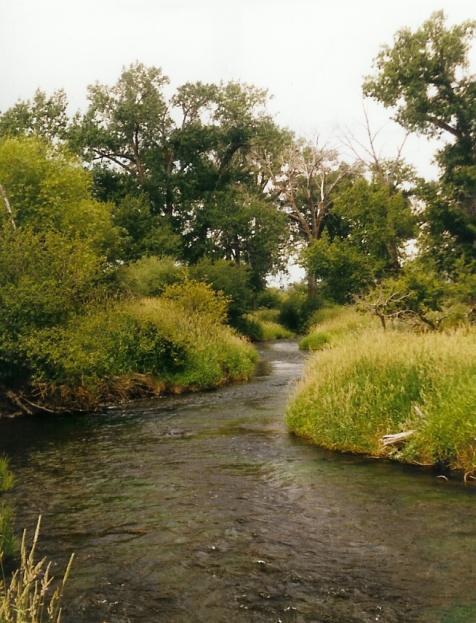
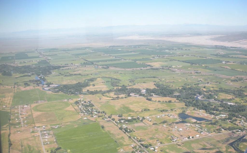
4 Eastern Snake River Plain and Study Basins

5 N 50 miles Beartooth Plateau Centennial Mts. Yellowstone Lake Great Salt Lake Bear Lake
6 N 50 miles Plate Motion 1 in/year Hot Spot
7 N 50 miles Uplift Zone Hot Spot Bow Wave Uplift Zone
8 Elevation (feet) Precipitation (inches) Elevation-precipitation relationship across the hotspot. N 50 miles 12,000 10,000 8,000 Old Faithful Hayden Valley Beartooth Plateau Elevation Precipitation ,000 4,000 Snake R Plain Lamar Valley Billings , Distance (miles) 0

9 N 50 miles Headwaters of a Continent Yellowstone Snake Bear

10 Upper Snake River Water System Drainage area: 35,800 mi 2 (93,130 km 2 ) Irrigated area: 2.4 M acres (9750 km 2 ) 9 major storage reservoirs; capacity 4 M a-f (5 x 10 9 m 3 )

11 Eastern Snake Plain Aquifer (ESPA) Boggs et al., 2010, J. Am. Water Res. Assoc. Water budget and water rights accounting close below Thousand Springs.
12 Water Table Height (ft) Problem 1: Decline in Groundwater Levels /1/ /1/ /1/ /1/ /1/ /1/2001 Groundwater level in a monitoring well on the ESPA.
13 Discharge - Cubic Meter per Second Problem 2: Decline in Aquifer Discharge Water Year Thousand Springs Discharge
14 Research Approach Model flow through linked surface-ground system, including: Diversions from streams into canal system Seepage from canals Seepage from stream channels Seepage due to irrigation application in excess of crop ET Surface return from irrigation system Returns to surface system from aquifers Analyze changes in irrigation practices Estimate water budgets Conduct analyses at multiple spatial scales: Small tributary basins(teton Valley) Intermediate-scale watershed (Henry s Fork) Entire system (Upper Snake River/Eastern Snake Plain Aquifer)

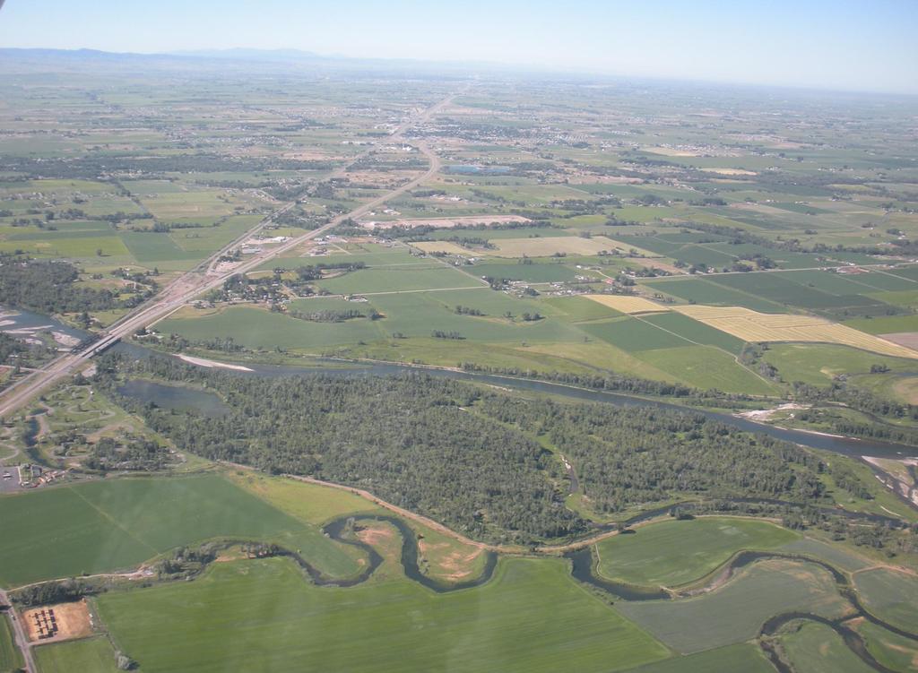
15 Henry s Fork Watershed Mean ann. precip.: 28.2 inches Min. elevation: 4,820 ft. Max. elevation: 11,400 ft. Canal-irrigated area: 250,000 ac. Canal length: 475 miles Annual water supply: 2.5 M a-f Annual diversion: 1.2 M a-f

16 Surface lithology of Henry s Fork Precambrian Paleozoic and Mesozoic sedimentary Cenozoic silicic volcanics from Yellowstone hotspot explosive eruptions Quaternary basalts Quaternary alluvium and glacial drift Source: Bayrd 2006 M.S. Thesis, Idaho State University


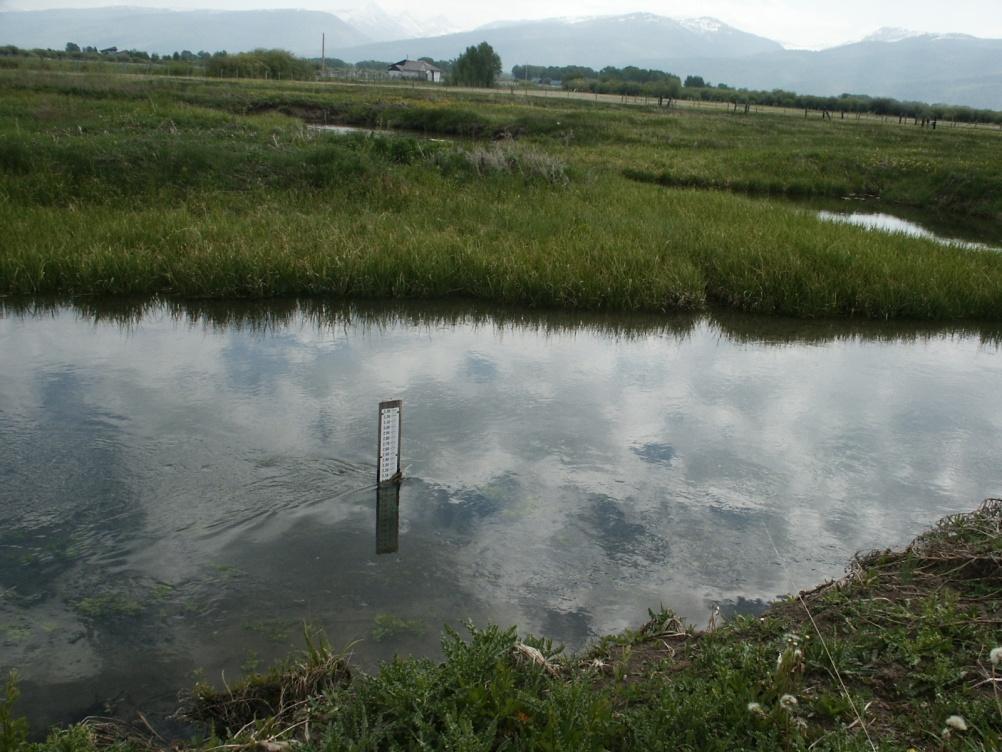
17 Field work to measure canal and stream channel loss rates and geometry for model parameterization.


18 Changes in Irrigation Practices Flood irrigation Sprinkler irrigation
19 Conversion from flood to sprinkler But, almost all conveyance still occurs in unlined canals.
20 Annual Volume (acre-feet) Groundwater pumping began in 1950s 350, , , , , ,000 50, Year Annual volume of groundwater pumped by A&B Irrigation District But, GW pumping does not occur in all locations.
21 Diversion (cfs) 30-year Mean Canal Hydrograph Teton Valley Application Seepage Crop ET Canal Seepage Canal/Sprinkler ET Surface Return Oct 1-Nov 1-Dec 1-Jan 1-Feb1-Mar 1-Apr 1-May 1-Jun 1-Jul 1-Aug 1-Sep Date
22 Diversion (acre-feet) Canal Budget by Year Teton Valley 160, , , ,000 Application Seepage Crop ET Canal Seepage Canal/Sprinkler ET Surface Return 80,000 60,000 40,000 20, Year
23 Diversion (cfs) 30-year Mean Canal Hydrograph HF Application Seepage Crop ET Canal Seepage Canal/Sprinkler ET Surface Return Oct 1-Nov 1-Dec 1-Jan 1-Feb1-Mar 1-Apr 1-May 1-Jun 1-Jul 1-Aug 1-Sep Date
24 Diversion (acre-feet) Canal Budget by Year Henry s Fork 1,600,000 1,400,000 1,200,000 Application Seepage Crop ET Canal Seepage Canal/Sprinkler ET Surface Return 1,000, , , , , Year
25 Net Gain (acre-feet/yr) River reach gains Henry s Fork Watershed 700, , , ,000 Lower HF & Teton HF Ashton-StA Teton Valley 300, , , ,
26 Analysis of Reach Gains in Henry s Fork Watershed Reach gains depend strongly on irrigation recharge, which depends on diversion
27 Annual aquifer recharge, acre-feet Natural Flood Actual Sprinkler Pipeline GW recharge under modeled scenarios, Teton Valley Pipeline scenario assumes 100% irrigation efficiency
28 Effect on GW elevations: Teton Valley
29 Distribution of Surface Withdrawals Does this scale up to entire Upper Snake? 100% 90% 80% 70% 60% Return via Surface Flow Evaporative Loss Crop Evapotranspiration Return via Groundwater 50% 40% 30% 20% 10% 0% Teton Valley 0.92 M a-f/yr Henry's Fork 1.2 M a-f/yr Upper Snake 8.7 M a-f/yr Water budget for surface water withdrawals
30 Distribution of Recharge Sources Does this scale up to entire Upper Snake? 100% 90% 80% 70% Direct Precipitation Stream Seepage/Tributary Underflow Irrigation Seepage 60% 50% 40% 30% 20% 10% 0% Teton Valley 0.95 M a-f/yr Henry's Fork 1.2 M a-f/yr Upper Snake 9.0 M a-f/yr Distribution of Recharge Sources to Valley Aquifers
31 Prediction of Thousand Springs discharge from irrigation seepage Modeling efficiency: 75% Boggs et al. 2010, JAWRA
32 Ecological Consequences: hydrologic alteration Modeled Teton River flow: irrigation has decreased peak flow and increased base flow
33 Ecological Consequences: hydrologic alteration Modeled Teton River flow, dimensionless hydrographs Measure GW influence by maximum/minimum ratio
34 Teton R. Maximum/minimum discharge ratio
35 1-Oct 1-Dec 1-Feb 1-Apr 1-Jun 1-Aug Discharge (percent of annual) Depth/bankfull width HF at Rexburg Warm River Trail Creek Groundwater influence and stream channel morphology Distance/bankfull width Stream channel complexity increases with hydrograph max/min ratio (Bayrd 2006) 1.2% 1.0% 0.8% 0.6% 0.4% 0.2% 0.0% HF at Rexburg Warm River Trail Creek
36 Percent cutthroat trout Max/min Ratio and Trout Species Composition Nonnative rainbow trout displace native cutthroat when max/min ratio is low. 100% 80% 60% South Fork Snake Teton River Linear (South Fork Snake) Linear (Teton River) 40% 20% 0% Maximum/minimum ratio during year of spawn
37 BUT, irrigation seepage maintains
38 Some conclusions and recommendations Irrigation patterns have driven groundwater-surface water interactions in upper Snake Basin since late 19 th century. Irrigation has transformed upper Snake hydrologic regimes from snowmeltdominated to GW-dominated. Native species and ecosystems have been replaced by nonnatives, but Ecosystem services provided by irrigation-dependent groundwater and wetlands are valued, if poorly understood and under-appreciated. Increases in irrigation efficiency have reduced GW-associated resources, including water supply for downstream users. Irrigation remains single largest source of aquifer recharge. Water management for all uses and values must account for groundwatersurface water interactions and treat both components equally Beware of unintended down-gradient and downstream consequences of wellintentioned water conservation measures.
39
Does Water Resources Management in the Snake River Basin Matter for the Lower Columbia River? Or Is the Snake River Part of Another Watershed?
 Does Water Resources Management in the Snake River Basin Matter for the Lower Columbia River? Or Is the Snake River Part of Another Watershed? John C. Tracy, Director Idaho Water Resources Research Institute
Over 150 Years of Irrigation Implications for Montana s Water Resources
 Over 150 Years of Irrigation Implications for Montana s Water Resources Alters hydrographs Water storage; recharge Changes timing of flow Ginette Abdo Montana Bureau of Mines and Geology March 10, 2016
In the Henry s Fork Watershed, Every Drop Leaves a Ripple. Kisa Koenig
 In the Henry s Fork Watershed, Every Drop Leaves a Ripple A Guide to Hydrology and Water Management Kisa Koenig Introduction In the arid west, many would agree that water is our most precious natural resource,
United Water Conservation District November 2016 Hydrologic Conditions Report 2017 Water Year. December 6, 2016
 United Water Conservation District November 216 Hydrologic Conditions Report 217 Water Year December 6, 216 Page Intentionally Left Blank PRECIPITATION (INCHES) PRECIPITATION (INCHES) PRECIPITATION (INCHES)
San Antonio Water System Mitchell Lake Constructed Wetlands Below the Dam Preliminary Hydrologic Analysis
 San Antonio Water System enhancement. This recommendation was based on limited water quality data provided by SAWS and using a free-water surface constructed wetland with approximately 112 acres of wetted
The Impacts of Climate Change on Portland s Water Supply
 The Impacts of Climate Change on Portland s Water Supply Richard Palmer and Margaret Hahn University of Washington Department of Civil and Environmental Engineering Joe Dvorak, Dennis Kessler, Azad Mohammadi
Hood River Water Conservation Strategy: achieving long-term water resource reliability for agriculture & local fish populations
 Hood River Water Conservation Strategy: achieving long-term water resource reliability for agriculture & local fish populations Cindy Thieman Hood River Watershed Group Ed Salminen & Niklas Christensen
Lecture 9A: Drainage Basins
 GEOG415 Lecture 9A: Drainage Basins 9-1 Drainage basin (watershed, catchment) -Drains surfacewater to a common outlet Drainage divide - how is it defined? Scale effects? - Represents a hydrologic cycle
M.L. Kavvas, Z. Q. Chen, M. Anderson, L. Liang, N. Ohara Hydrologic Research Laboratory, Civil and Environmental Engineering, UC Davis
 Assessment of the Restoration Activities on Water Balance and Water Quality at Last Chance Creek Watershed Using Watershed Environmental Hydrology (WEHY) Model M.L. Kavvas, Z. Q. Chen, M. Anderson, L.
Salinity TMDL Development and Modeling in the Otter Creek Watershed. Erik Makus DEQ Hydrologist June 6, 2013
 Salinity TMDL Development and Modeling in the Otter Creek Watershed 1 Erik Makus DEQ Hydrologist June 6, 2013 Outline for Today: Otter Creek and the Tongue River Previous salinity modeling efforts Existing
South Platte River Importance of Return Flows and Replacing Depletions to Down-Stream Water Users
 South Platte River Importance of Return Flows and Replacing Depletions to Down-Stream Water Users American Ground Water Trust Colorado Aquifer Management November 29 th, 2012 Jim Yahn, P.E. North Sterling
John H. Kerr Dam and Reservoir Virginia and North Carolina (Section 216)
") John H. Kerr Dam and Reservoir Virginia and North Carolina (Section 216) Wilmington District, Corps of Engineers Stakeholder Update Presentation January 24, 2014 Authorized under Section 216 of Public
John H. Kerr Dam and Reservoir Virginia and North Carolina (Section 216) Wilmington District, Corps of Engineers Stakeholder Update Presentation January 24, 2014 Authorized under Section 216 of Public
System Plan Components Inventory
 Northeast San Joaquin County Groundwater Bank System Plan Components Inventory Northeast San Joaquin County Groundwater Banking Authority April, 2002 The Northeast San Joaquin County Groundwater Banking
Afternoon Lecture Outline
 Afternoon Lecture Outline 1. Northern Prairies watershed hydrology 2. Solute mass balance in lakes and ponds 3. Simple mass balance simulation using MS Excel 4. Effects of sediment-water exchange on lake
Otter Creek Watershed TMDL Project. Stakeholder Meeting June 6, 2013
 Otter Creek Watershed TMDL Project Stakeholder Meeting June 6, 2013 1 Meeting Purpose Meet with watershed & technical advisory group members and watershed landowners to provide basic Otter Creek TMDL project
Afternoon Lecture Outline. Northern Prairie Hydrology
 Afternoon Lecture Outline 1. Northern Prairies watershed hydrology 2. Solute mass balance in lakes and ponds 3. Simple mass balance simulation using MS Excel 4. Effects of sediment-water exchange on lake
Hydrological And Water Quality Modeling For Alternative Scenarios In A Semi-arid Catchment
 Hydrological And Water Quality Modeling For Alternative Scenarios In A Semi-arid Catchment AZIZ ABOUABDILLAH, ANTONIO LO PORTO METIER Final Conference: Brussels, Belgium-4-6 November 2009 Outline Problem
Missouri River Basin Water Management
 Missouri River Basin Water Management Spring 2011 Public Meetings April 12 th 11:00 a.m. Nebraska City, NE April 12 th 7:00 p.m. Fort Peck, MT April 13 th 1:00 p.m. Bismarck, ND April 13 th 7:00 p.m. Pierre,
The Sustainability of Floods Pond
 The Sustainability of Floods Pond Bangor Water District s Public Water Supply Presented By: Rick Pershken Bangor Water District Overview Brief BWD History Watershed Characteristics Lake Characteristics
Utilization of the SWAT Model and Remote Sensing to Demonstrate the Effects of Shrub Encroachment on a Small Watershed
 Utilization of the SWAT Model and Remote Sensing to Demonstrate the Effects of Shrub Encroachment on a Small Watershed Jason Afinowicz Department of Biological and Agricultural Engineering Texas A&M University
HYDROGEOLOGY OF THE HUMBOLDT RIVER BASIN, IMPACTS OF OPEN-PIT MINE DEWATERING AND PIT LAKE FORMATION
 HYDROGEOLOGY OF THE HUMBOLDT RIVER BASIN, IMPACTS OF OPEN-PIT MINE DEWATERING AND PIT LAKE FORMATION June, 2015 Tom Myers, Ph.D., Hydrologic Consultant, Reno NV tom_myers@charter.net Prepared for: Progressive
Modeling the Middle and Lower Cape Fear River using the Soil and Water Assessment Tool Sam Sarkar Civil Engineer
 Modeling the Middle and Lower Cape Fear River using the Soil and Water Assessment Tool Sam Sarkar Civil Engineer Outline Problem statement and project objectives Watershed model development Model calibration
Working with the Water Balance
 Working with the Water Balance Forest Hydrology and Land Use Change Paul K. Barten, Ph.D. Professor of Forestry and Hydrology Department of Environmental Conservation www.forest-to-faucet.org The Living
Cedar River Watershed Habitat Conservation Plan
 Cedar River Watershed Habitat Conservation Plan Briefing for the WRIA 8 Salmon Recovery Council November 21, 2013 Cyndy Holtz Seattle Public Utilities cyndy.holtz@seattle.gov What is an HCP? Habitat Conservation
Hood River Basin Study
 Hood River Basin Study Climate Change Impacts to Streamflow & Opportunities for a Sustainable Future Cindy Thieman Hood River Watershed Group Niklas Christensen Watershed Professionals Network Overview
Overview of the Surface Hydrology of Hawai i Watersheds. Ali Fares Associate Professor of Hydrology NREM-CTAHR
 Overview of the Surface Hydrology of Hawai i Watersheds Ali Fares Associate Professor of Hydrology NREM-CTAHR 5/23/2008 Watershed Hydrology Lab 1 What is Hydrology? Hydrology is the water science that
Change for Western North America. Hydrologic Implications of Climate. and the Columbia River Basin. Dennis P. Lettenmaier. Alan F.
 Hydrologic Implications of Climate Change for Western North America and the Columbia River Basin Alan F. Hamlet, Philip W. Mote, Dennis P. Lettenmaier JISAO/CSES Climate Impacts Group Dept. of Civil and
An investment model for large-scale green
 Fargo, ND May 31 2007 An investment model for large-scale green infrastructure: re-mosaicking the prairies 3rd International Sustainable Wetland Plant Management Conference Henry David (Hank) Venema, PhD,
Fall 2013 HFE Protocol Decision Process
 Fall 2013 HFE Protocol Decision Process Glen Knowles Katrina Grantz Nick Williams Bureau of Reclamation Meeting with Basin States October 22, 2013 HFE Decision Making Process 1. Planning and Budgeting
Northern Arizona Hydrogeology
 Northern Arizona Hydrogeology Some basics Coconino Plateau Hydrogeology Flagstaff and Coconino Plateau Water Resources Well development, City of Flagstaff Effluent discharge to the Rio de Flag from Wildcat
Natural Resources & Environmental Stewardship
 Natural Resources & Environmental Stewardship Fundamentals of Nutrient Management Melissa L. Wilson Department of Environmental Science & Technology Ag Nutrient Management Program University of Maryland,
How do we meet current and future water needs? Niklas Christensen, PE Watershed Professionals Network
 How do we meet current and future water needs? Niklas Christensen, PE Watershed Professionals Network Objectives of Basin Study Analyze water supply and demand, include climate change Analyze how existing
DES MOINES RIVER RESERVOIRS WATER CONTROL PLAN UPDATES IOWA ASCE WATER RESOURCES DESIGN CONFERENCE
 DES MOINES RIVER RESERVOIRS WATER CONTROL PLAN UPDATES 237 237 237 217 217 217 200 200 200 0 0 0 163 163 163 131 132 122 80 119 27 252 174.59 110 135 120 112 92 56 IOWA ASCE WATER RESOURCES DESIGN CONFERENCE
SURFACE WATER WITHDRAWALS & LOW FLOW PROTECTION POLICY MICHAEL COLLEGE, P.E. SUSQUEHANNA RIVER BASIN COMMISSION
 SURFACE WATER WITHDRAWALS & LOW FLOW PROTECTION POLICY MICHAEL COLLEGE, P.E. SUSQUEHANNA RIVER BASIN COMMISSION SCENARIOS Direct withdrawal from surface water (SW): PA MOU w/padep NY MOU w/nysdec MD No
Comparison of Recharge Estimation Methods Used in Minnesota
 Comparison of Recharge Estimation Methods Used in Minnesota by Geoffrey Delin, Richard Healy, David Lorenz, and John Nimmo Minnesota Ground Water Association Spring Conference Methods for Solving Complex
Missouri River Basin Water Management
 Missouri River Basin Water Management Spring 2015 Public Meetings April 7 th April 7 th April 8 th April 9 th April 9 th 11:00 a.m. 6:00 p.m. 11:00 a.m. 11:00 a.m. 6:00 p.m. Pierre, SD Bismarck, ND Fort
Green Infrastructure BMPs. Hydrologic Performance Small Storms
 Green Infrastructure BMPs Hydrologic Performance Small Storms Clay Emerson, Ph.D. Princeton Hydro Robert G. Traver, Ph.D., PE Department of Civil and Environmental Engineering Villanova University Director,
Raw Water Supply Master Plan Development
 Raw Water Supply Master Plan Development Stakeholder Outreach Meeting - II 31 August 2016 Welcome Introductions Master Plan Goals and Objectives Refine our standard approach to long-term plan for securing
SNAMP water research. Topics covered
 SNAMP water research SNAMP water team UC Merced Topics covered Objectives, goals & overview What & why the water component of SNAMP Pre-treatment Observations Water Quality Water Quantity Modeling & Scenarios:
From the cornbeltto the north woods; understanding the response of Minnesota. Chris Lenhart Research Assistant Professor BBE Department
 From the cornbeltto the north woods; understanding the response of Minnesota watersheds to climate change Chris Lenhart Research Assistant Professor BBE Department 1. Background Differential response of
APPENDIX I CENTRAL EVERGLADES PLANNING PROCESS ISSUE RESOLUTION
 APPENDIX I PLANNING PROCESS ISSUE RESOLUTION This page intentionally left blank Central Everglades Planning Project EAA Formulation Issue Resolution Conference July 20, 2012 MEETING PURPOSE Issue Resolution
Overview of the Instream Flow/Fish Habitat Element of the WRIA 1 Watershed Management Project. By Jeremy Freimund, P.H.
 Overview of the Instream Flow/Fish Habitat Element of the WRIA 1 Watershed Management Project By Jeremy Freimund, P.H. January 31, 2006 1 Presentation Outline General Overview Instream Flow and Fish Habitat
ANNUAL PLATTE RIVER SURFACE WATER FLOW SUMMARY
 ANNUAL PLATTE RIVER SURFACE WATER FLOW SUMMARY 4/3/213 Platte River Recovery Implementation Program 213 ANNUAL SURFACE WATER FLOW SUMMARY DRAFT Prepared by staff of the Platte River Recovery Implementation
CHAPTER FIVE Runoff. Engineering Hydrology (ECIV 4323) Instructors: Dr. Yunes Mogheir Dr. Ramadan Al Khatib. Overland flow interflow
 Instructors: Dr. Yunes Mogheir Dr. Ramadan Al Khatib. Overland flow interflow") Engineering Hydrology (ECIV 4323) CHAPTER FIVE Runoff Instructors: Dr. Yunes Mogheir Dr. Ramadan Al Khatib Overland flow interflow Base flow Saturated overland flow ١ ٢ 5.1 Introduction To Runoff Runoff
Engineering Hydrology (ECIV 4323) CHAPTER FIVE Runoff Instructors: Dr. Yunes Mogheir Dr. Ramadan Al Khatib Overland flow interflow Base flow Saturated overland flow ١ ٢ 5.1 Introduction To Runoff Runoff
Use of a distributed catchment model to assess hydrologic modifications in the Upper Ganges Basin
 River Basin Management VI 177 Use of a distributed catchment model to assess hydrologic modifications in the Upper Ganges Basin L. Bharati 1, V. Smakhtin 2, P. Jayakody 2, N. Kaushal 3 & P. Gurung 1 1
Quantification of lake water level influences for Wawasee and Syracuse lakes: Lake and watershed water budgets for 2011, 2012, and 2013
 Quantification of lake water level influences for Wawasee and Syracuse lakes: Lake and watershed water budgets for 2011, 2012, and 2013 Nathan S. Bosch, Joellyn Moine, Margaret Lee, Anna Burke Center for
Planning Beyond the Supply/Demand Gap: Water Supply Vulnerabilities in New Mexico Presented by NM Universities Working Group on Drought
 Planning Beyond the Supply/Demand Gap: Water Supply Vulnerabilities in New Mexico Presented by NM Universities Working Group on Drought 1 Janie Chermak, David Gutzler, Peggy Johnson, J. Phillip King, Lee
AGRAR. Augmenting Groundwater Resources by Artificial Recharge. ICARDA, Aleppo, Syria nd November 2006
 AGRAR Augmenting Groundwater Resources by Artificial Recharge UNESCO G-WADI MEETING ON WATER HARVESTING ICARDA, Aleppo, Syria 20 22 nd November 2006 Project objectives BGS approached by DFID in 2000 to
Fort Collins WSDMP Update Additional Supplies and Facilities. Community Working Group Meeting #4 June 22, 2011
 Fort Collins WSDMP Update Additional Supplies and Facilities Community Working Group Meeting #4 June 22, 2011 1 Overview Existing water demands and supply system Future water demands Alternatives for meeting
Inside of forest (for example) Research Flow
 Research Flow") Study on Relationship between Watershed Hydrology and Lake Water Environment by the Soil and Water Assessment Tool (SWAT) Shimane University Hiroaki SOMURA Watershed degradation + Global warming Background
Study on Relationship between Watershed Hydrology and Lake Water Environment by the Soil and Water Assessment Tool (SWAT) Shimane University Hiroaki SOMURA Watershed degradation + Global warming Background
Flow-ecology relationships. Flow-ecology relationships Susitna case study
 Flow-ecology relationships Flow-ecology relationships Susitna case study Flow regime Ecologically-Relevant Flow Regime Characteristics Seasonal or typical conditions Annual extreme conditions High and
Spring Forecast Based Operations, Folsom Dam, California
 Spring Forecast Based Operations, Folsom Dam, California Paul E. Pugner, P.E. Chief, Water Management Section Sacramento District U.S. Army 1325 J Street, Room 1126 Sacramento, CA 95814-2922 Tel: (916)
Moving Forward Suggestions for Reducing the Destructive Lake Discharges to the Estuaries
 Moving Forward Suggestions for Reducing the Destructive Lake Discharges to the Estuaries Gary Goforth April 2014 Moving Forward Commend Corps and District for holding Lessons Learned workshops to identify
Climate Change Considerations for Surface Water and Groundwater Flows in the Everglades
 Climate Change Considerations for Surface Water and Groundwater Flows in the Everglades Robert Johnson National Park Service/ENP Hydrology of the Everglades in the Context of Climate Change March 30, 2012
Uncertainty in hydrologic impacts of climate change: A California case study
 Uncertainty in hydrologic impacts of climate change: A California case study Ed Maurer Civil Engineering Dept. Santa Clara University Photos from USGS Motivating Questions What are potential impacts of
Urbanization effects on the hydrology of the Atlanta area, Georgia (USA)
") 14/06/01 Impact of Human Activity on Groundwater Dynamics (Proceedings of a symposium held during the Sixth IAHS Scientific Assembly at Maastricht, The Netherlands, July 2001). IAHS Publ. no. 269, 2001.
14/06/01 Impact of Human Activity on Groundwater Dynamics (Proceedings of a symposium held during the Sixth IAHS Scientific Assembly at Maastricht, The Netherlands, July 2001). IAHS Publ. no. 269, 2001.
Hydrologic Modeling with the Distributed-Hydrology- Soils- Vegetation Model (DHSVM)
") Hydrologic Modeling with the Distributed-Hydrology- Soils- Vegetation Model (DHSVM) DHSVM was developed by researchers at the University of Washington and the Pacific Northwest National Lab 200 Simulated
Hydrologic Modeling with the Distributed-Hydrology- Soils- Vegetation Model (DHSVM) DHSVM was developed by researchers at the University of Washington and the Pacific Northwest National Lab 200 Simulated
Hydrology and Downstream Ecology Pre-McPhee Reservoir through Dolores Project Operations
 (especially below Disappointment Creek), the presence of non-native predators and competitors for available habitat, water temperature, and hydrologic modification such as changes to the magnitude, timing,
21st Century Climate Change In SW New Mexico: What s in Store for the Gila? David S. Gutzler University of New Mexico
 21st Century Climate Change In SW New Mexico: What s in Store for the Gila? David S. Gutzler University of New Mexico gutzler@unm.edu Silver City, NM June 5, 2008 Global Warming in the 20th/Early 21st
Hydrologic Implications of Climate Change for the Western U.S., Pacific Northwest, and Washington State
 Hydrologic Implications of Climate Change for the Western U.S., Pacific Northwest, and Washington State Alan F. Hamlet JISAO/CSES Climate Impacts Group Dept. of Civil and Environmental Engineering University
Option 11. Divert Water from Miocene and Hendricks Canal to Supply the Ridge
 Integrated Water Resources Plan Option 11 Divert Water from Miocene and Hendricks Canal to Supply the Ridge This option would use water from the Miocene Canal and/or Hendricks Canal for municipal supplies
The Florida Ranchlands Environmental Services Project (FRESP)
") Leonard Shabman Resources for the Future Designing Pay-for Environmental Services Programs The Florida Ranchlands Environmental Services Project (FRESP) FRESP The Florida Ranchlands Environmental Services
Leonard Shabman Resources for the Future Designing Pay-for Environmental Services Programs The Florida Ranchlands Environmental Services Project (FRESP) FRESP The Florida Ranchlands Environmental Services
Initial Assessment of Climate Change in the Chesapeake Bay Watershed
 Initial Assessment of Climate Change in the Chesapeake Bay Watershed STAC Workshop on Adapting to Climate Change In the Chesapeake Bay March 15, 2011 Lewis Linker 1, Thomas Johnson 2, and Gary Shenk 1
MODELING AT SOUTH FLORIDA WATER MANAGEMENT DISTRICT (SFWMD)
") MODELING AT SOUTH FLORIDA WATER MANAGEMENT DISTRICT (SFWMD) UNESCO IHE LECTURES - 2017 5/25/2017 Akintunde Owosina P.E. Chief, Hydrology and Hydraulics Bureau Operations, Engineering & Construction Division
MODELING AT SOUTH FLORIDA WATER MANAGEMENT DISTRICT (SFWMD) UNESCO IHE LECTURES - 2017 5/25/2017 Akintunde Owosina P.E. Chief, Hydrology and Hydraulics Bureau Operations, Engineering & Construction Division
Promoting Environmental Flow Management in Asian Rivers: Policy, Cases, and Lessons
 11 th RiverSymposium Brisbane, 1 4 September 2008 Promoting Environmental Flow Management in Asian Rivers: Policy, Cases, and Lessons Yaozhou Zhou Water Resources Management Specialist Asian Development
What Are Environmental (Instream) Flows?
 Flows?") 1 What Are Environmental (Instream) Flows? Sustainable water management requires that both human needs and the needs of aquatic and riparian ecosystems be fulfilled. Dams and diversion of water for municipal
1 What Are Environmental (Instream) Flows? Sustainable water management requires that both human needs and the needs of aquatic and riparian ecosystems be fulfilled. Dams and diversion of water for municipal
Numerical Groundwater Model for the Kaweah Delta Water Conservation District
 Numerical Groundwater Model for the Kaweah Delta Water Conservation District Nels Ruud and Peter Leffler Fugro West, Inc. Larry Dotson Kaweah Delta Water Conservation District Presentation Outline Background
GROUNDWATER QUANTITY PRESENTATION OUTLINE INTRODUCTION (CONT D) WHAT IS A RESERVE INTRODUCTION INTRODUCTION OBJECTIVES METHODS CONCLUSION
 WHAT IS A RESERVE INTRODUCTION INTRODUCTION OBJECTIVES METHODS CONCLUSION") THE USE OF RESERVE DETERMINATION IN ASSESSING GROUNDWATER QUANTITY INTRODUCTION OBJECTIVES PRESENTATION OUTLINE METHODS CONCLUSION Adaora Okonkwo and Nancy Motebe INTRODUCTION South Africa is a water Scare
THE USE OF RESERVE DETERMINATION IN ASSESSING GROUNDWATER QUANTITY INTRODUCTION OBJECTIVES PRESENTATION OUTLINE METHODS CONCLUSION Adaora Okonkwo and Nancy Motebe INTRODUCTION South Africa is a water Scare
Seepage Losses for the Rio Grande Project (Franklin Canal Case Study)
") Seepage Losses for the Rio Grande Project (Franklin Canal Case Study) Zhuping Sheng, Ph.D., P.E. Yaqi Wanyan, M.S., EIT Luis S. Aristizabal Kadambari Reddy, M.S., EIT TAMU, Agricultural Research and Extension
Seepage Losses for the Rio Grande Project (Franklin Canal Case Study) Zhuping Sheng, Ph.D., P.E. Yaqi Wanyan, M.S., EIT Luis S. Aristizabal Kadambari Reddy, M.S., EIT TAMU, Agricultural Research and Extension
I/I Analysis & Water Balance Modelling. Presented by Paul Edwards
 I/I Analysis & Water Balance Modelling Presented by Paul Edwards Contents Background Wet Weather Model Calibration Inflow / Infiltration Assessment Flow Containment Options Water Balance Model 20 Year
Water balance and observed flows in the Anllóns river basin (NW Spain).
.") Water balance and observed flows in the Anllóns river basin (NW Spain). M.ERMITAS 1 RIAL RIVAS, MANUEL ALÍ ÁLVAREZ ENJO 2 & FRANCISCO DÍAZ-FIERROS VIQUEIRA 3 Departamento de Edafoloxía e Química Agrícola,
Water balance and observed flows in the Anllóns river basin (NW Spain). M.ERMITAS 1 RIAL RIVAS, MANUEL ALÍ ÁLVAREZ ENJO 2 & FRANCISCO DÍAZ-FIERROS VIQUEIRA 3 Departamento de Edafoloxía e Química Agrícola,
EVALUATION OF HYDROLOGIC AND WATER RESOURCES RESPONSE TO METEOROLOGICAL DROUGHT IN THESSALY, GREECE
 EVALUATION OF HYDROLOGIC AND WATER RESOURCES RESPONSE TO METEOROLOGICAL DROUGHT IN THESSALY, GREECE A. LOUKAS*, AND L. VASILIADES Laboratory of Hydrology and Water Systems Analysis,, Volos, Greece *E-mail:
global science solutions
 global science solutions Tim Martin: Riverside Technology, inc. Fort Collins, Colorado, USA 2.4: Water Security Information and Tools to Support Global Water Security International Symposium on Synergistic
Science Supporting Policy: The Case For Flow Quantity
 MassDEP Water Management Program Science Supporting Policy: The Case For Flow Quantity Integrating Water Resources Management UMASS Conference April 8, 2008 Overview Human impact on streamflow and aquatic
STORMWATER HARVESTING FOR ALTERNATIVE WATER SUPPLY IN VOLUSIA COUNTY, FLORIDA
 STORMWATER HARVESTING FOR ALTERNATIVE WATER SUPPLY IN VOLUSIA COUNTY, FLORIDA Lena Rivera, P.E., D.WRE (CDM); Lee P. Wiseman, P.E., BCEE (CDM); Scott Mays, P.E. (Volusia County); and George Recktenwald
Scott River and Shasta River. Instream Flow Study Plan Development Orientation Meetings November 13 and 14, 2012
 Scott River and Shasta River Instream Flow Study Plan Development Orientation Meetings November 13 and 14, 2012 Scott River Meeting November 13, 2012 Fort Jones Community Center 6 8 pm 11960 East Street
Leila Talebi and Robert Pitt. Department of Civil, Construction, and Environmental Engineering, The University of Alabama, P.O. Box , Tuscaloosa
 Leila Talebi and Robert Pitt Department of Civil, Construction, and Environmental Engineering, The University of Alabama, P.O. Box 870205, Tuscaloosa May 2012 Global consumption of water increases every
Annex 5 - Hydropower Model Vakhsh
 Annex 5 - Hydropower Model Vakhsh 1. The Vakhsh Cascade The construction of dams on the Vakhsh River started in the late 1950s with the construction of the Perepadnaya diversion and power station. Until
The Hydrological and Ecological Impacts of Climate Change in a Large Lake Case Study of Lake Saimaa, Finnish Lake District
 Waterpraxis The Hydrological and Ecological Impacts of Climate Change in a Large Lake Case Study of Lake Saimaa, Finnish Lake District Seppo Hellsten Finnish Environment Institute SYKE 19/01/2011-1 Main
Stabilizing and Restoring an Aquifer and Springs Managed Aquifer Recharge in the Walla Walla Basin
 ABSTRACT & POWERPOINT PRESENTATION Stabilizing and Restoring an Aquifer and Springs Managed Aquifer Recharge in the Walla Walla Basin Robert Bower, M.Sc., B.Sc. Principal Hydrologist Golder Associates
Watershed - Lake Model to Support TMDL Determinations for Lake Thunderbird
 Watershed - Lake Model to Support TMDL Determinations for Lake Thunderbird 18 th Annual EPA Region 6 Stormwater Conference Workshop 5: TMDLs and You October 3, 2016 Oklahoma City, OK Lake Thunderbird Watershed-Lake
THE WYOMING FRAMEWORK WATER PLAN
 THE WYOMING FRAMEWORK WATER PLAN A SUMMARY OCTOBER 2007 WYOMING WATER DEVELOPMENT COMMISSION This report was prepared by: WWC Engineering Hinckley Consulting Collins Planning Associates Greenwood Mapping,
Los Angeles 3 rd Regional
 Los Angeles 3 rd Regional Investors Conference Los Angeles, California March 31, 2016 Metropolitan Water District of Southern California 1 Metropolitan Water District of of Southern California 2 Metropolitan
Chapter 6 Water Resources
 Chapter 6 Water Resources Elemental Geosystems 5e Robert W. Christopherson Charles E. Thomsen 1 Water Resources The Hydrologic Cycle Groundwater Resources Our Water Supply The Hydrologic Cycle A Hydrologic
SALTON SEA SOLAR PONDS PILOT PROJECT
 SALTON SEA SOLAR PONDS PILOT PROJECT Agrarian Research 162 East Line Street Suite E Bishop, CA 93514 Under contract to: Goal of Salinity Management Stabilize (or reduce slightly) the salinity of the Salton
Coupling SWAT with land cover and hydropower models for sustainable development in the Mekong Basin
 Coupling SWAT with land cover and hydropower models for sustainable development in the Mekong Basin Mauricio E. Arias 1 Tom A. Cochrane 1, Thanapon Piman 1,2, Ornanorg Vonnarart 2, Thomas B. Wild 3, Daniel
GROUNDWATER DISCHARGE
 GROUNDWATER DISCHARGE C O N N E C T I O N F A C T S H E E T S E R I E S D I S C H A R G E : The movement of groundwater from the subsurface to the surface P E R M E A B I L I T Y : The ability of a material
Rock Creek Floodplain Analysis
 Rock Creek Floodplain Analysis www.co.washington.or.us By Jon Franczyk 1996 Flood, www.co.washington.or.us 1996 Flood, www.co.washington.or.us Project Outline Project Goals Introduction Background Study
General Instream Flow Methods Overview. Agency Meeting on 2012 Draft Study Descriptions January 24, 2011
 General Instream Flow Methods Overview Agency Meeting on 2012 Draft Study Descriptions January 24, 2011 1 Susitna River 2 Main Channel and Side Channels 3 Sloughs and Side Channels 4 Turbidity Portage
National Integrated Drought Information System Southeast US Pilot for Apalachicola- Chattahooche-Flint River Basin. 14 August 2012
 National Integrated Drought Information System Southeast US Pilot for Apalachicola- Chattahooche-Flint River Basin 14 August 2012 Outline Welcome Keith Ingram, UF, Southeast Climate Consortium Current
Water Resources Vulnerability and Adaptation to Climate Change
 Water Resources Vulnerability and Adaptation to Climate Change Linda Mortsch Adaptation and Impacts Research Group, Environment Canada Looking Forward Opportunities for Adapting to Global Warming, MAWWEC
A Presentation of the 2012 Drainage Research Forum. November 20, 2012 Farmamerica, Waseca MN
 A Presentation of the 2012 Drainage Research Forum November 20, 2012 Farmamerica, Waseca MN 1 Evaluating water quality and quantity outcomes of switching from row crops to perennial biomass crops in a
Yahara WINS Group Meeting. September 13, 2017
 Yahara WINS Group Meeting September 13, 2017 Approval of Minutes Review and acceptance of 06/13/2017 meeting summary Updates Consulting Director contract signed Yahara Pride LDMI project moving forward
2.2 Middle Fork Nooksack River
 2118 2119 2120 2121 2122 2123 2124 2125 2126 2127 2128 2129 2130 2131 2132 2133 2134 2135 2136 2137 2138 2139 2140 2141 2142 2143 2144 2145 2146 2147 2148 2149 2150 2151 2152 2153 2154 2155 2156 2157 2158
Simulation and Modelling of Climate Change Effects on River Awara Flow Discharge using WEAP Model
 ANALELE UNIVERSITĂŢII EFTIMIE MURGU REŞIŢA ANUL XXIV, NR. 1, 2017, ISSN 1453-7397 Simulation and Modelling of Climate Change Effects on River Awara Flow Discharge using WEAP Model Oyati E.N., Olotu Yahaya
Application of a Basin Scale Hydrological Model for Characterizing flow and Drought Trend
 Application of a Basin Scale Hydrological Model for Characterizing flow and Drought Trend 20 July 2012 International SWAT conference, Delhi INDIA TIPAPORN HOMDEE 1 Ph.D candidate Prof. KOBKIAT PONGPUT