Utilization of the SWAT Model and Remote Sensing to Demonstrate the Effects of Shrub Encroachment on a Small Watershed
|
|
|
- Solomon Booker
- 6 years ago
- Views:
Transcription
1 Utilization of the SWAT Model and Remote Sensing to Demonstrate the Effects of Shrub Encroachment on a Small Watershed Jason Afinowicz Department of Biological and Agricultural Engineering Texas A&M University
2 Shrub Encroachment Replacement of herbaceous growth with woody species Active process over the past century Potentially caused by a number of human factors and climate change Shrub species such as Juniper and mesquite are assocaited with increased water consumption and transpiration
3 Brush Control Factored into many water quantity BMPs Reducing new-growth cedar in the Edwards recharge zone may lead to increased recharge Studies have been conducted to determine the effects of these techniques Methods include mechanical removal as well as more environmentally friendly manual methods


4 Overview of Project Hydrologic simulation of a watershed with brush cover Electronically remove the brush and determine the changes on the modeled hydrology


5 The SWAT Model The Soil and Water Assessment Tool (SWAT) is a basin and watershed scale model for estimating the effects of management practices on water quantity and quality. SWAT can incorporate many factors into the simulation, including land cover, soil types, weather, and crop growth. The SWAT 2000 model was integrated into the EPA s Better Assessment Science Integrating point and Non-point Sources (BASINS) package.

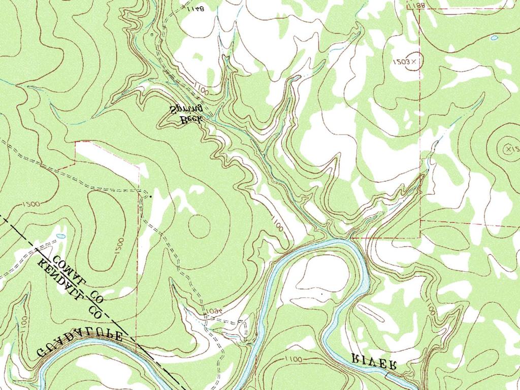
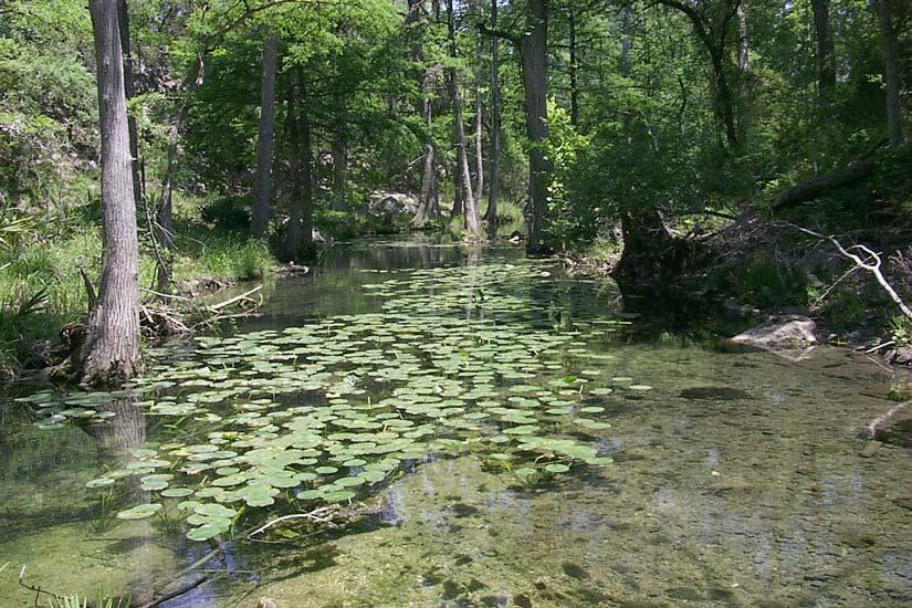
6 Honey Creek Located in western Comal County Part of the Upper Guadalupe watershed (HUC ) and is in the contributing region of the Edwards Aquifer Drains approximately 6000 acres Remains active throughout the year due to the activity of several springs Site of an in-progress brush control study utilizing two upstream branches of the creek
7 Data Surface Elevation 30-meter Resolution DEMs for Anhalt and Bergheim Quads Provided by TNRIS Hydrography RF3 Reach Files for Upper Guadalupe Basin Provided by EPA Soil Distribution SSURGO 2.0 Data for Comal and Hays Counties Provided by USDA-NRCS Land Cover Landsat ETM+ Image: 20 October 1999 (LE ) Provided by TNRIS Weather Data Rainfall, Temperature, Solar Radiation, PET, and Windspeed Provided by Texas ET Network, San Antonio Station (1/96 10/98)


8 DEM and Reach Data 30-m DEMs of the Anhalt and Bergheim quads were mosaiced to produce an elevation grid which covered the entire Honey Creek area


9 SSURGO Data SSURGO provides a high-resolution alternative to STATSGO soil data SWAT is built to read data found in STATSGO datasets Data for Comal County is provided in the new SSURGO 2 format A User Soils table obtained from the Texas A&M Spatial Sciences Lab aided in the integration of this data


10 Landsat Data Band 1: Visible Blue Band 2: Visible Green Band 3: Visible Red Band 4: Near Infrared Land Cover Classifications Band 5: Middle Infrared Band 6: Thermal Infrared Band 7: Middle Infrared Band 8: Panchromatic Classification Scheme Using ENVI

11 Landsat Data Original DOQQ Unclassified 0.69% FRSE 43.06% RNGB 31.83% RNGE 24.42% 1-m DOQQ courtesy of TNRIS Parallel Piped Mahalanobis Distance Maximum Likelihood Minimum Distance


12 Climate Data SWAT allows for the input of historical rainfall, temperature, solar radiation, and windspeed data, as well as the ability to name a user defined weather generator. Climate data is entered in two separate dbf tables Potential ET can also be read into the simulation.

13 Pre-Analysis with BASINS Delineate the Honey Creek basin using the DEM and RF3 datasets Assign spatial data pertaining to land cover and soil distribution
14 Control Simulation
15 Experimental Simulations Experiment 1: Replace RNGB land cover with RNGE to demonstrate complete removal. Experiment 2: Replace RNGB land cover with RNGE to demonstrate complete removal AND replace FRSE with RNGB to demonstrate partial clearing of dense areas.
16 Water Yield Total Water Yield Results Without October 1998 Data Yield (Acre-Feet) Control Run Experimental Run 1 Experimental Run October-95 May-96 December-96 June-97 January-98 July-98 February-99 Month
17 Jan-96 Feb-96 Mar-96 Apr-96 May-96 Jun-96 Jul-96 Aug-96 Sep-96 Oct-96 Nov-96 Dec-96 Jan-97 Feb-97 Mar-97 Apr-97 May-97 Jun-97 Jul-97 Aug-97 Sep-97 Oct-97 Nov-97 Dec-97 Jan-98 Feb-98 Mar-98 Apr-98 May-98 Jun-98 Jul-98 Aug-98 Sep-98 Oct-98 Change In Water Yield Change In Simulated Water Yield Month Yield (Acre-Feet) Experimental Run 1 Experimental Run 2
18 Groundwater Recharge 800 Aquifer Recharge Results Without October 1998 Data Percolation (Acre-Feet) Control Run Experimental Run 1 Experimental Run October-95 May-96 December-96 June-97 January-98 July-98 February-99 Month
19 Change In Recharge Jan-96 Feb-96 Mar-96 Apr-96 May-96 Jun-96 Jul-96 Aug-96 Sep-96 Oct-96 Nov-96 Dec-96 Jan-97 Feb-97 Mar-97 Apr-97 May-97 Jun-97 Jul-97 Aug-97 Sep-97 Oct-97 Nov-97 Dec-97 Jan-98 Feb-98 Mar-98 Apr-98 May-98 Jun-98 Jul-98 Aug-98 Sep-98 Oct-98 Change In Simulated Groundwater Recharge Month Percolation (Acre-Feet) Experimental Run 1 Experimental Run 2
20 ET Evaoration-Transpiration ET (Inches of Water) Control Run Experimental Run 1 Experimental Run October-95 May-96 December-96 June-97 January-98 July-98 February-99 Month
21 Change in ET Change in Simulated Evaporation-Transpiration Jan-96 Feb-96 Mar-96 Apr-96 May-96 Jun-96 Jul-96 Aug-96 Sep-96 Oct-96 Nov-96 Dec-96 Jan-97 Feb-97 Mar-97 Apr-97 May-97 Jun-97 Month Jul-97 Aug-97 Sep-97 Oct-97 Nov-97 Dec-97 Jan-98 Feb-98 Mar-98 Apr-98 May-98 Jun-98 Jul-98 Aug-98 Sep-98 Oct-98 ET (Inches of Water) Experimental Run 1 Experimental Run 2


22 Future Goal: Calibration Increased Enhancement integration of the of model satellite of with available land gauging cover data data techniques now being recorded Creation of a GIS system for targeting brush removal
23
San Antonio Water System Mitchell Lake Constructed Wetlands Below the Dam Preliminary Hydrologic Analysis
 San Antonio Water System enhancement. This recommendation was based on limited water quality data provided by SAWS and using a free-water surface constructed wetland with approximately 112 acres of wetted
Lecture 9A: Drainage Basins
 GEOG415 Lecture 9A: Drainage Basins 9-1 Drainage basin (watershed, catchment) -Drains surfacewater to a common outlet Drainage divide - how is it defined? Scale effects? - Represents a hydrologic cycle
SWAT modeling of Arroyo Colorado watershed
 SWAT modeling of Arroyo Colorado watershed Narayanan Kannan Texas AgriLife Research (Texas A&M University System) Temple Need for the project Arroyo Colorado failed to meet Texas water quality standards
Ottawa County Water Resources Study Phase 2
 Ottawa County Water Resources Study Phase 2 Overview David P. Lusch, Ph.D. Department of Geography and Institute of Water Research Michigan State University 1 / 24 Ottawa County Planning and Performance
USDA-NRCS, Portland, Oregon
 Hydrologic Simulation Modeling for Streamflow Forecasting and Evaluation of Land and Water Management Practices in the Sprague River, Upper Klamath Basin, Oregon, USA David Garen John Risley Jolyne Lea
..Title Receive Report on Salinas Valley Water Conditions for the Third Quarter of Water Year
 ..Title Receive Report on Salinas Valley Water Conditions for the Third Quarter of Water Year 2016-2017..Report RECOMMENDATION: It is recommended that the Monterey County Water Resources Agency Board of
Application of a Basin Scale Hydrological Model for Characterizing flow and Drought Trend
 Application of a Basin Scale Hydrological Model for Characterizing flow and Drought Trend 20 July 2012 International SWAT conference, Delhi INDIA TIPAPORN HOMDEE 1 Ph.D candidate Prof. KOBKIAT PONGPUT
Modeling the Middle and Lower Cape Fear River using the Soil and Water Assessment Tool Sam Sarkar Civil Engineer
 Modeling the Middle and Lower Cape Fear River using the Soil and Water Assessment Tool Sam Sarkar Civil Engineer Outline Problem statement and project objectives Watershed model development Model calibration
Exploring the Possibilities At Prado Dam
 Exploring the Possibilities At Prado Dam Greg Woodside, P.G., C.HG. Executive Director of Planning & Natural Resources December 5, 2017 The Orange County groundwater basin lies at the base of the Santa
Irrigation modeling in Prairie Ronde Township, Kalamazoo County. SW Michigan Water Resources Council meeting May 15, 2012
 Irrigation modeling in Prairie Ronde Township, Kalamazoo County SW Michigan Water Resources Council meeting May 15, 2012 Development of a Groundwater Flow Model INFLOWS Areal recharge from precipitation
Modeling the production of multiple ecosystems services from agricultural and forest landscape in Rhode Island
 Modeling the production of multiple ecosystems services from agricultural and forest landscape in Rhode Island Tingting Liu a, Nathaniel H. Merrill a, Arthur J. Gold b, Dorothy Q. Kellogg b and Emi Uchida
M.L. Kavvas, Z. Q. Chen, M. Anderson, L. Liang, N. Ohara Hydrologic Research Laboratory, Civil and Environmental Engineering, UC Davis
 Assessment of the Restoration Activities on Water Balance and Water Quality at Last Chance Creek Watershed Using Watershed Environmental Hydrology (WEHY) Model M.L. Kavvas, Z. Q. Chen, M. Anderson, L.
Assessment of impacts of climate change on runoff: River Nzoia catchment, Kenya. Githui F. W, Bauwens W. and Mutua F.
 Assessment of impacts of climate change on runoff: River Nzoia catchment, Kenya by Githui F. W, Bauwens W. and Mutua F. Objective To investigate the impact of climate change on runoff of Nzoia river catchment
Analyzing water resources in a monsoon-driven environment an example from the Indian Western Ghats
 Analyzing water resources in a monsoon-driven environment an example from the Indian Western Ghats 1, Shamita Kumar 2, Peter Fiener 1 and Karl Schneider 1 1,,, Germany 2 Institute of Environment Education
Inside of forest (for example) Research Flow
 Research Flow") Study on Relationship between Watershed Hydrology and Lake Water Environment by the Soil and Water Assessment Tool (SWAT) Shimane University Hiroaki SOMURA Watershed degradation + Global warming Background
Study on Relationship between Watershed Hydrology and Lake Water Environment by the Soil and Water Assessment Tool (SWAT) Shimane University Hiroaki SOMURA Watershed degradation + Global warming Background
Journal of Spatial Hydrology Vol.6, No.1 Spring 2006
 Journal of Spatial Hydrology Vol.6, No.1 Spring 2006 Hydrology and Water Balance of Devils Lake Basin: Part 1 Hydrometeorological Analysis and Lake Surface Area Mapping* Assefa M. Melesse 1, Vijay Nangia
R. Srinivasan, J.H. Jacobs, J.W. Stuth, J. Angerer, R. Kaithio and N. Clarke
 Impacts of reforestation policy and agro-forestry technology on the environment and food security in the Upper Tana river basin of Kenya R. Srinivasan, J.H. Jacobs, J.W. Stuth, J. Angerer, R. Kaithio and
Surface Soil Moisture Assimilation with SWAT
 Surface Soil Moisture Assimilation with SWAT Eunjin Han, Venatesh Merwade School of Civil Engineering, Purdue University, West Lafayette, IN, USA Gary C. Heathman USDA-ARS, National Soil Erosion Research
MODELING PHOSPHORUS LOADING TO THE CANNONSVILLE RESERVOIR USING SWAT
 MODELING PHOSPHORUS LOADING TO THE CANNONSVILLE RESERVOIR USING SWAT Bryan Tolson 1 & Christine Shoemaker 2 1. PhD Student, 2. Professor School of Civil & Environmental Engineering Cornell University PWT
M.L. Kavvas, Z. Q. Chen, M. Anderson, L. Liang, N. Ohara Hydrologic Research Laboratory, Civil and Environmental Engineering, UC Davis
 Assessment of the Restoration Activities on Water Balance and Water Quality at Last Chance Creek Watershed Using Watershed Environmental Hydrology (WEHY) Model M.L. Kavvas, Z. Q. Chen, M. Anderson, L.
Hydrological And Water Quality Modeling For Alternative Scenarios In A Semi-arid Catchment
 Hydrological And Water Quality Modeling For Alternative Scenarios In A Semi-arid Catchment AZIZ ABOUABDILLAH, ANTONIO LO PORTO METIER Final Conference: Brussels, Belgium-4-6 November 2009 Outline Problem
City of San Clemente Water Usage Report
 Monthly Usage (AF) ACRE FEET City of San Clemente Overview of Usage FY 217-18 Monthly Water Use Type of Supply Total MWDOC 723 722 657 629 - - - - - - - - 2,731 Local Groundwater 33 23 69 84 - - - - -
Hamid R. Solaymani. A.K.Gosain
 Motivation An integrated management plan is required to prevent the negative impacts of climate change on social- economic and environment aspects Each of these segments is expected to be strongly impacted
AN INTEGRATED FRAMEWORK FOR EFFECTIVE ADAPTATION TO CLIMATE CHANGE IMPACTS ON WATER RESOURCES
 AN INTEGRATED FRAMEWORK FOR EFFECTIVE ADAPTATION TO CLIMATE CHANGE IMPACTS ON WATER RESOURCES A. K. Gosain, Professor & Head Civil Engineering Department Indian Institute of Technology Delhi: gosain@civil.iitd.ac.in
Determining a Method for Targeting Brush Control Through Remote Sensing, GIS, and Hydrologic Modeling
 Determining a Method for Targeting Brush Control Through Remote Sensing, GIS, and Hydrologic Modeling Project Duration: March 2003 to February 2004. Graduate Student Researcher: Jason D. Afinowicz, Graduate
Calibrating the Soquel-Aptos PRMS Model to Streamflow Data Using PEST
 Calibrating the Soquel-Aptos PRMS Model to Streamflow Data Using PEST Cameron Tana Georgina King HydroMetrics Water Resources Inc. California Water Environmental and Modeling Forum 2015 Annual Meeting
Comparative analysis of SWAT model with Coupled SWAT-MODFLOW model for Gibbs Farm Watershed in Georgia
 2018 SWAT INTERNATIONAL CONFERENCE, JAN 10-12, CHENNAI 1 Comparative analysis of SWAT model with Coupled SWAT-MODFLOW model for Gibbs Farm Watershed in Georgia Presented By K.Sangeetha B.Narasimhan D.D.Bosch
I/I Analysis & Water Balance Modelling. Presented by Paul Edwards
 I/I Analysis & Water Balance Modelling Presented by Paul Edwards Contents Background Wet Weather Model Calibration Inflow / Infiltration Assessment Flow Containment Options Water Balance Model 20 Year
Linking Water Quality and Migratory Fish Passage to Economic Contributions of Fisheries and Water Use
 Insert Your Image Here Linking Water Quality and Migratory Fish Passage to Economic Contributions of Fisheries and Water Use Project/Grant Objective 1. Delineate impacts to drinking water quality from
Impact of Climate Change on Water Resources of a Semi-arid Basin- Jordan
 Impact of Climate Change on Water Resources of a Semi-arid Basin- Jordan Prof. Fayez Abdulla Civil Engineering Department Jordan University of Science & Technology Presented at the Water in an Arid Land,
IMPACT OF LAND USE/COVER CHANGES ON STREAMFLOW:
 IMPACT OF LAND USE/COVER CHANGES ON STREAMFLOW: THE CASE OF HARE RIVER WATERSHED, ETHIOPIA Kassa Tadele and Gerd Foerch University of Siegen July 06, 2007 Presentation outline 1. Introduction Study area
George Paul, P. V. Vara Prasad, Scott A. Staggenborg, and Prasanna H.Gowda Kansas State University; and CPRL USDA ARS, Bushland, Texas
 Assessing Impact of Climate Change and Variability and on Crop Production in Ogallala Region Using Regional Climate Data George Paul, P. V. Vara Prasad, Scott A. Staggenborg, and Prasanna H.Gowda Kansas
Effect of climate change on low-flow conditions in Ruscom River watershed, Ontario
 Effect of climate change on low-flow conditions in Ruscom River watershed, Ontario by Tirupati Bolisetti Co-Authors: M. Rahman and R. Balachandar August 5, 2009 Introduction Climate change refers to the
Using SWAT to understand the eco-hydrological response to droughts of a dry Mediterranean agro-forested catchment, southern Portugal
 GOVERNMENT OF THE PORTUGUESE REPUBLIC 213 International SWAT Conference & Workshops - Toulouse, France July 15-19, 213, Toulouse Using SWAT to understand the eco-hydrological response to droughts of a
Estimation of transported pollutant load in Ardila catchment using the SWAT model
 June 15-17 Estimation of transported pollutant load in Ardila catchment using the SWAT model 1 Engineering Department Polytechnic Institute of Beja 2 Section of Environmental and Energy Technical University
Applying the SWAT model to a Managed Irrigated Watershed in a Semi-Arid Region: Model Construction
 Applying the SWAT model to a Managed Irrigated Watershed in a Semi-Arid Region: Model Construction Xiaolu Wei Ryan T. Bailey Ali Tasdighi Mazdak Arabi Irrigated System N and P Transport Irrigation Water
SAN BERNARD RIVER WATER QUALITY MODEL UPDATE. August 18, 2011
 SAN BERNARD RIVER WATER QUALITY MODEL UPDATE August 18, 2011 Agenda Model Set-up Watershed model Watershed delineations Generate model input files & establish coefficients Receiving Water model Establish
The Impacts of Climate Change on Portland s Water Supply
 The Impacts of Climate Change on Portland s Water Supply Richard Palmer and Margaret Hahn University of Washington Department of Civil and Environmental Engineering Joe Dvorak, Dennis Kessler, Azad Mohammadi
Hydrologic Modeling of White Rock Creek Watershed with SWAT- SWMM
 Hydrologic Modeling of White Rock Creek Watershed with SWAT- SWMM Nam Won Kim, Yoo Seung Won, Jeongwoo Lee *, Jeong Eun Lee, Jaehak Jeong 1 / 27 SWAT has been developed to evaluate impacts of various Land
PEACE RIVER MANASOTA REGIONAL WATER SUPPLY AUTHORITY BOARD OF DIRECTORS MEETING December 5, 2018 ROUTINE STATUS REPORTS ITEM 1
 PEACE RIVER MANASOTA REGIONAL WATER SUPPLY AUTHORITY BOARD OF DIRECTORS MEETING December 5, 218 ROUTINE STATUS REPORTS ITEM 1 Hydrologic Conditions Report MEMORANDUM Project: Hydrologic Conditions Report
CALSIM II Sacramento River Basin Hydrology Enhancements
 CALSIM II Sacramento River Basin Hydrology Enhancements Andy Draper Walter Bourez - Montgomery Watson Harza - MBK Engineers February 26, 2004 Current representation Problems Solutions Work completed Possible
Does Water Resources Management in the Snake River Basin Matter for the Lower Columbia River? Or Is the Snake River Part of Another Watershed?
 Does Water Resources Management in the Snake River Basin Matter for the Lower Columbia River? Or Is the Snake River Part of Another Watershed? John C. Tracy, Director Idaho Water Resources Research Institute
Gilleland Creek Intensive Bacteria Survey Addendum. March 18, 2010
 Gilleland Creek Intensive Bacteria Survey Addendum March 18, 21 Prepared by: Texas Stream Team Texas State University San Marcos PREPARED IN COOPERATION WITH THE TEXAS COMMISSION ON ENVIRONMENTAL QUALITY
Overview of the Surface Hydrology of Hawai i Watersheds. Ali Fares Associate Professor of Hydrology NREM-CTAHR
 Overview of the Surface Hydrology of Hawai i Watersheds Ali Fares Associate Professor of Hydrology NREM-CTAHR 5/23/2008 Watershed Hydrology Lab 1 What is Hydrology? Hydrology is the water science that
Illinois in Drought. June 19, 2012, Updated June 21, 2012
 June 19,, Updated June 21, Illinois in Drought The ISWS now considers central and southern Illinois to be fully in drought based on several impacts including the early season onset of reservoir drawdown
Water Planning and Stewardship Committee Item 6a February 8, 2016
 Water Planning and Stewardship Committee Item 6a February 8, 2016 Hydrologic Conditions State Water Project Allocation 2016 Water Supply Demand Balances Statewide Conservation Regulations WSDM Tracking
Assessment of Agricultural Flood Damages Along the James River in South Dakota
 Assessment of Agricultural Flood Damages Along the James River in South Dakota Ron S. Beyer Hydraulic Engineer Omaha District US Army Corps of Engineers 2007 Eastern South Dakota Water Conference October
Watershed Management Area Recommendations for NJ Water Policy
 Watershed Management Area Recommendations for NJ Water Policy Presenters: William Kibler, Director of Policy, Raritan Headwaters Association Bob Kecskes, Freelance Environmental Consultant, retired NJDEP
Water Development Office
 THE STATE OF WYOMING Water Development Office 6920 YELLOWTAIL ROAD TELEPHONE: (307) 777-7626 CHEYENNE, WY 82002 FAX: (307) 777-6819 TECHNICAL MEMORANDUM TO: Water Development Commission DATE: November
Rainwater Harvesting
 Rainwater Harvesting A strategy for water conservation, stormwater management and sustainable development in the City of Tucson Ann Audrey, Environmental Projects Coordinator Tucson Office of Conservation
Re-conceptualizing SWAT for Variable Source Area Hydrology
 Re-conceptualizing SWAT for Variable Source Area Hydrology Zachary Easton *, Daniel Fuka, Eric White, Todd Walter, Tammo Steenhuis Dept. Biological and Environmental Engineering, Cornell University, Elliot
Proposed Project. Integrated Water Resources Management Using Remote Sensing Data in Upper Indus Basin
 Proposed Project Integrated Water Resources Management Using Remote Sensing Data in Upper Indus Basin Background Snowmelt contributes more than 6% of water resources of Upper Indus Basin Most of the moisture
Cover slide option 1 Title
 Hydrological Modeling of Koshi basin and Climate Cover slide option 1 Title Change analysis (Nepal) Ambika Khadka (Dr. Luna Bharati, Utsav Bhattarai, Pabitra Gurung) International Water Management Institute,
Initial Assessment of Climate Change in the Chesapeake Bay Watershed
 Initial Assessment of Climate Change in the Chesapeake Bay Watershed STAC Workshop on Adapting to Climate Change In the Chesapeake Bay March 15, 2011 Lewis Linker 1, Thomas Johnson 2, and Gary Shenk 1
Evaluating Vegetation Evapotranspiration (VegET) Modeling Results in South Dakota
 Modeling Results in South Dakota") Evaluating Vegetation Evapotranspiration (VegET) Modeling Results in South Dakota Gabriel Senay 1 and Geoffrey Henebry 2 1 SAIC, contractor to the U.S. Geological Survey (USGS) Center for Earth Resources
Evaluating Vegetation Evapotranspiration (VegET) Modeling Results in South Dakota Gabriel Senay 1 and Geoffrey Henebry 2 1 SAIC, contractor to the U.S. Geological Survey (USGS) Center for Earth Resources
soil losses in a small rainfed catchment with Mediterranean
 Using SWAT to predict climate change effects on runoff and soil losses in a small rainfed catchment with Mediterranean climate of NE Spain Ramos MC, Martínez-Casasnovas JA Department of Environment and
Bolton Town Hall February 24, George Knoecklein Northeast Aquatic Research Mansfield, CT
 Bolton Town Hall February 24, 214 George Knoecklein Northeast Aquatic Research Mansfield, CT Working Hypothesis 1. Deep drawdowns of Middle Bolton Lake fueled high growth rates of naiad in Lower Bolton
Hydrologic Modeling with the Distributed-Hydrology- Soils- Vegetation Model (DHSVM)
") Hydrologic Modeling with the Distributed-Hydrology- Soils- Vegetation Model (DHSVM) DHSVM was developed by researchers at the University of Washington and the Pacific Northwest National Lab 200 Simulated
Hydrologic Modeling with the Distributed-Hydrology- Soils- Vegetation Model (DHSVM) DHSVM was developed by researchers at the University of Washington and the Pacific Northwest National Lab 200 Simulated
Chapter 3 Previous Studies
 Chapter 3 Previous Studies The Vista Grande stormwater conveyance system and watershed area has been evaluated in a number of reports and studies for the CCSF, the Daly City and San Mateo County over the
Song Lake Water Budget
 Song Lake Water Budget Song Lake is located in northern Cortland County. It is a relatively small lake, with a surface area of about 115 acres, and an average depth of about 14 feet. Its maximum depth
Hydrologic and Water Quality Monitoring on Turkey Creek Watershed, Francis Marion National Forest, SC
 Hydrologic and Water Quality Monitoring on Turkey Creek Watershed, Francis Marion National Forest, SC D.M. Amatya, T.J. Callahan, A. Radecki-Pawlik, P. Drews, and W.F. Hansen A South Carolina Water Resources
Minnesota River Basin Turbidity TMDL
 Minnesota River Basin Turbidity TMDL Hydrological Simulation Program/FORTRAN Modeling Results: Scenario 4 Chuck Regan Barr Engineering Scenario 4: Key Elements Perennial Vegetation Increase in the Chippewa
CAEP Study Site: Cannonsville Reservoir Watershed
 Tammo Steenhuis, Zach Easton, Eric White, C. Shoemaker Joshua Woodbury and many others of the Soil and Water Laboratory, Farming Community and the Watershed Agriculture Program in Walton This project is
The Impact of Climate Change on a Humid, Equatorial Catchment in Uganda.
 The Impact of Climate Change on a Humid, Equatorial Catchment in Uganda. Lucinda Mileham, Dr Richard Taylor, Dr Martin Todd Department of Geography University College London Changing Climate Africa has
United Water Conservation District November 2016 Hydrologic Conditions Report 2017 Water Year. December 6, 2016
 United Water Conservation District November 216 Hydrologic Conditions Report 217 Water Year December 6, 216 Page Intentionally Left Blank PRECIPITATION (INCHES) PRECIPITATION (INCHES) PRECIPITATION (INCHES)
Impacts of Permit-Exempt Wells
 Impacts of Permit-Exempt Wells Dave Nazy, LHG August 24, 2018 1 Impacts of Permit-Exempt Wells Introduction ESSB 6091 Example Impacts Calculation Basin Estimate & 20-year Projections Offsetting Impacts
How will climate change affect future potato production and water use in South Africa?
 How will climate change affect future potato production and water use in South Africa? Martin Steyn 1, Anton Haverkort 1,2, Linus Franke 2 and Francois Engelbrecht 3 1 University of Pretoria; 2 Wageningen
Contribution of Irrigation Seepage to Groundwater-Surface Water Interactions on the Eastern Snake River Plain
 Contribution of Irrigation Seepage to Groundwater-Surface Water Interactions on the Eastern Snake River Plain Rob Van Kirk, HSU Department of Mathematics http://www.humboldt.edu/henrysfork/ BSU Geosciences
Source Water Protection Integrating with Existing Watershed and Water Management Frameworks
 Source Water Protection Integrating with Existing Watershed and Water Management Frameworks Steph Neufeld, M.Sc. Watershed Specialist 1 Overview There are multiple, competing land and water planning and
Nichole M. Embertson, Ph.D. Whatcom Conservation District. May 2, 2012 Abbotsford-Sumas Aquifer Groundwater Nitrate Science Forum Abbotsford, CN
 Nichole M. Embertson, Ph.D. Whatcom Conservation District May 2, 2012 Abbotsford-Sumas Aquifer Groundwater Nitrate Science Forum Abbotsford, CN Background ARM System Assessment Development Implementation
Water Supply Board Briefing. Water Operations Department March 22, 2016
 Water Supply Board Briefing Water Operations Department March 22, 2016 Water Supply Briefing California Water Supply District Water Supply Water Supply Projections Water Supply Schedule 2 California Water
Water Resources of the Virgin River Basin
 Water Resources of the Virgin River Basin Michael Johnson, Chief Hydrologist Virgin Valley Water District for Legislative Committee on Public Lands January 22, 2010 Las Vegas, Nevada Virgin River Drainage
Conservation Success & Challenges
 conservation Conservation Success & Challenges Karen Guz Director - Conservation Rates Advisory Committee Helping communities flourish Conservation Goals Reduce the need for water by looking at ALL of
Electric Forward Market Report
 Mar-01 Mar-02 Jun-02 Sep-02 Dec-02 Mar-03 Jun-03 Sep-03 Dec-03 Mar-04 Jun-04 Sep-04 Dec-04 Mar-05 May-05 Aug-05 Nov-05 Feb-06 Jun-06 Sep-06 Dec-06 Mar-07 Jun-07 Sep-07 Dec-07 Apr-08 Jun-08 Sep-08 Dec-08
10497 Town and Country Way, Suite 600 Houston, Texas fax
 TECHNICAL MEMORANDUM 1497 Town and Country Way, Suite 6 Houston, Texas 7724 713-6-68 fax 713-6-681 www.freese.com TO: Jace Houston David Parkhill, P.E. CC: Davies Mtundu FROM: Jason D. Afinowicz, P.E.
Surface Water Supplies
 Status Report: Salinas Valley Ground Water and SVWP UCCE Irrigation and Nutrient Management Meeting February 24, 2009 Presentation Salinas Valley Ground Water Where does ground water come from? Ground-water
by Keith Kennedy Manager of Environmental Programs North Central Texas Council of Governments
 by Keith Kennedy Manager of Environmental Programs North Central Texas Council of Governments What is NPDES? National Pollutant Discharge Elimination System USEPA outfall permitting program Storm water
University of Michigan Eco-Driving Index (EDI) Latest data: August 2017
 Latest data: August 2017") University of Michigan Eco-Driving Index () http://www.ecodrivingindex.org Latest data: August 2017 Developed and issued monthly by Michael Sivak and Brandon Schoettle Sustainable Worldwide Transportation
University of Michigan Eco-Driving Index () http://www.ecodrivingindex.org Latest data: August 2017 Developed and issued monthly by Michael Sivak and Brandon Schoettle Sustainable Worldwide Transportation
Prairie Hydrology. If weather variability increases, this could degrade the viability of many aspects of ecosystems, human activities and economy
 Prairie Hydrology John Pomeroy, Xing Fang, Robert Armstrong, Tom Brown, Kevin Shook Centre for Hydrology, University of Saskatchewan, Saskatoon, Canada Climate Change for the Prairies? Highly variable
Embedded Energy in Water Studies Study 1: Statewide and Regional Water-Energy Relationship
 Embedded Energy in Water Studies Study 1: Statewide and Regional Water-Energy Relationship Prepared by GEI Consultants/Navigant Consulting, Inc. Prepared for the California Public Utilities Commission
Salinity TMDL Development and Modeling in the Otter Creek Watershed. Erik Makus DEQ Hydrologist June 6, 2013
 Salinity TMDL Development and Modeling in the Otter Creek Watershed 1 Erik Makus DEQ Hydrologist June 6, 2013 Outline for Today: Otter Creek and the Tongue River Previous salinity modeling efforts Existing
Application of a spreadsheet model to groundwater use in the Mississippi Delta April 2016 David R. Johnson USACE-Vicksburg
 Application of a spreadsheet model to groundwater use in the Mississippi Delta April 2016 David R. Johnson USACE-Vicksburg Issues How much water is being used for irrigation today? How much will be needed
Soil and Water Lab Biological and Environmental Engineering Cornell University Ithaca, NY
 Watershed Modeling Cayuga Lake Modeling Project Meeting nyalt.org Soil and Water Lab Biological and Environmental Engineering Cornell University Ithaca, NY Why? In order to model the lake, we need to estimate
Adaption to climate change: New technologies for water management and impact assessment
 Adaption to climate change: New technologies for water management and impact assessment Wim Bastiaanssen Director WaterWatch (NL) Professor at Delft University of Technology (NL) Some selected problems
Hetch Hetchy Water and Power
 Hetch Hetchy Water and Power Who is Hetch Hetchy Water and Power (HHWP)? HHWP is a division of the San Francisco Public Utilities Commission (SFPUC) SFPUC a Department of the City and County of San Francisco
REGIONAL STORMWATER CAPTURE & USE FEASIBILITY STUDY TAC MEETING #1 - JULY 18, 2017
 REGIONAL STORMWATER CAPTURE & USE FEASIBILITY STUDY TAC MEETING #1 - JULY 18, 2017 Agenda 1. Welcome & Introductions Project Team Technical Advisory Committee (TAC) 2. Study Overview 3. TAC Charter 4.
Camp Far West Hydroelectric Project Relicensing
 Camp Far West Hydroelectric Project Relicensing Water Operations Model FERC Project No. 2997 July 16, 2018 Overview Project and South Sutter Water District overview Operations model Overview Model Updates
Assessing the hydrological impacts of agricultural changes upstream of the Tunisian World Heritage sea-connected Ichkeul Lake
 Complex Interfaces Under Change: Sea River Groundwater Lake 61 Proceedings of HP2/HP3, IAHS-IAPSO-IASPEI Assembly,Gothenburg, Sweden, July 2013 (IAHS Publ. 365, 2014). Assessing the hydrological impacts
Investigating the Impact of Climate Change on Flooding in the Sittaung River Basin, Myanmar
 Investigating the Impact of Climate Change on Flooding in the Sittaung River Basin, Myanmar Su Su Kyi * MEE1673 Supervisor: Assoc. Prof. Mohamed Rasmy** Prof. Toshihiro Koike** Dr. Duminda Perera** ABSTRACT
4/3/2017. Water Accounting and Auditing for Irrigation and Drainage Systems. Changes in irrigation and drainage sector
 Water Accounting and Auditing for Irrigation and Drainage Systems Wim Bastiaanssen With inputs from Gonzalo Espinoza Jonna van Opstal Tim Hessels Changes in irrigation and drainage sector We are facing
Section 5 - Inflow and Infiltration Analysis
 Section 5 - Inflow and Infiltration Analysis 5.1 Introduction The section presents a comprehensive review of the historical flow metering data collected for the sewer collection system in the Towns of
Use of a distributed catchment model to assess hydrologic modifications in the Upper Ganges Basin
 River Basin Management VI 177 Use of a distributed catchment model to assess hydrologic modifications in the Upper Ganges Basin L. Bharati 1, V. Smakhtin 2, P. Jayakody 2, N. Kaushal 3 & P. Gurung 1 1
Comprehensive Watershed Modeling for 12- digit HUC Priority Watersheds Phase II
 Comprehensive Watershed Modeling for 12- digit HUC Priority Watersheds Phase II PRESENTED BY: NARESH PAI PI: Dharmendra Saraswat Collaborator: Mike Daniels OBJECTIVE Project Objective Prioritize 12-digit
TMDL Data Requirements for Agricultural Watersheds
 This is not a peer-reviewed article. Pp. 408-415 in Total Maximum Daily Load (TMDL) Environmental Regulations: Proceedings of the March 11-13, 2002 Conference, (Fort Worth, Texas, USA) Publication Date
Improvement of the national water balance feasibility of water balances per river basin
 Improvement of the national water balance feasibility of water balances per river basin Report on Grant agreement No 50303.2010.001-2010.564 Cor Graveland & Kees Baas By: Water Accounts / Water Statistics
Analysis of Vermillion River Stream Flow Data (Dakota and Scott Counties, Minnesota)
") ST. ANTHONY FALLS LABORATORY Engineering, Environmental and Geophysical Fluid Dynamics Project Report No. 54 Analysis of Vermillion River Stream Flow Data (Dakota and Scott Counties, Minnesota) by William
ST. ANTHONY FALLS LABORATORY Engineering, Environmental and Geophysical Fluid Dynamics Project Report No. 54 Analysis of Vermillion River Stream Flow Data (Dakota and Scott Counties, Minnesota) by William
Michael Cahn and Barry Farrara, UC Cooperative Extension, Monterey Tom Bottoms and Tim Hartz, UC Davis
 Water Use of Strawberries on the Central Coast Michael Cahn and Barry Farrara, UC Cooperative Extension, Monterey Tom Bottoms and Tim Hartz, UC Davis As acreage of strawberries has steadily increased in
Mission. Selected Accomplishments from Walnut Gulch. Facilities. To develop knowledge and technology to conserve water and soil in semi-arid lands
 USDA-ARS Southwest Watershed Research Center Mission Sound Science for Watershed Decisions To develop knowledge and technology to conserve water and soil in semi-arid lands ARS Watershed Locations Selected
Welcome to the MWON Advanced Webinar Series
 Welcome to the MWON Advanced Webinar Series Today s presentation: The Importance of Forests to Streams and Groundwater You will need to have speakers attached to your computer to hear the presenter. You
Climate Change & Urbanization Have Changed River Flows in Ontario
 Climate Change & Urbanization Have Changed River Flows in Ontario by Trevor Dickinson & Ramesh Rudra Water Resources Engineering University of Guelph Acknowledgements Agencies NSERC, OMAF & Environment