Understanding and Evaluating Erosion Problems
|
|
|
- Ami Watson
- 6 years ago
- Views:
Transcription
1 Understanding and Evaluating Erosion Problems Fast Current Slow Current Transport Sally Russell Cox Alaska Division of Community and Regional Affairs (DCRA) October 22, 2014

2 Helps Alaskan communities and property owners understand and evaluate erosion problems and alternative solutions. The more you understand about factors contributing to community erosion problems, the better able you will be to monitor, describe, seek assistance for, and make decisions about local erosion issues.

3 Understanding Erosion Erodible Materials Gravel Clay Silt Erodible Material Sand Erodibility Material moved for each unit of energy. Deposit
4 Understanding Erosion Sources of Energy Waves Currents Ice Heat Wind Precipitation Seepage Shore Line Fast Current Slow Current Ice Block Transport
5 Understanding Erosion Factors that can Increase or Accelerate Erosion Tides Storm Surge Flooding Normal water level Set-Down Storm water level wind Storm water level Set-Up Storm water level
6 Understanding Erosion Symptoms of Erosion Undercutting Waves Undercutting Exposed Permafrost Slides Slides High Water Table Seepage Rain Exposed horizontal or vertical ice lenses Blocks of soil broken away from bank or bluff


7 Understanding Erosion River and Shoreline Configurations Braided River Split Chanel River Flow Flow Pool Meandering River Pool Pool Flow Crossings Point Bars Pool Oxbow Lake Cutoff Meander Belt Width Pool


8 Principles and Means of Controlling Erosion Suppress or Diminish the Energy Source Beach Bulldozer replacing eroded material Small Waves Large Waves A thorough design and careful construction is required to build a lasting offshore breakwater. Breakwater


9 Principles and Means of Controlling Erosion Protect or Shield the Erodible Material Revetment
10 Principles and Means of Controlling Erosion Cause a New Beach to be Formed Groins Potential Increased Erosion Beach Deposition
11 Principles and Means of Controlling Erosion Minimize/Reduce Erosion-Causing Activities Erosion Wakes Decrease boat speeds Maintain shoreline vegetation Try to reduce shoreline traffic
12 Understanding and Defining Your Problem Energy Source Identification

13 Understanding and Defining Your Problem Assessment of Energy Sources


14 Seeking Assistance Technical Assistance

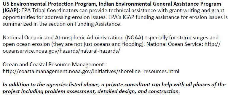
15 Seeking Assistance Funding Assistance


16 Seeking Assistance Funding Assistance


17 Seeking Assistance Funding Assistance

18 Appendices 1-3 Appendix 1. Example Problem

19 Appendices 1-3 Appendix 2. Information Sources

20 Appendices 1-3 Appendix 3. Helpful Publications
21 Glossary

22 Download from DCRA s Website


23 Alaska Climate Change Impact Mitigation Program Intended to address the needs of addressing the needs of communities imminently threatened by shoreline erosion and flooding, permafrost thaw and other climate-change related natural hazards.

24 Implemented through two funding sources Hazard Impact Assessments: Identify and document climate change-related hazards Analyze hazard trends and future impacts to community Recommend solutions to mitigate impacts of local natural hazards, taking into account financial considerations Community Adaptation Planning Grants: Based on recommendations of Hazard Impact Assessment Brings community to next stage in addressing hazards

25 Communities receiving Hazard Impact Assessment Grants

26 Kipnuk Hazard Impact Assessment Recommendations will provide basis for Community Planning Grant Shoreline protection to reduce rate of riverbank erosion, such as sheet piles, rip-rap, seawall, and river course modification Elevate structures above flood levels. Use of appropriate foundations such as pile or triodetic foundations to address permafrost degradation Adopt building code setting minimum floor height for new structures Install flood warning system including monitoring component to collect data for forecasting severity of storm surges Construct levee system to protect village from flooding Insulated pads to elevate the relative ground surface

27 Elim Hazard Impact Assessment Recommendations will provide basis for Community Planning Grant Wildfire fuel removal to reduce potential for wildfire Periodic monitoring of the cliff face Monitoring and documenting the rate of beach erosion Relocate the water source area or increase storage capacity Protection of wastewater disposal system Bridge replacement over Elim Creek to address icing and flooding Culvert evaluation throughout community Develop community land use plan and establish development standards Establish setback requirement preventing new development from being built too close to shoreline or known flooding areas. Move structures inland at Moses Point fish camp when a storm is approaching or sea level rises
28 Communities receiving Community Adaptation Planning Grants * Kipnuk just started a Community Adaption Planning Grant and Atmautluak will be starting one in the near future


29 Koyukuk Community Emergency Shelter Proposed to provide shelter for community during flood events Will serve as command post and safe house accessible to community Facilitates evacuations, provides temporary housing, and enables return of residents to their homes in safe manner

30 Shishmaref Community Relocation Site Selection Feasibility Study Community has hired consulting firm (URS Corporation) to: work with community to organize and review prior relocation studies reconfirm community values and technical considerations for site selection criteria evaluate remaining candidate sites and need for any new sites identify at least one relocation site with broad community support and reasonable constructability identify initial next steps for pioneer development.
31 Thank You! Sally Russell Cox Alaska Department of Commerce, Community and Economic Development Division of Community and Regional Affairs 550 West 7 th Avenue, Suite 1640 Anchorage, Alaska sally.cox@alaska.gov
Arctic Civil Infrastructure and Adaptation to Climate Change AASHTO Climate Change Symposium
 Arctic Civil Infrastructure and Adaptation to Climate Change AASHTO Climate Change Symposium Michael J. Coffey Statewide Maintenance and Operations Chief Alaska Department of Transportation and Public
Engineering considerations for coastal adaptation: Recent examples from Atlantic Canada
 Livable Cities Forum Halifax 12 Sep 2016 Climate change in Atlantic Canada: Issues and Responses Engineering considerations for coastal adaptation: Recent examples from Atlantic Canada Vincent Leys, Coastal
Maryland s Living Shorelines Program. Bhaskaran Subramanian February 27, 2015
 Maryland s Living Shorelines Program Bhaskaran Subramanian February 27, 2015 1 Erosion & traditional approaches Living shorelines- what is it? Maryland s Living Shorelines program LS Law Products Funding-
Lower San Joaquin River Feasibility Study PLAN FORMULATION ADDENDUM
 PLAN FORMULATION ADDENDUM Non-Structural Measure Descriptions Elevate Critical Infrastructure This measure would raise at-risk critical structures above the design inundation level. Elevation would be
2. Does not require, involve or include any additions to, or repair or modification of, the existing foundation.
 SECTION 3109 STRUCTURES SEAWARD OF A COASTAL CONSTRUCTION CONTROL LINE 3109.1 General. The provisions of this section shall apply to the design and construction of habitable structures, and substantial
Types of Disaster. Disaster NEC - DOH
 Types of Disaster NEC - DOH FETPAFI 1 Disaster An event that occur when significant number of people are exposed to hazards to which they are vulnerable, with resulting injury and loss of life often combined
Bethel Bank Stabilization
 Bethel Bank Stabilization Condition of Improvements 30 December 2014 Bethel Bank Stabilization, Alaska (CWIS No. 012314, 075440) Authorization Public Law 99-662, under Section 202, 17 November 1986, as
Hydrology and Flooding
 Hydrology and Flooding Background The 1996 flood Between February 4, 1996 and February 9, 1996 the Nehalem reporting station received 28.9 inches of rain. Approximately 14 inches fell in one 48 hour period.
Storm Surge Mitigation: Status and Questions. Scott A. Jones Director of Advocacy Galveston Bay Foundation
 Storm Surge Mitigation: Status and Questions Scott A. Jones Director of Advocacy Galveston Bay Foundation Galveston Bay Foundation Mission: To preserve, protect, and enhance the natural resources of Galveston
Alaska Climate Change Adaptation Planning Tool
 Alaska Climate Change Adaptation Planning Tool The future ain t what it used to be. Yogi Berra It s no joke. Alaska is changing before our eyes. Spring is coming earlier and freeze up later. Sea ice is
COASTAL PROTECTION, LANDSCAPING AND INFRASTRUCTURAL WORKS IN MAURITIUS CASE NOYALE SITE ENVIRONMENTAL IMPACT ASSESSMENT REPORT CONTENTS
 COASTAL PROTECTION, LANDSCAPING AND INFRASTRUCTURAL WORKS IN MAURITIUS CASE NOYALE SITE ENVIRONMENTAL IMPACT ASSESSMENT REPORT CONTENTS Chapter Description Page EXECUTIVE SUMMARY 1 INTRODUCTION 1-1 1.1
Atlantic Coast of New York East Rockaway Inlet to Rockaway Inlet and Jamaica Bay, NY
 Atlantic Coast of New York East Rockaway Inlet to Rockaway Inlet and Jamaica Bay, NY Draft Reformulation Public Information October 2016 US Army Corps of Engineers Presentation Outline Project Overview
Climate Change in the Northwest Territories. Heather Auld Adaptation and Impacts Research Section, Environment Canada
 Climate Change in the Northwest Territories Heather Auld Adaptation and Impacts Research Section, Environment Canada Climate Change means???? To Policy-Makers: Conventions, GHG reductions, regulations
Coastal Flood Protection /Resiliency
 Escambia RESTORE Act Advisory Committee Coastal Flood Protection /Resiliency July 15, 2013 Presented by: Rick Harter 1 What is Resiliency Definition of resilience (from Merriam-Webster) 1. the capability
7. NATURAL HAZARDS 7.1 SECTION INTRODUCTION
 7. NATURAL HAZARDS 7.1 SECTION INTRODUCTION 7.1.1 The Resource Management Act empowers Council to control any actual or potential effects of the use, development, or protection of land for the purpose
Project Alignment Appendix A
 Project Alignment Appendix A Fargo Moorhead Metropolitan Area Flood Risk Management Project EA Document This page is intentionally left blank Project Alignment Appendix A Table of Contents 1 BACKGROUND...
Using LIDAR to monitor beach changes: Goochs Beach, Kennebunk, Maine
 Maine Geologic Facts and Localities February, 2010 Using LIDAR to monitor beach changes: Goochs Beach, Kennebunk, Maine 43 o 20 51.31 N, 70 o 28 54.18 W Text by Peter Slovinsky, Department of Agriculture,
VIET NAM LOSSES CAUSED BY TYPICAL DISASTERS FROM 1978 TO 2005 TYPICAL DISASTERS IN VIET NAM ECONOMIC LOSS RECORDED FROM
 VIET NAM Việt Nam is located at the Southeast of Asia, with 333. km 2 of the total natural area and 32km of coastline. Population: 84 million (24 s statistics) Population density: 226 capitas/km2 Urban
HARBOR INFRASTRUCTURE INVENTORIES Presque Isle Harbor, Michigan
 HARBOR INFRASTRUCTURE INVENTORIES Presque Isle Harbor, Michigan Harbor Location: Presque Isle Harbor is located on the south shore of Lake Superior near Marquette, MI. Authority: River & Harbor Acts of
East St. Tammany Storm Surge Protection Project Request
 East St. Tammany Storm Surge Protection Project Request Submitted to Coastal Protection & Restoration Authority of Louisiana (CPRA) August 2015 Contact Information: Thomas Nolan Thompson The East St. Tammany
LOCATION AND DESIGN DIVISION
 VIRGINIA DEPARTMENT OF TRANSPORTATION LOCATION AND DESIGN DIVISION INSTRUCTIONAL AND INFORMATIONAL MEMORANDUM GENERAL SUBJECT: CULVERT DESIGN SPECIFIC SUBJECT: COUNTERSINKING AND LOW FLOW CONSIDERATIONS
Riverbank Stabilization Techniques Workshop Merrimack River, Haverhill, MA
 Riverbank Stabilization Techniques Workshop Merrimack River, Haverhill, MA Dwight R. Dunk, PWS Association of Massachusetts Wetland Scientists September 30, 2011 Introduction Project History Design Development
Flood Hazard Assessment Report Falls Gulch, Larimer County, Colorado January 16, 2013
 United States Department of Agriculture Natural Resources Conservation Service Denver Federal Center Building 56, Room 2604 P.O. Box 25426 Denver, CO 80225 720-544-2818-OFFICE alton.albin@co.usda.gov Flood
Flow Control No Channel Flow Dry Channels Erosion Control Low Channel Flows Shallow Water Sediment Control High Channel Flows [1] Deep Water [2]
![Flow Control No Channel Flow Dry Channels Erosion Control Low Channel Flows Shallow Water Sediment Control High Channel Flows [1] Deep Water [2]](/thumbs/78/76959611.jpg "Flow Control No Channel Flow Dry Channels Erosion Control Low Channel Flows Shallow Water Sediment Control High Channel Flows [1] Deep Water [2]") Geo Logs (coir logs) INSTREAM PRACTICES Flow Control No Channel Flow Dry Channels Erosion Control Low Channel Flows Shallow Water Sediment Control High Channel Flows [1] Deep Water [2] [1] Geo logs can
Geo Logs (coir logs) INSTREAM PRACTICES Flow Control No Channel Flow Dry Channels Erosion Control Low Channel Flows Shallow Water Sediment Control High Channel Flows [1] Deep Water [2] [1] Geo logs can
Holly Swartz and Jason Shirey
 Chapter 105 General Permits for Stream and Wetland Impacts DEP Ch. 105 CONTACTS FOR BERKS COUNTY: Holly Swartz and Jason Shirey What DEP Regulates Under Chapter 105 Waters of the Commonwealth, which includes
Overview of National and State erosion management reviews & reports
 Overview of National and State erosion management reviews & reports National Research Council: Managing Coastal Erosion 1990 Heinz Center: Evaluation of Erosion Hazards 2000 Maryland: Shore Erosion Task
Adapting to Rising Tides
 Adapting to Rising Tides A regional program that uses findings, processes, tools and relationships built by ART and its partners to lead and support efforts that increase the resilience of San Francisco
CONSERVATION & COASTAL MANAGEMENT
 CONSERVATION & COASTAL MANAGEMENT City of St. Augustine Comprehensive Plan EAR-Based Amendments Conservation and Coastal Management Element Conservation Goal Protect and conserve natural areas, environmentally
Marine Board Spring Meeting April 27, 2011 David M. Kennedy
 Marine Board Spring Meeting April 27, 2011 David M. Kennedy NOS Organization 2 NOAA Next Generation Strategic Plan National Ocean Policy and Coastal Goal NOAA s Coastal Goal Objectives Resilient coastal
WEST SHORE LAKE PONTCHARTRAIN HURRICANE AND STORM DAMAGE RISK REDUCTION STUDY INTEGRATED DRAFT FEASIBILITY REPORT AND ENVIRONMENTAL IMPACT STATEMENT
 WEST SHORE LAKE PONTCHARTRAIN HURRICANE AND STORM DAMAGE RISK REDUCTION STUDY INTEGRATED DRAFT FEASIBILITY REPORT AND ENVIRONMENTAL IMPACT STATEMENT PLAN FORMULATION APPENDIX E 1 Contents Introduction...
Created by Simpo PDF Creator Pro (unregistered version) Asst.Prof.Dr. Jaafar S. Maatooq
 Asst.Prof.Dr. Jaafar S. Maatooq") Lect.No.9 2 nd Semester Barrages, Regulators, Dams 1 of 15 In order to harness the water potential of a river optimally, it is necessary to construct two types of hydraulic structures, as shown in Figure
Lect.No.9 2 nd Semester Barrages, Regulators, Dams 1 of 15 In order to harness the water potential of a river optimally, it is necessary to construct two types of hydraulic structures, as shown in Figure
Innovative Solutions for Climate Change effects on Transport Networks
 Innovative Solutions for Climate Change effects on Transport Networks Civil Engineer International Relations Division Climate Change Consequences on Transport Networks (I) Shifts in tourism & agricultural
7 Mineral and Energy Resources
 7 Mineral and Energy Resources This chapter examines Humboldt County s mineral (including sand and gravel extraction) and energy (oil, gas, and geothermal) resources. Existing General Plan policies and
Adapting Road Infrastructure to Climate Extremes and Change
 Adapting Road Infrastructure to Climate Extremes and Change Experience from Small Pacific Island States September 2015 Pacific Island Countries (PICs) - - geographically dispersed, remote with small populations
T. Frank, J. Jensen, Ch. Mudersbach, B. Schubert, M. Wörner
 Research Institute for for Water and Environment University of of Siegen Protection of Nuclear Power Plants against Flooding Considerations for the Determination of a 10.000 Years Return Period Flood between
CHAPTER 7. San Dieguito River Flooding Adaptation
 CHAPTER 7 San Dieguito River Flooding Adaptation This chapter includes a range of adaptation measures to address vulnerabilities from flooding along the San Dieguito River, including the river valley,
Appendix D - Evaluation of Interim Solutions
 Appendix D - Evaluation of Interim Solutions D.1 Introduction The implementation of long-term improvements is projected to take 5 to 8 years. To reduce the number of years of flooding impacts, the partner
This assessment examines
 Managing to Protect Water Quality This assessment examines the special role shoreline property owners have in preventing contamination of their lake or stream. Use this publication as a supplement to the
Preface. MNR # Queen s Printer for Ontario, 2012 ISBN (PRINT) ISBN (PDF)
 ISBN (PDF)") Preface In 2008, the inter-agency Drainage Act & Section 28 Regulations Team (DART) was established by the Ministry of Natural Resources (MNR) and the Ministry of Agriculture, Food and Rural Affairs (OMAFRA)
Preface In 2008, the inter-agency Drainage Act & Section 28 Regulations Team (DART) was established by the Ministry of Natural Resources (MNR) and the Ministry of Agriculture, Food and Rural Affairs (OMAFRA)
TREASURE COAST REGIONAL PLANNING COUNCIL M E M O R A N D U M. To: Council Members AGENDA ITEM 3E
 TREASURE COAST REGIONAL PLANNING COUNCIL M E M O R A N D U M To: Council Members AGENDA ITEM 3E From: Date: Subject: Staff May 19, 2017 Council Meeting Local Government Comprehensive Plan Review Draft
3.1 Problem Statements, Goals, Objectives and Action Items
 3.0 Mitigation Plan Hazard mitigation planning is the coordination of actions taken to reduce injuries, deaths, property damage, economic losses, and degradation of natural resources due to natural or
Nancy L. Young, Forester USAID/USDA Natural Resources Conservation Service
 Forest Management Nancy L. Young, Forester USAID/USDA Natural Resources Conservation Service Material translated by: Mohammadullah Karimi, Training & Liaison Officer Afghan Conservation Corps Managing
Standards for Soil Erosion and Sediment Control in New Jersey May 2012 STANDARD FOR RIPRAP. Conditions Where Practice Applies
 STANDARD FOR RIPRAP Definition A layer of loose rock, aggregate, bagged concrete, gabions, or concrete revetment blocks placed over an erodible soil surface. Purpose The purpose of riprap is to protect
Chapter A-9 GEOTECHNICAL ANALYSIS NORTH KANSAS CITY - LOWER (HARLEM AREA)
") Kansas Citys, Missouri and Kansas Flood Damage Reduction Feasibility Study (Section 216 Review of Completed Civil Works Projects) Engineering Appendix to the Interim Feasibility Report Chapter A-9 GEOTECHNICAL
Kansas Citys, Missouri and Kansas Flood Damage Reduction Feasibility Study (Section 216 Review of Completed Civil Works Projects) Engineering Appendix to the Interim Feasibility Report Chapter A-9 GEOTECHNICAL
Unit E: Basic Principles of Soil Science. Lesson 7: Understanding Soil Erosion and Management Practices
 Unit E: Basic Principles of Soil Science Lesson 7: Understanding Soil Erosion and Management Practices 1 Important Terms Accelerated erosion Conservation tillage Cover crops Diversion ditches Geologic
DRAFT. Coastal Resilience Index: A Community Self-Assessment. A Guide to Examining How Prepared Your Community Is for a Disaster
 Florida Pilot Test Coastal Resilience Index: A Community Self-Assessment A Guide to Examining How Prepared Your Community Is for a Disaster Rod Emmer, Louisiana Sea Grant LaDon Swann, Melissa Schneider,
Ice Mass & Sea Level Change Unit 5: Southern California vignettes
 Ice Mass & Sea Level Change Unit 5: Southern California vignettes Becca Walker and Leigh Stearns Part 1: Background With current sea levels, California s coastline is already susceptible to flooding and
Critical Areas Ordinance
 Public Review Draft // Public Review Draft // Kitsap County Code Title Critical Areas Ordinance Underline / Strike out Version.00 Fish and Wildlife Habitat Conservation Areas 0 Public Review Draft // Chapter.00
TWIN PLATTE NATURAL RESOURCES DISTRICT
 TWIN PLATTE NATURAL RESOURCES DISTRICT Twin Platte NRD Multi-Jurisdictional Hazard Mitigation Plan Update Twin Platte NRD Multi-Jurisdictional Hazard Mitigation Plan Update 2016 1 INTRODUCTION This HMP
Long Island: Water Resources. Water Sayings. Water Issues. Water Quality Issues specific to LI Coastal Areas. Agriculture and Water Regulation
 Water Sayings Long Island: Water Resources Copyright 2011 AFG 1 All living things need water to survive after air. Water, water everywhere but not a drop to drink. The quality of water is just as important
E36. Natural hazards and flooding
 E36. Natural hazards and flooding E36.1. Background Auckland is affected by natural hazards including: those that occur frequently such as flooding, coastal erosion (including the effects of sea level
Cass County Soil Erosion & Sedimentation Control Program
 Cass County Soil Erosion & Sedimentation Control Program Both residents and visitors of Cass County enjoy the beauty of over 250 lakes and ponds, along with numerous streams, creeks, and wetlands that
IAFSM 2010 Annual Conference. City of Rockford Keith Creek Greenway Flood Mitigation Project
 IAFSM 2010 Annual Conference City of Rockford Keith Creek Greenway Flood Mitigation Project March 10, 2010 Introduction Problem Overview 1890 s Building of homes along Keith Creek 1920 s Home construction
Coal Combustion Facility Assessment Report. October 20, 2010
 Coal Combustion Facility Assessment Report October 20, 2010 Introduction Stantec Consulting Services Inc. North American Consulting Firm 10,000 Engineers, Geologists, Architects, Scientists and Technicians
THE COMMUNITY RESILIENCY INITIATIVE Planning for Adaptation: Adaptation Action Areas. Sean Reiss Division of Community Development
 THE COMMUNITY RESILIENCY INITIATIVE Planning for Adaptation: Adaptation Action Areas Sean Reiss Division of Community Development COMMUNITY RESILIENCY PROJECT GOALS Follow the lead of local governments
We re going to look at why earlier consideration is better.
 1 2 3 4 We re going to look at why earlier consideration is better. Another way to think of this is exploiting the comparison of analysis and goals to find synergies, but nobody wants to think like that.
E36. Natural hazards and flooding
 E36. Natural hazards and flooding E36.1. Background Auckland is affected by natural hazards including: those that occur frequently such as flooding, coastal erosion (including the effects of sea level
CHAPTER IV. RESOURCE PROTECTION STANDARDS
 CHAPTER IV. RESOURCE PROTECTION STANDARDS 4.00.00. OVERALL PURPOSE AND INTENT The purpose of this chapter is to protect, conserve and enhance Walton County's natural features. It is the intent of the County
Dredge and Fill Standards on the Highland Lakes
 www.lcra.org Dredge and Fill Standards on the Highland Lakes Lake Buchanan Inks Lake Lake LBJ Lake Marble Falls Lake Travis Introduction The Lower Colorado River Authority (LCRA) no longer requires that
15 Conservation of an Island Biodiversity Hotspot Th e g o v e r n m e n t o f Kapikua wants to expand biodiversity conservation efforts
 15 Conservation of an Island Biodiversity Hotspot Th e g o v e r n m e n t o f Kapikua wants to expand biodiversity conservation efforts on the island. The government has two goals: 1) to protect the overall
WATERSHED. Maitland Valley. Report Card 201
 Maitland Valley WATERSHED Report Card 201 The Maitland Valley Conservation Authority has prepared this report card as a summary on the state of our forests, wetlands, surface water, and ground water resources.
DRAFT GREATER MOOSES TOOTH TWO (GMT2) DEVELOPMENT PROJECT PERMITTEE RESPONSIBLE WETLANDS MITIGATION PLAN NATIONAL PETROLEUM RESERVE-ALASKA
 DEVELOPMENT PROJECT PERMITTEE RESPONSIBLE WETLANDS MITIGATION PLAN NATIONAL PETROLEUM RESERVE-ALASKA") DRAFT GREATER MOOSES TOOTH TWO (GMT2) DEVELOPMENT PROJECT PERMITTEE RESPONSIBLE WETLANDS MITIGATION PLAN NATIONAL PETROLEUM RESERVE-ALASKA Prepared for: ConocoPhillips Alaska, Inc. Anchorage, AK March
DRAFT GREATER MOOSES TOOTH TWO (GMT2) DEVELOPMENT PROJECT PERMITTEE RESPONSIBLE WETLANDS MITIGATION PLAN NATIONAL PETROLEUM RESERVE-ALASKA Prepared for: ConocoPhillips Alaska, Inc. Anchorage, AK March
Special Building Method for a Storm Tide Protection Construction on the Baltic Sea Coast
 Third Chinese-German Joint Symposium on Coastal and Ocean Engineering National Cheng Kung University, Tainan November 8-16, 2006 Special Building Method for a Storm Tide Protection Construction on the
Climate Change Adaptation Strategies for Infrastructure Managers
 Climate Change Adaptation Strategies for Infrastructure Managers Green Streets and Highways Conference November 17, 2010 Butch Wlaschin Office of Asset Management Federal Highway Administration U.S. Department
Annex O Irrigation Systems Modification Plan
 Annex O Irrigation Systems Modification Plan Table O1 Figure O1 Figure O2 Pump Station Data Typical Water Intake Pipeline Routing Map H:\WP\1346\Appendices\FEIS\D - Drawdown\CamRdy\App_D.doc Annex O: Irrigation
Sea-level Rise Science and Decision Making in an Uncertain Future. Rob Thieler U.S. Geological Survey Woods Hole, MA
 Sea-level Rise Science and Decision Making in an Uncertain Future Rob Thieler U.S. Geological Survey Woods Hole, MA Concepts Sea-level rise is one of the most certain impacts of climate change. There is
SECTION 4(f) EVALUATION ALASKA RAILROAD MOODY TUNNEL REMOVAL FEDERAL TRANSIT ADMINISTRATION U.S. Department of Transportation
 EVALUATION ALASKA RAILROAD MOODY TUNNEL REMOVAL FEDERAL TRANSIT ADMINISTRATION U.S. Department of Transportation") SECTION 4(f) EVALUATION ALASKA RAILROAD MOODY TUNNEL REMOVAL FEDERAL TRANSIT ADMINISTRATION U.S. Department of Transportation INTRODUCTION This has been prepared in compliance with the requirements of
SECTION 4(f) EVALUATION ALASKA RAILROAD MOODY TUNNEL REMOVAL FEDERAL TRANSIT ADMINISTRATION U.S. Department of Transportation INTRODUCTION This has been prepared in compliance with the requirements of
ICCG Think Tank Map: a worldwide observatory on climate think tanks Arctic, Energy Poverty and Health in the Second Volume of IPCC s AR 5
 ICCG Think Tank Map: a worldwide observatory on climate think tanks Arctic, Energy Poverty and Health in the Second Volume of IPCC s AR 5 Alice Favero, ICCG Arctic, Energy Poverty and Health Alice Favero
FLOOD PLAIN STANDARDS AND REQUIREMENTS. Adopted by City Council on September 16, 2014 Effective January 1, 2015
 City of Vancouver Land Use and Development Policies and Guidelines Planning and Development Services, 453 W. 12th Ave Vancouver, BC V5Y 1V4 tel 604.873.7000 fax 604.873.7060 planning@vancouver.ca FLOOD
Municipal Class Environmental Assessment for Pottersburg Creek Slope Stability Study South of Hamilton Road, Schedule B
 Municipal Class Environmental Assessment for Pottersburg Creek Slope Stability Study South of Hamilton Road, Schedule B February 13, 2013 Municipal Class EA Process We are here Purpose and Objective of
APPENDIX A HYDROLOGIC AND HYDRAULIC ANALYSIS
 APPENDIX A HYDROLOGIC AND HYDRAULIC ANALYSIS GENERAL The Hydrologic and Hydraulic information presented in this appendix is provided as a supplement to the Dallas Floodway Extension General Re-evaluation
20 Global Climate Change
 20 Global Climate Change Overview of Chapter 20 Introduction to Climate Change Causes of Global Climate Change Effects of Climate Change Melting Ice and Rising Sea Level Changes in Precipitation Patterns
Natural Hazards Mitigation Plan Kankakee County, Illinois Executive Summary
 1. Introduction Natural Hazards Mitigation Plan Kankakee County, Illinois Executive Summary Kankakee County s first Natural Hazards Mitigation Plan was adopted by the Kankakee County Board on October 11,
Fish Habitat Design, Operation and Reclamation Workbook and Worksheets for Placer Mining in the Yukon Territory
 Fish Habitat Design, Operation and Reclamation Workbook and Worksheets for Placer Mining in the Yukon Territory Version 1.3 November 2010 This document is available from: Yukon Placer Secretariat, 206B
GUIDANCE FOR INCORPORATING SEA LEVEL RISE INTO CAPITAL PLANNING IN SAN FRANCISCO: ASSESSING VULNERABILITY AND RISK TO SUPPORT ADAPTATION
 GUIDANCE FOR INCORPORATING SEA LEVEL RISE INTO CAPITAL PLANNING IN SAN FRANCISCO: ASSESSING VULNERABILITY AND RISK TO SUPPORT ADAPTATION Prepared by the City and County of San Francisco Sea Level Rise
U.S. Energy Sector Vulnerabilities to Climate Change and Extreme Weather
 U.S. Energy Sector Vulnerabilities to Climate Change and Extreme Weather NASEO 2013 Annual Meeting September 17, 2013 Jonathan Pershing, Ph.D. Deputy Assistant Secretary for Climate Change Policy and Technology,
CHAPTER 6 ADDITIONAL STANDARDS APPLYING TO SHORELAND AREAS AND PUBLIC WATERS
 CHAPTER 6 ADDITIONAL STANDARDS APPLYING TO SHORELAND AREAS AND PUBLIC WATERS Section 1 Intent. 49 Section 2 Floodplain Requirements 49 Section 3 Water-Oriented Accessory Structures 50 Section 4 Stairways,
LAKE MINNEWAWA ASSOCIATION
 LAKE MINNEWAWA ASSOCIATION HARVESTING OPERATIONS REPORT FOR 2016 Table Contents DNR Permit To Destroy Aquatic Vegetation........................... page 3 DNR Permit To Relocate Or Remove Bog............................
Regulatory Requirements for Site Approval Permit of Nuclear Power Plants
 Regulatory Requirements for Site Approval Permit of Nuclear Power Plants By Prof. Dr. Abdel-Hamid Nada Chairman of Radiation Control Division NRRA-EGYPT National Center for Nuclear Safety and Radiation
A State Policy Framework for Adaptation to Climate Change
 A State Policy Framework for Adaptation to Climate Change James Murley, Director Barry N. Heimlich Nick Bollman* Center for Urban and Environmental Solutions at Florida Atlantic University *In Memoriam
A Salt Marsh Advancement Zone Assessment of West Haven, Connecticut
 A Salt Marsh Advancement Zone Assessment of West Haven, Connecticut Front cover image: Open space and unprotected parcels critical to the conservation of marsh advancement corridors in West Haven; from
Impact of Sea Level Rise on Roadway Design. Paul Carroll, PE
 Impact of Sea Level Rise on Roadway Design Paul Carroll, PE September 14, 2016 State of Maryland Action Executive Order by Gov. O Malley established the Maryland Commission on Climate Change (MCCC) - 2007
U.S. Army Corps of Engineers Mobile District
 U.S. Army Corps of Engineers Mobile District General Permit for Living Shorelines in Alabama Sandy P. Gibson Regulatory Specialist, Coastal Alabama Regulatory Division, Mobile District US Army Corps of
Mitigation Measures for Natural Hazards
 Mitigation Measures for Natural Hazards Mitigation measures are actions that eliminate or reduce risks from future disaster events, including: Physical construction projects such as replacing a highly
SECTION EXCAVATION AND EMBANKMENT. B. Subbase Grading A samples for gradation analysis.
 PART 1 GENERAL 1.1 DESCRIPTION A. The WORK under this Section includes providing all labor, materials, tools and equipment necessary for excavation and embankment construction to the lines, grades and
Cat Island Chain Restoration, Green Bay
 Cat Island Chain Restoration, Green Bay Victoria Harris, UW Sea Grant January 27, 2005 Southern Green Bay historically provided diverse coastal wetland habitats for fish and wildlife Expansive emergent
Straw Bale Barrier. - Along the face and at grade breaks of exposed and erodible slopes to shorten slope length and spread runoff as sheet flow
 Straw Bale Barrier SE-9 Objectives EC Erosion Control SE Sediment Control TR Tracking Control WE Wind Erosion Control Non-Stormwater NS Management Control Waste Management and WM Materials Pollution Control
America s Climate Choices Adaptation A Challenge to the Transportation Industry
 America s Climate Choices Adaptation A Challenge to the Transportation Industry November 3, 2010 TRB Webinar H. G. Schwartz, Jr. 1 Major Factors Affecting Climate 2 MITIGATION Measures to reduce Greenhouse
Rob; Sincerely, Brian Causton, President FMLA. Jim Russell, Vice President FMLA [67 Highland Crescent, Cambridge, ON, N1S 1M1]
![Rob; Sincerely, Brian Causton, President FMLA. Jim Russell, Vice President FMLA [67 Highland Crescent, Cambridge, ON, N1S 1M1]](/thumbs/74/71148940.jpg "Rob; Sincerely, Brian Causton, President FMLA. Jim Russell, Vice President FMLA [67 Highland Crescent, Cambridge, ON, N1S 1M1]") Attention: Mr. Rob Griffiths, Manager of Planning Development Services - Planning Division City of Kawartha Lakes 180 Kent St. W., Lindsay, ON, K9V 2Y6 September 6, 2006 Rob; DEDICATED TO THE PROTECTION
Attention: Mr. Rob Griffiths, Manager of Planning Development Services - Planning Division City of Kawartha Lakes 180 Kent St. W., Lindsay, ON, K9V 2Y6 September 6, 2006 Rob; DEDICATED TO THE PROTECTION
Ch 18. Hydrologic Cycle and streams. Tom Bean
 Ch 18. Hydrologic Cycle and streams Tom Bean Wednesday s outline 1. the hydrologic cycle reservoirs cycling between them Evaporation and the atmosphere 2. Surface hydrology infiltration and soil moisture
Climate Change, Human Activities, and the State of New Jersey. Michael J. Kennish Institute of Marine and Coastal Sciences Rutgers University
 Climate Change, Human Activities, and the State of New Jersey Michael J. Kennish Institute of Marine and Coastal Sciences Rutgers University New Jersey Climate and Environmental Change Conclusions from
Lake Pepin TMDL Water Quality Objectives
 some preliminary thoughts on how Upper Mississippi River Environmental Pool Plan Restoration Features and Activities may relate to Lake Pepin TMDL Water Quality Objectives TMDL = WLA + LA + MOS + RC Scot
E671 vol. 5. Lesson 11. Environmental Impact of Small-Scale Infrastructure Projects. November L&-~~A>f. Technical Support Staff Basic Training
 Public Disclosure Authorized Public Disclosure Authorized Public Disclosure Authorized Public Disclosure Authorized -4L&-~~A>f Technical Support Staff Basic Training Training Documents (English Translations)
Standards for Soil Erosion and Sediment Control in New Jersey May 2012 STANDARD FOR GRASSED WATERWAYS. Definition. Purpose
 STANDARD FOR GRASSED WATERWAYS Definition A natural or constructed watercourse shaped or graded in earth materials and stabilized with suitable vegetation for the safe conveyance of runoff water. Purpose
Chapter 516 Shoreland Districts
 Chapter 516 Shoreland Districts 516.01 Statutory Authorization The State of Minnesota in Minnesota Statutes, Chapter 103F, has defined shoreland areas and described limitations on uses and locations of
Lyon Creek Cedar Way Stormwater Detention Dam Operation and Maintenance Manual
 Lyon Creek Cedar Way Stormwater Detention Dam Operation and Maintenance Manual Prepared by: Mike Shaw Stormwater Program Manager City of Mountlake Terrace January 2010 Section I General Information This
Kane County Natural Hazards Mitigation Committee
 Kane County Natural Hazards Mitigation Committee Annual Report For 2004 TO: Members of the Kane County Board FROM: Kane County Natural Hazards Mitigation Committee SUBJECT: Annual Report for 2004 Date: