Decision Support Systems Useful for Agricultural Decision Makers. Larry Brazil Riverside Technology, inc.
|
|
|
- Erica Brown
- 6 years ago
- Views:
Transcription
1 Decision Support Systems Useful for Agricultural Decision Makers Larry Brazil Riverside Technology, inc.
2 Introduction Throughout the World we face an increasing threat from drought and the social, economic, and environmental impacts that come with it. The combination of diminished water supplies and increasing demand for urban and other uses is gradually depleting surface and ground water reserves traditionally allocated for agriculture.


3 Making Decisions with Today s Environmental Data Global Information APPLICATIONS Climate Change Hydropower Natural Hazards Monitoring Satellite Development Land Use Energy Streamflow Forecasting Water Management Information Technology Agriculture Data Collection Data Management Data Analysis Dissemination APPLICATIONS Customer Decisions Water Use Conservation Planning Policies Operations Trading Production Development ----Systems Design and Integration----Program Management----- Management Raw Data CAPABILITIES ----Software Engineering----Training----Testing & Validation Contract Administration----Systems Engineering Science and Engineering----Modeling---Forecasting Geographic Information Systems----Remote Sensing Decision Support System Development Science Support---- CAPABILITIES Decision Support Systems Building Customer Solutions
4 Agricultural Decisions How to manage seasonal and multi-year farm production given uncertainty in the availability of water planting and harvest dates the application of pesticide and fertilizer the variability of markets communication technology
5 DSS Anyone? A DSS (Decision Support System) helps you make decisions by presenting information relevant to your critical questions in a configuration that s easy to understand Integrated data Consistent methodology Better, faster, more efficient Helps answer what if questions Increasingly relies on communications, Internet, and databases

6 DSS Framework
7 Specific Agricultural Problem Needs assessment What problem are we re trying to solve? In this case, issues related to Early Warning System for Agricultural Weather Management Forecasting availability of water supply Managing use of water for agriculture Providing useful information to agricultural producers

8 DSS Framework
9 Specific Agricultural Decisions A farmer s decisions range from tactical day-to-day decisions, to mid-term planning/crop selection decisions, to long-term strategic investment decisions that affect the farm for several years, such as the purchase of machinery or infrastructure improvements. Specific decisions to address Early Warning System for Agricultural Weather Management Pre-season: crop type selection, parcel-crop assignment, planting dates In-season: irrigation timing and amount, weed and pest control, fertilizer application End-of-season: harvest dates and methods, target markets Post harvest: crop residue removal methods, choice of tillage


10 DSS Framework
11 Specific Influences Availability and prices of inputs Markets for and prices of products Climate change Government policies and regulations (e.g., taxes) Donor organizations preferences Labor (political and other events that affect the availability of off-farm labor) Access to credit and availability of loans and grants

12 DSS Framework
13 Specific Decision Constraints Farmer goals and objectives, e.g., self food supply Farmer technical and management skills, e.g., level of expertise with specific crops and technologies Availability of information and knowledge (how to) sources, extension services, consultants, and training. Market access (e.g., distance, transportation, storage) Weather: level and distribution of precipitation, temperature, and humidity, events of hail, frost, wind, and flood Community organization, irrigation/ditch company


14 DSS Framework
15 Specific Agricultural Tools River basin modeling Irrigation simulation Consumptive use modeling ET estimation Crop modeling Hydrologic simulation Data analysis Risk assessment

16 DSS Framework
17 Specific Tool Constraints Licensing issues Data requirements Human capacity Internet access


18 DSS Framework
19 Specific Agricultural Data Historical observations of streamflow, soil moisture, meteorological conditions Satellite observations with appropriate resolution and spectral bands


20 DSS Framework
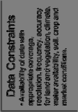
21 Specific Data Constraints Availability of data with appropriate coverage, resolution, frequency, and accuracy for land and vegetation, climate, water availability, soil, crop and market conditions.


22 Agricultural DSS Framework


23 Data Products Agro Climate Decision Support Project Diagram Decision Support System GMU, USDA & UFl Crop Modeling & DSS Tools for Data Management Decision Making Policy Making National Drought Policy User Community Satellite Remote Sensing Data Kenya & Other African Nations Integrated Agromet Data Products Soil & Crop Moisture. WAMI S SNU/NCAM IBIMET Extension & Training Farm Decisions Drought/Flood/Heat Weather, Climate & Farmers Seminars Drought/Flood/Heat Agricultural Extension Rain Gauge On Site Data

24 Experience with other DSSs

25 Nile River Basin - Water Resources Planning and Management Project Synopsis: The World Bank needed assistance in design and implementing a project that would help the Nile riparian countries develop and manage the waters of the Nile River in a rational and equitable manner. Project Preparation & Design Decision Support System (DSS) for River Basin Planning & Management Institutional Analysis & Design System Integration The Nile River
26 The Nile Basin Decision Support System Development Process and Key Features


27 Nile Basin Initiative Shared Vision for the Nile -To achieve sustainable socio-economic development through the equitable utilization of, and benefit from, the common Nile Basin water resources.-


28 The Nile Basin Longest River, 6700km Basin Area: 3.2 million sq.km, 10% of Africa Basin covers ten Basin countries: Burundi, DR Congo, Egypt, Eritrea, Ethiopia, Kenya, Rwanda, Sudan, Tanzania, Uganda Population of over 400 million; 190 mill. in the basin Rich natural and environmental assets Rich historical heritage 27


29 Eastern Nile Region
30 Why a Nile Basin Decision Support System? The Nile Riparians are in the process of developing/managing the shared water resources To support this process, need identified for accurate information and common analytical tools Accurate information and the shared tools provide a sound technical basis for joint decision making Such tools and information basis provide the means for tradeoff analysis and identification of mutually beneficial development/management interventions Due to the complexity of the Nile Basin and the issues to be addressed, a suite of modeling and analytical tools are required The suite of models/analytical tools, data/information and data management tools need to be provided in an integrated manner the Nile Basin DSS as a common analytical platform for the Nile Basin 29
31 The Nile Basin Decision Support System: Policy and Strategy Level Provide the Knowledgebase Serve as informed basis for policy and strategic analyses and dialogues A platform for communication to facilitate the joint identification of development strategies Rational support for decision making Planning and Management Level: to support Identification of cooperative projects that provide mutual benefits Evaluation of impacts/benefits of alternative plans Assessments of trade offs and investment sequencing Trend analysis and forecasts of the development of hot spots, Provide Baseline data and support for environmental management. 30
32 DSS Needs Assessment key questions What are the key thematic focus areas for the Nile Basin DSS? What are the decisions to be supported in these thematic areas? What outputs should the system produce to support these decisions? Who are the main users and clients? How do the users interact with the system What data are available to support the development and use of the DSS? What are existing systems that need to be taken into account? How to develop and deploy the system? How should future users be involved during development? 31
33 Key elements of the conceptual design Ease of use: interactive, easy to learn, intuitive understanding for infrequent users Flexibility: expandable as requirements evolve, technology changes and more data becomes available Modularity: multiple, alternative, complementary tools/models Openness, transparency: inspection (source code); backtracking, logs of interaction, modifications Advanced technology: client server architecture; single as well as corporate use Cost efficiency: long term commitment for maintenance and support 32
 Data explorer (TS) Toolset(TS) Data explorer")
34 Key functionalities of the DSS overview Query/filter tool Data view Metadata (TS) Data explorer (TS) Toolset(TS) Data explorer (TS) 33
 - Tradeoff analysis - Multi-Criteria analysis Alternative 2 Alternative 2 x x 21 x 21 x 22... 22... x x 2N 2N X X ij = ij =......... Good.")
35 Decision making tools Criterion 1 Criterion 2... Criterion N Criterion 1 Criterion 2... Criterion N Alternative 1 Alternative 1 x x 11 x 11 x x x 1N 1N - Economic analysis of scenarios (CBA) - Tradeoff analysis - Multi-Criteria analysis Alternative 2 Alternative 2 x x 21 x 21 x x x 2N 2N X X ij = ij = Good Good... Alternative M Alternative M x x M 1 x M 1 x M 2... M 2... x x MN MN Addis Ababa, 8/3/2011 Abdulkarim H. Seid, DSS - 34 Lead Specialist
36 Overall features Generic system that can be applied at different scales Wide range of functionalities: from data management to choice making (MCA) Configurable interface for web publishing of results (linkage with Nile-IS) All data (spatial & non-spatial) shall be stored in the RDBMS: PostgreSQL with PostGIS Flexible/Expandable architecture: new model tools, new modules can be added by users Scripting through which users can extend available functionality or automate repetitive tasks Support for multiple simultaneous uses (corporate edition) 35
37 Key lessons Expectation management is key; what a DSS can do and what it can t do Maintain the stakeholder interest on the DSS show early results Clear understanding of future users and uses vital Involve future users at appropriate levels Capacity building efforts should consider key cross section of future users (not only modelers) Requirements gathering/analysis, design, development and testing require iterative process plan ahead with adequate slack DSS development is for the future future is uncertain Keep system flexible (requirements evolve, technology improves) Software systems are like organisms if we don t feed them, they die Sustainability 36
38 Colorado's Decision Support Systems (CDSS) Synopsis: State agencies, water providers, and water users needed a means to make informed decisions regarding major water issues and policies. Systems Integrations Software Development DSS for the Colorado River, South Platte River and Rio Grande Water Resources Management Data Collection/Data Analysis Graphical User Interface (GUI) Graphical User Interface (GUI) for Surface Water Model
 are data and tools that help")

39 Colorado s DSS Colorado s Decision Support Systems (CDSS) are data and tools that help users make more informed decisions about Colorado s water resources.


40 CDSS Data Centered Architecture Data Analysis/ Display QA/QC WebServer DMI DMI Hydrologic Forecasting Data Processing Application Server Water Rights Modeling Central Database(s) Consumptive Use Modeling Data Analysis/ Display Water Quality Assessment Reservoir and River Simulation/ Optimization Irrigation Management
41 Main CDSS Activities/Areas Data collection Data management Software tools Baseline model data sets Access/distribution Management, coordination, application, extension

42 CDSS Data Collection Irrigated New evaluation approximately every 5 years Crop type Irrigation method Supply sources Ditches Wells Lands Input to consumptive use analysis


43 New gages CDSS Data Collection New observation wells Well tests GPS locates Additional data facilitates model calibration and water resource administration Observations

44 CDSS Data Management Geographic Information System (GIS) Irrigated lands Point layers extracted from HydroBase Imagery and background layers Other useful layers (see Map Viewer

45 Processes time series Reads model files, HydroBase, other inputs Filling, analysis, quality control, etc. Product generation Can be automated CDSS Software TSTool

46 CDSS Software StateCU Model Consumptive use model Compatible with StateMod and groundwater model Calculates agricultural, municipal, and industrial demands

47 CDSS Software StateMod Model Water allocation model Distributes water supply to meet demand based on system definition, water rights, and operations Shares files with StateCU and MODFLOW

48 CDSS - Access to Data and Tools CDSS website: cdss.state.co.us HydroBase DVD ray.alvarado@ state.co.us See also presentations for specific tools

49 Bonneville Power Administration Decision Support Tools Synopsis: Bonneville Power Administration required models including graphical displays to examine meteorologic and hydrologic conditions, simulate predictions, and analyze the results. Model calibration/validation Database design & implementation GUI development Data analysis QA/QC Training, documentation, & maintenance Hydrometeorological Data Display System

50 Web-based Climate Change Drought Decision Support System Synopsis: The effects climate change has on water supply are an increasing concern for water managers. As a result, a means to rapidly assess the impact of predicted climate change on natural flows at critical nodes along a river network is needed. Decision Support System (DSS) Data Analysis Hydrologic Modeling Streamflow Forecasting Climate Change Time Series Study

51 Denver Water DSS for Reservoir Operations Synopsis: Denver Water required decision support tools to improve the operations and management of local reservoirs. Streamflow Forecast Modeling Data Analysis Decision Support System Forecasting Hydrologic Analysis Software Development System Integration National Weather Service River Forecast System ESP Display

52 CWCB Flood Decision Support System Synopsis: The Colorado Water Conservation Board needed a means to evaluate implementation of a Flood Decision Support System. Data Dissemination Information Management Data Acquisition & Analysis Geographic Information Technology Flood DSS Map Viewer

53 NCWCD - Decision Support for Water Supply Operations Synopsis: The Northern Colorado Water Conservancy District required improved information including streamflow forecasts and snowpack data to help improve daily operations. Data Management & Storage Hydrologic Forecast System Snow & Soil Moisture Accounting Models Extended Streamflow Prediction Analysis & Display Program (ESPADP)

54 NASA - Enhancing Water Management Decision Support Systems Synopsis: Under a NASA Research Opportunities in Space and Earth Science (ROSES) Grant, Riverside is leading an effort to utilize remote sensing data to capture actual evapotranspiration over irrigated areas. Decision Support System Evapotranspiration Remote Sensing Water Management ArcET Map Server User Interface


55 Real-time Decision Support for Reservoir Operations Synopsis: New Hampshire Department of Environmental Services required a flood forecasting/reservoir operations model that allowed them to respond more effectively to hydrologic events. Flood Forecasting Reservoir Operations Model RiverTrak System Web-based Information Display System Interactive Data Review


 GIS Information Management Systems")
56 Central Asia Republics - Decision Support System for the Syr Darya River Basin Synopsis: The Syr Darya River s water resources are over-extended throughout the Central Asian region, and water allocation systems among the four riparian states needed modernization and a more robust information management system. Decision Support System (DSS) GIS Information Management Systems Integration Water Resources Management


57 China - Feasibility Study for the National Flood Control Decision Support System Synopsis: China s Ministry of Water Resources needed to know the feasibility of a national flood control system, including a pilot model to help Chinese officials make key operational decisions during devastating seasonal floods. Flood Management Hydraulic Modeling Decision Support System Technical Analysis U.S. Army Corps of Engineers (USACE) Water Management System (CWMS) Inundation Map and Model Interface


58 Panama Canal Decision Support for Real-time System Operations Synopsis: The Autoridad del Canal de Panamá required forecast information on a more timely basis to insure better decisions are made regarding reservoir operations in the Panama Canal. River Forecasting Data Collection & Analysis Reservoir Simulation Model Development Technology Transfer Training & Support Panama Canal Forecast System Displays

59 Morocco Decision Support for Economic Competitiveness Synopsis: Assist river basin agencies to design and develop an IMS for water and irrigation to help them establish a good governance of water at the regional scale. Existing Data and modeling Assessment Needs assessment Hydrologic, Groundwater and hydraulic modeling Design and develop Information Management System Training and capacity building

60 Bangladesh - Community Flood Information System (CFIS) Synopsis: Bangladesh required a flood warning system specific to the local hydrology with actionable information and messages that Bangladeshi villagers could understand. Community Flood Disaster Preparedness GIS Flood Forecasting Flood Warning Systems Operational System Development
61 Concluding thoughts Well designed and constructed Decision Support Systems can provide invaluable information to decision makers A plan for system support and maintenance with regular updates is a critical part of the overall approach to a successful project

62 Thank You!
global science solutions
 global science solutions Tim Martin: Riverside Technology, inc. Fort Collins, Colorado, USA 2.4: Water Security Information and Tools to Support Global Water Security International Symposium on Synergistic
The Nile Basin DSS. Grenzübergreifendes Managementsystem für Wasserressourcen im Einzugsgebiet des Nils
 The Nile Basin DSS Grenzübergreifendes Managementsystem für Wasserressourcen im Einzugsgebiet des Nils A transboundary DSS for water resources management in the Nile River Basin DHI Group Presentation
NASA s Contribution to Water Research, Applications, and Capacity Building in Africa
 NASA s Contribution to Water Research, Applications, and Capacity Building in Africa Nancy D. Searby 1, David Toll 2, Rick Lawford 3, 1 NASA HQ Earth Sciences Division Applied Sciences Program 2 NASA GSFC
Hydrological Aspects of Drought
 World Meteorological Organization SEOUL, REPUBLIC OF KOREA 25-27 October, 2016 REGIONAL ASSOCIATION II WORKING GROUP ON HYDROLOGICAL SERVICES Hydrological Aspects of Drought Irina Dergacheva NIGMI of Uzhydromet
Use of Earth Observation Data for Water Resources Management by the Nile Basin Initiative. - Tigernet Project
 Use of Earth Observation Data for Water Resources Management by the Nile Basin Initiative. - Tigernet Project By Milly Mbuliro GIS/ Remote Sensing Specialist Nile Basin Initiative Secretariat 25-27 March,
NBI strategic water resources analysis Phase I findings
 NBI strategic water resources analysis Phase I findings Abdulkarim H Seid NBI Secretariat The NBI Strategic Water Resources Analysis Key question: how to meet demands for water, food and energy upstream
Stanley J. Woodcock, Michael Thiemann, and Larry E. Brazil Riverside Technology, inc., Fort Collins, Colorado
 7.5 FRASER RIVER EXTENDED STREAMFLOW PREDICTION SYSTEM Stanley J. Woodcock, Michael Thiemann, and Larry E. Brazil Riverside Technology, inc., Fort Collins, Colorado Esther Vincent and Andy Pineda * Northern
2. Relevant operational framework(s)
") Inputs provided by: International Center of Insect Physiology and Ecology (ICIPE), Nairobi, Kenya 1. General description of mandates and objective(s) of your organization / associated network with institutional
Inputs provided by: International Center of Insect Physiology and Ecology (ICIPE), Nairobi, Kenya 1. General description of mandates and objective(s) of your organization / associated network with institutional
Giacomo Teruggi WMO 1
 Giacomo Teruggi WMO 1 Managing Water Extremes WMO/GWP Associated Programme on Flood Management (APFM) est. 2001 WMO/GWP Integrated Drought Management Programme (IDMP) est. 2013 APFM and IDMP provide a
MODULE - 9 LECTURE NOTES 4 DECISION SUPPORT SYSTEMS
 1 MODULE - 9 LECTURE NOTES 4 DECISION SUPPORT SYSTEMS INTRODUCTION DSS is an interactive computer-based system to help decision makers use communications technologies, data, documents, knowledge and/or
The Story of the Nile River
 The Story of the Nile River The History, Organisation Structure, Meetings, Projects and Process of the Nile River Bain and NBI By Dr. John Rao Nyaoro, HSC Introduction; The Basin Geographical location
INTERNATIONAL WATERS IN AFRICA COOPERATION AND GROWTH
 INTERNATIONAL WATERS IN AFRICA COOPERATION AND GROWTH April 11, 2013 Gustavo Saltiel Program Manager, CIWA A Multi-Donor Program Supporting Cooperation in International Waters in Africa DEVELOPMENT CHALLENGES:
Model objectives. Main features. Water Evaluation And Planning (WEAP)
") Water Evaluation And Planning (WEAP) Model objectives WEAP ( Water Evaluation And Planning system) is a userfriendly software tool that fully integrates water supply, demand, water quality and ecological
Water Evaluation And Planning (WEAP) Model objectives WEAP ( Water Evaluation And Planning system) is a userfriendly software tool that fully integrates water supply, demand, water quality and ecological
Alternative Approaches to Water Resource System Simulation
 US Army Corps of Engineers Hydrologic Engineering Center Alternative Approaches to Water Resource System Simulation May 1972 Approved for Public Release. Distribution Unlimited. TP-32 REPORT DOCUMENTATION
Suspended Sediment Discharges in Streams
 US Army Corps of Engineers Hydrologic Engineering Center Suspended Sediment Discharges in Streams April 1969 Approved for Public Release. Distribution Unlimited. TP-19 REPORT DOCUMENTATION PAGE Form Approved
Basline Servey of Irrigation and Rainfed Agriculture in Blue Nile Basin
 Basline Servey of Irrigation and Rainfed Agriculture in Blue Nile Basin Kebede Tsehayu FAO-Nile Project Entebbe, Uganda kebede-tsehayu@yahoo.co.uk Abstract This paper discusses issues and challenges of
Latest tools and methodologies for flood modeling
 Latest tools and methodologies for flood modeling Dr. Yuri Simonov Senior scientist, Hydrometcentre of Russia WMO Commission for Hydrology AWG member Floods - background Types of water-related natural
GFDRR on Hydromet US$30. $2 billion
 GFDRR on Hydromet Launched in 2011, the GFDRR Hydromet Program works closely with the World Meteorological Organization and other partners to help countries modernize their weather, climate, and hydrological
The Means of Achieving Better Recognition of the Value And Benefits of Climate Forecasts and Agrometeorological Information Disseminated to Users
 The Means of Achieving Better Recognition of the Value And Benefits of Climate Forecasts and Agrometeorological Information Disseminated to Users B. Chipindu Abstract Climate forecasts and agrometeorological
Estimation of the extreme meteorological and hydrological conditions in Slovenia in the future
 International Workshop on Climate Change, Budapest, 6 8 June 2016 REPUBLIC OF SLOVENIA MINISTRY OF THE ENVIRONMENT AND SPATIAL PLANNING SLOVENIAN ENVIRONMENT AGENCY Estimation of the extreme meteorological
MILLENNIUM DEVELOPMENT GOALS AND CLIMATE CHANGE ADAPTATION
 MILLENNIUM DEVELOPMENT GOALS AND CLIMATE CHANGE ADAPTATION THE CONTRIBUTION OF UNDP-GEF ADAPTATION INITIATIVES TOWARDS MDG1 Issue No.1: Eradicate Extreme Poverty and Hunger - from Climate Change United
ZIMBABWE CASE STUDY ZIMBABWE: COPING WITH DROUGHT AND CLIMATE CHANGE DECEMBER Country. Region. Key Result Area. UNDP Project ID 3785
 ZIMBABWE: COPING WITH DROUGHT AND CLIMATE CHANGE DECEMBER 2010 Country Zimbabwe [http://www.adaptationlearning.net/country-profiles/zw] Region Eastern Africa Key Result Area Agriculture/Food Security Disaster
South Platte Decision Support System Alluvial Groundwater Model Update Documentation
 EXECUTIVE SUMMARY Prepared for The Colorado Water Conservation Board and Division of Water Resources South Platte Decision Support System Alluvial Groundwater Model Update Documentation June 2017 All cover
ENTRO Capacity Building and Internship Program
 Nile Basin Initiative (NBI) Eastern Nile Technical Regional Office (ENTRO) ENTRO Capacity Building and Internship Program Azeb Mersha September, 2016 Central Asia Water Future Forum & Expo Almaty, Kazakhstan
Chapter 13 of Agenda 21
 Chapter 13 of Agenda 21 What is Agenda 21? Agenda 21 is the global plan of action that was adopted at the United Nations Conference on Environment and Development (UNCED) held in Rio de Janeiro, Brazil,
Priyanka Dissanayake Regional Coordinator GWP South Asia (GWP SAS) September 4, 2013 Kathmandu, Nepal
 September 4, 2013 Kathmandu, Nepal") Priyanka Dissanayake Regional Coordinator GWP South Asia (GWP SAS) September 4, 2013 Kathmandu, Nepal South Asia spreads over about 4% of the World s land area Possesses about 4.5% of the water resources
Priyanka Dissanayake Regional Coordinator GWP South Asia (GWP SAS) September 4, 2013 Kathmandu, Nepal South Asia spreads over about 4% of the World s land area Possesses about 4.5% of the water resources
LAND AND WATER - EARTH OBSERVATION INFORMATICS FSP
 Earth Observation for Water Resources Management Arnold Dekker,Juan P Guerschman, Randall Donohue, Tom Van Niel, Luigi Renzullo,, Tim Malthus, Tim McVicar and Albert Van Dijk LAND AND WATER - EARTH OBSERVATION
Drought Monitoring and Early Warning Systems
 World Meteorological Organization Working together in weather, climate and water Drought Monitoring and Early Warning Systems Robert Stefanski Chief, Agricultural Meteorology Division Climate and Water
BUILDING EXPOSURE MAPS OF URBAN INFRASTRUCTURE AND CROP FIELDS IN THE MEKONG RIVER BASIN
 BUILDING EXPOSURE MAPS OF URBAN INFRASTRUCTURE AND CROP FIELDS IN THE MEKONG RIVER BASIN E. Haas (1), J. Weichselbaum (1), U. Gangkofner (1), J. Militzer (1), A. Walli (1) (1) GeoVille, Sparkassenplatz
China s Climate Change Adaptation
 China s Climate Change Adaptation A Brief Introduction Liu Shuo Institute of Environment and Sustainable Envelopment in Agriculture, Chinese Academy of Agricultural Sciences Contents China s Vulnerabilities
The role of Remote Sensing in Irrigation Monitoring and Management. Mutlu Ozdogan
 The role of Remote Sensing in Irrigation Monitoring and Management Mutlu Ozdogan Outline Why do we care about irrigation? Remote sensing for irrigated agriculture What are the needs of irrigators? Future
Decision Support Tools for Climate Resilient Agriculture in the Bicol Region
 Office of Environment, Energy and Climate Change BRIEFER Decision Support Tools for Climate Resilient Agriculture in the Bicol Region Vulnerability to Climate Risks The Bicol Region, located in the southeastern
Tim Magee CEATI Fall 2016: Optimizing Hydropower Operations Mathematical Modelling Tools November 4, 2016
 RiverWare Optimization Tim Magee CEATI Fall 2016: Optimizing Hydropower Operations Mathematical Modelling Tools November 4, 2016 1 Common Applications of RiverWare Long term planning of river/reservoir
Practical Needs and Approaches for Water Resources Adaptation to Climate Uncertainty
 Practical Needs and Approaches for Water Resources Adaptation to Climate Uncertainty Rolf Olsen, PhD Senior Lead, Climate Change Institute for Water Resources U.S. Army Corps of Engineers Alexandria, Virginia
The Nile Basin Sustainability Framework DOCUMENT P001
 The Nile Basin Sustainability Framework DOCUMENT P001 1 2 Burundi, Democratic Republic of Congo, Egypt, Eritrea(Observer), Ethiopia, Kenya, Rwanda, Sudan, Tanzania and Uganda The Nile Basin Sustainability
MINISTÈRE DES AFFAIRES ÉTRANGÈRES ET EUROPÉENNES 20 December /5 6th World Water Forum Ministerial Process Draft document
 MINISTÈRE DES AFFAIRES ÉTRANGÈRES ET EUROPÉENNES 20 December 2011 1/5 6th World Water Forum Ministerial Process Draft document 1. We the Ministers and Heads of Delegations assembled in Marseille, France,
2001~2020(4 th ) Sound use of water and formulation of friendly and safe water environment
 Sound use of water and formulation of friendly and safe water environment") 1966~1975(1 st ) Multi-purpose dam plans for flood control, irrigation, and energy development in response to increased demand for water resources 1976~1981 Integrated River Basin Development Plan of the
1966~1975(1 st ) Multi-purpose dam plans for flood control, irrigation, and energy development in response to increased demand for water resources 1976~1981 Integrated River Basin Development Plan of the
Integrating food security & water & the impact of climate change
 Integrating food security & water & the impact of climate change Background paper for session 2 by EKN Dhaka and EKN Bamako, including the outcomes of the discussion during the Food Security Exchange week.
AGROMETEOROLOGICAL ASPECTS IN SUSTAINABLE AGRICULTURAL DEVELOPMENT
 AGROMETEOROLOGICAL ASPECTS IN SUSTAINABLE AGRICULTURAL DEVELOPMENT Review and evaluation of the status of agrometeorological applications to conserve and manage natural resources for the benefit of agriculture,
Role of Climate Smart Agriculture in achieving Land Degradation Neutrality in Sri Lanka. Champika S Kariyawasam
 Role of Climate Smart Agriculture in achieving Land Degradation Neutrality in Sri Lanka Champika S Kariyawasam Land Degradation Neutrality- Global Developments 2012 - UN Conference on Sustainable Development
Regional Experiences on Irrigation Modernization. Joop Stoutjesdijk Lead Irrigation Engineer, World Bank
 Regional Experiences on Irrigation Modernization Joop Stoutjesdijk Lead Irrigation Engineer, World Bank Why Modernize Few main reasons why to modernize: Rapidly increasing competing uses for water. Irrigation
Submission by the United States of America. Issues Related to Agriculture. 24 March 2015
 Submission by the United States of America Issues Related to Agriculture 24 March 2015 The United States welcomes the opportunity to submit its views and experiences, pursuant to FCCC/SBSTA/2014/L.14,
EXPRESSION OF INTEREST
 Government of Karnataka Advanced Centre for Integrated Water Resources Management (AC-IWRM) 1/1, 1 st Floor, KSFC Bhavan, Thimmaiah Road, Near Cantonment Railway Station, Bangalore-560052. Karnataka No.SE/AC-IWRM/EOIs/11/2015-16
National Adaptation Planning for Agriculture sectors
 National Adaptation Planning for Agriculture sectors UNFCCC LEG Regional Training Workshop National Adaptation Plans (NAPs) for Asian Countries Yangon, Myanmar, 10-14 August 2015 Alessandro Spairani, FAO
History of Model Development at Temple, Texas. J. R. Williams and J. G. Arnold
 History of Model Development at Temple, Texas J. R. Williams and J. G. Arnold INTRODUCTION Then Model development at Temple A long history (1937-present) Many scientists participating in: Data collection
Increasing Community Resilience to Drought in Sakai
 Increasing Community Resilience to Drought in Sakai Community based climate change adaptation Climate Change Adaptation Workshop May 26, 2010 IDRC, Ottawa, ON. Dr. Maggie Opondo Overview Climate change
Adaptation Strategy of the Slovak Republic on Adverse Impacts of Climate Change Overview: Executive Summary
 Adaptation Strategy of the Slovak Republic on Adverse Impacts of Climate Change Overview: Executive Summary Ministry of Environment of the Slovak Republic December 2016 Climate change has caused a wide
ENVIRONMENTAL OUTLOOK TO 2050: The consequences of Inaction
 Km3 ENVIRONMENTAL OUTLOOK TO 25: The consequences of Inaction Key Findings on Water Around the world, cities, farmers, industries, energy suppliers, and ecosystems are increasingly competing for their
Adaptation to Climate Change in the SAT.
 . ICRISAT s strategy for climate change adaptation in the SAT: ESA as a case study (1) Background - Current and future climate-induced risk in the SAT (2) Against this background, our evolving interaction
Monitoring Drought Across Many Scales
 Purdue University Purdue e-pubs 2011 Symposium on Data-Driven Approaches to Droughts Drought Research Initiative Network 6-21-2011 Monitoring Drought Across Many Scales Chris Funk USGS, cfunk@usgs.gov
Event and Continuous Hydrological Modeling with HEC- HMS: A Review Study
 Event and Continuous Hydrological Modeling with HEC- HMS: A Review Study Sonu Duhan *, Mohit Kumar # * M.E (Water Resources Engineering) Civil Engineering Student, PEC University Of Technology, Chandigarh,
DEVELOPED COUNTRIES SUPPORT TO THE AGRICULTURAL SECTOR IN LEAST DEVELOPED COUNTRIES OF EAST AFRICA: THE CASE OF AGRICULTURAL PRODUCTIVITY
 Development Challenges of the Least Developed Countries Tracking the International Commitments DEVELOPED COUNTRIES SUPPORT TO THE AGRICULTURAL SECTOR IN LEAST DEVELOPED COUNTRIES OF EAST AFRICA: THE CASE
National Climate Outlook Forum (NCOF): scaling down RCOF outlooks for decision making at national scale
: scaling down RCOF outlooks for decision making at national scale") WMO WORKSHOP ON GLOBAL REVIEW OF REGIONAL CLIMATE OUTLOOK FORUMS 5-7 September, 2017 Guayaquil, Ecuador National Climate Outlook Forum (NCOF): scaling down RCOF outlooks for decision making at national
WMO WORKSHOP ON GLOBAL REVIEW OF REGIONAL CLIMATE OUTLOOK FORUMS 5-7 September, 2017 Guayaquil, Ecuador National Climate Outlook Forum (NCOF): scaling down RCOF outlooks for decision making at national
Note that the Server provides ArcGIS9 applications with Spatial Analyst and 3D Analyst extensions and ArcHydro tools.
 Remote Software This document briefly presents the hydrological and hydraulic modeling software available on the University of Nice Server with Remote Desktop Connection. Note that the Server provides
Decision support systems for efficient irrigated agriculture
 Sustainable Irrigation Management, Technologies and Policies 247 Decision support systems for efficient irrigated agriculture R. Oad, L. Garcia, K.-D. Kinzli & D. Patterson Department of Civil Engineering,
Vision for Water for the World Bank
 Vision for Water for the World Bank How the Bank will increase its effectiveness to help clients deal with an increasingly urgent and increasingly complex water challenge EAP Water CoP June 2015 The Water
Drought Situations and Management in Vietnam
 Drought Situations and Management in Vietnam Background: In Vietnam, drought is one of the most frequent natural disasters, only after flood and storm, and has been becoming more severe due to the impact
THE GLOBAL WATER CYCLE THEME WITHIN THE INTEGRATED GLOBAL OBSERVING STRATEGY FRAMEWORK
 THE GLOBAL WATER CYCLE THEME WITHIN THE INTEGRATED GLOBAL OBSERVING STRATEGY FRAMEWORK RICK LAWFORD & JOSEF ASCHBACHER WATER FOR THE WORLD: SPACE SOLUTIONS FOR WATER MANAGEMENT SEPTEMBER 13, 2004 GRAZ,
International Research Center on El Niño CIIFEN
 International Research Center on El Niño CIIFEN www.ciifen.org GIS Technology for Making Decision in Agrometeorology: Early Warning Systems in Andean Region and its impacts in the agriculture development
The Use of Models for Water Administration In Colorado
 The Use of Models for Water Administration In Colorado AWSE 89 th Annual Meeting September 26, 2016 Springdale, Utah Dick Wolfe, M.S., P.E. State Engineer 1 Presentation Scope Areas of model use Colorado
NOAA National Water Model: Big Voluminous Data Challenges
 NOAA National Water Model: Big Voluminous Data Challenges American Water Resources Association November 15, 2016 Edward Clark Director, Geo-Intelligence Office of Water Prediction 1 Presentation Outline
ICARDA as a CGIAR Center
 ICARDA as a CGIAR Center Mission & Mandate To contribute to the improvement oflivelihoodsofthe resource poor in dry areas by enhancing food security and alleviating poverty through research and partnerships
Sterling and Gilcrest/LaSalle High Groundwater Analysis
 FINAL REPORT Prepared for The State of Colorado, Department of Natural Resources Sterling and Gilcrest/LaSalle High Groundwater Analysis July 2015 Sterling and Gilcrest/LaSalle High Groundwater Analysis
A WATER-SECURE WORLD
 WWW.IWMI.ORG A WATER-SECURE WORLD IWMI A WATER-SECURE WORLD COVER PHOTO JOE RONZIO / IWMI 2 THE INTERNATIONAL WATER MANAGEMENT INSTITUTE (IWMI) OPERATES AT THE INTERFACE OF RESEARCH AND DEVELOPMENT TO
Unappreciated Facts about Staple Food Markets: The Potential for Win-Win Outcomes for Governments, Farmers, Consumers and the Private Sector
 Unappreciated Facts about Staple Food Markets: The Potential for Win-Win Outcomes for Governments, Farmers, Consumers and the Private Sector T.S. Jayne and colleagues Michigan State University Presented
BPA s HERMES Project: a Multi-objective, Multi-user Approach to Reservoir Optimization
 BPA s HERMES Project: a Multi-objective, Multi-user Approach to Reservoir Optimization Damon Pellicori and Shane Mosier BPA RiverWare User Group Meeting Boulder, Colorado August 23-24, 2016 Presentation
Irrigation practices and challenges in Tana Sub basin
 MINISTRY OF WATER, IRRIGATION ENERGY ABBAY BASIN AUTHORITY TANA SUB BASIN ORGANIZATION Irrigation practices and challenges in Tana Sub basin NSF-PIRE KICK OFF CONFERENCE (July 11-14/2016) By Birlew Abebe
Estimation of Actual Evapotranspiration at Regional Annual scale using SWAT
 Estimation of Actual Evapotranspiration at Regional Annual scale using SWAT Azizallah Izady Ph.D student of Water Resources Engineering Department of Water Engineering, Faculty of Agriculture, Ferdowsi
GEO-DRI Drought Monitoring Workshop, May 10-11, 2010, Winnipeg, Manitoba Drought in Southeast Asia
 GEO-DRI Drought Monitoring Workshop, May 10-11, 2010, Winnipeg, Manitoba Drought in Southeast Asia Orn-uma Polpanich Stockholm Environment Institute Asia Bangkok, Thailand Southeast Asia Is located on
Crop Growth Monitor System with Coupling of AVHRR and VGT Data 1
 Crop Growth Monitor System with Coupling of AVHRR and VGT Data 1 Wu Bingfng and Liu Chenglin Remote Sensing for Agriculture and Environment Institute of Remote Sensing Application P.O. Box 9718, Beijing
The Global Climate Observing System and Sustainable Development An Action Plan for Africa. William Westermeyer GCOS Secretariat
 The Global Climate Observing System and Sustainable Development An Action Plan for Africa William Westermeyer GCOS Secretariat GCOS Regional Workshop Programme.to identify the priority capacity-building
Soil Moisture, Drought and Water Resources in Texas. Todd Caldwell
 Soil Moisture, Drought and Water Resources in Texas Todd Caldwell Michael Young and Bridget Scanlon MOISST: Advancing Soil Moisture Science and Application 4-5 June 2014, Stillwater, OK Soil Moisture and
Irrigation Investment. The case of Ethiopia
 Irrigation Investment The case of Ethiopia 1.Brief Profile of the Country 1.1. Land Ethiopia covers an area of 1.14 Million km square. 1.2. Location Situated in North Eastern Africa Bordering With Sudan,
WMO s Expectations on Application of Satellite Information in Hydrology and Water Resources
 WMO World Meteorological Organization weather, climate and water WMO s Expectations on Application of Satellite Information in Hydrology and Water Resources Julius Wellens-Mensah E-Mail: jwellens-mensah@wmo.int
Simulation and Modelling of Climate Change Effects on River Awara Flow Discharge using WEAP Model
 ANALELE UNIVERSITĂŢII EFTIMIE MURGU REŞIŢA ANUL XXIV, NR. 1, 2017, ISSN 1453-7397 Simulation and Modelling of Climate Change Effects on River Awara Flow Discharge using WEAP Model Oyati E.N., Olotu Yahaya
INTEGRATED ECONOMIC-ENGINEERING ANALYSIS OF CALIFORNIA'S FUTURE WATER SUPPLY EXECUTIVE SUMMARY
 INTEGRATED ECONOMIC-ENGINEERING ANALYSIS OF CALIFORNIA'S FUTURE WATER SUPPLY EXECUTIVE SUMMARY Principal Investigators Richard Howitt, Professor of Agricultural and Resource Economics, rehowitt@ucdavis.edu
for Agriculture and ENACTS
 Rwanda Services for Agriculture and ENACTS Desire Kagabo (PhD), CCIAT/CCAFS, Kigali-Rwanda EUROSAT User forum in Africa, 13-16 September 2016, Kigali What do we mean by climate services?? services information
Sanborn Wildland Fire Risk Assessment System (WFRAS)
") Total Geospatial Solutions 1.866.SANBORN www.sanborn.com 1935 Jamboree Drive, Suite 100 Colorado Springs, CO 80920 January 23, 2009 Sanborn Wildland Fire Risk Assessment System (WFRAS) Using the Latest
Total Geospatial Solutions 1.866.SANBORN www.sanborn.com 1935 Jamboree Drive, Suite 100 Colorado Springs, CO 80920 January 23, 2009 Sanborn Wildland Fire Risk Assessment System (WFRAS) Using the Latest
Report on the Global Assessment of Water Statistics and Water Accounts. Prepared by the United Nations Statistics Division
 Statistical Commission Fortieth session 24-27 February 2009 Item 3 (d) of the provisional agenda Environmental-Economic Accounting Background document Available in English only Report on the Global Assessment
Water - today and tomorrow. Inland water management
 Water - today and tomorrow Inland water management Water shapes our future DHI develops and provides forecasting systems used worldwide and based on state of the art technology and years of experience.
Forests, Rangelands and Climate Change in the Near East region Cairo, 21 Sept. FAO Investment Centre
 Financial Mechanisms and Funding Sources for Climate Change Adaptation Activities Overview of Presentation I. Climate Change Adaptation II. Financial Mechanisms and Funding Sources A. UNFCCC Adaptation
Agricultural Aerial Services
 Agricultural Aerial Services Satellite Imagery Satellite LOW Imagery RESOLUTION IMAGE LOW RESOLUTION IMAGE Satellite Imagery LOW RESOLUTION IMAGE High Resolution Imagery High Resolution SUPERIOR Imagery
ACTION PLAN TOWARD EFFECTIVE FLOOD HAZARD MAPPING IN CAMBODIA
 CONCLUDING REPORT On ACTION PLAN TOWARD EFFECTIVE FLOOD HAZARD MAPPING IN CAMBODIA Prepared by: HORN SOVANNA Chief Office of Hydrology Works Department of Hydrology and River Works (DHRW) Ministry of Water
Numerical Groundwater Model for the Kaweah Delta Water Conservation District
 Numerical Groundwater Model for the Kaweah Delta Water Conservation District Nels Ruud and Peter Leffler Fugro West, Inc. Larry Dotson Kaweah Delta Water Conservation District Presentation Outline Background
GEOGLAM international cooperation activities
 GEOGLAM international cooperation activities Chris Justice Center for Global Agricultural Monitoring and Research Dept. of Geographical Sciences University of Maryland GEO: an International Coordinating
DROUGHT DISASTER ASSESSMENTS AND RESPONSE EXPERIENCE FROM KENYA
 DROUGHT DISASTER ASSESSMENTS AND RESPONSE EXPERIENCE FROM KENYA BY DIDACUS ITYENG SENIOR ASSISTANT DIRECTOR/LIVELIHOODS ANALYST- STATE DEPARTMENT OF LIVESTOCK- KENYA TEAM LEADER RPL KENYA didacus.ityeng@gmail.com
Building resilience to extreme weather events
 Building resilience to extreme weather events Scott Vaughan Federal / Provincial / Territorial Deputy Ministers of Agriculture Fall Retreat October 29 th, 2014 Toronto, Ontario www.iisd.org 2014 The International
NASA International Water Activities Towards Water Security
 National Aeronautics & NASA International Water Activities Towards Water Security David Toll Hydrological Sciences NASA/GSFC NASA Water Resources Support Bradley Doorn NASA Manager Nancy Searby NASA Capacity
CLIMATE FIELD SCHOOL The First in the Philippines Second in Asia
 CLIMATE FIELD SCHOOL The First in the Philippines Second in Asia (The Climate Information Application Program Experience) Presenter: MR RICKY S. DADOR Dumangas Agromet Station Land Area: 12,870 ha Population:
Application of SWAT Model in land-use. change in the Nile River Basin: A Review
 Application of SWAT Model in land-use change in the Nile River Basin: A Review By: Marwa Ali, Okke Batelaan and Willy Bauwens 15-6-2011 Application of SWAT Model in land-use 1 change in the Nile River
EO Information Services in support of
 EO Information Services in support of Building Exposure Maps of Urban Infrastructure and Crop Fields in the Mekong River Basin Christian Hoffmann, GeoVille group World Bank HQ, Washington DC Date : 11
IWRM best practices in the 4-Ps Pilot Basin - towards Integrated River Basin Management
 i KINGDOM OF CAMBODIA Nation Religion King IWRM best practices in the 4-Ps Pilot Basin - towards Integrated River Basin Management contributed to International Conference on WATERSHED MANAGEMENT: "From
Sri Lanka: National Water Resources Authority
 Sri Lanka: National Water Resources Authority I. Description of NWASAB (i) Introduction Sri Lanka s water sector reforms are influenced by number of warning signs related to water and non-availability
Interest in a Community Model for Operational Delta Forecasting
 NOAA s National Weather Service California-Nevada River Forecast Center Interest in a Community Model for Operational Delta Forecasting Rob Hartman Hydrologist in Charge Mission of NWS Hydrologic Services
Extract from TAJIKISTAN SPCR October Building Climate Resilience in the Pyani River Basin. Title
 Extract from TAJIKISTAN SPCR October 2010 Title Building Climate Resilience in the Pyani River Basin Government Contact MDB contact Objective of the proposed activity Expected duration Estimated Level