Route 606 Loudoun County Parkway/ Old Ox Road Reconstruction and Widening
|
|
|
- Brian Webb
- 6 years ago
- Views:
Transcription


 Contract ID Number: C00097529DB64 Volume I: Technical")
1 R e s p o n s e t o Request for Proposals Route 606 Loudoun County Parkway/ Old Ox Road Reconstruction and Widening ORIGINAL A Design-Build Projec t From: Miles South of Route 621 Evergreen Mills Road To: Miles South of Route 267 Dulles Greenway Loudoun Count y, Virginia State Project No.: Federal Project No.: FPN-5A01 (165) Contract ID Number: C DB64 Volume I: Technical Proposal Submit ted To: Submit ted By: In Association With:
2 4.1 Le t t e r of Submit ta l


3
4 4.2 Offeror s Qu a l i f i c at i o n s
 remains true and accurate in accordance with Section 11.4. 4.")


5 4.2 Offeror's Qualifications 4.2 Offeror's Qualifications CONFIRMATION We confirm that the information contained in our Statement of Qualifications (SOQ) remains true and accurate in accordance with Section ORGANIZATIONAL CHART The Project Organizational Chart below identifies the chain of command and major functions to be performed and their reporting relationships in managing, designing and constructing the Project, including quality control/quality assurance. As there are no changes from our SOQ submittal, an updated narrative is not required. ROUTE 606 LOUDOUN COUNTY PARKWAY/OLD OX ROAD RECONSTRUCTION AND WIDENING PROJECT LOUDOUN COUNTY, VA 2
6 4.3 Design Concept
7 4.3 Design Concept 4.3 Design Concept INTRODUCTION The reconstruction and widening of Route 606 is a long planned improvement that is crucial to the area surrounding Dulles International Airport. Once completed, this Project will support the capacity needed for the continuing development of the corridor, and the connecting roadways including Route 50, the Dulles Greenway and Route 28 all of which continue to see substantial increases in traffic volume. Further, the expansion of Metrorail's Silverline along the Dulles Toll Road and Dulles Greenway corridor will place additional capacity demands on the roadway for motorists attempting to access alternate modes of transportation. Our Team is uniquely aware of the current shortfalls of the existing 2-lane Route 606 facility. With our Team's design-build office located immediately east of the Project, we regularly experience the extensive rush-hour delays traveling this corridor. With our construction activities well underway on the Route 50 and Route 28 Design-Build projects, we are well aware of the ever changing traffic conditions in eastern Loudoun County. In fact, several of the enhancements and modifications our Team will implement for this Project are based on lessons learned from the Route 50 and Route 28 Design-Build projects. These are aimed at not only enhancing the interim improvements (4-lanes) of this Project, but also at lessening impacts on the traveling public for the long term (6-lane and 8-lane) improvements identified in the RFP documents. These improvements are described in the following narrative and are shown in the attached Volume II Design Concept document, and include: 1. Construction of the inside four (4) lanes and a raised median: Provides the ultimate median section of the roadway, including all permanent median drainage, curb, and turn lane improvements. This enhancement developed by our Team also reduces direct impacts with the existing 16 and 20 water main such that roadway construction can be completed concurrently with water main relocations. This concept provides VDOT and the public with a substantial benefit by significantly reducing the risk of the Project experiencing delays. Further, the safety and impacts to all involved in the future expansion of Route 606 from 6 to 8 lanes is enormously improved with the Shirley's Team concept. It eliminates the need to place temporary barriers in the median to complete the 6-lane widening which would have been necessary based on the RFP typical section. By eliminating any future median widening, all safety concerns associated with temporary barrier sight distance obstructions in the median (especially at intersections) have been eliminated, and construction in all future phases is limited to one side of the traveled roadway; 2. Modified typical section and cross slopes: Results in less drainage being directed towards the median in normal pavement slope conditions, reducing the amount of drainage structures required in the median and reducing drainage spread concerns adjacent to the median header curb which has less capacity than curb and gutter sections; 3. Adjusted vertical profile: Provides the required 60mph design speed for the entire length of the project, balances cut and fill operations and quantities while minimizing impacts to the existing travel lanes during construction, and ensures traversable cross-overs are available during construction between stages when traffic will be switched from the existing travel lanes to the proposed travel lanes; 4. Simplified bridge typical section: By adjusting the alignment of Ramp A from the Dulles Greenway, the variable width of the westbound Route 606 bridge has been eliminated, and bridge girders can now be installed with a consistent spacing for the entire width of the roadway, simplifying the construction processes and reducing the overall size of the proposed structure; ROUTE 606 LOUDOUN COUNTY PARKWAY/OLD OX ROAD RECONSTRUCTION AND WIDENING PROJECT LOUDOUN COUNTY, VA 3
8 4.3 Design Concept 5. Adjust bridge abutment orientation: This simplifies fabrication and construction processes by designing and constructing the abutments parallel to the pier, as compared to the RFP concept which oriented the abutments radially from the baseline, requiring each girder alignment to be a slightly different length than the adjacent girder; 6. Maintain open outside shoulders and ditch sections: This improvement reduces project costs by eliminating variable width outside shoulders and multiple locations of outside curb and gutter construction, and simplifies future widening construction by grading an outside, open ditch section which can be easily paved and converted to a closed curb and gutter section to construct the 6-lane and 8-lane future sections. 7. Reduced impacts to Dulles Airport perimeter security road: By constructing the inside 4-lane section, the length of impacted airport perimeter roadway has been significantly reduced, reducing project costs and lessening airport impacts by reducing the amount of airport security/perimeter fence which needs to be removed and replaced. As required by the RFP documents, our Team s concept meets or exceeds all design criteria for the roadway and dam included in the Part 2 Attachments and all other requirements of the RFP. The limits of construction for the Project, including the proposed stormwater management facilities, are completely within the existing and/or proposed right-of-way limits shown in the RFP Conceptual Plans (with the exception of permanent and temporary easements). Additionally, no design exceptions or design waivers are required by our Team s concept beyond those already identified in the RFP documents CONCEPTUAL ROADWAY PLANS Our Team's Conceptual Roadway Plans are included in the Volume II Design Concept document. Descriptions of these Design Concepts and details regarding enhancements made to the RFP Plans that meet and/or exceed project requirements are described below. GENERAL GEOMETRY, HORIZONTAL ALIGNMENT, AND TYPICAL SECTION The general geometry including the number of lanes, shoulders and shared use paths for each roadway section included in our Volume II Design Concept are described below. Pavement sections proposed for each roadway alignment are consistent with the minimum pavement sections identified in the RFP documents and are shown on the typical sections included in our Volume II Design Concept. Route 606 Description of Design Concept: - The widening and reconstruction of Route 606 consists of construction of a 4-lane divided roadway in accordance with a 60mph GS-6 facility. The proposed design speed of 60mph will be provided for the entire limits of the project, except at the east end from Sta (just east of the bridge over the Horsepen Dam emergency spillway) to the eastern project limit where a 50mph design speed will be provided. As discussed during our Proprietary Meeting and allowed by Addendum No. 1, our Team proposes to construct the inside 4-lane section of an ultimate 8-lane facility, with the roadway crown being located between the constructed thru lanes in each direction. As shown in our Volume II Design Concept, the typical section our Team proposes includes: a 28 raised grass median; 1 buffers adjacent to the median curb and inside thru lane; two (2) 12 wide thru lanes in each direction; right and left turn lanes will be provided consistent with the locations and lengths identified in the RFP Conceptual Plans; 8 wide full depth paved shoulders to the outside of the roadway adjacent to an open ditch section; 10 wide asphalt shared use path adjacent to the westbound travel lanes (Phase B). ROUTE 606 LOUDOUN COUNTY PARKWAY/OLD OX ROAD RECONSTRUCTION AND WIDENING PROJECT LOUDOUN COUNTY, VA 4
9 4.3 Design Concept At the intersection with Evergreen Mills Road, a westbound auxiliary lane will be constructed to provide the required storage and queuing capacity at the signalized intersection, consistent with the requirements of the RFP concept. The shared use path will be designed in the ultimate location (vertically and horizontally) to allow for future widening of the roadway to 8-lanes and installation of curb and gutter without reconstruction of the shared use path, and will be constructed accordingly should Phase B be authorized. Construction Impacts, Safety, Operational, and Public Acceptance Considerations The primary reason for the alternate typical section described above is to minimize the amount of direct conflicts between the roadway typical section and the existing location of the 16 /20 water main owned by Loudoun Water. During our pre-proposal utility coordination, Loudoun Water advised that due to the importance of this waterline and the lack of a redundant water feed, construction of roadway improvements directly above their water main will not be permitted until after the water main is relocated. By reducing the area of conflict, roadway construction and water main relocations can be completed simultaneously, thus reducing the risk of construction delays and minimizing the amount of time traffic will be exposed to roadway construction and temporary traffic configurations. The following additional benefits are introduced by our proposed concept: Construction of the median lanes of the roadway also has an immediate operational benefit, as the length of the turning path for left turn movements has been reduced as much as possible, consistent with the ultimate roadway section. This reduction in turning path lengths will allow additional traffic signal green time to be allocated to the Route 606 thru traffic, further reducing queues and delays. Because we propose to construct the median lanes of the ultimate section, the widening in the vicinity of the Evergreen Mills Road intersection is located completely in the median, and construction and operation of the ultimate eastbound dual left turn lanes onto Evergreen Mills Road can be completed early in the overall construction schedule, providing operational improvements to the traveling public and reducing existing delays and queues as soon as possible. When Route 606 is widened in the future to 6 and 8-lanes, our Team will have allowed for significant safety improvements since median widening, and placement of temporary barrier in the median, will not be necessary. Our Team has experienced the challenges of installing temporary traffic barrier in the medians of roadways adjacent to signalized and unsignalized intersections. By eliminating the future median widening, our Team has eliminated future sight distance concerns associated with temporary barrier placement in the median of the roadway. Ramp A Description of Design Concept: - The alignment of Ramp A leaving the toll plaza from the Dulles Greenway will be adjusted to connect to the widened section of Route 606 and will be completed in accordance with a 20mph GS-R facility. The ramp width will taper from approximately 30 at the exit from the toll plaza to a minimum of 12 at the gore with westbound Route 606. A 12 paved shoulder will be provided to the right of the ramp, and will transition to an 8 wide paved width along Route 606. A 4 paved shoulder will be maintained on the left side of the ramp. Our Team has adjusted the alignment of Ramp A to eliminate the large flare between Route 606 and the acceleration lane which was shown crossing the proposed bridge over the Horsepen Dam emergency spillway. A tangent segment is still provided adjacent to Route 606 to avoid excessive superelevation break-overs between the westbound Route 606 lanes and the ramp acceleration lane. With our Team s revised ramp alignment, we have also increased the ramp baseline radius from 92 as shown in the RFP plans to 100. ROUTE 606 LOUDOUN COUNTY PARKWAY/OLD OX ROAD RECONSTRUCTION AND WIDENING PROJECT LOUDOUN COUNTY, VA 5
10 4.3 Design Concept Construction Impacts, Safety, Operational, and Public Acceptance Considerations The new alignment of Ramp A will be constructed outside of the existing ramp alignment and have little to no impact on the existing traffic movements. Widening of Route 606 and the vertical grade adjustments required in the vicinity of Ramp A will be staged/sequenced so that traffic is maintained at all times, and no detours of ramp traffic are proposed. Ramps B and C Description of Design Concept: - Design of Ramps B and C are proposed to be consistent with the RFP conceptual alignments and will meet design requirements for 30mph GS-R facilities. Ramp travel lane widths will be 16 minimum, and 4 paved shoulders will be provided on the left side of the ramps and 8 paved shoulders on the right side of the ramps. Because these ramp improvements are at the very end of the Project, our Team s concept will be refined during final design to match both the existing ramp alignments (based on detailed survey information) and the final configurations of the Route 606 profile and alignment. Construction Impacts, Safety, Operational, and Public Acceptance Considerations In an effort to reduce impacts to the traveling public, our Team s profiles for both Ramps B and C have been refined to closely match the existing pavement elevations. Double break-lines have been utilized at both gore areas with Route 606 in an effort to transition from the raised pavement elevations of the Route 606 travel lanes to elevations/profiles on the ramps which more closely mimic existing pavement elevations and cross slopes. Operational improvements of both ramps will be consistent with those expected from the RFP concept, and are associated with the elimination of the lane drops and transitioning pavement sections which currently occur in the vicinity of the Route 606/Dulles Greenway Interchange. Evergreen Mills Road Description of Design Concept: - The improvements to Evergreen Mills Road consist of widening to receive dual left turn lanes from eastbound Route 606 and to provide dual right and a single left turn onto Route 606. The design of Evergreen Mills Road will be consistent with a 40mph GS-7 facility, and will incorporate CG-2 and CG-6 curb and curb and gutter. The profile of the road will be developed to allow for widening of the existing roadway without requiring demolition of the existing pavement. Construction Impacts, Safety, Operational, and Public Acceptance Considerations Our Team s concept for the minor improvements to Evergreen Mills Road have been developed in an effort to minimize impacts to the traveling public. By establishing a vertical profile which is consistent with existing conditions, we will avoid significant overlays and/or the need for demolition of pavement to lower the proposed finished grade. Widening will be completed to the outside while maintaining existing traffic patterns and the proposed raised median will be constructed last after traffic is shifted to the outside widening. Similar to the improvements our Team has made to Route 606 at the Evergreen Mills Road intersection, a majority of the widening of Evergreen Mills Road can be completed within existing rightof-way, which will allow our Team to open the roadway to the permanent traffic configurations early in the construction timeline. This will improve operations through queue reductions and signal adjustments as early as possible in the project timeline. Minor Streets (Group A) Description of Design Concept: - As noted in the RFP documents, the following connecting roadways ( Group A ) will be designed in accordance with GS-8 criteria utilizing a 20mph design speed: Pebble Run Drive Overland Drive Route Beaver Meadow Road Freeport Place Weather Service Road Trade Center Place ROUTE 606 LOUDOUN COUNTY PARKWAY/OLD OX ROAD RECONSTRUCTION AND WIDENING PROJECT LOUDOUN COUNTY, VA 6
11 4.3 Design Concept Stukely Drive Ladbrook Drive Mercure Circle Commerce Center Court Each of these roadways will incorporate CG-2 and CG-6 curb and curb and gutter sections. Number and widths of lanes will be consistent with the RFP documents and as shown in our Volume II Design Concept, and raised medians will be incorporated to match the existing, adjacent sections of roadway. Construction Impacts, Safety, Operational, and Public Acceptance Considerations Reconstruction of each of these roadways will be minimized to the fullest extent possible to reduce impacts to the traveling public. Limits of work on each roadway will be based on the final design profiles, which will be developed based on updated and more detailed aerial surveys. Our Team has refined the profile of Route 606 in an effort to minimize grade changes at each intersection location, while also recognizing the required cross-slope of Route 606 through each intersection, and the impacts those cross-slopes will have on connecting to the existing roadways. At several locations, access roads will be constructed from these intersecting streets in order to maintain or provide access to utilities or stormwater management facilities. Each of these access roads will be designed to be within the footprint identified for the project while minimizing impacts to sensitive existing features, including landscaping, decorative walls, and utilities. Minor Streets (Group B) Description of Design Concept: - The minor streets in Group B include Bears School Road and Thunder Road, both of which will be designed to meet the requirements of a GS-4 facility with design speeds of 20mph. Each roadway will provide one travel lane in each direction with minimum lane widths ranging from 9 on Bears School Road to 12 on Thunder Road. A 2 minimum paved shoulder will be constructed adjacent to the travel lanes on both roadways. Construction Impacts, Safety, Operational, and Public Acceptance Considerations Since both Bears School Road and Thunder Road are located on the outside of proposed horizontal curves, the required cross slope of Route 606 will require significant grade adjustments to both roadways. Construction of Thunder Road will be completed outside of the footprint of the existing roadway, so traffic will be switched over to the new facility which will be constructed off-line. Bears School Road will need to be constructed in the same position as the existing roadway, so a temporary detour facility will be constructed in order to maintain traffic during construction. We anticipate the temporary detour will be constructed to the north of the existing roadway in order to avoid temporary impacts to the existing transmission power pole located to the south. The sequencing required for construction of these facilities is consistent with what would be required to construct the RFP concept. Our Team will design all temporary detours to maintain the full design speed of the existing roadway, eliminating concerns with temporary speed reductions, reductions in horizontal & vertical curvature, and degradation of intersection sight distances. MAXIMUM GRADES The maximum grades anticipated for each major roadway segment are identified in Table 1. Table 1 - Maximum Grades Alignment/Facility Maximum Grade Route % Evergreen Mills Road 1.95% Ramp A 2.50% Ramp B 4.50% Ramp C 1.00% Pebble Run Drive 2.00% Bears School Road 11.00% Overland Drive 2.00% Beaver Meadow Road 2.00% Freeport Place 3.50% Stukely Drive 2.50% Weather Service Road 2.00% Ladbrook Drive 2.00% Mercure Circle (South) 5.70% Thunder Road 10.00% Mercure Circle (North) 3.50% Commerce Center Court 7.00% ROUTE 606 LOUDOUN COUNTY PARKWAY/OLD OX ROAD RECONSTRUCTION AND WIDENING PROJECT LOUDOUN COUNTY, VA 7
12 4.3 Design Concept CONCEPTUAL HYDRAULIC AND STORMWATER MANAGEMENT DESIGN Our Team has investigated the drainage requirements and layout of the proposed improvements for both the interim and ultimate conditions. Consistent with the RFP requirements, our storm sewer and culvert designs account for the future 8-lane roadway section where appropriate. Because we are proposing to construct the median 4-lane section, our drainage concept is simplified as compared to what would have been required for the RFP concept and will require less modifications when the roadway is widened. ROADWAY DRAINAGE Drainage improvements for Route 606 and the intersecting roadways will consist of a combination of curb inlets, closed storm sewer systems, and open channels and ditches. Designs for each of these systems will be completed in accordance with the VDOT Drainage Manual specific to the type of facility being designed. Drainage layouts have been completed in a way which minimizes disruption to traffic during installation, maintains drainage of both existing and proposed roadways during construction, and provides a layout which can be easily extended, connected to, and maintained when future widening to 6 and 8 lanes are completed. Provided below is a brief description of the key project drainage elements: Closed System Drainage Since our concept constructs the median lanes of the roadway, our Team will be constructing the ultimate median drainage improvements as part of this Project. All median inlets and storm sewer will be designed for the ultimate 8-lane section in areas of full superelevation towards the median, and in other locations will be designed to intercept runoff from the inside lane and all left turn lanes. By shifting the roadway crown location as previously described, we have minimized the amount of runoff which is directed to the median header curb. Since the future median widening has been eliminated by our Team s concept, future modifications to inlets and storm sewer systems in the median will not be necessary, greatly simplifying future construction activities and minimizing future impacts to traffic. All closed system drainage pipes will utilize materials allowed in the VDOT PC-1 criteria, and will convey water to adequate receiving channels including roadside ditches, existing closed systems (which are analyzed to be adequate for the additional flow), or to proposed stormwater management facilities. Major Cross Culverts As shown on our Volume II Design Concept document, several new cross culverts will be required to maintain drainage across Route 606. Each of these crossing locations will be constructed in phases, consistent with the phasing of roadway construction, and existing drainage facilities will be maintained and extended as necessary until the permanent cross culvert is completed. Based on our anticipated construction phasing, we do not anticipate the need for any jacked culverts or construction of significant detours/diversions in order to install culverts via the traditional open-cut method. Open Channels and Roadside Ditches One of the major enhancements of our Team s concept is the ability to utilize open roadside ditches to convey water to stormwater management facilities and adequate outfalls as opposed to more costly closed system drainage designs which would need to be oversized to account for the future 6 and 8-lane widening. All of our roadside ditches will be designed to convey flow from surface runoff and proposed storm sewers which drain to the ditches, and will be located between the 4-lane roadway section the proposed shared use path in the westbound direction. Since these ditches are within the future 6 and 8-lane roadway area, they are essentially temporary ditches which will ultimately be replaced with pavement, curb and gutter, and closed drainage systems. STORMWATER MANAGEMENT Our Team has utilized the current versions of VDOT Instructional & Information Memorandums, VDOT s Stormwater Program Advisory, the VDOT Drainage Manual, and the VDOT BMP Handbook, combined with our Team s unique typical section concept for the Project to meet the phosphorus removal rate ROUTE 606 LOUDOUN COUNTY PARKWAY/OLD OX ROAD RECONSTRUCTION AND WIDENING PROJECT LOUDOUN COUNTY, VA 8
13 4.3 Design Concept requirements for stormwater management for the Project. Based on our analysis of the standards and the configuration of our proposed roadway improvements, our Team intends to construct 9 stormwater management basins (7 Retention III basins and 2 Extended Detention-Enhanced basins) within VDOT s right-of-way and proposed easements in addition to using the existing Horsepen Lake to meet the phosphorous removal requirements for our Team's stormwater management design. Consistent with the RFP requirements, no stormwater management facilities are proposed within the median of Route 606, and our concept is based on Horsepen Lake providing water quality treatment of not more than lbs/yr of phosphorous removal. Access to each of the proposed facilities will be provided through construction of gravel access roads with adequate turnarounds for maintenance vehicles. A cable barricade or fencing with a gated entrance will be installed across the access roads to prevent unwanted parking and to prevent access to the facilities for safety and security purposes. In addition to the typical stormwater management elements identified above, we will also incorporate the necessary pond water fowl fencing, longitudinal and transverse steel wires, and riprap slope protection to prevent migratory birds and geese from using the facilities which could introduce safety concerns for Dulles Airport and the approach and departure flight paths. In addition, all facilities on Airport property will follow FAA Advisory Circular 150/ B. This document s intent is to manage and provide guidance to control wildlife from having ideal locations for feeding, loafing, reproduction and escape within the airport property and in the safety radius of the airport. All plantings in the Retention and Extended Detention-Enhanced basins will be chosen to mitigate the hazardous wildlife attractants by not providing a food source for the fowl and reducing or preventing vegetation that may provide nesting habitat. As shown on sheet 14 of our Volume II Design Concept, we also intend to construct the required stormwater management facility for Parcel 015 to accommodate stormwater runoff for 1.23 acres of impervious area due to the anticipated direct impacts to the existing stormwater facility. Prior to final design of this element, our Team will meet with Loudoun County and VDOT staff to identify the criteria to be used for final design (Loudoun County or VDOT) as well as who will be responsible for maintenance of the facility, as these decisions will alter final design details and computation methods/requirements. NOISE BARRIER WALL LOCATIONS Consistent with the RFP documents, three (3) noise barriers will be designed and constructed adjacent to the westbound lanes of Route 606. As Shown on sheets 14, 16, 17 and 18 of our Volume II Design Concept document, these barriers extend from approximately Sta to approximately Sta , and maintain openings at the intersections with Freeport Place and Stukely Drive. Each of these noise barriers will incorporate the architectural treatments identified in the Special Provisions, and grading adjacent to the noise barriers will be completed to avoid ponding or trapping of water along the barrier. Due to the lengths of the barriers, and since the relocated water main will be placed behind the noise barriers, access doors for maintenance inspection, and potentially access to fire hydrants, will be coordinated with VDOT and Loudoun Water. Based on our on-going design-build work with VDOT, we understand their desire to maintain a 10 access width and required permanent easement (or right-of-way where appropriate) behind noise barriers. This requirement will be incorporated into the right-of-way plans as part of the Phase A design elements while accommodating future construction of the shared use path components in Phase B. OTHER KEY PROJECT ELEMENTS In addition to the major design and construction elements described above, there are several other key project features which must be integrated into the Final Design. These include: ROUTE 606 LOUDOUN COUNTY PARKWAY/OLD OX ROAD RECONSTRUCTION AND WIDENING PROJECT LOUDOUN COUNTY, VA 9
14 4.3 Design Concept Horsepen Dam Embankment, Culvert Outlet Structure Improvements & Water Sampling Station -In order to complete the widening of Route 606 over the existing Horsepen Dam, improvements to the riser structure outfall box culvert need to be completed, along with placement of significant amounts of additional embankment to support the proposed widened and elevated roadway. A necessary impact to complete these elements is the relocation or construction of a new water sampling station immediately downstream of the extended box culvert. All of these elements will be completed outside of existing traffic patterns, and phased to maintain one lane of traffic in each direction during construction across the dam embankment. Additional details related to the proposed bridge over the emergency spillway and associated retaining walls are provided in Section below, as well as in Sections and Traffic Signals - As identified in the RFP Conceptual Plans, traffic signals will be designed and constructed as part of the proposed improvements at Evergreen Mills Road, Overland Drive, Trade Center Place / Freeport Place, Ladbrook Drive and Mercure Circle (North). In addition to the widening of Route 606, it will be critical that these signals are coordinated between each other due to their relatively close spacing. As noted earlier, the construction of the median 4-lane section will result in a narrower roadway footprint, reducing the time required for left turn vehicles to cross the opposing travel lanes. This reduced turning time will allow for more green time to be allocated to the Route 606 thru traffic movements, further improving traffic operations on the corridor. During final design, we will collect updated traffic counts and work with VDOT to obtain the existing operation and timing information for existing signals along the corridor in an effort to optimize signal timings and phasing to provide the highest capacity along Route 606. Airport Security Fence - Our Team has significant firsthand experience working with MWAA on both the Route 28 and Route 50 projects to complete roadway improvements which impact the existing perimeter and security fencing around Dulles Airport. Following acceptance by MWAA of the construction plans and receipt of the MWAA Work Permit, we will immediately work towards installing the permanent sections of the security and perimeter fence and gravel inspection/access roadway which are impacted by the Project. By relocating the gravel perimeter road and fence first, all Route 606 roadway, grading and drainage work can be completed without security concerns on MWAA property CONCEPTUAL STRUCTURAL PLANS The Team's Conceptual Structural Plans are included in our Volume II Design Concept document. Descriptions of these Conceptual Plans and details regarding enhancements made to the RFP Plans that meet and/or exceed project requirements are as follows: BRIDGE STRUCTURE: B-686 & B-687: Route 606 over Horsepen Dam Emergency Spillway Typical Section Our concept for the bridge provides the same number of travel lanes and widths of shoulders as shown in the RFP Conceptual Plans, however an improvement has been made to eliminate the flare depicted on the westbound bridge. The bridge will provide 2-12 wide travel lanes in each direction, plus a 12 wide acceleration lane in the westbound direction (from Ramp A) and a 12 wide deceleration lane in the eastbound direction (to Ramp C). On the eastbound bridge (B-686), a 14 outside shoulder and a 2 wide median shoulder will be provided. In the westbound direction (B-687), an 8 wide outside shoulder will be provided adjacent to the barrier separation of the shared use path, and an 11 inside shoulder will be provided. The westbound bridge will also accommodate the 14 shared use path behind barrier separation from the westbound travel lanes as part of the Phase B design and construction elements. The median width of 41 between the face of median barriers will be maintained to accommodate a future median widening as shown in the Conceptual Plans. ROUTE 606 LOUDOUN COUNTY PARKWAY/OLD OX ROAD RECONSTRUCTION AND WIDENING PROJECT LOUDOUN COUNTY, VA 10
15 4.3 Design Concept Structure Span/Type The proposed bridges consist of spans supported by a center pier and semiintegral, cast in place type abutments. Based on anticipated scour depths and foundation materials in the emergency spillway area, both abutments and the center pier are anticipated to be supported on deep foundations, however the final foundation type, will be dependent upon the design geotechnical investigation and scour analysis. Based on the location of the bridge in relationship to the core of the existing dam, installation of piles or drilled shafts will not impact the integrity of the dam core material. Girders are anticipated to be steel plate girders, consistent with the RFP Conceptual Plans in order to minimize structure depth. As noted earlier, the substructure configuration proposed by our Team is different than the Conceptual Plans in that both abutments and the center pier will be constructed parallel to one another as opposed to radial from the centerline of Route 606. The span lengths shown in our Volume II Plans, as measured along the Route 606 baseline, matches the span lengths shown in the RFP Conceptual Plans. Material Selection, Maintenance & Construction Considerations The configuration of the bridge proposed by our Team was developed to simplify construction, ensure impacts to the existing dam core and spillway are minimized, and reduce the overall size of the bridge in an effort to reduce future maintenance and inspection costs. Steel girders have been selected for the bridges in an effort to reduce the structure depth and maximize the hydraulic capacity of the bridge opening. Bridge design and structural calculations will be completed to take into account the hydraulic loading of the girders during pressure flow conditions which would occur during the Probable Maximum Flood (PMF) event. Cast in place abutments and wing walls have been identified, consistent with the RFP requirements, in order to eliminate concerns with water infiltrating behind MSE panels and into the backfill material. The reorientation of the bridge abutments to be parallel to the center pier and the elimination of the flare on the westbound bridge will simplify construction since all bridge girders can be fabricated to the same dimensions, eliminating the need for multiple forms, and all cross frames can be fabricated with the same dimensions, eliminating the need for multiple details. Additionally, since the girder spacing remains consistent across the entire bridge, the deck thickness does not need to be increased to account for the increased spans between girders, leading to a reduction in the amount of concrete required for construction. Staging of construction will be completed so that the westbound bridge can be completed entirely out of traffic in a single stage. Based on the proposed travel lane and shoulder widths, both eastbound and westbound traffic will then be switched to the westbound bridge, allowing for construction of the eastbound bridge, also out of traffic. This construction sequence will minimize the impacts to the traveling public. As required by the RFP, the substructure elements required for future Phase B and median improvements will be completed as part of Phase A construction to eliminate significant future median construction activities and to avoid significant impact to traffic for the Phase B widening. RETAINING WALLS Consistent with the RFP Conceptual Plans, four (4) retaining walls are anticipated to be necessary near and approaching the Horsepen Dam and emergency spillway. Retaining Walls RW-1, RW-3 and RW-4 will be concrete cast-in-place cantilever walls, and will range in height up to approximately a 20 exposed height. Wall RW-2 will be an MSE retaining wall. Final design of each of these retaining walls will be coordinated with the scour analysis for the emergency spillway and will consider the PMF event in order to protect the proposed roadway embankment, relocated/reconstructed water sampling station, and to avoid impacts to the existing parking lot adjacent to Route 606 on the RREEF America Reit II Corp MMMM9 Virginia property (VDOT Parcel 061). Wall foundations will be dependent on the results of final scour analysis to determine whether pile foundations or spread footing foundations are best suited for construction based on constraints of excavation adjacent to the existing dam and avoidance of impacts to the core material. ROUTE 606 LOUDOUN COUNTY PARKWAY/OLD OX ROAD RECONSTRUCTION AND WIDENING PROJECT LOUDOUN COUNTY, VA 11
16 4.3 Design Concept A fifth retaining wall will be required as part of the Phase B shared use path construction and will be located immediately west of the Commerce Center Court intersection and is necessary to avoid impacts to the existing parking lot adjacent to the roadway. This retaining wall will be a concrete gravity wall and will range in height up to approximately 6 of exposed height, and for aesthetic purposes we anticipate this wall will also be a cast-in-place concrete wall to match the finish of the other retaining walls approaching the Route 606 bridge. ROUTE 606 LOUDOUN COUNTY PARKWAY/OLD OX ROAD RECONSTRUCTION AND WIDENING PROJECT LOUDOUN COUNTY, VA 12
17 4.4 Projec t Appro a c h
18 4.4 Project Approach 4.4 Project Approach UTILITIES One of the most critical elements of a complex design-build project such as this Project, is the effective and efficient integration of the utility process into each and every Project discipline. Knowing how much of an impact utilities can have, our Team has expended considerable effort to date in preparation of this Technical Proposal. We carefully studied the RFP Conceptual Plans, reviewed the utilities in the field, discussed the Project extensively with each utility company, researched available records, and ultimately developed our Conceptual Plan and Schedule accordingly. This information has had a direct impact on our Team's concept and proposed phasing and sequence of work, thus reducing the risk to VDOT and the public of the Project not being completed successfully. These integrated Team efforts will continue in earnest as the Project moves into detailed and final design. At the outset of design, utilities will be designated, test-pitted, and reviewed for potential conflicts. Our Utility Team is fully engaged in the design process and coordinates further with the right-of-way, permitting, construction, and scheduling disciplines. During construction, our Utility Team remains fully engaged to coordinate relocations between the utility companies and the Construction Team, therefore ensuring their timely and successful completion. The Shirley Team has been successfully managing the utility discipline on multiple design-build projects for VDOT and other owners for over 12 years. The key to our success is having the experienced in-house resources and positive relationships with utility owners, and as discussed above, integrating them with all other disciplines. With this experience, we have learned first-hand the importance of avoiding utility conflicts and relocations altogether. This will be our first and highest priority throughout the design and construction phases of the Project. If conflicts cannot be avoided by design, then we will work diligently to minimize these relocations through a combination of design and/or protection measures that allow the utilities to remain in place. Only as a last resort will we relocate utilities to eliminate conflicts with new construction. APPROACH TO UTILITY COORDINATION For this Project, our Team will be following the VDOT Utility Relocation Policies and Procedures Manual with regard to the utility scope of work. As discussed above, we have already begun activities to ensure the success of the utility relocation process as we prepared this Technical Proposal, and the following is a general outline of the steps and activities to be performed once the Project is underway: 1. During the design phase, the Utility Manager will work closely with the design engineer(s) to obtain utility designations, test pit information and locations of existing easements. 2. Based on this information, detailed feedback will be provided to the design, permitting and rightof-way discipline managers in an effort to create design solutions that provide additional avoidance and/or minimization of utility relocations. 3. The Utility Manager will continue coordination with each utility company to review utility relocation plans, identify relocations that are not necessary due to our Team s avoidance strategies, and communicate the schedule for project completion. Specific attention will be given to the location of the proposed relocations so that any right-of-way and easements needed can be integrated into the right-of-way acquisition process. ROUTE 606 LOUDOUN COUNTY PARKWAY/OLD OX ROAD RECONSTRUCTION AND WIDENING PROJECT LOUDOUN COUNTY, VA 13
19 4.4 Project Approach 4. The Utility Manager will hold UFI Meetings with private utility owners for all utilities that are in conflict with the proposed construction. He will then work closely with the individual utilities to establish a relocation plan, budget and schedule. These relocation plans and individual schedules will be integrated in the overall project schedule and coordinated with the other major project disciplines. 5. The Utility Manager will perform a thorough review of each private utilities prior rights in the early stages of the process. UT-9 forms will be prepared and pro-rata share budgets and relocation schedules will be finalized. 6. For the public utility relocations, the Utility Manager will meet with the utility and our Design Team to identify the necessary scope for avoidance and/or relocations. These elements will then be designed by our Team. The plans will be submitted to the utility owner for review and approval and the construction activities coordinated with them to schedule inspections and outages as needed. 7. Once the utility relocation plans are completed and estimates and schedules have been approved by the Utility Manager and VDOT, each utility will be notified in writing that relocations can begin. The approved plans and relocation schedule will also be communicated and coordinated with the design, construction and QA/QC teams. Our Team's Preliminary CPM Schedule, included with this Technical Proposal, is already integrated to include all utility coordination and relocation activities with appropriate ties to the design, right-of-way acquisition, and construction activities that are dependent on the utility schedule. Throughout our Team's utility coordination efforts listed above, schedule progress will be closely monitored by the Utility Manager, Construction Manager, and the Design-Build Project Manager as to the overall Project Schedule and with the established individual milestones. The CPM Schedule will be updated based on our avoidance and minimization efforts with activities modified and durations adjusted to reflect updated utility relocation plans and the utility companies' work schedules. This detailed schedule integration and constant monitoring will provide our Team the earliest possible notification of potential schedule slippages allowing for more time to implement corrective measures and schedule mitigation techniques. These measures could include use of additional resources by the utility owner, adjustments to the Project schedule and phasing, and/or partial completion of relocation work by other construction staff (for example, placing conduit for cable relocations or drilling holes for placement of utility poles). If necessary, the delay issue will be elevated within the utility company, VDOT, and others as appropriate until an acceptable resolution is reached. 8. In the event that unforseen utility conflicts arise, our Utility Manager will immediately consult with the construction Team and the utility owner to determine the nature of the conflict and its impact on the construction activities. A relocation strategy will then be developed and integrated into the Project schedule. Should this relocation adversely affect the critical path, the Team will reevaluate the sequence of work in an effort to mitigate the impact. If necessary, further actions will be taken to supplement the relocation and construction crews, redesign specific project elements, and/or adjust the Project Phasing. SPECIFIC PROJECT UTILITY IMPACTS At this stage of design, we have identified several existing utilities that potentially conflict with the design and construction of the Project. These known utilities and their potential conflicts are summarized in Table on the following page: ROUTE 606 LOUDOUN COUNTY PARKWAY/OLD OX ROAD RECONSTRUCTION AND WIDENING PROJECT LOUDOUN COUNTY, VA 14
20 4.4 Project Approach Table Utilities and Potential Conflicts UTILITY/OWNER DESCRIPTION NOVEC/Shentel APPROXIMATE LOCATION KNOWN OR POTENTIAL CONFLICT OVERHEAD POWER/COMMUNICATION LINES West Side Sta , Single-Phase Direct conflict with proposed roadway RELOCATION PLAN/AVOIDANCE STRATEGY Relocate Poles outside of proposed right-of-way NOVEC/Shentel West Side Sta , 3-Phase Direct conflict with proposed roadway Relocate Poles outside of proposed right-of-way NOVEC/Shentel West Side Sta , 3-Phase Direct conflict with proposed roadway Relocate Poles outside of proposed right-of-way NOVEC/Shentel East Side Sta , Single-Phase Direct conflict with proposed roadway Relocate Poles outside of proposed right-of-way NOVEC/Shentel East Side, Sta , 3-Phase Direct conflict with proposed roadway Relocate Poles outside of proposed right-of-way Direct conflict with Relocate to NOVEC poles outside Verizon West Side, Sta proposed roadway of proposed right-of-way West Side, Sta , Direct conflict with Relocate Poles outside of proposed Dominion Virginia Power Single-Phase proposed roadway right-of-way UNDERGROUND POWER/COMM LINES Dominion Virginia Power Dominion Virginia Power Verizon (2 Copper/4 Fiber Optic) Comcast (1-144/pr Fiber Optic) AT&T Long Distance (2- Fiber Optic/1-Coax) AT&T Long Distance (2- Fiber Optic) Crossing Rte. 606 at approx. Sta. 300 West Side, Sta , Adjacent to Commerce Center Both Sides, Sta West Side, Sta East Side, Sta Crossing Rte. 606 at approx. Sta. 222 Shentel (1-Fiber Optic) West Side, Sta Direct conflict with proposed roadway Direct conflict with proposed roadway Direct conflict with proposed roadway Direct conflict with proposed roadway Direct conflict with proposed roadway Direct conflict with proposed roadway Direct conflict with proposed roadway WATER 20" Loudoun Water West Side, Sta No Conflict 20" Loudoun Water East Side, Sta " Loudoun Water West Side, Sta ' Loudoun Water West Side, Sta " Loudoun Water Tie-ins at various locations Direct conflict with proposed roadway Direct conflict with proposed roadway Direct conflict with proposed roadway Direct conflict with proposed roadway Lower in-place to avoid conflicts Relocate underground outside of proposed right-of-way to avoid conflicts Relocate underground outside of proposed right-of-way to avoid conflicts Relocate underground outside of proposed right-of-way to avoid conflicts Relocate underground outside of proposed right-of-way to avoid conflicts Lower in-place to avoid conflicts Relocate underground outside of proposed right-of-way to avoid conflicts Conflict avoided by design alignment Relocate outside of proposed right-of-way to avoid conflicts Relocate outside of proposed right-of-way to avoid conflicts Relocate outside of proposed right-of-way to avoid conflicts Relocate with mains to avoid conflicts ROUTE 606 LOUDOUN COUNTY PARKWAY/OLD OX ROAD RECONSTRUCTION AND WIDENING PROJECT LOUDOUN COUNTY, VA 15
21 4.4 Project Approach UTILITY/OWNER DESCRIPTION 8' Loudoun Water Tie-ins at various locations 6" Loudoun Water Tie-ins at various locations Fire Hydrants - Loudoun Water APPROXIMATE KNOWN OR LOCATION POTENTIAL CONFLICT Direct conflict with proposed roadway Direct conflict with proposed roadway Direct conflict with Various Locations proposed roadway SANITARY SEWER RELOCATION PLAN/AVOIDANCE STRATEGY Relocate with mains to avoid conflicts Relocate with mains to avoid conflicts Relocate with mains and Tie-ins to avoid conflicts 8" Loudoun Water West Side, Sta Possible No Conflict Verify no conflict in final design 12" Loudoun Water 3" Force Main - Loudoun Water Manholes - Loudoun Water 6" Columbia Gas of Virginia 6" Columbia Gas of Virginia Crossing at approx. Sta. 188 Crossing at approx. Sta. 312 Various Locations West Side, Sta West Side, Sta Possible No Conflict Possible No Conflict Direct conflict with proposed roadway GAS Direct conflict with proposed roadway Direct conflict with proposed roadway Verify no conflict in final design Verify no conflict in final design Adjust Manhole Tops/Covers to match proposed grade Relocate outside of proposed rightof-way to avoid conflicts Relocate outside of proposed rightof-way to avoid conflicts MITIGATION STRATEGIES Utilities have the potential to significantly impact the Project schedule and cost. On design-build projects this risk is even greater for several reasons. First, at this phase of the Project s development, the roadway plans are at a preliminary level of completion and utility test pits have not been performed. It is not feasible at this stage to determine the accurate location of the existing facilities or the full extent of the impact the design will have on them. Second, the majority of the utility companies have not begun their design and analysis of the cost and schedule for their potential relocations. Finally, there is limited leverage available to the design-builder to affect the utility companies to complete their work within the overall project schedule. It is precisely our Team s experience managing these risks that has lead to the successful completion of every one of our design-build projects for VDOT. This experience has lead to the following proven strategies and project-specific concepts that we will implement on the Route 606 Project to mitigate utility risks: A. Alternate design concept to minimize direct utility conflicts. As we have prepared our Technical Proposal, our Team has invested a significant amount of time and effort to determine where utilities are currently located, how they are affected by the design, the cost to relocate unavoidable conflicts, and the schedule for doing so. As part of this analysis, we have already identified that revising the interim-typical Section to construct the inside four travel lanes as part of this Project will minimize the direct impacts with many utilities including waterlines, O/H poles and underground conduit systems. Although many of these utilities will still need to be relocated for the Project, the construction sequence is greatly enhanced by our design concept that allows for significant portions of roadway construction to occur simultaneous to the relocation of the utilities. A specific example is the Loudoun Water 16"/20" water main. Loudoun Water has advised that this transmission line is critical to their overall system operation and they will not allow construction of the new roadway to occur over their existing line until after it is relocated. By constructing the inside 4 lanes of the ultimate 8-lane facility, the existing waterline can remain in-service ROUTE 606 LOUDOUN COUNTY PARKWAY/OLD OX ROAD RECONSTRUCTION AND WIDENING PROJECT LOUDOUN COUNTY, VA 16
22 4.4 Project Approach during roadway construction as the proposed roadway is not directly over the waterline. Although the waterline will still need to be relocated for the Project, the revised design concept and change in sequence of construction minimizes the stress on the CPM Schedule and reduces the risk that delays in the acquisition of utility easements or utility relocation construction will impact the Project Completion Date. B. Designating a full time Utility Manager with primary focus on managing the utility scope of the Project from concept to completion. Our in-house Utility Manager has served in this role on every one of our design-build projects to date and is already intimately involved in this Project. He has the relationships in place, a fundamental working knowledge of the individual utility companies, an indication of the existing utilities present in the project corridor, and a thorough understanding of the interaction between the utilities and all other project disciplines. Having an in-house Utility Manager is a key strength that our Team brings to the Route 606 Project given the significant utility impacts we have identified. Not having to utilize an outside third party consultant or subcontractor for this function allows our Team to exercise more control of the utility relocation process, provides quicker response and flexibility to adapt to project challenges, and facilitates the overall integration and constructability review functions. C. Completely integrating utilities with all other project disciplines including design, right-of-way, permitting, construction, and QA/QC. The primary method of accomplishing this task is by holding, at a minimum, weekly Design Meetings with the entire Project Team. Led by the Design-Build Project Manager, these meetings are an extremely important tool in ensuring that all design build disciplines have input into the design and each other s disciplines. All aspects of the design are reviewed and meeting minutes kept in order to track progress and define responsibility. Issues, and options for their resolution, are discussed and agreed to by all Team members. This interactive process among the various disciplines occurs continuously outside of the scheduled Design Meetings as well. VDOT can be assured that when plans are submitted, they have been created with input and review by all Project disciplines, including utilities. D. Creating a realistic Project Schedule with input from the utility and other disciplines. As shown in the schedule submitted under Section 4.7, we have already reviewed the known utility conflicts and incorporated them into the overall sequence of work. During the development of this Technical Proposal, our Utility Manager has met with each individual utility company on numerous occasions and discussed the project scope and potential conflicts extensively with them. Based on these discussions, our previous experience and the information provided by the utility companies at the Utility Scoping Meeting on December 9, 2013, we have anticipated the timeframes for their relocations and coordinated those with the other disciplines, such as right-of-way, permitting and construction to arrive at a proposed sequence of work. In addition to this schedule meeting the RFP completion date, it highlights the need to remain focused on the management and coordination of the utility work. Throughout the Project, utility progress will be updated on a regular basis by the Design-Build Project Manager and the Utility Manager in order to identify schedule slippages as early as possible so that corrective measures can be taken without impacting the construction milestones and completion dates. E. Holding weekly (at a minimum) Construction Progress Meetings on the jobsite. Led by the Construction Manager, these meetings are used to facilitate coordination, during the construction phase, among the utility, construction and QA/QC disciplines. Open for attendance by VDOT s representative(s), the detailed day-to-day schedule of work is reviewed specifically with the foremen and superintendents responsible. The Utility Manager will also attend, along with specific utility company representatives, so that utility work can be directly coordinated with the construction crews. ROUTE 606 LOUDOUN COUNTY PARKWAY/OLD OX ROAD RECONSTRUCTION AND WIDENING PROJECT LOUDOUN COUNTY, VA 17
23 4.4 Project Approach F. Supplementing and assisting the Utility companies with their work. Because of our close relationship with the individual utility companies, we have employed several techniques that have allowed us to expedite and maintain greater control over their cost and schedule. First, in many cases, we are able to complete portions of their relocation design for them. This allows us to not only directly integrate their relocation design with that of the overall Project s, but also complete this task more quickly. Second, we are also proponents of the concept of a common duct bank for the relocation of multiple underground utilities, such as fiber optic cables. By negotiating an agreement between multiple utilities allowing us to design and construct the duct bank, each realizes a cost and time savings. VDOT and the Project itself benefits by the cost and time savings, but equally important are the benefits of having a single location for underground utilities instead of many individual locations to deal with for years to come. Finally, in addition to design activities for utility companies, we are able to perform portions of the actual relocation work ourselves, thus saving additional cost and time. Examples include constructing duct banks, drilling and setting of wood poles for aerial relocations, performing the in-place relocations described in Table above, and setting up temporary traffic control requirements for the utilities use GEOTECHNICAL One of the challenges we have identified on this Project is the planned modification of Horsepen Dam. As shown in the Conceptual Plans, up to approximately 50' of embankment will be placed for the widening of the roadway and construction of the bridge over the emergency spillway. A second geotechnical challenge for this Project is the low Rock Quality Designation (RQD) within the vicinity of the proposed bridge. By anticipating these challenges and effectively planning for them we will minimize the risk that geotechnical challenges will impact the construction schedule. At the outset of design, geotechnical field work will be initiated to ensure borings are completed at the spacing and locations which are required by the most recent VDOT Materials Manual of Instruction (MOI). All design information, including drainage design, stormwater management locations, retaining wall locations, noise barrier wall locations and heights, cross sections, roadway alignments, and profiles will be provided to our geotechnical engineer. The sequence of drilling test borings will be discussed by the Team such that the test borings on the critical path for the design are drilled with priority to provide critical information in a timely manner to be shared with the entire Team. We anticipate that the bridge, Horsepen Dam, and retaining wall borings will be completed prior to the roadway borings. Due to our long working relationship with our geotechnical engineer, GeoConcepts Engineering, Inc., we have been proactively communicating with them to identify critical areas of work and areas of concern so that all information necessary for design and construction is coordinated efficiently between all team members. The geotechnical testing procedures and boring locations will be selected in order to address project challenges and risks, and identify ways in which those challenges/risks can be mitigated. Our Team s experience in Loudoun County, with soils consistent with the types expected on this Project, and with work on high-hazard and earthen embankment dams similar to the Horsepen Dam, have led to the following process and testing techniques which will be used on this Project: 1. Horsepen Dam Modification and Box Culvert - Additional borings will be completed to supplement the existing subsurface information along the alignment of the Horsepen Dam and Box Culvert. The bearing capacity of the existing soils will be an important consideration in the design of the embankments and retaining walls within the vicinity of the Horsepen Dam. Also, the impact of additional fill on the underlying existing fill and natural soils with regard to consolidation is an important consideration. In addition to the direct shear strength tests provided in the geotechnical documents, to properly identify potential settlement concerns and for proper design of ROUTE 606 LOUDOUN COUNTY PARKWAY/OLD OX ROAD RECONSTRUCTION AND WIDENING PROJECT LOUDOUN COUNTY, VA 18
24 4.4 Project Approach embankments and walls, our Team will perform consolidation tests and consolidated undrained (CU) and unconsolidated undrained (UU) triaxial tests to determine the bearing capacity in drained and undrained conditions. Our Team will also perform in-situ dilatometer tests in order to determine the shear strength and constrained modulus of in-situ soils, particularly the existing fills. These tests will allow us to more accurately determine the long term consolidation and shear strength of the existing fill soils and underlying natural soils. If necessary, construction will be staged in a way to allow for proper consolidation or settlement of soils prior to placement of median barrier, pavement sections, and other finish elements. This same procedure has been used on past projects, such as Pacific Boulevard and Atlantic Boulevard, to ensure long term settlement is within allowable limits and does not result in uneven or excessive settlement of the fill material. Settlement monitoring as described below will be utilized to document that primary consolidation of the existing fill and/or natural soils has occurred prior to installing permanent structures or paving the roadway where it crosses the dam. 2. Scour Analysis - As previously indicated, relatively low RQD values were obtained for the bedrock at the site, which could introduce concerns with regard to scour protection. While minimum scour elevations are provided in Section 7.5 of the RFP documents, our Team will obtain additional representative bulk samples from the soil to perform hydrometer analysis to estimate D 50 and D 90. In addition, we will also perform modified slake durability tests on rock samples to estimate the Geotechnical Scour Number (GSN) for evaluating scour at the bridge and at retaining walls, as applicable. We will also evaluate the erodibilty index in accordance with Section of Hydraulic Engineering Circular No. 18. The results of this analysis will give a more accurate understanding of the condition of existing material and rock in the vicinity of the dam embankment, box culvert extension, and retaining walls, to ensure the long-term stability of each of these critical elements. 3. Corrosive Soils - Corrosive soils are a concern at all locations where bridge foundations and large diameter pipes are installed. Highly corrosive soils can damage substructure elements over time, and result in degradation of concrete and steel pipes. To properly identify areas of concern, soil tests at each bridge substructure unit and at each large pipe location will include corrosion series and concrete attack tests to determine the corrosion potential resulting from the presence of sulfate salts in the soil. Where encountered, pipe coating will be identified, and bridge piles will either be encased in concrete, coated with a protective lining, or oversized to provide sacrificial steel area to account for the potential degradation of the piles. All of these methods are allowable per VDOT requirements, and we have used each of the techniques on our recent projects. The selection of the preferred way to counteract any corrosive materials will depend on the amount and severity of corrosive soils, and the required installation techniques for the piles and pipes. 4. Temporary Excavation - The plans indicate that 59 feet of existing principal spillway from the outlet end will be replaced, which will require a vertical cut on the east end of approximately 35 feet. Based on the preliminary geotechnical documents, we anticipate that boulders will be encountered in the existing fill and/or rockfill portion of the dam embankment that may make driving piles or sheeting impractical. Our Team will evaluate various excavation and shoring methods such as trench boxes, and drilled H-Piles with lagging and tiebacks. Where shoring is not required, we will slope and bench per Occupational Safety and Health Administration (OSHA) requirements. 5. Instrumentation and Monitoring - Based on the geotechnical document, temporary instrumentation to monitor general embankment stability and seepage during construction is not required as the seepage through the embankment is expected to be low and the embankment is considered to be relatively stable. However, it is recommended that once the dam embankment is ROUTE 606 LOUDOUN COUNTY PARKWAY/OLD OX ROAD RECONSTRUCTION AND WIDENING PROJECT LOUDOUN COUNTY, VA 19
25 4.4 Project Approach completed, monitoring wells should be installed. The monitoring wells should extend from the ground surface down to the top of rock and the bottom 5 feet of each monitoring well should be screened. Groundwater monitoring wells will be made functional not less than two weeks before beginning excavation, so that we can demonstrate that each well is functioning properly. A baseline monitoring well reading will be established and will consist of the average of a minimum of three stable readings. After the well installations, the as-built survey coordinates for the wells horizontal position will be identified. Due to the height of the new fills, settlement plates will be placed to verify that the settlements have substantially dissipated prior to pavement construction. Settlement plates will be installed on the fill subgrades prior to placing the compacted structural fill. As fill operations progress, the riser pipe will be extended to remain above the fill surface. The elevation of the top of the riser will be recorded immediately before and after attaching an extension, and daily during fill operations. After completion of the fill, the elevation of the top of the riser will be recorded three times a week until settlement has essentially ceased. 6. Slope Stability - The stability of the dam and slopes will be evaluated utilizing pertinent geologic information and information regarding in-situ engineering properties of soil and rock materials as indicated in the previous geotechnical study and obtained from the proposed additional field investigation. In evaluating engineering properties of soil and rock materials for use in design, consideration will be given to possible variation in natural deposits or borrow materials, natural water contents of the materials, climatic conditions, rates and methods of fill placement, and moisture contents and compacted densities that should be expected with normal compacted fill construction. Stability analysis will be performed for each of the following conditions: during and at the end of construction; steady state seepage; sudden drawdown; and earthquake loading. A key component of this analysis is the selection of shear strength parameters. GeoConcepts has extensive experience conducting slope stability analysis in the specific soil conditions encountered at this Project, and has a substantial database of soil parameters for the soil types expected at this Project site. Their experience will be extremely helpful in identifying the most appropriate parameters to use for design. 7. Seepage Analysis - The current design requires excavation at or below the dam foundation for construction of the downstream retaining walls and modifications to the principal spillway outlet culvert. While the existing geotechnical documents do not indicate any concern regarding seepage, uncontrolled seepage into excavated areas at or near the dam foundation could jeopardize dam stability. Therefore, a seepage analysis will be performed to analyze the seepage through the dam and foundation materials. The involvement of our Lead Geotechnical Engineer does not stop at the end of the design process. Our Team has specifically chosen the same geotechnical sub-consultant to perform all of our QC materials testing during construction so that the knowledge gained during the design and field investigations is carried over to field operations. This is not only the case for this Project, but has been the case for each and every one of our design-build projects completed over the past 12 years. Due to the complexities associated with having an embankment dam utilized as part of the roadway, we will have the GeoConcepts Project Manager who developed the design recommendations be an integral part of the construction team during construction of the principal spillway modifications, dam stability measures, and seepage control measures. This individual will be a resource to the construction team, and will confirm that actual conditions are as anticipated from the geotechnical design study. Another advantage of having the design geotechnical engineer involved with the construction is this will also allow us to make recommendations very efficiently and effectively in the event differing conditions are encountered during ROUTE 606 LOUDOUN COUNTY PARKWAY/OLD OX ROAD RECONSTRUCTION AND WIDENING PROJECT LOUDOUN COUNTY, VA 20
26 4.4 Project Approach construction. In addition, GeoConcepts will also complete all materials testing including compaction testing, slump testing, and other material QC tests required by the VDOT manuals and testing procedures. Unforeseen situations which arise during construction will be dealt with between construction staff, QC staff including GeoConcepts, and QA inspection staff to ensure appropriate solutions are identified which meet the requirements of the geotechnical recommendations as well as VDOT and RFP requirements. Dewberry and GeoConcepts design staff will also remain involved during construction, and will respond to all RFI s as required when they include a geotechnical component. Any changes to geotechnical field work will first be passed through GeoConcepts before acceptance is granted for construction. This process has proven effective and timely on past projects, which has resulted in high quality projects at the completion of construction QUALITY ASSURANCE/QUALITY CONTROL (QA/QC) The Shirley Team is committed to providing VDOT with a project that is of the highest quality. Our extensive experience in design-build has led to the development of a proven QA/QC Program, complete with comprehensive procedures which address all aspects of quality from document inception to construction completion and final acceptance. This Program has been customized for the Project to incorporate all of the project specific contract requirements and the requirements of VDOT s Minimum Requirements for Quality Assurance and Quality Control on Design Build and Public-Private Transportation Act Projects, January 2012 (hereafter VDOT s Minimum QA/QC Requirements). Our Team has successfully implemented this Program, including utilization of independent Quality Assurance and Quality Control teams, on numerous design-build projects for VDOT over the past twelve years including the Route 28 Corridor Improvements, Battlefield Parkway, Pacific Boulevard, Waxpool Road/Loudoun County Parkway Intersection Improvements, Route 50 Widening and Route 27/244 Interchange Modifications Design-Build Projects. As a result of our performance and commitment to QA/QC, VDOT has been able to reduce costs by minimally staffing these projects with only the basic oversight needed to confirm that quality standards are exceeded. To protect the interests of VDOT and other Project stakeholders this Quality Assurance and Quality Control Plan (QA/QC Plan) shall be implemented and complied with by all Project Team members including: the Design-Builder; design engineers, consultants and subconsultants; contractors, subcontractors and suppliers; and quality assurance and quality control inspectors, testing technicians and laboratories. This Plan is described on the following pages and reflects the responsibilities and unique relationships among each of the parties involved in this Project for both the Design QA and QC and Construction QA and QC. DESCRIPTION OF DESIGN QA AND QC PROCEDURES Providing a completed project which meets VDOT s requirements and standards for plan development and long term cost effectiveness requires thorough QA and QC processes during design activities. The Shirley Team s Design QA and QC procedures have been developed to conform to VDOT s Minimum QA/QC Requirements. Our Team s design QA and QC functions are performed separately by independent staff not involved in the other quality role or the production of the design documents. As identified in our Team s organizational structure, the Design Manager will be David Mahoney, PE of Dewberry Consultants LLC. Mr. Mahoney will be responsible for oversight of all design disciplines, ensuring that each discipline coordinates with other disciplines to minimize rework and conflicts. He will also be responsible for monitoring the completion of the Design QA and QC functions for all design documents preparing final design certifications and signing and sealing of all final and construction documents. Design QA will be performed by Jeremy Beck, PE and Design QC will be completed by ROUTE 606 LOUDOUN COUNTY PARKWAY/OLD OX ROAD RECONSTRUCTION AND WIDENING PROJECT LOUDOUN COUNTY, VA 21

27 4.4 Project Approach competent design engineers who were not involved in development of the specific design elements they are reviewing. Interdisciplinary Coordination - This project includes a variety of work items bridge structures, dam alterations, roadways, retaining walls, signals, noise mitigation, ITS, drainage, erosion and sediment controls, SWM facilities, permitting, right-of-way, and utilities. The interaction between the designers of these various disciplines and the Right-of-Way Manager, Utility Manager, Permitting Manager, and Construction Manager, is a vital part of our Design QA/QC Program to make the Project comprehensive and complete and to minimize inter-discipline conflicts. During the Design Phase of the Project, the Design Manager will hold weekly interdisciplinary coordination meetings to discuss the ongoing design work, identify potential conflict items or items that may be overlooked, schedule, and constructability challenges. Inter-discipline coordination shall be a major focus of the Design Manager and members of the Design Team before all milestone phases of development and document submission. DESIGN QUALITY CONTROL (QC) PROCEDURE As indicated above, our Team has established a process for completion of Design QC functions which has worked successfully on several design-build projects, resulting in minimal VDOT reviews and timely approvals of our plan submissions. Formal QC checking of the plans, calculations, and other project documents (traffic reports, traffic analysis, hydraulic analysis, etc.) will be performed for each design submission. Qualified engineers not involved in the development of the design work will perform these checks and reviews, and provide comments back to the original design engineer for incorporation and revision, or explanation before design documents are finalized. The procedure undertaken by the QC engineer takes into consideration all of the information on the plans and in the computations, to verify conformance with contractual requirements and current VDOT standards and criteria. The informal QC process begins with initial plan development and consists of the constant communication between design engineers developing various components of the project design; for example, coordination between the traffic engineer and Utility Manager to avoid conflicts between overhead power relocations and proposed traffic signal placement. The formal QC process begins once a plan document or component is considered Figure to be complete by the design engineer for the specific task. The completed document is then copied and marked as an official check-print for review. The Design Manager will assign a qualified engineer not involved in the original design to perform the formal QC review. The QC reviewer will review the check-print and document their comments on the Review Comment Summary and Resolution Sheet developed by our Team and similar to the VDOT review form. A sample of our Team s form is provided as Figure Once comments are completed by the QC reviewer, the QC reviewer will meet with the design engineer to review the comments and identify the corrective action required. At this meeting, they will discuss the comments and agree on the acceptable resolution and necessary plan changes. If the QC reviewer and design engineer cannot come to an agreement on the appropriate action, the Design Manager will be called in to provide direction to resolve the comment in a way that ensures compliance with the contract ROUTE 606 LOUDOUN COUNTY PARKWAY/OLD OX ROAD RECONSTRUCTION AND WIDENING PROJECT LOUDOUN COUNTY, VA 22
28 4.4 Project Approach requirements. Following this meeting and as the required design changes are implemented, the design engineer will complete the response section of the Review Comment Summary and Resolution Sheet. After the plan is revised, the design engineer will forward the revised plan back to the QC reviewer for final review and disposition of the comments. The QC reviewer will review the revised plan, document the final disposition for all comments that are resolved and add any additional comments that may have resulted from the design change. This back and forth process will continue until all comments are resolved and documented on the Review Comment Summary and Resolution Sheet. The QC process will be undertaken by multiple reviewers who will review each and every aspect of the plans and computations, including geometric design (horizontal and vertical), drainage design, E&S design, maintenance of traffic (temporary traffic control) and sequence of construction, structural design, stormwater management design, signing and marking design, signal designs, etc. QC checks will be completed recognizing the Roadway Inventory and Major Design Figure Criteria identified in RFP, Part 2 Attachment 2.2, understanding the commitments those major design criteria require in terms of geometric standards, drainage criteria, traffic designs, etc. In addition to reviewing the plan components, reviews will also be completed on all design calculations, computer input data, and project studies and reports. Once agreement is reached between the QC reviewer and the design engineer, formal signatures indicating completion of the QC process for that component of the submission will be documented on a check print sign-off sheet. A sample of this Design QC Check Print Sign- Off Sheet is included as Figure Both the Review Comment Summary and Resolution Sheet and Design QC Check Print Sign- Off Sheet will be kept in a QC notebook maintained as part of the project records at Dewberry s Fairfax office. These documents will be available at anytime for VDOT review and audit following a formal submission. Constructability Reviews - Prior to formal submission to VDOT, and coincident with design QC reviews, two (2) sets of plans will be provided to the construction staff for review and comment for a constructability review. The constructability review will be conducted by qualified construction staff, designated by the Construction Manager, to ensure that the proposed design does not introduce unnecessarily difficult, unsafe, or costly work for the construction staff, and to ensure that the proposed design and sequence of construction maintains the contract schedule. Comments generated from the construction staff will be submitted to the Design Manager for distribution to the design team for incorporation or further discussion. Agreement to necessary plan changes or explanation of the proposed work will be discussed between the Design-Build Project Manager, Construction Manager, Design Manager, and design staff to determine what changes to the plans will be implemented. All design changes resulting from the constructability review will be sent to the QC Reviewer to ensure that a complete QC review is performed prior to the QA process and submission to VDOT. DESIGN QUALITY ASSURANCE (QA) PROCEDURE As shown in the organizational chart, Mr. Mahoney has assigned Mr. Jeremy Beck, PE to perform the Design QA reviews. This final QA review will not take place until all QC comments have been completed and addressed by the QC reviewers and design engineers. Following completion of the design QC process, ROUTE 606 LOUDOUN COUNTY PARKWAY/OLD OX ROAD RECONSTRUCTION AND WIDENING PROJECT LOUDOUN COUNTY, VA 23
29 4.4 Project Approach all check prints, Review Comment Summary and Resolution Sheets and Design QC Check Print Sign- Off Sheets as well as the updated/corrected set of plans and documents will be provided to the Design QA Reviewer for final review and approval. The purpose of the Design QA Review will be to: Verify that the design engineer assessed the design accurately and applied correct analysis Verify qualified personnel were assigned to the specific design tasks Evaluate whether the design solution is practical and cost effective Verify implementation of and conformance to constructability reviews and findings Confirm interdisciplinary reviews have been completed with all comments resolved Evaluate overall conformity of final design documents to the design scope of work, project criteria, and client expectations Confirm materials used and elements in the work have been designed to perform for the purpose intended Verify overall appearance, organization and technical accuracy, and Verify application of the seal, signature and date of the responsible registered VA Professional Engineer Figure Once the Design QA check is completed the Design QA Reviewer and Design Manager will sign and complete the Design QA Review Memorandum and include a record of it in the project file. An example of the Design QA Review Memorandum is included as Figure The Design QC and QA processes described above are graphically illustrated by Figure As indicated on Figure 4.4.4, the QA/QC process could require multiple iterations to ensure the design meets contract requirements, avoids conflicts between disciplines, utilizes the appropriate materials and supplies in the correct manner, and ensures that Figure all QA and QC review comments are adequately addressed. As verification of the completion of the QA and QC reviews, each submission will be accompanied by copies of the completed Design QC Check print Sign-off Sheets and Design QA Review Memorandum in addition to the standard VDOT LD-436 form showing that plans have been audited and approved and include all appropriate elements for each plan submission. ROUTE 606 LOUDOUN COUNTY PARKWAY/OLD OX ROAD RECONSTRUCTION AND WIDENING PROJECT LOUDOUN COUNTY, VA 24
30 4.4 Project Approach QA/QC APPROACH TO UNIQUE DESIGN ELEMENT/WORK ACTIVITY A unique design element on this Project which requires close coordination between the disciplines and detailed QC and QA review is design of the auxiliary spillway and associated embankment modifications for Horsepen Dam. The design of the auxiliary spillway is predicated on safe conveyance of the required spillway design flood (SDF) which has been established as the full probable maximum flood (PMF) in accordance with the RFP documents. Safe conveyance of the PMF is defined in accordance with NRCS criteria outline in TR-60 which states that the spillway design for a high hazard dam must be such that the spillway will not breach (i.e. the headcut will not advance beyond the upstream edge of the level part of the auxiliary spillway inlet channel) during passage of the PMF. TR-60 identifies the PMF as the freeboard storm for a high hazard dam which is used for evaluation of the integrity design of the auxiliary spillway. TR-60 also identifies a smaller storm known as the stability design hydrograph (roughly 40% of the freeboard hydrograph) for evaluating the stability of the auxiliary spillway. The auxiliary spillway must be able to safely convey the stability design hydrograph without exceeding identified maximum stress limitations of the spillway surface material. There should be little or no erosion/headcutting during passage of the stability design hydrograph. The following QA/QC approach will be followed to ensure the auxiliary spillway design is developed in accordance with NRCS criteria and meets project performance requirements. 1. Design of Auxiliary Spillway Capacity the hydraulic capacity of the auxiliary spillway will be confirmed with a mixed flow, steady state HEC-RAS model which will simulate both supercritical flow in the exit channel and sub-critical flow in the inlet channel. The HEC-RAS model will confirm the stage versus discharge relationship for the auxiliary spillway for a full range of discharges up to the full PMF and provide water surface elevations and flow velocities along the entire length of the spillway. The QA and QC reviewers will review the alignment of the inlet channel, level control section, and exit channel for general conformance with TR-60 hydraulic criteria and confirm that the proposed auxiliary spillway modifications will provide sufficient capacity for conveyance of the full PMF. 1. Design of Auxiliary Spillway Stability and Integrity the stability and integrity of the proposed auxiliary spillway will be evaluated using the NRCS SITES model. The project geotechnical engineer will perform borings throughout the length of the auxiliary spillway to define geologic strata below the spillway surface and develop associated erodiblity indices. This information is critical for proper development of the SITES model which will simulate headcut formation and migration within the exit channel during passage of the PMF to confirm whether or not the auxiliary spillway design satisfies TR-60 integrity criteria. Because this data is critical for proper design of the auxiliary spillway, the QA and QC reviewers will review the procedures used to define the geologic strata and associated erodibility indices to ensure conformance with NRCS guidance for development of this data. 2. Evaluation of Auxiliary Spillway Alternatives the auxiliary spillway alignment shown on the conceptual drawings provided with the RFP allows the exit channel to discharge directly onto the downstream toe of the dam embankment requiring the designer to predict the anticipated PMF scour depth along the proposed retaining wall running along the downstream dam toe and design the retaining wall foundation to prevent undermining/failure during the PMF. It may be preferable and more in keeping with TR-60 criteria if the auxiliary spillway exit channel were located away from the dam toe so that the area most susceptible to erosion is at a considerable distance from the dam. The design team will evaluate alternative auxiliary spillway designs to identify an alternative that both meets project requirements and complies with TR-60 criteria. The multidiscipline QA and QC reviewers (geotechnical, structural, and hydraulic engineers) will work with the designers to review the various alternatives to insure compliance with project design ROUTE 606 LOUDOUN COUNTY PARKWAY/OLD OX ROAD RECONSTRUCTION AND WIDENING PROJECT LOUDOUN COUNTY, VA 25
31 4.4 Project Approach requirements and accepted design standards. The QA and QC reviewers will review the design team s assessment of the merits of each alternative considering cost effectiveness, compliance with design standards, and project risk. After completion of the QA/QC review process, the alternative analysis and design team s recommendations will be presented to VDOT and MWAA for review and concurrence. As with all aspects of our QA and QC process, reviews of the auxiliary spillway design will be completed by individuals not involved in the day-to-day design of the dam modifications. This will ensure reviews are independent and not partial to the design which has already been completed. Modifications to any of the design details will be worked out and verified between the design engineers and QC reviewers prior to sign-off and forwarding to the QA engineer for final sign-off and acceptance. QA/QC Field Changes To The Design Field changes to the design occurring after final submission and release of the Construction Documents to the field shall be subject to the same rigorous procedures stipulated in the Design QA/QC Plan. Requests for field changes shall be reviewed by the design engineer that performed the original design. No field changes shall be allowed without approval by the Design Engineer indicating compliance with applicable design standards, and the certification of the Design Manager indicating completion of all Design QA and QC procedures. After certification by the Design Manager and approval by VDOT, the change can be implemented in the field and documented on the as-built drawings. Description of Construction QA/QC Procedures The Shirley Team s Construction QA and QC Procedures, found within our QA/QC Plan, have been established to conform to VDOT s Minimum QA/QC Requirements. Our Plan stipulates the specific requirements of the Project and implements appropriate Witness and Hold Points for inspection of work at critical stages. These critical inspection points allow for VDOT review and approval and identify inspection requirements by the key members from the Design Team prior to construction activities continuing. Having this level of Design Team involvement in construction activities allows the engineer to confirm that actual construction conditions conform to the parameters anticipated during design. During construction, the QA and QC Teams will follow the established and approved QA/QC Plan. The QA/QC plan is structured to ensure that QC and QA functions are performed independently and that procedures and work products are regularly audited. Key elements of the Construction QA/QC Procedures are summarized in the following paragraphs. Construction Quality Assurance The Quality Assurance Manager (QAM), John Vicinski, P.E. with Quinn Consulting Services, Inc., is independent of the Designer, Contractor and QC Team, and is responsible for the Quality Assurance of the roadway, bridge and other physical construction operations, including the independent QA testing technicians. The QAM will report directly to the Design-Build Project Manager and have the authority and responsibility to stop work and withhold payment for any work not being performed in accordance with the Contract requirements or lacking the QA/QC documentation necessary to prove that the work meets the Contract requirements. This authority is given to the QAM in writing by the Design-Build Project Manager prior to the start of construction and a copy of the letter is included in the QA/QC Plan. The QAM will oversee and direct the personnel responsible for performing QA inspections and testing of all materials used and work performed on the Project. He will have personnel representing the QA Team that reports directly to him and are not part of the QC Team. ROUTE 606 LOUDOUN COUNTY PARKWAY/OLD OX ROAD RECONSTRUCTION AND WIDENING PROJECT LOUDOUN COUNTY, VA 26
32 4.4 Project Approach All QA inspection staff will complete daily reports and QA Independent Assurance (QA IA) and verification sampling and testing (QA VST) reports of all quality assurance inspections. The QAM will compare QA IA and QA VST results to the QC, Owner Independent Assurance (OIA) and Owner Verification Sampling and Testing (OVST) results to ensure consistency and accuracy at all testing levels. The QAM will determine and certify to VDOT whether the materials and work are in compliance with the approved drawings, specifications, and applicable VDOT standards and reference documents as outlined in the Contract. The QAM will also ensure that all inspectors have adequate certifications for the testing performed and that copies are maintained in the QAM project files on site. The QAM has autonomy and the responsibility to coordinate QA inspections and report findings directly to VDOT. The QAM oversees the establishment and maintenance of a comprehensive system for project documentation that will organize, track and disseminate all Construction QA and QC information. The records will present a factual representation of the work performed by the Design-Builder on the Project and allow a determination by the QAM and VDOT that all work was completed and tested in accordance with the plans and specifications. All documentation will be adequately identified and cross-referenced to support a field audit by the QAM and VDOT during the life of the Project as well as final audit after project completion. As a minimum, the QAM will audit the testing and inspection records each month prior to certifying the monthly payment application. Construction Quality Control The Construction Quality Control Manager (QCM), Shawn Ball, PE, with Dewberry Consultants LLC, will manage the day-to-day QC inspections and material testing of the construction as directed by the Construction Manager and will report directly to the Construction Manager. The QCM and the QC Team are responsible for inspection of the construction activities and all QC sampling, testing and analysis of materials on the Project to ensure that construction quality is verified at frequencies exceeding those required by the VDOT Construction Manual, the Materials Manual of Instructions and Tables A-3 and A-4 of VDOT s Minimum QA/QC Requirements. As the QCM, he assures that the QC materials sampling and testing is consistent with the QC plan. Erosion and sediment controls will be inspected by the QC Team to ensure implementation in accordance with the approved plans, the erosion and sediment control laws and regulations, and the erosion and sediment control standards and specifications approved by the Virginia DEQ. All QC staff actively inspecting and/or testing segments of work will complete an Inspector Daily Report (IDR). The IDR s will be electronic dairies and will include, as an attachment, copies of all QC materials tests completed for the day s activities. Signed hard copies of the IDR s will be submitted to the QCM on a daily basis for review and approval. The Lead QC Inspector will complete an electronic Daily General Report, which will summarize the work covered by the IDR s. Copies of all signed Daily General Reports, IDR s, and test reports will be forwarded to the Construction Manager, QA Manager and others of the Design-Build Team for use and review while the original documents will be placed in three-ring binders, by project and month and maintained as part of the permanent QC records. All binders will be stored in fireproof storage cabinets at the Project site and will be available for audit by the QAM and VDOT at any time. A weekly report will be produced by the Lead QC Inspector that contains summaries of tests, materials placed, actions taken for failing materials, NCR s, safety, inspection, environmental and schedule challenges. ROUTE 606 LOUDOUN COUNTY PARKWAY/OLD OX ROAD RECONSTRUCTION AND WIDENING PROJECT LOUDOUN COUNTY, VA 27
33 4.4 Project Approach QA/QC APPROACH TO SIGNIFICANT CONSTRUCTION ELEMENT/WORK ACTIVITY The Shirley Team will provide comprehensive QA/QC services for every design and construction element on the Route 606 Project thereby minimizing VDOT s contract administration efforts while still preserving VDOT's oversight and audit opportunities. A unique element on this Project will be the demolition and construction of the box culvert extension for the modification to the Horsepen Dam including necessary support of excavation. As is our Team's practice and per the minimum requirements as set forth in the VDOT QA/QC Design-Build Manual, the first step prior to starting any activity is to hold a Preparatory Inspection Meeting with VDOT, the QA and QC inspection teams, the Contractor and any subcontractors who performing or inspecting the work. As part of the preparatory meeting, the QAM will: 1. Identify all plans, specifications and special provisions that are applicable to the work; 2. Confirm that all sources of materials have been submitted and approved; 3. Verify that sublet request forms are submitted and approved for any subcontractors; 4. Identify each QA and QC inspector, testing technician, and laboratory responsible for the inspection of the work and confirm their certifications; 5. Identify inspection checklists for each activity. The checklists provide a systematic outline of critical inspection items and testing requirements; 6. Discuss the specific inspection, testing, and documentation requirements of the activity; 7. Verify that all permits are approved including the Dam Alteration Permit, the MWAA Work Permit, the VSMP Permit, and Clean Water Act Permits; 8. Provide opportunity for the contractor to discuss the sequence of construction, schedule, and safety considerations; 9. Discuss any project specific concerns identified by the Design Team or in the Geotechnical Report, such as direction for protection of the dam core or concerns related to water infiltration or voids in the dam core; and 10. Highlight all witness and hold points for VDOT inspection and oversight. Following the Preparatory Inspection Meeting all parties will have a full understanding of the plan of operation for construction, inspection and documentation of the activities. This will also be documented in detailed Preparatory Meeting Minutes prepared by the QAM and distributed to the contractor, inspection teams, and VDOT within three days of the meeting. Support of Excavation: Prior to modifying the dam embankment or reconstructing the box culvert our Team will need to install a support of excavation system to safely access the portion of the box culvert that will need to be replaced. During the preparatory meeting the QAM will verify that the support of excavation system was designed by a professional engineer and reviewed and approved by the design team. The location of drilled shafts or driven piles will need to be closely coordinated with the existence of utilities and the location of the existing culvert. All existing utilities must be carefully marked and a QC inspector must be present at all times during pile installation. It will be the QC inspector s responsibility to inspect and document the following: Pile size, number, location, and final top and bottom elevations; Document any variation in pile location from the shop drawings; Monitor excavation and lagging to ensure that there is no over excavation behind piles; Verify all materials sources are consistent with source of materials submittals, conform to the specifications and were delivered with appropriate documentation and certifications; ROUTE 606 LOUDOUN COUNTY PARKWAY/OLD OX ROAD RECONSTRUCTION AND WIDENING PROJECT LOUDOUN COUNTY, VA 28
34 4.4 Project Approach Confirm certification of welders; and Verify placement of lagging and whalers are consistent with shop drawings. In conjunction with maintaining this documentation, QA and QC inspectors will constantly monitor excavation into the dam embankment looking for water seepage through the dam or other concerns with slope stability or the integrity of the dam. Precast Box Culvert Demolition and Construction Following installation of shoring systems and excavation to expose the box culvert, the contractor will demolish a portion of the existing culvert and reconstruct it to increase the structural capacity as well as extend the length of the outfall culvert. During demolition the QC inspector will verify the demolition limits to ensure that all of the substandard portion of the culvert is removed. Following demolition the project team will have a witness point for VDOT and the QAM to confirm the demolition limits and the integrity of the concrete at the tie-in location for the new box culvert extension. During construction of the box culvert extension the following items will be monitored and inspected: The QC inspector will inspect the culvert foundation excavation and will call-in the geotechnical engineer to verify foundation adequacy; QA and QC inspectors will inspect and test backfill of undercuts, if any, and suitability of bedding materials in accordance with Section 303 of the specifications, ensuring testing frequencies are performed in accordance with the contract requirements; Verify source of materials and materials acceptance documentation is in place for all borrow material, bedding stone, reinforcing steel, and concrete; Inspect formwork to ensure dimensions are consistent with the box culvert details included in the plans and VDOT Road and Bridge Standards; Inspect reinforcing steel placement for rebar size, type, and spacing and ensure the approved reinforcing supports and ties are used; The project team will have a witness point before pouring box culvert concrete to ensure that the forms and rebar are acceptable to the QAM and VDOT; QA and QC inspectors will complete required testing of each load of concrete and monitor placement, consolidation, finishing and curing procedure;. Inspectors will make certain the required concrete strengths have been attained prior to forming and pouring integral section; QA and QC cylinders will be prepared and broken to confirm minimum 28-day strengths are attained; and All inspections and tests will be documented in the daily inspection reports and retained at the field office with the permanent records. The records will be available for audit by VDOT at all times. To summarize, for all construction elements such as the support of excavation and box culvert construction, our Team will minimize the effort VDOT must expend performing QA/QC on the Project by implementing proven and time tested QA/QC procedures that include comprehensive preparatory meetings, regular inspections using prepared checklists, thorough QA/QC documentation, and a system of checks and balances that begins at design and continues to Project close-out. Project Staffing The Construction QA Team will consist of the Quality Assurance Manager assisted by a full time Senior QA inspector and an Office Engineer from Quinn Consulting Services, Inc. to complete on-site QA inspections/testing and manage the QA/QC documentation system. Quinn Consulting Services will provide ROUTE 606 LOUDOUN COUNTY PARKWAY/OLD OX ROAD RECONSTRUCTION AND WIDENING PROJECT LOUDOUN COUNTY, VA 29
35 4.4 Project Approach additional on-site testing technicians as necessary based on construction volume to complete on-site soils and concrete testing. The QA Team will be supplemented by Froehling & Robertson, Inc. to complete offsite laboratory testing of materials. The Construction QC Team will be comprised of the Quality Control Manager assisted by a senior and a junior roadway inspector and a structural inspector from Dewberry to complete QC inspections. Additionally, GeoConcepts Engineering will provide testing technicians to perform on-site QC testing. GeoConcepts will also perform off-site laboratory testing for the QC team and provide geotechnical engineers on an as-needed basis to inspect foundations and analyze instrumentation monitoring programs recommended in the Geotechnical Report for settlement, seepage and dam stability. The QC team will be supplemented by additional inspectors and testing technicians during peak construction timeframes. Scheduling of Inspection and Coordination with VDOT During the design phase, the Design Team will identify items of work that require special attention by the Construction QA and QC Teams. The applicable levels of inspection and standards of quality of these items will be addressed with the Construction Manager, the QCM and QAM prior to the start of construction and incorporated in the QA/QC Plan and the Project s CPM Schedule. During construction the QCM will coordinate daily with the Construction Manager in reviewing the Project schedule and determining the requirements of the QC Team to adequately and properly monitor the construction activities for certification of compliance to VDOT. Furthermore, the QCM will coordinate with the QC Team to continuously monitor and assure compliance with erosion and sediment control, environmental permit obligations, and maintenance-of-traffic procedures. On a weekly basis, the Construction Manager will hold a Construction Progress Meeting attended by the QAM, QCM, VDOT representatives, and construction personnel to discuss the progress of construction, review the previous weeks QC and QA tests, and discuss the upcoming inspection requirements based on a two week look-ahead schedule. The schedule review will highlight any upcoming Witness and Hold Points to provide ample time for VDOT to schedule inspections. This meeting also provides an opportunity to discuss ongoing testing and inspection procedures, documentation, and any issues that need to be addressed/resolved. These weekly meetings have been a valuable tool on our other design-build projects, providing a regular forum to make sure the inspection and testing process is working well and that all issues are addressed. The Quality Assurance and Quality Control procedures outlined in this section are the result of many years of completing Design-Build and PPTA projects for VDOT including the Route 28 Corridor Improvements, Battlefield Parkway Design-Build, Pacific Boulevard Design-Build, Fairfax County Parkway Phase III, among other projects. With each new project we have improved upon the QA/QC process based on project experience, VDOT expectations and feedback, and changes in VDOT QA/QC specifications. Shirley has a focused commitment to quality, both to minimize rework during construction and reduce long term maintenance costs. ROUTE 606 LOUDOUN COUNTY PARKWAY/OLD OX ROAD RECONSTRUCTION AND WIDENING PROJECT LOUDOUN COUNTY, VA 30
36 4.5 Construc t i o n Of T h e Projec t
37 4.5 Construction of the Project 4.5 Construction of the Project SEQUENCE OF CONSTRUCTION Our Team has developed our preliminary schedule and sequence of construction with the goals of minimizing impacts to the traveling public; maximizing the safety of the public, adjacent property owners, construction/inspection personnel, and all other stakeholders; allowing work to occur concurrently; and reducing the risk of the Project experiencing delays. Our proposed sequence of construction is summarized as follows: STAGE 1 - Construct minimum of 2 lane section of the 4 lane configuration through the entire corridor. Due to the layout of the proposed baseline this will include both permanent eastbound and westbound lanes. Permanent construction will therefore cross over the existing roadway and through the ultimate proposed median. Temporary pavement will be installed in the proposed median areas while the existing roadway will be modified where required to match the newly constructed lanes prior to switching traffic. Stage 1 will also include the relocation of several existing utilities as required for construction of the new roadway section. Also, during Stage 1 construction will commence on the new westbound bridge structure over the Horsepen Dam emergency spillway. This work will include the modifications to the dam including the outfall extension, added embankment fill, construction of retaining walls and spillway modifications. STAGE 2 Traffic will be switched to the lanes constructed in Stage 1. Construction will continue on the remaining 2 lanes of the 4 lane configuration. Again, this will include construction of both eastbound and westbound lanes during this phase. Utility relocations will continue during this stage of work as required to construct the remaining roadway sections. Traffic will be shifted onto the ultimate westbound lanes of the bridge, allowing for construction of the eastbound bridge including the associated retaining walls and remaining dam modifications. STAGE 3 Traffic will be split such that one lane eastbound and one lane westbound will be provided in the ultimate alignment in order to construction remaining slopes, ditches, drainage, medians and soundwalls. STAGE 4 - Place Surface Asphalt and other "finishes" such as final pavement markings, signage and final grading, seeding and landscaping and open all lanes of traffic. Prior to performing any land disturbing operations, all of the necessary environmental permits will be obtained and appropriate erosion and sediment control devices will be installed. All environmental controls will be maintained throughout the duration of the Project. Provided below is a description of each stage and the benefits of our Team's proposed sequence: STAGE 1 Roadway Construction and Utility Relocation During Stage 1 construction, 2 lanes will be constructed throughout the entire corridor which will include portions of the ultimate eastbound and westbound lanes in the final 4 lane configuration. This construction will include utility relocations to move existing utilities to their ultimate location within the proposed right-of-way (ROW) or easements. Permanent roadway construction will include permanent storm sewers, ROUTE 606 LOUDOUN COUNTY PARKWAY/OLD OX ROAD RECONSTRUCTION AND WIDENING PROJECT LOUDOUN COUNTY, VA 31
38 4.5 Construction of the Project drainage ditches, storm water management facilities, retaining walls, box culverts, guardrails, barriers, signage, and signals which can be constructed outside of the existing roadway. The majority of construction during this stage will be completed out of traffic minimizing the disruption to existing vehicular traffic and public transportation routes. Some traffic control will be required for utility relocations and construction around existing intersections and entrances and for the tie-ins and crossovers of the existing roadway. Any lane closures will be performed in accordance with the RFP documents and will be limited to the fullest extent possible in order to maintain traffic flow through the corridor. Existing pedestrian crossings and facilities will be maintained at all times during construction activities. The alternate typical section proposed by our Team provides us with a greater ability to construct more of the permanent lanes during this stage with fewer impacts and interruptions to the existing traffic flow. This plan also maximizes safety for both the traveling public and construction personnel, minimizes disruptions to vehicular traffic, and eliminates the need for additional traffic switches which would have been required by the RFP concept. In addition, we will be able to construct more of the utility relocations out of traffic and concurrent with roadway construction activities during this stage. We will coordinate with all stakeholders and utility owners to accommodate the new facilities and acquisition of any new easements required. Our plan is to obtain required easements and ROW early on in the Project by providing a separate design package for review and approval to start the ROW Acquisition process prior to obtaining full plan approval for the remaining portions of the Project. Full temporary traffic controls will be provided during construction in this stage to ensure safety will be maintained, including temporary traffic signal modifications, full signing and marking, temporary barriers and barricades and the use of temporary raised pavement markers to maximize driver comprehension. Bridge Construction and Dam Modifications Further details of Dam Modifications and structural work can be found in Section During Stage 1, work will focus on construction of the new westbound bridge structure over the Horsepen Dam Emergency spillway. This work will include the construction of Retaining Walls #3 and #4 for the dam modification, relocation of the water sampling station and modification and extension of the box culvert outfall structure. Once the retaining walls and outfall structures are completed, work will start on the fills to build out the existing dam and provide fill for the new roadway and bridge approaches. Concurrent with the filling operation, structural crews will be working on the bridge substructure and construction of Retaining Wall #2. Once the substructure work is completed and the filling operation is done, work will immediately start on the bridge superstructure work and the new westbound lanes will be tied into the new bridge structure. The westbound bridge structure will also include the widening for the shared use path should VDOT decide to include Phase B as part of this Project. The work on the dam modifications and bridge construction will be performed concurrent with the roadway work and utility relocations as detailed above. The majority of the bridge work and dam modifications in this stage can be completed out of traffic so there will be limited disruptions to traffic flow and to the work. Once the bridge structure and new lanes are completed in Stage 1, traffic will be switched onto the newly constructed lanes in order to start Stage 2 work. Traffic switches will be completed systematically in order to start in certain areas on Stage 2 prior to completing all of Stage 1. STAGE 2 Roadway Construction and Utility Relocation Stage 2 construction will start once traffic is switched onto the newly constructed roadway in Stage 1 and ROUTE 606 LOUDOUN COUNTY PARKWAY/OLD OX ROAD RECONSTRUCTION AND WIDENING PROJECT LOUDOUN COUNTY, VA 32
39 4.5 Construction of the Project will entail construction of the remaining two permanent lanes and utility relocations not completed in Stage 1. This will be done in sections along the entire corridor based on the traffic management plan. Temporary pavement will be utilized to cross over the permanent median areas and existing roadway and intersections where needed. We will maintain one lane in each direction with turn lanes at the intersections in accordance with the RFP requirements throughout the duration of Stage 2. Temporary signals will be installed on span wires allowing for the signal heads to be shifted to accommodate the changing traffic patterns. Stage 2 work will include the remaining permanent storm sewers, drainage ditches, storm water management facilities, retaining walls, box culverts, guardrails, signage, and traffic signals which were not completed in Stage 1. As with Stage 1, much of the work in Stage 2 will be constructed outside of operational travel lanes which will minimize impacts to the traveling public. All existing pedestrian crossings and facilities will continue to be maintained during Stage 2. Bridge Construction and Dam Modifications - Further details of Dam Modifications and structural work can be found in Section During Stage 2, work will focus on construction of the new eastbound bridge structure over the Horsepen Dam Emergency spillway. This work will include the construction of Retaining Wall #1 and further dam modification work. We will also be replacing the existing gate valve in the dam riser during this stage. Crews will be constructing the substructure for the eastbound bridge concurrent with the roadway work and approaches. Once the embankment fills are completed at the bridge approaches and the substructure completed, work will immediately start on the bridge superstructure and the new eastbound lanes will be tied into the new bridge structure. The majority of the bridge work and dam modifications in this stage can be completed out of traffic so there will be limited disruptions to traffic flow and to the work. Once the bridge structure and new lanes are completed in Stage 2, traffic will be switched onto the newly constructed lanes in order to start Stage 3 work. Traffic switches will be completed systematically in order to start in certain areas on Stage 3 prior to completing all of Stage 2 work. One lane will be maintained in each direction along with turn lanes at the intersections as required during Stage 3 work. STAGE 3 Roadway Construction and Utility Relocation The traffic patterns during Stage 3 work will be modified as needed in order to complete the remaining roadway work and any remaining utility relocation activities. Work will focus on completing the median areas which will include the removal of any temporary pavement as well as final grading of the outside shoulders, ditches and drainage facilities. This stage will also include the completion of the permanent signals at five intersections to include Evergreen Mills Road, Overland Drive, Trade Center Place/Freeport Place, Ladbrook Drive and Mercure Circle (North). Permanent signing and ITS components will also be completed in this stage. Any remaining drainage facilities and grading work in the vicinity of the interchange with Dulles Greenway and the Horsepen Dam and Emergency Spillway Channel will also be completed in this stage. Finally, work will focus on installation of the proposed noisewalls along the westbound lanes. STAGE 4 Stage 4 work represents the "finishing" stage when final grading, ditches, seeding, surface paving, striping, remaining signing, and closeout activities will be completed. Work in Stage 4 will be coordinated to minimize impacts to the traveling public. ROUTE 606 LOUDOUN COUNTY PARKWAY/OLD OX ROAD RECONSTRUCTION AND WIDENING PROJECT LOUDOUN COUNTY, VA 33
40 4.5 Construction of the Project SEQUENCE OF CONSTRUCTION BENEFITS The benefits of our proposed construction sequence identified above are summarized as follows: Improved safety of the traveling public, construction/inspection personnel, and all other stakeholders; Minimized impacts to the traveling public; Greater flexibility and float built into the Project schedule by improving opportunities to perform work concurrently; Reduced risk that the Project will experience delays; The reduced number of overall construction stages will promote public understanding and support of the Project and associated traffic impacts. Prior to the traffic shifts in each stage the Construction Team will initiate comprehensive public outreach including Pardon Our Dust meetings, website updates, press releases, ed and hand delivered notices and variable message sign notices to make the public aware of the upcoming changes. This public outreach with the public and key stakeholders is described in more detail in Section 4.5.2; and Improvements to material and equipment staging and storage areas. By separating the work areas and creating large open spaces away from travelways, we are able to establish these areas outside of the clear zone and without affecting vehicle sight lines, thus increasing the safety to the public. RIGHT-OF-WAY CONSIDERATIONS Due to the volume of property acquisitions required and their impact on performing utility and construction activities, right-of-way and easement acquisitions will be critical to the overall schedule and sequencing. To advance this activity, our Team plans to submit ROW Plans as an early design package. We have also sequenced the right-of-way acquisition activities into four areas of priority. This will ensure that the Acquisition Team will understand each parcels priority level and will focus efforts on the most critical parcels. In addition, as MWAA is a substantial property owner in the corridor and will be providing up to 40 acres of permanent easement for the project. Coordination with MWAA will be initiated early in the design phase to ensure that there is no delay to the multiple approvals needed from MWAA prior to the start of construction and utility relocations. These include approval of the construction plans, dam alteration permit, MWAA Work Permit, Licenses for all utility relocations, plats and metes and bounds exhibits for permanent easement dedication, and execution and recording permanent easement documents, and execution of right-of-entry agreement(s). ENVIRONMENTAL CONSIDERATIONS To date, our Team has never been delayed by acquisition of environmental permits on any of our designbuild projects, and the up-front work we have already completed will ensure that track record is maintained on this Project as well. Our Team has already begun initial investigations and research on the presence of existing wetlands along the corridor. We will incorporate this information into the final design in order to minimize and avoid impacts to existing wetlands and to preserve as much of the existing wetlands and streams as possible. The location of the storm water management basins will have a large affect on the total wetland impacts and our Team will aim to incorporate grading and sizing modifications which will maximize their effectiveness while minimizing impacts. Immediately following NTP, our Team will initiate field surveys to identify existing wetland and stream locations in order to receive the required jurisdictional determination (JD) with the COE. We will then immediately apply for the appropriate permits when the plans are developed to approximately 60% complete. ROUTE 606 LOUDOUN COUNTY PARKWAY/OLD OX ROAD RECONSTRUCTION AND WIDENING PROJECT LOUDOUN COUNTY, VA 34
41 4.5 Construction of the Project STAGING AND STORAGE Our Team understands that a clean, orderly project improves public perception and safety for all involved. As with all of our projects, storage of materials will be isolated to areas where safe delivery access can be provided while ensuring that no material is stored in a location which would introduce a hazard (such as blockage of sight lines) to the traveling public, construction, or inspection staff. GEOTECHNICAL CONSTRAINTS Since our Team intends to complete a significant geotechnical investigation program for the roadway improvements and dam modifications, sequencing of work will be developed to consider any geotechnical constraints and avoid delays in work activities. Considerations such as embankment and bridge settlement periods will be identified in the geotechnical recommendations, and construction durations adjusted accordingly so that milestone and completion dates are met. Other constraints, such as unsuitable materials, low CBR value materials, and increased pipe bedding requirements will also be identified in the geotechnical report and completed in conjunction with the appropriate elements and areas of improvement, and are not expected to cause any concerns or impacts to the construction schedule TRANSPORTATION MANAGEMENT PLAN With our Team s constant attention on safety in every facet of design and construction, as well as our unmatched experienced with significant projects on heavily travelled corridors in Dulles area of eastern Loudoun County, we intend to provide a Traffic Management Plan (TMP) and construction program that reduces the Project's anticipated impacts to the traveling public and also exceeds minimum public safety requirements of the RFP. We know that setting the stage for a successful and safe project (for the traveling public, construction, inspection, and VDOT project staff) begins with the development of a comprehensive and accurate TMP. As noted in Section 2.11 of the RFP, our Team will prepare a Type C TMP in accordance with VDOT I&IM 241.5/TE-351 as well as a site-specific Temporary Traffic Control (TTC) plan for each stage of construction. The TMP and TTC plans will place heavy emphasis on eliminating the need for temporary lane closures to the extent possible. We recognize the very important distinction that single lane closures on 2 lane roadways such as Route 606 have particularly significant impacts on traffic compared to multi-lane arterials. To meet these high safety and mobility standards, the TTC and TMP plan development will be led by our Traffic Engineer, Jerry Mrykalo, who is a Professional Traffic Operations Engineer and certified as a VDOT Work Zone Traffic Control instructor. Additionally, all of our design engineers have completed our in-house Work Zone Traffic Control Training Program and are VDOT certified in the development of TTC and TMP plans. These qualifications and training program exceed RFP requirements, and allow us to develop TTC and TMP plans that equally exceed safety and mobility minimum standards. In order to achieve the goals of maximizing safety and minimizing travel delays, we will initiate design activities by collecting current 24-hour volume information on Route 606. We recognize that the lane closure restriction times listed Section of the RFP are in accordance with the VDOT Northern Virginia Traffic Engineering Division requirements and are to be followed, but we also recognize that the impacts of closing a lane on a two-lane roadway such as Route 606 are significantly greater that closing a single lane on a facility with multiple through lanes in each direction. By collecting this updated 24-hour traffic volume information, we can utilize it in development of the TMP to allow for construction activities that require lane closures to occur during the hours of lowest volume. ROUTE 606 LOUDOUN COUNTY PARKWAY/OLD OX ROAD RECONSTRUCTION AND WIDENING PROJECT LOUDOUN COUNTY, VA 35
42 4.5 Construction of the Project Immediately after beginning the design of the TMP, our Team will begin developing site-specific Temporary Traffic Control (TTC) plans for the Project. The TTC plans will detail every specific element required during construction of the Project. These plans will be developed for each stage of construction to identify barrier and channelization locations, safe maintenance of existing pedestrian facilities, temporary sign locations, temporary pavement marking and marker requirements and limits, temporary traffic signalization, temporary drainage requirements, areas of temporary and permanent construction, and all other requirements per VDOT s I&IM-241.5, The Virginia Work Area Protection Manual, and the Manual on Uniform Traffic Control Devices (MUTCD). Given the substantial reconfiguration of intersections required and the continued commercial development along the corridor, all turning movements will be analyzed with AutoTurn software to ensure temporary geometry accommodates the turning paths of the appropriate design vehicle during all stages of construction. Also, intersection sight distance will be analyzed to avoid the potentially dangerous condition of devices such as temporary barrier blocking the sight lines of turning traffic. In addition, Portable Changeable Message Sign (PCMS) device locations and messages will be included in the plans. The careful design of locations meeting sight distance requirements and concise, comprehendible message design by our traffic engineers ensures that these extremely valuable devices are utilized to the maximum benefit without providing confusing or incomplete information. Specific details of our TTC plans, including planned lane closures and lane width restrictions are as follows: Route 606 On Route 606 (Old Ox Road), two (2) minimum 12 wide travel lanes plus all existing turn lanes will be maintained in each direction of travel during all stages of construction to maximize safety and large vehicle movements; Minimum 2 wide offsets to temporary barrier will be maintained throughout all stages of construction, and pull-off areas will be established for incident management where feasible; Traffic will be maintained along Route 606 at all times during bridge construction; All temporary traffic shifts will be designed to meet the full posted speeds on Route 606 wherever possible, exceeding the requirements of the Virginia Work Area Protection Manual and the RFP; Along Route 606, existing pedestrian access will be maintained throughout construction. No speed reductions will be proposed for Route 606; No temporary detours will be proposed, and temporary lane closures will be limited to off-peak hours. Flagging operations will only be implemented when absolutely necessary, and are anticipated to occur during overnight hours in accordance with Part 2 of the RFP; Temporary lane closures will be in accordance with the lane closure restriction times identified in the RFP, with a full temporary lane closures analysis completed by our Team as described above. Temporary lane closures are anticipated for night time paving, placement of traffic barriers, delivery of materials, traffic signal work, and bridge construction; and Temporary 20 minute maximum full stoppages on Route 606 during overnight hours are only expected for overhead sign and traffic signal work. Interchange Ramps Minimum 12 wide travel lane(s) will be maintained; Minimum 2 wide shoulders will be maintained on both sides of each interchange ramp, with full paved shoulders provided for incident management and vehicle breakdown wherever possible; The Dulles Greenway ramps will be maintained throughout construction, which is a significant improvement to both the traveling public and TRIP II, and exceeds the RFP requirements of allowable posted detours; No speed reductions will be proposed for the ramps; No flagging operations are anticipated; and ROUTE 606 LOUDOUN COUNTY PARKWAY/OLD OX ROAD RECONSTRUCTION AND WIDENING PROJECT LOUDOUN COUNTY, VA 36
43 4.5 Construction of the Project Temporary 20 minute maximum full stoppages on ramps during overnight hours are only expected for overhead work or major traffic switches (such as bridge opening). Intersecting Streets On cross streets, existing lanes will be maintained using minimum 11 wide travel lane(s); Minimum 1 wide offsets to temporary barrier will be maintained throughout all stages of construction; Existing traffic signals at intersections will be maintained throughout construction; Any necessary temporary traffic shifts will be designed to meet the full posted speeds wherever possible, exceeding the requirements of the Virginia Work Area Protection Manual and the RFP; Existing pedestrian access will be maintained throughout construction; No speed reductions will be proposed for any intersecting streets; No temporary detours will be proposed, and temporary lane closures will be limited to off-peak hours. Flagging operations will only be implemented when absolutely necessary, and are anticipated to occur during off-peak hours and per the requirements of Part 2 of the RFP; and Temporary 20 minute maximum full stoppages during overnight hours are only expected for overhead traffic signal work. As mentioned above, our Team does not anticipate the need for regulatory speed reductions thru the work zone, as all geometry and lane shifts will be designed to meet standards for the existing posted speeds, and lane widths (per locations above) will be maintained throughout construction. Our experience based on similar past projects has found that maintaining existing posted speed limits where geometric conditions permit has multiple benefits. In addition to minimizing motorist delay, research has proven that lowering speed limits where geometric conditions do not require the reduction actually lessen safety, since large deviations between driver s speeds commonly result in increased accidents. To further enhance our Temporary Traffic Control Plans, our Team will employ site-specific impact management strategies in order to maximize safety and mobility. These strategies will be particularly focused on avoiding potentially high-severity run-off-road, head-on, and intersection crashes, given the high traffic volumes, horizontal curves, and numerous intersections along Route 606. For example, full temporary raised pavement markers will be used to supplement lane line pavement markings for increased visibility, especially at night and during wet pavement conditions. Also, temporary intersection warning signs exceeding the requirements of the Work Area Protection Manual will be installed to warn drivers of intersection locations, especially as roadway configurations change during construction. Other strategies that will be utilized where warranted include the use of wider than normal lane lines for increased delineation of lane shifts, use of temporary transverse rumble strips to alert motorists of unusual conditions, and the use of tighter than required channelizing device spacing for increased work zone delineation and construction personnel safety. In addition to these accident avoidance strategies, our Team will further design and maintain "forgiving" roadside treatments during construction by utilizing temporary concrete barrier for the protection of both the traveling public and construction/inspection personnel. PUBLIC OUTREACH AND STAKEHOLDER COORDINATION A significant public outreach campaign is vital to a successful TMP. Our Team, combined with the involvement of and assistance from VDOT, will proactively communicate with all Dulles area citizens, community groups, public officials, police, fire and rescue, and Loudoun County Schools who could be impacted during critical elements of construction. Advance notification will be provided prior to any significant work activity or temporary lane closures to help reduce congestion and delays through the Project site. This will be communicated through our comprehensive public outreach campaign, which will ROUTE 606 LOUDOUN COUNTY PARKWAY/OLD OX ROAD RECONSTRUCTION AND WIDENING PROJECT LOUDOUN COUNTY, VA 37
44 4.5 Construction of the Project include Citizen Information Meetings, Pardon Our Dust meetings, website updates, press releases, and special meetings for specific groups/concerns. As with any large scale transportation improvement project such as this, some inconvenience is unavoidable, but our Team s goal will be to minimize these concerns for all major stakeholders. As noted above, there are several Project Stakeholders who may be impacted at various times during construction. Identification of these stakeholders in advance of construction activities will help to identify mitigation strategies for any temporary impacts. Provided below is a list of the major Project Stakeholders adjacent to the Project and how they may be impacted during construction: Police, Fire & Rescue We do not anticipate any measurable impacts to fire and rescue or police service or response, as all existing roadways and ramps will remain open at all times. Coordination will be required with the fire and rescue staff to provide advance notification of temporary lane restrictions, roadway closures and traffic shifts between stages. This coordination will include Station 9 (Arcola Pleasant Valley), Station 19 (Dulles South / South Riding) and Dulles Airport Fire & Rescue. Coordination with Metropolitan Washington Airports Authority (MWAA), Loudoun County Police and Virginia State Police will be required for all temporary lane closures. Dulles Airport & Local Businesses Dulles Airport and local businesses will be impacted during construction (specifically commercial business supporting Dulles Airport) along Route 606. To minimize impacts, all thru and turn lanes along Route 606 will remain open at all times, with temporary lane closures limited to off-peak hours. We will also coordinate closely with businesses to construct necessary improvements during the hours of least impact. Schools Coordination with the following school organizations will be necessary since their school boundaries encompass the Project site, and their bus routes travel on 606: Loudoun County Schools several county schools and their bus routes are in proximity of the Project (Stone Hill Middle School, Rosa Lee Carter Elementary School, Legacy Elementary School, Creighton s Corner Elementary School); and Minnieland Academy at Dulles, a child care facility located along Route 606 at Overland Drive. Although impacts are expected to be minimal as our Team will not implement lane closures during typical school bus hours, comprehensive coordination efforts will be undertaken with each of these school organizations to make them aware of temporary construction impacts. Traveling Public The maintenance of all travel lanes and ramps throughout construction will limit impacts to the traveling public. In addition, our optimization of the temporary lane closure hours will be limited to off-peak hours, further reducing these impacts. Keeping all work behind barriers and maximizing lane widths will also help limit delays associated with temporary lane configurations during peak hours. Local Residences Homeowners adjacent to Route 606 will be affected by the construction and changes in traffic patterns. Timely and relevant communication to these stakeholders will be the focus of our outreach program. Political Entities As funding for the Project is provided by these groups, it will be incumbent upon our Team to keep the Loudoun County Board of Supervisors, MWAA Board, and VDOT apprised of Project issues and progress. We are prepared to attend meetings and present to these groups as needed. Adjacent Projects Because of the proximity of the Route 606 Project to other regionally significant construction projects, the Team is prepared to initiate and maintain communication and coordination with them. These include the Route 50 Widening Project, Route 28 Corridor Improvements Project, Gloucester Parkway Project, and the Dulles Metrorail Silver Line Project ALL currently underway by the Shirley/Dewberry Team. This unparalleled ability represents a substantial benefit to the Project, VDOT, and other stakeholders and further reduces the risk that any one of these Projects could be adversely affected by the other. ROUTE 606 LOUDOUN COUNTY PARKWAY/OLD OX ROAD RECONSTRUCTION AND WIDENING PROJECT LOUDOUN COUNTY, VA 38
45 4.5 Construction of the Project CONSTRUCTION OF DAM MODIFICATIONS The modifications required to the existing Horsepen Dam, riser structure, and emergency spillway represent perhaps the most significant risk element of the Project and will require close and constant communication between design, construction, inspection, VDOT and MWAA staff throughout design and construction. While construction of the dam modifications will be when potential risks are realized in the field, proper identification of these risks and appropriate mitigation strategies will be identified during the design and permitting process. This up front and early identification and the planned measures by the Shirley Team to address these risks is what will ensure construction challenges are minimized and that the final product is in accordance with all permit requirements and construction plans and details. From our investigation of the RFP documents and Conceptual Plans, we have identified several items which may present challenges to receiving approval of the Dam Alteration Permit and/or introduce risks during construction of the dam modifications. Specifically, these items include: The existing alignment and condition of the vegetated, open channel auxiliary spillway, including evidence of existing head cutting immediately downstream of the existing dam embankment Excavation of the dam embankment for removal, reconstruction and extension of the principal spillway outlet conduit (double box culvert) Excavation of material at the toe of the embankment as required for construction of the proposed retaining walls As noted above, to eliminate risks during construction, each of these elements will be investigated during final design with solutions identified to mitigate the potential risks. Recognizing the importance of these potential risks and the need to identify solutions, we plan on investigating the following options or completing the following tasks during final design: Additional geotechnical investigations will be completed to better understand the subsurface strata and define erodibility indices for the SITES model, as well as to identify proper foundation elevations and bearing capacities for the box culvert extension and construction of the retaining walls. Investigate alignment modifications for the auxiliary spillway and possible armoring to insure that it meets the minimum stability requirements outlined in TR-60. Explore the feasibility of constructing a protection slab above and around the existing box culvert to support the additional fill and roadway loading. The protection slab would eliminate the need for excavation of the dam embankment and has been a successful alternate solution which our Team has used to avoid replacement of significant utilities, including the Potomac Interceptor at several locations. This approach would result in less disruption to the existing dam foundation, thereby reducing the risk associated with excavation near the phreatic zone while the lake is at normal pool. The existing 36 diameter low level drain system (gate, stem and actuator) will be replaced in accordance with the RFP Special Provision. In order to facilitate this replacement, The area immediately upstream of the low level drain will be dewatered through construction of a temporary cofferdam extending from the front face of the riser out beyond the end of the existing wing walls extending from the low level drain. In normal situations, after the valve has been tested and is fully functional, the cofferdam system is typically removed, but this can also introduce a risk of damaging the drop inlet spillway during complete removal of the subsurface portion of the cofferdam. During design, we will work with VDOT and MWAA to determine if leaving a portion of the cofferdam (below the normal pool elevation) in place in order to eliminate all risks ROUTE 606 LOUDOUN COUNTY PARKWAY/OLD OX ROAD RECONSTRUCTION AND WIDENING PROJECT LOUDOUN COUNTY, VA 39
46 4.5 Construction of the Project associated with its removal while ensuring the portion left in-place is not in conflict with the drop inlet spillway or low level drain system. An additional element of risk which has been raised during the question and response period of this procurement is the ability to receive approval of the Dam Alteration Permit from the Virginia Department of Conservation and Recreation (DCR). Based on our experience with the Natural Resources Conservation Service (NRCS) Technical Release No. 60 (TR-60), we recognize that modifications to the current Conceptual Plans may be necessary to conform with design procedures and minimum requirements for design of earth dams with drop inlet principal spillways and vegetated, open channel auxiliary spillways. As required by the RFP documents, we will work through any challenges at the outset of the Project through a combined effort with VDOT and MWAA, to identify solutions which will allow for approval of the Dam Alteration Permit. Based on our review of the Conceptual Plans, we envision discussing the following option with VDOT and MWAA for inclusion in the Permit submission package and construction plans to satisfy TR-60 requirements: An alternate alignment of the vegetated, open channel auxiliary spillway which eliminates the sharp bend adjacent to the dam embankment, and potentially eliminates the need for retaining walls at the toe of the embankment. Reconfiguration of the auxiliary spillway would meet the reasonable standard of care requirements of TR-60, and would also address the existing headcutting and erosion conditions of the existing auxiliary spillway immediately downstream from the existing dam embankment. The up-front identification of these potential risks, as well as the possible solutions identified above, will ensure that risks are minimized before the construction process is started. During construction, design and geotechnical staff will remain involved to identify solutions to any unforeseen issues which may arise after the design has been completed. Provided below is a detailed explanation of our anticipated construction sequence for the dam modifications and approach to ensuring construction is in accordance with the RFP and Dam Alteration Permit from DCR. SEQUENCE OF CONSTRUCTION Stage 1 - Retaining Walls #3, #4, Outfall Extension, Roadway Fill, Water Sampling Station The construction of the Horsepen Dam modifications will be constructed in two stages. Stage 1 will focus on the modifications on the north side of Route 606 including the box culvert outfall extension, construction of Retaining Walls 3 and 4, placement of embankment for the dam and roadway, grading of the spillway, and construction of the water sampling station. The first step in this stage will be to expose the portion of the existing box culvert that will need to be demolished and reconstructed due to the added fill. This will require design and construction of an excavation shoring system to safely support the existing dam/roadway embankment. In accordance with the RFP documents the excavation support system shall remain in place to avoid embankment disturbance. Once the existing box culvert is exposed we will demolish the portion that is inadequate for the proposed fill and verify the integrity of the existing concrete at the tie-in to the existing culvert. We will then construct a cast-in-place box-culvert extension and filter diaphragm (if required) for the dam s principal spillway outfall. Following completion of the box culvert we will construct cast-in-place Retaining Walls 3 and 4, which will encompass the headwall of the box culvert. We will also construct an energy dissipater (e.g. rip-rap basin) at the culvert outlet to resist scour during flood flows. Following completion of the retaining walls we will begin placement of fill for the roadway/dam embankment. As discussed in RFP questions and answers the fill will be placed over the existing riprap using graded natural filter materials of gravel and sand then capped with suitable roadway/dam ROUTE 606 LOUDOUN COUNTY PARKWAY/OLD OX ROAD RECONSTRUCTION AND WIDENING PROJECT LOUDOUN COUNTY, VA 40
47 4.5 Construction of the Project embankment material in accordance with Attachments 2.4 and 2.5 of the RFP documents. Concurrent with the roadway fill activities, we will construct the water sampling station and grade/stabilize the existing auxiliary spillway channel on the north side of Retaining Walls 3 and 4 to complete the Stage 1 dam modifications. Stage 2 - Retaining Wall #1, Dam Riser Structure Valve Stage 2 will begin after shifting traffic to the north on the portion of the dam modified in Stage 1. Stage 2 will start with the construction of Retaining Wall 1 followed by construction of the roadway fills for the eastbound lanes. Concurrent with this work we will move out into the pond to replace the outfall structure's gate valve mechanism. The first step to expose the existing gate valve will be to construct a cofferdam around the outfall structure and dewater the area. We will clean-out and remove any existing sediment/debris to fully expose and inspect the gate valve mechanism. We will remove the existing valve and verify the integrity of the existing concrete connections before replacing the valve system(gate, stem, guides, and actuator). Following installation of the new valve system we will flood the cofferdam and complete the testing required to confirm that the gate valve is operating properly and does not leak. Finally, once the testing is complete we will either remove the cofferdam completely or just remove that portion of the cofferdam above ground level to reduce the risk of damage to the principal spillway riser structure. At each stage of construction we will closely coordinate inspection and testing efforts by our QA and QC Team with VDOT, MWAA and DCR to ensure compliance with the approved Dam Alteration Permit and acceptance by MWAA. ROUTE 606 LOUDOUN COUNTY PARKWAY/OLD OX ROAD RECONSTRUCTION AND WIDENING PROJECT LOUDOUN COUNTY, VA 41
48 4.6 Disadva n ta g e d Business Enterprises
49 4.6 Disadvantaged Business Enterprises (DBE) 4.6 Disadvantaged Business Enterprises (DBE) COMMITMENT TO ACHIEVING THE DBE GOAL Shirley Contracting Company, LLC is committed to achieving the 14% DBE participation goal for the entire value of the contract. THE SHIRLEY PLAN TO MEET DBE SUBCONTRACTING GOAL The Shirley Team currently includes the following DBE firms, Diversified Property Services, Inc., GeoConcepts Engineering, Quinn Consulting Services, Inc., and Alvi Associates. Each of these firms is highly respected and has worked with the Shirley Team on past VDOT Design-Build projects. Concurrent with the preparation of this Technical Proposal, we will, as part of the Price Proposal, solicit firm pricing for the work from other potential DBE subcontractors and vendors. As part of the Price Proposal, we will include Form C-111 indicating how we plan to achieve the Project s DBE requirement during design and construction. The following narrative outlines the steps that will be taken to meet this requirement during the Price Proposal preparation phase: We will examine the Project, nature of the work, and our internal company DBE database to determine where we believe the opportunities for DBE participation will be available. We will then take the necessary steps to ensure that we communicate with and provide adequate notice of the Project opportunities to the DBE community. We will contact DBE firms in our company database to inform them of the opportunity. We will include in an solicitation the scope of the Project, the construction trades we believe will be able to provide subcontracting opportunities, and notice that plans are available at our company s main office for viewing. We will continue to make follow-up telephone calls to these firms as a means of determining actual interest in the Project. We will post the opportunity on our company website to reach a broader spectrum of contractors, vendors and other potential interested persons. We will also solicit interest in the Project by placing ads in a local newspaper and other media outlets identifying the Project and the potential opportunity to supply materials and services. Throughout the development and preparation of our Technical and Price Proposals for the Project, we will track and maintain the status of our expected DBE participation. In this manner, we were immediately and constantly aware of the need to solicit increased participation from the DBE community in order to meet the goal. As the date for submission of the Price Proposal approaches, strategies for meeting the DBE participation goals are evaluated and finalized to ensure that the goal will be met with the submission of the Price Proposal. As we will plan to show on Form C-111 to be submitted with the Price Proposal, we plan to exceed the stated DBE goal for the Project. Throughout the design and construction phases of the Project, we will continually monitor the status of our Team s DBE participation. The Design-Build Project Manager will be responsible for this task, and will develop a method to do so that will be shared with VDOT on a regular basis. ROUTE 606 LOUDOUN COUNTY PARKWAY/OLD OX ROAD RECONSTRUCTION AND WIDENING PROJECT LOUDOUN COUNTY, VA 42
50 4.7 Proposal Schedule
51 4.7 Proposal Schedule 4.7 Proposal Schedule PROJECT MILESTONES The Route 606 Loudoun County Parkway / Old Ox Road Reconstruction and Widening Project (the Project) Preliminary Schedule details our plan for all phases of the design-build process based on the following project Milestones (Additional Milestones can be found in the detailed Proposal Schedule Exhibit 4.7.1): Table 3 - Proposal Schedule and Dates of Project Milestone MILESTONE DATE Notice of Intent to Award: April 30, 2014 Notice to Proceed (Date of Commencement): June 19, 2014 Begin Stage 1 Construction: February 2, 2015 Begin Stage 2 Construction: April 15, 2016 Begin Stage 3 Construction October 24, 2016 Begin Stage 4 Construction February 28, 2017 Final Completion Date: September 8, 2017 WORK BREAKDOWN STRUCTURE Level 1 of the Work Breakdown Structure (WBS) groups the schedule into the phases of the design-build process as follows: A. Project Milestones: Area reserved for easy review of the Project status. B. Design: Includes preliminary engineering services, plan development, QA/QC reviews, submittal milestones, and reviews and approvals by VDOT, MWAA and other regulatory agencies. This section of the schedule includes a second level WBS structure to group design activities by type of design submission including right-of-way, roadway, bridge, dam modification / alteration, and in-plan utilities. C. Public Involvement: This section of the schedule includes milestones for planned public involvement meetings and updates to the Office of Public Affairs for major traffic shifts and the VDOT website. D. Environmental Permitting: Includes wetland and stream delineations and jurisdictional determination, permit management and preparation, mitigation, and permit submissions, reviews and approvals. Initial efforts will focus on the Corps of Engineers Individual Permit, Virginia Water Protection Individual Permit, VMRC Sub-Aqueous Bed Individual Permit, LD 455/VSMP Permit and the SWPPP submission. E. Right-of-way/Easement Acquisition: This section of the schedule is used to monitor the acquisition of right-of-way and easements for the Project including title searches, appraisals and appraisal reviews, offers, negotiations, and settlements. In order to prioritize groups of properties by order of need, we have included a second level WBS structure that includes separate right-of-way acquisition activities for the four quadrants of the Project. Dividing the right-of-way activities into four separate groups of parcels will enable our Team to focus our right-of-way acquisition efforts on the most schedule critical acquisitions and track these critical acquisitions to ensure on-time completion. F. Utility Relocations: The utility relocation section of the schedule includes activities for UFI meetings, preparation of utility relocation estimates, utility relocation design by the utility ROUTE 606 LOUDOUN COUNTY PARKWAY/OLD OX ROAD RECONSTRUCTION AND WIDENING PROJECT LOUDOUN COUNTY, VA
52 4.7 Proposal Schedule owner, approval of the utility plans and estimates (P&E), and utility relocation construction. The utility relocations are separated into second level WBS groups by utility owner. G. Construction: Includes all components of roadway, bridge, retaining walls, culverts, soundwalls and dam modification construction as well as MOT, construction access, signage, signals, electrical and drainage. The Construction section of the schedule is segmented by additional levels of WBS structure to divide the construction activities into groups of work packages that can be easily tracked to ensure on-time completion of the Project. Below is a complete outline of the WBS Structure for the Project: - WBS Structure WBS PATH WBS NAME 01 Schedule Milestones 02 Design Phase Right-of-way / MOT Plans Roadway / Retaining Wall / Soundwall Plans Bridge / Dam Modification Plans Waterline Relocation Plans Sanitary Sewer Relocation Plans 03 Public Involvement Public Involvement Meetings Public Affairs Updates 04 Environmental Permitting Joint Wetlands and Waters Permit LD 445 / VSMP / SWPPP Permit Hazardous Materials 05 Right-Of-Way Acquisition/Easements ROW / Easement Acquisitions - Stage 1 - Evergreen Mills to Beaver Meadow ROW / Easement Acquisitions - Stage 1 - Beaver Meadow to Greenway ROW / Easement Acquisitions - Stage 2 - Evergreen Mills to Beaver Meadow ROW / Easement Acquisitions - Stage 2 - Beaver Meadow to Greenway 06 Utility Relocations Waterline Relocation Verizon Ductbank Communication Ductbank Relocation - South Side Relocate OH Comm/Power Lines Sanitary Sewer Relocation Gas Line Relocation 07 Construction Preparatory Inspection Meetings Stage 1 Construction General Rte Evergreen Mills to Station Rte Station to Beaver Meadow Road Triple Box Culvert Construction - Stage Rte Beaver Meadow Road to Station Rte Station to Dulles Greenway Westbound Bridge and Retaining Walls Horsepen Dam Modifications- Stage Stage 2 Construction General Rte Evergreen Mills to Station Rte Station to Beaver Meadow Road Triple Box Culvert Construction - Stage 2 ROUTE 606 LOUDOUN COUNTY PARKWAY/OLD OX ROAD RECONSTRUCTION AND WIDENING PROJECT LOUDOUN COUNTY, VA
53 4.7 Proposal Schedule Rte Beaver Meadow Road to Station Rte Station to Dulles Greenway EASTBOUND Bridge and Retaining Walls Horsepen Dam Modifications- Stage Stage 3 Construction General Rte Evergreen Mills to Station Rte Station to Beaver Meadow Road Rte Beaver Meadow Road to Station Soundwall Construction Rte Station to Dulles Greenway Stage 4 Construction General Final Milling/Paving/Striping/Grading/Landscaping CALENDARS The following is a description of the calendars used for this Project. Global Calendar All calendars are based on 8 hour work days and include the following holidays: New Year Day Holiday from 7:00 AM December 31st until 7:00 AM the next work day following New Year Day, unless the holiday occurs on a Sunday and then the following Monday is considered the Holiday. Memorial Day Holiday from 7:00 AM Friday prior to Memorial Day until 7:00 AM Tuesday following Memorial Day. Easter Holiday from 7:00 AM on Good Friday until 7:00 AM the following Monday after Easter Sunday. Independence Day Holiday from 7:00 AM July 3rd until 7:00 AM the next work day following Independence Day, unless the holiday occurs on a Sunday and then the following Monday is considered the Holiday. Labor Day Holiday from 7:00 AM Friday prior to Labor Day until 7:00 AM Tuesday following the Labor Day. Thanksgiving Day Holiday from 12:00 PM Wednesday prior to Thanksgiving Day until 7:00 AM Monday following Thanksgiving Day. Christmas Day Holiday from 12:00 PM the day prior to Christmas Day until 12:00 PM the Day following. Calendar 01-5 DAY WORKWEEK W/HOLIDAYS this calendar is based on five working days per week and is used for all design, administrative, and construction activities that are unaffected by weather. Calendar 02 7 DAY WORKWEEK Assigned to activities that have durations based on calendar days instead of work days. For example VDOT s 21 calendar day review duration. Calendar 03 5 DAY WEATHER This calendar is based on working part-time from December 25 to March 15. It is assigned to activities that are anticipated to have reduced productivity during the winter months. Calendar 04 WINTER SD Assigned to activities that are anticipated to be shut down during the winter, such as asphalt paving and painting. This calendar contains no working days from December 24 of one year to March 14 of the next year. ROUTE 606 LOUDOUN COUNTY PARKWAY/OLD OX ROAD RECONSTRUCTION AND WIDENING PROJECT LOUDOUN COUNTY, VA
54 4.7 Proposal Schedule SCHEDULE TIMING AND CRITICAL PATH The following narrative describes key activities in the sequence of design, planning, permitting, preconstruction, and construction phase of the Project. Each of these activities can be found in the attached Proposal Schedule and schedule summary found in Exhibit Design Phase The design phase includes preparation, Quality Assurance/Quality Control reviews, and submission of ROW/MOT, Roadway, Bridge and Dam Modification Plans at multiple stages of the design process with a 21 calendar day activity for VDOT review after each submission. Also included are reviews for MWAA and other regulatory agencies as necessary. The design phase also includes non-critical activities for the completion of surveys, utility designations, test pits, hydrologic and hydraulic analysis (H&HA), utility relocation plans, scope validation period and geotechnical investigations, including a 90 calendar day activity for VDOT s review of the geotechnical report prior to submission of the final roadway and bridge plans. Our Team will begin the design phase of the Project immediately upon Notice to Proceed (NTP) to get an early jump on surveying and mapping, geotechnical investigations, utility designations, environmental studies, right-of-way plans and utility relocation plans. Our Team will prepare an advanced acquisition plan set to provide for beginning the right-of-way procurement process as early as possible and mitigate any potential schedule delays. The first submission roadway plans will be provided on September 12, 2014 and the bridge and dam modification plans first submission on November 24, After VDOT and MWAA review and comment, our Team will address all comments and resubmit both roadway, bridge and dam modification plans until we address all comments and submit the final plan set for approval. The schedule anticipates final approval of all plans by January 30, Also included in the Design Phase is the submission of the Dam Modification Plans to DCR in order to obtain the permit required for the Dam Modification work as detailed in the RFP documents. Finally, we have included reviews from MWAA and an activity and time for MWAA to provide a permit for the work to commence on MWAA property which will be required along with addressing all comments from plan reviews. Public Outreach The public outreach schedule includes submitting our Emergency Contact List upon NTP, holding Citizen Information Meetings during the design phase, public information Pardon Our Dust meetings at the start of major construction activities and/or prior to major traffic switches, providing updates to the Office of Public Affairs, and additional specific group meetings as necessary. The schedule includes the major milestone activities for the Public Information meetings and major traffic changes. However, there are many other public involvement activities that our Team will perform, including meeting with local businesses and affected property owners, attending meetings with home owners associations, local government representatives, and community groups, and providing information for regular updates at progress meetings and weekly lane closure plans. Environmental Permitting Environmental Permitting will begin upon Notice of Award with the completion of wetland delineations, stream assessments, and jurisdictional determinations. All environmental permitting necessary will be completed by February 2, 2015 well ahead of the planned start of construction and the utility relocations which will take place within the Project limits that are impacted by environmental permitting. Right-of-way Acquisition The administration of the right-of-way or easement acquisitions will start upon Notice-to-Proceed. We have sequenced the construction so that right-of-way/temporary and permanent easements impacts necessary for construction will be minimized. We will prepare advanced acquisition plans to expedite procurement of right-of-way or easement acquisitions on the most critical properties. To effectively ROUTE 606 LOUDOUN COUNTY PARKWAY/OLD OX ROAD RECONSTRUCTION AND WIDENING PROJECT LOUDOUN COUNTY, VA
55 4.7 Proposal Schedule prioritize and track the status of these acquisitions, we have separated the Project into four groups and included a detailed schedule of right-of-way acquisition activities for each group of properties. These activities include title searches, preparation of fair market value appraisals, appraisal reviews by the independent review appraiser, VDOT review and approval of the appraisals, preparation and delivery of offers to the affected property owners, negotiations with the property owners, signed options or filing of certificates if necessary, preparation of final plats and final settlements. The ROW/Easement acquisition is scheduled to be completed in areas necessary in advance of both Utility Relocation and Construction operations beginning. Utility Relocations We have created a section in the schedule to track the Utility Relocation process for this Project. This section has been broken down by utility type or utility owner. This section of the schedule will track all coordination efforts with the utility owners as well as the utility relocation activities. These activities are then tied to the construction activities that will be affected by the required utility relocation. Additional sections will affect the utility relocations as well including Design and ROW Acquisitions. The Water and Sewer Relocation Designs will be included in the design packages prepared by our Team to be included with the roadway design elements. The remaining relocation designs will be coordinated with the utility owners to include underground communication lines, underground power, gas lines and overhead power and communication line relocations. ROW Acquisition activities have been tied to the start of the utility relocation activities to appropriately identify the acquisition of ROW and/or Easements required prior to start each utility relocation. Within each utility owner or group, we have also included activities for holding the Utility Field Investigation (UFI) meeting, followed by preparation of the Preliminary Engineering (PE) estimates by the utility owner, approval of the PE estimate, design and approval of the utility relocation plan, and construction of the relocation by area. Although we have already met with each individual utility company to discuss the proposed relocations and prior rights, the utility relocation schedule starts with formal UFI meetings in November 2014 following completion of all utility test pits and 2nd Submission of Roadway plans. This will enable our Team to confirm and adjust our list of utility conflicts based on the field test pit data and to ensure we have all conflicts identified and required easements and ROW shown on the roadway plans prior to holding the formal UFI meeting. We will continue this early coordination of utilities throughout the Design Phase of the Project to ensure that the Roadway Plans are coordinated with the utility relocation plans. The utility relocations are anticipated to be completed prior to impacting construction operations and avoiding delays. Below is a brief summary of the utilities within the Project and detailed out in the schedule: Waterline Relocation - The existing waterline is located throughout the corridor within proposed VDOT right-of-way. Because Loudoun Water currently owns their easement, they are requiring the Offeror's to relocate their waterline in a new easement outside of the proposed right-of-way, even if it is not in conflict with the proposed work. We have identified the potential conflicts and have included the design of the waterline relocations in the schedule as well of acquisitions of new easements for the waterline relocation work. Finally, we have included activities for the installation of new waterline along the corridor to relocate the existing facilities including, testing and final inspection activities and coordination with Loudoun Water and tie ins in order to utilize the new waterline and abandon the existing facilities. We have broken the waterline relocation work into four areas which we intend to install during different times in the Project in order to relocate portions of the waterline earlier on in the project to start construction of other elements that are in conflict with the existing waterline prior to having to relocate the entire stretch of waterline through the whole corridor which would take too much time prior to starting other ROUTE 606 LOUDOUN COUNTY PARKWAY/OLD OX ROAD RECONSTRUCTION AND WIDENING PROJECT LOUDOUN COUNTY, VA
56 4.7 Proposal Schedule construction activities. Our experience in working with Loudoun Water and with major waterline relocations on several projects in this area along with our early discussions and coordination on the planned relocations will give us a distinct advantage in starting the waterline relocation work as early on in the Project as possible. This along with the revised design concept that significantly reduces the direct conflicts between the roadway construction and the existing waterline will allow construction to proceed concurrently with the waterline relocation in each area will ensure that waterline relocations will not have a negative impact on the project schedule. Verizon - Verizon has several facilities that are located along the corridor that will be in conflict with the proposed work. This includes both underground ductbanks and existing overhead utilities on existing poles. As with the waterline relocation work, we have broken the Verizon utility relocation into several sections by area on the Project. We intend to utilize a phased relocation for the different facilities by area in order to relocate portions of the existing ductbanks and/or overhead lines earlier on in the Project to start construction activities for the new roadway sections sooner in order to meet the Project Schedule. Some existing facilities will also be temporarily relocated by our own forces or worked around during certain construction activities in order to begin the work prior to the relocation work being completed. We have already begun discussions with Verizon representatives as to our planned approach and to discuss the various activities, durations and coordination in order to relocate the multiple facilities within the Project limits. Communication Ductbanks - There are several existing communication lines located with the Project limits that must also be relocated in order to complete the planned work. This section of the schedule includes different utility owners which include Comcast, AT&T and Shentel. More detailed descriptions and locations of anticipated utility conflicts can be found in Table Each potential conflict has been identified and activities with appropriate durations have been included in the schedule broken into areas in which the conflicts exist. OH Power and Communication Lines - There are several stretches of existing pole lines that carry both power and communication lines that will be in conflict with the proposed work. We have identified these conflicts and intend to relocate the OH Lines by installing new poles outside the proposed work in new easements acquired. New power lines will be installed on the new poles in order to remove the existing power. The existing communication cable should be able to be removed from the existing poles and relocated to the new poles without running all new cable. This will avoid time-consuming cutting and splicing of the communication lines. This work has been divided into three major areas of work along the corridor. The first areas include facilities from NOVEC, Shentel and Verizon. The last area includes the overhead and underground facility from Dominion Virginia Power. Sanitary Sewer: Existing sanitary sewer relocations/adjustments may be required for the proposed construction to accommodate storm drainage and road widening, the associated offsets will be performed as part of the standard construction operations. Currently we anticipate only minor conflicts which will mostly include existing manhole adjustments. Other potential conflicts must be verified during the design stage and utility designation and test pitting activities. Columbia Gas - There are two locations where we have identified potential conflicts with existing Gas Line facilities within the Project limits. Each location the existing facilities can be worked around for much of the proposed construction activities for the roadway work. We have included activities for design and relocation of the gas lines and have tied the completion of the relocations to the appropriate construction activities which cannot be accomplished until the relocations are completed. There is ROUTE 606 LOUDOUN COUNTY PARKWAY/OLD OX ROAD RECONSTRUCTION AND WIDENING PROJECT LOUDOUN COUNTY, VA
57 4.7 Proposal Schedule significant float on the gas line relocation activities and we do not anticipate any major risks or delays associated with this work. Overall we have identified the major utility conflicts that are currently known throughout the Project limits and have included each one in the Project Schedule to allow for enough time to incorporate design, ROW and utility relocation efforts into the overall schedule. In addition, our Team's concept is to construct the two interior lanes in both the eastbound and westbound directions as part of the ultimate 8- lane configuration. This will allow us to avoid some of the potential conflicts with existing utilities to start construction activities sooner in the overall schedule and reduce the risks involved with the utility relocations and the effects on the overall schedule. The utilities will still be relocated as required by the RFP for construction of the ultimate 8-lane configuration however our concept will allow for the utility relocation work to occur concurrent with some of the roadway construction activities allowing for less risk and greater schedule control. In addition, our phased approach to the utility relocations will also allow for more of the actual construction activities to be completed earlier on in the Project. Construction Mobilization is anticipated to begin in February 2015 upon approval of the Roadway plans. Much of the upfront work will focus on initial stages of construction, MOT Signage, clearing and grubbing and the utility relocation work starting with the waterline relocation from Evergreen Mill Road to approximate Staion During this time, our Team will continue to focus on ROW and Easement Acquisitions and completing any remaining design elements including utility relocation plans, Bridge Plans, Dam Modification Plans and obtaining permits for later stages of work from both DCR and MWAA. The critical path of the schedule currently runs through obtaining the permit from DCR which is required to start the dam modification work. Work will also focus on relocation of other existing utilities in order to start the major roadway widening activities. Stage 1 The major construction work has been broken into four stages and four major areas. The bridge work and Horsepen Dam Modifications work have also been broken out in the work breakdown schedule. The first stage of construction will focus on constructed one new "barrel" of the roadway. This will consist of either the eastbound or westbound lanes depending on the location. The first stage work will begin at Evergreen Mill Road with the installation of initial MOT and E&S controls. Some work may begin prior to relocation of existing utilities depending on final designs of the roadway and utility relocations. The major activities will start after the relocation of the waterline and some of the communication ductbanks. Work will continue on completing one new barrel including all permanent drainage, cut to fill, roadway subbase, underdrains, curb and gutter, installing the new pavement section and the new shared use path if included in this contract. Work will also be completed on any new and temporary signals to be installed at the required intersections and any permanent grading, ditches, guardrails and signage needed to switch traffic to Stage 2. We will also be installing the VDOT ITS conduits as required by the RFP documents. Work will continue from the first area to the second area from Station to Beaver Meadow Road in a similar fashion starting with ROW and Easement Acquisitions and Utility Relocations. The second area also contains OH Power and Communication lines which must be relocated however much of the proposed roadway work can be accomplished around the existing utility poles so some of this work will occur concurrent with the utility relocations which will also include waterline relocation, communication ductbanks and gas line relocation. This area will also include the construction of a new box culvert crossing. Utility and roadway work will then continue to the third area from Beaver Meadow Road to Station and the fourth area from Station to Dulles Greenway. The fourth area will also include the bridge work and modifications to Horsepen Dam which includes the demolition and extension ROUTE 606 LOUDOUN COUNTY PARKWAY/OLD OX ROAD RECONSTRUCTION AND WIDENING PROJECT LOUDOUN COUNTY, VA
58 4.7 Proposal Schedule of the existing box culvert outfall structure, construction of several new retaining walls, placing added fill to the dam and for the roadway widening and relocation of the water sampling structure. The bridge work will include the construction of the entire westbound bridge including Retaining Wall #2, Substructure and Superstructure work, approach slabs, parapets and railings. Temporary asphalt will be placed at any crossover areas between the permanent eastbound and westbound lanes which will be removed in a later stage and all driveways and intersections will be tied into the new roadway in order to maintain access. It is anticipated that Stage 1 work will be completed in August of Stage 2 Stage 2 work will begin once a portion of Stage 1 is completed and traffic is switched onto the new barrel. We anticipate switching traffic in two stages, therefore Stage 2 work will begin prior to the completion of Stage 1 so that there will be multiple operations occurring at all times in order to maintain the Project schedule. Stage 2 is anticipated to start in April 2016 and be completed by March of Stage 2 work will also hinge on acquiring any remaining ROW and Easements and the relocation of additional utilities. Stage 2 work is also broken down into the same areas as Stage 1 including the bridge work and modifications to Horsepen Dam. Stage 2 work will focus on completing the second "barrel" of the new 4 lane roadway including all remaining permanent drainage and installation of storm water management ponds, all cuts and fills, subbase aggregates, underdrains, pavement section, shared use path, ditches, signage and signals as shown in the plans and schedule. Stage 2 work will also include the final modifications to Horsepen Dam to include any final grading, rip rap, construction of RW #1 for bridge and dam grading and replacement of the dam riser structure valve. Finally, Stage 2 work will include the construction of the eastbound lane bridge structure including RW #1, Substructure and Superstructure work, approach slabs, parapets and railings. Stage 3 Stage 3 work will begin once a portion of Stage 2 work is completed and traffic is switched onto the new roadway so that there will be one lane in both the new eastbound and westbound barrel of the roadway. This will allow us to complete all remaining roadway work in the median areas after any temporary asphalt is removed. We will also complete the outside roadway areas to include completion of any remaining drainage ditches, storm water management ponds, curb and gutter, paving operations, tie-ins to driveways and intersections, remaining signal and ITS work, guardrails, fencing, airport access road, shared use paths and signage. This work is broken down into the same areas as with Stages 1 and 2. It is anticipated that all bridge and dam work will be completed in Stage 2. We also plan to construct the noisewalls during this stage. Stage 3 work will be constructed concurrent with some of the Stage 2 work in order to maintain the Project schedule. It is anticipated that Stage 3 will start in October 2016 and be completed by July Stage 4 Stage 4 work will focus on the finish work for the Project including any remaining ground mounted and overhead signage, final grading of slopes, ditches, installation of rip rap, completion of ponds, final seeding, landscaping and all final milling, surface paving and striping of the roadway and shared use path. This stage will also include the final inspection, punchlist and all other closeout activities. It is anticipated that Stage 4 work will start in February 2017 and be completed by September 8, 2017 as required by the RFP. Critical Path The Project Critical Path can be tracked within the attached Proposal Schedule and can also be found summarized below: ROUTE 606 LOUDOUN COUNTY PARKWAY/OLD OX ROAD RECONSTRUCTION AND WIDENING PROJECT LOUDOUN COUNTY, VA
59 4.7 Proposal Schedule The Critical Path of the Project starts with NTP which will kick off the start of the design activities. Preparation and submission of the Roadway and Bridge Plans and design elements are next on the critical path focusing on the supplemental surveying and mapping and the preparation of the Bridge and Dam Modification plans which are required to obtain the DCR Permit for the Dam Modification work. This ties to the start of the Dam Modification work in Stage 1 including the construction of new retaining walls and demolition and extension of the dam outfall box culvert structure. These elements are required to place the new fill for the dam structure and the roadway widening. The fill is also required to complete construction of the new westbound bridge structure. Completion of the westbound bridge is therefore on the critical path which is needed to switch traffic to the new roadway section in Stage 1 in order to start activities for roadway widening in Stage 2. The Critical Path continues through the construction of the eastbound bridge structure in Stage 2 which is required to switch traffic for Stage 3 work to start. Completion of Stage 3 median and roadway work is critical in order to start the final milling, surface paving and striping in Stage 4. Finally, final inspections, completion of the punchlist and other closeout activities leading to Final Completion are the final activities on the critical path of the Project. Significant Assumptions Several of the key significant assumptions relative to productivity and critical activities that our Team has made are as follows: By modifying the typical section of the proposed roadway construction by constructing the two interior lanes we can avoid some of the utility conflicts and reduce the construction costs and time resulting in less costs and risk to the Project and VDOT; Our proposed design concept and construction sequencing optimizes the time to complete some of the more typical activities associated with project delays including ROW, utility relocation and permitting; MWAA and NOAA will provide easements to the Project in the timeframe needed to meet the Project schedule; All parties will complete their review activities in the allotted timeframes; The dam modifications are permitable without significant design/construction changes; and Utilities perform their design and relocation activities in a timely manner to meet the schedule. ROUTE 606 LOUDOUN COUNTY PARKWAY/OLD OX ROAD RECONSTRUCTION AND WIDENING PROJECT LOUDOUN COUNTY, VA
60 A p p e n d i x
61 Attachment No Technical Proposal Checklist
62 ATTACHMENT ROUTE 606 LOUDOUN COUNTY PARKWAY/OLD OX ROAD RECONSTRUCTION AND WIDENING TECHNICAL PROPOSAL CHECKLIST AND CONTENTS Offerors shall furnish a copy of this Technical Proposal Checklist, with the page references added, with the Technical Proposal. Technical Proposal Component Form (if any) RFP Part 1 Cross Reference Included within page limit? Technical Proposal Checklist and Contents Attachment Section no Acknowledgement of RFP, Revisions, and/or Addenda Attachment 3.6 (Form C-78-RFP) Sections 3.6, no Technical Proposal Page Reference Letter of Submittal NA Sections 4.1 Letter of Submittal on Offeror s letterhead NA Section yes Offeror s official representative information NA Section yes Authorized representative s original signature NA Section yes Declaration of intent NA Section yes 120 day declaration NA Section yes Offeror s Point of Contact Information NA Section yes Principal Officer Information NA Section yes Final Completion Date NA Section yes Proposal Payment Agreement or Waiver of Proposal Payment Certification Regarding Debarment Forms Written statement Technical Proposal fully compliant with RFP requirements Attachment or Attachment (a) Attachment (b) Section Section no no NA Section yes 1 of 3
63 ATTACHMENT ROUTE 606 LOUDOUN COUNTY PARKWAY/OLD OX ROAD RECONSTRUCTION AND WIDENING TECHNICAL PROPOSAL CHECKLIST AND CONTENTS Technical Proposal Component Certification of ROW limits and Design Waivers/Exceptions Form (if any) RFP Part 1 Cross Reference Included within page limit? NA yes Technical Proposal Page Reference Offeror s Qualifications NA Section 4.2 Confirmation that the information provided in the SOQ submittal remains true and accurate or indicates that any requested changes were previously approved by VDOT Organizational chart with any updates since the SOQ submittal clearly identified Revised narrative when organizational chart includes updates since the SOQ submittal NA Section yes NA Section yes NA Section yes Design Concept NA Section 4.3 Conceptual Roadway Plans and description NA Section yes Conceptual Structural Plans and description NA Section yes Project Approach NA Section 4.4 Utilities NA Section yes Geotechnical NA Section yes Quality Assurance/ Quality Control (QA/QC) NA Section yes 2 of 3
64 ATTACHMENT ROUTE 606 LOUDOUN COUNTY PARKWAY/OLD OX ROAD RECONSTRUCTION AND WIDENING TECHNICAL PROPOSAL CHECKLIST AND CONTENTS Technical Proposal Component Form (if any) RFP Part 1 Cross Reference Construction of Project NA Section 4.5 Included within page limit? Technical Proposal Page Reference Sequence of Construction NA Section yes Transportation Management Plan NA Section yes Dam Construction NA Section yes Disadvantaged Business Enterprises (DBE) NA Section 4.6 Written statement of percent DBE participation NA Section 4.6 yes DBE subcontracting narrative NA Section 4.6 yes Proposal Schedule NA Section 4.7 Proposal Schedule NA Section 4.7 no Proposal Schedule Narrative NA Section 4.7 no Proposal Schedule in electronic format (CD-ROM) NA Section 4.7 no 3 of 3
65 Attachment No. 3.6 FORM C-78

66
67 Attachment No Proposal Payment Agreement

68

69

70

71
72 Debarment Forms
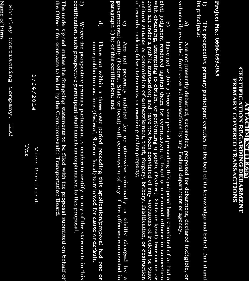
73
74
75

76
77
78
79

80

81
82
83


84


85 Copy 1 of 10 R e s p o n s e t o Request for PropoSAls Route 606 Loudoun County Parkway/Old Ox Road Reconstruction and Widening A Design-Build Projec t From: Miles South of Route 621 Evergreen Mills Road To: Miles South of Route 267 Dulles GreenWAy Loudoun Count y, Virginia State Project No.: Federal Project No.: FPN-5A01 (165) Contract ID Number: C DB64 Volume II: Design Concept Submit ted To: Submit ted By: In Association With:
Chapter 1. General Design Information. Section 1.02 Structure Selection and Geometry. Introduction
 Chapter 1 Bridge Design Manual General Design Information Section 1.02 Selection and Geometry Introduction Selection or Rehabilitation Report This section of the design manual provides guidance on the
APPENDIX C INLETS. The application and types of storm drainage inlets are presented in detail in this Appendix.
 Storm Drainage 13-C-1 APPENDIX C INLETS 1.0 Introduction The application and types of storm drainage inlets are presented in detail in this Appendix. 2.0 Inlet Locations Inlets are required at locations
Conceptual Design Report
 Conceptual Design Report I-244/Arkansas River Multimodal Bridge Tulsa, Oklahoma Prepared for the Oklahoma Department of Transportation Prepared by: August 2009 I-244 / ARKANSAS RIVER MULTIMODAL BRIDGE
Interstate 66 Widening
 R e s p o n s e to Request for Proposals Interstate 66 Widening Copy 1 of 10 ORIGINAL A Design-Build Project From: Approximately 1.2 miles west of U.S. Route 15 (James Madison Hwy.) To: Approximately 0.2
APPROACHES AND BRIDGE OVER TYE RIVER (RTE. 29 NBL) RFP QUESTIONS AND ANSWERS-REVISION 2
 RFP QUESTIONS AND ANSWERS-REVISION 2") Project: APPROACHES AND BRIDGE OVER TYE RIVER (RTE. 29 NBL) PROJECT: 0029-005-130, C501, B645 RFP QUESTIONS AND ANSWERS-REVISION 2 Date: 12/04/09 Approaches and Bridge over Tye River (Rte. 29 NBL) Subject:
Project: APPROACHES AND BRIDGE OVER TYE RIVER (RTE. 29 NBL) PROJECT: 0029-005-130, C501, B645 RFP QUESTIONS AND ANSWERS-REVISION 2 Date: 12/04/09 Approaches and Bridge over Tye River (Rte. 29 NBL) Subject:
SUBDIVISION CHECKLIST. Subdivision Name. Prior To Review. Preliminary plan approved by Planning Commission / Council as required.
 SUBDIVISION CHECKLIST Subdivision Name Account Number Review Engineer Prior To Review Preliminary plan approved by Planning Commission / Council as required. Review fee paid. Statement of Responsibility
Preliminary Drainage Study: Town of Hillsboro Pedestrian & Traffic Safety Project Traffic Calming Project UPC# 70587
 Preliminary Drainage Study: Town of Hillsboro Pedestrian & Traffic Safety Project Traffic Calming Project UPC# 70587 Introduction: The intent of this study was to perform a preliminary drainage study of
Rt. 29 Solutions Project Delivery Advisory Panel. February 18, 2016
 Rt. 29 Solutions Project Delivery Advisory Panel February 18, 2016 Agenda item 1: Introductions Project Delivery Advisory Panel Technical Team 2 Agenda item 2: Interaction and Feedback Live Streaming Feb
Project: Developer/Designer: Reviewer:
 City of Charlottesville, Virginia Engineering Plan Review Checklist (Site Plans, Site Plan Amendments, and Major Subdivisions) 610 East Market Street, Charlottesville, VA 22902 Telephone 434-970-3182;
I-64 Capacity Improvements Segment I Financial Plan Annual Update December 1, 2017
 I-64 Capacity Improvements Segment I Financial Plan Annual Update December 1, 2017 State Project # 0064-965-264, P101, R201, C501, B616, B617, B618, B619, B620, B621, D601, D602 Federal # NHS-064-3(479),
Review of Plans and Specs from a Constructability Perspective
 Review of Plans and Specs from a Constructability Perspective The Executive Regional Manager and the Project Manager, with approval of the Director of Project Management, may request the Constructability
Chapter 3: Permit Procedures and Requirements
 Chapter 1: General Provisions 1 1 Short Title 1 2 Jurisdiction 1 3 Amendments and Revisions 1 4 Enforcement Responsibility 1 5 Review Process 1 6 Prior Approval 1 7 Relationship to Other Standards 1 8
SPECIAL PROVISION Description of Project, Scope of Contract, and Sequence of Work
 2004 Specifications CSJ: 0932-01-076 SPECIAL PROVISION Description of Project, Scope of Contract, and Sequence of Work 1.0 Description of Project 1.1. General. This project provides for the widening of
12 DRAINAGE General Administrative Requirements Standards
 12 DRAINAGE 12.1 General The Design-Builder shall conduct all Work necessary to meet the requirements associated with drainage, including culverts, bridge hydraulics, roadway ditches, and closed storm
I-395 HOV Ramp at Seminary Road From: Sanger Avenue To: Seminary Road. with I-395 NB Auxiliary Lane Extension From: Duke Street To: Sanger Avenue
 R e s p o n s e t o Request for Proposals I-395 HOV Ramp at Seminary Road From: Sanger Avenue To: Seminary Road with I-395 NB Auxiliary Lane Extension From: Duke Street To: Sanger Avenue Copy 1 of 10 A
Highway Drainage 1- Storm Frequency and Runoff 1.1- Runoff Determination
 Highway Drainage Proper drainage is a very important consideration in design of a highway. Inadequate drainage facilities can lead to premature deterioration of the highway and the development of adverse
Route 7 Widening Project Project No , P101, R201, C501 UPC No January 15, a.m. NOVA District Building
 PROJECT SHOWING MINUTES Route 7 Widening Project January 15, 2013 10 a.m. NOVA District Building Overview / Welcome: Michael Gleasman, PE, Area Construction Engineer (VDOT) Overview: A question and answer
FOR INTERSTATE 81 AND ROUTE 37 INTERCHANGE FREDERICK COUNTY, VIRGINIA MILEPOST 310
 INTERCHANGE MODIFICATION REPORT FOR INTERSTATE 81 AND ROUTE 37 INTERCHANGE FREDERICK COUNTY, VIRGINIA MILEPOST 310 PREPARED BY: VIRGINIA DEPARTMENT OF TRANSPORTATION STAUNTON DISTRICT DECEMBER 13, 2006
ENGINEERING DESIGN & IMPROVEMENT STANDARDS
 ENGINEERING DESIGN & IMPROVEMENT STANDARDS 2016 Prepared by: Engineering Division For latest edition of these Improvement Standards, refer to City of Visalia website at: www.visalia.city/engineeringdocuments
STORM DRAINAGE DESIGN MANUAL
 Appendix I STORM DRAINAGE DESIGN MANUAL by: SUNGATE DESIGN GROUP, P.A. GEN ERAL DESIGN STAN DARDS AN D POLICIES 1. STREET AND LOCAL DRAINAGE Discharge estimates for specified design storms shall be calculated
CITY OF ASTORIA PUBLIC WORKS ENGINEERING DIVISION ENGINEERING DESIGN STANDARDS FOR IN-FILL DEVELOPMENT
 CITY OF ASTORIA PUBLIC WORKS ENGINEERING DIVISION ENGINEERING DESIGN STANDARDS FOR IN-FILL DEVELOPMENT Adopted by City Council: May 21, 2007 X:\General Eng\DESIGN STANDARDS\Engineering Design Standards
Texas Department of Transportation Book 2 Technical Provisions. Grand Parkway Project. Attachment 2-2. Work Breakdown Structure Requirements
 Texas Department of Transportation Book 2 Technical Provisions Grand Parkway Project Work Breakdown Structure Requirements Table 1 represents the minimum levels of the WBS that all schedule information
175 th Street Quivira to Antioch (TH-1343) Preliminary Engineering Study Overland Park, KS
 Preliminary Engineering Study Overland Park, KS") 175 th Street Quivira to Antioch (TH-1343) Preliminary Engineering Study Overland Park, KS June 2012 Prepared by: Public Works Department City of Overland Park, KS EXECUTIVE SUMMARY... 2 INTRODUCTION...
175 th Street Quivira to Antioch (TH-1343) Preliminary Engineering Study Overland Park, KS June 2012 Prepared by: Public Works Department City of Overland Park, KS EXECUTIVE SUMMARY... 2 INTRODUCTION...
CONSTRUCTION PLAN CHECKLIST
 CONSTRUCTION PLAN CHECKLIST The design engineer is responsible for ensuring that plans submitted for city review are in accordance with this checklist. It is requested that the executed checklist be submitted
I-64 Capacity Improvements Segment I Financial Plan Annual Update
 I-64 Capacity Improvements Segment I December 1, 2016 State Project # 0064-965-264, P101, R201, C501, B616, B617, B618, B619, B620, B621, D601, D602 Federal # NHS-064-3(479), NHA-064-3(479) UPC 104905
CONSTRUCTION SURVEY. Construction survey includes personnel, equipment, and supplies required for, but not limited to, the following:
 CONSTRUCTION SURVEY PART 1 - GENERAL 1.01 SECTION INCLUDES Construction survey includes personnel, equipment, and supplies required for, but not limited to, the following: A. Construction Survey: 1. Project
RFP QUESTIONS AND ANSWERS PARK AND RIDE LOT AT I-66/ROUTE 15 INTERCHANGE VDOT PROJECT PR CONTRACT ID C DB99 August 817, 2017
 Form DB-004 RFP Questions and Answers RFP QUESTIONS AND ANSWERS PARK AND RIDE LOT AT I-66/ROUTE 15 INTERCHANGE VDOT PROJECT PR15-076-236 CONTRACT ID C00109486DB99 August 817, 2017 PROCUREMENT 1. Part 1,
EXISTING ROADWAY CONDITION ASSESSMENT REPORT (ERCAR) SAMPLE OUTLINE
 SAMPLE OUTLINE") EXISTING ROADWAY CONDITION ASSESSMENT REPORT (ERCAR) SAMPLE OUTLINE The Existing Roadway Condition Assessment Report (ERCAR) should include the evaluation of all elements against new construction criteria.
EXISTING ROADWAY CONDITION ASSESSMENT REPORT (ERCAR) SAMPLE OUTLINE The Existing Roadway Condition Assessment Report (ERCAR) should include the evaluation of all elements against new construction criteria.
Gloucester Parkway Extension RFQ Information Meeting
 Gloucester Parkway Extension RFQ Information Meeting May 24, 2013 Tim Hartzell, PE District Project Manager Kevin Reichert, PE APD Project Manager and POC Topics Project Location & Overview RFQ Information
TOWN OF MANCHESTER PLANNING AND ZONING COMMISSION Subdivision Application Minimum Submission Requirements
 TOWN OF MANCHESTER PLANNING AND ZONING COMMISSION Subdivision Application Minimum Submission Requirements This checklist is to be completed and submitted with all Subdivision Applications. The Town reserves
Traffic Technical Memorandum: Hickman Road over Tuolumne River Bridge Replacement Project, Stanislaus County (BRLO-5938(199))
)") 11060 White Rock Road, Suite 200 Rancho Cordova, CA 95670 Phone: (916) 363-4210 Fax: (916) 363-4230 M e m o r a n d u m To: Reena Gohil, Environmental Planner Date: May 30, 2017 California Department of
11060 White Rock Road, Suite 200 Rancho Cordova, CA 95670 Phone: (916) 363-4210 Fax: (916) 363-4230 M e m o r a n d u m To: Reena Gohil, Environmental Planner Date: May 30, 2017 California Department of
CHAPTER 18 TEMPORARY ROADS AND BRIDGES
 Change #1 - Revised 12/12 CHAPTER 18 TEMPORARY ROADS AND BRIDGES 18.0 INTRODUCTION These guidelines are to be used to design temporary roads and bridges where traffic will be maintained at the construction
CHECKLIST FOR STREETS, INLETS, AND STORM SEWER DESIGN
 CHECKLIST FOR STREETS, INLETS, I. STREET CLASSIFICATION AND DESIGN CRITERIA A. Determine drainage classification for the roadway section using Table 7-1 or Table 7-2. B. Determine the allowable flow depth
Chapter 7. Street Drainage. 7.0 Introduction. 7.1 Function of Streets in the Drainage System. 7.2 Street Classification
 7. Introduction This chapter summarizes methods to evaluate runoff conveyance in various street cross sections and curb types in the Town of Castle Rock and identifies acceptable upper limits of street
UNIT: ROAD MAINTENANCE & OPERATIONS
 COUNTY OF FRESNO PS&E/CONSTRUCTABILITY REVIEW CHECKLIST UNIT: ROAD MAINTENANCE & OPERATIONS I certify that a thorough and complete constructability review has been performed by my staff: Signature of Functional
SINGLE STEEL BOX GIRDER BRIDGES FOR THE TERMINAL DEVELOPMENT PROJECT AT TORONTO PEARSON INTERNATIONAL AIRPORT. Srdjan Brasic, M.Sc., P.Eng.
 SINGLE STEEL BOX GIRDER BRIDGES FOR THE TERMINAL DEVELOPMENT PROJECT AT TORONTO PEARSON INTERNATIONAL AIRPORT Srdjan Brasic, M.Sc., P.Eng. UMA Engineering Ltd. Paper prepared for presentation at the Technical
CHAPTER 3 SCOPE SUMMARY
 CHAPTER 3 SCOPE SUMMARY GENERAL The SDDOT is an active member of AASHTO to share common national design standards for the state highway system. The AASHTO Task Force on Geometric Design has completed the
SECTION 3 DRAINAGE. 3-1 General. 3-2 Drainage Ordinances and Legal Requirements
 SECTION 3 DRAINAGE 3-1 General All Drainage plans for proposed development shall be prepared by a Professional Engineer registered in Virginia, except as noted below. Further, their seal and signature
Plan Name Plan No. Submitting Firm Contact Engineer. Review Date ESI Team ENGINEERS AND SURVEYORS INSTITUTE PEER REVIEW CHECKLIST CITY OF ALEXANDRIA
 EROSION AND SEDIMENT CONTROL CHECKLIST (E&S) VIRGINIA EROSION AND SEDIMENT CONTROL HANDBOOK (1 of 2) Item # Description OK NO N/A 1 Limits of clearing and grading match on all appropriate sheets 2 Construction
FIRM NAME DESIGNER: CHECKER: DATE: FPID #: DESCRIPTION: COUNTY: DRAINAGE DESIGN CHECKLIST. Designers Initials. Checkers Initials.
 I. Drainage Report A. Executive Summary - Brief Overview of Project Drainage Design B. Project Description 1. Existing Conditions 2. Proposed Project Conditions 3. Project Justification Narrative - Basin
Route 3 Widening. letter of submittal. original
 R e s p o n s e to Request for Proposals Route 3 Widening original A Design-Build Project From: 4.1 Miles East Route 29 To: 4.0 Miles West of Culpeper/Orange County Line Culpeper County, Virginia State
Constructability Guidelines
 Constructability Guidelines The Constructability Guidelines offer a list of items that should be considered by Constructability function personnel during the Concept Development Phase through the Final
NEPA and Design Public Hearings
 NEPA and Design Public Hearings Monday, December 5, 2016 Washington-Lee High School 1301 N. Stafford Street Arlington, VA 22201 Thursday, December 8, 2016 Mary Ellen Henderson Middle School 7130 Leesburg
SPECIAL PROVISION Detours, Barricades, Warning Signs, Sequence of Work, etc.
 2004 Specifications CSJ 0299-04-049, Etc. SPECIAL PROVISION 000---979 Detours, Barricades, Warning Signs, Sequence of Work, etc. 1. Description of Project. A. General. This project provides for the construction
CITY UTILITIES DESIGN STANDARDS MANUAL
 CITY UTILITIES DESIGN STANDARDS MANUAL () September 2017 Page Chapter 1 Acronyms and Definitions 1.01 Purpose 1 1.02 Acronyms 1 1.03 Definitions 3 Chapter 2 Introduction 2.01 Purpose 1 2.02 Applicability
2003 PRELIMINARY ENGINEERING STUDY JUNE 2006
 167 TH STREET PFLUMM ROAD TO METCALF AVENUE 159 th STREET & PFLUMM ROAD INTERSECTION PFLUMM ROAD 159 TH STREET TO 175 TH STREET QUIVIRA ROAD 159 TH STREET TO 167 TH STREET SWITZER ROAD 159 TH STREET TO
SECTION 12 STANDARDS FOR CONSTRUCTION PLANS AND SPECIFICATIONS
 SECTION 12 STANDARDS FOR CONSTRUCTION PLANS AND SPECIFICATIONS 12.1 The subdivider shall construct and install the improvements in accordance with the County's Standards for Construction Plans and Specifications
CHAPTER 12 INSTALLATION OF UTILITIES AND OTHER SYSTEMS TABLE OF CONTENTS
 CHAPTER 12 INSTALLATION OF UTILITIES AND OTHER SYSTEMS TABLE OF CONTENTS Section Title Page 12.1 General... 12-1 12.2 Design Standards... 12-1 12.2.1 General Requirements...12-1 12.2.2 Minimum Depth...12-1
5.0 PRELIMINARY ENVIRONMENTAL REVIEW
 5.0 PRELIMINARY ENVIRONMENTAL REVIEW 5.1 INTRODUCTION A preliminary environmental review was performed on the proposed freeway improvements that form Concept C, which encompasses the three freeway corridors
NORFOLK SOUTHERN CORPORATION UNDERPASS GRADE SEPARATION DESIGN CRITERIA
 NORFOLK SOUTHERN CORPORATION UNDERPASS GRADE SEPARATION DESIGN CRITERIA PURPOSE AND SCOPE These criteria modify and supplement the applicable sections of the AREMA Manual of Recommended Practice in connection
Preliminary Engineering Report. For the. Foxglove Trail. Prepared for: The City of Moore. Prepared By:
 Preliminary Engineering Report For the Foxglove Trail Prepared for: The City of Moore Prepared By: Certificate of Authorization No. CA#5714 Expires June 30, 2016 CE Project #264 May 2016 City of Moore
APPLICATION FOR PUBLIC INFRASTRUCTURE PERMIT
 APPLICATION FOR PUBLIC INFRASTRUCTURE PERMIT Engineering Division 550 Landa Street New Braunfels, Texas 78130 (830) 221-4020 1. Subdivision Plat Name: Location Description/ Nearest Intersection: Acreage:
SPECIAL SPECIFICATION Description of Project, Scope of Contract, and Sequence of Work
 2004 Specifications CSJ: 0050-06-081 SPECIAL SPECIFICATION 000--2733 Description of Project, Scope of Contract, and Sequence of Work 1. Description of Project. General. This project involves widening of
I-35W Retaining Wall Design Exhibit A - Draft Scope of Work
 Background MnDOT, Metro Transit, Hennepin County, and the City of Minneapolis are in the process of developing a project for Interstate 35W between 43 rd Street in Minneapolis and 15 th Street in Minneapolis.
Chapter 8. Inlets. 8.0 Introduction. 8.1 General
 . Introduction This chapter provides criteria and design guides for evaluating and designing storm sewer inlets in the City of Centennial. The review of all planning submittals will be based on the criteria
Phase II: Proposed (regulated) Impervious in disturbed area (ac) Long Lake Existing Impervious in disturbed area (ac)
 Impervious in disturbed area (ac) Long Lake Existing Impervious in disturbed area (ac)") Permit Application No.: 17-181 Rules: Erosion Control, Wetland Protection, and Waterbody Crossings & Structures Applicant: Hennepin County Received: 4/27/17 Project: CSAH 112 Phase II Complete: 9/5/17
Permit Application No.: 17-181 Rules: Erosion Control, Wetland Protection, and Waterbody Crossings & Structures Applicant: Hennepin County Received: 4/27/17 Project: CSAH 112 Phase II Complete: 9/5/17
on the eastbound side of Route 29). identified in the table.
. identified in the table.") To: Jeannie Swim, Memo From: Ken Demmons, P.E. Project: Route 29 Bridge Replacement over Little Rocky Run Per plans received on January 23, 2012 CC: File Date: February 21, 2012 Job No: P2464 RE: Review
To: Jeannie Swim, Memo From: Ken Demmons, P.E. Project: Route 29 Bridge Replacement over Little Rocky Run Per plans received on January 23, 2012 CC: File Date: February 21, 2012 Job No: P2464 RE: Review
DRAFT AIR QUALITY TECHNICAL MEMORANDUM
 AIR QUALITY TECHNICAL MEMORANDUM PROJECT DEVELOPMENT AND ENVIRONMENT STUDY STATE ROAD 60 GRADE SEPARATION OVER CSX RAILROAD Polk County, Florida Financial Project ID: 436559-1-22-01 Prepared for: Florida
Interstate 66 Widening from. RFQ Information Meeting. January 4, 2012 Christiana Briganti-Dunn, P.E. District Project Manager
 Interstate 66 Widening from Gainesville to Haymarket RFQ Information Meeting January 4, 2012 Christiana Briganti-Dunn, P.E. District Project Manager John C. Daoulas, P.E. APD Project Manager and POC Introduction
6 STORMWATER IMPROVEMENTS
 6 STORMWATER IMPROVEMENTS 6.01 General Requirements a. In addition to the standards contained in this, the design of stormwater systems is also governed by several ordinances and regulations. (1) Projects
BRIDGE DISTRICT. City of West Sacramento. Phase 1 Infrastructure Improvement Project. Monthly Status Report
 BRIDGE DISTRICT Phase 1 Infrastructure Improvement Project (for work completed thru November 2011) Cover Photo: Joint Utility Trench installation along Fifth Street just north of Bridge Street. Page 1
Page 1D-1 Revised language to link from Project Management Manual to Project Management Online Guide.
 IMPERIAL ROAD DESIGN MANUAL REVISIONS July 2008 CHAPTER 1D Page 1D-1 Revised language to link from Project Management Manual to Project Management Online Guide. CHAPTER 2A Page 2A-3 Revised language to
NORFOLK SOUTHERN RAILWAY COMPANY FILES: BR & BR
 NORFOLK SOUTHERN RAILWAY COMPANY FILES: BR0013844 & BR0013129 COLUMBIA, CHEROKEE COUNTY, SOUTH CAROLINA I-85 UNDERPASS PROJECT (1) REPLACEMENT OF EXISTING I-85 UNDERPASS BRIDGE MILEPOST SB-141.35 DOT/AAR
I-64 Capacity Improvements Segment III RFQ Information Meeting
 I-64 Capacity Improvements Segment III RFQ Information Meeting April 5, 2017 Janet Hedrick, P.E. Design Project Manager Joseph Clarke, P.E. APD Project Manager and POC I-64 Capacity Improvements Segment
CHAPTER 4 GRADE SEPARATIONS AND INTERCHANGES
 CHAPTER 4 GRADE SEPARATIONS AND INTERCHANGES 4.0 INTRODUCTION The ability to accommodate high volumes of intersecting traffic safely and efficiently through the arrangement of one or more interconnecting
DRAINAGE STUDY PHASE 2 REPORT HORRY COUNTY STORMWATER DEPARTMENT HIGHWAY 9 & 57 HORRY COUNTY, SC PREPARED FOR: APRIL 07, 2016 J
 DRAINAGE STUDY PHASE 2 REPORT FOR: HIGHWAY 9 & 57 HORRY COUNTY, SC PREPARED FOR: HORRY COUNTY STORMWATER DEPARTMENT APRIL 07, 2016 Prepared by: Savannah, GA Charleston, SC Myrtle Beach, SC Brunswick, GA
Construction Requirements for Installation of Utilities in the Public Right-of-way of McPherson County, Kansas October 2011
 Construction Requirements for Installation of Utilities in the Public Right-of-way of McPherson County, Kansas October 2011 General Provisions and Specifications - These provisions and specifications shall
Tarbutton Road Interchange and I-20 Frontage Roads. Estimating and Planning Group
 Tarbutton Road Interchange and I-20 Frontage Roads Dr. N. Wasiuddin Braden Smith Jared Taylor John Harrison Sarah Wells Samantha Tatro Ryan Ross Instructor Project Manager Transportation Group Geotechnical
York County STORMWATER LUNCH & LEARN
 York County STORMWATER LUNCH & LEARN TOPICS Points of Exposure SWPPP's NOT's Construction Sequence Permanent BMP's Basin Details Major and Minor Modifications Construction Buffers Stabilization Questions
Steve Haines, P.E., Parsons, (303) , James Studer, Kiewit, (926) ,
 , James Studer, Kiewit, (926) ,") PLACEMENT OF PRECAST PRESTRESSED CONCRETE GIRDER BRIDGE SPANS WITH SELF PROPELLED MODULAR TRANSPORTERS PIONEER CROSSING DESIGN/BUILD PROJECT, AMERICAN FORK, UT Steve Haines, P.E., Parsons, (303) 831-8100,
PLACEMENT OF PRECAST PRESTRESSED CONCRETE GIRDER BRIDGE SPANS WITH SELF PROPELLED MODULAR TRANSPORTERS PIONEER CROSSING DESIGN/BUILD PROJECT, AMERICAN FORK, UT Steve Haines, P.E., Parsons, (303) 831-8100,
LOCATION AND DESIGN DIVISION
 VIRGINIA DEPARTMENT OF TRANSPORTATION LOCATION AND DESIGN DIVISION INSTRUCTIONAL AND INFORMATIONAL MEMORANDUM GENERAL SUBJECT: Design Exceptions / Waivers SPECIFIC SUBJECT: Design Exception Request Form
Cleveland Opportunity Corridor Project Section 3. Subcontractor Informational Meeting August 12, 2016
 Cleveland Opportunity Corridor Project Section 3 Subcontractor Informational Meeting August 12, 2016 Agenda Welcome and Opening Remarks Project Overview Prequalifications & Work Types Procurement Overview
PUBLIC INFORMATION MEETING June 24, 2015
 Gallows Road (RTE. 650) over Arlington Boulevard (RTE. 50) Fairfax County Bridge Rehabilitation, Preventive Maintenance and Pier Repairs Phase 1 - Project No. 0650-029-235; UPC 106956, Pier Repair Phase
EXHIBIT "A" County Road 54 (Wesley Chapel Boulevard) (from North of Magnolia Boulevard to Oakley Boulevard) Work Order No. C-1640.
 (from North of Magnolia Boulevard to Oakley Boulevard) Work Order No. C-1640.") EXHIBIT "A" County Road 54 (Wesley Chapel Boulevard) (from North of Magnolia Boulevard to Oakley Boulevard) Work Order No. C-1640.00 SECTION I PURPOSE This document describes the scope of work and the
EXHIBIT "A" County Road 54 (Wesley Chapel Boulevard) (from North of Magnolia Boulevard to Oakley Boulevard) Work Order No. C-1640.00 SECTION I PURPOSE This document describes the scope of work and the
NEW MARKET HEIGHTS PHASE OF THE VIRGINIA CAPITAL TRAIL PROJECT RFP QUESTIONS AND ANSWERS
 NEW MARKET HEIGHTS PHASE OF THE VIRGINIA CAPITAL TRAIL PROJECT RFP QUESTIONS AND ANSWERS Date: 4-13-12 Project: Subject: New Market Heights Phase of the Virginia Capital Trail Project RFP Questions and
DESIGN OF CAMPBELL ROAD OVERPASS IN KELOWNA. Yulin Gao, M.A.Sc., P.Eng., SNC-Lavalin Inc. Samson Chan, M.Eng., P. Eng., SNC-Lavalin Inc.
 DESIGN OF CAMPBELL ROAD OVERPASS IN KELOWNA Yulin Gao, M.A.Sc., P.Eng., SNC-Lavalin Inc. Samson Chan, M.Eng., P. Eng., SNC-Lavalin Inc. Paper prepared for presentation at the Bridges in a Climate of Change
6 STORMWATER IMPROVEMENTS
 6 STORMWATER IMPROVEMENTS 6.01 General Requirements a. In addition to the standards contained in this, the design of stormwater systems is also governed by several ordinances and regulations. (1) Projects
Functional Servicing Report. Winston Park West Proposed Business Park Development Project. Infrastructure Ontario (IO) September MU1
 September MU1") Functional Servicing Report Winston Park West Proposed Business Park Development Project (IO) September 2011 14-11208-001-MU1 Winston Park West 2 TABLE OF CONTENTS Page 1.0 INTRODUCTION... 3 1.1 SITE DESCRIPTION...
Functional Servicing Report Winston Park West Proposed Business Park Development Project (IO) September 2011 14-11208-001-MU1 Winston Park West 2 TABLE OF CONTENTS Page 1.0 INTRODUCTION... 3 1.1 SITE DESCRIPTION...
Exhibit A Mn/DOT Contract No
 Exhibit A Mn/DOT Contract No. 98142 SCOPE OF WORK AND DELIVERABLES Preliminary Design Red Wing US 63 Bridge and Approach Roadways State Project (SP) 2515-21 SCOPE OVERVIEW... 2 SCHEDULE... 2 PROJECT TASK
5/25/2017. Lumpkin Detention Basin Houston, Texas By Brian Whitney, P.E., CFM Victor Rendon. Lumpkin Basin. Lumpkin Road Overall Description
 Lumpkin Detention Basin Houston, Texas By Brian Whitney, P.E., CFM Victor Rendon TEXAS FLOODPLAIN MANAGEMENT ASSOCIATION April 27, 2017 PROJECT LOCATION PROJECT VICINITY MAP Lumpkin Road Overall Description
University Region FY 2023 Final Scoping Package
 September 30, 2016 University Region FY 2023 Final Scoping Package I-496/US-127 Scoping From I-96 to the I-496/US- 127 Interchange CS 33045 JN 126442 I-496/US-127 STUDY EXECUTIVE SUMMARY UNIVERSITY REGION
TURNPIKE PLANS PREPARATION AND PRACTICES HANDBOOK (TPPPH) VOLUME 1
 VOLUME 1") TURNPIKE PLANS PREPARATION AND PRACTICES HANDBOOK (TPPPH) VOLUME 1 FLORIDA S TURNPIKE ENTERPRISE PRODUCTION DESIGN DEPARTMENT OCOEE, FL June 2016 January 3, 2017 Addendum #2 The following are changes,
TURNPIKE PLANS PREPARATION AND PRACTICES HANDBOOK (TPPPH) VOLUME 1 FLORIDA S TURNPIKE ENTERPRISE PRODUCTION DESIGN DEPARTMENT OCOEE, FL June 2016 January 3, 2017 Addendum #2 The following are changes,
For Public Input Period
 20142018 CAPITAL IMPROVEMENT PLAN ( Thousands) CITY OF HOUSTON STREET & TRAFFIC CONTROL Project: Kingwood Drive N100011 Loop 494 to Woodland Hills Project Description Project provides for the ROW acquisition,
Reason for Acceptance or Rejection
 Value Engineering Approval Form Project: 25th Avenue & Union Pacific Grade Separation #6 VE Study Date: January 28 through February 1, 2013 Form updated: 5/7/2013 (Final) FHWA Functional ENV 1 ROW 1 The
U.S. Army Corps of Engineers Permit Application Tips
 U.S. Army Corps of Engineers Permit Application Tips MnDOT Environmental Conference Ben Orne and Sarah Wingert, USACE 4-29-2015 US Army Corps of Engineers BUILDING STRONG Outline Introduction to Corps
CITY OF WALLED LAKE 1499 E. WEST MAPLE WALLED LAKE, MI 48390
 CITY OF WALLED LAKE 1499 E. WEST MAPLE WALLED LAKE, MI 48390 ENGINEERING DESIGN STANDARDS Prepared by: Boss Engineering Howell, Michigan October 5, 2016 TABLE OF CONTENTS PART I. INTRODUCTION SECTION 1.0
Plessis Road Twinning and Grade Separation at CN Redditt Subdivision: Design Challenges and Innovative Solutions
 Plessis Road Twinning and Grade Separation at CN Redditt Subdivision: Design Challenges and Innovative Solutions Tanya D. Worms, P.Eng. M.Sc., Project Manager, M.D. Steele Construction Ltd. Paper prepared
Port KC RFP NORTHLAND PARK BUILDING V
 Port KC RFP NORTHLAND PARK BUILDING V 1. The RFP refers to landscaping plans. However, it does not appear that the landscaping plans were issued with the rest of the RFP. Will these be issued with an addendum?
EXISTING ROADWAY CONDITION ASSESSMENT REPORT (ERCAR) SAMPLE OUTLINE
 SAMPLE OUTLINE") EXISTING ROADWAY CONDITION ASSESSMENT REPORT (ERCAR) SAMPLE OUTLINE The Existing Roadway Condition Assessment Report (ERCAR) should include the evaluation of all elements against new construction criteria.
EXISTING ROADWAY CONDITION ASSESSMENT REPORT (ERCAR) SAMPLE OUTLINE The Existing Roadway Condition Assessment Report (ERCAR) should include the evaluation of all elements against new construction criteria.
I-64 Capacity Improvements Segment II Financial Plan Annual Update October 30, 2017
 I-64 Capacity Improvements Segment II Financial Plan Annual Update October 30, 2017 State Project # 0064-965-264, P101, R201, C501, B627, B628, B629, B630, B631, B632, B633, B634, B635, D603, D604, D605,
STATE UNIVERSITY CONSTRUCTION FUND
 DIRECTIVE 2-1 Issue date: September 2012 1. General SITEWORK OVERVIEW This Directive outlines the Fund s requirements for the Consultant relative to the development, design and presentation of documents
Figure 28 Ocean Drive Improvements and Middle Thorofare Bridge Replacement Alternatives Comparison Matrix
 Figure 28 Ocean Drive Improvements and Middle Thorofare Bridge Alternatives Comparison Matrix Ocean Drive Improvements & Middle Thorofare Bridge Alternatives 1A. Engineering - Roadway - Proposed Travel
SEGMENTAL CONTRUCTION IN THE INNER CITY: THE BQE CONNECTOR RAMP TO WILLIAMSBURG BRIDGE
 SEGMENTAL CONTRUCTION IN THE INNER CITY: THE BQE CONNECTOR RAMP TO WILLIAMSBURG BRIDGE Paul Gauvreau University of Toronto, Canada (formerly J. Muller International) Thomas E. Kelly, Jr. Earth Tech/J.
Chapter 11 Culverts and Bridges
 Chapter 11 Culverts and Bridges Contents 1.0 Introduction... 1 2.0 General Design... 1 2.1 Design Criteria... 1 2.2 Design Flows... 1 2.3 Permitting and Regulations... 1 2.4 Aesthetics and Safety... 2
Pattullo Bridge Replacement Project. Cost Report
 Pattullo Bridge Replacement Project Cost Report January 2018 Cost Report Page i TABLE OF CONTENTS 1 PURPOSE... 1 2 BASIS FOR THE ESTIMATE... 2 2.1 Scope of the Works... 2 2.2 Scope of Capital Costs...
Dulles Corridor Metrorail Project Phase 1 & Phase 2 Updates
 Dulles Corridor Metrorail Project Phase 1 & Phase 2 Updates May 31, 2018 Charles W. Stark Senior Vice President Phase 1 Phase 1 Cost Summary Expenditures (Nov 17 thru Apr 18) Total Expenditures (Thru Apr
500 Interchange Design
 500 Interchange Design Table of Contents 501 Interchange Design... 5-1 July 2015 501.1 General... 5-1 501.2 Interchange Type... 5-1 501.2.1 General... 5-1 502 Interchange Design Considerations... 5-2 502.1
Chapter 4. Drainage Report and Construction Drawing Submittal Requirements
 4.0 Introduction The requirements presented in this section shall be used to aid the design engineer or applicant in the preparation of drainage reports, drainage studies, and construction drawings for
Douglas Woods Wind Farm
 Traffic Evaluation and Access Management Report Douglas Woods Wind Farm Douglas,Massachusets Prepared for American Pro Wind 195 Libbey Parkway - Unit Two Weymouth, MA 02189 Prepared by Transportation,