GPS & GIS for Hurricane Debris Removal. City of Miami Miami, Florida
|
|
|
- Roy Pope
- 5 years ago
- Views:
Transcription

1 GPS & GIS for Hurricane Debris Removal City of Miami Miami, Florida June 19, 2007 ESRI UC 2007
2 Presenters Regina L. Hagger GIS Developer City Of Miami Department of Public Works Michael Schmedt GIS Analyst HDR Engineering, Orlando, FL

3 City of Miami
4 City of Miami, FL Location: Miami-Dade County, Florida Incorporated: July 28, 1896 Population: , (projected) 390,191 Area: 35 Square Miles Climate: Subtropical Elevation: 12 Feet above Sea Level Temperature: Annual Average 75.9 Average January 67.2 Average July 82.6

5
6 Katrina Hurricanes Tropical Storm => Hurricane Level 1 Rita Tropical Storm => Hurricane Level 1 Wilma Hurricane Level 3

7 Source: Hurricanes
8 City Needs Assessment of tree damage caused by Hurricane Wilma Method to help monitor and coordinate tree debris collection Documentation of damage and debris removal for clean-up reimbursement by FEMA
9 Solution Collecting tree debris data using mobile GIS (Tree( Debris Inventory) Compiling a comprehensive citywide tree debris database (Database( Processing) Creating maps and reports visualizing and detailing tree debris information (Maps and Reports)

10 Tree Debris Inventory Trained 4 two-person field crews on inventory methodology and mobile GIS Crews equipped with laptop, GPS device, and digital camera Inventory consisted of field data collection, followed by nightly database synchronization
11 Tree Debris Inventory Developed ArcPad data entry forms to be used by the field crews Forms designed to collect information on: Debris type (fallen tree, tree limb, property damage) Trunk diameter; limb diameter/length (important for FEMA Eligibility) Location address Location coordinates (lat/long) Photo ID


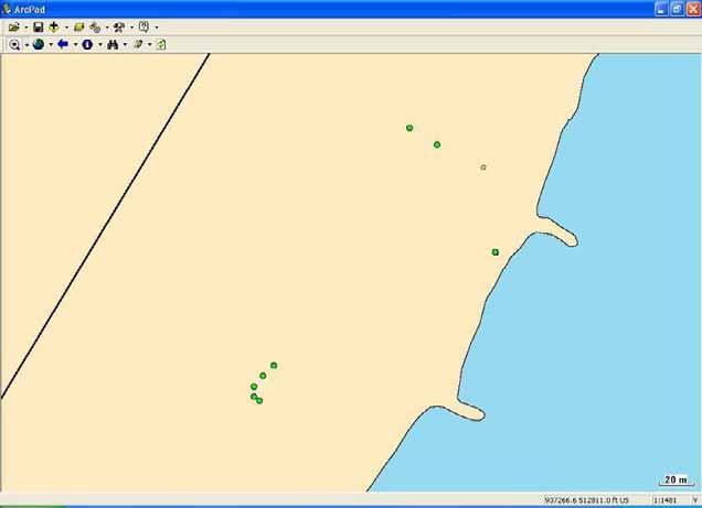
12 Tree Debris Inventory
13 Tree Debris Inventory Set up GIS database to be used by field crews Data derived from the Miami database includes: City and district boundaries Garbage collection zones Street and address data City-owned parks Water features Aerial imagery

14 Tree Debris Inventory
 0760 Parks 0340")
 6166")
")
15 Tree Debris Inventory Fallen Trees Citywide (in road right-of of-way) 0760 Parks 0340 Total 1100 Trees with Hanging Limbs Citywide (in road right-of of-way) 6166 Parks 0653 Total 6819 Property Damage Results Citywide (in road right-of of-way) 87 Parks 05 Total 92
16 Database Processing Office staff managed master GIS database, workflow included: merging individual uploads into one comprehensive debris database Address matching (performing spatial join) Checking for potential duplicate records Picture matching Screening of records for FEMA Eligibility Screening of comments for additional information Calculating lat/long coordinates General QA/QC


17 Database Processing Generating and maintaining comprehensive tree debris database
18 Maps and Reports Generated maps for individual City zones and districts detailing fallen trees, broken limbs and property damage Generated a series of Access reports detailing debris locations with corresponding attributes and photos

19 Maps and Reports

20 Maps and Reports
21 Benefits Database helping the City: Verifying reports from calling residents about tree debris Updating existing tree inventory Reports and maps resulted in cost savings for the City by: Serving as basis for debris removal contractors Allowing the City to define amount and location of debris removal Limiting the possibility of cost overruns by collecting out of scope debris
22 Benefits Reports and maps provided FEMA field staff with valuable information, facilitating FEMA workload and saving time and money
23 Lessons Learned Extensive training of field crews and standardized collection effort will reduce time and effort of data processing considerably Provide field crews with the latest master collection file in order to avoid potential collection of duplicates Standardizing and streamlining caption of pictures: Unique picture names No portrait pictures 1 st picture showing whole area of damage, 2 nd showing a close up

24 Why GPS? Accuracy & Quality Control Positional Attribute Data Stakeholders Cost Efficient City Staff existing experts
25 2006 USDA Grant Division of Forestry conducted a visual assessment of the City of Miami post hurricane damage in February 2006 during a mini-tour. 75% of the mature trees showed hurricane damage Tree Canopy (National avg.): 20% Tree Canopy for the City: 5%
26 2006 USDA Grant The City of Miami received a 2006 Urban and Community Forestry Grant from the Florida Dept of Agriculture s Division of Forestry for $25,000. Hardware $45,140 Software $4,840 Total $49,980 USDA Grant -$25,000 City Match $24,980
27 2006 USDA Grant 6 Geo XT GPS handheld units 4 RICOH Pro G3 Cameras & WI-FI cards 1 Contour XLRic Laser Rangefinder - bluetooth & hardware 1 Zephyr Antenna, Pole & hardware 1 GPS Analyst Extension (includes ArcPad 7 & GPS Correct software 3 copies of ArcPad 7 software 5 copies of Trimble GPS Correct software
28 Purchase Status In the City procurement process Currently utilizing the following units borrowed from other Departments: Geo XM Geo XH Parks Dept IT/GIS Dept

29 Project Staff GIS Developers Regina Hagger Public Works Ruth Dagnan IT/GIS GIS/CADD Technician Martin Arteaga Public Works Parks Naturalists Juan Fernandez Ernesto Martinez
 Catch Basins/Inlets 2 (FDOT) Trees 10 Nature Trail 1")
30 Field Testing 1/12/06 GPServe, Inc. and 2/21/06 NEI, Inc. Trimble GeoXH handheld with TerraSync software: Total # of structures collected: 35 Fire Hydrants 4 Bus Benches 3 Catch Basins/Inlets 16 (City) Catch Basins/Inlets 2 (FDOT) Trees 10 Nature Trail 1 mile Accuracy: Vertical: from 0.6 feet (8 inch) to 4.5 feet Horizontal: from 0.4 feet to 2.8 feet Trimble ProXRS backpack with Recon and ArcPad 7.0 software: Total # of structures collected: 27 Fire Hydrants 3 Bus Benches 2 City Storm Water Catch Basins/Inlets 12 Trees 10


31 Field Testing Results

32 Field Testing Results
 Price: $ 2,335 Hardware only Software & Hardware Bundle Price: $ 3,150 (includes ESRI ArcPad & Trimble GPScorrect")
33 Trimble Geo XM Hardware 1 3 meter GPS accuracy real time and Post Processing (PP) Accuracy suitable for asset management (benches, news racks, bus stops, payphones, fire hydrants, trees ) Price: $ 2,335 Hardware only Software & Hardware Bundle Price: $ 3,150 (includes ESRI ArcPad & Trimble GPScorrect software)
34 Hardware Trimble Geo XH Sub-meter GPS accuracy in the field (sub 30cm Post Processed {PP}) Accuracy suitable for storm water infrastructure & asset management (catch basins, manholes, outfalls ) Hardware Price: $ 4,765. Hardware & software Bundle Price: $ 5,350 (includes ESRI ArcPad & Trimble GPScorrect software)


35 Hardware Zephyr Antenna & Pole Why do you want this? Canyon & Canopy effect Assists in collecting in Urban canyon aka Downtown and in Tree Canopy Coconut Grove Antenna $2000 Pole $235 Bracket $175


36 Ricoh Pro G3 GPS Camera Hardware Requires Compact flash WI-FI Card Price $ (camera) Speeds data collection by documenting actual condition of asset (tree)

37 Future Hardware Lasercraft Contour Laser Rangefinder Why do you need this? Measures heights of buildings, trees Can collect many assets you may not be able to reach physically Across canals, streams & rivers Construction or industrial sites that are fenced, hazardous, or inaccessible $4,195 Rangefinder $200 Yoke Assembly $145 Bipod for Laser Pole
38 City Goals Plant 100,000 trees by 2010 Inventory all trees in the Road Right of Way and on City Property using GIS Track current tree inventory Implement effective Tree Management practices Become a Tree City USA Annual City-wide Arbor Day Celebration Create an Urban Forestry Plan
39 Tree Permits


40 GPS Pilot Project GPS Data Collection on Virginia Key Collection of rare and endangered trees and shrubs on Virginia Key Documentation of the habitat restoration project NOAA Grant to The Parks Department Started Data collection in July 2006 w/geo XM
41

42
43


44

45 Software ArcSDE 9.0 ArcGIS 9.1 ArcPad 7 Active Sync 4.2 ArcPad Application Builder 7 Trimble GPS Correct

46 Trees Common Name Genus & Species DBH HT_FT HT_IN In ROW Condition Gender Insp_Date Insp_By Flowers Flower color Image Native Permit_NO TAG_NO Database Fields Shrubs Common Name Genus & Species DBH HT_IN In ROW Condition Gender Insp_Date Insp_By Flowers Flower color Image Native TAG_NO

47 Trees 131 Tree Types 52 Shrub Types

48
49

50

51 Software ArcPad Application Builder 7

52 Future Software ESRI GPS Analyst Trimble Terra Sync
 Consider doing a field test of equipment (hardware & software) Compare notes with a GIS network")
53 Lessons Learned Planning Batteries Aerials (think twice!) Consider doing a field test of equipment (hardware & software) Compare notes with a GIS network resource Borrow equipment form another Dept.


54 Suggestions Start with a geo-database Budget for storage space to store pictures Data Collection Teams minimum of 2 people
55 Presenters Information Regina L. Hagger GIS Developer City of Miami Department of Public Works 444 SW 2 nd Avenue, 8 th Floor Miami, FL Phone: (305) Fax: (305) rhagger@ci.miami.fl.us Michael Schmedt GIS Analyst HDR Engineering 315 E. Robinson, Suite 400 Orlando, FL Phone: (407) Fax: (407) michael.schmedt@hdrinc.com
56 End Notes All Photographs were taken by City of Miami employees or contractors, with the exception of: Trimble Hardware & Software ESRI Hardware & Software Ricoh Hardware
Public Utilities GIS GIS Systems: How it can help the Operator Reach Success. 4/11/2013 Nick Kryger, SLC Public Utilities GIS 1
 Public Utilities GIS GIS Systems: How it can help the Operator Reach Success 4/11/2013 Nick Kryger, SLC Public Utilities GIS 1 Public Utilities GIS Layers Water 1400 Miles of Water Mains 90,000 Water Services
GIS automation through integration with PDA and GPS field units
 GIS automation through integration with PDA and GPS field units This presentation shares project tools for automating field data collection using GIS, PDAs and related technologies. Michael Welch Systems
An Automated Transit Stop Data Collection System
 ABSTRACT An Automated Transit Stop Data Collection System Albert Gan, Ike Ubaka, and Fabian Cevallos A transit stop inventory is needed for various transit planning, operational, and maintenance applications.
Integrating GIS Data and Management Systems to Assess Urban Forest Ecosystems
 Integrating GIS Data and Management Systems to Assess Urban Forest Ecosystems Introduction: Deborah Sheeler GIS Supervisor Software Solution: ArcPad Custom Field Collection Program William Ayersman GIS
Mobile Data Collection: Lessons from the Escambia County Bus Stop Inventory
 Mobile Data Collection: Lessons from the Escambia County Bus Stop Inventory Martin Catalá GIS Manager Center for Urban Transportation Research 4202 East Fowler Avenue (CUT100) Tampa, Florida 33620 http://www.cutr.usf.edu
Utilization of ArcPad and Mobile Technology to Update Street Signs in Local Government
 2004 ESRI International User Conference San Diego, California Utilization of ArcPad and Mobile Technology to Update Street Signs in Local Government Martin County, Florida Abstract Submission: Paper #1259
Performing Cost Effective Asset Management Inventories Utilizing GIS. Steve Tyler, Public Works Superintendent Mark Dumford, Consultant
 Performing Cost Effective Asset Management Inventories Utilizing GIS Steve Tyler, Public Works Superintendent Mark Dumford, Consultant Town of Atherton South San Mateo County 5 square miles Approximately
Liberty Utilities. NEPSR Seminar October 21-22, 2014 Underground Facility Record Keeping - GPS
 Liberty Utilities NEPSR Seminar October 21-22, 2014 Underground Facility Record Keeping - GPS Overview Background GPS Selection GPS Data Collection Requirements/Process Integration into GIS Challenges/Obstacles
Why We Chose Aerial Imagery to Manage our Trees
 Monica Silva The City of Vaughan, Asset Management Specialist Why We Chose Aerial Imagery to Manage our Trees City of Vaughan Population: 325,000 Roads: 832km Land Area: 27,000 Ha Street Trees: ~160-180K
Presenters: Ted Peay Tren Giles. GPS Using GPS Technology to Gather As-Constructed Field Notes
 Presenters: Ted Peay Tren Giles GPS Using GPS Technology to Gather As-Constructed Field Notes Retail GasDistribution Area Distribution System Serving nearly 900,000 Customers in Utah, Wyoming & Southeastern
Traffic Signs Research Study for Miami-Dade County
 Traffic Signs Research Study for Miami-Dade County Executive Summary Prepared for Miami-Dade County Metropolitan Planning Organization (MPO) Prepared by Pei-Sung Lin, Ph.D., P.E. PTOE Aldo Fabregas Center
Stormwater Asset Inventory and Condition Assessments to Support Asset Management Session 12710
 Stormwater Asset Inventory and Condition Assessments to Support Asset Management Session 12710 Ben Recker, Tetra Tech Inc. Contributing Author: Gary Nault, HQ ACC/A7AN Overview Utilities Asset Management
INTELLIGENT TRANSPORTATION SYSTEMS FACILITY MANAGEMENT AS-BUILT DELIVERABLES
 INTELLIGENT TRANSPORTATION SYSTEMS FACILITY MANAGEMENT AS-BUILT DELIVERABLES ITSFM AS-BUILT DELIVERABLES Agenda History of the ITSFM What ITSFM is and is not System Benefits As-built Data Collection As-built
Master Naturalist Opportunities with the Virginia Big Tree Program
 Master Naturalist Opportunities with the Virginia Big Tree Program Eric Wiseman, PhD Associate Professor of Urban Forestry Dept. of Forest Resources & Environmental Conservation Virginia Tech arborist@vt.edu
Street and Park Tree Inventories - How It Improves Pest Management
 Street and Park Tree Inventories - How It Improves Pest Management Kamie Long Colorado State Forest Service Assistant District Forester - Grand Junction District Kamie.Long@ColoState.edu or 970-248-7325
GPS For As built Data Collection of Utility Construction
 GPS For As built Data Collection of Utility Construction Agenda Company Information GPS Implementation Live Demonstration Questions 1 A Family of Companies Electric Generation and Distribution Natural
Using GPS/GIS Technology via BlackBerry Phones for Managing Public Works Programs
 Using GPS/GIS Technology via BlackBerry Phones for Managing Public Works Programs Scott E. Roberts, GISP, Director of Information Technology NEURISA 2010 October 18, 2010 Our Vision-How Did We Start? How
City of DeBary, FL Sidewalk Data Collection Services
 City of DeBary, FL Sidewalk Data Collection Services Prepared by: Data Transfer Solutions, LLC 2680 Avalon Park Blvd. East, Suite 200 Orlando, FL 32828 www.dtsgis.com 1 COVER LETTER May 30, 2017 Mr. Matt
Utilities GIS Development
 Utilities GIS Development A Case Study: Comprehensive Data Capture and Geodatabase Development for NAVFAC Utility Systems April 26, 2010 Grant Raudenbush PSM GISP Geospatial Analyst, Utilities Five Operating
Appendix C Risk Assessment Methods
 Appendix C Risk Assessment Methods The following section outlines the specific methods, data, and values used to evaluate wildfire risk in Lane County. Identifying the Wildland Urban Interface Risk The
ASTM F2897 as a Pointer to Additional Information. AGA Workshop Presentation October 18 th 2017
 ASTM F2897 as a Pointer to Additional Information AGA Workshop Presentation October 18 th 2017 Using the Standardized F2897 Identifier Dominion Energy has been an early adopter of component lot capture
Technology Applications for Stormwater Regulatory Compliance
 Technology Applications for Stormwater Regulatory Compliance Construction Administration 2015 APWA NC Stormwater Conference September 14, 2015 Virginia Lakes and Watersheds Association www.vlwa.org Annual
The Evolution of Data. Mike Schwab Solutions Architect
 The Evolution of Data Mike Schwab Solutions Architect The data story Asset Management development over the years Potential benefits of Asset Management Next steps toward proactive Asset Management Case
Environmental Arborist Services TREE ASSESSMENT
 Environmental Arborist Services TREE ASSESSMENT PROJECT TITLE: Arborist Tree Inspection- Along 12 Ave. between Coral Way and SW 12 th street, Miami FL 33145 DATE: 10-04-17 DAY: Wednesday REPORT NO. 1 TEMPERATURE
EOP / ESF - 03 ANNEX / APPENDIX 3-1 / TAB B EVENTS AND ASSUMPTIONS TAB B EVENTS AND ASSUMPTIONS
 TAB B B-1 FEBRUARY 2014 THIS PAGE INTENTIONALLY BLANK B-2 FEBRUARY 2014 I. INTRODUCTION A. The purpose of this section is to present various debris forecasting and estimating techniques including various
An Assessment of Tree Canopy and Canopy Change in the City of Charlottesville, VA
 An of Tree Canopy Canopy Change in the City of Charlottesville, VA A Presentation of, Findings Results February 24, 2016 Presented By: Chris Peiffer, Manager, www.planitgeo.com info@planitgeo.com 1 TONIGHT
GIS Data Cooperatives & Data Sharing The Hackensack Meadowlands District Model
 GIS Data Cooperatives & Data Sharing The Hackensack Meadowlands District Model Presented by: Dom Elefante New Jersey Geo-Spatial Forum March 26, 2010 The New Jersey Meadowlands Commission Meadowlands Environmental
DATE: May 19, 2009 REPORT NO. EN CHAIR AND MEMBERS COMMITTEE OF THE WHOLE OPERATIONS AND ADMINISTRATION
 DATE: May 19, 2009 REPORT NO. EN2009-095 TO: FROM: CHAIR AND MEMBERS COMMITTEE OF THE WHOLE OPERATIONS AND ADMINISTRATION SANDRA LAWSON, P.ENG., GENERAL MANAGER, ENGINEERING & OPERATIONAL SERVICES 1.0
GIS and Asset Management: a Cost Efficient Enterprise Solution
 GIS and Asset Management: a Cost Efficient Enterprise Solution Ming Zhao & Geoffrey Stevens Abstract: Utilities are facing significant challenges and opportunities in developing cost effective business
Mid-West ESRI Utility User Group Meeting. March 27, 2008 Shakopee Fire Station Shakopee, MN
 Mid-West ESRI Utility User Group Meeting March 27, 2008 Shakopee Fire Station Shakopee, MN Introductions Thank You! Why go mobile? Utility Industry Challenges Reliability Customer Satisfaction Provide
New England Pipeline Safety Representatives (NEPSR) Capturing & Integrating System Information. Trace & Traceability GIS & GPS
 Capturing & Integrating System Information. Trace & Traceability GIS & GPS") New England Pipeline Safety Representatives (NEPSR) Capturing & Integrating System Information Trace & Traceability GIS & GPS Speakers Mel Ciulla Manager, Gas Distribution Operations Charlie Kickham Manager,
New England Pipeline Safety Representatives (NEPSR) Capturing & Integrating System Information Trace & Traceability GIS & GPS Speakers Mel Ciulla Manager, Gas Distribution Operations Charlie Kickham Manager,
Stormwater Asset Inventory and Condition Assessments to Support Asset Management Session 12710
 Stormwater Asset Inventory and Condition Assessments to Support Asset Management Session 12710 Ben Recker, Tetra Tech Inc. Contributing Author: Gary Nault, HQ ACC/A7AN Report Documentation Page Form Approved
Campus Enterprise GIS
 Campus Enterprise GIS Cross Platform Supported: Enterprise GIS Initiative: Webmapping Making the Case for Enterprise GIS at UMD Esri Resources Available to UMD Webmapping for Information Access Demonstration:
The Digital Forest. Geospatial Technologies in Urban Forest Management. Justin Morgenroth New Zealand School of Forestry University of Canterbury
 The Digital Forest Geospatial Technologies in Urban Forest Management Justin Morgenroth New Zealand School of Forestry University of Canterbury Why Measure a Tree? Determine annual growth Determine value
Quantifying Ecosystem Service and Values of the Urban Forest. David J. Nowak USDA Forest Service Northern Research Station Syracuse, NY, USA
 Quantifying Ecosystem Service and Values of the Urban Forest David J. Nowak USDA Forest Service Northern Research Station Syracuse, NY, USA Overview Ecosystem services Measuring services Top down Bottom
EXHIBIT A SCOPE OF SERVICES MAINTENANCE PERSONNEL SUPPORT
 EXHIBIT A SCOPE OF SERVICES I. PURPOSE: MAINTENANCE PERSONNEL SUPPORT The Department is requesting Personnel Support Services to augment the Department s Maintenance personnel in the administration of
Leveraging GIS to Improve Operations and Asset Management Lifecycle
 Leveraging GIS to Improve Operations and Asset Management Lifecycle Gabriel Borroni Joel Gladfelter ESRI AEC Summit 2014 San Diego, CA Asset Management Inventory Control Maintenance Management Scheduling/
APPENDIX D. Tree Inventory
 APPENDIX D Tree Inventory AECOM 916.414.5800 tel 2020 L Street, Suite 400 916.414.5850 fax Sacramento, CA 95811 www.aecom.com December 2, 2015 Scott Johnson, Associate Planner City of Sacramento, Community
Municipal Tree Inventory using Low Carbon Footprint Remote Sensing Technology at the City of Vaughan. Esri Canada 2017 October 18 th, 2017
 Municipal Tree Inventory using Low Carbon Footprint Remote Sensing Technology at the City of Vaughan Monica Silva Asset Management Specialist Greg Czajko Systems Analyst/ Project Leader (GIS) Esri Canada
Optimizing Data Collection, Storage, and Visualization: A Modernization of Business Processes
 Optimizing Data Collection, Storage, and Visualization: A Modernization of Business Processes Submission Category: Business Process Innovations State: North Carolina Project Initiation: February 2016 Project
NRI/FSD and FOREST CONSERVATION EXEMPTION SUBMISSION REQUIREMENTS
 Detailed description of the submission requirements for the NRI/FSD and forest conservation exemption requests may be found in the MNCPPC Trees Technical Manual. The applicant, applicant s agent, or qualified
TREE REMOVAL, PROTECTION & CARE
 TREE REMOVAL, PROTECTION & CARE Tree Removal Regulation of tree removal through the permit process protects the natural setting in Lake Oswego. One of the benefits of living in Lake Oswego is the abundance
Digital Restoration Guide for Increasing Efficiency in Planning and Implementation of the Four Forest Restoration Initiative. Challenge and Need
 To succeed at forest restoration, the core strategy of The Nature Conservancy in Arizona helps resolve two challenges: the low value of small-diameter wood and associated biomass; and the tentative social
Urban Forestry Strike Team (UFST) October 6, 2009
 October 6, 2009") Urban Forestry Strike Team (UFST) October 6, 2009 Daniel Westcot Community Forester Georgia Forestry Commission 5960 Hwy 17 S Guyton, GA 31312 Objective of UFST Develop a professional response team to
Urban Forestry Strike Team (UFST) October 6, 2009 Daniel Westcot Community Forester Georgia Forestry Commission 5960 Hwy 17 S Guyton, GA 31312 Objective of UFST Develop a professional response team to
Hurricane Matthew Preparedness & Recovery with Cityworks
 Hurricane Matthew Preparedness & Recovery with Cityworks Esri Water Conference Feb 7-9, 2017 Orlando Fl. Greg Baird Director of Enterprise Strategies Cityworks gbaird@cityworks.com With Asset Management
Pasco County. Stormwater Inventory Master Plan
 Pasco County Stormwater Inventory Master Plan Introductions Derek Robinson GIS Analyst Pasco County Matt Terella Project Manager Jones Edmunds Brian Rosenfeld SR GIS Analyst Jones Edmunds Why did we need
Final Report 2014 Addendum
 Final Report 2014 Addendum Supplemental ADA Transition Plan Inventory of Public ROW Facilities Prepared by: August 2014 Table of Contents Executive Summary...1 Introduction...2 Inventory Methodology...2
A Report on the City of Lexington s Existing and Possible Urban Tree Canopy
 A Report on the City of Lexington s Existing and Possible Urban Tree Canopy Project Background Key Terms The analysis of Lexington s urban tree canopy (UTC) was carried out at the request of the Virginia
DEBRIS OPERATIONS A FIELD PERSPECTIVE. Presented by the FEMA Florida Long Term Recovery Office - Debris Operations May 2006 v1.0.4
 DEBRIS OPERATIONS A FIELD PERSPECTIVE Presented by the FEMA Florida Long Term Recovery Office - Debris Operations May 2006 v1.0.4 Overview of Debris Operations Costs Trends Force Account Contract Operational
Restoring and Preserving Urban Tree Canopy for Stormwater Management in Orange County, Florida
 Restoring and Preserving Urban Tree Canopy for Stormwater Management in Orange County, Florida Slide Show Topics Overview of Green Infrastructure Planning Trees as Green Infrastructure Outcomes and Work
Sign Management Using ArcGIS for IPAD
 2013 Esri International User Conference July 8 12, 2013 San Diego, California Sign Management Using ArcGIS for IPAD Ben McConville, GISP GIS Coordinator, City of Ames Iowa Esri UC2013. City of Ames Overview
Vegetation Cover Type Mapping Study Plan for Energy Northwest's Packwood Lake Hydroelectric Project FERC No Lewis County, Washington
 Revised Vegetation Cover Type Mapping Study Plan for Energy Northwest's Packwood Lake Hydroelectric Project FERC No. 2244 Lewis County, Washington Submitted to P.O. Box 968 Richland, Washington 99352-0968
Using GPS and. Forest. Inventory Apps in Forest. Management. Department of Natural Resources and Environment. Forest. Management. Division.
 Using GPS and Forest Inventory Apps in Forest Management Presented by: Cory Luoto Department of Natural Resources and Environment Forest Management Division Overview Introduction to the Michigan DNRE Forest
Understanding Washington, DC s Urban Forest through GIS Holli Howard, Casey Trees May, 2007
 Understanding Washington, DC s Urban Forest through GIS Holli Howard, Casey Trees May, 2007 With a mission to restore, enhance and protect the tree canopy of Washington, DC, Casey Trees has a set of ambitious
City of Deerfield Beach. Environmental Services
 City of Deerfield Beach Environmental Services Areas of Responsibility Engineering and Administration Responsible for the coordination, budget, and quality control of all department functions. Review and
Broward County 100-Year Flood Elevation Mapping Incorporating Future Conditions
 09.27.2017 Introduction What is this project really about? How will this project be used? How will Broward County be better for doing this project? Flood Control Finished Floor Level of Service Infrastructure
THE TOWN OF SUMMERVILLE. Request for Proposal Public Works Asset Management System
 THE TOWN OF SUMMERVILLE Request for Proposal Public Works Asset Management System 20 March 2017 The Town is seeking proposals for the purchase and setup support for an Asset Management System for the Public
Goal 2: Recommendations: Timeline Costs Partners. Align policies with the community vision for canopy establishment.
 A resilient urban forest that is diverse in species and age distribution, where new trees are planted strategically to optimize establishment, tree health, and benefits. Goal 1: Ensure tree benefits for
Main Projects, ESPM5295
 Main Projects, ESPM5295 We have a semester- long project that will help structure our learning. We seek to analyze rainfall- runoff on the St. Paul Campus. A surprising amount of money and effort is spent
Planning Commission November 20, 2013 URBAN FORESTRY LANDSCAPING CODE UPDATES
 1 Planning Commission November 20, 2013 URBAN FORESTRY LANDSCAPING CODE UPDATES 2 Urban Forest: a Major policy emphasis Urban Forest Policy Element Open Space Habitat and Recreation Element Climate Action
TRB Webinar: Maintenance Practices for Traffic Sign Retroreflectivity
 TRB Webinar: Maintenance Practices for Traffic Sign Retroreflectivity Today s Presenters and Moderator Paul Carlson, Texas Transportation Institute at Texas A&M University, Paul-Carlson@tamu.edu Jim Ellison,
Digital Asset Inspections
 Digital Asset Inspections Roads Operations Nov 1, 2017 Presentation City of Hamilton Facts City Incorporation 1846 Amalgamation 2001 Land Area 1117 sq km Population 520,000 (2011 census) Main Assets Roads
Watershed Tools for Adaptive Management Verification
 Watershed Tools for Adaptive Management Verification From Flood to Field: Utilities Engaging in their Watersheds November 14, 2017 Jeff Smudde NEW Water Brent Brown CH2M Megan Bender CH2M NEW Water: Green
NATURAL RESOURCE STEWARDSHIP FOR HOMEOWNER ASSOCIATIONS
 NATURAL RESOURCE STEWARDSHIP FOR HOMEOWNER ASSOCIATIONS Presented by: (Leader s Name/Agency) Trees & Natural Resources are Valuable HOA Assets There are many benefits trees and natural resources provide
5/25/2017. Overview. Project Background Information. Project Background Information Modeling Approach Model Development Results Next Steps
 City of Corpus Christi Downtown 2D Mapping Effort Brandon Hilbrich, PE, CFM Jake Fisher, PE, CFM Curtis Beitel, PE, CFM 2016 HDR, Inc., all rights reserved. Overview Project Background Information Modeling
Unit 2: Debris Quantity Forecasting and Estimating
 Unit 2: Debris Quantity Forecasting and Estimating 1 Unit Introduction The purpose of this unit is to present various debris forecasting and estimating techniques including various tools and rules of thumb
GIS at Saint John Energy. Presented by: JP McGrath
 GIS at Saint John Energy Presented by: JP McGrath The Business Saint John Energy is an electrical distribution utility providing service to approximately 36,000 residential, commercial and industrial customers.
The newly updated and comprehensive SWMP shall:
 RFQ SCOPE OF SERVICES 2.1 Project Purpose The City of Miami, ( City ) is seeking professional engineering services from a qualified firm for the purpose of planning and developing a newly updated and comprehensive
FedEx Distribution Center - Homestead Biological Assessment Report
 FedEx Distribution Center - Homestead Biological Assessment Report PREPARED FOR: SUNCAP PROPERTY GROUP PREPARED BY: DRMP, INC. 941 LAKE BALDWIN LANE ORLANDO, FL 32814 PHONE: 407-896-0594 FAX: 407-896-4836
A Better Way to Manage Assets and Infrastructure. Mutasem Jokhdar InfoGraph
 A Better Way to Manage Assets and Infrastructure Mutasem Jokhdar InfoGraph TITLE SLIDE InfoGraph (Founded in 1991) InfoGraph Specialty is Geographic Information Systems (GIS) & Remote Sensing software
GREEN INFRASTRUCTURE. An Introduction to. CITYgreen. Prepared by the Green Infrastructure Center Inc.
 An Introduction to CITYgreen Prepared by the Green Infrastructure Center Inc. August 20, 2010 Thanks to our funders! This project is funded in part by the Virginia Coastal Zone Management Program at the
Continuing, Cooperative and Comprehensive Transportation Report Process Improvements Henrico County, Virginia Page 1
 Page 1 1. Program Overview The Henrico County Continuing, Cooperative and Comprehensive (3-C) Transportation Report Process Improvements Program is an analysis and upgrade of the methods used to produce
Automated Field Design: How to improve the facility design process. A briefing for Distribution Utility Executives
 Automated Field Design: How to improve the facility design process A briefing for Distribution Utility Executives 0 Table of Contents 1 OVERVIEW 1 2 WHY IS AFD COMPELLING? 5 3 WHAT IS AN AFD? 7 4 WHAT
Miami-Dade Water & Sewer Department. Miami-Dade Water and Sewer Department 1
 Miami-Dade Water & Sewer Department Miami-Dade Water and Sewer Department www.miamidade.gov/water 1 Miami-Dade Water and Sewer Department (WASD) Largest Water & Sewer Utility in the Southeastern United
Data Collection for GIS. April 9, 2015 Frontier Precision User Group
 Data Collection for GIS April 9, 2015 Frontier Precision User Group Goal Overview of the InSphere Platform and our goals to make better data management tools for you Deep dive on a couple of software products
Laura Zanolli Geography Major/GIS/Geology/Water Resources Portland State University
 Laura Zanolli Geography Major/GIS/Geology/Water Resources Portland State University The canopy is one part of a system of shade and cover that promotes bank stability and along with vegetation helps to
Taking Advantage of ArcGIS Online to Push a Mobile Agenda
 2013 Esri International User Conference July 8 12, 2013 San Diego, California Taking Advantage of ArcGIS Online to Push a Mobile Agenda Michael Olkin Town of Amherst, MA Esri UC2013. Some of our goals
Maine Statewide Mapping
 Maine Statewide Mapping Maine Office of GIS Maine GeoLibrary 2013 major initiatives Orthoimagery Lidar Parcels / land records More web map services (MEGIS as a cloud) ArcGIS Online / cloud services Database
GIS /CAD Project Workflow
 GIS /CAD Project Workflow ` Pennsylvania Society of Land Surveyors PSLS 2018 Conference Hersey, Pennsylvania Presented by John Cooke and Kevin R. Zelinsky, GISP, CMS CivilTraining, LLC 5300 Wellington
Community Tree Fact Sheet Prepared for: Crookston, Minnesota Date: By:
 Community Tree Fact Sheet Prepared for: Crookston, Minnesota Date: By: The University of Minnesota Department of Forest Resources Urban and Community Forestry Community Preparedness Project Team Contents:
GEOJOT+ SALES TRAINING
 GEOJOT+ SALES TRAINING GeoJot+ Sales Training Webinar on February 13 Positioning GeoJot+ and the GeoJot+ selling process Identifying Sales Opportunities Sales resources Sales support Webinar support Demo
E(Orlando, Florida, U.S.), knocking
, knocking") Fleet Tracking Enables Efficient Crew Dispatch Progress Energy Florida integrates OMS, AVL to create mobile outage management system. By Claude Pitts, Progress Energy Florida arlier this year, a violent
Fleet Tracking Enables Efficient Crew Dispatch Progress Energy Florida integrates OMS, AVL to create mobile outage management system. By Claude Pitts, Progress Energy Florida arlier this year, a violent
Making Your Mobile Workforce More Efficient
 ArcGIS for Mobile Making Your Mobile Workforce More Efficient What Is Mobile GIS? Mobile geographic information system (GIS) technology extends GIS beyond the office and allows organizations to make accurate,
Asset Management Implementations within the Ohio Department of Transportation
 Ohio Department of Transportation John R. Kasich, Governor Jerry Wray, Director Asset Management Implementations within the Ohio Department of Transportation 2012-9th National Conference on Transportation
CITY GIS USER GROUP PRESENTATION SDOT ARCGIS ONLINE TREE COLLECTION APP. June 5, 2017
 CITY GIS USER GROUP PRESENTATION SDOT ARCGIS ONLINE TREE COLLECTION APP June 5, 2017 TREE COLLECTION APP PRESENTATION OVERVIEW The Need What it is How it Works Results Using the Inventory Data Future THE
Using Rapid Flood Inundation Modeling to Make Informed Decisions and Optimize Investments
 Using Rapid Flood Inundation Modeling to Make Informed Decisions and Optimize Investments Chris Niforatos, P.E. Client Account Manager chris.niforatos@ch2m.com So what is Rapid Inundation? Being able to
A Report on the City of Chesapeake s Existing and Possible Urban Tree Canopy
 A Report on the City of Chesapeake s Existing and Possible Urban Tree Canopy Project Background The analysis of Chesapeake s urban tree canopy (UTC) was carried out at the request of the Virginia Department
HANOVER COUNTY PUBLIC SAFETY GEOGRAPHIC INFORMATION SYSTEM WEB APPLICATION JJune 2011
 HANOVER COUNTY PUBLIC SAFETY GEOGRAPHIC INFORMATION SYSTEM WEB APPLICATION JJune 2011 PUBLIC SAFETY GEOGRAPHIC INFORMATION SYSTEM WEB APPLICATION Category: Criminal Justice & Public Safety Project Summary
Vegetation Resources Inventory
 Vegetation Resources Inventory Ground Sampling Quality Assurance Procedures Prepared by Ministry of Forests Resources Inventory Branch for the Terrestrial Ecosystem Task Force Resources Inventory Committee
Welcome to the Open House
 Welcome to the Open House The Alameda County Flood Control & Water Conservation District is hosting this interactive open house to: Review the process to date Summarize key outcomes of the process Provide
System Development and Operations/Maintenance of Monroe County s Signal System
 Florida Department of Transportation District VI SunGuide Transportation Management Management Center Center System Development and Operations/Maintenance of Monroe County s Signal System Isabel Hernandez,
ADMINISTRATIVE RESOURCE MANAGEMENT, MAINTENANCE, SPECIAL EVENTS, RESOURCE MANAGEMENT, ENVIRONMENTAL EDUCATION, VOLUNTEER COORDINATION
 COUNTY BUREAU LEARNING EXPERIENCE MAJORS ALLEGHENY BUREAU OF TOPOGRAPHIC AND GEOLOGIC SURVEY THIS INTERN POSITION WILL ASSIST WITH SEVERAL FUNCTIONS RELATIVE TO BTGS PROJECT RESPONSIBILITIES UNDER PHASE
FIG2006 Automated Road Sign Inventory Solution. Presenter: : Claude Laflamme Director of R&D
 FIG2006 Automated Road Sign Inventory Solution Presenter: : Claude Laflamme Director of R&D PRESENTATION OVERVIEW Geo-3D Introduction System components Data Extraction Detection Recognition Results Applications
I. Welcome & Introductions WPAC History (Paul Racette, PEC)
") Poquessing Creek Watershed ACT 167 STORM WATER MANAGEMENT PLAN Public Hearing July 10, 2012 I. Welcome & Introductions ---------- WPAC History (Paul Racette, PEC) Primary WPAC Members: Bucks County: Bensalem
Poquessing Creek Watershed ACT 167 STORM WATER MANAGEMENT PLAN Public Hearing July 10, 2012 I. Welcome & Introductions ---------- WPAC History (Paul Racette, PEC) Primary WPAC Members: Bucks County: Bensalem
ESPM August 2018
 Main Projects, ESPM4295 Introduction We have a semester-long project that will help structure our learning. We seek to analyze rainfall-runoff on the St. Paul Campus. A surprising amount of money and effort
ESPM August 2018
 Main Projects, ESPM4295 Introduction We have a semester-long project that will help structure our learning. We seek to analyze rainfall-runoff on the St. Paul Campus. A surprising amount of money and effort
INSPECTION AND ACCEPTANCE FOR MAINTENANCE
 Inspection and Acceptance For Maintenance Page 1 (Last revised 6/29/10) INSPECTION AND ACCEPTANCE FOR MAINTENANCE SELECTED LINKS TO SECTIONS WITHIN THIS SPECIFICATION Acceptance Sewer As Built Drwg Example
A Report on the City of Radford s Existing and Possible Urban Tree Canopy
 A Report on the City of Radford s Existing and Possible Urban Tree Canopy Project Background Key Terms The analysis of Radford s urban tree canopy (UTC) was carried out at the request of the Virginia Department
Keys Edge Community Development District. Engineer s Report Infrastructure Improvements
 Keys Edge Community Development District Engineer s Report Infrastructure Improvements Prepared for Keys Edge Community Development District Board of Supervisors Miami-Dade County, Florida Prepared by
Asset Management and Data Collection using Digital Video / GPS Data Extraction Techniques
 Asset Management and Data Collection using Digital Video / GPS Data Extraction Techniques TRB 6 th National Conference on Transportation Asset Management Kansas City, Missouri November 2, 2005 Presentation