COLDRA WOODS HOTEL BY CELTIC MANOR AND STARBUCKS DRIVE- THRU RESTAURANT Flood Consequences Assessment
|
|
|
- Madeline McCarthy
- 6 years ago
- Views:
Transcription


1 COLDRA WOODS HOTEL BY CELTIC MANOR AND STARBUCKS DRIVE- THRU RESTAURANT Flood Consequences Assessment APRIL 2017
2 CONTACTS JOSHUA MOORE Graduate Hydrologist dd ++44 (0) Arcadis. 2 Glass Wharf Temple Quay Bristol BS2 0FR United Kingdom APPROVAL AUTHOR Joshua Moore CHECKER Lisa Driscoll APPROVER Lisa Driscoll REPORT NO 5001-UA UU41R-ColdraHotel_FCA-03 DATE 03 April 2017 Arcadis (UK) Limited is a private limited company registered in England registration number: Registered office, Arcadis House, 34 York Way, London, N1 9AB. Part of the Arcadis Group of Companies along with other entities in the UK. Regulated by RICS. Copyright 2015 Arcadis. All rights reserved. arcadis.com
3 VERSION CONTROL Version Date Author Changes 01 08/03/2017 Joshua Moore Draft for comment 02 08/03/2017 Lisa Driscoll Technical Review updates 03 09/03/2017 Joshua Moore Amendments following technical review 04 03/04/2017 For Issue This report dated 03 April 2017 has been prepared for Broadhall (Coldra Woods) Ltd, Coldra Manor Resort and Idris Davies Ltd (the Client ) in accordance with the terms and conditions of appointment dated 16 December 2016 (the Appointment ) between the Client and Arcadis Consulting (UK) Limited ( Arcadis ) for the purposes specified in the Appointment. For avoidance of doubt, no other person(s) may use or rely upon this report or its contents, and Arcadis accepts no responsibility for any such use or reliance thereon by any other third party.
4 CONTENTS 1 INTRODUCTION Background Scope of Works Terminology BACKGROUND Site Location Flood History Natural Resources Wales Flood Map Existing Flood Defences TAN15 DEVELOPMENT AND FLOOD RISK Categorisation of Site within TAN15 Flood Zones Assessment of Flooding Consequences ASSESSMENT OF FLOOD RISK Fluvial Flood Risk Groundwater Surface Water Estimation of Runoff Rates and Storage Volumes Sewers Coastal/Tidal Artificial Sources FLOOD RISK MITIGATION MEASURES FLOOD RISK AND CONSEQUENCES SUMMARY FIGURES Figure 1: Proposed Development Location Figure 2: NRW Risk of Flooding from Rivers and the Sea Figure 3: TAN15 Development & Flood Risk: Development Advice Map Figure 4: Unnamed Watercourse, taken from northeast corner of the Site looking south (downstream) Figure 5: NRW Risk of Flooding from Surface Water... 9
5 TABLES Table 1: Historic Flooding Incidents and Locations... 3 Table 2: Greenfield Peak Runoff Flow Rate for 50%, 3.33% and 1% AEP Events Table 3: Existing and Proposed Development Rainfall-Runoff Volumes APPENDICES Detailed Site Layout Plan
6 1 Introduction 1.1 Background Arcadis Consulting (UK) Limited (Arcadis) has been commissioned by Broadhall (Coldra Woods) Ltd, Coldra Manor Resort and Idris Davies Ltd ( the Client ) to undertake a Flood Consequences Assessment (FCA) in support of the proposed construction of a 160 bedroom hotel and a separate stand-alone A3 Unit and Drive Thru Restaurant ( the proposed Development ). The total site area covers 4.22 hectares (ha), which incorporates the final red line boundary, covering 1.71 ha at the Coldra, Newport ( the Site ). This FCA has been prepared to determine whether the proposed Development would have an acceptable flood risk and to assess the potential for impacts on third party flood risk. 1.2 Scope of Works The scope of works for the FCA comprises the following tasks: Consultation with Natural Resources Wales (NRW) and the Lead Local Flood Authority (Newport City Council (NCC)) to collect up to date flood data (including historic flood records, modelled flood extents and levels); Review of strategic planning information and reports to inform the Technical Advice Note (TAN) 15 precautionary framework; Qualitative assessment of flood risk from all potential sources, informed by the baseline data collected; Calculation of pre and post development rainfall runoff rates and volumes of surface water runoff; Outline identification of potential flood mitigation measures, if required, and recommendations for further investigation, as appropriate; and Preparation of an FCA report, in line with TAN15 requirements Terminology Flood risk is a product of both the likelihood and consequence of flooding. Throughout this FCA, flood events are defined according to their likelihood of occurrence. Floods are described according to an annual chance, meaning the chance of a particular flood occurring in any one year. This is directly linked to the probability of a flood. For example, a flood with an annual chance of 1 in 100 (a 1 in 100 chance of occurring in any one year on average), has an annual exceedance probability (AEP) of 1%. 1 Llywodraeth Cymri Welsh Government (2004). Technical Advice Note 15: Development and Flood Risk Accessed online via: 1

7 2 Background 2.1 Site Location The Site is located at the Coldra in Newport, approximately 150m north of Junction 24 of the M4. The total as shown site area is 4.22 ha, which incorporates the final red line boundary, covering an area of 1.71 ha. The current land use of the Site primarily consists of managed semi-improved grassland, but with some broadleaved woodland in the southeast. The Site is bordered by the A449 to the north and west, the A48 to the south and existing hotel accommodation and commercial buildings to the east. The proposed Development location is illustrated in Figure 1 and a detailed site layout plan is provided in Appendix A. Figure 1: Proposed Development Location, total site area outlined in blue and final red line boundary outlined in red. Contains Ordnance Survey (OS) data Crown copyright and database right As shown in the site layout plan (Appendix A) the proposed Development consists of the creation of a 160- bedroom hotel with a floor area of approximately 5,110 m 2, located in the north of the Site. A separate singlestorey 465 m 2 A3 Unit and Drive-Thru Restaurant, located in the south east of the Site is also proposed, together with car parking provision for the Drive-Thru, and hotel staff and guests. Access to the proposed Development will be from the A48, from the south. 2
8 Existing ground levels have been defined using open source government LiDAR (25cm) datasets 2. The Site has a gentle incline towards the northwest, with ground levels ranging from 40.0m above ordnance datum (AOD) in the northwest to 32.5m AOD in the southeast. The nearest main rivers to the Site are the River Usk, which is located approximately 1.6km to the northwest, and Monks Ditch, 1.6km to the southeast. A minor unnamed watercourse drains southwards, neighbouring the north eastern boundary of the Site and to the downstream extent of the study area drains a hydrological catchment of approximately 1.3km 2 3. A drainage ditch runs along the northern boundary of the Site and joins the unnamed watercourse at the northeast corner of the Site. There are two small ponds located 70m west and 130m southwest of the Site, with surface areas of 350m 2 and 470m 2 respectively. There are no other surface water features in proximity to the Site that could be affected by the proposed Development. 2.2 Flood History Consultation with NCC has confirmed there are no recorded flooding issues in the area, which is confirmed by the NCC Flood Risk Management Plan (FRMP) Historic Flood Incidents Map 4 and the NCC Preliminary Flood Risk Assessment (PFRA) Historic Flood Incidents within Newport 5 map, which indicate there are no records of flooding having affected the Site. There are nine recorded incidents within the vicinity of the Site, from fluvial, surface water and sewer sources, which are detailed below. There are no recorded groundwater flood incidents. Table 1: Historic Flooding Incidents and Locations Flood Type Location Reason Fluvial Ford Farm Lane, 2.3km east of the Site. Blocked debris inlet screen. Surface Water A48 Chepstow Road Magor Road, 2km east of the Site. Recurrent surface water flooding of the road, likely due to upstream culvert inlet arrangement inefficiencies. Surface Water Magor Road Waltwood Road, 3.3km east of the Site. Recurrent surface water flooding of the road, however recent works have seen improvement to the highway drainage, including new gully connections. Sewer A48 Chepstow Road, 300m-500m east of the Site. Six incidences of sewer flooding. 2 UK Government (2006). LiDAR Tiles Digital Terrain Model (DTM). Contains public sector information licensed under the Open Government Licence v3.0. Accessed online via: 3 Centre for Ecology and Hydrology (CEH) (2017), Flood Estimation Handbook (FEH) Web Service. Accessed online via: 4 Newport City Council (2015). Newport City Council Newport, Local Flood Risk Management, Flood Risk Management Plan. Accessed online via: Risk-Management-Plan-Report-Issue-for-Consultation.pdf 5 URS Scott Wilson (2011). Newport City Council Preliminary Flood Risk Assessment, Preliminary Assessment Report. Accessed online via: Assessment-Report-April-2011.pdf 3
 annual probability of river or sea flooding. Figure 2: NRW Risk of Flooding from Rivers and the Sea, including the red line boundary.")
. Risk of Flooding from Rivers and the Sea, virtual map. Accessed online via: https://maps.cyfoethnaturiolcymru.gov.uk/html5")
9 2.3 Natural Resources Wales Flood Map An extract of the NRW Risk of Flooding from Rivers and the Sea map 6, provided in Figure 2, shows that the entire Site is described as Very Low flood risk, which designates land assessed as having a less than 1 in 1000 (0.1%) annual probability of river or sea flooding. Figure 2: NRW Risk of Flooding from Rivers and the Sea, including the red line boundary. Contains OS data Crown Copyright and database right Existing Flood Defences No formal or de facto flood defences have been identified in the vicinity of the Site. 6 Cyfoeth Naturiol Cymru Natural Resources Wales (2017). Risk of Flooding from Rivers and the Sea, virtual map. Accessed online via: /Geocortex/Essentials/REST/sites/Flood_Risk/viewers/Flood_Risk/virtualdirectory/Resources/Config/Default 4
10 3 TAN15 Development and Flood Risk TAN15 summarises the guidance to local planning authorities in determining planning applications with regard to flood risk and provides an interpretation of how this guidance applies specifically to the proposed Development. It provides a framework within which risks arising from both river and coastal flooding, and from additional run-off from the site under development conditions, can be assessed. This precautionary framework should be used for both forward planning and development control purposes. Its operation is governed by TAN15 paragraph 3.2: A development advice map containing three zones (A, B and C, with subdivisions C1 and C2), which should be used to trigger the appropriate planning tests in relation to Sections 6 and 7 in Appendix 1. Definitions of vulnerable development and advice on permissible uses in relation to the location of development and the consequences of flooding. The approach is therefore a stage one: Categorisation of the Site within TAN15 Flood Zones. Application of the TAN15 precautionary framework and determination of whether the proposed development is justified in that location (TAN15 Section 6). Assessment of flooding consequences (TAN15 Section 7 test and Appendix 1) and the production of a FCA report. 3.1 Categorisation of Site within TAN15 Flood Zones The TAN15 Development Advice Map (DAM) 7, provided in Figure 3, shows that the entire Site is located in Zone A, which is land considered to be at little or no risk of fluvial or coastal/tidal flooding. Following TAN15 Guidance, the location of the Site in Zone A indicates that the justification test is not applicable and there is no need to consider flood risk further. 7 Llywodraeth Cymru Welsh Government (2006). TAN15 Development and Flood Risk Development Advice Map. Accessed online via: 5


11 Figure 3: boundary. TAN15 Development & Flood Risk: Development Advice Map, including the red line Contains OS Data Crown Copyright and database right OS There is an area of Zone B, areas known to have been flooded in the past evidenced by sedimentary deposits, located approximately 300m east of the Site. 3.2 Assessment of Flooding Consequences Having established that the proposed Development is justified in its location, there is a need to assess the consequences of flooding. To comply with TAN15 guidance, the FCA must demonstrate that the consequences associated within flooding are manageable and acceptable. TAN15 specifies that flood risk from the following sources should be investigated as part of a FCA: Fluvial Groundwater Surface Water Coastal/Tidal Sewers Artificial Sources The flood risk from each of these sources is assessed in Section 4. 6
 and therefore has")
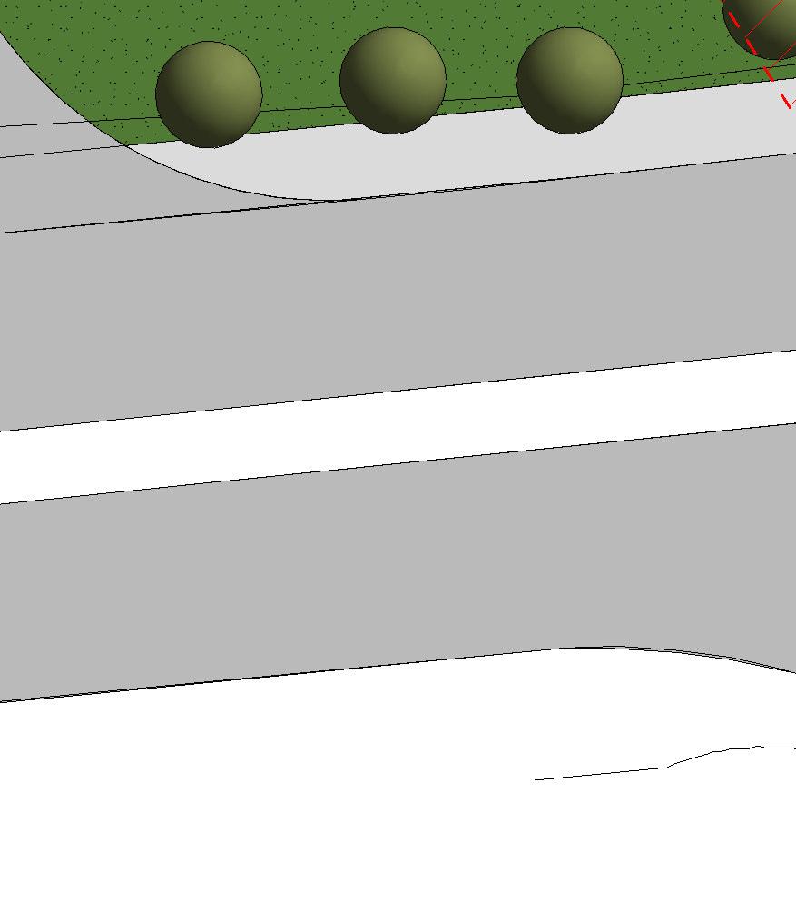
12 4 Assessment of Flood Risk All potential sources of flooding have been considered within the FCA and are discussed below. 4.1 Fluvial Flood Risk The NRW Risk of Flooding from Rivers and the Sea map, provided in Figure 2, illustrates that the Site is located in the very low flood risk zone (Flood Zone 1) and therefore has a risk of annual flooding from Main River sources that is less than 1 in 1,000 (0.1%). It is considered that there is no significant risk of flooding from main river sources. A minor unnamed watercourse flows southwards along the north eastern boundary of the Site and a drainage ditch runs along the northern boundary of the Site. No quantitative data is available for these ordinary watercourses. However, NCC confirm there are no records of historic flooding in this area and given the small size of these catchments, it is considered that there is a low flood risk from these watercourses. Figure 4 shows the channel of the unnamed watercourse, looking downstream from the northeast corner of the Site. The image shows the watercourse has a relatively wide, unconstrained channel, but with potential for large conveyance capacity. It is considered that there is no significance risk of flooding from ordinary watercourse sources. Figure 4: Unnamed Watercourse, taken from northeast corner of the Site looking south (downstream). 7
13 4.2 Groundwater The NCC FRMP and NCC PFRA state that, on a strategic scale, groundwater flooding is not considered to be a significant flood risk to the region and there are no recorded incidents of groundwater flooding in proximity to the Site. It is considered that there is no significant risk of flooding from groundwater sources. 4.3 Surface Water Flooding from this source is a potential risk during short, intense rainstorm events or longer duration storms when the capacity of underlying soils and drainage systems is exceeded and rainfall runs overland to pond in depressions in the landscape. It is important that due consideration is given to changes in surface water runoff patterns as a result of development proposals. The current land use of the entire Site is Greenfield, consisting of semi-improved and managed grassland. Surface water from the Site generally drains naturally to the ground via infiltration or, when the infiltration capacity of the soils is exceeded, flows overland in accordance with local topography towards the southeast corner of the Site and/or the ordinary watercourse. The NRW Risk of Flooding from Surface Water map 8, provided in Figure 5, shows that there are areas designated as at risk of surface water flooding within and in proximity to the Site boundary. The flood map takes a broad account of underground drainage and typical storms that are likely to cause flooding. The map shows four levels of flood risk: High: chance of flooding greater than 1-in-30 year (3.3%); Medium: chance flooding between 1-in-30 year (3.3%) and 1-in-100 year (1%); Low: chance of flooding between 1-in-100 year (1%) and 1-in-1,000 year (0.1%); and Very Low: chance of flooding less than 1-in-1,000 year (0.1%). The map does not contain sufficient information to determine flood risk to individual sites, however it provides an indication of whether, and to what extent, an area may be affected by surface water flooding. The map shows that the central area of the Site is at very low risk of surface water flooding, however land along the southern and eastern boundaries is designated with a low risk of flooding and land along the northern boundary and in the northeast and southeast corners are described as at medium to high risk of surface water flooding. 8 Cyfoeth Naturiol Cymru Natural Resources Wales (2017). Risk of Flooding from Surface Water, virtual map. Accessed online via: /Geocortex/Essentials/REST/sites/Flood_Risk/viewers/Flood_Risk/virtualdirectory/Resources/Config/Default 8

14 Figure 5: NRW Risk of Flooding from Surface Water, including the red line boundary. Contains OS data Crown copyright and database right The current land use of the Site is semi-improved grassland and broadleaved woodland and the proposed Development will increase the area of impermeable land cover which, if not sustainably managed, could lead to increases in flood risk both on Site and to neighbouring third party land. To mitigate any potential impacts of the Development on surface water flood risk, Sustainable Drainage Systems (SuDS), should be integrated into the design of the Site Estimation of Runoff Rates and Storage Volumes The storm water management requirements for a new development are assessed by calculating equivalent Greenfield runoff rates for the area of impermeable surface cover that will be added by the development, and then estimating the storage volume required to restrict runoff from these new impermeable surfaces to the Greenfield rates. 9
15 The proposed development will convert approximately 80% of the Site to impermeable surface cover and NCC have confirmed that runoff rates from the Site should be restricted to Greenfield rates. Equivalent Greenfield rainfall runoff rates and associated attenuation storage requirements have been estimated for this area using the Revitalised Flood Hydrograph method (ReFH) 9, part of a suite of techniques within the Flood Estimation Handbook 10. Greenfield runoff rates have been calculated for the 50%, 3.33% and 1% AEP events and are presented in Table 2 below. Table 2: Greenfield Peak Runoff Flow Rate for 50%, 3.33% and 1% AEP Events. Return Period Event (Annual Exceedance Probability) Greenfield Peak Flow Rate (l/s/ha) 50% % 7.7 1% 10.2 Storage volumes have been estimated for a rainstorm over the development Site with a 6-hour storm duration and 1% AEP inclusive of a 40% allowance for climate change, in line with CIRIA C609 and current NRW climate change guidelines. The Design Rainfall is the amount of rain that is predicted to fall on the proposed development Site during the event. The Net Rainfall is the portion of the Design Rainfall that contributes to surface water runoff, after accounting for losses due to evaporation, soil moisture retention and depression storage. To quantify the effect of the proposed Development on rainfall-runoff volumes, it has been assumed that no losses would occur when rain falls on the impervious services, such as roofs and hardstanding (these contribute to Net Rainfall). Those areas not covered by impermeable surfaces would encourage losses, with rainfall volume contributions calculated from Net Rainfall depths. The results of the calculations for the existing situation and the proposed Development option are presented in Table 3 below. Table 3: Existing and Proposed Development Rainfall-Runoff Volumes (1% AEP with Climate Change for 6-hour Storm). Option Total Volume of rainfall runoff (m³) (difference with respect to existing situation) Total Volume of rainfall runoff with Climate Change (m³) (difference with respect to existing situation) Existing Proposed Development 721 (+346) 1009 (+484) 9 Wallingford Hydrosolutions and Centre for Ecology and Hydrology (2016). Revitalised Hydrograph Model Version 2.2 Technical Guidance Report. Accessed online via: 10 Centre for Ecology and Hydrology (2016). Flood Estimation Handbook. Accessed online via: 10
16 The proposed development and the associated conversion of permeable to impermeable surfacing results in a significant increase in rainfall-runoff volume of 346m 3 and 484m 3 for the current and climate change (future) scenarios respectively. A comprehensive drainage strategy is therefore required so that the induced changes to the rainfall runoff regime does not impact on surface water flood risk on Site or on neighbouring third party land. The drainage strategy will incorporate appropriate Sustainable Drainage Solutions (SuDS) techniques that provide attenuation as well as treatment of surface water runoff. With an appropriate drainage strategy in place, it is considered that there would be no significant risk from surface water flooding on Site or to third party areas. 4.4 Sewers The NCC PFRA states that sewer flooding within Newport does not have significant consequences at a strategic scale and is instead limited to several small sewer flooding hotspots. The NCC PFRA and NCC LFRMS indicate that the flooding incidents in closest proximity to the Site have been from sewer flooding, however none of the extents from these events have included any areas within the Site boundary. It is considered that there is no significant risk of flooding from sewer sources. 4.5 Coastal/Tidal The Site is located over 7km from the coast and at an elevation of over 35m AOD, there is no risk of flooding at the proposed Development Site from tidal sources. 4.6 Artificial Sources The NRW Risk of Flooding from Reservoirs 11 map illustrates areas that could flood following the failure of a large reservoir and the subsequent release of any contained waters. The map shows that the entire Site is not considered at risk of reservoir flooding. No other potential sources of artificial flooding, including canals or lakes, have been identified in the area. It is considered that there is no risk of flooding from artificial sources. 11 Cyfoeth Naturiol Cymru Natural Resources Wales (2017). Risk of Flooding from Reservoirs, virtual map. Accessed online via: /Geocortex/Essentials/REST/sites/Flood_Risk/viewers/Flood_Risk/virtualdirectory/Resources/Config/Default 11
17 5 Flood Risk Mitigation Measures The entire Site and its proposed access/egress routes are designated as within TAN15 Zone A and the Site is considered to be at little or no risk of fluvial or tidal/coastal flooding and the justification test is not applicable and no need to consider flood risk further. As such, no additional mitigation measures are required to manage flood risk from rivers, the sea, groundwater or artificial sources. With regards to flood risk from surface water runoff and sewers, as the Development will convert semiimproved grassland to impermeable land cover, the design of a suitable surface water drainage system, incorporating SuDS is a key requirement. In addition, consultation with Dwr Cymru Welsh Water, as the statutory sewerage undertaker, is recommended to agree appropriate rates of foul water discharge. 12
18 6 Flood Risk and Consequences Summary All potential sources of flood risk to the proposed Development have been investigated using a desk study approach. Flood risk from fluvial, groundwater, artificial and coastal/ tidal sources have been assessed as low. Surface water flooding has been confirmed as the main source of flood risk to the Site. The centre of the Site is designated with a very low risk of surface water flooding, however the boundaries of the site, in particular the southern, northern and eastern edges are designated with medium-high surface water flood risk. The proposed Development will result in an increase in impermeable land cover, with approximately 80% of the Site being turned from greenfield land to built development. Calculations have confirmed that this change in land cover results in impacts on the existing rainfall runoff regime, which if not managed, poses an increased surface water flood risk, to the Site and third party areas. A drainage strategy would be produced for the proposed Development, which ensures that surface water runoff rates and volumes match existing (Greenfield) rates. The drainage strategy would incorporate a number of SuDS techniques, selected to accommodate site specific ground conditions and constraints. Access and egress to the proposed Development Site would be flood free in events up to and including the 0.1% AEP flood event. It is concluded that the development proposals satisfy the development and flood risk policy requirements of TAN15. 13
19 Appendix A Detailed Site Layout Plan


20 General Notes 1. Contractor to verify all dimensions and check level datums on site 2. All of the designs are the sole property of TACP Architects Ltd and may not be used without their written agreement 3. All prints, specifications and their copyright are the property of TACP Architects Ltd North 4. Do not scale off drawings 5. All dimensions shall be checked on site before commencment of shop drawings, manufacture and all discrepencies must be reported to TACP Architects Ltd STAFF CAR PARKING 7 Spaces Staff Entrance HOTEL DEVELOPMENT Entrance DROP-OFF ZONE CAR PARKING 7 Spaces Outdoor Seating Area Hotel Car Parking Barrier Risk Assessments Starbucks Drive-Thru 4 Wheelchair Users Spaces CAR PARKING 143 Spaces Revisions Rev A B COLDRA WOOD Date 22/02/17 23/02/17 Description By Site context added KA Area around Starbucks revised in accordance with client's AW comments. Check KA CAR PARKING 15 Spaces Consultants Client Lewis & Lewis Project Title Langstone Hotel Drawing Title Site layout Scale 1 : 200@A0 Date Drawn By Checked By 03/02/17 JH DM Job Number Drawing Number ST-01 Office Wrexham Revision B TACP Architects Ltd Pembroke House Ellice Way, Wrexham Technology Park, Wrexham, LL13 7YT admin@tacparchitects.co.uk Architecture Interior Design Healthcare Planning Conservation Masterplanning Sustainable Design
117 372 1200 arcadis.")
21 Arcadis Consulting (UK) Limited 2 Glass Wharf Temple Quay Bristol BS2 0FR United Kingdom T: +44 (0) arcadis.com
Flood Risk and Drainage Assessment.
 Flood Risk and Drainage Assessment. Change of Use off land to Leisure Complex At, Caersws, Powys, SY17 5SB October 2018 Statement prepared for: Mr T Bebb By Woodsyde Developments Ltd Woodsyde Developments
Surface Water Guidance for Developers
 Surface Water Guidance for Developers Contents Overview of Sustainable Drainage Systems (SuDS)... 2 Information Required in a Flood Risk Assessment or Drainage Strategy... 3 Outline Planning Applications...
Rising Sun. Scaffold Hill. Flood Risk Assessment
 Rising Sun Scaffold Hill Flood Risk Assessment August 2010 Contents 1.0 Introduction... 4 2.0 Site Description... 5 3.0 Legislative Framework... 6 4.0 Flood Risk... 10 5.0 Surface Water Drainage... 11
Refer to Chapter 3.0 (Description of Development) for a detailed site and development description.
 for a detailed site and development description.") 7. WATER: HYDROGEOLOGY & HYDROLOGY 7.1 Introduction This chapter of the EIAR comprises of an assessment of the likely impact of the proposed development on the surrounding surface water and hydrogeological
7. WATER: HYDROGEOLOGY & HYDROLOGY 7.1 Introduction This chapter of the EIAR comprises of an assessment of the likely impact of the proposed development on the surrounding surface water and hydrogeological
Barton Farm Winchester. Outline Planning Application A New Suburb for Winchester. Flood Risk Assessment prepared by Parsons Brinckerhoff
 Barton Farm Winchester Outline Planning Application A New Suburb for Winchester Flood Risk Assessment prepared by Parsons Brinckerhoff November 2009 BARTON FARM WINCHESTER FLOOD RISK ASSESSMENT May 2009
DOUGHTY ROAD, GRIMSBY Flood Risk Assessment and Surface Water Drainage Strategy DECEMBER 2017
 Flood Risk Assessment and Surface Water Drainage Strategy DECEMBER 2017 CONTACTS SARAH DEMETRIOU Graduate Flood Modeller dd 0117 313 6152 e sarah.demetriou@arcadis.com Arcadis. 2 Glass Wharf Temple Quay
Isle of Wight Strategic Flood Risk Assessment MK2. Appendix P Newport
 Isle of Wight Strategic Flood Risk Assessment MK2 Appendix P June 2010 Isle of Wight Strategic Flood Risk Assessment Overview Please review this discussion in conjunction with the mapping provided in this
Drainage Strategy Report
 CONSULTING ENGINEERS Report No: Date: C1014 Aug 2017 Project: Drainage Strategy Report Danygraig Works, Risca Client: P.D. Edenhall This report is provided for the benefit only of the party to whom it
Developers Guide for Surface Water Management.
 Developers Guide for Surface Water Management www.southwark.gov.uk Contents 1. Introduction... 2 2. Requirements for Flood Risk Assessments and Drainage Strategies... 3 2.1 Planning Applications... 3 2.2
Isle of Wight Strategic Flood Risk Assessment MK2. Appendix E West Wight
 Isle of Wight Strategic Flood Risk Assessment MK2 Appendix E June 2010 Isle of Wight Strategic Flood Risk Assessment Overview The RDA is comprised of the towns of Totland and Freshwater and is classified
Flood Consequence Assessment. Proposed Commercial Development, Tank Farm Way, Sully
 Flood Consequence Assessment Proposed Commercial Development, Tank Farm Way, Sully Client O Reilly Concrete Group Larchfield Kingscourt County Cavan Ireland By RVW Consulting 6 Neptune Court Vanguard Way
Respond! Housing Association. Residential Development at Flinters Field, Athy, Co. Kildare. Engineering Report. Job No. : Date: April 2017
 Job No. : 16036 Date: April 2017 Respond! Housing Association Residential Development at Flinters Field, Athy, Co. Kildare Engineering Report 2B Richview Office Park Clonskeagh Dublin 14 Contents Amendment
Attachment 12 Stage 1 Flood Risk Assessment (IE RP-0001)
") IE0311133-22-RP-0001, Issue A 17/10/2013 Attachment 12 Stage 1 Flood Risk Assessment (IE0311133-30-RP-0001) IE0311133-22-RP-0001_A_02.DOC Flood Risk Assessment Celebrating 40 Years in Business Jazz Pharmaceuticals
IE0311133-22-RP-0001, Issue A 17/10/2013 Attachment 12 Stage 1 Flood Risk Assessment (IE0311133-30-RP-0001) IE0311133-22-RP-0001_A_02.DOC Flood Risk Assessment Celebrating 40 Years in Business Jazz Pharmaceuticals
Flood Risk Assessment. for. Proposed Residential Development at Bentletts Scrap Yard Claygate Road Collier Street Kent
 Flood Risk Assessment for Proposed Residential Development at Bentletts Scrap Yard Claygate Road Collier Street Kent 1129-1008 February 2016 RCD Consultants Ltd Proposed Residential Development Bentletts
Foul Drainage Assessment and Surface Water Management Plan Land at Mill Lane Hawkinge CT18 7BY
 Foul Drainage Assessment and Surface Water Management Plan Land at Mill Lane Hawkinge CT18 7BY RMB Consultants (Civil Engineering) Ltd March 2015 RMB Consultants (Civil Engineering) Ltd 39 Cossington Road
Land North East of Blandford
 Land North East of Blandford On behalf of Savills Plc Project Ref: 36965/4001 Rev: B Date: February 2016 Office Address: Lakeside House, Blackbrook Business Park, Blackbrook Park Avenue, Taunton TA1 2PX
Appendix 8.4. Site-wide Drainage Strategy
 Appendix 8.4 Site-wide Drainage Strategy Noble House, Capital Drive, Linford Wood, Milton Keynes MK14 6QP T +44 (0)1908 669898 F +44 (0)1908 669899 E harrisjt@rpsgroup.com W www.rpsgroup.com/design THE
Lidl, Chippenham. Flood Risk Assessment & Drainage Strategy. September 2017
 September 2017 DOCUMENT VERIFICATION RECORD CLIENT: SCHEME: INSTRUCTION: Lidl UK GmbH Proposed Lidl Food store at the former Middlefield Adult Training Centre, Chippenham SN14 0JP The instruction to carry
Flood risk management and land use planning in changing climate conditions Mikko Huokuna Finnish Environment Institute, SYKE
 10th International Drainage Workshop of ICID 06.-11. July 2008 Flood risk management and land use planning in changing climate conditions Mikko Huokuna Finnish Environment Institute, SYKE Background hydrological
NW Bicester Masterplan. Flood Risk Assessment
 NW Bicester Masterplan Flood Risk Assessment Hyder Consulting (UK) Limited 2212959 Aston Cross Business Village 50 Rocky Lane Aston Birmingham B6 5RQ United Kingdom Tel: +44 (0)121 345 9000 Fax: +44 (0)121
Scottish Hydrological Group Meeting, 13 th November Surface water management plans in action Case studies in Kent.
 Scottish Hydrological Group Meeting, 13 th November 2013. Surface water management plans in action Case studies in Kent Paul Eccleston Topics Prioritisation and broad-scale surface water mapping Case study
Phase 1 FLOOD RISK ASSESSMENT REPORT
 Phase 1 FLOOD RISK ASSESSMENT REPORT PREPARED FOR: REFERENCE #: 1916 MS Power Projects Ltd DATE: February 2014 Page 1 of 24 AMBIENTAL TECHNICAL SOLUTIONS LTD. DOCUMENT ISSUE RECORD PROJECT: PHASE 1 FLOOD
ABERDEEN HARBOUR EXPANSION PROJECT November Volume 2: Environmental Statement. Chapter 8: FLOOD RISK AND SURFACE WATER
 ABERDEEN HARBOUR EXPANSION PROJECT November 2015 Volume 2: Environmental Statement Chapter 8: FLOOD RISK AND SURFACE WATER 8. FLOOD RISK AND SURFACE WATER 8.1 Introduction This chapter presents an assessment
FLOOD RISK ASSESSMENT
 Firth Buildings, 99-101 Leeds Road, Dewsbury, WF12 7BU t 01924 464342 f 01924 450662 e trevor.haigh@haighhuddleston.co.uk FLOOD RISK ASSESSMENT ON LAND AT BUTT LANE SNAITH WEST YORKSHIRE FOR HARRON HOMES
MAUREEN SMITH PROPOSED RESIDENTIAL DEVELOPMENT: 121 NESS ROAD, SHOEBURYNESS, SOUTHEND ON SEA FLOOD RISK ASSESSMENT
 WARD MAUREEN SMITH PROPOSED RESIDENTIAL DEVELOPMENT: 121 NESS ROAD, SHOEBURYNESS, SOUTHEND ON SEA HOMES FLOOD RISK ASSESSMENT REPORT REF. 170090-01 PROJECT NO. 170090 APRIL 2017 121 NESS ROAD, SHOEBURYNESS
Appendix 7.A Flood Risk Assessment Pro-forma
 Appendix 7.A Flood Risk Assessment Pro-forma Entec UK Limited Entec UK Limited 1 PPS25 Flood Risk Assessment Pro-forma 1. Development description and location 1a. What type of development is proposed and
Preliminary Rainfall Runoff Management for Developments EA/Defra Report Procedure W5-074/A Summary Guidance for Developers and Engineers
 Preliminary Rainfall Runoff Management for Developments EA/Defra Report Procedure W5-074/A Summary Guidance for Developers and Engineers 1. Objective of this guidance and Procedure W5-074/A is to assist
Sustainable Drainage Design Guidance
 Sustainable Drainage Design Guidance Contents Introduction 3 1. Legislative and Policy Background 4 2. What are Sustainable Drainage Systems? 5 3. Designing SuDS 7 4. Maintaining SuDS 9 5. Construction
FORMER SHEEP PEN MILL LANE WELSHPOOL FLOOD CONSEQUENCES ASSESSMENT LIDL UK GMBH FOR. September Our Ref: RCEF R
 FORMER SHEEP PEN MILL LANE WELSHPOOL FLOOD CONSEQUENCES ASSESSMENT FOR LIDL UK GMBH Our Ref: RCEF32271-002 R RPS Health, Safety & Environment Unit 12 Watersedge Business Park Modwen Rd, Salford Quays M5
Sustainability Criteria for the Design of Stormwater Drainage Systems for the 21 st Century
 Sustainability Criteria for the Design of Stormwater Drainage Systems for the 21 st Century R. Kellagher 1 and H. Udale-Clarke 1 * 1 HR Wallingford Ltd., Howbery Park, Wallingford. Oxfordshire, OX10 8BA,
Appendix G Preliminary Hydrology Study
 Appendix G Preliminary Hydrology Study Preliminary Hydrology Study VESTING TTM 72608 Long Beach, CA Prepared for: The Long Beach Project, LLC 888 San Clemente, Suite 100 New Port Beach, CA May 28, 2014
East Riding of Yorkshire Council STRATEGIC FLOOD RISK ASSESSMENT (SFRA) Level 1. APPENDIX C Surface Water Flood Hazard Mapping
 Level 1. APPENDIX C Surface Water Flood Hazard Mapping") APPENDIX C Surface Water Flood Hazard Mapping (this page intentionally left blank) Introduction Surface water or pluvial flooding can be defined as flooding which results from rainfall generated overland
APPENDIX C Surface Water Flood Hazard Mapping (this page intentionally left blank) Introduction Surface water or pluvial flooding can be defined as flooding which results from rainfall generated overland
SITE SPECIFIC FLOOD RISK ASSESSMENT NEW STUDENT ACCOMMODATION, FASSAUGH AVENUE, CABRA, DUBLIN / F5.1 3 RD JANUARY 2018
 SITE SPECIFIC FLOOD RISK ASSESSMENT NEW STUDENT ACCOMMODATION, FASSAUGH AVENUE, CABRA, DUBLIN 7 26 098 / F5.1 3 RD JANUARY 2018 Issued For Distribution Revision Final Architect B 1 INTRODUCTION 1.1 It
15: DEVELOPMENT AND FLOOD RISK
 Planning Policy Wales Technical Advice Note 15: DEVELOPMENT AND FLOOD RISK July 2004 This document is one of a series of Technical Advice Notes (TANs) which supplement Planning Policy Wales. Further information
SWMPs and SFRAs Sa S m m W ingfifeld
 SWMPs and SFRAs Sam Wingfield Introduction 1. Introduction to the Cumbria SWMP. Impact on future development and types of actions that will be proposed. 2. Flood risk mitigation options for future development
Kildare County Council. Proposed Development of 77 no. Residential Units at College Wood Manor, Ballingappa Road, Clane, Co. Kildare.
 Job No. : 16027 SHB2-CLA-CS-MOR Date: Feb 2018 Kildare County Council Proposed Development of 77 no. Residential Units at College Wood Manor, Ballingappa Road, Clane, Co. Kildare. Engineering Report 2B
Surface water is the rainwater that runs off roofs, roads and paved areas into the public sewerage system.
 This standard advice note is intended to provide clear guidance for all developers, and planning authorities regarding surface water design and management. It should also be used to inform development
Foul Water Drainage Strategy Monkton Road Minster CT12 4EE
 66-68 Monkton Road Minster CT12 4EE RMB Consultants (Civil Engineering) Ltd May 2016 RMB Consultants (Civil Engineering) Ltd 39 Cossington Road Canterbury Kent CT1 3HU Tel 01227 472128 www.rmbconsultants.co.uk
Stormwater Erosion Control & Post-Construction Plans (Stormwater Quality Plans)
") Stormwater Erosion Control & Post-Construction Plans (Stormwater Quality Plans) Allen County Stormwater Plan Submittal Checklist The following items must be provided when applying for an Allen County Stormwater
Stormwater Erosion Control & Post-Construction Plans (Stormwater Quality Plans) Allen County Stormwater Plan Submittal Checklist The following items must be provided when applying for an Allen County Stormwater
Action plans for hotspot locations
 Action plans for hotspot locations Ash Vale North 1. Local evidence indicates the culvert could not discharge during December 2013 because the outlet was blocked on the western side of the railway. Guildford
( THE M4 CORRIDOR AROUND NEWPORT SCHEME )
") PUBLIC INQUIRY IN THE MATTER OF THE HIGHWAYS ACT 1980 AND THE ACQUISITION OF LAND ACT 1981 AND IN THE MATTER OF: THE M4 MOTORWAY (JUNCTION 23 (EAST OF MAGOR) TO WEST OF JUNCTION 29 (CASTLETON) AND CONNECTING
PUBLIC INQUIRY IN THE MATTER OF THE HIGHWAYS ACT 1980 AND THE ACQUISITION OF LAND ACT 1981 AND IN THE MATTER OF: THE M4 MOTORWAY (JUNCTION 23 (EAST OF MAGOR) TO WEST OF JUNCTION 29 (CASTLETON) AND CONNECTING
D12 LAND DRAINAGE, WATER CONSERVATION, FOUL DRAINAGE AND SEWAGE DISPOSAL AN INTEGRATED WATER STRATEGY
 D12 LAND DRAINAGE, WATER CONSERVATION, FOUL DRAINAGE AND SEWAGE DISPOSAL AN INTEGRATED WATER STRATEGY OBJECTIVES D12/a To ensure that the development would not be at risk of flooding either from itself
Engineering Services Report for. Proposed Student Housing Development. Westwood Hotel Site. Dangan, Upper Newcastle. Galway City
 Engineering Services Report for Proposed Student Housing Development Westwood Hotel Site Dangan, Upper Newcastle Galway City Client: NTM ROI Seed Capital LP Job No. A079 May 2018 Engineering Services Report
Proposed Alterations and Extension to 17 St. John's Road, Sandymount, Dublin 4
 Proposed Alterations and Extension to 17 St. John's Road, Sandymount, Dublin 4 Engineering Report April, 2014 1422 Issue 1 Casey O Rourke Associates Structural & Civil Consulting Engineers 77 Merrion Square
Strategic Flood Risk Assessment (SFRA) Level 2
 Level 2") Strategic Flood Risk Assessment (SFRA) Level 2 (Final) South Bucks District Council Capswood Oxford Road Denham UB9 4LH (this page intentionally blank) Level 2 SFRA Background The South Bucks Level 1 SFRA
Strategic Flood Risk Assessment (SFRA) Level 2 (Final) South Bucks District Council Capswood Oxford Road Denham UB9 4LH (this page intentionally blank) Level 2 SFRA Background The South Bucks Level 1 SFRA
South Worcestershire Strategic Flood Risk Assessment Level 2 Update
 South Worcestershire Strategic Flood Risk Assessment Level 2 Update Worcester West Site Assessment Final Report February 2015 This page is intentionally left blank 2015s2316 Worcester West Site Assessment
Reducing surface flow during floods by proposed landscape interventions at Gaythorne Hall Farm in the headwater of Scale Beck, Cumbria
 Reducing surface flow during floods by proposed landscape interventions at Gaythorne Hall Farm in the headwater of Scale Beck, Cumbria Flood storage upstream of drystone wall 3c following Storm Eva 23-24
11 HYDROLOGY, HYDROGEOLOGY AND DRAINAGE
 11 HYDROLOGY, HYDROGEOLOGY AND DRAINAGE 11.1 introduction 11.1.1 The objective of this section and the statements presented is to assess the existing hydrological and hydrogeological conditions to understand
The Flood Risk Implications of Strategic Development at Barnham / Eastergate / Westergate
 at Barnham / Eastergate / Westergate The Hydrological and Hydrogeological Aspects of Tidal sluice and pumping station on the Aldingbourne Rife at Felpham Richard Allitt Associates Ltd Suite 3, Forge Offices
The Drainage Basin System
 The Drainage Basin System These icons indicate that teacher s notes or useful web addresses are available in the Notes Page. This icon indicates that the slide contains activities created in Flash. These
Horton Landfill, Small Dole, West Sussex. Infill of geological SSSI. Surface Water Management Assessment. Current Approved Design
 Horton Landfill, Small Dole, West Sussex Infill of geological SSSI Surface Water Management Assessment Current Approved Design Planning Permission DC/814/07 (UB) Condition 21 (Surface Water Management)
Initial Construction Costs For Various Pavement and Drainage Options
 Interpave Initial Construction Costs For Various Pavement and Drainage Options Final Prepared For Interpave Scott Wilson Ltd Interpave Pavement Design CONTENTS 1. Overview 2. Summary of Pavement Types
Flood Risk Assessment
 15T788 Proposed Lidl Store, Stanley Street, South Shields 07 December 2015 Prepared By Billinghurst George & Partners www.bgp-consulting.co.uk Waterloo House, Teesdale South, Thornaby, Stockton on Tees
Modelling landscape opportunities, multiple benefits and impacts
 In partnership with: Modelling landscape opportunities, multiple benefits and impacts Iain Craigen and Charlotte Beattie Natural Flood Management and Working With Natural Processes There is a growing evidence
Wylfa Newydd Project A5025 On-line Highway Improvements
 ENERGY WORKING FOR BRITAIN Wylfa Newydd Project Flood Consequences Assessment Wylfa Newydd Project Flood Consequence Assessment Contents 1 Introduction... 1 1.1 Purpose of this document... 1 1.2 Background...
Understanding flood risk
 Guides for Community Emergency Volunteers Understanding flood risk The Guides for Community Emergency Volunteers series has been developed in collaboration with: 2 The series has been funded through grants
ATTACHMENT E.2 EMISSIONS TO SURFACE WATERS SITE SERVICES LAYOUT SHEET 1 OF 2 (IE DR-0021)
") ATTACHMENT E.2 EMISSIONS TO SURFACE WATERS SITE SERVICES LAYOUT SHEET 1 OF 2 (IE0310818-30-DR-0021) SITE SERVICES LAYOUT SHEET 2 OF 2 (IE0310818-30-DR-0022) LOCATION OF EMISSION TO SURFACE WATER (IE0310818-22-DR-
ATTACHMENT E.2 EMISSIONS TO SURFACE WATERS SITE SERVICES LAYOUT SHEET 1 OF 2 (IE0310818-30-DR-0021) SITE SERVICES LAYOUT SHEET 2 OF 2 (IE0310818-30-DR-0022) LOCATION OF EMISSION TO SURFACE WATER (IE0310818-22-DR-
APPENDIX E APPENDIX E ESTIMATING RUNOFF FOR SMALL WATERSHEDS
 APPENDIX E ESTIMATING RUNOFF FOR SMALL WATERSHEDS March 18, 2003 This page left blank intentionally. March 18, 2003 TABLES Table E.1 Table E.2 Return Frequencies for Roadway Drainage Design Rational Method
Flow estimate for a Site in South Wales
 April 2011 Flow estimate for a Site in South Wales Wallingford HydroSolutions Limited For and on behalf of Wallingford HydroSolutions Ltd Client Prepared by Approved by Position Click here to enter text.
Muse Developments Ltd Mile End Road Development Flood Risk and Surface Water Drainage Strategy
 Muse Developments Ltd Mile End Road Development Flood Risk and Surface Water Drainage Strategy FRSWDS/MER Issue 1 20 October 2016 This report takes into account the particular instructions and requirements
Surface Water Management Masterplan. Summary and Actions. September 2016
 Surface Water Management Masterplan Summary and Actions September 2016 Contents Section Page 1. MGSDP Area and Partners 1 2. MGSDP Objectives, Vision and Guiding Principles 3 3. Surface Water Management
PRE-APPLICATION MEETING Meeting Minutes
 PRE-APPLICATION MEETING Meeting Minutes Date/Time : Location : Attendees: Site Location: LPA District reference: KCC reference: 2 nd May 2017, 09:30am The Street, Great Chart, Ashford Alex Brauninger,
Uttlesford District Council Uttlesford District Water Cycle Study
 Uttlesford District Council Uttlesford District Water Cycle Study Stage 1: Scoping and Outline Study High Level Summary Report Hyder Consulting (UK) Limited 2212959 Aston Cross Business Village 50 Rocky
Project Mensa Flood Risk Assessment. Final Report 23 December 2008
 Project Mensa Flood Risk Assessment Final Report 23 December 2008 This page is left intentionally blank for double sided printing L Project Mensa Flood Risk Assessment 23 December 2008 Notice This report
FLOOD WARNING & EVACUATION PLAN LIMEHOUSE MARINA, LONDON DECEMBER 2010
 FLOOD WARNING & EVACUATION PLAN LIMEHOUSE MARINA, LONDON DECEMBER 2010 No 2 Smithy Farm Chapel Lane Bruera Chester CH3 6EW Tel: 01244 677060 Fax: 01244 620431 info@weetwood.net www.weetwood.net SIGNATURE
Storm Water Management
 Storm Water Management Policy September 2014 2 Sustainable drainage feature designed to control and manage flows through a series of check dams 3 Document Name: Storm Water Management Controlled Copy No:
Drainage Servicing Report - Terms of Reference
 Urban Form and Corporate Strategic Development City Planning 7th Floor, Edmonton Tower 10111 104 Avenue NW Edmonton, AB T5J 0J4 edmonton.ca July 2018 1 Introduction: Drainage Servicing Reports Drainage
LDS Technical Guidance
 May 21, 2008 The following was provided to County staff as internal guidance for reviewers in applying the adequate outfall requirements of the Public Facilities Manual (PFM). A number of private sector
EDEN WESTWOOD FLOOD RISK ASSESSMENT
 EDEN WESTWOOD FLOOD RISK ASSESSMENT CONSULTATION DRAFT AUGUST 2016 EDEN WESTWOOD FLOOD RISK ASSESSMENT Consultation Draft Project no: 286897A-HHC Date: August 2016 Kings Orchard 1 Queen Street Bristol
21 ST CENTURY DRAINAGE PROGRAMME CAPACITY ASSESSMENT FRAMEWORK EXECUTIVE SUMMARY
 21 ST CENTURY DRAINAGE PROGRAMME CAPACITY ASSESSMENT FRAMEWORK EXECUTIVE SUMMARY Report Ref. No. 21CDP.CAF Programme Area & Reference Report Title Project Management Contractor Sub-Contractor Author of
Rutherglen (Potentially Vulnerable Area 11/14) Local Plan District Clyde and Loch Lomond Local authority Glasgow City Council, South Lanarkshire Counc
 Local Plan District Clyde and Loch Lomond Local authority Glasgow City Council, South Lanarkshire Counc") Rutherglen (Potentially Vulnerable Area 11/14) Local Plan District Clyde and Loch Lomond Local authority Glasgow City Council, South Lanarkshire Council Main catchment Cityford Burn Summary of flooding
Rutherglen (Potentially Vulnerable Area 11/14) Local Plan District Clyde and Loch Lomond Local authority Glasgow City Council, South Lanarkshire Council Main catchment Cityford Burn Summary of flooding
Cambridgeshire s Culvert Policy. An explanation of our policy regarding applications to culvert ordinary watercourses.
 Cambridgeshire s Culvert Policy An explanation of our policy regarding applications to culvert ordinary watercourses. Document History Document history Details By Current Version Date Initial draft RH
OHM Groups. FUNCTIONAL SERVICING REPORT 33 Arkell Road City of Guelph August 5, Prepared By:
 Prepared By: OHM Groups FUNCTIONAL SERVICING REPORT 33 Arkell Road City of Guelph 114169 August 5, 2015 Guelph Owen Sound Listowel Kitchener Exeter Hamilton GTA 650 Woodlawn Rd. W., Block C, Unit 2, Guelph
FLOOD CONSEQUENCE ASSESSMENT FOR A PROPOSED RESIDENTIAL DEVELOPMENT SITE ADJACENT TO GLANDULAS FARM, NEWTOWN, POWYS
 FOR A PROPOSED RESIDENTIAL DEVELOPMENT SITE ADJACENT TO GLANDULAS FARM, NEWTOWN, POWYS Report Reference: 218/FCA Draft: Version D1 July 2016 Report prepared for: Berry Brothers Willow House East Shrewsbury
This document was endorsed by Cambridgeshire County Council (CCC) in its capacity as Lead Local Flood Authority on 14 July 2016.
 in its capacity as Lead Local Flood Authority on 14 July 2016.") Note to the reader Note to the reader This document was endorsed by Cambridgeshire County Council (CCC) in its capacity as Lead Local Flood Authority on 14 July 2016. Once adopted as a Supplementary Planning
Note to the reader Note to the reader This document was endorsed by Cambridgeshire County Council (CCC) in its capacity as Lead Local Flood Authority on 14 July 2016. Once adopted as a Supplementary Planning
Environment Agency Guidance on Requirements for Land Contamination Reports. July 2005
 Environment Agency Guidance on Requirements for Land Contamination Reports July 2005 ENVIRONMENT AGENCY GUIDANCE ON REQUIREMENTS FOR LAND CONTAMINATION REPORTS Context Who is this guidance aimed at? Developers,
Drainage Report. New Braunfels Municipal Airport. Master Plan Update 2005
 Drainage Report Master Plan Update 2005 General The Texas Department of Transportation (TxDOT), Aviation Division, retained the consulting engineering team of Parkhill, Smith & Cooper, Inc. (PSC), to prepare
Flood Risk Assessment
 Flood Risk Assessment Low Whita Swaledale Morrison Utility Services Report Reference: CLE30080/05/01 Clear Environmental Consultants July 2015 QUALITY ASSURANCE Client: Morrison Utility Services Report
STORMWATER MANAGEMENT REPORT DRAFT PLAN OF CITY OF GUELPH
 Debrob Investments Limited STORMWATER MANAGEMENT REPORT DRAFT PLAN OF SUBDIVISION, CITYVIEW DRIVE CITY OF GUELPH PRELIMINARY NOVEMBER 2, 2011 I B I G R O U P P R E L I M I N A R Y Debrob Investments Limited
Proposed Development on Land West of Lancaster Park, Morpeth, Northumberland. Flood Risk Assessment including Surface Water Drainage Strategy Addendum
 Mitford Estate LLP Proposed Development on Land West of Lancaster Park, Morpeth, Northumberland Flood Risk Assessment including Surface Water Drainage Strategy Addendum August 2015 Matthew Elliott www.wyg.com
Yorkton Rona Commercial and Industrial development. Concept Plan and Serviceability Report
 Yorkton Rona Commercial and Industrial development Concept Plan and Serviceability Report Prepared for: 101242326 Sask Ltd. Box Ft Quappelle, SK Canada S0G 1S0 Prepared by: Stantec Consulting Ltd. 302-1345
FLOOD RISK ASSESSMENT DAMHEAD CREEK 2 POWER STATION
 FLOOD RISK ASSESSMENT DAMHEAD CREEK 2 POWER STATION Name Job Title Date Prepared Joanne Somerton Senior Consultant (Flood Risk) 14/01/2016 Checked Kerry Whalley Technical Director 04/02/2016 Technical
Developing a local flood risk management strategy Annex 1: Flooding, flood sources and flood defences
 Developing a local flood risk management strategy Annex 1: Flooding, flood sources and flood defences Pennine Water Group, University of Sheffield in collaboration with the partners of the FloodResilienCity
Kildare County Council. Proposed Development of 74 no. Residential Units at Craddockstown Road, Cradockstown Demesne, Naas, Co. Kildare.
 Job No. : 16027 SHB1-CRA-CS-MOR Date: April 2017 Kildare County Council Proposed Development of 74 no. Residential Units at Craddockstown Road, Cradockstown Demesne, Naas, Co. Kildare. 2B Richview Office
APPENDIX E ESTIMATING RUNOFF FROM SMALL WATERSHEDS
 ESTIMATING RUNOFF FROM SMALL WATERSHEDS June 2011 THIS PAGE LEFT BLANK INTENTIONALLY. June 2011 TABLES Table E.1 Table E.2 Return Frequencies for Roadway Drainage Design Rational Method Values June 2011
Surface Water Drainage Pro-forma for major developments
 Surface Water Drainage Pro-forma for major developments We advise that developers complete this form and submit it to the Local Planning Authority with their planning application, referencing from where
E. STORMWATER MANAGEMENT
 E. STORMWATER MANAGEMENT 1. Existing Conditions The Project Site is located within the Lower Hudson Watershed. According to the New York State Department of Environmental Conservation (NYSDEC), Lower Hudson
YORKSHIRE WATER SERVICES. Humbercare Sewerage Network Analysis
 YORKSHIRE WATER SERVICES Humbercare Sewerage Network Analysis Page 1 July 2008 1 Summary 1.1 Introduction 1.1.1 Following flooding in Hull in June 2007 we have been asked by Ofwat to investigate, model
Residential Development at Fortunestown Lane & Garter Lane, Saggart Co. Dublin Flood Risk Assessment
 Residential Development at Fortunestown Lane & Garter Lane, Saggart Co. Dublin Flood Risk Assessment Final Report December 2017 DBFL Consulting Engineers JBA Project Manager Tim Cooke Unit 3, Block 660
Nuriootpa (Sturt Highway Service Centre) DPA The Barossa Council Appendices. Appendix C - Herriot Consulting Engineering Assessment
 DPA The Barossa Council Appendices. Appendix C - Herriot Consulting Engineering Assessment") Nuriootpa (Sturt Highway Service Centre) DPA The Barossa Council Appendices Appendix C - Herriot Consulting Engineering Assessment 4th May 2018 C1803-002 Rocland Estate Lot 147 Sturt Highway, Nuriootpa
Nuriootpa (Sturt Highway Service Centre) DPA The Barossa Council Appendices Appendix C - Herriot Consulting Engineering Assessment 4th May 2018 C1803-002 Rocland Estate Lot 147 Sturt Highway, Nuriootpa
Functional Servicing Report. Winston Park West Proposed Business Park Development Project. Infrastructure Ontario (IO) September MU1
 September MU1") Functional Servicing Report Winston Park West Proposed Business Park Development Project (IO) September 2011 14-11208-001-MU1 Winston Park West 2 TABLE OF CONTENTS Page 1.0 INTRODUCTION... 3 1.1 SITE DESCRIPTION...
Functional Servicing Report Winston Park West Proposed Business Park Development Project (IO) September 2011 14-11208-001-MU1 Winston Park West 2 TABLE OF CONTENTS Page 1.0 INTRODUCTION... 3 1.1 SITE DESCRIPTION...
Drainage design tools
 Drainage design tools Richard Kellagher This presentation Designing drainage systems > Conveyance >Storage > Infiltration > Interception > Exceedence Assessing outline designs (planning) Checking detailed
City Development Plan Variation No. 7 Marina Park - Pairc Ui Chaoimh
 City Development Plan Variation No. 7 Marina Park - Pairc Ui Chaoimh Strategic Environmental Assessment (SEA) Screening Report 25 th November 2011 Cork City Council Comhairle Cathrach Chorcaí Proposed
Ryde/Binstead. Flood Investigation Report
 Ryde/Binstead Flood Investigation Report Flood Investigation Report Document Information Document Information Document Reference 2013-IWC-LLFA-009-13 Document Revision Report Status FINAL Date 24 June
Pre-Development Enquiry Form
 Pre-Development This application form is to be used to assess if we are able to provide your development with water and/or drainage services for a planned development. It is expected that this is submitted
STORM WATER MANAGEMENT STANDARDS DRAFT
 STORM WATER MANAGEMENT STANDARDS 1. Storm Water Management Plans (SWMP) - All development activity that is required to have a permit for land disturbing shall have an approved Storm Water Management Plan
FUNCTIONAL SERVICING AND STORMWATER MANAGEMENT STUDY 405 TWEEDSMUIR AVENUE
 FUNCTIONAL SERVICING AND STORMWATER MANAGEMENT STUDY FOR CITY OF OTTAWA PROJECT NO.: 11-532 FOR TABLE OF CONTENTS 1.0 INTRODUCTION... 1 1.1 Existing Conditions... 2 1.2 Required Permits / Approvals...
6.0 Runoff. 6.1 Introduction. 6.2 Flood Control Design Runoff
 October 2003, Revised February 2005 Chapter 6.0, Runoff Page 1 6.1 Introduction 6.0 Runoff The timing, peak rates of discharge, and volume of stormwater runoff are the primary considerations in the design
A planners perspective Martin Eaglestone MRTPI Planning Policy Manager St Asaph
 SUDS A planners perspective Martin Eaglestone MRTPI Planning Policy Manager St Asaph 21.11.08 Not speaking for my employer Anglesey Issues But I will reflect on some experiences from Anglesey, and work
Section 1 - Introduction
 VERSION 1.0 Stormwater Solutions for Residential Sites Section 1 - Introduction Prepared for EcoWater Solutions A Department of Waitakere City Council 113 Central Park Drive Henderson WAITAKERE CITY November