EDEN WESTWOOD FLOOD RISK ASSESSMENT
|
|
|
- Marshall Stokes
- 6 years ago
- Views:
Transcription


1 EDEN WESTWOOD FLOOD RISK ASSESSMENT CONSULTATION DRAFT AUGUST 2016
 1179 306 317 www.wspgroup.com www.pbworld.")
2 EDEN WESTWOOD FLOOD RISK ASSESSMENT Consultation Draft Project no: A-HHC Date: August 2016 Kings Orchard 1 Queen Street Bristol BS2 0HQ Tel: +0 (0)
3 QUALITY MANAGEMENT ISSUE/REVISION FIRST ISSUE REVISION 1 REVISION 2 REVISION 3 Remarks First issue - draft Date August 2016 Prepared by Elzbieta Szostak Signature Checked by Joanna Goodwin Signature Authorised by Adam Spiller Signature Project number A

4 ii TABLE OF CONTENTS 1 INTRODUCTION ASSESSMENT METHODOLOGY SITE DESCRIPTION EXISTING FLOOD RISK POST DEVELOPMENT FLOOD RISK SEQUENTIAL TEST AND EXCEPTION TEST CONCLUSION...23 APPENDICES APPENDIX A APPENDIX B APPENDIX C APPENDIX D INDICATIVE MASTERPLAN CORRESPONDENCE WITH EA AND DCC CURRENT GREENFIELD RUNOFF RATES PROPOSED OUTLINE DRAINAGE STRATEGY Eden Westwood Consultation Draft August 2016 ii
5 1 INTRODUCTION 1.1 PROJECT BACKGROUND has been appointed by to prepare a site specific Flood Risk Assessment (FRA) to support the proposed Eden Westwood development at Junction 27 of the M5 motorway, near Tiverton, Devon. Review of indicative flood maps available from the Environment Agency (EA) website indicates that the proposed development site is located within the low risk Flood Zone 1. The EA standing advice on flood risk states that a FRA will be required to support the planning application for all developments that are greater than 1 hectare (ha) located in Flood Zone 1. As the site is greater than 1 ha, a FRA is required. The FRA will be conducted in accordance with National Planning Policy Framework (NPPF) providing a predominantly qualitative analysis of flood risk to support the planning application. The assessment will include the following: Confirmation of the sources of flooding which may affect the site; A qualitative assessment of the risk of flooding to the site and to adjacent sites as a result of development; Review of the availability and adequacy of existing information; and Identification of possible measures which could reduce flood risk to acceptable levels. A report summarising the proposed outline drainage strategy is provided in Appendix D. 1.2 DEVELOPMENT PROPOSALS The proposed development site occupies an area of approximately 70ha which is currently used for agricultural purposes. The proposed development includes construction of a leisure-led mixed use development including: Outdoor Adventures it would be based on a surf lagoon. It would use newly developed technology to provide perfect surfing waves an in inland location. It would be the focal point for a variety of supporting outdoor activities such as beachside play, aerial ropes and adrenaline activities; Eden Ark it would be an agronomy centre a visitor attraction enabling people to understand issues relating to food production and promoting food production. It would be contained in a landmark building. It would contain a regional visitor hub, festival food hall, ticketed visitor attraction called Eden Gallery, food- and drink- related business/enterprise units, and a 100 room themed hotel; Designer Outlet Centre it will provide a retail offer that is different from that offered in town and city centres in the south west, offering the opportunity for retailers, many of whom are not found on the high street, to sell end-of-range and surplus stock direct to consumers; Travel Hub it would provide services for travellers, including fuel, and a hotel associated with the services; and Supporting infrastructure a range of infrastructure required to facilitate and support the development. Eden Westwood Consultation Draft August
6 The proposed masterplan is shown in Appendix A. 1.3 CONSULTATION Consultation was undertaken with the following authorities for the purpose of informing the FRA: Environment Agency (EA) was consulted in May 2016 and confirmed that the site is located entirely in Flood Zone 1 and is not within a Critical Drainage Area. Devon County Council (DCC) was consulted in May 2016 to confirm whether the estimated current greenfield runoff rates are acceptable. DCC confirmed that the greenfield runoff rates have been estimated in accordance with the approved method within the SuDS Manual and therefore are acceptable. DCC also noted a number of watercourses which cross the site and advised that flows across these catchments should mimic the existing drainage conditions. A copy of this consultation is provided in Appendix B. 1.4 SITE ACTIVITIES A site walkover was undertaken by engineers in March The site was found to be very wet with water ponding in many locations. Eden Westwood FRA Consultation Draft August
7 2 ASSESSMENT METHODOLOGY 2.1 OVERVIEW The assessment has been conducted in accordance with the National Planning Policy Framework (NPPF). The NPPF and its supporting Planning Practice Guidance Flood Risk and Coastal Change replaced the previous guidance document Planning Policy Statement (PPS) 25 and provides guidance on how new developments must take into account flood risk, including making allowance for climate change impacts. NPPF encourages decision makers to: Steer new development to lower risk locations that are appropriate to the proposed use and ensure development is safe; Prevent any increase in flood risk elsewhere and reduce flood risk through the layout and form of the development and the appropriate application of sustainable drainage systems; Reduce flood risk by making space for water by creating flood flow paths and by identifying, allocating and safeguarding space for flood storage; and Use regeneration to help relocate development to lower risk locations when climate change is expected to mean that some existing development may not be sustainable in the long-term. The methodology adopted in this FRA comprises: Review of available flood risk data to identify existing flood risk from fluvial, tidal, groundwater, overland flow and artificial sources; Consideration of existing ground conditions on-site to determine groundwater levels, soil permeability and contamination risks through review of previous land use and information available from the EA, the British Geological Survey (BGS) and Landis Soilscapes map; Review of the development proposals in terms of flood risk vulnerability and flood zone compatibility, in accordance with the methodology defined in the NPPF; Consideration of how the development proposals may affect flood risk to the site and surrounding land; and Proposals for the appropriate management of flood risks to facilitate development whilst not increasing risks elsewhere. Data regarding flood risk relevant to the proposed development and surrounding area has been obtained from the following sources: EA indicative flood risk maps and groundwater maps (Environment Agency, 2016); Mid Devon Strategic Flood Risk Assessment (SFRA) (Hyder Consulting (UK) Ltd, 2009); Devon County Council Preliminary Flood Risk Assessment (PFRA) Report (Devon County Council, 2011); Devon County Council Surface Water Management Plan (Jacobs, 2013); and Direct consultation with the EA and Devon County Council as discussed in Section 1.3. Eden Westwood FRA Consultation Draft August
8 2.2 DEFINITION OF FLOOD RISK Flood risk is the product of the likelihood or chance of a flood occurring (flood frequency) and the consequence or impact of the flooding (flood consequence). FLOOD FREQUENCY Flood frequency is identified in terms of the return period and annual probability. For example, a 1 in 100 year flood event has a 1% annual probability of occurring. Table 2-1 provides a conversion between return periods and annual flood probabilities. Table 2-1: Flood probability conversion table RETURN PERIOD (YEARS) Annual Flood Probability (%) The NPPF identifies Flood Zones in relation to flood frequency. The zones refer to the probability of river (fluvial) and sea (tidal) flooding, whilst ignoring the presence of defences. Table 2-2 summarises the relationship between Flood Zone category and the identified flood risk. Table 1-2: Flood Zones FLOOD RISK AREA IDENTIFICATION ANNUALPROBABILITY OF FLUVIAL FLOODING ANNUAL PROBABILITY OF TIDAL FLOODING Zone 1 Low Probability <0.1% <0.1% Zone 2 Medium Probability 1% 0.1% 0.5% 0.1% Zone 3a High Probability >1% >0.5% Zone 3b Function Flood Plain >5% >5% FLOOD CONSEQUENCES The consequence of a flood event describes the potential damage, danger and disruption caused by flooding. This is dependent on the mechanism and characteristics of the flood event and the vulnerability of the affected land and land use. The EA have identified five classifications of flood risk vulnerability and provide recommendations on the compatibility of each vulnerability classification with the Flood Zones, as shown in Table 2-3. Full details of the EA Flood Zones and flood risk vulnerability classifications can be found in the Practice Planning Guidance Flood Risk and Coastal Change. Eden Westwood FRA Consultation Draft August
9 Table 2-3: Flood risk vulnerability and flood zone compatibility EA FLOOD ZONE ESSENTIAL INFRASTRUCTURE WATER COMPATIBLE HIGHLY VULNERABLE MORE VULNERABLE LESS VULNERABLE Zone 1 ü ü ü ü ü Zone 2 ü ü Exception test required ü ü Zone 3a Exception test required ü û Exception test required ü Zone 3b Exception test required ü û û û ü Development considered acceptable û Development considered unacceptable Within the site boundary, a sequential approach should be adopted that aims to steer new development to areas with the lowest probability of flooding. 2.3 POTENTIAL SOURCES OF FLOODING In accordance with the NPPF, the following sources of flooding will be considered in this assessment: Fluvial flood risk from nearby watercourses; Overland surface water flooding from adjacent sites; Site generated surface water runoff; Surcharging of sewers; Groundwater flooding; and Tidal flooding. 2.4 POTENTIAL EFFECTS OF CLIMATE CHANGE Scientific consensus is that the global climate is changing as a result of human activity. While there remain uncertainties in how a changing climate will affect areas already vulnerable to flooding, it is expected to increase risk significantly over time. For the UK, projections of future climate change indicate that more frequent short-duration high-intensity rainfall events and more frequent periods of long-duration rainfall could be expected. The EA s recently published updated Adapting to Climate Change: Advice for Flood and Coastal Erosion Risk Management Authorities (March 2016) guidance on climate change allowances for flood risk assessments outlines anticipated changes in extreme rainfall intensity and peak river flows resulting from climate change for the next 100 years, shown in Table 2-4 and Table 2-5 respectively. The EA guidance recommends that new drainage systems should be assessed for both the central and upper end allowances to understand the range of impact. Eden Westwood FRA Consultation Draft August
10 Table 2-4: Anticipated changes in extreme rainfall intensity in small and urban catchments (EA Climate Change Guidance, 2016) ALLOWANCE CATEGORY TOTAL POTENTIAL CHANGE ANTICIPATED FOR 2010 TO 2039 TOTAL POTENTIAL CHANGE ANTICIPATED FOR 2040 TO 2059 TOTAL POTENTIAL CHANGE ANTICIPATED FOR 2060 TO 2115 Upper end 10% 20% 40% Central 5% 10% 20% Table 2-5: Peak river flow allowances by river basin district South West Area (EA Climate Change Guidance, 2016) RIVER BASIN DISTRICT ALLOWANCE CATEGORY TOTAL POTENTIAL CHANGE ANTICIPATED FOR THE 2020S (2015 TO 2039) TOTAL POTENTIAL CHANGE ANTICIPATED FOR THE 2050S (2040 TO 2069) TOTAL POTENTIAL CHANGE ANTICIPATED FOR THE 2080S (2070 TO 2115) South West Upper end 25% 40% 85% Higher central 20% 30% 40% Central 10% 20% 30% 2.5 REVIEW OF RELEVANT PLANNING POLICY THE FLOOD AND WATER MANAGEMENT ACT 2010 The Flood and Water Management Act 2010 (FWMA) introduces new responsibilities for flood risk management for local authorities and sets out new requirements for the management of sustainable drainage. Under the FWMA the unitary authority or county council for an area is designated the Lead Local Flood Authority (LLFA), with responsibility for managing flood risk from surface water, groundwater and ordinary watercourses within their area. The LLFA are also the consenting authority for works near or within ordinary watercourses. MID DEVON LOCAL DEVELOPMENT FRAMEWORK ADOPTED CORE STRATEGY 2026 (JULY 2007) The Mid Devon Local Development Framework Core Strategy 2026 forms Part 1 of the Mid Devon Local Plan and sets out the spatial portrait of Mid Devon, providing a strategic background to planning policy and land use; outlining national policies, strategy options and local core policies. The document includes the following policy (COR11) relating to climate change and flooding that is relevant to this planning application: The impact of flooding, taking account of the likely impact of climate change, will be managed in order to: Reduce the risk of flooding to life and property where possible; Eden Westwood FRA Consultation Draft August
11 Guide development to sustainable locations with the lowest flood risk by applying a sequential test, and locate appropriate development in areas of higher flood risk only where the benefits outweigh the risk of flooding; and Ensure that development does not increase the risk of flooding of properties elsewhere. MID DEVON LOCAL PLAN PART 3 DEVELOPMENT MANAGEMENT POLICIES (ADOPTED OCTOBER 2013) The Development Management Policies document (Mid Devon District Council, 2013) forms Part 3 of the Mid Devon Local Plan, and provides detailed policies to manage individual development proposals in a way that meets local needs, both economic and social, while also protecting the environment. The following polies are relevant to this planning application: DM2 High quality design Designs of new development must be of high quality, based upon and demonstrating appropriate drainage including sustainable drainage systems (SuDS) and connection of foul drainage to a mains sewer where available; DM7 Pollution Applications for development that risk negatively impacting on the quality of the environment through noise, odour, light, air, water, and other forms of pollution must be accompanied by a pollution impact assessment and mitigation scheme where necessary. Development will be permitted where the direct, indirect and cumulative effects of pollution will not have an unacceptable negative impact on health, the natural environment and general amenity; and DM28 Green infrastructure in major development Major development proposals must demonstrate that green infrastructure will be incorporated such as biodiversity mitigation where warranted, resulting in a net gain in biodiversity, flood and water resource management. 2.6 REVIEW OF OTHER RELEVANT GUIDANCE SUSTAINABLE DRAINAGE DESIGN GUIDANCE DEVON COUNTY COUNCIL (MAY 2014) The Sustainable Drainage Design Guidance document from Devon County Council provides a summary of current SuDS guidance, signposts relevant information as well as sets out the local context. The guidance document explains what SuDS are with reference to relevant examples and their different uses. Within the section titled Designing SuDS, the document sets out the SuDS Management Train, which gives information on prevention, source control, site control and regional control of runoff. The document also gives information on the construction, maintenance and education of SuDS. MID DEVON LEVEL 1 AND LEVEL 2 STRATEGIC FLOOD RISK ASSESSMENT (SFRA) (JUNE 2009) The Mid Devon Strategic Flood Risk Assessment (SFRA) provides an assessment of all types of flood risk at a Local Planning Authority (LPA) level and guides new development to areas where the risk of flooding is lowest. Eden Westwood FRA Consultation Draft August
12 The SFRA states that since Mid Devon lies over 15m above the highest astronomical tide and is a significant distance upstream of any estuaries, that the district is not at risk of coastal or tidal flooding. The SFRA states that whilst the Environment Agency has developed a national topographic screening technique to show areas which are susceptible to surface water flooding from heavy rainfall, local topographical gradients can also be used as a generalised indicator of surface water flood risk: if a proposed development site lies at the foot of a slope with a 1 in 20 gradient or more, it may be at risk of incoming overland flows and further assessment should be undertaken. Review of Figure A4-3 Groundwater Emergence and Source Protection Zones indicates that the proposed development site does not sit within a groundwater emergence zone. This zone is where groundwater levels could be expected to be at or close to the ground surface in exceptionally wet winters. The SFRA explains the potential effects of climate change, from predictions of the rise in mean annual temperature in Devon by 4 C by the 2080s to increase peak river flow by 20 per cent, and increase the frequency of extreme weather events. This guidance will have been superseded by the updated EA climate change guidance published in March The design and construction of drainage schemes for new development in Mid Devon must take into account the increased risk of climate change. However the SuDS manual, which provides best practice on the design and construction of SuDS, should be used for future storage volume requirement calculations. DEVON COUNTY COUNCIL SURFACE WATER MANAGEMENT PLAN (SWMP): PHASE 1 STRATEGIC ASSESSMENT (JULY 2012) AND PHASE 2A RISK ASSESSMENT (MAY 2013) The Devon County Council Surface Water Management Plan (SWMP) identifies sustainable responses to manage local flooding and includes an action plan for this flooding. The action plan and supporting material provide an evidence base for future decisions and funding applications in order to put recommendations into practise. The report states that no locations were identified in Phase 1 of the SWMP as being at particularly high risk of local flooding in Mid Devon District. Feedback on Phase 1 findings from the EA suggested a risk of flooding in Tiverton. No specific details relating to surface water management is provided for the proposed development site, and the only assessment undertaken by the District Council is in Tiverton. DEVON COUNTY COUNCIL PRELIMINARY FLOOD RISK ASSESSMENT REPORT (PFRA) (MAY 2011) The Devon County Council Preliminary Flood Risk Assessment (PFRA) provides a high level overview of flood risk from local sources, including surface water, groundwater, ordinary watercourses and canals. The report also assesses future flood risk based on a national methodology which has been set out by Defra, although out of ten national Indicative Flood Risk Areas that have been identified, none are located within Devon County Council s administrative area. Details provided from the EA indicate that surface water is a main cause of flooding in the area. The county is ranked 8 th nationally for properties at risk from surface water flooding with 43,752 properties at risk. The report provides information on groundwater flooding based on the EA s national dataset Areas Susceptible to Groundwater Flooding (AStGWF). It shows the proportion of each 1km square where geological and hydrogeological conditions suggest that groundwater might emerge. Eden Westwood FRA Consultation Draft August
13 The scale of the map does not provide enough detail to identify the exact location of the proposed development site, however the map indicates that the site area is in a grid square where up to 75% of the square is considered susceptible to groundwater flooding. Furthermore, the report states that although groundwater may have been a contributing factor to flood incidents, there are no records of flooding from groundwater as the main source in the area of the proposed development site. Eden Westwood FRA Consultation Draft August
14 3 SITE DESCRIPTION 3.1 SITE LOCATION The proposed development site is located in Mid Devon, at Junction 27 of the M5 motorway. The site has National Grid Reference coordinates approximately centred at , , and the nearest post code is EX16 7HD. The site location is shown in Figure 3-1. Junction 27 M5 A361 A38 B3181 Mountstephen Farm Approximate site boundary Figure 3-1: Site location plan 3.2 SITE DESCRIPTION The proposed development site covers an area of approximately 70ha in mixed ownership, and currently the majority of the site is used for agricultural purposes. The site also includes the area of the existing Junction 27 services. Eden Westwood FRA Consultation Draft August
15 The site is bounded by the M5 in the west and the Mountstephen Farm and its access road in the south. The B3181 forms the eastern boundary of the site, and the A38 forms the northern boundary of the site. The proposed development comprises a leisure-led mixed use scheme as described in Paragraph 1.2 and illustrated on the masterplan contained at Appendix A. Land generally slopes away from the eastern boundary and falls towards the northern, western and southern boundaries. The south western corner of the site has the lowest elevation within the site boundary at 73.0 AOD. HYDROLOGY AND SURFACE WATER FEATURES Spratford Stream is located approximately 250m to the west of the M5 and flows in a southwesterly direction. Its location is shown in Figure 3-2. Upstream of the A361, Spratford Stream is known as the River Lyner. Spratford Stream and the River Lyner are designated as main rivers under the EA jurisdiction. A number of field drains and ditches were identified within the site boundary. Review of OS mapping also indicates the presence of an unnamed ordinary watercourse flowing south of Mounstephen Farm. These features are believed to discharge to the Spratford Stream to the west of the M5. Their locations are shown in Figure 3-2. All ordinary watercourses are under the jurisdiction of DCC as a LLFA for this area. Review of OS mapping also indicates two ditches, assumed to be highway ditches, within the site boundary - one located along the eastern side of the M5 slip road, and one located along the eastern side of the road connecting the B3181 with the service station area. Their locations are shown in Figure 3-2 Photographs of the field drains and ditches that were visible on the day of the site visit are shown in Photographs 3-1 to 3-4. Eden Westwood FRA Consultation Draft August


16 Spratford Stream Watercourse 1 Ditch Watercourse 2 Watercourse 3 Ditch Approximate site boundary Watercourse 4 Pond Figure 1-2: Identified water features within the site boundary Photo 3-1: Watercourse 1 Photo 3-2: Watercourse 2 Eden Westwood FRA Consultation Draft August


17 Photo 3-3: One of the field ditches located within the site boundary Photo 3-4: Ditch along the road connecting A38 and B3181 A pond was identified within the south-east of the site boundary. It is located adjacent to the unnamed ordinary watercourse within the woodland area. Its location is shown in Figure 3-2. GEOLOGY AND HYDROGEOLOGY Geological data was reviewed using British Geological Survey s Geology of Britain viewer (British Geological Survey). The proposed development is indicated to be underlain by bedrock identified as Aylesbeare Mudstone Group. The bedrock is overlaid by superficial deposits across the majority of the site in the form of River Terrace Deposits (undifferentiated) comprising sand, gravel and colluvium. No superficial deposits were identified in the area adjacent to the M5 in the western part of the site. The EA s online groundwater mapping indicates the bedrock to be Secondary B Aquifer, which is described as predominantly lower permeability layers which may store and yield limited amounts of groundwater. The superficial deposits are identified as Secondary A Aquifer, described as permeable layers capable of supporting water supplies at a local rather than strategic scale, and in some cases forming an important source of base flow to rivers. SOIL INFILTRATION To date, no intrusive ground investigation has been undertaken at the site. However, review of LandIS Soilscapes mapping shows the site to be underlain partially by loamy and clayey soils with impeded drainage, and partially by loamy soils with naturally high groundwater. Considering this information, soil infiltration rates are likely to be low and infiltration techniques may not be feasible for this site. 3.3 EXISTING DRAINAGE The following existing drainage has been identified within the site and immediate surrounding area. HIGHWAYS DRAINAGE Ditches adjacent to the A38, B3181 and the access road between these two roads were observed during a site inspection undertaken in March These ditches collect surface water runoff from the adjacent road and it is believed that they also capture runoff from the adjacent fields. Eden Westwood FRA Consultation Draft August
18 Topographic data indicates that the ditch adjacent to the A38 drains westwards towards the M5 although the exact discharge route could not be determined during the site visit due to extensive vegetation and third party land ownership. Likewise the discharge of the ditches adjacent to the B3181 and access road could not be determined due to third party land ownership but it is believed that they drain south towards the ordinary watercourse at Mounstephen Farm and eventually discharge to the Spratford Stream. ON SITE SURFACE WATER DRAINAGE The proposed development site is currently greenfield land. Topography and site inspection indicates that surface water runoff from the existing site area will partially infiltrate or drain into field ditches and ditches within the site and adjacent to the A38 and B3181 as discussed above. Eden Westwood FRA Consultation Draft August
19 4 EXISTING FLOOD RISK 4.1 TIDAL FLOODING The proposed development site is not located in an area influenced by tides. 4.2 FLUVIAL FLOODING Data reviewed from the EA s Flood Map for Planning (Rivers and Sea) indicates that the site is located entirely in the low risk fluvial Flood Zone 1, defined as land having an annual probability flooding from rivers or the sea of less than 1 in 1,000. Some catchments are too small to be modelled by the EA and in such cases the EA s Flood Risk from Surface Water map is considered to provide an indication of areas at potential risk of flooding associated with minor watercourses. The EA s Flood Risk from Surface Water map shows that some areas within the site boundary adjacent to the existing field drains, ditches and minor watercourses are at risk of flooding from surface water. These are discussed further in the Risk of Flooding from Surface Water section below. GROUNDWATER FLOOD RISK Groundwater flooding occurs when water stored below ground reaches the surface. It is commonly associated with porous underlying geology, such as chalk, limestone and gravels. The Mid Devon SFRA provides information that the site area is not located in a Groundwater Emergency Zone. The EA national dataset 'Areas Susceptible to Groundwater Flooding' (AStGWF) provides the basis for assessing flood risk from groundwater. It shows the proportion of each 1km grid square where geological and hydrogeological conditions suggest that groundwater might emerge. The Devon County Council PFRA provides AStGWF information. However, the scale of the map does not provide enough detail to identify the exact location of the site. The map indicates that the site area is in an area where up to 75% of the grid square is considered susceptible to groundwater flooding. The Devon County Council PFRA also states that although groundwater may have been a contributing factor to flood incidents, there are no records of flooding from groundwater as the main source in the area of the site. RISK OF FLOODING FROM SURFACE WATER Surface water flooding usually occurs after storm events, when rainwater cannot be infiltrated or drained quickly enough and ponds in areas of lower topography. The EA s Risk of Flooding from Surface Water mapping also provides a good indication of areas which may be potentially at risk of flooding from minor watercourses where their associated catchment is too small to be modelled within the fluvial flood maps. Review of the EA s Risk of Flooding from Surface Water mapping indicates that land adjacent to the minor water features identified within the site boundary may be at risk of flooding. The most significant risks are identified to be associated with the drainage ditch within the west of the site (Watercourse 3 in Figure 3-2), where a relatively small areas of land are indicted to be at high risk of flooding. Eden Westwood FRA Consultation Draft August
 The minor watercourses located within the site boundary are likely to collect surface water runoff")
20 An extract from the EA s Risk of Flooding from Surface Water map is shown in Figure 4-1. Approximate site boundary Figure 4-1: EA s Risk of Flooding from Surface Water map (August 2016) The minor watercourses located within the site boundary are likely to collect surface water runoff generated within the site boundary as well as surface water runoff generated in the area immediately to the east of the site. There is also a potential risk that the extent of the areas currently indicated as being susceptible to flooding may increase when the potential effects of climate change are considered. OVERLAND FLOW For the purpose of this FRA, flood risk from overland flow includes flooding from overland flow from adjacent sites, surcharging of the sewerage network and overland flow from artificial sources such as canals or reservoirs. Topography within the surrounding area is relatively flat with a gentle slope towards the west. The surrounding land comprises predominantly agricultural land and, as such, the risk of overland flow causing flooding to the site is considered to be low. The EA Risk of Flooding from Reservoirs Map shows that the site is not located in the area at risk of flooding from reservoirs. The Devon County Council PFRA states that South West Water provided information on incidents of flooding from sewers in the Devon area. However, due to data sharing agreements, the location of these incidents are not provided in the report. The proposed site is a greenfield site with a few residential properties adjacent to it. Therefore, the risk of flooding from sewers is considered to be low. 4.3 SUMMARY OF EXISTING FLOOD RISK The proposed development site is located in fluvial Flood Zone 1 and is therefore considered to be at low risk from fluvial flooding. Eden Westwood FRA Consultation Draft August
21 Review of the EA s Risk of Flooding from Surface Water map indicates that isolated areas of the site may be at risk of flooding from this source, although this is more likely to be associated with flooding from the field drains and ditches that are located within the site boundary. The proposed development site is considered to be at low risk of flooding from overland flow from adjacent land. Considering the geological conditions of the site and information on groundwater flood risk provided in the Devon County Council PFRA, there is considered to be a moderate risk of groundwater flooding in the site. The site is at not considered to be at risk of flooding from reservoirs or sewers. Eden Westwood FRA Consultation Draft August
22 6 POST DEVELOPMENT FLOOD RISK 6.1 POST DEVELOPMENT FLOOD RISK In accordance with Table 2 of Planning Practice Guidance Flood Risk and Coastal Change the hotel is likely to be classified as more vulnerable development and the restaurants, shops and leisure spaces are likely to be classified as less vulnerable development. NPPF considers both more vulnerable and less vulnerable development to be appropriate in Flood Zone 1, as outlined in Table 3 of this report. The proposed development is likely to require the diversion of the existing field drains and ditches within the site boundary. The proposed development also includes the construction of new roads and infrastructure which may require construction of new crossings over the existing field drains and ditches. These works, if not appropriately designed, may impact flood flows within the site which may increase the risk of flooding in the wider area. Some areas within the site boundary are indicated to be susceptible to flooding from surface water. However, the identified risk of flooding is likely to be associated with the adjacent minor watercourses. Construction of new development in these areas may pose risk to users of the development and potentially increase flood risk elsewhere without appropriate mitigation. The proposed development will increase the amount of impermeable area within the site boundary which will increase the rate and volume of surface water runoff. This may pose a risk of flooding to the development itself and increase the risk of flooding to people and property elsewhere without mitigation in accordance with established guidance and standards. The proposed development will introduce a large surf lagoon that will store in excess of 25,000m 3 of water. The surf lagoon is therefore likely to be classified as a reservoir in accordance with the Reservoirs Act The above potential post-development risks are discussed in more detail below. WORKS IN PROXIMITY TO RIVER CHANNELS Construction of the proposed development has the potential to impact the existing field drains and ditches within the site boundary. Where possible, the existing alignment of water features will be maintained and integrated into the layout of the proposed development. The current masterplan layout does, however, propose the diversion of watercourses and, where applicable, their incorporation into the proposed surface water drainage strategy. During the detailed design of the scheme, further analysis will be undertaken to understand natural overland flow paths and ensure that these are respected within the development layout and reflected in the post-development topography. Further analysis will also be undertaken to ensure that existing catchments are broadly maintained and that the capacity of existing water features is retained. Any new crossings of field drains or ditches will be appropriately designed to prevent increased flood risk within the site or elsewhere. Where appropriate, new culverts or crossings will be designed to manage the 1 in 100 year flows with a 40% increase in river flow to allow for the potential effects of climate change, noting that a 40% increase in river flows is equivalent to the higher central tier recommended in the new climate change guidance for the developments with a design life of 100 years. Where a culvert or crossing of this capacity is not appropriate, further Eden Westwood FRA Consultation Draft August
23 analysis will be undertaken to ensure appropriate overland flow routes are available to direct exceedance flows back into the watercourse without posing unacceptable risk to the development or increasing risk elsewhere. Consideration will also be given to any ecological requirements. It is proposed that a suitable easement of 8m is maintained to either side of water features, where practicable, to ensure access is available for potential maintenance works. Any works within 8m of ordinary watercourses will require appropriate consent from Devon County Council. RESERVOIR RISKS During the detailed design of the development, further analysis will be undertaken to assess the residual risks associated with the proposed surf lagoon. This will take into consideration the design of the lagoon and, in particular, if it is intended to store water above the existing ground level. Further consultation will be undertaken with the EA to agree the proposed design and required risk management measures. The lagoon will be served by a dedicated service drain that will discharge directly to proposed surface water management system and, subsequently, to Spratford Stream. This has been discussed with the EA and further information is provided within the Drainage Report provided in Appendix D. MANAGEMENT OF SITE GENERATED SURFACE WATER RUNOFF Sustainable Drainage The Non-Statutory Technical Standards for Sustainable Drainage Systems published by DEFRA in March 2015 provide guidance on the standards by which new surface water drainage systems should comply. In addition, the NPPF promotes the SUDS hierarchy that states that the following methods of surface water disposal must be considered in order of preference: Discharge to the ground; Discharge to a surface water body; Discharge to a surface water sewer; and Discharge to a combined sewer. Currently the site is greenfield and the proposed development will significantly increase the amount of impermeable surface. This will increase the rate and volume surface water runoff generated in this area, and as a result could increase the risk of flooding. Therefore, an appropriate surface water management system will be required. A detailed description of the proposed surface water management system is provided in Appendix D. Surface Water Management Approach Surface water management proposals for the new development have been prepared to meet the following principles: No runoff from the development from rainfall depths up to 5mm; No increase in the volume or rate of surface water runoff from the site in the 1 in 1 and 1 in 100 year rainfall events; No increase in flooding to people and property elsewhere as a result of the development; No surface water flooding within the proposed development in all rainfall events up to and including a 1 in 30 year return period storm; Eden Westwood FRA Consultation Draft August
24 Overland flows within the site from rainfall events in exceedance of a 1 in 30 year return period storm are to be managed to minimise risk to people and property, up to the 1 in 100 year return period storm; The surface water management proposals are to be designed to allow for a 40% increase in rainfall intensity in the 1 in 100 year rainfall event in the next 100 years. In accordance with NPPF, the following approaches were considered (in order of preference): INFILTRATION TO GROUND Considering information on geology and soils underlying the site as well as high groundwater levels, soil infiltration rates are likely to be low and infiltration techniques are unlikely to be feasible. DISCHARGE TO A WATERCOURSE A number of minor watercourses are located within or in close proximity of the site boundary. Discharging surface water runoff to these watercourses is therefore considered to be viable option to manage surface water runoff generated within the development. DISCHARGE TO A SEWER It is proposed that surface water runoff generated within the development will be discharged to existing watercourses within the site boundary. Therefore, discharge to a sewer is not considered further. Surface Water Management Strategy The proposed surface water drainage strategy is based on the assumption that no infiltration is feasible. Surface water runoff generated in the development is proposed to be attenuated and discharged to the watercourses located within the site boundary. Surface water runoff will be treated before discharge to a watercourse to mitigate potential impact on the water quality. The proposed pollution prevention measures include trapped gullies, filter strips and swales (where appropriate). In addition, the proposed network of attenuation and detention basins would also provide mitigation for potential pollution. The discharge rate will be limited to the current greenfield runoff rates for up to and including the 1 in 100 year event to mimic the existing drainage patterns and account for the long term storage requirements identified by DCC within its current guidance. There is sufficient space within the proposed masterplan to provide the storage volumes required in above ground attenuation basins. However, as the scheme develops further SuDS measures may be considered which could include green roofs, swales, tanks/cells under hard standings, permeable paving/gravel bays within the parking areas and bioretention areas. Greenfield runoff rates were estimated using IH124 method and are summarised in Table 6-1. DCC confirmed that these rates are acceptable. Details of the calculations and the correspondence with DCC are shown in Appendix C and Appendix B respectively. Table 6-1: Estimated Current Greenfield Runoff Rates RETURN PERIOD (YEARS) Greenfield Runoff Rate (l/s/ha) Eden Westwood FRA Consultation Draft August
25 In accordance with the new Climate Change Guidance, attenuation storage will be designed to manage the 1 in 100 year event with 40% increase in rainfall to allow for climate change. OTHER FLOOD RESILIENCE MEASURES The site is indicated to be potentially at risk of flooding from groundwater. Mitigation measures such raising floor levels and provision of a robust drainage system are proposed to mitigate the potential risk of flooding to people and to the development. Considering the proposed mitigation measures are implemented, the residual risk of flooding from groundwater is assessed to be low. Eden Westwood FRA Consultation Draft August
26 7 SEQUENTIAL TEST AND EXCEPTION TEST 7.1 THE SEQUENTIAL TEST The NPPF recommends that the risk-based Sequential Test should be applied by the Local Planning Authority when considering applications for new development. Its aim is to steer new development to areas at the lowest risk of flooding (Flood Zone 1). Where this is not possible, higher risk flood zones can be considered, but in the context of Flood Risk Vulnerability Classification and the possible application of the Exception Test. The development is located entirely within Flood Zone 1 where all types of development are acceptable. Therefore, in accordance with the matrix in Table 3 of the Planning Practice Guidance Flood Risk and Coastal Change, the Sequential Test has been passed for the development. 7.2 THE EXCEPTION TEST With reference to Table 3 of the Planning Practice Guidance Flood Risk and Coastal Change, the Exception Test does not need to be applied to this development. Eden Westwood FRA Consultation Draft August
27 8 CONCLUSION The site is located immediately adjacent to the east of Junction 27 of the M5. The site is predominantly greenfield with number of field drainage and ditches crossing the site. 8.1 SUMMARY OF EXISTING FLOOD RISK The proposed development site is located in fluvial Flood Zone 1 and is therefore considered to be at low risk from fluvial flooding. Review of the EA s Risk of Flooding from Surface Water map indicates that isolated areas of the site may be at risk of flooding from this source, although this is more likely to be associated with flooding from the field drains and ditches that are located within the site boundary. The proposed development site is considered to be at low risk of flooding from overland flow from adjacent land. Considering the geological conditions of the site and information on groundwater flood risk provided in the Devon County Council PFRA, there is considered to be a moderate risk of groundwater flooding in the site. The site is at not considered to be at risk of flooding from reservoirs or sewers. 8.2 SUMMARY OF POST DEVELOPMENT FLOOD RISK MANAGEMENT OF SITE GENERATED SURFACE WATER RUNOFF Construction of the development will introduce a significant amount of impermeable area, which will in turn increase the rate and volume of surface water runoff generated within the site boundary and as a result may potentially increase the risk of flooding in the area or elsewhere without mitigation. To mitigate this potential impact, surface water runoff generated within the site boundary is proposed to be attenuated and discharged to the minor watercourses located within the site boundary. The discharge rate will be limited to the current greenfield runoff rates for all events up to and including the 1 in 100 year event, with climate change, to mimic the existing drainage patterns. Appropriate discharge consent from DCC will be obtained. The surface water runoff from the development is proposed to be attenuated in a system of attenuation measures including basins, swales and tanks/cells under the hardstanding. In addition, permeable paving and gravel bays are considered to be used for the parking areas. Attenuation storage will be designed to manage the 1 in 100 year event with 40% increase in rainfall intensity to allow for climate change. WORKING IN PROXIMITY TO WATERCOURSES Where possible, the existing alignment of water features will be maintained and/or integrated into the layout of the proposed development. Where the diversion of watercourses is required, further analysis will be undertaken to understand and respect natural overland flow paths, existing catchments and watercourse capacity. Eden Westwood FRA Consultation Draft August
28 Any new crossings of field drains or ditches will be appropriately designed to prevent increased flood risk within the site or elsewhere. An appropriate easement of 8m will be maintained to either side of water features, as far as practicable, to ensure access is available for potential maintenance works. Any works within 8m of ordinary watercourses will require appropriate consent from Devon County Council. RESERVOIR RISKS During the detailed design of the development, further analysis will be undertaken to assess and manage any residual risks associated with the proposed surf lagoon in consultation with the EA. FLOOD RESILIENCE MEASURES It is proposed to raise floor levels above adjacent ground levels and install and appropriate robust drainage system to manage any risks associated with groundwater emergence Eden Westwood FRA Consultation Draft August
29 Appendix A INDICATIVE MASTERPLAN Eden Westwood Consultation Draft August
30 J 10 DRAFT l egend 10 EDENWESTWOOD 1 pet r olf i l l i ngst at i on( Tr avelhub) 2 Tr avel l erser vi ces( Tr avelhub) 3 Hot el( Tr avelhub) 4 TheEdenAr kbui l di ng 5 Thel ear ni ngf i el ds 6 Themedhot el 7 Desi gnerout l etcent r e 8 Sur flagoon 9 Sur fpar k 10suppor ti nf r ast r uct ur e/l andscapi ng J PRELI MI NARY NH EDENWESTWOOD
31 Appendix B CORRESPONDENCE WITH EA AND DCC Eden Westwood Consultation Draft August
32 Szostak, Elzbieta From: Richard Rainbow Sent: 13 May :54 To: Szostak, Elzbieta Subject: RE: area of Junction 27 of M5 - current greenfield runoff rates Attachments: image001.png Hi Ela, Apologies for the delay, further to your below the greenfield calculations have been developed in accordance to the approved method within the SuDS Manual therefore are acceptable. However the limiting factor will be control structures beneath the M5. Also it is noted that there area covers a number of watercourse and associated catchments. The SW strategy should aim to maintain flows across these catchments, therefore it would be appropriate that GFRRs are partitioned to mimic the current greenfield conditions. Also are ground conditions consistent across the whole site? The SW strategy should also take into consideration long term storage as well, which will have a bearing on the proposed discharge rates. Happy to comment on any draft strategy. Many Thanks Richard Richard Rainbow Flood and Coastal Risk Engineer Flood Risk Management, Environment Group Devon County Council, AB3 Lucombe House, County Hall, Topsham Road, Exeter, EX2 4QD Tel: (ask for me by name) Mob: richard.rainbow@devon.gov.uk Disclaimer: 1
33 The linked image cannot be displayed. The file may have been moved, renamed, or deleted. Verify that the link points to the correct file and location. From: Jessica Bott Sent: 26 April :03 To: Richard Rainbow Subject: FW: area of Junction 27 of M5 - current greenfield runoff rates From: Szostak, Elzbieta [mailto:szostake@pbworld.com] Sent: 26 April :10 To: Jessica Bott Subject: area of Junction 27 of M5 - current greenfield runoff rates Good afternoon, I am a flood risk engineer and I work on a Flood Risk Assessment for a new development proposed in the area of Junction 27 of the M5. I attach a sketch showing approximate site boundary. The centre of the site is at approx. NGR , The proposed surface water drainage strategy for the development is to mimic the existing drainage patterns which means discharge to the existing minor watercourses and ditches located within the site boundary, which eventually discharge to the Spratford Stream located to the west of the M5. Devon County Council is the Lead Local Flood Authority for this area, and therefore I will appreciate it if you can confirm whether you are happy with the estimated greenfield runoff rates, so the proposed surface water drainage strategy can be developed based on these rates. I attach the calculations for your review. I look forward to hearing from you. Regards 2
34 Ela Szostak The linked image cannot be displayed. The file may have been moved, renamed, or deleted. Verify that the link points to the correct file and location. Elzbieta Szostak MEng Environmental Engineer, Water Engineering Kings Orchard, 1 Queen St, Bristol, BS2 0HQ Switchboard +44(0) Direct Dial: +44(0) Check out our Linkedin page Follow us on Twitter Confidential This message, including any document or file attached, is intended only for the addressee and may contain privileged and/or confidential information. Any other person is strictly prohibited from reading, using, disclosing or copying this message. If you have received this message in error, please notify the sender and delete the message. Thank you. WSP UK Limited (trading as ), Registered Office: WSP House, 70 Chancery Lane, London, WC2A 1AF. Registered Number England If possible, please consider saving paper by not printing your . NOTICE: This communication and any attachments ("this message") may contain confidential information for the sole use of the intended recipient(s). Any unauthorized use, disclosure, viewing, copying, alteration, dissemination or distribution of, or reliance on this message is strictly prohibited. If you have received this message in error, or you are not an authorized recipient, please notify the sender immediately by replying to this message, delete this message and all copies from your system and destroy any printed copies. 3
35 Szostak, Elzbieta From: Hooper, Ian Sent: 06 May :32 To: Szostak, Elzbieta Cc: Enquiries, Unit Subject: RE: Ref /JC15 RE: /DP11 - Area of M5 Junction 27, near Tiverton - greenfield runoff rates Dear Ela Thank you for your . The Environment Agency no longer provides bespoke advice on the management of surface water runoff from sites that are entirely within FZ 1 and that sit outside a Critical Drainage Area ( this site not being such ). This role has been taken over by Devon County Council given they are the Lead Local Flood Authority, who can be contacted at the following address. floodrisk@devon.gov.uk kind regards Ian Ian Hooper FCRM Officer ( Development and Flood Risk ) Partnership and Strategic Overview Team Environment Agency Manley House Kestrel Way Sowton Industrial Estate EXETER Devon EX2 7LQ T until end of Nov 2015 T ( new internet based phone nuumber ) from Dec 2015 ian.hooper@environment-agency.gov.uk From: Enquiries, Unit Sent: 06 May :34 To: Szostak, Elzbieta Subject: RE: Ref /JC15 RE: /DP11 - Area of M5 Junction 27, near Tiverton - greenfield runoff rates Dear Ela I have passed your enquiry to the local Partnership and Strategic Overview Team for advice and a member of the team will be in touch with you shortly. Kind regards 1
36 Joanne Carney Customer Service Advisor National Customer Contact Centre - Part of National Operations Services Tel: Web Site: Click an icon to keep in touch with us:- So how did we do...? Our National Customer Contact Centre relies on customer feedback, so we really value your thoughts on how we are doing. We will always make changes where we can to improve our service. This will only take three minutes to complete: From: Szostak, Elzbieta [mailto:szostake@pbworld.com] Sent: 03 May :48 To: Enquiries, Unit Subject: Ref /JC15 RE: /DP11 - Area of M5 Junction 27, near Tiverton - greenfield runoff rates David, Thank you for your reply. Usually the surface water discharge rate from a new development has to be limited to the current greenfield runoff rates (if the development is proposed in a currently greenfield). Is this rule not applicable to the subject site? The surface water runoff from the new development can be discharged with unlimited rate to the Spratford Stream? Regards Ela Elzbieta Szostak MEng Environmental Engineer, Water Engineering Kings Orchard, 1 Queen St, Bristol, BS2 0HQ Switchboard +44(0) Direct Dial: +44(0) Check out our Linkedin page Follow us on Twitter Confidential This message, including any document or file attached, is intended only for the addressee and may contain privileged and/or confidential information. Any other person is strictly prohibited from reading, using, disclosing or copying this message. If you have received this message in error, please notify the sender and delete the message. Thank you. WSP UK Limited (trading as ), Registered Office: WSP House, 70 Chancery Lane, London, WC2A 1AF. Registered Number England If possible, please consider saving paper by not printing your . 2
37 From: Enquiries, Unit Sent: 03 May :41 To: Szostak, Elzbieta Subject: /DP11 - Area of M5 Junction 27, near Tiverton - greenfield runoff rates Good afternoon Ela Szostak A permit or exemption is not required for the discharge of clean surface runoff water, for example from a roof, pathway or clean hard standing area. If the surface water is contaminated then you may need to apply for an environmental permit, more information can be found on GOV.UK: Regards David Powell Customer Service Advisor National Customer Contact Centre - Part of National Operations Services Tel: Web Site: Click an icon to keep in touch with us:- So how did we do...? Our National Customer Contact Centre relies on customer feedback, so we really value your thoughts on how we are doing. We will always make changes where we can to improve our service. This will only take three minutes to complete: From: Szostak, Elzbieta [mailto:szostake@pbworld.com] Sent: 26 April :56 To: Enquiries, Unit Subject: Area of M5 Junction 27, near Tiverton - greenfield runoff rates Good afternoon, I am a flood risk engineer and I work on a Flood Risk Assessment for a new development proposed in the area of Junction 27 of the M5. I attach a sketch showing approximate site boundary. The centre of the site is at approx. NGR , The proposed surface water drainage strategy for the development is to mimic the existing drainage patterns which means discharge to the existing minor watercourses and ditches located within the site boundary, which eventually discharge to the Spratford Stream located to the west of the M5. Spratford Stream is a main river under the jurisdiction of the EA, therefore I will appreciate it if you can confirm whether you are happy with the estimated greenfield runoff rates, so the proposed surface water drainage strategy can be developed based on these rates. I attach the calculations for your review. I look forward to hearing from you. Regards 3
38 Ela Szostak Elzbieta Szostak MEng Environmental Engineer, Water Engineering Kings Orchard, 1 Queen St, Bristol, BS2 0HQ Switchboard +44(0) Direct Dial: +44(0) Check out our Linkedin page Follow us on Twitter Confidential This message, including any document or file attached, is intended only for the addressee and may contain privileged and/or confidential information. Any other person is strictly prohibited from reading, using, disclosing or copying this message. If you have received this message in error, please notify the sender and delete the message. Thank you. WSP UK Limited (trading as ), Registered Office: WSP House, 70 Chancery Lane, London, WC2A 1AF. Registered Number England If possible, please consider saving paper by not printing your . NOTICE: This communication and any attachments ("this message") may contain confidential information for the sole use of the intended recipient(s). Any unauthorized use, disclosure, viewing, copying, alteration, dissemination or distribution of, or reliance on this message is strictly prohibited. If you have received this message in error, or you are not an authorized recipient, please notify the sender immediately by replying to this message, delete this message and all copies from your system and destroy any printed copies. This message has been scanned and no issues discovered. Click here to report this as spam Information in this message may be confidential and may be legally privileged. If you have received this message by mistake, please notify the sender immediately, delete it and do not copy it to anyone else. We have checked this and its attachments for viruses. But you should still check any attachment before opening it. We may have to make this message and any reply to it public if asked to under the Freedom of Information Act, Data Protection Act or for litigation. messages and attachments sent to or from any Environment Agency address may also be accessed by someone other than the sender or recipient, for business purposes. Click here to report this as spam NOTICE: This communication and any attachments ("this message") may contain confidential information for the sole use of the intended recipient(s). Any unauthorized use, disclosure, viewing, copying, alteration, dissemination or distribution of, or reliance on this message is strictly prohibited. If you have received this 4
39 message in error, or you are not an authorized recipient, please notify the sender immediately by replying to this message, delete this message and all copies from your system and destroy any printed copies. This message has been scanned and no issues discovered. Click here to report this as spam Information in this message may be confidential and may be legally privileged. If you have received this message by mistake, please notify the sender immediately, delete it and do not copy it to anyone else. We have checked this and its attachments for viruses. But you should still check any attachment before opening it. We may have to make this message and any reply to it public if asked to under the Freedom of Information Act, Data Protection Act or for litigation. messages and attachments sent to or from any Environment Agency address may also be accessed by someone other than the sender or recipient, for business purposes. Click here to report this as spam 5
40 Appendix C CURRENT GREENFIELD RUNOFF RATES Eden Westwood Consultation Draft August
 2 Soil 0.450 Area (ha) 70.000 Urban 0.000 SAAR (mm) 943 Region Number Region 8 Results l/s QBAR Rural 420.0 QBAR Urban 420.")
41 Parsons Brinckerhoff Page 1 Manchester Technology Centre Land at J27 of M5 Oxford Road Greenfield runoff rates Manchester M1 7ED Date July 2016 Designed by ES File Checked by XP Solutions Source Control IH 124 Mean Annual Flood Input Return Period (years) 2 Soil Area (ha) Urban SAAR (mm) 943 Region Number Region 8 Results l/s QBAR Rural QBAR Urban Q2 years Q1 year Q2 years Q5 years Q10 years Q20 years Q25 years Q30 years Q50 years Q100 years Q200 years Q250 years Q1000 years XP Solutions
42 LAND AT JUNCTION 27 OF THE M5 - GREENFIELD RUNOFF RATES CALCULATIONS PART 2 rev A Site area = 70 ha Return Period (years) Greenfield Runoff Rate for the Entire Site (l/s) Greenfield Runoff Rate (l/s/ha)
43 Appendix D PROPOSED OUTLINE DRAINAGE STRATEGY Eden Westwood Consultation Draft August


44 286897A-HHC EDEN WESTWOOD OUTLINE DRAINAGE STRATEGY AUGUST 2016
45 EDEN WESTWOOD OUTLINE DRAINAGE STRATEGY DRAFT Project no: A-HHC Date: August Capital Quarter, Tyndall Street, Cardiff CF10 4BZ
46 QUALITY MANAGEMENT ISSUE/REVISION FIRST ISSUE REVISION 1 REVISION 2 REVISION 3 Remarks Draft Date August 2016 Prepared by Nick Coulson Signature Checked by Adam Spiller Signature Authorised by George Walker Signature Project number A - HHC Report number File reference
47 ii TABLE OF CONTENTS EXECUTIVE SUMMARY INTRODUCTION SCOPE OF THE REPORT EXISTING SITE LOCATION AND DESCRIPTION GEOLOGY SOIL INFILTRATION PUBLIC SEWERS FLOODING SUMMARY REGULATORY REQUIREMENTS DEVON COUNTY COUNCIL SOUTH WEST WATER ENVIRONMENT AGENCY SUMMARY SURFACE WATER STRATEGY OVERVIEW DISCHARGE RATES AND VOLUMES WATER QUALITY SURF LAGOON FOUL WATER STRATEGY EXISTING SEWERS ON-SITE SEWERAGE OFF-SITE SEWERAGE Eden Westwood Confidential August 2016

48 iii 6 CONCLUSIONS SUMMARY CONCLUSION APPENDICES APPENDIX A APPENDIX B APPENDIX C FIGURES EXISTING SEWER RECORDS CORRESPONDENCE Eden Westwood Confidential August 2016
49 1 EXECUTIVE SUMMARY has been appointed by to produce an outline drainage strategy report to support an outline planning application for the Eden Westwood development. The site is located off Junction 27 of the M5 and is currently used as agricultural land and a motorway services. It is proposed to develop a leisure-led mixed use scheme that includes and is not limited to and outdoor adventures areas including a surf lagoon; Eden Ark agronomy centre including regional visitor hub, festival food hall, ticketed visitor attraction called Eden Gallery, food- and drink-related business/enterprise units, and a 100 room themed hotel; Designer Outlet Centre; Travel Hub including traveller services and hotel; and supporting infrastructure. The purpose of this report is to ensure that surface and foul water outfalls are available to service the proposed development. It is evident from the report that surface and foul water outfalls are available, subject to further consideration at the detailed design stage. Eden Westwood August 2016
50 2 1 INTRODUCTION 1.1 SCOPE OF THE REPORT has been appointed by to prepare an outline drainage strategy report to support the proposed development at Junction 27 of the M5 motorway, near Tiverton, Devon The proposed development will include the following elements: Surf lagoon; Eden Ark agronomy centre including regional visitor hub, Festival food hall, Ticketed visitor attraction called Eden Gallery, Food- and drink-related business/enterprise units, and a 100 room themed hotel; Designer Outlet Centre; Travel Hub including traveller services and hotel; Supporting infrastructure The masterplan layout is included in Appendix A This report will examine the options for draining foul and surface water from the development and any implications this has on the masterplan layout The report will confirm an overarching strategy to set the principles for draining the site whilst mitigating the effect of the development on the local hydrological environment. Eden Westwood August 2016

51 3 2 EXISTING SITE 2.1 LOCATION AND DESCRIPTION The proposed development at Eden Westwood is located just east of Junction 27 of the M5 motorway at OS grid reference , As shown on figure 1 below. It lies wholly within the boundary of Devon County Council The site location and boundary can be seen on Figure 1. M5 A361 Junction 27 A38 B3181 Mounstephen Farm Approximate site boundary Figure 1 Site location plan Eden Westwood August 2016
52 A site boundary plan is included in Appendix A The application site is bounded by the M5 motorway to the west, the A38 to the north, the B3181 to the east and Mountstephen Farm and grazing land to the south The proposed development site covers an area of approximately 70ha in mixed ownership, and currently the majority of the site is used for agricultural purposes. The site also includes the area of the existing Junction 27 services and woodland areas The existing topography generally slopes away from the eastern boundary and falls towards western and southern boundaries. The south western corner of the site has the lowest elevation within the site boundary at around 74.52mAOD There are a number of ditches and field drains crossing the site. The ditches discharge via two outfalls, south eastern and western. Both outfalls eventually discharge into Spratford Stream located around 250m to the west of the M Spratford Stream is classed as a main river and is referred to as the River Lyner upstream The western ditch forms a distinct valley within the site and discharges north of Mountstephen Farm into an assumed culvert beneath the M5. The south eastern ditch discharges into the adjacent field ditch forming the boundary of Homebush Plantation The existing drainage and overland flow routes are shown on Figure 2 within Appendix A. 2.2 GEOLOGY No intrusive ground investigation has been undertaken as part of this assessment The British Geological Survey (BGS) 1:50,000 map 310 shows the area around Junction 27 is underlain by Aylebeare Mudstone Group (AMG) of the Triassic era. The AMG is described by the BGS as reddish-brown silty mudstone and clayey siltstone; clayey fine-grained sandstone occurs locally, and less commonly, clean, fine- to medium-grained sandstone The depth of the AMG beneath the development site is unknown but it is thought to vary between 70 to 530m At a certain point beneath the AMG lie the beds of the Exeter Group (EG) of the Permian era. These strata comprise of the higher sandy sequence (Dawlish Sandstone) overlying a variety of Breccias and conglomerates. The thickness of this group is typically m thick The Environment Agency s (EA) online mapping indicates that the bedrock is a secondary class B aquifer. The superficial deposits are classed as secondary class A aquifers. 2.3 SOIL INFILTRATION Review of the LandIS Soilscapes map shows the site to be partially underlain by loamy, clayey soils with high groundwater The majority of the fields were either wet or waterlogged during the site visit and bull rushes were encountered in a number of areas Considering the above soil infiltration is likely to be low and infiltration is not considered feasible. Eden Westwood August 2016
53 5 2.4 PUBLIC SEWERS An enquiry was made to SWW to provide sewer records for the area. The records show no public sewers crossing the development site and are included in Appendix B The nearest public sewers are located in Sampford Peverell approximately 2.1km north west of the application site Moto Tiverton Motorway Services discharges foul sewage into a private package treatment works located on its northern boundary. 2.5 FLOODING The EA flood map for planning shows that the site is located entirely in flood zone 1. Flood zone 1 is described as land having an annual probability of flooding of less than 1 in 1000 where flooding from rivers or the sea is very unlikely There are no public sewers and very little existing drainage in the area so the site is considered as being at low risk of sewer flooding The EA Surface Water Flood Map shows a number of areas within the site are potentially at risk of surface water flooding. The risk varies between low and high. The affected areas are at field drain inlet points and low points The Mid Devon SFRA provides information that the site area is not located in a Groundwater Emergency Zone The Devon County Council PFRA also states that although groundwater may have been a contributing factor to flood incidents, there are no records of flooding from groundwater as the main source in the area of the site The EA Reservoir Flood Risk map shows the site is not at risk of flooding from this source. 2.6 SUMMARY The proposed development is located in flood zone 1 and is at low risk of fluvial and tidal flooding Reservoir flooding is considered a low risk Sewer flooding is considered a low risk Based on conditions encountered during the site visits and the PFRA there is potential risk from groundwater flooding. As the design progresses and investigations become more detailed the exact nature of the risk can be better understood The site is considered as being at moderate risk of surface water flooding. The development will be served by a new, appropriately sized, positive drainage system in the post-development scenario Overall the site is considered as being at low risk of flooding A separate flood risk assessment has been undertaken by WSP Parson Brinckerhoff. Eden Westwood August 2016
54 6 3 REGULATORY REQUIREMENTS 3.1 DEVON COUNTY COUNCIL Devon County Council (DCC) has a dual role in relation to surface water. It is both highway authority and lead local flood authority (LLFA) following the introduction of the Flood and Water management Act 2010 (FWMA) DCC will require suitable drainage provision for any adoptable highways In its role as LLFA DCC has further responsibilities in relation to surface water flood risk. DCC through the planning process is responsible for agreeing proposed surface water drainage strategy including works affecting existing features, discharge rates, attenuation and water quality requirements. 3.2 SOUTH WEST WATER South West Water (SWW) have been consulted in relation to foul and surface water drainage provision for the development SWW confirmed that any drainage intended for adoption must be designed and constructed in accordance with Sewers for Adoption 7 Th Edition SWW will not accept land drainage flows into the surface water drainage system. 3.3 ENVIRONMENT AGENCY The Environment Agency (EA) has a reduced role following the implementation of the FWMA. The EA retains a strategic overview of surface water management at regional level but approval for discharge to any watercourses other than main rivers or the sea is the remit of the LLFA. 3.4 SUMMARY In view of the size of the scheme, the unusual drainage elements included and the recent changes in statutory responsibilities, all of the regulatory bodies will be included in the development of the drainage strategy. Eden Westwood August 2016
55 7 4 SURFACE WATER STRATEGY 4.1 OVERVIEW The introduction of the Flood and Water Management Act 2010 has increased the focus on the management of surface water, particularly at new development sites. Government confirmed in 2014 that Schedule 3 of the FWMA will not be enacted, so SuDS approval bodies will not be established To ensure surface water drainage is dealt with appropriately LLFA s are now statutory consultees for planning applications DCC is the LLFA for the application site and have produced Sustainable Drainage Design Guidance on the design and construction of SuDS features The overarching issue with the development of SuDS for a particular development is ensuring that the systems, and the features within it, are practicable given the nature of the proposed development and the existing topography and geology In developing the surface water strategy for the proposed development the principles of SuDS (Source Control, Site Control and Regional Control) have been adhered to wherever practicable. 4.2 DISCHARGE RATES AND VOLUMES The discharge of surface water from the proposed development will be limited to the greenfield run-off rates and runoff volumes for the development. Greenfield runoff rates have been calculated for the site (70 hectares) and are summarised in Table 1 below: Table 1 Greenfield runoff rates Return Period (years) Greenfield Runoff Rate (l/s/ha) Eden Westwood August 2016
56 Microdrainage WinDes software was used to determine the amount of storage required based on the runoff rates in Table DCC Sustainable Drainage Design Guidance requires the volume discharged from the developed site for the 100 year 6 hour event to equate to the greenfield volume for the same event. The additional volume must either be managed on site through infiltration or discharged from Long Term Storage (LTS) at a low rate of 2 litres per second per hectare (l/s/ha). Where infiltration is not suitable, the overall discharge rate must be reduced by 2 l/s/ha to account for the LTS discharge As stated in section 2.3 it is assumed that infiltration is not feasible due to geology, so the strategy is based on a worst-case scenario Microdrainage software was used to model the various criteria for a 1ha development which could be factored up to suit the wider scheme. The total run off volume from a developed 1ha site for the 100 year 6 hour event is approx. 770m 3 Table 2 Discharge volumes for 100 year 6 hour event Storm Event 100 year 6 hour Developed Run Off (Source Control) 770m 3 Additional Volume 485m 3 Greenfield Volume 285m The drainage simulations were re-run using the values in Table 2. It was found that that for every 1ha of developed site, assuming 100% impermeable area, the following is required to avoid flooding for any event and ensure that greenfield volumes are not exceeded for the 6 hour event. Table 3 Refined Discharge rates and storage volumes for the 100 year 6 hour event Return Period 100 Developed Area 1ha Normal Storage Volume 75m 3 Normal Storage Discharge Rate 12 l/s Long Term Storage 460m 3 Long Term Storage Discharge Rate 2 l/s Eden Westwood August 2016
57 As flow controls are usually specified from 5 l/s upwards it would be prudent to ensure that at least 2.5ha of developed land drain into each Long Term Storage feature It would be prudent to allow some spare capacity within the system as the drain down times within the Long Term Storage are likely to be large due to the low outflow. In addition utilising various forms of storage may increase the volume required due to the head/flow relationship of the flow controls. Therefore for each hectare of impermeable development 650m 3 of storage is required As a result of topography and the masterplan layout the drainage networks are split over two distinct catchments, east and west. Surface water will discharge via an outfall in the western catchment and an outfall in the eastern catchment The strategy is to provide the required storage in the form of attenuation and detention basins. An indicative layout for surface water drainage strategy is shown on Figure 3 within Appendix A The masterplan includes attenuation basins to serve the various development parcels close to source. These basins provide the majority of the normal storage requirement (based on the values in Table 3) and also some of the long term storage requirement. The shortfall for the long term storage requirement is made up by large detention basins in the lower, southern part of each catchment Additional SuDS elements could be introduced to reduce or replace storage required in the basins, these could include: 1. Green roofs; 2. Detention Basins/Wetlands as part of amenity spaces; 3. Cellular Storage or Tanks under parking/courtyards; 4. Permeable paving for hardstanding areas; 5. Gravel Parking Bays; 6. Perimeter Swales and Filter Strips; 7. Bioretention areas for planting and landscaping; Eden Westwood August 2016
58 Those SuDS elements may be introduced as the design progresses. 4.3 WATER QUALITY The SuDS Manual and DCC Sustainable Drainage Design Guidance highlight the need for run-off treatment stages (both pre-treatment and treatment train) to be incorporated within the proposed surface water systems on site. For developments, including access roads, that discharge to nonsensitive watercourses the required number of treatment train stages is 2, assuming adequate pre-treatment is provided Pre-treatment can be provided in the form of trapped gully pots on the access roads and parking areas, filter strips and swales (where appropriate) and proprietary vortex separators when used for flow control The treatment train stages are provided by the network of attenuation and detention basins which provide the 1:100 year normal and long term storage As the layout and details progress the development may include green roofs, water recycling and other water saving methods which would reduce surface water runoff from the development, and enhance water quality. 4.4 SURF LAGOON The proposals include a surf lagoon which is likely to contain in excess of 25,000m 3 of water Initial discussions with the EA indicate that The Reservoir Act 1975 may apply, dependant on the form of the lagoon and in particular whether embankments are included to retain water above the natural existing ground level The lagoon is likely to require draining down for maintenance on an annual basis. To facilitate this it will be served by a dedicated service drain that will discharge directly to the surface water outfall in a controlled manner The EA confirmed that the lagoon can drain to the Spratford Stream and this could be split over the surface water outfalls. The flow rate would be restricted to the capacity of the receiving watercourses. Correspondence is included in Appendix C. Eden Westwood August 2016
59 11 5 FOUL WATER STRATEGY 5.1 EXISTING SEWERS An enquiry was made to SWW to provide sewer records for the area, and confirm whether there is capacity in the existing foul drainage network to serve the development The records show no public sewers crossing the development site. The sewer records are included in Appendix B. 5.2 ON-SITE SEWERAGE Existing topography and distance to the nearest acceptable point of connection to the public sewer network require foul sewage to be pumped off-site The site is split in to two distinct catchments due to topography and the Masterplan Each network (east and west) will comprise of gravity systems discharging to a pumping station within that catchment The eastern network will serve the travel hub, designer outlet centre and outdoor adventures area. The western network will serve the remainder of the development The western network will discharge by gravity to a pumping station in the area of the proposed hotel, which in turn will pump flows to the eastern pumping station. The eastern network will discharge via gravity to a pump station located south of the outdoor adventures area. An indicative layout for foul drainage strategy can be seen on Figure 4 within Appendix A Telemetry will be required to link the pumping stations The eastern pumping station will be designated as a terminal pumping station. 5.3 OFF-SITE SEWERAGE Enquiries were made to SWW to discuss options for discharging foul sewage to local sewage treatment works (STW) Aqua Consultants on behalf of SWW have advised of options for disposing of foul flows from the development. Three SWW sites have been considered to accept foul flows from the development: Sampford Peverell Sewage Treatment Works (STW) is located 800m west of the site. Uffculme STW is located 2100m south-east Willand STW is located 3100m south of the application site Aqua Consultants have advised that Uffculme STW is the preferred option for foul disposal; however, the STW will require improvement works to enable the discharges. Eden Westwood August 2016
60 12 6 CONCLUSIONS 6.1 SUMMARY The development is located in Flood Zone 1 so fulfils the requirements of the Sequential Test The proposed development site is assessed to be of low risk of flooding from most sources of flooding, including rivers, tidal, surface water, reservoirs, sewers and overland flows The desk study indicates that groundwater flooding may be pose a risk, this will require further investigation and the masterplan, and associated drainage strategy, that is developed accounts for any identified risks Initial discussions with SWW and DCC have agreed the principles for foul and surface water drainage. 6.2 CONCLUSION The report confirms that a sustainable drainage solution is available for the site and that the site is at low risk of flooding The drainage details will be developed further as the project progresses. Eden Westwood August 2016
61 Appendix A FIGURES


62
 2 Tr avel l erser vi ces( Tr avelhub) 3 Hot el( Tr avelhub) 4 TheEdenAr")

63 J 10 DRAFT l egend 10 EDENWESTWOOD 1 pet r olf i l l i ngst at i on( Tr avelhub) 2 Tr avel l erser vi ces( Tr avelhub) 3 Hot el( Tr avelhub) 4 TheEdenAr kbui l di ng 5 Thel ear ni ngf i el ds 6 Themedhot el 7 Desi gnerout l etcent r e 8 Sur flagoon 9 Sur fpar k 10suppor ti nf r ast r uct ur e/l andscapi ng J PRELI MI NARY NH EDENWESTWOOD
64 Rev Date Description By Chk App Notes: 1 Capital Quarter, Tyndall Street Cardiff, CF10 4BZ Tel: 44-(0) Fax: 44-(0) Client: Project: SPRATFORD STREAM M5 JUNCTION 27 Draft Title: Drainage Strategy Existing Drainage Figure 2 Drawn: Designed: NC NC Checked: Approved: AJS GW 02/08/2016 1:5000 A3 Date: Scale: Sheet: Project Number: Drawing Number: Revision: Eden Westwood A-HHC 510 _ Login: Coulson, Nick Plot Date: 02/08/ :54:02 File Name: H:\JOBS\286897A-HHC M5 Junction 27\6 ACAD\DRAWINGS\510 Existing Drainage _.dwg Project Number: Drawing Number: Revision: A 510 _
65 Rev Date Description EASTERN OUTFALL By Chk App Notes: WESTERN OUTFALL 1 Capital Quarter, Tyndall Street Cardiff, CF10 4BZ Tel: 44-(0) Fax: 44-(0) Client: Project: SPRATFORD STREAM M5 JUNCTION 27 Draft Title: Drainage Strategy Surface Water Drainage Figure 3 Drawn: Designed: NC NC Checked: Approved: AJS GW 02/08/2016 1:5000 A3 Date: Scale: Sheet: Project Number: Drawing Number: Revision: Eden Westwood A-HHC 520 _ Login: Coulson, Nick Plot Date: 02/08/ :37:02 File Name: H:\JOBS\286897A-HHC M5 Junction 27\6 ACAD\DRAWINGS\520 Proposed SW Drainage _.dwg Project Number: Drawing Number: Revision: A 520 _


66 Rev Date Description TO UFFCULME By Chk App Notes: 1 Capital Quarter, Tyndall Street Cardiff, CF10 4BZ Tel: 44-(0) Fax: 44-(0) Client: Project: M5 JUNCTION 27 Draft Title: Drainage Strategy Foul Drainage Figure 4 Drawn: Designed: NC NC Checked: Approved: AJS GW 02/08/2016 1:5000 A3 Date: Scale: Sheet: Project Number: Drawing Number: Revision: Eden Westwood A-HHC 530 _ Login: Coulson, Nick Plot Date: 02/08/ :56:27 File Name: H:\JOBS\286897A-HHC M5 Junction 27\6 ACAD\DRAWINGS\530 Proposed Foul Drainage _.dwg Project Number: Drawing Number: Revision: A 530 _
67 Appendix B EXISTING SEWER RECORDS
68


69


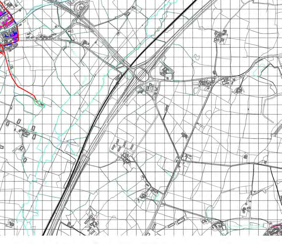
70
71


72 Appendix C CORRESPONDENCE
Rising Sun. Scaffold Hill. Flood Risk Assessment
 Rising Sun Scaffold Hill Flood Risk Assessment August 2010 Contents 1.0 Introduction... 4 2.0 Site Description... 5 3.0 Legislative Framework... 6 4.0 Flood Risk... 10 5.0 Surface Water Drainage... 11
Barton Farm Winchester. Outline Planning Application A New Suburb for Winchester. Flood Risk Assessment prepared by Parsons Brinckerhoff
 Barton Farm Winchester Outline Planning Application A New Suburb for Winchester Flood Risk Assessment prepared by Parsons Brinckerhoff November 2009 BARTON FARM WINCHESTER FLOOD RISK ASSESSMENT May 2009
Flood Risk and Drainage Assessment.
 Flood Risk and Drainage Assessment. Change of Use off land to Leisure Complex At, Caersws, Powys, SY17 5SB October 2018 Statement prepared for: Mr T Bebb By Woodsyde Developments Ltd Woodsyde Developments
Refer to Chapter 3.0 (Description of Development) for a detailed site and development description.
 for a detailed site and development description.") 7. WATER: HYDROGEOLOGY & HYDROLOGY 7.1 Introduction This chapter of the EIAR comprises of an assessment of the likely impact of the proposed development on the surrounding surface water and hydrogeological
7. WATER: HYDROGEOLOGY & HYDROLOGY 7.1 Introduction This chapter of the EIAR comprises of an assessment of the likely impact of the proposed development on the surrounding surface water and hydrogeological
Foul Drainage Assessment and Surface Water Management Plan Land at Mill Lane Hawkinge CT18 7BY
 Foul Drainage Assessment and Surface Water Management Plan Land at Mill Lane Hawkinge CT18 7BY RMB Consultants (Civil Engineering) Ltd March 2015 RMB Consultants (Civil Engineering) Ltd 39 Cossington Road
Surface Water Guidance for Developers
 Surface Water Guidance for Developers Contents Overview of Sustainable Drainage Systems (SuDS)... 2 Information Required in a Flood Risk Assessment or Drainage Strategy... 3 Outline Planning Applications...
Sustainable Drainage Design Guidance
 Sustainable Drainage Design Guidance Contents Introduction 3 1. Legislative and Policy Background 4 2. What are Sustainable Drainage Systems? 5 3. Designing SuDS 7 4. Maintaining SuDS 9 5. Construction
Drainage Strategy Report
 CONSULTING ENGINEERS Report No: Date: C1014 Aug 2017 Project: Drainage Strategy Report Danygraig Works, Risca Client: P.D. Edenhall This report is provided for the benefit only of the party to whom it
Developers Guide for Surface Water Management.
 Developers Guide for Surface Water Management www.southwark.gov.uk Contents 1. Introduction... 2 2. Requirements for Flood Risk Assessments and Drainage Strategies... 3 2.1 Planning Applications... 3 2.2
Isle of Wight Strategic Flood Risk Assessment MK2. Appendix E West Wight
 Isle of Wight Strategic Flood Risk Assessment MK2 Appendix E June 2010 Isle of Wight Strategic Flood Risk Assessment Overview The RDA is comprised of the towns of Totland and Freshwater and is classified
Appendix 7.A Flood Risk Assessment Pro-forma
 Appendix 7.A Flood Risk Assessment Pro-forma Entec UK Limited Entec UK Limited 1 PPS25 Flood Risk Assessment Pro-forma 1. Development description and location 1a. What type of development is proposed and
Land North East of Blandford
 Land North East of Blandford On behalf of Savills Plc Project Ref: 36965/4001 Rev: B Date: February 2016 Office Address: Lakeside House, Blackbrook Business Park, Blackbrook Park Avenue, Taunton TA1 2PX
Isle of Wight Strategic Flood Risk Assessment MK2. Appendix P Newport
 Isle of Wight Strategic Flood Risk Assessment MK2 Appendix P June 2010 Isle of Wight Strategic Flood Risk Assessment Overview Please review this discussion in conjunction with the mapping provided in this
FLOOD RISK ASSESSMENT
 Firth Buildings, 99-101 Leeds Road, Dewsbury, WF12 7BU t 01924 464342 f 01924 450662 e trevor.haigh@haighhuddleston.co.uk FLOOD RISK ASSESSMENT ON LAND AT BUTT LANE SNAITH WEST YORKSHIRE FOR HARRON HOMES
This document was endorsed by Cambridgeshire County Council (CCC) in its capacity as Lead Local Flood Authority on 14 July 2016.
 in its capacity as Lead Local Flood Authority on 14 July 2016.") Note to the reader Note to the reader This document was endorsed by Cambridgeshire County Council (CCC) in its capacity as Lead Local Flood Authority on 14 July 2016. Once adopted as a Supplementary Planning
Note to the reader Note to the reader This document was endorsed by Cambridgeshire County Council (CCC) in its capacity as Lead Local Flood Authority on 14 July 2016. Once adopted as a Supplementary Planning
NW Bicester Masterplan. Flood Risk Assessment
 NW Bicester Masterplan Flood Risk Assessment Hyder Consulting (UK) Limited 2212959 Aston Cross Business Village 50 Rocky Lane Aston Birmingham B6 5RQ United Kingdom Tel: +44 (0)121 345 9000 Fax: +44 (0)121
The Flood Risk Implications of Strategic Development at Barnham / Eastergate / Westergate
 at Barnham / Eastergate / Westergate The Hydrological and Hydrogeological Aspects of Tidal sluice and pumping station on the Aldingbourne Rife at Felpham Richard Allitt Associates Ltd Suite 3, Forge Offices
DOUGHTY ROAD, GRIMSBY Flood Risk Assessment and Surface Water Drainage Strategy DECEMBER 2017
 Flood Risk Assessment and Surface Water Drainage Strategy DECEMBER 2017 CONTACTS SARAH DEMETRIOU Graduate Flood Modeller dd 0117 313 6152 e sarah.demetriou@arcadis.com Arcadis. 2 Glass Wharf Temple Quay
Luton Level 1 SFRA Update. February 2013
 Luton Level 1 SFRA Update February 2013 Quality Management Job No Title Location CS/060431 Luton Level 1 SFRA update Luton Borough Council Document Ref N/A Issue / Revision Final Date 8 February 2013 Prepared
Lidl, Chippenham. Flood Risk Assessment & Drainage Strategy. September 2017
 September 2017 DOCUMENT VERIFICATION RECORD CLIENT: SCHEME: INSTRUCTION: Lidl UK GmbH Proposed Lidl Food store at the former Middlefield Adult Training Centre, Chippenham SN14 0JP The instruction to carry
CHAPTER 7 WATER RESOURCES AND DRAINAGE NORTHAMPTON GATEWAY
 CHAPTER 7 WATER RESOURCES AND DRAINAGE NORTHAMPTON GATEWAY 7.0 7.1 WATER RESOURCES AND DRAINAGE INTRODUCTION 7.1.1 This chapter details the potential receptors and likely effects, including potential water
PLYMOUTH ROAD, PLYMPTON, PLYMOUTH. FLOOD RISK ASSESSMENT. On Behalf of. Lidl UK.
 PLYMOUTH ROAD, PLYMPTON, PLYMOUTH. FLOOD RISK ASSESSMENT On Behalf of Lidl UK Date: Our Ref: JER6216 RPS 34 Lisbon Street Leeds West Yorkshire LS1 4LX Tel: (0)113 220 6190 Email: rpslds@rpsgroup.com Quality
FLOOD RISK ASSESSMENT DAMHEAD CREEK 2 POWER STATION
 FLOOD RISK ASSESSMENT DAMHEAD CREEK 2 POWER STATION Name Job Title Date Prepared Joanne Somerton Senior Consultant (Flood Risk) 14/01/2016 Checked Kerry Whalley Technical Director 04/02/2016 Technical
COLDRA WOODS HOTEL BY CELTIC MANOR AND STARBUCKS DRIVE- THRU RESTAURANT Flood Consequences Assessment
 COLDRA WOODS HOTEL BY CELTIC MANOR AND STARBUCKS DRIVE- THRU RESTAURANT Flood Consequences Assessment APRIL 2017 CONTACTS JOSHUA MOORE Graduate Hydrologist dd ++44 (0) 117 372 1238 joshua.moore@arcadis.com
REPORT /TA WORKING DRAFT NTS EDEN WESTWOOD TRANSPORT ASSESSMENT WORKING DRAFT NON TECHNICAL SUMMARY
 REPORT 62102063-200/TA WORKING DRAFT NTS EDEN WESTWOOD TRANSPORT ASSESSMENT WORKING DRAFT NON TECHNICAL SUMMARY CONSULTATION DRAFT AUGUST 2016 EDEN WESTWOOD TRANSPORT ASSESSMENT WORKING DRAFT NON TECHNICAL
PRE-APPLICATION MEETING Meeting Minutes
 PRE-APPLICATION MEETING Meeting Minutes Date/Time : Location : Attendees: Site Location: LPA District reference: KCC reference: 2 nd May 2017, 09:30am The Street, Great Chart, Ashford Alex Brauninger,
Storm Water Management
 Storm Water Management Policy September 2014 2 Sustainable drainage feature designed to control and manage flows through a series of check dams 3 Document Name: Storm Water Management Controlled Copy No:
The SuDS Manual Frequently asked questions
 The SuDS Manual Frequently asked questions 1. Is source control still a requirement of the new SuDS Manual? Yes. Source control components are fundamental elements of a SuDS scheme. The benefits of source
Background for: Upper Piddle Headwaters
 Background for: Upper Piddle Headwaters Environment Agency Information Waterbody Upper Piddle Waterbody ID GB108044010120 Status Poor Failing elements Fish macrophytes (flows) Phytobenthos (nutrients)
Surface water is the rainwater that runs off roofs, roads and paved areas into the public sewerage system.
 This standard advice note is intended to provide clear guidance for all developers, and planning authorities regarding surface water design and management. It should also be used to inform development
ABERDEEN HARBOUR EXPANSION PROJECT November Volume 2: Environmental Statement. Chapter 8: FLOOD RISK AND SURFACE WATER
 ABERDEEN HARBOUR EXPANSION PROJECT November 2015 Volume 2: Environmental Statement Chapter 8: FLOOD RISK AND SURFACE WATER 8. FLOOD RISK AND SURFACE WATER 8.1 Introduction This chapter presents an assessment
Flood Risk Assessment. for. Proposed Residential Development at Bentletts Scrap Yard Claygate Road Collier Street Kent
 Flood Risk Assessment for Proposed Residential Development at Bentletts Scrap Yard Claygate Road Collier Street Kent 1129-1008 February 2016 RCD Consultants Ltd Proposed Residential Development Bentletts
Plot 19, Motorpoint, Glasshoughton Stadium Business Park Environmental Statement: Non-Technical Summary
 Environmental Statement: Non-Technical Summary Report prepared by: Ecus Ltd. Brook Holt 3 Blackburn Road Sheffield S61 2DW 0114 266 9292 February 2013 Page left intentionally blank INTRODUCTION This Non
Environment Agency Guidance on Requirements for Land Contamination Reports. July 2005
 Environment Agency Guidance on Requirements for Land Contamination Reports July 2005 ENVIRONMENT AGENCY GUIDANCE ON REQUIREMENTS FOR LAND CONTAMINATION REPORTS Context Who is this guidance aimed at? Developers,
MAUREEN SMITH PROPOSED RESIDENTIAL DEVELOPMENT: 121 NESS ROAD, SHOEBURYNESS, SOUTHEND ON SEA FLOOD RISK ASSESSMENT
 WARD MAUREEN SMITH PROPOSED RESIDENTIAL DEVELOPMENT: 121 NESS ROAD, SHOEBURYNESS, SOUTHEND ON SEA HOMES FLOOD RISK ASSESSMENT REPORT REF. 170090-01 PROJECT NO. 170090 APRIL 2017 121 NESS ROAD, SHOEBURYNESS
11 HYDROLOGY, HYDROGEOLOGY AND DRAINAGE
 11 HYDROLOGY, HYDROGEOLOGY AND DRAINAGE 11.1 introduction 11.1.1 The objective of this section and the statements presented is to assess the existing hydrological and hydrogeological conditions to understand
Attachment 12 Stage 1 Flood Risk Assessment (IE RP-0001)
") IE0311133-22-RP-0001, Issue A 17/10/2013 Attachment 12 Stage 1 Flood Risk Assessment (IE0311133-30-RP-0001) IE0311133-22-RP-0001_A_02.DOC Flood Risk Assessment Celebrating 40 Years in Business Jazz Pharmaceuticals
IE0311133-22-RP-0001, Issue A 17/10/2013 Attachment 12 Stage 1 Flood Risk Assessment (IE0311133-30-RP-0001) IE0311133-22-RP-0001_A_02.DOC Flood Risk Assessment Celebrating 40 Years in Business Jazz Pharmaceuticals
SWMPs and SFRAs Sa S m m W ingfifeld
 SWMPs and SFRAs Sam Wingfield Introduction 1. Introduction to the Cumbria SWMP. Impact on future development and types of actions that will be proposed. 2. Flood risk mitigation options for future development
South Worcestershire Strategic Flood Risk Assessment Level 2 Update
 South Worcestershire Strategic Flood Risk Assessment Level 2 Update Worcester West Site Assessment Final Report February 2015 This page is intentionally left blank 2015s2316 Worcester West Site Assessment
Developing a local flood risk management strategy Annex 1: Flooding, flood sources and flood defences
 Developing a local flood risk management strategy Annex 1: Flooding, flood sources and flood defences Pennine Water Group, University of Sheffield in collaboration with the partners of the FloodResilienCity
Flood Risk Assessment
 Temporary Shale Gas Exploration Roseacre Wood, Lancashire PNR_PL_ June 2014 Contents 1 Introduction 1 2 Development Description and Location 2 Page 2.1 Location 2 2.2 Existing Site Characteristics 3 2.3
Ideal logo position here. Effective Scheme Design: Ground and Water
 Ideal logo position here Effective Scheme Design: Ground and Water Presentation Content Introduction to Cundall Ground Risk Flood Risk SuDS About Cundall 19 OFFICES WORK IN 50+ COUNTRIES 1 ST CONSULTANT
Appendix H Water Resources, Drainage and Flood Risk Assessment
 Blossom Street Appendix H Water Resources, Drainage and Flood Risk Assessment Replacement Environmental Statement Volume III 3461 Blossom Street Flood Risk Assessment December 2014 100 St John Street
BS8582, Code of Practice for Surface Water Management for Development Sites
 BSI Draft Review BS8582, Code of Practice for Surface Water Management for Development Sites Code of Practice for Surface Water Management Comment: The introduction of a specific British Standard which
Section 1 - Introduction
 VERSION 1.0 Stormwater Solutions for Residential Sites Section 1 - Introduction Prepared for EcoWater Solutions A Department of Waitakere City Council 113 Central Park Drive Henderson WAITAKERE CITY November
City Development Plan Variation No. 7 Marina Park - Pairc Ui Chaoimh
 City Development Plan Variation No. 7 Marina Park - Pairc Ui Chaoimh Strategic Environmental Assessment (SEA) Screening Report 25 th November 2011 Cork City Council Comhairle Cathrach Chorcaí Proposed
Preliminary Rainfall Runoff Management for Developments EA/Defra Report Procedure W5-074/A Summary Guidance for Developers and Engineers
 Preliminary Rainfall Runoff Management for Developments EA/Defra Report Procedure W5-074/A Summary Guidance for Developers and Engineers 1. Objective of this guidance and Procedure W5-074/A is to assist
Impact of the Flood Water Management Act 2010 APSE National roads, street lighting and winter maintenance seminar 2014
 Impact of the Flood Water Management Act 2010 APSE National roads, street lighting and winter maintenance seminar 2014 An area facing challenges Did we need the FWMA, after all flooding is nothing new?
8 Geology, Hydrology & Hydrogeology
 Inverneill Wind Farm Scoping Report Page 42 8 Geology, Hydrology & Hydrogeology 8.1 Introduction The EIA will consider the potential issues arising from the construction, operation and decommissioning
FORMER SHEEP PEN MILL LANE WELSHPOOL FLOOD CONSEQUENCES ASSESSMENT LIDL UK GMBH FOR. September Our Ref: RCEF R
 FORMER SHEEP PEN MILL LANE WELSHPOOL FLOOD CONSEQUENCES ASSESSMENT FOR LIDL UK GMBH Our Ref: RCEF32271-002 R RPS Health, Safety & Environment Unit 12 Watersedge Business Park Modwen Rd, Salford Quays M5
Phase 1 FLOOD RISK ASSESSMENT REPORT
 Phase 1 FLOOD RISK ASSESSMENT REPORT PREPARED FOR: REFERENCE #: 1916 MS Power Projects Ltd DATE: February 2014 Page 1 of 24 AMBIENTAL TECHNICAL SOLUTIONS LTD. DOCUMENT ISSUE RECORD PROJECT: PHASE 1 FLOOD
Loughton, Buckhurst Hill and Theydon Bois
 Loughton, Buckhurst Hill and Theydon Bois Surface Water Management Plan ` Final Report June 2016 Revision Schedule DOCUMENT INFORMATION Title: Owner: Essex County Council Version: 4 Status: Final Project
Muse Developments Ltd Mile End Road Development Flood Risk and Surface Water Drainage Strategy
 Muse Developments Ltd Mile End Road Development Flood Risk and Surface Water Drainage Strategy FRSWDS/MER Issue 1 20 October 2016 This report takes into account the particular instructions and requirements
Sustainable Drainage Systems (SUDS)
") www.environment-agency.gov.uk Sustainable Drainage Systems (SUDS) a guide for developers www.environment-agency.gov.uk Surface water run-off The problem The Environment Agency is the leading public body
www.environment-agency.gov.uk Sustainable Drainage Systems (SUDS) a guide for developers www.environment-agency.gov.uk Surface water run-off The problem The Environment Agency is the leading public body
Action plans for hotspot locations
 Action plans for hotspot locations Ash Vale North 1. Local evidence indicates the culvert could not discharge during December 2013 because the outlet was blocked on the western side of the railway. Guildford
Flood Risk Assessment
 15T788 Proposed Lidl Store, Stanley Street, South Shields 07 December 2015 Prepared By Billinghurst George & Partners www.bgp-consulting.co.uk Waterloo House, Teesdale South, Thornaby, Stockton on Tees
Design Details Flooding V.1
 2018 Edition Design Details Flooding V.1 www.essexdesignguide.co.uk Content Design Detail Section 1. Architectural Details Building form Modelling Dormers Placing of openings Solid and void Balance Windows
Uttlesford District Council Uttlesford District Water Cycle Study
 Uttlesford District Council Uttlesford District Water Cycle Study Stage 1: Scoping and Outline Study High Level Summary Report Hyder Consulting (UK) Limited 2212959 Aston Cross Business Village 50 Rocky
Cambridgeshire s Culvert Policy. An explanation of our policy regarding applications to culvert ordinary watercourses.
 Cambridgeshire s Culvert Policy An explanation of our policy regarding applications to culvert ordinary watercourses. Document History Document history Details By Current Version Date Initial draft RH
Respond! Housing Association. Residential Development at Flinters Field, Athy, Co. Kildare. Engineering Report. Job No. : Date: April 2017
 Job No. : 16036 Date: April 2017 Respond! Housing Association Residential Development at Flinters Field, Athy, Co. Kildare Engineering Report 2B Richview Office Park Clonskeagh Dublin 14 Contents Amendment
Arun District Council. Interim Planning Policy Guidance on Draft for consultation
 Arun District Council Interim Planning Policy Guidance on enterprise@bognorregis Draft for consultation July 2012 Arun District Council Interim Planning Policy Guidance on enterprise@bognorregis DRAFT
Surface Water Management Masterplan. Summary and Actions. September 2016
 Surface Water Management Masterplan Summary and Actions September 2016 Contents Section Page 1. MGSDP Area and Partners 1 2. MGSDP Objectives, Vision and Guiding Principles 3 3. Surface Water Management
Presentation structure
 www.gov.uk/hs2 Presentation structure HS2 overview Design vision Policy drivers Flood risk management aims and approach Case study from Phase 2a (Fradley to Crewe) Integrated assessment and design approach
Foul Water Drainage Strategy Monkton Road Minster CT12 4EE
 66-68 Monkton Road Minster CT12 4EE RMB Consultants (Civil Engineering) Ltd May 2016 RMB Consultants (Civil Engineering) Ltd 39 Cossington Road Canterbury Kent CT1 3HU Tel 01227 472128 www.rmbconsultants.co.uk
Proposed Alterations and Extension to 17 St. John's Road, Sandymount, Dublin 4
 Proposed Alterations and Extension to 17 St. John's Road, Sandymount, Dublin 4 Engineering Report April, 2014 1422 Issue 1 Casey O Rourke Associates Structural & Civil Consulting Engineers 77 Merrion Square
FLOOD RISK ASSESSMENT
 FLOOD RISK ASSESSMENT GBH WHELER WILL TRUST HAM ROAD, FAVERSHAM, KENT. MAY 2016 CS/11311 GBH Wheler Will Trust, Ham Road, Faversham, Kent Contents 1 EXECUTIVE SUMMARY... 4 1.1 Overview... 4 2 INTRODUCTION...
Clifton Marsh Landfill Variation of planning permission 05/09/0376 & 06/09/0395 for the continuation of landfilling until Non Technical Summary
 Clifton Marsh Landfill Variation of planning permission 05/09/0376 & 06/09/0395 for the continuation of landfilling until 2035 Non Technical Summary SLR Consulting Limited Project Ref: 403.00079.00474
Primary access to the site is proposed from two locations along the B3420 Andover Road, and a secondary access from Well House Lane.
 17. SERVICES 17.1 Introduction 17.1.1 WSP Development Limited has been appointed by CALA Homes to investigate and appraise the availability of services to serve a proposed mix-use development of approximately
Water Q1 (The Quadrant) Boston April Q1 (The Quadrant) Boston Flood Risk Assessment
 Boston April Q1 (The Quadrant) Boston Flood Risk Assessment") Water Q1 (The Quadrant) Boston April 2014 Q1 (The Quadrant) Boston Flood Risk Assessment Prepared by Anna Gee Checked by Matthew Wilson Graduate Flood Risk Consultant Senior Engineer Approved by: Graham
Water Q1 (The Quadrant) Boston April 2014 Q1 (The Quadrant) Boston Flood Risk Assessment Prepared by Anna Gee Checked by Matthew Wilson Graduate Flood Risk Consultant Senior Engineer Approved by: Graham
Strategic Flood Risk Assessment (SFRA) Level 2
 Level 2") Strategic Flood Risk Assessment (SFRA) Level 2 (Final) South Bucks District Council Capswood Oxford Road Denham UB9 4LH (this page intentionally blank) Level 2 SFRA Background The South Bucks Level 1 SFRA
Strategic Flood Risk Assessment (SFRA) Level 2 (Final) South Bucks District Council Capswood Oxford Road Denham UB9 4LH (this page intentionally blank) Level 2 SFRA Background The South Bucks Level 1 SFRA
Understanding flood risk
 Guides for Community Emergency Volunteers Understanding flood risk The Guides for Community Emergency Volunteers series has been developed in collaboration with: 2 The series has been funded through grants
Innovative Approaches to Urban Surface Water Management
 Innovative Approaches to Urban Surface Water Management Liveable City Conference Climate Adaptation Creating Flood Resilient Cities In Brief o Flood risk challenges within London/Southwark o Future challenges
Sunnyside Heights (Grandview Heights Area #2) Neighbourhood Concept Plan (NCP) - Engineering Servicing and Financial Strategies
 Neighbourhood Concept Plan (NCP) - Engineering Servicing and Financial Strategies") CORPORATE REPORT NO: R236 COUNCIL DATE: November 15, 2010 REGULAR COUNCIL TO: Mayor & Council DATE: November 10, 2010 FROM: General Manager, Engineering FILE: 6520-20 (GH#2) SUBJECT: Sunnyside Heights
CORPORATE REPORT NO: R236 COUNCIL DATE: November 15, 2010 REGULAR COUNCIL TO: Mayor & Council DATE: November 10, 2010 FROM: General Manager, Engineering FILE: 6520-20 (GH#2) SUBJECT: Sunnyside Heights
D12 LAND DRAINAGE, WATER CONSERVATION, FOUL DRAINAGE AND SEWAGE DISPOSAL AN INTEGRATED WATER STRATEGY
 D12 LAND DRAINAGE, WATER CONSERVATION, FOUL DRAINAGE AND SEWAGE DISPOSAL AN INTEGRATED WATER STRATEGY OBJECTIVES D12/a To ensure that the development would not be at risk of flooding either from itself
APPENDIX E APPENDIX E ESTIMATING RUNOFF FOR SMALL WATERSHEDS
 APPENDIX E ESTIMATING RUNOFF FOR SMALL WATERSHEDS March 18, 2003 This page left blank intentionally. March 18, 2003 TABLES Table E.1 Table E.2 Return Frequencies for Roadway Drainage Design Rational Method
Cottonmount Landfill Stable Non Reactive (SNR) Asbestos Cell. Volume 2 NON TECHNICAL SUMMARY. December 2012 SLR Ref:
 Asbestos Cell. Volume 2 NON TECHNICAL SUMMARY. December 2012 SLR Ref:") Cottonmount Landfill Stable Non Reactive (SNR) Asbestos Cell Volume 2 NON TECHNICAL SUMMARY December 2012 SLR Ref: 419.00034.00473 INTRODUCTION 1. This Non Technical Summary (NTS) has been produced by
Cottonmount Landfill Stable Non Reactive (SNR) Asbestos Cell Volume 2 NON TECHNICAL SUMMARY December 2012 SLR Ref: 419.00034.00473 INTRODUCTION 1. This Non Technical Summary (NTS) has been produced by
Flood Consequence Assessment. Proposed Commercial Development, Tank Farm Way, Sully
 Flood Consequence Assessment Proposed Commercial Development, Tank Farm Way, Sully Client O Reilly Concrete Group Larchfield Kingscourt County Cavan Ireland By RVW Consulting 6 Neptune Court Vanguard Way
Surface Water Drainage Pro-forma for major developments
 Surface Water Drainage Pro-forma for major developments We advise that developers complete this form and submit it to the Local Planning Authority with their planning application, referencing from where
Rainwise. Sustainable Drainage Solutions. Working with communities to manage rainwater. Murton, North Tyneside
 Rainwise Sustainable Drainage Solutions Working with communities to manage rainwater Murton, North Tyneside Murton is a small village that forms part of the wider urban area of North Tyneside. The village
Scottish Hydrological Group Meeting, 13 th November Surface water management plans in action Case studies in Kent.
 Scottish Hydrological Group Meeting, 13 th November 2013. Surface water management plans in action Case studies in Kent Paul Eccleston Topics Prioritisation and broad-scale surface water mapping Case study
East Riding of Yorkshire Council STRATEGIC FLOOD RISK ASSESSMENT (SFRA) Level 1. APPENDIX C Surface Water Flood Hazard Mapping
 Level 1. APPENDIX C Surface Water Flood Hazard Mapping") APPENDIX C Surface Water Flood Hazard Mapping (this page intentionally left blank) Introduction Surface water or pluvial flooding can be defined as flooding which results from rainfall generated overland
APPENDIX C Surface Water Flood Hazard Mapping (this page intentionally left blank) Introduction Surface water or pluvial flooding can be defined as flooding which results from rainfall generated overland
The Role of Pervious Paving in Meeting the Requirements of the Auckland Unitary Plan
 The Role of Pervious Paving in Meeting the Requirements of the Auckland Unitary Plan Nick Vigar Waterways Planning Team Manager Auckland Council Healthy Waters Outline Stormwater management under the Air,
PART 5D - NATURAL HAZARDS
 CONTENTS...PAGE 5D.1 CONTENT AND STRUCTURE...3 5D.2 RESOURCE MANAGEMENT ISSUES...3 5D.3 RESOURCE MANAGEMENT OBJECTIVE AND POLICIES...4 5D.4 RESOURCE MANAGEMENT STRATEGY...4 5D.5 IMPLEMENTATION...4 5D.6.RULES
Proposed Development on Land West of Lancaster Park, Morpeth, Northumberland. Flood Risk Assessment including Surface Water Drainage Strategy Addendum
 Mitford Estate LLP Proposed Development on Land West of Lancaster Park, Morpeth, Northumberland Flood Risk Assessment including Surface Water Drainage Strategy Addendum August 2015 Matthew Elliott www.wyg.com
YORKSHIRE WATER SERVICES. Humbercare Sewerage Network Analysis
 YORKSHIRE WATER SERVICES Humbercare Sewerage Network Analysis Page 1 July 2008 1 Summary 1.1 Introduction 1.1.1 Following flooding in Hull in June 2007 we have been asked by Ofwat to investigate, model
Land to the South of Old Mill Road, Sandbach Environmental Impact Assessment Environmental Statement: Non-Technical Summary
 Environmental Impact Assessment Report prepared by: Ecus Ltd. Brook Holt 3 Blackburn Road Sheffield S61 2DW 0114 266 9292 September 2013 Page Left Intentionally Blank 2 INTRODUCTION This Non Technical
Cambridgeshire Flood Risk Management Partnership St Neots Surface Water Management Plan
 Cambridgeshire Flood Risk Management Partnership St Neots Surface Water Management Plan Detailed Assessment and Options Appraisal Report Final Hyder Consulting (UK) Limited 2212959 Aston Cross Business
IV. ENVIRONMENTAL IMPACT ANALYSIS G. HYDROLOGY/WATER QUALITY
 IV. ENVIRONMENTAL IMPACT ANALYSIS G. HYDROLOGY/WATER QUALITY ENVIRONMENTAL SETTING The project site is located in the Wilshire community of the City of Los Angeles and is bound by S. Wetherly Drive to
21 ST CENTURY DRAINAGE PROGRAMME CAPACITY ASSESSMENT FRAMEWORK EXECUTIVE SUMMARY
 21 ST CENTURY DRAINAGE PROGRAMME CAPACITY ASSESSMENT FRAMEWORK EXECUTIVE SUMMARY Report Ref. No. 21CDP.CAF Programme Area & Reference Report Title Project Management Contractor Sub-Contractor Author of
Consumer Issues Workshop
 Consumer Issues Workshop Professor Bernard Crump Chair CCWater Central & Eastern Committee 27 September 2016 Flooding What can customer s expect from their water company if the area in which they live
SUDS for Roads. Design Tools in new guidance targeted at roads engineers. Chris Jefferies, Taye Akinrelere & Frank Guz University of Abertay Dundee
 SUDS for Roads Design Tools in new guidance targeted at roads engineers Chris Jefferies, Taye Akinrelere & Frank Guz University of Abertay Dundee What s in my talk? The context behind SUDS for Roads Overview
Yorkton Rona Commercial and Industrial development. Concept Plan and Serviceability Report
 Yorkton Rona Commercial and Industrial development Concept Plan and Serviceability Report Prepared for: 101242326 Sask Ltd. Box Ft Quappelle, SK Canada S0G 1S0 Prepared by: Stantec Consulting Ltd. 302-1345
SNOW REMOVAL & DISPOSAL POLICY
 PHILIP D. MURPHY Governor SHEILA Y. OLIVER Lt. Governor DEPARTMENT OF ENVIRONMENTAL PROTECTION Mail Code 401-02B Division of Water Quality 401 E State St P.O. Box 420 Trenton, NJ 08625-0420 CATHERINE R.
A planners perspective Martin Eaglestone MRTPI Planning Policy Manager St Asaph
 SUDS A planners perspective Martin Eaglestone MRTPI Planning Policy Manager St Asaph 21.11.08 Not speaking for my employer Anglesey Issues But I will reflect on some experiences from Anglesey, and work
Planning Considerations for Stormwater Management in Alberta. R. D. (Rick) Carnduff, M. Eng., P. Eng. February 20, 2013.
 Carnduff, M. Eng., P. Eng. February 20, 2013.") Planning Considerations for Stormwater Management in Alberta R. D. (Rick) Carnduff, M. Eng., P. Eng. February 20, 2013 Photo Optional Purpose The purpose of urban stormwater management is to provide solutions
Planning Considerations for Stormwater Management in Alberta R. D. (Rick) Carnduff, M. Eng., P. Eng. February 20, 2013 Photo Optional Purpose The purpose of urban stormwater management is to provide solutions
( THE M4 CORRIDOR AROUND NEWPORT SCHEME )
") PUBLIC INQUIRY IN THE MATTER OF THE HIGHWAYS ACT 1980 AND THE ACQUISITION OF LAND ACT 1981 AND IN THE MATTER OF: THE M4 MOTORWAY (JUNCTION 23 (EAST OF MAGOR) TO WEST OF JUNCTION 29 (CASTLETON) AND CONNECTING
PUBLIC INQUIRY IN THE MATTER OF THE HIGHWAYS ACT 1980 AND THE ACQUISITION OF LAND ACT 1981 AND IN THE MATTER OF: THE M4 MOTORWAY (JUNCTION 23 (EAST OF MAGOR) TO WEST OF JUNCTION 29 (CASTLETON) AND CONNECTING
13 Water Resources, Drainage and Flood Risk
 Blossom Street Replacement Environmental Statement Volume I Preface Update 2015 This replacement November 2015 Environmental Statement (hereafter referred as the November 2015 Replacement ES or this Replacement
HARBOURS ACT 1964 (AS AMENDED) THE POOLE HARBOUR REVISION (WORKS) ORDER 2014 ENVIRONMENTAL STATEMENT VOLUME 4: FLOOD RISK ASSESSMENT
 THE POOLE HARBOUR REVISION (WORKS) ORDER 2014 ENVIRONMENTAL STATEMENT VOLUME 4: FLOOD RISK ASSESSMENT") Intended for Poole Harbour Commissioners Report Reference 19463/ENV/R12 Date May 2014 FINAL HARBOURS ACT 1964 (AS AMENDED) THE POOLE HARBOUR REVISION (WORKS) ORDER 2014 ENVIRONMENTAL STATEMENT VOLUME 4:
Intended for Poole Harbour Commissioners Report Reference 19463/ENV/R12 Date May 2014 FINAL HARBOURS ACT 1964 (AS AMENDED) THE POOLE HARBOUR REVISION (WORKS) ORDER 2014 ENVIRONMENTAL STATEMENT VOLUME 4:
Chapter 4. Drainage Report and Construction Drawing Submittal Requirements
 4.0 Introduction The requirements presented in this section shall be used to aid the design engineer or applicant in the preparation of drainage reports, drainage studies, and construction drawings for
ROYAL ARSENAL Buildings 10, 11 and Royal Carriage Square Foul Sewage & Utilities Report
 ROYAL ARSENAL Buildings 10, 11 and Royal Carriage Square Foul Sewage & Utilities Report Submitted to Berkeley Homes (East Thames) Limited Submitted by AECOM Scott House Alençon Link Basingstoke Hampshire