Proposed Residential Development Snow Valley Uplands Cameron Estates Township of Springwater Functional Servicing Report
|
|
|
- Branden Ryan
- 6 years ago
- Views:
Transcription
1 Ontario Ltd. Proposed Residential Development Snow Valley Uplands Cameron Estates Township of Springwater Functional Servicing Report Prepared by: AECOM 55 Cedar Pointe Drive, Suite tel Barrie, ON, Canada L4N 5R fax August, 2016 Project Number:
2 Statement of Qualifications and Limitations Ontario Ltd. Proposed Residential Development Snow Valley Uplands Cameron Estates Township of Springwater Functional Servicing Report The attached Report (the Report ) has been prepared by AECOM Canada Ltd. ( AECOM ) for the benefit of the Client ( Client ) in accordance with the agreement between AECOM and Client, including the scope of work detailed therein (the Agreement ). The information, data, recommendations and conclusions contained in the Report (collectively, the Information ): is subject to the scope, schedule, and other constraints and limitations in the Agreement and the qualifications contained in the Report (the Limitations ); represents AECOM s professional judgement in light of the Limitations and industry standards for the preparation of similar reports; may be based on information provided to AECOM which has not been independently verified; has not been updated since the date of issuance of the Report and its accuracy is limited to the time period and circumstances in which it was collected, processed, made or issued; must be read as a whole and sections thereof should not be read out of such context; was prepared for the specific purposes described in the Report and the Agreement; and in the case of subsurface, environmental or geotechnical conditions, may be based on limited testing and on the assumption that such conditions are uniform and not variable either geographically or over time. AECOM shall be entitled to rely upon the accuracy and completeness of information that was provided to it and has no obligation to update such information. AECOM accepts no responsibility for any events or circumstances that may have occurred since the date on which the Report was prepared and, in the case of subsurface, environmental or geotechnical conditions, is not responsible for any variability in such conditions, geographically or over time. AECOM agrees that the Report represents its professional judgement as described above and that the Information has been prepared for the specific purpose and use described in the Report and the Agreement, but AECOM makes no other representations, or any guarantees or warranties whatsoever, whether express or implied, with respect to the Report, the Information or any part thereof. Without in any way limiting the generality of the foregoing, any estimates or opinions regarding probable construction costs or construction schedule provided by AECOM represent AECOM s professional judgement in light of its experience and the knowledge and information available to it at the time of preparation. Since AECOM has no control over market or economic conditions, prices for construction labour, equipment or materials or bidding procedures, AECOM, its directors, officers and employees are not able to, nor do they, make any representations, warranties or guarantees whatsoever, whether express or implied, with respect to such estimates or opinions, or their variance from actual construction costs or schedules, and accept no responsibility for any loss or damage arising therefrom or in any way related thereto. Persons relying on such estimates or opinions do so at their own risk. Except (1) as agreed to in writing by AECOM and Client; (2) as required by-law; or (3) to the extent used by governmental reviewing agencies for the purpose of obtaining permits or approvals, the Report and the Information may be used and relied upon only by Client. AECOM accepts no responsibility, and denies any liability whatsoever, to parties other than Client who may obtain access to the Report or the Information for any injury, loss or damage suffered by such parties arising from their use of, reliance upon, or decisions or actions based on the Report or any of the Information ( improper use of the Report ), except to the extent those parties have obtained the prior written consent of AECOM to use and rely upon the Report and the Information. Any injury, loss or damages arising from improper use of the Report shall be borne by the party making such use. This Statement of Qualifications and Limitations is attached to and forms part of the Report and any use of the Report is subject to the terms hereof. AECOM: AECOM Canada Ltd. All Rights Reserved Snow Valley Uplands Cameron Functional Servicing Report (Aug 2016).Docx


3
4 Ontario Ltd. Proposed Residential Development Snow Valley Uplands Cameron Estates Township of Springwater Functional Servicing Report Table of Contents 1. Introduction Official Plan and Background Reports Transportation Water Supply General History Existing Drinking Water System Design Criteria Water Demands Domestic Water Demand Fire Flow Requirements Drinking Water Servicing for Cameron Estates Upgrades to the Drinking Water System Water Supply and Treatment Water Storage MOECC Drinking Water Works Permit Hydraulic Model Update Pipe Layout Junction Elevations Design Water Demand Fire Flow Hydraulic Analysis Hydraulic Design Considerations Distribution System Performance for Design Conditions Sanitary Sewage General History Design Criteria Design Flows Historical Flow Data Ultimate Design Flows Sanitary Sewage Raw Sewage Characteristics Final Effluent Disposal Tile Beds Sanitary Sewage Servicing for Cameron Estates Upgrades to Sanitary Sewage System MOE Certificate of Approval Geotechnical Design Requirements Sanitary Collection, Pumping & Forcemains Waste Water Treatment Plant page Snow Valley Uplands Cameron Functional Servicing Report (Aug 2016).Docx
5 Ontario Ltd. Proposed Residential Development Snow Valley Uplands Cameron Estates Township of Springwater Functional Servicing Report 5. Stormwater Drainage Background General Servicing Concept Storm Drainage Existing Drainage Patterns Post Development Drainage Concept Stormwater Management Soakaway Pits Ditches and Culverts Infiltration Trenches Stormwater Management Pond Quality Control Quantity Control Hydrologic Modeling Methodology Rainfall Catchment Areas Curve Numbers Peak Flows Electrical Distribution Conclusion List of Figures Figure 1.1: Location Plan... 2 Figure 2.1: Road Network... 4 Figure 2.2: Site Grading Plan... 5 Figure 3.1: Water System Servicing Plan... 7 Figure 3.2: Proposed New Watermains Figure 3.3: Snow Valley Uplands Cameron Estates Hydraulic Model Analysis Junction IDs Figure 3.4: Snow Valley Uplands Cameron Estates Hydraulic Model Analysis Pipe IDs Figure 3.5: Ultimate Scenario Hydraulic Model Analysis Junction IDs Figure 3.6: Ultimate Scenario Hydraulic Model Analysis Pipe IDs Figure 4.1: Sanitary System Servicing Plan Figure 4.2: Sanitary System Servicing Plan Figure 4.3: Proposed Sanitary Pumping Station & Typical Details Figure 4.4: Yard Piping Plan, Proposed SBR Train No. 2 and Building Enclosure Figure 4.5: Snow Valley Highlands WWTP Process Schematic Figure 4.6: Conceptual Drawing Train 2 Plan View Figure 5.1: Pre-Development Drainage Plan Figure 5.2: Post-Development Drainage Plan Snow Valley Uplands Cameron Functional Servicing Report (Aug 2016).Docx
6 Ontario Ltd. Proposed Residential Development Snow Valley Uplands Cameron Estates Township of Springwater Functional Servicing Report Figure 5.3: Infiltration Trench Detail at Driveway Figure 5.4: Infiltration Trench Detail Cross Section List of Tables Table 3.1: Available Water Supply... 8 Table 3.2: Existing High Lift and Booster Pump Capacities... 9 Table 3.3: Summary of Water Demands Table 3.4: Snow Valley Fire Flow Supply Calculations Table 3.5: Snow Valley Water Storage Calculations Table 3.6: Summary of Water Demands Allocated to Modeling Junctions Table 4.1: Snow Valley Highlands Wastewater Treatment Plant Historical Raw Sewage Flows Table 5.1: Summary of Peak Flow Rates Appendices Appendix A. Appendix B. Appendix C. Appendix D. Appendix E. Appendix F. Appendix G. Appendix H. Appendix I. Appendix J. Appendix K. Draft Plan Traffic Impact Study Snow Valley Drinking Water System Drinking Water Works Permit 2015 Drinking Water System Annual Report Water Network Hydraulic Analysis Snow Valley Environmental Centre Environmental Compliance Approval 2012, 2013 & 2014 Wastewater Treatment Plant Annual Report ISAM-SBR Supplier Correspondence Snow Valley Highlands: Cameron Estates Proposed Residential Development Hydrogeological Report and Preliminary Water Budget, Golder Associates Ltd., July 2016 Stormwater Pre-Development Calculations and Hydrologic Modeling Stormwater Post-Development Calculations and Hydrologic Modeling Snow Valley Uplands Cameron Functional Servicing Report (Aug 2016).Docx
7 Ontario Ltd. Proposed Residential Development Snow Valley Uplands Cameron Estates Township of Springwater Functional Servicing Report 1. Introduction AECOM has been retained by Ontario Limited to prepare a Functional Servicing Report (FSR) in support of a subdivision located within the Snow Valley Uplands in the Township of Springwater. The proposed residential subdivision development, known as the Cameron Estates, consists of ha located east of the existing Snow Valley Highlands Development and north of Seadon Road. The general location of the proposed development is shown on enclosed Figure 1.1, Location Plan. The subject property is bounded by vacant lands and an existing golf course to the north, natural heritage lands to the east, Seadon Road to the south, and future residential lands to the west. The unopened Concession 7 & 8 road allowance divides the property. The proposed development for the subject property provides for the following: 87 single family residential units; 0.18 hectare parkette; 0.61 hectares of walking trail; 2.37 hectares of servicing blocks; and, 4.07 hectares of roads. The purpose of this report is to establish servicing concepts in support of draft plan approval of the Snow Valley Uplands Cameron Estates development. The proposed Draft Plan is included in Appendix A. 1.1 Official Plan and Background Reports The subject property is designated as Urban Residential in the Township of Springwater Official Plan. In addition to this FSR, the following background information associated with the subject land has been completed and/or reviewed: Township of Springwater, Community of Snow Valley Water System Upgrades Design Brief, R. G. Robinson Associates (1997) Ltd., September Township of Springwater Standards. Snow Valley Secondary Plan Traffic Impact Study, Phase 1B, Royal Oaks Estates, Totten Sims Hubicki Associates (1997) Limited, July Snow Valley Highlands Phase 5 Traffic Impact Study, AECOM, January Master Servicing Report, R. G. Robinson Associates (1997) Ltd Township of Springwater, Functional Servicing Report, Snow Valley Highlands Phase 5, AECOM, July Snow Valley & Centre Vespra Water System Hydraulic Model Analysis, AECOM, Class Environmental Assessment (Class EA), Ainley & Associates, December, Snow Valley Uplands Cameron Functional Servicing Report (Aug 2016).Docx 1
8 NORTH PROJECT: FUNCTIONAL SERVICING REPORT DRAWING: 1 No. DATE BY DRAWN BY: CHECKED BY: SS RFG ISSUES / REVISIONS PROJECT No. : DESIGNED BY: APPROVED BY: DRAWING No. RP/RFG SCALE: DATE: N.T.S. RP AUG TSHTB_LETTER-P$.dwg~May ~11:29 AM FIG 1.1
9 Ontario Ltd. Proposed Residential Development Snow Valley Uplands Cameron Estates Township of Springwater Functional Servicing Report 2. Transportation Direct access to the subject property will be provided via Seadon Road. The general alignment of the internal road network for the proposed Cameron Estates development is shown in Figure 2.1. The proposed internal road will be constructed in accordance with typical Township standards to a rural cross-section. A Traffic Impact Study has been completed for Snow Valley Highlands Phase 5 by AECOM in January 2016 and included the future development of the Cameron Estates development. The TIS is included in Appendix B. The grading of the proposed road network will generally follow the existing topography. The contemplated grading plan for the development is shown in Figure 2.2. The layout of the internal road systems has been aligned to facilitate servicing of the proposed residential development while maintaining appropriate access. The internal streets are proposed as two lane rural local roads within a 20m right of way Snow Valley Uplands Cameron Functional Servicing Report (Aug 2016).Docx 3
10 STREET C NORTH LEGEND SITE BOUNDARY STREET E EXISTING DEVELOPED ROADWAYS No. DATE BY ISSUES / REVISIONS STREET D STREET B STREET A ALL DIMENSIONS AND INFORMATION SHALL BE CHECKED AND VERIFIED ON THE JOB AND ANY DISCREPANCIES MUST BE REPORTED TO THE CONSULTANT BEFORE COMMENCING THE WORK. DRAWINGS ARE NOT TO BE SCALED AECOM Canada Ltd. ALL RIGHTS RESERVED. THIS DOCUMENT IS PROTECTED BY COPYRIGHT LAW AND MAY NOT BE USED, REPRODUCED OR MODIFIED IN ANY MANNER OR FOR ANY PURPOSE EXCEPT WITH THE WRITTEN PERMISSION OF AECOM Canada Ltd. DOING BUSINESS AS AECOM ("AECOM") OR A PARTY TO WHICH ITS COPYRIGHT HAS BEEN ASSIGNED. AECOM ACCEPTS NO RESPONSIBILITY, AND DENIES ANY LIABILITY WHATSOEVER, TO ANY PARTY THAT USES, REPRODUCES, MODIFIES, OR RELIES ON THIS DOCUMENT WITHOUT AECOM'S EXPRESS WRITTEN CONSENT. CLIENT: PROJECT: DRAWING: DRAWN BY: CHECKED BY: PROJECT No. : SS RFG DESIGNED BY: APPROVED BY: DRAWING No. SCALE: RP/RFG DATE: RP FIG :3000 AUG 2016
11 LEGEND NO 2.0% 0.5% 0.6% 1.0% DATE BY ISSUES / REVISIONS 0.5% 4.6% No. 1.0% 1.0% 1.3% 1.5% 2.7% 0.5% 2.4% ALL DIMENSIONS AND INFORMATION SHALL BE CHECKED AND VERIFIED ON THE JOB AND ANY DISCREPANCIES MUST BE REPORTED TO THE CONSULTANT BEFORE COMMENCING THE WORK. DRAWINGS ARE NOT TO BE SCALED. COPYRIGHT LAW AND MAY NOT BE USED, REPRODUCED OR MODIFIED IN ANY MANNER OR FOR ANY PURPOSE EXCEPT WITH THE WRITTEN PERMISSION OF AECOM Canada Ltd. DOING BUSINESS AS AECOM ("AECOM") OR A PARTY TO WHICH ITS COPYRIGHT HAS BEEN ASSIGNED. AECOM ACCEPTS NO RESPONSIBILITY, AND DENIES ANY LIABILITY WHATSOEVER, TO ANY PARTY THAT USES, REPRODUCES, MODIFIES, OR RELIES ON THIS DOCUMENT WITHOUT AECOM'S EXPRESS WRITTEN CONSENT. 2.4% CLIENT: 1.7% 3.5% 0.5% 3.0% PROJECT: DRAWING: DRAWN BY: CHECKED BY: SS DESIGNED BY: APPROVED BY: RP/RFG SCALE: PROJECT No. : RFG RP FIG. 2.2 DATE: 1: DRAWING No. AUG 2016 RT H
12 Ontario Ltd. Proposed Residential Development Snow Valley Uplands Cameron Estates Township of Springwater Functional Servicing Report 3. Water Supply 3.1 General History In 2002, R. G. Robinson and Associates (Barrie) Ltd. (now AECOM) completed a Master Servicing Report (MSR) in support of a Secondary Plan for the Snow Valley Area. The Secondary Plan includes additional residential development, a commercial area, and an institutional/community area. The proposed developments are within fifteen areas, nine of which are located along Snow Valley Road (County Road 43) in an area referred to as the Snow Valley Lowlands and six in an area south of Snow Valley Road and the ski hills, referred to as the Snow Valley Uplands. The MSR addressed the major servicing components for the development area including a water system, sewage systems, transportation requirements, stormwater management, utilities and preliminary costs. In 2003, R. G. Robinson and Associates (Barrie) Ltd. (now AECOM) was retained by the Township of Springwater to prepare plans and specifications for servicing upgrades to consider the overall long-term development within the Snow Valley Community serving area. This September 2003 design brief specifically related to the establishment of two pressure zones in the settlement area with computer modeling confirming performance for both domestic and fire flows. Consideration was given to all parameters to allow for the proposed upgrades to be expanded as other future developments occur. In 2010, AECOM undertook a detailed computer water analysis of the Snow Valley water supply system to confirm the viability of providing potable drinking water to external residential development in Township of Springwater. This analysis confirmed the hydraulic delivery of water out of the existing Snow Valley Secondary Plan servicing area to service the community of Centre Vespra. A Class Environmental Assessment (Class EA) completed by Ainley & Associates in December 2010 confirmed that there is surplus water above what may be required for the predicted development in both Centre Vespra and the Snow Valley Secondary Development. At the time of the Class EA, the well capacity was assessed at 4,675 m 3 /day with a predicted future maximum demand of 3,453 m 3 /day. This equates to a potential surplus well capacity of approximately 1,222 m 3 /d or would allow for the supply of water to an additional 849 residential lots. However, the current Permit to Take Water limits the system to a maximum of 2,600 m 3 /day. The 2010 EA recommended that the Township of Springwater apply for a new Permit to Take Water in an amount of 4,000 m 3 /day from the four existing Snow Valley wells. To date, this has not been applied for. The Snow Valley Drinking Water System currently services three pressures zones: the Snow Valley Lowlands (Zone 1), Snow Valley Uplands (Zone 2) and Centre Vespra (Zone 3). The Snow Valley Environmental Centre services the six (6) developments within the Snow Valley Uplands (Pressure Zone 2), identified as Development Areas 10, 11, 12, 13, 14 and 15. Figure 3.1 shows the existing and proposed water distribution system for the Snow Valley Lowlands and Snow Valley Uplands. Areas 10, 11 and two small subareas (10a and 13a) replacing the original School/Community area are currently approved and servicing / road construction is completed. Area 11 is proposed to be expanded by 17 lots, referred to as Snow Valley Highlands Phase 5, and has been addressed under a separate Functional Servicing Report. This FSR addresses servicing for the 87 lot development location within the east portion of Development Area Snow Valley Uplands Cameron Functional Servicing Report (Aug 2016).Docx 6
13 DATE BY ISSUES / REVISIONS NOR TH No. ALL DIMENSIONS AND INFORMATION SHALL BE CHECKED AND VERIFIED ON THE JOB AND ANY DISCREPANCIES MUST BE REPORTED TO THE CONSULTANT BEFORE COMMENCING THE WORK. DRAWINGS ARE NOT TO BE SCALED. COPYRIGHT LAW AND MAY NOT BE USED, REPRODUCED OR MODIFIED IN ANY MANNER OR FOR ANY PURPOSE EXCEPT WITH THE WRITTEN PERMISSION OF AECOM Canada Ltd. DOING BUSINESS AS AECOM ("AECOM") OR A PARTY TO WHICH ITS COPYRIGHT HAS BEEN ASSIGNED. AECOM ACCEPTS NO RESPONSIBILITY, AND DENIES ANY LIABILITY WHATSOEVER, TO ANY PARTY THAT USES, REPRODUCES, MODIFIES, OR RELIES ON THIS DOCUMENT WITHOUT AECOM'S EXPRESS WRITTEN CONSENT. CLIENT: PROJECT: FUNCTIONAL SERVICING REPORT DRAWING: DRAWN BY: CHECKED BY: SS DESIGNED BY: APPROVED BY: RP/RFG SCALE: PROJECT No. : RFG RP FIG. 3.1 DATE: 1: DRAWING No. AUG 2016
14 Ontario Ltd. Proposed Residential Development Snow Valley Uplands Cameron Estates Township of Springwater Functional Servicing Report 3.2 Existing Drinking Water System Four groundwater production wells, all located in the Lowlands distribution system, supply water to the system. Well No. 1 and Well No. 2 are located at the Snow Valley Lowlands Water Treatment Plant on George Parkway. Water is conveyed from the wells to the pumphouse, where it is treated and stored in an underground reservoir with a capacity of 95.9 m 3. Four high lift pumps (two duty, two standby) then boost the treated water to an appropriate pressure to service the Lowlands. Well No. 3 and Well No. 4 are located at the Snow Valley Well Pumphouse and Booster Station on the south side of Eder Trail. Water from Well No. 3 and Well No. 4 is treated in the pumphouse and conveyed through a 200 mm diameter watermain directly to the Snow Valley Environmental Centre, located at the end of Alpine Trail in the Snow Valley Highlands. Two glass-lined circular storage tanks, each with a nominal capacity of 500 m 3, provide water storage at the Environmental Centre. Treated water from Well No. 3 and Well No. 4 is stored in the tanks and then boosted to the Uplands distribution system by three high lift pumps (lead, lag, standby). Two transfer pumps, located in the Snow Valley Well Pumphouse and Booster Station, are available to pump water from the Lowlands distribution system to the Highlands Environmental Centre if Wells No. 3 and 4 are out of service for any reason, such as an emergency situation or maintenance work. Occasionally treated water from the Uplands flows back to the Lowlands via a dedicated 150 mm diameter watermain to meet maximum day demands or emergencies, such as a fire. A 250 mm diameter watermain along Dobson Road conveys water from the Snow Valley Environmental Centre to the Centre Vespra distribution system. The capacities of the existing production wells are summarized in Table 3.1 and the existing high lift and booster pump capacities are summarized in Table 3.2. Table 3.1: Available Water Supply Well No. Rated Capacity (m 3 /day) Available Supply (L/s) Runtime (hr/day) Note: As per current Permit to Take Water. During the planning process, it was proposed to add additional well capacity. However, in 2010 the Township completed a Class Environmental Assessment (EA) which suggested that additional capacity could be obtained from the existing wells and a new well was not needed. The additional well capacity is assumed to be available for the purpose of this present analysis Snow Valley Uplands Cameron Functional Servicing Report (Aug 2016).Docx 8
15 Ontario Ltd. Proposed Residential Development Snow Valley Uplands Cameron Estates Township of Springwater Functional Servicing Report Table 3.2: Existing High Lift and Booster Pump Capacities Location Pump ID Rated Capacity Snow Valley Lowlands WTP (George Parkway) Snow Valley Well Pumphouse and Booster Station (Eder Trail) Snow Valley Environmental Centre (Alpine Trail) Lowlands High Lift No. 1 Lowlands High Lift No. 2 Lowlands High Lift No. 3 Lowlands High Lift No. 4 Transfer Pump No. 4 Transfer Pump No. 5 Highlands High Lift No. 1 Highlands High Lift No. 2 Highlands High Lift No L/s at 53.5 m TDH 2.8 L/s at 53.5 m TDH 10.3 L/s at 46.6 m TDH 10.3 L/s at 46.6 m TDH 10 L/s at 56 m TDH 10 L/s at 56 m TDH 26 L/s at 55 m TDH 26 L/s at 55 m TDH 26 L/s at 55 m TDH The existing reservoir storage capacity with Snow Valley is composed of 95.9 m 3 reservoir located in Pressure Zone 1 and two bolted glass coated steel above grade storage tanks with a rated capacity of 500 m 3 located in Pressure Zone 2 each for a maximum storage of m 3 for Snow Valley Pressure Zones 1 and 2. Two bolted glass coated steel above grade storage tanks with a rated capacity of 557 m 3 each provide the required storage for Centre Vespra / Pressure Zone 3 separately from Pressure Zones 1 and 2. The storage reservoirs can be expanded to add additional capacity. The current Drinking Water Works Permit for the Snow Valley Drinking Water System is included in Appendix C. The 2015 Drinking Water System Annual Report prepared by the Ontario Clean Water Agency is included in Appendix D. 3.3 Design Criteria The following design criteria were used for the water network analysis for the Cameron Estates development. These criteria are consistent with the Township of Springwater Engineering Design Standard Specifications and Engineering Design Standard Drawings, 2008, the Ministry of Environment (MOE) Design Guidelines for Drinking- Water Systems, 2008, and previous modeling completed for the Snow Valley Drinking Water System in Household density: 3.2 persons/unit Average Day Demand per capita (Township Standard): 450 L/c/day Maximum Day Peaking Factor (MOE Guideline, (exceeds minimum Township Standard of 2.0)): 2.5 Peak Hour Peaking Factor (minimum Township Standard (exceeds MOE Guideline of 3.75)): 4.5 Minimum pressure (Township Standard): 275 kpa (40 psi) during peak hourly demand Maximum pressure (Township Standard): 550 kpa (80 psi) under static load or minimum hourly demand Residential Fire Flow (Township Standard): 38 L/s Minimum pressure during maximum day plus fire flow event (Township Standard): 140 kpa (20 psi) Minimum pipe diameter (Township Standard): 150 mm Snow Valley Uplands Cameron Functional Servicing Report (Aug 2016).Docx 9
16 Ontario Ltd. Proposed Residential Development Snow Valley Uplands Cameron Estates Township of Springwater Functional Servicing Report 3.4 Water Demands Domestic Water Demand Using the theoretical design criteria above for the proposed Cameron Estates development within the Snow Valley Uplands (Pressure Zone 2), the design water demands were calculated as follows: Average Day Demand (ADD): 87 units x 3.2 ppu x 450 L/c/day = m 3 /day (1.45 L/s) Maximum Day Demand (MDD): m 3 /day x 2.5 = m 3 /day (3.62 L/s) Peak Hour Demand (PHD): m3/day x 4.5 = m 3 /day (6.52 L/s) Water demands included in the existing InfoWater model for the Snow Valley Lowlands, Snow Valley Uplands and existing Centre Vespra community were carried forward for the analysis and updated as applicable based on current applicable development plans. The water demands used in the model are summarized in Table 3.3. Table 3.3: Summary of Water Demands Zone No. of Equivalent Units ADD (L/s) MDD (L/s) PHD (L/s) Snow Valley Lowlands (Pressure Zone 1) Snow Valley Uplands (Pressure Zone 2) Existing Highlands Subdivision Snow Valley Highlands Phase 5 Cameron Estates Future Development Centre Vespra (Pressure Zone 3) (Yorkwood Development) (Existing Residential) Total 1, Notes: 1. Estimated future development Fire Flow Requirements The existing Snow Valley Drinking Water System is divided into three separate pressure zones: Lowlands (Zone 1), Uplands (Zone 2) and Centre Vespra (Zone 3) Snow Valley Uplands Cameron Functional Servicing Report (Aug 2016).Docx 10
17 Ontario Ltd. Proposed Residential Development Snow Valley Uplands Cameron Estates Township of Springwater Functional Servicing Report The Lowlands (Zone 1) and Uplands (Zone 2) are connected by the 150 mm diameter watermain, which conveys flows from the Highlands WTP to the Lowlands only when demands exceed the capacity of the Lowlands WTP. Centre Vespra (Zone 3) and the Uplands (Zone 2) are connected by the existing trunk watermain along Dobson Road, which supplies the water reservoir and high lift pump station at the Centre Vespra WTP. The Centre Vespra WTP, once commissioned, will be capable of meeting all domestic and fire flow demands for Centre Vespra (Zone 3). Standard engineering practice is that fire flow requirements for watermain sizing are calculated separately for each pressure zone. The estimate population at the time when the Cameron Estates lands will be built is 1,005 people for the Snow Valley Lowlands and 813 people for the Snow Valley Uplands (480 existing plus 55 for Phase 5 plus 278 for Cameron). The existing residential watermains for each development area in Snow Valley have been sized to convey the maximum day demand plus a fire flow based on the standard at the time. For the majority of the existing development, a fire flow of 38 L/s was utilized in the design as per the fire flow requirements established in Snow Valley Secondary Plan and Master Servicing Report (MSR) completed in 2002 and the Township of Springwater Engineering Design Standards. The exception is the watermains in the original Snow Valley Estates Subdivision, which were designed based on the fire flow standard of 16.6 L/s that was in place at the time. However, the hydraulic analysis shows that these watermains are capable of providing a fire flow of 38 L/s. The trunk watermains along Snow Valley Road, Seadon Road and Dobson Road have been sized to feed the ultimate domestic and residential fire flow demand of 38 L/s as established in the MSR for the Snow Valley Secondary Plan Area based on the projected equivalent population at full buildout. Table 3.4 demonstrates that the existing water system is capable of meeting the maximum day demand plus fire flow based on the MOECC guidelines separately for the Snow Valley Lowlands (Pressure Zone 1) and Snow Valley Uplands (Pressure Zone 2) for the estimated population for each pressure zone Snow Valley Uplands Cameron Functional Servicing Report (Aug 2016).Docx 11
18 Ontario Ltd. Proposed Residential Development Snow Valley Uplands Cameron Estates Township of Springwater Functional Servicing Report Table 3.4: Snow Valley Fire Flow Supply Calculations Fire Flow Water Demand 2 (L/s) Existing Lowlands Existing Highlands + Phase 5 Existing Highlands + Phase 5 + Cameron Fire Flow Storage 314 units x 3.2 ppu 169 units x 3.2 ppu 256 units x 3.2 ppu Design Population = 1,005 = 541 = 820 Fire Flow 1 (L/s) Duration (hrs) Maximum Day Demand L/s 7.04 L/s L/s Maximum Day + Fire Flow L/s L/s L/s High Lift Capacity Rated Capacity at Design Point Lowlands HLP 1: m TDH Lowlands HLP 2: m TDH Lowlands HLP 3: m TDH Lowlands HLP 4: m TDH Total: 26.2 L/s Highlands HLP 1: m TDH Highlands HLP 2: m TDH Highlands HLP 3: m TDH Total: 78 L/s Firm Capacity at Design Point (i.e. largest pump out of service) Lowlands HLP 1: m TDH Lowlands HLP 2: m TDH Lowlands HLP 3: m TDH Total: 15.9 L/s Highlands HLP 1: m TDH Highlands HLP 2: m TDH Total: 52 L/s Pump Flow at Max Curve 3 (as per provided pump curves) Not available Highlands HLP 1: 33.4 L/s Highlands HLP 2: 33.4 L/s Highlands HLP 3: 33.4 L/s Total: L/s Flow from Uplands (Pressure Zone 2) to Lowlands (Pressure Zone 1) L/s Not applicable Total Rated Capacity 83.7 L/s 78 Available Flow Firm (i.e. largest 73.4 L/s 52 pump out of service) Pump Flow at Max Curve 3 (as per provided pump curves Not available Max Day + Fire Demand Met? Yes Yes Yes Notes: 1. As per MOE Design Guidelines for Drinking-Water Systems (2008) Table Based on 450 L/c/d and Maximum Day Peaking Factor as per MOE Design Guidelines for Drinking-Water Systems (2008) Table Actual pump flow will be higher during fire flow event as pump will typically operate beyond design point on pump curve to maintain minimum 140 kpa system pressure. 4. See pipe flow calculations in Appendix E Snow Valley Uplands Cameron Functional Servicing Report (Aug 2016).Docx 12
19 3.5 Drinking Water Servicing for Cameron Estates Ontario Ltd. Proposed Residential Development Snow Valley Uplands Cameron Estates Township of Springwater Functional Servicing Report The development area will be serviced from the existing Snow Valley Drinking Water System via new 150 mm diameter watermain connecting to the existing 250 mm diameter watermain on Seadon Road as shown on Figure Upgrades to the Drinking Water System Water Supply and Treatment As previously noted, the existing Snow Valley Drinking Water System has sufficient capacity to accommodate the proposed development. No upgrades to the water supply and treatment system will be required Water Storage The original storage design is predicated upon the utilization of water storage in the Uplands Pressure Zone 2 that will feed water to the lower Pressure Zone 1 by way of a dedicated watermain under gravity head at a controlled rate. The following calculations therefore address the concerns regarded phased growth within the community. Storage requirements for the Lowlands and Uplands pressure zones are summarized in Table 3.5. As per MOECC guidelines, when the water supply system is capable of providing more than the maximum day demands, the water storage requirements can be reduced accordingly. The Snow Valley water supply exceeds maximum day demands. The water volume supplied by the wells during a 2 hour design fire event has been included in the storage calculations. To be conservative, the firm well capacity (i.e. with the largest well out of service) has been used. Use of in-well storage to meet the fire flow storage requirements is an effective means to providing additional storage within the water system without the detrimental impacts to chlorine residual that would occur with additional reservoir storage and resulting longer time periods that treated water would be in storage. As seen in Table 3.5, the available storage (reservoirs and well capacity) in the existing water system is well in excess of the required storage volume even when considering both the Lowlands and Uplands pressure zones together Snow Valley Uplands Cameron Functional Servicing Report (Aug 2016).Docx 13
20 EDER TRAIL 8 HIGHWAY 26 WENDEN COURT NORTH PORTAGE TRAIL MAYER ROAD 64 SEADON ROAD EDER TRAIL 13 NICHOLSON CRESCENT PRIEST AVENUE GEORGE PARKWAY DUFFY'S COURT BARRIE HILL ROAD KEY PLAN SNOW VALLEY RD VIII 66 WILSON DRIVE DOBSON ROAD ANNE ST. N. (COUNTY ROAD 43) VII CARSON ROAD W. No. DATE BY ISSUES / REVISIONS 12 12a ALL DIMENSIONS AND INFORMATION SHALL BE CHECKED AND VERIFIED ON THE JOB AND ANY DISCREPANCIES MUST BE REPORTED TO THE CONSULTANT BEFORE COMMENCING THE WORK. DRAWINGS ARE NOT TO BE SCALED AECOM Canada Ltd. ALL RIGHTS RESERVED. THIS DOCUMENT IS PROTECTED BY COPYRIGHT LAW AND MAY NOT BE USED, REPRODUCED OR MODIFIED IN ANY MANNER OR FOR ANY PURPOSE EXCEPT WITH THE WRITTEN PERMISSION OF AECOM Canada Ltd. DOING BUSINESS AS AECOM ("AECOM") OR A PARTY TO WHICH ITS COPYRIGHT HAS BEEN ASSIGNED. AECOM ACCEPTS NO RESPONSIBILITY, AND DENIES ANY LIABILITY WHATSOEVER, TO ANY PARTY THAT USES, REPRODUCES, MODIFIES, OR RELIES ON THIS DOCUMENT WITHOUT AECOM'S EXPRESS WRITTEN CONSENT. CLIENT: PROJECT: DRAWING: 13a DRAWN BY: DESIGNED BY: SS CHECKED BY: RFG APPROVED BY: PROJECT No. : DRAWING No SCALE: RP/RFG DATE: RP FIG :3000 AUG 2016
21 Ontario Ltd. Proposed Residential Development Snow Valley Uplands Cameron Estates Township of Springwater Functional Servicing Report Table 3.5: Snow Valley Water Storage Calculations Fire Flow Water Demand (L/s) Existing Highlands + Phase 5 (Pressure Zone 2) Existing Highlands + Phase 5 + Cameron (Pressure Zone 2) Existing Lowlands (Pressure Zone 1) Existing Lowlands & Highlands + Phase 5 + Cameron Fire Flow Storage 169 units x 3.2 ppu 256 units x 3.2 ppu 314 units x 3.2 ppu 570 units x 3.2 ppu Design Population = 541 = 820 = 1,005 = 1,824 Fire Flow 1 (L/s) Duration (hrs) Maximum Day Demand 7.04 L/s L/s L/s L/s MOE Water Storage Requirement A - Fire Storage (m 3 ) B Equalization Storage (m 3 ) (25% of MDD) C Emergency Storage (m 3 ) (25% of A+B) Total Required Storage (m 3 ) ,445.9 Existing Storage (m 3 ) 1,000 1,000 1, ,095.9 Well Capacity during Fire Flow Event (m 3 ) (excluding largest well) Well No. 1: 13.3 L/s x 2 hours Well No. 2: 17.4 L/s x 2 hours Well No. 3: 18.9 L/s x 2 hours Total Available Volume (Storage Reservoirs + Wells) Storage Surplus (+) or Deficit (-) (m 3 ) Notes: 1. As per MOE Design Guidelines for Drinking-Water Systems (2008) Table , , , , MOECC Drinking Water Works Permit The proposed watermain for the Cameron Estates development is considered approved under the existing Snow Valley Drinking Water System Drinking Water Works Permit (DWWP) No Form A will need to be completed and filed with the Township. 3.6 Hydraulic Model Update The existing hydraulic model for the Snow Valley Drinking Water System was updated with the proposed Cameron Estates Draft Plan layout Snow Valley Uplands Cameron Functional Servicing Report (Aug 2016).Docx 15
22 Ontario Ltd. Proposed Residential Development Snow Valley Uplands Cameron Estates Township of Springwater Functional Servicing Report Two scenarios were created within the water model: An interim scenario, and; An ultimate scenario. The interim scenario includes the existing development within the Snow Valley Uplands plus the proposed Snow Valley Highlands Phase 5 development (addressed under a separate FSR) and the Cameron Estates development The ultimate scenario includes concepts for future development within the remaining lands of Development Area 12 as well as for Development Areas 11b, 14 and 15. The conceptual layout of the remaining lands within Development Area 12 has been revised from that shown in the Master Servicing Report to align with the existing Snow Valley Highlands development and the proposed draft plan layout for the Cameron Estates development. The conceptual layouts for Development Areas 14 and 15 remain unchanged for those included in the Master Servicing Report Pipe Layout The pipe network was updated to reflect the proposed road network for the Cameron Estates development concept and the conceptual layout for the remaining lands within Development Area 12 by adding new modeling pipes and junctions. Figure 3.2 shows the proposed development plan layout and associated watermains and Figure 2.2 shows the conceptual grading plan for the development. Figure 3.3 through Figure 3.6 show the proposed infrastructure added within the Cameron Estates development and remaining lands within Development Area 12 as part of the model update. The sizing of the new watermain was undertaken in accordance to the Township of Springwater Design Standards. Distribution system modeling was completed to identify appropriate pipe sizes for the entire area to meet design maximum day and peak hourly demands, and fire flows requirements, considering the Township s operational guidelines (i.e., minimum and maximum acceptable system pressure). The configuration and sizing of the proposed watermains was established through system modeling undertaken using InfoWater software. 150 mm diameter watermains are proposed to service the Cameron Estates development. The watermains are capable of meeting the anticipated domestic demands and providing sufficient available fire flows for the proposed development Junction Elevations Proposed ground elevations were assigned to modeling junctions. These elevations are critical to determine pressure values throughout the development. The junction modeling IDs for the interim and ultimate scenarios are shown on Figure 3.3 and Figure 3.5 respectively Snow Valley Uplands Cameron Functional Servicing Report (Aug 2016).Docx 16
23 to/from Snow Valley Lowlands Snow Valley Highlands Phase Cameron Estates J10 J9 J J M^ECC_HLP Snow Valley Highlands Environmental Centre SNH C:\Users\baronf\Documents\AECOM Projects\Centre Vespra\Hydraulic Model\December 2012\Vespra-Model-December2012.mxd Snow Valley Uplands Maximum Day Demand PRESSURE less than ~ ~ ~ 100 greater than 100 RUN_DIAM Less than 150 mm 150 mm 200 mm 250 mm 300 mm August 2016 Snow Valley and Centre Vespra Water System Snow Valley Uplands - Cameron Hydraulic Model Analysis - Junction IDs JSNH3 JSNH4 JSNH5 JSNH6 JSNH Township of Springwater µ FIG. 3.3
24 P P PSVH4 PSVH to/from Snow Valley Lowlands Snow Valley Highlands Phase 5 P505 Cameron Estates P502 P P18 P20 P P P P Snow Valley Highlands Environmental Centre M^ P ECC_HLP P PSVH1 534 P C:\Users\baronf\Documents\AECOM Projects\Centre Vespra\Hydraulic Model\December 2012\Vespra-Model-December2012.mxd Snow Valley Uplands Maximum Day Demand PRESSURE less than ~ ~ ~ 100 greater than 100 RUN_DIAM Less than 150 mm 150 mm 200 mm 250 mm 300 mm August 2016 Snow Valley and Centre Vespra Water System Snow Valley Uplands - Cameron Hydraulic Model Analysis - Pipe IDs PSVH5 PSVH Township of Springwater µ FIG. 3.4
25 to/from Snow Valley Lowlands Snow Valley Highlands Phase Cameron Estates C:\Users\baronf\Documents\AECOM Projects\Centre Vespra\Hydraulic Model\December 2012\Vespra-Model-December2012.mxd J10 J9 J11 91 Snow Valley Uplands Maximum Day Demand PRESSURE less than ~ ~ ~ 100 greater than 100 RUN_DIAM Less than 150 mm 150 mm 200 mm 250 mm 300 mm August J Snow Valley Highlands Environmental Centre M^ J26 J Future Development Area 12a Snow Valley and Centre Vespra Water System Snow Valley Uplands - Ultimate Scenario Hydraulic Model Analysis - Junction IDs SNH1 JSNH2 JSNH3 JSNH4 JSNH5 JSNH6 JSNH A 172-B Future Development Areas 14 & 15 Township of Springwater µ FIG. 3.5
26 P P PSVH4 PSVH to/from Snow Valley Lowlands Snow Valley Highlands Phase 5 P505 Cameron Estates P502 P C:\Users\baronf\Documents\AECOM Projects\Centre Vespra\Hydraulic Model\December 2012\Vespra-Model-December2012.mxd P18 P20 P Snow Valley Uplands Maximum Day Demand PRESSURE less than ~ ~ ~ 100 greater than 100 RUN_DIAM Less than 150 mm 150 mm 200 mm 250 mm 300 mm August P P P Snow Valley Highlands Environmental Centre M^ P Future Development Area 12a Snow Valley and Centre Vespra Water System Snow Valley Uplands - Ultimate Scenario Hydraulic Model Analysis - Pipe IDs P PSVH1 PSVH6 PSVH5 534 P Future Development Areas 14 & 15 Township of Springwater µ FIG. 3.6
27 Ontario Ltd. Proposed Residential Development Snow Valley Uplands Cameron Estates Township of Springwater Functional Servicing Report Design Water Demand The average water demand for the design condition was calculated for Cameron Estates development as 87 units x 3.2 ppu x 450 L/p/day = 125,280 L/day or 1.45 L/s. For the revised conceptual layout for the remaining lands within Development Area 12, the average water demand for the design condition was calculated as 26 units x 3.2 ppu x 450 L/p/day = 37,440 L/day or 0.43 L/s. These demands were allocated within the subdivision by creating Thiessen polygons around the proposed modeling junctions. The Thiessen polygons are drawn to include lots that are closer to the modeling junctions and allocate those demands to the adjacent junctions. Table 3.6 summarizes the main attributes of the modeling junctions within the proposed Cameron Estates development and the revised conceptual layout for the remaining lands within Development Area 12 including water demands allocated to each junction. Table 3.6: Summary of Water Demands Allocated to Modeling Junctions Model ID Elevation (m) ADD Demand (L/s) MDD Demand (L/s) (2.5 x ADD) PHD Demand (L/s) (4.5 x ADD) * * * * Notes: * Estimated demands for future development for the remaining lands within Development Area 12a. Water demands included in the existing InfoWater model for the Snow Valley Drinking Water System were carried forward for this analysis. The typical diurnal curve established as part of the Snow Valley and Centre Vespra Water System Hydraulic Analysis completed in 2010 was also utilized in the analysis Fire Flow The Township of Springwater Engineering Design Standards requires a minimum fire flow in a residential area of 38L/s (500 IGPM). All junctions within the Snow Valley Uplands Pressure Zone 2 (including the existing development, the proposed Snow Valley Highlands Phase 5 development, the proposed Cameron Estates Snow Valley Uplands Cameron Functional Servicing Report (Aug 2016).Docx 21
28 Ontario Ltd. Proposed Residential Development Snow Valley Uplands Cameron Estates Township of Springwater Functional Servicing Report development, and the future development within Development Areas 11b, 12, 14 and 15) were in turn assigned a fire flow requirement as per proposed concept. The values for all junctions were 38 L/s. Fire flow simulations were required with the criteria that a residual pressure of at least 20 psi be maintained while supplying 38 L/s Hydraulic Analysis Once the model was updated to include the proposed infrastructure, and the demands incorporated accordingly, the model was used to conduct hydraulic simulations. A 24-hour simulation was run for the Average Day Demand (ADD) and Maximum Day Demand (MDD) scenarios using the diurnal curve established in previous modeling for the system. Steady state (SS) simulation of the Peak Hour Demand (PHD) scenario and MDD plus fire flow (FF) simulations were also conducted Hydraulic Design Considerations A number of design parameters from the Township of Springwater Engineering Design Standards were considered when conducting the hydraulic analyses. These included: Hydraulic modeling using the Hazen-Williams equation, with a minimum pipe size of 150 mm diameter. Excessive pipe velocities (e.g. 3.0 m/s) should be avoided. Watermains were designed on the basis of providing a minimum pressure 275 kpa (40 psi) under PHD operating conditions. The minimum pressure when the system is tested for fire flow in conjunction with the design maximum daily demand shall be 140 kpa (20 psi). The normal operating pressure in the distribution system to be within 350 kpa to 480 kpa (50 to 70 psi). The maximum pressure under static load or during the minimum hourly demand shall be 550 kpa (80 psi). The absolute maximum pressure in the distribution system shall not exceed 700 kpa (102 psi) to avoid damage to household plumbing. Service connection to watermain in excess of 700 kpa is not permitted Distribution System Performance for Design Conditions When conducting hydraulic simulations the following parameters were evaluated: System pressure; Pipe velocity; Pipe headloss; and, Fire flow capacity. The computer modeling runs for both the interim scenario and the ultimate scenario suggest that the proposed watermains within the Cameron Estates development will meet all hydraulic design considerations. The results of the interim scenario, comprised of the existing Snow Valley Highlands developments, Snow Valley Highlands Phase 5, and Cameron Estates, are summarized as follows: Pipe velocities throughout the Snow Valley Uplands Pressure Zone 2 were below the maximum acceptable level of 3.0 m/s under all ADD, MDD, and PHD demand conditions. Pipe headloss gradients were below the commonly referred to maximum acceptable level of 1.5 m / 1000 m Snow Valley Uplands Cameron Functional Servicing Report (Aug 2016).Docx 22
29 Ontario Ltd. Proposed Residential Development Snow Valley Uplands Cameron Estates Township of Springwater Functional Servicing Report Watermain pressures within the development areas vary from 423 kpa (61 psi) to 645 kpa (94 psi) under Max Day Demand conditions. Under Peak Hour Demand conditions, the minimum pressure is 403 kpa (58 psi), which exceeds the Township of Springwater s standard of a minimum of 275 kpa (40 psi) under Peak Hour Demand. Sufficient fire flow is available throughout the system, with a minimum available fire flow of 50.4 L/s under the Max Day plus Fire Flow scenario. The results of the ultimate scenario, comprised of all existing and proposed future development lands within Snow Valley Uplands, are summarized as follows: Pipe velocities throughout the Snow Valley Uplands Pressure Zone 2 were below the maximum acceptable level of 3.0 m/s under all ADD, MDD, and PHD demand conditions. Pipe headloss gradients were below the commonly referred to maximum acceptable level of 1.5 m / 1000 m during Peak Hour Demand conditions with the exception of the first watermain from the Water Treatment Plant, which has a headloss gradient of 2.1 m / 100 m, and possible future watermain connected to a proposed future pressure reducing valve, which has a headloss gradient of 2.0 m / 100 m. Watermain pressures vary from 345 kpa (50 psi) to 688 kpa (100 psi) under Max Day Demand conditions. There is significant variation in elevations across the Snow Valley Uplands, which can result in some areas of development experiencing high water pressure. If during the detailed design of the future development areas, it is found that the water pressure exceeds acceptable limits, pressure reducing valve(s)/station(s) will be incorporated as required. Under Peak Hour Demand conditions, the minimum pressure is 345 kpa (50 psi), which exceeds the Township of Springwater s standard of a minimum of 275 kpa (40 psi) under Peak Hour Demand. Sufficient fire flow is available throughout the system, with a minimum available fire flow 47.1 L/s under the Max Day plus Fire Flow scenario. Detailed results from the water modeling is included Appendix E. Based on the hydraulic modeling, the design demands for Cameron Estates development can be adequately supplied with the watermain network proposed in Figure 3.2 maintaining the design criteria. The minimum fire flow available within the Snow Valley Uplands Pressure Zone 2, including the Cameron Estates development and proposed future development, exceeds the minimum requirement of 38 L/s while simultaneously maintaining 20 psi of residual pressure Snow Valley Uplands Cameron Functional Servicing Report (Aug 2016).Docx 23
30 Ontario Ltd. Proposed Residential Development Snow Valley Uplands Cameron Estates Township of Springwater Functional Servicing Report 4. Sanitary Sewage 4.1 General History In 2002, R. G. Robinson and Associates (RGRA) completed a Master Servicing Report (MSR) for the Snow Valley Secondary Plan Area. The Secondary Plan includes residential development, a commercial area and an institutional/community area. The proposed developments are in fifteen areas, nine of which are located along Snow Valley Road (County Road 43) in an area referred to as the Snow Valley Lowlands and six in an area south of Snow Valley Road and the ski hills, referred to as the Snow Valley Uplands. The MSR addressed the major servicing components for each development area including a water system, sewage systems, transportation requirements, storm water management, utilities, and preliminary costs. A Municipal Class Environmental Assessment (EA) is currently being completed to determine the preferred solution for upgrades to the Snow Valley Highlands wastewater system to service the Snow Valley Uplands development area. The EA will review the recommendations in the Master Servicing Report to expand the existing Snow Valley Wastewater Treatment Plant to accommodate the full buildout of the Snow Valley Uplands development areas and will identify a preferred solution for providing the required additional capacity for the Snow Valley Uplands sanitary service area. The WWTP was designed and approved and later amended with the issue of MOE Certificate of Approval (CofA) Number WXQ5B to service proposed development within the Snow Valley Uplands, identified in the Snow Valley Secondary Plan Area, Township of Springwater, County of Simcoe. A copy of the current Certificate of Approval is included in Appendix F. The existing Snow Valley Highlands Wastewater Treatment Plant (WWTP) is located in Development Area 11 and was designed to ultimately service six (6) of the developments within the Snow Valley Uplands, identified as Development Areas 10, 11, 12, 13, 14 and 15. Figure 4.1 shows the overall sanitary sewer system. Figure 4.2 shows the sanitary sewer and forcemain for the proposed Cameron Estates development. The proposed number of single family residential lots in each Development Area (as noted in the original Master Servicing Report) to be serviced by the WWTP are as follows: Development Area 10 Development Area 11 Development Area 12 Development Area 13 Development Area 14 Development Area 15 School/Community** Total Ultimate 33 lots 92 lots 84 lots 20 lots 62 lots 34 lots 18 lots 344 lots Snow Valley Uplands Cameron Functional Servicing Report (Aug 2016).Docx 24
31 DATE BY ISSUES / REVISIONS NOR TH No. ALL DIMENSIONS AND INFORMATION SHALL BE CHECKED AND VERIFIED ON THE JOB AND ANY DISCREPANCIES MUST BE REPORTED TO THE CONSULTANT BEFORE COMMENCING THE WORK. DRAWINGS ARE NOT TO BE SCALED. COPYRIGHT LAW AND MAY NOT BE USED, REPRODUCED OR MODIFIED IN ANY MANNER OR FOR ANY PURPOSE EXCEPT WITH THE WRITTEN PERMISSION OF AECOM Canada Ltd. DOING BUSINESS AS AECOM ("AECOM") OR A PARTY TO WHICH ITS COPYRIGHT HAS BEEN ASSIGNED. AECOM ACCEPTS NO RESPONSIBILITY, AND DENIES ANY LIABILITY WHATSOEVER, TO ANY PARTY THAT USES, REPRODUCES, MODIFIES, OR RELIES ON THIS DOCUMENT WITHOUT AECOM'S EXPRESS WRITTEN CONSENT. CLIENT: PROJECT: FUNCTIONAL SERVICING REPORT DRAWING: DRAWN BY: CHECKED BY: SS DESIGNED BY: APPROVED BY: RP/RFG SCALE: PROJECT No. : RFG RP FIG. 4.1 DATE: 1: DRAWING No. AUG 2016
32 EDER TRAIL 8 HIGHWAY 26 WENDEN COURT NORTH PORTAGE TRAIL MAYER ROAD 64 SEADON ROAD EDER TRAIL 13 NICHOLSON CRESCENT PRIEST AVENUE GEORGE PARKWAY DUFFY'S COURT BARRIE HILL ROAD KEY PLAN SNOW VALLEY RD VIII 66 WILSON DRIVE DOBSON ROAD ANNE ST. N. (COUNTY ROAD 43) VII CARSON ROAD W. No. DATE BY ISSUES / REVISIONS 12a ALL DIMENSIONS AND INFORMATION SHALL BE CHECKED AND VERIFIED ON THE JOB AND ANY DISCREPANCIES MUST BE REPORTED TO THE CONSULTANT BEFORE COMMENCING THE WORK. DRAWINGS ARE NOT TO BE SCALED AECOM Canada Ltd. ALL RIGHTS RESERVED. THIS DOCUMENT IS PROTECTED BY COPYRIGHT LAW AND MAY NOT BE USED, REPRODUCED OR MODIFIED IN ANY MANNER OR FOR ANY PURPOSE EXCEPT WITH THE WRITTEN PERMISSION OF AECOM Canada Ltd. DOING BUSINESS AS AECOM ("AECOM") OR A PARTY TO WHICH ITS COPYRIGHT HAS BEEN ASSIGNED. AECOM ACCEPTS NO RESPONSIBILITY, AND DENIES ANY LIABILITY WHATSOEVER, TO ANY PARTY THAT USES, REPRODUCES, MODIFIES, OR RELIES ON THIS DOCUMENT WITHOUT AECOM'S EXPRESS WRITTEN CONSENT. CLIENT: PROJECT: DRAWING: 13a DRAWN BY: DESIGNED BY: SS CHECKED BY: RFG APPROVED BY: PROJECT No. : DRAWING No SCALE: RP/RFG DATE: RP FIG :3000 AUG 2016
33 Ontario Ltd. Proposed Residential Development Snow Valley Uplands Cameron Estates Township of Springwater Functional Servicing Report Areas 10, 11 and two small sub areas replacing the original School/Community Centre** are currently approved and servicing / road construction is completed. Area 11 is proposed to be expanded by 17 lots, referred to as Snow Valley Highlands Phase 5. The proposed Cameron Estates development is located in part of Area 12. Early in this analysis it became apparent that the existing Snow Valley Highlands WWTP can accommodate part of the proposed Cameron Estates residential development; however the second SBR train would be required to service the remainder of the proposed Cameron Estates but also the full build out of the secondary plan. The following is a consolidated summary of the full build out of the wastewater treatment requirements for the area noted as the Snow Valley Uplands. Please refer to Figure 4.1 for the location of the following Development Areas and possible area that could be serviced. Development Area 10 Development Area 10a** Development Area 11 Development Area 11a Development Area 11b* Development Area 12 Development Area 13a*** Development Area 14 Development Area 15 Total Ultimate Notes: 33 lots 17 lots 92 lots 17 lots 10 lots 87 lots 10 lots 62 lots 34 lots 362 lots * Possible development areas ** Replaces original School/Community Centre area (18 lot equivalent) in MSR *** Development reduced to 10 lots from 20 lots in MSR 4.2 Design Criteria The Snow Valley Highlands Environmental Centre Waste Water Treatment Plant upgrades must take into account the historical raw sewage flow data and the revised raw sewage characteristics. Not only has there been a dramatic reduction in the generation of raw sewage quantities but it has also been acknowledged that the organic nitrogen in the raw sewage has increased in the flow observed at the WWTP Design Flows In accordance with the standard MOECC design criteria and the Township engineering standards, the following were used for the approval and construction of the WWTP: Household density: 3.2 persons/unit; Flow per capita: 450 L/c/day. This flow is considered to include some infiltration allowance. It was originally envisioned that the WWTP be constructed in two phases and the six identified residential developments will be constructed over an extend timeline allowing for careful monitoring of actual flow data Snow Valley Uplands Cameron Functional Servicing Report (Aug 2016).Docx 27
34 Ontario Ltd. Proposed Residential Development Snow Valley Uplands Cameron Estates Township of Springwater Functional Servicing Report Historical Flow Data The Snow Valley Highlands WWTP currently services approximately 150 occupied residential homes. A review of the historical sewage flow data included in the 2012, 2013 and 2014 Snow Valley Highlands WWTP Annual Reports indicates an annual average flow of approximately 71,000 L/day at the WWTP. This calculates to a 3-year average daily flow per capita of L/c/day, as shown in the calculations in Table 4.. Table 4.1: Snow Valley Highlands Wastewater Treatment Plant Historical Raw Sewage Flows Raw Sewage Average Daily Flow Serviced Population Year Average 67,975 L/d 71,240 L/d 72,153 L/d 70,456 L/d 150 units x 3.2 ppu = units x 3.2 ppu = units x 3.2 ppu = units x 3.2 ppu = 480 Flow per Capita L/c/day L/c/day L/c/day L/c/d The historical generation of raw sewage with the existing demographics of the new developments confirms that the average flow rate per capita is quite conservative. The Historical flow data support the premise that the per capita flow of 450 L/c/day is quite high with the true value at about 150 L/c/day. An average daily flow of 160 L/c/day was utilized in the FSR to review the capacity of the existing WWTP. This is conservative when compared to the 3-year average flow. The flow data for this location can be referenced in Appendix G. It has been demonstrated that these residential developments are producing a very low quantity of raw sewage measured at the WWTP flow meters. This may be attributed to a group of very environmentally conscious home owners that utilize all manners of water conserving measures Ultimate Design Flows Ultimate Design as per Secondary Plan at Historical Flow of (160 L/c/day as per Highlands WWTP): Development Area 10 Development Area 10a Development Area 11 Development Area 11a Development Area 11b Development Area 12 Development Area 13a Development Area 14 Development Area 15 Total Ultimate ADF 33 lots x 3.2 persons/unit x 160 L/c/day = 16.9 m 3 /day 17 lots x 3.2 persons/unit x 160 L/c/day = 8.7 m 3 /day 92 lots x 3.2 persons/unit x 160 L/c/day = 47.1 m 3 /day 17 lots x 3.2 persons/unit x 160 L/c/day = 8.7 m 3 /day 10 lots x 3.2 persons/unit x 160 L/c/day = 5.1 m 3 /day 87 lots x 3.2 persons/unit x 160 L/c/day = 44.5 m 3 /day 10 lots x 3.2 persons/unit x 160 L/c/day = 5.1 m 3 /day 62 lots x 3.2 persons/unit x 160 L/c/day = 31.7 m 3 /day 34 lots x 3.2 persons/unit x 160 L/c/day = 17.4 m 3 /day 352 lots x 3.2 persons/unit x 160 L/c/day = m 3 /day Snow Valley Uplands Cameron Functional Servicing Report (Aug 2016).Docx 28
35 Ontario Ltd. Proposed Residential Development Snow Valley Uplands Cameron Estates Township of Springwater Functional Servicing Report Sanitary Sewage Raw Sewage Characteristics With the reduction in the quantity of raw sewage per capita it has been observed that the TKN has increased significantly from the original design value of 30 mg/l to 72 mg/ L. Flow per capita was originally designed at 450 L/c/day with the actual recorded values of less than 160 L/c/day. This is a 65% reduction. TKN per capita was originally designed at 30 mg/l for the 450 L/c/day (TKN of 13.5 g/c/day) of flow with the actual TKN now at 72 mg/l in 160 L/c/day (11.5 g/c/day). This analysis shows that the TKN has remained very close to the original per capita/day loading (13.5 g/c/day compared to 11.5 g/c/day). It is the quantity of liquid per capita that is significantly less (450 mg/l/day compared to 160 mg/l/day). The latest flow data and raw sewage characteristics has been forwarded to the ISAM SBR supplier to review the process design of the existing treatment plant. The supplier has confirmed that, based on this data, the existing ISAM SBR system is capable of treating flows up to an ADF of 110 m 3 /day (see correspondence in Appendix H). Based on a flow rate of 160 L/c/day and the WWTP capacity of 110 m 3 /day, the existing Snow Valley Highlands WWTP has capacity to service 215 units. In addition to the existing 150 occupied residences, an additional 19 units have been approved but not yet built (2 units within the existing developments and 17 units as Snow Valley Highlands Phase 5). As such, the existing Snow Valley Highlands WWTP is capable of accommodating 46 units of Cameron Estates. The proposed expansion of the WWTP will be required to accommodate the remaining 41 proposed units of Cameron Estates as well as the future development areas Final Effluent Disposal Tile Beds This FSR deals primarily with the advancement of the 87 lot Cameron Estates development. It will be required to install sufficient tile beds to meet the disposal and disbursement of the final effluent to meet Reasonable Use. This is addressed in Appendix I. The tile beds will utilize dispersion flow control valves and orifices in concrete maintenance structures. 4.3 Sanitary Sewage Servicing for Cameron Estates The Development Area will be serviced by its own dedicated sewage pumping station discharging to a dedicated force main that will be connected to existing gravity sanitary sewers in the Snow Valley Highlands subdivision. The pumping station will also be provided with a backup power generator. Details of the proposed sanitary pumping station are shown in Figure Snow Valley Uplands Cameron Functional Servicing Report (Aug 2016).Docx 29
36 No. DATE BY ISSUES / REVISIONS ALL DIMENSIONS AND INFORMATION SHALL BE CHECKED AND VERIFIED ON THE JOB AND ANY DISCREPANCIES MUST BE REPORTED TO THE CONSULTANT BEFORE COMMENCING THE WORK. DRAWINGS ARE NOT TO BE SCALED AECOM Canada Ltd. ALL RIGHTS RESERVED. THIS DOCUMENT IS PROTECTED BY COPYRIGHT LAW AND MAY NOT BE USED, REPRODUCED OR MODIFIED IN ANY MANNER OR FOR ANY PURPOSE EXCEPT WITH THE WRITTEN PERMISSION OF AECOM Canada Ltd. DOING BUSINESS AS AECOM ("AECOM") OR A PARTY TO WHICH ITS COPYRIGHT HAS BEEN ASSIGNED. AECOM ACCEPTS NO RESPONSIBILITY, AND DENIES ANY LIABILITY WHATSOEVER, TO ANY PARTY THAT USES, REPRODUCES, MODIFIES, OR RELIES ON THIS DOCUMENT WITHOUT AECOM'S EXPRESS WRITTEN CONSENT. CLIENT: PROJECT: FUNCTIONAL SERVICING REPORT DRAWING: DRAWN BY: CHECKED BY: PROJECT No. : EVL RFG DESIGNED BY: APPROVED BY: DRAWING No. SCALE: RP/RFG DATE: RP FIG. 4.3 N.T.S. AUG 2016
37 Ontario Ltd. Proposed Residential Development Snow Valley Uplands Cameron Estates Township of Springwater Functional Servicing Report An existing sanitary pump station is located on the north side of Seadon Road at the proposed entrance to the Cameron Estates development. This sanitary pump station was constructed as part of the development of 10 residential lots on the south side of Seadon Road and was intended as a temporary pump station until such time as the Cameron lands were developed. As part of the sanitary servicing for the Cameron Estates development, it is proposed to remove this temporary sanitary pump station and accommodate the flows from the homes on Seadon Road within the Cameron Estates sanitary sewer system. The Cameron Estates sanitary sewer system and pumping station will also be designed to accommodate future flows from development in the remaining lands in Development Area Upgrades to Sanitary Sewage System MOE Certificate of Approval The existing MOE Certificate of Approval (CofA) will require an amendment to incorporate the required sanitary pumping station, forcemains, tile beds and WWTP upgrade/expansion Geotechnical Design Requirements The geotechnical field investigation has been limited to the residential development and sanitary pump station Sanitary Collection, Pumping & Forcemains It is proposed to provide a sanitary sewage collection pipe network that drains by gravity to a dedicated raw sewage pumping station in the development area. The final design of the pumping station and force main will reflect the design standards for the recently completed Black Creek Estates development in the Snow Valley Lowlands. The final selection of the pumps for the pumping station will be predicated upon the required Total Dynamic Head of the grade at the preferred site and the required minimum scouring velocity of the force main. The pumping station will be equipped with a backup power generator to maintain service under local power interruptions. When the final location of the raw sewage sanitary pumping station has been established the forcemain will be designed to meet the minimum velocity requirement of 0.8 m/s which allow for an acceptable Total Dynamic Head for the pumping station pump Waste Water Treatment Plant It will be required to upgrade infrastructure at the existing WWTP to accommodate part of the proposed Cameron Estates development. As previously noted, the existing WWTP has sufficient capacity to accommodate 46 units of the proposed Cameron Estates. Additional capacity will be required at the WWTP to accommodate the remaining units with Cameron Estates. The upgrades will be in accordance with the Snow Valley Highlands Wastewater Treatment Plant Environmental Assessment. It is anticipated that the preferred solution will consist of upgrades to the existing single train ISAM SBR and construction of a second ISAM SBR train, tertiary filtration and chemical feed to be contained in an architectural envelope. The conceptual design of the upgrades to the Snow Valley Highlands WWTP is detailed in Figure 4.4 through Figure Snow Valley Uplands Cameron Functional Servicing Report (Aug 2016).Docx 31
38 Ontario Ltd. Proposed Residential Development Snow Valley Uplands Cameron Estates Township of Springwater Functional Servicing Report The last Annual Report prepared by the operating authority was forwarded to the package plant designers for comments and it was confirmed that the proposed expanded Snow Valley Highlands WWTP will be fully capable of treating the additional raw sewage from not only this development but also the full build out of the Secondary Plan. As the Cameron Estates pumping station comes on line, the control and instrumentation programming will be enabled to meet the operational requirements for monitoring of the station Snow Valley Uplands Cameron Functional Servicing Report (Aug 2016).Docx 32
39 No. DATE BY ISSUES / REVISIONS ALL DIMENSIONS AND INFORMATION SHALL BE CHECKED AND VERIFIED ON THE JOB AND ANY DISCREPANCIES MUST BE REPORTED TO THE CONSULTANT BEFORE COMMENCING THE WORK. DRAWINGS ARE NOT TO BE SCALED AECOM Canada Ltd. ALL RIGHTS RESERVED. THIS DOCUMENT IS PROTECTED BY COPYRIGHT LAW AND MAY NOT BE USED, REPRODUCED OR MODIFIED IN ANY MANNER OR FOR ANY PURPOSE EXCEPT WITH THE WRITTEN PERMISSION OF AECOM Canada Ltd. DOING BUSINESS AS AECOM ("AECOM") OR A PARTY TO WHICH ITS COPYRIGHT HAS BEEN ASSIGNED. AECOM ACCEPTS NO RESPONSIBILITY, AND DENIES ANY LIABILITY WHATSOEVER, TO ANY PARTY THAT USES, REPRODUCES, MODIFIES, OR RELIES ON THIS DOCUMENT WITHOUT AECOM'S EXPRESS WRITTEN CONSENT. CLIENT: PROJECT: FUNCTIONAL SERVICING REPORT DRAWING: DRAWN BY: CHECKED BY: PROJECT No. : EVL RFG DESIGNED BY: APPROVED BY: DRAWING No. SCALE: RP/RFG DATE: RP FIG. 4.4 N.T.S. AUG 2016
40 No. DATE BY ISSUES / REVISIONS ALL DIMENSIONS AND INFORMATION SHALL BE CHECKED AND VERIFIED ON THE JOB AND ANY DISCREPANCIES MUST BE REPORTED TO THE CONSULTANT BEFORE COMMENCING THE WORK. DRAWINGS ARE NOT TO BE SCALED AECOM Canada Ltd. ALL RIGHTS RESERVED. THIS DOCUMENT IS PROTECTED BY COPYRIGHT LAW AND MAY NOT BE USED, REPRODUCED OR MODIFIED IN ANY MANNER OR FOR ANY PURPOSE EXCEPT WITH THE WRITTEN PERMISSION OF AECOM Canada Ltd. DOING BUSINESS AS AECOM ("AECOM") OR A PARTY TO WHICH ITS COPYRIGHT HAS BEEN ASSIGNED. AECOM ACCEPTS NO RESPONSIBILITY, AND DENIES ANY LIABILITY WHATSOEVER, TO ANY PARTY THAT USES, REPRODUCES, MODIFIES, OR RELIES ON THIS DOCUMENT WITHOUT AECOM'S EXPRESS WRITTEN CONSENT. CLIENT: PROJECT: FUNCTIONAL SERVICING REPORT DRAWING: DRAWN BY: CHECKED BY: PROJECT No. : EVL RFG DESIGNED BY: APPROVED BY: DRAWING No. SCALE: RP/RFG DATE: RP FIG. 4.5 N.T.S. AUG 2016
41 NORTH No. DATE BY ISSUES / REVISIONS ALL DIMENSIONS AND INFORMATION SHALL BE CHECKED AND VERIFIED ON THE JOB AND ANY DISCREPANCIES MUST BE REPORTED TO THE CONSULTANT BEFORE COMMENCING THE WORK. DRAWINGS ARE NOT TO BE SCALED AECOM Canada Ltd. ALL RIGHTS RESERVED. THIS DOCUMENT IS PROTECTED BY COPYRIGHT LAW AND MAY NOT BE USED, REPRODUCED OR MODIFIED IN ANY MANNER OR FOR ANY PURPOSE EXCEPT WITH THE WRITTEN PERMISSION OF AECOM Canada Ltd. DOING BUSINESS AS AECOM ("AECOM") OR A PARTY TO WHICH ITS COPYRIGHT HAS BEEN ASSIGNED. AECOM ACCEPTS NO RESPONSIBILITY, AND DENIES ANY LIABILITY WHATSOEVER, TO ANY PARTY THAT USES, REPRODUCES, MODIFIES, OR RELIES ON THIS DOCUMENT WITHOUT AECOM'S EXPRESS WRITTEN CONSENT. CLIENT: PROJECT: FUNCTIONAL SERVICING REPORT DRAWING: DRAWN BY: CHECKED BY: PROJECT No. : EVL RFG DESIGNED BY: APPROVED BY: DRAWING No. SCALE: RP/RFG DATE: RP FIG :100 AUG 2016
42 Ontario Ltd. Proposed Residential Development Snow Valley Uplands Cameron Estates Township of Springwater Functional Servicing Report 5. Stormwater Drainage 5.1 Background In 2002, R. G. Robinson and Associates (RGRA) completed a Master Servicing Report (MSR) for the Snow Valley Secondary Plan Area. The MSR set out the stormwater management requirements for development within the Secondary Plan Area and serves as a policy document to oversee all final design and implementation within the Secondary Plan Area. The MSR proposed the following design concepts: Limit clearing for roads, houses and leaching beds where required; Limit lot grading to the house envelope; Where swales may be required, reduce the grades to 1% to promote infiltration; Provide gravel pits with filter cloth to contain roof-top run-off where applicable; Infiltration of stormwater is preferred to increase groundwater recharge, rather than promoting overland flow with ditches and control ponds; Provide infiltration trenches consisting of stone within filter cloth envelopes below roadways, with ditch-inlets, to contain the stormwater for infiltration into the sandy soils. The infiltration trenches are located beneath shallow ditches. 5.2 General Servicing Concept The proposed residential development will be developed in accordance with Township of Springwater Guidelines and Standards and will include a rural road cross section complete with roadside ditches. The storm drainage system for the proposed residential Phases will utilize the following concepts: Minor and major system flows will be conveyed utilizing the roadside ditches within the right-of-way; Driveway culverts will be sized to convey runoff from the 1:5-year storm event; Quantity and quality control will be provided as required by the approving authorities. Quality controls and some quantity controls for the proposed development will be provided within the grassed roadside ditches, infiltration trenches and rooftop drainage to soakaway pits. Additional quantity controls will be provided through the implementation of a stormwater management (SWM) pond. The proposed SWM pond will be a dry facility and will be designed in accordance with the Township of Springwater Guidelines (May 2008) and the MOECC Stormwater Management Practices Planning and Design Manual (March 2003). The detailed design of this facility will incorporate the following concepts: Stormwater quantity control to attenuate post-development peak flows for the 2-year through 100-year storm events to pre-development levels; An emergency overflow weir designed to convey post-development uncontrolled 100-year or Regional storm peak flows (whichever is greater) through the facility Snow Valley Uplands Cameron Functional Servicing Report (Aug 2016).Docx 36
43 Ontario Ltd. Proposed Residential Development Snow Valley Uplands Cameron Estates Township of Springwater Functional Servicing Report 5.3 Storm Drainage Existing Drainage Patterns In general, the existing topography of the Cameron Estates development site directs runoff in a northerly direction across the property via sheet flow to two natural valleys, one located west of the site and a second natural valley located east of the site. The pre-development drainage plan for the Cameron Estates development is shown in Figure Post Development Drainage Concept The overall drainage concept for the proposed development is to provide storage to attenuate and infiltrate the stormwater into the underlying sandy soils through a treatment train approach. In addition to the infiltration measures, a stormwater management (SWM) pond will be utilized to mitigate peak flows from larger storm events. Runoff from a storm event will initially be conveyed to the grassed roadside ditches. The ditches will provide both infiltration and storage. Orifice plates provided on driveway culverts will detain runoff within ditch segments to enhance infiltration and provide some quantity storage and quality control within the ditches. Stormwater will also be conveyed through ditch inlets to infiltration trenches located under the ditches. Driveway culverts will be sized to convey runoff from the 5-year return period storm event and road crossing culverts will be sized to convey runoff from the 100-year return period storm event. Major system flows will be conveyed utilizing the roadside ditches within the right-of-way. During larger storm events, stormwater runoff from the majority of the developed area, that is not infiltrated or stored within the roadside ditches and infiltration trenches, will be conveyed through the ditch network to the stormwater management (SWM) pond. The proposed SWM pond will be located within a natural valley area located at the west limits of the site. Stormwater collected within the SWM pond will be discharged to the west across rip-rap and a flow spreader to dissipate energy and prevent local erosion. The pond will be sized to accommodate anticipated future development of the remaining lands within Development Area 12 in addition to the proposed Cameron Estates development. Due to the topography of the site, it is not possible to direct flow from the entire site to the pond. These areas generally consist of undeveloped tree protection areas and rear yards. These areas will continue to be conveyed to the existing natural valleys to the east and west. The stormwater treatment train system will be designed to control the release of peak flows such that the post development flows from the site to each valley will be less than predevelopment flows. The post development drainage plans for Cameron Estates are shown in Figure Snow Valley Uplands Cameron Functional Servicing Report (Aug 2016).Docx 37
44 26 HIGHWAY WENDEN COURT E 9.N ST R YE MAOAD R. LEGEND N AN 8 10 ) AD TY GEO. EY RD 66 (C DR W RK PA LL VA OW AY E IV SN N ILSO E RG NO AD RO NT SCE CRE SON RS HOL FY'S COU RT NUE AVE ER ED EDER 14 EST PRI TRAIL 64 ON AD RO DATE AD No. ON AD SE RO AD RO 63 VII BS DO I VII KEY PLAN LL A RT 16 HI PO 15 IE RR BA AIL TR GE W. ON CA DUF NIC AIL TR 43 RO N OU W 11 BY ISSUES / REVISIONS ALL DIMENSIONS AND INFORMATION SHALL BE CHECKED AND VERIFIED ON THE JOB AND ANY DISCREPANCIES MUST BE REPORTED TO THE CONSULTANT BEFORE COMMENCING THE WORK. DRAWINGS ARE NOT TO BE SCALED. COPYRIGHT LAW AND MAY NOT BE USED, REPRODUCED OR MODIFIED IN ANY MANNER OR FOR ANY PURPOSE EXCEPT WITH THE WRITTEN PERMISSION OF AECOM Canada Ltd. DOING BUSINESS AS AECOM ("AECOM") OR A PARTY TO WHICH ITS COPYRIGHT HAS BEEN ASSIGNED. AECOM ACCEPTS NO RESPONSIBILITY, AND DENIES ANY LIABILITY WHATSOEVER, TO ANY PARTY THAT USES, REPRODUCES, MODIFIES, OR RELIES ON THIS DOCUMENT WITHOUT AECOM'S EXPRESS WRITTEN CONSENT. CLIENT: PROJECT: DRAWING: DRAWN BY: CHECKED BY: SS DESIGNED BY: APPROVED BY: RP/RFG SCALE: PROJECT No. : RFG RP FIG. 5.1 DATE: 1: DRAWING No. AUG 2016 RT H
45 EDER TRAIL 8 HIGHWAY 26 WENDEN COURT NORTH 2.0% LEGEND 9 MAYER ROAD EDER TRAIL 13 NICHOLSON CRESCENT PRIEST AVENUE GEORGE PARKWAY DUFFY'S COURT SNOW VALLEY RD WILSON DRIVE ANNE ST. N. (COUNTY ROAD 43) CARSON ROAD W. TRAIL 16 VII PORTAGE 63 SEADON ROAD BARRIE HILL ROAD KEY PLAN VIII DOBSON ROAD No. DATE BY ISSUES / REVISIONS ALL DIMENSIONS AND INFORMATION SHALL BE CHECKED AND VERIFIED ON THE JOB AND ANY DISCREPANCIES MUST BE REPORTED TO THE CONSULTANT BEFORE COMMENCING THE WORK. DRAWINGS ARE NOT TO BE SCALED AECOM Canada Ltd. ALL RIGHTS RESERVED. THIS DOCUMENT IS PROTECTED BY COPYRIGHT LAW AND MAY NOT BE USED, REPRODUCED OR MODIFIED IN ANY MANNER OR FOR ANY PURPOSE EXCEPT WITH THE WRITTEN PERMISSION OF AECOM Canada Ltd. DOING BUSINESS AS AECOM ("AECOM") OR A PARTY TO WHICH ITS COPYRIGHT HAS BEEN ASSIGNED. AECOM ACCEPTS NO RESPONSIBILITY, AND DENIES ANY LIABILITY WHATSOEVER, TO ANY PARTY THAT USES, REPRODUCES, MODIFIES, OR RELIES ON THIS DOCUMENT WITHOUT AECOM'S EXPRESS WRITTEN CONSENT. CLIENT: PROJECT: DRAWING: DRAWN BY: SS DESIGNED BY: RP/RFG SCALE: 1:3000 CHECKED BY: RFG APPROVED BY: RP DATE: AUG 2016 PROJECT No. : DRAWING No FIG. 5.2
46 Ontario Ltd. Proposed Residential Development Snow Valley Uplands Cameron Estates Township of Springwater Functional Servicing Report 5.4 Stormwater Management A treatment train approach to stormwater management will be established for this development and consists of roof leaders directed to soakaway pits, reduced lot grading, roadside ditches, infiltration trenches and a stormwater management (SWM) facility (dry pond) Soakaway Pits The roof leaders from the proposed houses will be directed to soakaway pits sized to contain and infiltration the stormwater volume from a 100 year storm event. The required sizing of the soakaway pit for each lot will be customized for each house during the lot grading stage Ditches and Culverts The proposed ditch cross section is illustrated in Figure 5.3. The orifice plates on the driveway culverts will be set at an elevation of 0.2 metres above the bottom of the ditch. The orifice plate on the culvert provides a detention area for the infiltration of runoff from the roads and lots. Longitudinal grades of the ditches will be kept to a minimum where possible to provide increased storage volume in each section of ditch Infiltration Trenches The predominantly sandy soils on the site are ideal for the use of infiltration trenches. Infiltration trenches are proposed as a part of the treatment train approach to stormwater quantity and quality controls. The stone filled trenches will be located under the proposed roadside ditches. The proposed trenches will be 1.0 metres wide by 1.2 metres deep with a 300 mm diameter perforated pipe to distribute runoff collected from the ditch inlet catchbasin. A 3-metre section at the beginning of each infiltration trench will be deepened by 0.30 m allowing sediments from low flows entering the infiltration trench to accumulate in this sump, and thereby extend the working life of the trench system. Figure 5.4 illustrates the proposed typical infiltration trench design. The infiltration trenches will not be continuous. The storage volume required to provide enhanced level quality control in each developed catchment area will be determined based on Table 3.2 of the MOE Stormwater Management Planning and Design Manual, March 2003, and the storage volume available in the roadside ditches. Calculations for the preliminary sizing requirements for the infiltration trenches are included in Appendix K Snow Valley Uplands Cameron Functional Servicing Report (Aug 2016).Docx 40
47 PROJECT: FUNCTIONAL SERVICING REPORT DRAWING: 1 No. DATE BY DRAWN BY: CHECKED BY: S.SMITH R.PROVENCAL ISSUES / REVISIONS PROJECT No. : DESIGNED BY: APPROVED BY: DRAWING No. M. EGO SCALE: DATE: N.T.S. AUG FIG.5.3 TSHTB_LETTER-P$.dwg~May ~11:29 AM
48 PROJECT: 1 No. DATE BY ISSUES / REVISIONS FUNCTIONAL SERVICING REPORT DRAWN BY: S.SMITH CHECKED BY: R.PROVENCAL PROJECT No. : DRAWING: DESIGNED BY: APPROVED BY: DRAWING No. SCALE: M. EGO DATE: FIG.5.4 N.T.S. AUG 2016
49 Ontario Ltd. Proposed Residential Development Snow Valley Uplands Cameron Estates Township of Springwater Functional Servicing Report Stormwater Management Pond A stormwater management pond is proposed within the Cameron Estates development. The proposed SWM pond is a dry pond formed by creating a berm across a natural valley/ravine within the site. The pond is sized to attenuate runoff from the proposed development. Major system flow will enter the pond as overland flow through the roadside ditches. Calculations for the preliminary sizing requirements for the SWM pond are included in Appendix K. The required detention pond volume is approximately 9400 m 3 to attenuate post-development peak flows to at or below the predevelopment peak flows and safely convey the Regional storm event. This volume can be obtained within the existing valley located at the west limits of the site by constructing a horseshoe-shaped berm at an elevation of m as shown in Figure 5.2. The detention pond would have an available volume of 11,360 m 3 to the top of berm and an available storage volume of approximately 10,100 m 3 when allowing for a 0.3 m freeboard Quality Control Quality control will be provided through conveyance controls consisting of the roadside ditches (grassed swales) and infiltration trenches. Roadside Ditches/Grassed Swales (Conveyance) Grassed swales are an effective means of removing undesirable pollutants and provide an area for stormwater to infiltrate. The driveway culverts will be provided with orifice plates set at an elevation of 0.2 m above the bottom of the ditch. This will provide a detention area, promoting infiltration of runoff and settling of pollutants. Infiltration Trenches (Conveyance) Infiltration trenches can be an effective means of improving infiltration of stormwater. The soil conditions on the site are conducive to using infiltration trenches. Infiltration trenches will be located under the roadside ditches. Ditch inlets to the infiltration trenches will be located along both sides of the road Quantity Control Quantity control will be provided through a combination of the conveyance controls, consisting of the soakaway pits, roadside ditches and infiltration trenches, and the proposed end-of-pipe SWM facility. This treatment train approach will control post development peak runoff to pre-development values for all storms up to and including the 100-year storm event Snow Valley Uplands Cameron Functional Servicing Report (Aug 2016).Docx 43
50 Ontario Ltd. Proposed Residential Development Snow Valley Uplands Cameron Estates Township of Springwater Functional Servicing Report 5.5 Hydrologic Modeling Methodology The hydrologic modeling (Visual OTTHYMO) for the proposed development simulates the response of the contributing catchment areas to various rainfall events for both existing (pre-development) and future (post development) conditions. Rural watersheds (mostly pre-development and/or open space areas) are modeled using the NASHYD command. The Airport equation was utilized to calculate time of concentration for these catchment areas. Urban catchments (areas with greater than 20% imperviousness) are modeled using the STANDHYD command. The catchment area characteristics such as total imperviousness, slope, etc., are used within the STANDHYD command. The ROUTE RESERVOIR command is used to the model the SWM facility. The ROUTE RESERVOIR command uses a storage-discharge relationship to simulate the hydraulic function of the stormwater management facility s storage volume and outlet control structure used to control peak flows. The storage and infiltration within the infiltration trenches and roadside ditches will be added to the hydrologic model at the detailed design stage. The ROUTE RESERVOIR and DUHYD commands are used to simulate infiltration of storm runoff in the ditches and in the infiltration trenches during rainfall events. The DUHYD command separates the major flow and minor flow hydrographs from a total hydrograph. For a typical catchment area, the first ROUTE RESERVOIR / DUHYD pair simulates infiltration and storage in the roadside ditch. The storage, outflow, and infiltration from the roadside ditch are simulated by the ROUTE RESERVOIR command. The DUHYD command that follows splits the total infiltration rate for the ditches from the ditch outflow. The major system (ditch outflow) is then conveyed using the second ROUTE RESERVOIR command to simulate storage within the infiltration trench. Runoff volume that exceeds the stage-storage-discharge table of the ROUTE RESERVOIR (infiltration trench) is split by the second DUHYD command and represents infiltration in the infiltration trench and major system flow through the ditches. The use of both commands is necessary to model both storage and infiltration characteristics of an infiltration trench when less than 100% of the runoff is stored and infiltrated. The pre-development and post development hydrologic modeling utilized in this Functional Servicing Report follows modeling typically approved by governing agencies for estimating peak flows. The pre-development and postdevelopment OTTHYMO modeling inputs and outputs are included in Appendix J and Appendix K respectively Rainfall Design storms for the 2, 5, 10, 25 and 100-year rainfall events were individually simulated for the proposed development using the 24-hour SCS type 2 distribution and 4-hour Chicago distribution, utilizing rainfall data from the City of Barrie. The Regional Storm simulations utilized the Timmins Regional Storm event Snow Valley Uplands Cameron Functional Servicing Report (Aug 2016).Docx 44
51 Ontario Ltd. Proposed Residential Development Snow Valley Uplands Cameron Estates Township of Springwater Functional Servicing Report Catchment Areas Catchment areas for the study area are developed using topographic survey information, field reviews, and the proposed development and grading of the site. The Cameron Estates development site is currently comprised predominately of woodland. The pre- and post-development catchment areas are shown on Figure 5.1 and Figure 5.2 respectively Curve Numbers The curve numbers used in the hydrologic modeling were derived from information gathered from the Soil Map of Simcoe County produced by the Canada Department of Agriculture and the MTO Drainage Manuals. The Soil Map of Simcoe County identifies surface soil conditions throughout the Simcoe County. The soils in the area of the proposed development are identified as Tioga sandy loam with good drainage. Based on soil type, the MTO Drainage Manual classifies soil into a Hydrologic Soils Group (HSG). For the soil types found in this area the soils are classified to be HSG A type soil. From Table 10.1 in the NVCA Stormwater Technical Guide (December 2013), which identifies Curve Numbers (CN Values) for various soil types based on the Hydrologic Soils Group and current land use, a CN Value of 32 is considered appropriate for woodland and a CN Value of 49 is applicable to open spaces. Typically, once an area is developed the CN Value is increased in order to account for an increase in runoff associated with the change in land use. Based on the proposed development, a CN Value of 32 is used for treed areas, 49 is used for open spaces and lawns, and 100 is used for impervious surfaces, such as roads, driveways and building roofs. 5.6 Peak Flows The Visual OTTHYMO computer model was used to estimate pre-development and post-development peak flows for the proposed development site. The Visual OTTHYMO output for the pre-development and post development conditions are included in Appendix J and Appendix K respectively. The following table provides a summary of the pre-development and post development peak flows for the proposed Cameron Estates development Snow Valley Uplands Cameron Functional Servicing Report (Aug 2016).Docx 45
52 Ontario Ltd. Proposed Residential Development Snow Valley Uplands Cameron Estates Township of Springwater Functional Servicing Report Table 5.1: Summary of Peak Flow Rates Storm Event Pre-Development Post-Development 24-hr SCS Storm Peak Flow to Eastern Valley (m 3 /s) Peak Flow to Western Valley (m 3 /s) Peak Flow to Eastern Valley (m 3 /s) Peak Flow to Western Valley (m 3 /s) 2-year year year year year hr Chicago Storm 2-year year year year year Timmins Regional As seen in Table 5.1, the proposed uncontrolled peak flows to the eastern valley are less than the pre-development peak flows for the 2 through 100 year design storm events. Similarly, the proposed SWM pond is capable of providing the required stormwater quantity controls to reduce the post-development peak flows to the western valley to less than or equal to the pre-development peak flows for the 2 through 100 year design storms. Additional quantity controls will be provided by the infiltration trenches and roadside ditches which will be incorporated into the stormwater management calculations and modeling during the detailed design Snow Valley Uplands Cameron Functional Servicing Report (Aug 2016).Docx 46
53 Ontario Ltd. Proposed Residential Development Snow Valley Uplands Cameron Estates Township of Springwater Functional Servicing Report 6. Electrical Distribution The subject property will be serviced by an internal underground hydro cable distribution system. The electrical design will be in accordance with the latest hydro utility specification and standards. The electrical supply to service the subject site will be established by an extension of the existing distribution system on Seadon Road. As with external water and sanitary servicing, we anticipate that the existing electrical distribution system will accommodate the subject site which will become a contributing user of the existing system Snow Valley Uplands Cameron Functional Servicing Report (Aug 2016).Docx 47
54 Ontario Ltd. Proposed Residential Development Snow Valley Uplands Cameron Estates Township of Springwater Functional Servicing Report 7. Conclusion Servicing strategies presented herein for the subject site owned by Ontario Limited are in general conformance with the local municipal standards for servicing. Anticipation for the extension of the existing water, sanitary and electrical distribution systems involves the overall master servicing strategy for the area. The existing Snow Valley Highlands Wastewater Treatment Plant has sufficient capacity to accommodate the development of 46 lots in the Cameron Estates. The plant will need to be expanded to accommodate the sanitary sewage flows from the remainder of the Cameron Estates development as well as the anticipated full buildout of the Snow Valley Uplands service area in accordance with the Snow Valley Highlands Wastewater Treatment Plant Environmental Assessment which is currently underway. The proposed stormwater management systems will be constructed to accommodate storm drainage and to meet both quantity and quality control requirements in accordance with the policies of the governing agencies. There is adequate servicing and the proposed Cameron Estates development can be serviced in a feasible manner using appropriate design principles in accordance with the Township of Springwater, Ministry of Environment and Climate Control, and local utility standards Snow Valley Uplands Cameron Functional Servicing Report (Aug 2016).Docx 48
55 About AECOM AECOM (NYSE: ACM) is built to deliver a better world. We design, build, finance and operate infrastructure assets for governments, businesses and organizations in more than 150 countries. As a fully integrated firm, we connect knowledge and experience across our global network of experts to help clients solve their most complex challenges. From high-performance buildings and infrastructure, to resilient communities and environments, to stable and secure nations, our work is transformative, differentiated and vital. A Fortune 500 firm, AECOM companies had revenue of approximately US$19 billion during the 12 months ended June 30, See how we deliver what others can only imagine at aecom.com Contact Rick Groves Senior Project Manager T +1 (705) E rick.groves@aecom.com Randy Provencal Senior Project Manager T +1 (705) E randy.provencal@aecom.com aecom.com
56 Appendix A Draft Plan
57
58 Appendix B Traffic Impact Study
59 Transportation Ontario Ltd. Snow Valley Highlands Phase 5 Traffic Impact Study Prepared by: AECOM 105 Commerce Valley Drive West, Floor tel Markham, ON, Canada L3T 7W fax Project Number: Date: January, 2016
60 AECOM Ontario Ltd. Snow Valley Highlands Phase 5 Traffic Impact Study Statement of Qualifications and Limitations The attached Report (the Report ) has been prepared by AECOM Canada Ltd. ( Consultant ) for the benefit of the client ( Client ) in accordance with the agreement between Consultant and Client, including the scope of work detailed therein (the Agreement ). The information, data, recommendations and conclusions contained in the Report (collectively, the Information ): is subject to the scope, schedule, and other constraints and limitations in the Agreement and the qualifications contained in the Report (the Limitations ); represents Consultant s professional judgement in light of the Limitations and industry standards for the preparation of similar reports; may be based on information provided to Consultant which has not been independently verified; has not been updated since the date of issuance of the Report and its accuracy is limited to the time period and circumstances in which it was collected, processed, made or issued; must be read as a whole and sections thereof should not be read out of such context; was prepared for the specific purposes described in the Report and the Agreement; and in the case of subsurface, environmental or geotechnical conditions, may be based on limited testing and on the assumption that such conditions are uniform and not variable either geographically or over time. Consultant shall be entitled to rely upon the accuracy and completeness of information that was provided to it and has no obligation to update such information. Consultant accepts no responsibility for any events or circumstances that may have occurred since the date on which the Report was prepared and, in the case of subsurface, environmental or geotechnical conditions, is not responsible for any variability in such conditions, geographically or over time. Consultant agrees that the Report represents its professional judgement as described above and that the Information has been prepared for the specific purpose and use described in the Report and the Agreement, but Consultant makes no other representations, or any guarantees or warranties whatsoever, whether express or implied, with respect to the Report, the Information or any part thereof. Without in any way limiting the generality of the foregoing, any estimates or opinions regarding probable construction costs or construction schedule provided by Consultant represent Consultant s professional judgement in light of its experience and the knowledge and information available to it at the time of preparation. Since Consultant has no control over market or economic conditions, prices for construction labour, equipment or materials or bidding procedures, Consultant, its directors, officers and employees are not able to, nor do they, make any representations, warranties or guarantees whatsoever, whether express or implied, with respect to such estimates or opinions, or their variance from actual construction costs or schedules, and accept no responsibility for any loss or damage arising therefrom or in any way related thereto. Persons relying on such estimates or opinions do so at their own risk. Except (1) as agreed to in writing by Consultant and Client; (2) as required by-law; or (3) to the extent used by governmental reviewing agencies for the purpose of obtaining permits or approvals, the Report and the Information may be used and relied upon only by Client. Consultant accepts no responsibility, and denies any liability whatsoever, to parties other than Client who may obtain access to the Report or the Information for any injury, loss or damage suffered by such parties arising from their use of, reliance upon, or decisions or actions based on the Report or any of the Information ( improper use of the Report ), except to the extent those parties have obtained the prior written consent of Consultant to use and rely upon the Report and the Information. Any injury, loss or damages arising from improper use of the Report shall be borne by the party making such use. This Statement of Qualifications and Limitations is attached to and forms part of the Report and any use of the Report is subject to the terms hereof. AECOM: AECOM Canada Ltd. All Rights Reserved. Snow Valley TIS_Final_Draft.Docx
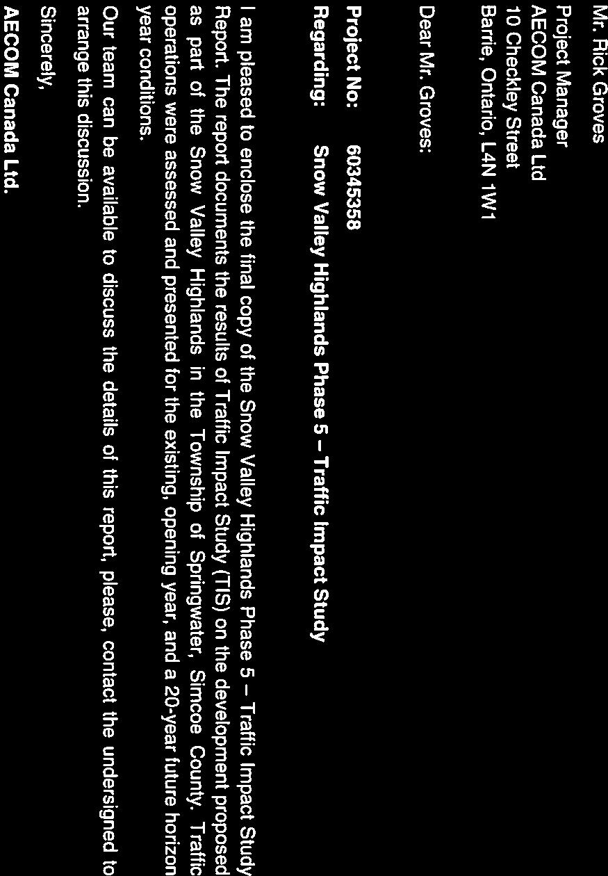


61


62
63 AECOM Ontario Ltd. Snow Valley Highlands Phase 5 Traffic Impact Study Table of Contents Statement of Qualifications and Limitations Letter of Transmittal Distribution List 1. Introduction Background Purpose of the Study Study Scope Transportation Infrastructure Future Development Plans Proposed Development Site Adjacent Planned Development Existing Traffic Conditions Data Collection Turning Movement Counts Annual Average Daily Traffic (AADT) Data Signal Timings Traffic Growth Rate Intersection Volumes and Lane Configuration Traffic Operations Analysis Operations Methodology Existing Conditions Opening Year Traffic Conditions Background Traffic Site Generated Traffic Planned Roadway Network Traffic Operations Analysis Future Year Traffic Conditions Background traffic Site Generated Traffic Planned Roadway Network Traffic Operations Analysis Background Traffic Conditions Future Total Traffic Railway Crossing Analysis Signal Warrant Analysis Conclusions and Recommendations page Snow Valley TIS_Final_Draft.Docx
64 AECOM Ontario Ltd. Snow Valley Highlands Phase 5 Traffic Impact Study List of Figures Figure 1: Study Area Overview... 2 Figure 2: Site Overview... 4 Figure 3: Future Development... 5 Figure 4: Weekday AM and PM Peak Hour Turning Movement Volumes Existing Conditions... 8 Figure 5: Lane Configuration and Method of Control Existing Conditions... 9 Figure 6: Weekday AM and PM Peak Hour Site Generated Traffic Opening Year Figure 7: Weekday AM and PM Peak Hour Turning Movement Volumes Opening Year Figure 8: Lane Configuration and Method of Control Opening Year Figure 9: Weekday Background Traffic Future Year Conditions (2035) Figure 10: Weekday AM and PM Peak Hour Turning Movement Volumes Future Year Conditions (2035) List of Tables Table 1: Turning Movement Counts Inventory... 6 Table 2: Average Annual Daily Traffic... 6 Table 3: Level of Service Descriptions Table 4: Existing Condition Traffic Analysis - AM and PM Peak Hours Table 5: Site Generated Traffic Table 6: Opening Year Conditions (2017) Traffic Analysis - AM and PM Peak Hours Table 7: Site Generated Traffic for Future Development Areas Table 8: Background Conditions Traffic Analysis AM and PM Peak Hours Table 9: Horizon Year (2035) Conditions Traffic Analysis AM and PM Peak Hours Table 10: Estimated Maximum Queue due to the Passage of a Train during Peak Hours (Year 2035) Table 11: Signal Warrant Analysis for the Intersection of Wilson Drive and Seadon Road Year Appendices Appendix A. Turning Movement Counts Appendix B. AADT and Signal Timings Appendix C. Synchro Output Results Snow Valley TIS_Final_Draft.Docx
65 AECOM Ontario Ltd. Snow Valley Highlands Phase 5 Traffic Impact Study 1. Introduction 1.1 Background AECOM has been retained by Ontario Limited to carry out a Traffic Impact Study (TIS) on the development proposed as part of the Snow Valley Highlands in the Township of Springwater, Simcoe County. The proposed Phase-5 development consists of 17 residential units having access on Barrie Hill Road and Seadon Road. The location of the site is shown in Figure 1. The purpose of this TIS is to assess the potential transportation implications of the proposed development and to determine whether transportation improvements are required as a result. 1.2 Purpose of the Study This traffic impact study is being undertaken to investigate the potential site traffic impact on the adjacent road network due to the proposed Phase 5 development. The study also considers the traffic volume generated by future developments on the north and south sides of Seadon Road. 1.3 Study Scope Figure 1 presents the study area overview. The scope of the study includes the following major tasks: Assess the operation of major intersections, specifically: 1. George Johnston Road / Snow Valley Road North; 2. George Johnston Road / Seadon Road; 3. Snow Valley Road North / Vespra Valley Road; 4. Snow Valley Road North / Wilson Drive; 5. Snow Valley Road South / Wilson Drive; 6. Wilson Drive / Carson Road; and 7. Seadon Road / Barrie Hill Road Review the operations characteristics of the proposed development access onto Seadon Road; Assess the traffic operation for the future proposed development accesses onto Seadon Road. The study covers the traffic condition analysis during the weekday AM and PM peak hours in the context of the following scenarios: Exiting conditions (2015); Opening year of the proposed site development (2017); and 20-year horizon (2035) This report summarizes the adopted methodology and the findings of this study. Snow Valley TIS_Final_Draft.Docx 1


66 Snow Valley Ski Resort Proposed Development Rail Line Roads Legend X Intersection Proposed Site Figure 1 Site Area Overview NTS
67 AECOM Ontario Ltd. Snow Valley Highlands Phase 5 Traffic Impact Study 2. Transportation Infrastructure Snow Valley Road (County Road 43) is a two lane rural road, with a posted speed limit of 60km/h. The road extends through the study area from a signalized intersection with George Johnston Road in the west to Wilson Drive in the east, before connecting with Bayfield Street. The Township s Official Plan designates Snow Valley Road as an arterial roadway but it functions more as a collector, providing a link between several local roads and nearby arterials (County Road 28 and Highway 26) as well as access to adjacent lands. George Johnston Road (County Road 28) is also a two lane, paved, rural arterial with a posted speed limit of 80km/h that provides a connection between Highway 26 in the north and County Road 40 (Sunnydale Road) in the south. The intersection of Snow Valley Road, George Johnston Road and Portage Trail, including the Canadian Pacific Railway (CPR) level-crossing is now all under traffic signal control. Wilson Drive (Concession 7) is a paved two lane rural (local) road with a posted speed limit of 80km/h. It has two T-intersections with Snow Valley Road as the east-west approaches. As noted above the northerly intersection with Snow Valley Road has been modified to facilitate east-west traffic flow. The north leg of Wilson Drive forms the stem of the T-intersection that is bisected by the CPR rail line. Southbound traffic is under stop sign control. Seadon Road and Carson Road are both two lane, rural, local roads that are on an east-west alignment similar to that of Snow valley Road. Vespra Valley Road is a two lane local road on north-south alignments that provides access to the Snow Valley Ski Resort from Snow Valley Road. Barrie Hill Lane is a two lane local road that provides access to the proposed development area from Seadon Road. The land use on both sides of this road is mostly residential units. A Canadian Pacific Railway (CPR) mainline extends east-west through the study area. It crosses Wilson Drive approximately 40m north of Snow Valley Road North. It then crosses Snow Valley Road approximately 450m west of Wilson Drive, at an acute angle. The road is curved to make the crossing and has a vertical hump to match the elevation of the tracks; the railway crossings are protected by standard automatic signal warning systems with the applicable advisory crossing speed. The railway also crosses George Johnston Road approximately south of Snow Valley Road. 3. Future Development Plans 3.1 Proposed Development Site The proposed development referred to as Snow Valley Highlands Phase 5 consists solely of residential units, approximately 17, south of the Snow Valley Ski Resort. See Figure 2 below for further details. To be conservative, it is assumed that the site generated traffic will use Barrie Hill Road to access Seadon Road. 3.2 Adjacent Planned Development There are three development areas in the study area that will take place by Figure 3 shows the details. Those future development areas include: Development Area 12: 84 residential units Development Area 14: 62 residential units Development Area 15: 34 residential units Snow Valley TIS_Final_Draft.Docx 3
68 8 HIGHWAY 26 WENDEN COURT NORTH LEGEND 9 MAYER ROAD GEORGE PARKWAY S NOW VALLEY R D WI LS ON DRIVE ANNE ST. N. (COUNTY ROAD 43) CA RS ON ROAD W. TRAIL 16 VII PORTAGE 63 SEADON ROAD BARRIE HILL ROAD KEY PLAN VIII DOB SON ROAD SITE BOUNDARY EXISTING DEVELOPED ROADWAYS No. DATE BY ISSUES / REVISIONS ALL DIMENSIONS AND INFORMATION SHALL BE CHECKED AND VERIFIED ON THE JOB AND ANY DISCREPANCIES MUST BE REPORTED TO THE CONSULTANT BEFORE COMMENCING THE WORK. DRAWINGS ARE NOT TO BE SCALED AECOM Canada Ltd. ALL RIGHTS RESERVED. THIS DOCUMENT IS PROTECTED BY COPYRIGHT LAW AND MAY NOT BE USED, REPRODUCED OR MODIFIED IN ANY MANNER OR FOR ANY PURPOSE EXCEPT WITH THE WRITTEN PERMISSION OF AECOM Canada Ltd. DOING BUSINESS AS AECOM ("AECOM") OR A PARTY TO WHICH ITS COPYRIGHT HAS BEEN ASSIGNED. AECOM ACCEPTS NO RESPONSIBILITY, AND DENIES ANY LIABILITY WHATSOEVER, TO ANY PARTY THAT USES, REPRODUCES, MODIFIES, OR RELIES ON THIS DOCUMENT WITHOUT AECOM'S EXPRESS WRITTEN CONSENT. CLIENT: PROJECT: TRAFFIC IMPACT STUDY DRAWING: DRAWN BY: SS DESIGNED BY: RP/RFG SCALE: 1:3000 CHECKED BY: RFG APPROVED BY: RP DATE: JAN 2016 PROJECT No. : DRAWING No FIG. 2
69 NORTH No. DATE BY ISSUES / REVISIONS ALL DIMENSIONS AND INFORMATION SHALL BE CHECKED AND VERIFIED ON THE JOB AND ANY DISCREPANCIES MUST BE REPORTED TO THE CONSULTANT BEFORE COMMENCING THE WORK. DRAWINGS ARE NOT TO BE SCALED AECOM Canada Ltd. ALL RIGHTS RESERVED. THIS DOCUMENT IS PROTECTED BY COPYRIGHT LAW AND MAY NOT BE USED, REPRODUCED OR MODIFIED IN ANY MANNER OR FOR ANY PURPOSE EXCEPT WITH THE WRITTEN PERMISSION OF AECOM Canada Ltd. DOING BUSINESS AS AECOM ("AECOM") OR A PARTY TO WHICH ITS COPYRIGHT HAS BEEN ASSIGNED. AECOM ACCEPTS NO RESPONSIBILITY, AND DENIES ANY LIABILITY WHATSOEVER, TO ANY PARTY THAT USES, REPRODUCES, MODIFIES, OR RELIES ON THIS DOCUMENT WITHOUT AECOM'S EXPRESS WRITTEN CONSENT. CLIENT: PROJECT: TRAFFIC IMPACT STUDY DRAWING: DRAWN BY: SS DESIGNED BY: RP/RFG SCALE: 1:7500 CHECKED BY: RFG APPROVED BY: RP DATE: JAN 2016 PROJECT No. : DRAWING No FIG. 3
70 AECOM Ontario Ltd. Snow Valley Highlands Phase 5 Traffic Impact Study 4. Existing Traffic Conditions 4.1 Data Collection Turning Movement Counts Turning movement counts (TMC) for five intersections in the study area were collected by Ontario Traffic Inc (OTI) as part of this study. All the TMCs were recorded on Tuesday, November 10, Intersections lane configurations were also confirmed as part of the data collection exercise. The turning movement counts for the other two intersections were obtained from the September 2011 Black Creek Estates of Snow Valley Traffic Impact Study 1. Table 1 provides a list of the traffic volume inventory utilized for the existing condition analyses. Detailed turning movement counts collected in this study are provided in Appendix A. Table 1: Turning Movement Counts Inventory No. Location Intersection Control Date Source 1 George Johnston Road / Snow Valley Rd North Signalized November 10, 2015 Ontario Traffic Inc 2 George Johnston Road / Seadon Road Unsignalized November 10, 2015 Ontario Traffic Inc 3 Snow Valley Road North / Vespra Valley Road Unsignalized Adjusted to 2011 AECOM TIS* 4 Snow Valley Rd North / Wilson Drive Unsignalized November 10, 2015 Ontario Traffic Inc 5 Snow Valley Road North / Wilson Drive Unsignalized Adjusted to 2011 AECOM TIS* 6 Wilson Drive / Carson Road Unsignalized November 10, 2015 Ontario Traffic Inc 7 Seadon Road/ Barrie Hill Rd Unsignalized November 10, 2015 Ontario Traffic Inc *AECOM, Black Creek Estates of Snow Valley Traffic Impact Study, Prepared for Ontario Ltd, September Annual Average Daily Traffic (AADT) Data Annual Average Daily Traffic (AADT) counts were obtained from the 2014 County of Simcoe Average Annual Daily Traffic Historical Summary. Automated traffic counts are collected as part of County of Simcoe annual traffic count program. Table 2 shows the AADT data for the abovementioned roads. Detailed turning movement counts collected in this study are provided in Appendix B. Table 2: Average Annual Daily Traffic Road/Year Wilson Drive N/A 1400 N/A Snow Valley Road N/A N/A 4600 N/A 5200 George Johnston Road N/A 3600 N/A *N/A Data not available 1 AECOM, Black Creek Estates of Snow Valley Traffic Impact Study, September 2011, Prepared for Ontario Ltd Snow Valley TIS_Final_Draft.Docx 6
71 AECOM Ontario Ltd. Snow Valley Highlands Phase 5 Traffic Impact Study Signal Timings Signal timings for the intersection of Snow Valley Road and George Johnston Road were obtained from the County of Simcoe, and used for the traffic analysis. Detailed signal timings are provided in Appendix B. 4.2 Traffic Growth Rate Average annual traffic growth rate was estimated using the AADT data obtained from the County of Simcoe (See Table 2). For east-west direction an average annual growth rate of 4.2% was estimated based on the increase in daily traffic volumes of Snow Valley Road between 2011 and 2014, and for north-south direction, an average annual growth rate of 2.6% was estimated based on change in traffic volume between 2006 and 2012 for Wilson Drive and George Johnston Road. 4.3 Intersection Volumes and Lane Configuration The existing intersection volumes were obtained for five (5) of the intersections from the turning movement count data. Traffic volumes for two (2) of the intersections (i.e. Snow Valley Road South/Wilson Drive and Snow Valley Road/ Vespra Valley Road) were estimated by growing 2011 traffic volumes 2 to For road segments with no access/egress points, traffic volumes were balanced. During the balancing process, the observed traffic volumes are adjusted to maintain the traffic flow conservation i.e. total vehicles entering a location on the network should be equal to those exiting that location. The volume balancing is then conducted based on review of turning movement counts at the intersections of the study area. Figure 4 illustrates existing turning movement counts in the study area. Lane configuration and method of control were also confirmed during data collection. Figure 5 illustrates the existing lane configuration and method of control. The percentages of heavy vehicles for the weekday AM and PM peak hours are calculated based on the turning movement counts. Peak hour factor (PHF) for each intersection approach was also computed based on the turning movement count data. 2 AECOM, Black Creek Estates of Snow Valley Traffic Impact Study, September 2011, Prepared for Ontario Ltd Snow Valley TIS_Final_Draft.Docx 7
72 Barrie Hill Rd 373 (228) 11 (9) 6 (2) 1 (4) 13 (5) 3 (7) 280 (213) 15 (24) Wilson Dr George Johnston Rd 274 (191) 50 (50) 2 (4) 345 (196) 17 (9) 7 (7) 7 (7) 7 (7) Vespra Valley Rd 11 (21) 159 (129) Wilson Dr 12 (27) 2 (6) 43 (43) 7 (7) 50 (103) 22 (27) Snow Valley Rd North (4) 1 (4) 1 (0) 0 36 (37) 146 (394) 2 (2) (7) 7 (119) 66 (9) (17) 7 (7) 7 (9) (12) 28 (112) (179) 76 (149) 22 (31) 25 (53) Snow Valley Rd South Snow Valley Ski Resort 38 (20) 150 (297) Proposed Site Development 8 (8) 16 (9) 3 (8) 19 (12) 2 (8) Seadon Rd 15 (35) 13 (29) 32 (30) 7 (20) 179 (421) (4) 1 (28) 16 (10) 7 2 (9) 1 (6) 0 (7) (8) 2 (19) 27 (20) (44) 171 (278) 8 (23) Carson Rd XX (XX) AM (PM) Peak Hour Turn Volumes NTS Rail Line Roads Legend Signalized Intersection Stop Sign Control Intersection Movements Figure 4 Weekday AM (PM) Peak Hour Turning Movement Volumes Existing Conditions
73 Barrie Hill Rd Wilson Dr George Johnston Rd Vespra Valley Rd Wilson Dr Snow Valley Rd North Snow Valley Rd South Snow Valley Ski Resort Proposed Site Development Seadon Rd Carson Rd NTS Rail Line Roads Legend Signalized Intersection Stop Sign Control Intersection Movements Figure 5 Lane Configuration and Method of Control Existing Conditions
74 AECOM Ontario Ltd. Snow Valley Highlands Phase 5 Traffic Impact Study 4.4 Traffic Operations Analysis Operations Methodology Traffic operations were analyzed using Synchro/SimTraffic version 9.0 software. The Highway Capacity Manual (HCM 2000) methodologies for signalized and unsignalized intersections were utilized. Where the LOS describes the driver experience on a transportation facility see Table 3 for further detail. Table 3: Level of Service Descriptions LOS Signalized Intersections Description Ave Delay Unsignalized Intersections Description Ave Delay A Very seldom does a vehicle wait longer than one red light. The approach appears open, turns are easily made and drivers have freedom of operation. 10 sec Little or no traffic delay occurs. Approaches appear open, turning movements are easily made, and drivers have freedom of operation. 10 sec B An occasional green light is fully used and many greens approach full use. Many drivers begin to feel somewhat restricted within groups of vehicles approaching the intersection. 20 sec Short traffic delays occur. Many drivers begin to feel somewhat restricted in terms of freedom of operation. 15 sec C D Intersection operation is stable but often has fully used greens. Drivers feel more restricted and occasionally may wait more than one red light. Queues may develop behind turning vehicles. Drivers experience increasing restriction and instability of traffic flow. There are substantial delays to vehicles during short peaks within the peak hour, but there is enough time with lower demand to permit occasional clearing of queues and prevent excessive backups. 35 sec 55 sec Average traffic delays occur. Operations are generally stable, but drivers emerging from the minor street may experience difficulty in completing their movement. This may occasionally impact on the stability of flow on the major street. Long traffic delays occur. Drivers emerging from minor streets experience significant restriction and frustration. Drivers on the major street will experience congestion and delay. 25 sec 35 sec E The capacity of the road is reached. There are long queues of vehicles waiting upstream of the intersection and delays to vehicles may extend to several signal cycles. 80 sec Very long traffic delays occur. Operations approach the capacity of the intersection. 50 sec F Vehicle demand exceeds the available capacity and delays extending through the peak hour are experienced. >80 sec Vehicle demand exceeds the available capacity. Very long traffic delays occur frequently. >50 sec The V/C ratio represents how saturated a road or intersection movement is based on actual volumes versus the maximum number of vehicles that can travel. A v/c between 0.00 and 0.49 means that less than half the capacity is being used by vehicles; this is generally associated with good operating conditions. As the v/c approaches 1.00, traffic conditions worsen and at 1.00 the theoretical maximum number of vehicles is reached and operations are generally denoted as very poor. A v/c can exceed 1.00, indicating very poor/over saturated conditions and extended traffic delays. Snow Valley TIS_Final_Draft.Docx 10
75 AECOM Ontario Ltd. Snow Valley Highlands Phase 5 Traffic Impact Study The critical movements identified in the capacity analysis summary tables are those having a LOS of E or F and/or a V/C ratio of 0.85 or greater for signalized intersections, and for unsignalized intersections a LOS of E or F. Since the analysis is based on actual volumes, V/C > 1.00 indicates that the counted traffic volumes exceeded the capacity calculated by the analysis procedure/software. Individual movements at intersections with calculated V/C > 1.00 are operating essentially above capacity and can be expected to experience severe recurring queuing and congestion during both the AM and PM peak periods Existing Conditions The existing traffic volumes (Figure 4) were analyzed based on the existing lane configurations (Figure 5) and signal timings. The traffic operational analysis results of the study area signalized and unsignalized intersections are summarized in Table 4. Detailed Synchro outputs are provided in Appendix C. Based on the intersection capacity analysis results presented in Table 4, all intersections (during both the AM and PM peak hours) and individual movements within the study area are predicted to operate at level of service C or better, and no critical movement is identified. Table 4: Existing Condition Traffic Analysis - AM and PM Peak Hours Intersection George Johnston Rd/ Snow Valley Rd (Signalized) George Johnston Rd/ Seadon Rd (Unsignalized) Vespa Valley Rd/ Snow Valley Rd (Unsignalized) Wilson Dr/ Snow Valley Rd North (Unsignalized) Wilson Dr/ Snow Valley Rd South (Unsignalized) Wilson Dr/ Seadon Rd- Carson Rd (Unsignalized) Barrie Hill Ln/ Seadon Rd (Unsignalized) SB NB Weekday AM Peak Hour Weekday PM Peak Hour Movement Delay Delay LOS V/C (sec) (sec) LOS V/C Left 3.2 A A 0.02 Thru/Thru-Right 3.6 A A 0.11 Left 3.1 A A 0.00 Thru 3.7 A A 0.34 Right 3.2 A A 0.03 EB Left-Thru-Right 27.6 C C 0.09 WB Left 31.7 C C 0.44 Thru-Right 27.6 C C 0.07 Overall Intersection 6.7 A A 0.35 SB Left 8.3 A A 0.01 WB Left-Right 11.6 B B 0.05 SB Left-Thru-Right 9.9 A B 0.04 NB Left-Thru-Right 9.5 A B 0.05 EB Left-Thru-Right 0.7 A A 0.02 WB Left-Thru-Right 2.2 A A 0.01 SB Left 14.9 B B 0.31 EB Left-Right 1.3 A A 0.01 SB Thru-Left 1.5 A A 0.04 WB Left-Right 11.8 B B 0.19 SB Left-Thru-Right 0.5 A A 0.03 NB Left-Thru-Right 0.4 A A 0.02 EB Left-Thru-Right 13.1 B C 0.16 WB Left-Thru-Right 16.5 C C 0.33 SB Left-Thru-Right 7.4 A A 0.02 NB Left-Thru-Right 6.7 A A 0.05 EB Left-Thru-Right 7.4 A A 0.06 WB Left-Thru-Right 7.3 A A 0.04 Snow Valley TIS_Final_Draft.Docx 11
76 AECOM Ontario Ltd. Snow Valley Highlands Phase 5 Traffic Impact Study 5. Opening Year Traffic Conditions In this section, traffic operations assessment in the opening year (2017) is presented. Background traffic and site generated traffic were estimated, and level of service for the intersections was predicted. 5.1 Background Traffic The background traffic was assumed to grow 4.2% per year in east-west direction and by 2.6% per year in northsouth direction as described in Section 4.2. No other major development in the study area is expected. 5.2 Site Generated Traffic Trips generated by Snow Valley Highlands Phase 5 were estimated using the average trip generation rates for the Single Family Detached Housing land uses as directed by the ITE Trip Generation, 9th Edition. Table 5 summarizes the site generated trips for the proposed development. The total inbound and outbound traffic was estimated for both the AM and PM peak using the ITE Average Rate. In the existing conditions, residential units developed in the previous phases of the Snow Valley Highlands are occupied. It is assumed that the trip distribution of traffic generated by the new seventeen (17) units in Phase 5 will be similar to the existing traffic generated by the currently occupied units in the previous phases. Therefore, total inbound and outbound traffic was distributed in the network based on the existing turning movement patterns. The volume of southbound right turning and left turning vehicles at the intersection of Barrie Hill Lane and Seadon Road was used to estimate the eastbound/westbound traffic proportion for the site generated traffic. To be conservative, it is assumed that all site generated traffic will be using Barrie Hill Lane to access the new development. Table 5: Site Generated Traffic Generated Trips ITE Land Use Code No. of Units Description AM Peak Hour PM Peak Hour In Out Total In Out Total 26% 74% 100% 64% 36% 100% Trip Rates (veh/hr/unit) # Trips (veh/hr) Figure 6 illustrates turning movement volumes for site generated traffic, and Figure 7 illustrates total traffic including both background and site generated traffic in the opening year. 5.3 Planned Roadway Network The County of Simcoe is undertaking an improvement plan for the intersection of Snow Valley Road North/South and Wilson Drive. After the improvements, Wilson Drive will be considered as the through road, and Snow Valley Road will be controlled by a stop sign. Figure 8 illustrates the lane configuration used for the opening year traffic analysis. The Synchro/SimTraffic model was updated to reflect the new intersection control and lane configuration. Snow Valley TIS_Final_Draft.Docx 12
77 Barrie Hill Rd 0 (0) 0 (1) 0 (1) 0 (0) 0 (0) 3 (1) 1 (2) 6 (3) Wilson Dr George Johnston Rd 0 (1) 0 (0) 0 (0) 0 (1) 0 (0) 0 (0) 0 (0) 0 (0) Vespra Valley Rd 0 (0) 0 (1) Wilson Dr 0 (0) 0 (0) 0 (0) 0 (0) 0 (0) 0 (0) Snow Valley Rd North (0) 0 (0) 0 (0) 0 0 (0) 1 (0) 0 (0) (0) 0 (0) 0 (0) 0 0 (0) 0 (0) 0 (0) (0) 0 (0) 0 0 (0) 0 (0) 0 (0) 0 (0) Snow Valley Rd South Snow Valley Ski Resort 0 (0) 0 (0) Proposed Site Development 1 (0) 2 (1) 1 (5) 0 (0) 0 (0) Seadon Rd 0 (0) 1 (2) 0 (0) 0 (1) 0 (0) (2) 0 (0) 0 (0) 0 0 (0) 2 (4) 0 (0) (0) 0 (1) 3 (2) 3 0 (0) 0 (0) 0 (2) Carson Rd XX (XX) AM (PM) Peak Hour Turn Volumes NTS Rail Line Roads Legend Signalized Intersection Stop Sign Control Intersection Movements Figure 6 Weekday AM (PM) Peak Hour Site Generated Traffic Opening Year
78 Barrie Hill Rd 393 (240) 12 (10) 9 (3) 2 (6) 20 (8) 3 (8) 295 (224) 16 (25) Wilson Dr George Johnston Rd 288 (202) 52 (52) 2 (4) 363 (207) 18 (9) 8 (8) 8 (8) 8 (8) Vespra Valley Rd 12 (22) 167 (137) Wilson Dr 13 (29) 2 (7) 47 (47) 8 (8) 54 (112) 24 (29) Snow Valley Rd North (4) 1 (4) 1 (0) 0 38 (39) 155 (415) 2 (2) (8) 8 (129) 71 (10) (18) 8 (8) 8 (10) (13) 30 (122) (188) 80 (157) 24 (33) 27 (57) Snow Valley Rd South Snow Valley Ski Resort 40 (21) 158 (313) Proposed Site Development 10 (9) 19 (11) 4 (14) 21 (13) 2 (9) Seadon Rd 16 (38) 15 (34) 35 (33) 7 (22) 188 (443) (6) 1 (30) 17 (11) 8 2 (9) 3 (10) 0 (7) (9) 2 (22) 32 (24) (46) 180 (293) 8 (26) Carson Rd XX (XX) AM (PM) Peak Hour Turn Volumes NTS Rail Line Roads Legend Signalized Intersection Stop Sign Control Intersection Movements Figure 7 Weekday AM (PM) Peak Hour Turning Movement Volumes Opening Year
79 Barrie Hill Rd Wilson Dr George Johnston Rd Vespra Valley Rd Wilson Dr Snow Valley Rd North Snow Valley Rd South Snow Valley Ski Resort Proposed Site Development Seadon Rd Carson Rd NTS Rail Line Roads Legend Signalized Intersection Stop Sign Control Intersection Movements Figure 8 Lane Configuration and Method of Control Opening Year
80 AECOM Ontario Ltd. Snow Valley Highlands Phase 5 Traffic Impact Study 5.4 Traffic Operations Analysis The opening year traffic volumes (Figure 7) were analyzed to assess traffic operations. The traffic operational analysis results of the study area, both signalized and unsignalized intersections, are summarized in Table 6. Detailed Synchro outputs are provided in Appendix C. Based on the intersection capacity analysis results presented in Table 6, all intersections (during both the AM and PM peak hours) and individual turning movements within the study area are predicted to operate at level of service D or better, and no critical movement is identified. Table 6: Opening Year Conditions (2017) Traffic Analysis - AM and PM Peak Hours Intersection George Johnston Rd/ Snow Valley Rd (Signalized) George Johnston Rd/ Seadon Rd (Unsignalized) Vespa Valley Rd/ Snow Valley Rd (Unsignalized) Wilson Dr/ Snow Valley Rd North (Unsignalized) Wilson Dr/ Snow Valley Rd South (Unsignalized) Wilson Dr/ Seadon Rd- Carson Rd (Unsignalized) Barrie Hill Ln/ Seadon Rd (Unsignalized) SB NB Movement Weekday AM Peak Hour Delay LOS V/C (sec) Weekday PM Peak Hour Delay LOS V/C (sec) Left 3.3 A A 0.02 Thru/Thru-Right 3.7 A A 0.1 Left 3.2 A A 0 Thru 3.8 A A 0.41 Right 3.3 A A 0.03 EB Left-Thru-Right 27.3 C C 0.09 WB Left 31.7 C C 0.41 Thru-Right 27.4 C C 0.07 Overall Intersection 6.9 A A 0.41 SB Left 8.4 A A 0.02 WB Left-Right 11.9 B B 0.08 SB Left-Thru-Right 10.1 B B 0.04 NB Left-Thru-Right 9.6 A B 0.06 EB Left-Thru-Right 0.7 A A 0.01 WB Left-Thru-Right 2.2 A A 0.02 NB Left 8.0 A A 0.17 EB Left-Right 12.5 B B 0.23 SB Thru-Left 7.8 A A 0.05 WB Left/Right 11.6 B B 0.16 SB Left-Thru-Right 0.5 A A 0.02 NB Left-Thru-Right 0.4 A A 0.03 EB Left-Thru-Right 13.7 B C 0.17 WB Left-Thru-Right 17.9 C D 0.48 SB Left-Thru-Right 7.5 A A 0.03 NB Left-Thru-Right 6.9 A A 0.08 EB Left-Thru-Right 7.4 A A 0.08 WB Left-Thru-Right 7.3 A A 0.06 Snow Valley TIS_Final_Draft.Docx 16
81 AECOM Ontario Ltd. Snow Valley Highlands Phase 5 Traffic Impact Study 6. Future Year Traffic Conditions Traffic operations for a 20-year horizon were analyzed to identify any potential challenges in the study area in year Background traffic Similar to the opening year, it is assumed the background traffic will have grown by the same rate estimated based on the AADT obtained from the County of Simcoe. An average growth rate of 4.2% per year in east-west direction and 2.6% per year in north-south direction as described in Section 4.2 were considered for the purpose of estimating the background traffic in the study area. As shown in Figure 3, three other development areas (Development Area 12, 14, and 15) are planned to be completed in the near future. Therefore, the trips generated from those development areas were also considered in the future horizon year (2035). Trips generated for the future residential development were estimated using the same methodology described in Section 5 for the Single Family Detached Housing land uses as directed by the ITE Trip Generation, 9th Edition. ITE Average Rate was used to estimate the site generated traffic. Table 7 summarizes the site generated trips for the future development areas. The total inbound and outbound traffic for the adjacent development areas was distributed in the network based on the existing turning movement patterns as described for the proposed development site (Phase 5) in Section 5.2. The volume of southbound right turning and left turning vehicles at the intersection of Barrie Hill Lane and Seadon Road was used to estimate the eastbound/westbound traffic proportion for the site generated traffic. Table 7: Site Generated Traffic for Future Development Areas Development Area ITE Land Use Code No. of Units Description Trip Rates (veh/hr/unit) # Trips (veh/hr) Trip Rates (veh/hr/unit) # Trips (veh/hr) Trip Rates (veh/hr/unit) # Trips (veh/hr) AM Peak Hour Generated Trips PM Peak Hour In Out Total In Out Total 26% 74% 100% 64% 36% 100% Total Trips Figure 9 illustrates turning movement volumes for the background traffic in year Snow Valley TIS_Final_Draft.Docx 17
82 AECOM Ontario Ltd. Snow Valley Highlands Phase 5 Traffic Impact Study 6.2 Site Generated Traffic As described in Section 5, trips generated by Snow Valley Highlands Phase 5 were estimated using the average trip generation rates for the Single Family Detached Housing land uses as directed by the ITE Trip Generation, 9th Edition (see Table 5 for details). Figure 10 illustrates turning movement volumes including both background and site generated traffic in year Planned Roadway Network Traffic network for year 2035 is assumed to remain the same as the opening year, as shown in Figure 8. Development Area 12 is considered to be connected to Seadon Road via a T-intersection, and Development Areas 14 and 15 are connected to the network via a 4-legged intersection as shown in Figure 10. Snow Valley TIS_Final_Draft.Docx 18
83 Barrie Hill Rd 623 (381) 24 (27) 10 (3) 2 (7) 22 (8) 16 (9) 32 (22) 12 (7) 0 (0) 24 (16) 8 (21) 468 (356) 25 (40) Wilson Dr George Johnston Rd 461 (327) 84 (83) 3 (7) 582 (340) 28 (15) 12 (12) 12 (12) 12 (12) Vespra Valley Rd 18 (35) 267 (219) Wilson Dr 27 (61) 5 (14) 98 (98) 17 (17) 113 (236) 50 (61) Snow Valley Rd North (9) 2 (9) 2 (0) 0 60 (62) 244 (658) 3 (3) (17) 17 (270) 149 (22) (28) 12 (12) 12 (16) (27) 64 (258) (300) 127 (249) 50 (70) 57 (122) Snow Valley Rd South Snow Valley Ski Resort 63 (33) 253 (498) 18 (18) 36 (20) Seadon Rd Proposed Site Development 7 (18) 43 (27) 5 (18) Development Area (37) 66 (126) Development Area 14 9 (27) 61 (153) 5 (15) 34 (80) 44 (105) 73 (68) 15 (60) 299 (703) (9) 2 (64) 36 (23) 16 3 (15) 2 (10) 0 (12) (18) 4 (89) 123 (13) 3 (90) 151 (7) 2 13 (9) 0 (0) 6 (4) (20) 7 (47) 90 (49) (74) 286 (465) 22 (69) Carson Rd Development Area 15 XX (XX) AM (PM) Peak Hour Turn Volumes NTS Rail Line Roads Legend Signalized Intersection Stop Sign Control Intersection Movements Figure 9 Weekday Background Traffic Future Year Conditions (2035)
84 Barrie Hill Rd 623 (381) 24 (28) 13 (4) 3 (9) 28 (11) 16 (9) 32 (22) 12 (7) 5 (5) 24 (16) 9 (22) 468 (356) 25 (40) Wilson Dr George Johnston Rd 461 (327) 84 (83) 3 (7) 582 (340) 28 (15) 12 (12) 12 (12) 12 (12) Vespra Valley Rd 18 (35) 267 (220) Wilson Dr 27 (61) 5 (14) 98 (98) 17 (17) 113 (236) 50 (61) Snow Valley Rd North (9) 2 (9) 2 (0) 0 60 (62) 254 (662) 3 (3) (17) 17 (270) 149 (22) (28) 12 (12) 12 (16) (27) 64 (259) (305) 127 (249) 50 (70) 57 (122) Snow Valley Rd South Snow Valley Ski Resort 63 (34) 253 (502) Proposed Site Development 29 (22) 58 (24) Seadon Rd 8(23) 72(34) 9 (31) Development Area (37) 67 (131) Development Area 14 9 (27) 62 (158) 5 (15) 34 (80) 45 (107) 73 (68) 15 (62) 299 (703) (11) 2 (91) 43 (33) 19 3 (15) 4 (14) 0 (12) (18) 4 (119) 136 (13) 3 (120) 163 (7) 2 13 (9) 5 (5) 6 (4) (25) 7 (59) 96 (62) (74) 286 (465) 23 (71) Carson Rd Development Area 15 XX (XX) AM (PM) Peak Hour Turn Volumes NTS Rail Line Roads Legend Signalized Intersection Stop Sign Control Intersection Movements Figure 10 Future (2035) Weekday AM (PM) Peak Hour Turning Movement Volumes
85 AECOM Ontario Ltd. Snow Valley Highlands Phase 5 Traffic Impact Study 6.4 Traffic Operations Analysis Background Traffic Conditions In this scenario, traffic operations in the study area were assessed assuming no traffic is generated by Snow Valley Heights Phase 5 development. The background future traffic volumes (Figure 9) were analyzed to assess traffic operations. The traffic operational analysis results of the study area, both signalized and unsignalized intersections, are summarized in Table 8. All the critical individual movements with respect to levels of service and volumes to capacity ratios are highlighted in the table. Detailed Synchro outputs are provided in Appendix C. Table 8: Background Conditions Traffic Analysis AM and PM Peak Hours Intersection George Johnston Rd/ Snow Valley Rd (Signalized) George Johnston Rd/ Seadon Rd (Unsignalized) Vespra Valley Rd/ Snow Valley Rd (Unsignalized) Wilson Dr/ Snow Valley Rd North (Unsignalized) Wilson Dr/ Snow Valley Rd South (Unsignalized) Wilson Dr/ Seadon Rd- Carson Rd (Unsignalized) Barrie Hill Ln/ Seadon Rd (Unsignalized) SB NB Movement Weekday AM Peak Hour Delay LOS V/C (sec) Weekday PM Peak Hour Delay LOS V/C (sec) Left 5 A A 0.06 Thru/Thru-Right 6.1 A A 0.18 Left 4.7 A A 0 Thru 6.2 A B 0.71 Right 5 A A 0.05 EB Left-Thru-Right 23.5 C C 0.15 WB Left 31 C C 0.62 Thru-Right 23.6 C C 0.18 Overall Intersection 9.5 A B 0.69 SB Left 9 A B 0.06 WB Left-Right 17.2 C D 0.27 SB Left-Thru-Right 12.3 B C 0.11 NB Left-Thru-Right 11.2 B B 0.14 EB Left-Thru-Right 0.7 A A 0.01 WB Left-Thru-Right 2.4 A A 0.05 NB Left 8.7 A A 0.30 EB Left-Right 54 F D 0.72 SB Left 8.3 A A 0.09 WB Left/Right 17 C D 0.61 SB Left-Thru-Right 0.7 A A 0.05 NB Left-Thru-Right 0.9 A A 0.09 EB Left-Thru-Right 43.2 E 0.71 >1000 F >2.0 WB Left-Thru-Right F 1.73 >1000 F >2.0 SB Left-Thru-Right 7.7 A A 0.03 NB Left-Thru-Right 7.0 A A 0.11 EB Left-Thru-Right 7.7 A A 0.16 WB Left-Thru-Right 7.6 A A 0.10 Snow Valley TIS_Final_Draft.Docx 21
86 AECOM Ontario Ltd. Snow Valley Highlands Phase 5 Traffic Impact Study The intersection capacity analysis results are presented in Table 8, the signalized intersection in the study area is predicted to operate at satisfactory level of service during both the AM and PM peak hour in However, it is predicted that some individual movements at unsignalized intersections would operate above capacity during either the AM or PM peak hour; or in both peak hours with significant delays. The following individual movements are identified as critical in year 2035: AM Peak Hour Wilson Dr/ Snow Valley Road North eastbound left-right PM Peak Hour Wilson Dr/ Seadon Rd-Carson Road eastbound and westbound left-thru-right Wilson Dr/ Seadon Rd-Carson Road eastbound and westbound left-thru-right Eastbound approach of the Wilson Drive/Snow Valley Road North intersection is predicted to operate at LOS F during the AM peak hour with v/c ratio of Turning movements at this approach are completed via a single shared left-right lane. Left turning vehicles waiting to find a gap in both northbound and southbound traffic streams would block the only lane, and reduce the capacity of the eastbound approach. Traffic approaching from the minor street at the Wilson Drive and Seadon Road/Carson Road intersection is predicted to experience significant delays in both the AM and PM peak hours. Specially during the PM peak hour, the v/c ratio of the minor approaches (Seadon Road/Carson Road) is predicted to be more than 2.0. Consideration of traffic signal may be justified at this intersection. Refer to Section 6.6 for detailed for signal warrant analysis. Snow Valley TIS_Final_Draft.Docx 22
87 AECOM Ontario Ltd. Snow Valley Highlands Phase 5 Traffic Impact Study Future Total Traffic In this scenario, traffic operations in the study area were assessed considering both background traffic volumes and traffic generated by the Snow Valley Heights Phase 5 development. The future traffic volumes (Figure 10) were analyzed to assess traffic operations. The traffic operational analysis results of the study area, both signalized and unsignalized intersections, are summarized in Table 9. All the critical individual movements with respect to levels of service and volumes to capacity ratios are highlighted in the table. Detailed Synchro outputs are provided in Appendix C. Table 9: Horizon Year (2035) Conditions Traffic Analysis AM and PM Peak Hours Intersection George Johnston Rd/ Snow Valley Rd (Signalized) George Johnston Rd/ Seadon Rd (Unsignalized) Vespa Valley Rd/ Snow Valley Rd (Unsignalized) Wilson Dr/ Snow Valley Rd North (Unsignalized) Wilson Dr/ Snow Valley Rd South (Unsignalized) Wilson Dr/ Seadon Rd- Carson Rd (Unsignalized) Barrie Hill Road/ Seadon Rd (Unsignalized) Weekday AM Peak Hour Weekday PM Peak Hour Movement Delay Delay LOS V/C (sec) (sec) LOS V/C SB Left 5 A A 0.06 Thru/Thru-Right 6.1 A A 0.18 Left 4.7 A A 0 NB Thru 6.3 A B 0.71 Right 5 A A 0.05 EB Left-Thru-Right 23.5 C C 0.15 WB Left 31 C C 0.62 Thru-Right 23.6 C C 0.19 Overall Intersection 9.5 A B 0.69 SB Left 9 A B 0.06 WB Left-Right 20 C D 0.33 SB Left-Thru-Right 12.3 B C 0.11 NB Left-Thru-Right 11.2 B B 0.14 EB Left-Thru-Right 0.7 A A 0.01 WB Left-Thru-Right 2.4 A A 0.05 NB Left 8.7 A A 0.30 EB Left-Right 53.7 F D 0.73 SB Left 1.3 A A 0.09 WB Left-Right 17.0 C D 0.61 SB Left-Thru-Right 0.7 A A 0.05 NB Left/Thru/Right 1 A A 0.09 EB Left/Thru/Right 48.3 E 0.76 >1000 F >2.0 WB Left/Thru/Right F 1.86 >1000 F >2.0 SB Left/Thru/Right 8.0 A A 0.05 NB Left/Thru/Right 7.3 A A 0.11 EB Left/Thru/Right 7.9 A A 0.23 WB Left/Thru/Right 8.0 A A 0.15 Based on the intersection capacity analysis results presented in Table 9, there is no significant change in traffic operations when site generated traffic volumes were added to the background conditions. Lane group delays, level Snow Valley TIS_Final_Draft.Docx 23
88 AECOM Ontario Ltd. Snow Valley Highlands Phase 5 Traffic Impact Study of service, and critical movements remain the same as background conditions. The following individual movements are identified as critical in the study area: AM Peak Hour Wilson Dr/ Snow Valley Road North eastbound left-right PM Peak Hour Wilson Dr/ Seadon Rd-Carson Road eastbound and westbound left-thru-right Wilson Dr/ Seadon Rd-Carson Road eastbound and westbound left-thru-right The intersection of Barrie Hill Road and Seadon Road is predicted to operate at LOS A for both the AM and PM peak hour in year 2035 indicating that the site generated traffic would have minimal impact on traffic operations at this intersection. The following mitigation measures may be considered for the future horizon year (2035) in the study area: Intersection of Wilson Drive and Snow Valley Road North: Eastbound approach is predicted to operate at LOS F in year 2035 with v/c ratio of Since both eastbound left and right turning vehicles are provided with a single shared lane, the provision of a right turn lane in year 2035 may be considered. Intersection of Wilson Drive and Seadon Road/Carson Road: Eastbound and westbound approaches (minor road) in this intersection are predicted to operate at LOS F in year The intersection has a single shared left-through-right lane for each approach. The provision of turn lanes may be considered for this intersection in year Moreover, installation of traffic signal at this intersection may be considered for the future horizon year. Details for signal warrant analysis are provided in Section Railway Crossing Analysis A Canadian Pacific Railway (CPR) mainline extends east-west through the study area. It crosses Wilson Drive approximately 60m north of Snow Valley Road North. It then crosses George Johnston Road approximately 60m south of Snow Valley Road. The following three locations may be negatively impacted by train traffic: George Johnston Road/Snow Valley Road: The rail track crosses the northbound approach of this intersection. The traffic signal is equipped with a pre-emption mechanism to ensure the northbound queue will clear the track before the train arrives. Wilson Drive/Snow Valley Road North: The rail track crosses the southbound approach of this intersection. Under the new configuration (See Figure 8), Wilson Drive will be given with the right of way, and Snow Valley Road North will be controlled by a stop sign. Therefore, the southbound movements will be free in the absence of a train, and no vehicular queue is expected between the intersection and the railway crossing Snow Valley Road Between Wilson Drive and Vespra Valley Road: The rail track crosses the Snow Valley Road west of Wilson Drive. The crossing is protected by signal warning system. A sensitivity analysis was conducted to estimate the queue length for the abovementioned locations when the traffic is stopped due to the passage of a train. Table 10 presents the estimated maximum queues. It was assumed that the traffic may be stopped up to 5 minutes 3 during the peak hours. The expected number of vehicles in the queue 3 A train consisting of 140 cars and 4 locomotives was assumed with the average length of each car assumed to be approximately 65ft. The speed of the train is assumed to be 48 km/hr. Thirty (30) seconds of warning time is assumed at the signal. The closure time is then rounded up to the nearest minute. Snow Valley TIS_Final_Draft.Docx 24
89 AECOM Ontario Ltd. Snow Valley Highlands Phase 5 Traffic Impact Study was estimated based on the average arrival rate during a 5-minute closure for both the AM and PM peak hour. The maximum queue lengths were estimated using the critical peak hour for each location. The effective length of vehicles in the queue is assumed based on Synchro default values. The queue lengths in 2035 are predicted to remain below the available storage for all three locations in the AM and PM peak hour. Table 10: Estimated Maximum Queue due to the Passage of a Train during Peak Hours (Year 2035) Road Direction Volume (veh/hr) Expected Number of Vehicles in Queue AM PM AM PM Maximum Queue (m) Available Storage (m) George Johnston Road Wilson Drive Snow Valley Road NB ~ 500 ~1100 SB ~ 420 >2000 NB ~ 210 ~275 SB ~ 200 ~2000 EB ~ 200 ~400 WB ~ 220 >2000 Notes: Available storage is computed based on the distance to the upstream intersection Average vehicle length in queue was assumed to be 7.6 m for passenger cars and 13.7 m for heavy vehicles, with the percentage of heavy vehicles assumed to be 10 percent. 6.6 Signal Warrant Analysis Ontario Traffic Manual Book 12 was consulted to investigate the justification of traffic signals; specifically traffic signal justification for future development (Justification 7). The intersection of Barrie Hill Road and Seadon Road provides the main access to the proposed development area. Based on Table 9, the intersection is predicted to operate at LOS A in year 2035 with minimal delays for all approaches. The signal warrant analysis showed that the intersection volume is well below the minimum requirements, thus traffic signals were not required Based on traffic operational analysis, the intersection of Wilson Drive and Seadon Road is predicted to operate at LOS F in Therefore, justification for a traffic signal installation at this intersection was investigated. According to OTM Book 12 Traffic Signal Justification 7, average hourly volume was estimated using the AM and PM peak hour volumes and unrestricted flow requirements were considered. Table 11 presents justification of traffic signal for projected volumes in year A compliance of 120% is required for a traffic signal to be justified. Therefore, the minimum vehicular volume justification is met, and the installation of traffic signals is warranted in year Snow Valley TIS_Final_Draft.Docx 25
90 AECOM Ontario Ltd. Snow Valley Highlands Phase 5 Traffic Impact Study Table 11: Signal Warrant Analysis for the Intersection of Wilson Drive and Seadon Road Year 2035 Justification Description Minimum Requirement Flow (veh/hr) Compliance Sectional Entire % Numerical % 1. Minimum Vehicular Volume A. Vehicle volume, all approaches (average hour) >120 B. Vehicle volume, along minor streets (average hour) >120 > Delay to Cross Traffic A. Vehicle volume, major street (average hour) B. Combined vehicle and pedestrian volume crossing artery from minor streets 9average hour) > Conclusions and Recommendations This report documents the results of the Traffic Impact Study (TIS) undertaken on the development proposed as part of the Snow Valley Highlands in the Township of Springwater, Simcoe County. The proposed Phase-5 development consists of 17 residential units having access on Barrie Hill Road and Seadon Road. Synchro/SimTraffic was used to assess traffic operations under the existing, opening year, and the future year conditions. This TIS was prepared in order to assess potential transportation implications of the proposed development and to determine whether transportation improvements are required as a result. Traffic corridor growth rates and future development plans in the study area were considered to predict traffic volumes in the opening and future years. Planed roadway network was also considered for the future year traffic analysis. The traffic analyses presented in the report provide the following conclusions: 1. Based on the Synchro analysis, all the intersections in the study area are operating satisfactorily in the existing conditions, and no significant delay is expected for both the AM and PM peak hour. 2. Traffic operations are predicted to remain satisfactory in the opening year. All individual movements would operate at level of service D or better, and no significant delays are expected for both the AM and PM peak hour. 3. Traffic operations for background conditions in year 2035 were assessed. All intersections in year 2035 are expected to operate at satisfactory levels of service except for the intersection of Wilson Drive and Seadon Road and the intersection of Wilson Drive and Snow Valley Road North. Further analysis is recommended to assess justification of traffic signals and/or turn lanes at these intersections. 4. Traffic operations in year 2035 were assessed considering both background and site generated traffic volumes. No significant change was observed when intersections level of service was compared to that of the background traffic conditions. 5. The intersection of Barrie Hill Road and Seadon Road provides the main access to the proposed development area. Based on traffic operational analysis, the intersection is predicted to operate at LOS A in year 2035 with minimal delays for all approaches. 6. Justification for a traffic signal installation at the intersection of Wilson Drive and Seadon Road/Carsen Road was investigated. Based on projected traffic volumes, installation of a traffic signal is justified at this intersection in year Snow Valley TIS_Final_Draft.Docx 26
91 AECOM Ontario Ltd. Snow Valley Highlands Phase 5 Traffic Impact Study APPENDICES Snow Valley TIS_Final_Draft.Docx
92 AECOM Ontario Ltd. Snow Valley Highlands Phase 5 Traffic Impact Study APPENDIX A Turning Movement Counts Snow Valley TIS_Final_Draft.Docx
93 Ontario Traffic Inc Morning Peak Diagram Specified Period From: 6:30:00 To: 9:30:00 One Hour Peak From: 7:30:00 To: 8:30:00 Municipality: Site #: Intersection: TFR File #: Count date: Minesing Snow Valley Rd & Wilson Dr 7 10-Nov-15 Weather conditions: Person(s) who counted: ** Non-Signalized Intersection ** Major Road: Snow Valley Rd runs N/S North Leg Total: 295 Heavys Heavys 3 North Entering: 170 Trucks Trucks 4 North Peds: 0 Cars Cars 118 Peds Cross: Totals Totals 125 Heavys Trucks Cars Totals Wilson Dr N Snow Valley Rd W E Heavys Trucks Cars Totals S Snow Valley Rd Peds Cross: Cars 310 Cars Peds Cross: West Peds: 0 Trucks 8 Trucks South Peds: 0 West Entering: 193 Heavys 6 Heavys South Entering: 173 West Leg Total: 280 Totals 324 Totals South Leg Total: 497 Comments
94 Ontario Traffic Inc Mid-day Peak Diagram Specified Period From: 11:30:00 To: 13:30:00 One Hour Peak From: 11:30:00 To: 12:30:00 Municipality: Site #: Intersection: TFR File #: Count date: Minesing Snow Valley Rd & Wilson Dr 7 10-Nov-15 Weather conditions: Person(s) who counted: ** Non-Signalized Intersection ** Major Road: Snow Valley Rd runs N/S North Leg Total: 163 Heavys Heavys 0 North Entering: 90 Trucks Trucks 8 North Peds: 0 Cars Cars 65 Peds Cross: Totals 8 82 Totals 73 Heavys Trucks Cars Totals Wilson Dr N Snow Valley Rd W E Heavys Trucks Cars Totals S Snow Valley Rd Peds Cross: Cars 167 Cars Peds Cross: West Peds: 0 Trucks 6 Trucks South Peds: 0 West Entering: 100 Heavys 0 Heavys South Entering: 137 West Leg Total: 181 Totals 173 Totals South Leg Total: 310 Comments
95 Ontario Traffic Inc Afternoon Peak Diagram Specified Period From: 15:30:00 To: 18:30:00 One Hour Peak From: 16:30:00 To: 17:30:00 Municipality: Site #: Intersection: TFR File #: Count date: Minesing Snow Valley Rd & Wilson Dr 7 10-Nov-15 Weather conditions: Person(s) who counted: ** Non-Signalized Intersection ** Major Road: Snow Valley Rd runs N/S North Leg Total: 341 Heavys Heavys 0 North Entering: 150 Trucks Trucks 4 North Peds: 0 Cars Cars 187 Peds Cross: Totals Totals 191 Heavys Trucks Cars Totals Wilson Dr N Snow Valley Rd W E Heavys Trucks Cars Totals S Snow Valley Rd Peds Cross: Cars 231 Cars Peds Cross: West Peds: 0 Trucks 9 Trucks South Peds: 0 West Entering: 124 Heavys 1 Heavys South Entering: 328 West Leg Total: 294 Totals 241 Totals South Leg Total: 569 Comments
96 Total Count Diagram Ontario Traffic Inc Municipality: Site #: Intersection: TFR File #: Count date: Minesing Snow Valley Rd & Wilson Dr 7 10-Nov-15 Weather conditions: Person(s) who counted: ** Non-Signalized Intersection ** Major Road: Snow Valley Rd runs N/S North Leg Total: 1866 Heavys Heavys 9 North Entering: 955 Trucks Trucks 36 North Peds: 0 Cars Cars 866 Peds Cross: Totals Totals 911 Heavys Trucks Cars Totals Wilson Dr N Snow Valley Rd W E Heavys Trucks Cars Totals S Snow Valley Rd Peds Cross: Cars 1650 Cars Peds Cross: West Peds: 0 Trucks 57 Trucks South Peds: 0 West Entering: 964 Heavys 21 Heavys South Entering: 1569 West Leg Total: 1815 Totals 1728 Totals South Leg Total: 3297 Comments
97 Ontario Traffic Inc Morning Peak Diagram Specified Period From: 6:30:00 To: 9:30:00 One Hour Peak From: 7:30:00 To: 8:30:00 Municipality: Site #: Intersection: TFR File #: Count date: Minesing Wilson Dr & Seadon Rd 6 10-Nov-15 Weather conditions: Person(s) who counted: ** Non-Signalized Intersection ** Major Road: Wilson Dr runs N/S North Leg Total: 486 Heavys Heavys 2 East Leg Total: 115 North Entering: 298 Trucks Trucks 13 East Entering: 60 North Peds: 0 Cars Cars 173 East Peds: 0 Peds Cross: Totals Totals 188 Peds Cross: Heavys Trucks Cars Totals Seadon Rd Heavys Trucks Cars Totals Wilson Dr N W E S Wilson Dr Cars Trucks Heavys Totals Seadon Rd Cars Trucks Heavys Totals Peds Cross: Cars 319 Cars Peds Cross: West Peds: 0 Trucks 17 Trucks South Peds: 0 West Entering: 56 Heavys 3 Heavys South Entering: 192 West Leg Total: 80 Totals 339 Totals South Leg Total: 531 Comments
98 Ontario Traffic Inc Mid-day Peak Diagram Specified Period From: 11:30:00 To: 13:30:00 One Hour Peak From: 12:30:00 To: 13:30:00 Municipality: Site #: Intersection: TFR File #: Count date: Minesing Wilson Dr & Seadon Rd 6 10-Nov-15 Weather conditions: Person(s) who counted: ** Non-Signalized Intersection ** Major Road: Wilson Dr runs N/S North Leg Total: 260 Heavys Heavys 0 East Leg Total: 115 North Entering: 134 Trucks Trucks 9 East Entering: 65 North Peds: 1 Cars Cars 117 East Peds: 0 Peds Cross: Totals Totals 126 Peds Cross: Heavys Trucks Cars Totals Seadon Rd Heavys Trucks Cars Totals Wilson Dr N W E S Wilson Dr Cars Trucks Heavys Totals Seadon Rd Cars Trucks Heavys Totals Peds Cross: Cars 146 Cars Peds Cross: West Peds: 0 Trucks 15 Trucks South Peds: 0 West Entering: 38 Heavys 0 Heavys South Entering: 131 West Leg Total: 69 Totals 161 Totals South Leg Total: 292 Comments
99 Ontario Traffic Inc Afternoon Peak Diagram Specified Period From: 15:30:00 To: 18:30:00 One Hour Peak From: 16:00:00 To: 17:00:00 Municipality: Site #: Intersection: TFR File #: Count date: Minesing Wilson Dr & Seadon Rd 6 10-Nov-15 Weather conditions: Person(s) who counted: ** Non-Signalized Intersection ** Major Road: Wilson Dr runs N/S North Leg Total: 565 Heavys Heavys 0 East Leg Total: 181 North Entering: 244 Trucks Trucks 9 East Entering: 94 North Peds: 0 Cars Cars 312 East Peds: 0 Peds Cross: Totals Totals 321 Peds Cross: Heavys Trucks Cars Totals Seadon Rd Heavys Trucks Cars Totals Wilson Dr N W E S Wilson Dr Cars Trucks Heavys Totals Seadon Rd Cars Trucks Heavys Totals Peds Cross: Cars 248 Cars Peds Cross: West Peds: 0 Trucks 10 Trucks South Peds: 0 West Entering: 47 Heavys 5 Heavys South Entering: 345 West Leg Total: 106 Totals 263 Totals South Leg Total: 608 Comments
100 Total Count Diagram Ontario Traffic Inc Municipality: Site #: Intersection: TFR File #: Count date: Minesing Wilson Dr & Seadon Rd 6 10-Nov-15 Weather conditions: Person(s) who counted: ** Non-Signalized Intersection ** Major Road: Wilson Dr runs N/S North Leg Total: 3086 Heavys Heavys 10 East Leg Total: 1031 North Entering: 1560 Trucks Trucks 82 East Entering: 561 North Peds: 1 Cars Cars 1434 East Peds: 0 Peds Cross: Totals Totals 1526 Peds Cross: Heavys Trucks Cars Totals Seadon Rd Heavys Trucks Cars Totals Wilson Dr N W E S Wilson Dr Cars Trucks Heavys Totals Seadon Rd Cars Trucks Heavys Totals Peds Cross: Cars 1693 Cars Peds Cross: West Peds: 0 Trucks 94 Trucks South Peds: 0 West Entering: 339 Heavys 17 Heavys South Entering: 1642 West Leg Total: 641 Totals 1804 Totals South Leg Total: 3446 Comments
101 Ontario Traffic Inc Morning Peak Diagram Specified Period From: 6:30:00 To: 9:30:00 One Hour Peak From: 7:15:00 To: 8:15:00 Municipality: Site #: Intersection: TFR File #: Count date: Minesing George Johnson Rd & Snow Valley 1 10-Nov-15 Weather conditions: Person(s) who counted: ** Signalized Intersection ** Major Road: George Johnson Rd runs N/S North Leg Total: 523 Heavys Heavys 0 East Leg Total: 111 North Entering: 364 Trucks Trucks 23 East Entering: 57 North Peds: 0 Cars Cars 136 East Peds: 0 Peds Cross: Totals Totals 159 Peds Cross: Heavys Trucks Cars Totals Snow Valley Rd Heavys Trucks Cars Totals George Johnson Rd N W E S George Johnson Rd Cars Trucks Heavys Totals Snow Valley Rd Cars Trucks Heavys Totals Peds Cross: Cars 370 Cars Peds Cross: West Peds: 0 Trucks 16 Trucks South Peds: 0 West Entering: 2 Heavys 2 Heavys South Entering: 184 West Leg Total: 8 Totals 388 Totals South Leg Total: 572 Comments
102 Ontario Traffic Inc Mid-day Peak Diagram Specified Period From: 11:30:00 To: 13:30:00 One Hour Peak From: 11:30:00 To: 12:30:00 Municipality: Site #: Intersection: TFR File #: Count date: Minesing George Johnson Rd & Snow Valley 1 10-Nov-15 Weather conditions: Person(s) who counted: ** Signalized Intersection ** Major Road: George Johnson Rd runs N/S North Leg Total: 317 Heavys Heavys 0 East Leg Total: 46 North Entering: 166 Trucks Trucks 8 East Entering: 19 North Peds: 0 Cars Cars 143 East Peds: 0 Peds Cross: Totals Totals 151 Peds Cross: Heavys Trucks Cars Totals Snow Valley Rd Heavys Trucks Cars Totals George Johnson Rd N W E S George Johnson Rd Cars Trucks Heavys Totals Snow Valley Rd Cars Trucks Heavys Totals Peds Cross: Cars 155 Cars Peds Cross: West Peds: 0 Trucks 15 Trucks South Peds: 0 West Entering: 8 Heavys 0 Heavys South Entering: 157 West Leg Total: 10 Totals 170 Totals South Leg Total: 327 Comments
103 Ontario Traffic Inc Afternoon Peak Diagram Specified Period From: 15:30:00 To: 18:30:00 One Hour Peak From: 16:15:00 To: 17:15:00 Municipality: Site #: Intersection: TFR File #: Count date: Minesing George Johnson Rd & Snow Valley 1 10-Nov-15 Weather conditions: Person(s) who counted: ** Signalized Intersection ** Major Road: George Johnson Rd runs N/S North Leg Total: 634 Heavys Heavys 1 East Leg Total: 126 North Entering: 209 Trucks Trucks 16 East Entering: 76 North Peds: 0 Cars Cars 408 East Peds: 0 Peds Cross: Totals Totals 425 Peds Cross: Heavys Trucks Cars Totals Snow Valley Rd Heavys Trucks Cars Totals George Johnson Rd N W E S George Johnson Rd Cars Trucks Heavys Totals Snow Valley Rd Cars Trucks Heavys Totals Peds Cross: Cars 216 Cars Peds Cross: West Peds: 0 Trucks 20 Trucks South Peds: 0 West Entering: 8 Heavys 3 Heavys South Entering: 433 West Leg Total: 20 Totals 239 Totals South Leg Total: 672 Comments
104 Total Count Diagram Ontario Traffic Inc Municipality: Site #: Intersection: TFR File #: Count date: Minesing George Johnson Rd & Snow Valley 1 10-Nov-15 Weather conditions: Person(s) who counted: ** Signalized Intersection ** Major Road: George Johnson Rd runs N/S North Leg Total: 3562 Heavys Heavys 6 East Leg Total: 696 North Entering: 1792 Trucks Trucks 119 East Entering: 339 North Peds: 0 Cars Cars 1645 East Peds: 1 Peds Cross: Totals Totals 1770 Peds Cross: Heavys Trucks Cars Totals Snow Valley Rd Heavys Trucks Cars Totals George Johnson Rd N W E S George Johnson Rd Cars Trucks Heavys Totals Snow Valley Rd Cars Trucks Heavys Totals Peds Cross: Cars 1760 Cars Peds Cross: West Peds: 0 Trucks 120 Trucks South Peds: 4 West Entering: 54 Heavys 11 Heavys South Entering: 1896 West Leg Total: 117 Totals 1891 Totals South Leg Total: 3787 Comments
105 Ontario Traffic Inc Morning Peak Diagram Specified Period From: 6:30:00 To: 9:30:00 One Hour Peak From: 7:15:00 To: 8:15:00 Municipality: Site #: Intersection: TFR File #: Count date: Minesing George Johnston Rd & Seadon Rd 9 10-Nov-15 Weather conditions: Person(s) who counted: ** Non-Signalized Intersection ** Major Road: George Johnston Rd runs N/S North Leg Total: 571 Heavys Heavys 7 East Leg Total: 42 North Entering: 384 Trucks Trucks 22 East Entering: 24 North Peds: 0 Cars Cars 158 East Peds: 0 Peds Cross: Totals Totals 187 Peds Cross: George Johnston Rd Cars Trucks Heavys Totals N W E Seadon Rd S Cars Trucks Heavys Totals George Johnston Rd Cars 378 Cars Peds Cross: Trucks 8 Trucks South Peds: 0 Heavys 3 Heavys South Entering: 186 Totals 389 Totals South Leg Total: 575 Comments
106 Ontario Traffic Inc Mid-day Peak Diagram Specified Period From: 11:30:00 To: 13:30:00 One Hour Peak From: 12:00:00 To: 13:00:00 Municipality: Site #: Intersection: TFR File #: Count date: Minesing George Johnston Rd & Seadon Rd 9 10-Nov-15 Weather conditions: Person(s) who counted: ** Non-Signalized Intersection ** Major Road: George Johnston Rd runs N/S North Leg Total: 318 Heavys Heavys 0 East Leg Total: 31 North Entering: 158 Trucks Trucks 8 East Entering: 16 North Peds: 0 Cars Cars 152 East Peds: 1 Peds Cross: Totals Totals 160 Peds Cross: George Johnston Rd Cars Trucks Heavys Totals N W E Seadon Rd S Cars Trucks Heavys Totals George Johnston Rd Cars 144 Cars Peds Cross: Trucks 12 Trucks South Peds: 0 Heavys 0 Heavys South Entering: 158 Totals 156 Totals South Leg Total: 314 Comments
107 Ontario Traffic Inc Afternoon Peak Diagram Specified Period From: 15:30:00 To: 18:30:00 One Hour Peak From: 16:15:00 To: 17:15:00 Municipality: Site #: Intersection: TFR File #: Count date: Minesing George Johnston Rd & Seadon Rd 9 10-Nov-15 Weather conditions: Person(s) who counted: ** Non-Signalized Intersection ** Major Road: George Johnston Rd runs N/S North Leg Total: 666 Heavys Heavys 0 East Leg Total: 47 North Entering: 237 Trucks Trucks 15 East Entering: 18 North Peds: 0 Cars Cars 414 East Peds: 1 Peds Cross: Totals Totals 429 Peds Cross: George Johnston Rd Cars Trucks Heavys Totals N W E Seadon Rd S Cars Trucks Heavys Totals George Johnston Rd Cars 214 Cars Peds Cross: Trucks 18 Trucks South Peds: 0 Heavys 5 Heavys South Entering: 441 Totals 237 Totals South Leg Total: 678 Comments
108 Total Count Diagram Ontario Traffic Inc Municipality: Site #: Intersection: TFR File #: Count date: Minesing George Johnston Rd & Seadon Rd 9 10-Nov-15 Weather conditions: Person(s) who counted: ** Non-Signalized Intersection ** Major Road: George Johnston Rd runs N/S North Leg Total: 3806 Heavys Heavys 16 East Leg Total: 308 North Entering: 1901 Trucks Trucks 104 East Entering: 151 North Peds: 1 Cars Cars 1785 East Peds: 2 Peds Cross: Totals Totals 1905 Peds Cross: George Johnston Rd Cars Trucks Heavys Totals N W E Seadon Rd S Cars Trucks Heavys Totals George Johnston Rd Cars 1785 Cars Peds Cross: Trucks 103 Trucks South Peds: 1 Heavys 14 Heavys South Entering: 1914 Totals 1902 Totals South Leg Total: 3816 Comments
109 Ontario Traffic Inc Morning Peak Diagram Specified Period From: 6:30:00 To: 9:30:00 One Hour Peak From: 7:00:00 To: 8:00:00 Municipality: Site #: Intersection: TFR File #: Count date: Minesing Seadon Rd & Barrie Hill Ln 5 10-Nov-15 Weather conditions: Person(s) who counted: ** Non-Signalized Intersection ** Major Road: Seadon Rd runs W/E North Leg Total: 25 Heavys Heavys 0 East Leg Total: 55 North Entering: 20 Trucks Trucks 0 East Entering: 24 North Peds: 2 Cars Cars 5 East Peds: 0 Peds Cross: Totals Totals 5 Peds Cross: Heavys Trucks Cars Totals Seadon Rd Heavys Trucks Cars Totals Barrie Hill Ln N W E S Barrie Hill Ln Cars Trucks Heavys Totals Seadon Rd Cars Trucks Heavys Totals Peds Cross: Cars 6 Cars Peds Cross: West Peds: 0 Trucks 1 Trucks South Peds: 0 West Entering: 24 Heavys 3 Heavys South Entering: 3 West Leg Total: 49 Totals 10 Totals South Leg Total: 13 Comments
110 Ontario Traffic Inc Mid-day Peak Diagram Specified Period From: 11:30:00 To: 13:30:00 One Hour Peak From: 11:45:00 To: 12:45:00 Municipality: Site #: Intersection: TFR File #: Count date: Minesing Seadon Rd & Barrie Hill Ln 5 10-Nov-15 Weather conditions: Person(s) who counted: ** Non-Signalized Intersection ** Major Road: Seadon Rd runs W/E North Leg Total: 20 Heavys Heavys 0 East Leg Total: 39 North Entering: 8 Trucks Trucks 0 East Entering: 20 North Peds: 0 Cars Cars 12 East Peds: 0 Peds Cross: Totals Totals 12 Peds Cross: Heavys Trucks Cars Totals Seadon Rd Heavys Trucks Cars Totals Barrie Hill Ln N W E S Barrie Hill Ln Cars Trucks Heavys Totals Seadon Rd Cars Trucks Heavys Totals Peds Cross: Cars 17 Cars Peds Cross: West Peds: 0 Trucks 0 Trucks South Peds: 2 West Entering: 17 Heavys 0 Heavys South Entering: 23 West Leg Total: 37 Totals 17 Totals South Leg Total: 40 Comments
111 Ontario Traffic Inc Afternoon Peak Diagram Specified Period From: 15:30:00 To: 18:30:00 One Hour Peak From: 15:45:00 To: 16:45:00 Municipality: Site #: Intersection: TFR File #: Count date: Minesing Seadon Rd & Barrie Hill Ln 5 10-Nov-15 Weather conditions: Person(s) who counted: ** Non-Signalized Intersection ** Major Road: Seadon Rd runs W/E North Leg Total: 29 Heavys Heavys 1 East Leg Total: 70 North Entering: 11 Trucks Trucks 0 East Entering: 28 North Peds: 0 Cars Cars 17 East Peds: 0 Peds Cross: Totals Totals 18 Peds Cross: Heavys Trucks Cars Totals Seadon Rd Heavys Trucks Cars Totals Barrie Hill Ln N W E S Barrie Hill Ln Cars Trucks Heavys Totals Seadon Rd Cars Trucks Heavys Totals Peds Cross: Cars 21 Cars Peds Cross: West Peds: 0 Trucks 0 Trucks South Peds: 0 West Entering: 42 Heavys 1 Heavys South Entering: 22 West Leg Total: 63 Totals 22 Totals South Leg Total: 44 Comments
112 Total Count Diagram Ontario Traffic Inc Municipality: Site #: Intersection: TFR File #: Count date: Minesing Seadon Rd & Barrie Hill Ln 5 10-Nov-15 Weather conditions: Person(s) who counted: ** Non-Signalized Intersection ** Major Road: Seadon Rd runs W/E North Leg Total: 175 Heavys Heavys 2 East Leg Total: 385 North Entering: 91 Trucks Trucks 1 East Entering: 178 North Peds: 2 Cars Cars 81 East Peds: 1 Peds Cross: Totals Totals 84 Peds Cross: Heavys Trucks Cars Totals Seadon Rd Heavys Trucks Cars Totals Barrie Hill Ln N W E S Barrie Hill Ln Cars Trucks Heavys Totals Seadon Rd Cars Trucks Heavys Totals Peds Cross: Cars 89 Cars Peds Cross: West Peds: 5 Trucks 2 Trucks South Peds: 3 West Entering: 180 Heavys 6 Heavys South Entering: 90 West Leg Total: 331 Totals 97 Totals South Leg Total: 187 Comments
113 AECOM Ontario Ltd. Snow Valley Highlands Phase 5 Traffic Impact Study APPENDIX B AADT and Signal Timings Snow Valley TIS_Final_Draft.Docx

114 County of Simcoe Transportation & Engineering Annual Average Daily Traffic Summary (A.A.D.T.) Updated Nov 2014 Road# - Section # Distance Link Description CR ,300 4,100 3,900 15th SR New Tecumseth ,900 4,700 4,400 East Limits / Beeton ,900 4,500 4,400 CR ,000 3,200 2,400 Adj/Tos Townline A 2.9 N/A N/A 2,800 CR ,800 1,900 1,900 Simcoe Boundary CR ,400 4,700 4,100 CR 4 Bradford Limits ,700 12,500 14,800 CR 89 / CR ,600 9,200 11,500 Line 4 / Churchill ,100 9,000 10,800 CR ,200 11,200 11,900 Victoria St. / Stroud ,700 13,000 13,600 Lockhart Dr. / Barrie Limit CR ,800 4,100 4,000 CR ,700 2,400 1,800 County Boundary CR 27 N ,700 4,400 4,600 4,600 Conc 4 / Tiny ,900 3,700 4,200 4,400 CR 25 / Perkinsfield ,700 4,400 4,700 5,000 Conc 11/ Tiny ,400 3,400 3,900 4,300 Conc 13 / Tiny ,000 3,100 3,200 3,600 CR 26 Page 1 of 9
115 Road# - Section # Distance Link Description Hwy ,100 4,700 5,500 Wasaga South Limit Hwy Hwy ,600 2,100 1,800 Bradford Limits CR ,600 2,500 3,400 6 / 7 SR, Creemore Ave ,100 2,100 2,000 Centre Line Road ,500 2,200 2,500 CR 42 / Cashtown Corners ,100 3,100 3,200 Fairgrounds Road Conc 8 / Clearview CR 124 Hwy ,200 7,200 7,300 CR ,800 6,500 6,900 CR ,300 6,400 8,300 Industrial Rd / 14th Conc N/A N/A N/A Honda Entrance N/A N/A N/A Hwy ,600 6,000 6,100 CR ,900 5,200 5,500 CR ,400 9,200 9,200 CR ,900 5,300 5,400 Hwy ,900 3,600 3,700 Wasaga Beach Limits Hwy ,500 3,300 3,400 3,900 12th Conc / Oro - Rugby ,100 2,200 2,100 2,300 3rd Line Oro ,700 2,700 2,600 3,100 CR ,000 3,000 3,300 3,700 Hwy 400 Page 2 of 9
116 Road# - Section # Distance Link Description CR ,400 1,300 1,400 County Boundary Hwy ,800 2,600 2,500 CR ,900 1,900 2,900 CR 12 CR , ,200 Adjala-New Tech Townline ,000 1,700 1,700 CR 10 Victoria St. / Alliston A 1.1 8,000 8,800 9,100 Essa Rd ,800 5,600 5,200 CR ,900 5,000 4,800 CR ,000 2,400 2,100 Base Borden South Limit CR ,100 4,500 5,100 4,200 Hwy 400 Coldwater / North Limits ,600 2,100 1,500 1,600 Quarry Road ,200 1,200 1, th Conc. Silkline Big Chute Hwy , ,200 1,200 Hwy ,700 1,500 1,600 1,700 8th Conc / Moonstone , ,000 1,100 Hwy ,700 1,500 1,900 1,700 CR 27 Barrie Limits ,500 2,800 3,100 2,600 Line 3 Oro-Medonte ,800 1,800 1,500 1,500 Line 7 Oro-Medonte ,000 1,000 1,000 1,000 Line 11 Oro-Medonte ,900 1,800 1,800 1,700 Line 11 / Hwy 11 Page 3 of 9
117 Road# - Section # Distance Link Description CR ,800 11,100 12,200 CR ,400 11,800 11,800 CR 54 (10th SR) ,800 14,000 13,700 Hwy ,700 13,100 13,200 5th SR Innisfil ,000 9,000 9,300 CR ,100 5,700 6,000 CR ,700 6,100 6,300 CR ,600 4,700 4,900 CR 15 Hwy ,500 4,600 4,300 4,600 Coulson/ 7th Line ,100 4,600 4,300 4,600 Horseshoe Valley Resort Ent ,100 6,200 5,500 5,300 CR ,100 6,200 5,800 6,300 Hwy ,300 5,300 5,600 6,100 CR ,100 4,400 4,400 4,600 Wilson Drive - Anten Mills ,900 3,900 3,900 4,100 CR ,200 5,200 6,200 6,400 Hwy 26 Hwy ,600 1,600 1,800 2,800 Gervais Rd ,700 1,700 1,900 2,800 CR ,600 1,800 1,900 2,200 Hwy 93 CR ,500 5,700 5,900 2nd Conc / Baseline Rd ,800 4,300 4,200 CR 6 Robert St / Penetang ,400 2,400 2,400 16th Conc ,100 2,100 2,100 CR ,600 2,800 2,700 Cedar Point Rd - 19/18 SR Page 4 of 9
118 Road# - Section # Distance Link Description Hwy ,800 6,100 6,700 CR ,900 4,700 5,100 Hwy ,600 6,300 5,500 CR 21 / North Junction ,200 9,400 9,800 Essa Road (old Hwy 131) 9,700 10,300 10,200 CR 90 Hwy ,300 10,300 11,200 CR ,450 9,800 10,100 Elmvale South Limits ,700 8,300 9,000 CR ,800 3,100 4,000 Hwy 93 / Wyevale CR N/A N/A 5,200 4,600 CR N/A N/A 4,700 5,100 CR N/A N/A 4,600 5,200 Hwy 26 CR ,900 3,500 3,900 Flos Road ,300 3,100 4,000 CR ,000 2,400 2,500 Conc 4/ Tiny CR ,700 3,200 3,200 10th Concession ,700 Poplar SR CR 124 Grey Cty Rd ,400 2,500 2,500 CR 32 / Sixth St ,700 2,900 2,900 Blue Mountain Road ,800 1,900 2,100 Highway 26 Page 5 of 9
119 Road# - Section # Distance Link Description CR ,400 4,800 4,100 4th Conc (Killarney Beach Rd) ,300 4,900 4,800 CR 21 Barrie North Limits ,800 4,400 4,300 7th Conc / George Lane ,000 5,100 N/A CR ,200 3,500 3,600 CR 90 Simcoe / Dufferin Boundary ,000 4,250 4,100 CR ,900 4,700 4,700 Stayner South Limits Hwy ,200 2,600 2,700 Wilson Drive ,200 1,300 1,400 CR 28 Hwy ,600 14,500 13,000 14,300 CR ,000 13,000 12,600 12,300 Casino Main Entrance ,400 3,900 4,200 4,000 Longford Mills Rd ,700 2,400 2,300 2,400 CR 169 CR 46 ( 503 ) ,600 2,100 2,100 2,200 CR ,900 2,800 2,900 2,800 CR 44 CR ,800 1,600 1,800 1,900 Simcoe / Victoria Boundary CR Sebright Hwy ,000 1, ,000 5th Sideroad/ Ramara ,900 1,600 1,400 1,800 Conc 4, Simcoe/Victoria Boundary ,100 1, ,100 Sylvan Glen Page 6 of 9
120 Road# - Section # Distance Link Description Orillia Limits ,000 8,800 8,900 9,100 Hwy 11 Overpass ,400 4,500 5,000 Hwy 11 on Ramp at Forest Hills Hwy ,900 6,100 6,700 CR ,200 4,800 6,100 Hwy 89 10th S.R. / Ramara Muskoka Rd ,800 1,700 1,700 1,500 Hwy 11 Ramp Hwy N/A 4,100 CR N/A 6,800 CR N/A 6,400 Barrie Limits McKay Road N/A 7,900 CR N/A 2,600 Hwy N/A 2,000 Hwy 88 10th Line, Innisfil ,100 7,200 6,400 CR ,700 Hwy ,500 9th Line Bradford Hwy ,200 2,500 3,100 CR ,800 2,600 3,600 CR 90 CR ,400 1,400 1,600 2,400 Hwy 12 Hwy Landfill Site Entrance Page 7 of 9
121 Road# - Section # Distance Link Description Middletown Rd - 10th S.R ,800 18,200 N/A Hwy ,200 7,000 6,600 Rd 27 CR ,800 6,500 6,000 10th SideRoad / CR ,400 7,200 7,800 Hwy 400 Barrie Tiffen St ,700 17,000 17,400 CR ,700 19,400 20,700 CR ,800 16,500 16,100 CR ,900 17,900 N/A CR ,300 16,500 15,100 CR 10 / N. Junction to Brentwood ,400 14,500 14,100 CFB Borden Stayner / W Limts ,500 5,200 5,200 CR 124 / Duntroon ,900 2,000 1,800 CR 95 Elmvale / W Limits ,000 5,200 5,700 CR ,000 7,300 7,700 Wasaga Beach Georgian Drive ,700 6,500 6,100 Hwy ,000 3,600 4,000 CR 11 / Forbes Rd / Dalston ,700 3,500 3,800 CR 22 / Craighurst ,900 2,550 3,200 Hwy 400 Hwy ,700 14,500 N/A CR 25 / Yonge St ,500 N/A N/A Hugel Ave ,900 N/A N/A Vinden St ,200 N/A N/A Penetang / S Limit Page 8 of 9
122 Road# - Section # Distance Link Description Singhampton - CR ,200 1,050 1,100 County Road 91 Hwy ,600 CR 7 Simcoe / Dufferin Cty Boundary ,400 2,800 2,900 Grey Rd ,700 4,300 4,000 Singhampton Corner ,400 3,700 3,600 8th Conc Nottawasaga ,400 3,800 3,600 CR 91 / Duntroon ,200 5,800 5,600 33/34 SR Nottawasaga ,100 9,400 8,600 Poplar SR / Collingwood Limit Hwy ,700 2,500 2,800 2,800 CR ,300 3,000 3,100 3,000 CR ,000 6,800 7,200 7,000 Quetton St ,100 7,000 7,100 Hwy 11 Ramp Junction TOTAL STATIONS 182 Page 9 of 9

123 CONTROL SYSTEMS AND HIGHWAY TRAFFIC SIGNALS INTERCONNECTION OF HIGHWAY-RAIL GRADE CROSSING WARNINGI ( CHAPTER FOUR sec. sec. Sec. _sec. the stop line at the tracks, achieve proper speed, and traverse the minimum track clearance distance. track circuit. lfside I is greater than Side II, the difference (Side I minus Side II) is known as the Preemption Time, PT (3). The larger of the Total Approach Time (Side I) or Total Warning Time (Side II) is used to determine the extent of the approach TABLE 6 mme component of the maximum preemption time during which the minimum track clearance distance is clear of vehicular traffic prior to the amval of the train (2). AT (or the Adjustment Time) accounts for die delay in rail equipment response; generally, it is the time from when the train enters the mwhere railroad tracks diagonally cross two highways intersecting nearby, the procedure for Side I for Clear Track Intervals is repeated mtinle required for a design vehicle (typically some type of standard truck or bus) in a standing (not moving) queue to accelerate from See the Institute oftransportation Engineers (ITE) Traffic Engineering Handbook (1992), pp (how to measure) and p. 120 to approach track circuit to the time when the highway-rail grade crossing warning devices and/or traffic signal controller is notified. include stan-up lost time (use 3 sec.) (5). 61 crossing and the second highway-rail grade crossing is typically subtracted from the Total Approach Time (9A). for each approach and added to the Total Approach Time (9A). The time for the train to travel between the first highway-rail grade 4This clement is used if the pedestrian clearance is not present and the minimum green is not terminated immediately upon preemption. Time elemenis not used are set too sec. If the WALK phase is allowed to continue after preemption is initiated, this time is also added. Total Approach Time t9 I. Traffic Signal Maximum Preemption Time SIGNALIZED INTERSECTION AM) HIGHWAY-RAIL GRADE CROSSING TIME REQUIREMENTS Traffic Signal Equipment Delay Red Clearance Queue Clearance Yellow Change Separation Time (8) Total.sec. Mm. Green, Conflicting phase (4) Total Red Clearance 3 sec. COMPARISON TABLE (5) AT (Adjustment Time) Change & Clearance intervals Yellow Change Dissipation of Queued Vehicles (6) lzsec Clear Track intervals (5) sec. sec. Total Warning Time 3o sec. sec. AT (Adjustment Time) i9 Sec. BT (Buffer Time) Pedestrian Clearance CT (Clearance Time) MWT (Misi. Warning Time) b sec. I sec. 9 Sec. I scc. II. Railroad (Or LRT) Warning Time > 20 sec. the sequence of events at a nearby signalized intersection. fic signal systems need to work togther to provide a safe envi traffic signal controllers and how they respond to a train ap ronment fbr crossing users. This chapter first describes the controlled by trafllc signals is necessaty. Chapter 3 descril,ed between highway-rail grade crossings and nearby intersections proaching an adjacent highway-rail grade crossing. The pur ing warning and control systems, including why coordination These two diffnt sequences need to mesh together to function the Preemption of Traffic Signals At or Near Railroad Grade Chapter 2 of this report discussed highway-rail grade cross pose of this chapter is to provide further details on how high way-rail grade crossing warning and control systems and traf sequence of events at a highway-rail grade crossing relative to SEQUENCES TRAFFIC SIGNAL SYSTEM TIMING HIGHWAY-RAiL GRADE CROSSING AND safer environment for crossing users. The chapter concludes with examples of how three state de quences are only interconnected by a simple electrical circuit. partments of transportation have taken steps to allow these two independent systems to function better together to provide a Table 6 presents a methodology based on the Institute of Transportation Engineers (ITE) Recommended Practice on as one, even though the two systems creating the two se OVER d1ew fr iz Zook, 41
 Highway Ra1 Grade Croesiiig Control (Automatic TraIn L i_ - I Gate Activates Position) (Shunts) Track Circuit 0 11111111111111111)11111111111111 I ii 7")
124 Seconds TRAFFIC SIGNAL INOICATIDNS + RED + YELLOW {> GREEN PEGESTRIAN SIGNAL INDICATIONS w w flashing DOWT WALK DOWTWALK Begin Pedestrian Clearance Interval I._r4wi 1 3.j G I Intersection Traffic Signals (Planview) Highway Ra1 Grade Croesiiig Control (Automatic TraIn L i_ - I Gate Activates Position) (Shunts) Track Circuit ) I ii 7 55.t p.IJ I AT PT (l) I I Siperallan This - - Wait Arrives Alter This Time PT Preemption Time AT = Adjustment Time (Rail Equipment Response Time) (MR Signal Manual of Recommended PractIce (3)) FlashIng Gala Gate 0 TaftIc Signal Controller receives Train Approaching message via interconnect (note 1 second delay) Light Starts to Lowered Lower Varies depending on clear storage and minimum track clearance distances. Detailed queuing analysis required. FIGURE 15 Sample advance preemption time line.
 -Amber Clearance and All Red from MTO Book 12 -Based on 2006 traffic conditions Notes: -Signals")
125 County Date: Aug-05 County: County of Simcoe Intersection: County Road 28 & County Road 43 (2006 Traffic) -Amber Clearance and All Red from MTO Book 12 -Based on 2006 traffic conditions Notes: -Signals operate under semi-actuated control (loop detectors on County Road 43) Ped Clearance (FDW) Extension Amber Clearance Phàse# Rd 43 County Road 43 County Road 28 County Road 28 With Pedestrian Actuation (Crossing Cty Rd 28), Amber Clearance Phase# County Rd 43 County Road 43 County Road 28 County Road 28 Extension 3 3. Without Pedestrian Actuation (Crossing Cty Rd 28) Startup of signals to be set to flashing Amber on County Road 28 (NorthlSouth) and flashing Red on County Road 43 (EastlWest). Traffic Signal Timing Plan Signal Operation Eastbound Westbound Nprthbound Southbound Minimum Green Maximum Green All Red Mm. Cycle Length: 47 seconds Max. Cycle Length: 50 seconds, Signal Operation Eastbound Westbound Northbound Southbound Minimum Green Maximum Green 29 All Red Walk Cycle Length: 66 seconds F:\2002\RG \Traffic Analysis\CR 28 & CR 43 TS timing 2006.xls
 2006 Traffic")


126 County Road 28 & County Road 43 (Snow Valley Road) 2006 Traffic Signal Timing With Pedestrian Actuation SVRd 45rs Cty Rd 28 Without Pedestrian Actuation 0 5 SV Rd Cty Rd a F:\2002RG \Traffic Analysis\CR 28 & CR43 TS timing 2006.xlsSheet2
127 AECOM Ontario Ltd. Snow Valley Highlands Phase 5 Traffic Impact Study APPENDIX C Synchro Output Results Snow Valley TIS_Final_Draft.Docx
128 HCM Signalized Intersection Capacity Analysis Existing Conditions 1: George Johnstos Rd & Portage Trail/Snow Valley Rd AM Peak Hour Movement EBL EBT EBR WBL WBT WBR NBL NBT NBR SBL SBT SBR Lane Configurations Traffic Volume (vph) Future Volume (vph) Ideal Flow (vphpl) Total Lost time (s) Lane Util. Factor Frt Flt Protected Satd. Flow (prot) Flt Permitted Satd. Flow (perm) Peak-hour factor, PHF Adj. Flow (vph) RTOR Reduction (vph) Lane Group Flow (vph) Heavy Vehicles (%) 0% 0% 0% 7% 0% 8% 0% 15% 11% 18% 4% 0% Parking (#/hr) 0 Turn Type Perm NA Perm NA Perm NA Perm Perm NA Protected Phases Permitted Phases Actuated Green, G (s) Effective Green, g (s) Actuated g/c Ratio Clearance Time (s) Vehicle Extension (s) Lane Grp Cap (vph) v/s Ratio Prot c0.11 v/s Ratio Perm 0.00 c v/c Ratio Uniform Delay, d Progression Factor Incremental Delay, d Delay (s) Level of Service C C C A A A A A Approach Delay (s) Approach LOS C C A A Intersection Summary HCM 2000 Control Delay 6.7 HCM 2000 Level of Service A HCM 2000 Volume to Capacity ratio 0.19 Actuated Cycle Length (s) 66.0 Sum of lost time (s) 14.4 Intersection Capacity Utilization 30.5% ICU Level of Service A Analysis Period (min) 15 c Critical Lane Group Synchro 9 Report Page 1
129 HCM Unsignalized Intersection Capacity Analysis Existing Conditions 2: George Johnstos Rd & Seadon Rd AM Peak Hour Movement WBL WBR NBT NBR SBL SBT Lane Configurations Traffic Volume (veh/h) Future Volume (Veh/h) Sign Control Stop Free Free Grade 0% 0% 0% Peak Hour Factor Hourly flow rate (vph) Pedestrians Lane Width (m) Walking Speed (m/s) Percent Blockage Right turn flare (veh) Median type None None Median storage veh) Upstream signal (m) px, platoon unblocked vc, conflicting volume vc1, stage 1 conf vol vc2, stage 2 conf vol vcu, unblocked vol tc, single (s) tc, 2 stage (s) tf (s) p0 queue free % cm capacity (veh/h) Direction, Lane # WB 1 NB 1 NB 2 SB 1 SB 2 SB 3 Volume Total Volume Left Volume Right csh Volume to Capacity Queue Length 95th (m) Control Delay (s) Lane LOS B A Approach Delay (s) Approach LOS B Intersection Summary Average Delay 0.8 Intersection Capacity Utilization 20.3% ICU Level of Service A Analysis Period (min) 15 Synchro 9 Report Page 2
130 HCM Unsignalized Intersection Capacity Analysis Existing Conditions 3: Vespa Valley Rd & Snow Valley Rd AM Peak Hour Movement EBL EBT EBR WBL WBT WBR NBL NBT NBR SBL SBT SBR Lane Configurations Traffic Volume (veh/h) Future Volume (Veh/h) Sign Control Free Free Stop Stop Grade 0% 0% 0% 0% Peak Hour Factor Hourly flow rate (vph) Pedestrians Lane Width (m) Walking Speed (m/s) Percent Blockage Right turn flare (veh) Median type None None Median storage veh) Upstream signal (m) px, platoon unblocked vc, conflicting volume vc1, stage 1 conf vol vc2, stage 2 conf vol vcu, unblocked vol tc, single (s) tc, 2 stage (s) tf (s) p0 queue free % cm capacity (veh/h) Direction, Lane # EB 1 WB 1 NB 1 SB 1 Volume Total Volume Left Volume Right csh Volume to Capacity Queue Length 95th (m) Control Delay (s) Lane LOS A A A A Approach Delay (s) Approach LOS A A Intersection Summary Average Delay 3.6 Intersection Capacity Utilization 19.9% ICU Level of Service A Analysis Period (min) 15 Synchro 9 Report Page 3
131 HCM Unsignalized Intersection Capacity Analysis Existing Conditions 4: Snow Valley Rd North & Wilson Dr AM Peak Hour Movement EBL EBT WBT WBR SBL SBR Lane Configurations Traffic Volume (veh/h) Future Volume (Veh/h) Sign Control Free Free Stop Grade 0% 0% 0% Peak Hour Factor Hourly flow rate (vph) Pedestrians Lane Width (m) Walking Speed (m/s) Percent Blockage Right turn flare (veh) Median type None None Median storage veh) Upstream signal (m) px, platoon unblocked vc, conflicting volume vc1, stage 1 conf vol vc2, stage 2 conf vol vcu, unblocked vol tc, single (s) tc, 2 stage (s) tf (s) p0 queue free % cm capacity (veh/h) Direction, Lane # EB 1 WB 1 SB 1 Volume Total Volume Left Volume Right csh Volume to Capacity Queue Length 95th (m) Control Delay (s) Lane LOS A B Approach Delay (s) Approach LOS B Intersection Summary Average Delay 5.1 Intersection Capacity Utilization 39.7% ICU Level of Service A Analysis Period (min) 15 Synchro 9 Report Page 4
132 HCM Unsignalized Intersection Capacity Analysis Existing Conditions 5: Wilson Dr & Snow Valley Rd South AM Peak Hour Movement WBL WBR NBT NBR SBL SBT Lane Configurations Traffic Volume (veh/h) Future Volume (Veh/h) Sign Control Stop Free Free Grade 0% 0% 0% Peak Hour Factor Hourly flow rate (vph) Pedestrians Lane Width (m) Walking Speed (m/s) Percent Blockage Right turn flare (veh) Median type None None Median storage veh) Upstream signal (m) px, platoon unblocked vc, conflicting volume vc1, stage 1 conf vol vc2, stage 2 conf vol vcu, unblocked vol tc, single (s) tc, 2 stage (s) tf (s) p0 queue free % cm capacity (veh/h) Direction, Lane # WB 1 NB 1 SB 1 Volume Total Volume Left Volume Right csh Volume to Capacity Queue Length 95th (m) Control Delay (s) Lane LOS B A Approach Delay (s) Approach LOS B Intersection Summary Average Delay 1.9 Intersection Capacity Utilization 40.7% ICU Level of Service A Analysis Period (min) 15 Synchro 9 Report Page 5
133 HCM Unsignalized Intersection Capacity Analysis Existing Conditions 6: Wilson Dr & Seadon Rd/Carson Rd AM Peak Hour Movement EBL EBT EBR WBL WBT WBR NBL NBT NBR SBL SBT SBR Lane Configurations Traffic Volume (veh/h) Future Volume (Veh/h) Sign Control Stop Stop Free Free Grade 0% 0% 0% 0% Peak Hour Factor Hourly flow rate (vph) Pedestrians Lane Width (m) Walking Speed (m/s) Percent Blockage Right turn flare (veh) Median type None None Median storage veh) Upstream signal (m) px, platoon unblocked vc, conflicting volume vc1, stage 1 conf vol vc2, stage 2 conf vol vcu, unblocked vol tc, single (s) tc, 2 stage (s) tf (s) p0 queue free % cm capacity (veh/h) Direction, Lane # EB 1 WB 1 NB 1 SB 1 Volume Total Volume Left Volume Right csh Volume to Capacity Queue Length 95th (m) Control Delay (s) Lane LOS B C A A Approach Delay (s) Approach LOS B C Intersection Summary Average Delay 3.4 Intersection Capacity Utilization 37.2% ICU Level of Service A Analysis Period (min) 15 Synchro 9 Report Page 6
134 HCM Unsignalized Intersection Capacity Analysis Existing Conditions 7: Barrie Hill Ln & Seadon Rd AM Peak Hour Movement EBL EBT EBR WBL WBT WBR NBL NBT NBR SBL SBT SBR Lane Configurations Sign Control Stop Stop Stop Stop Traffic Volume (vph) Future Volume (vph) Peak Hour Factor Hourly flow rate (vph) Direction, Lane # EB 1 WB 1 NB 1 SB 1 Volume Total (vph) Volume Left (vph) Volume Right (vph) Hadj (s) Departure Headway (s) Degree Utilization, x Capacity (veh/h) Control Delay (s) Approach Delay (s) Approach LOS A A A A Intersection Summary Delay 7.3 Level of Service A Intersection Capacity Utilization 18.5% ICU Level of Service A Analysis Period (min) 15 Synchro 9 Report Page 7
135 HCM Signalized Intersection Capacity Analysis Existing Condition 1: George Johnstos Rd & Portage Trail/Snow Valley Rd North PM Peak Hour Movement EBL EBT EBR WBL WBT WBR NBL NBT NBR SBL SBT SBR Lane Configurations Volume (vph) Ideal Flow (vphpl) Total Lost time (s) Lane Util. Factor Frt Flt Protected Satd. Flow (prot) Flt Permitted Satd. Flow (perm) Peak-hour factor, PHF Adj. Flow (vph) RTOR Reduction (vph) Lane Group Flow (vph) Heavy Vehicles (%) 0% 0% 0% 2% 0% 7% 0% 4% 8% 11% 11% 25% Parking (#/hr) 0 Turn Type Perm NA Perm NA Perm NA Perm Perm NA Protected Phases Permitted Phases Actuated Green, G (s) Effective Green, g (s) Actuated g/c Ratio Clearance Time (s) Vehicle Extension (s) Lane Grp Cap (vph) v/s Ratio Prot 0.01 c v/s Ratio Perm 0.01 c v/c Ratio Uniform Delay, d Progression Factor Incremental Delay, d Delay (s) Level of Service C C C A A A A A Approach Delay (s) Approach LOS C C A A Intersection Summary HCM 2000 Control Delay 7.3 HCM 2000 Level of Service A HCM 2000 Volume to Capacity ratio 0.35 Actuated Cycle Length (s) 66.0 Sum of lost time (s) 14.4 Intersection Capacity Utilization 36.9% ICU Level of Service A Analysis Period (min) 15 c Critical Lane Group Synchro 9 Report Page 1
136 HCM Unsignalized Intersection Capacity Analysis Existing Condition 2: George Johnstos Rd & Seadon Rd PM Peak Hour Movement WBL WBR NBT NBR SBL SBT Lane Configurations Volume (veh/h) Sign Control Stop Free Free Grade 0% 0% 0% Peak Hour Factor Hourly flow rate (vph) Pedestrians Lane Width (m) Walking Speed (m/s) Percent Blockage Right turn flare (veh) Median type None None Median storage veh) Upstream signal (m) px, platoon unblocked vc, conflicting volume vc1, stage 1 conf vol vc2, stage 2 conf vol vcu, unblocked vol tc, single (s) tc, 2 stage (s) tf (s) p0 queue free % cm capacity (veh/h) Direction, Lane # WB 1 NB 1 NB 2 SB 1 SB 2 SB 3 Volume Total Volume Left Volume Right csh Volume to Capacity Queue Length 95th (m) Control Delay (s) Lane LOS B A Approach Delay (s) Approach LOS B Intersection Summary Average Delay 0.5 Intersection Capacity Utilization 32.2% ICU Level of Service A Analysis Period (min) 15 Synchro 9 Report Page 2
137 HCM Unsignalized Intersection Capacity Analysis Existing Condition 3: Vespra Valley Rd & Snow Valley Rd/Snow Valley Rd North PM Peak Hour Movement EBL EBT EBR WBL WBT WBR NBL NBT NBR SBL SBT SBR Lane Configurations Volume (veh/h) Sign Control Free Free Stop Stop Grade 0% 0% 0% 0% Peak Hour Factor Hourly flow rate (vph) Pedestrians Lane Width (m) Walking Speed (m/s) Percent Blockage Right turn flare (veh) Median type None None Median storage veh) Upstream signal (m) px, platoon unblocked vc, conflicting volume vc1, stage 1 conf vol vc2, stage 2 conf vol vcu, unblocked vol tc, single (s) tc, 2 stage (s) tf (s) p0 queue free % cm capacity (veh/h) Direction, Lane # EB 1 WB 1 NB 1 SB 1 Volume Total Volume Left Volume Right csh Volume to Capacity Queue Length 95th (m) Control Delay (s) Lane LOS A A B B Approach Delay (s) Approach LOS B B Intersection Summary Average Delay 2.6 Intersection Capacity Utilization 26.1% ICU Level of Service A Analysis Period (min) 15 Synchro 9 Report Page 3
138 HCM Unsignalized Intersection Capacity Analysis Existing Condition 4: Snow Valley Rd North & Wilson Rd PM Peak Hour Movement EBL EBT WBT WBR SBL SBR Lane Configurations Volume (veh/h) Sign Control Free Free Stop Grade 0% 0% 0% Peak Hour Factor Hourly flow rate (vph) Pedestrians Lane Width (m) Walking Speed (m/s) Percent Blockage Right turn flare (veh) Median type None None Median storage veh) Upstream signal (m) px, platoon unblocked vc, conflicting volume vc1, stage 1 conf vol vc2, stage 2 conf vol vcu, unblocked vol tc, single (s) tc, 2 stage (s) tf (s) p0 queue free % cm capacity (veh/h) Direction, Lane # EB 1 WB 1 SB 1 Volume Total Volume Left Volume Right csh Volume to Capacity Queue Length 95th (m) Control Delay (s) Lane LOS A B Approach Delay (s) Approach LOS B Intersection Summary Average Delay 3.8 Intersection Capacity Utilization 33.9% ICU Level of Service A Analysis Period (min) 15 Synchro 9 Report Page 4
139 HCM Unsignalized Intersection Capacity Analysis Existing Condition 5: Wilson Dr & Snow Valley Rd South PM Peak Hour Movement WBL WBR NBT NBR SBL SBT Lane Configurations Volume (veh/h) Sign Control Stop Free Free Grade 0% 0% 0% Peak Hour Factor Hourly flow rate (vph) Pedestrians Lane Width (m) Walking Speed (m/s) Percent Blockage Right turn flare (veh) Median type None None Median storage veh) Upstream signal (m) px, platoon unblocked vc, conflicting volume vc1, stage 1 conf vol vc2, stage 2 conf vol vcu, unblocked vol tc, single (s) tc, 2 stage (s) tf (s) p0 queue free % cm capacity (veh/h) Direction, Lane # WB 1 NB 1 SB 1 Volume Total Volume Left Volume Right csh Volume to Capacity Queue Length 95th (m) Control Delay (s) Lane LOS B A Approach Delay (s) Approach LOS B Intersection Summary Average Delay 2.6 Intersection Capacity Utilization 44.5% ICU Level of Service A Analysis Period (min) 15 Synchro 9 Report Page 5
140 HCM Unsignalized Intersection Capacity Analysis Existing Condition 6: Wilson Dr & Seadon Rd/Carson Rd PM Peak Hour Movement EBL EBT EBR WBL WBT WBR NBL NBT NBR SBL SBT SBR Lane Configurations Volume (veh/h) Sign Control Stop Stop Free Free Grade 0% 0% 0% 0% Peak Hour Factor Hourly flow rate (vph) Pedestrians Lane Width (m) Walking Speed (m/s) Percent Blockage Right turn flare (veh) Median type None None Median storage veh) Upstream signal (m) px, platoon unblocked vc, conflicting volume vc1, stage 1 conf vol vc2, stage 2 conf vol vcu, unblocked vol tc, single (s) tc, 2 stage (s) tf (s) p0 queue free % cm capacity (veh/h) Direction, Lane # EB 1 WB 1 NB 1 SB 1 Volume Total Volume Left Volume Right csh Volume to Capacity Queue Length 95th (m) Control Delay (s) Lane LOS C C A A Approach Delay (s) Approach LOS C C Intersection Summary Average Delay 4.5 Intersection Capacity Utilization 38.5% ICU Level of Service A Analysis Period (min) 15 Synchro 9 Report Page 6
141 HCM Unsignalized Intersection Capacity Analysis Existing Condition 7: Barrie Hill Ln & Seadon Rd PM Peak Hour Movement EBL EBT EBR WBL WBT WBR NBL NBT NBR SBL SBT SBR Lane Configurations Sign Control Stop Stop Stop Stop Volume (vph) Peak Hour Factor Hourly flow rate (vph) Direction, Lane # EB 1 WB 1 NB 1 SB 1 Volume Total (vph) Volume Left (vph) Volume Right (vph) Hadj (s) Departure Headway (s) Degree Utilization, x Capacity (veh/h) Control Delay (s) Approach Delay (s) Approach LOS A A A A Intersection Summary Delay 7.3 Level of Service A Intersection Capacity Utilization 13.4% ICU Level of Service A Analysis Period (min) 15 Synchro 9 Report Page 7
142 HCM Signalized Intersection Capacity Analysis Future Scenario_2017_AM 1: George Johnstos Rd & Portage Trail/Snow Valley Rd North Default Movement EBL EBT EBR WBL WBT WBR NBL NBT NBR SBL SBT SBR Lane Configurations Traffic Volume (vph) Future Volume (vph) Ideal Flow (vphpl) Total Lost time (s) Lane Util. Factor Frt Flt Protected Satd. Flow (prot) Flt Permitted Satd. Flow (perm) Peak-hour factor, PHF Adj. Flow (vph) RTOR Reduction (vph) Lane Group Flow (vph) Heavy Vehicles (%) 0% 0% 0% 7% 0% 8% 0% 15% 11% 18% 4% 0% Parking (#/hr) 0 Turn Type Perm NA Perm NA Perm NA Perm Perm NA Protected Phases Permitted Phases Actuated Green, G (s) Effective Green, g (s) Actuated g/c Ratio Clearance Time (s) Vehicle Extension (s) Lane Grp Cap (vph) v/s Ratio Prot c0.12 v/s Ratio Perm 0.00 c v/c Ratio Uniform Delay, d Progression Factor Incremental Delay, d Delay (s) Level of Service C C C A A A A A Approach Delay (s) Approach LOS C C A A Intersection Summary HCM 2000 Control Delay 6.9 HCM 2000 Level of Service A HCM 2000 Volume to Capacity ratio 0.21 Actuated Cycle Length (s) 66.0 Sum of lost time (s) 14.4 Intersection Capacity Utilization 31.6% ICU Level of Service A Analysis Period (min) 15 c Critical Lane Group Synchro 9 Report Page 1
143 HCM Unsignalized Intersection Capacity Analysis Future Scenario_2017_AM 2: George Johnstos Rd & Seadon Rd Default Movement WBL WBR NBT NBR SBL SBT Lane Configurations Traffic Volume (veh/h) Future Volume (Veh/h) Sign Control Stop Free Free Grade 0% 0% 0% Peak Hour Factor Hourly flow rate (vph) Pedestrians Lane Width (m) Walking Speed (m/s) Percent Blockage Right turn flare (veh) Median type None None Median storage veh) Upstream signal (m) px, platoon unblocked vc, conflicting volume vc1, stage 1 conf vol vc2, stage 2 conf vol vcu, unblocked vol tc, single (s) tc, 2 stage (s) tf (s) p0 queue free % cm capacity (veh/h) Direction, Lane # WB 1 NB 1 NB 2 SB 1 SB 2 SB 3 Volume Total Volume Left Volume Right csh Volume to Capacity Queue Length 95th (m) Control Delay (s) Lane LOS B A Approach Delay (s) Approach LOS B Intersection Summary Average Delay 0.9 Intersection Capacity Utilization 20.9% ICU Level of Service A Analysis Period (min) 15 Synchro 9 Report Page 2
144 HCM Unsignalized Intersection Capacity Analysis Future Scenario_2017_AM 3: Vespra Valley Rd & Snow Valley Rd/Snow Valley Rd North Default Movement EBL EBT EBR WBL WBT WBR NBL NBT NBR SBL SBT SBR Lane Configurations Traffic Volume (veh/h) Future Volume (Veh/h) Sign Control Free Free Stop Stop Grade 0% 0% 0% 0% Peak Hour Factor Hourly flow rate (vph) Pedestrians Lane Width (m) Walking Speed (m/s) Percent Blockage Right turn flare (veh) Median type None None Median storage veh) Upstream signal (m) px, platoon unblocked vc, conflicting volume vc1, stage 1 conf vol vc2, stage 2 conf vol vcu, unblocked vol tc, single (s) tc, 2 stage (s) tf (s) p0 queue free % cm capacity (veh/h) Direction, Lane # EB 1 WB 1 NB 1 SB 1 Volume Total Volume Left Volume Right csh Volume to Capacity Queue Length 95th (m) Control Delay (s) Lane LOS A A A B Approach Delay (s) Approach LOS A B Intersection Summary Average Delay 3.7 Intersection Capacity Utilization 20.5% ICU Level of Service A Analysis Period (min) 15 Synchro 9 Report Page 3
145 HCM Unsignalized Intersection Capacity Analysis Future Scenario_2017_AM 4: Wilson Dr & Snow Valley Rd North Default Movement EBL EBR NBL NBT SBT SBR Lane Configurations Traffic Volume (veh/h) Future Volume (Veh/h) Sign Control Stop Free Free Grade 0% 0% 0% Peak Hour Factor Hourly flow rate (vph) Pedestrians Lane Width (m) Walking Speed (m/s) Percent Blockage Right turn flare (veh) Median type None None Median storage veh) Upstream signal (m) px, platoon unblocked vc, conflicting volume vc1, stage 1 conf vol vc2, stage 2 conf vol vcu, unblocked vol tc, single (s) tc, 2 stage (s) tf (s) p0 queue free % cm capacity (veh/h) Direction, Lane # EB 1 NB 1 NB 2 SB 1 Volume Total Volume Left Volume Right csh Volume to Capacity Queue Length 95th (m) Control Delay (s) Lane LOS B A Approach Delay (s) Approach LOS B Intersection Summary Average Delay 5.5 Intersection Capacity Utilization 36.7% ICU Level of Service A Analysis Period (min) 15 Synchro 9 Report Page 4
146 HCM Unsignalized Intersection Capacity Analysis Future Scenario_2017_AM 5: Wilson Dr & Snow Valley Rd South Default Movement WBL WBR NBT NBR SBL SBT Lane Configurations Traffic Volume (veh/h) Future Volume (Veh/h) Sign Control Stop Free Free Grade 0% 0% 0% Peak Hour Factor Hourly flow rate (vph) Pedestrians Lane Width (m) Walking Speed (m/s) Percent Blockage Right turn flare (veh) 4 Median type None None Median storage veh) Upstream signal (m) px, platoon unblocked vc, conflicting volume vc1, stage 1 conf vol vc2, stage 2 conf vol vcu, unblocked vol tc, single (s) tc, 2 stage (s) tf (s) p0 queue free % cm capacity (veh/h) Direction, Lane # WB 1 NB 1 NB 2 SB 1 SB 2 Volume Total Volume Left Volume Right csh Volume to Capacity Queue Length 95th (m) Control Delay (s) Lane LOS B A Approach Delay (s) Approach LOS B Intersection Summary Average Delay 1.7 Intersection Capacity Utilization 25.2% ICU Level of Service A Analysis Period (min) 15 Synchro 9 Report Page 5
147 HCM Unsignalized Intersection Capacity Analysis Future Scenario_2017_AM 6: Wilson Dr & Seadon Rd/Carson Rd Default Movement EBL EBT EBR WBL WBT WBR NBL NBT NBR SBL SBT SBR Lane Configurations Traffic Volume (veh/h) Future Volume (Veh/h) Sign Control Stop Stop Free Free Grade 0% 0% 0% 0% Peak Hour Factor Hourly flow rate (vph) Pedestrians Lane Width (m) Walking Speed (m/s) Percent Blockage Right turn flare (veh) Median type None None Median storage veh) Upstream signal (m) px, platoon unblocked vc, conflicting volume vc1, stage 1 conf vol vc2, stage 2 conf vol vcu, unblocked vol tc, single (s) tc, 2 stage (s) tf (s) p0 queue free % cm capacity (veh/h) Direction, Lane # EB 1 WB 1 NB 1 SB 1 Volume Total Volume Left Volume Right csh Volume to Capacity Queue Length 95th (m) Control Delay (s) Lane LOS B C A A Approach Delay (s) Approach LOS B C Intersection Summary Average Delay 3.7 Intersection Capacity Utilization 38.9% ICU Level of Service A Analysis Period (min) 15 Synchro 9 Report Page 6
148 HCM Unsignalized Intersection Capacity Analysis Future Scenario_2017_AM 7: Barrie Hill Ln & Seadon Rd Default Movement EBL EBT EBR WBL WBT WBR NBL NBT NBR SBL SBT SBR Lane Configurations Sign Control Stop Stop Stop Stop Traffic Volume (vph) Future Volume (vph) Peak Hour Factor Hourly flow rate (vph) Direction, Lane # EB 1 WB 1 NB 1 SB 1 Volume Total (vph) Volume Left (vph) Volume Right (vph) Hadj (s) Departure Headway (s) Degree Utilization, x Capacity (veh/h) Control Delay (s) Approach Delay (s) Approach LOS A A A A Intersection Summary Delay 7.4 Level of Service A Intersection Capacity Utilization 19.1% ICU Level of Service A Analysis Period (min) 15 Synchro 9 Report Page 7
149 HCM Signalized Intersection Capacity Analysis Future Scenario_2017_PM 1: George Johnstos Rd & Portage Trail/Snow Valley Rd North PM Peak Hour Movement EBL EBT EBR WBL WBT WBR NBL NBT NBR SBL SBT SBR Lane Configurations Traffic Volume (vph) Future Volume (vph) Ideal Flow (vphpl) Total Lost time (s) Lane Util. Factor Frt Flt Protected Satd. Flow (prot) Flt Permitted Satd. Flow (perm) Peak-hour factor, PHF Adj. Flow (vph) RTOR Reduction (vph) Lane Group Flow (vph) Heavy Vehicles (%) 0% 0% 0% 7% 0% 8% 0% 15% 11% 18% 4% 0% Parking (#/hr) 0 Turn Type Perm NA Perm NA Perm NA Perm Perm NA Protected Phases Permitted Phases Actuated Green, G (s) Effective Green, g (s) Actuated g/c Ratio Clearance Time (s) Vehicle Extension (s) Lane Grp Cap (vph) v/s Ratio Prot 0.01 c v/s Ratio Perm 0.01 c v/c Ratio Uniform Delay, d Progression Factor Incremental Delay, d Delay (s) Level of Service C C C A A A A A Approach Delay (s) Approach LOS C C A A Intersection Summary HCM 2000 Control Delay 8.5 HCM 2000 Level of Service A HCM 2000 Volume to Capacity ratio 0.41 Actuated Cycle Length (s) 66.0 Sum of lost time (s) 14.4 Intersection Capacity Utilization 38.4% ICU Level of Service A Analysis Period (min) 15 c Critical Lane Group Synchro 9 Report Page 1
150 HCM Unsignalized Intersection Capacity Analysis Future Scenario_2017_PM 2: George Johnstos Rd & Seadon Rd PM Peak Hour Movement WBL WBR NBT NBR SBL SBT Lane Configurations Traffic Volume (veh/h) Future Volume (Veh/h) Sign Control Stop Free Free Grade 0% 0% 0% Peak Hour Factor Hourly flow rate (vph) Pedestrians Lane Width (m) Walking Speed (m/s) Percent Blockage Right turn flare (veh) Median type None None Median storage veh) Upstream signal (m) px, platoon unblocked vc, conflicting volume vc1, stage 1 conf vol vc2, stage 2 conf vol vcu, unblocked vol tc, single (s) tc, 2 stage (s) tf (s) p0 queue free % cm capacity (veh/h) Direction, Lane # WB 1 NB 1 NB 2 SB 1 SB 2 SB 3 Volume Total Volume Left Volume Right csh Volume to Capacity Queue Length 95th (m) Control Delay (s) Lane LOS B A Approach Delay (s) Approach LOS B Intersection Summary Average Delay 0.7 Intersection Capacity Utilization 33.3% ICU Level of Service A Analysis Period (min) 15 Synchro 9 Report Page 2
151 HCM Unsignalized Intersection Capacity Analysis Future Scenario_2017_PM 3: Vespra Valley Rd & Snow Valley Rd/Snow Valley Rd North PM Peak Hour Movement EBL EBT EBR WBL WBT WBR NBL NBT NBR SBL SBT SBR Lane Configurations Traffic Volume (veh/h) Future Volume (Veh/h) Sign Control Free Free Stop Stop Grade 0% 0% 0% 0% Peak Hour Factor Hourly flow rate (vph) Pedestrians Lane Width (m) Walking Speed (m/s) Percent Blockage Right turn flare (veh) Median type None None Median storage veh) Upstream signal (m) px, platoon unblocked vc, conflicting volume vc1, stage 1 conf vol vc2, stage 2 conf vol vcu, unblocked vol tc, single (s) tc, 2 stage (s) tf (s) p0 queue free % cm capacity (veh/h) Direction, Lane # EB 1 WB 1 NB 1 SB 1 Volume Total Volume Left Volume Right csh Volume to Capacity Queue Length 95th (m) Control Delay (s) Lane LOS A A B B Approach Delay (s) Approach LOS B B Intersection Summary Average Delay 2.7 Intersection Capacity Utilization 27.1% ICU Level of Service A Analysis Period (min) 15 Synchro 9 Report Page 3
152 HCM Unsignalized Intersection Capacity Analysis Future Scenario_2017_PM 4: Wilson Dr & Snow Valley Rd North PM Peak Hour Movement EBL EBR NBL NBT SBT SBR Lane Configurations Traffic Volume (veh/h) Future Volume (Veh/h) Sign Control Stop Free Free Grade 0% 0% 0% Peak Hour Factor Hourly flow rate (vph) Pedestrians Lane Width (m) Walking Speed (m/s) Percent Blockage Right turn flare (veh) Median type None None Median storage veh) Upstream signal (m) px, platoon unblocked vc, conflicting volume vc1, stage 1 conf vol vc2, stage 2 conf vol vcu, unblocked vol tc, single (s) tc, 2 stage (s) tf (s) p0 queue free % cm capacity (veh/h) Direction, Lane # EB 1 NB 1 NB 2 SB 1 Volume Total Volume Left Volume Right csh Volume to Capacity Queue Length 95th (m) Control Delay (s) Lane LOS B A Approach Delay (s) Approach LOS B Intersection Summary Average Delay 4.4 Intersection Capacity Utilization 35.5% ICU Level of Service A Analysis Period (min) 15 Synchro 9 Report Page 4
153 HCM Unsignalized Intersection Capacity Analysis Future Scenario_2017_PM 5: Wilson Dr & Snow Valley Rd South PM Peak Hour Movement WBL WBR NBT NBR SBL SBT Lane Configurations Traffic Volume (veh/h) Future Volume (Veh/h) Sign Control Stop Free Free Grade 0% 0% 0% Peak Hour Factor Hourly flow rate (vph) Pedestrians Lane Width (m) Walking Speed (m/s) Percent Blockage Right turn flare (veh) 4 Median type None None Median storage veh) Upstream signal (m) px, platoon unblocked vc, conflicting volume vc1, stage 1 conf vol vc2, stage 2 conf vol vcu, unblocked vol tc, single (s) tc, 2 stage (s) tf (s) p0 queue free % cm capacity (veh/h) Direction, Lane # WB 1 NB 1 NB 2 SB 1 SB 2 Volume Total Volume Left Volume Right csh Volume to Capacity Queue Length 95th (m) Control Delay (s) Lane LOS B A Approach Delay (s) Approach LOS B Intersection Summary Average Delay 2.5 Intersection Capacity Utilization 33.1% ICU Level of Service A Analysis Period (min) 15 Synchro 9 Report Page 5
154 HCM Unsignalized Intersection Capacity Analysis Future Scenario_2017_PM 6: Wilson Dr & Seadon Rd/Carson Rd PM Peak Hour Movement EBL EBT EBR WBL WBT WBR NBL NBT NBR SBL SBT SBR Lane Configurations Traffic Volume (veh/h) Future Volume (Veh/h) Sign Control Stop Stop Free Free Grade 0% 0% 0% 0% Peak Hour Factor Hourly flow rate (vph) Pedestrians Lane Width (m) Walking Speed (m/s) Percent Blockage Right turn flare (veh) Median type None None Median storage veh) Upstream signal (m) px, platoon unblocked vc, conflicting volume vc1, stage 1 conf vol vc2, stage 2 conf vol vcu, unblocked vol tc, single (s) tc, 2 stage (s) tf (s) p0 queue free % cm capacity (veh/h) Direction, Lane # EB 1 WB 1 NB 1 SB 1 Volume Total Volume Left Volume Right csh Volume to Capacity Queue Length 95th (m) Control Delay (s) Lane LOS C D A A Approach Delay (s) Approach LOS C D Intersection Summary Average Delay 5.8 Intersection Capacity Utilization 41.3% ICU Level of Service A Analysis Period (min) 15 Synchro 9 Report Page 6
155 HCM Unsignalized Intersection Capacity Analysis Future Scenario_2017_PM 7: Barrie Hill Ln & Seadon Rd PM Peak Hour Movement EBL EBT EBR WBL WBT WBR NBL NBT NBR SBL SBT SBR Lane Configurations Sign Control Stop Stop Stop Stop Traffic Volume (vph) Future Volume (vph) Peak Hour Factor Hourly flow rate (vph) Direction, Lane # EB 1 WB 1 NB 1 SB 1 Volume Total (vph) Volume Left (vph) Volume Right (vph) Hadj (s) Departure Headway (s) Degree Utilization, x Capacity (veh/h) Control Delay (s) Approach Delay (s) Approach LOS A A A A Intersection Summary Delay 7.5 Level of Service A Intersection Capacity Utilization 14.3% ICU Level of Service A Analysis Period (min) 15 Synchro 9 Report Page 7
156 HCM Signalized Intersection Capacity AnalysisFuture Scenario_Background Traffic_2035_AM 1: George Johnstos Rd & Portage Trail/Snow Valley Rd North AM Peak Hour Movement EBL EBT EBR WBL WBT WBR NBL NBT NBR SBL SBT SBR Lane Configurations Traffic Volume (vph) Future Volume (vph) Ideal Flow (vphpl) Total Lost time (s) Lane Util. Factor Frt Flt Protected Satd. Flow (prot) Flt Permitted Satd. Flow (perm) Peak-hour factor, PHF Adj. Flow (vph) RTOR Reduction (vph) Lane Group Flow (vph) Heavy Vehicles (%) 0% 0% 0% 7% 0% 8% 0% 15% 11% 18% 4% 0% Parking (#/hr) 0 Turn Type Perm NA Perm NA Perm NA Perm Perm NA Protected Phases Permitted Phases Actuated Green, G (s) Effective Green, g (s) Actuated g/c Ratio Clearance Time (s) Vehicle Extension (s) Lane Grp Cap (vph) v/s Ratio Prot c0.19 v/s Ratio Perm 0.00 c v/c Ratio Uniform Delay, d Progression Factor Incremental Delay, d Delay (s) Level of Service C C C A A A A A Approach Delay (s) Approach LOS C C A A Intersection Summary HCM 2000 Control Delay 9.5 HCM 2000 Level of Service A HCM 2000 Volume to Capacity ratio 0.36 Actuated Cycle Length (s) 66.0 Sum of lost time (s) 14.4 Intersection Capacity Utilization 44.8% ICU Level of Service A Analysis Period (min) 15 c Critical Lane Group Synchro 9 Report Page 1
157 HCM Unsignalized Intersection Capacity Analysis Future Scenario_Background Traffic_2035_AM 2: George Johnstos Rd & Seadon Rd AM Peak Hour Movement WBL WBR NBT NBR SBL SBT Lane Configurations Traffic Volume (veh/h) Future Volume (Veh/h) Sign Control Stop Free Free Grade 0% 0% 0% Peak Hour Factor Hourly flow rate (vph) Pedestrians Lane Width (m) Walking Speed (m/s) Percent Blockage Right turn flare (veh) Median type None None Median storage veh) Upstream signal (m) px, platoon unblocked vc, conflicting volume vc1, stage 1 conf vol vc2, stage 2 conf vol vcu, unblocked vol tc, single (s) tc, 2 stage (s) tf (s) p0 queue free % cm capacity (veh/h) Direction, Lane # WB 1 NB 1 NB 2 SB 1 SB 2 SB 3 Volume Total Volume Left Volume Right csh Volume to Capacity Queue Length 95th (m) Control Delay (s) Lane LOS C A Approach Delay (s) Approach LOS C Intersection Summary Average Delay 1.5 Intersection Capacity Utilization 29.9% ICU Level of Service A Analysis Period (min) 15 Synchro 9 Report Page 2
158 HCM Unsignalized Intersection Capacity Analysis Future Scenario_Background Traffic_2035_AM 3: Vespra Valley Rd & Snow Valley Rd/Snow Valley Rd North AM Peak Hour Movement EBL EBT EBR WBL WBT WBR NBL NBT NBR SBL SBT SBR Lane Configurations Traffic Volume (veh/h) Future Volume (Veh/h) Sign Control Free Free Stop Stop Grade 0% 0% 0% 0% Peak Hour Factor Hourly flow rate (vph) Pedestrians Lane Width (m) Walking Speed (m/s) Percent Blockage Right turn flare (veh) Median type None None Median storage veh) Upstream signal (m) px, platoon unblocked vc, conflicting volume vc1, stage 1 conf vol vc2, stage 2 conf vol vcu, unblocked vol tc, single (s) tc, 2 stage (s) tf (s) p0 queue free % cm capacity (veh/h) Direction, Lane # EB 1 WB 1 NB 1 SB 1 Volume Total Volume Left Volume Right csh Volume to Capacity Queue Length 95th (m) Control Delay (s) Lane LOS A A B B Approach Delay (s) Approach LOS B B Intersection Summary Average Delay 3.7 Intersection Capacity Utilization 32.9% ICU Level of Service A Analysis Period (min) 15 Synchro 9 Report Page 3
159 HCM Unsignalized Intersection Capacity Analysis Future Scenario_Background Traffic_2035_AM 4: Wilson Dr & Snow Valley Rd North AM Peak Hour Movement EBL EBR NBL NBT SBT SBR Lane Configurations Traffic Volume (veh/h) Future Volume (Veh/h) Sign Control Stop Free Free Grade 0% 0% 0% Peak Hour Factor Hourly flow rate (vph) Pedestrians Lane Width (m) Walking Speed (m/s) Percent Blockage Right turn flare (veh) Median type None None Median storage veh) Upstream signal (m) px, platoon unblocked vc, conflicting volume vc1, stage 1 conf vol vc2, stage 2 conf vol vcu, unblocked vol tc, single (s) tc, 2 stage (s) tf (s) p0 queue free % cm capacity (veh/h) Direction, Lane # EB 1 NB 1 NB 2 SB 1 Volume Total Volume Left Volume Right csh Volume to Capacity Queue Length 95th (m) Control Delay (s) Lane LOS F A Approach Delay (s) Approach LOS F Intersection Summary Average Delay 22.9 Intersection Capacity Utilization 59.0% ICU Level of Service B Analysis Period (min) 15 Synchro 9 Report Page 4
160 HCM Unsignalized Intersection Capacity Analysis Future Scenario_Background Traffic_2035_AM 5: Wilson Dr & Snow Valley Rd South AM Peak Hour Movement WBL WBR NBT NBR SBL SBT Lane Configurations Traffic Volume (veh/h) Future Volume (Veh/h) Sign Control Stop Free Free Grade 0% 0% 0% Peak Hour Factor Hourly flow rate (vph) Pedestrians Lane Width (m) Walking Speed (m/s) Percent Blockage Right turn flare (veh) 4 Median type None None Median storage veh) Upstream signal (m) px, platoon unblocked vc, conflicting volume vc1, stage 1 conf vol vc2, stage 2 conf vol vcu, unblocked vol tc, single (s) tc, 2 stage (s) tf (s) p0 queue free % cm capacity (veh/h) Direction, Lane # WB 1 NB 1 NB 2 SB 1 SB 2 Volume Total Volume Left Volume Right csh Volume to Capacity Queue Length 95th (m) Control Delay (s) Lane LOS C A Approach Delay (s) Approach LOS C Intersection Summary Average Delay 2.6 Intersection Capacity Utilization 34.3% ICU Level of Service A Analysis Period (min) 15 Synchro 9 Report Page 5
161 HCM Unsignalized Intersection Capacity Analysis Future Scenario_Background Traffic_2035_AM 6: Wilson Dr & Seadon Rd/Carson Rd AM Peak Hour Movement EBL EBT EBR WBL WBT WBR NBL NBT NBR SBL SBT SBR Lane Configurations Traffic Volume (veh/h) Future Volume (Veh/h) Sign Control Stop Stop Free Free Grade 0% 0% 0% 0% Peak Hour Factor Hourly flow rate (vph) Pedestrians Lane Width (m) Walking Speed (m/s) Percent Blockage Right turn flare (veh) Median type None None Median storage veh) Upstream signal (m) px, platoon unblocked vc, conflicting volume vc1, stage 1 conf vol vc2, stage 2 conf vol vcu, unblocked vol tc, single (s) tc, 2 stage (s) tf (s) p0 queue free % cm capacity (veh/h) Direction, Lane # EB 1 WB 1 NB 1 SB 1 Volume Total Volume Left Volume Right csh Volume to Capacity Queue Length 95th (m) Control Delay (s) Lane LOS E F A A Approach Delay (s) Approach LOS E F Intersection Summary Average Delay 71.3 Intersection Capacity Utilization 61.2% ICU Level of Service B Analysis Period (min) 15 Synchro 9 Report Page 6
162 HCM Unsignalized Intersection Capacity Analysis Future Scenario_Background Traffic_2035_AM 7: Barrie Hill Ln & Seadon Rd AM Peak Hour Movement EBL EBT EBR WBL WBT WBR NBL NBT NBR SBL SBT SBR Lane Configurations Sign Control Stop Stop Stop Stop Traffic Volume (vph) Future Volume (vph) Peak Hour Factor Hourly flow rate (vph) Direction, Lane # EB 1 WB 1 NB 1 SB 1 Volume Total (vph) Volume Left (vph) Volume Right (vph) Hadj (s) Departure Headway (s) Degree Utilization, x Capacity (veh/h) Control Delay (s) Approach Delay (s) Approach LOS A A A A Intersection Summary Delay 7.6 Level of Service A Intersection Capacity Utilization 20.6% ICU Level of Service A Analysis Period (min) 15 Synchro 9 Report Page 7
163 HCM Unsignalized Intersection Capacity Analysis Future Scenario_Background Traffic_2035_AM 8: Seadon Rd & Development 12 Rd AM Peak Hour Movement EBL EBT WBT WBR SBL SBR Lane Configurations Traffic Volume (veh/h) Future Volume (Veh/h) Sign Control Free Free Stop Grade 0% 0% 0% Peak Hour Factor Hourly flow rate (vph) Pedestrians Lane Width (m) Walking Speed (m/s) Percent Blockage Right turn flare (veh) Median type None None Median storage veh) Upstream signal (m) px, platoon unblocked vc, conflicting volume vc1, stage 1 conf vol vc2, stage 2 conf vol vcu, unblocked vol tc, single (s) tc, 2 stage (s) tf (s) p0 queue free % cm capacity (veh/h) Direction, Lane # EB 1 WB 1 SB 1 Volume Total Volume Left Volume Right csh Volume to Capacity Queue Length 95th (m) Control Delay (s) Lane LOS A A Approach Delay (s) Approach LOS A Intersection Summary Average Delay 2.0 Intersection Capacity Utilization 19.7% ICU Level of Service A Analysis Period (min) 15 Synchro 9 Report Page 8
164 HCM Unsignalized Intersection Capacity Analysis Future Scenario_Background Traffic_2035_AM 9: Development 15 Rd/Development 14 Rd & Seadon Rd AM Peak Hour Movement EBL EBT EBR WBL WBT WBR NBL NBT NBR SBL SBT SBR Lane Configurations Traffic Volume (veh/h) Future Volume (Veh/h) Sign Control Free Free Stop Stop Grade 0% 0% 0% 0% Peak Hour Factor Hourly flow rate (vph) Pedestrians Lane Width (m) Walking Speed (m/s) Percent Blockage Right turn flare (veh) Median type None None Median storage veh) Upstream signal (m) px, platoon unblocked vc, conflicting volume vc1, stage 1 conf vol vc2, stage 2 conf vol vcu, unblocked vol tc, single (s) tc, 2 stage (s) tf (s) p0 queue free % cm capacity (veh/h) Direction, Lane # EB 1 WB 1 NB 1 SB 1 Volume Total Volume Left Volume Right csh Volume to Capacity Queue Length 95th (m) Control Delay (s) Lane LOS A A A B Approach Delay (s) Approach LOS A B Intersection Summary Average Delay 2.4 Intersection Capacity Utilization 20.4% ICU Level of Service A Analysis Period (min) 15 Synchro 9 Report Page 9
165 HCM Signalized Intersection Capacity Analysis Future Scenario_Background_2035_PM 1: George Johnstos Rd & Portage Trail/Snow Valley Rd North PM Peak Hour Movement EBL EBT EBR WBL WBT WBR NBL NBT NBR SBL SBT SBR Lane Configurations Traffic Volume (vph) Future Volume (vph) Ideal Flow (vphpl) Total Lost time (s) Lane Util. Factor Frt Flt Protected Satd. Flow (prot) Flt Permitted Satd. Flow (perm) Peak-hour factor, PHF Adj. Flow (vph) RTOR Reduction (vph) Lane Group Flow (vph) Heavy Vehicles (%) 0% 0% 0% 7% 0% 8% 0% 15% 11% 18% 4% 0% Parking (#/hr) 0 Turn Type Perm NA Perm NA Perm NA Perm Perm NA Protected Phases Permitted Phases Actuated Green, G (s) Effective Green, g (s) Actuated g/c Ratio Clearance Time (s) Vehicle Extension (s) Lane Grp Cap (vph) v/s Ratio Prot 0.03 c v/s Ratio Perm 0.02 c v/c Ratio Uniform Delay, d Progression Factor Incremental Delay, d Delay (s) Level of Service C C C A B A A A Approach Delay (s) Approach LOS C C B A Intersection Summary HCM 2000 Control Delay 13.0 HCM 2000 Level of Service B HCM 2000 Volume to Capacity ratio 0.69 Actuated Cycle Length (s) 66.0 Sum of lost time (s) 14.4 Intersection Capacity Utilization 56.2% ICU Level of Service B Analysis Period (min) 15 c Critical Lane Group Synchro 9 Report Page 1
166 HCM Unsignalized Intersection Capacity Analysis Future Scenario_Background_2035_PM 2: George Johnstos Rd & Seadon Rd PM Peak Hour Movement WBL WBR NBT NBR SBL SBT Lane Configurations Traffic Volume (veh/h) Future Volume (Veh/h) Sign Control Stop Free Free Grade 0% 0% 0% Peak Hour Factor Hourly flow rate (vph) Pedestrians Lane Width (m) Walking Speed (m/s) Percent Blockage Right turn flare (veh) Median type None None Median storage veh) Upstream signal (m) px, platoon unblocked vc, conflicting volume vc1, stage 1 conf vol vc2, stage 2 conf vol vcu, unblocked vol tc, single (s) tc, 2 stage (s) tf (s) p0 queue free % cm capacity (veh/h) Direction, Lane # WB 1 NB 1 NB 2 SB 1 SB 2 SB 3 Volume Total Volume Left Volume Right csh Volume to Capacity Queue Length 95th (m) Control Delay (s) Lane LOS D B Approach Delay (s) Approach LOS D Intersection Summary Average Delay 1.4 Intersection Capacity Utilization 47.0% ICU Level of Service A Analysis Period (min) 15 Synchro 9 Report Page 2
167 HCM Unsignalized Intersection Capacity Analysis Future Scenario_Background_2035_PM 3: Vespra Valley Rd & Snow Valley Rd/Snow Valley Rd North PM Peak Hour Movement EBL EBT EBR WBL WBT WBR NBL NBT NBR SBL SBT SBR Lane Configurations Traffic Volume (veh/h) Future Volume (Veh/h) Sign Control Free Free Stop Stop Grade 0% 0% 0% 0% Peak Hour Factor Hourly flow rate (vph) Pedestrians Lane Width (m) Walking Speed (m/s) Percent Blockage Right turn flare (veh) Median type None None Median storage veh) Upstream signal (m) px, platoon unblocked vc, conflicting volume vc1, stage 1 conf vol vc2, stage 2 conf vol vcu, unblocked vol tc, single (s) tc, 2 stage (s) tf (s) p0 queue free % cm capacity (veh/h) Direction, Lane # EB 1 WB 1 NB 1 SB 1 Volume Total Volume Left Volume Right csh Volume to Capacity Queue Length 95th (m) Control Delay (s) Lane LOS A A B C Approach Delay (s) Approach LOS B C Intersection Summary Average Delay 3.1 Intersection Capacity Utilization 46.5% ICU Level of Service A Analysis Period (min) 15 Synchro 9 Report Page 3
168 HCM Unsignalized Intersection Capacity Analysis Future Scenario_Background_2035_PM 4: Wilson Dr & Snow Valley Rd North PM Peak Hour Movement EBL EBR NBL NBT SBT SBR Lane Configurations Traffic Volume (veh/h) Future Volume (Veh/h) Sign Control Stop Free Free Grade 0% 0% 0% Peak Hour Factor Hourly flow rate (vph) Pedestrians Lane Width (m) Walking Speed (m/s) Percent Blockage Right turn flare (veh) Median type None None Median storage veh) Upstream signal (m) px, platoon unblocked vc, conflicting volume vc1, stage 1 conf vol vc2, stage 2 conf vol vcu, unblocked vol tc, single (s) tc, 2 stage (s) tf (s) p0 queue free % cm capacity (veh/h) Direction, Lane # EB 1 NB 1 NB 2 SB 1 Volume Total Volume Left Volume Right csh Volume to Capacity Queue Length 95th (m) Control Delay (s) Lane LOS D A Approach Delay (s) Approach LOS D Intersection Summary Average Delay 9.4 Intersection Capacity Utilization 54.9% ICU Level of Service A Analysis Period (min) 15 Synchro 9 Report Page 4
169 HCM Unsignalized Intersection Capacity Analysis Future Scenario_Background_2035_PM 5: Wilson Dr & Snow Valley Rd South PM Peak Hour Movement WBL WBR NBT NBR SBL SBT Lane Configurations Traffic Volume (veh/h) Future Volume (Veh/h) Sign Control Stop Free Free Grade 0% 0% 0% Peak Hour Factor Hourly flow rate (vph) Pedestrians Lane Width (m) Walking Speed (m/s) Percent Blockage Right turn flare (veh) 4 Median type None None Median storage veh) Upstream signal (m) px, platoon unblocked vc, conflicting volume vc1, stage 1 conf vol vc2, stage 2 conf vol vcu, unblocked vol tc, single (s) tc, 2 stage (s) tf (s) p0 queue free % cm capacity (veh/h) Direction, Lane # WB 1 NB 1 NB 2 SB 1 SB 2 Volume Total Volume Left Volume Right csh Volume to Capacity Queue Length 95th (m) Control Delay (s) Lane LOS D A Approach Delay (s) Approach LOS D Intersection Summary Average Delay 6.2 Intersection Capacity Utilization 47.6% ICU Level of Service A Analysis Period (min) 15 Synchro 9 Report Page 5
170 HCM Unsignalized Intersection Capacity Analysis Future Scenario_Background_2035_PM 6: Wilson Dr & Seadon Rd/Carson Rd PM Peak Hour Movement EBL EBT EBR WBL WBT WBR NBL NBT NBR SBL SBT SBR Lane Configurations Traffic Volume (veh/h) Future Volume (Veh/h) Sign Control Stop Stop Free Free Grade 0% 0% 0% 0% Peak Hour Factor Hourly flow rate (vph) Pedestrians Lane Width (m) Walking Speed (m/s) Percent Blockage Right turn flare (veh) Median type None None Median storage veh) Upstream signal (m) px, platoon unblocked vc, conflicting volume vc1, stage 1 conf vol vc2, stage 2 conf vol vcu, unblocked vol tc, single (s) tc, 2 stage (s) tf (s) p0 queue free % cm capacity (veh/h) Direction, Lane # EB 1 WB 1 NB 1 SB 1 Volume Total Volume Left Volume Right csh Volume to Capacity Err Queue Length 95th (m) Err Err Control Delay (s) Err Err Lane LOS F F A A Approach Delay (s) Err Err Approach LOS F F Intersection Summary Average Delay Err Intersection Capacity Utilization 73.0% ICU Level of Service C Analysis Period (min) 15 Synchro 9 Report Page 6
171 HCM Unsignalized Intersection Capacity Analysis Future Scenario_Background_2035_PM 7: Barrie Hill Ln & Seadon Rd PM Peak Hour Movement EBL EBT EBR WBL WBT WBR NBL NBT NBR SBL SBT SBR Lane Configurations Sign Control Stop Stop Stop Stop Traffic Volume (vph) Future Volume (vph) Peak Hour Factor Hourly flow rate (vph) Direction, Lane # EB 1 WB 1 NB 1 SB 1 Volume Total (vph) Volume Left (vph) Volume Right (vph) Hadj (s) Departure Headway (s) Degree Utilization, x Capacity (veh/h) Control Delay (s) Approach Delay (s) Approach LOS A A A A Intersection Summary Delay 8.1 Level of Service A Intersection Capacity Utilization 18.1% ICU Level of Service A Analysis Period (min) 15 Synchro 9 Report Page 7
172 HCM Unsignalized Intersection Capacity Analysis Future Scenario_Background_2035_PM 8: Seadon Rd & Development 12 Rd PM Peak Hour Movement EBL EBT WBT WBR SBL SBR Lane Configurations Traffic Volume (veh/h) Future Volume (Veh/h) Sign Control Free Free Stop Grade 0% 0% 0% Peak Hour Factor Hourly flow rate (vph) Pedestrians Lane Width (m) Walking Speed (m/s) Percent Blockage Right turn flare (veh) Median type None None Median storage veh) Upstream signal (m) px, platoon unblocked vc, conflicting volume vc1, stage 1 conf vol vc2, stage 2 conf vol vcu, unblocked vol tc, single (s) tc, 2 stage (s) tf (s) p0 queue free % cm capacity (veh/h) Direction, Lane # EB 1 WB 1 SB 1 Volume Total Volume Left Volume Right csh Volume to Capacity Queue Length 95th (m) Control Delay (s) Lane LOS A B Approach Delay (s) Approach LOS B Intersection Summary Average Delay 1.6 Intersection Capacity Utilization 27.9% ICU Level of Service A Analysis Period (min) 15 Synchro 9 Report Page 8
173 HCM Unsignalized Intersection Capacity Analysis Future Scenario_Background_2035_PM 9: Development 15 Rd/Development 14 Rd & Seadon Rd PM Peak Hour Movement EBL EBT EBR WBL WBT WBR NBL NBT NBR SBL SBT SBR Lane Configurations Traffic Volume (veh/h) Future Volume (Veh/h) Sign Control Free Free Stop Stop Grade 0% 0% 0% 0% Peak Hour Factor Hourly flow rate (vph) Pedestrians Lane Width (m) Walking Speed (m/s) Percent Blockage Right turn flare (veh) Median type None None Median storage veh) Upstream signal (m) px, platoon unblocked vc, conflicting volume vc1, stage 1 conf vol vc2, stage 2 conf vol vcu, unblocked vol tc, single (s) tc, 2 stage (s) tf (s) p0 queue free % cm capacity (veh/h) Direction, Lane # EB 1 WB 1 NB 1 SB 1 Volume Total Volume Left Volume Right csh Volume to Capacity Queue Length 95th (m) Control Delay (s) Lane LOS A A A B Approach Delay (s) Approach LOS A B Intersection Summary Average Delay 1.8 Intersection Capacity Utilization 22.7% ICU Level of Service A Analysis Period (min) 15 Synchro 9 Report Page 9
174 HCM Signalized Intersection Capacity Analysis Future Scenario_2035_AM 1: George Johnstos Rd & Portage Trail/Snow Valley Rd North AM Peak Hour Movement EBL EBT EBR WBL WBT WBR NBL NBT NBR SBL SBT SBR Lane Configurations Traffic Volume (vph) Future Volume (vph) Ideal Flow (vphpl) Total Lost time (s) Lane Util. Factor Frt Flt Protected Satd. Flow (prot) Flt Permitted Satd. Flow (perm) Peak-hour factor, PHF Adj. Flow (vph) RTOR Reduction (vph) Lane Group Flow (vph) Heavy Vehicles (%) 0% 0% 0% 7% 0% 8% 0% 15% 11% 18% 4% 0% Parking (#/hr) 0 Turn Type Perm NA Perm NA Perm NA Perm Perm NA Protected Phases Permitted Phases Actuated Green, G (s) Effective Green, g (s) Actuated g/c Ratio Clearance Time (s) Vehicle Extension (s) Lane Grp Cap (vph) v/s Ratio Prot c0.19 v/s Ratio Perm 0.00 c v/c Ratio Uniform Delay, d Progression Factor Incremental Delay, d Delay (s) Level of Service C C C A A A A A Approach Delay (s) Approach LOS C C A A Intersection Summary HCM 2000 Control Delay 9.5 HCM 2000 Level of Service A HCM 2000 Volume to Capacity ratio 0.36 Actuated Cycle Length (s) 66.0 Sum of lost time (s) 14.4 Intersection Capacity Utilization 44.8% ICU Level of Service A Analysis Period (min) 15 c Critical Lane Group Synchro 9 Report Page 1
175 HCM Unsignalized Intersection Capacity Analysis Future Scenario_2035_AM 2: George Johnstos Rd & Seadon Rd AM Peak Hour Movement WBL WBR NBT NBR SBL SBT Lane Configurations Traffic Volume (veh/h) Future Volume (Veh/h) Sign Control Stop Free Free Grade 0% 0% 0% Peak Hour Factor Hourly flow rate (vph) Pedestrians Lane Width (m) Walking Speed (m/s) Percent Blockage Right turn flare (veh) Median type None None Median storage veh) Upstream signal (m) px, platoon unblocked vc, conflicting volume vc1, stage 1 conf vol vc2, stage 2 conf vol vcu, unblocked vol tc, single (s) tc, 2 stage (s) tf (s) p0 queue free % cm capacity (veh/h) Direction, Lane # WB 1 NB 1 NB 2 SB 1 SB 2 SB 3 Volume Total Volume Left Volume Right csh Volume to Capacity Queue Length 95th (m) Control Delay (s) Lane LOS C A Approach Delay (s) Approach LOS C Intersection Summary Average Delay 2.5 Intersection Capacity Utilization 31.6% ICU Level of Service A Analysis Period (min) 15 Synchro 9 Report Page 2
176 HCM Unsignalized Intersection Capacity Analysis Future Scenario_2035_AM 3: Vespra Valley Rd & Snow Valley Rd/Snow Valley Rd North AM Peak Hour Movement EBL EBT EBR WBL WBT WBR NBL NBT NBR SBL SBT SBR Lane Configurations Traffic Volume (veh/h) Future Volume (Veh/h) Sign Control Free Free Stop Stop Grade 0% 0% 0% 0% Peak Hour Factor Hourly flow rate (vph) Pedestrians Lane Width (m) Walking Speed (m/s) Percent Blockage Right turn flare (veh) Median type None None Median storage veh) Upstream signal (m) px, platoon unblocked vc, conflicting volume vc1, stage 1 conf vol vc2, stage 2 conf vol vcu, unblocked vol tc, single (s) tc, 2 stage (s) tf (s) p0 queue free % cm capacity (veh/h) Direction, Lane # EB 1 WB 1 NB 1 SB 1 Volume Total Volume Left Volume Right csh Volume to Capacity Queue Length 95th (m) Control Delay (s) Lane LOS A A B B Approach Delay (s) Approach LOS B B Intersection Summary Average Delay 3.7 Intersection Capacity Utilization 32.9% ICU Level of Service A Analysis Period (min) 15 Synchro 9 Report Page 3
177 HCM Unsignalized Intersection Capacity Analysis Future Scenario_2035_AM 4: Wilson Dr & Snow Valley Rd North AM Peak Hour Movement EBL EBR NBL NBT SBT SBR Lane Configurations Traffic Volume (veh/h) Future Volume (Veh/h) Sign Control Stop Free Free Grade 0% 0% 0% Peak Hour Factor Hourly flow rate (vph) Pedestrians Lane Width (m) Walking Speed (m/s) Percent Blockage Right turn flare (veh) Median type None None Median storage veh) Upstream signal (m) px, platoon unblocked vc, conflicting volume vc1, stage 1 conf vol vc2, stage 2 conf vol vcu, unblocked vol tc, single (s) tc, 2 stage (s) tf (s) p0 queue free % cm capacity (veh/h) Direction, Lane # EB 1 NB 1 NB 2 SB 1 Volume Total Volume Left Volume Right csh Volume to Capacity Queue Length 95th (m) Control Delay (s) Lane LOS F A Approach Delay (s) Approach LOS F Intersection Summary Average Delay 22.8 Intersection Capacity Utilization 58.9% ICU Level of Service B Analysis Period (min) 15 Synchro 9 Report Page 4
178 HCM Unsignalized Intersection Capacity Analysis Future Scenario_2035_AM 5: Wilson Dr & Snow Valley Rd South AM Peak Hour Movement WBL WBR NBT NBR SBL SBT Lane Configurations Traffic Volume (veh/h) Future Volume (Veh/h) Sign Control Stop Free Free Grade 0% 0% 0% Peak Hour Factor Hourly flow rate (vph) Pedestrians Lane Width (m) Walking Speed (m/s) Percent Blockage Right turn flare (veh) 4 Median type None None Median storage veh) Upstream signal (m) px, platoon unblocked vc, conflicting volume vc1, stage 1 conf vol vc2, stage 2 conf vol vcu, unblocked vol tc, single (s) tc, 2 stage (s) tf (s) p0 queue free % cm capacity (veh/h) Direction, Lane # WB 1 NB 1 NB 2 SB 1 SB 2 Volume Total Volume Left Volume Right csh Volume to Capacity Queue Length 95th (m) Control Delay (s) Lane LOS C A Approach Delay (s) Approach LOS C Intersection Summary Average Delay 2.6 Intersection Capacity Utilization 34.3% ICU Level of Service A Analysis Period (min) 15 Synchro 9 Report Page 5
179 HCM Unsignalized Intersection Capacity Analysis Future Scenario_2035_AM 6: Wilson Dr & Seadon Rd/Carson Rd AM Peak Hour Movement EBL EBT EBR WBL WBT WBR NBL NBT NBR SBL SBT SBR Lane Configurations Traffic Volume (veh/h) Future Volume (Veh/h) Sign Control Stop Stop Free Free Grade 0% 0% 0% 0% Peak Hour Factor Hourly flow rate (vph) Pedestrians Lane Width (m) Walking Speed (m/s) Percent Blockage Right turn flare (veh) Median type None None Median storage veh) Upstream signal (m) px, platoon unblocked vc, conflicting volume vc1, stage 1 conf vol vc2, stage 2 conf vol vcu, unblocked vol tc, single (s) tc, 2 stage (s) tf (s) p0 queue free % cm capacity (veh/h) Direction, Lane # EB 1 WB 1 NB 1 SB 1 Volume Total Volume Left Volume Right csh Volume to Capacity Queue Length 95th (m) Control Delay (s) Lane LOS E F A A Approach Delay (s) Approach LOS E F Intersection Summary Average Delay 81.1 Intersection Capacity Utilization 62.0% ICU Level of Service B Analysis Period (min) 15 Synchro 9 Report Page 6
180 HCM Unsignalized Intersection Capacity Analysis Future Scenario_2035_AM 7: Barrie Hill Ln & Seadon Rd AM Peak Hour Movement EBL EBT EBR WBL WBT WBR NBL NBT NBR SBL SBT SBR Lane Configurations Sign Control Stop Stop Stop Stop Traffic Volume (vph) Future Volume (vph) Peak Hour Factor Hourly flow rate (vph) Direction, Lane # EB 1 WB 1 NB 1 SB 1 Volume Total (vph) Volume Left (vph) Volume Right (vph) Hadj (s) Departure Headway (s) Degree Utilization, x Capacity (veh/h) Control Delay (s) Approach Delay (s) Approach LOS A A A A Intersection Summary Delay 7.9 Level of Service A Intersection Capacity Utilization 24.6% ICU Level of Service A Analysis Period (min) 15 Synchro 9 Report Page 7
181 HCM Unsignalized Intersection Capacity Analysis Future Scenario_2035_AM 8: Seadon Rd & Development 12 Rd AM Peak Hour Movement EBL EBT WBT WBR SBL SBR Lane Configurations Traffic Volume (veh/h) Future Volume (Veh/h) Sign Control Free Free Stop Grade 0% 0% 0% Peak Hour Factor Hourly flow rate (vph) Pedestrians Lane Width (m) Walking Speed (m/s) Percent Blockage Right turn flare (veh) Median type None None Median storage veh) Upstream signal (m) px, platoon unblocked vc, conflicting volume vc1, stage 1 conf vol vc2, stage 2 conf vol vcu, unblocked vol tc, single (s) tc, 2 stage (s) tf (s) p0 queue free % cm capacity (veh/h) Direction, Lane # EB 1 WB 1 SB 1 Volume Total Volume Left Volume Right csh Volume to Capacity Queue Length 95th (m) Control Delay (s) Lane LOS A A Approach Delay (s) Approach LOS A Intersection Summary Average Delay 1.9 Intersection Capacity Utilization 20.4% ICU Level of Service A Analysis Period (min) 15 Synchro 9 Report Page 8
182 HCM Unsignalized Intersection Capacity Analysis Future Scenario_2035_AM 9: Development 15 Rd/Development 14 Rd & Seadon Rd AM Peak Hour Movement EBL EBT EBR WBL WBT WBR NBL NBT NBR SBL SBT SBR Lane Configurations Traffic Volume (veh/h) Future Volume (Veh/h) Sign Control Free Free Stop Stop Grade 0% 0% 0% 0% Peak Hour Factor Hourly flow rate (vph) Pedestrians Lane Width (m) Walking Speed (m/s) Percent Blockage Right turn flare (veh) Median type None None Median storage veh) Upstream signal (m) px, platoon unblocked vc, conflicting volume vc1, stage 1 conf vol vc2, stage 2 conf vol vcu, unblocked vol tc, single (s) tc, 2 stage (s) tf (s) p0 queue free % cm capacity (veh/h) Direction, Lane # EB 1 WB 1 NB 1 SB 1 Volume Total Volume Left Volume Right csh Volume to Capacity Queue Length 95th (m) Control Delay (s) Lane LOS A A A B Approach Delay (s) Approach LOS A B Intersection Summary Average Delay 2.3 Intersection Capacity Utilization 21.0% ICU Level of Service A Analysis Period (min) 15 Synchro 9 Report Page 9
183 HCM Signalized Intersection Capacity Analysis Future Scenario_2035_PM 1: George Johnstos Rd & Portage Trail/Snow Valley Rd North PM Peak Hour Movement EBL EBT EBR WBL WBT WBR NBL NBT NBR SBL SBT SBR Lane Configurations Traffic Volume (vph) Future Volume (vph) Ideal Flow (vphpl) Total Lost time (s) Lane Util. Factor Frt Flt Protected Satd. Flow (prot) Flt Permitted Satd. Flow (perm) Peak-hour factor, PHF Adj. Flow (vph) RTOR Reduction (vph) Lane Group Flow (vph) Heavy Vehicles (%) 0% 0% 0% 7% 0% 8% 0% 15% 11% 18% 4% 0% Parking (#/hr) 0 Turn Type Perm NA Perm NA Perm NA Perm Perm NA Protected Phases Permitted Phases Actuated Green, G (s) Effective Green, g (s) Actuated g/c Ratio Clearance Time (s) Vehicle Extension (s) Lane Grp Cap (vph) v/s Ratio Prot 0.03 c v/s Ratio Perm 0.02 c v/c Ratio Uniform Delay, d Progression Factor Incremental Delay, d Delay (s) Level of Service C C C A B A A A Approach Delay (s) Approach LOS C C B A Intersection Summary HCM 2000 Control Delay 13.0 HCM 2000 Level of Service B HCM 2000 Volume to Capacity ratio 0.69 Actuated Cycle Length (s) 66.0 Sum of lost time (s) 14.4 Intersection Capacity Utilization 56.4% ICU Level of Service B Analysis Period (min) 15 c Critical Lane Group Synchro 9 Report Page 1
184 HCM Unsignalized Intersection Capacity Analysis Future Scenario_2035_PM 2: George Johnstos Rd & Seadon Rd PM Peak Hour Movement WBL WBR NBT NBR SBL SBT Lane Configurations Traffic Volume (veh/h) Future Volume (Veh/h) Sign Control Stop Free Free Grade 0% 0% 0% Peak Hour Factor Hourly flow rate (vph) Pedestrians Lane Width (m) Walking Speed (m/s) Percent Blockage Right turn flare (veh) Median type None None Median storage veh) Upstream signal (m) px, platoon unblocked vc, conflicting volume vc1, stage 1 conf vol vc2, stage 2 conf vol vcu, unblocked vol tc, single (s) tc, 2 stage (s) tf (s) p0 queue free % cm capacity (veh/h) Direction, Lane # WB 1 NB 1 NB 2 SB 1 SB 2 SB 3 Volume Total Volume Left Volume Right csh Volume to Capacity Queue Length 95th (m) Control Delay (s) Lane LOS D B Approach Delay (s) Approach LOS D Intersection Summary Average Delay 1.8 Intersection Capacity Utilization 47.0% ICU Level of Service A Analysis Period (min) 15 Synchro 9 Report Page 2
185 HCM Unsignalized Intersection Capacity Analysis Future Scenario_2035_PM 3: Vespra Valley Rd & Snow Valley Rd/Snow Valley Rd North PM Peak Hour Movement EBL EBT EBR WBL WBT WBR NBL NBT NBR SBL SBT SBR Lane Configurations Traffic Volume (veh/h) Future Volume (Veh/h) Sign Control Free Free Stop Stop Grade 0% 0% 0% 0% Peak Hour Factor Hourly flow rate (vph) Pedestrians Lane Width (m) Walking Speed (m/s) Percent Blockage Right turn flare (veh) Median type None None Median storage veh) Upstream signal (m) px, platoon unblocked vc, conflicting volume vc1, stage 1 conf vol vc2, stage 2 conf vol vcu, unblocked vol tc, single (s) tc, 2 stage (s) tf (s) p0 queue free % cm capacity (veh/h) Direction, Lane # EB 1 WB 1 NB 1 SB 1 Volume Total Volume Left Volume Right csh Volume to Capacity Queue Length 95th (m) Control Delay (s) Lane LOS A A B C Approach Delay (s) Approach LOS B C Intersection Summary Average Delay 3.1 Intersection Capacity Utilization 46.5% ICU Level of Service A Analysis Period (min) 15 Synchro 9 Report Page 3
186 HCM Unsignalized Intersection Capacity Analysis Future Scenario_2035_PM 4: Wilson Dr & Snow Valley Rd North PM Peak Hour Movement EBL EBR NBL NBT SBT SBR Lane Configurations Traffic Volume (veh/h) Future Volume (Veh/h) Sign Control Stop Free Free Grade 0% 0% 0% Peak Hour Factor Hourly flow rate (vph) Pedestrians Lane Width (m) Walking Speed (m/s) Percent Blockage Right turn flare (veh) Median type None None Median storage veh) Upstream signal (m) px, platoon unblocked vc, conflicting volume vc1, stage 1 conf vol vc2, stage 2 conf vol vcu, unblocked vol tc, single (s) tc, 2 stage (s) tf (s) p0 queue free % cm capacity (veh/h) Direction, Lane # EB 1 NB 1 NB 2 SB 1 Volume Total Volume Left Volume Right csh Volume to Capacity Queue Length 95th (m) Control Delay (s) Lane LOS D A Approach Delay (s) Approach LOS D Intersection Summary Average Delay 9.5 Intersection Capacity Utilization 55.0% ICU Level of Service A Analysis Period (min) 15 Synchro 9 Report Page 4
187 HCM Unsignalized Intersection Capacity Analysis Future Scenario_2035_PM 5: Wilson Dr & Snow Valley Rd South PM Peak Hour Movement WBL WBR NBT NBR SBL SBT Lane Configurations Traffic Volume (veh/h) Future Volume (Veh/h) Sign Control Stop Free Free Grade 0% 0% 0% Peak Hour Factor Hourly flow rate (vph) Pedestrians Lane Width (m) Walking Speed (m/s) Percent Blockage Right turn flare (veh) 4 Median type None None Median storage veh) Upstream signal (m) px, platoon unblocked vc, conflicting volume vc1, stage 1 conf vol vc2, stage 2 conf vol vcu, unblocked vol tc, single (s) tc, 2 stage (s) tf (s) p0 queue free % cm capacity (veh/h) Direction, Lane # WB 1 NB 1 NB 2 SB 1 SB 2 Volume Total Volume Left Volume Right csh Volume to Capacity Queue Length 95th (m) Control Delay (s) Lane LOS D A Approach Delay (s) Approach LOS D Intersection Summary Average Delay 6.3 Intersection Capacity Utilization 47.8% ICU Level of Service A Analysis Period (min) 15 Synchro 9 Report Page 5
188 HCM Unsignalized Intersection Capacity Analysis Future Scenario_2035_PM 6: Wilson Dr & Seadon Rd/Carson Rd PM Peak Hour Movement EBL EBT EBR WBL WBT WBR NBL NBT NBR SBL SBT SBR Lane Configurations Traffic Volume (veh/h) Future Volume (Veh/h) Sign Control Stop Stop Free Free Grade 0% 0% 0% 0% Peak Hour Factor Hourly flow rate (vph) Pedestrians Lane Width (m) Walking Speed (m/s) Percent Blockage Right turn flare (veh) Median type None None Median storage veh) Upstream signal (m) px, platoon unblocked vc, conflicting volume vc1, stage 1 conf vol vc2, stage 2 conf vol vcu, unblocked vol tc, single (s) tc, 2 stage (s) tf (s) p0 queue free % cm capacity (veh/h) Direction, Lane # EB 1 WB 1 NB 1 SB 1 Volume Total Volume Left Volume Right csh Volume to Capacity Err Queue Length 95th (m) Err Err Control Delay (s) Err Err Lane LOS F F A A Approach Delay (s) Err Err Approach LOS F F Intersection Summary Average Delay Err Intersection Capacity Utilization 75.5% ICU Level of Service D Analysis Period (min) 15 Synchro 9 Report Page 6
189 HCM Unsignalized Intersection Capacity Analysis Future Scenario_2035_PM 7: Barrie Hill Ln & Seadon Rd PM Peak Hour Movement EBL EBT EBR WBL WBT WBR NBL NBT NBR SBL SBT SBR Lane Configurations Sign Control Stop Stop Stop Stop Traffic Volume (vph) Future Volume (vph) Peak Hour Factor Hourly flow rate (vph) Direction, Lane # EB 1 WB 1 NB 1 SB 1 Volume Total (vph) Volume Left (vph) Volume Right (vph) Hadj (s) Departure Headway (s) Degree Utilization, x Capacity (veh/h) Control Delay (s) Approach Delay (s) Approach LOS A A A A Intersection Summary Delay 8.6 Level of Service A Intersection Capacity Utilization 23.4% ICU Level of Service A Analysis Period (min) 15 Synchro 9 Report Page 7
190 HCM Unsignalized Intersection Capacity Analysis Future Scenario_2035_PM 8: Seadon Rd & Development 12 Rd PM Peak Hour Movement EBL EBT WBT WBR SBL SBR Lane Configurations Traffic Volume (veh/h) Future Volume (Veh/h) Sign Control Free Free Stop Grade 0% 0% 0% Peak Hour Factor Hourly flow rate (vph) Pedestrians Lane Width (m) Walking Speed (m/s) Percent Blockage Right turn flare (veh) Median type None None Median storage veh) Upstream signal (m) px, platoon unblocked vc, conflicting volume vc1, stage 1 conf vol vc2, stage 2 conf vol vcu, unblocked vol tc, single (s) tc, 2 stage (s) tf (s) p0 queue free % cm capacity (veh/h) Direction, Lane # EB 1 WB 1 SB 1 Volume Total Volume Left Volume Right csh Volume to Capacity Queue Length 95th (m) Control Delay (s) Lane LOS A B Approach Delay (s) Approach LOS B Intersection Summary Average Delay 1.4 Intersection Capacity Utilization 29.7% ICU Level of Service A Analysis Period (min) 15 Synchro 9 Report Page 8
191 HCM Unsignalized Intersection Capacity Analysis Future Scenario_2035_PM 9: Development 15 Rd/Development 14 Rd & Seadon Rd PM Peak Hour Movement EBL EBT EBR WBL WBT WBR NBL NBT NBR SBL SBT SBR Lane Configurations Traffic Volume (veh/h) Future Volume (Veh/h) Sign Control Free Free Stop Stop Grade 0% 0% 0% 0% Peak Hour Factor Hourly flow rate (vph) Pedestrians Lane Width (m) Walking Speed (m/s) Percent Blockage Right turn flare (veh) Median type None None Median storage veh) Upstream signal (m) px, platoon unblocked vc, conflicting volume vc1, stage 1 conf vol vc2, stage 2 conf vol vcu, unblocked vol tc, single (s) tc, 2 stage (s) tf (s) p0 queue free % cm capacity (veh/h) Direction, Lane # EB 1 WB 1 NB 1 SB 1 Volume Total Volume Left Volume Right csh Volume to Capacity Queue Length 95th (m) Control Delay (s) Lane LOS A A B B Approach Delay (s) Approach LOS B B Intersection Summary Average Delay 1.9 Intersection Capacity Utilization 23.6% ICU Level of Service A Analysis Period (min) 15 Synchro 9 Report Page 9
192 Appendix C Snow Valley Drinking Water System Drinking Water Works Permit
193
194
195
196
197
198
199
200
201
202
203
204
205
206
207
208
209 Appendix D 2015 Drinking Water System Annual Report

210 Ontario Clean Water Agency Minesing Well Supply System ANNUAL REPORT SNOW VALLEY DRINKING WATER SYSTEM FOR THE PERIOD: JANUARY 1, 2015 DECEMBER 31, 2015 Prepared for the Corporation of the Township of Springwater by the Ontario Clean Water Agency
211 ANNUAL REPORT Period from: JANUARY 01, 2015 DECEMBER 31, 2015 DRINKING-WATER SYSTEMS REGULATION O. Reg. 170/ 03 DRINKING-WATER SYSTEM NAME: SNOW VALLEY DRINKING WATER SYSTEM DRINKING-WATER SYSTEM NUMBER: DRINKING-WATER SYSTEM OWNER: TOWNSHIP OF SPRINGWATER DRINKING-WATER SYSTEM CATEGORY: LARGE MUNICIPAL RESIDENTIAL Complete if your Category is Large or Small Municipal Residential: Does your Drinking-Water System serve more than 10,000 people? Yes No Is your annual report available to the public at no charge on a web site on the Internet? Yes No Location where Summary Report required under O. Reg. 170/03 Schedule 22 will be available for inspection: Township of Springwater Municipal Office 2231 Nursery Road, Minesing 705) Complete for all other Categories: Number of Designated Facilities served: Did you provide a copy of your annual report to all Designated Facilities you serve? Yes No Number of Interested Authorities you report to: Did you provide a copy of your annual report to all Interested Authorities you report to for each Designated Facility? Yes No List all Drinking-Water Systems (if any), which receive all of their drinking water from your system: Drinking-Water System Name Drinking-Water System Number N/A N/ A Did you provide a copy of your annual report to all Drinking-Water System owners that are connected to you and to whom you provide all of its drinking water? Yes No N/A Indicate how you notified system users that your annual report is available, and is free of charge: Public access/ notice via the web Public access/ notice via Government Office Public access/ notice via a newspaper Public access/ notice via Public Request Public access/ notice via a Public Library Public access/ notice via other method: Township of Springwater Municipal Office Snow Valley Drinking Water System Page 1 of 4
212 ANNUAL REPORT Period from: JANUARY 01, 2015 DECEMBER 31, 2015 DRINKING-WATER SYSTEMS REGULATION O. Reg. 170/ 03 Describe your Drinking-Water System: The Snow Valley water treatment system is comprised of three buildings located in Snow Valley. The Old Snow Valley plant is located at 2602 George Parkway, the Highlands Snow Valley plant is located at 15 Alpine Drive and the Booster Station is located at 29A Eder Trail. Raw Raw water is supplied by four drilled wells identified as wells #1, #2, #3 and #4. Wells #1 and #2 are located at the Old plant and wells #3 and #4 are located at the booster station site. All four wells are equipped with submersible well pumps and flow meters. Treatment & Storage Old Plant (TW1) sodium hypochlorite is injected in the pump house using two chemical metering pumps. Sodium silicate is injected for iron sequestering. Both chemicals have two chemical metering pumps - one acts as an automatic back-up in case of failure. Adequate contact time is provided by an underground concrete dual-celled reservoir with a capacity of 95.9 m3 which also provides storage for the facility. Treatment & Storage Highlands System (TW2) raw water from the wells is directed to the booster station where it is injected with sodium hypochlorite for disinfection and sodium silicate for iron sequestration. Adequate contact time is provided by a contact main that travels uphill to the Highlands plant where it can be directed either to one of two glass lined steel storage tanks and to the upper distribution zone or back downhill to the lower distribution zone. Where the water is directed is based on demand. Further contact time is provided by the tanks or by the pipe traveling back downhill. The two tanks provide storage and have a total capacity of 1000 m3. Distribution The Snow Valley distribution system is comprised of two zones the upper distribution zone and the lower distribution zone. The upper zone is supplied by water from wells #3 and #4 only. The lower zone is supplied by all four wells. The distribution system is comprised of PVC piping. Monitoring The systems are each equipped with continuous chlorine residual and turbidity analyzers. This data, as well as flow and well level data, is recorded using data loggers. The facilities are both alarmed for various parameters. The Old plant is equipped with a 142 kw diesel generator for back-up power in case of emergencies. The Highlands plant is equipped with a 500 kw diesel generator and provides stand-by power to the booster station as well. List all water treatment chemicals used over this reporting period: Sodium hypochlorite, 12% NSF for disinfection Sodium silicate, NSF for iron sequestration Snow Valley Drinking Water System Page 2 of 4
213 ANNUAL REPORT Period from: JANUARY 01, 2015 DECEMBER 31, 2015 DRINKING-WATER SYSTEMS REGULATION O. Reg. 170/ 03 Were any significant expenses incurred to? Install required equipment Repair required equipment Replace required equipment Please provide a brief description of repaired equipment: 1. Standpipe inspections 2. Snow Valley Booster Well Video and Pump Inspection & Maintenance 3. Installed new probe conduit for Wells 3 & 4 4. Replaced jockey pump for Old Snow Valley 5. Replaced sodium hypochlorite pump and flow sensors at Snow Valley Booster 6. Emergency repair to Old Snow Valley dialer Please provide details on the notices submitted in accordance with subsection 18(1) of the Safe Drinking-Water Act or section 16-4 of Schedule 16 of O.Reg.170/ 03 and reported to Spills Action Centre: Incident Date Parameter Result N/A Unit of Measure Corrective Action Corrective Action Date Operational testing done under Schedule 7, 8 or 9 of Regulation 170/ 03 during the period covered by this Annual Report (Note for continuous monitors use 8760 as the number of samples): Parameter Number of Grab Samples Range of Results min #) (max #) Fluoride (if the DWS provides fluoridation) N/ A N/ A Raw Turbidity Wells / year / well NTU Free Chlorine Distribution mg/ L SNOW VALLEY OLD Treated Turbidity NTU Free Chlorine Treated mg/ L SNOW VALLEY HIGHLANDS Treated Turbidity NTU Free Chlorine Treated mg/ L Summary of additional testing and sampling carried out in accordance with the requirement of an approval, order or other legal instrument: Date of legal Unit of Parameter Date Sampled Result instrument issued Measure N/ A Snow Valley Drinking Water System Page 3 of 4
214 ANNUAL REPORT Period from: JANUARY 01, 2015 DECEMBER 31, 2015 DRINKING-WATER SYSTEMS REGULATION O. Reg. 170/ 03 List any Inorganic or Organic parameter(s) that exceeded half the standard prescribed in Schedule 2 of Ontario Drinking Water Quality Standards: Date of Sample Parameter Result Value Unit of Measure TW 1-5/22/ 2013 Sodium 14.5 mg/ l TW 2-5/ 22/ 2013 Sodium 11.6 mg/ l There is no "MAC" for Sodium. The aesthetic objective for sodium in drinking water is 200 mg/ L. The local Medical Officer of Health should be notified mg/ L when the sodium concentration exceeds 20 mg/ L so that this information may be communicated to local physicians for their use with patients on sodium restricted diets. Sodium is sampled only every 60 months. Summary of lead testing under Schedule 15.1 during this reporting period applicable to the following drinking water systems; large municipal residential systems, small municipal residential systems, and non-municipal year-round residential systems) During this reporting period, Snow Valley was eligible for and complied with the Reduced Sampling provisions as prescribed by Section of O.Reg. 170/ 03. Four ( 4) distribution samples were taken in the distribution system during each of the sampling periods and analyzed for ph and alkalinity. The range of results are as follows: ph: Alkalinity: mg/ L Microbiological testing done under the Schedule 10, 11 or 12 of Regulation 170/ 03, during this reporting period ATTACHED IN APPENDIX Summary of Inorganic parameters tested during this reporting period or the most recent sample results ATTACHED IN APPENDIX Summary of Organic parameters sampled during this reporting period or the most recent sample results ATTACHED IN APPENDIX Summary of Aesthetic, non-regulated parameters sampled during this reporting period or the most recent sample results, for information purposes for residents ATTACHED IN APPENDIX Snow Valley was last inspected by the Ministry of Environment on: November 12, Snow Valley Drinking Water System Page 4 of 4

215 Annual Summary of Microbiological, Inorganic and Organic Drinking-Water System Name: SNOW VALLEY HIGHLANDS DRINKING WATER SYSTEM Period being reported: 01/ / 2015 Microbiological testing done under the Schedule 10, 11 or 12 of Regulation 170/ 03,. during this reporting period No. of Samples Collected Range of E.Coli Or Fecal Results Range of Total Coliform Results Number of Range of HPC Results for period being reported Minimum # Maximum # Minimum # Maximum # HPC Samples Min # Max # Well # Well # Well # Well # Old Snow Valley Highlands Distribution Summary of Inorganic parameters tested during this reporting period or the most recent sample results Sample Date mm/ dd/ yyyy) Sample Result MAC No. of Exceedances TREATED WATER MAC 1/ 2 MAC Antimony: Sb (ug/ L) - TW1 2/ 10/ 2015 < No No Antimony: Sb (ug/ L) - TW2 2/ 10/ 2015 < No No Arsenic: As (ug/ L) - TW1 2/ 10/ No No Arsenic: As (ug/ L) - TW2 2/ 10/ No No Barium: Ba (ug/ L) - TW1 2/ 10/ No No Barium: Ba (ug/ L) - TW2 2/ 10/ No No Boron: B (ug/ L) - TW1 2/ 10/ No No Boron: B (ug/ L) - TW2 2/ 10/ No No Cadmium: Cd (ug/ L) - TW1 2/10/2015 < No No Cadmium: Cd (ug/ L) - TW2 2/10/2015 < No No Chromium: Cr (ug/ L) - TW1 2/ 10/ No No Chromium: Cr (ug/ L) - TW2 2/ 10/ 2015 < No No Mercury: Hg (ug/ L) - TW1 2/ 10/ No No Mercury: Hg (ug/ L) - TW2 2/ 10/ No No Selenium: Se (ug/ L) - TW1 2/ 10/ 2015 < No No Selenium: Se (ug/ L) - TW2 2/ 10/ 2015 < No No Uranium: U (ug/ L) - TW1 2/ 10/ No No Uranium: U (ug/ L) - TW2 2/ 10/ No No Mercury: Hg (ug/ L) - TW1 2/ 10/ No No
 - TW2 2/ 10/ 2015 0.119 20.0 No No Fluoride (mg/ L) - TW1 5/22/ 2013 0.12 1.5 No No Fluoride (mg/ L) - TW2 5/22/ 2013 0.12 1.5 No No Nitrite (mg/ L) - TW1 2/10/ 2015 < 0.")
216 Mercury: Hg (ug/ L) - TW2 2/ 10/ No No Selenium: Se (ug/ L) - TW1 2/ 10/ 2015 < No No Selenium: Se (ug/ L) - TW2 2/ 10/ 2015 < No No Uranium: U (ug/ L) - TW1 2/ 10/ No No Uranium: U (ug/ L) - TW2 2/ 10/ No No Fluoride (mg/ L) - TW1 5/22/ No No Fluoride (mg/ L) - TW2 5/22/ No No Nitrite (mg/ L) - TW1 2/10/ 2015 < No No Nitrite (mg/ L) - TW1 5/12/ 2015 < No No Nitrite (mg/ L) - TW1 8/11/ 2015 < No No Nitrite (mg/ L) - TW2 2/10/ 2015 < No No Nitrite (mg/ L) - TW2 5/12/ 2015 < No No Nitrite (mg/ L) - TW2 8/11/ 2015 < No No Nitrite (mg/ L) - TW2 11/ 17/ 2015 < No No Nitrate (mg/ L) - TW1 2/10/ 2015 < No No Nitrate (mg/ L) - TW1 5/12/ 2015 < No No Nitrate (mg/ L) - TW1 8/11/ No No Nitrate (mg/ L) - TW2 2/10/ 2015 < No No Nitrate (mg/ L) - TW2 5/12/ No No Nitrate (mg/ L) - TW2 8/11/ 2015 < No No Nitrate (mg/ L) - TW2 11/ 17/ 2015 < No No Sodium: Na (mg/ L) - TW1 5/22/ * No Yes Sodium: Na (mg/ L) - TW2 5/22/ * No Yes There is no "MAC" for Sodium. The aesthetic objective for sodium in drinking water is 200 mg/ L. The local Medical Officer of Health should be notified mg/ L when the sodium concentration exceeds 20 mg/ L so that this information may be communicated to local physicians for their use with patients on sodium restricted diets. Sample Date Sample mm/ dd/ yyyy) Result MAC Number of Exceedances TREATED WATER MAC 1/ 2 MAC Alachlor (ug/ L) - TW1 2/ 10/ 2015 < No No Alachlor (ug/ L) - TW2 2/ 10/ 2015 < No No Aldicarb (ug/ L) - TW1 2/ 10/ 2015 < No No Aldicarb (ug/ L) - TW2 2/ 10/ 2015 < No No Aldrin+Dieldrin (ug/ L) - TW1 2/ 10/ 2015 < No No Aldrin+Dieldrin (ug/ L) - TW2 2/ 10/ 2015 < No No Atrazine + N-dealkylated metabolites (ug/ L) - TW1 2/ 10/ 2015 < No No Atrazine + N-dealkylated metabolites (ug/ L) - TW2 2/ 10/ 2015 < No No Azinphos-methyl (ug/ L) - TW1 2/ 10/ 2015 < No No Azinphos-methyl (ug/ L) - TW2 2/ 10/ 2015 < No No Bendiocarb (ug/ L) - TW1 2/ 10/ 2015 < No No
pyrene (ug/ L) - TW2 2/ 10/ 2015 < 0.004 0.01 No No Bromoxynil (ug/ L) - TW1 2/ 10/ 2015 < 0.33 5.00 No No Bromoxynil (ug/ L) - TW2 2/ 10/ 2015 < 0.33 5.00 No No Carbaryl (ug/ L) - TW1 2/ 10/ 2015 < 0.")
217 Bendiocarb (ug/ L) - TW2 2/ 10/ 2015 < No No Benzene (ug/ L) - TW1 2/ 10/ 2015 < No No Benzene (ug/ L) - TW2 2/ 10/ 2015 < No No Benzo(a)pyrene (ug/ L) - TW1 2/ 10/ 2015 < No No Benzo(a)pyrene (ug/ L) - TW2 2/ 10/ 2015 < No No Bromoxynil (ug/ L) - TW1 2/ 10/ 2015 < No No Bromoxynil (ug/ L) - TW2 2/ 10/ 2015 < No No Carbaryl (ug/ L) - TW1 2/ 10/ 2015 < No No Carbaryl (ug/ L) - TW2 2/ 10/ 2015 < No No Carbofuran (ug/ L) - TW1 2/ 10/ 2015 < No No Carbofuran (ug/ L) - TW2 2/ 10/ 2015 < No No Carbon Tetrachloride (ug/ L) - TW1 2/ 10/ 2015 < No No Carbon Tetrachloride (ug/ L) - TW2 2/ 10/ 2015 < No No Chlordane: Total (ug/ L) - TW1 2/ 10/ 2015 < No No Chlordane: Total (ug/ L) - TW2 2/ 10/ 2015 < No No Chlorpyrifos (ug/ L) - TW1 2/ 10/ 2015 < No No Chlorpyrifos (ug/ L) - TW2 2/ 10/ 2015 < No No Cyanazine (ug/ L) - TW1 2/ 10/ 2015 < No No Cyanazine (ug/ L) - TW2 2/ 10/ 2015 < No No Diazinon (ug/ L) - TW1 2/ 10/ 2015 < No No Diazinon (ug/ L) - TW2 2/ 10/ 2015 < No No Dicamba (ug/ L) - TW1 2/ 10/ 2015 < No No Dicamba (ug/ L) - TW2 2/ 10/ 2015 < No No 1,2-Dichlorobenzene (ug/ L) - TW1 2/ 10/ 2015 < No No 1,2-Dichlorobenzene (ug/ L) - TW2 2/ 10/ 2015 < No No 1,4-Dichlorobenzene (ug/ L) - TW1 2/ 10/ 2015 < No No 1,4-Dichlorobenzene (ug/ L) - TW2 2/ 10/ 2015 < No No DDT + metabolites (ug/l) - TW1 2/ 10/ 2015 < No No DDT + metabolites (ug/l) - 2/ 10/ 2015 < No No TW2 1,2-Dichloroethane (ug/l) - TW1 2/ 10/ 2015 < No No 1,2-Dichloroethane (ug/l) - 2/ 10/ 2015 < No TW2 1-Dichloroethylene (ug/l) - TW1 2/ 10/ 2015 < No No No1, 1,1-Dichloroethylene (ug/l) - TW2 2/ 10/ 2015 < No No Dichloromethane (Methylene Chloride) (ug/ L) - TW1 2/ 10/ 2015 < No No Dichloromethane (Methylene Chloride) (ug/l) - TW2 2/ 10/ 2015 < No No 2,4-Dichlorophenol (ug/l) - TW1 2/ 10/ 2015 < No No
 (ug/ L) - TW2 2/ 10/ 2015 < 0.19 100.00 No No Diclofop-methyl (ug/ L) - TW1 2/ 10/ 2015 < 0.4 9.00 No No Diclofop-methyl (ug/ L) - TW2 2/ 10/ 2015 < 0.")
218 2,4-Dichlorophenol (ug/l) - TW2 2/ 10/ 2015 < No No 2,4-Dichlorophenoxy acetic acid (2,4-D) (ug/ L) - TW1 2/ 10/ 2015 < No No 2,4-Dichlorophenoxy acetic acid (2,4-D) (ug/ L) - TW2 2/ 10/ 2015 < No No Diclofop-methyl (ug/ L) - TW1 2/ 10/ 2015 < No No Diclofop-methyl (ug/ L) - TW2 2/ 10/ 2015 < No No Dimethoate (ug/ L) - TW1 2/ 10/ 2015 < No No Dimethoate (ug/ L) - TW2 2/ 10/ 2015 < No No Dinoseb (ug/ L) - TW1 2/ 10/ 2015 < No No Dinoseb (ug/ L) - TW2 2/ 10/ 2015 < No No Diquat (ug/ L) - TW1 2/ 10/ 2015 < No No Diquat (ug/ L) - TW2 2/ 10/ 2015 < No No Diuron (ug/ L) - TW1 2/ 10/ 2015 < No No Diuron (ug/ L) - TW2 2/ 10/ 2015 < No No Glyphosate (ug/ L) - TW1 2/ 10/ 2015 < No No Glyphosate (ug/ L) - TW2 2/ 10/ 2015 < No No Heptachlor+hepachlor epoxide (ug/ L) - TW1 2/ 10/ 2015 < No No Heptachlor+hepachlor epoxide (ug/ L) - TW2 2/ 10/ 2015 < No No Lindane (ug/ L) - TW1 2/ 10/ 2015 < No No Lindane (ug/ L) - TW2 2/ 10/ 2015 < No No Malathion (ug/ L) - TW1 2/ 10/ 2015 < No No Malathion (ug/ L) - TW2 2/ 10/ 2015 < No No Methoxychlor (ug/ L) - TW1 2/ 10/ 2015 < No No Methoxychlor (ug/ L) - TW2 2/ 10/ 2015 < No No Metolachlor (ug/ L) - TW1 2/ 10/ 2015 < No No Metolachlor (ug/ L) - TW2 2/ 10/ 2015 < No No Metribuzin (ug/ L) - TW1 2/ 10/ 2015 < No No Metribuzin (ug/ L) - TW2 2/ 10/ 2015 < No No Monochlorobenzene Chlorobenzene) (ug/ L) - TW1 2/ 10/ 2015 < No No Monochlorobenzene Chlorobenzene) (ug/ L) - TW2 2/ 10/ 2015 < No No Paraquat (ug/ L) - TW1 2/ 10/ 2015 < No No Paraquat (ug/ L) - TW2 2/ 10/ 2015 < No No Parathion (ug/ L) - TW1 2/ 10/ 2015 < No No Parathion (ug/ L) - TW2 2/ 10/ 2015 < No No PCB (ug/ L) - TW1 2/ 10/ 2015 < No No PCB (ug/ L) - TW2 2/ 10/ 2015 < No No Pentachlorophenol (ug/ L) - TW1 2/ 10/ 2015 < No No Pentachlorophenol (ug/ L) - TW2 2/ 10/ 2015 < No No Phorate (ug/ L) - TW1 2/ 10/ 2015 < No No Phorate (ug/ L) - TW2 2/ 10/ 2015 < No No Picloram (ug/ L) - TW1 2/ 10/ 2015 < No No Picloram (ug/ L) - TW2 2/ 10/ 2015 < No No
 - TW2 2/ 10/ 2015 < 0.01 10.00 No No Temephos (ug/ L) - TW1 2/ 10/ 2015 < 0.01 280.00 No No Temephos (ug/ L) - TW2 2/ 10/ 2015 < 0.01 280.00 No No Terbufos (ug/ L) - TW1 2/ 10/ 2015 < 0.")
219 Prometryne (ug/ L) - TW1 2/ 10/ 2015 < No No Prometryne (ug/ L) - TW2 2/ 10/ 2015 < No No Simazine (ug/ L) - TW1 2/ 10/ 2015 < No No Simazine (ug/ L) - TW2 2/ 10/ 2015 < No No Temephos (ug/ L) - TW1 2/ 10/ 2015 < No No Temephos (ug/ L) - TW2 2/ 10/ 2015 < No No Terbufos (ug/ L) - TW1 2/ 10/ 2015 < No No Terbufos (ug/ L) - TW2 2/ 10/ 2015 < No No Tetrachloroethylene (ug/ L) - TW1 2/ 10/ 2015 < No No Tetrachloroethylene (ug/ L) - TW2 2/ 10/ 2015 < No No 2,3,4,6-Tetrachlorophenol ug/ L) - TW1 2/ 10/ 2015 < No No 2,3,4,6-Tetrachlorophenol ug/ L) - TW2 2/ 10/ 2015 < No No Triallate (ug/ L) - TW1 2/ 10/ 2015 < No No Triallate (ug/ L) - TW2 2/ 10/ 2015 < No No Trichloroethylene (ug/ L) - TW1 2/ 10/ 2015 < No No Trichloroethylene (ug/ L) - TW2 2/ 10/ 2015 < No No 2,4,6-Trichlorophenol (ug/ L) - TW1 2/ 10/ 2015 < No No 2,4,6-Trichlorophenol (ug/ L) - TW2 2/ 10/ 2015 < No No 2,4,5-T (ug/ L) - TW1 2/ 10/ 2015 < No No 2,4,5-T (ug/ L) - TW2 2/ 10/ 2015 < No No Trifluralin (ug/ L) - TW1 2/ 10/ 2015 < No No Trifluralin (ug/ L) - TW2 2/ 10/ 2015 < No No Vinyl Chloride (ug/ L) - TW1 2/ 10/ 2015 < No No Vinyl Chloride (ug/ L) - TW2 2/ 10/ 2015 < No No DISTRIBUTION WATER Trihalomethane: Total (ug/ L) Annual Average - DW1 1/1/ No No Trihalomethane: Total (ug/ L) Annual Average - DW2 1/1/ No No Paraquat (ug/ L) - TW3 2/ 10/ 2015 < No No Parathion (ug/ L) - TW1 2/ 10/ 2015 < No No Parathion (ug/ L) - TW2 2/ 10/ 2015 < No No Parathion (ug/ L) - TW3 2/ 10/ 2015 < No No PCB (ug/ L) - TW1 2/ 10/ 2015 < No No PCB (ug/ L) - TW2 2/ 10/ 2015 < No No PCB (ug/ L) - TW3 2/ 10/ 2015 < No No Pentachlorophenol (ug/ L) - TW1 2/ 10/ 2015 < No No Pentachlorophenol (ug/ L) - TW2 2/ 10/ 2015 < No No Pentachlorophenol (ug/ L) - TW3 2/ 10/ 2015 < No No Phorate (ug/ L) - TW1 2/ 10/ 2015 < No No
 - TW3 2/ 10/ 2015 < 1.0 190 No No Prometryne (ug/ L) - TW1 2/ 10/ 2015 < 0.03 1 No No Prometryne (ug/ L) - TW2 2/ 10/ 2015 < 0.")
220 Phorate (ug/ L) - TW2 2/ 10/ 2015 < No No Phorate (ug/ L) - TW3 2/ 10/ 2015 < No No Picloram (ug/ L) - TW1 2/ 10/ 2015 < No No Picloram (ug/ L) - TW2 2/ 10/ 2015 < No No Picloram (ug/ L) - TW3 2/ 10/ 2015 < No No Prometryne (ug/ L) - TW1 2/ 10/ 2015 < No No Prometryne (ug/ L) - TW2 2/ 10/ 2015 < No No Prometryne (ug/ L) - TW3 2/ 10/ 2015 < No No Simazine (ug/ L) - TW1 2/ 10/ 2015 < No No Simazine (ug/ L) - TW2 2/ 10/ 2015 < No No Simazine (ug/ L) - TW3 2/ 10/ 2015 < No No Temephos (ug/ L) - TW1 2/ 10/ 2015 < No No Temephos (ug/ L) - TW2 2/ 10/ 2015 < No No Temephos (ug/ L) - TW3 2/ 10/ 2015 < No No Terbufos (ug/ L) - TW1 2/ 10/ 2015 < No No Terbufos (ug/ L) - TW2 2/ 10/ 2015 < No No Terbufos (ug/ L) - TW3 2/ 10/ 2015 < No No Tetrachloroethylene (ug/ L) - TW1 2/ 10/ 2015 < No No Tetrachloroethylene (ug/ L) - TW2 2/ 10/ 2015 < No No Tetrachloroethylene (ug/ L) - TW3 2/ 10/ 2015 < No No 2,3,4,6-Tetrachlorophenol ug/ L) - TW1 2/ 10/ 2015 < No No 2,3,4,6-Tetrachlorophenol ug/ L) - TW2 2/ 10/ 2015 < No No 2,3,4,6-Tetrachlorophenol ug/ L) - TW3 2/ 10/ 2015 < No No Triallate (ug/ L) - TW1 2/ 10/ 2015 < No No Triallate (ug/ L) - TW2 2/ 10/ 2015 < No No Triallate (ug/ L) - TW3 2/ 10/ 2015 < No No Trichloroethylene (ug/ L) - TW1 2/ 10/ 2015 < No No Trichloroethylene (ug/ L) - TW2 2/ 10/ 2015 < No No Trichloroethylene (ug/ L) - TW3 2/ 10/ 2015 < No No 2,4,6-Trichlorophenol (ug/ L) - TW1 2/ 10/ 2015 < No No 2,4,6-Trichlorophenol (ug/ L) - TW2 2/ 10/ 2015 < No No 2,4,6-Trichlorophenol (ug/ L) - TW3 2/ 10/ 2015 < No No 2,4,5-T (ug/ L) - TW1 2/ 10/ 2015 < No No 2,4,5-T (ug/ L) - TW2 2/ 10/ 2015 < No No 2,4,5-T (ug/ L) - TW3 2/ 10/ 2015 < No No Trifluralin (ug/ L) - TW1 2/ 10/ 2015 < No No Trifluralin (ug/ L) - TW2 2/ 10/ 2015 < No No Trifluralin (ug/ L) - TW3 2/ 10/ 2015 < No No Vinyl Chloride (ug/ L) - TW1 2/ 10/ 2015 < No No Vinyl Chloride (ug/ L) - TW2 2/ 10/ 2015 < No No
 - TW 2/ 10/ 2015 < 0.01 90.00 No No Carbon Tetrachloride (ug/ L) - TW 2/ 10/ 2015 < 0.16 5.00 No No Chlordane: Total (ug/ L) - TW 2/ 10/ 2015 < 0.01 7.")
221 Vinyl Chloride (ug/ L) - TW3 2/ 10/ 2015 < No No DISTRIBUTION WATER Trihalomethane: Total (ug/ L) Annual Average - DW5 1/1/ No No Carbaryl (ug/ L) - TW 2/ 10/ 2015 < No No Carbofuran (ug/ L) - TW 2/ 10/ 2015 < No No Carbon Tetrachloride (ug/ L) - TW 2/ 10/ 2015 < No No Chlordane: Total (ug/ L) - TW 2/ 10/ 2015 < No No Chlorpyrifos (ug/ L) - TW 2/ 10/ 2015 < No No Cyanazine (ug/ L) - TW 2/ 10/ 2015 < No No Diazinon (ug/ L) - TW 2/ 10/ 2015 < No No Dicamba (ug/ L) - TW 2/ 10/ 2015 < No No 1,2-Dichlorobenzene (ug/ L) - TW 1,4-Dichlorobenzene (ug/ L) - 2/ 10/ 2015 < No No TW 2/ 10/ 2015 < No No DDT + metabolites (ug/ L) - TW 2/ 10/ 2015 < No No 1,2-Dichloroethane (ug/l) - TW 2/ 10/ 2015 < No No 1,1-Dichloroethylene (ug/l) - TW 2/ 10/ 2015 < No No Dichloromethane (Methylene Chloride) (ug/ L) - TW 2/ 10/ 2015 < No No 2,4-Dichlorophenol (ug/l) - TW 2/ 10/ 2015 < No No 2,4-Dichlorophenoxy acetic acid (2,4-D) (ug/ L) - TW 2/ 10/ 2015 < No No Diclofop-methyl (ug/ L) - TW 2/ 10/ 2015 < No No Dimethoate (ug/ L) - TW 2/ 10/ 2015 < No No Dinoseb (ug/ L) - TW 2/ 10/ 2015 < No No Diquat (ug/ L) - TW 2/ 10/ 2015 < No No Diuron (ug/ L) - TW 2/ 10/ 2015 < No No Glyphosate (ug/ L) - TW 2/ 10/ 2015 < No No Heptachlor+hepachlor epoxide (ug/ L) - TW 2/ 10/ 2015 < No No Lindane (ug/ L) - TW 2/ 10/ 2015 < No No Malathion (ug/ L) - TW 2/ 10/ 2015 < No No Methoxychlor (ug/ L) - TW 2/ 10/ 2015 < No No Metolachlor (ug/ L) - TW 2/ 10/ 2015 < No No Metribuzin (ug/ L) - TW 2/ 10/ 2015 < No No Monochlorobenzene Chlorobenzene) (ug/ L) - TW 2/ 10/ 2015 < No No Paraquat (ug/ L) - TW 2/ 10/ 2015 < No No Parathion (ug/ L) - TW 2/ 10/ 2015 < No No PCB (ug/ L) - TW 2/ 10/ 2015 < No No Pentachlorophenol (ug/ L) - TW 2/ 10/ 2015 < No No Phorate (ug/ L) - TW 2/ 10/ 2015 < No No Picloram (ug/ L) - TW 2/ 10/ 2015 < No No
 - TW 2/ 10/ 2015 < 0.35 30.00 No No 2,3,4,6-Tetrachlorophenol ug/ L) - TW 2/ 10/ 2015 < 0.2 100.00 No No Triallate (ug/ L) - TW 2/ 10/ 2015 < 0.01 230.")
222 Prometryne (ug/ L) - TW 2/ 10/ 2015 < No No Simazine (ug/ L) - TW 2/ 10/ 2015 < No No Temephos (ug/ L) - TW 2/ 10/ 2015 < No No Terbufos (ug/ L) - TW 2/ 10/ 2015 < No No Tetrachloroethylene (ug/ L) - TW 2/ 10/ 2015 < No No 2,3,4,6-Tetrachlorophenol ug/ L) - TW 2/ 10/ 2015 < No No Triallate (ug/ L) - TW 2/ 10/ 2015 < No No Trichloroethylene (ug/ L) - TW 2/ 10/ 2015 < No No 2,4,6-Trichlorophenol (ug/ L) - TW 2/ 10/ 2015 < No No 2,4,5-T (ug/ L) - TW 2/ 10/ 2015 < No No Trifluralin (ug/ L) - TW 2/ 10/ 2015 < No No Vinyl Chloride (ug/ L) - TW 2/ 10/ 2015 < No No DISTRIBUTION WATER Trihalomethane: Total (ug/ L) Annual Average - DW5 1/1/ No No Summary of Aesthetic parameters sampled during this reporting period or most recent These parameters are not regulated; however they are included for information purposes for residents. Parameter Sample Date Result Value Iron (µg/l) - DW 2011/08/ Manganese (µg/l) - DW 2011/08/ Hardness - DW " Hard Water" mg/l or 11.9 grains/gallon
223 Appendix E Water Network Hydraulic Analysis
224 Snow Valley Water System Maximum Water Flow through Watermain from Snow Valley Highlands to Snow Valley Lowlands Watermain Nominal Diameter = 150 mm = 6 inches Length = 920 m = 3018 feet Dimension Ratio = DR 11 Available Hydraulic Head Reservoir Elevation = m Water Level = 7.0 m Lowlands Elevation = m Minimum Hydraulic Head Acting on Watermain = = 76.9 m = feet Headloss / 1000 ft of pipe = = feet/ From Sclairpipe Chart (see attached) Flow at headloss of feet/1000 = 911 usgpm = 57.5 L/s
225 Snow Valley Highlands - Cameron: MDD + Fire Flow Static Demand Static Pressure Static Head Fire-Flow Demand Residual Pressure Available Flow at Hydrant Available Flow ID (L/s) (psi) (m) (L/s) (psi) (L/s) Pressure (psi) Date: Thursday, July 28, 2016, Time: 11:09:13, Page 1
226 Snow Valley Highlands - Cameron: MDD + Fire Flow Static Demand Static Pressure Static Head Fire-Flow Demand Residual Pressure Available Flow at Hydrant Available Flow ID (L/s) (psi) (m) (L/s) (psi) (L/s) Pressure (psi) J J J J SNH Date: Thursday, July 28, 2016, Time: 11:09:13, Page 2
227 Snow Valley Highlands - Cameron: ADD Junction Demand Report ID Max.Value (L/s) Max.Time (hrs.) Min.Value (L/s) Min.Time (hrs.) Average (L/s) Difference (L/s) : : : : : : : : : : : : : : : : : : : : : : : : : : : : : : : : : : : : : : : : : : : : : : : : : : : : J : : : : : : : : : : : : : : : : : : : : : : : : : : : : J : : J : : : : J : : : : : : : : Date: Thursday, July 28, 2016, Time: 10:58:27, Page 1
228 Snow Valley Highlands - Cameron: ADD Junction Pressure Report ID Max.Value (psi) Max.Time (hrs.) Min.Value (psi) Min.Time (hrs.) Average (psi) Difference (psi) : : : : : : : : : : : : : : : : : : : : : : : : : : : : : : : : : : : : : : : : : : : : : : : : : : : : J : : : : : : : : : : : : : : : : : : : : : : : : : : : : J : : J : : : : J : : : : : : : : Date: Thursday, July 28, 2016, Time: 10:59:26, Page 1
229 Snow Valley Highlands - Cameron: ADD Pipe Report ID From Node To Node Length (m) Diameter (mm) Roughness Flow (L/s) Velocity (m/s) Headloss (m) HL/1000 (m/km) P17 91 J P P P18 J9 J P20 J11 J Date: Thursday, July 28, 2016, Time: 11:01:55, Page 1
230 Snow Valley Highlands - Cameron: ADD Pipe Report ID From Node To Node Length (m) Diameter (mm) Roughness Flow (L/s) Velocity (m/s) Headloss (m) HL/1000 (m/km) P J P26 J P P P Date: Thursday, July 28, 2016, Time: 11:01:55, Page 2
231 Snow Valley Highlands - Cameron: MDD Junction Demand Report ID Max.Value (L/s) Max.Time (hrs.) Min.Value (L/s) Min.Time (hrs.) Average (L/s) Difference (L/s) : : : : : : : : : : : : : : : : : : : : : : : : : : : : : : : : : : : : : : : : : : : : : : : : : : : : J : : : : : : : : : : : : : : : : : : : : : : : : : : : : J : : J : : : : J : : : : : : : : Date: Thursday, July 28, 2016, Time: 11:03:09, Page 1
232 Snow Valley Highlands - Cameron: MDD Junction Pressure Report ID Max.Value (psi) Max.Time (hrs.) Min.Value (psi) Min.Time (hrs.) Average (psi) Difference (psi) : : : : : : : : : : : : : : : : : : : : : : : : : : : : : : : : : : : : : : : : : : : : : : : : : : : : J : : : : : : : : : : : : : : : : : : : : : : : : : : : : J : : J : : : : J : : : : : : : : Date: Thursday, July 28, 2016, Time: 11:03:28, Page 1
233 Snow Valley Highlands - Cameron: MDD Pipe Report ID From Node To Node Length (m) Diameter (mm) Roughness Flow (L/s) Velocity (m/s) Headloss (m) HL/1000 (m/km) P17 91 J P P P18 J9 J P20 J11 J Date: Thursday, July 28, 2016, Time: 11:04:53, Page 1
234 Snow Valley Highlands - Cameron: MDD Pipe Report ID From Node To Node Length (m) Diameter (mm) Roughness Flow (L/s) Velocity (m/s) Headloss (m) HL/1000 (m/km) P J P26 J P P P Date: Thursday, July 28, 2016, Time: 11:04:53, Page 2
235 Snow Valley Highlands - Cameron: PHD Junction Report ID Demand (L/s) Elevation (m) Head (m) Pressure (psi) J J J J Date: Thursday, July 28, 2016, Time: 11:05:57, Page 1
236 Snow Valley Highlands - Cameron: PHD Pipe Report ID From Node To Node Length (m) Diameter (mm) Roughness Flow (L/s) Velocity (m/s) Headloss (m) HL/1000 (m/km) P17 91 J P P P18 J9 J P20 J11 J Date: Thursday, July 28, 2016, Time: 11:07:16, Page 1
237 Snow Valley Highlands - Cameron: PHD Pipe Report ID From Node To Node Length (m) Diameter (mm) Roughness Flow (L/s) Velocity (m/s) Headloss (m) HL/1000 (m/km) P J P26 J P P P Date: Thursday, July 28, 2016, Time: 11:07:16, Page 2
238 Snow Valley Uplands - Ultimate Scenario: MDD + Fire Flow Report Static Demand Static Pressure Static Head Fire-Flow Demand Residual Pressure Available Flow at Available Flow ID (L/s) (psi) (m) (L/s) (psi) Hydrant Pressure (L/s) (psi) A B Date: Thursday, August 04, 2016, Time: 17:15:03, Page 1
239 Snow Valley Uplands - Ultimate Scenario: MDD + Fire Flow Report Static Demand Static Pressure Static Head Fire-Flow Demand Residual Pressure Available Flow at Available Flow ID (L/s) (psi) (m) (L/s) (psi) Hydrant Pressure (L/s) (psi) J J J J SNH Date: Thursday, August 04, 2016, Time: 17:15:03, Page 2
240 Snow Valley Uplands - Ultimate Scenario: ADD Junction Demand Report ID Max.Value (L/s) Max.Time (hrs.) Min.Value (L/s) Min.Time (hrs.) Average (L/s) Difference (L/s) : : : : : : : : : : : : : : : : : : : : : : : : : : : : : : : : : : : : : : : : : : : : : : : : : : : : : : : : : : : : : : : : : : : : : : A : : B : : SNH : : J : : : : : : : : : : : : : : : : : : : : : : : : Date: Thursday, August 04, 2016, Time: 15:23:06, Page 1
241 Snow Valley Uplands - Ultimate Scenario: ADD Junction Demand Report ID Max.Value (L/s) Max.Time (hrs.) Min.Value (L/s) Min.Time (hrs.) Average (L/s) Difference (L/s) : : : : : : : : : : : : J : : J : : : : J : : : : : : : : : : Date: Thursday, August 04, 2016, Time: 15:23:06, Page 2
242 Snow Valley Uplands - Ultimate Scenario: ADD Junction Pressure Report ID Max.Value (psi) Max.Time (hrs.) Min.Value (psi) Min.Time (hrs.) Average (psi) Difference (psi) : : : : : : : : : : : : : : : : : : : : : : : : : : : : : : : : : : : : : : : : : : : : : : : : : : : : : : : : : : : : : : : : : : : : : : A : : B : : SNH : : J : : : : : : : : : : : : : : : : : : : : : : : : Date: Thursday, August 04, 2016, Time: 15:51:22, Page 1
243 Snow Valley Uplands - Ultimate Scenario: ADD Junction Pressure Report ID Max.Value (psi) Max.Time (hrs.) Min.Value (psi) Min.Time (hrs.) Average (psi) Difference (psi) : : : : : : : : : : : : J : : J : : : : J : : : : : : : : : : Date: Thursday, August 04, 2016, Time: 15:51:22, Page 2
244 Snow Valley Uplands - Ultimate Scenario: ADD Pipe Report ID From Node To Node Length (m) Diameter (mm) Roughness Flow (L/s) Velocity (m/s) Headloss (m) HL/1000 (m/km) B _U 172-A _D B P13 SNH1 172-A P17 91 J Date: Thursday, August 04, 2016, Time: 14:54:31, Page 1
245 Snow Valley Uplands - Ultimate Scenario: ADD Pipe Report ID From Node To Node Length (m) Diameter (mm) Roughness Flow (L/s) Velocity (m/s) Headloss (m) HL/1000 (m/km) 51 P P SNH P18 J9 J P20 J11 J P J P26 J P P P P Date: Thursday, August 04, 2016, Time: 14:54:31, Page 2
246 Snow Valley Uplands - Ultimate Scenario: MDD Junction Demand Report ID Max.Value (L/s) Max.Time (hrs.) Min.Value (L/s) Min.Time (hrs.) Average (L/s) Difference (L/s) : : : : : : : : : : : : : : : : : : : : : : : : : : : : : : : : : : : : : : : : : : : : : : : : : : : : : : : : : : : : : : : : : : : : : : A : : B : : SNH : : J : : : : : : : : : : : : : : : : : : : : : : : : Date: Thursday, August 04, 2016, Time: 17:03:15, Page 1
247 Snow Valley Uplands - Ultimate Scenario: MDD Junction Demand Report ID Max.Value (L/s) Max.Time (hrs.) Min.Value (L/s) Min.Time (hrs.) Average (L/s) Difference (L/s) : : : : : : : : : : : : J : : J : : : : J : : : : : : : : : : Date: Thursday, August 04, 2016, Time: 17:03:15, Page 2
248 Snow Valley Uplands - Ultimate Scenario: MDD Junction Pressure Report ID Max.Value (psi) Max.Time (hrs.) Min.Value (psi) Min.Time (hrs.) Average (psi) Difference (psi) : : : : : : : : : : : : : : : : : : : : : : : : : : : : : : : : : : : : : : : : : : : : : : : : : : : : : : : : : : : : : : : : : : : : : : A : : B : : SNH : : J : : : : : : : : : : : : : : : : : : : : : : : : Date: Thursday, August 04, 2016, Time: 17:03:42, Page 1
249 Snow Valley Uplands - Ultimate Scenario: MDD Junction Pressure Report ID Max.Value (psi) Max.Time (hrs.) Min.Value (psi) Min.Time (hrs.) Average (psi) Difference (psi) : : : : : : : : : : : : J : : J : : : : J : : : : : : : : : : Date: Thursday, August 04, 2016, Time: 17:03:42, Page 2
250 Snow Valley Uplands - Ultimate Scenario: MDD Pipe Report ID From Node To Node Length (m) Diameter (mm) Roughness Flow (L/s) Velocity (m/s) Headloss (m) HL/1000 (m/km) B _U 172-A _D B P13 SNH1 172-A P17 91 J Date: Thursday, August 04, 2016, Time: 17:07:23, Page 1
251 Snow Valley Uplands - Ultimate Scenario: MDD Pipe Report ID From Node To Node Length (m) Diameter (mm) Roughness Flow (L/s) Velocity (m/s) Headloss (m) HL/1000 (m/km) 51 P P SNH P18 J9 J P20 J11 J P J P26 J P P P P Date: Thursday, August 04, 2016, Time: 17:07:23, Page 2
252 Snow Valley Uplands - Ultimate Scenario: PHD Junction Report ID Demand (L/s) Date: Thursday, August 04, 2016, Time: 17:11:11, Page 1 Elevation (m) Head (m) Pressure (psi) A B SNH J
253 Snow Valley Uplands - Ultimate Scenario: PHD Junction Report ID Demand (L/s) Elevation (m) Head (m) Pressure (psi) J J J Date: Thursday, August 04, 2016, Time: 17:11:11, Page 2
254 Snow Valley Uplands - Ultimate Scenario: PHD Pipe Report ID From Node To Node Length (m) Diameter (mm) Roughness Flow (L/s) Velocity (m/s) Headloss (m) HL/1000 (m/km) B _U 172-A _D B P13 SNH1 172-A P17 91 J Date: Thursday, August 04, 2016, Time: 17:09:59, Page 1
255 Snow Valley Uplands - Ultimate Scenario: PHD Pipe Report ID From Node To Node Length (m) Diameter (mm) Roughness Flow (L/s) Velocity (m/s) Headloss (m) HL/1000 (m/km) 51 P P SNH P18 J9 J P20 J11 J P J P26 J P P P P Date: Thursday, August 04, 2016, Time: 17:09:59, Page 2
256 Appendix F Snow Valley Environmental Centre Environmental Compliance Approval
257
258
259
260
261
262
263
264
265
266
267
268
269 Appendix G 2012, 2013 & 2014 Wastewater Treatment Plant Annual Report
270 Ontario Clean Water Agency Minesing Well Supply System ANNUAL REPORT SNOW VALLEY HIGHLANDS WASTEWATER TREATMENT PLANT FOR THE PERIOD: JANUARY 1, 2013 DECEMBER 31, 2013 Prepared for the Corporation of the Township of Springwater by the Ontario Clean Water Agency
271 Ministry of the Environment Barrie District Office 54 Cedar Point Drive, Unit 1203 Barrie, ON L4N 5R7 ATTN: District Manager RE: 2013 Annual Operating Report for the Snow Valley Highlands Wastewater Treatment Plant 15 Alpine Drive, Springwater Township The enclosed 2013 report for the above referenced facility summarizes the performance and related activities in accordance with Certificate of Approval (CofA) #7115 5WXQ5B; Condition 10 (6) as follows below. a) A summary and interpretation of all monitoring data and a comparison to the effluent limits outlined in Condition 7, including an overview of the success and adequacy of the Works; Monitoring Plan SOURCE PARAMETER FREQUENCY METHOD CBOD5 RAW SEWAGE Total Suspended Solids (24 hour composite) Total Phosphorus Monthly Total Kjeldahl Nitrogen External Analysis FINAL EFFLUENT (24 hour composite) CBOD5 Total Suspended Solids Total Phosphorus Nitrates Weekly 2013 Snow Valley Highlands WWTP Annual Report Page 1 of 6
272 Effluent Limits SOURCE EFFLUENT PARAMETER ANNUAL MAXIMUM ANNUAL AVERAGE CBOD5 (mg/l) CBOD5 (kg/day) TSS (mg/l) TSS (kg/day) Nitrates (mg/l) Nitrates (kg/day) COMPLIANCE LIMITS 15.0 ANNUAL AVERAGE 2.7 ANNUAL AVERAGE 15.0 ANNUAL AVERAGE 2.7 ANNUAL AVERAGE 7.0 ANNUAL AVERAGE 1.26 ANNUAL AVERAGE Influent Flow Data AVERAGE PEAK TOTAL MONTH DAILY FLOW (m 3 ) FLOW (m 3 ) FLOW (m 3 ) RATED CAPACITY = m 3 JANUARY FEBRUARY MARCH APRIL MAY JUNE JULY AUGUST SEPTEMBER OCTOBER NOVEMBER DECEMBER AVERAGE: 71.2 MAXIMUM: 108 TOTAL: The plant operated at, on average, 40% of its rated capacity. The maximum flow rate for this reporting period was 108m 3, which is 60% of its rated capacity. Refer to Appendix A for detailed performance report. There were no non compliance events for the 2013 operating period. Based on the above monitoring program, the sewage works provided adequate treatment within the required average daily flows for all parameters Snow Valley Highlands WWTP Annual Report Page 2 of 6
273 b) A description of any operating problems encountered and corrective actions taken; The table below summarizes the effluent nitrate and ammonia results on a monthly basis. In previous years, ammonia concentrations were occasionally an operational issue. Sludge removal was increased to monthly hauling to ensure ammonia does not accumulate in the system. The annual average for ammonia has been reduced further since the 2012 annual report in 2012 the average was 3.90mg/L while in 2013 the average was 0.67mg/L, showing a significant improvement. The dissolved oxygen probe installed late in 2012 has proven to be a useful tool to trend DO and optimize process. MONTH NITRATE AVERAGE (mg/l) NH 3 + NH 4 AVERAGE (mg/l) TOTAL NITROGEN AVERAGE (mg/l) JANUARY FEBRUARY MARCH APRIL MAY JUNE JULY AUGUST SEPTEMBER OCTOBER NOVEMBER DECEMBER c) A summary of maintenance carried out on major structure, equipment, apparatus, mechanism or thing forming part of the Works; Plant maintenance, including scheduled and non scheduled maintenance, is monitored using the Hansen Work Management System. Work orders are generated monthly and any actions over and above this work is documented on corrective work orders and entered into the system for future reference Snow Valley Highlands WWTP Annual Report Page 3 of 6
274 d) A summary of any effluent quality assurance or control measures undertaken in the reporting period; The effluent parameters specified in the above table are analyzed by SGS Lakefield Research Ltd., an accredited lab in Ontario. In house tests are conducted by licensed operators for monitoring purposes using Standard Methods and the data generated from these tests is used to determine the treatment efficiency while maintaining process control. All in house monitoring equipment is calibrated based on the manufacturer s recommendations. e) A summary of the calibration and maintenance carried out on all effluent monitoring equipment; Flow meters monitor influent and effluent flow. The meters were calibrated in May by Flowmetrix. Refer to Appendix B for calibration reports. f) A description of efforts made and results achieved in meeting the Effluent Objectives of Condition 6; The majority of effluent objectives, with the exception of suspended solids and nitrates, were met during the 2013 reporting period. There were two samples in the month of April where the results exceeded the concentration objective for Total Suspended Solids. One sample in January exceeded the concentration objective for Nitrates The table below summarizes this data. Parameter CofA Concentration Objective (mg/l) Concentration (mg/l) Month 15.0 April April 10 Total Suspended Solids 12.0 Nitrates January Snow Valley Highlands WWTP Annual Report Page 4 of 6
275 g) A tabulation of the volume of sludge generated in the reporting period, an outline of anticipated volumes to be generated in the next reporting period and a summary of the locations to where the sludge was disposed; Sludge was hauled from the SBR tanks on several occasions to assist in process control. Sludge was hauled by ROHES of New Lowell, Gethon s Pumping Service of Barrie and Eisses of Innisfil. The table below summarizes the sludge data. Date Volume Hauled (m 3 ) Facility Transferred To 14 Jan Elmvale WWTP 13 Feb Elmvale WWTP 11 Mar Elmvale WWTP 16 Apr Elmvale WWTP 30 May Elmvale WWTP 03 Jul Elmvale WWTP 07 Aug Elmvale WWTP 17 Sep Elmvale WWTP 23 Oct Elmvale WWTP 21 Nov Elmvale WWTP 10 Dec Elmvale WWTP TOTAL h) A summary of any complaints received during the reporting period and any steps taken to address the complaints; There were no complaints for the 2013 reporting period. i) A summary of all By pass, spill or abnormal discharge events; There were no bypasses or spills for the 2013 reporting period Snow Valley Highlands WWTP Annual Report Page 5 of 6
276 j) Any other information the District Manager requires from time to time. There is no additional information for the 2013 reporting period. Regards, Richard Eagle Process & Compliance Technician (A) Ontario Clean Water Agency, Georgian Bay Hub c.c. Brad Sokach, Director of Public Works, Township of Springwater 2013 Snow Valley Highlands WWTP Annual Report Page 6 of 6
277 APPENDIX A PERFORMANCE ASSESSMENT REPORT
278 Ontario Clean Water Agency Monthly Process Data Report Page 1 of 3 Printed on: 3/14/2014 d_monthlyprocessrep Municipality: Facility: Works: Classification: Receiver: Community of Snow Valley [8254] - Snow Valley Highlands Wastewater treatment and Collection PDC [ ] - Snow Valley Highlands Wastewater Treatment and Collection PDC None required Disposal Beds Period: 01/01/2013 to 12/31/2013 Serviced Population: 595 Total Design Capacity(m³/day): Jan/2013 Feb/2013 Mar/2013 Apr/2013 May/2013 Jun/2013 Jul/2013 Aug/2013 Sep/2013 Oct/2013 Nov/2013 Dec/2013 <-- Summary --> Raw Sewage\Flows - Raw Sewage Raw Flow: Sum (m3/d) Avg Max Min Sum 2, , , , , , , , , , , , ,789.0 Raw Sewage\Raw Sewage - Raw Sewage CBOD5 (mg/l) Avg Cnt Suspended Solids (mg/l) Avg Cnt Total Phosphorus (mg/l) Avg Cnt TKN (mg/l) Avg Cnt Final Effluent\Flows - Final Effluent Final Eff. Flow: Sum (m3/d) Avg Max Min Sum 2, , , , , , , , , , , , ,571.0 Final Effluent\Effluent - Final Effluent CBOD5 (mg/l) Avg < < < 2.6 < 2.0 < 2.25 < 2.0 < 2.5 < 2.0 < 2.0 < 2.5 < Cnt Max < < < 2.0 < Min < < < 2.0 < 2.0 < 2.0 < 2.0 < 2.0 < 2.0 < 2.0 < 2.0 < 2.0 CBOD5 (kg/d) Avg Suspended Solids (mg/l) Avg < < 6.308
279 Ontario Clean Water Agency Monthly Process Data Report Page 2 of 3 Printed on: 3/14/2014 d_monthlyprocessrep Municipality: Facility: Works: Classification: Receiver: Community of Snow Valley [8254] - Snow Valley Highlands Wastewater treatment and Collection PDC [ ] - Snow Valley Highlands Wastewater Treatment and Collection PDC None required Disposal Beds Period: 01/01/2013 to 12/31/2013 Serviced Population: 595 Total Design Capacity(m³/day): Jan/2013 Feb/2013 Mar/2013 Apr/2013 May/2013 Jun/2013 Jul/2013 Aug/2013 Sep/2013 Oct/2013 Nov/2013 Dec/2013 <-- Summary --> Final Effluent\Effluent - Final Effluent Suspended Solids (mg/l) Cnt Max Min < < 2.0 Suspended Solids (kg/d) Avg Total Phosphorus (mg/l) Avg Cnt Max Min Total Phosphorus (kg/d) Avg NH3 + NH4 as N (mg/l) Avg < 5.1 < < 0.1 < < 0.1 < 0.1 < 0.1 < 0.12 < < 0.18 < < 0.1 < Cnt Max < < 0.1 < 0.1 < < Min < 0.1 < 0.1 < 0.1 < 0.1 < 0.1 < 0.1 < 0.1 < 0.1 < 0.1 < 0.1 < 0.1 < 0.1 < 0.1 NH3 + NH4 as N (kg/d) Avg TKN (mg/l) Avg < < < < < Cnt Max Min < < < 0.5 < 0.5 < 0.5 Nitrate - N (mg/l) Avg Cnt Max Min Nitrate as N (kg/d) Avg
280 Ontario Clean Water Agency Monthly Process Data Report Page 3 of 3 Printed on: 3/14/2014 d_monthlyprocessrep Municipality: Facility: Works: Classification: Receiver: Community of Snow Valley [8254] - Snow Valley Highlands Wastewater treatment and Collection PDC [ ] - Snow Valley Highlands Wastewater Treatment and Collection PDC None required Disposal Beds Period: 01/01/2013 to 12/31/2013 Serviced Population: 595 Total Design Capacity(m³/day): Jan/2013 Feb/2013 Mar/2013 Apr/2013 May/2013 Jun/2013 Jul/2013 Aug/2013 Sep/2013 Oct/2013 Nov/2013 Dec/2013 <-- Summary --> Final Effluent\Effluent - Ammonia+Nitrate+Nitrite Total Nitrogen (mg/l) Avg Cnt Max Min Total Nitrogen (kg/d) Avg Final Effluent\LRDC - Final Effluent ph Avg Cnt Max Min Note:? Calculation not verifiable. At least one result reported as < and at least one result reported >.
281 APPENDIX B CALIBRATION REPORTS
282 Date: Client: Location: Meter Type and S/N: ABB Magmaster Transmitter and Sensor Tube Verification VSE Simulator Velocity Velocity Accuracy Switch Position (m/s) Actual (m/s) (+/- 2%) % % % % % % % % % Sensor Measurement Meter Used Meter Reading Expected (Disconnected from Transmitter) (ohms) Value (ohms) Electrode 1 (Sig 1/Sig Gnd) Simpson K 2k- 20k Electrode 2 (Sig 2/Sig gnd) Simpson K 2k- 20k Electrode 1/2 (Sig 1/2) Simpson K 4k- 40k Screen 1 (Sig1/DS1) Simpson 260 Infinite Infinite Screen 2(Sig1/DS2) Simpson 260 Infinite Infinite Coil Resistance Fluke 87 DVM Meter Test Results Pass Fail Marginal Transmitter X Sensor X Comments Meter Operating Within Limits +/- 2% VSE Calibration Date - November Fluke 87 DVM Calibration Date - March May OCWA Georgian Bay Snow Valley Highlands Effluent 8254 MagMaster P/29233/4/4 OCWA I.D.# 92418

283 Date: Client: Location: Meter Type and S/N: ABB Magmaster Transmitter and Sensor Tube Verification VSE Simulator Velocity Velocity Accuracy Switch Position (m/s) Actual (m/s) (+/- 2%) % % % % % % % % % Sensor Measurement Meter Used Meter Reading Expected (Disconnected from Transmitter) (ohms) Value (ohms) Electrode 1 (Sig 1/Sig Gnd) Simpson K 2k- 20k Electrode 2 (Sig 2/Sig gnd) Simpson K 2k- 20k Electrode 1/2 (Sig 1/2) Simpson K 4k- 40k Screen 1 (Sig1/DS1) Simpson 260 Infinite Infinite Screen 2(Sig1/DS2) Simpson 260 Infinite Infinite Coil Resistance Fluke 87 DVM Meter Test Results Pass Fail Marginal Transmitter X Sensor X Comments Meter Operating Within Limits +/- 2% VSE Calibration Date - November Fluke 87 DVM Calibration Date - March May OCWA Georgian Bay Snow Valley Highlands Influent 8254 MagMaster P/29233/4/3 OCWA I.D.# 92417
284 Ontario Clean Water Agency Minesing Well Supply System ANNUAL REPORT SNOW VALLEY HIGHLANDS WASTEWATER TREATMENT PLANT FOR THE PERIOD: JANUARY 1, 2012 DECEMBER 31, 2012 Prepared for the Corporation of the Township of Springwater by the Ontario Clean Water Agency
285 Ministry of the Environment Barrie District Office 54 Cedar Point Drive, Unit 1203 Barrie, ON L4N 5R7 ATTN: District Manager RE: 2012 Annual Operating Report for the Snow Valley Highlands Wastewater Treatment Plant 15 Alpine Drive, Springwater Township The enclosed 2012 report for the above referenced facility summarizes the performance and related activities in accordance with Certificate of Approval (CofA) #7115 5WXQ5B; Condition 10 (6) as follows below. a) A summary and interpretation of all monitoring data and a comparison to the effluent limits outlined in Condition 7, including an overview of the success and adequacy of the Works; Monitoring Plan SOURCE PARAMETER FREQUENCY METHOD CBOD5 RAW SEWAGE Total Suspended Solids (24 hour composite) Total Phosphorus Monthly Total Kjeldahl Nitrogen External Analysis FINAL EFFLUENT (24 hour composite) CBOD5 Total Suspended Solids Total Phosphorus Nitrates Weekly 2012 Snow Valley Highlands WWTP Annual Report Page 1 of 5
286 Effluent Limits SOURCE EFFLUENT PARAMETER ANNUAL MAXIMUM ANNUAL AVERAGE CBOD5 (mg/l) CBOD5 (kg/day) TSS (mg/l) TSS (kg/day) Nitrates (mg/l) Nitrates (kg/day) COMPLIANCE LIMITS 15.0 ANNUAL AVERAGE 2.7 ANNUAL AVERAGE 15.0 ANNUAL AVERAGE 2.7 ANNUAL AVERAGE 7.0 ANNUAL AVERAGE 1.26 ANNUAL AVERAGE Influent Flow Data AVERAGE PEAK TOTAL MONTH DAILY FLOW (m 3 ) FLOW (m 3 ) FLOW (m 3 ) RATED CAPACITY = m 3 JANUARY FEBRUARY MARCH APRIL MAY JUNE JULY AUGUST SEPTEMBER OCTOBER NOVEMBER DECEMBER AVERAGE: 68.0 MAXIMUM: 98 TOTAL: The plant operated at, on average, 38% of its rated capacity. The maximum flow rate for this reporting period was 98m 3, which is 54% of its rated capacity. Refer to Appendix A for detailed performance report. There were no non compliance events for the 2012 operating period. Based on the above monitoring program, the sewage works provided adequate treatment within the required average daily flows for all parameters Snow Valley Highlands WWTP Annual Report Page 2 of 5
287 b) A description of any operating problems encountered and corrective actions taken; The table below summarizes the effluent nitrate and ammonia results on a monthly basis. Ammonia concentrations, on occasion, continue to be an operational issue. Sludge removal has been increased to monthly hauling to ensure ammonia does not accumulate in the system. The annual average for ammonia has been reduced since 2011 annual report in 2011 the average was 5.79mg/L while in 2012 the average was 3.90mg/L, showing moderate improvement. This will continue to be monitored and regular sludge haulage is planned for Additionally, a dissolved oxygen probe and controller was installed late in 2012 to assist in monitoring DO conditions within the SBR. MONTH NITRATE AVERAGE (mg/l) NH 3 + NH 4 AVERAGE (mg/l) TOTAL NITROGEN AVERAGE (mg/l) JANUARY FEBRUARY MARCH APRIL MAY JUNE JULY AUGUST SEPTEMBER OCTOBER NOVEMBER DECEMBER c) A summary of maintenance carried out on major structure, equipment, apparatus, mechanism or thing forming part of the Works; Plant maintenance, including scheduled and non scheduled maintenance, is monitored using the Hansen Work Management System. Work orders are generated monthly and any actions over and above this work is documented on corrective work orders and entered into the system for future reference. Purchase and Installed DO probe and controller Emergency repair to waste line and ISAM tank weir Purchase new pump for Seadon Road sewage lift station New SBR jet motive pump 2012 Snow Valley Highlands WWTP Annual Report Page 3 of 5
288 d) A summary of any effluent quality assurance or control measures undertaken in the reporting period; The effluent parameters specified in the above table are analyzed by SGS Lakefield Research Ltd., an accredited lab in Ontario. In house tests are conducted by licensed operators for monitoring purposes using Standard Methods and the data generated from these tests is used to determine the treatment efficiency while maintaining process control. All in house monitoring equipment is calibrated based on the manufacturer s recommendations. e) A summary of the calibration and maintenance carried out on all effluent monitoring equipment; Flow meters monitor influent and effluent flow. The meters were calibrated in March by Summa Engineering. Refer to Appendix B for calibration reports. f) A description of efforts made and results achieved in meeting the Effluent Objectives of Condition 6; All annual average effluent objectives, with the exception of suspended solids, were met during the 2012 reporting period. There were months where the monthly average of results exceeded the required annual objective average for Total Suspended Solids. In these months, usually only a single sample result exceeded the objective, bringing the average up. They also correspond with sludge haulage higher solids prior to scheduled haulage. Scheduled haulage was increased from once every three months to monthly in order to reduce the impact, of hauling large quantities of sludge, on process. The table below summarizes this data. Parameter Total Suspended Solids CofA Annual Average Objective (mg/l) 12.0 Monthly Average (mg/l) Month March July August October December g) A tabulation of the volume of sludge generated in the reporting period, an outline of anticipated volumes to be generated in the next reporting period and a summary of the locations to where the sludge was disposed; 2012 Snow Valley Highlands WWTP Annual Report Page 4 of 5
289 Sludge was hauled from the SBR tanks on several occasions to assist in process control. Sludge was hauled by ROHES of New Lowell and Gethon s Pumping Service of Barrie. The table below summarizes the sludge data. Date Volume Hauled (m 3 ) Facility Transferred To 22 Mar Elmvale WWTP 29 Mar Elmvale WWTP 28 May Elmvale WWTP 06 Jun Elmvale WWTP 04 Jul Elmvale WWTP 02 Aug Elmvale WWTP 26 Sep Elmvale WWTP 10 Oct Elmvale WWTP 03 Dec Elmvale WWTP TOTAL h) A summary of any complaints received during the reporting period and any steps taken to address the complaints; There were no complaints for the 2012 reporting period. i) A summary of all By pass, spill or abnormal discharge events; There were no bypasses or spills for the 2012 reporting period. j) Any other information the District Manager requires from time to time. There is no additional information for the 2012 reporting period. Regards, Richard Eagle Process & Compliance Technician (A) Ontario Clean Water Agency, Georgian Bay Hub c.c. Brad Sokach, Director of Public Works, Township of Springwater 2012 Snow Valley Highlands WWTP Annual Report Page 5 of 5
290 APPENDIX A PERFORMANCE ASSESSMENT REPORT
291 Ontario Clean Water Agency Monthly Process Data Report Page 1 of 3 Printed on: 3/21/2013 d_monthlyprocessrep Municipality: Facility: Works: Classification: Receiver: Community of Snow Valley [8254] - Snow Valley Highlands Wastewater treatment and Collection PDC [ ] - Snow Valley Highlands Wastewater Treatment and Collection PDC None required Disposal Beds Period: 01/01/2012 to 12/31/2012 Serviced Population: 595 Total Design Capacity(m³/day): Jan/2012 Feb/2012 Mar/2012 Apr/2012 May/2012 Jun/2012 Jul/2012 Aug/2012 Sep/2012 Oct/2012 Nov/2012 Dec/2012 <-- Summary --> Raw Sewage\Flows - Raw Sewage Raw Flow: Sum (m3/d) Avg Max Min Sum 2, , , , , , , , , , , , ,743.0 Raw Sewage\Raw Sewage - Raw Sewage CBOD5 (mg/l) Avg Cnt Suspended Solids (mg/l) Avg Cnt Total Phosphorus (mg/l) Avg Cnt TKN (mg/l) Avg Cnt Final Effluent\Effluent - Final Effluent CBOD5 (mg/l) Avg < < < 5.0 < < 4.4 < 3.5 < 4.5 < 4.0 Cnt Max < Min < < < 3.0 < < 3.0 < 2.0 < 2.0 < 2.0 CBOD5 (kg/d) Avg Suspended Solids (mg/l) Avg Cnt Max Min Suspended Solids (kg/d) Avg
292 Ontario Clean Water Agency Monthly Process Data Report Page 2 of 3 Printed on: 3/21/2013 d_monthlyprocessrep Municipality: Facility: Works: Classification: Receiver: Community of Snow Valley [8254] - Snow Valley Highlands Wastewater treatment and Collection PDC [ ] - Snow Valley Highlands Wastewater Treatment and Collection PDC None required Disposal Beds Period: 01/01/2012 to 12/31/2012 Serviced Population: 595 Total Design Capacity(m³/day): Jan/2012 Feb/2012 Mar/2012 Apr/2012 May/2012 Jun/2012 Jul/2012 Aug/2012 Sep/2012 Oct/2012 Nov/2012 Dec/2012 <-- Summary --> Final Effluent\Effluent - Final Effluent Total Phosphorus (mg/l) Avg Cnt Max Min Total Phosphorus (kg/d) Avg NH3 + NH4 as N (mg/l) Avg < < 5.2 < 0.1 < 3.48 < 1.15 < 1.54 < < < Cnt Max < Min < < 0.1 < 0.1 < 0.1 < 0.1 < 0.1 < 0.1 < 0.1 < 0.1 NH3 + NH4 as N (kg/d) Avg TKN (mg/l) Avg < < 4.89 Cnt Max Min < 0.5 < 0.5 Nitrate - N (mg/l) Avg Cnt Max Min Nitrate as N (kg/d) Avg Final Effluent\Effluent - Ammonia+Nitrate+Nitrite Total Nitrogen (mg/l) Avg Cnt Max Min Total Nitrogen (kg/d) Avg
293 Ontario Clean Water Agency Monthly Process Data Report Page 3 of 3 Printed on: 3/21/2013 d_monthlyprocessrep Municipality: Facility: Works: Classification: Receiver: Community of Snow Valley [8254] - Snow Valley Highlands Wastewater treatment and Collection PDC [ ] - Snow Valley Highlands Wastewater Treatment and Collection PDC None required Disposal Beds Period: 01/01/2012 to 12/31/2012 Serviced Population: 595 Total Design Capacity(m³/day): Jan/2012 Feb/2012 Mar/2012 Apr/2012 May/2012 Jun/2012 Jul/2012 Aug/2012 Sep/2012 Oct/2012 Nov/2012 Dec/2012 <-- Summary --> Final Effluent\LRDC - Final Effluent ph Avg Max Min Note:? Calculation not verifiable. At least one result reported as < and at least one result reported >.
294 APPENDIX B CALIBRATION REPORTS
295 6423 Northam Drive Mississauga, ON L4V 1J2 Tel: (905) Fax: (905) CALIBRATION REPORT Report No.: 12S-037 FIT-Raw Date: March SITE: Snow Valley Highlands SERVICE DATE: March PROCESS AREA: INSTR. TAG: Influent Flow FIT-Raw TECHNICIAN: Chad Arghittu/ Brent MANUFACTURER: ABB Finley MODEL: Mag Master JOB REFERENCE: 12S-037 SERIAL No.: OCWA ID: P/29233/4/ Input (Test) Output (Signal) (Process) Type: ABB Simulator Type or EGU: ma Liter/Sec Min: 0.00 Min: Max: Max: DN (mm): 80 Velocity Range: Constant: Sensor Factor 1: Before Calibration After Calibration Input (m/s nominal) Input % Calc. O/P Output %Error Output % % % % % % % % % % %Error 0.00% 0.20% 0.00% -0.12% -0.21% Type: Manufacturer: Model: Serial No.: Last Cal. Date: Comments: Calibration Equipment DMM Simulator Fluke ABB 87 Mag Master May-11 Apr-12 Flow 10.0 m/s = L/S

296 6423 Northam Drive Mississauga, ON L4V 1J2 Tel: (905) Fax: (905) CALIBRATION REPORT Report No.: 12S-037 Waste Outlet Date: March SITE: Snow Valley Highlands SERVICE DATE: March PROCESS AREA: INSTR. TAG: Effluent Waste Outlet TECHNICIAN: Chad Arghittu/ Brent MANUFACTURER: ABB Finley MODEL: Mag Master JOB REFERENCE: 12S-037 SERIAL No.: OCWA ID: P/92933/4/ Input (Test) Output (Signal) (Process) Type: ABB Simulator Type or EGU: ma Liter/Sec Min: 0.00 Min: Max: Max: DN (mm): 80 Velocity Range: Constant: Sensor Factor 1: Before Calibration After Calibration Input (m/s nominal) Input % Calc. O/P Output %Error Output % % % % % % % % % % %Error 0.00% 0.20% 0.33% 0.12% 0.07% Type: Manufacturer: Model: Serial No.: Last Cal. Date: Comments: Calibration Equipment DMM Simulator Fluke ABB 87 Mag Master May-11 Apr-12 Flow 10.0 m/s = L/S Power: Breaker 2 at LP

297
298
299
300
301
302
303
304
305
306
307
308
309
310
311 Appendix H ISAM-SBR Supplier Correspondence

312 FLUIDYNE CORPORATION 5436 Nordic Drive, Suite D Cedar Falls, IA Phone: Fax: June 26, 2015 Mr. Rick Groves AECOM 55 Cedar Pointe Drive, Suite 620 Barrie, ONT L4N 5R7 RE: Fluidyne ISAM - Snow Valley Highlands - Wastewater Treatment Plant Dear Mr. Groves: We have reviewed the Snow Valley Highlands WWTP annual report and the flow and loading data for TKN over the last fifteen months. It appears that the TKN has averaged around 65 mg/l during this period with peaks as high as 98 mg/l. Based on an average TKN of 65 mg/l, the existing system is capable of handling ADF flows of approximately 110 m3/day. Sincerely, FLUIDYNE CORPORATION Erick Mandt CC: Rob Anderson H2Flow Equipment
313 Appendix I Snow Valley Highlands: Cameron Estates Proposed Residential Development Hydrogeological Report and Preliminary Water Budget, Golder Associates Ltd., July 2016
314 July 2016 SNOW VALLEY HIGHLANDS CAMERON ESTATES PROPOSED RESIDENTIAL DEVELOPMENT Hydrogeological Report and Preliminary Water Budget Submitted to: Ron Sheardown Ontario Limited 39 Anne Street South, Barrie, ON L4N 2C7 REPORT Report Number: Distribution: 15 Copies Ontario Limited 1 pdf Copy Ontario Limited 1 Copy - Golder Associates Ltd.
315 CAMERON ESTATES DEVELOPMENT 1.0 INTRODUCTION INVESTIGATION PROCEDURE Borehole Investigation Program Test Pitting Program Laboratory Analyses Water Level Monitoring Water Quality Testing HYDROGEOLOGICAL BACKGROUND Neighbouring Water Supply Wells WATER BALANCE Catchment Delineation Surficial Soil Land Use WATER BALANCE RESULTS Pre-Development Conditions Post-Development Conditions CONCLUSIONS REFERENCES FIGURES Figure 1: Figure 2: Location Map Site Location Map Figure 3: Hydrogeological Cross Section A A Figure 4: Figure 5: Figure 6: Figure 7: Figure 8: Figure 9: Hydrogeological Symbols Upper Aquifer Potentiometric Surface Soils Map Water Budget Pre-development Catchment Areas Water Budget Post-development Catchment Areas Well Head Protection Areas July 2016 Report No i
316 CAMERON ESTATES DEVELOPMENT TABLES Table 1: Table 2: Table 3: Table 4: Tabulated Water Well Printout Pre-development Scenario Water Balance Results Post-development Scenario Water Balance Results Nitrate Impact Assessment Table 5: Water Quality Analysis OW16-1 APPENDIX A BOREHOLE AND TEST PIT LOGS APPENDIX B DISPOSAL BED July 2016 Report No ii
317 CAMERON ESTATES DEVELOPMENT 1.0 INTRODUCTION Golder Associates Ltd. (Golder) has been retained by Ontario Limited to carry out a hydrogeological investigation to support an application for sewage servicing of the proposed Cameron Estates Subdivision (the Site) located on Seadon Road in the Township of Springwater (former Vespra). The property occupies an area of approximately 23.7 Ha on the West Half of Lot 15 and Part Lot 14, Concession 8, and part of the East Half of Lot 15, Concession 7 Township of Springwater (former Vespra) (Figures 1 and 2). The proposed single family residential development is for 87 lots serviced by the Highlands Waste Water Treatment Plant located at 15 Alpine Trail (Snow Valley Environmental Centre, Certificate of Approval No WXQ5B; Figure 2). Disposal of treated effluent is proposed to be on-site in sub-surface effluent disposal beds located on the south side of the proposed subdivision. Water servicing for the Cameron Estates Subdivision will be from off-site municipal supply wells located in the Snow Valley Estates (PTTW No A9PHT9). This water supply system has been developed with wells and pumping equipment sized recognizing the Site is part of the future development in the Snow Valley Secondary Plan Area. Engineering design reports prepared by AECOM, Barrie that indicate the Highlands WWTP, which currently has a design capacity of 180 m 3 /day will be expanded to 360 m 3 /day as part of this development application. This report presents the results of an investigation of the shallow soil and water table conditions throughout the developable area of the Site. The purpose of the investigation was to refine the hydrogeological conditions in the vicinity of the proposed tile fields and to complete an assessment of the impact of the proposed effluent disposal beds on local hydrogeologic environment. 2.0 INVESTIGATION PROCEDURE The effluent disposal area was investigated using test pitting, borehole drilling, water level monitoring, and gradation analyses on soils in the bed area. 2.1 Borehole Investigation Program Boreholes were drilled at three locations on the Site (Figure 2) to further investigate the soil and water table conditions. Water was not expected to be encountered at a shallow depth in the area based on previous drilling and data contained in the Ontario Water Well Database (Table 1), therefore OW16-1 was drilled to a depth of 61 m below ground level to screen into the upper aquifer. Boreholes OW16-2 and OW16-3 were drilled in the bed area to depths of 9.6 m. Borehole OW16-1 was drilled using a dual rotary DR-12 water well drilling machine due to the depth and dry soils, while boreholes OW16-2 and OW16-3 where drilled using a CME 75, track mounted auger drill. Both drills were supplied and operated by Canadian Soil Drilling of Midhurst. The borehole logs are contained in Appendix A. Soil samples at boreholes OW16-2 and OW16-3 were collected at regular intervals of depth using conventional 35 mm steel split barrel samplers. Soil materials in OW16-1 were logged from cutting samples and groundwater conditions are also easily recognized using this drilling method. Golder logged the soil and groundwater conditions in the boreholes in the field and all soil samples were returned to our Barrie laboratory for further examination. The location of the boreholes were established by survey and access cleared prior to drilling. Monitoring wells were installed in OW16-1 and OW16-3 at the conclusion of the drilling. All monitoring wells were constructed with Schedule 40, flush threaded PVC screen and riser pipe which was factory cleaned and brought July 2016 Report No
318 CAMERON ESTATES DEVELOPMENT to the Site in sealed plastic bags. All of the monitoring wells were constructed of 50 mm diameter, 10-slot screen and riser pipe. A high solids bentonite slurry was used to grout the annular space. Details of the conditions encountered in the boreholes and the monitoring well installations are contained in appendix A. Symbols used on the logs are provided to assist the reader. 2.2 Test Pitting Program The test pits were dug on May 4, 2015 using an excavator contracted by the Site owner at surveyed stake locations shown on Figure 2. A total of eight test pits were excavated to depths of up to 4.0 metres below ground level (mbgl). Golder logged the subsurface conditions encountered in the test pits and collected soil samples of the exposed soil strata. All test pits were backfilled and bucket compacted upon completion. All soil samples collected were brought to the Golder laboratory in Barrie for further examination and selection for grain size distribution tests (Appendix B). None of the test pits intersected moist or wet soils and standpipes were not installed in test pits. 2.3 Laboratory Analyses Seven soil samples collected from the test pits TP1 TP7 in the proposed effluent disposal beds and were sieved for grain size distribution analysis (Figure B-2). The gradations from five soil samples from OW16-2 are presented on Figure B-3 and the gradations for 4 samples from OW16-3 are presented in Figure B Water Level Monitoring Water level monitoring was conducted on June 4, The water level for OW16-1 is recorded in Appendix A on the borehole log and OW16-3 was dry. 2.5 Water Quality Testing A water quality sample was obtained from OW16-1 on June 4, 2016 and submitted for water quality analyse to Maxxam Analytics in Mississauga. The results are contained in Table 5. The water quality sample was taken for future reference and is not germane to this evaluation. 2.6 Subsurface Treated Effluent Disposal Suitability Assessment The results of the on Site investigations and laboratory testing were used to assess the suitability of the Site to support the proposed on-site sub-surface disposal of treated septic plant effluent. The assessment was completed using the methods outlined in MOE, 2008 ( Design Guidelines for Sewage Disposal ) and MOE,1982 ( Manual of Policy, Procedures and Guideline for Private Sewage Disposal Systems ). The results of the assessment are presented in Section 7.0: Reasonable Use Assessment and Section 8: Effluent Disposal. 3.0 HYDROGEOLOGICAL BACKGROUND The Site is underlain by Quaternary aged unconsolidated sediments. The sediment package is over 150 m thick and consists of granular sands and gravels near the surface with buried deposits of sandy silt to silty sand Till and lacustrine silts and clays. The underlying bedrock has not been intersected by well drilling in the area but is inferred to be composed of Ordovician aged limestone or shale of the Simcoe Group (Barnett, 1992). July 2016 Report No
319 CAMERON ESTATES DEVELOPMENT 3.1 Topography and Drainage The topographic range on the site is 305 to 277masl with the general slope of land toward the north east. The slopes of the Snow Valley Upland are dry, as inferred on Figure 2, to an elevation of approximately 235 masl where springs emerge and flow northward. The groundwater flow in the area is toward the north and the Black Creek Valley. 3.2 Geology and Hydrogeology The development area is located within the Simcoe Uplands Physiographic region as defined by Chapman and Putnam (1984). The study area is underlain by sand or sandy silt near the ground surface and to the north of Seadon Road there are gravel deposits at the surface. The upland areas lie at elevations of approximately 310 metres above sea level (masl) while the lowland valley to the north is below 190 masl. Lake Algonquin was the highest of the long-duration lakes in this area and had an elevation that ranged from a high of 280 masl during the main phase to 240 masl as lower elevation outlets became ice-free and lake levels declined. Lake Algonquin was in existence for approximately 700 years from 14,700 to 14,000 years ago and during this time both shallow water granular materials and deep water fine grained materials were deposited on the valley floor to the north in the Minesing Wetland. The steep slope on the north side of the Site represents a wave cut terrace formed by Lake Algonquin. There would have been an open fetch of open water to the north of the site of 200 km or more, near the end of the occupation Lake Algonquin in this area. The extreme climate caused by katabatic winds originating from the nearby Wisconsinan glacier would have created potentially hurricane force winds on nearly a daily basis during the summer and caused significant erosion to the sandy north slope of the Site. The upland area is composed mainly of dry granular materials (Figure 3). Well drilling (OW 16-1, 16-2, and 16-3) indicates that the upland is primarily composed of granular sandy deposits to a depth of approximately 59 metres. There are thin discontinuous layers of sandy silt at elevations of approximately 290 and 270 masl. These layers were dry during drilling and did not support perched aquifer conditions. OW 16-2 was drilled to a depth of 9.6 m in the effluent disposal area and intersected fine to coarse sand throughout. OW 16-3 was also drilled in the bed area and intersected sandy silt between 8.7 and 9.6 m depth, but the monitoring well installed in this unit was dry. The water table is located at an elevation of approximately 256 masl as observed at OW16-1 and is approximately 38 m below the ground surface (Figure 3). The water table declines toward the north and a spring line is present at an elevation of approximately 230 and this represents the discharge of the upper aquifer in this area (Figure 5). The incised valleys in the upland area are a relict feature related to Lake Algonquin and do not currently flow as streams supported by groundwater baseflow. This aquifer unit has been identified as the Regional A1 aquifer (Golder, 2004a). Aquifer A1 is the dominant upper aquifer unit and is found at an elevation of approximately 225 to 250 masl in this area. There is a downward hydraulic gradient in the upland area and an upward hydraulic gradients in confined aquifers A2, A3, and A4 below elevations of approximately 235 masl. Aquifer A1 discharges to surface water along the flanks of the upland and the saturated portion of the aquifer thickens as the topography declines toward the valley to the north of the study area. Confined Regional Aquifers A2, A3, and A4 have all been identified at the Snow Valley Municipal water supply wells and at private water supply wells in the Snow Valley Road area (Figure 3). All of these aquifers are confined July 2016 Report No
320 CAMERON ESTATES DEVELOPMENT below the Lake Algonquin silts and clays in the Minesing wetland and do not discharge to surface water for many kilometers to the north. 3.3 Neighbouring Water Supply Wells Private water supply wells are typically constructed in the first aquifer that is encountered in the Snow Valley area. Aquifer A2 wells in this area generally yield 22 to 60 L/min, however the range is 14 to 120 L/min. Wells are constructed in Aquifer A3 when larger yields are required and the water well database indicates yields up to 2,500 L/min from this aquifer. The four Snow Valley municipal wells are constructed in Aquifer A3 approximately 1,100 m and 1,400 m north of the Site. There are no wells, public or private within 1,000 m of the Site. It is not expected that they will be impacted by the disposal of treated effluent from the proposed Cameron Estates subdivision. In the event that an impact is suspected, the municipal water supply is available. 4.0 WATER BALANCE The water balance assessment was based on meteorological data from the Meteorological Service of Canada Thornthwaite water budgets (Shanty Bay, Ontario between 1973 to 2015), watershed boundaries, land use data and the existing soil types. Water balance calculations are based on the following equation: P = S + ET + R + I Where: P = precipitation; S = change in soil water storage; ET = evapotranspiration; R = surface runoff; and, I = infiltration (groundwater recharge). Precipitation data collected at the Environment Canada (EC) Shanty Bay monitoring station (1973 to 2015) indicated a mean annual precipitation (P) of 974 mm/yr. Short-term or seasonal changes in soil water storage (S) occur as demonstrated by the dry conditions in the summer months and the wet or flooded conditions in the winter and spring. Long-term changes (e.g., year-to-year) in soil water storage are considered to be negligible. Evapotranspiration (ET) refers to water lost to the atmosphere from vegetated surfaces. The term combines evaporation (i.e., water lost from soil or water surfaces) and transpiration (i.e., water lost from plants and trees) because of the difficulties in measuring these two processes separately. Potential ET refers to the loss of water from a vegetated surface to the atmosphere under conditions of an unlimited water supply. The actual rate of ET is typically less than the potential rate under dry conditions (e.g., during the summer months when there is a moisture deficit). The mean annual potential ET for the study Site is approximately 607 mm/yr based on data provided by EC. Annual water surplus is the difference between P and the actual ET. The water surplus represents the total amount of water available for either surface runoff (R) or groundwater infiltration (I) on an annual basis. On a monthly July 2016 Report No
321 CAMERON ESTATES DEVELOPMENT basis, surplus water remains after actual evapotranspiration has been removed from the sum of rainfall and snowmelt, and maximum soil or snow pack storage is exceeded. Maximum soil storage is quantified using a water holding capacity (WHC) specific to the soil type and land use. Infiltration rates were estimated using the Ministry of the Environment and Climate Change (MOECC) Stormwater Management Planning and Design (SWM) Manual (2003). There are three main factors that determine the percent infiltration of the total surplus: topography, soil type and ground cover. The sum of the fractions representing the three characteristics establishes the approximate annual percentage of surplus which can be infiltrated in an area with a sufficient downward groundwater gradient. 4.1 Catchment Delineation Pre-development Site catchments were delineated using topographic mapping and site boundary information provided by the client, and are shown on Figure 7. The pre-development site was divided into two catchments based on a surface water divide within the property; one catchment contributes to the intermittent swale located northwest of the site which flows north to the George Parkway, the second catchment (hereby named southeast catchment) flows northeast to a separate intermittent swale, which discharges across the Snow Valley Golf Course. Both swales ultimately discharge to Willow Creek. The post-development site configuration is shown in Figure 8. The proposed site includes developed lots, road right of ways, and a proposed stormwater management pond. Road side ditches capture runoff from the lots and roads and convey these to the stormwater pond and offsite discharges. In addition, stormwater catchment drawings provided by AECOM show a portion of the drainage catchment boundary across the site has been shifted south to increase the surface runoff capture area of the proposed stormwater pond; flow of infiltrated water in these areas is assumed to follow the surface water flow catchments. 4.2 Surficial Soil Soil information was taken from the 2012 Ontario Quaternary Soils Mapping. Soils at the site was primarily Sandy Silt through the middle of the site and from investigation by others underlain by sand at varying depth. Sand from grade to investigation depth greater than 4 9 m flank the northwest and southeast site boundaries (Figure 7). 4.3 Land Use Pre-development land use for the site area was determined using site detail servicing provided by Ontario Limited. Areas were identified as either treed or open, depending on the survey designation. The land use for post-development conditions was based on preliminary road layout and lot sizing information provided by Ontario Ltd. The proposed post-development conditions contain some remaining treed and open areas (as in the predevelopment condition) as well as paved areas, roof areas, grassed ditching, lawns, natural open areas, and tree areas. In order to estimate areas for various land uses, several assumptions concerning lot development were made, including; 1. Building roof areas were assumed to be 384 m 2 per lot. 2. A 108 m 2 (6 m x 18 m) paved driveway was assumed at the front of each proposed lot, draining to the proposed road. July 2016 Report No
322 CAMERON ESTATES DEVELOPMENT Land use delineation results were used in conjunction with Table 3.1: Hydrologic Cycle Component Values, from the MOECC SWM Manual (March 2003), to identify appropriate WHCs and the infiltration factor for each land use in the pre- and post-development conditions. 5.0 WATER BALANCE RESULTS A conceptual water balance was prepared for the Cameron Estates area. Detailed subdivision designs of the future development in the Snow Valley uplands have not been prepared, therefore the details required to complete a detailed water balance assessment are not available. However, the known soil conditions in the proposed future development area and the recommended LIDs in the functional servicing report for Phase 5 of the Snow Valley development (prepared by AECOM (2015)) and elsewhere in the Snow Valley area, have been used to provide a preliminary assessment of pre- and post-infiltration. 5.1 Pre-Development Conditions Table 3.1: Hydrologic Cycle Component Values from the MOECC SWM Manual (MOE, 2003) summarizes the WHC and infiltration factors for the various soil types and land uses used in the pre-development water balance. The Site is located on sand and gravel soils. Open areas underlain by sand were assigned a WHC of 100 mm and an infiltration factor of 0.7 Open areas underlain by sandy silt were assigned a WHC of 150 mm and an infiltration factor of 0.5 Forest areas underlain by sand were assigned a WHC of 250 mm and an infiltration factor of 0.8 Forest areas underlain by sandy silt were assigned a WHC of 300 mm and an infiltration factor of 0.6 Table 2 present the results of the water balance for the site area under pre-development conditions. The total estimated average annual pre-development runoff from the Site is approximately 36,900 m 3 and the estimated infiltration is approximately 65,100 m 3. Table 2: Pre-development Scenario Water Balance Results Catchment Area Surplus Infiltration Runoff (ha) (mm/yr) (m 3 /yr) (mm/yr) (m 3 /yr) (mm/yr) (m 3 /yr) Site Northwest , , ,600 Site Southeast , , ,300 Site Total , , , Post-Development Conditions As with the pre-development conditions, Table 3.1: Hydrologic Cycle Component Values from the MOECC SWM Manual (March 2003) were used in determining the WHC and infiltration factors for the various soil types and land uses used in the post-development water balance. In addition to the undeveloped open areas and treed areas from the pre-development condition (with WHCs ranging from 100 mm to 300 mm), lawns and grassed swales were assigned a WHC of 75 mm and infiltration factors of 0.7 and 0.5 were used (representing rolling land and non-wooded land use, and for land use underlain by sand and sandy silt, respectively). For impervious areas (paved roads, driveways, and building roofs), July 2016 Report No
323 CAMERON ESTATES DEVELOPMENT it is assumed that evaporation represents only ten percent of the annual precipitation, and that the remaining portion of the annual precipitation reports as runoff (with no infiltration); this assumption reflects the text of the June 2013 Hydrogeological Assessment Submissions Conservation Authority Guidelines to Support Development Applications (TRCA, 2013). The post-development includes two LID features: Soakaway pits within the individual lots, and Grass swales and infiltration trenches. The sizing of the proposed LID features has not been completed as part of this water balance assessment. Further detailed design will be required in the future, which will require more detailed modelling for the site. Soakaway Pits All rooftop downspouts are being directed to soakaway pits, which are subsurface pits designed to hold and infiltrate runoff. The proposed soakaway pits have been designed to retain and infiltrate up to the 6-hour 1 in 100 year return period rainfall event or 66 mm rainfall event over 6 hours (Proposed Residential Development Snow Valley Highlands Phase 5 Township of Springwater Functional Servicing Report (AECOM July 2015)). According to AECOM, this target value is achieved through storage volume in the pit and assumed infiltration within the pit would occur during the 6-hour storm event. The 66 mm target is significantly higher than the recommended of sizing to 20 mm over the rooftop area in the MOECC 2013 SWM Manual, however this design has been used based on how the existing Snow Valley Highlands subdivision was built. It is assumed that these features will be sized appropriately according to the Low Impact Development (LID) SWM and Design Guide (TRCA, 2010). Comparing to the daily rainfall record at Shanty Bay ( ), there have been only four events which produced greater than 66 mm of rainfall in a 24-hour period in the 41 year record, with the amount in excess of 66 mm for these four events (the theoretical overflow from the pits assuming they capture the first 66 mm) represents less than 1% of the total rainfall for that period. As a result, for this analysis, all roof runoff was assumed to be captured and infiltrated in the soakaway pits during an average year, providing an overall infiltration factor for roof areas of 1.0. Grass Swales and Infiltration Trenches Grass swales and infiltration trenches have been proposed along the front of the properties adjacent to the road. These trenches would capture runoff from a portion of the roads, a portion of the lawns, and the ditch areas themselves. It is assumed that these features will be sized appropriately according to the Low Impact Development (LID) SWM and Design Guide (TRCA, 2010), and thus provide an additional runoff reduction of approximately 85% for all runoff reaching the features. Results Table 3 presents the results of the water balance for the site area under post-development conditions. The total estimated average annual post-development runoff from the site is approximately 36,900 m 3 (no significant change with respect to pre-development conditions). The total estimated average annual post-development infiltration from the site area is approximately 102,800 m 3 (an increase of 58% with respect to pre-development conditions). The increase in infiltration from the site shown in the results is generally a product of the increased site surplus from the proposed roof areas and paved roads (a portion of which was previously lost to evaporation) being July 2016 Report No
324 CAMERON ESTATES DEVELOPMENT directed into the ground as infiltration by the soakaway pits and infiltration trenches, respectively. Detailed design of the proposed LID features will result in further refinements to the runoff and infiltration volumes, and may be able to bring the post development infiltration volumes more in line with estimated pre-development infiltration volumes. Table 3: Post-development Scenario Water Balance Results Catchment Area Surplus Infiltration Runoff (ha) (mm/yr) (m 3 /yr) (mm/yr) (m 3 /yr) (mm/yr) (m 3 /yr) Site Northwest , , ,000 Site Southeast , , ,900 Site Total , , , REASONABLE USES ASSESSMENT The impact of disposal of treated effluent on the environment was evaluated using the Reasonable Use concept contained in MOE (2008). The Reasonable Use (RU) Assessment is based upon a maximum increase of 25% of the difference between the background nitrate concentration and the Ontario Drinking Water Standard of 10 mg/l. MOE (2008) assuming the background nitrate of zero, therefore a total increase in total inorganic nitrogen of 2.5 mg/l is allowed. Domestic sewage from the proposed development will be directed to the Highlands SBR tertiary waste water treatment plant (Highlands WWTP). The design treatment concentration for total nitrogen and the effluent limit is 7 mg/l (CofA, WXQ5B). The Highlands WWTP will be upgraded to allow a daily design flow of 220 m 3 /day to support the future development in the Highlands area. AECOM is preparing an ECA application for the expansion of the Highlands WWTP and placement of disposal beds. Average daily sewage effluent flow for the treated effluent is assumed to be one m 3 /d per lot or 87 m 3 /d for the Reasonable use calculations according to MOE (2008). The proposed treatment limit will remain unchanged at 7.0 mg/l total inorganic nitrogen. The area downgradient of the disposal beds is 22.9 ha and the resulting nitrate at the property line is 2.5 mg/l (Table 4). As noted above, the closest possible location for the upper aquifer to discharge to surface water is at an elevation of approximately 230 masl. The spring line along Snow Valley Road is approximately 1.4 km north of the proposed treated effluent disposal beds. This is much more than the 300 m criteria in MOE (2008) and phosphorus will be retained and adsorption in the soil, therefore no treatment of phosphorus is required. 7.0 EFFLUENT DISPOSAL The treated effluent will be disposed of in on-site sub-surface disposal beds located along the southern and upgradient side of the Site. The daily average design flow for the beds ranges over 96 m 3 /day based on an average loading rate of minimum 40 L/m 2 /day within the area reserved for disposal beds. The conceptual design for the effluent disposal beds is developed based on test pitting to depths of between 2.5 and 4 m depth as well as bore hole drilling to approximately 9 m depth in the areas proposed for effluent disposal. The water table was not intersected in test pits or bore holes. Gradation analyses were conducted on July 2016 Report No
325 CAMERON ESTATES DEVELOPMENT representative soil samples from test pits and indicate the hydraulic conductivity of the receiving soils to average 5.5 to 14.4 m/day (Table B-1). A conceptual bed layout and mounding assessment has been conducted based on the material properties identified above. An iterative approach was used to determine that the bed area can accommodate an average daily flow disposal of 96 m 3 /day treated effluent. A loading rate of 40 L/m 2 /day was used for each of the cells shown in Figure B-1 based on mounding variables outlined in Tables B-2 and B-3. The loading rate is based on uniformly graded fine to medium grained sand and layered sand to coarse sand and gravel underlying the disposal bed areas (see borehole logs in Appendix A and gradations in Figures B-2, B-3, and B-4). The results of analysis describe sands of Type SP (poorly graded well sorted) to SW (well graded poorly sorted), with little to no fines and T-times expected to range 2 to 12 minutes/cm for in-situ soils. Table 22-1 of the MOECC 2008 design guidelines for Large Sub-surface Sewage Disposal Systems suggest hydraulic loadings based on these soil characteristics to range 40 to 65 L/m 2 /day for effluent with BOD maintained <30 mg/l and low suspended solids. The conceptual design is comprised of effluent disposal beds in the area reserved for that purpose, shown in plan and profile on Figure B-1, consisting of: 10 beds, each 8 m width by 30 m length tile, with 5 m separations between each bed (total recharge area 300 m long and 8 m wide distributed across 395 m property width) Mounding analysis Table B-2 tabulates average mounding; and Table B-3 maximum mounding 96 m 3 /day average daily design flow loading Receiving thickness 7 m average (Table B-2), or 2.1 m minimum (Table B-3) Max loading rate within the bed area of 40 L/m 2 /day (single grain sand, CBOD < 30 mg/l treated effluent) Hydraulic conductivity of an average 5.5 m/day (Table B-2), or minimum 3.6 m/day (Table B-3) Mounding indicates a rise anticipated to range 0.05 to 0.2 m at the base of sands, maintaining a separation of the base of the trench and the water table of 1 m or greater in the bed area 1 through 4 and maintaining a separation of over 6.5 m from base of trench in bed areas 5 through 10. It is recommended distribution rates be reviewed and adjusted following engineered design and or supervision of soil conditions intersected during construction. 8.0 SOURCE WATER PROTECTION The proposed sewage disposal systems are not within well head protection areas. Figure 9 shows the groundwater flow surface and the WHPAs for the Snow Valley municipal water supply system. 9.0 CONCLUSIONS 1) An assessment based upon the MOE (2008) Guidelines indicates an area of 23.7 Ha is required to dilute treated sewage effluent from 87 residential dwellings to a concentration of 2.5 mg/l. The assessment assumes treated sewage effluent at the Highlands Waste Water Treatment Plant with a total inorganic nitrogen concentration of 7 mg/l. 2) The bed area is approximately 1,400 m from the nearest point of potential discharge to surface water, therefore phosphorus treatment is not required. 3) The Site soils and surface drainage are suitable for the construction of in-ground disposal beds. A mounding assessment indicates that a groundwater mound of 0.05 m to 0.2 m will be developed under the disposal July 2016 Report No
326 CAMERON ESTATES DEVELOPMENT beds. This groundwater mound could be accommodated in the unsaturated granular material between the water table and the base of the trenches of the respective bed. 4) Effluent loading rates of between 40 and 65 L/m 2 /day can be accommodated by the unsaturated soils in the bed area. 5) The water table is approximately 38 m below ground level at the Site, the incised valleys near the site do not intercept water from the upper aquifer until an elevation of approximately 230 masl, or near Snow Valley road. 6) Water supply is from the existing Snow Valley municipal water supply system, which has been designed anticipating this proposed development. 7) Private nor public water supply wells are not expected to be impacted by the disposal of treated effluent on the proposed subdivision. The disposal beds are separated from the Snow Valley municipal supply aquifer by two confining layers. 8) The Snow Valley Upland area is ideally suited for the application of Low Impact Development (LID) principals. Sandy soils, a good separation between the ground surface and groundwater table, and a willing proponent are the key ingredients to success. 9) A preliminary water balance assessment indicates given the assumed LID features at the site, recharge (in the form of infiltration) would be expected to see an increase between pre and post development conditions. Further refinements of the proposed LID features would be required to reduce the annual post-development infiltration volumes in line with pre-development infiltration volumes on a sub-catchment basis, if required. July 2016 Report No
327 CAMERON ESTATES DEVELOPMENT Report Signature Page GOLDER ASSOCIATES LTD. Chris Davidson, P.Eng. Surface Water Engineer John Easton, M.Sc., P.Geo. Senior Hydrogeologist, Associate Jim Regier, CET Senior Technologist CD/JR/MK/JAE/plc Golder, Golder Associates and the GA globe design are trademarks of Golder Associates Corporation. n:\active\2007\ snow valley lowlands tsh\reports\2016 cameron hydrogeology and water budget\ cameron estates hydrogeological report ( ).docx July 2016 Report No
328 CAMERON ESTATES DEVELOPMENT 10.0 REFERENCES AECOM, Proposed Residential-development, Cameron Estates Subdivision, Township of Springwater, Functional Servicing Report (July, 2016). Golder Associates Ltd South Simcoe Municipal Groundwater Study. Barrie, Ontario. Ministry of the Environment, Stormwater Management, Planning and Design Manual, March MOE, Design Guidelines for Sewage Systems. Ministry of the Environment, Toronto, ON. Ontario Geological Survey, Quaternary Geology of Southern Ontario, digital Edition. Toronto and Region Conservation Authority (TRCA). Low Impact-development Stormwater Management and Planning Design Guide, 2010 July 2016 Report No
329 CAMERON ESTATES DEVELOPMENT FIGURES July 2016 Report No
330 Path: \golder.gds\gal\barrie\cad rojects\2015\ (Barrie Welding Hydrog Snowvalley)\-EA-Cam\ File Name: EAEQUI.dwg POND SNOW VALLEY ROAD SERVICING SNOW VALLEY ROAD CPR SERVICING SERVICING BLOCK BLOCK BLOCK BLOCK BLOCK 95 BLOCK ? TREATMENT PLANT STATION EXISTING TILE BED AND DECOMMISSIONED AND DUPLEX SUBMERSIBLE SEWAGE STATION (length=200m APPROX.) SDR-11 HDPE FORCEMAIN 675m OF 75mm DIA. EFFLUENT FORCEMAIN SPLITTER BOXES EACH AND ORAFICE PLATE TREATED EFFLUENT CONTOUR 3-75mmØ TILES EXISTING SEPTIC TANK AND DECOMMISSIONED AND REPLACED WITH A PACKAGE SEWAGE GRINDER PUMPING TREATED EFFLUENT DISPOSAL TILES (length=150m APPROX.) (SEE FILTER BED BOX "A" SNOW VALLEY R SBR No IF THIS MEASUREMENT DOES NOT MATCH WHAT IS SHOWN, THE SHEET SIZE HAS BEEN MODIFIED FROM: ANSI B 0 25 mm W i l l o w C r Hwy 27 N Anten Mills 1 SPRINGWATER Midhurst Minesing Wetland 10 Minesing Snow Valley George Johnson Road 13 Snow Valley Road M RUN C O N C E S S I O N 8 TRAIL Wilson Road SITE Seadon Road Dobson Rd B l a c k C r. George Johnson Road Vespra Valley Road NVCA 11 Wilson Road Centre Vespra X Seadon Road Barrie Hill Road BARRIE Colwell Angus Utopia KEY SCALE 1: Miller Patterson Landings Royal Oaks WWTP Black Creek SNOW VALLEY ROAD VESPRA VALLEY ROAD VESPRA VALLEY ROAD VESPRA VALLEY ROAD Snow Valley Road 13 LEGEND: Phase 5 and Future Uplands Development Ski Resort 250 Boundary of Serviced Subdivisions Municipal / Public Water Supply (Lower Aquifers)? SNOW VALLEY Phase Highlands Highlands WWTP Cameron Estates BLOCK 98 BLOCK : m ROAD ALLOWANCE BETWEEN CONCESSIONS IX AND X Seadon Road ROAD ALLOWANCE BETWEEN LOTS 15 AND BLOCK 96 Seadon Road CLIENT ONTARIO PROJECT Projection UTM NAD 83 Zone 17 OBM Contours 5 metres interval Potentiometric Surfaces compilation, Tier 3 Groundwater Studies 2008, 2009 CAMERON ESTATES SUBDIVISION HYDROGEOLOGICAL INVESTIGATIONS TITLE Barrie Hill Road 300 A' A Dobson Rd LOCATION MAP CONSULTANT YYYY-MM-DD PREPARED DESIGN REVIEW JPR 300 APPROVED PROJECT No Phase - Rev. GA Figure 1
331 {273} {295} {290} {284} {285} {286} {287} {288} {289} {290} {291} {290} {302} {301} {300} {299} {298} {297} {296} {295} {294} {285} {280} {275} {275} {285} {286} {287} {288} {289} {290} {291} {292} {293} BLOCK 88 {291} {290} Path: \golder.gds\gal\barrie\cad rojects\2015\ (Barrie Welding Hydrog Snowvalley)\-EA-Cam\ File Name: EASITE.dwg 0 25 mm IF THIS MEASUREMENT DOES NOT MATCH WHAT IS SHOWN, THE SHEET SIZE HAS BEEN MODIFIED FROM: ANSI B N OTHER LANDS OWNED BY DEVELOPER DEVELOPER OTHER LANDS OWNED BY DEVELOPER OTHER LANDS OWNED BY DEVELOPER 275 {283} {292} {283} {286} {289} {300} {298} {300} {294} {304} {288} {281} {275} {303} 275 {275} 280 {280} 285 {285} {290} 290 {295} {295} {296} {297} {298} {299} {300} {301} {301} {300} {299} {302} 295 {294} {293} {292} {291} {287} {290} {289} {288} BLOCK 99 {286} {285} {301} {300} {299} {280} BLOCK {285} 93 {290} OW16-1 {295} {298} {297} {294} BLOCK 92 {296} 15 {295} {298} 70 {297} {296} {295} {293} {294} {292} {292} 22 {289} {290} {291} BLOCK 91 {290} {291} {286} {287} {288} {285} {290} {285} {285} {280} {280} {275} {275} {270} {265} {270} LEGEND: Cameron Uplands Development Tree Preservation Area (Approximate to Concept) Treated Effluent Disposal Bed Downgradient Dilution Area to 24 Ha Golder Test Pit Golder Borehole Golder Observation Well {306} 305 {305} {304} {304} {305} {302} {303} {303} {302} {301} {300} {299} {295} {294} {293} {292} {291} {290} {289} {288} {287} {286} {285} {284} 290 {283} {282} {281} {280} {279} {278} {277} {276} {275} {274} {272} {306} {307} {306} 3 {304} BLOCK : m 40 {307} 2 1 {305} {306} {305} {304} 47 {303} {291} {292} {293} {294} {295} {296} {297} 41 {298} {290} {289} CLIENT ONTARIO Projection UTM NAD 83 Zone 17 Site Contours 1 metres interval {307} {306} SEADON ROAD OW16-2 BLOCK 94 {302} {301} {300} {299} OW16-3 BLOCK 95 PROJECT CAMERON ESTATES SUBDIVISION HYDROGEOLOGICAL INVESTIGATIONS TITLE {307} BLOCK 96 {300} {295} BLOCK 97 {290} SITE LOCATION MAP CONSULTANT YYYY-MM-DD {305} {285} PREPARED JPR {300} {280} DESIGN {295} {290} SEADON ROAD PROJECT No Phase - REVIEW APPROVED Rev. JAE Figure 2
332 Path: \golder.gds\gal\barrie\cad rojects\2015\ (Barrie Welding Hydrog Snowvalley)\-EA-Cam\ File Name: EAEQUI.dwg DECIDUOUS BUSH L0458 OW PROP TREATMENT OW mm%%c FORCEMAIN IF THIS MEASUREMENT DOES NOT MATCH WHAT IS SHOWN, THE SHEET SIZE HAS BEEN MODIFIED FROM: ANSI B 0 25 mm Seadon BLOCK 88 BLOCK 92 OW16-1 BLOCK BLOCK 98 OW16-3 BLOCK 94 BLOCK 95 BLOCK 97 BLOCK 96 SEADON ROAD Dobson Rd N SITE S Fr SFT ELEVATION: metres above Sea-level WILLOW CREEK Fr Fr Fr HRD Fr Fr Fr Fr PCK A2 Fr A1 Fr WBG Fr Fr A A4 HRD CLIENT ONTARIO PROJECT CAMERON ESTATES SUBDIVISION HYDROGEOLOGICAL INVESTIGATIONS HRD REFER TO FIGURE 4 FOR LEGEND AND NOTES 0 1: m CONSULTANT YYYY-MM-DD PREPARED DESIGN REVIEW APPROVED JPR TITLE SECTION A - A' PROJECT No Phase - Rev. Figure 3
333 STRATIGRAPHIC PATTERN GENERIC MATERIALS Unoxidized CLAY, Blue, Grey, White, or Undefined CLAY Oxidized CLAY, Brown, Red, Yellow SILT SAND GRAVEL STONES, Rounded GRAVEL, PEBBLES BOULDER TILL SHALE DOLOSTONE LIMESTONE CRYSTALLINE ROCK UNKNOWN OR PREVIOUSLY DUG PEAT/LOAM SANDS & GRAVELS GRANULAR TILL SILT SILT CLAYEY CLAY TILL SECONDARY/ SOME Clayey TRACE MINOR Clay LIMESTONES SHALES PRECAMBRIAN Silty Silt Sandy Sand STRATIGRAPHY (see Notes) Stoney Stone AQUIFER HYDROSTRATIGRAPHIC CONTACT MOE Recorded Private Well CONFINING MATERIAL Path: \golder.gds\gal\barrie\cad rojects\2015\ (Barrie Welding Hydrog Snowvalley)\-EA-Cam\ File Name: EAEQUI.dwg CLIENT Recorded Static Water Level Water Producing Zone Flowing Well Screen SNOW VALLEY CAMERON ESTATES SUBDIVISION CONSULTANT YYYY-MM-DD PREPARED DESIGN REVIEW APPROVED JPR JAE NOTES PLAN SYMBOLS Drilled Overburden Well Test or Observation Well Municipal / Public Well Supply On all sections, boundaries between soil strata have been determined only at well and test well locations. Between the wells and test wells, boundaries are not proven but are assumed from geological evidence. Wells are located to MOE Water Well Bulletin Data. Locations and elevations are subject to field verification. PROJECT HYDROGEOLOGICAL INVESTIGATIONS TITLE HYDROGEOLOGICAL SYMBOLS PROJECT No Phase - Rev. FIGURE 4 IF THIS MEASUREMENT DOES NOT MATCH WHAT IS SHOWN, THE SHEET SIZE HAS BEEN MODIFIED FROM: ANSI A 0 25 mm
334 Path: \golder.gds\gal\barrie\cad rojects\2015\ (Barrie Welding Hydrog Snowvalley)\-EA-Cam\ File Name: EAEQUI.dwg HP POND SERVICING CPR SERVICING BLOCK BLOCK BLOCK BLOCK BLOCK 95 BLOCK IF THIS MEASUREMENT DOES NOT MATCH WHAT IS SHOWN, THE SHEET SIZE HAS BEEN MODIFIED FROM: ANSI B 0 25 mm N SNOW VALLEY ROAD L0438 SNOW VALLEY ROAD VESPRA VALLEY ROAD VESPRA VALLEY ROAD VESPRA VALLEY ROAD SNOW VALLEY ROAD SNOW VALLEY ROAD SNOW VALLEY ROAD 13 SERVICING SNOW VALLEY L LEGEND: Proposed Cameron Estates Subdivision BLOCK OW OW BLOCK BLOCK BLOCK 98 OW16-3 SEADON ROAD SEADON ROAD FERNDALE DRIVE 7153 CARSON ROAD CARSON ROAD CARSON ROAD :12500 Existing Snow Valley Community Subdivision Recorded Drilled Well / Abandonment Record Observation or Test Hole Municipal / Public Water Supply (Lower Aquifers) Groundwater Equipotential (Upper Aquifers) Inferred Upper Aquifer Groundwater Flow Direction m Projection UTM NAD 83 Zone 17 OBM Contours 5 metres interval Potentiometric Surfaces compilation, Tier 3 Groundwater Studies 2008, BARRIE HILL ROAD BARRIE HILL ROAD BARRIE HILL ROAD BARRIE HILL ROAD CLIENT ONTARIO PROJECT CAMERON ESTATES SUBDIVISION HYDROGEOLOGICAL INVESTIGATIONS TITLE UPPER AQUIFER POTENTIOMETRIC SURFACE CONSULTANT YYYY-MM-DD PREPARED DESIGN JPR PROJECT No Phase - REVIEW APPROVED Rev. JAE Figure 5


335 Path: \golder.gds\gal\barrie\cad rojects\2015\ (Barrie Welding Hydrog Snowvalley)\-AA-\ File Name: AAQUAT.dwg {320} {300} {305} {310} {313} {312} {305} {306} {307} {308} {309} {310} {309} {308} {307} {306} {305} {304} {309} EXISTING RESIDENTIAL {309} {306} {309} {308} {307} {306} {305} {304} {303} {310} {305} {301} {310} {307} {306} {305} {310} {305} {309} {308} {307} {306} {309} {309} {308} {307} {306} {305} {309} {308} {307} {305} {304} {306} {303} {301} {302} {301} {308} {308} {301} {300} {307} {306} {305} {300} {301} {304} {303} {302} {307} {306} {292} {306} {305} {304} {303} {302} {301} {300} {298} {305} {304} {300} {301} {300} {302} {303} {305} {302} {296} {301} {300} {299} {300} {295} {307} {275} {275} x {307} x x {304} x {287} {306} x {289} {300} {301} {307} {303} {300} {301} {275} {302} {300} {301} {302} {304} {304} {304} {304} 4 {306} {305} {307} 9 12 {305} {306} {307} 14 3 {303} 2 {290} {305} 74 {289} {306} {303} {302} {307} {307} {301} 18 {300} {306} {305} {296} 69 {303} 46 {286} 9b 7a EXISTING 7a ALPINE {282} 45 {305} {300} {295} {290} {302} 40 {300} {301} {285} 41 {299} {300} {276} {280} IF THIS MEASUREMENT DOES NOT MATCH WHAT IS SHOWN, THE SHEET SIZE HAS BEEN MODIFIED FROM: ANSI A 0 25 mm Snow Valley Rd 9b BLOCK 88 BLOCK 93 BLOCK BLOCK 91 {265} 5b {293} {313} {312} {310} {302} {300} {304} {303} 8 BLOCK {304} {303} {302} {300} {303} {300} {306} {305} {304} {304} BLOCK BLOCK 95 BLOCK BLOCK 94 BLOCK 96 {306} {305} {304} {307} {307} 1 2 {308} L L O Y D 51M REILLY'S C O O K HILLTOP COURT {309} RUN D R I V E E A S T REILLY'S RUN 5 1 M EXISTING RESIDENTIAL TIMBER COURT TRAIL LANE Seadon Road IRREGULAR WIRE FENCE 9b 7a Glaciolacustrine Sand Deposits Distal Sand & Gravel 0 1: m 5b Ablation Till CLIENT ONTARIO PROJECT CAMERON ESTATES SUBDIVISION HYDROGEOLOGICAL INVESTIGATIONS CONSULTANT YYYY-MM-DD PREPARED JPR TITLE QUATENARY GEOLOGY MAP DESIGN REVIEW APPROVED PROJECT No Phase - Rev. WB 6
336 Path: \golder.gds\gal\barrie\cad rojects\2015\ (Barrie Welding Hydrog Snowvalley)\-EB-\ File Name: EBPOST.dwg 0 25 mm IF THIS MEASUREMENT DOES NOT MATCH WHAT IS SHOWN, THE SHEET SIZE HAS BEEN MODIFIED FROM: ANSI A Northwest Southeast Sand Sandy Silt Ha. Sandy Silt Sand SEADON ROAD SEADON ROAD LEGEND Development Boundary Soil Boundary Surface Water Divide Drainage Boundary m 1:4000 NOTE: Drainage Boundaries AECOM, July 2016 CLIENT ONTARIO PROJECT CAMERON ESTATES SUBDIVISION HYDROGEOLOGICAL INVESTIGATIONS CONSULTANT YYYY-MM-DD PREPARED JPR TITLE WATER BUDGET PRE DEVELOPMENT DESIGN CD REVIEW APPROVED MK JAE PROJECT No Phase - Rev. FIGURE 7
337 TREE PRESERVATION BLOCK 88 Path: \golder.gds\gal\barrie\cad rojects\2015\ (Barrie Welding Hydrog Snowvalley)\-EB-\ File Name: EBPOST.dwg 0 25 mm IF THIS MEASUREMENT DOES NOT MATCH WHAT IS SHOWN, THE SHEET SIZE HAS BEEN MODIFIED FROM: ANSI A Northwest Southeast BLOCK 93 BLOCK Sand WALKWAY Sandy Silt Ha WALKWAY BLOCK BLOCK BLOCK Sandy Silt Sand 2 1 SEADON ROAD TREE PRESERVATION EFFLUENT RECHARGE BEDS BLOCK BLOCK 95 BLOCK 96 BLOCK 97 SEADON ROAD LEGEND Development Boundary Soil Boundary Surface Water Divide Drainage Boundary Tree Preservation Area Residential Open / Natural Areas m 1:4000 NOTE: Post Development Drainage Boundaries AECOM, July 2016 CLIENT ONTARIO PROJECT CAMERON ESTATES SUBDIVISION HYDROGEOLOGICAL INVESTIGATIONS CONSULTANT YYYY-MM-DD PREPARED DESIGN JPR CD TITLE WATER BUDGET POST DEVELOPMENT REVIEW APPROVED MK JAE PROJECT No Phase - Rev. WB 8


338 Path: \golder.gds\gal\barrie\cad rojects\2015\ (Barrie Welding Hydrog Snowvalley)\-EA-Cam\ File Name: EACAPT.dwg George Johnson Road POND SNOW VALLEY ROAD SERVICING SNOW VALLEY ROAD CPR SERVICING SERVICING Hwy 27 IF THIS MEASUREMENT DOES NOT MATCH WHAT IS SHOWN, THE SHEET SIZE HAS BEEN MODIFIED FROM: ANSI B 0 25 mm W i l l o w C r Minesing Wetland 10 N B l a c k C r. W i l l o w C r WHPA Capture SNOW VALLEY SITE BARRIE B l a c k C r. Vespra Valley Road NVCA 11 Wilson Road Black Creek Holdings MODEL LOWER AQUIFER GROUNDWATER FLOW SNOW VALLEY ROAD Miller VESPRA VALLEY ROAD VESPRA VALLEY ROAD VESPRA VALLEY ROAD 12 Patterson Snow Valley Road 13 Landings Black Creek LEGEND: Cameron Development Serviced Community Subdivisions Municipal / Public Water Supply (Lower Aquifers) Groundwater Equipotential (Lower Aquifers) Inferred Lower Aquifer Groundwater Flow Direction 10 Yr 25 Year WHPA Ski Resort 5 Yr 2 Yr SNOW VALLEY Yr 5 Yr 2 Yr Cameron Holdings Intrinsic Susceptibility Upper Aquifer High Medium Low Phase 5 Highlands 15 Cameron SCALE 1:20000 metres Plotted Tabloid 11x17 Seadon Road Seadon Road Projection UTM NAD 83 Zone 17 OBM Contours 5 metres interval Model Capture Well Head Protection Area (WHPA), Discover Simcoe CLIENT ONTARIO PROJECT CAMERON ESTATES SUBDIVISION HYDROGEOLOGICAL INVESTIGATIONS TITLE Barrie Hill Road Dobson Rd WELL HEAD PROTECTION AREAS CONSULTANT PROJECT No Phase - YYYY-MM-DD PREPARED DESIGN REVIEW APPROVED Rev JPR JAE Figure 9
339 CAMERON ESTATES DEVELOPMENT TABLES July 2016 Report No
340 Table 1 Tabulated Wells Printout LABEL CON DATE EASTING ELEV WTR FND SCR TOP LEN SWL RATE TIME PL DRILLER TYPE WELL NAME LOT mmm-yr NORTHING masl mbgl Qu mbgl m mbgl L/min min mbgl METHOD STAT DESCRIPTION OF MATERIALS Dec Fr WS MOE# CT ST 0.0 TPSL 0.6 BRWN CLAY 4.9 HPAN BLDR 28.0 CSND Sep Fr WS MOE# CT ST 0.0 FSND 36.6 CSND Mar Fr WS MOE# CT PU 0.0 BRWN CLAY 9.1 GRVL 25.9 FSND 33.5 CSND Aug Fr WS MOE# CT ST 0.0 CLAY STNS 6.1 MSND GRVL 22.3 MSND Mar Fr WS MOE# CT ST 0.0 TPSL 30.5 FSND 42.7 MSND 44.8 CSND Apr Fr WS MOE# CT ST 0.0 TPSL 3.7 GRVL May Fr WS MOE# CT ST 0.0 TPSL 3.7 GRVL May Fr WS MOE# CT ST 0.0 TPSL CLAY 3.7 CSND GRVL 41.8 CSND Jan Fr WS MOE# CT CO 0.0 BRWN MSND 3.7 SILT CLAY 30.5 FSND Oct Fr WS MOE# CT DO 0.0 PRDG 2.1 FSND MSND CLAY 29.6 GRVL MSND STNS 47.9 CSND STNS HPAN 60.7 CLAY MSND 61.3 MSND FSND Jan Fr WS MOE# CT ST 0.0 TPSL 0.3 MSND 0.9 CLAY 4.3 GRVL 13.1 MSND GRVL HPAN 46.6 MSND May Fr WS MOE# CT DO 0.0 CLAY MSND 15.8 MSND 16.2 CLAY MSND GRVL 32.6 MSND GRVL Oct Fr WS MOE# CT DO 0.0 MSND 5.2 MSND GRVL STNS 42.7 CLAY MSND 43.6 STNS MSND CSND 60.0 MSND FSND May Fr WS MOE# CT DO 0.0 BRWN CLAY MSND 0.9 MSND STNS 9.1 BLUE CLAY MSND 12.2 MSND Jun Fr WS MOE# CT DO 0.0 MSND 1.2 CLAY MSND STNS 13.7 MSND Sep Fr WS MOE# BR DO 0.0 GREY GRVL 10.4 GREY CLAY Jun Fr WS MOE# Fr CT DO 0.0 PRDG 3.7 SAND STNS 12.2 FSND Oct Fr WS MOE# CT DO 0.0 SAND 0.9 CLAY SAND 4.9 CLAY 6.7 FSND Jul Fr WS MOE# CT DO 0.0 SAND 10.1 CLAY 12.8 FSND 18.6
341 Table 1 Tabulated Wells Printout LABEL CON DATE EASTING ELEV WTR FND SCR TOP LEN SWL RATE TIME PL DRILLER TYPE WELL NAME LOT mmm-yr NORTHING masl mbgl Qu mbgl m mbgl L/min min mbgl METHOD STAT DESCRIPTION OF MATERIALS Jul Fr WS MOE# CT DO 0.0 SAND 3.7 CLAY 8.5 FSND Jan Fr WS MOE# CT DO 0.0 TPSL LOOS DKCL 0.3 RED SAND LOOS 1.5 GREY HPAN BLDR PCKD 16.8 YLLW SAND LOOS 26.2 BRWN CLAY SAND PCKD 31.7 GREY SAND SILT PCKD 59.4 YLLW FSND LOOS 70.1 YLLW SAND PCKD Mar Fr WS MOE# CT DO 0.0 BRWN SAND 21.0 GREY SAND GRVL CLAY 22.9 GREY CLAY 25.3 BRWN SAND 27.7 BRWN SAND GRVL CMTD 54.6 BRWN SAND Feb Fr WS MOE# CT DO 0.0 BRWN TPSL 0.3 YLLW SAND GRVL STNS 6.1 BRWN SAND GRVL STNS 18.3 BRWN SAND WBRG Nov Fr WS MOE# CT DO 0.0 BRWN CLAY 7.6 BRWN SAND Apr Fr WS MOE# CT DO 0.0 BRWN SAND CLAY Dec Fr WS MOE# RC ST 0.0 CLAY 4.9 CSND 13.1 GRVL 16.2 MSND 36.0 CSND 36.6 FSND MSND 53.9 SAND SILT 55.5 CLAY SILT Oct Fr WS MOE# CT DO 0.0 GREY SAND GRVL 4.6 GREY SAND CLAY 9.8 GREY FSND Sep Fr WS MOE# CT DO 0.0 BLCK TPSL 0.3 WHTE SAND 3.0 GREY SILT SAND 7.3 BLUE CLAY 10.1 BRWN SILT 12.8 BRWN FSND HARD 14.6 BRWN FSND LOOS Nov Fr WS MOE# CT DO 0.0 BRWN SAND 5.8 GREY CLAY SAND 11.6 BRWN SAND STNS 13.1 BRWN FSND VERY 18.0 BRWN FSND LTCL Aug Fr WS MOE# CT DO 0.0 TPSL 0.3 SAND GRVL STNS 8.5 CLAY GRVL STNS 36.0 SAND Nov Fr WS MOE# CT DO 0.0 BRWN TPSL 0.3 BRWN SAND 15.5 BRWN GRVL 39.6 BRWN CLAY SAND 56.7 BRWN SAND Jun Fr WS MOE# CT DO 0.0 FILL 0.9 BRWN SAND CLAY 8.5 BRWN CLAY ROCK 10.1 BRWN SAND CLAY LYRD 53.3 BRWN SAND WBRG Nov WS MOE# RC DO 0.0 BRWN SAND CLAY 0.6 SAND GRVL 5.2 CLAY GRVL 15.8 BRWN FSND SLTY 53.3 FSND MGRD 56.4 BRWN FSND SLTY 65.5
342 Table 1 Tabulated Wells Printout LABEL CON DATE EASTING ELEV WTR FND SCR TOP LEN SWL RATE TIME PL DRILLER TYPE WELL NAME LOT mmm-yr NORTHING masl mbgl Qu mbgl m mbgl L/min min mbgl METHOD STAT DESCRIPTION OF MATERIALS Nov Fr WS MOE# RC DO 0.0 PRDG 9.1 GREY SAND SILT BLDR 25.0 WHTE MSND FSND Oct Fr WS MOE# RC DO 0.0 MSND MGVL 4.3 CSND 8.5 CGVL 19.8 MSND Aug Fr WS MOE# CT DO 0.0 BLCK TPSL 0.3 BRWN SAND GRVL 7.9 BRWN CLAY 9.1 GREY CLAY GRVL 14.6 BRWN CSND Jan Fr OW MOE# RC NU 0.0 CGVL FGRD 4.0 GREY CLAY SNDY 12.2 FSND GRVL 29.9 GREY CLAY GRVL 39.6 GREY CLAY SNDY GRVL 51.8 FSND CGRD 67.1 GREY CLAY SNDY FGVL 84.7 FGVL SAND CLAY 91.4 GREY CLAY SNDY GRVL 94.5 BRWN CLAY HARD Feb OW MOE# RC NU 0.0 SAND GRVL STNS 2.4 CLAY SNDY GRVL 6.4 GRVL MSND SNDY 10.4 SAND FGVL SNDY 12.5 FSND GRVL 19.8 FSND SLTY CLAY 22.9 CLAY SLTY GRVL 25.9 FSND SNDY CLAY 35.7 FSND SNDY CLAY 42.7 CLAY SLTY SAND 48.5 GREY CLAY SLTY HARD 56.4 FSND CLAY SNDY 77.7 GREY CLAY SLTY 81.4 GREY FSND MGRD CLAY 95.4 CLAY SLTY FSND Mar Fr WS MOE# RC MU 0.0 TPSL 0.3 MGVL MSND 1.8 MSND MGVL 3.4 MSND FGVL CLAY 5.5 SILT 6.1 SILT 7.9 GREY CLAY 9.4 MSND MGVL 13.4 MSND 24.4 MSND FGVL 30.2 GREY CLAY 38.4 MSND 50.3 MSND 53.6 MSND FGVL CLAY 54.9 FSND 57.0 FSND Jan OW MOE# TAG#ASSMNT RC NU 0.0 FSND FGVL BLDR 2.4 BRWN FSND SNDY CLAY 15.8 GREY CLAY SLTY SNDY 22.9 GREY CLAY SLTY FSND 27.4 GREY CLAY SLTY HARD 31.7 GREY CLAY SNDY FGVL 36.3 GREY CLAY SLTY HARD 36.9 GREY CLAY SNDY HARD 53.9 GREY CLAY SLTY HARD 60.7 GREY CLAY SNDY FGVL 66.8 GREY CLAY SNDY FGVL 86.9 GREY CLAY SLTY FGVL Feb OW MOE# RC NU 0.0 SAND GRVL STNS 2.4 BRWN CLAY SNDY 5.5 BRWN CLAY SLTY 6.1 GREY CLAY SLTY 9.4 FSND FGVL 12.5 FSND 30.5 GREY CLAY SLTY 39.9 FSND 41.1 GREY FSND CLAY PCKD 47.2 FSND VERY 53.6 FSND SNDY CLAY 59.4 FSND 66.4 GREY CLAY SNDY FGVL Jun Fr WS MOE# RC DO 0.0 BRWN SAND 13.7 BRWN SAND GRVL 22.9 GREY SAND CLAY 38.1 FSND MSND 39.9 CLAY SILT 42.7
343 Table 1 Tabulated Wells Printout LABEL CON DATE EASTING ELEV WTR FND SCR TOP LEN SWL RATE TIME PL DRILLER TYPE WELL NAME LOT mmm-yr NORTHING masl mbgl Qu mbgl m mbgl L/min min mbgl METHOD STAT DESCRIPTION OF MATERIALS May Fr WS MOE# RC MU 0.0 MSND 1.8 MGVL MSND CLAY 6.1 GREY CLAY 10.4 GREY CLAY MGVL 14.3 MSND THIN MGVL 17.4 MSND 31.1 GREY CLAY 39.0 MSND 45.7 MSND MGVL CLAY 61.0 MSND 71.9 GREY CLAY Aug Fr WS MOE# CT DO 0.0 BRWN SAND CLAY 2.4 SAND CLAY HARD 5.5 GREY FSND CLAY 8.5 GREY CLAY 10.4 GREY FSND CLAY 11.6 GREY FSND Nov Fr WS MOE# RC BRWN FSND 4.6 GREY CLAY SILT 9.8 BRWN FSND 25.0 SILT VERY FSND 29.0 GREY CLAY SILT May Fr WS MOE# CT DO 0.0 SAND GRVL DRY 15.2 CLAY SAND 36.6 SAND Feb Fr WS MOE# CT DO 0.0 BRWN SAND FILL 1.5 BRWN CLAY GRVL 5.2 BRWN GRVL DRY 32.0 GREY GRVL CMTD 36.6 GREY FSND WBRG Apr Fr WS MOE# RC DO 0.0 BLCK TPSL 0.3 RED SAND 2.1 GREY CLAY GRVL 3.7 GRVL 15.8 GREY CLAY STNS 29.0 SAND CMTD 50.3 MSND Dec Fr WS MOE# CT DO 0.0 BRWN SAND 3.0 GREY SAND CLAY 9.1 BRWN SAND 11.3 GREY SAND 13.7 BRWN FSND May OW MOE# RC NU 0.0 TPSL 0.6 BRWN CLAY SNDY 12.8 BRWN CLAY SNDY GRVL 15.8 SAND GRVL BLDR 23.2 BRWN SAND GRVL CLAY 25.0 SILT SNDS 33.8 SILT PCKD Jun OW MOE# RC NU 0.0 GRVL BLDR CSND 3.4 BLDR SNDS 6.4 BRWN CLAY SNDY 9.4 GREY CLAY HARD 13.1 GRVL SAND 31.7 SAND CLAY 36.6 GREY CLAY SNDY 37.2 GREY SAND 37.8 GREY CLAY SOFT 45.1 GREY FSND 58.5 FSND CGRD 68.9 GREY CLAY SNDY Jun WS MOE# RC CO 0.0 GRVL BLDR SAND 3.4 SAND STNS 6.4 BRWN SAND CLAY 9.1 GREY CLAY HARD 13.1 GRVL SAND 19.5 SAND FGVL 31.7 GREY SAND CLAY 36.6 GREY CLAY SOFT 45.1 FSND PCKD 58.5 GREY SAND 68.9 GREY CLAY SNDY 70.1
344 Table 1 Tabulated Wells Printout LABEL CON DATE EASTING ELEV WTR FND SCR TOP LEN SWL RATE TIME PL DRILLER TYPE WELL NAME LOT mmm-yr NORTHING masl mbgl Qu mbgl m mbgl L/min min mbgl METHOD STAT DESCRIPTION OF MATERIALS May WS MOE# RC IR 0.0 TPSL 0.6 GRVL SAND BLDR 17.4 SAND GRVL BLDR 22.9 SAND GRVL CLAY 25.0 SAND GRVL 33.5 GREY SILT PCKD 40.8 GREY CLAY GRVL 45.7 SAND 56.4 GREY SAND PCKD 61.0 BRWN CLAY SAND 61.9 CLAY SAND HARD 66.4 CLAY SAND May NR 2576 TH MOE# RA NU 0.0 BRWN TPSL SILT 0.6 BRWN SAND GRVL 3.7 BRWN SAND 9.1 GREY SILT SAND 11.0 BRWN SAND FGVL 26.8 GREY GRVL SAND 31.4 GREY SAND 44.2 BRWN SAND WBRG May Fr NR WS MOE# CT DO 0.0 BRWN TPSL 0.3 BRWN SAND GRVL 12.8 GREY CLAY GRVL 38.4 GREY FSND Mar NR 2801 AB MOE# NU 0.0 SAND 4.6 SAND GRVL 10.7 BRWN CLAY 13.1 SAND GRVL 21.3 BRWN CLAY 21.9 SAND GRVL 39.9 GREY CLAY 43.9 CLAY GRVL 47.9 GREY SAND GRVL 68.9 GREY CLAY 75.3 SAND SILT 82.0 GREY CLAY GRVL 83.8 SAND SLTY 91.7 MSND MSND GREY CLAY STNS HARD Jul WS MOE# RC MU 0.0 SAND GRVL PCKD 4.3 SAND GRVL CMTD 7.0 SAND PCKD 12.8 GREY CLAY HARD 16.5 GREY SAND PCKD 20.7 GREY CLAY 25.9 SAND PCKD 43.0 GREY CLAY 44.5 SAND PCKD 46.6 GREY CLAY 54.9 SAND PCKD Jul Fr WS MOE# RC CO 0.0 BRWN FSND GRVL 11.9 BRWN CLAY SNDY GRVL 13.7 BRWN SAND GRVL 20.7 BRWN CLAY 22.3 BRWN SAND CLAY 27.4 BLUE CLAY FSND 44.5 GREY MSND FSND May Fr WS MOE# TAG#A CT DO 0.0 BRWN SAND FGVL LOOS Oct Fr FLW WS MOE# TAG#A CT DO 0.0 BRWN TPSL 0.3 BRWN CLAY STNS 4.3 GREY SAND CLAY GRVL 17.1 BRWN SAND Oct Fr WS MOE# TAG#A RC MU 0.0 SAND GRVL 6.4 FSND CLAY LYRD 20.7 SAND GRVL CLAY 25.6 FSND GRVL CLAY 44.2 CLAY LYRD SAND 56.7 FSND PCKD 76.8 FSND CLAY PCKD Apr NR 2801 AB MOE# DG Sep OW MOE# TAG#A RC TPSL 0.3 BRWN CSND CGVL STNS 15.8 BRWN CSND CGVL 56.4
345 Table 1 Tabulated Wells Printout LABEL CON DATE EASTING ELEV WTR FND SCR TOP LEN SWL RATE TIME PL DRILLER TYPE WELL NAME LOT mmm-yr NORTHING masl mbgl Qu mbgl m mbgl L/min min mbgl METHOD STAT DESCRIPTION OF MATERIALS Sep OW MOE# TAG#A RC MU 0.0 BRWN CSND CGVL STNS 14.6 BRWN CSND CGVL Sep OW MOE# TAG#A RC MU 0.0 TPSL 0.3 BRWN SAND LOOS 1.2 BRWN CSND CGVL 4.3 GREY CLAY TILL HARD 11.0 BRWN CSND CGVL Jul Fr WS MOE# TAG#A RA BRWN SAND LOOS 3.4 GREY CLAY SILT HARD 10.7 BRWN FSND LOOS 24.1 L Jun OW GAL# DHL RC CO 0.0 CSND GRVL STNS 5.2 GREY CSND GRVL CLAY 17.1 GREY CLAY HARD 18.6 SAND GRVL CLAY 20.4 SAND CLAY THIN 35.1 SAND WBRG 36.6 OW Mar NR 9999 OW GAL# DHL RC NU 0.0 SAND TPSL SLTY 1.2 SAND SILT SOFT 2.7 SILT SAND TILL 6.1 MSND CSND SILT 24.4 SAND 27.4 SILT 31.1 CSND 41.1 SAND SLTY 56.4 SAND SILT 59.4 GREY CLAY 61.0 QUALITY: TYPE: USE: METHOD : Fr Fresh WS Water Supply CO Comercial NU Not Used CT Cable Tool Mn Mineral AQ Abandoned Quality DO Domestic IR Irrigation JT Jetting Sa Salty AS Abandoned Supply MU Municipal AL Alteration RC Rotary Conventional Su Sulphur AB Abandonment Record PU Public RP Replacement RA Rotary Air -- Unrecorded TH Test Hole or Observation ST Stock - Not Recorded BR Boring Easting and Northings UTM NAD 83 Zone 17, Translated from Recorded UTM NAD, subject to Field Verified Location or Improved Location Accuracy. Records Copyright Ministry of Environment Queen's Printer. Selected information tabulated to metric with changes and corrections subject to Driller's Records. Sources: MOECC Water Well Database, Queen's Printer 2015 Golder Associates Monitoring Wells
346 Nitrate Impact Assessment Cameron Estates Subdivision Table 4 REFERENCE : MOE Technical Guideline for Individual On-Site Sewage Systems: Water Quality Impact Risk Assessment, 1996 : MOE (2008) Design Guidelines for Sewage Works POTENTIAL NITRATE CONCENTRATION (DILUTION BY PROPERTY RECHARGE ONLY; "3:1" Dilution) Property groundwater recharge = downgradient area x infiltration rate Resulting Nitrate at property line= ((Incident Recharge x background nitrate) + (effluent volume x waste water nitrate)) (Incident Recharge + effluent volume) Downgradient Area Infiltration Rate Groundwater Recharge Effluent Volume Background Nitrate Waste water Nitrate Nitrate at property line RU (4:1 Dilution Ratio) (Ha) (m/year) (m 3 /dy) (m 3 /dy) (mg/l) (mg/l) (mg/l) (mg/l) Volume of wastewater ODWS = Ontario Drinking Water Standard 1 acre = ha Note: Water supply (source of waste water) is from a separate aquifer or off-site. 1ha = 2.47 ac
347 Attention:John Easton Golder Associates Ltd 121 Commerce Park Drive Unit L Barrie, ON L4N 8X1 Your Project #: Site Location: SNOW VALLEY Your C.O.C. #: Report Date: 2016/05/13 Report #: R Version: 1 - Final MAXXAM JOB #: B Received: 2016/05/07, 09:30 Sample Matrix: Water # Samples Received: 1 Analyses Alkalinity Chloride by Automated Colourimetry Conductivity Dissolved Metals by ICPMS Total Ammonia-N Nitrate (NO3) and Nitrite (NO2) in Water (1) Sulphate by Automated Colourimetry Total Kjeldahl Nitrogen in Water Total Phosphorus (Colourimetric) CERTIFICATE OF ANALYSIS Date Quantity Extracted Date Analyzed Laboratory Method N/A 2016/05/11 CAM SOP N/A 2016/05/11 CAM SOP N/A 2016/05/11 CAM SOP N/A 2016/05/13 CAM SOP N/A 2016/05/11 CAM SOP N/A 2016/05/11 CAM SOP N/A 2016/05/11 CAM SOP /05/ /05/11 CAM SOP /05/ /05/10 CAM SOP Reference SM B m EPA m SM m EPA 6020A m EPA GS I m SM NO3I/NO2B EPA m OMOE E3516 m SM 4500 P B H m Reference Method suffix m indicates test methods incorporate validated modifications from specific reference methods to improve performance. * RPDs calculated using raw data. The rounding of final results may result in the apparent difference. (1) Values for calculated parameters may not appear to add up due to rounding of raw data and significant figures. Encryption Key Please direct all questions regarding this Certificate of Analysis to your Project Manager. Ema Gitej, Senior Project Manager EGitej@maxxam.ca Phone# (905) ==================================================================== Maxxam has procedures in place to guard against improper use of the electronic signature and have the required "signatories", as per section of ISO/IEC 17025:2005(E), signing the reports. For Service Group specific validation please refer to the Validation Signature Page. Total Cover Pages : 1 Page 1 of 12 Maxxam Analytics International Corporation o/a Maxxam Analytics 6740 Campobello Road, Mississauga, Ontario, L5N 2L8 Tel: (905) Toll-Free: Fax: (905)
348 Maxxam Job #: B Report Date: 2016/05/13 RESULTS OF ANALYSES OF WATER Golder Associates Ltd Client Project #: Site Location: SNOW VALLEY Sampler Initials: DEH Maxxam ID Sampling Date COC Number Inorganics Total Ammonia-N Conductivity Total Kjeldahl Nitrogen (TKN) Total Phosphorus Dissolved Sulphate (SO4) Alkalinity (Total as CaCO3) Dissolved Chloride (Cl) Nitrite (N) Nitrate (N) Nitrate + Nitrite (N) UNITS mg/l umho/cm mg/l mg/l mg/l mg/l mg/l mg/l mg/l mg/l MAC :500 < RDL = Reportable Detection Limit QC Batch = Quality Control Batch Lab-Dup = Laboratory Initiated Duplicate MAC,A/O: Ontario Drinking Water Standards - Maximum Acceptable Concentration [Criteria A / MAC], Interim Maximum Acceptable Concentration [IMC] & Table 4-Chemical/Physical Objectives [A/O] - Not Health Related, respectively (Made under the Ontario Safe Drinking Water Act, 2002) A/O CHY /05/06 10: OW1/16 < < <0.10 CHY /05/06 10: OW1/16 Lab-Dup 1600 < RDL QC Batch Page 2 of 12 Maxxam Analytics International Corporation o/a Maxxam Analytics 6740 Campobello Road, Mississauga, Ontario, L5N 2L8 Tel: (905) Toll-Free: Fax: (905)
349 Maxxam Job #: B Report Date: 2016/05/13 Golder Associates Ltd Client Project #: Site Location: SNOW VALLEY Sampler Initials: DEH ELEMENTS BY ATOMIC SPECTROSCOPY (WATER) Maxxam ID Sampling Date COC Number Metals Dissolved Aluminum (Al) Dissolved Antimony (Sb) Dissolved Arsenic (As) Dissolved Barium (Ba) Dissolved Beryllium (Be) Dissolved Bismuth (Bi) Dissolved Boron (B) Dissolved Cadmium (Cd) Dissolved Calcium (Ca) Dissolved Cesium (Cs) Dissolved Chromium (Cr) Dissolved Cobalt (Co) Dissolved Copper (Cu) Dissolved Iron (Fe) Dissolved Lead (Pb) Dissolved Lithium (Li) Dissolved Magnesium (Mg) Dissolved Manganese (Mn) Dissolved Molybdenum (Mo) Dissolved Nickel (Ni) Dissolved Phosphorus (P) Dissolved Potassium (K) Dissolved Rubidium (Rb) Dissolved Selenium (Se) Dissolved Silicon (Si) Dissolved Silver (Ag) Dissolved Sodium (Na) Dissolved Strontium (Sr) Dissolved Tellurium (Te) UNITS ug/l ug/l ug/l ug/l ug/l ug/l ug/l ug/l ug/l ug/l ug/l ug/l ug/l ug/l ug/l ug/l ug/l ug/l ug/l ug/l ug/l ug/l ug/l ug/l ug/l ug/l ug/l ug/l ug/l MAC IMC RDL = Reportable Detection Limit QC Batch = Quality Control Batch Lab-Dup = Laboratory Initiated Duplicate MAC,IMC,A/O: Ontario Drinking Water Standards - Maximum Acceptable Concentration [Criteria A / MAC], Interim Maximum Acceptable Concentration [IMC] & Table 4-Chemical/Physical Objectives [A/O] - Not Health Related, respectively (Made under the Ontario Safe Drinking Water Act, 2002) A/O CHY /05/06 10: OW1/ < <0.50 < < <0.20 <5.0 <0.50 <1.0 <100 < < < < <1.0 CHY /05/06 10: OW1/16 Lab-Dup < <0.50 < < <0.20 <5.0 <0.50 <1.0 <100 < < < < <1.0 RDL QC Batch Page 3 of 12 Maxxam Analytics International Corporation o/a Maxxam Analytics 6740 Campobello Road, Mississauga, Ontario, L5N 2L8 Tel: (905) Toll-Free: Fax: (905)
350 Maxxam Job #: B Report Date: 2016/05/13 Golder Associates Ltd Client Project #: Site Location: SNOW VALLEY Sampler Initials: DEH ELEMENTS BY ATOMIC SPECTROSCOPY (WATER) Maxxam ID Sampling Date COC Number Dissolved Thallium (Tl) Dissolved Thorium (Th) Dissolved Tin (Sn) Dissolved Titanium (Ti) Dissolved Tungsten (W) Dissolved Uranium (U) Dissolved Vanadium (V) Dissolved Zinc (Zn) Dissolved Zirconium (Zr) UNITS ug/l ug/l ug/l ug/l ug/l ug/l ug/l ug/l ug/l MAC IMC RDL = Reportable Detection Limit QC Batch = Quality Control Batch Lab-Dup = Laboratory Initiated Duplicate MAC,IMC,A/O: Ontario Drinking Water Standards - Maximum Acceptable Concentration [Criteria A / MAC], Interim Maximum Acceptable Concentration [IMC] & Table 4-Chemical/Physical Objectives [A/O] - Not Health Related, respectively (Made under the Ontario Safe Drinking Water Act, 2002) A/O CHY /05/06 10: OW1/16 <0.050 <2.0 <1.0 <5.0 < <0.50 <5.0 <1.0 CHY /05/06 10: OW1/16 Lab-Dup <0.050 <2.0 <1.0 <5.0 < <0.50 <5.0 <1.0 RDL QC Batch Page 4 of 12 Maxxam Analytics International Corporation o/a Maxxam Analytics 6740 Campobello Road, Mississauga, Ontario, L5N 2L8 Tel: (905) Toll-Free: Fax: (905)
351 Maxxam Job #: B Report Date: 2016/05/13 TEST SUMMARY Golder Associates Ltd Client Project #: Site Location: SNOW VALLEY Sampler Initials: DEH Maxxam ID: CHY099 Collected: 2016/05/06 Sample ID: OW1/16 Shipped: Matrix: Water Received: 2016/05/07 Test Description Alkalinity Chloride by Automated Colourimetry Conductivity Dissolved Metals by ICPMS Total Ammonia-N Nitrate (NO3) and Nitrite (NO2) in Water Sulphate by Automated Colourimetry Total Kjeldahl Nitrogen in Water Total Phosphorus (Colourimetric) Instrumentation AT KONE AT ICP/MS LACH/NH4 LACH KONE SKAL LACH/P Batch Extracted N/A N/A N/A N/A N/A N/A N/A 2016/05/ /05/10 Date Analyzed 2016/05/ /05/ /05/ /05/ /05/ /05/ /05/ /05/ /05/10 Analyst Surinder Rai Deonarine Ramnarine Surinder Rai Arefa Dabhad Charles Opoku-Ware Chandra Nandlal Alina Dobreanu Louise Harding Sarabjit Raina Maxxam ID: CHY099 Dup Collected: 2016/05/06 Sample ID: OW1/16 Shipped: Matrix: Water Received: 2016/05/07 Test Description Alkalinity Conductivity Dissolved Metals by ICPMS Total Kjeldahl Nitrogen in Water Instrumentation AT AT ICP/MS SKAL Batch Extracted N/A N/A N/A 2016/05/10 Date Analyzed 2016/05/ /05/ /05/ /05/11 Analyst Surinder Rai Surinder Rai Arefa Dabhad Louise Harding Page 5 of 12 Maxxam Analytics International Corporation o/a Maxxam Analytics 6740 Campobello Road, Mississauga, Ontario, L5N 2L8 Tel: (905) Toll-Free: Fax: (905)
352 Maxxam Job #: B Report Date: 2016/05/13 Golder Associates Ltd Client Project #: Site Location: SNOW VALLEY Sampler Initials: DEH GENERAL COMMENTS Each temperature is the average of up to three cooler temperatures taken at receipt Package C Results relate only to the items tested. Page 6 of 12 Maxxam Analytics International Corporation o/a Maxxam Analytics 6740 Campobello Road, Mississauga, Ontario, L5N 2L8 Tel: (905) Toll-Free: Fax: (905)
353 Maxxam Job #: B Report Date: 2016/05/13 Golder Associates Ltd Client Project #: Site Location: SNOW VALLEY Sampler Initials: DEH QUALITY ASSURANCE REPORT QA/QC Batch Init SNR SNR SNR SNR SNR COP COP COP COP LHA LHA LHA LHA LHA ADA QC Type Matrix Spike QC Standard Spiked Blank Method Blank RPD Matrix Spike Spiked Blank Method Blank RPD Matrix Spike [CHY099-02] QC Standard Spiked Blank Method Blank RPD [CHY099-02] Matrix Spike [CHY099-03] Parameter Total Phosphorus Total Phosphorus Total Phosphorus Total Phosphorus Total Phosphorus Total Ammonia-N Total Ammonia-N Total Ammonia-N Total Ammonia-N Total Kjeldahl Nitrogen (TKN) Total Kjeldahl Nitrogen (TKN) Total Kjeldahl Nitrogen (TKN) Total Kjeldahl Nitrogen (TKN) Total Kjeldahl Nitrogen (TKN) Dissolved Aluminum (Al) Dissolved Antimony (Sb) Dissolved Arsenic (As) Dissolved Barium (Ba) Dissolved Beryllium (Be) Dissolved Bismuth (Bi) Dissolved Boron (B) Dissolved Cadmium (Cd) Dissolved Calcium (Ca) Dissolved Cesium (Cs) Dissolved Chromium (Cr) Dissolved Cobalt (Co) Dissolved Copper (Cu) Dissolved Iron (Fe) Dissolved Lead (Pb) Dissolved Lithium (Li) Dissolved Magnesium (Mg) Dissolved Manganese (Mn) Dissolved Molybdenum (Mo) Dissolved Nickel (Ni) Dissolved Phosphorus (P) Dissolved Potassium (K) Dissolved Rubidium (Rb) Dissolved Selenium (Se) Dissolved Silicon (Si) Dissolved Silver (Ag) Dissolved Sodium (Na) Dissolved Strontium (Sr) Dissolved Tellurium (Te) Dissolved Thallium (Tl) Dissolved Thorium (Th) Dissolved Tin (Sn) Dissolved Titanium (Ti) Dissolved Tungsten (W) Dissolved Uranium (U) Dissolved Vanadium (V) Dissolved Zinc (Zn) Dissolved Zirconium (Zr) Date Analyzed 2016/05/ /05/ /05/ /05/ /05/ /05/ /05/ /05/ /05/ /05/ /05/ /05/ /05/ /05/ /05/ /05/ /05/ /05/ /05/ /05/ /05/ /05/ /05/ /05/ /05/ /05/ /05/ /05/ /05/ /05/ /05/ /05/ /05/ /05/ /05/ /05/ /05/ /05/ /05/ /05/ /05/ /05/ /05/ /05/ /05/ /05/ /05/ /05/ /05/ /05/ /05/ /05/13 Value <0.020 NC <0.050 NC <0.10 NC Recovery NC NC NC NC UNITS % % % mg/l % % % mg/l % % % % mg/l % % % % % % % % % % % % % % % % % % % % % % % % % % % % % % % % % % % % % % % QC Limits Page 7 of 12 Maxxam Analytics International Corporation o/a Maxxam Analytics 6740 Campobello Road, Mississauga, Ontario, L5N 2L8 Tel: (905) Toll-Free: Fax: (905)
354 Maxxam Job #: B Report Date: 2016/05/13 Golder Associates Ltd Client Project #: Site Location: SNOW VALLEY Sampler Initials: DEH QUALITY ASSURANCE REPORT(CONT'D) QA/QC Batch Init ADA ADA QC Type Spiked Blank Method Blank Parameter Dissolved Aluminum (Al) Dissolved Antimony (Sb) Dissolved Arsenic (As) Dissolved Barium (Ba) Dissolved Beryllium (Be) Dissolved Bismuth (Bi) Dissolved Boron (B) Dissolved Cadmium (Cd) Dissolved Calcium (Ca) Dissolved Cesium (Cs) Dissolved Chromium (Cr) Dissolved Cobalt (Co) Dissolved Copper (Cu) Dissolved Iron (Fe) Dissolved Lead (Pb) Dissolved Lithium (Li) Dissolved Magnesium (Mg) Dissolved Manganese (Mn) Dissolved Molybdenum (Mo) Dissolved Nickel (Ni) Dissolved Phosphorus (P) Dissolved Potassium (K) Dissolved Rubidium (Rb) Dissolved Selenium (Se) Dissolved Silicon (Si) Dissolved Silver (Ag) Dissolved Sodium (Na) Dissolved Strontium (Sr) Dissolved Tellurium (Te) Dissolved Thallium (Tl) Dissolved Thorium (Th) Dissolved Tin (Sn) Dissolved Titanium (Ti) Dissolved Tungsten (W) Dissolved Uranium (U) Dissolved Vanadium (V) Dissolved Zinc (Zn) Dissolved Zirconium (Zr) Dissolved Aluminum (Al) Dissolved Antimony (Sb) Dissolved Arsenic (As) Dissolved Barium (Ba) Dissolved Beryllium (Be) Dissolved Bismuth (Bi) Dissolved Boron (B) Dissolved Cadmium (Cd) Dissolved Calcium (Ca) Dissolved Cesium (Cs) Dissolved Chromium (Cr) Dissolved Cobalt (Co) Dissolved Copper (Cu) Dissolved Iron (Fe) Date Analyzed 2016/05/ /05/ /05/ /05/ /05/ /05/ /05/ /05/ /05/ /05/ /05/ /05/ /05/ /05/ /05/ /05/ /05/ /05/ /05/ /05/ /05/ /05/ /05/ /05/ /05/ /05/ /05/ /05/ /05/ /05/ /05/ /05/ /05/ /05/ /05/ /05/ /05/ /05/ /05/ /05/ /05/ /05/ /05/ /05/ /05/ /05/ /05/ /05/ /05/ /05/ /05/ /05/13 Value <5.0 <0.50 <1.0 <2.0 <0.50 <1.0 <10 <0.10 <200 <0.20 <5.0 <0.50 <1.0 <100 Recovery UNITS % % % % % % % % % % % % % % % % % % % % % % % % % % % % % % % % % % % % % % ug/l ug/l ug/l ug/l ug/l ug/l ug/l ug/l ug/l ug/l ug/l ug/l ug/l ug/l QC Limits Page 8 of 12 Maxxam Analytics International Corporation o/a Maxxam Analytics 6740 Campobello Road, Mississauga, Ontario, L5N 2L8 Tel: (905) Toll-Free: Fax: (905)
355 Maxxam Job #: B Report Date: 2016/05/13 Golder Associates Ltd Client Project #: Site Location: SNOW VALLEY Sampler Initials: DEH QUALITY ASSURANCE REPORT(CONT'D) QA/QC Batch Init ADA QC Type RPD [CHY099-03] Parameter Dissolved Lead (Pb) Dissolved Lithium (Li) Dissolved Magnesium (Mg) Dissolved Manganese (Mn) Dissolved Molybdenum (Mo) Dissolved Nickel (Ni) Dissolved Phosphorus (P) Dissolved Potassium (K) Dissolved Rubidium (Rb) Dissolved Selenium (Se) Dissolved Silicon (Si) Dissolved Silver (Ag) Dissolved Sodium (Na) Dissolved Strontium (Sr) Dissolved Tellurium (Te) Dissolved Thallium (Tl) Dissolved Thorium (Th) Dissolved Tin (Sn) Dissolved Titanium (Ti) Dissolved Tungsten (W) Dissolved Uranium (U) Dissolved Vanadium (V) Dissolved Zinc (Zn) Dissolved Zirconium (Zr) Dissolved Aluminum (Al) Dissolved Antimony (Sb) Dissolved Arsenic (As) Dissolved Barium (Ba) Dissolved Beryllium (Be) Dissolved Bismuth (Bi) Dissolved Boron (B) Dissolved Cadmium (Cd) Dissolved Calcium (Ca) Dissolved Cesium (Cs) Dissolved Chromium (Cr) Dissolved Cobalt (Co) Dissolved Copper (Cu) Dissolved Iron (Fe) Dissolved Lead (Pb) Dissolved Lithium (Li) Dissolved Magnesium (Mg) Dissolved Manganese (Mn) Dissolved Molybdenum (Mo) Dissolved Nickel (Ni) Dissolved Phosphorus (P) Dissolved Potassium (K) Dissolved Rubidium (Rb) Dissolved Selenium (Se) Dissolved Silicon (Si) Dissolved Silver (Ag) Dissolved Sodium (Na) Dissolved Strontium (Sr) Date Analyzed 2016/05/ /05/ /05/ /05/ /05/ /05/ /05/ /05/ /05/ /05/ /05/ /05/ /05/ /05/ /05/ /05/ /05/ /05/ /05/ /05/ /05/ /05/ /05/ /05/ /05/ /05/ /05/ /05/ /05/ /05/ /05/ /05/ /05/ /05/ /05/ /05/ /05/ /05/ /05/ /05/ /05/ /05/ /05/ /05/ /05/ /05/ /05/ /05/ /05/ /05/ /05/ /05/13 Value <0.50 <5.0 <50 <2.0 <0.50 <1.0 <100 <200 <0.20 <2.0 <50 <0.10 <100 <1.0 <1.0 <0.050 <2.0 <1.0 <5.0 <1.0 <0.10 <0.50 <5.0 <1.0 NC NC NC 1.1 NC NC NC NC 1.9 NC NC NC NC NC NC NC NC NC NC 1.6 NC Recovery UNITS ug/l ug/l ug/l ug/l ug/l ug/l ug/l ug/l ug/l ug/l ug/l ug/l ug/l ug/l ug/l ug/l ug/l ug/l ug/l ug/l ug/l ug/l ug/l ug/l % % % % % % % % % % % % % % % % % % % % % % % % % % % % QC Limits Page 9 of 12 Maxxam Analytics International Corporation o/a Maxxam Analytics 6740 Campobello Road, Mississauga, Ontario, L5N 2L8 Tel: (905) Toll-Free: Fax: (905)
356 Maxxam Job #: B Report Date: 2016/05/13 Golder Associates Ltd Client Project #: Site Location: SNOW VALLEY Sampler Initials: DEH QA/QC Batch Init C_N C_N C_N C_N ADB ADB ADB ADB DRM DRM DRM DRM SAU SAU SAU SAU SAU SAU QC Type Matrix Spike Spiked Blank Method Blank RPD Matrix Spike Spiked Blank Method Blank RPD Matrix Spike Spiked Blank Method Blank RPD Spiked Blank Method Blank RPD [CHY099-01] Spiked Blank Method Blank RPD [CHY099-01] QUALITY ASSURANCE REPORT(CONT'D) Parameter Dissolved Tellurium (Te) Dissolved Thallium (Tl) Dissolved Thorium (Th) Dissolved Tin (Sn) Dissolved Titanium (Ti) Dissolved Tungsten (W) Dissolved Uranium (U) Dissolved Vanadium (V) Dissolved Zinc (Zn) Dissolved Zirconium (Zr) Nitrite (N) Nitrate (N) Nitrite (N) Nitrate (N) Nitrite (N) Nitrate (N) Nitrite (N) Nitrate (N) Dissolved Sulphate (SO4) Dissolved Sulphate (SO4) Dissolved Sulphate (SO4) Dissolved Sulphate (SO4) Dissolved Chloride (Cl) Dissolved Chloride (Cl) Dissolved Chloride (Cl) Dissolved Chloride (Cl) Alkalinity (Total as CaCO3) Alkalinity (Total as CaCO3) Alkalinity (Total as CaCO3) Conductivity Conductivity Conductivity Date Analyzed 2016/05/ /05/ /05/ /05/ /05/ /05/ /05/ /05/ /05/ /05/ /05/ /05/ /05/ /05/ /05/ /05/ /05/ /05/ /05/ /05/ /05/ /05/ /05/ /05/ /05/ /05/ /05/ /05/ /05/ /05/ /05/ /05/11 Value NC NC NC NC NC NC NC NC NC <0.010 <0.10 NC NC Duplicate: Paired analysis of a separate portion of the same sample. Used to evaluate the variance in the measurement. Matrix Spike: A sample to which a known amount of the analyte of interest has been added. Used to evaluate sample matrix interference. Method Blank: A blank matrix containing all reagents used in the analytical procedure. Used to identify laboratory contamination. (1) Recovery or RPD for this parameter is outside control limits. The overall quality control for this analysis meets acceptability criteria. < < < < Recovery UNITS QC Limits % 20 % 20 % 20 % 20 % 20 % 20 % 20 % 20 % 20 % % (1) % % % mg/l mg/l % 25 % 25 NC % % mg/l % 20 NC % % mg/l % % mg/l % % umho/c % 25 QC Standard: A sample of known concentration prepared by an external agency under stringent conditions. Used as an independent check of method accuracy. Spiked Blank: A blank matrix sample to which a known amount of the analyte, usually from a second source, has been added. Used to evaluate method accuracy. NC (Matrix Spike): The recovery in the matrix spike was not calculated. The relative difference between the concentration in the parent sample and the spiked amount was too small to permit a reliable recovery calculation (matrix spike concentration was less than 2x that of the native sample concentration). NC (Duplicate RPD): The duplicate RPD was not calculated. The concentration in the sample and/or duplicate was too low to permit a reliable RPD calculation (one or both samples < 5x RDL). Page 10 of 12 Maxxam Analytics International Corporation o/a Maxxam Analytics 6740 Campobello Road, Mississauga, Ontario, L5N 2L8 Tel: (905) Toll-Free: Fax: (905)
357 Maxxam Job #: B Report Date: 2016/05/13 Golder Associates Ltd Client Project #: Site Location: SNOW VALLEY Sampler Initials: DEH VALIDATION SIGNATURE PAGE The analytical data and all QC contained in this report were reviewed and validated by the following individual(s). Brad Newman, Scientific Specialist Maxxam has procedures in place to guard against improper use of the electronic signature and have the required "signatories", as per section of ISO/IEC 17025:2005(E), signing the reports. For Service Group specific validation please refer to the Validation Signature Page. Page 11 of 12 Maxxam Analytics International Corporation o/a Maxxam Analytics 6740 Campobello Road, Mississauga, Ontario, L5N 2L8 Tel: (905) Toll-Free: Fax: (905)
358 Maxxam Job #: B Report Date: 2016/05/13 Golder Associates Ltd Client Project #: Site Location: SNOW VALLEY Sampler Initials: DEH Sample ID OW1/16 OW1/16 Maxxam ID CHY CHY Lab Dup Exceedence Summary Table ODWS (2002) Parameter Result Exceedences Dissolved Sodium (Na) Dissolved Sodium (Na) Criteria Result The exceedence summary table is for information purposes only and should not be considered a comprehensive listing or statement of conformance to applicable regulatory guidelines. DL Units ug/l ug/l Page 12 of 12 Maxxam Analytics International Corporation o/a Maxxam Analytics 6740 Campobello Road, Mississauga, Ontario, L5N 2L8 Tel: (905) Toll-Free: Fax: (905)
359 CAMERON ESTATES DEVELOPMENT APPENDIX A BOREHOLE AND TEST PIT LOGS July 2016 Report No
360 Path: \golder.gds\gal\barrie\cad rojects\2015\ (Barrie Welding Hydrog Snowvalley)\-EA-Cam\ File Name: EAEQUI.dwg 0 25 mm IF THIS MEASUREMENT DOES NOT MATCH WHAT IS SHOWN, THE SHEET SIZE HAS BEEN MODIFIED FROM: ANSI A Pilot Hole Well Design 10 CANADIAN SOIL DRILLING Depth from Grade m SFT Sand / Silt Silt Sand Till magl Working Surface Casing (removed, replaced with 4" Surface Casing cemented in Place) Depth mbgl 0 10 m-c Sand, Trace to Some Silt Sand Silt 51 mm (2") Sch. 40 PVC Casing Coarse Sand March May 2016 SWL Bentonite Grout Nom 152 mm (6") Bore Silty Sand Filter Sand to 10 m above Screen Sand / Silt Clay 57.9 (190') SCREEN 61.0 (200') 51 mm (2") 10 Slot PVC Sch *Note: All depths are metres below ground level unless otherwise stated. Converted depths to feet nominal 1 foot integrals 80 CLIENT ONTARIO PROJECT CAMERON ESTATES SUBDIVISION HYDROGEOLOGICAL INVESTIGATIONS CONSULTANT YYYY-MM-DD PREPARED JPR TITLE LOG OF OW16-1 DESIGN REVIEW APPROVED JAE PROJECT No Phase - Rev. FIGURE 16-1
361 PROJECT: LOCATION: N ; E RECORD OF BOREHOLE: BORING DATE: March 9, 2016 OW16-2 SHEET 1 OF 1 DATUM: Geodetic SPT/DCPT HAMMER: MASS, 64kg; DROP, 760mm DEPTH SCALE METRES 0 BORING METHOD GROUND SURFACE SOIL PROFILE DESCRIPTION Test Pit Log TP-3 Uniform well graded SAND STRATA PLOT ELEV. DEPTH (m) SAMPLES NUMBER TYPE BLOWS/0.3m DYNAMIC PENETRATION RESISTANCE, BLOWS/0.3m SHEAR STRENGTH Cu, kpa nat V. rem V Q - U - HYDRAULIC CONDUCTIVITY, k, cm/s WATER CONTENT PERCENT Wp W Wl ADDITIONAL LAB. TESTING PIEZOMETER OR STANDPIPE INSTALLATION Brown, medium to coarse SAND, some fine sand and gravel SS 24 GTA-BHS 001 T:\PROJECTS\2015\ (BARRIE WELDING HYDROG SNOWVALLEY)\LOG\ _GA_1000.GPJ GAL-MIS.GDT STB " Solid Stem DEPTH SCALE 1 : 50 Grey, fine SAND, uniform Coarse SAND, fine gravel Grey, fine SAND, loose End of Borehole Backfilled with Hole Plug and Sand to Surface SS SS SS SS SS > LOGGED: CHECKED: JR
362 PROJECT: LOCATION: N ; E RECORD OF BOREHOLE: BORING DATE: March 9, 2016 OW16-3 SHEET 1 OF 1 DATUM: Geodetic SPT/DCPT HAMMER: MASS, 64kg; DROP, 760mm DEPTH SCALE METRES 0 BORING METHOD GROUND SURFACE SOIL PROFILE DESCRIPTION Brown, gravelly SAND, loose, cobbles near surface less gravel and more uniform with depth STRATA PLOT ELEV. DEPTH (m) SAMPLES NUMBER TYPE BLOWS/0.3m DYNAMIC PENETRATION RESISTANCE, BLOWS/0.3m SHEAR STRENGTH Cu, kpa nat V. rem V Q - U - HYDRAULIC CONDUCTIVITY, k, cm/s WATER CONTENT PERCENT Wp W Wl ADDITIONAL LAB. TESTING PIEZOMETER OR STANDPIPE INSTALLATION Concrete Casing Brown, fine SAND, loose SS 25 GTA-BHS 001 T:\PROJECTS\2015\ (BARRIE WELDING HYDROG SNOWVALLEY)\LOG\ _GA_1000.GPJ GAL-MIS.GDT STB " Hollow Stem DEPTH SCALE 1 : 50 Medium to coarse SAND, fine gravel Fine SAND, loose Very fine to fine sand, trace silt; at 6.5 mbgs Yellow, fine SAND, uniform, loose Brown, very fine sandy SILT, moist to wet End of Borehole March 30, 2016: Dry June 5, 2016: Dry SS SS SS SS >50 Silica Sand and Bentonite Hole Plug Silica Sand 40 PVC Screen LOGGED: JR CHECKED:
363 PROJECT: LOCATION: N ; E RECORD OF BOREHOLE: BORING DATE: 04-May-2015 TP1 SHEET 1 OF 1 DATUM: Geodetic SPT/DCPT HAMMER: MASS, 64kg; DROP, 760mm DEPTH SCALE METRES 0 BORING METHOD GROUND SURFACE SOIL PROFILE DESCRIPTION Brown Compact Sandy Loam Topsoil Red Loose Silty f-m Sand, with Occassional f Gravel & Stone STRATA PLOT ELEV. DEPTH (m) SAMPLES NUMBER TYPE BLOWS/0.3m DYNAMIC PENETRATION RESISTANCE, BLOWS/0.3m SHEAR STRENGTH Cu, kpa nat V. rem V Q - U - HYDRAULIC CONDUCTIVITY, k, cm/s WATER CONTENT PERCENT Wp W Wl ADDITIONAL LAB. TESTING PIEZOMETER OR STANDPIPE INSTALLATION Brown Compact finer with depth to Sandy Silt Grey Compact to Granular Silt Till / Silty Sand & Cobbles End of Hole GTA-BHS 001 T:\PROJECTS\2015\ (BARRIE WELDING HYDROG SNOWVALLEY)\LOG\ _GA_1000.GPJ GAL-MIS.GDT STB DEPTH SCALE 1 : 50 LOGGED: CHECKED:
364 PROJECT: LOCATION: N ; E RECORD OF BOREHOLE: BORING DATE: 04-May-2015 TP2 SHEET 1 OF 1 DATUM: Geodetic SPT/DCPT HAMMER: MASS, 64kg; DROP, 760mm DEPTH SCALE METRES 0 BORING METHOD GROUND SURFACE Loose Topsoil Red Compact Sandy Silt SOIL PROFILE DESCRIPTION STRATA PLOT ELEV. DEPTH (m) SAMPLES NUMBER TYPE BLOWS/0.3m DYNAMIC PENETRATION RESISTANCE, BLOWS/0.3m SHEAR STRENGTH Cu, kpa nat V. rem V Q - U - HYDRAULIC CONDUCTIVITY, k, cm/s WATER CONTENT PERCENT Wp W Wl ADDITIONAL LAB. TESTING PIEZOMETER OR STANDPIPE INSTALLATION 1 Grey Compact Silty Sand with f Gravel and Occassional Stone Grey Compact f-m Sand with Gravel, to m-c Gravelly Silty Sand at Depth End of Hole GTA-BHS 001 T:\PROJECTS\2015\ (BARRIE WELDING HYDROG SNOWVALLEY)\LOG\ _GA_1000.GPJ GAL-MIS.GDT STB DEPTH SCALE 1 : 50 LOGGED: CHECKED:
365 PROJECT: LOCATION: N ; E RECORD OF BOREHOLE: BORING DATE: 04-May-2015 TP3 SHEET 1 OF 1 DATUM: Geodetic SPT/DCPT HAMMER: MASS, 64kg; DROP, 760mm DEPTH SCALE METRES 0 BORING METHOD SOIL PROFILE DESCRIPTION GROUND SURFACE Loose Sandy Loam Red Caves m Sand; Uniform well graded STRATA PLOT ELEV. DEPTH (m) SAMPLES NUMBER TYPE BLOWS/0.3m DYNAMIC PENETRATION RESISTANCE, BLOWS/0.3m SHEAR STRENGTH Cu, kpa nat V. rem V Q - U - HYDRAULIC CONDUCTIVITY, k, cm/s WATER CONTENT PERCENT Wp W Wl ADDITIONAL LAB. TESTING PIEZOMETER OR STANDPIPE INSTALLATION 1 Lt Brown Loose f-m Sand; Uniform well graded Grey Loose Gravelly m-c Sand; Clean End of Hole GTA-BHS 001 T:\PROJECTS\2015\ (BARRIE WELDING HYDROG SNOWVALLEY)\LOG\ _GA_1000.GPJ GAL-MIS.GDT STB DEPTH SCALE 1 : 50 LOGGED: CHECKED:
366 PROJECT: LOCATION: N ; E RECORD OF BOREHOLE: BORING DATE: 04-May-2015 TP4 SHEET 1 OF 1 DATUM: Geodetic SPT/DCPT HAMMER: MASS, 64kg; DROP, 760mm DEPTH SCALE METRES 0 BORING METHOD GROUND SURFACE Compact Sandy Silty Loam Red Compact Silty c Sand SOIL PROFILE DESCRIPTION STRATA PLOT ELEV. DEPTH (m) SAMPLES NUMBER TYPE BLOWS/0.3m DYNAMIC PENETRATION RESISTANCE, BLOWS/0.3m SHEAR STRENGTH Cu, kpa nat V. rem V Q - U - HYDRAULIC CONDUCTIVITY, k, cm/s WATER CONTENT PERCENT Wp W Wl ADDITIONAL LAB. TESTING PIEZOMETER OR STANDPIPE INSTALLATION Brown Compact f Sandy Silt, more coarse with depth Yellow Loose m-c Sand with Grit and Stone Grey Compact vf Sand Seam / Interbed GTA-BHS 001 T:\PROJECTS\2015\ (BARRIE WELDING HYDROG SNOWVALLEY)\LOG\ _GA_1000.GPJ GAL-MIS.GDT STB DEPTH SCALE 1 : 50 Grey m-c Sand End of Hole LOGGED: CHECKED:
367 PROJECT: LOCATION: N ; E RECORD OF BOREHOLE: BORING DATE: 04-May-2015 TP5 SHEET 1 OF 1 DATUM: Geodetic SPT/DCPT HAMMER: MASS, 64kg; DROP, 760mm DEPTH SCALE METRES 0 BORING METHOD GROUND SURFACE SOIL PROFILE DESCRIPTION Black Loose Thin Sandy Topsoil Red Compact f Sand, Trace Silt, more coarse with depth to m Sand, Lensed STRATA PLOT ELEV. DEPTH (m) SAMPLES NUMBER TYPE BLOWS/0.3m DYNAMIC PENETRATION RESISTANCE, BLOWS/0.3m SHEAR STRENGTH Cu, kpa nat V. rem V Q - U - HYDRAULIC CONDUCTIVITY, k, cm/s WATER CONTENT PERCENT Wp W Wl ADDITIONAL LAB. TESTING PIEZOMETER OR STANDPIPE INSTALLATION 1 Grey Loose Interbed of vc Sand (Grit) Grey Loose m Sand Grey f-m Sand, with occassional c Gravel & f Sand seams GTA-BHS 001 T:\PROJECTS\2015\ (BARRIE WELDING HYDROG SNOWVALLEY)\LOG\ _GA_1000.GPJ GAL-MIS.GDT STB 4 End of Hole DEPTH SCALE 1 : LOGGED: CHECKED:
368 PROJECT: LOCATION: N ; E RECORD OF BOREHOLE: BORING DATE: 04-May-2015 TP6 SHEET 1 OF 1 DATUM: Geodetic SPT/DCPT HAMMER: MASS, 64kg; DROP, 760mm DEPTH SCALE METRES 0 BORING METHOD GROUND SURFACE SOIL PROFILE DESCRIPTION Loose Thin Sandy Topsoil Red Compact f-m Sand, Trace Silt STRATA PLOT ELEV. DEPTH (m) SAMPLES NUMBER TYPE BLOWS/0.3m DYNAMIC PENETRATION RESISTANCE, BLOWS/0.3m SHEAR STRENGTH Cu, kpa nat V. rem V Q - U - HYDRAULIC CONDUCTIVITY, k, cm/s WATER CONTENT PERCENT Wp W Wl ADDITIONAL LAB. TESTING PIEZOMETER OR STANDPIPE INSTALLATION Lt Brown Loose m-c Sand & Gravel Grey Compact Silty Sand & Gravel, with Cobbles GTA-BHS 001 T:\PROJECTS\2015\ (BARRIE WELDING HYDROG SNOWVALLEY)\LOG\ _GA_1000.GPJ GAL-MIS.GDT STB End of Hole DEPTH SCALE 1 : LOGGED: CHECKED:
369 PROJECT: LOCATION: N ; E RECORD OF BOREHOLE: BORING DATE: 04-May-2015 TP8 SHEET 1 OF 1 DATUM: Geodetic SPT/DCPT HAMMER: MASS, 64kg; DROP, 760mm DEPTH SCALE METRES 0 BORING METHOD GROUND SURFACE Black Silty Loam Topsoil Red Compact Silty m Sand SOIL PROFILE DESCRIPTION STRATA PLOT ELEV. DEPTH (m) SAMPLES NUMBER TYPE BLOWS/0.3m DYNAMIC PENETRATION RESISTANCE, BLOWS/0.3m SHEAR STRENGTH Cu, kpa nat V. rem V Q - U - HYDRAULIC CONDUCTIVITY, k, cm/s WATER CONTENT PERCENT Wp W Wl ADDITIONAL LAB. TESTING PIEZOMETER OR STANDPIPE INSTALLATION 1 Brown Copmact Sandy Gravelly Silt, Soft; with Stone; to Sandy Clayey Silt at Depth GTA-BHS 001 T:\PROJECTS\2015\ (BARRIE WELDING HYDROG SNOWVALLEY)\LOG\ _GA_1000.GPJ GAL-MIS.GDT STB 4 End of Hole DEPTH SCALE 1 : LOGGED: CHECKED:
370 PROJECT: LOCATION: N ; E RECORD OF BOREHOLE: BORING DATE: 04-May-2015 TP9 SHEET 1 OF 1 DATUM: Geodetic SPT/DCPT HAMMER: MASS, 64kg; DROP, 760mm DEPTH SCALE METRES 0 BORING METHOD GROUND SURFACE Thin Loam Topsoil Red Compact vf Sand SOIL PROFILE DESCRIPTION STRATA PLOT ELEV. DEPTH (m) SAMPLES NUMBER TYPE BLOWS/0.3m DYNAMIC PENETRATION RESISTANCE, BLOWS/0.3m SHEAR STRENGTH Cu, kpa nat V. rem V Q - U - HYDRAULIC CONDUCTIVITY, k, cm/s WATER CONTENT PERCENT Wp W Wl ADDITIONAL LAB. TESTING PIEZOMETER OR STANDPIPE INSTALLATION Brown Compact f-m Sand, Trace to Some Silt; more fine with depth Grey Dense Silty Sand Till, Stone; to Gravelly Silt Till, Cobbles End of Hole GTA-BHS 001 T:\PROJECTS\2015\ (BARRIE WELDING HYDROG SNOWVALLEY)\LOG\ _GA_1000.GPJ GAL-MIS.GDT STB DEPTH SCALE 1 : 50 LOGGED: CHECKED:
371 GOLDER ASSOCIATES TEST PIT INVENTORY CLIENT: Snow Valley Cameron Highlands JOB NO: DATE : 04-May-2015 BY: JPR STREET 911 Property # LOT NO. Logged: Seadon Road JPR From To Colour Density Description TEST PIT # Brown Compact Sandy Loam Topsoil Red Loose Silty f-m Sand, with Occassional f Gravel & Stone Brown Compact finer with depth to Sandy Silt Grey Compact to Granular Silt Till / Silty Sand & Cobbles Design or Comments Backfilled and Excavator Compacted From To Colour Density Description TEST PIT # Loose Topsoil Red Compact Sandy Silt Grey Compact Silty Sand with f Gravel and Occassional Stone Grey Compact f-m Sand with Gravel, to m-c Gravelly Silty Sand at Depth Design or Comments Backfilled and Excavator Compacted From To Colour Density Description TEST PIT # Loose Sandy Loam Red Caves m Sand; Uniform well graded Lt Brown Loose f-m Sand; Uniform well graded Grey Loose Gravelly m-c Sand; Clean Design or Comments
372 GOLDER ASSOCIATES TEST PIT INVENTORY CLIENT: Snow Valley Cameron Highlands JOB NO: DATE : 04-May-2015 BY: JPR STREET 911 Property # LOT NO. Logged: Seadon Road JPR From To Colour Density Description TEST PIT # Compact Sandy Silty Loam Red Compact Silty c Sand Brown Compact f Sandy Silt, more coarse with depth Yellow Loose m-c Sand with Grit and Stone Grey Compact vf Sand Seam / Interbed Grey m-c Sand Design or Comments Backfilled and Excavator Compacted From To Colour Density Description TEST PIT # Black Loose Thin Sandy Topsoil Red Compact f Sand, Trace Silt, more coarse with depth to m Sand, Lensed Grey Loose Interbed of vc Sand (Grit) Grey Loose m Sand Grey f-m Sand, with occassional c Gravel & f Sand seams Design or Comments Backfilled and Excavator Compacted From To Colour Density Description TEST PIT # Loose Thin Sandy Topsoil Red Compact f-m Sand, Trace Silt Lt Brown Loose m-c Sand & Gravel Grey Compact Silty Sand & Gravel, with Cobbles Design or Comments

373 GOLDER ASSOCIATES TEST PIT INVENTORY CLIENT: Snow Valley Cameron Highlands JOB NO: DATE : 04-May-2015 BY: JPR STREET 911 Property # LOT NO. Logged: Seadon Road JPR From To Colour Density Description TEST PIT # 7 Design or Comments Not Excavated, in area of dense trees From To Colour Density Description TEST PIT # Black Silty Loam Topsoil Red Compact Silty m Sand Brown Copmact Sandy Gravelly Silt, Soft; with Stone; to Sandy Clayey Silt at Depth Design or Comments Backfilled and Excavator Compacted From To Colour Density Description TEST PIT # Thin Loam Topsoil 8 55 Red Compact vf Sand Brown Compact f-m Sand, Trace to Some Silt; more fine with depth Grey Dense Silty Sand Till, Stone; to Gravelly Silt Till, Cobbles Design or Comments Backfilled and Excavator Compacted
374 CAMERON ESTATES DEVELOPMENT APPENDIX B DISPOSAL BED July 2016 Report No
375
376 {300} Path: \golder.gds\gal\barrie\cad rojects\2015\ (Barrie Welding Hydrog Snowvalley)\-EA-Cam\ File Name: EASITE.dwg 0 25 mm IF THIS MEASUREMENT DOES NOT MATCH WHAT IS SHOWN, THE SHEET SIZE HAS BEEN MODIFIED FROM: ANSI A ELEVATION metres above sea-level TP1 TP2 OW16-2 TP3 TP4 OW16-3 {298} N 1 {306} {305} {304} {296} {297} OW16-2 {307} {306} {300} {299} OW16-3 SEADON ROAD BLOCK 94 {302} {301} BLOCK BED1 EXISTING GRADE 1 m min. SILT TILL BED 2 BED 3 BED 4 MID-POINT BASE GRADE LINE BED 5 BED 6 BED 7 BED 8 TOP OF BED FINISH GRADE LINE BED 9 BED m min SAND SANDY SILT DRY March SOILS LEGEND Sand & Gravel Sand & Gravel Trace Silt Sand Organics / Topsoil Silt Sandy Silt NOT FOR CONSTRUCTION Illustration of disposal bed concept and mounding calculation factors only. To be read in conjunction with reporting within which illustration is bound. Mapped wells and features are subject to revision. Boundaries between soil strata have been determined only at well and test well locations. Between the wells and test wells, boundaries are not proven but are assumed from geological evidence. Sand Trace Silt Silty Sand Silty Gravelly Sand Granular Till Leach Pipe 0 1: m CLIENT ONTARIO PROJECT CAMERON ESTATES SUBDIVISION HYDROGEOLOGICAL INVESTIGATIONS CONSULTANT YYYY-MM-DD PREPARED DESIGN JPR TITLE TREATED EFFLUENT DISPOSAL CONCEPT PLAN AND PROFILE REVIEW APPROVED PROJECT No Phase - Rev. FIGURE B-1
377 % Size Passing IF THIS MEASUREMENT DOES NOT MATCH WHAT IS SHOWN, THE SHEET SIZE HAS BEEN MODIFIED FROM: ANSI A 0 25 mm Path: \golder.gds\gal\barrie\cad rojects\2015\ (Barrie Welding Hydrog Snowvalley)\-EA-Cam\ File Name: EASVE1.dwg CLAY AND SILT (fines) SAND GRAVEL CLAY* SILT * SIEVES 100 CLAY DENOTED FROM MIT SOIL CLASSIFICATION 270 Fine Medium UNIFIED SOIL CLASSIFICATION SYSTEM Coarse 10 4 Fine Coarse 3 / 8" 1 / 2" 3 / 4" 1" 2" MASCH & DENNY cm/min Slot Size Grain Size (mm) d50 (phi units) LEGEND TP m TP m TP m TP m TP m TP m TP m CLIENT ONTARIO CONSULTANT YYYY-MM-DD PREPARED JPR PROJECT CAMERON ESTATES SUBDIVISION HYDROGEOLOGICAL INVESTIGATIONS TITLE TEST PIT GRAIN SIZE ANALYSES DESIGN REVIEW APPROVED JAE PROJECT No Phase - Rev. VE Figure B-2
378 % Size Passing IF THIS MEASUREMENT DOES NOT MATCH WHAT IS SHOWN, THE SHEET SIZE HAS BEEN MODIFIED FROM: ANSI A 0 25 mm Path: \golder.gds\gal\barrie\cad rojects\2015\ (Barrie Welding Hydrog Snowvalley)\-EA-Cam\ File Name: EASVE2.dwg CLAY AND SILT (fines) SAND GRAVEL CLAY* SILT * SIEVES 100 CLAY DENOTED FROM MIT SOIL CLASSIFICATION 270 Fine Medium UNIFIED SOIL CLASSIFICATION SYSTEM Coarse 10 4 Fine Coarse 3 / 8" 1 / 2" 3 / 4" 1" 2" MASCH & DENNY cm/min Slot Size Grain Size (mm) d50 (phi units) LEGEND OW m OW m OW m OW m OW m CLIENT ONTARIO CONSULTANT YYYY-MM-DD PREPARED DESIGN JPR PROJECT CAMERON ESTATES SUBDIVISION HYDROGEOLOGICAL INVESTIGATIONS TITLE OW16-2 GRAIN SIZE ANALYSES REVIEW APPROVED JAE PROJECT No Phase - Rev. VE Figure B-3
379 % Size Passing IF THIS MEASUREMENT DOES NOT MATCH WHAT IS SHOWN, THE SHEET SIZE HAS BEEN MODIFIED FROM: ANSI A 0 25 mm Path: \golder.gds\gal\barrie\cad rojects\2015\ (Barrie Welding Hydrog Snowvalley)\-EA-Cam\ File Name: EASVE3.dwg CLAY AND SILT (fines) SAND GRAVEL CLAY* SILT * SIEVES 100 CLAY DENOTED FROM MIT SOIL CLASSIFICATION 270 Fine Medium UNIFIED SOIL CLASSIFICATION SYSTEM Coarse 10 4 Fine Coarse 3 / 8" 1 / 2" 3 / 4" 1" 2" MASCH & DENNY cm/min Slot Size Grain Size (mm) d50 (phi units) LEGEND OW m OW m OW m OW m CLIENT ONTARIO CONSULTANT YYYY-MM-DD PREPARED JPR PROJECT CAMERON ESTATES SUBDIVISION HYDROGEOLOGICAL INVESTIGATIONS TITLE OW16-3 GRAIN SIZE ANALYSES DESIGN REVIEW APPROVED JAE PROJECT No Phase - Rev. Figure B-4
380 Table B-1 Results of Grain Size Distribution Analysis Sand Sample Hazen Masch&Denny mm m/day cm/min m/day West TP Central TP East TP Central OW m OW m OW m OW m OW m East OW m OW m OW m OW m Average All Average West Average Central Average West Minimum (m/day) Samples in Upper Soils used for Treated Effluent Disposal Bed Discharge
381 Table B-2 SUB-SURFACE TREATED EFFLUENT DISPOSAL IN-SITU SOILS GROUNDWATER MOUND Average Q In-Ground Average Sand Thickness Hydrogeological Variables Site Variables f= 0.3 Effective Porosity (Specific Yield) L= 40 Loading Rate (L/m2) k= 5.5 Coefficient of Permeability (m/day) d= 6.0 Aquifer Thickness (mbgl) SWLi = 7.0 mbgl t= Time in Days Trench = 1.0 mbgl Tile Bed Design Variables r= Distance From Center of Bed in X or Y Directions hm= Height of Mound (Water Table Rise) Q= 9.6 m3/day 96 m3/day Cells 10 Lb= 30.0 Length of Leaching Field in metres Wb= 8.0 Width of Leaching Field in metres rx1= 15.0 Radius or 1/2 Length of Leaching Field ry1= 4.0 Radius or 1/2 Width of Leaching Field Mounding Calculations 1. Hm = Q (2 pi k d) Maximum Water Table Rise 2. hm = Hm - Q (pi k) ln(rx2 rx1) 3. hm = Q (2 pi K D) (1 - exp((-2 pi k d t) (Lb Wb f))) Shape of Groundwater Mound at Equilibrium (Hm) 5.95 Separation Mound to Base of Trench Hm= 0.05 Maximum Mound Height in meters (1) Rx= Ry= 16.3 Maximum Mound Radius on x Axis in meters 4.3 Maximum Mound Radius on y Axis in meters 1.3 Horizontal Side Slope on X Axis (1 : 0.2 ) 0.3 Horizontal Side Slope on Y Axis (1 : 0.1 ) Distance rx2 hm(2) ry2 hm(2) From Tile Field Height of Mound (hm) at Time (t) Time (Days) hm(3) Rx Ry Maximum Mound Reference: Fielding Equation; MOE Manual of Policy, Procedures, and Guidelines for Private Sewage Waste Disposal
382 Table B-3 SUB-SURFACE TREATED EFFLUENT DISPOSAL IN-SITU SOILS GROUNDWATER MOUND Average Q In-Ground with Minimum k and Minimum Sand Thickness Hydrogeological Variables Site Variables f= 0.3 Effective Porosity (Specific Yield) L= 40 Loading Rate (L/m2) k= 3.6 Coefficient of Permeability (m/day) d= 2.2 Aquifer Thickness (mbgl) SWLi = 2.2 mbgl t= Time in Days Trench = 1.0 mbgl Tile Bed Design Variables r= Distance From Center of Bed in X or Y Directions hm= Height of Mound (Water Table Rise) Q= 9.6 m3/day 96 m3/day Cells 10 Lb= 30.0 Length of Leaching Field in metres Wb= 8.0 Width of Leaching Field in metres rx1= 15.0 Radius or 1/2 Length of Leaching Field ry1= 4.0 Radius or 1/2 Width of Leaching Field Mounding Calculations 1. Hm = Q (2 pi k d) Maximum Water Table Rise 2. hm = Hm - Q (pi k) ln(rx2 rx1) 3. hm = Q (2 pi K D) (1 - exp((-2 pi k d t) (Lb Wb f))) Shape of Groundwater Mound at Equilibrium (Hm) 1.0 Separation Mound to Base of Trench Hm= 0.2 Maximum Mound Height in meters (1) Rx= Ry= 18.8 Maximum Mound Radius on x Axis in meters 5.0 Maximum Mound Radius on y Axis in meters 3.8 Horizontal Side Slope on X Axis (1 : 1.4 ) 1.0 Horizontal Side Slope on Y Axis (1 : 0.4 ) Distance rx2 hm(2) ry2 hm(2) From Tile Field Height of Mound (hm) at Time (t) Time (Days) hm(3) Rx Ry Maximum Mound Reference: Fielding Equation; MOE Manual of Policy, Procedures, and Guidelines for Private Sewage Waste Disposal

383 Golder Associates Ltd. 121 Commerce Park Drive, Unit L Barrie, Ontario, L4N 8X1 Canada T: +1 (705)
384 Appendix J Stormwater Pre-Development Calculations and Hydrologic Modeling
385 Snow Valley Highlands - Cameron Pre-Development OTTHYMO Input Parameter Calculations CN Value - The area is predominately woodland and forest - Simcoe County Soils Map indicates Tioga sandy loam - MTO Design Chart H2-6A indicates this soil is classified in Hydrologic Soils Group 'A'. - From NVCA Table 10.1: CN for impervious areas = 100 CN for pasture/lawn = 49 CN for woods = 32 - From NVCA Table 10.5: C for impervious areas = 0.9 C for woodland or cutover (0-5%), open sand loam = 0.08 C for woodland or cutover (5-10%), open sand loam = 0.12 C for pasture, flat (0-5%), open sand loam = 0.10 C for lawns, sandy soil, 2 to 7%, = From NVCA Table 10.2: IA for woods = 10 mm IA for pasture/meadows = 8 mm IA for lawns = 5 mm IA for impervious areas = 2 mm Flow to Eastern Valley Catchment 101 Area = ha Land Use = Woods CN Value = 32 Runoff Coefficient ( C ) = 0.08 Initial Abstraction = 10 Time to Peak Calculation High Elevation = m (at 85% of length) Low Elevation = 291 m (at 10% of length) Length = 758 m Slope (S) = h 85 - h 10 = = 2.4 % 0.75 * L 0.75 * 758 C is less than 0.4, therefore use the Airport Equation as per NVCA guidelines. Airport Equation Time of Concentration = 3.26 * (1.1 - C) * L 0.5 * S = 3.26 * ( ) * 758 = min = 1.15 hrs Time to Peak (hrs) = 0.67 * Tc = 0.77 hrs Flow to Western Valley Catchment 102 Area = ha Land Use = Woods CN Value = 32 Runoff Coefficient ( C ) = 0.08 Initial Abstraction = * Snow Valley Highlands Cameron - FSR SWM Calcs - July 2016.xls
386 Time to Peak Calculation High Elevation = 305 m (at 85% of length) Low Elevation = m (at 10% of length) Length = 680 m Slope (S) = h 85 - h 10 = = 2.3 % 0.75 * L 0.75 * 680 C is less than 0.4, therefore use the Airport Equation as per NVCA guidelines. Airport Equation Time of Concentration = 3.26 * (1.1 - C) * L 0.5 * S = 3.26 * ( ) * 680 = min = 1.10 hrs Time to Peak (hrs) = 0.67 * Tc = 0.74 hrs Catchment 103 (Potential Future Development Area 12a) Area = 7.62 ha Land Use = Rural Residential, Woods Ex. House Area = m 2 Ex. Driveway Area = m 2 Total Impervious Area = m 2 Tree Area = 71,763 m 2 Lawn Area = 3,962 m * CN Value = 71,763 * ,962 * * ,200 = 33 Runoff Coefficient ( C ) = 71,763 * ,962 * * ,200 = 0.09 Initial Abstraction = 71,763 * ,962 * * 2 76,200 = 9.7 Time to Peak Calculation High Elevation = 307 m (at 85% of length) Low Elevation = 301 m (at 10% of length) Length = 487 m Slope (S) = h 85 - h 10 = = 1.6 % 0.75 * L 0.75 * 487 C is less than 0.4, therefore use the Airport Equation as per NVCA guidelines. Airport Equation Time of Concentration = 3.26 * (1.1 - C) * L 0.5 * S = 3.26 * ( ) * 487 = min = 1.03 hrs Time to Peak (hrs) = 0.67 * Tc = 0.69 hrs 0.5 * Snow Valley Highlands Cameron - FSR SWM Calcs - July 2016.xls


387 Site Location Snow Valley Highlands Cameron Soil Map Source: Soil Map of Simcoe County, Soil Survey Report No. 29


388
Functional Servicing Report. Winston Park West Proposed Business Park Development Project. Infrastructure Ontario (IO) September MU1
 September MU1") Functional Servicing Report Winston Park West Proposed Business Park Development Project (IO) September 2011 14-11208-001-MU1 Winston Park West 2 TABLE OF CONTENTS Page 1.0 INTRODUCTION... 3 1.1 SITE DESCRIPTION...
Functional Servicing Report Winston Park West Proposed Business Park Development Project (IO) September 2011 14-11208-001-MU1 Winston Park West 2 TABLE OF CONTENTS Page 1.0 INTRODUCTION... 3 1.1 SITE DESCRIPTION...
DERRY GREEN BUSINESS PARK WATER AND WASTEWATER SERVICING AREA SERVICING PLAN
 DERRY GREEN BUSINESS PARK WATER AND WASTEWATER SERVICING AREA SERVICING PLAN Submitted to: Town of Milton Regional Municipality of Halton Submitted by: AMEC Earth & Environmental 3215 North Service Road
APPENDIX A GEOTECHNICAL REPORT
 The City of Winnipeg Bid Opportunity No. 5-06 Template Version: C40606 - RW APPENDIX A GEOTECHNICAL REPORT AECOM 99 Commerce Drive 04 477 538 tel Winnipeg, MB, Canada R3P 0Y7 04 84 040 fax www.aecom.com
Public Information Centre No. 1
 Public Information Centre No. 1 City of Timmins Schedule B Class Environmental Assessment for the WHITNEY TISDALE SANITARY SYSTEM UPGRADES Welcome Please Sign In Class EA Process & Public Consultation
10 LOUISA STREET - THORNBURY
 10 LOUISA STREET - THORNBURY Town of The Blue Mountains Functional Servicing Report prepared by: C.C. Tatham & Associates Ltd. 115 Sandford Fleming Drive, Suite 200 Collingwood, ON L9Y 5A6 Tel: (705) 444-2565
To: Kevin Murphy From: Gregory Chochlinski David Schaeffer Engineering Ltd. 120 Iber Road, Unit 103 Stittsville, ON K2S 1E9
 Memo To: From: Gregory Chochlinski David Schaeffer Engineering Ltd. 120 Iber Road, Unit 103 Stittsville, ON K2S 1E9 Stantec Consulting Ltd. 400-1331 Clyde Avenue Ottawa, ON K2C 3G4 File: 163401487 Date:
MUNICIPAL CLASS ENVIRONMENTAL ASSESSMENT SCHEDULE B REPORT MUNICIPALITY OF TRENT HILLS CAMPBELLFORD POTABLE WATER SUPPLY AND DISTRIBUTION SYSTEM
 Background MUNICIPAL CLASS ENVIRONMENTAL ASSESSMENT SCHEDULE B REPORT MUNICIPALITY OF TRENT HILLS CAMPBELLFORD POTABLE WATER SUPPLY AND DISTRIBUTION SYSTEM - EXECUTIVE SUMMARY - The Municipality of Trent
TOWNSHIP OF SPRINGWATER MIDHURST - WATER, WASTEWATER & TRANSPORTATION CLASS ENVIRONMENTAL ASSESSMENT PHASE 3 & 4. January 7, 2015 Education Meeting
 TOWNSHIP OF SPRINGWATER MIDHURST - WATER, WASTEWATER & TRANSPORTATION CLASS ENVIRONMENTAL ASSESSMENT PHASE 3 & 4 January 7, 2015 Education Meeting 1 Overview of Presentation Overview of the Class Environmental
CITY OF SASKATOON DESIGN AND DEVELOPMENT STANDARDS MANUAL SECTION FOUR WATER DISTRIBUTION SYSTEM
 CITY OF SASKATOON DESIGN AND DEVELOPMENT STANDARDS MANUAL SECTION FOUR WATER DISTRIBUTION SYSTEM 2018 TABLE OF CONTENTS Section Four Water Distribution System SECTION PAGE NUMBER 1. Objective...1 2. Submissions
SITE SERVICING PRELIMINARY DESIGN BRIEF
 855 Carling Avenue Proposed Redevelopment SITE SERVICING PRELIMINARY DESIGN BRIEF March 2010 March 23, 2010 RVA 081785 Arnon Corporation 1801 Woodward Dr. Ottawa, ON K2C 0R3 Attention: Mike Casey Re: 855
Julia Bahen, Urban Strategies Inc.
 THE MUNICIPAL INFRASTRUCTURE GROUP LTD. 8800 Dufferin Street, Suite 200 Vaughan, Ontario L4K 0C5 T 905.738.5700 F 905.738.0065 www.tmig.ca TECHNICAL MEMORANDUM DATE June 13, 2017 TO CC SUBJECT FROM PROJECT
D. B. G R A Y E N G I N E E R I N G I N C.
 SERVICING BRIEF 2200 Prince of Wales Drive Ottawa, Ontario Report No. 11068-SB February 3, 2012 D. B. G R A Y E N G I N E E R I N G I N C. Stormwater Management - Grading & Drainage - Storm & Sanitary
D. B. G R A Y E N G I N E E R I N G I N C.
 SERVICING BRIEF 406-408 Bank Street Ottawa, Ontario Report No. 10015-SB December 13, 2011 D. B. G R A Y E N G I N E E R I N G I N C. Stormwater Management - Grading & Drainage - Storm & Sanitary Sewers
Appendix J Conceptual Design of Watermain and Sanitary Sewer
 City of Barrie - Hewitt's Secondary Plan Class Environmental Assessment (Phase 3 and 4) Study Environmental Study Report Appendix J Conceptual Design of Watermain and Sanitary Sewer Hatch 2017 All rights
FUNCTIONAL SERVICING AND STORMWATER MANAGEMENT STUDY 405 TWEEDSMUIR AVENUE
 FUNCTIONAL SERVICING AND STORMWATER MANAGEMENT STUDY FOR CITY OF OTTAWA PROJECT NO.: 11-532 FOR TABLE OF CONTENTS 1.0 INTRODUCTION... 1 1.1 Existing Conditions... 2 1.2 Required Permits / Approvals...
SCHAEFFERS FUNCTIONAL SERVICING REPORT PROPOSED RESIDENTIAL DEVELOPMENT LAKESHORE ROAD WEST TOWN OF OAKVILLE
 FUNCTIONAL SERVICING REPORT PROPOSED RESIDENTIAL DEVELOPMENT 346 362 LAKESHORE ROAD WEST TOWN OF OAKVILLE PROJECT 2016-4442 JULY 2017 REVISED: APRIL 2017 C O N S U L T I N G E N G I N E E R S 64 Jardin
Town of New Tecumseth. Water Distribution and Storage Master Plan April 2007
 Town of New Tecumseth Water Distribution and Storage Master Plan April 2007 Town of New Tecumseth Water Distribution and Storage Master Plan Executive Summary The Water Distribution and Storage Master
Welcome to the Public Information Centre #2 for The City of Kingston Water and Wastewater Master Plan Updates
 1 Welcome to the Public Information Centre #2 for The City of Kingston Water and Wastewater Master Plan Updates PLEASE COMPLETE THE SIGN-IN SHEET AND COMMENT FORM. THE PROJECT TEAM IS AVAILABLE TO ANSWER
Mayfield West Phase Two Secondary Plan Water and Wastewater Servicing Study Part A Report Town of Caledon
 Water and Wastewater Servicing Study Part A Report Town of Caledon Prepared by 170 Steelwell Road Suite 200 Brampton ON L6T 5T3 Canada File No: MTB 15608 The material in this report reflects best judgement
Appendix B. TM1B - SPS Population and Flow Projections
 Appendix B TM1B - SPS Population and Flow Projections The Regional Municipality of Waterloo Technical Memorandum No. 1B: Sewage Pumping Station Population and Flow Projections Final 5935 Airport Road,
D. B. G R A Y E N G I N E E R I N G I N C.
 SERVICING BRIEF Mutchmor Public School Addition 185 Fifth Avenue Ottawa, Ontario Report No. 12073-SB February 15, 2013 D. B. G R A Y E N G I N E E R I N G I N C. Stormwater Management - Grading & Drainage
Yorkton Rona Commercial and Industrial development. Concept Plan and Serviceability Report
 Yorkton Rona Commercial and Industrial development Concept Plan and Serviceability Report Prepared for: 101242326 Sask Ltd. Box Ft Quappelle, SK Canada S0G 1S0 Prepared by: Stantec Consulting Ltd. 302-1345
APPENDIX I. Conceptual Design - Salem Road and McKay Road Trunk Watermain and Sanitary Sewer
 APPENDIX I Conceptual Design - Salem Road and McKay Road Trunk Watermain and Sanitary Sewer THE CITY OF BARRIE PROJECT NO. 15M-00594-01 CONCEPTUAL DESIGN SALEM ROAD AND MCKAY ROAD TRUNK WATERMAIN AND SANITARY
City of Brantford Water Pressure District #1 Storage Class Environmental Assessment Study. Council Presentation - April 19, 2016
 City of Brantford Water Pressure District #1 Storage Class Environmental Assessment Study Council Presentation - April 19, 2016 Project Chronology Class EA Process Schedule B Timing Phase 1 Problem or
PRELIMINARY MUNICIPAL SERVICING REPORT NORTHWOODS SUBDIVISION. Prepared for: North Grassie Properties Inc.
 PRELIMINARY MUNICIPAL SERVICING REPORT SUBDIVISION Prepared for: North Grassie Properties Inc. Prepared by: Stantec Consulting Ltd. 905 Waverley St. Winnipeg, MB R3T 5P4 July 2012 File: 116808030 SUBDIVISION
2013 Water and Wastewater Master Plan for the Lake-Based Systems
 2013 Water and Wastewater Master Plan for the Lake-Based Systems Volume III - Water Master Plan Final Report P001-0005 Table of Contents Volume III Water Master Plan page 1 Introduction... 1 1.1 Background...
City of Greater Sudbury Infrastructure Background Study APPENDIX A.1. Guideline for Sewage and Water Services
 City of Greater Sudbury Infrastructure Background Study APPENDIX A.1 Guideline for Sewage and Water Services GUIDELINE D-5 Planning for Sewage & Water Services Legislative Authority: Environmental Protection
Schedule B Municipal Class Environmental Assessment Potable Water Storage
 Schedule B Municipal Class Environmental Assessment Potable Water Storage Town Meeting: Phase 2 Status Update J.L. Richards & Associates Limited Sarah Gore, P.Eng., Project Manager Date: May 22, 2018 JLR
Humber Bridge Trail Bowstring Arch Bridge Class Environmental Assessment
 Environment City of Vaughan Humber Bridge Trail Bowstring Arch Bridge Class Environmental Assessment Prepared by: AECOM 300 300 Town Centre Boulevard 905 477 8400 tel Markham, ON, Canada L3R 5Z6 905 477
Storage and pumping capacity analysis using hydraulic modeling
 Storage and pumping capacity analysis using hydraulic modeling G. MacPherson City of Chilliwack, B.C., Canada W. de Schaetzen & S. Cripps GeoAdvice Inc., Vancouver, B.C., Canada ABSTRACT: This paper summarizes
GRAND VALLEY WATER AND WASTEWATER SERVICING MASTER PLAN CLASS ENVIRONMENTAL ASSESSMENT
 GRAND VALLEY WATER AND WASTEWATER SERVICING MASTER PLAN CLASS ENVIRONMENTAL ASSESSMENT Public Information Centre Wednesday, November 1, 2017 6:00 PM 8:00 PM Grand Valley District Community Centre Grand
215 Sanders Street, Unit 1 (613) Prescott Street, Unit 1 P.O. Box 189 Kemptville, Ontario K0G 1J0 FAX: (613)
 Prescott Street, Unit 1 P.O. Box 189 Kemptville, Ontario K0G 1J0 FAX: (613)") Civil Geotechnical Structural Environmental 215 Sanders Street, Unit 1 (613) 860-0923 210 Prescott Street, Unit 1 P.O. Box 189 Kemptville, Ontario K0G 1J0 FAX: (613) 258-0475 December 17, 2013 130208 2343065
Civil Geotechnical Structural Environmental 215 Sanders Street, Unit 1 (613) 860-0923 210 Prescott Street, Unit 1 P.O. Box 189 Kemptville, Ontario K0G 1J0 FAX: (613) 258-0475 December 17, 2013 130208 2343065
TOWNSHIP OF SPRINGWATER MIDHURST - WATER, WASTEWATER & TRANSPORTATION CLASS ENVIRONMENTAL ASSESSMENT PHASE 3 & 4
 TOWNSHIP OF SPRINGWATER MIDHURST - WATER, WASTEWATER & TRANSPORTATION CLASS ENVIRONMENTAL ASSESSMENT PHASE 3 & 4 Aug 03, 2016 Status Update to Council 1 Overview of Midhurst Secondary Plan On November
Table of Contents. 3.1 Source Capacity Analysis
 Table of Contents 3.1 Source Capacity Analysis... 3-1 3.1.1. Design Criteria... 3-1 3.1.2. Source Capacity Evaluation... 3-1 3.1.2.1 Plateau Zone... 3-1 3.1.2.2 Cascade View Zone... 3-4 3.2 Storage Capacity
255 NORTHFIELD DRIVE EAST
 255 NORTHFIELD DRIVE EAST Fire Flow/Water Demand Analysis Project Location: 255 Northfield Drive East Waterloo, Ontario Prepared for: Abbey Ridge Developments Inc. 22 King Street South, Suite 300 Waterloo,
SAWS WATER PROJECTS MODELING CRITERIA GUIDELINES
 SAWS WATER PROJECTS MODELING CRITERIA GUIDELINES July 2016 2800 U.S. Highway 281 North San Antonio, Texas 78212 Modeling Criteria Guidelines, July 2016 TABLE OF CONTENTS MODELING CRITERIA GUIDELINES FOR
Marianneville Developments Ltd.
 Estates of Glenway Project No. L09-301 March 2012 Executive Summary Cole Engineering Group was retained by Marianneville Developments Limited to undertake a Functional Servicing Report in support of the
STANLEY FARM SUBDIVISION
 STANLEY FARM SUBDIVISION SERVICING OPTIONS AND STORMWATER MANAGEMENT REPORT BRIEF CITY OF OTTAWA PREPARED FOR: STANLEY FARM DEVELOPMENTS PREPARED BY: (November 2014 - Revision 0) LOT 9, CONCESSION 5 WATER
Windsor Water System Master Plan Update FINAL REPORT
 Water Windsor Utilities Commission Windsor Water System Master Plan Update FINAL REPORT Prepared by: AECOM 410 250 York Street, Citi Plaza London, ON, Canada N6A 6K2 www.aecom.com 519 673 0510 519 673
ENGINEERING REPORT WATER SUPPLY
 PROPOSED RESIDENTIAL DEVELOPMENT, CORAL SPRINGS TRELAWNY FCS #: 1124/76/C ENGINEERING REPORT WATER SUPPLY PREPARED FOR Gore Developments Limited 2c Braemar Ave, Kingston 10 FEBRUARY 2012 1 TABLE OF CONTENTS
Sanitary Sewer Design. Sanitary Sewers, Page 1
 Sanitary Sewer Design Sanitary Sewers, Page 1 Sanitary Sewers, Page 2 Sanitary Sewer Design sanitary sewers collect and transport domestic and industrial wastes via gravity flow the ultimate destination
Riverside South Block 3/4, Richcraft Group of Companies Inc., City of Ottawa SERVICING REPORT
 Riverside South Block 3/4, Richcraft Group of Companies Inc., City of Ottawa SERVICING REPORT Prepared by: Stantec Consulting Ltd. 1505 Laperriere Avenue Ottawa, ON K1Z 7T1 File: 160401004/83 January 17,
Submitted to: Ontario Clean Water Agency Attention: Mr. R. Eagle Georgian Bay Hub, Eastern Ontario Region 30 Woodland Drive Wasaga Beach, ON L9V 2V4
 ENVIRONMENTAL MONITORING REPORT Snow Valley Landings Waste Water Treatment Plant Submitted to: Ontario Clean Water Agency Attention: Mr. R. Eagle Georgian Bay Hub, Eastern Ontario Region 30 Woodland Drive
Silver Seven Corporate Centre Phase 1
 SERVICING BRIEF Silver Seven Corporate Centre Phase 1 15 & 19 Frank Nighbor Place and 737 & 777 Silver Seven Road Kanata, Ontario Report No. 12022-SB May 31, 2012 Revised October 23, 2012 D. B. G R A Y
SEWER SYSTEM DESIGN GUIDELINES
 SEWER SYSTEM DESIGN GUIDELINES PART 1 GENERAL 1.1 GENERAL GUIDELINES A. The following sewer system design guidelines are based on Federal, State and Local health requirements, and the Berkeley County Water
TOWN of LAKESHORE SUBDIVISION DEVELOPMENT PLAN CHECKLIST
 Project Name: Project Location: Date Submitted: TOWN of LAKESHORE SUBDIVISION DEVELOPMENT PLAN CHECKLIST Last Revised January 31, 2014 Name Phone Number E-mail Address Owner: Contractor/ Engineer: ( )
Design Checklist for Water and Sewer for Extensions and Subdivisions
 Design Checklist for Water and Sewer for Extensions and Subdivisions The proponent s hydraulic engineer/designer is required to complete this checklist and submit to Services Development, when submitting
JOHNSTON ROAD LAND USE STUDY
 JOHNSTON ROAD LAND USE STUDY SERVICING FEASIBILITY STUDY Project No. 2814 Prepared for: City of Ottawa Planning Branch Infrastructure Approvals Branch Prepared by: David McManus Engineering Ltd. 400 30
ENGINEERING STANDARD FOR DRAIN AND SEWER SYSTEMS OUTSIDE BUILDINGS FIRST EDITION NOVEMBER 2013
 ENGINEERING STANDARD FOR DRAIN AND SEWER SYSTEMS OUTSIDE BUILDINGS FIRST EDITION NOVEMBER 2013 This Standard is the property of Iranian Ministry of Petroleum. All rights are reserved to the owner. Neither
APPENDIX B. WSSC Design Criteria for Water Distribution Systems
 a. System Requirements ) Pressure Requirements APPENDIX B WSSC Design Criteria for Water Distribution Systems a) The water distribution system shall have adequate capacity to supply domestic demand to
MOE Guidelines on Surge/Transients
 Corporate Office Hydratek & Associates Inc. 216 Chrislea Road, Suite 501 Woodbridge, Ontario L4L 8S5 Canada www.hydratek.com MOE Guidelines on Surge/Transients Introduction The Ministry of the Environment
Cost Estimating Framework
 Cost Estimating Framework Water and Wastewater Master Study Prepared by: GM BluePlan Engineering for: Project No. 717022 TABLE OF CONTENTS 1 Introduction... 1 2 Cost Estimation Framework... 2 2.1 Approach
Regional District of Okanagan-Similkameen 101 Martin Street Penticton, BC V2A 5J9. November 2008 Project No
 Sawmill Road Area Sanitary Sewer Feasibility Study Regional District of Okanagan-Similkameen 101 Martin Street Penticton, BC V2A 5J9 November 2008 Project No. 104258 Table of Contents SECTION TITLE PAGE
Functional Servicing Report. Sorensen Court Townhouses. 25 Sorensen Court, Niagara-on-the-Lake, Ontario
 Functional Servicing Report Sorensen Court Townhouses 25 Sorensen Court, Niagara-on-the-Lake, Ontario Prepared by: Quartek Group Inc. Engineers, Architects & Planners 89-91 St. Paul Street, Suite 100 St.
Agua Consulting Inc. Engineered Water Solutions
 Agua file: 023-01.340 District of Summerland 9215 Cedar Avenue Box 159 Summerland, BC V0H 1Z0 Attention: Mr. Devon van der Meulen, Manager of Utilities Dear Devon: RE: Banks Crescent Proposed 346 Unit
Debrob Investments Limited FUNCTIONAL SERVICING REPORT DRAFT PLAN OF SUBDIVISION, CITYVIEW DRIVE CITY OF GUELPH
 JULY 2013 DOCUMENT CONTROL Client: Project Name: Report Title: IBI Reference: 25528 Cityview Drive Version: JULY 2013 Digital Master: Originator: Reviewer: Authorization: [File Location] Scott MacDonald,
PROPOSED ONE-STOREY WAREHOUSE BUILDING SITE FOR SLAVKO INC. PART OF BLOCK 6 REGISTERED PLAN 4M-351 GREELY INDUSTRIAL PARK McKEOWN DRIVE
 PROPOSED ONE-STOREY WAREHOUSE BUILDING SITE FOR SLAVKO INC. PART OF BLOCK 6 REGISTERED PLAN 4M-351 GREELY INDUSTRIAL PARK 6828 McKEOWN DRIVE CITY OF OTTAWA SERVICEABILITY REPORT REPORT No. R-812-77A T.
TABLE OF CONTENTS. 5 WATER SUPPLY 5-1 Sources of Supply TOC-1 City of Ontario Water Master Plan. R:Reports\Ontario\Water Master Plan
 Section Page 1 EXECUTIVE SUMMARY 1-1 Purpose... 1-1 1-2 Study Area... 1-1 1-3 Water Use... 1-2 1-4 Water Supply... 1-9 1-5 Existing System... 1-11 1-6 Service Criteria... 1-16 1-7 Hydraulic Model... 1-18
SPRINGBROOK 2017 Offsite Levies
 SPRINGBROOK 2017 Offsite Levies DETAILED CALCULATIONS REPORT BYLAW No. 2017/25 SCHEDULE A December 2017 RDC 2398 Final Version Table of Contents Springbrook 2017 Offsite Levies 2017 Detailed Calculations
El Margarita Development Analysis
 303 Second Street, Suite 300 South San Francisco, California 94107 415-243-2150 FAX: 415-896-0999 El Margarita Development Analysis 28 January 2015 Prepared for City of Yuba City 1201 Civic Center Boulevard
Sewer Modeling of Near- Term Development Technical Memorandum
 Sewer Modeling of Near- Term Development City of Reedley, CA March 8, 2018 Page Intentionally Blank The City of Reedley (City) is anticipating near-term developments to the north of the City s currently
Water supply components
 Water supply components Water sources structures (Dams, wells, reservoirs) Surface water Groundewater Pipelines from source Water treatment plant components Pumping stations Storage (elevated tanks) Distribution
Chapter 4. Drainage Report and Construction Drawing Submittal Requirements
 4.0 Introduction The requirements presented in this section shall be used to aid the design engineer or applicant in the preparation of drainage reports, drainage studies, and construction drawings for
March 29, to the. Please sign in and take a Comment Sheet
 elcome to the Public Information Centre for the River Street Pump Station Twin- Forcemain Extension and Ravensview Trunk Sewer Twinning Please sign in and take a Comment Sheet Utilities Kingston staff
Biggars Lane Landfill Expansion Environmental Assessment Stormwater Management Assessment County of Brant
 R.J. Burnside & Associates Limited 17345 Leslie Street, Suite 200 Newmarket ON L3Y 0A4 CANADA telephone (905) 953-8967 fax (905) 953-8945 web www.rjburnside.com Technical Memorandum Date: Project Name:
Section 9 Distribution System Analysis
 Section 9 Distribution System Analysis This section presents the analysis of the City of Sunnyside s (City) distribution system. Hydraulic modeling was performed to evaluate the adequacy of existing facilities
Public Information Centre No. 2
 Public Information Centre No. 2 Wednesday April 20, 2011 4:00 pm to 7:00 pm City of Welland City Hall Area 2 Welland, Pelham, and Port Colborne Welcome to Public Information Centre No. 2 Please sign in
Half Moon Bay South Draft Plan #3
 Half Moon Bay South Draft Plan #3 SERVICING REPORT Prepared for: Mattamy Homes Ltd. Prepared by: Stantec Consulting Ltd. Sign-off Sheet This document entitled Half Moon Bay South Draft Plan #3 was prepared
GANSEVALLEI RETIREMENT ESTATE, PLETTENBERG BAY Engineering Services Report
 GANSEVALLEI RETIREMENT ESTATE, PLETTENBERG BAY Engineering Services Report Prepared for: Shelfplett (Pty) Limited PO Box 101 Sunninghill 2157 Prepared by: Royal HaskoningDHV Suite 101, Bloemhof Building
Dunpar Developments Inc.
 Dunpar Developments Inc. Proposed Townhouse Development 2158, 2168, 2180 and 2192 Trafalgar Road Oakville, Ontario Functional Servicing and Stormwater Management Report (in Support of a Re-Zoning and Site
Section 7 Hydraulic Model Development and Evaluation Criteria
 Section 7 Hydraulic Model Development and Evaluation Criteria The hydraulic evaluation conducted to develop this master plan was performed using a computer model of the reclaimed water distribution system.
St. Boniface Industrial Park Phase 2 Municipal Servicing Report
 St. Boniface Industrial Park Phase 2 Municipal Servicing Report Prepared for: City of Winnipeg Prepared by: Stantec Consulting Ltd. File: 116809351 November 5, 2015 ST. BONIFACE INDUSTRIAL PARK PHASE 2
SECTION 4 - DESIGN STANDARDS FOR WATER DISTRIBUTION FACILITIES
 SECTION 4 - DESIGN STANDARDS FOR WATER DISTRIBUTION FACILITIES 4.1 GENERAL REQUIREMENTS 4.1.1 Water and fire protection distribution facilities are to be provided solely for the purpose of supplying potable
Mofan Holdings Inc. 249 Bayview Drive
 Mofan Holdings Inc. 249 Bayview Drive Functioning Service Report Project Number 213586 Prepared By: Yousef Saigh, P. Eng. exp Services Inc. 4 Cedar Pointe Drive, Unit L Barrie, ON L4N 5R7 Canada T: +1.705.719.1100
CHAPTER 4 SYSTEM DESIGN CRITERIA
 INTRODUCTION CHAPTER 4 SYSTEM DESIGN CRITERIA Adequate design of the District s wastewater conveyance facilities requires the determination of the quantity of wastewater from contributing sources. The
STORMWATER DRAINAGE ASSESSMENT. 479 Line 1 Road, Niagara-on-the-Lake, Ontario
 STORMWATER DRAINAGE ASSESSMENT 479 Line 1 Road, Niagara-on-the-Lake, Ontario November, 2015 1. Site Description Size: Location: Existing Land Use: Proposed Land Use: Soils: Stormwater Outlet: 1.38 hectares
DEVELOPMENT ENGINEERING REVIEW MANUAL (Regional Services)
") DEVELOPMENT ENGINEERING REVIEW MANUAL (Regional Services) FEBRUARY, 2005 PLANNING AND TRANSPORTATION SERVICES PLANNING AND PUBLIC WORKS DEPARTMENT TABLE OF CONTENTS Introduction 1 Application Review 1.1
DEVELOPMENT ENGINEERING REVIEW MANUAL (Regional Services) FEBRUARY, 2005 PLANNING AND TRANSPORTATION SERVICES PLANNING AND PUBLIC WORKS DEPARTMENT TABLE OF CONTENTS Introduction 1 Application Review 1.1
Draft Report. Prepared for: City of Ottawa. Prepared by: Stantec Consulting Ltd Clyde Avenue Ottawa, ON, K2C 3G4. Insert revision record
 Feasibility Study - Extension of Carlsbad Springs Trickle Feed Water System Area East of Carlsbad Springs (Russell Road, Carlsbad Lane, Sabourin Road & Boundary Road Industrial Park Draft Report Prepared
Municipal Service Review
 Redway Community Services District Municipal Service Review July 2008 Prepared by: For the District Sphere of Influence Report TABLE OF CONTENTS Page Local Agency Formation Commission Authority... 1 Agency
Stantec Consulting Ltd Hagey Boulevard, Waterloo ON N2L 0A4
 Stantec Consulting Ltd. 100-300 Hagey Boulevard, Waterloo ON N2L 0A4 November 17, 2017 File: 1614-13551/29 Attention: Ms. Nancy Shoemaker Black, Shoemaker, Robinson and Donaldson Ltd. Surveyors 351 Speedvale
Chapter 8-Sanitary Sewer
 Chapter -Sanitary Sewer Executive Summary Background The Metropolitan Land Planning Act (amended 1995) requires local governments to prepare comprehensive plans and submit them to the Metropolitan Council
Sunnyside Heights (Grandview Heights Area #2) Neighbourhood Concept Plan (NCP) - Engineering Servicing and Financial Strategies
 Neighbourhood Concept Plan (NCP) - Engineering Servicing and Financial Strategies") CORPORATE REPORT NO: R236 COUNCIL DATE: November 15, 2010 REGULAR COUNCIL TO: Mayor & Council DATE: November 10, 2010 FROM: General Manager, Engineering FILE: 6520-20 (GH#2) SUBJECT: Sunnyside Heights
CORPORATE REPORT NO: R236 COUNCIL DATE: November 15, 2010 REGULAR COUNCIL TO: Mayor & Council DATE: November 10, 2010 FROM: General Manager, Engineering FILE: 6520-20 (GH#2) SUBJECT: Sunnyside Heights
Preliminary Design Report: Prices Subdivision Drainage Improvements & Wastewater Servicing
 B.5.1 Preliminary Design Report: Prices Subdivision Drainage Improvements & Wastewater Servicing --Greenland Consulting Engineers-- 1 The Study Location (Prices Subdivision) consists of the lots fronting
SANITARY SEWAGE & WATER INFRASTRUCTURE IMPACTS CITY OF KINGSTON URBAN GROWTH STRATEGY
 SANITARY SEWAGE & WATER INFRASTRUCTURE IMPACTS CITY OF KINGSTON URBAN GROWTH STRATEGY March 8, 2004 Submitted to: Planning & Development Services City of Kingston 216 Ontario Street Kingston, Ontario K7L
FREELAND WATER & SEWER DISTRICT BERCOT ROAD INTERTIE STUDY
 FREELAND WATER & SEWER DISTRICT ISLAND COUNTY WASHINGTON BERCOT ROAD INTERTIE STUDY G&O #13507 NOVEMBER 2013 FREELAND WATER & SEWER DISTRICT ISLAND COUNTY WASHINGTON BERCOT ROAD INTERTIE STUDY G&O #13507
TES Industrial Development SW ¼ SEC Lacombe County Outline Plan
 TES Industrial Development Lacombe County Outline Plan 112849297 June 2012 am v:\1128\active\112849297\07_reports_studies\rpt_tes_20120508.doc i Table of Contents 1.0 INTRODUCTION... 1 1.1 PURPOSE... 1
Addendum Revised Section 7 to Address Region of Halton Comments March 2013
 PALETTA INTERNATIONAL LIMITED FUNCTIONAL SERVICING and STORMWATER MANAGEMENT REPORT EAGLE HEIGHTS & TAYLOR PROPERTY CITY OF BURLINGTON Updated June 2010 Addendum Revised Section 7 to Address Region of
STORMWATER MANAGEMENT REPORT DRAFT PLAN OF CITY OF GUELPH
 Debrob Investments Limited STORMWATER MANAGEMENT REPORT DRAFT PLAN OF SUBDIVISION, CITYVIEW DRIVE CITY OF GUELPH PRELIMINARY NOVEMBER 2, 2011 I B I G R O U P P R E L I M I N A R Y Debrob Investments Limited
South Coast Water District 2017 Master Plan Updates
 South Coast Water District 2017 Master Plan Updates SCWD Sara Mathis, PE AECOM Henry Liang, PE Kelly McEnerney, EIT June 22, 2017 2017 Master Plan Update Presentation Outline Approach Potable Water System
NZQA registered unit standard version 4 Page 1 of 5
 Page 1 of 5 Title Describe drinking-water supply reticulation systems Level 5 Credits 8 Purpose People credited with this unit standard are able to describe: the reticulated services found on public and
CHAPTER 4 HYDRAULIC ANALYSIS
 CHAPTER 4 HYDRAULIC ANALYSIS This chapter presents information on the computer hydraulic model of the City s water system and the results of hydraulic analyses. The purpose of the hydraulic analysis is
PRELIMINARY WASTEWATER CAPACITY STUDY
 PRELIMINARY WASTEWATER CAPACITY STUDY Tentative Tract Map No. 18955 CITY OF HESPERIA Prepared for: HESPERIA VENTURES I, LLC 10410 Roberts Road Calimesa, CA 92320 Tel (714) 785 2381 Mr. John Ohanian Prepared
WATER SERVICING CONCEPT PLAN CITY OF KINGSTON URBAN GROWTH STRATEGY
 WATER SERVICING CONCEPT PLAN CITY OF KINGSTON URBAN GROWTH STRATEGY July 2004 Submitted to: Planning & Development Services City of Kingston 216 Ontario Street Kingston, Ontario K7L 2Z3 JLR 18577 TABLE
TOWN OF NEW TECUMSETH WATER SUPPLY, STORAGE AND DISTRIBUTION MASTER PLAN WELCOME
 WELCOME PLEASE SIGN IN Public Information Centre, February 11, 2016, 5:30 pm to 8 pm Town of New Tecumseth Council Chambers, Alliston, ON The Town of New Tecumseth welcomes you to this Public Information
Sanitary Sewer Service Alternatives. Presented by Paul Dietz, III, PE PD Cubed LLC Prepared in cooperation with Value Engineering Inc
 Sanitary Sewer Service Alternatives Presented by Paul Dietz, III, PE PD Cubed LLC Prepared in cooperation with Value Engineering Inc Discussion of Sanitary Sewer Options for the proposed Melbourne Hill
Longfields Subdivision, Block 7, City of Ottawa
 Longfields Subdivision, Block 7, City of Ottawa 160400850/160401231 Prepared for: Campanale Homes Prepared by: Stantec Consulting Ltd. Table of Contents 1.0 INTRODUCTION...1.1 2.0 BACKGROUND...2.2 3.0
SECTION 2 - DESIGN STANDARDS FOR GRAVITY SANITARY SEWERS
 SECTION 2 - DESIGN STANDARDS FOR GRAVITY SANITARY SEWERS 2.1. General Requirements Sanitary sewers are to be provided solely for the removal of sanitary waste. Under no circumstances shall any roof drains,
4 Water Distribution System
 4 Water Distribution System 4.1 Introduction 4.1.1 Overview The Former CFB Rockcliffe site is located north of Montreal Road between the Aviation Parkway and the NRC lands, and generally south of the Rockcliffe
City of Crosby, ND Municipal Infrastructure Needs Assessment September 2012
 City of Crosby, ND Municipal Infrastructure Needs Assessment September 2012 Project made possible by US Dept. of HUD Regional Substantiality Planning Grant and ND Energy Development Infrastructure and
Table of Contents. 1.0 Introduction Existing Site Conditions Proposed Site Statistics Sanitary Servicing Review...
 Table of Contents 1.0 Introduction... 1 1.1. Existing Site Conditions... 1 1.2. Proposed Site Statistics... 1 2.0 Sanitary Servicing Review... 1 2.1. Potential Sanitary Sewage Outlets... 2 2.2. Internal