DRAFT BASIC ASSESSMENT REPORT
|
|
|
- Noah Goodwin
- 6 years ago
- Views:
Transcription
1
2 DRAFT BASIC ASSESSMENT REPORT Basic Assessment for the proposed expansion of a pig production and vegetable enterprise on Portion 56 of the Farm Houtpoort 392 in Heidelberg, Gauteng Basic Assessment for the proposed expansion of a pig production and vegetable enterprise on Portion 56 of the Farm Houtpoort 392 in Heidelberg, Gauteng DRAFT BASIC ASSESSMENT REPORT CSIR Report Number: CSIR/IU/EMS/ER/2017/0007/A January 2018 Prepared for: Lwando Piggery Prepared by: CSIR P O Box 320, Stellenbosch, 7599 Tel: Fax: Kmashabela1@csir.co.za Lead Authors: Karabo Mashabela and Minnelise Levendal CSIR All rights to the intellectual property and/or contents of this document remain vested in the CSIR. This document is issued for the sole purpose for which it is supplied. No part of this publication may be reproduced, stored in a retrieval system or transmitted, in any form or by means electronic, mechanical, photocopying, recording or otherwise without the express written permission of the CSIR. It may also not be lent, resold, hired out or otherwise disposed of by way of trade in any form of binding or cover than that in which it is published.
3 DRAFT BASIC ASSESSMENT REPORT Basic Assessment for the proposed expansion of a pig production and vegetable enterprise on Portion 56 of the Farm Houtpoort 392 in Heidelberg, Gauteng Title: Purpose of this report: Basic Assessment for the proposed expansion of a pig production and vegetable enterprise on Portion 56 of the Farm Houtpoort 392 in Heidelberg, Gauteng. The purpose of this BA Report is to: Present the proposed project and the need for the project; Describe the affected environment at a sufficient level of detail to facilitate informed decision-making; Provide an overview of the BA Process being followed, including public consultation; Assess the predicted positive and negative impacts of the project on the environment; Provide recommendations to avoid or mitigate negative impacts and to enhance the positive benefits of the project; Provide an Environmental Management Programme (EMPr) for the proposed project. Provide a Maintenance Management Plan (MMP) for the proposed project. Prepared for: Prepared by: Authors: CSIR Report Number: This Draft BA Report is hereby released for a 30-day commenting period. All comments submitted during the review of the BA Report will be incorporated into the finalised BA Report as applicable and where necessary. The final BA Report will then be submitted to the Gauteng Department of Agriculture and Rural development (GDARD) for decision-making Lwando Piggery CSIR P O Box 320, Stellenbosch, 7599 Tel: Fax: Karabo Mashabela and Minnelise Levendal CSIR/IU/EMS/ER/2017/0007/A Date: January 2018 To be cited as: CSIR, Basic Assessment for the proposed expansion of a pig production and vegetable enterprise on Portion 56 of the Farm Houtpoort 392 in Heidelberg, Gauteng. DRAFT BASIC ASSESSMENT REPORT. CSIR Report Number CSIR/IU/EMS/ER/2017/0007/A Page 1
4 DRAFT BASIC ASSESSMENT REPORT Basic Assessment for the proposed expansion of a pig production and vegetable enterprise on Portion 56 of the Farm Houtpoort 392 in Heidelberg, Gauteng Opportunity for Review: This Draft Basic Assessment Report, including the Draft Environmental Management Programme (EMPr), is hereby released for a 30-day review period by stakeholders. This review period closes on 15 February 2018 Comments are to be submitted to the CSIR at the contact details below. Project Manager Karabo Mashabela Council for Scientific and Industrial Research (CSIR) Postal Address: P.O. Box 320, Stellenbosch, 7599 Phone: Fax: Kmashabela1@csir.co.za Page 2
5 DRAFT BASIC ASSESSMENT REPORT Basic Assessment for the proposed expansion of a pig production and vegetable enterprise on Portion 56 of the Farm Houtpoort 392 in Heidelberg, Gauteng SECTION A: ACTIVITY INFORMATION 19 A.1 PROPOSAL OR DEVELOPMENT DESCRIPTION 19 A.2 APPLICABLE LEGISLATION, POLICIES AND/OR GUIDELINES 19 A.3 ALTERNATIVES 21 A.4 PHYSICAL SIZE OF THE ACTIVITY 24 A.5 SITE ACCESS 25 A.6 LAYOUT OR ROUTE PLAN 25 A.7 SITE PHOTOGRAPHS 26 A.8 FACILITY ILLUSTRATION 27 SECTION B: DESCRIPTION OF RECEIVING ENVIRONMENT 28 B.1 PROPERTY DESCRIPTION 29 B.2 ACTIVITY POSITION 29 B.3 GRADIENT OF THE SITE 30 B.4 LOCATION IN LANDSCAPE 30 B.5 GROUNDWATER, SOIL AND GEOLOGICAL STABILITY OF THE SITE 30 B.6 AGRICULTURE 31 B.7 GROUNDCOVER 31 B.8 LAND USE CHARACTER OF SURROUNDING AREA 38 B.9 SOCIO-ECONOMIC CONTEXT 39 B.10 CULTURAL/HISTORICAL FEATURES 40 SECTION C: PUBLIC PARTICIPATION (SECTION 41) 43 C.1 THE ENVIRONMENTAL ASSESSMENT PRACTITIONER 43 C.2 LOCAL AUTHORITY PARTICIPATION 43 C.3 CONSULTATION WITH OTHER STAKEHOLDERS 43 C.4 GENERAL PUBLIC PARTICIPATION REQUIREMENTS 44 C.5 APPENDICES FOR PUBLIC PARTICIPATION 44 SECTION D: RESOURCE USE AND PROCESS DETAILS 45 D.1 WASTE, EFFLUENT, AND EMISSION MANAGEMENT 45 D.2 WATER USE 47 D.3 POWER SUPPLY 48 D.4 ENERGY EFFICIENCY 48 SECTION E: IMPACT ASSESSMENT 49 E.1 ISSUES RAISED BY INTERESTED AND AFFECTED PARTIES 49 E.2 IMPACTS THAT MAY RESULT FROM THE CONSTRUCTION AND OPERATIONAL PHASE 49 E.3 IMPACTS THAT MAY RESULT FROM THE DECOMISSIONING AND CLOSURE PHASE 70 E.4 CUMULATIVE IMPACTS 74 Page 3
6 DRAFT BASIC ASSESSMENT REPORT Basic Assessment for the proposed expansion of a pig production and vegetable enterprise on Portion 56 of the Farm Houtpoort 392 in Heidelberg, Gauteng E.5 ENVIRONMENTAL IMPACT STATEMENT 74 E.6 IMPACT SUMMARY OF THE PROPOSAL OR PREFERRED ALTERNATIVE 76 E.7 SPATIAL DEVELOPMENT TOOLS 77 E.8 RECOMMENDATION OF THE PRACTITIONER 79 E.9 THE NEEDS AND DESIRABILITY OF THE PROPOSED DEVELOPMENT 80 E.10 THE PERIOD FOR WHICH THE ENVIRONMENTAL AUTHORISATION IS REQUIRED 83 E.11 ENVIRONMENTAL MANAGEMENT PROGRAMME (EMPr) 83 E.12 DECLARATION FORMS 84 SECTION F: APPENDICES 86 APPENDIX A: APPENDIX B: APPENDIX C: APPENDIX D: APPENDIX E: APPENDIX F: APPENDIX G: APPENDIX H: APPENDIX I: Site plan(s) (must include a scaled layout plan of the proposed activities overlain on the site sensitivities indicating areas to be avoided including buffers) Photographs Facility illustration(s) Route position information Public participation information Water use license(s) authorisation, SAHRA information, service letters from municipalities, water supply information Specialist reports EMPr Other information Page 4
7 DRAFT BASIC ASSESSMENT REPORT Basic Assessment for the proposed expansion of a pig production and vegetable enterprise on Portion 56 of the Farm Houtpoort 392 in Heidelberg, Gauteng Table 1: Listed activities to be triggered 7 Table 2: Summary of Impacts 9 Table 3: Population groups within the Lesedi Local municipality 39 Table 4: Population by educational background 39 Table 5: Population by gender 40 Table 6: Population by economic status 40 Table 7: Summary of Impacts and Significance with Mitigation 76 Figure 1: Proposed layout of the expansion of the pig production and vegetable farming enterprise 6 Figure 2: Vegetation categories 34 Figure 3a: Wetlands map 35 Figure 3b: Wetlands map 36 Figure 4: The land use structure of the Lesedi Local municipality 78 Page 5
8 DRAFT BASIC ASSESSMENT REPORT Basic Assessment for the proposed expansion of a pig production and vegetable enterprise on Portion 56 of the Farm Houtpoort 392 in Heidelberg, Gauteng INTRODUCTION AND BACKGROUND The Lwando Piggery (the project applicant) is a small scale commercial farming enterprise farming with approximately 60 pigs on portion 56 of the Farm Houtpoort 392 in Heidelberg, Gauteng (Coordinates: and ). The project applicant is proposing the expansion of their pig production enterprise by developing a 0.6 ha pig facility with a throughput capacity of pigs on the same site. Due to the current sensitivities on site the layout was reduced to 5ha of land see Figure 1 below. Figure 1: Proposed layout of the expansion of the pig production and vegetable farming enterprise Page 6
9 DRAFT BASIC ASSESSMENT REPORT Basic Assessment for the proposed expansion of a pig production and vegetable enterprise on Portion 56 of the Farm Houtpoort 392 in Heidelberg, Gauteng The basic infrastructure currently on site includes: Pig facilities which will be upgraded, Staff housing and the main farm house. The proposed new infrastructure includes: The construction of three pig houses New staff housing and Slurry tanks will be used for storage of pig waste. In addition to the proposed expansion of the pig facility, the proposed development entails the planting of chillies on 0.7 ha of land. ENVIRONMENTAL ASSESSMENT PROCESS The Council for Scientific and Industrial Research (CSIR) was appointed by National Department of Environmental Affairs (DEA) to manage the Special Needs and Skills Development Programme which is aimed at providing Environmental Services, pro-bono, to small-scale businesses with special needs. The programme offers the undertaking of a Basic Assessment for projects that require this assistance in applying for Environmental Authorisation. The CSIR is currently undertaking a Basic Assessment Process for Lwando Piggery for their proposed expansion of a pig production facility and vegetable farming enterprise on Portion 56 of the Farm Houtpoort 392 in Heidelberg, Gauteng. The proposed development triggers listed activities in terms of the Environmental Impact Assessment (EIA) Regulations, Government Regulations (GNR) 327 and 324 of April 2017 promulgated under the National Environmental Management Act (NEMA) (Act no 107 of 1998). In terms of these Regulations, a Basic Assessment should be undertaken for the proposed project. The CSIR is providing the Environmental Assessment Practitioners (EAPs) and is managing the BA process on behalf of the project applicant. In terms of the amended NEMA EIA Regulations published in GNR 324, 325, 326 and 327 on the 7 April 2017 Government Gazette Number 40772, a BA process is required as the project triggers the following listed activities (detailed in Table 1 below). Table 1: Listed activities to be triggered Relevant notice: GN. R 324, 7 April 2017 Activity No (s) (in terms of the relevant notice) : Description of each listed activity as per the Government Notice: 12 (c)(ii) The clearance of an area of 300 square metres or more of indigenous vegetation, except where such clearance of indigenous vegetation is required for maintenance purposes undertaken in accordance with a maintenance management plan. (a) In Gauteng (I) Within any critically endangered or endangered ecosystem listed in terms of section 52 of the NEMBA or prior to the publication of such list, within an area that has been identified as critically endangered in the National Spatial Biodiversity Assessment Page 7
10 DRAFT BASIC ASSESSMENT REPORT Basic Assessment for the proposed expansion of a pig production and vegetable enterprise on Portion 56 of the Farm Houtpoort 392 in Heidelberg, Gauteng Relevant notice: GNR 327, 7 April 2017 GNR 327, 7 April 2017 GNR 921, 29 November 2013 Activity No (s) (in terms of the relevant notice) : Description of each listed activity as per the Government Notice: 27 The clearance of an area of 1 hectare or more, but less than 20 hectares of indigenous vegetation, except where such clearance of indigenous vegetation is required for- i) the undertaking of a linear activity; or ii) maintenance purposes undertaken in accordance with a maintenance management plan 39 (ii) The expansion and related operation of facilities for the concentration of animals for the purpose of commercial production in densities that will exceed- (ii) 8 square meters per small stock unit, where the expansion will constitute more than; (b) 250 additional pigs, excluding piglets that are not yet weaned; Category (A) 1 The storage of general waste in lagoons These listed activities require Environmental Authorisation from Gauteng Department of Agriculture and Rural Development (GDARD). PROJECT DESCRIPTION The Lwando Piggery (the project applicant) is an existing small scale commercial farming enterprise farming with approximately 60 pigs on portion 56 of the Farm Houtpoort 392 in Heidelberg, Gauteng (Co-ordinates: and ). The project applicant is proposing the expansion their pig production enterprise by developing a 0.6 ha pig facility with a throughput capacity of pigs on the same site. There is a guaranteed market for pork meat in South Africa. The demand for pork meat has increased by 24% since 2007, while the domestic use of pork products has increased by almost 12% between 2010 and However, the number of pigs producers has decreased by 14.41% from 2011 to The demand for pork meat continues to escalate, which allows Lwando Piggery to realistically gain substantial milestones in the domestic market. The basic infrastructure currently on site includes: Pig facilities which will be upgraded, Staff housing and the main farm house. The proposed new infrastructure includes: The construction of three pig houses New staff housing and Slurry tanks will be used for storage of pig waste. In addition to the development of the new pig facility, the proposed development entails the planting of chillies on 0.7 ha of land. IMPACT ASSESSMENT Two specialist studies were conducted as part of the BA Process, i.e a Terrestrial Ecology Impact Assessment and Heritage Impact Assessment. The findings of these studies are summarised below. Page 8
11 DRAFT BASIC ASSESSMENT REPORT Basic Assessment for the proposed expansion of a pig production and vegetable enterprise on Portion 56 of the Farm Houtpoort 392 in Heidelberg, Gauteng It is important to note that the impacts described below apply to the proposed preferred alternative. Table 2: Summary of Impacts POTENTIAL IMPACTS SIGNIFICANCE SIGNIFICANCE RATING RATING Without CONSTRUCTION Mitigation With Mitigation Direct loss of terrestrial vegetation and faunal habitat Medium Low Loss of Conservation Important (CI) or medicinal flora Medium Low Introduction & proliferation of alien spp. High Low Reduction in Woody Alien Species Medium Medium Faunal Mortality and Displacement (including CI species) Medium Low Increase in dust and erosion degrading habitat integrity Medium Low Sensory disturbances Medium Low Destruction of graves Medium Very Low Emissions from construction vehicles and generation of dust Medium Low Pollution caused by spillage or discharge of construction waste water Low Very Low Pollution of the surrounding water and ground as a result of generation of building rubble and waste scrap material High Low Employment creation and skills development opportunities (Positive) Medium High Visual intrusion of construction/demolition activities Low Low Noise impact from the use of construction equipment Medium Low Noise generation from demolition and construction work Medium Low Health injuries to construction personnel as a result of construction work Medium Low Construction safety injuries: potential impact on the safety of construction workers High Medium Traffic, congestion and potential for collisions Low Low OPERATION Environmental contamination Medium Low Poor / Inappropriate control of invertebrate pests High Low Poor / Inappropriate control of vertebrate pests Medium Low Transmission of diseases Medium Low Reduction in CI Species - Harvesting of CI or medicinal flora Medium Low Increased burning - degrading habitat integrity/ Destruction of Species High Medium Introduction & proliferation of alien spp. - Competition and change in structure High Low Sensory disturbances Medium Low Destruction of graves Medium Very Low Emissions from staff vehicles Low Low Increased odours resulting from the pig production facility High Medium Improved service delivery with regards to produce and pork products Medium High Employment creation and skills development Medium High Visual intrusion of structures and buildings Low Low Page 9
12 DRAFT BASIC ASSESSMENT REPORT Basic Assessment for the proposed expansion of a pig production and vegetable enterprise on Portion 56 of the Farm Houtpoort 392 in Heidelberg, Gauteng SIGNIFICANCE SIGNIFICANCE POTENTIAL IMPACTS RATING RATING Night lighting of the development on the nightscape of the surrounding landscape Low Low Noise impact from operations and road transport of products Low Low Atmospheric pollution due to fumes, smoke from fires Medium Low Groundwater contamination as a result of the storage of pig waste Medium Low Health of operating personnel resulting in potential health injuries Medium Low Minor accidents to the public and moderate accidents to operational staff Medium Low Impact of extra operational vehicles on the road network Low Low DECOMMISIONING Introduction & proliferation of alien spp. - Competition and change in structure High Low Sensory disturbances Low Low Destruction of graves Medium Very Low Discharge of contaminated stormwater into the surrounding environment Medium Low Pollution of the surrounding environment as a result of the handling, temporary storage and disposal of solid waste Medium Low Emissions from decommissioning vehicles and generation of dust Low Low Noise generation from demolition activities Medium Low Potential health injuries to demolition staff during the decommissioning phase Medium Low Heavy traffic, congestion and potential for collisions Medium Low Demolition safety injuries High Medium Pollution of the surrounding water and ground as a result of spillages, generation of building rubble and waste scrap material High Low EAP S RECOMMENDATION Based on the findings of this BA Process, it is therefore the opinion of the EAP that conducted this BA Process, that there are no negative impacts that should be considered as fatal flaws from an environmental perspective, and thereby necessitate substantial re-design or termination of the project. Based on the findings of this Draft BA Report, it is the opinion of the EAP that the project benefits outweigh the negative environmental impacts, and that the project will make a positive contribution towards skills development, women empowerment and economic growth in the Lesedi Local Municipality. An Environmental Management Programme (EMPr) has been compiled for the proposed project. This Draft EMPr captures the project specific information for all phases of the development and includes all mitigation actions identified in this BA Process. The Draft EMPr is a dynamic document that should be updated regularly and provide clear and implementable measures for the establishment and operation of the proposed project. It is our recommendation that all the mitigation measures stipulated in the BA Report, including the EMPR be implemented for the proposed project. Concluding statement from EAP: Provided that the specified mitigation measures are applied effectively, it is proposed that the project receives Environmental Authorisation in terms of the EIA Regulations promulgated under the NEMA. Page 10
13 DRAFT BASIC ASSESSMENT REPORT Basic Assessment for the proposed expansion of a pig production and vegetable enterprise on Portion 56 of the Farm Houtpoort 392 in Heidelberg, Gauteng BA Basic Assessment BID Background Information Document CI Conservation Importance CSIR Council for Scientific and Industrial Research DEA National Department of Environmental Affairs EAP Environmental Assessment Practitioner EAPs Environmental Assessment Practitioners EIA Environmental Impact Assessment EMP Environmental Management Plan EMPr Environmental Management Programme GDARD Gauteng Department of Agriculture and Rural Development I&AP Interested and Affected Party I&APs Interested and Affected Parties IDP Integrated Development Plan NWA National Water Act (Act 36 of 1998) NEM: AQA National Environment Management: Air Quality Act (Act 39 of 2004) NEM: ICMA National Environmental Management: Integrated Coastal Management Act (Act 24 of 2008) NEMA National Environmental Management Act (Act 107 of 1998) NEM:WA National Environmental Management: Waste Act NHRA National Heritage Resources Act (Act 25 of 1999) PPP Public Participation Process SAHRA South African Heritage Resources Agency SAHRIS South African Heritage Resources Information System SDF Spatial Development Framework TOR Terms of Reference Page 11
14 DRAFT BASIC ASSESSMENT REPORT Basic Assessment for the proposed expansion of a pig production and vegetable enterprise on Portion 56 of the Farm Houtpoort 392 in Heidelberg, Gauteng Summary of where requirements of Appendix 1 of the 2014 NEMA EIA Regulations (GN R 982, as amended) are provided in this Basic Assessment Report APPENDIX 1 OF THE REGULATIONS YES / NO SECTION IN BAR 1) A basic assessment report must contain the information that is necessary for the competent authority to consider and come to a decision on the application, and must include- (a) details of i. the EAP who prepared the report; and Appendix I ii. the expertise of the EAP, including a curriculum vitae; Appendix I (b) the location of the activity, including i) the 21 digit Surveyor General code of each cadastral land parcel; Section B (ii) where available, the physical address and farm name; (iii) where the required information in items (i) and (ii) is not available, the coordinates of the boundary of the property or properties; (c) a plan which locates the proposed activity or activities applied for as well as associated structures and infrastructure at an appropriate scale; or, if it is- (i) a linear activity, a description and coordinates of the corridor in which the proposed activity or activities is to be undertaken; or Section B (ii) on land where the property has not been defined, the coordinates within which the activity (iii) is to be undertaken; (d) a description of the scope of the proposed activity, including (i) all listed and specified activities triggered and being applied for; and (ii) a description of the activities to be undertaken including associated structures and Section A infrastructure ; (e) a description of the policy and legislative context within which the development is proposed including- (i) an identification of all legislation, policies, plans, guidelines, spatial tools, municipal development planning frameworks, and instruments that are applicable to this activity and Section A2 have been considered in the preparation of the report; and (ii) how the proposed activity complies with and responds to the legislation and policy context, plans, guidelines, tools frameworks, and instruments (f) a motivation for the need and desirability for the proposed development including the need and desirability of the activity in the context of the preferred location Section E9 (g) a motivation for the preferred site, activity and technology alternative; Section A3 (h) a full description of the process followed to reach the proposed preferred alternative within the site, Section 3 Page 12
15 DRAFT BASIC ASSESSMENT REPORT Basic Assessment for the proposed expansion of a pig production and vegetable enterprise on Portion 56 of the Farm Houtpoort 392 in Heidelberg, Gauteng APPENDIX 1 OF THE REGULATIONS including: (i) details of all the alternatives considered; (ii) details of the public participation process undertaken in terms of regulation 41 of the Regulations, including copies of the supporting documents and inputs; (iii) a summary of the issues raised by interested and affected parties, and an indication of the manner in which the issues were incorporated, or the reasons for not including them; (iv) the environmental attributes associated with the alternatives focusing on the geographical, physical, biological, social, economic, heritage and cultural aspects; (v) the impacts and risks identified for each alternative, including the nature, significance, consequence, extent, duration and probability of the impacts, including the degree to which these impacts- (aa) can be reversed; (bb) may cause irreplaceable loss of resources; and (cc) can be avoided, managed or mitigated; (vi) the methodology used in determining and ranking the nature, significance, consequences, extent, duration and probability of potential environmental impacts and risks associated with the alternatives; (vii) positive and negative impacts that the proposed activity and alternatives will have on the environment and on the community that may be affected focusing on the geographical, physical, biological, social, economic, heritage and cultural aspects; (viii) the possible mitigation measures that could be applied and level of residual risk; (ix) the outcome of the site selection matrix; (x) if no alternatives, including alternative locations for the activity were investigated, the motivation for not considering such; and (xi) a concluding statement indicating the preferred alternatives, including preferred location of the activity; (i) a full description of the process undertaken to identify, assess and rank the impacts the activity will impose on the preferred location through the life of the activity, including- (i) a description of all environmental issues and risks that were identified during the environmental impact assessment process; and (ii) an assessment of the significance of each issue and risk and an indication of the extent to which the issue and risk could be avoided or addressed by the adoption of mitigation measures; YES / NO SECTION IN BAR Section E Appendix H Page 13
16 DRAFT BASIC ASSESSMENT REPORT Basic Assessment for the proposed expansion of a pig production and vegetable enterprise on Portion 56 of the Farm Houtpoort 392 in Heidelberg, Gauteng APPENDIX 1 OF THE REGULATIONS (j) an assessment of each identified potentially significant impact and risk, including- (I) cumulative impacts; (ii) the nature, significance and consequences of the impact and risk; (iii) the extent and duration of the impact and risk; (iv) the probability of the impact and risk occurring; (v) the degree to which the impact and risk can be reversed; (vi) the degree to which the impact and risk may cause irreplaceable loss of resources; and (vii) the degree to which the impact and risk can be avoided, managed or mitigated; (k) where applicable, a summary of the findings and impact management measures identified in any specialist report complying with Appendix 6 to these Regulations and an indication as to how these findings and recommendations have been included in the final report; (l) an environmental impact statement which contains- (i) a summary of the key findings of the environmental impact assessment; (ii) a map at an appropriate scale which superimposes the proposed activity and its associated structures and infrastructure on the environmental sensitivities of the preferred site indicating any areas that should be avoided, including buffers; and (iii) a summary of the positive and negative impacts and risks of the proposed activity and identified alternatives; (m) based on the assessment, and where applicable, impact management measures from specialist reports, the recording of the proposed impact management objectives, and the impact management outcomes for the development for inclusion in the EMPr; (n) any aspects which were conditional to the findings of the assessment either by the EAP or specialist which are to be included as conditions of authorisation; (o) a description of any assumptions, uncertainties, and gaps in knowledge which relate to the assessment and mitigation measures proposed; (p) a reasoned opinion as to whether the proposed activity should or should not be authorised, and if the opinion is that it should be authorised, any conditions that should be made in respect of that authorisation; (q) where the proposed activity does not include operational aspects, the period for which the environmental authorisation is required, the date on which the activity will be concluded, and the post construction monitoring requirements finalised; YES / NO SECTION IN BAR Section E Appendix G Appendix H Section E5 Section E Section E8 N/A Page 14
17 DRAFT BASIC ASSESSMENT REPORT Basic Assessment for the proposed expansion of a pig production and vegetable enterprise on Portion 56 of the Farm Houtpoort 392 in Heidelberg, Gauteng APPENDIX 1 OF THE REGULATIONS YES / NO SECTION IN BAR (r) an undertaking under oath or affirmation by the EAP in relation to: (i) the correctness of the information provided in the reports; (ii) the inclusion of comments and inputs from stakeholders and l&aps; (iii) the inclusion of inputs and recommendations from the specialist reports where relevant; and Appendix E4 and E5 (iv) any information provided by the EAP to interested and affected parties and any responses by the EAP to comments or inputs made by interested and affected parties; and (s) where applicable, details of any financial provisions for the rehabilitation, closure, and ongoing post decommissioning management of negative environmental impacts; N/A N/A (t) any specific information that may be required by the competent authority; and N/A N/A (u) any other matters required in terms of section 24(4)(a) and (b) of the Act. Page 15
18 DRAFT BASIC ASSESSMENT REPORT Basic Assessment for the proposed expansion of a pig production and vegetable enterprise on Portion 56 of the Farm Houtpoort 392 in Heidelberg, Gauteng Page 16
19 DRAFT BASIC ASSESSMENT REPORT Basic Assessment for the proposed expansion of a pig production and vegetable enterprise on Portion 56 of the Farm Houtpoort 392 in Heidelberg, Gauteng Basic Assessment Report in terms of the National Environmental Management Act, 1998 (Act No. 107 of 1998), as amended, and the Environmental Impact Assessment Regulations, 2014 (Version 1) Kindly note that: 1. This Basic Assessment Report is the standard report required by GDARD in terms of the EIA Regulations, This application form is current as of 8 December It is the responsibility of the EAP to ascertain whether subsequent versions of the form have been published or produced by the competent authority. 3. A Final Basic Assessment Report must be submitted, for purposes of comments within a period of thirty (30) days, to all State Departments administering a law relating to a matter likely to be affected by the activity to be undertaken. 4. A draft Basic Assessment Report (1 hard copy and two CD s) must be submitted, for purposes of comments within a period of thirty (30) days, to a Competent Authority empowered in terms of the National Environmental Management Act, 1998 (Act No. 107 of 1998), as amended to consider and decide on the application. 5. Five (5) copies (3 hard copies and 2 CDs-PDF) of the final report and attachments must be handed in at offices of the relevant competent authority, as detailed below. 6. The report must be typed within the spaces provided in the form. The size of the spaces provided is not necessarily indicative of the amount of information to be provided. The report is in the form of a table that can extend itself as each space is filled with typing. 7. Selected boxes must be indicated by a cross and, when the form is completed electronically, must also be highlighted. 8. An incomplete report may lead to an application for environmental authorisation being refused. 9. Any report that does not contain a titled and dated full colour large scale layout plan of the proposed activities including a coherent legend, overlain with the sensitivities found on site may lead to an application for environmental authorisation being refused. 10. The use of not applicable in the report must be done with circumspection because if it is used in respect of material information that is required by the competent authority for assessing the application, it may result in the application for environmental authorisation being refused. 11. No faxed or ed reports will be accepted. Only hand delivered or posted applications will be accepted. 12. Unless protected by law, and clearly indicated as such, all information filled in on this application will become public information on receipt by the competent authority. The applicant/eap must provide any interested and affected party with the information contained in this application on request, during any stage of the application process. 13. Although pre-application meeting with the Competent Authority is optional, applicants are advised to have these meetings prior to submission of application to seek guidance from the Competent Authority. Page 17
20 DRAFT BASIC ASSESSMENT REPORT Basic Assessment for the proposed expansion of a pig production and vegetable enterprise on Portion 56 of the Farm Houtpoort 392 in Heidelberg, Gauteng DEPARTMENTAL DETAILS Gauteng Department of Agriculture and Rural Development Attention: Administrative Unit of the of the Environmental Affairs Branch P.O. Box 8769 Johannesburg 2000 Administrative Unit of the of the Environmental Affairs Branch Ground floor Diamond Building 11 Diagonal Street, Johannesburg Administrative Unit telephone number: (011) Department central telephone number: (011) NEAS Reference Number: File Reference Number: Application Number: Date Received: (For official use only) If this BAR has not been submitted within 90 days of receipt of the application by the competent authority and permission was not requested to submit within 140 days, please indicate the reasons for not submitting within time frame. N/A Is a closure plan applicable for this application and has it been included in this report? No if not, state reasons for not including the closure plan. The proposed development is not mining related. Has a draft report for this application been submitted to a competent authority and all State Departments administering a law relating to a matter likely to be affected as a result of this activity? Is a list of the State Departments referred to above attached to this report including their full contact details and contact person? Yes Yes If no, state reasons for not attaching the list. Have State Departments including the competent authority commented? Yes If no, why? The report is yet to receive comments from state departments and the competent authority Page 18
21 DRAFT BASIC ASSESSMENT REPORT Basic Assessment for the proposed expansion of a pig production and vegetable enterprise on Portion 56 of the Farm Houtpoort 392 in Heidelberg, Gauteng SECTION A: ACTIVITY INFORMATION A.1 PROPOSAL OR DEVELOPMENT DESCRIPTION Project title (must be the same name as per application form): Basic Assessment for the proposed expansion of a pig production and vegetable farming enterprise on Portion 56 of the Farm Houtpoort 392 in Heidelberg, Gauteng. Select the appropriate box The application is for an upgrade of an existing development X The application is for a new development Other, specify Does the activity also require any authorisation other than NEMA EIA authorisation? YES If yes, describe the legislation and the Competent Authority administering such legislation The proposed project also requires a Waste Management License under the National Environmental Management: Waste Act (Act no. 59 of 2008), Category A (1) of GN. R 921 (29 November 2013) for the storage of general waste in lagoons. If yes, have you applied for the authorisation(s)? If yes, have you received approval(s)? (attach in appropriate appendix) YES NO Note from CSIR: The Waste Management License will be submitted with the application for environmental authorisation A.2 APPLICABLE LEGISLATION, POLICIES AND/OR GUIDELINES List all legislation, policies and/or guidelines of any sphere of government that are applicable to the application as contemplated in the EIA regulations: Title of legislation, policy or guideline: Administering authority: Promulgation Date: National Environmental Management Act, 1998 (Act No. 107 National & Provincial 27 November 1998 of 1998 as amended). National Water Act, 1998 (Act No. 36 of 1998) as amended National National Environmental Management: Waste Act (Act no. 59 National & Provincial 10 March 2009 of 2008),) as amended National Heritage Resources Act, 1999 (Act No. 25 of 1999) National & Provincial 1999 National Environmental Management Biodiversity Act, 2004 National & Provincial 2004 (Act No. 10 of 2004) Environmental Impact Assessment Regulations, 2014 National 4 December 2014 DEA Guidelines on Public Participation National (DEA) 10 October 2012 Lesedi Local Municipality and Sedibeng District Municipality IDP and SDF Provincial 2016/2017 Page 19
22 DRAFT BASIC ASSESSMENT REPORT Basic Assessment for the proposed expansion of a pig production and vegetable enterprise on Portion 56 of the Farm Houtpoort 392 in Heidelberg, Gauteng Title of legislation, policy or guideline: Administering authority: Promulgation Date: National Development Plan National 2012 National Environmental Management: Waste Act, as National and 29 November 2013 amended. Provincial Description of compliance with the relevant legislation, policy or guideline: Legislation, policy of guideline National Environmental Management Act, 1998 (Act No. 107 of 1998 as amended). National Water Act, 1998 (Act No. 36 of 1998) as amended National Heritage Resources Act, 1999 (Act No. 25 of 1999) National Environmental Management Biodiversity Act, 2004 (Act No. 10 of 2004) Environmental Impact Assessment Regulations, 2014 National Development Plan Lesedi Local Municipality and Sedibeng District Municipality IDP and SDF Description of compliance The Environmental Authorisation for the proposed development is lawfully applied for in terms of the EIA Regulations, 2014, promulgated under NEMA. The conditions on the Environmental Authorisation, if approved, will be adhered to. Relevant legislation published under this act will be adhered to. An application for Heritage Resources review was submitted to SAHRA (CaseID: 9370) in terms and respect of the National Heritage Resources Act, 1999 (Act No. 25 of 1999) as amended (NHRA). The fauna and flora that dominate the proposed project site will be assessed in terms of the National Environmental Management Biodiversity Act, 2004 (Act No. 10 of 2004) as amended (NEMBA) including all the relevant legislation published in terms of this act. Please see Chapter 6 relating to public participation, Appendix 1 relating to the content of the Basic Assessment Report as well as Appendix 4 relating to the content of the EMPr. The South African Government through the Presidency has published a National Development Plan. The Plan aims to eliminate poverty and reduce inequality by The Plan has the target of developing people s capabilities to improve their lives through education and skills development, health care, better access to public transport, jobs, social protection, rising income, housing and basic services, and safety. It proposes to implement the following strategies to address the above goals: 1. Creating jobs and improving livelihoods; 2. Expanding infrastructure; 3. Transition to a low-carbon economy; 4. Transforming urban and rural spaces; 5. Improving education and training; 6. Providing quality health care; 7. Fighting corruption and enhancing accountability; and 8. Transforming society and uniting the nation. The Spatial Development Framework (SDF) is the legislated component of the municipality s IDP that prescribes development strategies and policy guidelines to restructure and reengineer the urban and rural form. The SDF is the municipality s long-term vision of what it wishes to achieve spatially, and within the IDP programmes and projects. The SDF should not be interpreted as a blueprint or master plan Page 20
23 DRAFT BASIC ASSESSMENT REPORT Basic Assessment for the proposed expansion of a pig production and vegetable enterprise on Portion 56 of the Farm Houtpoort 392 in Heidelberg, Gauteng Legislation, policy of guideline National Environmental Management: Waste Act, as amended. Description of compliance aimed at controlling physical development, but rather the framework giving structure to an area while allowing it to grow and adapt to changing circumstances. An application for a Waste Management License will be submitted in terms of NEM:WA as the proposed activity pertains to the following activities included in the Act: Category A (1): The storage of general waste in lagoons. A.3 ALTERNATIVES Describe the proposal and alternatives that are considered in this application. Alternatives should include a consideration of all possible means by which the purpose and need of the proposed activity could be accomplished. The determination of whether the site or activity (including different processes etc.) or both is appropriate needs to be informed by the specific circumstances of the activity and its environment. The no-go option must in all cases be included in the assessment phase as the baseline against which the impacts of the other alternatives are assessed. Do not include the no go option into the alternative table below. Note: After receipt of this report the competent authority may also request the applicant to assess additional alternatives that could possibly accomplish the purpose and need of the proposed activity if it is clear that realistic alternatives have not been considered to a reasonable extent. Please describe the process followed to reach (decide on) the list of alternatives below The proposed alternative was considered based on the following: this is the only piece of land that is available to the applicant that was acquired through land reform processes, the site is within and surrounded by agricultural activities and the layout has been carefully informed by the sensitivities on site. Due to the nature of the industry, the support structures and the knowledge and experience of the applicant, the proposed project alternative is the only viable alternatives to take forward to the Impact Assessment phase. There is an existing pig production facility on site. This project will be an upgrade of the existing facility. Provide a description of the alternatives considered No. Alternative type, either alternative: site on property, properties, activity, design, Description technology, energy, operational or other(provide details of other ) 1 Proposal (preferred alternative) Project Details The Lwando Piggery (the project applicant) is a small scale commercial farming enterprise farming with approximately 60 pigs on portion 56 of the Farm Houtpoort 392 in Heidelberg, Gauteng (Co-ordinates: and ). The project applicant is proposing the expansion their pig production enterprise by developing a 0.6 ha pig facility with a throughput capacity of pigs on the same site. There is a guaranteed market for pork meat in South Africa. The demand for pork meat has increased by 24% Page 21
24 DRAFT BASIC ASSESSMENT REPORT Basic Assessment for the proposed expansion of a pig production and vegetable enterprise on Portion 56 of the Farm Houtpoort 392 in Heidelberg, Gauteng No. Alternative type, either alternative: site on property, properties, activity, design, technology, energy, operational or other(provide details of other ) Description since 2007, while the domestic use of pork products has increased by almost 12% between 2010 and However, the number of pigs produces has decreased by 14.41% from 2011 to The demand for pork meat continues to escalate, which allows Lwando Piggery to realistically gain substantial milestones in the domestic market. The basic infrastructure currently on site includes: Pig facilities which will be upgraded, Staff housing and the main farm house. The proposed new infrastructure includes: The construction of three pig houses New staff housing and Slurry tanks will be used for storage of pig waste. In addition to the development of the new pig facility, the proposed development entails the planting of chillies on 0.7 ha of land. 2 Property Alternative The applicant can be classified as a special needs applicant who inherited the proposed development site though the Land Redistribution for Agricultural Development Programme in As such this is the only property that is available for the applicant to utilize. 3 Activity Alternative The proposed development is within agricultural land and as such it is suitable for agricultural related projects such as piggeries. The nature of the project was determined based on the farming experience, demand for pork and knowledge of the applicant as well as funding opportunities available for the development. In other words the proposed development has been market driven. There is an existing pig production facility on site. This project will be an upgrade of the existing facility. 4 Design or Layout Alternative The layout of the proposed development has been informed by the recommendations of the specialists and sensitivities on site; therefore no other alternatives have been considered with regards to the project. Furthermore the layout of the site is mostly on transformed areas within the site thereby avoiding sensitive areas as much as possible. 5 Technology to be used The following technology will be used: Heating efficiency Heat lamps within the farrowing pens are known as significant contributors to energy usage as such the applicant shall install thermostats. Installation of the thermostats will ensure efficiency by controlling temperature in the pens. For example once the temperature rises to a set level the lights will automatically dim of switch off saving large amounts of energy. Page 22
25 DRAFT BASIC ASSESSMENT REPORT Basic Assessment for the proposed expansion of a pig production and vegetable enterprise on Portion 56 of the Farm Houtpoort 392 in Heidelberg, Gauteng No. Alternative type, either alternative: site on property, properties, activity, design, technology, energy, operational or other(provide details of other ) Description Cooling efficiency Large fans will be used as a method of cooling, mainly because they have the ability to move air faster than small fans. These fans will be maintained regularly to ensure that they operate efficiently. Lighting efficiency Energy saving light bulbs will be used for the development; the use of this energy saving bulbs will improve the efficiency of the development. Furthermore in terms of lighting within the entire site, sensor lights will be used thus reducing the energy usage required for lighting. In the event that no alternative(s) has/have been provided, a motivation must be included in the table below. Motivation for the exclusion of alternatives: Site location and layout alternatives The DEA commissioned the CSIR to manage the Special Needs and Skills Development (SNSD) Programme which is aimed at providing pro bono Environmental Impact Assessments (EIAs) for people who are classified as special needs clients/applicants, specifically Small, Medium and Micro Enterprises (SMMEs), Community Trusts, Individuals or Government Programmes. The CSIR received an application from Lwando Piggery under the SNSD Programme. The CSIR identified Lwando Piggery as a client or a special needs applicant and has agreed to assist them with acquiring Environmental Authorization for the project on a pro bono basis, including the cost of the basic assessment, specialist studies, site visits and human resources. Lwando Cooperative is a 100% black owned enterprise. The applicant has applied for funding through Department of Rural Development and Land Reform which support previously disadvantaged individuals who do not have the startup capital to launch their own enterprise. Thus, the site which is being investigated in this report is the only site available to this entity and there are no available alternative sites to be considered. The layout of the proposed project has been carefully informed by the findings of the Ecological Impact Assessment and the Heritage Impact Assessment (Appendix G) so as to avoid sensitive areas and loss of Species of Conservation Concern. Furthermore the development is within areas that have already been transformed previously to limit the disturbance of natural habitats. Design, technology & operational alternatives The proposed development is within agricultural land thus suitable for agricultural related projects such as piggeries. The nature of the project was determined based on the farming experience, need and knowledge of the applicant, the need of piggeries as well as funding opportunities available for the development. Furthermore the operating plan for the proposed project has been informed by extensive market research and an assessment of the need of the products that will be produced. In terms of the economic viability, the project does not make use of major technologies, which in turn results in the proposed development requiring very little energy. The following measures will be used as part of the resource efficiency of the proposed development: Page 23
26 DRAFT BASIC ASSESSMENT REPORT Basic Assessment for the proposed expansion of a pig production and vegetable enterprise on Portion 56 of the Farm Houtpoort 392 in Heidelberg, Gauteng Heating efficiency Thermostats will ensure efficiency by controlling temperature in the pens Cooling efficiency Large fans will be used as a method of cooling, mainly because they have the ability to move air faster than small fans. These fans will be maintained regularly to ensure that they operate efficiently. Lighting efficiency Energy saving light bulbs will be used for the development; the use of this energy saving bulbs will improve the efficiency of the development. Furthermore sensor lights will be used thus reducing the energy usage required for lighting. All waste from the piggery will be recycled into fertilizer for the proposed chilies fields. The pork will be sold 100% locally and the jobs being created by the proposed development will be sourced to local communities. The operations of this facility will be under constant supervision. In addition, the project design, technology and operations will make use of Agricultural Technical Support of the South African Pork Producers Organisation (SAPPO). Thus, due to the nature of the industry, the support structures and the knowledge and experience of Lwando Piggery, the proposed project alternatives are the only viable alternatives to take forward to the Impact Assessment phase. A.4 PHYSICAL SIZE OF THE ACTIVITY Indicate the total physical size (footprint) of the proposal as well as alternatives. Footprints are to include all new infrastructure (roads, services etc), impermeable surfaces and landscaped areas: Proposed activity (Total environmental (landscaping, parking, etc.) and the building footprint) Alternatives: Alternative 1 (if any) Alternative 2 (if any) or, for linear activities: Proposed activity Alternatives: Alternative 1 (if any) Alternative 2 (if any) Size of the activity: 5 Ha Ha/ m 2 Length of the activity: m/km Indicate the size of the site(s) or servitudes (within which the above footprints will occur): Size of the site/servitude: Proposed activity Alternatives: Alternative 1 (if any) Alternative 2 (if any) Ha/ m 2 Page 24
27 DRAFT BASIC ASSESSMENT REPORT Basic Assessment for the proposed expansion of a pig production and vegetable enterprise on Portion 56 of the Farm Houtpoort 392 in Heidelberg, Gauteng A.5 SITE ACCESS Proposal Does ready access to the site exist, or is access directly from an existing road? If NO, what is the distance over which a new access road will be built Describe the type of access road planned: YES Include the position of the access road on the site plan (if the access road is to traverse a sensitive feature the impact thereof must be included in the assessment). Alternative 1 Does ready access to the site exist, or is access directly from an existing road? If NO, what is the distance over which a new access road will be built Describe the type of access road planned: Include the position of the access road on the site plan. (if the access road is to traverse a sensitive feature the impact thereof must be included in the assessment). Alternative 2 Does ready access to the site exist, or is access directly from an existing road? If NO, what is the distance over which a new access road will be built Describe the type of access road planned: Include the position of the access road on the site plan. (if the access road is to traverse a sensitive feature the impact thereof must be included in the assessment). PLEASE NOTE: Points 6 to 8 of Section A must be duplicated where relevant for alternatives Section A 6-8 has been duplicated 0 Number of times (only complete when applicable) A.6 LAYOUT OR ROUTE PLAN A detailed site or route (for linear activities) plan(s) must be prepared for each alternative site or alternative activity. It must be attached to this document. The site or route plans must indicate the following: the layout plan is printed in colour and is overlaid with a sensitivity map (if applicable); layout plan is of acceptable paper size and scale, e.g. o A4 size for activities with development footprint of 10sqm to 5 hectares; o A3 size for activities with development footprint of 5 hectares to 20 hectares; o A2 size for activities with development footprint of 20 hectares to 50 hectares); o A1 size for activities with development footprint of 50 hectares); Page 25
28 DRAFT BASIC ASSESSMENT REPORT Basic Assessment for the proposed expansion of a pig production and vegetable enterprise on Portion 56 of the Farm Houtpoort 392 in Heidelberg, Gauteng The following should serve as a guide for scale issues on the layout plan: o A0 = 1: 500 o A1 = 1: 1000 o A2 = 1: 2000 o A3 = 1: 4000 o A4 = 1: 8000 (±10 000) shapefiles of the activity must be included in the electronic submission on the CD s; the property boundaries and Surveyor General numbers of all the properties within 50m of the site; the exact position of each element of the activity as well as any other structures on the site; the position of services, including electricity supply cables (indicate above or underground), water supply pipelines, boreholes, sewage pipelines, septic tanks, storm water infrastructure; servitudes indicating the purpose of the servitude; sensitive environmental elements on and within 100m of the site or sites (including the relevant buffers as prescribed by the competent authority) including (but not limited thereto): o Rivers and wetlands; o the 1:100 and 1:50 year flood line; o ridges; o cultural and historical features; o areas with indigenous vegetation (even if it is degraded or infested with alien species); Where a watercourse is located on the site at least one cross section of the water course must be included (to allow the position of the relevant buffer from the bank to be clearly indicated) FOR LOCALITY MAP (NOTE THIS IS ALSO INCLUDED IN THE APPLICATION FORM REQUIREMENTS) the scale of locality map must be at least 1: For linear activities of more than 25 kilometres, a smaller scale e.g. 1: can be used. The scale must be indicated on the map; the locality map and all other maps must be in colour; locality map must show property boundaries and numbers within 100m of the site, and for poultry and/or piggery, locality map must show properties within 500m and prevailing or predominant wind direction; for gentle slopes the 1m contour intervals must be indicated on the map and whenever the slope of the site exceeds 1:10, the 500mm contours must be indicated on the map; areas with indigenous vegetation (even if it is degraded or infested with alien species); locality map must show exact position of development site or sites; locality map showing and identifying (if possible) public and access roads; and the current land use as well as the land use zoning of each of the properties adjoining the site or sites. A.7 SITE PHOTOGRAPHS Colour photographs from the center of the site must be taken in at least the eight major compass directions with a description of each photograph. Photographs must be attached under the appropriate Appendix. It should be supplemented with additional photographs of relevant features on the site, where applicable. Note from CSIR: Site photographs in the eight major compass directions have been included in Appendix B. Photographs indicating sensitive features on site can be found in the Ecological Specialist Report (Limosela, November 2017) attached as Appendix G. Page 26
29 DRAFT BASIC ASSESSMENT REPORT Basic Assessment for the proposed expansion of a pig production and vegetable enterprise on Portion 56 of the Farm Houtpoort 392 in Heidelberg, Gauteng A.8 FACILITY ILLUSTRATION A detailed illustration of the activity must be provided at a scale of 1:200 for activities that include structures. The illustrations must be to scale and must represent a realistic image of the planned activity. The illustration must give a representative view of the activity to be attached in the appropriate Appendix. Note from CSIR: A facility illustration can be seen in Appendix C. Page 27
30 DRAFT BASIC ASSESSMENT REPORT Basic Assessment for the proposed expansion of a pig production and vegetable enterprise on Portion 56 of the Farm Houtpoort 392 in Heidelberg, Gauteng SECTION B: DESCRIPTION OF RECEIVING ENVIRONMENT Note: Complete Section B for the proposal and alternative(s) (if necessary) Instructions for completion of Section B for linear activities 1) For linear activities (pipelines etc) it may be necessary to complete Section B for each section of the site that has a significantly different environment. 2) Indicate on a plan(s) the different environments identified 3) Complete Section B for each of the above areas identified 4) Attach to this form in a chronological order 5) Each copy of Section B must clearly indicate the corresponding sections of the route at the top of the next page. Section B has been duplicated for sections of the route 0 times Instructions for completion of Section B for location/route alternatives 1) For each location/route alternative identified the entire Section B needs to be completed 2) Each alterative location/route needs to be clearly indicated at the top of the next page 3) Attach the above documents in a chronological order Section B has been duplicated for location/route alternatives 0 times (complete only when appropriate) Instructions for completion of Section B when both location/route alternatives and linear activities are applicable for the application Section B is to be completed and attachments order in the following way All significantly different environments identified for Alternative 1 is to be completed and attached in a chronological order; then All significantly different environments identified for Alternative 2 is to be completed and attached chronological order, etc. Section B - Section of Route Section B Location/route Alternative No. (complete only when appropriate for above) (complete only when appropriate for above) Page 28
31 DRAFT BASIC ASSESSMENT REPORT Basic Assessment for the proposed expansion of a pig production and vegetable enterprise on Portion 56 of the Farm Houtpoort 392 in Heidelberg, Gauteng B.1 PROPERTY DESCRIPTION Property description: (Including Physical Address and Farm name, portion etc.) Portion 56 of the Farm Houtpoort 392 in Heidelberg, Gauteng B.2 ACTIVITY POSITION Indicate the position of the activity using the latitude and longitude of the centre point of the site for each alternative site. The co-ordinates should be in decimal degrees. The degrees should have at least six decimals to ensure adequate accuracy. The projection that must be used in all cases is the WGS84 spheroid in a national or local projection. Alternative: Latitude (S): Longitude (E): o o In the case of linear activities: Alternative: Latitude (S): Longitude (E): Starting point of the activity Middle point of the activity End point of the activity For route alternatives that are longer than 500m, please provide co-ordinates taken every 250 meters along the route and attached in the appropriate Appendix Addendum of route alternatives attached The 21 digit Surveyor General code of each cadastral land parcel PROPOSAL T O I R Alt. 1 Alt. 2 etc. Page 29
32 DRAFT BASIC ASSESSMENT REPORT Basic Assessment for the proposed expansion of a pig production and vegetable enterprise on Portion 56 of the Farm Houtpoort 392 in Heidelberg, Gauteng B.3 GRADIENT OF THE SITE Indicate the general gradient of the site. Flat 1:50 1:20 1:20 1:15 1:15 1:10 1:10 1:7,5 1:7,5 1:5 Steeper than 1:5 B.4 LOCATION IN LANDSCAPE Indicate the landform(s) that best describes the site. Ridgeline Plateau Side slope of hill/ridge Valley Plain Undulating plain/low hills River front B.5 GROUNDWATER, SOIL AND GEOLOGICAL STABILITY OF THE SITE a) Is the site located on any of the following? Shallow water table (less than 1.5m deep) Dolomite, sinkhole or doline areas Seasonally wet soils (often close to water bodies) Unstable rocky slopes or steep slopes with loose soil Dispersive soils (soils that dissolve in water) Soils with high clay content (clay fraction more than 40%) Any other unstable soil or geological feature An area sensitive to erosion YES YES NO NO NO NO NO NO (Information in respect of the above will often be available at the planning sections of local authorities. Where it exists, the 1: scale Regional Geotechnical Maps prepared by Geological Survey may also be used). b) are any caves located on the site(s) NO If yes to above provide location details in terms of latitude and longitude and indicate location on site or route map(s) Latitude (S): Longitude (E): c) are any caves located within a 300m radius of the site(s) NO If yes to above provide location details in terms of latitude and longitude and indicate location on site or route map(s) Latitude (S): Longitude (E): d) are any sinkholes located within a 300m radius of the site(s) NO If yes to above provide location details in terms of latitude and longitude and indicate location on site or route map(s) Latitude (S): Longitude (E): Page 30
33 DRAFT BASIC ASSESSMENT REPORT Basic Assessment for the proposed expansion of a pig production and vegetable enterprise on Portion 56 of the Farm Houtpoort 392 in Heidelberg, Gauteng If any of the answers to the above are YES or unsure, specialist input may be requested by the Department B.6 AGRICULTURE Does the site have high potential agriculture as contemplated in the Gauteng Agricultural Potential Atlas (GAPA 4)? NO Please note: The Department may request specialist input/studies in respect of the above. Note from CSIR: The site is within a moderate potential agriculture as contemplated in the Gauteng Agricultural Potential Atlas. B.7 GROUNDCOVER To be noted that the location of all identified rare or endangered species or other elements should be accurately indicated on the site plan(s). Indicate the types of groundcover present on the site and include the estimated percentage found on site Natural veld - good condition 42% Cultivated land 19% Veld dominated by alien species 9% Building or other structure 2% Please note: The Department may request specialist input/studies depending on the nature of the groundcover and potential impact(s) of the proposed activity/ies. Note from CSIR: For evidence of the above, please see Ecological Specialist study, including an indication of the groundcover, attached to this report as Appendix G. Are there any rare or endangered flora or fauna species (including red list species) present on the site YES If YES, specify and explain: Page 31
34 DRAFT BASIC ASSESSMENT REPORT Basic Assessment for the proposed expansion of a pig production and vegetable enterprise on Portion 56 of the Farm Houtpoort 392 in Heidelberg, Gauteng According to the Ecological Specialist Report Appendix G (Limosela, 2017): The vegetation on site was found to be modified from the reference state of Soweto Highveld Grassland. Vegetation associated with the moist grassland on the southern boundary of the site was rated as being of high sensitivity, as all watercourses in South Africa (albeit non-perennial or degraded) are protected by the National Water Act (Act 10 of 1998). In addition, the moist grassland provides suitable habitat for some plant species of conservation concern, including the one Eucomis autumnalis that was recorded here. This species was recently reclassified to Least Concern nationally, but are still listed as Declining in Gauteng. The degraded grassland was rated as medium sensitivity, largely due to the fact that it falls within a CBA: Important category as per the Gauteng Conservation Plan. However, the grassland was degraded and did not support any species of conservation concern. The remainder of the site was rated as being of low sensitivity as it was considered to be modified with low indigenous species diversity. This includes the existing infrastructure, lusern field, pasture and secondary grassland. Are there any rare or endangered flora or fauna species (including red list species) present within a 200m (if within urban area as defined in the Regulations) or within 600m (if outside the urban area as defined in the Regulations) radius of the site. If YES, specify and explain: As described above Are there any special or sensitive habitats or other natural features present on the site? If YES, specify and explain: YES YES NO Page 32
35 DRAFT BASIC ASSESSMENT REPORT Basic Assessment for the proposed expansion of a pig production and vegetable enterprise on Portion 56 of the Farm Houtpoort 392 in Heidelberg, Gauteng According to the Ecological Specialist Report Appendix G (Dimela Eco Consulting, 2017): The site visit found that the majority of the vegetation on the site was modified or degraded from the reference state of Soweto Highveld Grassland, while the remainder of the site comprised moist grassland, also in a disturbed state. Modified and disturbed The land classified by this report as modified include areas that are irreversibly modified (complete loss of species composition and structure) to moderately modified (some function remain, while species composition has been compromised) and consist primarily of anthropogenic land cover types such as built up land and infrastructure, unnatural vegetation cover such as cultivated lands/crops or areas dominated by alien invasive plant species (GDARD, 2012). The species diversity in the modified areas were low with only thirteen (13) indigenous species recorded. The existing infrastructure, lucern field and pasture does not resemble the natural state of Soweto Highveld Grassland and were thus grouped as modified. The existing infrastructure included mowed lawns, large exotic trees (e.g. pines), vegetable gardens and some of the indigenous Searsia lancea trees. The pasture was dominated by the indigenous grass Eragrostis curvula (weeping love grass), commonly planted as pasture, along with Digitaria eriantha (vinger grass) (Photograph 2). The indigenous forbs identified within the pasture at the time of the site visit was limited to Felicia muricata and Cucumis zeyheri. Mediago sativa (lucern), along with indigenous pioneer grasses such as Hyparrhenia hirta and Cynodon dactylon (couch grass) dominate the lucern field Secondary grassland Secondary grasslands develop where the original, undisturbed grassland vegetation was removed (in this case mainly by cultivation for pasture). After such disturbances cease, pioneer plant species colonise the fallow lands or pasture leading to a pioneer grassland state with a much lower initial species diversity as opposed to the primary (climax) state prior to any disturbances. In the absence of further disturbances, the grassland could reach a secondary grassland state (more diverse and ecologically stable than pioneer grassland, yet lower in species diversity than primary grassland) and theoretically the primary state over time. A portion of historic pasture north of the dam had a slightly higher species diversity than the planted pasture and was likely not baled or ploughed in a number of years. This lead to the recolonisation of the land by pioneer indigenous species. Additional species recorded included the grass Eragrostis lehmanniana, and E rigidor. The indigenous forb diversity was higher than that of pasture with species such as Pelargonium luridum, Nemesia fructescens and Euphorbia striata. However, the indigenous species diversity is still regarded as very low compared to good condition or degraded grassland (7 grasses and 5 indigenous forbs). Exotics that easily colonise disturbed areas were present: Plantago lanceolata, Conyza albida and Oenothera rosea. The invasive trees Acacia dealbata and Solanum mauritianum (bugweed) occurred along the western boundary fence. Degraded grassland East of the secondary grasslands was a patch of grass that was seemingly not ploughed. This area had a slightly higher species diversity (5 grasses and 11 indigenous forbs). However, it is was likely trampled and grazed and the south-eastern section was dominated by Stoebe plumosa (bankrupbush) that usually November 2017 Lwando Piggery: Flora Assessment increase under high grazing pressure or sub-optimal veld management, and the grass Hyparrhenia hirta (thatching grass) (Photograph 4). Grass species present were mostly increaser II and III grasses that commonly occur in overgrazed veld (van Oudtshoorn, 2002). Species include: Sporobulus africanus, Melinis repens, Eragrostis curvula, Aristida congesta subsp congesta, Chloris virgata and Hyparrhenia hirta (Appendix B). The higher forb diversity included Pelargonium luridum, Selago densiflora, Kohautia caespitosa, a Helichrysum species and Gazania krebsiana. Weedy species included Conyza albida, Verbena bonariensis and some Tagetes minuta. Page 33
.")
36 DRAFT BASIC ASSESSMENT REPORT Basic Assessment for the proposed expansion of a pig production and vegetable enterprise on Portion 56 of the Farm Houtpoort 392 in Heidelberg, Gauteng Moist Grassland The moist grassland was characterised by hyrdrophytic plants (plants typically found in wet habitats or at least temporarily/seasonally wet). A non-perennial river flows from west to east along the southern boundary of this site with water filling the dam on the south-western corner of the site (Photograph 5). The area comprised grey, clay soils and was dominated by the tall growing grass Hyparrhenia tamba (blue thatching grass). Other plants known to occur in moist soils, not permanently wet, include Haplocarpa scposa, Jamesbrettenia aurantiaca, Centella asiatica and Chironia palustris. Permanently wet areas (e.g. within the dam) supported Phragmites australis (common reed), Typha capensis, Schoenoplectus corymbosus, a Cyperus species and Xyris capensis. I Figure 2: Vegetation categories Page 34

37 DRAFT BASIC ASSESSMENT REPORT Basic Assessment for the proposed expansion of a pig production and vegetable enterprise on Portion 56 of the Farm Houtpoort 392 in Heidelberg, Gauteng Figure 3a: Wetlands map Page 35
38 DRAFT BASIC ASSESSMENT REPORT Basic Assessment for the proposed expansion of a pig production and vegetable enterprise on Portion 56 of the Farm Houtpoort 392 in Heidelberg, Gauteng Figure 3b: Wetlands map Was a specialist consulted to assist with completing this section YES If yes complete specialist details Name of the specialist: Limosella Consulting Pty Ltd Contributors and Authors: Dimela Eco Consulting Qualification(s) of the specialist: MSc Resource Conservation Biology (Ecology) BSc Hons University of Pretoria ( ). Project Title: A phytosociological Assessment of the Wetland Pans of Lake Chrissie BSc University of South Africa ( ) Postal address: 126 Ballyclare Dr Morningside ext 40 Sandton, Johannesburg Postal code: 2196 Telephone: Cell: antoinette@dimelaeco.co.za Fax: Are any further specialist studies recommended by the specialist? NO If YES, specify: If YES, is such a report(s) attached? YES NO If YES list the specialist reports attached below Signature of specialist: See below Date: Heritage Assessment Page 36
39 DRAFT BASIC ASSESSMENT REPORT Basic Assessment for the proposed expansion of a pig production and vegetable enterprise on Portion 56 of the Farm Houtpoort 392 in Heidelberg, Gauteng Was a specialist consulted to assist with completing this section If yes complete specialist details Name of the specialist: HCAC - Heritage Consultants Qualification(s) of the specialist: University of the Witwatersrand MA (Archaeology) Postal address: Private Bag X 1049 Suite 34 Modimolle YES Postal code: 0510 Telephone: Cell: jaco.heritage@gmail.com Fax: Are any further specialist studies recommended by the specialist? NO If YES, specify: If YES, is such a report(s) attached? YES NO If YES list the specialist reports attached below Signature of specialist: See below Date: Please note; If more than one specialist was consulted to assist with the filling in of this section then this table must be appropriately duplicated Note from CSIR: Please see the Specialist Declaration as per Appendix 6 of the NEMA EIA Regulations 2014) on Page 6 of the Ecological Specialist Report, attached as Appendix G. Page 37
40 DRAFT BASIC ASSESSMENT REPORT Basic Assessment for the proposed expansion of a pig production and vegetable enterprise on Portion 56 of the Farm Houtpoort 392 in Heidelberg, Gauteng B.8 LAND USE CHARACTER OF SURROUNDING AREA Using the associated number of the relevant current land use or prominent feature from the table below, fill in the position of these land-uses in the vacant blocks below which represent a 500m radius around the site 1. Vacant land 2. River, stream, wetland 6. Dam or reservoir 7. Agriculture 3. Nature conservation area 8. Low density residential 11. Old age home 12. Retail 13. Offices 4. Public open space 5. Koppie or ridge 9. Medium to high density residential 14. Commercial & warehousing 10. Informal residential 15. Light industrial AN 17. Hospitality 16. Heavy industrial 18. Church 19. Education facilities 20. Sport facilities facility 21. Golf course/polo N 23. Train station or 25. Major road (4 22. Airport N 24. Railway linen fields shunting yard lanes or more) N 26. Sewage treatment 27. Landfill or waste plant A treatment site A 28. Historical building 29. Graveyard 30. Archeological site 31. Open cast mine Other land uses (describe): 32. Underground mine 33.Spoil heap or slimes dam A 34. Small Holdings NOTE: Each block represents an area of 250m X 250m, if your proposed development is larger than this please use the appropriate number and orientation of hashed blocks NORTH WEST /8 7/ EAST SOUTH Note: More than one (1) Land-use may be indicated in a block Please note: The Department may request specialist input/studies depending on the nature of the land use character of the area and potential impact(s) of the proposed activity/ies. Specialist reports that look at health & air quality and noise impacts may be required for any feature above and in particular those features marked with an A and with an N respectively. Have specialist reports been attached If yes indicate the type of reports below NO Page 38
41 DRAFT BASIC ASSESSMENT REPORT Basic Assessment for the proposed expansion of a pig production and vegetable enterprise on Portion 56 of the Farm Houtpoort 392 in Heidelberg, Gauteng B.9 SOCIO-ECONOMIC CONTEXT Describe the existing social and economic characteristics of the area and the community condition as baseline information to assess the potential social, economic and community impacts. Social and environmental impacts of any development are generally not site specific; impacts of a development may reach far beyond the development footprint. In light of the above mentioned impacts it is therefore necessary to consider the social and economic impacts on the municipality as a whole. The baseline study of this project includes a brief overview of the socio-economic factors within the Lesedi Local Municipality in Gauteng Province. This municipality is one of the three local municipalities comprising the Sedibeng district in Gauteng, South Africa. It is the eastern-most local municipality in the district, and covers an area of km². The total population is , number of households is Table 3 below depicts the population characteristics of the municipality. Black Africans are the most dominating group as 77.29% of the population is black. Table 3: Population groups within the Lesedi Local municipality Group Percentage Black African 77,3% Coloured 1,2% Indian/Asian 1,3% White 19,7% Other 0,6% According to StatsSA (2011) the educational profile of the population within Lesedi Local Municipality is as follows: no schooling rate is 2,6%, some primary education 39,3%, completed primary 5,7%, some secondary education 34,9%,completed secondary 13.2%, higher education 2,1%, not applicable 2.3%. Table 4: Population by educational background Group Percentage No Schooling 2,6% Some Primary 39,3% Completed Primary 5,7% Some Secondary 34,9% Completed Secondary 13,2% Higher Education 2,1% Not Applicable 2,3% According to Table 5, the gender population of the Lesedi Local Municipality is dominated by males with 51, 6% average and females averaged 48,4%. There are households in the municipality, with an average household size of 3,2 persons per household. Of these households, 52.3% have access to piped water and 39.8% have water in their yard. Only 1.2% of households do not have access to piped water (Stats SA, 2011). Page 39
42 DRAFT BASIC ASSESSMENT REPORT Basic Assessment for the proposed expansion of a pig production and vegetable enterprise on Portion 56 of the Farm Houtpoort 392 in Heidelberg, Gauteng Table 5: Population by gender Sex Percentage Female 48,4% Male 51,6% According to Statistics SA of the population in Lesedi Local Municipality, people are economically active (employed or unemployed but looking for work) and, of these, 25.9% are unemployed. Table 6: Population by economic status Employment Status Number Employed Unemployed Discouraged Work Seeker 2889 Not Economically Active B.10 CULTURAL/HISTORICAL FEATURES Please be advised that if section 38 of the National Heritage Resources Act 25 of 1999 is applicable to your proposal or alternatives, then you are requested to furnish this Department with written comment from the South African Heritage Resource Agency (SAHRA) Attach comment in appropriate annexure 38. (1) Subject to the provisions of subsections (7), (8) and (9), any person who intends to undertake a development categorised as- (a) the construction of a road, wall, powerline, pipeline, canal or other similar form of linear development or barrier exceeding 300m in length; (b) the construction of a bridge or similar structure exceeding 50m in length; (c) any development or other activity which will change the character of a site- (i) exceeding m2 in extent; or (ii) involving three or more existing erven or subdivisions thereof; or (iii) involving three or more erven or divisions thereof which have been consolidated within the past five years; or (iv) the costs of which will exceed a sum set in terms of regulations by SAHRA or a provincial heritage resources authority; (d) the re-zoning of a site exceeding m2 in extent; or (e) any other category of development provided for in regulations by SAHRA or a provincial heritage resources authority, must at the very earliest stages of initiating such a development, notify the responsible heritage resources authority and furnish it with details regarding the location, nature and extent of the proposed development. Are there any signs of culturally (aesthetic, social, spiritual, environmental) or historically significant elements, as defined in section 2 of the National Heritage Resources Act, 1999, (Act No. 25 of 1999), including archaeological or YES Page 40
43 DRAFT BASIC ASSESSMENT REPORT Basic Assessment for the proposed expansion of a pig production and vegetable enterprise on Portion 56 of the Farm Houtpoort 392 in Heidelberg, Gauteng palaeontological sites, on or close (within 20m) to the site? If YES, explain: A small informal cemetery was identified at 26 34'42.98"S and 28 22'55.88"E. The cemetery was identified along the eastern boundary fence of the property (Figure 26) proposed for the piggery expansion project. Seven graves were identified in the cemetery within the dense and tall grass growth of that area. The graves were placed next to each other in a line along the eastern boundary fence of the property. The graves are not fenced off and are overgrown with grasses and other vegetation which made identification difficult. The graves have informal mounds of packed rocks as dressings and do not have any headstones. However, one headstone was identified lying loosely next to or in between two graves, but it had no inscription or any information on it. This could possibly imply that the graves were damaged superficially to some extent. The graves are overgrown with grasses and other vegetation and were not maintained recently. The ages of the graves, related family and affiliation towards the property are unknown at this stage. If uncertain, the Department may request that specialist input be provided to establish whether there is such a feature(s) present on or close to the site. Briefly explain the findings of the specialist if one was already appointed: Page 41
44 DRAFT BASIC ASSESSMENT REPORT Basic Assessment for the proposed expansion of a pig production and vegetable enterprise on Portion 56 of the Farm Houtpoort 392 in Heidelberg, Gauteng According to the Heritage Impact Assessment Appendix G (HCAC, 2016): Archaeology and Palaeontology No archaeological sites or material was recorded during the survey. Therefore, no further mitigation prior to construction is recommended in terms of the archaeological component of Section 35 of the NHRA for the proposed development to proceed. Rossouw (2017) conducted an independent paleontological study and found: The proposed development footprint is underlain by palaeontologically insignificant shales, quartzites and conglomerate and mafic rocks, capped by equally insignificant, superficial deposits, the latter because the impact area is degraded and not situated near spring or well-developed alluvial deposits. The proposed development may proceed as far as the palaeontological heritage is concerned and no further palaeontological assessments are necessary, provided that all excavation activities are restricted to within the boundaries of the development footprint. Burial Grounds and Graves A small informal cemetery was identified at 26 34'42.98"S and 28 22'55.88"E. The cemetery was identified along the eastern boundary fence of the proposed for the piggery expansion project. Seven graves were identified in the cemetery within the dense and tall grass growth of that area. The graves were placed next to each other in a line along the eastern boundary fence of the property. The graves are not fenced off and are overgrown with grasses and other vegetation which made identification difficult. The ages of the graves, related family and affiliation towards the property are unknown at this stage Built environment No standing structures older than 60 years occur in the study area. Cultural landscape Long term impact on the cultural landscape is considered to be low as the surrounding area is rural in character with some road developments. Visual impacts to scenic routes and sense of place are also considered to be low due to the extensive township developments in the larger area and the tourism development is in line with the character of the area. Will any building or structure older than 60 years be affected in any way? Is it necessary to apply for a permit in terms of the National Heritage Resources Act, 1999 (Act 25 of 1999)? NO NO If yes, please attached the comments from SAHRA in the appropriate Appendix Page 42
45 DRAFT BASIC ASSESSMENT REPORT Basic Assessment for the proposed expansion of a pig production and vegetable enterprise on Portion 56 of the Farm Houtpoort 392 in Heidelberg, Gauteng SECTION C: PUBLIC PARTICIPATION (SECTION 41) C.1 THE ENVIRONMENTAL ASSESSMENT PRACTITIONER must conduct public participation process in accordance with the requirement of the EIA Regulations, C.2 LOCAL AUTHORITY PARTICIPATION Local authorities are key interested and affected parties in each application and no decision on any application will be made before the relevant local authority is provided with the opportunity to give input. The planning and the environmental sections of the local authority must be informed of the application at least thirty (30) calendar days before the submission of the application to the competent authority. Was the draft report submitted to the local authority for comment? YES If yes, has any comments been received from the local authority? NO If YES, briefly describe the comment below (also attach any correspondence to and from the local authority to this application): The Draft report will be released on January 2017 and no comments have been received to date. If NO briefly explain why no comments have been received or why the report was not submitted if that is the case. C.3 CONSULTATION WITH OTHER STAKEHOLDERS Any stakeholder that has a direct interest in the activity, site or property, such as servitude holders and service providers, should be informed of the application at least thirty (30) calendar days before the submission of the application and be provided with the opportunity to comment. Has any comment been received from stakeholders? YES If YES, briefly describe the feedback below (also attach copies of any correspondence to and from the stakeholders to this application): Page 43
46 DRAFT BASIC ASSESSMENT REPORT Basic Assessment for the proposed expansion of a pig production and vegetable enterprise on Portion 56 of the Farm Houtpoort 392 in Heidelberg, Gauteng Comments were received in response to the circulation of the Background Information Document and are as follow: Comment 1: Pivubala Naran - (FlFl): Pushfull Trade and lnvest Physical address: Plot 57 Houtpoort. Farm Ll-FB Laqerspoort Rd. Heidelberq I have a water bottling factory, and an environmental authorisation, will assist in measuring any impact that may or may not contaminate the water source. The aquafer flow, disposal to waste and air borne pollution. If NO briefly explain why no comments have been received C.4 GENERAL PUBLIC PARTICIPATION REQUIREMENTS The Environmental Assessment Practitioner must ensure that the public participation process is adequate and must determine whether a public meeting or any other additional measure is appropriate or not based on the particular nature of each case. Special attention should be given to the involvement of local community structures such as Ward Committees and ratepayers associations. Please note that public concerns that emerge at a later stage that should have been addressed may cause the competent authority to withdraw any authorisation it may have issued if it becomes apparent that the public participation process was flawed. The EAP must record all comments and respond to each comment of the public / interested and affected party before the application report is submitted. The comments and responses must be captured in a Comments and Responses Report as prescribed in the regulations and be attached to this application. C.5 APPENDICES FOR PUBLIC PARTICIPATION All public participation information is to be attached in the appropriate Appendix. The information in this Appendix is to be ordered as detailed below: Appendix 1 Proof of site notice Appendix 2 Written notices issued as required in terms of the regulations Appendix 3 Proof of newspaper advertisements Appendix 4 Communications to and from interested and affected parties Appendix 5 Minutes of any public and/or stakeholder meetings Appendix 6 - Comments and Responses Report Appendix 7 Comments from I&APs on Basic Assessment (BA) Report Appendix 8 Comments from I&APs on amendments to the BA Report Appendix 9 Copy of the register of I&APs Page 44
47 DRAFT BASIC ASSESSMENT REPORT Basic Assessment for the proposed expansion of a pig production and vegetable enterprise on Portion 56 of the Farm Houtpoort 392 in Heidelberg, Gauteng SECTION D: RESOURCE USE AND PROCESS DETAILS Note: Section D is to be completed for the proposal and alternative(s) (if necessary) Instructions for completion of Section D for alternatives 1) For each alternative under investigation, where such alternatives will have different resource and process details (e.g. technology alternative), the entire Section D needs to be completed 4) Each alterative needs to be clearly indicated in the box below 5) Attach the above documents in a chronological order Section D has been duplicated for alternatives 0 times (complete only when appropriate) Section D Alternative No. (complete only when appropriate for above) D.1 WASTE, EFFLUENT, AND EMISSION MANAGEMENT Solid waste management Will the activity produce solid construction waste during the construction/initiation phase? YES If yes, what estimated quantity will be produced per month? 20 m 3 How will the construction solid waste be disposed of (describe)? Construction solid waste will be stored in appropriate containers and disposed of at a registered Wastegroup landfill site Where will the construction solid waste be disposed of (describe)? All construction waste will be collected in weather and scavenger proof containers on site and disposed of at a registered landfill site. Will the activity produce solid waste during its operational phase? YES If yes, what estimated quantity will be produced per month? Pig waste 50m 3 Other waste 10 m 3 How will the solid waste be disposed of (describe)? All construction waste generated will be collected in weather and scavenger proof containers on site and disposed of at a registered landfill site. Pig waste will be stored in a slurry dam and used as fertilizers for the chilies planted on site Has the municipality or relevant service provider confirmed that sufficient air space exists for treating/disposing of the solid waste to be generated by this activity? Where will the solid waste be disposed if it does not feed into a municipal waste stream (describe)? Solid waste will be disposed of at a registered landfill site NO Page 45
48 DRAFT BASIC ASSESSMENT REPORT Basic Assessment for the proposed expansion of a pig production and vegetable enterprise on Portion 56 of the Farm Houtpoort 392 in Heidelberg, Gauteng Note: If the solid waste (construction or operational phases) will not be disposed of in a registered landfill site or be taken up in a municipal waste stream, the applicant should consult with the competent authority to determine whether it is necessary to change to an application for scoping and EIA. Can any part of the solid waste be classified as hazardous in terms of the relevant legislation? If yes, inform the competent authority and request a change to an application for scoping and EIA. NO Is the activity that is being applied for a solid waste handling or treatment facility? NO If yes, the applicant should consult with the competent authority to determine whether it is necessary to change to an application for scoping and EIA. Describe the measures, if any, that will be taken to ensure the optimal reuse or recycling of materials: Solid waste will be divided into two i.e. recyclable waste and non-recycle waste. The recyclable materials shall be transported to the nearby recycling facility whereas the non-recyclable materials shall be disposed at a registered landfill site. Liquid effluent (other than domestic sewage) Will the activity produce effluent, other than normal sewage, that will be disposed of in a municipal sewage system? If yes, what estimated quantity will be produced per month? If yes, has the municipality confirmed that sufficient capacity exist for treating / disposing of the liquid effluent to be generated by this activity(ies)? Yes NO Will the activity produce any effluent that will be treated and/or disposed of on site? Yes If yes, what estimated quantity will be produced per month? 50 m 3 If yes describe the nature of the effluent and how it will be disposed. Effluent waste will be stored in a slurry dam; solid waste will be used as fertilizers for the agricultural fields. Note that if effluent is to be treated or disposed on site the applicant should consult with the competent authority to determine whether it is necessary to change to an application for scoping and EIA Will the activity produce effluent that will be treated and/or disposed of at another facility? If yes, provide the particulars of the facility: Facility name: Contact person: Postal address: Postal code: Telephone: Cell: Fax: NO Describe the measures that will be taken to ensure the optimal reuse or recycling of waste water, if any: Pig waste together with waste water will be transferred to the slurry dam. The water within the slurry dam will be used for irrigating the yellow maize fields. Liquid effluent (domestic sewage) Will the activity produce domestic effluent that will be disposed of in a municipal sewage system? If yes, what estimated quantity will be produced per month? If yes, has the municipality confirmed that sufficient capacity exist for treating / disposing of the domestic effluent to be generated by this activity(ies)? NO NO Page 46
49 DRAFT BASIC ASSESSMENT REPORT Basic Assessment for the proposed expansion of a pig production and vegetable enterprise on Portion 56 of the Farm Houtpoort 392 in Heidelberg, Gauteng Will the activity produce any effluent that will be treated and/or disposed of on site? If yes describe how it will be treated and disposed off. NO Emissions into the atmosphere Will the activity release emissions into the atmosphere? YES If yes, is it controlled by any legislation of any sphere of government? NO If yes, the applicant should consult with the competent authority to determine whether it is necessary to change to an application for scoping and EIA. If no, describe the emissions in terms of type and concentration: Anticipated emission from the proposed piggery include Odours from the piggery resulting from the actual operation of the proposed piggery and the slurry dam onsite. Dust emissions from vehicles especially during construction phase and the use of the existing gravel road on site. The emissions which will be produced by the pig production facility do not require an Air Emissions License as per NEM:AQA. The relevant impacts of these emissions have been assessed in the Impact Assessment (Section E). D.2 WATER USE Indicate the source(s) of water that will be used for the activity groundwater If water is to be extracted from groundwater, river, stream, dam, lake or any other natural feature, please indicate the volume that will be extracted per month: liters If Yes, please attach proof of assurance of water supply, e.g. yield of borehole, in the appropriate Appendix Does the activity require a water use permit from the Department of Water Affairs? YES If yes, list the permits required If yes, have you applied for the water use permit(s)? If yes, have you received approval(s)? (attached in appropriate appendix) NO NO Page 47
50 DRAFT BASIC ASSESSMENT REPORT Basic Assessment for the proposed expansion of a pig production and vegetable enterprise on Portion 56 of the Farm Houtpoort 392 in Heidelberg, Gauteng D.3 POWER SUPPLY Please indicate the source of power supply eg. Municipality / Eskom / Renewable energy source Eskom If power supply is not available, where will power be sourced from? D.4 ENERGY EFFICIENCY Describe the design measures, if any, that have been taken to ensure that the activity is energy efficient: Heating efficiency Heat lamps within the farrowing pens are known as significant contributors to energy usage as such the applicant shall install thermostats. Installation of the thermostats will ensure efficiency by controlling temperature in the pens. For example once the temperature rises to a set level the lights will automatically dim of switch off saving large amounts of energy. Cooling efficiency Large fans will be used as a method of cooling, mainly because they have the ability to move air faster than small fans. These fans will be maintained regularly to ensure that they operate efficiently. Furthermore the fan components such as fan belts, pulleys etc. will be maintained. This will prevent performance reduction as such making them more efficient. Lighting efficiency Energy saving light bulbs will be used for the development; the use of this energy saving bulbs will improve the efficiency of the development. Sensor lights will be used thus reducing the energy usage required for lighting. The proposed development will make use of solar PV powered pumps with regards to pumping of water. This will reduce the energy required. Describe how alternative energy sources have been taken into account or been built into the design of the activity, if any: The use of Solar PV powered pumps for water Page 48
51 DRAFT BASIC ASSESSMENT REPORT Basic Assessment for the proposed expansion of a pig production and vegetable enterprise on Portion 56 of the Farm Houtpoort 392 in Heidelberg, Gauteng SECTION E: IMPACT ASSESSMENT The assessment of impacts must adhere to the minimum requirements in the EIA Regulations, 2014, and should take applicable official guidelines into account. The issues raised by interested and affected parties should also be addressed in the assessment of impacts as well as the impacts of not implementing the activity (Section 24(4)(b)(i). E.1 ISSUES RAISED BY INTERESTED AND AFFECTED PARTIES Summarise the issues raised by interested and affected parties. The issues/comments that were raised by Interested and Affected Parties following the release of the Background Information Document (26 July 2017) and prior to the release of this Draft Basic Assessment Report can be seen in the comments and responses report which is attached as Appendix E5 and also in Section 3 of this report: Summary of response from the practitioner to the issues raised by the interested and affected parties (including the manner in which the public comments are incorporated or why they were not included) (A full response must be provided in the Comments and Response Report that must be attached to this report): The issues/comments that were raised by Interested and Affected Parties following the release of the Background Information Document (26 July 2017) and prior to the release of this Draft Basic Assessment Report and the response given by the EAP can be seen in the comments and responses report which is attached as Appendix E5. E.2 IMPACTS THAT MAY RESULT FROM THE CONSTRUCTION AND OPERATIONAL PHASE Briefly describe the methodology utilised in the rating of significance of impacts APPROACH TO THE BASIC ASSESSMENT 1) METHODOLOGY OF IMPACT ASSESSMENT According to the DEA IEM Series guideline on "Impact Significance" (2002), there are a number of quantitative and qualitative methods that can be used to identify the significance of impacts resulting from a development. The process of determining impact significance should ideally involve a process of determining the acceptability of a predicted impact to society. Making this process explicit and open to public comment and input would be an improvement of the EIA/BA process. The CSIR s approach to determining significance is generally as follows: Use of expert opinion by the specialists ("professional judgement"), based on their experience, a site visit and analysis, and use of existing guidelines and strategic planning documents and conservation mapping (e.g. SANBI biodiversity databases); Review of specialist assessment by all stakeholders including authorities such as nature conservation officials, as part of the report review process (i.e. if a nature conservation official disagreed with the Page 49
52 DRAFT BASIC ASSESSMENT REPORT Basic Assessment for the proposed expansion of a pig production and vegetable enterprise on Portion 56 of the Farm Houtpoort 392 in Heidelberg, Gauteng significance rating, then we could negotiate the rating); and The methodology for assessment is included below. 2) SPECIALIST CRITERIA FOR IMPACT ASSESSMENT The following methodology has been provided by the CSIR to all specialists, for incorporation into specialist assessments: Assessment of Potential Impacts The assessment of impact significance is based on the following conventions: Nature of Impact - this reviews the type of effect that a proposed activity will have on the environment and should include what will be affected and how? Spatial Extent - this should indicate whether the impact will be: Site specific; Local (<2 km from site); Regional (within 30 km of site); or National. Duration - The timeframe during which (lifetime of) the impact will be experienced: Temporary (less than 1 year); Short term (1 to 6 years); Medium term (6 to 15 years); Long term (the impact will cease after the operational life of the activity); or Permanent (mitigation will not occur in such a way or in such a time span that the impact can be considered transient). Intensity - it should be established whether the impact is destructive or innocuous and should be described as either: High (severe alteration of natural systems, patterns or processes such that they temporarily or permanently cease); Medium (notable alteration of natural systems, patterns or processes; where the environment continues to function but in a modified manner); or Low (negligible or no alteration of natural systems, patterns or processes); can be easily avoided by implementing appropriate mitigation measures, and will not have an influence on decision-making. Probability - this considers the likelihood of the impact occurring and should be described as: Improbable (little or no chance of occurring); Probable (<50% chance of occurring); Highly probable (50 90% chance of occurring); or Definite (>90% chance of occurring). Reversibility - this considers the degree to which the adverse environmental impacts are reversible or irreversible. For example, an impact will be described as low should the impact have little chance of being rectified to correct environmental impacts. On the other hand, an impact such as the nuisance factor caused by noise impacts from wind turbines can be considered to be highly reversible at the end of the project lifespan. The assessment of the reversibility of potential impacts is based on the following terms: High - impacts on the environment at the end of the operational life cycle are highly reversible; Moderate - impacts on the environment at the end of the operational life cycle are reasonably reversible; Low - impacts on the environment at the end of the operational life cycle are slightly reversible; or Non-reversible - impacts on the environment at the end of the operational life cycle are not Page 50

53 DRAFT BASIC ASSESSMENT REPORT Basic Assessment for the proposed expansion of a pig production and vegetable enterprise on Portion 56 of the Farm Houtpoort 392 in Heidelberg, Gauteng reversible and are consequently permanent. Irreplaceability - this reviews the extent to which an environmental resource is replaceable or irreplaceable. For example, if the proposed project will be undertaken on land that is already transformed and degraded, this will yield a low irreplaceability score; however, should a proposed development destroy unique wetland systems for example, these may be considered irreplaceable and thus be described as high. The assessment of the degree to which the impact causes irreplaceable loss of resources is based on the following terms: High irreplaceability of resources (this is the least favourable assessment for the environment); Moderate irreplaceability of resources; Low irreplaceability of resources; or Resources are replaceable (this is the most favourable assessment for the environment). Figure 7: Guide to assessing risk/impact significance as a result of consequence and probability. The status of the impacts and degree of confidence with respect to the assessment of the significance is stated as follows: Status of the impact: A description as to whether the impact will be: Positive (environment overall benefits from impact); Negative (environment overall adversely affected); or Neutral (environment overall not affected). Degree of confidence in predictions: The degree of confidence in the predictions, based on the availability of Page 51
54 DRAFT BASIC ASSESSMENT REPORT Basic Assessment for the proposed expansion of a pig production and vegetable enterprise on Portion 56 of the Farm Houtpoort 392 in Heidelberg, Gauteng information and specialist knowledge. This should be assessed as: High; Medium; or Low. Based on the above considerations, the specialist provides an overall evaluation of the significance of the potential impact, which should be described as follows: Low to very low: the impact may result in minor alterations of the environment and can be reduced or avoided by implementing the appropriate mitigation measures, and will only have an influence on the decision-making if not mitigated; Medium: the impact will result in moderate alteration of the environment and can be reduced or avoided by implementing the appropriate mitigation measures, and will only have an influence on the decision-making if not mitigated; or High: Where it could have a no-go implication for the project unless mitigation or re-design is practically achievable. Furthermore, the following must be considered: Impacts should be described both before and after the proposed mitigation and management measures have been implemented. All impacts should be evaluated for the construction, operation and decommissioning phases of the project, where relevant. The impact evaluation should take into consideration the cumulative effects associated with this and other facilities which are either developed or in the process of being developed in the region, if relevant. Management Actions: Where negative impacts are identified, mitigatory measures will be identified to avoid or reduce negative impacts. Where no mitigatory measures are possible this will be stated. Where positive impacts are identified, augmentation measures will be identified to potentially enhance these. Quantifiable standards for measuring and monitoring mitigatory measures and enhancements will be set. This will include a programme for monitoring and reviewing the recommendations to ensure their ongoing effectiveness. Monitoring: Specialists should recommend monitoring requirements to assess the effectiveness of mitigation actions, indicating what actions are required, by whom, and the timing and frequency thereof. Cumulative Impact: Consideration is given to the extent of any accumulative impact that may occur due to the proposed development. Such impacts are evaluated with an assessment of similar developments already in the environment. Such impacts will be either positive or negative, and will be graded as being of negligible, low, medium or high impact. Mitigation: The objective of mitigation is to firstly avoid and minimise impacts where possible and where these cannot be completely avoided, to compensate for the negative impacts of the development on the receiving environment and to maximise re-vegetation and rehabilitation of disturbed areas. For each impact identified, appropriate mitigation measures to reduce or otherwise avoid the potentially negative impacts are suggested. All impacts are assessed without mitigation and with the mitigation measures as suggested. Page 52
55 DRAFT BASIC ASSESSMENT REPORT Basic Assessment for the proposed expansion of a pig production and vegetable enterprise on Portion 56 of the Farm Houtpoort 392 in Heidelberg, Gauteng Note from the CSIR: Feasible site alternatives (i.e. location and property alternatives) do not exist for the proposed project. The No-Go alternative will be considered. Construction Phase Briefly describe and compare the potential impacts (as appropriate), significance rating of impacts, proposed mitigation and significance rating of impacts after mitigation that are likely to occur as a result of the construction phase for the various alternatives of the proposed development. This must include an assessment of the significance of all impacts. ALTERNATIVE 1 (PREFERRED ALTERNATIVE) Potential impacts Significance rating of impacts Without Mitigation Spatial Extent Intensity Duration Reversibility Irreplaceability Probability Proposed mitigation Loss of wetland habitat Medium Negative Local High Long Term High Low Improbable Do not encroach onto the delineated wetland or its associated buffer zone No vehicles may drive in the wetland or buffer zone Changing the quantity and fluctuation properties Sedimentation of the watercourse Pollution of the wetland or watercourse Establishment of alien invasive plants Destruction of secondary and degraded grassland vegetation clearing of vegetation for the development footprint High Negative Local High Long Term High High Probable Do not encroach onto the delineated wetland or its associated buffer zone No vehicles may drive in the wetland or buffer zone Implement effective sediment control Implement effective stormwater management High Negative Local High Short Term High Low Probable Ensure that crew camps are located outside of the wetland buffer zone Ensure that vehicles are kept in good working order Provide adequate sanitation facilities outside the buffer zone No building material or rubble may be stored in the wetland or buffer zone High Negative Local High Long Term High Low Probable Ensure that construction vehicles are clean and don t carry seeds from other sites Remove listed weeds from the site before construction Monitor for the establishment of invasive plants after construction Low Negative Site specific Medium Long term Moderate Low Probable Restrict all habitat loss and disturbances from construction activities to within the proposed and agreed upon site layout. Maintain the viability of the Significance rating of impacts after mitigation Low Neutral Low Neutral Low Neutral Low Neutral Low Neutral Confidence High High High High High Page 53
56 DRAFT BASIC ASSESSMENT REPORT Basic Assessment for the proposed expansion of a pig production and vegetable enterprise on Portion 56 of the Farm Houtpoort 392 in Heidelberg, Gauteng Potential impacts Destruction of moist grassland: lack of natural vegetation could drastically reduce water holding capacity and the subsequent loss of the ecological function of the vegetation as catchment to the watercourse Exposure of the soil to erosion and subsequent sedimentation of proximate moist grasslands and watercourses removal of surface vegetation will expose soil that could lead to erosion and sedimentation Significance rating of impacts Without Mitigation High Negative Low Negative Spatial Extent Site specific Site specific Intensity Duration Reversibility Irreplaceability Probability Proposed mitigation indigenous seed bank in excavated soil so that this can be used for subsequent revegetation of any disturbed areas. No landscaping should be performed around the facilities. Avoid unnecessary loss of indigenous trees (The Acacia Indigenous Bushclumps) High Long term Moderate Moderate Probable No development should take place within the moist grassland. The development must take cognizance of the delineated wetland and Mitigation associated buffer zone (Limosella, 2017) No vehicles may drive in the moist grassland No activities can be undertaken within the moist soils until a Water Use License was granted by the Department of Water Affairs (DWA). No access routes are allowed in the moist grassland Remove only the vegetation where essential for construction and do not allow any disturbance to Mitigation High Long term Moderate Moderate Probable Do not allow erosion to develop on a large scale before taking action. Where possible, no construction / activities should be undertaken within the moist grasslands Retain vegetation and soil in position for as long as possible, removing it immediately ahead of construction / earthworks in that area (DWAF, 2005). Remove only the vegetation where essential Mitigation for construction and do not allow any disturbance to the adjoining natural vegetation cover. Protect all areas susceptible Significance rating of impacts after mitigation Medium Negative Low Negative Confidence Medium Negative High Page 54
57 DRAFT BASIC ASSESSMENT REPORT Basic Assessment for the proposed expansion of a pig production and vegetable enterprise on Portion 56 of the Farm Houtpoort 392 in Heidelberg, Gauteng Potential impacts Loss / Reduction of CI or medicinal flora Introduction & proliferation of alien species leading to increased competition and change in habitat structure Spread of alien invasive vegetation: Spread from existing infestations construction vehicles and equipment could introduce alien invasive plant seeds Significance rating of impacts Without Mitigation Medium (Negative) Spatial Extent Site specific Intensity Duration Reversibility Irreplaceability Probability Proposed mitigation to erosion (especially stockpiled soils and materials such as sand and tar) and ensure that there is no undue soil erosion resultant from activities within and adjacent to the construction camp and work areas. High Long Term Moderate Moderate Probable Submit permits for the removal of CI important species within the study site Prior to construction all CI and medicinally important floral specimens within the site layout footprint should be collected and replanted in the surrounding areas. Guidance from a suitably qualified vegetation specialist or horticulturist regarding the collection, propagation/storage and transplantation of plants is advised. Medium (Negative) Local Medium Long term Moderate Low Probable Regulate / limit access by potential vectors of alien plants. Maintain a tidy construction site By law, remove and dispose of Category 1b alien species on site. All Category 2 species that remain on site must require a permit. Medium Negative Local Medium Long term Moderate Low Probable Alien invasive species, that were identified within the Mitigation study area should be removed (prioritizing category 1 species), prior to construction. Spread of seeds will be prevented into disturbed soils. All alien seedlings and saplings must be removed as they become evident for the duration of construction. Manual / mechanical removal is preferred to chemical control. All construction vehicles and equipment, as well as construction material should Significance rating of impacts after mitigation Low (Negative) Low (Negative) Medium (Positive) Confidence High High High Page 55
58 DRAFT BASIC ASSESSMENT REPORT Basic Assessment for the proposed expansion of a pig production and vegetable enterprise on Portion 56 of the Farm Houtpoort 392 in Heidelberg, Gauteng Potential impacts Faunal Mortality and Displacement (including CI species) Increase in dust and erosion degrading habitat integrity Significance rating of impacts Without Mitigation Spatial Extent Intensity Duration Reversibility Irreplaceability Probability Proposed mitigation Mitigation be free of soil and plant material. Therefore, all equipment and vehicles should be thoroughly cleaned prior to access on to the study area. Medium (Negative) Local Medium Long term Moderate Low Probable Adhere to law and best practice guidelines regarding the handling and relocation of CI fauna Appropriately deal with fauna on site Time construction activities to minimize faunal mortality. Limit unnecessary mortality, and persecution of fauna. Minimize displacement of fauna that utilize alien trees Medium (Negative) Local Medium Long term Moderate Low Probable Limit vehicles, people and materials to the construction site Commence (and preferably complete) construction during winter, when the risk of erosion should be least. Revegetate denude areas with locally indigenous flora a.s.a.p. Implement erosion protection measures on site to reduce erosion and sedimentation of downstream areas. Measures could include bunding around soil stockpiles, and vegetation of areas not to be developed. Implement effective and environmentally-friendly dust control measures, such as mulching or periodic wetting of the entrance road. Sensory disturbances Medium (Negative) Site specific Destruction of graves Medium (Negative) Site specific Disturbance to and damage to Heritage Artefacts Medium (Negative) Site specific Low Temporary High Low Probable Time construction activities to minimize sensory disturbance of fauna. Limit disturbance from noise. Limit disturbance from light. Medium low Permanent Low High Probable Erect fence 5 m from graves and respect 10 m buffer from fence. Medium low Permanent Low High Probable The construction workers must be briefed on the potential uncovering of heritage features and what Significance rating of impacts after mitigation Low (Negative) Low (Negative) Low (Negative) Very Low (Negative) Very Low (Negative) Confidence High High High High High Page 56
59 DRAFT BASIC ASSESSMENT REPORT Basic Assessment for the proposed expansion of a pig production and vegetable enterprise on Portion 56 of the Farm Houtpoort 392 in Heidelberg, Gauteng Potential impacts Emissions from construction vehicles and generation of dust as a result of earthworks, demolition, as well as the delivery and mixing of construction materials. Pollution caused by spillage or discharge of construction waste water into the surrounding environment. Significance rating of impacts Without Mitigation Medium (Negative) Low (Negative) Spatial Extent Site specific Site specific Intensity Duration Reversibility Irreplaceability Probability Proposed mitigation actions are then required. In the event that artefacts of heritage significance are discovered, all activities are to cease and the South African Heritage Resources Agency (SAHRA) must be immediately contacted Medium low Permanent Low High Probable Ensure that cleared (excavated) areas and unpaved surfaces are sprayed with water (obtained from an approved source) to minimise dust generation. Approved soil stabilisers may be utilised to limit dust generation. Ensure that construction vehicles travelling on unpaved roads do not exceed a speed limit of 40 km/hour. Limit vehicles, people and materials to the construction site Adequate dust control strategies should be applied to minimise dust deposition, for example: Periodic spraying of water on the entrance road when necessary Commence (and preferably complete) construction during winter, when the risk of disturbing active (including breeding and migratory) animals, should be least. Noise should also be minimised throughout construction to limit the impact on sensitive fauna such as owls and large terrestrial birds. Limit construction activities to day time hours. Low Short term High Low Probable Ensure that adequate containment structures are provided for the storage of construction materials on site. Ensure the adequate removal and disposal of construction waste and material, Significance rating of impacts after mitigation Low (Negative) Very Low (Negative) Socio-economic Impact: Medium (Positive) Local Low Long term Moderate N/A Probable Enhance the use of local High (Positive) High Confidence High High Page 57
60 DRAFT BASIC ASSESSMENT REPORT Basic Assessment for the proposed expansion of a pig production and vegetable enterprise on Portion 56 of the Farm Houtpoort 392 in Heidelberg, Gauteng Potential impacts Employment creation and skills development opportunities during the construction phase, which is expected to give rise to approximately 6-12 new jobs. This impact is rated as positive. Potential visual intrusion of construction/demolition activities on the views of sensitive visual receptors Potential noise impact from the use of construction equipment (for the construction of the proposed infrastructure and demolition of existing Significance rating of impacts Without Mitigation Low (Negative) Spatial Extent Site specific Intensity Duration Reversibility Irreplaceability Probability Proposed mitigation labour and local skills as far as reasonably possible. Where the required skills do not occur locally, and where appropriate and applicable, ensure that relevant local individuals are trained. Ensure that an equitable percentage allocation is provided for local labour employment as well as specify the use of small-to-medium enterprises and training specifications in the Contractors contract. Ensure that goods and services are sourced from the local and regional economy as far as reasonably possible. Low Short term Moderate Low Probable No specific mitigation measures are required other than standard construction site housekeeping and dust suppression. These are included below: The contractor(s) should maintain good housekeeping on site to avoid litter and minimise waste. Litter and rubble should be timeously removed from the construction site and disposed at a licenced waste disposal facility. The project developer should demarcate construction boundaries and minimise areas of surface disturbance. Appropriate plans should be in place to minimise fire hazards and dust generation. Night lighting of the construction site should be minimised within requirements of safety and efficiency. Low (Negative) Local Low Short term Moderate Low Probable Limit construction activities to day time hours Significance rating of impacts after mitigation Low (Negative) Low (Negative) Confidence High High Page 58
61 DRAFT BASIC ASSESSMENT REPORT Basic Assessment for the proposed expansion of a pig production and vegetable enterprise on Portion 56 of the Farm Houtpoort 392 in Heidelberg, Gauteng Potential impacts infrastructure). Noise generation from demolition and construction work (e.g. grinding and use of angle grinders), as well as from the removal of waste material Potential health injuries to construction personnel as a result of construction work (i.e. welding fumes. Significance rating of impacts Without Mitigation Spatial Extent Intensity Duration Reversibility Irreplaceability Probability Proposed mitigation Medium (Negative) Local Low Short term Moderate Low Probable Construction personnel must wear proper hearing protection, which should be specified as part of the Construction Phase Risk Assessment carried out by the Contractor. The Contractor must ensure that all construction personnel are provided with adequate Personal Protective Equipment (PPE), where appropriate. The Contractor must prescribe, to construction personnel, what is required by the applicant management permit to work system. Medium (Negative) Site specific Low Short term High Low Probable The Contractor must ensure that all construction personnel are provided with adequate PPE for use where appropriate. Significance rating of impacts after mitigation Low (Negative) Low (Negative) Confidence High High Traffic, congestion and potential for collisions during the construction phase. Construction safety injuries: potential impact on the safety of construction workers due to construction activities (such as welding, cutting, working at heights, lifting of heavy items etc.) Low (Negative) High (Negative) Site specific Site specific Low Short term High Low Probable During the construction phase, suitable parking areas should be created and designated for construction trucks and vehicles. A construction supervisor should be appointed to coordinate construction traffic during the construction phase (by drawing up a traffic plan prior to construction). Road barricading should be undertaken where required and road safety signs should be adequately installed at strategic points within the construction site. Low Short term High Low Probable Ensure that a skilled and competent Contractor is appointed during the construction phase. The Contractor must be evaluated during the tender/appointment process in terms of safety standards. The Contractor must ensure that all construction Low (Negative) Medium (Negative) Medium (Negative) Medium (Negative) Page 59
62 DRAFT BASIC ASSESSMENT REPORT Basic Assessment for the proposed expansion of a pig production and vegetable enterprise on Portion 56 of the Farm Houtpoort 392 in Heidelberg, Gauteng Potential impacts Pollution of the surrounding water and ground as a result of generation of building rubble and waste scrap material. Significance rating of impacts Without Mitigation High (Negative) Spatial Extent Site specific Intensity Duration Reversibility Irreplaceability Probability Proposed mitigation personnel are provided with adequate PPE for use where appropriate. The Contractor must undertake a Construction Phase Risk Assessment. A Construction Site Manager or Safety Supervisor should be appointed, in conjunction with the project manager, to monitor all safety aspects during the construction phase. This could be the same person that is assigned to coordinate the construction traffic. Ensure that roads are not closed during construction, which may restrict access for emergency services. Low Short term High Low Probable The amount of hazardous materials and liquids (such as cleaning materials) handled will be minimal. Fumes generated during welding will be minimal, within a wellventilated area. All construction waste (including rubble) should be frequently removed from site and correctly disposed by a suitable waste Contractor. The construction site should be cleaned regularly. The Contractor should provide adequate waste skips (or similar) on site and the Construction Contract should specify that the Contractor must be responsible for the correct disposal of the contents of the waste skips. Significance rating of impacts after mitigation Low (Negative) Confidence High Indirect Impacts Socio-economic impact: Secondary industries may benefit from the proposed project in the form of the provision of produce and pork products. This impact is rated as positive. Low (Positive) Local Low Short term High Low Probable Ensure that local industries are utilised as suppliers, where applicable/practical. Medium (Positive) High Page 60
63 DRAFT BASIC ASSESSMENT REPORT Basic Assessment for the proposed expansion of a pig production and vegetable enterprise on Portion 56 of the Farm Houtpoort 392 in Heidelberg, Gauteng Potential impacts No-go Alternative Significance rating of impacts Without Mitigation Spatial Extent Intensity Duration Reversibility Irreplaceability Probability Proposed mitigation Significance rating of impacts after mitigation Confidence Direct impacts: None of the impacts mentioned above will occur. If the proposed project does not proceed, increased income and economic spin-off activities will not be realised. Approximately 6-12 new jobs will not be created during the construction phase. If the proposed project does not proceed, the industries that rely on the supply of fresh produce and pork products could experience hindered economic growth potential. Indirect impacts: There are no indirect impacts during the construction phase for the No-go Option. Cumulative impacts: There are no cumulative impacts during the construction phase for the No-go Option. Page 61
64 DRAFT BASIC ASSESSMENT REPORT Basic Assessment for the proposed expansion of a pig production and vegetable enterprise on Portion 56 of the Farm Houtpoort 392 in Heidelberg, Gauteng Operational Phase Potential impacts Significance rating of impacts Without Mitigation Spatial Extent Intensity Duration Reversibility Irreplaceability Probability Proposed mitigation Loss of wetland habitat Medium Negative Local High Long Term High Low Improbable No activities should be allowed in the wetland or its buffer zone Changing the quantity and fluctuation properties of the Sedimentation of the watercourse High Negative High Negative Regional High Long Term Hiigh High Possible No discharge or abstraction of water may be done from the watercourse or dam Implement effective stormwater management Significance rating of impacts after mitigation Low Neutral Low Neutral Confidence High Medium Pollution of the wetland or watercourse High Negative Regional High Long Term High High Possible Consider the layout that has the least impact on the wetland, for example locate the crop areas adjacent to the wetland and the abattoir further up the slope Ensure effective control of waste generated by the piggery Ensure that early detection mechanisms are in place to alert to spills and prevent waste material from entering the watercourse Should a spill occur, the proponent is responsible for rehabilitating the affected watercourse No fertilizer or pesticides may enter the wetland No animal or feed waste may enter the wetland Ensure that early detection mechanisms are in place to alert to spills and prevent waste material from entering the watercourse Low Neutral High Establishment of alien invasive plants Loss of the ecological function and degradation of the moist grasslands, Pollutants reach the moist grassland and deteriorate the water quality which could impact on the High Negative Local High Short Term Low Low Possible Monitor for the establishment of invasive plants after construction Implement an alien vegetation control plan High Negative Local High Long term Moderate Moderate Probable Engineer a method whereby accidental release of effluent can be contained and diverted to be treated Prevent disturbances to the moist grassland area by e.g. vehicles Medium Negative Medium negative Medium Medium Page 62
65 DRAFT BASIC ASSESSMENT REPORT Basic Assessment for the proposed expansion of a pig production and vegetable enterprise on Portion 56 of the Farm Houtpoort 392 in Heidelberg, Gauteng Potential impacts surrounding and downstream vegetation, Lack of natural vegetation in and around the moist grassland could drastically reduce water holding capacity and the subsequent loss of the ecological function of the vegetation as catchment to the watercourse Poor / Inappropriate control of invertebrate pests Poor / Inappropriate control of vertebrate pests Significance rating of impacts Without Mitigation Spatial Extent High (Negative) Local Low (Negative) Medium (Negative) Local Low (Negative) Transmission of diseases Medium (Negative) Local Low (Negative) Altered burning High (Negative) Local Medium (Negative) Intensity Duration Reversibility Irreplaceability Probability Proposed mitigation Place and maintain erosion control barriers as appropriate to prevent sedimentation Ensure that the vegetation disturbed during construction is rehabilitated with the plant species that naturally occur and monitor Mitigation rehabilitation for at least three years after construction is complete. If monitoring observed failed rehabilitation or erosion, corrective action should be taken immediately to determine the cause and correct the problem Do not disturb soil or vegetation in watercourses unnecessary during operation. Short Term High Low Probable Establish appropriate emergency procedures for accidental contamination of the surroundings. Waste recycling should be incorporated into the facility s operations as far as possible. Designate a secured, access restricted, signposted room for the storage of potentially hazardous substances such as herbicides, pesticides dips and medications. All hazardous waste should be disposed of at an appropriate licensed facility for this. Short Term High Low Probable Detect pest infestations before they become a problem through frequent and careful monitoring Long Term Moderate Low Probable Ensure that pests and other potential vectors are unable to enter areas where they might encounter production animals, carcasses, excrement or bedding by thoroughly sealing these areas using effective, humane and environmentally-friendly means Short Term Moderate Probable Ensure that flammable Low materials are stored in an appropriate safe house. Significance rating of impacts after mitigation Medium negative Low (Negative) Low (Negative) Low (Negative) Confidence High High Medium High Page 63
66 DRAFT BASIC ASSESSMENT REPORT Basic Assessment for the proposed expansion of a pig production and vegetable enterprise on Portion 56 of the Farm Houtpoort 392 in Heidelberg, Gauteng Potential impacts Introduction & proliferation of alien spp. - Competition and change in structure Significance rating of impacts Without Mitigation High (Negative) Spatial Extent Site specific Sensory disturbances Medium (Negative) Site specific Destruction of graves Medium (Negative) Site specific Intensity Duration Reversibility Irreplaceability Probability Proposed mitigation Low (Negative) Low (Negative) Very Low (Positive) Emissions from staff vehicles. Low (Negative) Sits specific Low (Negative) Increased odours resulting from the pig production High (Negative) Site specific Medium (Negative) Ensure that there are appropriate control measures in place for any accidental fires. If artificial burning is considered necessary to reduce risks to human and infrastructure safety from wild fires, a fire management plan should be compiled with input from an appropriate floral specialist, and diligently implemented. Annual wild fires should be strictly prohibited. Short term High Low Low Regulate / limit access by potential vectors of alien plants Maintain a neat and tidy production facility By law, remove and dispose of Category 1b alien species on site. All Category 2 species that remain on site must require a permit Short term High Low Probable Limit the effects of light pollution on nocturnal fauna (including numerous insects, bats and hedgehogs). Limit the effects of noise from pigs and operational activities on fauna such as carnivores, owls, korhaans and Secretary birds. Permanent Medium High Probable Erect fence 5 m from graves and respect 10 m buffer from fence Short term High Low Probable Efficient movement of traffic through the entrance and exit in order to reduce congestion and vehicle emissions Ensure that the facility is operated in such a manner whereby potential odours are minimised. Short term High Low Probable Ensure that excrement, carcasses, feed, and other operational waste and hazardous materials are appropriately and effectively contained and disposed of without detriment to the air quality of the receiving Significance rating of impacts after mitigation Low (Negative) Low (Negative) Low (Negative) Medium (Negative) Low (Negative) Confidence High High High High High Page 64
67 DRAFT BASIC ASSESSMENT REPORT Basic Assessment for the proposed expansion of a pig production and vegetable enterprise on Portion 56 of the Farm Houtpoort 392 in Heidelberg, Gauteng Potential impacts Improved service delivery with regards to produce and pork products. This impact is rated as positive. Employment creation and skills development opportunities during the construction phase, which is expected to give rise to approximately 10 new jobs. This impact is rated as positive. Potential visual intrusion of structures and buildings associated with the proposed development on existing views of sensitive visual receptors. Potential impact of night lighting of the development on the nightscape of the surrounding landscape. Significance rating of impacts Without Mitigation Spatial Extent Medium (Positive) Local High (Positive) Medium (Positive) Local High (Positive) Low (Negative) Low (Negative) Site specific Site specific Intensity Duration Reversibility Irreplaceability Probability Proposed mitigation Low (Negative) Low (Negative) environment Short term High Low Probable Ensure that the proposed infrastructure is maintained appropriately to ensure that all facilities and infrastructure operate within its design capacity to deliver as the market requires Long Term High Low Probable Liaise with TNPA to maximise job creation opportunities during the construction phase Enhance the use of local labour and local skills as far as reasonably possible Where the required skills do not occur locally, and where appropriate and applicable, ensure that relevant local individuals are trained Ensure that an equitable percentage allocation is provided for local labour employment as well as specify the use of small-to-medium enterprises and training specifications in the Contractors contract Ensure that goods and services are sourced from the local and regional economy as far as reasonably possible Short term High Low Probable No specific mitigation measures are recommended Short term High Low Probable No specific mitigation measures are recommended as it is assumed that night lighting of the proposed storage facility will be planned in such a manner so as to minimize light pollution such as glare and light spill (light trespass) by: Using light fixtures that shield the light and focus illumination on the ground (or only where light is required). Using minimum lamp wattage within safety/security Significance rating of impacts after mitigation Low (Negative) Low (Negative) Low (Negative) Low (Negative) Confidence High High High High Page 65
68 DRAFT BASIC ASSESSMENT REPORT Basic Assessment for the proposed expansion of a pig production and vegetable enterprise on Portion 56 of the Farm Houtpoort 392 in Heidelberg, Gauteng Potential impacts Potential noise impact from operations and road transport of products during the operational phase (i.e. increased road traffic). Atmospheric pollution due to fumes, smoke from fires (involving plant and vegetable oils or MEG). Groundwater contamination as a result of the storage of pig waste in the proposed cement lagoon. Significance rating of impacts Without Mitigation Spatial Extent Low (Negative) Local Low (Negative) Medium (Negative) Local Low (Negative) Medium (Negative) Local Low (Negative) Intensity Duration Reversibility Irreplaceability Probability Proposed mitigation requirements. Avoiding elevated lights within safety/security requirements. Where possible, using timer switches or motion detectors to control lighting in areas that are not occupied continuously (if permissible and in line with minimum security requirements). Switching off lights when not in use in line with safety and security Short term High Low Probable It is recommended that the drivers of the vehicles be discouraged from using air brakes at night. Limit the effects of noise associated disturbances from pigs and operational activities on sensitive fauna such as owls and medium-large mammals (especially carnivores), potentially occurring hedgehogs and large terrestrial birds such as Korhaans and Secretarybirds Short term High Low Probable Portable fire extinguishers and fire water hydrants (i.e. appropriate fire-fighting equipment) should be provided at the terminal as required. Mobile fire-fighting equipment should be provided at the berths as a safety precaution during the vessel offloading process. It should be noted that the products planned to be stored at the terminal have high flash points and low volatility. As a result, fires are unlikely, unsustainable, and can be extinguished with basic fire water and portable fire extinguishers. Short term High Low Probable Ensure that that the pig houses and associated drains and slurry facility are designed and lined with impermeable substances (clay-type soils, geosynthetic plastic, or Significance rating of impacts after mitigation Low (Negative) Low (Negative) Low (Negative) Confidence High High High Page 66
69 DRAFT BASIC ASSESSMENT REPORT Basic Assessment for the proposed expansion of a pig production and vegetable enterprise on Portion 56 of the Farm Houtpoort 392 in Heidelberg, Gauteng Potential impacts Potential impact on the health of operating personnel resulting in potential health injuries. Minor accidents to the public and moderate accidents to operational staff (e.g. fires). Impact of extra operational vehicles on the road network. Significance rating of impacts Without Mitigation Medium (Negative) Medium (Negative) Low (Negative) Spatial Extent Site specific Site specific Site specific Intensity Duration Reversibility Irreplaceability Probability Proposed mitigation Low (Negative) Low (Negative) Low (Negative) concrete) in accordance with advice from suitably qualified agricultural experts and international best practice norms. Personnel should ensure careful transportation of waste from the pig facilities to the lagoon as to avoid spillage. Adequate infrastructure should ensure waste will not exit the lagoon in an extreme weather event. Ensure adequate treatment of the waste to avoid extreme odours and contaminations Short term High Low Probable Operational personnel must wear basic PPE (e.g. gloves, goggles etc.) as necessary during the operational phase Short term High Low Probable Emergency Plan should be compiled in order to deal with potential spillages and fires. Records of practices should be kept on site. Scheduled inspections should be implemented by operating personnel in order to assure and verify the integrity of hoses, piping and storage lagoon. Portable fire extinguishers and fire water hydrants (i.e. appropriate fire-fighting equipment) should be provided at the facility as required. Short term High Low Probable Undertake re-calibration of existing traffic signals if required Significance rating of impacts after mitigation Low (Negative) Low (Negative) Low (Negative) Confidence High High High Page 67
70 DRAFT BASIC ASSESSMENT REPORT Basic Assessment for the proposed expansion of a pig production and vegetable enterprise on Portion 56 of the Farm Houtpoort 392 in Heidelberg, Gauteng Potential impacts Indirect Impacts Significance rating of impacts Without Mitigation Spatial Extent Intensity Duration Reversibility Irreplaceability Probability Proposed mitigation Significance rating of impacts after mitigation Confidence Socio-economic impact: Secondary industries may benefit from the proposed project in the form of the provision of produce and pork products. This impact is rated as positive. Low (Positive) Ensure that local industries are utilised as suppliers, where applicable/practical. Medium (Positive) No-go alternative Direct impacts: None of the impacts mentioned above will occur. The existing site will remain uncleared which will result in no clearance of indigenous vegetation and in addition, no clearance of present alien species. If the proposed project does not proceed, increased income and economic spin-off activities will not be realised. Approximately 6-12 new jobs will not be created during the construction phase. Customers of the proposed pig and vegetable facility will not be provided with an increase of produce and pork products on a local scale. If the proposed project does not proceed, the industries that rely on the supply of fresh produce and pork products could experience hindered economic growth potential. Indirect impacts: There are no indirect impacts during the construction phase for the No-go Option. Cumulative impacts: There are no cumulative impacts during the operational phase for the No-go Option List any specialist reports that were used to fill in the above tables. Such reports are to be attached in the appropriate Appendix. Ecological opinion/scan for a proposed development of a pig production facility on Portion 56 of the Farm Houtpoort 392 in Heidelberg, Gauteng s Attached as Appendix G. Heritage Impact Assessment: - Attached as Appendix G. Describe any gaps in knowledge or assumptions made in the assessment of the environment and the impacts associated with the proposed development. Page 68
71 DRAFT BASIC ASSESSMENT REPORT Basic Assessment for the proposed expansion of a pig production and vegetable enterprise on Portion 56 of the Farm Houtpoort 392 in Heidelberg, Gauteng Heritage Impact Assessment The study is carried out at the surface only and hence any completely buried archaeological sites will not be readily located. Similarly, it is not always possible to determine the depth of archaeological material visible at the surface. Although a detailed site development plan was not available, we do not believe that this will have impacted on the outcome of the assessment. Terrestrial Impact Study It is important to note that the absence of species on site does not conclude that the species is not present at the site. Reasons for not finding certain species during the late summer site visit may be due to: The short duration of fieldwork as well as the timing of the fieldwork (which occurred close to the end of the growing season). At the end of summer many species have died back and retracted making it difficult to confirm identification. The 2015/2016 season also experienced below average rainfall in the beginning of the season. Some plant species, which are small, have short flowering times, rare or otherwise difficult to detect may not have been detected even though they were potentially present on site. Vegetation mapping was based on the brief in-field survey as well as aerial imagery. Positioning of the vegetation units may not be exact due to potential georeferencing errors displayed in Google Earth, GPS accuracy in field as well as the age of the aerial image. Page 69
72 DRAFT BASIC ASSESSMENT REPORT Basic Assessment for the proposed expansion of a pig production and vegetable enterprise on Portion 56 of the Farm Houtpoort 392 in Heidelberg, Gauteng E.3 IMPACTS THAT MAY RESULT FROM THE DECOMISSIONING AND CLOSURE PHASE Briefly describe and compare the potential impacts (as appropriate), significance rating of impacts, proposed mitigation and significance rating of impacts after mitigation that are likely to occur as a result of the decommissioning and closure phase for the various alternatives of the proposed development. This must include an assessment of the significance of all impacts. PROPOSAL Potential impacts Introduction & proliferation of alien spp. - Competition and change in structure Significance rating of impacts Without Spatial Intensity Duration Reversibility Irreplaceability Probability Proposed mitigation Mitigation Extent High (Negative) Local Low Short term High Low Probable Ensure that excrement, carcasses, feed, and other operational waste and hazardous materials are appropriately and effectively contained and disposed of without detriment to the environment Ensure that there are appropriate control measures in place for any contamination event Sensory disturbances Low (Negative) Site specific Low Temporary High Low Low probability Time demolition / rehabilitation activities to minimize sensory disturbance of fauna Limit disturbance from noise. Limit disturbance from light. Effectively control dust. Significance rating of impacts after mitigation Low (Negative) Low (Negative) Confidence High Medium Destruction of graves Medium (Negative) Site- Specific Medium low Permanent Low High Probable Erect fence 5 m from graves and respect 10 m buffer from fence. Very low (Positive) High Potential spillage of effluent to the surrounding environment (from portable sanitation facilities for decommissioning personnel). Discharge of contaminated stormwater into the surrounding environment. Contamination could result from chemicals, oils, fuels, sewage, solid waste, litter etc. Pollution of the surrounding environment as a result of the handling, temporary storage and disposal of solid waste. Medium (Negative) Negative) Medium (Negative) Site specific Site specific Site specific Low Short term High Low Probable Normal sewage management practises should be implemented. These include ensuring that portable sanitation facilities are regularly emptied and the resulting sewage is transported safely (by an appointed service provider) for correct disposal at an appropriate, licenced facility. Proof of disposal (in the form of waste disposal slips or waybills) should be retained on file for auditing purposes. Low Short term High Low Probable The appointed Contractor should compile a Method Statement for Stormwater Management during the decommissioning phase. Provide secure storage for oil, chemicals and other waste materials to prevent contamination of stormwater runoff. Low Short term High Low Probable General waste (i.e. building rubble, demolition waste, discarded concrete, bricks, tiles, wood, glass, plastic, metal, excavated material, packaging material, paper and domestic waste etc.) and hazardous waste (i.e. empty tins, paint and paint cleaning liquids, oils, fuel spillages and chemicals etc.) generated during the decommissioning phase should be stored temporarily on site in suitable (and correctly Low (Negative) Low (Negative) Low (Negative) High High High Page 70
73 DRAFT BASIC ASSESSMENT REPORT Basic Assessment for the proposed expansion of a pig production and vegetable enterprise on Portion 56 of the Farm Houtpoort 392 in Heidelberg, Gauteng Potential impacts Air Quality Impact: Emissions from decommissioning vehicles and generation of dust as a result of earthworks and demolition. Potential visual intrusion of decommissioning activities on the existing views of sensitive visual receptors. Significance rating of impacts Without Mitigation Low (Negative) Low (Negative) Spatial Extent Site specific Site specific Intensity Duration Reversibility Irreplaceability Probability Proposed mitigation labelled) waste collection bins and skips (or similar). Waste collection bins and skips should be covered with suitable material, where appropriate. Should the on-site storage of general waste and hazardous waste exceed 100 m3 and 80 m3 respectively, then the National Norms and Standards for the Storage of Waste (published on 29 November 2013 under GN 926) must be adhered to. Ensure that general waste and hazardous waste generated are removed from the site on a regular basis and disposed of at an appropriate, licensed waste disposal facility by an approved waste management Contractor. Waste disposal slips or waybills should be kept on file for auditing purposes as proof of disposal. Ensure that sufficient general waste disposal bins are provided for all personnel throughout the site. These bins must be emptied on a regular basis. Appropriately time demolition / rehabilitation activities to minimise sensory disturbance to fauna. Low Short term High Low Probable Ensure that cleared (excavated) areas and unpaved surfaces are sprayed with water (obtained from an approved source) to minimise dust generation. Approved soil stabilisers may be utilised to limit dust generation. Ensure that decommissioning vehicles travelling on unpaved roads do not exceed a speed limit of 40 km/hour. Low Short term High Low Probable No specific mitigation measures are required other than standard site housekeeping and dust suppression. These are included below: The contractor(s) should maintain good housekeeping on site to avoid litter and minimise waste. Litter and rubble should be timeously removed from the work site and disposed at a licenced waste disposal facility. The project developer should demarcate decommissioning boundaries and minimise areas of surface disturbance. Appropriate plans should be in place to minimise fire hazards and dust generation. Night lighting of the decommissioning site should be minimised within requirements of safety and efficiency. Limit the effects of light pollution on nocturnal Significance rating of impacts after mitigation Low (Negative) Low (Negative) Confidence High High Page 71
74 DRAFT BASIC ASSESSMENT REPORT Basic Assessment for the proposed expansion of a pig production and vegetable enterprise on Portion 56 of the Farm Houtpoort 392 in Heidelberg, Gauteng Potential impacts Noise generation from demolition activities (e.g. grinding, steel falling, use of angle grinders) during the decommissioning phase. Potential health injuries to demolition staff during the decommissioning phase. Heavy traffic, congestion and potential for collisions. Demolition safety injuries. Pollution of the surrounding water and ground as a result of spillages, generation of building rubble and waste scrap material. Significance rating of impacts Without Mitigation Medium (Negative) Medium (Negative) Medium (Negative) High (Negative) High (Negative) Spatial Extent Site specific Site specific Site specific Site specific Site specific Intensity Duration Reversibility Irreplaceability Probability Proposed mitigation fauna (e.g. The potentially occurring Hedgehog and Rusty Pipistrelle but also various invertebrate species) Low Short term High Low Probable A method statement, including detailed procedures, must be drawn up prior to any decommissioning of existing tanks. Decommissioning personnel must wear proper hearing protection, which should be specified as part of the Decommissioning Phase Risk Assessment carried out by the Contractor. The Contractor must ensure that all decommissioning personnel are provided with adequate PPE, where appropriate. Low Short term High Low Probable The Contractor must ensure that all decommissioning personnel are provided with adequate PPE for use where appropriate. Low Short term High Low Probable Suitable parking areas should be created and designated for trucks and vehicles. A supervisor should be appointed to coordinate traffic during the decommissioning phase. Road barricading should be undertaken where required and road safety signs should be adequately installed at strategic points within the site. Low Short term High Low Probable Ensure that a skilled and competent Contractor is appointed. The Contractor must be evaluated during the tender/appointment process in terms of safety standards. The Contractor must ensure that all decommissioning personnel are provided with adequate PPE for use where appropriate. The Contractor must undertake a Decommissioning Phase Risk Assessment. A Site Manager or Safety Supervisor should be appointed, in conjunction with the project manager, to monitor all safety aspects during the decommissioning phase. This could be the same person that is assigned to co-ordinate the decommissioning traffic. Low Short term High Low Probable The amount of hazardous materials and liquids (such as cleaning materials) handled will be minimal. Fumes generated during welding will be minimal, within a well-ventilated area. All demolition waste (including rubble) should be frequently removed from site and correctly disposed by a suitable waste Contractor. The work area should be cleaned regularly. The Contractor should provide adequate waste skips (or similar) on site and the contract Significance rating of impacts after mitigation Low (Negative) Low (Negative) Low (Negative) Medium (Negative) Low (Negative) Confidence High High High Medium Medium Page 72
75 DRAFT BASIC ASSESSMENT REPORT Basic Assessment for the proposed expansion of a pig production and vegetable enterprise on Portion 56 of the Farm Houtpoort 392 in Heidelberg, Gauteng Potential impacts Significance rating of impacts Without Mitigation Spatial Extent Intensity Duration Reversibility Irreplaceability Probability Proposed mitigation should specify that the Contractor must be responsible for the correct disposal of the contents of the waste skips. Significance rating of impacts after mitigation Confidence List any specialist reports that were used to fill in the above tables. Such reports are to be attached in the appropriate Appendix. Ecological opinion/scan for a proposed development of a pig production facility on Portion 18 of Portion 13 of the Farm Poortje 340-IQ, Poortje, Gauteng- Natural Scientific Services Attached as Appendix G. Heritage Impact Assessment: Basic Assessment for a proposed piggery on Portion 18 of Portion 13 of Poortje 340-IQ, Gauteng. ASHA Consulting (Pty) Ltd and Heritage Contracts Archaeological Consulting- Attached as Appendix G. Where applicable indicate the detailed financial provisions for rehabilitation, closure and ongoing post decommissioning management for the negative environmental impacts. Page 73
76 DRAFT BASIC ASSESSMENT REPORT Basic Assessment for the proposed expansion of a pig production and vegetable enterprise on Portion 56 of the Farm Houtpoort 392 in Heidelberg, Gauteng E.4 CUMULATIVE IMPACTS Describe potential impacts that, on their own may not be significant, but is significant when added to the impact of other activities or existing impacts in the environment. Substantiate response: The surrounding communities mainly use groundwater as their source of water; this can lead to the reduction in water availability due to heavy reliance on ground water supply. A borehole test will be undertaken to determine the availability of water within the development site to meet the required capacity of the proposed development. The proposed development has the potential to also create employment, increase pork production and boost economic development in the area. This impact can also provide employment opportunities at various levels of production i.e. producers, distributors etc. As such the impact does not require any mitigation as it will improve the socio economic status of the surrounding areas. The odour from the piggery will also contribute to the existing localised cattle farming practices in the area. It is therefore important to ensure that excrement, carcasses, feed, and other operational waste and hazardous materials are appropriately and effectively contained and disposed of without detriment to the air quality of the receiving environment and that best practice pig husbandry and waste disposal norms are adhered to. E.5 ENVIRONMENTAL IMPACT STATEMENT Taking the assessment of potential impacts into account, please provide an environmental impact statement that sums up the impact that the proposal and its alternatives may have on the environment after the management and mitigation of impacts have been taken into account with specific reference to types of impact, duration of impacts, likelihood of potential impacts actually occurring and the significance of impacts. Proposal The proposed area is mostly transformed as a result of past agricultural practices. The main environmental impacts associated with the proposed project include: Site clearance and preparation of site for the pig facility and crop production may destroy medically important and CI species found on site. CI species within the Ridge habitats are considered not to be affected by the development during the construction phase; however they may be reduced due to harvesting by those entering the site. The probability is however, considered to be low. Earth-moving activities during the clearing of vegetation for the piggery and the tilling of land for vegetable production is likely to increase bare ground, dust and the land's susceptibility to erosion. The potential impact of continued and increased dust during construction was rated of Medium significance. There may be a further loss of Moderate-High and Moderate Significance habitat due to clearing and tilling of the site for the pig facility and crop production. Although habitats may be lost, the overall fragmentation of these habitats as a whole is seen as negligible due to the scale of the development and the current transformations on site. Habitat loss within the development footprint is also considered unlikely to affect potentially occurring CI faunal species due to the current disturbed nature of the site. The Very High rated Ridge communities are not within the footprint of the development and therefore no direct loss is expected. However, the drainage system exiting the Ridge habitat fields may continue to be impacted upon if farming of this field is planned for the development. Waste will be generated through-out the life cycle of the development. However with proper waste Page 74
77 DRAFT BASIC ASSESSMENT REPORT Basic Assessment for the proposed expansion of a pig production and vegetable enterprise on Portion 56 of the Farm Houtpoort 392 in Heidelberg, Gauteng disposal measures, waste impacts will be of low probability post mitigation. Please see Appendix I for full impact assessment and their significance. Alternative 1 Alternative 2 No-go (compulsory) The No-Go option assumes a conservative approach that would ensure that the environment is not disturbed. It is important to state that this assessment is informed by the current condition of the area. Should the Competent Authority decline the application, the No-Go option will be followed and the status quo of the site will remain. Page 75
78 DRAFT BASIC ASSESSMENT REPORT Basic Assessment for the proposed expansion of a pig production and vegetable enterprise on Portion 56 of the Farm Houtpoort 392 in Heidelberg, Gauteng E.6 IMPACT SUMMARY OF THE PROPOSAL OR PREFERRED ALTERNATIVE For proposal: Table 7: Summary of Impacts and Significance with Mitigation POTENTIAL IMPACTS SIGNIFICANCE SIGNIFICANCE RATING RATING CONSTRUCTION Without With Direct loss of terrestrial vegetation and faunal habitat High (-) Low (-) Loss of CI or medicinal flora Medium (-) Low (-) Introduction & proliferation of alien spp. High (-) Low (-) Reduction in Woody Alien Species Medium (+) Medium (+) Faunal Mortality and Displacement (including CI species) Medium (-) Low (-) Increase in dust and erosion degrading habitat integrity Medium (-) Low (-) Sensory disturbances Medium (-) Low (-) Destruction of graves Medium (-) Very Low (+) Emissions from construction vehicles and generation of dust Medium (-) Low (-) Pollution caused by spillage or discharge of construction waste water Low(-) Very Low (-) Pollution of the surrounding water and ground as a result of generation of building rubble and waste scrap material High (-) Low (-) Employment creation and skills development opportunities Medium (+) High (+) Visual intrusion of construction/demolition activities Low (-) Low (-) Noise impact from the use of construction equipment Medium (-) Low(-) Noise generation from demolition and construction work Medium (-) Low(-) Health injuries to construction personnel as a result of construction work Medium (-) Low(-) Construction safety injuries: potential impact on the safety of construction workers High (-) Medium(-) Traffic, congestion and potential for collisions Low (-) Low (-) OPERATION Environmental contamination Medium (-) Low (-) Poor / Inappropriate control of invertebrate pests High (-) Low (-) Poor / Inappropriate control of vertebrate pests Medium (-) Low (-) Transmission of diseases Medium (-) Low (-) Reduction in CI Species - Harvesting of CI or medicinal flora Medium (-) Low (-) Increased burning - degrading habitat integrity/ Destruction of Species High (-) Medium (-) Introduction & proliferation of alien spp. - Competition and change in structure High (-) Low (-) Sensory disturbances Medium (-) Low (-) Destruction of graves Medium (-) Very Low (-) Emissions from staff vehicles. Low (-) Low (-) Increased odours resulting from the pig production facility. High (-) Medium (-) Improved service delivery with regards to produce and pork products Medium (+) High (+) Page 76
79 DRAFT BASIC ASSESSMENT REPORT Basic Assessment for the proposed expansion of a pig production and vegetable enterprise on Portion 56 of the Farm Houtpoort 392 in Heidelberg, Gauteng Employment creation and skills development Medium (+) High (+) Visual intrusion of structures and buildings Low (-) Low (-) Night lighting of the development on the nightscape of the surrounding landscape Low (-) Low (-) Noise impact from operations and road transport of products Low (-) Low (-) Atmospheric pollution due to fumes, smoke from fires Medium (-) Low (-) Groundwater contamination as a result of the storage of pig waste Medium (-) Low (-) Health of operating personnel resulting in potential health injuries Medium (-)(-) Low (-) Minor accidents to the public and moderate accidents to operational staff Medium (-) Low (-) Impact of extra operational vehicles on the road network Low (-) Low (-) DECOMMISIONING Introduction & proliferation of alien spp. - Competition and change in structure High (-) Low (-) Sensory disturbances Low (-) Low (-) Destruction of graves Medium (-) Very Low (-) Discharge of contaminated stormwater into the surrounding environment Medium (-) Low (-) Pollution of the surrounding environment as a result of the handling, temporary storage and disposal of solid waste Medium (-) Low (-) Emissions from decommissioning vehicles and generation of dust Low (-) Low (-) Noise generation from demolition activities Medium (-) Low (-) Potential health injuries to demolition staff during the decommissioning phase Medium (-) Low (-) Heavy traffic, congestion and potential for collisions Medium (-) Low (-) Demolition safety injuries High (-) Medium (-) Pollution of the surrounding water and ground as a result of spillages, generation of building rubble and waste scrap material High (-) Low (-) For alternative: Having assessed the significance of impacts of the proposal and alternative(s), please provide an overall summary and reasons for selecting the proposal or preferred alternative. The proposed development is for a development of a piggery. All the proposed structures associated with the development are designed to follow guidelines in terms of best practices associated with pig farming, and to adhere to environmental legislation advocating minimal environmental impacts. The proposed location of the piggery will ensure that development occurs in previously transformed land, minimising impact on wetland within the remainder of the site. The preferred site is feasible for the proposed development provided that the management methods measures stipulated in this report are implemented. E.7 SPATIAL DEVELOPMENT TOOLS Indicate the application of any spatial development tool protocols on the proposed development and the outcome thereof. Page 77

80 DRAFT BASIC ASSESSMENT REPORT Basic Assessment for the proposed expansion of a pig production and vegetable enterprise on Portion 56 of the Farm Houtpoort 392 in Heidelberg, Gauteng The spatial development tools were used to assess the suitability of the proposed development. The Lesedi SDF promotes agricultural practices on the land that has been identified through land suitability criteria. The proposed development is within the area that has been demarcated as agricultural zone as such the propose development aligns with the objectives of the IDP (see figure below). Figure 4: The land use structure of the Lesedi Local municipality Furthermore Gauteng has established agricultural hubs in order to boost agricultural economy and job creation. This led to the identification of the Lesedi agricultural Hub, adjacent to the proposed development. These agricultural hubs are aimed at boosting agricultural products for local, national and international markets. The SDF further outlines the need for sustainable development of agricultural land which is driven by the following factors: Agricultural land is a limited natural resource Food security Climate change It is therefore necessary to preserve land with high-potential agricultural solids based on the principles of sustainable development. This will ensure food security, even if such land is not currently used for agricultural purposes and also create awareness about the value of agricultural land and the need to preserve it. Page 78
81 DRAFT BASIC ASSESSMENT REPORT Basic Assessment for the proposed expansion of a pig production and vegetable enterprise on Portion 56 of the Farm Houtpoort 392 in Heidelberg, Gauteng E.8 RECOMMENDATION OF THE PRACTITIONER Is the information contained in this report and the documentation attached hereto sufficient to make a decision in respect of the activity applied for (in the view of the Environmental Assessment Practitioner as bound by professional ethical standards and the code of conduct of EAPASA). YES If NO, indicate the aspects that require further assessment before a decision can be made (list the aspects that require further assessment): If YES, please list any recommended conditions, including mitigation measures that should be considered for inclusion in any authorisation that may be granted by the competent authority in respect of the application: This Draft BA Report has investigated and assessed the significance of the potential positive and negative impacts associated with the proposed development of a piggery and vegetable farming facility. No negative impacts have been identified within this BA that, in the opinion of the Environmental Assessment Practitioner who conducted this BA Process, should be considered fatal flaws from an environmental perspective, and thereby necessitate substantial re-design or termination of the project. The fact that development occurs on previously transformed land minimises the impacts on the proposed development site. Taking into consideration the findings of the BA Process, including the findings of the specialist studies, it is the opinion of the Environmental Assessment Practitioner, that the project benefits outweigh the costs and that the project will make a positive contribution to sustainable economic growth, skills development and employment opportunities in the Lesedi Local Municipality. It is recommended that the project receives Environmental Authorisation in terms of the EIA Regulations promulgated under the National Environmental Management Act (Act 107 of 1998, as amended) subjected to the following conditions: The EMPr of the proposed development must be adhered to during all phases of the development. A waste management Licence and a Water use license must be obtained. All the recommendations of the specialists must be implemented for the proposed project. In order to ensure the effective implementation of the mitigation and management actions, an updated EMPr has been compiled and is included in Appendix F of this Draft BA Report. The mitigation measures necessary to ensure that the project is planned, constructed, operated and decommissioned in an environmentally responsible manner are listed in this Draft EMPr. The EMPr is a dynamic document that should be updated regularly and provides clear and implementable measures for the development of the proposed piggery. Page 79
82 DRAFT BASIC ASSESSMENT REPORT Basic Assessment for the proposed expansion of a pig production and vegetable enterprise on Portion 56 of the Farm Houtpoort 392 in Heidelberg, Gauteng E.9 THE NEEDS AND DESIRABILITY OF THE PROPOSED DEVELOPMENT (as per notice 792 of 2012, or the updated version of this guideline) PART I: NEED 1. Is the land use associated with the activity being applied for considered within the timeframe intended by the existing approved SDF agreed to be the relevant environmental authority? In terms of the Land Use Management Zone of the Local Municipality SDF, the proposed development site falls within (Agricultural zone) which has the aim to Protect high-potential agricultural soils and allow of low-intensity residential uses where applicable commercial farming has been described as the typical land use within this zone. 2. Should the development, or if applicable, expansion of the town/area concerned in terms of this land use occurs here at this point in time? 3. Does the community/area need the activity and the associated land use concerned? This refers to the strategic as well as local level. 4. Are the necessary services with adequate capacity currently available (at the time of application) or must additional capacity be created to cater for the development? 5. Is this development provided for in the infrastructure planning of the municipality, and if not what will the implication be on the infrastructure planning of the municipality (priority and placement of the services and opportunity cost)? 6. Is the project part of a national programme to address an issue of national concern or importance? Yes, according to the Spatial Development framework, the proposed project falls within an agricultural zone as well as an area which is demarcated as rural, and the intention of development in this area is to create sustainable rural development which provides food and work opportunities. The South African pork industry contributes around 2.15% to the primary agricultural sector. As such the proposed project will contribute towards local economic development in the area and poverty alleviation. Furthermore, the increase in produce within the pork industry will have a positive effect on South Africa s poverty and food crisis, and thus aid in the National priority of boosting local economic development to improve the standard of living for communities. Yes. The proposed project will be using water directly from the registered borehole and will not rely on municipal water services. The site also has access to the municipal electricity. The site is within close proximity to R28 which is a regional road thus; additional capacity does not need to be created for the development. The development is not provided for in the infrastructure planning of the municipality as it is a small development of local importance. Thus, the proposed project will not have any implications for the infrastructure planning, as no services and/or infrastructure needs to be upgraded or created to cater for this development. The current status of the infrastructure in the area will suffice for the proposed development. The proposed development aims to maintain and increase South Africa's ability to meet its national food requirements, and also seeks to eliminate inequalities and poverty amongst Page 80
83 DRAFT BASIC ASSESSMENT REPORT Basic Assessment for the proposed expansion of a pig production and vegetable enterprise on Portion 56 of the Farm Houtpoort 392 in Heidelberg, Gauteng 1. Is the development the best practicable environmental option for this land/site? 2. Would the approval of this application compromise the integrity of the existing approved and credible IDP and SDF as agreed to by the relevant authorities? 3. Would the approval of this application compromise the integrity of the existing environmental management priorities for the area (e.g. as defined in EMFs), and if so, can it be justified in terms of sustainability considerations? households. According to Stats SA, about 14.3 million South Africans are vulnerable to food insecurity. As such the proposed development feeds into the food security stream. In addition, the main goals highlighted in the NDP which relate to the proposed project are employment and adequate nutrition. Chapter 6 of the National Development Plan highlights an inclusive rural economy and the objectives of this plan are to create jobs in agriculture, maintain a positive trade balance for primary and processed agricultural products and activating rural economies through service to small and micro farmers. As such the proposed development of the piggery aligns with these goals. PART II: DESIRABILITY Yes. This site is located on a non-arable; moderate potential grazing land has moderate agricultural potential according to the Gauteng Agricultural Potential Atlas (GAPA 4) this is not seen as significant due to the fact that the proposed development is for agricultural purposes i.e. piggery and maize plantation, which makes the site ideal for this development. Furthermore the piggery will be located on the area that is modified already and where there are existing structures. No. The proposed project aligns itself with the vision of Lesedi Local Municipality which is to create a city that is developing in order to continuously improve the quality of life of the community. The proposed development will contribute towards poverty alleviation by creating employment for the people in the municipality. It will also contribute towards financial sustainability of the municipality. No, the development will not compromise the integrity of the existing environmental management priorities for the area will not be compromised by this development. The Sedibeng district municipality has identified three hubs for agricultural development. The proposed establishment of the piggery is adjacent to the proposed Vaalcon Freight logistic Hub. The following environmental constrains were evaluated in the SDF: The site is not within protected natural area The site is within vulnerable and mixed bio sensitivity class The site is within medium alien plant Page 81
84 DRAFT BASIC ASSESSMENT REPORT Basic Assessment for the proposed expansion of a pig production and vegetable enterprise on Portion 56 of the Farm Houtpoort 392 in Heidelberg, Gauteng invasion suitability The site also has very low ground water vulnerability. 4. Do location factors favour this land use at this place? (this relates to the contextualization of the proposed land use on this site within its broader context). 5. How will the activity of the land use associated with the activity being applied for, impact on sensitive natural and cultural areas (built and rural/natural environment)? 6. How will the development impact on people s health and well-being? (E.g. In terms of noise, odours, visual character and sense of place, etc.)? Piggeries have been identified as potential projects that may stimulate economic opportunities for growth within the municipality. Yes, this area has been demarcated for agricultural development in the greater context of the district municipality due to its location and adjacency to the proposed Vaalcon Freight Logistic Hub, which is expected to attract investors and assist with transportation of meat to the market. The development of the proposed development will have an impact on the environment. However the findings of the Ecological Impact Assessment (Appendix G), recommends that the envisioned proposed development impacts can be mitigated to an acceptable level (Low, Low-Medium). Please refer to Section E for a list of all identified impacts of the proposed project on the environment. Kindly see Section E of this Report with regards to the Impact Assessment. In summary, impacts on well-being of the proposed development, following mitigation, will be as follows: Visual: Low Odours: Medium Noise: Low Sense of place: Low 7. Will the proposed activity or the land use associated with the activity being applied for, result in unacceptable opportunity costs? 8. Will the proposed land use result in unacceptable cumulative impacts? No. The pork industry in South Africa is developing rapidly. pork production increased by an annual average of 4.5%. No. The identified cumulative impacts of the proposed project can be mitigated to an acceptable level. The measures outlined in the EMPr attached will serve as a method to keep the proposed project from having any serious long term cumulative impacts on the receiving environment. Page 82
85 DRAFT BASIC ASSESSMENT REPORT Basic Assessment for the proposed expansion of a pig production and vegetable enterprise on Portion 56 of the Farm Houtpoort 392 in Heidelberg, Gauteng E.10 THE PERIOD FOR WHICH THE ENVIRONMENTAL AUTHORISATION IS REQUIRED (consider when the activity is expected to be concluded) The Environmental Authorisation is required for a minimum of 20 years. E.11 ENVIRONMENTAL MANAGEMENT PROGRAMME (EMPr) (must include post construction monitoring requirements and when these will be concluded.) If the EAP answers Yes to Point 7 above then an EMP is to be attached to this report as an Appendix EMPr attached Yes Page 83
86 DRAFT BASIC ASSESSMENT REPORT Basic Assessment for the proposed expansion of a pig production and vegetable enterprise on Portion 56 of the Farm Houtpoort 392 in Heidelberg, Gauteng E.12 DECLARATION FORMS Page 84
87 DRAFT BASIC ASSESSMENT REPORT Basic Assessment for the proposed expansion of a pig production and vegetable enterprise on Portion 56 of the Farm Houtpoort 392 in Heidelberg, Gauteng Page 85
88 DRAFT BASIC ASSESSMENT REPORT Basic Assessment for the proposed expansion of a pig production and vegetable enterprise on Portion 56 of the Farm Houtpoort 392 in Heidelberg, Gauteng SECTION F: APPENDICES The following appendixes must be attached as appropriate (this list is inclusive, but not exhaustive): It is required that if more than one item is enclosed that a table of contents is included in the appendix: APPENDIX A: APPENDIX B: APPENDIX C: APPENDIX D: APPENDIX E: APPENDIX F: APPENDIX G: APPENDIX H: APPENDIX I: Site plan(s) (must include a scaled layout plan of the proposed activities overlain on the site sensitivities indicating areas to be avoided including buffers) Photographs Facility illustration(s) Route position information Public participation information Water use license(s) authorisation, SAHRA information, service letters from municipalities, water supply information Specialist reports EMPr Other information Page 86
89
 (must include a scaled layout plan of the proposed activities overlain")
90 SECTION F : APPENDICES DRAFT BASIC ASSESSMENT REPORT Basic Assessment for the proposed expansion of a pig production and vegetable enterprise on Portion 56 of the Farm Houtpoort 392 in Heidelberg, Gauteng APPENDIX A: APPENDIX B: APPENDIX C: APPENDIX D: APPENDIX E: APPENDIX F: APPENDIX G: APPENDIX H: APPENDIX I: Site plan(s) (must include a scaled layout plan of the proposed activities overlain on the site sensitivities indicating areas to be avoided including buffers) Photographs Facility illustration(s) Route position information Public participation information Appendix E.1 Proof of site notice Appendix E.2 Written notices issued as required in terms of the regulations Appendix E.3 Proof of newspaper advertisements Appendix E.4 Communications to and from interested and affected parties Appendix E. 5 - Comments and Responses Report Appendix E.6 Copy of the register of I&APs Water use license(s) authorisation, SAHRA information, service letters from municipalities, water supply information Specialist reports EMPr Other information Appendix A, Page 1
91 SECTION F : APPENDICES DRAFT BASIC ASSESSMENT REPORT Basic Assessment for the proposed expansion of a pig production and vegetable enterprise on Portion 56 of the Farm Houtpoort 392 in Heidelberg, Gauteng Map A.1: Site layout of the proposed piggery development (as received from the project applicant) 3 Map A.2: Proposed layout superimposed on the sensitivities of the site. 4 Map A.3: The biodiversity on the proposed development site and surrounding area 5 Map A.4: The vegetation categories of the proposed development site 6 Map A.5: Areas of conservation concern as identified by (Limosella) 7 Map A.6: Site sensitivities of the proposed development site and surrounding area 8 Map A.7: Final layout 5 ha of land 9 Map A.8: Land cover map for Lwando piggery 10 Appendix A, Page 2
92 SECTION F : APPENDICES Map A.1: Site layout of the proposed piggery development (as received from the project applicant) Appendix A, Page 3
93 SECTION F : APPENDICES Map A.2: Proposed layout superimposed on the sensitivities of the site. Appendix A, Page 4
94 SECTION F : APPENDICES Map A.3: The biodiversity on the proposed development site and surrounding area Appendix A, Page 5
95 SECTION F : APPENDICES Map A.4: The vegetation categories of the proposed development site Appendix A, Page 6
96 SECTION F : APPENDICES Map A.5: Areas of conservation concern as identified by (Limosella) Appendix A, Page 7
97 SECTION F : APPENDICES Map A.6: Site sensitivities of the proposed development site and surrounding area Appendix A, Page 8
98 SECTION F : APPENDICES Map A.7: Final layout 5 ha of land Appendix A, Page 9

99 SECTION F : APPENDICES Map A.8: Land cover map for Lwando piggery Appendix A, Page 10

100 SECTION F : APPENDICES DRAFT BASIC ASSESSMENT REPORT Basic Assessment for the proposed expansion of a pig production and vegetable enterprise on Portion 56 of the Farm Houtpoort 392 in Heidelberg, Gauteng Lwando Site photographs taken in the eight major compass directions 2 Appendix B, Page 1

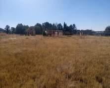
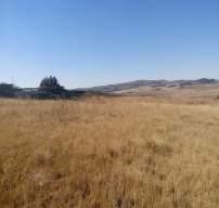
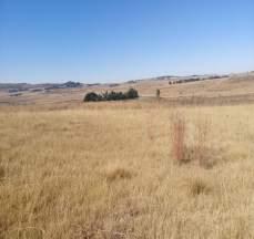
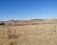
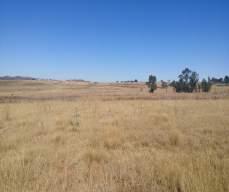
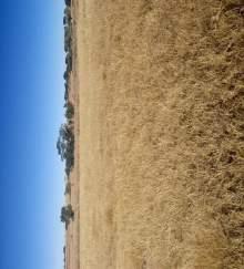
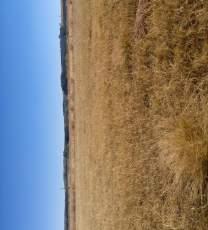
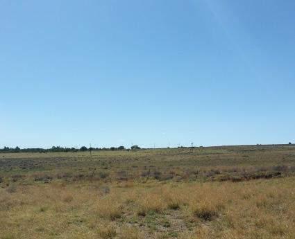
101 SECTION F : APPENDICES Lwando Site photographs taken in the eight major compass directions Appendix B, Page 2
102 SECTION F : APPENDICES DRAFT BASIC ASSESSMENT REPORT Basic Assessment for the proposed expansion of a pig production and vegetable enterprise on Portion 56 of the Farm Houtpoort 392 in Heidelberg, Gauteng Facility Illustration 2 Proposed layout incorporating site sensitivity 3 Appendix C, Page 1
103 SECTION F : APPENDICES Facility Illustration Appendix C, Page 2
104 SECTION F : APPENDICES Proposed layout incorporating site sensitivity Appendix C, Page 3
105 SECTION F: APPENDICES DRAFT BASIC ASSESSMENT REPORT Basic Assessment for the proposed expansion of a pig production and vegetable enterprise on Portion 56 of the Farm Houtpoort 392 in Heidelberg, Gauteng N/A Appendix D, Page 1
106 SECTION F : APPENDICES DRAFT BASIC ASSESSMENT REPORT Basic Assessment for the proposed expansion of a pig production and vegetable enterprise on Portion 56 of the Farm Houtpoort 392 in Heidelberg, Gauteng Appendix E.1 Proof of site notice 2 Appendix E.2 Written notices issued to Interested and Affected Parties 5 Appendix E.3 Proof of newspaper advertisements placed in the BLADSY 26 July Appendix E.4 Communications to and from interested and affected parties 18 Appendix E.5 Comments and Responses Report 19 Appendix E.6 Copy of the register of I&APs 20 Appendix E, Page 1

107 SECTION F: APPENDICES DRAFT BASIC ASSESSMENT REPORT Basic Assessment for the proposed expansion of a pig production and vegetable enterprise on Portion 56 of the Farm Houtpoort 392 in Heidelberg, Gauteng All public participation information is to be attached in the appropriate Appendix. The information in this Appendix is to be ordered as detailed below. Appendix E.1 Proof of site notice Appendix E, Page 2
 placed at the fence of the proposed development site Appendix E,")
108 SECTION F: APPENDICES DRAFT BASIC ASSESSMENT REPORT Basic Assessment for the proposed expansion of a pig production and vegetable enterprise on Portion 56 of the Farm Houtpoort 392 in Heidelberg, Gauteng Contents of the site notices (English) placed at the fence of the proposed development site Appendix E, Page 3
 placed at the fence of the proposed development site Appendix E,")
109 SECTION F: APPENDICES DRAFT BASIC ASSESSMENT REPORT Basic Assessment for the proposed expansion of a pig production and vegetable enterprise on Portion 56 of the Farm Houtpoort 392 in Heidelberg, Gauteng Contents of the site notices (Sesotho) placed at the fence of the proposed development site Appendix E, Page 4

110 SECTION F: APPENDICES DRAFT BASIC ASSESSMENT REPORT Basic Assessment for the proposed expansion of a pig production and vegetable enterprise on Portion 56 of the Farm Houtpoort 392 in Heidelberg, Gauteng Appendix E.2 Written notices issued to Interested and Affected Parties Letter sent (25/07/17) to I&APs as part of Project Announcement Appendix E, Page 5
111 SECTION F: APPENDICES DRAFT BASIC ASSESSMENT REPORT Basic Assessment for the proposed expansion of a pig production and vegetable enterprise on Portion 56 of the Farm Houtpoort 392 in Heidelberg, Gauteng sent (25/07/17) to I&APs as part of Project Announcement From: Reinett Mogotshi Date: 25/07/ :13 Subject: Notification of Release of BID for Basic Assessment for the proposed expansion of the pig production enterprise on the Portion 56 of the Farm Houtpoort 392 in Heidelberg, Gauteng. Bc: lwandopiggery@gmail.com; Jaco@jvlubricants.co.za; fifi.naran@gmail.com... Attachments: Comments & Reg Form.docx; Background Information Document_Lwando Piggery_RM_ML.pdf; I&APs Cover Letter_Draft_ENGLISH.pdf Good day, You are hereby notified about the release of the Background Information Document (BID) for the Basic Assessment for the proposed expansion of the pig production enterprise on the Portion 56 of the Farm Houtpoort 392 in Heidelberg, Gauteng. Please find attached the BID, which has been released for 30 day review, and the Registration/ Comment Form. Please return or before 28 August Should the contents of this project not pertain to you, kindly forward the documents to the person in your department that is affected. Additionally, please forward their contact details to the CSIR Project Manager or ask the affected party to contact the CSIR Project Manager. Should you wish to be registered or de-registered from receiving any further information during the Basic Assessment and Public Participation Process, kindly contact the CSIR Project Manager. Correspondence in this regard should preferably be via a hard copy, i.e. , Fax or Letter. Contact via: Ms. Reinett Mogotshi rmogotshi@csir.co.za Tel: Fax: Postal: PO Box 320 Stellenbosch 7599 South Africa Regards, CSIR Project Manager Ms. Reinett Mogotshi Appendix E, Page 6
112 SECTION F: APPENDICES DRAFT BASIC ASSESSMENT REPORT Basic Assessment for the proposed expansion of a pig production and vegetable enterprise on Portion 56 of the Farm Houtpoort 392 in Heidelberg, Gauteng Proof delivery sent on 25 July 2017 Message Id: 59776E3B.177 : 164 : Notification of Release of BID for Basic Assessment for the proposed expansion of the pig Subject: production enterprise on the Portion 56 of the Farm Houtpoort 392 in Heidelberg, Gauteng. Created By: RMogotshi@csir.co.za Scheduled Date: Creation Date: 25/07/ :13 From: Reinett Mogotshi Recipients: Recipient daff.gov.za BC: mashuduma@daff.gov.za(mashuduma@daff.gov.za) BC: MmaphakaT@daff.gov.za(MmaphakaT@daff.gov.za) drdlr.gov.za BC: Lerato.Molaudzi@drdlr.gov.za(Lerato.Molaudzi@drdlr.gov.za) BC: ncamisile.nkabinde@drdlr.gov.za(ncamisile.nkabinde@drdlr.gov.za) dwa.gov.za BC: MusekeneM@dwa.gov.za(MusekeneM@dwa.gov.za) BC: RakgothoT@dwa.gov.za(RakgothoT@dwa.gov.za) environment.gov.za BC: mrabothata@environment.gov.za(mrabothata@environment.gov.za) BC: SHlela@environment.gov.za(SHlela@environment.gov.za) BC: tnemarude@environment.gov.za(tnemarude@environment.gov.za) gauteng.gov.za BC: kwena.bopape@gauteng.gov.za(kwena.bopape@gauteng.gov.za) BC: maphata.ramphele@gauteng.gov.za(maphata.ramphele@gauteng.gov. za) BC: noluthando.cembi@gauteng.gov.za(noluthando.cembi@gauteng.gov.z a) BC: phuti.matlamela@gauteng.gov.za(phuti.matlamela@gauteng.gov.za) BC: Tebogo.molokomme@gauteng.gov.za(Tebogo.molokomme@gauteng. gov.za) BC: Zingisa.Smale@gauteng.gov.za(Zingisa.Smale@gauteng.gov.za) gmail.com BC: fifi.naran@gmail.com(fifi.naran@gmail.com) Action Transferred Transferred Transferred Transferred Transferred Transferred Date & Time 25/07/ :14 25/07/ :14 25/07/ :14 25/07/ :14 25/07/ :14 25/07/ :14 Comment Appendix E, Page 7
113 SECTION F: APPENDICES DRAFT BASIC ASSESSMENT REPORT Basic Assessment for the proposed expansion of a pig production and vegetable enterprise on Portion 56 of the Farm Houtpoort 392 in Heidelberg, Gauteng BC: lwandopiggery@gmail.com(lwandopiggery@gmail.com) BC: zanelesilvia7@gmail.com(zanelesilvia7@gmail.com) jvlubricants.co.za Transfer Delayed Transfer Delayed Transfer Delayed Transfer Delayed Transfer Delayed Transfer Delayed Transfer Delayed Transfer Delayed Transfer Delayed Transfer Delayed Transfer Delayed Transfer Delayed Transfer Delayed Transfer Delayed Transfer Delayed Transfer Delayed Transfer Delayed Transfer Delayed Transfer Delayed Transfer Delayed Transfer Delayed Transfer Delayed Transfer Delayed Transfer Delayed Transfer Delayed 25/07/ :14 25/07/ :34 25/07/ :54 25/07/ :14 25/07/ :15 25/07/ :15 25/07/ :15 25/07/ :15 26/07/ :16 26/07/ :16 26/07/ :16 26/07/ :17 26/07/ :17 26/07/ :18 26/07/ :18 26/07/ :18 26/07/ :19 26/07/ :19 26/07/ :19 26/07/ :19 26/07/ :19 26/07/ :19 26/07/ :19 26/07/ :19 26/07/ :20 Appendix E, Page 8
114 SECTION F: APPENDICES DRAFT BASIC ASSESSMENT REPORT Basic Assessment for the proposed expansion of a pig production and vegetable enterprise on Portion 56 of the Farm Houtpoort 392 in Heidelberg, Gauteng Transfer Delayed Transfer Delayed Transfer Delayed Transfer Delayed Transfer Delayed Transfer Delayed Transfer Delayed Transfer Delayed Transfer Delayed Transfer Delayed Transfer Delayed Transfer Delayed Transfer Delayed Transfer Delayed Transfer Delayed Transfer Delayed Transfer Delayed Transfer Delayed Transfer Delayed Transfer Delayed Transfer Delayed Transfer Delayed Transfer Delayed Transfer Delayed Transfer Delayed Transfer Delayed Transfer 26/07/ :20 26/07/ :20 26/07/ :21 26/07/ :22 26/07/ :22 26/07/ :23 26/07/ :27 27/07/ :28 27/07/ :36 27/07/ :36 27/07/ :38 27/07/ :39 27/07/ :41 27/07/ :42 27/07/ :42 27/07/ :42 27/07/ :42 27/07/ :43 27/07/ :43 27/07/ :43 27/07/ :44 27/07/ :44 27/07/ :44 27/07/ :44 27/07/ :45 27/07/ :46 27/07/201 Appendix E, Page 9
115 SECTION F: APPENDICES DRAFT BASIC ASSESSMENT REPORT Basic Assessment for the proposed expansion of a pig production and vegetable enterprise on Portion 56 of the Farm Houtpoort 392 in Heidelberg, Gauteng Delayed Transfer Delayed Transfer Delayed Transfer Delayed Transfer Delayed Transfer Delayed Transfer Delayed Transfer Delayed Transfer Delayed Transfer Delayed Transfer Delayed Transfer Delayed Transfer Delayed Transfer Delayed Transfer Delayed Transfer Delayed Transfer Delayed Transfer Delayed Transfer Delayed Transfer Delayed Transfer Delayed Transfer Delayed Transfer Delayed Transfer Delayed Transfer Delayed Transfer Delayed Transfer Delayed 7 19:47 27/07/ :48 27/07/ :56 27/07/ :26 28/07/ :53 28/07/ :05 28/07/ :21 28/07/ :31 28/07/ :06 28/07/ :07 28/07/ :08 28/07/ :09 28/07/ :09 28/07/ :09 28/07/ :10 28/07/ :10 28/07/ :10 28/07/ :13 28/07/ :17 28/07/ :35 28/07/ :40 28/07/ :07 28/07/ :48 28/07/ :10 29/07/ :15 29/07/ :15 29/07/ :37 Appendix E, Page 10
116 SECTION F: APPENDICES DRAFT BASIC ASSESSMENT REPORT Basic Assessment for the proposed expansion of a pig production and vegetable enterprise on Portion 56 of the Farm Houtpoort 392 in Heidelberg, Gauteng BC: Jaco@jvlubricants.co.za(Jaco@jvlubricants.co.za) lesedi.gov.za BC: jabum@lesedi.gov.za(jabum@lesedi.gov.za) BC: mm@lesedi.gov.za(mm@lesedi.gov.za) BC: mninimuzin@lesedi.gov.za(mninimuzin@lesedi.gov.za) nra.co.za BC: BotaV@nra.co.za(BotaV@nra.co.za) sedibeng.gov.za BC: meshackm@sedibeng.gov.za(meshackm@sedibeng.gov.za) BC: ralempotsem@sedibeng.gov.za(ralempotsem@sedibeng.gov.za) BC: rudolphn@sedibeng.gov.za(rudolphn@sedibeng.gov.za) BC: tebogom@sedibeng.gov.za(tebogom@sedibeng.gov.za) Transfer Delayed Transfer Delayed Transfer Delayed Transfer Delayed Transfer Delayed Transfer Delayed Transfer Delayed Transfer Delayed Transfer Failed Undeliverabl e Transferred Transferred Transferred 29/07/ :16 29/07/ :21 29/07/ :14 29/07/ :54 29/07/ :34 29/07/ :48 29/07/ :54 29/07/ :32 29/07/ :35 29/07/ :35 25/07/ :14 25/07/ :14 25/07/ : service unavailabl e Post Offices Post Office Delivered Route daff.gov.za daff.gov.za drdlr.gov.za drdlr.gov.za dwa.gov.za dwa.gov.za environment.gov.za environment.gov.za gauteng.gov.za gauteng.gov.za gmail.com gmail.com Appendix E, Page 11
117 SECTION F: APPENDICES DRAFT BASIC ASSESSMENT REPORT Basic Assessment for the proposed expansion of a pig production and vegetable enterprise on Portion 56 of the Farm Houtpoort 392 in Heidelberg, Gauteng jvlubricants.co.za lesedi.gov.za nra.co.za sedibeng.gov.za jvlubricants.co.za lesedi.gov.za nra.co.za sedibeng.gov.za Files File Size Date & Time Background Information Document_Lwando Piggery_RM_ML.pdf 301 KB ( Bytes) 20/07/ :37 Comments & Reg Form.docx 147 KB ( Bytes) 20/07/ :41 I&APs Cover Letter_Draft_ENGLISH.pdf 314 KB ( Bytes) 25/07/ :00 MESSAGE 2 KB (2778 Bytes) 25/07/ :13 TEXT.htm 2 KB (2458 Bytes) 25/07/ :13 Options Auto Delete: No Concealed Subject: No Expiration Date: None Notify Recipients: No Priority: Standard Reply Requested By: None Security: Standard To Be Delivered: Immediate Record Id Record Id: 59EE4D59.STELLBOS.POBOX EFC.1 Common Record Id: 59EE3139.STELLBOS.POBOX B34E.1 Appendix E, Page 12
118 SECTION F: APPENDICES DRAFT BASIC ASSESSMENT REPORT Basic Assessment for the proposed expansion of a pig production and vegetable enterprise on Portion 56 of the Farm Houtpoort 392 in Heidelberg, Gauteng List for mail sent 26 July 2017: Project Announcement documents (BID, Letter dated 26 July 2017, and Registration/Comment Form) Appendix E, Page 13
119 SECTION F: APPENDICES DRAFT BASIC ASSESSMENT REPORT Basic Assessment for the proposed expansion of a pig production and vegetable enterprise on Portion 56 of the Farm Houtpoort 392 in Heidelberg, Gauteng Appendix E, Page 14

120 SECTION F: APPENDICES DRAFT BASIC ASSESSMENT REPORT Basic Assessment for the proposed expansion of a pig production and vegetable enterprise on Portion 56 of the Farm Houtpoort 392 in Heidelberg, Gauteng Appendix E.3 Proof of newspaper advertisements placed in the BLADSY 26 July 2017 Appendix E, Page 15
121 SECTION F: APPENDICES DRAFT BASIC ASSESSMENT REPORT Basic Assessment for the proposed expansion of a pig production and vegetable enterprise on Portion 56 of the Farm Houtpoort 392 in Heidelberg, Gauteng Contents of the Newspaper Advert ( in English) Notice of Basic Assessment and Waste Management Licence for the proposed expansion of the pig production enterprise on the Portion 56 of the Farm Houtpoort 392 in Heidelberg, Gauteng. (CSIR Reference number: CSIR/IU/EMS/ER/2017/0007/A) Notice is given of a Basic Assessment (BA) and Waste Management Licence process being undertaken on behalf of Lwando Piggery (the Project Applicant) for the proposes the expansion of the pig production enterprise on the Portion 56 of the Farm Houtpoort 392 in Heidelberg, Gauteng In terms of the NEMA EIA Regulations published in Government Notice Regulation (GNR) 324 and 327 on 7 April 2017 Government Gazette No 40772, and NEM:WA Regulation published in GNR 921 on the 29 November 2013 Government Gazette No 37083, a BA process is required as the project triggers the following listed activities: GNR 327 Activity 39 (ii), GNR 327 Activity 27, GNR 324 Activity 12.(c)(ii) and GNR 921 Category A 3. The Council for Scientific and Industrial Research (CSIR) is the Environmental Assessment Practitioner (EAP) who will be managing the process. You are invited to register as an Interested and/or Affected Party (I&AP) and/or to provide any written comments on the BA process. To obtain further information, to comment and/or to register as an I&AP, please cite the CSIR Reference Number and provide your full name, full postal address, phone numbers, address and state your area of interest and/or concern to: Ms. Reinett Mogotshi, CSIR, PO Box 320, Stellenbosch 7599, Phone: (021) , Fax: (021) or rmogotshi@csir.co.za. You have until on or before 28 August 2017 to do so (30 days from the date of this publication - including weekends, but excluding public holidays). Appendix E, Page 16
122 SECTION F: APPENDICES DRAFT BASIC ASSESSMENT REPORT Basic Assessment for the proposed expansion of a pig production and vegetable enterprise on Portion 56 of the Farm Houtpoort 392 in Heidelberg, Gauteng Contents of the Newspaper Advert (in Isizulu) Isaziso sokuhlola ngokwemvelo noqhubo ngokuphathwa kwemfucuza mayelana ne Projekthi ehlongoza ukwandisa ibhizini elikhiqiza izingulube kwingxenye 56, kwipulazi Houtpoort 392 eheidelberg, Gauteng (Inombolo ye Referensi yase CSIR: CSIR/IU/EMS/ER/2017/0007/A) Uyaziswa ngoqhubo lokuhlola eziyisisekelo ngokwemvelo kanye noqhubo lwe-layisensi ngokuphathwa kwemfucuza, olwenziwa egameni le-lwando Piggery (ofake isicelo) ehlongoza ukwandisa ibhizinisi kokukhiqizwa kwezingulube kwingxenye 56, kwipulazi Houtpoort 392 eheidelberg, Gauteng. Ngokwe-Mithethonqubo yokuhlola Umthelela kwezemvelo ( NEMA EIA) eyanyatheliswa kwisaziso sikahulumeni (Government Notice Regulation (GNR)) 324 and 327 ngomhlaka 7 April 2017, inombolo ne NEM:WA Regulation enyatheliswe ku GNR 921 yangomhlaka 29 November 2013 ye-gazette ka Hulumeni No 37083,, uqhubo lwe-ba luyadingeka ngoba leprojekthi ithinta lemisebenzi elandelayo ebaliwe kwi-gnr: GNR 327 Activity 39 (ii), GNR 327 Activity 27, GNR 324 Activity 12.(c)(ii) and GNR 921 Category A 3. I-Council for Scientific and Industrial Research Council (CSIR) iyi-environmental Assessment Practitioner (EAP) ezophatha inqubo ye-ba. Siyakumema njengomuntu Othakazelayo noma Othintekayo (I&AP) ukuba ubhalise noma uthumele imibono yakho ngaloluqhubo lwe-ba. Ukuze uthole eminye imininingwane mayelana nale projekthi, nokuzibhalisa njenge I&AP, sicela ucaphune Inombolo ye Nkomba (Reference No.), usiphe igama nesibongo, ikheli leposi eliphelele, inombolo yocingo, ikheli le- , usazise nokuthi uthinteka kanjani mayelana nale-ba, uthumele ku: Ms. Reinett Mogotshi, CSIR, PO Box 320, Stellenbosch 7599, Phone: (021) , Fax: (021) or rmogotshi@csir.co.za. Sicile usithinte ungakadluli umhlaka 28 August 2017 (ngaphakathi kwezinsuku ezingamashumi amathuthu (30 days) kuphume lesisaziso). Appendix E, Page 17
123 SECTION F: APPENDICES DRAFT BASIC ASSESSMENT REPORT Basic Assessment for the proposed expansion of a pig production and vegetable enterprise on Portion 56 of the Farm Houtpoort 392 in Heidelberg, Gauteng Appendix E.4 Communications to and from interested and affected parties Appendix E, Page 18
124 SECTION F: APPENDICES DRAFT BASIC ASSESSMENT REPORT Basic Assessment for the proposed expansion of a pig production and vegetable enterprise on Portion 56 of the Farm Houtpoort 392 in Heidelberg, Gauteng Appendix E.5 Comments and Responses Report ISSUES RAISED COMMENTATOR DATE RESPONSE I have a water bottling factory, and an environmental authorisation, will assist in measuring any impact that may or may not contaminate the water source. Pivubala Naran - (FlFl) Pushfull Trade and lnvest July 2017 The current proposed position of the abattoir has been moved out of the wetland and buffer. The proposed layout was reduced from 7 ha to 5 ha to avoid the sensitivities. Issues and concerns: The aquifers flow, disposal of waste and are borne pollution The equipment will be maintained to ensure that pollution doesn t enter the watercourse. The manager will have to maintain the equipment to avoid waste being dumped into the river. Appendix E, Page 19
125 SECTION F: APPENDICES DRAFT BASIC ASSESSMENT REPORT Basic Assessment for the proposed expansion of a pig production and vegetable enterprise on Portion 56 of the Farm Houtpoort 392 in Heidelberg, Gauteng Appendix E.6 Copy of the register of I&APs Name Surname Organisation National Mmatlala Rabothata Department of Environmental Affairs Sibusisiwe Hlela Department of Environmental Affairs Takalani Nemarude Department of Environmental Affairs Thoko Buthelezi Department of Agriculture, Forestry and Fisheries Mashudu Marubini Department of Agriculture, Forestry and Fisheries Provincial Steven Mukhola Department of Agriculture and Rural Development Phuti Matlamela Department of Agriculture and Rural Development Karabo Mohatla Department of Agriculture and Rural Development Ms M Musekene Department of Water and Sanitation Ms T Rakgotho Department of Water and Sanitation Local Authorities Thomas Mkaza Sedibeng District Municipality Mninimuzi Ncala Lesedi Local Municipality Meshack Manqa Lesedi Local Municipality Ms Twala Ward councilor Jabu Marwa Executive Manager Development and Planning Landowners East Rand Milk Jason Portion 53 of Farm 294 Nooitgedacht Hlwanyela Agricultural Cooperative P.O Box 86, Sedibeng 2260 Ltd Aaron Nhlabati Applicant Buyisa Ndubane L1-F6 Largerspoort Road Heidelberg Neighbour Jaco Janse van Rensburg Jaco@jvlubricants.co.za Fifi Naran fifi.naran@gmail.com Other Interested and Affected Parties Tebogo Molokomme SAHRA Jacobus Hoffman Premier Pork Producers Ndumiso Mazibuko National Agricultural Marketing Council Hanneline Smit-Robinson Birdlife Anneliza Collett Agriland Stewart Foya Council for Geoscience Dr. Howard Hendricks South African National Parks Appendix E, Page 20
126 SECTION F: APPENDICES DRAFT BASIC ASSESSMENT REPORT Basic Assessment for the proposed expansion of a pig production and vegetable enterprise on Portion 56 of the Farm Houtpoort 392 in Heidelberg, Gauteng Name Surname Organisation Adams Pires The Endangered Wildlife Trust Len Palmer Monitor Pumps & Systems Pivubala Naran (FlFl): Pushfull Trade and lnvest Physical address: Plot 57 Houtpoort. Farm Ll-FB Laqerspoort Rd. Heidelberq Appendix E, Page 21
127 SECTION F : APPENDICES DRAFT BASIC ASSESSMENT REPORT Basic Assessment for the proposed expansion of a pig production and vegetable enterprise on Portion 56 of the Farm Houtpoort 392 in Heidelberg, Gauteng Letter from SAHRA 2 Letter from Department of Water and Sanitation (Application in progress) 5 Municipality Zoning 6 Services Report 8 Appendix F, Page 1

128 SECTION F: APPENDICES DRAFT BASIC ASSESSMENT REPORT Basic Assessment for the proposed expansion of a pig production and vegetable enterprise on Portion 56 of the Farm Houtpoort 392 in Heidelberg, Gauteng Letter from SAHRA Appendix F, Page 2

129 SECTION F: APPENDICES DRAFT BASIC ASSESSMENT REPORT Basic Assessment for the proposed expansion of a pig production and vegetable enterprise on Portion 56 of the Farm Houtpoort 392 in Heidelberg, Gauteng Appendix F, Page 3

130 SECTION F: APPENDICES DRAFT BASIC ASSESSMENT REPORT Basic Assessment for the proposed expansion of a pig production and vegetable enterprise on Portion 56 of the Farm Houtpoort 392 in Heidelberg, Gauteng Appendix F, Page 4
131 SECTION F: APPENDICES DRAFT BASIC ASSESSMENT REPORT Basic Assessment for the proposed expansion of a pig production and vegetable enterprise on Portion 56 of the Farm Houtpoort 392 in Heidelberg, Gauteng Letter from Department of Water and Sanitation (Application in progress) Appendix F, Page 5

132 SECTION F: APPENDICES DRAFT BASIC ASSESSMENT REPORT Basic Assessment for the proposed expansion of a pig production and vegetable enterprise on Portion 56 of the Farm Houtpoort 392 in Heidelberg, Gauteng Municipality Zoning Appendix F, Page 6

133 SECTION F: APPENDICES DRAFT BASIC ASSESSMENT REPORT Basic Assessment for the proposed expansion of a pig production and vegetable enterprise on Portion 56 of the Farm Houtpoort 392 in Heidelberg, Gauteng Appendix F, Page 7
134 SECTION F: APPENDICES DRAFT BASIC ASSESSMENT REPORT Basic Assessment for the proposed expansion of a pig production and vegetable enterprise on Portion 56 of the Farm Houtpoort 392 in Heidelberg, Gauteng Services Report Appendix F, Page 8

135 Basic Assessment for the proposed expansion of a pig production and vegetable enterprise on Portion 56 of the Farm Houtpoort 392 in Heidelberg, Gauteng. DRAFT BASIC ASSESSMENT REPORT APPENDIX G: SPECIALIST REPORTS
 FOR THE PROPOSED LWANDO PIGGERY, GAUTENG PROVINCE Type of development: Agricultural Development Client: CSIR Client info: Reinett Mogotshi E mail: RMogotshi@csir.co.")
136 HERITAGE IMPACT ASSESSMENT (REQUIRED UNDER SECTION 38(8) OF THE NHRA (No. 25 OF 1999) FOR THE PROPOSED LWANDO PIGGERY, GAUTENG PROVINCE Type of development: Agricultural Development Client: CSIR Client info: Reinett Mogotshi E mail: RMogotshi@csir.co.za Developer: Buyiswa Ndubane. HCAC - Heritage Consultants Private Bag X 1049 Suite 34 Modimolle 0510 Tel: Fax: jaco.heritage@gmail.com Report Author: Mr. J. van der Walt Project Reference: HCAC Project number Report date: November 2017
137 1 HIA Lwando Piggery November 2017 APPROVAL PAGE Project Name Lwando Piggery Report Title Heritage Impact Assessment Lwando Piggery Authority Reference Number Report Status SAHRA Case ID11202 Final Report Applicant Name Buyiswa Ndubane Lwando Piggery Name Signature Qualifications and Certifications Date Document Compilation Jaco van der Walt MA Archaeology ASAPA #159 November 2017 Marko Hutten BA Hons Archaeology November 2017 HCAC
138 2 HIA Lwando Piggery November 2017 DOCUMENT PROGRESS Distribution List Date Report Reference Number Document Distribution Number of Copies 24 November CSIR Electronic Copy Amendments on Document Date Report Reference Number Description of Amendment HCAC
139 3 HIA Lwando Piggery November 2017 INDEMNITY AND CONDITIONS RELATING TO THIS REPORT The findings, results, observations, conclusions and recommendations given in this report are based on the author s best scientific and professional knowledge as well as available information. The report is based on survey and assessment techniques which are limited by time and budgetary constraints relevant to the type and level of investigation undertaken and HCAC reserves the right to modify aspects of the report including the recommendations if and when new information becomes available from ongoing research or further work in this field, or pertaining to this investigation. Although HCAC exercises due care and diligence in rendering services and preparing documents, HCAC accepts no liability, and the client, by receiving this document, indemnifies HCAC against all actions, claims, demands, losses, liabilities, costs, damages and expenses arising from or in connection with services rendered, directly or indirectly by HCAC and by the use of the information contained in this document. This report must not be altered or added to without the prior written consent of the author. This also refers to electronic copies of this report which are supplied for the purposes of inclusion as part of other reports, including main reports. Similarly, any recommendations, statements or conclusions drawn from or based on this report must make reference to this report. If these form part of a main report relating to this investigation or report, this report must be included in its entirety as an appendix or separate section to the main report. COPYRIGHT Copyright on all documents, drawings and records, whether manually or electronically produced, which form part of the submission and any subsequent report or project document, shall vest in HCAC. The client, on acceptance of any submission by HCAC and on condition that the client pays to HCAC the full price for the work as agreed, shall be entitled to use for its own benefit: The results of the project; The technology described in any report; and Recommendations delivered to the client. Should the applicant wish to utilise any part of, or the entire report, for a project other than the subject project, permission must be obtained from HCAC to do so. This will ensure validation of the suitability and relevance of this report on an alternative project. HCAC
140 4 HIA Lwando Piggery November 2017 REPORT OUTLINE Appendix 6 of the GNR 326 EIA Regulations published on 7 April 2017 provides the requirements for specialist reports undertaken as part of the environmental authorisation process. In line with this, Table 1 provides an overview of Appendix 6 together with information on how these requirements have been met. Table 1. Specialist Report Requirements. Requirement from Appendix 6 of GN 326 EIA Regulation 2017 Chapter (a) Details of - Section a (i) the specialist who prepared the report; and Section 12 (ii) the expertise of that specialist to compile a specialist report including a curriculum vitae (b) Declaration that the specialist is independent in a form as may be specified by the Declaration of competent authority Independence (c) Indication of the scope of, and the purpose for which, the report was prepared Section 1 (ca)an indication of the quality and age of base data used for the specialist report Section 3.4 and 7.1. (cb) a description of existing impacts on the site, cumulative impacts of the proposed 9 development and levels of acceptable change; (d) Duration, Date and season of the site investigation and the relevance of the season Section 3.4 to the outcome of the assessment (e) Description of the methodology adopted in preparing the report or carrying out the Section 3 specialised process inclusive of equipment and modelling used (f) details of an assessment of the specific identified sensitivity of the site related to Section 8 and 9 the proposed activity or activities and its associated structures and infrastructure, inclusive of a site plan identifying site alternatives; (g) Identification of any areas to be avoided, including buffers Section 8 and 9 (h) Map superimposing the activity including the associated structures and Section 8 infrastructure on the environmental sensitivities of the site including areas to be avoided, including buffers (I) Description of any assumptions made and any uncertainties or gaps in knowledge Section 3.7 (j) a description of the findings and potential implications of such findings on the impact Section 9 of the proposed activity including identified alternatives on the environment or activities; (k) Mitigation measures for inclusion in the EMPr Section 9 (I) Conditions for inclusion in the environmental authorisation Section 9 (m) Monitoring requirements for inclusion in the EMPr or environmental authorisation Section 9 (n) Reasoned opinion - Section 9.2 (i) as to whether the proposed activity, activities or portions thereof should be authorised; (ia) regarding the acceptability of the proposed activity or activities; and (ii) if the opinion is that the proposed activity, activities or portions thereof should be authorised, any avoidance, management and mitigation measures that should be included in the EMPr, and where applicable, the closure plan (o) Description of any consultation process that was undertaken during the course of Section 6 preparing the specialist report (p) A summary and copies of any comments received during any consultation process Refer to BA report and where applicable all responses thereto; and (q) Any other information requested by the competent authority Section 10 HCAC
141 5 HIA Lwando Piggery November 2017 Executive Summary The CSIR are conducting a Basic Assessment for the proposed expansion of a pig production and vegetable enterprise on the Portion 56 of the Farm Houtpoort 392 in Heidelberg, Gauteng. HCAC was appointed to conduct a Heritage Impact Assessment to determine the presence of cultural heritage sites and the impact of the proposed development on these non-renewable resources. The study area was assessed both on desktop level and by a field survey. The field survey was conducted as a non-intrusive pedestrian survey to cover the extent of Portion 56 as development plans are not available at this stage, however no existing infrastructure (houses etc.) will be demolished or impacted on by the proposed development. No archaeological sites or material of significance was recorded during the survey. A paleontological desktop study was conducted by Rossouw (2017) that concluded: The proposed development may proceed as far as the palaeontological heritage is concerned and no further palaeontological assessments are necessary, provided that all excavation activities are restricted to within the boundaries of the development footprint.. No further mitigation prior to construction is recommended in terms of the archaeological and paleontological components of Section 35 for the proposed development to proceed. In terms of the built environment of the area (Section 34), no standing structures older than 60 years occur within the study areas. In terms of Section 36 of the Act (Burial grounds) one small informal cemetery was recorded along the boundary fence of the proposed development. The site will not be impacted on by the proposed piggery expansion and it is recommended that the graves should be fenced with an access gate for family members and retained in situ. If any additional graves are located in future they should ideally be preserved in-situ or alternatively relocated according to existing legislation. No public monuments are located within or close to the study area. The area is rural in character and the proposed expansion of the existing piggery is in line with the current land use and will not impact negatively on significant cultural landscapes or viewscapes. During the public participation process conducted for the project no heritage concerns was raised. It is recommended that the proposed project can commence on the condition that the following recommendations are implemented as part of the EMPr and based on approval from SAHRA: Implementation of a chance find procedure. It is recommended that the graves should be fenced with an access gate for family members and retained in situ. HCAC
142 1 HIA Lwando Piggery November 2017 Declaration of Independence Specialist Name Jaco van der Walt Declaration of Independence Signature I declare, as a specialist appointed in terms of the National Environmental Management Act (Act No 108 of 1998) and the associated 2014 Environmental Impact Assessment (EIA) Regulations, that I: I act as the independent specialist in this application; I will perform the work relating to the application in an objective manner, even if this results in views and findings that are not favourable to the applicant; I declare that there are no circumstances that may compromise my objectivity in performing such work; I have expertise in conducting the specialist report relevant to this application, including knowledge of the Act, Regulations and any guidelines that have relevance to the proposed activity; I will comply with the Act, Regulations and all other applicable legislation; I have no, and will not engage in, conflicting interests in the undertaking of the activity; I undertake to disclose to the applicant and the competent authority all material information in my possession that reasonably has or may have the potential of influencing - any decision to be taken with respect to the application by the competent authority; and - the objectivity of any report, plan or document to be prepared by myself for submission to the competent authority; All the particulars furnished by me in this form are true and correct; and I realise that a false declaration is an offence in terms of regulation 48 and is punishable in terms of section 24F of the Act. Date 24/11/2017 a) Expertise of the specialist Jaco van der Walt has been practising as a CRM archaeologist for 15 years. He obtained an MA degree in Archaeology from the University of the Witwatersrand focussing on the Iron Age in 2012 and is a PhD candidate at the University of Johannesburg focussing on Stone Age Archaeology with specific interest in the Middle Stone Age (MSA) and Later Stone Age (LSA). Jaco is an accredited member of ASAPA (#159) and have conducted more than 500 impact assessments in Limpopo, Mpumalanga, North West, Free State, Gauteng, KZN as well as he Northern and Eastern Cape Provinces in South Africa. Jaco has worked on various international projects in Zimbabwe, Botswana, Mozambique, Lesotho, DRC Zambia and Tanzania. Through this he has a sound understanding of the IFC Performance Standard requirements, with specific reference to Performance Standard 8 Cultural Heritage. HCAC
143 2 HIA Lwando Piggery November 2017 TABLE OF CONTENTS REPORT OUTLINE... 4 EXECUTIVE SUMMARY... 5 DECLARATION OF INDEPENDENCE... 1 A) EXPERTISE OF THE SPECIALIST... 1 ABBREVIATIONS... 5 GLOSSARY INTRODUCTION AND TERMS OF REFERENCE: TERMS OF REFERENCE LEGISLATIVE REQUIREMENTS METHODOLOGY LITERATURE REVIEW GENEALOGICAL SOCIETY AND GOOGLE EARTH MONUMENTS PUBLIC CONSULTATION AND STAKEHOLDER ENGAGEMENT: SITE INVESTIGATION SITE SIGNIFICANCE AND FIELD RATING IMPACT ASSESSMENT METHODOLOGY LIMITATIONS AND CONSTRAINTS OF THE STUDY DESCRIPTION OF SOCIO ECONOMIC ENVIRONMENTAL DESCRIPTION OF THE PHYSICAL ENVIRONMENT: RESULTS OF PUBLIC CONSULTATION AND STAKEHOLDER ENGAGEMENT: LITERATURE / BACKGROUND STUDY: LITERATURE REVIEW GENERAL HISTORY OF THE AREA FINDINGS OF THE SURVEY BUILT ENVIRONMENT (SECTION 34 OF THE NHRA) ARCHAEOLOGICAL AND PALAEONTOLOGICAL RESOURCES (SECTION 35 OF THE NHRA) BURIAL GROUNDS AND GRAVES (SECTION 36 OF THE NHRA) CULTURAL LANDSCAPES, INTANGIBLE AND LIVING HERITAGE BATTLEFIELDS AND CONCENTRATION CAMPS POTENTIAL IMPACT CONCLUSION AND RECOMMENDATIONS HCAC
144 3 HIA Lwando Piggery November CHANCE FIND PROCEDURES REASONED OPINION REFERENCES APPENDICES: CURRICULUM VITAE OF SPECIALIST LIST OF FIGURES FIGURE 1. PROVINCIAL LOCALITY MAP (1: TOPOGRAPHICAL MAP)... 8 FIGURE 2. REGIONAL LOCALITY MAP (1: TOPOGRAPHICAL MAP) FIGURE 3. SATELLITE IMAGE INDICATING THE DEVELOPMENT FOOTPRINT (GOOGLE EARTH 2016 ) FIGURE 4: TRACK LOGS OF THE SURVEY IN BLACK FIGURE 5. GENERAL SITE CONDITIONS EARTHEN DAM FIGURE 6. GENERAL SITE CONDITIONS. EXISTING PIGGERY FIGURE 7. GENERAL SITE CONDITIONS FIGURE 8. GENERAL SITE CONDITIONS FIGURE 9. UECKERMANN TRADING STORE (THE HERITAGE PORTAL) FIGURE TOPOGRAPHICAL MAP OF THE SITE UNDER INVESTIGATION. THE APPROXIMATE STUDY AREA IS INDICATED WITH A YELLOW BORDER. A MAIN ROAD GOES THROUGH THE WESTERN PART OF THE AREA UNDER INVESTIGATION. IN THE SOUTHERN PART OF THE STUDY AREA ONE CAN SEE TERRACES BUILT ALONGSIDE A STREAM. A SMALL DAM CAN BE SEEN TO THE WEST. THE NORTHERN HALF OF THE SITE WAS UNDER CULTIVATION, AND ONE CAN SEE ANOTHER NON-PERENNIAL STREAM TO THE NORTH OF THE STUDY AREA. (TOPOGRAPHICAL MAP 1954) FIGURE TOPOGRAPHICAL MAP OF THE SITE UNDER INVESTIGATION. THE APPROXIMATE STUDY AREA IS INDICATED WITH A YELLOW BORDER. A MAIN ROAD WENT THROUGH THE WESTERN PART OF THE AREA UNDER INVESTIGATION. THE NORTHERN TWO THIRDS OF THE STUDY AREA WERE CULTIVATED LANDS, AND ONE CAN SEE ONE BUILDING NEAR THE SOUTHERN BORDER. ONE CAN SEE A STREAM GOING THROUGH THE SOUTHERN PART OF THE SITE, AND THE OCCURRENCE OF EROSION FURTHER TO THE SOUTH. (TOPOGRAPHICAL MAP 1976) FIGURE TOPOGRAPHICAL MAP OF THE SITE UNDER INVESTIGATION. THE APPROXIMATE STUDY AREA IS INDICATED WITH A YELLOW BORDER. THE 103 MAIN ROAD WENT THROUGH THE WESTERN PART OF THE AREA UNDER INVESTIGATION. THE ENTIRE SITE WAS USED AS CULTIVATED LANDS, AND FOUR BUILDINGS AND A FARM ROAD CAN BE SEEN IN THE STUDY AREA. TO THE EAST, A SMALL DAM IS VISIBLE ALONG THE STREAM THAT GOES THROUGH THE SOUTHERN PART OF THE PROPERTY. (TOPOGRAPHICAL MAP 1991) FIGURE GOOGLE EARTH IMAGE SHOWING THE STUDY AREA IN RELATION TO THE M3 ROAD, HEIDELBERG AND OTHER SITES. (GOOGLE EARTH 2017) FIGURE 14. NEW FARMSTEAD FIGURE 15. FENCING IN STUDY AREA FIGURE 16. GENERAL SITE CONDITIONS FIGURE 17. FARM INFRASTRUCTURE FIGURE 18. POWER LINES IN STUDY AREA FIGURE 19. STORE ROOMS HCAC
145 4 HIA Lwando Piggery November 2017 FIGURE 20. GENERAL SITE CONDITIONS CEMETERY FIGURE 21. GENERAL SITE CONDITIONS - CEMETERY FIGURE 22. GENERAL SITE CONDITIONS CEMETERY FIGURE 23. GENERAL SITE CONDITIONS - CEMETERY FIGURE 24. GENERAL SITE CONDITIONS CEMETERY FIGURE 25. GENERAL SITE CONDITIONS - CEMETERY FIGURE 26. LOCATION OF CEMETERY LIST OF TABLES TABLE 1. SPECIALIST REPORT REQUIREMENTS TABLE 2: PROJECT DESCRIPTION... 7 TABLE 3: INFRASTRUCTURE AND PROJECT ACTIVITIES... 7 TABLE 4: SITE INVESTIGATION DETAILS TABLE 5. IMPACT ASSESSMENT TABLE HCAC
146 5 HIA Lwando Piggery November 2017 ABBREVIATIONS AIA: Archaeological Impact Assessment ASAPA: Association of South African Professional Archaeologists BGG Burial Ground and Graves BIA: Basic Impact Assessment CFPs: Chance Find Procedures CMP: Conservation Management Plan CRR: Comments and Response Report CRM: Cultural Resource Management DEA: Department of Environmental Affairs EA: Environmental Authorisation EAP: Environmental Assessment Practitioner ECO: Environmental Control Officer EIA: Environmental Impact Assessment* EIA: Early Iron Age* EIA Practitioner: Environmental Impact Assessment Practitioner EMP: Environmental Management Programme ESA: Early Stone Age ESIA: Environmental and Social Impact Assessment GIS Geographical Information System GPS: Global Positioning System GRP Grave Relocation Plan HIA: Heritage Impact Assessment LIA: Late Iron Age LSA: Late Stone Age MEC: Member of the Executive Council MIA: Middle Iron Age MPRDA: Mineral and Petroleum Resources Development Act MSA: Middle Stone Age NEMA National Environmental Management Act, 1998 (Act No. 107 of 1998) NHRA National Heritage Resources Act, 1999 (Act No. 25 of 1999) NID Notification of Intent to Develop NoK Next-of-Kin PRHA: Provincial Heritage Resource Agency SADC: Southern African Development Community SAHRA: South African Heritage Resources Agency *Although EIA refers to both Environmental Impact Assessment and the Early Iron Age both are internationally accepted abbreviations and must be read and interpreted in the context it is used. GLOSSARY Archaeological site (remains of human activity over 100 years old) Early Stone Age (~ 2.6 million to years ago) Middle Stone Age (~ to years ago) Later Stone Age (~ , to recently, 100 years ago) The Iron Age (~ AD 400 to 1840) Historic (~ AD 1840 to 1950) Historic building (over 60 years old) HCAC
147 6 HIA Lwando Piggery November Introduction and Terms of Reference: Heritage Contracts and Archaeological Consulting CC (HCAC) has been contracted by the CSIR to conduct a heritage impact assessment of the proposed Lwando Piggery expansion. The report forms part of the Basic Assessment Report (BAR) and Environmental Management Programme Report (EMPR) for the development. The aim of the study is to survey the proposed development footprint to identify cultural heritage sites, document, and assess their importance within local, provincial and national context. It serves to assess the impact of the proposed project on non-renewable heritage resources, and to submit appropriate recommendations with regard to the responsible cultural resources management measures that might be required to assist the developer in managing the discovered heritage resources in a responsible manner. It is also conducted to protect, preserve, and develop such resources within the framework provided by the National Heritage Resources Act of 1999 (Act No 25 of 1999). The report outlines the approach and methodology utilized before and during the survey, which includes: Phase 1, review of relevant literature; Phase 2, the physical surveying of the area on foot and by vehicle; Phase 3, reporting the outcome of the study. During the survey one small informal cemetery was identified. General site conditions and features on sites were recorded by means of photographs, GPS locations, and site descriptions. Possible impacts were identified and mitigation measures are proposed in the following report. SAHRA as a commenting authority under section 38(8) of the National Heritage Resources Act, 1999 (Act No. 25 of 1999) require all environmental documents, complied in support of an Environmental Authorisation application as defined by NEMA EIA Regulations section 40 (1) and (2), to be submitted to SAHRA. As such the Basic Assessment report and its appendices must be submitted to the case as well as the EMPr, once it s completed by the Environmental Assessment Practitioner (EAP). 1.1 Terms of Reference Field study Conduct a field study to: (a) locate, identify, record, photograph and describe sites of archaeological, historical or cultural interest; b) record GPS points of sites/areas identified as significant areas; c) determine the levels of significance of the various types of heritage resources affected by the proposed development. Reporting Report on the identification of anticipated and cumulative impacts the operational units of the proposed project activity may have on the identified heritage resources for all 3 phases of the project; i.e., construction, operation and decommissioning phases. Consider alternatives, should any significant sites be impacted adversely by the proposed project. Ensure that all studies and results comply with the relevant legislation, SAHRA minimum standards and the code of ethics and guidelines of ASAPA. To assist the developer in managing the discovered heritage resources in a responsible manner, and to protect, preserve, and develop them within the framework provided by the National Heritage Resources Act of 1999 (Act No 25 of 1999). HCAC
148 7 HIA Lwando Piggery November 2017 Table 2: Project Description Size of farm and portions Magisterial District 11 ha area on the farm Houtpoort 391 IR, near Heidelberg, Gauteng Province Ngaka Modiri District 1: map sheet number 1: topographic map 2628CB Heidelberg 1: geological map 2628 East Rand Central co-ordinate of the Site coordinates: 26 34'37.86"S 28 22'51.79"E development Table 3: Infrastructure and project activities Type of development Project size Project Components Proposed expansion of a pig production and vegetable enterprise on the Portion 56 of the Farm Houtpoort 392 in Heidelberg, Gauteng 11 hectares. The proposed development entails the plantation of chili pepper on 0.7 ha of land and expansion of the pig enterprise by developing a 0.6 ha pig facility with a throughput capacity of 1000 pigs. HCAC

149 8 HIA Lwando Piggery November 2017 Figure 1. Provincial locality map (1: topographical map) HCAC
.")
150 9 HIA Lwando Piggery November 2017 Figure 2. Regional locality map (1: topographical map). HCAC

151 10 HIA Lwando Piggery November 2017 Figure 3. Satellite image indicating the development footprint (Google Earth 2016 ). HCAC
152 11 HIA Lwando Piggery November Legislative Requirements The HIA, as a specialist sub-section of the EIA, is required under the following legislation: National Heritage Resources Act (NHRA), Act No. 25 of 1999) National Environmental Management Act (NEMA), Act No. 107 of Section 23(2)(b) Mineral and Petroleum Resources Development Act (MPRDA), Act No. 28 of Section 39(3)(b)(iii) A Phase 1 HIA is a pre-requisite for development in South Africa as prescribed by SAHRA and stipulated by legislation. The overall purpose of heritage specialist input is to: Identify any heritage resources, which may be affected; Assess the nature and degree of significance of such resources; Establish heritage informants/constraints to guide the development process through establishing thresholds of impact significance; Assess the negative and positive impact of the development on these resources; and Make recommendations for the appropriate heritage management of these impacts. The HIA should be submitted, as part of the impact assessment report or EMPr, to the PHRA if established in the province or to SAHRA. SAHRA will ultimately be responsible for the professional evaluation of Phase 1 AIA reports upon which review comments will be issued. 'Best practice' requires Phase 1 AIA reports and additional development information, as per the impact assessment report and/or EMPr, to be submitted in duplicate to SAHRA after completion of the study. SAHRA accepts Phase 1 AIA reports authored by professional archaeologists, accredited with ASAPA or with a proven ability to do archaeological work. Minimum accreditation requirements include an Honours degree in archaeology or related discipline and 3 years postuniversity CRM experience (field supervisor level). Minimum standards for reports, site documentation and descriptions are set by ASAPA in collaboration with SAHRA. ASAPA is based in South Africa, representing professional archaeology in the SADC region. ASAPA is primarily involved in the overseeing of ethical practice and standards regarding the archaeological profession. Membership is based on proposal and secondment by other professional members. Phase 1 AIA s are primarily concerned with the location and identification of heritage sites situated within a proposed development area. Identified sites should be assessed according to their significance. Relevant conservation or Phase 2 mitigation recommendations should be made. Recommendations are subject to evaluation by SAHRA. Conservation or Phase 2 mitigation recommendations, as approved by SAHRA, are to be used as guidelines in the developer s decision-making process. Phase 2 archaeological projects are primarily based on salvage/mitigation excavations preceding development destruction or impact on a site. Phase 2 excavations can only be conducted with a permit, issued by SAHRA to the appointed archaeologist. Permit conditions are prescribed by SAHRA and includes (as minimum requirements) reporting back strategies to SAHRA and deposition of excavated material at an accredited repository. In the event of a site conservation option being preferred by the developer, a site management plan, prepared by a professional archaeologist and approved by SAHRA, will suffice as minimum requirement. After mitigation of a site, a destruction permit must be applied for with SAHRA by the applicant before development may proceed. HCAC
153 12 HIA Lwando Piggery November 2017 Human remains older than 60 years are protected by the National Heritage Resources Act, with reference to Section 36. Graves older than 60 years, but younger than 100 years fall under Section 36 of Act 25 of 1999 (National Heritage Resources Act), as well as the Human Tissues Act (Act 65 of 1983), and are the jurisdiction of SAHRA. The procedure for Consultation Regarding Burial Grounds and Graves (Section 36[5]) of Act 25 of 1999) is applicable to graves older than 60 years that are situated outside a formal cemetery administrated by a local authority. Graves in this age category, located inside a formal cemetery administrated by a local authority, require the same authorisation as set out for graves younger than 60 years, in addition to SAHRA authorisation. If the grave is not situated inside a formal cemetery, but is to be relocated to one, permission from the local authority is required and all regulations, laws and by-laws, set by the cemetery authority, must be adhered to. Human remains that are less than 60 years old are protected under Section 2(1) of the Removal of Graves and Dead Bodies Ordinance (Ordinance No. 7 of 1925), as well as the Human Tissues Act (Act 65 of 1983), and are the jurisdiction of the National Department of Health and the relevant Provincial Department of Health and must be submitted for final approval to the office of the relevant Provincial Premier. This function is usually delegated to the Provincial MEC for Local Government and Planning; or in some cases, the MEC for Housing and Welfare. Authorisation for exhumation and reinternment must also be obtained from the relevant local or regional council where the grave is situated, as well as the relevant local or regional council to where the grave is being relocated. All local and regional provisions, laws and by-laws must also be adhered to. To handle and transport human remains, the institution conducting the relocation should be authorised under Section 24 of Act 65 of 1983 (Human Tissues Act). HCAC
154 13 HIA Lwando Piggery November METHODOLOGY 3.1 Literature Review A brief survey of available literature was conducted to extract data and information on the area in question to provide general heritage context into which the development would be set. This literature search included published material, unpublished commercial reports and online material, including reports sourced from the South African Heritage Resources Information System (SAHRIS). 3.2 Genealogical Society and Google Earth Monuments Google Earth and 1: maps of the area were utilised to identify possible places where sites of heritage significance might be located; these locations were marked and visited during the field work phase. The database of the Genealogical Society was consulted to collect data on any known graves in the area. 3.3 Public Consultation and Stakeholder Engagement: Stakeholder engagement is a key component of any BAR process, it involves stakeholders interested in, or affected by the proposed development. Stakeholders are provided with an opportunity to raise issues of concern (for the purposes of this report only heritage related issues will be included). The aim of the public consultation process was to capture and address any issues raised by community members and other stakeholders during key stakeholder and public meetings. The process involved: Placement of advertisements and site notices Stakeholder notification (through the dissemination of information and meeting invitations); Stakeholder meetings undertaken with I&APs; Authority Consultation The compilation of a Basic Assessment Report (BAR). Please refer to section 6 for more detail. 3.4 Site Investigation Conduct a field study to: a) systematically survey the proposed project area to locate, identify, record, photograph and describe sites of archaeological, historical or cultural interest; b) record GPS points of sites/areas identified as significant areas; c) determine the levels of significance of the various types of heritage resources recorded in the project area. Table 4: Site Investigation Details Site Investigation Date 31 October 2017 Season Summer. The development footprint was adequately surveyed to record the presence of heritage sites (Figure 4). HCAC
155 14 HIA Lwando Piggery November 2017 Figure 4: Track logs of the survey in black.. HCAC
156 15 HIA Lwando Piggery November Site Significance and Field Rating Section 3 of the NHRA distinguishes nine criteria for places and objects to qualify as part of the national estate if they have cultural significance or other special value. These criteria are: Its importance in/to the community, or pattern of South Africa s history; Its possession of uncommon, rare or endangered aspects of South Africa s natural or cultural heritage; Its potential to yield information that will contribute to an understanding of South Africa s natural or cultural heritage; Its importance in demonstrating the principal characteristics of a particular class of South Africa s natural or cultural places or objects; Its importance in exhibiting particular aesthetic characteristics valued by a community or cultural group; Its importance in demonstrating a high degree of creative or technical achievement at a particular period; Its strong or special association with a particular community or cultural group for social, cultural or spiritual reasons; Its strong or special association with the life or work of a person, group or organisation of importance in the history of South Africa; Sites of significance relating to the history of slavery in South Africa. The presence and distribution of heritage resources define a heritage landscape. In this landscape, every site is relevant. In addition, because heritage resources are non-renewable, heritage surveys need to investigate an entire project area, or a representative sample, depending on the nature of the project. In the case of the proposed project the local extent of its impact necessitates a representative sample and only the footprint of the areas demarcated for development were surveyed. In all initial investigations, however, the specialists are responsible only for the identification of resources visible on the surface. This section describes the evaluation criteria used for determining the significance of archaeological and heritage sites. The following criteria were used to establish site significance with cognisance of Section 3 of the NHRA: The unique nature of a site; The integrity of the archaeological/cultural heritage deposits; The wider historic, archaeological and geographic context of the site; The location of the site in relation to other similar sites or features; The depth of the archaeological deposit (when it can be determined/is known); The preservation condition of the sites; and Potential to answer present research questions. In addition to this criteria field ratings prescribed by SAHRA (2006), and acknowledged by ASAPA for the SADC region, were used for the purpose of this report. The recommendations for each site should be read in conjunction with section 10 of this report. FIELD RATING GRADE SIGNIFICANCE RECOMMENDED MITIGATION National Significance (NS) Grade 1 - Conservation; national site nomination Provincial Significance (PS) Grade 2 - Conservation; provincial site nomination Local Significance (LS) Grade 3A High significance Conservation; mitigation not advised Local Significance (LS) Grade 3B High significance Mitigation (part of site should be retained) Generally Protected A (GP.A) - High/medium significance Mitigation before destruction Generally Protected B (GP.B) - Medium significance Recording before destruction Generally Protected C (GP.C) - Low significance Destruction HCAC
157 16 HIA Lwando Piggery November Impact Assessment Methodology The criteria below are used to establish the impact rating on sites: The nature, which shall include a description of what causes the effect, what will be affected and how it will be affected. The extent, wherein it will be indicated whether the impact will be local (limited to the immediate area or site of development) or regional, and a value between 1 and 5 will be assigned as appropriate (with 1 being low and 5 being high): The duration, wherein it will be indicated whether: the lifetime of the impact will be of a very short duration (0-1 years), assigned a score of 1; the lifetime of the impact will be of a short duration (2-5 years), assigned a score of 2; medium-term (5-15 years), assigned a score of 3; long term (> 15 years), assigned a score of 4; or permanent, assigned a score of 5; The magnitude, quantified on a scale from 0-10 where; 0 is small and will have no effect on the environment, 2 is minor and will not result in an impact on processes, 4 is low and will cause a slight impact on processes, 6 is moderate and will result in processes continuing but in a modified way, 8 is high (processes are altered to the extent that they temporarily cease), and 10 is very high and results in complete destruction of patterns and permanent cessation of processes. The probability of occurrence, which shall describe the likelihood of the impact actually occurring. Probability will be estimated on a scale of 1-5 where; 1 is very improbable (probably will not happen), 2 is improbable (some possibility, but low likelihood), 3 is probable (distinct possibility), 4 is highly probable (most likely) and 5 is definite (impact will occur regardless of any prevention measures). The significance, which shall be determined through a synthesis of the characteristics described above and can be assessed as low, medium or high; and the status, which will be described as either positive, negative or neutral. the degree to which the impact can be reversed. the degree to which the impact may cause irreplaceable loss of resources. the degree to which the impact can be mitigated. The significance is calculated by combining the criteria in the following formula: S=(E+D+M)P S = Significance weighting E = Extent D = Duration M = Magnitude P = Probability HCAC
158 17 HIA Lwando Piggery November 2017 The significance weightings for each potential impact are as follows: < 30 points: Low (i.e., where this impact would not have a direct influence on the decision to develop in the area), points: Medium (i.e., where the impact could influence the decision to develop in the area unless it is effectively mitigated), 60 points: High (i.e., where the impact must have an influence on the decision process to develop in the area). 3.7 Limitations and Constraints of the study The authors acknowledge that the brief literature review is not exhaustive on the literature of the area. Due to the subsurface nature of archaeological artefacts, the possibility exists that some features or artefacts may not have been discovered/recorded during the survey and the possible occurrence of unmarked graves and other cultural material cannot be excluded. Similarly, the depth of the deposit of heritage sites cannot be accurately determined due its subsurface nature. This report only deals with the footprint area of the proposed development and consisted of non-intrusive surface surveys. This study did not assess the impact on medicinal plants and intangible heritage as it is assumed that these components would have been highlighted through the public consultation process if relevant. It is possible that new information could come to light in future, which might change the results of this Impact Assessment. 4 Description of Socio Economic Environmental The following information was obtained from the Lesedi Municipality IDP : According to Census (2011), the current population of Lesedi is estimated at , which reflects a population increase of about since Therefore, the total population of Lesedi accounts for only 10.9% of the total population of the district. Approximately 74.9% of the total population of Lesedi resides in the urban areas of Heidelberg/ Ratanda and Devon/Impumelelo, while the rest 25.1% is categorized as rural. About % of the households in LLM are formal in nature and 15.22% are informal households. The unemployment rate among the economically active sector of the community is approximately 25,9% and this is according to the Census The Gross Geographic Product (GGP) of Lesedi Local Municipality is largely dependent on manufacturing (38.8%), community services (29.4%) and financial services (18.6%), and collectively these three sectors constitute 86.8% of GGP of Lesedi Local Municipality.. HCAC
159 18 HIA Lwando Piggery November Description of the Physical Environment: The farm Houtpoort and surrounding properties were at first commercial farms with their main focus on the production of crops and the raising of live-stock. Most of these farms were later sub-divided into smaller units or small holdings which supported a wide range of businesses and agricultural activities. The previous farming activities are still evident as most of the property is still devoid of trees as it was cleared for fields to be ploughed and planted. These old fields are now covered with a lush presence of various grass types. The study area measures approximately 5ha in size and is situated adjacent and on the eastern side of the R103 tar road. The road also forms the western boundary of the proposed development. The proposed site is bordered with properties with the same rural and agricultural intent on the northern, eastern and southern sides. HCAC


160 19 HIA Lwando Piggery November 2017 Figure 5. General Site conditions Earthen dam Figure 6. General site conditions. Existing piggery Figure 7. General site conditions. Figure 8. General site conditions 6 Results of Public Consultation and Stakeholder Engagement: Stakeholder Identification Adjacent landowners and the public at large were informed of the proposed activity as part of the BA process. Site notices and advertisements notifying interested and affected parties were placed at strategic points and in local newspapers as part of the process. The farm manager, Mr Issiah Gantso, was interviewed during the site visit. Mr. Gantso pointed out graves in the southeastern corner of the property, but indicated that he did not know about anything else of heritage value or significance. HCAC
161 20 HIA Lwando Piggery November Literature / Background Study: 7.1 Literature Review The following reports were conducted in the general vicinity of the study area and were consulted for this report: Author Year Project Findings Huffman, T.N Archaeological Survey of Ratanda Extension Historic structure, Cemetery and Heidelberg Stone age scatter. Pistorius, J.C.C 2003 HIA of a portion of the farm Nooitgedacht Late Iron age sites. IR, Heidelberg, District of Gauteng. Coetzee, F The Archaeological Inverstigation of the Iron Age sites and Cemeteries and proposed Heidelberg Kloof Estate informal Graffiti. Development, Heidelberg, Gauteng Province. Coetzee, F Cultural Heritage Survey of the Proposed Development at Floracadia North and Floracadia South, Heidelberg, Gauteng Pelser, AJ and Van der Walt, J A Report on a Heritage Impact Assessment (HIA) for the proposed Sedaven Development On Portions 8 & 25 Of The Farm Boschoek 385 IR, Heidelberg, Gauteng Nel J British American Tobacco Photovoltaic Project Notification of Intent to Develop and Request for Exemption for Amber Earth (Pty) Ltd Historic Structures and graves/ cemeteries. Cemteries, Iron Age sites and historical sites Genealogical Society and Google Earth Monuments No known grave sites are indicated in the study area. HCAC
162 21 HIA Lwando Piggery November General History of the area Archaeology of the area The archaeological record for the greater study area consists of the Stone Age and Iron Age Stone Age South Africa has a long and complex Stone Age sequence of more than 2 million years. The broad sequence includes the Later Stone Age, the Middle Stone Age and the Earlier Stone Age. Each of these phases contain sub-phases or industrial complexes, and within these we can expect regional variation regarding characteristics and time ranges. The three main phases can be divided as follows; Later Stone Age; associated with Khoi and San societies and their immediate predecessors. Recently to ~30 thousand years ago Middle Stone Age; associated with Homo sapiens and archaic modern humans thousand years ago. Earlier Stone Age; associated with early Homo groups such as Homo habilis and Homo erectus > 2 million years ago. Stone Age sites are usually associated with stone artefacts found scattered on the surface or as part of deposits in caves and rock shelters. The closest known Stone Age sites in the larger geographical area are those of Riverview and Badfontein (Bergh 1999), while rock art (engravings) are known between Heidelberg and Vereeniging (Bergh 1999) The Iron Age The Iron Age as a whole represents the spread of Bantu speaking people and includes both the pre-historic and Historic periods. It can be divided into three distinct periods: The Early Iron Age: Most of the first millennium AD. The Middle Iron Age: 10th to 13th centuries AD The Late Iron Age: 14th century to colonial period. The Iron Age is characterised by the ability of these early people to manipulate and work Iron ore into implements that assisted them in creating a favourable environment to make a better living. Bergh (1999) indicates that no Early Iron sites are known in the area, while a large concentration of Late Iron Age sites are known. The Late Iron Age period in the region is largely associated with Uitkomst pottery and Klipriviersberg stonewalled sites that date from the 17th to the 19th Centuries. Uitkomst pottery is a merger of earlier Ntsuanatsatsi and Olifantspoort styles, and the walling is a variant of the Type N walling. These sites are associated with the Fokeng, a Nguni-speaking group that became Sotho-ized sometime during the 17h Century (Nel 2017). In Gauteng, Klipriviersberg walling would have ended at about AD 1823, when Mzilikazi (Rasmussen 1978) entered the area. This settlement type may have lasted longer near Rustenburg because of the positive interaction between Fokeng and Mzilikazi (see Pistorius 1999). This positive interaction may be a result of the Nguni origins of the Fokeng cluster. Fokeng settlements spread north across the Vaal into the Balfour, Suikerbosrand, Klipriviersberg and Vredefort areas (Huffman 2007). 7.3 Historical Information In 1862 Heidelberg began as a trading station built by German settler, Heinrich J Uekermann. Uekermann acquired part of Farm Langlaagte and established a general dealership. HCAC
 From 1880 to 1883, which included the years of the first Anglo-Boer War, Heidelberg served as the capital of the Zuid Afrikaansche Republiek under the")
163 22 HIA Lwando Piggery November 2017 Figure 9. Ueckermann Trading Store (The Heritage Portal) From 1880 to 1883, which included the years of the first Anglo-Boer War, Heidelberg served as the capital of the Zuid Afrikaansche Republiek under the triumvirate of Paul Kruger, PJ Joubert and MW Pretorius. In 1885 the Witwatersrand gold reef was discovered in the Heidelberg district and the office of the mining commissioner was set up in the area. Heidelberg developed as a typical Victorian town, and many buildings dating back to the period between 1890 and 1910 have been well-preserved including the AG Visser House and the Klipkerk, both dating to ( Anglo-Boer War Heidelberg has played an important part in South African history acting as a capital for the Boer republic during the war with Great Britain. During the First War of Independence, Heidelberg served as capital of the Zuid Afrikaansche Republiek under Paul Kruger, P.J. Joubert and M.W. Pretorius, from 1880 to In the second Anglo Boer war concentration camps were established at Heidelberg. It was one of the oldest camps and was probably already in existence in October By February 1901 there were over 1,200 people living there but the camp was never very large. At the end of June 1901 there were only 751 inmates and the number remained at under 1,000 for most of the period of the existence of the camp. A black camp was probably formed early in 1901 but there is little information about it. There were also a handful of black servants in the white camp 49, including 20 children in November 1901 ( Kamp/14016). HCAC

164 23 HIA Lwando Piggery November Cultural Landscape Figure Topographical map of the site under investigation. The approximate study area is indicated with a yellow border. A main road goes through the western part of the area under investigation. In the southern part of the study area one can see terraces built alongside a stream. A small dam can be seen to the west. The northern half of the site was under cultivation, and one can see another nonperennial stream to the north of the study area. (Topographical Map 1954) HCAC

165 24 HIA Lwando Piggery November 2017 Figure Topographical map of the site under investigation. The approximate study area is indicated with a yellow border. A main road went through the western part of the area under investigation. The northern two thirds of the study area were cultivated lands, and one can see one building near the southern border. One can see a stream going through the southern part of the site, and the occurrence of erosion further to the south. (Topographical Map 1976) HCAC

166 25 HIA Lwando Piggery November 2017 Figure Topographical map of the site under investigation. The approximate study area is indicated with a yellow border. The 103 Main Road went through the western part of the area under investigation. The entire site was used as cultivated lands, and four buildings and a farm road can be seen in the study area. To the east, a small dam is visible along the stream that goes through the southern part of the property. (Topographical Map 1991) HCAC

167 26 HIA Lwando Piggery November 2017 Figure Google Earth image showing the study area in relation to the M3 Road, Heidelberg and other sites. (Google Earth 2017) 8. Findings of the Survey It is important to note that only the development footprint of the project was surveyed. The study area was surveyed over a period of 1 day. A number of structures occupy the northern parts of the proposed site. These structures include the main farmstead, a garage, some storerooms and the existing piggery. The purpose of the project is for the piggery to be extended. Labour accommodation also forms part of the existing structures on the property. The identified structures all appeared to be from a recent origin and do not have any heritage value or significance but will not be impacted on by the current project. The property is fenced off and several fences divide the property into various camps. An earthen dam is situated at the southern extent of the property and several tracks and pipe lines service the needs of the various parts of the property. A small orchard is also situated in between the main house and the existing piggery. A borehole, dam and pump station are situated at the northern extent of the property. These provide water for the homestead, piggery and the rest of the property. A power line is situated along the R103 tar road and a line from this main line provides for the property. The prevailing vegetation type and landscape features of the area form part of the Soweto Highveld Grassland. It is described as a gently to moderately undulating landscape on the Highveld plateau supporting short to medium-high, dense, tufted grassland dominated almost entirely by Themeda triandra (red grass) and accompanied by a variety of other grasses. In places not disturbed, only scattered small HCAC
.")


168 27 HIA Lwando Piggery November 2017 wetlands, narrow stream alluvia, pans and occasional ridges interrupt the continuous grassland cover (Mucina & Rutherford, 2006). The proposed site was disturbed by the previous agricultural activities which destroyed a part of the natural vegetation, but the grasslands still remained throughout most of the region and the property. Exotic trees were introduced around the homestead, but for the most the property was not much disturbed. The farm manager, Mr Issiah Gantso, was interviewed during the site visit. Mr. Gantso pointed out graves in the south-eastern corner of the property, but indicated that he did not know about anything else of heritage value or significance. Figure 14. New farmstead Figure 15. Fencing in study area. Figure 16. General site conditions Figure 17. Farm infrastructure HCAC
 No standing structures older than 60 years occur in the study area. 8.4. Archaeological and palaeontological resources (Section 35 of the NHRA) No archaeological sites or material was recorded during the survey.")
 conducted an independent paleontological study and found: The proposed development footprint is underlain by palaeontologically insignificant shales, quartzites and conglomerate and")
169 28 HIA Lwando Piggery November 2017 Figure 18. Power lines in study area. Figure 19. Store rooms Built Environment (Section 34 of the NHRA) No standing structures older than 60 years occur in the study area Archaeological and palaeontological resources (Section 35 of the NHRA) No archaeological sites or material was recorded during the survey. Therefore, no further mitigation prior to construction is recommended in terms of the archaeological component of Section 35 of the NHRA for the proposed development to proceed. Rossouw (2017) conducted an independent paleontological study and found: The proposed development footprint is underlain by palaeontologically insignificant shales, quartzites and conglomerate and mafic rocks, capped by equally insignificant, superficial deposits, the latter because the impact area is degraded and not situated near spring or well-developed alluvial deposits. The proposed development may proceed as far as the palaeontological heritage is concerned and no further palaeontological assessments are necessary, provided that all excavation activities are restricted to within the boundaries of the development footprint Burial Grounds and Graves (Section 36 of the NHRA) A small informal cemetery was identified at 26 34'42.98"S and 28 22'55.88"E. The cemetery was identified along the eastern boundary fence of the property (Figure 26) proposed for the piggery expansion project. Seven graves were identified in the cemetery within the dense and tall grass growth of that area. The graves were placed next to each other in a line along the eastern boundary fence of the property. The graves are not fenced off and are overgrown with grasses and other vegetation which made identification difficult. The graves have informal mounds of packed rocks as dressings and do not have any headstones. However, one headstone was identified lying loosely next to or in between two graves, but it had no inscription or any information on it. This could possibly imply that the graves were damaged superficially to some extent. The graves are overgrown with grasses and other vegetation and were not maintained recently. The ages of the graves, related family and affiliation towards the property are unknown at this stage. Site size: Approximately 25m x 10m. HCAC


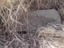
170 29 HIA Lwando Piggery November 2017 Figure 20. General site conditions Cemetery Figure 21. General site conditions - Cemetery Figure 22. General site conditions Cemetery Figure 23. General site conditions - Cemetery Figure 24. General site conditions Cemetery Figure 25. General site conditions - Cemetery HCAC

171 30 HIA Lwando Piggery November 2017 Figure 26. Location of cemetery HCAC
172 31 HIA Lwando Piggery November Cultural Landscapes, Intangible and Living Heritage. Long term impact on the cultural landscape is considered to be low as the surrounding area is rural in character with some road developments. Visual impacts to scenic routes and sense of place are also considered to be low as the development is in line with the rural character of the surrounding area development is in line with the character of the area Battlefields and Concentration Camps There are no battlefields or concentration camp sites in the study area Potential Impact The chances of impacting unknown archaeological sites in the study area is considered to be negligible. Any direct impacts that did occur would be during the construction phase only and would be of very low significance. Cumulative impacts occur from the combination of effects of various impacts on heritage resources. The importance of identifying and assessing cumulative impacts is that the whole is greater than the sum of its parts. In the case of the development, it will, with the recommended mitigation measures and management actions, not impact any heritage resources directly. However, this and other projects in the area could have an indirect impact on the larger heritage landscape. The lack of any heritage resources in the immediate area and the extensive existing development surrounding the study area minimises additional impact on the landscape Pre-Construction phase: It is assumed that the pre-construction phase involves the removal of topsoil and vegetation as well as the establishment of infrastructure needed for the construction phase. These activities can have a negative and irreversible impact on heritage sites. Impacts include destruction or partial destruction of non-renewable heritage resources Construction Phase During this phase, the impacts and effects are similar in nature but more extensive than the pre-construction phase. These activities can have a negative and irreversible impact on heritage sites. Impacts include destruction or partial destruction of non-renewable heritage resources Operation Phase: No impact is envisaged during this phase. Table 5. Impact Assessment table. Nature: During the construction phase activities resulting in disturbance of surfaces and/or sub-surfaces may destroy, damage, alter, or remove from its original position archaeological material or objects. Without mitigation With mitigation (Preservation/ excavation of site) Extent Local (1) Local (1) Duration Permanent (5) Permanent (5) Magnitude Moderate (6) Moderate (6) Probability Probable (3) Not probable (2) Significance 36 (Medium) 24 (Low) HCAC
173 32 HIA Lwando Piggery November 2017 Status (positive or Negative Negative negative) Reversibility Not reversible Not reversible Irreplaceable loss of No resources were recorded No resources were recorded. resources? Can impacts be mitigated? Yes, a chance find procedure should be implemented. Yes, Graves can be relocated or retained in situ. Mitigation: Due to the lack of apparent significant archaeological resources no further mitigation is required prior to construction. In terms of the graves it is recommended that the graves should be retained in situ and fenced with an access gate and a 30-meter buffer zone. If this is not possible the graves can be relocated adhering to all legal requirements. Residual Impacts: If sites are destroyed this results in the depletion of archaeological record of the area. However, if sites are recorded and preserved or mitigated this adds to the record of the area. HCAC
174 33 HIA Lwando Piggery November Conclusion and recommendations HCAC was appointed to conduct a Heritage Impact Assessment for the Lwando Piggery to determine the presence of cultural heritage sites and the impact of the proposed development on these non-renewable resources. The study area was assessed both on desktop level and by a field survey. The field survey was conducted as a non-intrusive pedestrian survey to cover the extent of Portion 56 as development plans are not available at this stage, however no existing infrastructure (houses etc.) will be demolished or impacted on by the proposed development. The farm manager, Mr Issiah Gantso, was interviewed during the site visit. Mr. Gantso pointed out graves in the south-eastern corner of the property, but indicated that he did not know about anything else of heritage value or significance. No archaeological sites or material of significance was recorded during the survey. A paleontological desktop study was conducted by Rossouw (2017) that concluded: The proposed development may proceed as far as the palaeontological heritage is concerned and no further palaeontological assessments are necessary, provided that all excavation activities are restricted to within the boundaries of the development footprint.. No further mitigation prior to construction is recommended in terms of the archaeological and paleontological components of Section 35 for the proposed development to proceed. In terms of the built environment of the area (Section 34), no standing structures older than 60 years occur within the study areas. In terms of Section 36 of the Act one small informal cemetery was recorded along the boundary fence of the proposed development. It is recommended that the graves should be fenced with an access gate for family members and retained in situ. If any additional graves are located in future they should ideally be preserved in-situ or alternatively relocated according to existing legislation. No public monuments are located within or close to the study area.. The area is rural in character and the proposed expansion of the existing piggery is in line with the current land use and will not impact negatively on significant cultural landscapes or viewscapes. During the public participation process conducted for the project no heritage concerns was raised. It is recommended that the proposed project can commence on the condition that the following recommendations are implemented as part of the EMPr and based on approval from SAHRA: Implementation of a chance find procedure. It is recommended that the graves should be fenced with an access gate for family members and retained in situ. HCAC
175 HCAC 34 HIA Lwando Piggery November 2017
176 35 HIA Lwando Piggery November Chance Find Procedures The possibility of the occurrence of subsurface finds cannot be excluded. Therefore, if during construction any possible finds such as stone tool scatters, artefacts or bone and fossil remains are made, the operations must be stopped and a qualified archaeologist must be contacted for an assessment of the find and therefor chance find procedures should be put in place as part of the EMP. A short summary of chance find procedures is discussed below. This procedure applies to the developer s permanent employees, its subsidiaries, contractors and subcontractors, and service providers. The aim of this procedure is to establish monitoring and reporting procedures to ensure compliance with this policy and its associated procedures. Construction crews must be properly inducted to ensure they are fully aware of the procedures regarding chance finds as discussed below. If during the pre-construction phase, construction, operations or closure phases of this project, any person employed by the developer, one of its subsidiaries, contractors and subcontractors, or service provider, finds any artefact of cultural significance or heritage site, this person must cease work at the site of the find and report this find to their immediate supervisor, and through their supervisor to the senior on-site manager. It is the responsibility of the senior on-site Manager to make an initial assessment of the extent of the find, and confirm the extent of the work stoppage in that area. The senior on-site Manager will inform the ECO of the chance find and its immediate impact on operations. The ECO will then contact a professional archaeologist for an assessment of the finds who will notify the SAHRA. 9.2 Reasoned Opinion The impact of the proposed project on heritage resources is considered low and no further preconstruction mitigation in terms of archaeological resources is required based on approval from SAHRA. Furthermore, the socio-economic benefits also outweigh the possible impacts of the development if the correct mitigation measures (i.e. chance find procedure) are implemented for the project. HCAC
177 36 HIA Lwando Piggery November References Archaeological database, University of the Witwatersrand. Bergh, J.S. (red.) Geskiedenisatlas van Suid-Afrika. Die vier noordelike provinsies. Pretoria: J.L. van Schaik. Coetzee, F The Archaeological Inverstigation of the proposed Heidelberg Kloof Estate Development, Heidelberg, Gauteng Province. Coetzee, F Cultural Heritage Survey of the Proposed Development at Floracadia North and Floracadia South, Heidelberg, Gauteng Huffman, T.N Archaeological Survey of Ratanda Extension Heidelberg Huffman, T.N Handbook to the Iron Age: The Archaeology of Pre-Colonial Farming Societies in Southern Africa. Scotsville: University of KwaZulu-Natal Press. Huffman, T.N Kameeldoorn Archaeological Survey. Unpublished report. Lombard, M., L. Wadley, J. Deacon, S. Wurz, I. Parsons, M. Mohapi, J. Swart & P. Mitchell South African and Lesotho Stone Age Sequence Updated (I). South African Archaeological Bulletin 67 (195): , National Heritage Resources Act (No 25 of 1999). Pretoria: the Government Printer. Republic of South Africa National Environmental Management Act (no 107 of ). Pretoria: The Government Printer. Pelser, AJ and Van der Walt, J A Report on a Heritage Impact Assessment (HIA) for the proposed Sedaven Development on Portions 8 & 25 Of The Farm Boschoek 385 IR, Heidelberg, Gauteng Nel J British American Tobacco Photovoltaic Project Notification of Intent to Develop and Request for Exemption for Amber Earth (Pty) Ltd Pistorius, J.C.C HIA of a portion of the farm Nooitgedacht 390 IR, Heidelberg, District of Gauteng. Rasmussen, R.K Migrant kingdom: Mzilikaqzi s Ndebele in South Africa. London: Rex Collings Rossouw, L Palaeontological desktop study of an 11 ha area on the farm Houtpoort 391 IR, near Heidelberg, Gauteng Province. Maps Topographical map South Africa. 1: Sheet. 2628CB Heidelberg, First Edition. Pretoria: Government Printer. Topographical map South Africa. 1: Sheet. 2628CB Heidelberg, Second Edition. Pretoria: Government Printer. Topographical map South Africa. 1: Sheet. 2628CB Heidelberg, Third Edition. Pretoria: Government Printer. Electronic Sources: Google Earth S E elev 1632 m. [Online]. [Cited 25 October 2017]. Google Earth S E elev 1646 m. [Online]. [Cited 25 October 2017]. Kamp/14016 HCAC
178 37 HIA Lwando Piggery November Appendices: Curriculum Vitae of Specialist Jaco van der Walt Archaeologist Education: Particulars of degrees/diplomas and/or other qualifications: Name of University or Institution: University of Pretoria Degree obtained : BA Heritage Tourism & Archaeology Year of graduation : 2001 Name of University or Institution: University of the Witwatersrand Degree obtained : BA Hons Archaeology Year of graduation : 2002 Name of University or Institution : University of the Witwatersrand Degree Obtained : MA (Archaeology) Year of Graduation : 2012 Name of University or Institution : University of Johannesburg Degree : PhD Year : Currently Enrolled EMPLOYMENT HISTORY: 2011 Present: Owner HCAC (Heritage Contracts and Archaeological Consulting CC) : CRM Archaeologist, Managed the Heritage Contracts Unit at the University of the Witwatersrand : CRM Archaeologist, Director of Matakoma Heritage Consultants 2004: Technical Assistant, Department of Anatomy University of Pretoria 2003: Archaeologist, Mapungubwe World Heritage Site : CRM Archaeologists, For R & R Cultural Resource Consultants, Polokwane 2000: Museum Assistant, Fort Klapperkop. HCAC
179 38 HIA Lwando Piggery November 2017 Countries of work experience include: Republic of South Africa, Botswana, Zimbabwe, Mozambique, Tanzania, The Democratic Republic of the Congo, Lesotho and Zambia. SELECTED PROJECTS INCLUDE: Archaeological Impact Assessments (Phase 1) Heritage Impact Assessment Proposed Discharge Of Treated Mine Water Via The Wonderfontein Spruit Receiving Water Body Specialist as part of team conducting an Archaeological Assessment for the Mmamabula mining project and power supply, Botswana Archaeological Impact Assessment Mmamethlake Landfill Archaeological Impact Assessment Libangeni Landfill Linear Developments Archaeological Impact Assessment Link Northern Waterline Project At The Suikerbosrand Nature Reserve Archaeological Impact Assessment Medupi Spitskop Power Line, Archaeological Impact Assessment Nelspruit Road Development Renewable Energy developments Archaeological Impact Assessment Karoshoek Solar Project Grave Relocation Projects Relocation of graves and site monitoring at Chloorkop as well as permit application and liaison with local authorities and social processes with local stakeholders, Gauteng Province. Relocation of the grave of Rifle Man Maritz as well as permit application and liaison with local authorities and social processes with local stakeholders, Ndumo, Kwa Zulu Natal. Relocation of the Magolwane graves for the office of the premier, Kwa Zulu Natal Relocation of the OSuthu Royal Graves office of the premier, Kwa Zulu Natal Phase 2 Mitigation Projects Field Director for the Archaeological Mitigation For Booysendal Platinum Mine, Steelpoort, Limpopo Province. Principle investigator Prof. T. Huffman Monitoring of heritage sites affected by the ARUP Transnet Multipurpose Pipeline under directorship of Gavin Anderson. Field Director for the Phase 2 mapping of a late Iron Age site located on the farm Kameelbult, Zeerust, North West Province. Under directorship of Prof T. Huffman. Field Director for the Phase 2 surface sampling of Stone Age sites effected by the Medupi Spitskop Power Line, Limpopo Province Heritage management projects Platreef Mitigation project mitigation of heritage sites and compilation of conservation management plan. HCAC
180 39 HIA Lwando Piggery November 2017 MEMBERSHIP OF PROFESSIONAL ASSOCIATIONS: o Association of Southern African Professional Archaeologists. Member number 159 o o o Accreditation: o Field Director Iron Age Archaeology o Field Supervisor Colonial Period Archaeology, Stone Age Archaeology and Grave Relocation Accredited CRM Archaeologist with SAHRA Accredited CRM Archaeologist with AMAFA Co-opted council member for the CRM Section of the Association of Southern African Association Professional Archaeologists ( ) PUBLICATIONS AND PRESENTATIONS A Culture Historical Interpretation, Aimed at Site Visitors, of the Exposed Eastern Profile of K8 on the Southern terrace at Mapungubwe. J van der Walt, A Meyer, WC Nienaber Poster presented at Faculty day, Faculty of Medicine University of Pretoria 2003 n Reddingsondersoek na Anglo-Boereoorlog-ammunisie, gevind by Ifafi, Noordwes-Provinsie. South-African Journal for Cultural History 16(1) June 2002, with A. van Vollenhoven as co-writer. Fieldwork Report: Mapungubwe Stabilization Project. WC Nienaber, M Hutten, S Gaigher, J van der Walt Paper read at the Southern African Association of Archaeologists Biennial Conference 2004 A War Uncovered: Human Remains from Thabantšho Hill (South Africa), 10 May M. Steyn, WS Boshoff, WC Nienaber, J van der Walt Paper read at the 12 th Congress of the Pan-African Archaeological Association for Prehistory and Related Studies 2005 Field Report on the mitigation measures conducted on the farm Bokfontein, Brits, North West Province. J van der Walt, P Birkholtz, W. Fourie Paper read at the Southern African Association of Archaeologists Biennial Conference 2007 Field report on the mitigation measures employed at Early Farmer sites threatened by development in the Greater Sekhukhune area, Limpopo Province. J van der Walt Paper read at the Southern African Association of Archaeologists Biennial Conference 2008 Ceramic analysis of an Early Iron Age Site with vitrified dung, Limpopo Province South Africa. J van der Walt. Poster presented at SAFA, Frankfurt Germany 2008 HCAC
181 40 HIA Lwando Piggery November 2017 Bantu Speaker Rock Engravings in the Schoemanskloof Valley, Lydenburg District, Mpumalanga (In Prep) J van der Walt and J.P Celliers Sterkspruit: Micro-layout of late Iron Age stone walling, Lydenburg, Mpumalanga. W. Fourie and J van der Walt. A Poster presented at the Southern African Association of Archaeologists Biennial Conference 2011 Detailed mapping of LIA stone-walled settlements in Lydenburg, Mpumalanga. J van der Walt and J.P Celliers Paper read at the Southern African Association of Archaeologists Biennial Conference 2011 Bantu-Speaker Rock engravings in the Schoemanskloof Valley, Lydenburg District, Mpumalanga. J.P Celliers and J van der Walt Paper read at the Southern African Association of Archaeologists Biennial Conference 2011 Pleistocene hominin land use on the western trans-vaal Highveld ecoregion, South Africa, Jaco van der Walt. J van der Walt. Poster presented at SAFA, Toulouse, France. Biennial Conference 2016 REFERENCES: 1. Prof Marlize Lombard Senior Lecturer, University of Johannesburg, South Africa mlombard@uj.ac.za 2. Prof TN Huffman Department of Archaeology Tel: (011) University of the Witwatersrand 3. Alex Schoeman University of the Witwatersrand Alex.Schoeman@wits.ac.za HCAC

182 Flora assessment: Lwando Piggery Pty (Ltd), Piggery Enterprise Project Site Gauteng November 2017 Report drafted for: Council for Scientific and Industrial Research (CSIR) PO Box 320 Stellenbosch 7599 Tel CSIR Reference number: CSIR/IU/EMS/ER/2017/0007/A Report prepared by: Dimela Eco Consulting Copyright Copyright in all text and other matter is the exclusive property of the author. It is a criminal offence to reproduce and/or use, without written consent, any matter, technical procedure and/or technique contained in this document. Criminal and civil proceedings will be taken as a matter of strict routine against any person and/or institution infringing the copyright of the author and/or proprietors. This document may not be modified other tan by the author and when incorporated into overarching studies, it should be included in its entirety as an appendix to the main report.
183 COMPLIANCE WITH THE APPENDIX 6 OF THE 2017 EIA REGULATIONS Requirements of Appendix 6 GN R326 EIA Regulations 7 April (1) A specialist report prepared in terms of these Regulations must containa) details ofi. the specialist who prepared the report; and ii. the expertise of that specialist to compile a specialist report including a Addressed in the Specialist Report Appendix D curriculum vitae; b) a declaration that the specialist is independent in a form as may be specified by See next page the competent authority; c) an indication of the scope of, and the purpose for which, the report was prepared 1. Introduction (ca) an indication of the quality and age of base data used for the specialist 1.2 Methodology report; (cb) a description of existing impacts on the site, cumulative impacts of the Section 5 proposed development and levels of acceptable change; d) the date and season of the site investigation and the relevance of the season to 1.2 Methodology the outcome of the assessment; e) a description of the methodology adopted in preparing the report or carrying ou 1.2 Methodology the specialised process inclusive of equipment and modelling used; f) details of an assessment of the specific identified sensitivity of the site related to Section 4 the proposed activity or activities and its associated structures and infrastructure inclusive of a site plan identifying site alternatives; g) an identification of any areas to be avoided, including buffers; Section 4 h) a map superimposing the activity including the associated structures and See sensitivity map infrastructure on the environmental sensitivities of the site including areas to be (Figure 10) avoided, including buffers; i) a description of any assumptions made and any uncertainties or gaps in 1.3 Assumptions knowledge; j) a description of the findings and potential implications of such findings on the Section 5 impact of the proposed activity or activities; k) any mitigation measures for inclusion in the EMPr; Section 5 l) any conditions for inclusion in the environmental authorisation; Section 5 m) any monitoring requirements for inclusion in the EMPr or environmenta Section 5 authorisation; n) a reasoned opinion- Section 5, i. whether the proposed activity, activities or portions thereof should be 6. Conclution authorised; (ia) regarding the acceptability of the proposed activity or activities and ii. if the opinion is that the proposed activity, activities or portions thereo should be authorised, any avoidance, management and mitigation measures that should be included in the EMPr, and where applicable, the closure plan; o) a description of any consultation process that was undertaken during the course - of preparing the specialist report; p) a summary and copies of any comments received during any consultation process NA and where applicable all responses thereto; and q) any other information requested by the competent authority. NA 2) Where a government notice gazetted by the Minister provides for any protocol or 1.2 Methodology minimum information requirement to be applied to a specialist report, the requirements as indicated in such notice will apply.
184 Indemnity This report is based on survey and assessment techniques which are limited by time and budgetary constraints relevant to the type and level of investigation undertaken. The findings, results, observations, conclusions and recommendations given in this report are based on the author s best scientific and professional knowledge as well as available information at the time of study. Therefore, the author reserves the right to modify aspects of the report including the recommendations if and when new information may become available from ongoing research or further work in this field, or pertaining to this investigation. Although the author exercises due care and diligence in rendering services and preparing documents, she accepts no liability, and the client, by receiving this document, indemnifies the author against all actions, claims, demands, losses, liabilities, costs, damages and expenses arising from or in connection with services rendered, directly or indirectly by the author and by the use of this document. The Environmental Impact Assessment Regulations (Regulation 17 of Government Notice No. R345 of 2010), requires that certain information is included in specialist reports. The terms of reference, purpose of the report, methodologies, assumptions and limitations, impact assessment and mitigation (where relevant to the scope of work) and summaries of consultations (where applicable) are included within the main report. Other relevant information is set out below: Expertise of author: Working in the field of ecology, and in specific vegetation related assessments, since 2007; Is registered as a Professional Natural Scientist with the South African Council for Natural Scientific ecology (Reg. No /11); and Has been working with plants indigenous to South Africa since Professions in the field of Declaration of independence: Dimela Eco Consulting in an independent consultant and hereby declare that it does not have any financial or other vested interest in the undertaking of the proposed activity, other than remuneration for the work performed in terms of the National Environmental Management Act, 1998 (Act 107 of 1998). In addition, remuneration for services provided by Dimela Eco Consulting is not subjected to or based on approval of the proposed project by the relevant authorities responsible for authorising this proposed project. Disclosure: Dimela Eco Consulting undertake to disclose, to the competent authority, any material information that has or may have the potential to influence the decision of the competent authority or the objectivity of any report, plan or document required in terms of the National Environmental Management Act, 1998 (Act 107 of 1998) and will provide the competent authority with access to all information at its disposal regarding the application, whether such information is favourable to the applicant or not. Based on information provided to Dimela Eco Consulting by the client, and in addition to information obtained during the course of this study, Dimela Eco Consulting present the results and conclusion within the associated document to the best of the authors professional judgement and in accordance with best practise. Antoinette Eyssell SACNASP Reg. No /11 Date
185 November 2017 Lwando Piggery: Flora Assessment EXECUTIVE SUMMARY Lwando Piggery proposes the expansion of the pig production enterprise on the Portion 56 of the farm Houtpoort 392 south of Heidelberg, Gauteng Province. The CSIR is currently undertaking a Basic Assessment Process for the proposed expansion of the pig production and vegetable enterprise. Lwando Piggery (the project applicant) is a small scale commercial farming enterprise farming with approximately 60 pigs. The project applicant is proposing the expansion of their pig production enterprise by developing a 0.6 ha pig facility with a throughput capacity of pigs on the same site. In addition to the development of the new pig facility, the proposed development entails the planting of chillies on 0.7 ha of land. The proposed new infrastructure includes: The construction of three pig houses; New staff housing; and Slurry tanks that will be used for storage of pig waste. The terms of reference was interpreted as follows: Provide a summary of the background information relating to vegetation for the area that the site is situated in; Report on and map the vegetation communities/ groups found on the site(s). Describe the conservation importance and function of the vegetation within the landscape. List all plant species identified on the site at the time of the field survey, including plants of conservation concern. Also list plants of conservation concern that are likely to occur, but not identified at the time of the field survey. Provide a map indicating confirmed or potential habitat for species that are of conservation concern as well as the inferred vegetation sensitivity of the study site. Assess the impact that the proposed development could have on the vegetation on the study site and surrounding vegetation and provide recommendations to limit or negate these perceived impacts. The site assessed comprised Portion 59 of the Farm Hekpoort 392 and is situated about 8km south of the town of Heidelberg in the Gauteng Province. The site is situated 1km west of the N3 highway and the R103 (Lagerspoort road) forms the western boundary of the site. The Alice Knocker Nature Reserve is less than 1km north-west of the site. A non-perennial river forms the southern boundary of the site and flows from west to east. The site is situated in the endangered Soweto Highveld Grassland that is also listed as a vulnerable ecosystem. Remaining good condition grassland should thus be regarded as conservation worthy. According to the Gauteng Conservation Plan, the majority of the site falls within an Ecological Support Area (ESA), with the southern watercourse area situated within an Important area. i
186 November 2017 Lwando Piggery: Flora Assessment Historical aerial imagery indicate that the majority or the site was historically cultivated with most used for pasture, while existing infrastructure is situated in the north-eastern corner. A dam area in southern portion of the site seems to have been disturbed or eroded in the past. The major land use around the site is agriculture, with the land west, north and east of the site historically cultivated. The vegetation on site was found to be modified from the reference state of Soweto Highveld Grassland. Vegetation associated with the moist grassland on the southern boundary of the site was rated as being of high sensitivity, as all watercourses in South Africa (albeit non-perennial or degraded) are protected by the National Water Act (Act 10 of 1998). In addition, the moist grassland provides suitable habitat for some plant species of conservation concern, including the one Eucomis autumnalis that was recorded here. The degraded grassland was rated as medium sensitivity, largely due to the fact that it falls within a CBA: Important category as per the Gauteng Conservation Plan. However, the grassland was degraded and did not support any species of conservation concern. The remainder of the site was rated as being of low sensitivity as it was considered to be modified with a low indigenous species diversity. This includes the existing infrastructure, lusern field, pasture and secondary grassland. Therefore, this assessment found that development of the site for the piggery expansion will not directly impact sensitive vegetation or plant species and could proceed, provided that the construction and operational phase not impact negatively on the moist grassland. The vegetation around the site, except the moist grassland south thereof, is also considered to be modified and in a degraded state and therefore unlikely to be negative affected by the proposed development.. ii
187 November 2017 Lwando Piggery: Flora Assessment TABLE OF CONTENTS EXECUTIVE SUMMARY... i 1. INTRODUCTION Terms of reference Methodology Assumptions and Limitations BACKGROUND TO THE STUDY SITE Locality and proposed layout Hydrology Climate Soils and topography Expected Vegetation Listed Ecosystems Gauteng Conservation Plan RESULTS OF THE FIELD ASSESSMENT Land use and existing impacts Vegetation recorded on the site Modified and disturbed Secondary grassland Degraded grassland Moist grassland Vegetation surrounding the site Review of Plants of Conservation Importance Threatened or Protected Plant Species (TOPS) Red and Orange listed plant species Provincially Protected Plants Alien Invasive Plant Species Vegetation Importance and Sensitivity Sensitivity ratings Sensitivity Analysis IMPACT ASSESSMENT AND MITIGATION Impact statement iii
188 November 2017 Lwando Piggery: Flora Assessment 5.2 Alternative site preference Impacts Assessment CONCLUSION REFERENCES GLOSSARY APPENDIX A: METHODOLOGY APPENDIX B: PLANT SPECIES APPENDIX C: PLANT SPECIES OF CONSERVATION CONCERN APPENDIX D: SPECIALIST CV PROOF OF MSC SACNASP REGISTRATION TABLES Table 1: Category 1 invasive recorded on or adjacent to the site Table 2: Weighting scores Table 3: Sensitivity scoring of vegetation groups within the study area Table 4: Assessment of direct impacts associated with the construction of the piggery Table 5: Assessment of indirect impacts associated with the construction of the piggery Table 6 Assessment of indirect impacts associated with the cooperation of the piggery iv
189 November 2017 Lwando Piggery: Flora Assessment FIGURES Figure 1: Locality of the site... 3 Figure 2: Proposed layout. Lagerspoort Road (R102) at the bottom of the image, is the western boundary of the site Figure 3: Hydrology of the area that the site is situated in. A non- perennial river is present on the southern boundary of the site Figure 4: Vegetation types present in the study area as per Mucina & Rutherford (2006)... 7 Figure 5: The site falls within an ESA and a CBA: Important as per the Gauteng Conservation Plan (GDARD, 2011)... 9 Figure 6: Aerial image of the site in the year 2016 (Google Earth, 2017) Figure 7: Aerial image of the site in the year 2013 (Google Earth, 2017) showing how much of the surrounding area was historically cultivated, while the area on site planted with pasture used to extent more southwards Figure 8: Vegetation groups on the study site, with an indication of surrounding vegetation and land uses...17 Figure 9: Threatened species and species of conservation concern Figure 10: Vegetation sensitivity map of the site Figure 11: Sample point map PHOTOGRAPHS Photograph 1: Current infrastructure on the site Photograph 2: Planted pasture (left) and the lucern field (right) Photograph 3: Secondary grassland on the site Photograph 4: Degraded grassland on the site Photograph 5: The dam-area. On the foreground degraded grassland and disturbed areas dominated by Stoebe plumosa are visible Photograph 6: Tall growing Hyparrhenia tamba grass in the moist grassland, with the invasive Verbena bonariensis in the foreground Photograph 7: Secondary grassland east of the site, dominated by Stoebe plumosa Photograph 8: Secondary grassland north of the site. The indigenous but weedy Gomphocarpus fructicosus dominated Photograph 9: Moist grassland south of the site v
190 November 2017 Lwando Piggery: Flora Assessment 1. INTRODUCTION Lwando Piggery proposes the expansion of the pig production enterprise on the Portion 56 of the farm Houtpoort 392 south of Heidelberg, Gauteng Province. The CSIR is currently undertaking a Basic Assessment Process for the proposed expansion of the pig production and vegetable enterprise. Lwando Piggery (the project applicant) is a small scale commercial farming enterprise farming with approximately 60 pigs. The project applicant is proposing the expansion of their pig production enterprise by developing a 0.6 ha pig facility with a throughput capacity of pigs on the same site. In addition to the development of the new pig facility, the proposed development entails the planting of chillies on 0.7 ha of land. The proposed new infrastructure includes: The construction of three pig houses; New staff housing; and Slurry tanks that will be used for storage of pig waste. 1.1 Terms of reference The terms of reference was interpreted as follows: Provide a summary of the background information relating to vegetation for the area that the site is situated in; Report on and map the vegetation communities/ groups found on the site(s). Describe the conservation importance and function of the vegetation within the landscape. List all plant species identified on the site at the time of the field survey, including plants of conservation concern. Also list plants of conservation concern that are likely to occur, but not identified at the time of the field survey. Provide a map indicating confirmed or potential habitat for species that are of conservation concern as well as the inferred vegetation sensitivity of the study site. Assess the impact that the proposed development could have on the vegetation on the study site and surrounding vegetation and provide recommendations to limit or negate these perceived impacts. 1.2 Methodology The study was undertaken in accordance with the Gauteng Requirements for Biodiversity Assessments Version 2 (GDARD, 2012). The vegetation investigation entailed a literature review which included short listing plants of conservation concern that could potentially occur on the site, a short visit to the site and reporting. 1
191 November 2017 Lwando Piggery: Flora Assessment The description of the regional vegetation relied on literature from Mucina & Rutherford (2006). Plant names follow Van Wyk & Van Wyk (1997), Van Wyk & Malan (1997), Pooley (1998), Henderson (2001), Van Oudtshoorn (2002) and Bromilow (2010). The site visit took place on the 17 th of November Random transects were walked on the site and representative areas in natural or semi-natural vegetation sampled. Any additional information on any other feature thought to have ecological significance within the site, such as dominant species cover abundance, soil type, erosion, rocky cover, alien/exotic/invasive plants, as well as plant species of conservation concern and/or their habitat were also recorded. Plant identification and vegetation description relied on species recorded in the sampling points along the walked transects. In order to determine the sensitivity of the vegetation observed on the study site, weighting scores were applied (Appendix A). The vegetation with the lowest score represents the vegetation that has the least / limited sensitivity to the proposed development. 1.3 Assumptions and Limitations Vegetation studies should be conducted during the growing season of all plant species that may potentially occur. This may require more than one season s survey with two visits undertaken preferably during November and February. In order to obtain a comprehensive understanding of the vegetation communities within the study area, studies should include investigations through different seasons, over a number of years and should include extensive sampling. However, this report relied on only one assessment undertaken in November Arial imagery (Google Earth indicated that much of the onsite vegetation was historically disturbed and limited natural vegetation was expected.) Although good rains has fallen in parts of Gauteng at the time of the site visit, the site was found to still be quite dry and some plant species may therefore have been dormant. 2. BACKGROUND TO THE STUDY SITE 2.1 Locality and proposed layout The site assessed comprised Portion 59 of the Farm Hekpoort 392 and is situated about 8km south of the town of Heidelberg in the Gauteng Province. The site is situated 1km west of the N3 highway and the R103 (Lagerspoort road) forms the western boundary of the site (Figure 1 & 2). The Alice Knocker Nature Reserve is less than 1km north-west of the site. 2.2 Hydrology A non-perennial river forms the southern boundary of the site and flows from west to east (GDARD, 2011). This watercourse feed and earthen dam on the south-western corner of the site. A non-perennial river also drains north eastwards from a couple of meters north of the site (Figure 3). 2

192 November 2017 Lwando Piggery: Flora Assessment Figure 1: Locality of the site 3
193 November 2017 Lwando Piggery: Flora Assessment Figure 2Proposed layout. Lagerspoort Road (R102) at the bottom of the image, is the western boundary of the site. 4
194 November 2017 Lwando Piggery: Flora Assessment Figure 3: Hydrology of the area that the site is situated in. A non- perennial river is present on the southern boundary of the site. 5
195 November 2017 Lwando Piggery: Flora Assessment 2.3 Climate The study area is situated in a summer rainfall region with a mean annual rainfall of about 500 to 600mm (Mucina & Rutherford, 2006). The average midday temperatures range from 16.6 C in June to 26.3 C in January. During winter, the temperature drops to 0.2 C on average during the night. Winters are dry with frequent frost. 2.4 Soils and topography The soils on the northern portion of the site comprise deep (1200+mm), red apedal sandy loam/sandy clay loam, mesotrophic soils, while the southern section where the non-perennial river and wetland area is situated are classified as deep (1200+mm), grey structureless loamy sand/sand on grey moderate blocky clays. The site slopes south and eastwards to the non-perennial river south and south east of the site. The northern part of the site is at an elevation of 1636m, while the southern boundary is at 1624m 2.5 Expected Vegetation The study area is situated in the Grassland Biome of Southern Africa. Summer rainfall combined with dry winters and frost with marked diurnal temperature variations are unfavourable to tree growth and therefore grasslands comprise mainly of grasses and plants with perennial underground storage organs, for example bulbs and tubers and less trees. The Grassland Biome consists of various different vegetation types. As per the most recent vegetation map (Mucina & Rutherford, 2006), the site falls within the Soweto Highveld Grassland dominates the study area. The proximate ridges northwest of the site, as well as the Alice Knocker Nature Reserve, falls within the Andesite Mountain Bushveld, a vegetation unit within the Savanna biome (Figure 4). The Soweto Highveld Grassland is dominated by Themeda triandra (red grass), accompanied by a variety of other highveld grasses such as Elionorus miticus, Eragrotis racemosa, Heteropogon contortus and Tristachya leucothrix (Mucina & Rutherford, 2006). Suffrutexes (plants which aerial parts die back to an underground rootstock during winter) such as Ziziphus zeyheriana occurs. The extent of Soweto Highveld Grassland is largely transformed by cultivation, mining and urbanisation with limited areas statutory conserved. Nationally, this vegetation type is classified as Endangered due to the limited remaining extent of undisturbed Soweto Highveld Grassland (Mucina & Rutherford, 2006). Soweto Highveld Grassland was previously grouped under Moist Clay Highveld Grassland (Low & Rebelo, 1996) and as Turf Highveld (Acocks, 1988), suggesting that this grassland mainly grows on clayey, black vertic or near vertic, mostly of montmorillonitic clays (Low & Rebelo, 1996). Themeda triandra (red grass) exclusively dominates areas which are not severely degraded, with Chloris virgata (feathered chloris), Cynodon dactylon (couch grass) and Aristida congesta (tassel bristlegrass) prominent in degraded areas. 6
196 November 2017 Lwando Piggery: Flora Assessment Figure 4: Vegetation types present in the study area as per Mucina & Rutherford (2006) 7
197 November 2017 Lwando Piggery: Flora Assessment 2.6 Listed Ecosystems The South African Biodiversity Act (Act 10 of 2004) provides for the listing of threatened or protected ecosystems. These ecosystems are grouped into Critically Endangered-, Endangered-, Vulnerable- and Protected Ecosystems (Section 52(1) (a) of the National Environmental Management: Biodiversity Act (Government Gazette 34809, Government Notice 1002, 9 December 2011)). The Soweto Highveld Grassland is listed as a Vulnerable ecosystem as the remaining natural habitat is less than 60% of its original extent. Any remaining natural vegetation is thus considered to be of high conservation importance. 2.7 Gauteng Conservation Plan The Gauteng Conservation Plan (Version 3.3) (GDARD, 2011) classified areas within the province on the basis of its contribution to reach the conservation targets within the province. Areas of conservation importance are classified as Critical Biodiversity Areas (CBAs) that should be conserved and Ecological Support Areas (ESAs) that are important for the maintenance of ecosystem function. CBAs are either Irreplaceable (must be conserved) or Important to reach the conservation targets and were classified based on the presence of primary vegetation as well as threatened plant species. Ecological Support Areas (ESAs) were also set aside to ensure sustainability in the long term. ESAs can include buffered wetlands, open natural, semi-natural vegetation and even cultivated areas. ESAs provide vital connections between areas of high or critical biodiversity importance and are therefore not necessarily good condition or primary vegetation. In addition, areas formally protected are also indicated. Figure 5 shows the extent of Irreplaceable, Important and Ecological Support Areas within the study area. The majority of the site falls within an ESA, with the southern watercourse area situated within an Important area. Important areas support primary vegetation and provide habitat to plants and animal species of conservation concern. 8
198 November 2017 Lwando Piggery: Flora Assessment Figure 5: The site falls within an ESA and a CBA: Important as per the Gauteng Conservation Plan (GDARD, 2011) 9
 (Figure 6).")
199 November 2017 Lwando Piggery: Flora Assessment 3. RESULTS OF THE FIELD ASSESSMENT 3.1 Land use and existing impacts The basic infrastructure currently on site includes pig facilities which will be upgraded, staff housing and the main farm house (Photograph 1) (Figure 6). The infrastructure and current vegetable gardens are positioned in the north-eastern corner of the site. The north-western corner of the site comprised a lusern field (Mediago sativa) and a trench or old borrow pit. Planted pasture occurs south thereof (dominated by Eragrostis curvula). The remainder of the grassland areas comprise secondary or degraded grassland which was historically ploughed or degraded, likely by trampling or heavy grazing. An earthen dam and moist grassland are present along the southern boundary of the site (Figure 6 & 7). Photograph 1: Current infrastructure on the site Historical aerial imagery indicate that the majority or the site was historically cultivated with most used for pasture (Figure 7). The dam area and southern portion of the site seems to have been disturbed or eroded in the past. The major land use around the site is agriculture, with the land west, north and east of the site historically cultivated (Figure 7). The planted pasture on site used to extend southwards towards the dam. 10


200 November 2017 Lwando Piggery: Flora Assessment Old lusern field Trench Existing infrastructure Planted pasture Secondary fields Degraded grassland Dam in moist grassland Figure 6: Aerial image of the site in the year 2016 (Google Earth, 2017) Planted pasture Figure 7: Aerial image of the site in the year 2013 (Google Earth, 2017) showing how much of the surrounding area was historically cultivated, while the area on site planted with pasture used to extent more southwards 11


201 November 2017 Lwando Piggery: Flora Assessment 3.2 Vegetation recorded on the site The site visit found that the majority of the vegetation on the site was modified or degraded from the reference state of Soweto Highveld Grassland, while the remainder of the site comprised moist grassland, also in a disturbed state. These areas are mapped in Figure 8 and discussed below. The plant species recorded at the time of this assessment (November 2017) are listed in Appendix B Modified and disturbed The land classified by this report as modified include areas that are irreversibly modified (complete loss of species composition and structure) to moderately modified (some function remain, while species composition has been compromised) and consist primarily of anthropogenic land cover types such as built up land and infrastructure, unnatural vegetation cover such as cultivated lands/crops or areas dominated by alien invasive plant species (GDARD, 2012). The species diversity in the modified areas were low with only thirteen (13) indigenous species recorded. The existing infrastructure, lucern field and pasture does not resemble the natural state of Soweto Highveld Grassland and were thus grouped as modified. The existing infrastructure included mowed lawns, large exotic trees (e.g. pines), vegetable gardens and some of the indigenous Searsia lancea trees. The pasture was dominated by the indigenous grass Eragrostis curvula (weeping love grass), commonly planted as pasture, along with Digitaria eriantha (vinger grass) (Photograph 2). The indigenous forbs identified within the pasture at the time of the site visit was limited to Felicia muricata and Cucumis zeyheri. Mediago sativa (lucern), along with indigenous pioneer grasses such as Hyparrhenia hirta and Cynodon dactylon (couch grass) dominate the lucern field (Photograph 2). Photograph 2: Planted pasture (left) and the lucern field (right) 12


202 November 2017 Lwando Piggery: Flora Assessment Secondary grassland Secondary grasslands develop where the original, undisturbed grassland vegetation was removed (in this case mainly by cultivation for pasture). After such disturbances cease, pioneer plant species colonise the fallow lands or pasture leading to a pioneer grassland state with a much lower initial species diversity as opposed to the primary (climax) state prior to any disturbances. In the absence of further disturbances, the grassland could reach a secondary grassland state (more diverse and ecologically stable than pioneer grassland, yet lower in species diversity than primary grassland) and theoretically the primary state over time. A portion of historic pasture north of the dam had a slightly higher species diversity than the planted pasture and was likely not baled or ploughed in a number of years. This lead to the recolonisation of the land by pioneer indigenous species. Additional species recorded included the grass Eragrostis lehmanniana, and E rigidor. The indigenous forb diversity was higher than that of pasture with species such as Pelargonium luridum, Nemesia fructescens and Euphorbia striata. However, the indigenous species diversity is still regarded as very low compared to good condition or degraded grassland (7 grasses and 5 indigenous forbs). Exotics that easily colonise disturbed areas were present: Plantago lanceolata, Conyza albida and Oenothera rosea. The invasive trees Acacia dealbata and Solanum mauritianum (bugweed) occurred along the western boundary fence. Photograph 3: Secondary grassland on the site Degraded grassland East of the secondary grasslands was a patch of grass that was seemingly not ploughed. This area had a slightly higher species diversity (5 grasses and 11 indigenous forbs). However, it is was likely trampled and grazed and the south-eastern section was dominated by Stoebe plumosa (bankrupbush) that usually 13
 (Photograph 4). Grass species present were mostly increaser II and III grasses that commonly occur in overgrazed veld (van Oudtshoorn, 2002).")

.")
203 November 2017 Lwando Piggery: Flora Assessment increase under high grazing pressure or sub-optimal veld management, and the grass Hyparrhenia hirta (thatching grass) (Photograph 4). Grass species present were mostly increaser II and III grasses that commonly occur in overgrazed veld (van Oudtshoorn, 2002). Species include: Sporobulus africanus, Melinis repens, Eragrostis curvula, Aristida congesta subsp congesta, Chloris virgata and Hyparrhenia hirta (Appendix B). The higher forb diversity included Pelargonium luridum, Selago densiflora, Kohautia caespitosa, a Helichrysum species and Gazania krebsiana. Weedy species included Conyza albida, Verbena bonariensis and some Tagetes minuta. Photograph 4: Degraded grassland on the site Moist grassland The moist grassland was characterised by hyrdrophytic plants (plants typically found in wet habitats or at least temporarily/seasonally wet). A non-perennial river flows from west to east along the southern 14
.")
204 November 2017 Lwando Piggery: Flora Assessment boundary of this site with water filling the dam on the south-western corner of the site (Photograph 5). The area comprised grey, clay soils and was dominated by the tall growing grass Hyparrhenia tamba (blue thatching grass). Other plants known to occur in moist soils, not permanently wet, include Haplocarpa scposa, Jamesbrettenia aurantiaca, Centella asiatica and Chironia palustris. Permanently wet areas (e.g. within the dam) supported Phragmites australis (common reed), Typha capensis, Schoenoplectus corymbosus, a Cyperus species and Xyris capensis. Photograph 5: The dam-area. On the foreground degraded grassland and disturbed areas dominated by Stoebe plumosa are visible 15

205 November 2017 Lwando Piggery: Flora Assessment Photograph 6: Tall growing Hyparrhenia tamba grass in the moist grassland, with the invasive Verbena bonariensis in the foreground. Although the moist grassland has been disturbed by the dam and grazing, the vegetation is functional in preventing soil erosion and contributing to the health and functioning of the wetland system. It must be noted that this area was mapped based on the presence of hydrophytic vegetation, as well as vegetation that is adapted to only temporary saturation. Data from sampled areas was extrapolated and therefore the map should not be used as an exact indication of wetland boundaries. Refer to the wetland assessment undertaken concurrently for information regarding the wetland conditions (Limosella, 2017). 16
206 November 2017 Lwando Piggery: Flora Assessment Fallow land Fallow and grazed Cultivated Fallow, dominated by Stoebe plumosa Moist grassland Figure 8: Vegetation groups on the study site, with an indication of surrounding vegetation and land uses 17
.")
. Photograph 7: Secondary grassland east of the site, dominated by Stoebe plumosa Photograph 8: Secondary grassland north of the site.")
207 November 2017 Lwando Piggery: Flora Assessment 3.3 Vegetation surrounding the site The land west, north and east of the site was historically cultivated and disturbed (Figure 3). At the time of the assessment, the land directly east of the site was dominated by the shrub Stoebe plumosa (bankruptbush). The area comprise secondary grassland that was likely overgrazed (Photograph 7). North of the site, the cultivated area lies fallow and was colonised by pioneer species. The area was degraded and likely overgrazed (Photograph 8). Photograph 7: Secondary grassland east of the site, dominated by Stoebe plumosa Photograph 8: Secondary grassland north of the site. The indigenous but weedy Gomphocarpus fructicosus dominated Moist grassland occurred south of the site and was parts dominated by the tall growing Hyparrhenia tamba and Imperata cylindrica. 18
 Chapter 4, Part 2 of the National Environmental Management: Biodiversity Act (No.")
208 November 2017 Lwando Piggery: Flora Assessment Photograph 9: Moist grassland south of the site. 3.4 Review of Plants of Conservation Importance Threatened or Protected Plant Species (TOPS) Chapter 4, Part 2 of the National Environmental Management: Biodiversity Act (No. 10 of 2004), (NEMBA) provides for listing of plant and animal species as threatened or protected. If a species is listed as threatened, it must be further classified as Critically Endangered, Endangered or Vulnerable. These species are commonly referred to as TOPS listed. The Act defines these classes as follows: Critically endangered species: any indigenous species facing an extremely high risk of extinction in the wild in the immediate future. Endangered species: any indigenous species facing a high risk of extinction in the wild in the near future, although it is not a critically endangered species. Vulnerable species: any indigenous species facing an extremely high risk of extinction in the wild in the medium-term future; although it is not a critically endangered species or an endangered species. Protected species: any species which is of such high conservation value or national importance that it requires national protection. Species listed in this category will include, among others, species listed in terms of the Convention on International Trade in Endangered Species of Wild Fauna and Flora (CITES). Certain activities, known as Restricted Activities, are regulated on listed species using permits by a special set of regulations published under the Act. Restricted activities regulated under the act are keeping, moving, having in possession, importing and exporting, and selling. The first list of threatened 19

209 November 2017 Lwando Piggery: Flora Assessment and protected species published under NEMBA was published in the government gazette on the 23rd of February 2007 along with the Regulations on Threatened or Protected Species. No TOPS species were recorded and none are expected to occur on the site Red and Orange listed plant species The Threatened Species Programme of the South African National Biodiversity Institute (SANBI) published the Red List of South African Plants (Raimondo et al, 2009). An online version provides up to date information on the national conservation status of South Africa's indigenous plants. In addition, the Gauteng Department of Agriculture and Rural Development (GDARD) provides historical records of these plant species within the Province. Plants of Conservation Concern and are those plants that are important for South Africa s conservation decision making processes and include all plants that are Threatened, Extinct in the wild, Data deficient, Near-threatened, Critically rare, Rare and Declining (Figure 9). These plants are also referred to as Red or Orange Listed plants. (Source: Figure 9: Threatened species and species of conservation concern A list of five (5) plant species that are of conservation concern and has a possibility of occurring in or around site was compiled using information from the South African National Biodiversity Institute s (SANBI), Plants of Southern Africa (POSA) checklist (SANBI, 2009), Raimondo et al, (2009), information 20
210 November 2017 Lwando Piggery: Flora Assessment received from GDARD and relevant literature and experience pertaining to the area. The list is given in Appendix C. One individual of Eucomis autumnalis was recorded in the moist grassland. This species was recently reclassified to Least Concern nationally, but are still listed as Declining in Gauteng Provincially Protected Plants A number of provincially protected plants are listed in the Transvaal Nature Conservation Ordinance Act No. 12 of These plants are not to be removed, damaged, or destroyed without permit authorisation from Gauteng Department of Agriculture and Rural Development (GDARD). The Eucomis autumnalis recorded in the moist grassland is protected by this legislation. Although one individual was recoded in a walked transects, additional individuals may also occur in parts not sampled or obscured by tall growing Hyparrhenis tamba. 3.5 Alien Invasive Plant Species Declared weeds and invader plant species have the tendency to dominate or replace the canopy or herbaceous layer of natural ecosystems, thereby transforming the structure, composition and function of natural ecosystems. Therefore, it is important that these plants are controlled and eradicated by means of an eradication and monitoring programme. Some invader plants may also degrade ecosystems through superior competitive capabilities to exclude native plant species (Henderson, 2001). The National Environmental Management: Biodiversity Act (NEMBA) is the most recent legislation pertaining to alien invasive plant species. In August 2014 the list of Alien Invasive Species was published in terms of the National Environmental Management: Biodiversity Act (Act 10 of 2004) (Government Gazette No 78 of 2014). The Alien and Invasive Species Regulations was published in the Government Gazette No , 1 August The legislation calls for the removal and / or control of alien invasive plant species (Category 1 species). In addition, unless authorised thereto in terms of the National Water Act, 1998 (Act No. 36 of 1998), no land user shall allow Category 2 plants to occur within 30 meters of the 1:50 year flood line of a river, stream, spring, natural channel in which water flows regularly or intermittently, lake, dam or wetland. Category 3 plants are also prohibited from occurring within close proximity to a watercourse. Below is a brief explanation of the three categories in terms of the National Environmental Management: Biodiversity Act (Act 10 of 2004) (NEMBA): Category 1a: Invasive species requiring compulsory control. Remove and destroy. Any specimens of Category 1a listed species need, by law, to be eradicated from the environment. No permits will be issued. Category 1b: Invasive species requiring compulsory control as part of an invasive species control programme. Remove and destroy. These plants are deemed to have such a high invasive potential that infestations can qualify to be placed under a government sponsored invasive species management programme. No permits will be issued. 21
211 November 2017 Lwando Piggery: Flora Assessment Category 2: Invasive species regulated by area. A demarcation permit is required to import, possess, grow, breed, move, sell, buy or accept as a gift any plants listed as Category 2 plants. No permits will be issued for Category 2 plants to exist in riparian zones. Category 3: Invasive species regulated by activity. An individual plant permit is required to undertake any of the following restricted activities (import, possess, grow, breed, move, sell, buy or accept as a gift) involving a Category 3 species. No permits will be issued for Category 3 plants to exist in riparian zones. The alien plant species identified on the study site are listed in Appendix B. Note that according to the regulations, a person who has under his or her control a category 1b listed invasive species must immediately: (a) notify the competent authority in writing (b) take steps to manage the listed invasive species in compliance with (i) section 75 of the Act; (ii) the relevant invasive species management programme developed in terms of regulation 4; and (iii) any directive issued in terms of section 73(3) of the Act. The following category 1 species was recorded on the site: Table 1: Category 1 invasive recorded on or adjacent to the site Species Common Name NEMBA category Vegetation group Eucalyptus Moist grassland camaldulensis Red River Gum Category 1b Rumex acetosella Sheep's sorrel Category 1a Secondary grassland Solanum mauritianum Bugweed Category 1b Secondary grassland Verbena bonariensis Wild Verbena Category 1b Degraded, secondary and moist grassland 4. VEGETATION IMPORTANCE AND SENSITIVITY It has been clearly demonstrated that vegetation not only forms the basis of the trophic pyramid in an ecosystem, but also plays a crucial role in providing the physical habitat within which organisms complete their life cycles (Kent & Coker 1992). Therefore, the vegetation of an area will largely determine the ecological sensitivity thereof. The vegetation sensitivity assessment aims to identify whether the vegetation within the study area is of conservation concern and thus sensitive to development as it is amongst others: Situated in a listed ecosystem or threatened vegetation unit; Habitat or potential habitat to threatened plants, protected plants or protected trees; Situated within ecologically sensitive features such as rocky areas, ridges, wetlands or riparian areas; and Untransformed and un-fragmented natural vegetation. 22
212 November 2017 Lwando Piggery: Flora Assessment 4.1 Sensitivity ratings In order to determine the sensitivity of the vegetation groups in the study area, weighting scores and criteria as in Appendix A were applied. The results of the scoring places the vegetation in either of the sensitivity classifications as listed in Table 3 below. Vegetation with a low score are not considered to be sensitive. The resulting vegetation sensitivity is geographically represented in Figure 10. Table 2: Weighting scores Scoring Mediumhigh Lowmedium Sensitivity High Medium Low 4.2 Sensitivity Analysis As per Table 3 below, the vegetation associated with the moist grassland was rated as being of high sensitivity, as all watercourses in South Africa (albeit non-perennial or degraded) are protected by the National Water Act (Act 10 of 1998). In addition, the moist grassland falls within a CBA and provides suitable habitat for some plant species of conservation concern, including the one Eucomis autumnalis that was recorded here. The degraded grassland was rated as medium sensitivity, largely due to the fact that it falls within a CBA: Important category as per the Gauteng Conservation Plan (Figure 5). However, the grassland was degraded and did not support any species of conservation concern. The remainder of the site was rated as being of low sensitivity as it was considered to be modified with a low indigenous species diversity. Table 3: Sensitivity scoring of vegetation groups within the study area Vegetation group Conservation Status of regional Vegetation unit State of vegetation Legislated protection Plants of conservation concern Ecological Function Conservation Importance Total Score out of max of 18 Moist grassland (watercourse) high Degraded grassland (falls within a medium CBA) Secondary grassland low Modified - pasture NA* low *not applicable to transformed vegetation=0 23
213 November 2017 Lwando Piggery: Flora Assessment Figure 10: Vegetation sensitivity map of the site 24
214 November 2017 Lwando Piggery: Flora Assessment 5. IMPACT ASSESSMENT AND MITIGATION 5.1 Impact statement The most significant impact on vegetation is expected to occur during the construction phase, with the greatest impacts expected to be the removal of natural vegetation from the moist grassland and the likelihood of invasion by invasive plant species. If the proposed piggery footprint is restricted to the area classified as being of low or medium sensitivity, the impact on vegetation is considered to be low and restricted to edge effects. However, the proposed stormwater dam will have a direct impact on vegetation associated with the health and functioning of moist grasslands / wetlands and will be subject to a water use license. 5.2 Alternative site preference No alternative was assessed. 5.3 Impacts Assessment The impact assessment followed the prescribed instructions from the CSIR and were as follows: Potential impacts was rated in terms of the direct, indirect and cumulative: Direct impacts are impacts that are caused directly by the activity and generally occur at the same time and at the place of the activity. These impacts are usually associated with the construction, operation or maintenance of an activity and are generally obvious and quantifiable. Indirect impacts of an activity are indirect or induced changes that may occur as a result of the activity. These types of impacts include all the potential impacts that do not manifest immediately when the activity is undertaken or which occur at a different place as a result of the activity. Cumulative impacts are impacts that result from the incremental impact of the proposed activity on a common resource when added to the impacts of other past, present or reasonably foreseeable future activities. Cumulative impacts can occur from the collective impacts of individual minor actions over a period of time and can include both direct and indirect impacts. Spatial extent The size of the area that will be affected by the impact: o Site specific; o Local o Regional (within 30 km of site); or o National. Intensity The anticipated severity of the impact: o High (severe alteration of natural systems, patterns or processes); 25
215 November 2017 Lwando Piggery: Flora Assessment o o Medium (notable alteration of natural systems, patterns or processes; or Low (negligible alteration of natural systems, patterns or processes). Duration The timeframe during which the impact will be experienced: o Temporary (less than 1 year); o Short term (1 to 6 years); o Medium term (6 to 15 years); o Long term (the impact will only cease after the operational life of the activity); or o Permanent (mitigation will not occur in such a way or in such a time span that the impact can be considered transient). Reversibility of impacts - o High reversibility of impacts (impact is highly reversible at end of project life); o Moderate reversibility of impacts; o Low reversibility of impacts; or o Impacts are non- reversible (impact is permanent). Irreplaceability of resource loss caused by impacts o High irreplaceability of resources (project will destroy unique resources that cannot be replaced); o Moderate irreplaceability of resources; o Low irreplaceability of resources; or o Resources are replaceable (the affected resource is easy to replace/ rehabilitate. Using the criteria above, the impacts will further be assessed in terms of the following: Probability The probability of the impact occurring: o Improbable (little or no chance of occurring); o Probable (<50% chance of occurring); o Highly probable (50 90% chance of occurring); or o Definite (>90% chance of occurring). Significance Will the impact cause a notable alteration of the environment? o Low to very low (the impact may result in minor alterations of the environment and can be easily avoided by implementing appropriate mitigation measures, and will not have an influence on decision-making); o Medium (the impact will result in moderate alteration of the environment and can be reduced or avoided by implementing the appropriate mitigation measures, and will only have an influence on the decision-making if not mitigated); or o High (the impacts will result in major alteration to the environment even with the implementation on the appropriate mitigation measures and will have an influence on decision-making). 26
216 November 2017 Lwando Piggery: Flora Assessment Status - Whether the impact on the overall environment (social, biophysical and economic) will be: o Positive - environment overall will benefit from the impact; o Negative - environment overall will be adversely affected by the impact; or o Neutral - environment overall will not be affected. Confidence The degree of confidence in predictions based on available information and specialist knowledge: o Low; o Medium; or o High. The tables below assess the direct and indirect impacts of construction (Table 4 & 5) and the indirect impacts of operation (Table 6). If mitigation measures are implemented no cumulative impacts are expected. 27
217 November 2017 Lwando Piggery: Flora Assessment Table 4: Assessment of direct impacts associated with the construction of the piggery Construction Phase Direct Impacts Impact Description Mitigation Spatial Extent Destruction of secondary and degraded grassland vegetation clearing of vegetation for the development footprint Destruction of moist grassland: lack of natural vegetation could drastically reduce water holding capacity and the subsequent loss of the ecological function of the vegetation as Activities should be restricted to the modified, secondary and disturbed grassland Remove only the vegetation where essential for construction and do not allow any disturbance to the adjoining natural vegetation cover. No development should take place within the moist grassland. The development must take cognizance of the delineated wetland and Site specific Site specific Intensity Duration Reversibility Irreplaceability Probability Significance & Status Confidence Medium Long term Moderate Low Highly probable Without Mitigation Low Negative High Long term Moderate Moderate Probable High Negative With Mitigation Low Neutral Medium Negative High High 28
218 November 2017 Lwando Piggery: Flora Assessment Construction Phase Direct Impacts Impact Description Mitigation Spatial Extent catchment to the watercourse associated buffer zone (Limosella, 2017) No vehicles may drive in the moist grassland No activities can be undertaken within the moist soils until a Water Use License was granted by the Department of Water Affairs (DWA). No access routes are allowed in the moist grassland Remove only the vegetation where essential for construction and do not allow any disturbance to Intensity Duration Reversibility Irreplaceability Probability Significance & Status Confidence Without Mitigation With Mitigation 29
219 November 2017 Lwando Piggery: Flora Assessment Construction Phase Direct Impacts Impact Description Mitigation Spatial Extent the adjoining natural vegetation cover. Trucks and equipment should only be washed in dedicated areas and the dirty water is not allowed to discharge into the watercourse or surrounding natural vegetation. A temporary fence or demarcation must be erected around the operations area to prevent access to the moist grassland Prohibit vehicular or pedestrian access into natural areas Intensity Duration Reversibility Irreplaceability Probability Significance & Status Confidence Without Mitigation With Mitigation 30
220 November 2017 Lwando Piggery: Flora Assessment Construction Phase Direct Impacts Impact Description Mitigation Spatial Extent Exposure of the soil to erosion and subsequent sedimentation of proximate moist grasslands and watercourses removal of surface vegetation will expose soil that could lead to erosion and sedimentation beyond the demarcated boundary. Do not allow erosion to develop on a large scale before taking action. Where possible, no construction / activities should be undertaken within the moist grasslands. Retain vegetation and soil in position for as long as possible, removing it immediately ahead of construction / earthworks in that area (DWAF, 2005). Remove only the vegetation where essential Site specific Intensity Duration Reversibility Irreplaceability Probability Significance & Status Confidence Medium Long term High Low Highly probable Without Mitigation Medium Negative With Mitigation Low Neutral Medium 31
221 November 2017 Lwando Piggery: Flora Assessment Construction Phase Direct Impacts Impact Description Mitigation Spatial Extent Spread of alien invasive vegetation: for construction and do not allow any disturbance to the adjoining natural vegetation cover. Protect all areas susceptible to erosion (especially stockpiled soils and materials such as sand and tar) and ensure that there is no undue soil erosion resultant from activities within and adjacent to the construction camp and work areas. Alien invasive species, that were identified within the Intensity Duration Reversibility Irreplaceability Probability Significance & Status Confidence Without Mitigation Local Medium Long term Moderate Low Probable Medium Negative With Mitigation Low Neutral High 32
222 November 2017 Lwando Piggery: Flora Assessment Construction Phase Direct Impacts Impact Description Mitigation Spatial Extent Spread from existing infestations construction vehicles and equipment could introduce alien invasive plant seeds study area should be removed (prioritizing category 1 species), prior to construction. Spread of seeds will be prevented into disturbed soils. All alien seedlings and saplings must be removed as they become evident for the duration of construction. Manual / mechanical removal is preferred to chemical control. All construction vehicles and equipment, as well as construction material should Intensity Duration Reversibility Irreplaceability Probability Significance & Status Confidence Without Mitigation With Mitigation 33
223 November 2017 Lwando Piggery: Flora Assessment Construction Phase Direct Impacts Impact Description Mitigation Spatial Extent be free of soil and plant material. Therefore, all equipment and vehicles should be thoroughly cleaned prior to access on to the study area. Intensity Duration Reversibility Irreplaceability Probability Significance & Status Confidence Without Mitigation With Mitigation Table 5: Assessment of indirect impacts associated with the construction of the piggery Construction Phase Indirect Impacts Impact Description Mitigation Spatial Extent Destruction or degradation of moist grasslands: edge effects erosion pollutants Edge effects from construction into the moist grassland must be avoided The construction methodology Intensity Duration Reversibility Irreplaceability Probability Significance & Status Confidence Without Mitigation Local Medium Long term Moderate High Probable High Negative With Mitigation Medium Negative Medium 34
224 November 2017 Lwando Piggery: Flora Assessment Construction Phase Indirect Impacts Impact Description Mitigation Spatial Extent must include mitigation measures to avoid the impacts on the moist grasslands Remove only the vegetation where essential for construction and do not allow any disturbance to the adjoining natural vegetation cover. Protect all areas susceptible to erosion (especially stockpiled soils and materials such as sand and tar) and ensure that there is no undue soil erosion Intensity Duration Reversibility Irreplaceability Probability Significance & Status Confidence Without Mitigation With Mitigation 35
225 November 2017 Lwando Piggery: Flora Assessment Construction Phase Indirect Impacts Impact Description Mitigation Spatial Extent Destruction or damage to Declining an provincially protected plant species in moist grassland edge effects resultant from activities within and adjacent to the construction camp and work areas. Prevent edge effects such as sedimentation into the moist grassland If this species or its habitat is for any reason deemed under threat from the construction, the area must be scanned for more individuals. Plants recorded must be relocated to suitable habitat. Relocation may only be undertaken Site specific Intensity Duration Reversibility Irreplaceability Probability Significance & Status Confidence Without Mitigation Moderate Short term Moderate Moderate Probable Medium Negative With Mitigation Low Neutral Medium 36
226 November 2017 Lwando Piggery: Flora Assessment Construction Phase Indirect Impacts Impact Description Mitigation Spatial Extent Degradation of adjacent natural vegetation and moist grasslands edge effects with approval from GDARD. The site and construction footprint must be fenced and no deleterious edge effects are allowed beyond the project boundary. In particular, no construction actives may cause deterioration of the nonperennial drainage line and moist grassland south of the site Protect all areas susceptible to erosion (especially stockpiled soils and Intensity Duration Reversibility Irreplaceability Probability Significance & Status Confidence Without Mitigation Local Medium Long term Medium Moderate Probable Medium Negative With Mitigation Low Neutral Medium 37
227 November 2017 Lwando Piggery: Flora Assessment Construction Phase Indirect Impacts Impact Description Mitigation Spatial Extent materials such as sand and tar) and ensure that there is no undue soil erosion resultant from activities within and adjacent to the construction camp and work areas. Intensity Duration Reversibility Irreplaceability Probability Significance & Status Confidence Without Mitigation With Mitigation 38
228 November 2017 Lwando Piggery: Flora Assessment Operational Phase Table 6 Assessment of indirect impacts associated with the cooperation of the piggery Indirect Impacts Impact Description Mitigation Spatial Extent Loss of the ecological function and degradation of the moist grasslands pollutants reach the moist grassland and deteriorate the water quality which could impact on the surrounding and downstream vegetation lack of natural vegetation in and around the moist grassland could drastically reduce water holding capacity and the subsequent loss of the ecological function of the vegetation as catchment to the watercourse Engineer a method whereby accidental release of effluent can be contained and diverted to be treated. Prevent disturbances to the moist grassland area by e.g. vehicles Place and maintain erosion control barriers as appropriate to prevent sedimentation. Ensure that the vegetation disturbed during construction is rehabilitated with the plant species that naturally occur and monitor Intensity Duration Reversibility Irreplaceability Probability Significance & Status Confidence Without Mitigation Local High Long term Moderate Moderate Probable High Negative With Mitigation Medium negative Medium 39
229 November 2017 Lwando Piggery: Flora Assessment Operational Phase Indirect Impacts Impact Description Mitigation Spatial Extent rehabilitation for at least three years after construction is complete. If monitoring observed failed rehabilitation or erosion, corrective action should be taken immediately to determine the cause and correct the problem. Do not disturb soil or vegetation in watercourses unnecessary during operation. Intensity Duration Reversibility Irreplaceability Probability Significance & Status Confidence Without Mitigation With Mitigation 40
230 November 2017 Lwando Piggery: Flora Assessment 6. CONCLUSION The vegetation on site was found to be modified from the reference state of Soweto Highveld Grassland. Vegetation associated with the moist grassland on the southern boundary of the site was rated as being of high sensitivity, as all watercourses in South Africa (albeit non-perennial or degraded) are protected by the National Water Act (Act 10 of 1998). In addition, the moist grassland provides suitable habitat for some plant species of conservation concern, including the one Eucomis autumnalis that was recorded here. The degraded grassland was rated as medium sensitivity, largely due to the fact that it falls within a CBA: Important category as per the Gauteng Conservation Plan. However, the grassland was degraded and did not support any species of conservation concern. The remainder of the site was rated as being of low sensitivity as it was considered to be modified with a low indigenous species diversity. This includes the existing infrastructure, lusern field, pasture and secondary grassland. Therefore, this assessment found that development of the site for the piggery expansion will not directly impact sensitive vegetation or plant species and could proceed, provided that the construction and operational phase not impact negatively on the moist grassland. The vegetation around the site, except the moist grassland south thereof, is also considered to be modified and in a degraded state and therefore unlikely to be negative affected by the proposed development. 41
231 November 2017 Lwando Piggery: Flora Assessment 7. REFERENCES Acocks, J. P. H. (1988): Veld types of South Africa. Memoirs of the Botanical Survey of South Africa 57: Bromilow, C, (2010): Problem Plants of Southern Africa. Third edition, first impression Briza Publications, Pretoria. Department of Water Affairs and Forestry (2005a): A practical field procedure for identification and delineation of wetlands and riparian areas. Department of Water affairs and Forestry. Pretoria. South Africa Department of Water Affairs and Forestry (2005b): Environmental Best Practice Specifications: Construction for Construction Sites, Infrastructure Upgrades and Maintenance Works. Version 3 Edwards, D., (1983): A broad-scale structural classification of vegetation for practical purposes,bothalia 14, Gauteng Department of Agriculture, Conservation and the Environment (2012): Requirements for Biodiversity Assessment Version 2. GDACE, South Africa Gauteng Department of Agriculture and Rural Development, (2011): Gauteng Conservation Plan Version 3 ArcGIS Spatial data Government Gazette No 32689, (2009): Draft National List of Threatened Ecosystems in terms of the National Environmental Management Act, 2004 (Act 10 of 2004). Department of Environmental Affairs Notice 1477 of 2009 in Government Gazette No 32689, 6 November Henderson, L., (2001): Alien Weeds and Invasive Plants. A complete guide to declared weeds and invaders in South Africa. Plant Protection Research Institute Handbook No. 12. Agricultural Research Council, South Africa. Land for Wildlife. (2002): Managing and rehabilitating riparian vegetation. Land for Wildlife, note 17. Limosella consulting (2017): Wetland delineation: Lwando Piggery. Undertaken on behalf of the CSIR. November Low, A.B. & Rebelo, A.G. (1996): Vegetation of South. Africa, Lesotho and Swaziland. Pretoria. Department of Environmental Affairs and Tourism, South Africa Manning, J., (2009): Field Guide to Wild Flowers of South Africa. Random House Struik (Pty) Ltd. SANBI, (2009): Plants of Southern Africa. POSA version 3. June (Accessed November 2014) Raimondo, D., von Staden, L., Foden, W., Victor, J.E., Helme, N.A., Turner, R.C., Kamundi, D.A. & Manyama P.A., (eds) (2009): Red List of South African plants Strelitzea 25, South African National Biodiversity Institute. Tainton N. (1999): Veld Management in South Africa. University of Natal Press, Pietermaritzburg Van Oudtshoorn, F., (2002): A Guide to Grasses of Southern Africa. Briza Publications, 42
232 November 2017 Lwando Piggery: Flora Assessment Van Wyk, B., Van Oudshoorn B., & Gericke N., (2005): Medicinal Plant of South Africa. Briza Publications, Pretoria. 8. GLOSSARY Alien species Plant taxa in a given area, whose presence there, is due to the intentional or accidental introduction as a result of human activity Biodiversity Biodiversity is the variability among living organisms from all sources including inter alia terrestrial, marine and other aquatic ecosystems and ecological complexes of which they are part; this includes diversity within species, between species and of ecosystems Biome A major biotic unit consisting of plant and animal communities having similarities in form and environmental conditions, but not including the abiotic portion of the environment. Buffer zone A collar of land that filters edge effects. Conservation concern (Plants of..) Plants of conservation concern are those plants that are important for South Africa s conservation decision making processes and include all plants that are Threatened (see Threatened), Extinct in the wild, Data deficient, Near threatened, Critically rare, Rare and Declining. These plants are nationally protected by the National Environmental Management: Biodiversity Act. Within the context of these reports, plants that are provincially protected are also discussed under this heading. Conservation status An indicator of the likelihood of that species remaining extant either in the present day or the near future. Many factors are taken into account when assessing the conservation status of a species: not simply the number remaining, but the overall increase or decrease in the population over time, breeding success rates, known threats, and so on. Community Assemblage of populations living in a prescribed area or physical habitat, inhabiting some common environment. Critically Endangered A taxon is Critically Endangered when it is facing an extremely high risk of extinction in the wild in the immediate future. Data Deficient There is inadequate information to make a direct, or indirect, assessment of its risk of extinction based on its distribution and/or population status. However, data deficient is therefore not a category of threat. Listing of taxa in this 43
233 November 2017 Lwando Piggery: Flora Assessment category indicates that more information is required and acknowledges the possibility that future research will show that threatened classification is appropriate. Declining A taxon is declining when it does not meet any of the five IUCN criteria and does not qualify for the categories Threatened or Near Threatened, but there are threatening processes causing a continuous decline in the population (Raimondo et al, 2009). Ecological Corridors Corridors are roadways of natural habitat providing connectivity of various patches of native habitats along or through which faunal species may travel without any obstructions where other solutions are not feasible Edge effect Endangered Inappropriate influences from surrounding activities, which physically degrade habitat, endanger resident biota and reduce the functional size of remnant fragments including, for example, the effects of invasive plant and animal species, physical damage and soil compaction caused through trampling and harvesting, abiotic habitat alterations and pollution A taxon is Endangered when it is not Critically Endangered but is facing a very high risk of extinction in the wild in the near future Endemic Naturally only found in a particular and usually restricted geographic area or region Exotic species Forb Plant taxa in a given area, whose presence there, is due to the intentional or accidental introduction as a result of human activity A herbaceous plant other than grasses. Habitat Type of environment in which plants and animals live Indigenous Any species of plant, shrub or tree that occurs naturally in South Africa In Situ In the place In Situ conservation refers to on-site conservation of a plant species where it occurs. It is the process of protecting an endangered plant or animal species in its natural habitat. The plant(s) are not removed, but conserved as they are. Removal and relocation could kill the plant and therefore in situ conservation is preferred/ enforced. Invasive species Naturalised alien plants that have the ability to reproduce, often in large numbers. Aggressive invaders can spread and invade large areas Mitigation The implementation of practical measures to reduce adverse impacts 44
234 November 2017 Lwando Piggery: Flora Assessment Near Threatened A Taxon is Near Threatened when available evidence indicates that that it nearly meets any of the five IUCN criteria for Vulnerable, and is therefore likely to qualify for a threatened category in the near future (Raimondo et al, 2009). Plant community A collection of plant species within a designated geographical unit, which forms a relatively uniform patch, distinguishable from neighboring patches of different vegetation types. The components of each plant community are influenced by soil type, topography, climate and human disturbance. In many cases there are several soil types within a given plant community (Gobbat et al, 2004) Protected Plant According to Provincial Nature Conservation Ordinances or Acts, no one is allowed to sell, buy, transport, or remove this plant without a permit from the responsible authority. These plants are protected by provincial legislation. Threatened Species that have naturally small populations, and species which have been reduced to small (often unsustainable) population by man s activities Species diversity A measure of the number and relative abundance of species Species richness The number of species in an area or habitat Threatened Threatened Species are those that are facing a high risk of extinction, indicated by placing in the categories Critically Endangered (CR), Endangered (E) and Vulnerable (VU) (Raimondo et al, 2009) Vegetation Unit A complex of plant communities ecologically and historically (both in spatial and temporal terms) occupying habitat complexes at the landscape scale. Mucina and Rutherford (2006) state: Our vegetation units are the obvious vegetation complexes that share some general ecological properties such as position on major ecological gradients and nutrient levels, and appear similar in vegetation structure and especially floristic composition. Vulnerable A taxon is Vulnerable when it is not Critically Endangered or Endangered but meets any of the five IUCN criteria for Vulnerable and are therefore facing a high risk of extinction in the wild in the future(raimondo et al, 2009) 45

235 November 2017 Lwando Piggery: Flora Assessment APPENDIX A: METHODOLOGY The site visit was undertaken on the 17 th of November The assessment entailed a literature review which included short listing plants of conservation concern that could potentially occur, a site visit and reporting. Literature Review: The description of the regional vegetation relied on literature from Mucina & Rutherford (2006). Plant names follow Van Wyk & Van Wyk (1997), Van Wyk & Malan (1997), Pooley (1998), Henderson (2001), Van Oudtshoorn (2002) and Bromilow (2010). The study was undertaken in accordance with the Requirements for Biodiversity Assessments Version 2 (GDARD, 2012). Field survey: The field survey focussed on identifying natural and untransformed vegetation, unique features that could indicate local sensitivities such as threatened and protected plants, as well as sensitive ecological features such as wetlands, ridges and rivers that are essential for the maintenance of ecosystems and ecological processes. Figure 11: Sample point map Random transects were walked within the proposed development footprint. In order to identify species, protected trees and variation within the vegetation community, transects concentrated on moving through environmental gradients encountered within the site and surrounds. This was continued until 46
236 November 2017 Lwando Piggery: Flora Assessment few or no new species were encountered. Any additional information on any other feature thought to have ecological significance within the site, such as dominant species cover abundance, soil type, erosion, rocky cover, alien/exotic/invasive plants, as well as plant species of conservation concern and/or their habitat was also recorded. Plant identification and vegetation description relied on species recorded in the sampling points along the walked transects. Vegetation Sensitivity The following criteria and weighting was used to determine the vegetation sensitivity, function and conservation importance: 1. The status of the regional vegetation that is expected to occur on the study site, only where natural vegetation is still remaining. Conservation status* Scoring Critically Endangered 3 Endangered 2 Vulnerable 1 Least threatened 0 *This scoring is not applicable (N/A) for areas devoid of natural vegetation. 2. State of the vegetation Listed Ecosystem* Scoring Primary state 3 Sub-climax state 2 Secondary state 1 No natural vegetation remaining 0 3. Whether the vegetation or ecological feature is protected by legislation: Listed Ecosystem* Scoring National legislation 3 Provincial policies and guidelines 2 Municipal or other protection 1 No legislated protection 0 4. The presence of suitable habitat for plants of conservation concern as well as the actual occurrence thereof. Suitable habitat / presence Confirmed presence 3 Confirmed presence of Declining species and Suitable habitat and some likelihood of occurrence of Threatened species Suitable habitat but unlikely to occur 1 No suitable habitat 0 Scoring 2 47
237 November 2017 Lwando Piggery: Flora Assessment 5. Ecological Function: areas important to ecological processes such as ecological corridors, hydrological processes and important topographical features such as ridges. Ecological function High: Sensitive vegetation communities with low inherent resistance or resilience towards disturbance factors; vegetation that are considered important for the maintenance of ecosystem integrity. Most of these vegetation communities represent late succession ecosystems with high connectivity with other important ecological systems. Medium to high: Vegetation communities that occur at disturbances of low-medium intensity and representative of secondary succession stages with a high degree of connectivity with other ecological systems OR disturbed vegetation connected to an ecological and protected system e.g. ridge, wetland or river Medium: Vegetation communities that occur at disturbances of low-medium intensity and representative of secondary succession stages with some degree or limited connectivity with other ecological systems Low: Degraded and highly disturbed vegetation with little ecological function 0 Scoring Conservation Importance: indication of the necessity to conserve areas based on factors such as the importance of the site on a national and/or provincial scale and on the ecological state of the area (degraded or pristine). This is determined by the presence of a high diversity, rare or endemic species and areas that are protected by legislation. Ecological importance High: Ecosystems with high species diversity and usually provide suitable habitat for a number of threatened species. OR protected ecosystems e.g. wetlands, riparian vegetation etc These areas should be protected Medium to high: Ecosystems with intermediate levels of species with the possible occurrence of threatened species Medium: Ecosystems with intermediate levels of species diversity without any threatened species. Low: Areas with little or no conservation potential and usually species poor (most species are usually exotic). Scoring
238 November 2017 Lwando Piggery: Flora Assessment APPENDIX B: PLANT SPECIES The table below lists the plant species that were observed during the site visit as well as the vegetation that the plants mainly occurred in. P=Provincially protected M=Medicinal D=Declining PT=Protected tree 1=Occurs in vegetation grouping Species Common name Habitat notes Pasture (modified) Secondary grassland Degraded Trees Diospyros lyciodes subsp lycoides Grassland, bushveld and rocky areas 1 Moist grassland Searsia lancea Sour Karee Grassland and bushveld 1 1 Total number of tree species = Grasses Aristida congesta subsp congesta Tassel Three-awn Disturbed, overgrazed or farmed land. Increaser II grass 1 Chloris virgata Feather-top Chloris Disturbed, moist areas, mostly clay soils and on edge of pans. Increaser II Most soils, usually in disturbed areas. Increaser II Cynodon dactylon Couch grass grass, palatable Digitaria eriantha Finger Grass Sandy, rocky soil in arid areas or next to rivers/vlei's in areas with higher rainfall. Planted for pasture Eragrostis capensis Heart-seed Love Grass Disturbed areas often in vlei-areas 1 Weeping Love Mostly occurs in disturbed areas / sown as Eragrostis curvula Grass pasture. Increaser II grass Eragrostis lehmanniana Lehmann's Grass Sandy soil, mostly in disturbed land. Increaser II grass 1 1 Eragrostis rigidior Broad Curly Leaf Disturbed areas such as old fields and overgrazed land. Increaser II grass 1 1 Hyparrhenia hirta Common Thatching Grass Well drained, rocky soil in open grassland and disturbed areas. Increaser I grass 1 57
239 November 2017 Lwando Piggery: Flora Assessment Species Common name Habitat notes Pasture (modified) Secondary grassland Degraded Moist grassland Hyperrhenia tamba Blue Thatching Grass Road reserves and where water accumulates, also next to rivers or outer edge of wetlands 1 Imperata cylindrica Cotton Wool Grass Mostly in moist soils 1 Melinis repens Natal Red Top Disturbed grassland. Increaser II grass. 1 1 Phragmites australis Common Reed Grows close to water sources such as rivers and wetlands. Setaria pallida-fuscua Garden Bristle Grass Disturbed areas e.g. next to roads and where rainwater collect Sporobulus africanus Ratstail dropseed Disturbed places close to water or in road verges. Increaser III grass 1 Total number of grass species = Forbs Centella asiatica (M) Marsh Pennywort Marshes, vlei's. Chironia palustris Marsh Chironia Marshy areas, often forming clumps Cucumis zeyheri (M) Grassland and bushveld 1 Grassland, moist places along vleis and along Diclis reptans streams 1 Infrequently scattered in grassland, often in Euphorbia striata Milk Grass seepage lines 1 1 Grassland, proliferating in overgrazed/disturbed Felicia muricata places 1 1 Gazania krebsiana Botterblom Grassland, widespread in other habitats 1 Gomphocarpus fructicosus milkweed Grassland, often along roadsides and abandoned cultivated fields, disturbed areas. 1 1 Haplocarpa scaposa (M) Tonteldoosbossie Grassland, often in moist places Helichrysum sp 1 Jamesbrittenia aurantiaca Cape Saffron Grassland, moist places Kohautia caespitosa Grassland and bushveld 1 Lactuca capensis Grassland and Bushveld, often in moist places 1 58
240 November 2017 Lwando Piggery: Flora Assessment Species Common name Habitat notes Pasture (modified) Secondary grassland Degraded Moist grassland Nemesia fructicans Wildeleeubekkie Shallow soils on exposed rock, also in disturbed areas 1 Pelargonium luridum (M) Grassland, often in moist places. 1 1 Ranunculus multifidus Buttercup Grassland usually in vlei's 1 Selago densiflora Grassland and bushveld. 1 Senecio innornatus Grassland often in moist places Stoebe plumosa Bankruptbush Grassland, often proliferating in overgrazed areas Solanum panduriforme Poison Apple Disturbed places, often under trees (probably an indigenous specie) 1 1 Sonchus wilmsii Milk Thistle Disturbed grasslands, often along roadsides 1 1 Xyris capensis Common Xyris Marshy areas 1 Total number of forb species = Sedges Cyperus sp. 1 Schoenoplectus corymbosus Marshy grassland, forming stands. Edge of rivers 1 Typha capensis* Bulrush Grows in marshy areas and along watercourses. 1 Total number of sedge species = Alien and invasive species Acacia dealbata/decurrens* Wattle Invader of grassland and riverbanks, Category Cirsium vulgare Scotch Thistle Category 1b (NEMBA) Biennial 1 Conyza albida Tall Fleabane Weed 1 1 Eucalyptus camaldulensis Red River Gum Category 1b 1 Planted as fodder, can spread and become Medicago sativa Lusern weedy 1 Rose Evening Oenothera rosea Primrose Moist, disturbed places, often in shade 1 1 Yellow Evening Oenothera stricta Primrose Weed along roadsides and disturbed areas 1 Pinus spp. Pines Invaders. Category 2, transform landscape and reduce carrying capacity 59
241 November 2017 Lwando Piggery: Flora Assessment Species Common name Habitat notes Pasture (modified) Secondary grassland Degraded Moist grassland Plantago lanceolata Narrow-leaved Plantain Introduced weed, usually in disturbed places 1 Rumex acetosella Sheep's sorrel Category 1a 1 Solanum mauritianum bugweed Category 1b 1 Weed in disturbed places. Has become naturalised and due to the vast amount of seed Tagetes minuta Khaki Weed set, difficult to control 1 Verbena bonariensis Wild Verbena Category 1b Verbena tenuisecta Fine-leaved Verbena Common in disturbed places 1 Total number of alien and invasive species =
242 November 2017 Lwando Piggery: Flora Assessment APPENDIX C: PLANT SPECIES OF CONSERVATION CONCERN Species short listed that have a likelihood of occurring on the site Species Conservation Status Habitat notes and likelihood of occurrence Cineraria longipes Gnaphalium nelsonii Eucomis autumnalis Gunnera perpensa Hypoxis hemerocallidea Vulnerable Near threatened Declining (reclassified to LC nationally) Declining (reclassified nationally as Least Concern) Declining (reclassified to LC nationally) This specie occurs in grassland amongst rocks and along seepage areas and exclusively on basalt koppies on south facing slopes in association with Pteridium. Not recorded on site, unlikely to occur due to lack of suitable habitat Seasonally wet places in grassland and savanna, and along dry watercourses. Not recorded on the site, likelihood of occurrence can not be ruled out. Damp, open grassland and sheltered places between rocks. One individual was recorded in a walked transect the moist grassland and more could be present Damp marshy area and vleis from coast to 2400m Not recorded on the site and a likelihood exist that the species may be present south of the site. Occurs in a wide range of habitats, from sandy hills on the margins of dune forests to open rocky grassland; also grows on dry, stony, grassy slopes, mountain slopes and plateaux; appears to be drought and fire tolerant and can tolerate some disturbance. Not recorded on site and considered unlikely to occur. Flowering period March- May Oct-Dec Nov-April Oct- March Sept- March 57
.")
243 November 2017 Lwando Piggery: Flora Assessment APPENDIX D: SPECIALIST CV Curriculum Vitae and abbreviated Company Profile Antoinette Eyssell-Knox Pr Sci Nat (400019/11) Ecological Science EMPLOYMENT RECORD I am currently self-employed and am the sole proprietor of Dimela Eco Consulting. I have been working in the field of environmental impact assessment since 2007 (10 years). Employment record: Environmental Assessments Time frame Title Company Nov current Sep 2007 Nov 2011 Sole proprietor, vegetation specialist Terrestrial Ecologist, specialising in vegetation Dimela Eco Consulting Strategic Environmental Focus (SEF) Prior to working in the environmental impact assessment field, my main work experience was gained at the Pretoria National Botanical Gardens where I have developed much of my knowledge on indigenous plants. 58
244 November 2017 Lwando Piggery: Flora Assessment Employment record: Other Time frame Title Company Aug 2003 Sep 2007 Snr Environmental Education Officer Environmental Education Centre, Pretoria National Botanical Garden, South African National Biodiversity Institute (SANBI) Jun Jul 2003 Horticultural Trainer 17 Shaft Training Centre, Johannesburg May 1997 Mar 2002 Horticulturist Pretoria National Botanical Garden (then NBI, now SANBI) QUALIFICATIONS M.Sc Environmental Science, University of Pretoria (2010) Dissertation: Land cover change and its effect on future land uses B. Sc (Hons) Horticulture, University of Pretoria ( ) Dissertation: Horticultural uses of the indigenous Barleria species B. Sc (Agriculture) Horticulture, University of Pretoria ( ) Proof of MSc attached PROFESSIONAL MEMBERSHIP: SACNASP Registered as a Professional Natural Scientist with the South African Council for Natural Scientific Professionals (SACNASP) SACNASP Reg no /11 Proof of certificate attached SPECIALIST WORK EXPERIENCE Dimela Eco Consulting is an independent consultancy which offers a range of services pertaining to the integration of vegetation, vegetation ecology, protected plants and other ecological concerns into the development and land use process. In support of sustainable development, green infrastructure and socially responsible progress, Dimela Eco Consulting provides clients with quality, unbiased and reliable reports to help minimise the impact on the receiving natural environment and to inform effective decision making by providing the following services: Vegetation assessments; Vegetation overviews or scans; Strategic ecological assessments, including wetland input; Mitigation measures to reduce impacts on the natural environment; 59
245 November 2017 Lwando Piggery: Flora Assessment Ecological management and biodiversity action plans (including alien vegetation management); Specialist input: ecological conditional requirements for Green Star rating; Ground-truthing of vegetation related data; and Review of ecological reports. In addition, Antoinette Eyssell has 4 years experience in Environmental Education and Greening Projects at the South African National Biodiversity Institute (SANBI) ( ). In this time, she mentored four students over two year period as part of an internship programme. She currently writes the ecology feature for the bimonthly Supernova Kids Magazine and welcome opportunities to stay involved in environmental education and related community programmes. The table below list some of Dimela s projects, since Project experience PROJECT NAME INDUSTRY / CLIENT DATE ADDITIONAL INFORMATION Schmidsdrift, Northern Cape Vegetation Assessment for Solar Panels V & L Landscape Architects January 2012 Delineation of vegetation communities, determine vegetation sensitivities and survey for plants of conservation concern. Report on potential impacts and mitigation measures to limit impacts. Kranspoort road upgrade Protected tree identification Lidwala March 2012 Identify and record localities, species and numbers of protected trees along an area earmarked for road upgrade. Vegetation base line study and input into Biodiversity Action Plan Kumba Iron Ore (Anglo) via Lidwala April-May 2012 Undertake a gap analysis and review of existing information and update by assessing the vegetation during the summer months and suggesting monitoring plots, information to be collected and areas where sensitive vegetation should be avoided and managed. Rietfontein Open Cast Vegetation assessment Cabanga Concepts April 2012 Delineation of vegetation communities, determine vegetation sensitivities and survey for plants of conservation concern. Report on potential impacts and mitigation measures to limit impacts. Eskom: Perseus to Gamma Vegetation assessment Mokgope Environmental Consultants October 2012 Survey the proposed route options and compare the floral assemblages that are expected to occur within the area to the actual vegetation found to be present along the route options. Map the localities of plants of conservation concern that was identified during the field survey or suitable habitat 60
246 November 2017 Lwando Piggery: Flora Assessment PROJECT NAME Vierfontein Colliery Vegetation assessment and EMP input Diepsloot Eskom line and substation, Johannesburg (Gauteng Komati Power Station Coal stockyard Vegetation opinion Tshepong Mine, assessment and Biodiversity Action Plan (BAP) Eskom: Northern Alignments (Perseus in the Northern Cape to Juno in the Western Cape) Masa Ngwedi 750kV and 400kV lines (Limpopo and North West INDUSTRY / CLIENT Cabanga Concepts Envirolution DATE January 2013 March 2013 ESKOM May 2013 Harmony Mokgope Consulting Mandara Consulting Novembe r 2013 Feb Novembe r 2013 ADDITIONAL INFORMATION where these plants could potentially occur. Assess impacts and determine route alignment that is likely to have the least impact on sensitive vegetation Assess the current impacts of the open cast mine on the vegetation and provide input into the EMP to conserve and limit impact on conservation worthy vegetation that persist on the site Survey the preferred and alternative route alignments and compare the floral assemblages that are expected to occur within the area to the actual vegetation found to be present along the routes. Map the vegetation / habitat types according to structurally distinct vegetation units as well as transformed areas, as well as the localities of threatened plant species. Recommend mitigation measures to aid the conservation of vegetation during construction and operation and indicate the route that will have the least impact on the vegetation. Assess the potential plant species and vegetation communities that could be impacted by the proposed increase in capacity of the coal stockyard. Recommend mitigation measures to avoid or limit the potential negative impacts that the proposed activity could have on the surrounding vegetation. Undertake baseline assessments for fauna, flora and wetlands; Compile a Biodiversity Action Plan (BAP) based on the baseline assessments Compile an alien invasive plant management plan for the site Survey the proposed route options and compare the floral assemblages that are expected to occur within the area to the actual vegetation found to be present along the route options. Map the localities of plants of conservation concern that was identified during the field survey or suitable habitat where these plants could potentially occur. Assess impacts and determine route alignment that is likely to have the least impact on sensitive vegetation Walk down with specific reference to plants of conservation concern that could occur along the proposed powerline route. A report detailing the pylons in proximity to intact and likely sensitive vegetation as well as measures to aid 61
247 November 2017 Lwando Piggery: Flora Assessment PROJECT NAME Provinces) Section D & E Vegetation Input for EMP Marakele Bush Camp Meteor substation, as well as the 88kV line between the Pulsar, Meteor and Sonland substations, Sebokeng area, Gauteng Blesboklaagte & Leeupoort Township development INDUSTRY / CLIENT NuLeaf Nsovo Environmental Consulting DATE December 2013 February 2014 Shangoni April 2014 ADDITIONAL INFORMATION conservation / rehabilitation of this vegetation along the powerline routes as input into the EMP; and localities of plants of conservation concern will be mapped and used to apply for permits for the removal/destruction/pruning of these species where they might be impacted on by the powerline. Site visit and meeting with the park manager with regards to the area proposed for the development An opinion with regards to the suitability and ecological sensitivity of the proposed area as well as the likelihood for protected plant species occurring within the development footprint. Survey the preferred and alternative route alignments and substation locality; Compare the floral assemblages that are expected to occur within the area to the actual vegetation found to be present along the routes; Map the vegetation / habitat types according to structurally distinct vegetation units as well as transformed areas; Map the localities of plants of conservation concern that was identified during the field survey or suitable habitat where these plants could potentially occur; Assess the possible impacts that the proposed powerline an substation could have on the vegetation; Recommend mitigation measures to aid the conservation of vegetation during construction and operation; and Indicate the route that will have the least impact on the vegetation Undertake a field survey and assessment of the biophysical environment and current status of natural features on the proposed site and compare the findings to the expected natural state as listed in the national vegetation map; Field survey with specific reference to plants of conservation concern ( red data and provincially protected species) that could occur within the study site or immediate surroundings; Sensitivity mapping, including possible or confirmed localities of plants of conservation concern; and Report on the potential impacts that the proposed township could have on vegetation and recommend mitigation measures to limit or negate the potential negative impacts where possible. 62
248 November 2017 Lwando Piggery: Flora Assessment PROJECT NAME Goldi Farm Composting Site, Section 24G Fauna and Flora assessment and Summary document Upgrading of Internal Roads in Stinkwater, Hammanskraal (Gauteng) Environmental management Plan for the Krugersdorp Nature Reserve vegetation section Rietspruit Residential (Ekhurhuleni) INDUSTRY / CLIENT DATE Shangoni May 2014 Glad Africa Nu Leaf and Mogale City Council Naledi Consulting Decembe r 2014 Novembe r January 2015 May 2015 ADDITIONAL INFORMATION Due to secondary state of the vegetation on site, the reports comprised an opinion with regards to the fauna and flora: describing the vegetation communities and fauna habitats that likely occurred on site prior to the commencement of the illegal activity, as well as natural vegetation surrounding the site; reference to the occurrence or possible occurrence of plants of conservation concern and threatened fauna (vertebrates) that might inhabit the site and immediate surroundings; map indicating confirmed or potential habitat for plant and fauna species that are of conservation concern as well as ecologically sensitive vegetation communities / fauna habitats; and assessing the impacts that the activities is likely to have on vegetation and fauna of conservation concern. Map the location and extent of all plant communities on the study site as well as the ecological sensitivity of each plant community A plant species list were provided for each plant community with medicinal and invasive/exotic species indicated. A Red List plant survey was undertaken and the site visit determined whether any of the national protected tree species occurred on or around the site The potential impacts, based on a supplied methodology and the proposed development, were assessed and the report recommended mitigation measures to limit the perceived impacts on sensitive vegetation. Determine the baseline vegetation communities present within the reserve Recommend management activities to improve deteriorated vegetation and to conserve areas of high vegetation sensitivity. Recommend management strategies to eradicate and control alien invasive plant species in the reserve. Compare the vegetation that are expected to occur as per the National Vegetation Map, Gauteng Conservation Plan and the Ekhurhuleni Bioregional Plan, with the information gathered on site during the field survey; Map and discuss the vegetation groups recorded on the site and their sensitivity to the proposed development; 63
249 November 2017 Lwando Piggery: Flora Assessment PROJECT NAME INDUSTRY / CLIENT DATE ADDITIONAL INFORMATION Map the localities of plants of conservation concern that was identified during the field survey (if any) or suitable habitat where these plants could potentially occur; Assess the possible impacts that the proposed development could have on sensitive vegetation; and Recommend mitigation measures to aid the conservation of vegetation during construction and operation thereof. City of Joburg Linbro Park and Bassonia Open Space Plans Iggdrasil Scientific Services via Royal HaskoningDH V Sept- Nov 2015 Background information pertaining to vegetation within the proposed open spaces. Status quo of vegetation within open spaces. Input into open space planning The proposed Kaalspruit Open Space Project, Thembisa, Gauteng Kaalspruit River Rehabilitation Biodiversity Scan: Vegetation and vertebrate report (in collaboration with vertebrate specialists Dr N Rautenbach, Dr A Kemp and Jaco van Wyk NuLeaf Planning and Environmental Novem ber 2015 A biodiversity scan was requested to ascertain if any habitat for threatened plant or faunal species may be present and what the impact of the proposed rehabilitation will be on their persistence. The biodiversity scan will involve sample plots and/or transects within accessible areas and areas likely to support threatened species (areas still comprising natural vegetation). Carry out a high level scan for vegetation and fauna within the area proposed for rehabilitation; List any threatened or protected fauna and flora species found or suitable habitats that may be present; Map the vegetation and habitats on the basis of potential areas of concern; and Assessment of the impacts that the proposed rehabilitation could have on the fauna and flora (particularly sensitive assemblages if present), as well as recommendations to limit or negate these perceived impacts N4 - Additional lane Environamic Februar y 2016 Research the regional background information pertaining to this section of the N4 route; List the threatened or protected plant and tree species that were historically recorded in the area and that have a likelihood of colonising or persisting in the servitudes; Undertake a site survey of the servitude; Map the potential sensitivities and recommend management objectives to protect and conserve potential sensitive areas / species; and 64
250 November 2017 Lwando Piggery: Flora Assessment PROJECT NAME INDUSTRY / CLIENT DATE ADDITIONAL INFORMATION Provide the coordinates of protected trees species / threatened species recorded in the sample areas in tabulated format. Tharisa Mine Railway Line Vegetation rehabilitation plan Limosella Consulting January 2016 Providing guidelines for the re establishment of vegetation cover with suitable plant species; 65

251 November 2017 Lwando Piggery: Flora Assessment PROOF OF MSC 66

252 November 2017 Lwando Piggery: Flora Assessment SACNASP REGISTRATION 67

253 AN ASSESSMENT OF THE VERTEBRATES AND THEIR HABITATS OF PORTION 56 OF THE FARM HOUTPOORT 392 (HEIDELBERG), SCHEDULED FOR THE LWANDO PIGGERY by I.L. Rautenbach Ph.D., Pr.Sci.Nat. J.C.P. Van Wyk MSc., Pr.Sci.Nat. Copyright in all text and other matter is the exclusive property of the authors. It is a criminal offence to reproduce and/or use, without written consent, any matter, technical procedure and/or technique contained in this document. Criminal and civil proceedings will be taken as a matter of strict routine against any person and/or institution infringing the copyright of the author and/or proprietors. This document may not be modified other than by the author and when incorporated into overarching studies, it should be included in its entirety as an appendix to the main report. Vertebrates and Their Habitats of Farm Houtpoort, Heidelberg Dec Page 1
254 Contents ABSTRACT... 4 DISCLAIMER:... 4 Declaration of Professional Standing and Independence INTRODUCTION SCOPE AND OBJECTIVES OF THE STUDY STUDY AREA METHODS Field Survey Desktop Survey Taxon-specific Requirements Assessment criteria Impact Assessment Criteria RESULTS MAMMALS Expected and Observed Mammal Species Richness Threatened and Red Listed Mammal Species Flagged BIRDS Bird Habitat Assessment Bird diversity Bird diversity threatened species REPTILES AND FROGS Herpetofauna Habitat Assessment: Expected and Observed Herpetological Species Richness Threatened and Red listed Reptile and Amphibian Species: FINDINGS AND POTENTIAL IMPLICATIONS Scope and Impact Assessment criteria Impacts on vertebrates LIMITATIONS, ASSUMPTIONS AND GAPS IN INFORMATION CONCLUSIONS LITERATURE CONSULTED DETAILS OF SPECIALIST CONSULTANTS Vertebrates and Their Habitats of Farm Houtpoort, Heidelberg Dec Page 2
255 TABLE OF FIGURES: Figure 1: The proposed piggery and the adjacent fallow field earmarked for planting chillies. 7 Figure 2: The location of Farm Foutpoort 392 near Heidelberg Figure 3: The C-plan of the district Figure 4: The vegetation map of the district where the piggery will be built Figure 5: The wetland type of Farm Houtpoort 392 near Heidelberg Figure 6: Soil types of the study site... 9 Figure 7: The study site in relation to a streambed Figure 8: The geology of the site Figure 9: A view over the fallow and mowed field where the piggery is to be built Figure 10: The wetland / moist grassland along the stream Figure 11: The compacted gravelly soil of the fallow field Figure 12: The dark clayish soil of the moisture grassland /wetland support a dense stand of grass and detritus favored especially by vlei rats TABLES: Table 1: Mammal diversity. The species observed or deduced to occupy the site. (systematics and taxonomy as proposed by Bronner et.al [2003], Skinner & Chimimba [2005], Apps [2012] and Stuart & Stuart [2015]) Table 2. Bird species recorded in the area considered for the desktop survey (see Figure 11). The current (2015) regional red data status ( RD column) of each red-listed species is provided (NT = near threatened; Vu = vulnerable; En = endangered; Cr = critically endangered), and the likelihood of each species occurring is rated as high, medium or low Table 3: Red-listed species whose possible presence at the site of the proposed development was evaluated during the assessment process Table 4: The reptile and amphibian species observed on or deduced to reside at least occasionally on the site Vertebrates and Their Habitats of Farm Houtpoort, Heidelberg Dec Page 3
256 ABSTRACT The proposed development (a new piggery and a small chillie field) will be on previously transformed grassland, and from an agricultural / conservation perspective that is considered to be acceptable. The conservartion status of the site is ranked as Low, i.e. Land that has little conservation value and that could be considered for developed with little to no impact on the habitats or vertebrata. No sensitive ecological systems or components are recognized. It must be emphasized that a piggery is a form of farming and some forms of land-use entails habitat change that may even entails devastation. Connectivity is rated as good but that is, in this instance, of no significance. From the perspective of vertebrates and the two habitat-types involved we cannot offer any reasonable and scientifically-based objectives to the construction and operation of the piggery. However, it is of cardinal importance that only clean water is discharged into the wetland and / or stream. Contamination by slurry or any other contaminant from the piggery is unacceptable. DISCLAIMER: Even though every care is taken to ensure the accuracy of this report, faunal and environmental assessment studies are limited in scope, time and budget. Discussions and proposed mitigations are made, to some extent, on reasonable and informed assumptions built on bona fide information sources, as well as deductive reasoning. A more factual report, based on field collecting and observations, can only be derived over several years and seasons of research, to account for fluctuating environmental conditions and animal migrations. Since environmental impact studies deal with dynamic natural systems, additional information may come to light at a later stage. We can therefore not accept responsibility for conclusions and mitigation measures, made in good faith, based on own databases, and on the information provided at the time of the directive. Although we exercised due care and diligence in rendering services and preparing documents we accept no liability and the client, by accepting this document, indemnifies us against all actions, claims, demands, losses, liabilities, costs, damages and expenses that arise from or in connection with services rendered, directly or indirectly, by the authors and use of this document. This report should therefore be viewed and acted upon with these limitations in mind. Vertebrates and Their Habitats of Farm Houtpoort, Heidelberg Dec Page 4
257 Declaration of Professional Standing and Independence We, Ignatius Lourens Rautenbach (SACNASP # /05), Jacobus Casparus Petrus van Wyk (SACNASP # /09) declare that we: hold higher degrees in the biological sciences, which allowed registration by S.A. Council for National Scientific Professions (SACNASP) as Professional Ecologist or Zoologists that sanctions us to function independently as specialist scientific consultants; declare that as per prerequisites of the Natural Scientific Professions Act No. 27 of 2003 this project was our own work from inception and reflects exclusively our observations and unbiased scientific interpretations, and executed to the best of our abilities; abide by the Code of Ethics of the SACNASP; are committed to biodiversity conservation but concomitantly recognize the need for economic development. Whereas we appreciate opportunities to learn through constructive criticism and debate, we reserve the right to form and hold our own opinions within the constraints of our training, experience and results and therefore will not submit willingly to the interests of other parties or change our statements to appease or unduly benefit them; are subcontracted as specialist consultants for the project An Assessment of the Vertebrates and their Habitats of Portion 56 of The Farm Houtpoort 392 (Heidelberg), Scheduled For The Lwando Piggery, as described in this report; have no financial interest in the proposed development other than remuneration for the work performed; do not have, and will not have in the future, any vested or conflicting interests in the proposed development; undertake to disclose to the consultant and its client(s) as well as to the competent authority any material information that may have the potential to influence any decisions by the competent authority, as required in terms of the Environmental Impact Assessment Regulations 2006; reserve the right to only transfer our intellectual property contained in this report to the client(s), (party or company that commissioned the work) on full payment of the contract fee. Upon transfer of the intellectual property, we recognise that written consent from the client will be required for any of us to release of any part of this report to third parties. In addition, remuneration for services provided by us is not subjected to or based on approval of the proposed project by the relevant authorities responsible for authorising this proposed project. I.L. Rautenbach J.C.P. van Wyk Vertebrates and Their Habitats of Farm Houtpoort, Heidelberg Dec Page 5
258 1. INTRODUCTION A mammal, bird, reptile and amphibian survey was commissioned by Limosella Consulting CC for Portion 56 of Farm Houtpoort 392 (Heidelberg), a sub-portion of which is scheduled for the construction of a piggery to be named Lwando Piggery. The objective of this investigation was to determine which vertebrate species may still reside on the construction area and which will this be affected, with an emphasis on habitat diversity and quality. Special attention was given to the documentation of Red Data species which may persist on-site and in the immediate area, with reference to their habitat requirements. This survey focuses on the current status of threatened vertebrate species (or which are likely to occur) and a description of the available and sensitive habitats. 2. SCOPE AND OBJECTIVES OF THE STUDY To define and then qualitatively and quantitatively assess the significance of the vertebrate habitat components and current general conservation status of the property; Identify and comment on ecological sensitive areas; Comments on connectivity with natural vegetation and habitats on adjacent sites; To provide a list of vertebrates which occur or might occur, and to identify species of conservation importance; To highlight potential impacts of the proposed development on the vertebrates and their habitat(s) of the study site, and To provide management recommendations to mitigate negative and enhance positive impacts should the proposed development be approved. 3. STUDY AREA It is planned to construct a piggery, abattoir, slurry pond and associated housing (Figure 1) on a 0.6 hectares terrain as well as to establish a 0.7 hectares chilly field on two sub-portions of Portion 56 of the Farm Houtpoort 392 near Heidelberg (26º S; 28º E) (Figure 2). The farm is along the R103 and located in the socalled Ecological Support Area [to the north] and Important Area [to the south] as illustrated in the GDARD C-Plan (Figure 3). Floristically the basal cover is classified by Mucina and Rutherford (2006) as Soweto Highveld Grassland (Figure 4) and/or Mesic Grassland Group 3 (Figure 5). Two soil types are recognized (Figures 6, 11 and 12) whereas the Quaternary geological formation predominates (Figure 8). The portion on which the piggery and staff accommodation are to be built has been transformed by agriculture (tilling and grazing). The construction site and field are flanked by a stream just outside of their southern boundaries (Figure 7). Within the context of evaluating species richness on-site as well as along 500 meters outside its perimeter the stream, its riparian zone as well as the wetland is taken into account when assessing habitat and species diversity as well as connectivity. Vertebrates and Their Habitats of Farm Houtpoort, Heidelberg Dec Page 6


259 The landscape is typical of the rolling grassy plains of higher altitudes of the Highveld. However, it must be emphasized that both the construction of the piggery as well as the chillie field will be on a fallow field whereas the abattoir will be on mesic Highveld grassland (Figure 4). Figure 1: The proposed piggery and the adjacent fallow field earmarked for planting chillies. Figure 2: The location of Farm Houtpoort 392 near Heidelberg. Vertebrates and Their Habitats of Farm Houtpoort, Heidelberg Dec Page 7


260 Figure 3: The C-Plan of the district. Figure 4: The vegetation map of the district where the piggery will be built. Figure 5: The wetland type of Farm Houtpoort 392 near Heidelberg. Vertebrates and Their Habitats of Farm Houtpoort, Heidelberg Dec Page 8

261 Figure 6: Soil types of the study site. Figure 7: The study site in relation to a streambed. Figure 8: The geology of the site. Vertebrates and Their Habitats of Farm Houtpoort, Heidelberg Dec Page 9


262 Figure 9: A view over the fallow and mowed field where the piggery is to be built. Figure 10: The wetland / moist grassland along the stream. Figure 11: The compacted gravelly soil of the fallow field. Vertebrates and Their Habitats of Farm Houtpoort, Heidelberg Dec Page 10

263 Figure 12: The dark clayish soil of the moisture grassland /wetland support a dense stand of grass and detritus favored especially by vlei rats. 4. METHODS 4.1 Field Survey A field investigation was conducted on 18 November The derived lists of notional resident species formerly derived were audited by means of sight records, signs of presences (viz. nests, runways, scats) and by defining habitat types and assessing the conservation status habitats. 4.2 Desktop Survey As many mammals and herpetofauna are either secretive, nocturnal, poikilothermic, hibernators and/or seasonal, and whereas some birds are seasonal migrators, distributional ranges and the presence of suitable habitats were used to deduce the presence or absence of such species based on authoritative tomes, scientific literature, field guides, atlases and data bases. This can be done with a high level of confidence irrespective of season. 4.3 Taxon-specific Requirements Mammals: Based on the results of earlier surveys (Rautenbach, 1987 and 1982), impact studies of nearby properties as well as the maps of this site (Figure 2) species richness was assessed for the potential occurrence of Red Data and/or wetland-associated species such as Juliana s golden mole (Neamblosomus juliana), Highveld golden mole (Amblysomus septentrionalis), Rough-haired golden mole (Chrysospalax villosus), African marsh rat (Dasymys incomtus), Angoni vlei rat (Otomys angoniensis), Vlei rat (Otomys irroratus), White-tailed rat (Mystromys albicaudatus), a member of shrews such as the Forest shrew (Myosorex varius), Southern African hedgehog (Atelerix frontalis), a number of bats such as the Short-eared trident bat (Cloeotis percivali), African clawless otter (Aonyx capensis), Spotted-necked otter (Lutra maculicollis), Marsh mongoose (Atilax paludinosus), Brown hyena (Parahyaena brunnea), etc. Vertebrates and Their Habitats of Farm Houtpoort, Heidelberg Dec Page 11
264 Birds: A list of bird species expected to occur on site was derived initially from the quarter-degree grid records presented in an atlas of southern African birds (Harrison et al. 1997). Based on an assessment of the habitats present at the site, and on the best regional fieldguide for the area (Marais & Peacock 2008), the list was then reduced to those species that were judged as possible or likely to occur within those habitats as residents or regular visitors. Due to the considerable aerial mobility of birds, a number of additional species might be expected as infrequent nomads or vagrants, but these were not included on the list. It was judged that the habitats available would not offer significant material support or conservation assistance to these species, and that if they did occur it would be temporarily and in insignificant numbers. No objective assessment was made of the carrying capacity of the habitat for any species, since this varies through time and birds are capable of arriving or departing as conditions change. Special attention was paid to species considered as threatened internationally or nationally (Taylor et al. 2015), and to those considered as species of conservation priority within Gauteng (GDARD 2014a, 2014b). The category assigned to these species was raised to include infrequent visitors as likely, based on the precautionary principle. Further details of the extent and limits of various habitat types detected during the field survey and on adjacent properties were also obtained by study of satellite images from Google Earth. Herpetofauna: Reptile and frog species diversity was assessed for the potential occurrence of Red Data herpetofauna species in Gauteng (Minter, et al, 2004, Alexander & Marais, 2007, Bates, et al, 2014 and Du Preez & Carruthers, 2017) such as: Nile Crocodile (Crocodylus niloticus), Southern African Python (Python natalensis), Coppery Grass Lizard (Chamaeasaura aenea), Striped Harlequin Snake (Homoroselaps dorsalis) and Giant Bullfrogs (Pyxicephalus adspersus). 4.4 Assessment criteria The conservation status of habitats within the study site can be assigned to one of five levels of sensitivity, i.e. High: Ecologically sensitive and valuable land, with high species richness, sensitive ecosystems or Red Data species, that should be conserved and no development allowed. Medium-high: Land where sections are disturbed but that is still ecologically sensitive to development/disturbance. Medium: Land on which low-impact development with limited impact on the ecosystem could be considered, but where it is still recommended that certain portions of the natural habitat be maintained as open spaces. Medium-low: Land on which small sections could be considered for conservation but where the area in general has little conservation value. Low: Land that has little conservation value and that could be considered for developed with little to no impact on the habitats or vertebrata. Vertebrates and Their Habitats of Farm Houtpoort, Heidelberg Dec Page 12
265 These correlate with the significance ratings for the development as discussed in Section 6.5, and are tabulated as follows: RANKING SIGNIFICANCE Very High High Moderate Low Minor CONSERVATION STATUS High Medium-high Medium Medium-low Low 4.5 Impact Assessment Criteria The methods and format of the impact tables used in this report are in accordance to the requirements of the 2014 NEMA Regulations. This approach is more empirical and yields quantitative values ideal for comparative purposes.» The nature, which shall include a description of what causes the effect, what will be affected and how it will be affected.» The probability (P) of occurrence, which shall describe the likelihood of the impact actually occurring. Probability will be estimated on a scale of 1 5, where 1 is very improbable (probably will not happen), 2 is improbable (some possibility, but low likelihood), 3 is probable (distinct possibility), 4 is highly probable (most likely) and 5 is definite (impact will occur regardless of any prevention measures).» The duration (D), wherein it will be indicated whether: the lifetime of the impact will be of a very short duration (0 1 years) assigned a score of 1; the lifetime of the impact will be of a short duration (2-5 years) - assigned a score of 2; medium-term (5 15 years) assigned a score of 3; long term (> 15 years) - assigned a score of 4; or permanent - assigned a score of 5;» The extent (E), wherein it will be indicated whether the impact will be local (limited to the immediate area or site of development) or regional, and a value between 1 and 5 will be assigned as appropriate (with 1 being low and 5 being high):» The magnitude (M), quantified on a scale from 0-10, where 0 is small and will have no effect on the environment, 2 is minor and will not result in an impact on processes, 4 is low and will cause a slight impact on processes, 6 is moderate and will result in processes continuing but in a modified way, 8 is high (processes are altered to the extent that they temporarily cease), and 10 is very high and results in complete destruction of patterns and permanent cessation of processes.» the significance (S), which shall be determined through a synthesis of the characteristics described above and can be assessed as low, medium or high; THE SIGNIFICANCE RATING IS CALCULATED BY THE FOLLOWING FORMULA: S (significance) = (D + E + M) x (P)» the status, which will be described as either positive, negative or neutral.» the degree to which the impact can be reversed.» the degree to which the impact may cause irreplaceable loss of resources.» the degree to which the impact can be mitigated. The numerical value of the calculation is assigned to a significance category. Vertebrates and Their Habitats of Farm Houtpoort, Heidelberg Dec Page 13
266 RANKING SIGNIFICANCE Very High High Moderate Low Minor Impacts should be identified for the construction and operational phases of the proposed development. Proposed mitigation measures should be practical and feasible such that they can be realistically implemented by the applicant. 5. RESULTS 5.1 MAMMALS Acocks (1988), Mucina and Rutherford (2006), Low & Rebelo (1996), Knobel and Bredenkamp (2006) and SANBI & DEAT (2009) discuss in broad terms the distinguishing historical plant associations of the study site and surrounds. It should be acknowledged that botanical geographers have made immense strides in defining plant associations (particularly assemblages denoted as vegetation units or veld types), whereas this cannot be said of zoologists. The reason is that vertebrate distributions are not very dependent on the minutiae of plant associations. Rautenbach (1978 & 1982) found that mammal assemblages can at best be correlated with botanically defined biomes, such as those by Low and Rebelo (1996 & 1998), and latterly by Mucina and Rutherford (2006) as well Knobel and Bredenkamp (2006). Hence, although the former s work has been superseded by the work of the latter two, the definitions of biomes are similar and both remain valid for mammals. The occurrences of vertebrates are generally dependent on broadly defined habitat types, in particular terrestrial, arboreal (tree-living), rupiculous (rock-dwelling) and wetlandassociated vegetation cover. It is thus possible to deduce the presence or absence of mammal species by evaluating the habitat types within the context of global distribution ranges. Two of the key habitat types (i.e. arboreal and rupiculous) are absent from the proposed development terrains. The terrestrial habitat consists of fallow fields recently mowed for baling grass whereas adjacent land consist of grassland to the east, west and north. To the south is a moist grassland / wetland, the riparian zone of the stream, and the stream itself Expected and Observed Mammal Species Richness The mammal species richness on the site and in the general area has declined relative to have established the fields on which the development is to be established, as well as result of earlier hunting pressures. All large mammals (viz. elephants, hippopotami, white rhinoceri, buffaloes, black wildebeests, plain s zebras, lions, and spotted hyenas) have a century or more ago been hunted out for sport or to maximise farming practices. More recently progressively intensive land-use practices systematically exert survival pressure on medium-sized mammals such as aardvarks, springhares, baboons, vervet monkeys, Vertebrates and Their Habitats of Farm Houtpoort, Heidelberg Dec Page 14
267 pangolins, porcupines, brown hyenas, aardwolves, black-backed jackals, duikers and steenboks. Due to the absence of rupiculous and arboreal habitats, species narrowly adapted to these were a priori omitted from the list of possible occurrences. We conclude it likely that 32 terrestrial and wetland-reliant mammal species are still resident or regular vagrants to the site (Table 2). It should be noted that potential occurrences is interpreted as to be possible over a period of time as a result of environmentally induced expansion and contractions of population densities and ranges which stimulate migration. All feral mammal species expected to occur on the study site (e.g. house mice, house rats, dogs and cats) were omitted from the assessment since these cannot be considered when estimating the conservation value of the site. It is considered likely that hedgehogs still reside in dense grass. The rank wetland vegetation provide excellent habitat for wetland-reliant mammals such as marsh mongooses and cane rats Most of the species of the resident diversity (Table 1) are common and widespread. With the possible exception of the two dwarf shrews, all the species listed in Table 1 are robust (some with strong pioneering capabilities). The reason for their survival success is predominantly seated in their remarkable reproduction potential (viz. multimammate mice species capable of producing ca. 12 pups per litter at intervals of three weeks), and to a lesser extent their reticent and cryptic nature (scrub hares, genets and mongooses). The two mongoose species and two genet species are very resilient and have a remarkable ability to persist, even close to human settlement. The key to their persistence lie in their catholic diets, reticent nature and in the case of the genets also their nocturnal lifestyles. The listed bats show remarkable adaptivity by expanding their population numbers significantly by capitalizing on the roosting opportunities offered be manmade structures in the vicinity. However, there are no caves or any other structure, manmade or natural, available for daytime roosts for cave-dwelling bats, whereas freetailed and vesper bats (listed) regularly roost under roofs and commute to feeding patches such as over the wetlands during summer sunsets. Hence it is submitted that individuals will commute from daytime roosts elsewhere to hawk for aerial prey in the airspace over the site itself but particularly over the wetlands along the streams, dam and quarry. The species richness is moderate which is ascribed to the size and the relatively undisturbed nature of the site Threatened and Red Listed Mammal Species Flagged -By the Scientific Community: Vertebrates and Their Habitats of Farm Houtpoort, Heidelberg Dec Page 15
268 The ecology and population dynamics of Data Deficient (DD) small mammal species listed in Table 1 have not been adequately studied to provide quantitative field data to empirically assign a conservation ranking, and are thus as a precaution considered as Data Deficient Red Data species. Shrews operate at the apex of the food pyramid via an invertebrate trophic sublevel, which means that their population numbers are significantly lower than that of their prey species in order to maintain sustainable prey population levels. Because of their diet, they are furthermore not readily trapped with conventional bait or traps, which may mean that their numbers are under-estimated. Specimen collection of shrews using drift fences and pitfalls invariable yield better acquisition results than live-trapping, which reiterate the sentiment that shrews numbers are more often than not under-estimated and that many species conservation status are misconstrued. Hedgehogs are easy prey for small carnivores and latterly for pets. As result they became endangered as ranked as Near Threatened. No other Red Data or sensitive species are deemed present on the site, either since the site is too isolated, falls outside the distributional ranges of some species, or does not offer suitable habitat(s). -By the Biodiversity Act No 10 of 2004 Nil. -By the Regulations of the Provincial Authority GDARD closely follows the findings of a panel of mammalogists (Friedman and Day (Eds.) 2004). -Formally Prohibited Invasive and Prohibited Species Nil Table 1: Mammal diversity. The species observed or deduced to occupy the site. (Systematics and taxonomy as proposed by Bronner et.al [2003], Skinner & Chimimba [2005], Apps [2012] and Stuart & Stuart [2015]). SCIENTIFIC NAME ENGLISH NAME Habitat Order Lagomorpha Family Leporidae Lepus saxatilis Scrub hare Terr. Order Rodentia Family Bathyergidae Cryptomys hottentotus African mole rat Subter. Family Tryonomyidae? Thryonomys swinderianus Greater cane rat Wetl. Family Muridae * Rhabdomys pumilio Four-striped grass mouse Terr. * Mus minutoides Pygmy mouse Terr. * Mastomys natalensis Natal multimammate mouse Terr. * Aethomys ineptus Tete veld rat Terr.? Otomys angoniensis Angoni vlei rat Wetl.? Otomys irroratus Vlei rat Wetl. * Gerbillurus brantsii Highveld gerbil Terr. Vertebrates and Their Habitats of Farm Houtpoort, Heidelberg Dec Page 16
269 * Saccostomus campestris Pouched mouse Terr. * Dendromus melanotis Grey pygmy climbing mouse Terr. * Dendromus mesomelas Brants climbing mouse Terr. Order Eulipotypha Family Soricidae DD? Suncus lixus Greater dwarf shrew Terr. DD? Suncus infinitesimus Least dwarf shrew Terr. DD* Crocidura cyanea Reddish-grey musk shrew Terr. DD* Crocidura hirta Lesser red musk shrew Terr. Family Erinaceidae NT? Atelerix frontalis Southern African hedgehog Terr. Order Chiroptera Family Embalonuridae? Taphozous mauritianus Mauritian tomb bat Aerial Family Molossidae * Tadarida aegyptiaca Egyptian free-tailed bat Aerial * Chaerephon pumila Little free-tailed bat Aerial Family Vespertilionidae * Neoromicia capensis Cape serotine bat Aerial Scotophilus dinganii African yellow house bat Aerial Scotophilus viridis Greenish yellow house bat Aerial Order Carnivora Genetta genetta Small-spotted genet Terr. Genetta tigrina SA large-spotted genet Terr. Family Herpestidae Galerella sanguinea Slender mongoose Terr. Cynictis penicillata Yellow mongoose * Sylvicapra grimmia Grey (common) duiker * Raphicerus campestris Steenbok Definitely there or have a high probability to occur; * Medium probability to occur based on ecological and distributional parameters;? Low probability to occur based on ecological parameters. Red Data species rankings as defined in Friedmann and Daly s S.A. Red Data Book / IUCN (World Conservation Union) (2004) are indicated in the first column: CR= Critically Endangered, En = Endangered, Vu = Vulnerable, LR/cd = Lower risk conservation dependent, LR/nt = Lower Risk near threatened, DD = Data Deficient. All other species are deemed of Least Concern. Vertebrates and Their Habitats of Farm Houtpoort, Heidelberg Dec Page 17
270 5.2 BIRDS Bird Habitat Assessment The habitats occupied by flighted birds differ spatially from those of most terrestrial vertebrates in being explicitly three-dimensional, especially for aerial-feeding species and in the airspace above landscapes with low relief and short vegetation, such as occurred at the site. In the two primarily terrestrial dimensions, most birds are also more dependent on vegetation structure, and substrate texture and colour, than they are on vegetation composition, with the exception of a minority of species with particular food requirements of foliage, flowers, fruit or seeds. However, although the vegetation biomes and units most recently described for South Africa are defined primarily on vegetation composition, they do offer good analyses of the abiotic factors that also underlie these divisions, such as topography, geology, soil types and climate, and on general structural features of vegetation types and landscapes (Mucina & Rutherford, 2006). The habitats at the site occur within the Soweto Highveld Grassland vegetation unit (Gm 8) of Mucina & Rutherford, 2006). The aerial mobility of birds also demands paying attention to the principal habitats surrounding the study site and their conservation status, not just those along the immediate borders but also more distant habitats that might provide sources for species visiting the site and sinks for those breeding on site. In this regard, the rocky ridges within Andesite Mountain Bushveld around Heidelberg and the relative nearby Suikerbosrand Nature Reserve are important. The nearby Blesbokspruit also forms an important ecological corridor of open water and Highveld Alluvial Vegetation. Birds are also a relatively visible and audible group of homeothermic vertebrates, active throughout the year, and with habitat preferences that can be evaluated from experience, by reference to the comprehensive literature available and by the subset of species that can be detected by a field survey during a particular season and time of day. Such information and experience also informs and enables searches for particular species of conservation concern. The principal habitat types detected on the site that are most relevant to bird ecology and community structure are: In the buffer area around the site are stony ridges with small rock outcrops. The nearest is situated in the west, with scattered small indigenous and exotic tree species trees, bushes, natural grass and herb cover. A drainage line and a dam occur on the southern boundary of the site. The drainage line support taller grasses. A larger dam to the east, with indigenous and exotic trees, occurs on a neighboring property along the drainage line. The presence of fish/frogeating herons also suggests that they offer a variety of aquatic foods. A few patches of natural grasslands occur on the site. Agricultural lands occur on sandy soils. These lands at present are fallow lands. Vertebrates and Their Habitats of Farm Houtpoort, Heidelberg Dec Page 18
271 5.2.2 Bird diversity The small size of the site and the disturbed nature of the habitat, collectively mean that avian diversity is lower. Only 32 bird species were observed. The drainage line, with a few temporary dams, potentially provides habitat for aquatic species. The bird species which were deduced to occupy the site occur in Table 2. Table 2. Bird species recorded in the area considered for the desktop survey (see Figure 11). The current (2015) regional red data status ( RD column) of each redlisted species is provided (NT = Near Threatened; VU = Vulnerable; EN = Endangered; CR = Critically Endangered), and the likelihood of each species occurring is rated as high, medium or low. English Scientific RD Likelihood Apalis, Bar-throated Apalis thoracica Low Avocet, Pied Recurvirostra avosetta Low Barbet, Acacia Pied Tricholaema leucomelas Low Barbet, Black-collared Lybius torquatus Medium Barbet, Crested Trachyphonus vaillantii Medium Bee-eater, European Merops apiaster High Bee-eater, White-fronted Merops bullockoides High Bishop, Southern Red Euplectes orix Confirmed Bishop, Yellow-crowned Euplectes afer Medium Bokmakierie, Bokmakierie Telophorus zeylonus Low Bulbul, African Red-eyed Pycnonotus nigricans Medium Bulbul, Dark-capped Pycnonotus tricolor Confirmed Bunting, Cape Emberiza capensis Low Bunting, Cinnamon-breasted Emberiza tahapisi Low Buttonquail, Kurrichane Turnix sylvaticus Low Buzzard, Jackal Buteo rufofuscus Low Buzzard, Steppe Buteo vulpinus Medium Canary, Black-throated Crithagra atrogularis Confirmed Canary, Cape Serinus canicollis Low Canary, Yellow Crithagra flaviventris Low Canary, Yellow-fronted Crithagra mozambicus Low Chat, Southern Anteating Myrmecocichla formicivora Low Chat, Familiar Cercomela familiaris Medium Cisticola, Cloud Cisticola textrix Medium Cisticola, Desert Cisticola aridulus Low Cisticola, Lazy Cisticola aberrans Low Cisticola, Levaillant's Cisticola tinniens High Cisticola, Wailing Cisticola lais Low Cisticola, Wing-snapping Cisticola ayresii Low Cisticola, Zitting Cisticola juncidis Confirmed Cliff-chat, Mocking Thamnolaea cinnamomeiventris Low Cliff-swallow, South African Hirundo spilodera Low Coot, Red-knobbed Fulica cristata Confirmed Vertebrates and Their Habitats of Farm Houtpoort, Heidelberg Dec Page 19
272 Cormorant, Reed Phalacrocorax africanus High Cormorant, White-breasted Phalacrocorax carbo High Coucal, Burchell's Centropus burchellii Low Courser, Temminck's Cursorius temminckii Low Crake, Black Amaurornis flavirostris Low Crake, Corn Crex crex Low Crane, Blue Anthropoides paradiseus NT Low Crow, Cape Corvus capensis Low Crow, Pied Corvus albus High Cuckoo, Diderick Chrysococcyx caprius Medium Cuckoo, Red-chested Cuculus solitarius Low Darter, African Anhinga rufa Medium Dove, Laughing Streptopelia senegalensis Confirmed Dove, Namaqua Oena capensis Low Dove, Red-eyed Streptopelia semitorquata High Dove, Rock Columba livia Medium Drongo, Fork-tailed Dicrurus adsimilis Medium Duck, African Black Anas sparsa Low Duck, Comb Sarkidiornis melanotos Low Duck, Fulvous Dendrocygna bicolor Low Duck, Maccoa Oxyura maccoa NT Low Duck, White-backed Thalassornis leuconotus Low Duck, White-faced Dendrocygna viduata Medium Duck, Yellow-billed Anas undulata Confirmed Eagle, Booted Aquila pennatus Low Eagle, Long-crested Lophaetus occipitalis Low Eagle, Martial Polemaetus bellicosus EN Low Eagle, Verreaux's Aquila verreauxii VU Low Eagle, Wahlberg's Aquila wahlbergi Low Eagle-owl, Spotted Bubo africanus Confirmed Egret, Cattle Bubulcus ibis Confirmed Egret, Great Egretta alba Low Egret, Little Egretta garzetta Medium Egret, Yellow-billed Egretta intermedia Low Falcon, Amur Falco amurensis Medium Falcon, Lanner Falco biarmicus VU Low Falcon, Peregrine Falco peregrinus Low Falcon, Red-footed Falco vespertinus NT Low Finch, Cuckoo Anomalospiza imberbis Low Finch, Red-headed Amadina erythrocephala Medium Finfoot, African Podica senegalensis VU Low Fiscal, Common (Southern) Lanius collaris Confirmed Fish-eagle, African Haliaeetus vocifer Low Flamingo, Greater Phoenicopterus ruber NT Low Flamingo, Lesser Phoenicopterus minor NT Low Flufftail, Red-chested Sarothrura rufa Low Vertebrates and Their Habitats of Farm Houtpoort, Heidelberg Dec Page 20
273 Flycatcher, Fairy Stenostira scita Low Flycatcher, Fiscal Sigelus silens Medium Flycatcher, Spotted Muscicapa striata Medium Francolin, Orange River Scleroptila levaillantoides Low Francolin, Red-winged Scleroptila levaillantii Low Go-away-bird, Grey Corythaixoides concolor Low Goose, Egyptian Alopochen aegyptiacus High Goose, Spur-winged Plectropterus gambensis Medium Grass-owl, African Tyto capensis VU Low Grassbird, Cape Sphenoeacus afer Low Grebe, Black-necked Podiceps nigricollis Low Grebe, Great Crested Podiceps cristatus Low Grebe, Little Tachybaptus ruficollis Medium Greenshank, Common Tringa nebularia Low Guineafowl, Helmeted Numida meleagris Confirmed Gull, Grey-headed Larus cirrocephalus High Hamerkop Scopus umbretta Medium Harrier, Pallid Circus macrourus Low Harrier, Montagu s Cirus pygargus Low Harrier-Hawk, African Polyboroides typus Low Heron, Black Egretta ardesiaca Low Heron, Black-headed Ardea melanocephala Confirmed Heron, Goliath Ardea goliath Low Heron, Green-backed Butorides striata Low Heron, Grey Ardea cinerea Medium Heron, Purple Ardea purpurea Low Heron, Squacco Ardeola ralloides Low Honey-buzzard, European Pernis apivorus Low Honeyguide, Lesser Indicator minor Low Hoopoe, African Upupa africana Confirmed House-martin, Common Delichon urbicum Low Ibis, African Sacred Threskiornis aethiopicus Confirmed Ibis, Glossy Plegadis falcinellus Confirmed Ibis, Hadeda Bostrychia hagedash Confirmed Jacana, African Actophilornis africanus Low Kestrel, Greater Falco rupicoloides Low Kestrel, Lesser Falco naumanni Low Kestrel, Rock Falco rupicolus Low Kingfisher, Brown-hooded Halcyon albiventris Low Kingfisher, Giant Megaceryle maximus Low Kingfisher, Half-collared Alcedo semitorquata NT Low Kingfisher, Malachite Alcedo cristata Low Kingfisher, Pied Ceryle rudis Low Kite, Black Milvus migrans Low Kite, Black-shouldered Elanus caeruleus High Kite, Yellow-billed Milvus aegyptius Low Vertebrates and Their Habitats of Farm Houtpoort, Heidelberg Dec Page 21
274 Korhaan, Blue Eupodotis caerulescens Low Korhaan, Northern Black Afrotis afraoides High Korhaan, White-bellied Eupodotis senegalensis VU Low Lapwing, African Wattled Vanellus senegallus Medium Lapwing, Blacksmith Vanellus armatus Confirmed Lapwing, Crowned Vanellus coronatus High Lark, Eastern Clapper Mirafra fasciolata High Lark, Eastern Long-billed Certhilauda semitorquata Low Lark, Melodious Mirafra cheniana Low Lark, Pink-billed Spizocorys conirostris Low Lark, Red-capped Calandrella cinerea High Lark, Rufous-naped Mirafra africana High Lark, Sabota Calendulauda sabota Low Lark, Spike-heeled Chersomanes albofasciata Medium Longclaw, Cape Macronyx capensis High Marsh-harrier, African Circus ranivorus EN Low Martin, Banded Riparia cincta Medium Martin, Brown-throated Riparia paludicola Confirmed Martin, Rock Hirundo fuligula Low Martin, Sand Riparia riparia Low Masked-weaver, Southern Ploceus velatus Confirmed Moorhen, Common Gallinula chloropus High Mousebird, Red-faced Urocolius indicus High Mousebird, Speckled Colius striatus Confirmed Myna, Common Acridotheres tristis Confirmed Neddicky, Cisticola fulvicapilla Medium Night-Heron, Black-crowned Nycticorax nycticorax Low Nightjar, European Caprimulgus europaeus Low Nightjar, Freckled Caprimulgus tristigma Low Owl, Barn Tyto alba Low Owl, Marsh Asio capensis Low Painted-snipe, Greater Rostratula benghalensis NT Low Palm-swift, African Cypsiurus parvus Low Paradise-flycatcher, African Terpsiphone viridis Low Pigeon, Speckled Columba guinea Confirmed Pipit, African Anthus cinnamomeus Confirmed Pipit, African Rock Anthus crenatus Low Pipit, Buffy Anthus vaalensis Low Pipit, Long-billed Anthus similis Low Pipit, Plain-backed Anthus leucophrys Low Pipit, Striped Anthus lineiventris Low Plover, Common Ringed Charadrius hiaticula Low Plover, Kittlitz s Charadrius pecuarius Low Plover, Three-banded Charadrius tricollaris Medium Pochard, Southern Netta erythrophthalma Low Pratincole, Black-winged Glareola nordmanni NT Low Vertebrates and Their Habitats of Farm Houtpoort, Heidelberg Dec Page 22
275 Prinia, Black-chested Prinia flavicans High Prinia, Tawny-flanked Prinia subflava High Puffback, Black-backed Dryoscopus cubla Low Pytilia, Green-winged Pytilia melba Low Quail, Common Coturnix coturnix Low Quail, Harlequin Coturnix delegorguei Low Quailfinch, African Ortygospiza atricollis Low Quelea, Red-billed Quelea quelea Medium Rail, African Rallus caerulescens Low Reed-warbler, African Acrocephalus baeticatus Medium Reed-warbler, Great Acrocephalus arundinaceus Low Robin-chat, Cape Cossypha caffra High Rock-thrush, Cape Monticola rupestris Low Rock-thrush, Sentinel Monticola explorator Low Roller, European Coracias garrulus NT Low Roller, Lilac-breasted Coracias caudatus Low Ruff Philomachus pugnax Low Rush-warbler, Little Bradypterus baboecala Medium Sandpiper, Common Actitis hypoleucos Low Sandpiper, Curlew Calidris ferruginea Low Sandpiper, Marsh Tringa stagnatilis Low Sandpiper, Wood Tringa glareola Low Scrub-robin, Kalahari Cercotrichas paena Low Secretarybird, Secretarybird Sagittarius serpentarius VU Low Seedeater, Streaky-headed Crithagra gularis Confirmed Shelduck, South African Tadorna cana Low Shoveler, Cape Anas smithii Low Shrike, Lesser Grey Lanius minor Low Shrike, Red-backed Lanius collurio Low Snipe, African Gallinago nigripennis Medium Sparrow, Cape Passer melanurus Confirmed Sparrow, House Passer domesticus High Sparrow, Southern Greyheaded Passer diffusus Medium Sparrow-weaver, White-browed Plocepasser mahali Confirmed Sparrowlark, Chestnut-backed Eremopterix leucotis Low Spoonbill, African Platalea alba Confirmed Spurfowl, Swainson's Pternistis swainsonii High Starling, Cape Glossy Lamprotornis nitens Confirmed Starling, Pied Spreo bicolor High Starling, Red-winged Onychognathus morio Low Starling, Wattled Creatophora cinerea Low Stilt, Black-winged Himantopus himantopus Low Stint, Little Calidris minuta Low Stonechat, African Saxicola torquatus High Stork, Abdim's Ciconia abdimii NT Low Vertebrates and Their Habitats of Farm Houtpoort, Heidelberg Dec Page 23
276 Stork, Black Ciconia nigra VU Low Stork, White Ciconia ciconia Medium Stork, Yellow-billed Mycteria ibis EN Low Sunbird, Amethyst Chalcomitra amethystina High Sunbird, Malachite Nectarinia famosa Low Swallow, Barn Hirundo rustica High Swallow, Greater Striped Hirundo cucullata Confirmed Swallow, Pearl-breasted Hirundo dimidiata Low Swallow, Red-breasted Hirundo semirufa Low Swallow, White-throated Hirundo albigularis Medium Swamp-warbler, Lesser Acrocephalus gracilirostris Medium Swamphen, African Purple Porphyrio madagascariensis Medium Swift, African Black Apus barbatus Low Swift, Alpine Tachymarptis melba Low Swift, Common Apus apus Low Swift, Horus Apus horus Low Swift, Little Apus affinis Medium Swift, White-rumped Apus caffer Medium Teal, Cape Anas capensis Low Teal, Hottentot Anas hottentota Low Teal, Red-billed Anas erythrorhyncha Medium Tern, Caspian Sterna caspia Low Tern, Whiskered Chlidonias hybrida Low Tern, White-winged Chlidonias leucopterus Low Thick-knee, Spotted Burhinus capensis High Thrush, Karoo Turdus smithi Medium Tit, Ashy Parus cinerascens Low Tit-babbler, Chestnut-vented Parisoma subcaeruleum Low Turtle-dove, Cape Streptopelia capicola Confirmed Vulture, Cape Gyps coprotheres EN Low Wagtail, Cape Motacilla capensis Confirmed Wagtail, Yellow Motacilla flava Low Warbler, Garden Sylvia borin Low Warbler, Icterine Hippolais icterina Low Warbler, Marsh Acrocephalus palustris Medium Warbler, Sedge Acrocephalus schoenobaenus Low Warbler, Willow Phylloscopus trochilus Medium Waxbill, Common Estrilda astrild Confirmed Waxbill, Orange-breasted Amandava subflava Low Weaver, Cape Ploceus capensis Medium Wheatear, Capped Oenanthe pileata Low Wheatear, Mountain Oenanthe monticola Low White-eye, Cape Zosterops virens Medium Whydah, Pin-tailed Vidua macroura Low Widowbird, Fan-tailed Euplectes axillaris Low Widowbird, Long-tailed Euplectes progne Confirmed Vertebrates and Their Habitats of Farm Houtpoort, Heidelberg Dec Page 24
277 Widowbird, Red-collared Euplectes ardens High Widowbird, White-winged Euplectes albonotatus Medium Wood-hoopoe, Green Phoeniculus purpureus Medium Woodpecker, Cardinal Dendropicos fuscescens Low Wryneck, Red-throated Jynx ruficollis Medium Bird diversity threatened species There are 21 species that are among those listed as of special conservation concern (Table 2) within Gauteng Province (GDARD 2014a, 2014b), and some of these are also of national and even international concern (Taylor et al. 2015). Several of these are expected to only visit the site for feeding purposes (Martial Eagle, Verreaux s Eagle, Lanner Falcon, Red footed Falcon, African Finfoot, Greater Flamingo, Lesser Flamingo, Half-collared Kingfisher, Greater Painted-snipe, Black-winged Pratincole, European roller, Secretarybird, Abdim s Stork, Yellow-billed Stork and Cape Vulture), since there exists no obvious roost or breeding habitats for these species on site (Table 3).. All are species that have either large home ranges or wander widely in search of food, so the site might still be important in a small way for their overall welfare. However, of these species none are likely to occur at the site, and for many the nature of the site is such that their occurrence is extremely unlikely For the other species (Blue Crane, Maccoa Duck, African Grass-Owl, African Marsh Harrier and White-bellied Korhaan) there is potential habitat both for feeding and breeding when conditions are optimal for each species. The outside edge of the reeds and the adjacent floodplain marshes appear suitable for African Grass-Owl, and maybe even African Marsh Harrier given the extent of adjacent fallow grass- and farmlands on neighboring properties for additional hunting space. The potential of these habitats is currently reduced by human activity. The natural grassland on the site and the surrounding buffer area offer suitable habitat for Whitebellied Korhaan and Blue Cranes. During the breeding season, the Maccoa Duck also takes advantage of man-made infrastructures such as farm dams. Vertebrates and Their Habitats of Farm Houtpoort, Heidelberg Dec Page 25
278 Table 3: Red-listed species whose possible presence at the site of the proposed development was evaluated during the assessment process. Species Scientific name Red Data 1 NEMBA 2 GDARD 3 Assessment of likelihood of presence at site Stork, Yellow-billed Mycteria ibis EN Unlikely. Habitat not suitable - generally inhabits open, shallow water. Stork, Abdim's Ciconia abdimii NT Unlikely. Occurs in grasslands, woodlands and cultivated fields in rural areas. Flamingo, Greater Phoenicopterus ruber NT Unlikely no suitable habitat Flamingo, Lesser Phoenicopterus minor NT Unlikely no suitable habitat Duck, Maccoa Oxyura maccoa NT Possible, but unlikely occurs in permanent standing water bodies. The farm dam at the site is probably too small to host this species. Secretarybird Sagittarius serpentarius VU Unlikely. Site is too small and disturbed to host this species. Vulture, Cape Gyps coprotheres EN EN Unlikely. Ranges widely, but unlikely to venture into transformed landscape. However, occurs within 100 km of site, and therefore possible that birds traverse the area from time to time. Falcon, Lanner Falco biarmicus VU Occurrence possible, but the area is unlikely to be important hunting habitat. Falcon, Red-footed Falco vespertinus NT Possible. Occurs in open savannas, and may roost in stands of eucalypts. Eagle, Verreaux's Aquila verreauxii VU Unlikely. Large confined to mountainous areas. Eagle, Martial Polemaetus bellicosus EN VU Unlikely - requires huge areas of suitable habitat. Kestrel, Lesser Falco naumannii Possible as an occasional visitor. Marsh-harrier, African Circus ranivorus EN PR Possible, but unlikely. Site too small. Finfoot, African Podica senegalensis VU Extremely unlikely requires slow-flowing water in large river systems. Crane, Blue Anthropoides paradiseus NT EN Possible, but unlikely. Site too small. Korhaan, White-bellied Eupodotis senegalensis VU Possible, but unlikely. Site too small. Painted-snipe, Greater Rostratula benghalensis NT Very unlikely. Site too small and to disturbed. Pratincole, Blackwinged Very unlikely. Site too small and to disturbed. Glareola nordmanni NT Grass-owl, African Tyto capensis VU VU Possible, but unlikely. Site too small. It is possible that individuals move through from time to time; recent tracking studies have revealed that individuals of this species Vertebrates and Their Habitats of Farm Houtpoort, Heidelberg Dec Page 26
279 range widely, sometimes using marginal habitat. Kingfisher, Half-collared Alcedo semitorquata NT Very unlikely. Roller, European Coracias garrulus NT Unlikely. Habitat not suitable. 1 Current (2015) IUCN Red List Status for South Africa, Lesotho and Swaziland (Taylor et al. 2015). NT = Near Threatened; VU = Vulnerable; EN = Endangered; CR = Critically Endangered 2 Indicates species listed as Protected ( PR ), Vulnerable ( VU ), Endangered ( EN ) or Critically Endangered ( CR ) in the National Environmental Management: Biodiversity Act, 2004 list of Threatened or Protected Species (2007 version) 3 Indicates species listed in GDARD Requirements for Biodiversity Assessments (Version 3, 2014) Vertebrates and Their Habitats of Farm Houtpoort, Heidelberg Dec Page 27
280 5.3 REPTILES AND FROGS Herpetofauna Habitat Assessment: The local occurrences of reptiles and amphibians are closely dependent on broadly defined habitat types, in particular terrestrial, arboreal (tree-living), rupiculous (rock-dwelling) and wetland-associated vegetation cover. It is thus possible to deduce the presence or absence of reptile and amphibian species by evaluating the habitat types within the context of global distribution ranges. From a herpetological habitat perspective, it was established that only two of the four major habitats are naturally present on the study site, namely terrestrial and wetland-associated vegetation cover. Most of the study site consists of transformed grassland. The natural grasslands were first transformed for agricultural purposes and later by anthropogenic influences such as buildings, foot paths, veld fires, dumping, invasive plants and gravel roads. The study site is thus ecologically disturbed in most portions. No moribund termitaria were recorded on the study site. These structures are generally good indicators of the occurrence of small herpetofauna. Accordingly, it is estimated that the reptile and amphibian species richness and population density for the study site is lower. The basal cover before the rain is poor and would not provide adequate cover for small terrestrial herpetofauna. The grasslands of the study site have been severely transformed and prey is probably sparsely distributed, so foraging grounds would need to be fairly extensive to support any herpetofauna population. There are no natural rupiculous habitats on the study site, but good manmade rupiculous habitat exists in the form of buildings and building rubble. Due to the absence of natural rupiculous habitat, some species like yellow-throated plated lizard, common girdled lizard and rock agama were omitted from the species list in Table 4. The few trees on the study site do not provide sufficient arboreal habitat and there are no dead logs, to provide shelter or food for any herpetofauna. Due to the absence of natural arboreal habitat, some species like flap-neck chameleons were omitted from the species list in Table 4. A drainage line occurs on the southern border that bisects the study. At least three temporary pans occur on the study site. These water sources would provide habitat for most water-dependent herpetofauna. Except for the drainage line, connectivity on the study site is fair. The site itself and some of its undeveloped adjoining properties are collectively surrounded by other properties and busy roads. Due to busy roads like the N3 National Road and Lagerspoort Road migration is difficult Expected and Observed Herpetological Species Richness Of the 37 reptile species which may occur on the study site (Table 4), one was confirmed during the site visit (Table 5) and of the 14 amphibian species which may possibly occur on the study site (Table 4), one was confirmed during the site visit (Table 5). Vertebrates of Houtpoort 392 Prtn 56 (Lwando Piggery) Nov Page 28
281 The American red-eared terrapin (Trachemys scripta elegans) and the Brahminy blind snake (Ramphotyphlops braminus) are the only two feral reptile or amphibian species known to occur in South Africa (De Moor and Bruton, 1988; Picker and Griffiths, 2011), but with only a few populations, they are not expected to occur on this particular site. The species assemblage is typical of what can be expected of habitat that is severely disturbed or transformed, but with sufficient habitat to sustain populations. Most of the species of the resident diversity (Table 4) are fairly common and widespread (viz. common house snake, mole snake, speckled rock skink, Cape gecko, guttural toad, Boettger s caco, common platanna and the common river frog). Table 4: The Reptile and Amphibian species observed on or deduced to reside at least occasionally on the site. SCIENTIFIC NAME ENGLISH NAME CLASS: REPTILIA REPTILES Order: TESTUDINES TORTOISES & TERRAPINS Family: Pelomedusidae Side-necked Terrapins * Pelomedusa subrufa Marsh Terrapin Order: SQUAMATA SCALE-BEARING REPTILES Suborder:LACERTILIA LIZARDS Family: Gekkonidae Geckos? Lygodactylus capensis Common Dwarf Gecko? Pachydactylus affinis Transvaal Gecko Pachydactylus capensis Cape Gecko Family:Lacertidae Old World Lizards or Lacertids Nucras lalandii Delalande s Sandveld Lizard Family: Gerrhosauridae Plated Lizards? Gerhosaurus flavigularis Yellow-throated Plated Lizard Family: Scincidae Skinks? Acontias gracilicauda Thin-tailed Legless Skink Afroablepharus wahlbergii Wahlberg s Snake-Eyed Skink Trachylepis capensis Cape Skink Trachylepis punctatissima Speckled Rock Skink * Trachylepis varia Variable Skink Family: Varanidae Monitor Varanus niloticus Nile Monitor Family: Agamidae Agamas Agama aculeata distanti Eastern Ground Agama Suborder: SERPENTES SNAKES Family: Typhlopidae Blind Snakes * Afrotyphlops bibronii Bibron s Blind Snake? Rhinotyphlops lalandei Delalande s Beaked Blind Snake Family: Leptotyphlopidae Thread Snakes Leptotyphlops scutifrons Peter s Thread Snake Family: Viperidae Adders * Brits arietans Puff Adder Causus rhombeatus Rhombic Night Adder Family: Lamprophiidae * Aparallactus capensis Black-headed Centipede Eater Vertebrates of Houtpoort 392 Prtn 56 (Lwando Piggery) Nov Page 29
282 SCIENTIFIC NAME ENGLISH NAME? Atractapis bibronii Bibron s Stiletto Snake NT? Homoroselaps dorsalis Striped Harlequin Snake? Homoroselaps lacteus Spotted Harlequin Snake Boaedon capensis Common House Snake? Lamprophis aurora Aurora House Snake? Lycodonomorphus inornatus Olive Ground Snake Lycodonomorphus rufulus Brown Water Snake? Lycophidion capense Cape Wolf Snake Psammophis brevirostris Short-snouted Grass Snake Psammophis crucifer Cross-Marked Grass Snake? Psammophis trinasalis Kalahari Sand Snake Psammophylax rhombeatus Spotted Grass Snake? Duberria lutrix Common Slug Eater * Prosymna sundevallii Sundevall s Shovel-snout Pseudaspis cana Mole Snake Family: Elapidae Cobras, Mambas and Others Hemachatus haemachatus Rinkhals Family: Colubridae Crotaphopeltis hotamboeia Red-Lipped Snake Dasypeltis scabra Rhombic Egg Eater CLASS: AMPHIBIA AMPHIBIANS Order: ANURA FROGS Family: Pipidae Clawed Frogs Xenopus laevis Common Platanna Family: Bufonidae Toads Sclerophrys gutturalis Guttural Toad * Sclerophrys capensisi Raucous Toad Schismaderma carens Red Toad Family: Hyperoliidae Reed Frogs Kassina senegalesis Bubbling Kassina? Semnodactylus wealii Rattling Frog Family: Phrynobatrachidae Puddle Frog Phrynobatrachus natalensis Snoring Puddle Frog Family: Pyxicephalidae Amietia delalandii Common River Frog? Amieta poyntoni Poynton s River Frog? Strongylopus fasciatus Striped Stream Frog Cocosternum boettgeri Boettger s Caco NT? Pyxicephalus adspersus Giant Bullfrog Tomopterna cryptotis Tremolo Sand Frog Tomopterna natalensis Natal Sand Frog Systematic arrangement and nomenclature according to Branch (1998), Alexander & Marais (2007), Minter, et.al (2004), Du Preez & Carruthers (2009) and Bates, et.al Red Data species rankings as defined in Minter, et.al, Atlas and Red Data Book of the Frogs of South Africa, Lesotho and Swaziland (2004) and Bates, et.al, Atlas and Red List of the Reptiles of South Africa, Lesotho and Swaziland (2014) are indicated in the first column: CR= Critically Endangered, En = Endangered, Vu = Vulnerable, NT = Near Threatened, DD = Data Deficient. All other species are deemed of Least Concern Vertebrates of Houtpoort 392 Prtn 56 (Lwando Piggery) Nov Page 30
283 Table 5: Reptile and Amphibian species positively confirmed on the study site, observed indicators and habitat. SCIENTIFIC NAME ENGLISH NAME OBSERVATION INDICATOR HABITAT Trachylepis Speckled Rock Sight record of a Manmade punctatissima Skink few adults rupicolous habitat on buildings Amietaophrynus gutturalis Guttural Toad Tadpoles Gosner stages 24 (Gosner, 1960) Manmade dams The speckled rock skink and guttural toad listed in Table 5, should be common on the study site and elsewhere in its range Threatened and Red listed Reptile and Amphibian Species: The study site falls outside the natural range of the Southern African python and Nile crocodile and these species should not occur on the study site. The striped harlequin snake has been recorded in quarter degree square (TVL Museum Records or Ditsong Museum of Natural History), but no moribund termitaria, where this species is most likely to be found, are present on the study site. It is very difficult to confirm whether this cryptic snake is present on any study site, but there is a small chance this species could occur on this particular study site. The species has been collected south of the study site in the Suikerbosrand Nature Reserve (Koen, 2007). The coppery grass lizard has not been recorded on this quarter degree square (TVL Museum Records or Ditsong Museum of Natural History), and has not been collected south of the study site in the Suikerbosrand Nature Reserve (Koen, 2007). This species should not occur on the study site. Koen (2007) in his extended survey of the herpetofauna of the Suikerbosrand Nature Reserve, collected two juveniles from the southern part of the reserve. The study site contains two temporary dams, which are potential breeding places for giant bullfrogs. Giant bullfrogs prefer warm, stagnant water, which giant bullfrog tadpoles need for rapid development (Van Wyk, Kok & Du Preez, 1992). Bullfrog breeding sites are mostly temporary, in order to avoid predation from fish. Many of the dams on the study site have gentle slopes, which giant bullfrogs prefer. A gentle slope allows for shallow water (less than 10cm deep), which enables the female bullfrog to stand when she lays her eggs outside the water for the male to fertilise. Many parts of the study site consist of sandy soil and are very suitable as dispersal areas, which combine feeding and aestivation. It is essential that the soil be suitable for burrowing on a daily basis during the short activity period at the beginning of the rainy season and for deeper retreats during the resting periods. There is small chance that giant bullfrog may occur on the site. It is important to note that in the latest literature (Measey (ed.) 2011 and Carruthers & Du Preez 2011); the giant bullfrog s status has changed officially from Near Threatened (Minter et al, 2004) to Least Concern in South Africa. Vertebrates of Houtpoort 392 Prtn 56 (Lwando Piggery) Nov Page 31
284 The conservation status of giant bullfrogs is controversial. In the latest literature (Measey (ed.) 2011 and Carruthers & Du Preez 2011); the giant bullfrog s status has changed officially from Near Threatened (Minter et al, 2004) to Least Concern in South Africa, but in places like Gauteng 80% of bullfrog habitat has disappeared between 1980 and 2000 (Carruthers, 2007). This is indicative of the concomitant decline in the specialized habitats used by this species and the loss of important wetland services provided by those habitats (Carruthers, 2009). In Gauteng, South Africa, the decline in numbers has led to the species being regarded as a conservation concern (Du Preez & Carruthers, 2017). 6. FINDINGS AND POTENTIAL IMPLICATIONS 6.1 Scope and Impact The footprint of the proposed piggery would encompass only a small portion of the study site, and will thus have a limited impact on the conservation status quo of biota. Species richness: Having formerly established the fields, species have been displaced but during the period that the area has been fallow, some pioneer species have re-invaded the area; those are to be negatively affected by the proposed development. Endangered species: None of the Red Data species identified should unduly be affected on adjoining land. Sensitive areas: The stream, riparian zone and the moist grassland are deemed to be ecologically sensitive. Although these will not directly affected by the development, it is imperative that only purified water is released into the stream ex the slurry pond or wherever else. Habitat(s) quality and extent: The habitat on the footprints of the proposed development has previously been transformed by agriculture (tilling and grazing). Impact on species richness and conservation: The proposed development will not impact on neither species richness nor conservation given the fact that earlier tilling and grazing have previously altered these ecological facets. Connectivity: The proposed development will have no effect of connectivity. Management recommendation: It should be emphasized that the stream / drainage line and its riparian zones are permanent habitat resources and must, from the perspectives of ecological conservation as well judicial prerequisites, be considered; these conservation assets must be conserved in their natural state. 6.2 Assessment criteria The conservation impact on natural biota by the piggery is rated to be Low i.e. Land that has little conservation value and that could be considered for developed with little to no impact on the habitats or vertebrata (See 4.4). 6.3 Impacts on vertebrates See Section 4.5 (Significance (Consequence) Rankings) for the procedure to calculate ranking values. Vertebrates of Houtpoort 392 Prtn 56 (Lwando Piggery) Nov Page 32
285 Table 6: The direct impact on species richness and loss of habitat. Nature: Limited loss of ecological resources will result, but this will have a minimal impact given the small size of the site as well as the poor conservation character of the transformed grassland. Mitigation would not be possible given the nature of the proposed development and the conservation ranking. The following values are assuming that no contaminated water will be released into the stream. Without mitigation With mitigation CONSTRUCTION PHASE Probability Most likely 4 Duration Short duration 1 Extent Local 1 Magnitude Small 0 Significance Low 8 Status (positive or negative) Negative Probability Most likely 4 Duration Permanent 5 Extent Local 1 Magnitude Small 0 Significance Moderate 24 Status (positive or negative) Negative Reversibility Nil Irreplaceable loss of Insignificant resources? Can impacts be mitigated? Minimally Mitigation: Water is to be cleaned and preferable recycled. Cumulative impacts: There is a risk that spills from the piggery may wash into the wetland and the stream. This risk must be avoided at all costs. Residual Risks: None. 7. LIMITATIONS, ASSUMPTIONS AND GAPS IN INFORMATION The vertebrate team has sufficient experience and ample access to information sources to confidently compile lists of biota (or in this instance detail the loss of species) to support conclusions and suggested mitigation measures based on a site visit. In instances where doubt exists, a species is assumed to be a possible occupant (viz. Suncus species); -this Vertebrates of Houtpoort 392 Prtn 56 (Lwando Piggery) Nov Page 33
286 approach renders the conclusions to be robust. In instances where the possible occurrence has significant ecological implications, an intensive survey is recommended. In view of the latter, it is highly unlikely that an intensive survey will augment this site visit will add significantly to the data base, and the additional costs are unlikely to warrant the effort. 8. CONCLUSIONS The proposed development will be on previously transformed grassland, and from a conservation perspective that is considered to be acceptable. The conservartion status of the site is ranked as Low, i.e. Land that has little conservation value and that could be considered for developed with little to no impact on the habitats or vertebrata, whereas the Significance Rating of the development is 24 (See sections 6.2 and 6.3). No sensitive ecological systems or components are recognized. It must be emphasized that a piggery is a form of farming and some forms of land-use entails habitat change that may even entails devastation. Connectivity is rated as good, but that is, in this instance, of no significance. From the perspective of vertebrates and the two habitat-types involved we cannot offer any reasonable and scientifically-based objectives to the construction and operation of the piggery. However, it is of cardinal importance that only clean water is discharged into the wetland and / or stream. Contamination by slurry or any other contaminant from the piggery is unacceptable. The conservation impact of the development on natural biota (as it now is) is rated to be Moderate whereas the ultimate direct impact of the development on species richness and loss of habitat is calculated to be 80% whether it is mitigated or not. 9. LITERATURE CONSULTED Acocks, J.P.H Veld types of South Africa, 3 rd ed. Memoirs of the Botanical Survey of South Africa. 57: Apps, P Smithers Mammals of Southern Africa. A Field Guide. Struik Nature, Cape Town. Alexander, G. & Marais J A Guide to the Reptiles of Southern Africa. Struik Publishers, Cape Town. Bates, M.F., Branch, W.R., Bauer, A.M., Burger, M., Marais, J., Alexander, G.J. & De Villiers, M.S. (eds) Atlas and Red List of the Reptiles of South Africa, Lesotho and Swaziland. Suricata 1. South African National Biodiversity Institute, Pretoria. BirdLife South Africa Checklist of Birds in South Africa BirdLife South Africa, Johannesburg. Branch, W.R. (Editor), August South African Red Data Book Reptiles and Amphibians. S.A.National Scientific Programmes, Report No Branch, W.R Field Guide to the Snakes and other Reptiles of Southern Africa. 3rd edition. Struik Publishers, Cape Town. Vertebrates of Houtpoort 392 Prtn 56 (Lwando Piggery) Nov Page 34
287 Branch, W.R The Conservation Status of South Africa s threatened Reptiles : In:- G.H.Verdoorn & J. le Roux (editors), The State of Southern Africa s Species, Proceedings of a conference held at the Rosebank Hotel, 4 7 September World Wildlife Fund. Bredenkamp, G.J. & Brown, L.R Vegetation A reliable ecological basis for environmental planning. Urban Greenfile Nov-Dec 2001: Broadley, D.G FitzSimons Snakes of Southern Africa. Jonathan Ball & Ad Donker Publishers. Bronner, G.N., Hoffmann, M., Taylor, P.J., Chimimba, C.T., Best, P.B., Mathee, C.A. & Robinson, T.J A revised systematic checklist of the extant mammals of the southern African subregion. Durban Museum Novitates 28: CARA, Conservation of Agricultural Resources Act, 1983 (Act 43 of 1983). Carruthers V The Giant Bullfrog and Economic Development. African Wildlife Vol 61 (2). Carruthers V. & Du Preez L Frogs & Frogging in South Africa. Struik Nature, Cape Town. Channing, A Amphibians of Central and Southern Africa. Protea Bookhouse Pretoria. DEAT, Department of Environmental Affairs and Tourism National Environmental Management: Biodiversity Act, 2004 (Act 10 of 2004): Publication of Lists of Critically Endangered, Endangered, Vulnerable and Protected Species. Government Notices. De Moor I.J. & Bruton M.N Atlas of Alien and Translocated Indigenous Aquatic Animals in Southern Africa. S.A.National Scientific Programmes, Report No den Boogert, Lorainmari Vegetation Assessment Report: 2017 Blue Hills Portion 31, Gauteng, South Africa. Internal EIA Report. Du Preez, L. & Carruthers, V A Complete Guide to the Frogs of Southern Africa. Struik Publishers, Cape Town. Du Preez L & Carruthers, V Frogs of Southern Africa. A Complete Guide. Struik Publishers, Cape Town. ECA, Environmental Conservation Act, 1989 (Act No. 73 of 1989). Friedman, Y. and Daly, B. (editors) Red Data Book of the Mammals of South Africa: A Conservation Asessment: CBSG Southern Africa, Conservation Breeding Specialist Group (SSC/IUCN), Endangered Wildlife Trust, South Africa. GDACE, Guateng Directorate of Nature Conservation GDACE Requirements for Biodiversity Assessments, Version 2. Gauteng Provincial Government. GDARD, 2014a. Technical report for the Gauteng Conservation Plan (Gauteng C-Plan V3.3). Biodiversity Management Directorate, Department of Agriculture and Rural development, Johannesburg, Gauteng. GDARD, 2014b. Requirements for biodiversity assessments Version 3. Biodiversity Management Directorate, Department of Agriculture and Rural development, Johannesburg, Gauteng. Vertebrates of Houtpoort 392 Prtn 56 (Lwando Piggery) Nov Page 35
288 Gosner, K.L A simplified table for staging Anuran embryos and lavae with notes on identification. Herpetologica. 16: Koen, D Survey of the Herpetofauna of the Suikerbosrand Nature Reserve and Extension for Directorate of Nature Conservation, Gauteng 33 pp. Harrison, J.A., Allan, D.G., Underhill, L.G., Herremans, M., Tree, A.J., Parker, V. & Brown, C.J. (eds.) The Atlas of Southern African Birds. Vol. 1 & 2. BirdLife South Africa, Johannesburg. Hockey, P. A. R., Dean, W. R. J. & Ryan, P. G. (eds.) Roberts Birds of Southern Africa, VIIth ed. The Trustees of the John Voelcker Bird Book Fund, Cape Town. Kemp, A.C., Bredenkamp, G.J., Rautenbach, I.L. & van Wyk, J.C.P An assessment of the flora, habitats and vertebrate fauna expected along the proposed Kaalspruit watercourse rehabilitation. Draft report submitted. Knobel, J. & Bredenkamp, G The magnificent natural heritage of South Africa. Roggebaai, Sunbird Publishers, Cape Town. Low, A.B. & Rebelo, A.G Vegetation Map of South Africa, Lesotho and Swaziland. Department of Environmental Affairs and Tourism, Pretoria. Low, A.E. & Rebelo, A.G. (eds) Vegetation of South Africa, Lesotho and Swaziland. A companion to the Vegetation Map of South Africa, Lesotho and Swaziland. Department of Environmental Affairs & Tourism, Pretoria. Marais, E. & Peacock, F The Chamberlain Guide to Birding Gauteng. Mirafra Publishing, Centurion. Measey, G.J. (ed.) Ensuring a future for South Africa s frogs: a strategy for conservation research. SANBI Biodiversity Series 19. South African National Biodiversity Institute, Pretoria. Meester, J.A.J., Rautenbach, I.L., Dippenaar, N.J. & Baker, C.M Classification of Southern African Mammals. Transvaal Museum Monograph No. 5. Transvaal Museum, Pretoria, RSA. Mills, G. & Hes, L The complete book of Southern African Mammals. Struik Winchester, Cape Town, RSA. Minter, L.R., Burger, M., Harrison, J.A., Braack, H.H., Bishop, P.J. and Kloepfer, D. eds Atlas and Red Data Book of the Frogs of South Africa, Lesotho and Swaziland.SI/MAB Series #9. Smithsonian Institution, Washington, DC. Mucina, L, & Rutherford, M.C. (eds.) The vegetation of South Africa, Lesotho and Swaziland. Strelitzia 19. South African National Biodiversity Institute, Pretoria. NEMA, National Environment Management Act, 1998 (Act No. 107 of 1998). NEMA, Environmental Impact Assessment Regulations, 2014 (Gazette No Regulation 982). NEMBA, National Environmental Management: Biodiversity Act, 2004 (Act 10 of 2004): Publication of Lists of Critically Endangered, Endangered, Vulnerable and Protected Species. Government Notices. Vertebrates of Houtpoort 392 Prtn 56 (Lwando Piggery) Nov Page 36
289 NEMBA, National Environmental Management Biodiversity Act, (Act 10 of 2004). Draft List of Threatened Ecosystems. Government Gazette RSA Vol. 1477, 32689, Cape Town, 6 Nov NFA, National Forests Act, 2006 (Act 84 of 1998 as amended). Government Gazette RSA Vol. 897, 29062, Cape Town, 8 Sept NSPA, Natural Scientific Professions Act, 2003 (Act 27 of 2003). Picker M. & Griffiths C Alien & Invasive Animals. A South African Perspective. Struik Nature, Cape Town. Raimondo, D., Von Staden, L., Foden, W., Victor, J.E., Helme, N.A., Turner, R.C. Kamundi, D.A. & Manyama, P.A. (Eds.) Red list of South African plants Strelitzia 25: Rautenbach, I.L A numerical re-appraisal of the southern African biotic zones. Bulletin of the Carnegie Museum of Natural History 6: Rautenbach, I.L Mammals of the Transvaal. Ecoplan Monograph No. 1. Pretoria, RSA. SANBI & DEAT Threatened Ecosystems in South Africa: Descriptions and Maps. Draft for Comment. South African National Biodiversity Institute, Pretoria, South Africa. Sinclair, I, Hockey, P., Tarboton, W. & Ryan, P Sasol birds of southern Africa, 4th Edn. Struik, Cape Town Skinner, J.D. & Chimimba, T.C The Mammals of the Southern African Subregion. 3rd edition. Cambridge University Press. Skinner, J.D. & Smithers, R.H.N The Mammals of the Southern African Subregion. 2nd edition. Pretoria: University of Pretoria. Smithers,R.H.N The Mammals of the Southern African Subregion. Pretoria: University of Pretoria. Taylor, M. (ed.) The Eskom Red Data Book of Birds of South Africa, Lesotho and Swaziland. BirdLife South Africa, Johannesburg. Taylor, P.J The Smaller Mammals of KwaZulu-Natal. University of Natal Press: Pietermaritzburg. Taylor, P.J Bats of Southern Africa. University of Natal Press: Pietermaritzburg. Van Wyk, J.C.P., Kok, D.J. & Du Preez, L.H Growth and behaviour of tadpoles and juveniles of the African Bullfrog, Pyxicephalus adspersus Tschudi African Journal of Herpetology: Journal of the Herpetological Association of Africa 40:56. Van Schalkwyk, M National Environmental Management: Biodiversity Act, 2004 (Act 10 of 2004); Publication of Lists of Critically Endangered, Endangered, Vulnerqable and Protected Species. Vertebrates of Houtpoort 392 Prtn 56 (Lwando Piggery) Nov Page 37
290 12. DETAILS OF SPECIALIST CONSULTANTS IGNATIUS LOURENS RAUTENBACH Independent Environmental Consultant MAMMALOGY; Ph.D., Prof. Nat. Sci.. Identity Number Gender Male Date of Birth 1 December 1942; born Germiston, RSA Nationality South African Home Languages Bilingual (English & Afrikaans) Postal Address 45 Helgaard Street, Kilner Park, Pretoria, RSA Tel no , Cell naasrauten@mweb.co.za Former Position Retired Director: Planning, Northern Flagship Institute Present Position Consultant Specialist, Environmental Impact Assessments (Applied research), Photographing microstock for four agencies Qualifications B.Sc. (UP) 1966, T.H.E.D (Pta TTC) 1967, M.Sc. (UP) 1971, Ph.D. (Un. Natal) 1971 Professional Honours 1. Professional Natural Scientist (Zoology) S.A Council for Natural Scientific Professions, Registration # /05 2. Fellow of the Photographic Society of South Africa 3. Master photographer at club level 4. Honorary life member of the S.A. Wildlife Management Association. Notable Research Contribution In-depth survey of the Mammals of the Transvaal pp. Ecoplan Monograph 1. Notable Literary Contribution Rautenbach, Naas & Annalene Rautenbach Photography for Focused Beginners. 302pp with 250 images. Green Door Studio, Pretoria. Formal Courses Attended Computer Literacy, Project Management, Contract Design, Senior Management Employment history May Present Self-employed, collaborator with Eco-Agent CC Ecological Consultants as well as Galago Environmental [environmental impact assessments], technical writing, and photography April August 2001 Director: Planning, Northern Flagship Institution Jan April 1999 Executive Director, Transvaal Museum July Dec 1990 Curator (in charge) of the Division of Mammalogy, Transvaal Museum. Promoted to Principal Scientist rank as of June 1985 March - June 1967 Research student at the Mammal Research Institute of the Zoology Department, University of Pretoria July 1966, Nov l966 - Febr 1967 Member of the Smithsonian Institution's field teams collectively partaking in the 'African Mammal Project' 1966: Part-time research assistant to Prof. J. Meester, University of Pretoria Temporary assistant during University holidays in the Nematology laboratories, Agricultural Technical Services Founder member and non-executive director of the Board of Trustees of Founder member and Trustee of the privatised Museums Pension Fund Non-executive director of the Tswaing Section 21 Company Professional Achievements Managed a research institute of 125 members of staff. Solicited numerous grants totalling R Initiated and overseen building programmes of R30 million at the Transvaal Museum. Conceptualised and managed 12 display programmes. Vertebrates of Houtpoort 392 Prtn 56 (Lwando Piggery) Nov Page 38
291 Research: Author and co-author of 85 scientific publications re mammalogy in peer reviewed subject journals, 18 popular articles, 10 books, and >400 contractual EIA research reports. Extensive field work and laboratory experience in Africa, Europe, USA, Alaska, Brazil and Mexico. B -rated by FRD as scientist of international status Students: Additional to museum manager duties, co-supervised 5 B.Sc. (Hons.), 2 M.Sc. and 2 Ph.D. students. Public Recognition: Public speaking inter alia Enrichment Lecturer on board the 6* SS Silver Wind, radio talks, TV appearances. Hobbies Technical writing, photography, field logistics, biological observations, wood working, cooking, designs. Personal Evaluation I am goal-orientated, expecting fellow workers and associates to share this trait. I am an extrovert, sensitive to amicable interpersonal relations. I have a wide interest span ranging from zoological consulting, photography, cooking, sport, news, gardening and out of necessity, DIY. To compensate for my less than perfect memory, I lead a structured and organised life to deal with the detail of a variety of interests. Often to the chagrin to people close to me, I have an inclination to Think Out of the Box. Vertebrates of Houtpoort 392 Prtn 56 (Lwando Piggery) Nov Page 39
292 JACOBUS CASPARUS PETRUS (JACO) Identity number Gender Male Date of birth 4 August 1968 Nationality South African Home languages Afrikaans, fluent in English Postal address P.O. Box 25085, Monument Park, Pretoria, Tel no , Cell jcpvanwyk@absamail.co.za Present position Co-Department Head, Environmental Education & Life Sciences, Hoërskool Waterkloof Consultant Specialist Environmental Assessments, EIAs, writing, photo-recording Qualifications B.Sc. (U.F.S.) B.Sc. (Hon.) (U.F.S.), H.E.D (U.F.S.), M.Sc. (U.F.S.) Honours Foundation of Research Development bursary holder Professional Natural Scientist (Zoology) S.A Council for Natural Scientific Professions, Registration # /09 Notable Research Contribution In-depth field study of the giant bullfrog Formal Courses Attended Outcomes Based Education, University of the South Africa (2002) Introductory Evolution, University of the Witwatersrand (2008) OBE, GET & FET training, , Education Department Employment history 2000 Present Co-Department Head for Environmental Education & Life Sciences, Hoërskool Waterkloof, Pretoria Teaching Biology (Grades 8 12) and Physics / Chemistry (Grades 8 9) at the Wilgerivier High School, Free State. Duties included teaching, mid-level management and administration. July 1994 Dec 1994 Teaching Botany practical tutorials to 1 st year students at the Botany & Zoology Department of the Qwa-Qwa campus of the University of Free State, plant collecting, amphibian research Mammal Research Institute (University of Pretoria) research associate on the Prince Edward Islands: topics field biology and population dynamics of invasive alien rodents, three indigenous seals, invertebrate assemblages, censussing king penguin chicks and lesser sheathbills, and marine pollution Laboratory demonstrator for Zoological and Entomological practical tutorials, and caring for live research material, University of the Free State Wildlife management and eco-guiding, Mt. Everest Game Farm, Harrismith Professional Achievement Research: Author and co-author of 52 scientific publications in peer-reviewed and popular subject journals, and >260 contractual EIA research reports. Extensive field work and laboratory experience in Africa Public Recognition: Public speaking inter alia radio talks, TV appearances Hobbies: Popular writing, travel, marathon running, climbing (viz Kilimanjaro), photography, biological observations, public speaking. Vertebrates of Houtpoort 392 Prtn 56 (Lwando Piggery) Nov Page 40
293 The Proposed Expansion of a Pig Production and Vegetable Enterprise on Portion 56 of the Farm Houtpoort 392 in Heidelberg, Gauteng. Wetland/Riparian Delineation and Functional Assessment November 2017 Drafted by: Limosella Consulting Pty Ltd Reg No: 2014/023293/07 antoinette@limosella.co.za Cell: Prepared for: The CSIR Implementation Unit EMS P.O. Box 320 Stellenbosch, 7599 Tel: (021) COPYRIGHT WARNING Copyright in all text and other matter, including the manner of presentation, is the exclusive property of the author. It is a criminal offence to reproduce and/or use, without written consent, any matter, technical procedure and/or technique contained in this document. Criminal and civil proceedings will be taken as a matter of strict routine against any person and/or institution infringing the copyright of the author and/or proprietors.
294 Lwando Piggery and Vegetable Enterprise November 2017 Declaration of Independence I, Antoinette Bootsma, in my capacity as a specialist consultant, hereby declare that I - Act as an independent consultant; Do not have any financial interest in the undertaking of the activity, other than remuneration for the work performed in terms of the National Environmental Management Act, 1998 (Act 107 of 1998); Undertake to disclose, to the competent authority, any material information that has or may have the potential to influence the decision of the competent authority or the objectivity of any report, plan or document required in terms of the National Environmental Management Act, 1998 (Act 107 of 1998); As a registered member of the South African Council for Natural Scientific Professions, will undertake my profession in accordance with the Code of Conduct of the Council, as well as any other societies to which I am a member; and Based on information provided to me by the project proponent, and in addition to information obtained during the course of this study, have presented the results and conclusion within the associated document to the best of my professional judgement. Antoinette Bootsma (PrSciNat) Ecologist/Botanist SACNASP Reg. No Date 2
295 Lwando Piggery and Vegetable Enterprise November 2017 COMPLIANCE WITH THE APPENDIX 6 OF THE 2017 EIA REGULATIONS Requirements of Appendix 6 GN R326 EIA Regulations 7 April (1) A specialist report prepared in terms of these Regulations must containa) details ofi. the specialist who prepared the report; and ii. the expertise of that specialist to compile a specialist report including a curriculum vitae; b) a declaration that the specialist is independent in a form as may be specified by Yes the competent authority; c) an indication of the scope of, and the purpose for which, the report was prepared Yes (ca) an indication of the quality and age of base data used for the specialist Yes report; (cb) a description of existing impacts on the site, cumulative impacts of the Yes proposed development and levels of acceptable change; d) the date and season of the site investigation and the relevance of the season to Yes the outcome of the assessment; e) a description of the methodology adopted in preparing the report or carrying ou Yes the specialised process inclusive of equipment and modelling used; f) details of an assessment of the specific identified sensitivity of the site related to Yes the proposed activity or activities and its associated structures and infrastructure inclusive of a site plan identifying site alternatives; g) an identification of any areas to be avoided, including buffers; Yes h) a map superimposing the activity including the associated structures and Yes infrastructure on the environmental sensitivities of the site including areas to be avoided, including buffers; i) a description of any assumptions made and any uncertainties or gaps in Yes knowledge; j) a description of the findings and potential implications of such findings on the Yes impact of the proposed activity or activities; k) any mitigation measures for inclusion in the EMPr; Yes l) any conditions for inclusion in the environmental authorisation; Yes m) any monitoring requirements for inclusion in the EMPr or environmenta Yes authorisation; n) a reasoned opinion- Yes i. whether the proposed activity, activities or portions thereof should be authorised; (ia) regarding the acceptability of the proposed activity or activities and ii. if the opinion is that the proposed activity, activities or portions thereo should be authorised, any avoidance, management and mitigation measures that should be included in the EMPr, and where applicable, the closure plan; o) a description of any consultation process that was undertaken during the course NA of preparing the specialist report; p) a summary and copies of any comments received during any consultation process NA and where applicable all responses thereto; and q) any other information requested by the competent authority. Yes 2) Where a government notice gazetted by the Minister provides for any protocol or Yes minimum information requirement to be applied to a specialist report, the requirements as indicated in such notice will apply. Addressed in the Specialist Report Yes 3
296 Lwando Piggery and Vegetable Enterprise November 2017 Indemnity This report is based on survey and assessment techniques which are limited by time and budgetary constraints relevant to the type and level of investigation undertaken. The findings, results, observations, conclusions and recommendations given in this report are based on the author s best scientific and professional knowledge as well as information available at the time of study. Therefore the author reserves the right to modify aspects of the report, including the recommendations, if and when new information may become available from ongoing research or further work in this field, or pertaining to this investigation. Although the author exercised due care and diligence in rendering services and preparing documents, she accepts no liability, and the client, by receiving this document, indemnifies the author against all actions, claims, demands, losses, liabilities, costs, damages and expenses arising from or in connection with services rendered, directly or indirectly by the author and by the use of this document. Qualification of Specialists Report writing and review Antoinette Bootsma Ecologist/Botanist/Wetland specialist SACNASP Reg. No Field work and data analysis Antoinette Bootsma Ecologist/Botanist/Wetland specialist SACNASP Reg. No
297 Lwando Piggery and Vegetable Enterprise November 2017 EXECUTIVE SUMMARY Limosella Consulting was appointed by the Council for Scientific and Industrial Research (CSIR) to undertake a wetland and/or riparian delineation and functional assessment to inform the Environmental Authorization process for the proposed piggery and vegetable operations located on portion 56 of the Farm Houtpoort 392 in Heidelberg, Gauteng. Fieldwork was conducted on the 17 th of November The terms of reference for the study were as follows: Delineate the wetland or riparian areas; Classify the watercourse according to the system proposed in the national wetlands inventory if relevant, Undertake functional and integrity assessment of wetlands areas within the area assessed as specified in General Notice 267 of 24 March 2017; Undertake an impact assessment as specified in the NEMA 2014 regulations, Recommend suitable buffer zones, both generic (as required in GDARD, 2014) and scientific as specified in General Notice 267 of 24 March 2017, following Macfarlane et al 2015 ; and Discuss appropriate mitigation and management procedures relevant to the conserving wetland areas on the site. A channelled valley bottom was recorded along the southern section of the site. A farm dam is located instream of this wetland. High incidence of oxidation and iron precipitation was recorded indicating a strong seepage component to this wetland. A seepage wetland lies to the east of the site, outside the site boundaries. The primary risks of the proposed activities to the wetlands and downstream watercourses is pollution from waste from the piggery and abattoir as well as drift of fertilizers and pesticides from the proposed croplands. It is possible to mitigate for these impacts but this requires particular attention, monitoring and effective maintenance in the long term. Where spills occur, it is important that successful rehabilitation be done. The delineated wetland with its buffer zones relative to the preliminary layout is shown in the Figure below. In this figure the proposed abattoir encroaches onto the wetland and the croplands extend onto the operational buffer. This is not ideal as wetland function and habitat will be lost. 5
298 Lwando Piggery and Vegetable Enterprise November 2017 The important factors relevant to the project, including the buffer zones, integrity and functional assessment scores, are summarised in the table below: 6
299 Lwando Piggery and Vegetable Enterprise November 2017 Quaternary Catchment and WMA areas C21F, 5 th Vaal Major WMA Important Rivers possibly affected The channelled valley bottom wetland drains into the Blesbokspruit about 10km downstream PES EIS REC Buffers NEMA Impact assessment DWS Risk Assessment Does the specialist support the development? Major concerns Recommendations Channelled valley bottom wetland C Seepage wetland - C Channelled valley bottom wetland C Seepage wetland - C Channelled valley bottom wetland C Seepage wetland - C Channelled valley bottom - 15m Construction Phase and 38m Operational Phase, 50m generic buffer Seepage wetland 15m Construction Phase and 30m Operational Phase, 50m generic buffer Activities have a high to medium score before implementation of mitigation measures and a medium to low score after mitigation which includes moving all planned infrastructure out of the wetland and associated buffers The operational phase of the proposed activities fall in the moderate risk category. In this category risk and impact on watercourses are notable and require mitigation measures on a higher level, which costs more and require specialist input (DWS 2016). Authorisation through a Water Use Licence is required. The reason for this high score is the permanent effect of contamination of the watercourse by waste generated by the piggery and abattoir. Yes. However, it should be done with appropriate authorization in a manner that does not further alter the watercourses. Pollution by waste from the abattoir, feedlots and fertilizers and pesticides Colonisation of exotic vegetation Sedimentation of the watercourse Effective mitigation measures should be implemented throughout the development. The layout should be adjusted so that no activities occur in the wetland or its associated buffer zone Effective waste management is key to sustainable operations. Maintenance and monitoring should be an important part of the operational phase to ensure effective waste management 7
300 Lwando Piggery and Vegetable Enterprise November 2017 Table of Contents 1 INTRODUCTION Terms of Reference Assumptions and Limitations Definitions and Legal Framework Locality of the study site Description of the Receiving Environment METHODOLOGY Wetland and Riparian Delineation Wetland Classification and Delineation Buffer Zones Wetland Functionality, Status and Sensitivity Present Ecological Status (PES) WET-Health Ecological Importance and Sensitivity (EIS) WetEcoServices Impact Assessments NEMA (2014) Impact Ratings DWS (2016) Impact Register and Risk Assessment RESULTS Land Use, Cover and Ecological State Terrain indicator Soil Indicators Vegetation Indicators Wetlands Within 500m of the Site Functional and Integrity Assessment Impacts and Mitigations DWS (2016) Impact Register and Risk Assessment CONCLUSION REFERENCES APPENDIX A: Abbreviated CVs of participating specialists APPENDIX B: GLOSSARY OF TERMS Figures Figure 1: The study site Figure 2: Regional hydrology...15 Figure 3: Regional vegetation classification...16 Figure 4: Geology classification for the site...17 Figure 5: Soil classification for the site...18 Figure 6: Typical cross section of a wetland (Ollis, 2013)...20 Figure 7. Terrain units (DWAF, 2005) Figure 8: Wetland Units based on hydrogeomorphic types (Ollis et al. 2013)
301 Lwando Piggery and Vegetable Enterprise November 2017 Figure 9: Schematic diagram illustrating an example of where the 3 zones would be placed relative to geomorphic diversity (Kleynhans et al, 2007)...22 Figure 10: A schematic representation of the processes characteristic of a river area (Ollis et al, 2013) Figure 11: A represent the buffer zone setback for the wetland types discussed in this report...26 Figure 12: The elevation profile through the southern section of the site...33 Figure 13:.Iron precipitation along roots indicating a fluctuating water table...34 Figure 14:.Position of soil samples reflecting wetland conditions...34 Figure 15: (A) Vegetation characteristics of the wetland; (B) Vegetation of the dam...35 Figure 16: Wetlands on and within 500m of the study site Figure 17: The delineated wetland relative to the preliminary proposed layout...46 Tables Table 1: Wetland Types and descriptions...24 Table 2: Generic functions of buffer zones relevant to the study site (adapted from Macfarlane et al, 2010)...25 Table 3: Health categories used by WET-Health for describing the integrity of wetlands (Macfarlane et al, 2007)...27 Table 4: Trajectory class, change scores and symbols used to evaluate Trajectory of Change to wetland health (Macfarlane et al, 2007)...27 Table 5: Environmental Importance and Sensitivity rating scale used for the estimation of EIS scores (DWAF, 1999)...28 Table 6: An extract from DWS (2016) indicating the risk scores and classes as well as the implication for the appropriate authorization process...32 Table 7: Buffer Zones for each wetland recorded...35 Table 8: Summary of hydrology, geomorphology and vegetation health assessment for channelled valley bottom wetland (Macfarlane et al, 2009) Table 9: EIS scores obtained for the channelled valley bottom wetland (DWAF, 1999) Table 10: Results and brief discussion of the Ecosystem Services provided by the channelled valley bottom wetland...38 Table 11: Summary of hydrology, geomorphology and vegetation health assessment for the seepage wetland (Macfarlane et al, 2009) Table 12: EIS scores obtained for the seepage wetland (DWAF, 1999) Table 13: Results and brief discussion of the Ecosystem Services provided by the seepage wetland...39 Table 14: The impacts recognised for the construction phase...40 Table 15: The impacts recognised for the operation phase...42 Table 16: The DWS (2016) risk assessment matrix for the proposed activities potentially affecting the channelled valley bottom wetland
302 Lwando Piggery and Vegetable Enterprise November 2017 Table 17: Important aspects of the project INTRODUCTION Limosella Consulting was appointed by the Council for Scientific and Industrial Research (CSIR) to undertake a wetland and/or riparian delineation and functional assessment to inform the Environmental Authorization process for the proposed piggery and vegetable operations located on portion 56 of the Farm Houtpoort 392 in Heidelberg, Gauteng. The Lwando Piggery currently farms with approximately 60 pigs. The project applicant is proposing the expansion their pig production enterprise by developing a 0.6 ha pig facility with a throughput capacity of 1000 pigs on the same site, in order to benefit from market conditions. The CSIR is managing the process on behalf of the Lwando Piggery under the Special Needs and Skills Development Programme. This programme provides pro bono environmental services to disadvantaged small-scale entrepreneurs, communities or individuals (who are referred to as having special needs ), in particular through undertaking Basic Assessment to assist them obtain Environmental Authorisation for their projects. The basic infrastructure currently on site includes: Pig facilities which will be upgraded, Staff housing and the main farm house. The proposed new infrastructure includes: The construction of three pig houses New abattoir New staff housing and Slurry tanks will be used for storage of pig waste. In addition to the development of the new pig facility, the proposed development entails the planting of chillies on 0.7 ha of land. Fieldwork was conducted on the 17 th of November Terms of Reference The terms of reference for the study were as follows: Delineate the wetland and riparian areas; Classify the watercourse according to the system proposed in the national wetlands inventory if relevant, Undertake functional and integrity assessment of wetlands areas within the area assessed as specified in General Notice 267 of 24 March 2017; Undertake an impact assessment as specified in the NEMA 2014 regulations, 10
303 Lwando Piggery and Vegetable Enterprise November 2017 Recommend suitable buffer zones, both generic (as required in GDARD, 2014) and scientific as specified in General Notice 267 of 24 March 2017, following Macfarlane et al 2015 ; and Discuss appropriate mitigation and management procedures relevant to the conserving wetland areas on the site. 1.2 Assumptions and Limitations The information provided by the client forms the basis of the planning and layouts discussed. The detailed field study was conducted from a once off field trip and thus would not depict any seasonal variation in the wetland plant species composition and richness. Description of the depth of the regional water table and geohydrological and hydropedological processes falls outside the scope of the current assessment Floodline calculations fall outside the scope of the current assessment A Red Data scan, fauna and flora, and aquatic assessments were not included in the current study The recreation grade GPS used for wetland and riparian delineations is accurate to within five meters. Wetland delineation plotted digitally may be offset by at least five meters to either side. Furthermore, it is important to note that, during the course of converting spatial data to final drawings, several steps in the process may affect the accuracy of areas delineated in the current report. It is therefore suggested that the no-go areas identified in the current report be pegged in the field in collaboration with the surveyor for precise boundaries. The scale at which maps and drawings are presented in the current report may become distorted should they be reproduced by for example photocopying and printing. 1.3 Definitions and Legal Framework This section outlines the definitions, key legislative requirements and guiding principles of the wetland study and the Water Use Authorisation process. The National Water Act, 1998 (Act No. 36 of 1998) [NWA] provides for Constitutional water demands including pollution prevention, ecological and resource conservation and sustainable utilisation. In terms of this Act, all water resources are the property of the State and are regulated by the Department of Water and Sanitation (DWS). The NWA sets out a range of water use related principles that are to be applied by DWS when taking decisions that significantly affect a water resource. The NWA defines a water resource as including a watercourse, surface water, estuary or aquifer. A watercourse includes a river or spring; a natural channel in which water flows regularly or intermittently; a wetland, lake, pan or dam, into which or from which water flows; any collection of water that the Minister may declare to be a watercourse; and were relevant its beds and banks. The NWA defines a wetland as land which is transitional between terrestrial and aquatic systems where the water table is usually at or near the surface or the land is periodically covered with shallow water, and which land in normal circumstances supports or would support vegetation typically adapted to life in saturated soil. In addition to water at or near the surface, other distinguishing indicators of wetlands include hydromorphic soils and vegetation adapted to or tolerant of saturated soils (DWA, 2005). 11
304 Lwando Piggery and Vegetable Enterprise November 2017 Riparian habitat often performs important ecological and hydrological functions, some similar to those performed by wetlands (DWA, 2005). Riparian habitat is also the accepted indicator used to delineate the extent of a river s footprint (DWAF, 2005). It is defined by the NWA as follows: Riparian habitat includes the physical structure and associated vegetation of the areas associated with a watercourse, which are commonly characterised by alluvial soils, and which are inundated or flooded to an extent and with a frequency sufficient to support vegetation of species with a composition and physical structure distinct from those of adjacent land areas. Water uses for which authorisation must be obtained from DWS are indicated in Section 21 of the NWA. Section 21 (c) and (i) is applicable to any activity related to a wetland: Section 21(c): Impeding or diverting the flow of water in a watercourse; and Section 21(i): Altering the bed, banks, course or characteristics of a watercourse. Authorisations related to wetlands are regulated by Government Notice 509 of 2016 regarding Section 21(c) and (i). This notice grants General Authorisation (GA) for the above water uses on certain conditions. This regulation also stipulates that water uses must the registered with the responsible authority. Any activity that is not related to the rehabilitation of a wetland and which takes place within 500 m of a wetland are excluded from a GA under either of these regulations, unless the impacts score as low in the requires risk assessment matrix (DWS, 2016) Such an activity requires a Water Use Licence (WUL) from the relevant authority. In addition to the above, the proponent must also comply with the provisions of the following relevant national legislation, conventions and regulations applicable to wetlands and riparian zones: Convention on Wetlands of International Importance - the Ramsar Convention and the South African Wetlands Conservation Programme (SAWCP). National Environmental Management Act, 1998 (Act No. 107 of 1998) [NEMA]. National Environmental Management: Biodiversity Act, 2004 (Act 10 of 2004). National Environment Management Protected Areas Act, 2003 (Act No. 57 of 2003). Regulations GN R.982, R.983, R. 984 and R.985 of 2014, promulgated under NEMA. Conservation of Agriculture Resources Act, 1983 (Act 43 of 1983). Regulations and Guidelines on Water Use under the NWA. South African Water Quality Guidelines under the NWA. Mineral and Petroleum Resources Development Act, 2002 (Act No. 287 of 2002). DWS General Notice 267 of 24 March Locality of the study site The Lwando Piggery id located on portion 56 of the Farm Houtpoort 392 in Heidelberg, Gauteng (Figure 1). The N3 lies to the east of the site. The R103 forms the western boundary of the site. The R549 lies to the west. Approximate central coordinates are 26 34'39.90"S and 28 22'50.74"E. 12

305 Lwando Piggery and Vegetable Enterprise November 2017 Figure 1: The study site. 1.5 Description of the Receiving Environment A review of available literature and spatial data formed the basis of a characterisation of the biophysical environment in its theoretically undisturbed state and consequently an analysis of the degree of impact to the ecology of the study site in its current state. Quaternary Catchments and Water Management Area (WMA): As per Macfarlane et al, (2009) one of the most important aspects of climate affecting a wetland s vulnerability to altered water inputs is the ratio of Mean Annual Precipitation (MAP) to Potential Evapotranspiration (PET) (i.e. the average rainfall compared to the water lost due to the evapotranspiration that would potentially take place if sufficient water was available). The study site is situated in the Quaternary Catchment C21F. In this Quaternary Catchment the precipitation rate is lower than the evaporation rate with a Mean Annual Precipitation (MAP) to Potential Evapotranspiration (PET) of Consequently, watercourses in this area are sensitive to changes in regional hydrology, particularly where their catchment becomes transformed and the water available to sustain them becomes redirected. Quaternary Catchment C21F is located in the fifth water management area (WMA), the Vaal Major according to GN In this WMA the major rivers include the Wilge, Liebenbergsvlei, Mooi, Renoster, Vaal, Sand Vet, Harts, Molopo and Vals. The main river possibly affected by the proposed activities is the Blesbokspruit. 13
306 Lwando Piggery and Vegetable Enterprise November 2017 Hydrology: Surface water spatial layers such as the National Freshwater Ecosystems Priority Areas (NFEPA) Wetland Types for South Africa (SANBI, 2013) Indicated the presence of a watercourse running along the southern boundary of the site. This watercourse drains into the Blesbokspruit about 10.4 Kilometres to the north of the site (Figure 2). Regional Vegetation: According to the Vegetation Map of South Africa, Lesotho and Swaziland sensu Mucina & Rutherford (2006), the study site is located on an area classified as Soweto Highveld Grassland (Figure 3). This vegetation type is associated with the gently to moderately undulating landscape of the Highveld Plateau supporting short to medium-high, dense, tufted grassland, dominated by a variety of grasses. In undisturbed areas grassland is interrupted by small wetlands and narrow stream alluvia and occasional ridges or rocky outcrops. Soweto Highveld Grassland is considered Endangered as only a handful of patches are statutorily, or privately, conserved. Geology and soils: The geology of the site is predominantly Quaternary, Jeppestown and Vaalian Subgroups, Witwatersrand Supergroup (Figure 4). The soil of the study sites is dominated by Hutton soils in the northern section of the site and Kroonstad soils in the south (Figure 5). Under natural conditions the G horizon of Kroonstad soil is saturated with water for long periods and is dominated by grey colours, with or without mottling. It has firmer consistency than the overlying horizon. This soil form is typical of bottomlands or wetlands which invariably have a better reserve of plant nutrients and a higher ph, CEC and organic matter content than soils of surrounding uplands. Such soils usually display a high degree of stickiness and plasticity (Fey, 2010). 14

307 Lwando Piggery and Vegetable Enterprise November 2017 Figure 2: Regional hydrology 15

308 Lwando Piggery and Vegetable Enterprise November 2017 Figure 3: Regional vegetation classification 16

309 Lwando Piggery and Vegetable Enterprise November 2017 Figure 4: Geology classification for the site 17
310 Lwando Piggery and Vegetable Enterprise November 2017 Figure 5: Soil classification for the site. 18
311 Lwando Piggery and Vegetable Enterprise November METHODOLOGY The delineation method documented by the Department of Water affairs and Forestry in their document Updated manual for identification and delineation of wetlands and riparian areas (DWAF, 2008), and the Minimum Requirements for Biodiversity Assessments (GDACE, 20012) as well as the Classification System for Wetlands and other Aquatic Ecosystems in South Africa. User Manual: Inland Systems (Ollis et al, 2013) was followed throughout the field survey. These guidelines describe the use of indicators to determine the outer edge of the wetland and riparian areas such as soil and vegetation forms as well as the terrain unit indicator. A hand held Garmin Montana 650 was used to capture GPS co-ordinates in the field. 1: cadastral maps and available GIS data were used as reference material for the mapping of the preliminary watercourse boundaries. These were converted to digital image backdrops and delineation lines and boundaries were imposed accordingly after the field survey. 2.1 Wetland and Riparian Delineation Wetlands are delineated based on scientifically sound methods, and utilizes a tool from the Department of Water and Sanitation A practical field procedure for identification and delineation of wetlands and riparian areas (DWAF, 2005) as well as the Updated manual for identification and delineation of wetlands and riparian areas (DWAF, 2008). The delineation of the watercourses presented in this report is based on both desktop delineation and groundtruthing. Desktop Delineation A desktop assessment was conducted with wetland and riparian units potentially affected by the proposed activities identified using a range of tools, including: 1: topographical maps; S A Water Resources; Recent, relevant aerial and satellite imagery, including Google Earth. All areas suspected of being wetland and riparian habitat based on the visual signatures on the digital base maps were mapped using google earth. Groundtruthing Wetlands were identified based on one or more of the following characteristic attributes (DWAF, 2005) (Figures 6 & Figure 7): The Terrain Unit Indicator helps to identify those parts of the landscape where wetlands are more likely to occur (Figure 7 and Figure 8); The presence of plants adapted to or tolerant of saturated soils (hydrophytes); Wetland (hydromorphic) soils that display characteristics resulting from prolonged saturation; and A high water table that results in saturation at or near the surface, leading to anaerobic conditions developing within 50cm of the soil surface. 19


312 Lwando Piggery and Vegetable Enterprise November 2017 Figure 6: Typical cross section of a wetland (Ollis, 2013) The Terrain Unit Indicator The terrain unit indicator (Figure 7) is an important guide for identifying the parts of the landscape where wetlands might possibly occur. Some wetlands occur on slopes higher up in the catchment where groundwater discharge is taking place through seeps. An area with soil wetness and/or vegetation indicators, but not displaying any of the topographical indicators should therefore not be excluded from being classified as a wetland. The type of wetland which occurs on a specific topographical area in the landscape is described using the Hydrogeomorphic classification which separates wetlands into HGM units. The classification of Ollis, et al. (2013) is used, where wetlands are classified on Level 4 as either Rivers, Floodplain wetlands, Valley-bottom wetlands, Depressions, Seeps, or Flats (Figure 8). Figure 7. Terrain units (DWAF, 2005). 20
 Riparian Indicators Riparian habitat is classified primarily by identifying riparian vegetation along the edge of the macro stream channel.")
313 Lwando Piggery and Vegetable Enterprise November 2017 Figure 8: Wetland Units based on hydrogeomorphic types (Ollis et al. 2013) Riparian Indicators Riparian habitat is classified primarily by identifying riparian vegetation along the edge of the macro stream channel. The macro stream channel is defined as the outer bank of a compound channel and should not be confused with the active river bank. The macro channel bank often represents a dramatic change in the energy with which water passes through the system. Rich alluvial soils deposit nutrients making the riparian area a highly productive zone. This causes a very distinct change in vegetation structure and composition along the edges of the riparian area (DWAF, 2008). The marginal zone includes the area from the water level at low flow, to those features that are hydrologically activated for the greater part of the Year (WRC Report No TT 333/08 April, 2008). The non-marginal zone is the combination of the upper and lower zones (Figure 9). 21

314 Lwando Piggery and Vegetable Enterprise November 2017 Figure 9: Schematic diagram illustrating an example of where the 3 zones would be placed relative to geomorphic diversity (Kleynhans et al, 2007) A riparian area can be defined as a linear fluvial, eroded landform which carries channelized flow on a permanent, seasonal or ephemeral/episodic basis. The river channel flows within a confined valley (gorge) or within an incised macro-channel. The river includes both the active channel (the portion which carries the water) as well as the riparian zone (Figure 10) (Kotze, 1999). 22

315 Lwando Piggery and Vegetable Enterprise November 2017 Figure 10: A schematic representation of the processes characteristic of a river area (Ollis et al, 2013). 2.2 Wetland Classification and Delineation The classification system developed for the National Wetlands Inventory is based on the principles of the hydro-geomorphic (HGM) approach to wetland classification (Ollis et al, 2013). The current wetland study follows the same approach by classifying wetlands in terms of a functional unit in line with a level three category recognised in the classification system proposed in Ollis et al, (2013). HGM units take into consideration factors that determine the nature of water movement into, through and out of the wetland system. In general HGM units encompass three key elements (Kotze et al, 2005): Geomorphic setting - This refers to the landform, its position in the landscape and how it evolved (e.g. through the deposition of river borne sediment); Water source - There are usually several sources, although their relative contributions will vary amongst wetlands, including precipitation, groundwater flow, stream flow, etc.; and Hydrodynamics - This refers to how water moves through the wetland. The classification of wetland areas found within the study site and/or within 500 m of the study site (adapted from Brinson, 1993; Kotze, 1999, Marneweck and Batchelor, 2002 and DWAF, 2005) are as follows (Table 1): 23

, but probably also the most overlooked.")
316 Lwando Piggery and Vegetable Enterprise November 2017 Table 1: Wetland Types and descriptions Wetland Type: Unchannelled Valley Bottom Description: Linear fluvial, net depositional valley bottom surfaces which do not have a channel. The valley floor is a depositional environment composed of fluvial or colluvial deposited sediment. These systems tend to be found in the upper catchment areas, or at tributary junctions where the sediment from the tributary smothers the main drainage line. Seepage Wetland Seepage wetlands are the most common type of wetland (in number), but probably also the most overlooked. These wetlands can be located on the mid- and footslopes of hillsides; either as isolated systems or connected to downslope valley bottom weltands. They may also occur fringing depressional pans. Seepages occur where springs are decanting into the soil profile near the surface, causing hydric conditions to develop; or where through flow in the soil profile is forced close to the surface due to impervious layers (such as plinthite layers; or where large outcrops of impervious rock force subsurface water to the surface). 2.3 Buffer Zones A buffer zone is defined as a strip of land surrounding a wetland or riparian area in which activities are controlled or restricted (DWAF, 2005). A development has several impacts on the surrounding environment and on a wetland. The development changes habitats, the ecological environment, infiltration rate, amount of runoff and runoff intensity of the site, and therefore the water regime of the entire site. An increased volume of stormwater runoff, peak discharges, and frequency and severity of flooding is therefore often characteristic of transformed catchments. The buffer zone identified in this report serves to highlight an ecologically sensitive area in which activities should be conducted with this sensitivity in mind. 24
317 Lwando Piggery and Vegetable Enterprise November 2017 Buffer zones have been shown to perform a wide range of functions and have therefore been widely proposed as a standard measure to protect water resources and their associated biodiversity. These include (i) maintaining basic hydrological processes; (ii) reducing impacts on water resources from upstream activities and adjoining landuses; (iii) providing habitat for various aspects of biodiversity. A brief description of each of the functions and associated services is outlined in Table 2 below. Table 2: Generic functions of buffer zones relevant to the study site (adapted from Macfarlane et al, 2010) Primary Role Maintaining basic aquatic processes, services and values. Reducing impacts from upstream activities and adjoining land uses Buffer Functions Groundwater recharge: Seasonal flooding into wetland areas allows infiltration to the water table and replenishment of groundwater. This groundwater will often discharge during the dry season providing the base flow for streams, rivers, and wetlands. Sediment removal: Surface roughness provided by vegetation, or litter, reduces the velocity of overland flow, enhancing settling of particles. Buffer zones can therefore act as effective sediment traps, removing sediment from runoff water from adjoining lands thus reducing the sediment load of surface waters. Removal of toxics: Buffer zones can remove toxic pollutants, such hydrocarbons that would otherwise affect the quality of water resources and thus their suitability for aquatic biota and for human use. Nutrient removal: Wetland vegetation and vegetation in terrestrial buffer zones may significantly reduce the amount of nutrients (N & P), entering a water body reducing the potential for excessive outbreaks of microalgae that can have an adverse effect on both freshwater and estuarine environments. Removal of pathogens: By slowing water contaminated with faecal material, buffer zones encourage deposition of pathogens, which soon die when exposed to the elements. Despite limitations, buffer zones are well suited to perform functions such as sediment trapping, erosion control and nutrient retention which can significantly reduce the impact of activities taking place adjacent to water resources. Buffer zones are therefore proposed as a standard mitigation measure to reduce impacts of land uses / activities planned adjacent to water resources. These must however be considered in conjunction with other mitigation measures. Buffer calculation tools have been developed and been published as Guideline for the Determination of Buffer Zones for Rivers, Wetlands and Estuaries. Consolidated Report by the WRC (Macfarlane et al 2015). This buffer tools aims to calculate the best suited buffer for each wetland or section of a wetland based on numerous on-site observations. The resulting buffer area can thus have large differences depending on the current state of the wetland as well as the nature of the proposed development. Developments with a high risk factor such as mining are likely to have a larger buffer area compared to a residential development with a lower risk factor. The minimum accepted buffer for low risk developments are however 15 meters from the edge of the wetland (Macfarlane, et al 2015) as opposed to the generic recommendation of 32 m for wetlands inside the urban edge and 50 m outside the urban edge (GDARD, 2014). 25


318 Lwando Piggery and Vegetable Enterprise November 2017 The calculated buffer for the wetlands and riverine areas of the study sites is as follows (Figure 11): m m Figure 11: A represent the buffer zone setback for the wetland types discussed in this report 2.4 Wetland Functionality, Status and Sensitivity Wetland functionality is defined as a measure of the deviation of wetland structure and function from its natural reference condition. The natural reference condition is based on a theoretical undisturbed state extrapolated from an understanding of undisturbed regional vegetation and hydrological conditions. In the current assessment the hydrological, geomorphological and vegetation integrity was assessed for the wetland unit associated with the study site, to provide a Present Ecological Status (PES) score (Macfarlane et al, 2007) and an Environmental Importance and Sensitivity category (EIS) (DWAF, 1999). The impacts observed for the affected wetlands on the study site are summarised for each wetland under section 3.2. These impacts are based on evidence observed during the field survey and land-use changes visible on aerial imagery. The allocations of scores in the functional and integrity assessment are subjective and are thus vulnerable to the interpretation of the specialist. Collection of empirical data is precluded at this level of investigation due to project constraints including time and budget. Water quality values, species richness and abundance indices, surface and groundwater volumes, amongst others, should ideally be used rather than a subjective scoring system such as is presented here. The functional assessment methodologies presented below take into consideration subjective recorded impacts to determine the scores attributed to each functional Hydrogeomorphic (HGM) wetland unit. The aspect of wetland functionality and integrity that are predominantly addressed include hydrological and geomorphological function (subjective observations) and the integrity of the biodiversity component (mainly based on the theoretical intactness of natural vegetation) as directed by the assessment methodology. In the current study the wetland was assessed using, WET-Health (Macfarlane et al, 2007), EIS (DWAF, 1999) and WetEcoServices, (Kotze et al, 2006) Present Ecological Status (PES) WET-Health A summary of the three components of the WET-Health namely Hydrological; Geomorphological and Vegetation Health assessment for the wetlands found on site is described in Table 3. A Level 1 assessment 26
319 Lwando Piggery and Vegetable Enterprise November 2017 was used in this report. Level 1 assessment is used in situations where limited time and/or resources are available. Table 3: Health categories used by WET-Health for describing the integrity of wetlands (Macfarlane et al, 2007) Description Impact Score Range PES Score Summary Unmodified, natural A Very High Largely natural with few modifications. A slight change in ecosystem processes is discernible and a small loss of natural habitats and biota may have taken place. Moderately modified. A moderate change in ecosystem processes and loss of natural habitats has taken place but the natural habitat remains predominantly intact. Largely modified. A large change in ecosystem processes and loss of natural habitat and biota has occurred. The change in ecosystem processes and loss of natural habitat and biota is great but some remaining natural habitat features are still recognizable. Modifications have reached a critical level and the ecosystem processes have been modified completely with an almost complete loss of natural habitat and biota B High C Moderate D Moderate E Low 8.10 F Very Low A summary of the change class, description and symbols used to evaluate wetland health are summarised in Table 4. Table 4: Trajectory class, change scores and symbols used to evaluate Trajectory of Change to wetland health (Macfarlane et al, 2007) Change Class Description Symbol Improve Condition is likely to improve over the over the next 5 years ( ) Remain stable Slowly deteriorate Rapidly deteriorate Condition is likely to remain stable over the next 5 years Condition is likely to deteriorate slightly over the next 5 years Substantial deterioration of condition is expected over the next 5 years ( ) ( ) ( ) Ecological Importance and Sensitivity (EIS) The Ecological Importance and Sensitivity (EIS) score forms part of a larger assessment called the Wetland Importance and Sensitivity scoring system which also addresses hydrological importance and direct human 27
320 Lwando Piggery and Vegetable Enterprise November 2017 benefits relevant to a HGM unit. Both PES and EIS form part of a larger reserve determination process documented by the Department of Water and Sanitation. Ecological importance is an expression of a wetland s importance to the maintenance of ecological diversity and functioning on local and wider spatial scales. Ecological sensitivity refers to the system s ability to tolerate disturbance and its capacity to recover from disturbance once it has occurred (DWAF, 1999). This classification of water resources allows for an appropriate management class to be allocated to the water resource and includes the following: Ecological Importance in terms of ecosystems and biodiversity such as species diversity and abundance. Ecological functions including groundwater recharge, provision of specialised habitat and dispersal corridors. Basic human needs including subsistence farming and water use. The Ecological Importance and Sensitivity of the wetlands is represented are described in the results section. Explanations of the scores are given in Table 5. Table 5: Environmental Importance and Sensitivity rating scale used for the estimation of EIS scores (DWAF, 1999) Ecological Importance and Sensitivity Categories Rating Very High Wetlands that are considered ecologically important and sensitive on a national or even international level. The biodiversity of these wetlands is usually very sensitive to flow and habitat modifications. They play a major role in moderating the quantity and quality of water in major rivers High Wetlands that are considered to be ecologically important and sensitive. The biodiversity of these wetlands may be sensitive to flow and habitat modifications. They play a role in moderating the quantity and quality of water of major rivers Moderate Wetlands that are considered to be ecologically important and sensitive on a provincial or local scale. The biodiversity of these wetlands is not usually sensitive to flow and habitat modifications. They play a small role in moderating the quantity and quality of water in major rivers Low/Marginal Wetlands that are not ecologically important and sensitive at any scale. The biodiversity of these wetlands is ubiquitous and not sensitive to flow and habitat modifications. They play an insignificant role in moderating the quantity and quality of water in major rivers >3 and <=4 >2 and <=3 >1 and <=2 >0 and <=1 Upon completion of the PES and EIS assessments for the wetland, a Recommended Ecological Category for the Recommended Ecological Category (REC) of the water resource must be determined. 28
321 Lwando Piggery and Vegetable Enterprise November 2017 The REC is determined by the Present Ecological State of the water resource and the importance and/or sensitivity of the water resource. Water resources which have Present Ecological State categories in an E or F ecological category are deemed unsustainable by the DWA. In such cases the REC must automatically be increased to a D. Where the PES is in the A, B, C, D or E the EIS components must be checked to determine if any of the aspects of importance and sensitivity (Ecological Importance; Hydrological Functions and Direct Human Benefits) are high or very high. If this is the case, the feasibility of increasing the PES (particularly if the PES is in a low C or D category) should be evaluated. This is recommended to enable important and/or sensitive wetland water resources to maintain their functionality and continue to provide the goods and services for the environment and society. If: PES is in an E or F category: The REC should be set at at least a D, since E and F EC s are considered unsustainable. o The PES category is in a A, B, C or D category, AND the EIS criteria are low or moderate OR the EIS criteria are high or even very high, but it is not feasible or practicable for the PES to be improved: The REC is set at the current PES. o The PES category is in a B, C or D category, AND the EIS criteria are high or very high AND it is feasible or practicable for the PES to be improved: The REC is set at least one Ecological Category higher than the current PES. (Rountree et al, 2013) WetEcoServices The Department of Water and Sanitation authorisations related to wetlands are regulated by Government Notice 267 published in the Government Gazette of 24 March 2017 regarding Section 21(c) and (i). Page 196 of this notice provides a detailed terms of reference for wetland assessment reports and includes the requirement that the ecological integrity and function of wetlands be addressed. Although it is our opinion that this section should draw from site specific fauna and flora data, this requirement is addressed through the WetEcoServices toolkit (Kotze et al. 2006). This wetland assessment method is an excel based tool which is based on the integral function of wetlands in terms of their hydrogeomorphic setting. Each of seven benefits are assessed based on a list of characteristics (e.g. slope of the wetland) that are relevant to the particular benefit. Scores are subjectively awarded to characteristics of the wetland and its catchment relative to the proposed activity. 29
322 Lwando Piggery and Vegetable Enterprise November Impact Assessments NEMA (2014) Impact Ratings As required by the 2014 NEMA regulations, impact assessment should provide quantified scores indicating the expected impact, including the cumulative impact of a proposed activity. This assessment follows the format presented below: Direct impacts are impacts that are caused directly by the activity and generally occur at the same time and at the place of the activity. These impacts are usually associated with the construction, operation or maintenance of an activity and are generally obvious and quantifiable. Indirect impacts of an activity are indirect or induced changes that may occur as a result of the activity. These types of impacts include all the potential impacts that do not manifest immediately when the activity is undertaken or which occur at a different place as a result of the activity. Cumulative impacts are impacts that result from the incremental impact of the proposed activity on a common resource when added to the impacts of other past, present or reasonably foreseeable future activities. Cumulative impacts can occur from the collective impacts of individual minor actions over a period of time and can include both direct and indirect impacts. Spatial extent The size of the area that will be affected by the impact: o Site specific; o Local o Regional (within 30 km of site); or o National. Intensity The anticipated severity of the impact: o High (severe alteration of natural systems, patterns or processes); o Medium (notable alteration of natural systems, patterns or processes; or o Low (negligible alteration of natural systems, patterns or processes). Duration The timeframe during which the impact will be experienced: o Temporary (less than 1 year); o Short term (1 to 6 years); o Medium term (6 to 15 years); o Long term (the impact will only cease after the operational life of the activity); or o Permanent (mitigation will not occur in such a way or in such a time span that the impact can be considered transient). Reversibility of impacts - o High reversibility of impacts (impact is highly reversible at end of project life); o Moderate reversibility of impacts; o Low reversibility of impacts; or o Impacts are non- reversible (impact is permanent). 30
323 Lwando Piggery and Vegetable Enterprise November 2017 Irreplaceability of resource loss caused by impacts o High irreplaceability of resources (project will destroy unique resources that cannot be replaced); o Moderate irreplaceability of resources; o Low irreplaceability of resources; or o Resources are replaceable (the affected resource is easy to replace/ rehabilitate. Using the criteria above, the impacts were further assessed in terms of the following: Probability The probability of the impact occurring: o Improbable (little or no chance of occurring); o Probable (<50% chance of occurring); o Highly probable (50 90% chance of occurring); or o Definite (>90% chance of occurring). Significance Will the impact cause a notable alteration of the environment? o Low to very low (the impact may result in minor alterations of the environment and can be easily avoided by implementing appropriate mitigation measures, and will not have an influence on decision-making); o Medium (the impact will result in moderate alteration of the environment and can be reduced or avoided by implementing the appropriate mitigation measures, and will only have an influence on the decision-making if not mitigated); or o High (the impacts will result in major alteration to the environment even with the implementation on the appropriate mitigation measures and will have an influence on decision-making). Status - Whether the impact on the overall environment (social, biophysical and economic) will be: o Positive - environment overall will benefit from the impact; o Negative - environment overall will be adversely affected by the impact; or o Neutral - environment overall will not be affected. Confidence The degree of confidence in predictions based on available information and specialist knowledge: o Low; o Medium; or o High. Impacts w then be collated into an EMP and these will include the following: Management actions and monitoring of the impacts; Identifying negative impacts and prescribing mitigation measures to avoid or reduce negative impacts; and Positive impacts will be identified and enhanced where possible. 31
 Impact Register and Risk Assessment Section 21(c) and (i) water uses (Impeding or diverting low and/or impacts to the bed and banks of watercourses) are non-consumptive and their impacts")
324 Lwando Piggery and Vegetable Enterprise November DWS (2016) Impact Register and Risk Assessment Section 21(c) and (i) water uses (Impeding or diverting low and/or impacts to the bed and banks of watercourses) are non-consumptive and their impacts more difficult to detect and manage. They are also generally difficult to clearly quantify. However, if left undetected these impacts can significantly change various attributes and characteristics of a watercourse, and water resources, especially if left unmanaged and uncontrolled. Risk-based management has value in providing an indication of the potential for delegating certain categories of water use risks to DWS regional offices (RO) or Catchment Management Agencies (CMA). Risk categories obtained through this assessment serve as a guideline to establish the appropriate channel of authorisation of these water uses The DWS has therefore developed a risk assessment matrix to assist in quantifying expected impacts. The scores obtained in this assessment are useful in evaluating how the proposed activities should be authorised. The formula used to derive a risk score is as follows: RISK = CONSEQUENCE x LIKELIHOOD CONSEQUENCE = SEVERITY + SPATIAL SCALE + DURATION LIKELIHOOD = FREQUENCY OF THE ACTIVITY + FREQUENCY OF THE IMPACT +LEGAL ISSUES + DETECTION Table 6 below provides a description of the classes into which scores are sorted, and their implication for authorization. Table 6: An extract from DWS (2016) indicating the risk scores and classes as well as the implication for the appropriate authorization process 32

325 Lwando Piggery and Vegetable Enterprise November RESULTS 4.1 Land Use, Cover and Ecological State The study site lies outside the urban edge in an area characterised by low density residential infrastructure, roads and agriculture. The Alice Glὄckner Nature Reserve lies to the northwest of the site Terrain indicator The wetland on the southern portion of the site lies on the slope of a shallow valley with a slope of 4.7% (Figure 12). The channel of the watercourse extends approximately 20m south of the site although the lowest part of the valley is located on the site. This may mean that some meandering of the stream occurs, or that the culvert in the R103, together with the farm dam on the site, have led to the diverting of the stream channel further south from its original course. Figure 12: The elevation profile through the southern section of the site Soil Indicators Soil Soil samples were taken throughout the southern portion of the site as indicated by moisture gradients visible from aerial imagery. Soil in this area had a fine texture characteristic of colluvium that accumulates in valley bottoms consistent with the Kroonstad soil form. Furthermore, soil was black, with high organic material and clay in the orthic A horizon. Root oxidation was often evident just a few centimetres from the soil surface indicating a temporary zone of wetness. This indicates the precipitation of iron along root sheaths where oxygen is abundant in a fluctuating water table. Orange mottling in the soil and a distinct E horizon were observed (Figure 13) within 50cm of the soil surface, conclusive indication of wetland conditions. Figure 14 below shows the location of sample points where wetland soil indicators were recorded. 33


326 Lwando Piggery and Vegetable Enterprise November 2017 Figure 13:.Iron precipitation along roots indicating a fluctuating water table Figure 14:.Position of soil samples reflecting wetland conditions Vegetation Indicators The dominant wetland vegetation was the grass Hyparrhennia tamba. Individual sedges were observed but the vegetation was dominated by grass and forbs including Diclis reptans, Haplocarpa scaposa and Helichrysum nudifolium. The vegetation around the dam was dominated by Phragmites australis reeds and sedges (Figure 15). 34

.")
327 Lwando Piggery and Vegetable Enterprise November 2017 A B Figure 15: (A) Vegetation characteristics of the wetland; (B) Vegetation of the dam Wetlands Within 500m of the Site Two wetlands were recorded on and within 500m of the study site (Figure 16). A channelled valley bottom wetland lies on the southern portion of the site. Water flow is from west to east. The main channel of this wetland lies about 20m to the south of the site boundary. A farm dam lies within the site boundary. A seepage wetland was recorded to the east of the site. This wetland does not encroach onto the site boundary. Buffer zones calculated for these wetlands are as follows (Table 7). Table 7: Buffer Zones for each wetland recorded Wetland Scientific Buffer Macfarlane et al, 2015 Generic buffer, GDARD, 2014 Channelled Valley Bottom Seepage wetland 15m Construction Phase 38m Operational Phase 15m Construction Phase 30m Operational Phase 50m 50m 35

328 Lwando Piggery and Vegetable Enterprise November 2017 Figure 16: Wetlands on and within 500m of the study site. 36
329 Lwando Piggery and Vegetable Enterprise November Functional and Integrity Assessment Channelled Valley Bottom Wetland The combined PES scores for the channelled valley bottom wetland is a C Moderately modified. Loss and change of natural habitat and biota have occurred, but the basic ecosystem functions are still predominantly unchanged. The change in ecosystem processes and loss of natural habitat and biota is great but some remaining natural habitat features are still recognizable. (Table 8). The condition is likely to remain stable over the next 5 years Table 8: Summary of hydrology, geomorphology and vegetation health assessment for channelled valley bottom wetland (Macfarlane et al, 2009). Wetland Unit Extent (%) Impact Score Hydrology Geomorphology Vegetation Overall Health Score Change Score Impact Score Change Score Impact Score Change Score Valley bottom PES Category and B C C C Projected Trajectory The EIS score of 1.8 falls into a category characterised by Moderate Importance. Wetlands in this category are considered to be ecologically important and sensitive on a provincial or local scale. The biodiversity of these wetlands is not usually sensitive to flow and habitat modifications. They play a small role in moderating the quantity and quality of water in major rivers (DWAF, 1999) (Table 9). Table 9: EIS scores obtained for the channelled valley bottom wetland (DWAF, 1999). WETLAND IMPORTANCE AND SENSITIVITY Importance Confidence Ecological importance & sensitivity Hydro-functional importance Direct human benefits The recommended ecological class (REC) based on the PES and EIS is a C. The ecosystem services provided by the wetlands on the study site is summarised in the table below (Table 10). The table is listed from the lowest scores to the highest scores: 37
330 Lwando Piggery and Vegetable Enterprise November 2017 Table 10: Results and brief discussion of the Ecosystem Services provided by the channelled valley bottom wetland Seepage Wetland Function Score Significance Cultural significance 0,0 Low Education and research 1,3 Moderately Low Tourism and recreation 1.3 Moderately Low Natural resources 1,6 Moderately Low Cultivated foods 1,6 Moderately Low Streamflow regulation 1,7 Moderately Low Water supply for human use 1,8 Moderately Low Carbon storage 2,7 Moderately High Nitrate removal 1,9 Moderately Low Maintenance of biodiversity 2,0 Moderately High Phosphate trapping 2,1 Moderately High Sediment trapping 2,2 Moderately High Toxicant removal 2,3 Moderately High Flood attenuation 2,9 Moderately High Erosion control 3,1 High The combined PES scores for the Seepage Wetland on Study site 3 is a C Moderately modified. Loss and change of natural habitat and biota have occurred, but the basic ecosystem functions are still predominantly unchanged. The change in ecosystem processes and loss of natural habitat and biota is great but some remaining natural habitat features are still recognizable. (Table 11). The condition is likely to remain stable over the next 5 years Table 11: Summary of hydrology, geomorphology and vegetation health assessment for the seepage wetland (Macfarlane et al, 2009). Wetland Unit Extent (%) Impact Score Hydrology Geomorphology Vegetation Overall Health Score Change Score Impact Score Change Score Impact Score Change Score Seepage Wetland PES Category and C C C C Projected Trajectory The EIS score of 1.0 falls into a category characterised by Moderate Importance. Wetlands in this category are considered to be ecologically important and sensitive on a provincial or local scale. The biodiversity of these wetlands is not usually sensitive to flow and habitat modifications. They play a small role in moderating the quantity and quality of water in major rivers (DWAF, 1999) (Table 12). 38
331 Lwando Piggery and Vegetable Enterprise November 2017 Table 12: EIS scores obtained for the seepage wetland (DWAF, 1999). WETLAND IMPORTANCE AND SENSITIVITY Importance Confidence Ecological importance & sensitivity 1,0 2.8 Hydro-functional importance 1,6 3.0 Direct human benefits 0,5 3.0 The recommended ecological class (REC) based on the PES and EIS is a C. The ecosystem services provided by the wetlands on the study site is summarised in the table below (Table 13). The table is listed from the lowest scores to the highest score. Table 13: Results and brief discussion of the Ecosystem Services provided by the seepage wetland Function Score Significance Cultural significance 0,0 Low Natural resources 0,2 Low Cultivated foods 0,2 Low Education and research 0,3 Low Sediment trapping 0,8 Low Tourism and recreation 1,0 Low Maintenance of biodiversity 1,3 Moderately Low Flood attenuation 1,6 Moderately Low Erosion control 1,6 Moderately Low Phospahte trapping 1,7 Moderately Low Carbon storage 1,7 Moderately Low Streamflow regulation 1,8 Moderately Low Water supply for human use 1,8 Moderately Low Toxicant removal 1,9 Moderately Low Nitrate removal 2,2 Moderately High 4.3 Impacts and Mitigations The proposed layout indicates an abattoir planned to be located on the southern section of the site. It would have less impact if the proposed crop areas were located adjacent to the wetland and that the abattoir was located in the northern section of the site. Potential impacts associated with the proposed activities include; pollution of the wetland and downstream areas, loss of habitat, increased sediment input into the wetland and increased colonisation of exotic plants. The impacts and mitigations are summarised in tables 14 and 15 below. 39
332 Lwando Piggery and Vegetable Enterprise November 2017 Table 14: The impacts recognised for the construction phase Construction Phase Direct Impacts Impact Description Mitigation Spatial Extent Intensity Duration Reversibility Irreplaceability Probability Significance & Status Confidence Without Mitigation With Mitigation Alternative 1 Loss of wetland habitat Changing the quantity and fluctuation properties of the Sedimentation of the watercourse Pollution of the wetland or watercourse Do not encroach onto the delineated wetland or its associated buffer zone No vehicles may drive in the wetland or buffer zone Do not encroach onto the delineated wetland or its associated buffer zone No vehicles may drive in the wetland or buffer zone Implement effective sediment control Implement effective stormwater management Ensure that crew camps are located outside of the wetland buffer zone Ensure that vehicles are kept in good working order Local High Long Term Regional High Long Term Regional High Long Term Local High Short Term High Low Improbable Medium Negative High High Possible High Negative Low High Probable High Negative High Low Possible High Negative Low Neutral Low Neutral Low Negative Low Neutral High High High High 40
333 Lwando Piggery and Vegetable Enterprise November 2017 Establishment of alien invasive plants Provide adequate sanitation facilities outside the buffer zone No building material or rubble may be stored in the wetland or buffer zone Ensure that construction vehicles are clean and don t carry seeds from other sites Remove listed weeds from the site before construction Monitor for the establishment of invasive plants after construction Local High Long Term High Low Probable High Negative Low Neutral High 41
334 Lwando Piggery and Vegetable Enterprise November 2017 Table 15: The impacts recognised for the operation phase Operation Phase Direct Impacts Impact Description Mitigation Spatial Extent Intensity Duration Reversibility Irreplaceability Probability Significance & Status Confidence Without Mitigation With Mitigation Alternative 1 Loss of wetland habitat Changing the quantity and fluctuation properties of the Sedimentation of the watercourse Pollution of the wetland or watercourse No activities should be allowed in the wetland or its buffer zone No discharge or abstraction of water may be done from the watercourse or dam Implement effective stormwater management Consider the layout that has the least impact on the wetland, for example locate the crop areas adjacent to the wetland and the abattoir further up the slope Ensure effective control of waste generated by the piggery Ensure that early detection mechanisms are in place to alert to spills and prevent Local High Long Term High Low Improbable Medium Negative Region al High Long Term High High Possible High Negative Region al High Long Term Low High Possible High Negative Local High Short Term High Low Possible High Negative Low Neutral Low Neutral Low Neutral Medium Negative High Medium High Medium 42
335 Lwando Piggery and Vegetable Enterprise November 2017 Establishment of alien invasive plants waste material from entering the watercourse Should a spill occur, the proponent is responsible for rehabilitating the affected watercourse No fertilizer or pesticides may enter the wetland No animal or feed waste may enter the wetland Ensure that early detection mechanisms are in place to alert to spills and prevent waste material from entering the watercourse Monitor for the establishment of invasive plants after construction Implement an alien vegetation control plan Local High Long Term High Low Possible High Negative Low Neutral High 43
336 Lwando Piggery and Vegetable Enterprise November DWS (2016) Impact Register and Risk Assessment An extract from the Risk Matrix spreadsheet presented in Table 1 below show the expected risk score categories which can be used to guide decision-making with regards to the authorization of the proposed activities through a Water Use Licence or General Authorization or a General Authorization. 44

337 Lwando Piggery and Vegetable Enterprise November 2017 Table 16: The DWS (2016) risk assessment matrix for the proposed activities potentially affecting the channelled valley bottom wetland 45
338 Lwando Piggery and Vegetable Enterprise November CONCLUSION A channelled valley bottom was recorded along the southern section of the site. A farm dam is located instream of this wetland. High incidence of oxidation and iron precipitation was recorded indicating a strong seepage component to this wetland. A seepage wetland lies to the east of the site, outside the site boundaries. The primary risks of the proposed activities to the wetlands and downstream watercourses is pollution from waste from the piggery and abattoir as well as drift of fertilizers and pesticides from the proposed croplands. It is possible to mitigate for these impacts but this requires particular attention, monitoring and effective maintenance in the long term. Where spills occur, it is important that successful rehabilitation be done. The delineated wetland with its buffer zones relative to the preliminary layout is shown in Figure 17 below. In this figure the Abattoir encroaches onto the wetland and the croplands extend onto the operational buffer. This is not ideal as wetland function and habitat will be lost. Figure 17: The delineated wetland relative to the preliminary proposed layout The important factors relevant to the project are summarised in Table 17 below. 46
339 Lwando Piggery and Vegetable Enterprise November 2017 Table 17: Important aspects of the project Quaternary Catchment and WMA areas C21F, 5 th Vaal Major WMA Important Rivers possibly affected The channelled valley bottom wetland drains into the Blesbokspruit about 10km downstream PES EIS REC Buffers NEMA Impact assessment DWS Risk Assessment Does the specialist support the development? Major concerns Recommendations Channelled valley bottom wetland C Seepage wetland - C Channelled valley bottom wetland C Seepage wetland - C Channelled valley bottom wetland C Seepage wetland - C Channelled valley bottom - 15m Construction Phase and 38m Operational Phase, 50m generic buffer Seepage wetland 15m Construction Phase and 30m Operational Phase, 50m generic buffer Activities have a high to medium score before implementation of mitigation measures and a medium to low score after mitigation which includes moving all planned infrastructure out of the wetland and associated buffers The operational phase of the proposed activities fall in the moderate risk category. In this category risk and impact on watercourses are notable and require mitigation measures on a higher level, which costs more and require specialist input (DWS 2016). Authorisation through a Water Use Licence is required. The reason for this high score is the permanent effect of contamination of the watercourse by waste generated by the piggery and abattoir. Yes. However, it should be done with appropriate authorization in a manner that does not further alter the watercourses. Pollution by waste from the abattoir, feedlots and fertilizers and pesticides Colonisation of exotic vegetation Sedimentation of the watercourse Effective mitigation measures should be implemented throughout the development. The layout should be adjusted so that no activities occur in the wetland or its associated buffer zone Effective waste management is key to sustainable operations. Maintenance and monitoring should be an important part of the operational phase to ensure effective waste management 47
340 Lwando Piggery and Vegetable Enterprise November 2017 REFERENCES Department of Water Affairs and Forestry, (2005): Environmental Best Practice Specifications: Construction for Construction Sites, Infrastructure Upgrades and Maintenance Works. Version 3 Department of Water Affairs (2008): Updated Manual for the Identification and Delineation of Wetlands and Riparian areas. Department of Water Affairs (2010). National Water Act, 1998 (Act No 36 of 1998) S21(c) & (i) Water Uses. Version: February Training Manual. Gauteng Department of Agriculture Conservation & Environment (2002). Gauteng Agricultural Potential Atlas. Johannesburg Gauteng Department of Agriculture, Conservation & Environment (2012) GDARD Minimum Requirements for Biodiversity Assessments Version 3. Directorate Nature Conservation, Johannesburg. Gauteng Department of Agriculture and Rural Development (2014). Approval of the Environmental Management Plan (EMP) for Project Reference GAUT: 002/456: Proposed Development of a Filling Station on Portion 125 (a Portion of Portion 1) of the Farm Leeuwpoort 113 IR, Boksburg, Gauteng. Kleynhans, C.J. (1999): A procedure for the determination of the ecological reserve for the purpose of the national water balance model for South African Rivers. Institute for Water Quality Studies Department of Water Affairs and Forestry, Pretoria. Kleynhans C.J., MacKenzie J. and Louw M.D. (2007). Module F: Riparian Vegetation Response Assessment Index in River Classification: Manual for EcoStatus Determination (version 2). Joint Water Research Commission and Department of Water Affairs and Forrestry report. WRC Report No. TT 333/08 Kotze D C, (1999): A system for supporting wetland management decisions. Ph.D. thesis. School of Applied Environmental Sciences, University of Natal, Pietermaritzburg. Kotze P. (2015). New study aims to quantify the risk of cemeteries and develop guidelines for their future development. The Water Wheel, January/February Volume 14 No Macfarlane D.M., Kotze D.C., Ellery W.N., Walters D, Koopman V, Goodman P and Goge C. (2008). WET- Health: A technique for rapidly assessing wetland health. Water Research Commission, Pretoria. WRC Rport TT340/08 February 2008 Macfarlane D.M., Teixeira-Leite A., Goodman P., Bate G and Colvin C. (2015) Report on the Development of a Method and Model for Buffer Zone Determination. Water Research Commission project K5/1789. The Institute of Natural Resources and its Associates Mucina L., & Rutherford M. C. (2006). Vegetation Map of South Africa, Lesotho and Swaziland, 1: scale sheet maps. South African National Biodiversity Institute., Pretoria. 48
341 Lwando Piggery and Vegetable Enterprise November 2017 Schultze R.E. (1997). South African Atlas of Agrohydrology and Climatology. Water Research Commission, Pretoria, Report TT82/96 APPENDIX A: Abbreviated CVs of participating specialists Name: ANTOINETTE BOOTSMA nee van Wyk ID Number Name of Firm: Limosella Consulting SACNASP Status: Professional Natural Scientist # Botany and Ecology EDUCATIONAL QUALIFICATIONS MSc Ecology, University of South Africa (2017) Awarded with distinction. Project Title: Natural mechanisms of erosion prevention and stabilization in a Marakele peatland; implications for conservation management Short course in wetland soils, Terrasoil Science (2009) Short course in wetland delineation, legislation and rehabilitation, University of Pretoria (2007) B. Sc (Hons) Botany, University of Pretoria ( ). Project Title: A phytosociological Assessment of the Wetland Pans of Lake Chrissie B. Sc (Botany & Zoology), University of South Africa ( ) PUBLICATIONS A.A. Boostma, S. Elshehawi, A.P. Grootjans, P.L Grundling, S. Khosa. In Press. Ecohydrological analysis of the Matlabas Mountain mire, South Africa. Mires and Peat P.L. Grundling, A Lindstrom., M.L. Pretorius, A. Bootsma, N. Job, L. Delport, S. Elshahawi, A.P Grootjans, A. Grundling, S. Mitchell Investigation of Peatland Characteristics and Processes as well as Understanding of their Contribution to the South African Wetland Ecological Infrastructure Water Research Comission KSA 2: K5/2346 A.P. Grootjans, A.J.M Jansen, A, Snijdewind, P.C. de Hullu, H. Joosten, A. Bootsma and P.L. Grundling. (2014). In search of spring mires in Namibia: the Waterberg area revisited. Mires and Peat. Volume 15, Article 10, 1 11, ISSN X 2015 International Mire Conservation Group and International Peat Society Haagner, A.S.H., van Wyk, A.A. & Wassenaar, T.D The biodiversity of herpetofauna of the Richards Bay Minerals leases. CERU Technical Report 32. University of Pretoria. van Wyk, A.A., Wassenaar, T.D The biodiversity of epiphytic plants of the Richards Bay Minerals leases. CERU Technical Report 33. University of Pretoria. Wassenaar, T.D., van Wyk, A.A., Haagner, A.S.H, & van Aarde, R.J.H Report on an Ecological Baseline Survey of Zulti South Lease for Richards Bay Minerals. CERU Technical Report 29. University of Pretoria 49
342 Lwando Piggery and Vegetable Enterprise November 2017 KEY EXPERIENCE The following projects provide an example of the application of wetland ecology on strategic as well as fine scale as well as its implementation into policies and guidelines. (This is not a complete list of projects completed, rather an extract to illustrate diversity); More than 90 external peer reviews as part of mentorship programs for companies including Gibb, Galago Environmental Consultants, Lidwala Consulting Engineers, Bokamoso Environmental Consultants, 2009 ongoing More than 300 fine scale wetland and ecological assessments in Gauteng, Mpumalanga, KwaZulu Natal, Limpopo and the Western Cape 2007, ongoing Strategic wetland specialist input into the Open Space Management Framework for Kyalami and Ruimsig, City of Johannesburg, 2016 Fine scale wetland specialist input into the ESKOM Bravo Integration Project 3, 4, 5 and Kyalami Midrand Strengthening. Wetland/Riparian delineation and functional assessment for the proposed maintenance work of the rand water pipelines and valve chambers exposed due to erosion in Casteel A, B and C in Bushbuckridge Mpumalanga Province Wetland/Riparian delineation and functional assessment for the Proposed Citrus Orchard Establishment, South of Burgersfort (Limpopo Province) and North of Lydenburg (Mpumalanga Province). Scoping level assessment to inform a proposed railway line between Swaziland and Richards Bay. April Environmental Control Officer. Management of onsite audit of compliance during the construction of a pedestrian bridge in Zola Park, Soweto, Phase 1 and Phase 2. Commenced in 2010, ongoing. Fine scale wetland delineation and functional assessments in Lesotho and Kenya and 2009; Analysis of wetland/riparian conditions potentially affected by 14 powerline rebuilds in Midrand, Gauteng, as well submission of a General Rehabilitation and Monitoring Plan. May Wetland specialist input into the Environmental Management Plan for the upgrade of the Firgrove Substation, Western Cape. April 2013 An audit of the wetlands in the City of Johannesburg. Specialist studies as well as project management and integration of independent datasets into a final report. Commenced in August 2007 Input into the wetland component of the Green Star SA rating system. April 2009; A strategic assessment of wetlands in Gauteng to inform the GDACE Regional Environmental Management Framework. June As assessment of wetlands in southern Mozambique. This involved a detailed analysis of the vegetation composition and sensitivity associated with wetlands and swamp forest in order to inform the development layout of a proposed resort. May
343 Lwando Piggery and Vegetable Enterprise November 2017 An assessment of three wetlands in the Highlands of Lesotho. This involved a detailed assessment of the value of the study sites in terms of functionality and rehabilitation opportunities. Integration of the specialist reports socio economic, aquatic, terrestrial and wetland ecology studies into a final synthesis. May Ecological studies on a strategic scale to inform an Environmental Management Framework for the Emakazeni Municipality and an Integrated Environmental Management Program for the Emalahleni Municipality. May and June
344 Lwando Piggery and Vegetable Enterprise November 2017 APPENDIX B: GLOSSARY OF TERMS Buffer Hydrophyte Hydromorphic soil Seepage Sedges Soil profile Wetland: Wetland delineation A strip of land surrounding a wetland or riparian area in which activities are controlled or restricted, in order to reduce the impact of adjacent land uses on the wetland or riparian area any plant that grows in water or on a substratum that is at least periodically deficient in oxygen as a result of soil saturation or flooding; plants typically found in wet habitats soil that in its undrained condition is saturated or flooded long enough during the growing season to develop anaerobic conditions favouring the growth and regeneration of hydrophytic vegetation (vegetation adapted to living in anaerobic soils) A type of wetland occurring on slopes, usually characterised by diffuse (i.e. unchannelled, and often subsurface) flows Grass-like plants belonging to the family Cyperaceae, sometimes referred to as nutgrasses. Papyrus is a member of this family. the vertically sectioned sample through the soil mantle, usually consisting of two or three horizons (Soil Classification Working Group, 1991) land which is transitional between terrestrial and aquatic systems where the water table is usually at or near the surface, or the land is periodically covered with shallow water, and which land in normal circumstances supports or would support vegetation typically adapted to life in saturated soil. (National Water Act; Act 36 of 1998). the determination and marking of the boundary of a wetland on a map using the DWAF (2005) methodology. This assessment includes identification of suggested buffer zones and is usually done in conjunction with a wetland functional assessment. The impact of the proposed development, together with appropriate mitigation measures are included in impact assessment tables 52
345
346 SECTION F: APPENDICES DRAFT BASIC ASSESSMENT REPORT Basic Assessment for the proposed expansion of a pig production and vegetable enterprise on Portion 56 of the Farm Houtpoort 392 in Heidelberg, Gauteng 1. INTRODUCTION Purpose of the Environmental Management Programme Contents of the EMPr Environmental Assessment Practitioner Description of applicable legislation and policies National Environmental Management Act Environmental Impact Assessment Regulations National Water Act (Act 36 of 1998) National Environmental Management Waste Act (NEM:WA) GNR 921, 29 November National Heritage Resources Act 25 of National Environmental Management Biodiversity Act 10 of THE APPROACH TO THE EMPR 6 3. ROLES AND RESPONSIBILITIES Farm Manager and Team The Contractor Environmental Control Officer 7 4. THE PROJECT DESCRIPTION 7 5. ENVIRONMENTAL MANAGEMENT PLAN ENVIRONMENTAL EDUCATION/ ENVIRONMENTAL AWARENESS PLAN ENVIRONMENTAL MONITORING & REPORTING/ AUDITING 48 Appendix H: ENVIRONMENTAL MANAGEMENT PROGRAMME - Page 1

347 SECTION F: APPENDICES DRAFT BASIC ASSESSMENT REPORT Basic Assessment for the proposed expansion of a pig production and vegetable enterprise on Portion 56 of the Farm Houtpoort 392 in Heidelberg, Gauteng Table 1-1: Compliance with Appendix 4 of Government Notice Regulation 982 of 4 December 2014 and Section 24N of the National Environmental Management Act 107 of Table 5-1: Impact management plan for the proposed Design and Planning Phase 17 Table 5-2: Impact management plan for the proposed Operational Phase 33 Table 5-3: Impact management plan for the proposed Decommissioning Phase 42 Figure 1: Map showing areas of conservation concerns as identified 10 Figure 2: The biodiversity map of the proposed development site 11 Figure 3: Vegetation groups on the study site, with an indication of surrounding vegetation and land uses. 12 Figure 4: Site sensitivities of the proposed development site 13 Figure 5: Site layout of the proposed development site (as supplied by the Project Proponent) 14 Figure 6: Layout of the proposed development with sensitivities 15 Figure 7: Proposed layout considering site sensitivities 16 Appendix H: ENVIRONMENTAL MANAGEMENT PROGRAMME - Page 2
348 APPENDICES DRAFT BASIC ASSESSMENT REPORT Basic Assessment for the proposed expansion of a pig production and vegetable enterprise on Portion 56 of the Farm Houtpoort 392 in Heidelberg, Gauteng 1. INTRODUCTION 1.1 Purpose of the Environmental Management Programme This EMPr is considered as a document that can be updated as new information becomes available during the construction, operational and operational phases, if applicable, of the proposed development. Mitigations measure need to be implemented as addressed in this EMPr, except where they are not applicable, and additional measures should be considered when necessary. The EMPr identifies the following: Construction and Operation activities that will impact on the environment; Specifications with which the piggery s management shall comply in order to protect the environment from the identified impacts; and Actions that shall be taken in the event of non-compliance. This EMPr incorporates management plans for the design, construction, operation and decommissioning phases of the project, which consist of the following components: Impact: The potential positive or negative impact of the development that needs to be enhanced, mitigated or eliminated. Objectives: The objectives necessary in order to meet the goal; these take into account the findings of the specialist studies. Mitigation/Management Actions: The actions needed to achieve the objectives, taking into consideration factors such as responsibility, methods, frequency, resources required and prioritisation. Monitoring: The key monitoring actions required to check whether the objectives are being achieved, taking into consideration responsibility, frequency, methods and reporting. 1.2 Contents of the EMPr This EMPr specifies the management actions necessary to ensure minimal environmental impacts, as well as procedures for monitoring these impacts associated with the proposed activity. In terms of legal compliance, this EMPr aims to satisfy Appendix 4 of Government Notice Regulation 982 of 4 December 2014, presented in Table 1-1 below. Appendix H, Page 1
349 APPENDICES DRAFT BASIC ASSESSMENT REPORT Basic Assessment for the proposed expansion of a pig production and vegetable enterprise on Portion 56 of the Farm Houtpoort 392 in Heidelberg, Gauteng Table 1-1: Compliance with Appendix 4 of Government Notice Regulation 982 of 4 December 2014 and Section 24N of the National Environmental Management Act 107 of Requirements according to Appendix 4 of GNR 982 of 4 December 2014 Section (1) An EMPr must comply with section 24N of the Act and includea) details of - Section 1.3 (i) the EAP who prepared the EMPr; and (ii) the expertise of that EAP to prepare an EMPr, including a curriculum vitae; Appendix I b) a detailed description of the aspects of the activity that are covered by the EMPr as identified by the project description; Section 2 c) a map at an appropriate scale which superimposes the proposed activity, its associated structures, and infrastructure on the environmental sensitivities of the preferred site, indicating any areas that any areas that should be avoided, Section 2, Figure 2-1, 2-2, 2-3 including buffers; d) a description of the impact management objectives, including management statements, identifying the impacts and risks that need to be avoided, managed and mitigated as identified through the environmental impact assessment Section 4 process for all phases of the development including- (i) planning and design; Section 4 (ii) pre-construction activities; Section 4 (iii) construction activities; Section 4 (iv) rehabilitation of the environment after construction and where applicable Section 4 post closure; and (v) where relevant, operation activities; Section 4 e) a description and identification of impact management outcomes required for the aspects contemplated in paragraph (d); Section 4 f) a description of proposed impact management actions, identifying the manner in which the impact management objectives and outcomes contemplated in paragraphs (d) and (e) will be achieved, and must, where applicable, include actions to Section 4 i. avoid, modify, remedy, control or stop any action, activity or process which causes pollution or environmental degradation; ii. comply with any prescribed environmental management standards or practices; Section 4 iii. comply with any applicable provisions of the Act regarding closure, where applicable; and N/A iv. comply with any provisions of the Act regarding financial provisions for rehabilitation, where applicable; N/A g) the method of monitoring the implementation of the impact management actions contemplated in paragraph (f); Section 4 h) frequency of monitoring the implementation of the impact management actions contemplated in paragraph (f); Section 4 i) an indication of the persons who will be responsible for the implementation of the impact management actions; Section 4 j) the time periods within which the impact management actions contemplated in paragraph (f) must be implemented; Section 4 k) the mechanism for monitoring compliance with the impact management actions contemplated in paragraph (f); Section 4 Appendix H, Page 2
350 APPENDICES DRAFT BASIC ASSESSMENT REPORT Basic Assessment for the proposed expansion of a pig production and vegetable enterprise on Portion 56 of the Farm Houtpoort 392 in Heidelberg, Gauteng Requirements according to Appendix 4 of GNR 982 of 4 December 2014 l) a program for reporting on compliance, taking into account the requirements as prescribed by the Regulations; m) an environmental awareness plan describing the manner in which- (i) the applicant intends to inform his or her employees of any environmental risk which may result from their work; and Section Section 4 Section 4 (ii) risks must be dealt with in order to avoid pollution or the degradation of the environment; and n) any specific information that may be required by the competent authority. N/A 1.3 Environmental Assessment Practitioner The Environmental Management Services (EMS) falls under the Specialist Services (SS) group within the Implementation Unit (IU) of the Council for Scientific and Industrial Research (CSIR). The CSIR is amongst the largest multi-disciplinary research and development organizations in Africa, which undertakes applied research and development for implementation across the continent, as well as providing consulting services to industry, government and international agencies. It has been one of the leading organisations in South Africa contributing to the development and implementation of environmental assessment and management methodologies and sustainability science. The EMS vision is to assist in ensuring the sustainability of projects or plans in terms of environmental and social criteria, by providing a range of environmental services that extend across the project and planning life cycles. This group has over 20 years of experience in environmental management practices and research methodologies, as well as in conducting environmental assessment and management studies in over 15 countries in Africa, in particular in southern and West Africa, and elsewhere in the world. The EMS group links closely with wider CSIR expertise in areas such as resource mapping, biodiversity assessment, socio-economic assessments, strategic infrastructure development studies, environmental screening studies, natural resource management, etc. The group has also prepared guidelines such as the Integrated Management Series and Guidelines for Environmental Impact Assessment for the Western Cape provincial government. Karabo Mashabela (Project Manager) Karabo holds a MSc degree in Environmental Sciences. She has three years of experience in the environmental management field working on the Aquaculture SEA in the CSIR. Karabo is currently one of the project managers of the Special Needs and Skills Development Programme of the CSIR (mostly for aquaculture projects). Minnelise Levendal Minnelise is a Senior EAP in the EMS group of the CSIR and holds a Master s degree in Biological Science (Botany) from the Stellenbosch University. She has 17 years of experience in Environmental Management (which includes ten years working as an EAP). Before she joined the CSIR she was employed at the Western Cape Department of Environmental Affairs and Development Planning (DEA&DP) for five years where she assessed EIAs, BAs and EMPs. Minnelise is currently managing various EIAs for wind and solar renewable energy projects in South Africa. She was the CSIR project manager for Appendix H, Page 3
351 APPENDICES DRAFT BASIC ASSESSMENT REPORT Basic Assessment for the proposed expansion of a pig production and vegetable enterprise on Portion 56 of the Farm Houtpoort 392 in Heidelberg, Gauteng the 100 MW Ubuntu Wind Energy Facility near Jeffreys Bay (Environmental Authorisation granted in June 2012), as well as the 50 MW Banna Ba Pifhu Wind Energy Facility proposed by WKN Windcurrent near Humansdorp in the Eastern Cape (Environmental Authorisation granted in July 2014). She was the project manager of ten BAs for wind monitoring masts in South Africa as part of the National Wind Atlas Project of the Department of Energy. Environmental Authorisation from the DEA for all the ten masts was obtained in Minnelise is currently the managing the Special Needs Skills and Development Programme (the programme under which this BA is being conducted). This Environmental Management Programme that has been compiled in fulfilment of the requirements of the Environmental Impact Assessment Regulations (2014). This EMPr describe the activities that are proposed, and prescribe the management, mitigation and monitoring measures that must be implemented to ensure that potential negative environmental or socio-economic impacts that may be associated with the development are avoided or mitigated correctly, and to ensure that positive impacts of the proposed development are promoted where possible. This document also intended to ensure that the principles of Environmental Management specified in the National Environmental Management Act are promoted during the different phases of the proposed development of a piggery. 1.4 Description of applicable legislation and policies National Environmental Management Act The National Environmental Management Act (NEMA) (Act 107 of 1998 as amended) is the primary piece of environmental legislation in South Africa, and establishes principles for decision-making on matters affecting the environment, and establishes a framework for integrating good environmental management into all development activities. Section 2 of NEMA states the principles of environmental management that must be applied through the Republic of South Africa. The key principles that are relevant to the proposed project include: Environmental management must place people and their needs at the forefront, and serve their physical, psychological, developmental, cultural and social interests equitably. Development must be socially, environmentally and economically sustainable. Environmental management must be integrated & take into account the effects of decisions on all aspects of the environment & all people in the environment by pursuing the best practical environmental option. Equitable access to environmental resources, benefits and services to meet basic human needs and ensure human well-being must be pursued. The environment is held in public trust for the people, the beneficial use of environmental resources must serve the public interest and the environment must be protected as the people s common heritage. Appendix H, Page 4
352 APPENDICES DRAFT BASIC ASSESSMENT REPORT Basic Assessment for the proposed expansion of a pig production and vegetable enterprise on Portion 56 of the Farm Houtpoort 392 in Heidelberg, Gauteng The participation of all interested and affected parties in environmental governance must be promoted, and all people must have the opportunity to develop the understanding. Skills and capacity necessary for achieving equitable and effective participation and participation by vulnerable and disadvantaged persons must be ensured. The social, economic and environmental impacts of activities, including disadvantages and benefits must be considered, assessed and evaluated. Decisions must be appropriate in the light of such consideration and assessment. The polluter must pay for the cost of remedying pollution, environmental degradation and adverse health effects. Sensitive, vulnerable, highly dynamic or stressed ecosystems, such as coastal shores, estuaries, wetlands, and similar systems require specific attention in management and planning procedures, especially where they are subject to significant human resource usage and development pressure. In terms of Section 28 of NEMA Every person who causes, has caused, or may cause significant pollution or degradation of the environment must take reasonable measures to prevent such pollution or degradation from occurring, continuing or recurring, or, in so far as such harm cannot reasonably be avoided or stopped, to minimize and rectify such pollution or degradation of the environment. The principles of environmental management and the Duty of Care as stated in NEMA must be observed on site, during all phases of the proposed development of a bridge Environmental Impact Assessment Regulations The Environmental Impact Assessment Regulations of 2014 (as amended) (GN No. R327, 324 and 326 of 7 April 2017), published under NEMA, list those activities that may have a potentially detrimental impact on the environment, and which require environmental authorisation before those listed activities can be undertaken National Water Act (Act 36 of 1998) In terms of the National Water Act (Act 36 of 1998), there are eleven types of water use that require authorisation from the Department of Water & Sanitation (DWS) before the water use activities commences. Given the nature of the project, the type of water use in terms of Section 21 of the National Water Act that is relevant to the proposed project is: Section 21(i) altering the beds, banks, course or characteristics of a watercourse. Authorisation for a Water Use Licence Application is required from the DWS in order to undertake the above activity. An application for Water Use Authorisation will be lodged with the DWS National Environmental Management Waste Act (NEM:WA) GNR 921, 29 November 2013 In terms of the National Environmental Management Waste Act (Act 59 of 2008) the storage of piggery waste in a lagoon is a listed activity that requires a waste management license. An application for a Appendix H, Page 5
353 APPENDICES DRAFT BASIC ASSESSMENT REPORT Basic Assessment for the proposed expansion of a pig production and vegetable enterprise on Portion 56 of the Farm Houtpoort 392 in Heidelberg, Gauteng Waste Management Licence will be submitted in terms of NEM:WA as the proposed activity pertains to the storage of general waste in lagoons National Heritage Resources Act 25 of 1999 In terms of the National Heritage Resources Act (Act 25 of 1999) an application for Heritage Resources review was submitted to SAHRA in terms of the National Heritage Resources Act, 1999 (Act No. 25 of 1999) as amended National Environmental Management Biodiversity Act 10 of 2004 The National Environmental Management Biodiversity Act, 2004 (Act No. 10 of 2004) as amended (NEMBA) including all the pertinent legislation published in terms of this act was considered in compiling this EMPr. This included the determination and assessment of the fauna and flora prevailing in the proposed project and the handling thereof in terms of NEMBA. 2. THE APPROACH TO THE EMPr A typical EMPr takes the planning and design, construction and operational phases of a project into account. The EMPr is based largely on the findings and recommendations of the BA process. However, the EMPr is considered a live document and must be updated with additional information or actions during the lifetime of the project if and when needed. The EMPr follows an approach of identifying an over-arching goal and objectives, accompanied by management actions that are aimed at achieving these objectives. The management actions are presented in a table format in order to show the links between the goal and associated objectives, actions, responsibilities, monitoring requirements and targets. The management plans for the Design and Layout, Construction and Operational phases consist of the following components: Description of the activity taking place; The potential impacts associated with that activity; The appropriate mitigation measures; The responsible party; and Monitoring Frequency. 3. ROLES AND RESPONSIBILITIES For the purposes of the EMPr, the generic roles that need to be defined are those of the: Farm Manager and Team; The Contractor; and Environmental Control Officer. Appendix H, Page 6
354 APPENDICES DRAFT BASIC ASSESSMENT REPORT Basic Assessment for the proposed expansion of a pig production and vegetable enterprise on Portion 56 of the Farm Houtpoort 392 in Heidelberg, Gauteng Note: The specific titles for these functions will vary from project to project. The intent of this section is to give a generic outline of what these roles typically require. 3.1 Farm Manager and Team The manager of the Lwando farm and the team. The farm manager is responsible to oversee construction, operational and decommissioning aspects of the piggery to make sure that the EMPr is implemented and the conditions of Environmental Authorisation are adhere to throughout the project lifecycle. He will also be responsible for rehabilitation of disturbed areas during construction. 3.2 The Contractor The person or company appointed to undertake construction or decommissioning of the piggery. For the purposes of this EMPr, Contractor may also refer to the person undertaking any of the proposed activities whether awarded a contract or not. The contractor will be responsible for the overall construction and decommissioning activities on site and compliance with all conditions of authorization as well as drafting the method statement that is aimed to protect environmental resources, minimise pollution and to rehabilitate disturbed areas and its implementation thereof. 3.3 Environmental Control Officer It can either be an internal staff member of the Engineer / Contractor assigned to the project. The Environmental Control Officer will be part of the project staff and will advise the Engineer on all environmental matters relating to the works, in terms of this EMPr. The environmental officer will also be responsible for monitoring construction activities on site to also ensure that all the recommendations of the EMPr are adhere to during construction phase. He/she will also be responsible for the implementation of the EMPr on site. 4. THE PROJECT DESCRIPTION The Lwando Piggery (the project applicant) is a small scale commercial farming enterprise farming with approximately 60 pigs on portion 56 of the Farm Houtpoort 392 in Heidelberg, Gauteng (Co-ordinates: and ). The project applicant is proposing the expansion their pig production enterprise by developing a 0.6 ha pig facility with a throughput capacity of pigs on the same site. There is a guaranteed market for pork meat in South Africa. The demand for pork meat has increased by 24% since 2007, while the domestic use of pork products has increased by almost 12% between 2010 and However, the number of pigs produces has decreased Appendix H, Page 7
355 APPENDICES DRAFT BASIC ASSESSMENT REPORT Basic Assessment for the proposed expansion of a pig production and vegetable enterprise on Portion 56 of the Farm Houtpoort 392 in Heidelberg, Gauteng by 14.41% from 2011 to The demand for pork meat continues to escalate, which allows Lwando Piggery to realistically gain substantial milestones in the domestic market. The basic infrastructure currently on site includes: Pig facilities which will be upgraded, Staff housing and the main farm house. The proposed new infrastructure includes: The construction of three pig houses New staff housing and Slurry tanks will be used for storage of pig waste. In addition to the development of the new pig facility, the proposed development entails the planting of chillies on 0.7 ha of land. Listed Activities The development of the piggery triggers listed activities in terms of the Environmental Impact Assessment (EIA) Regulations, Government Regulations (GNR) 327, 324 and 326 of 7 April 2017 promulgated under the National Environmental Management Act (NEMA) (Act no 107 of 1998). The development also triggers listed activities in terms of the National Environmental Management: Waste Act (NEMWA) (Act no 59 of 2008). In terms of these Regulations, a Basic Assessment (BA) and an application for a Waste Management Licence should be undertaken for the proposed project. In terms of the NEMA EIA Regulations published in GNR 327, 324 and 326 on the 7 April 2017 Government Gazette Number 40772, a BA process is required as the project triggers the following listed activities (detailed in the table below). Relevant notice: GN. R 324, 7 April 2017 Activity No (s) (in terms of the relevant notice) : Description of each listed activity as per the Government Notice: 12 (c)(ii) The clearance of an area of 300 square metres or more of indigenous vegetation, except where such clearance of indigenous vegetation is required for maintenance purposes undertaken in accordance with a maintenance management plan. (a) In Gauteng (I) Within any critically endangered or endangered ecosystem listed in terms of section 52 of the NEMBA or prior to the publication of such list, within an area that has been identified as critically endangered in the National Spatial Biodiversity Assessment Appendix H, Page 8
356 APPENDICES DRAFT BASIC ASSESSMENT REPORT Basic Assessment for the proposed expansion of a pig production and vegetable enterprise on Portion 56 of the Farm Houtpoort 392 in Heidelberg, Gauteng Relevant notice: GNR 327, 7 April 2017 GNR 327, 7 April 2017 GNR 921, 29 November 2013 Activity No (s) (in terms of the relevant notice) : Description of each listed activity as per the Government Notice: 27 The clearance of an area of 1 hectare or more, but less than 20 hectares of indigenous vegetation, except where such clearance of indigenous vegetation is required for- i) the undertaking of a linear activity; or ii) maintenance purposes undertaken in accordance with a maintenance management plan 39 (ii) The expansion and related operation of facilities for the concentration of animals for the purpose of commercial production in densities that will exceed- (ii) 8 square meters per small stock unit, where the expansion will constitute more than; (b) 250 additional pigs, excluding piglets that are not yet weaned; Category (A) 1 The storage of general waste in lagoons Appendix H, Page 9
357 APPENDICES DRAFT BASIC ASSESSMENT REPORT Basic Assessment for the proposed expansion of a pig production and vegetable enterprise on Portion 56 of the Farm Houtpoort 392 in Heidelberg, Gauteng Figure 1: Map showing areas of conservation concerns as identified Appendix H, Page 10
358 APPENDICES DRAFT BASIC ASSESSMENT REPORT Basic Assessment for the proposed expansion of a pig production and vegetable enterprise on Portion 56 of the Farm Houtpoort 392 in Heidelberg, Gauteng Figure 2: The biodiversity map of the proposed development site Appendix H, Page 11
359 APPENDICES DRAFT BASIC ASSESSMENT REPORT Basic Assessment for the proposed expansion of a pig production and vegetable enterprise on Portion 56 of the Farm Houtpoort 392 in Heidelberg, Gauteng Figure 3: Vegetation groups on the study site, with an indication of surrounding vegetation and land uses. Appendix H, Page 12
360 APPENDICES DRAFT BASIC ASSESSMENT REPORT Basic Assessment for the proposed expansion of a pig production and vegetable enterprise on Portion 56 of the Farm Houtpoort 392 in Heidelberg, Gauteng Figure 4: Site sensitivities of the proposed development site Appendix H, Page 13
361 APPENDICES DRAFT BASIC ASSESSMENT REPORT Basic Assessment for the proposed expansion of a pig production and vegetable enterprise on Portion 56 of the Farm Houtpoort 392 in Heidelberg, Gauteng Figure 5: Site layout of the proposed development site (as supplied by the Project Proponent) Appendix H, Page 14
362 APPENDICES DRAFT BASIC ASSESSMENT REPORT Basic Assessment for the proposed expansion of a pig production and vegetable enterprise on Portion 56 of the Farm Houtpoort 392 in Heidelberg, Gauteng Figure 6: Layout of the proposed development with sensitivities Appendix H, Page 15

363 APPENDICES DRAFT BASIC ASSESSMENT REPORT Basic Assessment for the proposed expansion of a pig production and vegetable enterprise on Portion 56 of the Farm Houtpoort 392 in Heidelberg, Gauteng Figure 7: Proposed layout considering site sensitivities Appendix H, Page 16
364 APPENDICES DRAFT BASIC ASSESSMENT REPORT Basic Assessment for the proposed expansion of a pig production and vegetable enterprise on Portion 56 of the Farm Houtpoort 392 in Heidelberg, Gauteng 5. ENVIRONMENTAL MANAGEMENT PLAN As part of environmental management and enhancement, an identification and description of impact management objectives must be developed, inclusive of the proposed methods and effective management and mitigation measures required during the design, construction and operational phases of the proposed piggery. The table below lists potential impacts and mitigation measures recommended for the proposed Lwando piggery and agricultural development at the different phases. Table 5-1: Impact management plan for the proposed Design and Planning Phase Impact Management/Mitigation Measures Methodology Loss of wetlands Pollution of the wetland or watercourse No development shall occur within the high sensitivity areas No activities should be allowed in the wetland or its buffer zone Consider the layout that has the least impact on the wetland, for example locate the crop areas adjacent to the wetland and the abattoir further up the slope Ensure effective control of waste generated by the piggery Ensure that early detection mechanisms are in place to alert to spills and prevent waste material from entering the watercourse Should a spill occur, the proponent is responsible for rehabilitating the affected watercourse Revise the planned layout of the facility and all associated infrastructure to avoid all Very High and High sensitive areas Revise the planned layout of the facility and all associated infrastructure to avoid all Very High and High sensitive areas Monitoring Frequency During design During design Responsibility Farm Manager and Team Farm Manager and Team Appendix H, Page 17
365 APPENDICES DRAFT BASIC ASSESSMENT REPORT Basic Assessment for the proposed expansion of a pig production and vegetable enterprise on Portion 56 of the Farm Houtpoort 392 in Heidelberg, Gauteng Impact Management/Mitigation Measures Methodology No fertilizer or pesticides may enter the wetland No animal or feed waste may enter the wetland Monitoring Frequency Responsibility Sedimentation of the watercourse Direct loss of terrestrial vegetation and faunal habitat Ensure that early detection mechanisms are in place to alert to spills and prevent waste material from entering the watercourse Implement effective stormwater management Restrict all habitat loss and disturbances from construction activities to within the proposed and agreed upon site layout. Maintain the viability of the indigenous seed bank in excavated soil so that this can be used for subsequent re-vegetation of any disturbed areas. No landscaping should be performed around the facilities. Avoid unnecessary loss of indigenous trees (The Diospyros lyciodes subsp lycoides) Revise the planned layout of the facility and all associated infrastructure to avoid all Very High and High sensitive areas Revise the planned layout of the facility and all associated infrastructure to avoid all Very High and High sensitive areas Clearly demarcate or fence in the construction site. Relocate specimens that are situated in the construction footprint, according to the advice of an appropriate specialist Commence (and preferably complete) construction during winter, when the risk of disturbing growing plants should be least No further farming should take place at the top field near the drainage area. The area should be rehabilitated to revert back to a similar structure to the surrounding Soweto Highveld Grassland. Identify and mark indigenous trees on the ground and digitally to facilitate the retention of as many of these important faunal habitats During design During design Pre-construction During construction During design Design / preconstruction Farm Manager and Team Farm Manager and Team Farm Manager and Team Farm Manager and Team Farm Manager and Team Farm Manager and Team, Construction Crew, with advice Appendix H, Page 18
366 APPENDICES DRAFT BASIC ASSESSMENT REPORT Basic Assessment for the proposed expansion of a pig production and vegetable enterprise on Portion 56 of the Farm Houtpoort 392 in Heidelberg, Gauteng Impact Management/Mitigation Measures Methodology Loss of Conservation Important (CI) or medicinal flora Mortality and displacement of fauna (including CI species) Adhere to legal requirements and best practice guidelines regarding the displacement of CI and medicinally important floral species. Adhere to legal requirements and best practice guidelines regarding the handling and relocation of CI fauna. Appropriately deal with fauna on site as possible into the final development footprint Submit permits for the removal of CI important species within the study site. Prior to construction all CI and medicinally important floral specimens within the site layout footprint should be collected and replanted in the surrounding areas. Guidance from a suitably qualified vegetation specialist or horticulturist regarding the collection, propagation/storage and transplantation of plants is advised If any of the remaining natural areas are to be affected, then it is recommended that a suitably qualified specialist be assigned to relocate any CI fauna on site to nearby suitable habitat (i.e. Termitaria that need to be destroyed within the project footprint should be carefully searched for Striped Harlequin Snakes and immediately before construction of the units, rocks and grass should be searched for grass lizards, and night time searches for hedgehogs should be performed). Ensure that procedures are in place for handling and relocating fauna that need to be moved off site. Ensure that staff are trained and equipped to safely handle fauna (particularly snakes), or that the services of a trained professional are readily available on call. Buried bullfrogs, which are unearthed during construction activities must be handled and relocated with Monitoring Frequency Responsibility from an Ecologist Pre-Construction Farm Manager and Team Pre-Construction Botanist / horticulturist During Construction Pre-Construction All Phases All Phases Botanist / horticulturist Zoologist/Ecolo gist Farm Manager and Team Farm Manager and Team / External Ecologist Appendix H, Page 19
367 APPENDICES DRAFT BASIC ASSESSMENT REPORT Basic Assessment for the proposed expansion of a pig production and vegetable enterprise on Portion 56 of the Farm Houtpoort 392 in Heidelberg, Gauteng Impact Management/Mitigation Measures Methodology Introduction & proliferation of alien spp. - Competition and change in structure Time construction activities to minimize faunal mortality Limit unnecessary mortality, and persecution of fauna Minimize displacement of fauna that utilize alien trees. Regulate / limit access by potential vectors of alien plants. advice from an appropriate specialist. Construction activities should be timed to prefably start (and preferably end) during winter, when activity levels and the presence of breeding and migratory animal species are lowest Check open trenches for trapped animals (e.g. bullfrogs, hedgehogs and snakes), which should be carefully caught and relocated according to the specifications of a relevant specialist Prohibit the further introduction of domestic animals such as dogs and cats. Educate the team on prohibited actions involving the utilisation of wildlife (i.e. poaching / harvesting) through training and notices Routinely walk fence lines and within the Ridge habitat to remove snares. Slowly replace alien trees with indigenous trees, which flower during different times of the years, so as to provide a continued source of arboreal habitat and other resources for fauna (such as pollen for bees). Carefully regulate / limit access by vehicles and materials to the construction site. Demarcate or fence in the construction area Monitoring Frequency Pre-construction Daily during construction All Phases All Phases All Phases All Phases Prior to and during construction Responsibility Farm Manager and Team, Construction Crew Farm Manager and Team, Construction Crew, Zoologist Farm Manager and Team Farm Manager and Team / External Ecologist (Advisory Capacity) Farm Manager and Team / Farm Management Farm Manager and Team / External Ecologist (Advisory Capacity) Farm Manager and Team ECO Construction manager Appendix H, Page 20
368 APPENDICES DRAFT BASIC ASSESSMENT REPORT Basic Assessment for the proposed expansion of a pig production and vegetable enterprise on Portion 56 of the Farm Houtpoort 392 in Heidelberg, Gauteng Impact Management/Mitigation Measures Methodology Increase in dust and erosion Maintain a tidy construction site. By law, remove and dispose of Category 1b alien species on site. All Category 2 species that remain on site must require a permit. Implement effective measures to control dust and erosion. Continue with the removal of alien wooded species. However, this must be supplemented with some indigenous species to provide food resources for species such as the bees present on site Prohibit the introduction of domestic animals such as dogs and cats If any landscaping is to be done -Only plant locally indigenous flora Keep construction activities neat and tidy. When complete, remove all sand piles and landscape all uneven ground while reestablishing a good topsoil layer. Remove Category species using mechanical methods and minimize soil disturbance as far as possible. Limit vehicles, people and materials to the construction site. Commence (and preferably complete) construction during winter, when the risk of erosion should be least Revegetate denude areas with locally indigenous flora a.s.a.p. Implement erosion protection measures on site to reduce erosion and sedimentation of downstream areas. Measures could include bunding around soil stockpiles, and vegetation of areas not to be developed. Implement effective and environmentallyfriendly dust control measures, such as mulching or periodic wetting of the entrance Monitoring Frequency Pre-Construction and continued through the life of the project All Phases All Phases During construction During construction During construction Responsibility Farm Manager and Team Farm Manager and Team Farm Manager and Team Farm Manager and Team Farm Manager and Team / construction crew Farm Manager and Team, Construction Crew Appendix H, Page 21
369 APPENDICES DRAFT BASIC ASSESSMENT REPORT Basic Assessment for the proposed expansion of a pig production and vegetable enterprise on Portion 56 of the Farm Houtpoort 392 in Heidelberg, Gauteng Impact Management/Mitigation Measures Methodology Minimize sensory disturbance of fauna Pollution of the surrounding environment as a result of contamination of stormwater. Contamination could result from chemicals, oils, fuels, sewage, solid waste, litter etc. Time construction activities to minimize sensory disturbance of fauna. Limit disturbance from noise Limit disturbance from light Reduce the contamination of stormwater. road. Commence (and preferably complete) construction during winter, when the risk of disturbing active (including breeding and migratory) animals, should be least Minimize noise to limit its impact on sensitive fauna such as owls, korhaans and Secretary birds. Limit construction activities to day time hours. Minimize or eliminate security and construction lighting, to reduce the disturbance of nocturnal fauna. The appointed Contractor should compile a Method Statement for Stormwater Management during the construction phase. Provide secure storage for oil, chemicals and other waste materials in order to prevent contamination of stormwater runoff. Regular inspections of stormwater infrastructure should be undertaken to ensure that it is kept clear of all debris and weeds. Ensure that the pig houses and associated drains and slurry facility are designed and lined with impermeable substances (clay-type soils, geosynthetic plastic, or concrete) in accordance with advice from suitably Monitoring Frequency During preconstruction and construction planning Prior to and throughout construction Throughout construction Throughout construction All phases Responsibility Farm Manager and Team, Construction Crew Farm Manager and Team, Construction Crew Farm Manager and Team, Construction Crew Construction Crew Construction Crew and Farm Manager and Team Appendix H, Page 22
370 APPENDICES DRAFT BASIC ASSESSMENT REPORT Basic Assessment for the proposed expansion of a pig production and vegetable enterprise on Portion 56 of the Farm Houtpoort 392 in Heidelberg, Gauteng Impact Management/Mitigation Measures Methodology qualified agricultural experts and international best practice norms. Monitoring Frequency Responsibility Table 5-2: Impact management plan for the proposed Construction Phase Impact Management/Mitigation Measures Methodology Loss of wetlands Pollution of the wetland or watercourse No development shall occur within the areas of high sensitivity No activities should be allowed in the wetland or its buffer zone Consider the layout that has the least impact on the wetland, for example locate the crop areas adjacent to the wetland and the abattoir further up the slope Ensure effective control of waste generated by the piggery Ensure that early detection mechanisms are in place to alert to spills and prevent waste material from entering the watercourse Should a spill occur, the proponent is responsible for rehabilitating the affected watercourse No fertilizer or pesticides may enter Revise the planned layout of the facility and all associated infrastructure to avoid all Very High and High sensitive areas Revise the planned layout of the facility and all associated infrastructure to avoid all Very High and High sensitive areas Monitoring Frequency During design During design Responsibility Farm Manager and Team Farm Manager and Team Appendix H, Page 23
371 APPENDICES DRAFT BASIC ASSESSMENT REPORT Basic Assessment for the proposed expansion of a pig production and vegetable enterprise on Portion 56 of the Farm Houtpoort 392 in Heidelberg, Gauteng Impact Management/Mitigation Measures Methodology the wetland No animal or feed waste may enter the wetland Monitoring Frequency Responsibility Sedimentation of the watercourse Direct loss of terrestrial vegetation and faunal habitat Implement effective stormwater management Restrict all habitat loss and disturbances from construction activities to within the proposed and agreed upon site layout. Maintain the viability of the indigenous seed bank in excavated soil so that this can be used for subsequent re-vegetation of any disturbed areas. No landscaping should be performed around the facilities. Avoid unnecessary loss of indigenous trees (Diospyros lyciodes subsp Revise the planned layout of the facility and all associated infrastructure to avoid all Very High and High sensitive areas Revise the planned layout of the facility and all associated infrastructure to avoid all Very High and High sensitive areas Clearly demarcate or fence in the construction site. Relocate specimens that are situated in the construction footprint, according to the advice of an appropriate specialist Commence (and preferably complete) construction during winter, when the risk of disturbing growing plants should be least No further farming should take place at the top field near the drainage area. The area should be rehabilitated to revert back to a similar structure to the surrounding Soweto Highveld Grassland. d. Briefly and effectively stockpile topsoil preferably 1-1.5m high. Natural vegetation must be allowed to recover in areas of disturbance. If recovery is slow, then a seed mix for the area (using indigenous grass species listed within this report) should be sourced and planted Identify and mark indigenous trees on the ground and digitally to facilitate the retention During design During design Pre-construction During construction During design During construction Design / preconstruction Farm Manager and Team Farm Manager and Team Farm Manager and Team Farm Manager and Team Farm Manager and Team Construction Crew Farm Manager and Team, Construction Appendix H, Page 24
372 APPENDICES DRAFT BASIC ASSESSMENT REPORT Basic Assessment for the proposed expansion of a pig production and vegetable enterprise on Portion 56 of the Farm Houtpoort 392 in Heidelberg, Gauteng Impact Management/Mitigation Measures Methodology Loss of CI or medicinal flora Mortality and displacement of fauna (including CI species) lycoides) Adhere to legal requirements and best practice guidelines regarding the displacement of CI and medicinally important floral species. Adhere to legal requirements and best practice guidelines regarding the handling and relocation of CI fauna. Appropriately deal with fauna on site of as many of these important faunal habitats as possible into the final development footprint Submit permits for the removal of CI important species within the study site. Prior to construction all CI and medicinally important floral specimens within the site layout footprint should be collected and replanted in the surrounding areas. Guidance from a suitably qualified vegetation specialist or horticulturist regarding the collection, propagation/storage and transplantation of plants is advised If any of the remaining natural areas are to be affected, then it is recommended that a suitably qualified specialist be assigned to relocate any CI fauna on site to nearby suitable habitat (i.e. Termitaria that need to be destroyed within the project footprint should be carefully searched for Striped Harlequin Snakes and immediately before construction of the units, rocks and grass should be searched for grass lizards, and night time searches for hedgehogs should be performed). Ensure that procedures are in place for handling and relocating fauna that need to be moved off site. Ensure that staff are trained and equipped to safely handle fauna (particularly snakes), or that the services of a trained professional are readily available on call. Buried bullfrogs, which are unearthed during construction Monitoring Frequency Responsibility Crew, with advice from an Ecologist Pre-Construction Farm Manager and Team Pre-Construction Botanist / horticulturist During Construction Pre-Construction All Phases All Phases Botanist / horticulturist Zoologist/Ecolo gist Farm Manager and Team Farm Manager and Team / External Ecologist Appendix H, Page 25
373 APPENDICES DRAFT BASIC ASSESSMENT REPORT Basic Assessment for the proposed expansion of a pig production and vegetable enterprise on Portion 56 of the Farm Houtpoort 392 in Heidelberg, Gauteng Impact Management/Mitigation Measures Methodology Introduction & proliferation of alien spp. - Competition and change in structure Time construction activities to minimize faunal mortality Limit unnecessary mortality, and persecution of fauna Minimize displacement of fauna that utilize alien trees. Regulate / limit access by potential vectors of alien plants. activities must be handled and relocated with advice from an appropriate specialist. Construction activities should be timed to start (and preferably end) during winter, when activity levels and the presence of breeding and migratory animal species are lowest Check open trenches for trapped animals (e.g. bullfrogs, hedgehogs and snakes), which should be carefully caught and relocated according to the specifications of a relevant specialist Prohibit the further introduction of domestic animals such as dogs and cats. Educate the team on prohibited actions involving the utilisation of wildlife (i.e. poaching / harvesting) through training and notices Routinely walk fence lines and within the Ridge habitat to remove snares. Slowly replace alien trees with indigenous trees, which flower during different times of the years, so as to provide a continued source of arboreal habitat and other resources for fauna (such as pollen for bees). Carefully regulate / limit access by vehicles and materials to the construction site. Demarcate or fence in the construction area Monitoring Frequency Pre-construction Daily during construction All Phases All Phases All Phases All Phases Prior to and during construction Responsibility Farm Manager and Team, Construction Crew Farm Manager and Team, Construction Crew, Zoologist Farm Manager and Team Farm Manager and Team / External Ecologist (Advisory Capacity) Farm Manager and Team / Farm Management Farm Manager and Team / External Ecologist (Advisory Capacity) Farm Manager and Team ECO Construction manager Appendix H, Page 26
374 APPENDICES DRAFT BASIC ASSESSMENT REPORT Basic Assessment for the proposed expansion of a pig production and vegetable enterprise on Portion 56 of the Farm Houtpoort 392 in Heidelberg, Gauteng Impact Management/Mitigation Measures Methodology Increase in dust and erosion Maintain a tidy construction site. By law, remove and dispose of Category 1b alien species on site. All Category 2 species that remain on site must require a permit. Implement effective measures to control dust and erosion. Continue with the removal of alien wooded species. However, this must be supplemented with some indigenous species to provide food resources for species such as the bees present on site Prohibit the introduction of domestic animals such as dogs and cats If any landscaping is to be done -Only plant locally indigenous flora Keep construction activities neat and tidy. When complete, remove all sand piles and landscape all uneven ground while reestablishing a good topsoil layer. Remove Category 1b species using mechanical methods and minimize soil disturbance as far as possible. Limit vehicles, people and materials to the construction site. Commence (and preferably complete) construction during winter, when the risk of erosion should be least Revegetate denude areas with locally indigenous flora a.s.a.p. Implement erosion protection measures on site to reduce erosion and sedimentation of downstream areas. Measures could include bunding around soil stockpiles, and vegetation of areas not to be developed. Implement effective and environmentallyfriendly dust control measures, such as mulching or periodic wetting of the entrance road. Monitoring Frequency Pre-Construction and continued through the life of the project All Phases All Phases During construction During construction During construction Responsibility Farm Manager and Team Farm Manager and Team Farm Manager and Team Farm Manager and Team Farm Manager and Team / construction crew Farm Manager and Team, Construction Crew Appendix H, Page 27
375 APPENDICES DRAFT BASIC ASSESSMENT REPORT Basic Assessment for the proposed expansion of a pig production and vegetable enterprise on Portion 56 of the Farm Houtpoort 392 in Heidelberg, Gauteng Impact Management/Mitigation Measures Methodology Minimize sensory disturbance of fauna Time construction activities to minimize sensory disturbance of fauna. Limit disturbance from noise Limit disturbance from light Commence (and preferably complete) construction during winter, when the risk of disturbing active (including breeding and migratory) animals, should be least Minimize noise to limit its impact on sensitive fauna such as owls, korhaans and Secretary birds. Limit construction activities to day time hours. Minimize or eliminate security and construction lighting, to reduce the disturbance of nocturnal fauna. Destruction of graves Manage the disturbance of graves Graves should be retained in situ and fenced with an access gate and a 30-meter buffer zone. Disturbance to and damage to Heritage Artefacts Emissions from construction vehicles and generation of dust as a result of earthworks, demolition, as well as the delivery and mixing of construction materials. Prevent damage and destruction to fossils, artefacts and materials of heritage significance. Reduce dust emissions during construction activities. The construction workers must be briefed on the potential uncovering of heritage features and what actions are then required. In the event that artefacts of heritage significance are discovered, all activities are to cease and the South African Heritage Resources Agency (SAHRA) must be immediately contacted Ensure that cleared (excavated) areas and unpaved surfaces are sprayed with water (obtained from an approved source) to minimise dust generation. Adequate dust control strategies should be applied to minimise dust deposition, for example: Periodic spraying of water on the entrance road when necessary Monitoring Frequency During preconstruction and construction planning Prior to and throughout construction Throughout construction Throughout construction Prior to and throughout construction Prior to and throughout construction During preconstruction and construction planning Responsibility Farm Manager and Team, Construction Crew Farm Manager and Team, Construction Crew Farm Manager and Team, Construction Crew Construction Crew Farm Manager and Team Farm Manager and Team Construction Crew Appendix H, Page 28
376 APPENDICES DRAFT BASIC ASSESSMENT REPORT Basic Assessment for the proposed expansion of a pig production and vegetable enterprise on Portion 56 of the Farm Houtpoort 392 in Heidelberg, Gauteng Impact Management/Mitigation Measures Methodology Pollution caused by spillage or discharge of construction waste water into the surrounding environment. Socio-economic Impact: Employment creation and skills development opportunities during the construction phase, which is expected to give rise to approximately 6-12 new jobs. This impact is rated as positive. Reduce the spillage of domestic effluent and the impact thereof on the environment. Maximise local employment and local business opportunities to promote and improve the local economy. Ensure that construction vehicles travelling on unpaved roads do not exceed a speed limit of 40 km/hour. Commence (and preferably complete) construction during winter, when the risk of disturbing active (including breeding and migratory) animals, should be least. Noise should also be minimised throughout construction to limit the impact on sensitive fauna such as owls and large terrestrial birds. Ensure that adequate containment structures are provided for the storage of construction materials on site. Enhance the use of local labour and local skills as far as reasonably possible. Where the required skills do not occur locally, and where appropriate and applicable, ensure that relevant local individuals are trained Ensure that an equitable percentage allocation is provided for local labour employment as well as specify the use of small-to-medium enterprises and training specifications in the Contractors contract. Ensure that goods and services are sourced from the local and regional economy as far as reasonably possible. Monitoring Frequency During construction During the construction phase Responsibility Construction Crew Farm Manager and Team Appendix H, Page 29
377 APPENDICES DRAFT BASIC ASSESSMENT REPORT Basic Assessment for the proposed expansion of a pig production and vegetable enterprise on Portion 56 of the Farm Houtpoort 392 in Heidelberg, Gauteng Impact Management/Mitigation Measures Methodology Potential visual intrusion of construction/demolition activities on the views of sensitive visual receptors Prevent unnecessary visual clutter from focusing attention of surrounding visual receptors on the proposed development. No specific mitigation measures are required other than standard construction site housekeeping and dust suppression such as demarcating construction boundaries and minimise areas of surface disturbance. Monitoring Frequency All Phases Responsibility Construction Crew Night lighting of the construction site should be minimised within requirements of safety and efficiency Potential noise impact from the use of construction equipment (for the construction of the proposed infrastructure and demolition of existing infrastructure). Noise generation from demolition and construction work (e.g. grinding and use of angle grinders), as well as from the removal of waste material (e.g. crane and truck engines). This impact is rated as neutral. Prevent unnecessary impacts on the surrounding environment by ensuring that the piling noise is mitigated Reduce the potential noise impacts on the construction workers. Limit construction activities to day time hours During construction Construction Crew Construction personnel must wear proper hearing protection, which should be specified as part of the Construction Phase Risk Assessment carried out by the Contractor. The Contractor must ensure that all construction personnel are provided with adequate Personal Protective Equipment (PPE), where appropriate During construction Construction Crew Potential health injuries to construction personnel as a result of construction work Prevent respiratory illnesses caused to the construction personnel. The Contractor must ensure that all construction personnel are provided with adequate PPE for use where appropriate. During construction Construction Crew Appendix H, Page 30
378 APPENDICES DRAFT BASIC ASSESSMENT REPORT Basic Assessment for the proposed expansion of a pig production and vegetable enterprise on Portion 56 of the Farm Houtpoort 392 in Heidelberg, Gauteng Impact Management/Mitigation Measures Methodology (i.e. welding fumes. This impact is rated as neutral. Traffic, congestion and potential for collisions during the construction phase. This impact is rated as neutral. Construction safety injuries: potential impact on the safety of construction workers due to construction activities (such as welding, cutting, working at heights, lifting of heavy items etc.). This impact is rated as neutral. Prevent unnecessary impacts on the surrounding road network by supplying parking for construction vehicles on site. Prevention of injuries to and fatalities of construction personnel during the construction phase. During the construction phase, suitable parking areas should be created and designated for construction trucks and vehicles. A construction supervisor should be appointed to co-ordinate construction traffic during the construction phase (by drawing up a traffic plan prior to construction). Ensure that a skilled and competent Contractor is appointed during the construction phase. The Contractor must be evaluated during the tender/appointment process in terms of safety standards. The Contractor must ensure that all construction personnel are provided with adequate PPE for use where appropriate. A Construction Site Manager or Safety Supervisor should be appointed, in conjunction with the project manager, to monitor all safety aspects during the construction phase. This could be the same person that is assigned to co-ordinate the construction traffic. The Contractor must undertake a Construction Phase Risk Assessment Monitoring Frequency During construction During construction Responsibility Construction Crew Construction Crew Appendix H, Page 31
379 APPENDICES DRAFT BASIC ASSESSMENT REPORT Basic Assessment for the proposed expansion of a pig production and vegetable enterprise on Portion 56 of the Farm Houtpoort 392 in Heidelberg, Gauteng Impact Management/Mitigation Measures Methodology Ensure that roads are not closed during construction, which may restrict access for emergency services. Monitoring Frequency Responsibility Pollution of the surrounding water and ground as a result of generation of building rubble and waste scrap material. Prevent unnecessary pollution impacts on the surrounding environment. The amount of hazardous materials and liquids (such as cleaning materials) handled will be minimal. Fumes generated during welding will be minimal, within a wellventilated area. The construction site should be cleaned regularly All phases Construction Crew and Farm Manager and Team The Contractor should provide adequate waste skips (or similar) on site and the Construction Contract should specify that the Contractor must be responsible for the correct disposal of the contents of the waste skips. All construction waste (including rubble) should be frequently removed from site and correctly disposed by a suitable waste Contractor. Pollution of the surrounding environment as a result of contamination of stormwater. Contamination could result from chemicals, oils, fuels, sewage, solid waste, litter etc. Reduce the contamination of stormwater. The appointed Contractor should compile a Method Statement for Stormwater Management during the construction phase. Provide secure storage for oil, chemicals and other waste materials in order to prevent contamination of stormwater runoff. All phases Construction Crew and Farm Manager and Team Appendix H, Page 32
380 APPENDICES DRAFT BASIC ASSESSMENT REPORT Basic Assessment for the proposed expansion of a pig production and vegetable enterprise on Portion 56 of the Farm Houtpoort 392 in Heidelberg, Gauteng Impact Management/Mitigation Measures Methodology Regular inspections of stormwater infrastructure should be undertaken to ensure that it is kept clear of all debris and weeds. Ensure that the pig houses and associated drains and slurry facility are designed and lined with impermeable substances (clay-type soils, geosynthetic plastic, or concrete) in accordance with advice from suitably qualified agricultural experts and international best practice norms. Monitoring Frequency Responsibility Table 5-3: Impact management plan for the proposed Operational Phase Impact Description Environmental contamination Management/Mitigation Measures Ensure that excrement, carcasses, feed, and other operational waste and hazardous materials are appropriately and effectively contained and disposed of without detriment to the environment. Methodology Ensure that the pig houses and associated drains and slurry facility are designed and lined with impermeable substances (clay-type soils, geosynthetic plastic, or concrete) in accordance with advice from suitably qualified agricultural experts and international best practice norms. Adhere to best practice pig husbandry and waste disposal norms Incorporate effective storm water management design aspects into the infrastructure plan Ensure that if vehicles, equipment or visiting personnel are to be decontaminated make Monitoring Frequency During design Throughout Operation During design Throughout Operation Responsibility Farm Manager and Team Appendix H, Page 33
381 APPENDICES DRAFT BASIC ASSESSMENT REPORT Basic Assessment for the proposed expansion of a pig production and vegetable enterprise on Portion 56 of the Farm Houtpoort 392 in Heidelberg, Gauteng Impact Description Management of pest invertebrates Management/Mitigation Measures Detect and control pest infestations before they become a problem through frequent and careful cleaning, monitoring and control. Methodology sure this is done in a designated area that can effectively contain excess disinfectants / biocides / surfactants. The run-off substances should be effectively captured and stored, and later disposed of at an appropriate licensed facility for hazardous waste. Establish appropriate emergency procedures for accidental contamination of the surroundings. Waste recycling should be incorporated into the facility s operations as far as possible. Designate a secured, access restricted, signposted room for the storage of potentially hazardous substances such as herbicides, pesticides dips and medications. All hazardous waste should be disposed of at an appropriate licensed facility for this. Clean floors regularly. Provide sufficient ventilation and airflow to keep floors, bedding, and fodder as dry as possible Check that fan louvers work properly, and close fans completely when off Screed concrete floors properly to seal all cracks and limit the pooling of effluent and water Use appropriately sloped and slatted floors to facilitate drainage. Clean up excess fodder regularly from under troughs and feed bins Effectively drain storm water from around pig houses Monitoring Frequency Prior to operation Daily during the construction phase. Responsibility Farm Manager and Team Appendix H, Page 34
382 APPENDICES DRAFT BASIC ASSESSMENT REPORT Basic Assessment for the proposed expansion of a pig production and vegetable enterprise on Portion 56 of the Farm Houtpoort 392 in Heidelberg, Gauteng Impact Description Management of pest vertebrates Management/Mitigation Measures Detect pest infestations before they become a problem through frequent and careful monitoring. Methodology Keep areas surrounding pig houses free of spilled manure and litter Remove all trash, and sources of feed and water for pests from the outside perimeter of the facilities. Keep grass and weeds mowed to 5cm or less immediately around the facilities, to prevent insect growth Effectively maintain and seal the concrete reservoir, where the storage of pig slurry is planned, to prevent invertebrate animals from accessing the effluent. Regularly empty slurry dam to prevent the accumulation of floating solids for extended periods of time (crust left on top of slurry soon become major breeding ground for flies) Electrocution devices are available to kill flies, while other mechanical devices include traps, sticky tapes or baited traps. Ensure that measures to control pest invertebrates are tightly restricted to areas where these are problematic. Pest control measures should be taxon-specific. If necessary, advice should be sought from an appropriate specialist. Maintain the appropriate pest control measures Ensure that if vehicles, equipment or visiting personnel are to be decontaminated make sure this is done in a designated area that can effectively contain excess disinfectants / biocides / surfactants. The run-off substances should be effectively captured and stored, and Monitoring Frequency Daily during the construction phase. Responsibility Farm Manager and Team Appendix H, Page 35
383 APPENDICES DRAFT BASIC ASSESSMENT REPORT Basic Assessment for the proposed expansion of a pig production and vegetable enterprise on Portion 56 of the Farm Houtpoort 392 in Heidelberg, Gauteng Impact Description Transmission of diseases Harvesting of CI or medicinal flora Management/Mitigation Measures Ensure that pests and other potential vectors are unable to enter areas where they might encounter production animals, carcasses, excrement or bedding, by thoroughly sealing these areas using effective, humane and environmentally-friendly means. Harvesting of indigenous flora for medicine, fire wood, building materials, and other purposes must be prohibited. Methodology later disposed of at an appropriate licensed facility for hazardous waste. Effectively maintain and seal the concrete reservoir, where the storage of pig slurry is planned, to prevent invertebrate and vertebrate animals from accessing the effluent Maintain the appropriate pest control measures Ensure that if vehicles, equipment or visiting personnel are to be decontaminated make sure this is done in a designated area that can effectively contain excess disinfectants / biocides / surfactants. The run-off substances should be effectively captured and stored, and later disposed of at an appropriate licensed facility for hazardous waste. Effectively maintain and seal the concrete reservoir, where the storage of pig slurry is planned, to prevent invertebrate and vertebrate animals from accessing the effluent. Education of the Farm Management and team required prior to operation and with yearly refresher talks. Destruction of graves Limit disturbance of graves on site Graves should be retained in situ and fenced with an access gate and a 30-meter buffer zone. Altered burning Ensure that flammable materials are stored in an appropriate safe house. Ensure that there are Create safe storage on the premises for flammable materials. If artificial burning is considered necessary, establish and Monitoring Frequency Life of operation particularly at the onset of the rainy season Throughout Operation Throughout Operation When necessary, during operation Prior to construction Throughout Operation Responsibility Farm Manager and Team Farm Manager and Team Farm Manager and Team Construction crew Farm Manager and Team and ECO Appendix H, Page 36
384 APPENDICES DRAFT BASIC ASSESSMENT REPORT Basic Assessment for the proposed expansion of a pig production and vegetable enterprise on Portion 56 of the Farm Houtpoort 392 in Heidelberg, Gauteng Impact Description Introduction & proliferation of alien spp. Sensory disturbances Management/Mitigation Measures appropriate control measures in place for any accidental fires. If artificial burning is considered necessary to reduce risks to human and infrastructure safety from wild fires, a fire management plan should be compiled with input from an appropriate floral specialist, and diligently implemented. Annual wild fires should be strictly prohibited. Regulate / limit access by potential vectors of alien plants. Maintain a neat and tidy production facility By law, remove and dispose of Category 1b alien species on site. All Category 2 species that remain on site must require a permit. Limit the effects of light pollution on nocturnal fauna (including numerous insects, bats and Methodology implement a fire management plan with emergency fire procedures Maintain an effective fire break between the development area and the surrounding natural environment (especially the ridge to the north, where the fire-dependent Highveld Blue butterfly may occur) Educate workers about the plan and emergency procedures with regular training and notices Carefully regulate / limit access by vehicles and materials to the site Prohibit the introduction of domestic animals such as dogs and cats. Only plant locally indigenous flora (if landscaping is to be implement) Employ best practices regarding the tilling of soil and weed management Minimize the accumulation or dispersal of excess fodder on site Mechanical removal of these species is recommended. However, the removal must be carefully performed so as to not excessively disturb the soil layer. Alien debris could be donated to a local community. Be especially pro-active around the pig effluent slurry dam, fodder loading bays as well as in and around the croplands Minimize essential lighting. Ensure that all outdoor lights are angled Monitoring Frequency Throughout Operation Responsibility Farm Manager and Team and ECO Farm Manager and Team Appendix H, Page 37
385 APPENDICES DRAFT BASIC ASSESSMENT REPORT Basic Assessment for the proposed expansion of a pig production and vegetable enterprise on Portion 56 of the Farm Houtpoort 392 in Heidelberg, Gauteng Impact Description Disturbance to and damage to Heritage Artefacts Emissions from staff vehicles. Management/Mitigation Measures hedgehogs). Limit the effects of noise from pigs and operational activities on fauna such as carnivores, owls, korhaans and Secretarybirds. Limit disturbance of any Heritage Artefacts Reduce emissions during operation Methodology downwards and/or fitted with hoods. Avoid using metal halide, mercury or other bulbs that emit high UV (blue-white) light that is highly and usually fatally attractive to insects. Use bulbs that emit warm, long wavelength (yellow-red) light, or use UV filters or glass housings on lamps to filter out UV. Minimize unavoidable noise. Conduct regular maintenance of machinery and pig house ventilation systems / fans (if any). Implement an automated pig feeding system to reduce pig noise upon human entry at feeding times. The construction workers must be briefed on the potential uncovering of heritage features and what actions are then required. In the event that artefacts of heritage significance are discovered, all activities are to cease and the South African Heritage Resources Agency (SAHRA) must be immediately contacted. Efficient movement of traffic through the entrance and exit in order to reduce congestion and vehicle emissions. Monitoring Frequency Throughout Operation Responsibility Farm Manager and Team Farm Manager and Team Farm Manager and Team Improved service delivery with regards to produce and pork Maximise service delivery through maintenance of infrastructure Ensure that the facility is operated in such a manner whereby potential odours are minimised. Ensure that the proposed infrastructure is maintained appropriately to ensure that all Farm Manager and Team Appendix H, Page 38
386 APPENDICES DRAFT BASIC ASSESSMENT REPORT Basic Assessment for the proposed expansion of a pig production and vegetable enterprise on Portion 56 of the Farm Houtpoort 392 in Heidelberg, Gauteng Impact Description products. Potential impact of night lighting of the development on the nightscape of the surrounding landscape. Management/Mitigation Measures Prevent night lights from impacting on surrounding visual receptors by minimizing glare and light spill. Methodology facilities and infrastructure operate within its design capacity to deliver as the market requires. No specific mitigation measures are recommended as it is assumed that night lighting of the proposed storage facility will be planned in such a manner so as to minimize light pollution such as glare and light spill (light trespass) by: Using light fixtures that shield the light and focus illumination on the ground (or only where light is required). Monitoring Frequency Responsibility Farm Manager and Team Avoiding elevated lights within safety/security requirements. Using minimum lamp wattage within safety/security requirements. Potential noise impact from operations and road transport of products during the operational phase (i.e. increased road traffic). Prevent unnecessary impacts on the surrounding environment by ensuring that the drivers of road tankers minimise the use of air Where possible, using timer switches or motion detectors to control lighting in areas that are not occupied continuously (if permissible and in line with minimum security requirements). Switching off lights when not in use in line with safety and security. It is recommended that the drivers of the vehicles be discouraged from using air brakes at night. Farm Manager and Team Appendix H, Page 39
387 APPENDICES DRAFT BASIC ASSESSMENT REPORT Basic Assessment for the proposed expansion of a pig production and vegetable enterprise on Portion 56 of the Farm Houtpoort 392 in Heidelberg, Gauteng Impact Description Atmospheric pollution due to fumes, smoke from fires (involving plant and vegetable oils or MEG). Groundwater contamination as a result of the storage of pig waste in the proposed cement lagoon. Management/Mitigation Measures brakes. Prevent unnecessary air pollution impacts as a result of the operational procedures. Reduce soil and groundwater contamination as a result of incorrect storage and disposal of waste. Methodology Limit the effects of noise associated disturbances from pigs and operational activities on sensitive fauna such as owls and medium-large mammals (especially carnivores), potentially occurring hedgehogs and large terrestrial birds such as Korhaans and Secretarybirds. Portable fire extinguishers and fire water hydrants (i.e. appropriate fire-fighting equipment) should be provided at the terminal as required. Mobile fire-fighting equipment should be provided at the berths as a safety precaution during the vessel offloading process. It should be noted that the products planned to be stored at the terminal have high flash points and low volatility. As a result, fires are unlikely, unsustainable, and can be extinguished with basic fire water and portable fire extinguishers. Ensure that that the pig houses and associated drains and slurry facility are designed and lined with impermeable substances (clay-type soils, geosynthetic plastic, or concrete) in accordance with advice from suitably qualified agricultural experts and international best practice norms. Personnel should ensure careful transportation of waste from the pig facilities to the lagoon as to avoid spillage. Monitoring Frequency Responsibility Farm Manager and Team and ECO ECO Appendix H, Page 40
388 APPENDICES DRAFT BASIC ASSESSMENT REPORT Basic Assessment for the proposed expansion of a pig production and vegetable enterprise on Portion 56 of the Farm Houtpoort 392 in Heidelberg, Gauteng Impact Description Management/Mitigation Measures Methodology Adequate infrastructure should ensure waste will not exit the lagoon in an extreme weather event. Monitoring Frequency Responsibility Ensure adequate treatment of the waste to avoid extreme odours and contaminations. Potential impact on the health of operating personnel resulting in potential health injuries. Minor accidents to the public and moderate accidents to operational staff (e.g. fires). To ensure that there are no adverse effects on the health of operating personnel. Ensure operating personnel or the public are not affected or injured by heat from possible fires. Operational personnel must wear basic PPE (e.g. gloves, goggles etc.) as necessary during the operational phase. An Emergency Plan should be compiled in order to deal with potential spillages and fires. Records of practices should be kept on site. Annually Farm Manager and Team Farm Manager and Team Impact of extra operational vehicles on the road network. Prevent unnecessary or excessive heavy vehicles Scheduled inspections should be implemented by operating personnel in order to assure and verify the integrity of hoses, piping and storage lagoon. Portable fire extinguishers and fire water hydrants (i.e. appropriate fire-fighting equipment) should be provided at the facility as required. Undertake re-calibration of existing traffic signals if required. Farm Manager and Team Appendix H, Page 41
389 APPENDICES DRAFT BASIC ASSESSMENT REPORT Basic Assessment for the proposed expansion of a pig production and vegetable enterprise on Portion 56 of the Farm Houtpoort 392 in Heidelberg, Gauteng Table 5-4: Impact management plan for the proposed Decommissioning Phase Impact Description Loss of wetlands Pollution of the wetland or watercourse Management/Mitigation Measures No development shall occur within areas of high sensitivity No activities should be allowed in the wetland or its buffer zone Consider the layout that has the least impact on the wetland, for example locate the crop areas adjacent to the wetland and the abattoir further up the slope Methodology Revise the planned layout of the facility and all associated infrastructure to avoid all Very High and High sensitive areas Revise the planned layout of the facility and all associated infrastructure to avoid all Very High and High sensitive areas Monitoring Frequency During design During design Responsibility Farm Manager and Team Farm Manager and Team Ensure effective control of waste generated by the piggery Ensure that early detection mechanisms are in place to alert to spills and prevent waste material from entering the watercourse Should a spill occur, the proponent is responsible for rehabilitating the affected watercourse No fertilizer or pesticides may enter the wetland No animal or feed waste may enter the wetland Appendix H, Page 42
390 APPENDICES DRAFT BASIC ASSESSMENT REPORT Basic Assessment for the proposed expansion of a pig production and vegetable enterprise on Portion 56 of the Farm Houtpoort 392 in Heidelberg, Gauteng Impact Description Introduction & proliferation of alien spp. - Competition and change in structure Sensory disturbances Management/Mitigation Measures Ensure that early detection mechanisms are in place to alert to spills and prevent waste material from entering the watercourse By law, remove and dispose of Category 1b alien species on site. All Category 2 species that remain on site must require a permit. Time demolition / rehabilitation activities to minimize sensory disturbance of fauna. Limit disturbance from noise Limit disturbance from light Methodology Remove Category species using mechanical methods and minimize soil disturbance as far as possible. Commence (and preferably complete) demolition / rehabilitation during winter, when the risk of disturbing active (including breeding and migratory) animals, should be least. Minimize noise to limit its impact on sensitive fauna such as owls, korhaans and Secretarybirds Limit demolition activities to day time hours Monitoring Frequency Throughout the decommissioning phase. Throughout the decommissioning phase. Responsibility Farm Manager and Team and ECO Farm Manager and Team and ECO Destruction of graves Effectively control dust. Limit disturbance of graves on site Minimize or eliminate security and other lighting, to reduce the disturbance of nocturnal fauna Implement environmentally-friendly dust control measures (e.g. mulching and wetting) where and when dust is problematic Rehabilitate contaminated areas a.s.a.p. in accordance with advice from appropriate specialists. Implement the selected control measure(s) where dust is problematic. Revegetate denude areas with locally indigenous flora a.s.a.p. Graves should be retained in situ and fenced with an access gate and a 30-meter buffer Carry out monitoring for the Contractor Appendix H, Page 43
391 APPENDICES DRAFT BASIC ASSESSMENT REPORT Basic Assessment for the proposed expansion of a pig production and vegetable enterprise on Portion 56 of the Farm Houtpoort 392 in Heidelberg, Gauteng Impact Description Potential spillage of effluent to the surrounding environment (from portable sanitation facilities for decommissioning personnel). Discharge of contaminated stormwater into the surrounding environment. Contamination could result from chemicals, oils, fuels, sewage, solid waste, litter etc. Pollution of the surrounding environment as a result of the handling, temporary storage and disposal of solid waste. Management/Mitigation Measures Reduce the spillage of domestic effluent and the impact thereof on the environment. Reduce the contamination of stormwater. Reduce soil and groundwater contamination as a result of incorrect storage, handling and disposal of general and hazardous waste. Methodology zone. Normal sewage management practises should be implemented. These include ensuring that portable sanitation facilities are regularly emptied and the resulting sewage is transported safely (by an appointed service provider) for correct disposal at an appropriate, licenced facility. Proof of disposal (in the form of waste disposal slips or waybills) should be retained on file for auditing purposes. The appointed Contractor should compile a Method Statement for Stormwater Management during the decommissioning phase. Provide secure storage for oil, chemicals and other waste materials to prevent contamination of stormwater runoff. General waste (i.e. building rubble, demolition waste, discarded concrete, bricks, tiles, wood, glass, plastic, metal, excavated material, packaging material, paper and domestic waste etc.) and hazardous waste (i.e. empty tins, paint and paint cleaning liquids, oils, fuel spillages and chemicals etc.) generated during the decommissioning phase should be stored temporarily on site in suitable (and correctly labelled) waste collection bins and skips (or similar). Waste collection bins and skips should be covered with suitable material, where appropriate. Monitoring Frequency decommissioning phase. Monthly Once off (and thereafter updated as required). Carry out monitoring for the decommissioning phase. Responsibility ECO Contractor ECO Appendix H, Page 44
392 APPENDICES DRAFT BASIC ASSESSMENT REPORT Basic Assessment for the proposed expansion of a pig production and vegetable enterprise on Portion 56 of the Farm Houtpoort 392 in Heidelberg, Gauteng Impact Description Management/Mitigation Measures Methodology Should the on-site storage of general waste and hazardous waste exceed 100 m 3 and 80 m 3 respectively, then the National Norms and Standards for the Storage of Waste (published on 29 November 2013 under GN 926) must be adhered to. Monitoring Frequency Responsibility Ensure that general waste and hazardous waste generated are removed from the site on a regular basis and disposed of at an appropriate, licensed waste disposal facility by an approved waste management Contractor. Waste disposal slips or waybills should be kept on file for auditing purposes as proof of disposal. Ensure that sufficient general waste disposal bins are provided for all personnel throughout the site. These bins must be emptied on a regular basis. Appropriately time demolition / rehabilitation activities to minimise sensory disturbance to fauna. Emissions from decommissioning vehicles and generation of dust as a result of earthworks and demolition. Reduce dust emissions during decommissioning activities. Ensure that cleared (excavated) areas and unpaved surfaces are sprayed with water (obtained from an approved source) to minimise dust generation. Carry out monitoring for the decommissioning phase. Contractor and ECO Appendix H, Page 45
393 APPENDICES DRAFT BASIC ASSESSMENT REPORT Basic Assessment for the proposed expansion of a pig production and vegetable enterprise on Portion 56 of the Farm Houtpoort 392 in Heidelberg, Gauteng Impact Description Management/Mitigation Measures Methodology Approved soil stabilisers may be utilised to limit dust generation. Monitoring Frequency Responsibility Ensure that decommissioning vehicles travelling on unpaved roads do not exceed a speed limit of 40 km/hour. Potential visual intrusion of decommissioning activities on the existing views of sensitive visual receptors. Prevent unnecessary visual clutter from focusing attention of surrounding visual receptors on the proposed development. No specific mitigation measures are required other than standard site housekeeping and dust suppression. These are included below: The contractor(s) should maintain good housekeeping on site to avoid litter and minimise waste. The project developer should demarcate decommissioning boundaries and minimise areas of surface disturbance. Weekly Construction Crew and ECO Appropriate plans should be in place to minimise fire hazards and dust generation. Litter and rubble should be timeously removed from the work site and disposed at a licenced waste disposal facility. Night lighting of the decommissioning site should be minimised within requirements of safety and efficiency. Limit the effects of light pollution on nocturnal fauna (e.g. The potentially occurring Hedgehog and Rusty Pipistrelle but also various invertebrate species) Appendix H, Page 46
394 APPENDICES DRAFT BASIC ASSESSMENT REPORT Basic Assessment for the proposed expansion of a pig production and vegetable enterprise on Portion 56 of the Farm Houtpoort 392 in Heidelberg, Gauteng Impact Description Noise generation from demolition activities (e.g. grinding, steel falling, use of angle grinders) during the decommissioning phase. This impact is rated as neutral. Management/Mitigation Measures Reduce the potential noise impacts on the decommissioning personnel Methodology Limit the effects of light pollution on nocturnal fauna (e.g. The potentially occurring Hedgehog and Rusty Pipistrelle but also various invertebrate species) A method statement, including detailed procedures, must be drawn up prior to any decommissioning of existing tanks. Decommissioning personnel must wear proper hearing protection, which should be specified as part of the Decommissioning Phase Risk Assessment carried out by the Contractor. Monitoring Frequency Throughout the decommissioning phase. Responsibility ECO and Contractor The Contractor must ensure that all decommissioning personnel are provided with adequate PPE, where appropriate. Potential health injuries to demolition staff during the decommissioning phase. This impact is rated as neutral. Heavy traffic, congestion and potential for collisions. This impact is rated as neutral. Prevent respiratory illnesses caused to the decommissioning personnel Prevention of injuries, fatalities, and damage to equipment and vehicles during the decommissioning phase. The Contractor must ensure that all decommissioning personnel are provided with adequate PPE for use where appropriate. Suitable parking areas should be created and designated for trucks and vehicles. A supervisor should be appointed to coordinate traffic during the decommissioning phase. Throughout the decommissioning phase. Throughout the decommissioning phase. ECO and Contractor Contractor and ECO Road barricading should be undertaken where required and road safety signs should be adequately installed at strategic points within the site. Appendix H, Page 47
395 APPENDICES DRAFT BASIC ASSESSMENT REPORT Basic Assessment for the proposed expansion of a pig production and vegetable enterprise on Portion 56 of the Farm Houtpoort 392 in Heidelberg, Gauteng 6. ENVIRONMENTAL EDUCATION/ ENVIRONMENTAL AWARENESS PLAN The farm manager will be responsible for implementing a programme that will raise environmental awareness for all construction workers. The environmental awareness training will be presented to all workers in other to promote a successful implementation of the EMPr. An Environmental Control Officer shall be appointed to assist the manager with effective implementation of the programme and to also ensure compliance with all conditions of authorisations received. The Awareness training shall emphasise the importance of an EMPr in order to promote compliance. All the environmental impacts that are associated with the proposed development should be outlined together with the proposed mitigation measures. The programme should also focus on sensitive areas in order to ensure that sensitive natural resources are protected. The environmental awareness training should be undertaken when necessary and it is the responsibility of the farm manager to ensure that every person who will be coming to site is educated about the general conduct. Furthermore a register must be signed as part of the monitoring process; this will serve as proof that workers were made aware of the sensitivities on site. A method statement will be compiled by the contractor prior to commencement of construction activities. The method statement will comply with all the recommendations that have been outlined in the EMPr of the project with aims to protect environmental resources, minimise pollution and to rehabilitate disturbed areas. 7. ENVIRONMENTAL MONITORING & REPORTING/ AUDITING The Environmental Control Officer will be responsible for monitoring of construction activities on site to also ensure that all the recommendations of the EMPr are adhere to during the construction phase of the programme. Monitoring of compliance with all the recommendations should be done regularly in order to protect the natural resources on site. The construction area must be inspected and the Environmental Control Officer must compile a report after each inspection. Should non-compliance be recorded, the construction activities must be ceased until remedial actions are taken to ensure compliance. The report must be submitted to the Farm manager who can then address any issues raised with the engineer and contractor. The reports will be kept as part of record keeping and will be send to GDARD should they be requested. Written records should entail the method statement, the approved EMPr that consists of monitoring reports, a site incident register, relevant authorisations that have been obtained and records of any meeting and training held with the construction workers. The farm manager will also be responsible for post construction phase monitoring programme i.e. clearance of Invasive Alien Species on site, the removal of debris during flooding etc. Appendix H: ENVIRONMENTAL MANAGEMENT PROGRAMME - Page 48
396 SECTION F : APPENDICES DRAFT BASIC ASSESSMENT REPORT Basic Assessment for the proposed expansion of a pig production and vegetable enterprise on Portion 56 of the Farm Houtpoort 392 in Heidelberg, Gauteng Minnelise Levendal (Project Leader, Reviewer) 2 Karabo Mahabela (Project Manager) 5 Appendix I, Page 1
 CSIR Phone: +27 21 888 2400 Jan Cilliers Street Fax: +27 21 888 2693 PO Box 320 Stellenbosch 7600 Email: mlevendal@csir.co.")
397 SECTION F: APPENDICES DRAFT BASIC ASSESSMENT REPORT Basic Assessment for the proposed expansion of a pig production and vegetable enterprise on Portion 56 of the Farm Houtpoort 392 in Heidelberg, Gauteng Minnelise Levendal (Project Leader, Reviewer) CSIR Phone: Jan Cilliers Street Fax: PO Box 320 Stellenbosch mlevendal@csir.co.za South Africa CURRICULUM VITAE OF MINNELISE LEVENDAL PROJECT LEADER AND EAP Name of firm CSIR Name of staff Minnelise Levendal Profession Environmental Assessment and Management Professional Registration SACNASP Pri Sci Nat: Registration number: Position in firm Senior Project Manager Years with firm 13 years Nationality South African Languages Afrikaans and English CONTACT DETAILS: Postal Address: P O Box 320, Stellenbosch, 7599 Telephone Number: /2661 Cell: mlevendal@csir.co.za BIOSKETCH: Minnelise joined the CSIR Environmental Management Services group (EMS) in She is focussing primarily on managing Environmental Impact Assessments (EIAs), Basic Assessments (BAs) and Environmental Screening studies for renewable energy projects including wind and solar projects. These include an EIA for a wind energy facility near Swellendam, Western Cape South Africa for BioTherm (Authorisation granted in September 2011) and a similar EIA for BioTherm in Laingsburg, Western Cape (in progress). She is also managing two wind farm EIAs and a solar Photovoltaic BA for WKN-Windcurrent SA in the Eastern Cape. Minnelise was the project manager for the Basic Assessment for the erection of ten wind monitoring masts at different sites in South Africa as part of the national wind atlas project of the Department of Energy in 2009 and She was also a member of the Project Implementation Team who managed the drafting of South Africa s Second National Communication under the United Nations Framework Convention on Climate Change. The national Department of Environmental Affairs appointed the South African Botanical Institute (SANBI) to undertake this project. SANBI subsequently appointed the CSIR to manage this project. Appendix I, Page 2
398 SECTION F: APPENDICES DRAFT BASIC ASSESSMENT REPORT Basic Assessment for the proposed expansion of a pig production and vegetable enterprise on Portion 56 of the Farm Houtpoort 392 in Heidelberg, Gauteng EDUCATION: M.Sc. (Botany) Stellenbosch University 1998 B.Sc. (Hons.) (Botany) University of the Western Cape 1994 B.Sc. (Education) University of the Western Cape 1993 MEMBERSHIPS: International Association for Impact Assessment (IAIA), Western Cape (member of their steering committee from ) IUCN Commission on Education and Communication (CEC); World Conservation Learning Network (WCLN) American Association for the Advancement of Science (AAAS) Society of Conservation Biology (SCB) EMPLOYMENT RECORD: 1995: Peninsula Technicon. Lecturer in the Horticulture Department. 1996: University of the Western Cape. Lecturer in the Botany Department. 1999: University of Stellenbosch. Research assistant in the Botany Department (3 months) 1999: Bengurion University (Israel). Research assistant (Working in the Arava valley, Negev Israel; 2 months). Research undertaken was published (see first publication in publication list) : Assistant Director at the Department of Environmental Affairs and Development Planning (DEA&DP). Work involved assessing Environmental Impact Assessments and Environmental Management Plans; promoting environmental management and sustainable development to present: Employed by the CSIR in Stellenbosch: September 2004 May 2008: Biodiversity and Ecosystems Services Group (NRE) May 2008 to present: Environmental Management Services Group (EMS) PROJECT EXPERIENCE RECORD: The following table presents a list of projects undertaken at the CSIR as well as the role played in each project: Completion Date 2011 (in progress) Project description Role Client EIA for the proposed Electrawinds Swartberg wind energy project near Moorreesburg in the Western Cape EIA for the proposed Ubuntu wind energy project, Eastern Cape EIA for the proposed Banna ba pifhu wind energy project, Eastern Cape (in progress) (in progress) BA for a powerline near Swellendam in the Western Cape EIA for a proposed wind farm near (Environmental Swellendam in the Western Cape Authorisation granted in September 2011) 2010 (complete) 2010 (complete) Basic Assessment for the erection of two wind monitoring masts near Swellendam and Bredasdorp in the Western Cape Basic Assessment for the erection of two wind monitoring masts near Jeffrey s Bay in the Eastern Cape Project Manager Project Manager Project Manager Project Manager Project Manager Project Manager Project Manager Electrawinds WKN Windkraft SA WKN Windkraft SA BioTherm Energy (Pty Ltd BioTherm Energy (Pty Ltd BioTherm Energy (Pty Ltd Windcurrent (Pty Ltd Basic Assessment Process for the proposed Project Department of Energy Appendix I, Page 3
399 SECTION F: APPENDICES DRAFT BASIC ASSESSMENT REPORT Basic Assessment for the proposed expansion of a pig production and vegetable enterprise on Portion 56 of the Farm Houtpoort 392 in Heidelberg, Gauteng Completion Date ((Environmental erection of 10 wind monitoring masts in SA Authorisations granted as part of the national wind atlas project during 2010) 2010 South Africa s Second National Communication under the United Nations Framework Convention on Climate Change 2009 (Environmental Authorisation granted in 2009) Project description Role Client Basic Assessment Report for a proposed boundary wall at the Port of Port Elizabeth, Eastern Cape 2008 Developing an Invasive Alien Plant Strategy for the Wild Coast, Eastern Cape Monitoring and Evaluation of aspects of Biodiversity 2006 Integrated veldfire management in South Africa. An assessment of current conditions and future approaches Biodiversity Strategy and Action Plan Wild Coast, Eastern Cape, SA 2005 Western Cape State of the Environment Report: Biodiversity section. (Year One). Manager Project Manager Project Manager Co-author Project Leader Co- author Co-author Co- author and Project Manager through SANERI; GEF SANBI Transnet Ltd Eastern Cape Parks Board Internal project awarded through the Young Researchers Fund Working on Fire Wilderness Foundation Department of Environmental Affairs and Development Planning PUBLICATIONS: Bowie, M. (néé Levendal) and Ward, D. (2004). Water status of the mistletoe Plicosepalus acaciae parasitic on isolated Negev Desert populations of Acacia raddiana differing in level of mortality. Journal of Arid Environments 56: Wand, S.J.E., Esler, K.J. and Bowie, M.R (2001). Seasonal photosynthetic temperature responses and changes in 13 C under varying temperature regimes in leaf-succulent and drought-deciduous shrubs from the Succulent Karoo, South Africa. South African Journal of Botany 67: Bowie, M.R., Wand, S.J.E. and Esler, K.J. (2000). Seasonal gas exchange responses under three different temperature treatments in a leaf-succulent and a drought-deciduous shrub from the Succulent Karoo. South African Journal of Botany 66: LANGUAGES Language Speaking Reading Writing English Excellent Excellent Excellent Afrikaans Excellent Excellent Excellent Minnelise Levendal July 2017 Appendix I, Page 4
 CSIR Phone: +27 21 888 2408 Jan Cilliers Street Fax: +27 21 888 2693 PO Box 320 Stellenbosch 7600 Email: kmashabela1@csir.co.")
 Position in Firm: Environmental Assessment Practitioner (Intern) Full Name: Karabo Mashabela Professional Registration: Cand.Sci.")

400 SECTION F: APPENDICES DRAFT BASIC ASSESSMENT REPORT Basic Assessment for the proposed expansion of a pig production and vegetable enterprise on Portion 56 of the Farm Houtpoort 392 in Heidelberg, Gauteng Karabo Mahabela (Project Manager) CSIR Phone: Jan Cilliers Street Fax: PO Box 320 Stellenbosch kmashabela1@csir.co.za South Africa CURRICULUM VITAE Karabo Mashabela (Cand.Sci.Nat) Position in Firm: Environmental Assessment Practitioner (Intern) Full Name: Karabo Mashabela Professional Registration: Cand.Sci.Nat Environmental Sciences Date of Birth: 11/12/1989 Nationality: South African Marital Status: Single Language Proficiency: English, N Sotho, Swati, Ndebele, Zulu and Tsonga BIOSKETCH: Karabo holds a master s degree in Environmental Science and Geography from University of Limpopo Turfloop campus. Her undergraduate degree was a Bachelor of Science with majors in Environmental Science and GIS and remote sensing. She is currently working as an environmental assessment practitioner intern at the Council for Scientific and Industrial Research (CSIR). Karabo has been the co-author of a various special need and skills programme Basic Assessment. She assisted with the Umgeni water desalination plant and wind and solar SEA. She is also a project officer for National Strategic environmental assessment for Aquaculture. EMPLOYMENT TRACK RECORD: The following table presents a list of projects that Karabo Mashabela has been involved in to this date: Completion Date In progress In progress Project description Role Client National Strategic environmental assessment for Aquaculture Special Needs and Skills Development Programme (DEA-CSIR) Project officer Project Manager conducting Environmental services such as basic Assessments and National Department of Environmental Affairs and National Department of Agriculture Forestry and Fisheries Various SMME s and Community Trusts Appendix I, Page 5
NOVEMBER 2016 REVISION 0. Prepared by: JG AFRIKA (PTY) LTD
 LTD") DRAFT ENVIRONMENTAL IMPACT ASSESSMENT REPORT & ENVIRONMENTAL MANAGEMENT PROGRAMME REPORT: PROPOSED ESTABLISHMENT OF A STAGED MOBILE CRUSHING PLANT WITHIN THE CURRENT FOOTPRINT OF THE AMASUNDU GRAVEL CC
DRAFT ENVIRONMENTAL IMPACT ASSESSMENT REPORT & ENVIRONMENTAL MANAGEMENT PROGRAMME REPORT: PROPOSED ESTABLISHMENT OF A STAGED MOBILE CRUSHING PLANT WITHIN THE CURRENT FOOTPRINT OF THE AMASUNDU GRAVEL CC
EWA ENVIRONMENTAL AFFAIRS
 326 National Environmental Management Act (107/1998): Amendments to the Environmental Impact Assessment Regulations, 2014 40772 STAATSKOERANT, 7 APRIL 2017 No. 40772 211 DEPARTMENT OF ENVIRONMENTAL AFFAIRS
ENVIRONMENTAL IMPACT ASSESSMENT PROCESS AND WASTE MANAGEMENT LICENSE APPLICATION PROPOSED EXTENSION OF ASH DAMS AT HENDRINA POWER STATION, MPUMALANGA
 ENVIRONMENTAL IMPACT ASSESSMENT PROCESS AND WASTE MANAGEMENT LICENSE APPLICATION PROPOSED EXTENSION OF ASH DAMS AT HENDRINA POWER STATION, MPUMALANGA DEA Reference Number: 12/12/20/2175 BACKGROUND INFORMATION
Annesley Andalusite Mine: Section 24G Rectification Process. Consultation with community members 15 June 2017
 Annesley Andalusite Mine: Section 24G Rectification Process Consultation with community members 15 June 2017 AGENDA Welcome and introduction Meeting protocol Purpose of the meeting Project background Project
PROPOSED VOLSPRUIT MINE, MOKOPANE DISTRICT, LIMPOPO PROVINCE. Background Information Document (BID) ESCIENCE ASSOCIATES (PTY) LTD.
 ESCIENCE ASSOCIATES (PTY) LTD.") ENVIRONMENTAL IMPACT ASSESSMENT (EIA), MINING RIGHT APPLICATION AND OTHER ANCILLARY LICENSING PROCESSES: PROPOSED PLATINUM GROUP METALS MINE & ASSOCIATED INFRASTRUCTURE PROPOSED VOLSPRUIT MINE, MOKOPANE
ENVIRONMENTAL IMPACT ASSESSMENT (EIA), MINING RIGHT APPLICATION AND OTHER ANCILLARY LICENSING PROCESSES: PROPOSED PLATINUM GROUP METALS MINE & ASSOCIATED INFRASTRUCTURE PROPOSED VOLSPRUIT MINE, MOKOPANE
Information on the focal point for the Convention. Information on the point of contact for the Convention
 Questionnaire for the REPORT OF MONTENEGRO ON THE IMPLEMENTATION OF THE CONVENTION ON ENVIRONMENTAL IMPACT ASSESSMENT IN A TRANSBOUNDARY CONTEXT in the period 2006 2009 Information on the focal point for
Environmental Impact Report for the proposed establishment of a New Coal-Fired Power Station in the Lephalale Area, Limpopo Province
 3. SCOPE OF ENVIRONMENTAL INVESTIGATIONS 3.1. Approach to Undertaking the Study An Environmental Scoping Study for the proposed establishment of a new coalfired Power Station, in Lephalale, was undertaken
Environmental Management Programme (EMP)
") Appendix D Environmental Management Programme (EMP) Please note that although Construction and Operational Phase measures are included in this EMP they are relevant to the issued Waste Management Licence
Appendix D Environmental Management Programme (EMP) Please note that although Construction and Operational Phase measures are included in this EMP they are relevant to the issued Waste Management Licence
LESEDI ENVIRONMENTAL MANAGEMENT FRAMEWORK (EMF) PUBLIC MEETING 25 JANUARY 2006
 PUBLIC MEETING 25 JANUARY 2006") LESEDI ENVIRONMENTAL MANAGEMENT FRAMEWORK (EMF) PUBLIC MEETING 25 JANUARY 2006 AGENDA Opening and Welcome Introduction of Consultants Profile of Izwelisha Consortium Explanation of the EMF process Environmental
LESEDI ENVIRONMENTAL MANAGEMENT FRAMEWORK (EMF) PUBLIC MEETING 25 JANUARY 2006 AGENDA Opening and Welcome Introduction of Consultants Profile of Izwelisha Consortium Explanation of the EMF process Environmental
CONSERVATION OF ENVIRONMENT ENACTMENT 1996 CONSERVATION OF ENVIRONMENT (PRESCRIBED ACTIVITIES) ORDER 1999
 ORDER 1999") (No. JPBN. 1509/27 Vol. II CONSERVATION OF ENVIRONMENT ENACTMENT 1996 CONSERVATION OF ENVIRONMENT (PRESCRIBED ACTIVITIES) ORDER 1999 In exercise of the powers conferred by section 5 of the Conservation
(No. JPBN. 1509/27 Vol. II CONSERVATION OF ENVIRONMENT ENACTMENT 1996 CONSERVATION OF ENVIRONMENT (PRESCRIBED ACTIVITIES) ORDER 1999 In exercise of the powers conferred by section 5 of the Conservation
Third document for comment October 2011 Scoping Phase
 Third document for comment October 2011 Scoping Phase ENVIRONMENTAL IMPACT ASSESSMENT FOR A WASTE MANAGEMENT LICENSE Proposed New General Waste Disposal Site within the Lesedi Local Municipality GDACE
A User-Friendly Guide to the EIA Regulations
 A User-Friendly Guide to the EIA Regulations 2015 COMPANY CONTACT DETAILS: Chand Environmental Consultants Chand Environmental Consultants (Chand) is an all-female, affirmative business enterprise offering
Second document for comment March 2011 Scoping Phase
 Second document for comment March 2011 Scoping Phase ENVIRONMENTAL IMPACT ASSESSMENT Proposed New General Waste Disposal Site within the Lesedi Local Municipality GDACE REF NO: Gaut 002/10-11/E0194 Proponent:
(18 April 2011 to date) MINERAL AND PETROLEUM RESOURCES DEVELOPMENT ACT 28 OF 2002
 MINERAL AND PETROLEUM RESOURCES DEVELOPMENT ACT 28 OF 2002") (18 April 2011 to date) MINERAL AND PETROLEUM RESOURCES DEVELOPMENT ACT 28 OF 2002 (Gazette No. 23922, Notice No. 1273 dated 10 October 2002. Commencement date: 1 May 2004 [Proc. No. R25, Gazette No. 26264])
(18 April 2011 to date) MINERAL AND PETROLEUM RESOURCES DEVELOPMENT ACT 28 OF 2002 (Gazette No. 23922, Notice No. 1273 dated 10 October 2002. Commencement date: 1 May 2004 [Proc. No. R25, Gazette No. 26264])
EXTERNAL AUDIT REPORT IN FULFILMENT OF THE ENVIRONMENTAL AUTHORISATION FOR THE REHABILITATION OF THE VAAL WASTE DUMP SITE ARCELORMITTAL SOUTH AFRICA
 EXTERNAL AUDIT REPORT IN FULFILMENT OF THE ENVIRONMENTAL AUTHORISATION FOR THE REHABILITATION OF THE VAAL WASTE DUMP SITE AT ARCELORMITTAL SOUTH AFRICA VEREENIGING WORKS Report Nr: 296-ZANAMVE-2015 Audit
Environmental Assessment Matrix
 For FCC Use Only Date: Customer Name: Environmental Assessment Matrix Loan Number: Please complete each question. Some answers may require additional information. Attach additional documentation where
ENVIRONMENTAL GUIDELINES FOR PREPARATION OF AN ENVIRONMENT MANAGEMENT PLAN. Environment Protection Authority, ACT May 2009
 ENVIRONMENTAL GUIDELINES FOR PREPARATION OF AN ENVIRONMENT MANAGEMENT PLAN Environment Protection Authority, ACT May 2009 ISBN-13: 978-0-642-60494-1 ISBN-10: 0-642-60494-0 Australian Capital Territory,
Consultation Basic Assessment Report:
 Consultation Basic Assessment Report: in support of the Emergency Nondabula Water Reticulation Project July 2015 I L E M B E D I S T R I C T M U N I C I P A L I T Y N E A S / K Z N E D T E A R E F E R
Annex F Scoping Checklist
 Scoping Checklist Table F1: Scoping Checklist Table. Questions to be considered in Scoping /? Which Characteristics of the Project 1. Will construction, operation or decommissioning of the Project involve
Chapter 12 Hazardous Substances
 Schedules to Decision 154 Chapter 12 Hazardous Substances The chapter is amended by our decision as follows. For ease of identifying the minor corrections made by this decision, all previous decision text
Environmental Impact Assessment (EIA) Owen Struthers Development Management Branch Welsh Government
 Owen Struthers Development Management Branch Welsh Government") Environmental Impact Assessment (EIA) Owen Struthers Development Management Branch Welsh Government Environmental Impact Assessment Introduction New Directive: Directive 2014/52/EU of the European Parliament
Environmental Impact Assessment (EIA) Owen Struthers Development Management Branch Welsh Government Environmental Impact Assessment Introduction New Directive: Directive 2014/52/EU of the European Parliament
DRAFT SCOPING REPORT
 DRAFT SCOPING REPORT DIEPSLOOT MIXED USE TOWNSHIP THE REMAINING EXTENT OF PORTIONS 1 AND 6 OF THE FARM DIEPSLOOT 388 JR CITY OF JOHANNESBURG METROPOLITAN MUNICIPALITY Prepared for: NOVEMBER 2015 TABLE
ENVIRONMENTAL AND OPERATIONAL MANAGEMENT PLAN
 Zitholele Consulting Reg. No. 2000/000392/07 PO Box 6002 Halfway House 1685 South Africa Thandanani Park, Matuka Close Halfway Gardens, Midrand Tel + (27) 011 207 2079 Fax + (27) 011 805-2100 E-mail :
Sustainability Roadmap for Myanmar (Environment Perspective) Dr. San Oo Director Environmental Conservation Department 20 January 2015
 Dr. San Oo Director Environmental Conservation Department 20 January 2015") Sustainability Roadmap for Myanmar (Environment Perspective) Dr. San Oo Director Environmental Conservation Department 20 January 2015 1 Ministry of Environmental Conservation and Forestry (MOECAF) Environmental
Sustainability Roadmap for Myanmar (Environment Perspective) Dr. San Oo Director Environmental Conservation Department 20 January 2015 1 Ministry of Environmental Conservation and Forestry (MOECAF) Environmental
6 Risk assessment methodology
 Risk assessment methodology 6 Risk assessment methodology 6.1 Introduction INPEX has committed to a systematic risk assessment process as a means of achieving best practice in environmental management
08 NOVEMBER PURPOSE
 TERMS OF REFERENCE 08 NOVEMBER 2017 THE SOUTH AFRICAN HERITAGE RESOURCES AGENCY (SAHRA) INVITES SUITABLY QUALIFIED AND EXPERIENCED SERVICE PROVIDERS TO SUBMIT PROPOSALS FOR THE HOSTING, SUPPORT AND MAINTENANCE
Environmental Management Programme: Langhoogte Wind Farm, Western Cape
 SAGIT Energy Ventures Environmental Management Programme: Langhoogte Wind Farm, Western Cape Version 1 February 2013 J30284A Head Office 14 Eglin Road, Sunninghill 2191 Johannesburg, South Africa Tel:
ENVIRONMENT ACT TERMS OF REFERENCE NOVA SCOTIA DEPARTMENT OF TRANSPORTATION AND PUBLIC WORKS. Beaver Bank Bypass
 ENVIRONMENT ACT TERMS OF REFERENCE NOVA SCOTIA DEPARTMENT OF TRANSPORTATION AND PUBLIC WORKS Beaver Bank Bypass Highway 101 to the Beaver Bank Road Halifax County, NS NOVA SCOTIA DEPARTMENT OF THE ENVIRONMENT
Chapter 14 Overall Project Assessment
 Chapter 14 Overall Project Assessment TABLE OF CONTENTS 14 OVERALL PROJECT ASSESSMENT... 14-1 14.1 Introduction... 14-1 14.2 Development of the ESIA... 14-1 14.2.1 Adopted Process... 14-1 14.2.2 Challenges
OPERATION PHASE: ENVIRONMENTAL MANAGEMENT PROGRAMME
 OPERA PHASE: ENVIRONMENTAL MANAGENT PROGRAMME 1. OBJECTIVE The overall goal for the Environmental Programme (O) is to ensure that the operation of the wind energy facility (WEF) does not have unforeseen
18 Cumulative Impacts and Interaction of Effects
 18 Cumulative Impacts and Interaction of Effects 18.1 Introduction This chapter addresses the cumulative impacts and main interactions between different aspects of the environment likely to be significantly
8 ENVIRONMENTAL MANAGEMENT PROGRAMME (PROJECT ENVIRONMENTAL SPECIFICATION)
") 8 ENVIRONMENTAL MANAGEMENT PROGRAMME (PROJECT ENVIRONMENTAL SPECIFICATION) In order to manage the construction phase impacts associated with the establishment of the Compilation Yard and the Common User
8 ENVIRONMENTAL MANAGEMENT PROGRAMME (PROJECT ENVIRONMENTAL SPECIFICATION) In order to manage the construction phase impacts associated with the establishment of the Compilation Yard and the Common User
APPENDIX 5 ENVIRONMENTAL IMPACT ASSESSMENT METHODOLOGY
 APPENDIX 5 ENVIRONMENTAL IMPACT ASSESSMENT METHODOLOGY ENVIRONMENTAL IMPACT ASSESSMENT METHODOLOGY In line with the Minerals and Petroleum Resource Development Act 20 of 2002 (MPRDA), an Impact Assessment
ANNEXE 2: THE TERMS OF REFERENCE FOR ESIA AND RAP. 1. Objectives. The aim of the study is to achieve the following objectives:
 ANNEXE 2: THE TERMS OF REFERENCE FOR ESIA AND RAP 1. Objectives The aim of the study is to achieve the following objectives: Review of existing EIA and RAP reports on sections of the line which are not
Final Draft Environmental Basic Assessment Report for the Proposed Installation of a Gas Fired Heat Treatment Furnace at Scaw Metals High Chrome Ball
 Final Draft Environmental Basic Assessment Report for the Proposed Installation of a Gas Fired Heat Treatment Furnace at Scaw Metals High Chrome Ball Plant in Germiston, Gauteng Province. Basic Assessment
GE/GN8640. Risk Evaluation and Assessment. Guidance on Planning an Application of the Common Safety Method on. Rail Industry Guidance Note
 GN Published by: Block 2 Angel Square 1 Torrens Street London EC1V 1NY Copyright 2014 Rail Safety and Standards Board Limited GE/GN8640 Method on Risk Evaluation and Assessment Issue One; June 2014 Rail
Departures from Standards and Specification
 Departures from Standards and Specification October 2016 TRANSPORT INFRASTRUCTURE IRELAND (TII) PUBLICATIONS About TII Transport Infrastructure Ireland (TII) is responsible for managing and improving the
ENVIRONMENTAL AND SOCIAL IMPACT ASSESSMENT GUIDELINES FOR HYDROPOWER PROJECTS IN MYANMAR
 ENVIRONMENTAL AND SOCIAL IMPACT ASSESSMENT GUIDELINES FOR HYDROPOWER PROJECTS IN MYANMAR Overview of Presentation 1. Objectives of the Consultancy 2. Hydropower in Myanmar 3. Draft Table of Contents 4.
Environmental Management System Integrated Pollution Control. Origination Date 1 st February Area: The Group
 Environmental Management System Integrated Pollution Control Document No. 5.2.1 Version no. 1 Origination Date 1 st February 2017 Area: The Group Approval: Group Services & Facilities Last Revision Date
Appendix General Environmental Risk Analysis
 Proposed Solar Power Station Near Moree, NSW (MOREE SOLAR FARM) Appendix Prepared by BP Solar & Walsh Consulting January 011 Background The body of the identifies all significant environmental risks identified
IN THE MATTER of the Resource Management Act 1991 MERIDIAN ENERGY LIMITED. Appellant SOUTHLAND DISTRICT COUNCIL. Respondent NOTICE OF APPEAL
 BEFORE THE ENVIRONMENT COURT AT CHRISTCHURCH ENV-2014-CHC- IN THE MATTER of the Resource Management Act 1991 AND IN THE MATTER BETWEEN of an appeal under Clause 14(1), First Schedule of the Act in relation
Understanding the State Planning Policy July 2017 Changes to state interest statements, policies and assessment benchmarks
 Understanding the State Planning Policy July 2017 Changes to state statements, policies and assessment benchmarks This fact sheet outlines the key policy changes to the state statements, policies and assessment
Yes: Y No: N (a) (b) (c) (d) (a) (a) (b) (c) (d) (e)
 (b) (c) (d) (a) (a) (b) (c) (d) (e)") Checklist: 3. Hydropower Stations, Dams and Reservoirs (1) 1 Permits and Explanation 2 Pollution Control (1) EIA and Permits (2) Explanation to the Local Stakeholders Main Check s Have EIA reports been
Checklist: 3. Hydropower Stations, Dams and Reservoirs (1) 1 Permits and Explanation 2 Pollution Control (1) EIA and Permits (2) Explanation to the Local Stakeholders Main Check s Have EIA reports been
ENVIRONMENTAL AUDITING GUIDE TD 16/16/E
 ENVIRONMENTAL AUDITING GUIDE MIDDLE EAST GASES ASSOCIATION (MEGA) European Business Center, Office BC 25 Dubai Investments Park, PO Box: 166 Dubai-UAE Tel: +971-4-8135525 / Fax: +971-4-8135575 / E-mail:
The rezoning application and proposed transportation facility warrants consideration.
 Date: November 11, 2014 To: Re: Chair and Members Planning & Development Committee PDE File Number: REZ1400020 275 Conception Bay South Bypass Road, Ward 5 Application to Rezone Land to Industrial General
Summary of Preparatory Study
 Summary of Preparatory Study 1. Title of the Cooperation Project, Relevant Project Report Preparatory Survey on the Project for the Establishment of Rural Water Supply System in Kambia Town in the Republic
Report for Agenda Item: 2
 QLDC Council 28 September 2017 Department: Planning & Development Report for Agenda Item: 2 Stage 2 Proposed District Plan Notification Purpose The purpose of this paper is to present those parts of Stage
Annex 1: Project Tropicalia Sustainable Tourism, Dominican Republic
 Annex 1: Project Tropicalia Sustainable Tourism, Dominican Republic and Social Action Plan (ESAP) Item PS 1: Assessment and Management of and Social Risks and Impacts 1.1 and Social Management System (ESMS)
GUIDELINES FOR CONTRACTOR ENVIRONMENTAL MANAGEMENT PLANS CS-ENV-08
 CS ENERGY PROCEDURE FOR GUIDELINES FOR CONTRACTOR ENVIRONMENTAL MANAGEMENT PLANS CS-ENV-08 Responsible Officer: Manager Environment Approved: Executive General Manager Asset Strategy DOCUMENT HISTORY Date
IGF Geneva 2016 MPF-SDG Comparative Analysis. Perrine Toledano CCSI, Head: Extractive Industries
 IGF Geneva 2016 MPF-SDG Comparative Analysis Perrine Toledano CCSI, Head: Extractive Industries SDG and MPF: Can they connect? The Sustainable Development Goals (SDGs) form the post-2015 global development
DRAFT ENVIRONMENTAL IMPACT ASSESSMENT REPORT FOR THE FOR BELA BELA FARMYARD ESTATE (PTY) LTD ON THE FARM NOODHULP 492 KR
 LTD ON THE FARM NOODHULP 492 KR") ENVIRONMENTAL ASSURANCE (Pty) Ltd Draft EIA Report BELA BELA Report Number PROJ-115-LIM-RW-EIA 01 Revision Number 02 Page Number Page i of 113 DRAFT ENVIRONMENTAL IMPACT ASSESSMENT REPORT FOR THE PROPOSED
ENVIRONMENTAL ASSURANCE (Pty) Ltd Draft EIA Report BELA BELA Report Number PROJ-115-LIM-RW-EIA 01 Revision Number 02 Page Number Page i of 113 DRAFT ENVIRONMENTAL IMPACT ASSESSMENT REPORT FOR THE PROPOSED
PROPOSED AMATHOLE DISTRICT MUNICIPALITY OFFICE PARK, STUTTERHEIM, EASTERN CAPE
 Draft Basic Assessment Report PROPOSED AMATHOLE DISTRICT MUNICIPALITY OFFICE PARK, STUTTERHEIM, EASTERN CAPE DEDEAT Reference: EC/18/A/LN1/23(ii)/13-07 Prepared for: Amathole District Municipality Prepared
GP 30/5/1/3/2/10242 MP
 ! Before Dawn Property Developers (Pty) Ltd GP 30/5/1/3/2/10242 MP Background Information Document For the proposed mining permit On the farm Malony s Eye 169 IQ. Report Ref: 2017/BDPD0001 Prepared by:
AMDAL Procedure. Flowchart of Indonesian Environmental Clearance 1
 AMDAL Procedure (This is only indicative and for reference purposes. This is not exhaustive and therefore, the Consultants are requested to familiarize themselves with all the laws, rules, regulations,
MSHOLOZI INFORMAL SETTLEMENT PRE-FEASIBILITY STUDY MADIBENG LOCAL MUNICIPALITY
 P.O. Box 3209, Houghton, 2041 Block A, Riviera Office Park, 6- Riviera Road, Riviera R E Q U E S T F O R P R O P O S A L S MSHOLOZI INFORMAL SETTLEMENT PRE-FEASIBILITY STUDY MADIBENG LOCAL MUNICIPALITY
SABI Code of Practice for On-farm Irrigation Design
 SABI Code of Practice for On-farm Irrigation Design This code was developed to provide guidelines for irrigators and those servicing irrigators on developing a new irrigation system or upgrading an existing
No October 2012
 196 No. 35769 GOVERNMENT GAZETTE, 10 OCTOBER 2012 No. 806 10 October 2012 NATIONAL ENVIRONMENTAL MANAGEMENT ACT, 1998 (ACT NO. 107 OF 1998) PUBLICATION OF ENVIRONMENTAL MANAGEMENT FRAMEWORK GUIDELINE FOR
SOLID WASTE DISPOSAL FACILITY CONSTRUCTION/DEMOLITION LANDFILL PERMIT APPLICATION PACKAGE. ADEM Form
 SOLID WASTE DISPOSAL FACILITY CONSTRUCTION/DEMOLITION LANDFILL PERMIT APPLICATION PACKAGE ADEM Form 305 8-02 1 July 10, 2002 M E M O R A N D U M TO: FROM: RE: Applicants Seeking a Permit for Solid Waste
74 Subdivision Rules - Business 1, 2, 3, 4, Town Basin, Marsden Point Port, Port Nikau and Airport Environments
 74 Subdivision Rules - Business 1, 2, 3, 4, Town Basin, Marsden Point Port, Port Nikau and Airport 74.1 Introduction This chapter contains subdivision rules for the Business 1, 2, 3, 4, Town Basin, Marsden
Works, services and infrastructure code
 9.4.11 Works, services infrastructure code 9.4.11.1 Application (1) This code applies to assessable development identified as requiring assessment against the Works, services infrastructure code by the
Template for ToR for Transaction Advisory Services
 Template for ToR for Transaction Advisory Services Addendum 1 Prepared by Genesis Analytics 4 December 2013 PPP TRANSACTION ADVISOR TERMS OF REFERENCE Terms of reference for transaction advisor services
Introduction. They can help ensure that all key issues and elements have been considered; They help ensure that the review process is systematic; and
 Introduction There are many tools that a reviewer of environmental impact assessment documents can use to help determine whether such documents are complete and adequate. Among the powerful tools that
ANNEX III ALMERIA DECLARATION
 page 1 ANNEX III ALMERIA DECLARATION We, the Environment Ministers and Heads of Delegations of the Contracting Parties to the Convention for the Protection of the Marine Environment and the Coastal Region
C&B Alberta Solar Development ULC
 Decision 22781-D01-2017 Newell Solar Power Plant November 15, 2017 Alberta Utilities Commission Decision 22781-D01-2017 Newell Solar Power Plant Proceeding 22781 Application 22781-A001 November 15, 2017
WIND ENERGY FACILITY ON KANGNAS FARM NEAR SPRINGBOK IN THE NORTHERN CAPE FINAL LIFE-CYCLE ENVIRONMENTAL MANAGEMENT PROGRAMME DEA 14/12/16/3/3/2/346
 Report Number: 10335/108495 WIND ENERGY FACILITY ON KANGNAS FARM NEAR SPRINGBOK IN THE NORTHERN CAPE FINAL LIFE-CYCLE ENVIRONMENTAL MANAGEMENT PROGRAMME DEA 14/12/16/3/3/2/346 NOVEMBER 2015 CONSULTANT
1 ENVIRONMENTAL MANAGEMENT PROGRAMME 1.1 INTRODUCTION
 1 ENVIRONMENTAL MANAGEMENT PROGRAMME 1.1 INTRODUCTION This section presents the Draft Management Programme (EMPr) for the Proposed Acetylene Gas Manufacturing Plant, located in Daleside (hereafter referred
REPUBLIC OF LITHUANIA LAW ON ELECTRICITY 20 July, 2000, No. VIII 1881 as amended by 26 June, 2001, No. IX-408 Vilnius CHAPTER ONE GENERAL PROVISIONS
 Official translation REPUBLIC OF LITHUANIA LAW ON ELECTRICITY 20 July, 2000, No. VIII 1881 as amended by 26 June, 2001, No. IX-408 Vilnius CHAPTER ONE GENERAL PROVISIONS Article 1. Purpose of the Law This
RE: STAKEHOLDER INFORMATION DOCUMENT 1: RIETKOL MINING OPERATIONS
 6 October 2016 Dear Stakeholder, RE: STAKEHOLDER INFORMATION DOCUMENT 1: RIETKOL MINING OPERATIONS As indicated in our previous notification dated 12 February 2016, Consol Glass (Pty) Limited ( Consol
TERMS OF REFERENCE FOR THE STELLENBOSCH PLANNING ADVISORY COMMITTEE
 TERMS OF REFERENCE FOR THE STELLENBOSCH PLANNING ADVISORY COMMITTEE The Greater Stellenbosch is a place of great character and beauty. This is not only due to its dramatic natural setting but also because
MARINE POLLUTION DEGRADATION MITIGATION MANAGEMENT IS ESSENTIAL FOR IMPROVING MARINE ENVIRONMENT
 MARINE POLLUTION DEGRADATION MITIGATION MANAGEMENT IS ESSENTIAL FOR IMPROVING MARINE ENVIRONMENT The health of the world s oceans and marine life is degrading rapidly as a result of excess human activities.
BUILDING ACTIVITY APPLICATION PACKAGE
 BUILDING ACTIVITY APPLICATION PACKAGE ADELAIDE and PARAFIELD AIRPORTS FEBRUARY 2016 O:\E&AS\3-93 Page i Contents Page INTRODUCTION 1 SUBMISSION OF APPLICATION 1 Application Information 2 Supporting Documentation
Implementing the Mitigation Hierarchy
 Implementing the Mitigation Hierarchy Presented by National Biodiversity and Business Network IUCN De Beers Group of Companies 10 August 2016 Objectives for the day Provide an overview of the overall framework
13 Section 32 Summary for the Residential Chapter
 13 Section 32 Summary for the Residential Chapter The purpose of this section is to present a summary of the evaluation of the objectives, policies and methods of the Residential Zone Chapter of the Proposed
Construction of a Motorway in Slovakia under the Juncker Plan: A public-private partnership with high costs and limited benefits
 Briefing paper June 2016 Construction of a Motorway in Slovakia under the Juncker Plan: A public-private partnership with high costs and limited benefits After being elected President of the European Commission,
DRAFT ENVIRONMENTAL IMPACT ASSESSMENT REPORT
 Portion 1 and Portion 4 of Cape Farm 1183 (Erf 277), Western Cape Scoping and Environmental Impact Assessment for the proposed Atlantis Gas-to-Power facility on Cape Farm 1183-4-1 (Erf 277), Western Cape
DRAFT FOR PUBLIC REVIEW
 ENVIRONMENTAL SCOPING REPORT FOR THE PROPOSED COMBINED CYCLE GAS TURBINE (CCGT) POWER PLANT IN THE AMERSFOORT AREA, MPUMALANGA PROVINCE (DEAT REF 12/12/20/1074) DRAFT FOR PUBLIC REVIEW PROJECT OF ESKOM
Noront Ferrochrome Production Facility (FPF) Environmental Issues and Approach. October 2017
 Environmental Issues and Approach. October 2017") Noront Ferrochrome Production Facility (FPF) Environmental Issues and Approach October 2017 (Simulated FPF) INTRODUCTION Noront is proposing to develop a Ferrochrome Production Facility (FPF) in Northern
Noront Ferrochrome Production Facility (FPF) Environmental Issues and Approach October 2017 (Simulated FPF) INTRODUCTION Noront is proposing to develop a Ferrochrome Production Facility (FPF) in Northern
Clifton Marsh Landfill Variation of planning permission 05/09/0376 & 06/09/0395 for the continuation of landfilling until Non Technical Summary
 Clifton Marsh Landfill Variation of planning permission 05/09/0376 & 06/09/0395 for the continuation of landfilling until 2035 Non Technical Summary SLR Consulting Limited Project Ref: 403.00079.00474
Basic Assessment and Environmental Management Programme Helam Mining Page 1
 BASIC ASSESSMENT REPORT AND ENVIRONMENTAL MANAGEMENT PROGRAMME REPORT NAME OF APPLICANT: Helam Mining (Pty) Ltd TEL NO: +27 11 702 6922 FAX NO: + 27 11 706 3071 POSTAL ADDRESS: Post Office Box 71007, Bryanston,
to The Uganda Gazette No. 25, Volume CX, dated 5th May, 2017 Printed by UPPC, Entebbe, by Order of the Government No. 22.
 STATUTORY INSTRUMENTS SUPPLEMENT No. 13 5th May, 2017 STATUTORY INSTRUMENTS SUPPLEMENT to The Uganda Gazette No. 25, Volume CX, dated 5th May, 2017 Printed by UPPC, Entebbe, by Order of the Government.
C&B Alberta Solar Development ULC
 Decision 22296-D01-2017 Hays Solar Power Plant June 7, 2017 Alberta Utilities Commission Decision 22296-D01-2017 Hays Solar Power Plant Proceeding 22296 Application 22296-A001 June 7, 2017 Published by
Environmental and Social Considerations in Detailed Planning Survey. (Technical Cooperation for Development Planning)
") Page: 1 Date: May 27, 2014 Environmental and Social Considerations in Detailed Planning Survey (Technical Cooperation for Development Planning) 1. Full Title of the Project 2. Type of the study (e.g. Master
Page: 1 Date: May 27, 2014 Environmental and Social Considerations in Detailed Planning Survey (Technical Cooperation for Development Planning) 1. Full Title of the Project 2. Type of the study (e.g. Master
Struma Lot 3.2 EIA Development, Working Document
 Struma Lot 3.2 EIA Development, Working Document Revision 1, 03 February 2016 1 Introduction 1.1 Background Struma Motorway is one of the most challenging road projects in Bulgaria. The motorway is about
WE EEN Wizard of the Environment: the Enterprise Europe Network. Eurosportello del Veneto Via delle Industrie 19/C Venezia
 WE EEN Wizard of the Environment: the Enterprise Europe Network Eurosportello del Veneto Via delle Industrie 19/C Venezia Directive 2008/98/EC on waste (Waste Framework Directive) The Directive introduces
Executive Summary 1. 1 Project Background 6
 Contents Executive Summary 1 1 Project Background 6 Page 1.1 Project Overview 6 1.2 Hotel Concept 6 1.3 Justification of the Project 8 1.3.1 Foreign Currency Earnings 8 1.3.2 Tourism Developments in Mauritius
For PROPOSED IT PARK. By M/s.Balewadi Tech Park Pvt.Ltd. Submitted to State Environment Expert Appraisal Committee III, Maharashtra
 Draft Terms of References (ToR) (Based on the model TOR given in Environmental Impact Assessment Guidance Manual for building construction projects by MoEF & CC) For PROPOSED IT PARK By M/s.Balewadi Tech
Annex K. Environmental and Social Management Programme (EMPr)
") Annex K Environmental and Social Management Programme (EMPr) CONTENTS ABBREVIATIONS 1 DEFINITIONS AND TERMINOLOGY 1 1 BACKGROUND TO PROJECT 4 1.1 REGULATORY REQUIREMENT FOR THE EMPR 4 1.2 OBJECTIVES OF
Annex K Environmental and Social Management Programme (EMPr) CONTENTS ABBREVIATIONS 1 DEFINITIONS AND TERMINOLOGY 1 1 BACKGROUND TO PROJECT 4 1.1 REGULATORY REQUIREMENT FOR THE EMPR 4 1.2 OBJECTIVES OF
Summary of Environmental and Social Consideration in Development Study (Preparatory Study)
") Summary of Environmental and Social Consideration in Development Study (Preparatory Study) 1. Full title of the Project The Study on Integrated Development Strategy for Danang City and Its Neighboring
Summary of Environmental and Social Consideration in Development Study (Preparatory Study) 1. Full title of the Project The Study on Integrated Development Strategy for Danang City and Its Neighboring
DUDFIELD CEMENT FACTORY - ALTERNATIVE FUEL RESOURCE
 DEA REFERENCE NUMBER: 12/9/11/L44260/7 DUDFIELD CEMENT FACTORY - ALTERNATIVE FUEL RESOURCE ADDENDUM TO THE SCOPING AND ENVIRONMENTAL IMPACT REPORTS SEPTEMBER 2015 DUDFIELD CEMENT FACTORY - ALTERNATIVE
BASIC INFORMATION QUESTIONNAIRE
 Application No. Central Environmental Authority BASIC INFORMATION QUESTIONNAIRE Essential information to determine the environmental approval requirement of projects (Note Use separate sheets as and when
Environmental Management Programme
 Environmental Impact Assessment of the Used Fuel Transient Interim Storage Facility at Koeberg Nuclear Power Station Environmental Management Programme Report Prepared for Order Reference Number: 4600057255
Shell Quest Carbon Capture and Storage Project. Shell Canada Limited
 SCREENING SCOPING DOCUMENT For the proposed Shell Quest Carbon Capture and Storage Project Shell Canada Limited Prepared by: Canadian Environmental Assessment Agency Natural Resources Canada Fisheries
CMPDI. 4.6 Mine Closure Plan
 4.6 Mine Closure Plan Post-mining Land Use Planning The mine closure planning with regard to for Lekhapani OCP will broadly involve the following aspects: 1. Technical Aspects 2 Environmental Aspects 2.
Technical Guidance Document for Operational Environmental Management Plan (OEMP)
") Technical Guidance Document for Operational Environmental Management Plan (OEMP) EAD-EQ-PCE-TG-06 Signature on Original Environment Quality Sector * Corporate Management Representative Secretary General
Technical Guidance Document for Operational Environmental Management Plan (OEMP) EAD-EQ-PCE-TG-06 Signature on Original Environment Quality Sector * Corporate Management Representative Secretary General
Environmental Guideline on Stone crushing plant set up temporarily for the purpose of a project by a public department
 2017 [Type a quote from the document or the summary of an interesting point. You can position the text box anywhere in the document. Use the Drawing Tools tab to change the formatting of the pull quote
GUIDELINE. environmental management of mining. GUIDELINE 11 - Terms of Reference and Preparation of an Environmental Impact. Statement.
 GUIDELINE environmental management of mining GUIDELINE 11 - Terms of Reference and Preparation of an Environmental Impact Statement Content: 1 Introduction 2 Background 3 Objectives page 1 page 1 page
Chapter 17 Cumulative Impacts
 Chapter 17 Cumulative Impacts CONTENTS 17. Cumulative Effects... 2 17.1 Introduction... 2 17.2 Summary of Relevant Legislation, Planning Policy and Guidance... 2 17.3 Methods... 5 17.4 Consultation...
POLICY BRIEF. Vol 1 Issue 2. Land Resources Management Policy and Strategy
 POLICY BRIEF Vol 1 Issue 2 Land Resources Management Policy and Strategy Acknowledgement and Disclaimer This Policy Brief has been produced with the financial assistance of the Development Fund of Norway,
DIFFERENCES BETWEEN APPA- AQA AUTHORISATION REGIMES
 DIFFERENCES BETWEEN APPA- AQA AUTHORISATION REGIMES Lekgotla Session 2.4, 12:15 12:30, Monday 29 September 2008 Presentation to the 3 rd Annual Air Quality Governance Lekgotla, Nelspruit, Emnotweni Arena,
Rural Living Environment
 1 RLE.1 Rural Living Environment RLE.1.1 Description & Expectations The Rural Living Environment (RLE) covers rural areas within the District that are either already characterised by lifestyle activities