Our Journey Aquatic Invasive Species Eurasian Milfoil (EWM) April 23, 2015
|
|
|
- Ginger Lynn Poole
- 6 years ago
- Views:
Transcription

 April")
1 Our Journey Aquatic Invasive Species Eurasian Milfoil (EWM) April 23,


2 About Beecher Lake Name: Beecher Lake Water body Area: 30 ACRES Maximum Depth: 45 feet Bottom: 5% sand, 5% gravel, 0% rock, 90% muck Water body Type: flowage Hydrologic Lake Type: DRAINAGE County: Marinette Region Organizations: Beecher And Upper Lake Inland Protection District Recreation: One Boat Landing Fish: Panfish, Largemouth Bass and Northern Pike Parks: One Lake Health: Invasive Species Banded Mystery Snail, Eurasian Water Milfoil, Purple Loosestrife Trophic Status: Mesotrophic 2

3 About Beecher Lake channel channel dam dam 3


4 Beecher and Upper Lake Work Summary 2007 and Eurasian Milfoil was discovered Last year of weed harvesting 2008 Aquatic Plant Management Plan Grant Last Gypsy Moth Treatment WDNR recommended chemical treatment 100% funded by Lake District 4

5 Eurasian Milfoil Background Reproduces through rhizomes, seeds and stem fragments which can spread easily and makes it hard to get rid of Grows rapidly Present in more than 400 Wisconsin Lakes 5

6 Eurasian Milfoil Background Dense growth can shade out native aquatic plants This has an effect on fish and water foul dependent on nutrients and habitat provided by native plant communities Can have an effect on water quality and contribute to algal blooms No fun to swim or boat in! 6


7 Beecher and Upper Lake Work Summary 2009 Aquatic Plant Management Plan Applied for and received a grant. chemically treat draw down lake 7


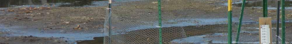
8 Beecher and Upper Lake Work Summary 2010 Implemented and evaluated 2010 spring chemical treatment Built Siphons Implemented 2010 fall draw down Heavy rain event 8


9 9


10 10


11 11

 Chip Long, Fish Biologist, Marinette County Implemented second draw")
12 Beecher and Upper Lake Work Summary 2011 Evaluated 2010 drawdown Unsuccessful due to significant rain event Strategic changes: Move up start date Complete drawdown by Mid October Anticipate 35 days to drawdown Use pump/generator system Reviewed fish habitat (2005 and 2010) Chip Long, Fish Biologist, Marinette County Implemented second draw down 12


13 13


14 14

15 Beecher and Upper Lake Work Summary 2012 Monitored drawdown impact Limited Success Extensive muck & debris slowed water flow Unseasonable early Spring/Hot Summer Determined Siphons drawdown to 4.5 feet (goal 6ft.) Lakes filled up quickly Could reach drawdown mark if water flows Controlled EWM in shallow areas (frost 4 ) Conclusion Dredge to enable draw down Modify the dam to allow drawdowns Begin work on dredging grant dam 15
 Minimize dependence on herbicides to control this")

16 Beecher and Upper Lake Work Summary 2013 Applied for an Aquatic Invasive Species grant to: 1) Use winter drawdown as a Eurasian Milfoil management tool 2) Minimize dependence on herbicides to control this invasive species 3) Implement long term, effective controls in a cost effective manner Majority of a quorum of the District passed the resolution Requested Army Corp of Engineers approve dredging to enable draw down 16


17 Beecher and Upper Lake Work Summary 2014 Army Corp of Engineers Approved Dredging AIS Grant Application Denied Reviewed unsuccessful dredging grant application Encouraged to reapply Increased match WDNR Meeting Review chemical treatment history & results Chemical Treatment Cost share grants and Marinette County 27 acres whole lake treatment Annual Meeting Met with Brenda Nordin, WDNR and Chuck Druckrey Marinette County Unanimously approved resolution for District to fund 50% of grant 17

18 Beecher and Upper Lake Work Summary 2015 February WDNR EWM Conference Resubmitted Grant March Successful grant awarded April Signed Grant Agreement Begin work on preparing to dredge to enable a drawdown. 18

19 Beecher and Upper Lake Work Summary Lessons Learned Stay connected. Identify resources and content experts. Think outside of the box. Develop a team approach Plan, do, study, act! Never, never, never give up. Winston Churchill Acknowledgment Town of Beecher Marinette County Wisconsin Department of Natural Resources Army Corp of Engineers 19
Control of Eurasian Water Milfoil & Large-scale Aquatic Herbicide Use Updated July 2006 Prepared by WDNR Lakes and Aquatic Plant Management Staff
 Control of Eurasian Water Milfoil & Large-scale Aquatic Herbicide Use Updated July 2006 Prepared by WDNR Lakes and Aquatic Plant Management Staff Introduction The spread of aquatic invasive plants is a
BLACK OTTER LAKE DISTRICT
 BLACK OTTER LAKE DISTRICT Storm water Action Plan Action Plan submitted for UW-Madison Course 272630 JDD001 #41967 Great Lakes Water Stewardship Institute 2012 Hortonville Area School District Hortonville
BIG ROCHE A CRI LAKE CHARACTERISTICS
 BIG ROCHE A CRI LAKE CHARACTERISTICS Lake Description Big Roche Cri Lake is located in north central Adams County and has a surface area of 205 acres, a shoreline length of 6.1 mile, a volume of 6,993
Winter Drawdown Proposal for Control of EWM in Long Trade Lake. Informational Meeting Saturday, August 25, 2012
 Winter Drawdown Proposal for Control of EWM in Long Trade Lake Informational Meeting Saturday, August 25, 2012 Recent Management Summary Trade Lakes System Summer 2011 Aquatic Plant Management Plan for
Aquatic Plant Treatment Evaluation
 Aquatic Plant Treatment Evaluation Purpose and Applicability This protocol is used to evaluate the results of herbicide application or any other manipulation (but from here on called a chemical application
management STRATEGIC PLAN The Shawano Lake Watershed Management Vision
 Management Vision That Shawano Lake is a quality water body managed by watershed residents to be useable for various types of recreation. The lake contains a broad array of habitats, supports diverse communities
Aquatic Plant Management Plan: White Ash and North White Ash Lakes
 Aquatic Plant Management Plan: White Ash and North White Ash Lakes White Ash Lakes APM Planning Polk County, Wisconsin WDNR No. AEPP-209-10 SEH No. WALPR 110599 May 2011 May 19, 2011 RE: White Ash Lakes
Aquatic Invasive Species Action Plan for Comfort Lake, Chisago County, Minnesota
 Invasive Ogopogo in Okanagan Lake, British Columbia, Canada (source: CBC radio website) Aquatic Invasive Species Action Plan for Comfort Lake, Chisago County, Minnesota Prepared for: Comfort Lake/Forest
Answering questions about milfoil physiology, spread, and growth in our lakes:
 Answering questions about milfoil physiology, spread, and growth in our lakes: Celia Evans, Dan Kelting, Kimberly M. Forrest, Lindsey Steblen, Derek Scott, Martin Serwatka, Megan O Reilly Watershed Stewardship
Aquatic Plants and Management in Valley Branch Watershed District (VBWD) Lakes. DNR-VBWD Meeting. February 13, 2017
 Lakes. DNR-VBWD Meeting. February 13, 2017") Aquatic Plants and Management in Valley Branch Watershed District (VBWD) Lakes DNR-VBWD Meeting February 13, 2017 Goals Goals Gain consensus whether there is a problem with aquatic plants (particularly
Aquatic Plants and Management in Valley Branch Watershed District (VBWD) Lakes DNR-VBWD Meeting February 13, 2017 Goals Goals Gain consensus whether there is a problem with aquatic plants (particularly
Waterford Waterway & Tichigan Lake 2017 Water Quality and Algae Sampling Report
 Waterford Waterway & Tichigan Lake 2017 Water Quality and Algae Sampling Report September 20, 2017 Prepared for: Waterford Waterway Management District Prepared by: James Scharl 0 Toll Free: 866-208-0724
Portage County Lake Planning Process
 Portage County Lake Planning Process Lake Leaders Kemp Field Station September 2010 Jen McNelly and Nancy Turyk Center for Watershed Science and Education UW-Stevens Point Types of Planning Emotional Crisis
Survey of Bottom Substrate Composition and Fish Habitat Value at Nett Lake
 Survey of Bottom Substrate Composition and Fish Habitat Value at Nett Lake Prepared by: Frank G. Stone, U.S. Fish & Wildlife Service Ashland FRO May 2006 The objective of this project was to characterize
Healthy lakes add value to our communities. They provide a place to relax and recreate,
 Pike Lake Eastern Marathon County Lake Study Final Study Results 2013 University of Wisconsin-Stevens Point and Marathon County Staff and Citizens Healthy lakes add value to our communities. They provide
Diascund Reservoir Hydrilla Management Work Plan November 2017 Update
 Newport News Waterworks Diascund Reservoir Hydrilla Management Work Plan November 2017 Update Background In March of 2013, Newport News Waterworks stocked 1,000 sterile grass carp (SGC), obtained from
2012 Lake Vegetation Summary Lake Sarah (Hennepin County)
") 2012 Lake Vegetation Summary Lake Sarah (Hennepin County) Introduction Lake Sarah is a 561 acre lake located near the town of Rockford in Hennepin County. It has a littoral area of 373 acres, and is dominated
2012 Lake Vegetation Summary Lake Sarah (Hennepin County) Introduction Lake Sarah is a 561 acre lake located near the town of Rockford in Hennepin County. It has a littoral area of 373 acres, and is dominated
Iron County Loon Project Practicum in Loon and Lake Ecology and Management Final Report 2015
 Iron County Loon Project Practicum in Loon and Lake Ecology and Management Final Report 15 Background For the more than years, the Wisconsin Department of Natural Resources (WDNR) Bureau of Integrated
Black Lake Integrated Aquatic Vegetation Management Plan. Harry Gibbons Toni Pennington Shannon Brattebo
 Black Lake Integrated Aquatic Vegetation Management Plan Harry Gibbons Toni Pennington Shannon Brattebo 1 Benefits of Native Plants Provide diverse habitat for fish & wildlife Competes with algae for nutrients
Gull Lake CASS & CROW WING COUNTIES
 Gull Lake 11-0305-00 CASS & CROW WING COUNTIES Summary Gull Lake is located just northwest of Brainerd, Minnesota, on the border of Cass and Crow Wing Counties. It covers 9,947 acres, which places it in
Lake. Grant. Sponsored by: De Pere, WI
 LPL-1115-07 & LPL-1116-07 Lake Mohawksin Lincoln County, Wisconsin Comprehensive Lake Management Plan December 2010 Onterra, LLC 135 South Broadway Suite C De Pere, WI 54115 920.338.8860 www.onterra-eco.com
Control of Eurasian Watermilfoil in Mesocosms at Lake Tahoe
 Control of Eurasian Watermilfoil in Mesocosms at Lake Tahoe Robert J. DuVall, Graduate Group in Ecology, Lars W. J. Anderson, Weed Science Program Charles R. Goldman, Environmental Science and Policy and
Red Rock Lake: A Path Forward
 University of Minnesota Morris Digital Well University of Minnesota Morris Digital Well Center for Small Towns 6-2016 Red Rock Lake: A Path Forward Colette Millard Student - University of Minnesota, Morris
MANAGING MINNESOTA S SHALLOW LAKES FOR WATERFOWL AND WILDLIFE
 MANAGING MINNESOTA S SHALLOW LAKES FOR WATERFOWL AND WILDLIFE Shallow Lakes Program Plan Minnesota Department of Natural Resources Division of Fish and Wildlife Wildlife Management Section December 2010
USING AQUATIC PLANT SURVEYS TO EVALUTE LAKE QUALITY
 USING AQUATIC PLANT SURVEYS TO EVALUTE LAKE QUALITY Reesa Evans, Lake Specialist Certified Lake Manager Adams County Land & Water Conservation Department P.O. Box 287 Friendship, WI 53934 Water is an important
Powers Lake Management Plan Washington County, MN
 Guy Rose: (River Epte, Giverny), 1904-12 Powers Lake Management Plan Washington County, MN March 2000 Prepared for: South Washington Watershed District Prepared by: Bonestroo, Rosene, Anderlik and Associates
Boy Lake CASS COUNTY
 Boy Lake 11-143- CASS COUNTY Summary Boy Lake is located near Remer, MN in Cass County. It covers 3,452 acres, which places it in the upper 1% of lakes in Minnesota in terms of size. Boy Lake has two main
Portage Lake Hubbard County
 Prepared in cooperation with the Minnesota Department of Natural Resources Minnesota Lake ID: 9- Area: acres Watershed Area: 6,7 acres Ecoregion: Northern Lakes and Forests (NLF) Portage Lake Hubbard County
Appendix B: Aquatic Herbicide Application Methods
 Appendix B: Aquatic Herbicide Application Methods William T. Haller: University of Florida, Gainesville FL; whaller@ufl.edu Introduction All pesticide labels contain very specific information regarding
Lake Bonaparte, NY. - Jamie Ross, June EnviroScience, Inc Darrow Road Stow, Ohio 44224
 Lake Bonaparte, NY As president of the Scugog Lake Stewards, a 17,000 acre lake in Southern Ontario, my experience with milfoil weevils and EnviroScience Inc. has been extremely positive. Our early results
Tip of the Mitt Watershed Council Management Plan June 2007
 Volunteer Purple Corps: Managing the Spread of Purple Loosestrife (Lythrum salicaria) with People and Beetles in the Burt and Pickerel-Crooked Lakes Watersheds Tip of the Mitt Watershed Council Management
Aquatic Plant Management Plan
 Minong Flowage Washburn and Douglas Counties, Wisconsin WBIC: 2692900 SEH No. February 2010 February 12, 2010 RE: Minong Flowage Washburn and Douglas Counties, Wisconsin WBIC: 2692900 SEH No. Ms. Doris
2014 Data Report for Higgins Lake, Roscommon County North Basin
 214 Data Report for Higgins Lake, Roscommon County North Basin Michigan Lakes Ours to Protect The CLMP is brought to you by: About this report: This report is a summary of the data that have been collected
Wisconsin River. Hardest Working River In the Nation
 Hardest Working River In the Nation Hardest Working River In The Nation Largest Basin In Wisconsin 430 miles in length 20% of Wisconsin, with diverse land use 14,776 mi2 catchment at Prairie du Sac Dam
GLP UPDATE: INDIANA HYDRILLA ERADICATION & STARRY STONEWORT BATTLE
 GLP UPDATE: INDIANA HYDRILLA ERADICATION & STARRY STONEWORT BATTLE ERIC FISCHER, AQUATIC INVASIVE SPECIES COORDINATOR INDIANA DEPT. OF NATURAL RESOURCES INVASIVE SPECIES MOVE FAST!! Who or What was knocking
Restorative Lake Sciences West Spring Lake Road Spring Lake, Michigan Website:
 Eagle Lake 2016 Aquatic Vegetation & Water Quality Report & 2017 Management Recommendations October, 2016 Eagle Lake 2016 Aquatic Vegetation & Water Quality Report & 2017 Management Recommendations Restorative
Cedar Lake Aquatic Ecosystem Restoration Feasibility Study, Cedar Lake, Indiana. Frequently Asked Questions November 2016
 Cedar Lake Aquatic Ecosystem Restoration Feasibility Study, Cedar Lake, Indiana Frequently Asked Questions 1. Why is dredging only occurring in specific locations? The locations and the quantity of material
Restoration and Protection of the Water Resources of the Greenwood Lake Watershed in New Jersey
 Restoration and Protection of the Water Resources of the Greenwood Lake Watershed in New Jersey Greenwood Lake Commission Bi-state commission that was formed in 2001 for the express purpose of improving
MATERIALS NEEDED LEARNING OBJECTIVES PREPARATION INTRODUCTION PROCEDURE VOCABULARY BACKGROUND
 Grade 5th 8th grade Length One to two class periods Subjects/strands (skills kids are developing) use of technology as a tool, modeling, geography, mathematics, ecology, biology Topics trophic AIS topics
Climate Vulnerability Assessment: Wild Rice. Wild rice, known as Manoomin by the Ojibwe of northern Wisconsin, is a cultural
 Hansen 1 Hans Hansen ES 600 Conaway, Hitch Capstone Paper Draft 13 April 2015 Climate Vulnerability Assessment: Wild Rice Introduction Wild rice, known as Manoomin by the Ojibwe of northern Wisconsin,
Oswego Lake: Beneath the Surface. an investigation into your lake s health
 Oswego Lake: Beneath the Surface an investigation into your lake s health LAKE SIZE... 83 acres WATERSHED SIZE... 71,660 acres MAX DEPTH... 36 feet INLETS... Flow from Lake Tippecanoe Oswego Lake OUTLETS...
Aquatic Nuisance Species
 Aquatic Nuisance Species Exotic Species Nonindigenous species (NIS) Aquatic nuisance species (ANS) ANS Impacts Threaten the diversity or abundance of native species Threaten activities dependent on these
Mark Twain Lake Water Control Manual Update
 Mark Twain Lake Water Control Manual Update Joan Stemler St. Louis District Water Control US Army Corps of Engineers WATER CONTOL PLAN Overall Objectives Project Purposes Flood Control Hydroelectric Power
2016 Data Report for Barlow Lake, Barry County
 Michigan Lakes Ours to Protect 216 Data Report for Barlow Lake, Barry County Site ID: 8176 42.67559 N, 85.5242 W The CLMP is brought to you by: 1 About this report: This report is a summary of the data
SW-74 SERENOVA PRESERVE SITES 2, 3, 4, 8 MITIGATION PLAN
 SW-74 SERENOVA PRESERVE SITES 2, 3, 4, 8 MITIGATION PLAN BACKGROUND INFORMATION Project SWIM? Aquatic Control? Exotic Control? Mitigation Bank? Type No No No No Mitigation Restoration and enhancement Type
Habitat Grant Projects Clinton River Watershed
 Habitat Grant Projects Clinton River Watershed L Y N N E S E Y M O U R E N V I R O N M E N T A L E N G I N E E R O F F I C E O F T H E M A C O M B C O U N T Y P U B L I C W O R K S C O M M I S S I O N
State Water Resources Monitoring Priorities and Role of Citizen Based Monitoring Tim Asplund, WDNR April 5, 2013
 State Water Resources Monitoring Priorities and Role of Citizen Based Monitoring Tim Asplund, WDNR April 5, 2013 From Ken Johnson, WDNR Water Division Administrator: Please extend my gratitude to all those
The COLA Experience. A Partnership to Save the Lake
 The COLA Experience A Partnership to Save the Lake State Map County map Lake map Lac Courte Oreilles Watershed 68,990 ac Lac Courte Oreilles Hayward Round L Grindstone L LCO Sand L Whitefish L Lac Courte
Working with partners to manage Invasive Aquatic Plants
 Working with partners to manage Invasive Aquatic Plants By: Chip Welling Coordinator, Management of Invasive Aquatic Species MnDNR To: State of Water conference Alexandria Date: 2016 April 15 S-o-W_2016_Apr_15-CW.ppt
2014 Data Report for Lake Chemung, Livingston County
 2014 Data Report for Lake Chemung, Livingston County Michigan Lakes Ours to Protect The CLMP is brought to you by: About this report: This report is a summary of the data that have been collected through
2014 Data Report for Clark Lake, Jackson County
 2014 Data Report for Clark Lake, Jackson County Michigan Lakes Ours to Protect The CLMP is brought to you by: About this report: This report is a summary of the data that have been collected through the
Prairie Lake OTTER TAIL COUNTY
 Prairie Lake 56-0915-00 OTTER TAIL COUNTY Lake Water Quality Summary Prairie Lake is located less than one mile north of Pelican Rapids, MN in northwestern Otter Tail County. It covers 1,004 acres and
Phillips Chain of Lakes Price County, Wisconsin
 Phillips Chain of Lakes Price County, Wisconsin Comprehensive Management Plan June 2011 Sponsored by: Phillips Chain O Lakes Association WDNR AIS Grant Program AEPP-161-08 Onterra, LLC 135 South Broadway
CITIZEN MONITORING AS WATERSHED MANAGEMENT TOOL. Reesa Evans Lake Specialist Certified Lake Manager Adams County LWCD
 CITIZEN MONITORING AS WATERSHED MANAGEMENT TOOL Reesa Evans Lake Specialist Certified Lake Manager Adams County LWCD Setting Up Monitoring When looking at setting up a monitoring program, the first step
Invasive Plants Taking Root in Alaska
 Invasive Plants Taking Root in Alaska Prepared by: Caleb Slemmons Homer Soil and Water Conservation District http://www.homerswcd.org November, 2006 Sponsored by: Alaska Association of Conservation Districts
Rice Lake Excess Nutrient TMDL
 Rice Lake Excess Nutrient TMDL Prepared for North Fork Crow River Watershed District April 2012 Rice Lake Nutrient TMDL Report Wenck File #1878-03 Prepared for: NORTH FORK CROW RIVER WATERSHED DISTRICT
Control of Eurasian Milfoil (Myriophyllum spicatum) using wind powered water circulators at Lake Cayamant, Quebec, CANADA.
 using wind powered water circulators at Lake Cayamant, Quebec, CANADA.") 146 Dalesville, Brownsburg-Chatham. Quebec,Canada. J8G-1H4 Tel : 450-533-9191 Fax : 450-533-9175 E-mail : info@lake2000.com Web : www.lake2000.com Control of Eurasian Milfoil (Myriophyllum spicatum) using
146 Dalesville, Brownsburg-Chatham. Quebec,Canada. J8G-1H4 Tel : 450-533-9191 Fax : 450-533-9175 E-mail : info@lake2000.com Web : www.lake2000.com Control of Eurasian Milfoil (Myriophyllum spicatum) using
ENVIROTHON AQUATICS SAMPLE TEST
 ENVIROTHON AQUATICS SAMPLE TEST Habitat Assessment Perform a visual assessment (habitat assessment) of Coalburn Creek within the designated area (100 meter reach). You will be provided with the habitat
Hydrologic and Ecologic Impacts from the CERP Indian River Lagoon South Project
 Hydrologic and Ecologic Impacts from the CERP Indian River Lagoon South Project Dr. Gretchen Ehlinger Senior Biologist US Army Corps of Engineers Jacksonville District November 15, 2016 AWRA Conference
Good morning, Chairman Yaw, Chairman Yudichak, Chairman Vulakovich, Chairman Costa,
 Testimony of Patrick McDonnell, Secretary Pennsylvania Department of Environmental Protection Joint Hearing on Flooding and Emergency Response Senate Environmental Resources & Energy and Veterans Affairs
POND MUCKING Environmental Education Lesson Plan Edwards Camp and Conference Center
 POND MUCKING Environmental Education Lesson Plan Edwards Camp and Conference Center Summary Using the boat bay as an example of a pond, the students will compare it to Lake Beulah to learn the differences
Chapter 3. Lake Assessments
 Chapter 3. Lake Assessments Introduction The Pelican Group of Lakes encompasses 4 lakes: Pelican, Little Pelican, Bass, and Fish. Although these lakes have somewhat different characteristics, they are
Aquatic Invasive Species (AIS) Prevention Aid Lessons Learned
 Prevention Aid Lessons Learned") Aquatic Invasive Species (AIS) Prevention Aid Lessons Learned Tina Wolbers, Phil Hunsicker DNR AIS Prevention Planners Adam Doll DNR Watercraft Inspection Program Coordinator Dave Rush Douglas County Land
Aquatic Invasive Species (AIS) Prevention Aid Lessons Learned Tina Wolbers, Phil Hunsicker DNR AIS Prevention Planners Adam Doll DNR Watercraft Inspection Program Coordinator Dave Rush Douglas County Land
AQUATIC PLANT MANAGEMENT PLAN FOR U.S. ARMY CORPS OF ENGINEERS, SAVANNAH DISTRICT WATER RESOURCES PROJECTS SOUTH CAROLINA AND GEORGIA
 AQUATIC PLANT MANAGEMENT PLAN FOR U.S. ARMY CORPS OF ENGINEERS, SAVANNAH DISTRICT WATER RESOURCES PROJECTS SOUTH CAROLINA AND GEORGIA Appendix A CY 2018 Update Annual Aquatic Plant Treatment Plan and Summary
Hydrology, Water Quality, and Phosphorus Loading of Little St. Germain Lake, Vilas County, Wisconsin
 Hydrology, Water Quality, and Phosphorus Loading of Little St. Germain Lake, Vilas County, Wisconsin Introduction Little St. Germain Lake, which is in Vilas County, Wisconsin, just northeast of St. Germain
LAKE JOSEPHINE, RAMSEY COUNTY: 2017 AQUATIC VEGETATION REPORT
 LAKE JOSEPHINE, RAMSEY COUNTY: 2017 AQUATIC VEGETATION REPORT Report by the Invasive Species Program Division of Ecological and Water Resources Minnesota Department of Natural Resources Lake: Josephine
CORPS REGULATORY PROGRAM
 CORPS REGULATORY PROGRAM Emily Hughes Special Projects Manager/Outreach Specialist Wilmington Regulatory Field Office USACE, Wilmington District US Army Corps of Engineers BUILDING STRONG Corps Regulatory
West Leaf Lake DNR ID:
 East Otter Tail County Water Quality Factsheet West Leaf Lake DNR ID: 56-0114-00 Vitals Physical Characteristics MN Lake ID: 56-0114-00 Surface area (acres): 700 Zoning Authority: Ottertail Littoral area
Little Arbor Vitae Lake Vilas County, Wisconsin
 Little Arbor Vitae Lake Vilas County, Wisconsin Comprehensive Management Plan December 2013 Sponsored by: Little Arbor Vitae Lake Protection & Rehabilitation District WDNR Grant Program LPL-1377-10, LPL-1378-10
Comparative Analysis of Minnesota Lakes Treated with Alum to Inform Spring Lake Treatment
 Comparative Analysis of Minnesota Lakes Treated with Alum to Inform Spring Lake Treatment Prepared for the Prior Lake Spring Lake Watershed District (PLSLWD) April 23, 2013 Comparative Analysis of Minnesota
LITTLE ROCK DISTRICT CORPS OF ENGINEERS WATER SUPPLY
 US Army Corps of Engineers LITTLE ROCK DISTRICT CORPS OF ENGINEERS WATER SUPPLY One Corps Serving The Army and the Nation Storage at Existing Lakes Basic Authority Water Supply Act of 1958 The Corps can
Minnesota Department of Natural Resources. Aquatic Plant Management Program
 Minnesota epartment of Natural Resources Aquatic Plant Management Program The Goal of the MN NR s Aquatic Plant Management Program-APM Protect & enhance Minnesota s aquatic resources, while allowing lakeshore
2017 MAWD Project & Program of the Year. Detailed Award Information Form. 3) Watershed District: Comfort Lake-Forest Lake Watershed District
 Watershed District: Comfort Lake-Forest Lake Watershed District") 2017 MAWD Project & Program of the Year Detailed Award Information Form 1) Award Category (Project or Program): Project 2) MAWD Region (1, 2 or 3): 3 3) Watershed District: Comfort Lake-Forest Lake Watershed
2017 MAWD Project & Program of the Year Detailed Award Information Form 1) Award Category (Project or Program): Project 2) MAWD Region (1, 2 or 3): 3 3) Watershed District: Comfort Lake-Forest Lake Watershed
2016 Adams County LWCD Plan of Operations
 2016 Adams County LWCD Plan of Operations I. County Owned Dams a. Goal: Inspect, Operate and Maintain dams as specified in the I.O.M. Plan to meet State laws/standards. Action: Update I.O.M. Plan and Emergency
Hydrology and Flooding
 Hydrology and Flooding Background The 1996 flood Between February 4, 1996 and February 9, 1996 the Nehalem reporting station received 28.9 inches of rain. Approximately 14 inches fell in one 48 hour period.
2008 SUMMARY REPORT of North Loon Lake NICC Pond. Lake County, Illinois
 2008 SUMMARY REPORT of North Loon Lake NICC Pond Lake County, Illinois Prepared by the LAKE COUNTY HEALTH DEPARTMENT ENVIRONMENTAL HEALTH SERVICES LAKES MANAGEMENT UNIT 3010 Grand Avenue Waukegan, Illinois
INVASIVE SPECIES CONTROL PLAN FOR CONSTRUCTION ACTIVITIES AND POST CONSTRUCTION MONITORING
 INVASIVE SPECIES CONTROL PLAN FOR CONSTRUCTION ACTIVITIES AND POST CONSTRUCTION MONITORING INTRODUCTION Black Oak Wind Farm, LLC is proposing to develop a wind-powered electric generating facility (the
Aquatic Plants and Their Control In the South
 Aquatic Plants and Their Control In the South Chuck Cichra School of Forest Resources & Conservation Program in Fisheries & Aquatic Sciences cecichra@ufl.edu Overview of Talk Bryan has done an excellent
Water Soldier Control and Eradication in Ontario. Great Lakes Panel on Aquatic Nuisance Species Spring Meeting April 15, 2015
 Water Soldier Control and Eradication in Ontario Great Lakes Panel on Aquatic Nuisance Species Spring Meeting April 15, 2015 Background Water soldier (Stratiotes aloides) is an aquatic invasive perennial
CEDAR LAKE WATERSHED MANAGEMENT PLAN
 CEDAR LAKE WATERSHED MANAGEMENT PLAN Submitted by: Cedar Lake Improvement Board PO Box 53 Greenbush, Michigan 48738 Contents List of Attachments... ii CHAPTER 1: INTRODUCTION... 1 Background... 1 WMP Drivers...
Big Arbor Vitae Lake Vilas County, Wisconsin Comprehensive Management Plan February 2013
 Vilas County, Wisconsin Comprehensive Management Plan February 2013 Created by: Tim Hoyman, Dan Cibulka and Brenton Butterfield Onterra, LLC De Pere, WI Funded by: Big Arbor Vitae Lake Association Wisconsin
Options for Reducing Harmful Lake Okeechobee Discharges and Everglades Restoration
 Options for Reducing Harmful Lake Okeechobee Discharges and Everglades Restoration The Florida Senate Appropriations Subcommittee on the Environment and Natural Resources January 11, 2017 Gary Goforth,
Heavily Adapted from: MOE Fact Sheets and Algae Blooms in Ontario's Lakes: Analyzing the trends Jenny Winter, Ministry of the Environment
 Heavily Adapted from: MOE Fact Sheets and Algae Blooms in Ontario's Lakes: Analyzing the trends Jenny Winter, Ministry of the Environment What are Algae? Small, mostly microscopic plants Live in virtually
OVERVIEW OF RESERVOIR OPERATIONS AND FLOOD RISK MANAGEMENT
 OVERVIEW OF RESERVOIR OPERATIONS AND FLOOD RISK MANAGEMENT 255 255 255 237 237 237 0 0 0 217 217 217 163 163 163 200 200 200 COLUMBIA RIVER BASIN 131 132 122 239 65 53 80 119 27 110 135 120 252 174.59
BARABOO RIVER REMOVAL OF THE WATERWORKS DAM IN WISCONSIN
 Dam Removal Success Stories Final Report 3 BARABOO RIVER REMOVAL OF THE WATERWORKS DAM IN WISCONSIN DAM REMOVAL BENEFITS: IMPROVED MIGRATORY AND RESIDENT FISH HABITAT, REVITALIZED RIVERFRONT, IMPROVED
Stage 5 Geography Full Day. Student Name: Case Study: Water Management at Penrith Lakes
 Stage 5 Geography Full Day Student Name: Case Study: Water Management at Penrith Lakes Page 1 of 7 Bioretention Basin Bus tour of the Penrith Lakes Scheme. Stop 1: Introduction to Penrith Lakes Stop 2:
Lake Emily CROW WING COUNTY
 Lake Emily 18-0203-00 CROW WING COUNTY Lake Water Quality Summary Lake Emily is located on the eastern edge of the City of Emily, MN in Crow Wing County. It is a shallow lake that covers 720 acres and
Michigan Inland Lakes
 Michigan Inland Lakes Proactive vs. Reactive Jeff Suttner Airmax There are an estimated 11,000 Inland Lakes in the state of Michigan. Use of Earth Bottom Lakes: Recreation Fishing, Swimming Water Retention
Wetland Monitoring. City of Edmonton. Edmonton Wetlands Workshop December 4-5, 2013
 Wetland Monitoring City of Edmonton Edmonton Wetlands Workshop December 4-5, 2013 City of Edmonton Presentation Outline Kennedale Wetland Water Quality Sediment removal Vegetation management Biological
City of Stillwater Lake Management Plans. Lily Lake McKusick Lake. Wenck File # Prepared for:
 City of Stillwater Lake Management Plans Lily Lake McKusick Lake Wenck File #1848-01 Prepared for: City of Stillwater Brown s Creek Watershed District Prepared by: WENCK ASSOCIATES, INC. 1800 Pioneer Creek
Literature, Maps, and Data Sources Cited
 Literature, Maps, and Data Sources Cited Carlson, R. E. 1977. A trophic state index for lakes. Limnology and Oceanography 22(2): 361 69. Cooper, J. L. 1999. Special animal abstract for Buteo lineatus (red-shouldered
Island Lake CROW WING COUNTY
 Island Lake 18-183- CROW WING COUNTY Lake Water Quality Summary Island Lake is located 4 miles southeast of Emily, MN in Crow Wing County. It is a round lake covering 237.5 acres (Table 1). Island Lake
Biodiversity Debate. To evaluate the biological, aesthetic, ethical, social and economic arguments with regard to maintaining biodiversity.
 Purpose: Summary: To evaluate the biological, aesthetic, ethical, social and economic arguments with regard to maintaining biodiversity. In this exercise, students will hold a debate about the construction
AQUATIC INVASIVE SPECIES Program Updates. Sharina Kennedy Alberta Environment & Sustainable Resource Development
 AQUATIC INVASIVE SPECIES Program Updates Sharina Kennedy Alberta Environment & Sustainable Resource Development What are Aquatic Invasive Species (AIS)? Not native Animal, plant or pathogen No effective
Ponds. Pond A water impoundment made by excavating a pit, or constructing a dam or an embankment.
 POND SITE SELECTION AND CONSTRUCTION Uses, Planning, & Design David Krietemeyer Area Engineer USDA-NRCS June 20, 2008 Uses Considerations for Location of Commonly Used Terms Pond A water impoundment made
Aquatic Weed Control Weed Management
 Kentucky Pesticide Education Program copyright 2016 University of Kentucky Department of Entomology Aquatic Weed Control Weed Management Adapted from North Central Regional Extension Publication No. 241,
For the property described as: Property Owner: Name. Phone Number. Mailing Address. City. Report Year:
 Timber Management Plan For the property described as: Property Owner: Name Phone Number Mailing Address City State Zip Report Year: (This template is provided to assist Cherokee County land owners who
STATE OF THE LAKE Environment Report 2012 CLAYTON LAKE
 STATE OF THE LAKE Environment Report 2012 CLAYTON LAKE CLAYTON LAKE WHY WATERSHED WATCH? A lake monitoring program of the Mississippi Valley Conservation Authority Mississippi Valley Conservation Authority
Selecting indicators based on river science two examples
 Selecting indicators based on river science two examples use High turbidity, poor vegetation Increase vegetation using summer water level drawdowns to expose sediment and germinate plants Sediments dry
Aquatic Vegetation Management Plan For Lake Athens 2018
 Aquatic Vegetation Management Plan For Lake Athens 2018 Spencer Dumont TPWD IF Region 1 Program Director Dr. Richard Ott, TPWD IF District Supervisor Jake Norman, TPWD IF Assistant Biologist William Casey,
Lake Ossawinnamakee CROW WING COUNTY
 Lake Ossawinnamakee 18-0352-00 CROW WING COUNTY Lake Water Quality Summary Lake Ossawinnamakee is located by Breezy Point, MN in Crow Wing County. It is an elongated L shape basin that covers 689 acres