NW La Center Road/I-5 Interchange Improvement Project (MP 16.80)
|
|
|
- Cassandra McKinney
- 6 years ago
- Views:
Transcription
1 FINAL DRAFT - NW La Center Road/I-5 Interchange Improvement Project (MP 16.80) La Center, Washington February 2015
2 FINAL DRAFT - NW La Center Road/I-5 Interchange Improvement Project (MP 16.80) La Center, Washington Prepared By: Kittelson & Associates, Inc. 610 SW Alder, Suite 700 Portland, OR (503) Project Manager: Matt Hughart, AICP Project Principal: Marc Butorac, P.E., P.T.O.E. Project Analyst: Kelly Laustsen Project No February 2015
3 NW La Center Road/I-5 Interchange Improvement Project (MP 16.80) This, prepared under my direct supervision, has been prepared in accordance with RCW and appropriate Washington State Department of Transportation manuals. IJR Engineer of Record Traffic Analysis Engineer By: P.E. Title Date:, 2015 Concurrence Region Area Engineer / Project Engineer By:, P.E. Date:, 2015 Concurrence Region Traffic Review By:, P.E. Date:, 2015 Concurrence Project Development Engineer By:, P.E. Date:, 2015 WSDOT Approval Assistant State Design Engineer By:, P.E. Date:, 2015 FHWA Approval FHWA Safety and Design Engineer By:, Date:, 2015 FHWA Approval Headquarters Development Services & Access Manager By:, Date:, 2015
4 TABLE OF CONTENTS List of Figures.... v List of Tables... vi Executive Summary... 1 Introduction Study Area and Transportation Facilities... 3 Relevant Background Documents... 8 Description of Future Growth... 9 IJR Policy Points.10 Methods and Assumptions Policy Point 1 Need for Access Point Revision Policy Point 2 Reasonable Alternatives Policy Point 3 Operational and Collision Analyses Policy Point 4 Access Connections and Design Policy Point 5 Land Use and Transportation Plans Policy Point 6 Future Interchanges Policy Point 7 Coordination Policy Point 8 Environmental Processes References.... R-1 List of Appendices... A-1 iv Kittelson & Associates, Inc.
5 LIST OF FIGURES Figure I-1 Site Vicinity... 4 Figure I-2 Study Interchange... 6 Figure 2-1 Interchange Concept Options... 3 Figure 2-2 Figure 2-3 Figure 2-4 Figure Weekday AM and Weekend Total Volume and Movement Summary for Signalized Intersections Weekday AM and Weekend Total Volume and Movement Summary for Roundabout Intersections Weekday AM and Weekend Total Volume and Movement Summary for Signalized Intersections Weekday AM and Weekend Total Volume and Movement Summary for Signalized Intersections Figure 2-6 Map of Parcel Owners on East Side of Interchange Figure 2-7 Frontage Road Concept Options Figure 2-8 Frontage Road Realignment Figure 2-9 Developable Properties Figure Existing Lane Configurations and Traffic Control Devices... 6 Figure Existing Conditions... 8 Figure Background Lane Configurations and Traffic Control Devices Figure Background Conditions Figure Total Traffic Lane Configurations and Traffic Control Devices (No Build) Figure Total Traffic Lane Configurations and Traffic Control Devices (Build) Figure Total Traffic Conditions (No-Build) Figure Total Traffic Conditions (Build) Figure Total Traffic Lane Configurations and Traffic Control Devices (No Build) Figure Total Traffic Lane Configurations and Traffic Control Devices (Build) Figure Total Traffic Conditions (No-Build) Figure Total Traffic Conditions (Build) Figure 3-13 Interchange Crashes by Severity Figure 3-14 Interchange Crashes by Type Figure 3-15 I-5 Northbound Weigh Station at Milepost 15.5: Crashes by Severity and Type Figure 3-16 Long-Term Layout (2017 to 2037) Figure 4-1 Long-Term Parcel Access... 5 v Kittelson & Associates, Inc.
6 LIST OF TABLES Table 2-1 Initial Interchange Form Concept Evaluation... 7 Table Ramp Terminal Traffic Control Operations Comparison... 8 Table Ramp Terminal Traffic Control Operations Comparison Table 2-4 Ramp Terminal Traffic Control Comparison Table 2-5 Frontage Road Option Evaluation Table 3-1 WSDOT Measures of Effectiveness by Facility Type... 3 Table 3-2 LOS Criteria for Freeway Merge/Diverge/Weave (HCM 2010)... 3 Table 3-3 WSDOT Level of Service Standards for Washington State Highways, January 1, Table 3-4 City of La Center Level of Service Standards... 4 Table 3-5 Operational Standards... 5 Table 3-6 Existing 2014 I-5 Mainline Operations... 7 Table 3-7 NW La Center Road/I-5 Interchange Existing 2014 Merge/Diverge Operations... 7 Table 3-8 Existing 2014 Study Intersection Operations... 9 Table Background Conditions I-5 Mainline Operations Table 3-10 NW La Center Road/I-5 Interchange 2017 Background Conditions Merge/Diverge... Operations Table Background Intersection Operations Table Total Traffic Conditions (No-Build & Build 1 ) I-5 Mainline Operations Table 3-13 NW La Center Road/I-5 Interchange 2017 Total Traffic Conditions Merge/Diverge... Operations Table Total Traffic Conditions Study Intersection Operations (No Build) Table Total Traffic Conditions Study Intersection Operations (Build) Table Total Traffic Conditions (Build) Intersection 95 th Percentile Queue Lengths Table Intersection Operations with an 85/15 Trip Distribution Split Table Critical Lane Operations with an 85/15 Trip Distribution Split Table Total Traffic Conditions I-5 Mainline Operations (No Build and Build 1 ) Table 3-20 NW La Center Road/I-5 Interchange 2037 Total Traffic Conditions Merge/Diverge... Operations (No Build and Build 1 ) Table Total Traffic Conditions Study Intersection Operations (No Build) Table Total Traffic Conditions Study Intersection Operations (Build) Table Intersection 95 th Percentile Queue Lengths (feet) Table Intersection Operations with an 85/15 Trip Distribution Split vi Kittelson & Associates, Inc.
7 Table Critical Lane Operations with an 85/15 Trip Distribution Split Table 3-26 Crash History I-5 Mainline, MP (Jan 1, 2009 Dec 31, 2013) Table 3-27 Crash History I-5 Mainline NB Weigh Station, MP (Jan 1, Dec 31, 2013) Table 3-28 Crash History La Center Road/I-5 Interchange Ramps (Jan 1, 2009 Dec 31, 2013) Table 3-29 Crash History La Center Road/I-5 Study Intersections (Jan 1, 2009 Dec 31, 2013) Table 3-30 Crash Frequency Assessment at Ramp Terminals with Improvements Table 3-31 Overall Metrics from Truck Speed Study Table 3-32 Volumes at I-5 Northbound Weigh Station (June 2014 Data) Table 4-1 Existing Ramp Design... 1 Table 4-2 Proposed Ramp Design... 3 vii Kittelson & Associates, Inc.
8 Executive Summary EXECUTIVE SUMMARY The Exit 16 interchange (at NW La Center Road and NW 319 th Street, milepost 16.80) along Interstate 5 serves the City of La Center and surrounding rural areas. The interchange is a diamond interchange with a two-lane structure over the freeway and stop-controlled access at the ramp terminals. Closely spaced frontage road intersections exist just outside each of the I-5 ramp terminals, posing access management challenges to the operations of the interchange. From a functional standpoint, the existing interchange form is supporting existing development within the City of La Center and surrounding rural areas. However, the interchange has been the subject of recent planning studies that examined the impacts of enhancing development opportunities along NW La Center Road on the east side and NW 319 th street on the west side of I-5. One near-term approved development involves 152 acres of land that will be held in trust by the U.S. Department of the Interior for the Cowlitz Indian Tribe along the west side of I-5. This property spans the north and south sides of NW 319 th Street and has been approved by the Department of the Interior to be developed as a casino, resort and tribal government center by the Cowlitz Tribe (herein referred to as the Cowlitz Reservation Development). The City of La Center has annexed property on the south side of NW La Center Road from the original municipal boundary to and including I-5, making over thirty acres available for urban development. Given the anticipated increase in traffic due to local/regional growth there is a need to modify/reconstruct the existing NW La Center Road/I-5 interchange along with portions of the adjacent frontage road network in order to provide safe and efficient access to/from I-5. Based on a detailed planning and operations analysis, the interchange project will include the following: Construction of a new overpass structure located immediately south of the existing structure which will accommodate four travel lanes and pedestrian and bicycle facilities; Modification of the existing northbound and southbound interchange ramp terminals to include multiple lane roundabouts; A modified northbound off-ramp that is lengthened and includes a second exit lane; A modified southbound on-ramp that includes two receiving lanes off of the ramp terminal that transition to a single lane prior to merging with I-5 mainline traffic; A partial relocation of Paradise Park Road and the development of a new intersection with NW La Center Road. This new intersection would be located approximately 450 feet (centerline-tocenterline) east of the northbound roundabout terminal to meet Washington State Department of Transportation (WSDOT) guidelines for intersection spacing of 350 or more feet. The new intersection will operate as a two-way stop-control intersection in the near-term and eventually need to be converted to a roundabout or traffic signal with future development; Relocation of NW 319th Street approximately 350 feet south of the current alignment to accommodate the new overpass and provide an enhanced east-west circulation network that is more compatible with the Cowlitz Reservation Development; and A partial relocation of NW 31st Avenue and the development of a new intersection with NW 319th Street. This new intersection would be located approximately 600 feet (centerline-to- 1 Kittelson & Associates, Inc.
9 Executive Summary centerline) west of the southbound roundabout terminal to meet WSDOT intersection spacing guidelines. The new intersection will operate as a roundabout to accommodate near-term and future development. To support the NW La Center Road/I-5 interchange reconstruction/modification project, this Interchange Justification Report (IJR) has been prepared as required by WSDOT and the Federal Highway Administration (FHWA). The IJR documents the interchange planning process, the evaluation of improvement alternatives, the design of the preferred alternative, the impacts to the Interstate system and local street network, and the coordination details to support and justify the request for an access revision. As a component of the IJR process, the WSDOT Design Manual requires a Methods and Assumptions Document be developed to record assumptions, criteria, and support team decisions used in the IJR. The NW La Center Road/I-5 Interchange Improvement Project (MP 16.80) IJR Methods and Assumptions Document was approved in October 2013 and is provided in Appendix A for reference. 2 Kittelson & Associates, Inc.
10 Introduction INTRODUCTION The existing NW La Center Road/I-5 Interchange is a simple diamond interchange form that was constructed in the late 1960s to provide access between I-5, the City of La Center, and surrounding rural residential areas. Based on a limited interchange form and the findings of several recent planning studies 12, the interchange and supporting local circulation system are not capable of safely and efficiently supporting extensive new development. One such development, the Cowlitz Reservation Development, involves 152 acres of land that will be held in federal trust for the Cowlitz Indian Tribe. This property, which is located on the west side of I-5 and spans the north and south sides of NW 319 th Street, has been approved for development of a cultural center, tribal government buildings, housing for tribal elders, a gaming facility, and a hotel. To support anticipated future traffic volumes in the region, the existing interchange and supporting local street network will need to be reconfigured to better accommodate intensified traffic patterns at the interchange. This IJR documents the planning, evaluation, and selection of a new interchange form, interchange terminal control, and frontage roadway configurations. It was completed with the following focus areas: Accommodating multi-modal traffic circulation in a safe and efficient manner, Upgrading the interchange bridge to current design standards. Addressing and satisfying regulatory agency approval criteria, Minimizing negative impacts to adjacent property owners (right-of-way and access), Addressing the existing closely spaced frontage road intersections at NW 31 st Avenue and NW Paradise Park Road by appropriately realigning these frontage roads, Advancing the transportation system in a manner consistent with long-term community aspirations (e.g, La Center Transportation Plan), and Ensuring that the selected interchange form supports future expansion to meet the surrounding communities growth needs through the year The following sections describe the existing interstate system and the non-interstate highway/local transportation system within the project study area. STUDY AREA AND TRANSPORTATION FACILITIES The IJR focuses on the existing NW La Center Road/I-5 Interchange and its functional area along the NW 319 th Street/NW La Center Road corridors, including the two adjacent frontage roads on either side of the interchange. As illustrated in Figure I-1, the project study area also includes the two upstream/downstream 1 La Center Junction Subarea Plan (Reference 1) 2 Cowlitz Indian Tribe Casino Project: Traffic Impact Study, Supplemental Report (Reference 2) 3 Kittelson & Associates, Inc.
11
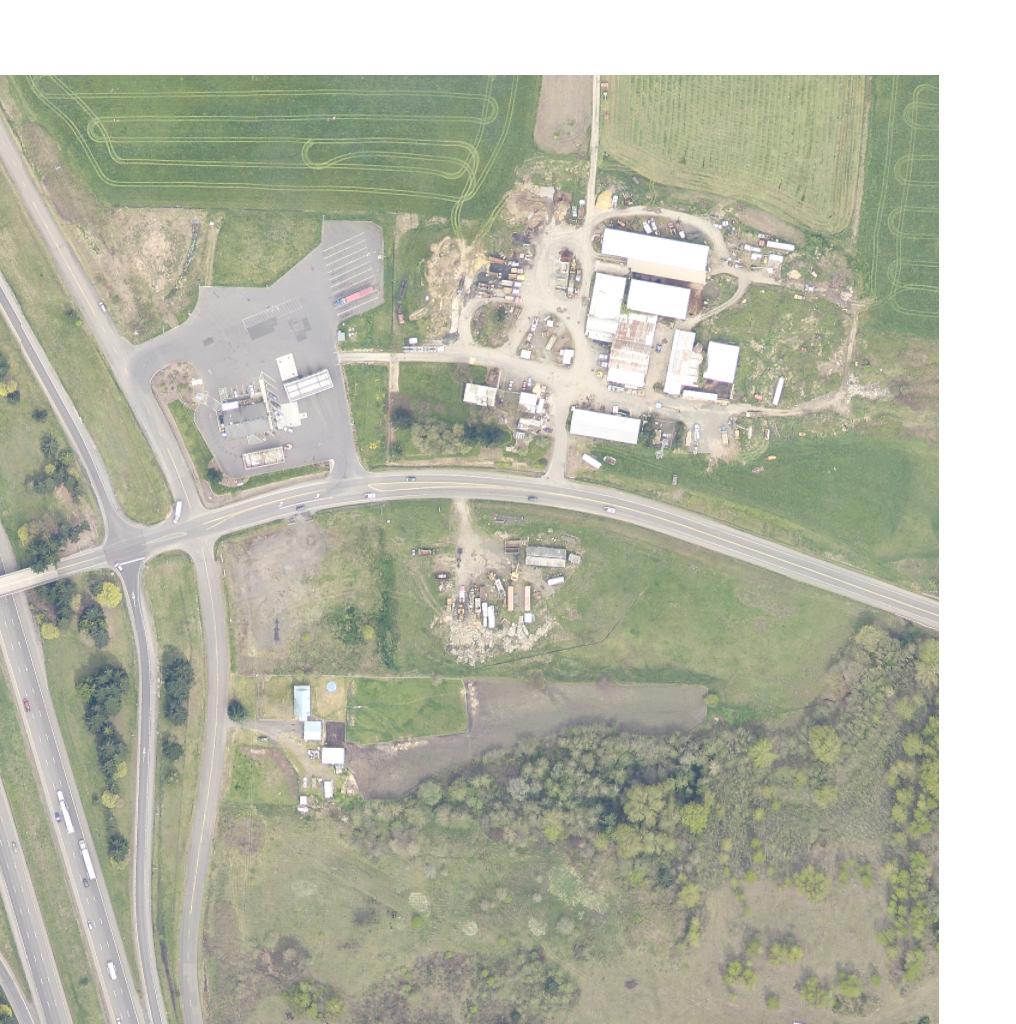
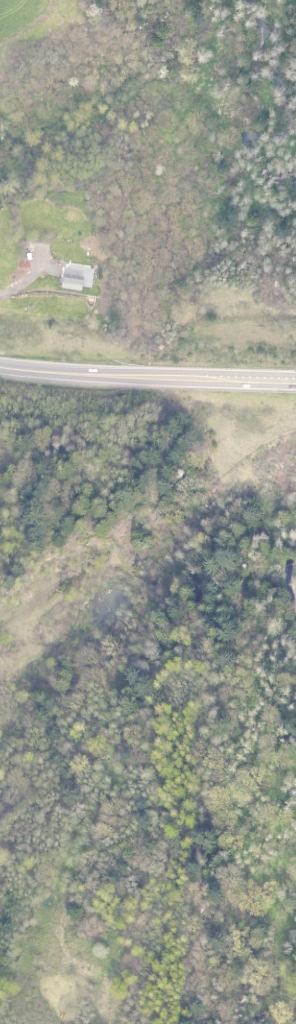
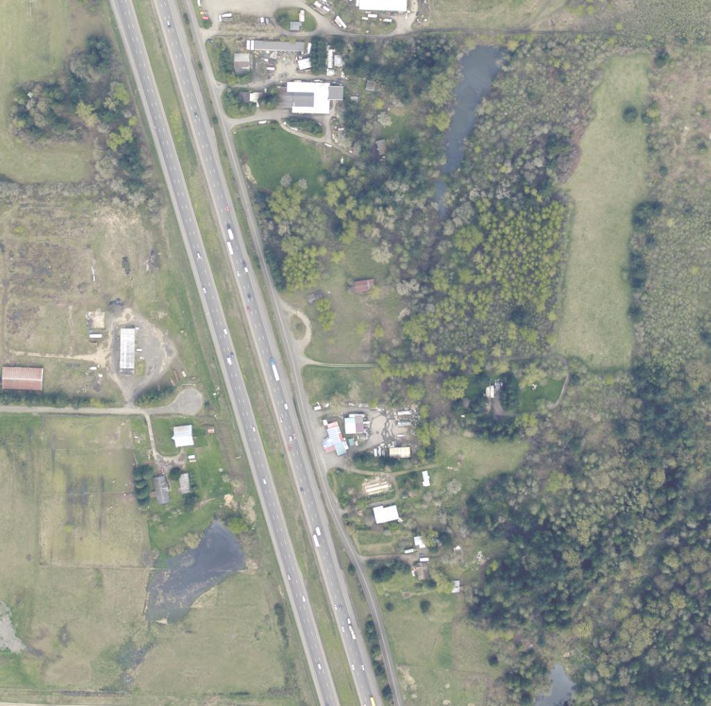
12 Introduction (SR 501 Exit 14 at milepost and SR 503 Exit 21 at milepost 21.08) interchanges along the I-5 corridor. However, a complete traffic operations analysis of these two upstream/downstream interchanges was not formally included in the IJR as there are no significant increases in traffic expected in these locations 3. Furthermore, the SR 501 Exit 14 interchange was recently reconstructed with 20-year capacity as documented in the Interstate 5/SR 501 Ridgefield Interchange Project IJR dated May 4, The remainder of this section describes each facility located within the IJR study area. I-5 Mainline Within the interchange improvement study area, I-5 is a 6-lane, median-separated, interstate highway. The WSDOT State Highway Log classifies this section of I-5 as Rural. It should be noted that WSDOT envisions this classification changing to Urban over the next 20-year period with build out of the La Center Growth Management Area. Existing average annual daily traffic (AADT) for this section of I-5 is approximately 68,000 vehicles per day based on the most recent 2013 data at nearby R045 permanent traffic recorder station located at milepost The posted speed limit along this segment of I-5 is 70 mph. NW La Center Road/I-5 Interchange The NW La Center Road interchange is a diamond interchange located at milepost The interchange is located within the City of La Center and consists of single-lane on- and off-ramps with unsignalized ramp terminals at NW La Center Road. Traffic volumes on I-5 north of the NW La Center Road interchange are approximately 68,000 vehicles per day. The ramp terminals are located approximately 535 feet (centerline-to-centerline) apart and are separated by a relatively narrow two-lane overpass structure that was constructed in The bridge provides eleven-foot travel lanes, two-foot shoulders, and three-foot wide sidewalks on each side, which do not meet current width design standards. In addition, the existing bridge does not meet current seismic design standards. The NW La Center Road/I-5 interchange is served by several local roadways that provide connectivity between I-5, La Center, and the surrounding rural areas. These facilities are documented below and mapped in Figure I-2, which also shows the boundaries of the City of La Center. NW La Center Road NW La Center Road is an east-west, two-lane roadway that connects I-5 and the City of La Center. Based on recent traffic count information, the existing ADT east of the I-5 interchange is approximately 11,000 vehicles per day.the City of La Center owns the roadway within their city limits and currently classifies it as a Major Collector. Within the vicinity of the interchange, there are no sidewalks or bicycle lanes along either side of the roadway. Based on future projected volumes and uses (detailed in later sections), the roadway will be designed as a Major Arterial in accordance with the City s street standards. 3 Further explanation of the study area is provided in the section Study Area Defined under Policy Point 1. 5 Kittelson & Associates, Inc.
13
14 Introduction NW 319 th Street West of I-5, NW La Center Road becomes NW 319 th Street. This east-west roadway is classified as a Rural Minor Collector by Clark County, which maintains a roadway easement west of the City s limits. NW 319 th Street primarily serves the rural residential development located between I-5 and the Columbia River to the west. Existing ADT along this roadway is approximately 1,500 vehicles per day. NW 31 st Avenue NW 31 st Avenue is a north-south roadway located on the west side of I-5 south of NW 319 th Street. The City of La Center owns the northern portion of the roadway within its City limits and classifies it as a two-lane Rural Major Collector. Clark County owns the remainder of the roadway south and also classifies NW 31 st Avenue as a Rural Major Collector. Oriented parallel to I-5, this roadway acts as a rural frontage road to I-5 providing a continuous connection between NW 319 th Street and the City of Ridgefield to the south. The intersection of NW 31 st Avenue with NW 319 th Street is located approximately 100 feet (centerline-tocenterline) from the I-5 southbound ramp terminal. NW Paradise Park Road NW Paradise Park Road is a north-south roadway located on the east side of I-5. As with NW 31 st Avenue, NW Paradise Park Road acts as a rural frontage road to I-5 and connects to NW La Center Road approximately 125 feet (centerline-to-centerline) east of the northbound ramp terminal. Clark County owns the portion south of the City s limits and also classifies NW Paradise Park Road as a Local roadway. The City of La Centers owns the portion of the roadway near the interchange within its City Limits and classifies the roadway as a Local roadway. Based on future projected volumes and uses (detailed in later sections), the roadway will be designed as a Major Collector in accordance with the City s street standards.sr 503/I-5 Interchange The SR 503/I-5 interchange is a split diamond interchange located in Woodland, WA. This interchange is located approximately 4.28 miles north of the NW La Center Road/I-5 interchange at milepost in Woodland, WA. Traffic volumes on I-5 south of the SR 503 interchange are approximately 68,000 vehicles per day. SR 501/I-5 Interchange The SR 501/I-5 Interchange is diamond interchange located approximately 2.63 miles south of the NW La Center Road/I-5 interchange at milepost Recently reconstructed to include a six-lane overpass and signalized ramp terminals, this interchange primarily serves the City of Ridgefield and the surrounding rural residential areas. Traffic volumes on I-5 south of the SR 501 interchange are approximately 82,000 vehicles per day. I-5 Weigh Station An existing weigh station for northbound I-5 traffic is located south of the La Center/I-5 interchange at milepost Kittelson & Associates, Inc.
15 Introduction Gas Station Access Locations in Northeast Quadrant of the Interchange An existing Shell Fuel Station is located on NW La Center Road just east of the interchange with a driveway on NW Paradise Park Road and on NW La Center Road. The driveway on NW La Center Road is located approximately 250 feet from the intersection of NW La Center Road/NW Paradise Park Road and 390 feet from the I-5 northbound ramp terminal. According to the WSDOT Design manual If a frontage road or local road is located at or within 350 feet of a ramp, limited access will be established and then acquired along the crossroad and for an additional minimum distance of 130 feet in all directions from the centerline of the intersection of the crossroad and the frontage or local road (Section (3)(c), Reference 5). Therefore the access currently meets WSDOT design standards. RELEVANT BACKGROUND DOCUMENTS Several documents offer foundational information relevant to the project and were reviewed as part of the study preparation. Two of these studies are briefly summarized below Cowlitz Environmental Impact Statement The Bureau of Indian Affairs (BIA) prepared an Environmental Impact Statement (EIS) for The Cowlitz Indian Tribe Trust Acquisition and Casino Project in 2008 for acquisition of the Cowlitz property into federal trust and the construction and operation of a casino resort and supporting infrastructure, including improvements to the La Center Road/I-5 Interchange (Reference 3). As part of the EIS, a traffic impact assessment (TIA) was completed to evaluate six site alternatives and their impacts to the surrounding transportation network. Four of the studied alternatives included a casino, hotel, and convention center; one alternative included an office park and warehouse; and one was a no-build alternative. The Cowlitz Reservation Development proposal documented in this IJR (see below) is very similar to -- and consistent with -- Alternative A of the EIS. It is worth noting, however, that the Cowlitz Reservation Development is somewhat reduced in size and intensity as compared to Alternative A, and, for that reason, some impacts may be somewhat smaller than those identified in the EIS. Alternative A, including mitigation to improve the I-5 Interchange, was approved by the BIA in a Record of Decision issued by the BIA on April 22, La Center Junction Subarea Plan The City of La Center prepared a subarea plan for the local community that assessed long-term needs at the NW La Center Road/I-5 interchange (Reference 1). This study was not formally adopted but was used for informational and guidance purposes during preparation of the IJR. Transportation Impact Analysis A separate transportation impact analysis (TIA) has been prepared that addresses the increased traffic expected to be generated by the Cowlitz Reservation Development project and surrounding regional growth in the City of La Center and Clark County. This separate TIA is a companion document to the NW La Center Road/I-5 Interchange Improvement Project IJR and is provided in Appendix B. This document along with the analysis summarized in the following IJR Policy Points has concluded that future development-driven traffic 8 Kittelson & Associates, Inc.
16 Introduction growth will necessitate the reconstruction of the existing NW La Center Road/I-5 interchange and require realignment of portions of the NW 31 st Avenue and NW Paradise Park Road frontage roads. These findings are consistent with the Final Environmental Impact Statement (EIS) for the Cowlitz Indian Tribe Trust Acquisition and Casino Project dated May 30, 2008 and subsequent Record of Decision issued on April 22, 2013 (refer to discussion under Policy Point 8). DESCRIPTION OF FUTURE GROWTH The NW La Center Road/I-5 Interchange Improvement Project will accommodate the increase in future traffic volumes projected as a result of approved and anticipated development. A description of local development projects anticipated to increase traffic volumes at the interchange, including the Cowlitz Reservation Project and anticipated growth in the City of La Center, is provided below: Cowlitz Reservation Development. While the site layout/program has yet to be finalized, full build-out the site in the northwest quadrant of the interchange is anticipated to include the following uses: 2,440 gaming positions (the IJR will study 3,500 gaming positions for a conservative analysis); Four interior restaurants; 5,000 6,000 square feet of interior retail space; Casino bars; An event center with seating for up to 1,500 guests; and Valet parking services A 250-room hotel with restaurant and retail space; and Up to 3,450 parking spaces La Center Regional Growth. Based on currently adopted land use plans, growth within the City of La Center and near the La Center interchange is expected to increase at a rate similar to County wide population growth estimates of approximately 1.1%. The La Center urban growth area (UGA) is not currently planned for expansion near the interchange. For near-term 2017 analysis, a conservative growth rate of 3% per year is used for traffic east and west of the interchange at the request of City of La Center staff. For long term 2037 analysis, travel demand modeling from Southwest Washington Regional Transportation Council (RTC) is used to estimate traffic. The RTC s models are developed in part based on the 2014 update to the Regional Transportation Plan For Clark County (RTP). 9 Kittelson & Associates, Inc.
17 IJR Policy Points IJR POLICY POINTS Chapter 550 of the WSDOT Design Manual (Reference 5) outlines the eight policy points that need to be addressed as part of an IJR. These eight policy points are: Policy Point 1 Need for Access Point Revision; Policy Point 2 Reasonable Alternatives; Policy Point 3 Operational and Collision Analyses; Policy Point 4 Access Connections and Design; Policy Point 5 Land Use and Transportation Plans; Policy Point 6 Future Interchanges; Policy Point 7 Coordination; and Policy Point 8 Environmental Processes. METHODS AND ASSUMPTIONS As part of the IJR process, the WSDOT Design Manual requires a Methods and Assumptions document be developed to document the project, assumptions, methodologies, criteria, and decisions made in preparation of the project s final IJR. The final approved version of the NW La Center Road/I-5 Interchange Improvement Project (MP 16.80) IJR Methods and Assumptions Document is provided in Appendix A for reference. For this project, special emphasis has been placed on Policy Points 2 and 3. Policy Point 2 describes the alternate interchange forms, terminal traffic control, and frontage roadway alignments that were considered and the process used to select the most appropriate design. Policy Point 3 describes the operations assessment of the I-5 mainline, merge/diverge locations, and intersections within the study area. It also describes the measures of effectiveness used to assess operations under several alternatives scenarios. Each policy point is discussed in the following sections. 10 Kittelson & Associates, Inc.
18 IJR Policy Points - Policy Point 1 Need for Access Point Revision POLICY POINT 1 NEED FOR ACCESS POINT REVISION Policy Point 1 describes the need for the interchange improvement and why the existing interchange is not sufficient to meet the design year needs. To address this policy point, the project study area is further defined and the existing and future needs are identified. Study Area Defined The IJR study area includes the I-5 mainline at the existing NW La Center Road/I-5 Interchange and its functional area along the NW 319th Street/NW La Center Road corridors. This includes the two adjacent frontage roads on either side of the interchange (NW 31 st Avenue and NW Paradise Park Road). As such, the following intersections have been identified for detailed operational analysis: NW 31 st Avenue/NW 319 th Street; I-5 Southbound Ramps/NW La Center Road; I-5 Northbound Ramps/NW La Center Road; and Paradise Road/NW La Center Road. Additional local intersections that go beyond the IJR study area are provided in the Cowlitz Reservation Development TIA (see Appendix B) prepared separately from the IJR. The IJR study area extends to the northern interchange (SR 503 Exit 21 at milepost in Woodland) and southern interchange (SR 501 Exit 14 at milepost in Ridgefield) along the I-5 corridor. However, complete operational analyses of these interchanges are not included in the IJR. The 2017 and 2037 forecasts are anticipated to have a negligible impact at these two regional interchanges. Based on a trip distribution pattern developed for the Cowlitz Reservation Development, it is estimated that a very small percentage of the site-generated trips will use these interchanges. Specifically, it is estimated that between 0.5% and 1% of the total generated trips will utilize each of these interchanges. Based on trip generation estimates, this equates to approximately 8 to 17 total vehicle trips traveling through each of the adjacent interchanges during the highest trip generation period (Friday peak period). In addition, there is sufficient distance between the NW La Center Road/I-5 Interchange and the adjacent interchanges (approximately 4.3 miles to I-5/SR 503 and 2.7 miles to I-5/SR 501) to negate any impacts caused by the merging and diverging movements of the NW La Center Road interchange. Furthermore, the SR 501 Exit 14 interchange was recently reconstructed with available capacity exceeding 20 years as documented in the Interstate 5/SR 501 Ridgefield Interchange Project IJR dated May 4, 2009 (Reference 6). For these reasons, the impacts to the I- 5/SR 503 and I-5/SR 501 interchanges are expected to be negligible with the NW La Center Road/I-5 Interchange Improvement Project. Identification of Existing and Future Needs The City of La Center published the La Center Junction Subarea Plan in 2010 which identified the need for improvements to the NW La Center Road/I-5 interchange in order to support development planned for the area (Reference 1). In addition, the City annexed a total of 471 acres of property with an additional 112 acres of roads and right-of-way up to I-5 in September 2011, providing developable industrial and commercial lands (Reference 4). As noted in the Subarea Plan, the current configuration provides two lanes 1-1 Kittelson & Associates, Inc.
19 IJR Policy Points - Policy Point 1 Need for Access Point Revision on the NW La Center Road/I-5 overcrossing, which does not allow for left-turn lanes and the closely spaced local street intersections reduce the efficiency and safety of the current design (Reference 1). In addition, the Cowlitz Indian Tribe Casino Project Traffic Impact Study, updated in 2007, found the existing operations at the NW La Center Road/I-5 southbound on ramp to be deficient, and projected additional failures at the interchange in the future with development of the Cowlitz property (Reference 2). Finally, the Final Environmental Impact Statement (EIS) for the Cowlitz Indian Tribe Trust Acquisition and Casino Project dated May 30, 2008 (Reference 3) and subsequent Record of Decision issued on April 22, 2013 (Reference 7) cite the need for a number of transportation improvements, including: Realignment of NW 31 st Avenue approximately feet west of its current intersection with NW 319 th Street in order to provide appropriate intersection spacing from the I-5 interchange. The intersection with NW 319 th would be signalized and improved with left- and right-turn lanes. Signalization of the northbound and southbound ramp intersections with separate controllers, which are in coordination with one another. Addition of an auxiliary lane to the northbound off-ramp of approximately 1,500 feet in length (consistent with WSDOT standards) and widening to accommodate a two-lane off-ramp. Widening of the overpass between the I-5 northbound and southbound ramps to accommodate a second westbound traffic lane and back-to-back left turn lane (a total of four lanes on the overpass); the overpass shall be constructed so as to accommodate a second eastbound travel lane in the long-term (2030) future. The historical planning study findings cited above were further corroborated by the existing conditions analysis conducted as part of this IJR that found the southbound approach to the NW 319 th Street/I-5 Southbound Ramp intersection to be operating at a LOS F and with a v/c ratio of 0.71 during the weekday AM peak hour. The need for interchange improvements from a traffic operations perspective is further established in the existing conditions assessment, provided in Policy Point 3. As detailed in the reports, significant amounts of growth are projected for the west side of I-5 that the current interchange form cannot support. The anticipated conditions are further discussed in Policy Point 3, Operational and Accident Analyses. Additionally, the current interchange does not meet WSDOT standards for access spacing at an interchange. Chapter 530 of the WSDOT Design Manual, Limited Access Control, requires 350 feet of spacing between ramp terminal intersections and frontage or local roads (Reference 5). Currently, the NW 31 st Avenue frontage road is located less than 100 feet (centerline to centerline) west of the I-5 Southbound Ramps/NW 319 th Street intersection and the NW Paradise Park Road frontage road is located less than 150 feet east of the I-5 Northbound Ramps/NW La Center Road intersection. The close spacing of the frontage road intersections is an access management concern that can lead to operational and safety challenges when considering future operations of the interchange. The deficient access spacing at the interchange will be further discussed and mitigations identified in Policy Point 4. A more detailed engineering assessment was performed on the existing interchange bridge structure. This report is provided in Appendix C. The assessment concluded that the bridge has sufficient capacity to carry existing loads. However, the structure is substandard in terms of lane-widths, shoulders, and pedestrian 1-2 Kittelson & Associates, Inc.

20 IJR Policy Points - Policy Point 1 Need for Access Point Revision facilities, and does not meet current seismic standards. The image in Exhibit 1-1 illustrates the narrow bridge deck. Exhibit 1-1: Existing Bridge Deck Therefore, from an operations, access management, and roadway standards perspective, the current interchange does not meet current or future needs. These deficiencies were considered and addressed through the IJR development process and are documented herein. 1-3 Kittelson & Associates, Inc.
21 IJR Policy Points - Policy Point 2 Reasonable Alternatives POLICY POINT 2 REASONABLE ALTERNATIVES Several interchange, terminal traffic control, and frontage road alternatives for the NW La Center Road/I-5 interchange were assessed prior to determining that a diamond configuration best meets the near- and long-term operations and safety needs. The majority of the concepts discussed below were originally presented at the interchange improvement Alternatives Workshop on March 14 th, 2013 (attended by WSDOT, FHWA, and City of La Center staff 4, Meeting Minutes provided in Appendix D). Based on feedback at the meeting, two additional concepts were evaluated. These concepts were developed as part of earlier planning efforts by the City of La Center 5. The updated concepts were presented and reviewed at an updated Alternatives and Frontage Road Workshop on July 14 th, 2014 (attended by WSDOT, FHWA, Clark Public Utility (CPU) District, and City of La Center staff 4, Meeting Minutes provided in Appendix E). The process used to identify potential design concepts, compare the concepts, and select the most appropriate design is described in the sections below. The project team applied practical design in the development of reasonable alternatives. The preferred diamond interchange form will fit the future context of the anticipated land uses surrounding the interchange. Diamond interchanges avoid free-flow movements that are undesirable for bicyclists and pedestrians within the future anticipated urban setting. The implementation of roundabouts selected as the preferred intersection traffic control - at the ramp terminal intersections results in narrower cross sections along the road segments with less impervious area. In addition, roundabouts have shown to reduce the frequency and number of injury crashes at intersections. The project team considered trade-offs between traffic operations, design, and safety in developing a practical design solution of the transportation system at the NW La Center Road/I-5 interchange. Interchange Design Objectives The project interchange, terminal traffic control, and frontage road alternatives assessment was guided by the following objectives: 1. Follow the principles of interchange design: any alternative should consider appropriate design guidance to provide for safe and efficient operations. 2. Accommodate dominant traffic volumes: the interchange should accommodate current traffic volumes, as well as those projected for year 2017 (opening of the Cowlitz Reservation Development). In addition, capacity needs in year 2037 should also be considered so that the selected interchange form does not fail under long-term growth projections or preclude the potential for future expansion. 3. Optimize the performance of the interchange for all users: freight, vehicle, bicycle, and pedestrian users and their respective needs should be adequately considered. 4 While Clark County staff were invited to participate in this workshop (and future workshops), they elected not to participate. 5 La Center Junction Subarea Plan, City of La Center, Kittelson & Associates, Inc.
22 IJR Policy Points - Policy Point 2 Reasonable Alternatives In order to ensure that the interchange accommodates future traffic volumes, traffic volume projections for 2017 (anticipated opening year of the Cowlitz Reservation Development) and 2037 (20-year long-term forecast year required for an interchange justification report [IJR]) with and without the Cowlitz Reservation Development were developed. An operational analysis was performed at the ramp terminals, freeway mainline, and ramp merge/diverge locations to assess geometric needs. Both signals and roundabouts were assessed as potential control options for the ramp terminals and frontage roads. The findings of this analysis are summarized in the memorandum Interchange Evaluation Intersection Traffic Control (provided in Appendix F). Significant findings include: The northbound off-ramp requires dual exit lanes in 2017 with the Cowlitz Development Reservation. With signals at the ramp terminal intersections, a 5-lane bridge structure will be required in 2017 and a 6-lane structure in 2037 to support future traffic volumes and the Cowlitz Reservation development. With roundabouts at the ramp terminals, there is more flexibility for staging the interchange reconstruction and a narrower (4-lane) bridge structure could be maintained through the 2037 study period. The capacity needs identified through this analysis were used to inform the development of interchange forms capable of serving existing and future demand at the interchange. Interchange Concept Development Eight interchange improvement concepts were originally developed for the NW La Center Road/I-5 Interchange, which were discussed at the Alternatives Workshop on March 14 th, Based on feedback from the City of La Center, the team also reviewed the La Center Junction Subarea Plan (Reference 1). The subarea plan developed three concepts for the interchange and considered the improvements that would be necessary with and without the development of a casino-resort in the northwest quadrant of the interchange. The team added Option 2 and Option 3 from the subarea plan to the concepts under consideration (Option 1 was found to be very similar to the original concepts already under consideration). All of the concepts alternatives are briefly described below. Single-line sketches of each concept are provided in Figure 2-1; larger images are provided in Appendix G. The sketches are intended to provide a high-level look at the interchange forms and their anticipated impacts. Although frontage roads are included in some of these sketches, the concepts were evaluated purely on the interchange form. The alignment and influence of frontage roads was addressed in subsequent analysis from this initial step. Concept 1 Signalized Diamond Interchange: the existing diamond interchange form is maintained and improved to accommodate additional traffic volumes with traffic signals at the ramp terminal intersections. This concept would require the widening or replacement of the existing bridge structure. This alternative could likely be accommodated within existing right-ofway in 2017 with only minor changes to the existing freeway ramps. Concept 2 Roundabout Diamond Interchange: the existing diamond interchange form is maintained and improved to accommodate additional traffic volumes with roundabouts at the ramp terminal intersections. This concept is similar to the signalized diamond interchange, but 2-2 Kittelson & Associates, Inc.
23
24 IJR Policy Points - Policy Point 2 Reasonable Alternatives does not require as wide of a bridge structure. Additionally, it provides more flexibility for expanding the interchange to accommodate projected 2037 traffic volumes. It would require minor realignments of the off-ramp approaches to the ramp terminals to slow traffic speeds entering the roundabouts. Concept 3 Partial Cloverleaf Interchange (Southbound Parclo A): a southbound looping onramp is added to the northwest quadrant of the interchange. The loop ramp is intended to accommodate anticipated high traffic volumes to the south. The bridge structure would require widening or replacement and the southbound on- and off-ramps would require alterations. This design has significant property impacts to the northwest quadrant of the interchange. Concept 4 Partial Cloverleaf Interchange (Northbound Parclo B): a northbound looping offramp is added to the northeast quadrant of the interchange. The loop ramp is intended to accommodate anticipated high traffic volumes from the south destined to the west side of I-5. The bridge structure would require widening or replacement. The property impacts to the northeast quadrant and existing developments are significant. The northbound on- and offramps would require significant alterations and additional right-of-way. Concept 5 Partial Cloverleaf Interchange (Northbound Parclo B and A Ramp): this concept includes a northbound loop off-ramp to the northeast of the interchange for motorists destined to the west of the interchange, while the standard northbound off-ramp will be maintained for motorists destined to the east. There will only be one northbound off-ramp that will feed both the loop and standard ramps. The bridge structure would require widening or replacement. Similar to Concept 4, the impacts to the northeast quadrant and existing developments are significant. The northbound on- and off-ramps would require significant alternations and additional right-of-way. Concept 6 Partial Cloverleaf Interchange (Southbound Parclo A, Northbound Parclo B and A Ramp): a southbound loop on-ramp and northbound loop off-ramp are added to the north quadrants of the interchange to accommodate high traffic volumes to and from the south. This interchange form would have significant property impacts north of the interchange and require additional right-of-way. The bridge structure would require widening or replacement. All interchange ramps would require significant modifications. Concept 7 Single-Point Urban Interchange (SPUI) Configuration: the interchange is converted to a SPUI form, which centralizes all interchange ramp movements at one intersection. This would require a significantly larger bridge structure and reconstruction of the approach alignments. The SPUI configuration is typically unfriendly towards bicyclists and pedestrians due to the exposure within a large intersection. Concept 8 Diverging Diamond Interchange (DDI): the existing diamond interchange is altered at the ramp terminals to create a DDI, as well as replaces the existing bridge. The DDI design has shown to improve the operations of turning movements to and from the freeway facility and significantly reduces the number of vehicle-to-vehicle conflict points compared to a conventional diamond interchange. The DDI also reduces the severity of conflicts, as conflicts between left-turning movements and the opposing through movement are eliminated. The remaining conflicts are reduced to merge conflicts for turning movements, and the reduced- 2-4 Kittelson & Associates, Inc.
25 IJR Policy Points - Policy Point 2 Reasonable Alternatives speed crossover conflict of the two through movements. This design may provide challenges to bicyclists and pedestrians unfamiliar with the interchange form. Concept 9 Diamond Interchange with Additional Overcrossing (La Center Junction Subarea Plan Concept 2): the diamond interchange is maintained and an additional overcrossing is proposed south of the interchange that provides a connection between NW 31 st Avenue on the south and NW 26 th Avenue on the north. The intent of the additional I-5 crossing is to reduce east-west local trips from the interchange. Based on the subarea junction plan, additional travel lanes would be required on NW La Center Road across the interchange with the development of a casino northwest of the interchange. Concept 10 Partial Cloverleaf Interchange (Parclo A) (La Center Junction Subarea Plan Concept 3): a northbound loop on-ramp and southbound loop on-ramp are added to the northwest and southeast quadrants. This concept has undesirable road hierarchy by mixing frontage roads and ramp terminals. NW La Center Road, the bridge structure, and several ramps would need to be widened to also accommodate the casino traffic. The concept also includes extending NW 26 th Avenue south to NW La Center Road. Interchange Evaluation Criteria and Assessment An initial evaluation and comparison of the interchange concepts was conducted based on selected screening criteria. The evaluation served to eliminate concepts with fatal flaws that did not warrant more detailed evaluation. It also helped to rank the concepts and identify the most feasible concepts. A scoring system was developed to help quantify the ratings and compare the concepts. Each evaluation criterion was assigned a numerical value (-2, -1, 0, 1, 2) that was then applied to each concept. Concepts that scored better than others received a +2. Those that do not impact the metric or have a neutral impact received a 0. Those that underperform compared to the other concepts received a -2. The concepts that fall in between receive a +1 or -1 score. The selected evaluation criteria used for this assessment are outlined and briefly described below: Transportation Operations: includes mobility, freight mobility, and safety. The interchange configuration will accommodate current and anticipated future traffic volumes. Land Use: considers right-of-way impacts, consistency with adopted land use and economic development plans, impacts to utilities, and impacts to existing businesses/developments. There is currently a service station and other established private properties located on the east side of the interchange. Multimodal Accessibility: considers pedestrian and bicycle mobility. While pedestrian and bicycle activity at the interchange is currently low, multimodal facilities should be provided in the future to accommodate potential demand. Cost: expected relative cost between the concepts. Environmental Impact: considers impacts to the environment. There are environmentally sensitive areas within the vicinity of the interchange. 2-5 Kittelson & Associates, Inc.
26 IJR Policy Points - Policy Point 2 Reasonable Alternatives Constructability: includes the ability to construct the improvements in phases (to expand the interchange in the future), local impacts during construction, and potential to utilize the existing bridge structure and freeway ramps. Accessibility and Connectivity: considers access spacing requirements, local roadway connectivity, and future access for undeveloped properties. Realignment of the frontage roads to the east and west of the interchange will be considered independent of the concepts assessment. Therefore, this assignment focuses primarily on the interchange form s influence on the area s accessibility. Safety has not been identified as a separate evaluation criterion, because safety will be addressed inherently throughout the design and construction of the new interchange. These criteria were presented at the Alternatives Workshop on March 14 th, Based on feedback at the meeting, the potential for wrong way movements were also assessed for each concept. Other feedback at the meeting was noted and factored in to the evaluation process as well. Table 2-1 provides a summary of the preliminary evaluation of the initial interchange concepts. More detailed notes further explaining the scores are provided in Appendix H. After this initial evaluation, Concepts 3, 4, 5, 6 and 10 (all variations of partial cloverleaf designs) were eliminated because they were determined to underperform based on the screening criteria compared to the other concepts. These concepts scored poorly primarily due to environmental and land use impacts north of the interchange (particularly to the existing gas station) and the significant costs associated with reconstructing multiple freeway ramps and the bridge structure. Concept 7 (SPUI) has a positive rating, but the large expensive structure, the associated constructability challenges, as well as the pedestrian and bicycle exposure through the large intersection makes this alternative undesirable for this location. The expense associated with the additional bridge structure in Concept 9 (additional I-5 overcrossing) outweighs the benefit it provides to the overall transportation system. Concept 8 (DDI) rates fairly well; however, due to the La Center interchange s traffic pattern characteristics, a DDI design at this location does not take full advantage of a DDI s improved operational benefits for turning movements to and from the freeway facility, which reduces the number of vehicle-to-vehicle conflict points compared to a conventional diamond interchange. Traffic patterns at the La Center interchange will consist of dominant northbound (afternoon peaks) and westbound left-turns (morning peaks) with limited opposing traffic, which does not necessarily play toward the strengths of a typical DDI design configuration. Concept 1 (Signalized Diamond Interchange) and Concept 2 (Roundabout Diamond Interchange) perform the highest. Both of these concepts maintain the existing diamond interchange form and use either signals or roundabouts at the ramp terminals. Based on the evaluation shown in Table 2-1 and feedback received at the design workshops held in March 2013 and July 2014, the diamond interchange form was selected as the preferred alternative. The assessment of signals or roundabouts for the ramp terminals is provided in the following section. 2-6 Kittelson & Associates, Inc.
27 IJR Policy Points - Policy Point 2 Reasonable Alternatives Table 2-1 Initial Interchange Form Concept Evaluation Interchange Form Concept Primary Advantages Primary Constraints Transportation Operations Land Use Multimodal Access Cost Environmental Impact Constructability Access. & Connectivity Total Alternatives Workshop Feedback (3/14/2013) Concept 1 Signalized Diamond Interchange Utilizes existing interchange form/freeway ramps. Minimal ROW impacts City does not have staff to maintain traffic signals currently. Concept 2 Roundabout Diamond Interchange Utilizes existing interchange form/freeway ramps. Minimal ROW impacts. Flexibility in expanding interchange in the future Positive feedback and consistent with WSDOT practices. Concept 3 Partial Cloverleaf Interchange ( Southbound Parclo A ) Capacity for southbound on-ramp during AM peak (dominant movement) Significant impacts to NW quadrant Requires full reconstruction of southbound ramps The parclo concept will push the ramp gore points farther from the interchange and has impacts on the properties at the NW quadrant of the interchange. Potential for wrong-way movements Concept 4 Partial Cloverleaf Interchange (Northbound Parclo B) Capacity for northbound off-ramp during PM peak (dominant movement) Significant impacts to NE quadrant and existing gas station Requires full reconstruction of northbound ramps The parclo concept will push the ramp gore points farther from the interchange and has impacts on the properties at the NE quadrant of the interchange. Potential for wrong-way movements Concept 5 Partial Cloverleaf Interchange (Northbound Parclo B and A Ramp) Capacity for northbound off-ramp during PM peak (dominant movement) Significant impacts to NE quadrant and existing gas station Requires full reconstruction of northbound ramps The parclo concept will push the ramp gore points farther from the interchange and has impacts on the properties at the NE quadrant of the interchange. Potential for wrong-way movements Concept 6 Partial Cloverleaf Interchange (Southbound Parclo A, Northbound Parclo B and A Ramp) Capacity for southbound on-ramp during AM peak and northbound off-ramp during PM peak Significant impacts to NW quadrant and NE quadrant (existing gas station) Requires full reconstruction of southbound and northbound ramps The parclo concept will push the ramp gore points farther from the interchange and has impacts on the properties at the NW and NE quadrants of the interchange. Potential for wrong-way movements Concept 7 Single-Point Urban Interchange (SPUI) Configuration Minimal ROW impacts Improved operation efficiency Requires one signal Large and expensive bridge structure, posing constructability challenges Unfriendly for pedestrians and bicyclists Likely would require large and expensive bridge structure, and could create pedestrian and bike unfriendly environment. Concept 8 Diverging Diamond Interchange Improved operation efficiency Reduces signal delay Minimal ROW impacts Lack of familiarity for drivers, bicyclists, and pedestrians To pursue a DDI, there needs to be a reason to select it above other concepts, otherwise not preferred Design is likely to be unpopular with community, although left-turn movements on to I-5 are a concern and would be addressed with design. Concept 9 Diamond Interchange with Additional Overcrossing Removes local trips from the interchange Significant costs and ROW impact with additional overcrossing Low volume of local trips that would be removed with overpass, but new connection has significant impacts. Concept 10 Partial Cloverleaf Interchange (Parclo A) Capacity for southbound on-ramp during AM peak (dominant movement) Significant impacts to NW and SE quadrants of interchange The northbound loop on-ramp does not provide much benefit to the operations of the ramp terminal Requires full reconstruction of southbound and northbound ramps The parclo concept will push the ramp gore points farther from the interchange and has impacts on the properties at the NW and SE quadrants of the interchange. Potential for wrong-way movements 2-7 Kittelson & Associates, Inc.
28 IJR Policy Points - Policy Point 2 Reasonable Alternatives Terminal Traffic Control Options As noted in the alternative interchange form descriptions, the existing interchange could be improved by adding either traffic signals or roundabouts at the ramp terminals. In order to help inform the assessment of the terminal traffic control, further operations analysis was performed for both the traffic signal and roundabout scenarios (detailed operational analysis is provided in Interchange Evaluation Intersection Traffic Control, provided in Appendix F). For the signalized option, the signals along NW La Center Road were assumed to be coordinated in order to progress dominant movements between the I-5 ramps and NW La Center Road. As part of this assessment, the required lane configurations to accommodate traffic volumes in 2017 and 2037 with the Cowlitz Reservation Development were developed for both traffic signal and roundabout scenarios. Concept sketches were then created for each scenario to better understand the feasibility and impacts of each alternative. Figure 2-2 provides a conceptual sketch of the lane configuration needed in 2017 with traffic signals and operations, while Figure 2-3 shows the roundabout concept. As seen by comparing the figures, fewer lanes are needed on the overpass with the roundabout option (three lanes compared to four) and fewer turn lanes (particularly left-turn lanes) at the ramp terminals and NW 31 st Avenue frontage road intersection are needed with the roundabout option. Table 2-2 compares operations in 2017 with traffic signals or roundabouts. Table Ramp Terminal Traffic Control Operations Comparison Signal Control Roundabout Control Intersection Operating Standard Forecast Weekday AM Forecast Weekend Forecast Weekday AM Forecast Weekend NW 319 th Street/NW 31 st Avenue D A (0.32) B (0.84) A (0.17) A (0.53) NW La Center Road/I-5 SB Ramps C A (0.87) A (0.77) A (0.31) A (0.61) NW La Center Road/I-5 NB Ramps C B (0.85) B (0.66) A (0.56) A (0.55) NW La Center Road/NW Paradise Park Road 1 E E (0.58) E (0.15) E (0.57) E (0.15) Notes: LOS (V/C Ratio) 1 Intersection is modeled as two-way stop controlled intersection in both scenarios as low volumes don t warrant signal or roundabout As seen in the table, the intersection of NW 319 th Street/NW 31 st Avenue and ramp terminals all operate at a better LOS with roundabout control compared to signalized control. Figure 2-4 provides a conceptual sketch of the lane configuration needed in 2037 with traffic signals and operations, while Figure 2-5 shows the roundabout concept. Again, fewer lanes are needed on the overpass with the roundabout option (four lanes compared to six) and fewer turn lanes (particularly left-turn lanes) at the ramp terminals and 31 st Avenue frontage road intersection are needed with the roundabout option. Table 2-3 compares operations in 2037 with traffic signals or roundabouts. 2-8 Kittelson & Associates, Inc.
29
30
31
32
33 IJR Policy Points - Policy Point 2 Reasonable Alternatives Table Ramp Terminal Traffic Control Operations Comparison Signal Control Roundabout Control Intersection Operating Standard Forecast Weekday AM Forecast Weekend Forecast Weekday AM Forecast Weekend NW 319 th Street/NW 31 st Avenue D B (0.75) C (0.85) A (0.23) A (0.52) NW La Center Road/I-5 SB Ramps D B (0.73) B (0.87) A (0.41) A (0.53) NW La Center Road/I-5 NB Ramps D B (0.91) C (0.83) A (0.66) B (0.76) NW La Center Road/NW Paradise Park Road D A (0.37) B (0.62) A (0.38) A (0.45) Notes: LOS (V/C Ratio) As seen in the table, all intersections are projected to operate at a better LOS with roundabout control than with signal control. Based on this operational analysis and assessment of future lane configuration needs, the roundabout option can be constructed in phases so that the 2017 layout and configuration can easily be expanded to accommodate growth anticipated for The roundabout option also requires a narrower bridge structure (4-lanes). Access to the properties on NW La Center Road could be more easily provided with roundabouts due to the easier ability to accommodate U-turn movements. In comparison, signals have the advantage of being easier to construct while maintaining traffic during construction. A summary of the key differences between the options is provided in Table 2-4. Table 2-4 Ramp Terminal Traffic Control Comparison Consideration Traffic Signals Roundabouts Operations Intersection Footprint Turn-Lane Needs Phasing Bridge Structure Access to Adjacent Properties Safety Cost With appropriate lane configuration, signals could accommodate future traffic volumes. Smaller intersection footprint. Require additional turn-lanes to serve demand. Additional capacity added by widening/adding turnlanes, requiring reconstruction of curbing and pedestrian/bicycle facilities. 4-lane bridge structure needed in 2017; 6-lane bridge structure needed in Accommodating some existing private property accesses along NW La Center Road that would be located within the intersection influence area may be challenging Signals provide protected movements, but some crash types (such as angle and turning crashes) may result in high-severity conflicts. Traffic signal is slightly less expensive to construct with 2017 improvements (approximately $27M), but more expensive to expand to accommodate 2037 improvements (additional $24.1M). Roundabouts provide better overall operations and reduce the turn-lanes needed. Requires more land in immediate vicinity of intersection to accommodate the central island, splitter islands, and approaches. Able to accommodate left-turns within the roundabout. Additional capacity added by shrinking splitter islands and diameter of the central island, limiting impacts. 3-lane bridge structure needed in 2017; 4-lane bridge structure needed in Accesses between roundabouts can be limited to right-in/right-out, because left-turns can be accommodated at the roundabouts. Roundabouts provide increased safety levels due to fewer conflict points, lower speeds, and reduced potential for high-severity conflicts. Roundabout is slightly more expensive to construct with 2017 improvements (approximately $28.7M), but less expensive to expand to accommodate 2037 improvements (additional $10.8M), 2-13 Kittelson & Associates, Inc.
34 IJR Policy Points - Policy Point 2 Reasonable Alternatives Interchange Form & Terminal Traffic Control Findings and Recommendations Based on the considerations documented herein and input provided at the design workshops in March 2013 and July 2014, the preferred option is to improve the existing diamond interchange with roundabouts at the ramp terminals. The feedback is captured in Table 2-1 and the Alternatives Workshop Meeting Minutes (Appendix D and E). Overall, the feedback for the roundabout option was favorable, with the following key considerations: Minimizes construction phasing between 2017 and 2037 by allowing the roundabouts to be expanded inward to maintain the same footprint and minimize impacts to curbing. Requires fewer lanes on most intersection approaches compared to signalized scenario. Outperforms signals from both an operational and safety perspective, and reduces the number of necessary travel lanes through and between the ramp terminals. This results in an ultimately narrower bridge structure (4-lanes) in 2037 compared to the signalized scenario (6-lanes). Requires minimal changes to on-ramp and off-ramp alignments to achieve necessary speed reduction on roundabout approaches. Minimizes right-of-way impacts. Provides more overall accessibility to land uses along NW La Center Road via the U-turns movements accommodated at roundabouts. The remainder of this section will focus on the inclusion of a diamond configuration for the NW La Center Road/I-5 interchange with roundabouts at the ramp terminals. Frontage Road Alignment In addition to assessing several interchange forms and terminal traffic control options, options for the realignment of the frontage roads on the east and west sides of the interchange were evaluated. As described in Policy Point 1, the spacing of the frontage roads is currently deficient and does not meet WSDOT standards. In developing and evaluating the potential frontage road options, similar evaluation criteria to that used in the interchange form analysis were employed. However, the primary driver in the development of the frontage roadway options was the availability of existing right-of-way and parcels for purchase. Given that the project is not federally funded and the Cowlitz Tribe s ability to have the federal government exercise eminent domain on its behalf is limited to trust lands, the frontage road improvement options were limited to existing right-of-ways and parcels available for purchase (i.e., willing sellers). To determine and define parcel availability, all the properties adjacent to NW La Center Road, NW 319 th Street, NW 31 st Avenue, and NW Paradise Park Road within 500 feet of the interchange (and not under control of the Cowlitz Tribe) were contacted regarding potential purchase. Based on this process, six additional parcels were brought under contract over the course of the IJR development process and were deemed available at the time of this analysis for the potential development of frontage roads. Figure 2-6 summarizes the existing right-of-ways and/or easements controlled by WSDOT, Clark County, and the City of La Center as well as the properties fully owned or under contract by the Cowlitz Tribe Kittelson & Associates, Inc.
35
36 IJR Policy Points - Policy Point 2 Reasonable Alternatives Frontage Road Design Objectives Based on the available right-of-way and property, the following design objectives were used in developing the frontage road options: 1. Follow the principles of roadway system design: any option should consider appropriate roadway design guidance to provide for safe and efficient operations, and meet the design criteria of the applicable road authority (e.g., WSDOT, Clark County, City of La Center, or the Cowlitz Tribe). 2. Meet or exceed access spacing requirements: the frontage road intersections should be located to meet or exceed the WSDOT minimum crossroad spacing requirement of 350 feet (centerline to centerline) and 130 feet on the frontage roads themselves. 3. Accommodate opening year traffic volumes and future expansion needs: the frontage road system should accommodate current traffic volumes, as well as those projected for In addition, capacity needs in 2037 should also be considered so that the selected frontage road system design does not fail under long-term growth projections or does not preclude the potential for future expansion. 4. Optimize the performance of the frontage road system for all users: freight, motor vehicle, bicycle, and pedestrian users and their respective needs were considered. Frontage Road Options Based on the preferred diamond interchange concept and the design objectives discussed above, eight frontage road options were developed on the eastside of I-5 for NW Paradise Park Road. Single-line sketches of each concept are provided in Figure 2-7; larger images are provided in Appendix I. Option A This frontage option utilizes the Carlson/Fudge parcels and locates the new Paradise Park Road/La Center Road intersection approximately 1,400 feet east of the northbound ramp terminal. The existing Paradise Park Road intersection would be eliminated by forming cul-desacs (or potentially vacating the roadways) north and south of NW La Center Road. This option relies on NW 324 th Street to connect to the northerly portion of Paradise Park Road. Option B This option utilizes the Carlson/Burk/Landon/Fudge parcels and locates the new Paradise Park Road/La Center Road offset T intersections approximately 500 (south leg) and 1,400 feet (north leg) east of the northbound ramp terminal. The existing Paradise Road intersection would be eliminated by forming cul-de-sacs (or potentially vacating the roadways) north and south of NW La Center Road. This option relies on NW 324 th Street to connect to the northerly portion of Paradise Park Road. Option C This option utilizes the Carlson parcel and develops a Paradise Park Road underpass at NW La Center Road. The underpass provides access to properties north of NW La Center Road via the newly realigned southern Paradise Park Road T intersection. This option eliminates the existing Paradise Park Road intersection and lowers the roadway approximately 20 feet to pass under NW La Center Road. The new frontage T intersection would be located approximately 1,400 feet from the existing I-5 northbound ramp terminal Kittelson & Associates, Inc.
37
38 IJR Policy Points - Policy Point 2 Reasonable Alternatives Option D This option in similar to Option C and utilizes the Landon Parcel to access NW La Center Road. The new frontage road T intersection would be approximately 480 feet east of the existing I-5 northbound ramp terminal. Option E1 This option utilizes the Burk/Landon parcels and develops a La Center Road underpass similar to Option C to access properties to the north on Paradise Park Road. The new frontage intersection would be located approximately 480 feet from the existing I-5 northbound ramp terminal. Option E2 This option utilizes the Carlson/Burk/Landon/Fudge/3BNW parcels to develop a new frontage road intersection approximately 480 feet east of the existing I-5 northbound ramp terminal. The existing Paradise Park Road intersection would be eliminated by forming cul-desacs (or potentially vacating the roadways) north and south of NW La Center Road. This option relies on NW 324 th Street to connect to the northerly portion of Paradise Park Road. Option E3 This option utilizes the Burk/Landon/Fudge/3BNW parcels and is similar to Option E2. The new frontage road intersection would be located approximately 480 feet east of the existing I-5 northbound ramp terminal. The existing Paradise Park Road intersection would be eliminated by forming cul-de-sacs (or potentially vacating the roadways) north and south of NW La Center Road. This option relies on NW 324 th Street to connect to the northerly portion of Paradise Park Road. Option F This option utilizes the Burk/Vanvessum parcels and develops a Paradise Park Road underpass of La Center Road similar to Options C, D, and E1. The new frontage T intersection would be located approximately 575 feet from the existing I-5 northbound ramp terminal. In addition to the Paradise Road options, a single frontage road option for NW 31 st Avenue was developed on the west side of I-5. The single option was developed to optimally fulfill the design objectives because all the property in the southwest quadrant of the interchange is under the control of the Cowlitz Tribe. Figure 2-8 shows the NW 31 st Street realignment option under both the realigned and non-realigned NW 319 th Street scenarios Kittelson & Associates, Inc.
39
40 IJR Policy Points - Policy Point 2 Reasonable Alternatives Evaluation Criteria and Assessment An initial evaluation and comparison of the frontage road options was conducted based on a variety of screening criteria. The evaluation served to eliminate options with fatal flaws that did not warrant more detailed evaluation. It also helped to rank the options and identify the most feasible option. A scoring system was developed to help quantify the ratings and compare the options. Each evaluation criterion was assigned a numerical value (-2, -1, 0, 1, 2) that was then applied to each option. Options that scored better than others received a +2. Those that do not impact the metric or have a neutral impact received a 0. Those that underperform compared to the other options received a -2. The options that fall in between receive a +1 or -1 score. The evaluation criteria used for this assessment are outlined and briefly described below: Transportation Operations: includes mobility, freight mobility, and safety. The frontage road intersections will accommodate current and anticipated future traffic volumes. Land Use: considers right-of-way impacts, consistency with adopted land use and economic development plans, impacts to utilities, and impacts to existing businesses/developments. A service station and other established private properties are currently located on the east side of the interchange. Multimodal Accessibility: considers pedestrian and bicycle mobility. While pedestrian and bicycle activity in the area is currently limited, multimodal facilities should be provided in the future to accommodate potential demand. Cost: reflects anticipated relative cost compared to other options. Environmental Impact: considers impacts to the environment. There are environmentally sensitive areas within the vicinity of the frontage road system. Constructability: includes the ability to construct the improvements in phases (to expand the frontage intersections in the future) and local impacts during construction. Accessibility and Connectivity: considers access spacing requirements, local roadway connectivity, and future access for undeveloped properties. Safety has not been identified as a separate evaluation criterion recognizing that safety will be inherently addressed through the design and construction of the new frontage road system. Table 2-5 provides a summary of the evaluation of the frontage road system options presented in this memorandum Kittelson & Associates, Inc.
41 IJR Policy Points - Policy Point 2 Reasonable Alternatives Table 2-5 Frontage Road Option Evaluation Frontage Road Alignment Option Primary Advantages Primary Constraints Transportation Operations Land Use Multimodal Access Cost Environmental Impact Constructability Access & Connectivity Total Alternatives Workshop Feedback (3/14/2013) Comments on Next Steps Option A - Carlson/Fudge Meets crossroad spacing standards Provides access to all properties within the interchange area Facilitates potential future north-south signalized crossing of La Center Road Requires a degree of out-of-direction travel to access properties currently serviced by Paradise Park Road in the vicinity of La Center Road Creates wetland impacts both north and south of NW La Center Road The alignment was deemed to be fatally flawed because the Fudge property did not become available for right-of-way or easement acquisition Does not align with the plan City of La Center street network Further consideration eliminated due to property lack of available property Requires a degree of out-of-direction travel to access properties currently serviced by Paradise Road in the vicinity of La Center Road Option B - Carlson/Burk/Landon/Fudge Meets crossroad spacing standards Provides access to all properties within the interchange area Requires a relatively steep grade to connect La Center Road and Paradise Park Road Eliminates future development potential on the Landon parcel The alignment was deemed to be fatally flawed because the Fudge property did not become available for right-of-way or easement acquisition Does not align with the plan City of La Center street network Further consideration eliminated due to property lack of available property Option C Carlson/La Center Road Underpass Meets crossroad spacing standards Provides access to all properties within the interchange area Provides grade-separated Paradise Park Road crossing of La Center Road Requires a degree of out-of-direction travel to access properties currently serviced by Paradise Park Road in the vicinity of La Center Road Requires the development of a underpass and the lowering of Paradise Park Road Further consideration eliminated due to grade separation cost and inherent out-of-direction travel required Option D Landon/La Center Road Underpass Meets crossroad spacing standards Provides access to all properties within the interchange area Provides grade-separated Paradise Park Road crossing of La Center Road Requires a degree of out-of-direction travel to access properties currently serviced by Paradise Park Road in the vicinity of La Center Road Insufficient horizontal radii on the southern portion of the realigned Paradise Park Road The Landon parcel becomes undevelopable Requires the development of a underpass and the lowering of Paradise Park Road Further consideration eliminated due to grade separation cost and inherent out-of-direction travel required Option E1 Burk/Landon/La Center Road Underpass Meets crossroad spacing standards Provides access to all properties within the interchange area Provides grade-separated Paradise Park Road crossing of La Center Road Requires a degree of out-of-direction travel to access properties currently serviced by Paradise Park Road in the vicinity of La Center Road Requires the development of a underpass and the lowering of Paradise Park Road Further consideration eliminated due to grade separation cost and inherent out-of-direction travel required 2-21 Kittelson & Associates, Inc.
42 IJR Policy Points - Policy Point 2 Reasonable Alternatives Frontage Road Alignment Option Primary Advantages Primary Constraints Transportation Operations Land Use Multimodal Access Cost Environmental Impact Constructability Access & Connectivity Total Alternatives Workshop Feedback (3/14/2013) Comments on Next Steps Option E2 Carlson/Burk/Landon/Fudge/3BNW Meets crossroad spacing standards Provides access to all properties within the interchange area Provides grade-separated Paradise Park Road crossing of La Center Road Impacts multiple properties High cost associated with acquisition of Carlson property Meets crossroad spacing standards Option E3 Burk/Landon/Fudge/3BNW Provides access to all properties within the interchange area Facilitates potential future north-south signalized crossing of La Center Road Impacts multiple properties Option F Burk/Vanvessem/La Center Road Underpass Meets crossroad spacing standards Provides access to all properties within the interchange area Provides grade-separated Paradise Park Road crossing of La Center Road Requires the development of a underpass and the lowering of Paradise Park Road Further consideration eliminated due to grade separation cost and inherent out-of-direction travel required 2-22 Kittelson & Associates, Inc.
43 NW La Center Road/I-5 Interchange Improvement Project (MP 16.80) September 2014 IJR Policy Points - Policy Point 2 Reasonable Alternatives Frontage Road Findings and Recommendations After this initial evaluation, Options A and B were eliminated because the Fudge property could not ultimately be brought under contract for the easterly alignment. Furthermore, both Options A and B had potential environmental impacts north of NW La Center Road. Options C, D, E1, and F were removed from consideration due to the relatively high costs of developing the Paradise Road underpass and the relative out-of-direction travel created for properties north of the NW La Center Road. Option E2 (Carlson/Burk/Landon/Fudge/3BNW), requires the largest number of property acquisitions and was ranked second highest through the scoring system. This option meets all the design objectives and minimizes out-of-direction travel for properties located both north and south of La Center Road east of I-5. However, the cost associated with the acquisition of the Carlson property is significant and a deterrent for this option. Option E3 (Burk/Landon/Fudge/3BNW) minimizes impacts to the Carlson property and was ranked highest through the scoring system. Based on the evaluation criteria and available right-of-ways and properties for purchase, Option E3 is recommended as the preferred option moving forward. Developable Property In order to help inform the interchange design and frontage road alignments, developable property in the vicinity of the interchange was assessed. Figure 2-9 illustrates the preferred interchange form, terminal traffic controls, and frontage road alignments, as well as developable property. As seen in the figure, developable property southeast of the interchange is constrained by wetlands. The NW Paradise Park Frontage Road was aligned to avoid impacts to the Carlson property and maximize developable land. The interchange improvement project intends to maximize the potential for future development in the vicinity of the interchange by providing improved operations and as much area as possible for development Kittelson & Associates, Inc.
44
45 IJR Policy Points - Policy Point 3 Operational and Collision Analyses POLICY POINT 3 OPERATIONAL AND COLLISION ANALYSES The following operational and collision analysis will demonstrate that a preferred redesigned NW La Center Road/I-5 interchange (including the freeway, ramps, and adjacent intersections) will operate acceptably under future near- and long-term traffic forecasts. The operational analysis assesses existing and future traffic operations under a number of scenarios to confirm that the preferred interchange meets standards. The collision analysis contains details concerning the crash history at the interchange and in the immediate vicinity. Operational Analysis The operational analysis is divided into a background section that includes operational scenarios, traffic volumes, pedestrian and bicycle volumes, measures of effectiveness, WSDOT operating standards, City of La Center operating standards, summary of applicable agency operating standards, and analysis tools; and an analysis results section providing an assessment of operations under each analysis scenario. Operational Scenarios Operations were assessed for the weekday AM peak hour, weekday PM peak hour, and weekend 6 peak hour. The weekend peak hour was selected for study in addition to the typical weekday peak hours to capture the anticipated peak of the roadway system and casino traffic. The analysis years (2014, 2017, and 2037) were selected based on materials submitted to the City of La Center, Clark County, WSDOT and FHWA and comments received. The 2017 study year is assumed to represent the build out year of the Cowlitz Reservation Development and will be used for identifying mitigations that will be needed for and funded exclusively (no federal, state, or local dollars will be used to plan, design, and/or construct the project) by the Cowlitz Reservation Development. The 2037 study year scenario is informational for WSDOT to ensure that near-term interchange improvements do not preclude the ability to provide future long-term improvements. In total, traffic operations were assessed for the eighteen scenarios, listed below: 2014 Existing o Weekday AM Peak Hour o Weekday PM Peak Hour o Weekend Peak Hour 2017 Background o Weekday AM Peak Hour o Weekday PM Peak Hour 6 This time period was referred to as the Friday PM peak hour in the Methods and Assumptions document. This time period was selected to represent the highest cumulative impact anticipated on the freeway between background I-5 volumes and the trips generated by the Cowlitz Reservation Development. Although volumes are anticipated to be highest during the Friday afternoon, the analysis scenario assesses the highest volumes anticipated during the weekend, and thus is referred to as the weekend peak hour for clarity. 4-1 Kittelson & Associates, Inc.
46 IJR Policy Points - Policy Point 3 Operational and Collision Analyses o Weekend Peak Hour 2017 Total No-Build (with Cowlitz Reservation Development and no infrastructure improvements) o Weekday AM Peak Hour o Weekday PM Peak Hour o Weekend Peak Hour 2017 Total Build (with Cowlitz Reservation Development and interchange improvements) o Weekday AM Peak Hour o Weekday PM Peak Hour o Weekend Peak Hour 2037 Total No-Build (with Cowlitz Reservation Development and 2017 infrastructure improvements) o Weekday AM Peak Hour o Weekday PM Peak Hour o Weekend Peak Hour 2037 Total Build (with Cowlitz Reservation Development and full interchange improvements) o Weekday AM Peak Hour o Weekday PM Peak Hour o Weekend Peak Hour Traffic Volumes Turning-movement counts were collected at the I-5/La Center Ramp terminals for a typical weekday and Friday in mid-may At the same time, I-5 mainline counts were collected south of the interchange. Traffic data from the weigh station on northbound I-5 located south of the NW La Center Road interchange was received from WSDOT for June Additional details on the development of the traffic volumes used in the existing conditions analysis and future analysis scenarios are provided in the memorandum Cowlitz Reservation Development IJR Analysis Methodology, provided in Appendix J. Traffic volumes at the I-5 ramps used in the IJR analysis are consistent with those developed for the TIA, which provides a full explanation on the traffic volume development (including peak hours, planned developments, and growth rates). The TIA is provided in Appendix B. A thorough trip generation analysis was prepared for the Cowlitz Reservation Development. The trip generation is based on data from other similar casino developments and calculates the projected number of trips based on the number of gaming positions. The site-generated traffic was assigned to the study intersections and interchange using the estimated trip distribution patterns within the site vicinity for each of the three analysis periods. The trip generation and trip assignments for the Cowlitz Reservation Development are provided in the TIA in Appendix B. Bicycle and Pedestrian Volumes There are no pedestrian or bicycle facilities in the study area, which in part reflects the relatively rural nature of the study area and the lack of existing development around the immediate interchange. Field 3-2 Kittelson & Associates, Inc.
47 IJR Policy Points - Policy Point 3 Operational and Collision Analyses observations and traffic counts in the site vicinity revealed little to no existing pedestrian or bicycle activity along the study area roadways during most hours of the day. Therefore, a thorough operational analysis was not conducted for bicyclists and pedestrians. However, bicycle and pedestrian facilities were considered in the design of the preferred alternative and factored in to the alternatives analysis conducted as part of Policy Point 2. Bicycle and pedestrian accommodations will be provided with the interchange improvements. Measures of Effectiveness (MOE) The WSDOT Design Manual, Chapter 320 describes the measure of effectiveness (MOE) used for determining a highway facilities level of service (LOS) as follows: The level of service (LOS) for operating state highway facilities is based upon measures of effectiveness (MOEs), in accordance with the latest version of the Highway Capacity Manual. These MOEs (see Table 3-1 below) describe the measures best suited for analyzing state highway facilities, such as freeway segments and on- or off-ramps. Depending on the facility, WSDOT LOS thresholds are LOS C and LOS D on state highway facilities. Table 3-3 presents the thresholds applicable to the study locations on I-5. Table 3-1 WSDOT Measures of Effectiveness by Facility Type Type of Facility Measure of Effectiveness (MOE) Basic Freeway Segments Density (pc/mi/ln) Ramps Density (pc/mi/ln) Ramp Terminals Delay (sec/veh) Multilane Highways Density (pc/mi/ln) Note: pc/mi/ln = passenger cars per mile per lane The level of service (LOS) for freeway merge, diverge, and weave operations is determined by traffic density based on criteria outlined in the Highway Capacity Manual (HCM) 2010, as shown in Table 3-2. Table 3-2 LOS Criteria for Freeway Merge/Diverge/Weave (HCM 2010) Maximum Density (pc/mi/ln) LOS Merge/Diverge Weave A B >10-20 >10-20 C >20-28 >20-28 D >28-35 >28-35 E >35 >35 F Demand Exceeds Capacity Demand Exceeds Capacity Speed (mph) and travel time (minutes) are also indicators of the performance of an individual segment and the overall freeway facility. 3-3 Kittelson & Associates, Inc.
48 IJR Policy Points - Policy Point 3 Operational and Collision Analyses WSDOT Operating Standards WSDOT provides a table of LOS standards for state highways of statewide significance (HSS) based on RCW (2). Regional transportation planning organizations (RTPOs) and WSDOT jointly develop and RTPOs establish LOS standards for regionally significant state highways based on RCW (1)(c). Table 3-3 presents the WSDOT standards for state facilities in Clark County and Cowlitz County. Table 3-3 WSDOT Level of Service Standards for Washington State Highways, January 1, 2010 LOS for Non-HHS 1 LOS for HSS 1 Regional Organization/County Urban Rural Urban Rural (RTC) Southwest Washington Regional Transportation Council MA/MP/RTPO Clark County E C D C Cowlitz County D C D C Note: 1 HSS=Highway of Statewide Significance Per WSDOT direction, LOS C will be the standard used for the I-5 mainline and merge/diverge operations for the existing conditions analysis. As noted in the IJR Methods & Assumptions, LOS C will also be the standard used through the 2017 analysis scenarios, while LOS D will be used for the 2037 scenarios. City of La Center Operating Standards The City of La Center s standards apply to the Paradise Park Road/NW La Center Road intersection. The City s LOS standards are defined in the 2008 La Center Urban Area Capital Facilities Plan (Reference 8), Page 17, as follows: As LOS drops, intersection improvements may become necessary. In some situations, LOS will drop but an intersection may not meet warrants for placement of a traffic signal or construction of turning lanes. In this situation, where an unsignalized intersection does not meet signal warrants or where a signal is not desired, this plan recommends a LOS standard of D. When an intersection attains a LOS standard of D and/or meets traffic signal warrants, a traffic signal should be installed. The LOS does not apply to local street intersections. Table 3-4 provides service standards based on the type of facility. Table 3-4 City of La Center Level of Service Standards Type of Facility Roadway LOS Signalized Intersection LOS Non-Signalized LOS Classified Streets (arterials & collectors) LOS D LOS D LOS E Unclassified Streets LOS D LOS D LOS E Local Streets N/A N/A N/A 3-4 Kittelson & Associates, Inc.
49 IJR Policy Points - Policy Point 3 Operational and Collision Analyses While the City s standards do not address volume-to-capacity ratios (v/c), City staff recommends intersections not exceed a v/c ratio of 0.95, and roadway segments not exceed a v/c ratio of Summary of Applicable Agency Operating Standards Table 3-5 summarizes the LOS operational standards and jurisdiction administering each study location. Table 3-5 Operational Standards Study Location Type Agency LOS Standard I-5: SR 501 to La Center Rd Mainline WSDOT C (for year 2017) / D ( for year 2037) I-5: La Center Rd to SR 503 Mainline WSDOT C (for year 2017) / D ( for year 2037) I-5/La Center Rd: NB On Ramp Merge WSDOT C (for year 2017) / D ( for year 2037) I-5/ La Center Rd: NB Off Ramp Diverge WSDOT C (for year 2017) / D ( for year 2037) I-5/ La Center Rd: SB On Ramp Merge WSDOT C (for year 2017) / D ( for year 2037) I-5/ La Center Rd: SB Off Ramp Diverge WSDOT C (for year 2017) / D ( for year 2037) I-5/Weigh Station: NB On Ramp Merge WSDOT C (for year 2017) / D ( for year 2037) I-5/Weigh Station: NB Off Ramp Diverge WSDOT C (for year 2017) / D ( for year 2037) NW 31 st Avenue/ NW 319 th Street Intersection Clark County D NW 319 th Street/ I-5 SB Ramps Intersection WSDOT C (for year 2017) / D ( for year 2037) NW La Center Rd./ I-5 NB Ramps Intersection WSDOT C ( for year 2017) / D ( for year 2037) Paradise Park Road/ NW La Center Rd. Intersection City of La Center E (non-signalized) D (signalized) Analysis Tools HCS+ was used to analyze the I-5 mainline performance and the interchange merge/diverge areas. Synchro 8 and SimTraffic were used to analyze the signalized and stop-controlled intersections. Synchro 8 analyzes individual signalized and unsignalized intersections as well as coordinated traffic signal timings along a corridor. The traffic analysis software SIDRA was used to conduct the roundabout analysis, in accordance with the WSDOT methodology. Further explanation of the analysis tools and methodology applied is provided in the Methods and Assumptions (provided in Appendix A) document Existing Conditions The existing transportation conditions analysis documents how the transportation system in the study area is currently operating. The existing lane configurations and traffic control devices are provided in Figure 3-1. As discussed above, the operational analysis includes the freeway mainline, merge/diverge locations at the NW La Center Road/I-5 interchange, and four study intersections adjacent to the interchange. Key findings from the existing conditions analysis include: 7 As documented in the January 22, 2013 Cowlitz Casino Transportation Analysis Scoping Review letter prepared by the City Public Works Director. 3-5 Kittelson & Associates, Inc.
50
51 IJR Policy Points - Policy Point 3 Operational and Collision Analyses The I-5 mainline north of the La Center Road interchange is operating at a LOS B or better in both the southbound and northbound direction during the weekday and weekend peak periods. The I-5 mainline south of the La Center Road interchange is operating at a LOS C or better in both the southbound and northbound direction during the weekday and weekend peak periods. The merge/diverge locations at La Center Road/I-5 and the weigh station south of La Center Road operate at a LOS C or better during the weekday and weekend peak periods. The southbound approach to the La Center Road/I-5 Southbound Ramp intersection is not meeting standards during the weekday or weekend peak periods. The existing conditions traffic volumes and operations are summarized in Figure 3-2 and detailed in the subsections below. I-5 Mainline Freeway Operations Operations on the I-5 freeway were assessed using the previously described methodology and were compared to the respective agency operating standards. Table 3-6 compares the existing operations of the freeway mainline to the minimum operating standards. Table 3-6 Existing 2014 I-5 Mainline Operations I-5 Segment LOS Requirement Weekday AM Peak Weekday PM Peak Weekend Peak LOS Requirement Met? SR 501 to La Center Rd (NB) C B B C Yes SR 501 to La Center Rd (SB) C B B B Yes La Center Rd to SR 503 (NB) C B B B Yes La Center Rd to SR 503 (SB) C B B B Yes As seen in the table, the freeway is operating acceptably on all study segments. The HCS analysis output sheets for the existing conditions freeway mainline operations are provided in Appendix K. I-5 Freeway Merge/Diverge Operations Operations of the study merge/diverge locations were assessed and were compared to the respective agency operating standards. Table 3-7 provides a summary of how the existing operations of the study merge/diverge locations compare to the minimum operating standards. Table 3-7 NW La Center Road/I-5 Interchange Existing 2014 Merge/Diverge Operations Merge/Diverge Location LOS Requirement Weekday AM Peak Weekday PM Peak Weekend Peak LOS Requirement Met? La Center Rd/I-5: NB On Ramp C B B B Yes La Center Rd/I-5: NB Off Ramp C B C C Yes La Center Rd/I-5: SB On Ramp C B B B Yes La Center Rd/I-5: SB Off Ramp C B B B Yes I-5/Weigh Station: NB On Ramp C B B C Yes I-5/Weigh Station: NB Off Ramp C B B B Yes 3-7 Kittelson & Associates, Inc.
52
53 IJR Policy Points - Policy Point 3 Operational and Collision Analyses As seen in the table, all locations are operating acceptably. The HCS analysis output sheets for the existing conditions merge/diverge operations are provided in Appendix L. Study Intersection Operations Operations of the study intersections were assessed using the previously described methodology and were compared to the respective agency operating standards 8. Table 3-8 provides a summary of existing intersection operations compared to the applicable minimum operating standards. Table 3-8 Existing 2014 Study Intersection Operations Study Intersection LOS Requirement Weekday AM Peak Weekday PM Peak Weekend Peak LOS Requirement Met? NW 31 st Ave/ NW 319 th St D A (0.08) A (0.10) A (0.06) Yes NW La Center Rd/I-5 SB Ramps C F (0.64) E (0.61) D (0.52) No NW La Center Rd/I-5 NB Ramps C C (0.08) C (0.63) B (0.57) Yes Paradise Park Rd/ NW La Center Rd E C (0.05) C (0.04) C (0.08) Yes 1 Notes: LOS (V/C Ratio) Grey shading indicates failure to satisfy operating standards 1 While the left-turn movements from the minor street approach experience delays, the intersection does not meet signal warrants and operates below capacity. As seen in the table, all but one study intersection were found to meet LOS standards during the three analysis periods. The southbound approach to the NW 319 th Street/I-5 Southbound Ramp intersection was found to exceed WSDOT s LOS C requirement during all three analysis periods, though the critical movement v/c ratios during each period indicate there is additional capacity available. The lengthy delays associated with the minor street LOS in part reflect the relatively high volume of westbound NW 319 th Avenue traffic turning left onto the I-5 southbound on-ramp during the weekday AM peak hour. While the southbound approach is delayed, the eastbound and westbound approaches operate under capacity and the major street turning and through movements operate at LOS A. Furthermore, the intersection does not meet signal warrants and therefore should be monitored for potential future operational improvement needs. Appendix M includes the existing conditions intersection operations analysis worksheets. Appendix N includes the signal warrant analysis worksheets Background Conditions (Year of Opening) The year 2017 background traffic analysis identifies how the study area s transportation system will operate in the projected Cowlitz Reservation Development s year of opening. The lane configurations and traffic control devices included in the 2017 background analysis are provided in Figure 3-3 (no change from existing 8 Note that, per the 2010 Highway Capacity Manual methodology, peak 15-minute volumes at each intersection were identified and multiplied by four to obtain the peak hour volume (no peak hour factor was applied, per the methodology). 3-9 Kittelson & Associates, Inc.
54
55 IJR Policy Points - Policy Point 3 Operational and Collision Analyses conditions). This analysis includes traffic attributed to planned/approved developments within the study area and to general growth in the region, but does not include traffic from the Cowlitz Reservation Development. Key findings from the analysis include: The I-5 mainline north of the La Center Road interchange is operating at a LOS B or better in both the southbound and northbound direction during the weekday and weekend peak under the 2017 background conditions. The I-5 mainline south of the La Center Road interchange is operating at a LOS C or better in both the southbound and northbound direction during the weekday and weekend peak periods under the 2017 background conditions. The merge/diverge locations at I-5/La Center Road and the weigh station south of La Center Road operate at a LOS C or better during the weekday and weekend peak periods under the 2017 background conditions. The I-5 southbound off-ramp at NW La Center Road is projected to operate at a LOS F for all study time periods. The 2017 background conditions traffic volumes and operations are summarized in Figure 3-4 and detailed in the sub-sections below. I-5 Mainline Freeway Operations Operations on the I-5 freeway were assessed using the previously described methodology and were compared to the respective agency operating standards. Table 3-9 compares the 2017 background operations of the freeway mainline to the minimum operating standards. Table Background Conditions I-5 Mainline Operations I-5 Segment LOS Requirement Forecast Weekday AM Peak LOS Forecast Weekday PM Peak LOS Forecast Weekend Peak LOS LOS Requirement Met? SR 501 to La Center Rd (NB) C B B C Yes SR 501 to La Center Rd (SB) C B B B Yes La Center Rd to SR 503 (NB) C B B B Yes La Center Rd to SR 503 (SB) C B B B Yes As seen in the table, the freeway is operating acceptably on all study segments. The HCS analysis output sheets for the 2017 background conditions freeway mainline operations are provided in Appendix O. I-5 Freeway Merge/Diverge Operations Operations of the study merge/diverge locations were assessed and were compared to the respective agency operating standards. Table 3-10 provides a summary comparison of the 2017 background operations of the study merge/diverge locations with the minimum operating standards Kittelson & Associates, Inc.
56
57 IJR Policy Points - Policy Point 3 Operational and Collision Analyses Table 3-10 NW La Center Road/I-5 Interchange 2017 Background Conditions Merge/Diverge Operations Merge/Diverge Location LOS Requirement Forecast Weekday AM Peak LOS Forecast Weekday PM Peak LOS Forecast Weekend Peak LOS LOS Requirement Met? La Center Rd/I-5: NB On Ramp C B B B Yes La Center Rd/I-5: NB Off Ramp C B C C Yes La Center Rd/I-5: SB On Ramp C B B B Yes La Center Rd/I-5: SB Off Ramp C B B B Yes I-5/Weigh Station: NB On Ramp C B C C Yes I-5/Weigh Station: NB Off Ramp C B B B Yes As seen in the table, all merge/diverge locations are projected to operate acceptably under 2017 background conditions. The HCS analysis output sheets for the 2017 background conditions merge/diverge operations are provided in Appendix P. Study Intersection Operations Table 3-11 provides a summary of projected 2017 background operations at the study intersections relative to the minimum acceptable operating standards. Table Background Intersection Operations Notes: Study Intersection LOS Requirement Forecast Weekday AM Peak Forecast Weekday PM Peak Forecast Weekend Peak LOS Requirement Met? NW 31 st Ave/ NW 319 th St D A (0.09) A (0.13) A (0.08) Yes NW La Center Rd/I-5 SB Ramps C F (>1.0) F (0.93) F (0.79) No NW La Center Rd/I-5 NB Ramps C C (0.10) C (0.77) C (0.70) Yes Paradise Park Rd/ NW La Center Rd E D (0.11) D (0.07) D (0.14) Yes LOS (V/C Ratio) Grey shading indicates failure to satisfy operating standards As shown in the table, the background traffic analysis determined that all study intersections are projected to operate within standards, with the exception of the I-5 southbound off-ramp at NW La Center Road. Similar to existing conditions, the southbound approach to the NW La Center Road/I-5 Southbound Ramp intersection does not meet the WSDOT LOS C standard, and operates near or at capacity during all three analysis periods. Turning and through movements along La Center Road operate at LOS A. The projected intersection traffic volumes are sufficient to warrant signalization during 2017 background conditions. Appendix Q includes the 2017 background intersection operations analysis worksheets Total Traffic Conditions (No-Build and Build) The 2017 total traffic conditions analysis forecasts how the study area s transportation system will operate with the traffic generated by the Cowlitz Reservation Development. Site-generated traffic was added to 2017 background traffic volumes for the weekday AM, PM and weekend peak hours to arrive at the total traffic volumes. For this scenario, it was assumed no improvements would be made to the existing roadways or interchange ( No Build ). When comparing this scenario to the 2017 background traffic conditions, 3-13 Kittelson & Associates, Inc.
58 IJR Policy Points - Policy Point 3 Operational and Collision Analyses impacts the development will have on the transportation system can be identified as well as needed mitigations ( Build ). The lane configurations and traffic control devices assumed for the 2017 no-build and build total traffic analysis are provided in Figures 3-5 and 3-6, respectively. Key findings from the analysis include: The I-5 mainline north of the La Center Road interchange continues to operate at a LOS B or better in both the southbound and northbound direction during the weekday and weekend peak under 2017 total traffic conditions. The I-5 mainline south of the La Center Road interchange continues to operate at a LOS C or better in both the southbound and northbound direction during the weekday and weekend peak periods under 2017 total traffic conditions. The merge/diverge locations at the NW La Center Road/I-5 interchange ramps and the weigh station south of La Center Road continue to operate at a LOS C or better during the weekday and weekend peak periods under the 2017 total traffic conditions, with the exception of the northbound off-ramp at the NW La Center Road interchange. With the development, the diverge location associated with the northbound off-ramp is project to operate at a LOS D during the weekday PM and weekend peak hours. The LOS deficiency can be mitigated by providing a dual lane exit configuration (adding one lane to the ramp relative to existing condition). All study intersections require improvement to meet standards in 2017 with the Cowlitz Reservation Development. Proposed mitigations include a new overpass structure development of both ramp terminals as roundabouts and the realignment of both the NW 31 st Street and Paradise Park Road frontage road intersections. These improvements are illustrated in Figure 3-6. The 2017 no-build and build total traffic conditions traffic volumes and operations are summarized in Figures 3-7 and 3-8, respectively, and detailed in the sub-sections below. I-5 Mainline Freeway Operations Operations on the I-5 freeway were assessed using the previously described methodology and were compared to the respective agency operating standards. Table 3-12 compares the 2017 operations of the freeway mainline to the minimum operating standards. Table Total Traffic Conditions (No-Build & Build 1 ) I-5 Mainline Operations Note: I-5 Segment LOS Requirement Forecast Weekday AM Peak LOS Forecast Weekday PM Peak LOS Forecast Weekend Peak LOS LOS Requirement Met? SR 501 to La Center Rd (NB) C B C C Yes SR 501 to La Center Rd (SB) C B B C Yes La Center Rd to SR 503 (NB) C B B B Yes La Center Rd to SR 503 (SB) C B B B Yes 1 No changes are recommended that would impact the freeway mainline operations. Thus there is no change between no-build and build operations Kittelson & Associates, Inc.
59
60
61
62
63 IJR Policy Points - Policy Point 3 Operational and Collision Analyses As seen in the table, the freeway is operating acceptably on all study segments. The HCS analysis output sheets for the 2017 total traffic under No-Build and Build conditions for freeway mainline operations are provided in Appendix R. I-5 Freeway Merge/Diverge Operations Operations of the study merge/diverge locations were assessed using the previously described methodology and were compared to the respective agency operating standards. Table 3-13 provides a summary comparison of the 2017 total traffic operations under No-Build and Build conditions for the study merge/diverge locations with the minimum operating standards. Table 3-13 NW La Center Road/I-5 Interchange 2017 Total Traffic Conditions Merge/Diverge Operations 2017 Total Traffic Conditions (No Build) 2017 Total Traffic Conditions (Build 1 ) Merge/Diverge Location LOS Requirement Weekday AM Peak LOS Weekday PM Peak LOS Weekend Peak LOS Weekday AM Peak LOS Weekday PM Peak LOS Weekend Peak LOS I-5/La Center Rd: NB On Ramp C B B B No Change I-5/ La Center Rd: NB Off Ramp C C D D B C C I-5/ La Center Rd: SB On Ramp C B C C No Change I-5/ La Center Rd: SB Off Ramp C B C C No Change I-5/Weigh Station: NB On Ramp C B B C No Change I-5/Weigh Station: NB Off Ramp C B B C No Change Notes: Grey shading indicates failure to satisfy operating standards 1 Build includes a dual lane exit configuration on the northbound off-ramp As seen in the table, all locations are projected to operate acceptably with the exception of the northbound off-ramp. With the development, the diverge location associated with the northbound off-ramp is projected to operate at a LOS D during the weekday PM and weekend peak hours. Operations can be mitigated by providing a dual-lane exit configuration (adding one lane to the ramp relative to existing condition). With this improvement, 2017 total traffic operations improve to a LOS B during the weekday AM peak hour and LOS C during the weekday PM and weekend peak hours. The HCS analysis output sheets for the 2017 total traffic conditions merge/diverge operations are provided in Appendix S. HCS analysis output sheets for the 2017 total traffic conditions (build) northbound off-ramp diverge location are provided in Appendix T. Development Trip Distribution Assumptions at East and West Site Driveways Traffic operations at the I-5 interchange will be affected by the Cowlitz Reservation Development s trip distribution (routing of trips to and from the site) between the two site driveways on NW 319 th Street. The trip distribution will be directly related to the development s parking supply and configuration near the two site driveways. A detailed site plan was not available at the time this report was prepared; therefore, the analysis presented in this report assumes that the two site driveways on NW 319 th Street experience a roughly even distribution of site traffic with 50% entering and exiting the site at the NW 319 th Street/NW 31 st Avenue (east driveway) intersection, and 50% entering and exiting the site at the west driveway on NW 319 th Street. The 50/50 trip distribution split translates to an evenly split lane utilization for the northbound left-turn lanes at the La Center Road/I-5 Northbound Ramp intersection. In order to provide for effective on 3-19 Kittelson & Associates, Inc.
64 IJR Policy Points - Policy Point 3 Operational and Collision Analyses and off-site operations, development of the site plan will be guided by the operational needs for the site, such as: A minimum throat length of 200 feet will be maintained at the easterly driveway approach to the roundabout at NW 31 st Avenue/NW 319 th Street. The site plan will comply with the WSDOT spacing standard that requires a minimum distance of 130 feet of limited access from the centerline of the intersection of the crossroad and the frontage road (e.g. NW 31 st Avenue/NW 319 th Street). The site accesses will accommodate 95 th percentile queues on site. Study Intersection Operations Operations at the study intersections in 2017 with the Cowlitz Reservation Development and existing infrastructure are shown in Table 3-14 as well as Figure 3-7. Table Total Traffic Conditions Study Intersection Operations (No Build) Notes: Study Intersection LOS Requirement Forecast Weekday AM Peak Forecast Weekday PM Peak Forecast Weekend Peak LOS Requirement Met? NW 31 st Ave/ NW 319 th St/ Cowlitz East Access D C (0.29) F (>1.0) F (>1.0) No NW La Center Rd/I-5 SB Ramps C F (>1.0) F (>1.0) F (>1.0) No NW La Center Rd/I-5 NB Ramps C F (>1.0) F (>1.0) F (>1.0) No Paradise Park Rd/ NW La Center Rd E D (0.10) D (0.07) E (0.15) Yes 1 LOS (V/C Ratio) Grey shading indicates failure to satisfy operating standards 1 While the left-turn movements from the minor street approach experience delays, the intersection does not meet signal warrants and operates below capacity. As shown in the table, the following study intersections require mitigation to operate acceptably with the addition to the Cowlitz Reservation Development trips: NW 31 st Avenue/NW 319 th Street/East Site Access Intersection traffic volumes are sufficient to warrant signalization or installation of a roundabout. NW La Center Road/I-5 Southbound Ramp Southbound approach LOS also does not satisfy standards under total traffic conditions. Intersection traffic volumes are sufficient to warrant signalization or installation of a roundabout. NW La Center Road/I-5 Northbound Ramp Intersection traffic volumes are sufficient to warrant signalization or installation of a roundabout Kittelson & Associates, Inc.
65 IJR Policy Points - Policy Point 3 Operational and Collision Analyses Neither frontage road intersection (NW 31 st Avenue/NW 319 th Street/Cowlitz East Access or Paradise Park Road/NW La Center Road) meets WSDOT standard for frontage road access spacing. The close proximity of the frontage roads to the ramp terminals also provides insufficient queue storage. Appendix U includes the 2017 no-build total intersection operations analysis worksheets. Intersection Mitigations (Build) The need to mitigate the four study intersections identified has been anticipated for some time based on the Final Environmental Impact Statement (EIS) for the Cowlitz Indian Tribe Trust Acquisition and Casino Project dated May 30, 2008 and subsequent Record of Decision issued on April 22, 2013, and the findings of past planning studies prepared by others (References 1 and 8). In particular, the existing I-5/La Center interchange and closely spaced frontage road intersections at NW Paradise Park Road and NW 31 st Avenue require mitigation to support the development and/or build-out of the City of La Center. The preferred alternative developed as part of the NW La Center Road/I-5 interchange improvement project includes the following elements: NW 319 th Street/NW 31 st Avenue/East Cowlitz Access: reconstructed/realigned NW 31 st Avenue and NW 319 th Street intersecting at a new roundabout approximately 600 feet west of the southbound interchange terminal; NW 319 th Street/I-5 Southbound Ramp: newly aligned and widened NW 319 th Street intersecting with newly aligned I-5 Southbound ramps at a new roundabout; NW La Center Road/I-5 Northbound Ramp: newly aligned and widened NW La Center Road intersecting with newly aligned I-5 Northbound ramps at a new roundabout, including new dual left-turn lanes and an exclusive right-turn lane on the northbound ramp terminal; NW La Center Road/NW Paradise Park Road: reconstructed/realigned NW Paradise Park Road intersecting NW La Center Road east of the existing gas station at a two-way stop-controlled intersection approximately 450 feet west of the northbound interchange terminal. Improvements include construction of a new intersection with La Center Road that maintains the current northbound and southbound stop controlled, single-lane approaches along Paradise Park Road. The northbound and southbound approaches will be constructed so they can be restriped in the future to include separate left-turn lanes along with a shared through/right lane; and Bridge structure: the construction of a new 4-lane, two-span bridge structure with bicycle and pedestrian facilities immediately south of the current structure which will be removed following completion of the new interchange. The new bridge will maintain a single eastbound lane and two westbound lanes under 2017 Build conditions, while maintaining adequate median width to accommodate a future second eastbound lane. The recommended configurations for each intersection were developed based on projected volumes and operational needs. The associated lane configurations are shown in Figure 3-6. Table 3-15 provides level of service (LOS) results for the mitigated intersections based on these configurations during the weekday AM, weekday PM and weekend peak hours, which are also shown in Figure 3-8. As with the 2017 total traffic conditions no build assessment, a 50/50 trip distribution was 3-21 Kittelson & Associates, Inc.
66 IJR Policy Points - Policy Point 3 Operational and Collision Analyses assumed between the two site driveways on NW 319 th Street for site traffic associated with the Cowlitz Reservation Development. Table Total Traffic Conditions Study Intersection Operations (Build) Intersection LOS Requirement Forecast Weekday AM Peak LOS Forecast Weekday PM Peak LOS Forecast Weekend Peak LOS LOS Requirement Met? NW 31 st Ave/ NW 319 th St/ Cowlitz East Access D A (0.17) A (0.50) A (0.53) Yes NW La Center Rd/I-5 SB Ramps C A (0.31) A (0.53) A (0.61) Yes NW La Center Rd/I-5 NB Ramps 1 C A (0.56) A (0.54) A (0.55) Yes Paradise Park Rd/ NW La Center Rd E E (0.57) E (0.45) E (0.15) Yes Notes: LOS (V/C Ratio) Grey shading indicates failure to satisfy operating standards 1 Lane utilization at this intersection assumed all westbound through traffic destined to turn left onto the I-5 southbound on-ramp at the NW La Center Road/I-5 SB Ramp intersection (traveling towards Vancouver) would line up in the westbound left/through lane (left lane) at the NW La Center Road/I-5 NB Ramp intersection. As shown in the table, all four of the reconstructed intersections are projected to operate acceptably during the three analysis periods 9. Appendix V includes the 2017 build total intersection operations analysis worksheets. Intersection Queuing Analysis Table 3-16 provides projected 95 th percentile queue lengths with the proposed intersection mitigations under 2017 total traffic conditions (Build). Both Sidra and Synchro 8 software packages report queues based on number of vehicles. In the table below a single car has been reported as 25 feet. Queue lengths are rounded up to the nearest 25 feet in cases when the software packages report non-whole numbered vehicles. Table Total Traffic Conditions (Build) Intersection 95 th Percentile Queue Lengths Intersection Approach Lane Forecast Weekday AM Hour Forecast Weekday PM Hour Forecast Weekend Hour Available Storage Adequate Storage? NW 319 th Street/ NW 31 st Avenue Roundabout NW 319 th Street/ I-5 SB Ramp Roundabout SB Yes EB Yes NB Yes WB Through/Left Yes WB Right Yes SB Yes EB Through/Left Yes EB Right Yes WB Through Yes WB Through/Left Yes 9 Note that the NW Paradise Park Road/NW La Center Road intersection satisfies City operating standards and the projected traffic volumes do not meet traffic signal warrants. The City should continue to monitor future growth and development that adds traffic to the intersection to determine if and when signalization may be appropriate Kittelson & Associates, Inc.
67 IJR Policy Points - Policy Point 3 Operational and Collision Analyses Intersection Approach Lane Forecast Weekday AM Hour Forecast Weekday PM Hour Forecast Weekend Hour Available Storage Adequate Storage? NW La Center Road/ I-5 NB Ramp Roundabout EB Yes NB Left Yes NB Left/Through Yes NB Right Yes WB Through Yes WB Through/Right Yes Notes: NW La Center Road/ Paradise Park Road Stop Controlled EB=Eastbound, NB=Northbound, SB=Southbound, WB=Westbound 1 Distance to adjacent intersection SB Yes EB Left Yes NB Left Yes NB Yes The table shows that all queue lengths are expected to be relatively small. Queues are not expected to back up to adjacent intersections, or to mainline I-5 along the northbound and southbound off-ramps. Trip Distribution Sensitivity Analysis A trip distribution sensitivity analysis was conducted to assess whether the 319 th Street/31 st Avenue (east driveway) and NW La Center Road/I-5 Northbound Ramp intersections northbound off-ramp terminal could satisfy agency operating standards if the site plan does not facilitate a 50/50 driveway trip split. The sensitivity analysis assumed that 85% of the site-generated trips enter and exit the site at the NW/319 th Street/NW 31 st Avenue intersection (east driveway), and 15% enter and exit the site from the west driveway. The 85/15 split sensitivity analysis is reflected in the lane utilization of the northbound ramp terminal and the west bound lanes of the southbound ramp terminal. Table 3-17 shows the NW 319 th Street/NW 31 st Avenue (east driveway), NW La Center Road/I-5 Southbound Ramp, and NW La Center Road/I-5 Northbound Ramp intersections are projected to operate acceptably during the weekday AM, weekday PM and weekend peak hours assuming an 85/15 trip distribution split at the intersection. Table 3-18 shows the critical lanes (those with or that conflict with the 85% of trip generated traffic) are projected to operate below capacity with queues accommodated within the available storage areas. As such, no additional mitigation measures should be necessary. Table Intersection Operations with an 85/15 Trip Distribution Split Note: Intersection Operating Standard Forecast Weekday AM Peak Hour Forecast Weekday PM Peak Hour Forecast Weekend Peak Hour LOS Requirement Met? NW 319 th Street/NW 31 st Avenue D A (0.18) A (0.58) A (0.59) Yes NW La Center Road/I-5 SB Ramp C A (0.36) A (0.53) A (0.63) Yes NW La Center Road/I-5 NB Ramp C A (0.57) B (0.59) B (0.67) Yes LOS (V/C Ratio) 3-23 Kittelson & Associates, Inc.
68 IJR Policy Points - Policy Point 3 Operational and Collision Analyses Table Critical Lane Operations with an 85/15 Trip Distribution Split Forecast Weekday AM Peak Hour Forecast Weekday PM Hour Forecast Weekend Hour Intersection NW 319 th Street/NW 31 st Avenue NW La Center Road/I-5 SB Ramp NW La Center Road/I-5 NB Ramp Lane LOS v/c Queue (feet) LOS v/c Queue (feet) LOS v/c SB A B B WB Right A A A SB B B C WB Thru/Left A A A NB Left A A A NB Left/Thru A B B WB Thru B B B Queue (feet) As seen when comparing Table 3-18 to 3-17, the majority of queue lengths do not change significantly with the modified distribution split. Appendix W includes the 2017 trip distribution sensitivity analysis worksheets assuming an 85/15 trip distribution split Total Traffic Conditions (No-Build and Build) As described in the IJR Methods & Assumptions document, the 2037 conditions analysis with the Cowlitz Reservation Development is informational for WSDOT to ensure that near-term interchange improvements do not preclude the ability to provide future long-term improvements. Site-generated traffic was added to 2037 background traffic volumes for the weekday AM, PM and weekend peak hours to arrive at the total traffic volumes. For this assessment, both the No Build and Build scenarios were evaluated. Under the No Build scenario, no additional improvements beyond those identified in the 2017 assessment were assumed. The lane configurations and traffic control devices assumed for the 2037 no-build and build total traffic analysis are provided in Figures 3-9 and 3-10, respectively. Key findings from the analysis include: The I-5 mainline north of the La Center Road interchange operate at a LOS C or better in both the southbound and northbound direction during the weekday and weekend peak under 2037 total traffic conditions. The I-5 mainline south of the La Center Road interchange operates at a LOS D or better in both the southbound and northbound direction during the weekday and weekend peak periods under 2037 total traffic conditions. The mitigation at the northbound off-ramp identified under the 2017 conditions (adding one lane to the ramp relative to the existing condition to provide a dual lane exit configuration) is sufficient to maintain acceptable operations at the ramp in the long-term. With the identified mitigation, the merge/diverge locations at the NW La Center Road/I-5 interchange ramps and the weigh station south of La Center Road operate at a LOS D or better during the weekday and weekend peak periods under the 2037 total traffic conditions. The roundabout configurations to be built in 2017 at the 319 th Street/3st Avenue and ramp terminals can accommodate 2037 traffic volumes and satisfy the LOS criteria; however, the long-term 2037 design should consider the following improvements (measures beyond those 3-24 Kittelson & Associates, Inc.
69 IJR Policy Points - Policy Point 3 Operational and Collision Analyses needed in 2017) to mitigate for long-term local and regional growth not accounted for in the regional travel demand models and not associated with the Cowlitz Reservation Development. o a second eastbound through lane on the overpass between the ramp terminal roundabouts and between the 319 th Street/31 st Avenue and southbound ramp roundabout; and o a separate right turn-lane on the southbound I-5 off-ramp; In addition, a traffic signal with two thru lanes on the eastbound and westbound approaches will be needed at the NW La Center Road/NW Paradise Park Road intersection. The 2037 no-build and build total traffic conditions traffic volumes and operations are summarized in Figures 3-11 and 3-12, respectively, and detailed in the sub-sections below. I-5 Mainline Freeway Operations Operations on the I-5 freeway were assessed and compared to the respective agency operating standards. Table 3-19 compares the 2037 operations of the freeway mainline to the minimum operating standards. Note that the applicable standard for the 2037 operations is LOS D. Table Total Traffic Conditions I-5 Mainline Operations (No Build and Build 1 ) I-5 Segment LOS Requirement Forecast Weekday AM Peak LOS Forecast Weekday PM Peak LOS Forecast Weekend Peak LOS LOS Requirement Met? SR 501 to La Center Rd (NB) D B C D Yes SR 501 to La Center Rd (SB) D B C D Yes La Center Rd to SR 503 (NB) D B C C Yes La Center Rd to SR 503 (SB) D B B C Yes Note: 1 No changes are recommended that would impact the freeway mainline operations. Thus, there is no change between no-build and build operations. As seen in the table, the freeway is forecasted to operate acceptably on all study segments with no additional mitigations under year 2037 conditions. The HCS analysis output sheets for the 2037 total traffic conditions freeway mainline operations are provided in Appendix X Kittelson & Associates, Inc.
70
71
72
73
74 IJR Policy Points - Policy Point 3 Operational and Collision Analyses I-5 Freeway Merge/Diverge Operations Operations of the study merge/diverge locations were assessed using the previously described methodology and were compared to the respective agency operating standards. Table 3-20 provides a summary comparison of the 2037 total traffic operations of the study merge/diverge locations with the minimum operating standards. Table 3-20 NW La Center Road/I-5 Interchange 2037 Total Traffic Conditions Merge/Diverge Operations (No Build and Build 1 ) Merge/Diverge Location LOS Requirement Forecast Weekday AM Peak LOS Forecast Weekday PM Peak LOS Forecast Weekend Peak LOS LOS Requirement Met? I-5/La Center Rd: NB On Ramp D B C C Yes I-5/ La Center Rd: NB Off Ramp D B C D Yes I-5/ La Center Rd: SB On Ramp D C C D Yes I-5/ La Center Rd: SB Off Ramp D C C D Yes I-5/Weigh Station: NB On Ramp D C C D Yes I-5/Weigh Station: NB Off Ramp D B C C Yes Notes: 1 No additional improvements beyond the two lane exit configuration on the northbound off-ramp recommended. Thus, there is no change between no-build and build operations. As seen in the table, all locations are projected to operate acceptably and no further mitigations are recommended beyond the dual exit lanes on the northbound off-ramp, recommended under 2017 total traffic conditions and assumed in the 2037 No Build scenario. The HCS analysis output sheets for the 2037 total traffic conditions merge/diverge operations are provided in Appendix Y. Study Intersection Operations The 20-year horizon analysis is used to ensure the development and associated improvements to the interchange are consistent with, and do not preclude, future improvements. Projected growth within the City of La Center and unincorporated Clark County during the 2037 horizon period may require additional lanes be added to the lane configurations and traffic control required under year 2017 total traffic (Build) conditions. The operations at the study intersections in 2037 with the Cowlitz Reservation Development and the existing infrastructure are provided in Table 3-21 and Figure Table Total Traffic Conditions Study Intersection Operations (No Build) Study Intersection Operating Standard Forecast Weekday AM Peak Forecast Weekday PM Peak Forecast Weekend Peak LOS Requirement Met? NW 31 st Ave/ NW 319 th St/ Cowlitz East Access D A (0.23) A (0.47) A (0.52) Yes NW La Center Rd/I-5 SB Ramps D A (0.50) A (0.63) A (0.73) Yes NW La Center Rd/I-5 NB Ramps 1 D A (0.67) B (0.81) B (0.81) Yes Paradise Park Rd/ NW La Center Rd E F (>1.0) F (>1.0) F (>1.0) No Notes: LOS (V/C Ratio) Grey shading indicates failure to satisfy operating standards 3-30 Kittelson & Associates, Inc.
75 IJR Policy Points - Policy Point 3 Operational and Collision Analyses 1 Lane utilization at this intersection assumed all westbound traffic turning left onto the I-5 southbound on-ramp at the NW 319 th Street/ I-5 SB ramp intersection, would line up in the westbound left/through lane (left lane) at the NW La Center Road/I-5 NB Ramp intersection. As shown in Table 3-21, the NW 319 th Street/NW 31 st Avenue, NW La Center Road/Southbound Ramp, and NW La Center Road/Northbound Ramp intersections satisfy the LOS criteria. Although the ramp terminal roundabouts meet LOS criteria, considerations should be made for additional lanes at the ramp terminal roundabouts as described in the next section. Appendix Z includes the 2037 no-build intersection operations analysis worksheets. Intersection Mitigations (Build) While the ramp terminal roundabouts are projected to satisfy the LOS criteria, the long-term 2037 design should consider the following improvement measures (beyond those needed in 2017) to mitigate for longterm local and regional growth not accounted for in the RTC travel demand models and not associated with the Cowlitz Reservation Development. a second eastbound through lane on the overpass between the I-5 ramp terminal roundabouts, and between the 319th Street/31st Avenue and southbound ramp roundabout; and a separate right turn-lane on the southbound I-5 off-ramp. In addition, a traffic signal with two thru lanes on the eastbound and westbound approaches will be needed at the NW La Center Road/NW Paradise Park Road to mitigate the intersection. (see further discussion below). These improvements are shown in Figure NW Paradise Park Road/NW La Center Road NW Paradise Park Road is not included in the RTC model projections; however, growth was assumed along the northbound and southbound approaches at the intersection with NW La Center Road. The volumes on Paradise Park Road were developed assuming full build-out of the remaining developable areas located within the City of La Center s current comprehensive plan and city limits that would access La Center Road via Paradise Park Road. Capacity improvement needs were identified at the intersection as a result of the increase in traffic along La Center Road and modest growth assumed along Paradise Park Road. A traffic signal was assumed as potential mitigation at the intersection in A roundabout could also be considered as potential mitigation recognizing the NW 319 th Street/NW La Center Road corridor would have three roundabouts west of this intersection. Intersection Operations Analysis Table 3-22 provides level of service (LOS) results for the intersections during the weekday AM, weekday PM and weekend peak hours, which are also provided in Figure Kittelson & Associates, Inc.
76 IJR Policy Points - Policy Point 3 Operational and Collision Analyses Table Total Traffic Conditions Study Intersection Operations (Build) Study Intersection Operating Standard Forecast Weekday AM Peak Forecast Weekday PM Peak Forecast Weekend Peak LOS Requirement Met? NW 31 st Ave/ NW 319 th St/ Cowlitz East Access D A (0.23) A (0.47) A (0.52) Yes NW La Center Rd/I-5 SB Ramps D A (0.41) A (0.49) A (0.53) Yes NW La Center Rd/I-5 NB Ramps 1 D A (0.66) B (0.76) B (0.76) Yes Paradise Park Rd/ NW La Center Rd D A (0.38) A (0.47) A (0.45) Yes Notes: LOS (V/C Ratio) 1 Lane utilization at this intersection assumed all westbound traffic turning left onto the I-5 southbound on-ramp at the NW 319th Street/ I-5 SB Ramp intersection, would line up in the westbound left/through lane (left lane) at the NW La Center Road/I-5 NB Ramp intersection. As shown in the table, all intersections satisfy the LOS requirements of the respective agencies in 2037 assuming the identified potential improvements are constructed. Accordingly, it is recommended that the intersection improvements proposed in conjunction with the Cowlitz Reservation Development be designed and constructed in a manner that does not preclude these potential long-term improvements.appendix AA includes the 2037 build intersection operations analysis worksheets. Intersection Queuing Analysis Table 3-23 provides projected 95 th percentile queue lengths associated with the proposed intersection mitigations. Both Sidra and Synchro 8 software packages report queues based on number of vehicles. In the table below a single car has been reported as 25 feet. Queue lengths are rounded up to the nearest 25 feet in cases when the software packages report non-whole numbered vehicles. Table Intersection 95 th Percentile Queue Lengths (feet) Intersection Approach Lane Weekday AM Hour Weekday PM Hour Weekend Hour Available Storage Adequate Storage? NW 319 th Street/NW 31 st Avenue Roundabout NW La Center Road/I-5 SB Ramp Roundabout NW La Center Road/I-5 NB Ramp Roundabout SB Yes EB Yes NB Yes WB Through/Left Yes WB Right Yes SB Through/Left Yes SB Right Yes EB Through/Left Yes EB Through Yes EB Right Yes WB Through Yes WB Through/Left Yes EB Through/Left Yes EB Through Yes NB Left Yes NB Left/Through Yes NB Right Yes WB Through Yes 2 WB Through/Right Yes 3-32 Kittelson & Associates, Inc.
77 IJR Policy Points - Policy Point 3 Operational and Collision Analyses Intersection Approach Lane Weekday AM Hour Weekday PM Hour Weekend Hour Available Storage Adequate Storage? NW La Center Road/Paradise Park Road Traffic Signal Notes: SB Through/Right Yes SB Left Yes EB Left Yes EB Through Yes EB Through/Right Yes NB Through/Right Yes NB Left Yes WB Left Yes WB Through Yes WB Through/Right Yes EB=Eastbound, NB=Northbound, SB=Southbound, WB=Westbound 1 Distance to adjacent intersection 2 Lane utilization at this intersection assumed all westbound through traffic destined to turn left onto the I-5 southbound on-ramp at the NW La Center Road/I-5 SB Ramp intersection (traveling towards Vancouver) would line up in the westbound left/through lane (left lane) at the NW La Center Road/I-5 NB Ramp intersection. Table 3-23 shows that the projected 95 th percentile queues can be accommodated within the available storage areas. Trip Distribution Sensitivity Analysis A trip distribution sensitivity analysis was conducted to assess whether the 319 th Street/31 st Avenue (east access) and NW La Center Road/I-5 Northbound Ramp intersections could satisfy agency operating standards if the site plan does not facilitate a 50/50 access split. The sensitivity analysis assumed that 85% of the site-generated trips enter and exit the site at the NW/319 th Street/NW 31 st Avenue intersection (east access), and 15% enter and exit the site from the west access. The 85/15 split sensitivity analysis is reflected in the lane utilization of the northbound ramp terminal. The sensitivity analysis will have no effect on the southbound ramp terminal because the two westbound lanes at the intersection do not conflict with any traffic. Table 3-24 shows the NW 319 th Street/NW 31 st Avenue (east driveway), NW La Center Road/I-5 Southbound Ramp, and NW La Center Road/I-5 Northbound Ramp intersections are projected to operate acceptably during the weekday AM, weekday PM and weekend peak hours assuming an 85/15 trip distribution split at the intersection. Table 3-25 shows the critical lanes (those with or that conflict with the 85% of trip generated traffic) are projected to operate below capacity with queues accommodated within the available storage areas (with the exception of the westbound through lane at the NW La Center Road/I-5 Northbound Ramp, which exceeds available storage with the original distribution as well). Table Intersection Operations with an 85/15 Trip Distribution Split Intersection Operating Standard Weekday AM Peak Hour Weekday PM Peak Hour Weekend Peak Hour LOS Requirement Met? NW 319 th Street/NW 31 st Avenue D A (0.26) A (0.58) A (0.58) Yes NW La Center Road/I-5 SB Ramp D A (0.44) A (0.51) A (0.57) Yes NW La Center Road/I-5 NB Ramp D A (0.66) B (0.83) B (0.85) Yes Note: LOS (V/C Ratio) 3-33 Kittelson & Associates, Inc.
78 IJR Policy Points - Policy Point 3 Operational and Collision Analyses Table Critical Lane Operations with an 85/15 Trip Distribution Split Weekday AM Peak Hour Weekday PM Hour Weekend Hour Intersection NW 319 th Street/NW 31 st Avenue NW La Center Road/I-5 SB Ramp NW La Center Road/I-5 NB Ramp Lane LOS v/c Queue (feet) LOS v/c Queue (feet) LOS v/c SB A B B WB Right A A A SB Thru/Left A A A SB Right A A B WB Thru A A A NB Left/Thru A B A WB Thru B C C WB Thru/Right B B B Queue (feet) As seen when comparing Table 3-25 to 3-23, for the most part queue lengths do not change significantly with the modified distribution split. Appendix BB includes the 2037 trip distribution sensitivity analysis worksheets assuming an 85/15 trip distribution split. Collision Analysis The purpose of the collision analysis is to both document the observed crash history and assess the safety effect of the proposed interchange modifications. The methods and assumptions for the collision analysis are detailed in the memorandum NW La Center Road/I-5 Interchange IJR Methods & Assumptions Supplement Collision Analysis, provided in Appendix CC for reference. To aid in the collision analysis, WSDOT Statewide Travel & Collision Data Office provided crash data for the study area for the most recent five years (January 1, 2009 through December 31, 2013). The crash data is summarized in the following sections and provided in Appendix DD for reference. Observed Crash History The WSDOT Design Manual specifies that the IJR should Identify and document collision histories, rates, and types for the freeway section and the adjacent affected local surface system (Reference 5). The following subsections provide the crash assessment for the I-5 mainline within a half-mile vicinity of the interchange and truck weigh station south of NW La Center Road, interchange ramps, and study intersections. As noted above, crash data was provided by WSDOT for the study area for 2009 through Crash data was mapped and summarized to assess trends related to crash type, severity, roadway surface condition, weather, lighting conditions, time, and/or date. It should be noted that there were no fatality crashes in any of these subsections for these dates. I-5 Mainline: Interchange Vicinity Crash data was collected for the I-5 mainline segment in the vicinity of the NW La Center Road/I-5 interchange. Crash data within a half-mile north and south of the NW La Center Road interchange ramps was isolated to assess conditions in the immediate vicinity of the interchange. The data is provided in Table 3-26 and mapped by severity and type in Figures 3-13 and 3-14, respectively Kittelson & Associates, Inc.
79 5 24th Ave 329th St 321st St 26th Ave 5 319th St Paradise Park Rd Lacenter Rd Paradise Park Rd 324th St 319th St 321st St Lacenter Rd 319th St 31st Ave See Enlargement H:\projfile\ Cowlitz Reservation Development\gis\Crashes by Severity_LaC.mxd - klaustsen - 4:56 PM 2/24/2015 Severity Fatal Injury Property Damage Only Unknown 31st Ave 309th St NW La Center Road/I-5 Interchange Crashes by Severity January 1, December 31, th St Figure 3-13 Coordinate System: NAD 1983 HARN StatePlane Washington South FIPS 4602 Feet 3-35


80 5 24th Ave 329th St 321st St 26th Ave 5 319th St Paradise Park Rd Lacenter Rd Paradise Park Rd 324th St 319th St 321st St Lacenter Rd 319th St 31st Ave See Enlargement H:\projfile\ Cowlitz Reservation Development\gis\Crashes by Type_LaC.mxd - klaustsen - 5:00 PM 2/24/2015 Crash Type Rear-end Turning Angle Fixed object Vehicle overturned Turing Animal Sideswipe Other 31st Ave 309th St NW La Center Road/I-5 Interchange Crashes by Type January 1, December 31, th St Figure 3-14 Coordinate System: NAD 1983 HARN StatePlane Washington South FIPS 4602 Feet 3-36
81 IJR Policy Points - Policy Point 3 Operational and Collision Analyses Table 3-26 Crash History I-5 Mainline, MP (Jan 1, 2009 Dec 31, 2013) Severity Crash Type Year PDO 1 Injury Fatality Fixed Object Rear-End Sideswipe Vehicle Overturned Animal Other Total Total Note: 1 PDO = Property Damage Only As seen in the table, the majority of the reported crashes were classified as sideswipe (16 crashes), followed by fixed object (12 crashes) and rear-end (9 crashes). Based on data provided by WSDOT, 11 of the 16 sideswipe crashes occurred when one vehicle was changing lanes. Based on available data, one crash on the freeway mainline was associated with the interchange ramps. This crash involved a southbound vehicle merging on to I-5 from the southbound on-ramp from NW La Center Road that struck another vehicle on the left side. The crashes are graphed by type and severity in Exhibit 3-1. Exhibit 3-1 Crashes by Type and Severity ( ) Reported Crashes Injury No Injury 2 0 Fixed Object Rear-End Sideswipe Vehicle overturned Animal Other Crash Type As seen in the exhibit, the injury crashes were primarily classified as sideswipe and rear-end crashes. None of the animal crashes resulted in injuries. The crashes are graphed by type and roadway surface condition in Exhibit Kittelson & Associates, Inc.
82 IJR Policy Points - Policy Point 3 Operational and Collision Analyses Exhibit 3-2 Crashes by Type and Roadway Surface Condition ( ) Reported Crashes Fixed Object Rear-End Sideswipe Vehicle overturned As seen in the exhibit, the majority of crashes occurred during dry roadway surface conditions. Over half of rear-end crashes and animal crashes occurred when the roadway was wet. The two crashes that occurred during ice conditions were fixed object crashes. I-5 Mainline: Weigh Station Crash Type Animal There is a truck weigh station on I-5 northbound at milepost 15.5, south of the NW La Center Road/I-5 interchange. Collisions from 2009 through 2013 were mapped and summarized from a half mile before the painted gore point of the off ramp for the weigh station (MP 14.71) to a half mile after the end of the painted gore (MP 15.24) of the on ramp taper to assess any apparent crash trends. The data is provided in Table 3-27 and mapped by severity and type in figure Other Ice Wet Dry Other Table 3-27 Crash History I-5 Mainline NB Weigh Station, MP (Jan 1, 2009 Dec 31, 2013) Severity Crash Type Year PDO 1 Injury Fatality Fixed Object Rear-End Sideswipe Vehicle Overturned Animal Other Total Total Note: 1 PDO = Property Damage Only As seen in the table, 31 crashes were reported on I-5 northbound with the majority of these crashes were fixed object (fourteen crashes), followed by sideswipe crashes (seven crashes). Of the fourteen fixed object crashes, four occurred during roadway conditions classified as ice, five in wet, and one in standing water. The majority of the fixed object crashes involved a vehicle hitting a cable barrier, concrete barrier/jersey barrier, or guardrail. Guardrail is provided at select locations in the vicinity of the weigh station due to 3-38 Kittelson & Associates, Inc.

83 Severity Fatal Paradise Park Rd Injury Paradise Park Rd 18th Pl Property Damage Only 18th Pl Unknown 299th St 299th St 289th St Crash Type Rear-end 289th St H:\projfile\ Cowlitz Reservation Development\gis\Crashes at Weigh Station.mxd - klaustsen - 4:55 PM 2/24/ th St 57th Ct 5 Turning Angle Fixed object Vehicle overturned Turing Animal Sideswipe Other 10th St I-5 Northbound Weigh Station at Milepost 15.5 Crashes by Severity and Type January 1, December 31, th Ct 5 Figure 3-15 Coordinate System: NAD 1983 HARN StatePlane Washington South FIPS 4602 Feet 3-39
84 IJR Policy Points - Policy Point 3 Operational and Collision Analyses roadway ditches. A concrete barrier/jersey barrier is provided in the immediate vicinity of the weigh station to separate it from the mainline. Six of the sideswipe crashes involved vehicles changing lanes and one involved a vehicle merging to enter traffic (presumably from the weigh station). Eight of the crashes involved one or more semi-trucks or truck tractors. La Center Road/I-5 Interchange Ramps For this assessment, crashes that occurred along the ramps themselves were included (crashes related to the ramp terminals are discussed below). The crash history is summarized in Table 3-28 and included in Figures 3-13 and 3-14, which map crashes by severity and type, respectively. Table 3-28 Crash History La Center Road/I-5 Interchange Ramps (Jan 1, 2009 Dec 31, 2013) Severity Crash Type Ramp PDO 1 Injury Fixed Object Vehicle Overturned Other Total Northbound Off-Ramp Northbound On-Ramp Southbound Off-Ramp Southbound On-Ramp Total Note: 1 PDO = Property Damage Only A total of four crashes were recorded for the five year period, all of which were property-damage only crashes. Two crashes were classified as fixed object crashes, one of which involved a fence the other guardrail face. La Center Road/I-5 Study Intersections Crash data was collected for the IJR study intersections, listed below: NW 31 st Avenue/NW 319 th Street; I-5 Southbound Ramp/NW La Center Road; I-5 Northbound Ramp/NW La Center Road; and Paradise Road/NW La Center Road The crash history for the intersections is summarized in Table 3-29 and included in Figures 3-13 and 3-14, which map crashes by severity and type, respectively Kittelson & Associates, Inc.
85 IJR Policy Points - Policy Point 3 Operational and Collision Analyses Table 3-29 Crash History La Center Road/I-5 Study Intersections (Jan 1, 2009 Dec 31, 2013) Severity Crash Type Intersection PDO 1 Injury Rear-End Angle Turning Other Total NW 31 st Ave/ NW 319 th St NW La Center Rd/ I-5 SB Ramps NW La Center Rd/ I-5 NB Ramps Paradise Park Rd/ NW La Center Rd Total Note: 1 PDO = Property Damage Only As seen in the table, the NW La Center Road/I-5 Northbound ramp intersection experienced the highest number of crashes, with a total of 13 reported. Seven of those were rear-end crashes, five of which occurred on the northbound off-ramp. In addition, three crashes were observed at the Paradise Road/NW La Center Road intersection, two of which resulted in injuries. No crashes were observed at the I-5 southbound ramp intersection with NW La Center Road or at the NW 31 st Avenue/NW 319 th Street intersection. All four study intersection will be reconstructed in conjunction with the interchange improvements. The anticipated impacts for the changes are discussed below. Proposed Improvements The interchange project will include reconstruction of the four study intersections. Roundabouts are proposed for the intersections of NW 31 st Avenue/ NW 319 th Street and the NW La Center Road/I-5 ramp terminals. According to NCHRP Report 672 (Reference 9, page 5-4), roundabouts improve overall safety performance, with research showing reductions in crash frequencies, especially evident with less frequent injury crashes. This is as a result of: Fewer vehicular conflict points in comparison to conventional intersections and greatly reduced potential for high-severity conflicts, such as right angle and left-turn head-on crashes. Low vehicle speeds help reduce crash severity, making fatalities and serious injuries uncommon at roundabouts. Lower speed differential (meaning most road users travel at similar speeds), resulting in reduced crash severities compared to some traditionally controlled intersections. The roundabout splitter islands act as pedestrian refuges, so that pedestrians need only cross one direction of traffic at a time at each approach as they traverse roundabouts (i.e., crossing in two stages), as compared with many traditional intersections. Based on research presented in NCHRP Report 672 (Reference 9, Exhibit 5-9), constructing a roundabout at a two-way stop-controlled intersection has the potential to reduce total crashes by 40.4% to 48%, and reduce injury and fatal crashes specifically by 78.6% to 85%, based on a 95% confidence level. In addition, the intersection of NW La Center Road/NW Paradise Park Road is proposed to be reconstructed and realigned east of the gas station at a two-way stop-controlled intersection. Improvements include constructing a new two-way stop-controlled intersection with La Center Road that provides a separate leftturn lane and shared through/right-turn lane on each approach to the intersection. The northbound and 3-41 Kittelson & Associates, Inc.
86 IJR Policy Points - Policy Point 3 Operational and Collision Analyses southbound approaches would be stop-controlled. Based on research in the FHWA report Safety Effectiveness of Intersection Left- and Right-Turn Lanes (Reference 10), providing left-turn lanes on both major approaches of rural, unsignalized intersections has the potential to reduce total crash types by 22.8% to 33.2%, based on a 95% confidence level. Crash data at the intersection from 2009 through 2013 included a rear-end and angle crash. WSDOT standards require full control limited access along the crossroad at an interchange for a minimum distance of 350 feet beyond the centerline of the ramp (Reference 5), neither NW Paradise Park Road or NW 31 st Avenue currently meet this standard. The interchange project will relocate both frontage roads farther from the interchange meeting the 350-foot spacing specified in WSDOT standards, as described in Policy Point 4. By realigning the frontage roads and improving the spacing, the conflict areas of the ramp terminals and frontage roads will be separated, improving operations and safety at the interchange. Build Versus No Build Alternative Analysis The WSDOT Design Manual (Reference 5) specifies that a collision analysis should be performed for the year of opening and design year under the no build and build condition. It states that the collision analysis should demonstrate that (1) the proposal does not have a significant adverse impact on the safety of the freeway or the adjacent affected local surface system, or (2) the impacts will be mitigated. The safety data for interchanges is currently limited and therefore all the proposed improvements at the interchange cannot be quantitatively assessed (like the provision of pedestrian and bicycle facilities). Therefore, existing data was used to the extent possible to assess the impact of the project on the safety of the interchange and adjacent transportation system. The current edition (1 st ) of the Highway Safety Manual does not include a prediction methodology for interchanges. The research presented in the final report Safety Prediction Methodology and Analysis Tool for Freeways and Interchanges (Project 17-45, Reference 11) was used to assess improvements at the interchange ramp terminals. This research has been approved by the American Association of State Highway and Transportation Officials (AASHTO) and will be incorporated in to the next edition of the HSM. This research was used to develop the Enhanced Interchange Safety Analysis Tool (ISATe), which can be used to evaluate freeway and interchange safety. The application of ISATe is currently limited, as additional data is needed to expand the tool to test more design features, such as roundabouts. Therefore, the tool was used in conjunction with crash modification factors (CMFs) presented in the HSM to estimate the difference in expected crash frequency between the existing configuration of the ramp terminals (no build) and proposed configuration (build), which includes the installation of roundabouts. The ISATe tool includes an input for distance to the next public street intersection on the outside crossroad leg, which may account for the effect of the frontage road realignment. Other interchange improvements (like the provision of pedestrian and bicycle facilities) cannot be quantitatively assessed with existing safety prediction tools Kittelson & Associates, Inc.
87 IJR Policy Points - Policy Point 3 Operational and Collision Analyses Table 3-30 presents the expected crash frequency at the interchange ramps for the no build and build scenarios for the year 2017 and As described above, this assessment accounts for the conversion of the intersections to roundabouts 12, future growth in traffic volumes, and realignment of the frontage roads. Table 3-30 Crash Frequency Assessment at Ramp Terminals with Improvements Expected Crash Frequency (/year) Intersection Observed Crashes ( ) Observed Crash Rate (/year) 2017 No Build 2017 Build 2037 No Build 2037 Build NW La Center Rd/ I-5 SB Ramps NW La Center Rd/ I-5 NB Ramps Total As seen in the table, the proposed improvements are anticipated to reduce the expected crash frequency in 2017 and 2037, compared to the no build scenarios. This reduction is attributed both to the increase in distance to the next public intersection on the outside crossroads of the ramp terminals (modeled through ISATe) and installation of roundabout control (estimated using data from NCHRP 672, Reference 9). Crashes are anticipated to increase over time due to the anticipated increase in traffic volumes. In addition to the improvements at the ramp terminals in the build alternative assessed above, the interchange improvement project is also anticipated to provide safety benefits to the surrounding roadway system and on the I-5 ramps at NW La Center Road. The realignment of the frontage roads further separates the intersections of NW 31 st Avenue/NW 319 th Street and Paradise Park Road/NW La Center Road from the interchange, increasing the separation between the conflict points. The roundabout proposed at NE 31 st Avenue/NW 319 th Street is anticipated to provide safety benefits, as described above in the section Proposed Improvements. As detailed in Policy Point 4, the interchange ramps will be modified with the project. With the proposed changes, the connection location of all four ramps will be changed, which will increase the deceleration length for the northbound off-ramp and southbound off-ramp and acceleration lengths for the northbound on-ramp and southbound on-ramp. With these changes, the proposed ramps meet WSDOT standards for taper rate and deceleration length. Based on research described in the final report Safety Prediction Methodology and Analysis Tool for Freeways and Interchanges (Project 17-45), an increase in acceleration or deceleration length is typically related to a reduction in crashes. As part of the improvement project, it is recommended to modify the northbound off-ramp to have dual exit-lanes from I-5. In addition, both the southbound on-ramp and southbound-off ramp are proposed to have two receiving/approach lanes at the ramp terminal, with a single lane entrance/exit to/from I-5. As described in Project 17-45, Data reported by 12 The ISATe tool cannot currently account for the conversion of an interchange terminal to a roundabout. Therefore, the tool was used to assess the impact of the increased traffic volumes and change in distance to the frontage road intersections. The effect of the conversion to roundabouts was estimated using the CMF in NCHRP Report 672 (Reference 9, Exhibit 5-9) for conversion from a two-way stop controlled intersection to a roundabout. Given the limited data available for rural locations, the data for all sites was applied. It should be noted that this data is not specific to ramp terminals Kittelson & Associates, Inc.
.")
88 IJR Policy Points - Policy Point 3 Operational and Collision Analyses Bauer and Harwood (1998) indicate that 84 percent of interchange ramps in Washington have one lane and 16 percent have two lanes. They developed a regression model that indicates single-lane ramps have more than twice as many crashes as two-lane ramps, for a given traffic volume and configuration (Reference 11). Therefore, the proposed changes at the interchange ramps are anticipated to yield safety benefits when compared to the no build alternative. Appendix EE provides the predictive crash assessment worksheets. Weigh Station Considerations Consideration was given to the weigh station on I-5 northbound and potential interactions with the northbound exit ramp at NW La Center. The northbound off-ramp is currently located at milepost and proposed to move to milepost with the interchange improvement project. The weigh station functions as the primary point of entry in to Washington. A weigh-in motion (WIM) system is provided approximately half a mile in advance of the weigh station, which verifies a truck s weight, size, registration and safety record and provides a signal for trucks to either bypass the weigh station or report to the weigh station. In order to better understand the current interaction between the weigh station and exit ramp, a speed study was conducted to assess truck acceleration and speeds north of the weigh station. Truck speeds were collected at four points along northbound I-5, shown in Exhibit 3-3. The northernmost location site (3350 feet north of the merge point from the weigh station) is about 1300 feet from the gore point of the northbound off-ramp at NW La Center Road. Exhibit 3-3 Truck Speed Study Data Collection Locations Source: 2014 Google 3-44 Kittelson & Associates, Inc.
89 IJR Policy Points - Policy Point 3 Operational and Collision Analyses The average truck speeds by vehicle classification at each data collection site are illustrated in Exhibit 3-4. General definitions from WSDOT of each vehicle class and the full set of data collected is provided in Appendix FF. The legend indicates the number of trucks of each vehicle class recorded in the study. For example, data was collected for fourteen Class 5 vehicles. Exhibit 3-4 Average Speeds from Truck Speed Study, by Class 65 Average Speed (MPH) Class 5 (13) Class 6 (8) Class 8 (6) Class 9 (71) Class 10 (39) Class 12 (1) Class 13 (11) All (149) 35 Merge 1 Point Feet Feet Feet Exhibit 3- graphs the data recorded at each location for each vehicle. It illustrates the ranges of speeds recorded and variance at each location. Exhibit 3-5 Speeds from Truck Speed Study Speed (MPH) Merge Point 1000 Feet 2000 Feet 3350 Feet 3-45 Kittelson & Associates, Inc.
90 IJR Policy Points - Policy Point 3 Operational and Collision Analyses As seen in the exhibits, truck speeds generally increase most substantially between 1000 and 2000 feet north of the merge from the weigh station. Speeds are more constant between 2000 and 3350 feet north of the weigh station, with truck speeds increasing by a couple miles per hour on average. Table 3-31 provides the average, minimum, maximum and median speed at each data collection location. It also illustrates the typical increase in speeds as trucks travel north on I-5 from the weigh station. Table 3-31 Overall Metrics from Truck Speed Study Metric Merge Point 1000 Feet 2000 feet 3350 Feet Average Speed (MPH) Minimum Speed (MPH) Maximum Speed (MPH) Median Speed (MPH) As seen in the table, based on the data collected in the speed study, trucks are traveling an average of 56 miles per hour when they are 3350 feet north of the merge from the weigh station and approximately 1300 feet south of the gore point for the northbound off-ram at NW La Center Road. To further assess the influence of trucks merging from the weigh station to I-5, WSDOT provided volume data from the mainline and weigh station from several days during June 2014 (provided in Appendix J). The average volume of trucks accessing the weigh station during the peak periods is shown in Table Table 3-32 Volumes at I-5 Northbound Weigh Station (June 2014 Data) Peak Period Average # of Trucks through Weigh Station Friday 3:00-6:00 PM 181 Weekday 7:00-9:00 AM 192 Weekday 4:00-6:00 PM 164 As seen in the table, based on the data from WSDOT, an average of less than 200 trucks access the weigh station during the Friday, weekday AM, and weekday PM peak periods. The proposed interchange improvement project will reconstruct the northbound exit ramp to NW La Center Road, providing dual exit lanes and a great deceleration length. The ramp will be relocated from milepost to 16.60, shortening the space between the weigh station and exit ramp by approximately 300 feet. Given the existing truck speeds observed between the weigh station and northbound exit ramp to NW La Center Road, volume of trucks accessing the weigh station during peak periods,and proposed layout for the exit ramp with both exit lanes added (and the eastern lane on I-5 continuing through the NW La Center Road interchange), the interchange improvement project is not anticipated to adversely impact truck operations between the weigh station and NW La Center Road Kittelson & Associates, Inc.
91 IJR Policy Points - Policy Point 3 Operational and Collision Analyses Policy Point 3 Findings The proposed reconstruction of the existing diamond interchange, realignment of the frontage roads, and reconstruction of the ramp terminals and frontage road intersections is planned to be completed in two phases: an initial reconstruction to accommodate projected 2017 volumes and a future expansion to accommodate growth anticipated to occur by NW 319 th Street will be realigned to the south of its current location. The entire new bridge (to accommodate 2017 traffic conditions) will be built to the south of the existing bridge. To accommodate future 2037 traffic conditions, the bridge will be widened to the north. The roundabouts can be constructed in phases so that the 2017 layout can be easily expanded to accommodate growth anticipated for The roundabouts planned for 2017 were designed to occupy the same outer circle diameter (footprint) as the ultimate configurations planned for This strategy limits the future construction impacts to surrounding properties during widening because sidewalks and outer curb lines will require minimal adjustment. The footprints of the roundabouts and approaches do not change between the near-term 2017 design and the ultimate 2037 design. Instead, the splitter islands and the diameter of the central island are reduced, where necessary, to accommodate additional travel lanes. The ultimate design was established first, and then the near-term design was produced by modifying the ultimate design. Configuring the outer curb line to the ultimate need ensures that the ultimate design can be accommodated at the time the roundabout is constructed. The specific changes required to expand the roundabouts for the 2037 scenario are shown in Figure Both on-ramp alignments would be maintained to the maximum extent possible; however, the southbound on-ramp would be widened to provide two lanes for some distance. Both off-ramps would require new alignments to control entry speeds into the roundabouts in conformance with national design guidelines. Operational and Safety Implications With the proposed interchange improvement project, the interchange, surrounding study intersections, and I-5 mainline roadway facilities are expected to operate at an acceptable level of service in the opening year of the Cowlitz Reservation Development (2017) and long-term design year (2037). The interchange improvements have been designed in such a way that they can easily be expanded to accommodate longterm growth projected at the interchange. An examination of recent crashes in the vicinity of the modification suggests that the project will address some, if not most of the types of accidents previously occurring. By realigning the frontage roads and improving the spacing, the conflict areas of the ramp terminals and frontage roads will be separated. Also, an increase in volume is predicted on the northbound off-ramp in the future. A second lane was added to the off-ramp to increase the operations and safety of the diverging movement. In addition, the ramp terminals were improved such that the potential for queuing down the ramps or across the bridge is reduced through the introduction of roundabouts Kittelson & Associates, Inc.
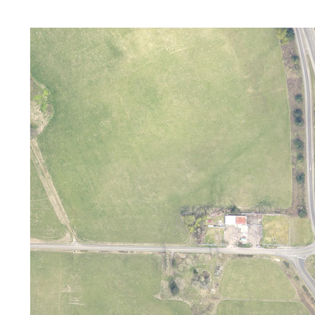
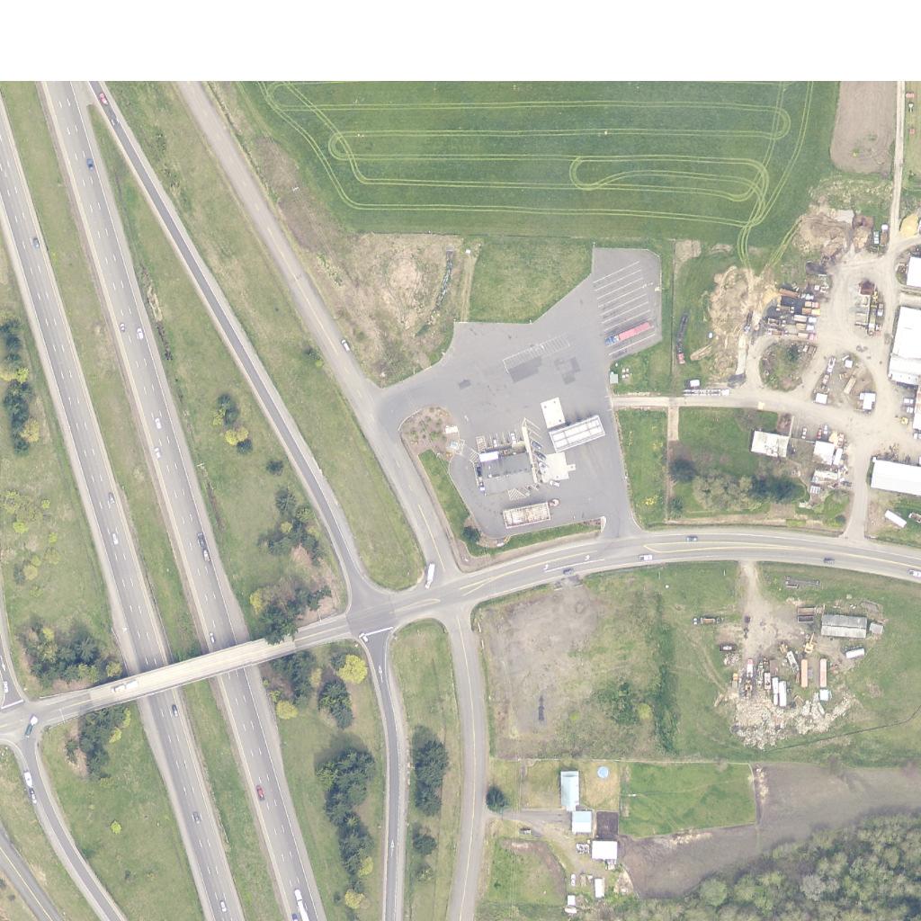
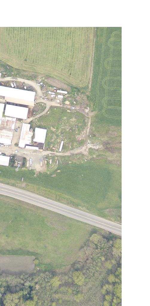
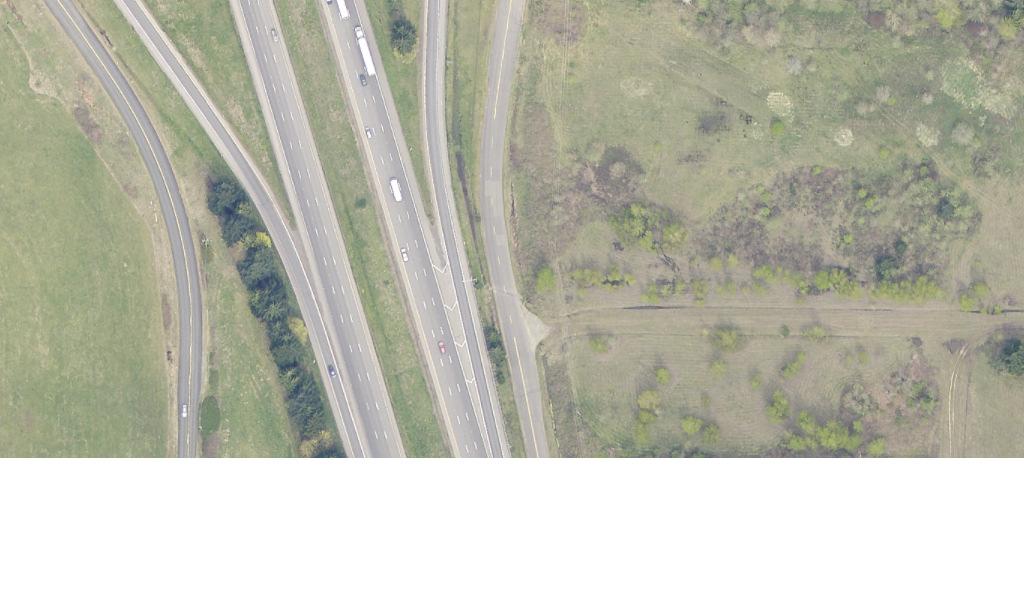
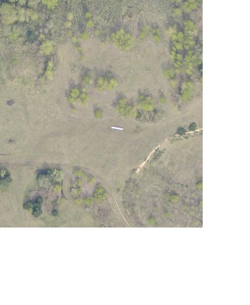
92
93 IJR Policy Points - Policy Point 3 Operational and Collision Analyses The reconstruction of the NW La Center Road/I-5 interchange will not have significant adverse impacts to the interstate or the adjacent affected local surface system, and will improve operations at the interchange and in the vicinity Kittelson & Associates, Inc.
94 IJR Policy Points - Policy Point 4 Access Connections and Design POLICY POINT 4 ACCESS CONNECTIONS AND DESIGN The NW La Center Road/I-5 Interchange Improvement Project involves a reconstruction of the overpass structure and substantial modification of the supporting interchange infrastructure. These improvements do not result in a change to the number of access points to I-5; however, some of the interchange ramps will be modified/lengthened to meet forecast traffic demand and current geometric criteria. In addition, portions of the supporting local roadway network will be modified to accommodate the interchange modifications and better address intersection spacing criteria at interchanges. For these reasons, the response to Policy Point 4 is divided into two sections. The first section addresses the anticipated interchange design and how the overall interchange modifications impact access and spacing criteria to the I-5 corridor. The second section addresses how the interchange modifications will impact access and spacing criteria to the supporting local roadway network both east and west of the interchange. The Project Design Criteria utilized for the interchange improvement are provided in Appendix GG. Interchange Design and Access Impacts to the I-5 Corridor An assessment of the existing interchange design and proposed modifications are detailed in the following sub-sections. Existing Interchange Design and Access All four interchange ramps are currently single-lane and tapered. The ramp curves, deceleration lengths, connection locations, and tapers are detailed in Table 4-1 and compared to WSDOT standards. Table 4-1 Existing Ramp Design Location Connection Location Taper Standard Northbound off-ramp :1 Meets standards? Curve Radius (ft) Accel/Decel Length (ft) Standard (ft) Meets standards? 20:1 Desirable 15:1 Minimum 1 Yes No Northbound on-ramp :1 50:1 3 Yes ,380 4 No Southbound off-ramp :1 20:1 Desirable 15:1 Minimum 1 Yes No Southbound on-ramp :1 50:1 3 Yes ,380 4 No Notes: Grey shading indicates failure to satisfy operating standards 1 Standard for single-lane, tapered off-connection 2 Decelerating from 80 mph to 40 mph 3 Standard for single-lane, tapered on-connection 4 Accelerating from 40 mph to 80 mph As seen in the table, none of the ramps currently meet standards for acceleration or deceleration length. While the northbound off-ramp and southbound off-ramp meet the minimum standard for taper rate, they do not meet the desirable taper rate. 4-1 Kittelson & Associates, Inc.
95 IJR Policy Points - Policy Point 4 Access Connections and Design Interchange Spacing WSDOT recommends considering the spacing between interchanges, intersections, and other points of access to avoid excessive interruption of mainline traffic (WSDOT Design Manual, Chapter 1360). The minimum spacing between adjacent interchanges is one mile (5,280 feet) in urban areas, measured along the freeway centerline between the gore noses of adjacent ramps. The nearest connection, not an interchange, to the south of the NW La Center Road/I-5 Interchange is the northbound on-ramp from the weigh station. The approximate spacing between this ramp and the northbound off ramp of the NW La Center Road/I-5 Interchange is approximately 4,800 feet (0.9 miles), which is approximately 500 feet short of the standard. The approximate spacing between the NW La Center Road/I-5 Interchange and Ridgefield interchange to the south is 11,500 feet (2.2 miles). The nearest connections to the north of the NW La Center Road/I-5 Interchange are the ramps to/from the Woodland interchange. The approximate spacing between these ramps and the northbound on/southbound off-ramps of the NW La Center Road/I-5 Interchange is about 20,000 feet (3.8 miles), which more than meets the one mile standard. Proposed Interchange Design and Access In order to meet forecast traffic demand and current geometric criteria, the NW La Center Road/I-5 interchange project will include the following major changes: Construction of a new overpass structure located immediately south of the existing structure that will accommodate four travel lanes (only two westbound lanes and one eastbound lane are needed for 2017) and pedestrian and bicycle facilities; Modification of the existing northbound and southbound interchange ramp terminals to include multiple lane roundabouts; Modification to the northbound on-ramp and southbound off-ramp to meet the acceleration and deceleration length requirements; A modified northbound off-ramp that is lengthened and widened to include a dual exit lane; A modified southbound on-ramp that includes two receiving lanes south of the ramp terminal that transition to a single lane prior to merging with I-5 mainline traffic; and A modified southbound off-ramp that has a single lane exit from I-5 that widens to provide two approach lanes at the ramp terminal. The proposed modifications are compared to applicable standards in Table Kittelson & Associates, Inc.
96 IJR Policy Points - Policy Point 4 Access Connections and Design Table 4-2 Proposed Ramp Design Location Connection Location Taper Standard Meets standards? Curve Radius (ft) Accel/Decel Length (ft)) Standard (ft) Meets standards? Northbound off-ramp :1 25:1 1 Yes 1, Yes Northbound on-ramp :1 50:1 3 Yes 1, Yes Southbound off-ramp :1 20:1 Desirable 15:1 Minimum 5 Yes Yes Southbound on-ramp :1 50:1 3 Yes 9,000 1, Yes Notes: 1 Standard for two-lane, tapered off-connection 2 Decelerating from 80 mph to 60 mph 3 Standard for single-lane, tapered on-connection 4 Accelerating from 60 mph to 80 mph 5 Standard for single-lane, tapered off-connection 6 Decelerating from 80 mph to 50 mph As seen in the table, the proposed modifications slightly modify the connection location of all four ramps and increase the deceleration length for the northbound off-ramp and southbound off-ramp and acceleration lengths for the northbound on-ramp and southbound on-ramp. With these changes, the proposed ramps meet WSDOT standards for taper rate and deceleration length. Interchange Spacing The proposed interchange design negligibly moves the connection locations of all four ramps, and therefore slightly modifies the spacing between the interchange and adjacent access points. As in existing conditions, with the proposed modifications, the interchange does not meet the one mile spacing standard to the south. The northbound off-ramp at the NW La Center Road/I-5 Interchange and northbound on-ramp at the weigh station are approximately 4,400 feet (0.8 miles) apart, which is less than the recommended one mile. As described in the section Weigh Station Considerations in Policy Point 3, a speed study was conducted to assess truck acceleration and speeds north of the weigh station. The results showed that trucks, on average, accelerate from 41 miles per hour at the merge point from the weigh station to 56 miles per hour when they are 3350 feet north of the merge from the weigh station and approximately 1300 feet south of the gore point for the northbound off-ram at NW La Center Road. Based on existing data provided by WSDOT (included in Appendix J), on average approximately seventy to one-hundred trucks access the weigh station during the peak hour. Given these conditions, the fact that the interchange does not meeting the one mile spacing standard to the south is deemed acceptable. Ramp Terminals As identified in the analysis conducted as part of Policy Points 2 and 3, roundabouts will be installed at the northbound and southbound ramp terminals and at the NW 319 th Street/NW 31 st Avenue intersection. The ramp terminals will be located in the approximate location of the existing ramp terminals, but shifted slightly south to accommodate the new overpass design. No design deviations are anticipated for the design of the ramp terminals. 4-3 Kittelson & Associates, Inc.
97 IJR Policy Points - Policy Point 4 Access Connections and Design Interchange Design and Access Impacts to the Local Road Network The NW La Center Road/I-5 Interchange project will include the following changes associated with the supporting local roadway network: Relocation of Paradise Park Road and the development of a new intersection with NW La Center Road. This new intersection would be located approximately 450 feet (centerline to centerline) east of the northbound roundabout terminal to comply with Washington State Department of Transportation (WSDOT) guidelines for intersection spacing of 350 or more feet. The new intersection will operate as a two-way stop-control intersection in the near-term and eventually need to be improved to accommodate future development (e.g. with the conversion to a traffic signal or roundabout ); Relocation of NW 319 th Street approximately 350 feet south of the existing alignment to accommodate the new overpass and provide an enhanced east-west circulation network that is more compatible with the Cowlitz Reservation Development; and Relocation of NW 31 st Avenue and the development of a new intersection with NW 319 th Street. This new intersection would be located approximately 600 feet west of the southbound roundabout terminal to address WSDOT intersection spacing guidelines. The new intersection will operate as a roundabout to accommodate near-term and future development. Figure 4-1 provides a conceptual sketch of the interchange form and frontage road alignment. Red arrows are used to indicate long-term parcel access. The roundabout control at the ramp terminals and frontage road intersections helps to facilitate access by accommodating U-turn movements. Frontage Roads The existing frontage road alignment does not meet WSDOT standards [i.e., NW 31 st Avenue is located less than 100 feet (centerline to centerline) west of the southbound ramp terminal, and NW Paradise Park Road is less than 150 feet (centerline to centerline) east of the northbound ramp terminal]. The proposed design includes realigning the frontage roads to exceed WSDOT standards. Figure 4-1 illustrates the functional layout of the improved frontage road network, as described above and summarized below: NW 31 st Avenue (frontage road west of I-5) will be located approximately 600 feet (centerline to centerline) west of the southbound ramp terminal; and NW Paradise Park Road (frontage road east of I-5) will be approximately 450 feet (centerline to centerline) east of the northbound ramp terminal. Deviations All of the above mentioned design elements will follow the applicable WSDOT Design Manual and City of La Center and Clark County design criteria. No design deviations are currently anticipated. 3-4 Kittelson & Associates, Inc.
98
The Folded Interchange: An Unconventional Design for the Reconstruction of Cloverleaf Interchanges
 The Folded Interchange: An Unconventional Design for the Reconstruction of Cloverleaf Interchanges I. ABSTRACT Keith A. Riniker, PE, PTOE This paper presents the Folded Interchange design and compares
I 75 PD&E STUDIES TABLE OF CONTENTS DTTM, TECHNICAL REPORT No. 2 TABLE OF CONTENTS
 TABLE OF CONTENTS DTTM, TECHNICAL REPORT No. 2 TABLE OF CONTENTS SECTION PAGE NO. SECTION TITLE NO. EXECUTIVE SUMMARY -------------------------------------------------------------------- ES-1 1.0 INTRODUCTION
FOR INTERSTATE 81 AND ROUTE 37 INTERCHANGE FREDERICK COUNTY, VIRGINIA MILEPOST 310
 INTERCHANGE MODIFICATION REPORT FOR INTERSTATE 81 AND ROUTE 37 INTERCHANGE FREDERICK COUNTY, VIRGINIA MILEPOST 310 PREPARED BY: VIRGINIA DEPARTMENT OF TRANSPORTATION STAUNTON DISTRICT DECEMBER 13, 2006
INTERCHANGE MODIFICATION REPORT
 INTERSTATE 75 AND STATE ROAD 884 (COLONIAL BOULEVARD) INTERCHANGE LEE COUNTY, FLORIDA INTERCHANGE MODIFICATION REPORT Prepared for: Florida Department of Transportation District One May 2017 Interchange
CHAPTER 5 PARALLEL PARKWAY CORRIDOR IMPROVEMENTS
 HPTER 5 PRLLEL PRKWY ORRIDOR IMPROVEMENTS nother key area within the Village West study area is the Parallel Parkway corridor. This chapter focuses on the segment of Parallel Parkway between 106 th Street
TRANSPORTATION PROJECT REPORT DRAFT CONCEPTUAL ACCESS MODIFICATION PROPOSAL OCTOBER 2002
 TRANSPORTATION INTERSTATE 87 INTERCHANGE 11A TOWN OF MALTA SARATOGA COUNTY, NY DRAFT CONCEPTUAL ACCESS MODIFICATION PROPOSAL OCTOBER 2002 PROJECT REPORT NEW YORK STATE DEPARTMENT OF TRANSPORTATION JOSEPH
APPENDIX B. Public Works and Development Engineering Services Division Guidelines for Traffic Impact Studies
 APPENDIX B Public Works and Development Engineering Services Division Guidelines for Traffic Impact Studies Revised December 7, 2010 via Resolution # 100991 Reformatted March 18, 2011 TABLE OF CONTENTS
FLORIDA DEPARTMENT OF TRANSPORTATION Planning and Environmental Management Office INTERCHANGE MODIFICATION REPORT
 FLORIDA DEPARTMENT OF TRANSPORTATION Planning and Environmental Management Office INTERCHANGE MODIFICATION REPORT District 2 1109 South Marion Avenue Lake City, FL 32025-5874 INTERSTATE 10 (SR 8) / SR
PROJECT STUDY REPORT. Cal Poly Pomona Senior Project
 06/2014 PROJECT STUDY REPORT (Cal Poly Pomona Senior Project) For Conceptual Approval of an Interchange Improvement And Cooperative Agreement with The City of Lake Elsinore for completion of Project Approval
DRAFT. SR-60 7 th Avenue Intersection Control Evaluation (ICE) I-605 Corridor Improvement Project (CIP) I-605/SR-60 EA# 3101U0
 I-605 Corridor Improvement Project (CIP) I-605/SR-60 EA# 3101U0") SR-60 7 th Avenue Intersection Control Evaluation (ICE) I-605/SR-60 EA# 3101U0 October 9, 2017 Contents 1 Purpose of ICE Memo... 1 2 Background... 1 3 Existing Interchange Deficiencies... 1 4 Context Sensitive
SR-60 7 th Avenue Intersection Control Evaluation (ICE) I-605/SR-60 EA# 3101U0 October 9, 2017 Contents 1 Purpose of ICE Memo... 1 2 Background... 1 3 Existing Interchange Deficiencies... 1 4 Context Sensitive
Summary. Preliminary Alternative Development and Screening. DEIS July 23, 2018
 What is the Carolina Crossroads Project? The South Carolina Department of Transportation (SCDOT), in cooperation with the Federal Highway Administration (FHWA), is proposing to upgrade and redesign a key
GUIDE FOR THE PREPARATION OF TRAFFIC IMPACT STUDIES
 GUIDE FOR THE PREPARATION OF TRAFFIC IMPACT STUDIES Adopted by Town Council on November 25, 2008 Prepared By: HNTB Engineering Department Planning Department TABLE OF CONTENTS I. INTRODUCTION... 1 II.
TRAFFIC STUDY GUIDELINES
 TRAFFIC STUDY GUIDELINES December 2013 The scope of the traffic impact analysis (TIA) should follow these guidelines and the requirements of VMC 11.80.130 and VMC 11.70, transportation concurrency (attached
MEMORANDUM. Date: July 14, 2006 Project #: To: US 97 & US 20 Refinement Plan Steering Committee
 MEMORANDUM Date: July 14, 2006 Project #: 6389 To: US 97 & US 20 Refinement Plan Steering Committee From: Sonia Hennum, P.E., Andrew Cibor, E.I.T., & Julia Kuhn, P.E. Project: US 97 & US 20 Refinement
TABLE OF CONTENTS TABLE OF CONTENTS... I APPENDICES... III LIST OF EXHIBITS... V LIST OF TABLES... VII LIST OF ABBREVIATED TERMS...
 Amendment No. 2 to Reclamation Plan 2006-01 Traffic Impact Analysis TABLE OF CONTENTS TABLE OF CONTENTS... I APPENDICES... III LIST OF EXHIBITS... V LIST OF TABLES... VII LIST OF ABBREVIATED TERMS... IX
On behalf of the Carolina Crossroads project team we thank you for taking the time to attend this meeting.
 On behalf of the Carolina Crossroads project team we thank you for taking the time to attend this meeting. Located in the heart of South Carolina, the I-20/26/126 Corridor is the crossroads of the state
WELCOME IL 47. Community Advisory Group Meeting #5 Waubonsee Community College Wednesday, May 31, 2017
 WELCOME IL 47 Community Advisory Group Meeting #5 Waubonsee Community College Wednesday, May 31, 2017 MEETING PURPOSE MEETING AGENDA 1. Welcome/Introduction 2. Review Previous Public Involvement 3. Process/Schedule
APPENDIX B. Excerpts from the October 2002 Conceptual Alternatives Report
 APPENDIX B Excerpts from the October 2002 Interstate 83 and PA Route 921 The objective for the SR 921 interchange site was to study alternatives for construction of a new interchange. There are no short-term
Appendix D: Functional Classification Criteria and Characteristics, and MnDOT Access Guidance
 APPENDICES Appendix D: Functional Classification Criteria and Characteristics, and MnDOT Access Guidance D.1 Functional classification identifies the role a highway or street plays in the transportation
Environmental Consequences and Mitigation
 Chapter 4 Environmental Consequences and Mitigation 4.1 Introduction This chapter provides a detailed description of the impacts (and indirect impacts where applicable) associated with the alternatives
Appendix D Functional Classification Criteria and Characteristics, and MnDOT Access Guidance
 Appendix D Functional Classification Criteria and Characteristics, and MnDOT Access Guidance Functional classification identifies the role a highway or street plays in the transportation system. Some highways
I 95 EXPRESS LANES SOUTHERN TERMINUS EXTENSION TRAFFIC OPERATIONS AND SAFETY ANALYSIS REPORT
 I 95 EXPRESS LANES SOUTHERN TERMINUS EXTENSION TRAFFIC OPERATIONS AND SAFETY ANALYSIS REPORT February 2016 INTERSTATE 95 EXPRESS LANES SOUTHERN TERMINUS EXTENSION PROJECT Commonwealth of Virginia Virginia
DIVISION I TRAFFIC IMPACT STUDY GUIDELINES ENGINEERING STANDARDS
 CITY OF ALBANY DEPARTMENT OF PUBLIC WORKS DIVISION I TRAFFIC IMPACT STUDY GUIDELINES ENGINEERING STANDARDS Prepared By PUBLIC WORKS DEPARTMENT ALBANY, OREGON 97321 Telephone: (541) 917-7676 TABLE OF CONTENTS
2017 TIGER DISCRETIONARY GRANT APPLICATION
 2017 TIGER DISCRETIONARY GRANT APPLICATION Spokane International Airport Spokane, WA APPENDIX D 2015 Airport Drive Couplet at Spotted Road Airport Drive Couplet at Spotted Road April 2015 Prepared for:
SECTION VII TRAFFIC IMPACT ANALYSIS GUIDELINES
 SECTION VII TRAFFIC IMPACT ANALYSIS GUIDELINES A. GENERAL Traffic Impact Analyses (TIAs) are tools that have historically been utilized to evaluate the interaction between existing transportation infrastructures
I-10 CORRIDOR IMPROVEMENTS STAGE 0 FEASIBILITY STUDY STATE PROJECT NUMBER H FEDERAL AID PROJECT NUMBER H004100
 JULY 2016 I-10 CORRIDOR IMPROVEMENTS STAGE 0 FEASIBILITY STUDY STATE PROJECT NUMBER H.004100 FEDERAL AID PROJECT NUMBER H004100 EAST BATON ROUGE AND WEST BATON ROUGE PARISHES, LOUISIANA Section TABLE OF
ALBION FLATS DEVELOPMENT EXISTING TRAFFIC CONDITIONS AND POTENTIAL IMPACTS
 EXISTING TRAFFIC CONDITIONS AND POTENTIAL IMPACTS FINAL REPORT SEPTEMBER 2010 TABLE OF CONTENTS 1.0 INTRODUCTION 1 2.0 EXISTING TRAFFIC CONDITIONS 2 3.0 FUTURE TRAFFIC CONDITIONS 3 4.0 POTENTIAL IMPACTS
FINAL PROJECT PRIORITIZATION PLAN FOR THE NM 599 CORRIDOR
 FINAL PROJECT PRIORITIZATION PLAN FOR THE NM 599 CORRIDOR PROJECT NO. WIP-599-1(102) CONTROL NO. D5SF2 APRIL 2010 Prepared for: New Mexico Department of Transportation Northern Design Bureau P.O. Box 1149
PROCEDURES FOR NEW OR REVISED FREEWAY ACCESS IN ARKANSAS
 PROCEDURES FOR NEW OR REVISED FREEWAY ACCESS IN ARKANSAS June 2011 PROCEDURES FOR NEW OR REVISED FREEWAY ACCESS IN ARKANSAS June 2011 Prepared by: Arkansas State Highway and Transportation Department
I-35/80 Operations Study: Douglas Avenue to NW 86 th Street FOR
 : Douglas Avenue to NW 86 th Street FOR Iowa Department of Transportation City of Urbandale City of Grimes February 7, 2013 FINAL Prepared by: HR Green, Inc. HR Green Project Number: 40110031 TABLE OF
LOCATION AND DESIGN DIVISION
 VIRGINIA DEPARTMENT OF TRANSPORTATION LOCATION AND DESIGN DIVISION INSTRUCTIONAL AND INFORMATIONAL MEMORANDUM GENERAL SUBJECT: Interstate, NHS Non-Interstate and Non-NHS (IJR / IMR Guidance) SPECIFIC SUBJECT:
Traffic Impact Analysis Guidelines. Town of Queen Creek
 Traffic Impact Analysis Guidelines Town of Queen Creek January 2016 1. INTRODUCTION The purpose of this document is to outline the procedures and requirements for preparing a Transportation Impact Analysis
DRAFT AIR QUALITY TECHNICAL MEMORANDUM
 AIR QUALITY TECHNICAL MEMORANDUM PROJECT DEVELOPMENT AND ENVIRONMENT STUDY STATE ROAD 60 GRADE SEPARATION OVER CSX RAILROAD Polk County, Florida Financial Project ID: 436559-1-22-01 Prepared for: Florida
TOWN OF MOORESVILLE TRANSPORTATION IMPACT ANALYSIS PROCEDURES MANUAL TOWN OF MOORESVILLE, NORTH CAROLINA
 TOWN OF MOORESVILLE TRANSPORTATION IMPACT ANALYSIS PROCEDURES MANUAL TOWN OF MOORESVILLE, NORTH CAROLINA Effective August 1, 2007 Amended March 4, 2013, December 1, 2014, May 1, 2017 TOWN OF MOORESVILLE,
South Dakota Department of Transportation. Interchange Modification Justification Report. Interstate 90 Exit 44 (Bethlehem Road - Piedmont)
") South Dakota Department of Transportation Interchange Modification Justification Report Interstate 90 Exit 44 (Bethlehem Road - Piedmont) February 28, 2014 Prepared By: SDDOT Office of Project Development
South Dakota Department of Transportation Interchange Modification Justification Report Interstate 90 Exit 44 (Bethlehem Road - Piedmont) February 28, 2014 Prepared By: SDDOT Office of Project Development
THE PROJECT. Executive Summary. City of Industry. City of Diamond Bar. 57/60 Confluence.
 THE PROJECT A freeway segment ranked 6th worst in the Nation, with levels of congestion, pollution and accidents that are simply unacceptable and which have Statewide and National implications. Executive
November 8, RE: Harrah s Station Square Casino Transportation Analysis Detailed Traffic Impact Study Review. Dear Mr. Rowe:
 November 8, 2006 Mr. Glenn Rowe, P.E. Pennsylvania Department of Transportation Bureau of Highway Safety and Traffic Engineering Commonwealth Keystone Building 400 North Street, 6 th Floor Harrisburg,
City of Menifee. Public Works Department. Traffic Impact Analysis Guidelines
 Public Works Department Traffic Impact Analysis Guidelines Revised: August 2015 TABLE OF CONTENTS INTRODUCTION... 3 PURPOSE... 3 EXEMPTIONS... 3 SCOPING... 4 METHODOLOGY... 5 STUDY AREA... 6 STUDY SCENARIOS...
MEMORANDUM: INITIAL CONCEPTS SUMMARY
 MEMORANDUM: INITIAL CONCEPTS SUMMARY INTRODUCTION This memo presents a summary of initial concepts that have been identified as development of the project study has progressed, along with a recommendations
Traffic Impact Study Guidelines. City of Guelph
 Traffic Impact Study Guidelines City of Guelph April 2016 Engineering and Capital Infrastructure Services Infrastructure, Development & Enterprise 1 Carden Street Guelph, Ontario Canada N1H 3A1 Page 1
Diverging Diamond Interchanges in Michigan
 2015 MDOT / ACEC Partnering Workshop Diverging Diamond Interchanges in Michigan Lori Swanson MDOT Oakland TSC John Katers OHM Advisors Chris Van Norwick MDOT Grand Region Rob Leppala TranSystems Topics
CITY OF VALLEJO PUBLIC WORKS DEPARTMENT TRAFFIC IMPACT Analysis/Study GUIDELINES
 The City Engineer, under the authority of the Public Works Director and recommendations from the Traffic Engineer, will make the final decision on the need for a traffic study. The purpose of the traffic
Transportation and Works Department The Regional Municipality of York Yonge Street Newmarket, Ontario L3Y 6Z1
 TRANSPORTATION IMPACT STUDY (TIS) GUIDELINES FOR DEVELOPMENT APPLICATIONS Transportation and Works Department The Regional Municipality of York 17250 Yonge Street Newmarket, Ontario L3Y 6Z1 August, 2007
US 14 EIS (New Ulm to N. Mankato) Interchange and Intersection Type Comparison
 Interchange and Intersection Type Comparison") T E C H N I C A L M E M O R A N D U M US 14 EIS (New Ulm to N. Mankato) Interchange and Intersection Type Comparison PREPARED FOR: Mn/DOT District 7 PREPARED BY: CH2M HILL DATE: March 27, 2007 This technical
T E C H N I C A L M E M O R A N D U M US 14 EIS (New Ulm to N. Mankato) Interchange and Intersection Type Comparison PREPARED FOR: Mn/DOT District 7 PREPARED BY: CH2M HILL DATE: March 27, 2007 This technical
2 Purpose and Need. 2.1 Study Area. I-81 Corridor Improvement Study Tier 1 Draft Environmental Impact Statement
 2 Purpose and Need 2.1 Study Area Interstate 81 (I-81) is relied upon for local and regional travel and interstate travel in the eastern United States. It extends 855 miles from Tennessee to New York at
Community Advisory Committee Meeting No. 2. June 22, 2006
 Community Advisory Committee Meeting No. 2 June 22, 2006 Introductions The Study Team KDOT Wichita Partners Consultants CAC members Overview Today s Agenda Opinion Survey Study Status Starting Concept
TRANSPORTATION IMPACT STUDIES
 January 28, 2009 POLICIES AND PROCEDURES FOR TRANSPORTATION IMPACT STUDIES Related to Highway Occupancy Permits Pennsylvania Department of Transportation Bureau of Highway Safety and Traffic Engineering
Executive Summary. How to Use this Document
 How to Use this Document In the Final Environmental Impact Statement (EIS) and this Executive Summary: Text from the Draft EIS that remains substantially unchanged, including minor edits such as correction
Vicinity Map. Interstate 605 (I-605) and State Route 91 (SR-91) in Los Angeles County
 and State Route 91 (SR-91) in Los Angeles County") 07 - LA - 605 - PM 2.87/PM 6.36 07 - LA - 91 - PM 14.10/PM 19.81 Vicinity Map N On Routes Interstate 605 (I-605) and State Route 91 (SR-91) in Los Angeles County I-605 between Excelsior Dr UC (PM 6.36)
07 - LA - 605 - PM 2.87/PM 6.36 07 - LA - 91 - PM 14.10/PM 19.81 Vicinity Map N On Routes Interstate 605 (I-605) and State Route 91 (SR-91) in Los Angeles County I-605 between Excelsior Dr UC (PM 6.36)
DDI s Can Move More Than Cars. Alex Ariniello. Presentation for the ITE Western District Annual Meeting. July, 2016 in Albuquerque, New Mexico
 DDI s Can Move More Than Cars Alex Ariniello Presentation for the ITE Western District Annual Meeting July, 2016 in Albuquerque, New Mexico In January, 2016, a Diverging Diamond Interchange (DDI) opened
FEDERAL HIGHWAY ADMINISTRATION RECORD OF DECISION FOR THE LYNNWOOD LINK EXTENSION
 FEDERAL HIGHWAY ADMINISTRATION RECORD OF DECISION FOR THE LYNNWOOD LINK EXTENSION AUGUST 2015 Table of Contents 1 Decision... 1 1.1 Project Description... 2 1.2 Basis for the FHWA Decision... 7 1.2.1
Exit 73 I-29 Interchange Modification Justification Study
 xit 73 I-29 Interchange Modification Justification tudy Introduction Figure 1 shows the location of xit 73. This interchange is proposed to be the connecting point of the ast and West Corridors to I-29.
US 26 / Glencoe Road Interchange Area Management Plan
 Volume 1 US 26 / Glencoe Road Interchange Area Management Plan North Plains, Oregon November 2008 Volume 1 US 26/Glencoe Road Interchange Area Management Plan North Plains, Oregon Prepared For: The Oregon
Military Highway Interchange
 III. Military Highway Interchange Deficiencies Design Challenges Proposed Alternatives III.1.2 Volumes & Operations Figure III.2: Existing Volumes displays the existing volumes for the Military Highway
6.0 CONGESTION HOT SPOT PROBLEM AND IMPROVEMENT TRAVEL DEMAND MODEL ANALYSIS
 6.0 CONGESTION HOT SPOT PROBLEM AND IMPROVEMENT TRAVEL DEMAND MODEL ANALYSIS 6.1 MODEL RUN SUMMARY NOTEBOOK The Model Run Summary Notebook (under separate cover) provides documentation of the multiple
Woodburn Interchange Project Transportation Technical Report
 Final Report Woodburn Interchange Project Transportation Technical Report Prepared for Oregon Department of Transportation April 212 Prepared by DKS Associates Contents Methodologies... 4 Volume Development...
CHAPTER 2 - TRAVEL DEMAND MODEL DEVELOPMENT
 CHAPTER 2 - TRAVEL DEMAND MODEL DEVELOPMENT 2.1 EXISTING TRAVEL DEMAND MODEL In order to accurately project future year traffic volumes within this regional study area, it was first necessary to construct
This IJR demonstrates that modified access to Blaine meets the FHWA policy points, specifically:
 Executive Summary Introduction This Interchange Justification Report (IJR) documents responses to the Federal Highway Administration s (FHWA) eight policies on interchange justification to support the
HALDIMAND COUNTY DESIGN CRITERIA SECTION T TRAFFIC IMPACT STUDY GUIDELINES
 HALDIMAND COUNTY DESIGN CRITERIA SECTION T TRAFFIC IMPACT STUDY GUIDELINES Revised 2015 TRAFFIC IMPACT STUDIES PAGE 1 T 1.00 T 1.01 INTRODUCTION TRAFFIC IMPACT STUDY One of Haldimand County s key objectives
Route 7 Connector Ramp MODIF IE D I N T ER C H A N G E M OD IFICATIO N R E PO RT TRA N S F O R M I : I N S ID E THE BE LTWAY
 STATE PROJECT NUMBER: 0066-96A-493,P101, C501, B686; UPC: 110629 FEDERAL PROJECT NUMBER: NHPP-066-1(356) FAIRFAX COUNTY, VIRGINIA TRA N S F O R M I - 6 6 : I N S ID E THE BE LTWAY Route 7 Connector Ramp
BCEO TRAFFIC IMPACT STUDY GUIDELINES
 BCEO TRAFFIC IMPACT STUDY GUIDELINES February 2006 TABLE OF CONTENTS INTRODUCTION..... i TRAFFIC IMPACT STUDY STRUCTURE... 1 WHEN IS A TRAFFIC IMPACT STUDY NEEDED?..... 1 STUDY AREA, SITE PLAN & HORIZON
Executive Summary. Study Background
 Executive Summary ES 1.1 Introduction The Capitol Region Council of Governments (CRCOG) and the Connecticut Department of Transportation (CTDOT) initiated the (BTS) in 2006 to identify near and long-term
SLATER ROAD /I-5 INTERCHANGE IMPROVEMENT PROJECT. Application for FASTLANE Funding PROJECT SUMMARY TABLE. Interchange Improvements NO
 SLATER ROAD /I-5 INTERCHANGE IMPROVEMENT PROJECT PROJECT SUMMARY TABLE Project Name Was a FASTLANE application for this project submitted previously? If yes, what was the name of the project in the previous
Appendix C - Highway 400 Widening and Interchange Evaluation Summary Tables
 Highway 400 Improvements from 1 km South of Highway 89 to the Junction of Highway 11 Appendix C - Highway 400 Widening and Interchange Tables Prepared for: Ontario Ministry of Transportation Four General
Functional Planning Study Highway 15:06 From Range Road 220 to Highway 830
 Functional Planning Study :06 December 2016 E00311A Executive Summary Strathcona County, as requirement of the roadside development permit from Alberta Transportation for the intersection upgrade of
MULTIMODAL TRANSPORTATION IMPACT STUDY GUIDELINES
 MULTIMODAL TRANSPORTATION IMPACT STUDY GUIDELINES 1 st Edition City of San Luis Obispo 2035 Circulation Element 1 Table of Contents Introduction... 2 Process... 2 When Impact Studies Are Required... 3
Informational Brochure. Proposed Interchange. Interstate Route 295 (I-295) AT Greenville Avenue (State Route 5) Town of Johnston, Rhode Island
 AT Greenville Avenue (State Route 5) Town of Johnston, Rhode Island") Informational Brochure Proposed Interchange OF Interstate Route 295 (I-295) AT Greenville Avenue (State Route 5) Town of Johnston, Rhode Island October 5, 2016 Department of Transportation Two Capitol
Informational Brochure Proposed Interchange OF Interstate Route 295 (I-295) AT Greenville Avenue (State Route 5) Town of Johnston, Rhode Island October 5, 2016 Department of Transportation Two Capitol
St. Francis Drive through the City of Santa Fe Corridor Study
 VIII. ENGINEERING AND ENVIRONMENTAL EVALUATION INTERSECTION IMPROVEMENTS SOUTHERN For the southern end of the corridor, traffic volumes are expected to increase over existing levels. The Phase A Report
South Dakota Interstate Corridor Study. Phase I Summary Report
 South Dakota Interstate Corridor Study Phase I Summary Report December 2000 Prepared for: South Dakota Department of Transportation 700 East Broadway Avenue Pierre, South Dakota 57501-2586 Prepared by:
CITY OF CLOVIS Traffic Impact Study Guidelines
 CITY OF CLOVIS Traffic Impact Study Guidelines CLOVIS, A WAY OF LIFE Approved August 25, 2014 City Council Resolution 2014-79 Prepared by City of Clovis Engineering Division Steve White, City Engineer
Interchange Workshop Report (August 2004)
") U.S. Highway 14 Corridor Study New Ulm to North Mankato Table of Contents Section Interchange Workshop Report (August 2004) Page 1. Introduction and Next Steps 1 2. Interchange Workshop Participants &
U.S. Highway 14 Corridor Study New Ulm to North Mankato Table of Contents Section Interchange Workshop Report (August 2004) Page 1. Introduction and Next Steps 1 2. Interchange Workshop Participants &
CHAPTER 4 GRADE SEPARATIONS AND INTERCHANGES
 CHAPTER 4 GRADE SEPARATIONS AND INTERCHANGES 4.0 INTRODUCTION The ability to accommodate high volumes of intersecting traffic safely and efficiently through the arrangement of one or more interconnecting
Rivers Edge Alternative Urban Areawide Review (AUAR) Traffic Study
 Traffic Study") Appendix F Rivers Edge Alternative Urban Areawide Review (AUAR) Traffic Study Prepared by Westwood Professional Services, Inc. for City of St. Paul Park Grey Cloud Island Township October 14, 2003 Introduction
Appendix F Rivers Edge Alternative Urban Areawide Review (AUAR) Traffic Study Prepared by Westwood Professional Services, Inc. for City of St. Paul Park Grey Cloud Island Township October 14, 2003 Introduction
The New Highway Capacity Manual 6 th Edition It s Not Your Father s HCM
 The New Highway Capacity Manual 6 th Edition It s Not Your Father s HCM Tom Creasey, PE, PhD Principal, Stantec Consulting Services Inc. Chair, TRB Highway Capacity and Quality of Service Committee Presented
BILLINGS BYPASS UPDATE
 July 18, 2018 BILLINGS BYPASS UPDATE TEDD Steering Committee Monthly Meeting Project Update EIS and ROD Documents through Current Design Preliminary Design Completed preliminary design for full-build
CLA /10.54, PID Project Description:
 Project Description: The proposed project will consist of widening IR 70 to three lanes from Enon Road (SLM 06.75) to the US 68 interchange ramps (SLM 10.55). IR 70 is a component of the Strategic Highway
Interchange Improvements at the Queen Elizabeth Way and Glendale Avenue
 Welcome to the Public Information Centre for the Interchange Improvements at the Queen Elizabeth Way and Glendale Avenue Class Environmental Assessment and Preliminary Design Study G.W.P. 2423-15-00 http://qew-glendale-interchange.ca
Alternatives Evaluation Report. Appendix C. Alternatives Evaluation Report
 s Evaluation Report Appendix C s Evaluation Report I-35W North Corridor Project EA Minnesota Department of Transportation Final Project s Report I-35W North Corridor Preliminary Design Project Report Version
A three-stage process was implemented in order to develop and evaluate the project concepts and provide recommendations for the project.
 MEMORANDUM TO: FROM: Highway 36/Rice Street PMT Mark Benson DATE: March 23, 2009 RE: Selection of a Preferred Alternative SEH No. 105803 The purpose of this memorandum is to document the process for selecting
NCHRP 3-88 Guidelines for Ramp and Interchange Spacing
 Session 312 Updates on NCHRP-Funded Geometric Design Research Projects NCHRP 3-88 Guidelines for Ramp and Interchange Spacing Brian L. Ray, PE Kittelson & Associates, Inc Portland, Oregon bray@ kittelson.com
EXHIBIT A SCOPE OF SERVICES INTERCHANGE JUSTIFICATION REPORT (IJR) FOR INTERSTATE 75 AT OVERPASS ROAD
 FOR INTERSTATE 75 AT OVERPASS ROAD") Scope of Services 12/08/2008 EXHIBIT A SCOPE OF SERVICES INTERCHANGE JUSTIFICATION REPORT (IJR) FOR INTERSTATE 75 AT OVERPASS ROAD TABLE OF CONTENTS Section Pace I. 0 PROJECT DESCRIPTION........................,............................................................
Scope of Services 12/08/2008 EXHIBIT A SCOPE OF SERVICES INTERCHANGE JUSTIFICATION REPORT (IJR) FOR INTERSTATE 75 AT OVERPASS ROAD TABLE OF CONTENTS Section Pace I. 0 PROJECT DESCRIPTION........................,............................................................
Article 16 Traffic Impact Analysis
 Article 16 Traffic Impact Analysis Table of Contents... 16-1 Chapter 16.1 Purpose and Intent... 16-2 Chapter 16.2 Applicability... 16-2 Chapter 16.3 Exemptions... 16-2 Chapter 16.4 Trip Generation Data...
Conceptual Design Report
 Conceptual Design Report I-244/Arkansas River Multimodal Bridge Tulsa, Oklahoma Prepared for the Oklahoma Department of Transportation Prepared by: August 2009 I-244 / ARKANSAS RIVER MULTIMODAL BRIDGE
9.0 I-26 & I-526 Interchange Improvements
 9.0 I-26 & I-526 Interchange Improvements The I-26 & I-526 System-to-System interchange currently consists of a combination of directional and loop ramps providing for all movements from one Interstate
Final Air Quality Report
 Florida Department of TRANSPORTATION Final Air Quality Report PD&E Study From East of Babcock Street (SR 507) to US 1 Brevard County, Florida Financial Project ID: 430136-1-22-01 ETDM Project Number: 13026
500 Interchange Design
 500 Interchange Design Table of Contents 501 Interchange Design... 1 501.1 General... 1 501.2 Interchange Type... 1 501.2.1 General... 1 502 Interchange Design Considerations... 2 502.1 Determination of
Highway Construction Program
 Highway Construction Program Monthly Delivery Progress Report Watch List February 2017 This report focuses on Capital Highway Program projects, which have, or may have significant changes in scope, schedule,
Conclusions & Lessons Learned
 What is a DDI Recommended Practices Traffic Operations Analysis Geometric Design FHWA Review Conclusions & Lessons Learned It s not about you, it s about the public Developed by Access Utah County
500 Interchange Design
 500 Interchange Design Table of Contents 501 Interchange Design... 5-1 July 2015 501.1 General... 5-1 501.2 Interchange Type... 5-1 501.2.1 General... 5-1 502 Interchange Design Considerations... 5-2 502.1
Existing vs. Proposed Ramp Noise Sensitivity Analysis Austin Boulevard Interchange
 I-290 Phase I Study West of US 45 (Mannheim Road) to Racine Avenue Existing vs. Proposed Ramp Noise Sensitivity Analysis Austin Boulevard Interchange Technical Memorandum Prepared By: Huff & Huff, Inc.
Traffic Impact Study Requirements
 [TYPE THE COMPANY NAME] Traffic Impact Study Requirements County of San Mateo Department of Public Works Roadway Services 9/1/2013 I. Introduction The County of San Mateo (County), Department of Public
Air Quality Analysis Technical Memorandum
 Air Quality Analysis Technical Memorandum Segment 2: State Road 400 (SR 400) / Interstate 4 (I-4) from West of SR 528 (Beachline Expressway) to West of SR 435 (Kirkman Road) Orange County (75280), Florida
Goleta Ramp Metering Study
 DRAFT Technical Memorandum Goleta Ramp Metering Study Subtasks 2.1 and 2.2: Data Collection and Existing Baseline Analysis June 5, 2017 DRAFT Technical Memorandum Goleta Ramp Metering Study Subtasks 2.1
VIII. LAND USE ISSUES
 VIII. LAND USE ISSUES The & Route 57 Land Use and Circulation Study (Land Use Study, Figure 6) was completed for the Town of Clay in November 1999 (Clough, Harbour & Associates). This study investigated
Dated: January 2015 TRANSPORTATION IMPACT STUDY GUIDELINES
 Dated: January 2015 TRANSPORTATION IMPACT STUDY GUIDELINES TABLE OF CONTENTS 1.0 Introduction.. 2 1.1 Transportation Impact Study...... 2 1.2 Need and Justification... 2 1.3 Purpose of Guidelines... 2
5/11/2016 SR 15 SECTION 088 CSVT SOUTHERN SECTION SR 15 SECTION 088 CSVT SOUTHERN SECTION AGENDA
 PUBLIC OFFICIALS MEETING MAY 11, 2016 AGENDA I. INTRODUCTIONS V. CURRENT PROJECT STATUS VI. PROJECT SCHEDULE VII. UPCOMING ACTIVITIES VOPEN DISCUSSION & QUESTIONS IX. ACTION ITEMS 1 A. Bridge Lighting
CHAPTER 2: MODELING METHODOLOGY
 CHAPTER 2: MODELING METHODOLOGY 2.1 PROCESS OVERVIEW The methodology used to forecast future conditions consisted of traditional traffic engineering practices and tools with enhancements to more accurately
Project Prioritization for Urban and Rural Projects TEAM CONFERENCE March 7, 2018
 Project Prioritization for Urban and Rural Projects 2018 TEAM CONFERENCE March 7, 2018 Challenge Limited funding for transportation improvements requires strategic selection of projects to ensure resource
LOCATION AND DESIGN DIVISION
 VIRGINIA DEPARTMENT OF TRANSPORTATION LOCATION AND DESIGN DIVISION INSTRUCTIONAL AND INFORMATIONAL MEMORANDUM GENERAL SUBJECT: Design Exceptions / Waivers SPECIFIC SUBJECT: Design Exception Request Form
NCHRP Report 687 Guidelines for Ramp and Interchange Spacing
 Updates on NCHRP-Funded Geometric Design Research Projects NCHRP Report 687 Guidelines for Ramp and Interchange Spacing Brian L. Ray, PE Kittelson & Associates, Inc Portland, Oregon bray@ kittelson.com