I-35/80 Operations Study: Douglas Avenue to NW 86 th Street FOR
|
|
|
- Ira Jenkins
- 5 years ago
- Views:
Transcription
1 : Douglas Avenue to NW 86 th Street FOR Iowa Department of Transportation City of Urbandale City of Grimes February 7, 2013 FINAL Prepared by: HR Green, Inc. HR Green Project Number:
2
3 TABLE OF CONTENTS I. EXECUTIVE SUMMARY... I-1 A. Introduction... I-1 B. Summary of Alternatives Studied... I-1 C. Alternative Evaluation Summary... I-2 D. Conclusions Summary... I-4 II. INTRODUCTION AND BACKGROUND... II-1 A. Study Purpose... II-1 B. Project Study Area... II-1 C. Existing Traffic Patterns... II-4 D. Crash History Review... II-6 E. Overview of Planned Infrastructure Improvements... II-6 F. Project Study Area Environmental Overview... II-8 G. Project Purpose and Need Summary... II-8 III. ALTERNATIVE DEVELOPMENT AND ANALYSIS... III-1 A. Description of Alternatives... III-1 B. Development of Traffic Forecasts... III-2 C. Analysis of Alternatives... III-2 IV. ALTERNATIVE SCREENING REVIEW... IV-1 A. Operations Analysis Summary... IV-1 B. Supplemental Analysis... IV-5 C. Policy Point 1 Overview... IV-14 V. CONCLUSIONS AND COST... V-1 A. Conclusions... V-1 B. Planning Level Cost Opinions... V-2 VI. APPENDIX A: CRASH HISTORY REVIEW MEMORANDUM... VI-1 VII. APPENDIX B: ENVIRONMENTAL OVERVIEW MEMORANDUM... VII-1 VIII. APPENDIX C: DRAFT PROJECT PURPOSE AND NEED STATEMENT... VIII-1 IX. APPENDIX D: TRAFFIC FORECASTS TECHNICAL MEMORANDUM... IX-1 X. APPENDIX E: CAPACITY ANALYSIS RESULTS EXHIBITS (UNDER SEPARATE COVER)... X-1 XI. APPENDIX F: CONCEPTUAL GUIDE SIGNING PLAN (UNDER SEPARATE COVER). XI-1 XII. APPENDIX G: MEREDITH DRIVE BRIDGE CROSS SECTION... XII-1 ii
4 LIST OF TABLES Table I-1: Alternative Description Matrix... I-1 Table III-1: Alternative Description Matrix... III-1 Table III-2: Freeway Operations Level-of-Service Thresholds... III-3 Table III-3: Intersection Operations Level-of-Service Thresholds... III-3 Table IV-1: Urbandale Dr./Meredith Dr. Supplemental Analysis... IV-5 Table IV-2: Meredith Ramp Intersection Supplemental Analysis... IV-6 Table IV-3: IA 141 Supplemental Analysis... IV-7 Table IV-4: IA 141 EB Merge with Braided Ramps... IV-10 Table V-1: Planning Level Cost Opinions... V-2 LIST OF FIGURES Figure II-1: Study Area Map... II-3 Figure II-2: Existing Daily Traffic Patterns... II-5 Figure II-3: Planned Projects Identified in 2035 LRTP... II-7 Figure III-1: 2015 Mainline Capacity Analysis Summary of Alternatives... III-5 Figure III-2: 2015 Intersection Capacity Analysis Summary of Alternatives... III-6 Figure III-3: 2035 Mainline Capacity Analysis Summary of Alternatives... III-7 Figure III-4: 2035 Intersection Capacity Analysis Summary of Alternatives... III-8 Figure III-5: Alternative 1 and Alternative 2 Existing Roadway Network... III-10 Figure III-6: Alternative 4 Roadway Network... III-12 Figure III-7: Alternative 5 Roadway Network... III-14 Figure III-8: Alternative 9 Roadway Network... III-18 Figure III-9: Alternative 3 Roadway Network... III-20 Figure III-10: Alternative 6 Roadway Network... III-24 Figure III-11: Alternative 6B Roadway Network... III-28 Figure III-12: Alternative 7 Roadway Network... III-32 Figure III-13: Alternative 8 Roadway Network... III-36 Figure III-14: Alternative 10 Roadway Network... III-40 Figure IV-1: Grade-Separate C/D Road Concept... IV-4 Figure IV-2: Spatial Distance Analysis NB/EB Dual Lane On-Ramp - Concept 1... IV-9 Figure IV-3: Spatial Distance Analysis NB/EB Dual Lane On-Ramp Concept 2... IV-9 Figure IV-4: Spatial Distance Analysis NB/EB Dual Lane On-Ramp Concept 3... IV-10 Figure IV-5: Spatial Distance Analysis SB/WB Dual Lane On-Ramp Concept 1... IV-12 Figure IV-6: Spatial Distance Analysis SB/WB Dual Lane On-Ramp Concept 2... IV-13 iii
5 I. EXECUTIVE SUMMARY A. Introduction The purpose of this project is to study the traffic operations, safety, and access issues surrounding the I-35/I-80/IA 141 interchange area to determine feasible alternative(s) that could be carried forward in a future National Environmental Policy Act (NEPA) and Interchange Justification Report (IJR) documents. The study area includes I-35/80 from Douglas Avenue on the south/west to NW 86 th Street on the north/east. It also includes Iowa Highway 141 (IA 141) from NW 54 th Avenue on the north, through the I-35/80 interchange transitioning to NW Urbandale Drive, and south to Meredith Drive. Other prominent corridors within this study include Meredith Drive, the proposed NW 50 th Avenue connection between IA 141 and NW 128 th Street, and the proposed NW 100 th Street improvements and interchange with I-35/80. B. Summary of Alternatives Studied ANALYSIS YEAR This study analyzed several alternatives under varying projected traffic loadings. The table below summarizes the components included in each alternative and whether the alternative was analyzed under 2015 or 2035 projected traffic loadings. Alternative 2 represents the current 2015 planned projects in the DMAMPO LRTP and was used as the baseline to which 2015 Alternatives 4,5, and 9 were compared. Likewise, Alternative 3 represents the current 2035 planned projects in the DMAMPO LRTP and was used as the baseline to which 2035 Alternatives 6, 6B, 7, 8, and 10 were compared. Existing ALTERNATIVE # Table I-1: Alternative Description Matrix ALTERNATIVE INCLUDES: REMOVAL REMOVAL MEREDITH OF SB/WB OF NB/EB RAMPS LOOP LOOP ON RAMP OFF RAMP NB FLYOVER RAMP As shown in Table I-1, key components of the alternatives included: NB Flyover Ramp a proposed flyover connection exiting NB/EB I-35/80 just north of the existing Meredith Drive overpass and traveling over I-35/80, merging with the IA 141 northbound lanes. Meredith Ramps a proposed exit ramp from NB/EB I-35/80 to Meredith Drive and a proposed entrance ramp from Meredith Drive to SB/WB I-1 100TH STREET INTERCHANGE C/D ROAD SYSTEM 50TH AVE CONNECTION 2 4 X X X X 5 X X X X X 9 X 3 X X 6 X X X X X 6B X X X X X X 7 X X X X X X 8 X X X X X X X 10 X X X
6 I-35/80. When included in an alternative, these ramps take the place of and coincide with the removal of the existing loop ramps at the I-35/80/IA 141 interchange. Removal of SB/WB Loop On-Ramp the existing loop entrance ramp from NB IA 141 to SB/WB I-35/80. Removal of NB/EB Loop Off-Ramp the existing loop exit ramp from NB/EB I-35/80 to IA 141/NW Urbandale Drive. 100 th Street Interchange a proposed interchange with I-35/80 at NW 100 th Street. This project is listed in the current Des Moines Area MPO (DMAMPO) Long Range Transportation Plan (LRTP). C/D Road System a proposed collector/distributer road system linking the proposed Meredith Drive ramps with the IA 141 ramps. The studied C/D system features at-grade connections with traffic signals at the crossing roadways. However, this C/D road system could be extended to include other adjacent interchanges, feature grade-separated crossings of the arterial system, and include braided ramps for high weaving volumes between adjacent interchanges. 50 th Avenue Connection a proposed connection between IA 141 and NW 128 th Street. This project is listed in the current DMAMPO LRTP. The connection to IA 141 is proposed to intercept the corridor at the SB/WB I-35/80 ramp terminal intersection with IA 141 creating a four-legged intersection. The DMAMPO provided travel demand modeling assistance to model each of the alternatives and 2035 AM and PM peak hour traffic projections were developed for each of the alternatives based on the average daily traffic (ADT) identified from the travel demand model output. C. Alternative Evaluation Summary A capacity analysis of the alternatives was completed using 2010 Highway Capacity Software (HCS2010) to analyze I-35/80 mainline basic freeway, merge, diverge, and weave segments and Synchro (Version 7) to analyze non-interstate local roadways. Results from Synchro were obtained from the programs HCS reporting function. The analysis of the various alternatives did not identify a single alternative as one that would improve the capacity issues of the entire study area to the extent needed to meet or exceed the Iowa DOT Level-of-Service (LOS) criteria. In general, capacity constraints associated with freeway segments identified from the no-build analysis (Alternative 2 and 3) were also experienced by many of the alternatives. This indicates the I-35/80 corridor is and will likely remain a congested corridor even with the addition of a fourth lane in each direction as contained in the 2035 LRTP. The analysis then focused on the common components of the various alternatives and identified their relative impact. 1. NB Fly-Over Ramp The NB fly-over ramp was common component to all the alternatives analyzed. This proposed improvement provides a free-flowing condition to a high-volume movement resulting in operational benefits at the I-35/80 and IA 141 interchange that eliminates the primary operational concern within the interchange. Completing this improvement as a stand-alone project (i.e., leaving the existing loop ramps in place at the IA 141 interchange and not adding the proposed Meredith Drive ramps) creates a two successive-exit scenario. The AASHTO Green Book suggests that I-2
7 operational benefits may be attained by providing interchange configurations with a single exit design. Providing a single exit at an interchange can improve operations by simplifying signing, simplifying the driver s decision process and by satisfying driver expectancy by placing the exit in advance of the separation structure. 2. Meredith Drive Ramps With the proposed NB fly-over ramp and the subsequent removal of the existing loop ramps at the IA 141 interchange, the Meredith Drive ramps are needed to maintain a fully directional interchange, considering the Meredith ramps and IA 141 ramps working together to provide all directional movements. Supplemental access to a growing commercial and residential area west of the study area is also provided by the Meredith ramps. Depending on the alternative, connection from Meredith Drive is accomplished through the existing local roadway system (Meredith Drive and NW Urbandale Drive) or through the proposed C/D road system. Mainline operational impacts to I-35/80 were minimal as the analysis showed no degradation in LOS from the no-build scenario. With alternatives that include the C/D road system, additional improvements to Meredith Drive may be necessary including widening the corridor to a six-lane section with turn lanes. 3. NW 50 th Avenue The inclusion of the NW 50 th Avenue connection between the SB/WB I-35/80 ramp terminal intersection with IA 141 and NW 128 th Street resulted in traffic operations that did not satisfy the LOS C goals for ramp terminal intersections for all alternatives with the NW 50 th Avenue connection. With this direct connection to the existing Interstate exit ramp terminal intersection, NW 50 th Avenue is projected to carry approximately 24,000 vehicles per day, feeding the growing commercial and residential area to the west. This connection focuses added traffic to an already congested area which has direct connectivity to, and effects on, Interstate operations. The NW 50 th Avenue corridor connection was further studied with the inclusion of a direct ramp connection between NW 50 th Avenue and the SB/WB I-35/80 on-ramp from SB IA 141. With the ramp connection, eastbound motorists would not need to travel through the SB/WB I-35/80 terminal intersection to use the existing loop onramp to SB/WB I-35/80. The inclusion of this ramp connection was thought to provide operational benefits to the IA 141 / NW 50 th Avenue / SB/WB I-35/80 ramp terminal intersection. However, the potential benefit increased the volume of traffic on the southbound ramp to IA 141, decreasing the Level-of-Service for the merge area. This, in effect, has shifted an operational concern from the local system to mainline I-35/80. For these reasons, the direct connection from NW 50 th Avenue to the southbound IA 141 ramp to I-35/80 is not recommended. 4. C/D Road System The alternatives which included the proposed C/D road provided the benefit of a direct connection between IA 141 and Meredith Drive. However, the analysis found with the proposed at-grade intersections at Meredith Drive and IA 141 that additional infrastructure improvements would likely be necessary. Meredith Drive will likely need widened to a six-lane facility plus turn lanes to achieve acceptable LOS. The at-grade C/D road alternatives also create concerns for the existing railroad spur line that runs along the west side of IA 141 through the interchange. The railroad spur line is active and will not likely be closed within the foreseeable future. I-3
8 Additionally, the concentration of traffic on the C/D road places additional demand on the merge/diverge operations with the Interstate requiring additional infrastructure to provide adequate merge/diverge operations while integrating with operations of adjacent interchanges. Although not analyzed by this study, an additional concept has been developed which provides a grade-separated C/D road system running adjacent to the I-35/80 corridor to both address the merge/diverge operations and aid in mitigating the base mainline operational constraints. D. Conclusions Summary The IA 141 interchange is reaching capacity today; under 2035 traffic levels, backups from the NB/EB I-35/80 loop off-ramp along with poor operations of the programmed NW 50th Avenue/IA 141 intersection impact interstate operations. High NB/EB I-35/80 to IA 141 traffic movements degrades operations of traffic signals at the I-35/80 and NW Urbandale Drive termini intersections. Introduction of the NB flyover significantly improves the 141 interchange operations in the near term by eliminating the high NB/EB I-35/80 to IA 141 traffic movement from the interchange. However, in 2035 the operations of the NW 50th Avenue intersection degrade to a point that Interstate operations are adversely impacted. The addition of the Meredith Drive ramps and elimination of NW 50th Avenue provides better overall operations and eliminates the SB/WB I-35/80 off-ramp to IA 141 queuing concerns associated with NW 50th Avenue alternatives. Connectivity between Meredith Drive and IA 141 can be provided via Meredith Drive and NW Urbandale Drive. The intersection of Meredith Drive and NW Urbandale Drive performs poorly regardless of the alternative studied. In the PM peak hour, the intersection failed in all of the studied 2035 alternatives under existing geometric conditions. Additional capacity tests of this intersection showed that adding dual left-turn and single right-turn lanes to all approaches significantly improved the performance for most alternatives. The Meredith Drive ramps increase traffic on Meredith Drive west of the Interstate; however, operations remain acceptable. The model included existing geometric infrastructure as no additional projects are planned for this corridor as part of the DMAMPO LRTP. Alternatives with both NW 50 th Avenue and Meredith Drive ramps reduced some demand on Meredith Drive, but not to a level that would warrant the negative impacts associated with the SB/WB I-35/80 off-ramp queues to IA 141. Therefore, if the Meredith Drive ramps were implemented, the NW 50 th Avenue connection from the IA 141 interchange to NW 128 th Street as currently planned would not be desirable. More direct connectivity between Meredith Drive and IA 141 via at-grade C/D roads creates operational concerns at the eastern quadrant Interstate merge/diverge points due to high traffic volumes on the C/D. The addition of the C/D roads would also require expansion of Meredith Drive bridge to allow for necessary dual EB left-turn lanes onto the NB C/D road and a possible three-through lanes in each direction; this modification would result in an 8-lane cross section. Operations impacts of rail spur line needs further study, but is an element that could negatively impact interchange operations. Therefore, long-term solutions with regards to a grade separated C/D system needs further study. I-4
9 The only option that would support a NW 50 th Avenue connection is the right-in/right-out configuration associated with a connection to the one-way SB C/D roadway. This connection would be driven more by local connectivity desires than overall roadway network operations. Basic capacity constraints exist on the Interstate, both in current conditions and in 2035 with additional through lanes. The current 2035 LRTP concept includes an 8-lane Interstate system, with LOS E basic capacity operations north of Douglas Avenue (no Meredith ramps) and LOS D and F weaving conditions between IA 141 and 100th Street. Introduction of the NB flyover and Meredith Drive ramps, with implementation of auxiliary lanes between IA 141 and Douglas Avenue, maintains the base 2035 LRTP operating conditions while eliminating the queuing concerns associated with the IA 141 interchange. This report recommends the initiation of the formal IJR and NEPA process to add the NB flyover, add Meredith Drive ramps and add I-35/80 auxiliary lanes (both directions) between IA 141 and Douglas Avenue. At-Grade C/D connections are not recommended. However, the IJR Study should address resolving the less than desirable mainline levels of service by further analysis of a grade separated C/D system and potential braided ramps at key locations to resolve poor weaving levels of service and provide expandability for longer-term mobility needs. The NW 50 th Avenue connection to IA 141 should be considered for elimination from the MPO LRTP. I-5
10 II. INTRODUCTION AND BACKGROUND A. Study Purpose The purpose of this project is to study the traffic operations, safety, and access issues surrounding the I-35/I-80/IA 141 interchange area to determine feasible alternative(s) that could be carried forward in a future National Environmental Policy Act (NEPA) and Interchange Justification Report (IJR) documents. This report will: Review historical crash records to identify safety concerns of the current interchange, Review existing and forecasted traffic volumes for the interchange, Describe and provide a traffic operational analysis comparison of the alternatives studied, Identify issues/concerns associated with the alternatives needing further study, Provide planning level opinions of probable cost for various components of the alternative likely to be carried forward for further study. Additionally, this study process has also accomplished the following functions: Completed an environmental overview of the project study area, Completed a review of the project purpose and need which will be needed for future NEPA documentation, Completed an initial, high level review of Policy Point 1 as described in Federal Register, dated August 27, 2009 (Volume 74, Number 165). B. Project Study Area The study area includes I-35/80 from Douglas Avenue on the south/west to NW 86 th Street on the north/east. Key corridors within the project study area include: I-35/80 Urban Interstate corridor with posted speed limit of 65 MPH. Currently exists as a 6-lane facility (3-lanes in each direction). Interchanges with crossroad exist at Douglas Avenue, IA 141/NW Urbandale Drive, and NW 86 th Street. Douglas Avenue Urban divided 4-lane facility with posted speed limit of 35 MPH. Dedicated left and right-turn lanes are provided at major intersections. Interchange with I-35/80 exists as a partial cloverleaf configuration with entrance loops to the Interstate provided for the eastbound to northbound and westbound to southbound movements. East of I-35/80, Douglas Avenue is listed as Other Principle Arterial on the federal functional classification map. West of I-35/80, it is shown as Minor Arterial. Meredith Drive - Urban divided 4-lane facility with posted speed limit of 35 MPH. Dedicated left and right-turn lanes are provided at major intersections. Access to I-35/80 is not currently provided. Meredith Drive is listed as Minor Arterial on the federal functional classification map. Iowa Highway 141 (IA 141)/NW Urbandale Drive IA 141 intersects the I-35/80 corridor at an area locally referred to as Rider Corner. At this location, I-35/80 II-1
11 bends from a north/south alignment to an east/west alignment. The existing interchange is a modified folded-diamond configuration with northbound exit loop from I-35/80 and an entrance loop to southbound I-35/80. A directional entrance ramp is also provided for southbound IA 141 to southbound I-35/80. North of the interchange, IA 141 is listed on the federal functional classification map as Other Principle Arterial and provides access to the Cities of Grimes, Johnston, and points north. It has a posted speed limit of 45 MPH within the study area and transitions to 65 MPH further north. South of the interchange, NW Urbandale Drive provides access to the City of Urbandale, is listed as Minor Arterial on the federal functional classification map, and has a posted speed limit of 35 MPH. NW 100 th Street North of I-35/80, NW 100 th Street currently exists as a rural 2- lane facility with a posted speed limit of 35 MPH. South of I-35/80, NW 100 th Street has been widened to an urban 4-lane facility, transitioning back to an urban 2-lane facility south of the Plum Drive intersection. NW 100 th Street is listed as Collector on the federal functional classification map. Access to I-35/80 is currently not provided. NW 86 th Street - Urban divided 4-lane facility with posted speed limit of 35 MPH. Dedicated left and right-turn lanes are provided at major intersections. Interchange with I-35/80 exists as a partial cloverleaf configuration with entrance loops to the Interstate provided for the northbound to westbound and southbound to eastbound movements. South of I-35/80, NW 86 th Street is listed as Other Principle Arterial on the federal functional classification map. North of I-35/80, it is listed as Minor Arterial. Rail Spur Line An existing railroad spur line runs along the west side of IA 141/NW Urbandale Drive through the interchange. The railroad spur line is active and will not likely be closed within the foreseeable future. The project study area is shown in Figure II-1: Study Area Map on the following page. II-2


12 Legend Project Study Area SE 37th St 80 UV141 Plum Dr 100th St NW 100th St 104th St NW Urbandale Dr NW 54th Ave Meredith Dr 35 86th St NW 86th St Aurora Ave Douglas Ave Figure II-1 Project Study Area II-3 I-80 / I-35 Operations Study 1 inch = 2,500 feet Feet 0 1,250 2,500 Date: 1/30/2013
13 C. Existing Traffic Patterns I-35 and I-80, two prominent Interstate routes of national significance, join together through the northerly and westerly portions of the Des Moines, Iowa, metro region. Within the project study area, at the intersection with Iowa IA 141, a modified foldeddiamond interchange serves as the primary connection between two well-traveled roadways. I-35/80 currently carries approximately 87,000 vehicles per day and, according to Des Moines Area Metropolitan Planning Organization, is forecasted to grow to 128,000 vehicles per day in IA 141 currently carries approximately 40,000 vehicles per day and is forecasted to increase to nearly 60,000 vehicles per day in Figure II-2, shown on the following page, illustrates the existing traffic volumes. The traffic volumes are shown relative to one another based upon the existing daily traffic volume the roadway segment carries. The northbound I-35/80 exit loop to IA 141 movement carries approximately 11,000 vehicles per day. Furthermore, in the PM peak hour approximately ninety-percent (1,110 of 1,240 vehicles) of exit loop traffic turn right onto northbound IA 141. The southbound IA 141 to southbound I-35/80 on-ramp currently carries approximately 9,500 vehicles per day. The AM peak hour with 1,070 vehicles carries a higher volume as opposed to the PM peak hour with 610 vehicles. These trends indicate that the IA 141 corridor is servicing the bedroom communities north of the I-35/80 corridor. Commuters travel to work in the morning using IA 141 southbound and home again at night using IA 141 northbound. This north-south movement through the interchange is the predominant travel pattern. The Interstate 35/80 interchange with IA 141 currently services over 110,000 vehicles per day (including I-35/80 through volume traffic). This number is forecasted to increase even further over the next twenty years. This fact is likely to exacerbate existing capacity and safety issues currently experienced at the interchange. II-4


 I-80 / I-35")

14 Legend 39,000 Relative Existing Daily Traffic XX,XXX Annual Average Daily Traffic 7, , ,500 11,100 8,100 Plum Dr 77,600 19, Meredith Dr 87,100 Figure II-2 Existing Daily Traffic (Source: Iowa DOT 2008 ADT Strip Maps) I-80 / I-35 Operations Study 1 inch = 600 feet Feet II-5 Date: 1/30/2013
15 D. Crash History Review A review of crash history data was completed for the I-35/80 and IA 141 interchange and documented in a memorandum to project stakeholders, dated June 15, This memorandum is contained in Appendix A. Crash data was obtained from Iowa DOT s Crash Mapping Analysis Tool (CMAT) software and included data from January 1, 2006 through December 31, 2010 for a total of five (5) years of data. Statewide crash averages are not available for direct comparison of interchanges. However, the findings of the crash history review suggest potential safety concerns with the given interchange configuration. Approximately 82% of crashes at the I-35/80 southbound/westbound and IA 141 ramp terminal intersection are rear-end related. This observation suggests potential traffic signal timing and/or capacity issues. Also, approximately 35% of crashes at the I-35/80 northbound/eastbound and IA 141 ramp terminal intersection are related to vehicles making the right-turn from the loop off-ramp to northbound IA 141. This is a high volume movement and suggests possible capacity concerns. The crash history also corresponds to observed traffic conditions on the exit ramps. Queues are regularly witnessed extending up the length of both exit ramps from I-35/80. In the case of the northbound exit loop, these queues sometimes extend around the curvature of the loop and impede mainline traffic. While the crash history does not necessarily reflect the safety concerns of queues disrupting mainline traffic flow, slowing and stopped vehicles on the Interstate mainline, particularly in the curved section of the Interstate, is not a desirable condition. The overall recommendation from the review of crash history data is that improving safety should be included as part of the purpose and need statement for the interchange study. E. Overview of Planned Infrastructure Improvements The Des Moines Area Metropolitan Planning Organization s (DMAMPO) 2035 Long Range Transportation Plan (LRTP) was referenced to identify infrastructure projects affecting roadway capacity within the project study area. These projects are shown in Figure II-3: Planned Projects Identified in 2035 LRTP, on the following page. A partial list of projects affecting the study area includes: I-35/80 Widening from 3 basic lanes in each direction to 4 basic lanes. 100 th Street Interchange new I-35/80 interchange at NW 100 th Street. IA 141 Widening from 2 basic lanes in each direction to 3 basic lanes. NW 50 th Avenue new 5-lane roadway between IA 141 and NW 128 th St. II-6


16 Widen 2 lanes to 5 lanes undivided Widen 2 lanes to 4 lanes undivided Widen 2 lanes to 5 lanes undivided Widen 4 lanes to 6 lanes divided Widen 4 lanes to 6 lanes divided Widen 2 lanes to 3 lanes undivided Pave 2 gravel to 2 lanes undivided Add 5 lanes undivided Pave 2 gravel to 2 lanes undivided Widen 2 lanes to 4 lanes divided Pave 2 gravel to 2 lanes undivided Figure II - 3 Legend DMAMPO 2035 Projects YEAR Before II - 7 Add 2 lanes undivided
17 The infrastructure improvement projects shown in Figure II-3 are color coded according to the anticipated year of construction. These projects are included in the region s travel demand model as fiscally constrained projects and represent an investment in transportation infrastructure. The combined value of street capital improvements within three miles of the I-80/I-35/IA 141 interchange included within the DMAMPO s 2035 LRTP is over $177 million. However, as evidenced by the traffic analysis documented in Section III of this report, these projects do not provide sufficient added capacity to improve traffic operations at the IA 141 interchange in future years. This fact will be expanded upon in Section III. F. Project Study Area Environmental Overview HR Green completed a review of public database information to determine possible environmental concerns that could be located within the project corridor. This review was documented in a memorandum to project stakeholders, dated December 8, This memorandum may be found in Appendix B. Based on the review of public database and available map resources, it is not anticipated that the proposed project will have a significant impact to environmental resources within the project corridor. However, further study and coordination with the U.S. Army Corps of Engineers Rock Island District Regulatory Branch and the U.S. Fish and Wildlife Service will need to be completed to address potential impacts to wetlands and the federally-listed endangered species Indiana bat (Myotis sodalist). It should be noted that this environmental overview is only a small component of the formal NEPA process; there are many more categories that will need to be studied as part of the formal NEPA process. G. Project Purpose and Need Summary The Purpose and Need of a project is essential in establishing a basis for the development of a range of reasonable alternatives required for study in an Interchange Justification Report or formal environmental documentation process. The purpose and need assists in the identification and eventual selection of a preferred alternative. A draft project Purpose and Need statement was provided for stakeholder review at the June 15, 2012, progress meeting. This document is contained in its entirety in Appendix C and summarized below. To improve mobility in the immediate project area and to the Des Moines Metropolitan Area s urban core and Downtown Des Moines as a regional employment destination, the purpose of the proposed project is threefold: 1. Provide improvements to the Interstate Highway System and connecting local and regional roadways in the vicinity of the I-35/I-80 and IA 141 Interchange in Urbandale, Iowa; alleviating traffic operation and safety concerns at the existing interchange. 2. Support the development of new infrastructure and accessibility initiatives currently missing along the Interstate Highway System, regional and local roadway network and define additional requirements necessary to respond to petitioner requests for new or modified Interstate system access on I-35/I-80 at Meredith Avenue and NW 100th Street. II-8
18 3. Relieve existing and future traffic congestion on IA 141. The need for the proposed project is defined by the following corrective actions: 1. Correct Design Deficiencies - Need to correct specific operational and safety concerns at the existing I-35/I-80/IA 141 Interchange to improve safety, preserve mobility, and achieve acceptable future traffic operations in the study area. 2. Coordinate and Implement Interagency Long-Range Regional Transportation Planning - Need to coordinate and implement long-range regional transportation planning recommendations supported by the Des Moines Area Metropolitan Planning Organization, Iowa DOT, and FHWA. 3. Determine Additional Studies Needed to Improve System Linkages and Capacity Improvements - Need to identify additional studies to potentially add capacity and address interconnecting street improvement needs between Douglas Avenue and NW 86th Street to complement potential improvements to the I-35/I-80/IA 141 interchange. II-9
19 III. ALTERNATIVE DEVELOPMENT AND ANALYSIS A. Description of Alternatives ANALYSIS YEAR Alternatives were developed through the review of previous study documents, conversations with project stakeholders, and brain-storming sessions amongst HR Green s design professionals. The guiding principles in the development of the alternatives included: Improve out-dated components of the existing IA 141 interchange, in particular provide a free-flow, fly-over ramp for the highest volume movement from northbound I-35/80 to IA 141. Improve safety Alternative concepts should provide for all movements Consider the future development of the area and the impacts this has on the I- 35/80 corridor and access points. The alternatives were developed with a phased construction approach in mind. Some alternatives would be analyzed only under 2015 projected traffic conditions with the idea that these alternatives are Phase 1 of a larger concept. The components of the various alternatives analyzed are described in the table below. The alternatives are shown graphically within section III starting on Page III-10 of this report. Existing ALTERNATIVE # Table III-1: Alternative Description Matrix ALTERNATIVE INCLUDES: REMOVAL REMOVAL MEREDITH OF SB/WB OF NB/EB RAMPS LOOP LOOP ON RAMP OFF RAMP NB FLYOVER RAMP 100TH STREET INTERCHANGE C/D ROAD SYSTEM 50TH AVE CONNECTION 2 4 X X X X 5 X X X X X 9 X 3 X X 6 X X X X X 6B X X X X X X 7 X X X X X X 8 X X X X X X X 10 X X X Alternatives 1, 2, and 3 represent the No-Build condition. These alternatives represent the base condition to which other alternatives are compared. The analysis of these three alternatives incorporates local planned improvements identified by the Des Moines Area MPO LRTP. These alternatives also provide a snapshot of the anticipated traffic operations issues likely to be experienced in the future if no improvements beyond the MPO plan are made. Additional refinements to some of these alternatives are discussed in Section IV-B of this report. III-1
20 B. Development of Traffic Forecasts The DMAMPO maintains the TransCAD travel demand model for the region. This model was used to develop 2015 and 2035 projected average daily traffic (ADT) forecasts for each of the alternatives. HR Green used an iterative process consistent with NCHRP Report #255 to review the post-processing of the model output and breakdown the ADT forecasted volumes into AM and PM peak hour forecasts. This process was documented in a technical memorandum, dated June 15, This memorandum contained six pages of text explaining the process used to develop the traffic projections and was followed by approximately 50 pages of 11 X 17 exhibits showing the traffic projections for each alternative. Because these exhibits have been further used to show the results of the capacity analysis completed for the alternatives, only the text of the technical memorandum is shown in Appendix D. The 11 X 17 exhibits showing the capacity analysis results and traffic forecasts for each alternative are contained in Appendix E (under separate cover). C. Analysis of Alternatives The traffic operations analysis for the study area was completed using Highway Capacity 2010 Software (HCS) to analyze Interstate operations including basic freeway segments, merge, diverge, and possible weaving segments. Synchro/SimTraffic software was used to analyze the local roadway network including the interchange ramp terminal intersections. The corridor model was created using Synchro with results being reported from Synchro s HCS reporting function. The primary measure of effectiveness compared throughout the analysis for the Interstate and local roadway network is level-of-service (LOS). For Interstate operations, LOS is a function of vehicle density measured in terms of passenger cars per mile per lane (pc/mi/ln). For intersections, LOS is a function of the average delay incurred per vehicle measured in seconds. The various density ranges for Interstate operations or delay ranges for intersection operations are assigned a letter grade, much like an academic report card, where LOS A represents little delay or low vehicle density equating to very good traffic operations. Likewise, LOS F represents heavy delay or high vehicle density equating to very poor traffic operations. Typically, LOS E is considered to be at capacity. The density and delay thresholds for the various LOS conditions are shown in the following tables. The Iowa DOT seeks to achieve LOS C on urban Interstate facilities, including interchange ramps and the ramp terminal intersections with the cross roads. LOS D is considered acceptable on the arterial street system beyond interchange ramp terminal intersections. III-2
21 Table III-2: Freeway Operations Level-of-Service Thresholds Basic Freeway Segment Merge and Diverge Segments Weaving Segments LOS Density Range (pc/mi/ln) Density Range (pc/mi/ln) Density Range (pc/mi/ln) A B > > > C > > > D > > > E > > 35 > 35 F > 45 Demand Exceeds Capacity Demand Exceeds Capacity Table III-3: Intersection Operations Level-of-Service Thresholds Signalized Two-Way Stop Control Intersections Or All-Way Stop Control Delay / Vehicle (s) LOS Delay / Vehicle (s) A B > > C > > D > > E > > F > 80 > 50 The peak hour turning movements and LOS results for the 2012 (Existing), 2015 and 2035 alternatives are shown in Appendix E (under separate cover). The figures on the following pages provide a summarized view of the various alternatives looking at the IA 141 interchange area specifically. The Figures use color coding to indicate what operational effects an alternative has compared to the baseline alternative. Figure III-1: 2015 Mainline Capacity Analysis Summary of Alternatives - provides 2015 (Alternatives #2 Baseline, #4, #5, #9) level of service results for mainline operations along I-35/80 between Douglas Avenue and 100 th Street. Existing condition Level-of-Service results are also included for comparison. Figure III-2: 2015 Intersection Capacity Analysis Summary of Alternatives - provides 2015 (Alternatives #2 Baseline, #4, #5) level of service results for arterial intersection operations for the primary intersections within the IA 141 interchange study area. Figure III-3: 2035 Mainline Capacity Analysis Summary of Alternatives - provides 2035 (Alternatives #3 Baseline, #6, #6B, #7, #8, #10) level of service results for mainline operations along I-35/80 between Douglas Avenue and 100 th Street. Existing condition Level-of-Service results are also included for comparison. III-3
22 Figure III-4: 2035 Intersection Capacity Analysis Summary of Alternatives - provides 2035 (Alternatives #3 Baseline, #6, #6B, #7, #8, #10) level of service results for arterial intersection operations for the primary intersections within the IA 141 interchange study area. Following Figures III-1 through III-4, observational summaries of each alternative for each design year are shown. The alternative summary contains a graphical representative of the alternative and disadvantages/advantages compared to the baseline alternative. The 2015 and 2035 alternative operation models include projects that are listed within the Des Moines Area Metropolitan Planning Organization Long Range Transportation Plan. III-4
23
24
25
26
27 THIS PAGE INTENTIONALLY LEFT BLANK III-9
28 UV TH ST SE 37th St 80 Meredith Dr NW 54th Ave Plum Dr NW Urbandale Dr 100th St NW 100th St 104th St 35 Douglas Ave Figure III-5 Alternative #1 and Alternative #2 I-80 / I-35 Operations Study 1 inch = 2,000 feet Feet 0 1,000 2,000 III-10 Date: 1/30/2013
29 1. Alternative #2 (2015) Baseline Considered year 2015 baseline alternative and assumes existing roadway conditions with planned 2015 improvements as documented in the Des Moines Area Metropolitan Planning Organization (MPO) Long Range Transportation Plan (LRTP). Arterial Streets On the local network, only the NW 54 th Avenue intersection with IA 141 and the NB/EB I-35/80 ramp terminal intersection with NW Urbandale Drive intersection were found to experience LOS below the desired threshold. The NW 54 th Avenue intersection experienced LOS E during the AM peak hour, while the NB/EB I-35/80 ramp terminal intersection showed LOS D during the PM peak hour. I-35/80 Mainline The level of service results are fairly consistent with existing conditions; which is expected as Alternative #2 assumes existing roadway conditions. During the AM peak hour the SB/WB I-35/80 basic segment prior to the NW Urbandale Drive off-ramp level of service decreased from a LOS D (existing condition) to a LOS E. In the AM peak hour, the SB IA 141 on-ramp merge segment decreased one letter grade from LOS D to E. Several freeway movements were found to experience LOS D or E during one or both of the peak hours. These movements fall below the desired LOS C criteria. The only freeway movement to achieve LOS C or better for both peak hours is the merge section from the loop on-ramp from northbound NW Urbandale Drive to SB/WB I-35/80. Potential Needs Identified by initial analysis: o Additional through-lane capacity on I-35/80 in each direction o Additional capacity at IA 141/NW 54 th Street intersection o Additional capacity at NB/EB I-35/80 exit ramp terminal with IA 141 III-11


30 D D D D Legend D Remove Ramp Proposed Roads Meredith Interchange NB Flyover Auxiliary Lane Plum Dr NW Ur bandale Dr Meredith Dr 121st St 80 Douglas Ave Figure III-6 Alternative #4 Preliminary Concept 2015 Combined Meredith/141 Interchange w/ NB Flyover I-80 / I-35 Operations Study 1 inch = 1,000 feet Feet ,000 III-12 Date: 1/30/2013
31 2. Alternative #4 (2015) Alternative #4 includes the addition of an on-ramp and off-ramp on the south side of Meredith Drive as well as the NB/EB I-35/80 directional fly-over off-ramp. Alternative #4 also includes the removal of the NB NW Urbandale Drive to SB/WB I-35/80 on-ramp loop as well as the removal of the existing NB/EB I-35/80 to NW Urbandale Drive off-ramp loop. Fully directional access is provided by the combination of the Meredith and 141 interchange ramps, connected by the local roadway network with way-finding signage (see Appendix F: Conceptual Guide Signing Plan). Auxiliary lanes are provided for SB/WB I-35/80 between Meredith and Douglas and for NB/EB between Douglas and the proposed IA 141 flyover ramp. Arterial Streets Local street connectivity between Meredith Drive and IA 141 interchanges function at adequate levels of service (LOS C or better) in both the AM and PM peak hours. When compared to Alternative #2, the NW Urbandale Drive intersections with Plum Drive and Meredith Drive remained at acceptable LOS but degraded one letter grade. The NW Plum Drive intersection went from LOS B to C during the AM peak hour while the Meredith Drive intersection went from LOS C to D during the PM peak hour. With the addition of the Meredith Drive ramps, traffic levels along Meredith Drive east of I-35/80 are relatively non-affected while daily traffic volumes west of I-35/80 increase by approximately 30% over the baseline alternative. With the addition of the northbound fly-over off-ramp, the I-35/80 and NW Urbandale Drive termini intersections are relieved of traffic demands which therefore translate into improved LOS operations. The south terminal intersection operations in the PM peak hour are substantially improved with results shifting from LOS D to LOS A. I-35/80 Mainline Traffic operations are relatively unchanged on I-35/80 mainline when compared to Alternative #2. A need for additional through-lane capacity in both directions is still evident. Advantages: + Improves access to local street network + Improves operations at I-35/80 - NW Urbandale Drive ramp termini intersections + Creates free-flow fly-over ramp for major movement at the IA 141 interchange + Improves decision sight distance for drivers exiting from mainline facility to local street network + Reduces crash potential due to queuing traffic at the NB/EB I-35/80 exit loop to IA 141/NW Urbandale Drive Disadvantages: - The split ramp configuration between IA 141 and Meredith Drive requires indirect routing of traffic for Interstate re-entry. This condition could be mitigated with guide signage. Potential Needs Identified by initial analysis: o Additional through-lane capacity on I-35/80 in both directions (also identified in Alt #2) o Additional capacity at IA 141/NW 54 th Street intersection (also identified in Alt #2) o Dual lane exit SB/WB I-35/80 to IA 141 o Guide signage on local roadway system III-13
32 Legend D D Remove Ramp Remove Ramp Proposed Roads CD System Meredith Interchange NB Flyover Auxiliary Lane D D D D D D Plum Dr D D N W Urbandale Dr Meredith Dr 12 1st St 80 Douglas Ave Figure III-7 Alternative #5 Preliminary Concept 2015 Combined Meredith/141 Interchange w/ NB Flyover & w/ CD System I-80 / I-35 Operations Study 1 inch = 1,000 feet Feet ,000 III-14 Date: 1/30/2013
33 3. Alternative #5 (2015) Alternative #5 includes the addition of an on-ramp and off-ramp on the south side of Meredith Drive as well as the NB/EB I-35/80 off-ramp directional fly-over ramp. Alternative #5 also includes the addition of the one-way collector/distributor (C/D) system along both directions of I-35/80 between Meredith Drive and NW Urbandale Drive, featuring at-grade crossing of the railroad spur line and traffic signals. Similar to Alternative #4, it also includes auxiliary lanes to the Douglas Avenue interchange. Alternative #5 includes the removal of the NB NW Urbandale Drive to SB/WB I-35/80 loop on-ramp as well as the removal of the existing NB/EB I-35/80 to NW Urbandale Drive loop off-ramp. Arterial Streets Local street connectivity between Meredith Drive and IA 141 interchanges function at adequate levels of service (LOS C or better) in both the AM and PM peak hours. However, in the AM peak hour, traffic operations at the NB/EB I-35/80 and NW Urbandale Drive terminal intersection decrease from a LOS B (Alternative #2 Baseline) to a LOS C. The impact at this intersection is likely due to increases in traffic volumes from the addition of the C/D road system. The NB C/D road is forecasted to experience a volume of 13,000 vehicles per day. With the C/D road system, mainline traffic decreases south of Meredith Drive and increases east of IA 141 / NW Urbandale Drive. Also, traffic levels along Meredith Drive east of I-35/80 decrease while daily traffic volumes west of I-35/80 increase by approximately 66% over the baseline alternative. The I-35/80 and NW Urbandale Drive termini intersections experience higher traffic demands which therefore translate into decreased LOS operations when compared to Alternative #4 (which is identical to Alternative #5 other than not including the C/D road system). The south terminal intersection operations in the AM peak hour shift from LOS A to LOS C. However, this remains in the acceptable LOS range. The C/D road system does relieve the NW Urbandale Drive corridor between Meredith Drive and I-35/80 by removing approximately 7,000 vehicles per day. LOS operations improve when compared to Alternative #4 (which does not include the C/D road system). I-35/80 Mainline With respect to mainline operations, the addition of the C/D road system relieves the SB/WB I-35/80 on-ramp from SB IA 141. In the AM peak hour, the merge segment LOS improves from a LOS E to a LOS D. However, in the NB/EB direction during the PM peak hour, the C/D road system creates a significant increase in traffic (approximately 82%) merging onto NB/EB I-35/80 from NW Urbandale Drive. This increase in traffic translates into degraded merge segment and basic freeway segment level of service operations. Overall, a need for additional through-lane capacity is evident in both directions on I-35/80, as was identified by Alternative #2. With the addition of the C/D system, a greater number of vehicles desire to use the SB/WB I-35/80 off-ramp to reach the SB C/D road. This increase in traffic translates into potential queue / mainline interaction at the off-ramp in both the AM and PM peak hours. III-15
34 Advantages: + Improves access to local street network + Improves operations at SB/WB I-35/80 on-ramp from Improves operations at NB/EB I-35/80 - NW Urbandale Drive ramp terminal intersection to acceptable LOS when compared to baseline alternative (Alternative #2) + Improves operations at IA 141 & NW 54th Avenue intersection to acceptable LOS + Creates free-flow fly-over ramp for major movement at the IA 141 interchange + Improves decision sight distance for drivers exiting from mainline facility to local street network + Reduces crash potential due to queuing traffic at the NB/EB I-35/80 loop ramp to IA 141/NW Urbandale Drive. Disadvantages: - Due to C/D road, I-35/80 eastbound on-ramp LOS decreases to LOS E - Due to C/D road system, operations at I-35/80 - NW Urbandale Drive ramp termini intersections decrease when compared to Alternative #4 - Potential for queue / mainline interaction at SB/WB I-35/80 to IA 141 ramp exists in the AM and PM peak hours Potential Needs identified by initial analysis: o Widen Meredith Drive bridge o Dual lane entrance NB/EB I-35/80 from NW Urbandale Drive o Dual lane exit SB/WB I-35/80 to NW Urbandale Drive o Additional through-lane capacity on I-35/80 in both directions (also identified in Alt #2) III-16
35 THIS PAGE INTENTIONALLY LEFT BLANK III-17
36 Legend Proposed Roads NB Flyover Auxiliary Lane Plum Dr N W Urbandale Dr Meredith Dr 12 1 st St 80 Douglas Ave Figure III-8 Alternative #9 Preliminary Concept 2015 Same as Alternative #2 w/ NB Flyover I-80 / I-35 Operations Study 1 inch = 1,000 feet Feet ,000 III-18 Date: 1/30/2013
37 4. Alternative #9 (2015) Alternative #9 includes the addition of only the NB/EB I-35/80 off-ramp directional fly-over ramp with an auxiliary lane to the Douglas Avenue interchange, maintaining the existing loop ramps to provide for all directions of travel. The level of service results are fairly consistent with existing conditions; which is expected as Alternative #9 assumes existing roadway conditions other than the addition of the fly-over ramp. Arterial Streets Local street connectivity along Meredith Drive and NW Urbandale Drive function at adequate levels of service (LOS C or better) in both the AM and PM peak hours. Due to the addition of the NB flyover, traffic operations at the NB/EB I-35/80 and NW Urbandale Drive terminal intersection improve from a LOS B (Alternative #2 Baseline) to a LOS A in the AM peak hour and improve from a LOS D to a LOS A in the PM peak hour. I-35/80 Mainline With respect to mainline operations, the addition of the NB flyover does not significantly differ from baseline operations. Although the traffic demand has significantly decreased at the NB/EB I-35/80 to NW Urbandale Drive diverge segment, the mainline traffic volumes govern the HCS LOS calculation. The LOS value result is carried forward from the baseline alternative for both the AM (LOS C) and PM (LOS D) peak hours. Advantages: + Improves operations at I-35/80 - NW Urbandale Drive ramp termini intersections + Creates free-flow fly-over ramp for major movement at the IA 141 interchange Disadvantages: - Does not significantly improve operations at NB/EB I-35/80 to NW Urbandale Drive diverge segment - Existing loop ramp exists within the multiple exit point interchange design for NB/EB I-35/80 traffic 1. Loop ramps are not favored within multiple exit point interchange designs. - Existing loop ramp does not allow high-speed exit from mainline facility Potential Needs identified by initial analysis: o Additional through-lane capacity on I-35/80 in both directions (also identified in Alt #2) o Additional capacity at IA 141/NW 54 th Street intersection (also identified in Alt #2) o Dual lane exit SB/WB I-35/80 to IA AASHTO, A Policy on Geometric Design of Highways and Streets, 6 th Edition (2011), Section III-19
38 Legend Proposed Roads Road 100th Interchange NW 50th Ave Extension to 128th St Auxiliary Lane UV TH ST SE 37th St 80 Meredith Dr NW 54th Ave Plum Dr NW Urbandale Dr 100th St NW 100th St 104th St 35 Douglas Ave Figure III-9 Alternative #3 Adopted Model 2035 III-20 I-80 / I-35 Operations Study 1 inch = 2,000 feet Feet 0 1,000 2,000 Date: 1/30/2013
39 5. Alternative #3 (2035) Baseline 2035 baseline alternative with planned LRTP projects, including: 4-lanes each direction on mainline I-35/80; 3-lanes each direction along IA 141 and NW Urbandale Drive north of NB/EB I-35/80 and NW Urbandale Drive terminal intersection; The addition of the proposed NW 100th Street interchange; The addition of NW 50th Avenue connection between 128th Street and IA 141 (NW Urbandale Drive). Arterial Streets Under 2035 traffic levels, the NB/EB I-35/80 and NW Urbandale Drive ramp terminal intersection experiences poor operations (LOS F) during the PM peak hour. The IA 141 and 54 th Avenue intersection operates at a LOS D in the AM peak hour and a LOS C in the PM peak hour. The Meredith Drive and NW Urbandale Drive intersection operations fail (LOS F) in the PM peak hour and result in a LOS D in the AM peak hour. Additional capacity improvements are likely needed to service the projected volume at this intersection. The intersections of NW Urbandale Drive/Plum Drive and Meredith Drive/121 st Street satisfied the LOS criteria during both peak hours. I-35/80 Mainline Due to the 2035 traffic levels and ramp terminal intersection geometry, ramp queue / mainline interaction (ramp spillage) exists for both off-ramps to NW Urbandale Drive in the PM peak hour, adversely impacting Interstate operations. The mainline weaving segment between IA 141 and 100 th Street operates at a LOS F in the AM SB/WB direction and a LOS D in the PM NB/EB direction. The mainline basic freeway segment between IA 141 and Douglas Avenue operates at a LOS E in the southbound direction during the AM peak hour and northbound direction during the PM peak hour. The NB/EB I-35/80 to NW Urbandale Drive diverge segment operates at a LOS F in the PM peak hour. The 2015 baseline diverge segment operated at a LOS D. The merge section from the northbound NW Urbandale Drive to SB/WB I-35/80 loop ramp was the only freeway segment to satisfy or exceed the Iowa DOT LOS C criteria for both peak hours with LOS B. Potential Needs identified by initial analysis: o Additional through-lane capacity on I-35/80 in each direction o Additional capacity at NW Urbandale Drive/Meredith Drive intersection o Additional capacity at NB/EB I-35/80 ramp terminal with IA 141 Supplemental Analysis Summary: A supplemental analysis was conducted to mitigate certain key needs identified during the initial review of alternatives. The supplemental analysis is discussed in detail in Section IV.B, beginning on page IV-6 of this report, and covers the following topics: NW Urbandale Drive and Meredith Drive Intersection Additional Analysis of Meredith Drive Corridor IA 141 Cross-Section Below I-35/80 Bridge III-21
40 NW 50 th Avenue Ramp Connection I-35/80 Merge Conditions A brief summary of these topics is provided below with regards to how it relates to Alternative 3 (refer to the referenced section for more detail): NW Urbandale Drive and Meredith Drive Intersection: Section IV.B.1 Page IV-5 o Additional capacity improvements at the intersection in the form of dual left-turn lanes and single right-turn lanes improved traffic operations at the intersection. o The LOS D or better goal for local intersections was met for both AM and PM peak hours. Additional Analysis of Meredith Drive Corridor o Not applicable to this alternative IA 141 Cross-Section Below I-35/80 Bridge o Not applicable to this alternative NW 50 th Avenue Ramp Connection o Slight improvement in operations at SB/WB I-35/80 ramp terminal intersection with IA 141/NW Urbandale Drive o Additional traffic on SB IA 141 ramp to SB/WB I-35/80 decreases LOS in the merge area. I-35/80 Merge Conditions o SB/WB I-35/80 Merge Conditions: Section IV.B.4 Page IV-11 o The weaving distance between IA 141 and Douglas Avenue is a concern. o The weaving interaction should be studied further as part of the IJR study process. III-22
41 THIS PAGE INTENTIONALLY LEFT BLANK III-23


42 Legend D Remove Ramp Proposed Roads UV141 Meredith Interchange SE 37th St 100th Interchange NB Flyover Auxiliary Lane D D NW 54th Ave D D Meredith Dr Plum Dr NW Urbandale Dr 100th St NW 100th St 104th St 35 Douglas Ave 80 Figure III-10 Alternative #6 Preliminary Concept 2035 Combined Meredith/141 Interchange w/ NB Flyover I-80 / I-35 Operations Study 1 inch = 1,700 feet Feet ,700 III-24 Date: 1/30/2013
43 6. Alternative #6 (2035) Alternative #6 includes the addition of an on-ramp and off-ramp on the south side of Meredith Drive as well as the NB/EB I-35/80 off-ramp directional fly-over ramp. Alternative #6 also includes the addition of the proposed NW 100th Street interchange, but excludes NW 50th Avenue. Auxiliary lanes on I-35/80 are included in both directions between the Douglas Avenue interchange and the proposed Meredith Drive ramps/nb fly-over and between IA 141 and the proposed 100 th Street interchange. Alternative #6 includes the removal of the NB NW Urbandale Drive to SB/WB I-35/80 onramp as well as the removal of the existing NB/EB I-35/80 to NW Urbandale Drive off-ramp. Arterial Streets Local street connectivity between Meredith Drive and IA 141 interchanges function at adequate levels of service (LOS C or better) in both the AM and PM peak hours. However, in both the AM and PM peak hours, the intersection of Meredith Drive and NW Urbandale Drive operates at a LOS F. The need for additional capacity improvements at this intersection was also identified by the Alternative #3 baseline analysis. With the addition of the Meredith Drive ramps, traffic levels along Meredith Drive east of I-35/80 are slightly increased while daily traffic volumes west of I-35/80 increase by approximately 60% over the baseline alternative. With the increase in traffic along Meredith Drive at the intersection of 121 st Street, operations are relatively maintained, consistent with the baseline alternative in the AM peak hour (LOS C) and shifting from a LOS C (Alternative #3 Baseline) to a LOS D in the PM peak hour. Meredith Drive ramp terminal intersections function at adequate levels of service in both the AM and PM peak hours. The worst performance (LOS C) occurs in the AM peak hour at the NB off-ramp terminal intersection. With the addition of the fly-over ramp, the I-35/80 and NW Urbandale Drive termini intersections are relieved of traffic demands which therefore translate into improved LOS operations. The south terminal intersection operations in the PM peak hour are substantially improved with results shifting from LOS F to LOS A. I-35/80 Mainline Ramp queue / mainline interaction for both off-ramps to NW Urbandale Drive are significantly reduced. The SB/WB I-35/80 weaving segment between NW 100 th St and NW Urbandale Drive slightly improves in the AM peak hour from a LOS F to a LOS E. The SB IA 141 to SB/WB I-35/80 merge segment performance degrades from a LOS D (baseline alternative) to a LOS E. Overall, mainline operations show a need for additional through-lane capacity in both directions on I-35/80. Advantages: + Improves access to local street network + Improves operations at SB/WB I-35/80 off-ramp to NW Urbandale Drive + Improves operations at I-35/80 and NW Urbandale Drive ramp termini intersections III-25
44 + Significantly reduces potential for queue / mainline interaction at both baseline affected ramps + Creates free-flow fly-over ramp for major movement at the IA 141 interchange + Improves decision sight distance for drivers exiting from mainline facility to local street network + Reduces crash potential due to queuing traffic at the NB/EB I-35/80 exit loop to IA 141/ NW Urbandale Drive Disadvantages: - Operations decrease at SB/WB I-35/80 on-ramp from SB IA Due to addition of Meredith Drive ramps, traffic along Meredith Drive increases west of I-35/80 and leads to decrease in operations at the Meredith Drive & 121st Street intersection in the PM peak hour (although it remains at acceptable levels) - Due to increase in traffic along NW Urbandale Drive between Meredith Drive and I-35/80, operations decrease in the AM peak hour at Meredith Drive & NW Urbandale Drive intersection - The split ramp configuration between IA 141 and Meredith Drive requires indirect routing of traffic for Interstate re-entry. This condition could be mitigated with way-finding signage. Potential Needs identified by the initial analysis: o Additional through-lane capacity on I-35/80 in both directions (also identified in Alt #3) o Additional capacity at IA 141/NW 54th Street intersection o Dual lane exit SB/WB I-35/80 to IA 141 o Guide signage on local roadway system o Improvements to NW Urbandale Drive/Meredith Drive intersection (also identified in Alt #3) Supplemental Analysis Summary: A supplemental analysis was conducted to mitigate certain key needs identified during the initial review of alternatives. The supplemental analysis is discussed in detail in Section IV.B, beginning on page IV-6 of this report, and covers the following topics: NW Urbandale Drive and Meredith Drive Intersection Additional Analysis of Meredith Drive Corridor IA 141 Cross-Section Below I-35/80 Bridge NW 50 th Avenue Ramp Connection I-35/80 Merge Conditions A brief summary of these topics is provided below with regards to how it relates to Alternative 6 (refer to the referenced section for more detail): NW Urbandale Drive and Meredith Drive Intersection: Section IV.B.1 Page IV-5 o Additional capacity improvements at the intersection in the form of dual left-turn lanes and single right-turn lanes improved traffic operations at the intersection. o The LOS D or better goal for local intersections was met for both AM and PM peak hours. Additional Analysis of Meredith Drive Corridor o Not applicable to this alternative IA 141 Cross-Section below I-35/80 Bridge: Section IV.B.3 Page IV-6 III-26
45 o With revised intersection geometry and signal timing, LOS C or better operations are met at the IA 141 ramp terminal intersections. NW 50 th Avenue Ramp Connection o Not applicable to this alternative I-35/80 Merge Conditions o SB/WB I-35/80 Merge Conditions: Section IV.B.4 Page IV-11 o The weaving distance between IA 141 and Douglas Avenue is a concern. o The weaving interaction should be studied further as part of the IJR study process. III-27


46 Legend D Remove Ramp Proposed Roads 100th Interchange Meredith Interchange NB Flyover NW 50th Ave Extension to 128th St Auxiliary Lane UV TH ST SE 37th St D D NW 54th Ave D D Meredith Dr Plum Dr NW Urbandale Dr 100th St NW 100th St 104th St Douglas Ave Figure III-11 Alternative #6B Preliminary Concept 2035 Same as Alternative #6 w/ NW 50th to 128th I-80 / I-35 Operations Study 1 inch = 2,000 feet Feet 0 1,000 2,000 III-28 Date: 1/30/2013
47 7. Alternative #6B (2035) Alternative #6B is identical to Alternative #6 other than Alternative #6B includes the addition of the NW 50th Avenue connection between 128th Street and NW Urbandale Drive. Auxiliary lanes on I-35/80 are included in both directions between the Douglas Avenue interchange and the proposed Meredith Drive ramps/nb fly-over and between IA 141 and the proposed 100 th Street interchange. Arterial Streets Local street connectivity between Meredith Drive and IA 141 interchanges function at adequate levels of service (LOS C or better) in both the AM and PM peak hours. However, in the PM peak hour, the intersection of Meredith Drive and NW Urbandale Drive operates at a LOS F. The need for additional capacity improvements at this intersection was also identified by the Alternative #3 baseline analysis. With the addition of NW 50 th Avenue, Meredith Drive is relieved of some traffic demands as demonstrated by the intersections of NW Urbandale Drive and 121 st Street. At the Intersection of Meredith Drive and NW Urbandale Drive in the AM peak hour, operations improve from a LOS F (Alternative #6) to a LOS D. At the intersection of Meredith Drive and 121 st Street in the PM peak hour, operations improve from a LOS D (Alternative #6) to a LOS C. Meredith Drive ramp terminal intersections function at adequate levels of service (LOS C or better) in both the AM and PM peak hours. Operations slightly improve due to the reduction of traffic along Meredith Drive because of the addition of NW 50 th Avenue. With the addition of NW 50 th Avenue, the I-35/80 and NW Urbandale Drive termini intersections experience greater traffic volumes which consequently translate into degraded LOS operations when compared to Alternative #6. In the PM peak hour, the north terminal intersection operations deteriorate with results shifting from LOS B to LOS D. I-35/80 Mainline Ramp queue / mainline interaction for both off-ramps to NW Urbandale Drive are significantly reduced. The SB IA 141 to SB/WB I-35/80 merge segment performance degrades from a LOS D (baseline alternative) to a LOS E. Advantages: + Improves access to local street network + Improves operations at I-35/80 - NW Urbandale Drive ramp termini intersections when compared to baseline alternative (Alternative #3) + Significantly reduces potential for queue / mainline interaction at both baseline affected ramps + Due to inclusion of NW 50th Avenue connection, operations improve along Meredith Drive intersections + Creates free-flow fly-over ramp for major movement at the IA 141 interchange + Improves decision sight distance for drivers exiting from mainline facility to local street network + Reduces crash potential due to queuing traffic at the NB/EB I-35/80 exit loop to IA 141/ NW Urbandale Drive III-29
48 Disadvantages: - Operations decrease at SB I-35/80 on-ramp from SB IA Due to NW 50 th Avenue, operations at I-35/80 - NW Urbandale Drive ramp termini intersections decrease to LOS D when compared to Alternative #6 (LOS B) - The split ramp configuration between IA 141 and Meredith Drive requires indirect routing of traffic for Interstate re-entry. This condition could be mitigated with way-finding signage. Potential Needs identified by initial analysis: o Additional through-lane capacity on I-35/80 in both directions (also identified in Alt #3) o Dual lane exit SB/WB I-35/80 to IA 141 o Guide signage on local roadway system o Improvements to NW Urbandale Drive/Meredith Drive intersection (also identified in Alt #3) o Additional improvements to SB/WB I-35/80 exit ramp and NW Urbandale Drive segments Supplemental Analysis Summary: A supplemental analysis was conducted to mitigate certain key needs identified during the initial review of alternatives. The supplemental analysis is discussed in detail in Section IV.B, beginning on page IV-6 of this report, and covers the following topics: NW Urbandale Drive and Meredith Drive Intersection Additional Analysis of Meredith Drive Corridor IA 141 Cross-Section Below I-35/80 Bridge NW 50 th Avenue Ramp Connection I-35/80 Merge Conditions A brief summary of these topics is provided below with regards to how it relates to Alternative 6B (refer to the referenced section for more detail): NW Urbandale Drive and Meredith Drive Intersection: Section IV.B.1 Page IV-5 o Additional capacity improvements at the intersection in the form of dual left-turn lanes and single right-turn lanes improved traffic operations at the intersection. o The LOS D or better goal for local intersections was met for both AM and PM peak hours. Additional Analysis of Meredith Drive Corridor o Not applicable to this alternative IA 141 Cross-Section below I-35/80 Bridge: Section IV.B.3 Page IV-6 o Addition of the NW 50 th Avenue connection necessitates the widening of IA 141 at the I-35/80 bridge, therefore impacting the adjacent rail line and/or requiring reconstruction of the bridge. NW 50 th Avenue Ramp Connection o Not applicable to this alternative I-35/80 Merge Conditions o SB/WB I-35/80 Merge Conditions: Section IV.B.4 Page IV-11 o o The weaving distance between IA 141 and Douglas Avenue is a concern. The weaving interaction should be studied further as part of the IJR study process. III-30
49 THIS PAGE INTENTIONALLY LEFT BLANK III-31


50 UV141 Legend D D Remove Ramp Remove Ramp Proposed Roads 100th Interchange CD System D D NW 54th Ave D D D D D Meredith Dr Plum Dr NW Urbandale Dr 104th St 100th St NW 100th St NW 54th St Meredith Interchange NB Flyover Auxiliary Lane Douglas Ave Figure III-12 Alternative #7 Preliminary Concept 2035 Same as Alternative #6 w/ CD System I-80 / I-35 Operations Study 1 inch = 1,500 feet Feet ,500 III-32 Date: 1/30/2013
51 8. Alternative #7 (2035) Alternative #7 includes the addition of an on-ramp and off-ramp on the south side of Meredith Drive as well as the NB/EB I-35/80 off-ramp directional fly-over. Alternative #7 also includes the addition of the one-way collector/distributor (C/D) system along both directions of I-35/80 between Meredith Drive and NW Urbandale Drive as well as the addition of the proposed NW 100th Street interchange. Auxiliary lanes on I-35/80 are included in both directions between the Douglas Avenue interchange and the proposed Meredith Drive ramps/nb fly-over and between IA 141 and the proposed 100 th Street interchange. Alternative #7 includes the removal of the NB NW Urbandale Drive to SB/WB I-35/80 loop on-ramp as well as the removal of the existing NB/EB I-35/80 to NW Urbandale Drive loop off-ramp. Arterial Streets Local street connectivity between Meredith Drive and IA 141 interchanges function at improved or consistent levels of service in both the AM and PM peak hours when compared to baseline operation results. However, in the AM peak hour, the traffic operations at the NB/EB I-35/80 and NW Urbandale Drive terminal intersection decrease from a LOS A (baseline alternative) to a LOS C. The impact at the intersection is likely attributable to the increase in traffic volumes from the addition of the C/D road system. The NB C/D road is forecasted to experience a high volume of 22,400 vehicles/per day. The addition of the C/D road results in I-35/80 mainline traffic to decrease south of Meredith Drive and increase east of IA 141 / NW Urbandale Drive. With the addition of the C/D roads, traffic levels along Meredith Drive east of I-35/80 significantly decrease while daily traffic volumes west of I-35/80 increase by approximately 100% over the baseline alternative. With the addition of the C/D roads, the I-35/80 and NW Urbandale Drive termini intersections experience higher traffic demands which therefore translate into decreased LOS operations when compared to Alternative #6 (which is identical to Alternative #7 other than not including the C/D road system). The south terminal intersection operations in the PM peak hour degrade with results shifting from LOS A to LOS C. I-35/80 Mainline With respect to mainline operations, the addition of the C/D road system significantly affects the NB/EB direction during both the AM and PM peak hours. The C/D road system creates a significant increase in daily traffic (approximately 87%) merging onto NB/EB I-35/80 from NW Urbandale Drive. This increase in traffic translates into degraded weave segment level of service operations. In the AM peak hour, the NB/EB I-35/80 weave segment level of service between IA 141 and NW 100 th Street degrades from LOS C to LOS F. In the PM peak hour, the level of service degrades from a LOS D to LOS F. Also, due to the increased traffic exiting at Meredith Drive in the PM peak hour, potential for queue / mainline interaction exists. Advantages: + Improves access to local street network III-33
52 + Other than the AM peak hour at the NB/EB I-35/80 - NW Urbandale Drive ramp terminal intersection, operations improve at the I-35/80 - NW Urbandale Drive ramp termini intersections when compared to baseline alternative + Creates free-flow fly-over ramp for major movement at the IA 141 interchange + Removes the need to use local street system (Meredith Drive and NW Urbandale Drive) as C/D road connection between Meredith Drive ramps and IA 141 ramps + Improves decision sight distance for drivers exiting from mainline facility to local street network + Reduces crash potential due to queuing traffic at the NB/EB I-35/80 exit loop to IA 141/ NW Urbandale Drive Disadvantages: - NB/EB I-35/80 on-ramp LOS decreases - Traffic along Meredith Drive increases west of I-35/80 and leads to slight decrease in operations at the Meredith Drive & 121st Street intersection in the PM peak hour. However, LOS for this intersection remains at D or above during both peak hours. - Operations decrease at the I-35/80 NW Urbandale Drive ramp termini intersections when compared to Alternative #6 - Operations decrease at the I-35/80 - Meredith Drive ramp termini intersections when compared to Alternative #6 - Potential for queue / mainline interaction at NB/EB I-35/80 to Meredith Drive ramp exists in the PM peak hour Potential Needs identified from initial analysis: o Widen Meredith Drive bridge o Dual lane entrance NB/EB I-35/80 from NW Urbandale Drive o Dual lane exit SB/WB I-35/80 to NW Urbandale Drive o Additional through-lane capacity on I-35/80 in both directions (also identified in Alt #3) o Improvements to NW Urbandale Drive/Meredith Drive intersection (also identified in Alt #3) o Extend C/D system to 100th Street interchange o Extend C/D system to Douglas Avenue interchange o Additional capacity on Meredith Drive (likely requires a six-lane basic section) Supplemental Analysis Summary: A supplemental analysis was conducted to mitigate certain key needs identified during the initial review of alternatives. The supplemental analysis is discussed in detail in Section IV.B, beginning on page IV-6 of this report, and covers the following topics: NW Urbandale Drive and Meredith Drive Intersection Additional Analysis of Meredith Drive Corridor IA 141 Cross-Section Below I-35/80 Bridge NW 50 th Avenue Ramp Connection I-35/80 Merge Conditions A brief summary of these topics is provided below with regards to how it relates to Alternative 7 (refer to the referenced section for more detail): NW Urbandale Drive and Meredith Drive Intersection: Section IV.B.1 Page IV-5 o Additional capacity improvements at the intersection in the form of dual left-turn lanes and single right-turn lanes improved traffic operations at the intersection. III-34
53 o The LOS D or better goal for local intersections was met for both AM and PM peak hours. Additional Analysis of Meredith Drive Corridor: Section IV.B.2 Page IV-6 o A six-lane cross-section along Meredith Drive would likely be required to achieve LOS C or better operations at the ramp terminal intersections. o The improvements would require reconstruction of the existing Meredith Drive bridge. IA 141 Cross-Section below I-35/80 Bridge: Section IV.B.3 Page IV-6 o With revised intersection geometry and signal timing, LOS C or better operations are met at the IA 141 ramp terminal intersections. NW 50 th Avenue Ramp Connection o Not applicable to this alternative I-35/80 Merge Conditions o NB/EB I-35/80 Merge Conditions: Section IV.B.4 Page IV-8 o The weaving distance between IA 141 and 100 th Street is a concern. o The weaving interaction should be studied further as part of the IJR study process. o SB/WB I-35/80 Merge Conditions: Section IV.B.4 Page IV-11 o The weaving distance between IA 141 and Douglas Avenue is a concern. o The weaving interaction should be studied further as part of the IJR study process. III-35
54 128TH ST SE 37th St D D UV141 D D D D D Meredith Dr NW 54th Ave Plum Dr Legend D D Remove Ramp Remove Ramp Proposed Roads 100th Interchange CD System Meredith Interchange NB Flyover NW 50th Ave Extension to 128th St Auxiliary Lane NW Urbandale Dr 100th St NW 100th St 104th St Douglas Ave Figure III-13 Alternative #8 Preliminary Concept 2035 Same as Alternative #7 w/ NW 50th connected to CD System I-80 / I-35 Operations Study 1 inch = 2,000 feet Feet 0 1,000 2,000 III-36 Date: 1/30/2013
55 9. Alternative #8 (2035) Alternative #8 is identical to Alternative #7 with the addition of the NW 50th Avenue connection between 128th Street and SB/WB I-35/80 C/D roadway. The connector would operate as right-in/right-out access off of the SB C/D road. Arterial Streets Local street connectivity between Meredith Drive and IA 141 interchanges function at improved levels of service in both the AM and PM peak hours when compared to baseline operation results. However in the AM peak hour, the traffic operations at the NB/EB I-35/80 and NW Urbandale Drive terminal intersection decrease from a LOS A (Alternative #3 Baseline) to a LOS B. The impact at the intersection is due to increase in traffic volumes from the addition of the C/D road system. The NB C/D road is forecasted to experience a high volume of 20,900 vehicles/per day. The C/D road causes mainline I-35/80 traffic to decrease south of Meredith Drive and increase east of IA 141 / NW Urbandale Drive. With the addition of the C/D roads, traffic levels along Meredith Drive east of I-35/80 significantly decrease while daily traffic volumes west of I-35/80 increase by approximately 71% over the baseline alternative. With the addition of NW 50 th Avenue connecting into the SB C/D road, the traffic along Meredith Drive west of I-35/80 is decreased when compared to Alternative #7. With the addition of NW 50 th Avenue along the SB C/D road, the SB/WB I-35/80 and NW Urbandale Drive terminal intersection experiences higher traffic demands which therefore translate into decreased LOS operations when compared to Alternative #7. The south terminal intersection operations in the AM peak hour slightly reduce with results shifting from LOS C to LOS D. In the PM peak hour, results shift from a LOS B to LOS C. The Meredith Drive SB terminal intersection is affected by the addition of NW 50 th Avenue. In the AM peak hour, SB/WB vehicles utilize the NW 50 th Avenue connection which alleviates the SB terminal intersection. When compared to Alternative 7, the level of service results in a shift from LOS E to LOS C. In the PM peak hour, performance degrades from LOS C to LOS D. I-35/80 Mainline With respect to mainline operations, the addition of NW 50 th Avenue slightly improves the SB IA 141 to SB/WB I-35/80 merge segment in both the AM and PM peak hours, when compared to Alternative #7 level of service. When compared to Alternative 7, the level of service results shift from a LOS E to a LOS D in the AM peak hour and from LOS C to LOS B in the PM peak hour. With the addition of NW 50 th Avenue, a greater number of vehicles desire to use the SB/WB I-35/80 off-ramp to reach the SB C/D road in the AM peak hour. This increase in traffic translates into potential queue / mainline interaction at the off-ramp in the AM peak hour. The NB/EB I-35/80 direction during both the AM and PM peak hours appears to not be affected by the addition of NW 50 th Avenue. III-37
56 Advantages: + Improves access to local street network + Other than the AM peak hour at the NB/EB I-35/80 - NW Urbandale Drive ramp terminal intersection, operations improve at the I-35/80 - NW Urbandale Drive ramp termini intersections when compared to baseline alternative + Creates free-flow fly-over ramp for major movement at the IA 141 interchange + Removes the need to use local street system (Meredith Drive and NW Urbandale Drive) as C/D road connection between Meredith Drive ramps and IA 141 ramps. + Improves decision sight distance for drivers exiting from mainline facility to local street network + Reduces crash potential due to queuing traffic at the NB/EB I-35/80 exit loop to IA 141/ NW Urbandale Drive Disadvantages: - NB/EB I-35/80 on-ramp LOS decreases - Traffic along Meredith Drive increases west of I-35/80 and leads to decrease in operations at the Meredith Drive & 121st Street intersection in the PM peak hour - Operations decrease at the I-35/80 NW Urbandale Drive ramp termini intersections when compared to Alternative #6 - Operations decrease at the I-35/80 - Meredith Drive ramp termini intersections when compared to Alternative #6 - Potential for queue / mainline interaction at NB/EB I-35/80 to Meredith Drive ramp exists in the AM and PM peak hours - Potential for queue / mainline interaction at SB/WB I-35/80 to IA 141 ramp exists in the AM peak hour Potential Needs identified from the initial analysis: o Widen Meredith Drive bridge o Dual lane entrance NB/EB I-35/80 from NW Urbandale Drive o Dual lane exit SB/WB I-35/80 to NW Urbandale Drive o Additional through-lane capacity on I-35/80 in both directions (also identified in Alt #3) o Improvements to NW Urbandale Drive/Meredith Drive intersection (also identified in Alt #3) o Extend C/D system to 100th Street interchange o Extend C/D system to Douglas Avenue interchange o Additional capacity on Meredith Drive (likely requires a six-lane basic section) Supplemental Analysis Summary: A supplemental analysis was conducted to mitigate certain key needs identified during the initial review of alternatives. The supplemental analysis is discussed in detail in Section IV.B, beginning on page IV-6 of this report, and covers the following topics: NW Urbandale Drive and Meredith Drive Intersection Additional Analysis of Meredith Drive Corridor IA 141 Cross-Section Below I-35/80 Bridge NW 50 th Avenue Ramp Connection I-35/80 Merge Conditions A brief summary of these topics is provided below with regards to how it relates to Alternative 8 (refer to the referenced section for more detail): III-38
57 NW Urbandale Drive and Meredith Drive Intersection: Section IV.B.1 Page IV-5 o Additional capacity improvements at the intersection in the form of dual left-turn lanes and single right-turn lanes improved traffic operations at the intersection. o The LOS D or better goal for local intersections was met for both AM and PM peak hours. Meredith Drive Corridor: Section IV.B.2 Page IV-6 o A six-lane cross-section along Meredith Drive would likely be required to achieve LOS C or better operations at the ramp terminal intersections. o The improvements would require reconstruction of the existing Meredith Drive bridge. IA 141 Cross-Section below I-35/80 Bridge: Section IV.B.3 Page IV-6 o With revised intersection geometry and signal timing, LOS C or better operations are met at the IA 141 ramp terminal intersections. NW 50 th Avenue Ramp Connection o Not applicable to this alternative I-35/80 Merge Condition o NB/EB I-35/80 Merge Conditions: Section IV.B.4 Page IV-8 o The weaving distance between IA 141 and 100 th Street is a concern. o The weaving interaction should be studied further as part of the IJR study process. o SB/WB I-35/80 Merge Conditions: Section IV.B.4 Page IV-11 o o The weaving distance between IA 141 and Douglas Avenue is a concern. The weaving interaction should be studied further as part of the IJR study process. III-39
58 Legend Proposed Roads Road 100th Interchange NB Flyover NW 50th Ave Extension to 128th St Auxiliary Lane UV TH ST SE 37th St Meredith Dr NW 54th Ave Plum Dr NW Urbandale Dr 100th St NW 100th St 104th St Douglas Ave Figure III-14 Alternative #10 Preliminary Concept 2035 Same as Alternative #3 w/ NB Flyover I-80 / I-35 Operations Study 1 inch = 2,000 feet Feet 0 1,000 2,000 III-40 Date: 1/30/2013
59 10. Alternative #10 (2035) Alternative #10 includes the addition of the NB/EB I-35/80 off-ramp directional fly-over ramp, the addition of NW 50th Avenue connection between 128th Street and IA 141 (NW Urbandale Drive), and the existing NB NW Urbandale Drive to SB/WB I-35/80 on-ramp as well as the existing NB/EB I-35/80 to NW Urbandale Drive off-ramp. The levels of service results are fairly consistent with baseline alternative conditions; this is expected as Alternative #10 assumes baseline alternative roadway conditions other than the addition of the fly-over ramp. The effects of the fly-over ramp are generally isolated to the I-35/80 and NW Urbandale Drive terminal intersections. Arterial Streets With the addition of the fly-over ramp, the NB/EB I-35/80 and NW Urbandale Drive terminal intersection is relieved of traffic demands which therefore translate into improved LOS operations. The south terminal intersection operations in the PM peak hour are substantially improved with results shifting from LOS F to LOS B. Conversely, the SB/WB I-35/80 and NW Urbandale Drive terminal intersection level of service is not affected by the addition of the fly-over ramp. Although the northbound-through traffic is significantly reduced, the northbound-left movements to NW 50 th Avenue still remain as well as the other approach demands of the intersection. The level of service for the intersection continues to operate at LOS D in both the AM and PM peak hours. I-35/80 Mainline With respect to mainline operations, the addition of the NB flyover does not significantly affect baseline operations other than the NB/EB I-35/80 to NW Urbandale Drive diverge segment. The level of service of the diverge segment improves in both the AM and PM peak hours. In the PM peak hour, operations improve significantly shifting from a LOS F to a LOS C. It is noteworthy to point out an observation between Alternative #10 and Alternative #9 (year 2015). With regards to the PM peak hour, Alternative #9 results in a LOS D where Alternative #10 (under higher traffic levels) results in a LOS C. This improvement in level of service is the result of the fourth basic lane addition along NB/EB I-35/80. If the fourth basic lane was not added, the same 2035 diverge segment would perform at a LOS E. Advantages: + Improves operations at NB/EB I-35/80 - NW Urbandale Drive ramp terminal intersection + Improves operations at NB/EB I-35/80 to NW Urbandale Drive diverge segment Disadvantages: - Does not improve operations at SB/WB I-35/80 - NW Urbandale Drive ramp terminal intersection - Existing loop ramp exists within the multiple exit point interchange design for NB/EB I-35/80 traffic 2. Loop ramps are not favored within multiple exit point interchange designs. - Existing loop ramp does not allow high-speed exit from mainline facility 2 AASHTO, A Policy on Geometric Design of Highways and Streets, 6 th Edition (2011), Section III-41
60 Potential Needs identified from the initial analysis: o Additional through-lane capacity on I-35/80 in both directions (also identified in Alt #3) o Improvements to NW Urbandale Drive/Meredith Drive intersection (also identified in Alt #3) o Dual lane exit SB/WB I-35/80 to IA 141 Supplemental Analysis Summary: A supplemental analysis was conducted to mitigate certain key needs identified during the initial review of alternatives. The supplemental analysis is discussed in detail in Section IV.B, beginning on page IV-6 of this report, and covers the following topics: NW Urbandale Drive and Meredith Drive Intersection Additional Analysis of Meredith Drive Corridor IA 141 Cross-Section Below I-35/80 Bridge NW 50 th Avenue Ramp Connection I-35/80 Merge Conditions A brief summary of these topics is provided below with regards to how it relates to Alternative 10 (refer to the referenced section for more detail): NW Urbandale Drive and Meredith Drive Intersection: Section IV.B.1 Page IV-5 o Additional capacity improvements at the intersection in the form of dual left-turn lanes and single right-turn lanes improved traffic operations at the intersection. o The LOS D or better goal for local intersections was met for both AM and PM peak hours. Additional Analysis of Meredith Drive Corridor o Not applicable to this alternative IA 141 Cross-Section below I-35/80 Bridge: Section IV.B.3 Page IV-6 o Addition of the NW 50 th Avenue connection necessitates the widening of IA 141 at the I-35/80 bridge, therefore impacting the adjacent rail line and/or requiring reconstruction of the bridge. NW 50 th Avenue Ramp Connection: Section IV.B.4 Page IV-7 o Slight improvement in operations at SB/WB I-35/80 ramp terminal intersection with IA 141/NW Urbandale Drive o Additional traffic on SB IA 141 ramp to SB/WB I-35/80 decreases LOS in the merge area. I-35/80 Merge Conditions o SB/WB I-35/80 Merge Conditions: Section IV.B.4 Page IV-11 o o The weaving distance between IA 141 and Douglas Avenue is a concern. The weaving interaction should be studied further as part of the IJR study process. III-42
61 IV. ALTERNATIVE SCREENING REVIEW A. Operations Analysis Summary The analysis of the various alternatives did not identify a single alternative as one that would improve the capacity issues of the entire study area to the extent needed to meet or exceed the Iowa DOT LOS criteria. In general, capacity constraints associated with freeway segments identified from the no-build analysis (Alternative 2 and 3) were also experienced by many of the alternatives. This indicates the I-35/80 corridor is and will likely remain a congested corridor even with the addition of a fourth lane in each direction. The review of the analysis then must focus on the common components of the various alternatives and identify their relative impact. The following section breaks down the alternatives to evaluate some of the individual components. A discussion of potential additional infrastructure needs is also included. 1. I-35/80 Northbound Fly-Over Ramp to IA 141 The addition of the northbound fly-over ramp from NB/EB I-35/80 to IA 141 creates a free-flow condition for the major movement at the I-35/80 and IA 141 interchange. Because this traffic no longer must travel through both signalized ramp terminal intersections, the ramp terminal operations improve significantly and mitigate the exit ramp backups to mainline. However, the level of improvement gained is dependent upon the proposed connection of NW 50 th Street (see discussion below). With the exception of Alternatives 2 and 3, considered the No-Build alternatives, all other alternatives analyzed included the northbound fly-over ramp. The issue becomes the relative impact of making other connections to I-35/80 to maintain an interchange that provides for all movements and provides local connectivity to the west as intended by the NW 50th Street connection contained in the MPO s Long Range Transportation Plan. The AASHTO Green Book suggests that operational benefits may be attained by providing interchange configurations with a single exit design. Providing a single exit can improve operations by simplifying signing and the decision process and by satisfying driver expectancy by placing the exit in advance of the separation structure. Alternative 10, which leaves the existing loop ramps in place while providing the northbound fly-over ramp, creates a two-exit scenario for the IA 141/NW Urbandale Drive interchange. While the existing northbound exit loop ramp is needed with this alternative to provide for the left-turn to southbound NW Urbandale Drive (providing for all movements), it will be difficult to restrict the ability to also make the right-turn to go northbound on IA 141. This two-exit strategy would violate driver expectancy and create possible safety concerns. The other alternatives evaluated remove the existing loop ramps at the IA 141 interchange and replace them with ramps at Meredith Drive. A C/D road system is created either by using the existing connection between Meredith Drive and NW Urbandale Drive or by creating a parallel facility to I-35/80, depending on the alternative. In either case, exit ramps are placed in advance of the separating structure satisfying driver expectancy. There is a multiple-exit situation for NB/EB I- 35/80, created by the Meredith exit followed by the IA 141 exit. This multiple-exit IV-1
62 situation can be mitigated by signage that clearly distinguishes the Meredith Drive destination and the IA 141 destination along with the use of an auxiliary lane. One issue not explicitly analyzed with the northbound fly-over ramp as a part of this study is the possible weaving condition created between where the fly-over ramp joins with IA 141 and the NW 54 th Avenue intersection. The HCS and Synchro software used to complete this study do not provide a good platform to analyze this condition. More robust microsimulation of this situation is recommended using VISSIM software. The alternatives analyzed for the northbound fly-over ramp focused on an alignment for this ramp that crossed over I-35/80 on the east side of IA 141 and joined the IA 141 alignment on the right side. This alignment was selected because it provided the greatest ramp spacing and was felt to provide adequate distance to achieve the vertical clearance and adequate curvature for a 40 mph design speed necessary to cross the Interstate. Other ramp alignments may be feasible including an alignment that joins IA 141 on the left side of the northbound lanes to address possible dominant origin/destination patterns to the north and west. While such an alignment would likely create a more direct path, additional infrastructure improvements would likely be necessary including the realignment of IA 141 southbound lanes and possibly rebuilding the Meredith Drive bridge over I-35/80 to achieve the necessary separation. 2. NW 50 th Avenue The NW 50 th Avenue roadway between IA 141 and NW 128 th Street is a planned project in the Des Moines Area MPO Long Range Transportation Plan. It is planned to intersect the IA 141 corridor at the I-35/80 westbound ramp terminal intersection creating a four-legged intersection. Previous studies of this roadway (using 2030 traffic forecasts) found this connection to be a feasible alternative. The 2035 travel demand model output obtained from the Des Moines MPO for alternatives having this direct connection showed the NW 50 th Avenue roadway to be carrying a significant amount of traffic, in some cases as high as 24,000 vehicles per day. A review of the transportation analysis zones (TAZ) in the study area found that the TAZ directly west of IA 141 and north of Meredith Drive had the greatest potential for employment growth in the Des Moines Metro area. Thus, it is not surprising that the NW 50 th Avenue connection is shown to carry this amount of traffic in the travel demand model. Each of the 2035 Alternatives that included the direct connection of NW 50 th Avenue to the I-35/80 westbound exit ramp terminal intersection resulted in poor operations at this intersection. Alternatives 3, 3B, 6B, 10, and 10B all showed LOS D during one or both the AM and PM peak hours. While the travel demand model shows this connection to provide needed access to a TAZ with high potential employment growth, the capacity analysis suggests that making this direct connection will have detrimental impacts on the operations of the I-35/80 and IA 141 interchange. Other connection alternatives may be feasible for the NW 50 th Avenue corridor rather than making the direct connection to the ramp terminal intersection. The capacity analysis of Alternative 8 included a NW 50 th Avenue connection to the proposed C/D road system. This connection results in a right-in/right-out connection for NW 50 th IV-2
63 Avenue at the C/D road system. The travel demand model output also showed making this connection resulted in significantly less daily traffic on NW 50 th Avenue with approximately 9,900 vehicles per day. 3. A review of the existing travel patterns for the IA 141 interchange (see Section II.C) shows the IA 141 corridor to be a major commuter route carrying approximately 40,000 vehicles per day today and forecasted to carry approximately 60,000 vehicles per day in The NW 50 th Avenue connection, if allowed, focuses additional traffic to this area. This fact, combined with the results from the capacity analysis, suggest that a viable route is needed as an alternative route to the IA 141 corridor. While not explicitly studied as part of this project, one goal for this route should be to provide alternative access to the I-35/80 corridor dispersing traffic away from the IA 141 interchange. C/D Road System between Meredith Drive and IA 141 Alternatives 7 and 8 create a direct C/D road connection between the proposed I- 35/80 ramps at Meredith Drive and the IA 141 interchange. The volume of traffic carried by this connection creates operational concerns at ramp terminal intersections, the at-grade crossing of the railroad spur and the high merge/diverge volumes with I-35/80 to/from the east. As the ramps at Meredith Drive have been shown to be a likely feature to accommodate the removal of the existing loop ramps at the IA 141 interchange (see I-35/80 northbound fly-over ramp to IA 141 discussion above) and the Meredith Drive ramps mitigate the operational concerns associated with the NW 50th Avenue connection opposite the IA 141 WB/SB exit ramp (while providing access to the high growth areas to the west), additional alternatives may be necessary to mitigate the operational concerns associated with the C/D road. Although a capacity analysis was not completed to fully vet the benefits, one such alternative may be a fully grade-separated C/D road system. The grade-separated alternative would likely remain parallel to the I-35/80 corridor, crossing below the Meredith Drive corridor and over the IA 141 corridor. Ramps from the C/D road would then be used to make the connections to the local street system. Figure IV-1, on the following page, provides a concept drawing of this alternative. Additional micro-simulation evaluation could identify the need to braid certain ramp connections to mitigate high weaving volume and also extend the C/D system to 86th Street. The grade separated C/D system would also be expected to mitigate some of the mainline capacity issues identified with the No-Build alternatives. IV-3


64 Legend UV141 Proposed Roads CD System Connector Grade Separated CD System NB Flyover SB On-Ramp SE 37th St NW 54th Ave 80 Meredith Dr Plum Dr NW Urbandale Dr 104th St 100th St NW 100th St 35 Douglas Ave Figure IV-1 Grade Separated CD System Preliminary Concept IV-4 I-80 / I-35 Operations Study 1 inch = 1,500 feet Feet ,500 Date: 1/30/2013
65 4. Dual-Lane Ramps A common potential need for most alternatives included dual-lane ramps for high volume movements. The 2010 Highway Capacity Manual states that the inclusion of dual-lane ramps does not affect the overall capacity of the merge section as the capacity is limited by the downstream freeway segment. However, ITE s Freeway and Interchange Geometric Design Handbook states that single lane ramps can accommodate a range of 400 2,000 vehicles per hour while dual lane ramps can accommodate a range of 1,500 3,600 vehicles per hour. The decision to include dual lane ramps is often times dictated by geometric constraints outside of the merge or diverge segment. For instance, a signalized ramp terminal intersection may require dual-left turn lanes to accommodate a high volume within an acceptable level of service range. Thus, a dual lane ramp is needed to accept the dual-left turn lanes. In other instances, a high volume movement combined with lane continuity and lane balance principles between closely spaced interchanges may lead the designer to select the dual-lane ramp alternative. This issue is expanded upon with respect to the I-35/80 study area in the following section. B. Supplemental Analysis The initial analysis of the alternatives identified common issues among the alternatives needing further analysis. The following sections document these issues. 1. NW Urbandale Drive and Meredith Drive Intersection The NW Urbandale Drive/Meredith Drive intersection was identified during the analysis of Alternative #3, considered the 2035 no-build scenario, as needing additional capacity improvements to attain the LOS D goal for local intersections. This trend was continued through the analysis of all six 2035 alternatives. After a review of the 2035 traffic projections for this intersection, additional capacity analysis was completed assuming the inclusion of dual left-turn lanes and single right-turn lanes for all approaches to the intersection. This scenario was repeated for all 2035 alternatives. The overall intersection LOS results are shown in Table IV-1. Table IV-1: Urbandale Dr./Meredith Dr. Supplemental Analysis Alternative # AM PM 3 C D 6 D E 6B C E 7 C* D* 8 D* D* 10 C C As is shown from the table, the inclusion of the additional turn-lane capacity improved the operations for most alternatives. The intersection was expected to experience LOS F during the PM peak hour with the existing lane configurations. With the exception of Alternatives 6 and 6B, all other alternatives achieved LOS D or better. It should be noted; the asterisk noted for Alternatives 7 and 8 indicates that a IV-5
66 six-lane Meredith facility was included in this analysis to resolve operational issues at the proposed Meredith ramp intersections (see Additional Analysis of Meredith Drive Corridor section below). This six-lane facility began at the NW Urbandale Drive intersection on the east and continued west through the proposed interchange. 2. Additional Analysis of Meredith Drive Corridor With Alternatives 7 and 8 which include the proposed at-grade C/D road connection between Meredith Drive and IA 141, the Meredith Drive ramp intersections were noted to be below the desired LOS threshold. Additional analysis was completed for these two alternatives to identify the necessary capacity improvements to achieve LOS C or better at the ramp terminal intersections. After a review of the 2035 traffic projections, additional capacity in the form of an additional through-lane in each direction was added to the Meredith Drive corridor. This created a six-lane section (plus applicable turn lanes at intersections) which started at the NW Urbandale Drive intersection on the east and continued west through the interchange. The results of this analysis are shown in Table IV-2 below for Alternatives 7 and 8. Table IV-2: Meredith Ramp Intersection Supplemental Analysis Alternative # SB Ramp Terminal NB Ramp Terminal AM PM AM PM 7 C B C C 8 A B C C The addition of the C/D road connection between IA 141 and Meredith Drive increase the 2035 projected daily traffic volumes on Meredith Drive west of the proposed interchange by nearly 100% over alternatives without the C/D road system. This analysis shows that a six-lane section will likely be required to accommodate the additional traffic. This improvement would require reconstruction of the existing Meredith Drive bridge over I-35/80. The Meredith Drive bridge cross sections are included within Appendix G. 3. IA 141 Cross-Section Below I-35/80 Bridge The initial analysis of alternatives was conducted assuming widening of IA 141 under the I-35/80 bridge as recommended in the previous NW 50 th Avenue study. Approximately 57 feet is available for lanes between the bridge piers, excluding the width needed for barrier rail and shy distance. Therefore, any lane additions would require placing lanes in the area now occupied by the rail spur or reconstruction of bridge, both being potentially high cost impacts. It could be possible to place five lanes between the bridge piers using 11-foot lanes; however, high truck volumes combined with approaching roadway curvature makes narrower lanes a less desirable option. With the above described IA 141 widening impacts in mind, additional capacity analysis was completed on the 2035 alternatives to determine the feasibility of maintaining the existing 4-lane cross-section between the existing bridge piers. This analysis assumed that dual left-turn lanes could be developed immediately beyond the bridge piers to maintain adequate turning movement capacity. The results of this analysis are shown in Table IV-3. IV-6


67 I-35/80 Operations Study Douglas Avenuee to NW 86 th Street Table IV-3: IA 1411 Supplemental Analysis Alternativee # SB Ramp Terminal NB Ramp Terminal AM PM AM PM 6 6B B C C C D B D B B D A A C C B A A C C B The results show that only Alternatives 6B and 10 didd not achieve the LOS C or better goal for ramp terminal intersection operations. These two alternatives both include the direct connection of NW 50 th Avenue to the SB/WB I-35/ 80 ramp terminal intersection. Interestingly, with the revised intersection geometry and accompanying refinement in signal timing, all other alternatives achieved the LOS C or better goal at both ramp terminal intersectionss including Alternatives 7 and 8 which include the proposed C/D connection between IA 141 and Meredith Drive. Only the alternatives with NW 50 th Avenuee necessitated the widening of IA 141 at the I-35/80 bridge and consequently the NW 50 th Avenue alternatives carry with them the need to impact the rail spur or reconstruction of the I-35/80 bridge. 4. NW 50 th Avenue Ramp Connection Alternatives 3 and 10 were further studied with the inclusion of a direct ramp connection between NW 50 th Avenue and the SB/WB I-35/80 on-ramp from SB IA 141. With the ramp connection, eastbound motorists would not need to travel through the SB/WB I-35/80 terminal intersection to use the existing loop on-ramp to SB/ WB I-35/80. An illustration of the ramp connection can be seen within the image insert to the right. The addition of the ramp connection between NW 50 th Avenue and SB/ /WB I-35/80 on-ramp from SB IA 141 did not indicate substantial improvement at the SB/WB I-35/80 terminal intersection. Although the intersection Level-of-Service did improvee from a LOS D to a LOS C in the AM peak hour when this connection was added to Alternative 10 withh the I-35/80 northbound flyover ramp to IA 141, the intersection operations remained at a LOS D in the PM peak hour. The additional traffic to the SB 141 ramp also decreased the traffic operations of the merge onto SB I-35/80 from LOS D to LOS E in the AM peak hour. The inclusion of this ramp connection was thought to provide operational benefits to the IA 141 / NW 50 th Avenue / SB/WB I-35/80 ramp terminal intersection. However, the potential benefit increased the volume of traffic on the southbound ramp to IA 141, decreasing the Level-of-Ser rvice for the merge area. This, in effect, has shifted an operational concern from the local system to mainline I-35/80. For these reasons, the direct connection from NW 50 th Avenue too the southbound IA 141 ramp to I-35/80 is not recommended. IV-7
68 5. I-35/80 Merge Conditions As part of the stakeholder input process, two areas of further independent study were identified. The first area includes the merge/weaving section of the NB C/D road onto NB/EB I-35/80 from the NW Urbandale Drive intersection. The weaving segment is created from the NW Urbandale Drive on-ramp to mainline traffic interacting with the mainline to off-ramp traffic destined for 100 th Street. The second area focuses on the SB IA 141 on-ramp traffic merging onto SB/WB I-35/80. Currently, the ramp drops from a dual lane to a single lane ramp approximately 925 upstream of the painted gore point with SB/WB I-35/80. The second area investigates the potential for a dual lane ramp merging onto mainline SB/WB I-35/80. Each of the two areas is further explored below with regards to the impacts of duallane merge conditions with I-35/80. While evaluating the potential impacts of the dual-lane operations, the following resources were utilized; AASHTO Geometric Design of Highways and Streets, 6 th Edition (2011) (Green Book) ITE Freeway and Interchange Geometric Design Handbook, 2005 NB/EB Merge from C/D Road With the addition of the 100 th Street interchange and the proximity from the current single lane NB/EB on-ramp from NW Urbandale Drive, the weaving distance between the ramp gore points becomes a concern. Under baseline Alternative #3 conditions which include a single lane on-ramp and a single lane off-ramp to 100 th Street, the approximate distance between painted gore points would be 1,600. Due to this distance, an auxiliary lane would be used to facilitate weaving operations. The ITE Freeway and Interchange Geometric Design Handbook states that an auxiliary lane should have a minimum distance of 1,500 and a preferred distance of 2,500. Also, the AASHTO Green Book states under Figure 10-68, that under the study area conditions (EN-EX Weaving Segment, Service to Service Interchange, Full Freeway Section), 1,600 should be the minimum distance between the painted gore points. Therefore under the single-lane entrance ramp scenario, the minimum AASHTO recommended distances between interchanges would be met. With the addition of a second on-ramp lane from the C/D road to aid in improving traffic operations, the weaving distance becomes more critical. The AASHTO Green Book, Figure 10-52, recommends a minimum 2,500 distance for an auxiliary lane when merging a two-lane ramp. Figure IV-2 below shows inadequate distance to acquire a 2,500 auxiliary lane section for weaving. IV-8


.")


69 I-35/80 Operations Study Douglas Avenuee to NW 86 th Street Figure IV-2: Spatial Distance Analysis NB/EB Dual Lane On-Ramp - Concept 1 Extending the auxiliary lane past the 100 th Street exit is possible; however, the 1,600 weave section presents challenges as both vehicles from the left and the right compete for the same space. Figure IV-3 shows a potential concept to achieve a minimum of 2,500 weaving section by creating a C/D road. The conceptt considers the NB/EB I-35/80 movement to 100 th Street as well as the dual lane on-ramgraphical depiction represents physical separation between mainline and weaving operations. The two lane section would functionn as a traffic to mainline NB/EB I-35/80. The horizontal red line on the C/D road. Once the 100 th Street off-ramp exits the C/D road, the C/D road would join mainline NB/EB I-35/80 merging by means of a 2,600 lane reduction section. Importantt to the ability to achieve minimumm distances is the flexibility to shift the NB/EB entrance ramp merge point from IA 141 (NW Urbandale Drive) to the west and create the exit point to 100 th Street further west. This is only possible with the elimination of the existing NB/EBB I-35/80 exit loop ramp to IA 141 (NW Urbandale Drive). Figure IV-3: Spatial Distance Analysis NB/EB Dual Lane On-Ramp Concept 2 Figure IV-4 provides an illustration of an additional potential concept to achieve a minimum of 2,500 weaving section by braiding the NB/EB I-35/80 on-ramp and 100 th Street off-rampas well as the dual lane on-ramp traffic to mainline NB/EB I-35/80. Physical The concept considers the NB/EB I-35/ /80 movement to 100 th Street IV-9


70 I-35/80 Operations Study Douglas Avenuee to NW 86 th Street separation between mainline and the on-ramp does not exist downstream of the gore point. The 100 th Street off-ramp exits the mainline independently of NB/EB I-35/80 on-ramp traffic by means of an overpass. The on-ramp would join mainline NB/EB I-35/80 by means of a 2,600 lane reductionn merging section. The 2,000 distance between the last merge taper and the gore point of the 100 th Street on-ramp provides flexibility in the design of the braided ramp overpass. Due to the location of the 100 th Street off-ramp, this concept is only possible with the eliminationn of the existing NB/EB I-35/80 exit loop ramp to IA 141 (NW Urbandale Drive). Figure IV-4: Spatial Distance Analysis NB/EB Dual Lane On-Ramp Concept 3 HCS20100 was used to complete an analysiss of the merge conditionn created from IA 141 to NB/EB I-35/80 assuming the braided ramp configuration shown in Figure IV-4. The number of merging lanes in this analysiss is dependent upon the alternative. The results are shown in Table IV-4. Table IV-4: IA 141 EB Merge withh Braided Ramps Alternative 3 # of Merging Lanes on Ramp 1 AM C PM D 6 1 C C 6B 1 C C 7 2 B B 8 2 B B 10 1 C D Table IV-4 shows that braiding the ramps between IA 141 and NW 100 th Street in the eastbound direction along I-35/80 has the potential to improve the operations of the merge condition. Where the initial analysis showed a LOS F for the weaving condition between IA 141 and NW 100 th Street for Alternatives 7 and 8, removal of the weaving conditionn results in LOS B for the IA 141 eastbound entrance ramp with dual lanes. However, the downstream basic freeway segment would likely experience LOS E during the PM peak hour for Alternatives 7 and 8. Again, this area would benefit from a more robust analysis using microsimulation software to better identify the potential interaction between the merge and basic freeway sections. IV-10
71 SB/WB Merge from SB IA 141 Under baseline Alternative #3 conditions which include a single lane on-ramp from southbound IA 141 and a single lane off-ramp to Douglas Avenue joined by an auxiliary lane, the approximate distance between painted gore points would be 3,400. The ITE Freeway and Interchange Geometric Design Handbook states that an auxiliary lane should have a minimum distance of 1,500 and a preferred distance of 2,500. Also, the AASHTO Green Book states under Figure 10-68, that under the study area conditions (EN-EX Weaving Segment, System to Service Interchange, Full Freeway Section), 2,000 should be the minimum distance between the painted gore points. The distance of 3,400 would exceed the stated dimensions above. Feedback from project stakeholders questioned the possibility of creating a dual lane on-ramp from SB Highway 141 to address the poor levels of service reported for this movement. Figure IV-5: Spatial Distance Analysis SB/WB Dual Lane On-Ramp Concept 1, shown below, is a graphical depiction of a concept that could be studied further within the IJR Study process. The concept includes dual lanes with the inside lane becoming the auxiliary lane exiting at Douglas Avenue. The outside lane would run parallel with mainline SB/WB I-35/80 for 600 before merging to the inside lane with a 300 lane drop. Using the AASHTO Green Book 2,000 distance requirement between the entrance and an exit gore points along the mainline, 1,400 would remain as extra distance. IV-11


, 1,000 should be")


72 I-35/80 Operations Study Douglas Avenuee to NW 86 th Street Figure IV-5: Spatial Distance Analysis SB/WB Dual Lane On-Ramp Concept 1 Figure IV-6: Spatial Distance Analysis SB/WB Dual Lane On-Ramp Concept 2, shown below, accounts for the year 2035 alternatives that include the SB on-ramp 10-68, that from Meredith Drive. The AASHTO Greenn Book states under Figure under the study areaa conditions (EN-EN Segment, Full Freeway Section), 1,000 should be the minimum distance between the painted gore points. As can be seen from the graphical depiction, even with the dual lane on-ramp merge segment, approximately 800 would remain as extra distance before encountering the SB onhas a ramp from Meredith Drive (This assumes the Meredith Drive SB on-ramp length of approximately 1,500 ). IV-12


.")


73 I-35/80 Operations Study Douglas Avenuee to NW 86 th Street Figure IV-6: Spatial Distance Analysis SB/WB Dual Lane On-Ramp Concept 2 However, Figure IV-6 also illustrates the concern regarding the distance between the Meredith Drive SB on-ramp gore point and the Douglas Avenue SB off-ramp gore point. The approximate distance of 1,600 available for the weave segment is equal to the value stated within Figure of the AASHTO Green Book for the study area conditions (EN-EX Weavee Segment, Service to Service Interchange, Full Freeway Section). This weaving segment interaction should be studied further as part of the IJR study process. The use of microsimulation for this corridor segment should prove beneficial in assisting to identify the effects of the closely spaced facilities. IV-13
74 C. Policy Point 1 Overview The Iowa DOT s Process For New Or Revised Interchange Access, User Guide 2.1, March 2012, provides guidance to achieve the FHWA s requirements for examining potential solutions to identified interchange needs prior to constructing any new interchange improvements. The following analysis provides an overview of the proposed project s ability to satisfy Policy Point One. The need being addressed by the request cannot be adequately satisfied by existing interchanges to the Interstate, and/or local roads and streets in the corridor can neither provide the desired access, nor can they be reasonably improved (such as access control along surface streets, improving traffic control, modifying ramp terminals and intersections, adding turn bays or lengthening storage) to satisfactorily accommodate the design-year traffic demands (23 CFR 625.2(a)). The Interstate is not primarily for local travel. Can the local network be improved to meet traffic demand? It should be demonstrated that an access point will satisfy interregional and regional traffic needs and will not be a substitute for reasonable improvements or additions to the local municipal street, secondary road or primary highway system. The Interstate highway should function as a route carrying longer-distance interregional traffic and not be allowed to become a substitute for a well-planned and developed local street and highway system designed to handle local traffic circulation. RESPONSE: The Cities of Urbandale, Grimes, and Johnston are providing safety and capacity investments to existing roadways in the vicinity of the I-35/I-80/IA 141 interchange. Over $177,350,000 of local system improvements are contained in the MPO s LRTP. These improvements would be reviewed and summarized in the IJR, identifying other potential network additions that could address the purpose and need for the interchange modifications. The No-Build analysis demonstrated that the local roadway expansion currently in the LRTP is not adequate to meet the Purpose and Need for Interstate access modifications. However at this time, the effects of adding additional roadways that interconnect with existing streets, capacity and access modifications on IA 141, and other planned projects such as the Northwest Corridor, are unknown. If a new interchange or a new ramp is being considered, it should be demonstrated that existing or possible future roads or streets generally parallel to the Interstate facility could not be used in lieu of adding a new interchange or ramp(s), and provide the access intended by the proposal. RESPONSE: The primary reason for modification to the existing I-35/I-80/IA 141 interchange is the current safety problem associated with mainline backups at the northbound IA 141 exit ramp. The interchange s design life/capacity given the travel demand increases over time and the effects of roadway components added later to the interchange, including NW Urbandale Drive, continue to erode the interchange s performance and create additional safety concerns along the Interstate system. Adding additional capacity to parallel routes such as 128 th Street, 121 st Street, 100 th Street, NW 54 th Avenue, Meredith Drive and Douglas Avenue would be tested IV-14
75 using the travel demand model; however, these tests are not anticipated to meet the purpose and need for the project. The testing would include extending NW 54 th Avenue to Merle Hay Road, although the City of Johnston has recently eliminated this alternative in their recent comprehensive plan update. The analysis supporting Policy Point One must demonstrate that the local roadway network (existing and improved condition) is incapable of accommodating the forecasted traffic. The analysis methodology for this point will vary from situation to situation. Some of the methodologies include: Utilize the travel demand model and increase capacity on various local system roadways, or add new local system roadways, and examine potential reassignment of travel volumes. RESPONSE: Capacity is currently and will be added to the existing roadway network through In addition to testing capacity expansion to the routes mentioned above, adding capacity to the 141/NW Urbandale Drive corridor would also be examined; however, the Iowa DOT s long-range plan is to maintain the corridor as an arterial roadway with signalized intersections. Expand the capacity of crossing or parallel street systems and test the operational performance (Level of Service, Delay, Queuing, etc.) of those local transportation systems to determine the effect on operation of the Interstate access points. RESPONSE: The effects of this activity have not yet been fully analyzed due to the uncertainty of nearby proposed projects such as the NW Corridor and how the 100 th Street and 128 th Street corridors could be improved to relieve IA Highway 141. Access to the growing areas to the west remains an issue that needs to be addressed by the proposal. The IJR would provide an examination of adjacent interchanges to handle additional traffic demand. In the case of an existing interchange, test a scenario that adds turn lanes or auxiliary lanes to the existing interchange ramps (i.e. maintain existing form of interchange) along with capacity expansion of the crossing roadway. RESPONSE: A short-term capacity improvement is being added to the IA Highway 141 interchange at the NB/EB exit ramp terminal to address the immediate safety concern of mainline ramp back-up queues; however, this improvement is temporary and will not resolve the long-term problem. The IJR would test additional expansion of the cross road and ramp terminal intersections; however, this exercise is expected to result in unsatisfactory operational results with expensive alternatives such as bridge modifications to the I-35/80 mainline bridges. IV-15
76 V. CONCLUSIONS AND COST A. Conclusions The IA 141 interchange is reaching capacity today; under 2035 traffic levels, backups from the NB/EB I-35/80 loop off-ramp along with poor operations of the planned NW 50th Avenue/IA 141 intersection impact interstate operations. High NB/EB I-35/80 to IA 141 traffic movements degrades operations of traffic signals at the I-35/80 and NW Urbandale Drive termini intersections. Introduction of a NB flyover significantly improves the 141 interchange operations in the near term by eliminating the high NB/EB I-35/80 to IA 141 traffic movement from the interchange. However, in 2035, the operations of the NW 50th Avenue intersection degrades to a point that Interstate operations are adversely impacted. The addition of the Meredith Drive ramps and elimination of NW 50th Avenue provides better overall operations and eliminates the SB/WB I-35/80 off-ramp to IA 141 queuing concerns associated with NW 50th Avenue alternatives. Connectivity between Meredith Drive and IA 141 can be provided via Meredith Drive and NW Urbandale Drive. The intersection of Meredith Drive and NW Urbandale Drive performs poorly regardless of the alternative studied. In the PM peak hour, the intersection failed in all of the studied 2035 alternatives under existing geometric conditions. Additional capacity tests of this intersection showed that adding dual left-turn and single right-turn lanes to all approaches significantly improved the performance for most alternatives. The Meredith Drive ramps increase traffic on Meredith Drive west of the Interstate; however, operations remain acceptable. The model included existing geometric infrastructure as no additional projects are planned for this corridor as part of the DMAMPO LRTP. Alternatives with both NW 50 th Avenue and Meredith Drive ramps reduced some demand on Meredith Drive, but not to a level that would warrant the negative impacts associated with the SB/WB I-35/80 off-ramp queues to IA 141. Therefore, if the Meredith Drive ramps were implemented, the NW 50 th Avenue connection from the IA 141 interchange to NW 128 th Street as currently planned would not be desirable. More direct connectivity between Meredith Drive and IA 141 via at-grade C/D roads creates operational concerns at the eastern quadrant Interstate merge/diverge points due to high traffic volumes on the C/D. The addition of the C/D roads would also require expansion of Meredith Drive bridge to allow for necessary dual EB left turn lanes onto the NB C/D road and a possible three-through lanes in each direction; this modification would result in a 8-lane cross section. Operations impacts of rail spur line needs further study, but is an element that could negatively impact interchange operations. Therefore, long-term solutions with regards to a grade separated C/D system needs further study. The only option that would support a NW 50 th Avenue connection is the right-in/right-out configuration associated with a connection to the one-way SB C/D roadway. This connection would be driven more by local connectivity desires than overall roadway network operations. Basic capacity constraints exist on the Interstate, both in current conditions and in 2035 with additional through lanes. The current 2035 LRTP concept includes an 8-lane V-1
77 Interstate system, with LOS E basic capacity operations north of Douglas Avenue (no Meredith ramps) and LOS D and F weaving conditions between IA 141 and 100th Street. Introduction of the NB flyover and Meredith Drive ramps, with implementation of auxiliary lanes between IA 141 and Douglas Avenue, maintains the base 2035 LRTP operating conditions while eliminating the queuing concerns associated with the IA 141 interchange. This report recommends the initiation of the formal IJR and NEPA process to add the NB flyover, add Meredith Drive ramps and add I-35/80 auxiliary lanes (both directions) between IA 141 and Douglas Avenue. At-Grade C-D connections are not recommended. However, the IJR Study should address resolving the less than desirable mainline levels of service by further analysis of a grade separated C-D system and potential braided ramps at key locations to resolve poor weaving levels of service and provide expandability for longer-term mobility needs. The NW 50 th Avenue connection to IA 141 should be considered for elimination from the MPO LRTP. B. Planning Level Cost Opinions Identifying the longer-term solution for the subject segment of I-35/80 is an important element in the overall implementation process for the recommended 141 interchange improvements. Whereas this study has not fully evaluated the long-term solution, it has identified feasible near-term solutions that would integrate well into a future Interstate system plan. The above recommended improvements logically break down into a series of projects that could be implemented as one project or phased. The table below represents one possible implementation plan: Table V-1: Planning Level Cost Opinions Phase Features Included Cost Opinion Phase 1 Phase 2 Local System Improvements NB I-35/80 auxiliary lane, Douglas to NB Flyover NB Flyover Ramp Auxiliary lane on NB IA 141 to NW 54 th Avenue SB I-35/80 auxiliary lane, SB IA 141 on-ramp to Douglas Meredith Ramps (south quadrants) Way-finding signage Removal of IA 141 loop ramps Meredith Drive/NW Urbandale Drive intersection Note coordinated with implementation of Meredith ramps. City of Urbandale currently pursuing the funding and construction of this project. $18 to $21 Million $12 to $14 Million $1.8 Million V-2


, the City")


")

78 I-35/80 Operations Study Douglas Avenuee to NW 86 th Street VI. APPENDIX A: CRASH HISTORY REVIEW MEMORANDUM To: Project Stakeholders From: Subject: Date: J. Andrew Swisher, PE, PTOE I-35/80 & IA Hwy 141 Interchange Crash History Review June 15, 2012 A review of crash history data was completed for the I-35/80 and Iowa Hwy 141 interchangee as part of the I-35/80 corridor study being completed for thee Iowa Department of Transportation (DOT), the City of Urbandale, and the City of Grimes. Crash data was obtained from Iowa DOT s Crash Mapping Analysis Tool (CMAT) software and includedd data from January 1, 2006 through December 31, 2010 for a total of five (5) years of data. An extensive review of the crash data was completed breaking the data down into specific location segments within the interchange area to identifyy potential trends or safety concerns within the study area. An aerial view of the study interchange is shown in Exhibit 1 with color shading indicating the segmental breakdown of the crash data. Exhibit 1 Crash History Study Area VI-1
79 Exhibit 2 summarizes the crash data for each segment of the interchange. Location Code Exhibit 2 Crash History ( ) Summary by Interchange Segment Total Total Total # Total Location # # Major # Description Fatal Crashes Injury Fatalities Crashes Crashes VI-2 Total # Major Injuries 1 IA 141 to I-35/80 SB/WB Merge I-35/80 NB/EB Diverge to IA I-35/80 SB/WB Merge from IA 141 Loop I-35/80 NB/EB Merge from IA IA 141 SB Ramp to I-35/80 SB/WB I-35/80 SB/WB Ramp to IA IA 141 Ramp to NB/EB I- 35/ IA 141 NB Loop Ramp to I- 35/80 SB/WB I-35/80 NB/EB Loop Ramp to IA I-35/80 NB/EB & IA 141 Ramp Terminal IA 141 Between Ramp Terminals I-35/80 SB/WB & IA 141 Ramp Terminal IA 141 North of I-35/80 SB/WB Ramp Terminal IA 141 NB at IA 141 SB Diverge to I-35/80 SB/WB IA 141 SB Diverge to I-35/80 SB/WB IA 141 NB at SE 41 st St I-35/80 SB/WB Diverge to IA Totals: Exhibit 3 documents traffic counts collected by the Iowa DOT in 2008 surrounding the study interchange. This information shows that the I-35/80 and Iowa Hwy 141 interchange is currently servicing approximately 114,000 vehicles per day (addition of AADT volumes surrounding the interchange and divided by 2).


 was")


80 I-35/80 Operations Study Douglas Avenuee to NW 86 th Street Exhibit 3 Iowa DOT 2008 Average Annual Daily Traffic Volumes Crash rates were calculated for the interchange as a whole as well as the two I-35/80 ramp termini intersections. Observations of the crash history were also compiled for the ramp termini intersections. In addition, a list of crash history observations was compiled for the I-35/80 SB/WB mainline segment between the I-35/80 SB/WB to IA 141 off-rampp and the IA 141 SB to I-35/80 SB/WB on-ramp. The segment includes the IA 141 NB to I-35/80 SB/WB merge segment. Interchange: The Iowa DOT maintains crash rate averages for intersections, but not for interchanges. Thus, the interchange was reviewed as an intersection and a crash rate off 1.56 crashes / million entering vehicles (MEV) was calculated. The interchange, when viewed as an intersection, exceeds the statewide average crash rate of 1.0 crashes/mev for intersections with above 25,000 entering vehicles per day. The 90% confidence level crash rate is 1.6 crashes/mev, inferring that one could state that the interchange is above the statewide average with approximately 90% confidence. I-35/80 NB/EB & IA 141 ramp terminal intersection: For the I-35/80 NB/EB & IA 141 ramp terminal intersection (Location Code #10), daily traffic volumes for the threee legs were obtained from Iowa DOTT traffic counts. The intersection is currently servicing approximately 35,000 vehicles per day (addition of AADT volumes along IA VI-3
81 141 and divided by 2, plus the AADT volume of I-35/80 NB/EB off-ramp). These counts were then used to calculate a crash rate for the ramp terminal intersection. The calculated crash rate is 0.84 crashes/mev, which is below the statewide average crash rate of 1.0 crashes/mev for intersections with above 25,000 entering vehicles per day. The following is a summary of the crash history for the I-35/80 NB/EB & IA 141 ramp terminal intersection. I-35/80 NB/EB & IA 141 ramp terminal intersection o o o o o o o o o 54 Total crashes 3/54 = Injury crashes 5/54 = Major cause of the accident was due to a vehicle running a traffic signal 12/54 = Major cause of the accident was due to failure to yield while make a left turn 11/12 accidents involved SB vehicle making left turn onto I-35/80 NB/EB on-ramp 12/54 = Major cause of the accident was due to vehicle making improper turn 9/12 accidents involved vehicles turning right, off of the I-35/80 NB/EB offramp 7/54 = Major cause of the accident was due to other improper action 5/7 accidents involved vehicles turning right, off of the I-35/80 NB/EB offramp 7/54 = Major cause of the accident was due to a vehicle following too close 5/7 accidents involved vehicles turning right, off of the I-35/80 NB/EB offramp 19/54 = Manner of crash involved a rear-end collision Majority of crashes occurred along the I-35/80 NB/EB off-ramp 18/54 = Manner of crash involved a same direction side-swipe I-35/80 SB/WB & IA 141 ramp terminal intersection: For the I-35/80 SB/WB & IA 141 ramp terminal intersection (Location Code #12), daily traffic volumes for the three legs were obtained from Iowa DOT traffic counts performed in The intersection is currently servicing approximately 36,500 vehicles per day (addition of AADT volumes along IA 141 and divided by 2, plus the AADT volume of I-35/80 SB/WB off-ramp). These counts were then used to calculate a crash rate for the ramp terminal intersection. The calculated crash rate is 1.24 crashes/mev, which is above the statewide average crash rate of 1.0 crashes/mev for intersections with above 25,000 entering vehicles per day. The following is a summary of the crash history for the I-35/80 SB/WB & IA 141 ramp terminal intersection. I-35/80 SB/WB & IA 141 ramp terminal intersection VI-4
82 o o o o o 83 Total crashes 1/83 = Injury crashes 34/83 = Major cause of the accident was due to a vehicle following too close 25/34 accidents involved vehicles along I-35/80 SB/WB off-ramp 21/83 = Major cause of the accident was due to other improper action 17/21 accidents involved vehicles along I-35/80 SB/WB off-ramp 68/83 = Approximately 82% of crashes involved a rear-end collision Majority of rear-end crashes occurred along I-35/80 SB/WB off-ramp I-35/80 SB/WB Merge Segment from IA 141 NB Loop on-ramp: The following is a summary of the crash history for the I-35/80 SB/WB mainline between the I- 35/80 SB/WB to IA 141 off-ramp and the IA 141 SB to I-35/80 SB/WB on-ramp (Location Code #3). This segment includes the IA 141 NB to I-35/80 SB/WB merge segment. I-35/80 SB/WB Merge Segment from IA 141 NB Loop on-ramp o o o o o o 41 Total crashes 1/41 = Fatal crash Accident occurred on 9/27/2008 at approximately 2:30pm, under daylight light conditions with dry surface conditions Three vehicles involved 4-tire light truck Tractor/semi-trailer Passenger car Major cause of accident was equipment failure Report did not state which vehicle experienced equipment failure Drug/alcohol involvement was not indicated 4/41 = Injury crashes 30/41 = Crashes occurred with wet, ice, slush, or snow covered surface conditions 19/30 accidents did not involve a collision with another vehicle Rear ends and same direction side swipes composed remaining accidents 21/41 = Major cause of the accident was due to a vehicle driving too fast for conditions 14/21 accidents did not involve a collision with another vehicle Rear ends and same direction side swipes composed remaining accidents 24/41 = Manner of crash involved a non-collision VI-5
83 o 10/41 = Manner of crash involved a same direction side-swipe Conclusion Statewide crash averages are not available for direct comparison of interchanges. However, findings suggest potential safety concerns with the given interchange configuration. Approximately 82% of crashes at the I-35/80 SB/WB & IA 141 ramp terminal intersection are rear-end related. This observation suggests potential traffic signal timing and/or capacity issues. Also, approximately 35% of crashes at the I-35/80 NB/EB & IA 141 ramp terminal intersection are related to vehicles making the right turn from the loop off-ramp to northbound IA 141. This is a high volume movement and suggests possible capacity concerns. The overall recommendation is improving safety should be included as part of the purpose and need statement for the interchange study. VI-6
84 VII. To: APPENDIX B: ENVIRONMENTAL OVERVIEW MEMORANDUM David Dougherty From: Subject: Stephen Chu I-35/I-80 Operations Study City of Urbandale Environmental Overview Project No Date: December 8, 2011 HRG reviewed public database information to determine possible environmental concerns that could be located within the project corridor. See Figure #1 for the environmental review area. Hazardous material According to the Iowa Department of Natural Resources and Public Safety State Fire Marshal Office website on Storage tanks there is one (1) known contaminated site, nine (9) known Underground Storage Tanks (UST), and five (5) known leaking underground within the project corridor. The United States Environmental Protection Agency Maps indicated there are one Federal superfund sites within the project study area (Safety Kleen Corp, 5318 NW 111th Drive, Grimes, IA 50111). The following tables list the locations of Underground Storage Tanks (UST), Leaky Underground Storage Tanks (LUST), and contaminated sites within the project corridor: Table 1: Underground Storage Tanks (UST) (Figure #2). Site Status Date Swift Stop # NW 54 th Ave Grimes, IA Safety Kleen Corp 5318 NW 111 Drive Grimes, IA EE Briggs Sodding 5330 NW 111 th Street Grimes, IA Casey's General Store # TH Street Urbandale, IA Pilot Travel Center # Douglas Ave Des Moines, IA Regulated Active 7/13/1992 Regulated Closed 5/1/1986 Regulated Closed 8/28/1991 Regulated Active 10/1/1998 Regulated Active 4/13/1989 VII-1
85 Site Status Date Frito Lay Inc NW 114 th Street Grimes, IA Brown Nationlease 5222 NW 111 th Drive Grimes, IA Kum & Go # NW 86 th Street Johnston, IA Grimes Asphalt & Paving Co NW 54 th Avenue Grimes, IA Regulated Closed 9/29/1990 Regulated Closed 4/24/1992 Regulated Active 5/20/1998 Regulated Closed 3/10/1986 Table 2: Leaky Underground Storage Tanks (LUST) (Figure #3) Site Status Date LUST Status Swift Stop # NW 54TH Ave Grimes, IA Safety Kleen Corp 5318 NW 111 th Drive Grimes, IA Ee Briggs Sodding 5330 NW 111 th Street Grimes, IA Casey's General Store # th Street Urbandale, IA Pilot Travel Center # Douglas Ave Des Moines, IA Regulated Active 7/13/1992 High Risk Regulated Closed 5/1/1986 High Risk Regulated Closed 8/28/1991 No Action Required Regulated Active 10/1/1998 No Action Required Regulated Active 4/13/1989 No Action Required Table 3: Contaminated Sites (Figure #4) Site Status Date Program Type Crossroads Pointe Business Park 121st Street & Meredith Urbandale, IA Closed 7/6/2007 CERCLA Preremedial VII-2
86 National Wetland Inventory Review The National Wetland Inventory indicates thirteen (13) mapped wetlands within the project corridor, totaling acres (Figure #5). In addition one Waters of the United States, North Walnut Creek, is identified present within the project corridor. It is recommended that a wetland delineation be conducted and a jurisdictional determination request sent to the US Army Corps of Engineers, Rock Island District prior to any impacts to the subject wetlands. In addition, the U.S. Army Corps of Engineers, Rock Island Regulatory office should be contacted to determine potential Section 404 of the Clean Water Act for impacts to these wetlands. Table 4 summarizes the wetland type and area within the project corridor: Table 4: Summary of Potential Wetlands (Figure #5) Wetland Type Area (acres) PUBFx PUBGx PEMKx PEMFx PUBKx PUBKx PUBGh PFO1A PFO1A PFO1A PUBFh PUBFh PUBFx Total Area: acres VII-3
87 Threatened and Endangered Species The Endangered Species Act of 1973, as amended, requires Federal agencies to consult with the Secretaries of the Interior and Commerce to ensure that actions are not likely to jeopardize the continued existence of any endangered species or threatened species or result in the destruction or adverse modification of the critical habitat of such species. Further consultations will be required with the US Fish & Wildlife Service. A habitat assessment for federal and state threatened and endangered species was not conducted for this preliminary review of environmental resources. Based on review of aerial photography and land cover maps the project corridor may have potentially suitable Indiana bat habitat at the crossing of North Walnut Creek and I-80. However, further field investigation will be required to determine if appropriate habitat exists. Table 5 summarizes the federally listed threatened and endangered species located within Polk County, Iowa and indicates if suitable habitat is present within the project corridor: Table 5: Federally Listed Threatened and Endangered Species Species Status Suitable Habitat Indiana bat (Myotis sodalist) Prairie bush clover (Lespedeza leptostachya) Western prairie fringed orchid (Platanthera praeclara) Least tern (Sterna antillarum) Endangered Threatened Threatened Endangered Potential habitat may exist at the crossing of North Walnut Creek and I- 80, where there is a small stream corridor with well-developed riparian woods. Further investigation is recommended. Based on map research it is not anticipated that suitable habitat (Dry to mesic prairies with gravelly soil) is present within the project corridor. Based on map research it is not anticipated that suitable habitat (Wet prairies and sedge meadows) is present within the project corridor Based on map research it is not anticipated that suitable habitat (Bare alluvial and dredged spoil islands) is present within the project corridor. Based on review of aerial photography and land cover maps it is not anticipated that any of the below listed state-listed Threatened and Endangered Species and their associated habitat are located within the project corridor. Table 6 summarizes the state listed threatened and endangered species located within Polk County, Iowa and indicates if suitable habitat is present within the project corridor: VII-4
88 Table 6: State-Listed Threated and Endangered Species Common Name Scientific Name Class State Status Bald Eagle Haliaeetus leucocephalus BIRDS S No Barn Owl Tyto alba BIRDS E No Henslow's Sparrow Ammodramus henslowii BIRDS T No Least Tern Sterna antillarum BIRDS E No Red-shouldered Hawk Buteo lineatus BIRDS E No Blacknose Shiner Notropis heterolepis FISH T No Grass Pickerel Esox americanus FISH T No Western Sand Darter Ammocrypta clara FISH T No Regal Fritillary Speyeria idalia INSECTS S No Zabulon Skipper Poanes zabulon INSECTS S No Plains Pocket Mouse Perognathus flavescens MAMMALS E No Spotted Skunk Spilogale putorius MAMMALS E No Cliff Conobea Leucospora multifida PLANTS (DICOTS) E No Earleaf Foxglove Tomanthera auriculata PLANTS (DICOTS) S No False Loosestrife Ludwigia peploides PLANTS (DICOTS) S No Hill's Thistle Cirsium hillii PLANTS (DICOTS) S No Pretty Dodder Cuscuta indecora PLANTS (DICOTS) S No Raccoon Grape Ampelopsis cordata PLANTS (DICOTS) S No Scarlet Hawthorn Crataegus coccinea PLANTS (DICOTS) S No Smooth Black-haw Viburnum prunifolium PLANTS (DICOTS) S No Toothcup Rotala ramosior PLANTS (DICOTS) S No Tunnel-formed Penstemon Penstemon tubiflorus PLANTS (DICOTS) S No Waxleaf Meadowrue Thalictrum revolutum PLANTS (DICOTS) E No Waxyfruit Hawthorn Crataegus pruinosa PLANTS (DICOTS) S No Great Plains Ladies'-tresses Spiranthes magnicamporum PLANTS (MONOCOTS) S No Oval Ladies'-tresses Spiranthes ovalis PLANTS T No (MONOCOTS) Small White Lady's Slipper Cypripedium candidum PLANTS (MONOCOTS) S No Western Prairie Fringed Orchid Platanthera praeclara PLANTS (MONOCOTS) Blanding's Turtle Emydoidea blandingii REPTILES T No Bullsnake Pituophis catenifer sayi REPTILES S No Ornate Box Turtle Terrapene ornata REPTILES T No Slender Glass Lizard Ophisaurus attenuatus REPTILES T No T Suitable Habitat No VII-5
89 Summary Based on HRG review of public database and available map resources it is not anticipated that the proposed project will have a significant impact to environmental resources within the project corridor. However, further study and coordination with the U.S. Army Corps of Engineers-Rock Island District Regulatory Branch and the U.S. Fish and Wildlife Service will need to be completed to eliminate the possibility of adversely impacting wetlands and the federally-listed endangered species Indiana bat (Myotis sodalist). It should be noted that this environmental overview is only a small component of the formal NEPA process; there are many more categories that will need to be studied as part of the upcoming formal NEPA process. VII-6
90 VIII. APPENDIX C: DRAFT PROJECT PURPOSE AND NEED STATEMENT Preliminary Draft Purpose and Need I 35/I 80/IA 141 Operations (Douglas Avenue to NW 86 th Street) The Purpose and Need of a project is essential in establishing a basis for the development of a range of reasonable alternatives required for study in an Interchange Justification Report or formal environmental documentation process. The purpose and need assists with the identification and eventual selection of a preferred alternative. I. Background Project Location I 35 and I 80, two prominent Interstate routes of national significance, join together through the northerly and westerly portions of the Des Moines, Iowa, metro region. At the intersection with State Highway 141, a two quadrant interchange serves as the primary connection to a growing commercial, industrial and residential area, locally known as Rider Corner. Rider was the site of a former coal mining operation and small village that was eventually incorporated by the City of Urbandale. Today, the local area continues to grow, with many available properties planned for development. There is also an active rail spur that may become a component of future multimodal improvements identified in the interchange area. Project History and Status The Highway 141 interchange connection to a newly constructed I 35 and I 80 was first made in 1958 and upgraded to expressway design in Interchange geometric improvements were made in 1989 and 1998 and subsequent ramp, turn lane and Highway 141 modifications have continued to be implemented since then to address capacity and safety needs to keep pace with growing traffic demand. However, the basic form of interchange is reaching capacity and other transportation network solutions are needed. Whereas there have been a number of alternatives studied in recent history to resolve the traffic operation and access needs of the area, none of the solutions have gained support and/or approval of all the necessary local, state and federal agencies to move a project forward. New roadway network and interchange geometry concepts have recently been brought to light to focus on the root causes of the traffic operation needs. II. Purpose of the Proposed Project To improve mobility in the immediate project area and to the Des Moines Metropolitan Area s urban core and Downtown Des Moines as a regional employment destination, the purpose of the proposed project is threefold: VIII-1
91 1. Provide improvements to the Interstate Highway System and connecting local and regional roadways in the vicinity of the I 35/I 80 and Iowa Highway 141 Interchange in Urbandale, Iowa; alleviating traffic operation and safety concerns at the existing interchange. 2. Support the development of new infrastructure and accessibility initiatives currently missing along the Interstate Highway System, regional and local roadway network and define additional requirements necessary to respond to petitioner requests for new or modified Interstate system access on I 35/I 80 at Meredith Avenue and NW 100 th Street. 3. Relieve existing and future traffic congestion on Iowa Highway 141. III. Need for the Proposed Project The need for the proposed project is defined by the following corrective actions: 1. Correct Design Deficiencies Need to correct specific operational and safety concerns at the existing I 35/I 80/IA 141 Interchange to improve safety, preserve mobility, and achieve acceptable future traffic operations in the study area. According to DMAMPO data, I 35/I 80 currently carries approximately 89,000 vehicles per day; forecasted to grow to 128,000 in Highway 141 currently carries approximately 40,000 vehicles per day with expected increases to nearly 60,000 vehicles per day. Travel patterns at the 141 interchange are predominantly north to south connectivity between Highway 141 and the Interstate System. For example, the northbound Highway 141 to southbound I 35/I 80 loop carries only 5 cars in the peak hour; whereas the northbound I 35/I 80 exit loop to northbound Highway 141 movement carries 1100 cars in the peak hour. It is at the intersection of the northbound I 35/I 80 exit loop and Highway 141 intersection where the lack of adequate access to the growing area is beginning to cause concern. The high turning movements to continue north on 141 causes backups onto the Interstate. The Interstate 35/80 interchange with Iowa Highway 141 currently services over 110,000 vehicles per day (includes I 35/80 through volume traffic). During the five year period between January, 2, 2006 and December 31, 2010, there were 321 crashes within the influence area of the interchange. Approximately 43 percent of these crashes occurred at the two signalized ramp terminal intersections along IA Hwy Coordinate and Implement Interagency Long Range Regional Transportation Planning Need to coordinate and implement long range regional transportation planning recommendations supported by the Des Moines Area Metropolitan Planning Organization, Iowa DOT, and FHWA During the development of the DMAMPO s Year 2030 Long Range Transportation Plan (LRTP) in 2004, the Federal Highway Administration (FHWA) requested that the DMAMPO expend time evaluating transportation system improvement scenarios included in the 2030 LRTP, and in particular, new or modified freeway interchange access. Due to statutory plan acceptance requirements and the scope of work needed to accomplish the FWHA s request, the DMAMPO 2030 LRTP was approved without the FHWA s alternative scenario testing request. In 2005 and in response to this request, the Iowa DOT prepared an Interstate System Traffic Study focused on interchanges between the two I 35/I 80 systems VIII-2
92 interchanges in the northeast and southwestern Des Moines Metropolitan Area. The FHWA did not accept this study because it was focused only on addressing questions responding to the Iowa DOT s Interchange Justification Report Policy Point No. 6 (i.e., cumulative system wide effects of adding access from a region wide perspective). In January 2007, the Des Moines Metropolitan Area Planning Organization (DMAMPO) completed a Regional Freeway System Study and identified three primary needs: Improve access into the urban area from outside the Greater Des Moines metropolitan region; Improve access into the Downtown Des Moines employment center; and, Relieve traffic congestion on the Iowa Highway 141 Corridor To address these needs, the 2007 study recommends that any interchange proposal brought forward needs to align with the stated need and focus on solving traffic operations and safety items from this regional perspective. The 2007 study also identified a number of potential operational, safety, and congestion issues related to a future interchange at I 35/I 80 and Meredith Drive. Also in 2007, an Interchange Justification Report (IJR) was completed for new Interstate highway access at Meredith Drive. The IJR was not approved for a number of reasons, notably the need for a 10 lane I 35/I 80 mainline Interstate highway section was not considered to be an acceptable base level assumption for new access at Meredith Drive. An IJR was also initiated for a new interchange at I 35/I 80 at NW 100 th in 2008 but failed to meet IJR Policy Point No. 1 and could not demonstrate a need for a new interchange. Finally, the DMAMPO s Horizon Year 2035 LRTP, approved in 2010, did not include new access at Meredith Drive but did include a number of other local street improvements to add continuity to the local street system around Iowa Highway 141 and I 35/I 80, including an extension of NW 50 th Street as a replacement for a system interchange improvement at Iowa Highway 141 and I 35/I 80. The use of the existing Iowa Interstate Railroad as a potential rapid transit corridor within the Iowa Highway 141 and I 35/I 80 interchange has also become a DMAMPO and Des Moines Area Regional Transit Agency (DART) subject of further study in the 2035 DMAMPO and DART regional plans. 3. Determine Additional Studies Needed to Improve System Linkages and Capacity Improvements Need to identify additional studies to potentially add capacity and address interconnecting street improvement needs between Douglas Avenue and NW 86 th Street to complement potential improvements to the I 35/I 80/IA 141 interchange. The DMAMPO travel demand model shows the immediate project area would add 26,000 jobs and 27,000 in population by the year An earlier 2006 study of a 9 square mile area that features the I 35/I 80/IA 141 interchange on the southern end of the analysis area, indicated a potential for an additional 40,000 jobs. However local businesses, including national firms such as John Deere and Citigroup, have expressed concern about expanding their operations due to poor access conditions with I 35/I 80 and growing concern about the ability of the local arterial network to handle traffic growth. The City of Urbandale is aggressively pursuing adding local roadway capacity and has invested more than $37 million in local roadway improvements and will contribute another $17 million in additional VIII-3
93 improvements in the DMAMPO Long Range Transportation Plan from 2012 to The local communities continue to plan long range investments in the local system of roadways to improve capacity, mobility, and safety. These projects include street paving, 2 and 4 lane roadway widenings, and the construction of additional travel lanes on existing streets. The combined value of street capital improvements within three miles of the I 80/I 35/IA 141 Interchange included in the DMAMPO s 2035 Horizon Year Plan is as follows: Timeframe Communities Value ($000s) Grimes, Johnston and Urbandale 43, Grimes, Johnston and Urbandale 48, Grimes and Urbandale 85,810 Improvement to the Highway 141 interchange and additional mobility between the Interstate and local roadway network remains the bottleneck to a safe and efficient transportation system and to enhance the functional ability of the proposed street improvements to accommodate forecasted traffic volumes, and also to allow access to the area to enable orderly new development. With proposed I 35/I 80.IA 141 safety improvements, additional studies are needed to determine the effects of planned projects in the vicinity on the proposed improvements, including: IA 141 effects of adding capacity and implementing access management improvements Northwest Corridor Study effects of adding a new corridor alignment west of the project area NW 54 th Avenue improvements effects of adding capacity I 35/I 80 and NW 100 th Street Crossing additional study to determine the effects of providing a new bridge crossing with or without Interstate highway access VIII-4
94 I-35/80 Operations Study Douglas Avenuee to NW 86 th Street IX. APPENDIX D: TRAFFIC FORECASTS TECHNICAL L MEMORANDUM Technical Memorandum Traffic Foreca ast Technical Memorandum I-35/I-80 Avenue to NW 86 th Street Operations Study Douglas June 15, 2012 HRG Projectt Number: Prepared For: David McKay, P. E., City Engineer City of Urbandale, Iowa Prepared By: IX-1
95 Daily and peak hour traffic volumes have been prepared for the 2012, 2015 and 2035 alternatives defined for analysis as part of the I-35/I-80 Operations Study. The purpose of this memorandum is to document the process used to develop the volumes and to present the projected volumes. The alternatives discussed in this memorandum are defined as follows: Existing conditions - Utilizes year 2012 roadway network and traffic volumes, and serves as the base line calibration year for all model projections. Alternative #2 (2015 No Build As Adopted) Considered year 2015 baseline alternative and assumes existing roadway conditions with planned 2015 improvements as documented in the Des Moines Area Metropolitan Planning Organization (MPO) Long Range Transportation Plan (LRTP). Alternative #3 (2035 No Build As Adopted) Considered year 2035 baseline alternative. Assumes existing roadway conditions plus the addition of the proposed NW 100 th Street interchange, the NW 50 th Street connection between 128 th Street and NW Urbandale Drive, and other planned 2035 improvements as documented in the Des Moines Area MPO LRTP. Alternative #4 (2015) Includes the addition of an on-ramp and off-ramp on the south side of Meredith Drive as well as the NB/EB I-35/80 off-ramp directional fly-over. Alternative #4 includes the removal of the NB NW Urbandale Drive to SB/WB I-35/80 loop on-ramp as well as the removal of the existing NB/EB I-35/80 to NW Urbandale Drive loop off-ramp. Alternative #5 (2015) Includes the addition of an on-ramp and off-ramp on the south side of Meredith Drive as well as the NB/EB I-35/80 off-ramp directional fly-over. Alternative #5 also includes the addition of the one-way collector/distributor (C/D) system along both directions of I-35/80 between Meredith Drive and NW Urbandale Drive. Alternative #5 includes the removal of the NB NW Urbandale Drive to SB/WB I-35/80 loop on-ramp as well as the removal of the existing NB/EB I-35/80 to NW Urbandale Drive loop off-ramp. Alternative #6 (2035) Includes the addition of an on-ramp and off-ramp on the south side of Meredith Drive as well as the NB/EB I-35/80 off-ramp directional fly-over. Alternative #5 also includes the addition of the proposed NW 100 th Street interchange. Alternative #6 includes the removal of the NB NW Urbandale Drive to SB/WB I-35/80 loop on-ramp as well as the removal of the existing NB/EB I-35/80 to NW Urbandale Drive loop off-ramp. Alternative #6 does not include the C/D road system between Meredith Drive and NW Urbandale Drive. Alternative #6B (2035) Identical to Alternative #6 other than Alternative #6B includes the addition of the NW 50 th Street connection between 128 th Street and NW Urbandale Drive. IX-2
96 Alternative #7 (2035) Includes the addition of an on-ramp and off-ramp on the south side of Meredith Drive as well as the NB/EB I-35/80 off-ramp directional fly-over. Alternative #7 also includes the addition of the one-way collector/distributor (C/D) system along both directions of I-35/80 between Meredith Drive and NW Urbandale Drive as well as the addition of the proposed NW 100 th Street interchange. Alternative #7 includes the removal of the NB NW Urbandale Drive to SB/WB I-35/80 loop on-ramp as well as the removal of the existing NB/EB I-35/80 to NW Urbandale Drive loop off-ramp. Alternative #8 (2035) Identical to Alternative #7 other than Alternative #8 includes the addition of the NW 50 th Street connection between 128 th Street and SB/WB I-35/80 C/D roadway. The connector would operate as right-in/right-out access Travel Demand Model Parameters The Des Moines Area Metropolitan Planning Organization (MPO) maintains a computerized travel demand model (TransCAD) for estimating future year traffic. In the model, the Des Moines metropolitan area is divided into smaller transportation analysis zones (TAZs), each of which includes information such as existing and future population and employment. The future land use for each TAZ (which will determine the future population and employment) is based on the plans of the municipalities in the area. The primary model outputs used for this study were the daily traffic projections (2012, 2015 and 2035) for each link. It should be noted that alternatives #3, #6, #6B, #7, #8 include the addition of the proposed NW 100 th Street interchange located along I-35/80 between NW Urbandale Drive/IA 141 and NW 86 th Street as this is a planned project within the current Des Moines Area MPO LRTP. The Des Moines Area MPO completed model runs for all the alternatives being studied. Both the raw model output and post-processed model output was provided to HR Green for the analysis Travel Demand Model Adjustments Typically, raw model output requires adjustments to account for the macroscopic nature of the model. Evaluation of the 2012 travel demand model results showed some inconsistencies along the I-35/I-80 mainline volumes between crossroads. The traffic approaching an interchange did not equal the traffic volume departing the interchange, while taking into account the ramp traffic. To correct for the inconsistencies and to smooth the mainline assigned traffic volumes, the 2012 existing and future alternative models were further post-processed by HR Green. The model volume data of the freeway segment directly east of Merle Hay Road was found to be comparable to actual field counts recorded in the fall of 2011 by the Iowa DOT. The daily traffic volumes projected within the model for the on- and off-ramps were found to be acceptable. It was decided to use the model volume data of the freeway segment directly east of Merle Hay Road along with the model volume ramp data to arrive at daily traffic volumes for the mainline segments throughout the study area. Progressing through the project corridor west from Merle Hay Road, the ramp data was used to quantify the mainline daily traffic volumes. The above methodology was done consistently for all of the alternatives. IX-3
97 1.3. Future Year Traffic Forecasts Daily traffic volumes for each of the future year alternatives were developed from the provided Des Moines Area MPO TransCAD model and then refined as described in the previous section. Within each alternative, traffic projections were developed for the links (both mainline and arterial) along and that intersect: Mainline: I-35/80 from Hickman Road to Merle Hay Road Arterial: NW Urbandale Drive from Meredith Drive to NW 54 th Avenue (37 th Street) Arterial: Meredith Drive from 121 st Street to NW Urbandale Drive Arterial: Douglas Avenue at the interchange ramp terminal intersections Arterial: NW 86 th Street at the interchange ramp terminal intersections Arterial: NW 100 th Street at proposed future ramp terminal intersections Arterial: NW 50 th Street west of NW Urbandale Drive (For applicable alternatives) Year 2012 heavy vehicle volume counts on mainline I-35/80 (east of Merle Hay Road), provided by the Iowa DOT, show a noteworthy volume of truck traffic accounting for an average of 11 percent of the total vehicle volume within the study area. Available peak hour classification counts were used to calculate truck percentages for each direction of I-35/80 in both the AM and PM peak hours. In the AM peak, the heavy vehicles percentages were 8 percent for northbound/eastbound traffic and 15 percent for southbound/westbound traffic. In the PM peak, northbound/eastbound heavy vehicles were approximately 10 percent and southbound/westbound traffic was approximately 13 percent. Using Iowa DOT 2008 count data, values of percent heavy vehicles were also calculated for each individual ramp for both the AM and PM peak hours. 100 th Street and Meredith Drive ramp percentages were determined using trends and averages of adjacent ramps. These values will be used as input data for the Highway Capacity Software (HCS) analyses of the mainline operations Future Year Peak Hour Volumes Peak hour turning movement counts were conducted at intersections where information from the City of Urbandale or the Iowa DOT was not available. Counts conducted by HR Green include the following intersections: NW Urbandale Drive at: o Meredith Drive o Plum Drive Meredith Drive at: o 121 st Street o 114 th Street o 112 th Street o 104 th Street Peak hour turning movement count information provided by the Iowa DOT was used for the following intersections: NW Urbandale Drive at: o I-35/80 Eastbound ramp terminal o I-35/80 Westbound ramp terminal o NW 54 th Avenue (SE 37 th Street) IX-4
98 Douglas Avenue at: o I-35/80 Northbound ramp terminal (including loop on-ramp) o I-35/80 Southbound ramp terminal (including loop on-ramp) 86 th Street at: o I-35/80 Westbound ramp terminal (including loop on-ramp) o I-35/80 Eastbound ramp terminal (including loop on-ramp) Utilizing existing peak hour traffic data along with projected future year ADT volumes, a multistep process was used to obtain peak hour traffic counts for each of the proposed alternatives. The iterative calculation process utilizes both the existing and projected approach/departure ADT s of each of the intersection legs as well as the existing turning movement count data to calculate a K factor 3 and a growth rate for each of the intersection legs. The K factor and growth rate are then used within the iterative process to develop AM and PM peak hour traffic volume projections for each of the proposed alternatives balancing the approach and departure volumes for each leg of the intersection. For the ramps at NW Urbandale Drive and when necessary, Meredith Drive and NW 100 th Street, projected AM and PM peak hour ramp traffic volumes were developed utilizing the future year ADT volumes, and the base line year 2012 K factors. It should be noted that the peak hour turning movement counts were then balanced along the roadways, so that, for example, the eastbound volume leaving the Meredith Drive/114 th Street intersection is equal to the eastbound volume approaching the Meredith Drive/112 th Street intersection Summary Future year projected daily and peak hour volumes have been developed for the 2012, 2015 and 2035 alternatives. The peak hour volumes will be used to determine the projected level of service (LOS) for each alternative and evaluate the impacts of the geometry for each of the interchange alternatives. The next steps will be to input various proposed geometrics and projected peak hour traffic volumes into the Highway Capacity Software (HCS) and Synchro/SimTraffic to determine the expected LOS for the various alternatives. If the analysis indicates more detailed traffic operations analysis is necessary to provide greater detail for a particular alternative, a CORSIM/VISSIM model may be developed. The existing (year 2012) peak hour turning movements are shown in Figure 1. The projected peak hour volumes for the 2015 No Build & Build alternatives (Alternatives 2,4 & 5), which were developed according to the procedures described above, are presented in Figures For each link with daily and peak hour counts, the K factor was calculated by dividing the AM or PM peak hour volume by the link ADT. For example, in the PM peak on the NB/EB Douglas Avenue Onramp, the existing volume was 205 vehicles. The base year 2012 ADT for that link, as reported by the travel demand model, was 1,800 vehicles per day. The PM peak K factor for this link would then be calculated as (205 / 1,800) = 0.11, or 11.0 percent. The AM peak K factor for this link would be calculated similarly. IX-5
99 The projected peak hour volumes for the 2035 No Build & Build alternatives (Alternatives 3,6,6B,7 & 8), which were developed according to the procedures described above, are presented in Figures 5-9. IX-6
100 X. APPENDIX E: CAPACITY ANALYSIS RESULTS EXHIBITS (UNDER SEPARATE COVER) X-1
101 XI. APPENDIX F: CONCEPTUAL GUIDE SIGNING PLAN (UNDER SEPARATE COVER) XI-1
102 XII. APPENDIX G: MEREDITH DRIVE BRIDGE CROSS SECTION XII-1
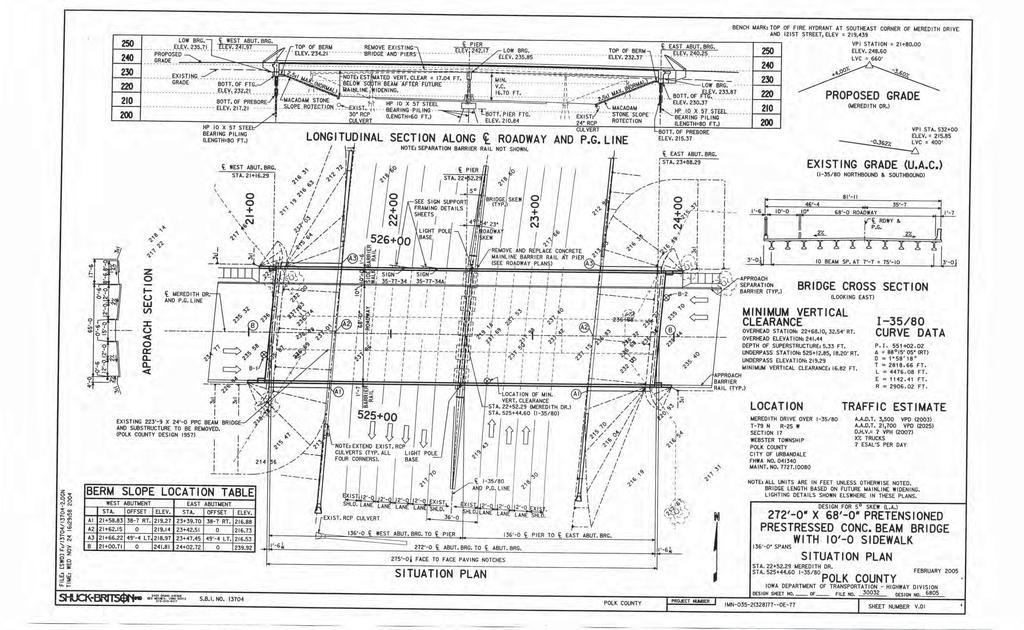
103
FOR INTERSTATE 81 AND ROUTE 37 INTERCHANGE FREDERICK COUNTY, VIRGINIA MILEPOST 310
 INTERCHANGE MODIFICATION REPORT FOR INTERSTATE 81 AND ROUTE 37 INTERCHANGE FREDERICK COUNTY, VIRGINIA MILEPOST 310 PREPARED BY: VIRGINIA DEPARTMENT OF TRANSPORTATION STAUNTON DISTRICT DECEMBER 13, 2006
INTERCHANGE MODIFICATION REPORT
 INTERSTATE 75 AND STATE ROAD 884 (COLONIAL BOULEVARD) INTERCHANGE LEE COUNTY, FLORIDA INTERCHANGE MODIFICATION REPORT Prepared for: Florida Department of Transportation District One May 2017 Interchange
DRAFT. SR-60 7 th Avenue Intersection Control Evaluation (ICE) I-605 Corridor Improvement Project (CIP) I-605/SR-60 EA# 3101U0
 I-605 Corridor Improvement Project (CIP) I-605/SR-60 EA# 3101U0") SR-60 7 th Avenue Intersection Control Evaluation (ICE) I-605/SR-60 EA# 3101U0 October 9, 2017 Contents 1 Purpose of ICE Memo... 1 2 Background... 1 3 Existing Interchange Deficiencies... 1 4 Context Sensitive
SR-60 7 th Avenue Intersection Control Evaluation (ICE) I-605/SR-60 EA# 3101U0 October 9, 2017 Contents 1 Purpose of ICE Memo... 1 2 Background... 1 3 Existing Interchange Deficiencies... 1 4 Context Sensitive
I 75 PD&E STUDIES TABLE OF CONTENTS DTTM, TECHNICAL REPORT No. 2 TABLE OF CONTENTS
 TABLE OF CONTENTS DTTM, TECHNICAL REPORT No. 2 TABLE OF CONTENTS SECTION PAGE NO. SECTION TITLE NO. EXECUTIVE SUMMARY -------------------------------------------------------------------- ES-1 1.0 INTRODUCTION
I 95 EXPRESS LANES SOUTHERN TERMINUS EXTENSION TRAFFIC OPERATIONS AND SAFETY ANALYSIS REPORT
 I 95 EXPRESS LANES SOUTHERN TERMINUS EXTENSION TRAFFIC OPERATIONS AND SAFETY ANALYSIS REPORT February 2016 INTERSTATE 95 EXPRESS LANES SOUTHERN TERMINUS EXTENSION PROJECT Commonwealth of Virginia Virginia
MEMORANDUM: INITIAL CONCEPTS SUMMARY
 MEMORANDUM: INITIAL CONCEPTS SUMMARY INTRODUCTION This memo presents a summary of initial concepts that have been identified as development of the project study has progressed, along with a recommendations
FINAL PROJECT PRIORITIZATION PLAN FOR THE NM 599 CORRIDOR
 FINAL PROJECT PRIORITIZATION PLAN FOR THE NM 599 CORRIDOR PROJECT NO. WIP-599-1(102) CONTROL NO. D5SF2 APRIL 2010 Prepared for: New Mexico Department of Transportation Northern Design Bureau P.O. Box 1149
The Folded Interchange: An Unconventional Design for the Reconstruction of Cloverleaf Interchanges
 The Folded Interchange: An Unconventional Design for the Reconstruction of Cloverleaf Interchanges I. ABSTRACT Keith A. Riniker, PE, PTOE This paper presents the Folded Interchange design and compares
Summary. Preliminary Alternative Development and Screening. DEIS July 23, 2018
 What is the Carolina Crossroads Project? The South Carolina Department of Transportation (SCDOT), in cooperation with the Federal Highway Administration (FHWA), is proposing to upgrade and redesign a key
TRANSPORTATION PROJECT REPORT DRAFT CONCEPTUAL ACCESS MODIFICATION PROPOSAL OCTOBER 2002
 TRANSPORTATION INTERSTATE 87 INTERCHANGE 11A TOWN OF MALTA SARATOGA COUNTY, NY DRAFT CONCEPTUAL ACCESS MODIFICATION PROPOSAL OCTOBER 2002 PROJECT REPORT NEW YORK STATE DEPARTMENT OF TRANSPORTATION JOSEPH
Military Highway Interchange
 III. Military Highway Interchange Deficiencies Design Challenges Proposed Alternatives III.1.2 Volumes & Operations Figure III.2: Existing Volumes displays the existing volumes for the Military Highway
I-35/I-80/Iowa 141 Interchange IJR and NEPA A Practical Approach to Resolving a Decades-Old Traffic Operations Challenge
 I-35/I-80/Iowa 141 Interchange IJR and NEPA A Practical Approach to Resolving a Decades-Old Traffic Operations Challenge Client: AJR or IJR? This is a TO-MAY-TO This is a TO-MAH-TO Practical Design PRACTICAL
LOCATION AND DESIGN DIVISION
 VIRGINIA DEPARTMENT OF TRANSPORTATION LOCATION AND DESIGN DIVISION INSTRUCTIONAL AND INFORMATIONAL MEMORANDUM GENERAL SUBJECT: Interstate, NHS Non-Interstate and Non-NHS (IJR / IMR Guidance) SPECIFIC SUBJECT:
BCEO TRAFFIC IMPACT STUDY GUIDELINES
 BCEO TRAFFIC IMPACT STUDY GUIDELINES February 2006 TABLE OF CONTENTS INTRODUCTION..... i TRAFFIC IMPACT STUDY STRUCTURE... 1 WHEN IS A TRAFFIC IMPACT STUDY NEEDED?..... 1 STUDY AREA, SITE PLAN & HORIZON
Environmental Consequences and Mitigation
 Chapter 4 Environmental Consequences and Mitigation 4.1 Introduction This chapter provides a detailed description of the impacts (and indirect impacts where applicable) associated with the alternatives
Route 7 Connector Ramp MODIF IE D I N T ER C H A N G E M OD IFICATIO N R E PO RT TRA N S F O R M I : I N S ID E THE BE LTWAY
 STATE PROJECT NUMBER: 0066-96A-493,P101, C501, B686; UPC: 110629 FEDERAL PROJECT NUMBER: NHPP-066-1(356) FAIRFAX COUNTY, VIRGINIA TRA N S F O R M I - 6 6 : I N S ID E THE BE LTWAY Route 7 Connector Ramp
VIII. LAND USE ISSUES
 VIII. LAND USE ISSUES The & Route 57 Land Use and Circulation Study (Land Use Study, Figure 6) was completed for the Town of Clay in November 1999 (Clough, Harbour & Associates). This study investigated
CHAPTER 5 PARALLEL PARKWAY CORRIDOR IMPROVEMENTS
 HPTER 5 PRLLEL PRKWY ORRIDOR IMPROVEMENTS nother key area within the Village West study area is the Parallel Parkway corridor. This chapter focuses on the segment of Parallel Parkway between 106 th Street
PROCEDURES FOR NEW OR REVISED FREEWAY ACCESS IN ARKANSAS
 PROCEDURES FOR NEW OR REVISED FREEWAY ACCESS IN ARKANSAS June 2011 PROCEDURES FOR NEW OR REVISED FREEWAY ACCESS IN ARKANSAS June 2011 Prepared by: Arkansas State Highway and Transportation Department
Vicinity Map. Interstate 605 (I-605) and State Route 91 (SR-91) in Los Angeles County
 and State Route 91 (SR-91) in Los Angeles County") 07 - LA - 605 - PM 2.87/PM 6.36 07 - LA - 91 - PM 14.10/PM 19.81 Vicinity Map N On Routes Interstate 605 (I-605) and State Route 91 (SR-91) in Los Angeles County I-605 between Excelsior Dr UC (PM 6.36)
07 - LA - 605 - PM 2.87/PM 6.36 07 - LA - 91 - PM 14.10/PM 19.81 Vicinity Map N On Routes Interstate 605 (I-605) and State Route 91 (SR-91) in Los Angeles County I-605 between Excelsior Dr UC (PM 6.36)
FLORIDA DEPARTMENT OF TRANSPORTATION Planning and Environmental Management Office INTERCHANGE MODIFICATION REPORT
 FLORIDA DEPARTMENT OF TRANSPORTATION Planning and Environmental Management Office INTERCHANGE MODIFICATION REPORT District 2 1109 South Marion Avenue Lake City, FL 32025-5874 INTERSTATE 10 (SR 8) / SR
Informational Brochure. Proposed Interchange. Interstate Route 295 (I-295) AT Greenville Avenue (State Route 5) Town of Johnston, Rhode Island
 AT Greenville Avenue (State Route 5) Town of Johnston, Rhode Island") Informational Brochure Proposed Interchange OF Interstate Route 295 (I-295) AT Greenville Avenue (State Route 5) Town of Johnston, Rhode Island October 5, 2016 Department of Transportation Two Capitol
Informational Brochure Proposed Interchange OF Interstate Route 295 (I-295) AT Greenville Avenue (State Route 5) Town of Johnston, Rhode Island October 5, 2016 Department of Transportation Two Capitol
US 14 EIS (New Ulm to N. Mankato) Interchange and Intersection Type Comparison
 Interchange and Intersection Type Comparison") T E C H N I C A L M E M O R A N D U M US 14 EIS (New Ulm to N. Mankato) Interchange and Intersection Type Comparison PREPARED FOR: Mn/DOT District 7 PREPARED BY: CH2M HILL DATE: March 27, 2007 This technical
T E C H N I C A L M E M O R A N D U M US 14 EIS (New Ulm to N. Mankato) Interchange and Intersection Type Comparison PREPARED FOR: Mn/DOT District 7 PREPARED BY: CH2M HILL DATE: March 27, 2007 This technical
500 Interchange Design
 500 Interchange Design Table of Contents 501 Interchange Design... 5-1 July 2015 501.1 General... 5-1 501.2 Interchange Type... 5-1 501.2.1 General... 5-1 502 Interchange Design Considerations... 5-2 502.1
On behalf of the Carolina Crossroads project team we thank you for taking the time to attend this meeting.
 On behalf of the Carolina Crossroads project team we thank you for taking the time to attend this meeting. Located in the heart of South Carolina, the I-20/26/126 Corridor is the crossroads of the state
DEVELOPMENT, ANALYSIS, AND DESIGN OF A NEW PARKWAY AT GRADE INTERSECTION (PAGI)
") 2013 ITE Western District Annual Meeting COCEPT DEVELOPMET, AALYSIS, AD DESIG OF A EW PARKWAY AT GRADE ITERSECTIO (PAGI) Lead Author: James M. Witkowski, PhD Supporting Author: Darrell Truitt, PE The Pima
2013 ITE Western District Annual Meeting COCEPT DEVELOPMET, AALYSIS, AD DESIG OF A EW PARKWAY AT GRADE ITERSECTIO (PAGI) Lead Author: James M. Witkowski, PhD Supporting Author: Darrell Truitt, PE The Pima
CHAPTER 4 GRADE SEPARATIONS AND INTERCHANGES
 CHAPTER 4 GRADE SEPARATIONS AND INTERCHANGES 4.0 INTRODUCTION The ability to accommodate high volumes of intersecting traffic safely and efficiently through the arrangement of one or more interconnecting
M D 355 [FR E D E R IC K R O A D] OVER
![M D 355 [FR E D E R IC K R O A D] OVER](/thumbs/79/79553721.jpg "M D 355 [FR E D E R IC K R O A D] OVER") M D 355 [FR E D E R IC K R O A D] OVER LITTLE BENNETT CREEK MAINTENANCE OF TRAFFIC ALTERNATIVE ANA LYSIS Prepared by: INTRODUCTION The purpose of this report is to present the results of traffic analyses
M D 355 [FR E D E R IC K R O A D] OVER LITTLE BENNETT CREEK MAINTENANCE OF TRAFFIC ALTERNATIVE ANA LYSIS Prepared by: INTRODUCTION The purpose of this report is to present the results of traffic analyses
500 Interchange Design
 500 Interchange Design Table of Contents 501 Interchange Design... 1 501.1 General... 1 501.2 Interchange Type... 1 501.2.1 General... 1 502 Interchange Design Considerations... 2 502.1 Determination of
Future Build Alternative Traffic Forecasts and Level of Service Analysis
 4.2.10 Future Build Alternative Traffic Forecasts and Level of Service Analysis For the five Build Alternatives, study intersections within one mile of potential station locations were analyzed, as it
WELCOME IL 47. Community Advisory Group Meeting #5 Waubonsee Community College Wednesday, May 31, 2017
 WELCOME IL 47 Community Advisory Group Meeting #5 Waubonsee Community College Wednesday, May 31, 2017 MEETING PURPOSE MEETING AGENDA 1. Welcome/Introduction 2. Review Previous Public Involvement 3. Process/Schedule
DDI s Can Move More Than Cars. Alex Ariniello. Presentation for the ITE Western District Annual Meeting. July, 2016 in Albuquerque, New Mexico
 DDI s Can Move More Than Cars Alex Ariniello Presentation for the ITE Western District Annual Meeting July, 2016 in Albuquerque, New Mexico In January, 2016, a Diverging Diamond Interchange (DDI) opened
PROJECT STUDY REPORT. Cal Poly Pomona Senior Project
 06/2014 PROJECT STUDY REPORT (Cal Poly Pomona Senior Project) For Conceptual Approval of an Interchange Improvement And Cooperative Agreement with The City of Lake Elsinore for completion of Project Approval
MEMORANDUM. Date: July 14, 2006 Project #: To: US 97 & US 20 Refinement Plan Steering Committee
 MEMORANDUM Date: July 14, 2006 Project #: 6389 To: US 97 & US 20 Refinement Plan Steering Committee From: Sonia Hennum, P.E., Andrew Cibor, E.I.T., & Julia Kuhn, P.E. Project: US 97 & US 20 Refinement
Appendix B Highway 407 Interchange Review - Cochrane Street Area
 Appendix B Highway 407 Interchange Review - Cochrane Street Area AECOM 300 ater Street hitby, ON, Canada L1N 9J2 www.aecom.com Memorandum To Michael May, P.Eng., Town of hitby Page 1 CC Subject Greg Hardy,
Beltline Interchange Range of Alternatives Screening Summary Memo
 Range of Alternatives Screening Summary Memo (Concurrence Point #2 from the Agency Coordination Plan) (I-39/90 and US 12/18 Interchange) Dane County, Wisconsin WisDOT Project ID 1007-10-02 Table of Contents
CHAPTER 2: MODELING METHODOLOGY
 CHAPTER 2: MODELING METHODOLOGY 2.1 PROCESS OVERVIEW The methodology used to forecast future conditions consisted of traditional traffic engineering practices and tools with enhancements to more accurately
TABLE OF CONTENTS TABLE OF CONTENTS... I APPENDICES... III LIST OF EXHIBITS... V LIST OF TABLES... VII LIST OF ABBREVIATED TERMS...
 Amendment No. 2 to Reclamation Plan 2006-01 Traffic Impact Analysis TABLE OF CONTENTS TABLE OF CONTENTS... I APPENDICES... III LIST OF EXHIBITS... V LIST OF TABLES... VII LIST OF ABBREVIATED TERMS... IX
Transportation and Works Department The Regional Municipality of York Yonge Street Newmarket, Ontario L3Y 6Z1
 TRANSPORTATION IMPACT STUDY (TIS) GUIDELINES FOR DEVELOPMENT APPLICATIONS Transportation and Works Department The Regional Municipality of York 17250 Yonge Street Newmarket, Ontario L3Y 6Z1 August, 2007
APPENDIX B. Public Works and Development Engineering Services Division Guidelines for Traffic Impact Studies
 APPENDIX B Public Works and Development Engineering Services Division Guidelines for Traffic Impact Studies Revised December 7, 2010 via Resolution # 100991 Reformatted March 18, 2011 TABLE OF CONTENTS
Traffic Analysis. Appendix I
 FHWA #T-A000(18) / NHDOT #13742 Bow Concord Improvements Appendix I Traffic Analysis The traffic analysis for the project was conducted using the Bow-Concord Traffic Microsimulation Model prepared specifically
Woodburn Interchange Project Transportation Technical Report
 Final Report Woodburn Interchange Project Transportation Technical Report Prepared for Oregon Department of Transportation April 212 Prepared by DKS Associates Contents Methodologies... 4 Volume Development...
THE PROJECT. Executive Summary. City of Industry. City of Diamond Bar. 57/60 Confluence.
 THE PROJECT A freeway segment ranked 6th worst in the Nation, with levels of congestion, pollution and accidents that are simply unacceptable and which have Statewide and National implications. Executive
I-10 CORRIDOR IMPROVEMENTS STAGE 0 FEASIBILITY STUDY STATE PROJECT NUMBER H FEDERAL AID PROJECT NUMBER H004100
 JULY 2016 I-10 CORRIDOR IMPROVEMENTS STAGE 0 FEASIBILITY STUDY STATE PROJECT NUMBER H.004100 FEDERAL AID PROJECT NUMBER H004100 EAST BATON ROUGE AND WEST BATON ROUGE PARISHES, LOUISIANA Section TABLE OF
AIR QUALITY TECHNICAL MEMORANDUM
 AIR QUALITY TECHNICAL MEMORANDUM AIR QUALITY TECHNICAL MEMORANDUM GOLDEN GLADES INTERCHANGE PD&E STUDY Miami-Dade County, Florida Financial Management Number: 428358-1-22-01 Efficient Transportation Decision
Conceptual Design Report
 Conceptual Design Report I-244/Arkansas River Multimodal Bridge Tulsa, Oklahoma Prepared for the Oklahoma Department of Transportation Prepared by: August 2009 I-244 / ARKANSAS RIVER MULTIMODAL BRIDGE
APPENDIX B. Excerpts from the October 2002 Conceptual Alternatives Report
 APPENDIX B Excerpts from the October 2002 Interstate 83 and PA Route 921 The objective for the SR 921 interchange site was to study alternatives for construction of a new interchange. There are no short-term
2 Purpose and Need. 2.1 Study Area. I-81 Corridor Improvement Study Tier 1 Draft Environmental Impact Statement
 2 Purpose and Need 2.1 Study Area Interstate 81 (I-81) is relied upon for local and regional travel and interstate travel in the eastern United States. It extends 855 miles from Tennessee to New York at
9.0 I-26 & I-526 Interchange Improvements
 9.0 I-26 & I-526 Interchange Improvements The I-26 & I-526 System-to-System interchange currently consists of a combination of directional and loop ramps providing for all movements from one Interstate
GUIDE FOR THE PREPARATION OF TRAFFIC IMPACT STUDIES
 GUIDE FOR THE PREPARATION OF TRAFFIC IMPACT STUDIES Adopted by Town Council on November 25, 2008 Prepared By: HNTB Engineering Department Planning Department TABLE OF CONTENTS I. INTRODUCTION... 1 II.
I-95 Corridor Study Phase II Highway Element
 I-95 Corridor Study Phase II Highway Element FAMPO Policy Committee February 26, 2018 1 Activity in January & February 1. Numerous discussion with VDOT to better understand the scope of recently funded
6.0 CONGESTION HOT SPOT PROBLEM AND IMPROVEMENT TRAVEL DEMAND MODEL ANALYSIS
 6.0 CONGESTION HOT SPOT PROBLEM AND IMPROVEMENT TRAVEL DEMAND MODEL ANALYSIS 6.1 MODEL RUN SUMMARY NOTEBOOK The Model Run Summary Notebook (under separate cover) provides documentation of the multiple
GRE PID 80468
 Assessment of Feasible Alternatives Prepared for Ohio Department of Transportation 505 South SR 741 Lebanon, OH 45036-9518 December 2011 One Dayton Centre, Suite 1100 One South Main Street Dayton, OH 45402
NEPA and Design Public Hearings
 NEPA and Design Public Hearings Monday, December 5, 2016 Washington-Lee High School 1301 N. Stafford Street Arlington, VA 22201 Thursday, December 8, 2016 Mary Ellen Henderson Middle School 7130 Leesburg
CLA /10.54, PID Project Description:
 Project Description: The proposed project will consist of widening IR 70 to three lanes from Enon Road (SLM 06.75) to the US 68 interchange ramps (SLM 10.55). IR 70 is a component of the Strategic Highway
WELCOME. Public Meeting for I-35 / I-44 Interchange. October 6, 2015
 WELCOME Public Meeting for I-35 / I-44 Interchange October 6, 2015 TEAM INTRODUCTIONS PURPOSE OF THIS MEETING is to present the alternative alignments for the I-35/I-44 and I-35/NE 63rd Street Interchanges
Traffic Impact Study Requirements
 [TYPE THE COMPANY NAME] Traffic Impact Study Requirements County of San Mateo Department of Public Works Roadway Services 9/1/2013 I. Introduction The County of San Mateo (County), Department of Public
St. Francis Drive through the City of Santa Fe Corridor Study
 VIII. ENGINEERING AND ENVIRONMENTAL EVALUATION INTERSECTION IMPROVEMENTS SOUTHERN For the southern end of the corridor, traffic volumes are expected to increase over existing levels. The Phase A Report
Bow Concord I-93 Improvements City of Concord Transportation Policy Advisory Committee
 Bow Concord I-93 Improvements City of Concord Transportation Policy Advisory Committee December 15, 2016 Agenda Project History / Project Development Process Traffic Modeling Alternatives Development o
12 Evaluation of Alternatives
 12 Evaluation of Alternatives This chapter evaluates the effectiveness of the No-Build Alternative and the proposed METRO Blue Line Light Rail Transit (BLRT) Extension project based on the information
Community Advisory Committee Meeting No. 2. June 22, 2006
 Community Advisory Committee Meeting No. 2 June 22, 2006 Introductions The Study Team KDOT Wichita Partners Consultants CAC members Overview Today s Agenda Opinion Survey Study Status Starting Concept
Exit 73 I-29 Interchange Modification Justification Study
 xit 73 I-29 Interchange Modification Justification tudy Introduction Figure 1 shows the location of xit 73. This interchange is proposed to be the connecting point of the ast and West Corridors to I-29.
2017 TIGER DISCRETIONARY GRANT APPLICATION
 2017 TIGER DISCRETIONARY GRANT APPLICATION Spokane International Airport Spokane, WA APPENDIX D 2015 Airport Drive Couplet at Spotted Road Airport Drive Couplet at Spotted Road April 2015 Prepared for:
8.0 Chapter 8 Alternatives Analysis
 8.0 Chapter 8 Alternatives Analysis The primary purpose for using CORSIM in the context of this manual is to guide the design process and program delivery. To this point in the manual, you have been given
A Unique Application of Railroad Preemption with Queue Mitigation at a Roundabout Interchange
 A Unique Application of Railroad Preemption with Queue Mitigation at a Roundabout Interchange Jeromy Grenard, PE, PTOE American Structurepoint Hardik Shah, PE, PTOE American Structurepoint Roundabouts
Alternatives Evaluation Report. Appendix C. Alternatives Evaluation Report
 s Evaluation Report Appendix C s Evaluation Report I-35W North Corridor Project EA Minnesota Department of Transportation Final Project s Report I-35W North Corridor Preliminary Design Project Report Version
NCHRP 3-88 Guidelines for Ramp and Interchange Spacing
 Session 312 Updates on NCHRP-Funded Geometric Design Research Projects NCHRP 3-88 Guidelines for Ramp and Interchange Spacing Brian L. Ray, PE Kittelson & Associates, Inc Portland, Oregon bray@ kittelson.com
MOBILITY AND ALTERNATIVES ANALYSIS
 6 MOBILITY AND ALTERNATIVES ANALYSIS BACK OF SECTION DIVIDER 6.0 Mobility and Alternatives Analysis Travel demand analysis provides a framework for the identification of transportation facilities and services
APPENDIX A TIER 1 ANALYSIS
 SPN H.004100 FEASIBILITY STUDY APPENDIX A TIER 1 ANALYSIS 040-012-042AH Appendices Lead Sheets PROVIDENCE STATE PROJECT. H.004100 The following worksheets analyze various project alternatives at various
FEDERAL HIGHWAY ADMINISTRATION RECORD OF DECISION FOR THE LYNNWOOD LINK EXTENSION
 FEDERAL HIGHWAY ADMINISTRATION RECORD OF DECISION FOR THE LYNNWOOD LINK EXTENSION AUGUST 2015 Table of Contents 1 Decision... 1 1.1 Project Description... 2 1.2 Basis for the FHWA Decision... 7 1.2.1
Diverging Diamond Interchanges in Michigan
 2015 MDOT / ACEC Partnering Workshop Diverging Diamond Interchanges in Michigan Lori Swanson MDOT Oakland TSC John Katers OHM Advisors Chris Van Norwick MDOT Grand Region Rob Leppala TranSystems Topics
2. Alternatives ENVIRONMENTAL ASSESSMENT US 52 OPERATIONAL IMPROVEMENTS. 2.1 Introduction
 2. Alternatives 2.1 Introduction This chapter discusses the development and evaluation of scenarios and alternatives considered for the proposed action. The goal of this process, which is described in
Jim Alexander Director of Design and Engineering, Southwest Light Rail Transit Project
 Memorandum Date: January 15, 2014 To: CC: From: Subject: Jim Alexander Director of Design and Engineering, Southwest Light Rail Transit Project Paul Danielson, P.E. Project Manager, Southwest Light Rail
PUBLIC INFORMATION MEETING TUESDAY MARCH 9, 2010
 St. Francis Drive Corridor Study Draft Phase B Review 1 PUBLIC INFORMATION MEETING TUESDAY MARCH 9, 2010 Objective Present Alternatives Evaluated Solicit Feedback On Selection of Recommended Projects 2
Final Air Quality Report
 Florida Department of Transportation - District VII County Line Road (C.R. 578) Project Development and Environment Study From U.S. 19 (S.R. 55) to U.S. 41 (S.R. 45) Work Program Item Segment Number: 257298
EXECUTIVE SUMMARY. The IP developed the following purpose and need statement for the Part B I-71 Access Improvement Study.
 EXECUTIVE SUMMARY The Ohio-Kentucky-Indiana Regional Council of Governments (OKI) has conducted the with the following purpose: Develop a comprehensive transportation plan for the Uptown area that serves
CHAPTER 8: I-71 ACCESS IMPROVEMNETS
 CHAPTER 8: I-71 ACCESS IMPROVEMNETS I-71 Access Improvements were a separate and distinct part of the overall Uptown Transportation Study. This Part B work is fully documented in the Planning Study Report
Breaking the Diamond: DDIs, CFIs, and SPUIs
 Breaking the Diamond: DDIs, CFIs, and SPUIs Smith Siromaskul, P.E. Abstract With a recent push towards innovative solutions in interchange design, the diverging diamond interchange has been the next big
NW La Center Road/I-5 Interchange Improvement Project (MP 16.80)
") FINAL DRAFT - NW La Center Road/I-5 Interchange Improvement Project (MP 16.80) La Center, Washington February 2015 FINAL DRAFT - NW La Center Road/I-5 Interchange Improvement Project (MP 16.80) La Center,
FINAL DRAFT - NW La Center Road/I-5 Interchange Improvement Project (MP 16.80) La Center, Washington February 2015 FINAL DRAFT - NW La Center Road/I-5 Interchange Improvement Project (MP 16.80) La Center,
Consideration of a Diverging Diamond Interchange in Saskatchewan. Paul H. A. Steel, Project Manager, M. Eng., P.Eng., Tetra Tech EBA Inc.
 Consideration of a Diverging Diamond Interchange in Saskatchewan Paul H. A. Steel, Project Manager, M. Eng., P.Eng., Tetra Tech EBA Inc. Terry Schmidt, P.Eng., MBA, Senior Project Director, Tetra Tech
Northwest State Route 138 Corridor Improvement Project
 Northwest State Route 138 Corridor Improvement Project Los Angeles County, CA DISTRICT 7- LA- 138 (PM 0.0/36.8); DISTRICT 7- LA- 05 (PM 79.5/83.1); DISTRICT 7- LA- 14 (PM 73.4/74.4) 265100/ 0700001816
I-65/I-70 North Split Project
 I-65/I-70 North Split Project Public Open House October 10, 2018 Alternatives Development Process Define Problems Identify Context Gather Input Define Alternatives Balance Trade-Offs Select Alternative
MULTIMODAL TRANSPORTATION IMPACT STUDY GUIDELINES
 MULTIMODAL TRANSPORTATION IMPACT STUDY GUIDELINES 1 st Edition City of San Luis Obispo 2035 Circulation Element 1 Table of Contents Introduction... 2 Process... 2 When Impact Studies Are Required... 3
Chapter GRADE SEPARATIONS & INTERCHANGES
 Chapter 9 GRADE SEPARATIONS & INTERCHANGES 2012 ODOT Highway Design Manual Grade Separations And Interchanges 9.1 GENERAL INFORMATION There are three types of roadway intersections: intersections at-grade,
DIVISION I TRAFFIC IMPACT STUDY GUIDELINES ENGINEERING STANDARDS
 CITY OF ALBANY DEPARTMENT OF PUBLIC WORKS DIVISION I TRAFFIC IMPACT STUDY GUIDELINES ENGINEERING STANDARDS Prepared By PUBLIC WORKS DEPARTMENT ALBANY, OREGON 97321 Telephone: (541) 917-7676 TABLE OF CONTENTS
EXHIBIT A SCOPE OF SERVICES INTERCHANGE JUSTIFICATION REPORT (IJR) FOR INTERSTATE 75 AT OVERPASS ROAD
 FOR INTERSTATE 75 AT OVERPASS ROAD") Scope of Services 12/08/2008 EXHIBIT A SCOPE OF SERVICES INTERCHANGE JUSTIFICATION REPORT (IJR) FOR INTERSTATE 75 AT OVERPASS ROAD TABLE OF CONTENTS Section Pace I. 0 PROJECT DESCRIPTION........................,............................................................
Scope of Services 12/08/2008 EXHIBIT A SCOPE OF SERVICES INTERCHANGE JUSTIFICATION REPORT (IJR) FOR INTERSTATE 75 AT OVERPASS ROAD TABLE OF CONTENTS Section Pace I. 0 PROJECT DESCRIPTION........................,............................................................
INTERACTIVE HIGHWAY SAFETY DESIGN MODEL (IHSDM)
") INTERACTIVE HIGHWAY SAFETY DESIGN MODEL (IHSDM) TSITE 2016 Winter Meeting Nashville, TN February 25, 2016 AGENDA Project History IHSDM: Background & Overview IHSDM: Interstate 24 Model IHSDM: Interstate
INTERACTIVE HIGHWAY SAFETY DESIGN MODEL (IHSDM) TSITE 2016 Winter Meeting Nashville, TN February 25, 2016 AGENDA Project History IHSDM: Background & Overview IHSDM: Interstate 24 Model IHSDM: Interstate
I-65/I-70 North Split Project. Alternatives Screening Report CAC Meeting October 9, 2018
 I-65/I-70 North Split Project Alternatives Screening Report CAC Meeting October 9, 2018 Alternatives Development Process Define Problems Identify Context Gather Input Define Alternatives Balance Trade-Offs
TOWN OF BARGERSVILLE DEPARTMENT OF DEVELOPMENT TRAFFIC STUDY GUIDELINES
 TOWN OF BARGERSVILLE DEPARTMENT OF DEVELOPMENT TRAFFIC STUDY GUIDELINES Town of Bargersville Department of Development 24 North Main Street, P.O. Box 420 Bargersville, Indiana 46106 Adopted by the Bargersville
FINAL REPORT GUIDELINES FOR PRELIMINARY SELECTION OF THE OPTIMUM INTERCHANGE TYPE FOR A SPECIFIC LOCATION
 FINAL REPORT GUIDELINES FOR PRELIMINARY SELECTION OF THE OPTIMUM INTERCHANGE TYPE FOR A SPECIFIC LOCATION Nicholas J. Garber, Ph.D. Faculty Research Scientist and Professor of Civil Engineering Michael
UPTOWN TRAFFIC IMPACT ANALYSIS
 UPTOWN TRAFFIC IMPACT ANALYSIS This memorandum summarizes the results of the traffic analysis conducted to evaluate the traffic operations of the intersections along Post Oak Boulevard within Uptown Houston
Executive Summary. Study Background
 Executive Summary ES 1.1 Introduction The Capitol Region Council of Governments (CRCOG) and the Connecticut Department of Transportation (CTDOT) initiated the (BTS) in 2006 to identify near and long-term
NCHRP Report 687 Guidelines for Ramp and Interchange Spacing
 Updates on NCHRP-Funded Geometric Design Research Projects NCHRP Report 687 Guidelines for Ramp and Interchange Spacing Brian L. Ray, PE Kittelson & Associates, Inc Portland, Oregon bray@ kittelson.com
NORTHWEST CORRIDOR PROJECT. NOISE TECHNICAL REPORT 2015 Addendum Phase IV
 Noise Technical Report 2015 Addendum NOISE TECHNICAL REPORT 2015 Addendum PREPARED FOR: Federal Highway Administration and Georgia Department of Transportation PREPARED BY: Parsons Brinckerhoff Project
Goleta Ramp Metering Study
 DRAFT Technical Memorandum Goleta Ramp Metering Study Subtasks 2.1 and 2.2: Data Collection and Existing Baseline Analysis June 5, 2017 DRAFT Technical Memorandum Goleta Ramp Metering Study Subtasks 2.1
WOO-SR Feasibility Study (PID 90541) Feasibility Study Report April 22, 2011
 Feasibility Study Report April 22, 2011") TABLE OF CONTENTS EXECUTIVE SUMMARY... 1 CHAPTER 1: INTRODUCTION... 5 1.1 Study Purpose and background... 5 1.2 Study Approach... 6 1.3 Study Area... 6 CHAPTER 2: DESCRIPTIONS OF ALTERNATIVES... 7 2.1
TABLE OF CONTENTS EXECUTIVE SUMMARY... 1 CHAPTER 1: INTRODUCTION... 5 1.1 Study Purpose and background... 5 1.2 Study Approach... 6 1.3 Study Area... 6 CHAPTER 2: DESCRIPTIONS OF ALTERNATIVES... 7 2.1
Environmental Consequences
 4 Environmental Consequences 4.1 Introduction This chapter describes the impacts associated with each of the alternatives that were carried forward for further study (see Section 2.5). A concise summary
Final Recommendations Identification of Improvements, Strategies, and Solutions
 Identification of Improvements, Strategies, and Solutions Prepared by: December 2015 TABLE OF CONTENTS 1. Introduction... 1 1 2. Freight Policy Recommendations... 2 1 3. Freight Infrastructure Recommendations...
Interchange Workshop Report (August 2004)
") U.S. Highway 14 Corridor Study New Ulm to North Mankato Table of Contents Section Interchange Workshop Report (August 2004) Page 1. Introduction and Next Steps 1 2. Interchange Workshop Participants &
U.S. Highway 14 Corridor Study New Ulm to North Mankato Table of Contents Section Interchange Workshop Report (August 2004) Page 1. Introduction and Next Steps 1 2. Interchange Workshop Participants &
PORT OF FERNANDINA TRUCK CIRCULATION STUDY
 OCTOBER 2015 PREPARED FOR: I. Introduction... 1 II. Study Area... 1 III. Field Data Collection... 3 IV. Existing Traffic... 5 V. Truck Circulation Analysis... 8 VI. Peak Hour Intersection Analysis... 10