Processing Multitemporal TM Imagery to Extract Forest Cover Change Features in Cleveland National Forest, Southern California
|
|
|
- Anthony Ford
- 6 years ago
- Views:
Transcription
1 Processing Multitemporal TM Imagery to Extract Forest Cover Change Features in Cleveland National Forest, Southern California John Rogan and Janet Franklin San Diego State University Thanks to Lisa Levien: USDA Forest Service- Sacramento Dar Roberts: UC Santa Barbara
2 Introduction and Background * Forest cover change mapping * Research Question: Can Multitemporal Spectral Mixture Analysis techniques be effectively used to accurately map forest cover changes in southern California? * Specifically: - What categories of forest cover change can be mapped using MSMA techniques?
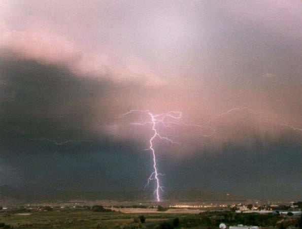

3 Vegetation Disturbance

4 Conceptual Schema of Spectral Mixture Model SOIL SHADE GV NPV

5 Study Site

6 Descanso: June 1990 Descanso: June 1996 Disturbance

7 Random Sampling Design Field Sampling Protocol Stratified Adaptive Cluster Sampling Design Stratification Stratification Change Sample Plot No Change Change 1 Change 2 Sample Plot Change 3
8 Methods Data Preprocessing Radiometric normalization and Absolute atmospheric correction Spectral Mixture Analysis Endmember selection: Image Vs Reference Spectral Unmixing: Shade, Soil, GV, NPV and RMS Image-differencing Classification: Maximum Likelihood Vs Decision Tree Accuracy Assessment: Contingency Matrix


9 1996 TM Endmember Evaluation Classification Change Map Accuracy Assessment 1990 TM Image Endmember Selection Reflectance Retrieval Classification Reference Spectra Endmember Evaluation Reference Endmember Selection SMA Soil T1 Shade T1 GV T1 NPV T1 Soil T2 Shade T2 GV T2 NPV T2 Derive Change Fractions Soil Shade GV NPV Fraction Analysis
10 FOREST CHANGE CLASS NO CHANGE VEGETATION INCREASE VEGETATION DECREASE CHANGE IN NON- VEGETATED AREAS FRACTION CHARACTERISTICS AND DYNAMICS Consistent shade, soil, NPV and GV fractions over time Increase in GV and possible increase in shade in vegetation due to plant-architectural shade Decrease in Soil and NPV over time due to increased ground cover by vegetation Decrease in GV and plant-architectural Shade Increase Soil and NPV due to decreased vegetation ground cover over time Decrease in GV due to land clearing and construction Increase in Shade, Soil and, possibly NPV
11 Endmembers used to Model Scenes 250 Soil 200 Rescaled Reflectance GV Soil Endmember Selection NPV TM Band Shade


12 Shade 1990 Fractions GV NPV Soil RMS RGB: Soil, GV, NPV


13 Shade 1996 Fractions GV NPV Soil RMS RGB: Soil, GV, NPV

14 FRACTION ANALYSIS Regrowth and Deforestation Regeneration No Change GV 1990 Deforestation GV 1996 Red = GV 1990 Blue, Green = GV 1996
15 Results Contingency Matrix: Maximum Likelihood Classification REF CLASS CORRECT PRODUCER S USER S KAPPA TOTALS TOTALS ACC. ACC. Water % 86.67% 0.82 Recharge No Change % 66.67% 0.52 Vegetation % 56.67% 0.48 Increase Vegetation % 70% 0.63 Decrease Change in % 46.67% 0.38 Nonvegetated areas Totals %
16 Results Contingency Matrix: Decision Tree Classification REF CLASS CORRECT PRODUCER S USER S KAPPA TOTALS TOTALS ACC. ACC. Water % 86.87% 0.82 Recharge No Change % 76.67% 0.66 Vegetation % 66% 0.59 Increase Vegetation % 76.67% 0.72 Decrease Change in % 53% 0.45 Nonvegetated areas Totals % 0.65
17 Results and Discussion Sources of Error--- Spectral confusion- (Topography) Reservoirs: Very Accurate Urban Change: Difficult to adequately characterize using MSMA Veg Decrease: Very Accurate (Fire Scars) Veg Increase: Moderately Accurate- Phenological/ Precipitation differences
18 Conclusions and Future Work Multitemporal Spectral Mixture Analysis Highly accurate in depicting changes in forest cover: Soil, NPV and GV are sensitive to interdate change in natural cover Decision Tree Classifier outperformed a Conventional Maximum Likelihood Classifier by 10% overall and by an average of 9% for each cover change class Inclusion of ancillary data sets to reduce spectral confusion and texture images to enhance accuracy
A North-American Forest Disturbance Record from Landsat Imagery
 GSFC Carbon Theme A North-American Forest Disturbance Record from Landsat Imagery Jeffrey Masek, NASA GSFC Forrest G. Hall, GSFC & UMBC Robert Wolfe, GSFC & Raytheon Warren Cohen, USFS Corvallis Eric Vermote,
PRODES - INPE INPE. PRODES Methodology- PRODES Methodology - INPE. Mapping and Monitoring Deforestation and Forest Degradation in the Brazilian Amazon
 Mapping and Monitoring Deforestation and Forest Degradation in the Brazilian Amazon GOFC-GOLD GOLD Symposium on Forest and Land Cover Observations March 21st-26 26 th, 2006 Jena, Germany Carlos Souza Jr.
FOREST COVER MAPPING AND GROWING STOCK ESTIMATION OF INDIA S FORESTS
 FOREST COVER MAPPING AND GROWING STOCK ESTIMATION OF INDIA S FORESTS GOFC-GOLD Workshop On Reducing Emissions from Deforestations 17-19 April 2007 in Santa Cruz, Bolivia Devendra PANDEY Forest Survey of
A Remote Sensing Based Urban Tree Inventory for the Mississippi State University Campus
 A Remote Sensing Based Urban Tree Inventory for the Mississippi State University Campus W. H. Cooke III a and S.G. Lambert b a Geosciences Department, GeoResources Institute, Mississippi State University,
THE IMPACTS OF URBANIZATION ON THE SURFACE ALBEDO IN THE YANGTZE RIVER DELTA IN CHINA
 THE IMPACTS OF URBANIZATION ON THE SURFACE ALBEDO IN THE YANGTZE RIVER DELTA IN CHINA 08/24/2011 Mélanie Bourré Motivation Since the 20th century, rapid urbanization of the world population. United Nation
30 Years of Tree Canopy Cover Change in Unincorporated and Incorporated Areas of Orange County,
 30 Years of Tree Canopy Cover Change in Unincorporated and Incorporated Areas of Orange County, 1986-2016 Final Report to Orange County July 2017 Authors Dr. Shawn Landry, USF Water Institute, University
Image Classification I
 Image Classification I Classification is the process of labeling image pixels using predetermined categorical classes. Components: Image features Classification scheme Signatures Training Classifiers Classification
Classification of Forest Dominate Types Using an Integrated Landsat and Ecological Model
 Classification of Forest Dominate Types Using an Integrated Landsat and Ecological Model Southern Region Existing Vegetation Mapping Pilot Project Test Supported By Region 8 Engineering/GeoSpatial 3 Year
EVALUATING THE ACCURACY OF 2005 MULTITEMPORAL TM AND AWiFS IMAGERY FOR CROPLAND CLASSIFICATION OF NEBRASKA INTRODUCTION
 EVALUATING THE ACCURACY OF 2005 MULTITEMPORAL TM AND AWiFS IMAGERY FOR CROPLAND CLASSIFICATION OF NEBRASKA Robert Seffrin, Statistician US Department of Agriculture National Agricultural Statistics Service
Annual Deforestation Mapping in Sumatera using multi temporal digital classification
 Annual Deforestation Mapping in Sumatera 1990-2014 using multi temporal digital classification Kustiyo Remote Sensing Technology and Data Center LAPAN International Workshop on Land Use/Cover Change and
Multitemporal Analysis of Degraded Forests in the Southern Brazilian Amazon
 Earth Interactions Volume 9 (2005) Paper No. 19 Page 1 Copyright 2005, Paper 09-019; 8,851 words, 5 Figures, 0 Animations, 5 Tables. http://earthinteractions.org Multitemporal Analysis of Degraded Forests
Mapping cropland in smallholder-dominated Savannas: Integrating Remote Sensing Techniques And Probabilistic Modeling
 Archived version from NCDOCKS Institutional Repository http://libres.uncg.edu/ir/asu/ Mapping cropland in smallholder-dominated Savannas: Integrating Remote Sensing Techniques And Probabilistic Modeling
Forestry Department Food and Agriculture Organization of the United Nations FRA 2000 GLOBAL FOREST COVER MAP. Rome, November 1999
 Forestry Department Food and Agriculture Organization of the United Nations FRA 2000 GLOBAL FOREST COVER MAP Rome, November 1999 Forest Resources Assessment Programme Working Paper 19 Rome 1999 The Forest
Evaluating Regional Watershed Sensitivity to Climate Change: Future Runoff and Sediment Variability in Southern California
 Evaluating Regional Watershed Sensitivity to Climate Change: Future Runoff and Sediment Variability in Southern California Dr. Terri Hogue Sonya Lopez, Ph.D. Candidate University of California Los Angeles
STRATIFIED ESTIMATES OF FOREST AREA USING THE k-nearest NEIGHBORS TECHNIQUE AND SATELLITE IMAGERY
 STRATIFIED ESTIMATES OF FOREST AREA USING THE k-nearest NEIGHBORS TECHNIQUE AND SATELLITE IMAGERY Ronald E. McRoberts, Mark D. Nelson, and Daniel G. Wendt 1 ABSTRACT. For two study areas in Minnesota,
ANALYSIS OF CHANGES IN VEGETATION BIOMASS USING MULTITEMPORAL AND MULTISENSOR SATELLITE DATA
 ANALYSIS OF CHANGES IN VEGETATION BIOMASS USING MULTITEMPORAL AND MULTISENSOR SATELLITE DATA A. Akkartal a*, O. Türüdü a, and F.S. Erbek b a stanbul Technical University, Faculty of Civil Engineering,
PROGRESS IN ADAPTING k-nn METHODS FOR FOREST MAPPING AND ESTIMATION USING THE NEW ANNUAL FOREST INVENTORY AND ANALYSIS DATA
 PROGRESS IN ADAPTING k-nn METHODS FOR FOREST MAPPING AND ESTIMATION USING THE NEW ANNUAL FOREST INVENTORY AND ANALYSIS DATA Reija Haapanen, Kimmo Lehtinen, Jukka Miettinen, Marvin E. Bauer, and Alan R.
SandYare the strata-weighted mean, and standard
 A LANDSAT STAND BASAL AREA CLASSIFICATION SUITABLE FOR AUTOMATING STRATIFICATION OF FOREST INTO STATISTICALLY EFFICIENT STRATA Emily B. Schultz a, Thomas G. Matney a, David L. Evans a, and Ikuko Fujisaki
Recent HARVIST Results: Classifying Crops from Remote Sensing Data
 Recent HARVIST Results: Classifying Crops from Remote Sensing Data Kiri Wagstaff and Dominic Mazzoni (kiri.wagstaff@jpl.nasa.gov) Jet Propulsion Laboratory, California Institute of Technology, 4800 Oak
REDD-COMIFAC Meeting March 2008, Paris. REDD Pilot Project COMIFAC: Cameroon. T. Haeusler, S. Gomez
 REDD-COMIFAC Meeting 10-12 March 2008, Paris R e d u c i n g E m i s s i o n s f r o m D e f o r e s t a t i o n a n d D e g r a d a t i o n REDD Pilot Project COMIFAC: Cameroon T. Haeusler, S. Gomez Consortium
Vegetation Management and Water Yield: Silver Bullet or a Pipe Dream?
 Vegetation Management and Water Yield: Silver Bullet or a Pipe Dream? Lee H. MacDonald rofessor Emeritus and Senior Research Scientist Watershed Science/NREL Colorado State University, Fort Collins, CO
GIS and Remote Sensing Analyses of Forest Plantations in Costa Rica s Atlantic Lowland Area
 GIS and Remote Sensing Analyses of Forest Plantations in Costa Rica s Atlantic Lowland Area Investigator: James Donahey 1 Advisors: Marcia Snyder 2, Ann Russell 1, Lisa Schulte 1 Affiliations: 1 Iowa State
FIRE AND FUEL MAPPING SHOALWATER BAY TRAINING AREA. Brian Tunstall, Neil Powell and Alan Marks
 FIRE AND FUEL MAPPING SHOALWATER BAY TRAINING AREA Brian Tunstall, Neil Powell and Alan Marks Technical Report 10/98 March 1998 FIRE AND FUEL MAPPING SHOALWATER BAY TRAINING AREA Brian Tunstall 1, Neil
Mapping forest degradation in the Eastern Amazon from SPOT 4 through spectral mixture models
 Remote Sensing of Environment 87 (2003) 494 506 www.elsevier.com/locate/rse Mapping forest degradation in the Eastern Amazon from SPOT 4 through spectral mixture models Carlos Souza Jr. a,b, *, Laurel
Accuracy Assessment of FIA s Nationwide Biomass Mapping Products: Results From the North Central FIA Region
 Accuracy Assessment of FIA s Nationwide Biomass Mapping Products: Results From the North Central FIA Region Geoffrey R. Holden, Mark D. Nelson, and Ronald E. McRoberts 1 Abstract. The Remote Sensing Band
To provide timely, accurate, and useful statistics in service to U.S. agriculture
 NASS MISSION: To provide timely, accurate, and useful statistics in service to U.S. agriculture What does NASS do? Administer USDA s Statistical Estimating Program Conduct the 5-year Census of Agriculture
Characterizing Planted Tree Survivorship in the Asian Longhorned Beetle Quarantine Zone in Worcester, Massachusetts
 Characterizing Planted Tree Survivorship in the Asian Longhorned Beetle Quarantine Zone in Worcester, Massachusetts John Rogan, Deborah Martin, Arthur Elmes and Michelle Andrews Graduate School of Geography,
2014REDD302_41_JCM_PM_ver01
 Joint Crediting Mechanism Proposed Methodology Form Cover sheet of the Proposed Methodology Form Form for submitting the proposed methodology Host Country Indonesia Name of the methodology proponents Mitsubishi
The Biomass mission How it works, what it measures? Thuy Le Toan, CESBIO, Toulouse, France & The Biomass Mission Advisory Group
 The Biomass mission How it works, what it measures? Thuy Le Toan, CESBIO, Toulouse, France & The Biomass Mission Advisory Group Why Synthetic Aperture Radars to observe the world forests? Transmit and
Afforestation, Reforestation and Deforestation
 JRC technical workshop 2014 on reporting LULUCF for CP2 with the IPCC 2013KP Supplement 5-7 May 2014, Arona Afforestation, Reforestation and Deforestation Marina Vitullo ISPRA - Institute for Environmental
Effects of the Development of the Baikal-Amur Mainline Railroad on Patterns of Boreal Forest Cover and Carbon Fluxes in Southern Siberia
 Effects of the Development of the Baikal-Amur Mainline Railroad on Patterns of Boreal Forest Cover and Carbon Fluxes in Southern Siberia Eric Kasischke (Co-Principal Investigator) Kathleen Bergen, Nancy
INTERNATIONAL JOURNAL OF GEOMATICS AND GEOSCIENCES Volume 3, No 2, 2012
 INTERNATIONAL JOURNAL OF GEOMATICS AND GEOSCIENCES Volume 3, No 2, 2012 Copyright by the authors - Licensee IPA- Under Creative Commons license 3.0 Research article ISSN 0976 4380 Landuse / Landcover change
THESIS MAPPING BURN SEVERITY, PINE BEETLE INFESTATION, AND THEIR INTERACTION AT THE HIGH PARK FIRE. Submitted by. Brandon Stone
 THESIS MAPPING BURN SEVERITY, PINE BEETLE INFESTATION, AND THEIR INTERACTION AT THE HIGH PARK FIRE Submitted by Brandon Stone Graduate Degree Program in Ecology In partial fulfillment of the requirements
Assessing on estimates of biomass in forest areas
 Assessing on estimates of biomass in forest areas Carlos Antônio Oliveira Vieira, Aurilédia Batista Teixeira, Thayse Cristiane Severo do Prado, Fernando Fagundes Fontana, Ramon Vitto, Federal University
MONITORING LAND USE AND LAND USE CHANGES IN FRENCH GUIANA BY OPTICAL REMOTE SENSING
 MONITORING LAND USE AND LAND USE CHANGES IN FRENCH GUIANA BY OPTICAL REMOTE SENSING Photo : Valéry Gond Photo : Valéry Gond Photo Photo : Gaëlle : : Valéry VERGER Gond Gaëlle VERGER ONF, French National
FOREST CHANGE DETECTION AND MAPPING IN GATINEAU PARK, QUÉBEC, 1987 TO 2010 USING LANDSAT IMAGERY
 FOREST CHANGE DETECTION AND MAPPING IN GATINEAU PARK, QUÉBEC, 1987 TO 2010 USING LANDSAT IMAGERY Christopher J. Czerwinski 1, Doug J. King 2, Scott W. Mitchell 3 Carleton University, Department of Geography
12-1. TIMBER ESTIMATION 291
 12-1. TIMBER ESTIMATION 291 FOREST INVENTORY A forest inventory is the procedure for obtaining information on the quantity, quality, and condition of the forest resource, associated vegetation and components,
Mapping burn severity in heterogeneous landscapes with a relativized version of the delta Normalized Burn Ratio (dnbr)
") Mapping burn severity in heterogeneous landscapes with a relativized version of the delta Normalized Burn Ratio (dnbr) Jay D. Miller USDA Forest Service 3237 Peacekeeper Way McClellan, CA 95652 Email:
Mapping burn severity in heterogeneous landscapes with a relativized version of the delta Normalized Burn Ratio (dnbr) Jay D. Miller USDA Forest Service 3237 Peacekeeper Way McClellan, CA 95652 Email:
Unmanned Aerial Vehicle (UAV)-Based Remote Sensing for Crop Phenotyping
-Based Remote Sensing for Crop Phenotyping") Unmanned Aerial Vehicle (UAV)-Based Remote Sensing for Crop Phenotyping Sanaz Shafian 1, Nithya Rajan 1, Yeyin Shi 2, John Valasek 3 & Jeff Olsenholler 4 1 Dept. of Soil and Crop Sciences; 2 Dept. of Biological
Unmanned Aerial Vehicle (UAV)-Based Remote Sensing for Crop Phenotyping Sanaz Shafian 1, Nithya Rajan 1, Yeyin Shi 2, John Valasek 3 & Jeff Olsenholler 4 1 Dept. of Soil and Crop Sciences; 2 Dept. of Biological
Integration methods for forest degradation assessment and change monitoring
 VTT TECHNICAL RESEARCH CENTRE OF FINLAND LTD Joint GFOI / GOFC-GOLD / CONABIO / SilvaCarbon R&D Expert and Capacity Building workshop on: Regional solutions to forest type stratification and characterising
INVESTIGATING FOREST DISTURBANCE USING LANDSAT DATA IN THE NAGAGAMISIS CENTRAL PLATEAU, ONTARIO, CANADA. Grant McCartney
 INVESTIGATING FOREST DISTURBANCE USING LANDSAT DATA IN THE NAGAGAMISIS CENTRAL PLATEAU, ONTARIO, CANADA by Grant McCartney A major research paper presented to Ryerson University in partial fulfilment of
A Stratified Temporal Spectral Mixture Analysis Model for Mapping Cropland Distribution through MODIS Time-Series Data
 Journal of Agricultural Science; Vol. 7, No. 8; 2015 ISSN 1916-9752 E-ISSN 1916-9760 Published by Canadian Center of Science and Education A Stratified Temporal Spectral Mixture Analysis Model for Mapping
Ten-Year Landsat Classification of Deforestation and Forest Degradation in the Brazilian Amazon
 Remote Sens. 2013, 5, 5493-5513; doi:10.3390/rs5115493 Article OPEN ACCESS Remote Sensing ISSN 2072-4292 www.mdpi.com/journal/remotesensing Ten-Year Landsat Classification of Deforestation and Forest Degradation
Assessment of Tree Resources Outside Forest Based on Remote Sensing Satellite Data
 Assessment of Tree Resources Outside Forest Based on Remote Sensing Satellite Data Dr. J.K. Rawat 1, Saibal Dasgupta 2 & Rajesh Kumar 3 Introduction Forests have gained an important place in international
Field validation of Burned Area Reflectance Classification (BARC) products for post fire assessment
 products for post fire assessment") University of Nebraska - Lincoln DigitalCommons@University of Nebraska - Lincoln USDA Forest Service / UNL Faculty Publications U.S. Department of Agriculture: Forest Service -- National Agroforestry Center
University of Nebraska - Lincoln DigitalCommons@University of Nebraska - Lincoln USDA Forest Service / UNL Faculty Publications U.S. Department of Agriculture: Forest Service -- National Agroforestry Center
CHANGES IN LAND COVER IN FRENCH GUYANA BETWEEN 1990 AND 2012
 D E L I N V E N TA I R E FORESTIER JULY 2015 = 35 CHANGES IN LAND COVER IN FRENCH GUYANA BETWEEN 1990 AND 2012 The Kyoto Protocol signatory countries are committed, depending on each individual case, to
ASSESSING FOREST FUEL MODELS USING LIDAR REMOTE SENSING
 ASSESSING FOREST FUEL MODELS USING LIDAR REMOTE SENSING Muge Mutlu Sorin Popescu Spatial Science Laboratory Department of Forest Science Texas A&M University 1500 Research Parkway, Suite B215 College Station,
Bioenergy & Sustainability a SCOPE series volume Launching the report of a global assesment of bioenergy sustainability
 Environmental Security and Ecosystem Services: biodiversity, restoring soils and protecting ecosystems in bioenergy landscapes, harmonizing forestry and agriculture policies Mateus Batistella Embrapa Satellite
Applications of hyperspectral data collected during the AACES field campaign
 Applications of hyperspectral data collected during the AACES field campaign Marta Yebra & Juan Pablo Guerschman with contributions from Guy Byrne (CLW), Mariano Oyarzabal (IFEVA) and Sara Jurdao (UAH)
Hyperspectral technologies for wildfire fuel mapping
 Hyperspectral technologies for wildfire fuel mapping D.A. Roberts and P.E. Dennison University of California, Department of Geography, Santa Barbara, California, USA Keywords: AVIRIS, Spectral Mixture
History and Future of Oaks in and around the San Joaquin
 History and Future of Oaks in and around the San Joaquin January 24, 2011 San Joaquin County Historical Society Tom Gaman California Oaks East-West Forestry Associates, Inc. www.forestdata.com Tonight:
Chapter 21 Global Climate Change
 Chapter 21 Global Climate Change Overview of Chapter 21 Introduction to Climate Change Causes of Global Climate Change Effects of Climate Change Melting Ice and Rising Sea Level Changes in Precipitation
Detecting deforestation with multitemporal L-band SAR imagery: a case study in western Brazilian Amazônia
 INT. J. REMOTE SENSING INPE eprint: sid.inpe.br/eprint@80/2006/12.08.13.17 v1 2006-12-09 2006, 1 8, PrEview article Detecting deforestation with multitemporal L-band SAR imagery: a case study in western
CHARACTERIZATION OF THE AREAS IN SUCCESSION PROCESS (REGROWTH) IN THE AMAZON REGION
 IN THE AMAZON REGION") CHARACTERIZATION OF THE AREAS IN SUCCESSION PROCESS (REGROWTH) IN THE AMAZON REGION Iris de Marcelhas e Souza Iris@ltid.inpe.br Yosio Edemir Shimabukuro Yosio@ltid.inpe.br Valdete Duarte Valdte@ltid.inpe.br
CHARACTERIZATION OF THE AREAS IN SUCCESSION PROCESS (REGROWTH) IN THE AMAZON REGION Iris de Marcelhas e Souza Iris@ltid.inpe.br Yosio Edemir Shimabukuro Yosio@ltid.inpe.br Valdete Duarte Valdte@ltid.inpe.br
Using i-tree to Estimate Environmental Services. Eric Kuehler Technology Transfer Specialist USDA Forest Service
 Using i-tree to Estimate Environmental Services Eric Kuehler Technology Transfer Specialist USDA Forest Service ekuehler@fs.fed.us 706-559-4268 Why do we plant trees in cities? Aesthetic beauty What are
Remote sensing for prediction of 1-year post-fire ecosystem condition
 CSIRO PUBLISHING International Journal of Wildland Fire 2009, 18, 594 608 www.publish.csiro.au/journals/ijwf Remote sensing for prediction of 1-year post-fire ecosystem condition Leigh B. Lentile A,D,,
Application of SAM and SVM Techniques to Burned Area Detection for Landsat TM Images in Forests of South Sumatra
 20 2nd International Conference on Environmental Science and Technology IPCBEE vol.6 (20) (20) IACSIT Press, Singapore Application of SAM and SVM Techniques to Burned Area Detection for Landsat TM Images
Image segmentation for humid tropical forest classification in Landsat TM data
 Image segmentation for humid tropical forest classification in Landsat TM data R. A. HILL Section for Earth Observation, Institute of Terrestrial Ecology, Monks Wood, Abbots Ripton, Huntingdon, Cambs,
Trace Gas Performance of Sentinel 4 UVN on Meteosat Third Generation
 Trace Gas Performance of Sentinel 4 UVN on Meteosat Third Generation Heinrich Bovensmann, S. Noël, K. Bramstedt, P. Liebing, A. Richter, V. Rozanov, M. Vountas, J. P. Burrows University of Bremen, Germany
Belair Litora. B E L A I R WO R KS H OP J U N E 1 3, G e m bl o u x, B e l g i um
 Belair Litora B E L A I R WO R KS H OP 2 0 1 4 - J U N E 1 3, 2 0 1 4 G e m bl o u x, B e l g i um E l s k n a e ps, D r i e s R ay m a e ke rs, S i v e e C h a w l a, N i t i n B h a t i a, P i e t e
User Awareness & Training: LAND. Tallinn, Estonia 9 th / 10 th April 2014 GAF AG
 User Awareness & Training: LAND Tallinn, Estonia 9 th / 10 th April 2014 GAF AG Day 2 - Contents LAND (1) General Introduction to EO and the COPERNICUS Sentinel Programme Overview of COPERNICUS/GMES LAND
Available online at Received 15 November 2006; received in revised form 18 July 2007; accepted 21 July 2007
 Available online at www.sciencedirect.com Remote Sensing of Environment 112 (2008) 1969 1981 www.elsevier.com/locate/rse Deforestation in Central Africa: Estimates at regional, national and landscape levels
Landsat 5 & 7 Band Combinations
 Landsat 5 & 7 Band Combinations By James W. Quinn Landsat 5 (TM sensor) Wavelength (micrometers) Resolution (meters) Band 1 0.45-0.52 30 Band 2 0.52-0.60
BAEN 673 / February 18, 2016 Hydrologic Processes
 BAEN 673 / February 18, 2016 Hydrologic Processes Assignment: HW#7 Next class lecture in AEPM 104 Today s topics SWAT exercise #2 The SWAT model review paper Hydrologic processes The Hydrologic Processes
Remote sensing as a tool to detect and quantify vegetation properties in tropical forest-savanna transitions Edward Mitchard (University of Edinburgh)
") Remote sensing as a tool to detect and quantify vegetation properties in tropical forest-savanna transitions Edward Mitchard (University of Edinburgh) Presentation to Geography EUBAP 10 th Oct 2008 Supervisor:
Remote sensing as a tool to detect and quantify vegetation properties in tropical forest-savanna transitions Edward Mitchard (University of Edinburgh) Presentation to Geography EUBAP 10 th Oct 2008 Supervisor:
Map accuracy assessment methodology and results for establishing Uganda s FRL
 Map accuracy assessment methodology and results for establishing Uganda s FRL 1 Table of Contents Acronyms... 4 1 Introduction... 5 2 Process and institutions involved... 5 3 Objectives of the map AA...
Using Hansen's Global Forest Cover Change Datasets to Assess Forest Loss in Terrestrial Protected Areas
 Using Hansen's Global Forest Cover Change Datasets to Assess Forest Loss in Terrestrial Protected Areas A Case Study of the Philippines Armando Apan (Prof.), L.A. Suarez, Tek Maraseni & Allan Castillo
Forest Monitoring in Tropical Regions
 Forest Monitoring in Tropical Regions Manuela Hirschmugl & Mathias Schardt Institute of Digital Image Processing, Joanneum Research Content: 1. Background 2. Data 3. Methods 3.1. Pre-processing 3.2. Segmentation
Botkin & Keller: Environmental Science: Earth as a Living Planet, 8th Edition APES- Chapter #18- Water Supply, Use and Management.
 Botkin & Keller: Environmental Science: Earth as a Living Planet, 8th Edition APES- Chapter #18- Water Supply, Use and Management Name: Learning Objectives: At the end of this chapter, students will understand:
The role of Remote Sensing in Irrigation Monitoring and Management. Mutlu Ozdogan
 The role of Remote Sensing in Irrigation Monitoring and Management Mutlu Ozdogan Outline Why do we care about irrigation? Remote sensing for irrigated agriculture What are the needs of irrigators? Future
Evaluation of Machine Learning Algorithms for Satellite Operations Support
 Evaluation of Machine Learning Algorithms for Satellite Operations Support Julian Spencer-Jones, Spacecraft Engineer Telenor Satellite AS Greg Adamski, Member of Technical Staff L3 Technologies Telemetry
Mission. Selected Accomplishments from Walnut Gulch. Facilities. To develop knowledge and technology to conserve water and soil in semi-arid lands
 USDA-ARS Southwest Watershed Research Center Mission Sound Science for Watershed Decisions To develop knowledge and technology to conserve water and soil in semi-arid lands ARS Watershed Locations Selected
Research Ecologist, USDA Forest Service, Rocky Mountain Research Station, th Street, Ogden, UT
 Measurement of Forest Disturbance and Regrowth With Landsat and Forest Inventory and Analysis Data: Anticipated Benefits From Forest and Inventory Analysis Collaboration With the National Aeronautics and
FOREST AND FOREST CHANGE MAPPING WITH C- AND L-BAND SAR IN LIWALE, TANZANIA
 FOREST AND FOREST CHANGE MAPPING WITH C- AND L-BAND SAR IN LIWALE, TANZANIA J. Haarpaintner a, C. Davids a, H. Hindberg a, E. Zahabu b, R.E. Malimbwi b a Norut, P.O. Box 6434, Tromsø Science Park, N-9294
General Plan Update Workshop 6 Agriculture, Conservation, & Open Space February 23, 2005
 General Plan Update Workshop 6 Agriculture, Conservation, & Open Space February 23, 2005 Municipal Services Agency Planning and Community Development Department Workshop Outline GPU Update Background &
Remote Sensing (C) School Name: Student Name(s):
 School Name: Student Name(s):") School Name: Student Name(s): Remote Sensing (C) Nebraska Science Olympiad State Competition University of Nebraska-Lincoln Saturday, April 2 nd 2011 Question and Answer Sheet 100 points total Show all
School Name: Student Name(s): Remote Sensing (C) Nebraska Science Olympiad State Competition University of Nebraska-Lincoln Saturday, April 2 nd 2011 Question and Answer Sheet 100 points total Show all
Forest Changes and Biomass Estimation
 Forest Changes and Biomass Estimation Project Title: Comparative Studies on Carbon Dynamics in Disturbed Forest Ecosystems: Eastern Russia and Northeastern China Supported by NASA Carbon Cycle Science
REMOTE SENSING APPLICATION IN FOREST ASSESSMENT
 Bulletin of the Transilvania University of Braşov Series II: Forestry Wood Industry Agricultural Food Engineering Vol. 4 (53) No. 2-2011 REMOTE SENSING APPLICATION IN FOREST ASSESSMENT A. PINEDO 1 C. WEHENKEL
LAND AND WATER - EARTH OBSERVATION INFORMATICS FSP
 Earth Observation for Water Resources Management Arnold Dekker,Juan P Guerschman, Randall Donohue, Tom Van Niel, Luigi Renzullo,, Tim Malthus, Tim McVicar and Albert Van Dijk LAND AND WATER - EARTH OBSERVATION
The evolution of passive remote sensing has witnessed. Nirmal Keshava and John F. Mustard
 Nirmal Keshava and John F. Mustard DIGITAL VISION LTD. The evolution of passive remote sensing has witnessed the collection of measurements with significantly greater spectral breadth and resolution. It
Remotely-Sensed Carbon and Water Variations in Natural and Converted Ecosystems with Time Series MODIS Data
 Remotely-Sensed Carbon and Water Variations in Natural and Converted Ecosystems with Time Series MODIS Data Alfredo Ramon Huete 1 Piyachat Ratana 1 Yosio Edemir Shimabukuro 2 1 University of Arizona Dept.
K&C Phase 3 Brief project essentials. Climate-Relevant Modernization of the National Forest Policy and Piloting of REDD+ Measures in the Philippines
 K&C Phase 3 Brief project essentials Climate-Relevant Modernization of the National Forest Policy and Piloting of REDD+ Measures in the Philippines Francisco B. Tavora, Jr. 1, Jose Don T. De Alban 2, Enrico
Change Detection of Forest Vegetation using Remote Sensing and GIS Techniques in Kalakkad Mundanthurai Tiger Reserve - (A Case Study)
") , Vol 9(30), DOI: 10.17485/ijst/2016/v9i30/99022, August 2016 ISSN (Print) : 0974-6846 ISSN (Online) : 0974-5645 Change Detection of Forest Vegetation using Remote Sensing and GIS Techniques in Kalakkad
, Vol 9(30), DOI: 10.17485/ijst/2016/v9i30/99022, August 2016 ISSN (Print) : 0974-6846 ISSN (Online) : 0974-5645 Change Detection of Forest Vegetation using Remote Sensing and GIS Techniques in Kalakkad
INTRODUCTION cont. INTRODUCTION. What is Impervious Surface? Implication of Impervious Surface
 Mapping Impervious Surface Changes In Watersheds In Part Of South Eastern Region Of Nigeria Using Landsat Data By F. I. Okeke Department of Geoinformatics and Surveying, University of Nigeria, Enugu Campus
Integrated Regional Water Management
 Integrated Regional Water Management California Watershed Network March 20, 2007 John Woodling California Dept. of Water Resources Integrated Regional Water Management A cornerstone of the California Water
Forest carbon 101. Climate change adaptation and mitigation considerations. Overview Module Silviculture Institute 5/24/2017
 Climate change adaptation and mitigation considerations Outline Forest carbon 101 Influence of silvicultural treatments on carbon dynamics Adaptation considerations in light of global change Tradeoffs
The Forest Changescape: a view from above
 The Forest Changescape: a view from above Daniel J. Hayes ORNL Environmental Science Division SAMSI - Program on Mathematical and Statistical Ecology (ECOL) Workshop Wednesday, 20 August 2014 Research
Appendix A Silvicultural Prescription Matrix Spruce Beetle Epidemic and Aspen Decline Management Response
 Appendix A Silvicultural Prescription Matrix Spruce Beetle Epidemic and Aspen Decline Management Response Treatment objectives within the matrix are a combination of objectives for silvicultural, fuels,
Recent carbon trends and the fate of the natural sink
 Recent carbon trends and the fate of the natural sink Biosphere between sink & source 22.01.2008 Johannes Enssle GCM 2007 Student presentation Physical Fundamentals of Global Change Content 1. Recent global
Monitoring soil carbon and nation wide carbon inventories
 Monitoring soil carbon and nation wide carbon inventories Raisa Mäkipää Finnish Forest Research Institute (Metla) with Mikko Peltoniemi, Margareeta Häkkinen, Petteri Muukkonen and Aleksi Lehtonen at Metla,
Field Assessment of Overall RMS Vibration Guidelines for Reciprocating Compressors
 Field Assessment of Overall RMS Vibration Guidelines for Reciprocating Compressors by: Brian Howes Chief Engineer, Beta Machinery Analysis Calgary, Canada bhowes@betamachinery.com and Tom Stephens Senior
INVESTIGATING RELATIONSHIPS BETWEEN FIRE SEVERITY, HABITAT TYPE, & LONG-TERM POST-FIRE RECOVERY OF THE 2007 WITCH CREEK FIRE
 Witch Fire October 2007 by Adam Johnson INVESTIGATING RELATIONSHIPS BETWEEN FIRE SEVERITY, HABITAT TYPE, & LONG-TERM POST-FIRE RECOVERY OF THE 2007 WITCH CREEK FIRE MGIS CANDIDATE: JONATHAN LEE ADVISOR:
Nick van de Giesen, Jens Liebe, Marc Andreini, and Tammo Steenhuis (2004), Use of small reservoirs in West Africa as remotely-sensed cumulative
, Use of small reservoirs in West Africa as remotely-sensed cumulative") Nick van de Giesen, Jens Liebe, Marc Andreini, and Tammo Steenhuis (2004), Use of small reservoirs in West Africa as remotely-sensed cumulative runoff gauges, in Proceedings of the 2 nd international CAH-
Nick van de Giesen, Jens Liebe, Marc Andreini, and Tammo Steenhuis (2004), Use of small reservoirs in West Africa as remotely-sensed cumulative runoff gauges, in Proceedings of the 2 nd international CAH-
ASSOCIATED STATIONS. characteristics, labelling process and rules INSTRUCTIONS FOR ASSOCIATED STATIONS. ICOS Ecosystem Instructions.
 INSTRUCTIONS FOR characteristics, labelling process and rules Version Release date Summary of changes CONTENTS SUMMARY... 2 ASSOCIATED STATION REQUIREMENTS... 3 LABELLING PROCESS... 4 ETC SERVICES... 5
Weka Evaluation: Assessing the performance
 Weka Evaluation: Assessing the performance Lab3 (in- class): 21 NOV 2016, 13:00-15:00, CHOMSKY ACKNOWLEDGEMENTS: INFORMATION, EXAMPLES AND TASKS IN THIS LAB COME FROM SEVERAL WEB SOURCES. Learning objectives
Guiana Shield Activities Radar Point of view
 Guiana Shield Activities Radar Point of view SAR Technical Workshop for Forest Mapping Session 2 Applications - April 2015 Cédric Lardeux Jean-Paul Rudant Pierre-Louis Frison cedric.lardeux@onfinternational.com
"all-lands" data set fire and resource management
 Management Applications of LANDFIRE BPS Models in California National Forests Hugh Safford USFS Regional Ecologist, Pacific Southwest Region and Dept of Environmental Science & Policy, UC-Davis Presented
Urban Climate. Prof. Dr. Lutz Katzschner Environmental Meteorology Department Faculty of Architecture and Planning University Kassel / Germany
 Urban Climate Prof. Dr. Lutz Katzschner Environmental Meteorology Department Faculty of Architecture and Planning University Kassel / Germany Urban Climatology and Global Climate Change - air pollution
Optimizing the management responses to the climate change in the boreal conditions - methods and findings
 Optimizing the management responses to the climate change in the boreal conditions - methods and findings Findings based on the Motive studies on the northern boreal forests Seppo Kellomäki, Timo Pukkala