Buffalo Creek Watershed-Based Plan EXECUTIVE SUMMARY
|
|
|
- Noel Butler
- 5 years ago
- Views:
Transcription


1 Buffalo Creek Watershed-Based Plan EXECUTIVE SUMMARY Prepared for Buffalo Creek Clean Water Partnership By Cardno August 2015


2 What you will find inside this Executive Summary 1. Introduction 2. Purpose and Goals 3. Past, Present & Future 4. Challenges & Threats 5. Green Infrastructure 6. Action Recommendations 7. Get Involved Source: Arkansas Watershed Advisory Group Introduction Each of us lives, works, and plays in a watershed. A watershed is the area of land drained by a river/stream system or a body of water. As simple as the definition sounds, a watershed is actually a complex interaction between ground, climate, water, vegetation and animals. In today s developed watersheds, other elements such as sewage, agricultural drainage, impervious surfaces (such as streets, parking lots, buildings), stormwater and erosion are can have detrimental effects on the health of a watershed. Buffalo Creek is a tributary of the Des Plaines River, located in Lake and Cook counties (see map, right). The Buffalo Creek Watershed is approximately 11 miles long and 2.5 miles wide with a total drainage area of 26.8 square miles. The general orientation of the watershed slopes from the northwest to the southeast. Two tributaries, the North Branch and the South Branch, join together downstream of Albert Lake to form the main channel of Buffalo Creek in the northwest portion of the watershed. Buffalo Creek enters the Buffalo Creek Reservoir at the Long Grove/Buffalo Grove border just south of Checker Road. Another tributary named Tributary A originates in the Deer Grove Cook County Forest Preserve and enters the Buffalo Creek Reservoir from the south. Buffalo Creek exits the Buffalo Creek Reservoir via a spillway located at the southwest corner of Arlington Heights Road and Checker Road. After Buffalo Creek crosses into Cook County, two more tributaries feed the main channel. Farrington Ditch enters from the north while White Pine Ditch joins from the southwest. Buffalo Creek continues through the Village of Buffalo Grove. When Buffalo Creek passes under the Wisconsin Central R.R. in the Village of Wheeling, it becomes the Wheeling Drainage Ditch. The Wheeling Drainage Ditch flows southeast until it reaches Wolf Road. It was rerouted north of Palwaukee Airport in the and flows to the Des Plaines River.

3 PURPOSE The first step toward improved water quality in the Buffalo Creek Watershed is the development of a Watershed-Based Plan. Watershed planning requires collaboration between local stakeholders to appropriately sustain and manage water resources. Watershed plans are a comprehensive approach to environmental protection that relies on science, policy and public involvement. Rather than focusing on single issues, watershed plans address multiple water quality issues under one program, thus taking a holistic approach of water resource management. The goal of this effort was to come up with a plan to restore watershed lakes, streams, and wetlands to a healthy condition while reducing the impacts of water pollution on watershed residents. This process provided opportunities for watershed stakeholders to have a significant role in the process. A significant outcome of this planning effort and implementation of the plan going forward is to return the stream segments and watershed lakes that are presently listed as impaired on the Illinois 303(d) list of impaired waters to conditions that fully support their designated uses. In 2012, the Buffalo Creek Clean Water Partnership (BCCWP) applied for and received funding from the Illinois Environmental Protection Agency through Section 319 of the Clean Water Act to undergo a volunteer planning effort to produce a comprehensive Watershed-Based Plan for the Buffalo Creek watershed. Projects identified in this plan become eligible for state and federal grants. All recommendations in this plan are for guidance only and not required by any federal, state, or local agency. The primary jurisdictions in the watershed include the municipalities of Wheeling, Buffalo Grove, Long Grove, Kildeer, Palatine, Deer Park, Lake Zurich, Arlington Heights and Prospect Heights (see map, below). Watershed Jurisdictions Map

 and 2012 aerial photo interpretation")
 comprises 3,026 acres or 17% of the watershed.")
4 THE PAST Pre-settlement vegetation within the Buffalo Creek Watershed was evaluated as part of the planning process. Based on this analysis, pre-settlement vegetation in the watershed consisted of approximately 83% prairie, 11% timber and the remainder wetlands, ponds and lakes. Following settlement, most of this land was converted to agricultural practices, followed by residential and commercial land uses. THE PRESENT Existing land use of the Buffalo Creek Watershed was determined using a combination of data from the Chicago Metropolitan Agency for Planning (CMAP) and 2012 aerial photo interpretation (see map below). The residential land use class accounts for the greatest area of the watershed with 9,394 Acres (54%). Total open space, including all open land (agricultural, private/public open space, wetlands, and water) comprises 3,026 acres or 17% of the watershed. Total developed land, including residential, commercial/retail/mixed use, government, institutional, industrial, office and research parks, transportation, and utilities accounts for 14,359 acres or 83% of the watershed. Current Land Use Map THE FUTURE Future land use projections were based on a review of municipality future land use maps. Approximately 3.5% of the watershed is expected to change land use; 3.4% of the watershed that is currently considered pervious will be converted to imperious cover. This is primarily a result of the increase in commercial and industrial properties and single family residential land use, which is supported by the expected increase in household and population. Approximately 95% of the expected land use changes are expected to occur on agricultural and vacant land uses. The population density is expected to increase from 7.1 persons per acre to 8.8 persons per acre.


5 High Quality Natural Areas Map Vision Statement Buffalo Creek will be a sustainable watershed success story with reduced erosion, improved water quality, thriving wildlife, decreased flooding and the beauty of native vegetation. This will be accomplished through collaborative and inclusive community and agency partnerships. WATERSHED PLAN GOALS GOAL #1 WATER QUALITY: Improve and protect water quality (physical, biological, and chemical health), eliminate impairments and non-point source pollution, and implement land development and management practices to prevent pollution. GOAL #2 MANAGE STORMWATER VOLUME AND REDUCE FLOODING: Reduce flooding and runoff through increased storage and infiltration of stormwater. GOAL #3 NATURAL RESOURCES: Protect, enhance & restore natural resources through expanding environmental corridors, maintaining hydrology/buffers for high quality areas, and employing good natural resource management practices. GOAL #4 GREEN INFRASTRUCTURE: Use a system of both site-level stormwater green infrastructure practices to reduce runoff and pollution, and regional greenways and trails to protect and connect the natural drainage system, natural resource areas and to provide recreational opportunities. GOAL #5 SMART DEVELOPMENT: Guide new development and redevelopment design and practices to protect or enhance existing water resources, natural resources and open space. GOAL #6 STAKEHOLDER EDUCATION: Provide watershed stakeholders with the knowledge, skills and motivation needed to implement the watershed plan. Watershed stakeholders include (but are not limited to) residents, property owners, property owner associations, businesses and institutions, government agencies and jurisdictions, and developers.


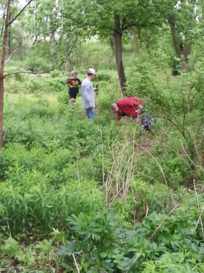
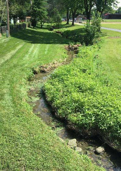
6 GREEN INFRASTRUCTURE & YOUR BACKYARD A Green Infrastructure Network is a connected system of natural areas and other open space that conserves natural ecosystem values and functions, sustains clean air and water, and provides a wide array of benefits to wildlife and people. The network is made up of hubs and linking corridors. Hubs generally consist of the largest and least fragmented areas such as Deer Grove Forest Preserve, Buffalo Creek Reservoir, large agricultural areas, and golf courses. Corridors are generally formed by smaller private residential parcels along developed reaches of Buffalo Creek and tributaries. Corridors are extremely important because they provide biological conduits between hubs. However, most parcels forming corridors are not ideal green infrastructure until residents embrace the idea of managing stream corridors or creating backyard habitats. Rain Barrel Source: Chicago Wilderness Green Infrastructure Vision June 2012 Permeable Pavers Bioswale Rain Garden

. 4.")


, or a small vegetated depression, to capture water is another way of promoting infiltration while")
not only reduces the amount of runoff entering")
7 If a portion of a stream runs through your backyard, here are some tips to help property manage your piece of the green infrastructure network: 1. MANAGER FERTILIZER USE Avoid over fertilizing lawns adjacent to streams and only use phosphorus when soil testing shows that it is necessary. 2. NO DUMPING Avoid dumping yard waste and clear heavy debris jams. 3. REMOVE NON-NATIVE SPECIES Identify and remove plants that are not native to the area (see photo guide, right). 4. PLANT NATIVE VEGETATION Deep rooted, native plants adapted to the Midwest climate can help control erosion by stabilizing banks. 5. NATURAL STREAMS Work with experts to restore degraded streams. For more information, check out the Lake County Stormwater Management Commission's booklet, Riparian Area Management: A Citizen's Guide, at RAIN BARREL DISCONNECTED DOWNSPOUT Any property owner can improve green infrastructure. Create a safe place for wildlife by providing a few simple things such as food, water, cover, and a place for wildlife to raise their young. The National Wildlife Federation s Certified Wildlife Habitat and the Conservation Foundation s Conservation@Home programs can help you get started. Golf courses can become certified through the Audubon Cooperative Sanctuary Program. Creating a rain garden (see photo, above), or a small vegetated depression, to capture water is another way of promoting infiltration while beautifying your yard and providing additional habitat. Disconnecting your roof downspouts and capturing that runoff in rain barrels (see photo, above)not only reduces the amount of runoff entering streams, but also serves as a great source of water for irrigating your yard. REMOVE THESE NON-NATIVE AND INVASIVE SPECIES BUCKTHORN REED CNARY GRASS PURPLE LOOSESTRIFE GARLIC MUSTARD TEASEL Chris Evans, Illinois Wildlife Action Plan Rob Routledge, Sault College Linda Haugen, USDA Forest Service Chris Evans, Illinois Wildlife Action Plan Steve Dewey, Utah State University


8 GET INVOLVED Watershed planning and implementation is a voluntary effort. Active watershed stakeholders are needed to put this watershed plan into action. Buffalo Creek Clean Water Partnership is in place to support plan implementation and future planning efforts. Contact the Buffalo Creek Clean Water Partnership to learn how you can help. The Buffalo Creek Watershed-Based Plan can be downloaded at: How can YOU help Buffalo Creek? Residents & Businesses Reduce fertilizer use on lawns and only use phosphorus based on soil testing results. Use less salt on driveways, parking lots, and sidewalks during winter months. Use native landscaping to decrease watering needs and maintenance. Install rain gardens and use rain barrels to reduce stormwater runoff. Manage your backyard as part of the green infrastructure network. Attend meetings with decision makers to express concerns about the watershed. Build a sense of community in your neighborhood around Buffalo Creek and the watershed. Attend watershed education events. Municipalities & Townships Adopt the Buffalo Creek Watershed-Based Plan and inform the public that a plan has been developed. Incorporate watershed plan goals and recommended actions into local comprehensive plans, zoning overlays, codes, and ordinances. Build demonstration projects, or large-scale water quality & public education projects, near public facilities. Distribute materials to help residents manage streams in their backyards. Forest Preserve Districts Control non-native/invasive species and replace with native vegetation. Look for opportunities to acquire green infrastructure protection areas. For more information contact: Buffalo Creek Clean Water Partnership Executive Summary & Plan produced by: Cardno All photos by Cardno unless otherwise noted. This plan was prepared using United States Environmental Protection Agency funds under Section 319 (h) of the Clean Water Act distributed through the Illinois Environmental Protection Agency. The findings and recommendations herein are not necessarily those of the funding agencies.
EXECUTIVE SUMMARY DES PLAINES RIVER WATERSHED-BASED PLAN WHY A WATERSHED-BASED PLAN? WHAT IS A WATERSHED?
 Des Plaines River Watershed-Based Plan EXECUTIVE SUMMARY June 2018 EXECUTIVE SUMMARY DES PLAINES RIVER WATERSHED-BASED PLAN WHY A WATERSHED-BASED PLAN? Water is elemental to our lives. Plants and animals,
Sustainable Water Resource Practices
 Sustainable Water Resource Practices This section is related to and shoudl be read in conjunction with the Land Use Element, and Conservation Element. Implementing sustainable water resource practices
ELK RAPIDS TOWNSHIP WATER QUALITY ACTION PLAN
 ELK RAPIDS TOWNSHIP WATER QUALITY ACTION PLAN Elk-River-Chain-of-Lakes Gaps Analysis Project The Watershed Center Grand Traverse Bay Tip of the Mitt Watershed Council Michigan Department of Natural Resources
BANKS TOWNSHIP WATER QUALITY ACTION PLAN
 BANKS TOWNSHIP WATER QUALITY ACTION PLAN Elk-River-Chain-of-Lakes Gaps Analysis Project The Watershed Center Grand Traverse Bay Tip of the Mitt Watershed Council Michigan Department of Natural Resources
VILLAGE OF BELLAIRE WATER QUALITY ACTION PLAN
 VILLAGE OF BELLAIRE WATER QUALITY ACTION PLAN Elk-River-Chain-of-Lakes Gaps Analysis Project The Watershed Center Grand Traverse Bay Tip of the Mitt Watershed Council Michigan Department of Natural Resources
Atlasof Biodiversity
 Atlasof Biodiversity Second Edition Atlasof Biodiversity Second Edition First published in 1997, the Chicago Wilderness Atlas of Biodiversity provides an introduction to our region s natural treasures.
The total population of the township is 9,942 (2015 Five-Year American Community Survey [ACS]). The median household income is over $109,000.
![The total population of the township is 9,942 (2015 Five-Year American Community Survey [ACS]). The median household income is over $109,000.](/thumbs/72/67990406.jpg "The total population of the township is 9,942 (2015 Five-Year American Community Survey [ACS]). The median household income is over $109,000.") East Bradford Township, Pennsylvania Motivated by watershed impairment caused by suburban development over the past 30 years, a township with a full slate of water quality improvement programs looks outside
East Bradford Township, Pennsylvania Motivated by watershed impairment caused by suburban development over the past 30 years, a township with a full slate of water quality improvement programs looks outside
INDIAN CREEK WATERSHED PLAN EXECUTIVE SUMMARY
 INDIAN CREEK WATERSHED PLAN EXECUTIVE SUMMARY The Indian Creek Watershed covers a 38 square mile area in southern Lake County, Illinois that drains 24,116 acres before discharging into the Des Plaines
D Olive Watershed. Path Toward Restoration
 D Olive Watershed Path Toward Restoration Water is the most critical resource issues of our lifetime and our children s lifetime. The health of our waters is the principal measure of how we live on the
CLEARWATER TOWNSHIP WATER QUALITY ACTION PLAN
 CLEARWATER TOWNSHIP WATER QUALITY ACTION PLAN Elk-River-Chain-of-Lakes Gaps Analysis Project The Watershed Center Grand Traverse Bay Michigan Department of Environmental Quality July 2011 Purpose The Grand
Education and Outreach Plan
 Education and Outreach Plan CRWD 2010 Watershed Management Plan - 9/1/2010 Appendix E - 1 Education and Outreach Plan CRWD 2010 Watershed Management Plan - 9/1/2010 Appendix E - 2 CRWD 2010 Watershed Management
CHAPTER 4 WATERSHED PLAN GOALS & OBJECTIVES
 4.0 Introduction CHAPTER 4 WATERSHED PLAN GOALS & OBJECTIVES After the watershed analysis had been completed, the next step in the planning process followed by the group was to come up with goals and objectives
anagement A new role for the Metropolitan Water Reclamation District of Greater Chicago Protecting Our Water Environment
 anagement A new role for the Metropolitan Water Reclamation District of Greater Chicago Protecting Our Water Environment The Waterways of Cook County Aerial photograph of Dr. Mary Woodland Reservoir, located
Primer introduction to watershed management Plan Process highlight the major steps of plan development Project types look at some examples of common
 1 Primer introduction to watershed management Plan Process highlight the major steps of plan development Project types look at some examples of common projects Plan Organization how to read the plan Next
Community Assistance Planning Report No. 330 A RESTORATION PLAN FOR THE OAK CREEK WATERSHED. Chapter 1 INTRODUCTION
 #239219 CAPR-330 (Oak Creek Watershed) Chapter 1 - Text 300-4010 MGH/LKH/JEB/mid 8/28/18, 9/6/18, 9/10/18 Community Assistance Planning Report No. 330 A RESTORATION PLAN FOR THE OAK CREEK WATERSHED Chapter
Municipal Stormwater Management Plan Prepared For The Borough of Cape May Point By Van Note-Harvey Associates VNH File No.
 Municipal Stormwater Management Plan Prepared For The Borough of Cape May Point By Van Note-Harvey Associates 2005 VNH File No. 35317-210-21 Table of Contents Introduction... 3 Goals... 3 Storm water Discussion...
TORCH LAKE TOWNSHIP WATER QUALITY ACTION PLAN
 TORCH LAKE TOWNSHIP WATER QUALITY ACTION PLAN Elk-River-Chain-of-Lakes Gaps Analysis Project The Watershed Center Grand Traverse Bay Tip of the Mitt Watershed Council Michigan Department of Natural Resources
14(h)EPA-06 City of Springfield 76 East High Street Springfield, Ohio Clark County Greening City Plaza
EPA-06 City of Springfield 76 East High Street Springfield, Ohio Clark County Greening City Plaza") 14(h)EPA-06 City of Springfield 76 East High Street Springfield, Ohio 45502 Clark County Greening City Plaza $100,000 in FY 2014 Section 319(h) Nonpoint Source grant funding is requested to install three
14(h)EPA-06 City of Springfield 76 East High Street Springfield, Ohio 45502 Clark County Greening City Plaza $100,000 in FY 2014 Section 319(h) Nonpoint Source grant funding is requested to install three
Community Benefits of Land Restoration
 Community Benefits of Land Restoration Introducing Green Infrastructure for Coastal Resilience Matt Fulda, Acting Director Monroe May 23 rd, 2017 Avery Point Campus, University of Connecticut Easton Trumbull
TMDL Report for Chesapeake Bay Shellfish Waters: Ware Creek, Taskinas Creek, and Skimino Creek Bacterial Impairments (VADEQ, 2010)
") As part of a long term commitment to environmental stewardship, James City County volunteers and staff have been gathering information about stream health throughout the County since 2008. The goal of
As part of a long term commitment to environmental stewardship, James City County volunteers and staff have been gathering information about stream health throughout the County since 2008. The goal of
Boardman River Townships Project EAST BAY TOWNSHIP. WATER QUALITY ACTION PLAN Fall 2009
 Boardman River Townships Project EAST BAY TOWNSHIP WATER QUALITY ACTION PLAN Fall 2009 Partners: The Watershed Center Grand Traverse Bay Northwestern Michigan College - Great Lakes Water Studies Institute
DC STORMWATER PLAN CONSOLIDATED TOTAL MAXIMUM DAILY LOAD (TDML) IMPLEMENTATION PLAN
 IMPLEMENTATION PLAN") DC STORMWATER PLAN CONSOLIDATED TOTAL MAXIMUM DAILY LOAD (TDML) IMPLEMENTATION PLAN CONTENTS Introduction 1 The Challenge 5 The Solution 7 Tracking Progress 11 What can you do? 15 INTRODUCTION The DC Stormwater
DC STORMWATER PLAN CONSOLIDATED TOTAL MAXIMUM DAILY LOAD (TDML) IMPLEMENTATION PLAN CONTENTS Introduction 1 The Challenge 5 The Solution 7 Tracking Progress 11 What can you do? 15 INTRODUCTION The DC Stormwater
Post-Development Stormwater Runoff Performance Standards
 Post-Development Stormwater Runoff Performance Standards December 9, 2014 Topics Why performance standards? What practices/requirements are in effect in other States? The Workgroup s preliminary and final
Cannon River One Watershed, One Plan. POLICY COMMITTEE MEETING January 10, 2018 Rice County Government Center Faribault, MN
 Cannon River One, One Plan POLICY COMMITTEE MEETING January 10, 2018 Rice County Government Center Faribault, MN TASK Task 1. Aggregate Existing Physical & Spatial Data 1A. Create project maps 1B. Meeting
The Indian Creek Watershed Project Restoring Habitat and Water Quality for ALL Our Stakeholders
 The Indian Creek Watershed Project 1999-2009 Restoring Habitat and Water Quality for ALL Our Stakeholders Concerned Citizens formed the Indian Creek Watershed Project, Ltd. in 2000 to implement Educational
Natural Resource Protection is the Goal: (no further elaboration needed)
") What is NEMO? NEMO (Nonpoint Education for Municipal Officials) is an educational program for local land use decision makers focusing on the relationship between land use and natural resource quality.
What is NEMO? NEMO (Nonpoint Education for Municipal Officials) is an educational program for local land use decision makers focusing on the relationship between land use and natural resource quality.
ANCR INDIVIDUAL RESPONSES SUMMARY: 2/11/04 WATER RESOURCES GOALS AND OBJECTIVES
 ANCR INDIVIDUAL RESPONSES SUMMARY: 2/11/04 WATER RESOURCES GOALS AND OBJECTIVES Goal 1: Protect the health and safety of the Dane County population. a. Prevent development that may have an adverse effect
Don t Mow. Let it Grow!
 Don t Mow. Let it Grow! The Science Behind the Need for Riparian Buffer Protection. Chelsea Walker, WCD Watershed Specialist chelsea@wcdpa.com 724-837-5271 What is a Riparian Buffer? A riparian buffer
MILTON TOWNSHIP WATER QUALITY ACTION PLAN
 MILTON TOWNSHIP WATER QUALITY ACTION PLAN Elk-River-Chain-of-Lakes Gaps Analysis Project The Watershed Center Grand Traverse Bay Tip of the Mitt Watershed Council Michigan Department of Natural Resources
BEE BRANCH WATERSHED GREEN INFRASTRUCTURE SUMMARY
 BEE BRANCH WATERSHED GREEN INFRASTRUCTURE SUMMARY purpose & background PURPOSE & BACKGROUND Through the Bee Branch Watershed Green Infrastructure Project, the City proposes to install permeable interlocking
Water Quality Stewardship Plan (WaQSP)
") Salt Lake Countywide Water Quality Stewardship Plan (WaQSP) Natalie Rees Salt Lake County Flood Control & Engineering Division 2008 Watershed Symposium COUNTY RESPONSIBILITY AND AUTHORITY Salt Lake County
Salt Lake Countywide Water Quality Stewardship Plan (WaQSP) Natalie Rees Salt Lake County Flood Control & Engineering Division 2008 Watershed Symposium COUNTY RESPONSIBILITY AND AUTHORITY Salt Lake County
Blackberry Creek Watershed Action Plan
 1 Blackberry Creek Watershed Action Plan Executive Summary December 2011 Planning to protect local water resources Beginning in fall 2010, community members in south central Kane County and north central
NOVATO WATERSHED PROGRAM
 NOVATO WATERSHED PROGRAM NOVATO CITY COUNCIL Photo Credit: Sue Lattanzio AGENDA OVERVIEW OF TONIGHT S TALK Slide 2 Context what is a watershed? Process how did we implement the watershed approach? Content
Green Infrastructure Financing
 Green Infrastructure Financing Jennifer Cotting Environmental Finance Center National Center for Smart Growth University of Maryland December 2012 Green Infrastructure Financing What we will cover: Why
I. Welcome & Introductions WPAC History (Paul Racette, PEC)
") Poquessing Creek Watershed ACT 167 STORM WATER MANAGEMENT PLAN Public Hearing July 10, 2012 I. Welcome & Introductions ---------- WPAC History (Paul Racette, PEC) Primary WPAC Members: Bucks County: Bensalem
Poquessing Creek Watershed ACT 167 STORM WATER MANAGEMENT PLAN Public Hearing July 10, 2012 I. Welcome & Introductions ---------- WPAC History (Paul Racette, PEC) Primary WPAC Members: Bucks County: Bensalem
Grand Traverse Bay Watershed Protection Plan:
 Grand Traverse Bay Watershed Protection Plan: An Overview Sarah U Ren Program Director The Watershed Center 231-935-1514, suren@gtbay.org The Grand Traverse Bay Watershed 973 square miles Bay Volume =
Anacostia River Watershed Restoration Plan. Paint Branch Subwatershed Provisional Restoration Project Inventory
 Anacostia River Watershed Restoration Plan Paint Branch Subwatershed Provisional Restoration Project Inventory November 2009 Table of Contents I. Background... 2 II. Restoration Inventory... 3 A. Impervious
SECTION 3 NATURAL RESOURCES
 SECTION 3 NATURAL RESOURCES The natural environment plays a large role in planning for future development. Environmental conditions, such as topography, wetlands, floodplains, and water bodies, can often
Incorporating Restoration Planning and Transportation Controls into the Valley Creek Watershed Act 167 Stormwater Management Plan
 Incorporating Restoration Planning and Transportation Controls into the Valley Creek Watershed Act 167 Stormwater Management Plan Pennsylvania State Section American Water Resources Association Fall 2011
June 27, 2012 Holly Galavotti U.S. EPA
 June 27, 2012 Holly Galavotti U.S. EPA Urban stormwater is a leading source of water quality impairment Urban stormwater identified as source of impairment (2004 WQ Report) 22,559 miles of impaired rivers
Goose Creek Watershed Assessment Summary October 2003
 Goose Creek Watershed Assessment Summary October 2003 The Goose Creek Watershed The Goose Creek watershed is 385 square miles, covering nearly half of Loudoun County and one-quarter of Fauquier County
BMP 5.4.2: Protect /Conserve/Enhance Riparian Areas
 BMP 5.4.2: Protect /Conserve/Enhance Riparian Areas The Executive Council of the Chesapeake Bay Program defines a Riparian Forest Buffer as "an area of trees, usually accompanied by shrubs and other vegetation,
Green Infrastructure. Jesse Schomberg University of Minnesota Sea Grant Program
 Green Infrastructure Jesse Schomberg University of Minnesota Sea Grant Program Forest Cover Storage (Wetlands) What alters this process? Altered runoff patterns North Shore Streams: Miles of Stream
Environmental Resource Inventories. What are ERIs? Significance of information How to use them
 Environmental Resource Inventories What are ERIs? Significance of information How to use them Environmental Resource Inventory - ERI Compiled by the environmental commission Information about the natural
Reservoir age, increasing human population,
 B-6249 02/12 Eagle Mountain Watershed Management Brent Clayton, Justin Mechell, David Waidler and Clint Wolfe* Reservoir age, increasing human population, and changing land uses have prompted the development
Acres 32% 35% Not Suitable. Impervious. Possible UTC. Vegetation. Existing UTC
 Acres A Report on Washington, D.C. s Urban Tree Canopy Why is Tree Canopy Important? Urban tree canopy (UTC) is the layer of leaves, branches, and stems of trees that cover the ground when viewed from
OUR MISSION: To preserve, protect, and restore Delaware s Inland Bays the water that flows into them and the watershed around them.
 OUR MISSION: To preserve, protect, and restore Delaware s Inland Bays the water that flows into them and the watershed around them. OUR In 1988, the Delaware Inland Bays were declared an estuary of national
Bee Meadow Pond Shoreline Restoration Project
 Bee Meadow Pond Shoreline Restoration Project Executive Summary Bee Meadow Pond is one of three ponds located in Bee Meadow Park. The ponds are stocked for fishing, but boating and swimming are not allowed.
Suggested Stormwater Management Practices For Individual House Lots
 Suggested Stormwater Management Practices For Individual House Lots These practices are necessary to satisfy the water quantity and water quality criteria of the Rappahannock Stormwater Ordinance. These
Bear Creek/Bear Lake Upper Watershed Information and Education Plan
 Bear Creek/Bear Lake Upper Watershed Information and Education Plan Addressing Stormwater Pollution Prevention and the Muskegon Lake Area of Concern Eutrophication Beneficial Use Impairment (BUI) 2010
Model Riparian Buffer Ordinance.
 Model Riparian Buffer Ordinance. This is a sample riparian buffer ordinance written as an amendment to an existing zoning ordinance. This ordinance complies with the state minimum standards for river corridor
Pennsylvania Stormwater Best Management Practices Manual. Chapter 3. Stormwater Management Principles and Recommended Control Guidelines
 Pennsylvania Stormwater Best Management Practices Manual Chapter 3 Stormwater Management Principles and Recommended Control Guidelines 363-0300-002 / December 30, 2006 Chapter 3 Stormwater Management Principles
The Status of Pompeston Creek, : From Data to Action. Pompeston Creek Watershed Association
 Pompeston Creek Watershed Association P.O. Box 2883 Cinnaminson, NJ 08077 (856) 235-9204 www.pompestoncreek.org The Status of Pompeston Creek, 1998-2008: From Data to Action Pompeston Creek Watershed Association
Watershed Planning in Blackberry Creek We Save Land. We Save Rivers.
 Watershed Planning in Blackberry Creek We Save Land. We Save Rivers. What is a watershed? The area of land that catches rain and snow and drains into a stream, river, lake or groundwater. How land is used
PRESERVING THE KISHWAUKEE WATERSHED
 PRESERVING THE KISHWAUKEE WATERSHED Guiding development in the Marengo-Union region Executive Summary This project is funded through a grant from the Joyce Foundation Sponsored and funded by the City of
Water Quality Regulatory Programs and Our Citywide EPA / DEQ Stormwater Permit. Public Works Engineering City Council Briefing June 7, 2016
 Water Quality Regulatory s and Our Citywide EPA / DEQ Stormwater Permit Public Works Engineering City Council Briefing June 7, 2016 Briefing Topics Introduction: Regulatory Overview Elements of the MS4
Local Wetland Protection in a Changing Climate. Michigan Inland Lakes Convention May 1, 2014
 Local Wetland Protection in a Changing Climate Michigan Inland Lakes Convention May 1, 2014 LIAA is a Section 501(c)3 nonprofit corporation created in 1993 to stimulate & support greater civic engagement.
OVERVIEW 2016 FIVE STAR & URBAN WATERS GRANT PROGRAM. January 7, 2016 NIRPC EMPC Meeting
 OVERVIEW 2016 FIVE STAR & URBAN WATERS GRANT PROGRAM January 7, 2016 NIRPC EMPC Meeting Program Overview Nationwide grant program to support on-the-ground, community-based conservation, outreach and education/training
DAKOTA COUNTY SOIL AND WATER CONSERVATION DISTRICT COMPREHENSIVE PLAN
 DAKOTA COUNTY SOIL AND WATER CONSERVATION DISTRICT COMPREHENSIVE PLAN 2011-2015 4100 220 th Street West, Suite 102 Farmington, MN 55024 651-480-7777 www.dakotacountyswcd.org I. INTRODUCTION A. Purpose
Cayuga Lake is not forever. We need to protect it better.
 Cayuga Lake is not forever. We need to protect it better. September 26, 2016 Sustainability Perspectives Wells College, Aurora NY Hilary Lambert Cayuga Lake Watershed Network Mission Statement The Cayuga
Pike County: Where People, Land and Water Meet. Will your actions today protect the natural resources for the next generation?
 Pike County: Where People, Land and Water Meet Will your actions today protect the natural resources for the next generation? Residents & visitors of Pike County share fond memories of swimming and fishing
Purpose of Shoreland Zoning:
 January, 2016 Purpose of Shoreland Zoning: 1. Further the maintenance of safe and healthful conditions 2. Prevent and control water pollution 3. Protect spawning grounds, fish, and aquatic life 4. Regulate
Green Infrastructure: A Guide to Asset Mapping in the Rappahannock-Rapidan Region. Rappahannock-Rapidan Regional Commission December 2015
 Green Infrastructure: A Guide to Asset Mapping in the Rappahannock-Rapidan Region Rappahannock-Rapidan Regional Commission December 2015 What Is Green Infrastructure? Green infrastructure is an interconnected
CBP Implementation Plan
 York County Conservation District CBP Implementation Plan March 2014 York County Conservation District 118 Pleasant Acres Road York, PA 17402 Phone: (717) 840-7430 www.yorkccd.org 1 Table of Contents Introduction
Carter Lake Restoration Project
 Carter Lake Restoration Project Location in Iowa EPA 303d Impaired Waters list for; phosphorus, nitrogen, algae, toxic algae, chlorophyll, PCBs, ph, ammonia, and low dissolved oxygen. High concentrations
Appendix A Stormwater Site Plan Report Short Form
 Appendix A Stormwater Site Plan Report Short Form The Stormwater Site Plan Report Short Form may be used for projects that trigger only Minimum Requirements #1-#5. These projects typically fall within
CHAPTER 4.2 ENVIRONMENTAL ELEMENT
 CHAPTER 4.2 ENVIRONMENTAL ELEMENT Vision: Promote efforts that will conserve, protect, and improve the quality of natural resources, and assure that all new development meets strict environmental quality
Pennichuck Brook Watershed Buildout Analysis December 2003
 INTRODUCTION The Pennichuck Brook watershed (Figure 1) includes approximately 17,700 acres within the communities of Amherst, Hollis, Merrimack, Milford and Nashua and is the primary drinking water supply
CREEKS OF THE MIDDLE FOX RIVER 2016 Progress Report
 CREEKS OF THE MIDDLE FOX RIVER 2016 Progress Report Brewster approximately three years after dam removal Presented by the Sierra Club Valley of the Fox Water Sentinels ILLINOIS CHAPTER PRESERVING THE FOX
A Case Study of Suburban Infill Redevelopment, Stormwater challenges, and Partnerships
 A Case Study of Suburban Infill Redevelopment, Stormwater challenges, and Partnerships Matt Meyers and Ronald Tuttle Fairfax County, Department of Public Works and Environmental Services Stormwater Management
Chapter 11 Intergovernmental Coordination and Implementation
 Chapter 11 Intergovernmental Coordination and Implementation Regional Framework Plan Vision In the year 2020, Lake County will have developed cooperation between County, municipal, township, and other
Outcomes. Kelly Karll-SEMCOG Margaret Barondess - MDOT
 Eco-Logical: I-75 Corridor I-75 Conservation Transportation Action Planning in to Monroe Achieve County: Multiple Stormwater Environmental Considerations Outcomes Kelly Karll-SEMCOG Karll@semcog.org Margaret
Des Plaines River Watershed Plan
 Des Plaines River Watershed Plan February 1, 2017 FUNDING FOR THIS PROJECT PROVIDED, IN PART, BY THE ILLINOIS ENVIRONMENTAL PROTECTION AGENCY THROUGH SECTION 319 OF THE CLEAN WATER ACT. Des Plaines River
Final Report of the Riparian Forest Buffer Panel
 Chesapeake Bay Program Final Report of the Riparian Forest Buffer Panel Introduction Findings Land Use-Specific Findings On Agricultural Land On Forested Land On Developed and Developing Lands Recommendations
Habitat Grant Projects Clinton River Watershed
 Habitat Grant Projects Clinton River Watershed L Y N N E S E Y M O U R E N V I R O N M E N T A L E N G I N E E R O F F I C E O F T H E M A C O M B C O U N T Y P U B L I C W O R K S C O M M I S S I O N
Ohio Environmental Protection Agency WATER QUALITY IMPROVEMENT GRANTS LAKE ERIE WATERSHED
 Ohio Environmental Protection Agency WATER QUALITY IMPROVEMENT GRANTS LAKE ERIE WATERSHED The following summaries describe projects that are recommended funding in the Lake Erie These projects have been
STREAM FUNCTION INDEX SUMMARY. Addendum to the Salt Lake Countywide
 STREAM FUNCTION INDEX SUMMARY Addendum to the Salt Lake Countywide Water Quality Stewardship Plan Comments? Let us know! Salt Lake County Watershed Planning & Restoration Program Flood Control & Water
A Summary Guide to the. Rifle River WATERSHED MANAGEMENT PLAN. Know Your Watershed Protect Its Resources
 A Summary Guide to the Rifle River WATERSHED MANAGEMENT PLAN Know Your Watershed Protect Its Resources Table of Contents The Watershed... 3 The Management Plan... 4 Designated and Desired Uses... 5 Sources
Big Creek Watershed Retrofit Ranking Project
 Big Creek Watershed Retrofit Ranking Project John Stein and Jennifer Olson Tetra Tech, Inc. Bob Gardin, FOBC Innovative Stormwater Conveyance Through Green Infrastructure May 13, 2014 Presentation Outline
Chapter 10 Natural Environment
 Chapter 10 Natural Environment Existing Conditions The Natural Environment Element addresses the protection, conservation, preservation, and restoration of the natural resources the Bayview Ridge Subarea,
DES PLAINES RIVER WATERSHED WORKGROUP DRAFT WORKPLAN /18
 DES PLAINES RIVER WATERSHED WORKGROUP DRAFT WORKPLAN 2017-2021 1/18 1 DRWW: A BRIEF HISTORY Lakes and streams within the Des Plaines River watershed have been identified by the Illinois Environmental Protection
Shell Rock River Watershed: Water Plans
 Shell Rock River Watershed: Water Plans The Shell Rock River Watershed encompasses Freeborn County. Each county has developed a 10-year rotating comprehensive local water management plan (LWMP) in order
CITY OF HAPEVILLE STORMWATER UTILITY IMPLEMENTATION. Presented by: Michael J. Moffitt, P.E. (Keck & Wood, Inc.) City Engineer.
 City Engineer.") CITY OF HAPEVILLE STORMWATER UTILITY IMPLEMENTATION Presented by: Michael J Moffitt, PE (Keck & Wood, Inc) City Engineer May, 2016 What is Stormwater? Stormwater is rain or snowmelt that falls on streets,
CITY OF HAPEVILLE STORMWATER UTILITY IMPLEMENTATION Presented by: Michael J Moffitt, PE (Keck & Wood, Inc) City Engineer May, 2016 What is Stormwater? Stormwater is rain or snowmelt that falls on streets,
7 Natural Resources. Goals and Policies 7-1
 7 Natural Resources The City of Mendota Heights is fortunate to have a wide variety of Natural Resources. These natural resources are an important recreation, aesthetic, and ecological asset to the community
Chapter 3 Dispersion BMPs
 Chapter 3 Dispersion BMPs 3.1 BMP L611 Concentrated Flow Dispersion 3.1.1 Purpose and Definition Dispersion of concentrated flows from driveways or other pavement through a vegetated pervious area attenuates
From My Backyard to Our Bay It s the 911 for the Chesapeake Bay
 From My Backyard to Our Bay Reporting Problems on Our Bay, Rivers, and Streams We can all be the eyes and ears of our local waterways. Maryland has established the Chesapeake Bay Safety and Environmental
Mukwonago River Watershed Protection Plan Recommendations & Implementation Update Friends of Mukwonago River March 16, 2013 Mukwonago, WI
 Mukwonago River Watershed Protection Plan Recommendations & Implementation Update Friends of Mukwonago River March 16, 2013 Mukwonago, WI Thomas M. Slawski, Principal Specialist Biologist Southeastern
Roots for Rivers. An Introduction to Floodplain Restoration & Steps For Implementing A Reforestation Project In Your Watershed
 Roots for Rivers An Introduction to Floodplain Restoration & Steps For Implementing A Reforestation Project In Your Watershed Kimber Ray Resource Service Coordinator The Watershed Institute 609-737-3735
Natural Resources of Chatham
 Natural Resources of Chatham Andrew Meyer, Beth Roessler, Karen Strong, and Emily Vail NYSDEC Hudson River Estuary Program and Cornell University Presentation to Town of Chatham, December 6, 2012 The Hudson
The Metropolitan District. Water Bureau Presentation May 18, 2016
 The Metropolitan District Water Bureau Presentation May 18, 2016 TOPICS WATER SUPPLY SAFE YIELD DROUGHT WATERSHED MANAGEMENT 2 ACTIVE WATER SUPPLY SOURCES Nepaug Reservoir 9.5 BG completed in 1917 Barkhamsted
OTHER APPROACHES TO MANAGING POLLUTANT SOURCES
 OTHER APPROACHES TO MANAGING POLLUTANT SOURCES Laws, Land Use, and Laypersons' Participation [Chapter 10] Rules of Thumb Rule 1 One management measure alone rarely achieves the desired result. Rule 2 Both
Lake Creek Watershed Management Plan Public Meeting. Arrowhead Lake May 3, :00 PM
 Lake Creek Watershed Management Plan Public Meeting Arrowhead Lake May 3, 2018 6:00 PM Agenda I. Welcome and Introductions II. III. IV. Watershed Basics Overview of Lake Creek Watershed Elements of a Successful
SUSTAINABLE MUNICIPAL WATER MANAGEMENT PROGRAM
 THE CITY OF ST. CATHARINES SUSTAINABLE MUNICIPAL WATER MANAGEMENT PROGRAM SUSTAINABLE MUNICIPAL WATER MANAGEMENT PROGRAM THE CITY OF ST. CATHARINES Background As a member of the Great Lakes and St. Lawrence
Sewage Overflows in the Detroit River. Photo Credit: Bob Burns, Detroit Riverkeeper
 Sewage Overflows in the Detroit River Photo Credit: Bob Burns, Detroit Riverkeeper Great Lakes Regional Collaboration In May of 2004, President Bush issued an Executive Order Recognized Great Lakes as
STREAM AND BUFFER AREA PROTECTION/RESTORATION
 STREAM AND BUFFER AREA PROTECTION/RESTORATION AMENDMENT OPTIONS TO STRENGTHEN POLICY IN HEADWATERS AREAS DRAFT SUBSEQUENT TO THE JANUARY 25, 2007 MEETING OF THE PLANNING COMMISSION ENVIRONMENT COMMITTEE
WATER RESOURCES PAGE. Groundwater
 WATER RESOURCES PAGE Water Resources Water resources consist of two main sources of water: surface water and groundwater. Surface water is water in a river, lake or fresh water wetland. Surface water is
SDC 2.0 Working Group: Goals, Actions and Targets Nature + Water
 1 SDC 2.0 Working Group: Goals, Actions and Targets Nature + Water *KEY: Yellow highlights are proposed new text. NATURE 1 Goal 1: Protect, restore, and expand aquatic ecosystems. Target 1: CURRENT: By
Redwood Heights Stage 2 Update. Citizen s Advisory Committee April 25, 2017
 Redwood Heights Stage 2 Update Citizen s Advisory Committee April 25, 2017 Outline Transportation Study Utility Servicing Biodiversity Conservation Strategy Outstanding Items Timeline Water Servicing Limited
INVESTIGATING YOUR STREAM S DRAINAGE BASIN
 IT S OUR WATER INVESTIGATING YOUR STREAM S STREAM ACTIVITY SUMMARY Using maps, students will determine land uses in the drainage basin of their stream and calculate the approximate percentage of impervious