Wetland Loss and Degradation: The Hidden Costs of Ethical Oil
|
|
|
- Alfred Floyd
- 5 years ago
- Views:
Transcription

1 Wetland Loss and Degradation: The Hidden Costs of Ethical Oil Photo: Peter Essick Rebecca Rooney 1,2, Suzanne Bayley 2, Dustin Raab 2 1 Dept Biology, University of Waterloo, Waterloo, ON, Canada 2 Dept of Biological Sci, University of Alberta, Edmonton, AB, Canada rrooney@ualberta.ca

2 Ethical oil Ezra Levant (2010) Ethical oil: the case for Canada s oil sands Political oppression Human rights Canada vs. OPEC How to prioritize human and environmental ethical factors? Oil companies operating in Alberta are the same ones in China and the middle east. What are the costs?
 PNAS, 109:")

3 Wetlands in the oil sands area Rooney, Bayley, and Schindler (2012) PNAS, 109: Boreal Plain 475,000 ha is mineable 99% leased ~170,000 ha approved (10)


4 Oil sands accessed by strip mining Edward Burtynsky


5 Google Earth Image 0.33 and 0.63 m 2 of land 1m 3 of oil produced 12 km 49,700,000 m 3 produced in 2010 > 16.4 km 2

6 Data from Alberta Environment and Sustainable Resources Development Public liability Uncertainty of reclamation success The area of disturbed land that still needs to be reclaimed

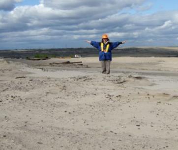
7 Lots of peatland Little upland Little open water Pre-mining, the region is 62% peatland Suncor 2010


8 No peatland Mainly upland End pit lakes and stream network Suncor 2010

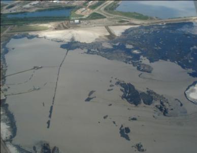
9 Wetland loss 1) Peatland dominated landscape will be replaced with a few, subsaline, shallow open water marshes. Photo: Suzanne Bayley 2004

10 Reclaimed forest It will take time for trees to mature

11 Constructed riparian area

12 Constructed marsh

13 4 mines provided comparable baseline and closure habitat area numbers Horizon Muskeg River Jackpine 1 Kearl 42% of land approved for mining
14 Wetland loss: mainly peatland Scale Description up: ~30,000 ha of peatland destroyed Total Pre Total Post Net change (ha) (ha) (ha) (%) Upland forest Shrubland Bog ~4000 ha of marsh created ~5500 ha of riparian shrubland created Fen Gramminoid marsh Swamp Shallow open water Lake Riparian shrubland Littoral zone infinite Disturbance But, no operational scale evidence that reclamation efforts will succeed. What is the cost? Peatland (bog & fen)

15 Biodiversity: > 300 plant species Photo: Dave Locky 2004


16 Habitat for species at risk Carbon storage Water storage Reclaimed Natural Traditional use Bog Cranberry
 Ottawa, Ontario, Canada.")
17 Integrated risk assessment for Boreal Caribou Environment Canada (2011) Ottawa, Ontario, Canada. 102 pp.

18 Reclamation and wetland degradation 2) The shallow open water marshes built for reclamation do not resemble natural shallow open water marshes Physical and chemical environment Plant community


19 OIL SANDS MINING PROCESS PEAT SURFICIAL DEPOSITS MARINE CLAYS OIL SANDS 19 of 40


20 Difficulties in wetland construction Water quality Salt Metals Hydrocarbons
")
 Shallow")

 Wet")
21 Reclamation wetlands Small (1-20 ha) Elevated salinity (~ 1000 μs/cm) Shallow open water wetlands 3 vegetation zones Emergent (EM) Open water (OW) Wet meadow (WM)


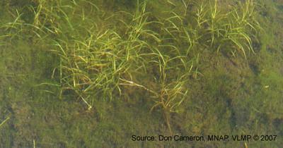
22 63 wetlands 38 REF 12 Phys. 13 Tailings Reference Physically disturbed Similar range in salinity, surface area, depth, and turbidity. Tailings contaminated Ref sites ranged north and south / east and west of the reclamation wetlands.
23 E.g., same range of salinity Total dissolved solids (g/l) Tailings contaminated Physically disturbed Reference Order 16 April 2012 Dr. Rebecca Rooney 23
24 1) Environmental stress? Usually abiotic Usually biotic Stress Response Driver Stress Stress Response
25 Are reclamation wetlands under greater stress? 52 environmental variables Ordination to summarize PC 2 Scores Na Conductivity Cations Anions TDS NH4 + TDN TN TP PC 1 Scores Rooney and Bayley (2010) Ecol. Indic., 10: Just need 8 Water Sediment Physical Cont. Cations TN % water Max depth Secchi/Total Amplitude % oil Cl -
26 Stress Score Stress scores of all wetlands Kruskal-Wallis with non-parametric multiple comparisons test REF < OS reference < OS process affected, at α = Wetland Name Reference Physically disturbed Tailings contaminated
27 2) Biological response? Salinity Nutrient limitation Mining Turbidity Depth Slope Hydrocarbons Response?
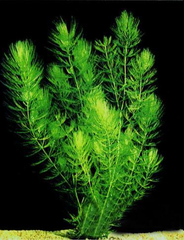
28 Chara Myriophyllum No spp. R. cirrhosa P. pusillus C. demersum U. macrorhiza Total Oil sands wetlands have different SAV Categorical test of independence 74% of all Reference wetlands REF OSREF OSPA Total χ 2 = 67.75, d.f. = 12, p < Rooney and Bayley (2011) Ecol. Engineering, 37:


29 Carex atherodes, Scutellaria galericulata Carex aquatilis Hordeum jubatum, Sonchus spp. Total Oil sands wetlands have different wet meadow plants Reference 76% of REF Reclaimed sedge REF OSREF OSPA Disturbed/saline Total Dustin Raab (2010) MSc. thesis
 Rooney and Bayley")

30 Index of Biotic Integrity: submersed aquatic veg (SAV) Rooney and Bayley (2012) Env. Monit. Assess., 184: April 2012 Dr. Rebecca Rooney 30


31 1. Select biotic metrics Measure Variables % C. demersum Diversity % Alkali tolerant 60 initial candidate metrics 11 significantly related to stress scores (α < 0.05) Low Stress Gradient High


32 2. Minimize redundancy 5 nonredundant (Pearson r 0.6)
33 SAV IBI Score 3. Verify: SAV IBI scores by wetland type Reference < 12 ANOVA: F 2,59 = 34.7, p < Constructed > R 2 = 0.51 P < Stress Score Reference Physically disturbed Tailings contaminated
34 WM IBI Score IBI: wet meadow vegetation Reference Component metrics Robel height (Biomass) Vegetation zone width Mean C value Relative diversity exotic spp. Relative diversity halophytes Raab and Bayley (2012) Ecol. Indic., 15: Constructed R 2 = 0.50 P < Reference Stress Score Physically disturbed Tailings contaminated
35 Higher stress, lower health Salinity Nutrient limitation SAV Mining Turbidity Depth Slope Wet meadow Hydrocarbons

36 Summary Oil sands mining causes massive loss of peatland ~30,000 ha peatland destruction already approved Functions and values of pealtand


37 Summary continued Reclamation not restoration Replace peatlands with much less shallow open water marsh Different functions and values Reclamation marshes are not healthy Elevated environmental stress Different plant communities Lower biotic integrity
38 Conclusions Development charges ahead of reclamation creating 61,000 ha of reclamation debt 65% of land in the area was wetland Peatland is destroyed Replacement wetlands are different in type and of inferior quality Concern that reclamation plans may not be achievable Improved reclamation practices are needed


39 Co-authors: Dr. S. Bayley, D. Raab Acknowledgements Collaborators: Dr. L. Foote, Dr. J. Ciborowski, Dr. R. Vinebrook, Dr. H. Proctor, Dr. J.C. Cahill, C. Nielsen, D. Fabijan, & M. Bolding Many field and lab assistants
Wetlands, Function & Value:
 Wetlands, Function & Value: Natural, Restored, & Constructed August 12, 2015 Dr. David Locky PWS, P.Biol Wetlands are the only ecosystem in the world recognized by international treaty, the Ramsar Convention
Wetlands in Alberta: Challenges and Opportunities. David Locky, PhD, PWS, PBiol Grant MacEwan University
 Wetlands in Alberta: Challenges and Opportunities David Locky, PhD, PWS, PBiol Grant MacEwan University Overview What & Where Function & Value Alberta s Keystone Ecosystem Losses & Impacts Restoration
Fort McKay Specific Assessment
 BIODIVERSITY Fort McKay Specific Assessment Fort McKay Industry Relations Corporation March 2010 [Fort McKay Specific Assessment] Contents 8.0... 1 Figures 8.1 Fort McKay Concerns Related to... 1 8.2
Regulatory and Assessment Challenges for Muskeg Soil at Oil and Gas Sites in Northeast BC
 Regulatory and Assessment Challenges for Muskeg Soil at Oil and Gas Sites in Northeast BC Tom Frkovich, P.Geo. SynergyAspen Environmental 2013 Remediation Technologies Symposium Regulatory and Assessment
Integrated Surface Water and Groundwater Modelling for Oil Sands Reclamation
 Integrated Surface Water and Groundwater Modelling for Oil Sands Reclamation Ranjeet Nagare 1, Young-Jin Park 2, Jalpa Pal 1 1 WorleyParsons Canada Services Ltd. 2 Aquanty Inc. Shell, 2006 (AER, 2014)
Bin Xu NSERC Industrial Research Chair for Colleges, Peatland Restoration NAIT
 Management and Restoration of Wooded Peatland in Alberta Bin Xu NSERC Industrial Research Chair for Colleges, Peatland Restoration NAIT Peatland Wetland with a minimum depth of 40cm peat, a deposit of
REFERENCE WETLANDS. Karen Newlon and Cat McIntyre Montana Natural Heritage Program Helena, MT
 REFERENCE WETLANDS Karen Newlon and Cat McIntyre Montana Natural Heritage Program Helena, MT REFERENCE CONCEPT Indicators are evaluated against some expectation of condition Expectations act as a reference
The Facts on Oil Sands Reclamation. By: Don Thompson July 31, 2008
 The Facts on Oil Sands Reclamation By: Don Thompson July 31, 2008 The History 1 In the Beginning The oil sands industry is ~ 45 years old 1/2 the average return period for forest fires in the region (80
Projecting impacts of climate change on reclaimed forest in the mineable oil sands
 Projecting impacts of climate change on reclaimed forest in the mineable oil sands Shifting reclamation targets? Hedvig Nenzén, David Price, Brad Pinno, Elizabeth Campbell, Dominic Cyr, Yan Boulanger,
Developing Protocols for the Ecological Restoration of a Mine Site in the Hudson Bay Lowland, Canada
 Developing Protocols for the Ecological Restoration of a Mine Site in the Hudson Bay Lowland, Canada Daniel Campbell Birchbark Environmental Research boreal.daniel.campbell@gmail.com What is ecological
Case Study Validation of the New Alberta Reclamation Criteria for Wellsites and Associated Facilities for Peatlands
 Case Study Validation of the New Alberta Reclamation Criteria for Wellsites and Associated Facilities for Peatlands Doug Bright, Ph.D., Practice Lead Environmental Risk Assessment October 13, 2016 Background
University of Alberta
 University of Alberta Reclamation of wetland habitat in the Alberta oil sands: Generating assessment targets using boreal marsh vegetation communities by Dustin Jeremy Raab A thesis submitted to the Faculty
HABITATS INTRODUCTION
 386 HABITATS INTRODUCTION can be defined in the landscape as mappable units and include both biotic and abiotic characteristics. This section of the Natural History of Nova Scotia deals with the habitats
3.2 Biomes and Aquatic Zones
 3.2 Biomes and Aquatic Zones Learning Goals: 1. Identify a biome based on its temperature, precipitation, and dominant plant species. 2. Identify a marine life zone based on its location and amounts of
Alberta Transportation s Wetland Habitat Compensation Program
 Alberta Transportation s Wetland Habitat Compensation Program Water Technologies Symposium 2014 Mark Svenson, P.Biol Provincial Transportation Environmental Coordinator Alberta Transportation Outline Wetland
Aquatic Science Unit 1. Introduction to Freshwater Ecology
 Aquatic Science Unit 1 Introduction to Freshwater Ecology Water is essential to life Water is essential to the survival of all living things No living organism can survive without water Humans cannot go
50% $3 BILLION CAPTURE 3.5 TAILINGS MANAGEMENT OF TAILINGS FINE PARTICLES IN DEDICATED DISPOSAL AREAS BY 2015 INVESTMENT TO MANAGE TAILINGS
 34 Environment Tailings Management SYNCRUDE SUSTAINABILITY REPORT 3.5 TAILINGS MANAGEMENT CONTEXT Both stakeholders and regulators have expressed concerns regarding the growth of tailings volumes and potential
Ecological Considerations in Setting MFLs and Lake Regulation Targets for the Ocklawaha Chain of Lakes
 Ecological Considerations in Setting MFLs and Lake Regulation Targets for the Ocklawaha Chain of Lakes Rolland Fulton, Ph.D. Environmental Scientist VI Bureau of Environmental Sciences St. Johns River
Whereas, Whereas, Whereas, Whereas, Whereas, Whereas, Whereas, Whereas, Therefore be it resolved: That That That That That That
 Resolution on oil sands mining in wetlands put forward by: Suzanne Bayley, University of Alberta, CANADA Sylvie de Blois, McGill University, CANADA Irena Creed, University of Western Ontario, CANADA DRAFT
Ecosystem Services and Biodiversity Issues in the Canadian Boreal Biome: The Cumulative Effects of Human Disturbance and Changing Climate
 Ecosystem Services and Biodiversity Issues in the Canadian Boreal Biome: The Cumulative Effects of Human Disturbance and Changing Climate D W Schindler University of Alberta Edmonton, Canada Global Forest
AP Environmental Science
 AP Environmental Science Types of aquatic life zones MARINE Estuaries coral reefs mangrove swamps neritic zone pelagic zone FRESHWATER lakes and ponds streams and rivers wetlands Distribution of aquatic
Climate: describes the average condition, including temperature and precipitation, over long periods in a given area
 Ch. 6 - Biomes Section 6.1: Defining Biomes Biome: a group of ecosystems that share similar biotic and abiotic conditions, large region characterized by a specific type of climate, plants, and animals
Fort McKay Specific Assessment
 PROJECT SPECIFIC CULTURAL HERITAGE ASSESSMENT APPENDIX A Fort McKay Specific Assessment Fort McKay Industry Relations Corporation March 2010 Summary of Cultural Heritage Assessment Environmental Indicators
Ontario Envirothon LEARNING OBJECTIVES. Ontario Envirothon Learning Objectives
 Ontario Envirothon LEARNING OBJECTIVES Updated Fall 2015 5 Contents Contents... 6 Overall Objectives... 7 Aquatic Ecology... 8 Specific Objectives... 8 Overall Objectives... 8 Application/Analysis... 9
OIL SANDS TAILINGS TECHNOLOGY: UNDERSTANDING THE IMPACT TO RECLAMATION. Melinda Mamer, P.Eng
 OIL SANDS TAILINGS TECHNOLOGY: UNDERSTANDING THE IMPACT TO RECLAMATION Melinda Mamer, P.Eng Suncor Energy Inc. P.O. Box 4001 Fort McMurray, AB T9H 3E3 ABSTRACT Managing tailings is a critical component
Multivariate summaries of Great Lake stressor loadings using watershed delineations at multiple scales
 Multivariate summaries of Great Lake stressor loadings using watershed delineations at multiple scales Tom Hollenhorst, Lucinda Johnson,, George Host, Jan Ciborowski, Gerald Niemi, and Nick Danz Great
Chapter 3 Communities, Biomes, and Ecosystems
 Communities, Biomes, and Ecosystems Section 1: Community Ecology Section 2: Terrestrial Biomes Section 3: Aquatic Ecosystems Click on a lesson name to select. 3.1 Community Ecology Communities A biological
Kearl Kearl Oil Sands Project Project Description November 2003
 earl Kearl Oil Sands Project Project Description November 2003 PROPOSED DEVELOPMENT Imperial Oil Resources (Imperial) and ExxonMobil Canada Ltd. (ExxonMobil) are advancing public consultation and other
David M. Stagliano
 Wetland Associations Of Dragonflies,Damselflies & Butterflies in Montana s Wetlands: Uses in Level II & III Assessments David M. Stagliano http://www.mtnhp.org/ Key Goals for Addressing Montana s Wetland
Recommended Wetland Management Standards According to Management Class
 Recommended Wetland Management Standards According to Management Class Measure Management Strategy Management Class Preserve Manage 1 Manage 2 Manage 3 Maintain wetland and existing functions, values and
Fort McKay Specific Assessment
 SURFACE WATER HYDROLOGY Fort McKay Specific Assessment Fort McKay Industry Relations Corporation March 2010 Contents 4.0... 1 4.1 Fort McKay s Key Concerns Related to Surface Water... 1 4.2 Fort McKay
Bluff Creek One Water
 Bluff Creek One Water The Bluff Creek Watershed has no lakes within its boundaries. As the westernmost watershed within the District, land use changes from agricultural to residential have occurred relatively
Manitoba s Submission Guidelines for Peatland Recovery Plans
 Manitoba s Submission Guidelines for Peatland Recovery Plans Peatland Management Guidebook Forestry and Peatlands Branch Manitoba Sustainable Development First Published: September 2017 Review by: 2022
Soil Biodiversity and Chemistry Challenges to Reclamation in the Oil Sands
 Soil Biodiversity and Chemistry Challenges to Reclamation in the Oil Sands 2018 NORTHERN LATITUDES MINING RECLAMATION WORKSHOP September 11, 2018 AGENDA What are the Challenges? Soil biodiversity ph Salinity
Mosquito Hill Biotic Inventory Data Sheets feet radius circle (1/100 th of a Hectare)
") Observers (first and last names) Mosquito Hill Biotic Inventory Data Sheets School Name Date (day, month, year) Site Number Size of Area being Assessed Start Time Stop Time Air Temperature ( o F or o C)
Observers (first and last names) Mosquito Hill Biotic Inventory Data Sheets School Name Date (day, month, year) Site Number Size of Area being Assessed Start Time Stop Time Air Temperature ( o F or o C)
Criteria and Indicators Framework for Oil Sands Mine Reclamation Certification
 July 2013 CONTEXT FOR USING THE FRAMEWORK The (the Framework) is one of a suite of tools that will be used to provide direction and guidance related to oil sands mine reclamation and closure planning,
Wetland restoration and monitoring on the Chevelon Wildlife Area
 Wetland restoration and monitoring on the Chevelon Wildlife Area Michael Ingraldi, Ph.D. Research Branch Arizona Game and Fish Department Phoenix, Arizona 85023 The Chevelon State Wildlife Area is located
Habitat Evaluation Scoring Method to Estimate Ecosystem Service Improvements from Restoration. Timothy Barber, Jennifer Lyndall, and Wendy Mahaney
 Habitat Evaluation Scoring Method to Estimate Ecosystem Service Improvements from Restoration Timothy Barber, Jennifer Lyndall, and Wendy Mahaney The Challenge Valuation of Ecosystem Services from Restoration
Manitoba s Submission Guidelines for Peatland Recovery Plans
 Manitoba s Submission Guidelines for Peatland Recovery Plans Peatland Management Guidebook Forestry and Peatlands Branch Manitoba Sustainable Development First Published: September 2017 Review by: 2022
2.4 Floodplain Restoration Principles
 Floodplain Restoration Principles 2.4 Floodplain Restoration Principles Anthropogenic alternation of river corridors and floodplains significantly modified the structure and function of landscapes and
BMP 5.4.2: Protect /Conserve/Enhance Riparian Areas
 BMP 5.4.2: Protect /Conserve/Enhance Riparian Areas The Executive Council of the Chesapeake Bay Program defines a Riparian Forest Buffer as "an area of trees, usually accompanied by shrubs and other vegetation,
Recovery Potential Screening: EPA Tools, Data and Support for Watershed Planning and Prioritizing
 Recovery Potential Screening: EPA Tools, Data and Support for Watershed Planning and Prioritizing Doug Norton Watershed Branch WRAPD/OWOW, EPA Office of Water ASWM Webinar, June 2018 1 What is Recovery
How Much Habitat Is Enough? How Much Disturbance is Too Much?
 How Much Habitat Is Enough? How Much Disturbance is Too Much? Jocelyn Sherwood Canadian Wildlife Service - Ontario January 27 th, 2017 Page 2 April 19, 2017 Page 3 April 19, 2017 Grasslands Forest Wetlands
July 30, Gordon Edwards Executive Director Alberta Water Council Street, 1400 South Petroleum Plaza Edmonton AB T5K 2G8
 July 30, 2008 Gordon Edwards Executive Director Alberta Water Council 9915-108 Street, 1400 South Petroleum Plaza Edmonton AB T5K 2G8 Dear Mr. Edwards: Re: CAPP Position on Wetland Policy and Implementation
SNC1D BIOLOGY 5/10/2013. SUSTAINABLE ECOSYSTEMS L Biomes (P.16-17) Biomes. Biomes
 Biomes. Biomes") SNC1D BIOLOGY SUSTAINABLE ECOSYSTEMS L Biomes (P.16-17) Biomes Areas of the world that have a similar climate and similar organisms are known as biomes. Desert, coral reef, tundra, and tropical rainforest
SNC1D BIOLOGY SUSTAINABLE ECOSYSTEMS L Biomes (P.16-17) Biomes Areas of the world that have a similar climate and similar organisms are known as biomes. Desert, coral reef, tundra, and tropical rainforest
The Water Council would like to thank all those who provided information, photos and advice for the development of this document.
 The Water Council would like to thank all those who provided information, photos and advice for the development of this document. Special thanks to: Government of Manitoba Ducks Unlimited Canada Gordon
Peatland Restoration. Environment and Sustainable Resource Development
 Peatland Restoration Environment and Sustainable Resource Development Why Peatland Criteria? Equivalent Capability Carbon Sequestration Water Storage Reservoir Filter Precipitation as it recharges the
WATER USE AND TAILINGS MANAGEMENT IN SURFACE MINED OIL SANDS. Randy J. Mikula Kalium Research
 WATER USE AND TAILINGS MANAGEMENT IN SURFACE MINED OIL SANDS Randy J. Mikula Kalium Research Reserves and Production Summary 2005 (billions of barrels) EUB NR2006-024 Bitumen Total Resource 1,694 Reserve
How Much Habitat is Enough?
 How Much Habitat is Enough? Canadian Wildlife Service 2017 Third Edition Page 2 April 19, 2017 Grasslands Forest Wetlands Riparian & Watershed Page 3 April 19, 2017 Significant impairment in stream At
Assessments for designing fish habitat programs and restoration. Peter B Moyle Center for Watershed Sciences University of California, Davis
 Assessments for designing fish habitat programs and restoration Peter B Moyle Center for Watershed Sciences University of California, Davis This talk Framing monitoring of aquatic systems in terms of reconciliation
Muskeg River Mine Dedicated Disposal Area (DDA) Plan for In-pit Cell 1
 Plan for In-pit Cell 1") Muskeg River Mine Dedicated Disposal Area (DDA) Plan for In-pit Cell 1 Updated: November 2010 Directive 74 Appendix C Requirement Approval: 8512D Submitted to SHELL CANADA ENERGY MRM DDA PLAN-UPDATE NOV
Muskeg River Mine Dedicated Disposal Area (DDA) Plan for In-pit Cell 1 Updated: November 2010 Directive 74 Appendix C Requirement Approval: 8512D Submitted to SHELL CANADA ENERGY MRM DDA PLAN-UPDATE NOV
Upstream Oil and Gas Spills to Boreal Wetland Environments Best Practices and Evolving Tools
 Upstream Oil and Gas Spills to Boreal Wetland Environments Best Practices and Evolving Tools Presentation Title Doug Bright, Ph.D., Practice Lead Environmental Risk By: Authors Assessment Date: RemTech
CITY OF NEW WESTMINSTER. Bylaw No. 7033, 2005 RIPARIAN AREAS PROTECTION BYLAW
 CITY OF NEW WESTMINSTER Bylaw No. 7033, 2005 RIPARIAN AREAS PROTECTION BYLAW WHEREAS the City may preserve, protect, restore and enhance the natural environment near streams that support fish habitat from
What are Wetlands? Wetland Ecology Fall 2017
 What are Wetlands? Wetland Ecology Fall 2017 Ingredients to make a wetland Water Topography Soil Plants Animals Definitions Transition zone between upland and permanently flooded ecosystems Isolated basins
Assessment of Contaminated Soil in the Canadian Boreal Forest using Standardized Toxicity tests. Mary Moody, SRC Rick Scroggins, Environment Canada
 Assessment of Contaminated Soil in the Canadian Boreal Forest using Standardized Toxicity tests Mary Moody, SRC Rick Scroggins, Environment Canada Outline 1. Methods Plants Invertebrates Soil collection
Wetland Ecology Basic Principles. November 14, Kendra Moseley, Regional ESS, Soil Science Division
 Wetland Ecology Basic Principles November 14, 2018 - Kendra Moseley, Regional ESS, Soil Science Division Wetland Ecology Primary & Secondary Succession Disturbance Ecological Thresholds Ecological Dynamics
Gray s Creek. Gray s Creek
 Gray s Creek 1 Grades F + Forest Conditions B Wetland Conditions C - Surface Water Quality This Watershed Report Card outlines the environmental information for the Gray s Creek watershed as of 2017. The
biology Slide 1 of 39 End Show Copyright Pearson Prentice Hall
 biology 1 of 39 2 of 39 4-4 Aquatic Ecosystems Nearly three-fourths of the Earth s surface is covered with water. Almost all bodies of water contain a wide variety of communities governed by biotic and
RIPARIAN AREAS REGULATION
 Definitions and interpretation RIPARIAN AREAS REGULATION 1 (1) In this regulation: Act means the Fish Protection Act; active floodplain means an area of land that supports floodplain plant species and
4-4 Aquatic Ecosystems
 biology 1 of 39 2 of 39 Nearly three-fourths of the Earth s surface is covered with water. Almost all bodies of water contain a wide variety of communities governed by biotic and abiotic factors including
Manitoba s Submission Guidelines for Peatland Management Plans
 Manitoba s Submission Guidelines for Peatland Management Plans Peatland Management Guidebook Forestry and Peatlands Branch Manitoba Sustainable Development First Published: September 2017 Review by: 2022
STORMWATER NUTRIENT REDUCTION Using Riparian Buffers and Upland Urban Forest Systems. August 29, 2017 StormCon 2017, Bellevue, WA
 STORMWATER NUTRIENT REDUCTION Using Riparian Buffers and Upland Urban Forest Systems August 29, 2017 StormCon 2017, Bellevue, WA Introductions Jennifer Miller Eric Kuehler Senior Scientist ARCADIS US,
PROPOSED TERMS OF REFERENCE ENVIRONMENTAL IMPACT ASSESSMENT REPORT FOR CANADIAN NATURAL RESOURCES LIMITED HORIZON NORTH PIT EXTENSION PROJECT
 PROPOSED TERMS OF REFERENCE ENVIRONMENTAL IMPACT ASSESSMENT REPORT FOR CANADIAN NATURAL RESOURCES LIMITED HORIZON NORTH PIT EXTENSION PROJECT Approximately 70 km North of Fort McMurray, Alberta ISSUED
Hydrology-Based Wetland Monitoring to Assess Potential Effects from In-Situ Oil Sands Development
 Hydrology-Based Wetland Monitoring to Assess Potential Effects from In-Situ Oil Sands Development 8 th April 2016 WaterTech - Banff, Alberta Jane Yetter & Pablo Piña Context It is a challenge to design
3 Parameters Federal/Corps. Wetland Delineation. Vegetation. Monterey County Wetlands Workshop 2/24/2014
 3 Parameters Federal/Corps Vegetation Wetland Delineation Soils Hydrology 3 Parameters but only 1 needed for State/Coastal Commission Vegetation Vegetation Soils Hydrology Sponsor: Elkhorn Slough Coastal
Minimal Disturbance Brine Water and Oil Emulsion Spill Response in Northern Boreal Peatland Settings
 Mark Pickering Alberta Environment and Sustainable Resource Development Watertech 2013 Divider: Option 1 This may be used as a main section divider EMS Data base-april 11, 2002 to present day, over 24
2002 Rodeo-Chediski Wildfire Survival of Springs. Daniel Pusher, White Mountain Apache Tribe Water Resources Program
 2002 Rodeo-Chediski Wildfire Survival of Springs Daniel Pusher, White Mountain Apache Tribe Water Resources Program PURPOSE Emphasize importance of watershed protection & preservation: Identification Reconnaissance
Saving Wetlands. Is saving Lives
 Saving Wetlands Is saving Lives What are Wetlands? areas between water and land What are Wetlands? contain hydric soil - saturated by water. soil lacks oxygen when saturated land that is seasonally wet.
The 2007 National Lakes Assessment
 The 2007 National Lakes Assessment Water Quality, Recreational Suitability, and Ecological Integrity of Lakes and Reservoirs Richard Mitchell, United States Environmental Protection Agency Neil Kamman,
Status of Aquatic and Terrestrial Plant Methods in Canada. Contact:
 Status of Aquatic and Terrestrial Plant Methods in Canada Contact: Lisa.Taylor@ec.gc.ca Why do we need standardized biological test methods? scientifically defensible minimize variation comparable data
What factors affect life in aquatic ecosystems?
 Aquatic Ecosystems: Notes Outline Today s Objective: Students will explain that different types of organisms exist within aquatic systems due to chemistry, geography, light, depth, salinity, and/or temperature.
Stormwater Treatment Wetlands
 Florida Chamber Summer School July, 2014 Stormwater Treatment Wetlands Chris Keller, P.E. Wetland Solutions, Inc. Why Wetlands? Wetlands are the natural stormwater management systems in the landscape Wetlands
9/4/2013 CHAPTER 4 ECOLOGY AND GEOLOGY. Ecosystem. Ecology & Geology Linkage. Fundamental Ecology Terms. Natural Service Functions of Ecosystems
 CHAPTER 4 ECOLOGY AND GEOLOGY Ecology & Geology Linkage Ecology Study of relationships between living things and their environments; the study of control factors over the distribution, abundance, and health
Maps to Help You Protect and Manage Lands: The Revised Wildlife Action Plan Maps. Emily Preston, Wildlife Biologist Katie Callahan, GIS specialist
 Maps to Help You Protect and Manage Lands: The Revised Wildlife Action Plan Maps Emily Preston, Wildlife Biologist Katie Callahan, GIS specialist What is the Wildlife Action Plan? Restore rare wildlife
Minimal Disturbance Brine Water and Oil Emulsion Spill Response in Northern Boreal Peatland Settings
 Mark Pickering Alberta Environment and Sustainable Resource Development RemTech 2012 Divider: Option 1 This may be used as a main section divider EMS Data base-april 11, 2002 to present day, over 24 000
MURPHY DRAIN CATCHMENT
 The RVCA produces individual reports for 16 catchments in the Lower Rideau subwatershed. Using data collected and analysed by the RVCA through its watershed monitoring and land cover classification programs,
INDICATOR: DETROIT RIVER COASTAL WETLANDS
 INDICATOR: DETROIT RIVER COASTAL WETLANDS Background Wetlands are characterized by water saturation, which is the dominant factor determining the nature of soil development and the types of plant and animal
BIOMES. Living World
 BIOMES Living World Biomes Biomes are large regions of the world with distinctive climate, wildlife and vegetation. They are divided by terrestrial (land) or aquatic biomes. Terrestrial Biomes Terrestrial
Introduction to SAV and Seagrass of Our Coastal Waters
 Introduction to SAV and Seagrass of Our Coastal Waters Hyun Jung (J.) Cho hyun_jung.cho@jsums.edu Department of Biology Jackson State University 1400 Lynch St. Jackson, Mississippi 39217 Submerged Aquatic
Physically-based Watershed Health, Resilience, and Priority Assessment of the Han River Basin in South Korea
 2016 International SWAT Conference July 27-29, 2016, Beijing, China SESSION A2: ENVIRONMENTAL APPLICATIONS Meeting Room No.2 2016 International SWAT Conference Physically-based Watershed Health, Resilience,
Cases for QAES's and QWAES's and QWSP s and QAP s
 Cases for QAES's and QWAES's and QWSP s and QAP s ARHCA Environment Session, Red Deer, AB November 6, 2014 Jay S. White, M.Sc., P. Biol, QWAES, QAES Aquality Environmental Consulting Ltd. Water Act (1999)
Compensatory Mitigation Regulation ( Mitigation( Rule )
") Compensatory Mitigation Regulation ( Mitigation( Rule ) 33 CFR Part 332 (Corps) 40 CFR Part 230 (EPA) 3/20/09 Agenda Complete application Definitions What didn t t change? How does this rule affect existing
Compensatory Mitigation Regulation ( Mitigation( Rule ) 33 CFR Part 332 (Corps) 40 CFR Part 230 (EPA) 3/20/09 Agenda Complete application Definitions What didn t t change? How does this rule affect existing
Nonpoint Source Pollution A Challenge to Control
 Nonpoint Source Pollution A Challenge to Control Connecticut Envirothon Aquatics Workshop January 14, 2017 Presented by Denise Savageau Conservation Director, Town of Greenwich Point Source Pollution is
Development of a Statewide Wetland Reference Network for Montana. Karen Newlon and Linda Vance Montana Natural Heritage Program Helena, MT
 Development of a Statewide Wetland Reference Network for Montana Karen Newlon and Linda Vance Montana Natural Heritage Program Helena, MT Montana s s source for information on native species and habitats,
BIEAP and FREMP. Two main roles: Policy/Planning Coordination Coordinated Project Review
 BIEAP-FREMP BIEAP and FREMP The Burrard Inlet Environmental Action Program (BIEAP) and the Fraser River Estuary Management Program (FREMP) are inter-governmental partnerships established to coordinate
McClelland Wetlands: Mining Our Outstanding Peat Wetlands Should Be Passé
 McClelland Wetlands: Mining Our Outstanding Peat Wetlands Should Be Passé BY CAROLYN CAMPBELL, AWA CONSERVATION SPECIALIST Suncor, Total May Not Proceed with New Oil-Sands Mines read a late July 2012 Dow
APPENDIX B. If the GRANIT Data Mapper gets stuck during an operation, use the refresh button in your browser.
 APPENDIX B ANSWERING QUESTIONS THAT REQUIRE THE GRANIT DATA MAPPER ONLINE TOOLS AND PRINTED MAPS (Remaining questions are answered during field checking) Each of the questions in the table on the following
This Landbase is Not Passive Connecting Boreal Wetlands to Forest Management
 This Landbase is Not Passive Connecting Boreal Wetlands to Forest Management The Role of Wetlands in Forests and Forest Management Canadian Institute of Forestry: National Electronic Lecture Series January
INTEGRATED MINE CLOSURE I
 WHY DO MINES CLOSE? 1. Depletion of mineable reserves, resulting from total extraction within deposit or mine limits 2. Unexpected deterioration in geologic condition 3. Deterioration of market condition
ASSESSMENTS FOR STORMWATER MONITORING AND MANAGEMENT
 ASSESSMENTS FOR STORMWATER MONITORING AND MANAGEMENT Eric Stein Biology Departments Southern California Coastal Water Research Project (SCCWRP) Effects of Stormwater Runoff Stormwater Assessment is Complex
NICO COBALT-GOLD-BISMUTH-COPPER PROJECT Community Scoping Session Environmental Overview
 NICO COBALT-GOLD-BISMUTH-COPPER PROJECT Community Scoping Session Environmental Overview 1 INTRODUCTION Screening level environmental impact assessment provided in application package Many of the potential
Riparian Areas. 101 An overview. Prepared by: Jacque Sorensen, M.Sc. TRU Department of Natural Resource Sciences
 Riparian Areas 101 An overview Prepared by: Jacque Sorensen, M.Sc. TRU Department of Natural Resource Sciences February 11, 2015 Presented for the Gardom Lake Planning Committee Today s focus Riparian
RESOURCE BOOKLET M14/4/ENVSO/SP2/ENG/TZ0/XX/T ENVIRONMENTAL SYSTEMS AND SOCIETIES STANDARD LEVEL PAPER 2. Thursday 8 May 2014 (afternoon) 2 hours
 2 hours") 22146303 ENVIRONMENTAL SYSTEMS AND SOCIETIES STANDARD LEVEL PAPER 2 Thursday 8 May 2014 (afternoon) 2 hours RESOURCE BOOKLET INSTRUCTIONS TO CANDIDATES Do not open this booklet until instructed to do so.
22146303 ENVIRONMENTAL SYSTEMS AND SOCIETIES STANDARD LEVEL PAPER 2 Thursday 8 May 2014 (afternoon) 2 hours RESOURCE BOOKLET INSTRUCTIONS TO CANDIDATES Do not open this booklet until instructed to do so.
Disturbance Driven Dynamics in Riparian Zones:
 Disturbance Driven Dynamics in Riparian Zones: Knowledge is Power David Andison & many others. Overview - What is a riparian zone? - What are the management issues? - How are those issues dealt with? -
Wetland Restoration in Alberta
 Wetland Restoration in Alberta Thorsten Hebben, MSc., PBiol. Limnologist and Policy Analyst Policy Division Alberta Environment & Sustainable Resource Development Outline Mechanisms Legislative Authority
Chapter Four: Overview. Introduction to Environmental Geology, 5e. Case History: Endangered Trout. Ecology and Geology Linkage
 Chapter Four: Overview Introduction to Environmental Geology, 5e Chapter 4 Ecology and Geology Jennifer Barson Spokane Falls Community College Linkages between geology with ecology and relationships with
Jeremy s Construction Ltd.
 Jeremy s Construction Ltd. Environmental Assessment Registration Document Proposed Doyles Quarry Extension Submitted by: Jeremy s Construction Limited P.O. Box 137 Doyles, NL A0N 1J0 March 2017 Table of
TOWN OF SMYRNA Water Quality Buffer Zone Policy
 TOWN OF SMYRNA Water Quality Buffer Zone Policy Section I - Description A water quality buffer zone (a.k.a. a riparian zone) is a strip of undisturbed native (indigenous) vegetation, either original or
Maintaining Ecohydrological Sustainability of Alberta s Urban Natural Areas Adjacent to Proposed Residential Developments
 Maintaining Ecohydrological Sustainability of Alberta s Urban Natural Areas Adjacent to Proposed Residential Developments Water Tech 2017, Banff, AB Urban Analysis, City Planning April 2017 Presented by
New Approaches to Watershed Modelling Using STELLA. WeSMART Conference, December 11, 2014 Heather Cray & Michael McTavish
 New Approaches to Watershed Modelling Using STELLA WeSMART Conference, December 11, 2014 Heather Cray & Michael McTavish Ecosystem Modelling What are models and ecosystem models? Broadly, a model is a