Agricultural Satellite Monitoring and Crop Yield Forecasting in. Who we are: Current Expertise & International Activities
|
|
|
- Melinda Griffith
- 6 years ago
- Views:
Transcription


.")

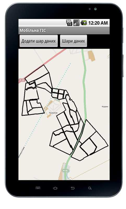
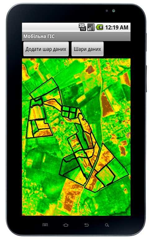
1 Agricultural Satellite Monitoring and Crop Yield Forecasting in Ukraine N. Kussul 1, S. Skakun 1, A. Shelestov 1,2 1 Space Research Institute NASU-SSAU 2 National University of Life and Environmental Sciences of Ukraine Crop Yield Forecasting in South East Europe May, 2013, Skopje, Macedonia Who we are: Current Expertise & International Activities Space Research Institute National Academy of Science & National Space Agency of Ukraine Department of Space Information Technologies Active participation in the Working Group on Information System and Services (WGISS) of the Committee on Earth Observation Satellites (CEOS). Participation in international collaborative activities within GEO Working Plan UN-SPIDER RSO 1
 Project ЕС JRC Crop area estimation with satellite images in Ukraine, 2009-2011")
 Crop field boundaries")

 and along the road surveys (curves) GEO JECAM-test sites in")


2 % pixels classified as cereals 10/22/2013 Background: the EC project The Monitoring Agricultural ResourceS (MARS) Project ЕС JRC Crop area estimation with satellite images in Ukraine, Satellite data Ground data Processing Orthorectification Segmentation Classification Along the road survey Stratified Area Frame Sampling LC map Area estimates (pixel counting) Crop field boundaries Segments Data fusion Adjustment of area estimates (Regression estimator) % oats in ground survey Data: MODIS AWiFS Landsat-5/TM LISS-III RapidEye Final results Area estimates Accuracy assessment The benefit from satellite data usage: Decrease of work cost in 1.5 times Area frame sampling (segments) and along the road surveys (curves) GEO JECAM-test sites in Ukraine Test sites were officially established in 2011 Test sites Kyiv oblast (SRI) Crop area estimation In-situ measurements crop types, along the roads and segment surveys Pshenychne (National University of Life and Environmental Sciences of Ukraine) Biopar parameters retrieval and crop growth model calibration In-situ measurements crop types, crop height, LAI, fcover, soil parameters Lviv oblast (The State Science- Technological Centre of Soil Fertility Protective) Crop rotation identification Administrative map of Ukraine and location of Kyiv and Lviv region Map of intensive observation sub-site Relationship between humus and satellite-derived biomass 2


 compliant with CEOS Land Product Validation (LPV) guidelines CAN-EYE")
3 JECAM-related tasks (cont ) GEO-GLAM Winter Wheat Yield Forecasting for the whole Ukraine Based on satellite data, meteorological observations, crop growth model SOAR-JECAM SAR parameters optimization for crop classification Based on Radarsat-2 quad-polarized images ESA Sentinel2-Agriculture Participation as a Champion User SPOT-4 will observe JECAM Ukraine every 5 days to simulate Sintenel-2 Within FP7 ImagineS Validation of global satellite products Validation of global products For JECAM test site in Ukraine Within FP7 ImagineS (Dr. Roselyne Lacaze HYGEOS, Earth Observation Department Toulouse, FRANCE) Follows VALERI protocol (30 ESU elementary sampling units) compliant with CEOS Land Product Validation (LPV) guidelines CAN-EYE software Biophysical parameters: LAI, FAPAR, FCover 3


 Radarsat-2,")

4 Validation of global products (cont ) Example of processing for winter wheat SOAR-JECAM SAR parameters optimization for crop classification Data Radarsat-2 (quad-pol) 27 and 30 August 2012 EO-1/ALI 28 July and 05 August 2012 Major crop types Maize Soybeans Sunflower Sugar beet Winter and spring crops (wheat) Radarsat-2, RADARSAT-2 Data and Products MacDonald, Dettwiler and Associates Ltd.(2012) - All Rights Reserved. EO-1,
 Overall accuracy 80.")

 Landsat5 (2011.05.")
5 SOAR-JECAM (cont ) Classification algorithms DT SVM NN (MLP) Overall accuracy 80.4% (MLP) Classification map of Radarsat-2 and EO-1/ALI images using ensemble of MLPs Crop rotation identification Lviv oblast Satellite data Landsat7 ( ) Landsat5 ( ) Crop rotation violation Winter rapeseed Landsat Landsat


 based on WOFOST crop growth")
6 10/22/2013 Тематическая карта состояния посевов озимых и ярых зерновых культур АР Крым Красногвардейский район, 27 мая 2013 г. Легенда Зерновые культуры степень повреждения посевов Поздние яровые 0-30% 30-70%культуры70-100% Необрабатываемые поля Інститут космiчних дослiджень НАН України та ДКА України проспект Академiка Глушкова, , Київ 187, Україна Тел./факс: Winter wheat yield forecasting Three approaches empirical regression-based model using MODIS data, empirical regression-based model using meteorological parameters, and adapted for Ukraine Crop Growth Monitoring System (CGMS) based on WOFOST crop growth simulation model and meteorological parameters; 6
7 Winter wheat forecast for 2012 Operational forecasting of winter wheat yield in Ukraine for 2012 based on Earth observation Predicted, c/ha Observed, c/ha Winter wheat forecasts for Ukraine for 2012 as of 2 June 2012 Winter wheat crop yield forecast for 2013 (23/05/2013) 7


8 Change of crop yield forecast between and Geoportal: delivery of EO products (jecam.org.ua) soybean, 90 ha Not planted, 40 ha 8
9 We are interested in collaboration in research and education Thank you! 9
Collaboration of Space Research Institute NASU-SSAU with EC JRC on satellite monitoring for food security: background and prospects
 Collaboration of Space Research Institute NASU-SSAU with EC JRC on satellite monitoring for food security: background and prospects Prof. Nataliia Kussul 1 Space Research Institute NASU-SSAU, Ukraine Context
Ера "великих даних" та інноваційні проекти в супутниковому моніторингу
 Ера "великих даних" та інноваційні проекти в супутниковому моніторингу Проф. д.т.н. Куссуль Наталія Миколаївна, к.т.н. Колотій А.В., М.С. Лавренюк Інститут космічних досліджень НАН України та ДКА України
International Journal "Information Models and Analyses" Vol.1 /
 International Journal "Information Models and Analyses" Vol.1 / 2012 251 CROP STATE AND AREA ESTIMATION IN UKRAINE BASED ON REMOTE AND IN- SITU OBSERVATIONS Nataliia Kussul, Andrii Shelestov, Sergii Skakun,
Joint Experiment for Crop Assessment and Monitoring GEOGLAM Implementation Meeting Washington D.C. February 21, 2013
 Joint Experiment for Crop Assessment and Monitoring GEOGLAM Implementation Meeting Washington D.C. February 21, 2013 Ian Jarvis JECAM Sub-Task Lead Earth Observation Service, Agriculture and Agri-Food
Куссуль Н.Н. Кравченко А.Н. Скакун С.В. Шелестов А.Ю. Kyiv, Институт космических исследований НАНУ-НКАУ
 Куссуль Н.Н. Кравченко А.Н. Скакун С.В. Шелестов А.Ю. 2010 Институт космических исследований НАНУ-НКАУ Crop acreage estimation Contract of the Joint Research Centre of the European Commission Crop area
Service: status & evolution
 The Copernicus Global Land Service: status & evolution R. Lacaze HYGEOS on behalf the GIO - Global Land consortium What is Copernicus? The European system for monitoring i the Earth The European response
Ukraine. Space Research Institute
 Ukraine Demonstration objectives Space Research Institute Todeliver consistent information at field scalefor Ukraine using Sen2Agri system: Crop mask; Crop type; Crop status; Early crop area indicators,
Sentinel- 2 Agriculture Demonstration in Ukraine: state- of- the- art and recent results Prof. Nataliia Kussul Space Research Institute, Ukraine
 Sentinel- 2 Agriculture Demonstration in Ukraine: state- of- the- art and recent results Prof. Nataliia Kussul Space Research Institute, Ukraine Sen2Agri: Sentinel-2 Country level Demonstration, the context
COMPARISON OF BIOPHYSICAL AND SATELLITE PREDICTORS FOR WHEAT YIELD FORECASTING IN UKRAINE
 The International Archives of the Photogrammetry, Remote Sensing, and Spatial Information Sciences, Volume XL-7/W3, 2015 COMPARISON OF BIOPHYSICAL AND SATELLITE PREDICTORS FOR WHEAT YIELD FORECASTING IN
JECAM - Joint Experiment for Crop Assessment and Monitoring Recent progress with SAR/Optical Inter-Comparison Projects Ian Jarvis Co-lead of JECAM
 JECAM - Joint Experiment for Crop Assessment and Monitoring Recent progress with SAR/Optical Inter-Comparison Projects Ian Jarvis Co-lead of JECAM Science and Technology Branch, Agriculture and Agri-Food
GEO-GLAM Agricultural Mapping and Monitoring
 GEO-GLAM Agricultural Mapping and Monitoring Chris Justice Inbal Becker-Reshef and Matt Hansen University of Maryland, Department of Geographical Sciences June 18 2012 The GEO Global Agricultural Monitoring
GEOGLAM. JECAM Collaborative Priorities : Pierre Defourny (UCLouvain) and Andrew Davidson (AAFC) Co-leads of JECAM
 and Andrew Davidson (AAFC) Co-leads of JECAM") G20 Global Agriculture Monitoring Initiative GEOGLAM JECAM Collaborative Priorities : Pierre Defourny (UCLouvain) and Andrew Davidson (AAFC) Co-leads of JECAM Origins The GEO Agricultural Community of
G20 Global Agriculture Monitoring Initiative GEOGLAM JECAM Collaborative Priorities : Pierre Defourny (UCLouvain) and Andrew Davidson (AAFC) Co-leads of JECAM Origins The GEO Agricultural Community of
JECAM Synthetic Aperture Radar (SAR) Cross Site Experiments. JECAM Meeting, October 2016, Ukraine
 Cross Site Experiments. JECAM Meeting, October 2016, Ukraine") JECAM Synthetic Aperture Radar (SAR) Cross Site Experiments JECAM Meeting, October 2016, Ukraine Recent (2016) Developments Preliminary roadmap for the JECAM SAR cross sites experiments presented at 2015
JECAM Synthetic Aperture Radar (SAR) Cross Site Experiments JECAM Meeting, October 2016, Ukraine Recent (2016) Developments Preliminary roadmap for the JECAM SAR cross sites experiments presented at 2015
JECAM and the Manitoba Super Site
 JECAM and the Manitoba Super Site GEO-DRI Drought Monitoring Workshop May 10 & 11, 2010 Grant Wiseman, M.Sc. AAFC, AESB, Winnipeg, Canada grant.wiseman@agr.gc.ca Joint Experiments on Crop Assessment and
Barrax JECAM Site (Spain)
") Barrax JECAM Site (Spain) JECAM/GEOGLAM Science Meeting Brussels, Belgium 16-17 November, 2015 Fernando Camacho Consuelo Latorre Fernando de la Cruz Location Site Description Barrax has been a study area
Barrax JECAM Site (Spain) JECAM/GEOGLAM Science Meeting Brussels, Belgium 16-17 November, 2015 Fernando Camacho Consuelo Latorre Fernando de la Cruz Location Site Description Barrax has been a study area
GEOGLAM : Global Agricultural Monitoring
 GEOGLAM : Global Agricultural Monitoring Jai Singh Parihar on behalf of GEOGLAM Task Team (Chris Justice, Shinichi Sobue, Olivier Leo, Wu Bingfang, Derrick Williams, Inbal Becker-Reshef, Ian Jarvis, Terry
Sentinels for Agriculture Global, Operational, Open, Reliable
 Sentinels for Agriculture Global, Operational, Open, Reliable Benjamin Koetz European Space Agency Earth Observation Directorate ESA UNCLASSIFIED - For Official Use Sentinel-2B Launch Tonight, 7 th of
The European Commission s science and knowledge service. Joint Research Centre
 The European Commission s science and knowledge service Joint Research Centre JRC MARS Crops yield forecasts: method and 2018 forecasts Bettina Baruth Brussels 11/07/2018 Table of content Mars Crop Yield
Evaluation of benefits and constraints for the use of Sentinel-2 for agricultural monitoring
 23/05/2014 Evaluation of benefits and constraints for the use of Sentinel-2 for agricultural monitoring Isabelle Piccard, Herman Eerens, Kris Nackaerts, Sven Gilliams, Lieven Bydekerke Sentinel-2 for Science
JECAM SAR cross sites experiments
 JECAM SAR cross sites experiments H. McNairn, I. Jarvis, A.Davidson, P. Defourny, G. Chomé, F. Waldner Agriculture and Agri-food Canada UCLouvain-Geomatics, Belgium and the JECAM SAR researchers and/or
Earth Observations based agricultural monitoring over EEU countries: concept and first results of the SIGMA RBK project
 Earth Observations based agricultural monitoring over EEU countries: concept and first results of the SIGMA RBK project Bartalev Sergey, Loupian Evgeny, Plotnikov Dmitry and Tolpin Vladimir Space Research
Nationwide demonstration cases of Sentinel-2 satellite exploitation towards early crop area indicator
 Nationwide demonstration cases of Sentinel-2 satellite exploitation towards early crop area indicator Pierre Defourny 1, Sophie Bontemps 1, Nicolas Bellemans 1, Cosmin Cara 3, Gérard Dedieu 2, Eric Guzzonato
SIGMA project. Overview
 SIGMA project Overview Background SIGMA - Facts Start 1 November 2013 30 March 2017 Agriculture AND Environment 22 partners, 17 countries VITO, CIRAD, JRC, IIASA, Alterra, RADI, NMSC, DEIMOS, GeoSAS, RCMRD,
Global Agricultural Monitoring International Coordination: GEOGLAM
 Global Agricultural Monitoring International Coordination: GEOGLAM Chris Justice NASA - Earth Observation for Food Security and Agriculture Consortium Department of Geographical Sciences, University of
The GEO Global Agricultural Monitoring (GEOGLAM) Initiative
 Initiative") The GEO Global Agricultural Monitoring (GEOGLAM) Initiative Chris Justice GEOGLAM Global Co-Lead The Center for Agricultural Monitoring Research, Department of Geographical Sciences, GEOGLAM Launched by
The GEO Global Agricultural Monitoring (GEOGLAM) Initiative Chris Justice GEOGLAM Global Co-Lead The Center for Agricultural Monitoring Research, Department of Geographical Sciences, GEOGLAM Launched by
CROP AREA ESTIMATES WITH MERIS DATA ON BELGIUM AND POLAND
 ISPRS Archives XXXVI-8/W48 Workshop proceedings: Remote sensing support to crop yield forecast and area estimates CROP AREA ESTIMATES WITH MERIS DATA ON BELGIUM AND POLAND P. Cayrol. a, *, H. Poilvé a,
Copernicus Global Land Service possible downstream services in Agriculture. Lieven Bydekerke, Programme Manager Remote Sensing Applications
 Copernicus Global Land Service possible downstream services in Agriculture Lieven Bydekerke, Programme Manager Remote Sensing Applications Outline» Challenges in global Agriculture» Remote sensing & agriculture»
GEOGLAM international cooperation activities
 GEOGLAM international cooperation activities Chris Justice Center for Global Agricultural Monitoring and Research Dept. of Geographical Sciences University of Maryland GEO: an International Coordinating
Real-time crop mask production using high-spatial-temporal resolution image times series
 Real-time crop mask production using high-spatial-temporal resolution image times series S.Valero and CESBIO TEAM 1 1 Centre d Etudes Spatiales de la BIOsphre, CESBIO, Toulouse, France Table of Contents
The GEO Global Agricultural Monitoring Initiative (GEOGLAM): Overview
: Overview") The GEO Global Agricultural Monitoring Initiative (GEOGLAM): Overview Chris Justice (UMD) 1 / 27 GEO the Group on Earth Observations an Intergovernmental Organization with 90 Members and 67 Participating
The GEO Global Agricultural Monitoring Initiative (GEOGLAM): Overview Chris Justice (UMD) 1 / 27 GEO the Group on Earth Observations an Intergovernmental Organization with 90 Members and 67 Participating
Agrometeorological monitoring in Ukraine
 State Emergency Service of Ukraine UKRAINIAN HYDROMETEOROLOGICAL CENTER Agrometeorological monitoring in Ukraine Joint Workshop On Information Needs in Crop Monitoring Kyiv, 22-23 October 2015 Tatiana
JECAM SAR Inter-Comparison Experiment
 JECAM SAR Inter-Comparison Experiment Crop Type Identification & Mapping Laura Dingle Robertson, Andrew Davidson, Heather McNairn, Mehdi Hosseini, Scott Mitchell, & Michael H. Cosh February 15, 2018 Agenda
REMOTE SENSING OF EBVS TO MONITOR BIODIVERSITY. Andrew Skidmore, ITC, University Twente
 REMOTE SENSING OF EBVS TO MONITOR BIODIVERSITY Andrew Skidmore, ITC, University Twente INTRODUCTION BIODIVERSITY: THE VARIETY OF LIFE INTRODUCTION WHY BIODIVERSITY MATTERS: THE EXAMPLE OF ECOSYSTEM SERVICES
Earth Observation in Support of Science-Driven Policy & Decision Making: GEO Global Agricultural Monitoring (GEOGLAM)
") Earth Observation in Support of Science-Driven Policy & Decision Making: GEO Global Agricultural Monitoring (GEOGLAM) Alyssa Whitcraft Program Scientist, GEOGLAM Secretariat akwhitcraft@geooglam.org on
Earth Observation in Support of Science-Driven Policy & Decision Making: GEO Global Agricultural Monitoring (GEOGLAM) Alyssa Whitcraft Program Scientist, GEOGLAM Secretariat akwhitcraft@geooglam.org on
GEOGLAM: G20 S GLOBAL AGRICULTURAL MONITORING INITIATIVE SPACE BASED EARTH OBSERVATIONS TO ENHANCE GLOBAL COMMODITY MARKET TRANSPARENCY
 GEOGLAM: G20 S GLOBAL AGRICULTURAL MONITORING INITIATIVE SPACE BASED EARTH OBSERVATIONS TO ENHANCE GLOBAL COMMODITY MARKET TRANSPARENCY Ian Jarvis (on behalf of GEO Agricultural Community of Practice)
GEOGLAM, Michel Deshayes, GEO, GEOGLAM Coordinator for the Agricultural Community of Practice
 GEOGLAM, Global Agricultural Monitoring Michel Deshayes, GEO, GEOGLAM Coordinator for the Agricultural Community of Practice GEO, Group on Earth Observations Created in 2005, to develop a coordinated and
Monitoring Crop Leaf Area Index (LAI) and Biomass Using Synthetic Aperture Radar (SAR)
 and Biomass Using Synthetic Aperture Radar (SAR)") Monitoring Crop Leaf Area Index (LAI) and Biomass Using Synthetic Aperture Radar (SAR) Mehdi Hosseini, Heather McNairn, Andrew Davidson, Laura Dingle-Robertson *Agriculture and Agri-Food Canada JECAM SAR
Monitoring Crop Leaf Area Index (LAI) and Biomass Using Synthetic Aperture Radar (SAR) Mehdi Hosseini, Heather McNairn, Andrew Davidson, Laura Dingle-Robertson *Agriculture and Agri-Food Canada JECAM SAR
AfriGEOSS in the Next Decade of Developing the GEOSS Andiswa Mlisa
 AfriGEOSS in the Next Decade of Developing the GEOSS Andiswa Mlisa GEO Secretariat Africa Leadership Conference (ALC) 2015, Sharm El Sheik, Egypt, 1 4 December 2015 GEO Vision Ministers Adopted the GEO
JECAM SAR Inter-Comparison Experiment. Applying Operational SAR and Optical Classification Methodologies to Multiple
 SAR Inter-Comparison Experiment Component 1: Crop Type Identification & Mapping Activity 1: Regions Applying Operational SAR and Optical Classification Methodologies to Multiple 1a. Applying Agriculture
Crop type mapping and growth monitoring thanks to a synergistic use of SAR and optical remote sensing
 Crop type mapping and growth monitoring thanks to a synergistic use of SAR and optical remote sensing Pierre Defourny(1), Xavier Blaes(1), Moira Callens (2), Vincent Guissard (1), Valerie Janssens (2),
Method for automated classification with INSPIRE data and Sentinel-2 satellite imagery: case remote crop monitoring
 Method for automated classification with INSPIRE data and Sentinel-2 satellite imagery: case remote crop monitoring Joona Laine / Spatineo INSPIRE CONFERENCE 2018 Antwerp www.spatineo.com 1 EU is supporting
Results from the Land & Environment Crop & Drought. projects in Dragon-3. Chaired by S. Pignatti & F. Jinlong
 Results from the Land & Environment Crop & Drought projects in Dragon-3 Chaired by S. Pignatti & F. Jinlong Project 10367: Desertification Monitoring and Assessment Committed products optimal indicators
SPACE MONITORING of SPRING CROPS in KAZAKHSTAN
 SPACE MONITORING of SPRING CROPS in KAZAKHSTAN N. Muratova, U. Sultangazin, A. Terekhov Space Research Institute, Shevchenko str., 15, Almaty, 050010, Kazakhstan, E-mail: nmuratova@mail.ru Abstract The
From Image to Information
 From Image to Information Using ICT and Earth Observation to support food security Workshop on innovations in food and agriculture system: Policies to foster productive and sustainable solutions OECD 26.
Stocktaking Overview of the G20. Global Agricultural Monitoring Initiative
 Stocktaking Overview of the G20 Global Agricultural Monitoring Initiative February 2018 Background The Group on Earth Observations Global Agricultural Monitoring Initiative (GEOGLAM) was initially launched
Stocktaking Overview of the G20. Global Agricultural Monitoring Initiative
 Stocktaking Overview of the G20 Global Agricultural Monitoring Initiative February 2018 Background The Group on Earth Observations Global Agricultural Monitoring Initiative (GEOGLAM) was initially launched
Sentinel-2 for agriculture and land surface monitoring from field level to national scale
 Sentinel-2 for agriculture and land surface monitoring from field level to national scale The on-going BELCAM, Sen2-Agri and LifeWatch experiences C. Delloye, S. Bontemps, N. Bellemans, J. Radoux, F. Hawotte,
Review of best practices for crop area estimation with remote sensing
 AGRISAT, Brussels, October 14,. 2010 1 Review of best practices for crop area estimation with remote sensing Javier.gallego@jrc.ec.europa.eu AGRISAT, Brussels, October 14,. 2010 2 Remote sensing and Crop
H2020 SENSAGRI project: developing prototypes for new Copernicus services for agriculture
 GEOINT for Environmental Compliance Assurance in rural areas/agriculture H2020 SENSAGRI project: developing prototypes for new Copernicus services for agriculture Antonio Ruiz Verdú University of Valencia
Sentinel-2 Agriculture project : Preparing Sentinel2 exploitation for agriculture monitoring
 Sentinel-2 Agriculture project : Preparing Sentinel2 exploitation for agriculture monitoring Defourny Pierre, Bontemps Sophie, CaraCozmin, Dedieu Gerard, Hagolle Olivier, Inglada Jordi, Thierry Rabaute,
CROP YIELD FORECAST JRC EUR ISSN VOL.19 No.20 (2011)
") JRC 67103 EUR 24736 ISSN 1831-9793 VOL.19 No.20 (2011) CROP YIELD FORECAST Period of analysis: 11 th September 20 th October Issue date: 25 th October Promising crop season for grain maize confirmed at
JRC 67103 EUR 24736 ISSN 1831-9793 VOL.19 No.20 (2011) CROP YIELD FORECAST Period of analysis: 11 th September 20 th October Issue date: 25 th October Promising crop season for grain maize confirmed at
Crop mapping with satellite data
 Crop mapping with satellite data Dr. C.S. Murthy Head, Agricultural Sciences and Applications National Remote Sensing Centre, Hyderabad murthy_cs@nrsc.gov.in, csmurthy09@gmail.com Geospatial Technology
Review. of the application of modern information technologies in the agricultural management systems. S.Korsakova
 Review of the application of modern information technologies in the agricultural management systems S.Korsakova REVIEW OF MODERN INFORMATION TECHNOLOGIES APPLIED INAGRICULTURAL MANAGEMENT SYSTEMS The USA,
Divino Figueiredo Geotechnology and System Analist
 Divino Figueiredo Geotechnology and System Analist Mission Contribute to regularity of food supply and guarantee income to farmers, participating in the formulation and implementation of agricultural and
2.2 Methods 2 DATA SET AND METHODS USED
 COMBINING CROP MODEL AND REMOTE SENSING DATA AT HIGH RESOLUTION FOR THE ASSESSMENT OF RICE AGRICULTURAL PRACTICES IN THE SOUTH- EASTERN FRANCE (TAKE 5 EXPERIMENT SPOT4-SPOT5) Courault D (1), Ruget F (1),
 FP7- SPA.2013.1.1-06: Stimulating development of downstream services and service evolution. Contract N : 606983 A downstream service to support agro-production, planning and policy http://www.ermes-fp7space.eu/
SEN4CAP Sentinels for Agriculture Monitoring
 SEN4CAP Sentinels for Agriculture Monitoring Bontemps S., Defourny P., Bajec K., Bellemans N., Joshi N., Kucera L., Mammone C., Milcinski G., L. Rossi, C. Sciarretta, F. Tutunaru, F. Volpe, M. Zavagli,
Introduction to yield forecasting with CST
 Introduction to yield forecasting with CST H. Kerdiles (JRC), H. Boogaard & S. Hoek (Alterra) Harare, Zimbabwe 26 Oct 2016 Yield variability: can you rank the maize fields according to their yield? Same
GEOGLAM: Science-driven information supporting decisions in agricultural markets and food security through use of earth observations
 GEOGLAM: Science-driven information supporting decisions in agricultural markets and food security through use of earth observations Inbal Becker-Reshef Program Scientist GEOGLAM Secretariat Co-Director
Sentinels for Agricultural Monitoring Sen4CAP Concept & Goals
 Sentinels for Agricultural Monitoring Sen4CAP Concept & Goals Benjamin Koetz European Space Agency, Earth Observation Directorate Sentinels Looking after Agriculture ESA 28/11/2017 Slide 2 Copernicus Space
GEOGLAM Global Agricultural Monitoring. Michel Deshayes
 GEOGLAM Global Agricultural Monitoring Michel Deshayes mdeshayes@geosec.org Outline GEOGLAM and AMIS GEOGLAM Structure and Governance New activities and projects Rangelands and Pasture Monitoring Early
OPERATIONAL UPDATE July th of August, 2017
 OPERATIONAL UPDATE July 2017 16 th of August, 2017 Key Events of July 2017 /02 Operational Financial/Restructuring Trading & Commercial In July, Mriya started its harvesting campaign. Till the end of the
CEOS ACQUISITION STRATEGY FOR GEOGLAM
 CEOS ACQUISITION STRATEGY FOR GEOGLAM Version 2.0 October 2014 Table of Contents Executive Summary... 2 1 Introduction... 4 1.1 Purpose of the Document... 4 1.2 Scope... 4 1.3 Contents... 4 1.4 Revision
Global Agricultural Monitoring International Coordination: GEOGLAM
 Global Agricultural Monitoring International Coordination: GEOGLAM Chris Justice Inbal Becker-Reshef, Christina Justice, Brian Barker, Michael Humber The Center for Agricultural Monitoring Research, Department
DMC 22m Sensors for Supertemporal Land Cover Monitoring. Gary Holmes DMC International Imaging Ltd June 2014
 DMC 22m Sensors for Supertemporal Land Cover Monitoring Gary Holmes DMC International Imaging Ltd June 2014 DMC 2 nd Generation Satellites UK-DMC2 and Deimos-1 launched 29 th July 2009 650km swath width
Agricultural monitoring of Russia using Remote Sensing: an overview
 Russian Academy of Sciences Space Research Institute Agricultural monitoring of Russia using Remote Sensing: an overview Savin I., Bartalev S., Loupian E. Some features of R&D at IKI Focus is on national
ANTARES. EuroGEOSS Agriculture Pilot - outline. 1. EO Agriculture Monitoring - MARS, GEOGLAM and the current European contribution
 GEO-XIV - EuroGEOSS launch event EuroGEOSS Agriculture pilot Pr. Pierre Defourny, UCLouvain GEOGLAM/JECAM Co-lead With the contribution of collaborators and leaders of several EU programs and projects
GEO Progress and Issues for the Future
 GEO Progress and Issues for the Future Jose Achache GEO Secretariat Director 24 th CEOS Plenary Rio de Janeiro 12-15 Oct 2010 GEO, the Group on Earth Observations An Intergovernmental Organization with
Ukraine Winter Wheat: Sowing Progress (All years include estimated area for Crimea.)
") Sept 7 Sept 14 Sept 21 Sept 28 Oct 5 Oct 12 Oct 19 Oct 26 Nov 2 Nov 9 Nov 16 Million hectares 1,000 hectares 8,000 7,000 6,000 Ukraine Winter Wheat: Sowing Progress (All years include estimated area for
Sept 7 Sept 14 Sept 21 Sept 28 Oct 5 Oct 12 Oct 19 Oct 26 Nov 2 Nov 9 Nov 16 Million hectares 1,000 hectares 8,000 7,000 6,000 Ukraine Winter Wheat: Sowing Progress (All years include estimated area for
Developing a Global Agricultural Monitoring System of Systems. Context for Agriculture Monitoring. Chris Justice University of Maryland
 Developing a Global Agricultural Monitoring System of Systems Chris Justice University of Maryland IRSA Beijing, Feb 11-13 th 2009 Energy and Food Prices Closely Linked Energy prices affect ag inputs,
CROP STATE MONITORING USING SATELLITE REMOTE SENSING IN ROMANIA
 CROP STATE MONITORING USING SATELLITE REMOTE SENSING IN ROMANIA Dr. Gheorghe Stancalie National Meteorological Administration Bucharest, Romania Content Introduction Earth Observation (EO) data Drought
A downstream service to support agro production, planning and policy. FP7 SPACE CALL Contract N :
 A downstream service to support agro production, planning and policy FP7 SPACE 2013 1 CALL Contract N : 606983 Project coordinator Mirco Boschetti CNR IREA PROJECT FRAMEWORK Who is ERMES (H)ermes (/ˈhɜrmiːz/;
GEOGLAM Global Agricultural Monitoring
 GEOGLAM Global Agricultural Monitoring Dr. Selma Cherchali on behalf of the GEOGLAM Crop Monitor team Land and Hydrology Program Manager Science, Application and innovation Directorate, CNES Co-Lead, CEOS
GEO Agricultural and Land Use Change. Chris Justice (GEO-AG Task Co-Chair) Inbal Becker-Reshef University of Maryland
 Inbal Becker-Reshef University of Maryland") GEO Agricultural and Land Use Change Chris Justice (GEO-AG Task Co-Chair) Inbal Becker-Reshef University of Maryland GEO, the Group on Earth Observations An Intergovernmental Organization with 87 Members
GEO Agricultural and Land Use Change Chris Justice (GEO-AG Task Co-Chair) Inbal Becker-Reshef University of Maryland GEO, the Group on Earth Observations An Intergovernmental Organization with 87 Members
DEVELOPMENT OF A DECISION SUPPORT SYSTEM FOR NATURAL DAMAGE ASSESSMENT BASED ON REMOTE SENSING AND BIO-PHYSICAL MODELS
 DEVELOPMENT OF A DECISION SUPPORT SYSTEM FOR NATURAL DAMAGE ASSESSMENT BASED ON REMOTE SENSING AND BIO-PHYSICAL MODELS M.A. Sharifi a*, W.G.M. Bastiaanssen b, S.J. Zwart b a ITC, P.O. Box 6, 7500 AA, Enschede,
User Awareness & Training: LAND. Tallinn, Estonia 9 th / 10 th April 2014 GAF AG
 User Awareness & Training: LAND Tallinn, Estonia 9 th / 10 th April 2014 GAF AG Day 2 - Contents LAND (1) General Introduction to EO and the COPERNICUS Sentinel Programme Overview of COPERNICUS/GMES LAND
CEOS Update: JECAM EO Data Access & NASA/JECAM Cloud-Based SDMS
 CEOS Update: JECAM EO Data Access & NASA/JECAM Cloud-Based SDMS Alyssa Whitcraft on behalf of CEOS Ad Hoc WG for GEOGLAM Program Scientist & Component 4 Lead GEOGLAM Secretariat / UMD akwhitcraft@geoglam.org
Set-up of CGMS in Ethiopia and first user experiences
 4th CGMS Expert Meeting (18-19 March 2009) JRC ISPRA Set-up of CGMS in Ethiopia and first user experiences Bernard TYCHON, Bakary DJABY (Ulg), Michel MASSART (JRC-FOODSEC) A. Objective Adaptation of the
CEOS/LPV workshop on LAI & fapar validation. Davos 15/03/2007
 CEOS/LPV workshop on LAI & fapar validation Davos 15/03/2007 Proposed Agenda 09:00-09:30 Introduction, objectives of the meeting, relation to GEO/GEOSS 09:30-10:45 Ongoing direct validation activities
GMES and AFRICA
 Global Monitoring for Environment and Security Mauro.Facchini@ec.europa.eu GMES and AFRICA What is GMES? European response to global needs to manage the environment, understand and mitigate the effects
AGRICULTURAL CROP MAPPING USING OPTICAL AND SAR MULTI- TEMPORAL SEASONAL DATA: A CASE STUDY IN LOMBARDY REGION, ITALY
 AGRICULTURAL CROP MAPPING USING OPTICAL AND SAR MULTI- TEMPORAL SEASONAL DATA: A CASE STUDY IN LOMBARDY REGION, ITALY G. Fontanelli, A. Crema, R. Azar, D. Stroppiana, P. Villa, M. Boschetti Institute for
Rice Monitoring from Space?
 Rice Monitoring from Space? Thuy Le Toan CESBIO, Toulouse, France The GEORICE Project Towards Operational Rice Monitoring Benjamin Koetz Thuy Le Toan, Phan Thi Hoa Alexandre Bouvet Lam Dao Nguyen, VNSC
FINANCIAL AND OPERATIONAL RESULTS 2016: ANALYSIS AND CONCLUSIONS. 21 December, 2016
 FINANCIAL AND OPERATIONAL RESULTS 2016: ANALYSIS AND CONCLUSIONS 21 December, 2016 Key Financial and Operational Results in the 2016 Season /02 The 2016 season has been a difficult season for Mriya. The
MCYFS The agrometeorological system of the EC: present and future
 Institute for Protection and Security of the Citizen Wageningen 19 October 2007 1 WIMEK workshop on Earth Observation and crop growth modeling 1 MCYFS The agrometeorological system of the EC: present and
CEOS. Working Group on Calibration and Validation
 CEOS Working Group on Calibration and Validation CEOS WGCV The Working Group on Calibration and Validation (WGCV) was established in 1984. This resulted from the recognition that calibration and validation
Integrating and Visualizing Earth Observation Data for the SDGs Mike Gill
 7 th Meeting of the Interagency and Expert Group on Sustainable Development Goal Indicators Vienna, Austria 12 April, 2018 Integrating and Visualizing Earth Observation Data for the SDGs Mike Gill GEO
GEO Initiatives: GEOGLAM and AfriGEOSS
 GEO Initiatives: GEOGLAM and AfriGEOSS Andiswa Mlisa Michel Deshayes GEO Secretariat G4AWeek 21-24 September 2015, The Hague, Netherlands 87 Participating Organizations GEO Secretariat Information Value
WHEN SPACE MEETS AGRICULTURE
 WHEN SPACE MEETS AGRICULTURE Image from ESA Sentinel 14-15 November 2016 Matera, Italy Join the conversation #WSMA16 What can Copernicus do for farmers and for the European Agricultural Policy Catharina
GEOGLAM RAPP (Rangeland & Pasture Productivity): Context, updates & next steps
: Context, updates & next steps") Spyglass, QLD, Australia, credits Michael Schaefer CSIRO GEOGLAM RAPP (Rangeland & Pasture Productivity): Context, updates & next steps Alex Held, Flora Kerblat, Juan Guerschman (CSIRO) RAPP workshop ESRIN
Spyglass, QLD, Australia, credits Michael Schaefer CSIRO GEOGLAM RAPP (Rangeland & Pasture Productivity): Context, updates & next steps Alex Held, Flora Kerblat, Juan Guerschman (CSIRO) RAPP workshop ESRIN
EARLY VALIDATION OF PROBA-V GEOV1 LAI, FAPAR AND FCOVER PRODUCTS FOR THE CONTINUITY OF THE COPERNICUS GLOBAL LAND SERVICE
 EARLY VALIDATION OF PROBA-V GEOV1 LAI, FAPAR AND FCOVER PRODUCTS FOR THE CONTINUITY OF THE COPERNICUS GLOBAL LAND SERVICE J. Sánchez a, *, Camacho a, R. Lacaze b, B. Smets c a EOLAB, Parc Científic Universitat
Disaster Early Warning and Response Activities at RCMRD Tesfaye Korme (Ph.D), Regional Centre for Mapping of Resources for Development
, Regional Centre for Mapping of Resources for Development") Satellite Earth Observation & Disaster Risks Disaster Early Warning and Response Activities at RCMRD Tesfaye Korme (Ph.D), Regional Centre for Mapping of Resources for Development RCMRD and its member
Satellite Earth Observation & Disaster Risks Disaster Early Warning and Response Activities at RCMRD Tesfaye Korme (Ph.D), Regional Centre for Mapping of Resources for Development RCMRD and its member
Collaborative Agreement. JRC (MARS Unit-AGRI4CAST): M. El Aydam & INRA (Morocco): R. Balaghi AGRI4CAST. Collaborative Agreement JRC / INRA - Maroc
: M. El Aydam & INRA (Morocco): R. Balaghi AGRI4CAST. Collaborative Agreement JRC / INRA - Maroc") Collaborative Agreement JRC (MARS Unit-): M. El Aydam & INRA (Morocco): R. Balaghi 1. General context 2. Main objectives 3. Main Results 4. Perspectives 1. General context Morocco Min Agri INRA (DSS) Crop
Collaborative Agreement JRC (MARS Unit-): M. El Aydam & INRA (Morocco): R. Balaghi 1. General context 2. Main objectives 3. Main Results 4. Perspectives 1. General context Morocco Min Agri INRA (DSS) Crop
National crop yield statistics and yield forecasting in France
 6 th CGMS Expert Meeting National crop yield statistics and yield forecasting in France Auriane RENAUD, Statistical Service of French Ministry of Agriculture I. Dissemination II. Drawing up of yield forecasting
OPTICAL REMOTE SENSING REQUIREMENTS FOR OPERATIONAL CROP MONITORING AND YIELD FORECASTING IN EUROPE
 OPTICAL REMOTE SENSING REQUIREMENTS FOR OPERATIONAL CROP MONITORING AND YIELD FORECASTING IN EUROPE Grégory Duveiller (1), Raúl López-Lozano (1), Lorenzo Seguini (1), Jędrzej S. Bojanowski (1), Bettina
Panel Discussion. Sergey Bartalev: Russia Tuomas Hame: Finland Eva Konkoly-Gyuro: Hungary Anu Reinart: Estonia Premysl Stych: Czech Republic
 Panel Discussion Sergey Bartalev: Russia Tuomas Hame: Finland Eva Konkoly-Gyuro: Hungary Anu Reinart: Estonia Premysl Stych: Czech Republic Panel Discussion Notes Russia Emphasis on Applications Forest/Agric/Wetland
Pilot studies on estimating the content of Nitrogen and Phosphorus in agricultural products. Catalin SIMOTA
 Pilot studies on estimating the content of Nitrogen and Phosphorus in agricultural products Catalin SIMOTA National Research and Development Institute for Soil Science Agrochemistry and Environment Bucharest
IT for space Systems. A project oriented view of IT in space projects
 IT for space Systems A project oriented view of IT in space projects Andrea Bennetti Client Relationship Manager Tel +31629350733 andrea.bennetti@sapienzaconsulting.com April 28 th 2010 Content Who is
Use of multi-temporal PalSAR ScanSAR data for soil moisture retrieval
 Use of multi-temporal PalSAR ScanSAR data for soil moisture retrieval Francesco Mattia (1), Giuseppe Satalino (1), Anna Balenzano (1) and Michele Rinaldi () (1) Consiglio Nazionale delle Ricerche (CNR)
 FP7- SPA.2013.1.1-06: Stimulating development of downstream services and service evolution. Contract N : 606983 A downstream service to support agro-production, planning and policy http://www.ermes-fp7space.eu/
The MARS, GLOBCAST & GEOGLAM Crop Yield monitoring and Forecasting Systems and their potential Application in Bangladesh
 The MARS, GLOBCAST & GEOGLAM Crop Yield monitoring and Forecasting Systems and their potential Application in Bangladesh Jacques Delincé, Global Strategy ESS-FAO Rome Slides from: O. Léo (MARS-JRC) I.