Welcome to Yangon (Rangoon)
|
|
|
- Garry Blankenship
- 5 years ago
- Views:
Transcription

1 Welcome to Yangon (Rangoon) 1
2 The NASA Land-Cover/Land- Use Change (LCLUC) Science: Focus on South/Southeast Asia Garik Gutman, LCLUC Program Manager NASA Headquarters Washington, DC 2
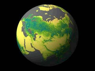
3 South/Southeast Asia Research Initiative (SARI) Region 3


4 Pre-SARI Meetings 2013, Japan 2014, Vietnam Pre-SARI LCLUC NASA Science Team Meetings 2015, Indonesia 2009/1: Kohn Kaen, Thailand 2011/11: Hanoi, Vietnam 2013/1: Coimbatore, India 2016/1: Yangon, Myanmar


5 SARI Yangon Workshop: East Meeting West 5
6 Issues in SARI region Rapid pace of economic development Cross-border trade and regionalization Poverty alleviation and alternative livelihoods Biofuel from energy security perspective Alternate land uses in the context of climate mitigation Emissions/Pollution from Deforestation and Fires Industrial pollution 6
7 7

8 Changes of Lake Inle : the net open water area of Inle Lake decreased from 69 to 47 km2 (~ 32%) Ongoing agricultural practices within the wetlands and margins of the lake are the main sources of sedimentation, eutrophication, and pollution and loss of open water area Inle fishermen return from gathering sediment from the lake to be used as fertilizer, using the traditional Intha legpaddling technique. 8

9 Land-Cover/Land-Use Change Program LCLUC is an interdisciplinary scientific theme within NASA s Earth Science program. The ultimate vision of this program is to develop the capability for periodic global inventories of land use and land cover from space, to develop the scientific understanding and models necessary to simulate the processes taking place, and to evaluate the consequences of observed and predicted changes 9
 Monitoring 27% LU")


10 200 projects since Program s inception Each year ~40 3-yr projects Total in the Program >200 researchers Impacts 33% (Carbon+Water+Eco) Monitoring 27% LU Modeling 14% Drivers 11% LCLUC Climate interactions 6% Synthesis 5% Vulnerability/Adaptation 4% LCLUC Program Content Carbon and Biogeochemical Cycle Impacts 18% Predictive Land Use Modeling 14% Drivers of Change 11% Vuln./ Adapt. 4% Synthesis Studies 5% Observations and Data/ Detection and Monitoring of LCLUC 27% Climate Variability and Change 6% Water and Energy Cycle Impacts 7% Ecosystems and Biodiversity Impacts 8% Brochure Webinar series E-newsletter 10
11 Tools Remote sensing observations (satellite and airborne) Optical Hyper-spatial resolution multispectral (e.g. IKONOS, Orbview) High resolution multispectral (e.g. Landsat, SPOT) Moderate resolution multispectral (e.g. AVHRR, MODIS, MERIS) Lidars Microwave Passive Radars In situ observations and intensive field campaigns Modeling and integrative data analysis Data and information systems 11
12 VIIRS Synergistic Use of Optical Remote Sensing 3300 km swath spatial resolution, 400/800m (nadir (Vis/IR)) AVHRR/ MODIS 2048 km swath spatial resolution, 250m, 500m, 1000m MISR 360 km spatial resolution, 275m, 550m, 1100m global coverage, 2x/day/satellite global coverage, 2 days global coverage, 9 days Landsat spatial resolution, 15m, 30m ASTER spatial resolution 15m, 30m, 90m Commercial Systems spatial resolution ~ 1m 183 km 60 km ~ 10 km 16 day orbital repeat seasonal global coverage day orbital repeat global coverage, years global coverage, decades, if ever 12
 satellite")
13 Earth Night Lights: A 2012 composite from data acquired by the Suomi National Polar-orbiting Partnership (Suomi-NPP) satellite 13
 to 14")
14 DMSP/OLS (5km 2 / 6 bits) to 14

15 NPP/VIIRS (742 m 2 /14 bit)
16 NASA Pre SARI Projects Jefferson Fox/East West Center: The Expansion Of Rubber And Its Implications For Water And Carbon Dynamics In Montane Mainland Southeast Asia Chandra Giri/ SAIC/USGS EROS Center: Tropical Mangrove Forests: Global Distributions And Dynamics ( ) Atul Jain/University of Illinois: Land Cover And Land Use Change And Its Effects On Carbon Dynamics In Monsoon Asian Region Xiangming Xiao/ University of Oklahoma: Quantifying changes in agricultural intensification and expansion in monsoon Asia during Hanqin Tian/Auburn University: Land Use Ecosystem Climate Interactions In Monsoon Asia David Skole/Michigan State University: Enhancing Global Observations And Information On Tropical Forest Change Using Landsat Global Data Ruth DeFries/Columbia University: Multi sensor Fusion to Determine Climate Sensitivity of Agricultural Intensification in South Asia Steve, Leisz/Colorado State University: Increased Accessibility, Landscape Changes, 16 Rural Transformations, and Urbanization: Impacts of the East-West Economic Corridor from Da Nang, Vietnam, to Khon Kaen, Thailand
17 Atul Jain/U. of Illinois NASA LCLUC Synthesis Projects in SARI Region Land Cover and Land Use Changes and Their Effects on Carbon Dynamics in South and South East Asia: A Synthesis Study Jeff Fox, East-West Center, Hawaii Forest, Agricultural, and Urban Transitions in Mainland Southeast Asia: Synthesizing Knowledge and Developing Theory Peilei Fan, Michigan State U. Urbanization and Sustainability Under Global Change and Transitional Economies: Synthesis from Southeast, East and North Asia Seto, Karen, Yale U. Synthesis of LCLUC studies on Urbanization: State of the Art, Gaps in Knowledge, and New Directions for Remote Sensing Science 17
18 What We Have Learned by Now: for the SARI Region Population growth => rapid urban expansion on rural and agricultural lands => further deforestation Prevalent commodity crops (rubber and palm) prices increase => reduced food production and increased food costs Large-scale land-cover conversion for agriculture => changes in carbon cycle and air quality degradation Economic development initiatives => regional landscape fragmentation 18
19 NASA-SARI Science Will be based on the pre-sari projects and selections (for South Asia) from the current LCLUC-2015 solicitations complemented by future selections (for Southeast Asia) from the new solicitation LCLUC-2016 (will be announced in Feb) possibly also by some selections from Carbon Cycle-2016 and IDS
 SERVIR-Mekong promotes the use of")
20 SARI-SERVIR Relationship SERVIR Himalya at ICIMOD will advance free and open information sharing and develop innovative, analyses, decisionsupport products, and trainings that advance scientific understanding and deliver information to those who need it Recent SERVIR s expansion with SERVIR-Mekong, implemented by the Asian Disaster Preparedness Center (ADPC) SERVIR-Mekong promotes the use of publicly available satellite imagery and related geospatial decision-support tools/products for key stakeholders and decision makers Activities of SARI s two GOFC-GOLD regional networks (SEARRIN and SARIN) will be coordinated with SERVIR- 20 Hymalaya and -Mekong activities


21 21
Oct Chiang Mai, attending CEOS Cal/Val Workshop Group Meeting
 1 Oct 2006 - Chiang Mai, attending CEOS Cal/Val Workshop Group Meeting 2 The NASA Land-Cover/Land- Use Change (LCLUC) Science: Focus on South/Southeast Asia Garik Gutman, LCLUC Program Manager NASA Headquarters
NASA's Land-Cover/Land Use Change Program: An Update. Garik Gutman, NASA Headquarters Manager, LCLUC Program
 NASA's Land-Cover/Land Use Change Program: An Update Garik Gutman, NASA Headquarters Manager, LCLUC Program Land-Cover/ Land-Use Change Program International Activities Northern Eurasia Earth Science Partnership
The NASA LCLUC Science: Focus on Central/Eastern Europe. Garik Gutman, LCLUC Program Manager NASA Headquarters Washington, DC
 The NASA LCLUC Science: Focus on Central/Eastern Europe Garik Gutman, LCLUC Program Manager NASA Headquarters Washington, DC 1 Land Cover/Land Use Change Program LCLUC is an interdisciplinary scientific
LCLUC Spring Science Team Meeting, April, Gaithersburg Marriott Washingtonian Center (Rio), Maryland. Meeting Objectives AGENDA
, Maryland. Meeting Objectives AGENDA") LCLUC Spring Science Team Meeting, 2018 3-5 April, Gaithersburg Marriott Washingtonian Center (Rio), Maryland Meeting Objectives This LCLUC Science Team meeting will consist of presentations from the LCLUC
LCLUC Spring Science Team Meeting, 2018 3-5 April, Gaithersburg Marriott Washingtonian Center (Rio), Maryland Meeting Objectives This LCLUC Science Team meeting will consist of presentations from the LCLUC
NASA LCLUC ACTIVITIES IN SOUTHEAST ASIA. Garik Gutman, LCLUC Program Manager NASA HQ, Washington DC
 NASA LCLUC ACTIVITIES IN SOUTHEAST ASIA Garik Gutman, LCLUC Program Manager NASA HQ, Washington DC Land-Cover/Land-Use Change Program LCLUC is an interdisciplinary scientific theme within NASA s Earth
The South/Southeast Asia Research Initiative (SARI) Update and Meeting Objectives. Krishna Prasad Vadrevu NASA Marshall Space Flight Center
 Update and Meeting Objectives. Krishna Prasad Vadrevu NASA Marshall Space Flight Center") The South/Southeast Asia Research Initiative (SARI) Update and Meeting Objectives Krishna Prasad Vadrevu NASA Marshall Space Flight Center Presentation topics Background to the SARI initiative Meeting
The South/Southeast Asia Research Initiative (SARI) Update and Meeting Objectives Krishna Prasad Vadrevu NASA Marshall Space Flight Center Presentation topics Background to the SARI initiative Meeting
LCLUC Spring Science Team Meeting, April, Gaithersburg Marriott Washingtonian Center (Rio), Maryland. Meeting Objectives AGENDA
, Maryland. Meeting Objectives AGENDA") LCLUC Spring Science Team Meeting, 2018 3-5 April, Gaithersburg Marriott Washingtonian Center (Rio), Maryland Meeting Objectives This LCLUC Science Team meeting will consist of presentations from the LCLUC
LCLUC Spring Science Team Meeting, 2018 3-5 April, Gaithersburg Marriott Washingtonian Center (Rio), Maryland Meeting Objectives This LCLUC Science Team meeting will consist of presentations from the LCLUC
Role and importance of Satellite data in the implementation of the COMIFAC Convergence Plan
 Plenary Meeting of the Congo Basin Forest Partnership (CBFP) Palais des Congrès, Yaoundé. Cameroon 11-12 November, 2009 Role and importance of Satellite data in the implementation of the COMIFAC Convergence
20 Years and Counting
 20 Years and Counting The Foundation, Current Status and Possible Future Directions for the LCLUC Program Chris Justice LCLUC Project Scientist Foundations of LCLUC 1990 NASA Landsat Pathfinder initiated
The South/Southeast Asia Research Initiative (SARI) Update and Meeting Objectives. Krishna Prasad Vadrevu NASA Marshall Space Flight Center
 Update and Meeting Objectives. Krishna Prasad Vadrevu NASA Marshall Space Flight Center") The South/Southeast Asia Research Initiative (SARI) Update and Meeting Objectives Krishna Prasad Vadrevu NASA Marshall Space Flight Center Presentation topics Background to the SARI initiative Meeting
The South/Southeast Asia Research Initiative (SARI) Update and Meeting Objectives Krishna Prasad Vadrevu NASA Marshall Space Flight Center Presentation topics Background to the SARI initiative Meeting
Land Cover/Land Use Change SARI International Regional Science Meeting in South/Southeast Asia, Chiang Mai, Thailand th, 2017
 Land Cover/Land Use Change SARI International Regional Science Meeting in South/Southeast Asia, Chiang Mai, Thailand 17 19 th, 2017 AGENDA DAY 1 (17TH JULY, MONDAY) LEELAWADEE ROOM, 5 TH FLOOR, FURAMA
Reports and journal articles Funding and collaboration opportunities Plans for future meetings and special sessions at scientific conferences
 DRAFT AGENDA, version 3 (Nov 10, 2008) Workshop on Monsoon Asia Tropical Forest Carbon Dynamics and Sustainability Jan. 8-11 (Thurs.-Sun.), 2009, Khon Kaen, Thailand Website: http://tbrs.arizona.edu/tropical-asia
MAIRS ACTIVITIES & NASA IDS MEKONG WEF NEXUS PROJECT
 MAIRS ACTIVITIES & NASA IDS MEKONG WEF NEXUS PROJECT Jiaguo Qi Michigan State University and MAIRS Science Steering Committee International Project Office Beijing, China Regional Project Office Bangalore,
Garik Gutman, NASA Headquarters Manager, LCLUC Program
 Garik Gutman, NASA Headquarters Manager, LCLUC Program LCLUC 15 years Program growth by coalescence Carbon Cycle program Interdisciplinary program Other Program visibility in the international arena IGBP-IHDP/GLP
meeting/workshop summaries
 14 Workshop on Land-Cover Land-Use Change in Southeast Asia LeeAnn King, University of Maryland, College Park, mkinglee@hermes.umd.edu Garik Gutman, NASA Headquarters, garik.gutman@nasa.gov Chris Justice,
Land Use and Emissions in South and Southeast Asia Objectives of the Meeting
 Land Use and Emissions in South and Southeast Asia Objectives of the Meeting Chris Justice Dept. of Geographical Sciences University of Maryland Krishna Vadrevu NASA/MSFC Objectives of the Meeting 1 Increased
Land Cover and Land Use Change (LCLUC) Dynamics in South and South East Asia (SSEA)
 Dynamics in South and South East Asia (SSEA)") Land Cover and Land Use Change (LCLUC) Dynamics in South and South East Asia (SSEA) Atul Jain Department of Atmospheric Sciences University of Illinois, USA Acknowledgements Science Team Members & NASA
Land Cover and Land Use Change (LCLUC) Dynamics in South and South East Asia (SSEA) Atul Jain Department of Atmospheric Sciences University of Illinois, USA Acknowledgements Science Team Members & NASA
BUILDING EXPOSURE MAPS OF URBAN INFRASTRUCTURE AND CROP FIELDS IN THE MEKONG RIVER BASIN
 BUILDING EXPOSURE MAPS OF URBAN INFRASTRUCTURE AND CROP FIELDS IN THE MEKONG RIVER BASIN E. Haas (1), J. Weichselbaum (1), U. Gangkofner (1), J. Militzer (1), A. Walli (1) (1) GeoVille, Sparkassenplatz
Multi-scalar telecouplings in the East- West Economic Corridor between Da Nang, Vietnam and Khon Kaen, Thailand: urban and rural land changes.
 Multi-scalar telecouplings in the East- West Economic Corridor between Da Nang, Vietnam and Khon Kaen, Thailand: urban and rural land changes. Stephen Leisz Colorado State University Overview Background
Evolution and Priorities for NASA Land Cover and Land Use Change Program
 Evolution and Priorities for NASA Land Cover and Land Use Change Program NASA LCLUC Science Team Meeting 15 th Anniversary University of Maryland 28 March 2011 Anthony C. Janetos, Director Joint Global
What is SERVIR? SERVIR-Mekong : Geospatial Data and Analysis for. Better Decision Making in the Lower Mekong Region
 SERVIR-Mekong : Geospatial Data and Analysis for Better Decision Making in the Lower Mekong Region 29 October 2015 What is SERVIR? (Sistema Regional de Visualización y Monitoreo) Partnership between USAID
Progress Report for COMBINED SATELLITE MAPPING OF SIBERIAN LANDSCAPES: NATURAL AND ANTHROPOGENIC FACTORS AFFECTING CARBON BALANCE
 Progress Report for COMBINED SATELLITE MAPPING OF SIBERIAN LANDSCAPES: NATURAL AND ANTHROPOGENIC FACTORS AFFECTING CARBON BALANCE Submitted to : Dr. Garik Gutman, LCLUC Program Manger Dr. Waleed Ablati,
Background. Chapter (DeFries et al.) in IPAM/ED book (eds: Moutinho + Schwartzman)
 in IPAM/ED book (eds: Moutinho + Schwartzman)") Global Observation of Forest and Land Cover Dynamics Monitoring Deforestation for Compensated Reductions Martin Herold ESA GOFC-GOLD Land Cover Project Office FSU Jena, Germany on behalf of GTOS/GOFC-GOLD
Global Observation of Forest and Land Cover Dynamics Monitoring Deforestation for Compensated Reductions Martin Herold ESA GOFC-GOLD Land Cover Project Office FSU Jena, Germany on behalf of GTOS/GOFC-GOLD
Research and Training on Big Data
 Research and Training on Big Data Seminar on Statistical Capacity Building for New Data Sources Keio Plaza Hotel, Tokyo, Japan 8 December 2017 Kaushal Joshi Asian Development Bank Outline Conventional
Everett A. Hinkley National Remote Sensing Program Manager
 USDA Forest Service Wildfire Support Programs Update GOFC-Fire IT Meeting October 2011 Everett A. Hinkley National Remote Sensing Program Manager USDA Forest Service / Geospatial Management Office Brad
Science Mission Directorate Carbon Cycle & Ecosystems Roadmap NACP
 Science Mission Directorate Carbon Cycle & Ecosystems Roadmap NACP Bill Emanuel Program Scientist, Terrestrial Ecology Carbon Cycle & Ecosystems Focus Area Carbon Cycle & Ecosystems Focus Area Program
meeting/workshop summaries
 24 Summary of the 2013 NASA Land Cover/Land Use Change Regional Science Meeting, South India Krishna Prasad Vadrevu, University of Maryland, College Park, krishna@hermes.geog.umd.edu Chris Justice, University
IGOL: The Land Theme Integrated Global Observations for Land:
 IGOL: The Land Theme Integrated Global Observations for Land: IGOL Report: Scope Land cover, land cover change, fire Land use, land use change Agricultural production, food security, sustainable agriculture
Building capacity to access and use greenhouse gas observations
 12 th International Workshop on Greenhouse Gas Measurement from Space (IWGGMS-12) Building capacity to access and use greenhouse gas observations June 7, 2016 Takuya Nomoto/ Hassan Virji/ Senay Habtezion
Investigating ecological patterns and processes in tropical forests using GIS and remote sensing
 Investigating ecological patterns and processes in tropical forests using GIS and remote sensing Carlos Portillo-Quintero Center for Earth Observation Sciences (CEOS) Department of Earth & Atmospheric
A look past and a look forward. David Skole Michigan State University
 A look past and a look forward David Skole Michigan State University Antecedents ca. 1988-94 There were important antecedents to the NASA LCLUC program Two important drivers: Large scale Landsat databases
Panel Discussion. Sergey Bartalev: Russia Tuomas Hame: Finland Eva Konkoly-Gyuro: Hungary Anu Reinart: Estonia Premysl Stych: Czech Republic
 Panel Discussion Sergey Bartalev: Russia Tuomas Hame: Finland Eva Konkoly-Gyuro: Hungary Anu Reinart: Estonia Premysl Stych: Czech Republic Panel Discussion Notes Russia Emphasis on Applications Forest/Agric/Wetland
OneMap Myanmar Project and Updates
 International Meeting on Land Use and Emission in South/Southeast Asia Ho Chi Minh City, Vietnam, 17 th -19 th October 2016 OneMap Myanmar Project and Updates Myat Su Mon Forest Department, Myanmar Presentation
LCLUC AND WEF NEXUS IN THE MEKONG RIVER BASIN
 LCLUC AND WEF NEXUS IN THE MEKONG RIVER BASIN Jiaguo Qi Michigan State University PRESENTATION OUTLINE Water-Energy-Food Systems and Challenges Water-Energy-Food Nexus Framework Approaches and Activities
Climate Sensitivity of Winter Cropping in India
 Climate Sensitivity of Winter Cropping in India LCLUC Regional Team Meeting, Yangon, Jan 13 15, 2016 R. DeFries, Columbia University G. Galford, University of Vermont M. Jain, Stanford University P. Mondal,
Dynamics and Drivers of Land Cover & Land Use Changes in Bangladesh Integration of Satellite Data with Socioeconomic Dataset
 LC/LUC and Impacts on Environment in SSEA Intl. Regional Science Team Meeting Philippines, May 28-30, 2018 Dynamics and Drivers of Land Cover & Land Use Changes in Bangladesh Integration of Satellite Data
2. NASA LCLUC: Mapping LCLUC and sensor fusion in South Asia
 Background Synergistic projects 1. NASA SBIR (NNX14CS01C).: Rice Decision Support System (RiceDSS): Support global food security programs, disaster management, and commodity markets with fused rice info
High-resolution Land Cover Mapping Projects in JAXA/EORC
 2017/07/19 LCLUC SARI International Regional Science Meeting in South/Southeast Asia High-resolution Land Cover Mapping Projects in JAXA/EORC Kenlo Nishida Nasahara (奈佐原顕郎) JAXA/EORC Ecology Research Group
Forest and Land Cover Monitoring by Remote Sensing Data Analysis
 Low Carbon Asia Research Network (LoCARNet) 3rd Annual Meeting Bogor, Indonesia November 24 26, 2014 Forest and Land Cover Monitoring by Remote Sensing Data Analysis Muhammad Ardiansyah Center for Climate
Announcement TE AM Agenda and Talks Reorganized. See Registration Desk
 Announcement TE AM Agenda and Talks Reorganized See Registration Desk Review of LCLUC Observations and Data and Land Use Chris Justice LCLUC Program Scientist University of Maryland LCLUC Program Objectives
Generating Data from National Forest Monitoring
 Generating Data from National Forest Monitoring and Click Carbon to edit Accounting (REDD Master MRV) title style Alexander Lotsch Click to edit Master subtitle style World Bank Forest Carbon Partnership
CARPE monitoring of the Congo Basin results and ideas for REDD monitoring
 CARPE monitoring of the Congo Basin results and ideas for REDD monitoring Matthew C. Hansen Erik Lindquist Peter Potapov Bwangoy Bankanza South Dakota State University Chris Justice Alice Altstatt Diane
Land Surface Monitoring from the Moon
 Land Surface Monitoring from the Moon Jack Mustard, Brown University Workshop on Science Associated with Lunar Exploration Architecture Unique Perspective of Lunar Observation Platform Low Earth Orbit:
The NASA LCLUC Program s Support of NEESPI: Focus on Europe. Garik Gutman, LCLUC Program Manager NASA Headquarters Washington, DC
 The NASA LCLUC Program s Support of NEESPI: Focus on Europe Garik Gutman, LCLUC Program Manager NASA Headquarters Washington, DC 1 WELCOME TO ODESSA-MAMA! 2 3 NEESPI Science Plan Review Meeting Yalta 2003
Earth observations for water resource management: Current practice and examples
 Earth observations for water resource management: Current practice and examples NEW OPPORTUNITIES IN SATELLITE AND AIRBORNE REMOTE SENSING: Hydrological and Environmental Applications DTU Environment Lyngby
Summary of Research. Stephen J. Leisz. Colorado State University Fort Collins, CO NNX13AC51G. Title of Grant / Cooperative Agreement:
 Title of Grant / Cooperative Agreement: Type of Report: Increased accessibility, landscape changes, rural transformations, and urbanization: Impacts of the east-west economic corridor from Da Nang, Vietnam,
OVERVIEW: Social and Environmental Soundness Issues in REDD+
 OVERVIEW: Social and Environmental Soundness Issues in REDD+ Session 1 Evan Notman USAID Global Climate Change 5 November 2012 KEY ISSUES FOR THE WEEK REDD+ Social & Environmental Soundness (SES) Key concepts
MONITORING LAND USE AND LAND USE CHANGES IN FRENCH GUIANA BY OPTICAL REMOTE SENSING
 MONITORING LAND USE AND LAND USE CHANGES IN FRENCH GUIANA BY OPTICAL REMOTE SENSING Photo : Valéry Gond Photo : Valéry Gond Photo Photo : Gaëlle : : Valéry VERGER Gond Gaëlle VERGER ONF, French National
Lawrence Friedl USA / NASA
 Geospatial Information and Earth Observations: Supporting Official Statistics in Monitoring the SDGs UNSC STATISTICAL-GEOSPATIAL INTEGRATION FORUM United Nations 7 March 2016 Session III. Geospatial and
Remote Sensing in Support of Multilateral Environmental Agreements
 Remote Sensing in Support of Multilateral Environmental Agreements Alex de Sherbinin CIESIN, The Earth Institute, Columbia University Presented at the Satellites and the Law Enforcement Meeting London,
Wildfire WG. Recent Activities and Agenda. Sentinel Asia Joint Project Team Meeting 2014 Nov 20. Yangon, Myanmar
 Wildfire WG Recent Activities and Agenda Sentinel Asia Joint Project Team Meeting 2014 Nov 20. Yangon, Myanmar Koji Nakau PhD., Hokkaido University Keiji Kimura PhD., Nara University Masami Fukuda PhD.,
Dynamic Maps of Open Surface Water Bodies in Oklahoma at 30- m Spatial Resolution during
 Dynamic Maps of Open Surface Water Bodies in Oklahoma at 30- m Spatial Resolution during 1984-2014 Xiangming Xiao Center for Spatial Analysis Earth Observation and Modeling Facility Department of Microbiology
Economic and Social Council
 United Nations Economic and Social Council E/ESCAP/CST(5)/6 Distr.: General 12 October 2016 Original: English Economic and Social Commission for Asia and the Pacific Committee on Statistics Fifth session
Mapping Industrial Forests in Tropical Monsoon Asia
 Mapping Industrial Forests in Tropical Monsoon Asia Jinwei Dong University of Oklahoma NASA LCLUC Science Team Meeting, April 18-19, 2016, Maryland Acknowledgement : A network of international collaborators
Carbon Cycle & Ecosystems. Diane E. Wickland, Focus Area Lead April 12, 2006
 Carbon Cycle & Ecosystems Diane E. Wickland, Focus Area Lead April 12, 2006 Carbon Cycle & Ecosystems Program Elements & Managers Ocean Biology and Biogeochemistry Paula Bontempi Land Cover and Land Use
G8 Environment Ministers Meeting 2008 Kobe Call for Action for Biodiversity
 Attachment 3 G8 Environment Ministers Meeting 2008 Kobe Call for Action for Biodiversity We, the Environment Ministers of the G8, based upon our discussions in Kobe on biodiversity, 24-26 May 2008, Emphasizing
EO Information Services in support of
 EO Information Services in support of Building Exposure Maps of Urban Infrastructure and Crop Fields in the Mekong River Basin Christian Hoffmann, GeoVille group World Bank HQ, Washington DC Date : 11
Product Delivery Report for K&C Phase 3. Nathan Torbick, William Salas Applied Geosolutions. Collaborators: J. Dong, M. Ducey, C. Li, J. Qi, X.
 Product Delivery Report for K&C Phase 3 Nathan Torbick, William Salas Applied Geosolutions Collaborators: J. Dong, M. Ducey, C. Li, J. Qi, X. Xiao Science Team meeting #21 Phase 3 Result Presentations
Promoting Cooperation on Ecosystem-based Approaches in the Greater Mekong Subregion (GMS)
") Promoting Cooperation on Ecosystem-based Approaches in the Greater Mekong Subregion (GMS) Ornsaran Pomme Manuamorn Climate Change Coordinator GMS Environment Operations Center (EOC) Asian Development Bank
Promoting Cooperation on Ecosystem-based Approaches in the Greater Mekong Subregion (GMS) Ornsaran Pomme Manuamorn Climate Change Coordinator GMS Environment Operations Center (EOC) Asian Development Bank
Atul Jain University of Illinois, Urbana, IL 61801, USA
 Brian O Neill, NCAR 2010 LCLUC Spring Science Team Meeting Bethesda, MD April 20-22, 2010 Land-Use Change and Associated Changes in Biogeochemical and Biophysical Processes in Monsoon Asian Region (MAR)
Remote Sensing of Mangrove Structure and Biomass
 Remote Sensing of Mangrove Structure and Biomass Temilola Fatoyinbo 1, Marc Simard 2 1 NASA Goddard Space Flight Center, Greenbelt, MD USA 2 NASA Jet Propulsion Laboratory, Pasadena, CA USA Introdution
Overview of the GEF6 Integrated Approach Pilot Programs. Early Lessons from Programming
 Overview of the GEF6 Integrated Approach Pilot Programs Early Lessons from Programming Integrated Approach Pilots: Charting a New Frontier for the Global Environment Schlosser & Pfirman, Nature Geosciences,
Overview of the GEF6 Integrated Approach Pilot Programs. Early Lessons from Programming
 Overview of the GEF6 Integrated Approach Pilot Programs Early Lessons from Programming Integrated Approach Pilots: Charting a New Frontier for the Global Environment Schlosser & Pfirman, Nature Geosciences,
Joint Experiment for Crop Assessment and Monitoring GEOGLAM Implementation Meeting Washington D.C. February 21, 2013
 Joint Experiment for Crop Assessment and Monitoring GEOGLAM Implementation Meeting Washington D.C. February 21, 2013 Ian Jarvis JECAM Sub-Task Lead Earth Observation Service, Agriculture and Agri-Food
GEOGLAM international cooperation activities
 GEOGLAM international cooperation activities Chris Justice Center for Global Agricultural Monitoring and Research Dept. of Geographical Sciences University of Maryland GEO: an International Coordinating
INTRODUCTION. STEP M Executive Summary 1
 INTRODUCTION Global migration is a long-standing behavioral trait of humankind that has shaped our existing and ever-changing population distribution. As the global population has increased seven-fold
Integrating and Visualizing Earth Observation Data for the SDGs Mike Gill
 7 th Meeting of the Interagency and Expert Group on Sustainable Development Goal Indicators Vienna, Austria 12 April, 2018 Integrating and Visualizing Earth Observation Data for the SDGs Mike Gill GEO
Action Plans to Prevent and Control Deforestation (Aichi Target #5, National Target #12)
") Action Plans to Prevent and Control Deforestation (Aichi Target #5, National Target #12) Capacity building Workshop for Southeast Asia on Ecosystem Conservation and Restoration to support achievement of
Action Plans to Prevent and Control Deforestation (Aichi Target #5, National Target #12) Capacity building Workshop for Southeast Asia on Ecosystem Conservation and Restoration to support achievement of
Land Cover and Land Use Change and its Effects on Carbon Dynamics in Monsoon Asia Region. Atul Jain. University of Illinois, Urbana-Champaign, IL USA
 Land Cover and Land Use Change and its Effects on Carbon Dynamics in Monsoon Asia Region Atul Jain University of Illinois, Urbana-Champaign, IL USA Email: jain1@uiuc.edu Terrestrial Ecosystems, Land Use
Asia RiCE Highlights (Asian Rice crop estimation & monitoring)
") Asia RiCE Highlights (Asian Rice crop estimation & monitoring) Thuy Le Toan CESBIO, Toulouse, France On behalf of the GEOGLAM Asia RiCE team 13/01/2016 1 Importance of rice monitoring in SE Asia Rice is
Asia RiCE Highlights (Asian Rice crop estimation & monitoring) Thuy Le Toan CESBIO, Toulouse, France On behalf of the GEOGLAM Asia RiCE team 13/01/2016 1 Importance of rice monitoring in SE Asia Rice is
The NASA LCLUC Program and the Drylands Focus. Chris Justice Geography Department University of Maryland USA
 The NASA LCLUC Program and the Drylands Focus Chris Justice Geography Department University of Maryland USA Drylands The worlds drylands are home to 1/3 of the Worlds population Drylands cover 40% of the
Current Status of NFMIS in Myanmar & How MOLI data can Contribute to the ongoing Efforts. Myat Su Mon, Forest Department, Myanmar
 Current Status of NFMIS in Myanmar & How MOLI data can Contribute to the ongoing Efforts Myat Su Mon, Forest Department, Myanmar 26-05-2017 1 Presentation Outlines Background Information Challenges for
The NISAR Mission. Paul Siqueira Emerging Technologies and Methods in Earth Observation for Agriculture Monitoring College Park, 2018
 The NISAR Mission Paul Siqueira Emerging Technologies and Methods in Earth Observation for Agriculture Monitoring College Park, 2018 Flyer A one-page paper-flyer is available with more information NISAR
K&C Phase 3 Brief project essentials. Application of PALSAR for regional assessments of forest disturbance, rice agriculture and wetland habitats.
 K&C Phase 3 Brief project essentials Application of PALSAR for regional assessments of forest disturbance, rice agriculture and wetland habitats. William Salas Applied GeoSolutions, LLC (AGS) Durham, NH
Climate Change Impacts: Caribbean
 Climate Change Impacts: watersheds of Mesoamerica and the Caribbean Water quality and availability Flood potential Context CATHALAC & SERVIR Climate Change and Biodiversity Increasing frequency and intensity
Overview. Virginia Burkett, USGS, GFOI.ORG GFOI1
 Overview Virginia Burkett, USGS, GEO @GFOI_FOREST GFOI.ORG GFOI1 What is GFOI? Partnership for coordinating the delivery of international support on forest monitoring & GHG accounting for REDD+ and related
Biomass Needs for Global Climate Modeling
 Biomass Needs for Global Climate Modeling Joint Global Carbon Cycle Center DEPARTMENT of GEOGRAPHICAL SCIENCES September 25, 2018 Dr. George Hurtt Professor & Research Director Science Team Leader CMIP6-Endorsed
CMS and Decision Support Discussion Forum: Current and Near-term Satellite Assets
 CMS and Decision Support Discussion Forum: Current and Near-term Satellite Assets February 6, 2013 Diane E. Wickland 1 and Marc L. Imhoff 2 1 - NASA HQ, Science Mission Directorate, Earth Science Division
A global perspective on land use and cover change
 A global perspective on land use and cover change Alan Belward The Global Environment Monitoring Unit Institute for Environment and Sustainability European Commission Joint Research Centre 21027 Ispra
Remote Sensing for Monitoring USA Crop Production: What is the State of the Technology
 Remote Sensing for Monitoring USA Crop Production: What is the State of the Technology Monitoring Food Security Threats from Space - A CELC Seminar Centurion, SA 21 April 2016 David M. Johnson Geographer
Remotely-Sensed Fire Danger Rating System to Support Forest/Land Fire Management in Indonesia
 Remotely-Sensed Fire Danger Rating System to Support Forest/Land Fire Management in Indonesia Orbita Roswintiarti Indonesian National Institute of Aeronautics and Space (LAPAN) SE Asia Regional Research
NEESPI NASA Vision: A Retrospective and Perspectives
 NEESPI NASA Vision: A Retrospective and Perspectives Looking back Current issues Looking ahead Garik Gutman Land-Cover/Land-Use Change Program NASA Headquarters NEESPI Summit 3-4 May, Helsinki, Finland
Chandrashekhar Biradar, PhD Principal Scientist (Agro-Ecosystems) Head-Geoinformatics Unit 30 March 2017 Bangkok, Thailand
 Head-Geoinformatics Unit 30 March 2017 Bangkok, Thailand") Chandrashekhar Biradar, PhD Principal Scientist (Agro-Ecosystems) Head-Geoinformatics Unit c.biradar@cgiar.org 30 March 2017 Bangkok, Thailand People Drylands increased Ensuring Food Security Gender Address
Chandrashekhar Biradar, PhD Principal Scientist (Agro-Ecosystems) Head-Geoinformatics Unit c.biradar@cgiar.org 30 March 2017 Bangkok, Thailand People Drylands increased Ensuring Food Security Gender Address
2010 Katoomba Meeting XVII
 2010 Katoomba Meeting XVII Southeast Asia HANOI, VIETNAM June 23-26, 2010 TAKING THE LEAD: PAYMENTS FOR ECOSYSTEM SERVICES IN SOUTHEAST ASIA CO-HOSTS The conference is brought to you by the Government
EO-MINERS. The EO-MINERS project A general overview. EO-MINERS Final Conference Versailles, October 11-12, 2013
 EO-MINERS The EO-MINERS project A general overview EO-MINERS Final Conference Versailles, October 11-12, 2013 Stéphane CHEVREL Project Coordinator s.chevrel@brgm.fr The EO-MINERS project EO-MINERS is a
USGCRP/CCSP Strategic Planning Building Block Global Carbon Cycle 1
 USGCRP/CCSP Strategic Planning Building Block Global Carbon Cycle 1 Summary The global carbon cycle is changing rapidly as a result of human actions, altering Earth s climate. Many research priorities
Associated Event : SDG 6 on Water and Sanitation
 Associated Event : SDG 6 on Water and Sanitation Ir. (Dr.) Keizrul bin Abdullah Chairperson, Network of Asian River Basin Organizations (NARBO) The Role of River Basin Organizations (RBOs) in Fostering
Ecosystem Based Adaptation Mozaharul Alam Regional Coordinator, Climate Change UN Environment Office for Asia and the Pacific Bangkok, Thailand
 NAP Regional Training Workshop for Asia Mainstreaming Climate Change Adaptation into Water Resources Ecosystem Based Adaptation Mozaharul Alam Regional Coordinator, Climate Change UN Environment Office
JICA s Cooperation for. Sustainable Forest. Management
 JICA s Cooperation for Sustainable Forest Management 9 March 2016 GOSEKI Kazuhiro Forestry & Nature Conservation Group, Global Environment Department, Japan International Cooperation Agency Outline of
International Meet on Land Cover and Land Use Change Dynamics and its Impacts in South Asia: Focus on Water Resources January 7-8, 2013
 International Meet on Land Cover and Land Use Change Dynamics and its Impacts in South Asia: Focus on Water Resources January 7-8, 2013 Centre for Water Resources Development and Management Web: www.cwrdm.org
India s Readiness for REDD+
 INDIA@COP22 India s Readiness for REDD+ Dr. T.P. Singh Sustainable Lifestyle = Positive Climate Action www.indiaatcop22.org Forests Cover in India Class Area (sq km) % of geo area Very Dense Forest 85,904
NASA. AMS Washington Forum Federal Panel. Michael H. Freilich 4 April LDCM First-Light. OLI False-Color. Fort Collins, CO area.
 NASA TIRS Saudi Arabia AMS Washington Forum Federal Panel Michael H. Freilich 4 April 2013 LDCM First-Light Suomi NPP VIIRS OLI False-Color Visible Composite Fort Collins, CO area NASA Earth Science Highlights
Networking for Climate Change: Experiences from Montreal Protocol
 Networking for Climate Change: Experiences from Montreal Protocol Eighteenth Asia-Pacific Seminar on Climate Change Building an Architecture of an Effective Future Regime Atul Bagai, Network Coordinator
Changing Dynamics of Tropical Deforestation and Atmospheric Carbon: Science Meets Policy PLEASE DO NOT USE GRAPHICS WITHOUT PERMISSIONS
 Changing Dynamics of Tropical Deforestation and Atmospheric Carbon: Science Meets Policy R. DeFries, University of Maryland College Park Michigan State University, March 18, 2008 Collaborators G. Van der
3/1/18 USING RADAR FOR WETLAND MAPPING IMPORTANCE OF SOIL MOISTURE TRADITIONAL METHODS TO MEASURE SOIL MOISTURE. Feel method Electrical resistance
 3/1/18 USING RADAR FOR WETLAND MAPPING SOIL MOISTURE AND WETLAND CLASSIFICATION Slides modified from a presentation by Charlotte Gabrielsen for this class. Southeast Arizona: Winter wet period From C.
LCLUC PROGRAM: UPDATE
 LCLUC PROGRAM: UPDATE Garik Gutman, NASA Headquarters Manager, LCLUC Program April 2018 LCLUC Program Content >300 projects since Program s inception Each year: * ~40 3-yr projects * ~300 researchers Carbon
Ecosystem based Disaster Risk Reduction
 Ecosystem based Disaster Risk Reduction Radhika Murti Programme Coordinator, Disaster Risk Reduction IUCN Headquarters, Switzerland INTERNATIONAL UNION FOR CONSERVATION OF NATURE 2 Western Indian Ocean
THE WORLD FOREST OBSERVATORY An Instrument for Global Forest Measurement. Alan Grainger. University of Leeds
 THE WORLD FOREST OBSERVATORY An Instrument for Global Forest Measurement Alan Grainger University of Leeds If astronomers can continually observe the universe... Why can't global change scientists continually