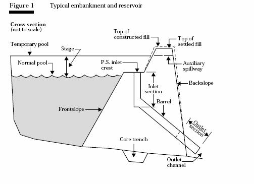
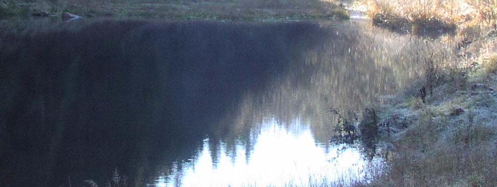
Ponds: planning, design, and construction
|
|
|
- Rolf Webb
- 5 years ago
- Views:
Transcription

1 Ponds: planning, design, and construction


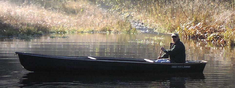
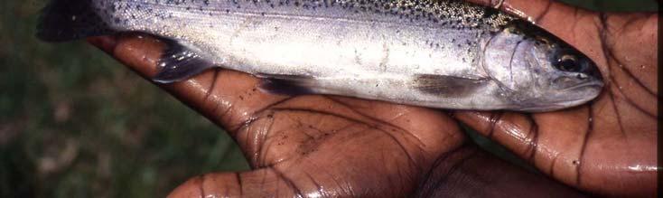
2 Ponds for many purposes: Fish Production Recreation Water Supply Esthetics Wildlife Habitat
3 Natural ponds: Formed in natural depressions in the landscape Not man-made made don t t have constructed dams or embankments May be permanent or seasonal Not easily controlled/managed
4 Excavated ponds: Designed for specific purposes Uniform shapes and sizes Flat, sloped bottoms Free of stumps, rocks, etc. Usually drainable Have reliable sources of good quality water More easily managed than natural ponds
5 Watershed ponds: Fit into the topography of the watershed Use watershed runoff as water source Partially excavated; usually have a dam Less easily managed than excavated ponds Water supply/management depends on weather
6 Basic terminology:
7 Site selection Choose site to fit landscape Consider more than one location and select the one that is most ecologically appropriate, esthetic, and practical site. Weighing both onsite and offsite effects of constructing a pond is essential in site selection. Choose site to maximize storage for smallest amount of embankment. Consider potential for pollution from contributing watershed area.
8 Geology Knowledge of local geology is important especially for large dams. Well logs are another source of subsurface geologic information. View the interactive geologic map of Oregon

9 Geologic maps may be available that include your property
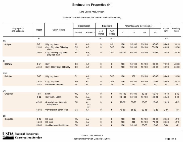
10 Soils Most counties in Oregon have published soil surveys Check out soil survey report for your county Soils information can be accessed via the Internet, too, via the Soil Data Mart.

11 Soil Survey reports:


12 Soil Survey is a Scientifically-Based Inventory A soil survey includes maps, descriptions, properties, climate, and interpretations. These are excellent sources of information. About 3000 counties in the United States have a soil survey.


13 Soils Have Unique Physical, Chemical, and Biological Properties Important to Their Use color texture structure consistence roots pores other features Soil is a natural body of solids, liquid, and gases, with either horizons or layers, and the ability to support rooted plants.
14 So how do you getting started using the Soil Data Mart?? Go to the web site: soildatamart.nrcs.usda.gov

15 Soil Data Mart Home Page soildatamart.nrcs.usda.gov

16 Select either a county or survey area. Some counties are covered by multiple soil survey areas, and some soil survey areas cover multiple counties.

17 Then select a survey area. In the case of Lane County, there is one survey area available.

18 You can generate a variety of soils reports online.

19 Select the map units you want in the report and the type of report. There is also an option to include a report description.
20

21 NRCS Oregon Soil Survey Web Site: Click on the soil survey area of interest.

22 The soil map is displayed with a digital orthophoto background. Section lines are in yellow. Section numbers are highlighted in yellow.

23 You can also display soil maps with a topographic map background. Click on the topo_drg.sid layer then Refresh Map
24 Let s s say you ve selected a purpose for the pond Irrigation Fish and wildlife/recreation Waste storage Livestock water supply Fire protection
25 Watershed hydrology is next Determine watershed area that will contribute water to the pond. Determine the amount of runoff to the pond site.

26 Rain Soil Runoff Infiltration

27 Estimated drainage area in acres required for each acre-foot of storage in a pond.


28 Recommended minimum depth of water for ponds.
29 Determine pond capacity Rule of thumb method for determining capacity of pond: Determine max. depth at dam. Determine surface area (acres). Multiply by 0.4 Result is in acre-feet of storage. 1 acre-foot = 325,651 gallons
30 Estimating storm runoff from catchment area NRCS procedure Requires assessment of land use, cover, and soils in the catchment area or watershed. Uses NOAA Atlas for precipitation data Tool that can be used is Win-TR55 by NRCS. Find it at: tools-models models-wintr55.html
31 Hydrologic Soil Groups Group A is sand, loamy sand or sandy loam types of soils. It has low runoff potential and high infiltration rates even when thoroughly wetted. They consist chiefly of deep, well to excessively drained sands or gravels and have a high rate of water transmission.
32 Hydrologic Soil Groups Group B is silt loam or loam. It has a moderate infiltration rate when thoroughly wetted and consists chiefly or moderately deep to deep, moderately well to well drained soils with moderately fine to moderately coarse textures.
33 Hydrologic Soil Groups Group C soils are sandy clay loam. They have low infiltration rates when thoroughly wetted and consist chiefly of soils with a layer that impedes downward movement of water and soils with moderately fine to fine structure.
34 Hydrologic Soil Groups Group D soils are clay loam, silty clay loam, sandy clay, silty clay or clay. This HSG has the highest runoff potential. They have very low infiltration rates when thoroughly wetted and consist chiefly of clay soils with a high swelling potential, soils with a permanent high water table, soils with a clay pan or clay layer at or near the surface and shallow soils over nearly impervious material.
35 Runoff curve numbers Curve numbers are related to hydrologic soil groups and land use/land cover. The higher the curve number value, the higher the runoff, e.g. concrete and other impervious surfaces have a curve number of 98. Refer to reference tables for typical values. Develop a weighted curve number for the watershed.
36 Web resources There are many places on the web that have aids to help with runoff calculations. Here s s one at Purdue Univ.:
37 Volume of storm runoff Storm runoff volume is important to know for a given frequency event: This volume is needed to compute storage, as well as the peak discharge rate for the storm. See page 18 in Ag. Handbook 590
38 Runoff depth Given: 3-inch rainfall on 100 acres; wt. CN = 75; runoff depth = 0.96; volume = (0.96x100)/12 = 8 acre-feet.
39 Hydrology This runoff volume for a 3-inch 3 rainfall may be related to a given frequency storm event. The peak discharge from the drainage area to the pond will be important for designing the principal and auxiliary spillways. These structures are sized to allow excess runoff to be safely routed through the pond and on downstream without endangering the dam.
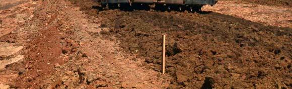
40 Site surveys Conduct a site survey to layout the dam centerline, spillways and other features. A profile of the dam centerline is used to set the top of the dam, determine pond capacity, and locate the spillways. It is also used to compute the volume of earthfill required to build the dam.
41 Surveys Establish a similar centerline for the auxiliary spillway, beginning on the upstream end well below the pond s s normal water surface and continuing downstream where water can be safely discharged without endangering the dam. Establish a benchmark that will not be disturbed during construction and tie all survey points to this.
42 Embankment ponds A detailed soils investigation is required to determine the characteristics of the soils on site. Will they hold water in the reservoir? What materials can be used for embankment construction? Can borrow be taken from the floor of the reservoir area or does it need to come from upland sources?
43 Foundation conditions Foundation must be able to support the weight of the dam to ensure stability and provide resistance to seepage. Soil borings or test pits can be used to investigate the foundation conditions. Holes should be at least 1.5 times the height of the dam. Ensure there are no steep dropoffs that might cause cracking of the dam.
44 Foundation conditions If the foundation is on rock or excavated to bedrock, the rock should be examined for thickness and for fissures and seams that will pass water. Sand and gravel deposits in the foundation should be removed to decrease seepage potential. A cutoff core trench of impervious compacted material can be installed under the dam, or an upstream blanket of similar material can be placed on the dam and pond area.
45 Foundation conditions Fine-grained materials, such as silts and clays, are relatively impervious, but may have a low degree of stability (soft and compressible). Flattening the side slopes of the dam may be required to decrease the unit load on a soft foundation. Peat, muck or any soil with high organic-matter content should be removed from the foundation.
46 Foundation conditions Good foundation materials are those that provide both stability and imperviousness. These include mixtures of coarse- and fine-textured soils, such as gravel-sand sand-clay mixtures, gravel-sand sand-silt silt mixture, and sand-clay or sand-silt silt mixtures. Less desirable but ok foundation materials include gravelly clays, sandy clays, silty clays, silty and clayey fine sands, and clayey silts that have slight plasticity. Undisturbed sampling may be needed to test strength of foundation materials (large dams only).
47 Fill material Availability of suitable fill is a determining factor in site selection. Locate enough soil volume to meet 1.5 times the volume required for the dam. This will allow for shrinkage and volume loss due to compaction of the soil when building the dam. If site conditions allow, borrow can be taken from within the pond area.
48 Fill material Need to know the engineering properties of the soils available at the site. Some soil mechanics tests are required to determine these properties. Index tests: will give USCS classification and plasticity index Soil/moisture/density tests: will give information needed to determine construction properties of the soil materials. Special tests needed to determine shrink-swell swell potential (clays) and whether soils are dispersive.
49
50
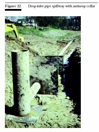
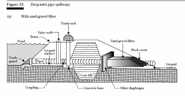
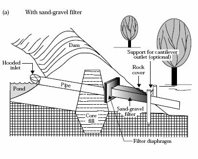
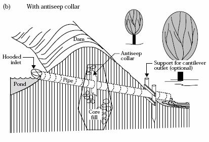
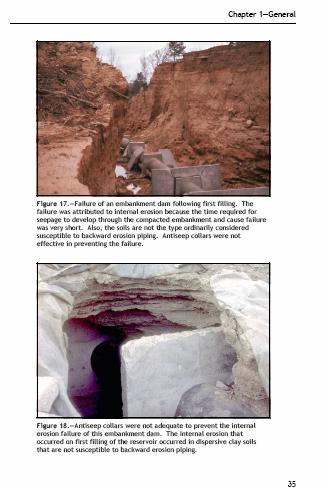
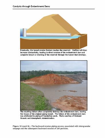
51
52 Principal Spillways Principal spillways allow for passage of excess water during small storm events and reduce the frequency of operation of the auxiliary spillway. Usually sized to control runoff up to a 10-year frequency storm. Design should be performed by someone with training and experience in engineering and sizing hydraulic structures.
53 Auxiliary spillways These operate during infrequent storms and protect the embankment from being overtopped by water from the pond. Having adequate capacity in the auxiliary spillway is critical. Again design is best left to experienced engineer.
54 Spillway design guide
55 Plan, profile, and cross section of excavated spillway
56 Excavated earth spillway
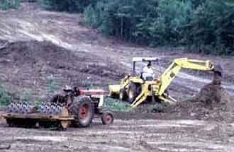
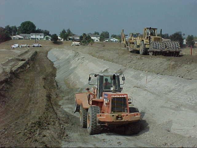
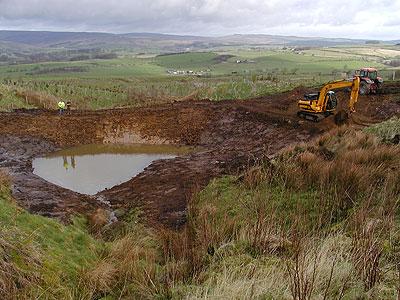
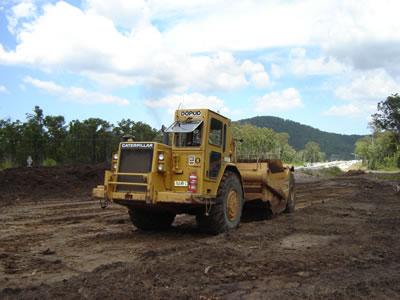
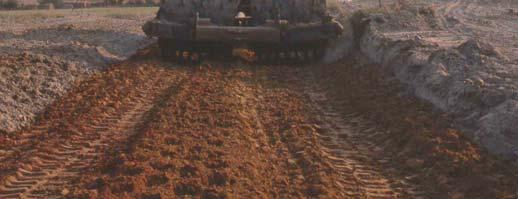
57 Excavated earth spillway
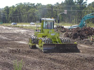
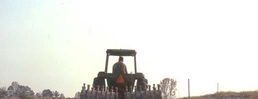
58 Conduits through dams (principal spillways) Require careful installation to protect from piping and internal scour along the conduit. Use of Anti-seep collars Use of Filter diaphragms
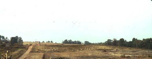
59
60
61
62
63
64 Pond construction Construction stake-out and site preparation Core trench excavation Placement of earthfill in the embankment Principal spillway Auxiliary spillway Toe drain Replace topsoil and seed the site to appropriate vegetation
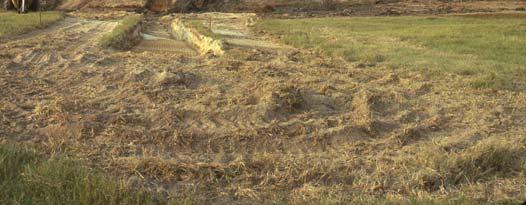
65 Soil compaction Equipment types: Sheepsfoot roller Vibratory roller Rubber-tired loaded scraper Soil lifts for compaction should not be more than 9 inches thick.

66 Problems sites
67
68
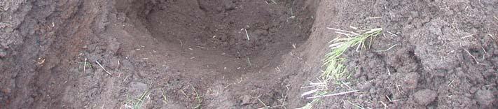
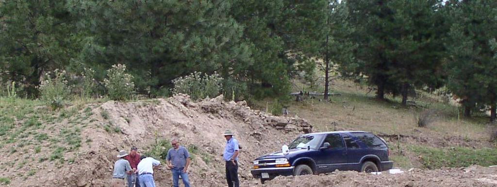
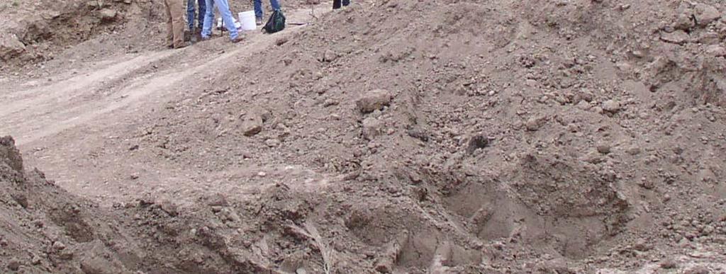
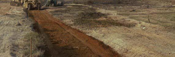
69
70
71
72 Construction traffic considerations
73
74
75

76 Investigate sites by excavating test pits to observe soil stratigraphy
77
78
79
80
81
82
83
84
85
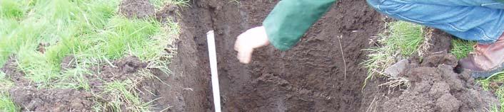
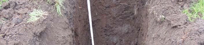
86
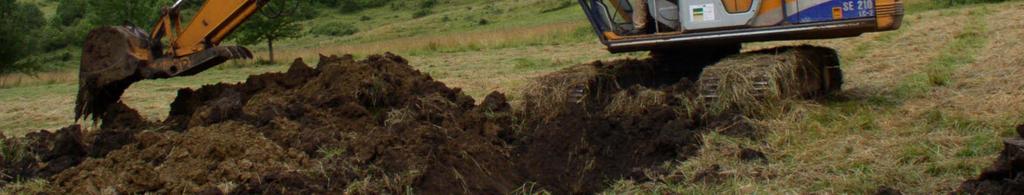
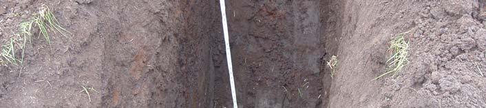
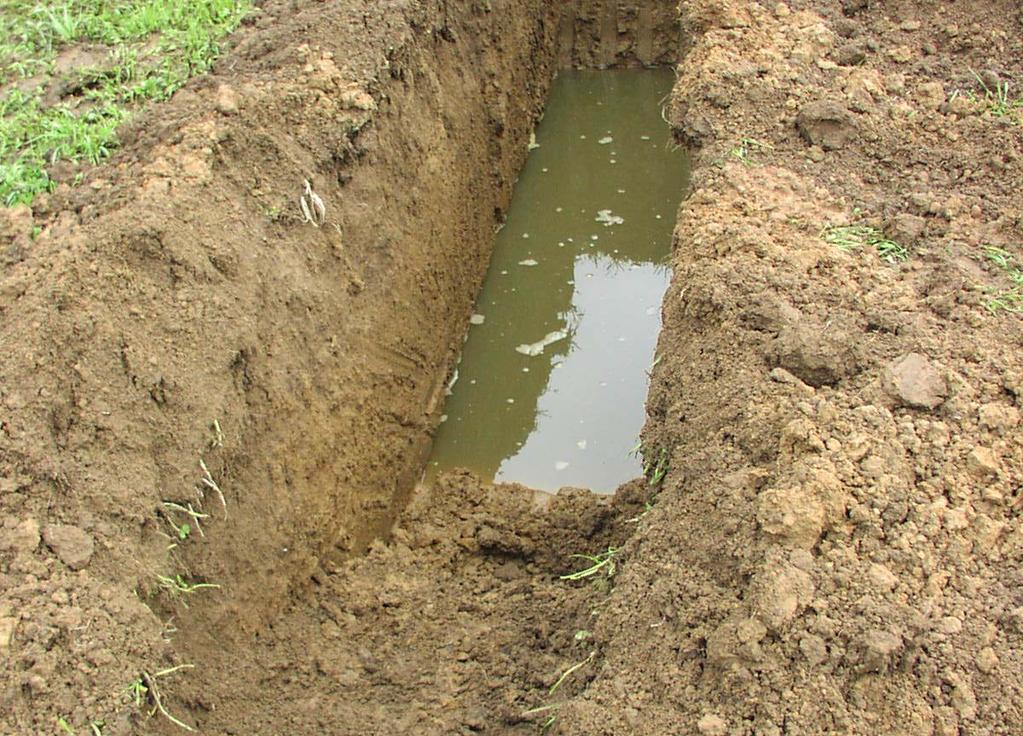
87
88
89 Problems with existing ponds Excessive seepage. Poor geologic conditions Poorly designed Improper construction Leaky dam Leaky foundation or abutments Does not fill to capacity. Poor hydrology/watershed runoff Oversized design for the site


90 My pond is leaking what can I do to seal it up?
91 Leaking ponds: This is usually the result of improper construction or construction on poor soils Preventive actions that can be taken: Construct only on good soils Use correct construction procedures Corrective actions that can be taken: Add a layer of clay to the pond bottom Add a modified core trench in weak area Install a plastic liner
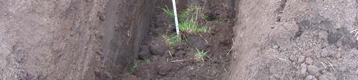
92 Proper soils for construction: Soils must be impermeable to water Soils must therefore have a minimum clay content: 20% clay for general purposes 30% clay for dam cores Some sand, silt, and even gravel in the mix is good but the amount of each of these should be limited
93 Proper pond construction procedures: Remove topsoil from the dam area Build a core trench into the base of the dam Extend core trench well into a clay layer below the original ground surface Back-fill core trench with high-clay soil ( 30% clay) Compact backfill soil in layers 6 thick

94 Core trench construction:


95 Core trench construction: Core trenches can also be excavated by hand
96 Sealing pond with compacted clay liners: Work during the dry season Drain the pond and allow it to dry Bring in soil with 30% clay Spread a 6 thick layer evenly over pond bottom and up embankments Compact with a sheepsfoot roller
97 Adding a clay blanket to an existing pond: compacted embankment layers add a layer of clay embankment built without core original ground level clay layer in original soil


98 Sealing a pond bottom by adding a clay blanket:
99 Adding core trenches to existing ponds: Work during the dry season Drain the pond and allow it to dry Cut a trench part way up the inside slope of the embankment Back-fill core trench with high-clay soil ( ( 30% clay) Compact backfill soil in 4 4 layers
100 Seepage due to lack of core trench: compacted embankment layers embankment built without core seepage clay layer in original soil
101 Adding a core trench to an existing pond: drain and dry the pond cut core and fill with clay compacted embankment layers embankment built without core clay layer in original soil
102 Using plastic liners to seal ponds: Work during the dry season Drain the pond and allow it to dry Lay plastic material and seal all seams Tuck edges back down under the soil on top of the embankments Cover liner with with soil if desired no sharp-cornered pieces, though!


103 Using plastic liners to seal ponds:

104 Happy Fishing!

105 Don t let this happen to your pond
Ponds. Pond A water impoundment made by excavating a pit, or constructing a dam or an embankment.
 POND SITE SELECTION AND CONSTRUCTION Uses, Planning, & Design David Krietemeyer Area Engineer USDA-NRCS June 20, 2008 Uses Considerations for Location of Commonly Used Terms Pond A water impoundment made
378 - POND NATURAL RESOURCES CONSERVATION SERVICE CONSERVATION PRACTICE SPECIFICATION I. SCOPE
 378-1 NATURAL RESOURCES CONSERVATION SERVICE CONSERVATION PRACTICE SPECIFICATION 378 - POND I. SCOPE The work shall consist of constructing an earthfill embankment and appurtenances to the lines, grades,
Suggested Stormwater Management Practices For Individual House Lots
 Suggested Stormwater Management Practices For Individual House Lots These practices are necessary to satisfy the water quantity and water quality criteria of the Rappahannock Stormwater Ordinance. These
BLOCKING AND FILLING SURFACE DRAINAGE DITCHES
 MINNESOTA WETLAND RESTORATION GUIDE BLOCKING AND FILLING SURFACE DRAINAGE DITCHES TECHNICAL GUIDANCE DOCUMENT Document No.: WRG 4A-1 Publication Date: 10/14/2015 Table of Contents Introduction Application
POND CONSTRUCTION. Woodland Steward Series
 POND CONSTRUCTION Woodland Steward Series BOB TWOMEY DISTRICT CONSERVATIONIST USDA NATURAL RESOURCES CONSERVATION SERVICE COURSE OUTLINE DEFINITION OF A POND OR LAKE TYPES OF PONDS GEOLOGIC CONSIDERATIONS
Appendix 10-A. Optional Recharge Volume Approach
 Appendix 10-A Optional Recharge Volume Approach Table of Contents APPENDIX SECTION HEADINGS 10-A.0 INTRODUCTION 10-A-2 10-A.1 Horsely Method for Determining Recharge Volumes 10-A-2 10-A.1.1 Basis for Determining
Sealing Leaking Ponds
 1 of 5 5/21/2004 12:47 PM Sealing Leaking Ponds Excessive seepage in ponds is generally due either to a poor site--that is, one in which the soils in the impounded area are too permeable to hold water--to
Watershed Delineation Techniques
 Watershed Delineation Techniques Stacy D. Dehne DATCP Engineer February 2008 1 What Is a Watershed? An Area of Land that Drains to a given location February 2008 2 Contour Map Features Contour Maps: Represent
Deep River-Portage Burns Waterway Watershed 2015
 2.4 Soils Soil development is the product of the interaction of parent material, topography, climate, organisms and time. Understanding the types of soils that exist within a watershed and their characteristics
APPENDIX A EARTHEN EMBANKMENT. VERSION 1.0 March 1, 2011
 APPENDIX A EARTHEN EMBANKMENT VERSION 1.0 March 1, 2011 SECTION A-1: DESCRIPTION OF PRACTICE An earthen embankment is a raised impounding structure made from compacted soil. The embankment is the feature
Stormwater Analysis Report
 Stormwater Analysis Report Solar Panel Array Temple Street (Rt. 14) West Boylston, MA February 24, 216 SITE Prepared for: West Boylston Municipal Lighting Plant 4 Crescent Street West Boylston, MA 1583
This page intentionally left blank
 REFERENCE DOCUMENTS This page intentionally left blank TABLE OF CONTENTS REFERENCE DOCUMENTS REFERENCE DOCUMENT A: MEAN SEASONAL PRECIPITATION MAP R 1 REFERENCE DOCUMENT B: K FACTOR R 2 REFERENCE DOCUMENT
WELCOME TO POND 101 OREGON WATER RESOURCES DAM SAFETY SECTION. John Falk, PE
 WELCOME TO POND 101 OREGON WATER RESOURCES DAM SAFETY SECTION John Falk, PE MISCONCEPTION 101 This is my own property..so I guess it s really none of your %*&^`!# business if I want to build a pond. R
Low Gradient Velocity Control Short Term Steep Gradient Channel Lining Medium-Long Term Outlet Control Soil Treatment Permanent [1]
![Low Gradient Velocity Control Short Term Steep Gradient Channel Lining Medium-Long Term Outlet Control Soil Treatment Permanent [1]](/thumbs/83/88729038.jpg "Low Gradient Velocity Control Short Term Steep Gradient Channel Lining Medium-Long Term Outlet Control Soil Treatment Permanent [1]") Diversion Channels DRAINAGE CONTROL TECHNIQUE Low Gradient Velocity Control Short Term Steep Gradient Channel Lining Medium-Long Term Outlet Control Soil Treatment Permanent [1] [1] The design of permanent
Diversion Channels DRAINAGE CONTROL TECHNIQUE Low Gradient Velocity Control Short Term Steep Gradient Channel Lining Medium-Long Term Outlet Control Soil Treatment Permanent [1] [1] The design of permanent
Module 3: Rainfall and Hydrology for Construction Site Erosion Control
 Module 3: Rainfall and Hydrology for Construction Site Erosion Control Robert Pitt Department of Civil, Construction, and Environmental Engineering University of Alabama Tuscaloosa, AL Rainfall and Hydrology
Construction Inspection Checklists
 III. Construction Inspection Checklists 33 Bioretention - Construction Inspection Checklist Project: Location: Site Status: Date: Time: Inspector: Construction Sequence Satisfactory / Unsatisfactory Comments
SC-01 Surface Outlet and Baffle Sediment Basin
 Greenville County Technical Specification for: SC-01 Surface Outlet and Baffle Sediment Basin 1.0 Surface Outlet and Baffle Sediment Basin This Specification contains requirements for the design and construction
Standards for Soil Erosion and Sediment Control in New Jersey May 2012 STANDARD FOR GRASSED WATERWAYS. Definition. Purpose
 STANDARD FOR GRASSED WATERWAYS Definition A natural or constructed watercourse shaped or graded in earth materials and stabilized with suitable vegetation for the safe conveyance of runoff water. Purpose
REFERENCE MAPS FEMA FIRM MAP NRCS SOILS MAP
 REFERENCE MAPS FEMA FIRM MAP NRCS SOILS MAP Hydrologic Soil Group-Hillsborough County, Florida (Independence Parkway) 27' 58' 56" 27" 58' 57" 2r 58' 32" 27" 58' 33" Map Scale: 1:5,290 if printed on A size
Names: ESS 315. Lab #6, Floods and Runoff Part I Flood frequency
 Names: ESS 315 Lab #6, Floods and Runoff Part I Flood frequency A flood is any relatively high flow of water over land that is not normally under water. Floods occur at streams and rivers but can also
Ponds Planning, Design, Construction
 United States Department of Agriculture Natural Resources Conservation Service Ponds Planning, Design, Construction Agriculture Handbook Number 590 Estimating storm runoff The amount of precipitation,
Flow Diversion Banks: On earth slopes
 Flow Diversion Banks: On earth slopes DRAINAGE CONTROL TECHNIQUE Low Gradient Velocity Control Short Term Steep Gradient Channel Lining Medium-Long Term Outlet Control Soil Treatment Permanent [1] [1]
Site Description. CCR Rule Initial Inflow Design Flood Control System Plan (cont.) 2
 2") Site Description Kentucky Utilities Company (KU) owns and operates Ghent Gypsum Stack, a CCR surface impoundment, at the Ghent Generating Station in Carroll County, Kentucky. The impoundment is permitted
Site Description Kentucky Utilities Company (KU) owns and operates Ghent Gypsum Stack, a CCR surface impoundment, at the Ghent Generating Station in Carroll County, Kentucky. The impoundment is permitted
Precipitation Surface Cover Topography Soil Properties
 Precipitation Surface Cover Topography Soil Properties Intrinsic capacity of rainfall to cause erosion Influenced by Amount, intensity, terminal velocity, drop size and drop size distribution of rain.
Diversion Dikes. Fe=0.95
 2.2 Diversion Dike Erosion Control Description: A diversion dike is a compacted soil mound, which redirects runoff to a desired location. The dike is typically stabilized with natural grass for low velocities
Hydrologic Soil Group Knowledge Matrix
 Hydrologic Soil Group Knowledge Matrix Refinement Of Soils Parameter For MPCA s Minimum Impact Design Standards Calculator and Stand-Alone Hydrologic Soil Group Determination Funding for this project was
Mapping and Understanding YOUR LAKE S WATERSHED By: Tony Groves, Pam Tyning, and Tory Meyers Water Resources Group, Progressive AE
 By: Tony roves, Pam Tyning, and Tory Meyers Water Resources roup, Progressive A What is a Watershed? A watershed is the land area surrounding a lake from which water drains to the lake. The imaginary line
Standards for Soil Erosion and Sediment Control in New Jersey May 2012 STANDARD FOR SLOPE PROTECTION STRUCTURES. Definition
 STANDARD FOR SLOPE PROTECTION STRUCTURES Definition Structures to safely conduct surface runoff from the top of a slope to the bottom of the slope. Purpose The purpose of this practice is to convey storm
Urban Soil Conservation and Management
 Urban Soil Conservation and Management Urban Soil include those located in: Cities in park areas Recreation areas Community gardens Green belts Lawns Septic absorption fields Sediment basins We need a
GEOTECHNICAL INVESTIGATION & ASSESSMENT TO ESTIMATE AQUIFER PARAMETERS
 GEOTECHNICAL INVESTIGATION & ASSESSMENT TO ESTIMATE AQUIFER PARAMETERS SJRWMD PONDS WORKSHOP! Note the word is estimate & not determine! Must appreciate the physical meaning of each aquifer parameter!
How & Where does infiltration work? Context: Summary of Geologic History Constraints/benefits for different geologic units
 Associated Earth Sciences, Inc. Associated Earth Sciences, Inc. Presented by: Matthew A. Miller, PE April 23, 2013 How & Where does infiltration work? Context: Summary of Geologic History Constraints/benefits
SECTION SOILS REPORT
 SECTION 02300 SOILS REPORT 1. GENERAL: 1.1 All work included under this heading shall be subject to the General Conditions of the entire operation. This Contractor is required to refer especially thereto.
Stormwater Treatment Practice (STP) Calculator Instructions
 Calculator Instructions") Stormwater Treatment Practice (STP) Calculator Instructions The STP Calculator is a tool developed by the Department of Environmental Conservation (DEC) to estimate total phosphorus load reductions achieved
Stormwater Treatment Practice (STP) Calculator Instructions The STP Calculator is a tool developed by the Department of Environmental Conservation (DEC) to estimate total phosphorus load reductions achieved
COMPACTED CLAY LINERS
 Technical Reference Document for Liquid Manure Storage Structures COMPACTED CLAY LINERS Table of Contents SECTION 1 - PURPOSE AND SCOPE 1.1. Purpose of the Technical Reference Document 1.2. Requirement
CBC Aids WVDEP with Fresh Water Reservoir - Chief Logan State Park
 CBC Case Study-1212 1 of 5 CBC Aids WVDEP with Fresh Water Reservoir - Chief Logan State Park More Than Geotechnical Engineering DAYTON 125 Westpark Road Centerville, OH 45459 Phone: 937-428-6150 HAZARD
B. Install storm drain inlet protection to prevent clogging of the stormsewer and sediment loads to downstream stormwater facilities or waterbodies.
 The language provided in these specifications is meant to serve as a reminder and provide a generic example of the type of language that should be provided in final construction documents. This language
CHAPTER 4 - EROSION & SEDIMENT CONTROL AND STORMWATER MANAGEMENT ORDINANCE OF DUBUQUE COUNTY, IOWA. Adopted March 29, 2010.
 CHAPTER 4 - EROSION & SEDIMENT CONTROL AND STORMWATER MANAGEMENT ORDINANCE OF DUBUQUE COUNTY, IOWA Adopted March 29, 2010 Table of Contents Page Part 1 Introduction...3 4-1 Title..................3 4-2
Manure Storage for Environmental Management Systems
 WiMStor01 MStor Manure Storage for Environmental Management Systems Key: 1)Low Risk 2)Low-Moderate Risk 3)Moderate-High Risk 4)High Risk Location of Manure Storage Are the manure storage facilities in
Appendix 3-G SWM AND BMP CONSTRUCTION INSPECTIONS
 Appendix 3-G SWM AND BMP CONSTRUCTION INSPECTIONS Table of Contents APPENDIX SECTION HEADINGS 3-G.1.0 INTRODUCTION 3-G-2 3-G.1.1 Construction Inspections 3-G-2 3-G.1.2. As-Built Survey and Plan 3-G-2 3-G.1.2.1
LAKE COUNTY HYDROLOGY DESIGN STANDARDS
 LAKE COUNTY HYDROLOGY DESIGN STANDARDS Lake County Department of Public Works Water Resources Division 255 N. Forbes Street Lakeport, CA 95453 (707)263-2341 Adopted June 22, 1999 These Standards provide
Supplemental Watershed Plan Agreement No. 10 for Neshaminy Creek Watershed Core Creek Dam (PA-620) Bucks County, Pennsylvania
 Bucks County, Pennsylvania") Supplemental Watershed Plan Agreement No. 10 for Neshaminy Creek Watershed Core Creek Dam (PA-620) Bucks County, Pennsylvania Project Authorization USDA's Small Watershed Program is carried out under the
Supplemental Watershed Plan Agreement No. 10 for Neshaminy Creek Watershed Core Creek Dam (PA-620) Bucks County, Pennsylvania Project Authorization USDA's Small Watershed Program is carried out under the
MD Exhibit MD1 SMALL POND DESIGN CHECKLIST. ProjectName. Engineering Firm Date Submitted. Vicinity Map Pond Summary Sheet (MD-ENG-14) Pond Class
 Pond Class") MD501.06 Exhibit MD1 SMALL POND DESIGN CHECKLIST ProjectName Engineering Firm Date Submitted Vicinity Map Pond Summary Sheet (MD-ENG-14) Pond Class REVIEW INDEX R (required, not submitted) NA (not applicable)
MD501.06 Exhibit MD1 SMALL POND DESIGN CHECKLIST ProjectName Engineering Firm Date Submitted Vicinity Map Pond Summary Sheet (MD-ENG-14) Pond Class REVIEW INDEX R (required, not submitted) NA (not applicable)
In preparation for constructing buildings on a property, the builder. Site Preparation CHAPTER
 CHAPTER 3 Site Preparation In preparation for constructing buildings on a property, the builder must consider a number of factors related to code requirements. The buildings must be located according to
Jacobi, Toombs, and Lanz, Inc.
 Area 5: Blackiston Mill Road at Dead Man's Hollow Flooding Assessment Jacobi, Toombs, and Lanz, Inc. This document summarizes an assessment of drainage and flooding concerns and provides recommendations
Design of Stormwater Wetlands
 Hydraulic & Hydrologic Stormwater Engineering Design of Stormwater Wetlands Jon Hathaway, EI Extension Associate NCSU Bio. And Ag. Engineering 6 Step Process 1. Watershed Analysis (Runoff Volume and Peak
Lyon Creek Cedar Way Stormwater Detention Dam Operation and Maintenance Manual
 Lyon Creek Cedar Way Stormwater Detention Dam Operation and Maintenance Manual Prepared by: Mike Shaw Stormwater Program Manager City of Mountlake Terrace January 2010 Section I General Information This
SMALL POND APPROVAL Guidelines & Checklist
 SMALL POND APPROVAL Guidelines & Checklist 1 SMALL POND APPROVAL GUIDELINES The following items must be addressed when preparing the pond design and must be clearly shown in the plans and/or computations.
RAPID INFILTRATION BASINS REVIEW CHECKLIST
 Water Quality RAPID INFILTRATION BASINS REVIEW CHECKLIST Wastewater Technical Review and Guidance FACILITY NAME Water/Wastewater/#5.65, May 2001 DATE CONSULTING ENGINEER SITE INSPECTION (DATE & INSPECTOR)
Background. AEM Tier 2 Worksheet Farmstead Water Supply Evaluation. AEM Principle: Glossary
 AEM Tier 2 Worksheet Glossary Casing: Steel or plastic pipe installed while drilling a well, to prevent collapse of the well bore hole and the entrance of contaminants, and to allow placement of a pump
Highway Surface Drainage
 Highway Surface Drainage R obert D. M iles, Research Engineer Joint Highway Research Project, and Assistant Professor of Highway Engineering, School of Civil Engineering Purdue University IN T R O D U
Typical Local Erosion Control Requirements (Storm Water Management Authority, Inc.)
") Module 2: Selection of Controls and Site Planning for Construction Site Erosion Prevention Robert Pitt Department of Civil, Construction, and Environmental Engineering University of Alabama Tuscaloosa,
Module 2: Selection of Controls and Site Planning for Construction Site Erosion Prevention Robert Pitt Department of Civil, Construction, and Environmental Engineering University of Alabama Tuscaloosa,
CHAPTER 7 PHYSICAL INVENTORY OF THE CITY
 CHAPTER 7 PHYSICAL INVENTORY OF THE CITY Chapter 7: Physical Inventory of the City 39 This page intentionally left blank. Chapter 7: Physical Inventory of the City 40 SECTION 1 PHYSICAL SETTING While communities
ROLES AND RESPONSIBILITIES Small Pond Approval. SWM MD-378 Pond Checklist Training 10/17/07. Exemptions EMBANKMENT HEIGHT. Height of Dam Weir Wall
 SWM MD-378 Pond Checklist Training 10/17/07 Ken Wolfe Warren Johnson USDA, NRCS Frederick, Maryland ROLES AND RESPONSIBILITIES Small Pond Approval MDE, WMA, Dam Safety Division Authority (COMAR 26.17.04.03)
Highway Drainage 1- Storm Frequency and Runoff 1.1- Runoff Determination
 Highway Drainage Proper drainage is a very important consideration in design of a highway. Inadequate drainage facilities can lead to premature deterioration of the highway and the development of adverse
Sediment Basin. Fe= (Depends on soil type)
") 3.9 Sediment Control Description: A sediment basin is an embankment with a controlled outlet that detains stormwater runoff, resulting in the settling of suspended sediment. The basin provides treatment
3.9 Sediment Control Description: A sediment basin is an embankment with a controlled outlet that detains stormwater runoff, resulting in the settling of suspended sediment. The basin provides treatment
DESIGN AND CONSTRUCTION OF AN EMBANKMENT DAM IN NEW SOUTH WALES, AUSTRALIA
 DESIGN AND CONSTRUCTION OF AN EMBANKMENT DAM IN NEW SOUTH WALES, AUSTRALIA Nor Hamiza Zackaria and Robin Fell Civil Engineering Programme, Universiti Teknologi PETRONAS, Bandar Seri Iskandar, 31750 Tronoh,
General Groundwater Concepts
 General Groundwater Concepts Hydrologic Cycle All water on the surface of the earth and underground are part of the hydrologic cycle (Figure 1), driven by natural processes that constantly transform water
HISTORY OF CONSTRUCTION 40 CFR (c)(1)(i) (xii) PLANT HAMMOND ASH POND (AP 2) GEEORGIA POWER COMPANY
(1)(i) (xii) PLANT HAMMOND ASH POND (AP 2) GEEORGIA POWER COMPANY") HISTORY OF CONSTRUCTION 40 CFR 257.73(c)(1)(i) (xii) PLANT HAMMOND ASH POND (AP 2) GEEORGIA POWER COMPANY (i) Site Name and Ownership Information: Site Name: Plant Hammond Site Location: Site Address:
HISTORY OF CONSTRUCTION 40 CFR 257.73(c)(1)(i) (xii) PLANT HAMMOND ASH POND (AP 2) GEEORGIA POWER COMPANY (i) Site Name and Ownership Information: Site Name: Plant Hammond Site Location: Site Address:
Required liner. thickness depends on acceptable seepage rate, soil permeability characteristics, and manure depth according to Darcy s Law.
 Soils Considerations for Earthen Impoundments Many natural soils will tend to partly seal due to manure solids plugging pore spaces between soil particles. Chemicals (salts) in manure tend to disperse
Successful Foundation Preparations in Karst Bedrock of the Masonry Section of Wolf Creek Dam
 Successful Foundation Preparations in Karst Bedrock of the Masonry Section of Wolf Creek Dam David M. Robison, P.G. Geotechnical and Dam Safety Section, Louisville District, U.S. Army Corps of Engineers
INFLOW DESIGN FLOOD CONTROL SYSTEM PLAN 40 C.F.R. Part PLANT MCINTOSH ASH POND 1 GEORGIA POWER COMPANY
 INFLOW DESIGN FLOOD CONTROL SYSTEM PLAN 40 C.F.R. Part 257.82 PLANT MCINTOSH ASH POND 1 GEORGIA POWER COMPANY EPA s Disposal of Coal Combustion Residuals from Electric Utilities Final Rule (40 C.F.R. Part
Tips with Creation of your Erosion and Sediment Control Plan
 Tips with Creation of your Erosion and Sediment Control Plan By Chris Droste, CESCO Senior Erosion Control Specialist Westmoreland Conservation District Forming Your Narrative Use the DEP checklist. Page
Suggestions for Guideline on Borrow Pits for Water Ponds in Mozambique
 Suggestions for Guideline on Borrow Pits for Water Ponds in Mozambique This note discusses the systematic conversion of borrow pits as source of water supply in Mozambique. Borrow pits provide the source
Source of Pollution or Groundwater Solution?
 Acknowledgement Source of Pollution or Groundwater Solution? Kitt Farrell-Poe, Ph.D. Water Quality Extension Specialist & Professor Agricultural & Biosystems Engineering University of Arizona This work
SECTION EROSION CONTROL DEVICES
 SECTION 02374 PART 1 GENERAL EROSION CONTROL DEVICES 1.1 SUMMARY A. Section Includes: 1. Diversion Channels. 2. Rock Energy Dissipator. 3. Paved Energy Dissipator. 4. Rock Basin. 5. Rock Barriers. 6. Sediment
Culverts and Flood Gates
 1 of 5 2/15/2011 8:45 AM University of Missouri Extension G1606, Reviewed October 1993 Culverts and Flood Gates C. F. Cromwell, Jr. and Mark Peterson Department of Agricultural Engineering The tables in
Shelbyville, Kentucky Stormwater Best Management Practices (BMPs) Stormwater Pollution Treatment Practices (Structural) DRAFT
 Stormwater Pollution Treatment Practices (Structural) DRAFT") Shelbyville, Kentucky Stormwater Best Management Practices (BMPs) Stormwater Pollution Treatment Practices (Structural) Activity: Infiltration Systems PLANNING CONSIDERATIONS: Design Life: Short IS Acreage
Shelbyville, Kentucky Stormwater Best Management Practices (BMPs) Stormwater Pollution Treatment Practices (Structural) Activity: Infiltration Systems PLANNING CONSIDERATIONS: Design Life: Short IS Acreage
Flow Diversion Banks: On grassed slopes
 Flow Diversion Banks: On grassed slopes DRAINAGE CONTROL TECHNIQUE Low Gradient Velocity Control Short Term Steep Gradient Channel Lining Medium-Long Term Outlet Control Soil Treatment Permanent [1] [1]
4. Ponds and infiltration BMPs can achieve 60 to 100% removal efficiencies for sediment.
 Landscape BMPs For the purposes of this project, preventive measures have been categorized into two categories: landscape BMPs and source prevention BMPs. Landscape BMPs includes both vegetative practices
Permeable Pavement Facilities and Surfaces
 Permeable Pavement Facilities and Surfaces This checklist is intended to highlight items critical to the performance of permeable pavement facilities and surfaces that need to be addressed in the design
Grouting Bilfinger Spezialtiefbau GmbH
 Grouting Bilfinger Spezialtiefbau GmbH Goldsteinstrasse 114 D-60528 Frankfurt Phone: +49 69 6688-345 Fax: +49 69 6688-277 Email: info.spezialtiefbau@bilfinger.com www.foundation-engineering.bilfinger.com
DRAINAGE STUDY CROWS LANDING INDUSTRIAL BUSINESS PARK. Stanislaus County. Prepared by:
 DRAINAGE STUDY FOR CROWS LANDING INDUSTRIAL BUSINESS PARK Stanislaus County Prepared by: March, 2017 Revised November, 2017 Table of Contents EXECUTIVE SUMMARY... 1 1. INTRODUCTION... 2 2. HYDROLOGY...
Bowling Green, Kentucky Stormwater Best Management Practices (BMPs) Sediment Management Practices (SMPs) Activity: Temporary Inlet Protection (TIP)
 Sediment Management Practices (SMPs) Activity: Temporary Inlet Protection (TIP)") Bowling Green, Kentucky Stormwater Best Management Practices (BMPs) Sediment Management Practices (SMPs) Activity: Temporary Inlet Protection (TIP) SMP-11 PLANNING CONSIDERATIONS: Design Life: 1 yr Acreage
Bowling Green, Kentucky Stormwater Best Management Practices (BMPs) Sediment Management Practices (SMPs) Activity: Temporary Inlet Protection (TIP) SMP-11 PLANNING CONSIDERATIONS: Design Life: 1 yr Acreage
( ) or 811 or mo1call.com
 or 811 or mo1call.com") Missouri One Call 1-800-DIG RITE (800-344-7483) or 811 or mo1call.com Missouri One Call 1-800-DIG RITE (800-344-7483) or 811 or mo1call.com Missouri One Call 1-800-DIG RITE (800-344-7483) or 811 or mo1call.com
Missouri One Call 1-800-DIG RITE (800-344-7483) or 811 or mo1call.com Missouri One Call 1-800-DIG RITE (800-344-7483) or 811 or mo1call.com Missouri One Call 1-800-DIG RITE (800-344-7483) or 811 or mo1call.com
HISTORY OF CONSTRUCTION 40 CFR (c)(1)(i)-(xii) PLANT WANSLEY ASH POND (AP-1) GEORGIA POWER COMPANY. Carrollton, Georgia 30116
(1)(i)-(xii) PLANT WANSLEY ASH POND (AP-1) GEORGIA POWER COMPANY. Carrollton, Georgia 30116") (i) Site Name and Ownership Information: HISTORY OF CONSTRUCTION 40 CFR 257.73(c)(1)(i)-(xii) PLANT WANSLEY ASH POND (AP-1) GEORGIA POWER COMPANY Site Name: Site Location: Site Address: Owner: Owner Address:
(i) Site Name and Ownership Information: HISTORY OF CONSTRUCTION 40 CFR 257.73(c)(1)(i)-(xii) PLANT WANSLEY ASH POND (AP-1) GEORGIA POWER COMPANY Site Name: Site Location: Site Address: Owner: Owner Address:
Suitable Applications Where concentrated flow of surface runoff must be conveyed down a slope in order to prevent erosion.
 Categories EC Erosion Control SE Sediment Control TC Tracking Control WE Wind Erosion Control Non-Stormwater NS Management Control Waste Management and WM Materials Pollution Control Legend: Primary Objective
INITIAL RUN-ON AND RUN-OFF CONTROL PLAN 40 C.F.R. PART 257
 INITIAL RUN-ON AND RUN-OFF CONTROL PLAN 40 C.F.R. PART 257.81 PLANT BOWEN PRIVATE INDUSTRY SOLID WASTE DISPOSAL FACILITY (ASH LANDFILL) GEORGIA POWER COMPANY EPA s Disposal of Coal Combustion Residuals
Module 6: Problem soils
 Module 6: Problem soils Module Objectives: By the end of this session, participants will understand: 1. Why different types of ground (soils) found in South Africa is problematic for builders. 2. How different
The Construction General Permit and Erosion Prevention and Sedimentation Control
 The Construction General Permit and Erosion Prevention and Sedimentation Control Presented at the Tennessee Gas Association Conference April 23, 2008 More than thirty years ago, two-third of the nation's
Index. outlet protection Rev. 12/93
 6 Index outlet protection level spreader outlet stabilization structure 6.40.1 6.41.1 Rev. 12/93 Practice Standards and Specifications 6.40 level spreader Definition Purpose Conditions Where Practice Applies
Chapter 2: Conditions in the Spring Lake Watershed related to Stormwater Pollution
 Chapter 2: Conditions in the Spring Lake Watershed related to Stormwater Pollution To identify the primary causes and consequences of stormwater discharges to Spring Lake and its adjoining waterbodies,
Appendix B.2. Construction Specifications for Infiltration Practices
 Appendix B.2 Construction Specifications for Infiltration Practices B.2.A Infiltration Trench General Notes and Specifications An infiltration trench may not receive run-off until the entire contributing
INFLOW DESIGN FLOOD CONTROL SYSTEM PLAN 40 C.F.R. PART PLANT YATES ASH POND 3 (AP-3) GEORGIA POWER COMPANY
 GEORGIA POWER COMPANY") INFLOW DESIGN FLOOD CONTROL SYSTEM PLAN 40 C.F.R. PART 257.82 PLANT YATES ASH POND 3 (AP-3) GEORGIA POWER COMPANY EPA s Disposal of Coal Combustion Residuals from Electric Utilities Final Rule (40 C.F.R.
INFLOW DESIGN FLOOD CONTROL SYSTEM PLAN 40 C.F.R. PART 257.82 PLANT YATES ASH POND 3 (AP-3) GEORGIA POWER COMPANY EPA s Disposal of Coal Combustion Residuals from Electric Utilities Final Rule (40 C.F.R.
Section 208. SOIL EROSION AND SEDIMENTATION CONTROL
 208.01 Section 208. SOIL EROSION AND SEDIMENTATION CONTROL 208.01. Description. This work consists of installing and maintaining erosion and sedimentation controls to minimize soil erosion and control
Fabric Drop Inlet Protection
 Fabric Drop Inlet Protection SEDIMENT CONTROL TECHNIQUE Type 1 System Sheet Flow Sandy Soils Type 2 System Concentrated Flow Clayey Soils [1] Type 3 System Supplementary Trap Dispersive Soils [1] Block
CIVILTEST ALBURY WODONGA
 CIVILTEST ALBURY WODONGA Soils Engineering Laboratory 16 Kane Road, Wodonga - Postal Address P.O Box 876, Wodonga 3689 Telephone 0260 243960 Summit Group C/- EDM Group 99 Hume Street Wodonga, Vic, 3690
[1] Level spreaders can release sheet flow down steep slopes, but the level spreader itself must be constructed across a level gradient.
![[1] Level spreaders can release sheet flow down steep slopes, but the level spreader itself must be constructed across a level gradient.](/thumbs/86/93230989.jpg "[1] Level spreaders can release sheet flow down steep slopes, but the level spreader itself must be constructed across a level gradient.") Level Spreaders DRAINAGE CONTROL TECHNIQUE Low Gradient Velocity Control Short Term Steep Gradient [1] Channel Lining Medium-Long Term Outlet Control Soil Treatment Permanent [1] Level spreaders can release
Level Spreaders DRAINAGE CONTROL TECHNIQUE Low Gradient Velocity Control Short Term Steep Gradient [1] Channel Lining Medium-Long Term Outlet Control Soil Treatment Permanent [1] Level spreaders can release
NATURAL RESOURCES CONSERVATION SERVICE CONSERVATION PRACTICE STANDARD. POND (No.) CODE 378
 CODE 378") NATURAL RESOURCES CONSERVATION SERVICE CONSERVATION PRACTICE STANDARD POND (No.) CODE 378 DEFINITION A water impoundment made by constructing a dam or an embankment or by excavating a pit or dugout. In
NATURAL RESOURCES CONSERVATION SERVICE CONSERVATION PRACTICE STANDARD POND (No.) CODE 378 DEFINITION A water impoundment made by constructing a dam or an embankment or by excavating a pit or dugout. In
Soil Map Lewis County, Kentucky (Denham Farm, Sand Hill/Trinity, Lewis Co., KY) Web Soil Survey National Cooperative Soil Survey
 Web Soil Survey National Cooperative Soil Survey") 83 37' 43'' W (Denham Farm, Sand Hill/Trinity, Lewis Co., KY) 83 36' 18'' W 38 40' 37'' N 271500 271700 271900 272100 272300 272500 272700 272900 273100 273300 38 40' 37'' N 38 39' 54'' N 4282900 4283100
83 37' 43'' W (Denham Farm, Sand Hill/Trinity, Lewis Co., KY) 83 36' 18'' W 38 40' 37'' N 271500 271700 271900 272100 272300 272500 272700 272900 273100 273300 38 40' 37'' N 38 39' 54'' N 4282900 4283100
Drainage Letter for Falcon High School Building Expansion
 August 11, 2017 El Paso County Planning and Community Development Department 2880 International Circle, Suite 110 Colorado Springs, CO 80910 ATTN: RE: Mr. Jeff Rice Drainage Letter for Falcon High School
Section 1I-3 - Bioswales
 BIOSWALES (Numbering pending) These specifications compliment the bioswale design portion of the Iowa Stormwater Management Manual in Chapter 2, Section 2I-3. Sections of the following documents, as referenced
McColl Fence Addition GEOTECHNICAL ASSESSMENT
 McColl Fence Addition GEOTECHNICAL ASSESSMENT Prepared For: Stuart McColl 1038 Hooker Road Sequim, WA 98382 SEPTEMBER 2012 Prepared By: Trent T. Adams, EIT Justin C. Wilson, PE NTI ENGINEERING & LAND SURVEYING
RETENTION BASIN EXAMPLE
 -7 Given: Total Tributary Area = 7.5 ac o Tributary Area within Existing R/W = 5.8 ac o Tributary Area, Impervious, Outside of R/W = 0.0 ac o Tributary Area, Pervious, Outside of R/W = 1.7 ac o Tributary
PART 2D. Section 7.2 of SJRWMD Special Publication SJ93-SP10
 PART 2D GEOTECHNICAL INVESTIGATION TO ESTIMATE AQUIFER PARAMETERS Note the word is estimate & not determine. Must appreciate the physical meaning of each aquifer parameter. Aquifer, in this sense, does
Computation of excess stormflow at the basin scale. Prof. Pierluigi Claps. Dept. DIATI, Politecnico di Torino
 Computation of excess stormflow at the basin scale Prof. Pierluigi Claps Dept. DIATI, Politecnico di Torino Pierluigi.claps@polito.it losses include: interception, evapotranspiration, storage infiltration,
Module 6 Temporary Pond and Silt Fence. Noboru Togawa. Presented to: Dr. Pitt Construction Site Erosion Control
 Module 6 Temporary Pond and Silt Fence by Presented to: Dr. Pitt Construction Site Erosion Control Department of Civil, Construction, and Environmental Engineering The University of Alabama Tuscaloosa,
1.0 BACKGROUND 2.0 DIAGRAMS. The attached diagrams illustrate a typical NDDS system. 3.0 CDPHE OWTS REGULATION #43
 COLORADO PROFESSIONALS IN ONSITE WASTEWATER (CPOW) GUIDELINES FOR THE DESIGN AND INSTALLATION OF NON-PRESSURIZED DRIP DISPERSAL SYSTEMS (NDDS) REVISED DECEMBER 11, 2014 1.0 BACKGROUND Non-Pressurized Drip
Design of Open-Channel Waterways
 Design of OpenChannel Waterways Open channels can be designed using the concept of maximum permissible depth of flow. The fundamental premise of this approach is that for any selected channel there exist
AESI AESI 6/17/2015 HOW AND WHERE DOES INFILTRATION WORK? o Context: Summary of Geologic History. o Constraints/benefits for different geologic units
 PRESENTED June 17, 2014 BY Jim Brisbine, PE HOW AND WHERE DOES INFILTRATION WORK? o Context: Summary of Geologic History o Constraints/benefits for different geologic units o Key geologic and groundwater