INTERRELATION OF SURFACE WATER AND GROUNDWATER, INCLUDING GROUNDWATER RECHARGE ASSESSMENT. THE ACHIEVEMENTS OF PROWATERMAN PROJECT
|
|
|
- Rudolf Pope
- 6 years ago
- Views:
Transcription
, J.P.")
1 INTERRELATION OF SURFACE WATER AND GROUNDWATER, INCLUDING GROUNDWATER RECHARGE ASSESSMENT. THE ACHIEVEMENTS OF PROJECT Manuel M. Oliveira (LNEC), J.P. Lobo Ferreira (LNEC) With contributions of: José Paulo Monteiro (UAlg), Núria Salvador (UAlg), Luís Costa (UAlg) Emília Novo (LNEC), Luís Oliveira (LNEC)


2 Introduction : Water, aquatic ecosystems and human activity. An integrated and participatory framework to define innovative PROspective strategies for WATER resources MANagement in South Portugal PROJECT FCT PTDC/AAC-AMB/105061/2008 Starting date: 01 January 2010 Duration: 36 months 2


3 ProWaterMan MARSol Study areas MELIDES LEGEND Melides river basin Arade river basin x x x Querença-Silves aquifer system x x ARADE AND QUERENÇA-SILVES Ribeira de Quarteira RB above Purgatório flow station x x Ribeiro Meirinho above Ponte Mesquita flow station Rio Seco RB above Marsol IB. x x x RIO SECO AND CAMPINA DE FARO Campina de Faro aquifer system x 3

4 Arade and Querença-Silves


5 aquifer system

 6")
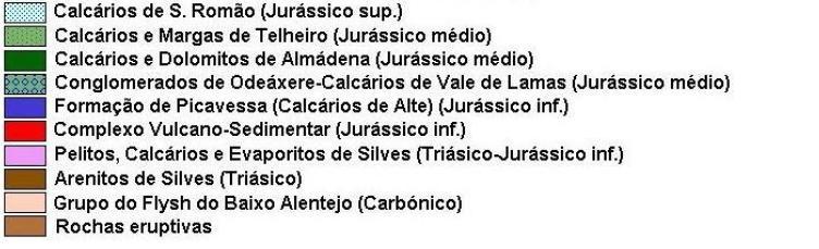
6 Geology (Almeida et al., 2000) 6

7 Aquifer system, drainage network, springs & river basins upstream flow gauge stations Ribeira de Quarteira Source: Adapted from LNEC Report nr. 180/2012
 Source: LNEC Report nr.")
8 Ribeira de Alcantarilha river basin upstream Ponte Mesquita flow gauge station Surface flow hydrograph separation (DECHIDR_VB, Oliveira, 2001) Source: LNEC Report nr. 180/2012
 Source: LNEC Report nr.")
9 Ribeira de Alcantarilha river basin upstream Ponte Mesquita flow gauge station Surface flow hydrograph separation (DECHIDR_VB, Oliveira, 2001) Source: LNEC Report nr. 180/2012
 A l = Soil storage variation Ed = Direct runoff ETR = Evapotranspiration Ip = Deep infiiltration R = Recharge")
10 Daily sequential soil water balance model (BALSEQ_MOD) Modelling recharge in intergranular porous medium R = I p = P Ed ETR A l (Source: OLIVEIRA, 2011) P = Precipitation Is = Infiltration (surface) A l = Soil storage variation Ed = Direct runoff ETR = Evapotranspiration Ip = Deep infiiltration R = Recharge 10
 R = I p + Ed = P ETR A l (Source: OLIVEIRA,")

11 Daily sequential soil water balance model (BALSEQ_MOD) Modelling recharge in fractured porous medium (karstic) R = I p + Ed = P ETR A l (Source: OLIVEIRA, 2011) P = Precipitation Is = Infiltration (surface) A l = Soil storage variation Ed = Direct runoff ETR = Evapotranspiration Ip = Deep infiiltration R = Recharge 11
 Yearly recharge Yearly direct runoff Yearly evapotranspiration Source: LNEC Report no.")
12 Ribeira de Alcantarilha river basin upstream Ponte Mesquita flow gauge station Sequential daily water balance model (BALSEQ_MOD, Oliveira, 2004) Yearly recharge Yearly direct runoff Yearly evapotranspiration Source: LNEC Report no. 180/2012
 Surface flow hydrograph separation (DECHIDR_VB) Source: LNEC Report no.")
13 Ribeira de Alcantarilha river basin upstream Ponte Mesquita flow gauge station Sequential daily water balance model (BALSEQ_MOD) Surface flow hydrograph separation (DECHIDR_VB) Source: LNEC Report no. 180/
 Source: LNEC Report nr.")
14 Ribeira de Quarteira river basin upstream Purgatório flow gauge station Surface flow hydrograph separation (DECHIDR_VB, Oliveira, 2001) Source: LNEC Report nr. 180/2012
15 Ribeira de Quarteira river basin upstream Purgatório flow gauge station Surface flow hydrograph separation (DECHIDR_VB, Oliveira, 2001) Source: LNEC Report nr. 180/2012


16 Ribeira de Quarteira river basin upstream Purgatório flow gauge station Sequential daily water balance model (BALSEQ_MOD, Oliveira, 2004) Yearly recharge Yearly direct runoff Yearly evapotranspiration Source: LNEC Report no. 180/2012
17 Ribeira de Quarteira river basin upstream Purgatório flow gauge station Sequential daily water balance model (BALSEQ_MOD) Surface flow hydrograph separation (DECHIDR_VB) Source: LNEC Report no. 180/
18 Ribeira de Quarteira river basin upstream Quinta da Passagem flow gauge station Surface flow hydrograph separation (DECHIDR_VB, Oliveira, 2001) Source: LNEC Report nr. 180/2012
 Source: LNEC Report nr.")
19 Ribeira de Quarteira river basin upstream Quinta da Passagem flow gauge station Surface flow hydrograph separation (DECHIDR_VB, Oliveira, 2001) Source: LNEC Report nr. 180/2012
 588/7 Source: LNEC Report nr.")
20 Ribeira de Quarteira river basin upstream Quinta da Passagem flow gauge station Spring discharges: Fonte Benémola and 588/7 (source: SNIRH) 588/7 Source: LNEC Report nr. 180/2012


21 Ribeira de Quarteira river basin upstream Quinta da Passagem flow gauge station Sequential daily water balance model (BALSEQ_MOD, Oliveira, 2004) Yearly recharge Yearly direct runoff Yearly evapotranspiration Source: LNEC Report no. 180/2012
22 Ribeira de Quarteira river basin upstream Quinta da Passagem flow gauge station Sequential daily water balance model (BALSEQ_MOD) Surface flow hydrograph separation (DECHIDR_VB) Source: LNEC Report no. 180/


23 Source: Monteiro et al. (2007) XXXV IAH Congress 23
 Source: SNIRH (data accessed on")
24 Fontes de Estômbar springs (W bank of Arade river) Source: SNIRH (data accessed on )
25 Water balance in the drainage area of the aquifer system P Ep Topography R Ed R Ed R Phreatic level D = Eb Ebs Legend: P = precipitation, R = recharge, Ed = Direct runoff, D = Groundwater discharge, Eb = Base flow, Ebs = outgoing groundwater flow, Ep = surface runoff (= Ed + Eb) Ebs River basin Aquifer system Source: Adapted from LNEC Report Nº 180/2012


26 Water balance in the drainage area of the aquifer system P Ep Topography R Ed R Ed D = Eb R Phreatic level Ebs Ebs River basin Aquifer system Source: LNEC Report no. 180/2012
The MARSOL Project. 18 Months of MARSOL. Highlights Mid-term meeting Workshop 4: Water Quality Aspects of Managed Aquifer Recharge, Faro, Portugal
 RECHARGE The MARSOL Newsletter Half time edition Issue 04 The MARSOL Project 18 Months of MARSOL Highlights Mid-term meeting Workshop 4: Water Quality Aspects of Managed Aquifer Recharge, Faro, Portugal
Modelling Water Transferences from the Almádena Odeáxere Aquifer System to Vale do Barão and Bensafrim Creeks (Algarve South Portugal)
") Modelling Water Transferences from the Almádena Odeáxere Aquifer System to Vale do Barão and Bensafrim Creeks (Algarve South Portugal) J. MARTINS & J. P. MONTEIRO Algarve University Geo Systems Centre
Modelling Water Transferences from the Almádena Odeáxere Aquifer System to Vale do Barão and Bensafrim Creeks (Algarve South Portugal) J. MARTINS & J. P. MONTEIRO Algarve University Geo Systems Centre
10.º SEMINÁRIO SOBRE ÁGUAS SUBTERRÂNEAS
 COMISSÃO ORGANIZADORA Manuel M. Oliveira (APRH, CEAS, LNEC) Manuela Simões (CEAS, GeoBioTec, FCT/UNL) Maria do Rosário Carvalho (CEAS, FC/UL) José Paulo Monteiro (CEAS, NRSul/APRH, FCT/UAlg) J. Martins
WATER MANAGEMENT STRATEGIES FOR RIBEIRAS DO ALGARVE, PORTUGAL
 WATER MANAGEMENT STRATEGIES FOR RIBEIRAS DO ALGARVE, PORTUGAL arid cyprus, conference may 2005 1 ribeiras do algarve river basin area of the basin: 3837 Km 2 18 municipalities more than 350,000 inhabitants
Hydrology 101. Impacts of the Urban Environment. Nokomis Knolls Pond Summer June 2008
 Hydrology 101 Nokomis Knolls Pond Summer 2002 Impacts of the Urban Environment Hydrologic Cycle; What is it? Geography, Topography, Geology, Land Cover and Climate determine the Amount and Behavior of
Issue paper: Aquifer Water Balance
 Issue paper: Aquifer Water Balance 1. Introduction And Background 1.1. Purpose and Scope The population in Kitsap County has grown rapidly in recent years and is expected to increase substantially in the
Lecture 9A: Drainage Basins
 GEOG415 Lecture 9A: Drainage Basins 9-1 Drainage basin (watershed, catchment) -Drains surfacewater to a common outlet Drainage divide - how is it defined? Scale effects? - Represents a hydrologic cycle
EFFECTS OF WATERSHED TOPOGRAPHY, SOILS, LAND USE, AND CLIMATE ON BASEFLOW HYDROLOGY IN HUMID REGIONS: A REVIEW
 PROGRESS IN PHYSICAL GEOGRAPHY EFFECTS OF WATERSHED TOPOGRAPHY, SOILS, LAND USE, AND CLIMATE ON BASEFLOW HYDROLOGY IN HUMID REGIONS: A REVIEW KATIE PRICE 2011 Presented by: Jordan Martin Article Overview
Salt Dynamics in prairie wetlands under changing climate
 Salt Dynamics in prairie wetlands under changing climate Uri Nachshon Andrew Ireson Garth van der Kamp Howard Wheater Ryan Davies GIWS, University of Saskatchewan GIWS, University of Saskatchewan Environment
Understanding Earth Fifth Edition
 Understanding Earth Fifth Edition Grotzinger Jordan Press Siever Chapter 17: THE HYDROLOGIC CYCLE AND GROUNDWATER Lecturer: H Mohammadzadeh Assistant professors, Department of Geology, FUM Copyright 2007
GROUNDWATER DISCHARGE
 GROUNDWATER DISCHARGE C O N N E C T I O N F A C T S H E E T S E R I E S D I S C H A R G E : The movement of groundwater from the subsurface to the surface P E R M E A B I L I T Y : The ability of a material
GIS Applications in Water Resources Engineering
 King Fahd University of Petroleum & Minerals City & Regional Planning Department Introduction to Geographic Information Systems Term Paper Presentation GIS Applications in Water Resources Engineering Prepared
The Islamic University of Gaza- Civil Engineering Department Sanitary Engineering- ECIV 4325 L5. Storm water Management
 The Islamic University of Gaza- Civil Engineering Department Sanitary Engineering- ECIV 4325 L5. Storm water Management Husam Al-Najar Storm water management : Collection System Design principles The Objectives
Chapter 2: Aquifers and groundwater
 Chapter 2: Aquifers and groundwater Groundwater movement through aquifers is driven by differences in groundwater levels or pressure and is controlled by how porous the material is that it passes through.
Urbanization effects on the hydrology of the Atlanta area, Georgia (USA)
") 14/06/01 Impact of Human Activity on Groundwater Dynamics (Proceedings of a symposium held during the Sixth IAHS Scientific Assembly at Maastricht, The Netherlands, July 2001). IAHS Publ. no. 269, 2001.
14/06/01 Impact of Human Activity on Groundwater Dynamics (Proceedings of a symposium held during the Sixth IAHS Scientific Assembly at Maastricht, The Netherlands, July 2001). IAHS Publ. no. 269, 2001.
Hydrology and Water Management. Dr. Mujahid Khan, UET Peshawar
 Hydrology and Water Management Dr. Mujahid Khan, UET Peshawar Course Outline Hydrologic Cycle and its Processes Water Balance Approach Estimation and Analysis of Precipitation Data Infiltration and Runoff
Lecture 20: Groundwater Introduction
 Lecture 20: Groundwater Introduction Key Questions for Groundwater 1. What is an aquifer? 2. What is an unconfined aquifer? 3. What is groundwater recharge? 4. What is porosity? What determines the magnitude
Water Education Foundation Briefing Water Year 2016: San Joaquin Valley Groundwater Conditions
 Groundwater in Fractured Rock Aquifers Well Location, Yield, and Sustainability Water Education Foundation Briefing Water Year 2016: San Joaquin Valley Groundwater Conditions John Kirk, PG, CEG, CHG Engineering
Resolving uncertainties in the source of low flows in South African rivers using conceptual and modelling studies
 Conceptual and Modelling Studies of Integrated Groundwater, Surface Water, and Ecological Systems 127 (Proceedings of Symposium H1 held during IUGG211 in Melbourne, Australia, July 211) (IAHS Publ. 345,
Wisconsin s Buried Treasure
 Wisconsin s Buried Treasure Kevin Masarik Center for Watershed Science and Education Through the University of Wisconsin-Extension, all Wisconsin people can access University resources and engage in lifelong
UNIT HYDROGRAPH AND EFFECTIVE RAINFALL S INFLUENCE OVER THE STORM RUNOFF HYDROGRAPH
 UNIT HYDROGRAPH AND EFFECTIVE RAINFALL S INFLUENCE OVER THE STORM RUNOFF HYDROGRAPH INTRODUCTION Water is a common chemical substance essential for the existence of life and exhibits many notable and unique
Water Management in the Upper Laje River Basin Rebecca Leonardson Rosey Jencks February 13, 2009
 Water Management in the Upper Laje River Basin Rebecca Leonardson Rosey Jencks February 13, 2009 Abstract Urban water management in Portugal will grow increasingly challenging over the 21 st century, due
Definitions 3/16/2010. GG22A: GEOSPHERE & HYDROSPHERE Hydrology
 GG22A: GEOSPHERE & HYDROSPHERE Hydrology Definitions Streamflow volume of water in a river passing a defined point over a specific time period = VxA discharge m 3 s -1 Runoff excess precipitation - precipitation
Groundwater Balance Study in the High Barind, Bangladesh. A.H.M.Selim Reza 1, Quamrul Hasan Mazumder 1 and Mushfique Ahmed 1
 Rajshahi University J. of Sci. 39, 11-26 (2011) ISSN 1681-0708 Groundwater Balance Study in the High Barind, Bangladesh A.H.M.Selim Reza 1, Quamrul Hasan Mazumder 1 and Mushfique Ahmed 1 1 Department of
Water balance and observed flows in the Anllóns river basin (NW Spain).
.") Water balance and observed flows in the Anllóns river basin (NW Spain). M.ERMITAS 1 RIAL RIVAS, MANUEL ALÍ ÁLVAREZ ENJO 2 & FRANCISCO DÍAZ-FIERROS VIQUEIRA 3 Departamento de Edafoloxía e Química Agrícola,
Water balance and observed flows in the Anllóns river basin (NW Spain). M.ERMITAS 1 RIAL RIVAS, MANUEL ALÍ ÁLVAREZ ENJO 2 & FRANCISCO DÍAZ-FIERROS VIQUEIRA 3 Departamento de Edafoloxía e Química Agrícola,
Module 3. Lecture 4: Introduction to unit hydrograph
 Lecture 4: Introduction to unit hydrograph (UH) The unit hydrograph is the unit pulse response function of a linear hydrologic system. First proposed by Sherman (1932), the unit hydrograph (originally
CHAPTER FIVE Runoff. Engineering Hydrology (ECIV 4323) Instructors: Dr. Yunes Mogheir Dr. Ramadan Al Khatib. Overland flow interflow
 Instructors: Dr. Yunes Mogheir Dr. Ramadan Al Khatib. Overland flow interflow") Engineering Hydrology (ECIV 4323) CHAPTER FIVE Runoff Instructors: Dr. Yunes Mogheir Dr. Ramadan Al Khatib Overland flow interflow Base flow Saturated overland flow ١ ٢ 5.1 Introduction To Runoff Runoff
Engineering Hydrology (ECIV 4323) CHAPTER FIVE Runoff Instructors: Dr. Yunes Mogheir Dr. Ramadan Al Khatib Overland flow interflow Base flow Saturated overland flow ١ ٢ 5.1 Introduction To Runoff Runoff
API SOIL & GROUNDWATER RESEARCH BULLETIN
 American API SOIL & GROUNDWATER RESEARCH BULLETIN A summary of research results from API s Soil and Groundwater Technical Task Force. No. 2 March 1997 Estimation of Infiltration and Recharge for Environmental
Groundwater. Groundwater Movement. Groundwater Movement Recharge: the infiltration of water into any subsurface formation.
 On March 22, 2014, a major landslide occurred near Oso, Washington. Death toll currently at 30, with 15 still missing. Groundwater Before and After Swipe http://bit.ly/pen1jt N. Fork Stillaguamish River
São Paulo Advanced School on Integrated Water Resources Management
 São Paulo Advanced School on Integrated Water Resources Management September, 01 st 15 th, 2017. São Carlos São Paulo State Brazil PROGRAMME OF ALL LECTURES Date: 01/09 Date: 02/09 Date: 03/09 Date: 04/09
POLLUTION POTENTIAL OF GROUND- WATER RESOURCES IN ANTALYA CITY
 POLLUTION POTENTIAL OF GROUND- WATER RESOURCES IN ANTALYA CITY Mustafa Yildirim and Bulent Topkaya Akdeniz University, Department of Environmental Engineering, Topcular, 07200 Antalya, Turkey Presented
ANALYSIS OF RAINFALLINFILTRATION
 ANALYSIS OF RAINFALLINFILTRATION RECHARGE TO GROUNDWATER Jinquan Wu and Renduo Zhang Proceedings 1994 WWRC-94-09 In Proceedings of Fourteenth Annual American Geophysical Union: Hydrology Days Submitted
Analysis of Runoff Reduction and Hydrologic Cycle Utilizing LID Concepts
 Maine Stormwater Conference (Portland, ME, 2015) Analysis of Runoff Reduction and Hydrologic Cycle Utilizing LID Concepts Park Jongpyo, Lee Kyoungdo: HECOREA. INC Shin Hyunsuk: Busan National University
Hydrologic Cycle. Water Availabilty. Surface Water. Groundwater
 Hydrologic Cycle Hydrologic ydoogccyce cycle Surface Water Groundwater Water Availabilty 1 Hydrologic Cycle Constant movement of water above, on, and, below the earth s surface (Heath) Endless circulation
GLY 155 Introduction to Physical Geology, W. Altermann. Grotzinger Jordan. Understanding Earth. Sixth Edition
 Grotzinger Jordan Understanding Earth Sixth Edition Chapter 17: THE HYDROLOGIC CYCLE AND GROUNDWATER 2011 by W. H. Freeman and Company Chapter 17 The Hydrologic Cycle and Groundwater 1 About the Hydrologic
East Maui Watershed Partnership Adapted from Utah State University and University of Wisconsin Ground Water Project Ages 7 th -Adult
 INTRODUCTION What is groundwater? Water contained in saturated soil and rock materials below the surface of the earth. It is not NEW water, but is recycled water through the hydraulic cycle. The source
Lumped-parameter models as a tool for determining the hydrological parameters of some groundwater systems based on isotope data
 Tracers and Modelling in Hydrogeology (Proceedings of the TraM'2000 Conference held at Liège, Belgium, May 2000). IAHS Publ. no. 262, 2000. 271 Lumped-parameter models as a tool for determining the hydrological
Numerical Groundwater Model for the Kaweah Delta Water Conservation District
 Numerical Groundwater Model for the Kaweah Delta Water Conservation District Nels Ruud and Peter Leffler Fugro West, Inc. Larry Dotson Kaweah Delta Water Conservation District Presentation Outline Background
Water security and charging for the use of water in river basins: a case study of São Paulo, Brazil
 Center for Environmental Studies and Research Water security and charging for the use of water in river basins: a case study of São Paulo, Brazil Ina Thomé Picoli Roberto Luiz do Carmo Center for Environmental
Storm Water Management Model
 Use of Storm Water Management Model for on lot drainage Renato Nunes de Mattos Ricardo Prado Abreu Reis Marina Sangoi de Oliveira Ilha The increased runoff flow is one of the impacts caused by the construction
Review of existing simulation based flood frequency frameworks in Greece
 European Procedures for Flood Frequency Estimation FLOODFREQ COST ACTION ES0901 3 rd Management Committee Meeting, Prague, 28 29 October 2010 WG3: Use of rainfall runoff models for flood frequency estimation
The Water Cycle and Water Insecurity
 Edexcel Geography A-level The Water Cycle and Water Insecurity PMT Education Written by Jeevan Singh The Water Cycle and Water Insecurity Enquiry question 1: What are the processes operating within the
HyMeX. (1) GAME-CNRM,Météo-France & CNRS, Toulouse - (2) IPSL/LMD, Palaiseau
 GAME-CNRM,Météo-France & CNRS, Toulouse - (2) IPSL/LMD, Palaiseau") HyMeX (*) http://www.cnrm.meteo.fr/hymex/ meteo V. Ducrocq (1), P. Drobinski (2) (1) GAME-CNRM,Météo-France & CNRS, Toulouse - (2) IPSL/LMD, Palaiseau & the HyMeX International Scientific Steering Committee
HyMeX (*) http://www.cnrm.meteo.fr/hymex/ meteo V. Ducrocq (1), P. Drobinski (2) (1) GAME-CNRM,Météo-France & CNRS, Toulouse - (2) IPSL/LMD, Palaiseau & the HyMeX International Scientific Steering Committee
Are Dams Regulating Diversity of Riparian Forests?
 Are Dams Regulating Diversity of Riparian Forests? Functional trade-offs and synergies in Mediterranean Europe* Francisca C. Aguiar, Maria João Martins, Maria Dolores Bejarano, ChristerNilsson, Maria Manuela
BAEN 673 / February 18, 2016 Hydrologic Processes
 BAEN 673 / February 18, 2016 Hydrologic Processes Assignment: HW#7 Next class lecture in AEPM 104 Today s topics SWAT exercise #2 The SWAT model review paper Hydrologic processes The Hydrologic Processes
STRAWMAN OUTLINE March 21, 2008 ISWS/ISGS REPORT ON THE OPPORTUNITIES AND CHALLENGES OF MEETING WATER DEMAND IN NORTH-EAST ILLINOIS
 STRAWMAN OUTLINE March 21, 2008 ISWS/ISGS REPORT ON THE OPPORTUNITIES AND CHALLENGES OF MEETING WATER DEMAND IN NORTH-EAST ILLINOIS REPORT TO BE DELIVERED TO THE RWSPG BY SEPTEMBER 30, 2008 Table of Contents
Assessing aquifer vulnerability to seawater intrusion using the GALDIT method: part 1 application to the Portuguese Monte Gordo aquifer
 Water in Celtic Countries: Quantity, Quality and Climate Variability (Proceedings of the Fourth InterCeltic Colloquium on Hydrology and Management of Water Resources, Guimarães, Portugal, July 2005). IAHS
NATURAL FEATURES, LAND SUITABILITY FOR DEVELOPMENT AND DEVELOPMENT CONCERNS
 East Central Wayne County Comprehensive Plan - Natural Features, Land Suitability Page 170 NATURAL FEATURES, LAND SUITABILITY FOR DEVELOPMENT AND DEVELOPMENT CONCERNS Introduction The residents of East
ERTH 519 Watershed Hydrology
 1 ERTH 519 Watershed Hydrology Course Description, Goals, and Learner Outcomes Participants will increase their understanding of watershed hydrology and the relation to water quality and water quantity.
Watershed Hydrology. a) Water Balance Studies in Small Experimental Watersheds
 Water Balance Studies in Small Experimental Watersheds") Watershed Hydrology a) Water Balance Studies in Small Experimental Watersheds In order to characterize the geometry of the regolith as well as the directions of the fractures or fissures in the protolith,
Watershed Hydrology a) Water Balance Studies in Small Experimental Watersheds In order to characterize the geometry of the regolith as well as the directions of the fractures or fissures in the protolith,
Capão Xavier Mine Water Drainage Management (Minas Gerais, Brazil)
") Capão Xavier Mine Water Drainage Management (Minas Gerais, Brazil) Rafael Fernández Rubio 1,2, Fabiana Vasconcelos Caldas 3, David Lorca Fernández 2, César Grandchamp 3, Mauro Lobo de Razende 3 1 Madrid
Capão Xavier Mine Water Drainage Management (Minas Gerais, Brazil) Rafael Fernández Rubio 1,2, Fabiana Vasconcelos Caldas 3, David Lorca Fernández 2, César Grandchamp 3, Mauro Lobo de Razende 3 1 Madrid
Sunset Circle Vegetated Swale and Infiltration Basin System Monitoring Report: Rainy Seasons and
 Sunset Circle Vegetated Swale and Infiltration asin System Monitoring Report: Rainy Seasons 2012-13 and 2013-14 bstract Site Summary Project Features Sunset Circle Vegetated swales and infiltration basins
HUMBOLDT RIVER BASIN WATER AUTHORITY
 HUMBOLDT RIVER BASIN WATER AUTHORITY OVERVIEW OF ORGANIZATION AND KEY ISSUES PRESENTATION TO NEVADA LEGISLATURE S PUBLIC LANDS COMMITTEE May 4, 2012 HUMBOLDT RIVER BASIN CHARACTERISTICS Drainage area of
CIVE22 BASIC HYDROLOGY Jorge A. Ramírez Homework No 7
 Hydrologic Science and Engineering Civil and Environmental Engineering Department Fort Collins, CO 80523-1372 (970) 491-7621 CIVE22 BASIC HYDROLOGY Jorge A. Ramírez Homework No 7 1. Obtain a Unit Hydrograph
The nitrate contamination concern
 Section A The nitrate contamination concern In 1974, the U.S. Congress passed the Safe Drinking Water Act (SDWA). This law required the Environmental Protection Agency (EPA) to determine the level of contaminants
Field Observations and Model Simulations of an Extreme Drought Event in the Southeast Brazil
 Field Observations and Model Simulations of an Extreme Drought Event in the Southeast Brazil Leonardo Domingues, Humberto Rocha, Jonathan Mota da Silva Warsaw, Poland 2017 Jaguari Sub-basin Drainage area:
Prediction for Natural Recharging In Langat Basin and Ukm Campus as Case Study
 Prediction for Natural Recharging In Langat Basin and Ukm Campus as Case Study 1 Mohaad Fawzi Al Ajlouni, 2 Rakmi Abd Rahman, 3 Abdul Ghani Rafek, 4 Mazlin Mokhtar, 5 Noor Ezlin Ahmad Basri 1, 5 Department
Physically-based distributed modelling of river runoff under changing climate conditions
 doi:10.5194/piahs-368-156-2015 156 Remote Sensing and GIS for Hydrology and Water Resources (IAHS Publ. 368, 2015) (Proceedings RSHS14 and ICGRHWE14, Guangzhou, China, August 2014). Physically-based distributed
Watersheds and the Hydrologic Cycle
 Watersheds and the Hydrologic Cycle The Global Hydrologic Cycle Water Cycle in Florida Florida Water Facts Surface Area = 170,452 km 2 Average Rainfall = 140 cm (55 ) Total Annual Rain = 238 billion m
Application of a Basin Scale Hydrological Model for Characterizing flow and Drought Trend
 Application of a Basin Scale Hydrological Model for Characterizing flow and Drought Trend 20 July 2012 International SWAT conference, Delhi INDIA TIPAPORN HOMDEE 1 Ph.D candidate Prof. KOBKIAT PONGPUT
Importance of irrigation return flow on the groundwater budget of a rural basin in India
 62 Hydrology of the Mediterranean and Semiarid Regions (Proceedings of an international symposium held at Montpellier. April 2003). IAHS Publ. no. 278. 2003. Importance of irrigation return flow on the
Water Resources on PEI: an overview and brief discussion of challenges
 Water Resources on PEI: an overview and brief discussion of challenges Components: Components and links Atmospheric water Surface water (including glacial water) Groundwater Links: Precipitation (atm(
Estimation of Actual Evapotranspiration at Regional Annual scale using SWAT
 Estimation of Actual Evapotranspiration at Regional Annual scale using SWAT Azizallah Izady Ph.D student of Water Resources Engineering Department of Water Engineering, Faculty of Agriculture, Ferdowsi
The Hydrological Cycle. Hydrological Cycle. Definition of Terms. Soils and Water, Spring Lecture 7, The Hydrological Cycle 1
 The Hydrological Cycle Water vapor helps warm up the earth Evaporation+Transpiration Chemical Spill Runoff To Oceans Water potential, atmosphere Hydrological Cycle Transpiration, T Atmospheric pool Interception
Stormwater Infiltration using Dry Wells as a Low Impact Development (LID) Tool
 Tool") Stormwater Infiltration using Dry Wells as a Low Impact Development (LID) Tool Presented by: Connie Nelson, CFM City of Elk Grove/Willdan Engineering Today s Discussion Background California s water situation
Stormwater Infiltration using Dry Wells as a Low Impact Development (LID) Tool Presented by: Connie Nelson, CFM City of Elk Grove/Willdan Engineering Today s Discussion Background California s water situation
Watersheds. A river is the report card for its watershed. Alan Levere. Arizona Water Issues 2010 The University of Arizona HWR203 1
 Watersheds A river is the report card for its watershed. Alan Levere 1 What separates watersheds? How do you identify watershed boundaries? Drainage Divides River Networks boto.ocean.washington.edu/gifs/purus.gif
Pennsylvania Stormwater Best Management Practices Manual. Chapter 3. Stormwater Management Principles and Recommended Control Guidelines
 Pennsylvania Stormwater Best Management Practices Manual Chapter 3 Stormwater Management Principles and Recommended Control Guidelines 363-0300-002 / December 30, 2006 Chapter 3 Stormwater Management Principles
Occurrence of Iron in Surface Waters of the Upper St. Johns River Basin
 Occurrence of Iron in Surface Waters of the Upper St. Johns River Basin Prepared by Florida Department of Environmental Protection Bureau of Watershed Management Ground Water Protection Section December
Indicator Fact Sheet (WQ01c) Water exploitation index
 Water exploitation index") Indicator Fact Sheet (WQ01c) Water exploitation index Authors: Conchita Marcuello and Concha Lallana, CEDEX EEA project manager: Niels Thyssen version 01.10.03 Key message 18% of Europe s population live
Indicator Fact Sheet (WQ01c) Water exploitation index Authors: Conchita Marcuello and Concha Lallana, CEDEX EEA project manager: Niels Thyssen version 01.10.03 Key message 18% of Europe s population live
Dynamic Statewide Water Budget for Water Planning in New Mexico
 Dynamic Statewide Water Budget for Water Planning in New Mexico Sep 20 2016 Ongoing Drought in New Mexico and the West Jan 20 2015 April 8 2014 July 9 2013 Elephant Butte Storage (AF) Surface supplies
CEE3430 Engineering Hydrology
 CEE3430 Engineering Hydrology Practice Exam (There are multiple practice questions here A 110 min test will likely not have more than four questions) 1. Water Balance Write the water balance as Δ Where
Is the hydrological function of Lake Wigry changing?
 Limnol. Rev. (2014) 14,4 161-167 Is the hydrological function of Lake Wigry changing? DOI 10.1515/limre-2015-0006 161 Is the hydrological function of Lake Wigry changing? Elżbieta Bajkiewicz-Grabowska
Numerical Modeling of Groundwater Flow in Karst Aquifer, Makeng Mining Area
 American Journal of Environmental Sciences 6 (1): 78-82, 2010 ISSN 1553-345X 2010 Science Publications Numerical Modeling of Groundwater Flow in Karst Aquifer, Makeng Mining Area 1,2 F.M. Rani and 1 Z.H.
Engineering Hydrology. Class 16: Direct Runoff (DRO) and Unit Hydrographs
 and Unit Hydrographs") Engineering Hydrology Class 16: and s Topics and Goals: 1. Calculate volume of DRO from a hydrograph; 2. Complete all steps to develop a. Class 14: s? HG? Develop Ocean Class 14: s? HG? Develop Timing
Engineering Hydrology Class 16: and s Topics and Goals: 1. Calculate volume of DRO from a hydrograph; 2. Complete all steps to develop a. Class 14: s? HG? Develop Ocean Class 14: s? HG? Develop Timing
Condensation. Condensation Moist Air. Evaporation from rivers, soils, lakes. Interception. Evaporation Runoff. Soil Moisture.
 CHAPTER 3 STORMWATER 3.1 STORMWATER AND THE HYDROLOGIC CYCLE The Hydrologic Cycle The hydrologic cycle, illustrated in Figure 3.1-1, is the movement of water from the atmosphere to the earth s surface.
Ecosystem-based Adaptation in the Water Sector. GIZ/Thies
 Seite 1 GIZ/Thies 1. Definition, Measures and Benefits Seite 2 GIZ/Thies Ecosystem-based Adaptation (Eba) in the Water Sector Definition: Ecosystem-based adaptation is the use of biodiversity and ecosystem
APPENDIX G. Aquifer Mapping & Groundwater Protection Zone
 APPENDIX G Aquifer Mapping & Groundwater Protection Zone LEGGETTE, BRASHEARS & GRAHAM, INC. PROFESSIONAL GROUNDWATER AND ENVIRONMENT AL ENGINEERING SERVICES 6 ARROW ROAD, SUITE 103 RAMSEY, NJ 07446 (20
ENVIRONMENTAL SITUATION IN THE SURROUNDING AREA OF LAJES FIELD AIRPORT, AZORES
 ENVIRONMENTAL SITUATION IN THE SURROUNDING AREA OF LAJES FIELD AIRPORT, AZORES João Paulo LOBO FERREIRA Dr.-Ing. Habil in Civil Engineering, Principal Researcher and Head of the Groundwater Division (NAS)
Groundwater in Bayfield County. Madeline Gotkowitz Hydrogeologist April 23, 2015
 Groundwater in Bayfield County Madeline Gotowitz Hydrogeologist April 23, 2015 Groundwater in Bayfield County Groundwater basics Hydrogeology across Wisconsin Hydrogeology in Bayfield County Mapping groundwater
Uncertainty in Hydrologic Modelling for PMF Estimation
 Uncertainty in Hydrologic Modelling for PMF Estimation Introduction Estimation of the Probable Maximum Flood (PMF) has become a core component of the hydrotechnical design of dam structures 1. There is
A Case for the Design and Modeling of BMP Infiltration and LID Techniques. By: Bob Murdock
 A Case for the Design and Modeling of BMP Infiltration and LID Techniques 2009 IAFSM Annual Conference 2009 IAFSM Annual Conference By: Bob Murdock Presentation Outline 1. Runoff Reduction (RR) and Low
Engineering Hydrology Class 3
 Engineering Hydrology Class 3 Topics and Goals: I.Develop s (estimate precipitation) II.Develop simple constant intensity design storm III.Develop SCS design storm Ocean s Why do we want to derive the?
Hydrologic Calibration:
 Hydrologic Calibration: UPDATE OF EFFECTIVE HYDROLOGY FOR MARYS CREEK October 2010 Agenda Background Hydrologic model Calibrated rainfall Hydrologic calibration 100 year discharges, Existing Conditions
SNAMP water research. Topics covered
 SNAMP water research SNAMP water team UC Merced Topics covered Objectives, goals & overview What & why the water component of SNAMP Pre-treatment Observations Water Quality Water Quantity Modeling & Scenarios:
Suspended Sediment Discharges in Streams
 US Army Corps of Engineers Hydrologic Engineering Center Suspended Sediment Discharges in Streams April 1969 Approved for Public Release. Distribution Unlimited. TP-19 REPORT DOCUMENTATION PAGE Form Approved
Ottawa County Water Resources Study Phase 2
 Ottawa County Water Resources Study Phase 2 Overview David P. Lusch, Ph.D. Department of Geography and Institute of Water Research Michigan State University 1 / 24 Ottawa County Planning and Performance
Implications of Climate Change on Water Management in Bangladesh
 Implications of Climate Change on Water Management in Bangladesh February 6, 28 Jahir Uddin Chowdhury Professor Institute of Water and Flood Management BUET, Dhaka-1, Bangladesh 1. Introduction Bangladesh
HS Hydrological Sciences (#EGU18HS) Orals Monday, 09 April
 Orals Monday, 09 April") HS Hydrological Sciences (#EGU18HS) Orals Monday, 09 April MO1, 08:30 10:00 HS1.4, Advances in Diagnostics, Sensitivity, and Uncertainty Analysis of Earth and Environmental Systems Models, 08:30 15:00,
HS Hydrological Sciences (#EGU18HS) Orals Monday, 09 April MO1, 08:30 10:00 HS1.4, Advances in Diagnostics, Sensitivity, and Uncertainty Analysis of Earth and Environmental Systems Models, 08:30 15:00,
GY 111 Lecture Note Series Groundwater and Hydrogeology
 GY 111 Lecture Notes D. Haywick (2008-09) 1 GY 111 Lecture Note Series Groundwater and Hydrogeology Lecture Goals A) The hydrologic cycle B) Groundwater dynamics C) Mapping groundwater (done in class not
REGIONAL WORKSHOP ON ECO-EFFICIENT WATER INFRASTRUCTURE TOWARDS SUSTAINABLE URBAN DEVELOPMENT AND GREEN ECONOMY IN ASIA AND THE PACIFIC, BANGKOK,
 REGIAL WORKSHOP AND GREEN ECOMY IN ASIA AND THE PACIFIC, BANGKOK, THAILAND 1. Overview and Achievement of PPWSA 2. Current Challenges in Water Resource Management, 3. Participation from Relevant Government
The Use of Models for Water Administration In Colorado
 The Use of Models for Water Administration In Colorado AWSE 89 th Annual Meeting September 26, 2016 Springdale, Utah Dick Wolfe, M.S., P.E. State Engineer 1 Presentation Scope Areas of model use Colorado
Modélisation sur Enxoé - Lisbonne, 9-11 mars 2011
 Modélisation sur Enxoé - Lisbonne, 9-11 mars 211 1 Enxoé watershed Description Area : 6km2 River Length: 9km Altitude Range: 16 35m Annual Precipitation: 5mm Pressures: 5% NoIrrigAgriculture/Pasture; 35%
A comparative study of the methods for estimating streamflow at ungauged sites
 22nd International Congress on Modelling and Simulation, Hobart, Tasmania, Australia, 3 to 8 December 2017 mssanz.org.au/modsim2017 A comparative study of the methods for estimating streamflow at ungauged
Alfredo Ribeiro Federal University of Pernambuco
 Alfredo Ribeiro Federal University of Pernambuco IPCC Scenarios and Global Circulation Models Bias Correction Water Balance Simulation Hydrological Model Simulation and Optimization Exercise Annual anomalies
AQUIFERS OF THE SAN ANTONIO RIVER BASIN
 AQUIFERS OF THE SAN ANTONIO RIVER BASIN OBJECTIVES Explain what an aquifer is Identify the major aquifers located in the San Antonio River Basin Explain the difference between porosity and permeability
2001~2020(4 th ) Sound use of water and formulation of friendly and safe water environment
 Sound use of water and formulation of friendly and safe water environment") 1966~1975(1 st ) Multi-purpose dam plans for flood control, irrigation, and energy development in response to increased demand for water resources 1976~1981 Integrated River Basin Development Plan of the
1966~1975(1 st ) Multi-purpose dam plans for flood control, irrigation, and energy development in response to increased demand for water resources 1976~1981 Integrated River Basin Development Plan of the
Hydrologic cycle, runoff process
 Hydrologic cycle, runoff process Motivation of hydrological modelling What happens at the catchment and in the stream when it rains? How does the increased/decreased runoff affect (not only) the landowners
Unit 5 Lesson 1 What Is the Water Cycle? Copyright Houghton Mifflin Harcourt Publishing Company
 Water on the Move warm up 1 Water on the Move About three-fourths of Earth s surface is covered by water. Water on the Move Video!!! Water on the Move Water moves between Earth s surface and the atmosphere
Fillmore One to seven million acre-feet in storage depending on calculation assumption; surface area is 20,100 acres.
 Where does the City of Santa Paula obtain its water? Currently, the City of Santa Paula obtains its water supply from the court-adjudicated Santa Paula Groundwater Basin (Basin) and in lieu surface water
Urban Hydrology and Storm Water Management. iwater_3rd International Event Juan Jose Galan Vivas (Aalto University)
") Urban Hydrology and Storm Water Management iwater_3rd International Event Juan Jose Galan Vivas (Aalto University) OBJECTIVES of the LECTURE Provide the basics to understand the hydraulic factors and variables
Urban Hydrology and Storm Water Management iwater_3rd International Event Juan Jose Galan Vivas (Aalto University) OBJECTIVES of the LECTURE Provide the basics to understand the hydraulic factors and variables