Ottawa County Water Resources Study Phase 2
|
|
|
- Byron Wade
- 6 years ago
- Views:
Transcription
1 Ottawa County Water Resources Study Phase 2 Overview David P. Lusch, Ph.D. Department of Geography and Institute of Water Research Michigan State University 1 / 24
2 Ottawa County Planning and Performance Improvement developed a detailed list of water resource information needs that could inform the decision makers of the county about the sustainability of the groundwater throughout the county. The Phase 2 study has 4 Goals based on these information needs. 4 Goals are specific to Ottawa County 3 other Goals focus on the regional lowlands of Southern Michigan 2 / 24
3 Goals specific to Ottawa County Goal 1: Quantify the current sustainability of groundwater quantity in the glacial and bedrock aquifers of the county. Goal 2: Quantify the current sustainability of the aquifers of the county based on chloride concentrations. Goal 3: Estimate the future sustainability of the glacial and bedrock aquifers of the county based on projected water quantity and chloride concentrations at 5, 10 and 20 years into the future. Goal 4: Develop and recommend best practices, policies and/or other solutions to address and mitigate any likely groundwater shortages or problematic chloride concentrations that are documented in Ottawa County. 3 / 24
4 The Phase 2 study will use state of the art modeling software that has been developed at MSU PAWS Process based Adaptive Watershed Simulator IGW Interactive Ground Water 4 / 24

5 Two model Project Methodology PAWS model for recharge and surface water budget. IGW model for estimating groundwater flow and 3D chloride concentration distribution. 5 / 24
6 Inputs to the PAWS Model Topography Stream Network, Ponds Land Use /Land Cover Soils Climate Data Streamflows Return flows 6 / 24
 7 /")
7 Topography (Ottawa Co. LiDAR DEM) 7 / 24

8 Stream Network, Ponds (National Hydrography Dataset) 8 / 24
 9")
9 Land Use /Land Cover (Ottawa County Impervious map / USDA CDL / USGS NLCD) 9 / 24
")
10 Soils (NRCS SSURGO) (micrometers per second) 10 / 24
 11 /")
11 Precipitation Data (NCDC NEXRAD radar hourly precipitation accumulations for 2013) 11 / 24
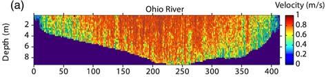
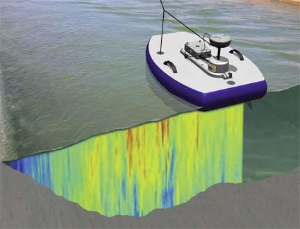
12 Streamflows (USGS + subset of field measurements) 12 / 24
13 Return flows Discharge from WWTS (Ottawa County Road Commission Public Utilities) Return flow from household septic systems will be incorporated using generalized, published estimates of household water use and maps of non sewered residential areas provided by Ottawa County. 13 / 24
 Groundwater Heads (GVSU wells; USGS RASA /MDEQ test")
.")
14 Calibration data for the PAWS Model Streamflows / Baseflows (Measured from stream segments) Groundwater Heads (GVSU wells; USGS RASA /MDEQ test wells; MDEQ monitoring wells at sites of environmental concern) Glacial RASA Rock/Deep Model cell resolution will be 300 m x 300 m (~ 22 acres). 14 / 24
15 Outputs from the PAWS Model Recharge to the water table aquifer (input to IGW) Water Balance of the Glacial Aquifer Detailed maps of: Evapotranspiration (ET) Infiltration Runoff Recharge Streamflows Soil Moisture Depth to the water table Spatial resolution of outputs for management support is 1000 m x 1000 m (about 250 acres) 15 / 24
16 IGW Interactive Ground Water An integrated groundwater modeling suite utilizing a powerful parallel computing methodology with computational steering and interactive visualization to provide dynamic groundwater flow modeling. IGW supports interactive, hierarchical, multi scale groundwater flow modeling. 16 / 24
 Bedrock framework (MDEQ GWIM database + USGS RASA reports) 17")
17 Inputs to IGW 3D Hydraulic Conductivity (transition probability model) Bedrock framework (MDEQ GWIM database + USGS RASA reports) 17 / 24
18 Inputs to IGW Stream network (National Hydrology Database) Lakes/ponds (from Michigan Geographic Framework) Digital elevation model (LiDAR from Ottawa County GIS) Recharge (from PAWS model) Water use (from MDEQ / MDARD Water Use Program) Initial Cl concentrations (water samples from volunteer homeowners + some Ottawa County Health Department data) 18 / 24

19 Ottawa County Phase II Water Resource Study Chloride Sampling Volunteer Locations (09/12/2014) 254 volunteer sites 99 shallow glacial aquifer 22 deep glacial aquifer 133 bedrock aquifer 19 / 24
20 Calibration Data for IGW Baseflow, synoptic (from streamflow measurements on all stream segments) Baseflow, time series (12 monthly streamflow measurements on 15 streams) Static water levels (GVSU wells, MDEQ monitoring wells and aquifer tests, USGS RASA data) Static water level and Cl concentration time series (from the single test well and two monitoring wells (4 day pumping stress period; 2 week recovery period) Model cell resolution will be 300 m x 300 m (~ 22 acres). 20 / 24
21 Outputs from IGW Aquifer Depth and Thickness Maps and 3D Graphics Static Water Level Maps and 3D Graphics Glacial and Bedrock Aquifer Groundwater Flow Maps Groundwater Discharge to Streams Map Current Water Quantity Severity Rating Map(s) Chloride Depth Map(s) and 3D Graphic(s) Chloride Concentration Map(s) Chloride Migration Analysis Results Current Chloride Severity Rating Map(s) 21 / 24
22 Outputs from IGW Maps of Projected Change in Groundwater Quantity at 5, 10, and 20 years Maps of Projected Change in Chloride at 5, 10, and 20 years Projected Groundwater Quantity Severity Rating Map(s) at 5, 10, and 20 years Chloride Rating Maps at 5, 10, and 20 years Spatial resolution of outputs for management support will be 1000 m x 1000 m (about 250 acres) 22 / 24
23 Milestones & Timeline 2014 Sept - Oct: Countywide Water Sampling (Cl levels from 500 wells) Sept - Oct: Streamflow Measurements (80+ streams) Oct - Nov: Recovery of SWL data from MDEQ monitoring wells Oct - Nov: Bedrock Aquifer Pumping Test 2015 Jun: Countywide Recharge Modeling completed Aug: Statewide Groundwater Assessment completed 2016 Mar: Countywide Groundwater Quantity Modeling completed Sept: Countywide Groundwater Chloride Modeling completed Dec: Future Sustainability Modeling completed 2017 Jun: Hotspot Quantity & Quality Modeling completed Jun - Jul: Revised Web-based DSS completed / training offered Aug: Final Report completed 23 / 24
24 Interactive Water Resource Decision Support System 24 / 24
25 Partnership List

26 Groundwater Task Force Members
27 Ottawa County Water Resources Study Phase 2 Overview 27 / 24
Utilization of the SWAT Model and Remote Sensing to Demonstrate the Effects of Shrub Encroachment on a Small Watershed
 Utilization of the SWAT Model and Remote Sensing to Demonstrate the Effects of Shrub Encroachment on a Small Watershed Jason Afinowicz Department of Biological and Agricultural Engineering Texas A&M University
M.L. Kavvas, Z. Q. Chen, M. Anderson, L. Liang, N. Ohara Hydrologic Research Laboratory, Civil and Environmental Engineering, UC Davis
 Assessment of the Restoration Activities on Water Balance and Water Quality at Last Chance Creek Watershed Using Watershed Environmental Hydrology (WEHY) Model M.L. Kavvas, Z. Q. Chen, M. Anderson, L.
Song Lake Water Budget
 Song Lake Water Budget Song Lake is located in northern Cortland County. It is a relatively small lake, with a surface area of about 115 acres, and an average depth of about 14 feet. Its maximum depth
Overview of the Surface Hydrology of Hawai i Watersheds. Ali Fares Associate Professor of Hydrology NREM-CTAHR
 Overview of the Surface Hydrology of Hawai i Watersheds Ali Fares Associate Professor of Hydrology NREM-CTAHR 5/23/2008 Watershed Hydrology Lab 1 What is Hydrology? Hydrology is the water science that
Welcome to the MWON Advanced Webinar Series
 Welcome to the MWON Advanced Webinar Series Today s presentation: The Importance of Forests to Streams and Groundwater You will need to have speakers attached to your computer to hear the presenter. You
M.L. Kavvas, Z. Q. Chen, M. Anderson, L. Liang, N. Ohara Hydrologic Research Laboratory, Civil and Environmental Engineering, UC Davis
 Assessment of the Restoration Activities on Water Balance and Water Quality at Last Chance Creek Watershed Using Watershed Environmental Hydrology (WEHY) Model M.L. Kavvas, Z. Q. Chen, M. Anderson, L.
Groundwater in the Santa Rosa Plain
 . Groundwater in the Santa Rosa Plain Marcus Trotta, PG, CHg Principal Hydrogeologist Sonoma County Water Agency Santa Rosa Plain Groundwater Sustainability Agency October 12, 2017 www.sonomacountywater.org
Comparison of Recharge Estimation Methods Used in Minnesota
 Comparison of Recharge Estimation Methods Used in Minnesota by Geoffrey Delin, Richard Healy, David Lorenz, and John Nimmo Minnesota Ground Water Association Spring Conference Methods for Solving Complex
Lecture 9A: Drainage Basins
 GEOG415 Lecture 9A: Drainage Basins 9-1 Drainage basin (watershed, catchment) -Drains surfacewater to a common outlet Drainage divide - how is it defined? Scale effects? - Represents a hydrologic cycle
Irrigation modeling in Prairie Ronde Township, Kalamazoo County. SW Michigan Water Resources Council meeting May 15, 2012
 Irrigation modeling in Prairie Ronde Township, Kalamazoo County SW Michigan Water Resources Council meeting May 15, 2012 Development of a Groundwater Flow Model INFLOWS Areal recharge from precipitation
Modeling the Middle and Lower Cape Fear River using the Soil and Water Assessment Tool Sam Sarkar Civil Engineer
 Modeling the Middle and Lower Cape Fear River using the Soil and Water Assessment Tool Sam Sarkar Civil Engineer Outline Problem statement and project objectives Watershed model development Model calibration
Rockland County s Water Resources -Selected Findings from the USGS Study- Paul M. Heisig, Hydrologist New York USGS Water Science Center Troy, NY
 Rockland County s Water Resources -Selected Findings from the USGS Study- Paul M. Heisig, Hydrologist New York USGS Water Science Center Troy, NY Subject to Permits Water Sources Rockland County, NY -Lake
1 THE USGS MODULAR MODELING SYSTEM MODEL OF THE UPPER COSUMNES RIVER
 1 THE USGS MODULAR MODELING SYSTEM MODEL OF THE UPPER COSUMNES RIVER 1.1 Introduction The Hydrologic Model of the Upper Cosumnes River Basin (HMCRB) under the USGS Modular Modeling System (MMS) uses a
Illinois in Drought. June 19, 2012, Updated June 21, 2012
 June 19,, Updated June 21, Illinois in Drought The ISWS now considers central and southern Illinois to be fully in drought based on several impacts including the early season onset of reservoir drawdown
CAEP Study Site: Cannonsville Reservoir Watershed
 Tammo Steenhuis, Zach Easton, Eric White, C. Shoemaker Joshua Woodbury and many others of the Soil and Water Laboratory, Farming Community and the Watershed Agriculture Program in Walton This project is
Exploring the Possibilities At Prado Dam
 Exploring the Possibilities At Prado Dam Greg Woodside, P.G., C.HG. Executive Director of Planning & Natural Resources December 5, 2017 The Orange County groundwater basin lies at the base of the Santa
SNAMP water research. Topics covered
 SNAMP water research SNAMP water team UC Merced Topics covered Objectives, goals & overview What & why the water component of SNAMP Pre-treatment Observations Water Quality Water Quantity Modeling & Scenarios:
Assessing Water Use and Availability Trends in New Hampshire
 Assessing Water Use and Availability Trends in New Hampshire Brandon Kernen, PG NH Department of Environmental Services (603) 271-0660/Brandon.Kernen@des.nh.gov Existing Groundwater Use and Availability
Calibrating the Soquel-Aptos PRMS Model to Streamflow Data Using PEST
 Calibrating the Soquel-Aptos PRMS Model to Streamflow Data Using PEST Cameron Tana Georgina King HydroMetrics Water Resources Inc. California Water Environmental and Modeling Forum 2015 Annual Meeting
Modeling the production of multiple ecosystems services from agricultural and forest landscape in Rhode Island
 Modeling the production of multiple ecosystems services from agricultural and forest landscape in Rhode Island Tingting Liu a, Nathaniel H. Merrill a, Arthur J. Gold b, Dorothy Q. Kellogg b and Emi Uchida
Application of a Basin Scale Hydrological Model for Characterizing flow and Drought Trend
 Application of a Basin Scale Hydrological Model for Characterizing flow and Drought Trend 20 July 2012 International SWAT conference, Delhi INDIA TIPAPORN HOMDEE 1 Ph.D candidate Prof. KOBKIAT PONGPUT
Comparative analysis of SWAT model with Coupled SWAT-MODFLOW model for Gibbs Farm Watershed in Georgia
 2018 SWAT INTERNATIONAL CONFERENCE, JAN 10-12, CHENNAI 1 Comparative analysis of SWAT model with Coupled SWAT-MODFLOW model for Gibbs Farm Watershed in Georgia Presented By K.Sangeetha B.Narasimhan D.D.Bosch
A Case Study on Integrated Urban Water Modelling using Aquacycle NTUA, 2007
 A Case Study on Integrated Urban Water Modelling using Aquacycle NTUA, 2007 Contents Motivation Input Data Requirements Case Study - Greater Athens Area Model calibration and validation Formulation and
Forecast Informed Reservoir Operations (FIRO) ERDC Hydrologic Investigations
 ERDC Hydrologic Investigations") Forecast Informed Reservoir Operations (FIRO) ERDC Hydrologic Investigations Briefing, May 31, 2017 Background The US Army Corps of Engineers (USACE) operates reservoirs primarily for flood control, with
Forecast Informed Reservoir Operations (FIRO) ERDC Hydrologic Investigations Briefing, May 31, 2017 Background The US Army Corps of Engineers (USACE) operates reservoirs primarily for flood control, with
Recent Developments in Water Withdrawal Management
 Recent Developments in Water Withdrawal Management Frank Ruswick David A. Hamilton Michigan Department of Environmental Quality Overview What Water Withdrawals are regulated? Water Withdrawal Assessment
Hydrologic and Water Quality Monitoring on Turkey Creek Watershed, Francis Marion National Forest, SC
 Hydrologic and Water Quality Monitoring on Turkey Creek Watershed, Francis Marion National Forest, SC D.M. Amatya, T.J. Callahan, A. Radecki-Pawlik, P. Drews, and W.F. Hansen A South Carolina Water Resources
Climate Change and Drought Scenarios for Water Supply Planning
 Climate Change and Drought Scenarios for Water Supply Planning Analyses of the sensitivity of water availability (surface water and groundwater) and water demand to climate change and drought will be conducted
The Impact of Climate Change on a Humid, Equatorial Catchment in Uganda.
 The Impact of Climate Change on a Humid, Equatorial Catchment in Uganda. Lucinda Mileham, Dr Richard Taylor, Dr Martin Todd Department of Geography University College London Changing Climate Africa has
MODELING PHOSPHORUS LOADING TO THE CANNONSVILLE RESERVOIR USING SWAT
 MODELING PHOSPHORUS LOADING TO THE CANNONSVILLE RESERVOIR USING SWAT Bryan Tolson 1 & Christine Shoemaker 2 1. PhD Student, 2. Professor School of Civil & Environmental Engineering Cornell University PWT
RANCHO CALIFORNIA WATER DISTRICT GROUNDWATER WORKSHOP. Groundwater Production History and Outlook for the Temecula Valley Groundwater Basin
 RANCHO CALIFORNIA WATER DISTRICT GROUNDWATER WORKSHOP by: Dennis Williams July 22, 2014 1 Overview Geohydrology of the Rancho California Area RCWD Ground Water Management Plan Ground Water Management Tools
GreenPlan Modeling Tool User Guidance
 GreenPlan Modeling Tool User Guidance Prepared by SAN FRANCISCO ESTUARY INSTITUTE 4911 Central Avenue, Richmond, CA 94804 Phone: 510-746-7334 (SFEI) Fax: 510-746-7300 www.sfei.org Table of Contents 1.
Climate Change and Sea Level Rise
 Potential Effects of Sea-Level Rise on the Hydrologic System of Cape Cod, Massachusetts 3 rd Cape Coastal Conference, December 7, 2016 Continued release of anthropogenic greenhouse gases is resulting in
Using Your Computer for Water Withdrawal Planning and Groundwater Mapping
 Michigan s Water Withdrawal Assessment Tool An Overview Distinguished Senior Research Specialist Michigan State University Dept. of Geography And Institute of Water Research 1 / 29 Act 451 of 1994 (Natural
Hydrologic Analysis of a Watershed-Scale Rainwater Harvesting Program. Thomas Walsh, MS, PhD Candidate University of Utah
 Hydrologic Analysis of a -Scale Rainwater Harvesting Program Thomas Walsh, MS, PhD Candidate University of Utah 1. Hydrologic analysis of watershed-scale RWH networks targeting stormwater runoff volumes,
SAN MATEO PLAIN GROUNDWATER BASIN ASSESSMENT STAKEHOLDER WORKSHOP#2 SEPTEMBER 7, 2016
 SAN MATEO PLAIN GROUNDWATER BASIN ASSESSMENT STAKEHOLDER WORKSHOP#2 SEPTEMBER 7, 2016 PRESENTATION OVERVIEW Introductions Project Overview Summary of Stakeholder Meeting #1 Feedback Snapshot of Results
San Mateo Plain Groundwater Basin Assessment Stakeholder Workshop #8 17 APRIL 2018
 San Mateo Plain Groundwater Basin Assessment Stakeholder Workshop #8 17 APRIL 2018 PRESENTATION OVERVIEW Introductions Project Overview Summary of Analysis Supporting Model Development Model Development
Topography and the Spatial Distribution of Groundwater Recharge and Evapotranspiration:
 Topography and the Spatial Distribution of Groundwater Recharge and Evapotranspiration: A Need to Revisit Distributed Water Budget Analysis when Assessing Impacts to Ecological Systems. By M.A. Marchildon,
Hydrologic Modeling with the Distributed-Hydrology- Soils- Vegetation Model (DHSVM)
") Hydrologic Modeling with the Distributed-Hydrology- Soils- Vegetation Model (DHSVM) DHSVM was developed by researchers at the University of Washington and the Pacific Northwest National Lab 200 Simulated
Hydrologic Modeling with the Distributed-Hydrology- Soils- Vegetation Model (DHSVM) DHSVM was developed by researchers at the University of Washington and the Pacific Northwest National Lab 200 Simulated
Environmental Resource Inventories. What are ERIs? Significance of information How to use them
 Environmental Resource Inventories What are ERIs? Significance of information How to use them Environmental Resource Inventory - ERI Compiled by the environmental commission Information about the natural
Urbanization effects on the hydrology of the Atlanta area, Georgia (USA)
") 14/06/01 Impact of Human Activity on Groundwater Dynamics (Proceedings of a symposium held during the Sixth IAHS Scientific Assembly at Maastricht, The Netherlands, July 2001). IAHS Publ. no. 269, 2001.
14/06/01 Impact of Human Activity on Groundwater Dynamics (Proceedings of a symposium held during the Sixth IAHS Scientific Assembly at Maastricht, The Netherlands, July 2001). IAHS Publ. no. 269, 2001.
Hamid R. Solaymani. A.K.Gosain
 Motivation An integrated management plan is required to prevent the negative impacts of climate change on social- economic and environment aspects Each of these segments is expected to be strongly impacted
CHAPTER FIVE Runoff. Engineering Hydrology (ECIV 4323) Instructors: Dr. Yunes Mogheir Dr. Ramadan Al Khatib. Overland flow interflow
 Instructors: Dr. Yunes Mogheir Dr. Ramadan Al Khatib. Overland flow interflow") Engineering Hydrology (ECIV 4323) CHAPTER FIVE Runoff Instructors: Dr. Yunes Mogheir Dr. Ramadan Al Khatib Overland flow interflow Base flow Saturated overland flow ١ ٢ 5.1 Introduction To Runoff Runoff
Engineering Hydrology (ECIV 4323) CHAPTER FIVE Runoff Instructors: Dr. Yunes Mogheir Dr. Ramadan Al Khatib Overland flow interflow Base flow Saturated overland flow ١ ٢ 5.1 Introduction To Runoff Runoff
Afternoon Lecture Outline. Northern Prairie Hydrology
 Afternoon Lecture Outline 1. Northern Prairies watershed hydrology 2. Solute mass balance in lakes and ponds 3. Simple mass balance simulation using MS Excel 4. Effects of sediment-water exchange on lake
DEVELOPMENT OF A HYDRO-GEOMORPHIC MODEL FOR THE LAGUNA CREEK WATERSHED
 DEVELOPMENT OF A HYDRO-GEOMORPHIC MODEL FOR THE LAGUNA CREEK WATERSHED Agenda Background Hydro-Geomorphic Modeling Methodology HEC-HMS Modeling How is the Model Used Background Proposition 50 Grant Funding
Appendix A: Datasets and Hydrologic Models
 Appendix A: Datasets and Hydrologic Models 1. Existing Datasets 2. Land Use and Land Cover Update 3. Modeling the Effects of Stormwater Runoff on Current Conditions 4. Long-Term Hydrologic Impact Assessment
Afternoon Lecture Outline. Northern Prairie Hydrology
 Afternoon Lecture Outline 1. Northern Prairies watershed hydrology 2. Solute mass balance in lakes and ponds 3. Simple mass balance simulation using MS Excel 4. Effects of sediment-water exchange on lake
Analysis of Vermillion River Stream Flow Data (Dakota and Scott Counties, Minnesota)
") ST. ANTHONY FALLS LABORATORY Engineering, Environmental and Geophysical Fluid Dynamics Project Report No. 54 Analysis of Vermillion River Stream Flow Data (Dakota and Scott Counties, Minnesota) by William
ST. ANTHONY FALLS LABORATORY Engineering, Environmental and Geophysical Fluid Dynamics Project Report No. 54 Analysis of Vermillion River Stream Flow Data (Dakota and Scott Counties, Minnesota) by William
Leila Talebi and Robert Pitt. Department of Civil, Construction, and Environmental Engineering, The University of Alabama, P.O. Box , Tuscaloosa
 Leila Talebi and Robert Pitt Department of Civil, Construction, and Environmental Engineering, The University of Alabama, P.O. Box 870205, Tuscaloosa May 2012 Global consumption of water increases every
EFFECTS OF WATERSHED TOPOGRAPHY, SOILS, LAND USE, AND CLIMATE ON BASEFLOW HYDROLOGY IN HUMID REGIONS: A REVIEW
 PROGRESS IN PHYSICAL GEOGRAPHY EFFECTS OF WATERSHED TOPOGRAPHY, SOILS, LAND USE, AND CLIMATE ON BASEFLOW HYDROLOGY IN HUMID REGIONS: A REVIEW KATIE PRICE 2011 Presented by: Jordan Martin Article Overview
Hydrological And Water Quality Modeling For Alternative Scenarios In A Semi-arid Catchment
 Hydrological And Water Quality Modeling For Alternative Scenarios In A Semi-arid Catchment AZIZ ABOUABDILLAH, ANTONIO LO PORTO METIER Final Conference: Brussels, Belgium-4-6 November 2009 Outline Problem
Potential effects evaluation of dewatering an underground mine on surface water and groundwater located in a rural area
 Potential effects evaluation of dewatering an underground mine on surface water and groundwater located in a rural area ITRODUCTIO Michel Mailloux* Eng. M.Sc, Vincent Boisvert, M.Sc, Denis Millette, Eng.,
Assessment of impacts of climate change on runoff: River Nzoia catchment, Kenya. Githui F. W, Bauwens W. and Mutua F.
 Assessment of impacts of climate change on runoff: River Nzoia catchment, Kenya by Githui F. W, Bauwens W. and Mutua F. Objective To investigate the impact of climate change on runoff of Nzoia river catchment
Land Subsidence Management in Japanese Deltas
 Land Subsidence Management in Japanese Deltas July 28, 2017 Tomoyuki OKADA Director for International Coordination of River Engineering River Planning Division, Water and Disaster Management Bureau Ministry
San Antonio Water System Mitchell Lake Constructed Wetlands Below the Dam Preliminary Hydrologic Analysis
 San Antonio Water System enhancement. This recommendation was based on limited water quality data provided by SAWS and using a free-water surface constructed wetland with approximately 112 acres of wetted
Radar-based flood forecasting: Quantifying hydrologic prediction uncertainty
 Severe Storms Prediction and Global Climate Impact on the Gulf Coast, Rice University, October 29 31, 2008 Radar-based flood forecasting: Quantifying hydrologic prediction uncertainty Baxter E. Vieux,
Nichole M. Embertson, Ph.D. Whatcom Conservation District. May 2, 2012 Abbotsford-Sumas Aquifer Groundwater Nitrate Science Forum Abbotsford, CN
 Nichole M. Embertson, Ph.D. Whatcom Conservation District May 2, 2012 Abbotsford-Sumas Aquifer Groundwater Nitrate Science Forum Abbotsford, CN Background ARM System Assessment Development Implementation
PEARCE CREEK CONFINED DISPOSAL AREA MODIFICATION
 US Army Corps of Engineers Philadelphia District PEARCE CREEK CONFINED DISPOSAL AREA MODIFICATION CECIL COUNTY MARYLAND STORMWATER MANAGEMENT PLAN NARRATIVE INITIAL SUBMISSION JUNE 2014 1 PEARCE CREEK
EVALUATION OF HYDROLOGIC AND WATER RESOURCES RESPONSE TO METEOROLOGICAL DROUGHT IN THESSALY, GREECE
 EVALUATION OF HYDROLOGIC AND WATER RESOURCES RESPONSE TO METEOROLOGICAL DROUGHT IN THESSALY, GREECE A. LOUKAS*, AND L. VASILIADES Laboratory of Hydrology and Water Systems Analysis,, Volos, Greece *E-mail:
Impacts of Permit-Exempt Wells
 Impacts of Permit-Exempt Wells Dave Nazy, LHG August 24, 2018 1 Impacts of Permit-Exempt Wells Introduction ESSB 6091 Example Impacts Calculation Basin Estimate & 20-year Projections Offsetting Impacts
Piloting Utility Modeling Applications: The San Francisco Public Utilities Commission
 Piloting Utility Modeling Applications: The San Francisco Public Utilities Commission David Behar Climate Program Director Alexis Dufour, P.E. Hydrology and Water Systems Modeling PUMA Workshop December
Afternoon Lecture Outline
 Afternoon Lecture Outline 1. Northern Prairies watershed hydrology 2. Solute mass balance in lakes and ponds 3. Simple mass balance simulation using MS Excel 4. Effects of sediment-water exchange on lake
Outline. Regional Overview Mine Study Area. Transportation Corridor Study Area. Streamflow Low Flow Peak Flow Snow Small Pools.
 Environmental Baseline Document Surface Water Hydrology Agency Meetings, January 31 to February 3, 2012 Anchorage, Alaska Jaime Cathcart, P.Eng., Ph.D. Outline 2 Regional Overview Mine Study Area Streamflow
Wetland Water Balance Linking hydrogeological processes to ecological effect
 Wetland Water Balance Linking hydrogeological processes to ecological effect Don Ross & David Gasca Outline Background Wetland-scale processes Water balance approach Hydrogeological inputs & ecological
Scale Effects in Large Scale Watershed Modeling
 Scale Effects in Large Scale Watershed Modeling Mustafa M. Aral and Orhan Gunduz Multimedia Environmental Simulations Laboratory School of Civil and Environmental Engineering Georgia Institute of Technology
Impact of Climate Change on Water Resources of a Semi-arid Basin- Jordan
 Impact of Climate Change on Water Resources of a Semi-arid Basin- Jordan Prof. Fayez Abdulla Civil Engineering Department Jordan University of Science & Technology Presented at the Water in an Arid Land,
Assessing the impact of projected climate changes on small coastal basins of the Western US
 Assessing the impact of projected climate changes on small coastal basins of the Western US William Burke Dr. Darren Ficklin Dept. of Geography, Indiana University Introduction How will climate change
Turbidity Monitoring Under Ice Cover in NYC DEP
 Turbidity Monitoring Under Ice Cover in NYC DEP Reducing equifinality by using spatial wetness information and reducing complexity in the SWAT-Hillslope model Linh Hoang 1,2, Elliot M. Schneiderman 2,
AN INTEGRATED FRAMEWORK FOR EFFECTIVE ADAPTATION TO CLIMATE CHANGE IMPACTS ON WATER RESOURCES
 AN INTEGRATED FRAMEWORK FOR EFFECTIVE ADAPTATION TO CLIMATE CHANGE IMPACTS ON WATER RESOURCES A. K. Gosain, Professor & Head Civil Engineering Department Indian Institute of Technology Delhi: gosain@civil.iitd.ac.in
Proposed Project. Integrated Water Resources Management Using Remote Sensing Data in Upper Indus Basin
 Proposed Project Integrated Water Resources Management Using Remote Sensing Data in Upper Indus Basin Background Snowmelt contributes more than 6% of water resources of Upper Indus Basin Most of the moisture
Scott Valley Siskiyou County, California: Voluntary Private Well Water Level Monitoring Program Spring 2006 January 2016
 Scott Valley Siskiyou County, California: Voluntary Private Well Water Level Monitoring Program Spring 2006 January 2016 (Data collected monthly except January 2011) University of California Davis 2016
Assessment of sediment and carbon flux in a tropical watershed: the Red River study case (China and Vietnam)
") Assessment of sediment and carbon flux in a tropical watershed: the Red River study case (China and Vietnam) Xi WEI Supervisors: Sabine SAUVAGE, Jose-Miguel SANCHEZ-PEREZ, Thi Phuong Quynh LE 2 th September
Assessment of sediment and carbon flux in a tropical watershed: the Red River study case (China and Vietnam) Xi WEI Supervisors: Sabine SAUVAGE, Jose-Miguel SANCHEZ-PEREZ, Thi Phuong Quynh LE 2 th September
Continuous Simulation Example Problem
 Continuous Simulation Example Problem The following examples provided an introduction to the continuous simulation hydrograph in the PONDS 3.2 Refined Method software, with an emphasis on wetland hydroperiod
Chapter 2: Conditions in the Spring Lake Watershed related to Stormwater Pollution
 Chapter 2: Conditions in the Spring Lake Watershed related to Stormwater Pollution To identify the primary causes and consequences of stormwater discharges to Spring Lake and its adjoining waterbodies,
Estimation of transported pollutant load in Ardila catchment using the SWAT model
 June 15-17 Estimation of transported pollutant load in Ardila catchment using the SWAT model 1 Engineering Department Polytechnic Institute of Beja 2 Section of Environmental and Energy Technical University
Working with the Water Balance
 Working with the Water Balance Forest Hydrology and Land Use Change Paul K. Barten, Ph.D. Professor of Forestry and Hydrology Department of Environmental Conservation www.forest-to-faucet.org The Living
R. Srinivasan, J.H. Jacobs, J.W. Stuth, J. Angerer, R. Kaithio and N. Clarke
 Impacts of reforestation policy and agro-forestry technology on the environment and food security in the Upper Tana river basin of Kenya R. Srinivasan, J.H. Jacobs, J.W. Stuth, J. Angerer, R. Kaithio and
Municipal Groundwater Flow Modelling Study. Town of Torbay, NL
 Municipal Groundwater Flow Modelling Study Town of Torbay, NL October 19, 2015 Agenda 1 Purpose 2 What is a Groundwater Model 3 Approach 4 Conceptual Model & GW Flow Model Construction 5 Model Predictions
Surface Soil Moisture Assimilation with SWAT
 Surface Soil Moisture Assimilation with SWAT Eunjin Han, Venatesh Merwade School of Civil Engineering, Purdue University, West Lafayette, IN, USA Gary C. Heathman USDA-ARS, National Soil Erosion Research
AN INTEGRATED GROUNDWATER RECHARGE AND FLOW MODEL TO PREDICT BASE FLOW
 AN INTEGRATED GROUNDWATER RECHARGE AND FLOW MODEL TO PREDICT BASE FLOW By XIAOJING NI A THESIS Submitted to Michigan State University in partial fulfillment of the requirements for the degree of Civil
DYNFLOW accepts various types of boundary conditions on the groundwater flow system including:
 Section 6 Groundwater Flow Model A groundwater flow model was developed to evaluate groundwater flow patterns in the site area and to provide a basis for contaminant transport modeling. 6.1 Model Code
Effect of climate change on low-flow conditions in Ruscom River watershed, Ontario
 Effect of climate change on low-flow conditions in Ruscom River watershed, Ontario by Tirupati Bolisetti Co-Authors: M. Rahman and R. Balachandar August 5, 2009 Introduction Climate change refers to the
Groundwater Level and Movement
 Groundwater Level and Movement Infiltration and Recharge Infiltration Entry of rain water into the ground. Recharge Addition of infiltrated water to the aquifer. Two types of Recharge- 1. Natural 2. Artificial
Planning Beyond the Supply/Demand Gap: Water Supply Vulnerabilities in New Mexico Presented by NM Universities Working Group on Drought
 Planning Beyond the Supply/Demand Gap: Water Supply Vulnerabilities in New Mexico Presented by NM Universities Working Group on Drought 1 Janie Chermak, David Gutzler, Peggy Johnson, J. Phillip King, Lee
Nitrate Tracking in the Lower Yakima Basin
 Nitrate Tracking in the Lower Yakima Basin Matt Bachmann, Ph.D. September 19 th, 2013 U.S. Department of the Interior U.S. Geological Survey GWMA objectives reduce nitrate concentrations in groundwater
M E M O R A N D U M DATE: FEBRUARY 27, 2015 LILY XU (CITY OF OTTAWA) JOCELYN CHANDLER (RVCA) CONRAD STANG / MICHAEL PETEPIECE
 JOCELYN CHANDLER (RVCA) CONRAD STANG / MICHAEL PETEPIECE") DATE: FEBRUARY 27, 25 M E M O R A N D U M TO: FROM: RE: CC: LILY XU (CITY OF OTTAWA) JOCELYN CHANDLER (RVCA) CONRAD STAN / MICHAEL PETEPIECE STITTSVILLE SOUTH (AREA 6) WATER BALANCE NOVATECH FILE: 34 DAVID
DATE: FEBRUARY 27, 25 M E M O R A N D U M TO: FROM: RE: CC: LILY XU (CITY OF OTTAWA) JOCELYN CHANDLER (RVCA) CONRAD STAN / MICHAEL PETEPIECE STITTSVILLE SOUTH (AREA 6) WATER BALANCE NOVATECH FILE: 34 DAVID
Journal of Spatial Hydrology Vol.6, No.1 Spring 2006
 Journal of Spatial Hydrology Vol.6, No.1 Spring 2006 Hydrology and Water Balance of Devils Lake Basin: Part 1 Hydrometeorological Analysis and Lake Surface Area Mapping* Assefa M. Melesse 1, Vijay Nangia
AGENDA DATE: November 14, 2018
 ALAMEDA COUNTY FLOOD CONTROL AND WATER CONSERVATION DISTRICT, ZONE 7 100 NORTH CANYONS PARKWAY, LIVERMORE, CA 94551 PHONE (925) 454-5000 FAX (925) 454-5727 ORIGINATING SECTION: INTEGRATED PLANNING CONTACT:
Project Overview- Feasibility Report
 OVERVIEW OF STORMWATER CAPTURE AND USE FEASIBILITY STUDY TAC MEETING #1, JULY 18, 2017 PRESENTED TO SAN DIEGO IRWM RAC AUGUST 2, 2017 2 Project Overview- Feasibility Report 1. Existing Conditions 2. Feasibility
The Sustainability of Floods Pond
 The Sustainability of Floods Pond Bangor Water District s Public Water Supply Presented By: Rick Pershken Bangor Water District Overview Brief BWD History Watershed Characteristics Lake Characteristics
TECHNICAL NOTE: ESTIMATION OF FRESH WATER INFLOW TO BAYS FROM GAGED AND UNGAGED WATERSHEDS. T. Lee, R. Srinivasan, J. Moon, N.
 TECHNICAL NOTE: ESTIMATION OF FRESH WATER INFLOW TO BAYS FROM GAGED AND UNGAGED WATERSHEDS T. Lee, R. Srinivasan, J. Moon, N. Omani ABSTRACT. The long term estimation of fresh water inflow to coastal bays
PEACE RIVER MANASOTA REGIONAL WATER SUPPLY AUTHORITY BOARD OF DIRECTORS MEETING December 5, 2018 ROUTINE STATUS REPORTS ITEM 1
 PEACE RIVER MANASOTA REGIONAL WATER SUPPLY AUTHORITY BOARD OF DIRECTORS MEETING December 5, 218 ROUTINE STATUS REPORTS ITEM 1 Hydrologic Conditions Report MEMORANDUM Project: Hydrologic Conditions Report
Watershed Management Area Recommendations for NJ Water Policy
 Watershed Management Area Recommendations for NJ Water Policy Presenters: William Kibler, Director of Policy, Raritan Headwaters Association Bob Kecskes, Freelance Environmental Consultant, retired NJDEP
Christopher Fields, PhD Candidate Drs. Lynn Johnson and John Labadie Dept. Civil and Environmental Engineering Cooperative Institute for Research on
 Christopher Fields, PhD Candidate Drs. Lynn Johnson and John Labadie Dept. Civil and Environmental Engineering Cooperative Institute for Research on the Atmosphere Colorado State University 19 November
Coupling of MODFLOW and WATFLOOD in hydrological modelling of a small watershed
 294 Weather Radar Information and Distributed Hydrological Modelling (Proceedings of symposium HS03 held during IUGG2003 at Sapporo, July 2003). IAHS Publ. no. 282. 2003. Coupling of MODFLOW and WATFLOOD
Water Resources Status in Danube River Basin. SWAT Conference_ Spain, Toledo June 2011
 Water Resources Status in Danube River Basin SWAT Conference_ Spain, Toledo June 2011 Objectives Objectives Building and calibratîng a hydrologic model of Danube Basin Using SWAT and SWAT CUP Quantifying
July, International SWAT Conference & Workshops
 Analysis of the impact of water conservation measures on the hydrological response of a medium-sized watershed July, 212 212 International SWAT Conference & Workshops ANALYSIS OF THE IMPACT OF WATER CONSERVATION
WATER QUANTITY AND QUALITY REPORT Foothills Subarea
 WATER QUANTITY AND QUALITY REPORT Foothills Subarea Prepared for: Whatcom County Planning & Development Services Project No. 080056-00-0 July 8, 008 79 Madrone Lane North Bainbridge Island, WA 980 Tel:
Estimating Groundwater Recharge within Wisconsin s Central Sands
 Estimating Groundwater Recharge within Wisconsin s Central Sands Adam Freihoefer and Robert Smail Wisconsin Department of Natural Resources [study objective] Identify a defensible approach to quantify
Phosphorus Risk Assessment Using the Variable Source Loading Function Model
 Phosphorus Risk Assessment Using the Variable Source Loading Function Model Zachary Easton 1, Elliot Schneiderman 2, M. Todd Walter 1, and Tammo Steenhuis 1 1 Dept. Biological and Environmental Engineering,
Issue paper: Aquifer Water Balance
 Issue paper: Aquifer Water Balance 1. Introduction And Background 1.1. Purpose and Scope The population in Kitsap County has grown rapidly in recent years and is expected to increase substantially in the