SOUTH HADLEY HIGH SCHOOL ATHLETIC CAMPUS IMPROVEMENTS SOUTH HADLEY, MASSACHUSETTS
|
|
|
- Elwin Allen
- 6 years ago
- Views:
Transcription
1
2
3 STORMWATER MANAGEMENT REPORT SOUTH HADLEY HIGH SCHOOL ATHLETIC CAMPUS IMPROVEMENTS SOUTH HADLEY, MASSACHUSETTS TABLE OF CONTENTS 1.0 CHECKLIST FOR STORMWATER REPORT 2.0 PROJECT DESCRIPTION 3.0 EXISTING CONDITIONS INFORMATION 4.0 STORMWATER MANAGEMENT CONCEPT 4.1 Pre-Development Condition Hydrologic Sub Areas 4.2 Post-Development Condition Hydrologic Sub Areas 5.0 COMPLIANCE WITH STORMWATER STANDARDS 5.1 Untreated Stormwater (Standard 1) 5.2 Post-Development Peak Rates (Standard 2) Proposed Conditions Peak Rate Summary 5.3 Recharge to Groundwater (Standard 3) 5.4 Water Quality (Standard 4) 5.5 Land Uses With Higher Potential Pollutant Loads (Standard 5) 5.6 Critical Areas (Standard 6) 5.7 Redevelopment (Standard 7) 5.8 Erosion and Sedimentation Control Plan (Standard 8) 5.9 Operation and Maintenance Plan (Standard 9) 5.10 Prohibition of Illicit Discharges (Standard 10) 6.0 SUMMARY
4 TABLE OF CONTENTS (continued) ATTACHMENTS Attachment 1: United States Soil Conservation Services Mapping Attachment 2: Pre & Post Development Conditions Map Attachment 3: Pre & Post Development Hydrology Attachment 4: Operation and Maintenance & Erosion and Sediment Control Plan
5 1.0 CHECKLIST FOR STORMWATER REPORT

6
7

8
9
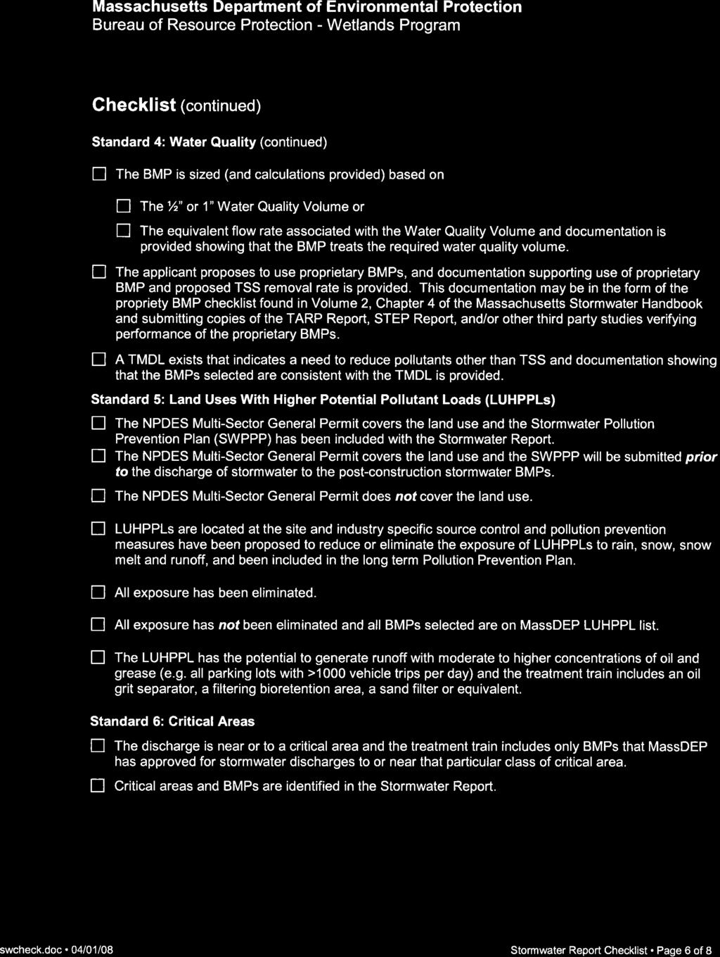
10

11
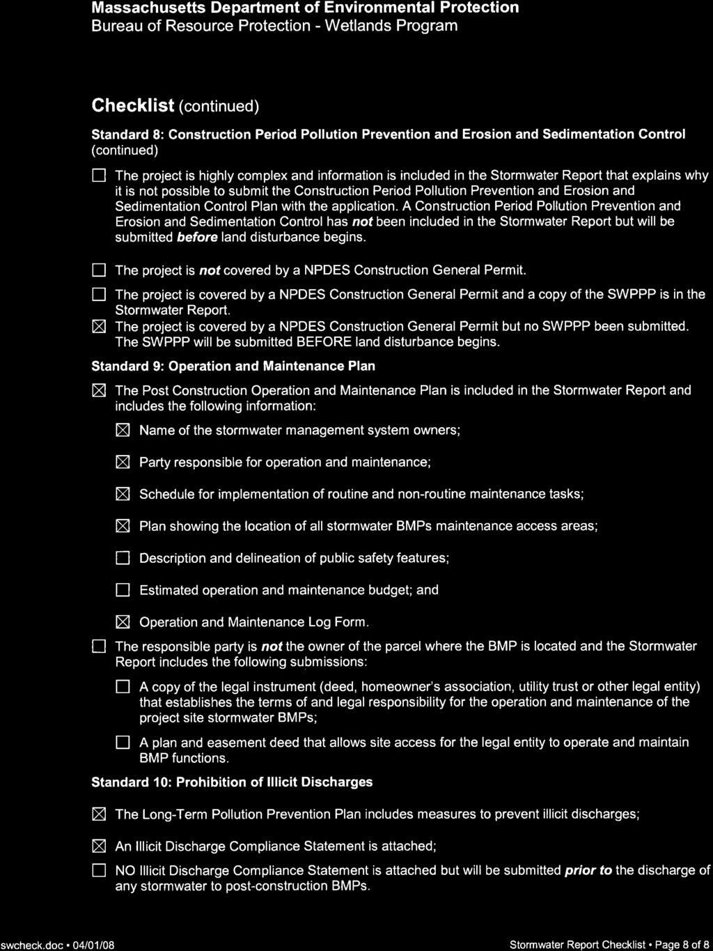
12

13 2.0 PROJECT DESCRIPTION South Hadley High School (SHHS) is proposing a number of improvements to their athletic campus at 153 Newton Street in South Hadley, Massachusetts. The athletic facilities are currently used by the school students and athletes as well as local communities and youth sport organizations. The image below shows an overview of the SHHS campus and the adjacent parcels. The project site is bounded by Lincoln Avenue and residential area to the north, the school building and baseball field to the west and south, town DPW facility to the east and wooded conservation area to the east and southeast. Project Site The proposed project includes improvements to main rectangular game field area and the improvements are described below: Game Field Improvements to the Game Field include converting the existing natural turf field inside the stone dust/cinder running track to synthetic turf. This will involve removing the existing topsoil and drainage infrastructure inside the field and installing a new drainage system and synthetic turf base stone. The majority of the stone dust/cinder track will be removed in order to maximize
 buffer protected under the Town of South Hadley and MA DEP Wetland Protection Act.")
14 athletic field footprint needed for a true multipurpose rectangular field. Other improvements include accessible walkways to access the field and the existing grandstands. There is no portion of the proposed work that is located within 100 Bordering Vegetated Wetland (BVW) buffer protected under the Town of South Hadley and MA DEP Wetland Protection Act. An Application for Stormwater Permit and associated Stormwater Management Report has been filed with the Town of South Hadley Planning Board for the proposed work. The proposed work areas are discussed in more detail below and are depicted within the accompanying plan set and supporting information. 3.0 EXISTING CONDITION INFORMATION Gale Associates Inc. (Gale) completed the existing conditions survey, in the fall of Overall, the field area are approximately 3+ acres. Bordering Vegetated Wetlands (BVW) There are no Bordering vegetated wetlands (BVW) present within the project site. The nearest BVW is located to the south and is part of the Black/Stevens Conservation Area. The nearest disturbance associated with proposed work is well outside the 100-ft buffer. The schematic wetlands lines are shown on the image below. Nearest Wetlands within the Black/Stevens Conservation Area
15 Flood Plain No portion of this project is within the 100-year flood plain, according to the FEMA FIRM Mapping. Natural Heritage According to the Massachusetts Natural Heritage Atlas (13 th Edition), the site does not lie within a priority habitat of rare species. Soils Investigation Based on Natural Resources Conservation Service (NRCS) soil report, the underlying soils within the project area consist primarily of Hinckley-Merrimac Urban Land Complex (745C) with 3% 15% slopes. Curve number (CN) values for infiltration computations were based on Hydrologic Soil Group B (HSG B) and the surface cover material (e.g., grass, pavement). HSG B has an infiltration rate of 1.02 in./hr. for sandy loam, according to the Massachusetts Stormwater Handbook. This is generally consistent with the field investigation and was used for the recharge calculations. The breakdown of curve numbers can be seen in the drainage calculations, which are included in Attachment STORMWATER MANAGEMENT CONCEPT The majority of the work pertains to the construction of a new infilled synthetic turf field. In general, synthetic turf fields drain stormwater runoff vertically, as opposed to natural turf fields, which tend to sheet flow runoff. The proposed synthetic turf fields have been designed with an engineered stone base (12-inch avg. depth, with 33% voids) and be drained via flat panel drains. The time required for stormwater to travel through the stone base and fill the voids, before reaching the underdrain system as well as the use of outlet control structures, will enable the synthetic turf field to release stormwater at a controlled rate, as well as provide storage to attenuate flows and promote additional recharge. The field has been designed so that postdevelopment peak rates of runoff do not exceed pre-development peak rates for the 2, 10, and 100 year storm events. 4.1 Pre-Development Condition Hydrologic Sub Areas The site, as analyzed by Gale, is broken down into one (1) watershed, which drain towards one (1) analysis point or design point (DP). The watershed is shown on the Pre- Development Watershed Map included in Attachment 2 and the area is summarized as follows:
16 Watershed Area 1 (WS-1): WS-1 consists of the rectangular game field, bleachers and compacted stone dust/cinder track and handicap parking areas. Runoff from WS-1 flows overland down a slope before being collect by several catch basins and ultimately reaching existing drainage manhole on the southern portion of the project site (DP-1). WS-1 is approximately acres and it has a time of concentration of 9.1 minutes, with a weighted curve number of 65 (CN=65). 4.2 Post-Development Condition Hydrologic Sub Areas The site, as analyzed by Gale, is broken down into two (2) watersheds, generally maintaining flow patterns and design points consistent with pre-development conditions. Each watershed is shown on the Post-Development Watershed Map included in Attachment 2 and the areas are summarized as follows: Watershed Area 1 (WS-1): WS-1, in the proposed condition, contains synthetic turf field. In the proposed condition, WS-1 is approximately acres and consists of the synthetic turf area. It has a time of concentration of 6.0 minutes, with a curve number of 98 (CN=98). Synthetic turf is modeled in HydroCAD with a CN of 98 to model the direct contribution of runoff to the underlying dynamic base stone, similar to the modeling of a pond. However, in reality it is a highly permeable surface. Runoff from WS-1 contributes to the dynamic base stone, which acts as a detention/infiltration basin that will detain runoff and promote recharge to groundwater. Runoff is released at a controlled rate and discharged through the existing 16 pipe to an existing drainage manhole. Watershed Area 2 (WS-2): WS-2, in the proposed condition, contains the area surrounding the field area and is essentially unchanged from the pre-development condition with the exception of new walkways and the removal of sections of existing track stone dust and replacing with new loam and seed. WS-2 is approximately acres and consists of several ground covers, including grass, stone dust/cinder and impervious areas. It has a time of concentration of 11.0 minutes, with a weighted curve number of 67 (CN=67). Runoff from WS-2 flows into a series of catch basins, which connect via a closed drainage system and discharges to the existing drainage manhole (DP-1). 5.0 COMPLIANCE WITH STORMWATER STANDARDS (MASWMS) 5.1 Untreated Stormwater (Standard 1)
17 The project is designed so that new stormwater conveyances (outfalls/discharges) do not discharge untreated stormwater into or cause erosion to wetlands, to the maximum extent practicable. 5.2 Post-Development Peak Rates (Standard 2) A hydrologic study was performed to determine the rate of runoff for the 2, 10, and 100- year storm events under pre-development (existing) conditions. Post-development rates were then computed in a similar manner. The study point where the peak rates were compared were taken at one design point which has been designated as the adjacent downgradient drainage structure at the southern end of the field. From these analyses, it was determined that the proposed project and its stormwater management system would not increase the peak runoff rates above existing levels. It is the intent of the stormwater management system to minimize impacts to drainage patterns, downstream property and wetlands, while simultaneously providing water quality treatment to runoff prior to its release from the site. The U.S.D.A. Soil Conservation Service (SCS) Technical Release 55 (TR-55), 1986, was used as the procedure for estimating runoff. A HydroCAD SCS TR-20-based computer program was used for estimating peak discharges. TR-55 is a generally accepted model for use on small sites, and begins with a rainfall amount uniformly imposed on the watershed over a specified time distribution. Mass rainfall is converted to mass runoff by using a runoff curve number (CN). The CN is based on soils, plant cover, impervious areas, interception and surface storage. Runoff is then transformed into a hydrograph that depends on runoff travel time through segments of the watershed. Calculations can be found in Attachment Proposed Conditions The post-development curve numbers are greater than pre-development, which generally increases the runoff potential of the site. In the Hydro-CAD software, synthetic turf is modeled with a CN of 98, to model the direct contribution of stormwater into the dynamic base stone beneath the synthetic turf fields, which is modeled as a detention/infiltration basin. The dynamic base stone serves to collect, detain and control the release of the majority of the stormwater runoff, to not increase the peak rates of runoff. The stone base will allow recharge and will promote infiltration to the maximum extent feasible Peak Rate Summary The Table 1 below shows the peak rate of runoff for the existing site as well as for the developed site at 2, 10, and 100-year design storms.
18 Table 1 Analysis Point Design Storm Existing Runoff (CFS) Proposed Runoff (CFS) DP-1 2-yr (Exist MH) 10-yr yr Recharge to Groundwater (Standard 3) The project controls the stormwater runoff from the site by attenuating and treating the runoff by the use of proposed synthetic turf base stone. After permeating through the base stone, the runoff will infiltrate into the soils beneath the field, with the excess stormwater draining through perforated flat panel under drains and perforated collector pipes. The flow from the dynamic base stone is constricted by the outlet control structures prior to release toward the existing drainage manhole. Also, the flat panel drains are spaced at 25 on-center, which leaves ample opportunity for groundwater recharge, rather than downstream conveyance. Required Recharge Volume for the site was calculated in accordance with the Standards given a Type B soil: Rev = [(S)(Rv)(A)]/12 Rev = [(0.35)(0.144)(3.55)/12 =.0150 Ac-ft = 650 CF Rev = Required Recharge Volume (acre-feet) S = Target Depth Factor (0.35 in for soils of Hydrologic Soil Group B) Rv = (I) where I is the percent impervious cover Impervious Area = sidewalks, and roofs (16,200 SF or Ac.) I = / 3.55 = 10.48% A = site area in acres = 3.55 Ac. Required minimum Surface Area of the bottom of the infiltration structure was calculated in accordance with the Simple Dynamic Method, as outlined in the Massachusetts Stormwater Management Standards: A = Rev / (D + KT) A = 650 CF / (1.0 ft ft/h * 2h) = 556 SF A = Minimum required surface area of the bottom of the infiltration structure
19 Rev = Required Recharge Volume D = Depth of the Infiltration Facility = 1.0 ft) K = Saturated Hydraulic Conductivity (1.02 in/h = ft/h) T = Allowable drawdown during the peak of the storm (2h) The synthetic turf field is used to meet this standard, as it is separated by two feet (2 ) from the estimated seasonal high groundwater (ESHGW) table. The synthetic turf field is approximately 83,600 SF in surface area. This amount of infiltrative surface area allows for the vertical transport of stormwater into the underlying dynamic base stone, which contains 33% voids. The drawdown time from the dynamic base stone was calculated as follows: Time drawdown = Rev / [(K)*(Bottom Area)] = (650 ft 3 ) / [(0.085 ft/hr)*(83,600 ft 2 )] = 0.09 hrs Rev = Required Recharge Volume (ft 3 ) K = Saturated Hydraulic Conductivity (ft/hr) Bottom Area = Bottom Area of Recharge Structure (ft 2 ) The drawdown time for the infiltration areas was calculated to be 0.09 hours, well below the required drawdown time of 72 hours. 5.4 Water Quality (Standard 4) The proposed synthetic turf athletic field has a low potential for accumulation of Total Suspended Solids (TSS). The turf is not subject to vehicle traffic, fertilization, sedimentation, irrigation or rigorous maintenance, thus lessening the ability to acquire TSS. Runoff generated by the synthetic turf field will travel vertically, through approximately twelve inches (12 ) of engineered stone base, where it will either infiltrate into the soils below or travel laterally through the stone base and into the flat drains leading to the collector pipe. The perforated pipes are embedded within stone trenches. Runoff from the proposed track will drain to the proposed dynamic base stone. Additionally, the proposed sidewalk improvements have low potential for accumulation of (TSS). They are not subject to salting or sanding operations, or to oil contamination from vehicles, thus lessening the ability to acquire TSS. It is our opinion that runoff generated from the surfaces is clean and does not require water quality treatment. 5.5 Land Uses with Higher Potential Pollutant Loads (Standard 5) The proposed project does not qualify for a LUHPPL. No untreated runoff will leave the site or discharge into the adjacent wetlands, as various perimeter treatment techniques are proposed, including infiltration basins.
20 5.6 Critical Areas (Standard 6) This site does not lie within or discharge to or near any critical areas. 5.7 Redevelopment (Standard 7) The project is, in essence, a redevelopment project. However, it does result in an increase of impervious area and therefore does not meet the requirement of Standard 7 to be classified as a redevelopment project. As documented in this report, all applicable standards have been met. 5.8 Erosion and Sedimentation Controls (Standard 8) An Erosion and Sedimentation Control Plan is provided as part of the Stormwater Permit Application to the Planning Board. Also, the project will be covered by a NPDES Construction General Permit and SWPPP Plan. The contractor will provide these items prior to the start of construction. 5.9 Operation and Maintenance Plan (Standard 9) An Operation and Maintenance Plan is provided as part of the Notice of Intent Application to the Conservation Commission. See Attachment 4 for the Operation and Maintenance & Erosion and Sediment Control Plan Prohibition of Illicit Discharges (Standard 10) 6.0 SUMMARY There are no illicit discharges to the proposed stormwater management system. A template for an illicit discharge compliance statement has been provided as part of the Stormwater Permit Application to the Planning Board. A completed statement will be submitted prior to the discharge of stormwater to the post-construction stormwater management system. Refer to Attachment 4. The project, as proposed, is the best fit for this site, and an improvement to the adjacent resource areas. The project maintains the existing drainage patterns for the site, with only minor revisions to the existing stormwater management techniques. A synthetic turf field is an optimal facility for sites where there are concerns of stormwater flows or degradation of adjacent natural resources. The project proves to be a betterment to the environment and meets the Massachusetts Stormwater Management Standards. C:\Users\ps\Desktop\Work Servers\G\717000\02 Design\reports\stormwater\ SWMR - South Hadley.docx
21 Attachment 1: United States Soil Conservation Services Mapping

22 United States Department of Agriculture Natural Resources Conservation Service A product of the National Cooperative Soil Survey, a joint effort of the United States Department of Agriculture and other Federal agencies, State agencies including the Agricultural Experiment Stations, and local participants Custom Soil Resource Report for Hampshire County, Massachusetts, Central Part January 29, 2016
23 Preface Soil surveys contain information that affects land use planning in survey areas. They highlight soil limitations that affect various land uses and provide information about the properties of the soils in the survey areas. Soil surveys are designed for many different users, including farmers, ranchers, foresters, agronomists, urban planners, community officials, engineers, developers, builders, and home buyers. Also, conservationists, teachers, students, and specialists in recreation, waste disposal, and pollution control can use the surveys to help them understand, protect, or enhance the environment. Various land use regulations of Federal, State, and local governments may impose special restrictions on land use or land treatment. Soil surveys identify soil properties that are used in making various land use or land treatment decisions. The information is intended to help the land users identify and reduce the effects of soil limitations on various land uses. The landowner or user is responsible for identifying and complying with existing laws and regulations. Although soil survey information can be used for general farm, local, and wider area planning, onsite investigation is needed to supplement this information in some cases. Examples include soil quality assessments ( nrcs/main/soils/health/) and certain conservation and engineering applications. For more detailed information, contact your local USDA Service Center ( offices.sc.egov.usda.gov/locator/app?agency=nrcs) or your NRCS State Soil Scientist ( cid=nrcs142p2_053951). Great differences in soil properties can occur within short distances. Some soils are seasonally wet or subject to flooding. Some are too unstable to be used as a foundation for buildings or roads. Clayey or wet soils are poorly suited to use as septic tank absorption fields. A high water table makes a soil poorly suited to basements or underground installations. The National Cooperative Soil Survey is a joint effort of the United States Department of Agriculture and other Federal agencies, State agencies including the Agricultural Experiment Stations, and local agencies. The Natural Resources Conservation Service (NRCS) has leadership for the Federal part of the National Cooperative Soil Survey. Information about soils is updated periodically. Updated information is available through the NRCS Web Soil Survey, the site for official soil survey information. The U.S. Department of Agriculture (USDA) prohibits discrimination in all its programs and activities on the basis of race, color, national origin, age, disability, and where applicable, sex, marital status, familial status, parental status, religion, sexual orientation, genetic information, political beliefs, reprisal, or because all or a part of an individual's income is derived from any public assistance program. (Not all prohibited bases apply to all programs.) Persons with disabilities who require alternative means 2
24 for communication of program information (Braille, large print, audiotape, etc.) should contact USDA's TARGET Center at (202) (voice and TDD). To file a complaint of discrimination, write to USDA, Director, Office of Civil Rights, 1400 Independence Avenue, S.W., Washington, D.C or call (800) (voice) or (202) (TDD). USDA is an equal opportunity provider and employer. 3
25 Contents Preface...2 How Soil Surveys Are Made...5 Soil Map...7 Soil Map...8 Legend...9 Map Unit Legend...10 Map Unit Descriptions...10 Hampshire County, Massachusetts, Central Part C Hinckley-Merrimac-Urban land complex, 3 to 15 percent slopes C Windsor-Scitico-Amostown complex, 0 to 15 percent slopes...14 References
26 How Soil Surveys Are Made Soil surveys are made to provide information about the soils and miscellaneous areas in a specific area. They include a description of the soils and miscellaneous areas and their location on the landscape and tables that show soil properties and limitations affecting various uses. Soil scientists observed the steepness, length, and shape of the slopes; the general pattern of drainage; the kinds of crops and native plants; and the kinds of bedrock. They observed and described many soil profiles. A soil profile is the sequence of natural layers, or horizons, in a soil. The profile extends from the surface down into the unconsolidated material in which the soil formed or from the surface down to bedrock. The unconsolidated material is devoid of roots and other living organisms and has not been changed by other biological activity. Currently, soils are mapped according to the boundaries of major land resource areas (MLRAs). MLRAs are geographically associated land resource units that share common characteristics related to physiography, geology, climate, water resources, soils, biological resources, and land uses (USDA, 2006). Soil survey areas typically consist of parts of one or more MLRA. The soils and miscellaneous areas in a survey area occur in an orderly pattern that is related to the geology, landforms, relief, climate, and natural vegetation of the area. Each kind of soil and miscellaneous area is associated with a particular kind of landform or with a segment of the landform. By observing the soils and miscellaneous areas in the survey area and relating their position to specific segments of the landform, a soil scientist develops a concept, or model, of how they were formed. Thus, during mapping, this model enables the soil scientist to predict with a considerable degree of accuracy the kind of soil or miscellaneous area at a specific location on the landscape. Commonly, individual soils on the landscape merge into one another as their characteristics gradually change. To construct an accurate soil map, however, soil scientists must determine the boundaries between the soils. They can observe only a limited number of soil profiles. Nevertheless, these observations, supplemented by an understanding of the soil-vegetation-landscape relationship, are sufficient to verify predictions of the kinds of soil in an area and to determine the boundaries. Soil scientists recorded the characteristics of the soil profiles that they studied. They noted soil color, texture, size and shape of soil aggregates, kind and amount of rock fragments, distribution of plant roots, reaction, and other features that enable them to identify soils. After describing the soils in the survey area and determining their properties, the soil scientists assigned the soils to taxonomic classes (units). Taxonomic classes are concepts. Each taxonomic class has a set of soil characteristics with precisely defined limits. The classes are used as a basis for comparison to classify soils systematically. Soil taxonomy, the system of taxonomic classification used in the United States, is based mainly on the kind and character of soil properties and the arrangement of horizons within the profile. After the soil scientists classified and named the soils in the survey area, they compared the 5
27 Custom Soil Resource Report individual soils with similar soils in the same taxonomic class in other areas so that they could confirm data and assemble additional data based on experience and research. The objective of soil mapping is not to delineate pure map unit components; the objective is to separate the landscape into landforms or landform segments that have similar use and management requirements. Each map unit is defined by a unique combination of soil components and/or miscellaneous areas in predictable proportions. Some components may be highly contrasting to the other components of the map unit. The presence of minor components in a map unit in no way diminishes the usefulness or accuracy of the data. The delineation of such landforms and landform segments on the map provides sufficient information for the development of resource plans. If intensive use of small areas is planned, onsite investigation is needed to define and locate the soils and miscellaneous areas. Soil scientists make many field observations in the process of producing a soil map. The frequency of observation is dependent upon several factors, including scale of mapping, intensity of mapping, design of map units, complexity of the landscape, and experience of the soil scientist. Observations are made to test and refine the soillandscape model and predictions and to verify the classification of the soils at specific locations. Once the soil-landscape model is refined, a significantly smaller number of measurements of individual soil properties are made and recorded. These measurements may include field measurements, such as those for color, depth to bedrock, and texture, and laboratory measurements, such as those for content of sand, silt, clay, salt, and other components. Properties of each soil typically vary from one point to another across the landscape. Observations for map unit components are aggregated to develop ranges of characteristics for the components. The aggregated values are presented. Direct measurements do not exist for every property presented for every map unit component. Values for some properties are estimated from combinations of other properties. While a soil survey is in progress, samples of some of the soils in the area generally are collected for laboratory analyses and for engineering tests. Soil scientists interpret the data from these analyses and tests as well as the field-observed characteristics and the soil properties to determine the expected behavior of the soils under different uses. Interpretations for all of the soils are field tested through observation of the soils in different uses and under different levels of management. Some interpretations are modified to fit local conditions, and some new interpretations are developed to meet local needs. Data are assembled from other sources, such as research information, production records, and field experience of specialists. For example, data on crop yields under defined levels of management are assembled from farm records and from field or plot experiments on the same kinds of soil. Predictions about soil behavior are based not only on soil properties but also on such variables as climate and biological activity. Soil conditions are predictable over long periods of time, but they are not predictable from year to year. For example, soil scientists can predict with a fairly high degree of accuracy that a given soil will have a high water table within certain depths in most years, but they cannot predict that a high water table will always be at a specific level in the soil on a specific date. After soil scientists located and identified the significant natural bodies of soil in the survey area, they drew the boundaries of these bodies on aerial photographs and identified each as a specific map unit. Aerial photographs show trees, buildings, fields, roads, and rivers, all of which help in locating boundaries accurately. 6
28 Soil Map The soil map section includes the soil map for the defined area of interest, a list of soil map units on the map and extent of each map unit, and cartographic symbols displayed on the map. Also presented are various metadata about data used to produce the map, and a description of each soil map unit. 7

29 72 35' 12'' W Custom Soil Resource Report Soil Map 72 34' 54'' W 42 13' 49'' N ' 49'' N 42 13' 40'' N 42 13' 40'' N ' 12'' W N Map Scale: 1:1,810 if printed on A landscape (11" x 8.5") sheet. Meters Feet Map projection: Web Mercator Corner coordinates: WGS84 Edge tics: UTM Zone 18N WGS ' 54'' W
30 Custom Soil Resource Report MAP LEGEND MAP INFORMATION Area of Interest (AOI) Area of Interest (AOI) Soils Soil Map Unit Polygons Soil Map Unit Lines Soil Map Unit Points Special Point Features Blowout Borrow Pit Clay Spot Closed Depression Gravel Pit Gravelly Spot Landfill Lava Flow Marsh or swamp Mine or Quarry Miscellaneous Water Perennial Water Rock Outcrop Saline Spot Sandy Spot Severely Eroded Spot Sinkhole Slide or Slip Sodic Spot Spoil Area Stony Spot Very Stony Spot Wet Spot Other Special Line Features Water Features Streams and Canals Transportation Rails Interstate Highways US Routes Major Roads Local Roads Background Aerial Photography The soil surveys that comprise your AOI were mapped at 1:15,800. Warning: Soil Map may not be valid at this scale. Enlargement of maps beyond the scale of mapping can cause misunderstanding of the detail of mapping and accuracy of soil line placement. The maps do not show the small areas of contrasting soils that could have been shown at a more detailed scale. Please rely on the bar scale on each map sheet for map measurements. Source of Map: Natural Resources Conservation Service Web Soil Survey URL: Coordinate System: Web Mercator (EPSG:3857) Maps from the Web Soil Survey are based on the Web Mercator projection, which preserves direction and shape but distorts distance and area. A projection that preserves area, such as the Albers equal-area conic projection, should be used if more accurate calculations of distance or area are required. This product is generated from the USDA-NRCS certified data as of the version date(s) listed below. Soil Survey Area: Hampshire County, Massachusetts, Central Part Survey Area Data: Version 10, Sep 28, 2015 Soil map units are labeled (as space allows) for map scales 1:50,000 or larger. Date(s) aerial images were photographed: Mar 28, 2011 Apr 18, 2011 The orthophoto or other base map on which the soil lines were compiled and digitized probably differs from the background imagery displayed on these maps. As a result, some minor shifting of map unit boundaries may be evident. 9
31 Custom Soil Resource Report Map Unit Legend Hampshire County, Massachusetts, Central Part (MA609) Map Unit Symbol Map Unit Name Acres in AOI Percent of AOI 745C 750C Hinckley-Merrimac-Urban land complex, 3 to 15 percent slopes Windsor-Scitico-Amostown complex, 0 to 15 percent slopes % % Totals for Area of Interest % Map Unit Descriptions The map units delineated on the detailed soil maps in a soil survey represent the soils or miscellaneous areas in the survey area. The map unit descriptions, along with the maps, can be used to determine the composition and properties of a unit. A map unit delineation on a soil map represents an area dominated by one or more major kinds of soil or miscellaneous areas. A map unit is identified and named according to the taxonomic classification of the dominant soils. Within a taxonomic class there are precisely defined limits for the properties of the soils. On the landscape, however, the soils are natural phenomena, and they have the characteristic variability of all natural phenomena. Thus, the range of some observed properties may extend beyond the limits defined for a taxonomic class. Areas of soils of a single taxonomic class rarely, if ever, can be mapped without including areas of other taxonomic classes. Consequently, every map unit is made up of the soils or miscellaneous areas for which it is named and some minor components that belong to taxonomic classes other than those of the major soils. Most minor soils have properties similar to those of the dominant soil or soils in the map unit, and thus they do not affect use and management. These are called noncontrasting, or similar, components. They may or may not be mentioned in a particular map unit description. Other minor components, however, have properties and behavioral characteristics divergent enough to affect use or to require different management. These are called contrasting, or dissimilar, components. They generally are in small areas and could not be mapped separately because of the scale used. Some small areas of strongly contrasting soils or miscellaneous areas are identified by a special symbol on the maps. If included in the database for a given area, the contrasting minor components are identified in the map unit descriptions along with some characteristics of each. A few areas of minor components may not have been observed, and consequently they are not mentioned in the descriptions, especially where the pattern was so complex that it was impractical to make enough observations to identify all the soils and miscellaneous areas on the landscape. The presence of minor components in a map unit in no way diminishes the usefulness or accuracy of the data. The objective of mapping is not to delineate pure taxonomic classes but rather to separate the landscape into landforms or landform segments that have similar use and management requirements. The delineation of such segments 10
32 Custom Soil Resource Report on the map provides sufficient information for the development of resource plans. If intensive use of small areas is planned, however, onsite investigation is needed to define and locate the soils and miscellaneous areas. An identifying symbol precedes the map unit name in the map unit descriptions. Each description includes general facts about the unit and gives important soil properties and qualities. Soils that have profiles that are almost alike make up a soil series. Except for differences in texture of the surface layer, all the soils of a series have major horizons that are similar in composition, thickness, and arrangement. Soils of one series can differ in texture of the surface layer, slope, stoniness, salinity, degree of erosion, and other characteristics that affect their use. On the basis of such differences, a soil series is divided into soil phases. Most of the areas shown on the detailed soil maps are phases of soil series. The name of a soil phase commonly indicates a feature that affects use or management. For example, Alpha silt loam, 0 to 2 percent slopes, is a phase of the Alpha series. Some map units are made up of two or more major soils or miscellaneous areas. These map units are complexes, associations, or undifferentiated groups. A complex consists of two or more soils or miscellaneous areas in such an intricate pattern or in such small areas that they cannot be shown separately on the maps. The pattern and proportion of the soils or miscellaneous areas are somewhat similar in all areas. Alpha-Beta complex, 0 to 6 percent slopes, is an example. An association is made up of two or more geographically associated soils or miscellaneous areas that are shown as one unit on the maps. Because of present or anticipated uses of the map units in the survey area, it was not considered practical or necessary to map the soils or miscellaneous areas separately. The pattern and relative proportion of the soils or miscellaneous areas are somewhat similar. Alpha- Beta association, 0 to 2 percent slopes, is an example. An undifferentiated group is made up of two or more soils or miscellaneous areas that could be mapped individually but are mapped as one unit because similar interpretations can be made for use and management. The pattern and proportion of the soils or miscellaneous areas in a mapped area are not uniform. An area can be made up of only one of the major soils or miscellaneous areas, or it can be made up of all of them. Alpha and Beta soils, 0 to 2 percent slopes, is an example. Some surveys include miscellaneous areas. Such areas have little or no soil material and support little or no vegetation. Rock outcrop is an example. 11
33 Custom Soil Resource Report Hampshire County, Massachusetts, Central Part 745C Hinckley-Merrimac-Urban land complex, 3 to 15 percent slopes Map Unit Setting National map unit symbol: 9b0c Elevation: 0 to 1,000 feet Mean annual precipitation: 40 to 50 inches Mean annual air temperature: 45 to 52 degrees F Frost-free period: 120 to 240 days Farmland classification: Not prime farmland Map Unit Composition Hinckley and similar soils: 30 percent Merrimac and similar soils: 25 percent Urban land: 25 percent Minor components: 20 percent Estimates are based on observations, descriptions, and transects of the mapunit. Description of Hinckley Setting Landform: Outwash plains Landform position (two-dimensional): Footslope Landform position (three-dimensional): Tread, riser Down-slope shape: Convex Across-slope shape: Convex Parent material: Loose sandy and gravelly glaciofluvial deposits Typical profile H1-0 to 8 inches: loamy sand H2-8 to 13 inches: loamy sand H3-13 to 29 inches: gravelly sand H4-29 to 60 inches: Error Properties and qualities Slope: 3 to 8 percent Depth to restrictive feature: More than 80 inches Natural drainage class: Excessively drained Runoff class: Low Capacity of the most limiting layer to transmit water (Ksat): High to very high (6.00 to in/hr) Depth to water table: More than 80 inches Frequency of flooding: None Frequency of ponding: None Available water storage in profile: Low (about 3.6 inches) Interpretive groups Land capability classification (irrigated): None specified Land capability classification (nonirrigated): 3s Hydrologic Soil Group: A Description of Merrimac Setting Landform: Outwash plains 12
34 Custom Soil Resource Report Landform position (two-dimensional): Footslope Landform position (three-dimensional): Tread, riser Down-slope shape: Convex Across-slope shape: Convex Parent material: Friable loamy eolian deposits over loose sandy glaciofluvial deposits derived from granite and gneiss Typical profile H1-0 to 16 inches: gravelly fine sandy loam H2-16 to 24 inches: gravelly sandy loam H3-24 to 60 inches: stratified sand to very gravelly sand Properties and qualities Slope: 3 to 8 percent Depth to restrictive feature: More than 80 inches Natural drainage class: Somewhat excessively drained Runoff class: Low Capacity of the most limiting layer to transmit water (Ksat): High (2.00 to 6.00 in/hr) Depth to water table: More than 80 inches Frequency of flooding: None Frequency of ponding: None Available water storage in profile: Low (about 5.4 inches) Interpretive groups Land capability classification (irrigated): None specified Land capability classification (nonirrigated): 2s Hydrologic Soil Group: A Description of Urban Land Setting Parent material: Paved/fill Minor Components Windsor Percent of map unit: 4 percent Ninigret Percent of map unit: 4 percent Sudbury Percent of map unit: 4 percent Walpole Percent of map unit: 4 percent Landform: Terraces Agawam Percent of map unit: 4 percent 13
35 Custom Soil Resource Report 750C Windsor-Scitico-Amostown complex, 0 to 15 percent slopes Map Unit Setting National map unit symbol: 9b2n Mean annual precipitation: 40 to 50 inches Mean annual air temperature: 45 to 52 degrees F Frost-free period: 140 to 240 days Farmland classification: Not prime farmland Map Unit Composition Windsor and similar soils: 40 percent Scitico and similar soils: 20 percent Amostown and similar soils: 15 percent Minor components: 25 percent Estimates are based on observations, descriptions, and transects of the mapunit. Description of Windsor Setting Landform: Outwash plains Landform position (two-dimensional): Footslope Landform position (three-dimensional): Riser Down-slope shape: Linear Across-slope shape: Convex Parent material: Loose sandy glaciofluvial deposits Typical profile H1-0 to 8 inches: loamy sand H2-8 to 21 inches: loamy sand H3-21 to 60 inches: sand Properties and qualities Slope: 25 to 35 percent Depth to restrictive feature: More than 80 inches Natural drainage class: Excessively drained Runoff class: Medium Capacity of the most limiting layer to transmit water (Ksat): High to very high (6.00 to in/hr) Depth to water table: More than 80 inches Frequency of flooding: None Frequency of ponding: None Available water storage in profile: Low (about 4.8 inches) Interpretive groups Land capability classification (irrigated): None specified Land capability classification (nonirrigated): 7s Hydrologic Soil Group: A 14
36 Custom Soil Resource Report Description of Scitico Setting Landform: Depressions Down-slope shape: Concave Across-slope shape: Linear Parent material: Hard silty glaciolacustrine deposits Typical profile H1-0 to 10 inches: silt loam H2-10 to 22 inches: silt loam H3-22 to 36 inches: silty clay H4-36 to 65 inches: silty clay Properties and qualities Slope: 0 to 3 percent Depth to restrictive feature: More than 80 inches Natural drainage class: Poorly drained Runoff class: Very high Capacity of the most limiting layer to transmit water (Ksat): Very low to moderately low (0.00 to 0.06 in/hr) Depth to water table: About 0 to 12 inches Frequency of flooding: None Frequency of ponding: None Available water storage in profile: Moderate (about 8.6 inches) Interpretive groups Land capability classification (irrigated): None specified Land capability classification (nonirrigated): 4w Hydrologic Soil Group: D Description of Amostown Setting Landform: Outwash plains, deltas, terraces Landform position (two-dimensional): Footslope, summit Landform position (three-dimensional): Tread Down-slope shape: Convex Across-slope shape: Convex Parent material: Friable sandy glaciofluvial deposits over silty glaciolacustrine deposits Typical profile H1-0 to 7 inches: fine sandy loam H2-7 to 32 inches: fine sandy loam H3-32 to 60 inches: stratified very fine sand to silt loam Properties and qualities Slope: 3 to 8 percent Depth to restrictive feature: More than 80 inches Natural drainage class: Moderately well drained Runoff class: Medium Capacity of the most limiting layer to transmit water (Ksat): Moderately low to moderately high (0.06 to 0.60 in/hr) Depth to water table: About 18 to 36 inches Frequency of flooding: None Frequency of ponding: None 15
37 Custom Soil Resource Report Available water storage in profile: High (about 9.3 inches) Interpretive groups Land capability classification (irrigated): None specified Land capability classification (nonirrigated): 2e Hydrologic Soil Group: B Minor Components Hinckley Percent of map unit: 10 percent Agawam Percent of map unit: 5 percent Pollux Percent of map unit: 5 percent Boxford Percent of map unit: 5 percent 16
38 References American Association of State Highway and Transportation Officials (AASHTO) Standard specifications for transportation materials and methods of sampling and testing. 24th edition. American Society for Testing and Materials (ASTM) Standard classification of soils for engineering purposes. ASTM Standard D Cowardin, L.M., V. Carter, F.C. Golet, and E.T. LaRoe Classification of wetlands and deep-water habitats of the United States. U.S. Fish and Wildlife Service FWS/OBS-79/31. Federal Register. July 13, Changes in hydric soils of the United States. Federal Register. September 18, Hydric soils of the United States. Hurt, G.W., and L.M. Vasilas, editors. Version 6.0, Field indicators of hydric soils in the United States. National Research Council Wetlands: Characteristics and boundaries. Soil Survey Division Staff Soil survey manual. Soil Conservation Service. U.S. Department of Agriculture Handbook detail/national/soils/?cid=nrcs142p2_ Soil Survey Staff Soil taxonomy: A basic system of soil classification for making and interpreting soil surveys. 2nd edition. Natural Resources Conservation Service, U.S. Department of Agriculture Handbook nrcs/detail/national/soils/?cid=nrcs142p2_ Soil Survey Staff Keys to soil taxonomy. 11th edition. U.S. Department of Agriculture, Natural Resources Conservation Service. portal/nrcs/detail/national/soils/?cid=nrcs142p2_ Tiner, R.W., Jr Wetlands of Delaware. U.S. Fish and Wildlife Service and Delaware Department of Natural Resources and Environmental Control, Wetlands Section. United States Army Corps of Engineers, Environmental Laboratory Corps of Engineers wetlands delineation manual. Waterways Experiment Station Technical Report Y United States Department of Agriculture, Natural Resources Conservation Service. National forestry manual. home/?cid=nrcs142p2_ United States Department of Agriculture, Natural Resources Conservation Service. National range and pasture handbook. detail/national/landuse/rangepasture/?cid=stelprdb
39 Custom Soil Resource Report United States Department of Agriculture, Natural Resources Conservation Service. National soil survey handbook, title 430-VI. nrcs/detail/soils/scientists/?cid=nrcs142p2_ United States Department of Agriculture, Natural Resources Conservation Service Land resource regions and major land resource areas of the United States, the Caribbean, and the Pacific Basin. U.S. Department of Agriculture Handbook cid=nrcs142p2_ United States Department of Agriculture, Soil Conservation Service Land capability classification. U.S. Department of Agriculture Handbook
40 Attachment 2: Pre & Post Development Conditions Map
41 Gale Associates, Inc. Engineers and Planners 163 LIBBEY PARKWAY WEYMOUTH, MA P F Boston Baltimore Orlando San Francisco 2016 F:\717000\plots\Permit Drawings\717000_PRE.dwg, C102
42 Gale Associates, Inc. Engineers and Planners 163 LIBBEY PARKWAY WEYMOUTH, MA P F Boston Baltimore Orlando San Francisco 2016 F:\717000\plots\Permit Drawings\717000_POST.dwg, C102
43 Attachment 3: Pre & Post Development Hydrology
44 1 DP-1 WS-1 DP-1 Subcat Reach Pond Link Drainage Diagram for _South Hadley_PRE Prepared by Hewlett-Packard Company, Printed 1/28/2016 HydroCAD 9.10 s/n HydroCAD Software Solutions LLC
45 717000_South Hadley_PRE Prepared by Hewlett-Packard Company HydroCAD 9.10 s/n HydroCAD Software Solutions LLC Printed 1/28/2016 Page 2 Area (acres) CN Description (subcatchment-numbers) Area Listing (all nodes) >75% Grass cover, Good, HSG B (1) Stone Dust Track, HSG B (1) Unconnected pavement, HSG B (1) TOTAL AREA
46 717000_South Hadley_PRE Prepared by Hewlett-Packard Company HydroCAD 9.10 s/n HydroCAD Software Solutions LLC Printed 1/28/2016 Page 3 Area (acres) Soil Group Subcatchment Numbers HSG A HSG B HSG C HSG D Other TOTAL AREA Soil Listing (all nodes)
47 717000_South Hadley_PRE Prepared by Hewlett-Packard Company HydroCAD 9.10 s/n HydroCAD Software Solutions LLC Printed 1/28/2016 Page 4 Line# Node Number In-Invert (feet) Out-Invert (feet) Pipe Listing (all nodes) Length (feet) Slope (ft/ft) n Diam/Width (inches) Height (inches) Fill (inches)
48 717000_South Hadley_PRE Type III 24-hr 2-Year Rainfall=3.00" Prepared by Hewlett-Packard Company Printed 1/28/2016 HydroCAD 9.10 s/n HydroCAD Software Solutions LLC Page 5 Time span= hrs, dt=0.05 hrs, 561 points Runoff by SCS TR-20 method, UH=SCS Reach routing by Stor-Ind+Trans method - Pond routing by Stor-Ind method Subcatchment 1: WS-1 Link DP-1: DP-1 Runoff Area=154,790 sf 3.84% Impervious Runoff Depth=0.51" Flow Length=754' Tc=9.1 min UI Adjusted CN=65 Runoff=1.37 cfs af Inflow=1.37 cfs af Primary=1.37 cfs af Total Runoff Area = ac Runoff Volume = af Average Runoff Depth = 0.51" 96.16% Pervious = ac 3.84% Impervious = ac
49 717000_South Hadley_PRE Type III 24-hr 2-Year Rainfall=3.00" Prepared by Hewlett-Packard Company Printed 1/28/2016 HydroCAD 9.10 s/n HydroCAD Software Solutions LLC Page 6 Summary for Subcatchment 1: WS-1 Runoff = hrs, Volume= af, Depth= 0.51" Runoff by SCS TR-20 method, UH=SCS, Time Span= hrs, dt= 0.05 hrs Type III 24-hr 2-Year Rainfall=3.00" Area (sf) CN Description * 20, Stone Dust Track, HSG B 5, Unconnected pavement, HSG B 128, >75% Grass cover, Good, HSG B 154, Weighted Average, UI Adjusted CN = , % Pervious Area 5, % Impervious Area 5, % Unconnected Tc Length Slope Velocity Capacity Description (min) (feet) (ft/ft) (ft/sec) (cfs) Sheet Flow, A-B Grass: Short n= P2= 3.10" Shallow Concentrated Flow, B-C Unpaved Kv= 16.1 fps Pipe Channel, 8.0" Round Area= 0.3 sf Perim= 2.1' r= 0.17' n= Corrugated PE, smooth interior Pipe Channel, 12.0" Round Area= 0.8 sf Perim= 3.1' r= 0.25' n= Corrugated PE, smooth interior Pipe Channel, 15.0" Round Area= 1.2 sf Perim= 3.9' r= 0.31' n= Corrugated PE, smooth interior Total
Custom Soil Resource Report for Polk County, Wisconsin
 United States Department of Agriculture Natural Resources Conservation Service A product of the National Cooperative Soil Survey, a joint effort of the United States Department of Agriculture and other
Custom Soil Resource Report for Colquitt and Cook Counties, Georgia
 United States Department of Agriculture Natural Resources Conservation Service A product of the National Cooperative Soil Survey, a joint effort of the United States Department of Agriculture and other
Custom Soil Resource Report for Pamlico County, North Carolina
 United States Department of Agriculture Natural Resources Conservation Service A product of the National Cooperative Soil Survey, a joint effort of the United States Department of Agriculture and other
SITE DESIGN ENGINEERING, LLC. 11 Cushman Street, Middleboro, MA P: F:
 INTRODUCTION This drainage report was prepared for the proposed site re-development at in Burlington, Massachusetts. The project site is approximately 1.05± acres consisting of approximately 70% impervious
Custom Soil Resource Report for Kent County, Michigan
 United States Department of Agriculture Natural Resources Conservation Service A product of the National Cooperative Soil Survey, a joint effort of the United States Department of Agriculture and other
Initial Run-on and Run-off Control System Plan
 Initial Run-on and Run-off Control System Plan For Compliance with the Coal Combustion Residuals Rule (40 CFR 257.81) Valmont Station - Ash Disposal Facility Public Service Company of Colorado Denver,
PHYSICAL SOIL PROPERTIES
 PHYSICAL SOIL PROPERTIES Physical Soil Properties Santa Cruz County, California Scotts Valley Target Physical Soil Properties This table shows estimates of some physical characteristics and features that
THE CITY OF THE VILLAGE PLANNED UNIT DEVELOPMENT DESIGN STATEMENT FOR MULFORD ESTATES
 THE CITY OF THE VILLAGE PLANNED UNIT DEVELOPMENT DESIGN STATEMENT FOR MULFORD ESTATES Revised August 18, 2016, August 10, 2016, September 19,2016 Prepared By: Isch and Associates, Inc. 14848 Bristol Park
Appendix E Agency Coordination
 Sustainable Airport Master Plan Appendix E Agency Coordination. Appendix United States Department of Agriculture Natural Resources Conservation Service A product of the National Cooperative Soil Survey,
Standards for Soil Erosion and Sediment Control in New Jersey May 2012 STANDARD FOR GRASSED WATERWAYS. Definition. Purpose
 STANDARD FOR GRASSED WATERWAYS Definition A natural or constructed watercourse shaped or graded in earth materials and stabilized with suitable vegetation for the safe conveyance of runoff water. Purpose
Suffolk Downs Redevelopment. Appendix G: Stormwater Management Supporting Documentation
 Suffolk Downs Redevelopment Expanded PNF Appendix G: Stormwater Management Supporting Documentation Suffolk Downs Redevelopment Phase 1 Stormwater Management Report Boston, Massachusetts 285402RP004 TABLE
Inflow Design Flood Control System Plan
 Inflow Design Flood Control System Plan For Compliance with the Coal Combustion Residuals Rule (40 CFR Part 257) Cherokee Station - CCR Surface Impoundments Public Service Company of Colorado Denver, Colorado
United States Department of Agriculture Natural Resources Conservation Service
 Jericho Winter, USDA NRCS Resource Soil Scientist Jeremy Baker, Rural Conservationist, East Multnomah SWCD Kim Galland, Multnomah Co. District Conservationist United States Department of Agriculture Natural
HYDROLOGIC CONSIDERATIONS. 22 nd Annual Nonpoint Source Pollution Conference Saratoga Springs, NY
 LOW IMPACT DEVELOPMENT HYDROLOGIC CONSIDERATIONS 22 nd Annual Nonpoint Source Pollution Conference Saratoga Springs, NY May 18, 2011 PRESENTATION AGENDA Introduction Definitions Discuss Impacts to Hydrologic
GENERAL AND FLOODING STANDARDS SUBMISSION BRUNSWICK LAYOVER FACILITY BRUNSWICK, MAINE PREPARED FOR:
 APPENDIX H GENERAL AND FLOODING STANDARDS SUBMISSION BRUNSWICK LAYOVER FACILITY BRUNSWICK, MAINE PREPARED FOR: NORTHERN NEW ENGLAND PASSENGER RAIL AUTHORITY (NNEPRA) 75 WEST COMMERCIAL STREET, SUITE 104
APPENDIX E. LESA Models
 APPENDIX E LESA Models LESA ASSESSMENT CALEXICO SOLAR FARM I PHASE A PROJECT AREA CALEXICO SOLAR FARM I PHASE A PROJECT (SW/4 Section 13, S/2 Section 14, S/2 NE/4 Section 15, NW/4 Section 15, T17S, R13E,
NEW CASTLE CONSERVATION DISTRICT. through. (Name of Municipality) PLAN REVIEW APPLICATION DRAINAGE, STORMWATER MANAGEMENT, EROSION & SEDIMENT CONTROL
 PLAN REVIEW APPLICATION DRAINAGE, STORMWATER MANAGEMENT, EROSION & SEDIMENT CONTROL") NEW CASTLE CONSERVATION DISTRICT through (Name of Municipality) PLAN REVIEW APPLICATION DRAINAGE, STORMWATER MANAGEMENT, EROSION & SEDIMENT CONTROL Office use only: Received by Municipality: Received by
NEW CASTLE CONSERVATION DISTRICT through (Name of Municipality) PLAN REVIEW APPLICATION DRAINAGE, STORMWATER MANAGEMENT, EROSION & SEDIMENT CONTROL Office use only: Received by Municipality: Received by
Ponds. Pond A water impoundment made by excavating a pit, or constructing a dam or an embankment.
 POND SITE SELECTION AND CONSTRUCTION Uses, Planning, & Design David Krietemeyer Area Engineer USDA-NRCS June 20, 2008 Uses Considerations for Location of Commonly Used Terms Pond A water impoundment made
Jacobi, Toombs, and Lanz, Inc.
 Area 5: Blackiston Mill Road at Dead Man's Hollow Flooding Assessment Jacobi, Toombs, and Lanz, Inc. This document summarizes an assessment of drainage and flooding concerns and provides recommendations
AG-LAND Investment Brokers 275 Sale Lane Red Bluff, CA Fax Corning Eucalyptus Farm
 AG-LAND Investment Brokers 275 Sale Lane Red Bluff, CA 96080 530-529-4400 Fax 530-527-5042 Corning Eucalyptus Farm Tehama County,, California 1 of 6 deep irrigation wells Drip tubing rolled at the edge
INFLOW DESIGN FLOOD CONTROL SYSTEM PLAN 40 C.F.R. PART PLANT YATES ASH POND 3 (AP-3) GEORGIA POWER COMPANY
 GEORGIA POWER COMPANY") INFLOW DESIGN FLOOD CONTROL SYSTEM PLAN 40 C.F.R. PART 257.82 PLANT YATES ASH POND 3 (AP-3) GEORGIA POWER COMPANY EPA s Disposal of Coal Combustion Residuals from Electric Utilities Final Rule (40 C.F.R.
INFLOW DESIGN FLOOD CONTROL SYSTEM PLAN 40 C.F.R. PART 257.82 PLANT YATES ASH POND 3 (AP-3) GEORGIA POWER COMPANY EPA s Disposal of Coal Combustion Residuals from Electric Utilities Final Rule (40 C.F.R.
Inflow Design Flood Control System Plan
 Inflow Design Flood Control System Plan For Compliance with the Coal Combustion Residuals Rule (40 CFR Part 257) Valmont Station - CCR Surface Impoundments Public Service Company of Colorado Denver, Colorado
INFLOW DESIGN FLOOD CONTROL SYSTEM PLAN PLANT BARRY ASH POND ALABAMA POWER COMPANY
 INFLOW DESIGN FLOOD CONTROL SYSTEM PLAN PLANT BARRY ASH POND ALABAMA POWER COMPANY Section 257.82 of EPA s regulations requires the owner or operator of an existing or new CCR surface impoundment or any
Stream Reaches and Hydrologic Units
 Chapter United States 6 Department of Agriculture Natural Resources Conservation Service Chapter 6 Stream Reaches and Hydrologic Units Rain clouds Cloud formation Precipitation Surface runoff Evaporation
Treatment Volume: Curve Numbers. Composite CN or Not? Treatment Volume: Curve Numbers. Treatment Volume: Calculation. Treatment Volume: Calculation
 Stormwater Engineering Bioretention Design Bill Hunt, PE, Ph.D. Extension Specialist & Assistant Professor NCSU-BAE www.bae.ncsu.edu/stormwater Bioretention Design Six Step Process 1 Determine Volume to
Mixed-Use Development Site Plan. for. 131 Eliot Street Milton, Massachusetts
 Mixed-Use Development Site Plan for 131 Eliot Street Milton, Massachusetts August 25, 2010 Prepared for: Carrick Realty Trust c/o Jeremiah Connelly, Trustee 1858 Dorchester Avenue Dorchester, MA 02124
INFLOW DESIGN FLOOD CONTROL SYSTEM PLAN 40 C.F.R. PART PLANT DANIEL ASH POND B MISSISSIPPI POWER COMPANY
 INFLOW DESIGN FLOOD CONTROL SYSTEM PLAN 40 C.F.R. PART 257.82 PLANT DANIEL ASH POND B MISSISSIPPI POWER COMPANY EPA s Disposal of Coal Combustion Residuals from Electric Utilities Final Rule (40 C.F.R.
SECTION 3 NATURAL RESOURCES
 SECTION 3 NATURAL RESOURCES The natural environment plays a large role in planning for future development. Environmental conditions, such as topography, wetlands, floodplains, and water bodies, can often
4.8. Subsurface Infiltration
 4.8. Subsurface Infiltration Subsurface infiltration systems are designed to provide temporary below grade storage infiltration of storm water as it infiltrates into the ground. Dry wells, infiltration
REFERENCE MAPS FEMA FIRM MAP NRCS SOILS MAP
 REFERENCE MAPS FEMA FIRM MAP NRCS SOILS MAP Hydrologic Soil Group-Hillsborough County, Florida (Independence Parkway) 27' 58' 56" 27" 58' 57" 2r 58' 32" 27" 58' 33" Map Scale: 1:5,290 if printed on A size
Conservation Practices. Conservation Choices. These five icons will show the benefits each practice offers... 6/4/2014
 Conservation Choices Your guide to conservation and environmental farming practices. Conservation Choices These five icons will show the benefits each practice offers... The practice reduces soil erosion
BMP #: Infiltration Basin
 Structural BMP Criteria BMP #: Infiltration Basin An Infiltration Basin is a shallow impoundment that stores and infiltrates runoff over a level, subtle, uncompacted, (preferably undisturbed area) with
4.8. Subsurface Infiltration
 4.8. Subsurface Infiltration Subsurface infiltration systems are designed to provide temporary below grade storage infiltration of stormwater as it infiltrates into the ground. Dry wells, infiltration
BMP 6.4.4: Infiltration Trench
 BMP 6.4.4: Infiltration Trench An Infiltration Trench is a leaky pipe in a stone filled trench with a level bottom. An Infiltration Trench may be used as part of a larger storm sewer system, such as a
Infiltration Guidelines
 Appendix E Infiltration Guidelines As a stormwater management method, infiltration means retaining or detaining water within soils to reduce runoff. Infiltration can be a cost-effective method to manage
Sizing Calculations and Design Considerations for LID Treatment Measures
 SCVURPPP C.3 Workshop December 18, 2012 Sizing Calculations and Design Considerations for LID Treatment Measures Jill Bicknell, P.E., EOA, Inc. Santa Clara Valley Urban Runoff Pollution Prevention Program
Hydrology Study. Ascension Heights Subdivision Ascension Drive at Bel Aire Road San Mateo, California (Unincorporated)
") Hydrology Study Ascension Heights Subdivision Ascension Drive at Bel Aire Road San Mateo, California (Unincorporated) Prepared for San Mateo Real Estate & Construction March 9, 21 Rev. 1 11-8-211 Rev.
Hydrology Study Ascension Heights Subdivision Ascension Drive at Bel Aire Road San Mateo, California (Unincorporated) Prepared for San Mateo Real Estate & Construction March 9, 21 Rev. 1 11-8-211 Rev.
Chapter 6. Hydrology. 6.0 Introduction. 6.1 Design Rainfall
 6.0 Introduction This chapter summarizes methodology for determining rainfall and runoff information for the design of stormwater management facilities in the City. The methodology is based on the procedures
At least 2 feet above the seasonal high water table Overflow path or structure provided
 General Conditions Map of proposed subwatershed to each subbasin, including total area and CN Design Flow or Design Volume to each STF, as appropriate Operation and Maintenance instructions for each STF
Chapter 3 Dispersion BMPs
 Chapter 3 Dispersion BMPs 3.1 BMP L611 Concentrated Flow Dispersion 3.1.1 Purpose and Definition Dispersion of concentrated flows from driveways or other pavement through a vegetated pervious area attenuates
Preliminary Drainage Analysis
 Preliminary Drainage Analysis Tanimura and Antle Employee Housing Town of Spreckels County of Monterey, California LIB150205 May 29, 2015 Prepared For: Tanimura and Antle Produce Prepared By: 9699 Blue
Pre-Treatment Bioretention Cells Bioswales IOWA STORMWATER MANAGEMENT MANUAL DECEMBER 16, 2015
 Pre-Treatment Bioretention Cells Bioswales IOWA STORMWATER MANAGEMENT MANUAL DECEMBER 16, 2015 Urban Runoff Background How we got here What Problem?? Provenance of the Problem Unified Sizing Criteria What
HYDROLOGIC-HYDRAULIC STUDY ISABELLA OCEAN RESIDENCES ISLA VERDE, CAROLINA, PR
 HYDROLOGIC-HYDRAULIC STUDY ISABELLA OCEAN RESIDENCES ISLA VERDE, CAROLINA, PR 1 INTRODUCTION 1.1 Project Description and Location Isabella Ocean Residences is a residential development to be constructed
Appendix I OFFICE OF THE MORGAN COUNTY SURVEYOR STORMWATER DESIGN MANUAL 7/1/2008
 Appendix I OFFICE OF THE MORGAN COUNTY SURVEYOR This Page Left Intentionally Blank OFFICE OF THE MORGAN COUNTY SURVEYOR APPENDIX I PAGE 1 Appendix II OFFICE OF THE MORGAN COUNTY SURVEYOR This Page Left
What Does It All Mean? CWA? Sara Esposito, P.E. DNREC Division of Watershed Stewardship
 What Does It All Mean? CWA? Sara Esposito, P.E. DNREC Division of Watershed Stewardship sara.esposito@state.de.us Why are we here? Just like pavement has helped move cars faster; it has also helped water
6.0 Runoff. 6.1 Introduction. 6.2 Flood Control Design Runoff
 October 2003, Revised February 2005 Chapter 6.0, Runoff Page 1 6.1 Introduction 6.0 Runoff The timing, peak rates of discharge, and volume of stormwater runoff are the primary considerations in the design
Erosion & Sedimentation Control Policy
 Issue Date 10/22/2010 Page 1 of 8 Erosion & Sedimentation Control Policy Introduction: Soil erosion is the removal of soil by water, wind, ice or gravity and sediment deposition occurs when the rate of
Custom Soil Resource Report for Montgomery County, Texas, Polk and San Jacinto Counties, Texas, and Walker County, Texas
 United States Department of Agriculture Natural Resources Conservation Service A product of the National Cooperative Soil Survey, a joint effort of the United States Department of Agriculture and other
Determination of Design Infiltration Rates for the Sizing of Infiltration based Green Infrastructure Facilities
 Determination of Design Infiltration Rates for the Sizing of Infiltration based Green Infrastructure Facilities 1 Introduction This document, developed by the San Francisco Public Utilities Commission
Hydrologic Study Report for Single Lot Detention Basin Analysis
 Hydrologic Study Report for Single Lot Detention Basin Analysis Prepared for: City of Vista, California August 18, 2006 Tory R. Walker, R.C.E. 45005 President W.O. 116-01 01/23/2007 Table of Contents Page
Engineering and Development Feasibility Study Report. Melone Property North Road (Rt. 117) Sudbury, MA. January 31, 2011 (Rev.
 Sudbury, MA. January 31, 2011 (Rev.") Engineering and Development Feasibility Study Report Melone Property North Road (Rt. 117) Sudbury, MA January 31, 2011 (Rev. 2/24/11) Submitted to: Town of Sudbury Sudbury Town Hall 278 Old Sudbury Road
Engineering and Development Feasibility Study Report Melone Property North Road (Rt. 117) Sudbury, MA January 31, 2011 (Rev. 2/24/11) Submitted to: Town of Sudbury Sudbury Town Hall 278 Old Sudbury Road
Santa Clara Area, California, Western Part
 Santa Clara Area, California, Western Part 101 Urban land, 0 to 2 percent slopes, basins Map Unit Setting Landscape: Alluvial plains, basins Elevation: 0 to 80 feet Mean annual precipitation: 14 to 30
Stormwater Local Design Manual For Houston County, Georgia
 Stormwater Local Design Manual For Houston County, Georgia Adopted November 15, 2005 TABLE OF CONTENTS 1. FORWARD... 1 2. GENERAL LEVEL OF SERVICE STANDARDS... 2 2.1. DETENTION REQUIREMENTS... 2 2.1.1.
Hydrologic Soil Group Knowledge Matrix
 Hydrologic Soil Group Knowledge Matrix Refinement Of Soils Parameter For MPCA s Minimum Impact Design Standards Calculator and Stand-Alone Hydrologic Soil Group Determination Funding for this project was
SUBSURFACE INFILTRATION SYSTEM DESCRIPTION. Alternative Names: Sump, Drywell, Infiltration Trench, Infiltration Galleries, Leach Fields
 4.1-d SUBSURFACE INFILTRATION SYSTEM Alternative Names: Sump, Drywell, Infiltration Trench, Infiltration Galleries, Leach Fields BMP DESIGN APPROACH Pollutant Source Control Hydrologic Source Control Stormwater
Standards for Soil Erosion and Sediment Control in New Jersey May 2012 STANDARD FOR SLOPE PROTECTION STRUCTURES. Definition
 STANDARD FOR SLOPE PROTECTION STRUCTURES Definition Structures to safely conduct surface runoff from the top of a slope to the bottom of the slope. Purpose The purpose of this practice is to convey storm
STORMWATER RUNOFF AND WATER QUALITY IMPACT REVIEW
 SUBCHAPTER 8 STORMWATER RUNOFF AND WATER QUALITY IMPACT REVIEW 7:45-8.1 Purpose and scope of review Except for those projects expressly exempted by this chapter or waived by the Commission, the Commission
Highway Drainage 1- Storm Frequency and Runoff 1.1- Runoff Determination
 Highway Drainage Proper drainage is a very important consideration in design of a highway. Inadequate drainage facilities can lead to premature deterioration of the highway and the development of adverse
PRELIMINARY DRAINAGE REPORT NEWCASTLE FIRE STATION OLD STATE HIGHWAY
 PRELIMINARY DRAINAGE REPORT FOR THE NEWCASTLE FIRE STATION OLD STATE HIGHWAY PREPARED FOR THE NEWCASTLE FIRE PROTECTION DISTRICT JULY 2014 BY ROSEVILLE DESIGN GROUP, INC. ROSEVILLE DESIGN GROUP, Inc Established
Paraprofessional Training Session 1
 Paraprofessional Training Session 1 Part 2: Stormwater Basics November 26, 2012 Rutgers University, Cook Campus Christopher C. Obropta, Ph.D., P.E. Extension Specialist in Water Resources Associate Professor
Rhode Island Stormwater Design and Installations Standards Manual
 Rhode Island Stormwater Design and Installations Standards Manual Public Workshop Required Management Volume Calculations and Redevelopment Considerations March 22, 2011 Presentation Outline Recap of How
Project Name: Add a unique name that appropriately identifies the submission
 PTAPP Online Municipal Tracking Tool Instructions Project Name: Add a unique name that appropriately identifies the submission Municipal Project: Check this box if the project is part of municipal efforts
MODEL Stormwater Local Design Manual. City of Centerville
 MODEL Stormwater Local Design Manual City of Centerville Adopted December 6, 2005 TABLE OF CONTENTS 1. FORWARD... 1 2. GENERAL LEVEL OF SERVICE STANDARDS... 1 2.1. DETENTION REQUIREMENTS... 1 2.1.1. Discharge
E. STORMWATER MANAGEMENT
 E. STORMWATER MANAGEMENT 1. Existing Conditions The Project Site is located within the Lower Hudson Watershed. According to the New York State Department of Environmental Conservation (NYSDEC), Lower Hudson
INFLOW DESIGN FLOOD CONTROL SYSTEM PLAN 40 C.F.R. PART PLANT BOWEN ASH POND 1 (AP-1) GEORGIA POWER COMPANY
 GEORGIA POWER COMPANY") INFLOW DESIGN FLOOD CONTROL SYSTEM PLAN 40 C.F.R. PART 257.82 PLANT BOWEN ASH POND 1 (AP-1) GEORGIA POWER COMPANY EPA s Disposal of Coal Combustion Residuals from Electric Utilities Final Rule (40 C.F.R.
INFLOW DESIGN FLOOD CONTROL SYSTEM PLAN 40 C.F.R. PART 257.82 PLANT BOWEN ASH POND 1 (AP-1) GEORGIA POWER COMPANY EPA s Disposal of Coal Combustion Residuals from Electric Utilities Final Rule (40 C.F.R.
Pennsylvania Stormwater Best Management Practices Manual. Chapter 3. Stormwater Management Principles and Recommended Control Guidelines
 Pennsylvania Stormwater Best Management Practices Manual Chapter 3 Stormwater Management Principles and Recommended Control Guidelines 363-0300-002 / December 30, 2006 Chapter 3 Stormwater Management Principles
February 26, Mr. Mark Allen Allen Engineering, LLC 2 Willowbrook Lane Mendon MA, Sent Via
 February 26, 2018 Mr. Mark Allen Allen Engineering, LLC 2 Willowbrook Lane Mendon MA, 01756 Sent Via Email: allenengineering@comcast.net RE: Wetland Review Macy Estates Off of Monique Drive Plat 29 Lot
16.0 Water Quality Management Criteria for Developed Land
 October 2003, Revised February 2005 Criteria for Developed Land Page 1 16.1 Introduction 16.0 Water Quality Management Criteria for Developed Land Stormwater quality control is an integral part of any
Understanding Stormwater Pollution Prevention Plans (SWPPPs) (SWPPPS)
 (SWPPPS)") Understanding Stormwater Pollution Prevention Plans (SWPPPs) (SWPPPS) Definitions SWPPP: Storm Water Pollution Prevention Plan BMP: Best Management Practice(s) to control pollution IDNR: Iowa Department
Understanding Stormwater Pollution Prevention Plans (SWPPPs) (SWPPPS) Definitions SWPPP: Storm Water Pollution Prevention Plan BMP: Best Management Practice(s) to control pollution IDNR: Iowa Department
Effect of Land Surface on Runoff Generation
 Effect of Land Surface on Runoff Generation Context: Hydrologic Cycle Runoff vs Infiltration Infiltration: Process by which water on the ground surface enters the soil Runoff: Water (from rain, snowmelt,
Chapter 10 Natural Environment
 Chapter 10 Natural Environment Existing Conditions The Natural Environment Element addresses the protection, conservation, preservation, and restoration of the natural resources the Bayview Ridge Subarea,
Soil Resource Report within Project Limits
 Preliminary Geotechnical Report El Camino Real Bus Rapid Transit Project Santa Clara County, California 04-SCL-82 Appendix A.3 Soil Resource Report within Project Limits November 2013 A-4 United States
Appendix G Preliminary Hydrology Study
 Appendix G Preliminary Hydrology Study Preliminary Hydrology Study VESTING TTM 72608 Long Beach, CA Prepared for: The Long Beach Project, LLC 888 San Clemente, Suite 100 New Port Beach, CA May 28, 2014
Review Zone Application for D&R Canal Commission Decision
 Review Zone Application for D&R Canal Commission Decision MEETING DATE: December 21, 2016 DRCC #: 16-4345 Latest Submission Received: December 7, 2016 Applicant: Robert McCarthy, PE PSE&G 4000 Hadley Road,
EXAMPLE Stormwater Management Plans w/ CSS BMP Sizing Calculator (v2.1)
") 525 Golden Gate Avenue, 11th Floor San Francisco, CA 94102 EXAMPLE Stormwater Management Plans w/ CSS BMP Sizing Calculator (v2.1) The following example Stormwater Management Plans (SMPs) are provided
525 Golden Gate Avenue, 11th Floor San Francisco, CA 94102 EXAMPLE Stormwater Management Plans w/ CSS BMP Sizing Calculator (v2.1) The following example Stormwater Management Plans (SMPs) are provided
Chatham Park Stormwater Manual
 Chatham Park Stormwater Manual Table of Contents A. Introduction... 2 B. Calculation Methods... 2 C. BMP Design Standards... 3 D. Compliance Points... 3 E. Critical Environmental Resources... 3 F. Submittal
Module 2: Basic Stormwater Principles
 Module 2: Basic Stormwater Principles 2a. Overview... 2 Inspectors and stormwater management...2 Definition of stormwater runoff...3 VSMP technical criteria...3 Environmental Site Design...4 Best management
APPENDIX A: STORMWATER HYDROLOGY
 APPENDIX A: STORMWATER HYDROLOGY In low impact development (LID), the objective of stormwater control measures (SCMs) is to mimic or replicate the hydrologic function of a natural system. This approach
Old Mill School Stream Restoration
 Project Overview This conceptual plan restores and stabilizes two consecutive reaches of a highly incised and unstable stream and reconnects them with the floodplain. The restoration reaches are part of
Very slight to negligible limitations no special land management practices required.
 Land Capability Classes Land and Soil Capability Class 1 Class 1 Definition Very slight to negligible limitations no special land management practices required. On-site impact of land management practices
Loam Ridge Almond Orchard
 AG-LAND Investment Brokers 645 Antelope Blvd., Suite 17 PO Box 896 Red Bluff, CA 96080 530-529-4400 Fax 530-527-5042 Loam Ridge Almond Orchard Contact: AG-LAND Investment Brokers Prepared by FSA Date:
Mississippi River Basin Healthy Watershed Initiative
 Mississippi River Basin Healthy Watershed Initiative A Progress Report for Arkansas Presented by: Mike Sullivan, State Conservationist FY 2010 12 States 41 Focus Areas FY 2011 Added two focus areas: SD/MS
Constructed Wetland Pond T-8
 Constructed Wetland Pond T-8 Description A constructed wetlands pond is a shallow retention pond designed to permit the growth of wetland plants such as rushes, willows, and cattails. Constructed wetlands
Best Management Practice Fact Sheet 10: Dry Swale
 Publication 426-129 Best Management Practice Fact Sheet 10: Dry Swale David J. Sample, Assistant Professor and Extension Specialist, Biological Systems Engineering, Virginia Tech Lia Doumar, Undergraduate
Pennsylvania Stormwater Best Management Practices Manual. Section 3 Stormwater Management Principles, Goals, and a Management Model
 Pennsylvania Stormwater Best Management Practices Manual DRAFT - JANUARY 2005 Section 3 Stormwater Management Principles, Goals, and a Management Model This page intentionally left blank. Section 3 Stormwater
RI Site Specific Soil Mapping Standards and Procedures
 RI Site Specific Soil Mapping Standards and Procedures Understanding Hydrologic Soil Groups and Site Specific Mapping URI Coastal Institute, Kingston June 28 th 2012 Jillian Phillips URI Cooperative Extension
Storm Water Management Standards
 Storm Water Management Standards The City of Roseville has developed specific requirements that apply to development and redevelopment projects. These standards are intended to help achieve the water resource
[Rev - 1] 06/
![[Rev - 1] 06/](/thumbs/73/68893485.jpg "[Rev - 1] 06/") WVU DESIGN GUIDELINES & CONSTRUCTION STANDARDS DIVISION 33 UTILITIES SECTION 334100 STORMWATER MANAGEMENT PART 1 GENERAL 1.1. Any deviances from the following instructions must be approved during design
WVU DESIGN GUIDELINES & CONSTRUCTION STANDARDS DIVISION 33 UTILITIES SECTION 334100 STORMWATER MANAGEMENT PART 1 GENERAL 1.1. Any deviances from the following instructions must be approved during design
FARM BILL 2002 Colorado Conservation Provisions
 United States Department of Agriculture Natural Resources Conservation Service FARM BILL 2002 Colorado Conservation Provisions Conserving Natural Resources on Colorado s Privately Owned Farmland Farm Bill
Stormwater Management Fact Sheet: Porous Pavement
 Stormwater Management Fact Sheet: Porous Pavement Description Porous pavement is a permeable pavement surface with an underlying stone reservoir that temporarily stores surface runoff before infiltrating
Precipitation Surface Cover Topography Soil Properties
 Precipitation Surface Cover Topography Soil Properties Intrinsic capacity of rainfall to cause erosion Influenced by Amount, intensity, terminal velocity, drop size and drop size distribution of rain.
iswm TM Technical Manual Hydrology:
 : 1.0 2.0 Downstream Assessment 3.0 Streambank Protection 4.0 Water Balance 5.0 Rainfall Tables 6.0 Hydrologic Soils Data Table of Contents 1.0... HO-1 1.1 Estimating Runoff... HO-1 1.1.1 Introduction
UNIVERSITY OF OREGON NORTH CAMPUS CONDITIONAL USE PERMIT PROJECT Draft Conditional Use Permit Stormwater, Sanitary Sewer, and Water Analysis Report
 UNIVERSITY OF OREGON NORTH CAMPUS CONDITIONAL USE PERMIT PROJECT Draft Conditional Use Permit Stormwater, Sanitary Sewer, and Water Analysis Report Prepared for: Cameron McCarthy Landscape Architects LLP
Review Zone Application for D&R Canal Commission Decision
 Review Zone Application for D&R Canal Commission Decision MEETING DATE: June 15, 2016 DRCC #: 15-4748 Phase I and II Latest Submission Received: May 4, 2016 Applicant: Kevin Hayes Country Club Meadows,
PART 3 - STANDARDS FOR SEWERAGE FACILITIES DESIGN OF STORM SEWERS
 PART 3 - STANDARDS FOR SEWERAGE FACILITIES 3.3 - DESIGN OF STORM SEWERS 3.301 Design of Storm Sewers A. General Information B. Investigations and Surveys C. Special Projects 3.302 Design Criteria for Storm
Characteristics of Land Resources
 Chapter Chapter 1 Characteristics of Land Resources The geology, soils and topography of Woodford County T he geology, soils and topography of an area are important to the community planning process for
CHAPTER 3 STORMWATER HYDROLOGY. Table of Contents SECTION 3.1 METHODS FOR ESTIMATING STORMWATER RUNOFF
 CHAPTER 3 STORMWATER HYDROLOGY Table of Contents SECTION 3.1 METHODS FOR ESTIMATING STORMWATER RUNOFF 3.1.1 Introduction to Hydrologic Methods...3.1-1 3.1.2 Symbols and Definitions...3.1-3 3.1.3 Rainfall
Boise City Public Works General Drainage Plan Review Requirements Checklist
 Boise City Public Works General Drainage Plan Review Requirements Checklist Development Name Bldg. Permit # Drainage Reviewer Site Address Initial Review Date ODI Number Designer Company Name Treated Acres
HARVEST PARK/ZIEGLER MIXED USE LOT 2 CITY OF FORT COLLINS, CO
 EROSION CONTROL REPORT / STORMWATER MANAGEMENT PLAN FOR HARVEST PARK/ZIEGLER MIXED USE LOT 2 CITY OF FORT COLLINS, CO Prepared by: Interwest Consulting Group 1218 West Ash, Suite C Windsor, Colorado 80550
4.1 General Methodology and Data Base Development
 Chapter 4 METHODOLOGY 4.1 General and Data Base Development This report project utilized several computer software models and analysis techniques to create the numeric data on which decisions for this