PART 2D. Section 7.2 of SJRWMD Special Publication SJ93-SP10
|
|
|
- Kelly Higgins
- 6 years ago
- Views:
Transcription
1 PART 2D GEOTECHNICAL INVESTIGATION TO ESTIMATE AQUIFER PARAMETERS Note the word is estimate & not determine. Must appreciate the physical meaning of each aquifer parameter. Aquifer, in this sense, does not refer to the Florida aquifer but usually the uppermost sand aquifer into which the pond is excavated. This task should be conducted by an experienced geotechnical engineer. Two important references: SWFWMD Training Workshop on SHWT (1998 Edition) Section 7.2 of SJRWMD Special Publication SJ93-SP10
2 VISUALIZATION OF THE AQUIFER PARAMETERS
3 GEOTECHNICAL INVESTIGATION - STORMWATER PONDS Objective of the soils report is to provide numerical values for the following aquifer parameters: Seasonal high water table (ft NGVD) Seasonal fluctuation of water table (ft) [only for wet pond] Base of effective aquifer (ft NGVD) Weighted horizontal hydraulic conductivity of effective aquifer (ft/day) Fillable porosity Unsaturated vertical infiltration rate (ft/day) [only for dry pond where unsaturated flow is being considered] Parameters should be clearly stated in one section or in a table of the soils report. It should not be buried within the verbiage of the report.
4 Top of Wall E.L SAMPLE END RESULT OF GEOTECH INVESTIGATION PB-1 ( ') (Fill) Very dark brown organic Gray Light gray (2.4') Dark reddish brown slightly silty (5.1') 8" CMU Wall (Fill all cells with grout) ì 6" to 1' Below Grade 3'-8" 3'-0" 6" Non- Cementous Gravel Top E.L PB-2 (+123.4') (Fill) Dark grayish brown slightly silty with roots. Light gray fine sand (2.9') Dark reddish brown slightly silty k v = 13.4 ft/day (5.7') Brown Brown 115.0
5 SAMPLE END RESULT OF GEOTECH INVESTIGATION +107' +107' +106' +105' +104' +103' +102' +101' Cross Section Along North Side of Pond Range of predevelopment grade Cross Section Along South Side of Pond West East West East HA-3 ( ') HA-8 ( ') HA-4 ( ') HA-7 ( ') HA-1 ( ') +106' +105' +104' +103' +102' +101' +100' +100' +99' +99' +98' +97' kv =28.9 ft /day HA-2 (+97.33') Ø kv =30.5 ft /day +98' +97' +96' +95' +94' +93' +92' +91' +90' +89' (7.5') HA-5 Light gray clay Light orange 1.0' brown clayey Light orange brown and light gray sandy clay 10.0' 10.0' (8.0') Light orange brown clayey Ø Ù (7.0') Light orange brown sandy clay 8.0' Pond Bottom Elevation (+93.8') 11.0' (5.75') Light orange brown clayey 7.0' (9.5') Light orange brown clayey HA-6 Light gray clay 1.0' Ù (11.5') Light orange brown sandy clay 13.0' +96' +95' +94' +93' +92' +91' +90' +89'
6 GEOTECHNICAL INVESTIGATION - STORMWATER PONDS Review of published data to include USGS quad map (look at lay of the land and any closed depressions, and contributing drainage basins; good practice to field verify drainage basin divides). NRCS (formerly SCS) soils map. NRCS data is now available on the internet. Aerial photos Sub regional map of potentiometric ti t i surface of Florida aquifer and compare to land surface elevation or water table elevation Map data to include Location of pond within development Location of adjacent water bodies and wetlands and their water ocat o o adjace t ate bod es a d et a ds a d t e ate elevations

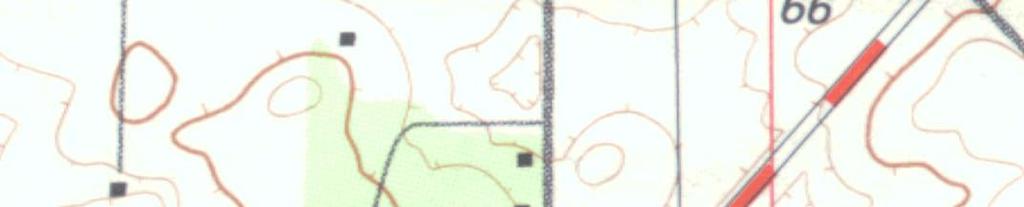


7 REVIEW USGS QUADRANGLE MAP Drainage Basin Divide Tc flow line


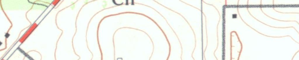
8 REVIEW NRCS SOILS MAP SITE Legend: CaB - Candler sand, 0 to 5 % slopes
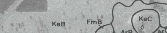
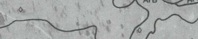
9 Table 3: Key SCS Characterization Data for Arredondo Sand [ArB (0-5% slopes)] This is a nearly level to sloping, well drained soil that occurs as both large and small areas in the upland. The water table is at a depth of more than 72 inches. Hydrologic Soil Group (HSG) A REPRESENTATIVE SOIL PROFILE Depth Soil Color & Texture Permeability 0-7in dark grayish brown sand 7-18 in mixed yellowish brown and dark yellowish brown sand in yellowish brown sand 12 to 40 ft/day in strong brown sand in strong brown loamy sand in strong brown y loam 4 to 12 ft/day
10 Minimum Requirements for Soils Reports Site-specific geotechnical data to include: Location of borings within or adjacent to pond. The geotechnical engineer should select the number of pond borings based on the size of the pond. For guidance on the number of borings, refer to page 162 of SJ93-SP10. Soil profiles with stabilized water table measurements at time of drilling Results of hydraulic conductivity tests (if performed). Report should also state type of hydraulic conductivity test performed and reference the location and depth of the test Explicit recommendations for each aquifer parameter
11 Estimating Aquifer Parameters Aquifer thickness: Refer to Section of SJRWMD SJ93-SP10 for the recommended type and number of soil borings. Also refer to this section for how the soil profile should be interpreted. Fillable porosity: Refer to Section of SJRWMD SJ93-SP10 for recommendations on how to estimate fillable porosity. Rules of thumb: 30% for HSG A, 25% for HSG B & C, and 20% for HSG D. Weighted horizontal hydraulic conductivity: Refer to Section of SJRWMD SJ93-SP10 for recommended test procedures and how the weighted average should be computed. Unsaturated vertical infiltration rate: use Double Ring Infiltrometer test (described later). Apply minimum safety factor of 2 to measured rate.
12 Estimating Aquifer Parameters (Continued) Seasonal high water table: Refer to Section of SJRWMD SJ93- SP10 for the recommended procedure. This technical procedure cross-references a paper I wrote on estimating the seasonal high water table. We will discuss this subject in some more detail in this workshop. Seasonal fluctuation of the water table: typically 3 to 4 ft in the pine flatwood soils and 6 ft or more in the sand ridge soils.
13 Typical Correlation Between Fines Fraction & Hydraulic Conductivity for Florida Fine Sands Hydraulic Conductivity (ft/day) Note: hydraulic conductivity also depends on cementation, color, roots, gradation, compaction, density, and other factors From Permeameter Tests on Poorly Graded Fine Sands to Silty Fine Sands in Florida Percent Passing U.S. No. 200 Sieve
Estimating the Seasonal High Water Table: A Mix of Art & Science
 Estimating the Seasonal High Water Table: A Mix of Art & Science PONDS WORKSHOP - SJRWMD Devo Seereeram, Ph.D., P.E. This paper was originally written over 4 years ago & generated a lot of interest. The
August 15, 2006 (Revised) July 3, 2006 Project No A
 July 3, 2006 Project No A") August 15, 2006 (Revised) July 3, 2006 Project No. 01-05-0854-101A Mr. David Reed, P.E. Protean Design Group 100 East Pine Street, Suite 306 Orlando, Florida 32801 Preliminary Soil Survey Report Polk Parkway
August 15, 2006 (Revised) July 3, 2006 Project No. 01-05-0854-101A Mr. David Reed, P.E. Protean Design Group 100 East Pine Street, Suite 306 Orlando, Florida 32801 Preliminary Soil Survey Report Polk Parkway
Report of Preliminary Geotechnical Engineering Investigation for Ponds
 Report of Preliminary Geotechnical Engineering Investigation for Ponds Segment 2: State Road 400 (SR 400)/Interstate 4 (I-4) from West of SR 528 (Beachline Expressway) to West of SR 435 (Kirkman Road)
Continuous Simulation Modeling of Stormwater Ponds, Lakes, & Wetlands: A BUILT-IN APPLICATION OF PONDS 3.2
 Continuous Simulation Modeling of Stormwater Ponds, Lakes, & Wetlands: A BUILT-IN APPLICATION OF PONDS 3.2 PRESENTED AT THE SFWMD WORKSHOP PRE-DEVELOPMENT VERSUS POST DEVELOPMENT RUNOFF VOLUME ANALYSIS
SUMMARY REPORT OF A GEOTECHNICAL SITE EXPLORATION LACROSSE CITRUS REPOSITORY LACROSSE, ALACHUA COUNTY, FLORIDA. GSE PROJECT No.
 SUMMARY REPORT OF A GEOTECHNICAL SITE EXPLORATION LACROSSE CITRUS REPOSITORY LACROSSE, ALACHUA COUNTY, FLORIDA GSE PROJECT No. 1128 Prepared For: BURE OF CITRUS BUDWOOD REGISTRATION SEPTEMBER 2011 Certificate
Applicant s Handbook, Volume II (including Appendices A through F`) is Incorporated by Reference in Rule , F.A.C.
 is Incorporated by Reference in Rule , F.A.C.") REFERENCES AND DESIGN AIDS FOR THE ENVIRONMENTAL RESOURCE PERMIT APPLICANT S HANDBOOK VOLUME II FOR USE WITHIN THE GEOGRAPHIC LIMITS OF THE NORTHWEST FLORIDA WATER MANAGEMENT DISTRICT Applicant s Handbook,
REFERENCES AND DESIGN AIDS FOR THE ENVIRONMENTAL RESOURCE PERMIT APPLICANT S HANDBOOK VOLUME II FOR USE WITHIN THE GEOGRAPHIC LIMITS OF THE NORTHWEST FLORIDA WATER MANAGEMENT DISTRICT Applicant s Handbook,
Stormwater Retention Pond Recovery Analysis
 Stormwater Retention Pond Recovery Analysis By Nicolas E Andreyev The first in a series of courses on Green Drainage Design www.suncam.com Page 1 of 33 Forward To design a stormwater retention pond, one
This report presents the findings of the subsurface exploration concerning the design of the taxiway rehabilitation. Description
 September 22, 2016 American Infrastructure Development, Inc. 3810 Northdale Boulevard, Suite 170 Tampa, Florida 33624 Attn: Mr. Mohsen Mohammadi, Ph.D., P.E. Senior Consultant Mob: (813) 244-6609 E-mail:
Subsurface Environmental Investigation
 Subsurface Environmental Investigation Lake Development East Lake and 21 st Avenue South February 23, 201 Terracon Project No. MP14738A Prepared for: Minneapolis Public Schools Prepared by: Terracon Consultants,
Determination of Design Infiltration Rates for the Sizing of Infiltration based Green Infrastructure Facilities
 Determination of Design Infiltration Rates for the Sizing of Infiltration based Green Infrastructure Facilities 1 Introduction This document, developed by the San Francisco Public Utilities Commission
REPORT OF GEOTECHNICAL EXPLORATION AND ENGINEERING ANALYSIS
 FIGURE 3 Geotechnical Report (2) REPORT OF GEOTECHNICAL EXPLORATION AND ENGINEERING ANALYSIS RIVER TOWER RESTORATION RIVER TOWER PARK TAMPA, FLORIDA AREHNA PROJECT NO. B-13-002 February 22, 2013 Prepared
November 13, IP3406. Mr. Uriah Sowell Rooney Engineering 115 Inverness Drive East, Suite 300, Englewood, CO 80112
 November 13, 2015 103IP3406 Mr. Uriah Sowell Rooney Engineering 115 Inverness Drive East, Suite 300, Englewood, CO 80112 Subject: Infiltration Testing Gates Road Valve Site Sunoco Pennsylvania Pipeline
Typical Subsurface Profile. November 28, 2016
 November 28, 2016 RSCCD Facility Planning, District Construction and Support Services 2323 N. Broadway, Suite 112, Santa Ana, CA 92706 Attn: Re: Ms. Allison Coburn Facilities Project Manager P: (714) 480-7530
Infiltration Testing For Stormwater BMPs: What Would Mickey Mouse Do?
 Infiltration Testing For Stormwater BMPs: What Would Mickey Mouse Do? CCLC Turning A New Leaf November 3, 2017 David J. Hirschman Hirschman Water & Environment, LLC www.hirschmanwater.com dave@hirschmanwater.com
HYDRIC SOILS. By Neal Svendsen Resource Soil Scientist Natural Resources Conservation Service Sept 2006
 HYDRIC SOILS By Neal Svendsen Resource Soil Scientist Natural Resources Conservation Service Sept 2006 Wetlands and Hydric Soils The term hydric soils proposed by Cowardin in 1979 Classification of Wetlands
SECTION 1 BIO-INFILTRATION BUMP OUTS (BIBO)
") SECTION 1 BIO-INFILTRATION BUMP OUTS (BIBO) This guide specification for U.S. applications describes construction of bio-infiltration bump outs (or bioretention ) systems. From the surface down to the
SECTION 1 BIO-INFILTRATION BUMP OUTS (BIBO) This guide specification for U.S. applications describes construction of bio-infiltration bump outs (or bioretention ) systems. From the surface down to the
APPENDIX D EXTINCTION-DEPTH DETERMINATION
 APPENDIX D EXTINCTION-DEPTH DETERMINATION by Robert Freese SJRWMD 1 Page Intentionally Blank 2 EXTINCTION-DEPTH DETERMINATION Shah et al. (2007) define extinction depth as the depth to water table at which
APPENDIX A DRAINAGE STUDY PHASE 2 ALTERNATIVE IMPROVEMENTS CRYSTAL LAKE ALTERNATIVE 4C IMPROVEMENTS LAKEWOOD PIRATELAND SWASH HORRY COUNTY, SC
 DRAINAGE STUDY PHASE ALTERNATIVE IMPROVEMENTS CRYSTAL LAKE ALTERNATIVE C IMPROVEMENTS ` FOR: LAKEWOOD PIRATELAND SWASH HORRY COUNTY, SC APPENDIX A J-.000 Prepared by: Savannah, GA Charleston, SC Myrtle
November 13, IP3406. Mr. Uriah Sowell Rooney Engineering 115 Inverness Drive East, Suite 300, Englewood, CO 80112
 November 13, 2015 103IP3406 Mr. Uriah Sowell Rooney Engineering 115 Inverness Drive East, Suite 300, Englewood, CO 80112 Subject: Infiltration Testing Hopeland Road Valve Site Sunoco Pennsylvania Pipeline
Background Information on the. Peace River Basin
 Background Information on the Peace River Basin Resource Conservation & Development Department August 24 Background Physiography The Peace River drainage basin occupies large parts of Polk, Hardee, DeSoto,
Jacobi, Toombs, and Lanz, Inc.
 Area 5: Blackiston Mill Road at Dead Man's Hollow Flooding Assessment Jacobi, Toombs, and Lanz, Inc. This document summarizes an assessment of drainage and flooding concerns and provides recommendations
Ardaman & Associates, Inc. Geotechnical, Environmental and Materials Consultants
 SUBSURFACE SOIL EXPLORATION ANALYSIS AND RECOMMENDATIONS PROPOSED WEIRS AT STATIONS 130+00 AND 16+00 DRAINAGE IMPROVEMENTS TO THE FOUR CORNERS MSBU HENDRY COUNTY, FLORIDA Ardaman & Associates, Inc. Geotechnical,
GREEN CITY, CLEAN WATERS
 GREEN CITY, CLEAN WATERS Investigation of Infiltration in Unsaturated Urban Fill Material VUSP Pennsylvania Stormwater Symposium October 15, 2015 Dan O Rourke, CDM Smith Jason Cruz, Philadelphia Water
Re: Geotechnical Consultation for Storm Infiltration Robert Louis Stevenson ES Modernization th Avenue San Francisco, California
 Date: August 4, 2015 Project No.: 608-4-2 Prepared For: Mr. Sajeev Madhaven, AIA SAN FRANCISCO UNIFIED SCHOOL DISTRICT 135 Van Ness Avenue - Room 207a San Francisco, California 94102 Re: Geotechnical Consultation
Septic Tank Soil Treatment Systems
 Bulletin 939 Septic Tank Soil Treatment Systems for Ohio Rural Homes Copyright 2009, The Ohio State University Ohio State University Extension embraces human diversity and is committed to ensuring that
April 7, Webster Street Sub-Surface Stormwater Storage System Bid No Bid Date: 4/13/17 ADDENDUM NO 1
 PUBLIC WORKS DEPARTMENT David A. Jones, P.E., Director April 7, 2017 Webster Street Sub-Surface Stormwater Storage System Bid No. 2017-022 Bid Date: 4/13/17 ADDENDUM NO 1 Please make the following changes
Report of Geotechnical Engineering Investigation OIA SOUTH CELL LOT (W340) AID Project No. GOA16001 Orange County, Florida GEC Project No.
 AID Project No. GOA16001 Orange County, Florida GEC Project No.") Report of Geotechnical Engineering Investigation OIA SOUTH CELL LOT (W40) AID Project No. GOA16001 Orange County, Florida GEC Project No. 956G July 6, 2017 American Infrastructure Development, Inc. 7 North
Report of Geotechnical Engineering Investigation OIA SOUTH CELL LOT (W40) AID Project No. GOA16001 Orange County, Florida GEC Project No. 956G July 6, 2017 American Infrastructure Development, Inc. 7 North
CEEN Geotechnical Engineering
 CEEN 3160 - Geotechnical Engineering Lab Report 1 Soil Classification prepared by Student Name 1 Student Name 2 Student Name 3 Student Name 4 Tuesday Lab Time 9:30 10:45 Lab Team 1 Submission Date INTRODUCTION
A. Exemptions from the Geotechnical/Geological Engineering Report submittal requirements are:
 CHAPTER 800. SECTION 807. NATURAL AND CULTURAL RESOURCES PROTECTION SOILS AND GEOTECHNICAL HAZARDS 807.1. Intent and Purpose The intent and purpose of this section is to evaluate the suitability of soils
RI Site Specific Soil Mapping Standards and Procedures
 RI Site Specific Soil Mapping Standards and Procedures Understanding Hydrologic Soil Groups and Site Specific Mapping URI Coastal Institute, Kingston June 28 th 2012 Jillian Phillips URI Cooperative Extension
In preparation for constructing buildings on a property, the builder. Site Preparation CHAPTER
 CHAPTER 3 Site Preparation In preparation for constructing buildings on a property, the builder must consider a number of factors related to code requirements. The buildings must be located according to
Geotechnical Engineering Report
 Geotechnical Engineering Report Turner Turnpike Widening Milepost 210 to 218 Drainage Structure Pipe Jacking Creek County, Oklahoma July 1, 2016 Terracon Project No. 04165017 Prepared for: Benham Tulsa,
University of Florida Conservation Areas Land Management Plan Trillium Slope (Golf Course Woods)
") University of Florida Conservation Areas Land Management Plan Trillium Slope (Golf Course Woods) Introduction Trillium Slope (Golf Course Woods) is a 4.9-acre Conservation Area named after a plant that
University of Florida Conservation Areas Land Management Plan Trillium Slope (Golf Course Woods) Introduction Trillium Slope (Golf Course Woods) is a 4.9-acre Conservation Area named after a plant that
CITY OF MONTCLAIR Montclair Civic Center 5111 Benito Street Montclair, CA 91763
 CITY OF MONTCLAIR Montclair Civic Center 5111 Benito Street Montclair, CA 91763 I. Introduction Water Quality A National, State, and Local Concern Throughout the United States, many rivers, creeks, streams,
Earth Mechanics, Inc. Geotechnical & Earthquake Engineering
 Earth Mechanics, Inc. Geotechnical & Earthquake Engineering TECHNICAL MEMORANDUM DATE: June 3, 2009 EMI PROJECT NO: 01-143 TO: COPY: FROM: SUBJECT: John Chun, P.E. / Port of Long Beach (POLB) Jorge Castillo
 FIGURES Printed By: aday Print Date: 3/23/2011 12:48:08 PM File Name: \\geodesign.local\files\jobs\m-r\penskeauto\penskeauto-1\penskeauto-1-01\figures\cad\penskeauto-1-01-vm01.dwg Layout: FIGURE 1 VICINITY
For. Report of Geotechnical Exploration. University of North Florida Parking Lot 47 Jacksonville, Florida
 Report of Geotechnical Exploration For University of North Florida Parking Lot 47 Jacksonville, Florida MAE Project No. 0019-0009 April 5, 2017 Revised: April 6, 2017 Prepared for: Prepared by: Jacksonville,
Water Well Report. Site Name
 Prepared for: Banks Environmental Data 1601 Rio Grande Ste 500 Austin, TX 78701 Water Well Report Roseland Park Baytown, TX 77520 PO #: 999888-11150 Table of Contents Geographic Summary 3 Maps Summary
9. SOIL PERMEABILITY. 9.0 Why is it important to determine soil permeability?
 9. SOIL PERMEABILITY 9.0 Why is it important to determine soil permeability? Soil permeability is the property of the soil to transmit water and air and is one of the most important qualities to consider
For. Report of Geotechnical Exploration. Beaver St Lane Ave to Carnegie St Trans Water Main Project Jacksonville, FL
 Report of Geotechnical Exploration For Beaver St Lane Ave to Carnegie St Trans Water Main Project Jacksonville, FL MAE Project No. 0106-0002.02 March 30, 2017 Prepared for: CPH, Inc. 5200 Belfort Road,
GEOTECHNICAL INVESTIGATION I-15 SIGN BRIDGES LAS VEGAS EA JANUARY
 GEOTECHNICAL INVESTIGATION I-15 SIGN BRIDGES LAS VEGAS EA 73171 JANUARY 06 MATERIALS DIVISION STATE OF NEVADA DEPARTMENT OF TRANSPORTATION MATERIALS DIVISION GEOTECHNICAL SECTION GEOTECHNICAL REPORT I-15
For. Report of Geotechnical Exploration. University of North Florida Parking Lot 11 Jacksonville, Florida
 Report of Geotechnical Exploration For University of North Florida Parking Lot 11 Jacksonville, Florida MAE Project No. 0019-0008 January 13, 2017 Prepared for: GAI Consultants 1301 Riverplace Boulevard,
Urban Soil Conservation and Management
 Urban Soil Conservation and Management Urban Soil include those located in: Cities in park areas Recreation areas Community gardens Green belts Lawns Septic absorption fields Sediment basins We need a
WETLAND DELINEATION REPORT
 WETLAND DELINEATION REPORT WHITMORE LAKE LOT WASHTENAW COUNTY, MICHIGAN JULY 2015 PREPARED FOR: WASHTENAW COUNTY PARKS AND RECREATION 2230 SOUTH PLATT ROAD ANN ARBOR, MICHIGAN 48104 PREPARED BY: THE MANNIK
STORMWATER MANAGEMENT. 158 Attachment 2. Borough of Perkasie
 158 Attachment 2 Borough of Perkasie Appendix B Site Soil Evaluation and Soil Infiltration Testing Source: Pennsylvania Stormwater Best Management Practice Manual, December 2006. SITE SOIL EVALUATION AND
Section 1I-3 - Bioswales
 BIOSWALES (Numbering pending) These specifications compliment the bioswale design portion of the Iowa Stormwater Management Manual in Chapter 2, Section 2I-3. Sections of the following documents, as referenced
GEOTECHNICAL REPORT B-1942
 GEOTECHNICAL REPORT TUSCARORA BRIDGE REPLACEMENT B-1942 E.A. 73561 March 2011 MATERIALS DIVISION STATE OF NEVADA DEPARTMENT OF TRANSPORTATION MATERIALS DIVISION GEOTECHNICAL SECTION GEOTECHNICAL REPORT
Tesoro Anacortes Refinery Clean Products Upgrade Project Draft Environmental Impact Statement APPENDIX 2-D: GEOTECHNICAL DRAWINGS
 Tesoro Anacortes Refinery Clean Products Upgrade Project Draft Environmental Impact Statement APPENDIX 2-D: GEOTECHNICAL DRAWINGS March 17 Tesoro Anacortes Refinery Clean Products Upgrade Project Draft
Treatment Volume: Curve Numbers. Composite CN or Not? Treatment Volume: Curve Numbers. Treatment Volume: Calculation. Treatment Volume: Calculation
 Stormwater Engineering Bioretention Design Bill Hunt, PE, Ph.D. Extension Specialist & Assistant Professor NCSU-BAE www.bae.ncsu.edu/stormwater Bioretention Design Six Step Process 1 Determine Volume to
Differential Black Walnut Growth on a Recommended Soil Map Unit: Investigation of Related Soil Chemical and Physical Properties
 University of Kentucky UKnowledge Agronomy Notes Plant and Soil Sciences 1996 Differential Black Walnut Growth on a Recommended Soil Map Unit: Investigation of Related Soil Chemical and Physical Properties
Precipitation Surface Cover Topography Soil Properties
 Precipitation Surface Cover Topography Soil Properties Intrinsic capacity of rainfall to cause erosion Influenced by Amount, intensity, terminal velocity, drop size and drop size distribution of rain.
City of Dade City AMEC Project No Dade City Stormwater Master Plan September 2012 Page 11
 Page 11 1.0 INTRODUCTION This report was prepared for the City of Dade City to provide an overview of the existing stormwater management challenges that the City faces. The report is intended to assist
Effect of Land Surface on Runoff Generation
 Effect of Land Surface on Runoff Generation Context: Hydrologic Cycle Runoff vs Infiltration Infiltration: Process by which water on the ground surface enters the soil Runoff: Water (from rain, snowmelt,
Measured Water Losses of Lateral A in Hidalgo County Irrigation District No. 2
 COLLEGE OF AGRICULTURE AND LIFE SCIENCES TR-74 011 Measured Water Losses of Lateral A in Hidalgo County Irrigation District No. By: Eric Leigh, Extension Associate and Guy Fipps, P.E., Extension Agricultural
APPENDIX E. LESA Models
 APPENDIX E LESA Models LESA ASSESSMENT CALEXICO SOLAR FARM I PHASE A PROJECT AREA CALEXICO SOLAR FARM I PHASE A PROJECT (SW/4 Section 13, S/2 Section 14, S/2 NE/4 Section 15, NW/4 Section 15, T17S, R13E,
Infiltration Guidelines
 Appendix E Infiltration Guidelines As a stormwater management method, infiltration means retaining or detaining water within soils to reduce runoff. Infiltration can be a cost-effective method to manage
Ponding Test Results Seepage and Total Losses, North Alamo Main Canal Hidalgo County Irrigation District No. 2
 TR-324 2008 Ponding Test Results Seepage and Total Losses, North Alamo Main Canal Hidalgo County Irrigation District No. 2 Eric Leigh Texas AgriLife Extension Associate, Biological and Agricultural Engineering,
ATTACHMENT 4 USDA NRCS HYDRIC SOIL UNIT DESCRIPTIONS
 ATTACHMENT 4 USDA NRCS HYDRIC SOIL UNIT DESCRIPTIONS USDA NRCS descriptions of the 23 wetland soil units (hydric soils and soils with hydric inclusions) That occur within the proposed Marble River Wind
Geotechnical Engineering Report
 Geotechnical Engineering Report Pavement Subgrade Survey State Highway 125 over Hudson Creek Ottawa County, Oklahoma September 23, 21 Terracon Project No. 415121 Prepared for: Guy Engineering Services,
geotechnical and construction materials consultants
 geotechnical and construction materials consultants City of Dallas Public Works and Transportation Department 320 E. Jefferson Blvd, Room 307 Dallas, Texas 75203 ATTN: Mr. Vincent Lewis, P.E. Email: Vincent.lewis@dallascityhall.com
PARKING LOTS 4, 7, AND 8 RECONSTRUCTION REPORT
 PARKING LOTS 4, 7, AND 8 RECONSTRUCTION REPORT Converse Project No. 15-81-177-01 Prepared For: David Evans and Associates, Inc. 17782 17th Street, Suite 200 Tustin, California 92780 Prepared By: 10391
Work Plan EAS Components
 October 27, 2010 Work Plan EAS Components Completed Tasks: Organization, Background Investigation and Comparison of Review Criteria (B1) Ecological Assessments and Database Compilation (B2) Data Evaluation
GEOTECHNICAL STUDY PROPOSED CONCRETE ROADWAY TIKI ISLAND COMMUNITY GALVESTON COUNTY, TEXAS PROJECT NO E
 GEOTECHNICAL STUDY PROPOSED CONCRETE ROADWAY TIKI ISLAND COMMUNITY GALVESTON COUNTY, TEXAS PROJECT NO. 15-945E TO VILLAGE OF TIKI ISLAND TIKI ISLAND, TEXAS BY SERVICING TEXAS, LOUISIANA, NEW MEXICO, OKLAHOMA
SOIL MECHANICS Assignment #2: Soil Classification Solution.
 Geotechnical Engineering Research Laboratory One University Avenue Lowell, Massachusetts 01854 Edward L. Hajduk, D.Eng, PE Lecturer PA105D Tel: (978) 934 2621 Fax: (978) 934 3052 e mail: Edward_Hajduk@uml.edu
TIERRA TIERRA, INC. November 19, TPA Group LLC 3350 Riverwood Parkway, Suite 750 Atlanta, Georgia 30339
 ovember 9, TIERRA TPA Group LLC Riverwood Parkway, Suite 7 Atlanta, Georgia 9 Attn: Mr. Paul Michael Mr. Charlie Otero (Otero Engineering) RE: Report of Geotechnical Engineering Services orthpointe Mass
FIRM NAME DESIGNER: CHECKER: DATE: FPID #: DESCRIPTION: COUNTY: DRAINAGE DESIGN CHECKLIST. Designers Initials. Checkers Initials.
 I. Drainage Report A. Executive Summary - Brief Overview of Project Drainage Design B. Project Description 1. Existing Conditions 2. Proposed Project Conditions 3. Project Justification Narrative - Basin
Applied GeoScience, Inc Hammond Dr., Suite 6 Schaumburg, Illinois
 AGI Project No. 13-109B Subsurface Investigation Report For the Proposed Roosevelt Middle School Site Improvements 7560 Oak Avenue River Forest, Illinois Prepared for Mr. Jerry Pilipowicz Terra Engineering,
PRELIMINARY ENGINEERING DESIGN MEMORANDUM WATER TREATMENT PLANT FLOOD WALL TO PROTECT BACKWASH SETTLING BASIN CITY OF NEW BUFFALO, MI
 PRELIMINARY ENGINEERING DESIGN MEMORANDUM WATER TREATMENT PLANT FLOOD WALL TO PROTECT BACKWASH SETTLING BASIN CITY OF NEW BUFFALO, MI City of New Buffalo, MI Preliminary Engineering Design Memorandum Water
The following sections provide the approved standard infiltration testing specifications.
 APPENDIX F.2 INFILTRATION TESTING To properly size and locate stormwater management facilities, it is necessary to characterize the soil infiltration conditions at the location of the proposed facility.
PHYSICAL SOIL PROPERTIES
 PHYSICAL SOIL PROPERTIES Physical Soil Properties Santa Cruz County, California Scotts Valley Target Physical Soil Properties This table shows estimates of some physical characteristics and features that
Site Location. Figure 1: Site Location Map US-24 and I-275 Interchange Ash Township, Monroe County, Michigan
 Site Location 0606 1771 North Dixie Highway Monroe, Michigan 48162 Tel: 734-289-2200 Fax: 734-289-2345 www.manniksmithgroup.com Figure 1: Site Location Map US-24 and I-275 Interchange Ash Township, Monroe
ENGINEERING SERVICES REPORT FOREST LAKES BOULEVARD PAVEMENT EVALUATION TAMPA ROAD TO COUNTY LINE FOR PINELLAS COUNTY, FL. May 21, 2010 URS CORPORATION
 ENGINEERING SERVICES REPORT FOREST LAKES BOULEVARD PAVEMENT EVALUATION TAMPA ROAD TO COUNTY LINE FOR PINELLAS COUNTY, FL May 21, 2010 URS CORPORATION May 21, 2010 Mr. Brent D. Hall Senior Department Administrative
SPECIFICATIONS FOR PRECAST MODULAR BLOCK RETAINING WALL SYSTEM (revised 5/8/7)
") Page 1 of 7 STONE STRONG SYSTEMS SPECIFICATIONS FOR PRECAST MODULAR BLOCK RETAINING WALL SYSTEM (revised 5/8/7) PART 1: GENERAL 1.01 Description A. Work includes furnishing and installing precast modular
Page 1 of 7 STONE STRONG SYSTEMS SPECIFICATIONS FOR PRECAST MODULAR BLOCK RETAINING WALL SYSTEM (revised 5/8/7) PART 1: GENERAL 1.01 Description A. Work includes furnishing and installing precast modular
Earthen Manure Storage Seepage
 July 2001 Agdex 729-1 Earthen Manure Storage Seepage A Study of Five Typical Sites With the increasing concerns about manure storage in agriculture, a study was done to look into manure seepage from several
File No Supplemental November Geotechnical and Environmental Consulting Engineers
 Supplemental Information & Geotechnical Recommendations Proposed New Solar Valley Location B (East of Building No. 7) Cañada Community College 4200 Farm Hill Boulevard Submitted to: Mr. Peter Hempel Construction
GEOTECHNICAL INVESTIGATION For PROPOSED OUTDOOR THEATER 495 Upper Park Road APN Santa Cruz, California
 GEOTECHNICAL INVESTIGATION For PROPOSED OUTDOOR THEATER 495 Upper Park Road APN 009-301-06 Santa Cruz, California Prepared For SANTA CRUZ SHAKESPEAR Santa Cruz, California Prepared By DEES & ASSOCIATES,
PROJECT NO A. ISSUED: February 29, 2016
 INTERPRETIVE REPORT FOR INFILTRATION SYSTEM DESIGN, PROPOSED VILLA VERONA APARTMENT COMMUNITY, ASSESSOR S PARCEL NUMBERS 311-040-015, 311-040-021, 311-040-024, 311-040-026 AND 311-040-013, LOCATED ON THE
Design and Operation of Landfills
 Design and Operation of Landfills Soils and hydrogeology Site selection criteria Site layout and landfill operations Liner design Water balance Biological reactions in landfills Leachate quality Gas production
REPORT OF SUBSURFACE EXPLORATION AND GEOTECHNICAL ENGINEERING SERVICES
 REPORT OF SUBSURFACE EXPLORATION AND GEOTECHNICAL ENGINEERING SERVICES Addendum No.1 5 th Bay Ocean View Norfolk, Virginia G E T Project No: VB15-342G November 18, 2016 PREPARED FOR: 204 Grayson Road Virginia
PRELIMINARY GEOTECHNICAL INVESTIGATION UCCS PARKING GARAGE STANTON STREET AND AUSTIN BLUFFS PARKWAY COLORADO SPRINGS, COLORADO
 PRELIMINARY GEOTECHNICAL INVESTIGATION UCCS PARKING GARAGE STANTON STREET AND AUSTIN BLUFFS PARKWAY COLORADO SPRINGS, COLORADO Prepared for: UNIVERSITY OF COLORADO AT COLORADO SPRINGS Facilities Services
An Explanation of the Hydric Soil Technical Standard and Normal Precipitation
 An Explanation of the Hydric Soil Technical Standard and Normal Precipitation From: National Technical Committee for Hydric Soils. 2001. Hydric Soil Technical Standard (Technical Note 11). http://soils.usda.gov/soil_us
Soil Compaction. By: Kelly Patches Soils 401 April 8, 2009
 Soil Compaction By: Kelly Patches Soils 401 April 8, 2009 The Problem 3 acre field on my family s dairy farm has compaction Compaction forms a hardpan increase bulk density decrease pore space ponding/runoff
INFLOW DESIGN FLOOD CONTROL SYSTEM PLAN PLANT GREENE COUNTY ASH POND ALABMA POWER COMPANY
 INFLOW DESIGN FLOOD CONTROL SYSTEM PLAN PLANT GREENE COUNTY ASH POND ALABMA POWER COMPANY Section 257.82 of EPA s regulations requires the owner or operator of an existing or new CCR surface impoundment
DUCTILE IRON PILES ARE HIGHLY EFFECTIVE, FAST AND VERSATILE MODULAR DRIVEN MICROPILE SYSTEMS
 DUCTILE IRON PILES DUCTILE IRON PILES ARE HIGHLY EFFECTIVE, FAST AND VERSATILE MODULAR DRIVEN MICROPILE SYSTEMS Designed to resist both compression and tension loads in either end-bearing or friction,
Sent: Friday, June 24, :17 PM. Subject: RE: Southwood 4 - Monitoring Well update
 Sent: Friday, June 24, 2016 5:17 PM Subject: RE: Southwood 4 - Monitoring Well update Please see attached for a copy of our Draft Borehole Logs, Draft Borehole Location Plan and Interim Ground Water Monitoring
BCOSSA Technical Review Committee Technical Bulletin
 BCOSSA Technical Review Committee Technical Bulletin Title: Site Capability Tables Subject: Provides the Site Capability Table standards of the SPM V2 in a more accessible format, with a summary table
DRIP EMITTER SYSTEM STUDY GUIDE
 DRIP EMITTER SYSTEM STUDY GUIDE Minimum Criteria for Pressurized Subsurface Absorption Fields Utilizing Emitters. Subsurface systems utilizing emitters may be used in lieu of conventional or other alternative
STORMWATER HYDROLOGY
 ..CHAPTER.. STORMWATER HYDROLOGY 3.1 Introduction to Hydrologic Methods Hydrology is the science dealing with the characteristics, distribution, and movement of water on and below the earth's surface and
INFLOW DESIGN FLOOD CONTROL SYSTEM PLAN PLANT BARRY ASH POND ALABAMA POWER COMPANY
 INFLOW DESIGN FLOOD CONTROL SYSTEM PLAN PLANT BARRY ASH POND ALABAMA POWER COMPANY Section 257.82 of EPA s regulations requires the owner or operator of an existing or new CCR surface impoundment or any
Standards for Soil Erosion and Sediment Control in New Jersey May 2012 STANDARD FOR GRASSED WATERWAYS. Definition. Purpose
 STANDARD FOR GRASSED WATERWAYS Definition A natural or constructed watercourse shaped or graded in earth materials and stabilized with suitable vegetation for the safe conveyance of runoff water. Purpose
Bioreactor Landfill Design
 Bioreactor Landfill Design Timothy Townsend, PhD, PE Department of Environmental Engineering Sciences University of Florida ttown@ufl.edu Bioreactor Landfill Design Modern landfill design entails many
Characterizing Engineering Properties of Foundry Sands
 Characterizing Engineering Properties of Foundry Sands Craig H. Benson, PhD, PE Recycled Materials Resource Center University of Washington chbenson@u.washington.edu www.recycledmaterials.org Recycled
4.1 General Methodology and Data Base Development
 Chapter 4 METHODOLOGY 4.1 General and Data Base Development This report project utilized several computer software models and analysis techniques to create the numeric data on which decisions for this
Appendix A. Infiltration and Soil Texture Testing Methods. Appendix A. A.1 General Description. A.2 Infiltration Testing: A Four-Step Process
 Infiltration and Soil Texture Testing Methods A.1 General Description Appendix A A.2 Infiltration Testing: A Four-Step Process A.3 Other Soil Tests A.3.1 Soil Compaction Bulk Density Tests A.3.2 Soil Contamination
SepticDesign.ca Gunnell Engineering Ltd.
 SepticDesign.ca Gunnell Engineering Ltd. Presentation Summary Best Practices Code Context Prior to Attending the Site When on Site Site Assessment Assessing Existing Sewage Systems The Septic Test Pit
B. Install storm drain inlet protection to prevent clogging of the stormsewer and sediment loads to downstream stormwater facilities or waterbodies.
 The language provided in these specifications is meant to serve as a reminder and provide a generic example of the type of language that should be provided in final construction documents. This language
Preliminary Geotechnical Exploration Armstrong Tract Rivers Avenue and Hanahan Road North Charleston, South Carolina S&ME Project No.
 Preliminary Geotechnical Exploration Rivers Avenue and Hanahan Road S&ME Project No. 4213-16-016 Prepared for: Charleston Water System 103 Saint Phillip Street Charleston, South Carolina 29403 Prepared
Green Station CCR Surface Impoundment Sebree Generating Station Address: 9000 Highway 2096 Robards, Kentucky 42452
 Big Rivers Electric Corporation Disposal of Coal Combustion Residuals (CCR) from Electric Utilities Final Rule CCR Impoundment Groundwater Monitoring System and Statistical Methods Assessment and Certification
U.S. Army Corps of Engineers Jacksonville District Sediment Quality Control/Quality Assurance Plan For Maintenance Dredging with Beach Placement
 U.S. Army Corps of Engineers Jacksonville District Sediment Quality Control/Quality Assurance Plan For Maintenance Dredging with Beach Placement Name of Project: Maintenance Dredging AIWW Vicinity Jupiter
NORTH CAROLINA DEPARTMENT OF HEALTH AND HUMAN SERVICES DIVISION OF PUBLIC HEALTH ENVIRONMENTAL HEALTH SECTION ON-SITE WATER PROTECTION BRANCH
 NORTH CAROLINA DEPARTMENT OF HEALTH AND HUMAN SERVICES DIVISION OF PUBLIC HEALTH ENVIRONMENTAL HEALTH SECTION ON-SITE WATER PROTECTION BRANCH INNOVATIVE WASTEWATER SYSTEM APPROVAL INNOVATIVE WASTEWATER