PWD s Systematic Watershed-wide Approach to Stormwater Mgmt.
|
|
|
- Tracy Oliver
- 5 years ago
- Views:
Transcription


1 PWD s Systematic Watershed-wide Approach to Stormwater Mgmt. Jeffrey Featherstone, PhD Director, Center for Sustainable Communities, Temple University Paul DeBarry, PE, PH, GISP, D.WRE Director, Geospatial Data Technologies and Watershed Mgmt., NTM Engineering Joanne Dahme, General Manager Public Affairs, Philadelphia Water Department Richard Fromuth, P.E. Senior Research Associate, Center for Sustainable Communities, Temple University.

2 Agenda: 1. PWD Watersheds & Studies/Plans 2. Typical Procedure for Development of a Comprehensive Stormwater Management Plan
3
4 Coordinated efforts: Act 167 SW Mgmt. Plans GIS Mapping, Watershed Hydrologic Modeling Model Stormwater Ordinance Plan of Action for SW Mgmt. & Retrofitting River Conservation Plans Resource Inventory Management Options (stream clean-ups, protect open space, protect stream corridors) Comprehensive Characterization Reports Water Quality Sampling Habitat Assessment Indicator Status Update Integrated Watershed Mgmt. Plans Restore Impaired Water Quality Multi-faceted Approach (Stream Restoration, BMPs, CSO Rehab) Stream Assessment Study s Trail Master Plans Other Studies
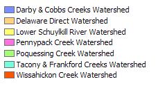
5 Darby-Cobbs Delaware R. Pennypack Poquessing Tookany/Tacony- Frankford Schuylkill R. Wissahickon Act 167 SW Mgmt. Plans River Conservation Plan Comprehensive Characterization Reports Integrated Watershed Mgmt. Plans Stream Assessment Study Source Water Assessment Other Studies
6 Timeline: Comprehensive Act 167 Stormwater Management Plans Darby-Cobbs Creeks Act 167 SW Mgmt. Plan (Delaware Co. Lead), 2004 Development of Philadelphia Stormwater Standards from Darby-Cobbs Ordinance, 2005 Tookany/Tacony-Frankford Act 167 Act 167 SW Mgmt. Plan, 2008 Pennypack Creek Act 167 SW Mgmt. Plan, 2013 Poquessing Creek Act 167 Act 167 SW Mgmt. Plan, 2013 Wissahickon Creek Act 167 SW Mgmt. Plan, 2014

7 The Watershed Stormwater Management Plans: 1. Evaluate Existing Studies/Data 2. Adjust DEM 3. Identify and Map Stormwater Problems 4. Map Streams 5. Map Obstructions 6. Collect Hydrologic Data 7. Develop Land Use Scenarios 8. GIS/Hydrologic Model Development 9. ID Stormwater Improvements 10.Develop Management Areas/Criteria 11. Develop Model SW Ordinance 12. Plan of Action

8 Plans Have to Account for Past Neglect 283 linear miles of streams 118 linear miles of streams 73% Piped
9


10 Sample Comprehensive Stormwater Management Plan: Wissahickon Creek Watershed


11 Related Documents/ Studies: An Integrated Watershed Management Plan A Comprehensive Characterization of the Water Quality, Habitat and Biology Sandy Run Act 167 Plan River Conservation Plan


12 Related Documents/ Studies: Floodplain Mapping Study: Sandy Run and Ambler Area Watersheds Fort Washington Area Flooding and Transportation Improvement Study A 'Special Area Management Plan Detention Basin Inventory and Retrofit Program Friends of Wissahickon Inventory
13 GIS Data County and municipal boundaries Road centerlines Streams Water bodies Watershed boundary Wetlands Source PennDOT, PASDA PennDOT or DVRPC PWD PWD, PAMAP Delineated from LiDAR DEM from PAMAP U.S. Fish and Wildlife Service National Wetlands Inventory (NWI), PWD High Resolution Digital Ortho PAMAP , DVRPC Photographs Digital Elevation Model (DEM) LiDAR from PAMAP Program Existing Land Use DVRPC Future Land Use DVPRC, CSC Impervious Surface Areas PWD Hydrologic Soil Groups NRCS, PWD Geology USGS, PWD Obstructions PWD, CSC, FEMA, Municipalities Floodplains (FEMA Q3) FEMA


14 LiDAR data from PAMAP do not have stream break lines for small tributaries. This is needed for hydraulic modeling. Contractor (BAE) hired to add break lines for areas where hydraulic modeling and flood mapping is funded. (Ambler area at this time)
15 Municipal Participation Data Collection Forms
16

17 Problems in the Watershed Floodplain encroachment Undersized storm drains Undersized stream channels Erosion/Sedimentation Water Quality/Pollution Existing Ordinances Others????

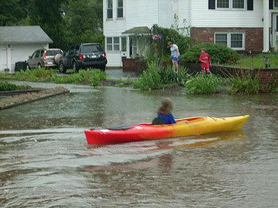
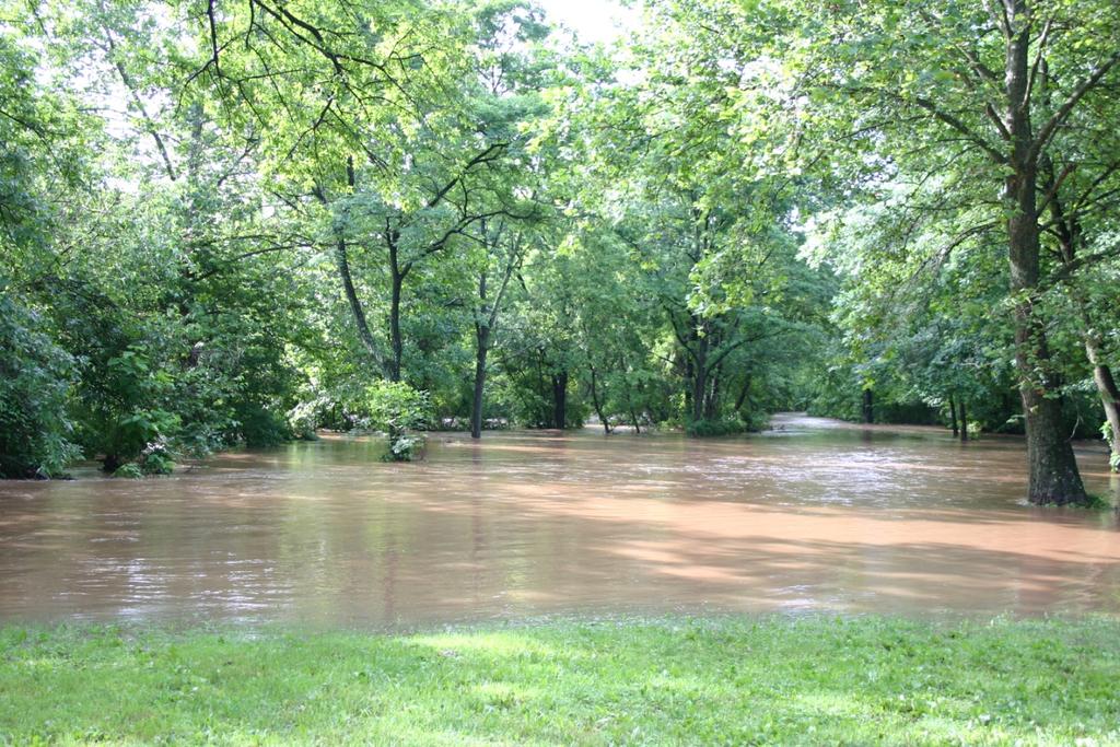

18 Flooding

19 Undersized or Blocked Storm Drains


20 Erosion / Sedimentation Problem Area

21 Water Quality Problem Area


22 Existing detention basins were ID d from aerial photography

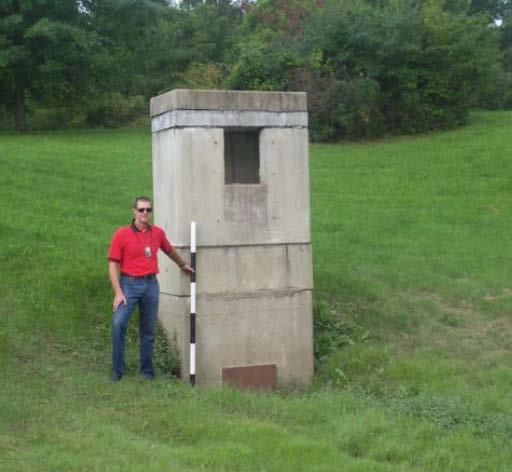

23 Data was collected on the dimensions and outlet structures

24 Volumes were determined by overlaying LiDAR Contours on digital aerials and Stage- Storage- Discharge data was incorporated into the hydrologic model.


25 FEMA FIS data was collected and the floodplains utilized to ID problem areas, inundated structures, loss, etc.
26 Structures within Wissahickon Watershed Floodplains Municipality Building Footprints in Floodplain 100 Year 500 Year Abington Ambler Cheltenham 0 0 Horsham 0 0 Lansdale Lower Gwynedd Montgomery 6 6 North Wales 5 66 Philadelphia 5 16 Springfield Upper Dublin Upper Gwynedd Upper Moreland 0 0 Whitemarsh Whitpain Worcester 0 0 Total

27 Stormwater Problems Flood Damage Flood Insurance Payments: January 1978 March 2010 Total paid claims = 610 Total payments = $26.2 Million Flood Insurance Data provided by FEMA. Total claims payments do not represent all flood damage. 27

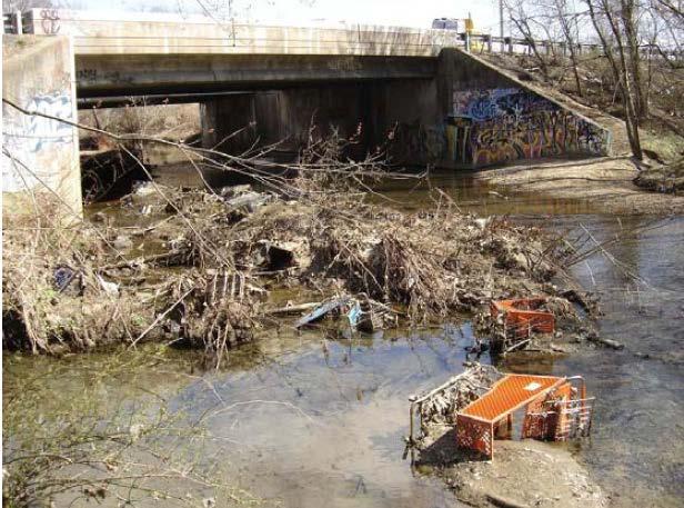
28 Obstructions


29 Obstruction Inventory PWD field surveyed over 700 bridges, culverts, and dams in the watershed in Half of these were determined significant obstructions to flow and resurveyed in From the field measurements, obstruction capacities were determined and compared to flood frequencies. Bridge Culvert Dam Scour also reported

30 Obstructions Rose Valley Creek Tannery Run Stuart Farm Creek

31 Obstructions


32 GIS was used to overlay land use and hydrologic soil group for each subbasin to generate CN Land Use Hydrologic Soil Group 32
33 Curve Number Distribution for Wissahickon Subbasins CN >85 CN CN CN CN <70 Approximately 25 % of the watershed is covered by impervious surfaces such as roofs, parking lots and roads. Curve numbers in this area to be evaluated further. 33


34 Trend Green Residential Trend Future land use based on population projections, no site-specific BMPs. Green Future land use based on population projections and cluster housing, no site-specific BMPs. Future Based on the Green land use projections and includes additional adjustments for storage from new or retrofitted detention basins, infiltration facilities, and riparian buffers. Non-Residential

35 Existing Detention Storage Summed for each subbasin and added to the potential storage. The Curve number was then be adjusted. 35
36 Hydrologic Model HEC-HMS model Inputs based on: LiDAR from PAMAP Land use from DVRPC - Soils data from NRCS, PWD - Stream and x-sect. data from PWD Ortho imagery from PASDA - Storm Sewer Shed data from PWD ArcHydro and HEC-GeoHMS used to prepare input for HEC-HMS model 137 subbasins delineated Average Drainage Area = 0.46 square miles 36

37 Model Calibration The model was tested for multiple rainfall events and calibrated against observed flow data at stream gages. -Fort Washington -Philadelphia Design rainfall events were based on NOAA Atlas 14 precipitation frequency data. Philadelphia Gage 64 mi 2 Fort Washington Gage 40.8 mi 2 The GIS data was exported to the HEC-HMS hydrologic model 37


38 Actual Storms - Storm Direction Influenced Hydrographs
39 Model Calibration Continuous (measured every 15 minutes) streamflow data is available at both USGS gage stations. Precipitation from several runoff-producing events will be run through the hydrologic model. The model will be calibrated so that it produces flows that are consistent with those measured by the USGS gages.
40 Flow (cfs) Hyetograph/Hydrograph Mouth Ft. Washington Gage 18 Gage 19 Gage 21 Wings Field (1-hr) C1648 C5430 C6611 C3510 AP Rainfall Depth (inches) /2/09 3:00 AM 8/2/09 6:00 AM 8/2/09 9:00 AM 8/2/09 12:00 PM 8/2/09 3:00 PM 8/2/09 6:00 PM 8/2/09 9:00 PM 8/3/09 12:00 AM 8/3/09 3:00 AM Date
 Main Stem Sandy Run Peak Flow At Ft.")

41 Events were calibrated for both lag and peak at several points of interest (POIs). Event Lag Time to Ft. Washington Gage (hrs) Main Stem Sandy Run Peak Flow At Ft. Washington (approx cfs) Lag Time to Gage at Mouth (hrs) Peak Flow At Mouth (approx cfs) Sep Jun Oct Aug May Jun

42 Model Calibration The calibrated model output was be compared with peak flow estimates calculated using several widely accepted methods.

43 Peak and timing of hydrographs were analyzed at each POI 43

44 Determine Management District


45 Assign Overall Management Districts District A = standard detention District B = alternate storm district District C = conditional direct discharge 45

46 Hydraulic Model HEC-RAS Ambler portion of the watershed. Rose Valley Creek Sandy Run Watershed Tannery Run Stuart Farm Creek Sandy Run Watershed 46
47 Model Ordinance: - ERSAM - SWM Site Plan Requirments - Groundwater Recharge - Water Volume Control - Channel Protection - Flood Control
48 Final Products: -Inventory of detention basins with proposed retrofits (Wm Penn) - Inventory of problem areas with proposed solutions (Wm Penn) - Final report - Model Stormwater Mgmt. Ordinance - FEMA flood flows - Basis for flood control projects - Plan of action to implement all various previously prepared programs
49 Questions????
I. Welcome & Introductions WPAC History (Paul Racette, PEC)
") Poquessing Creek Watershed ACT 167 STORM WATER MANAGEMENT PLAN Public Hearing July 10, 2012 I. Welcome & Introductions ---------- WPAC History (Paul Racette, PEC) Primary WPAC Members: Bucks County: Bensalem
Poquessing Creek Watershed ACT 167 STORM WATER MANAGEMENT PLAN Public Hearing July 10, 2012 I. Welcome & Introductions ---------- WPAC History (Paul Racette, PEC) Primary WPAC Members: Bucks County: Bensalem
Section 3: Stormwater Problems
 Section 3: Stormwater Problems The Wissahickon Creek Watershed has undergone major development and urbanization. Much of the watershed area was developed as a part of the inner ring suburbs of Philadelphia
Please note that these minutes and the PowerPoint presentations shown at the meeting are being posted at
 Poquessing Watershed Partnership Meeting Wednesday, September 29, 2010, 10:00 AM to noon Glen Foerd on the Delaware See list of attendees at end of minutes. Meeting Minutes Please note that these minutes
Section 6: Stormwater Improvements
 Section 6: Stormwater Improvements A major objective of this study was to identify opportunities for improvements to address the widespread water quality impairments caused by stormwater runoff in the
Section 2: Watershed Characteristics and Runoff
 Section 2: Watershed Characteristics and Runoff The hydrology of the Wissahickon Creek and its tributaries varies greatly from place to place within the larger watershed. Stormwater management planning
I-Introduction and Welcome Paul Racette, Pennsylvania Environmental Council (PEC)
") Wissahickon Watershed Partnership Act 167 Stormwater Management Plan Kick-off Meeting Thursday, October 7, 2010, 9:30 a.m. 11:30 am Wissahickon Valley Watershed Association, 12 Morris Road, Ambler Attendees:
Wissahickon Watershed Partnership Act 167 Stormwater Management Plan Kick-off Meeting Thursday, October 7, 2010, 9:30 a.m. 11:30 am Wissahickon Valley Watershed Association, 12 Morris Road, Ambler Attendees:
The Upper Wissahickon Creek Special Area Management Plan (SAMP) & Pilot- Critical Area Resource Plan (CARP)
 & Pilot- Critical Area Resource Plan (CARP)") The Upper Wissahickon Creek Special Area Management Plan (SAMP) & Pilot- Critical Area Resource Plan (CARP) View on the Wissahickon by James Peale, 1830 Water Resources Planning Act Bill passed in 2002
The Upper Wissahickon Creek Special Area Management Plan (SAMP) & Pilot- Critical Area Resource Plan (CARP) View on the Wissahickon by James Peale, 1830 Water Resources Planning Act Bill passed in 2002
SECTION III: WATERSHED TECHNICAL ANALYSIS
 Trout Creek Watershed Stormwater Management Plan SECTION III: WATERSHED TECHNICAL ANALYSIS A. Watershed Modeling An initial step this study of the Trout Creek watershed was the selection of a stormwater
Hydrologic Calibration:
 Hydrologic Calibration: UPDATE OF EFFECTIVE HYDROLOGY FOR MARYS CREEK October 2010 Agenda Background Hydrologic model Calibrated rainfall Hydrologic calibration 100 year discharges, Existing Conditions
CHELTENHAM TOWNSHIP Chapter 290: WATERSHED STORMWATER MANAGEMENT Article IV: Stormwater Management
 CHELTENHAM TOWNSHIP Chapter 290: WATERSHED STORMWATER MANAGEMENT Article IV: Stormwater Management Online ECode Available on Cheltenham Township Website at: http://ecode360.com/14477578 For all regulated
Stormwater Management and Water Quality Restoration Efforts in Montgomery County Green Stormwater Infrastructure Design, Costs, & Funding
 Stormwater Management and Water Quality Restoration Efforts in Montgomery County Green Stormwater Infrastructure Design, Costs, & Funding Susan Harris Watershed Evaluations Delaware River Watershed Initiative
A Hydrologic Study of the. Ryerson Creek Watershed
 A Hydrologic Study of the Ryerson Creek Watershed Dave Fongers Hydrologic Studies Unit Land and Water Management Division Michigan Department of Environmental Quality May 8, 2002 Table of Contents Summary...2
Crooked Creek Storm Water Master Plan
 Final Crooked Creek Storm Water Master Plan Submitted to Gwinnett County, Georgia July 2003 Contents Executive Summary...ES-1 Background... ES-1 Purpose of the Storm Water Master Plan... ES-2 Regulatory
Wissahickon Creek Watershed Act 167 Plan
 Wissahickon Creek Watershed Act 167 Plan Prepared by And Edited by Richard Fromuth, P.E., Research Fellow, Center for Sustainable Communities, Temple University April 2014 (revised November 2014) Table
SECTION IV WATERSHED TECHNICAL ANALYSIS
 A. Watershed Modeling SECTION IV WATERSHED TECHNICAL ANALYSIS An initial step in the preparation of this stormwater management plan was the selection of a stormwater simulation model to be utilized. It
MIDAS CREEK PROJECT. FINAL DESIGN REPORT SKR Hydrotech 4/11/2012
 2012 MIDAS CREEK PROJECT FINAL DESIGN REPORT SKR Hydrotech 4/11/2012 Executive Summary... 1 Section 1 Introduction... 1 Background Information... 1 Purpose of Study... 1 Scope of Work... 1 Section 2 Description
INFLOW DESIGN FLOOD CONTROL SYSTEM PLAN 40 C.F.R. PART PLANT YATES ASH POND 3 (AP-3) GEORGIA POWER COMPANY
 GEORGIA POWER COMPANY") INFLOW DESIGN FLOOD CONTROL SYSTEM PLAN 40 C.F.R. PART 257.82 PLANT YATES ASH POND 3 (AP-3) GEORGIA POWER COMPANY EPA s Disposal of Coal Combustion Residuals from Electric Utilities Final Rule (40 C.F.R.
INFLOW DESIGN FLOOD CONTROL SYSTEM PLAN 40 C.F.R. PART 257.82 PLANT YATES ASH POND 3 (AP-3) GEORGIA POWER COMPANY EPA s Disposal of Coal Combustion Residuals from Electric Utilities Final Rule (40 C.F.R.
Pennypack Creek Watershed Study
 [DRAFT COPY] Pennypack Creek Watershed Study Edited by Md Mahbubur R Meenar Draft report submitted to the Federal Emergency Management Agency, William Penn Foundation, and participating municipalities
RIPARIAN CORRIDOR STUDY FINAL CITY CREEK MANAGEMENT PLAN TABLE OF CONTENTS
 TABLE OF CONTENTS 1.0 INTRODUCTION... 1-1 Riparian Corridor Study and Management Plan Goals... 1-1 Study Area... 1-2 Importance and Functions of Riparian Corridors... 1-2 Habitat for Mammals, Birds, and
EFFECT OF UPSTREAM DEVELOPMENT ON THE CLEAR CREEK AREA
 EFFECT OF UPSTREAM DEVELOPMENT ON THE CLEAR CREEK AREA Technical Memorandum Farming in the Floodplain Project Prepared for May 2017 PCC Farmland Trust Photo credit: Google Earth TABLE OF CONTENTS Page
Engineering Report Preliminary Floodplain Study. Executive Summary
 Executive Summary Engineering Report Preliminary Floodplain Study The Federal Emergency Management Agency (FEMA) has updated the Flood Insurance Rate Maps (FIRM) for Finney County, including the City of
Incorporating Restoration Planning and Transportation Controls into the Valley Creek Watershed Act 167 Stormwater Management Plan
 Incorporating Restoration Planning and Transportation Controls into the Valley Creek Watershed Act 167 Stormwater Management Plan Pennsylvania State Section American Water Resources Association Fall 2011
Prepared for: City of Jeffersonville. November Prepared by
 JEFFERSONVILLE STORMWATER MASTER PLAN HYDRAULICS APPENDIX JEFFERSONVILLE, INDIANA Prepared for: City of Jeffersonville November 2011 Prepared by Christopher B. Burke Engineering, Ltd. 115 W. Washington
PEARCE CREEK CONFINED DISPOSAL AREA MODIFICATION
 US Army Corps of Engineers Philadelphia District PEARCE CREEK CONFINED DISPOSAL AREA MODIFICATION CECIL COUNTY MARYLAND STORMWATER MANAGEMENT PLAN NARRATIVE INITIAL SUBMISSION JUNE 2014 1 PEARCE CREEK
Municipal Stormwater Management Planning
 Municipal Stormwater Management Planning Christopher C. Obropta, Ph.D., P.E. Water Resources Extension Specialist with Rutgers Cooperative Extension Assistant Professor with Department of Environmental
COUNTY OF KANE. Kishwaukee River Headwaters Study Stakeholder Meeting Monday, February 26, :30 am Hampshire Village Hall
 COUNTY OF KANE ENVIRONMENTAL AND BUILDING MANAGEMENT Timothy Harbaugh, P.E., DEE Director County Government Center 719 Batavia Avenue Geneva, IL 60134 www.co.kane.il.us Environmental Management: (630)
Stormwater Review Part 2. Rainfall and Runoff. Tom Seybert, PE and Andy Bennett, PE. Pennsylvania Surveyors Conference 2019
 Stormwater Review Part 2 Rainfall and Runoff Tom Seybert, PE and Andy Bennett, PE Pennsylvania Surveyors Conference 2019 1 Topics Covered 1. Rainfall characteristics and sources 2. Watershed characteristics
Assessing the Risk of 100-year Freshwater Floods in the Lamprey River Watershed of New Hampshire Resulting from Changes in Climate and Land Use
 Assessing the Risk of 100-year Freshwater Floods in the Lamprey River Watershed of New Hampshire Resulting from Changes in Climate and Land Use Presented by: Ann Scholz, PE, CPSWQ Advisor: Dr. Robert Roseen,
Drainage Criteria Manual Review
 City of Colorado Springs Stormwater Management Assessment and Standards Development Drainage Criteria Manual Review March 8, 2013 Springsgov.com/City Agencies/Stormwater/Stormwater Engineering/ Stormwater
BMP Design Aids. w w w. t r a n s p o r t a t i o n. o h i o. g o v. Equations / Programs
 BMP Design Aids 1 Equations / Programs Outlet Discharge Equations Hydrograph and Pond Routing Programs USGS StreamStats 2 Ohio Department of Transportation 1 Training Intent Introduction and overview of
CALCASIEU PARISH ENGLISH BAYOU BASIN STORMWATER MASTER PLAN. NTB Associates, Inc. Solving Tomorrow's Problems Today...
 CALCASIEU PARISH ENGLISH BAYOU BASIN STORMWATER MASTER PLAN Prepared by: Solving Tomorrow's Problems Today... PROJECT TEAM Calcasieu Parish Division of Engineering & Public Works URS Corporation Prime
Flood Control Planning Below Alluvial Fans
 Flood Control Planning Below Alluvial Fans Presenter: Contributors: Aric Torreyson P.E., Program Manager, Tetra Tech Inc. Nathan Schreiner, P.E., Project Manager, Tetra Tech Inc. Tesfaye Demissie, P.E.,
Regulatory Requirements
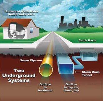
 CHAPTER 1 Regulatory Requirements 1.0 Introduction The negative impacts of unmanaged stormwater runoff present a challenge to the City of Philadelphia, including increased runoff pollutant concentrations,
Stream and Watershed Restoration Design and Quantitative Benefits. Kelly Gutshall, RLA and Mike LaSala
 Stream and Watershed Restoration Design and Quantitative Benefits Kelly Gutshall, RLA and Mike LaSala Suquehanna Greenway River Towns Workshop September 30, 2013 Benefit Stacking Single Function Multiple
TABLE OF CONTENTS. 1.0 Background Watershed Description Hydrology - HEC-HMS Models Hydraulics - HEC-RAS Models...
 TABLE OF CONTENTS 1.0 Background... 1 2.0 Watershed Description... 1 3.0 Hydrology - HEC-HMS Models... 2 3.1 Hydrologic Approach... 2 3.2 Drainage Areas... 2 3.3 Curve Numbers... 2 3.4 Lag Times... 3 3.5
Appendix A. Tookany/Tacony-Frankford Creek SWMM Validation
 Appendix A Tookany/Tacony-Frankford Creek SWMM Validation A.1 Introduction This appendix describes the development and validation of the Tookany/Tacony-Frankford Creek Tributary H&H Model used to provide
Riparian Setback- What is that and what should I be doing? October 25th, 2016 Presented by: Anil Tangirala, PE, CFM, ENV SP
 Riparian Setback- What is that and what should I be doing? October 25th, 2016 Presented by: Anil Tangirala, PE, CFM, ENV SP Agenda Introduction Stream and Riparian Impacts Ohio EPA Stormwater General Permit
Appendix A Watershed Modeling Technical Data
 Appendix A Watershed Modeling Technical Data An overview of the process that was used to complete the hydrologic modeling in preparation of this Plan is presented in Section 6 Technical Analysis of this
INITIAL RUN-ON AND RUN-OFF CONTROL PLAN 40 C.F.R. PART 257
 INITIAL RUN-ON AND RUN-OFF CONTROL PLAN 40 C.F.R. PART 257.81 HUFFAKER ROAD (PLANT HAMMOND) PRIVATE INDUSTRIAL LANDFILL (HUFFAKER ROAD LANDFILL) GEORGIA POWER COMPANY EPA s Disposal of Coal Combustion
Stormwater Erosion Control & Post-Construction Plans (Stormwater Quality Plans)
") Stormwater Erosion Control & Post-Construction Plans (Stormwater Quality Plans) Allen County Stormwater Plan Submittal Checklist The following items must be provided when applying for an Allen County Stormwater
Stormwater Erosion Control & Post-Construction Plans (Stormwater Quality Plans) Allen County Stormwater Plan Submittal Checklist The following items must be provided when applying for an Allen County Stormwater
Climate and Land Use Consequences to 100-Year Flooding
 Climate and Land Use Consequences to 100-Year Flooding Robert Roseen D.WRE, PE, PhD, Ann Scholz, PE, CPSWQ, Thomas Ballestero, PhD, PE, PH, UNH Stormwater Center Nebraska Post- Construction Stormwater
New Castle County, DE. Floodplain Regulations
 New Castle County, DE Floodplain Regulations John J. Gysling, PE CFM Department of Land Use New Castle County, DE February 26, 2009 Today s Presentation Floodplain Protection and Uses Terms and Definitions
Integrating HEC HMS generated flow hydrographs with FLO-2D. Nanda Meduri, PE, PMP, CFM Seth Lawler Venkata Dinakar Nimmala, CFM
 Integrating HEC HMS generated flow hydrographs with FLO-2D Nanda Meduri, PE, PMP, CFM Seth Lawler Venkata Dinakar Nimmala, CFM Focus of this Presentation Introduction Methodology Challenges & Solutions
5/25/2017. Overview. Flood Risk Study Components HYDROLOGIC MODEL (HEC-HMS) CALIBRATION FOR FLOOD RISK STUDIES. Hydraulics. Outcome or Impacts
 CALIBRATION FOR FLOOD RISK STUDIES. Hydraulics. Outcome or Impacts") HYDROLOGIC MODEL (HEC-HMS) CALIBRATION FOR FLOOD RISK STUDIES C. Landon Erickson, P.E.,CFM Water Resources Engineer USACE, Fort Worth District April 27 th, 2017 US Army Corps of Engineers Overview Flood
HYDROLOGIC MODEL (HEC-HMS) CALIBRATION FOR FLOOD RISK STUDIES C. Landon Erickson, P.E.,CFM Water Resources Engineer USACE, Fort Worth District April 27 th, 2017 US Army Corps of Engineers Overview Flood
RIPARIAN CORRIDOR STUDY FINAL PARLEYS CREEK MANAGEMENT PLAN TABLE OF CONTENTS
 TABLE OF CONTENTS 1.0 INTRODUCTION... 1-1 Riparian Corridor Study and Management Plan Goals... 1-1 Study Area... 1-2 Importance and Functions of Riparian Corridors... 1-2 Habitat for Mammals, Birds, and
RUN-ON AND RUN-OFF CONTROL PLAN 40 C.F.R. PART PLANT DANIEL NORTH ASH MANAGEMENT UNIT MISSISSIPPI POWER COMPANY
 RUN-ON AND RUN-OFF CONTROL PLAN 40 C.F.R. PART 257.81 PLANT DANIEL NORTH ASH MANAGEMENT UNIT MISSISSIPPI POWER COMPANY EPA s Disposal of Coal Combustion Residuals from Electric Utilities Final Rule (40
The Beckett s Run Experience. Fort Wayne, Indiana
 The Beckett s Run Experience Fort Wayne, Indiana Introductions Charlie Cochran City of Fort Wayne, Wet Weather Storm & Sewer Engineering Jason Durr, PE Christopher B. Burke Engineering, LLC 2 A Little
GISHYDRO: Developing Discharges and Watershed Parameters
 GISHYDRO: Developing Discharges and Watershed Parameters A Case Study with Baltimore City Watersheds by Mathini Sreetharan, Ph.D., P.E., CFM, Dewberry, VA Kim Dunn, P.E., CFM, Dewberry, PA Baltimore City
San Antonio Water System Mitchell Lake Constructed Wetlands Below the Dam Preliminary Hydrologic Analysis
 San Antonio Water System enhancement. This recommendation was based on limited water quality data provided by SAWS and using a free-water surface constructed wetland with approximately 112 acres of wetted
INSTALLATION AND HYDROLOGIC RESPONSE OF THE PENN STATE LOW HEAD WEIRS
 INSTALLATION AND HYDROLOGIC RESPONSE OF THE PENN STATE LOW HEAD WEIRS Larry Fennessey, James Hamlett, and Rob Cooper University Park Campus The Pennsylvania State University University Park, Pennsylvania
DRAFT. Jacob Torres, P.E.; Nick Fang, Ph.D., P.E.
 \ Memorandum SSPEED Center at Rice University Department of Civil & Environmental Engineering 6100 Main MS-317 Houston, Texas 77005-1827 sspeed.rice.edu tel: 713-348-4977 To Andy Yung, P.E. CFM; Lane Lease,
Please note that these minutes and the PowerPoint presentations shown at the meeting are being posted at
 Poquessing Watershed Partnership Meeting Wednesday, March 30, 2011, 9:00 AM to 11:00 AM Delaware Valley Veteran s Home See list of attendees at end of minutes. Meeting Minutes Please note that these minutes
DEVELOPMENT OF A HYDRO-GEOMORPHIC MODEL FOR THE LAGUNA CREEK WATERSHED
 DEVELOPMENT OF A HYDRO-GEOMORPHIC MODEL FOR THE LAGUNA CREEK WATERSHED Agenda Background Hydro-Geomorphic Modeling Methodology HEC-HMS Modeling How is the Model Used Background Proposition 50 Grant Funding
COON CREEK WATERSHED DISTRICT PERMIT REVIEW. Spring Lake Park Schools Westwood Middle School st Avenue NE, Spring Lake Park, MN 55432
 PAN 16-112, Westwood Middle School, Page 1 of 6 COON CREEK WATERSHED DISTRICT PERMIT REVIEW MEETING DATE: August 22, 2016 AGENDA NUMBER: 10 FILE NUMBER: 16-112 ITEM: Westwood Middle School RECOMMENDATION:
SEWRPC Staff Memorandum
 SEWRPC Staff Memorandum EVALUATION OF PROPOSED STORMWATER QUANTITY MANAGEMENT FOR THE DES PLAINES RIVER WATERSHED PORTION OF THE PROPOSED FOXCONN DEVELOPMENT IN THE VILLAGE OF MOUNT PLEASANT June, 2018
LIST OF TABLES.II LIST OF FIGURES.II LIST OF ATTACHMENTS.II I. INTRODUCTION.1 II. STUDY AREA.3 III
 Table of Contents LIST OF TABLES...II LIST OF FIGURES...II LIST OF ATTACHMENTS...II I. INTRODUCTION...1 II. STUDY AREA...3 III. PRECIPITATION-RUNOFF PROCESSES AND FLOW ROUTING SIMULATION WITH HEC-HMS 4
Stream Buffers Sharpest Tool in the SWM Toolbox Tom Hegemier, PE, D.WRE, CFM
 Stream Buffers Sharpest Tool in the SWM Toolbox 1 Tom Hegemier, PE, D.WRE, CFM www.apaienv.com Stream Buffers - Overview 2 Why stream buffers? Floodplain management and other benefits Existing regulatory
INFLOW DESIGN FLOOD CONTROL SYSTEM PLAN PLANT BARRY ASH POND ALABAMA POWER COMPANY
 INFLOW DESIGN FLOOD CONTROL SYSTEM PLAN PLANT BARRY ASH POND ALABAMA POWER COMPANY Section 257.82 of EPA s regulations requires the owner or operator of an existing or new CCR surface impoundment or any
Chapter 6. Hydrology. 6.0 Introduction. 6.1 Design Rainfall
 6.0 Introduction This chapter summarizes methodology for determining rainfall and runoff information for the design of stormwater management facilities in the City. The methodology is based on the procedures
Municipal Stormwater Management Plan Prepared For The Borough of Cape May Point By Van Note-Harvey Associates VNH File No.
 Municipal Stormwater Management Plan Prepared For The Borough of Cape May Point By Van Note-Harvey Associates 2005 VNH File No. 35317-210-21 Table of Contents Introduction... 3 Goals... 3 Storm water Discussion...
Hey and Associates, Inc.
 Hey and Associates, Inc. Table 1: 100-Year Study Existing Conditions Discharges and Elevations vs. FIS Results Location Existing FIS Q (cfs) Existing FIS Elevation Existing XP- SWMM Q (cfs) Existing XP-SWMM
Grand Traverse Bay Watershed Protection Plan:
 Grand Traverse Bay Watershed Protection Plan: An Overview Sarah U Ren Program Director The Watershed Center 231-935-1514, suren@gtbay.org What is a Watershed? A watershed is an area of land that captures
Upstream Philadelphia Green Infrastructure Improvements Project Tour. November 9, 2016
 Upstream Philadelphia Green Infrastructure Improvements Project Tour November 9, 2016 Schwenksville Hatfield Lower Salford Towamencin GRAVL PIK Limerick Wrightstown Lansdale Montgomery Newtown Newtown
INITIAL RUN-ON AND RUN-OFF CONTROL PLAN 40 C.F.R. PART 257
 INITIAL RUN-ON AND RUN-OFF CONTROL PLAN 40 C.F.R. PART 257.81 PLANT BOWEN PRIVATE INDUSTRY SOLID WASTE DISPOSAL FACILITY (ASH LANDFILL) GEORGIA POWER COMPANY EPA s Disposal of Coal Combustion Residuals
Pajaro River Watershed Flood Prevention Authority. Phase 3 and 4a. Pajaro River Watershed Study
 Pajaro River Watershed Flood Prevention Authority Phase 3 and 4a FEBRUARY 2005 Funding for this project has been provided in full or in part through a contract with the SWRCB pursuant to the Costa-Machado
COON CREEK WATERSHED DISTRICT PERMIT REVIEW
 16-054 Woodland Creek Wetland Banking Restoration Project, Page 1 of 6 COON CREEK WATERSHED DISTRICT PERMIT REVIEW MEETING DATE: August 22, 2016 AGENDA NUMBER: 11 FILE NUMBER: 16-054 ITEM: Woodland Creek
INFLOW DESIGN FLOOD CONTROL SYSTEM PLAN 40 C.F.R. PART PLANT BOWEN ASH POND 1 (AP-1) GEORGIA POWER COMPANY
 GEORGIA POWER COMPANY") INFLOW DESIGN FLOOD CONTROL SYSTEM PLAN 40 C.F.R. PART 257.82 PLANT BOWEN ASH POND 1 (AP-1) GEORGIA POWER COMPANY EPA s Disposal of Coal Combustion Residuals from Electric Utilities Final Rule (40 C.F.R.
INFLOW DESIGN FLOOD CONTROL SYSTEM PLAN 40 C.F.R. PART 257.82 PLANT BOWEN ASH POND 1 (AP-1) GEORGIA POWER COMPANY EPA s Disposal of Coal Combustion Residuals from Electric Utilities Final Rule (40 C.F.R.
Modeling Infiltration BMPs
 Modeling Infiltration BMPs CAHILL ASSOCIATES Environmental Consultants West Chester, PA (610) 696-4150 www.thcahill.com Design Goals for Calculations 1. Mitigate Peak Rates 2-Year to 100-Year 2. No Volume
IMPROVED MODELING OF THE GREAT PEE DEE RIVER: DOCUMENTATION IN SUPPORT OF FEMA APPEAL. Horry County, South Carolina
 IMPROVED MODELING OF THE GREAT PEE DEE RIVER: DOCUMENTATION IN SUPPORT OF FEMA APPEAL Horry County, South Carolina July 15, 2016 CONTENTS 1 Introduction... 2 2 Hydrology... 3 3 HEC-RAS Model... 7 3.1 Cross
Design Example Residential Subdivision
 Design Example Residential Subdivision Rhode Island Stormwater Design and Installation Standards Manual December 2010 Public Training March 22, 2010 Richard Claytor, P.E. 508-833-6600 Appendix D: Site
Climate and Land Use Consequences to 100-Year Flooding
 Climate and Land Use Consequences to 100-Year Flooding Presented by: Ann Scholz, PE, CPSWQ Grad Student, University of New Hampshire Robert Roseen & Thomas Ballestero, UNH Stormwater Center Michael Simpson,
TABLE OF CONTENTS. TOC-i
 TOC-i TABLE OF CONTENTS 1.0 INTRODUCTION... 1-1 Riparian Corridor Study and Management Plan Goals... 1-1 Study Area... 1-2 Importance and Functions of Riparian Corridors... 1-2 Habitat for Mammals, Birds,
INFLOW DESIGN FLOOD CONTROL SYSTEM PLAN 40 C.F.R. PART PLANT YATES ASH POND B (AP-B ) GEORGIA POWER COMPANY
 GEORGIA POWER COMPANY") INFLOW DESIGN FLOOD CONTROL SYSTEM PLAN 40 C.F.R. PART 257.82 PLANT YATES ASH POND B (AP-B ) GEORGIA POWER COMPANY EPA s Disposal of Coal Combustion Residuals from Electric Utilities Final Rule (40 C.F.R.
INFLOW DESIGN FLOOD CONTROL SYSTEM PLAN 40 C.F.R. PART 257.82 PLANT YATES ASH POND B (AP-B ) GEORGIA POWER COMPANY EPA s Disposal of Coal Combustion Residuals from Electric Utilities Final Rule (40 C.F.R.
COON CREEK WATERSHED DISTRICT PERMIT REVIEW Mississippi Dr Coon Rapids, MN SQ FT Residence on 0.64 Acre Lot
 17-082 Van Sloun Residence, Page 1 of 5 COON CREEK WATERSHED DISTRICT PERMIT REVIEW MEETING DATE: May 8, 2017 AGENDA NUMBER: 17 FILE NUMBER: 17-082 ITEM: Van Sloun Residence RECOMMENDATION: Approve with
Wood-Pawcatuck Watershed Flood Resiliency Management Plan
 Wood-Pawcatuck Watershed Flood Resiliency Management Plan Project Steering Committee Kickoff Meeting March 26, 2015 Wood-Pawcatuck Watershed Association Meeting Agenda 10:00 10:05 Welcome and Opening Remarks
Application for a Dam Permit Ash Basin No. 1
 Application for a Dam Permit Ash Basin No. 1 for the Sunbury Generating Station Shamokin Dam, Pennsylvania submitted to Commonwealth of Pennsylvania Department of Environmental Protection Bureau of Waterways
San Luis Obispo Creek Watershed Hydrologic Model Inputs
 Jeff Werst San Luis Obispo County Department of Public Works 1050 Monterey Street San Luis Obispo CA 93408 December 14, 2007 Subject: San Luis Obispo Creek Watershed Hydrology and Hydraulic Model Dear
Addressing Flooding Issues in an Environmental Justice Community: A Complicated and Multi-Layered Case Study
 Addressing Flooding Issues in an Environmental Justice Community: A Complicated and Multi-Layered Case Study Mahbubur MEENAR, Ph.D., Temple University, USA Jeffrey FEATHERSTONE, Ph.D., Temple University,
INFLOW DESIGN FLOOD CONTROL SYSTEM PLAN PLANT GREENE COUNTY ASH POND ALABMA POWER COMPANY
 INFLOW DESIGN FLOOD CONTROL SYSTEM PLAN PLANT GREENE COUNTY ASH POND ALABMA POWER COMPANY Section 257.82 of EPA s regulations requires the owner or operator of an existing or new CCR surface impoundment
Estimating the 100-year Peak Flow for Ungagged Middle Creek Watershed in Northern California, USA
 American Journal of Water Resources, 2014, Vol. 2, No. 4, 99-105 Available online at http://pubs.sciepub.com/ajwr/2/4/3 Science and Education Publishing DOI:10.12691/ajwr-2-4-3 Estimating the 100-year
The prioritization list along with the estimated probable construction cost and future cost index is shown in Table 1.
 EXECUTIVE SUMMARY To address flooding concerns and assess costs of potential capital improvement projects associated with flooding in the downtown Town Center Area Plan (TCAP), the Town of Cary commissioned
Appendix D: Spatial Analysis & Initial Planning investigation
 Appendix D: Spatial Analysis & Initial Planning investigation IV- D Appendix D: Spatial Analysis Process And Initial Resource Analysis (Source: Arroyo Seco Watershed Restoration Feasibility Study, Summary
Waackaack Creek Preliminary Hydrologic Model Report
 Waackaack Creek Preliminary Hydrologic Model Report Developed by the Rutgers Cooperative Extension Water Resources Program Prepared for Holmdel Township, Monmouth County, New Jersey March 8, 2019 1 Table
DRAINAGE MASTER PLAN FOR THE TOWN OF BLOOMING GROVE AND VILLAGES OF WASHINGTONVILLE AND SOUTH BLOOMING GROVE
 DRAINAGE MASTER PLAN FOR THE TOWN OF BLOOMING GROVE AND VILLAGES OF WASHINGTONVILLE AND SOUTH BLOOMING GROVE PUBLIC MEETING March 8, 2017 LOGISTICS Meeting Agenda: Presentation (7:15 7:45 pm) [Auditorium]
CEDAR RUN WATERSHED ACT 167 STORMWATER MANAGEMENT PLAN FINAL REPORT
 CEDAR RUN WATERSHED ACT 167 STORMWATER MANAGEMENT PLAN FINAL REPORT I. PURPOSE OF THE REPORT The purpose of this report is to summarize the findings and recommendations of the Cedar Run Watershed Act 167
INFLOW DESIGN FLOOD CONTROL SYSTEM PLAN 40 C.F.R. Part PLANT MCINTOSH ASH POND 1 GEORGIA POWER COMPANY
 INFLOW DESIGN FLOOD CONTROL SYSTEM PLAN 40 C.F.R. Part 257.82 PLANT MCINTOSH ASH POND 1 GEORGIA POWER COMPANY EPA s Disposal of Coal Combustion Residuals from Electric Utilities Final Rule (40 C.F.R. Part
Airport Master Plan. Floodplain Report. Prepared by: Prepared for: Illinois Department of Transportation
 Airport Master Plan Floodplain Report Prepared by: Prepared for: Illinois Department of Transportation July 10, 2013 Table of Contents Topic Page Number Cover Sheet... Cover Sheet Table of Contents...
Modeling the Hydrologic Impacts of Control Structures Utilizing LiDAR, ICPR, and GIS Technologies
 Modeling the Hydrologic Impacts of Control Structures Utilizing LiDAR, ICPR, and GIS Technologies Keanan Bell NorthStar June 12, 2015 Project began in 2010 as a Hydrology Assessment and Conceptual Restoration
Appendix B Stormwater Site Plan Submittal Requirements Checklist
 Stormwater Site Plan Submittal Requirements Checklist The Submittal Requirements Checklist is intended to aid the design engineer in preparing a Stormwater Site Plan. All items included in the following
Wood-Pawcatuck Watershed Flood Resiliency Management Plan Community Meeting October 20, 2016
 Wood-Pawcatuck Watershed Flood Resiliency Management Plan Community Meeting October 20, 2016 Wood-Pawcatuck Watershed Association Meeting Agenda 10:00 10:05 Introductions and Meeting Goals 10:05 10:15
Little Bear Brook Flood Hazard Assessment and Redevelopment Area Regional Stormwater Management Analysis. Progress Meeting
 Little Bear Brook Flood Hazard Assessment and Redevelopment Area Regional Stormwater Management Analysis Progress Meeting June 30, 2014 Princeton Hydro, LLC and SWM Consulting, LLC Project Team West Windsor
Public Works and Engineering
 6.C Exhibit Incorporated in 1909 Public Works and Engineering Committee Report To: From: Mayor and Board of Trustees Bill Emmerich For Village Board Meeting of: November 27, 2017 Subject: Division and
1.1 Scope and Approach. 1.2 Data Collection and Evaluation. 1.3 Hydrologic and Hydraulic Modeling
 1. Introduction The North Branch Chicago River and Lake Michigan watersheds, located in northeastern Cook County, Illinois, drain an area of over 120 square miles that includes 20 communities. Figure ES.1
Jason R. Vogel, Ph.D., P.E. Biosystems and Agricultural Engineering Oklahoma State University
 Stormwater 101 OKLAHOMA STATE UNIVERSITY Biosystems and Agricultural Engineering Department Jason R. Vogel, Ph.D., P.E. Biosystems and Agricultural Engineering Oklahoma State University Stormwater is excess
TOWN LINE BROOK URBAN WATERSHED STUDY MODELING INCREMENTAL IMPROVEMENTS
 TOWN LINE BROOK URBAN WATERSHED STUDY MODELING INCREMENTAL IMPROVEMENTS Marcus M. Quigley, P.E., Project Engineer, GeoSyntec Consultants Steven P. Roy, Associate, GeoSyntec Consultants Lawrence Gil, North
APPENDIX 4 ARROYO MODELING
 APPENDIX 4 ARROYO MODELING The existing HEC-HMS model can serve as a baseline for further development and analysis of major arroyos in the city. The model would need to be updated and expanded to consider
LIST OF TABLES... ii LIST OF FIGURES... iii LIST OF APPENDICES... iv. Section 1 - Introduction Purpose of Study... 1
 Preliminary Hydrologic Analysis for Alberhill Villages April 2015 TABLE OF CONTENTS Section Name Page Number LIST OF TABLES... ii LIST OF FIGURES... iii LIST OF APPENDICES... iv Section 1 - Introduction...