Recent cal/val activities at the REMEDHUS network (Spain)
|
|
|
- Jared Dickerson
- 6 years ago
- Views:
Transcription
 Water Resources Research Group (www.usal.")

1 Centro Hispano Luso de Investigaciones Agrarias University of Salamanca (Spain) Water Resources Research Group ( Recent cal/val activities at the REMEDHUS network (Spain) José Martínez-Fernández 2nd SMOS-VRT Workshop Lisboa, Portugal March 2009


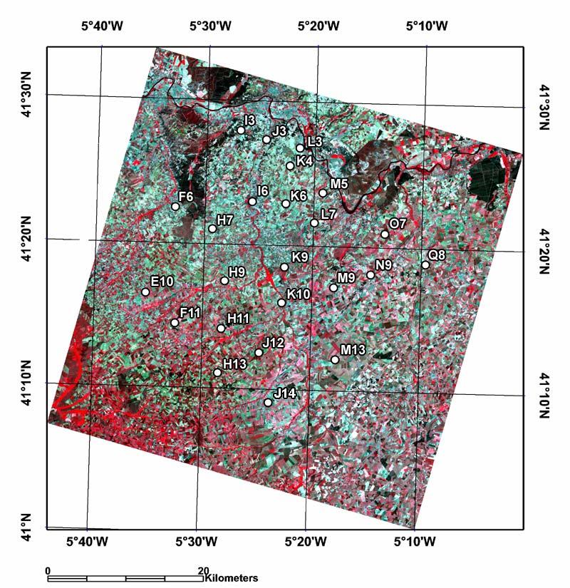
2 REMEDHUS Soil Moisture Stations Network
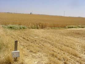
3 REMEDHUS Site Climate: Semiarid continental Mediterranean (385 mm rainfall; 12 ºC temp.) Topography: Hilly area, gentle slopes, m.a.s.l. Land use: Agriculture: rainfed cereal, irrigated crops, vineyards, others: pasture, forest,...
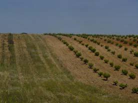
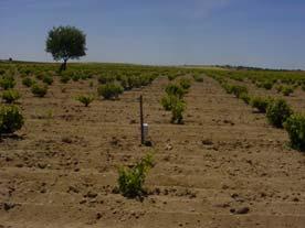
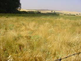
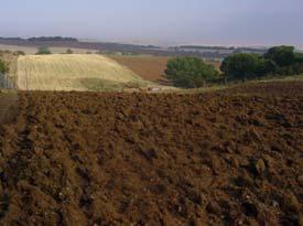
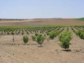
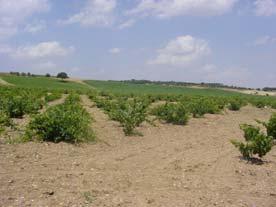
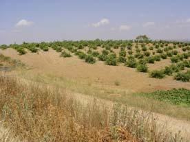
4 Land uses in REMEDHUS: rainfed and irrigated crops, vineyards, forest
")
")
 Forest")
5 Land uses Rainfed cereals: barley, wheat, (80%) Vineyards (4%) Pasture (valley bottoms, 2%) Irrigated crops: sugar beet, corn, alfalfa, (4%) Forest (patchy): pine, holm oak, (6%)
 Soil Moisture Station (ID) Longitude W Latitude N Altitude (masl) E10 5º 35 26 41º 16 34 870 F6 5º 32 46")


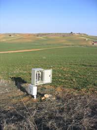
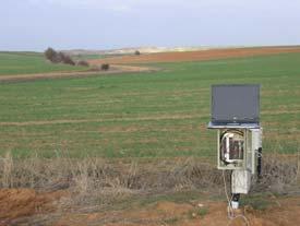
6 REMEDHUS Soil Moisture Stations Network (30 x 40 km, aprox.) Soil Moisture Station (ID) Longitude W Latitude N Altitude (masl) E10 5º º F6 5º º H11 5º º J14 5º º H13 5º º J12 5º º F11 5º º Q8 5º º H7 5º º I3 5º º I6 5º º J3 5º º L3 5º º K10 5º º K4 5º º M5 5º º O7 5º º N9 5º º M9 5º º L7 5º º
7 REMEDHUS


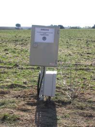
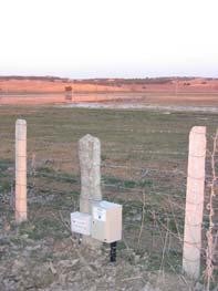
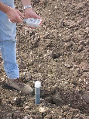
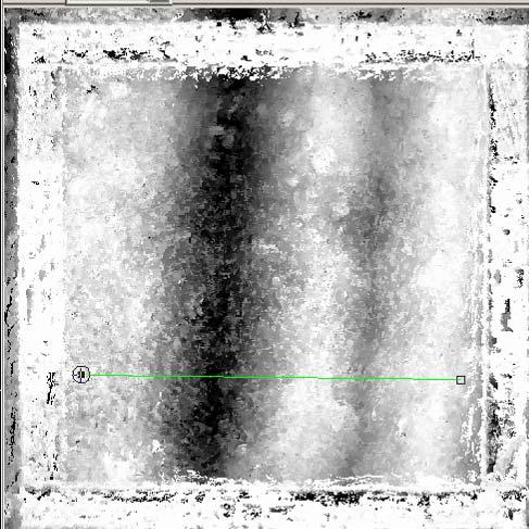
8 Soil Moisture Stations Network: Experimental Layout TDR network 20 TDR SOIL MOISTURE STATIONS (5-100 cm depth), fortnightly measurements Tektronix 1502C cm 0 TDR stations


, hourly")

9 Soil Moisture Stations Network: Experimental Layout HYDRA network 20 AUTOMATIC SOIL MOISTURE SOIL TEMPERATURE STATIONS (5 cm depth), hourly measurements Hydra probes (Stevens Water Monitoring Systems Inc.)
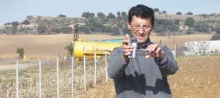
10 SMOS CAL/VAL CAMPAIGN IN REMEDHUS AREA: RECENT ACTIVITIES 1. SMOS rehearsal simulation campaign (CNES/CESBIO) 2. SMOS End-to-end Performance Simulator (SEPS) (Universidad de Salamanca - Universitat Politècnica de Catalunya) 3. Intensive soil moisture measurement campaign Trial plots network (Universidad de Salamanca Vienna University of Technology) 4. GPS and RAdiometric Joint Observations (GRAJO) experiment (Universidad de Salamanca - Universitat Politècnica de Catalunya)
11 SMOS CAL/VAL CAMPAIGN IN REMEDHUS AREA. RECENT ACTIVITIES 1. SMOS rehearsal simulation campaign (CNES/CESBIO) Study area: REMEDHUS area (SPAIN) Experimental layout and sampling scheme: a) grid of 306 cells of 3x3 km area (18 columnsx17 rows). Each parameter is referred to the center of each cell (if data exists in every cell) for each date of SMOS. b) 20 soil (moisture+temperature )stations c) 3 weather stations Data LAI Land use Soil Moisture (0-5 cm) Soil Temperature (0-5 cm) Soil texture Air temperature Database period (related to SMOS simulated orbits) 03/26/08 to 05/05/08

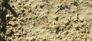
 Sand, silt and clay 0-5 cm depth.")
12 Air Temp. 3 weather stations DUERO Castilla y León Portugal Duero Spain LAND USES (classification) LAI (MODIS 8days composite) Sand, silt and clay 0-5 cm depth. Weather Station Soil Temp 0-5 cm Soil Moisture 0-5 cm
13 2. SMOS End-to-end Performance Simulator (SEPS) (Universidad de Salamanca - Universitat Politècnica de Catalunya) Study area: REMEDHUS area (SPAIN) Experimental layout: a) 20 soil (moisture+temperature) stations b) 3 weather stations Data - Land uses - Soil Moisture (0-5 cm) - Soil Temperature (0-5 cm) - Air temperature and precipitation - Plant water content (cereals stations, 16) Database period 02/27 /07 to 07/03/07
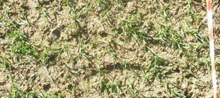
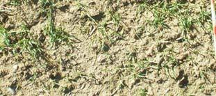
14 2007 Cereal Growing Season During 2007 some other parameters were also measured: LAI, Equivalent Water Thickness, Biomass, Plant Height, percentage cover, but were not used in this model
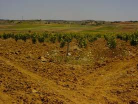
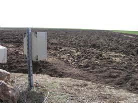
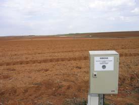
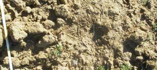
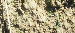
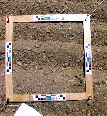
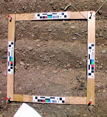
15 3. Intensive soil moisture measurement campaign Trial plots network (Universidad de Salamanca Vienna University of Technology) Study area: REMEDHUS area (SPAIN) Experimental layout: Data Soil Moisture (0-5 cm) a) 65 field plots b) 20 soil moisture stations Objectives -Training network - Verification of Hydra network Database period 05/20/08 to 11/21/08 (nine sampling dates) Coinciding 6 overpasses of ASAR


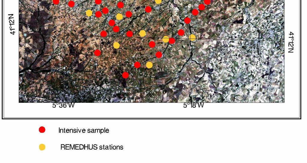
16 - Soil Moisture (0-5 cm) - 4 measurements/plot
17


 October")
18 4. GPS and RAdiometric Joint Observations (GRAJO) experiment (Universidad de Salamanca - Universitat Politècnica de Catalunya) October 2008 December 2009

19 4. GPS and RAdiometric Joint Observations (GRAJO) experiment (Universidad de Salamanca - Universitat Politècnica de Catalunya)
 experiment (Universidad de Salamanca -")

 NDVI estimation (field")
20 4. GPS and RAdiometric Joint Observations (GRAJO) experiment (Universidad de Salamanca - Universitat Politècnica de Catalunya) Vegetation measurements Vegetation cover estimation (supervised classification) LAI estimation (leaf scanning) NDVI estimation (field spectroradiometer reflectivity)

 experiment")


")


21 4. GPS and RAdiometric Joint Observations (GRAJO) experiment (Universidad de Salamanca - Universitat Politècnica de Catalunya) Roughness measurements 3D terrestrial laser scanning (1.5 mm resolution) Sampling area of 20x20 m. High detailed Digital Elevation Model (grid=2 cm). Digital data set: dense "point cloud in 3D. Statistical analysis to obtain S and L parameters.
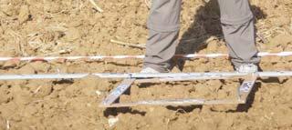
22 Roughness measurements Multi-view acquisition of Close-Photogrammetry Frame Digital elevation dataset (aprox 50x50 cm) Raw vertical profile (mm)


 Sampling interval: 30 min.")
23 4. GPS and RAdiometric Joint Observations (GRAJO) experiment (Universidad de Salamanca - Universitat Politècnica de Catalunya) Soil Moisture and Temperature measurements Two soil moisture probes and two soil temperature probes per plot (0-5 cm depth) One soil moisture profile (probes at 5, 25, 50 and 70 cm depth) One soil temperature profile (probes at 5, 25, 50 and 70 cm depth) Sampling interval: 30 min. One Automatic Weather Station
")


24 4. GPS and RAdiometric Joint Observations (GRAJO) experiment (Universidad de Salamanca - Universitat Politècnica de Catalunya) Soil Moisture and Temperature measurements Bare soil Soil moisture (%) Barley Grass
 and - ESA AO-3230 - Spanish National Research Programme: Project ESP2006-00643 Project")
25 Acknowledgements: - Nilda Sánchez-Martín - Carlos Pérez-Gutiérrez - Guido Baroncini-Turricchia - Jesús Álvarez-Mozos - Ana Cano - Luciana A. Magalhães - Pablo Méndez - The Passive Remote Sensing Group (UPC) and - ESA AO Spanish National Research Programme: Project ESP Project ESP Project ESP E
Ramos MC, Martínez-Casasnovas JA & Balasch JC
 Runoff and soil loss prediction in a vineyard area at very detail scale using SWAT: comparison between dry and wet years Runoff and soil loss prediction in a vineyard area at very detailed scale Ramos
HIGH RESOLUTION AIRBORNE SOIL MOISTURE MAPPING
 HIGH RESOLUTION AIRBORNE SOIL MOISTURE MAPPING Jeffrey Walker 1, Rocco Panciera 1 and Ed Kim 2 1. Department of Civil and Environmental Engineering, University of Melbourne 2. Hydrospheric and Biospheric
DMC 22m Sensors for Supertemporal Land Cover Monitoring. Gary Holmes DMC International Imaging Ltd June 2014
 DMC 22m Sensors for Supertemporal Land Cover Monitoring Gary Holmes DMC International Imaging Ltd June 2014 DMC 2 nd Generation Satellites UK-DMC2 and Deimos-1 launched 29 th July 2009 650km swath width
Joint Research Centre (JRC)
") Joint Research Centre (JRC) Marco Pastori and Faycal Bouraoui IES - Institute for Environment and Sustainability Ispra - Italy http://ies.jrc.ec.europa.eu/ http://www.jrc.ec.europa.eu/ CONTENT Introduction
Joint Research Centre (JRC) Marco Pastori and Faycal Bouraoui IES - Institute for Environment and Sustainability Ispra - Italy http://ies.jrc.ec.europa.eu/ http://www.jrc.ec.europa.eu/ CONTENT Introduction
and spatial resolution)
") Analysis of different synergy schemes to improve SMOS soil moisture retrievals (accuracy and spatial resolution) A. Chanzy 1, B. Berthelot 2, S. Cros 1, M. Weiss 2, J.-C. Calvet 3, T. Pellarin 4, J.-P
Analysis of different synergy schemes to improve SMOS soil moisture retrievals (accuracy and spatial resolution) A. Chanzy 1, B. Berthelot 2, S. Cros 1, M. Weiss 2, J.-C. Calvet 3, T. Pellarin 4, J.-P
Airborne Laser Scanning (ALS) for forestry applications
 for forestry applications") Airborne Laser Scanning (ALS) for forestry applications International School on Lidar Technology 2008 IIT Kanpur, India Norbert Pfeifer + I.P.F.-Team http://www.ipf.tuwien.ac.at/ Christian Doppler Laboratory
Airborne Laser Scanning (ALS) for forestry applications International School on Lidar Technology 2008 IIT Kanpur, India Norbert Pfeifer + I.P.F.-Team http://www.ipf.tuwien.ac.at/ Christian Doppler Laboratory
Atul Jain University of Illinois, Urbana, IL 61801, USA
 Brian O Neill, NCAR 2010 LCLUC Spring Science Team Meeting Bethesda, MD April 20-22, 2010 Land-Use Change and Associated Changes in Biogeochemical and Biophysical Processes in Monsoon Asian Region (MAR)
North West Geography
 ISSN 1476-1580 North West Geography Volume 11, Number 1, 2011 North West Geography, Volume 11, 2011 7 Characterising phenological changes in North West forests using terrestrial laser scanning: some preliminary
Irrigation Improvement Options part 1- on field irrigation
 Training Course Conceptual irrigation design in the context of IRBM Arba Minch University, Arba Minch 26 30 March, 2012 Irrigation Improvement Options part 1- on field irrigation March 2012, Henk Ritzema
Remotely-Sensed Fire Danger Rating System to Support Forest/Land Fire Management in Indonesia
 Remotely-Sensed Fire Danger Rating System to Support Forest/Land Fire Management in Indonesia Orbita Roswintiarti Indonesian National Institute of Aeronautics and Space (LAPAN) SE Asia Regional Research
Estimation of Actual Evapotranspiration at Regional Annual scale using SWAT
 Estimation of Actual Evapotranspiration at Regional Annual scale using SWAT Azizallah Izady Ph.D student of Water Resources Engineering Department of Water Engineering, Faculty of Agriculture, Ferdowsi
Remote sensing: A suitable technology for crop insurance?
 Remote sensing: A suitable technology for crop insurance? Geospatial World Forum 2014 May 9, 2014, Geneva, Switzerland Agenda 1. Challenges using RS technology in crop insurance 2. Initial situation Dominance
ANALYSIS OF CHANGES IN VEGETATION BIOMASS USING MULTITEMPORAL AND MULTISENSOR SATELLITE DATA
 ANALYSIS OF CHANGES IN VEGETATION BIOMASS USING MULTITEMPORAL AND MULTISENSOR SATELLITE DATA A. Akkartal a*, O. Türüdü a, and F.S. Erbek b a stanbul Technical University, Faculty of Civil Engineering,
CropSyst Modelling Solution. Reference documentation
 CropSyst Modelling Solution Reference documentation Release Issue Date 1 2 September 2013 Copyright European Union, 1995 2013 Reproduction is authorised, provided the source is acknowledged, save where
Application of PALSAR data to classify vegetation in an anthropogenically affected wetland area in Central Spain (Las Tablas de Daimiel)
") Rhodes, Greece, Application of PALSAR data to classify vegetation in an anthropogenically affected wetland area in Central Spain (Las Tablas de Daimiel) Thomas Schmid 1, Magaly Koch 2, Jesús Solana 3 and
Rhodes, Greece, Application of PALSAR data to classify vegetation in an anthropogenically affected wetland area in Central Spain (Las Tablas de Daimiel) Thomas Schmid 1, Magaly Koch 2, Jesús Solana 3 and
On SEBI-SEBS validation in France, Italy, Spain, USA and China
 On SEBI-SEBS validation in France, Italy, Spain, USA and China Massimo Menenti Li Jia 2 and ZongBo Su 2 - Laboratoire des Sciences de l Image, de l Informatique et de la Télédétection (LSIIT), Strasbourg,
SAR forest canopy penetration depth as an indicator for forest health monitoring based on leaf area index (LAI)
") SAR forest canopy penetration depth as an indicator for forest health monitoring based on leaf area index (LAI) Svein Solberg 1, Dan Johan Weydahl 2, Erik Næsset 3 1 Norwegian Forest and Landscape Institute,
SAR forest canopy penetration depth as an indicator for forest health monitoring based on leaf area index (LAI) Svein Solberg 1, Dan Johan Weydahl 2, Erik Næsset 3 1 Norwegian Forest and Landscape Institute,
LAND AND WATER - EARTH OBSERVATION INFORMATICS FSP
 Earth Observation for Water Resources Management Arnold Dekker,Juan P Guerschman, Randall Donohue, Tom Van Niel, Luigi Renzullo,, Tim Malthus, Tim McVicar and Albert Van Dijk LAND AND WATER - EARTH OBSERVATION
GEOGLAM international cooperation activities
 GEOGLAM international cooperation activities Chris Justice Center for Global Agricultural Monitoring and Research Dept. of Geographical Sciences University of Maryland GEO: an International Coordinating
Automatic retrieval of biophysical and biochemical canopy variables: an example based on AHS data from AGRISAR campaign
 Automatic retrieval of biophysical and biochemical canopy variables: an example based on AHS data from AGRISAR campaign Wouter Dorigo, Heike Gerighausen & Erik Borg German Remote Sensing Data Centre, German
Title: CEDEX Proposal for Use. of CHRIS imagery for Monitoring. Authors: Spain) Topic/subtopic
 Topic/subtopic") Title: CEDEX Proposal for Use of CHRIS imagery for Monitoring oring Ecological Water Quality in smallest Mediterranean Reservoirs integrated in the Intercalibration Exercise of WFD Implementation Process
Title: CEDEX Proposal for Use of CHRIS imagery for Monitoring oring Ecological Water Quality in smallest Mediterranean Reservoirs integrated in the Intercalibration Exercise of WFD Implementation Process
AIRBORNE MAPPING OF VEGETATION CHANGES IN RECLAIMED AREAS AT HIGHLAND VALLEY BETWEEN 2001 AND Gary Borstad, Leslie Brown, Mar Martinez
 AIRBORNE MAPPING OF VEGETATION CHANGES IN RECLAIMED AREAS AT HIGHLAND VALLEY BETWEEN 21 AND 28 1 Gary Borstad, Leslie Brown, Mar Martinez ASL Borstad Remote Sensing Inc, Sidney BC Bob Hamaguchi, Jaimie
Airship-based LiDAR and multi-sensor forest monitoring
 Airship-based LiDAR and multi-sensor forest monitoring S. Esposito, P. Fallavollita, M. Balsi, R. Tognetti, M. Marchetti COST WORKSHOP Green Engineering Camp ( GEC) Plitvice Lakes National Park, Croatia
BUILDING EXPOSURE MAPS OF URBAN INFRASTRUCTURE AND CROP FIELDS IN THE MEKONG RIVER BASIN
 BUILDING EXPOSURE MAPS OF URBAN INFRASTRUCTURE AND CROP FIELDS IN THE MEKONG RIVER BASIN E. Haas (1), J. Weichselbaum (1), U. Gangkofner (1), J. Militzer (1), A. Walli (1) (1) GeoVille, Sparkassenplatz
UCS#4: Soil moisture assessment over Africa
 UCS#4: Soil moisture assessment over Africa S. Horion, H. Nieto*, T. Tagesson, R. Fensholt * Institute for Sustainable Agriculture CSIC, Córdoba, Spain Rationale and objectives Accurate estimates of soil
Agricultural drought index and monitoring on national scale. LU Houquan National Meteorological Center, CMA
 Agricultural drought index and monitoring on national scale LU Houquan National Meteorological Center, CMA Contents Agricultural drought disasters in China Agricultural drought indices --Precipitation
SPOT4 (Take Five) experiment Sentinel-2 Simulations for the Monitoring of Water Ressources of the Merguellil Watershed and Kairouan Plain (Tunisia)
 experiment Sentinel-2 Simulations for the Monitoring of Water Ressources of the Merguellil Watershed and Kairouan Plain (Tunisia)") SPOT4 (Take Five) experiment Sentinel-2 Simulations for the Monitoring of Water Ressources of the Merguellil Watershed and Kairouan Plain (Tunisia) First Results Bernard Mougenot(1), Vincent Simonneaux
SPOT4 (Take Five) experiment Sentinel-2 Simulations for the Monitoring of Water Ressources of the Merguellil Watershed and Kairouan Plain (Tunisia) First Results Bernard Mougenot(1), Vincent Simonneaux
LiDAR based sampling for subtle change, developments, and status
 LiDAR based sampling for subtle change, developments, and status Erik Næsset Norwegian University of Life Sciences, Norway 2111 2005 Conclusions: 1. LiDAR is an extremely precise tool for measuring forest
ASSOCIATED STATIONS. characteristics, labelling process and rules INSTRUCTIONS FOR ASSOCIATED STATIONS. ICOS Ecosystem Instructions.
 INSTRUCTIONS FOR characteristics, labelling process and rules Version Release date Summary of changes CONTENTS SUMMARY... 2 ASSOCIATED STATION REQUIREMENTS... 3 LABELLING PROCESS... 4 ETC SERVICES... 5
FOREST COVER MAPPING AND GROWING STOCK ESTIMATION OF INDIA S FORESTS
 FOREST COVER MAPPING AND GROWING STOCK ESTIMATION OF INDIA S FORESTS GOFC-GOLD Workshop On Reducing Emissions from Deforestations 17-19 April 2007 in Santa Cruz, Bolivia Devendra PANDEY Forest Survey of
Recent HARVIST Results: Classifying Crops from Remote Sensing Data
 Recent HARVIST Results: Classifying Crops from Remote Sensing Data Kiri Wagstaff and Dominic Mazzoni (kiri.wagstaff@jpl.nasa.gov) Jet Propulsion Laboratory, California Institute of Technology, 4800 Oak
Design of efficient ground based soil moisture monitoring networks using cosmic-ray neutron probes and space-time data fusion
 Design of efficient ground based soil moisture monitoring networks using cosmic-ray neutron probes and space-time data fusion Trenton E. Franz Asst. Professor of Hydrogeophysics, School of Natural Resources,
Chapter 4: The Laying Yard
 UNP-25 Shiitake Mushroom Production on Logs Chapter 4: The Laying Yard The laying yard is where inoculated logs are stored while the spawn runs. This may be inside or outside. How logs are stacked and
Lund-Potsdam-Jena managed land (LPJmL) Process-based agriculture, vegetation and hydrology model
 Process-based agriculture, vegetation and hydrology model") Lund-Potsdam-Jena managed land (LPJmL) Process-based agriculture, vegetation and hydrology model A short, simple and informal introduction June 2015 1 One grid-cell in LPJmL Climate, CO 2 concentration,
Lund-Potsdam-Jena managed land (LPJmL) Process-based agriculture, vegetation and hydrology model A short, simple and informal introduction June 2015 1 One grid-cell in LPJmL Climate, CO 2 concentration,
LOSS AND RUNOFF. Background. 2 Soil Loss and Runoff
 2 SOIL LOSS AND RUNOFF Background One of the underlying assumptions behind the PARDYP research was that soil erosion is a major problem, leading to environmental degradation, lower yield, and ultimately
To provide timely, accurate, and useful statistics in service to U.S. agriculture
 NASS MISSION: To provide timely, accurate, and useful statistics in service to U.S. agriculture What does NASS do? Administer USDA s Statistical Estimating Program Conduct the 5-year Census of Agriculture
The Community Atmosphere Land Exchange (CABLE) model:
 model:") The Community Atmosphere Land Exchange (CABLE) model: results from ACCESS1.3 and new simulations with CABLE-2.0 www.cawcr.gov.au Rachel Law CABLE coordinator 26 th September 2012 Acknowledgements Land
The Community Atmosphere Land Exchange (CABLE) model: results from ACCESS1.3 and new simulations with CABLE-2.0 www.cawcr.gov.au Rachel Law CABLE coordinator 26 th September 2012 Acknowledgements Land
Summary of the socio-economic impact of Copernicus in the EU
 Summary of the socio-economic impact of Copernicus in the EU ESA Since the entry into service of Copernicus first satellite, Sentinel-1A, in 2014, the impacts of the programme are witnessed beyond the
Operational products for crop monitoring. Hervé Kerdiles, JRC MARS
 Operational products for crop monitoring Hervé Kerdiles, JRC MARS Outline Meteo products Rainfall, temperature, global radiation, ETa, snow depth Biomass indicators & crop yield prediction NDVI & other
Observing terrestrial variables for climate: achievements and opportunities
 Observing terrestrial variables for climate: achievements and opportunities Martin Herold Wageningen University, GOFC-GOLD Joint GCOS, UNFCCC, IPCC workshop 10. Febr. 2015 Essential Climate Variables (terrestrial)
Growing Wheat under Spate Irrigation In Dera Ismail Khan ( )
") Growing Wheat under Spate Irrigation In Dera Ismail Khan (2006 07) M.J. Khan¹,, A. Razzaq¹, M.K. Khattak², L. Garcia³ 1 Project for Livelihood Improvement (PLI) D.I.Khan 1 Water Management Department,
Growing Wheat under Spate Irrigation In Dera Ismail Khan (2006 07) M.J. Khan¹,, A. Razzaq¹, M.K. Khattak², L. Garcia³ 1 Project for Livelihood Improvement (PLI) D.I.Khan 1 Water Management Department,
SOUTHERN INDIANA 2008 FLOODS: DAMAGE ASSESSMENT AND WEB MAPPING
 SOUTHERN INDIANA 2008 FLOODS: DAMAGE ASSESSMENT AND WEB MAPPING Ejaz Hussain KyoHyouk kkim Jie Shan, Associate Professor {ehussain,kim458,jshan}@,j purdue.edu Tel:765-494-2168 School Of Civil Engineering
Surface heat turbulent fluxes: comparison of Bowen ratio and aerodynamic techniques
 Surface heat turbulent fluxes: comparison of Bowen ratio and aerodynamic techniques A. de Miguel and J. Bilbao Department of Applied Physics I Sciences Faculty. University of Valladolid (Spain). E-mail:julia@cpd.
LOCAL PLANNING FOR SUSTAINABLE BIOENERGY PRODUCTION: APPROACHES AND APPLICATIONS
 ERASMUS INTENSIVE PROGRAMME - EPROBIO Energy Production from Biomass in the European Union LOCAL PLANNING FOR SUSTAINABLE BIOENERGY PRODUCTION: APPROACHES AND APPLICATIONS Monteleone M., Cammerino A.R.B.
Examples of successful applications of weather and climate products for agriculture in Europe
 Examples of successful applications of weather and climate products for agriculture in Europe Philippe FRAYSSINET Météo-France Toowoomba,, Queensland, Australia 18-21 May 2009 Plan Introduction Context
Remote Sensing Applications on the Indus Basin. dr. Wim Bastiaanssen The Netherlands
 Remote Sensing Applications on the Indus Basin dr. Wim Bastiaanssen The Netherlands Utilization of water resources River Basin Management Precipitation Consumptive Use Agriculture Irrigation Rainfed Other
Of vital importance..
 Soil moisture Of vital importance.. Low and erratic rainfall form a significant cause of low crop production and crop failure in rainfed agriculture in the tropics However, crop and land management do
OF EXTENSIVE CROPS IN SPAIN sigagroasesor Project. Antonio Mestre AEMET
 CUSTOMIZED ADVANCED GIS ADVISORY TOOLS FOR THE SUSTAINABLE MANAGEMENT OF EXTENSIVE CROPS CUSTOMIZED ADVANCED GIS ADVISORY TOOLS FOR THE SUSTAINABLE MANAGEMENT OF EXTENSIVE CROPS IN SPAIN sigagroasesor
Suborbital Measurement Program Using the MEOS Spectrometer (MEOSuB)
") Suborbital Measurement Program Using the MEOS Spectrometer (MEOSuB) J.J. Sloan, R. V. Kruzelecky, K. Strong and J. Lin Workshop on Suborbital Platforms and Nanosatellites Canadian Space Agency, Saint-Hubert,
Suborbital Measurement Program Using the MEOS Spectrometer (MEOSuB) J.J. Sloan, R. V. Kruzelecky, K. Strong and J. Lin Workshop on Suborbital Platforms and Nanosatellites Canadian Space Agency, Saint-Hubert,
Makin and Usin Management Zones A Case Study
 Makin and Usin Management Zones A Case Study Dan Breckon : Woodrill Farms, Precison Ag Specialist Doug Aspinall: Woodrill Farms, Precision Soil Scientist Management Zones Zones are a function of soils,
WATER PRODUCTION FUNCTIONS FOR CENTRAL PLAINS CROPS
 Proceedings of the 24th Annual Central Plains Irrigation Conference, Colby, Kansas, February 21-22, 2012 Available from CPIA, 760 N.Thompson, Colby, Kansas WATER PRODUCTION FUNCTIONS FOR CENTRAL PLAINS
Monitoring soil moisture helps refine irrigation management
 Enviroscan soil moisture sensors like the one shown, that monitor on a continuous basis, provide more information that can be valuable. Monitoring soil moisture helps refine irrigation management Blaine
Remote sensing information for land use planning and pasture management in Tusheti, Georgia. Integrated Biodiversity Management, South Caucasus
 Remote sensing information for land use planning and pasture management in Tusheti, Georgia Integrated Biodiversity Management, South Caucasus Content The Caucasus Global Hot-Spot for Biodiversity Challenges
Research and Conservation Opportunities Arising from a High Resolution LiDAR Mission for the Long Point Biosphere Reserve and Surrounding Region
 Research and Conservation Opportunities Arising from a High Resolution LiDAR Mission for the Long Point Biosphere Reserve and Surrounding Region Dr. Stewart J. Sweeney, Environmental Management Branch,
SUGARCANE IRRIGATION SCHEDULING IN PONGOLA USING PRE-DETERMINED CYCLES
 SUGARCANE IRRIGATION SCHEDULING IN PONGOLA USING PRE-DETERMINED CYCLES N L LECLER 1 and R MOOTHILAL 2 1 South African Sugar Association Experiment Station, P/Bag X02, Mount Edgecombe, 4300, South Africa.
Precision Horticulture Horticulture some perspectives
 Precision Horticulture some perspectives What is Precision Horticulture (or agriculture) an integrated information and production based farming system designed to increase long term, site-specific and
Long term simulations
 Representation of micrometeorological and physiological parameters with numerical models influencing the vineyard ecosystem: the case of Piemonte (Italy) Valentina Andreoli(1), Claudio Cassardo(1), Silvia
Land Consolidation Practices in Turkey and Some Results
 Land Consolidation Practices in Turkey and Some Results Gürsel KÜSEK, Turkey According to 2012 statistical data, the total population of Turkey is about 75.6 million, of which 49.8 percent are women. The
Crop Rotations Under Irrigation. Irrigation Agronomy Workshop April 9, 2013 Outlook, SK Gary Kruger PA CCA Irrigation Agrologist
 Crop Rotations Under Irrigation Irrigation Agronomy Workshop April 9, 2013 Outlook, SK Gary Kruger PA CCA Irrigation Agrologist Crop Rotation A planned sequence of crops repeated over time on the same
The Science Behind Quantifying Urban Forest Ecosystem Services. David J. Nowak USDA Forest Service Northern Research Station Syracuse, NY, USA
 The Science Behind Quantifying Urban Forest Ecosystem Services David J. Nowak USDA Forest Service Northern Research Station Syracuse, NY, USA Current Model Version 3.0 i-tree Version 4.0 (March 10, 2011)
Lecture 19. Landfill hydrology
 Lecture 19 Landfill hydrology Landfill hydrology Water Pathways Rainfall/Snowfall Transpiration Snow Evaporation Interception Interception Evaporation Runoff Snow Melt Snow Accumulation Plant Growth Infiltration
COST734 Coincidence of variation in yield and climate in Europe
 COST734 Coincidence of variation in yield and climate in Europe Pirjo Peltonen-Sainio, L. Jauhiainen, M. Trnka, J.E. Olesen, P. Calanca, H. Eckersten, J. Eitzinger, A. Gobin, K.C. Kersebaum, J. Kozyra,
USING HYDROSCAPES TO MAXIMIZE THE BENEFITS OF RIPARIAN CORRIDOR RESTORATION FOR MULTIPLE RIVER ECOSYSTEM SERVICES
 REFORM International Conference on River and Stream Restoration Novel Approaches to Assess and Rehabilitate Modified Rivers TEMPLATE FOR EXTENDED SUMMARY USING HYDROSCAPES TO MAXIMIZE THE BENEFITS OF RIPARIAN
Soil moisture measurements
 Soil moisture measurements Climatological and hydrological field work - FS2017 1 Introduction Soil moisture is a key variable in the climate system. By controlling evapotranspiration, soil moisture impacts
Annual Deforestation Mapping in Sumatera using multi temporal digital classification
 Annual Deforestation Mapping in Sumatera 1990-2014 using multi temporal digital classification Kustiyo Remote Sensing Technology and Data Center LAPAN International Workshop on Land Use/Cover Change and
Role and importance of Satellite data in the implementation of the COMIFAC Convergence Plan
 Plenary Meeting of the Congo Basin Forest Partnership (CBFP) Palais des Congrès, Yaoundé. Cameroon 11-12 November, 2009 Role and importance of Satellite data in the implementation of the COMIFAC Convergence
UC Berkeley Technical Completion Reports
 UC Berkeley Technical Completion Reports Title Soil water monitoring using geophysical techniques : development and applications in agriculture and water resources management Permalink https://escholarship.org/uc/item/2zw1t2gp
Extensive Ecoforest Map of Northern Continuous Boreal Forest, Québec, Canada
 Extensive Ecoforest Map of Northern Continuous Boreal Forest, Québec, Canada A. Robitaille¹, A. Leboeuf¹, J.-P. Létourneau¹, J.-P. Saucier¹ and É. Vaillancourt¹ 1. Ministère des Ressources naturelles et
Crop Water Use Program for Irrigation
 Crop Water Use Program for Irrigation Divisions of Plant Sciences, Applied Social Sciences, Food Sciences and Bioengineering, and Soil, Environmental, and Atmospheric Sciences Water is an important factor
WEED CONTROL IN PUMPKINS & SQUASH RESEARCH RESULTS 2006 PREPARED BY DARREN ROBINSON, RIDGETOWN CAMPUS FOR THE ONTARIO PROCESSING VEGETABLE GROWERS
 WEED CONTROL IN PUMPKINS & SQUASH RESEARCH RESULTS 2006 PARED BY DARREN ROBINSON, RIDGETOWN CAMPUS FOR THE ONTARIO PROCESSING VEGETABLE GROWERS NOVEMBER 8, 2006 ACKNOWLEDGEMENTS Purpose Of This Booklet
Chapter 9: Adoption and impact of supplemental irrigation in wheat-based systems in Syria
 Chapter 9: Adoption and impact of supplemental irrigation in wheat-based systems in Syria 131 132 Chapter 9: Adoption and impact of supplemental irrigation in wheat-based systems in Syria A. Bader, N.
Irrigation Scheduling: Checkbook Method
 Know how. Know now. EC709 Irrigation Scheduling: Checkbook Method Steven R. Melvin, Extension Educator C. Dean Yonts, Extension Irrigation Specialist Irrigation scheduling helps determine when and how
Recommendations for effective water use in agriculture under changing climate perspectives from Poland
 Recommendations for effective water use in agriculture under changing climate perspectives from Poland Leszek Labedzki Institute for Land Reclamation and Grassland Farming Regional Research Centre in Bydgoszcz,
Modelling tropical forest microclimate using remotely-sensed data. ZulkifleeAbdLatif & EranSadekSaid MohdSadek Universiti Teknologi MARA
 Modelling tropical forest microclimate using remotely-sensed data ZulkifleeAbdLatif & EranSadekSaid MohdSadek Universiti Teknologi MARA Email: zulki721@salam.uitm.edu.my Commission No. 3 Introduction Wind
New Tech Predicts Local Corn Supply. -The Opportunities and Limits of Statistical Ag Data-
 New Tech Predicts Local Corn Supply -The Opportunities and Limits of Statistical Ag Data- Presented by: Steffen Mueller, PhD Principal Economist Biofuel and Bioenergy Research University of Illinois at
Best Fit Practices for Reforestation in Lebanon to Enhance Climate Resilience in Remote Hilly Areas
 MARCH 2015 Best Fit Practices for Reforestation in Lebanon to Enhance Climate Resilience in Remote Hilly Areas DELIVERABLE TASK 3 DEVELOPMENT OF A DESIGN FOR WEB-BASED REFORESTATION REGISTRY, LINKED TO
Research and Development Protocol for the Olive Agroforestry in Kassandra, Chalkidiki, Greece
 Research and Development Protocol for the Olive Agroforestry in Kassandra, Chalkidiki, Greece Project name AGFORWARD (613520) Work-package Specific group 3: Agroforestry for High Value Trees Olives intercropped
Productivity of Kharif Maize (Zea mays L.) as Influenced by Sub Soiling and Planting Methods
 as Influenced by Sub Soiling and Planting Methods") International Journal of Current Microbiology and Applied Sciences ISSN: 2319-7706 Volume 6 Number 7 (2017) pp. 513-521 Journal homepage: http://www.ijcmas.com Original Research Article https://doi.org/10.20546/ijcmas.2017.607.062
International Journal of Current Microbiology and Applied Sciences ISSN: 2319-7706 Volume 6 Number 7 (2017) pp. 513-521 Journal homepage: http://www.ijcmas.com Original Research Article https://doi.org/10.20546/ijcmas.2017.607.062
Monitoring Crop Leaf Area Index (LAI) and Biomass Using Synthetic Aperture Radar (SAR)
 and Biomass Using Synthetic Aperture Radar (SAR)") Monitoring Crop Leaf Area Index (LAI) and Biomass Using Synthetic Aperture Radar (SAR) Mehdi Hosseini, Heather McNairn, Andrew Davidson, Laura Dingle-Robertson *Agriculture and Agri-Food Canada JECAM SAR
Monitoring Crop Leaf Area Index (LAI) and Biomass Using Synthetic Aperture Radar (SAR) Mehdi Hosseini, Heather McNairn, Andrew Davidson, Laura Dingle-Robertson *Agriculture and Agri-Food Canada JECAM SAR
Special Seminar on Food Security: Focusing on Water management and Sustainable Agriculture
 Special Seminar on Food Security: Focusing on Water management and Sustainable Agriculture Kyi Myint Ministry of Agriculture and Irrigation Location Latitude 9 58-28 31 N Longitude 92 9-100 10 E Country
Use of GIS and remote sensing in identifying recharge zones in an arid catchment: a case study of Roxo River basin, Portugal
 Recharge zones in arid catchment: Roxo River basin, Portugal Journal of Nepal Geological Society, 2005, Vol. 31, pp. 25 32 Use of GIS and remote sensing in identifying recharge zones in an arid catchment:
SSTI is installed cm below the surface for residential/commercial applications and cm for agricultural applications.
 1 Introduction Subsurface Textile Irrigation (SSTI) is a technology designed specifically for subsurface irrigation in all soil textures from desert sands to heavy clays. Use of SSTI will significantly
Water balance of savannah woodlands: a modelling study of the Sudanese gum belt region
 Department of Forest Sciences/ VITRI Faculty of Agriculture and Forestry Water balance of savannah woodlands: a modelling study of the Sudanese gum belt region Syed Ashraful Alam (Ashraful.Alam@helsinki.fi)
Climate, Soils, and Seed Production. Thomas G Chastain CSS 460/560 Seed Production
 Climate, Soils, and Seed Production Thomas G Chastain CSS 460/560 Seed Production Climate and Seed Production Much of the land mass of the Eastern US is wetter than the Western US. There are individual
Irrigation Scheduling for Urban and Small Farms
 Irrigation Scheduling for Urban and Small Farms Urban and Small Farm Workshop February 18, 2015 Presentation by L. Niel Allen Extension Irrigation Engineer n.allen@usu.edu http://extension.usu.edu/irrigation/
Remote sensing technology contributes towards food security of Bangladesh
 American Journal of Remote Sensing 2013; 1(3): 67-71 Published online June 20, 2013 (http://www.sciencepublishinggroup.com/j/ajrs) doi: 10.11648/j.ajrs.20130103.12 Remote sensing technology contributes
EVALUATING WATER REQUIREMENTS OF DEVELOPING WALNUT ORCHARDS IN THE SACRAMENTO VALLEY
 EVALUATING WATER REQUIREMENTS OF DEVELOPING WALNUT ORCHARDS IN THE SACRAMENTO VALLEY Allan Fulton ABSTRACT Most of the research on irrigation of walnuts has primarily focused on plant water relations and
M.L. Kavvas, Z. Q. Chen, M. Anderson, L. Liang, N. Ohara Hydrologic Research Laboratory, Civil and Environmental Engineering, UC Davis
 Assessment of the Restoration Activities on Water Balance and Water Quality at Last Chance Creek Watershed Using Watershed Environmental Hydrology (WEHY) Model M.L. Kavvas, Z. Q. Chen, M. Anderson, L.
Mission. Selected Accomplishments from Walnut Gulch. Facilities. To develop knowledge and technology to conserve water and soil in semi-arid lands
 USDA-ARS Southwest Watershed Research Center Mission Sound Science for Watershed Decisions To develop knowledge and technology to conserve water and soil in semi-arid lands ARS Watershed Locations Selected
Unmanned Aerial Vehicle (UAV)-Based Remote Sensing for Crop Phenotyping
-Based Remote Sensing for Crop Phenotyping") Unmanned Aerial Vehicle (UAV)-Based Remote Sensing for Crop Phenotyping Sanaz Shafian 1, Nithya Rajan 1, Yeyin Shi 2, John Valasek 3 & Jeff Olsenholler 4 1 Dept. of Soil and Crop Sciences; 2 Dept. of Biological
Unmanned Aerial Vehicle (UAV)-Based Remote Sensing for Crop Phenotyping Sanaz Shafian 1, Nithya Rajan 1, Yeyin Shi 2, John Valasek 3 & Jeff Olsenholler 4 1 Dept. of Soil and Crop Sciences; 2 Dept. of Biological
Lift irrigation Using man or Animal power Using Mechanical or Electrical Power Flow irrigation a)inundation Irrigation b) Perennial Irrigation Direct
inundation Irrigation b) Perennial Irrigation Direct") Lift irrigation Using man or Animal power Using Mechanical or Electrical Power Flow irrigation a)inundation Irrigation b) Perennial Irrigation Direct irrigation Storage irrigation a)flow irrigation system:
Lift irrigation Using man or Animal power Using Mechanical or Electrical Power Flow irrigation a)inundation Irrigation b) Perennial Irrigation Direct irrigation Storage irrigation a)flow irrigation system:
KanSched An ET-Based Irrigation Scheduling Tool for Kansas Summer Annual Crops
 KanSched An ET-Based Irrigation Scheduling Tool for Kansas Summer Annual Crops Gary A. Clark, Professor Danny H. Rogers, Extension Engineer, Irrigation Steven Briggeman, Extension Assistant Biological
Ekoniva Corporate Social Responsibility of a Russian Agro-Holding. Washington, D.C. April 26 th 2012 Dr. Christian Ebmeyer
 www.ekosem-agrar.de www.ekoniva.com Ekoniva Corporate Social Responsibility of a Russian Agro-Holding Washington, D.C. April 26 th 2012 Dr. Christian Ebmeyer Ag Investments Do Benefit Local Communities!!
Integration of SAR multi-frequency and optical data for the retrieval of soil moisture and vegetation water content
 Integration of SAR multi-frequency and optical data for the retrieval of soil moisture and vegetation water content A. Padovano 1,2, F. Greifeneder 1, R. Colombo 2, G. Cuozzo 1, C. Notarnicola 1 1 - Eurac
USING REMOTE SENSING AND GEOSPATIAL DATA SETS TO DELINEATE GROUNDWATER DEPENDENT ECOSYSTEMS IN THE UNITED STATES
 1 USING REMOTE SENSING AND GEOSPATIAL DATA SETS TO DELINEATE GROUNDWATER DEPENDENT ECOSYSTEMS IN THE UNITED STATES PRESENTER ISABEL C. PEREZ HOYOS PhD Candidate ADVISORS NIR Y. KRAKAUER REZA KHANBILVARDI
APPENDIX D EXTINCTION-DEPTH DETERMINATION
 APPENDIX D EXTINCTION-DEPTH DETERMINATION by Robert Freese SJRWMD 1 Page Intentionally Blank 2 EXTINCTION-DEPTH DETERMINATION Shah et al. (2007) define extinction depth as the depth to water table at which
Conservation Agriculture:
 Conservation Agriculture: The ideal concept for soil conservation and sustainable agriculture under Mediterranean conditions Gottlieb Basch Soil threats: Erosion Decline in organic matter Soil contamination
WATER FROM THE CLOUDS
 WATER FROM THE CLOUDS 814 mm per year on land or 110 000 km 3 56% is evapotranspirated by forests and natural landscapes 5% is evapotranspirated by rainfed agriculture 39% available for human uses (irrigation,
Page 1. Name:
 Name: 7574-1 - Page 1 1) The diagram below shows the result of leaving an empty, dry clay flowerpot in a full container of water for a period of time. The water level in the container dropped to level
Prepared and Published by Irrigation Industry Association of British Columbia (IIABC) Editors
 Editors") Agriculture Pivot Irrigation Scheduling Calculator Users Guide Prepared and Published by (IIABC) Editors Andrew Petersen, P.Ag. CID Ted W. van der Gulik, P.Eng. April 2009 www.irrigationbc.com TABLE OF
Agriculture Pivot Irrigation Scheduling Calculator Users Guide Prepared and Published by (IIABC) Editors Andrew Petersen, P.Ag. CID Ted W. van der Gulik, P.Eng. April 2009 www.irrigationbc.com TABLE OF