IN-SITU PERMEABILITY TESTING RESULTS
|
|
|
- Shannon Simon
- 6 years ago
- Views:
Transcription
1 APPENDIX F IN-SITU PERMEABILITY TESTING RESULTS
2
3
4
5
6
7 Document/Report Control Form DOCUMENT / REPORT CONTROL FORM File Location Name: Project Name: Roma Flood Levee - Geotechnical Investigation Project Number: Revision Number: 03 Revision History Revision # Date Prepared by Reviewed by Approved for Issue by DRAFT 15/11/2013 CM/OC/JM AL AZ 01 20/12/2013 CM/OC/JM AL AZ 02 17/01/2014 CM/OC/JM AL AZ 03 02/06/2014 CM/OC/JM AL AZ Issue Register Distribution List Date Issued Number of Copies Maranoa Regional Council 02/06/ Brisbane Office Library (SMEC office location): Office Library [SMEC office location] SMEC Project File SMEC Company Details SMEC AUST PTY LTD Andy Law Tel: Fax: Andy.Law@smec.com Website: The information within this document is and shall remain the property of: SMEC Australia Pty and Maranoa Regional Council
8 APPENDIX D GEOTECHNICAL INTERPRETIVE REPORT

9 ROMA FLOOD MITIGATION PROJECT Levee Stage 1 Geotechnical Interpretive Report July
10 TABLE OF CONTENTS TABLE OF CONTENTS 1 INTRODUCTION Background Report Objectives Report Scope Discipline Interaction AVAILABLE INFORMATION Previous Geotechnical Information Site Description and Geology Site Description and Geomorphology Regional Geology SUBSURFACE PROFILE Levee Alignment Section A Levee Alignment Section B Levee Alignment Section C Levee Alignment Section D Refuse Tip Borrow Pit Area Barron s Borrow Pit Area Alignment Borrow Pits East of Levee Section A East of Levee Section B East and West Section C McNamara Dam No.2 Borrow Pit Area McNamara Dam No.2 Borrow Pit Area ID McNamara Dam No.1 Borrow Pit Area ID Proposed Borrow B Racecourse Borrow Area Groundwater GEOTECHNICAL ASSESSMENT Laboratory Testing Material classification, plasticity and field moisture content Soil erodibility and dispersion Levee Alignment Foundation Section A to Section D Refuse Tip Borrow Area Levee Borrow Areas Borrow ID5 (Barron Borrow) Area McNamara Dam (Borrow ID 8) McNamara Previously Proposed Dam (Borrow B12) McNamara Dam (Borrow ID 7) McPhie Street Borrow Area Race Course Borrow Area Soil Reactivity Levee Alignment Foundation Section A to Section D Refuse Tip Borrow Area Levee Alignment Borrow Areas Borrow ID5 (Barron Borrow) Area McNamara Dam (Borrow ID 7) Borrow Pit Peaks Property Area Proposed Dam Extension Campbell s Property Area Borrow Pit Western Diversion Area Soil Permeability Roma Flood Mitigation Geotechnical Interpretive Report i
11 TABLE OF CONTENTS In-situ Permeability (undisturbed) Laboratory Permeability (disturbed) Correlation with published data Suitability of levee fill material General Criteria for levee fill suitability Levee fill suitability GEOTECHNICAL DESIGN Design Criteria Ground Models Geotechnical Design Parameters Soil Permeability Soil Shear Strengths Summary Earth levee design General overview of the design methodology Slope stability analysis Seepage analysis Levee settlement assessment Foundation treatment Design levee geometry and surface protection EARTHWORKS General Earthworks Requirements Topsoil Treatment of dispersive fill material Surface protection Vegetation MAINTENANCE Appendix A SITE INVESTIGATION PLANS Appendix B GEOLOGICAL SUBSURFACE SECTIONS Appendix C IN SITU PERMEABILITY TESTING RESULTS Appendix D GEOTECHNICAL DESIGN CALCULATIONS LIST OF FIGURES Figure 1 Geological Map of the Roma, QLD area... 4 Figure 2 Plasticity limit vs liquid limit Figure 3 Field moisture content Figure 4 Acceptable plasticity limits for earth fill Figure 5 Friction angles for foundation materials LIST OF TABLES Table 1 Summary of Subsurface Profile (Section A to Section D)... 5 Table 2 Summary of Subsurface Profile (Borrow Areas)... 7 Table 3 Test Pit and Borehole Location Table 4 Emerson Class Dispersion Test Results and Assessment Roma Flood Mitigation Geotechnical Interpretive Report ii
12 TABLE OF CONTENTS Table 5 Shrink and Swell Test Results and Assessment Table 6 In-situ permeability tests results Table 7 Summary of Geotechnical Design Parameters Roma Flood Mitigation Geotechnical Interpretive Report iii
13 INTRODUCTION 1 INTRODUCTION 1.1 Background The Roma Township is located in the Bungil Creek floodplain and has an extensive history of flooding, with a number of major flood events in the recent years resulting in significant damage to private property, public infrastructure and utilities. Three significant flood events have occurred between March 2010 and February 2012, with the February 2012 flood being the largest flood event ever recorded in Roma and resulting in significant damage to over 500 premises. Further background information on the project can be found in Roma Flood Management Strategy Report. SMEC Australia Pty Ltd. (SMEC) has been commissioned by Ostwald Bros Pty Ltd. (OB) to prepare the design of the Stage 1 Roma Flood Levee, on behalf of Maranoa Regional Council (MRC). SMEC has carried out geotechnical investigations to provide: Ground information for the detailed design of the proposed earthworks and structures. Information for potential nearby borrow areas to identify suitable materials for the levee earthworks. For the purpose of design works and field investigation, the levee alignment has been divided in four separable sections (i.e. Section A to Section D). 1.2 Report Objectives The objectives of this report are to provide geotechnical assessment and design of the following elements: Geotechnical interpretation and design of Levee Section A to Section D. Assessment of proposed borrow areas identified to date. Refer to Appendix A for a plan showing location of the works and borehole location plan. Construction drawings, specifications and construction advice do not form part of this report. 1.3 Report Scope The scope of work covered by this report includes: Review and summary of relevant background geotechnical information. Key summary of geotechnical investigation and testing findings Interpretation of likely ground conditions Summary of design methodology and criteria used in geotechnical design Summary of geotechnical designs for Section A to Section D Discussion of geotechnical issues for consideration Maintenance recommendations 1.4 Discipline Interaction The proposed levee alignment crosses two local council roads (McPhie Street at CH2875 and Miscamble Street at CH4725) and one TMR road (i.e. Carnarvon Highway at CH750) that have required discipline interaction with the pavements team during the design process. Associated pavement design works at these levee crossings are discussed in the main Detailed Design Report Roma Flood Mitigation Geotechnical Interpretive Report 1
14 INTRODUCTION The pavement design for Carnarvon Highway is discussed in a separate report issued to TMR and included as Appendix I to the main Detailed Design Report. Construction specifications and surface erosion protections are covered in the main Design Report Roma Flood Mitigation Geotechnical Interpretive Report 2
15 AVAILABLE INFORMATION 2 AVAILABLE INFORMATION 2.1 Previous Geotechnical Information The following geotechnical information has been reviewed for the purpose of the assessment and design of flood mitigation measures for Roma: Roma Flood Mitigation Project Geotechnical Factual Report, March 2013, GHD. Roma Flood Levee Geotechnical Investigation Potential Borrow Areas Factual Report Tender Stage May 2013, SMEC. Roma Flood Mitigation Project Tender Design Report June 2013, SMEC. 2.2 Site Description and Geology Site Description and Geomorphology Roma is located in the Maranoa shire within southern Queensland. The majority of the town is located on the flood plain to the western side of Bungil Creek. At this location, the creek generally flows in a north-south direction with several meanders, especially to the southern side of Roma. The proposed flood mitigation levee is located on the western side of Bungil Creek and on the east and north side of Roma; within the low lying flood plains that surround the town. Aerial photo interpretation suggests that the creek has been migrating eastward over time. These changes have left several abandoned channels; the most evident abandoned channel is located south of the Warrego Highway. These abandoned channels may become preferential flow paths when Bungil Creek overflows. Additionally, smaller gullies have been observed to run within the township of Roma and towards Bungil creek. These gullies run seasonally, generally in a south-easterly direction. Cretaceous age deeply weathered rocks, outcrop at both sides of the Bungil creek alluvial plains, in Hospital Hill towards the west and along the eastern margin of Bungil creek. The landforms produced by these rocks are generally gentle rolling slopes interrupted by creeks and gullies Regional Geology The proposed flood levee is to be located within the Quaternary alluvium of the Bungil creek floodplains. The Quaternary alluvium comprises clay, silt and sands that have been transported by the creek, which suggests that lateral and vertical variability is to be expected. Underlying the quaternary sediments, rocks from the Duncaster Member of the Wallumbilla Formation are present. These rocks generally comprise deeply weathered carbonaceous age mudstone, siltstone and some glauconitic and calcareous shelly fossils of Cretaceous age. North of Roma and further upstream, Bungil Creek flows through rocks belonging the Bungil Formation. The Bungil Formation mainly comprises glauconitic, labile to quartzose, siltstone and mudstone of Lower Cretaceous age. The Bungil Formation (Ky) is part of the Blythesdale Group and underlies the Doncaster Member Roma Flood Mitigation Geotechnical Interpretive Report 3

16 AVAILABLE INFORMATION Figure 1, below is an extract from the geological map of the project area. Figure 1 Geological Map of the Roma, QLD area Roma Flood Mitigation Geotechnical Interpretive Report 4
17 SUBSURFACE PROFILE 3 SUBSURFACE PROFILE The stratigraphy beneath the site comprises Quaternary alluvial deposits associated with Bungil Creek. Lateral and vertical variability of the sediments is observed along the alignment; therefore the ground profile has been described for each section of the alignment separately. Subsurface profiles have been derived for all levee sections (Section A to Section D), as well as for each of the proposed borrow areas. Geological long sections for all levee section are presented in Appendix B. Borehole location plans are included in Appendix A for Sections A and D of the levee. Borehole and test pits logs are presented in the Roma Flood Mitigation Levee Geotechnical Investigations Factual Report which should be read in conjunction with this report. A summary of the subsurface profile encountered at the locations is tabulated in Table 1 and Table 2 refers to borrow areas below: Table 1 Summary of Subsurface Profile (Section A to Section D) Test ID Silty Clay Sandy Clay Approximate Depth (mbgl) Clayey Silty Sand Sand Sand Gravelly Sand XW Rock Termination Depth (mbgl) Levee Alignment Section A TP22 NE NE 0.70 TD NE NE NE 3.3 TP23 NE NE TD NE NE NE 3.1 TP24 NE NE NE 0 - TD NE NE NE 3.5 TP NE TD NE NE NE 3.4 TP26 0 TD NE NE NE NE NE NE 2.0 TP TD NE NE NE NE NE NE 2.6 TP NE TD NE NE NE 3.4 BH17 NE NE TD NE NE NE 8.5 Levee Alignment Section B TP17 NE 0 - TD NE NE NE NE NE 3.0 TP19 NE NE NE TD NE NE 3.3 TP20 NE NE TD NE NE NE 3.0 BH16 NE NE NE NE TD 10.0 BH21 NE NE NE NE TD 10.2 BH22 NE NE NE NE TD 12.0 BH23 NE NE NE NE NE TD Roma Flood Mitigation Geotechnical Interpretive Report 5
18 SUBSURFACE PROFILE Table 1 (Cont d) Test ID Silty Clay Sandy Clay Approximate Depth (mbgl) Clayey Sand Silty Sand Sand Levee Alignment Section C Gravelly Sand XW Rock Termination Depth (mbgl) TP TD NE NE NE NE 3.0 TP TD NE NE NE NE NE NE 3.3 TP NE TP TP14 TP15 NE TD TP BH TD TD TD NE NE NE 3.2 NE NE NE NE NE TD NE NE NE NE NE NE NE NE 3.1 NE NE NE NE NE 2.7 NE NE NE TD 10.1 BH NE NE NE 8.4 TD 10.3 Levee Alignment Zone D TP TD NE NE NE NE NE 2.7 TP04 0 -TD NE NE NE NE NE NE 3.1 TP TD NE NE NE NE 3.1 TP NE TD NE NE NE 3.0 BH18 NE NE NE NE TD 10.7 BH19 NE NE TD 10.3 BH20 NE NE NE NE TD 9.8 TP NE NE 2.6 TD NE NE 3.0 TP09 NE TD NE NE NE 3.0 TP29 NE NE TD NE NE NE 2.9 TP30 NE NE 1.9 TD NE NE NE 3.0 TP31 NE NE TD NE NE NE 3.0 TP32 NE NE NE NE NE NE 2.9 Key: NE: Not Encountered TD: Termination Depth XW: Extremely Weathered mbgl: Metres Below Ground Level Roma Flood Mitigation Geotechnical Interpretive Report 6
19 SUBSURFACE PROFILE Table 2 Summary of Subsurface Profile (Borrow Areas) Test Silty Clay Sandy Clay Approximate Depth (mbgl) Clayey Sand Silty Sand Sand Clayey Gravel XW Rock Termination Depth (mbgl) Refuse Tip Borrow Area TPB01 NE NE TD NE NE 4.6 TPB NE NE NE NE TD 4.5 TPB NE NE NE NE NE 2.7 TD 4.3 TPB NE NE 2.7 TD NE NE 5.2 TPB NE NE NE NE NE 1.5 TD 4.5 TPB NE NE NE NE NE 0.8 TD 2.8 TPB NE NE NE NE TD 4.5 TPB NE NE NE TD 4.8 TPB NE NE TD NE NE 6.0 Levee Alignment Borrow Areas East of Levee Section A TPB NE 3.0 TD NE NE NE 3.3 TPB NE TD East of Levee Section B NE NE NE 3.3 TPB TD NE NE NE 3.0 East and West Section C/D TPB TD NE NE NE NE NE 3.0 TPB TD NE NE NE NE NE 3.2 TPB12 0 TD NE NE NE NE NE NE 3.0 TPB16 NE NE 2.0 TD NE NE NE 3.2 Borrow ID 5 (Barron Borrow) Area TPB NE NE NE NE TD 2.8 TPB TD NE NE NE NE 3.0 TPB19 NE NE NE NE NE TD 3.0 TPB20 NE NE NE NE NE 0.9 TD 2.6 TPB21 NE 1.3 TD NE NE NE 3.0 TPB22 NE NE NE TD 2.5 TPB23 NE NE NE NE NE TD 2.4 TPB24 NE TD NE NE Roma Flood Mitigation Geotechnical Interpretive Report 7
20 SUBSURFACE PROFILE Table 2 (Cont d) Test Silty Clay Sandy Clay Approximate Depth (mbgl) Clayey Sand TPB25 NE NE Silty Sand Sand Borrow ID 5 (Barron Borrow) Area TD Clayey Gravel XW Rock Termination Depth (mbgl) NE NE NE 2.7 TPB NE NE NE NE TD 2.9 TPB27 TPB28 NE TD NE NE NE TD 2.9 NE NE NE NE 2.6 Borrow ID 8 McNamara Dam 1 Borrow Area TPB29 NE TD NE NE NE 5.3 TPB30 NE TPB TD NE NE NE TD NE NE NE 5.0 Borrow ID B12 McNamara Dam Previously Proposed Borrow Area TPB NE NE TD NE NE NE 4.3 Borrow ID 7 McNamara Dam 2 Borrow Area TPB NE TD NE NE 5.0 TPB NE TD NE NE 4.8 TPB NE TD NE NE 5 33 McPhie Street Borrow Area TPB38 NE NE TD NE NE NE 5.8 TPB39 NE TD NE NE NE 5.2 TPB40 NE TD NE NE NE 5.3 TPB41 NE TD NE NE NE 5.5 Race Course Borrow Area TPB42 NE NE 2.1 TD NE NE NE 3.0 TPB TD NE NE NE NE 3.0 TPB TD NE NE NE NE 3.0 Key: NE: Not Encountered TD: Termination Depth XW: Extremely Weathered mbgl: Metres Below Ground Level Roma Flood Mitigation Geotechnical Interpretive Report 8
21 SUBSURFACE PROFILE 3.1 Levee Alignment Section A Section A of the levee starts from south of Bassett Lane road at CH3745, crosses Miscamble Street at CH4750 and extends to the west bank of Bungil Creek at CH5165. Test pits (TP22 to TP28) and borehole (BH17) excavated along the alignment in Section A, show the subsurface profile towards the southern end of the levee (TP25 to TP28) to predominantly comprise silty clay, while the northern area of the Section A is predominantly composed of clayey sand and silty sand as exposed in TP22, TP23 and TP24, and BH17. The silty clay is generally found to be very stiff to hard, medium to high plasticity with moisture content increasing with depth from dry to moist. Some layers of sandy clay were observed below 1.50 m depth in test pits TP25 and TP28 respectively. These sandy clay layers are generally hard, low to medium plasticity with fine grained sand. At the northern end of the Section A (TP22, TP23 and TP24, and BH17), the subsurface profile comprises silty sand and clayey sand. Silty sand was found from surface, down to the termination depth of TP24 (3.50m) and between 6.0m to 8.5m depth in BH17. In TP23, silty sand and clayey sand was found to be inter-layered. The silty sand is medium dense to very dense, dry near the surface with moisture increasing with depth and generally fine grained. The clayey sand observed in TP23 and BH17 is dense to very dense with fine to medium grained sand. The moisture content also increases with depth. Rock was not found in any of the excavations undertaken in Section A. 3.2 Levee Alignment Section B Section B starts at CH 2575 at the bend of the levee (west of Bungil creek) and extends to just north of Bassett Lane road at CH3745. A total of 5 test pits and 3 boreholes were excavated along the alignment at Section B. The subsurface profile toward the southern end of the levee (BH22, BH23, BH16, TP19 and TP20) shows the materials along this section of the levee to comprise predominantly clayey sand and silty sand. These silty sand and clayey sands are medium dense to very dense, dry near the surface, with moisture increasing with depth. They are generally fine grained with the presence of white powdery calcite nodules of less than 10mm in diameter. At the northern end of the Section B (TP17), the subsurface profile changes once more, to more cohesive materials, typically sandy clay and silty clay. The sandy clay and silty clay encountered within this area, have been described as being medium plasticity, very stiff to hard, dry at the surface and increasing in moisture with depth. The sand is generally fine grained. Extremely weathered (XW) mudstone was encountered in all boreholes drilled in this area. BH21 to BH23 were drilled along the proposed flood wall with the XW rock encountered at between 8.9m to 10.1m depth. The XW mudstone is usually weathered to silty clay, fractured with some silt and quartz laminations and of very low to low strength (increasing with depth). 3.3 Levee Alignment Section C Section C of the levee starts at CH1350 located within the McNamara property and extends to CH2575 at the north - west bend of the Bungil creek Roma Flood Mitigation Geotechnical Interpretive Report 9
22 SUBSURFACE PROFILE A total of 7 test pits (TP10 to TP16) and 2 boreholes (BH14 and BH15) were undertaken in Section C of the levee alignment. This section of the levee is underlain by silty clay and sandy clay with a clayey sand layer in the vicinity of TP14 and TP15 at 2.2m below the ground level. The sandy clay and silty clay encountered within this area, have been described as medium to high plasticity, very stiff to hard, dry at the surface and increasing moisture with depth, with some white powdery calcite nodules and trace of fine grained sand. Towards the northwest end of the Section C sandier layers were encountered at TP10 and TP12 at between 2.6m to 2.7m bgl. Extremely weathered mudstone was encountered at both boreholes at depths of between 8.4 and 9.0 m. The XW mudstone encountered was usually weathered to silty clay, fractured with some silt and quartz laminations and of very low to low strength (increasing with depth). 3.4 Levee Alignment Section D Section D extends from the western end of the levee at CH00 (adjacent the airport runway) across the airport site, across the Carnarvon Highway and then traverses the border with Section C within the McNamara property. In this section, a total of 10 test pits (TP3 to TP6, TP8 and TP9, TP29 to TP32) were excavated to approximately 3m depth and three boreholes (BH18 to BH20) were drilled to approximately 10m depth. From the western end of the levee, across the airport site and along the Carnarvon Highway, generally consistent ground conditions were encountered. Near surface soils comprise very stiff to hard, medium to high plasticity silty clay and sandy clay to approximately 3m in depth (the limit of excavation). From the east of the Carnarvon Highway to approximate CH1000, the deeper boreholes (BH18 to BH20) and test pits (TP29 to TP30) indicate that beneath the surface clays, ground conditions comprise alluvial clayey sands, silty sands and sands with varying gravel content below 2.5m to 4m depth. Below this, residual and extremely weathered mudstone was encountered at depths of below 10m at the western end adjacent the Carnarvon Highway in BH18 and rising to approximately 6m depth in BH19 and BH20 to the east. The XW mudstone was found to be extremely low strength varying toward very low strength and laminated in parts. Beyond this point, the alignment turns south along higher ground with test pits TP31 and TP9 indicating the materials comprise predominantly medium dense to dense silty and clayey sands. 3.5 Refuse Tip Borrow Pit Area Nine test pits were dug at the proposed borrow areas located in the eastern side of Bungil creek and north of the Roma s refuse tip site. Below the surface, the ground conditions observed in these test pits, comprised a layer of silty clay between 0.8m and 2.7m thick in all test pits except in TPB01 and TPB08, where silty clay was not found or was found below sandy clay layers (TPB08). The silty clay is generally described as either alluvium or residual, very stiff to hard, medium to high plasticity, dry at surface and with moisture increasing with depth. Extremely weathered rock was encountered in all test pits except TPB01, TPB04 and TPB09 and directly beneath the silty clay in TPB02, TPB03, TPB05, TPB06 and TPB07. The rock is described as inter-bedded laminations of mudstone and siltstone, very low to low strength, friable. In the section north of the existing council refuse tip where TPB2, TPB3 and TPB5 were excavated, the ground conditions consist of gravelly clays with small cobbles and high plasticity silty clays Roma Flood Mitigation Geotechnical Interpretive Report 10
23 SUBSURFACE PROFILE overlying weathered mudstone and siltstone. The gravel and cobbles content in the surface soils is expected to vary across the site and generally decrease below depths of 0.5m-0.6m. 3.6 Barron s Borrow Pit Area The proposed Barron s Borrow area is located east of Bungil Creek and north of the council owned land fill properties and existing Borrow No.4. The site slopes gently upward from the flood plain of Bungil Creek climbing to the east with adjacent ridges along both northern and southern boundaries each running in an east west direction. Twelve test pits (TPB 17-28) were carried out to depths of 3m depth at a grid of approximately 30m spacings. A line of four test pits (TPB17, TPB20, TPB23 and TPB26) were carried out along the proposed northern boundary at the base of the northern ridge. Another line of four test pits (TPB18, TPB21, TPB24 and TPB27) runs longitudinally along the middle of valley area between the adjacent ridges either side. The third line of four test pits (TPB19, TPB22, TPB25 and TPB28) was carried along the proposed southern boundary, along the base of the adjacent southern ridge. The ground conditions along the base of ridges along both the northern and southern sides, generally comprise silty and sandy clays overlying weathered mudstone, siltstone and occasional sandstone beds at shallow depth. It is likely that much of this extremely low strength to very low strength weathered rock will easily break down during excavation. When moisture conditioned and placed, it is expected that these materials will likely remold to the properties and classification of a high plasticity silty and sandy clay. Below depths ranging between 1.3m and >2.6m, the less weathered profile increases in strength. It is expected that this material will be gravelly when excavated and remain gravelly during placement i.e. forming a gravelly clay or clayey gravel. Throughout the central section of the site, slightly more variable ground conditions were encountered. These comprise banded, sandy slope wash materials overlying deeper alluvial soils. Unsuitable silty sands were encountered from surface overlying silty and sandy clays. In the lower two test pits (TPB18 and TPB21) the depth of likely suitable clay material was not determined due to limit of reach of the extents at 3.0m depth. In TPB24 further upslope, clayey sands with some gravel and cobble content were encountered at a depth of 2.1m. In the top of this horizon as indicated by TPB27, weathered siltstone was encountered at 2.4m and likely unsuitable weathered sandstone below 2.7m depth. 3.7 Alignment Borrow Pits East of Levee Section A East of Levee Section A, two test pits were excavated for the proposed farm dams Borrow ID 1 Nancy Dam (TPB13) and Borrow ID 2 Thrupp Dam (TPB14). Both tests pit show alluvial silty clay layers underlain by sandy clay. The thickness of the silty clay varies from 0.6m in TPB14 to 2.40m at TPB13. The underlying sandy clay layer is between 0.6m and 0.80m thick. Below this, silty sand was encountered below depths of 3.0m and 2.5m respectively and continued to the limit of the excavations at 3.3m depth. The overlying silty clay is very stiff to hard, high plasticity, dry at surface with moisture increasing with depth. Below this, the hard sandy clay is low to medium plasticity and moist Roma Flood Mitigation Geotechnical Interpretive Report 11
24 SUBSURFACE PROFILE The underlying silty sand, also of alluvial origin, is dense to very dense, fine grained sand, moist and in some horizons grading to sandy silt depending on sand/silt content. No extremely weathered rock or residual was encountered within these test pits East of Levee Section B East of Levee Section B, one test pit was excavated for the proposed farm dam Borrow ID 3 Wildermuth Dam (TPB15). The subsurface profile indicates alluvial ground comprising silty clay to 0.7m overlying clayey sand to 1.1m. Below this, sandy clay was encountered to a depth of 2.7m overlying silty sand to the limit of the excavation at 3.0m. Test pit TPB15 is located further east of the levee alignment and closer to the present alignment of Bungil Creek. The variability in these alluvial ground conditions is considered typical with the consequences of the historical creek meandering and seasonal flow regime of Bungil Creek East and West Section C A couple of areas have been selected for Section C at both sides of the levee for use as borrow pits. Three test pits (TPB10 to TPB12) were excavated and indicate the subsurface profile to comprise predominantly silty clay with some layers of sandy clay being observed at the base of TPB10 and between 1.0m and 2.8m depth in TPB11. TPB12 only encountered silty clay throughout the profile. The silty clay at this location is very stiff to hard, high plasticity, dry at surface but with moisture increasing with depth, some calcite nodules were observed and a trace of fine grained sand. The sandy clay is hard, low to medium plasticity, fine grained sand with some occasional white powdery calcite nodules and traces of silt, generally slightly moist to moist. No rock or residual material was intercepted at these locations. 3.8 McNamara Dam No.2 Borrow Pit Area Since the initial investigation additional test pits TPB29, TPB30 and TPB31 were carried out west of the original location of test pit TPB10 and adjacent an existing dam to investigate the possible deepening and extension westward. In TPB29 and TPB30 similar ground conditions consist of silty clays overlying sandy clays at depths of 2.4m and 3.0m respectively. Below depths of 3.4m and 3.7m, the sand content increases and grades coarser, while clay content decreases presenting marginal materials. Samples of these materials were retrieved and suitability can be later confirmed once laboratory testing results are received. Silty sands were encountered below 5.1m and 5.2m respectively. TPB31 was located within the excavation of the existing dam at a ground level approximately 1.4m below that of the surrounding natural surface. Similar ground conditions were encountered in TPB31 however, clays of higher moisture content and underlying sandier materials at shallower depths due to the lower surface level indicating similar RLs. The alluvial, dark grey brown silty clays encountered in the top 0.6m (excluding topsoil) in both TPB29 and TPB30 show indications of potentially being reactive and prone to seasonal shrinking and swelling resulting in substantial surface cracking Roma Flood Mitigation Geotechnical Interpretive Report 12
25 SUBSURFACE PROFILE 3.9 McNamara Dam No.2 Borrow Pit Area ID7 In addition to the original test pit TPB11 during the initial investigation of this proposed borrow area, three deeper test pits TPB34, TPB36 and TPB37 were recently carried out to confirm ground conditions over the proposed extents. The findings of TPB11 and the selected laboratory testing indicate suitable material to the base of the pit at 3.2m. Consistent ground conditions were encountered in the additional pits comprising silty clay overlying sandy clay below depths ranging 0.4m-0.6m. The test pits generally indicated an increased and varying sand content and decreasing clay content below approximately 3.5m possibly presenting marginal material types. Silty sands were generally encountered below 4.2m and cleaner sands below 4.6m. The alluvial, dark grey brown silty clays again encountered above the depths ranging 0.4m-0.6m (excluding topsoil) in these test pits show indications of potentially being reactive and prone to seasonal shrinking and swelling resulting in substantial surface cracking. This has been confirmed by laboratory testing on nearby similar soil samples retrieved from TPB12 at similar depth McNamara Dam No.1 Borrow Pit Area ID8 Since the initial investigation additional test pits TPB29, TPB30 and TPB31 were recently carried out west of the original location of test pit TPB10 and adjacent an existing dam to investigate the possible deepening and extension westward. In TPB29 and TPB30 similar ground conditions consist of silty clays overlying sandy clays at depths of 2.4m and 3.0m respectively. Below depths of 3.4m and 3.7m the sand content increases and grades coarser, while clay content decreases presenting marginal materials. Silty sands were encountered below 5.1m and 5.2m, respectively. TPB31 was located within the excavation of the existing dam at a ground level approximately 1.4m below that of the surrounding natural surface. Similar ground conditions were encountered in TPB31 however, clays of higher moisture content and underlying sandier materials at shallower depths due to the lower surface level indicating similar RLs Proposed Borrow B12 Since the initial investigation of the proposed borrow area B12, an additional deeper test pit TPB33 was carried out to confirm deeper ground conditions in the western direction. The findings of the original TPB12, combined with the adjacent borehole BH14 and laboratory testing indicate high plasticity silty clays overlying sandy clays at depths ranging 2.7m and 2.2m respectively. Moderately reactive silty clay was encountered above 0.4m. Test pit TPB12 was discontinued in suitable sandy clay at its base of 3.0m. Borehole BH14 encountered unsuitable clayey silts below 3.5m. Ground conditions encountered in TPB33 indicate likely suitable sandy clay above 1.5m and marginal sandy material to a depth of 1.8m where silty sand was encountered to a depth of 4.3m. Results from the subsequent lab testing from TPB33 have not been received at this time. Likely suitability at this stage is based on visual assessment only and will be further confirmed by testing results. The alluvial, dark grey brown silty clays again encountered above the depths ranging 0.4m-0.6m (excluding topsoil) in these test pits show indications of potentially being reactive and prone to seasonal shrinking and swelling resulting in substantial surface cracking (as detailed above). This has been confirmed by laboratory testing Roma Flood Mitigation Geotechnical Interpretive Report 13
26 SUBSURFACE PROFILE 3.12 Racecourse Borrow Area Three test pits were carried out to 3m depth approximately 40m apart on an east west alignment. Ground conditions encountered in the test pits comprise silty sands overlying sandy and silty clays to below 3.0m (limit of excavation). In both TPB42 and TPB43 the near surface ground conditions were generally consistent with 0.7m of unsuitable silty sand overlying likely suitable sandy and silty clays. In TPB42 layers of likely unsuitable silty and clayey sands were encountered between depths of depths of 1.7m to 2.1m. These were not encountered to the east in TPB43 or TPB44. To the western end in TPB44, 0.2m of unsuitable silty sand with organics was encountered from surface. This topsoil layer overlies likely suitable sandy and silty clays increasing in moisture content with depth Groundwater Ground water was encountered in BH14, BH16, BH17, BH 18, BH21, BH22 and BH23 during drilling. Standing water levels were measured in the standpipe piezometers installed in BH14, BH15, BH16, BH17, BH18 and BH21 prior to carrying out the falling head permeability tests on 3 rd October 2013 and 8 th November Based on the observation, groundwater on the site is generally detected at a depth between approximate 4.0m to 9.0m below ground surface level. Table 3 summarises ground water levels encountered during drilling and standing water level measured before in-situ permeability testing. Table 3 Test Pit and Borehole Location BH Estimated water level encountered during drilling (mbgl) Date Standing water level measured in piezometer (mbgl) Date BH /10/ /10/13 BH15 Not observed 02/10/ /10/13 BH /09/ /10/13 BH /09/ /10/13 BH /11/ /11/13 BH19 Not observed 7/11/13 N/A - BH20 Not observed 7/11/13 N/A - BH /10/13 N/A - BH /10/ /10/13 BH /10/13 N/A - BH07* /02/13 N/A Roma Flood Mitigation Geotechnical Interpretive Report 14
27 SUBSURFACE PROFILE BH Estimated water level encountered during drilling (mbgl) Date Standing water level measured in piezometer (mbgl) Date BH10* /02/13 N/A - BH13* /02/13 N/A - * Reported in previous investigation undertaken by GHD, March Roma Flood Mitigation Geotechnical Interpretive Report 15
28 GEOTECHNICAL ASSESSMENT 4 GEOTECHNICAL ASSESSMENT Key site investigation findings and associated interpretation based upon the recent geotechnical investigation carried out up to date by SMEC are provided in this section. Specifically, a brief discussion regarding the findings from the interpretation of both laboratory and field test results and assessment of subsurface conditions is provided. In addition, suitability of the materials for a levee fill is also assessed and presented herein. 4.1 Laboratory Testing Laboratory testing was carried out on representative samples of materials encountered during site investigation, comprising: Materials classification, plasticity and field moisture content. Dispersion characteristics of surface and excavated materials. Compaction / density characteristics of near surface foundation and potential fill materials. Reactivity / shrink swell behaviour of foundation materials. Permeability characteristics of foundation soils and site won cut material. Testing was carried out by NATA accredited laboratories undertaken by South Queensland Soils Pty Ltd, Soiltech Testing Services Pty Ltd and Coffey Pty Ltd. A full summary of laboratory testing results are presented in Table 4 of the Geotechnical Investigation Factual report issued on March Material classification, plasticity and field moisture content Based on the results obtained from particle distribution test and Atterberg limit test, the majority of materials encountered on the site are generally classified as silty or sandy clay with low plasticity and has a wide range of plasticity index (PI) and liquid limit (LL). Some materials found in the potential borrow areas such as Proposed Land Fill Borrow, Proposed Borrow ID 5 (Barron Borrow) etc. appear to be silty or sandy clay of high plasticity. The derived plasticity index and liquid limit are presented in Figure 2 Plasticity limit vs liquid limit Roma Flood Mitigation Geotechnical Interpretive Report 16
29 GEOTECHNICAL ASSESSMENT Figure 2 Plasticity limit vs liquid limit The moisture contents measured in the laboratory appears to vary in wide range from 0.4% to 25.6%. The resulting field moisture content obtained from samples obtained from the site is presented in Figure 3 Field moisture content Roma Flood Mitigation Geotechnical Interpretive Report 17
30 GEOTECHNICAL ASSESSMENT 4.3 Soil erodibility and dispersion Figure 3 Field moisture content An erodibility and dispersion assessment has been carried out based upon Emerson Class Number testing on a variety of soils encountered across the proposed site as per AS The results of the testing are presented below in Table 4 together with an assessment of likely dispersion and potential erosion risk using the criteria set out in AS and BCC document Erosion Hazard Assessment, Supporting Technical Notes, October The recorded Emerson Class Numbers ranging from 3 to 5 suggests the site material has a medium to low potential risk for erosion whilst the value of 1 or 2 indicates a very high to high potential risk Levee Alignment Foundation Section A to Section D The majority of foundation materials encountered in all test pits along the proposed levee alignment section A to D were assessed as medium to high potential risk with the exception of TP26 (extremely high), TP20 (low) and TP08 (extremely high). It is very likely that most of these materials encountered between the surface and 0.6m below ground level will be removed for the preparation of the levee footings Refuse Tip Borrow Area Emerson Class testing was undertaken for 20 samples at 8 different locations at the refuse tip borrow area. The recorded Emerson Class Numbers ranged from 2 to 4 suggesting that, the site material ranges from high to medium potential for erosion. The lowest value (2) was encountered in 13 tests, between 0.4m and more than 3.0m below ground level. These highly erodible materials generally comprise silty clay and extremely weathered mudstone Roma Flood Mitigation Geotechnical Interpretive Report 18
31 GEOTECHNICAL ASSESSMENT Levee Borrow Areas Emerson Class testing was undertaken on 19 samples at 6 different locations at the proposed borrow areas along the levee. Three main borrow areas along the levee alignment were identified as follows: East of levee Section A The recorded Emerson Class Numbers ranged from 3 to 4 suggesting that, the site material has a medium to high potential for erosion. These values were consistently obtained throughout the ground profile. East of levee Section B Only 1 test pit was excavated to assess this area, and 3 samples were tested throughout the soil profile. The recorded Emerson Class Numbers ranged from 3 to 5 which means, the onsite material ranges from medium / high to low potential for erosion. The highest value (5) was encountered near the surface, this material is likely to be stripped and not incorporated in the works due to its organic content. Therefore, an Emerson Class Number of 3 shall be considered for this area. East and West Section C The number of 4 test pits were excavated at this location and nine samples were tested for Emerson Class number assessment. The recorded Emerson Class Numbers ranged from 1 to 4 which suggest that, the site material has a very high to medium potential for erosion. The lowest value (1) was encountered in TPB10 at 2.6m to 2.9m below the ground level, with only a value of 2 in the upper layers of this test pit. Out of the 3 test pits, TPB10 is located furthest away from Bungil Creek. The values obtained at this test pit were the lowest of the proposed borrow area Borrow ID5 (Barron Borrow) Area 11 test pits were excavated at this location and 12 samples were tested for Emerson Class number assessment. Generally, Emerson Class Numbers ranged from 4 to 6 which suggest that, the site material has a low to medium dispersive potential for erosion. Only at TPB18 and TPB19 an Emerson Class number of 2 and 3 respectively, indicated some potential erosion risks throughout this borrow area McNamara Dam (Borrow ID 8) Three test pits were excavated at this location and 3 samples were tested for Emerson Class Number assessment. The recorded Emerson Class Number from all samples was 3, suggesting a moderate potential for erosion that appears to be consistent for this borrow area. Note that at the time of writing, a number of 6 additional Emerson Class Number tests were still outstanding at this location. These samples were all collected from TPB29, between 0.3m to 4.6m below ground level McNamara Previously Proposed Dam (Borrow B12) Only 1 test pit was excavated to assess this area, and 2 samples were tested throughout the soil profile. The recorded Emerson Class Numbers were 2 and 3 which means, the site material ranges from moderately to high potential for erosion McNamara Dam (Borrow ID 7) Three test pits were excavated at this location and 5 samples were tested for Emerson Class Number assessment. The recorded Emerson Class Number was consistently 2 suggest that, the onsite material has high potential for erosion Roma Flood Mitigation Geotechnical Interpretive Report 19
32 GEOTECHNICAL ASSESSMENT McPhie Street Borrow Area Four test pits were excavated at this location and 9 samples were tested for Emerson Class Number assessment. The recorded Emerson Class Number was consistently 2 (with the exception of one sample that recorded a value of 3), suggesting that the onsite material has high potential for erosion Race Course Borrow Area Three test pits were excavated at this location and 9 samples were tested for Emerson Class Number assessment. Seven samples recorded an Emerson Class Number of 2, with one Emerson Class Number value of 3 and one of 1. This suggests that generally, the site material has a high potential for erosion. Table 4 Emerson Class Dispersion Test Results and Assessment Location ID Depth (m) Material Type Emerson Class Number Dispersiveness Potential Risk of Erosion (from BCC guidelines) Levee Alignment Foundation Section A Clayey SAND 3 Moderately Medium to High TP Silty SAND 3 Moderately Medium to High Clayey SAND 2 Dispersive High TP Silty SAND 3 Moderately Medium to High TP Silty CLAY 3 Moderately Medium to High Sandy CLAY 2 Dispersive High TP Silty CLAY 1 Very Dispersive Very High TP Silty CLAY 2 Dispersive High TP Silty CLAY 2 Dispersive High Levee Alignment Foundation Section B TP Sandy CLAY 3 Moderately Medium to High Silty CLAY 4 Slightly to Moderately Medium TP Clayey SAND 5 Slightly Low Levee Alignment Foundation Section C TP Silty CLAY 2 Dispersive High Silty CLAY 4 Slightly to Moderately Medium TP Silty CLAY 3 Moderately Medium to High TP Silty CLAY 3 Moderately Medium to High TP Silty CLAY 2 Dispersive High TP Silty CLAY 3 Moderately Medium to High TP Sandy CLAY 3 Moderately Medium to High Levee Alignment Foundation Section D TP Sandy CLAY 2 Dispersive High Roma Flood Mitigation Geotechnical Interpretive Report 20
33 GEOTECHNICAL ASSESSMENT Location ID Depth (m) Material Type Emerson Class Number Dispersiveness Potential Risk of Erosion (from BCC guidelines) Sandy CLAY 2 Dispersive High TP Sandy CLAY 3 Moderately Medium to High TP Sandy CLAY 2 Dispersive High TP Sandy CLAY 1 Highly Dispersive Very High Sandy CLAY 1 Highly Dispersive Very High TP Silty SAND 3 Moderately Medium to High TP29 TP30 TP Sandy CLAY 2 Dispersive High Sandy CLAY 2 Dispersive High Sandy CLAY 2 Dispersive High Sandy CLAY 2 Dispersive High Clayey SAND 2 Dispersive High Clayey SAND 2 Dispersive High Refuse Pit Borrow Area TPB Silty CLAY 3 Moderately Medium to High Silty CLAY 2 Dispersive High Silty CLAY 4 Slightly to Moderately Medium TPB Silty CLAY 3 Moderately Medium to High Siltstone/Mudstone 2 Dispersive High TPB Silty CLAY 3 Moderately Medium to High Silty CLAY 2 Dispersive High TPB Silty CLAY 2 Dispersive High TPB6 TPB7 TPB8 TPB9 TPB13 Refuse Pit Borrow Areas Silty CLAY 2 Dispersive High Mudstone 2 Dispersive High Silty CLAY 4 Slightly to Moderately Medium Silty CLAY 2 Dispersive High Silty CLAY 4 Slightly to Moderately Medium Silty CLAY 2 Dispersive High Sandy CLAY 3 Moderately Medium to High Siltstone/Mudstone 2 Dispersive High Silty CLAY 2 Dispersive High Silty CLAY 2 Dispersive High Silty CLAY 2 Dispersive High Silty CLAY 2 Dispersive High Levee Alignment Borrow Areas East of Levee Section A Silty CLAY 3 Moderately Medium to High Silty CLAY 4 Slightly to Moderately Medium Sandy CLAY 3 Moderately Medium to High Roma Flood Mitigation Geotechnical Interpretive Report 21
34 GEOTECHNICAL ASSESSMENT Location ID Depth (m) Material Type Emerson Class Number Dispersiveness Potential Risk of Erosion (from BCC guidelines) TPB14 TPB Sandy SILT 3 Moderately Medium to High Silty CLAY 3 Moderately Medium to High Sandy CLAY 3 Moderately Medium to High Sandy SILT 3 Moderately Medium to High East of Levee Section B Silty CLAY 5 Slightly Low Clayey SAND 3 Moderately Medium to High Sandy CLAY 3 Moderately Medium to High East and West of Levee Section C Silty CLAY 2 Dispersive High TPB Silty CLAY 2 Dispersive High Sandy CLAY 1 Highly Dispersive Very High TPB Silty CLAY 4 Slightly to Moderately Medium Sandy CLAY 2 Dispersive High Silty CLAY 3 Moderately Medium to High TPB Silty CLAY 4 Slightly to Moderately Medium Sandy CLAY 2 Dispersive High TPB Sandy Silty CLAY 3 Moderately Medium to High Borrow ID 5 (Barron Borrow) Silty CLAY 6 Non - dispersive Very low TPB17 XW Mudstone/ Clayey SAND 4 Slightly to Moderately Medium TPB Silty CLAY 5 Slightly Low Sandy CLAY 2 Dispersive High Clayey SAND 3 Moderately Medium to High TPB19 TPB21 TPB25 TPB26 TPB Clayey SAND 5 Slightly Low Mudstone/ Clayey SAND 4 Slightly to Moderately Medium Sandy CLAY 5 Slightly Low Sandy CLAY 5 Slightly Low Sandy CLAY 5 Slightly Low Sandy CLAY 4 Slightly to Moderately Medium Mudstone/ Silty CLAY 6 Non - dispersive Very low Borrow ID 8 McNamara Dam Silty CLAY 3 Moderately Medium to High Sandy CLAY 3 Moderately Medium to High Sandy CLAY 3 Moderately Medium to High Borrow B12 McNamara Previously Proposed Dam TPB Sandy CLAY 3 Moderately Medium to High Roma Flood Mitigation Geotechnical Interpretive Report 22
35 GEOTECHNICAL ASSESSMENT Location ID Depth (m) Material Type Emerson Class Number Dispersiveness Potential Risk of Erosion (from BCC guidelines) TPB36 TPB38 TPB39 TPB40 TPB41 TPB42 TPB43 TPB Sandy CLAY 2 Dispersive High Borrow ID 7 McNamara Dam Silty CLAY 2 Dispersive High Sandy CLAY 2 Dispersive High Sandy CLAY 2 Dispersive High Sandy CLAY 2 Dispersive High Sandy CLAY 2 Dispersive High 33 McPhie Street Borrow Area Sandy CLAY 2 Dispersive High Sandy CLAY 2 Dispersive High Silty SAND 2 Dispersive High Silty SAND 2 Dispersive High Clayey SAND 2 Dispersive High Clayey SAND 2 Dispersive High Sandy CLAY 2 Dispersive High Silty SAND 3 Moderately Medium to High Sandy CLAY 2 Dispersive High Race Course Borrow Area Sandy CLAY 2 Dispersive High Sandy CLAY 2 Dispersive High Silty SAND 3 Moderately High Sandy CLAY 2 Dispersive High Sandy CLAY 1 Highly Dispersive Very High Silty CLAY 2 Dispersive High Silty CLAY 2 Dispersive High Sandy CLAY 2 Dispersive High Sandy CLAY 2 Dispersive High 4.4 Soil Reactivity Shrink Swell Index tests were carried out on soil samples obtained from across the site. Soil reactivity was assessed based on the resulting shrink swell index and interpreted in accordance with AS Residential Slabs and Footings. The resulting shrink swell index, site classification and estimated surface movements are presented in Table Levee Alignment Foundation Section A to Section D The majority of foundation materials encountered in all test pits along the proposed levee alignment section A to D were found to be highly to moderately reactive with the exception of TP14 and TP Roma Flood Mitigation Geotechnical Interpretive Report 23
36 GEOTECHNICAL ASSESSMENT It is very likely that most of these materials encountered between the existing ground level and 0.6m depth will be removed for the preparation of the levee footings Refuse Tip Borrow Area Shrink swell testing was undertaken for 2 samples at the refuse tip borrow area. The site material was assessed as being extremely reactive and generally comprise of silty clay, found between 0.3m to 0.9m below ground level. The estimated characteristic surface movement due to moisture changes was from 78.5mm to 103.8mm Levee Alignment Borrow Areas Shrink swell testing was undertaken on 8 samples at 6 different locations at the proposed borrow areas along the levee. Three main borrow areas along the levee alignment were identified as follows: East of levee Section A The recorded shrink swell index ranged from 0.8 to 2.4 suggesting that, the site materials are classified as a moderately to highly reactive. The estimated surface movement was from 20.2mm to 60.8mm East of levee Section B One test pit was excavated to assess this area and 1 sample was tested. The onsite material was classified as moderately reactive. The estimated surface movement was 25.3mm. East and West Section C To assess this area, one sample was tested for soil reactivity assessment. The site material was assessed as moderately reactive. The estimated surface movement was 20.3mm Borrow ID5 (Barron Borrow) Area A number of seven samples were tested from this area. The site material was classified as moderately to highly reactive with estimated characteristic surface movement from 38mm to 65.8mm. Only TP 26 has extremely highly reactive and generally comprises mudstone/silty clay McNamara Dam (Borrow ID 7) A number of two test samples were examined for soil reactivity assessment. The recorded shrink swell index was from 2.6 to 3.3 suggesting that, the onsite material is highly to extremely reactive. The estimated surface movement due to moisture changes was estimated to range between 65.8mm to 83.5mm Borrow Pit Peaks Property Area A number of three test samples were tested. The recorded shrink swell index was from 1.0 to 2.0, suggesting that the onsite material is moderately to highly reactive. The surface movements due to moisture changes were estimated from 25.3mm to 50.6mm Proposed Dam Extension Campbell s Property Area A number of two samples were tested for this site which recorded a shrink swell index ranging from 1.0 to 1.5. This suggests that generally, the site material is moderately reactive with estimated surface movement due to changes in moisture content from 25.3mm to 38mm Roma Flood Mitigation Geotechnical Interpretive Report 24
37 GEOTECHNICAL ASSESSMENT Borrow Pit Western Diversion Area A number of five samples were tested for this area. Onsite materials were found to be consistently highly reactive with estimate surface movement at changes of moisture content varying between 43mm to 60.8mm. Table 5 Shrink and Swell Test Results and Assessment Location ID Depth (m) Material Type Shrink Swell Index (Iss, %) Site Classification Estimated Surface Movement y s (mm) Levee Alignment Foundation Section A TP Silty CLAY 1.2 Moderately Reactive (M) 30.4 TP Silty CLAY 2.1 Highly Reactive (H) 53.2 TP Silty CLAY 2.4 Highly Reactive (H) 60.7 TP17 Levee Alignment Foundation Section B Sandy CLAY 1.4 Moderately Reactive (M) Silty CLAY 1.4 Moderately Reactive (M) 35.4 Levee Alignment Foundation Section C TP Silty CLAY 1.7 Highly Reactive (H) 43.0 TP Silty CLAY 2.0 Highly Reactive (H) 50.6 TP Silty SAND 0.5 Slightly Reactive (S) 12.7 TP Sandy CLAY 1.9 Highly Reactive (H) 48.1 Levee Alignment Foundation Section D TP Sandy CLAY 2.5 Highly Reactive (H) 63.3 TP Sandy CLAY 3.6 Extremely Reactive (E) 91 Refuse Pit Borrow Area TPB Silty CLAY 3.1 Extremely Reactive (E) 78.5 TPB Silty CLAY 4.1 Extremely Reactive (E) Levee Alignment Borrow Areas East of Levee Section A TPB Silty CLAY 2.3 Highly Reactive (H) 58.2 TPB Silty CLAY 2.4 Highly Reactive (H) Sandy SILT 0.8 Moderately Reactive (M) 20.2 TPB Silty CLAY 1.0 Moderately Reactive (M) Sandy CLAY 1.5 Moderately Reactive (M) Sandy SILT 1.5 Moderately Reactive (M) 38.0 East of Levee Section B TPB Silty CLAY 1.0 Moderately Reactive (M) 25.3 East and West of Levee Section C Roma Flood Mitigation Geotechnical Interpretive Report 25
38 GEOTECHNICAL ASSESSMENT Location ID Depth (m) Material Type Shrink Swell Index (Iss, %) Site Classification Estimated Surface Movement y s (mm) TPB Sandy Silty CLAY 0.8 Moderately Reactive (M) 20.3 Borrow ID 5 (Barron Borrow) TPB Silty CLAY 1.7 Highly Reactive (H) Sandy CLAY 1.6 Highly Reactive (H) 40.5 TPB Sandy CLAY 1.5 Moderately Reactive (M) Sandy CLAY 2.6 Highly Reactive (H) 65.8 TPB Sandy CLAY 2.0 Highly Reactive (H) 50.6 TPB Mudstone/ - Silty CLAY 4.4 Extremely Reactive (E) TPB Sandy CLAY 2.4 Highly Reactive (H) 60.8 Borrow ID 7 McNamara Dam 1 TPB Silty CLAY 2.6 Highly Reactive (H) 65.8 TPB Silty CLAY 3.3 Extremely Reactive (E) 83.5 Borrow Pit Peaks Property TPB Sandy CLAY 1.8 Highly Reactive (H) 45.6 TPB Sandy CLAY 1.0 Moderately Reactive (M) 25.3 TPB Clayey SAND 2.0 Highly Reactive (H) 50.6 Proposed Dam Extension Campbell s Property TPB Sandy CLAY 1.5 Moderately Reactive (M) 38.0 TPB Sandy CLAY 1.0 Moderately Reactive (M) 25.3 TPB70 Borrow Pit Western Diversion Silty CLAY 1.9 Highly Reactive (H) Silty CLAY 1.7 Highly Reactive (H) 43.0 TPB Sandy CLAY 2.4 Highly Reactive (H) Sandy CLAY 2.1 Highly Reactive (H) 53.2 TPB Sandy CLAY 2.1 Highly Reactive (H) 53.2 Results not considered due to extreme cracking and crumbling of sample 4.5 Soil Permeability Laboratory and in-situ permeability testing has been conducted on a variety of soil materials across the site. The objective of the testing was to provide an estimate of the range of permeability of the soils that are proposed for the levee fill and levee foundations In-situ Permeability (undisturbed) Falling head and/or rising head permeability tests were carried out for all alignment boreholes, (i.e. BH14, BH15, BH16, BH18, BH18, and BH22) Roma Flood Mitigation Geotechnical Interpretive Report 26
39 GEOTECHNICAL ASSESSMENT Details of the standpipe piezometers installed in the five boreholes are included in the factual reporting submitted as a separate document. Permeability test results are presented in Appendix C and are summarised in Table 5. Rising head tests were carried out for the soils immediately below the standing ground water table with the response section extended to the bottom end of the perforated pipe in the piezometer. The test was conducted in accordance with the method described in Bower and Rice, This method relies on measuring the rate of the rise of water level after a certain volume of water is removed from the piezometer pipe (with the aid of a bailer, in this case). Falling head tests were generally carried out over a longer response zone than for the rising head tests. For this test, a water truck was used to inundate the piezometer hole for a period of at least 20 minutes before conducting the test. When more than one material was present within the response zone, then an average permeability was measured. By assuming isotropic permeability in horizontal and vertical direction, (i.e. k v =k h ) analysis of the field results has produced a coefficient of permeability ranging from 1.51x10⁻⁶ to 4.64x10⁻⁸ m/s. Table 6 In-situ permeability tests results BH BH14 Test conducted Date Material type Material response zone Permeability, k (m/s) Rising head 03/10/13 Gravelly SAND x10-6 Falling Head 03/10/13 Sandy CLAY/ Gravelly SAND -6 (*) x10 BH15 Falling Head 03/10/13 SAND x10-6 BH16 Rising head 03/10/13 Falling Head 03/10/13 BH 17 Falling Head 03/10/13 BH18 BH22 XW Mudstone (weathered to Silty CLAY) Clayey SAND/SAND/ XW Mudstone (weathered to Silty CLAY) Clayey SAND/Silty SAND x (*) x10-6 (*) x10 Rising head 08/11/13 Clayey SAND x (*) Falling Head 08/11/13 SAND/Clayey SAND x10 Rising head 03/10/13 Clayey SAND x10-6 Falling Head 03/10/13 Clayey SAND/Silty SAND (*) Average permeability for material within the response zone -6 (*) x Laboratory Permeability (disturbed) In total, 42 laboratory falling head tests were carried out (15 tests for Section A, 6 tests for Section B, 15 tests for Section C and 6 tests for Section D) on disturbed samples obtained from a variety of soils in the project area Roma Flood Mitigation Geotechnical Interpretive Report 27
40 GEOTECHNICAL ASSESSMENT In Section A, the soils tested ranged from the surface silty clays (0 to 1.5m below ground level) found along the majority of the section and for the surface silty/clayey sands encountered at the northern end of the section. Permeability tests were also carried out for deeper (below 1.5m below ground level) silty/sandy clays found generally throughout the corridor. The results of the testing indicate relatively low coefficients of permeability ranging from 3x10⁻⁸ m/s to 5x10-12 m/s. In Section B, the soils tested ranged from the silty sands (found generally between 0 to the termination depth of approximately 3.0m below ground level) along the northern end portion of this levee section and the surface sandy/silty clays found along the majority of this section s alignment. For the silty sands laboratory permeability ranged between 5x10⁻⁶ m/s to 2x10⁻⁶ m/s while for silty/sandy permeability ranged between 2x10⁻⁹ m/s to 6x10⁻¹⁰ m/s. In Section C, the soil profile was found to be relatively homogenous, consisting mainly in silty/sandy clays with some clayey sands in parts for the top 3m below ground level. For these soils permeability values ranged between 5x10⁻⁸ to m/s with only one outlier showing a permeability of 1x10⁻⁷ m/s for a clayey sand material found within 0.5m below ground level. In Section D, the soils tested ranged from the surface silty/sandy clays found generally throughout the section (with some occasional shallow silty sands pockets). For the silty/sandy clayey laboratory permeability ranged between 2x10⁻¹⁰ m/s to 1x10-11 m/s while for clayey sands permeability ranged between 1x10⁻⁹ m/s to 5x10⁻¹⁰ m/s. Laboratory results showed much lower permeabilities than for the in-situ permeability testing, generally by two to three orders of magnitude. This difference is considered common, as laboratory tests are performed on the remoulded specimens (sampled from test pits), free of fissures or others structural defects (that are likely to be present within the matrix of in situ materials) which are compacted close the maximum dry density Correlation with published data Published data (reference to GEC No 5, Evaluation of Soil and Rock Properties, FHWA-IF-02-34, April 2002) indicates that the range of permeability from testing corresponds to soil types ranging from fine sand material/ mixtures of silt/sand (permeability of 2x10⁻⁷ m/s) through to homogenous clay material (permeability of 2x10⁻⁹ m/s). These soil types correspond well to the actual material classification of the site materials established from the recent soil investigation. FHWA indicates that materials with permeability less than 1x10⁻⁶ m/s have applications for use as impervious sections of earth fill dams and levees. Assessment of the underlying, clayey/silty sands encountered throughout the Section A and C (generally, 2m below existing ground level) has also been carried out utilising Hazen s formula, shown below: k = xd 10 Where k = Permeability co-efficient (m/sec) D 10 = soil particle size at which 10% of soil weight is finer (mm) By considering materials with fines content of 10% and using the appropriate D 10 grain size of very fine sands (0.09mm), the Hazen formula produces permeability values of the order of 2x10⁻⁵ m/s. This is consistent with the USBR Earth Manual published data for slightly silty sands, which indicates permeability ranging between 1x10⁻⁶ to 1x10⁻⁴ m/s for these types of materials Roma Flood Mitigation Geotechnical Interpretive Report 28
41 GEOTECHNICAL ASSESSMENT 4.6 Suitability of levee fill material General Based on the information available, it is anticipated that suitable general levee fill materials will be sourced from the borrow pits adjacent to the proposed levee. A number of sites in the local area have been identified as sources of potential fill for the bulk earthworks that will form levee. The locations of the potential fill sites are shown on Drawing GE-0101 in Appendix A Criteria for levee fill suitability General levee fill is to comprise material that minimises potential for water to flow through the levee whilst maximising the fill density. All levee fill is to conform to the requirements of the specification for this project refer to the report of Construction Specification for Roma Flood Mitigation Design and Construct Contract Rev % (January, 2014). Key requirements of bulk fill for the levee include the following: More than 10% clay content More than 20% silt plus clay content Presence of Sands and Gravels in reasonable quantity to supply structural strength and be classified as SC, CL, CI soils Minimum plasticity index (PI) of 10, minimum and maximum liquid limit (LL) of 20 and 65 respectively Contain no rocks, stones or any other hard materials that can be retained on 75mm sieve size. Clay with moderate dispersion or less and low shrink/swell capacity in critical areas. Negligible organic matter content. Levee fill would typically be compacted in no more than 200mm layers to 98% standard maximum dry density at OMC +/- 2%. In terms of bulk fill for the levee embankments, the following typical properties were assumed in the design: Bulk Unit weight: 18 to 19kN/m 3 Drained strength: Φʹ = 28to 34 and c= 0 to 2kPa Permeability: 1x10⁻⁸ m/s Levee fill suitability Based on available site investigation information for the potential borrow areas, the material is generally classified as silty or sandy clay and has a wide range of plasticity index (PI) and liquid limit based on laboratory testing on the samples taken from test pits excavated along the proposed levee alignment and at potential fill borrow locations. As shown in Figure 4 Acceptable plasticity limits for earth fill, most of the materials encountered on potential borrow areas appear to be in range of acceptable PI and LL. Some materials outside of the range are expected not to be used for levee fill material. The moisture contents measured in the laboratory appears to vary in wide range. It is expected that the materials will require conditioning using water to achieve the required compaction. Most of materials found in the potential borrow areas appear to be suitable for use to build up from the foundation formation level of the levee. However, some of the materials found in the borrow Roma Flood Mitigation Geotechnical Interpretive Report 29
 appear to have a high potential for dispersivity, requiring some special design consideration at the surface finish of the levee to reduce the")
42 GEOTECHNICAL ASSESSMENT areas (e.g. Land Fill Borrow Areas and Levee Alignment Borrow Areas) appear to have a high potential for dispersivity, requiring some special design consideration at the surface finish of the levee to reduce the potential for erosion due to scour where deemed problematic. The special treatment for dispersive soils is presented in Section in this report. In addition to the above some soils exhibit a high shrink/swell potential. Such soils will not be suitable for use below pavements or foundations. Where used as general levee fill, such soils would have the potential to exhibit deep desiccation cracking and formation of increased permeability channels. Following further assessment therefore, it is concluded that highly reactive or expansive soils should be placed beneath a cover of non-reactive soil. The special treatment for highly reactive soils encountered i.e. black clays, in either the levee foundation or potential borrow areas is detailed in Section 1.3 of construction specifications for Roma Flood Mitigation Design and Construct Contract (refer to Appendix B in the main detailed design report 100%). Figure 4 Acceptable plasticity limits for earth fill Roma Flood Mitigation Geotechnical Interpretive Report 30
43 GEOTECHNICAL DESIGN 5 GEOTECHNICAL DESIGN Geotechnical levee design includes slope stability, seepage analyses, settlement assessment due to the proposed levees loading, treatment of the foundation materials. In order to undertake design and assessment, the proposed levee alignment has been divided into discrete sections with similar characteristics, e.g. proposed fill height, ground conditions of the foundation and physical or imposed constraints such as available borrow pits. A plan showing the zoning nominated for use in the design development process is presented in Appendix A. 5.1 Design Criteria Design criteria for slope stability of the earth levees have been adopted as set out in the US Army Corps of Engineers Document titled: Design and Construction of Levees; Engineer Manual No. EM (April 2000). The design criterion requires that the levees achieve a minimum factor of safety (FoS) under during construction, long term condition, and during rapid drawdown during floodwater recession. The required minimum factors of safety for stability assessment are as follows: Minimum FoS=1.3 during construction Minimum FoS=1.4 for long term condition Minimum FoS=1.3 for flooding Minimum FoS=1.0 to 1.2 for rapid drawdown(*) Minimum FoS=1.1 for earthquake (*) FoS = 1.0 applies to pool levels prior to drawdown for conditions where these water levels are unlikely to persist for long periods preceding drawdown. FoS = 1.2 applies to pool level, likely to persist for long periods prior to drawdown. An allowable hydraulic gradient of 0.5 has been adopted assuming the case where a levee is founded directly on pervious materials as proposed by Design and Construction of Levees (US Army Corps of Engineers, April 2000). An allowable settlement of 100mm has been adopted for settlement assessment. 5.2 Ground Models Based on the findings of geotechnical investigation information at each section, three representative ground models have been developed. For Section A and Section C, the ground model comprises clayey / silty sand or sandy clay. For Section B, the representative ground model comprises clayey / silty sand with thin sand layer interbeded at approximate 3.4m below ground surface based on BH16 located in Section B. For Section D, the representative ground model comprises sandy / silty clay with 2m thick sand layer interbeded at approximate 5m below ground surface based on BH18 located in Section D. These sand layers are assumed to have relatively high permeability. 5.3 Geotechnical Design Parameters Geotechnical design parameters for levee fill material and foundation soils have been derived from the geotechnical site investigation information, a suite of laboratory testing, published literature and past experience Roma Flood Mitigation Geotechnical Interpretive Report 31
44 GEOTECHNICAL DESIGN Soil Permeability Due to the nature of the soil deposit, the ratio of horizontal to vertical hydraulic conductivity (k h / k v ) may vary in wide range, for example, Mitchell (1993): 1 to 7 observed in clays. Lambe and Whitman (1969): 2 to 10 for normally consolidated sedimentary clay. Based on past experience a k h /k v ratio of 4 appears to be reasonable for the foundation soils under the proposed levee (although the ratio of 1 assumed for in situ permeability test), whereas the ratio of 1 for the levee fill is adopted. For the purposed of seepage assessment, the upper bound value of permeability for foundation materials was adopted Soil Shear Strengths As addressed in Section 4.2, the majority of materials encountered on the potential borrow areas are generally classified as silty or sandy clay of low plasticity. The levee is expected to comprise wellcompacted fill, which is expected to behave like a very stiff to hard clay. A typical value of undrained shear strength of very stiff clay is reasonably assumed to be 150kPa. Drained shear strengths of the levee materials have been estimated based on empirical correlation between typical range of angles of effective shearing resistance for various clays that compacted to the maximum dry density according to the standard compaction test (Carter and Bentley, 1991). For clays of low plasticity, a typical value of frictional angle of compacted clay of 28 was proposed by Carter and Bentley. Drained cohesion for clay material is assumed to be zero. The materials forming levee foundation is assumed to be medium dense to dense silty or clayey sand or very stiff to hard silty or sandy clay. The drained shear strength of the foundation material was estimated based on empirical correlation between friction angle and plasticity index (PI) proposed in CIRIA report 104 Design of retaining walls embedded in stiff clay. The low strength materials existing from surface to a depth of 0.5m below ground surface will be removed to form an appropriate levee foundation. The derived frictional angle for foundation materials is presented in Figure Roma Flood Mitigation Geotechnical Interpretive Report 32
45 GEOTECHNICAL DESIGN Figure 5 Friction angles for foundation materials Roma Flood Mitigation Geotechnical Interpretive Report 33
46 GEOTECHNICAL DESIGN Summary Based on the above assessments, the geotechnical design parameters were derived for slope stability and seepage analyses for Section A to Section D and are presented below: Table 7 Summary of Geotechnical Design Parameters Location Soil type Bulk Density kn/m 3 Undrained Shear Strengh, Cu kpa Drained cohesion, c kpa Drained friction, φ deg Permeability k v (m/s) Permeability k h (m/s) Potential Levee Fill from Borrow Area Very stiff silty or sandy CLAY x 10-8 (*) 1 x 10⁻⁸ Foundation Soil Medium dense to dense silty SAND for Sections A, B & C 26.5 for Section D 2.5 x 10⁻⁶ (**) 1 x 10⁻⁵ Interbeded Sand Dense to very dense SAND x x 10-4 Notes: (*)The coefficient of permeability of the fill material available from borrow pits adjacent to the levee, i.e. TPB10, TPB11, TPB12, TPB13 and TPB14, generally ranges from 2x10⁻⁸ m/s to 9x10-11 m/s. (**) The coefficient of field permeability of the foundation soils ranges from 4.12x10⁻⁶ m/s to 3.58x10⁻⁷ m/s obtained from the relevant boreholes, i.e. BH14, BH15 and BH17, and BH Earth levee design This section provides the earth levee design details for Sections A to Section D and it is based upon the available site investigation data General overview of the design methodology A general overview of the design methodology is in accordance with the follows: Derive the geotechnical model and geotechnical design parameters based on the available site investigation results. The representative cross section is selected considering worst case such as combination of highest level height and worst ground condition. Undertake seepage analysis using the finite element method based program SEEP/W, which is part of GeoStudio software package. Change the proposed levee geometry, seepage parameters, foundation treatment etc. if necessary, until the estimated result is acceptable. Undertake slope stability analysis for short-term, long-term and rapid drawdown conditions, and earthquake condition using the limit equilibrium method based program SLOPE/W Roma Flood Mitigation Geotechnical Interpretive Report 34
47 GEOTECHNICAL DESIGN Change levee geometry if necessary, until the estimated factor of safety satisfies design criteria. Repeat the above procedure until the design is satisfactorily finalised. Calculate settlement due to the levee loading by means of elastic analysis using drained stiffness value for the foundation material. Slope stability analysis Static slope stability analyses have been undertaken for representative levee cross sections, using the commercial software package SLOPE/W which uses limit equilibrium theory to compute the factor of safety of slopes. The representative cross section has been selected based on the worst case such as combination of highest level height and worst ground condition. The Morgenstern-Price method was used, which includes consideration of equilibrium of both moment forces and inter-slice forces. Seismic stability analyses have been undertaken using the SLOPE/W software based on pseudo static approach that represents the effect of earthquake shaking by accelerations that create inertial forces, assuming that the undrained strengths during earthquake is reduced. The results of the slope stability analysis for all sections indicate adequate factors of safety for the conditions assessed. A summary of the results and plots for stability analyses and the results are presented in Appendix D - Geotechnical Design Calculations Seepage analysis Seepage analyses have been carried out in order to establish seepage characteristics within and beneath the flood levee, using the finite element seepage program SEEP/W. As described in Table 7, upper bound values of permeability for the foundation soil and levee embankment have been analysed for a flood duration of 7 days (as advised by the hydraulic engineer). An initial groundwater level of 1.0m below ground level has been assumed. It is believed that this assumption is quite conservative when considering that a groundwater level of approximately between 4.0m and 9.0m below ground level was observed at the time of the site investigation. Deeper initial groundwater conditions would be expected to result in a predominance of vertical downward flow. To model realistic seepage behaviour, both foundation and levee materials were modelled with saturated/unsaturated model that considers variation in permeabilities with matric suction based on hydraulic conductivity functions estimated using typical volumetric water content (VWC) function and closed form (Fredlund and Xing, 1994). SEEP/W results indicate that steady state seepage is unlikely to develop through the embankment and foundation soils over a flood duration of 7 days if the permeability of the embankment is less than 1.0 x 10⁻⁸ m/s. The predicted uplift hydraulic gradient at the town side levee toe were less than or equal to the allowable gradient, indicating a low risk of piping action through the foundation. Although the risk of toe piping is deemed to be low, given the potential for the presence of dispersive soils, regular levee inspections and maintenance should be carried out to ensure no occurrence of desiccation cracking that would increase risk of toe piping due to a concentrated seepage path. It is understood that the levee will be constructed with clay material ranging from Emerson Class 2 (dispersive soil) to 5 (non-dispersive soil) obtained from several borrow areas. These materials are expected to be mixed and conditioned prior to placement. It is therefore difficult to estimate the dispersive nature of the resulting levee material. Special treatment for dispersive soils as use of levee fill is presented in Section in this report Roma Flood Mitigation Geotechnical Interpretive Report 35
48 GEOTECHNICAL DESIGN A summary of the results and plots for seepage analysis are presented in Appendix D - Geotechnical Design Calculations Levee settlement assessment An assessment of levee settlement due to embankment loading has been undertaken by means of elastic analysis. Settlements less than 100mm were calculated for the given sandy nature of the foundation, the majority of this settlement is expected to occur during construction. Settlement calculations are presented in Appendix D Geotechnical Design Calculations Foundation treatment Once topsoil and unsuitable materials have been removed, foundation conditions at the proposed levees are anticipated to primarily comprise silty clay, clayey sand/sandy clay or silty sand. Field / laboratory permeability tests indicate that for the soil types encountered during site investigations, permeability appears to be of the order of 1.6x10⁻⁵ m/s or less. Accordingly, for all Sections A, B, C and D it is considered necessary that Foundation Treatment Type 1 is appropriate which includes removal of topsoil by minimum 500mm, proof-rolling over entire width of levee and moisture conditioning prior to placement of fill material (refer to drawing TC-0102 Rev 1.0 in Appendix A). No additional specific treatments such as a key trench, filter and/or toe drain are required for design against development of quick conditions or piping. If there are any unsuitable materials or sudden changes in material layers encountered in the foundation preparation, the Designers Site Geotechnical Representative (DSGR) is to be contacted immediately. The DSGR shall inspect the foundation prior to the placement of any material to assess suitability Design levee geometry and surface protection Key detail regarding proposed batter geometry and surface protection is summarised below: For Section A (CH3735-CH5130), Section B (CH2565- CH3735) and Section C (CH1415-CH2565), and Section D (CH0- CH1415): Batter slope (water side) 4H:1V Batter slope (town side) 4H:1V Crest width 3 m with 2% cross fall at formation level Town side batter treatment of topsoil with vegetation cover Water side batter treatment with surface erosion protection (as specified on relevant drawings) where scour is deemed to be problematic Water side batter treatment of top soil with vegetation cover where low scour risk is expected 0.5m deep foundation treatment Roma Flood Mitigation Geotechnical Interpretive Report 36
49 EARTHWORKS 6 EARTHWORKS 6.1 General Earthworks Requirements All cut and fill procedures are to be carried out in accordance with the approved Specification for this project, this Report and associated IFC drawings. The following procedures and practices will apply. All earthworks shall be undertaken with full time Level 1 supervision as defined in AS Designers Site Geotechnical Representative (DSGR) is recommended to be present for foundation inspection prior to placement of any fill material Clearing, stripping and grubbing shall be carried out in areas subject to earthworks. All soils containing organic matter should be stripped from the construction area. This material is not considered suitable for use as general fill, but may be used as topsoil if appropriate. Depressions formed by the removal of vegetation, burrow holes, underground elements, etc, should have all disturbed, weakened soil cleaned out and be backfilled with compacted select material. Fill is anticipated to be dispersive in nature. Accordingly, placed fill shall be compacted to a minimum of 98% Maximum Dry Density (Standard Compaction) Field density testing shall be carried out in accordance with the approved Specification to check the standard of compaction achieved and the placement moisture content. The material excavated on the project may be reused as bulk filling on the project, provided that the material meets the requirements of the specification. All proposed filling should be benched into the existing neighbouring fill embankment The proposed levee should be overfilled and trimmed back to ensure batters are cut within appropriately compacted fill material. Relevant earthwork requirements are detailed in Construction specification for Roma flood mitigation - Design and Construction Contract in Appendix B of the main detailed design report Topsoil It is anticipated that topsoil won from site will be stockpiled, reconditioned (where required) and reused in topsoiling the levee surface. Reconditioning and use of imported material may be required to ensure that the topsoil placed can sustain a thick mat of vegetation. Erosion protection mats and hydro mulching are anticipated to be used to facilitate establishment of vegetation and to provide additional erosion protection Treatment of dispersive fill material Dispersion is known to be triggered by direct exposure to water. Given the assumed short duration of the flood event, low permeability of the proposed fill and assumed steady state ground water condition (>3m below existing ground level), steady state levee saturation and water flow through the embankment is not considered likely, provided the embankment is adequately compacted. Accordingly, a stringent construction specification for compaction and moisture conditioning has been adopted Assuming that materials are well compacted in the levee in accordance with specification, residual risk associated with dispersion of levee fill is considered to be primarily associated with surface soil and areas around structures, pipes etc, where water can readily penetrate. To address these risks, the following mitigation measures have been proposed to minimise water exposure to the potentially dispersive fill: Roma Flood Mitigation Geotechnical Interpretive Report 37
50 EARTHWORKS Use of strict construction specification for compaction and moisture conditioning of the fill (i.e. minimising void ratio) Use of non-dispersive fill around pipes and adjacent to select fill zones around retaining walls (if required) and penetrations through the earth levees, in combination with concrete cutoffs Topsoiling and ensuring consistent vegetation cover on the levee batters/ crest Provision for erosion control mats and hydro mulching to establish a thick mat of vegetation Provision of formal walking/ access path on levee crest/ batters to prevent establishment of preferential erosion path Surface protection Due to the anticipated flow velocities, use of permanent and cost effective surface erosion protection are recommended to prevent scouring and erosion of the levee surface. The selected surface erosion protection will be placed on the water side batter and fully grassed top soil layers on the town side batter is recommended. Details on the selected protection can be found in the main detailed design report and Drawing TC-0101 Rev D. Periodic maintenance (repairing of slumps and eroded areas as required) is also required as described in Section Vegetation Vegetation that produces a thick mat and deep root structure is desired to maximise resistance to erosion and bonding with the underlying erosion protection mattress. Specifically sourced vegetation is required to maximise durability and coverage of vegetation during times of drought and heavy rainfall. It is noted that due to the variable weather conditions at Roma, specific vegetation (except for trees) may be required to be sourced to ensure full batter coverage across all seasons. It is considered that by adopting the above mitigation measures, the site won dispersive material may be suitable for use as general levee fill Roma Flood Mitigation Geotechnical Interpretive Report 38
51 MAINTENANCE 7 MAINTENANCE From consideration of the significance of the role that the levee and diversion system plays in protecting the community of Roma, it is recommended that a maintenance strategy is developed to ensure adequate performance of the levee system over its design life. It is recommended that this strategy comprises development of an Operations Manual in combination with regular inspections and maintenance. Regular yearly and post flood inspections are recommended to be carried out by experienced personnel and cover all associated works and identification of any issues that may affect the serviceability or performance of the levee system (burrow holes, trees, scouring particularly around the levee toe area), piping, seepage, weed build up etc). Particular attention should be paid to drainage structures, valves etc and associated earthworks, to ensure the system is functioning and performing correctly and as per design assumptions. The documented results from the annual inspection can then be used as an input for a maintenance program, which will facilitate timely levee maintenance. Maintenance operations to be undertaken include repair of batter slumps, revegetation, mowing, and removal of trees, filling of burrow holes and depressions and crest maintenance. Particular monitoring and maintenance of the surface protection system immediately following construction is particularly important, at a time when a thick vegetative mattress has not fully established. Replanting and other associated maintenance will likely be required following the initial wet season and following the levees first flood event. Crest maintenance is recommended to maintain design levee height and to prevent development of ruts and potholes, which avoids water ponding and potential development of pipes. If the levees are anticipated to be used as a thoroughfare for walking or vehicular traffic, installation of formalised gravel tracks are recommended. Grazing of vegetation on the levees or diversions is not recommended as this will impact on the coverage of vegetation Roma Flood Mitigation Geotechnical Interpretive Report 39
52 APPENDIX A SITE INVESTIGATION PLANS Please refer to appendix A of the main design report for the relevant drawings.
53 APPENDIX B GEOLOGICAL SUBSURFACE SECTIONS
54
55
56
57
58 APPENDIX C IN SITU PERMEABILITY TESTING RESULTS
59
60
61
62
63
64
65 APPENDIX D GEOTECHNICAL DESIGN CALCULATIONS Geotechnical design calculations provide details on geotechnical design flood mitigation levee to be constructed in Sections A to D. This package includes: Slope stability assessment Seepage assessment Settlement assessment Derivation of seismic coefficient
66
67 Project: Roma Flood Mitigation Analysis Type: Morgenstern-Price Sections A & C Calcs by: JY Date: 28/05/2014 Run ID: 01 During construction File Name: SECTION A & C.gsz =1e-8m/s) Model: Undrained (Phi=0) Unit Weight: 19 kn/m³ Cohesion: 150 kpa Piezometric Line: 1 on (K=1e-5m/s) Model: Mohr-Coulomb Unit Weight: 20 kn/m³ Cohesion: 0 kpa Phi: 30 Phi-B: 0 Piezometric Line: 1 Flood Level (2012) 20kPa Surcharge Distance
68 Project: Roma Flood Mitigation Analysis Type: Morgenstern-Price Sections A & C Calcs by: JY Date: 28/05/2014 Run ID: 02 Longterm File Name: SECTION A & C.gsz on (K=1e-5m/s) Model: Mohr-Coulomb Unit Weight: 20 kn/m³ Cohesion: 0 kpa Phi: 30 Phi-B: 0 Piezometric Line: 1 =1e-8m/s) (D) Model: Mohr-Coulomb Unit Weight: 19 kn/m³ Cohesion: 0 kpa Phi: 28 Phi-B: 0 Piezometric Line: 1 Flood Level (2012) 10kPa Surcharge Distance
69 Project: Roma Flood Mitigation Analysis Type: Morgenstern-Price Sections A & C Calcs by: JY Date: 28/05/2014 Run ID: 03 Earthquake File Name: SECTION A & C.gsz =1e-8m/s) (Reduced) Model: Undrained (Phi=0) Unit Weight: 19 kn/m³ Cohesion: 120 kpa Piezometric Line: 1 on (K=1e-5m/s) (Reduced) Model: Mohr-Coulomb Unit Weight: 20 kn/m³ Cohesion: 0 kpa Phi: 24.8 Phi-B: 0 Piezometric Line: Flood Level (2012) 10kPa Surcharge Distance
70 Project: Roma Flood Mitigation Analysis Type: Morgenstern-Price Sections A & C Calcs by: JY Date: 28/05/2014 Run ID: 04-1 Flooding_undrained File Name: SECTION A & C.gsz =1e-8m/s) Model: Undrained (Phi=0) Unit Weight: 19 kn/m³ Cohesion: 150 kpa on (K=1e-5m/s) Model: Mohr-Coulomb Unit Weight: 20 kn/m³ Cohesion: 0 kpa Phi: 30 Phi-B: 0 Flood Level (2012) 10kPa Surcharge Distance
71 Project: Roma Flood Mitigation Analysis Type: Morgenstern-Price Sections A & C Calcs by: JY Date: 28/05/2014 Run ID: 04-2 Flooding_drained File Name: SECTION A & C.gsz =1e-8m/s) Model: Undrained (Phi=0) Unit Weight: 19 kn/m³ Cohesion: 150 kpa on (K=1e-5m/s) Model: Mohr-Coulomb Unit Weight: 20 kn/m³ Cohesion: 0 kpa Phi: 30 Phi-B: 0 =1e-8m/s) (D) Model: Mohr-Coulomb Unit Weight: 19 kn/m³ Cohesion: 0 kpa Phi: 28 Phi-B: 0 Flood Level (2012) 10kPa Surcharge Distance
72 Project: Roma Flood Mitigation Analysis Type: Morgenstern-Price Sections A & C Calcs by: JY Date: 28/05/2014 Run ID: 05-1 Rapid drawdown_undrained File Name: SECTION A & C.gsz =1e-8m/s) Model: Undrained (Phi=0) Unit Weight: 19 kn/m³ Cohesion: 150 kpa on (K=1e-5m/s) Model: Mohr-Coulomb Unit Weight: 20 kn/m³ Cohesion: 0 kpa Phi: 30 Phi-B: Flood Level (2012) 10kPa Surcharge Distance
73 Project: Roma Flood Mitigation Analysis Type: Morgenstern-Price Sections A & C Calcs by: JY Date: 28/05/2014 Run ID: 05-2 Rapid drawdown_drained File Name: SECTION A & C.gsz =1e-8m/s) Model: Undrained (Phi=0) Unit Weight: 19 kn/m³ Cohesion: 150 kpa on (K=1e-5m/s) Model: Mohr-Coulomb Unit Weight: 20 kn/m³ Cohesion: 0 kpa Phi: 30 Phi-B: 0 =1e-8m/s) (D) Model: Mohr-Coulomb Unit Weight: 19 kn/m³ Cohesion: 0 kpa Phi: 28 Phi-B: Flood Level (2012) 10kPa Surcharge Distance
74
75 Project: Roma Flood Mitigation Analysis Type: Morgenstern-Price Section B Calcs by: JY Date: 28/05/2014 Run ID: 01 During construction File Name: SECTION B.gsz =1e-8m/s) Model: Undrained (Phi=0) Unit Weight: 19 kn/m³ Cohesion: 150 kpa Piezometric Line: 1 on (K=1e-5m/s) Model: Mohr-Coulomb Unit Weight: 20 kn/m³ Cohesion: 0 kpa Phi: 30 Phi-B: 0 Piezometric Line: 1 1e-4m/s) Model: Mohr-Coulomb Unit Weight: 19 kn/m³ Cohesion: 0 kpa Phi: 34 Phi-B: 0 Piezometric Line: 1 tone (K=1e-10m/s) Model: Mohr-Coulomb Unit Weight: 20 kn/m³ Cohesion: 0 kpa Phi: 30 Phi-B: 0 Piezometric Line: 1 Flood Level (2012) 20kPa Surcharge 4.94 Levee (K=1e-8m/s) Levee (K=1e-8m/s) Foundation (K=1e-5m/s) Foundation (K=1e-5m/s) Foundation (K=1e-5m/s) SAND (K=1e-4m/s) Foundation (K=1e-5m/s) XW Mudstone (K=1e-10m/s) Distance
76 Project: Roma Flood Mitigation Analysis Type: Morgenstern-Price Section B Calcs by: JY Date: 28/05/2014 Run ID: 02 Longterm File Name: SECTION B.gsz on (K=1e-5m/s) Model: Mohr-Coulomb Unit Weight: 20 kn/m³ Cohesion: 0 kpa Phi: 30 Phi-B: 0 Piezometric Line: 1 =1e-8m/s) (D) Model: Mohr-Coulomb Unit Weight: 19 kn/m³ Cohesion: 0 kpa Phi: 28 Phi-B: 0 Piezometric Line: 1 1e-4m/s) Model: Mohr-Coulomb Unit Weight: 19 kn/m³ Cohesion: 0 kpa Phi: 34 Phi-B: 0 Piezometric Line: 1 tone (K=1e-10m/s) Model: Mohr-Coulomb Unit Weight: 20 kn/m³ Cohesion: 0 kpa Phi: 30 Phi-B: 0 Piezometric Line: 1 Flood Level (2012) 10kPa Surcharge 2.06 Levee (K=1e-8m/s) (D) Levee (K=1e-8m/s) (D) Foundation (K=1e-5m/s) Foundation (K=1e-5m/s) Foundation (K=1e-5m/s) SAND (K=1e-4m/s) Foundation (K=1e-5m/s) XW Mudstone (K=1e-10m/s) Distance
77 Project: Roma Flood Mitigation Analysis Type: Morgenstern-Price Section B Calcs by: JY Date: 28/05/2014 Run ID: 03 Earthquake File Name: SECTION B.gsz =1e-8m/s) (Residual) Model: Undrained (Phi=0) Unit Weight: 19 kn/m³ Cohesion: 120 kpa Piezometric Line: 1 on (K=1e-5m/s) (Residual) Model: Mohr-Coulomb Unit Weight: 20 kn/m³ Cohesion: 0 kpa Phi: 24.8 Phi-B: 0 Piezometric Line: 1 1e-4m/s) Model: Mohr-Coulomb Unit Weight: 19 kn/m³ Cohesion: 0 kpa Phi: 34 Phi-B: 0 Piezometric Line: 1 tone (K=1e-10m/s) Model: Mohr-Coulomb Unit Weight: 20 kn/m³ Cohesion: 0 kpa Phi: 30 Phi-B: 0 Piezometric Line: Flood Level (2012) 10kPa Surcharge Levee (K=1e-8m/s) (Residual) Levee (K=1e-8m/s) (Residual) Foundation (K=1e-5m/s) (Residual) Foundation (K=1e-5m/s) (Residual) Foundation (K=1e-5m/s) (Residual) SAND (K=1e-4m/s) Foundation (K=1e-5m/s) (Residual) XW Mudstone (K=1e-10m/s) Distance
78 Project: Roma Flood Mitigation Analysis Type: Morgenstern-Price Section B Calcs by: JY Date: 28/05/2014 Run ID: 04-1 Flooding_undrained File Name: SECTION B.gsz =1e-8m/s) Model: Undrained (Phi=0) Unit Weight: 19 kn/m³ Cohesion: 150 kpa on (K=1e-5m/s) Model: Mohr-Coulomb Unit Weight: 20 kn/m³ Cohesion: 0 kpa Phi: 30 Phi-B: 0 1e-4m/s) Model: Mohr-Coulomb Unit Weight: 19 kn/m³ Cohesion: 0 kpa Phi: 34 Phi-B: 0 tone (K=1e-10m/s) Model: Mohr-Coulomb Unit Weight: 20 kn/m³ Cohesion: 0 kpa Phi: 30 Phi-B: 0 Flood Level (2012) 10kPa Surcharge 4.41 Levee (K=1e-8m/s) Levee (K=1e-8m/s) Foundation (K=1e-5m/s) Foundation (K=1e-5m/s) Foundation (K=1e-5m/s) SAND (K=1e-4m/s) Foundation (K=1e-5m/s) XW Mudstone (K=1e-10m/s) Distance
79 Project: Roma Flood Mitigation Analysis Type: Morgenstern-Price Section B Calcs by: JY Date: 28/05/2014 Run ID: 04-2 Flooding_drained File Name: SECTION B.gsz on (K=1e-5m/s) Model: Mohr-Coulomb Unit Weight: 20 kn/m³ Cohesion: 0 kpa Phi: 30 Phi-B: 0 =1e-8m/s) (D) Model: Mohr-Coulomb Unit Weight: 19 kn/m³ Cohesion: 0 kpa Phi: 28 Phi-B: 0 1e-4m/s) Model: Mohr-Coulomb Unit Weight: 19 kn/m³ Cohesion: 0 kpa Phi: 34 Phi-B: 0 tone (K=1e-10m/s) Model: Mohr-Coulomb Unit Weight: 20 kn/m³ Cohesion: 0 kpa Phi: 30 Phi-B: 0 Flood Level (2012) 10kPa Surcharge 1.92 Levee (K=1e-8m/s) (D) Levee (K=1e-8m/s) (D) Foundation (K=1e-5m/s) Foundation (K=1e-5m/s) Foundation (K=1e-5m/s) SAND (K=1e-4m/s) Foundation (K=1e-5m/s) XW Mudstone (K=1e-10m/s) Distance
80 Project: Roma Flood Mitigation Analysis Type: Morgenstern-Price Section B Calcs by: JY Date: 28/05/2014 Run ID: 05-1 Rapid drawdown_undrained File Name: SECTION B.gsz =1e-8m/s) Model: Undrained (Phi=0) Unit Weight: 19 kn/m³ Cohesion: 150 kpa on (K=1e-5m/s) Model: Mohr-Coulomb Unit Weight: 20 kn/m³ Cohesion: 0 kpa Phi: 30 Phi-B: 0 1e-4m/s) Model: Mohr-Coulomb Unit Weight: 19 kn/m³ Cohesion: 0 kpa Phi: 34 Phi-B: 0 tone (K=1e-10m/s) Model: Mohr-Coulomb Unit Weight: 20 kn/m³ Cohesion: 0 kpa Phi: 30 Phi-B: Flood Level (2012) Levee (K=1e-8m/s) Levee (K=1e-8m/s) Foundation (K=1e-5m/s) Foundation (K=1e-5m/s) Foundation (K=1e-5m/s) SAND (K=1e-4m/s) Foundation (K=1e-5m/s) XW Mudstone (K=1e-10m/s) Distance
81 Project: Roma Flood Mitigation Analysis Type: Morgenstern-Price Section B Calcs by: JY Date: 28/05/2014 Run ID: 05-2 Rapid drawdown_drained File Name: SECTION B.gsz on (K=1e-5m/s) Model: Mohr-Coulomb Unit Weight: 20 kn/m³ Cohesion: 0 kpa Phi: 30 Phi-B: 0 =1e-8m/s) (D) Model: Mohr-Coulomb Unit Weight: 19 kn/m³ Cohesion: 0 kpa Phi: 28 Phi-B: 0 1e-4m/s) Model: Mohr-Coulomb Unit Weight: 19 kn/m³ Cohesion: 0 kpa Phi: 34 Phi-B: 0 tone (K=1e-10m/s) Model: Mohr-Coulomb Unit Weight: 20 kn/m³ Cohesion: 0 kpa Phi: 30 Phi-B: Flood Level (2012) Levee (K=1e-8m/s) (D) Levee (K=1e-8m/s) (D) Foundation (K=1e-5m/s) Foundation (K=1e-5m/s) Foundation (K=1e-5m/s) SAND (K=1e-4m/s) Foundation (K=1e-5m/s) XW Mudstone (K=1e-10m/s) Distance
82
83 Project: Roma Flood Mitigation Analysis Type: Morgenstern-Price Section D Calcs by: JY Date: 28/05/2014 Run ID: 01 During construction File Name: SECTION D.gsz =1e-8m/s) Model: Undrained (Phi=0) Unit Weight: 19 kn/m³ Cohesion: 150 kpa Piezometric Line: 1 on (K=1e-5m/s) Model: Mohr-Coulomb Unit Weight: 20 kn/m³ Cohesion: 0 kpa Phi: 30 Phi-B: 0 Piezometric Line: 1 1e-4m/s) Model: Mohr-Coulomb Unit Weight: 19 kn/m³ Cohesion: 0 kpa Phi: 34 Phi-B: 0 Piezometric Line: 1 tone (K=1e-10m/s) Model: Mohr-Coulomb Unit Weight: 20 kn/m³ Cohesion: 0 kpa Phi: 30 Phi-B: 0 Piezometric Line: 1 Flood Level (2012) 20kPa Surcharge 4.92 Levee (K=1e-8m/s) Levee (K=1e-8m/s) Foundation (K=1e-5m/s) Foundation (K=1e-5m/s) SAND (K=1e-4m/s) Foundation (K=1e-5m/s) XW Mudstone (K=1e-10m/s) Distance
84 Project: Roma Flood Mitigation Analysis Type: Morgenstern-Price Section D Calcs by: JY Date: 28/05/2014 Run ID: 02 Longterm File Name: SECTION D.gsz on (K=1e-5m/s) Model: Mohr-Coulomb Unit Weight: 20 kn/m³ Cohesion: 0 kpa Phi: 30 Phi-B: 0 Piezometric Line: 1 =1e-8m/s) (D) Model: Mohr-Coulomb Unit Weight: 19 kn/m³ Cohesion: 0 kpa Phi: 28 Phi-B: 0 Piezometric Line: 1 1e-4m/s) Model: Mohr-Coulomb Unit Weight: 19 kn/m³ Cohesion: 0 kpa Phi: 34 Phi-B: 0 Piezometric Line: 1 tone (K=1e-10m/s) Model: Mohr-Coulomb Unit Weight: 20 kn/m³ Cohesion: 0 kpa Phi: 30 Phi-B: 0 Piezometric Line: 1 Flood Level (2012) 10kPa Surcharge 2.06 Levee (K=1e-8m/s) (D) Levee (K=1e-8m/s) (D) Foundation (K=1e-5m/s) Foundation (K=1e-5m/s) SAND (K=1e-4m/s) Foundation (K=1e-5m/s) XW Mudstone (K=1e-10m/s) Distance
85 Project: Roma Flood Mitigation Analysis Type: Morgenstern-Price Section D Calcs by: JY Date: 28/05/2014 Run ID: 03 Earthquake File Name: SECTION D.gsz =1e-8m/s) (Residual) Model: Undrained (Phi=0) Unit Weight: 19 kn/m³ Cohesion: 120 kpa Piezometric Line: 1 on (K=1e-5m/s) (Residual) Model: Mohr-Coulomb Unit Weight: 20 kn/m³ Cohesion: 0 kpa Phi: 21.2 Phi-B: 0 Piezometric Line: 1 1e-4m/s) Model: Mohr-Coulomb Unit Weight: 19 kn/m³ Cohesion: 0 kpa Phi: 34 Phi-B: 0 Piezometric Line: 1 tone (K=1e-10m/s) Model: Mohr-Coulomb Unit Weight: 20 kn/m³ Cohesion: 0 kpa Phi: 30 Phi-B: 0 Piezometric Line: Flood Level (2012) 10kPa Surcharge Levee (K=1e-8m/s) (Residual) Levee (K=1e-8m/s) (Residual) Foundation (K=1e-5m/s) (Residual) Foundation (K=1e-5m/s) (Residual) SAND (K=1e-4m/s) Foundation (K=1e-5m/s) (Residual) XW Mudstone (K=1e-10m/s) Distance
86 Project: Roma Flood Mitigation Analysis Type: Morgenstern-Price Section D Calcs by: JY Date: 28/05/2014 Run ID: 04-1 Flooding_undrained File Name: SECTION D.gsz =1e-8m/s) Model: Undrained (Phi=0) Unit Weight: 19 kn/m³ Cohesion: 150 kpa on (K=1e-5m/s) Model: Mohr-Coulomb Unit Weight: 20 kn/m³ Cohesion: 0 kpa Phi: 30 Phi-B: 0 1e-4m/s) Model: Mohr-Coulomb Unit Weight: 19 kn/m³ Cohesion: 0 kpa Phi: 34 Phi-B: 0 tone (K=1e-10m/s) Model: Mohr-Coulomb Unit Weight: 20 kn/m³ Cohesion: 0 kpa Phi: 30 Phi-B: 0 Flood Level (2012) 10kPa Surcharge 4.32 Levee (K=1e-8m/s) Levee (K=1e-8m/s) Foundation (K=1e-5m/s) Foundation (K=1e-5m/s) SAND (K=1e-4m/s) Foundation (K=1e-5m/s) XW Mudstone (K=1e-10m/s) Distance
87 Project: Roma Flood Mitigation Analysis Type: Morgenstern-Price Section D Calcs by: JY Date: 28/05/2014 Run ID: 04-2 Flooding_drained File Name: SECTION D.gsz on (K=1e-5m/s) Model: Mohr-Coulomb Unit Weight: 20 kn/m³ Cohesion: 0 kpa Phi: 30 Phi-B: 0 =1e-8m/s) (D) Model: Mohr-Coulomb Unit Weight: 19 kn/m³ Cohesion: 0 kpa Phi: 28 Phi-B: 0 1e-4m/s) Model: Mohr-Coulomb Unit Weight: 19 kn/m³ Cohesion: 0 kpa Phi: 34 Phi-B: 0 tone (K=1e-10m/s) Model: Mohr-Coulomb Unit Weight: 20 kn/m³ Cohesion: 0 kpa Phi: 30 Phi-B: 0 Flood Level (2012) 10kPa Surcharge 1.84 Levee (K=1e-8m/s) (D) Levee (K=1e-8m/s) (D) Foundation (K=1e-5m/s) Foundation (K=1e-5m/s) SAND (K=1e-4m/s) Foundation (K=1e-5m/s) XW Mudstone (K=1e-10m/s) Distance
88 Project: Roma Flood Mitigation Analysis Type: Morgenstern-Price Section D Calcs by: JY Date: 28/05/2014 Run ID: 05-1 Rapid drawdown_undrained File Name: SECTION D.gsz =1e-8m/s) Model: Undrained (Phi=0) Unit Weight: 19 kn/m³ Cohesion: 150 kpa on (K=1e-5m/s) Model: Mohr-Coulomb Unit Weight: 20 kn/m³ Cohesion: 0 kpa Phi: 30 Phi-B: 0 1e-4m/s) Model: Mohr-Coulomb Unit Weight: 19 kn/m³ Cohesion: 0 kpa Phi: 34 Phi-B: 0 tone (K=1e-10m/s) Model: Mohr-Coulomb Unit Weight: 20 kn/m³ Cohesion: 0 kpa Phi: 30 Phi-B: Flood Level (2012) Levee (K=1e-8m/s) Levee (K=1e-8m/s) Foundation (K=1e-5m/s) Foundation (K=1e-5m/s) SAND (K=1e-4m/s) Foundation (K=1e-5m/s) XW Mudstone (K=1e-10m/s) Distance
89 Project: Roma Flood Mitigation Analysis Type: Morgenstern-Price Section D Calcs by: JY Date: 28/05/2014 Run ID: 05-2 Rapid drawdown_drained File Name: SECTION D.gsz on (K=1e-5m/s) Model: Mohr-Coulomb Unit Weight: 20 kn/m³ Cohesion: 0 kpa Phi: 30 Phi-B: 0 =1e-8m/s) (D) Model: Mohr-Coulomb Unit Weight: 19 kn/m³ Cohesion: 0 kpa Phi: 28 Phi-B: 0 1e-4m/s) Model: Mohr-Coulomb Unit Weight: 19 kn/m³ Cohesion: 0 kpa Phi: 34 Phi-B: 0 tone (K=1e-10m/s) Model: Mohr-Coulomb Unit Weight: 20 kn/m³ Cohesion: 0 kpa Phi: 30 Phi-B: Flood Level (2012) Levee (K=1e-8m/s) (D) Levee (K=1e-8m/s) (D) Foundation (K=1e-5m/s) Foundation (K=1e-5m/s) SAND (K=1e-4m/s) Foundation (K=1e-5m/s) XW Mudstone (K=1e-10m/s) Distance
90 Project: Roma Flood Mitigation Analysis Type: Transient Sections A & C Calcs by: JY Date: 28/05/2014 Run ID: 04 Flooding File Name: SECTION A & C.gsz Model: Saturated / Unsaturated K-Function: Silty CLAY (K=1e-8) Vol. WC. Function: Silty CLAY K-Ratio: 1 K-Direction: 0 m/s) Model: Saturated / Unsaturated K-Function: Silty SAND (K=1e-5) Vol. WC. Function: Silty SAND K-Ratio: 0.25 K-Direction: 0 Flood Level (2012) days Distance
91 Project: Roma Flood Mitigation Analysis Type: Transient Sections A & C Calcs by: JY Date: 28/05/2014 Run ID: 05 Rapid drawdown File Name: SECTION A & C.gsz Model: Saturated / Unsaturated K-Function: Silty CLAY (K=1e-8) Vol. WC. Function: Silty CLAY K-Ratio: 1 K-Direction: 0 m/s) Model: Saturated / Unsaturated K-Function: Silty SAND (K=1e-5) Vol. WC. Function: Silty SAND K-Ratio: 0.25 K-Direction: 0 Flood Level (2012) Distance
92 Flood Level (2012) Y-Gradient sec X (m)
93 Project: Roma Flood Mitigation Analysis Type: Transient Section B Calcs by: JY Date: 28/05/2014 Run ID: 04 Flooding File Name: SECTION B.gsz 1e-8m/s) Model: Saturated / Unsaturated K-Function: Silty CLAY (K=1e-8) Vol. WC. Function: Silty CLAY K-Ratio: 1 K-Direction: 0 n (K=1e-5m/s) Model: Saturated / Unsaturated K-Function: Silty SAND (K=1e-5) Vol. WC. Function: Silty SAND K-Ratio: 0.25 K-Direction 1e-4m/s) Model: Saturated / Unsaturated K-Function: Sand Vol. WC. Function: Sand K-Ratio: 0.25 K-Direction: 0 tone (K=1e-10m/s) Model: Saturated / Unsaturated K-Function: XW Mudstone Vol. WC. Function: Rock K-Ratio: 1 K-Direction: 0 Flood Level (2012) day s Distance
94 Project: Roma Flood Mitigation Analysis Type: Transient Section B Calcs by: JY Date: 28/05/2014 Run ID: 05 Rapid drawdown File Name: SECTION B.gsz =1e-8m/s) Model: Saturated / Unsaturated K-Function: Silty CLAY (K=1e-8) Vol. WC. Function: Silty CLAY K-Ratio: 1 K-Direction: 0 on (K=1e-5m/s) Model: Saturated / Unsaturated K-Function: Silty SAND (K=1e-5) Vol. WC. Function: Silty SAND K-Ratio: 0.25 K-Directio =1e-4m/s) Model: Saturated / Unsaturated K-Function: Sand Vol. WC. Function: Sand K-Ratio: 0.25 K-Direction: 0 stone (K=1e-10m/s) Model: Saturated / Unsaturated K-Function: XW Mudstone Vol. WC. Function: Rock K-Ratio: 1 K-Direction: 0 Flood Level (2012) Distance
95 Flood Level (2012) 7 day s Y-Gradient sec X (m)
96 Project: Roma Flood Mitigation Analysis Type: Transient Section D Calcs by: JY Date: 28/05/2014 Run ID: 04 Flooding File Name: SECTION D.gsz 1e-8m/s) Model: Saturated / Unsaturated K-Function: Silty CLAY (K=1e-8) Vol. WC. Function: Silty CLAY K-Ratio: 1 K-Direction: 0 n (K=1e-5m/s) Model: Saturated / Unsaturated K-Function: Silty SAND (K=1e-5) Vol. WC. Function: Silty SAND K-Ratio: 0.25 K-Direction 1e-4m/s) Model: Saturated / Unsaturated K-Function: Sand Vol. WC. Function: Sand K-Ratio: 0.25 K-Direction: 0 tone (K=1e-10m/s) Model: Saturated / Unsaturated K-Function: XW Mudstone Vol. WC. Function: Rock K-Ratio: 1 K-Direction: 0 Flood Level (2012) days Distance
 Model: Saturated / Unsaturated K-Function: Silty CLAY (K=1e-8) Vol. WC.")
97 Project: Roma Flood Mitigation Analysis Type: Transient Section D Calcs by: JY Date: 28/05/2014 Run ID: 05 Rapid drawdown File Name: SECTION D.gsz =1e-8m/s) Model: Saturated / Unsaturated K-Function: Silty CLAY (K=1e-8) Vol. WC. Function: Silty CLAY K-Ratio: 1 K-Direction: 0 on (K=1e-5m/s) Model: Saturated / Unsaturated K-Function: Silty SAND (K=1e-5) Vol. WC. Function: Silty SAND K-Ratio: 0.25 K-Directio =1e-4m/s) Model: Saturated / Unsaturated K-Function: Sand Vol. WC. Function: Sand K-Ratio: 0.25 K-Direction: 0 stone (K=1e-10m/s) Model: Saturated / Unsaturated K-Function: XW Mudstone Vol. WC. Function: Rock K-Ratio: 1 K-Direction: 0 Flood Level (2012) Distance
98 Flood Level (2012) 7 days Y-Gradient sec X (m)
99

100
101 Document/Report Control Form DOCUMENT / REPORT CONTROL FORM File Location Name: Project Name: I:\Projects\ Roma Flood Levee Project Number: Revision Number: Revision C Revision History Revision # Date Prepared by Reviewed by Approved for Issue by DRAFT 29/11/2013 OC/JM/JY Andy Law Ashley Zanetti Rev 1 20/12/2013 OC/JM/JY Andy Law Ashley Zanetti Revision A 30/01/2014 OC/JM/JY Andy Law Ashley Zanetti Revision B 02/06/2014 OC/JM/JY Andy Law Ashley Zanetti Revision C 08/07/2014 OC/JM/JY Andy Law Ashley Zanetti Issue Register Distribution List Date Issued Number of Copies Maranoa Regional Council 08/07/ electronic copy Ostwald Bros Pty Ltd. 08/07/ electronic copy Brisbane Office Library (SMEC office location): 08/07/ electronic copy SMEC Project File SMEC Company Details SMEC AUST PTY LTD Ashley Zanetti Tel: Fax: Ashley.Zanetti@smec.com Website: The information within this document is and shall remain the property of: SMEC AUST PTY LTD and Maranoa Regional Council.
102 APPENDIX E ENVIRONMENTAL REQUIREMENTS CHECKLIST
103 *Summary of legislation relevant to design and construction of the Roma Levee Legislation Regulatory Authority Trigger for Approval Type of Approval/Action required Commonwealth Significant impact on Matters of National Environmental Significance (MNES) including: nationally threatened species and ecological communities; migratory species protected under international agreements including JAMBA and CAMBA; RAMSAR wetlands of international importance; and National Heritage places. Environment Protection and Biodiversity Conservation Act 1999 Department of Sustainability, Environment, Water, Population and Communities (SEWPaC) Referral to SEW and if controlle action approva from SEWPaC Aboriginal and Torres Strait Islander Heritage Protection Act 1984 SEWPaC This Act allows Aboriginal people or Torres Strait Islander people to call upon the Federal Government to protect places or things of significance to them if such places or things are threatened. This would only apply only if recourses to the state have been exhausted. Ensure the requirements of Aboriginal Cultu Heritage Act 200 are adhered to. The main objectives of this Act are to provide for the recognition and protection of native title, to establish ways in which future dealings affecting native title may proceed, and to establish a mechanism for determining claims. Native Title can be extinguished by valid grants of interests in land that are inconsistent with the continued existence of Native Title rights and interests. For example, construction of valid public works including the construction of roads, public buildings, major earth works or dredging of rivers, will likely have the effect of extinguishing Native Title. Native Title Act 1993 National Native Title Tribunal Native Title Assessment (ide any outstanding claims)
104 Legislation Regulatory Authority Trigger for Approval Type of Approval/Action required Queensland Aboriginal Cultural Heritage Act 2003 Department of Environment and Heritage Protection (DEHP) Impacts to cultural heritage Cultural Heritage Management Pl Agreement Building Act 1975 Maranoa Regional Council (MRC) Works involving building activities such as alterations or renovations. Building Permit Coastal Protection and Management Act 1995 DEHP Works within the Coastal Zone or within the Coastal Management District. Prescribed tidal works / Works w a Coastal Management Di Environmental Protection Act 1994 / Environmental Protection Regulation 2008 MRC / DEHP Operation of an Environmentally Relevant Activity (ERA) Environmentally Relevant Activiti (ERA's) Environmental Protection Act 1994 / Environmental Protection Regulation 2008 MRC / DEHP Disposal of soil from sites listed under the Environmental Management Register or Contaminated Land Register. Contaminated la disposal permit
105 Legislation Regulatory Authority Trigger for Approval Type of Approval/Action required General environmental duty. Environmental Protection Act 1994 / Environmental Protection Regulation 2008 DEHP An activity must not be carried out that causes, or is likely to cause, environmental harm unless all reasonable and practicable measures are taken to prevent or minimise the harm. Duty to notify environmental harm. Applies when serious or material environmental harm is caused or threatened by someone s act or omission in carrying out an activity. Compliance with General Environmental D and Duty to Not Environmental H Environmental Protection Act 1994 Environmental Protection (Waste Management) Regulation 2000 DEHP The storage, removal and disposal of waste material. Approval of a wa tracking system. Compliance with requirements fo storage, remova tracking of wast within the legislation. Fisheries Act 1994 Department of Agriculture, Forestry and Fisheries (DAFF) The construction and raising of a waterway barrier is classed as operational works under the Sustainable Planning Act 2009 (SPA), thereby requiring development approval. Included in the development approval process is an assessment under the Fisheries Act Development Approval Fisheries Act 1994 DAFF Operational Works that is the removal, destruction or damage of a marine plant Development Approval Land Protection (Pest and Stock Route Management) Act 2002 DAFF Clearing declared pests (plant or animal) Undertake the activity in accordance with Act. Nature Conservation Act 1992 and Nature Conservation Regulation DEHP Taking of or interfering with protected plants (all native plants) and/or removal of wildlife listed as protected in the Nature Conservation (Wildlife) Regulation 2006 Approval to take keep or use protected anima plants
106 Legislation Regulatory Authority Trigger for Approval Type of Approval/Action required Plant Protection Act 1989 Plant Protection Regulation 2002 DAFF Moving soil within a fire ant restricted area. Approved Risk Management Pl (ARMP) or Fire a Declaration Queensland Heritage Act 1992 DEHP Interference or impact on any listed sites or items (s 71). Exemption Certificate or development application for development on Queensland her place, or on land is adjacent to, o includes a Queensland her place and requir referral under Schedule 7 of th Sustainable Plan Regulation 2009 South East Queensland Koala Conservation State Planning Regulatory Provisions (Koala Conservation SPRP) DEHP Clearing of mapped koala habitat. Approval to clea vegetation from koala habitat are or koala rehabilitation ar within the SPRP Koala Assessable Development Ar State Planning Policy 1/02: Development in the Vicinity of Certain Airports and Aviation Facilities MRC Development which creates adverse effects on operational airspace or functioning of aviation facilities. Compliance with State Planning P and relevant Guideline. State Planning Policy 1/92: Development and Conservation of Agricultural Land MRC Development within Good Quality Agricultural Land Compliance with State Planning P and relevant Guideline.
107 Legislation Regulatory Authority Trigger for Approval Type of Approval/Action required State Planning Policy 2/02: Planning and Managing Development Involving Acid Sulphate Soils DEHP Interference with land, soil or sediment below 5 metres Australian Height Datum (AHD) which includes: excavating or otherwise removing 100m 3 or more of soil or sediment; or filling land involving 500m 3 or more of material with an average depth of 0.5 a metre or greater Undertake activ accordance with State Planning P 2/02. Development Approval. Strategic Cropping Land Act 2011 Strategic Cropping Land Regulation 2011 Department of Natural Resources and Mines (DNRM) Development involving material change of use or reconfiguration of a lot in an area mapped as strategic cropping land or potential strategic cropping land. Development Approval, includ completion of ID Form 35 Strate Cropping Land Sustainable Planning Act 2009 Roma Planning Scheme MRC Material Change of Use Development Application Sustainable Planning Act 2009 Roma Planning Scheme MRC Operational work Excavation and Filling Development Application Sustainable Planning Act 2009 Roma Planning Scheme MRC Reconfiguration of a lot Development Application Transport Infrastructure Act 1994 Department of Transport and Main Roads (DTMR) The undertaking of any activity, works or erecting of a structure within the road corridor. Road Corridor P
108 Legislation Regulatory Authority Trigger for Approval Type of Approval/Action required Vegetation Management Act 1999 DEHP Clearing remnant or regulated regrowth vegetation or essential habitat. Operational wor Vegetation Clea Permit Waste Reduction and Recycling Act 2011 Waste Reduction and Recycling Regulation 2011 DEHP Disposal of all waste; including contaminated soils, ASS and regulated wastes. Waste Managem Plan Compliance with regulation. Water Act 2000 Water Regulation 2002 DNRM Destroying vegetation, excavation or placing fill in a watercourse, lake or spring if works are not in accordance with the Guideline for Activities in a watercourse, lake or spring carried out by an entity as part of Part 5 of the Water Regulation 2002 (s 814) Riverine Protect Permit to do one more of the following activit within a watercourse: (s 269 Water Act 2000 Water Regulation 2002 DNRM Any removal of quarry material in or from a watercourse (which is upstream of where the high spring tide ordinarily flows and reflows). Development application and allocation notice remove quarry material in or fro watercourse. Water Act 2000 Water Regulation 2002 DNRM Taking water from a watercourse, lake or spring for an activity which is of a temporary nature. Application for permit to take w
109 Legislation Regulatory Authority Trigger for Approval Type of Approval/Action required Water Act 2000 Water Regulation 2002 DNRM Taking overland flow water for stock or domestic purposes. Compliance with code for selfassessable development fo taking overland water for stock o domestic purpos Water Act 2000 Water Regulation 2002 DNRM Construction of a new or modification of an existing levee. Development Approval for lev Work Health and Safety Act 2011 Hazardous Chemicals Code of Practice 2003 Department of Justice and Attorney-General Activities involving hazardous chemicals. It applies to anyone who has a duty of care in the circumstances described in the code. Compliance with Hazardous Chem Code of Practice Local Law 1 (Administration) 2011 MRC Alteration or improvement to local government controlled areas and road. Subordinate Loc Law 1.1 (Alterat or Improvement Local Governme Controlled Areas Roads ) 2011 Local Law 1 (Administration) 2011 MRC Carrying out works on a road or interfering with a road or its operation. Subordinate Loc Law 1.15 (Carryi our Work on a R or Interfering wi Road or its Operation) 2011
110 APPENDIX F CONSTRUCTION COMMENTS
111 Drawing Discrepancies Summary Item Type Drawing No. & Rev No. 1 Bedding material TC-0103 Rev 05 2 Sheet Piling 3 Culverts Comments "Bedding Class U" not on the specification? Discrepency in pile heights above existing ground - long section showns 4.5m, cross section shows 3.5 m (Max) As per Rob De Jong - conflicting information between plans and drainage cross-sections
112 APPENDIX G THIRD PARTY CLIENT COMMENTS
113 Design Verification Report Project Name: Roma Flood Levee Discipline: Levee and Geotechnical Design Package Mgr: R De Jong Project Submission Type 80% Detailed Design draft PTU and 100% PTU Change to PTU Variation Design Package Drawings Spec/Supp. Spec Mgmt. Plan Report Annexure Position Name Initial Comments Date Discipline Verifier: J Williams/A Black 24/2/14 Design Verification Manager: M Bryett 24/2/14 Comments All comments on this sheet now closed-out. These comments shall be read in conjunction with the separate comments sheets for the Issue Document Rev/ Verifier Review Comment Designer s Response No. Reference Date SECTIONS A & C 100% Comments ROMA FLOOD LEVEE PROJECT DETAILED DESIGN REPORT SECTION 1. Section A IFC Page 10. Access requirements over the levee at Bassett Land appears to be outstanding at detailed design. This needs to be sorted out for 100% design issue. 2. Section 2.8 A IFC Page 11. The hydrological analysis, hydraulic analysis and levee alignment is not complete at 100% design. This needs to be sorted out for 100% design issue. 3. Section 2.13 A IFC Page 12. Table 2 refers to multiple unresolved issues at the next stage of design. 100% is the final stage of design? Key items noted as needing resolution include the hydraulic modelling and failure modes. Issue not resolved MRC awaiting access deeds. Flood report and modelling completed and issued t See comment Sw-001 A Page 22. Where is the design and specification for the erosion protection around Mc Phie st as shown on the drawing? Does this relate to Type D as provided in the specification? Please provide design basis for rip rap sizing. Refer to design scour note. Specification to be upda scour note reviewed and accepted. 5. Tc-0101 A Page 23. Where is the design and specification for the erosion protection shown on the drawing? The drawing should refer back to appropriate zone type and specification as well as a nominal thickness. 6. WP-1008 A Page 34. The extension of the levee embankment into edge of creek is it needed? (Cross check hydraulic model, GHD reference design ended circa chainage 5100.)What is the fixing of the rock protection shown and design justification for this. See above comment Extension required to transition to ground at a stab
114 7. DD-0001 A Page 37. WP08B is Miscamble Street on the creek side of the levee, should this have scour protection both sides (flood situation backflow could occur)? 8. DD-0111 A Page 38. What are the details for the lockable penstocks? How is the penstock pressure load transferred in such a way that it does not pull away from rubber ring pipes? Need design check for this, including expected movements if reliance is placed on soil passive resistance only. Noted. However we believe this is not required. Lockable fixing. Resistance is from the concrete he cutoff wall in addition to the soil pressure. 9. Geotech Rev 1 Page Treatment of dispersive material. Design The measures to mitigate the risks associated with Interpretive notes potentially dispersive material (Emerson Class 2), dispersive fill were addressed in Section of Ge Report high potential for shrink swell and desiccation cracking. Interpretive Report. Furthermore, regular yearly an This would indicate that design for piping resistance is flood inspections are recommended to identify any required. Designer notes that low permeability will reduce may affect the serviceability and performance of th risks, but this is at odds with the high permeability noted system. in desiccation cracking zones. Designer to reconcile risks associated with dispersion in desiccation cracking zones and dispersive areas. In particular care taken with Exit Gradients, 0.5 is appropriate but gradients up to 1.5 noted in design calculations which the designer notes is outside their own design criteria. To accept higher gradients the designer notes that: In most cohesive soils (plastic clays), with the exception of dispersive soils, interparticle attractions create bonds between particles that make it less likely for these soils to lose strength due to seepage. The statement has been removed. Seepage has bee analysed with mesh refinement where finer or coar is needed within the levee and foundation because adopted mesh size and density for the previous see (issued on January 2014) has been noticed to be sen this parameter for assessing exit gradients. Re-asse indicates that the calculated exit gradients near th downstream (townside) toe are all acceptable with than 0.5. While this is partially correct (soils don t lose strength due to seepage), the soils at the site are dispersive, meaning that this statement is not valid. In addition, desiccation cracking may result in seepage exiting at toe with higher potential for distress because of concentrated seepage in desiccation cracks. Care needed for acceptable hydraulic gradients, especially if dispersive material is in this location. Calculated hydraulic gradients and heave potential needed in design report. Linkage to acceptable hydraulic gradients needed. 10. Geotech 17/1/13 Page?? SEEPW- different approach to B&D. Suggest Compiled and re-structured for 1v:4h levee section Design as compiling both sections to reduce confusion and have levee and sheet pile wall sections is currently on ho Calculations provided consistent approach. therefore the calculations will be added for next re in the geotechnical interpretation report. Revision A 11. Geotech 17/1/13 Page 982 Designer notes that high exit gradients to be Removed refer to item 9. Design as addressed by using geofabric with rip rap over. This is a Calculations provided high risk approach better to use filter zone and weighting in berm. Otherwise tears and damage to geofabric will void Revision A filter protection provided, both during construction and long term. The use of this is not shown on the drawings so it is not clear where this applies.
115 12. Geotech Design Calculations 17/1/13 as provided in Revision A Page Seepage. Improve labelling of runs as you need to go back to Page 1015 to see what it means Revised. 13. Geotech Design Calculations 17/1/13 Page Seepage. Levee height for analysis is 2.3m high should it be 4m? Need to select representative heights for various sections, or adopt highest typical section for analysis if this is critical. Removed 4m high levee has been used as a repres section. 14. Geotech Design Calculations 17/1/13 as provided in Revision A Page Settlement. Large difference between A&C & B&D (unit weights, fill thickness) What borehole data used? Settlement for A & C has been re-assessed based on profile identified from borehole BH14. In total 44m years has been estimated and therefore differentia settlement of approximately 5mm is anticipated be C and B & D. The proposed embankment will be generally founde stiff to hard clay or dense to very dense silty sand. of settlement is anticipated to be occurred during p of the levee fill. Therefore, post construction settl expected to be negligible. 15. DWG GE 0101 Rev A Page 975 What is Zone A and Zone B? Is this Section A and Section B of the levee alignment? Corrected this will be issued with next revision of Geotechnical Interpretation Report. SECTIONS B & D 100% Comments ROMA FLOOD LEVEE PROJECT DETAILED DESIGN REPORT 30th Jan 16. Section A IFC Page 10. Does this account for a higher percentage of heavier vehicles accessing the tip? Section could not be found. Traffic data agreed wit 17. Section A IFC Page 7. Access requirements over the levee at Bassett Land appears to be outstanding at detailed design. Waiting the direction of MRC. 18. Section 2.8 A IFC Page 9. The hydrological analysis, hydraulic analysis and levee alignment is not complete at 100% design. Noted. Alignment not finalised 19. Section 2.13 A IFC Page 8. Table 2 refers to multiple unresolved issues at the next stage of design. 100% is the final stage of design? 20. Sw-001 B Page 27. Where is the design and specification for the erosion protection around Mc Phie st as shown on the drawing? What s the basis for the reduction from Rev A without completed hydraulic modelling? Duplicate comment McPhie st and Hamilton s property is still under neg 21. Tc-0102 B Page 29. What is the foundation treatment as specified? Comment unclear. No change 22. Tc-0102 B Page 29. Scarify existing pavement for the tie in? Detailed on the TMR package which has been appro 23. Wp-1001 A Page 35. Is the airport access track still required? The airport access will be cut off by the levee as a the extension of the levee.
116 24. dd-001 B Page 50. Is erosion protection of the u/s of penstock (cut area) required? 25. xs-1004 A Page 55 The drawing does not show the transition between 1in2 & 1in4 batters. Still holds on sheet piles and 1:2 slopes. No protection required. Design for this section of the levee is on hold as SM further guidance from MRC regarding negotiations relevant landowners. 26. Geotechnical Interpretive Report Rev A Page 937 Mention of 1in3 slopes for drawdown. This does not appear to be adopted in the final arrangements anywhere? (1 in 3 on hold) Design for this section of the levee is on hold as SM further guidance from MRC regarding negotiations relevant landowners. 27. Geotechnical Interpretive Report Rev A Page Please confirm that the stability analysis adopted the porewater pressure results determined during the seepage analysis for all embankment sections analysed. The stability analyses for flooding and drawdown ca been updated by adopting the pore water pressure determined during the seepage analysis. 28. Geotechnical Interpretive Report Rev A Page 964 & Section 5.2 Should sensitivity testing of the Kv/Kh be undertaken, given the homogenous nature of the embankment? Construction techniques as well as cracking/drying can result in a Kv/Kh ratio of less than 1. Upper bound permeability values derived from labo testing were adopted for seepage analysis as a cons approach. 29. Geotechnical Interpretive Report Rev A Page 155 Speciation and page 1054 for design summary. It is unclear what increased strength fill for the 1in2 batters are required. Type B is shown in drawings (Tc-0101 Rev B) which is also the same for the 1in4. There is no differentiation shown in the specification (Page 155 Table A1: Material Classification Table). There is no supporting laboratory testing to show cause for an upper limit to the fill strength. Is there any density testing of the preferred compacted fill to support a density of 20 kn/m^3? Noting that the bulk density tests range from 14.4 kn/m^3 to 19.6 kn/m^3 and 1:4 slopes adopt 19 kn/m^3. Design for this section of the levee is on hold as SM further guidance from MRC regarding negotiations relevant landowners. It is noted that the designer has made the following comments on page v in 2h batter is acceptable in terms of static stability as long as the levee fill satisfies the strength requirement i.e. c =2kPa and φ =30. Of course, it would be a requirement that the Contractor demonstrates these minimum drained strength properties as part of his quality control / HOLDPOINT system. How is this reflected in the specification? How does the contractor demonstrate these minimum strength requirements in a manner fitting normal construction quality control. (Obtaining undisturbed strengths from the levee is difficult and time consuming). The designer clearly notes that the critical design case of rapid drawdown is not acceptable for 1 in 2 slopes. This needs to be resolved as the design presented (and noted as HOLD on the drawings) is clearly not accepted. This is not 100% design for these sections.
117 30. Page 955 and Page 971 Section 4 and Section 6 and page 998. Report notes concern on shrink swell of soils but does not address shrink/swell reactivity behaviour of foundation soil. But page 966 says that reactive soil is to be encapsulated to prevent shrink swell. No details or methodology in determining high shrink swell soils and resulting treatment shown on drawings (methodology in report for 1 m deep covering). Also page 967 unsuitable soils how is this proposed to be identified during construction? According to site classification based on soil reactiv Sections A, B and C have been classified as moderat highly reactive clay or silt site. Section D has been highly to extremely reactive sites. This will be addr next revision of the report. Specification in use of reactive soils was addressed 1.3 Type B - General Levee Fill of Engineering Spec Levee Earthworks, Structures and Drainage of the d design report. Proof rolling of foundation is carried out as per spe performance under load is visually assessed and uns materials visually identified and removed to the de required under supervision of the experienced DSGR Section 3 Foundation Preparation of Engineering Sp for Levee Earthworks, Structures and Drainage. 31. Foundation depth of 1m not shown in drawings (see above) 1.0m deep foundation treatment is proposed for 1 section that is currently on hold. 32. Page Sheet pile sealants where necessary What does this entail. Also, no detailing of erosion protection at base of sheetpile wall (at ground surface). Loss of wall on passive side will destabilise wall has this risk been considered. (noting this was a failure mechanism for sheet pile walls in USA). Design for this section of the levee is on hold as SM further guidance from MRC regarding negotiations relevant landowners. 33. Geotech Design Calculations 34. Geotech Design Calculations 30/1/13 SLOPEW. Max height of section used. Centreline of CH850 is 4.2m high (CH846 is transition of 1in2 to sheet pile wall) Values used are 4m (1in4) & 3.7m (1in2) 30/1/13 Page Drained cohesion value (c ) of 2 used. Levee material has range of 0-2 (Page 965). Table has zero cohesion in properties what is design value adopted? Design for this section of the levee is on hold as SM further guidance from MRC regarding negotiations relevant landowners. Design value of 0kPa was adopted for 1 in 4 levee s Drained cohesion of 2kPa is a minimum strength req for 1 in 2 levee section which is currently on hold. 35. Geotech Design Calculations 36. Geotech Design Calculations 37. Geotech Design Calculations 38. Geotech Design Calculations 39. Geotech Design Calculations 40. Geotech Design Calculations 30/1/13 Page All 3 options are not shown in SLOPEW analysis. 30/1/13 Page Cutoff/sheet pile walls indicate 4.5m deep. SLOPEW analysis shows 10m deep. Justification on depth? No sheet pile calculations done for those within embankment. 30/1/13 Page Foundation treatment depth. Has 1m stripping been considered for CH ? This section of wall (1in2) is higher than CH which has 1m stripping. 30/1/13 Page Seepage CH Appears to be labelled incorrectly please check plot names. 30/1/13 Page Sheet pile walls. (load diagrams pg ) Water pressure consistent with zero movement. What about flex of wall under load with resulting higher water pressure at upstream has this been considered and is this a risk. 30/1/13 Page Settlement circa 100 mm. Very different to A&C value which is circa 40 mm. 100 mm allowance adopted in design but not adopted in any camber ie assumed to be part of design freeboard. Normal dam engineering practice to provide for freeboard in camber allowance. Three options are associated with 1 in 2 levee secti currently on hold. Design for this section of the levee is on hold as SM further guidance from MRC regarding negotiations relevant landowners Design for this section of the levee is on hold as SM further guidance from MRC regarding negotiations relevant landowners. CH is 1 in 2 levee section which is currently Design for this section of the levee is on hold as SM further guidance from MRC regarding negotiations relevant landowners Re-assessed refer to item 14. No camber allowanc for the levee design.
118 41. Geotech Design Calculations 30/1/13 P1074. Seismic. AS used for 1 in 1000 AEP event and then increased arbitrarily to 1 in 10,000 AEP (0.20 g to 0.25 g). No justification for this increase. No 1in2 batter check (if this is removed from HOLD status) Seismic stability for 1 in 4 levee has been re-assess adopting 1 in 1000 AEP event. 1 in 2 levee section i on hold. 42. Geotech Design Calculations 30/1/13 P1076. Seismic. Figure 40 title should it be 1in4? Revised. 43. Geotechnical Interpretive Report Rev A Page 944 suggests Test pit TP19 has a layer of sand from 1.5 m. Is this interpretation correct? This is questioned due to the inferred relatively close proximity of a sand layer to the ground surface at chainage The depth between the existing ground surface and the levee crest height is approx. 3.1 m. If correct this should be addressed in the design. Typo-error - this will be corrected. Elsewhere it is inferred to as a silty sand Page 211 log silty sand, at 1.5 m depth SP Sand, Page % passing mm. Refer also to AS for classification.
119 Design Verification Report Project Name: Roma Flood Levee Discipline: Local Roads and Drainage Design Package Mgr: R De Jong Design Package Project Submission Type 80% Detailed Design (PARTIAL ONLY)100% PTU Change to PTU Varia Design Package Drawings Spec/Supp. Spec Mgmt. Plan Report Annexure Position Name Initial Comments Date Discipline Verifier: R Blumson / L Martin 21/2/14 Design Verification Manager: M Bryett 21/2/14 Comments All comments on previous versions of the design report and drawings are now closed-o Final comments on the 100% design submitted 19May and 2June are on separate sheet Issue Document Rev/ Verifier Review Comment Designer s Response No. Reference Date Partial 100% Sections A&C 1. TC-0101 A Further to 80% comment #17, please show the topsoil atop the design surface. The current detail implies the top 150mm of the levee is topsoil. 2. TC-0103 A Further to 80% comment #3, the access to the penstock needs to be properly detailed. Presumably the penstocks will be accessed from the levee top maintenance access track. Some sections of the levee are 1 on 4 batters, some are 1 on 2 batters. Design documentation upda Penstocks are detailed corr penstock level. 3. WP-1003 A Please clarify / detail what is intended for the existing irrigation lines to removed and placed on top of levee. Are the lines in a trench? How does having the lines on top of the levee affect maintenance (maintenance vehicles on the levee access track, and grass maintenance / slashing)? If the irrigation lines go un be treated in accordance w treatment detail. If is pref go under the levee. 4. GA-0002 A Please detail turnouts from Miscamble Street onto the Levee access track. Access points are being disc 5. GA-0002 A What is the detail for the Gravel and Seal for the property access? And please clarify the extent of the gravel and seal. To be determined in consul landowner. Typical detail s
120 6. XS-1015 A This drawing was missing from the pdf set provided. Design Documentation upda submitted package. Partial 100% Sections B&D 7. SW-0001 B Further to 80% comment #1, please detail turnouts for the maintenance vehicle access off the public roads, and provide turnaround (currently none) provisions on the levee with the sheet pile wall sections. 8. TC-0101 B Further to 80% comment #2, please show the topsoil above the design profile. The typical section shows the top section of the levee as topsoil. 9. TC-0101 A Similar to the topsoil query, please confirm that the erosion protection rock is to be placed above the levee design level. 10. TC-0103 B Further to 80% comment #3, please properly detail the access to the penstocks. Refer to comment 4. Depen final alignment Design documentation upda Erosion protection detail up documentation updated. Batter locally flattened for 11. WP-1001 A What is the treatment and extent for removing the existing airport access track at Ch 100? 12. WP-1001 A Please clarify the note on plan about the Existing driveway access to be maintained over proposed levee. Also, please be consistent with noting / labelling accesses (some have labels, some don t). 13. WP-1001 A The overland flow path line type is referred to as a channel on this plan (to be transitioned to existing surface). What is the detail for the channel? Neither the typical sections nor annotated sections show any defined channel. 14. WP-1006 A Please confirm the note about reshaping the existing dam (Ch3975) is sufficient guidance / detail for construction to proceed. 15. WP-1007 A At CH4705, there is an additional access over the levee. This is in Section A, but was not shown in the IFC / 100% drawings for Sections A&C (separately commented on)? Presumably Council have asked for this additional access. Please confirm how the longitudinal channels beside the levee from the north (concentrated flows) will cross this new access, without creating a maintenance issue ( bog holes ). 16. GA-0001 A Further to 80% comment #4, please confirm Council is happy to have speed humps installed on this country lane. Would a crest sign with 20km/h advisory speed sign be more appropriate in this environment? To be negotiated with MRC and over levee. See drg WP Label removed. Design docu The intent is for surface gr defined bed and bank chann Yes as we have a onsite pre required. The property owner reques alongside the driveway. McPhie street is on hold pe 17. GA-0001 A Further to 80% comment #5, please confirm extent of Telstra conflict (orange highlight line skewed between Ch 65 and 81). McPhie street is on hold pe 18. GA-0001 A Further to 80% comment #6, the fence in the SE quadrant has a note about reinstating existing fence over the levee. Please revise. McPhie street is on hold pe
121 19. GA-0001 A Further to 80% comment #7, at approx. Ch37 LHS, please revise the note pointing to the gate match neatly to existing fence. McPhie street is on hold pe 20. GA-0001 A Further to 80% comment #8, please label the fence numbers (FN35 etc), for cross referencing. McPhie street is on hold pe 21. GA-0001 A Further to 80% comment #9, we need a turnout off McPhie Street for maintenance vehicle access to the Levee. Same issue applies to other crossings. McPhie street is on hold pe 22. GA-0001 A Please clarify the end terminals for the guardrail installation. McPhie street is on hold pe 23. GA-0001 A In relation to the guardrail installation, there doesn t appear to be the required 1m offset from face of rail to the batter hinge point. Please clarify the post type intended. McPhie street is on hold pe 24. GA-0003 A Further to 80% comment #10, please label the Control Lines (MCP9 etc), for cross referencing. 25. GA-0003 A Further to 80% comment #11, please label batter slopes for access ramps. 26. GA-0003 A Further to 80% comment #12, please detail the pavement / surfacing for these all-weather access ramps. 27. GA-0003 A Further to 80% comment #15, please label the fencing consistent with GA PA-0001 A Further to 80% comment #17, please provide long sections of the access tracks. 29. PA-0101 B Further to 80% comment #18, the single property access crossing is nominated as 5.0m, but both accesses on dwg GA-0003 are 3.5m. Suggest show as varies (or similar). Updated Not required Depends on the location of landowner may request a su treatment to be 150mm Th course. Fencing updated to suit cur Not required. The levee alignment is on h discussions. 30. PA-0101 B Further to 80% comment #19, the accesses are nominated as 1 in 10 longitudinal grades (approach and departure), but neither of the accesses shown on dwg GA-0003 have this. Suggest show as varies (or similar). The levee alignment is on h discussions.
122 31. PA-0101 B Further to 80% comment #20, the batters in the typical sections are nominated as 1 on 4. The southern access looks like 1 in 2 (from contours). Suggest show as varies (or similar). 32. PA-0101 B Further to 80% comment #21, please show the topsoil as above the design surface levels. Not required Unsure where this commen 33. PD-1001 A Please confirm the design intention for the location of the topsoil in relation to the design surface. The sections suggest the topsoil is beneath the design surface. 34. PD-1001 A The note for the sprayed seal says the Contract Administrator is to do the final seal design. Refer also SPRAY SEAL Note 1 in dwg PD-0011, similar. Is the Contract Administrator aware of this? 35. PD-1001 A The box about sprayed seal design refers to a S4.55 PMB. Please confirm that this is supposed to be a S4.5S PMB. 36. DD-0001 B Please confirm that a cut off wall is required on culvert WP08B, even though this culvert is not through the levee. 37. DD-0111 B Further to 80% comment #24, and as noted for TC-0103, please detail the access to the penstocks. 38. ST-1001 A Further to 80% comment #26, please re-review how the sheet pile wall levee is fenced off (to restrict kids walking along it and falling off a 4m+ drop). Topsoil is above the design Note removed. Design updated. A cutoff wall is not require Access will be down the ba Sheet pile wall design is on 39. ST-1001 A Further to 80% comment #24, please detail vehicle turnaround atop the levee? Access points are being neg 40. ST-1001 A Culvert WP-02A is shown here (and on dwg WP-1002 at a smaller scale) to be well short of the batter toes, scaled at approx. 12.2m long. Dwg has this culvert at 15.81m long. Please clarify. 41. PU-1002 B Please clarify the requirements for the irrigation system relocation, to ensure the levee is not compromised as a result (size, depth, backfill etc). Culvert section is correct. Refer to comment 3 above 100% Carnarvon Hwy 42. TC-1101 A Further to 80% comment #3, please detail the embankment material, for the section that acts as levee, as well as the foundation treatment required. No action 43. TC-1101 A Further to 80% comment #4, please update the cross slope of the table drains. No action 44. TC-1101 A Please check the second coat bitumen type (S4.55 PMB currently shown). 45. TC-1101 A Please confirm the note on Section A about the Existing fence line (right hand side of detail) is pointing to the right location. 46. TC-1101 A The cutback detail from the 80% submission (was on HOLD) has been removed. What is the detail now for the joint to existing at each end? Pavement design updated Noted Detail on drawings as appro
123 47. WP-1101 A Further to 80% comment #5, please define the extent of the reconstruction down the side roads / accesses. 48. WP-1101 A Further to 80% comment #6, please ensure the required pavement / surfacing for the side roads / accesses is clear. Shown on plans and within Noted. To be discussed with 49. WP-1101 A Further to 80% comment #7, please revise the note re existing Airport Dr sign (~Ch 3800 RHS). 50. WP-1101 A Further to 80% comment #9, please detail a turnout to / from the highway for the maintenance access onto / off the levee. 51. WP-1101 A Further to 80% comment #10, please provide cross reference labels to Council drawings for the levee embankment / wall. 52. WP-1101 A Further to 80% comment #11, please clarify how access to the penstock on WP01A is achieved. As it stands they would have to park in the nearby private access driveway and walk back along the highway shoulder? 53. WP-1101 A Further to 80% comment #12, the table drain RHS from around Ch3575 is shown to drain back to the reconstructed driveway at the start or the works. Please clarify what happens to this water, as there is no culvert shown under the driveway. 54. WP-1102 A Further to 80% comment #14, at around Ch3825 RHS, please reword the fence requirements. 55. WP-1102 A Further to 80% comment #15, please label the Control Lines MCP2, MCP3 etc, for cross referencing. 56. XS-1101 A Further to 80% comment #16, please re-review / update the drainage around WP01E. 57. XS-1102 A Further to 80% comment #17, at Ch3800, the invert of the table drain is shown as being above the natural surface. Please clarify / confirm this is the design intention. Noted. Updated Noted Not required Access would be along drain Drainage in accordance wit existing conditions Noted No change No change Local grading may be requi 58. DD-1101 A Further to 80% comment #19, please update the drainage for WP01C and WP01D. As above 59. DD-1101 A Further to 80% comment #20, please update drainage for WP01E. No change 60. PA-1101 A Further to 80% comment #21, please detail the width of the access driveways, along with the cross fall, and the batter slopes. Not required
124 Design Verification Report Project Name: Roma Flood Levee Discipline: All Design Package Mgr: Design Package Name : A B C and Project Submission Type 80% Detailed Design draft 100% PTU 100% PTU Change to PTU Design Package Drawings Spec/Supp. Spec Mgmt. Plan Report Annexure Position Name Initial Comments Date Discipline Verifier: J Williams/A Black 19/5/14 and 12/6/14 Design Verification Manager: M Bryett 28/5/14 and 20/6/14 Comments Issue Document Rev/ Verifier Review Comment Designer s Response No. Reference Date 100% Comments ROMA FLOOD LEVEE PROJECT DETAILED DESIGN REPORT 19th May Section th May Page 5. Should be for all sections not A&C only Noted. Design report updated pag 2. Section th May Page 8. Levee cross section is the same for all areas Noted. Design report updated pag 3. Section th May Page 8-9. McPhie St- No speed control devices shown on drawings. No guardrail shown on drawings. No erosion protection on road batters. 1 in 1.5 batters area? 4. Section th May Page 8-9. Mention that Carnarvon Highway is in separate report refer to appendix 5. Section th May Page 9. McPhie St pavement design not shown on drawings & does not match Miscamble St details on drawings 6. Section th May Page st paragraph. What are Councils thoughts on local design practice? Should be finalised for 100% - the documents should reflect this hold Noted. Design report updated pag Noted. Design report updated pag Noted. Design report updated pag TMR Pavement design supplement system used for critical infrastruc This should be more than adequa design of council roads. No hold in design report. Design t word proposed.page Section th May Page th paragraph. As per issue #6 Closed see issue #6 8. Section th May Page 13. Pavement design does not match drawings Noted. Design report updated pag 9. Section th May Page 14. As per issue #4 Closed see issue # Section th May Page 14. levee alignment is finalised, so refer to appendix flood report Noted. Design report updated pag 11. Section th May Page 15. No mention of permits required for DTMR. Design report is a desktop study o 3 rd para what permits are required for Bungil creek? Alignment is finalised. 12. TC-0101 D Page 27. Indicate chainages for Reno Mattress and Placed Rock sections Chainages provided in Working pl indicated by the hatching. 13. TC-0103 C Page 29. V-drain remove levels as they will vary Noted. Drawings Updated 14. CL-1001 C Page 30. No Gate shown at chainage 800 (East of Carnarvon Highway). Gate provided at MCP12 as discus 30.
125 15. Wp-1008 D Page 42. Confirm type of rock protection at end (rock/reno or enkomat) 16. GA-0001 C Page 43. 3m wide of road. No transition from existing pavement width. What about passing vehicles with no sight distance. 1in 8 slopes (other access tracks are 1in10). No long section shown.(also refer to comment #3) 17. GA-0003 C Page 45. Main levee crest width and levels are not maintained at driveway crossings. Levee cross section and stability is compromised. What are driveway batter slopes? Rock protection d50 = 550 as per Added to protect the termi 42. Road has become a council access used in maintenance activities or if required. MRC agreement of ap Driveways crossover above the lev 3.0 has been maintained. See the Page 45 Longitudinal grade of driveway is are 1 on PA-004 A Page 49. Access on creek side not completed Noted. Design drawing updated. P 19. PD-1001 D Page 53. No cross sections or details shown for Mcphie St-(contradicts design report) 20. PA-0101 C Page 51. No cross sections shown for access tracks (showing pavement details) 21. DD-001 D Page 54. Wp02B provide cover over top of cutoff wall (top of concrete seems higher than crest level) Design has changed from road to clients request. Pavement details contained in no Page 52 Cutoff wall terminate 150mm bel The drawing has been revised to r Batter to be locally shaped aroun updated. Page Part A Section 1.3 Construction spec D Page Item 16 no longer in project. Update document Not required. No change. Page Part B Section 1.5 Construction Specification D Page 118. Clarify terminology of Erosion Protection or RipRap (noting that reno mattress rock is different again) Please see section 9.1 to 9.3 for d erosion protection types and thei Part B Section 1.3 Construction spec D Page 119. Protection of services. Clarify drg(page 25 /DI-001F ) & spec. What is exactly required as they are not consistent Design believes notes are accepta 25. Part B Section 9 Construction spec D Page 133. three types in drgs/spec (reno/rock & enkomat).only two are specified in paragraph Noted, minor comment spec upda 26. Part C Section Construction spec D Page 143. No mention of ensuring closure of lifting plugs(piping risk) Lifting plugs shall be closed as pe recommendations as noted in the 27. Part E Section 1.1 Construction spec D Page st para 1 st sentence. Should be done by an experienced personnel of the principals representative (rep for the spec is Ross Drabble who is not a suitably qualified person in levees/dams) We believe the intent of the sent 28. Construction Spec D Page Page 101 states revision D in May but footer states Rev D in January Updated
126 29. Part F Section 1.8 Construction spec D Page Been copied from a NSW job Dot point 2. Flows into Bungil Creek then Balonne River not Warrego/Bradleys Department of land & water conservation is NSW dept Noted, minor comment spec upda Dot point 10. RLPA is NSW Qld is Land Protection Act 2002 Table 16.2 check water quality parameters dot point 1. POEO is NSW Act dot point 5 OHS Act is old NSW act dot point 6 NPWS is NSW name of dept dot point 8 RLPA dot point 3 SEPP & EP & A act is NSW 30. Section 1.1 Geotechnical Investigation Factual Report March 2014 Page 181. Last paragraph states that section D not updated & needs new submission. Report to be updated Updated. Page Geotechnical Interpretativ e Report January 2014 Page Update to suit Geotechnical Investigative report dated March 2014 and other comments. Alternative XS profiles(section Page ), borrow areas (section 1.2 Page 676), foundation types (section page ), sheet piles (section 5.5 page ) Updated. Page Geotechnical Design Calculations A&C January 2014 V1.2 Page Has not been consolidated into one report - section B&D calculations were different. Needs to be updated to suit latest alignment, cross sections etc Compiled and re-structured. Updated based on latest changes. 33. Carnarvon Highway Design Report 28 th February 2014 Page Report & Drawings in report not updated to show changes to levee alignment, typical cross section etc. This in a minor comment based on nature of the levee alignment as client, however the drawings hav requested. 34. Appendix 3 Scour Protection Note 17 th April 2014 Page Areas shown do not match GA drawings (page 38-42) Design note was produced as requ assist the decision of alternative Extents shown on current constru 35. Section 3 Flood Investigation 1 May 2014 Page 974. Should be modelled with final levee alignment not with options. Update document. Options include final levee alignm alignment and accesses have still Council. The alignments modelled 36. Section 3.3 Flood Investigation 1 May 2014 Page 976. Chainages do not match with locations shown on GA drawings (page 38-42) or scour note The scour note was to inform an a by Council, extent of scour treatm design drawings. 37. Section 4 Flood Investigation 1 May 2014 Page 977. Last paragraph. Flood model has been rerun. Needs to be finalised. Update document Document has been updated. We model has been finalised based on SMEC by Council. 38. Section 2.11 Local Drainage 19 May 2014 P11. The intent of the local drainage design methodology is satisfactory. However, there is no design justification provided in the design report. The drawings indicate location and size of proposed culverts and drainage structures however there is no hydraulic analysis documentation provided to support the current design drawings. Section of the PPR document defines specific requirements for local drainage assessment, although acknowledged in the SMEC design report, the proposed local drainage design needs further justification in terms of pre and post levee effects on the local stormwater flow characteristics and how the design ensures a no worsening impact as outlined in the PPR. Further information provided in t this covers calculations, and justi catchment plan has also been add report. Page 1421.
127 100% Comments ROMA FLOOD LEVEE FLOOD INVESTIGATION REPORT 1 May Section 3.1 Tuflow Update 1 May flood inundation and velocity mapping has not been provided mapping to be provided for review. Mapping has been provide and ad report. 40. Section 3.2 Tuflow update 12 May 2014 Review of model results has raised 2 issues to be resolved: - SMEC have provided the model run data for the 100 year ARI event instead of the 2012 flood event. Although this has probably no significant impact as the peak flow rates are very similar at 2078 and 2038 [m³/s], the 2012 model results and data are to be submitted for review. Model results (maps) have been in report. Results have been supplied via em - The modelled levee vertical alignment does not provide the minimum 800 [mm] immunity along the entire alignment. Specifically there are 2 locations where the levee levels are below this level: one is located immediately upstream of Miscamble street at approximate chainage 4700 [m], the other is at approximate chainage 4000 [m] south of basset Lane. Noted, However the PPR doesn t s immunity of the levee is to be 80 different to freeboard. A separat heights and flood modelling has b showing flood heights and also th considered. GHD require information supporting that the minimum mm freeboard has been achieved along the entire levee alignment as defined in the PPR document. The PPR defines that the levee m of flood events being the 2012 ev year flood event, as appropriate. levee is compliant based on the c these flood events. 41. Section 3 1 May 2014 Section of the PPR outlines minimum requirements for the designer to assess potential failure mechanisms and mitigation. Although the flood study has considered potential breaching events of the levee and provides mapping of the events, no information regarding mitigation, routing, control structures or emergency planning has been provided in the report. Design report updated, failure me discussed and a consequence asse undertaken. The O&M manual dis of the levee. 100% Comments ROMA FLOOD LEVEE PROJECT DETAILED DESIGN REPORT 2nd June Section nd June 2014 Page 16. Failure Modes do not consider external erosion ie overtopping (refer to new QLD Levee guidelines) also page 1402 states high likely hood of failure and does not list mitigating actions for first three dot points. E.g. capping to stabalize moisture content to minimise desiccation cracking and inspections as per OMM Design report updated. Steps und mitigate added to section Operations & Maintenance manual Section June 2014 Page U-turn access on crest at southern end not shown on drawings Operations and Maintenance Manu A specific U-turn area is not turning around is performed by tr down the batter. 44. Operations & Maintenance manual Section June 2014 Page Conduits on crest (irrigation lines). Do they meet this requirement? As noted above details of private are to be confirmed. There instal conform to this paragraph. 45. Operations & Maintenance manual Section 3.5 June 2014 Page Stockpile of sand to be used? Also location of stockpile of sandbags (assume that it is Cartwright depot)? Operations and Maintenance Manu 3.5.
128 46. Operations & Maintenance manual Appendix A & B June 2014 Page Privacy of owners names (assuming why they are not in appendix A (page 1386). Are all owner occupier (no rentals) for contact purposes? Agreed. All are owner occupiers for conta However the future type of reside confirmed. 47. Operations & Maintenance manual Appendix C June 2014 Page Refers to annual inspection but Section (page 1360) states appendix C is for regular inspection Tick boxes would be good Inspection Checklists updated to p inspection checklist. Tick boxes added. 48. Operations & Maintenance manual June 2014 Page Ensure as built drawings are included Construction ongoing. Design to e final documentation. Appendix D 49. Operations & Maintenance manual June 2014 Suggest inclusion of a form for owners/residents to advise them of the do s & don ts of levee. Issues/what to look out for/contact details for Council for any issues etc The levee is a Council owned asse owners have signed a deed in rela requirements of the levee. This d land owner of the do s and don ts No further action 50. Consequence Assessment Section 2 June 2014 Page Paragraph 1, suggest rewording conservative criteria to a design approach consistent with the recently released 2014 Qld Levee Guidelines. This was the intention of the design to Referable Dams guidelines in the PPR to provide security against release of new, more onerous, design guidelines. Page 1402 Dot points. Refer to comment #1 Note high likelihood of failure listed above dot points but no mitigating actions listed for top 3 dot points this should refer to topsoil and capping of levee to maintain moisture content to reduce desiccation risk and for inspection in accordance with OMM. Consequence Assessment Section the design team notes the levee h designed with direct reference to specifically as they were not com commencement of the design. The Design report failure modes S been updated to address this. 51. Consequence Assessment June 2014 Page Should have a title stating what flood event this is? (assuming 1:100 pre levee) Updated. Appendix B Show levee on plan (faded/dashed)
129 APPENDIX H SAFETY IN DESIGN
130 12 - High Design out where possible. Training and equipment. Identify in maintenance plan High Review drainage provision during construction. Monitoring of weather conditions and identification of high risk locations / periods. Designer 2 - Unlikely 3 - Moderate 6 - Moderate Some deep pits and long culverts cannot be fully designed out. Contractor 1 - Rare 3 - Moderate 3 - Low Flooding to adjacent properties. Rework of levee. Council Contractor 12 - High Monitoring site conditions and weather Model scheduled work accordingly temp works arrangements Run initial flood analysis to examine effects of construction program Contractor 3 - Possible 3 - Moderate 9 - Moderate Possible flooding to adjacent properties Contractor 16 - High Monitor storm events and conditions prior to works as part of standard works procedure. Dewatering and providing diversions where significant works are necessary. Deep excavations are to be fenced High Integration solution with all infrastructure Engage early, no clashes, early consultation 6 - Moderate Implementation of ASS management plan. Ensure staff are trained accordingly. PPE. Minimising excavation in ASS zones. Provide water quality treatments as per control plan. Thorough site investigation, presence of DSGR during ground breaking 12 - High Erosion and Sedimentation Design. JSA, Sound Construction Contractor 1 - Rare 5 - Extreme 5 - Moderate Monitor site works to ensure standard procedures are adhered to. Designer 1 - Rare 4 - Major 4 - Low Design change of infrastructure Contractor 2 - Unlikely 2 - Minor 4 - Low Still potential for exposure to ASS through excavation in soil areas. Sudden or large events to affect water quality treatments or accidents. Incorrect identification or stockpiling resulting in discharges or injuries. Contractor 1 - Rare 4 - Major 4 - Low Flooding Contamination Contractor Designer Contractor Designer 20 - Very High EMP, Mopping, Construction, Site Inspection Contractor 3 - Possible 4 - Major 12 - High Contaminated Land Contractor 15 - High Monitor construction works Contractor 1 - Rare 3 - Moderate 3 - Low Dust & Noise Contractor 8 - Moderate Anti-Graffiti, Suitable Planting Contractor 1 - Rare 2 - Minor 2 - Very Low Graffiti/Vandalism Council 12 - High Further Testing Contractor 1 - Rare 4 - Major 4 - Low Uncovering of Asbestos Contractor 9 - Moderate Site investigation and design to analyse Designer 1 - Rare 2 - Minor 2 - Very Low Soil uplift Designer the effect of the levee construction on the water table 25 - Very High Reduce work to be undertaken at height. Risk assessments to be undertaken and handrails provided where necessary. Contractor 1 - Rare 5 - Extreme 5 - Moderate During maintenance operations there is the potential for an operative to fall from height. Council 15 - High Provide escorted access when necessary. Communicate changed access arrangements to property owner. Contractor 1 - Rare 3 - Moderate 3 - Low Ensure changes are adequately communicated to property owners. Contractor 16 - High Fence the site to ensure a secure site, adequate warning signs to be provided High Smart alarms, worker restrictions, training. Safety Barriers were required. Precast parapets etc Contractor 1 - Rare 4 - Major 4 - Low Unauthorised access to the site will have the potential for accidents Contractor 1 - Rare 5 - Extreme 5 - Moderate Risks of injury due to vehicle / worker conflicts Contractor Contractor Page 1 of 7

131 15 - High Appropriate traffic control measures and or barriers separating general public from site operations. Worker training. Community information Contractor 2 - Unlikely 3 - Moderate 6 - Moderate Risks of injury due to site vehicle / public conflicts Contractor 12 - High Ensure line marking is fully removed Contractor 2 - Unlikely 3 - Moderate 6 - Moderate Road markings not fully when undertaking traffic switches and not removed due to unforeseen painted over. circumstances Contractor 12 - High Crane checks and design pads where required. Accurate measurement of loadings. Designated access routes and pre works risk assessments. Use of bridging layers and ground treatments where necessary. Contractor 2 - Unlikely 4 - Major 8 - Moderate Incorrect controls on crane locations or potential for changes in methodology without reassessment may result in probability being higher. Contractor 12 - High Construction staging, temporary catch screens, offsets and barriers 12 - High Mass haul, traffic control and vehicle movement plan, staging design to take into account volumes and movement. Maximise movements within site. Manage time of deliveries and materials. Contractor 1 - Rare 4 - Major 4 - Low During construction there is Contractor the potential for objects falling into excavation areas Contractor 2 - Unlikely 5 - Extreme 10 - Moderate Continue to review site movement and update as necessary to address risks Contractor 15 - High Minimise night works where possible, especially where adjacent to live traffic. Ensure adequate lighting maintained during construction. Where required use traffic controllers and use toolbox talks to alert all site workers to safety issues relevant to the works taking place. Contractor 2 - Unlikely 3 - Moderate 6 - Moderate Ensure adequate planning of night works and monitor during works. Contractor 9 - Moderate Sufficient community and landholder involvement 8 - Moderate Carry out geotechnical investigation and analysis on proposed batter slopes Shoring/ benching. Council 2 - Unlikely 2 - Minor 4 - Low Risk to construction from protests or sabotage of levee. Ongoing consultation required Council Designer 1 - Rare 2 - Minor 2 - Very Low Batter slope failure during construction Contractor 12 - High Carry out geotechnical investigation and analyse proposed batter slopes Designer 2 - Unlikely 4 - Major 8 - Moderate Existing batters will require modification during construction Contractor 6 - Moderate Earthworks modelling to be completed prior to commencement of construction 9 - Moderate Soft Soil treatment monitoring for long term settlement Designer 1 - Rare 2 - Minor 2 - Very Low Reworking in areas not originally intended carries risks. Ensure areas to be reworked are stable Designer 2 - Unlikely 2 - Minor 4 - Low Settlements take longer or are greater than calculated. Contractor Designer 9 - Moderate Preliminary investigations into material quality and sufficient alternatives investigated and costed 12 - High Eliminate excavations where possible, where not practicable implement relevant hazard control procedures. Designer 2 - Unlikely 2 - Minor 4 - Low Change in alignment or inadequate access to alignment during design for sufficient investigation to take place. Early approval of alignment and confirmation of stakeholders Council Designer 2 - Unlikely 4 - Major 8 - Moderate During construction there is Contractor the potential for falling from heights Page 2 of 7
132 25 - Very High Provide walkways with handrails, capping for exposed ends. Using precast elements. Provide stairs where possible. Contractor 2 - Unlikely 4 - Major 8 - Moderate Potential for untrained staff, incorrect equipment or damaged safety facilities. Contractor 12 - High Maximise the use of precast elements Simplify connections Design lifting points Designer 2 - Unlikely 3 - Moderate 6 - Moderate Ensure SWMS is adhered to Contractor 12 - High Rationalise speed zoning and provide appropriate sign posting Designer 1 - Rare 3 - Moderate 3 - Low Drivers do not adhere to sign posting. Speed zone to be reviewed by MRC. Council 12 - High Planning of works to ensure where possible construction traffic is separated from the public. Preparation of and adherence to SWMS. Contractor 1 - Rare 4 - Major 4 - Low Risks of injury due to vehicle / pedestrian conflicts Contractor 15 - High Close liaison with emergency services Contractor 2 - Unlikely 3 - Moderate 6 - Moderate Construction activities could make access more difficult for emergency services Plan in Place Contractor 12 - High Traffic management plan. Risk assessment. Separate acceleration and deceleration lanes for construction vehicles. Plan accesses to minimise impact. Use local roads for access where possible High Staging design to be adequate for 40kph Consultation with property owners / community High Ensure appropriate planning of traffic switches and signage to warn road users of the changes Plan works to minimise closures. Where closures are required, works are to be undertaken at night to reduce effect on traffic. Appropriate advanced warning of alternative routes. Reduce speed through the works. Advance signing. Training of traffic controllers. Designer 2 - Unlikely 4 - Major 8 - Moderate Due to site constraints appropriate separate construction points access cannot be provided Provided access checked Designer 2 - Unlikely 4 - Major 8 - Moderate Increased traffic movements and site vehicles pulling off the road increases the risk of Designer 2 - Unlikely 4 - Major 8 - Moderate Unfamiliarity of the travelling public to changing conditions increases the risk of accidents Contractor Contractor Contractor 15 - High Provide advance notice to road users with signage 9 - Moderate Traffic Management plan to have suitable clearance specified Very High Ensure a management plan is in place to avoid contamination of local waterways. Ensure that vehicles crossing and entering public roads have been cleaned throughly Very High Construction Team to manage Permit to Dig system. Program utility relocation before construction where possible. Early discussion with the service providers Contractor 1 - Rare 3 - Moderate 3 - Low Unfamiliarity of the travelling public to changing conditions increases the risk of accidents Contractor 2 - Unlikely 3 - Moderate 6 - Moderate Ensure working widths are adhered to in staging Contractor 1 - Rare 4 - Major 4 - Low Vehicles likely to remain dirty, requirement to monitor condition of road s and clean as deemed appropriate. Contractor 2 - Unlikely 4 - Major 8 - Moderate Utility interfacing to be managed on site Contractor Contractor Contractor Contractor Page 3 of 7
133 16 - High Undertake sufficient utility searches and co-ordinate with service provider to identify location of service. Undertake trial holes where required and realign utilities where required Very High Monitor drainage provisions during large storm events. Include maintenance schedule as part of the Operations and Maintenance Manual Design levee for suitable storm event to minimise likelihood. Design suitable areas of overflow and spill to minimise damage to property and risk to people Contractor 2 - Unlikely 4 - Major 8 - Moderate Contractor to undertake sufficient searches and service locations prior to construction to satisfy themselves and protect workers and services. Designer 3 - Possible 3 - Moderate 9 - Moderate Monitor heavy rainfall events and advise motorists accordingly if an extreme event occurs. Monitor storms for potential flooding exceeding levee. Have suitable emergency action plans in place. Contractor Council 12 - High Signage Potential fencing around populated area Public education Designer 1 - Rare 2 - Minor 2 - Very Low Where fencing is provided, Council ensure this is well maintained to keep the basin secure High Design and model suitable localised drainage including outlets and backflow prevention Designer 2 - Unlikely 3 - Moderate 6 - Moderate Increased risk of flooding from damaged or blocked localised drainage infrastructure. Ensure sufficient maintenance of localised drainage infrastructure Council 12 - High Suitable design, construction and maintenance of structures. Adequate training and procedure for operation of flood control structures 12 - High Ensure levee alignment is designed and modelled to minimise downstream flood risk and property assessments are carefully considered. Designer/ Contractor/ Council 2 - Unlikely 4 - Major 8 - Moderate Poor operation and maintenance leading to failure. Correct Operational procedures are documented and training undertaken. Structures maintained Designer 2 - Unlikely 3 - Moderate 6 - Moderate Increased risk of flooding downstream of levee. Ensure appropriate measures are taken to protect any downstream properties Council Council 12 - High Early and sufficient negotiations and involvement with various stakeholders to reduce risks of problems 12 - High Early identification of access and easement issues 12 - High Barrier to be set back to move outside of the sight envelope. Landscaping proposed appropriate to sight lines Very High Suitable road crossing design to eliminate or reduce flood risk and maintain access to levee and roads where applicable Council 2 - Unlikely 3 - Moderate 6 - Moderate Change in conditions and demands of stakeholders effecting the project with delays and cost constraints. Ongoing consultation required Designer 2 - Unlikely 3 - Moderate 6 - Moderate Continue usage of accesses and apply further mitigation as necessary. Designer 1 - Rare 3 - Moderate 3 - Low Landscaping to be maintained to provide required sightlines Designer 3 - Possible 3 - Moderate 9 - Moderate Ongoing maintenance and operation of flood devices across Carnarvon Highway to ensure flood waters are maintained behind the levee. Council Council Council Council 15 - High Suitable property access over the levee designed where appropriate in conjunction with landowner negotiation Design gentler slope to allow access across the levee where possible Designer 2 - Unlikely 2 - Minor 4 - Low Ongoing maintenance of driveways will need to be determined by Council and the landowner Council 9 - Moderate Eliminate joints as far as possible and Contractor 1 - Rare 3 - Moderate 3 - Low All pavement joints cannot be Contractor ensure shaping / height of joints between designed out existing and new is reviewed. Page 4 of 7

134 16 - High Realign existing services or provide suitable easements and protection to allow the maintenance and repair of services reduce the need to undertake repairs. Designer 2 - Unlikely 3 - Moderate 6 - Moderate Risk of damage to levee if location of services and suitable procedures for working on them is not maintained. 6 - Moderate Consider local drainage provisions. Designer 1 - Rare 3 - Moderate 3 - Low Culverts to be regularly maintained. Culverts not regularly maintained will cause adverse impacts (eg. silt built up and possible blockage) Council Council 6 - Moderate Maintenance access strategy to be developed in consultation with Council Maintenance Team Designer 2 - Unlikely 2 - Minor 4 - Low Maintenance access will remain potentially difficult Council 9 - Moderate Suitably designed landscaping and sufficient vegetation control plan 12 - High Maintenance access strategy to be developed by Councils Maintenance Team Designer 2 - Unlikely 3 - Moderate 6 - Moderate Failure to maintain access to levee and increased risk of embankment and ancillary structural failure Designer 2 - Unlikely 4 - Major 8 - Moderate Maintenance access will remain potentially difficult Council Council 5 - Moderate Personal driver judgement expected regarding fatigue and weather/road conditions. Toolbox talks and inductions to cover educate workers. Contractor 1 - Rare 3 - Moderate 3 - Low Traffic accidents will still Contractor remain at the discretion of the vigilance of the driver 15 - High Flatten batters, eliminate tight radius, over build and cut back, design temp haul roads Designer 2 - Unlikely 4 - Major 8 - Moderate Unforeseen weather events may effect this risk Contractor 20 - Very High Early survey pick up of services, Liaise with Ergon early and transparently, identify alternative construction methodology if required, cable / service protection hazard marking during construction, Remove redundant services early. Undertake dial before you dig and potholing (location and levels), initial clearing operation to be conscious of unknown services. Ground truthing with utility providers and construction team members. Contractor 2 - Unlikely 4 - Major 8 - Moderate Accidental striking of services Contractor may still occur 15 - High Signage, community liaision, stand down process, relocation of cattle /livestock, active site supervision, temporary controls / fencing as required Designer 2 - Unlikely 2 - Minor 4 - Low Unauthorised access will remain an issue Council 20 - Very High Design consultation with land owners to understand requirements, design of suitable safe access, access deeds, approved deviations Council 2 - Unlikely 3 - Moderate 6 - Moderate Unauthorized access/amentiy issues will remain a risk Council 16 - High Design of private access, design roads to correct specifications and standards. Designer 2 - Unlikely 3 - Moderate 6 - Moderate Extreme weather events may still jeapardise structural integrity of design plans Designer Page 5 of 7
135 9 - Moderate Ensure adequate measures to minimise Designer 2 - Unlikely 3 - Moderate 6 - Moderate Ensure measures are being impacts are implemented and manage by carried out to minimise safe practices effects Contractor 9 - Moderate Early identification of environmental issues, permits and process Designer 2 - Unlikely 3 - Moderate 6 - Moderate Ensure to adhere to safe management practices Contractor 12 - High Reinstatement of fences, community education and consultation throughtout project, maintenance of fencing Council 2 - Unlikely 4 - Major 8 - Moderate Unauthorised access will remain a potential risk Council 9 - Moderate Identify regulations and achieve requirements. Limit time within airport land through construction staging, Identification of treatment ofr scour Designer 2 - Unlikely 3 - Moderate 6 - Moderate Traffic accidents will still Contractor remain at the discretion of the vigilance of the driver 15 - High Batter treatments, formal access as required, safe slopes Designer 1 - Rare 2 - Minor 2 - Very Low Unauthorised access will remain a potential risk Council 9 - Moderate Idenitication and consultation as required if encountered Designer 2 - Unlikely 2 - Minor 4 - Low Geotechnical advice may be required Designer 9 - Moderate Early engagement, site walkover, stop work policy Designer 1 - Rare 3 - Moderate 3 - Low Ensure to locate cultural heritage locations as outlined by designer prior to commencement of works Contractor 16 - High Identify potential impacts to client Designer 2 - Unlikely 3 - Moderate 6 - Moderate Design for failure to limit potential damage Designer 9 - Moderate Investigate alternative options Designer 2 - Unlikely 2 - Minor 4 - Low Alternative solutions may be limited Designer 16 - High Identification of services, designing suitable treatment types, gound truthing with residents, visual inspection Designer 2 - Unlikely 3 - Moderate 6 - Moderate Ensure to locate services prior to commencement of works Council 20 - Very High Design geometry and structural integrity Designer 3 - Possible 3 - Moderate 9 - Moderate Unauthorised access will remain a potential risk Council 12 - High To be addressed within the maintenance access strategy. Designer 3 - Possible 2 - Minor 6 - Moderate Landscaping to be maintained on steep batters Council Page 6 of 7

136 12 - High Testing of soils undertaken as part of design. Ground treatment where required. On batter slope provide low maintenance planting. Designer 2 - Unlikely 4 - Major 8 - Moderate Landscaping to be maintained on steep batters 9 - Moderate Sight distance checks. Close liaison with landscape designers. Provide appropriate selection of planting. low maintenance surfacing (eg. seal\concrete) Designer 1 - Rare 4 - Major 4 - Low Landscape maintenance to be carried out 16 - High Discuss and agree requirements with utility providers at an early stage. Ensure maintenance access is located outside of the road. Consult with asset owner over maintance access provision. Designer 1 - Rare 2 - Minor 2 - Very Low Increased risk if adequate provision for access is not available. Council Council Utility Company 20 - Very High Public Education, Regular maintenance checks in the operations and maintenance manual. Development of signage along earth and concrete levee. Designer 2 - Unlikely 5 - Extreme 10 - Moderate Public Education and regular inspections. Council 12 - High Clause added to specification for lugs to be repaired as per culvert manufacturers requirement Contractor 1 - Rare 4 - Major 4 - Low Council should consider a cctv inspection of the pipes as part of te annual inspection. Council 12 - High Identification of fences crossing the levee, minimise footing depth and numbers of posts on the levee Designer 2 - Unlikely 3 - Moderate 6 - Moderate Ensure to locate fencing appropriately Council 16 - High EMP to be further developed to include scope of waste facility levee. Thorough Environmental investigation into required permits and possible contaminated lands required. Contractor 2 - Unlikely 4 - Major 8 - Moderate Contaminated Land Contractor 12 - High Locate penstocks on the dry side of the levee for ease of operation. Check for stability and movement Designer 2 - Unlikely 4 - Major 8 - Moderate Movement Failure Council 12 - High Ensure pipes are RRJ, ensure suitable trench treatment method. Undertake structural check on movement of headwall Designer 2 - Unlikely 4 - Major 8 - Moderate Piping Failure Council 12 - High Limit cattle using and grazing on the levee, undertake regular maintenance inspections Council 2 - Unlikely 3 - Moderate 6 - Moderate Routine inspections of levee surface Owner Council Page 7 of 7
137 APPENDIX I CARNARVON HIGHWAY REPORT
138 Carnarvon Highway Design Report Roma Flood Levee Detailed Design 8 th July
139 TABLE OF CONTENTS TABLE OF CONTENTS EXECUTIVE SUMMARY INTRODUCTION Background / Purpose Objectives and Design Criteria Levee and Highway intersection INVESTIGATIONS Existing Data Post Tender Data Site Inspections Site Investigations TMR Design Review DETAILED DESIGN Vertical Realignment Extended Design Domain Sight Distance Requirements Safe Intersection Sight Distance Requirements Speed Zones Clear Zone Property Access and Fencing A, 237B, 237C, 237D and 243 Carnarvon Highway RHS Ch Carnarvon Highway RHS Ch Carnarvon Highway LHS Ch Services and Drainage Drawings Properties of Construction Materials Pavement Design Existing Pavement Geotechnical Investigation Design Traffic Loading Subgrade Assessment Pavement Design APPENDIX A DRAWINGS APPENDIX B TMR COMMENTS APPENDIX C GEOTECHNICAL INVESTIGATION AND BORROW PIT LOCATIONS SHEET APPENDIX D DESIGN TRAFFIC LOADING...15 APPENDIX E LABORATORY TEST RESULTS APPENDIX F MECHANISTIC PAVEMENT ANALYSIS APPENDIX G RISC ANALYSIS APPENDIX H TMR SIGNOFF LIST OF TABLES Table 1 SSD requirements... 6 Table 2 SISD requirements... 6 Carnarvon Highway Design Report Rev C i
140 EXECUTIVE SUMMARY EXECUTIVE SUMMARY This design report has been compiled with a submission of drawings provided for TMR approval. This package concerns the realignment of the Carnarvon Highway due to the conflict with the construction of the Roma Flood Mitigation Levee. The highway design requires the road to be moved over the levee. The road enters extended design domain due to existing site restraints. Provisions are also made in the report for local drainage, pavement design, services affected, clear zones and the integration with the levee structure. Carnarvon Highway Design Report Rev C 1
141 INTRODUCTION 1 INTRODUCTION 1.1 Background / Purpose The Roma Township is located in the Bungil Creek floodplain and has an extensive history of flooding, with a number of major flood events in the past 100 years resulting in minor damage to private property, public infrastructure and utilities. Three significant large flood events have occurred between March 2010 and February 2012, with the February 2012 flood the largest event ever recorded in Roma and resulting in significant damage to over 500 premises. As a result of the recent major flood events the Roma Flood Study and Mitigation Project was developed to minimise the flood risk to the Roma community and alleviate property inundation from the Bungil Creek catchment regional flooding. The SMEC and Ostwald Brothers (OB) team were selected to deliver the design and construction of a Levee by Maranoa Regional Council (MRC). The levee crosses three roads which need to be realigned including the Transport and Main Roads (TMR) asset the Carnarvon Highway. The Levee consists of approximately 5km of earth embankment. The height of the levee has been designed to consider the 2012 flood level and a Q1000 flood in the adjacent Bungil Creek. This design report concerns the detailed design of the realignment of the Carnarvon Highway over the Levee and associated infrastructure. 1.2 Objectives and Design Criteria The objective of the design was to provide a solution that provided the same and if possible better driving environment for users of the Carnarvon Highway and Stakeholders affected by the works undertaken on the road. During the tender design a preference was indicated by TMR to raise the Highway over the levee rather than a gate option through the levee. At the beginning of the detailed design phase, Ostwald Brothers commissioned SMEC to undertake five different designs for presentation to TMR at a meeting held on Wednesday 30 th of October 2013 in Roma. From this meeting the following design objectives were agreed: Maintain the existing drainage flowpath to Macarteys Gully; The Highway is to go over the levee; A 9m carriageway with two 3.5m wide lanes and 1m wide shoulders is to be provided; Batter slopes of 1:3 are to be provided and Extended Design Domain can be used to minimise the effect on stakeholders; Speed signs are to be relocated as appropriate; It is preferred that guardrail is not used Levee and Highway intersection The alignment of the levee has been sensitive to community negotiations throughout the design process. The levee rises in the Council owned Airport and joins the Carnarvon Highway from the East at MCC1 Ch The Highway acts as the levee for 25m until MCC1 Ch.3775, at this point the levee exits the road embankment and travels through the lot 6 RP Carnarvon Highway Design Report Rev C 2

142 INTRODUCTION Figure 1.1 General Levee/Carnarvon Intersection Layout Carnarvon Highway Design Report Rev C 3
143 INVESTIGATIONS 2 INVESTIGATIONS 2.1 Existing Data During an initial meeting held with TMR on Wednesday 30 th of October 2013 SMEC and OB presented a number of different designs and made a recommendation of the most appropriate design. TMR informed the Design team that the area to be redesigned was due to be repaired as part of planned TNRP works. Based on the agreements in that meeting TMR supplied the following information: TNRP designs of road; Traffic data; Chainages; Standard Driveway Detail. In addition the SMEC/OB team undertook a design of the Carnarvon Highway at the tender stage. This design conformed to the MRCs Principal Project Requirements. 2.2 Post Tender Data The design team obtained a dial before you dig survey during the tender stage for the full length of the levee and the conforming tender design. This was sought again at the commencement of the detailed design stage. A detailed survey was undertaken by the construction team to provide the design team with the required data to model the road reserve and the effects of the levee running through the area including changes to the road conditions, hydraulics and drainage. The survey was also used to verify data obtained in the DBYD survey Site Inspections The SMEC and Ostwald Brothers team has undertaken numerous site inspections to gain as much ground level knowledge as possible to assist in developing the design solutions and to address potential risks, such as services, ground conditions, speed environment etc Site Investigations Site investigation of in situ pavements and embankment materials took place and are discussed in Section 3.8. Further discussion of the site investigations is available in Appendix C of the main Design Report TMR Design Review The design team submitted an 80% design to TMR on the 10 th of January. TMR reviewed the design and then a meeting was held in Roma on the 7 th of February to discuss the design and TMRs comments. TMRs comments to the 80% package have been attached in Appendix B of this report. After this meeting the design team was also provided with: Survey for the exact Northern tie in point with TNRP works TNRP Works Pavement Design Cross Section Carnarvon Highway Design Report Rev C 4
144 DETAILED DESIGN 3 DETAILED DESIGN The Carnarvon Highway is a state controlled road which connects Roma with Injune and the Dawson Highway to the north. The levee alignment crosses the Carnarvon Highway approximately 500m north of the Airport Drive intersection with an approximate levee height of 1.5m. The posted speed limit on this section of the highway is 80km/hr. The levee alignment intersects the highway at this location; the Carnarvon then acts as the levee for approximately 25m before the levee separates from the Highway and continues East. The resulting vertical realignment of the road impacts on a number of property accesses. A four cell box culvert exists in Macarteys Gully under the Highway, approximately 100m north of the Levee. 3.1 Vertical Realignment Due to the height of the levee in this area the road design involved lifting the current road approximately 1.5m at its crest. The increase in the height of the road resulted in the embankment extending out of the road corridor into private lots and forcing drainage paths through the properties adjacent to the roadway. The design slope was revised to include 1:3 batters to minimise the footprint of the embankment and prevent land resumptions and as many fencing relocations as possible. This treatment applies over 200m from Ch and 3890m. The raising of the levee results in 314m of realignment between chainages 3580 to By using a 1:3 embankment the design was able to minimise the effect and maintain current flowpaths through Macarteys Gully at chainage 3900, thus preventing a major replan of drainage. The intent of the local drainage design is to mimic the existing scenario and use positive drainage paths / grades rather than a formal drainage channel and pipe network. The design requires an embankment higher than 1.5m between chainages 3700 and As noted above this hazard has been created by the desire to keep the road within the extents of the current road corridor while at the same time passing over the levee. A risk analysis was run using TMRs RISC software. It was found that by installing guardrails to mitigate the hazard the BCR was negligible thus defeating the purpose of installing the barrier. The results of the analysis are attached Extended Design Domain The design team applied the extended domain design criteria between Ch and 3890 for a number of reasons. To prevent a costly culvert extensions by closely matching current road level at Macarteys Gully Larger vertical curves would invoke guardrail protection due to increased batter slopes, and this would affect current driveway alignments The AADT data provided by TMR was found to be 2,822veh/day which is less than the upper limit of 4,000veh/day used on dry roads. Reducing the speed in this area was not seen as an option. Changing speed zones to enable lower design criteria is believed to be ineffective without a noticeable change in road environment Sight Distance Requirements The design speed of 90km/hr was selected based on design criteria listed above. With Extended Design domain and a design speed of 90km/hr the SSD requirements of 119m are satisfied for a Reaction time of 2.0s and a wet road coefficient of deceleration of The resultant road crest K value is Grade correction was applied to the new vertical geometry and a minimum crest curve K value of 34 as adopted to preserve the required SSD. Carnarvon Highway Design Report Rev C 5
145 DETAILED DESIGN Table 1 SSD requirements SSD Criteria EDD Wet Roads, Rt=2.0s, d=0.46 Design Speed (km/h) Reaction time (Rt) (s) Coefficient of deceleration (d) Required SSD (Aust Roads 2009 Part 3) (m) Required Crest K Value (Aust Road 2009 Part Safe Intersection Sight Distance Requirements For a design speed of 90km/hr with Extended Design domain, SISD requirements of 169m are satisfied for a reaction time of 2.0s and a wet road coefficient of deceleration of As noted above a minimum road crest curve K value of 34 has been adopted. Table 2 SISD requirements SISD Criteria EDD Wet Roads, Rt=2.5s, d=0.46 Design Speed (km/h) Reaction time (Rt) (s) Coefficient of deceleration (d) Required SSD (Aust Roads 2009 Part 3) (m) Required Crest K Value (Aust Road 2009 Part 3.2 Speed Zones The existing speed through northbound is posted at 80km/hr at Ch Southbound the existing speed is posted at 80km/hr reducing to 60km/hr at Ch As noted already when considering safer design solutions reductions to the speed in this zone when the road environment is not changing would be ineffective, as a result the design speed of 90km/hr was used. 3.3 Clear Zone The clear zone requirements for Ch3487 and 3660 are 6.5m and have been achieved be the design. A 1:3 batter is considered to be non-recoverable slope and cannot be safely traversed by cars, this is the case between ch.3660 and Austroads standards dictate in this situation that a barrier may be warranted for slopes steeper than 1:3 and where not provided consideration of a clear run out zone should include available road reservation, environmental concerns, economic factors, safety needs and crash histories. A cost benefit analysis was run using TMRs RISC software on the 1:3 batters and using guardrail as a protective measure. The results, included in Appendix G, indicated that the costs outweighed the benefits provided by installing a guardrail. In the absence of guardrail the design has provided a 1m shoulder to the road width and ensured a minimum 3m wide clear run out zone between the bottom of the batter and edge of the road reserve boundary as specified in Austroads. The levee joins the road at ch and includes a culvert to drain water from the town side of the Highway to the Creek side. As a standard part of the culvert design through the levee a penstock has been provided on the town side of the levee. In a flood event the penstock would be closed preventing flood Carnarvon Highway Design Report Rev C 6
146 DETAILED DESIGN waters flowing through the levee drainage and flooding the town. The levee and penstocks are located within the nominated clearzone. A second risk analysis was completed using the RISC software to look at providing a guardrail to mitigate the hazard due to the penstock on culvert WP01D. The results, included in Appendix G, indicated that the costs outweighed the benefits provided by installing a guardrail. To mitigate against the penstock and levee itself the design has specified sloped endwalls on the culvert and designed the levee to be a 1:4 slope to make it traversable by car. A 3m wide runout zone has also been specified in this area. When travelling Southbound the penstock on culvert WP01A is located on the town side of the levee so the risk of a collision is seen as less. However the earth batter that connects the sheet pile wall and the highway at this location has been designed with a 1 in 4 slope to make it traversable by car. 3.4 Property Access and Fencing The road realignment impacts on 3 driveways, to the following properties: 237A, 237B, 237C, 237D and 243 Carnarvon Highway, Chainage 3650; 249 Carnarvon Highway, Chainage 3770; 254 Carnarvon Highway, Chainage 3775; The main effects at the property accesses will be the provision of culverts under the driveway to maintain a drainage flowpath and regrading of driveways. The design details the replacement of the impacted gates and fencing on a like for like basis A, 237B, 237C, 237D and 243 Carnarvon Highway RHS Ch This entrance will need to be resurfaced to match the new pavement height. The drainage has been designed to fall away from either side of this driveway as per the current drain alignment. This driveway acts as the main point of entry for five properties. After discussion with landowners provision was made for Northbound traffic turning right into this driveway. A BAR (basic right turn treatment) has been provided to allow property owners to safely enter their properties Carnarvon Highway RHS Ch This entrance will require a single 450 RCP culvert to provide adequate drainage. The culvert has been provided with a penstock as it is controls flow through the levee. The driveway design consists of a 1 in 10 slope to connect the existing driveway with the new road height Carnarvon Highway LHS Ch This entrance will require a single 450 RCP culvert to provide adequate drainage. The driveway design consists of a 1 in 10 slope to connect the existing driveway with the new road height. Negotiations with this landowner are still ongoing and the design of the access may change. 3.5 Services and Drainage Existing services in the vicinity of the Highway have been located from a Dial-Before-You-Dig search, a site inspection, detailed survey and potholing. Telstra services will be affected by the road realignment. No information on water mains, sewers or stormwater drainage was provided with the DBYD information or discovered during investigations. Overhead Ergon services in the area were unaffected by the realignment of the road. Underground Telstra services and culverts travel beneath the levee on both sides of the road. These trenches will require treatment so that they don t act as a preferential flow path under the levee and cause piping failure. The treatment details can be seen on DD1101. Underground conduits provide areas of weakness in the levee foundation which are susceptible to seepage of water along the Carnarvon Highway Design Report Rev C 7
147 DETAILED DESIGN conduit and the backfill material of the trench with the associated increased risk of piping causing failure of the levee. Conduit treatment beneath the levee involves trenching around the service under the full footprint of the levee and surrounding the conduit with flowable fill. Culverts that flow through the levee are backfilled with structural fill with a single cut off collar under the levee centreline. The intent of the local drainage design is to mimic the existing scenario and use positive drainage paths / grades rather than a formal drainage channel and pipe network. The design involves modifying the existing v-drain to maintain the existing flow. Due to the function of the levee a penstock has been provided as a backflow prevention device to culverts WP01A and WP01D. The penstocks are located on the town side of the levee and need to be closed in a large flood event. The penstock located on WP01D at chainage MCA is located in the clear zone. A risk analysis was run using TMRs RISC software. It was found that by installing guardrails to mitigate the hazard the BCR was 0.6 thus defeating the purpose of installing the barrier. 3.6 Drawings The drawings are included in Appendix A and detail the design development. These drawings are the provided reference design drawings with a greater level of detailed provided. Details include notes and legend, general arrangements, drainage crossings, driveway crossings, longitudinal sections, cross sections and services relocations. 3.7 Properties of Construction Materials As the Road embankment acts as the levee for sixty metres, selection of materials for construction of the embankment must ensure compatibility with design assumptions relating to stability, flow and piping though the embankment and foundation such that the overall performance criteria of the structure can be met. Approximately 3890m 3 of material will need to be imported in order to construct the vertical realignment. 3.8 Pavement Design Due to construction of the Roma Flood Mitigation Levee and the proposed alignment across the Carnarvon Highway approximately 500m north of the Airport Drive intersection, the Carnarvon Highway is to be constructed over the levee to provide access to the town of Roma. The new proposed Highway is to stay on its original alignment but constructed over the levee bank to an approximate levee height of 800mm. The Carnarvon Highway is a state controlled road which connects Roma with Injune and the Dawson Highway to the north with a posted speed limit of 80km/hr on this section of the highway. Consideration for the new pavement over the levee bank has been based on ensuring that the pavement is designed in such a way as to minimise the pavements sensitivity to moisture and ensure that this vital transport link to the township of Roma is able to function during periods of flooding and potential saturation of the pavement gravels. The existing pavement profile and local experience is also considered to ensure that the pavement is consistent with local TMR practices Existing Pavement A review of the recently constructed Carnarvon Highway pavement profile was undertaken from asconstructed drawings provided by TMR. The pavement profile from drawing number , dated June 2013 under contract number SWTD-899, stipulated the following pavement profile was constructed: Carnarvon Highway Design Report Rev C 8
148 DETAILED DESIGN Pavement Layer Thickness (mm) Seal (full width) - Primerseal (full width) - Insitu Cemented Modified Base (CMB) Consisting of 140mm of imported Type 2.3 gravel for stabilisation with existing material and 2% high slag cement 200 Reference was made to drawing number for type cross section; however this was not available at the time of writing this report Geotechnical Investigation As part of the geotechnical investigation component of this project, investigation was undertaken on the Carnarvon Highway to provide information on the existing pavement profile and geotechnical properties of the existing pavement and subgrade materials. Site investigations in the form of test pits were undertaken by SMEC and Ostwald Brothers, with samples taken for laboratory analysis. An overview of the test pit locations is shown on the drawing titled Geotechnical Investigation and Borrow Pit Locations Sheet 1 as attached in Appendix C. Test pits along the Carnarvon Highway were undertaken at the following locations: Test Pit TPX01 TPX02 Location Western Shoulder Eastern Shoulder Chainage (Approx.) Control Line Easting (m) Northing (m) RL (m) AHD 3850 MCC MCC The results of site investigations suggest that as-constructed profile at one location is consistent with the existing pavement profile that was found during the investigation. The existing profile from the test pits is summarised below: Layer TPX01 Test Pits TPX02 Surfacing 20mm - Bituminous Seal 30mm - Asphalt Base 200mm - Cement Treated Base 300mm - Sandy GRAVEL Sub-base 80mm Gravelly SAND - Natural Fill / Subgrade Silty CLAY Sandy CLAY Photos taken during the excavation of test pit TPX01 shows that the road currently shows multiple surface and pavement failures; the recently completed pavement works have failed prematurely - 6 months into the design life. Pavement failures including crocodile cracking and slight rutting located predominately in the wheelpaths on both sides of the road is evident. The initial stages of potholing are also visible and are expected to develop further. Carnarvon Highway Design Report Rev C 9
149 DETAILED DESIGN Design Traffic Loading Design traffic loading for the Carnarvon Highway has been based on traffic information provided by TMR in dated 12 th November A Traffic Analysis and Reporting System (TARS) Report for the Carnarvon Highway at Chainage 2.94km (Site ID 40513) dated 28 th February 2013 provided traffic counts and distribution of the vehicles that was used in developing the design traffic loading. The traffic data shows an estimated AADT of 2822 for both lanes, with 25% heavy vehicles. A compounding growth rate of 8% was adopted for this calculation. Design traffic loading was calculated in accordance with Austroads Guide to Pavement Technology (Part 2), and is attached in Appendix D. The Design Traffic Loading was calculated as 2.1 x 10 7 Equivalent Standard Axles (ESA s) Subgrade Assessment The new pavement for the Carnarvon Highway is to be constructed over two varying subsurface materials. The new Carnarvon Highway is to be constructed over both imported fill and the existing subsurface material. Material samples were taken from the test pits to determine the likely condition of the existing subgrade material. Laboratory test reports for the existing subgrade material are included in Appendix E. The results of materials testing indicate that the existing subsurface conditions along the Carnarvon Highway are generally reactive and have a low bearing strength when wet. Test Pit X01 on the northern side of the site is at the approximate location where the new pavement is to be constructed and laboratory testing on the material suggests that in a soaked condition the subgrade CBR would be approximately 2.5% with a swell of 3%. The Carnarvon highway is also to be constructed on imported fill to a Type B Main Roads specification. The imported fill material is considered to be of an equivalent standard to the existing subgrade conditions. Internal Geotechnical advice indicates that settlement of the fill embankment is not expected. It is considered appropriate, therefore, that the imported material is of an approximately the same structural capacity. Therefore a design subgrade CBR of 2.5% and swell of 3% is considered appropriate for the subgrade over the levee and the existing subgrade Pavement Design Our pavement design has been undertaken in accordance with TMR s Pavement Design Supplement The pavement designs produced for this project has considered the existing pavement profile as suggested by the as-constructed drawings and site investigations, past performance, coupled with design intent to ensure the pavement gravels sensitivity to moisture is minimised. Consideration has been given to the risk of the pavement gravels becoming inundated or saturated on the wet side of the levee. It is considered that the pavement on the Southern (dry) side of the levee has a substantially reduced risk of flooding and therefore less risk that the pavement gravels will become saturated. For this reason, an improved pavement design can be adopted, whereby an unbound pavement can be adopted on the Sothern (dry) side of the levee. On the Northern (wet) side of the levee however, a cement modified gravel layer is to be incorporated to reduce the risk of degree of saturation issues associated with unbound pavement gravels. The recommended pavement composition on both sides of the levee consider the swell potential of the clay subgrade and has incorporated a locally available layer of CBR 35 select fill material to achieve cover requirements over the expected reactive subgrade. Subject to confirmation by laboratory testing, it may be suitable to re-use some of the existing pavement gravel in the CBR 35% select fill layer. Mechanistic pavement analysis utilising CIRCLY and the Guide to Pavement Technology Part 2: Pavement Structural Design has been used for the pavement design. Refer to Appendix F for CIRCLY pavement design analysis. Carnarvon Highway Design Report Rev C 10
150 DETAILED DESIGN This pavement design is considered significantly different to the existing pavement details we note however that photographs of the existing pavement taken at the time of sampling shows that the existing pavement is failing. Local TMR practice is to adopt S0.3B binder in the seal design. Our review of pavement temperatures along with considerations outlined in Austroads AP-T Guide to the Selection and Use of Polymer Modified Binders and Multigrade Bitumen indicates that a binder with a softening point greater than 58.2 C is required (which is greater than that of S0.3B). With approval by TMR, consideration may also be given to applying a cut back bitumen primer seal (at approximately 1.1 L/m 2 with 10mm cover aggregate spread at 110m 2 /m 3 ) followed by a PMB binder (6 to 9 months later) applied at 1.3 L/m 2 with 5 to 7mm cover aggregate spread at 180 to 200m 2 /m 3. Project specific design notes have been provided on Drawing No PD-0011 and this report is to be read in conjunction with the design drawings and pavement notes provided. Carnarvon Highway Design Report Rev C 11
151 APPENDIX A DRAWINGS Refer to Appendix A of the Roma Flood Levee Detailed Design Report.
152 APPENDIX B TMR COMMENTS
153 Roma Flood Levee Stage 1 Carnarvon Highway Concept Design /Detailed Design/Final Design Apparently there is around 800 mm freeboard available at levee finished height. Current pavement design is proposing 600 mm thick pavement., in such a situation, the new pavement will still have 200mm freeboard and risk with saturation issues is less. Further the new pavement will be built on selected fill material which will obviously satisfy the TMR standards in terms of Atterbergs limits regarding LL, PI, swell and shrinkage, therefore the risk of capillary rise is considered less.i have confirmed with E&T the UCS for base course should be aimed for Mpa at 7 days for in-situ mixing/stabilising. My preference would be closer to 1.0 Mpa. The northern limit of works needs to be confirmed. Drawing WP-1102 shows the limit of works on the plan view as CH This chainage appears to fall within the extents of the existing 4 cell culvert at Macartey Gully. For ease of construction and to tie in with the proposed TNRP works to the north it would be undesirable to have the end of job limits finish on top of the existing culvert cells. It may be better to extend the limits of works further to the north to include the entire culvert. The vertical grade will need to tie in with the TNRP overlay works which are now scheduled to be completed prior to the levee works. The TNRP drawings which were ed to Ashley and Paul on 30/10/2013 show a 140mm minimum granular overlay. Dwg No A shows at Ch 3920 an overlay depth at centreline of 182mm whereas on the drawings provided for the levee bank the design height coincides with the natural surface. This shows the overlay depth has not been taken into consideration. As the TNRP works will happen prior to the levee construction, RoadTek are proposing to install a temporary ramp on the southern side of Ch This ramp will extend from Ch 3919 to approx. Ch A detail which illustrates how the levee bank works will be keyed in with the TNRP works will need to be provided. Horizontal taper from 9m to 8m formation at northern limits. The annotated cross sections from Ch 3880 to shows the formation width reducing from 9m to 8m. This will tie in horizontally with the TNRP works 12/02/14 07/02/14 07/02/14 07/02/14 The levee height i Q1000 year event above the 2012 flo this into considera The design docum preferred UCS bas As agreed at mee move tie in point s Darren Mansfield completed to Ch.3 Design to key into updated to key int per survey receive key with the TNRP Type B. TNRP works comp Shoulder tapering tapering will occur has been updated Comments and Response Form Page
154 Roma Flood Levee Stage 1 Carnarvon Highway which are based on a 8m formation. (3.5m traffic lanes, 0.5m shoulders). However for north bound traffic this will result in a shoulder reduction from 1.0m to 0.5m on the approach to the Macartey Gully culvert which is undesirable. If the culvert is able to safely accommodate a 9m formation, it would be preferred if the wider formation could be continued across the culvert and then tapered back to tie in with the TNRP works. The road surface height at Ch 3760 is higher than the top of the flood levee. In earlier discussions it was agreed that it wasn't necessary for the proposed pavement to be higher than the levee height and that the pavement could be used to form the top of the levee. Can you confirm that it is a requirement of the vertical grading that the road height could not be reduced at this location to match the levee height? A single 450 RCP, culvert WP01A is shown where the proposed flood wall intersects the highway at approx Ch There are concerns that this culvert may not be adequate for the catchment area. Have the relevant hydraulic calculations been completed to determine culvert sizes? Culverts have been shown as rubber ring. Is there any reason why rubber ring culverts have been shown? It is not normal practice to use these in cross drainage applications. Existing signs need to be checked and confirmed on site as there has been changes since survey. Some of the R1-4 speed signs have already been relocated. Refer marked up drawings for further details. 9 Existing airport drive sign at Ch 3950 will need to reinstated higher due to the raised road surface The Queensland Government crest and text is not required in the title block. This could cause confusion as the drawings have not been produced by a government department. You may choose to insert your logo in the title block. There is also no requirement to use the TMR title block. You may use your own title block if you wish, however there is no need to change as the TMR title block is acceptable without the Qld Gov logo. In my previous on the 29/01/14, I asked if the number of instances where the 1:3 batter slopes has been exceeded could be quantified as the design report mentioned local steepening of the batters had been done. I was not able to identify any fill slopes greater than 1:3 shown on the annotated cross sections. A working plan was provided which indicated where the embankment is greater than 1.5m along with a risk 07/02/14 07/02/14 07/02/14 07/02/14 07/02/14 07/02/14 07/02/14 The project is con culvert at Ch minimise the requ the sight distance horizontal restrain go over the levee Hydrological calcu including WP01A. software with the s calculations were undertaken to size Concrete pipe join Department of Ma Pipe Joint Ty ground movement sizes up to 600mm of the Road Draina Agreed, design do Agreed, design do TMR block was ag SMEC on 20/11/1 retain the TMR sta There are no emb local steepening is been updated Comments and Response Form Page
155 Roma Flood Levee Stage 1 Carnarvon Highway assessment however this did not show any batter slopes exceeding 1:3. Has the clear zone requirements been met and the requirement for sloping endwalls on culverts considered? 13 Land resumption is shown at Ch 3837 is this correct? Are any land resumptions required? The drainage channel at Ch 3865 RHS is very close to the fence line. Has consultation taken place or an agreement been made with the adjacent land-holder as the likelihood of water discharging into their property has been increased? The pavement on the south side of levee- Since this stretch is outside the levee the risk of saturation is less and as such granular nature of the pavement can be maintained. A polymer final seal should be provided for a water tight impermeable surface or alternatively asphaltic surface can be provided. If the intention is to provide asphaltic surface throughout the entire new proposed embankment, than the overall pavement thickness can be discount based on proposed asphalt thickness. The pavement on the North side of the levy- This stretch could be subjected to scour in the event of flooding, and saturation issues may arise. But than again this stretch should drain faster than rest of the pavement on the northern side. Provision of some sort of batter protection on the downstream side of embankment would serve good purpose. The submitted design report states the current road would be lifted approximately 1.5m at its crest, this results in embankment heights which exceed 1.5m. For example at Ch 3860 The level difference between the shoulder (ESR) and invert (IDR) is 3.189m. From Austroads Part 6 Figure 4.6, a fill height of 3m and batter slope of 3:1 falls within the "treatment required" area. (embankment more hazardous than barrier). Both the TMR Road Planning and Design Manual (RPDM) and Austroads state the likelihood of vehicle rollover with a high severity outcome increases significantly where the embankment height exceeds 1.5 m and embankment slopes are critical. A slope of steeper than 3:1 is critical as the errant vehicle is likely to overturn. 07/02/14 07/02/14 07/02/14 03/02/14 03/02/14 29/01/14 Sloping endwalls h documentation up non-recoverable s guardrail to preven RISC assessment financially viable. T clear run out zone Austroads Chapte Design Report. This detail is incor Design documenta The landholder ha channel however t deepened to carry should improve th The pavement des pavement south o documentation. Draft TUFLOW flo levee and has ind be an issue. The d development. A cost benefit risk embankment and to mitigate this haz design includes a the embankment i requirements to m overturing. The re discussed in sectio The embankment design report has Comments and Response Form Page
156 Roma Flood Levee Stage 1 Carnarvon Highway The design report mentions local steepening of the 1:3 batters to minimise the footprint to prevent land resumptions and relocations of fencing. I have not seen any fill slopes greater than 1:3 shown on the annotated cross sections. Are you able to quantify the number of instances where 1:3 has been exceeded? As you have stated in the design report from our meeting in October last year it would be preferred if guardrail is not used, however we still need to provide a safe roadside environment. Evidence that an embankment assessment process was undertaken will need to provided. There may also be other options besides guardrail which could mitigate this risk The other point we discussed was the proposed centre line marking which is shown as double barrier from approximately Ch 3560 through to the northern limit of works. If sufficient sight distance is available to drivers as they are approaching the crest is there any reason why this could not be changed to a broken line to allow overtaking? 29/01/14 29/01/14 See reply to comm Agreed drawings ( with a broken line continuous line ha of the project. Danny Duncan/Vanish Arya Jonathan Carroll/Lachlan S Comments and Response Form Page 4
157 APPENDIX C GEOTECHNICAL INVESTIGATION AND BORROW PIT LOCATIONS SHEET 1

158
159 APPENDIX D DESIGN TRAFFIC LOADING
 used in the design of")

160 CALCULATION OF DESIGN TRAFFIC & EQUIVALENT STANDARD AXLES Using Austroads Pavement Design Manual, Part 2, 2008 Project Number Project Name Revision Date Prepared By Verified By Roma Flood Mitigation, Carnarvon Highway 0 20/01/2013 Lachlan Swann Steven Runge This worksheet can assist in calculating the Design Traffic and Design Equivalent Standard Axles (DESA) used in the design of pavements. The worksheet uses the Austroads Design Standards, and any references in this document refer to the appropriate section of the Au stroads Design Manual Part 2, 2008 (Other versions may be used however variations may occur). The Left side of this worksheet contains the user inputted variables while the right hand side displays the relevant Austroad s references used to determine each variable. Overview The Design Equivalent Standard Axles is calculated using equation 7.4 of the Austroads 2008 Pavement Design Manual, shown below: #REF! Parameters AADT = 2822 vehicles/day The Annual Average Daily Traffic in the first year, ie. Current Years Traffic. Determined from traffic calculations or traffic surveys. Design Life = 20 years The Design life of the pavement. Used in Calculating Cumulative Growth Factor. Typical periods given by Austroads are: %HV = % The percentage of Heavy Vehicles on the road. Determined through traffic counts or estimations based of road heirarchy's, land development, land use and other considerations. Growth Rate = 5 % The Growth rate of the road and surrounding areas. A presumptious value based of local area growth inlcuding considerations of the extent of future constructions. Can also be determined by back calculations and comparisons of past traffic and current traffic if these are available, if not available, comparisons can be made on similar roads in close proximity.

 with a traffic count taking into account the traffic across all 4 lanes, would have a Direction Factor of 0.")
161 Direction Factor = 1 The proportion of the two-way AADT travelling in the direction of the design lane. For Traffic Counts that only included traffic in the design lane this variable is typically 1. For traffic counts taking into account the traffic in both directions on a two lane, two directional road, with an even distribution, the DF should be 0.5. This will vary depending on the Distribution of traffic, ie. One direction may be trafficked more heavily then the other direction. eg: a two lane, two directional road (total 4 lanes) with a traffic count taking into account the traffic across all 4 lanes, would have a Direction Factor of 0.25 Lane Distribution Factor = 1 The Distribution of traffic per lane. For a road with one lane in each direction the LDF would be 1. The LDF for multi lane roads should be determined using table 7.3 of Austroads design manual, the highest value should be adopted: = 3 Average Number of Axle Groups Per Heavy Vehicle (Section 7.4.6). Cumulative Growth Factor = 33.1 Cumulative Growth Factor is the compound growth of traffic volumes for the length of the design life. Calculated based of eq 7.2 to the right, using the above Austroads provides an equation and chart to determine the CGF. inputted data. Alternatively the design chart to the right can be used. To adopt a different value enter the value into the field below. Ensure this field is blank to use the already Calculated Alternative CGF = (leave blank if not used) ESA/HVAG = 0.8 This figure is an estimation of the average number of ESA per heavy vehicle axle group (ESA/HVAG). This value is based of presumptive values presented in Table 7.8 of Austroads 2008 Manual.
162 Calculations The NDT and DESA have been calculated using the above inputted variables and the following equation's from Austroads Design Manual Design Traffic (NDT) = 2.56E+07 DESA = 2.1E+07
163 APPENDIX E LABORATORY TEST RESULTS
164 CHINCHILLA LABORATORY 15 Malduf Street Chinchilla Q 4413 Phone: (07) Fax: (07) California Bearing Ratio Test Report Client: OSTWALD BROS PO BOX 279 DALBY QLD 4405 Report No: CBR:S Issue No: 1 Accredited for compliance with ISO/IEC Project: ROMA FLOOD MITIGATION Accreditation No. Approved Signatory: Karl Bannerman 2911 Date of Issue: 13/01/2014 THIS DOCUMENT SHALL NOT BE REPRODUCED EXCEPT IN FULL Sample Details Sample ID: S Date Sampled: 19/11/2013 Sampled By: Client Sampling Method: Unknown Source: In-situ Material: Specification: All Purpose Grading Location: TPX1, , POTENTIAL BORROW AREAS Tested By: A. Hammermeister Date Tested: 14/12/2013 Load vs Penetration Test Results AS CBR At 2.5mm (%): 2.5 Maximum Dry Density (t/m³): 1.69 Optimum Moisture Content (%): 17.3 Dry Density before Soaking (t/m³): 1.61 Density Ratio before Soaking (%): 95 Moisture Content before Soaking (%): 17.4 Moisture Ratio before Soaking (%): 101 Dry Density after Soaking (t/m³): 1.56 Density Ratio after Soaking (%): 92 Swell (%): 3.0 Moisture Content of Top 30mm (%): 27.4 Moisture Content of Remaining Depth (%): 22.0 Compactive Effort: Standard Surcharge Mass (kg): 4.50 Period of Soaking (Days): 10 Oversize Material (%): Comments Form No: 18986, Report No: CBR:S QESTLab by SpectraQEST.com Page 1 of 1
165 CHINCHILLA LABORATORY 15 Malduf Street Chinchilla Q 4413 Phone: (07) Fax: (07) California Bearing Ratio Test Report Client: OSTWALD BROS PO BOX 279 DALBY QLD 4405 Report No: CBR:S Issue No: 1 Accredited for compliance with ISO/IEC Project: ROMA FLOOD MITIGATION Accreditation No. Approved Signatory: Karl Bannerman 2911 Date of Issue: 13/01/2014 THIS DOCUMENT SHALL NOT BE REPRODUCED EXCEPT IN FULL Sample Details Sample ID: S Date Sampled: 19/11/2013 Sampled By: Client Sampling Method: Unknown Source: In-situ Material: Specification: All Purpose Grading Location: TPX1, , CARNARVON H/W PAVEMENT INVESTIGATION Tested By: A. Hammermeister Date Tested: 14/12/2013 Load vs Penetration Test Results AS CBR At 2.5mm (%): 2.5 Maximum Dry Density (t/m³): 1.72 Optimum Moisture Content (%): 16.3 Dry Density before Soaking (t/m³): 1.63 Density Ratio before Soaking (%): 95 Moisture Content before Soaking (%): 16.3 Moisture Ratio before Soaking (%): 100 Dry Density after Soaking (t/m³): 1.59 Density Ratio after Soaking (%): 93 Swell (%): 2.5 Moisture Content of Top 30mm (%): 25.1 Moisture Content of Remaining Depth (%): 21.6 Compactive Effort: Standard Surcharge Mass (kg): 4.50 Period of Soaking (Days): 10 Oversize Material (%): Comments Form No: 18986, Report No: CBR:S QESTLab by SpectraQEST.com Page 1 of 1
166 CHINCHILLA LABORATORY 15 Malduf Street Chinchilla Q 4413 Phone: (07) Fax: (07) California Bearing Ratio Test Report Client: OSTWALD BROS PO BOX 279 DALBY QLD 4405 Report No: CBR:S Issue No: 1 Accredited for compliance with ISO/IEC Project: ROMA FLOOD MITIGATION Accreditation No. Approved Signatory: Karl Bannerman 2911 Date of Issue: 13/01/2014 THIS DOCUMENT SHALL NOT BE REPRODUCED EXCEPT IN FULL Sample Details Sample ID: S Date Sampled: 19/11/2013 Sampled By: Client Sampling Method: Unknown Source: In-situ Material: Specification: All Purpose Grading Location: TPX1, , CARNARVON H/W PAVEMENT INVESTIGATION Tested By: A. Hammermeister Date Tested: 14/12/2013 Load vs Penetration Test Results AS CBR At 2.5mm (%): 2.5 Maximum Dry Density (t/m³): 1.73 Optimum Moisture Content (%): 17.1 Dry Density before Soaking (t/m³): 1.64 Density Ratio before Soaking (%): 95 Moisture Content before Soaking (%): 17.1 Moisture Ratio before Soaking (%): 100 Dry Density after Soaking (t/m³): 1.59 Density Ratio after Soaking (%): 92 Swell (%): 3.5 Moisture Content of Top 30mm (%): 24.9 Moisture Content of Remaining Depth (%): 20.6 Compactive Effort: Standard Surcharge Mass (kg): 4.50 Period of Soaking (Days): 10 Oversize Material (%): Comments Form No: 18986, Report No: CBR:S QESTLab by SpectraQEST.com Page 1 of 1
167 CHINCHILLA LABORATORY 15 Malduf Street Chinchilla Q 4413 Phone: (07) Fax: (07) California Bearing Ratio Test Report Client: OSTWALD BROS PO BOX 279 DALBY QLD 4405 Report No: CBR:S Issue No: 1 Accredited for compliance with ISO/IEC Project: ROMA FLOOD MITIGATION Accreditation No. Approved Signatory: Karl Bannerman 2911 Date of Issue: 13/01/2014 THIS DOCUMENT SHALL NOT BE REPRODUCED EXCEPT IN FULL Sample Details Sample ID: S Date Sampled: 19/11/2013 Sampled By: Client Sampling Method: Unknown Source: In-situ Material: Specification: All Purpose Grading Location: TPX2, , CARNARVON H/W PAVEMENT INVESTIGATION Tested By: A. Hammermeister Date Tested: 14/12/2013 Load vs Penetration Test Results AS CBR At 2.5mm (%): 4.5 Maximum Dry Density (t/m³): 1.79 Optimum Moisture Content (%): 15.1 Dry Density before Soaking (t/m³): 1.70 Density Ratio before Soaking (%): 95 Moisture Content before Soaking (%): 14.8 Moisture Ratio before Soaking (%): 98 Dry Density after Soaking (t/m³): 1.70 Density Ratio after Soaking (%): 95 Swell (%): 0.0 Moisture Content of Top 30mm (%): 19.2 Moisture Content of Remaining Depth (%): 18.6 Compactive Effort: Standard Surcharge Mass (kg): 4.50 Period of Soaking (Days): 10 Oversize Material (%): Comments Form No: 18986, Report No: CBR:S QESTLab by SpectraQEST.com Page 1 of 1
168 CHINCHILLA LABORATORY 15 Malduf Street Chinchilla Q 4413 Phone: (07) Fax: (07) California Bearing Ratio Test Report Client: OSTWALD BROS PO BOX 279 DALBY QLD 4405 Report No: CBR:S Issue No: 1 Accredited for compliance with ISO/IEC Project: ROMA FLOOD MITIGATION Accreditation No. Approved Signatory: Karl Bannerman 2911 Date of Issue: 13/01/2014 THIS DOCUMENT SHALL NOT BE REPRODUCED EXCEPT IN FULL Sample Details Sample ID: S Date Sampled: 19/11/2013 Sampled By: Client Sampling Method: Unknown Source: In-situ Material: Specification: All Purpose Grading Location: TPX2, , CARNARVON H/W PAVEMENT INVESTIGATION Tested By: A. Hammermeister Date Tested: 14/12/2013 Load vs Penetration Test Results AS CBR At 2.5mm (%): 3.0 Maximum Dry Density (t/m³): 1.74 Optimum Moisture Content (%): 14.0 Dry Density before Soaking (t/m³): 1.66 Density Ratio before Soaking (%): 95 Moisture Content before Soaking (%): 13.7 Moisture Ratio before Soaking (%): 98 Dry Density after Soaking (t/m³): 1.63 Density Ratio after Soaking (%): 94 Swell (%): 1.5 Moisture Content of Top 30mm (%): 20.5 Moisture Content of Remaining Depth (%): 18.6 Compactive Effort: Standard Surcharge Mass (kg): 4.50 Period of Soaking (Days): 10 Oversize Material (%): Comments Form No: 18986, Report No: CBR:S QESTLab by SpectraQEST.com Page 1 of 1
169 APPENDIX F MECHANISTIC PAVEMENT ANALYSIS

170 CIRCLY Outputs Roma Flood Mitigation Carnarvon Highway February 2014 Engineer: Lachlan Swann
171 CIRCLY RUN ID DESA* Pavement Profile Design Life Achieved (Yea CD1_Granular 2.1E+07 Unbound Granular Material 20 CD1_CMB 2.1E+07 Cement Modified Pavement 20
172 TITLE - CD1_GRANULAR... 3 DESA 2.10E TITLE - CD1_CMB... 5 DESA 2.10E
173 TITLE - CD1_GRANULAR DESA 2.10E+07 CIRCLY Version 5.1b (8 March 2013) Layer no. 3 is INCLUDED in max. CDF calculation Job Title: Roma Flood Mitigation Damage Factor Calculation Assumed number of damage pulses per movement: One pulse per axle (i.e. use NROWS) Traffic Spectrum Details: ID: 2.1E7 Title: 2.1E7 Load Load Movements No. ID 1 ESA75-Full 2.10E+07 Details of Load Groups: Load Load Load Load Radius Pressure/ Exponent No. ID Category Type Ref. stress 1 ESA75-Full SA750-Full Vertical Force Load Locations: Location Load Gear X Y Scaling Theta No. ID No. Factor 1 ESA75-Full E ESA75-Full E ESA75-Full E ESA75-Full E Layout of result points on horizontal plane: Xmin: 0 Xmax: 165 Xdel: 165 Y: 0 Details of Layered System: ID: Gran1 Title: Granular Pavement Layer Lower Material Isotropy Modulus P.Ratio No. i/face ID (or Ev) (or vvh) F Eh vh 1 rough Gran_350 Aniso. 3.50E E E rough Gran_200 Aniso. 2.00E E E rough Sun-CBR2.5 Aniso. 2.50E E E Performance Relationships: Layer Location Performance Component Perform. Perform. Traffic No. ID Constant Exponent Multiplier 3 top Sub_2004 EZZ Reliability Factors: Not Used.
174 Details of Layers to be sublayered: Layer no. 1: Austroads (2004) sublayering Layer no. 2: Austroads (2004) sublayering Automatic layer thickness design: Layer number to be designed: 2 Minimum thickness: 0 Maximum thickness: 5000 Results: Layer Thickness Material Load Critical CDF No. ID ID Strain Gran_350 n/a n/a Gran_200 n/a n/a Sun-CBR2.5 ESA75-Full 7.82E E-01
175 TITLE - CD1_CMB DESA 2.10E+07 CIRCLY Version 5.1b (8 March 2013) Layer no. 3 is INCLUDED in max. CDF calculation Job Title: Roma Flood Mitigation Damage Factor Calculation Assumed number of damage pulses per movement: One pulse per axle (i.e. use NROWS) Traffic Spectrum Details: ID: 2.1E7 Title: 2.1E7 Load Load Movements No. ID 1 ESA75-Full 2.10E+07 Details of Load Groups: Load Load Load Load Radius Pressure/ Exponent No. ID Category Type Ref. stress 1 ESA75-Full SA750-Full Vertical Force Load Locations: Location Load Gear X Y Scaling Theta No. ID No. Factor 1 ESA75-Full E ESA75-Full E ESA75-Full E ESA75-Full E Layout of result points on horizontal plane: Xmin: 0 Xmax: 165 Xdel: 165 Y: 0 Details of Layered System: ID: CMB 3 Title: CMB 3 Layer Lower Material Isotropy Modulus P.Ratio No. i/face ID (or Ev) (or vvh) F Eh vh 1 rough Gran_600 Aniso. 6.00E E E rough Gran_200 Aniso. 2.00E E E rough Sun-CBR2.5 Aniso. 2.50E E E Performance Relationships: Layer Location Performance Component Perform. Perform. Traffic No. ID Constant Exponent Multiplier 3 top Sub_2004 EZZ Reliability Factors: Not Used.
176 Details of Layers to be sublayered: Layer no. 1: Austroads (2004) sublayering Layer no. 2: Austroads (2004) sublayering Automatic layer thickness design: Layer number to be designed: 2 Minimum thickness: 0 Maximum thickness: 5000 Results: Layer Thickness Material Load Critical CDF No. ID ID Strain Gran_600 n/a n/a Gran_200 n/a n/a Sun-CBR2.5 ESA75-Full 7.82E E-01
177 APPENDIX G RISC ANALYSIS
178
179 DOCUMENT / REPORT CONTROL FORM File Location Name: Project Name: I:\Projects\ \006_Rptg Roma Flood Mitigation Project Project Number: Revision Number: C Revision History Revision # Date Prepared by Reviewed by Approved for Issue by Draft 22/11/2013 J.Carroll A.Zanetti A.Zanetti 01 20/12/2013 J.Carroll A.Zanetti A.Zanetti 02 30/01/2014 A 28/02/2014 J.Carroll L.Swann J.Carroll L.Swann S. Runge A.Zanetti S.Runge A.Zanetti B 02/06/2014 J. Carroll A.Zanetti A.Zanetti C 08/07/2014 J. Carroll A.Zanetti A.Zanetti Issue Register Distribution List Date Issued Number of Copies Ostwald Brothers 08/07/ electronic copy Department of Transport and Main Roads 08/07/ electronic copy Office Library, Brisbane 08/07/ electronic copy SMEC Project File 08/07/ electronic copy SMEC Company Details SMEC Australia Ltd PO Box 5333 West End QLD 4101 Tel: Fax: Ashley.Zanetti@smec.com Website: The information contained within this report is in draft format and has been released for comment only. The information within this document is and shall remain the property of: SMEC Australia Pty Ltd
180 APPENDIX J MECHANISTIC ANALYSIS
181 Cemented Material - Pavement Loading Summary Project Pavement Description Date Roma Flood Mitigation Miscamble Street Pavement Design - CMB overlying CTB and Insitu Lime Stabo 22/01/2014 Total Allowable Loading of Pre-Cracked Phase Pre-cracking cemented material phase: N Pre-Cracked Cemented Layer Fatigue Life 8.40E+01 ESAs Permanent deformation allowable loading: N Permanent Deformation 1.31E+08 ESAs Total Allowable Loading of Pre-Cracked and Post-Cracked Phases Permanent Deformation Allowable Loading: N CT 8.40E+01 ESAs N 1stS 1.31E+08 ESAs N 2ndS 1.67E+05 ESAs N S (Permanent Deformation) 1.67E+05 ESAs Design Life Summary DESA 1.67E+05 ESAs Design Life 20 Years Design Life Achieved 20.0 Years Life Provided by Pre-Crack Phase Life Provided by Post-Crack Phase 0.01 Years 0% % Years 100% %
182 APPENDIX K SCOUR DESIGN NOTE
183 Scour Protection Note Roma Flood Levee 01 May
184 TABLE OF CONTENTS TABLE OF CONTENTS 1 INTRODUCTION SCOUR PROTECTION TYPE Proposed Solution Enkamat Alternative Maintenance Expected Product Life Reno Mattress Alternative VELOCITIES TIME OF INUNDATION BENEFITS AND DISAVDANTAGES Benefit Enkamat: Disadvantage Enkamat: Benefit Rip Rap: Disadvantage Rip Rap: Benefit Reno Mattress: Disadvantage of Reno Mattress TREATMENT MEASURES REFERENCES QUALIFICATIONS APPENDIX 1 FLOOD VELOCITY MAPPING APPENDIX 2 SCOUR PROTECTION FIGURES APPENDIX 3 EXTENT OF PROPOSED TREATMENT DOCUMENT / REPORT CONTROL FORM LIST OF FIGURES Figure 1: Depth and Inundation Time against Levee at Chainage Figure 2: March 2010 Recorded Flows at Roma Gauge... 6 LIST OF TABLES Table 1 Treatment Measures for Varying Flood Velocities... 2 Table 2 Chainages where Additional Scour Treatment Measures are Required... 4 Table 3 Proposed Scour Protection Measures along Levee... 8 Roma Flood Levee Project - Hydraulics i
185 INTRODUCTION 1 INTRODUCTION SMEC has previously prepared a report titled Flood Investigation Roma Flood Levee. The purpose of that report was to assess the final levee design to confirm it still achieve the flood immunity requirements and to assess the estimated velocities along the levee embankment and advise of appropriate scour management options. This design note has been produced to inform Council of the proposed and potential alternative products for scour protection for use along the length of the levee, along with the design parameters used to inform the decision making process. This note will look to provide information on the: Expected velocity ranges along the levee; Estimated inundation times of levee for various events; Proposed products for various velocity ranges; Design method for sizing RIP RAP; and Potential ongoing operational and maintenance requirements with an alternative product. Roma Flood Levee Project - Hydraulics 1
186 SCOUR PROTECTION TYPE 2 SCOUR PROTECTION TYPE 2.1 Proposed Solution The type of scour treatment applied to the levee is dependent of the resulting scour velocities expected and the failure mode of the levee. Suitable scour protection measures were to be installed, depending on the velocity estimated as outlined below in Table 1. Table 1 Treatment Measures for Varying Flood Velocities Velocity Treatment Measure Alternative Vegetative Treatment Measure Alternative Rock Mattress Treatment Measure < 1.5 m/s Topsoil and Natural Vegetation Nil Nil 1.5 to 2.5 m/s Placed Rock (d50=300mm) Enkamat Green Armor 7018 Reno Mattress 230mm Thick 2.5 to 3.5 m/s Placed Rock (d50=550mm) Enkamat Green Armor 7020 Reno Mattress 250mm Thick > 3.5 m/s Placed Rock (d50=550mm) Nil Reno Mattress 300mm Thick For the velocity ranges of up to 1.5m/s the natural vegetation should be able to withstand these velocities. This is supported by Figure 9 of the Construction Industry Research and Information Associations Report 116 Design of reinforced grassed waterways which highlights that plain grass average cover can withstand velocities of approximately 1.5m/s for durations of 50 hours. This is reiterated in QUDM Table which notes the scour limit for banks with sparse vegetation of 1.0 to 1.5 m/s. For velocities above 1.5 m/s, placed rock has been sized in accordance with Table 4.1 and 4.2 of the Austroads Part 5B: Drainage Open Channels, Culverts and Floodways. These figures are presented in Appendix 2A 2C for reference purposes. 2.2 Enkamat Alternative For the velocity range of 1.5m/s to 3.5m/s the Enkamat Green Armor product is suggested as a proven alternative to placed rock. Based on the Construction Industry Research and Information Associations Report 116 Design of reinforced grassed waterways Figure 9 a filled mat or fabric can withstand velocities of approximately 3.5m/s for a duration of 50 hours (when comparing this with the manufactures advice). This figure is presented in Appendix 2E for reference purposes. Additional information on the maintenance and expected project life has been provided below in order to provide Council with an overview of potential management requirements of where the Enkamat project may be installed Maintenance 1. Rodent damage - no nutritive value; the tangled structure of the mat is unpleasant to borrowing animals & rodents. 2. Limited maintenance / post maintenance is needed after installation. If grass growing through Enkamat needs cutting, mowing equipment can be used safely as the Enkamat will stay firmly secured in the ground - vegetative cover must be in place. The intensity of the mowing depends on the type of vegetation & subsoil. Generally, mowing is not to be carried out more than once a year for poor / dry vegetation or more than twice a year for good vegetation. 3. Establishment of vegetation from seeding takes +/- 3 months. 4. Enkamat prevents soil erosion by wind & rain and is particularly suitable for dry slopes. Roma Flood Levee Project - Hydraulics 2
187 SCOUR PROTECTION TYPE Expected Product Life 1. Enkamat is made from 100% synthetic material & contains no biodegradable or photodegradable components or materials. 2. Chemical resistant to all chemicals in concentrations which are normally contained in the earth & surface water. 3. Toxicity - none; approved for use in potable water reservoirs; Enkamat is inert and not harmful to the environment. 4. Low flammability - does not support combustion. 5. Storage/ shelf life by manufacturer - is kept for 10 years. 6. Reinforced Enkamats containing polyester grid has a design life of 60 years. 2.3 Reno Mattress Alternative For the velocity ranges above 1.5m/s reno mattresses are suggested as an alternative to loose rock where the application of Enkamat is not acceptable. This is at locations of bends in geometry of potential levee failure points. The mattress sizes vary based on the expected velocities to be encountered. The critical and limiting velocities for each size of mattress is detailed in Appendix 2F for reference purposes. The reno mattresses have been put forward as an alternative to assist in the constructability issues associated with placing larger sized loose rock. These issues with the loose rock are highlighted below following a constructability workshop. 1. Material Delivery 100te per day to manufacture assume 100te per day delivery approx. 6000te requirement 60 days to complete. 2. Rock approximately 550mm diam. Equivalent to t per rock each rock will have to be individually placed. 3. Require 2 excavators placing rock, one feeding the other. 4. Anchor trench approximately 6m wide at top, then will need to travel up the batter. 5. Placement of 50 rocks per day process very slow and time consuming high cost low productivity. 6. Safety placing individual rock on the batter slope in 2 layers large amounts of voids persons walking on or near could be hurt if rock rolls down the batter. 7. Risk of breaking the Bidim layer on the wall. 8. High cost to repairs for trucks carting large rock potential cost to replace trucks due to wear and tear. 9. Issue with construction of trench on the creek bank to construct this we will have to bench the creek out and may have to do additional shoring works on the creek bank to ensure the rock does not fall into the creek also a safety issue for the diggers. Roma Flood Levee Project - Hydraulics 3
188 VELOCITIES 3 VELOCITIES The on-going management of such things as scour along the levee are important in maintaining its longevity and also integrity of the levee in times of flood. An assessment of the 100 year AEP flood velocity was undertaken along the full length of the levee alignment. Additional flood events were also run and are reported in the flood report. Mapping of the 100 year AEP flood velocities are shown in the Flood report and have been thematically mapped into increments associated with each treatment measure type. This plan highlights that for the majority of the levee s length, the flood velocity is less than 1.5 m/s and only vegetation will be required along the embankments. However, further interrogation of the flood velocities in relation to the levee chainages, highlights that there are a number of areas where scour measures are required to manage velocities between 1.5 to 2.5 m/s, 2.5m to 3.5 m/s and >3.5 m/s. The chainages where the velocities exceed 1.5 m/s are highlighted in Table 2. These chainages are noted as either 1.5 to 2.5 m/s, 2.5 to 3.5 m/s or >3.5 m/s in order to designate scour protection measures and scour protection measures should be applied as per Table 1. Table 2 Chainages where Additional Scour Treatment Measures are Required Chainage Ch Ch Ch Velocity 1.5 to 2.5m/s 1.5 to 2.5m/s 1.5 to 2.5m/s The velocities in the 2,000 year AEP event were also interrogated in order to determine the associated risk of scour in the event the levee was to be overtopped. By reviewing the 2,000 year AEP Flood Velocity Maps in Appendix 1, it can be seen that whilst overtopping occurs along the northern extent of the levee, velocities are seen to remain below 1.5 m/s. The 2,000 AEP velocities were also reviewed to highlight areas of the levee the may be prone to scour in larger events and this was used to inform the placement of scour protection types. Roma Flood Levee Project - Hydraulics 4
189 TIME OF INUNDATION 4 TIME OF INUNDATION The time in which an embankment, such as a levee, is inundated can directly impact the effectiveness of soft scour protection measures. As detailed in Appendix 2E, it is highlighted that where embankments are protected by soft measures such as bare earth, grass or Enkamat, that the permissible velocity reduces the longer the embankment is exposed to inundation. The time in which the levee remains inundated was interpolated for the design 100 year AEP event to gain an understanding of the estimated maximum time of inundation for this event. The maximum water depth along the levee occurs at approximately chainage At this location the depth of water, to the toe of the embankment is approximately 3.3m. Figure 1 details the water level hydrograph against the levee at chainage As the supplied flow hydrographs used in the flood model end after 36hrs, the time in which the levee ceases to be inundated was estimated based on the slope of the falling limb of the level hydrograph (red line). From this it can be seen the estimated time of inundation at chainage 2700 is approximately 48hrs (2 days). Figure 1: Depth and Inundation Time against Levee at Chainage 2700 In assessing the time of inundation it is to be noted that the majority of the levee remains dry in the 5 year AEP flood event, with only a small section from chainage 750 to 1100 being exposed to shallow depths of inundation. A comparison of the time of inundation has also been made against the recorded gauge data from the March 2010 event. This event peaked at almost 1,400 m 3 /s with flows remaining quite high for a couple days after the peak. Figure 2 highlights the recorded flow data from the March 2010 event. If it was conservatively assumed that the levee became inundated at a flow of 100 m 3 /s, it can be seen that based on the gauge data, that the maximum time of inundation based on this event is approximately 60hrs (2.5 days). Roma Flood Levee Project - Hydraulics 5
190 TIME OF INUNDATION Figure 2: March 2010 Recorded Flows at Roma Gauge Roma Flood Levee Project - Hydraulics 6
191 BENEFITS AND DISAVDANTAGES 5 BENEFITS AND DISAVDANTAGES The section below discusses the benefits and disadvantages of each of the proposed options. This was undertaken to assist the asset owner of the potential risks between each type of product. 5.1 Benefit Enkamat: 1. Ease of Laying (during construction) Reduced construction cost 2. Aesthetics - fits into the surrounding environment. 3. Resistance to vandalism (removal) 4. More accessible / traversable (foot / light vehicle). 5.2 Disadvantage Enkamat: 1. Structural strength and form reduced when grass cover is degraded (performance reduced by half). 2. Limited long term design life. 3. Design service limit reached at (5 to 6 m/s). 4. Susceptible to fire. 5.3 Benefit Rip Rap: 1. Easy to maintain. 2. Council is familiar with this product. 3. Longer design life. 4. Increased service limit 5.4 Disadvantage Rip Rap: 1. Vandalism (small scale removal). 2. Built in safety at 5 to 6 m/s - lower m/s - should look more suitable / economical options. 3. Aesthetics - stands out from the surrounding environment. 4. Safety placing individual rock on the batter slope in 2 layers large amounts of voids persons walking on or near could be hurt if rock rolls down the batter. 5.5 Benefit Reno Mattress: 1. Easy to source and construct 2. Council is familiar with this product. 3. Longer design life. 4. Increased service limit 5. Smaller rock size 5.6 Disadvantage of Reno Mattress 1. Vandalism (cutting of mattress) 2. More steps required in replacement, compared to rock 3. Aesthetics - stands out from the surrounding environment. Roma Flood Levee Project - Hydraulics 7
192 TREATMENT MEASURES 6 TREATMENT MEASURES By identifying different treatment options for varying flow velocities and by then understanding the varying velocities along the levee alignment, appropriate treatment measures can be targeted. Table 3 highlights the proposed treatment measures that are recommended along the entire length of the levee alignment. Appendix 3 details the location of the proposed scour protection measures along the levee alignment. Table 3 Proposed Scour Protection Measures along Levee Chainage Treatment Comments Ch0-740 Ch Ch Ch Topsoil and Natural Vegetation Nil Topsoil and Natural Vegetation Preferred: Reno Mattress 230mm Alt: Placed Rock (d50=300mm) High velocity at end of Canarvon Hwy batter, to impact to levee Higher velocity on levee bend and floodplain constriction Ch Enkamat 7018 Ch Topsoil and Natural Vegetation Ch Enkamat 7018 Long area of high velocity with bend in levee and expansion of floodplain flow width Ch Preferred: Reno Mattress 230mm Alt: Placed Rock (d50=300mm) Long area of high velocity with bend in levee and expansion of floodplain flow width Ch Enkamat 7018 Ch Ch Ch Topsoil and Natural Vegetation Nil Preferred: Reno Mattress 250mm Alt: Placed Rock (d50=550mm) High velocity at end of Miscamble Street batter High velocity at end of levee. Temporary Solution until levee is extended. Roma Flood Levee Project - Hydraulics 8
193 REFERENCES 7 REFERENCES 1. Austroads (2013) Part 5B: Drainage Open Channels, Culverts and Floodways 2. Department of Transport and Main Roads (2010), Road Drainage Manual. 3. Engineers Australia (1997), Australian Rainfall and Runoff. 4. Hewlett HWM, Boorman LA and Bramley ME (1987) Design of Reinforced Grass Waterways. 5. GHD (April 2013), Roma Flood Mitigation Project Stage 1 Hydrology and Hydraulic Assessment Report. 6. Queensland Government Natural Resources and Water (2007), Queensland Urban Drainage Manual Volume 1 2 nd Edition. Roma Flood Levee Project - Hydraulics 9
194 QUALIFICATIONS 8 QUALIFICATIONS SMEC has prepared this report with the expected care and technical rigor on behalf of and for use by Maranoa Regional Council and only those third parties who have been authorised in writing by SMEC and Maranoa Regional Council. This report has been undertaken and issued in accordance with the agreement between Maranoa Regional Council and SMEC. This report is based on accepted engineering practices and standards at the time it was prepared. No other warranty is made as to the professional advice included in this report. The methodology adopted and sources of information used by SMEC are outlined in this report. SMEC has made no independent verification of this information beyond the agreed scope of works and SMEC assumed no responsibility for any inaccuracies or omissions. No indications were found during our assessment that information contained in this report as provided to SMEC was false. This report should be read in full. SMEC accepts no liability or responsibility whatsoever for it in respect of any use of or reliance upon this report by any third party. This report does not imply to giving legal advice. Roma Flood Levee Project - Hydraulics 10
195 APPENDIX 1 FLOOD VELOCITY MAPPING Refer to Flood Report in Appendix L. APPENDIX 1 FLOOD VELOCITY MAPPING Roma Flood Levee Project - Hydraulics 11
196 APPENDIX 2 SCOUR PROTECTION FIGURES APPENDIX 2 SCOUR PROTECTION FIGURES Appendix 2A Bank scour velocities noted in report Design of reinforced grass waterways Roma Flood Levee Project - Hydraulics 12

197 APPENDIX 2 SCOUR PROTECTION FIGURES Appendix 2B Bank scour velocities noted in QUDM Roma Flood Levee Project - Hydraulics 13
198 APPENDIX 2 SCOUR PROTECTION FIGURES Appendix 2C Rock protection sizing noted in Austroads Part 5B: Drainage Open Channels, Culverts and Floodways Roma Flood Levee Project - Hydraulics 14

199 APPENDIX 2 SCOUR PROTECTION FIGURES Appendix 2D Rock protection sizing noted in TMR Road Drainage Manual Appendix 2E Enkamat Performance Curves Roma Flood Levee Project - Hydraulics 15

200 APPENDIX 2 SCOUR PROTECTION FIGURES Appendix 2F Reno Mattress Performance Velocities Roma Flood Levee Project - Hydraulics 16
201 APPENDIX 3 EXTENT OF PROPOSED TREATMENT APPENDIX 3 EXTENT OF PROPOSED TREATMENT Refer to Design Drawings. Roma Flood Levee Project - Hydraulics 17
202 Document/Report Control Form DOCUMENT / REPORT CONTROL FORM File Location Name: Project Name: I:\Projects\ \005_Ops\Hydraulics\Report Roma Flood Levee Project - Hydraulics Project Number: Revision Number: A Revision History Revision # Date Prepared by Reviewed by Approved for Issue by A 17/04/14 B. Bolt J. Carroll A. Zanetti Issue Register Distribution List Date Issued Number of Copies Ostwald Brothers 08/04/ Office Library - Brisbane SMEC Project File SMEC Company Details SMEC Level 1, 154 Melbourne Street, South Brisbane, QLD, 4101, Australia Tel: Fax: Brendon.Bolt@smec.com Website: The information within this document is and shall remain the property of: Maranoa Regional Council and SMEC Roma Flood Levee Project - Hydraulics 18
203 APPENDIX L FLOOD REPORT
204 Flood Investigation Roma Flood Levee 8 th July
205 TABLE OF CONTENTS TABLE OF CONTENTS 1 INTRODUCTION Objectives and Scope PREVIOUS INVESTIGATION GHD Report Hydrology Hydraulics DESIGN LEVEE ASSESSMENT TUFLOW Update Levee Immunity Velocities CONCLUSIONS AND RECOMMENDATIONS REFERENCES QUALIFICATION... 9 APPENDIX 1 FLOOD INUNDATION MAPPING... 1 APPENDIX 2 FLOOD VELOCITY MAPPING... 2 DOCUMENT / REPORT CONTROL FORM... 3 LIST OF FIGURES Figure 1: Option 1 - Roma Flood Levee Alignment with Embankment Only (No McPhie Street Passover)... 4 Figure 2: Option 2 - Roma Flood Levee Alignment with McPhie Street Passover... 5 LIST OF TABLES Table 1 Peak Flow Rates... 2 Table 2 Potential Treatment Measures for Varying Flood Velocity... 6 Table 3 Chainages where additional Scour Treatment Measures are required... 6 Roma Flood Levee Project - Hydraulics i
206 INTRODUCTION 1 INTRODUCTION SMEC and Ostwald Brothers have been engaged by Maranoa Regional Council to design and construct the Roma Flood Levee. This hydraulic assessment will enable design parameters to be established to ensure adequate measures are designed and installed to manage the potentially damaging impacts caused by flood waters. This will largely relate to flood velocities and the areas where scour potential requires additional treatment. This investigation has stemmed from the previous study and is based on the modelling undertaken as part of the Roma Flood Mitigation Project Stage 1 Hydrology and Hydraulic Assessment Report (GHD, April 2013). The previous study by GHD investigated hydrology of the receiving Bungil Creek catchment and the hydraulics of the floodplain upstream and downstream of the Roma Township. As part of this report a preliminary flood levee alignment was developed and two scenarios were investigated. From this, the 1 in 1000 year AEP scenario was adopted and the ultimate levee alignment and dimensions developed during the detailed design phase has been used as part of this assessment. It is to be noted that the hydrology methodology has not been revised from that used as part of the GHD investigation. 1.1 Objectives and Scope The primary objective of this investigation is to provide design input into the design and subsequent construction of the Roma Flood Levee. To achieve these objectives, the scope of works for this project includes: Data collection and review Hydraulic Investigation of ultimate levee alignment adopting modelling parameters developed by GHD Assessment of risk associated with flood waters and velocities affecting levee structure Recommend appropriate measures to manage risks Confirm flood immunity is greater than 1,000 year AEP flood event Reporting and documentation Roma Flood Levee Project - Hydraulics 1
207 PREVIOUS INVESTIGATION 2 PREVIOUS INVESTIGATION It is understood that there have been three main flood studies that have previously been completed with respect to the Roma Township and the Bungil Creek catchment. These are: Bungil Creek Flood Study Hydrology Report (EGIS, 2002) Roma Flood Study and Mitigation project (ENGENY, May 2012) Roma Flood Mitigation Project Stage 1 Hydrology and Hydraulic Assessment Report (GHD, April 2013) GHD Report The last investigation entitled Roma Flood Mitigation Project Stage 1 Hydrology and Hydraulic Assessment Report by GHD (April 2013) builds on the previous two studies noted above by EGIS (2002) and ENGENY (2012). The GHD report was prepared to provide Maranoa Regional Council with an updated flood study of the Bungil Creek catchment and identify a levee option to reduce the risk of flooding to the Township of Roma. In order to support the design of a levee to manage flood risks in the future, the following key elements have been incorporated in this study: Development and calibration of a hydrologic model, enabling an accurate flood flow rate estimation Development of a hydraulic model capable of accurately determining flood levels, extents and velocities for given flow conditions Hydraulic model calibration. Flood models have been calibrated to the latest flood events including the 2010, 2011 and 2012 floods Estimation of extreme flood event magnitude Conceptual modelling of the proposed Stage 1 levee Hydrology There are two stream gauges located within the Bungil Creek catchment. A flood frequency analysis was carried out part of the hydrologic calibration process utilising the two gauges below. Station A - Bungil Creek at Tabers (710km 2 ) Station Bungil Creek at Roma (1370km 2 ) The Unified River Basin Simulator (URBS) hydrologic model was used to represent the Bungil Creek catchment. This model was then calibrated to three recent large flood events which occurred in 2010, 2011 and The calibrated model was then compared to the flood frequency output for the various design storm events. The methodology outlined in Australian Rainfall and Runoff was then used to develop flow hydrographs for events up to the 2,000 year AEP. The peak flow for each event is outlined below in Table 1. Table 1 Peak Flow Rates AEP Peak Flow Rate (m 3 /s) 20 1, , , , ,800 1,000 3,000 Roma Flood Levee Project - Hydraulics 2
208 PREVIOUS INVESTIGATION AEP Peak Flow Rate (m 3 /s) 2,000 3, Hydraulics Modelling of the floodplain was carried out over the Roma Township using the TUFLOW 2D hydraulic modelling software. The hydraulic model was setup to represent the various characteristics and structures within the defined model extents of the floodplain. Using the flow hydrograph outputs from the calibrated URBS hydrology model, the hydraulic model was calibrated to known flood levels recorded during the 2010, 2011 and 2012 flood events. Following the calibration of the hydraulic model, the design storm flood hydrographs were run through the TUFLOW for the various AEP flood events. A base case flood extent was developed to show areas where inundation currently occurs. Two mitigation scenarios were developed which investigated the installation of a levee that considers the historical 2012 flood event and the 1 in 1000 year ARI event. Roma Flood Levee Project - Hydraulics 3
209 DESIGN LEVEE ASSESSMENT 3 DESIGN LEVEE ASSESSMENT The TUFLOW hydraulic model developed by GHD was utilised during the detailed design phase to ascertain the hydraulic characteristics of flood waters in relation to the levee and inform aspects of the design. As part of the detailed design phase, the height of the flood levee has been set as being the water levels from design. As part of this assessment two levee alignments have been investigated and are shown in Figure 1 and Figure 2. These levees are on a similar alignment however, the design shown in Figure 1 (Option 1) incorporates an earth levee embankment along the entire alignment (with no road passover at McPhie Street), while Figure 2 (Option 2) has a similar earth embankment alignment but incorporates a road Passover at McPhie Street. The following has been performed as part of this assessment to assist the detailed design process: Update flood model using the two levee alignment proposed from the detailed design phase; Identify the flood immunity of the two flood levee options (that is, the point at which the levee will overtop; Define the flood velocity profile along the two proposed levee alignment. In assessing the above scenarios, the TUFLOW model created as part of the previous GHD investigation was run using the design hydrographs representing the peak flows defined in Table 1 for the 100, 1,000 and 2,000 year AEP events. Figure 1: Option 1 - Roma Flood Levee Alignment with Embankment Only (No McPhie Street Passover) Roma Flood Levee Project - Hydraulics 4

210 DESIGN LEVEE ASSESSMENT Figure 2: Option 2 - Roma Flood Levee Alignment with McPhie Street Passover 3.1 TUFLOW Update In modelling the updated levee alignment, all of the previous modelling and setup parameters remained unchanged. The only alteration was referencing in the 12D design of the two levee alignments, dimensions and heights (and 2d_zln of levee crest), which were incorporated into the model s topography. The two levee alignments were supplied by the design team and are shown in Figure 1 and Figure 2. Further details of the levee are contained with the detailed design drawings. 3.2 Levee Immunity As part of this assessment, the levee s overall immunity was assessed in order to determine the flood event in which the levee would be breached. Previous modelling by GHD assessed the levee as being immune to the 1,000 year AEP. SMEC s modelling also confirms that the levee is immune 1,000 year AEP flood event. Flood inundation mapping of the two options is provided in Appendix 1, which confirms that the levee alignment of the two options has maintained flood immunity to both the 100 and 1,000 year AEP flood event. In line with the GHD report, it can be seen that the levee becomes breached in the 2,000 year AEP event along the northern (upstream) section of the levee. 3.3 Velocities The on-going management of such things as scour along the levee are important in maintaining its longevity and also integrity in times of flood. An assessment of the 100 year AEP flood velocity was undertaken along the full length of the levee alignment. Suitable scour protection measures are needed to be installed, depending on the estimated velocity. Table 2 identifies potential scour protection measures that could be installed depending on the expected velocity. Roma Flood Levee Project - Hydraulics 5
211 DESIGN LEVEE ASSESSMENT Table 2 Potential Treatment Measures for Varying Flood Velocity Velocity Potential Treatment Measure < 1.5 m/s Topsoil and Natural Vegetation 1.5 to 2.5 m/s Placed Rock (d50=300mm), Enkamat Green Armor 7018 orreno Mattress 230mm Thick 2.5 to 3.5 m/s Placed Rock (d50=550mm), Enkamat Green Armor 7020 or Reno Mattress 250mm Thick > 3.5 m/s Placed Rock (d50=550mm), Reno Mattress 300mm Thick Mapping of the 100 year AEP flood velocities is shown in Appendix 2 and has been thematically mapped into increments associated with each treatment measure type. This plan highlights that for the majority of the levee s length, the flood velocity is less than 1.5 m/s and only vegetation will be required along the embankments. However, further interrogation of the flood velocities in relation to the levee chainages, highlights that there are a number of areas where scour measures are required to manage velocities between 1.5 to 2.5 m/s, 2.5 to 3.5 m/s and over 3.5m/s. The chainages where the velocities exceed 1.5 m/s are highlighted in Table 3. These chainages are noted as either 1.5 to 2.5 m/s, 2.5 to 3.5 m/s or >3.5 m/s in order to designate scour protection measures. It is to be noted that the distribution of the velocities is similar for the two options and scour protection measures should be applied as per Table 3. Table 3 Chainages where additional Scour Treatment Measures are required Chainage Velocity Ch to 2.5m/s Ch to 2.5m/s Ch to 2.5m/s The velocities in the 2,000 year AEP event were also interrogated in order to determine the associated risk of scour in the event the levee was too overtopped. By reviewing the 2,000 year AEP Flood Velocity Maps in Appendix 2, it can be seen that whilst overtopping occurs along the northern extent of the levee, velocities are seen to remain below 1.5 m/s in both Options 1 and 2. The 2,000 AEP velocities were also reviewed to highlight areas of the levee the may be prone to scour in larger events and this was used to inform the placement of scour protection types. Roma Flood Levee Project - Hydraulics 6
212 4 CONCLUSIONS AND RECOMMENDATIONS CONCLUSIONS AND RECOMMENDATIONS Flood modelling has been undertaken for two design alignments for the Roma Flood Levee using the previously developed TUFLOW 2D flood model. Option 1 used a combination of sheet piling with the levee embankment, while Option 2 relied solely on a levee embankment. The modelling was completed to confirm flood immunity requirements have been maintained through the design process. The design intent of the flood levee was to achieve immunity to the 2012 flood event and the 1,000 year AEP flood event as defined in the Principle Project Requirement (PPR). The height of the flood levee was based on the levels determined from the modelling. The modelling completed as part of this investigation confirms that the final design alignment achieves flood immunity to the 1,000 year AEP flood event. As can be seen from the flood mapping, in the 2,000 year AEP event overtopping of the levee occurs along the northern (upstream) length. In the 100 year AEP flood event the majority of flood velocities along the levee length are lower than 1.5m/s. In these areas vegetation is considered appropriate in managing potential scour issues. However, there were some areas along the levee length where the velocities exceeded 1.5m/s. These areas are highlighted in Table 3. The corresponding treatment areas where velocities exceed 1.5m/s are provided in Table 2. Roma Flood Levee Project - Hydraulics 7
213 REFERENCES 5 REFERENCES 1. Engineers Australia (1997), Australian Rainfall and Runoff. 2. Queensland Government Natural Resources and Water (2007), Queensland Urban Drainage Manual Volume 1 2 nd Edition. 3. BMT WBM (2010), TUFLOW User Manual. 4. GHD (April 2013), Roma Flood Mitigation Project Stage 1 Hydrology and Hydraulic Assessment Report. Roma Flood Levee Project - Hydraulics 8
214 QUALIFICATION 6 QUALIFICATION SMEC has prepared this report with the expected care and technical rigor on behalf of and for use by Maranoa Regional Council and only those third parties who have been authorised in writing by SMEC and Maranoa Regional Council. This report has been undertaken and issued in accordance with the agreement between Maranoa Regional Council and SMEC. This report is based on accepted engineering practices and standards at the time it was prepared. No other warranty is made as to the professional advice included in this report. The methodology adopted and sources of information used by SMEC are outlined in this report. SMEC has made no independent verification of this information beyond the agreed scope of works and SMEC assumed no responsibility for any inaccuracies or omissions. No indications were found during our assessment that information contained in this report as provided to SMEC was false. This report should be read in full. SMEC accepts no liability or responsibility whatsoever for it in respect of any use of or reliance upon this report by any third party. This report does not imply to giving legal advice. Roma Flood Levee Project - Hydraulics 9
215 APPENDIX 1 FLOOD INUNDATION MAPPING APPENDIX 1 FLOOD INUNDATION MAPPING
216
217
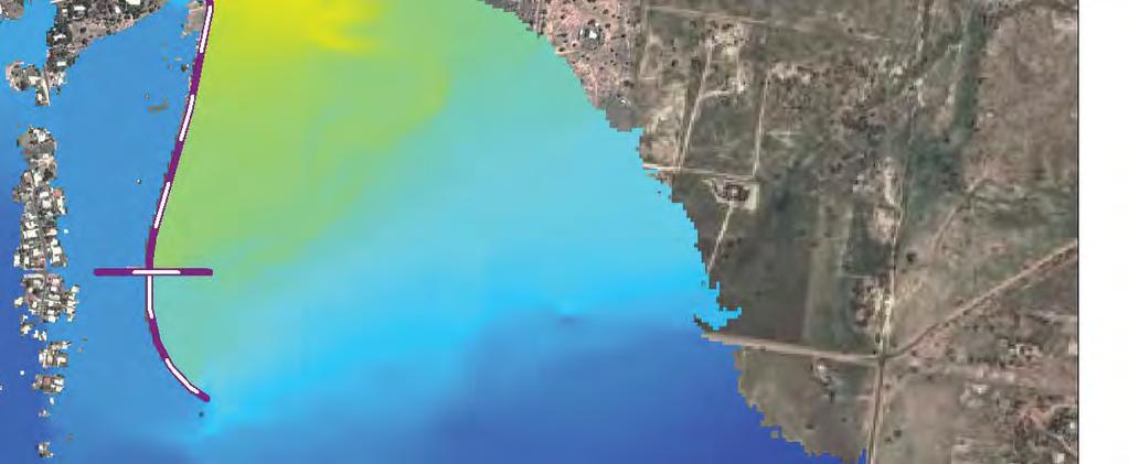
218
219

220
221

222
223 APPENDIX 2 FLOOD VELOCITY MAPPING APPENDIX 2 FLOOD VELOCITY MAPPING
224
225


226

227

228
229

230
231 Document/Report Control Form DOCUMENT / REPORT CONTROL FORM File Location Name: Project Name: I:\Projects\ \005_Ops\Hydraulics\Report Roma Flood Levee Project - Hydraulics Project Number: Revision Number: 1 Revision History Revision # Date Prepared by Reviewed by Approved for Issue by A 31/01/14 B. Bolt A. Zanetti J. Carroll B 08/04/14 B. Bolt A. Zanetti J. Carroll 0 01/05/14 B. Bolt A. Zanetti J. Carroll 1 08/07/2014 B. Bolt A. Zanetti J. Carroll Issue Register Distribution List Date Issued Number of Copies Ostwald Brothers 08/07/ electronic copy Department of Transport and Main Roads 08/07/ electronic copy Office Library, Brisbane 08/07/ electronic copy SMEC Project File 08/07/ electronic copy SMEC Company Details SMEC Level 1, 154 Melbourne Street, South Brisbane, QLD, 4101, Australia Tel: Fax: Brendon.Bolt@smec.com Website: The information within this document is and shall remain the property of: Maranoa Regional Council and SMEC Australia Pty Ltd
232 APPENDIX M OPERATIONS AND MAINTENANCE MANUAL

233 Roma Flood Levee Operations and Maintenance Manual 8 th July
234 TABLE OF CONTENTS TABLE OF CONTENTS DISTRIBUITION LIST / MANUAL CONTROL FORM... iii 1 INTRODUCTION Background Terms General Purpose of this Manual Distribution of this Manual Levee Design Operator Safety OPERATIONS General Engineers Record Keeping Equipment Normal Operations Flood Operations Designation and Responsibilities of Flood Operations Personnel Operational Arrangements Flood Operations Engineer Director of Public Infrastructure Chief Executive Officer Transport and Main Roads Representative Flood Surveillance Flood Warning Levels Level 1 Warning Level 2 Event Notice Level 3 Event 1 in 100 year ARI event Level 4 Event 1 in 1000 year ARI event Event Reductions Post Flood Event Penstock Operation and local drainage Road Barrier Gates Operation Levee Inspections Regular Inspections Flood Event Inspections Annual Inspections Post Flood Event Inspections Access Plan Combatting Seepage Identified during a flood event MAINTENANCE Embankment Grass Rip Rap ENKAMAT - Scour Protection Bare Earth Crest Landowner Access Tracks Formation...17 Roma Flood Levee O&M Manual i
235 TABLE OF CONTENTS 3.2 Drainage Culverts Drainage Paths Drainage Channels Structures Access Gates Road Barrier Gates Fencing Penstocks Public Utility Plant Electricity Water Supply Communications Private Landowner Services Flood Operation Equipment Sandbags MANUFACTURERS LITERATURE Appendix A RELEVANT CONTACT DETAILS Appendix B LEVEE PROPERTY MAP Appendix C INSPECTION CHECKLISTS Appendix D AS CONSTRUCTED INFORMATION LIST OF FIGURES Image 1.1 Flood Levee Extents... 1 Image 2.1 Sandbag Ring...14 LIST OF TABLES Table 2.1 Flood Level Warning Summary... 7 Table 2.2 Culvert with Penstocks...10 Table 3.1 Private Access Ramps...17 Roma Flood Levee O&M Manual ii
236 DISTRIBUITION LIST / MANUAL CONTROL FORM DISTRIBUITION LIST / MANUAL CONTROL FORM File Location Name: Project Name: I:\Projects\ \006_Rptg Roma Flood Levee Project Number: Revision Number: 1 Revision History Revision # Date Prepared by Reviewed by Approved for Issue by 0 03/06/14 J. Carroll H. Baldwin A. Zanetti 1 08/07/14 J. Carroll H. Baldwin A. Zanetti Issue Register Distribution List Date Issued Number of Copies CEO Maranoa Regional Council 08/07/14 1 Electronic DPI Maranoa Regional Council 08/07/14 1 Electronic FOE Maranoa Regional Council 08/07/14 1 Electronic TMRR Department of Transport and Main Roads 08/07/14 1 Electronic Cartwright Street Depot, Roma QLD /07/14 2 Electronic SMEC Project File 08/07/14 Electronic SMEC Company Details Ashley Zanetti Project Manager Level 1, 154 Melbourne Street, South Brisbane, QLD 4101, Australia Tel: Mob: Ashley.Zanetti@smec.com Fax: The information within this document is and shall remain the property of: SMEC Australia Pty Ltd. And Maranoa Regional Council Roma Flood Levee O&M Manual iii

237 INTRODUCTION 1 INTRODUCTION 1.1 Background The Roma Township is located in the Bungil Creek floodplain and has an extensive history of flooding, with a number of major flood events in the past 100 years resulting in damage to private property, public infrastructure and utilities. Three significant large flood events have occurred between March 2010 and February 2012, with the February 2012 flood the largest event ever recorded in Roma and resulting in significant damage to over 500 premises. As a result of the recent major flood events the Roma Flood Study and Mitigation Project was developed to minimise the flood risk to the Roma community and alleviate property inundation from the Bungil Creek catchment regional flooding. On completion of the Flood Study the construction of an Earth Levee was recommended to protect the town against flooding. This document is the Operations and Maintenance manual for the Stage 1 Roma Flood Levee. Construction of the Levee commenced in October 2013 and took eight months to finish with practical completion achieved in June The Levee is over 5km long rising at Roma airport and finishing at Bungil Creek south of Miscamble Street. Image 1.1 Flood Levee Extents The 5km of Levee consists of an earth embankment with 1:4 side slopes and a 3m wide crest for access. The Levee has six access ramps to the creek side and two road crossings, one of which, Miscamble Street, is Council owned and one of which, Carnarvon Highway, is TMR owned. 1.2 Terms Below is a list of abbreviations used within the manual and their definitions. ARI Average Recurrence Interval BOM The Australian Governments Bureau of Meterology Roma Flood Levee O&M Manual 1
238 INTRODUCTION CEO Maranoa Regional Council Chief Executive Officer Council Maranoa Regional Council, the Levee owners DPI The Maranoa Regional Council Director of Public Infrastructure Flood Event This occurs when the flow in the Bungil Creek exceeds its banks and the resulting floodwater comes into contact with the Levee FOE Flood Operations Engineer, appointed by Council Levee The Roma Flood Levee Stage 1 Manual The Roma Flood Levee Operations and Maintenance Manual, this document TMR The Department of Transport and Main Roads Queensland TMRR The Department of Transport and Main Roads Queensland, Carnarvon Highway Representative 1.3 General Purpose of this Manual This document has been compiled as the operations and maintenance manual of the Levee and has been developed in accordance with the Roma Flood Mitigation Project Principal Requirements. The manual has been produced to assist operators, engineers and managers to maintain the Roma Flood Levee in a safe condition that meets the requirements and risk appetite of Maranoa Regional Council. Operators are encouraged to use the manual and to provide feedback on any changes so that over time it remains a useful and relevant tool for operators. The manual should be reviewed periodically and updated as needed to reflect any changes. This manual has been developed with the design of the Levee to consider two flooding events, the 2012 event and the 1 in 1000 year ARI event. It should be noted that the 2012 event has been noted to be approximately equal to a 1 in 100 year ARI event. Any significant construction undertaken in the flood zone will alter the behaviour of the Creek and function of the Levee, a review of this document should be undertaken should this occur Distribution of this Manual It is the responsibility of the Levee owner Maranoa Regional Council to ensure that this document remains up to date and relevant to the operation of the Levee. A register of the issued copies is located at the front of this Manual. The Director of Public Infrastructure for Maranoa Regional Council (DPI) is responsible for maintaining this register. Any updates or replacement documents for this manual should be transmitted to the relevant parties listed on the distribution list. In the event that this document is found to be out of date the DPI from Maranoa Regional Council should be contacted. 1.4 Levee Design The Levee has been designed to consider two flood events: the 2012 flood event and the 1 in 1000 ARI event where the 2012 event is considered to be approximately equal to the 1 in 100 year ARI event. The Levee crest level has been calculated in order to provide protection to the community for the 1 in 1000 year ARI event. The as constructed information provided in Appendix D provides the Levels achieved during construction and verified by the design to provide protection to the 1 in 1000 ARI event. The scour protection has been designed to satisfy a range of flood events, the modelled velocities and can be found in the flood report, attached to the main design report. Roma Flood Levee O&M Manual 2
239 INTRODUCTION The Levee profile consists of an earth embankment with 1 in 4 side slopes and a 3m wide crest for vehicle access. Local Drainage is discussed in the Detailed Design Report. For construction and community purposes the levee was divided into four sections: Section A Ch to 5151 Section B Ch to 3750 Section C Ch to 2650 Section D Ch. 0 to 1450 The Levee crosses four road reserves. The following provisions have been made at each location:- The Carnarvon Highway, Levee Ch.751 to782, is a TMR asset and has a graded ramp conforming to the Austroads Design Standards McPhie Street, Levee Ch. 2890, is a MRC asset and has a private access only ramp to admit vehicles to the levee crest and the creek side of Levee Bassett Lane, Levee Ch. 3740, no provision has been made for access at the end of Basset Lane. Miscamble Street, Levee Ch. 4750, is an MRC asset with an Austroads conforming design that provides a ramp and through road to the other side of Bungil Creek. In addition to the road crossings the levee has provided six private access ramps at the request of the landowners in question: Airport Access ramp Ch.160, provided for MRC to perform security inspections around the airport; 237C Carnarvon Highway Ch. 1050, private ramp which provides access to the residence located on the creek side of the levee; 237D Carnarvon Highway Ch. 1060, private ramp which provides access to the residence located on the creek side of the levee; 73 McPhie Street Ch. 2060, private ramp which provides access to the creek side of the property McPhie Street Road Reserve Ch East Miscamble Street Ch. 4750, private ramp which provides access to the creek side of the property 1.5 Operator Safety The safety of operators and members of the public is an important issue in respect to any operation and maintenance activities undertaken at the Levee. Operators shall undertake a risk assessment in respect to any possible hazards that may be present before undertaking any work or activity relating to the operation and maintenance of the Levee. A list of possible risks to be considered has been provided below. Any additional risks identified should be added in updates of the manual: Vehicle and travelling risks Slippery conditions on the levee bank slopes Drowning during a flood event Fall from height at penstocks and from Levee crest Snakes, ticks and other venomous creatures Use of hazardous tools for completing maintenance Working on uneven slopes Inclement weather hot weather in summer, rain during floods etc. Roma Flood Levee O&M Manual 3
240 INTRODUCTION Operators shall be provided with appropriate safety equipment and any tools should be in good condition and safe to use. All work practices should be in accordance with Maranoa Regional Council standard work practices and safety systems. Roma Flood Levee O&M Manual 4
241 OPERATIONS 2 OPERATIONS This manual includes both operations and maintenance schedules which recommend the frequency of inspections and periodic maintenance works. These recommendations and other procedures outlined in the manual should be reviewed periodically to ensure that they are relevant, up to date and reflect the actual inspection and maintenance requirements for the levee. The operations section of this report has been developed to assist MRC in operating the Levee. While every effort has been made to provide a procedure for a type of flood event it should be accepted that the procedures listed below is not an exhaustive list of preparations that can be made to assist the operation of the levee and the flood proofing of Roma. 2.1 General Engineers All engineers referred to in in this manual must hold a Certificate of Registration as a Registered Professional Engineer of Queensland and must hold appropriate engineering qualifications as approved by the Director of Public Infrastructure Record Keeping Operators shall keep all relevant data relating to the ongoing operation and maintenance of the Levee in a single location, at the Cartwright Street Depot in Roma. Relevant data includes this manual, as constructed records, major flood event reporting, completed maintenance schedules and any other data deemed relevant to the Levee by the Flood Operations Engineer. This data should also be stored electronically to ensure its safekeeping Equipment The following items are a list of equipment that may be required in the occurrence of a flood event, should be stored in a safe location and kept in good working order. Portable pumps Sandbags Torches Two way radios Hi visibility rain gear Locks for local road gates Keys for Penstocks 2.2 Normal Operations This section of the manual details the procedures to be followed during periods when the flow in Bungil Creek is below flood levels. Operations to be undertaken during this period include:- Regular inspection of the levee and associated infrastructure should be undertaken as per section ; Testing of the operation of penstocks as per section 2.12 and 3.3.4; Periodic review and if required updating of this manual; Development and management of a levee maintenance program in accordance with section 3; Roma Flood Levee O&M Manual 5
242 OPERATIONS Confirmation that the Bungil Creek monitoring systems are operational and resources are available as required for flood responses. Council must ensure that operational personnel required for Levee operational activities receive adequate training in the various activities involved in flood control operation as required by the Director of Public Infrastructure. 2.3 Flood Operations This Section of the manual details the procedures to be followed in the occurrence of a flood event. A flood event, for the purposes of the Levee, should be considered as any event where the Bungil Creek exceeds the height of its banks and the resulting floodwater comes into contact with the levee. 2.4 Designation and Responsibilities of Flood Operations Personnel Operational Arrangements Council must ensure that sufficient numbers of suitably qualified personnel are available to operate the Levee if a Flood Event occurs. There are four people relevant to the operation of the Levee in a flood event. FOE Flood Operations Engineer DPI Maranoa Regional Councils Director of Public Infrastructure CEO Maranoa Regional Councils Chief Executive Officer TMRR The Department of Transport and Main Roads Representative Please see Appendix A for the contact details for the nominated persons of the above roles Flood Operations Engineer The Flood Operations Engineer (FOE) is appointed to lead the operation of the levee in a flood event and look after the day to day maintenance of the levee. The FOE should be on call at all times in order to co-ordinate the operation of the levee should a major flood event occur. The FOE is designated to be in charge of Flood Operations at all times during a major flood event. The FOE should be equipped to deal with any local drainage issues that may occur due to the operating of penstocks. A reserve FOE should also be appointed in case of the unavailability of the main FOE Director of Public Infrastructure The Director of Public Infrastructure (DPI) is responsible for all issues regarding the maintenance and renewal of Council Infrastructure including the Levee. The DPI will appoint the FOE to oversee the regular maintenance of the Levee. The DPI is to provide resources as required to maintain levee and development of maintenance budgets. The DPI will supply information to the TMRR regarding the status of the flood and the requirement to close the Carnarvon Highway. The DPI must ensure that this document is kept up to date and issued to the correct parties Chief Executive Officer The Chief Executive Officer (CEO) is responsible for the short and long term strategies of Maranoa Regional Council. The CEO is required to approve any emergency evacuation plan. All practical attempts should be made to liase with the CEO if a flood event is likely to cause failure or overtopping which will endanger life or property. Roma Flood Levee O&M Manual 6
243 OPERATIONS Transport and Main Roads Representative The Transport and Main Roads Representative is appointed by TMR in order to co-ordinate with the DPI in the event of a flood. The TMRR will be responsible for the closing of the Carnarvon Highway on advice from the DPI. 2.5 Flood Surveillance The FOE is the individual appointed by Maranoa Regional Council with the responsibility of monitoring rain gauge levels, weather forecasts and weather warnings within the Bungil Creek Catchment. The FOE is to take a proactive approach to monitoring of conditions in the Bungil Creek Catchment that could lead to flood conditions developing at Roma. The FOE should monitor the Bureau of Meteorology (BOM) website or other media outlets, particularly during the wet season (November to February). The BOM website has a summary of warnings for the Queensland Region, this web page should be inspected daily by the FOE for storm warnings within the Bungil Creek Catchment. The FOE should also monitor BOMs predicted rainfall for the Maranoa Region. There are four rainfall gauges on the Bungil Creek Catchment that monitor conditions. The following should be monitored from the BOM website ( bin/wrap_fwo.pl?idq60367.html):- Station , Roma Airport Station , Tindarra TM Station , Tabers TM Station , Spring dale TM There are two stream gauges on Bungil Creek located upstream of Roma that provide details relevant to the Bungil Creek Catchment. Station , Tindarra TM - Station , Tabers TM - The river conditions for these stations can be found at this web address: In the event of forecast heavy rainfall forecast in the region the FOE will immediately contact the Maranoa Regional Council Director of Public Infrastructure and the TMRR in order to place them on standby issuing a level 1 warning. 2.6 Flood Warning Levels The manual has divided the severity of an event into four separate levels in order to allow MRC to respond to a flood event appropriately. The table below summarises the events by using predicted water levels at the Tindarra (422965) and Tabers (422210A) Flood Gauges:- Table 2.1 Flood Level Warning Summary Flood Level Trigger Response Level 1 High Rainfall rates predicted in Bungil Creek Catchment. FOE, DPI and CEO to be in communication with each other regarding a possible Tabers Gauge Level (m) >3m >3m Tindarra Gauge Level (m) Roma Flood Levee O&M Manual 7
244 OPERATIONS Flood Level Trigger Response Level 2 Level 3 Level 4 Bungil Creek exceeds the height of its banks. BOM issues flood warning. Flood Level reaches 800mm below Levee crest. Very High Rain rates predicted. Rising water levels in Bungil Creek. BOM issues moderate flood warning. Flood Level reaches 200mm below the crest. Very high rain rates predicted rising water levels in Bungil Creek. BOM issues major flood warning. flood event. The penstocks are to be closed and the Creek area evacuated. Initial warning released. Local and State Roads to be closed. Ensure continuous inspection of the levee occurs. Tabers Gauge Level (m) >5m >5m >6m >6m >7m >7m Tindarra Gauge Level (m) 2.7 Level 1 Warning The FOE will undertake a flood event inspection of the Levee. The FOE should (if time and conditions permit safe access) immediately arrange for any loose objects to be removed from the creek side of the levee. At this stage the DPI shall inform the CEO and TMRR of the possible pending flood event. The DPI will monitor the flood warnings from the BOM website. No action is required from the CEO or TMRR at this stage. The FOE shall undertake an equipment check on items that may be required should a flood event worsen. Should the FOE identify a defect during his inspection that may prevent the levee functioning correctly they shall immediately inform the DPI. In the event of a defect identification judged to be major by the DPI, a defect that may put lives and property at risk, the DPI will contact the CEO. The FOE will continue to monitor the rainfall and weather forecasts. He will also undertake a Flood event Inspection as detailed in Section The Foe will also undertake an equipment check. The DPI will inform the CEO of the possibility of a flood event and monitor the rainfall and weather forecasts. The TMRR will take no further action at this time other than to wait on further contact from the DPI and the FOE. 2.8 Level 2 Event Notice In the event of heavier rainfall and the Bungil Creek exceeding its banks the FOE will contact the DPI and issue a Level 2 Warning. The DPI will contact the TMRR and issue a Level 2 event notice. The FOE will organise a crew of two persons to close the road barrier gates on both sides of East Miscamble Street before accessing the levee along the crest and travelling to McPhie Street closing Roma Flood Levee O&M Manual 8
245 OPERATIONS the penstock gates as they go. At McPhie Street they shall ensure that the gate is locked. The crew will continue along the levee until all the penstocks are closed. The crew shall if time, materials and safe access permit, sand bag the creek side of the culverts. The sandbags will provide additional protection to the penstock by sealing the pipe on the creek side. The sand bags should be placed parallel to the direction of flow with each successive layers joint connections staggered in order to provide a comprehensive seal. When the crew reach the properties 237C and 237D located on the creek side of the levee they shall inform the landowners of the impending flood event and suggest to evacuate. As a matter of courtesy and if time and conditions permit the DPI will contact the residents immediately on the town side of the Levee (see Appendix A) of the impending event and the requirement to close the penstocks. If the weather is forecast to worsen significantly the DPI should make a media release advising the residents downstream of the extent of the event. The FOE shall monitor the flood progress by performing a flood event inspection on a regular basis throughout the day until the flood event is over or the level is increased. The inspection should monitor local drainage paths on the townside of the levee. If the FOE notes ponding of water at the penstocks or any other location along the levee they should consider using a portable pump to pump water over the levee into the creek side. The FOE will contact the landowners residing in the flood plain of the levee and inform them to leave their properties. The FOE will organise a crew to close the penstocks. The FOE will arrange for the closure of the flood gates on Miscamble Street. The DPI depending on the severity of the forecast shall issue a media release to the residents of Roma. The TMRR should begin preparation to close the Carnarvon Highway. 2.9 Level 3 Event 1 in 100 year ARI event Upon receipt of a forecast that water levels will reach or exceed the 1 in 100 year event the FOE will issue a level 3 event to the DPI, then the TMRR and then the CEO. The FOE will, with the penstock crew evacuate the two properties on the flood side of the levee (see Appendix B). The DPI should issue a media release identifying the severity of the flood and warning the residents downstream of the Levee. The DPI shall inform their counterpart in the Banana Shire Council and discuss the possibility of closing the Roma Taroom Road. The DPI shall also contact the Origin Camp on the Roma Taroom Road and inform them of the likelihood of the road closure. The FOE and penstock crew will be required to take flood event inspections every hour from the levee crest and report to the DPI any significant findings. Any significant defects found in the Levee should be communicated to the CEO. The TMRR will close the Carnarvon Highway using temporary barriers to prevent northbound traffic leaving the town. The TMRR will also contact Injune and close the road this direction. The DPI will issue a level 3 warning to the FOE, TMRR and the CEO. The FOE will evacuate the flood side of the levee and close McPhie Street. The FOE will undertake Flood event inspections every hour. The TMRR will close the Carnarvon Highway Level 4 Event 1 in 1000 year ARI event Upon receipt of a forecast that water levels will reach or exceed the 1 in 1000 year ARI event the FOE will issue a level 4 event to the DPI, then the TMRR and then the CEO. The FOE and penstock crew Roma Flood Levee O&M Manual 9
246 OPERATIONS will cease to take Flood event inspections continuously due to concerns of the levee overtopping. The FOE will monitor the flood level from a safe location such as the Cartwright Street Depot. Should the levels of the event be forecast to increase above the 1 in 1000 the chance of the levee being overtopped is increased. The DPI and the CEO shall discuss the possibility of evacuating the town. During a 1 in 1000 year ARI event the flood waters are expected to inundate the town side of the Miscamble Street ramp. Access to the Levee should it be required shall be via McPhie Street. The DPI will issue a level 4 warning to the FOE, TMRR and the CEO. The FOE will cease flood event inspections and monitor the flood levels from a safe location 2.11 Event Reductions The FOE will continue to inform the DPI and TMRR as the flood recedes. The FOE will liase with the DPI during the receding of floodwater levels so as to prepare an inspection of the levee. The FOE will inform the DPI of a flood event reduction, the DPI will then inform the CEO and TMRR as required Post Flood Event A major flood event, for the purposes of the Levee, should be considered as any event where the Bungil Creek bursts its banks and the resulting flow comes into contact with the levee. After any such event a post flood inspection will be required and shall consider the following: Only access the site if it is safe to do so; Inspect the end of the levee at Bungil Creek for scour damage; Inspect the Levee embankment for signs of damage including erosion, slipping of fill and evidence of seepage; Inspect the crest of the Levee for signs of movement (cracks, displacement etc.) Inspect the area around culverts and known services beneath the levee for erosion of material and cracks Record any works required and make arrangements for the work to be carried out. Any erosion, seepage or movement of embankment should be attended to as soon as possible. During the flood season rectification work following a storm should be completed promptly to prevent further damage in any proceeding floods. The procedures for these inspections are further discussed in Section Penstock Operation and local drainage Penstocks are operated via handwheel which is turned clockwise to close and anti-clockwise to open. The penstocks should be locked using a padlock when not being opened or closed the keys for the padlocks are universal and should be stored in the Cartwright Street Depot at all times. The penstocks are accessed from the top of the levee by descending the 1 in 4 batter from the access track. The culvert headwalls have been shaped to provide a platform and standing room behind the headwall for an operator to turn the wheel. The closing of the penstocks will alter the drainage paths behind the levee and may cause water to pond on the town side of the levee. During a flood event the FOE will need to assess the requirement for temporary pumps and or sandbags to alter the drainage paths. A number of portable pumps should remain on standby in the Cartwright Street depot for use in a flood event. The following table lists the locations of culverts that pass through the levee where temporary pumps may be required to assist local drainage systems when their penstocks have been closed: Table 2.2 Culvert with Penstocks Roma Flood Levee O&M Manual 10
247 OPERATIONS Culvert Location Details WP01F Section D, Ch. 180, Roma Airport 600RCP located inside the airport security fencing. WP01G Section D, Ch. 455, Roma Airport 600RCP located outside airport security fencing WP01D Section D, Ch. 740, Carnarvon Highway 450RCP located on LHS of Highway Northbound WP01B Section D, Ch. 793, Carnarvon Highway 450RCP located on RHS of Highway Northbound WP02A Section D, Ch RCP located in 249 Carnarvon Highway WP02B Section D, Ch RCP located in 237B Carnarvon Highway WP04A Section B, Ch RCP located in 27 McPhie Street WP05A Section B, Ch RCP located in 80 Edwardes Street WP08C Section D, Ch RCP located in 13 East Miscamble Street 2.14 Road Barrier Gates Operation Gates at McPhie and East Miscamble Street should be locked using a chain and padlock. The chains and padlocks should be stored in the Cartwright Street depot when not in use Levee Inspections Four types of inspections are required to ensure the levee remains able to maintain its performance in a major flood event. Operators should maintain a record of the any inspections and activities undertaken on the Levee. This includes but is not necessarily limited to the inspections mentioned below. Suggested information to be captured includes:- Date and purpose of visit; Name of persons in attendance; Water Level if applicable; Photos and plans of defects; Tasks undertaken; Notes regarding further actions; This information should be recorded as soon as possible after the completion of an inspection and stored with the Levee records at the Cartwright Street Depot Regular Inspections In order to ensure that the Levee functions correctly maintenance should be undertaken as per the frequency recommended in Section 3.1 to 3.4. The purpose of the regular inspections is to ensure that this maintenance is completed and any new maintenance or repair items identified in a timely manner. Regular inspections should be undertaken using the annual inspection checklist in Appendix C and should be undertaken by an inspector suitably trained and familiar with this manual. Regular inspection checklists should be stored in the Cartwright Street Depot with this manual in order to have a complete record of the Levee maintenance. Regular inspections should be taken monthly. Roma Flood Levee O&M Manual 11
248 OPERATIONS Flood Event Inspections A flood event inspection is to be undertaken as flood levels approach the toe of the Levee and should continue on a regular basis until the flood has receded. The frequency of the inspections shall be as required to ensure that any issues are quickly identified. It is recommended that an inspection be undertaken at least once every 3 hours initially and continuous surveillance undertaken as the FOE see fit. In order to allow inspections to continue during hours of darkness, the inspection team will need to be provided with battery powered lights. The lights are to be capable of providing sufficient light to enable safe access and to illuminate the Levee embankment slopes and embankment toe area. The inspection teams are to be equipped with radio transceivers to maintain regular contact with the FOE and to enable a rapid response to any issues. It is recommended that all flood inspection be undertaken on foot. Due to the total length of the levee and the teams required to complete and inspection consideration should be given to using multiple teams. The flood event inspection is similar to the regular inspection in procedure. It requires the inspector to traverse the length of the Levee and inspect the levee banks, penstocks, headwalls and gates along the Levee. The inspector shall be familiar with the levee and its maintenance so that they can identify any serious defects. The inspection should be undertaken by a team of at least two for safety reasons. The inspection team shall wear life jackets to lower the risk of drowning should they fall into the flood waters. The inspections should focus on the town side foundations and embankment batters to detect potential failure mechanisms such as (seepage, boiling, piping, and heaving). The primary goal of the inspections will be to identify any areas of seepage during a flood event. Should any seepage be noted the FOE will be required to monitor and respond Annual Inspections The annual inspections should be a complete review of the operation and maintenance of the Levee. The annual inspection should include operation of all elements of the levee and inspect the full length to ensure that the maintenance undertaken has been in keeping with this manual. It is recommended that annual inspections are completed in September before the start of the wet season so that time is given to complete any maintenance that is required. The inspection should identify items of maintenance that are to be undertaken to ensure the levee is flood ready should a sudden and severe storm occur in the catchment. Items that are to be inspected include penstocks and removal of rubbish/debris that may hinder their operation and erosion control measures that may be damaged. The inspection should consist of a walking inspection of the length of the levee, a review of this manual and Levee maintenance records. The inspection should be undertaken by a suitably qualified professional engineer as deemed by the Director of Public Infrastructure. The inspection shall be reported on and shall fully document any deficiencies identified and a means to resolve these deficiencies. A copy of the report should be stored in the Cartwright Street Depot. This report shall be approved by the Director of Public Infrastructure. Please see Appendix C for an inspection checklist Post Flood Event Inspections A Post Flood Event inspection should be undertaken after every flood event. Inspections should consist of a complete walkthrough of the Levee and a procedural review of the operation of the Levee. The post flood inspection should inspect all elements of the levee the full length to ensure Roma Flood Levee O&M Manual 12
249 OPERATIONS that any structure or element of the levee that has been damaged is assessed in order to ensure that it remains fit for purpose. In a minor event below the 1 in 100 event a Flood event Inspection should be undertaken by the FOE as an absolute minimum. In an event greater than or equal to the 1 in 100 event the inspection should be undertaken by an experienced dams engineer who is a Registered Professional Engineer (RPEQ) to ensure any Levee defects are identified and actions to remediate the defects are noted. The inspection should be undertaken by a qualified professional engineer as determined by the Director of Public Infrastructure. The inspection shall be reported on and shall fully document any deficiencies identified and a means to resolve these deficiencies. This report shall be approved by the Director of Public Infrastructure Access Plan In order to maintain the levee arrangements have been provided for vehicles to periodically access the crest of the levee. Access can be gained to the crest from the road at Miscamble Street. Vehicles will be required to turn right off Miscamble Street and head in a downstream (southerly) direction. A vehicle will then be able to travel to the limit of works and perform a turn down the batter and return to the crest of the levee before returning to Miscamble Street. The inspector can drive straight across to the other side of the levee at Miscamble Street where they can travel to McPhie Street where the inspector can descend using the access ramp to either side of the levee. To inspect Section C of the Levee the inspector can access the levee from McPhie Street and travel in an upstream direction to the council owned property at 249 Carnarvon Highway. The inspector will need to descend the levee at this location and travel to the airport. At the airport after checking in with Airport Security the inspector will be able to use the internal access tracks to access the Levee crest. Where the crest of the levee is topsoiled and grassed only, vehicular access to the crest is restricted to undertaking maintenance or repairs only. The use of vehicles for inspection of the levees is not recommended. Vehicular access to the crest of the levee should only be undertaken after completion of a site assessment Combatting Seepage Identified during a flood event The primary tool available to the FOE and his team during a flood event is the use of sand bags to temporarily fight any water suspected to be flowing through the Levee. Sandbags construction does not guarantee a water tight seal but properly filled and placed sandbags can act as a barrier to divert water. If water finds a large enough path through the levee it will become visible. Inspectors should carefully examine the water, fi the flow is clear there are no issues yet, if there is no distinct hole, the water flow is not a threat. The area should be monitored regularly for changes. Roma Flood Levee O&M Manual 13

250 OPERATIONS Image 2.1 Sandbag Ring A dirty water flow indicates that the embankment is being eroded by the water. Constructing a sandbag ring around the defect is the best solution. The ring reduces water flow until the water is flowing clear but not to stop the water flow, this acts as a relief valve for the water pressure. If the flow is stopped the pressure will remain and the water will find another path through the levee. The height of the ring should create enough head to slow flow so that no more material is displaced. Roma Flood Levee O&M Manual 14
251 MAINTENANCE 3 MAINTENANCE This Section of the report addresses ongoing maintenance issues that the levee owner will need to address in order for the Levee to function as intended in a major flood event. All repairs and maintenance should be undertaken using the construction specification and the design drawings so that the original design intent of the Levee can be maintained. Any alteration to the Levee completed outside of the construction specification and the design drawings should be verified by a suitably qualified engineer as determined by the DPI. Any rehabilitation work completed after a flood event should be completed so that the repairs function in the same manner or better than the original design intent. All material used to repair scour damage or general weathering shall be replaced with material that complies with the construction specification. Any structures used to replace damaged as constructed structures shall be equivalent to the as constructed drawings (see Appendix D). Any damage structures to be refurbished rather than removed will require approval from the Director of Public Infrastructure. Any changes or additions to mechanical components (penstocks, piping etc.) should be noted in the manual and copies of any technical literature (brochures, parts schedules, maintenance schedules, drawings etc) included in the manual. 3.1 Embankment Grass The embankment batters of the Levee are to be covered with topsoil and grass so as to provide low maintenance, long term stabilisation of the surface against erosion and to provide acceptable appearance to the area. The Levee requires 300mm of topsoil to be placed and seeded with Buffel Grass in order to protect against velocities less than or equal to 1.5m/s. Further information can be found in the construction specification Part B Section 8. The grassed areas should be mown periodically to maintain a thick vigorous turf. The frequency of moving shall take into account growth rates and seasonal conditions. During the construction of the levee a 6 metre wide perimeter from the toe of the Levee batter was cleared and grubbed. This area is to be maintained with Buffel Grass to provide a clear zone at the toe of the levee. The Levee grass cover should be kept between 30 and 100mm long. The frequency of mowing required will vary depending on the season however it is suggested that mowing be undertaken as required to maintain the grass cover. Due to the slope of the levee and access issues a low centre of gravity lawn mower suitable for the embankment slope is recommended. Alternatively a boom arm could be used to cut grass along the levee. Grazing by livestock on the vegetation on the levees is not to be permitted as this will impact on the coverage of vegetation, thus impacting the levee integrity. Trees and other types of vegetation except those approved in the technical specification should be removed from the levee embankment and prevented from establishing within the 6m perimeter from the embankment toe. Maintenance inspections should include undertaking a vegetation control program that prevents trees becoming established whose root systems may penetrate the embankment and affect the stability of the Levee. Should trees become established on the levee they should be grubbed immediately. The holes remaining after grubbing shall be backfilled promptly with material that meets the designs technical Roma Flood Levee O&M Manual 15
252 MAINTENANCE specification to prevent the infiltration and ponding of water. The backfilled material shall be compacted to at least the relative density of the adjacent ground Rip Rap The Rip Rap coverage of the levee shall be as per the design drawings with the locations where rip rap is required noted on the working plan drawings WP-1000 to 1008 and the depths and gradings of rock required noted on the typical cross section drawing TC-0103 and the specification Part A Construction Section 9. Any new Rip Rap shall be placed on BIDIM A34 or a design approved equivalent geotextile in order to prevent weeds or unwanted grasses growing through the rip rap causing maintenance problems and inhibiting its energy dissipation function ENKAMAT - Scour Protection Turf reinforced matting (TRM) coverage should be as per the design drawings with the locations where TRM is required noted on the working plan drawings WP-1000 to 1008 and the set out as per TC TRM shall be maintained as per the manufacturers requirements. Please see Section 4 Manufacturers Literature for requirements. TRM areas shall be seeded with Buffel grass which shall be maintained as per Section 3.1. TRM should be inspected every month for vandalism or animal damage. The inspection should ensure that it is not damaged and will be able to function properly in a flood event. Refer to the manufacturers information section for more information Bare Earth Bare earth is any place where the grass or scour protection (rip rap and enkamat) has been eroded or lost. Should any areas of bare earth be exposed for any reason the area should have topsoil replaced and the area reseeded with buffel grass at a rate of 3kg/ha with a cover crop of Japanese Millet, sterile hybrid version during October to March and during April to September Wimmera Rye, sterile hybrid version. Any replaced grass should be inspected for healthy growth, and treated for any deficiency in topsoil or chemical imbalance. The grass should be cordoned off to prevent any damage until such a time as the cover crop has been established Crest Grass growing on the 3m wide Levee crest is to be kept shorter due to its requirement as an access in an emergency situation. The grass should be kept between 30 and 50mm at all times. No ponding or rutting shall be allowed to develop and any damages should be replaced with material that agrees with the construction specification. Inspections of the track should check for possible rutting and ponding of water. Inspectors should also check for any hazards or items that would impede inspections during an emergency event. Any repairs or maintenance completed along the crest of the Levee should ensure that the finished level of Type B material (see construction specification part B Section 1.3) of the repair is the same level or above the design drawings Landowner Access Tracks The landowner access tracks are found at chainages 1050, 1060, 2080 and Access tracks over the levee should be maintained as per the as constructed drawings. Below is a schedule of the private access tracks: Roma Flood Levee O&M Manual 16
253 MAINTENANCE Table 3.1 Private Access Ramps Property Levee Chainage Purpose Roma Airport 160 Access over the Levee for Airport vehicles. 237C Carnarvon Highway 1050 Access from Carnarvon Highway to Residence. 237D Carnarvon Highway 1060 Access from Carnarvon Highway to Residence. 73 McPhie Street 2080 Access to Creek Side Paddock McPhie Street 2900 Access to Creek Side Properties 13 Miscamble Street 4720 Access to Creek Side Paddock The access ramp provided at the Airport is located within the security fencing and is provided to allow the existing airport tracks to be maintained and for security and maintenance access around the airport. The access ramp provided at McPhie Street is designed to provide access to and across the Levee. The other accesses mentioned in Table 3.1 will act as individual accesses for properties however they still require maintenance to ensure they can be used in a flood event. No organic material should be allowed to grow on these tracks Formation The surface formation of the levee must be checked for any rabbit or rodent holes or burrows. If any holes are found they must be backfilled, any repairs or maintenance completed along the formation of the Levee should ensure that the finished level of Type B material (see construction specification part B Section 1.3). 3.2 Drainage Culverts Culverts have been provided through the levee to mimic current overland flow paths. Culverts should be kept free of any material that may clog them and inhibit flow. Culverts should be inspected after rainfall events exceeding 10mm per hour in order to confirm that culverts have not been clogged or silted. Culvert energy dissipation has been provided at the outlets for all the culverts. The rock protection provided should be maintained as per the detailed drainage drawings DD-0001, 0002 and The energy dissipation material shall be maintained as per section rip rap. Culverts should also be inspected for scour at and behind headwalls. The removal of material around the headwalls may compromise the integrity of the structures. All material replaced should be undertaken in accordance with the design specification and the design drawings Drainage Paths While the Levee design has attempted to maintain existing drainage paths, there may be cases where due to the level nature of the area some minor ponding may occur. Ponding of greater than 150mm deep water against the levee will require treatment. Any such ponding should be treated by the placement of selected fill and regraing the area. Roma Flood Levee O&M Manual 17
254 MAINTENANCE Drainage Channels Drainage channels should be kept clear of silt and debris. Grass lined channels should be maintained as per section An inspection of the channel should be undertaken every four weeks to ensure that the channel is not clogged. The Levee has only one purpose constructed drainage channel at the airport end of the Levee however existing drainage channels should be maintained as recommended above. 3.3 Structures Access Gates Access gates have been provided along the crest of the levee in order to access different adjacent properties that the levee runs through. The gates have been orientated so that there is always a minimum of 2.4m width to allow a vehicle to enter. The gates should be maintained as per the drawings in section 4. These gates should be left unlocked at all times. In the event of an unpredicted emergency access will be required to perform the routine inspection along the length of the levee. Any private locks found on the gates should be removed. A gate has been provided at the end of McPhie Street to close it off to traffic. The properties 7 and 8 McPhie Street are both owned by MRC. The gates should be utilised regularly during the grass maintenance and Levee general inspection however they should undergo a specific inspection at 3 monthly intervals. The gates should be inspected for damage and exercised to ensure the closing mechanism is functioning correctly Road Barrier Gates Barrier gates, fencing and signage have been provided at Miscamble Street in order to close the road to traffic in an emergency event. The barrier gates should be inspected for damage every three months. The gates should be opened and closed to ensure they function correctly in the same check Fencing Fencing has been provided along property borders and as specified by particular landowners. The set out for the fencing shall be as per the control line and fencing set out drawings CL-1001 to Fencing noted on these drawings shall undergo a three monthly inspection for any damage or repairs required. Fencing should be maintained to Capricorn Municipal Development Guidelines Standard Drawing CMDG Penstocks Penstocks should be inspected and exercised at 3 monthly intervals by opening and closing to ensure they are functional in a flood event. The lift nut and penstock stem should be cleaned and greased annually using Mobil Mobilith As2 Ep2 or equivalent. Refer to manufacturers literature for more information. 3.4 Public Utility Plant Public Utility Plant that conflicts with the levee is noted on the drawings PU-1000 to PU PUP should require no maintenance in order to continue functioning as part of the Levee. The location of the services as per the as constructed drawings should be inspected every three to six months. The inspection should ensure that no water is ponding on either side of the levee within 10m of the service. Roma Flood Levee O&M Manual 18
255 MAINTENANCE Electricity Electricity supply is maintained and provided by Ergon. Any maintenance issues should be referred to Ergon Roma Water Supply Water supply is maintained and provided by Maranoa Regional Council. Any maintenance or change to the services beneath the Levee required should be referred to the DPI Communications Communications are maintained and provided by Telstra. Any maintenance issues should be referred to Telstra Roma Private Landowner Services Details of private landowner services are to be confirmed. Any additional landowner conduits running over the levee need to be approved by the DPI. Such conduits would need to consider safe access along the top of the levee during a flood event. No additional conduits are to run through or under the Levee. 3.5 Flood Operation Equipment Sandbags A stock pile of tied sandbags should be made available for use in flood operations. This stockpile is recommended to be stored at the Cartwright street depot. Roma Flood Levee O&M Manual 19
256 MANUFACTURERS LITERATURE 4 MANUFACTURERS LITERATURE Roma Flood Levee O&M Manual 20
257 25A 25S INSTRUCTION MANUAL Fabricated Water Gates Manual and Power Actuated Water Gates (Penstocks) LUDOWICI WATER 72 Mica Street, Carole Park, QLD. AUSTRALIA Ph Fax IM02-2-A Page 1 of 12
258 INTRODUCTION Specialist Expertise Ludowici Water specialises in the design and fabrication of water gates including penstocks, slide gates and stopgates. The compani emphasis is on its engineering expertise, customer support, high quality and performance. Quality Ludowici Water has full quality assurance accreditation to ISO 9001:2000 and all equipment is manufactured and tested meeting strict quality control standards. Purpose The purpose of this manual is to provide recommendations only for the handling, storage, installation, operation and maintenance of standard equipment supplied by Ludowici Water. Equipment covered in this manual includes 25 Range Penstocks. The recommendations outlined in this manual should be read in conjunction with relevant equipment drawings provided by Ludowici Water. INDEX Introduction 2 Receiving 4 Handling and Storage 4 Installation 5 Initial Operation of Gate 11 General Maintenance 11 Spare Parts & Replacements 11 Trouble Shooting 12 Field Service Range Penstock The 25 Range of Penstocks are engineered for excellent sealing whilst providing maximum resistance to corrosion. Ultra high molecular weight polyethylene sealing surfaces provide a low coefficient of sliding friction while maintaining a superior resistance to chemical attack and water absorption. The 25 Range of Penstocks is designed for high head applications incorporating a top seal. Under maximum design on and off seating heads under normal conditions, the leakage rate should not exceed 0.1L/min per metre of seal. Precision Equipment All Ludowici Water water gates are considered precision equipment and although robust in design, all equipment should be handled with care and installed accurately to ensure equipment operates as designed at maximum efficiency. Liability Ludowici Water assumes no liability for the application of the recommendations contained herein nor the incorrect handling, storage, installation, operation or maintenance of the equipment. Copyright Ludowici Water Revised and Printed February 2012 for Ludowici Water. This manual is provided in confidence and cannot be copied or reproduced in any part without the written consent of Ludowici Water. IM02-2-A Page 2 of 12
259 EQUIPMENT IDENTIFICATION DIAGRAM Stem cover tube Limit Nut F10 or F14 Lift Limit Nut Bevel gearbox Stem cover tube Handwheel Electric actuator Manual Handwheel Bevel Reduction Gearbox Electric Actuator Pedestal Complete with factory-set Internal stem guides Factory-set stem guides Thrust Tube Complete with factory-set Internal stem guides Cored hole (by others) Stem guides Stem Factory-set stem guides Open top + pedestal Self contained frame Thrust tube Stem Anchor bolts Off-seating wedge Top seal Thrust nut pocket (Non-rising stem) Bracket (rising stem) Frame Gate Gate stiffener Side seals and seal retainer bars (factory set, do not adjust) Invert seal Frame and gate Fig.1 Typical penstock configuration IM02-2-A Page 3 of 12
260 RECEIVING All items associated with the delivery of the required equipment are listed on the packing list supplied with the delivery. Check all items upon receipt of delivery. Notify Ludowici Water immediately if a shortage exists. Notify Ludowici Water if damage has occurred. Unless the contract with Ludowici Water states otherwise, all equipment is shipped FOT) our store. In the event that equipment has been damaged in transit, the purchaser will be responsible for filing a claim with the transport company. For assistance in filing a claim and/or replacing equipment, please contact Ludowici Water directly. Ludowici Water cannot be responsible for any shortages reported more than 30 days after receipt of shipment. HANDLING AND STORAGE Care should be taken with handling and storage of all items. The following guidelines should be followed to prevent personal injury or damage to the equipment. Standard safety procedures should be followed for lifting and handling of heavy equipment by suitably qualified personnel. Although equipment is robust and durable in design, all equipment must be handled with care preventing damage in any way. Equipment may be lifted using slings. Care must be applied in selecting suitable lifting points so as to prevent damage. Equipment must be adequately supported to prevent bending and distortion. Lift equipment with the gates in the fully closed position, taking particular care of the sealing surfaces. Ferrous lifting gear such as chains should not come into direct contact with stainless steel equipment as this will cause contamination. Particular care must be taken with machined components such as the machined stem threads. Equipment should be stored on a dry flat surface stacked on timber blocks and kept covered and clean. Do not stack equipment without proper protection and proper spacers. If the stem is supplied with a protective cover this should not be removed until installed. Miscellaneous equipment including anchors and lift components may be supplied in boxes. Store these boxes in a secure and dry place with the equipment until installed. Handle the assembly as you would any other piece of precision machinery. Equipment has been factory set. DO NOT DISSASSEMBLE. IM02-2-A Page 4 of 12
261 INSTALLATION General To ensure the correct operation of the equipment, it is essential that items set in concrete are accurate and in accordance with recommendations included in this manual and as per equipment drawings provided. Check equipment data plates to select required equipment. TIP: There are three key issues to remember when installing a water gate. A water gate must be square, it must be straight and it must be clean. Square: The water gate must be kept square and installed with the invert horizontal and side rails perpendicular to the invert and top of frame. Straight: The water gate must be installed with the frames straight in each plane, free from twist and stress. Clean: The seals must be kept clean, free from debris. If any grout or other debris comes in contact with the seals, this must be thoroughly cleaned. STEP 1 - Check opening dimensions and mating surface 1.1 Measure inside diameter of pipe or concrete opening width and height. Record dimensions and compare penstock opening size. The water gate opening should not be smaller than the mating inside diameter of the pipe or the concrete opening. 1.2 Check that the mating surface is in good condition, flat and within tolerance as specified by Australian Standards. 1.3 Check invert of concrete opening is horizontal and sides are vertical with a level. TIP: It is important to install the water gate level rather than aligned with the mating surface. STEP 2 - Locate water gate accurately onto concrete wall 2.1 Carefully lower water gate adjacent to the mating surface using suitable lifting equipment following all necessary safety precautions. TIP: The water gate is generally supplied closed (with the gate in the lowered position, 25A-W and 25S-W gates are closed in the raised position). The water gate should be installed with the gate closed and with temporary bracing intact. 2.2 Align invert of water gate opening with invert of pipe or concrete opening. Place temporary support blocks under frame to maintain position. 2.3 Align inner sides of water gate opening with inside of pipe or concrete opening. 2.4 Check that the top of water gate opening is aligned with opening of pipe or concrete wall or is as shown on drawings. IM02-2-A Page 5 of 12
262 2.5 With a level, ensure that the invert of the water gate is level ie. frame is perpendicular to invert. Fig 2.5 Install Perpendicular TIP: The water gate must be kept square and installed with the sides perpendicular to the invert and top of frame. 2.6 Push frame against concrete wall. 2.7 Drill into concrete through the oversize anchor bolt holes at the top anchor bolt location on each side of the frame. (Install total of two only anchor bolts at this stage). Set into position top two anchor bolts using Hilti HIT-RE 500 or HVU Anchor Adhesive resin or equivalent (supplied by others) with projection as shown on drawings. Follow guidelines for the installation of chemical anchors as outlined in the installation procedures provided by anchor adhesive supplier. Let adhesive set for specified period. Hang water gate by setting into position top two anchor bolts only. STEP 3 - Set and adjust anchor bolts Fig. 2.7 Install top two anchor bolts The following step outlines the procedure for a traditional grouted installation. Anchor bolts consisting of double nuts allow for jacking to accommodate deviations in mating concrete face. Non-shrink grout is then poured into the void. Anchors complete with backing nut and locking nut. 25mm Non-shrink grout between frame and mating concrete face (Refer step 4) 25-S Series 25-A Series Anchors complete with backing nut and locking nut. 25mm Non-shrink grout between frame and mating concrete face (Refer step 4) IM02-2-A Page 6 of 12
263 Fig. 3.0 Typical wall mounted installation 3.1 Upon installation of the top two anchor bolts, allowing time to set, safely move water gate and place backing nut and washer onto anchor bolts. Locate water gate approximately 25mm from mating concrete face using appropriate safety procedures and lifting equipment. 3.2 Check for clearance between the gate and the invert seal. Carefully wedge the invert seal frame member upwards to ensure horizontal invert seal is pressing hard against the gate. (Excludes WC & WR Range) 3.3 Drill into concrete through all remaining oversize anchor bolt holes. Set into position all remaining anchor bolts using Hilti HIT-RE 500 or HVU Anchor Adhesive resin or equivalent (supplied by others) with projection as shown on drawings. Follow guidelines for the installation of chemical anchors as outlined in the installation procedures provided by anchor adhesive supplier. Insert backing nut and washer and finger-tighten locking nuts and washers. Let adhesive set for specified period. 3.4 Check for clearance between the gate and the top seal for 25S/A-T penstocks (and Invert seal for 25S/A-W penstocks). Carefully wedge the top seal frame member outwards (by Jacking bolts) to ensure horizontal seal is pressing against the gate. (Excludes US, WC & WR Range) Anchor bolt with backing nut and locking nut Jacking bolt (top seal for 25S/A-T) or (invert seal for 25S/A-W) 25-A Series 25-S Series Fig. 3.4 Top seal 3.5 While taking care not to distort or twist the frame, tighten all nuts on the anchor bolts. In the event that the mating surface is not flat, do not over-tighten nuts as this will distort and twist the frame. Ensure frame is kept straight, flat and free from twist despite mating concrete face If mating concrete is not flat, Do not over-tighten anchor bolts and pull frame tight against concrete as this will distort and twist the frame causing gate failure. Voids due to concrete deviation are to filled using non-shrink or epoxy grout. (Refer step 4) Fig. 3.5 Keep Frame straight, flat and free from twist 3.6 Adjust as required to ensure water gate is straight and flat in each plane while maintaining a nominal offset of 25mm from mating face. Warning! Do not over-tighten nuts as this will distort and twist the frame. 3.7 Check all anchor bolts are tight. IM02-2-A Page 7 of 12
264 Check carefully to ensure size, projection, perpendicular and horizontal alignments conform to requirements as shown on drawings. Exercise care as bolts that are improperly set may cause distortion and may result in excessive leakage. STEP 4 Apply grout between water gate and mating face 4.1 Raise and lower gate. If the frame has been set correctly, the gate should cycle with ease. If the gate appears tight, travels incorrectly and requires excessive torque to operate, then check the frame and adjust to ensure it is flat, straight and free from twist. 4.2 Place temporary timber formwork around perimeter requiring grout. Refer to drawings for location requirements. Pour non-shrink grout from above ensuring that the grout fills all voids. It may be necessary to tap the timbers to assist the grout to maneuver into all voids and crevices. Allow to cure and remove formwork. 25mm Non-shrink grout between frame and mating concrete face 25mm Non-shrink grout between frame and mating concrete face 25-S Series 25-A Series Fig Typical wall mounted installation 4.3 If any grout or other debris comes in contact with the side and invert seals, this must be thoroughly cleaned. Failure to do this will result in serious wear to the sealing surfaces and increases risk of leakage. Warning! Failure to keep seals free from debris will result in serious wear to seals and increase leakage. 4.4 Close the gate. Allow to cure. The penstock should now be located accurately into position, fully sealed against the wall with Sikaflex and any voids and deviations in the concrete mating face filled with non-shrink grout. Remove temporary brace as shown on drawings if required. STEP 5 Adjust off-seating strong-back wedges (for high off-seating 25 Range only) 5.1 If the water gate has a high off-seating head, then off-seating wedges may be fitted. Off-seating wedges are not factory set and will require on-site adjustment. 5.2 Adjust stainless steel frame wedge against UHMWPE gate wedge. Tighten locking nuts. IM02-2-A Page 8 of 12
265 Adjust stainless steel off-seating frame wedges Strongback Fig. 5.2 Adjust off-seating wedges 5.3 Raise and lower gate to check that the gate wedge pushes the gate against the top seal in the closed position. TIP: With wedges adjusted there should be a slight deflection of the strongback as the gate closes. If the wedges are too tight, the strongback will twist. If they are too loose, the gate will leak. OPERATING MECHANISM, STEMS AND GUIDES Step 6 - Stems and Stem Guides 6.1 If stem is already assembled, go to step If stem is non-rising, thread stem into nut pocket at top of gate. If stem is rising, fasten stem to gate. Handle stem carefully ensuring not to damage stem thread. 6.3 Assemble stem transit joints if required and continue to assemble stem segments if required. 6.4 Install stem guides generally as shown on the drawings from bottom up as the stem is installed. 6.5 Grease the stem using Mobil Mobilith Aw2 Ep2 (or equivalent). If Non-rising Stem with a plastic thrust nut then stem does not require greasing. However if thrust nut is bronze then stem does require greasing. Step 7 - Lifts Manual Lift (Including standard F10 bushed & needle bearing lifts; bevel reduction gearboxes) 7.1 If the lift is supplied loose, upon assembly of the stem, lower the lift over the upper threaded portion of stem carefully engaging thread of stem to lift nut or drive nut. 7.2 If mounted on a pedestal, ensure the pedestal is aligned perpendicular with the stem passing through the centre of lift mounting plate. Jack using anchor bolts and apply grout upon completion of installation. IM02-2-A Page 9 of 12
266 Limit Nut (Rising stem) Lift Assembly (F10 or F14) Pedestal Stem (Transit joints if in excess of 5m) Stem Guide Nut Pocket (Non-rising stem) Bracket (Rising stem) Water Gate (Penstock) Fig. 7.2 Typical Manual Lift 7.3 Upon assembly, check alignment and tighten all fasteners including stem guide fasteners. 7.4 Set and tighten limit nut as shown on drawings when gate is fully closed in the lowered position. 7.5 Fit stem cover tube (if required) and seal with Sikaflex (or equivalent). Hydraulic Lift Warning! Lubricate prior to operation. Failure to lubricate will void warranty. 7.6 Hydraulic cylinders should be securely stored. 7.7 Handle with care being careful not to score the cylinder rod upon assembly. 7.8 Lower cylinder onto mount and align perpendicular. 7.9 Fill hydraulic cylinder with hydraulic fluid With the gate fully closed, extend the cylinder rod to adjacent to gate bracket and adjust jacking bolts to ensure alignment in each plane Ensure alignment and tighten connection and mounting fasteners Raise and lower gate to check operation and tracking of gate. If gate does not track straight, adjust jacking bolts and repeat the process. Electric Actuated 7.13 Install is similar to manual lifts 7.14 Upon checking alignment, manually open and close the gate slightly prior to initial operation. Refer to supplier manual. IM02-2-A Page 10 of 12
267 TIP: It is usually best to install the penstock with the actuator base only and then bolt the actuator onto the base. INITIAL OPERATION OF GATE 1. After installation: Check that lift fasteners and anchor bolts are tight Check seals are free from debris and grout and clean as necessary Warning! Seals are UHMWPE (Ultra High Molecular Weight Polyethylene) and require no lubrication. DO NOT LUBRICATE SEALS! 2. Raise gate to the fully open position. The operation should be easy and unlabored. If not, check for binding or other causes by reviewing the installation procedure. Do not apply excessive force to the operating mechanism. 3. Further clean debris and grout from the sealing surfaces now exposed and flush invert seal. 4. Close gate to the fully lowered position and check for proper closure. Again, do not apply excessive force on the operating mechanism. The stem under compressive load may buckle if excessive force is applied. 5. Cycle the gate again to ensure proper installation, alignment, and operation. GENERAL MAINTENANCE Minimal maintenance is required on Ludowici Water equipment. It is recommended to: Periodically clean as required to maintain smooth operation Open and close the gate at 3 monthly intervals Clean and grease the lift and stem at 12 monthly intervals using Mobil Mobilith Aw2 Ep2 (or equivalent). If actuated via electric actuator, it is recommended that a periodic maintenance schedule be set up as recommended in the equipment manual. For modulating actuators, it is recommended that the stem be cleaned and re-greased at monthly intervals and the drive nut be checked at 3 monthly intervals for wear. manual for maintenance guidelines. SPARE PARTS AND PARTS REPLACEMENTS Ludowici Water equipment is designed for a long life if properly maintained and operated. It is not necessary to stock spare parts. If actuated via electric actuator, it may be necessary to replace drive nuts as this is a wear part, particularly with modulating actuators. Should it become necessary to replace a part, refer to the arrangement drawings for the appropriate part number or size. Replacements may be ordered from Ludowici Water. IM02-2-A Page 11 of 12
268 TIP: Be prepared to quote the equipment serial number from the nameplate; job number or drawing number referenced on the drawings when requesting replacement parts.. TROUBLESHOOTING SYMPTOM CAUSE REMEDY Leak at invert Concrete or grout caught in seal. Frame not installed horizontal Remove debris and clean seals Check installation and perpendicular incorrectly adjusted off-seating wedges or jacking bolts (weir gate) Leak at sides Concrete or grout caught in seal. Remove debris and clean seals Leak at top of gate Excessive force required to operate Incorrectly adjusted off-seating wedges Frame installed twisted Frame installed not straight or flat Dry stem threads Adjust off-seating wedges Check installation Check installation Lubricate stems FIELD SERVICE In the event that problems are encountered during installation or operation of the equipment, refer to this installation manual and drawings to determine if the equipment has been installed properly. If the proper performance and operation cannot be obtained and assistance from Ludowici Water is required, please contact us with the serial number or job number so that we may assist you. IM02-2-A Page 12 of 12
269
270
271 APPENDIX A RELEVANT CONTACT DETAILS
272 Operations Personnel Name Position Address Phone Number Julie Reitano Chief Executive Officer Maranoa Regional Council Cnr of Quintin and Bungil Streets, Roma, QLD Cameron Castles Director of Public Infrastructure Maranoa Regional Council 1 Cartwright Street, Roma, QLD TBA Flood Operations Engineer - Maranoa Regional Council 1 Cartwright Street, Roma, QLD 4411 TBA TBA - Transport and Main Roads
273 Residents located on the Creek side of the Levee Name Address Phone Number Golders Norm Timms 237C Carnarvon Highway 237D Carnarvon Highway Residents located Immediately on the Town side of the Levee Name Address Phone Number TBA Roma Airport TBA Smith McNamara 249 Carnarvon Highway 237B Carnarvon Highway 211 Carnarvon Highway 73 McPhie Street 71 McPhie Street 45McPhie Street 43 McPhie Street 33 McPhie Street 27 McPhie Street 36 McPhie Street 10 Edwardes Street 14 Edwardes Street 18 Edwardes Street 28 Edwardes Street 34 Edwardes Street 42 Edwardes Street 74 Edwardes Street 100 Edwardes Street 114 Edwardes Street 138 Edwardes Street Thrupp 13 Miscamble Steet East 210 Edwardes Street 215 Edwardes Street
274 APPENDIX B LEVEE PROPERTY MAP


275 LEGEND NOT FOR CONSTRUCTION ROMA FLOO PROPERT
276 APPENDIX C INSPECTION CHECKLISTS

277 Roma Flood Levee - Inspection Checklist Inspector: Inspection: Regular Inspection Date: Description: Inspection is to ensure that maintenenace is completed as per the O&M manual Instructions: Note the date of the last maintenance of the element and tick the box if completed. Otherwise provide a comment in the space provided below. Element Date of last maintenance Area Embankment Section A Section B Section C Section D Grass Rip Rap Enkamat -Scour Protection Crest Landowner Tracks Drainage Section A Section B Section C Section D Culverts Drainage Paths Drainage Channels N/A N/A N/A Structures Section A Section B Section C Section D Access Gates Flood Gates Fencing Penstocks Sheet Pile Wall Public Utility Plant Section A Section B Section C Section D Electricity Water Supply Communications Private Landowner Services Comments: Date of next Regular Inspection: Signed: Date:
278 Annual Inspection Checklist - Roma Flood Levee Date of Inspection Name of Inspector General: This inspection checklist lists the features of the Roma Levee to be inspected as part of an annual inspection. Any comments regarding the features should be listed in the comments section. The comments should also raise any maintenance concerns and the criticality of the works. Please refer to the Operations and Maintenance Manual before undertaking the annual inspection. Documentation Feature Checked O&M Reference Operations and Maintenance Manual Section 1.3 Previous Annual Inspections Flood Operation Equipment Feature Checked O&M Reference Portable pumps Section Sandbags Section Torches Section Two way Radios Section Hi visibiltiy rain gear Section Locks for local road gates Section Keys for Penstocks Section Section A Chainage 4760 to End Feature Checked O&M Reference Placed Rock Section Crest Section Grass coverage Section Property Fencing Section Access Gates Section Miscamble Street Feature Checked O&M Reference Road Barrier Gates Section Culvert WP08B Section Embankment Section Overhead Electricity Section Section A Chainage 4760 to 3750 Feature Checked O&M Reference Culvert WP08C Section Penstock WP08C Section Private Access Ramp Section Crest Section Grass Coverage Section Property Fencing Section Access Gates Section Turf Reinforced Matting Section Placed Rock Section Section B Chainage 3750 to 2900 Feature Checked O&M Reference Overhead Electricity Section Underground Water Section Underground Telstra Section Turf Reinforced Matting Section Culvert WP05A Section Penstock WP05A Section Crest Section Grass Coverage Section Property Fencing Section Access Gates Section Turf Reinforced Matting Section McPhie Street Feature Checked O&M Reference Road Barrier Gates Section Culvert WP08B Section Embankment Section Overhead Electricity Section of 2

279 Annual Inspection Checklist - Roma Flood Levee Date of Inspection Name of Inspector McPhie Street continued Feature Checked O&M Reference Underground Water Section Underground Telstra Section Section B Chainage 2880 to 2582 Feature Checked O&M Reference Turf Reinforced Matting Section Culvert WP04A Section Penstock WP04A Section Crest Section Grass Coverage Section Property Fencing Section Access Gates Section Turf Reinforced Matting Section Placed Rock Section Section C Chainage 2582 to 1432 Feature Checked O&M Reference Placed Rock Section Crest Section Grass Coverage Section Property Fencing Section Access Gates Section Private Access Ramp Section Section D Chainage 1432 to 800 Feature Checked O&M Reference Crest Section Grass Coverage Section Property Fencing Section Access Gates Section Private Access Ramp Section Culvert WP02B Section Penstock WP02B Section Underground Water Section Underground Telstra Section Culvert WP02A Section Penstock WP02A Section Carnarvon Highway Chainage 782 to 751 Feature Checked O&M Reference Culvert WP01B Section Penstock WP01B Section Culvert WP01D Section Penstock WP01D Section Culvert WP01C Section Embankment Section Overhead Electricity Section Underground Water Section Underground Telstra Section Section D Chainage 750 to End Feature Checked O&M Reference Culvert WP01G Section Penstock WP01G Section Culvert WP01F Section Penstock WP01F Section Culvert WP01H Section Crest Section Grass Coverage Section Property Fencing Section Access Gates Section Private Access Ramp Section of 2
280 APPENDIX D AS CONSTRUCTED INFORMATION
281 APPENDIX N CERTIFICATION
282
283
284
285 APPENDIX O CONSEQUENCE ASSESSMENT
286 ROMA FLOOD LEVEE PROJECT Roma Flood Levee Stage 1 CONSEQUENCE ASSESSMENT JUNE
287 TABLE OF CONTENTS TABLE OF CONTENTS 1 INTRODUCTION Background Information POTENTIAL FOR FAILURE OF THE FLOOD LEVEE TO OCCUR REFERENCES CONSEQUENCE ASSESSMENT INPUT DATA, ASSUMPTIONS AND DISCUSSION Population at Risk Consequence Assessment... 6 APPENDIX A CERTIFICATION... 5 APPENDIX B FLOOD MAPS ROMA FLOOD LEVEE PROJECT CONSEQUENCE ASSESSMENT STAGE 1 i
288 INTRODUCTION 1 INTRODUCTION SMEC was engaged by Maranoa Regional Council (MRC) to undertake the detail design and documentation of the Stage 1 of the Roma Flood Mitigation Levee. This levee is the first stage only of a levee that extends from the Roma Airport on a variable alignment in a southerly direction. The levee is intended to protect the township of Roma from impacts of flooding in Bungil Creek. Stage 1 of the project covers the construction of approximately 4,700 lineal metres of earth embankment levee only. 1.1 Background Information MRC undertook a process associated with the feasibility of this project and issued a design brief (Principal Project Requirements or PPR) to which SMEC responded. The PPR was prescriptive in terms of the requirements for key elements of the proposed levee including levee crest level and other key features. Key aspects from the design brief (PPR) include:- Section General As there is the potential for the levee to be considered Referable under the Water Supply (Safety and Reliability) Act (2008) the structure shall be designed in accordance with the requirements of a Referable Dam under this Act. This includes the provision of any relevant Australian Standards or Guidelines issued by the Australian National Committee on Large Dams (ANCOLD). The Contractor shall pay special attention to the design and construction certification requirements of this Act, particularly in regard to the RPEQ requirements. and Section Fit for Purpose Without limiting the terms of the Contract and in particular the definition of Fit for Purpose as described in the General Conditions of the Contract, the purpose and requirements of the Works include that: a) it will have a 100 year design life; b) it will have a final design that has considered a range of flood events including the severity of the 2012 flood event or the 1 in 1000 year flood event, as appropriate (the design for 1 in 1000 year flood event being the 2012 flood event heights plus a freeboard of 800mm); c) it will minimise the ongoing and future operational and maintenance costs; d) it will satisfy the requirements/standards of the NRM 2002 Dam Safety Management guidelines and ANCOLD guidelines; e) it will be modelled with larger than design floods to determine the point at which overtopping occurs; f) access is provided to existing roads, highways and private property owners in accordance with the requirements of any and all Legislative Requirements and the requirements of Council and the property owners; and g) it will incorporate provision for local drainage and backflow prevention (as appropriate). The following comments are made in respect to the above extracts from the PPR: ROMA FLOOD LEVEE PROJECT CONSEQUENCE ASSESSMENT STAGE 1 1
289 INTRODUCTION Section 4.1 Referable Dam This section requires the structure to be designed in accordance with requirements of a Referable Dam under the Water Supply Act (2008). As a result the levee and its documentation is to be undertaken in accordance with the relevant guidelines and includes providing the required suite of documentation and certifications. As per the Queensland Dam Safety Management Guidelines, a Referable Dam is to have a Data Book. In this instance SMEC will be providing the documentation for the start of the Roma Levee Data Book covering the Stage 1 works only that includes:- A design / construction report incorporating both geotechnical factual and interpretive reports and other design notes and references; and Operation and Maintenance Manual (DOMM) for Stage 1. The provision of As- Constructed drawings will be supplied by the contractor. Standing Operating Procedures (SOPs) and an Emergency Action Plans (EAP) for this stage of the levee development are considered to not be required until such time as the levee becomes a referrable dam, and or the levee stage 2 is completed. It is anticipated that Council will maintain or update its current Flood Management Plan in the interim period. Section 4.8 Fit for Purpose Part b) of this section specifies the criteria for the completed level of the flood levee. In this instance SMEC has adopted the requirement for the crest level of the levee being the at least high enough to contain the 2012 flood event and the 1000 year AEP. This level was then checked against the 1 in 1000 AEP event and it was found that the levee had a minimum freeboard of approximately 100 mm with the majority of the levee having in the order of 200 mm or more of freeboard. This modelling does not include any allowance for climate change. Stage 1 of the Roma Flood Levee provides a limited degree of flood protection only at this stage as this levee:- is located at the upstream end of the township and on the western side of Bungil Creek only; provides no flood protection for any areas or properties located on the eastern side of Bungil Creek; and until further stages of this levee are constructed, some of the properties located on the western side of the Stage 1 levee (those which it is intended to protect) will continue to have a high likelihood of being inundated in a flood event occurring in Bungil Creek. Backwater flows will still be able to occur around the downstream end of the stage 1 levee. There has been no modelling undertaken at this time to determine potential backwater levels behind the Stage 1 levee. The consequence assessment provided in this assessment is based only on the Stage 1 Levee works. Further extension of the levee at Roma will increase the area, properties and population being provided with an increased level of flood immunity and therefore this may change the levee s assigned category and consequence rating. The consequence assessment will therefore need to be updated when further extensions to the levee are undertaken ROMA FLOOD LEVEE PROJECT CONSEQUENCE ASSESSMENT STAGE 1 2
290 POTENTIAL FOR FAILURE OF THE FLOOD LEVEE TO OCCUR 2 POTENTIAL FOR FAILURE OF THE FLOOD LEVEE TO OCCUR The Roma Flood Levee Stage 1 consists of an earth embankment with its footprint and foundation located at an elevation above the normal water level in Bungil Creek. Design of the levee has adopted suitable criteria, consistent with the recently released 2014 Queensland Levee guidelines, including relatively flat embankment slopes that have a high factor of safety against instability and a crest width of 3 metres. During construction particular attention was paid to ensuring suitable fill material was used and compacted and where required deeper sand lenses or areas of potential seepage were addressed by the provision of an appropriate cut-off. Whilst the design and construction of the Roma Flood Levee Stage 1 was based on sound engineering design and construction practices, the levee is considered to have a high likelihood of developing a failure mechanism in the long term for the following reasons:- The levee is located at an elevation above surrounding surface water levels and ground water levels. Over time the moisture content of the placed material in the levee will reduce and there is potential for the embankment fill material to then crack or desiccate; Floods and exposure of the levee to water pressure will occur infrequently and for very short durations only (<5 days). Restoration of the moisture content within the levee back to as constructed moisture levels is unlikely to occur as the permeability of the fill material used is low and moisture is unlikely to penetrate much beyond surface layers. It is recognised that the highest likelihood of a failure occurring in an earth embankment dam is upon first filling. For a flood levee this this situation will occur a number of times over the life of the levee as the period between water pressure on the embankment taking place is likely to be years; Drying and desiccation cracking of the levee increases the risk of a failure developing in the levee when the levee is subjected to water pressures. The desiccation and cracking will be difficult to manage and may only become evident during a flood event or if the core of the levee is exposed; Unless a program is implemented and maintained to control vegetation, the development of trees on or near the levee over time provides the opportunity for piping failure development along tree root paths; Future installation of in-ground services under the levee without the provision of proper treatment around any conduits will provide an area highly susceptible to the development of a piping failure path; Over time, there is the potential for the loss of interest in the management and maintenance of the levee, particularly where alterations or changes to the levee are undertaken (ie localised removal of material, installation of additional or upgrading drainage outlets etc). These may compromise the integrity of the levee; and Gradual erosion or loss of the crest capping material, exposing the embankment core to erosion (localised lowering of the levee crest creating an area susceptible to overflowing in a major flood event) and drying of the embankment core (and cracking). While all appropriate measures such as topsoil and grassing to cap the levee have been documented, the above issues can only be mitigated by the development and implementation of an ongoing program of inspection and maintenance for the levee together with a management program to monitor and control any works undertaken on or near the levee ROMA FLOOD LEVEE PROJECT CONSEQUENCE ASSESSMENT STAGE 1 3
291 REFERENCES 3 REFERENCES The following references have been used in undertaking this assessment:- 1. Maranoa Regional Council, Roma Flood Mitigation Project, Principal Project Requirements (PPR), April 2013, GHD 2. Queensland Dam Safety Management Guidelines, DNRM, February Guidelines for Failure Impact Assessment of Water Dams, DEWS, Guidelines for the construction or modification of Category 2 and 3 levees, Queensland Department of Natural Resources and Mines, Manual for Assessing Consequence Categories and Hydraulic Performance of Structures, EMC635, Version 4, Queensland Government 6. Guideline, Structures which are dams or levees constructed as part of environmentally relevant activities, EM634, Version 6, Queensland Government ROMA FLOOD LEVEE PROJECT CONSEQUENCE ASSESSMENT STAGE 1 4
292 CONSEQUENCE ASSESSMENT INPUT DATA, ASSUMPTIONS AND DISCUSSION 4 CONSEQUENCE ASSESSMENT INPUT DATA, ASSUMPTIONS AND DISCUSSION The alignment of the Stage 1 Levee was specified by others with the Scope of Work undertaken by SMEC only to provide detail around the construction of the levee and its associated infrastructure. All work associated with determination and modelling of flood impacts were excluded from SMEC s Scope of Work and therefore SMEC does not take any responsibility for any non-conformances with guidelines or recommended practices and any changes to the flow characteristic or flood patterns in Bungil Creek caused by the Stage 1 levee. It is noted that SMEC raised a number of concerns about impacts of the levee including increased flood levels and increased flow velocities during the detail design development process. Directions received were to proceed with the design based on the alignment and levee details as outlined in the Scope of Work (PPR). The design crest level adopted for the levee was based on the requirements as outlined in Section 4.8 b) of the PPR as the 2012 Flood level. This crest level was then checked by SMEC against a 1 in 1000 EAP event and it was found that a minimum freeboard of approximately 100 mm was provided with the average freeboard for the Stage 1 levee being in the order of 200 mm or more. At the time of compiling this assessment, the Queensland Government were yet to complete a definitive manual and guideline on flood protection levees for communities. At the current time the most applicable reference is the Guideline for category 2 and 3 levees (refer to reference 4 from above reference list). However this guideline does not provide any guidance on identifying the consequences associated with failure of the levee and assigning a hazard category. The above guideline does however provide guidance on the level of assessment required. At Roma, failure of the levee will have an impact on a number of properties and the affected population is expected to be greater than 3. Therefore the Roma Levee (Stage 1) will be classified as a Category 3 Levee and as a consequence the guideline recommends an Impact Assessment be undertaken. Under the guideline for category 2 and 3 levee construction, determination of off-property impact is required. The levee property is defined as the lot or parcel of land on which the levee is situated. Therefore the off-property is the lots and parcels of land located outside of the footprint of the levee. In this instance this includes land on either side of the levee. The off-property land has been classified into 2 categories for this assessment:- Flood Path Land This land is located on the upstream of the levee and will be subject to periodic flooding as a result of flows in Bungil Creek. The determination of the impact on these off-property areas is outside of the scope of work assigned to and undertaken by SMEC. Flood Protected Land - this land is located on the downstream side of the levee and is the area for which the levee will provide a degree of immunity against flooding from flows in Bungil Creek. In the event that the levee fails under flood conditions, there will be an impact on this land and its occupants. In this instance, the base case is that the levee creates a situation where under flood conditions these parcels of land are not flooded. In the event of the levee failing, the area flooded and impacted will approximate that pre levee construction. In order to identify the magnitude of the impact the 1 in 100 EAP event inundation maps have been used to identify properties and parcels of land at risk (refer to Appendix B.) This level of flooding is expected to result in water exceeding a depth of 5 cm over occupation floor levels throughout the majority of the area identified on the above inundation map ROMA FLOOD LEVEE PROJECT CONSEQUENCE ASSESSMENT STAGE 1 5
293 CONSEQUENCE ASSESSMENT INPUT DATA, ASSUMPTIONS AND DISCUSSION 4.1 Population at Risk For this assessment the area downstream of the Stage 1 Levee located north of Lovell Street only was examined. The Stage 1 Levee does appear to have some impact on improving the flood immunity south of Lovell Street but for this assessment this area has not been included at this time. The following estimation of off-property land occupation and default population impacted is detailed in the following table:- Nature of Place of Equivalent Total No. of Places / Units Occupation Population per Unit Population Detached House Approved Caravan Park per site 45 Non-Residential Sites 2 (5 staff) 0.4 x No. of Staff 2 TOTAL 772 Default The above table confirms that the Stage 1 Levee at Roma is classified as Category 3 (population affected > 3). 4.2 Consequence Assessment A) Queensland Consequence Manual There is no guideline under the Queensland Dam Safety Guidelines directly applicable to this situation. In order to provide an indication of the consequence of failure of the levee, the use of the guidelines for Environmental Activities has been used as a template. The consequence category will be the highest rating as outlined in the following table. Refer to Table 1, Manual for Assessing Consequence Categories and Hydraulic Performance of Structures, November 2013, EM635 for details of the consequences. Whilst this manual is specifically intended for assessing Environmentally Relevant Activities, it does however provide a template for assessing the impact of a breach in a flood levee. The following assessment is subjective and is intended to highlight the overall risk profile of the Roma Stage 1 Flood Levee and the impact of a breach or failure of the levee occurring. The following examines the incremental consequences and risks associated with the event. Environmental Harm (Impact Category) Harm to Humans Description of Consequences Failure of the Stage 1 Levee exposes a significant population to risk associated with unexpected inundation of properties and occupation. Water depths to vary but are likely to exceed 300 mm in some areas. Potential for loss of life as the population tries to move to higher ground. Population exposed and at risk >200 persons. Properties close to the levee breach location may be subject to high flow velocities and a risk of people being swept along in the flow. High potential for loss of life in these areas. Roads flooded and movement of vehicles and egress from the area made more difficult. Rain event is likely to have closed or reduced traffic movement on the Carnarvon Highway. Local roads flooded making Assigned Consequence High High Significant ROMA FLOOD LEVEE PROJECT CONSEQUENCE ASSESSMENT STAGE 1 6
294 CONSEQUENCE ASSESSMENT INPUT DATA, ASSUMPTIONS AND DISCUSSION Environmental Harm (Impact Category) General Environmental Harm General Economic Loss or Property Damage Description of Consequences movement difficult or not possible. Risk of people becoming stranded in vehicles or accidents happening due to poor visibility or water across roads hiding hazards or washed away sections of roads. Flood event may be associated with a storm event that includes high wind velocities. Potential for impacts to include vegetation, trees, buildings and power lines to be blown over and create a hazard to the movement of people. Disaster events have psychological impacts on the impacted population, particularly if the event was unexpected. A breach in the levee is likely to occur with minimal notice to the impacted population and the psychological impacts as a result can be high, particularly if people are trapped by rapidly rising water levels or are unable to move to higher ground in a timely manner. Whilst existing residents will be aware of the impact and potential issues associated with flooding, over time with a change in the occupancy of the area, this experience will be lost. Residents new to the area will not be expecting flooding of their property. Council, emergency services and others will be exposed to risks associated with undertaking work, evacuation of residents and other activities during the event. Any activity taking place near or exposing people to the possibility of working in water or above water has an element of risk (associated with unseen hazards and possibility of drowning). This type of activity in Roma is infrequent and persons undertaking assigned activities may be inexperienced. Erosion of the levee breach area and the movement of levee material onto other areas. Impact area likely to be restricted to that near the breach. Material deposited over an area within 200 metres of the breach where flow velocities have dropped to a level that allows sedimentation of the material to occur. Potential impact of leaving a mud layer on property and inside occupation buildings. Likely limited in area and impact compared to wider impact of the flood event. Scouring of property in the vicinity of the breach or along main flow paths. Loss of topsoil and damage to vegetation is possible. Movement of additional sediment load and deposition of sediments further downstream. Likely limited in area and impact compared to wider impact of the flood event. The area inundated by a breach or failure of the levee has undergone urban and commercial development. Any indigenous cultural heritage sites are likely to have been previously disturbed or lost and no additional impact is expected as a result of the levee failure. There are no significant cultural sites, buildings or structures in the area associated with the development of the township of Roma or the region. No loss of any structure of cultural significance is expected if the flood levee fails. Loss of habitat is possible. Majority of the area consists of either urban residential development or small acreage plots that include a residence. Minor loss of habitat only is expected. Damage to the levee as a result of a breach will need to be repaired. Minor earthworks project only with a cost <$100k depending on extent of the breach. Damage to the road infrastructure is possible, including deposition of sediment in drains (blockage of drains), damage to sealed pavements, loss of pavement etc. Ongoing damage is also likely as inundation can Assigned Consequence Significant Significant Significant Low Low Low Low Low Low Low ROMA FLOOD LEVEE PROJECT CONSEQUENCE ASSESSMENT STAGE 1 7
295 CONSEQUENCE ASSESSMENT INPUT DATA, ASSUMPTIONS AND DISCUSSION Environmental Harm (Impact Category) Description of Consequences soften road foundations with damage from vehicle movements only becoming evident post flood event. Costs in the order of $500K or more can be expected. Damage to houses and buildings will vary depending on whether flood levels exceed floor levels. Damage is likely to include the need to replace floor coverings, some furnishings, damage to walls and other fixtures. Allowing for damage to 200 No. properties at an average cost of $20k results in a total cost of $4m Property loss (other than buildings) is likely, particularly if the breach develops quickly and occupants are given minimal warning. Loss of vehicles (or damage to vehicles), loss of equipment, damage to landscaping, fencing, and external fixtures is possible. Allowing for 100 No. properties at an average cost $20K results in a total cost of $2m Economic loss due to disruption to transport corridors within Roma will occur. Due to rainfall event that led to flooding in Bungil Creek, road closures are likely to be in place limiting access to and from Roma. Access to and from the airport will be restricted due to localised flooding across Carnarvon Highway also possibility of airport being closed due to weather conditions. The impact of a breach in the levee is therefore minimal as this impact will already be occurring. Estimated cost $1 m Regional economic impacts include the disruption to vehicle movements through Roma (intrastate and interstate transport) as well as the movement of manpower, equipment and supplies for the local petroleum and gas industry. Transport costs will be incurred either from the delay in delivery or transport services incurring costs associated with needing to travel longer routes to bypass the area. The gas and petroleum industry may incur costs associated with being unable to service their outlying operations including the movement of personnel to and from the sites. Estimated cost $2m Some commercial activity will be impacted if there is a breach in the levee. Damage to the business apart from damage to buildings and property will include reduced volume of trade as the business may not be able to operate for a period of time. Cost $500k Damage to public infrastructure is possible. This includes power, water, wastewater and communications. Minor costs only expected as a result of a breach or failure of the levee of <$500k. The response by Council will most likely need to include the mobilisation of resources to undertake a number of activities. Costs incurred are likely to include callout and overtime charges for council staff, fuel and repairs for machinery and the engagement of contractors to provide equipment, services and labour. Estimated cost $500K The levee was intended to provide an increased level of flood immunity for the area. As a consequence of the supposed increased level of immunity occupants would see an increase in land and property values (areas potential for flooding being reduced) and a decrease in Insurance premiums to cover flood damage. A breach in the levee would most likely see property values decline and insurance premiums increase. Estimated cost allowing for an average of 250 No. properties at $10k each would total $2.5 m Assigned Consequence Significant Significant Low Significant Low Low Low Significant ROMA FLOOD LEVEE PROJECT CONSEQUENCE ASSESSMENT STAGE 1 8
296 CONSEQUENCE ASSESSMENT INPUT DATA, ASSUMPTIONS AND DISCUSSION The consequence category assigned to a breach or failure of the Stage 1 Roma Flood Levee is High. This category is driven by the potential impact on Human Life. B) ANCOLD Consequence Assessment The following assessment has been undertaken in accordance with the ANCOLD Guidelines on the Consequence Categories for Dams (October 2012). This assessment has been undertaken to an Initial level only in that:- The flood mapping used is historic data of previous flood inundation areas and that an analysis of flood inundation based on a breach of the levee has not been undertaken; and The downstream community information is based on that obtained from maps and local knowledge. As per the guidelines, the community impacted for this assessment is the Total PAR. As per the previous section this is estimated to approximately 772 persons. As per the guidelines the consequences are identified for a number of categories refer to Table 2 from the guidelines as outlined below:- Severity Level Damage and Loss Minor Medium Major Catastrophic Total Infrastructure Costs Cost Estimate Residential $6,000, Commercial $3,000, Community Infrastructure $500, Levee Replacement or repair $500, cost Total Estimated Cost $10,000,000 Impact on dam owner s business Importance to the business Effect on services provided by the owner Effect on continuing credibility Community reaction and political implications Impact on financial viability Value of Water in the storage Health and social impacts Public Health It is important that Council maintains the levee to minimise the potential for any flooding. Floods have a high impact on the community and the Council. The effect of a breach of the levee will include the disruption to the community as well as damage to roads and other council infrastructure The levee was constructed to protect the community from flooding. A breach of the levee will raise questions over the ability of Council to provide and maintain these services. It is likely that a breach will have consequences for Council s reputation As the levee was intended to provide a degree of flood immunity, a breach in the levee will most likely have implications for the Council and State Government. Council should able to cover financial costs, either through its budgets or insurances. Not Applicable There is potential for sections of the population to be put at risk (including drowning). Disruption to sewer and water ROMA FLOOD LEVEE PROJECT CONSEQUENCE ASSESSMENT STAGE 1 9
297 CONSEQUENCE ASSESSMENT INPUT DATA, ASSUMPTIONS AND DISCUSSION Severity Level Damage and Loss Minor Medium Major Catastrophic Loss of service to the community Cost of emergency management Dislocation of people Dislocation of businesses Employment affected Loss of heritage Loss of recreational facility Environmental impacts Stock and fauna Ecosystems Rare and endangered species services can be expected. Potential for some health issues associated with the clean-up. Disruption to community life is expected if there is a breach in the levee. Roads and council services disrupted. All emergency services are likely to be involved if the levee breaches. Need to evacuate and accommodate population. Need to provide additional services to supplement local operations. Significant part of the population of Roma will need to be evacuated from their homes and residences. Some disruption to business is expected including a caravan park and workers accommodation centre. Disruption to employment expected. Potential for some loss of positions if impacted businesses do not recover. There will be an offset with builders and tradesmen being required to undertake repairs. Minimal impact on heritage (including cultural heritage) expected. Minor impact on local recreation areas (parks) only. Minimal stock impounded in the area. Area is well developed, therefore minimal damage to fauna. Area is well developed and natural ecosystems have been previously disrupted or lost. No rare or endangered species are thought to be resident in this area of Roma. Highest level of severity and loss From the above assessment, the severity of damage and loss is considered to be Major. From Table 3 of the Consequence guidelines, for a Population at Risk of 772 and a Major severity of damage and loss, the Roma Flood Levee (Stage 1) is assigned a High A consequence rating. Queensland Dam Safety Guidelines As outlined in the PPR, the levee is to be considered as a Referable Dam and be designed and managed in accordance with the Queensland Dam Safety Management Guidelines. Under these guidelines, the levee could be considered as having a Category 2 Failure Impact (>100 people at risk) and would therefore be a referable dam. As a referable dam, the levee is required to have a dam safety management program that includes a suite of documentation (refer to section 2 of the guidelines). As per the Queensland Dam Safety Management Guidelines, the documentation includes:- 1. Investigation, Design, and Construction Documentation including Data Book, Design Report and As-Constructed Details (or Construction Report) ROMA FLOOD LEVEE PROJECT CONSEQUENCE ASSESSMENT STAGE 1 10
298 CONSEQUENCE ASSESSMENT INPUT DATA, ASSUMPTIONS AND DISCUSSION 2. Standing Operating Procedures (SOPs) 3. Detailed Operating and Maintenance Manuals (DOMMs) 4. Inspection and Evaluation Reports 5. Dam Safety Review Report 2 6. Emergency Action Plan (EAP). In this instance SMEC will be providing the documentation for the start of the Roma Levee Data Book (item 1 from above) covering the Stage 1 works only that includes:- A design / construction report incorporating both geotechnical factual and interpretive reports and other design notes and references. The provision of Standing Operating Procedures (SOPs), item 2 above and an Emergency Action Plan (EAP), item 6 above for this stage of the levee development should be developed at such time that the levee becomes a referrable dam and / or the levee stage 2 (extension) is completed as comprehensive plans and procedures can be produced that will accurately inform the levee owner of their requirements and operational procedures of the levee. The Councils current flood planning should remain in place. SMEC has provided separately an Operations and Maintenance Manual that complies with the requirement for item 3 above as separately requested in the PPR. As this levee has only just been constructed, there are no inspection and evaluation reports that can be provided (for items 4 and 5 above). It will be the responsibility of others to undertake these inspections and to add these reports to the data book in due course ROMA FLOOD LEVEE PROJECT CONSEQUENCE ASSESSMENT STAGE 1 11
299 APPENDIX A CERTIFICATION
300 Roma Flood Levee, Stage 1 RPEQ Certification Form of Certification (Consequence Assessment) Name of Registered Professional Engineer providing certification: Howard J Baldwin Address of Registered Professional Engineer providing certification: 9 Leonie Court Gladstone, 4680 Statement of relevant experience I hereby state that I am a Registered Professional Engineer of Queensland and meet the requirements of the definition of suitably qualified and experienced person. Statement of certification All relevant material relied upon by me, including subsidiary certifications of specialist components, where required by the environmental authority, is provided in the attached report Roma Flood Levee Project, Roma Flood Levee Assessment Stage 1, Consequence Assessment, June I hereby certify that the Consequence Assessment report Roma Flood Levee Project, Roma Flood Levee Assessment Stage 1, Consequence Assessment, June 2014 has been undertaken in accordance with:- Queensland Dam Safety Management Guidelines, February 2002; Guidelines for Failure Impact Assessment of Water Dams, DEWS, 2012; Guidelines for the construction or modification of Category 2 and 3 levees, Queensland Department of Natural Resources and Mines, 2014; Manual for Assessing Consequence Categories and Hydraulic Performance of Structures, EMC635, Version 4, Queensland Government; Guideline, Structures which are dams or levees constructed as part of environmentally relevant activities, EM634, Version 6, Queensland Government; and Guidelines on Assessment of the Consequence Categories for Dams, ANCOLD, October 2012 I Howard J Baldwin, declare that the information provided as part of this certification is true to the best of my knowledge. I acknowledge that it is an offence under section 480 of the Environmental Protection Act 1994 to give the administering authority a document containing information that I know is false, misleading or incomplete in a material particular. Signed: RPEQ 8379 Date: 3 rd June 2014
301 APPENDIX B FLOOD MAPS

302
303 APPENDIX P CATCHMENT PLAN

304
Sent: Friday, June 24, :17 PM. Subject: RE: Southwood 4 - Monitoring Well update
 Sent: Friday, June 24, 2016 5:17 PM Subject: RE: Southwood 4 - Monitoring Well update Please see attached for a copy of our Draft Borehole Logs, Draft Borehole Location Plan and Interim Ground Water Monitoring
PROJECT NO A. ISSUED: February 29, 2016
 INTERPRETIVE REPORT FOR INFILTRATION SYSTEM DESIGN, PROPOSED VILLA VERONA APARTMENT COMMUNITY, ASSESSOR S PARCEL NUMBERS 311-040-015, 311-040-021, 311-040-024, 311-040-026 AND 311-040-013, LOCATED ON THE
TABLE OF CONTENTS 1 INTRODUCTION AND TERMS OF REFERENCE SITE DESCRIPTION SITE GEOLOGY FINDINGS & RECOMMENDATIONS...
 Date i TABLE OF CONTENTS 1 INTRODUCTION AND TERMS OF REFERENCE... 1 2 SITE DESCRIPTION... 2 3 SITE GEOLOGY... 2 4 FINDINGS & RECOMMENDATIONS... 2 4.1 Summary of Findings...2 4.2 Foundations...3 4.3 Excavation
A Case Study: Foundation Design in Liquefiable Site
 RESEARCH ARTICLE OPEN ACCESS A Case Study: Foundation Design in Liquefiable Site Tahar Ayadat* *(Department of Civil Engineering, College of Engineering, PMU University, P.O. Box 1664, Al-Khobar, 31952,
DISPERSIVE SOILS. Dispersive soils are those in which the clay content has a high percentage of sodium.
 DISPERSIVE SOILS Dispersive soils are those in which the clay content has a high percentage of sodium. This clay fraction readily breaks down to form a suspension in water. 1 Some types of clay minerals
GEOTECHNICAL INVESTIGATION I-15 SIGN BRIDGES LAS VEGAS EA JANUARY
 GEOTECHNICAL INVESTIGATION I-15 SIGN BRIDGES LAS VEGAS EA 73171 JANUARY 06 MATERIALS DIVISION STATE OF NEVADA DEPARTMENT OF TRANSPORTATION MATERIALS DIVISION GEOTECHNICAL SECTION GEOTECHNICAL REPORT I-15
Earth Mechanics, Inc. Geotechnical & Earthquake Engineering
 Earth Mechanics, Inc. Geotechnical & Earthquake Engineering TECHNICAL MEMORANDUM DATE: June 3, 2009 EMI PROJECT NO: 01-143 TO: COPY: FROM: SUBJECT: John Chun, P.E. / Port of Long Beach (POLB) Jorge Castillo
GEOTECHNICAL ENGINEERING REPORT
 GEOTECHNICAL ENGINEERING REPORT PROJECT MINECRAFT ACCESS ROAD BOYDTON PLANK ROAD DINWIDDIE COUNTY, VIRGINIA JOB NUMBER: 37775.003 PREPARED FOR: DINWIDDIE COUNTY PO BOX 70 DINWIDDIE COUNTY, STATE 23841
August 15, 2006 (Revised) July 3, 2006 Project No A
 July 3, 2006 Project No A") August 15, 2006 (Revised) July 3, 2006 Project No. 01-05-0854-101A Mr. David Reed, P.E. Protean Design Group 100 East Pine Street, Suite 306 Orlando, Florida 32801 Preliminary Soil Survey Report Polk Parkway
August 15, 2006 (Revised) July 3, 2006 Project No. 01-05-0854-101A Mr. David Reed, P.E. Protean Design Group 100 East Pine Street, Suite 306 Orlando, Florida 32801 Preliminary Soil Survey Report Polk Parkway
April 7, Webster Street Sub-Surface Stormwater Storage System Bid No Bid Date: 4/13/17 ADDENDUM NO 1
 PUBLIC WORKS DEPARTMENT David A. Jones, P.E., Director April 7, 2017 Webster Street Sub-Surface Stormwater Storage System Bid No. 2017-022 Bid Date: 4/13/17 ADDENDUM NO 1 Please make the following changes
In preparation for constructing buildings on a property, the builder. Site Preparation CHAPTER
 CHAPTER 3 Site Preparation In preparation for constructing buildings on a property, the builder must consider a number of factors related to code requirements. The buildings must be located according to
Typical Subsurface Profile. November 28, 2016
 November 28, 2016 RSCCD Facility Planning, District Construction and Support Services 2323 N. Broadway, Suite 112, Santa Ana, CA 92706 Attn: Re: Ms. Allison Coburn Facilities Project Manager P: (714) 480-7530
File No Supplemental November Geotechnical and Environmental Consulting Engineers
 Supplemental Information & Geotechnical Recommendations Proposed New Solar Valley Location B (East of Building No. 7) Cañada Community College 4200 Farm Hill Boulevard Submitted to: Mr. Peter Hempel Construction
Memorandum. FOUNDATION ENGINEERING, INC. Professional Geotechnical Services. Date: August 13, 2012 To:
 FOUNDATION ENGINEERING, INC. Professional Geotechnical Services Memorandum Date: August 13, 2012 To: From: Subject: Project: Brett C. Martin, P.E. LEI Engineering & Surveying, LLC James K. Maitland, P.E.,
GEOTECHNICAL STUDY PROPOSED CONCRETE ROADWAY TIKI ISLAND COMMUNITY GALVESTON COUNTY, TEXAS PROJECT NO E
 GEOTECHNICAL STUDY PROPOSED CONCRETE ROADWAY TIKI ISLAND COMMUNITY GALVESTON COUNTY, TEXAS PROJECT NO. 15-945E TO VILLAGE OF TIKI ISLAND TIKI ISLAND, TEXAS BY SERVICING TEXAS, LOUISIANA, NEW MEXICO, OKLAHOMA
Northport Berth 3 design and construction monitoring
 Proc. 18 th NZGS Geotechnical Symposium on Soil-Structure Interaction. Ed. CY Chin, Auckland Lucy Coe, Nicola Ridgley, Do Van Toan Beca Infrastructure Limited, Auckland, NZ Keywords: retaining wall, deflections,
This report presents the findings of the subsurface exploration concerning the design of the taxiway rehabilitation. Description
 September 22, 2016 American Infrastructure Development, Inc. 3810 Northdale Boulevard, Suite 170 Tampa, Florida 33624 Attn: Mr. Mohsen Mohammadi, Ph.D., P.E. Senior Consultant Mob: (813) 244-6609 E-mail:
GEOTECHNICAL INVESTIGATION MDACC GUHN ROAD FLOOD MITIGATION PROJECT 5610 GUHN ROAD HOUSTON, TEXAS REPORT NO
 GEOTECHNICAL INVESTIGATION MDACC GUHN ROAD FLOOD MITIGATION PROJECT 5610 GUHN ROAD HOUSTON, TEXAS REPORT NO. 1140189301 Reported to: URS CORPORATION Houston, Texas Reported by: GEOTEST ENGINEERING, INC.
Subsurface Investigation Report. Proposed New 1-Story Building 6447 Grand Avenue Gurnee, Illinois
 AGI Project No. -11 Subsurface Investigation Report For the Proposed New 1-Story Building 6447 Grand Avenue Gurnee, Illinois Prepared for Mr. Steve Panko Key Development Partners, LLC North State Street,
GENERAL SOILS EVALUATION REPORT. For
 GENERAL SOILS EVALUATION REPORT For EL PASO WATER UTILITIES (EPWU) PROPOSED AUSTIN STORMWATER POND IMPROVEMENTS NE OF ALTURA AVE. & LACKLAND ST. EL PASO, EL PASO COUNTY, TEXAS Prepared For MORENO CARDENAS
Determination of Design Infiltration Rates for the Sizing of Infiltration based Green Infrastructure Facilities
 Determination of Design Infiltration Rates for the Sizing of Infiltration based Green Infrastructure Facilities 1 Introduction This document, developed by the San Francisco Public Utilities Commission
SCG INTERNATIONAL TRINIDAD AND TOBAGO LIMITED COUVA CHILDREN S HOSPITAL
 SCG INTERNATIONAL TRINIDAD AND TOBAGO LIMITED COUVA CHILDREN S HOSPITAL GEOTECHNICAL CONSULTANT Prepared by Checked by Approved by Mr. C Allen Dr. Derek Gay Dr. Derek Gay Signature Date Signature Date
Geotechnical Engineering Report
 Geotechnical Engineering Report Pavement Subgrade Survey State Highway 125 over Hudson Creek Ottawa County, Oklahoma September 23, 21 Terracon Project No. 415121 Prepared for: Guy Engineering Services,
SITE Geotechnical. RE: 92 Lot Residential Subdivision, 185 Rix Road Officer Geotechnical Investigation & Pavement Design
 SITE Geotechnical Soil Investigation Testing & Evaluation Your Reference: // (Melway Reference ) 22 January 2016 AA Holdings Pty Ltd Level 1, 40 Johnston Street Collingwood VIC 3066 C/- Beveridge Williams
Debrob Investments Limited FUNCTIONAL SERVICING REPORT DRAFT PLAN OF SUBDIVISION, CITYVIEW DRIVE CITY OF GUELPH
 JULY 2013 DOCUMENT CONTROL Client: Project Name: Report Title: IBI Reference: 25528 Cityview Drive Version: JULY 2013 Digital Master: Originator: Reviewer: Authorization: [File Location] Scott MacDonald,
Applied GeoScience, Inc Hammond Dr., Suite 6 Schaumburg, Illinois
 AGI Project No. 13-276 Subsurface Investigation Report For the Proposed New Retail Center 9601 South Pulaski Road Evergreen Park, Illinois Prepared for Mr. Feras Sweis FHS Design + Build LLC 2010 West
Subsurface Investigations PDCA Professor s Driven Pile Institute. Loren R. Anderson Utah State University June 25, 2015
 Subsurface Investigations PDCA Professor s Driven Pile Institute Loren R. Anderson Utah State University June 25, 2015 Ralph B. Peck (1962) Subsurface engineering is an art; soil mechanics is an engineering
SPECIFICATION FOR ENGINEERED FILLS
 SPECIFICATION FOR ENGINEERED FILLS This specification is intended to be used for the engineered fill. The specification is suitable for most purposes but there may be special conditions existing at some
Geoenvironmental impact assessment of a landfill for solid chemical wastes
 ALOJZY SZYMAŃSKI, ZBIGNIEW LECHOWICZ, KAZIMIERZ GARBULEWSKI Department of Geotechnical Engineering, Warsaw Agricultural University SGGW, Poland Geoenvironmental impact assessment of a landfill for solid
APPENDIX A DRAINAGE STUDY PHASE 2 ALTERNATIVE IMPROVEMENTS CRYSTAL LAKE ALTERNATIVE 4C IMPROVEMENTS LAKEWOOD PIRATELAND SWASH HORRY COUNTY, SC
 DRAINAGE STUDY PHASE ALTERNATIVE IMPROVEMENTS CRYSTAL LAKE ALTERNATIVE C IMPROVEMENTS ` FOR: LAKEWOOD PIRATELAND SWASH HORRY COUNTY, SC APPENDIX A J-.000 Prepared by: Savannah, GA Charleston, SC Myrtle
COMPACTED CLAY LINERS
 Technical Reference Document for Liquid Manure Storage Structures COMPACTED CLAY LINERS Table of Contents SECTION 1 - PURPOSE AND SCOPE 1.1. Purpose of the Technical Reference Document 1.2. Requirement
REPORT OF GEOTECHNICAL EXPLORATION AND ENGINEERING ANALYSIS
 FIGURE 3 Geotechnical Report (2) REPORT OF GEOTECHNICAL EXPLORATION AND ENGINEERING ANALYSIS RIVER TOWER RESTORATION RIVER TOWER PARK TAMPA, FLORIDA AREHNA PROJECT NO. B-13-002 February 22, 2013 Prepared
GEOTEK ENGINEERING & TESTING SERVICES, INC. 909 East 50 th Street North Sioux Falls, South Dakota Phone Fax
 GEOTEK ENGINEERING & TESTING SERVICES, INC. 909 East 50 th Street North Sioux Falls, South Dakota 57104 Phone 605-335-5512 Fax 605-335-0773 October 28, 2016 City of Vermillion 25 Center Street 57069 Attn:
November 13, IP3406. Mr. Uriah Sowell Rooney Engineering 115 Inverness Drive East, Suite 300, Englewood, CO 80112
 November 13, 2015 103IP3406 Mr. Uriah Sowell Rooney Engineering 115 Inverness Drive East, Suite 300, Englewood, CO 80112 Subject: Infiltration Testing Gates Road Valve Site Sunoco Pennsylvania Pipeline
Site Location. Figure 1: Site Location Map US-24 and I-275 Interchange Ash Township, Monroe County, Michigan
 Site Location 0606 1771 North Dixie Highway Monroe, Michigan 48162 Tel: 734-289-2200 Fax: 734-289-2345 www.manniksmithgroup.com Figure 1: Site Location Map US-24 and I-275 Interchange Ash Township, Monroe
PRELIMINARY ENGINEERING DESIGN MEMORANDUM WATER TREATMENT PLANT FLOOD WALL TO PROTECT BACKWASH SETTLING BASIN CITY OF NEW BUFFALO, MI
 PRELIMINARY ENGINEERING DESIGN MEMORANDUM WATER TREATMENT PLANT FLOOD WALL TO PROTECT BACKWASH SETTLING BASIN CITY OF NEW BUFFALO, MI City of New Buffalo, MI Preliminary Engineering Design Memorandum Water
PARKING LOTS 4, 7, AND 8 RECONSTRUCTION REPORT
 PARKING LOTS 4, 7, AND 8 RECONSTRUCTION REPORT Converse Project No. 15-81-177-01 Prepared For: David Evans and Associates, Inc. 17782 17th Street, Suite 200 Tustin, California 92780 Prepared By: 10391
REPORT ON GEOTECHNICAL INVESTIGATION 1251 MAIN STREET NORTH. STITTSVILLE, ONTARIO REPORT NO.: G-CPR-A REPORT DATE: SEPTEMBER 24, 2015
 REPORT ON GEOTECHNICA INVETIGATION 1251 MAIN TREET NORTH. TITTVIE, ONTARIO REPORT NO.: 4186-15-G-CPR-A REPORT DATE: EPTEMBER 24, 2015 PREPARED FOR CHOICE PROPERTIE REIT 22 T. CAIR AVENUE EAT TORONTO, ONTARIO
Ardaman & Associates, Inc. Geotechnical, Environmental and Materials Consultants
 SUBSURFACE SOIL EXPLORATION ANALYSIS AND RECOMMENDATIONS PROPOSED WEIRS AT STATIONS 130+00 AND 16+00 DRAINAGE IMPROVEMENTS TO THE FOUR CORNERS MSBU HENDRY COUNTY, FLORIDA Ardaman & Associates, Inc. Geotechnical,
Subsurface Investigation Report
 AGI Project No. 17-154 Subsurface Investigation Report For the Proposed New One-Story Building Addition 7030 West 111 th Street Worth, Illinois Prepared for T63 Development LLC 11052 Mayflow er Lane Orland
Central Region GeoHazard Assessment H597:02, km Slide May 2011 Site Inspection and Instrumentation Monitoring Report
 Alberta Transportation Central Region #401, 4902 51 Street Red Deer, Alberta T4N 6K8 July 14, 2011 Mr. Dennis Grace, P.Eng. Construction Engineer Dear Mr. Grace: Central Region GeoHazard Assessment H597:02,
VOTR Site Assessment Victoria on the River
 i Executive Summary A. Introduction AECOM New Zealand Limited (AECOM) was engaged by Hamilton City Council (HCC) to undertake a geotechnical assessment of the (VOTR) site in Hamilton s central business
LAYING IBSTOCK CLAY PAVERS FOR PERMEABLE PAVEMENTS
 PERMEABLE PAVEMENTS (SUDS) This leaflet highlights the basic requirements for laying Ibstock clay pavers to form a permeable pavement. Ibstock clay pavers are intended for domestic use only i.e. patios
Soil Investigation Report
 Soil Investigation Report Prepared For PO Box 57 LOCHINVAR SITE ADDRESS - Lot - POTTERS LANE STAGE RAYMOND TERRACE 4 BRISBANE (NORTH) (Head Office) 4 Milton Road MILTON, Qld 464 Postal Address PO Box 69
3.1 Affected Environment
 Chapter 3 Earth This chapter of the Draft EIS examines geology and soil conditions to identify and characterize potential earth-related hazards associated with future development in the Sammamish Town
Report of Preliminary Geotechnical Engineering Investigation for Ponds
 Report of Preliminary Geotechnical Engineering Investigation for Ponds Segment 2: State Road 400 (SR 400)/Interstate 4 (I-4) from West of SR 528 (Beachline Expressway) to West of SR 435 (Kirkman Road)
Old Mill School Stream Restoration
 Project Overview This conceptual plan restores and stabilizes two consecutive reaches of a highly incised and unstable stream and reconnects them with the floodplain. The restoration reaches are part of
Characteristics of Land Resources
 Chapter Chapter 1 Characteristics of Land Resources The geology, soils and topography of Woodford County T he geology, soils and topography of an area are important to the community planning process for
GEOTECHNICAL REPORT B-1942
 GEOTECHNICAL REPORT TUSCARORA BRIDGE REPLACEMENT B-1942 E.A. 73561 March 2011 MATERIALS DIVISION STATE OF NEVADA DEPARTMENT OF TRANSPORTATION MATERIALS DIVISION GEOTECHNICAL SECTION GEOTECHNICAL REPORT
is a possibility of the existence of permafrost as a result
 111.2 CERTAIN ASPECTS OF ALASKA DISTRICT ENGINEERS EXPERIENCE IN AREAS OF MARGINAL PERMAFROST E. L. Long In nearly twenty years of engineering and construction experience in Alaska, the Alaska District
Geotechnical Engineering Subsurface Investigation Report 15-SI-9-OI-1Page) 1637 Bank Street, Ottawa, ON. Yuri Mendez M. Eng, P. Eng.
 1637 Bank Street, Ottawa, ON. Yuri Mendez M. Eng, P. Eng.") Geotechnical Engineering Page) 1637 Bank Street, Ottawa, ON Abstract: This report present the findings of the geotechnical investigation completed at 1637 Bank Street, Ottawa, ON, and issue the recommendations
Geotechnical Engineering Page) 1637 Bank Street, Ottawa, ON Abstract: This report present the findings of the geotechnical investigation completed at 1637 Bank Street, Ottawa, ON, and issue the recommendations
CW 3170 EARTHWORK AND GRADING TABLE OF CONTENTS
 CW 3170 EARTHWORK AND GRADING TABLE OF CONTENTS 1. GENERAL CONDITIONS...1 3. DESCRIPTION...1 5. MATERIALS...1 5.1 General...1 5.2 Handling and Storage of Materials...1 5.3 Testing and Approval...1 5.4
DEPTH EFFECTS AND VIBRATIONS ASSOCIATED WITH DYNAMIC COMPACTION CASE STUDY
 DEPTH EFFECTS AND VIBRATIONS ASSOCIATED WITH DYNAMIC COMPACTION CASE STUDY Derek Avalle 1 and Jaime Tabucanon 2 1 Keller Ground Engineering, PO Box 7974, Baulkham Hills NSW 1755, Australia. E-mail: davalle@kellerge.com.au
Steel screw settlement reduction piles for a raft foundation on soft soil
 Proc. 18 th NZGS Geotechnical Symposium on Soil-Structure Interaction. Ed. CY Chin, Auckland Alexei Murashev Opus International Consultants Limited, Wellington, New Zealand. Keywords: piled raft, settlement
November 13, IP3406. Mr. Uriah Sowell Rooney Engineering 115 Inverness Drive East, Suite 300, Englewood, CO 80112
 November 13, 2015 103IP3406 Mr. Uriah Sowell Rooney Engineering 115 Inverness Drive East, Suite 300, Englewood, CO 80112 Subject: Infiltration Testing Hopeland Road Valve Site Sunoco Pennsylvania Pipeline
Design and development of a decline shaft through poorly consolidated Kalahari deposits at Ghaghoo Diamond Mine.
 Design and development of a decline shaft through poorly consolidated Kalahari deposits at Ghaghoo Diamond Mine. Alan Naismith 1, Dr Graham Howell 2, Howard Marsden 3. 1 SRK; 2 SRK; 3 Petra Diamonds (previously,
ACKNOWLEDGMENT OF SPONSORSHIP
 ACKNOWLEDGMENT OF SPONSORSHIP This work was sponsored by the American Association of State Highway and Transportation Officials, in cooperation with the Federal Highway Administration, and was conducted
REPORT AECOM. December 24, Submitted to: AECOM 300 Water Street Whitby, ON L1N 9B6
 December 24, 2009 AECOM PRELIMINARY PAVEMENT ENGINEERING REPORT INVESTIGATION FOR THE CLASS ENVIRONMENTAL ASSESSMENT STUDY OF BURNHAMTHORPE ROAD AT NEYAGAWA BLVD AND NINTH LINE, PROJECT #08-0005 Submitted
SUBSURFACE EXPLORATION & GEOTECHNICAL ENGINEERING EVALUATION
 Report of Subsurface Exploration and Geotechnical Engineering Evaluation Proposed Courtyard Marriott Phenix City, Alabama BHATE Project Number: 112263 October 9, 2012 SUBSURFACE EXPLORATION & GEOTECHNICAL
GEOTECHNICAL INVESTIGATION For PROPOSED OUTDOOR THEATER 495 Upper Park Road APN Santa Cruz, California
 GEOTECHNICAL INVESTIGATION For PROPOSED OUTDOOR THEATER 495 Upper Park Road APN 009-301-06 Santa Cruz, California Prepared For SANTA CRUZ SHAKESPEAR Santa Cruz, California Prepared By DEES & ASSOCIATES,
Physiographic zones. and water quality
 Southland Physiographic zones Central Plains Technical information Physiographic zones are part of the Water and Land 2020 & Beyond project that aims to maintain and improve water quality in the Southland
paterson -MEMO consulting engineers
 paterson consulting engineers EMAIL-MEMO to: Minto Communities Inc. - Mr. Barry Gray bgray@minto.com cc: Minto Communities Inc. - Mr. Julio Da Silva julio_dasilva@minto.com re: Grade Raise Recommendations
SEISMIC RETROFIT OF AN UNDERGROUND RESERVOIR. Robert Small 1, Rob Jameson 2
 ABSTRACT SEISMIC RETROFIT OF AN UNDERGROUND RESERVOIR Robert Small 1, Rob Jameson 2 Seismic Upgrade of the University Mound Reservoir North Basin included 542 micropiles with 1335 KN (300 kip) design capacity
SITE INVESTIGATION. Foundation Engineering
 SITE INVESTIGATION Assist. Prof. Berrak TEYMUR Foundation Engineering Analysis Design Construction As a foundation engineer, you need to consider geotechnical/structural issues (involves geology, subsurface
Optimization of Supports in a Road Tunnel through Conglomerate during Construction
 Optimization of Supports in a Road Tunnel through Conglomerate during Construction Tülin SOLAK, Temelsu International Engineering Services Inc., Turkey, tulin.solak@temelsu.com.tr Bülent ULUKAN, Temelsu
REPORT OF SUBSURFACE EXPLORATION AND GEOTECHNICAL ENGINEERING SERVICES
 REPORT OF SUBSURFACE EXPLORATION AND GEOTECHNICAL ENGINEERING SERVICES NORTH SHORE SCHOOL DISTRICT 11 HIGHLAND PARK, ILLINOIS ECS PROJECT NO. 1:8 FOR NORTH SHORE SCHOOL DISTRICT 11 SEPTEMBER, 1 REPORT
FORT ROUGE GLASS GEOTECHNICAL INVESTIGATION SOUTH LANDING BUSINESS PARK. RM of MacDONALD, MANITOBA
 FORT ROUGE GLASS GEOTECHNICAL INVESTIGATION SOUTH LANDING BUSINESS PARK RM of MacDONALD, MANITOBA Prepared for: Berntt Holdings Ltd. Winnipeg, Manitoba October 2016 File #163984 Table of Contents 1.0
SITE INVESTIGATION Validation and Interpretation of data
 SITE INVESTIGATION Validation and Interpretation of data Dr. G.Venkatappa Rao The Impact 1 The Need To determine the type of foundation To assess bearing capacity/settlement Location of Ground water table,issues
REPORT GEOTECHNICAL EXPLORATION Northern Crossing West Southeast Corner of the Intersection of Interstate 35W & Loop 820 North Fort Worth, Texas
 REPORT GEOTECHNICAL EXPLORATION Northern Crossing West Southeast Corner of the Intersection of Interstate W & Loop 80 North Fort Worth, Texas Prepared for: Northern Crossing West Business Park, LLC c/o
GROUND IMPROVEMENT USING DYNAMIC REPLACEMENT FOR NCIG CET3 COAL STOCKYARD
 FOR NCIG CET3 COAL STOCKYARD Charles CH Chua 1, Ming Lai 2, Graeme Hoffmann 2 and Brett Hawkins 1 1 Connell Hatch, Australia, 2 Keller Ground Engineering Pty Ltd ABSTRACT This paper presents an overview
HIGH BRIDGE AREA ROADWAY SLIDE, LETCHWORTH STATE PARK PORTAGEVILLE, NEW YORK
 HIGH BRIDGE AREA ROADWAY SLIDE, LETCHWORTH STATE PARK PORTAGEVILLE, NEW YORK INTRODUCTION Letchworth State Park is located along the Genesee River about 35 miles south of Rochester, New York. The Genesee
t ghi yr Cop
 In many situations, soil itself is used as a construction material Highway embankments Railway embankments Earth dams Highway / Airfield pavements Backfilled trenches Landfills When soil is used as foundation
PRELIMINARY GEOTECHNICAL INVESTIGATION UCCS PARKING GARAGE STANTON STREET AND AUSTIN BLUFFS PARKWAY COLORADO SPRINGS, COLORADO
 PRELIMINARY GEOTECHNICAL INVESTIGATION UCCS PARKING GARAGE STANTON STREET AND AUSTIN BLUFFS PARKWAY COLORADO SPRINGS, COLORADO Prepared for: UNIVERSITY OF COLORADO AT COLORADO SPRINGS Facilities Services
VOLUME 2 Environmental Assessment Report. Kestrel Extension #4
 VOLUME 2 Environmental Assessment Report Kestrel Extension #4 November 2012 riotinto.com VOLUME 1 Executive Summary Chapter 01 Chapter 02 Chapter 03 Chapter 04 Chapter 05 Chapter 06 Chapter 07 Chapter
Environmental Assessment
 Tarrawonga Coal Project Environmental Assessment APPENDIX R CONCEPT DESIGN FOR LOW PERMEABILITY BARRIER AND PERMANENT GOONBRI CREEK ALIGNMENT Tarrawonga Coal Pty Ltd TARRAWONGA COAL PTY LTD TARRAWONGA
Study of Various Techniques for Improving Weak and Compressible Clay Soil under a High Earth Embankment
 MATEC Web of Conferences 11, 03006 ( 2014) DOI: 10.1051/ matecconf/ 20141103006 C Owned by the authors, published by EDP Sciences, 2014 Study of Various Techniques for Improving Weak and Compressible Clay
SEEPAGE FLOW-STABILITY ANALYSIS OF THE RIVERBANK OF SAIGON RIVER DUE TO RIVER WATER LEVEL FLUCTUATION
 Geotech., Const. Mat. and Env., ISSN:2186-2982(P), 2186-2990(O), Japan SEEPAGE FLOW-STABILITY ANALYSIS OF THE RIVERBANK OF SAIGON RIVER DUE TO RIVER WATER LEVEL FLUCTUATION A. Oya 1, H.H. Bui 2, N. Hiraoka
Geotechnical Assessment Clackamette Cove Development Oregon City, Oregon
 Geotechnical Assessment Development Prepared for: Pacific Property Search, LLC May 26, 2011 Table of Contents 1.0 INTRODUCTION AND LIMITATIONS... 1 2.0 SITE DESCRIPTION AND PROJECT UNDERSTANDING... 1
Rock Fill Layer Management and Maintenance Plan Former BNSF Site 13 Highway 99 Eugene, Oregon
 Rock Fill Layer Management and Maintenance Plan 13 Highway 99 Prepared for: Half Moon LLC P.O. Box 25112 97402 PBS Project No. 51833.000 Rock Fill Layer Management and Maintenance Plan TABLE OF CONTENTS
Geotechnical Engineering Report
 Geotechnical Engineering Report Foothills Drive Widening Holmes Drive to Lakewood Street Farmington, New Mexico April 9, 2014 Terracon Project No. 69135010 Prepared for: Souder Miller & Associates Farmington,
Applied GeoScience, Inc Hammond Dr., Suite 6 Schaumburg, Illinois
 AGI Project No. 13-109B Subsurface Investigation Report For the Proposed Roosevelt Middle School Site Improvements 7560 Oak Avenue River Forest, Illinois Prepared for Mr. Jerry Pilipowicz Terra Engineering,
Geotechnical Engineering Report South Shore Carter Lake Campground Expansion Northwest of CR 31 and Cougar Run Lane Larimer County, Colorado
 Geotechnical Engineering Report South Shore Carter Lake Campground Expansion Northwest of CR 31 and Cougar Run Lane Larimer County, Colorado July 15, 2016 Terracon Project No. 20165057 Prepared for: Larimer
GEOTECHNICAL STUDY HIDDEN VALLEY SPORTS PARK RESTROOM FACILITY MABEL JONES DRIVE CANYON LAKE, TEXAS
 FUGRO CONSULTANTS, INC. GEOTECHNICAL STUDY HIDDEN VALLEY SPORTS PARK RESTROOM FACILITY MABEL JONES DRIVE CANYON LAKE, TEXAS COMAL COUNTY Canyon Lake, Texas GEOTECHNICAL STUDY HIDDEN VALLEY SPORTS PARK
Geotechnical Engineering Report
 Geotechnical Engineering Report Turner Turnpike Widening Milepost 210 to 218 Drainage Structure Pipe Jacking Creek County, Oklahoma July 1, 2016 Terracon Project No. 04165017 Prepared for: Benham Tulsa,
Design Guideline for Gravity Systems in Soil Type 1. January 2009
 Design Guideline for Gravity Systems in Soil Type 1 January 2009 This page is intentionally blank. Design Guideline for Gravity Systems in Soil Type 1 January 2009 For information or additional copies
Case study on a deep excavation in Baku: Flame Towers project earth retaining system
 Case study on a deep excavation in Baku: Flame Towers project earth retaining system H. A. Afatoglu 1 ENAR Engineers Architects & Consultants, Istanbul, Turkey ABSTRACT Baku Flame Towers Project, consisting
6.0 SITE EROSION POTENTIAL AND EVALUATION. 6.1 General
 6.0 SITE EROSION POTENTIAL AND EVALUATION 6.1 General SECTION 6 - SITE EROSION POTENTIAL AND EVALUATION The foremost challenge facing the designer is to correctly assess the erosion potential resulting
REPORT ON. GEOTECHNICAL INVESTIGATION PROPOSED LIGHT INDUSTRIAL BUILDING 6945 McKEOWN DRIVE OSGOODE WARD, GREELY CITY OF OTTAWA, ONTARIO
 Civil Geotechnical Structural Environmental Hydrogeology 210 Prescott Street, Unit 1 (613) 860-0923 P.O. Box 189 Kemptville, Ontario K0G 1J0 FAX: (613) 258-0475 REPORT ON GEOTECHNICAL INVESTIGATION PROPOSED
REPORT. Explorations and Geotechnical Engineering Services. Proposed Seaport Village Healthcare Facility Ellsworth, Maine. March 27, S
 REPORT March 27, 2013 S Explorations and Geotechnical Engineering Services Proposed Seaport Village Healthcare Facility Ellsworth, Maine PREPARED FOR: First Atlantic Corporation Attention: Craig Coffin,
1970 s and. Site Location Map. and shed transform the. Gateway Project.
 Bayview Gateway and Tulare Park Improvements Project August 2013 Page 2 of 10 Tulare Park Improvement Project Tulare Park is an existing 8,000 square foot park that is located within the Port s portion
Freight Street Development Strategy
 Freight Street Development Strategy Appendix B: Naugatuck River Floodplain Analysis Freight Street Development Strategy DECEMBER 2017 Page B-1 1.0 NAUGATUCK RIVER FLOODPLAIN AT FREIGHT STREET 1.1 Watershed
Case History: Value Engineering of Driven H-Piles for Slope Stability on the Missouri River
 DEEP FOUNDATIONS 207 Case History: Value Engineering of Driven H-Piles for Slope Stability on the Missouri River W. Robert Thompson, III, 1 M.ASCE, P.E., Jeffrey R. Hill, 2 M.ASCE, P.E., and J. Erik Loehr,
CERTIFICATE FOR: CADD CONSULTING ENGINEERS PVT. LTD
 CERTIFICATE This is to certify that the samples are collected from the proposed OPGC PROPOSED FOR SOIL INVESTIGATION WORK FOR CONSTRUCTION OF CHP AREA AT MINE S END The laboratory tests have been performed
CEEN Geotechnical Engineering
 CEEN 3160 - Geotechnical Engineering Lab Report 1 Soil Classification prepared by Student Name 1 Student Name 2 Student Name 3 Student Name 4 Tuesday Lab Time 9:30 10:45 Lab Team 1 Submission Date INTRODUCTION
GEO TECHNICAL INVESTIGATION REPORT (1449-R2-NALANDA UNIVERSITY)
") GEO TECHNICAL INVESTIGATION REPORT (1449-R2-NALANDA UNIVERSITY) AT THE SITE FOR PROPOSED SITE FOR NEW CAMPUS OF NALANDA UNIVERSITY, RAJGIR, DISTT. NALANDA, FOR UNIVERSITY ENGINEER NALANDA UNIVERSITY, COUNCIL
GEO TECHNICAL INVESTIGATION REPORT (1449-R2-NALANDA UNIVERSITY) AT THE SITE FOR PROPOSED SITE FOR NEW CAMPUS OF NALANDA UNIVERSITY, RAJGIR, DISTT. NALANDA, FOR UNIVERSITY ENGINEER NALANDA UNIVERSITY, COUNCIL
BLEINC. August 17, Black & Veatch Corporation 201 Brookfield Parkway, Suite 150 Greenville, SC 29607
 BLEINC. BUNNELL-LAMMONS ENGINEERING, INC. GEOTECHNICAL, ENVIRONMENTAL AND CONSTRUCTION MATERIALS CONSULTANTS August 17, 2017 Black & Veatch Corporation 201 Brookfield Parkway, Suite 150 Greenville, SC
 FIGURES Printed By: aday Print Date: 3/23/2011 12:48:08 PM File Name: \\geodesign.local\files\jobs\m-r\penskeauto\penskeauto-1\penskeauto-1-01\figures\cad\penskeauto-1-01-vm01.dwg Layout: FIGURE 1 VICINITY
THE WEIGHTED PLASTICITY INDEX IN ROAD DESIGN AND CONSTRUCTION
 THE WEIGHTED PLASTICITY INDEX IN ROAD DESIGN AND CONSTRUCTION B. G. Look Foundation Specialists Pty Ltd, Brisbane ABSTRACT The commonly used Plasticity Index (PI) test disposes the material retained on
MAPLES COMMUNITY CENTRE ADDITION GEOTECHNICAL INVESTIGATION 434 ADSUM DRIVE WINNIPEG, MANITOBA
 MAPLES COMMUNITY CENTRE ADDITION GEOTECHNICAL INVESTIGATION 434 ADSUM DRIVE WINNIPEG, MANITOBA Prepared for: Maples Recreation Association c / o Wolfrom Engineering Ltd. Winnipeg, Manitoba February 2014
Geotechnical Engineering Report Robert A. Duff Water Treatment Plant 65-MGD Flocculation and Sedimentation Basin Expansion Medford, Oregon
 January 22, 2014 5489 GEOTECHNICAL RPT Black & Veatch 5885 Meadows Road, Suite 700 Lake Oswego, OR 97035 Attention: SUBJECT: Patrick Van Duser, PE Geotechnical Engineering Report Robert A. Duff Water Treatment